topographic maps what is this? a flat map showing the elevation for one hill
TRANSCRIPT
Topographic MapsTopographic Maps
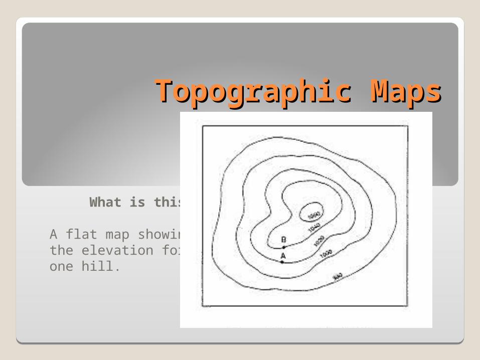
What is this?
A flat map showingthe elevation for one hill.

Topographic Maps•Show the difference in elevation between any two points.
•They can show…•Hills, valleys, mountains, etc.•Water features like lakes, ponds, etc.•Cultural features that are man-made like buildings.

400
450
500
Key Words
Contour lines —An imaginary line that connects points of the same elevation on the Earth’s surface.
The number tells the distance above sea level.
It is greater than 500 ft. above sea level here.

Contour lines never cross!Contour lines never cross!
400
450
500

Key Words
Contour Intervals —Shows the difference in elevation between two contour lines
400
450
500
There is 50 ft of difference in the elevation of these two lines. This is the contour interval.

Contour lines are widely spaced on gentle slopes.
400
450
500
This is a gentle slope because the contour lines are far apart.

Contour lines are closely spaced are steep slopes.
400
450
500
This is a steep slope because the contour lines are close together.

The top of the hill is higher than the closest contour line.
400
450
500
This is higher than 500 ft.