town of pittsfield maine ordinances
TRANSCRIPT
The University of MaineDigitalCommons@UMaine
Maine Town Documents Maine Government Documents
2016
Town of Pittsfield Maine OrdinancesPittsfield, Me.
Follow this and additional works at: https://digitalcommons.library.umaine.edu/towndocs
This Plan is brought to you for free and open access by DigitalCommons@UMaine. It has been accepted for inclusion in Maine Town Documents by anauthorized administrator of DigitalCommons@UMaine. For more information, please contact [email protected].
Repository CitationPittsfield, Me., "Town of Pittsfield Maine Ordinances" (2016). Maine Town Documents. 8330.https://digitalcommons.library.umaine.edu/towndocs/8330

CHAPTER 13C. LAND USE DEFINITIONS ORDINANCE
Except where specifically defined herein, all words used in this Code shall carry their customary meanings. Words used in the present tense include the future, and the plural includes the singular; the word "lot" includes the word "plot"; the word "building" includes the word "structure"; the word “may” shall be permissive; the word "shall" is always mandatory; "occupied" or "used" shall be considered as though followed by the words "or intended, arranged, or designed to be used or occupied."
Definitions apply to all Land Use Ordinances unless otherwise specified.
Abutting Property: Any lot which is physically contiguous with the subject lot even if only at a point and any lot which is located directly across a street or right-of-way from the subject lot such that the extension of the side lot lines of the subject lot would touch or enclose the abutting property.
Accessory Building: A detached, subordinate building, the use of which is clearly incidental and related to that of the principal building or use of the land, and which is located on the same lot as that of the principal building or use.
Accessory Structure: A structure that is incidental and subordinate to the principal use or structure. A deck or similar extension of the principal structure or a garage attached to the principal structure by a roof or a common wall is considered part of the principal structure.
Accessory Use: A use customarily incidental and subordinate to the principal building or use and located on the same lot with such principal building or use. Such use shall include one accessory apartment that is clearly a subordinate unit related to the main residence. Such unit shall not be counted as a second whole unit for the purposes of zoning, however adequate off street parking shall be required and all requirements of the State of Maine Plumbing Code shall be met.
Addition: Any proposed change which increases the size of a building.
Adjacent Grade: Means the natural elevation of the ground surface prior to construction next to the proposed walls of a structure.
Affordable Housing: Housing units which will meet the sales price and/or rental targets established by the U.S. Department of Housing and Urban Development for housing affordability.
Aggrieved Party: An owner of land whose property is directly or indirectly affected by the granting or denial of a permit or variance under this Ordinance; a person whose land abuts land for which a permit or variance has been granted; or any other person or group of persons who have suffered particularized injury as a result of the granting or denial of such permit or variance.
13C-1
Agriculture: The production, keeping or maintenance for sale or lease, of plants and/or animals, including but not limited to: forages and sod crops; grains and seed crops; dairy animals and dairy products; poultry and poultry products; livestock; fruits and vegetables; and ornamental and green house products. Agriculture does not include forest management and timber harvesting activities.
Alteration: A change, addition, or modification, requiring construction, including any change in the location of structural members of buildings such as bearing walls, columns, beams, or girders which would alter or affect any exterior architectural features.
Antenna: A system of electrical conductors that emit or receive radio waves, including microwave dishes.
Applicant: The person applying for subdivision approval under these regulations.
Aquaculture: The growing or propagation of harvestable freshwater, estuarine, or marine plant or animal species.
Area of Special Flood Hazard: The land in the floodplain having a one percent or greater chance of flooding in any given year as specifically identified in the Flood Insurance Study cited in Article 1 of the Flood Plain Management Ordinance.
Arterial: A controlled access road or a street or road with traffic signals at important intersections and/or stop signs on side streets or which is functionally classified by the Maine Department of Transportation as an arterial.
Attic: The unfinished portion or portions of a building which are located immediately below and wholly or partly w ithin the roof framing.
Automobile Graveyard: A yard, field, or other area used as a place of storage for three or more unserviceable, discarded, wom-out or junked automobiles.
Average Daily Traffic (APT): The average number of vehicles per day that enter and exit the premises or travel over a specific section of road.
Backlot: A lot that has no frontage on a road, street or private way. Backlots shall not be permitted in the Town of Pittsfield.
Banner: Any sign of lightweight fabric or similar material that is mounted to a pole or a building by a frame at one or more edges. National, state or municipal flags, or the official flag of any institution or business shall not be considered a banner.
Basal Area: The area of cross-section of a tree stem at AVi feet above ground level and inclusive of bark.
Base Flood: The flood having a one percent chance of being equaled or exceeded in any given year, commonly called the 100-year flood.
13C-2
Basement: Any portion of a structure with a floor-to-ceiling height of 6 feet or more and having more than 50% of its volume below the existing ground level.
xBed and Breakfast: A type of lodging based on a permanent single family dwelling unit where the occupant acts as the proprietor offering for payment sleeping rooms on a transient basis to the general public. A transient basis is a maximum stay of 30 days in any consecutive 45-day period. Bed and Breakfasts shall be classified as follows:
Class 1 Bed and Breakfast-more than five (5) bedrooms for lease,
Class 2 Bed and Breakfast-more than two (2) bedrooms but less than six (6) for lease.
Class 3 Bed and Breakfast-less than three (3) bedrooms for lease.
Billboard: A structure, either free standing or attached to a building, the surface of which is available for hire for advertising purposes.
2Biomedical Waste Processing Facility: Any building, structure, site or equipment used in an activity or process designed to process, treat and sterilize biomedical waste from medical facilities in preparation for disposal at an approved disposal site. A biomedical waste processing facility shall be considered high tech employer for the purposes of use classification under this ordinance. These facilities shall not allow incineration as a means of treating the medical waste.
Boardinghouse: A bui lding other than a hotel or restaurant where meals or lodging are regularly furnished by pre-arrangement for compensation.
Boat Launching Facility: A facility designed primarily for the launching and landing of watercraft, and which may include an access ramp, docking area, and parking spaces for vehicles and trailers.
Buffer Area: A part of a property or an entire property, which is not built upon and is specifically intended to separate and thus minimize the effects of a land use activity (e.g., noise, dust, visibility, glare, etc.) on adjacent properties or on sensitive natural resources.
Building: Any permanent structure, having one or more floors and a roof, which is used for the housing or enclosure of persons, animals or property. When any portion thereof is separated by a division wall without opening, then each such portion shall be deemed a separate building.
Building Height: The vertical distance measured from the mean elevation of the finished lot grade along the street yard face of the structure to the highest point of flat roofs; to the mean height level between the eaves and the ridges of gable, gambrel, hip, and pitch roofs; or to the deck line of mansard roofs.
Building Width: The minimum horizontal dimension of the principal part of the building. The width shall not include outside porches not used as normal living space.
13C-3

Business and Professional Offices: Offices for the conduct of business which involve no sales of products available on the premises, except those pertaining to the profession, or storage of materials or equipment which are used off the premises. The following uses are not considered business and professional offices:
1) Distribution facilities2) Sales offices involving on-premises display and sales of materials3) Offices of building contractors involving the storage of materials or equipment.
Campground: Any area or tract of land to accommodate two (2) or more parties in temporary living quarters, including, but not limited to tents, recreational vehicles or other shelters.
Capital Improvements Program (CIP): The municipality's proposed schedule of future projects listed in order of construction priority together with cost estimates and the anticipated means of financing each project.
Capital Investment Plan: The portion of the comprehensive plan that identifies the projects for consideration for inclusion within the capital improvements program, together with an estimate of the order of magnitude for the cost of each project.
Certificate of Compliance: A document signed by the Code Enforcement Officer stating that a structure is in compliance with all of the provisions of this Ordinance.
Change from One Category of Nonresident Use to Another Category of NonresidentialUse: A change in the type of occupancy of a nonresidential building or structure, or a portion thereof, such that the basic type of use is changed, such as from retail to office or storage to a restaurant, but not including a change in the occupants.
Charitable/Benevolent Association: A non-profit organization that is not organized or operated for the purpose of carrying on a trade or business. No part of its net earnings may benefit any member of the association. The purpose shall be to provide religious, social, physical, recreational and/or benevolent benefits to its members/associates.
Code Enforcement Officer: A person appointed by the municipal officers to perform the inspection, licensing, and enforcement duties required by a particular statute or ordinance.
Commercial Use: The use of lands, buildings, or structures, other than a "home occupation." defined below, the intent and result of which activity is the production of income from the buying and selling of goods and/or services, exclusive of rental of residential buildings and/or dwelling units.
Common Open Space: Land within or related to a subdivision, not individually owned or within an individual lot, which is designed and intended for the common use or enjoyment of the residents of the development or the general public. It may include complementary structures and improvements, typically used for maintenance and operation of the open space, such as for outdoor recreation.
13C-4
Communications Tower: Any free standing, guyed or building mounted structure containing antennas for cellphone, microwave, relay, TV or radio broadcast and commercial two way radio service. Not including personal TV reception, Citizens Band and Short Band radio antennas.
Comprehensive Plan: A document or interrelated documents adopted by the Legislative Body, containing an inventory and analysis of existing conditions, a compilation of goals for the development of the community, an expression of policies for achieving these goals, and a strategy for implementation of the policies.
Conditional Uses: Are uses of a special nature as to make impractical their predetermination as a principal use in a district.
Corner Lot: A lot abutting two or more streets at their intersection provided that the comer of such intersection shall have an angle of 135 degrees or less, measured on the lot side. Such comer lots shall be deemed to have two front yard setbacks.
Coverage: That percentage of the plot or lot area covered by the building area.
Curb Cut: The opening along the curb line or street right-of-way line at which point vehicles may enter or leave the street.
Day Care Center: A home or other facility used generally to provide day care services or babysitting services for thirteen (13) or more children. This use shall be a principal use and shall require a conditional use approval and site plan approval by the Planning Board.
Day Care Home: A single family home used generally to provide day care services or babysitting services for six (6) or fewer children. This shall be considered a home occupation.
3Dav Care Home. Class A: A home used generally to provide day care sen ices or baby-sitting services for more than six (6) but twelve (12) or fewer children. This use shall be an accessory to the residential use but shall require a conditional use approval from the Planning Board.
Density; The number of dwelling units per acre of land.
Developed Area: Any area on which a site improvement or change is made, including buildings, landscaping, parking areas, and streets.
Development: Means any change caused by individuals or entities to improved or unimproved real estate, including but not limited to the construction of buildings or other structures; the construction of additions or substantial improvements to buildings or other stmctures; mining, dredging, filling, grading, paving, excavation, drilling operations or storage of equipment or materials; and the storage, deposition, or extraction of materials, public or private sewage disposal systems or water supply facilities.
13C-5

Dimensional Requirements: Numerical standards relating to spatial relationships including but not limited to setback, lot area, shore frontage and height.
Direct Watershed of a Great Pond: That portion of the watershed that drains directly to the great pond without first passing through an upstream great pond. For the purposes of these regulations, the watershed boundaries shall be as delineated in the comprehensive plan. Due to the scale of the map in the comprehensive plan there may be small inaccuracies in the delineation of the watershed boundary. Where there is a dispute as to exact location of a watershed boundary, the Board or its designee and the applicant shall conduct an on-site investigation to determine where the drainage divide lies. If the Board and the applicant can not agree on the location of the drainage divide based on the on-site investigation, the burden of proof shall lie with the applicant to provide the Board with information from a registered land surveyor showing where the drainage divide lies.
Disability: Any disability, infirmity, malformation, disfigurement, congenital defect or mental condition caused by bodily injury, accident, disease, birth defect, environmental conditions or
illness;and also includes the physical or mental condition of a person which constitutes a substantial
handicapas determined by a physician or in the case of mental handicap, by a psychiatrist or psychologist,
as wellas any other health or sensory impairment which requires special education, vocational
rehabilitation orrelated services.
Driveway: A vehicular access-way less than five hundred (500) feet in length serving two lots or less.
Drive-through Service: A retail or service activity in which the customer does not leave his/her motor vehicle to complete the transaction, and which complies with the following requirements:
1) A separate, defined stacking lane is provided which will accommodate a minimum offive vehicles.
2) The transaction occurs at a defined service window or terminal.3) The service window or terminal is located a minimum of sixty (60) feet, with the
maximum to be established at Site Plan Review, from the point of egress onto the nearest street right-of-way.
4) The architectural design of the service window or terminal shall be compatible with the
principal use.
Dwelling: A building designed or used as the living quarters for one or more families. The term shall
not be deemed to include a hotel, motel, rooming house, mobile home, or trailer, but shall include a
modular housing unit consisting of two or more units of which neither unit is a complete dwelling unit.
13C-6

Dwelling: Multi-Family: A single building designed for or occupied by three (3) or more families with separate housekeeping and cooking facilities for each.
Dwelling: Single-Family; A detached residence for, or occupied by, (1) family only.
Dwelling: Two Family: A residence designed for or occupied by two (2) families only, with separate housekeeping and cooking facilities for each.
Dwelling Unit: A room or suite of rooms used as a habitation which is separate from other such rooms or suites of rooms, and which contains independent living, cooking, and sleeping facilities; includes single family houses, and the units in a duplex, apartment house, multifamily dwellings, and residential condominiums.
Elevated Building: A non-basement building
a. built, in the case of a building in Zones AE or A, to have the top of the elevated floor elevated above the ground level by means of pilings, columns, post, piers, or "stilts;" andb. adequately anchored so as not to impair the structural integrity of the building during a flood of up to one foot above the magnitude of the base flood.
In the case of Zones AE or A, Elevated Building also includes a building elevated by means of fill or solid foundation perimeter walls with hydraulic openings sufficient to facilitate the unimpeded movement of flood waters.
Elevation Certificate: An official form (FEMA Form 81-31, 03/97, as amended) that:
a. is used to verify compliance with the floodplain management regulations of the National Flood Insurance Program; and,
b. is required for purchasing flood insurance.
Emergency Operations: Operations conducted for the public health, safety or general welfare, such as protection of resources from immediate destruction or loss, law enforcement, and operations to rescue human beings, property and livestock from the threat of destruction or injury.
Engineered Subsurface Waste Water Disposal System: A subsurface waste water disposal system designed, installed, and operated as a single unit to treat 2,000 gallons per day or more; or any system designed to treat waste water with characteristics significantly different from domestic waste water.
Enlargement or Expansion of a Structure: An increase of the building footprint and/or increase in the height of the structure beyond its present highest point. Alterations of existing buildings which are required in order to meet the requirements of the Americans with Disabilities Act (ADA) and/or the State Fire Code are not considered to be enlargements or expansions of a structure and are not required to meet otherwise applicable setback requirements, provided the alterations are the minimum necessary to satisfy the ADA and/or the latest NFPA 101 Life Safety Code.
13C-7

Enlargement or Expansion of Use: An}' intensification of use in time, volume, or function, whether or not resulting from an increase in the footprint, height, floor area, land area or cubic volume occupied by a particular use. Increases which are required in order to meet the requirements of the Americans with Disabilities Act and/or the State Fire Code are not considered to be enlargements or expansions of use.
Essential Services: Gas, electrical or communication facilities; steam, fuel, electric power or water transmission or distribution lines, towers and related equipment; telephone cables or lines, poles and related equipment; gas, oil, water, slurry or other similar pipelines; municipal sewage lines, collection or supply systems; and associated storage tanks. Such systems may include towers, poles, wires, mains, drains, pipes, conduits, cables, fire alarms and police call boxes, traffic signals, hydrants and similar accessories, but shall not include service drops or buildings which are necessary for the furnishing of such sendees.
Exterior Architectural Features: Elements of a building’s outside appearance including but not limited to, architectural character, general composition and general appearance of exterior siding, exterior trim, change in size of door and window openings, roofs, porches, signs, fire escapes, and accessory buildings and solar facilities.
Family: One or more persons occupying a dwelling and living as a single housekeeping unit as distinguished from a group occupying a rooming house or motel.
Final Plan: The final drawings on which the applicant's plan of subdivision is presented to the Boardfor approval and which, if approved, may be recorded at the Registry of Deeds.
Fisheries, Significant Fisheries: Areas identified by a governmental agency such as the Maine Department of Inland Fisheries and Wildlife, Atlantic Salmon Authority, or Maine Department of Marine Resources as having significant value as fisheries and any areas so identified in the municipality's comprehensive plan.
Flag: Any fabric or bunting containing distinctive colors, patterns, or symbols, used as a symbol of a government, political subdivision, or other entity.
Flood or Flooding:
a. A general and temporary condition of partial or complete inundation of normally dry land areas from:
1. The overflow of inland or tidal waters.
2. The unusual and rapid accumulation or runoff of surface waters from any source.
b. The collapse or subsidence of land along the shore of a lake or other body of water as a result of erosion or undermining caused by waves or currents of water exceeding anticipated
13C-8

cyclical levels or suddenly caused by an unusually high water level in a natural body of water, accompanied by a severe stonn, or by an unanticipated force of nature, such as flash flood or an abnormal tidal surge, or by some similarly unusual and unforeseeable event which results in flooding as defined in paragraph a., 1. of this definition.
Flood Elevation Study: An examination, evaluation and determination of flood hazards and, if appropriate, corresponding water surface elevations.
Flood Insurance Rate Man: The official map on which the Federal Emergency Management Agency has delineated both the areas of special flood hazards and the risk premium zones applicable to the Town of Pittsfield, Maine.
Flood Insurance Rate Man (FIRM!: An official map of a community, on which the Federal Insurance Administrator has delineated both the special hazard areas and the risk premium zones applicable to the community.
Flood Insurance Study: See Flood Elevation Study.
Floodplain Management: The operation of an overall program of corrective and preventive measures for reducing flood damage, including but not limited to emergency preparedness plans, flood control works, and floodplain management regulations.
Floodplain Management Regulations: Zoning ordinances, subdivision regulations, building codes, health regulations, special purpose ordinances (such as a floodplain ordinance, grading ordinance, and erosion control ordinance) and other applications of police power. The term describes such state or local regulations, in any combination thereof, which provide standards for the purpose of flood damage prevention and reduction.
Floodplain or Flood-prone Area: Any land area susceptible to being inundated by water from any source (see flooding).
Floodproofing: Any combination of structural and non-structural additions, changes, or adjustments to structures which reduce or eliminate flood damage to real estate or improved real property, water and sanitary facilities, structures and contents.
Floodwav: The channel of a river or other watercourse and adjacent land areas that must be reserved in order to discharge the 100-year flood without cumulatively increasing the water surface elevation by more than one foot in height.
Floodwav Encroachment Lines: The lines marking the limits of floodways on federal, state, and local floodplain maps.
Floor Area: The sum of the horizontal areas of the floor(s) of a structure enclosed by exterior walls, plus the horizontal area of any unenclosed portions of a structure such as porches and decks. tFloor Area Ratio: A measure of the intensity of the use of a piece of property determined by
13C-9
Floor Area Ratio: A measure of the intensity of the use of a piece of property determined by dividing the sum of the gross floor area of all floors of all principal buildings or structures by the total area of the parcel.
Footprint: Area of the ground covered by a structure, including the foundation and all areas enclosed by exterior walls and footings.
Forest Management Activities: Timber cruising and other forest resources evaluation activities, pesticide or fertilizer application, management planning activities, timber stand improvement, pruning, regeneration of forest stands, and other similar or associated activities, exclusive of timber harvesting and the construction, creation or maintenance of roads.
Forested Wetland: A freshwater wetland dominated by woody vegetation that is six (6) meters tall or taller.
Foundation: The supporting substructure of a building or other structure including but not limited to basements, slabs, sills, posts or frostwalls.
Freeboard: Means a factor of safety usually expressed in feet above a flood level for purposes of floodplain management. Freeboard tends to compensate for the many unknown factors, such as wave action, bridge openings, and the hydrological effect of urbanization of the watershed, that could contribute to flood heights greater than the height calculated for a selected size flood and floodway conditions.
Freshwater Wetland: Freshwater swamps, marshes, bogs and similar areas, other than forested wetlands, which are:
1) Often or more contiguous acres; or of less than 10 contiguous acres and adjacent to a surface water body, excluding any river, stream or brook such that in a natural state, the combined surface area is in excess of 10 acres; and
2) Inundated or saturated by surface or ground water at a frequency and a duration sufficient to support, and which under normal circumstances do support, a prevalence of wetland vegetation typically adapted for life in saturated soils.
Freshwater wetlands may contain small stream channels or inclusions of land that do not conform to the criteria of this definition.
Frontage: The horizontal, straight-line distance between the intersections of the side lot lines with the road right-of-way.
Functionally Dependent Use: A use which cannot perform its intended purpose unless it is located or carried out in close proximity to water. The term includes only docking facilities, port facilities that are necessary for the loading and unloading of cargo or passengers, and ship building and ship repair facilities, but does not include long-term storage or related manufacturing facilities.
13C-10

Functionally Water-Dependent Uses: Those uses that require, for their primary purpose, location on submerged lands or that require direct access to, or location in, inland waters and that can not be located away from these waters. The uses include, but are not limited to commercial and recreational fishing and boating facilities, waterfront dock facilities, boat building facilities, marinas, and uses that primarily provide general public access to inland waters.
Great Pond: Any inland body of water which in a natural state has a surface area in excess of ten acres, and any inland body of water artificially formed or increased which has a surface area in excess of thirty (30) acres except for the purposes of this Ordinance, where the artificially formed or increased inland body of water is completely surrounded by land held by a single owner.
Great Pond Classified GPA: Any great pond classified GPA, pursuant to Title 38 Article 4-A Section 465-A. This classification includes some, but not all impoundments of rivers that are defined as great ponds.
Groundwater: All of the water found beneath the surface of the ground. For purposes of aquifer protection, this term refers to the subsurface water present in aquifers and recharge areas.
Height of a Structure: The vertical distance between the mean original grade at the downhill side of the structure and the highest point of the structure, excluding chimneys, steeples, antennas, and similar appurtenances which have no floor area.
High Intensity Soil Survey: A map prepared by a Certified Soil Scientist, identifying the soil types down to one eighth of an acre or less at a scale equivalent to the subdivision plan submitted. The soils shall be identified in accordance with the National Cooperative Soil Survey. The map shall show the location of all test pits used to identify the soils, and shall be accompanied by a log of each sample point identifying the textural classification and the depth to seasonal high water table or bedrock at that location. Single soil test pits and their evaluation for suitability for subsurface waste water disposal systems shall not be considered to constitute high intensity soil surveys.
Historic or Archaeological Resources: Areas identified by a governmental agency such as the Maine Historic Preservation Commission as having significant value as an historic or archaeological resource and any areas identified in the municipality's comprehensive plan.
Historic Structure: Any structure that is:
a. Listed individually in the National Register of Historic Places (a listing maintained by the Department of Interior) or preliminarily determined by the Secretary of the Interior as meeting the requirements for individual listing on the National Register;
b. Certified or preliminarily determined by the Secretary of the Interior as contributing to the historical significance of a registered historic district or a district preliminarily determined by the Secretary of the Interior to qualify as a registered historic district;
c. Individually listed on a state inventory of historic places in states with historic preservation programs which have been approved by the Secretary of the Interior; or
13C-11
d. Individually listed on a local inventory of historic places in communities with historic preservation programs that have been certified either:
1. By an approved state program as determined by the Secretary of the Interior, or
2. Directly by the Secretary of the Interior in states without approved programs.
Home Occupation: An occupation or profession that is accessory to a residential use and is customarily carried on in a dwelling unit or in a building or other structure accessory to a dwelling unit.
Hotel/Motel: A building or group of buildings containing six of more guest rooms and offering lodging accommodations (which may include such accessory services as food and beverages, meeting rooms, entertainment and recreation) to transient guests. A hotel/motel may provide kitchens or kitchenettes in guestrooms and will not, as a result, be considered a dwelling unit under this Ordinance, as long as the hotel/motel is occupied exclusively by transient guests. A transient guest is a person who occupies the hotel/motel for no more than 186 days in any 365-day period.
Household Pets: Those animals normally considered as household companions, and not including horses, cows, sheep, goats, mink, swine, chickens, turkeys or any animals raised for sale or for the sale of their products.
Impervious Coverage Ratio: A measure of the intensity of the use of a piece of property determined by dividing the total area of the site covered by impervious surface including roofs, parking lots, roads, access drives, service areas, paved drainage ways, and similar impervious surfaces by the total area of the parcel.
Impervious Surface: The area covered by buildings and associated constructed facilities, areas which have been or will be covered by a low-permeability material, such as asphalt or concrete, and areas such as gravel roads and unpaved parking areas, which have been or will be compacted through design or use to reduce their permeability.
Common impervious surfaces include, but are not limited to, roof tops, walkways, patios, driveways, parking lots or storage areas, concrete or asphalt paving, gravel roads, packed earthen materials, and oiled, macadam, or other surfaces which similarly impede the natural infiltration of stormwater.
Increase in Nonconformity of a Structure: Any change in a structure or property which causes further deviation from the dimensional standard(s) creating the nonconformity such as, but not limited to, reduction in water body, tributary stream or wetland setback distance, increase in lot coverage, or increase in height of a structure. Property changes or structure expansions which either meet the dimensional standard or which cause no further increase in the linear extent of nonconformance of the existing structure shall not be considered to increase nonconformity. For example, there is no increase in nonconformity with the setback requirement for water bodies, wetlands, or tributary streams if the expansion extends no further into the required setback area than does any portion of the existing nonconforming structure. Hence, a structure may be expanded
13C-12

laterally provided that the expansion extends no closer to the water body or wetland than the closest portion of the existing structure from that water body or wetland. Included in this allowance are expansions which in-frll irregularly shaped structures.
Individual Private Campsite: An area of land which is not associated with a campground, but which is developed for repeated camping by only one group not to exceed ten (10) individuals and which involves site improvements which may include but not be limited to gravel pads, parking areas, fire places, or tent platforms.
Industrial: The assembling, fabrication, finishing, manufacturing, packaging or processing of goods, or the extraction of minerals.
infestation: To be overrun with insects, rats, mice, vermin or other pests contiguous to a structure or premises in numbers or quantities large enough to be harmful, threatening or obnoxious.
7 Junk: For purpose of this Ordinance, ‘junk” shall include all materials set forth in 30-A M.R.S.A.§ 3752(4) and the following: any accumulation of refuse, household trash, used automobile and equipment parts, debris, building materials, inoperable machinery, glass, used furniture, used doors or windows, used household items and unused and inoperable appliances.
7Junkyard: The definition o f‘junkyard” shall be the same as set forth in 30-A M.R.S.A. §3752(4).
Kennel: An establishment in which more than four (4) dogs or four (4) cats more than one year old are housed, bred, boarded, trained or sold.
Landscaped Buffer Strip: A landscaped area adjacent to and parallel with the front property line of a lot or parcel. The border strip may be crossed by drives, access roads or pedestrian ways but otherwise shall be maintained in a landscaped state. The border strip shall not be used for parking, the storage of materials, equipment or wastes or the display of any equipment, materials or products.
9Large Scale Commercial Development: A commercial use that (1) utilizes more then two (2) acres for building, parking, storage, display or any other related use or operation; (2) has more than five (5) employees on site; and (3) generates more than twenty-five (25) truck or car trips per day. This definition shall not include Timber Harvesting or Agriculture use.
Level of Service: A description of the operating conditions a driver will experience while traveling on a particular street or highway calculated in accordance with the provisions of the Highway Capacity Manual, 1991 edition, published by the National Academy of Sciences, Transportation Research Board as amended from time to time. There are six levels of service ranging from Level of Service A, with free traffic flow and no delays to Level of Service F, with forced flow and congestion resulting in complete failure of the roadway.
Loading Area: A completely off-street space or berth on the same lot for the loading or unloading of freight carriers, having adequate ingress and egress to a public street or alley.
13C-13

9LocaHv-Designated Passive Recreation Area: Any site or area designated by a municipalityfor passive recreation that is open and maintained for public use and which: a) has fixed boundaries, b) is owned in fee simple by a municipality or is accessible by virtue of public easement, c) is identified and described in a local comprehensive plan and, d) has been identified and designated at least nine months prior to the submission of the Applicant's Wind Energy Facility permit application.
Locally Established Datum: Means, for purposes of this ordinance, an elevation established for a specific site to which all other elevations at the site are referenced. This elevation is generally not referenced to the National Geodetic Vertical Datum (NGVD) or any other established datum and is used in areas where Mean Sea Level data is too far from a specific site to be practically used.
Lot: A parcel of land in single ownership, or one leasehold, with ascertainable boundaries established by deed or instrument of record, or a segment of land ownership defined by lot boundary lines on a land subdivision plan duly approved by the Planning Board and recorded in the County Registry of Deeds.
Lot Area: A parcel of land in single ownership, or one leasehold, with ascertainable boundaries established by deed or instrument of record, or a segment of land ownership defined by lot boundary lines on a land subdivision plan duly approved by the Planning Board and recorded in the County Registry of Deeds.
Lot Lines: The lines bounding a lot. Wherever a lot abuts a street, the sideline of the street on the side abutting the lot shall constitute the lot line.
Lowest Floor: The lowest floor of the lowest enclosed area (including basement). An unfinished or flood resistant enclosure, usable solely for parking of vehicles, building access or storage in an area other than a basement area is not considered a building's lowest floor, provided that such enclosure is not built so as to render the structure in violation of the applicable non-elevation design requirements described in Article VI of this ordinance.
Manufactured Home: A structure, transportable in one or more sections, which is built on a permanent chassis and is designed for use with or without a permanent foundation when connected to the required utilities. For floodplain management purposes the term manufactured home also includes park trailers, travel trailers, and other similar vehicles placed on a site for greater than 180 consecutive days.
Manufactured Home Park or Subdivision: A parcel (or contiguous parcels) of land divided into two or more manufactured home lots for rent or sale.
Manufactured Housing: A structural unit or units designed for occupancy and constructed in a manufacturing facility and transported, by the use of its own chassis or an independent chassis, to a building site. For the purposes of this Ordinance the term includes:
13C-14

Mobile Homes
1. Units constructed after June 15, 1976 and commonly called “newer mobile homes” which the manufacturer certifies are constructed in compliance with the United States Department of Housing and Urban Development Standards, meaning structures transportable in one or more sections, which in the traveling mode are 14 body feet or more in width and are 750 or more square feet in size (not including any tongue) and which are built on a permanent chassis and designed to be used as dwellings, with or without pennanent foundations, when connected to the required utilities including plumbing, heating, air conditioning or electrical systems contained in the unit.
Modular Homes
1. Units commonly called “modular homes” which the manufacturer certifies are constructed in compliance with Title 10, Chapter 951, and rules adopted under that Ordinance, meaning structures transportable in one or more sections, which are not constructed on a permanent chassis and are designed to be used as dwellings on foundations when connected to the required utilities including plumbing, heating, air conditioning or electrical systems contained in the unit.
Marina: A business establishment having frontage on navigable water and, as its pnncipal use, providing for hire docking facilities for boats, and which may also provide accessory services such as boat and related sales, boat repair and construction, indoor and outdoor storage of boats and marine equipment, boat and tackle shops and marine fuel service facilities.
Market Value: The estimated price a property will bring in the open market and under prevailing market conditions in a sale between a willing seller and a willing buyer, both conversant with the property and with prevailing general price levels.
Mean Sea Level: Means, for purposes of the National Flood Insurance Program, the National Geodetic Vertical Datum (NGVD) of 1929, or other datum, to which base flood elevations shown on a community's Flood Insurance Rate map are referenced.
8Medical Marijuana Dispensary: A “registered dispensary” as that term is defined by 22M.R.S.A. Section 2422(6), as may be amended from time to time, including any location at which marijuana is cultivated by a registered dispensary pursuant to 22 M.R.S.A. Section 2428, as may be amended.
Meteorological Tower (MET Tower): A Tower used for the measurement and collection of weather data that supports various types of equipment, including but not limited to anemometers, data recorders, and solar power panels. MET Towers may also include wildlife related equipment such as ANABAT detectors, bird diverts and wildlife entanglement protectors.
Methadone Clinic: A clinic or similar facility that provides for the operation of substance abuse treatment programs to provide treatment for persons with heroin or other opiate addictions where
13C-15
the treatment provided includes administration or prescription of methadone or other opioid replacements (e.g., methadone, methadone hydrochloride or LAAM (levo-alpha-acetyl-methadol)) for either detoxification or maintenance purposes, which treatment programs are typically licensed by the State of Maine Department of Health and Human Services Division of Licensing and Regulatory Services under 14-118 Code of Maine Regulations (Chapter 5), as may be amended from time to time.
Mineral Exploration: Hand sampling, test boring, or other methods of determining the nature or extent of mineral resources which create minimal disturbance to the land and which include reasonable measures to restore the land to its original condition.
Mineral Extraction: Any operation within any twelve (12) month period which removes more than one hundred (100) cubic yards of soil, topsoil, loam, sand, gravel, clay, rock, peat, or other like material from its natural location and to transport the product removed, away from the extraction site.
Minimum Lot Width: The closest distance between the side lot lines of a lot.
Minor Development: Means all development that is not new construction or a substantial improvement, such as repairs, maintenance, renovations, or additions, whose value is less than 50% of the market value of the structure. It also includes, but is not limited to: accessory structures as provided for in Article VI., J., mining, dredging, filling, grading, paving, excavation, drilling operations, storage of equipment or materials, deposition or extraction of materials, public or private sewage disposal systems or water supply facilities that do not involve structures; and non- structural projects such as bridges, dams, towers, fencing, pipelines, wharves, and piers.
4Mixeri Use Complex: A building designed for the operation of both business and commercial use operations. The building shall be considered a single principal use without regard for the number of business or commercial use entities that it contains.
Mobile Home Park: A contiguous parcel of land under unified ownership approved by the municipality for the placement of 3 or more manufactured homes. Individual home sites may be rented or leased.
Mobile Vending Unit: A vehicle, trailer, van, pushcart or portable structure which is temporarily located on private property for the purpose of operating a retail business or service business and removed from the site every day or seasonally, but which does not include such structures temporarily located on any particular private property for such purposes for less than one-half hour. It shall not include such uses as construction offices during the duration of a building project or sales as part of an approved farmers market, fair or similar event.
Mnltifamilv Development: A subdivision which contains three or more dwelling units on land in common ownership, such as apartment buildings, condominiums or mobile home parks.
Multi-Unit Residential: A residential structure containing three (3) or more residential dwelling units.
13C-16

Municipal Engineer: Any registered professional engineer hired or retained by the municipality, either as staff or on a consulting basis.
Municipality: The Town of Pittsfield.
9Nacelle: The frame and housing at the top of the Tower that encloses the gearbox and generator.
National Geodetic Vertical Datum 1NGVD1: The national vertical datum, whose standard was established in 1929, which is used by the National Flood Insurance Program (NFIP). NGVD was based upon mean sea level in 1929 and also has been called "1929 Mean Sea Level (MSL).”
Natural Areas and Natural Communities. Unique Natural Areas and Natural Communities:Areas identified by a governmental agency such as the Maine Department of Conservation Natural Areas Program as having significant value as a natural area and any areas so identified in the municipality's comprehensive plan.
Net Acreage: The net area of any parcel or site generally suitable, in its natural state, for development and theoretically related to the natural capacity of the land to support a certain intensity of use. The net acreage shall be determined by subtracting unsuitable areas from the gross acreage of the parcel. The following original land areas shall be considered unsuitable and shall be deducted in the following order:
1. Fifteen percent (15%) of the total acreage of the parcel as an estimated allowance for new access roads and parking areas, whether or not the actual area devoted to these uses is greater or less than 15 percent.
2. Areas that are, because of existing land uses, natural features, or lack of access, isolated and unavailable for building purposes or for use in common with the remainder of the parcel, as determined by the Planning Board.
3. Areas within a floodway or 100-year flood hazard area, as shown on the Federal Flood Boundary and Floodway Map or Federal Flood Insurance Rate Map.
4. Areas characterized predominately by soils classified by the U.S. Soil Conservation Service as either a) "very poorly drained” or b) “poorly drained” and having a slope of less than three percent (3%).
5. Areas of rights-of-way and easements, except for new access roads deducted above and rights-of-way or easements for landscaped buffer strips and walking/bicycle paths not part of a street right-of-way.
6. Stream channels, as measured from the top of banks, and other surface water bodies, as measured from the high water mark.
7. Areas of 33 percent sustained slope or more. Slope areas of 20 to 33 percent shall also be
13C-17
deducted unless the developer can demonstrate to the Planning Board's satisfaction that these slopes will be used as part of the overall plan for the development, that they are stable for structures, if so utilized, and that any slope development will minimize soil erosion and comply with Maine State Plumbing Code.
8. Areas of un-reclaimed gravel or borrow pits.
9. Land in Resource Protection Districts.
10. Other areas that the Planning Board determines could not, in their natural state, be incorporated into conventional subdivision lots of the minimum required area.
No building or structure shall be sited in areas treated as 100 percent deductions from the parcel's gross area. Siting of structures in areas treated as 50 percent deductions shall be discouraged but permitted where the applicant/developer demonstrates that measures will be taken to minimize erosion, sedimentation, and seasonal wetness, that these areas are stable for the siting of structures and that proposed subsurface waste disposal systems are sited away from marginal soils and otherwise meet the State of Maine Subsurface Waste Disposal Rules.
Net Residential Acreage: The total acreage available for the subdivision, as shown on the proposed subdivision plan, minus the area for streets or access and the areas that are unsuitable for development.
Net Residential Density: The net residential acreage of a parcel of land divided by the minimum lot area per dwelling unit.
New Construction: Structures for which the "start of construction" commenced on or after the effective date of floodplain management regulations or other ordinances adopted by a community and includes any subsequent improvements to such structures.
New Structure or Structures: Includes any structure for which construction begins on or after September 23, 1988. The area included in the expansion of an existing structure is deemed to be a new structure.
Non-Conforming Lot: A single lot of record winch, at the effective date of adoption or amendment of this Ordinance, does not meet the area, frontage, or width requirements of the district in which it is located.
Non-Conforming Structure: A structure which does not meet any one or more of the following dimensional requirements; setback, height, or lot coverage, but which is allowed solely because it was in lawful existence at the time this Ordinance or subsequent amendments took effect.
Non-Conforming Use: Use of buildings, structures, premises, land or parts thereof which is not permitted in the district in which it is situated, but which is allowed to remain solely because it was in lawful existence at the time this Ordinance or subsequent amendments took effect.
13C-18
Normal High-Water Line: That line which is apparent from visible markings, changes in the character of soils due to prolonged action of the water or changes in vegetation, and which distinguishes between predominantly aquatic and predominantly terrestrial land. In the case of wetlands adjacent to rivers and great ponds, the normal high-water line is the upland edge of the wetland, and not the edge of the open water.
Nursing Home: Any dwelling in which three (3) or more aged, chronically ill, or incurable persons are housed and furnished with meals, and nursing care for compensation.
100-Year Flood: The highest level of flood that, on the average, has a one percent (1%) chance of occurring in any given year.
9Occupied Building: A residence, school, hospital, house of worship, public library or other building that is occupied or in use as a primary residence or is customarily frequented by the public at the time when the permit application is submitted.
Parking Space: Parking space shall mean an area of not less than 180 square feet, exclusive of drives or aisles giving access thereto, accessible from streets or aisles leading to streets and usable for the storage or parking of passenger vehicles. Parking space or access thereto shall be construed as to be usable year round.
Pennant: Any lightweight plastic, fabric, or other material, whether or not containing a message of any kind, suspended from a rope, wire, or string, usually in series, designed to move in the wind.
Person: An individual, corporation, governmental agency, municipality, trust, estate, partnership, association, two or more individuals having a joint or common interest, or other legal entity.
Piers. Docks, Wharves, Bridges and Other Structures and Uses Beyond the Normal High Water Line or Within A Wetland:
Temporary: Structures which remain in or over the water for less than seven (7) months in any period of twelve (12) consecutive months.
Permanent: Structures which remain in or over the water for seven (7) months or more in any period of twelve (12) consecutive months.
9Planned: A Project, for which all applicable building and land use permits have been approved, provided that the time for beginning construction under such permits has not expired.
5Planned Residential Development: A development of land that is under unified control and is planned and developed as a whole in a single development operation of programmed series of development stages. It may contain more than one principal structure on a lot and may include a mix of single-family and two-family detached houses with Town houses and apartment buildings with common recreation areas and off-street parking. Lots within a planned development may be sold individually, provided that the owners of all lots are required by deed covenant and plan
13C-19

approval to be members of a homeowners association that owns and maintains any common facilities within the development, including but not limited to private streets, drainage facilities and private open space that is part of the development, hi zoning district C-4 only single-family and two-family detached houses shall be allowed.
Planning Board: Hie Planning Board of the Town of Pittsfield.
Preliminary Plan: The preliminary drawings indicating the proposed layout of the subdivision to be submitted to the Planning Board for its consideration.
Prime Agricultural Soils: Prime agricultural soils are those soils which have the least limitations for growing food and will produce the best yields with the least environmental damage.
9Prime Farm Land: Those areas shown on the Town of Pittsfield Zoning Map (Revised February11, 2011)
Principal Structure: A building other than one which is used for purposes wholly incidental or accessory to the use of another building or use on the same premises.
Principal Use: The primary use and chief purpose of a lot or structure.
Professional Engineer: A professional engineer, registered in the State of Maine.
9Proiect: A planned piece of work that has a specific purpose such as but not limited to constructing something new, adding or modifying something existing or excavating into the ground for the constructing of any of the preceeding including land filling.
Protected Location: Any location that is:
1) accessible by foot, on any parcel of land not owned or leased by the applicant containing an occupied building or planned occupied building, or a planned residential subdivision, duly licensed hospital or nursing home near the development site at the time an application is submitted;
2) within a State Park, Baxter State Park, a National Park, a nature preserve owned by a land trust, the Maine Audubon Society or the Maine chapter of the Nature Conservancy, the Appalachian Trail, the Moosehom National Wildlife refuge, a federally designated wilderness area, a state wilderness area designated by statute, a municipal park or a locally-designated passive recreation area, or any location within consolidated public reserve lands designated by rule by the Bureau of Public Lands as a Protected Location, or;
3) a hotel, motel, campsite or duly licensed campground that the Planning Board has designated a Protected Location after making a determination that the health and welfare of the guests or the economic viability of the establishment will be unreasonably impacted.
13C-20
Public Facility: Any facility, including, but not limited to, buildings, property, recreation areas, and roads, which are owned, leased, or otherwise operated, or funded by a governmental body or public entity.
Public Improvement: Works of governmental units and public utilities, including but not limited to, lighting, sidewalks, street furniture, overhead utilities, buildings, tree planting programs, street signs, and traffic lights.
Public Sewer System: A common sewer controlled by a public, governmental authority.
Public Water System: A water supply system that provides water to at least 15 service connections or services water to at least 25 individuals daily for at least 30 days a year.
Recent Flood Plain Soils: The following soil series as described and identified by the National Cooperative Soil Survey:
FryeburgLovewellAlluvialPodunkSuncook
HaleyMedomakCornishRumneySunday
LimerickOndawaCharlesSacoWinooski
Recharge Area: Area composed of permeable, porous material through which precipitation and surface water infiltrate and directly replenish groundwater in aquifers.
Recording Plan: An original of the Final Plan, suitable for recording at the Registry of Deeds and which need show only information relevant to the transfer of an interest in the property, and which does not show other information presented on the plan such as sewer and water line locations and sizes, culverts, and building lines.
Recreational Facility: A place designed and equipped for the conduct of sports, leisure time activities, and other customary and usual recreational activities, excluding boat launching facilities.
Recreational Vehicle: A vehicle which is:
a. built on a single chassis;
b. 400 square feet or less when measured at the largest horizontal projection, not including slideouts;
c. designed to be self-propelled or permanently towable by a motor vehicle; and
d. designed primarily not for use as a permanent dwelling but as temporary living quarters for recreational, camping, travel, or seasonal use.
Regulatory Floodwav:
a. The channel of a river or other water course and the adjacent land areas that must be
13C-21
reserved in order to discharge the base flood without cumulatively increasing the water surface elevation more than one foot, and
b. when not designated on the community's Flood Insurance Rate Map. it is considered to be the channel of a river or other water course and the ad jacent land areas to a distance of one-half the width of the floodplain, as measured from the normal high water mark to the upland limit of the floodplain.
Replacement System: A system intended to replace:
1. an existing system which is either malfunctioning or being upgraded with no significant change of design flow or use of the structure, or
2. any existing overboard wastewater discharge.
Reserved Affordable Housing: Affordable housing which is restricted by means of deed covenants, financing restrictions, or other binding long term methods to occupancy by households making 80% or less of the area median household income.
Residual Basal Area: The sum of the basal area of trees remaining on a harvested site.
Residential Dwelling Unit: A room or group of rooms designed and equipped exclusively for use as permanent, seasonal, or temporary living quarters for only one family. The term shall include mobile homes, but not recreational vehicles.
Retail Business: A business establishment engaged in the sale, rental, or lease of goods or services to the ultimate consumer for direct use or consumption and not for resale.
Riprap: Rocks, irregularly shaped, and at least six (6) inches in diameter, used for erosion control and soil stabilization, typically used on ground slopes of two (2) units horizontal to one (1) unit vertical or less.
River: A free-flowing body of water including its associated flood plain wetlands from that point at which it provides drainage for a watershed of twenty-five (25) square miles to its mouth.
Riverine: Means relating to, formed by, or resembling a river (including tributaries), stream, brook, etc.
Road: A route or track consisting of a bed of exposed mineral soil, gravel, asphalt, or other material constructed for or created by the repeated passage of motorized vehicles. The term shall also include private, undedicated roads that are described in a recorded document. The term road shall not include those ways that have been discontinued or abandoned. The right-of-way of a road cannot be used to calculate frontage on a lot.
13C-22

Roadside Stand: A building or structure used for the retail sales of fresh fruits, vegetables, flowers, herbs or plants. In addition, it may involve the accessory sales of other unprocessed foodstuffs, home processed food products such as jams, jellies, pickles, sauces or baked goods and home-made handicrafts. The floor area devoted to the sales of these accessory items shall not exceed 50% of the total sales area. No commercially packaged handicrafts or commercially processed or packaged foodstuffs shall be sold at a roadside stand.
9Scenic Resource: Either a Scenic Resource of State or National significance, as defined in 35-A M.R.S § 3451 (9) or a scenic resource of local significance located within the municipality and identified as such in a comprehensive plan, open space plan or scenic inventory adopted by the municipal legislative body.
Service Drop: Any utility line extension which does not cross or run beneath any portion of a water body provided that:
1. in the case of electric service
a. the placement of wires and/or the installation of utility poles is located entirely upon the premises of the customer requesting service or upon a roadway right-of- way; and
b. the total length of the extension is less than one thousand (1,000) feet.
2. in the case of telephone service
a. the extension, regardless of length, will be made by the installation of telephone wires to existing utility poles, or
b. the extension requiring the installation of new utility poles or placement underground is less than one thousand (1,000) feet in length.
Setback, Lot Line: The minimum horizontal distance from a lot line to the nearest part of a building, including porches, steps and railings.
Setback, Normal High Water Line: The nearest horizontal distance from the normal high-water line to the nearest part of a structure, road, parking space or other regulated object or area.
9Shadow Flicker: Alternating changes in light intensity caused by the movement of Wind Turbine blades casting shadows on the ground or a stationary object.
Shopping Center: Any concentration of two or more retail stores or sen ice establishments under one ownership or management containing 15,000 square feet or more of gross floor space.
13C-23

Shore Frontage: The length of a lot bordering on a water body measured in a straight line between the intersections of the lot lines with the shoreline at normal high-water elevation.
Shoreland Zone: The land area located within two hundred and fifty (250) feet, horizontal distance, of the normal high-water line of any great pond, river, or saltwater body; within 250 feet of the upland edge of a freshwater wetland; or within seventy-five (75) feet of the normal high- water line of a stream.
’’Short Duration Repetitive Sounds: A sequence of repetitive sounds which occur more than once within an hour, each clearly discernible as an event and causing an increase in the sound level of at least 6 dBA on the fast meter response above the sound level observed immediately before and after the event, each typically less than ten seconds in duration, and which are inherent to the process or operation of the development and are foreseeable.
Sight Distance: The length of an unobstructed view from a particular access point to the farthest visible point of reference on a roadway. Used in these regulations as a reference for unobstructed road visibility.
9Sight Line Representation: A profile drawing showing prominent features, including but not limited to topography, buildings and trees, along and in relation to a line of sight extending from an observer’s eye to the lowest point visible on a proposed Tower.
Sign: Any structure or part thereof attached thereto or painted or represented thereon, which shall display or include any letter, word, model, banner, flag, pennant, insignia, device or representation used as, or which is in the nature of an announcement, direction or advertisement. The word "sign" does not include the flag, pennant or insignia of any nation, state, city or other political unit, or of any political, educational, charitable, philanthropic, civic, professional, religious or like campaign, drive, movement, or event.
Sign Area: The surface are on one side of the smallest simple geometric shape exemplified by a square, rectangle, triangle, circle, etc., encompassing all lettering, wording, design, or symbols, together with any background which is distinguishable from the building. For the purposes of calculating the surface area of a sign, an inconspicuous support exemplified by a slim post is not part of the sign.
Sign. Canopy: A sign that is part of or attached to an awning, canopy, or other fabric, plastic, or structural protective cover over a door, entrance, window, or outdoor service area.
Sign. Consolidated: A single, on premise sign that serves two or more businesses or entities, all of which are located at the same lot of record, which sign is on a single device, fixture, placard, or structure.
Sign, Freestanding: A sign supported by one or more upright poles, columns, braces or structure anchored in the ground and not attached to any building or other structure.
13C-24

Sign. Externally Illuminated: A sign that is lit entirely from an external source, such as flood or spot lights, and is so arranged that no direct rays of light are projected from the external source onto adjoining properties or public streets.
Sign, Illuminated: A sign lit in any manner by an artificial light.
Sign, Internally Illuminated: A sign whose lighting is integral to the sign and/or shines through a plastic or other translucent covering.
Sign, Ladder: A sign with two or more signs attached to the same support. The components of a ladder sign must comply, cumulatively, with the dimensional limitations imposed by this section.
Sign, Off Premise: A sign that is not located on the same lot of record that the business, facility, or point of interest is located.
Sign, On Building: A sign that is attached to the building wall and extends not more than six inches from the face of such wall.
Sign. On Premise: A sign that is located on the same lot of record that the business, facility, or point of interest is located.
Sign, Projecting: A sign that is attached to a building wall and extends more than six inches from the face of such wall.
Sign, Portable: A sign that is not permanently attached to the ground or other permanent structure, or a sign designed to be transported, including but not limited to, signs designed to be transported by means of wheels or trailers, balloons used as signs, and signs attached to or painted on vehicles parked and visible from the public right-of-way, unless said vehicle is used in the normal day-to-day operations of the business. For the purpose of this Ordinance, menu and sandwich board signs are not considered portable signs.
Sign, Temporary: A sign of temporary nature, erected for a period of less than 90 days within any 12 month period, exemplified by the following: political signs, charitable signs, fundraising signs, construction signs, carnival signs, garage sales, lawn sales, rummage sales, and all signs advertising the sale of personal property (excluding mobile homes), and for rent signs. Any exterior sign displayed by an ongoing business on the business’ premises in which the written or printed message changes while the structure of the sign remains unchanged shall not be considered as a temporary sign. For example, chalkboards and signs with removable lettering shall not be considered temporary signs.
Significant River Segments: See Title 38 MRS A §437.
Significant Wildlife Habitat: A Significant Wildlife Habitat as defined in 38 M.R.S. § 480- B(10).
Sketch Plan: Conceptual maps, renderings, and supportive data describing the project proposed by the applicant for initial review prior to submitting an application for subdivision approval.
Special Flood Hazard Area: See Area of Special Flood Hazard
13C-25

Start of Construction: Means the date the building permit was issued, provided the actual start of construction, repair, reconstruction, rehabilitation, addition, placement, substantial improvement or other improvement was within 180 days of the permit date. The actual start means either the first placement of permanent construction of a structure on a site, such as the pouring of a slab or footings, the installation of piles, the construction of columns, or any work beyond the stage of excavation; or the placement of a manufactured home on a foundation. Permanent construction does not include land preparation, such as clearing, grading and filling; nor does it include the installation of streets and/or walkways; nor does it include excavation for basement, footings, piers, or foundations or the erection of temporary forms; nor does it include the installation on the property of accessory buildings, such as garages or sheds not occupied as dwelling units or not part of the main structure. For a substantial improvement, the actual start of construction means the first alteration of any wall, ceiling, floor, or other structural part of a building, whether or not that alteration affects the external dimensions of the building.
Stream: A free-flowing body of water from the outlet of a great pond or the confluence of two(2) perennial streams as depicted on the most recent edition of a United States Geological Survey 7.5 minute series topographic map, or if not available, a 15-minute series topographic map, to the point where the body of water becomes a river or flows to another water body or wetland within the shoreland area. This definition also includes Johnson Brook from the 300 foot contour as depicted on the USGS Map to the Burnham Town Line.
Street: A way established or maintained under public authority, or a fifty (50) foot wide recorded private way approved by the Planning Board, or a way shown on a plan of a subdivision duly approved by the Planning Board. The right-of-way of a street cannot be used to calculate the frontage of a lot.
Street Classification:
Arterial Street. A major thoroughfare that serves as a major traffic way for travel between and through the municipality. The following roadways shall be considered arterial streets:
Interstate 95 Burnham RoadCanaan Road Main StreetPark Street Somerset Avenue
Collector Street. A street with average daily traffic of 200 vehicles per day or greater, or streets which serve as feeders to arterial streets, and collectors of traffic from minor streets. The following roadways shall be considered collector streets:
Grove Street Hartland AvenueHunnewell Avenue North Main StreetPhillips Comer Road Peltoma Avenue
Cul-de-sac: A street with only one outlet and having the other end for the reversal of traffic movement.
Industrial or Commercial Street: Streets servicing industrial or commercial uses.
13C-26

Local Street: A street servicing only residential properties and which has an average daily traffic of less than 200 vehicles per day.
Private Right-of-Way: A minor residential street servicing no more than eight dwelling units, which is not intended to be dedicated as a public way.
Structure: Anything built for the support, shelter or enclosure of persons, animals, goods or property of any kind, together with anything constructed or erected with a fixed location on or in the ground, exclusive of fences. The term includes structures permanently located, such as decks, satellite dishes, and permanently affixed gas or liquid storage tanks that are above ground, but not including tents, vehicles, or freestanding above-ground swimming pools.
Subdivision: Shall be defined as provided by State Law, Title 30A, Section 4401.
Substantial Construction: The completion of a portion of the improvements that represents no less than thirty percent of the costs of the proposed improvements within a subdivision. If the subdivision is to consist of individual lots to be sold or leased by the subdivider, the cost of construction of buildings on those lots shall not be included. If the subdivision is a multifamily development, or if the applicant proposes to construct the buildings within the subdivision, the cost of building construction shall be included in the total costs of proposed improvements.
Substantial Damage: Damage of any origin sustained by a structure whereby the cost of restoring the structure to its before damage condition would equal or exceed 50 percent of the market value of the structure before the damage occurred.
Substantial Improvement: Means any reconstruction, rehabilitation, addition, or other improvement of a stmcture, the cost of which equals or exceeds 50 percent of the market value of the stmcture before the start of construction of the improvement. This term includes structures which have incurred substantial damage, regardless of the actual repair work performed. The term does not, however, include either:
1. Any project for improvement of a stmcture to correct existing violations of state or local health, sanitary, or safety code specifications which have been identified by the local code enforcement official and winch are the minimum necessary to assure safe living conditions; or
2. Any alteration of a Historic Stmcture, provided that the alteration will not preclude the stmcture's continued designation as a historic stmcture, and a variance is obtained from the community’s Board of Appeals.
Substantial Start: Completion of thirty (30) percent of a permitted stmcture or use measured as a percentage of estimated total cost.
Substantially Commenced: Substantially Completed: Constmction shall be considered to be substantially commenced when any work beyond the state of excavation, including but not limited to, the pouring of a slab or footings, the installation of piles, the constmction of columns, or the placement of a manufactured home on a foundation has begun. Constmction shall be considered to be substantially completed when it has been completed to the point where normal functioning, use, or occupancy can occur without concern for the general health, safety, and
13C-27
welfare of the occupant and the general public. At a minimum it shall include the completion of no less than seventy (70) percent of the costs of the proposed improvements within a development and shall include permanent stabilization and/or re-vegetation of areas of the site that were disturbed during construction.
Subsurface Sewage Disposal System: A collection of treatment tank(s), disposal area(s), holding tank(s) and pond(s), surface spray system(s), cesspool(s), well(s), surface ditch(es), alternative toilet(s), or other devices and associated piping designed to function as a unit for the purpose of disposing of wastes or wastewater on or beneath the surface of the earth. The term shall not include any wastewater discharge system licensed under 38 MRSA Section 414, any surface wastewater disposal system licensed under 38 MRSA Section 413 Subsection 1-A, or any public sewer. The term shall not include a wastewater disposal system designed to treat wastewater which is in whole or in part hazardous waste as defined in 38 MRSA Chapter 13, sub-chapter 1.
Sustained Slope: A change in elevation where the referenced percent grade is substantially maintained or exceeded throughout the measured area.
Timber Harvesting: The cutting and removal of trees from their growing site, and the attendant operation of cutting and skidding machinery but not the construction or creation of roads. Timber harvesting does not include the cutting of land for approved construction.
9Tower: The free-standing or guyed structure on which a signal transmission system, weather measuring, observation platform or energy conversion system is mounted.
Tract or Parcel of Land: All contiguous land in the same ownership, provided that lands located on opposite sides of a public or private road shall be considered each a separate tract or parcel of land unless such road was established by the owner of land on both sides thereof.
transmission Line: Electric power transmission line of 115 kV through 345 kV, including the associated transmission poles or towers.
Tributary Stream: A channel between defined banks created by the action of surface water, whether intermittent or perennial, and which is characterized by the lack of upland vegetation or presence of aquatic vegetation and by the presence of a bed devoid of topsoil containing waterborne deposits of exposed soil, parent material or bedrock, and which flows to a water body or wetland as defined. This definition does not include the term "stream" as defined elsewhere in this Ordinance, and only applies to that portion of the tributary stream located within the shoreland zone of the receiving water body or wetland.
9Turbine Height: The distance measured from the surface of the Ground or Tower foundation, which ever is lower, to the highest point of any turbine rotor blade measured at the highest arc of the blade.
Turning Circle: A street segment forming a circle at the closed end of a cul-de-sac street, with a curve radius of 100 feet as measured to the outside line of the right-of-way.
Upland Edge: The boundary between upland and wetland.
13C-28

Usable Open Space: That portion of the common open space that due to its slope, drainage characteristics and soil conditions can be used for active recreation, horticulture or agriculture. In order to be considered usable open space, the land must not be poorly drained nor very poorly drained, have ledge outcroppings or areas with slopes exceeding 10%.
Use: The declared or ostensible purpose for which land or a building is arranged, designed, or intended, or for which either land or a building is or may be occupied or maintained.
Utilities: Public and private facilities such as water wells, water and sewage pumping stations, water storage tanks, power, cable television and communication transmission lines, electrical power substations, static transformer stations, telegraph exchanges, commercial microwave radio relays, and gas regulation stations, but not including sewage disposal plants, municipal incinerators, warehouses, shops, and storage yards.
Variance: A relaxation of the terms of this Ordinance where such variances shall not be contrary to the public interest and where, owning to conditions peculiar to the property and not the result of the actions of the applicant, a literal enforcement of this Ordinance would result in unnecessary and undue hardship. A variance is authorized only for lot area, lot coverage by structure, frontage, lot width, and setbacks. Establishment or expansion of a use otherwise prohibited shall not be allowed by variance, nor shall a variance be granted because of the presence of non-conformities in the zoning district or adjoining zoning districts.
Vegetation: All live trees, shrubs, ground cover, and other plants including without limitation, trees both over and under 4 inches in diameter, measured at 454 feet above ground level.
Violation: Means the failure of a structure or development to comply with a community's Ordinances.
Volume of a Structure: The volume of all portions of a structure enclosed by roof and fixed exterior walls as measured from the exterior faces of these walls and roof.
Water Body: Any great pond, river, or stream.
Water Crossing: Any project extending from one bank to the opposite bank of a river or stream, whether under, through, or over the water course. Such projects include but may not be limited to roads, fords, bridges, culverts, water lines, sewer lines, and cables as well as maintenance work on these crossings.
Wetland: Areas inundated or saturated by surface or groundwater at a frequency and duration sufficient to support, and that under normal circumstances do support, a prevalence of vegetation typically adapted for life in saturated soil conditions. Wetlands generally include swamps, marshes, bogs, and similar areas. The boundary of a wetland is drawn around those areas that meet all three of the following criteria: a prevalence of wetland plants, hydric soils, and evidence of saturation or flooding.
Wetlands Associated with Great Ponds and Rivers: Wetlands contiguous with or adjacent to a great pond or river, and which during normal high water, are connected by surface water to the great pond or river. Also included are wetlands which are separated from the great pond or river by a berm, causeway, or similar feature less than 100 feet in width, and which have a surface elevation at or below the normal
13C-29
high water line of the great pond or river. Wetlands associated with great ponds or rivers are considered to be part of that great pond or river.
Wildlife Habitat, Significant Wildlife Habitat: Areas identified by a governmental agency such as the Maine Department of Inland Fisheries and Wildlife as having significant value as habitat for animals and any areas so identified in the municipality's comprehensive plan.
9Wind Energy Facility: A public or private facility that uses one or more Wind Turbines to convert wind energy to electrical or mechanical energy. A Wind Energy Facility includes Generating Facilities and Associated Facilities.
9Wind Energy Facility, Type 1A: A Wind Energy Facility having a maximum generating capacity of less than lOOkW, a maximum of one Wind Turbine and a maximum Turbine Height of 80 feet.
9Wind Energy Facility, Type IB: A Wind Energy Facility having a maximum generating capacity of less than lOOkW and either more than one Wind Turbine, or one or more Wind Turbines with a Turbine Height greater than 80 feet.
9Wind Energy Facility, Type 2: A Wind Energy Facility having a maximum generating capacity of 100 kW or greater and which does not require a state permit issued by the Department of Environmental Protection under the Site Location of Development Act, 38 M.R.S. §481, et seq.
9Wind Energy Facility, Type 3: A Wind Energy Facility having a generating capacity of lOOkW or greater and which requires a state permit issued by the Department of Environmental Protection under the Site Location of Development Act, 38 M.R.S. §481, et seq.
9Wind Turbine: A system for the conversion of wind energy into electrical or mechanical energy which is comprised of a Tower, Generator, Nacelle, Rotor, Gearbox and/or Transformer.
Yard: An unoccupied space, open to the sky, on the same lot with a building or structure.
Yard Front: An open unoccupied space on the same lot with the building or structure between the front line of the building or structure and the front line of the lot and extending the full width of the lot.
Yard Rear: An open unoccupied space on the same lot with the building or structure between the rear line of the building or structure and the rear line of the lot and extending the full width of the lot.
Yard Side: An open unoccupied space on the same lot with the building or structure situated between the building and the side line of the lot and extending from the front yard to the rear yard. Any lot line not a rear line or a front line shall be deemed a sideline.
'Ordinance 04-04, 04/02/04 2Ordinance 04-08, 05/20/04 3Ordinance 02-18, 09/06/02 4Ordinance 06-08, 02/21/06 Ordinance 06-34, 06/20/06
13C-30

6Ordinance 09-08, 08/11/09 7Ordinance 14-05, 04/01/14 “Ordinance 15-03, 03/03/15 9Ordinance 16-11, 08/16/16
13C-31

TABLE P - RESIDENTIAL AND RURAL DISTRICT USE AND DIMENSIONAL STANDARDS
D IM E N SIO N A LSTA N D A R D
R - 1R E SID E N T IA L
D IST R IC TR - 2 R E SID E N T IA L
D ISTR IC TR - 3 R E SID E N T IA L
D IST R IC TR 4 R E SID E N T IA L
D IST R IC T
C - 4 R U R A L D IST R IC TR E SID E N T IA L
U SE O T H E R U SESL o t A re a
L o t F ro n ta g eM in . 2 2 ,5 0 0 s q . f t . /u n i t
M in im u m 7 5 fe e t
M in . 1 0 ,0 0 0 sq . f t . /u n i t
M in im u m 5 0 fe e tM in . 1 0 ,0 0 0 sq . f t . /u n i t (4 )
M in im u m 5 0 f e e t (4 )
M in . 2 2 ,5 0 0 sq . f t . /u n i t (4 )
M in im u m 1 5 0 f e e t (4 )
M in . 1 A c re /U n it
M in im u m 2 0 0 ft.
M in . 2 A c re s /U n it
M in im u m 2 0 0 ft.M a x im u m p la n n e d D e v e lo p m e n t
d e n s i ty (5 )1 5 ,0 0 s q .f t . /u n i t (5 ) 7 ,5 0 0 s q .f t . /u n i t (5 ) 7 ,5 0 0 s q . f t / u n i t (5 ) 1 0 ,0 0 0 s q .f t . /u n i t (5 ) 1 0 ,0 0 0 s q .f t . /u n i t (5 )
B u i ld in g S ize
B u i ld in g H e ig h t
B u i ld in g W id th
L o t C o v e ra g e
M in im u m 1 ,2 0 0 sq . ft.
M a x im u m 3 5 fe e t
M in im u m 2 4 fe e t
2 0 %
M in im u m 7 5 0 sq . ft.
M a x im u m 35 fe e t
M in im u m 14 fe e t
3 0 %
M in im u m 1 ,2 0 0 sq .ft .
M a x im u m 35 fe e t
M in im u m 2 4 fe e t
3 0 %
M in im u m 7 5 0 sq .ft .
M a x im u m 3 5 fe e t
M in im u m 2 4 fe e t
2 0 %
M in im u m 7 5 0 sq .ft .
M a x im u m 35 fe e t
M in im u m 14 fe e t
2 0 %
N o m in im u m
M a x im u m 35 fe e t
M in im u m n o n e
2 0 %
S tr e e t S e tb a c k ( 1 ) (3 )
S e tb a c k a ll O th e r B o u n d a r ie s (3 )
M in im u m 4 0 fe e t
M in im u m 3 0 fe e t
M in im u m 3 0 fe e t
M in im u m 2 0 fe e t
M in im u m 3 0 fe e t
M in im u m 2 0 fe e t
M in im u m 4 0 fe e t
M in im u m 3 0 fe e t
M in im u m 5 0 fe e t
M in im u m 3 0 fe e t
M in im u m 5 0 fe e t
M in im u m 5 0 fe e t
P r in c ip a l U s e s (6 ) S in g le f a m ily d w e ll in g s .
H o m e o c c u p a t i o n s ,
m u n ic ip a l u t i l i t ie s ,
e s s e n t ia l s e r v ic e s (6 ),
s c h o o ls , p la n n e d
r e s id e n t ia l d e v e lo p m e n ts ,
c o m m u n i ty c e n te r s , p a rk s
a n d p la y g ro u n d s , o u td o o r
r e c r e a t io n fa c ilitie s ,
a c c e s s o r y a p a r tm e n ts
S in g le fa m ily , d w e ll in g s , tw o
f a m ily d w e ll in g s (2 ) , m o b ile
h o m e s a n d p a rk s , h o m e o c c u p a tio n s , c o m m u n ity
c e n te r s , c h u r c h e s , p ro f e s s io n a l
o f f ic e s , m u n ic ip a l u t i l i t ie s ,
e s s e n t ia l s e r v ic e s (6 ) , s c h o o ls ,
p la n n e d re s id e n t ia l d e v e lo p m e n ts , o u td o o r
r e c r e a t io n f a c i l i t ie s , ac c e sso ry '
a p a r tm e n ts
S in g le f a m ily d w e ll in g s , tw o
f a m ily d w e ll in g s , m u lt ip le
f a m ily d w e ll in g s a t d e n s i t ie s
n o g r e a te r t h a n 1 u n i t p e r
5 ,0 0 0 sq .ft , o f lo t a re a , h o m e
o c c u p a tio n s , m u n ic ip a l
u t ih t ie s , e s s e n t ia l s e rv ic e s
(6 ) , s c h o o ls , p la n n e d
re s id e n t ia l d e v e lo p m e n ts ,
o u td o o r r e c r e a t io n fa c ih t ie s ,
p ro f e s s io n a l o f f ic e s , h b ra r ie s ,
c h u rc h e s , p a rk s a n d
p la y g ro u n d s , a c c e s s o ry
a p a r tm e n ts
A ll u s e s p e r m i t te d i n th e R -2
a n d R -3 z o n e s , n o n
c o m m e r c ia l fo rm a n im a ls k e p t
f o r h o u s e h o ld u s e , e s s e n t ia l
s e r v ic e s (6 ) , a c c e s s o ry
a p a r tm e n ts
S in g le f a m ily d w e ll in g s , tw o f a m ily d w e ll in g s , m o b ile
h o m e s , p la n n e d re s id e n t ia l d e v e lo p m e n ts a n d m o b ile
h o m e p a rk s l im i t e d to n o g r e a te r th a n 4 m o b i le h o m e s ,
b o a r d in g k e n n e ls , a g r ic u l tu re , fo re s try , h o m e o c c u p a tio n s .
O n -s i te n a tu r a l r e s o u r c e b a s e d in d u s t r ie s , e s s e n t ia l
s e r v ic e s (6 ) , r e ta i l u s e s w h ic h m e e t o n e o r m o r e o f th e
fo liow ring c o n d it io n s : th e a c tiv i ty : a ) o c c u rs a s a h o m e
b a s e d e n te rp r is e , b ) in v o lv e s th e sa le o f g o o d s th a t a re
e i th e r g ro w n , m a d e o r s u b s ta n t ia l ly a l te r e d o n th e
p re m is e s , o r o f s e rv ic e s r e la te d to th o s e g o o d s , c ) a t t ra c ts
a n a v e ra g e o f le s s t h a n 25 c a r t r i p s o f r e ta i l c u s to m e r p e r
d a y , d ) o c c u rs le s s f r e q u e n tly t h a n 15 d a y s i n a g iv e n
y e a r . O th e r n o n - r e ta i l u s e s in c lu d in g c iv ic a n d
r e c r e a t io n a l a re p e r m i t te d i f th e y m e e t t r a f f ic s ta n d a rd s c
a n d d a b o v e , a c c e s s o ry a p a r tm e n ts . L a rg e s c a le
c o m m e r c ia l d e v e lo p m e n t i n th e C -4 d is t r ic t s h a l l b e
l im i te d t o th e C D O C C o r r id o r D e v e lo p m e n t O v e r la y
D is tr ic t .
C o n d i t io n a l U se s C h a r i ta b le /B e n e v o le n t
A s s o c ia t io n s
D a y C a re H o m e s , C la s s A ,
b o a r d in g h o m e s a n d a s s i s te d
b r i n g fa c i l i t ie s , C h a r i ta b le /
B e n e v o le n t A s s o c ia t io n s , W in d
E n e rg y F a c i l i ty ,
C o m m u n ic a t io n s T o w e rs a n d
M e te o r o lo g ic a l T o w e rs
D a y C a re C e n te r s , D a y C a re
H o m e s , C la s s A ,
C h a r i ta b le /B e n e v o le n t
A s s o c ia t io n s
D a y C a r e C e n te r s , D a y C a re
H o m e s , C la s s A ,
C h a r i ta b le /B e n e v o le n t
A s s o c ia t io n s , W in d E n e rg y
F a c i l i ty , C o m m u n ic a t io n s
T o w e rs a n d M e te o ro lo g ic a l
T o w e rs
M in e r a l e x p lo ra t io n , e x t r a c t io n a n d g r a v e l p i t s . D a y C a re
H o m e s , C la s s A , C h a r i ta b le /B e n e v o le n t A s s o c ia t io n s ,
W in d E n e r g y F a c i l i ty , C o m m u n ic a t io n s T o w e rs a n d
M e te o r o lo g ic a l T o w e rs
( 1 ) M e a s u r e m e n t i s t a k e n f ro m th e e d g e o f th e r o a d r ig h t o f w a y . ( 2 ) N o t w ith s ta n d in g th e r o a d f ro n ta g e a n d lo t a r e a r e q u i r e m e n ts o f th e o rd ia n c e , a tw o - f a m i ly d w e ll in g le g a l ly e x is t in g o n th e e ffe c t iv e d a te o f th is
o rd ia n c e , a s d o c u m e n te d o n th e M u n ic ia l T a x re c o rd s , m a y b e e x p a n d e d b y o n e d w e ll in g u n it . A n y s u c h e x p a n s io n i s s u b je c t t o S ite P l a n R e v ie w b y th e P la n n in g B o a r d a n d m u s t c o m p ly w i th th e S ta te o f M a in e
S u b s u r fa c e W a s te W a te r D is p o s a l R u le s a n d M in im u m L o t la w . E x c e p t a s s p e c if ic a l ly p r o v id e d , th e e x p a n s io n s h a l l b e s u b je c t t o th e s e tb a c k re q u i r e m e n ts o f th e o rd in a n c e a n d s h a l l n o t r e s u l t i n a n y in c r e a s e i n a n
e x is t in g n o n - c o n f o r m i ty o r c a u s e a n e w n o n - c o n fo im ity . (3 ) E x p e c t a s o th e rw is e a l lo w e d i n S e c t io n 4 .1 .a. o f t h i s o r d in a n c e . (4 ) E x c e p t a s o th e rw is e a l lo w e d i n S e c t io n 4 , C o n v e r s io n s to M u lt i -F a m ily S tru c tu re s .
N /A N o t a p p l ic a b le i n t h is d i s t r ic t . ( 5 ) I n d iv id u a l lo ts o f v a r ia b le s iz e s a re p e r m i t te d i n a p e r m i t te d i n a p la n n e d re s id e n t ia l d e v e lo p m e n t a c c o r d in g to a u n i f i e d d e s ig n p l a n a s a p p r o v e d b y th e P la n n in g B o a rd . T h e
P la n n in g B o a r d m a y v a r y th e lo ts f ro n ta g e a n d s e tb a c k s fo r in d iv id u a l lo ts a s p a r t o f i t s r e v ie w .
( 6 ) E le c t r ic p o w e r t r a n s m is s io n l in e s a n d th e i r r e la te d to w e rs , w ore r u n s a n d e q u ip m e n t a re r e q u i r e d to m e e t th e p r o p e r ty f in e s e tb a c k s ta n d a rd s o f th e d is t r ic t i n w h ic h lo c a te d . W h e re s u c h tr a n s m is s io n l in e s a re
l o c a te d i n a n e a s e m e n t , th e s e tb a c k s h a l l b e m e a s u r e d f ro m th e e d g e o f th e e a s e m e n t .


TABLE Q - COMMERCIAL DISTRICT USE AND DIMENSIONAL STANDARDS
D IM E N S IO N A LS T A N D A R D
C -l T O W N C E N T E R D IS T R IC T
C -2 H IG H W A Y C O M M E R C IA L
D IS T R IC TC -3 IN D U ST R IA L
D IST R IC T
*CDO C - C O R R ID O R D E V E L O PM E N T
O V E R L A Y D IS T R IC T
*M SO D - M E D IC A L SE R V IC E S O V E R L A Y
D IS T R IC T
L o t A re a L o t F ro n ta g e
N o M in im u m 2 0 fe e t
M in im u m 4 0 ,0 0 0 sq. ft. M in im u m 2 0 0 fe e t
M in im u m 2 A c re s 2 0 0 fe e t
M in im u m 2 A c re s 2 0 0 fe e t
M in im u m 1 0 ,0 0 0 sq . ft. 10 0 fe e t
M in . B u i ld in g S iz e M a x . B u i ld in g H e ig h t
N o M in im u m 3 5 fe e t
N o M in im u m 35 fe e t
N o M in im u m 35 fe e t
N o M in im u m 35 fe e t
7 0 0 sq . ft. 35 fe e t
S tre e t S e tb a c k R e a r S e tb a c k S id e S e tb a c k M a x . L o t C o v e ra g e
N o M in im u m N o M in im u m N o M in im u m N o M a x im u m
3 0 fe e t 2 0 fe e t 2 0 fe e t 6 5 %
5 0 fe e t 25 fe e t 25 fe e t 6 0 %
3 0 fe e t 5 0 fe e t 5 0 fe e t2 0 %
3 0 fe e t 2 0 fe e t 2 0 fe e t 3 0 %
P r in c ip a l U s e s R e ta il s to re s , p ro fe s s io n a l o f f ic e s , b a n k s , re s ta u ra n ts , g o v e rn m e n t o f f ic e s , c o n s u m e r s e rv ic e s , e s se n tia l s e rv ic e s (6 ), in d o o r r e c re a tio n a l f a c ili t ie s , r e s id e n tia l u n i ts o n th e s e c o n d f lo o r o f c o m m e rc ia l b u i ld in g s , C h a r ita b le /B e n e v o le n t A s s o c ia t io n s , D a y C a re C e n te rs , u s e s s im ila r to th e a b o v e a n d c o n s is te n t w i th th e C o m p re h e n s iv e P la n .
T ra v e l a n d veh ic le -o rie n te d sa les a n d se rv ices a n d re ta il u ses th a t a re to o lan d in ten siv e for th e T o w n C e n te r d is tr ic t su c h as v e h ic le sa les , sh o p p in g cen te rs, g a so lin e serv ice s ta tions , m o te ls, sa les o f m a c h in e ry a n d eq u ipm en t, w h o le sa lin g an d w a re h o u s in g , c o m m erc ia l g reen h o u ses , e ssen tia l se rv ices (6 ), C h a rita b le / B e n e v o le n t A sso c ia tio n s , C a ll C en te rs , D a y C a re C en ters , M ix e d u se c o m p lex es, u ses s im ila r to th e a b o v e a n d co n s is ten t w ith th e C o m p reh e n s iv e P lan .
M a n u fa c tu r in g a n d t r a n s p o r ta tio n re la te d a c tiv it ie s , w h o le s a lin g , o f f ic e sp a c e a s so c ia te d w ith a m a n u fa c tu r in g c o n c e rn o r in d e p e n d e n t ly d e v e lo p e d , h ig h - te c h e m p lo y e rs , c a ll c e n te rs , H o m e O c c u p a tio n s in e x is t in g n o n -c o n fo rm in g re s id e n tia l s tru c tu re s , e s se n tia l s e rv ic e s (6), C h a r ita b le /B e n e v o le n t A s s o c ia t io n s , D a y C a re C e n te rs , M ix e d u s e c o m p le x e s , u s e s s im ila r to th e a b o v e a n d c o n s is te n t w i th th e C o m p re h e n s iv e P lan .
L a n d in te n s iv e c o m m e rc ia l e n te rp ris e s w h ic h d o n o t re q u ire p u b l ic w a te r a n d se w e r s u c h a s la rg e e q u ip m e n t d e a le r sh ip s a n d lu m b e ry a rd s , ju n k y a rd s , tra f f ic in te n s iv e re c re a tio n a l a c tiv it ie s s u c h as a m u s e m e n t p a rk s , r a c e t ra c k s a n d o u td o o r f le a m a rk e ts
D o c to rs a n d d e n tis ts o f f ic e s , h e a lth re la te d la b o ra to r ie s , re h a b i l i ta t io n c e n te rs , n u r s in g o r b o a rd in g h o m e s , c lin ics , v e te r in a ry c lin ic s a n d o th e r m e d ic a l fa c ili t ie s , D a y C a re C e n te rs
C o n d itio n a l U se C o m m u n ic a tio n s T o w e rs a n d M e te o ro lo g ic a l T o w e rs
M e d ic a l M a r i ju a n a D is p e n sa ry , W in d E n e rg y F a c il i ty , C o m m u n ic a tio n s T o w e rs a n d M e te o ro lo g ic a l T o w e rs
M e d ic a l M a r i ju a n a D is p e n sa ry , W in d E n e rg y F a c il i ty , C o m m u n ic a tio n s T o w e rs a n d M e te o ro lo g ic a l T o w e rs
W in d E n e rg y F a c il i ty , C o m m u n ic a tio n s T o w e rs a n d M e te o ro lo g ic a l T o w e rs
M e d ic a l M a r i ju a n a D is p e n sa ry , M e th a d o n e C lin ic , C o m m u n ic a tio n s T o w e rs a n d M e te o ro lo g ic a l T o w e rs
(1 ) M e a s u re m e n t is t a k e n fro m th e e d g e o f th e r o a d r ig h t o f w a y . N /A N o t a p p lic a b le in th is d is tr ic t.^ M o b ile H o m e P a rk s sh a ll n o t b e a l lo w e d in th e D is tr ic t . E x is tin g M o b ile H o m e P a rk s s h a ll n o t b e e x p a n d e d .(6 ) E le c tr ic p o w e r t ra n s m is s io n l in e s a n d th e ir r e la te d to w e rs , w ire ru n s a n d e q u ip m e n t a re r e q u i r e d to m e e t th e p r o p e r ty lin e s e tb a c k s ta n d a rd s o f th e d is t r ic t in w h ic h lo ca te d . W h e re s u c h t ra n s m is s io n l in e s a re lo c a te d in a n e a se m e n t, th e s e tb a c k s h a ll b e m e a s u r e d fro m th e e d g e o f th e e a se m e n t.
[ 13 - Table]

TABLE R - SPECIAL DISTRICT USE AND DIMENSIONAL STANDARDS
D IM E N S IO N A LS T A N D A R D
R F - R IV E R FR O N T D IST R IC T
A PD - A G R IC U L T U R A L PR O T E C T IO N D IS T R IC T
SO D - SC EN IC O V E R L A Y D IS T R IC T
A O D A IR PO R T O V E R L A Y D IS T R IC T
L o t A re a L o t F ro n ta g e
P r o p o s e d u s e m e e ts a ll th e s ta n d a rd s o f th e s tr ic te s t u s e d is t r ic t w h ic h i t a b u ts
N o M in im u m N o M in im u m
S a m e a s u n d e r ly in g D is tr ic t( s ) S a m e a s u n d e rly in g D is tr ic t( s )
M a x im u m P la n n e d D e v e lo p m e n t D e n s i ty
P r o p o s e d u s e m e e ts th e m a x im u m d e n s ity s ta n d a rd s o f s tr ic te s t u s e d is t r ic t w h ic h it a b u ts e x c e p t a s o u t l in e d in th e c o n d it io n a l u se s ta n d a rd s
N /A S a m e as u n d e r ly in g D is tr ic t( s ) N /A
B u ild in g A re a B u i ld in g H e ig h t B u i ld in g W id th L o t C o v e ra g e
P r o p o s e d u s e m e e ts a ll th e s ta n d a rd s o f th e s tr ic te s t u s e d is t r ic t w h ic h i t a b u ts
S a m e as u n d e r ly in g D is tr ic t ( s ) S a m e a s u n d e r ly in g D is tr ic t( s ) S a m e a s u n d e rly in g D is tr ic t( s )
P r in c ip a l U s e s n o n e A g r ic u l tu re a n d O p e n S p a c e S a m e a s u n d e r ly in g D is tr ic t( s ) e x c e p t t h a t w a te r s ta n d p ip e s , o u td o o r m o v ie s c re e n s , c o m m u n ic a t io n to w e rs a n d o th e r a n te n n a e s h a ll n o t b e p e rm itte d
S am e as u n d e rly in g d istric t(s) e x c ep t th a t ho u s in g n o t d ire c tly re la te d to a irp o rt a c tiv itie s shall n o t be p e rm itte d a n d all tre e h a rv e s tin g m u s t b e co n s is ten t w ith a irp o rt u se as sp ecified b y th e T o w n A irp o rt C om m ittee . T h e fo llow ing uses sh a ll b e perm itted : H an g ars w ith ac ce sso ry ap ts., res tau ran ts, p a rk in g , a irp o rt m a in ten a n c e a n d fueling fac ilities , a n d a ll o th er a irp o rt re la te d ac tiv ities
C o n d i t io n a l U s e s R e s id e n t ia l In d u s tr ia l C o m m e rc ia l E s s e n tia l S e rv ic e s (6 )
W in d E n e rg y F a c il i ty , C o m m u n ic a tio n s T o w e rs a n d M e te o ro lo g ic a l T o w e rs
S a m e a s u n d e r ly in g D is tr ic t ( s ) , W in d E n e rg y F a c il i ty , C o m m u n ic a tio n s T o w e rs a n d M e te o ro lo g ic a l T o w e rs
W in d E n e rg y F a c il i ty , C o m m u n ic a tio n s T o w e rs a n d M e te o ro lo g ic a l T o w e rs
(6 ) E le c tr ic p o w e r t ra n s m is s io n l in e s a n d th e ir r e la te d to w e rs , w ire r u n s a n d e q u ip m e n t a re r e q u ir e d to m e e t th e p ro p e r ty lin e s e tb a c k s ta n d a rd s o f th e d is t r ic t in w h ic h lo c a te d . W h e re s u c h t ra n s m is s io n l in e s a re lo c a te d in a n e a se m e n t, th e s e tb a c k s h a ll b e m e a s u r e d fro m th e e d g e o f th e e a se m e n t.
[ 13 - Table ]

[ 1 3 -Table]

TABLE OF CONTENTS
CHAPTER 13A. FLOODPLAIN MANAGEMENT ORDINANCE.................................. 13A-2ARTICLE I - PURPOSE AND ESTABLISHMENT..............................................13A-2ARTICLE II - PERMIT REQUIRED...................................................................... 13A-2ARTICLE III - APPLICATION FOR PERMIT .................................................... 13A-2ARTICLE IV ■ APPLICATION FEE AND EXPERT'S FE E ................................13A-4ARTICLE V - REVIEW STANDARDS FOR FLOOD HAZARD DEVELOPMENT
PERMIT APPLICATIONS..............................................................13A-4ARTICLE VI - DEVELOPMENT STANDARDS .................................................. 13A-6ARTICLE VII - CERTIFICATE OF COMPLIANCE ........................................ 13A-11ARTICLE VIII - REVIEW OF SUBDIVISION AND DEVELOPMENT
PROPOSALS................................................................................ 13 A-11ARTICLE IX - APPEALS AND VARIANCES .................................................... 13A-12ARTICLE X - ENFORCEMENT AND PENALTIES..........................................13A--14ARTICLE XI - VALIDITY AND SEVERABILITY............................................13A 14ARTICLE XII - CONFLICT WITH OTHER ORDINANCES ..........................13A-14ARTICLE XIII - DEFINITIONS............................................................................ 13A 14ARTICLE XIV - ABROGATION .......................................................................... 13A 40

CHAPTER 13A. FLOODPLAIN MANAGEMENT ORDINANCE
ARTICLE I - PURPOSE AND ESTABLISHMENT
Certain areas of the Town of Pittsfield, Maine are subject to periodic flooding, causing serious damages to properties within these areas. Relief is available in the form of flood insurance as authorized by the National Flood Insurance Act of 1968.
Therefore, the Town of Pittsfield, Maine has chosen to become a participating community in the National Flood Insurance Program, and agrees to comply with the requirements of the National Flood Insurance Act of 1968 (P.L. 90-488, as amended) as delineated in this Floodplain Management Ordinance.
It is the intent of the Town of Pittsfield, Maine to require the recognition and evaluation of flood hazards in all official actions relating to land use in the floodplain areas having special flood hazards.
The Town of Pittsfield has the legal authority to adopt land use and control measures to reduce future flood losses pursuant to Title 30-A MRSA, Sections 3001-3007, 4352 and 4401-4407 as may be amended from time to time.
The National Flood Insurance Program, established in the aforesaid Act, provides that areas of the Town of Pittsfield having a special flood hazard be identified by the Federal Emergency Management Agency and that floodplain management measures be applied in such flood hazard areas. This Ordinance establishes a Flood Hazard Development Permit system and review procedure for development activities in the designated flood hazard areas of the Town of Pittsfield, Maine.
The areas of special flood hazard, Zones A and AE, are identified by the Federal Emergency Management Agency in a report entitled "Flood Insurance Study - Town of Pittsfield, Maine, Somerset County," dated January 19, 1996 with accompanying "Flood Insurance Rate Map" dated January 19, 1996, which are hereby adopted by reference and declared to be a part of this Ordinance.
ARTICLE II - PERMIT REQUIRED
Before any construction or other development (as defined in Article XIII), including the placement of manufactured homes, begins within any areas of special flood hazard established in Article I, a Flood Hazard Development Permit shall be obtained from the Code Enforcement Officer. This permit shall be in addition to any other permits that may be required pursuant to the codes and ordinances of the Town of Pittsfield, Maine.
ARTICLE III - APPLICATION FOR PERMIT
The application for a Flood Hazard Development Permit shall be submitted to the Code Enforcement Officer and shall include:
A. The name, address and phone number of the applicant, owner, and contractor;
B. An address and a map indicating the location of the construction site;
13A-2

C. A site plan showing location of existing and/or proposed development, including but not limited to structures, sewage disposal facilities, water supply facilities, areas to be cut and filled, and lot dimensions;
D. A statement of the intended use of the structure and/or development;
E. A statement of the cost of the development including all materials and labor;
F. A statement as to the type of sewage system proposed;
G. Specification of dimensions of the proposed structure and/or development;
(Items H-K.2 apply only to new construction and substantial improvements.)
H. The elevation in relation to the National Geodetic Vertical Datum (NGVD), or to a locally established datum in Zone A only, of the:
1. base flood at the proposed site of all new or substantially improved structures, which is determined:
a. in Zone AE, from data contained in the "Flood Insurance Study - Town of Pittsfield, Maine," as described in Article I; or,
b. in Zone A, to be the elevation of the ground at the intersection of the floodplain boundary and a line perpendicular to the shoreline which passes along the ground through the site of the proposed building;
2. highest and lowest grades at the site adjacent to the walls of the proposed building;
3. lowest floor, including basement; and whether or not such structures contain a basement; and,
4. level, in the case of non-residential structures only, to which the structure will be floodproofed;
I. A description of an elevation reference point established on the site of all new or substantially improved structures;
J. Either an Elevation Certificate (FEMA Form 81-31, 03/97, as amended) completed by a Professional Land Surveyor, registered professional engineer or architect; or, for non-residential structures to be floodproofed, a Floodproofing Certificate (FEMA Form 81-65, 05/93, as amended) completed by a registered professional engineer or architect. These Certificates verify that the elevations shown on the application are accurate;
K. Certifications as required in Article VI by a registered professional engineer or architect that:
1. floodproofing methods for any non-residential structures will meet the floodproofing criteria of Article FH.H.4.; Article VI.G.; and other applicable standards in Article VI;
13A-3
2. engineered hydraulic openings in foundation walls will meet the standards of Article VI.L.2.;
3. bridges will meet the standards of Article VI.M.;
4. containment walls will meet the standards of Article VI.N.;
L. A description of the extent to which any water course will be altered or relocated as a result of the proposed development; and,
M. A statement of construction plans describing in detail how each applicable development standard in Article VI will be met.
ARTICLE IV - APPLICATION FEE AND EXPERT S FEE
A non-refundable application fee of $25.00 shall be paid to the Town Clerk and a copy of a receipt for the same shall accompany the application.
An additional fee may be charged if the Code Enforcement Officer and/or Board of Appeals needs the assistance of a professional engineer or other expert. The expert's fee shall be paid in full by the applicant within 10 days after the town submits a bill to the applicant. Failure to pay the bill shall constitute a violation of the ordinance and be grounds for the issuance of a stop work order. An expert shall not be hired by the municipality at the expense of an applicant until the applicant has either consented to such hiring in writing or been given an opportunity to be heard on the subject. An applicant who is dissatisfied with a decision of the Code Enforcement Officer may appeal that decision to the Board of Appeals.
ARTICLE V - REVIEW STANDARDS FOR FLOOD HAZARD DEVELOPMENT PERMIT APPLICATIONS
The Code Enforcement Officer shall:
A. Review all applications for the Flood Hazard Development Permit to assure that proposed developments are reasonably safe from flooding and to determine that all pertinent requirements of Article VI (Development Standards) have, or will be met;
B. Utilize, in the review of all Flood Hazard Development Permit applications, the base flood data contained in die "Flood Insurance Study - Town of Pittsfield, Maine,” as described in Article I. In special flood hazard areas where base flood elevation data are not provided, the Code Enforcement Officer shall obtain, review and reasonably utilize any base flood elevation and floodway data from federal, state, or other sources, including information obtained pursuant to Article m.H.l.b.; Article VI.K.; and Article VUI.D., in order to administer Article VI of this Ordinance;
C. Make interpretations of the location of boundaries of special flood hazard areas shown on the maps described in Article I of this Ordinance;
D. In the review of Flood Hazard Development Permit applications, determine that all necessary permits have been obtained from those federal, state, and local government
13A-4

agencies from which prior approval is required by federal or state law, including but not limited to Section 404 of the Federal Water Pollution Control Act Amendments of 1972, 33 U.S.C. 1334;
E. Notify adjacent municipalities, the Department of Environmental Protection, and the Maine Floodplain Management Program in the State Planning Office prior to any alteration or relocation of a water course and submit copies of such notifications to the Federal Emergency Management Agency;
F. Issue one of the following Flood Hazard Development Permits based on the type of development:
1. Issue a two part Flood Hazard Development Permit for elevated structures. Part I shall authorize the applicant to build a structure to and including the first horizontal floor only above the base flood level. At that time the applicant shall provide the Code Enforcement Officer with a second Elevation Certificate completed by a Professional Fand Surveyor, registered professional engineer or architect based on the Part I permit construction, as built, for verifying compliance with the elevation requirements of Article VI, paragraphs F, G, or H. Following review of the Elevation Certificate data, which shall take place within 72 hours of receipt of the application, the Code Enforcement Officer shall issue Part II of the Flood Hazard Development Permit. Part II shall authorize the applicant to complete the construction project; or,
2. Issue a Flood Hazard Development Permit for Floodproofing of Non-Residential Stmctures that are new construction or substantially improved non-residential structures that are not being elevated but that meet the floodproofing standards of Article VI.G.l.a.,b., and c. The application for this permit shall include a Floodproofing Certificate signed by a registered professional engineer or architect; or,
3. Issue a Flood Hazard Development Permit for Minor Development for all development that is not new construction or a substantial improvement, such as repairs, maintenance, renovations, or additions, whose value is less than 50% of the market value of the structure. Minor development also includes, but is not limited to: accessory structures as provided for in Article VIJ., mining, dredging, filling, grading, paving, excavation, drilling operations, storage of equipment or materials, deposition or extraction of materials, public or private sewage disposal systems or water supply facilities that do not involve structures; and non-structural projects such as bridges, dams, towers, fencing, pipelines, wharves and piers.
G. Maintain, as a permanent record, copies of all Flood Hazard Development Permit Applications, corresponding Permits issued, and data relevant thereto, including reports of the Board of Appeals on variances granted under the provisions of Article IX of this Ordinance, and copies of Elevation Certificates, Floodproofing Certificates, Certificates of Compliance and certifications of design standards required under the provisions of Articles III, VI, and VII of this Ordinance.
ARTICLE VI - DEVELOPMENT STANDARDS
13A-5
All developments in areas of special flood hazard shall meet the following applicable standards:
A. All Development - All development shall:
1. be designed or modified and adequately anchored to prevent flotation (excluding piers and docks), collapse or lateral movement of the development resulting from hydrodynamic and hydrostatic loads, including the effects of buoyancy;
2. use construction materials that are resistant to flood damage;
3. use construction methods and practices that will minimize flood damage; and,
4. use electrical, heating, ventilation, plumbing, and air conditioning equipment, and other service facilities that are designed and/or located so as to prevent water from entering or accumulating within the components during flooding conditions.
B. Water Supply - All new and replacement water supply systems shall be designed to minimize or eliminate infiltration of floodwaters into the systems.
C. Sanitary Sewage Systems - All new and replacement sanitary sewage systems shall be designed and located to minimize or eliminate infiltration of flood waters into the system and discharges from the system into flood waters.
D. On Site Waste Disposal Systems - On site waste disposal systems shall be located and constructed to avoid impairment to them or contamination from them during floods.
E. Watercourse Carrying Capacity - All development associated with altered or relocated portions of a watercourse shall be constructed and maintained in such a manner that no reduction occurs in the flood carrying capacity of the watercourse.
F. Residential - New construction or substantial improvement of any residential structure located within:
1. Zone AE shall have the lowest floor (including basement) elevated to at least one foot above the base flood elevation.
2. Zone A shall have the lowest floor (including basement) elevated to at least one foot above the base flood elevation utilizing information obtained pursuant to Article m.H.l.b.; Article V.B; or Article VTTT.D.
G. Non Residential - New construction or substantial improvement of any non-residential structure located within:
1. Zone AE shall have the lowest floor (including basement) elevated to at least one foot above the base flood elevation, or together with attendant utility and sanitary facilities shall:
a. be floodproofed to at least one foot above the base flood elevation so that
13A-6
below that elevation the structure is watertight with walls substantially impermeable to the passage of water;
b. have structural components capable of resisting hydrostatic and hydrodynamic loads and the effects of buoyancy; and,
c. be certified by a registered professional engineer or architect that the floodproofing design and methods of construction are in accordance with accepted standards of practice for meeting the provisions of this section. Such certification shall be provided with the application for a Flood Hazard Development Permit, as required by Article in.K. and shall include a record of the elevation above mean sea level to which the structure is floodproofed.
2. Zone A shall have the lowest floor (including basement) elevated to at least one foot above the base flood elevation utilizing information obtained pursuant to Article m.H.l.b.; Article V.B; or Article VULD., or
a. together with attendant utility and sanitary facilities meet the floodproofing standards of Article VI.G.l.
H. Manufactured Homes - New or substantially improved manufactured homes located within:
1. Zone AE shall:
a. be elevated such that the lowest floor (including basement) of the manufactured home is at least one foot above the base flood elevation;
b. be on a permanent foundation, which may be poured masonry slab or foundation walls, with hydraulic openings, or may be reinforced piers or block supports, any of which support the manufactured home so that no weight is supported by its wheels and axles; and,
c. be securely anchored to an adequately anchored foundation system to resist flotation, collapse, or lateral movement. Methods of anchoring may include, but are not limited to:
(1) over-the-top ties anchored to the ground at the four corners of the manufactured home, plus two additional ties per side at intermediate points (manufactured homes less than 50 feet long require one additional tie per side); or by,
(2) frame ties at each comer of the home, plus five additional ties along each side at intermediate points (manufactured homes less than 50 feet long require four additional ties per side).
(3) all components of the anchoring system described in Article VI.H.l.c.(l)&(2) shall be capable of carrying a force of 4800 pounds.
13A-7
2. Zone A shall:
a. be elevated on a permanent foundation, as described in Article VI.H.l.b., such that the lowest floor (including basement) of the manufactured home is at least one foot above the base flood elevation utilizing information obtained pursuant to Article IELH.l.b.; Article V.B; or Article VIHD.; and
b. meet the anchoring requirements of Article VI.H. 1 .c.
I. Recreational Vehicles - Recreational Vehicles located within:
1. Zone AE shall either:
a. be on the site for fewer than 180 consecutive days,
b. be fully licensed and ready for highway use. A recreational vehicle is ready for highway use if it is on its wheels or jacking system, is attached to the site only by quick disconnect type utilities and security devices, and has no permanently attached additions; or,
c. be permitted in accordance with the elevation and anchoring requirements for "manufactured homes" in Article VI.H.l.
J. Accessory Structures - Accessory Structures, as defined in Article Xm, located withinZones AE and A, shall be exempt from the elevation criteria required in Article VI.F. & G.above, if all other requirements of Article VI and all the following requirements are met.Accessory Structures shall:
1. be 500 square feet or less and have a value less than $3000;
2. have unfinished interiors and not be used for human habitation;
3. have hydraulic openings, as specified in Article VI.L.2., in at least two different walls of the accessory structure;
4. be located outside the floodway;
5. when possible be constructed and placed on the building site so as to offer the minimum resistance to the flow of floodwaters and be placed further from the source of flooding than is the primary structure; and,
6. have only ground fault interrupt electrical outlets. The electric service disconnect shall be located above the base flood elevation and when possible outside the Special Flood Hazard Area.
K. Floodways -
1. In Zone AE, encroachments, including fill, new constmction, substantial
13A-8
improvement, and other development shall not be permitted in riverine areas, for which a regulatory floodway is designated on the community's Flood Insurance Rate Map, unless a technical evaluation certified by a registered professional engineer is provided demonstrating that such encroachments will not result in any increase in flood levels within the community during the occurrence of the base flood discharge.
2. In Zones AE and A riverine areas for which no regulatory floodway is designated, encroachments, including fill, new construction, substantial improvement, and other development shall not be permitted in the floodway as determined in Article VI.K.3. unless a technical evaluation certified by a registered professional engineer is provided demonstrating that the cumulative effect of the proposed development, when combined with all other existing development and anticipated development:
a. will not increase the water surface elevation of the base flood more than one foot at any point within the community; and,
b. is consistent with the technical criteria contained in Chapter 5 entitled "Hydraulic Analyses," Flood Insurance Study - Guidelines and Specifications for Study Contractors, (FEMA 37/ January 1995, as amended).
3. In Zones AE and A riverine areas for which no regulatory floodway is designated, the regulatory floodway is determined to be the channel of the river or other water course and the adjacent land areas to a distance of one-half the width of the floodplain as measured from the normal high water mark to the upland limit of the floodplain.
L. Enclosed Areas Below the Lowest Floor - New construction or substantial improvement of any structure in Zones AE and A that meets the development standards of Article VI, including the elevation requirements of Article VI, paragraphs F, G, or H and is elevated on posts, columns, piers, piles, "stilts," or crawlspaces may be enclosed below the base flood elevation requirements provided all the following criteria are met or exceeded:
1. Enclosed areas are not "basements" as defined in Article XIII;
2. Enclosed areas shall be designed to automatically equalize hydrostatic flood forces on exterior walls by allowing for the entry and exit of flood water. Designs for meeting this requirement must either:
a. be engineered and certified by a registered professional engineer or architect; or,
b. meet or exceed the following minimum criteria:
(1) a minimum of two openings having a total net area of not less than one square inch for every square foot of the enclosed area;
(2) the bottom of all openings shall be no higher than one foot above the lowest grade; and,
13A-9
(3) openings may be equipped with screens, louvers, valves, or other coverings or devices provided that they permit the entry and exit of flood waters automatically without any external influence or control such as human intervention, including the use of electrical and other non-automatic mechanical means;
3. The enclosed area shall not be used for human habitation; and,
4. The enclosed areas are usable solely for building access, parking of vehicles, orstoring of articles and equipment used for maintenance of the building.
M. Bridges - New constmction or substantial improvement of any bridge in Zones AE and A shall be designed such that:
1. when possible, the lowest horizontal member (excluding the pilings, or columns) iselevated to at least one foot above the base flood elevation; and
2. a registered professional engineer shall certify that:
a. the structural design and methods of construction shall meet the elevation requirements of this section and the floodway standards of Article VI.K.; and
b. the foundation and superstructure attached thereto are designed to resist flotation, collapse and lateral movement due to the effects of wind and water loads acting simultaneously on all structural components. Water loading values used shall be those associated with the base flood.
N. Containment Walls - New construction or substantial improvement of any containment wall located within:
1. Zones AE and A shall:
a. have the containment wall elevated to at least one foot above the base flood elevation;
b. have structural components capable of resisting hydrostatic and hydrodynamic loads and the effects of buoyancy; and,
c. be certified by a registered professional engineer or architect that the design and methods of construction are in accordance with accepted standards of practice for meeting the provisions of this section. Such certification shall be provided with the application for a Flood Hazard Development Permit, as required by Article HLK.
O. Docks - New construction or substantial improvement of docks is permitted in Zones AE and A, in and over water if the following requirements are met:
1. docks shall comply with all applicable local, state, and federal regulations; and
13A-10

2. for commercial docks, a registered professional engineer shall develop or review the structural design, specifications, and plans for the construction.
ARTICLE VII - CERTIFICATE OF COMPLIANCE
No land in a special flood hazard area shall be occupied or used and no structure which is constructed or substantially improved shall be occupied until a Certificate of Compliance is issued by the Code Enforcement Officer subject to the following provisions:
A. For New Construction or Substantial Improvement of any structure the applicant shall submit to the Code Enforcement Officer, an Elevation Certificate completed by a Professional Land Surveyor, registered professional engineer, or architect, for compliance with Article VI, paragraphs F, G, or H.
B. The applicant shall submit written notification to the Code Enforcement Officer that the development is complete and complies with the provisions of this ordinance.
C. Within 10 working days, the Code Enforcement Officer shall:
1. review the Elevation Certificate and the applicant’s written notification; and,
2. upon determination that the development conforms with the provisions of this ordinance, shall issue a Certificate of Compliance.
ARTICLE VIII - REVIEW OF SUBDIVISION AND DEVELOPMENT PROPOSALS
The Planning Board shall, when reviewing subdivisions and other proposed developments that require review under other federal law, state law or local ordinances or regulations and all projects on 5 or more acres, or in the case of manufactured home parks divided into two or more lots, assure that:
A. All such proposals are consistent with the need to minimize flood damage.
B. All public utilities and facilities, such as sewer, gas, electrical and water systems are located and constructed to minimize or eliminate flood damages.
C. Adequate drainage is provided so as to reduce exposure to flood hazards.
D. All proposals include base flood elevations, flood boundaries, and, in a riverine floodplain, floodway data. These determinations shall be based on engineering practices recognized by the Federal Emergency Management Agency.
E. Any proposed development plan must include a condition of plan approval requiring that structures on any lot in the development having any portion of its land within a Special Flood Hazard Area, are to be constructed in accordance with Article VI of this ordinance. Such requirement will be included in any deed, lease, purchase and sale agreement, or document transferring or expressing an intent to transfer any interest in real estate or structure, including but not limited to a time-share interest. The condition shall clearly articulate that the municipality may enforce any violation of the construction requirement
13A-11
and that fact shall also be included in the deed or any other document previously described. The construction requirement shall also be clearly stated on any map, plat, or plan to be signed by the Planning Board or local reviewing authority as part of the approval process.
ARTICLE IX - APPEALS AND VARIANCES
The Board of Appeals of the Town of Pittsfield may, upon written application of an aggrieved party, hear and decide appeals from determinations of the Code Enforcement Officer in the administration of the provisions of this Ordinance. The Board of Appeals may grant a variance from the requirements of this Ordinance consistent with state law and the following criteria:
A. Variances shall not be granted within any designated regulatory floodway if any increase in flood levels during the base flood discharge would result.
B. Variances shall be granted only upon:
1. a showing of good and sufficient cause; and,
2. a determination that should a flood comparable to the base flood occur, the granting of a variance will not result in increased flood heights, additional threats to public safety, public expense, or create nuisances, cause fraud or victimization of the public or conflict with existing local laws or ordinances; and,
3. a showing that the issuance of the variance will not conflict with other state, federal or local laws or ordinances; and,
4. a determination that failure to grant the variance would result in "undue hardship," which in this sub-section means:
a. that the land in question cannot yield a reasonable return unless a variance is granted; and,
b. that the need for a variance is due to the unique circumstances of the property and not to the general conditions in the neighborhood; and,
c. that the granting of a variance will not alter the essential character of the locality; and,
d. that the hardship is not the result of action taken by the applicant or a prior owner.
C. Variances shall only be issued upon a determination that the variance is the minimum necessary, considering the flood hazard, to afford relief.
D. Variances may be issued for new construction, substantial improvements, or other development for the conduct of a functionally dependent use provided that:
1. other criteria of Article IX and Article VI.K. are met; and,
13A-12
2. the structure or other development is protected by methods that minimize flood damages during the base flood and create no additional threats to public safety.
E. Variances may be issued for the repair, reconstruction, rehabilitation, or restoration of Historic Structures upon the determination that:
1. the development meets the criteria of Article IX, paragraphs A. through D. above; and,
2. the proposed repair, reconstruction, rehabilitation, or restoration will not preclude the structure’s continued designation as a Historic Structure and the variance is the minimum necessary to preserve the historic character and design of the structure.
F. Any applicant who meets the criteria of Article IX, paragraphs A. through E. shall be notified by the Board of Appeals in writing over the signature of the Chairman of the Board of Appeals that:
1. the issuance of a variance to construct a structure below the base flood level will result in greatly increased premium rates for flood insurance up to amounts as high as $25 per $100 of insurance coverage;
2. such construction below the base flood level increases risks to life and property; and,
3. the applicant agrees in writing that die applicant is fully aware of all the risks inherent in the use of land subject to flooding, assumes those risks and agrees to indemnify and defend the municipality against any claims filed against it that are related to the applicant's decision to use land located in a floodplain and that the applicant individually releases the municipality from any claims die applicant may have against the municipality that are related to the use of land located in a floodplain.
G. The Board of Appeals shall submit to the Code Enforcement Officer a report of all variance actions, including justification for the granting of the variance and an authorization for the Code Enforcement Officer to issue a Hood Hazard Development Permit, which includes any conditions to be attached to said permit.
ARTICLE X - ENFORCEMENT AND PENALTIES
A. It shall be the duty of the Code Enforcement Officer (CEO) to enforce the provisions of this Ordinance pursuant to Title 30-A MRSA §4452 as may be amended from time to time.
B. The penalties contained in Title 30-A MRSA §4452 as may be amended from time to time shad apply to any violation of this Ordinance.
C. In addition to any other actions, the CEO, upon determination that a violation exists, shall submit a declaration to the Administrator of the Federal Insurance Administration requesting a denial of flood insurance. The valid declaration shall consist of;
1. the name of the property owner and address or legal description of the property
13A-13

sufficient to confirm its identity or location;
2. a clear and unequivocal declaration that the property is in violation of a cited State or local law, regulation, or ordinance;
3. a clear statement that the public body making the declaration has authority to do so and a citation to that authority;
4. evidence that the property owner has been provided notice of the violation and the prospective denial of insurance; and,
5. a clear statement that the declaration is being submitted pursuant to Section 1316 of the National Flood Insurance Act of 1968, as amended.
ARTICLE XI - VALIDITY AND SEVERABILITY
If any section or provision of this Ordinance is declared by the courts to be invalid, such decision shall not invalidate any other section or provision of this Ordinance.
ARTICLE XII - CONFLICT WITH OTHER ORDINANCES
This Ordinance shall not in any way impair or remove the necessity of compliance with any other applicable rule, ordinance, regulation, bylaw, permit, or provision of law. Where this Ordinance imposes a greater restriction upon the use of land, buildings, or structures, the provisions of this Ordinance shall control.
ARTICLE XIII - DEFINITIONS
Except where specifically defined herein, all words used in this Code shall carry their customary meanings. Words used in the present tense include the future, and the plural includes the singular; the word "lot" includes the word "plot"; the word "building" includes the word "structure"; the word “may” shall be permissive; the word "shall" is always mandatory; "occupied" or "used" shall be considered as though followed by the words "or intended, arranged, or designed to be used or occupied."
Definitions apply to all Land Use Ordinances unless otherwise specified.
Abutting Property: Any lot which is physically contiguous with the subject lot even if only at a point and any lot which is located directly across a street or right-of-way from the subject lot such that the extension of the side lot lines of the subject lot would touch or enclose the abutting property.
Accessory Building: A detached, subordinate building, the use of which is clearly incidental and related to that of the principal building or use of the land, and which is located on the same lot as that of the principal building or use.
Accessory Structure: A structure that is incidental and subordinate to the principal use or structure. A deck or similar extension of the principal structure or a garage attached to the principal
13A-14

structure by a roof or a common wall is considered part of the principal structure.
Accessory use: A use customarily incidental and subordinate to the principal building or use and located on the same lot with such principal building or use. Such use shall include one accessory apartment that is clearly a subordinate unit related to the main residence. Such unit shall not be counted as a second whole unit for the purposes of zoning, however adequate off street parking shall be required and all requirements of the State of Maine Plumbing Code shall be met.
Addition: Any proposed change which increases the size of a building.
Adjacent Grade: Means the natural elevation of the ground surface prior to construction next to the proposed walls of a structure.
Affordable Housing: Housing units which will meet the sales price and/or rental targets established by the U.S. Department of Housing and Urban Development for housing affordability.
Aggrieved Party: An owner of land whose property is directly or indirectly affected by the granting or denial of a permit or variance under this Ordinance; a person whose land abuts land for which a permit or variance has been granted; or any other person or group of persons who have suffered particularized injury as a result of the granting or denial of such permit or variance.
Agriculture: The production, keeping or maintenance for sale or lease, of plants and/or animals, including but not limited to: forages and sod crops; grains and seed crops; dairy animals and dairy products; poultry and poultry products; livestock; fruits and vegetables; and ornamental and green house products. Agriculture does not include forest management and timber harvesting activities.
Alteration: A change, addition, or modification, requiring construction, including any change in the location of structural members of buildings such as bearing walls, columns, beams, or girders which would alter or affect any exterior architectural features.
Antenna: A system of electrical conductors that emit or receive radio waves, including microwave dishes.
Applicant: The person applying for subdivision approval under these regulations.
Aquaculture: The growing or propagation of harvestable freshwater, estuarine, or marine plant or animal species.
Area of Special Flood Hazard: The land in the floodplain having a one percent or greater chance of flooding in any given year as specifically identified in the Flood Insurance Study cited in Article 1 of the Flood Plain Management Ordinance.
Arterial: A controlled access road or a street or road with traffic signals at important intersections and/or stop signs on side streets or which is functionally classified by the Maine Department of Transportation as an arterial.
Attic: The unfinished portion or portions of a building which are located immediately below and wholly or partly within the roof framing.
13A-15
Automobile Graveyard: A yard, field, or other area used as a place of storage for three or more unserviceable, discarded, wom-out or junked automobiles.
Average Daily Traffic (ADT): The average number of vehicles per day that enter and exit the premises or travel over a specific section of road.
Backlot: A lot that has no frontage on a road, street or private way. Backlots shall not be permitted in the Town of Pittsfield.
Banner: Any sign of lightweight fabric or similar material that is mounted to a pole or a building by a frame at one or more edges. National, state or municipal flags, or the official flag of any institution or business shall not be considered a banner.
Basal Area: The area of cross-section of a tree stem at 4 Vi feet above ground level and inclusive of bark.
Base Flood: The flood having a one percent chance of being equaled or exceeded in any given year, commonly called the 100-year flood.
Basement: Means any area of the building having its floor subgrade (below ground level) on all sides.
Billboard: A structure, either free standing or attached to a building, the surface of which is available for hire for advertising purposes.
Boardinghouse: A building other than a hotel or restaurant where meals or lodging are regularly furnished by pre-arrangement for compensation.
Boat Launching Facility: A facility designed primarily for the launching and landing of watercraft, and which may include an access ramp, docking area, and parking spaces for vehicles and trailers.
Buffer Area: A part of a property or an entire property, which is not built upon and is specifically intended to separate and thus minimize the effects of a land use activity (e.g., noise, dust, visibility, glare, etc.) on adjacent properties or on sensitive natural resources.
Building: see Structure.
Building Height: The vertical distance measured from the mean elevation of the finished lot grade along the street yard face of the structure to the highest point of flat roofs; to the mean height level between the eaves and the ridges of gable, gambrel, hip, and pitch roofs; or to the deck line of mansard roofs.
Building Width: The minimum horizontal dimension of the principal part of the building. The width shall not include outside porches not used as normal living space.
Business and Professional Offices: Offices for the conduct of business which involve no sales of products available on the premises, except those pertaining to the profession, or storage of materials
13A-16

or equipment which are used off the premises. The following uses are not considered business and professional offices:
1) Distribution facilities2) Sales offices involving on-premises display and sales of materials3) Offices of building contractors involving the storage of materials or equipment
Campground: Any area or tract of land to accommodate two (2) or more parties in temporary living quarters, including, but not limited to tents, recreational vehicles or other shelters.
Capital Improvements Program (CIP): The municipality's proposed schedule of future projects listed in order of construction priority together with cost estimates and the anticipated means of financing each project.
Capital Investment Plan: The portion of the comprehensive plan that identifies the projects for consideration for inclusion within the capital improvements program, together with an estimate of the order of magnitude for the cost of each project.
Certificate of Compliance: A document signed by the Code Enforcement Officer stating that a structure is in compliance with all of the provisions of this Ordinance.
Change from One Category of Nonresident Use to Another Category of Nonresidential Use:A change in the type of occupancy of a nonresidential building or structure, or a portion thereof, such that the basic type of use is changed, such as from retail to office or storage to a restaurant, but not including a change in the occupants.
Charitable/Benevolent Association: A non-profit organization that is not organized or operated for the purpose of carrying on a trade or business. No part of its net earnings may benefit any member of the association. The purpose shall be to provide religious, social, physical, recreational and/or benevolent benefits to its members/associates.
Code Enforcement Officer: A person appointed by the municipal officers to perform the inspection, licensing, and enforcement duties required by a particular statute or ordinance.
Commercial use: The use of lands, buildings, or structures, other than a "home occupation," defined below, the intent and result of which activity is the production of income from the buying and selling of goods and/or services, exclusive of rental of residential buildings and/or dwelling units.
Common Open Space: Land within or related to a subdivision, not individually owned or within an individual lot, which is designed and intended for the common use or enjoyment of the residents of the development or the general public. It may include complementary structures and improvements, typically used for maintenance and operation of the open space, such as for outdoor recreation.
Comprehensive Plan: A document or interrelated documents adopted by the Legislative Body, containing an inventory and analysis of existing conditions, a compilation of goals for the development of the community, an expression of policies for achieving these goals, and a strategy
13A-17

for implementation of the policies.
Corner Lot: A lot abutting two or more streets at their intersection provided that the corner of such intersection shall have an angle of 135 degrees or less, measured on the lot side. Such corner lots shall be deemed to have two front yard setbacks.
Coverage: That percentage of the plot or lot area covered by the building area.
Curb Cut: The opening along the curb line or street right-of-way line at which point vehicles may enter or leave the street.
Day Care Center: A home or other facility used generally to provide day care services or babysitting services for thirteen (13) or more children. This use shall be a principal use and shall require a conditional use approval and site plan approval by the Planning Board.
Day Care Home: A single family home used generally to provide day care services or baby-sitting services for six (6) or fewer children. This shall be considered a home occupation.
'Day Care Home, Class A: A home used generally to provide day care services or baby-sitting services for more than six (6) but twelve (12) or fewer children. This use shall be an accessory to the residential use but shall require a conditional use approval from the Planning Board.
Density: The number of dwelling units per acre of land.
Developed Area: Any area on which a site improvement or change is made, including buildings, landscaping, parking areas, and streets.
Development: Means any change caused by individuals or entities to improved or unimproved real estate, including but not limited to the construction of buildings or other structures; die construction of additions or substantial improvements to buildings or other stmctures; mining, dredging, filling, grading, paving, excavation, drilling operations or storage of equipment or materials; and the storage, deposition, or extraction of materials, public or private sewage disposal systems or water supply facilities.
Dimensional Requirements: Numerical standards relating to spatial relationships including but not limited to setback, lot area, shore frontage and height.
Direct Watershed of a Great Pond: That portion of the watershed that drains directly to the great pond without first passing through an upstream great pond. For the purposes of these regulations, the watershed boundaries shall be as delineated in the comprehensive plan. Due to the scale of the map in the comprehensive plan there may be small inaccuracies in the delineation of the watershed boundary. Where there is a dispute as to exact location of a watershed boundary, the Board or its designee and the applicant shall conduct an on-site investigation to determine where the drainage divide lies. If the Board and the applicant can not agree on the location of the drainage divide based on the on-site investigation, the burden of proof shall lie with the applicant to provide the Board with information from a registered land surveyor showing where the drainage divide lies.
'Ordinance 02-18, 8/6/02
13A-18

Disability: Any disability, infirmity, malformation, disfigurement, congenital defect or mental condition caused by bodily injury, accident, disease, birth defect, environmental conditions or illness; and also includes the physical or mental condition of a person which constitutes a substantial handicap as determined by a physician or in the case of mental handicap, by a psychiatrist or psychologist, as well as any other health or sensory impairment which requires special education, vocational rehabilitation or related services.
Driveway: A vehicular access-way less than five hundred (500) feet in length serving two lots or less.
Drive-through Service: A retail or service activity in which the customer does not leave his/her motor vehicle to complete the transaction, and which complies with the following requirements:
1) A separate, defined stacking lane is provided which will accommodate a minimum of five vehicles.
2) The transaction occurs at a defined service window or terminal.
3) The service window or terminal is located a minimum of sixty (60) feet, with the maximum to be established at Site Plan Review, from the point of egress onto the nearest street right-of-way.
4) The architectural design of the service window or terminal shall be compatible with the principal use.
Dwelling: A building designed or used as the living quarters for one or more families. The term shall not be deemed to include a hotel, motel, rooming house, mobile home, or trailer, but shall include a modular housing unit consisting of two or more units of which neither unit is a complete dwelling unit and which is constructed in accordance with the BOCA Building Code.
Dwelling: Multi-Family: A single building designed for or occupied by three (3) or more families with separate housekeeping and cooking facilities for each.
Dwelling: Single-Family: A detached residence for, or occupied by, (1) family only.
Dwelling: Two Family: A residence designed for or occupied by two (2) families only, with separate housekeeping and cooking facilities for each.
Dwelling Unit: A room or suite of rooms used as a habitation which is separate from other such rooms or suites of rooms, and which contains independent living, cooking, and sleeping facilities; includes single family houses, and the units in a duplex, apartment house, multifamily dwellings, and residential condominiums.
Elevated Building: A non-basement building
a. built, in the case of a building in Zones AE or A, to have the top of theelevated floor elevated above the ground level by means of pilings, columns, post, piers, or "stilts;" and
13A-19
b. adequately anchored so as not to impair the structural integrity of the building during a flood of up to one foot above the magnitude of the base flood.
In the case of Zones AE or A, Elevated Building also includes a building elevated by means of fill or solid foundation perimeter walls with hydraulic openings sufficient to facilitate the unimpeded movement of flood waters.
Elevation Certificate: An official form (FEMA Form 81-31, 03/97, as amended) that:
a. is used to verify compliance with the floodplain management regulations of the National Flood Insurance Program; and,
b. is required for purchasing flood insurance.
Emergency Operations: Operations conducted for the public health, safety or general welfare, such as protection of resources from immediate destruction or loss, law enforcement, and operations to rescue human beings, property and livestock from the threat of destruction or injury.
Engineered Subsurface Waste Water Disposal System: A subsurface waste waterdisposal system designed, installed, and operated as a single unit to treat 2,000 gallons per day or more; or any system designed to treat waste water with characteristics significantly different from domestic waste water.
Enlargement or Expansion of a Structure: An increase of the building footprint and/or increase in the height of the structure beyond its present highest point. Alterations of existing buildings which are required in order to meet the requirements of the Americans with Disabilities Act (ADA) and/or the State Fire Code are not considered to be enlargements or expansions of a structure and are not required to meet otherwise applicable setback requirements, provided the alterations are the minimum necessary to satisfy the ADA and/or the latest NFPA 101 Life Safety Code.
Enlargement or Expansion of Use: Any intensification of use in time, volume, or function, whether or not resulting from an increase in the footprint, height, floor area, land area or cubic volume occupied by a particular use. Increases which are required in order to meet the requirements of the Americans with Disabilities Act and/or the State Fire Code are not considered to be enlargements or expansions of use.
Essential Services: Gas, electrical or communication facilities; steam, fuel, electric power or water transmission or distribution lines, towers and related equipment; telephone cables or lines, poles and related equipment; gas, oil, water, slurry or other similar pipelines; municipal sewage lines, collection or supply systems; and associated storage tanks. Such systems may include towers, poles, wires, mains, drains, pipes, conduits, cables, fire alarms and police call boxes, traffic signals, hydrants and similar accessories, but shall not include service drops or buildings which are necessary for the furnishing of such services.
Exterior Architectural Features: Elements of a building’s outside appearance including but not limited to, architectural character, general composition and general appearance of exterior siding, exterior trim, change in size of door and window openings, roofs, porches, signs, fire escapes, and accessory buildings and solar facilities.
13A-20
Family: One or more persons occupying a dwelling and living as a single housekeeping unit as distinguished from a group occupying a rooming house or motel.
Final Plan: The final drawings on which the applicant's plan of subdivision is presented to the Board for approval and which, if approved, may be recorded at the Registry of Deeds.
Fisheries, Significant Fisheries: Areas identified by a governmental agency such as the Maine Department of Inland Fisheries and Wildlife, Atlantic Salmon Authority, or Maine Department of Marine Resources as having significant value as fisheries and any areas so identified in the municipality's comprehensive plan.
Flag: Any fabric or bunting containing distinctive colors, patterns, or symbols, used as a symbol of a government, political subdivision, or other entity.
Flood or Flooding:
a. A general and temporary condition of partial or complete inundation of normally dry land areas from:
1. The overflow of inland or tidal waters.
2. The unusual and rapid accumulation or runoff of surface waters from any source.
b. The collapse or subsidence of land along the shore of a lake or other body of water as a result of erosion or undermining caused by waves or currents of water exceeding anticipated cyclical levels or suddenly caused by an unusually high water level in a natural body of water, accompanied by a severe storm, or by an unanticipated force of nature, such as flash flood or an abnormal tidal surge, or by some similarly unusual and unforeseeable event which results in flooding as defined in paragraph a. 1. of this definition.
Flood Elevation Study: An examination, evaluation and determination of flood hazards and, if appropriate, corresponding water surface elevations.
Flood Insurance Rate Map: The official map on which the Federal Emergency Management Agency has delineated both the areas of special flood hazards and the risk premium zones applicable to the Town of Pittsfield, Maine.
Flood Insurance Rate Map (FIRM): An official map of a community, on which the Federal Insurance Administrator has delineated both the special hazard areas and the risk premium zones applicable to the community.
Flood Insurance Study: See Flood Elevation Study.
Floodplain Management: The operation of an overall program of corrective and preventive measures for reducing flood damage, including but not limited to emergency preparedness plans, flood control works, and floodplain management regulations.
13A-21

Floodplain Management Regulations: Zoning ordinances, subdivision regulations, building codes, health regulations, special purpose ordinances (such as a floodplain ordinance, grading ordinance, and erosion control ordinance) and other applications of police power. The term describes such state or local regulations, in any combination thereof, which provide standards for the purpose of flood damage prevention and reduction.
Floodplain or Flood-prone Area: Any land area susceptible to being inundated by water from any source (see flooding).
Floodproofing: Any combination of structural and non-structural additions, changes, or adjustments to structures which reduce or eliminate flood damage to real estate or improved real property, water and sanitary facilities, structures and contents.
Floodway: See Regulatory Floodway.
Floodway Encroachment Lines: The lines marking the limits of floodways on federal, state, and local floodplain maps.
Floor area: The sum of the horizontal areas of the floor(s) of a structure enclosed by exterior walls, plus the horizontal area of any unenclosed portions of a structure such as porches and decks.
Floor Area Ratio: A measure of the intensity of the use of a piece of property determined by dividing the sum of the gross floor area of all floors of all principal buildings or structures by the total area of the parcel.
Footprint: Area of the ground covered by a structure, including the foundation and all areas enclosed by exterior walls and footings.
Forest Management Activities: Timber cruising and other forest resources evaluation activities, pesticide or fertilizer application, management planning activities, timber stand improvement, pruning, regeneration of forest stands, and other similar or associated activities, exclusive of timber harvesting and the construction, creation or maintenance of roads.
Forested wetland: A freshwater wetland dominated by woody vegetation that is six (6) meters tall or taller.
Foundation: The supporting substructure of a building or other structure including but not limited to basements, slabs, sills, posts or frostwalls.
Freeboard: Means a factor of safety usually expressed in feet above a flood level for purposes of floodplain management. Freeboard tends to compensate for the many unknown factors, such as wave action, bridge openings, and the hydrological effect of urbanization of the watershed, that could contribute to flood heights greater than the height calculated for a selected size flood and floodway conditions.
Freshwater Wetland: Freshwater swamps, marshes, bogs and similar areas, other than forested wetlands, which are:
13A-22

1) Of ten or more contiguous acres; or of less than 10 contiguous acres and adjacent to a surface water body, excluding any river, stream or brook such that in a natural state, the combined surface area is in excess of 10 acres; and
2) Inundated or saturated by surface or ground water at a frequency and a duration sufficient to support, and which under normal circumstances do support, a prevalence of wetland vegetation typically adapted for life in saturated soils.
Freshwater wetlands may contain small stream channels or inclusions of land that do not conform to the criteria of this definition.
Frontage: The horizontal, straight-line distance between the intersections of the side lot lines with the road right-of-way.
Functionally Dependent Use: A use which cannot perform its intended purpose unless it is located or carried out in close proximity to water. The term includes only docking facilities, port facilities that are necessary for the loading and unloading of cargo or passengers, and ship building and ship repair facilities, but does not include long-term storage or related manufacturing facilities.
Functionally Water-Dependent Uses: Those uses that require, for their primary purpose, location on submerged lands or that require direct access to, or location in, inland waters and that can not be located away from these waters. The uses include, but are not limited to commercial and recreational fishing and boating facilities, waterfront dock facilities, boat building facilities, marinas, and uses that primarily provide general public access to inland waters.
Great Pond: Any inland body of water which in a natural state has a surface area in excess of ten acres, and any inland body of water artificially formed or increased which has a surface area in excess of thirty (30) acres except for the purposes of this Ordinance, where the artificially formed or increased inland body of water is completely surrounded by land held by a single owner.
Great Pond Classified GPA: Any great pond classified GPA, pursuant to Title 38 Article 4-A Section 465-A. This classification includes some, but not all impoundments of rivers that are defined as great ponds.
Groundwater: All of the water found beneath the surface of the ground. For purposes of aquifer protection, this term refers to the subsurface water present in aquifers and recharge areas.
Height of a Structure: The vertical distance between the mean original grade at the downhill side of the structure and the highest point of the structure, excluding chimneys, steeples, antennas, and similar appurtenances which have no floor area.
High Intensity Soil Survey: A map prepared by a Certified Soil Scientist, identifying the soil types down to one eighth of an acre or less at a scale equivalent to the subdivision plan submitted. The soils shall be identified in accordance with the National Cooperative Soil Survey. The map shall show the location of all test pits used to identify the soils, and shall be accompanied by a log of each sample point identifying the textural classification and the depth to seasonal high water table or bedrock at that location. Single soil test pits and their evaluation for suitability for subsurface waste water disposal systems shall not be considered to constitute high intensity soil surveys.
13A-23

Historic or Archaeological Resources: Areas identified by a governmental agency such as the Maine Historic Preservation Commission as having significant value as an historic or archaeological resource and any areas identified in the municipality's comprehensive plan.
Historic Structure: Any stmcture that is:
a. Listed individually in the National Register of Historic Places (a listing maintained by the Department of Interior) or preliminarily determined by the Secretary of the Interior as meeting the requirements for individual listing on the National Register;
b. Certified or preliminarily determined by the Secretary of the Interior as contributing to the historical significance of a registered historic district or a district preliminarily determined by the Secretary of the Interior to qualify as a registered historic district;
c. Individually listed on a state inventory of historic places in states with historic preservation programs which have been approved by the Secretary of the Interior; or
d. Individually listed on a local inventory of historic places in communities with historic preservation programs that have been certified either:
1. By an approved state program as determined by the Secretary of the Interior, or
2. Directly by the Secretary of the Interior in states without approved programs.
Home Occupation: An occupation or profession that is accessory to a residential use and is customarily carried on in a dwelling unit or in a building or other stmcture accessory to a dwelling unit.
Hotel/Motel: A building or group of buildings containing six of more guest rooms and offering lodging accommodations (which may include such accessory services as food and beverages, meeting rooms, entertainment and recreation) to transient guests. A hotel/motel may provide kitchens or kitchenettes in guestrooms and will not, as a result, be considered a dwelling unit under this Ordinance, as long as the hotel/motel is occupied exclusively by transient guests. A transient guest is a person who occupies the hotel/motel for no more than 186 days in any 365-day period.
Household Pets: Those animals normally considered as household companions, and not including horses, cows, sheep, goats, mink, swine, chickens, turkeys or any animals raised for sale or for the sale of their products.
Impervious Coverage Ratio: A measure of the intensity of the use of a piece of property determined by dividing the total area of the site covered by impervious surface including roofs, parking lots, roads, access drives, service areas, paved drainage ways, and similar impervious surfaces by the total area of the parcel.
Impervious Surface: The area covered by buildings and associated constructed facilities, areas which have been or will be covered by a low-permeability material, such as asphalt or concrete, and areas such as gravel roads and unpaved parking areas, which have been or will be compacted
13A-24

through design or use to reduce their permeability. Common impervious surfaces include, but are not limited to, roof tops, walkways, patios, driveways, parking lots or storage areas, concrete or asphalt paving, gravel roads, packed earthen materials, and oiled, macadam, or other surfaces which similarly impede the natural infiltration of stormwater.
Increase in Nonconformity of a Structure: Any change in a structure or property which causes further deviation from the dimensional standard(s) creating the nonconformity such as, but not limited to, reduction in water body, tributary stream or wetland setback distance, increase in lot coverage, or increase in height of a structure. Property changes or structure expansions which either meet the dimensional standard or which cause no further increase in the linear extent of nonconformance of the existing structure shall not be considered to increase nonconformity. For example, there is no increase in nonconformity with the setback requirement for water bodies, wetlands, or tributary streams if the expansion extends no further into the required setback area than does any portion of the existing nonconforming structure. Hence, a structure may be expanded laterally provided that the expansion extends no closer to the water body or wetland than the closest portion of the existing structure from that water body or wetland. Included in this allowance are expansions which in- fill irregularly shaped structures.
Individual Private Campsite: An area of land which is not associated with a campground, but which is developed for repeated camping by only one group not to exceed ten (10) individuals and which involves site improvements which may include but not be limited to gravel pads, parking areas, fire places, or tent platforms.
Industrial: The assembling, fabrication, finishing, manufacturing, packaging or processing of goods, or the extraction of minerals.
Junk Yard: A lot or part thereof, exposed to the elements, which is used for the sale or for the storage for sale of second-hand products or materials, for the storage of any three or more automobiles or trucks which cannot pass the state inspection test in their existing condition.
Kennel: An establishment in which more than four (4) dogs or four (4) cats more than one year old are housed, bred, boarded, trained or sold.
Landscaped Buffer Strip: A landscaped area adjacent to and parallel with the front property line of a lot or parcel. The border strip may be crossed by drives, access roads or pedestrian ways but otherwise shall be maintained in a landscaped state. The border strip shall not be used for parking, the storage of materials, equipment or wastes or the display of any equipment, materials or products.
Level of Service: A description of the operating conditions a driver will experience while traveling on a particular street or highway calculated in accordance with the provisions of the Highway Capacity Manual, 1991 edition, published by the National Academy of Sciences, Transportation Research Board as amended from time to time. There are six levels of service ranging from Level of Service A, with free traffic flow and no delays to Level of Service F, with forced flow and congestion resulting in complete failure of the roadway.
Loading Area: A completely off-street space or berth on the same lot for the loading or unloading of freight carriers, having adequate ingress and egress to a public street or alley.
13A-25
Locally Established Datum: Means, for purposes of this ordinance, an elevation established for a specific site to which all other elevations at the site are referenced. This elevation is generally not referenced to the National Geodetic Vertical Datum (NGVD) or any other established datum and is used in areas where Mean Sea Level data is too far from a specific site to be practically used.
Lot: A parcel of land in single ownership, or one leasehold, with ascertainable boundaries established by deed or instrument of record, or a segment of land ownership defined by lot boundary lines on a land subdivision plan duly approved by the Planning Board and recorded in the County Registry of Deeds.
Lot Area: The area of land enclosed within die boundary lines of a lot, minus land below the normal high-water line of a water body or upland edge of a wetland and areas beneath roads serving more than two lots.
Lot Lines: The lines bounding a lot. Wherever a lot abuts a street, the sideline of the street on the side abutting the lot shall constitute the lot line.
Lowest Floor: The lowest floor of the lowest enclosed area (including basement). An unfinished or flood resistant enclosure, usable solely for parking of vehicles, building access or storage in an area other than a basement area is not considered a building’s lowest floor, provided that such enclosure is not built so as to render the structure in violation of die applicable non-elevation design requirements described in Article VI of this ordinance.
Manufactured Home: A structure, transportable in one or more sections, which is built on a permanent chassis and is designed for use with or without a permanent foundation when connected to the required utilities. For floodplain management purposes the term manufactured home also includes park trailers, travel trailers, and other similar vehicles placed on a site for greater than 180 consecutive days.
Manufactured Home Park or Subdivision: A parcel (or contiguous parcels) of land divided into two or more manufactured home lots for rent or sale.
Manufactured Housing: A structural unit or units designed for occupancy and constructed in a manufacturing facility and transported, by the use of its own chassis or an independent chassis, to a building site. For the purposes of this Ordinance the term includes:
Mobile Homes
1. Units constructed after June 15, 1976 and commonly called “newer mobile homes” which the manufacturer certifies are constructed in compliance with the United States Department of Housing and Urban Development Standards, meaning structures transportable in one or more sections, which in the traveling mode are 14 body feet or more in width and are 750 or more square feet in size(not including any tongue) and which are built on a permanent chassis and designed to be used as dwellings, with or without permanent foundations, when connected to the required utilities including plumbing, heating, air conditioning or electrical systems contained in the unit.
Modular Homes
13A-26

2. Units commonly called “modular homes” which the manufacturer certifies areconstmcted in compliance with Title 10, Ordinance 957, and rules adopted under that Ordinance, meaning structures transportable in one or more sections, which are not constructed on a permanent chassis and are designed to be used as dwellings on foundations when connected to the required utilities including plumbing, heating, air conditioning or electrical systems contained in the unit.
Marina: A business establishment having frontage on navigable water and, as its principal use, providing for hire docking facilities for boats, and which may also provide accessory services such as boat and related sales, boat repair and construction, indoor and outdoor storage of boats and marine equipment, boat and tackle shops and marine fuel service facilities.
Market Value: The estimated price a property will bring in the open market and under prevailing market conditions in a sale between a willing seller and a willing buyer, both conversant with the property and with prevailing general price levels.
Mean Sea Level: Means, for purposes of the National Flood Insurance Program, the National Geodetic Vertical Datum (NGVD) of 1929, or other datum, to which base flood elevations shown on a community's Flood Insurance Rate map are referenced.
Mineral Exploration: Hand sampling, test boring, or other methods of determining the nature or extent of mineral resources which create minimal disturbance to the land and which include reasonable measures to restore the land to its original condition.
Mineral Extraction: Any operation within any twelve (12) month period which removes more than one hundred (100) cubic yards of soil, topsoil, loam, sand, gravel, clay, rock, peat, or other like material from its natural location and to transport the product removed, away from the extraction site.
Minimum Lot Width: The closest distance between the side lot lines of a lot.
Minor Development: Means all development that is not new construction or a substantial improvement, such as repairs, maintenance, renovations, or additions, whose value is less than 50% of the market value of the structure. It also includes, but is not limited to: accessory structures as provided for in Article VI. J., mining, dredging, filling, grading, paving, excavation, drilling operations, storage of equipment or materials, deposition or extraction of materials, public or private sewage disposal systems or water supply facilities that do not involve structures; and non-stractural projects such as bridges, dams, towers, fencing, pipelines, wharves, and piers.
Mobile Home Park: A contiguous parcel of land under unified ownership approved by the municipality for the placement of 3 or more manufactured homes. Individual home sites may be rented or leased.
Mobile Vending Unit: A vehicle, trailer, van, pushcart or portable structure which is temporarily located on private property for the purpose of operating a retail business or service business and removed from the site every day or seasonally, but which does not include such structures temporarily located on any particular private property for such purposes for less than one-half hour.It shall not include such uses as construction offices during the duration of a building project or sales
13 A-27

as part of an approved farmers market, fair or similar event.
Multifamily Development: A subdivision which contains three or more dwelling units on land in common ownership, such as apartment buildings, condominiums or mobile home parks.
Multi-Unit Residential: A residential stmcture containing three (3) or more residential dwelling units.
Municipal Engineer: Any registered professional engineer hired or retained by the municipality, either as staff or on a consulting basis.
Municipality: The Town of Pittsfield.
National Geodetic Vertical Datum (NGVD): The national vertical datum, whose standard was established in 1929, which is used by the National Flood Insurance Program (NFIP). NGVD was based upon mean sea level in 1929 and also has been called “1929 Mean Sea Level (MSL).”
Natural Areas and Natural Communities, Unique Natural Areas and Natural Communities:Areas identified by a governmental agency such as the Maine Department of Conservation Natural Areas Program as having significant value as a natural area and any areas so identified in the municipality's comprehensive plan.
Net Acreage: The net area of any parcel or site generally suitable, in its natural state, for development and theoretically related to the natural capacity of the land to support a certain intensity of use. The net acreage shall be determined by subtracting unsuitable areas from the gross acreage of the parcel. The following original land areas shall be considered unsuitable and shall be deducted in the following order:
1. Fifteen percent (15%) of the total acreage of the parcel as an estimated allowance for new access roads and parking areas, whether or not the actual area devoted to these uses is greater or less than 15 percent.
2. Areas that are, because of existing land uses, natural features, or lack of access, isolated and unavailable for building purposes or for use in common with the remainder of the parcel, as determined by the Planning Board.
3. Areas within a floodway or 100-year flood hazard area, as shown on the Federal Flood Boundary and Floodway Map or Federal Flood Insurance Rate Map.
4. Areas characterized predominately by soils classified by the U.S. Soil Conservation Service as either a) “very poorly drained” or b) “poorly drained” and having a slope of less than three percent (3%).
5. Areas of rights-of-way and easements, except for new access roads deducted above and rights-of-way or easements for landscaped buffer strips and walking/bicycle paths not part of a street right-of-way.
6. Stream channels, as measured from the top of banks, and other surface water bodies,
13A-28
as measured from the high water mark.
7. Areas of 33 percent sustained slope or more. Slope areas of 20 to 33 percent shall also be deducted unless the developer can demonstrate to the Planning Board's satisfaction that these slopes will be used as part of the overall plan for the development, that they are stable for structures, if so utilized, and that any slope development will minimize soil erosion and comply with Maine State Plumbing Code.
8. Areas of un-reclaimed gravel or borrow pits.
9. Land in Resource Protection Districts.
10. Other areas that the Planning Board determines could not, in their natural state, be incorporated into conventional subdivision lots of the minimum required area.
No building or structure shall be sited in areas treated as 100 percent deductions from the parcel's gross area. Siting of structures in areas treated as 50 percent deductions shall be discouraged but permitted where the applicant/developer demonstrates that measures will be taken to minimize erosion, sedimentation, and seasonal wetness, that these areas are stable for the siting of structures and that proposed subsurface waste disposal systems are sited away from marginal soils and otherwise meet the State of Maine Subsurface Waste Disposal Rules.
Net Residential Acreage: The total acreage available for the subdivision, as shown on the proposed subdivision plan, minus the area for streets or access and the areas that are unsuitable for development.
Net Residential Density: The net residential acreage of a parcel of land divided by the minimum lot area per dwelling unit.
New Construction: Structures for which the "start of construction" commenced on or after the effective date of floodplain management regulations or other ordinances adopted by a community and includes any subsequent improvements to such structures.
New Structure or Structures: Includes any structure for which construction begins on or after September 23, 1988. The area included in the expansion of an existing structure is deemed to be a new structure.
Non-conforming Lot: A single lot of record which, at the effective date of adoption or amendment of this Ordinance, does not meet the area, frontage, or width requirements of the district in which it is located.
Non-Conforming Structure: A structure which does not meet any one or more of the following dimensional requirements; setback, height, or lot coverage, but which is allowed solely because it was in lawful existence at the time this Ordinance or subsequent amendments took effect.
Non-Conforming Use: Use of buildings, structures, premises, land or parts thereof which is not permitted in the district in which it is situated, but which is allowed to remain solely because it was
13A-29

in lawful existence at the time this Ordinance or subsequent amendments took effect.
Normal High-Water Line: That line which is apparent from visible markings, changes in the character of soils due to prolonged action of the water or changes in vegetation, and which distinguishes between predominantly aquatic and predominantly terrestrial land. In the case of wetlands adjacent to rivers and great ponds, the normal high-water line is the upland edge of the wetland, and not the edge of the open water.
Nursing Home: Any dwelling in which three (3) or more aged, chronically ill, or incurable persons are housed and furnished with meals, and nursing care for compensation.
100-Year Flood: See Base Flood.
Parking Space: Parking space shall mean an area of not less than 180 square feet, exclusive of drives or aisles giving access thereto, accessible from streets or aisles leading to streets and usable for the storage or parking of passenger vehicles. Parking space or access thereto shall be construed as to be usable year round.
Pennant: Any lightweight plastic, fabric, or other material, whether or not containing a message of any kind, suspended from a rope, wire, or string, usually in series, designed to move in the wind.
Person: An individual, corporation, governmental agency, municipality, trust, estate, partnership, association, two or more individuals having a joint or common interest, or other legal entity.
Piers, Docks, Wharves, Bridges and Other Structures and Uses: Beyond the Normal High Water Line or Within A Wetland:
Temporary: Structures which remain in or over the water for less than seven (7) months in any period of twelve (12) consecutive months.
Permanent: Structures which remain in or over the water for seven (7) months or more in any period of twelve (12) consecutive months.
Planned Residential Unit Development: A development of land that is under unified control and is planned and developed as a whole in a single development operation of programmed series of development stages. It may contain more than one principal stmcture on a lot and may include a mix of single family detached houses with Town houses and apartment buildings with common recreation areas and off-street parking.
Planning Board: The Planning Board of the Town of Pittsfield.
Preliminary Plan: The preliminary drawings indicating the proposed layout of the subdivision to be submitted to the Planning Board for its consideration.
Prime Agricultural Soils: Prime agricultural soils are those soils which have the least limitations for growing food and will produce the best yields with the least environmental damage.
Principal Structure: A building other than one which is used for purposes wholly incidental or
13A-30

accessory to the use of another building or use on the same premises.
Principal Use: The primary use and chief purpose of a lot or structure.
Professional Engineer: A professional engineer, registered in the State of Maine.
Public Facility: Any facility, including, but not limited to, buildings, property, recreation areas, and roads, which are owned, leased, or otherwise operated, or funded by a governmental body or public entity.
Public Improvement: Works of governmental units and public utilities, including but not limited to, lighting, sidewalks, street furniture, overhead utilities, buildings, tree planting programs, street signs, and traffic lights.
Public Sewer System: A common sewer controlled by a public, governmental authority.
Public Water System: A water supply system that provides water to at least 15 service connections or services water to at least 25 individuals daily for at least 30 days a year.
Recent Flood Plain Soils: The following soil series as described and identified by the National Cooperative Soil Survey:
FryeburgLovewellAlluvialPodunkSuncook
HaleyMedomakCornishRumneySunday
LimerickOndawaCharlesSacoWinooski
Recharge Area: Area composed of permeable, porous material through which precipitation and surface water infiltrate and directly replenish groundwater in aquifers.
Recording Plan: An original of the Final Plan, suitable for recording at the Registry of Deeds and which need show only information relevant to the transfer of an interest in the property, and which does not show other information presented on the plan such as sewer and water line locations and sizes, culverts, and building lines.
Recreational Facility: A place designed and equipped for the conduct of sports, leisure time activities, and other customary and usual recreational activities, excluding boat launching facilities.
Recreational Vehicle:A vehicle which is:
a. built on a single chassis;
b. 400 square feet or less when measured at Hie largest horizontal projection, not including slideouts;
c. designed to be self-propelled or permanently towable by a motor vehicle; and
13A-31

d. designed primarily not for use as a permanent dwelling but as temporary living quarters for recreational, camping, travel, or seasonal use.
Regulatory Floodway:
a. The channel of a river or other water course and the adjacent land areas that must be reserved in order to discharge the base flood without cumulatively increasing the water surface elevation more than one foot, and
b. when not designated on the community’s Flood Insurance Rate Map, it is considered to be the channel of a river or other water course and the adjacent land areas to a distance of one-half the width of the floodplain, as measured from the normal high water mark to the upland limit of the floodplain.
Replacement System: A system intended to replace: 1.) an existing system which is either malfunctioning or being upgraded with no significant change of design flow or use of the structure, or 2.) any existing overboard wastewater discharge.
Reserved Affordable Housing: Affordable housing which is restricted by means of deed covenants, financing restrictions, or other binding long term methods to occupancy by households making 80% or less of the area median household income.
Residual Basal Area: The sum of the basal area of trees remaining on a harvested site.
Residential Dwelling Unit: A room or group of rooms designed and equipped exclusively for use as permanent, seasonal, or temporary living quarters for only one family. The term shall include mobile homes, but not recreational vehicles.
Retail Business: A business establishment engaged in the sale, rental, or lease of goods or services to the ultimate consumer for direct use or consumption and not for resale.
Riprap: Rocks, irregularly shaped, and at least six (6) inches in diameter, used for erosion control and soil stabilization, typically used on ground slopes of two (2) units horizontal to one (1) unit vertical or less.
River: A free-flowing body of water including its associated flood plain wetlands from that point at which it provides drainage for a watershed of twenty-five (25) square miles to its mouth.
Riverine: Means relating to, formed by, or resembling a river (including tributaries), stream, brook, etc.
Road: A route or track consisting of a bed of exposed mineral soil, gravel, asphalt, or other material constructed for or created by the repeated passage of motorized vehicles. The term shall also include private, undedicated roads that are described in a recorded document. The term road shall not include those ways that have been discontinued or abandoned. The right-of-way of a road cannot be used to calculate frontage on a lot.
Roadside Stand: A building or structure used for the retail sales of fresh fruits, vegetables,
13A-32
flowers, herbs or plants. In addition, it may involve the accessory sales of other unprocessed foodstuffs, home processed food products such as jams, jellies, pickles, sauces or baked goods and home-made handicrafts. The floor area devoted to the sales of these accessory items shall not exceed 50% of the total sales area. No commercially packaged handicrafts or commercially processed or packaged foodstuffs shall be sold at a roadside stand.
Service Drop: Any utility line extension which does not cross or ran beneath any portion of a water body provided that:
1. in the case of electric service
a. the placement of wires and/or the installation of utility poles is located entirely upon the premises of the customer requesting service or upon a roadway right-of-way; and
b. the total length of the extension is less than one thousand (1,000) feet.
2. in the case of telephone service
a. the extension, regardless of length, will be made by the installation of telephone wires to existing utility poles, or
b. the extension requiring the installation of new utility poles or placement underground is less than one thousand (1,000) feet in length.
Setback, Lot Line: The minimum horizontal distance from a lot line to the nearest part of a building, including porches, steps and railings.
Setback, Normal High Water Line: The nearest horizontal distance from the normal high-water line to the nearest part of a structure, road, parking space or other regulated object or area.
Shopping Center: Any concentration of two or more retail stores or service establishments under one ownership or management containing 15,000 square feet or more of gross floor space.
Shore Frontage: The length of a lot bordering on a water body measured in a straight line between the intersections of the lot lines with the shoreline at normal high-water elevation.
Shoreland Zone: The land area located within two hundred and fifty (250) feet, horizontal distance, of the normal high-water line of any great pond, river, or saltwater body; within 250 feet of the upland edge of a freshwater wetland; or within seventy-five (75) feet of the normal high-water line of a stream.
Sight Distance: The length of an unobstructed view from a particular access point to the farthest visible point of reference on a roadway. Used in these regulations as a reference for unobstructed road visibility.
Sign: Any structure or part thereof attached thereto or painted or represented thereon, which shall display or include any letter, word, model, banner, flag, pennant, insignia, device or representation used as, or which is in the nature of an announcement, direction or advertisement. The word "sign"
13A-33

does not include the flag, pennant or insignia of any nation, state, city or other political unit, or of any political, educational, charitable, philanthropic, civic, professional, religious or like campaign, drive, movement, or event.
Sign Area: The surface area on one side of the smallest simple geometric shape exemplified by a square, rectangle, triangle, circle, etcetera, encompassing all lettering, wording, design, or symbols, together with any background which is distinguishable from the building. For the purposes of calculating the surface area of a sign, an inconspicuous support exemplified by a slim post is not part of the sign.
Sign, Canopy: A sign that is part of or attached to an awning, canopy, or other fabric, plastic, or structural protective cover over a door, entrance, window, or outdoor service area.
Sign, Consolidated: A single, on premise sign that serves two or more businesses or entities, all of which are located at the same lot of record, which sign is on a single device, fixture, placard, or structure.
Sign, Freestanding: A sign supported by one or more upright poles, columns, braces or structure anchored in the ground and not attached to any building or other structure.
Sign, Externally Illuminated: A sign that is lit entirely from an external source, such as flood or spot lights, and is so arranged that no direct rays of light are projected from the external source onto adjoining properties or public streets.
Sign, Illuminated: A sign lit in any manner by an artificial light.
Sign, Internally Illuminated: A sign whose lighting is integral to the sign and/or shines through a plastic or other translucent covering.
Sign, Ladder: A sign with two or more signs attached to the same support. The components of a ladder sign must comply, cumulatively, with the dimensional limitations imposed by this section.
Sign, Off Premise: A sign that is not located on the same lot of record that the business, facility, or point of interest is located.
Sign, On Building: A sign that is attached to the building wall and extends not more than six inches from the face of such wall.
Sign, On Premise: A sign that is located on the same lot of record that the business, facility, or point of interest is located.
Sign, Projecting: A sign that is attached to a building wall and extends more than six inches from the face of such wall.
Sign, Portable: A sign that is not permanently attached to the ground or other permanent structure, or a sign designed to be transported, including but not limited to, signs designed to be transported by means of wheels or trailers, balloons used as signs, and signs attached to or painted on vehicles parked and visible from the public right of-way, unless said vehicle is used in the normal day-to-day
13A-34

operations of the business. For the purpose of this Ordinance, menu and sandwich board signs are not considered portable signs.
Sign, Temporary: A sign of temporary nature, erected for a period of less than 90 days within any 12 month period, exemplified by the following: political signs, charitable signs, fundraising signs, construction signs, carnival signs, garage sales, lawn sales, rummage sales, and all signs advertising the sale of personal property (excluding mobile homes), and for rent signs. Any exterior sign displayed by an ongoing business on the business’ premises in which the written or printed message changes while the structure of the sign remains unchanged shall not be considered as a temporary sign. For example, chalkboards and signs with removable lettering shall not be considered temporary signs.
Significant River Segments: See Title 38 MRSA Sec. 437.
Sketch Plan: Conceptual maps, renderings, and supportive data describing the project proposed by the applicant for initial review prior to submitting an application for subdivision approval.
Special Flood Hazard Area: See Area of Special Flood Hazard.
Start of Construction: Means the date the building permit was issued, provided the actual start of constmction, repair, reconstruction, rehabilitation, addition, placement, substantial improvement or other improvement was within 180 days of the permit date. The actual start means either the first placement of permanent construction of a structure on a site, such as the pouring of slab or footings, the installation of piles, the construction of columns, or any work beyond the stage of excavation; or the placement of a manufactured home on a foundation. Permanent construction does not include land preparation, such as clearing, grading and filling; nor does it include the installation of streets and/or walkways; nor does it include excavation for basement, footings, piers, or foundations or the erection of temporary forms; nor does it include the installation on the property of accessory buildings, such as garages or sheds not occupied as dwelling units or not part of the main structure. For a substantial improvement, the actual start of construction means the first alteration of any wall, ceiling, floor, or other structural part of a building, whether or not that alteration affects the external dimensions of the building.
Stream: A free-flowing body of water from the outlet of a great pond or the confluence of two (2) perennial streams as depicted on the most recent edition of a United States Geological Survey 7.5 minute series topographic map, or if not available, a 15-minute series topographic map, to die point where the body of water becomes a river or flows to another water body or wetland within the shoreland area. This definition also includes Johnson Brook from the 300 foot contour as depicted on the USGS Map to the Burnham Town Line.
Street: A way established or maintained under public authority, or a fifty (50) foot wide recorded private way approved by the Planning Board, or a way shown on a plan of a subdivision duly approved by the Planning Board. The right-of-way of a street cannot be used to calculate the frontage of a lot.
Street Classification:
Arterial Street: A major thoroughfare that serves as a major traffic way for travel between
13A-35
and through the municipality. The following roadways shall be considered arterial streets:
Interstate 95 Burnham Road Canaan Road Main Street Park Street Somerset Avenue
Collector Street'. A street with average daily traffic of 200 vehicles per day or greater, or streets which serve as feeders to arterial streets, and collectors of traffic from minor streets. The following roadways shall be considered collector streets:
Grove Street Hartland Avenue Hunnewell Avenue North Main Street Phillips Comer Road Peltoma Avenue
Cul-de-sac: A street with only one outlet and having the other end for the reversal of traffic movement.
Industrial or Commercial Street: Streets servicing industrial or commercial uses.
Local Street: A street servicing only residential properties and which has an average daily traffic of less than 200 vehicles per day.
Private Right-of-Way: A minor residential street servicing no more than eight dwelling units, which is not intended to be dedicated as a public way.
Structure: Anything built for the support, shelter or enclosure of persons, animals, goods or property of any kind, together with anything constructed or erected with a fixed location on or in the ground, exclusive of fences. The term includes structures permanently located, such as decks, satellite dishes, and permanently affixed gas or liquid storage tanks that are above ground, but not including tents, vehicles, or freestanding above-ground swimming pools.
Subdivision: The division of a tract or parcel of land into three (3) or more lots as defined by the Maine Revised Statutes Annotated, Title 30, Sec. 4956, as amended, within any five (5) year period.
Substantial Construction: The completion of a portion of the improvements that represents no less than thirty percent of the costs of the proposed improvements within a subdivision. If the subdivision is to consist of individual lots to be sold or leased by the subdivider, the cost of construction of buildings on those lots shall not be included. If the subdivision is a multifamily development, or if the applicant proposes to construct the buildings within the subdivision, the cost of building construction shall be included in the total costs of proposed improvements.
Substantial Damage: Damage of any origin sustained by a structure whereby the cost of restoring
13A-36
the structure to its before damage condition would equal or exceed 50 percent of the market value of the structure before the damage occurred.
Substantial Improvement: Means any reconstruction, rehabilitation, addition, or other improvement of a structure, the cost of which equals or exceeds 50 percent of the market value of the structure before the start of construction of the improvement. This term includes structures which have incurred substantial damage, regardless of the actual repair work performed. The term does not, however, include either:
a. Any project for improvement of a structure to correct existing violations of state or local health, sanitary, or safety code specifications which have been identified by the local code enforcement official and which are the minimum necessary to assure safe living conditions; or
b. Any alteration of a Historic Structure, provided that the alteration will not preclude the structure's continued designation as a historic structure, and a variance is obtained from the community’s Board of Appeals.
Substantial Start: Completion of thirty (30) percent of a permitted structure or use measured as a percentage of estimated total cost.
Substantially Commenced; Substantially Completed: Constmction shall be considered to be substantially commenced when any work beyond the state of excavation, including but not limited to, the pouring of a slab or footings, the installation of piles, the construction of columns, or the placement of a manufactured home on a foundation has begun. Construction shall be considered to be substantially completed when it has been completed to the point where normal functioning, use, or occupancy can occur without concern for the general health, safety, and welfare of the occupant and the general public. At a minimum it shall include the completion of no less than seventy (70) percent of the costs of the proposed improvements within a development and shall include permanent stabilization and/or re-vegetation of areas of the site that were disturbed during construction.
Subsurface Sewage Disposal System: A collection of treatment tank(s), disposal area(s), holding tank(s) and pond(s), surface spray system(s), cesspool(s), well(s), surface ditch(es), alternative toilet(s), or other devices and associated piping designed to function as a unit for the purpose of disposing of wastes or wastewater on or beneath the surface of the earth. The term shall not include any wastewater discharge system licensed under 38 MRSA Section 414, any surface wastewater disposal system licensed under 38 MRSA Section 413 Subsection 1-A, or any public sewer. The term shall not include a wastewater disposal system designed to treat wastewater which is in whole or in part hazardous waste as defined in 38 MRSA Chapter 13, sub-chapter 1.
Sustained Slope: A change in elevation where the referenced percent grade is substantially maintained or exceeded throughout the measured area.
Timber Harvesting: The cutting and removal of trees from their growing site, and the attendant operation of cutting and skidding machinery but not the construction or creation of roads. Timber harvesting does not include the cutting of land for approved construction.
Tract or Parcel of Land: All contiguous land in the same ownership, provided that lands located on opposite sides of a public or private road shall be considered each a separate tract or parcel of
13A-37
land unless such road was established by the owner of land on both sides thereof.
Tributary Stream: A channel between defined banks created by the action of surface water, whether intermittent or perennial, and which is characterized by the lack of upland vegetation or presence of aquatic vegetation and by the presence of a bed devoid of topsoil containing waterborne deposits of exposed soil, parent material or bedrock, and which flows to a water body or wetland as defined. This definition does not include the term "stream" as defined elsewhere in this Ordinance, and only applies to that portion of the tributary stream located within the shoreland zone of the receiving water body or wetland.
Turning Circle: A street segment forming a circle at the closed end of a cul-de-sac street, with a curve radius of 100 feet as measured to die outside line of the right-of-way.
Upland Edge: The boundary between upland and wetland.
Usable Open Space: That portion of the common open space that due to its slope, drainage characteristics and soil conditions can be used for active recreation, horticulture or agriculture. In order to be considered usable open space, the land must not be poorly drained nor very poorly drained, have ledge outcroppings or areas with slopes exceeding 10%.
Use: The declared or ostensible purpose for which land or a building is arranged, designed, or intended, or for which either land or a building is or may be occupied or maintained.
Utilities: Public and private facilities such as water wells, water and sewage pumping stations, water storage tanks, power, cable television and communication transmission lines, electrical power substations, static transformer stations, telegraph exchanges, commercial microwave radio relays, and gas regulation stations, but not including sewage disposal plants, municipal incinerators, warehouses, shops, and storage yards.
Variance: A grant of relief by a community from the terms of a floodplain management regulation.
Vegetation: All live trees, shrubs, ground cover, and other plants including without limitation, trees both over and under 4 inches in diameter, measured at 4 Vi feet above ground level.
Violation: Means the failure of a structure or development to comply with a community's floodplain management regulations.
Volume of a Structure: The volume of all portions of a structure enclosed by roof and fixed exterior walls as measured from the exterior faces of these walls and roof.
Water Body: Any great pond, river, or stream.
Water Crossing: Any project extending from one bank to the opposite bank of a river or stream, whether under, through, or over the water course. Such projects include but may not be limited to roads, fords, bridges, culverts, water lines, sewer lines, and cables as well as maintenance work on these crossings.
Wetland: Areas inundated or saturated by surface or groundwater at a frequency and duration sufficient to support, and that under normal circumstances do support, a prevalence of vegetation typically adapted for life in saturated soil conditions. Wetlands generally include swamps,
13A-38

marshes, bogs, and similar areas. The boundary of a wetland is drawn around those areas that meet all three of the following criteria: a prevalence of wetland plants, hydric soils, and evidence of saturation or flooding.
Wetlands Associated with Great Ponds and Rivers: Wetlands contiguous with or adjacent to a great pond or river, and which during normal high water, are connected by surface water to the great pond or river. Also included are wetlands which are separated from the great pond or river by a berm, causeway, or similar feature less than 100 feet in width, and which have a surface elevation at or below the normal high water line of the great pond or river. Wetlands associated with great ponds or rivers are considered to be part of that great pond or river.
Wildlife Habitat, Significant Wildlife Habitat: Areas identified by a governmental agency such as the Maine Department of Inland Fisheries and Wildlife as having significant value as habitat for animals and any areas so identified in the municipality's comprehensive plan.
Yard: An unoccupied space, open to the sky, on the same lot with a building or structure.
Yard Front: An open unoccupied space on the same lot with the building or structure between the front line of the building or structure and the front line of the lot and extending the full width of the lot.
Yard Rear: An open unoccupied space on the same lot with the building or structure between the rear line of the building or structure and the rear line of the lot and extending the full width of the lot.
Yard Side: An open unoccupied space on the same lot with the building or structure situated between the building and the side line of the lot and extending from the front yard to the rear yard. Any lot line not a rear line or a front line shall be deemed a sideline.
ARTICLE XIV - ABROGATION
This ordinance repeals and replaces any municipal ordinance previously enacted to comply with the National Flood Insurance Act of 1968 (P.L. 90-488, as amended).
13A-39

TABLE OF CONTENTS
CHAPTER 16. SHORELAND ZONING ORDINANCES Conditional Approval: See Department Order #90-09 at back of chapter
Page
1. Purposes........................................... .................................................................................................16-12. Authority............................................................................................................................................ 16-13. Applicability...................................................................................................................................... 16-14. Effective Date.....................................................................................................................................16-1
A. Effective Date of Ordinance and Ordinance Amendments......................................................... 16-1B. Repeal of Municipal Timber Harvesting Regulation...................................................................16-1
5. Availability............................................................. ..........................................................................16-16. Severability................................... ....................................................................................................16-27. Conflicts with Other Ordinances....................................................................................................... 16-28. Amendments.......................................................................................................................................16-29. Districts and Zoning Map.................................................................................................................. 16-2
A. Official Shoreland Zoning Map................................................................................................. 16-2B. Scale of Map.............................................................................................................................. 16-2C. Certification of Official Shoreland Zoning Map....................................................................... 16-2D. Changes to the Official Shoreland Zoning Map......................................................................... 16-2
10. Interpretation of District Boundaries................................................................................................. 16-311. Land Use Requirements......................................................................................................... 16-312. Non-conformance..................... 16-3
A. Purpose.............................................................................................................................. 16-3B. General.........................................................................................................................................16-3C. Non-conforming Structures.... .................................................................................................... 16-3D. Non-conforming Uses............. ...................................................................................................16-5E. Non-conforming Lots..................................................................................................... ............16-6
13. Establishment of Districts................................................................................................................. 16-6A. Resource Protection District....................................................... ...............................................16-6B. Limited Residential District.............................................................................. 16-7C. Limited Commercial District................................................................................................. 16-7D. General Development District....................................... 16-7E. Stream Protection District........ .................................... 16-8
14. Table of Land Uses............................................................................................................................ 16-815. Land Use Standards ....................................................................................................................... 16-10
A. Minimum Lot Standards............................................. 16-10B. Principal and Accessory Structures.......................................................................................... 16-10C. Campgrounds............................ 12D. Individual Private Campsites ................................. 12E. Commercial and Industrial Uses.....................................................................................................13F. Parking Areas......................... 1.6-14G. Roads and Driveways........... ....................................... 16-14H. Signs..................................... 16-16I. Storm Water Runoff ................................................................................................................ 16-16J. Septic Waste Disposal.............................................................................................................. 16-16
16- i

K. Essential Services .....................................................................................................................16-17L. Mineral Exploration and Extraction ........................................................................................ 16-17M. Agriculture.................................................................................................................................16-18N. Timber Harvesting ................................................................... 16-18O. Clearing or Removal of Vegetation for Activities Other than Timber Harvesting ................. 16-20P. Erosion and Sedimentation Control......................................................................................... 16-22Q. Soils................ 16-23R. Water Quality............................................................................................... 16-23S. Archaeological S ite .................................................................................................................. 16-23
16. Administration.............................................................................................................. ..................16-23A. Administering Bodies and Agents ........................................................................................... 16-24B. Permits Required....................................................................................................................... 16-24C. Permit Application.................................................................................................................... 16-24D. Procedure for Administering Permits ..................................................................................... 16-24E. Special Exceptions.................................................................................................................... 16-25F. Expiration of Permit................................................. 16-26G. Installation of Public Utility Service ...................................................................................... 16-26H. Appeals........ ....................................................................... 16-26J. Enforcement...............................................................................................................................16-29
17. Definitions...................................................................................... ...............................................16-30
1 6 - 2

Shoreland Zoning Ordinance for the Municipality of Pittsfield, Maine
1. Purposes. The purposes of this Ordinance are to further the maintenance of safe and healthful conditions; to prevent and control water pollution; to protect fish spawning grounds, aquatic life, bird and other wildlife habitat; to protect buildings and lands from flooding and accelerated erosion; to protect archaeological and historic resources; to protect freshwater wetlands; to control building sites, placement of structures and land uses; to conserve shore cover, and visual as well as actual points of access to inland waters; to conserve natural beauty and open space; and to anticipate and respond to the impacts of development in shoreland areas.
2. Authority. This Ordinance has been prepared in accordance with the provisions of Title 38 sections 435-449 of the Maine Revised Statutes Annotated (M.R.S.A.).
3. Applicability. This Ordinance applies to all land areas within 250 feet, horizontal distance, of the
• normal high-water line of any great pondor river, or• upland edge of a freshwater wetland,
and all land areas within 75 feet, horizontal distance, of the normal high-water line of a stream.
4. Effective Date
A. Effective Date of Ordinance and Ordinance Amendments. This Ordinance, which was adopted by the municipal legislative body on August 11, 2009, ‘and the Town of Pittsfield Zoning Maps dated February 11,2011 which were adopted by the municipal legislative body on May 3,2011, shall not be effective unless approved by the Commissioner of the Department of Environmental Protection. A certified copy of the Ordinance, or Ordinance Amendment, attested and signed by the Municipal Clerk, shall be forwarded to the Commissioner for approval. If the Commissioner fails to act on this Ordinance or Ordinance Amendment, within forty-five (45) days of his/her receipt of the Ordinance, or Ordinance Amendment, it shall be automatically approved. Upon approval of this Ordinance, the shoreland zoning ordinance previously adopted on June 6, 2000 is hereby repealed.
Any application for a permit submitted to the municipality within the forty-five (45) day period shall be governed by the terms of this Ordinance, or Ordinance Amendment, if the Ordinance, or Ordinance Amendment, is approved by the Commissioner.
B. Repeal of Municipal Timber Harvesting Regulation. The municipal regulation of timber harvesting activities is repealed on the statutory date established under 38 M.R.S.A. section 438- A(5), at which time the State of Maine Department of Conservation’s Bureau of Forestry shall administer timber harvesting standards in the shoreland zone. On the date established under 38 M.R.S.A section 438-A(5), the following provisions of this Ordinance are repealed:
• Section 14. Table of Land Uses, item 3 (Forest management activities except for timber harvesting) and item 4 (Timber harvesting);
• Section 15(0) in its entirety; and• Section 17. Definitions, the definitions of “forest management activities” “residual basal
area”, “skid trail”, and “slash”.
16- I

5. Availability. A certified copy of this Ordinance shall be filed with the Municipal Clerk and shall be accessible to any member of the public. Copies shall be made available to the public at reasonable cost at the expense of the person making the request. Notice of availability of this Ordinance shall be posted.
6. Severability. Should any section or provision of this Ordinance be declared by the courts to be invalid, such decision shall not invalidate any other section or provision of the Ordinance.
7. Conflicts with Other Ordinances. Whenever a provision of this Ordinance conflicts with or is inconsistent with another provision of this Ordinance or of any other Ordinance, except The Town of Pittsfield Chapter 13 Zoning Ordinance, regulation or statute administered by the municipality, the more restrictive provision shall control.
8. Amendments. This Ordinance may be amended by majority vote of the legislative body. Copies of amendments, attested and signed by the Municipal Clerk, shall be submitted to the Commissioner of the Department of Environmental Protection following adoption by the municipal legislative body and shall not be effective unless approved by the Commissioner. If the Commissioner fails to act on any amendment within forty-five (45) days of his/her receipt of the amendment, the amendment is automatically approved. Any application for a permit submitted to the municipality within the forty- live (45) day period shall be governed by the terms of the amendment, if such amendment is approved by the Commissioner.
9. Districts and Zoning Map
A. Official Shoreland Zoning Map. The areas to which this Ordinance is applicable are hereby divided into the following districts as shown on the Official Shoreland Zoning Map(s) which is (are) made a part of this Ordinance:
(1) Resource Protection(2) Limited Residential(3) Limited Commercial(4) General Development(5) Stream Protection
B. Scale of Map. The Official Shoreland Zoning Map shall be drawn at a scale of not less than: 1 inch = 2000 feet. District boundaries shall be clearly delineated and a legend indicating the symbols for each district shall be placed on the map.
C. Certification of Official Shoreland Zoning Map. The Official Shoreland Zoning Map shall be certified by the attested signature of the Municipal Clerk and shall be located in the municipal office. In the event the municipality does not have a municipal office, the Municipal Clerk shall be the custodian of the map.
D. Changes to the Official Shoreland Zoning Map. If amendments, in accordance with Section 8, are made in the district boundaries or other matter portrayed on the Official Shoreland Zoning Map, such changes shall be made on the Official Shoreland Zoning Map within thirty (30) days after the amendment has been approved by the Commissioner of the Department of Environmental Protection.
16-2
10. Interpretation of District Boundaries. Unless otherwise set forth on the Official Shoreland Zoning Map, district boundary lines are property lines, the centerlines of streets, roads and rights of way, and the boundaries of the shoreland area as defined herein. Where uncertainty exists as to the exact location of district boundary lines, the Board of Appeals shall be the final authority as to location.
11. Land Use Requirements. Except as hereinafter specified, no building, structure or land shall hereafter be used or occupied, and no building or structure or part thereof shall hereafter be erected, constructed, expanded, moved, or altered and no new lot shall be created except in conformity with all of the regulations herein specified for the district in which it is located, unless a variance is granted.
12. Non-conformance.
A. Purpose. It is the intent of this Ordinance to promote land use conformities, except that non- conforming conditions that existed before the effective date of this Ordinance or amendments thereto shall be allowed to continue, subject to the requirements set forth in Section 12. Except as otherwise provided in this Ordinance, a non-conforming condition shall not be permitted to become more non-conforming.
B. General
(1) Transfer of Ownership. Non-conforming structures, lots, and uses may be transferred, and the new owner may continue the non-conforming use or continue to use the non-conforming structure or lot, subject to the provisions of this Ordinance.
(2) Repair and Maintenance, This Ordinance allows, without a permit, the normal upkeep and maintenance of non-conforming uses and structures including repairs or renovations that do not involve expansion of the non-conforming use or structure, and such other changes in a non-conforming use or structure as federal, state, or local building and safety codes may require.
C. Non-conforming Structures
(1) Expansions. A non-conforming structure may be added to or expanded after obtaining a permit from the same permitting authority as that for a new structure, if such addition or expansion does not increase the non-conformity of the structure, and is in accordance with subparagraphs (a), and(b) below.
(a) After January 1, 1989 if any portion of a structure is less than the required setback from the normal high-water line of a water body or tributary stream or the upland edge of a wetland, that portion of the structure shall not be expanded, as measured in floor area or volume, by 30% or more, during the lifetime of the structure. If a replacement structure conforms with the requirements of Section 12(C)(3), and is less than the required setback from a water body, tributary stream or wetland, the replacement structure may not be expanded if the original structure existing on January I, 1989 had been expanded by 30% in floor area and volume since that date.
(b) Whenever a new, enlarged, or replacement foundation is constructed under a non- conforming structure, the structure and new foundation must be placed such that the
1 6 - 3
setback requirement is met to the greatest practical extent as determined by the Planning Board or its designee, basing its decision on the criteria specified in Section 12(C)(2) Relocation, below. If the completed foundation does not extend beyond the exterior dimensions of the structure, except for expansion in conformity with Section 12(C)(1)(a) above, and the foundation does not cause the structure to be elevated by more than three(3) additional feet, as measured from the uphill side of the structure (from original ground level to the bottom of the first floor sill), it shall not be considered to be an expansion of the structure.
(2) Relocation: A non-conforming structure may be relocated within the boundaries of the parcel onwhich the structure is located provided that the site of relocation conforms to all setback requirements to the greatest practical extent as determined by the Planning Board and provided that the applicant demonstrates that the present subsurface sewage disposal system meets the requirements of State law and the State of Maine Subsurface Wastewater Disposal Rules (Rules), or that a new system can be installed in compliance with the law and said Rules. In no case shall a structure be relocated in a manner that causes the structure to be more non-conforming
In determining whether the building relocation meets the setback to the greatest practical extent, the Planning Board shall consider the size of the lot, the slope of the land, the potential for soil erosion, the location of other structures on the property and on adjacent properties, the location of the septic system and other on-site soils suitable for septic systems, and the type and amount of vegetation to be removed to accomplish the relocation. When it is necessary to remove vegetation within the water or wetland setback area in order to relocate a structure, the Planning Board shall require replanting of native vegetation to compensate for the destroyed vegetation. In addition, the area from which the relocated structure was removed must be replanted with vegetation. Replanting shall be required as follows:
(a) Trees removed in order to relocate a structure must be replanted with at least one native tree, three (3) feet in height, for every tree removed. If more than five trees are planted, no one species of tree shall make up more than 50% of the number of trees planted. Replaced trees must be planted no further from the water or wetland than the trees that were removed.
Other woody and herbaceous vegetation, and ground cover, that are removed or destroyed in order to relocate a structure must be re-established. An area at least the same size as the area where vegetation and/or ground cover was disturbed, damaged, or removed must be reestablished within the setback area. The vegetation and/or ground cover must consist of similar native vegetation and/or ground cover that was disturbed, destroyed or removed.
(b) Where feasible, when a structure is relocated on a parcel the original location of the structure shall be replanted with vegetation which may consist of grasses, shrubs, trees, or a combination thereof.
(3) Reconstruction or Replacement. Any non-conforming structure which is located less thanthe required setback from a water body, tributary stream, or wetland and which is removed,or damaged or destroyed, regardless of the cause, by more than 50% of the market value of
1 6 - 4

the structure before such damage, destruction or removal, may be reconstructed or replaced provided that a permit is obtained within eighteen (18) months of the date of said damage, destruction, or removal, and provided that such reconstruction or replacement is in compliance with the water body, tributary stream or wetland setback requirement to the greatest practical extent as determined by the Planning Board in accordance with the puiposes of this Ordinance. In no case shall a structure be reconstructed or replaced so as to increase its non-conformity. If the reconstructed or replacement structure is less than the required setback it shall not be any larger than the original structure, except as allowed pursuant to Section 12(C)(1) above, as determined by the non-conforming floor area and volume of the reconstructed or replaced structure at its new location. If the total amount of floor area and volume of the original structure can be relocated or reconstructed beyond the required setback area, no portion of the relocated or reconstructed structure shall be replaced or constructed at less than the setback requirement for a new structure. When it is necessary to remove vegetation in order to replace or reconstruct a structure, vegetation shall be replanted in accordance with Section 12(C)(2) above.
Any non-conforming structure which is located less than the required setback from a water body, tributary stream, or wetland and which is removed by 50% or less of the market value, or damaged or destroyed by 50% or less of the market value of the structure, excluding normal maintenance and repair, may be reconstructed in place if a permit is obtained from the Code Enforcement Officer within one year of such damage, destruction, or removal.
In determining whether the building reconstruction or replacement meets the setback to the greatest practical extent the Planning Board shall consider, in addition to the criteria in Section 12(C)(2) above, the physical condition and type of foundation present, if any.
(4) Change of Use of a Non-conforming Structure. The use of a non-conforming structure may not be changed to another use unless the Planning Board, after receiving a written application, determines that the new use will have no greater adverse impact on the water body, tributary stream, or wetland, or on the subject or adjacent properties and resources than the existing use.
In determining that no greater adverse impact will occur, the Planning Board shall require written documentation from the applicant, regarding the probable effects on public health and safety, erosion and sedimentation, water quality, fish and wildlife habitat, vegetative cover, visual and actual points of public access to waters, natural beauty, floodplain management, archaeological and historic resources, and functionally water-dependent uses.
D. Non-conforming Uses
(1) Expansions. Expansions of non-conforming uses are prohibited, except that non-conforming residential uses may, after obtaining a permit from the Planning Board, be expanded within existing residential structures or within expansions of such structures as allowed in Section 12(C)(1)(a) above.
(2) Resumption Prohibited. A lot, building or structure in or on which a non-conforming use is discontinued for a period exceeding one year, or which is superseded by a conforming use, may not again be devoted to a non-conforming use except that the Planning Board may, for good cause shown by the applicant, grant up to a one year extension to that time period. This
1 6 - 5

provision shall not apply to the resumption of a use of a residential structure provided that the structure has been used or maintained for residential purposes during the preceding five(5) year period.
(3) Change of Use. An existing non-conforming use may be changed to another non-conforming use provided that the proposed use has no greater adverse impact on the subject and adjacent properties and resources than the former use, as determined by the Planning Board. The determination of no greater adverse impact shall be made according to criteria listed in Section 12(C)(4) above.
E. Non-conforming Lots
(1) Non-conforming Lots: A non-conforming lot of record as of the effective date of this Ordinance or amendment thereto may be built upon, without the need for a variance, provided that such lot is in separate ownership and not contiguous with any other lot in the same ownership, and that ail provisions of this Ordinance except lot area, lot width and shore frontage can be met. Variances relating to setback or other requirements not involving lot area, lot width or shore frontage shall be obtained by action of the Board of Appeals.
(2) Contiguous Built Lots: If two or more contiguous lots or parcels are in a single or joint ownership of record at the time of adoption of this Ordinance, if all or part of the lots do not meet the dimensional requirements of this Ordinance, and if a principal use or structure exists on each lot, the non-conforming lots may be conveyed separately or together, provided that the State Minimum Lot Size Law (12 M.R.S.A. sections 4807-A through 4807-D) and the State of Maine Subsurface Wastewater Disposal Rules are complied with.
If two or more principal uses or structures existed on a single lot of record on the effective date of this ordinance, each may be sold on a separate lot provided that the above referenced law and rules are complied with. When such lots are divided each lot thus created must be as conforming as possible to the dimensional requirements of this Ordinance.
(3) Contiguous Lots - Vacant or Partially Built: If two or more contiguous lots or parcels are in single or joint ownership of record at the time of or since adoption or amendment of this Ordinance, if any of these lots do not individually meet the dimensional requirements of this Ordinance or subsequent amendments, and if one or more of the lots are vacant or contain no principal structure the lots shall be combined to the extent necessary to meet the dimensional requirements.
13. Establishment of Districts
A. Resource Protection District. The Resource Protection District includes areas in which development would adversely affect water quality, productive habitat, biological ecosystems, or scenic and natural values. This district shall include the following areas when they occur within the limits of the shoreland zone, exclusive of the Stream Protection District, except that areas which are currently developed and areas which meet the criteria for the Limited Commercial or General Development I Districts need not be included within the Resource Protection District.
(1) Areas within 250 feet, horizontal distance, of the upland edge of freshwater wetlands, and wetlands associated with ponds and rivers, which are rated "moderate" or "high” value
1 6 - 6

waterfowl and wading bird habitat, including nesting and feeding areas, by the Maine Department of Inland Fisheries and Wildlife (MDIF&W) that are depicted on a Geographic Information System (GIS) data layer maintained by either MDIF&W or the Department as of August 25, 2008 For the purposes of this paragraph “wetlands associated with ponds and rivers” shall mean areas characterized by non-forested wetland vegetation and hydric soils that are contiguous with a great pond or river, and have a surface elevation at or below the water level of the great ponder river during the period of normal high water. “Wetlands associated with ponds or rivers” are considered to be part of that or river.
(2) Floodplains along rivers and floodplains along artificially formed ponds along rivers, defined by the 100 year floodplain as designated on the Federal Emergency Management Agency's (FEMA) Flood Insurance Rate Maps or Flood Hazard Boundary Maps, or the flood of record, or in the absence of these, by soil types identified as recent floodplain soils.
(3) Areas of two or more contiguous acres with sustained slopes of 20% or greater.
(4) Areas of two (2) or more contiguous acres supporting wetland vegetation and hydric soils, which are not part of a freshwater wetland as defined, and which are not surficially connected to a water body during the period of normal high water.
(5) Land areas along rivers subject to severe bank erosion, undercutting, or river bed movement.
B. Limited Residential District. The Limited Residential District includes those areas suitable for residential and recreational development. It includes areas other than those in the Resource Protection District, or Stream Protection District, and areas which are used less intensively than those in the Limited Commercial District or the General Development Districts.
C. Limited Commercial District. The Limited Commercial District includes areas of mixed, light commercial and residential uses, exclusive of the Stream Protection District, which should not be developed as intensively as the General Development Districts. This district includes areas of two or more contiguous acres in size devoted to a mix of residential and low intensity business and commercial uses. Industrial uses are prohibited.
D. General Development District. The General Development District includes the following types of existing, intensively developed areas:
(1) Areas of two or more contiguous acres devoted to commercial, industrial or intensive recreational activities, or a mix of such activities, including but not limited to the following:
(a) Areas devoted to manufacturing, fabricating or other industrial activities;
(b) Areas devoted to wholesaling, warehousing, retail trade and service activities, or other commercial activities; and
(c) Areas devoted to intensive recreational development and activities, such as, but not limited to amusement parks, race tracks and fairgrounds.
(2) Areas otherwise discernible as having patterns of intensive commercial, industrial or recreational uses.
1 6 - 7

E. Stream Protection District The Stream Protection District includes all land areas within seventy-five (75) feet, horizontal distance, of the normal high-water line of a stream, exclusive of those areas within two-hundred and fifty (250) feet, horizontal distance, of the normal high-water line of a pond, or river, or within two hundred and fifty (250) feet, horizontal distance, of the upland edge of a freshwater wetland. Where a stream and its associated shoreland area are located within two-hundred and fifty (250) feet, horizontal distance, of the above water bodies or wetlands, that land area shall be regulated under the terms of the shoreland district associated with that water body or wetland. Also; Johnson Brook from the 300-foot contour as depicted on the USGS map to the Burnham town line.
14. Table of Land Uses. All land use activities, as indicated in Table 1, Land Uses in the Shoreland Zone, shall conform with all of the applicable land use standards in Section 15. The district designation for a particular site shall be determined from the Official Shoreland Zoning Map.
Key to Table 1:
Yes - Allowed (no permit required but the use must comply with all applicable land use standards.)
No - Prohibited
PB - Allowed with permit issued by the Planning Board.
CEO - Allowed with permit issued by the Code Enforcement Officer
LPI - Allowed with permit issued by the Local Plumbing Inspector
Abbreviations:
RP - Resource Protection GD General Development I and General Development II
LR - Limited Residential LC - Limited Commercial
SP - Stream Protection
1 6 - 8

LAND USESTABLE 1. LAND USES IN THE SHORELAND ZONE
DISTRICTSP RP LR LC G D
1, Non-intensive recreational uses not requiring structures such as hunting, fishing and hiking yes yes yes yes yes
2. Motorized vehicular traffic on existing roads and trails yes yes yes yes yes3. Forest management activities except for timber harvesting yes yes yes yes yes4. Timber harvesting yes CEO yes yes yes5. Clearing or removal of vegetation for activities other than timber harvesting CEO CEO' yes yes yes6. Fire prevention activities yes yes yes yes yes7. Wildlife management practices yes yes yes yes yes8. Soil and water conservation practices yes yes yes yes y e s .................................9. Mineral exploration no yes* yes* yes2 yes210. Mineral extraction including sand and gravel extraction no PB3 PB PB PB11. Surveying and resource analysis yes yes yes yes yes12. Emergency operations yes yes yes yes yes13. Agriculture yes PB yes yes yes14. Aquaculture PB PB PB yes yes15. Principal structures and uses
A. One and two family residential, including drivewaysNO
PB9 CEO CEO CEOB. Multi-unit residential no no PB PB PBC. Commercial N o -10 n o '° ...."n'S l t r ~ PB PBD. Industrial no no no no PBE. Governmental and institutional no no PB PB PSF.Small non-residential facilities for educational, scientific, or nature interpretation purposes
pg4 PB CEO CEO CEO
16. Structures accessory to allowed uses peP1 PB CEO CEO yes17. Intentionally left blank
18. Conversions of seasonal residences to year-round residences LPI LPI LPI LPI LPI19. Home occupations PB PB PB CEO yes20. Private sewage disposal systems for allowed uses LPI LPI LPI LPI LPI21. Essential services
A. Roadside distribution lines (34.5kV and lower) CEO5 CEO6 yes12 yes12 12yes'*B. Non-roadside or cross-country distribution lines involving ten poles or less in the shoreland zone
PB6 PB6 CEO CEO CEO
C. Non-roadside or cross-country distribution lines involving eleven or more poles in the shoretand zone
PB6 PB6 PB PB PB
D. Other essential services PB6 PB6 PB PB PB
22. Service drops, as defined, to allowed uses yes yes yes yes yes23. Public and private recreational areas involving minimal structural development PB PB PB CEO CEO24. Individual, private campsites CEO CEO CEO CEO CEO25. Campgrounds no no' PB PB PB26. Road construction PB nob PB PB PB27. Parking facilities no no' PB PB PB
28. Marinas PB no PB PB PB29. Filling and earth moving of <10 cubic yards CEO CEO yes yes yes30. Filling and earth moving of >10 cubic yards PB PB CEO CEO CEO31. Signs yes yes yes yes yes32. Uses similar to allowed uses CEO CEO CEO CEO CEO33. Uses similar to uses requiring a CEO permit CEO CEO CEO CEO CEO34. Uses similar to uses requiring a PB permit PB PB PB PB PB35. Medical Marijuana Dispensary No No No No No36. Methadone Clinic No No No No No
1ln RP not allowed within 75 feet horizontal distance, of the normal high-water line of great ponds, except to remove safety hazards.2Requires permit from the Code Enforcement Officer if more than 100 square feet of surface area, in total, is disturbed.3ln RP not allowed in areas so designated because of wildlife value.^Provided that a variance from the setback requirement is obtained from the Board of Appeals.6See further restrictions in Section 15{ L){2).7Except when area is zoned for resource protection due to floodplain criteria in which case a permit is required from the PB.^Except as provided in Section 15(H)(4).9Single family residential structures may be allowed by special exception only according to the provisions of Section 16(E), Special Exceptions. Two-family residential structures are prohibited.10Except for commercial uses otherwise listed in this Table, such as marinas and campgrounds, that are allowed in the respective district.11 Excluding bridges and other crossings not involving earthwork, in which case no permit is required. 12Permit not required but must file a written “notice of intent to construct” with CEO.
NOTE: A person performing any of the following activities shall require a permit from the Department of Environmental Protection, pursuant to 38 M.R.S.A. section 480-C, if the activity occurs in, on, over or adjacent to any freshwater wetland, great pond, river, stream or brook and operates in such a manner that material or soil may be washed into them:A. Dredging, bulldozing, removing or displacing soil, sand, vegetation or other materials;B. Draining or otherwise dewatering;C. Pilling, including adding sand or other material to a sand dune; orD. Any construction or alteration of any permanent structure.
! 6 - 9
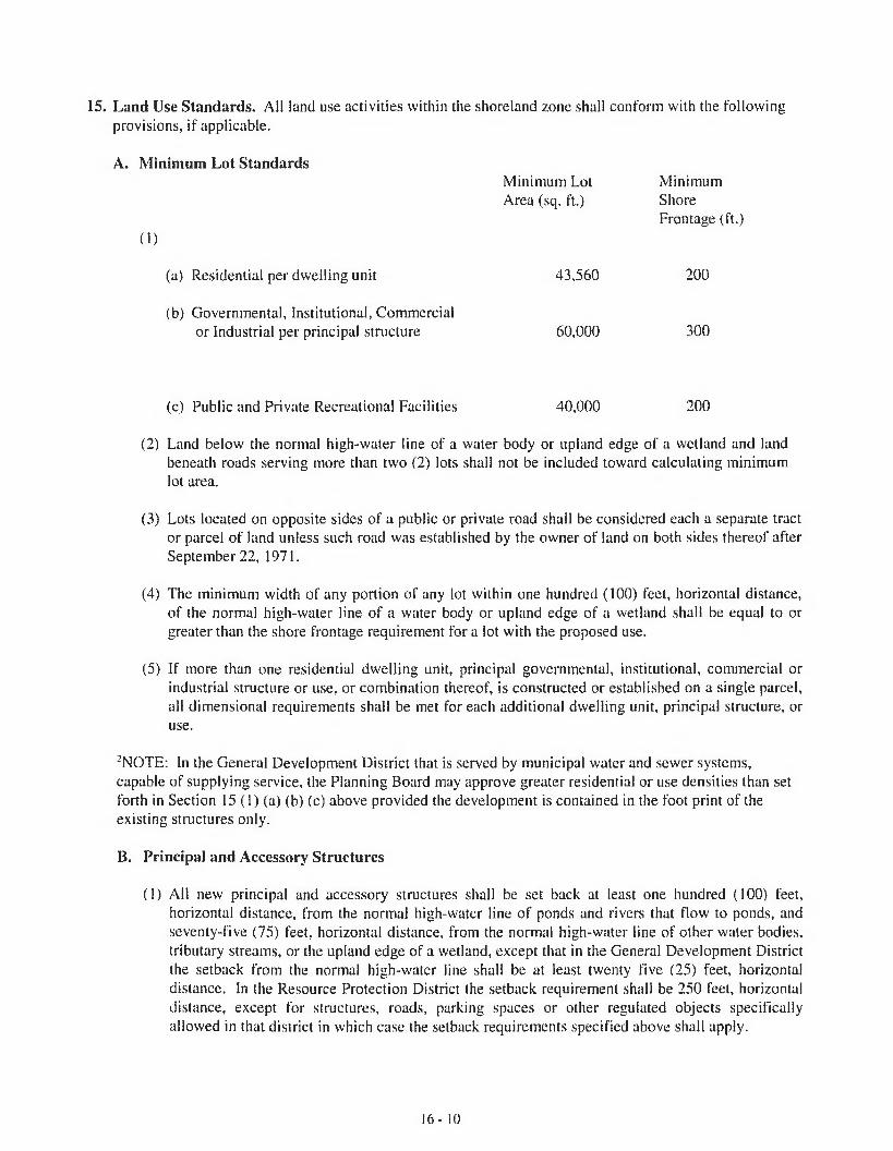
15. Land Use Standards. All land use activities within the shoreland zone shall conform with the following provisions, if applicable.
A. Minimum Lot Standards
0 )
Minimum LotArea (sq. ft.)
MinimumShoreFrontage (ft.)
(a) Residential per dwelling unit 43,560 200
(b) Governmental, Institutional, Commercial or Industrial per principal structure 60,000 300
(c) Public and Private Recreational Facilities 40,000 200
(2) Land below the normal high-water line of a water body or upland edge of a wetland and land beneath roads serving more than two (2) lots shall not be included toward calculating minimum lot area.
(3) Lots located on opposite sides of a public or private road shall be considered each a separate tract or parcel of land unless such road was established by the owner of land on both sides thereof after September 22, 1971.
(4) The minimum width of any portion of any lot within one hundred (100) feet, horizontal distance, of the normal high-water line of a water body or upland edge of a wetland shall be equal to or greater than the shore frontage requirement for a lot with the proposed use.
(5) If more than one residential dwelling unit, principal governmental, institutional, commercial or industrial structure or use, or combination thereof, is constructed or established on a single parcel, all dimensional requirements shall be met for each additional dwelling unit, principal structure, or use.
2NOTE: In the General Development District that is served by municipal water and sewer systems, capable of supplying service, the Planning Board may approve greater residential or use densities than set forth in Section 15 (1) (a) (b) (c) above provided the development is contained in the foot print of the existing structures only.
B. Principal and Accessory Structures
(1) All new principal and accessory structures shall be set back at least one hundred (100) feet, horizontal distance, from the normal high-water line of ponds and rivers that flow to ponds, and seventy-five (75) feet, horizontal distance, from the normal high-water line of other water bodies, tributary streams, or the upland edge of a wetland, except that in the General Development District the setback from the normal high-water line shall be at least twenty five (25) feet, horizontal distance. In the Resource Protection District the setback requirement shall be 250 feet, horizontal distance, except for structures, roads, parking spaces or other regulated objects specifically allowed in that district in which case the setback requirements specified above shall apply.
16-10

In addition:
(a) The water body, tributary stream, or wetland setback provision shall neither apply to structures which require direct access to the water body or wetland as an operational necessity, such as piers, docks and retaining walls, nor to other functionally water-dependent uses.
(b) On a non-conforming lot of record on which only a residential structure exists, and it is not possible to place an accessory structure meeting the required water body, tributary stream or wetland setbacks, the code enforcement officer may issue a permit to place a single accessory structure, with no utilities, for the storage of yard tools and similar equipment. Such accessory structure shall not exceed eighty (80) square feet in area nor eight (8) feet in height, and shall be located as far from the shoreline or tributary stream as practical and shall meet all other applicable standards, including lot coverage and vegetation clearing limitations. In no case shall the structure be located closer to the shoreline or tributary stream than the principal structure.
(2) Principal or accessory structures and expansions of existing structures which are permitted in the Resource Protection, Limited Residential, Limited Commercial, and Stream Protection Districts, shall not exceed thirty-five (35) feet in height. This provision shall not apply to structures such as transmission towers, windmills, antennas, and similar structures having no floor area.
(3) The lowest floor elevation or openings of all buildings and structures, including basements, shall be elevated at least one foot above the elevation of the 100 year flood, the flood of record, or in the absence of these, the flood as defined by soil types identified as recent flood-plain soils. In those municipalities that participate in the National Flood Insurance Program and have adopted the April 2005 version, or later version, of the Floodplain Management Ordinance, accessory structures may be placed in accordance with the standards of that ordinance and need not meet the elevation requirements of this paragraph.
(4) The total footprint area of all structures, parking lots and other non-vegetated surfaces, within the shoreland zone shall not exceed twenty (20) percent of the lot or a portion thereof, located within the shoreland zone, including land area previously developed, except in the General Development District adjacent to rivers that do not flow to ponds, where lot coverage shall not exceed seventy (70) percent.
(5) Retaining walls that are not necessary for erosion control shall meet the structure setback requirement, except for low retaining walls and associated fill provided all of the following conditions are met:
(a) The site has been previously altered and an effective vegetated buffer does not exist;
(b) The wall(s) is(are) at least 25 feet, horizontal distance, from the normal high-water line of a water body, tributary stream, or upland edge of a wetland;
(c) The site where the retaining wall will be constructed is legally existing lawn or is a site eroding from lack of naturally occurring vegetation, and which cannot be stabilized with vegetative plantings;
(d) The total height of the wall(s), in the aggregate, are no more than 24 inches;
(e) Retaining walls are located outside of the 100-year floodplain on rivers, streams, and tributary streams, as designated on the Federal Emergency Management Agency’s (FEMA)
16- 11

Flood Insurance Rate Maps or Flood Hazard Boundary Maps, or the flood of record, or in the absence of these, by soil types identified as recent flood plain soils.
(f) The area behind the wall is revegetated with grass, shrubs, trees, or a combination thereof, and no further structural development will occur within the setback area, including patios and decks; and
(g) A vegetated buffer area is established within 25 feet, horizontal distance, of the normal high- water line of a water body, tributary stream, or upland edge of a wetland when a natural buffer area does not exist. The buffer area must meet the following characteristics;
(i) The buffer must include shrubs and other woody and herbaceous vegetation. Where natural ground cover is lacking the area must be supplemented with leaf or bark mulch;
(ii) Vegetation plantings must be in quantities sufficient to retard erosion and provide for effective infiltration of stormwater runoff;
(iii) Only native species may be used to establish the buffer area;
(iv) A minimum buffer width of 15 feet, horizontal distance, is required, measured perpendicularly to the normal high-water line or upland edge of a wetland;
(v) A footpath not to exceed the standards in Section 15(N)(2)(a), may traverse the buffer;
(6) Notwithstanding the requirements stated above, stairways or similar structures may be allowed with a permit from the Code Enforcement Officer, to provide shoreline access in areas of steep slopes or unstable soils provided: that the structure is limited to a maximum of four (4) feet in width; that the structure does not extend below or over the normal high-water line of a water body or upland edge of a wetland, (unless permitted by the Department of Environmental Protection pursuant to the Natural Resources Protection Act, 38 M.R.S.A. section 480-C); and that the applicant demonstrates that no reasonable access alternative exists on the property.
C. Campgrounds. Campgrounds shall conform to the minimum requirements imposed under State licensing procedures and the following
(1) Campgrounds shall contain a minimum of five thousand (5,000) square feet of land, not including roads and driveways, for each site. Land supporting wetland vegetation, and land below the normal high-water line of a water body shall not be included in calculating land area per site.
(2) The areas intended for placement of a recreational vehicle, tent or shelter, and utility and service buildings shall be set back a minimum of one hundred (100) feet, horizontal distance, from the normal high-water line of a great pond or a river flowing to a pond, and seventy-five (75) feet, horizontal distance, from the normal high-water line of other water bodies, tributary streams, or the upland edge of a wetland.
D. Individual Private Campsites. Individual private campsites not associated with campgrounds areallowed provided the following conditions are met:(1) One campsite per lot existing on the effective date of this Ordinance, or thirty thousand (30,000)
square feet of lot area within the shoreland zone, whichever is less, may be permitted.
(2) Campsite placement on any lot, including the area intended for a recreational vehicle or tent platform, shall be set back one hundred (100) feet, horizontal distance, from the normal high-
16- 12

water line of a or river flowing to a pond, and seventy-five (75) feet, horizontal distance, from the normal high-water line of other water bodies, tributary streams, or the upland edge of a wetland.
(3) Only one recreational vehicle shall be allowed on a campsite. The recreational vehicle shall not be located on any type of permanent foundation except for a gravel pad, and no structure except a canopy shall be attached to the recreational vehicle.
(4) The clearing of vegetation for the sitting of the recreational vehicle, tent or similar shelter in a Resource Protection District shall be limited to one thousand (1000) square feet.
(5) A written sewage disposal plan describing the proposed method and location of sewage disposal shall be required for each campsite and shall be approved by the Local Plumbing Inspector. Where disposal is off-site, written authorization from the receiving facility or land owner is required.
(6) When a recreational vehicle, tent or similar shelter is placed on-site for more than one hundred and twenty (120) days per year, all requirements for residential structures shall be met, including the installation of a subsurface sewage disposal system in compliance with the State of Maine Subsurface Wastewater Disposal Rules unless served by public sewage facilities.
E. Commercial and Industrial Uses. The following new commercial and industrial uses areprohibited within the shoreland zone adjacent to ponds, and rivers and streams which flow to ponds:
(1) Auto washing facilities
(2) Auto or other vehicle service and/or repair operations, including body shops
(3) Chemical and bacteriological laboratories
(4) Storage of chemicals, including herbicides, pesticides or fertilizers, other than amounts normally associated with individual households or farms
(5) Commercial painting, wood preserving, and furniture stripping
(6) Dry cleaning establishments
(7) Electronic circuit assembly
(8) Laundromats, unless connected to a sanitary sewer
(9) Metal plating, finishing, or polishing
(10) Petroleum or petroleum product storage and/or sale except storage on same property as use occurs and except for storage and sales associated with marinas
(11) Photographic processing
(12) Printing
16- 13
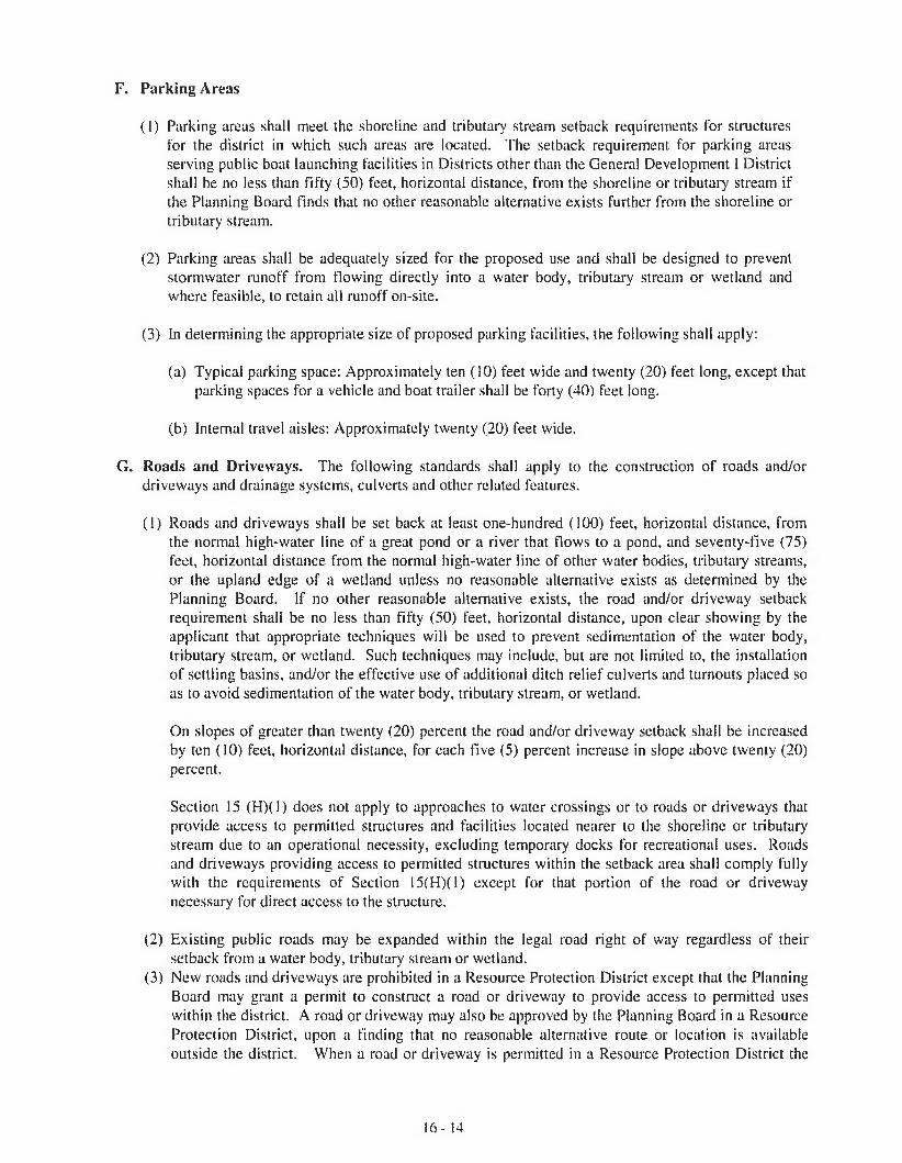
F. Parking Areas
(1) Parking areas shall meet the shoreline and tributary stream setback requirements for structures for the district in which such areas are located. The setback requirement for parking areas serving public boat launching facilities in Districts other than the General Development I District shall be no less than fifty (50) feet, horizontal distance, from the shoreline or tributary stream if the Planning Board finds that no other reasonable alternative exists further from the shoreline or tributary stream.
(2) Parking areas shall be adequately sized for the proposed use and shall be designed to prevent stormwater runoff from flowing directly into a water body, tributary stream or wetland and where feasible, to retain all runoff on-site.
(3) In determining the appropriate size of proposed parking facilities, the following shall apply:
(a) Typical parking space: Approximately ten (10) feet wide and twenty (20) feet long, except that parking spaces for a vehicle and boat trailer shall be forty (40) feet long.
(b) Internal travel aisles: Approximately twenty (20) feet wide.
G. Roads and Driveways. The following standards shall apply to the construction of roads and/ordriveways and drainage systems, culverts and other related features.
(1) Roads and driveways shall be set back at least one-hundred (100) feet, horizontal distance, from the normal high-water line of a great pond or a river that flows to a pond, and seventy-five (75) feet, horizontal distance from the normal high-water line of other water bodies, tributary streams, or the upland edge of a wetland unless no reasonable alternative exists as determined by the Planning Board, If no other reasonable alternative exists, the road and/or driveway setback requirement shall be no less than fifty (50) feet, horizontal distance, upon clear showing by the applicant that appropriate techniques will be used to prevent sedimentation of the water body, tributary stream, or wetland. Such techniques may include, but are not limited to, the installation of settling basins, and/or the effective use of additional ditch relief culverts and turnouts placed so as to avoid sedimentation of the water body, tributary stream, or wetland.
On slopes of greater than twenty (20) percent the road and/or driveway setback shall be increased by ten (10) feet, horizontal distance, for each five (5) percent increase in slope above twenty (20) percent.
Section 15 (H)(1) does not apply to approaches to water crossings or to roads or driveways that provide access to permitted structures and facilities located nearer to the shoreline or tributary stream due to an operational necessity, excluding temporary docks for recreational uses. Roads and driveways providing access to permitted structures within the setback area shall comply fully with the requirements of Section 15(H)(1) except for that portion of the road or driveway necessary for direct access to the structure.
(2) Existing public roads may be expanded within the legal road right of way regardless of their setback from a water body, tributary stream or wetland.
(3) New roads and driveways are prohibited in a Resource Protection District except that the Planning Board may grant a permit to construct a road or driveway to provide access to permitted uses within the district. A road or driveway may also be approved by the Planning Board in a Resource Protection District, upon a finding that no reasonable alternative route or location is available outside the district. When a road or driveway is permitted in a Resource Protection District the
1 6 - 1 4

road and/or driveway shall be set back as far as practicable from the normal high-water line of a water body, tributary stream, or upland edge of a wetland.
(4) Road and driveway banks shall be no steeper than a slope of two (2) horizontal to one (1) vertical, and shall be graded and stabilized in accordance with the provisions for erosion and sedimentation control contained in Section 15(Q).
(5) Road and driveway grades shall be no greater than ten (10) percent except for segments of less than two hundred (200) feet.
(6) In order to prevent road and driveway surface drainage from directly entering water bodies, tributary streams or wetlands, roads and driveways shall be designed, constructed, and maintained to empty onto an unscarified buffer strip at least (50) feet plus two times the average slope, in width between the outflow point of the ditch or culvert and the normal high-water line of a water body, tributary stream, or upland edge of a wetland. Surface drainage which is directed to an unscarified buffer strip shall be diffused or spread out to promote infiltration of the runoff and to minimize channelized flow of the drainage through the buffer strip.
(7) Ditch relief (cross drainage) culverts, drainage dips and water turnouts shall be installed in a manner effective in directing drainage onto unscarified buffer strips before the flow gains sufficient volume or head to erode the road, driveway, or ditch. To accomplish this, the following shall apply:
(a) Ditch relief culverts, drainage dips and associated water turnouts shall be spaced along the road, or driveway at intervals no greater than indicated in the following table:
Grade Spacing(Percent) (Feet)
0-2 2503-5 200-1356-10 100-8011-15 80-6016-20 60-4521 + 40
(b) Drainage dips may be used in place of ditch relief culverts only where the grade is ten (10) percent or less.
(c) On sections having slopes greater than ten (10) percent, ditch relief culverts shall be placed at approximately a thirty (30) degree angle downslope from a line perpendicular to the centerline of the road or driveway.
(d) Ditch relief culverts shall be sufficiently sized and properly installed in order to allow for effective functioning, and their inlet and outlet ends shall be stabilized with appropriate materials.
(8) Ditches, culverts, bridges, dips, water turnouts and other storm water runoff control installations associated with roads and driveways shall be maintained on a regular basis to assure effective functioning.
H Signs. The following provisions shall govern the use of signs in the Resource Protection, Stream Protection, Limited Residential and Limited Commercial Districts:
16- 15

(1) Signs relating to goods and services sold on the premises shall be allowed, provided that such signs shall not exceed six (6) square feet in area and shall not exceed two (2) signs per premises. In the Limited Commercial District, however, such signs shall not exceed sixteen (16) square feet in area. Signs relating to goods or services not sold or rendered on the premises shall be prohibited.
(2) Name signs are allowed, provided such signs shall not exceed two (2) signs per premises, and shall not exceed twelve (12) square feet in the aggregate.
(3) Residential users may display a single sign not over three (3) square feet in area relating to the sale, rental, or lease of the premises.
(4) Signs relating to trespassing and hunting shall be allowed without restriction as to number provided that no such sign shall exceed two (2) square feet in area.
(5) Signs relating to public safety shall be allowed without restriction.
(6) No sign shall extend higher than twenty (20) feet above the ground.
(7) Signs may be illuminated only by shielded, non-flashing lights.
I. Storm Water Runoff
(1) All new construction and development shall be designed to minimize storm water runoff from the site in excess of the natural predevelopment conditions. Where possible, existing natural runoff control features, such as berms, swales, terraces and wooded areas, shall be retained in order to reduce runoff and encourage infiltration of stormwaters.
(2) Storm water runoff control systems shall be maintained as necessary to ensure proper functioning.
J. Septic Waste Disposal
(1) All subsurface sewage disposal systems shall be installed in conformance with the State of Maine Subsurface Wastewater Disposal Rules, and the following: a) clearing or removal of woody vegetation necessary to site a new system and any associated fill extensions, shall not extend closer than seventy-five (75) feet, horizontal distance, from the normal high-water line of a water body or the upland edge of a wetland and b) a holding tank is not allowed for a first-time residential use in the shoreland zone.
K. Essential Services
(1) Where feasible, the installation of essential services shall be limited to existing public ways and existing service corridors.
(2) The installation of essential services, other than road-side distribution lines, is not allowed in a Resource Protection or Stream Protection District, except to provide services to a permitted use within said district, or except where the applicant demonstrates that no reasonable alternative exists. Where allowed, such structures and facilities shall be located so as to minimize any adverse impacts on surrounding uses and resources, including visual impacts.
16- 16
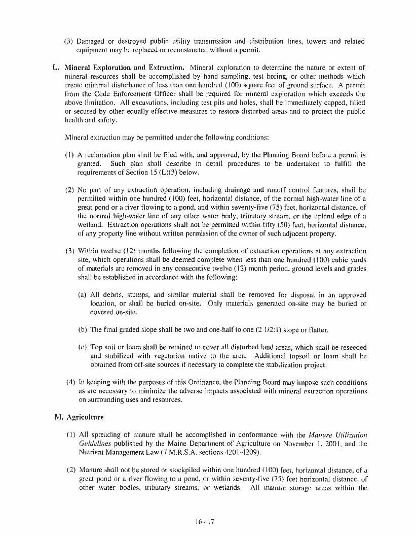
(3) Damaged or destroyed public utility transmission and distribution lines, towers and related equipment may be replaced or reconstructed without a permit.
L. Mineral Exploration and Extraction. Mineral exploration to determine the nature or extent of mineral resources shall be accomplished by hand sampling, test boring, or other methods which create minimal disturbance of less than one hundred (100) square feet of ground surface. A permit from the Code Enforcement Officer shall be required for mineral exploration which exceeds the above limitation. All excavations, including test pits and holes, shall be immediately capped, filled or secured by other equally effective measures to restore disturbed areas and to protect the public health and safety.
Mineral extraction may be permitted under the following conditions:
(1) A reclamation plan shall be filed with, and approved, by the Planning Board before a permit is granted. Such plan shall describe in detail procedures to be undertaken to fulfill the requirements of Section 15 (L)(3) below.
(2) No part of any extraction operation, including drainage and runoff control features, shall be permitted within one hundred (100) feet, horizontal distance, of the normal high-water line of a great pond or a river flowing to a pond, and within seventy-five (75) feet, horizontal distance, of the normal high-water line of any other water body, tributary stream, or the upland edge of a wetland. Extraction operations shall not be permitted within fifty (50) feet, horizontal distance, of any property line without written permission of the owner of such adjacent property.
(3) Within twelve (12) months following the completion of extraction operations at any extraction site, which operations shall be deemed complete when less than one hundred (100) cubic yards of materials are removed in any consecutive twelve (12) month period, ground levels and grades shall be established in accordance with the following:
(a) Ail debris, stumps, and similar material shall be removed for disposal in an approved location, or shall be buried on-site. Only materials generated on-site may be buried or covered on-site.
(b) The final graded slope shall be two and one-half to one (2 1/2:1) slope or flatter.
(c) Top soil or loam shall be retained to cover all disturbed land areas, which shall be reseeded and stabilized with vegetation native to the area. Additional topsoil or loam shall be obtained from off-site sources if necessary to complete the stabilization project.
(4) In keeping with the purposes of this Ordinance, the Planning Board may impose such conditions as are necessary to minimize the adverse impacts associated with mineral extraction operations on surrounding uses and resources.
M. Agriculture
(1) All spreading of manure shall be accomplished in conformance with the Manure Utilization Guidelines published by the Maine Department of Agriculture on November 1, 2001, and the Nutrient Management Law (7 M.R.S.A. sections 4201-4209).
(2) Manure shall not be stored or stockpiled within one hundred (100) feet, horizontal distance, of a great pond or a river Bowing to a pond, or within seventy-five (75) feet horizontal distance, of other water bodies, tributary streams, or wetlands. All manure storage areas within the
16- 17

shoreland zone must be constructed or modified such that the facility produces no discharge of effluent or contaminated storm water.
(3) Agricultural activities involving tillage of soil greater than forty thousand (40,000) square feet in surface area, within the shoreland zone shall require a Conservation Plan to be filed with the Planning Board. Non-conformance with the provisions of said plan shall be considered to be a violation of this Ordinance.
(4) There shall be no new tilling of soil within one-hundred (100) feet, horizontal distance, of the normal high-water line of a pond; within seventy-five (75) feet, horizontal distance, from other water bodies; nor within twenty-five (25) feet, horizontal distance, of tributary streams and freshwater wetlands. Operations in existence on the effective date of this ordinance and not in conformance with this provision may be maintained.
(5) Newly established livestock grazing areas shall not be permitted within one hundred (100) feet, horizontal distance, of the normal high-water line of a pond; within seventy-five (75) feet, horizontal distance, of other water bodies; nor within twenty-five (25) feet, horizontal distance, of tributary streams and freshwater wetlands. Livestock grazing associated with ongoing farm activities, and which are not in conformance with the above setback provisions may continue, provided that such grazing is conducted in accordance with a Conservation Plan.
N. Timber Harvesting
(1) In a Resource Protection District abutting a pond, timber harvesting shall be limited to the following:
(a) Within the strip of land extending 75 feet, horizontal distance, inland from the normal high- water line, timber harvesting may be conducted when the following conditions are met:
(1) The ground is frozen;(2) There is no resultant soil disturbance;(3) The removal of trees is accomplished using a cable or boom and there is no entry of
tracked or wheeled vehicles into the 75-foot strip of land;(4) There is no cutting of trees less than 6 inches in diameter; no more than 30% of the trees
6 inches or more in diameter, measured at 4 Vi feet above ground level, are cut in any 10- year period; and a well-distributed stand of trees and other natural vegetation remains; and
(5) A licensed professional forester has marked the trees to be harvested prior to a permit being issued by the municipality.
(b) Beyond the 75 foot strip referred to in Section 15(0)(l)(a) above, timber harvesting is permitted in accordance with paragraph 2 below except that in no case shall the average residual basal area of trees over 4 Vz inches in diameter at 4 1/2 feet above ground level be reduced to less than 30 square feet per acre.
(2) Except in areas as described in Section 15(0)( 1) above, timber harvesting shall conform with the following provisions:
(a) Selective cutting of no more than forty (40) percent of the total volume of trees four (4) inches or more in diameter measured at 4 1/2 feet above ground level on any lot in any ten (10) year period is permitted. In addition:
16- 18
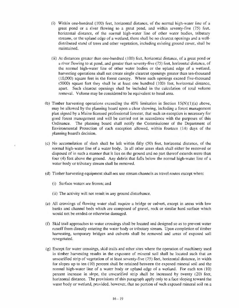
(i) Within one-hundred (100) feet, horizontal distance, of the normal high-water line of a great pond or a river flowing to a great pond, and within seventy-five (75) feet, horizontal distance, of the normal high-water line of other water bodies, tributary streams, or the upland edge of a wetland, there shall be no clearcut openings and a well- distributed stand of trees and other vegetation, including existing ground cover, shall be maintained.
(ii) At distances greater than one-hundred (100) feet, horizontal distance, of a great pond or a river flowing to at pond, and greater than seventy-five (75) feet, horizontal distance, of the normal high-water line of other water bodies or the upland edge of a wetland, harvesting operations shall not create single clearcut openings greater than ten-thousand (10,000) square feet in the forest canopy. Where such openings exceed five-thousand (5000) square feet they shall be at least one hundred (100) feet, horizontal distance, apart. Such clearcut openings shall be included in the calculation of total volume removal. Volume may be considered to be equivalent to basal area.
(b) Timber harvesting operations exceeding the 40% limitation in Section 15(N)(l)(a) above, may be allowed by the planning board upon a clear showing, including a forest management plan signed by a Maine licensed professional forester, that such an exception is necessary for good forest management and will be carried out in accordance with the purposes of this Ordinance. The planning board shall notify the Commissioner of the Department of Environmental Protection of each exception allowed, within fourteen (14) days of the planning board’s decision.
(c) No accumulation of slash shall be left within fifty (50) feet, horizontal distance, of the normal high-water line of a water body. In ail other areas slash shall either be removed or disposed of in such a manner that it lies on the ground and no part thereof extends more than four (4) feet above the ground. Any debris that falls below the normal high-water line of a water body or tributary stream shall be removed.
(d) Timber harvesting equipment shall not use stream channels as travel routes except when:
(i) Surface waters are frozen; and
(ii) The activity will not result in any ground disturbance.
(e) All crossings of flowing water shall require a bridge or culvert, except in areas with low banks and channel beds which are composed of gravel, rock or similar hard surface which would not be eroded or otherwise damaged.
(f) Skid trail approaches to water crossings shall be located and designed so as to prevent water runoff from directly entering the water body or tributary stream. Upon completion of timber harvesting, temporary bridges and culverts shall be removed and areas of exposed soil revegetated.
(g) Except for water crossings, skid trails and other sites where the operation of machinery used in timber harvesting results in the exposure of mineral soil shall be located such that an unscarified strip of vegetation of at least seventy-five (75) feet, horizontal distance, in width for slopes up to ten (10) percent shall be retained between the exposed mineral soil and the normal high-water line of a water body or upland edge of a wetland. For each ten (10) percent increase in slope, the unscarified strip shall be increased by twenty (20) feet, horizontal distance. The provisions of this paragraph apply only to a face sloping toward the water body or wetland, provided, however, that no portion of such exposed mineral soil on a
16- 19
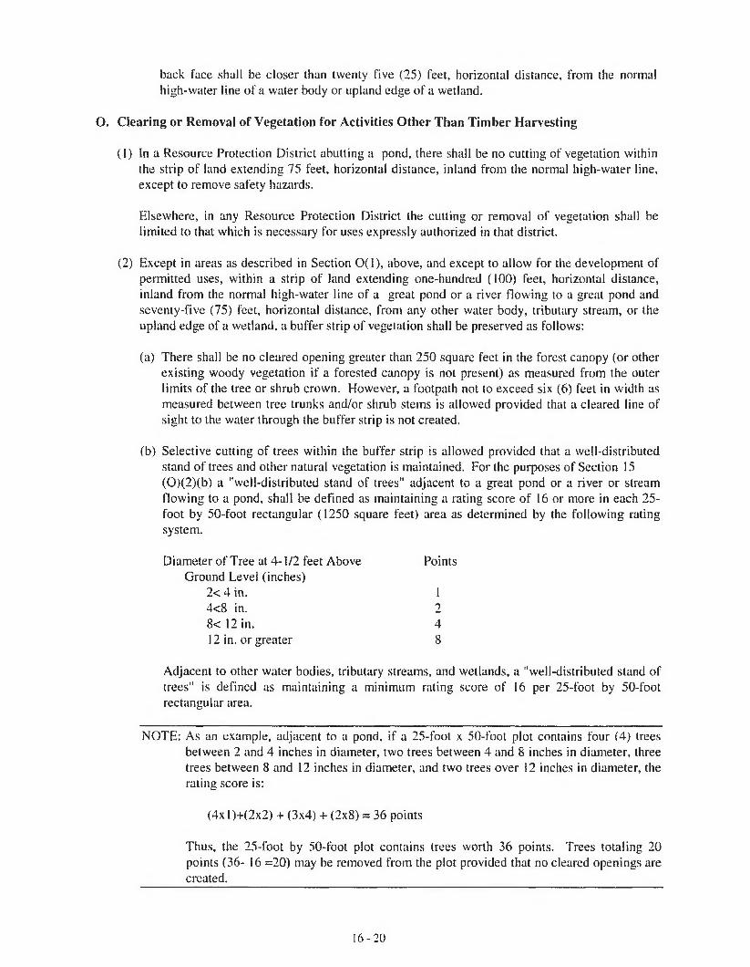
back face shall be closer than twenty five (25) feet, horizontal distance, from the normal high-water line of a water body or upland edge of a wetland.
O. Clearing or Removal of Vegetation for Activities Other Than Timber Harvesting
(1) In a Resource Protection District abutting a pond, there shall be no cutting of vegetation within the strip of land extending 75 feet, horizontal distance, inland from the normal high-water line, except to remove safety hazards.
Elsewhere, in any Resource Protection District the cutting or removal of vegetation shall be limited to that which is necessary for uses expressly authorized in that district.
(2) Except in areas as described in Section 0(1), above, and except to allow for the development of permitted uses, within a strip of land extending one-hundred (100) feet, horizontal distance, inland from the normal high-water line of a great pond or a river flowing to a great pond and seventy-five (75) feet, horizontal distance, from any other water body, tributary stream, or the upland edge of a wetland, a buffer strip of vegetation shall be preserved as follows:
(a) There shall be no cleared opening greater than 250 square feet in the forest canopy (or other existing woody vegetation if a forested canopy is not present) as measured from the outer limits of the tree or shrub crown. However, a footpath not to exceed six (6) feet in width as measured between tree trunks and/or shrub stems is allowed provided that a cleared line of sight to the water through the buffer strip is not created.
(b) Selective cutting of trees within the buffer strip is allowed provided that a well-distributed stand of trees and other natural vegetation is maintained. For the purposes of Section 15(0)(2)(b) a "well-distributed stand of trees" adjacent to a great pond or a river or stream flowing to a pond, shall be defined as maintaining a rating score of 16 or more in each 25- foot by 50-foot rectangular (1250 square feet) area as determined by the following rating system.
Diameter of Tree at 4-1 /2 feet Above PointsGround Level (inches)
2< 4 in. 14<8 in. 28< 12 in. 412 in. or greater 8
Adjacent to other water bodies, tributary streams, and wetlands, a "well-distributed stand of trees" is defined as maintaining a minimum rating score of 16 per 25-foot by 50-foot rectangular area.
NOTE: As an example, adjacent to a pond, if a 25-foot x 50-foot plot contains four (4) trees between 2 and 4 inches in diameter, two trees between 4 and 8 inches in diameter, three trees between 8 and 12 inches in diameter, and two trees over 12 inches in diameter, the rating score is:
(4xl)+(2x2) + (3x4) + (2x8) = 36 points
Thus, the 25-foot by 50-foot plot contains trees worth 36 points. Trees totaling 20 points (36- 16 =20) may be removed from the plot provided that no cleared openings are created.
1 6 - 2 0

The following shall govern in applying this point system:
(i) The 25-foot by 50-foot rectangular plots must be established where the landowner or lessee proposes clearing within the required buffer;
(ti) Bach successive plot must be adjacent to, but not overlap a previous plot;(iii) Any plot not containing the required points must have no vegetation removed except
as otherwise allowed by this Ordinance;(iv) Any plot containing the required points may have vegetation removed down to the
minimum points required or as otherwise allowed by is Ordinance;(v) Where conditions permit, no more than 50% of the points on any 25-foot by 50-foot
rectangular area may consist of trees greater than 12 inches in diameter.
For the purposes of Section I5(0)(2)(b) “other natural vegetation’’ is defined as retaining existing vegetation under three (3) feet in height and other ground cover and retaining at least five (5) saplings less than two (2) inches in diameter at four and one half (4 Vi) feet above ground level for each 25-foot by 50-foot rectangle area. If five saplings do not exist, no woody stems less than two (2) inches in diameter can be removed until 5 saplings have been recruited into the plot.
Notwithstanding the above provisions, no more than 40% of the total volume of trees four (4) inches or more in diameter, measured at 4 1/2 feet above ground level may be removed in any ten (10) year period.
(c) In order to protect water quality and wildlife habitat, existing vegetation under three (3) feet in height and other ground cover, including leaf litter and the forest duff layer, shall not be cut, covered, or removed, except to provide for a footpath or other permitted uses as described in Section 15(0) paragraphs (2) and (2)(a) above.
(d) Pruning of tree branches, on the bottom 1/3 of the tree is allowed.
(e) In order to maintain a buffer strip of vegetation, when the removal of storm-damaged, diseased, unsafe, or dead trees results in the creation of cleared openings, these openings shall be replanted with native tree species unless existing new tree growth is present.
Section 15(0)(2) does not apply to those portions of public recreational facilities adjacent to public swimming areas as long as cleared areas are limited to the minimum area necessary.
(3) At distances greater than one hundred (100) feet, horizontal distance, from a great pond or a river flowing to a great pond, and seventy-five (75) feet, horizontal distance, from the normal high-water line of any other water body, tributary stream, or the upland edge of a wetland, there shall be allowed on any lot, in any ten (10) year period, selective cutting of not more than forty (40) percent of the volume of trees four (4) inches or more in diameter, measured 4 1/2 feet above ground level. Tree removal in conjunction with the development of permitted uses shall be included in the forty (40) percent calculation. For the purposes of these standards volume may be considered to be equivalent to basal area.
In no event shall cleared openings for any purpose, including but not limited to, principal and accessory structures, driveways, lawns and sewage disposal areas, exceed in the aggregate, 25% of the lot area within the shoreland zone or ten thousand (10,000) square feet, whichever is greater, including land previously cleared. This provision shall not apply to the General Development Districts.
16- 21

(4) Legally existing nonconforming cleared openings may be maintained, but shall not be enlarged, except as allowed by this Ordinance.
(5) Fields and other cleared openings which have reverted to primarily shrubs, trees, or other woody vegetation shall be regulated under the provisions of Section 15(0).
P. Erosion and Sedimentation Control
(1) Ail activities which involve filling, grading, excavation or other similar activities which result in unstabilized soil conditions and which require a permit shall also require a written soil erosion and sedimentation control plan. The plan shall be submitted to the permitting authority for approval and shall include, where applicable, provisions for:
(a) Mulching and revegetation of disturbed soil.
(b) Temporary runoff control features such as hay bales, silt fencing or diversion ditches.
(c) Permanent stabilization structures such as retaining wails or rip-rap.
(2) In order to create the least potential for erosion, development shall be designed to Fit with the topography and soils of the site. Areas of steep slopes where high cuts and fills may be required shall be avoided wherever possible, and natural contours shall be followed as closely as possible.
(3) Erosion and sedimentation control measures shall apply to all aspects of the proposed project involving land disturbance, and shall be in operation during all stages of the activity. The amount of exposed soil at every phase of construction shall be minimized to reduce the potential for erosion.
(3) Any exposed ground area shall be temporarily or permanently stabilized within one (1) week from the time it was last actively worked, by use of riprap, sod, seed, and mulch, or other effective measures. In all cases permanent stabilization shall occur within nine (9) months of the initial date of exposure. In addition:
(a) Where mulch is used, it shall be applied at a rate of at least one (1) bale per Five hundred 500) square feet and shall be maintained until a catch of vegetation is established.
(b) Anchoring the mulch with netting, peg and twine or other suitable method may be required to maintain the mulch cover.
(c) Additional measures shall be taken where necessary in order to avoid siltation into the water. Such measures may include the use of staked hay bales and/or silt fences.
(5) Natural and man-made drainage ways and drainage outlets shall be protected from erosion from water flowing through them. Drainageways shall be designed and constructed in order to carry water from a twenty Five (25) year storm or greater, and shall be stabilized with vegetation or lined with riprap.
Q. Soils. All land uses shall be located on soils in or upon which the proposed uses or structures can be established or maintained without causing adverse environmental impacts, including severe erosion, mass soil movement, improper drainage, and water pollution, whether during or after construction. Proposed uses requiring subsurface waste disposal, and commercial or industrial development and other similar intensive land uses, shall require a soils report based on an on-site investigation and be prepared by state-certified professionals. Certified persons may include Maine Certified Soil
1 6 - 2 2

Scientists, Maine Registered Professional Engineers, Maine State Certified Geologists and other persons who have training and experience in the recognition and evaluation of soil properties. The report shall be based upon the analysis of the characteristics of the soil and surrounding land and water areas, maximum ground water elevation, presence of ledge, drainage conditions, and other pertinent data which the evaluator deems appropriate. The soils report shall include recommendati ons for a proposed use to counteract soil limitations where they exist.
R. Water Quality. No activity shall deposit on or into the ground or discharge to the waters of the State any pollutant that, by itself or in combination with other activities or substances, will impair designated uses or the water classification of the water body, tributary stream or wetland.
S. Archaeological Site. Any proposed land use activity involving structural development or soil disturbance on or adjacent to sites listed on, or eligible to be listed on the National Register of Maine Historic Preservation Commission for review and comment, at least twenty (20) days prior to action being taken by the permitting authority. The permitting authority shall consider comments received from the Commission prior to rendering a decision on the application.
16. Administration
A. Administering Bodies and Agents
(1) Code Enforcement Officer. A Code Enforcement Officer shall be appointed or reappointed annually by July 1st.
(2) Board of Appeals. A Board of Appeals shall be created in accordance with the provisions of 30- A M.R.S.A. section 2691.
(3) Planning Board. A Planning Board shall be created in accordance with the provisions of State law.
B. Permits Required. After the effective date of this Ordinance no person shall, without first obtaining a permit, engage in any activity or use of land or structure requiring a permit in the district in which such activity or use would occur; or expand, change, or replace an existing use or structure; or renew a discontinued nonconforming use. A person who is issued a permit pursuant to this Ordinance shall have a copy of the permit on site while the work authorized by the permit is performed.
(1) A permit is not required for the replacement of an existing road culvert as long as:
(a) The replacement culvert is not more than 25% longer than the culvert being replaced;
(b) The replacement culvert is not longer than 75 feet; and
(c) Adequate erosion control measures are taken to prevent sedimentation of the water, and the crossing does not block fish passage in the watercourse.
(2) A permit is not required for an archaeological excavation as long as the excavation is conducted by an archaeologist listed on the State Historic Preservation Officer’s level 1 or level 2 approved list, and unreasonable erosion and sedimentation is prevented by means of adequate and timely temporary and permanent stabilization measures.
(3) Any permit required by this Ordinance shall be in addition to any other permit required by other law or ordinance.
1 6 - 2 3

C. Permit Application
(1) Every applicant for a permit shall submit a written application, including a scaled site plan, on a form provided by the municipality, to the appropriate official as indicated in Section 14.
(2) All applications shall be signed by an owner or individual who can show evidence of right, title or interest in the property or by an agent, representative, tenant, or contractor of the owner with authorization from the owner to apply for a permit hereunder, certifying that the information in the application is complete and correct.
(3) All applications shall be dated, and the Code Enforcement Officer or Planning Board, as appropriate, shall note upon each application the date and time of its receipt.
(4) If the property is not served by a public sewer, a valid plumbing permit or a completed application for a plumbing permit, including the site evaluation approved by the Plumbing Inspector, shall be submitted whenever the nature of the proposed structure or use would require the installation of a subsurface sewage disposal system.
D. Procedure for Administering Permits. Within 35 days of the date of receiving a written application, the Planning Board or Code Enforcement Officer, as indicated in Section 14, shall notify the applicant in writing either that the application is a complete application, or, if the application is incomplete, that specified additional material is needed to make the application complete. The Planning Board or the Code Enforcement Officer, as appropriate, shall approve, approve with conditions, or deny all permit applications in writing within 35 days of receiving a completed application. However, if the Planning Board has a waiting list of applications, a decision on the application shall occur within 35 days after the first available date on the Planning Board’s agenda following receipt of the completed application, or within 35 days of the public hearing, if the proposed use or structure is found to be in conformance with the purposes and provisions of this Ordinance.
The applicant shall have the burden of proving that the proposed land use activity is in conformity with the purposes and provisions of this Ordinance.
After the submission of a complete application to the Planning Board, the Board shall approve an application or approve it with conditions if it makes a positive finding based on the information presented that the proposed use:
(1) Will maintain safe and healthful conditions;
(2) Will not result in water pollution, erosion, or sedimentation to surface waters;
(3) Will adequately provide for the disposal of all wastewater;
(4) Will not have an adverse impact on spawning grounds, fish, aquatic life, bird or other wildlife habitat;
(5) Will conserve shore cover and visual, as well as actual, points of access to inland waters;
(6) Will protect archaeological and historic resources as designated in the comprehensive plan;
(7) Will avoid problems associated with floodplain development and use; and
(8) Is in conformance with the provisions of Section 15, Land Use Standards.
16-24
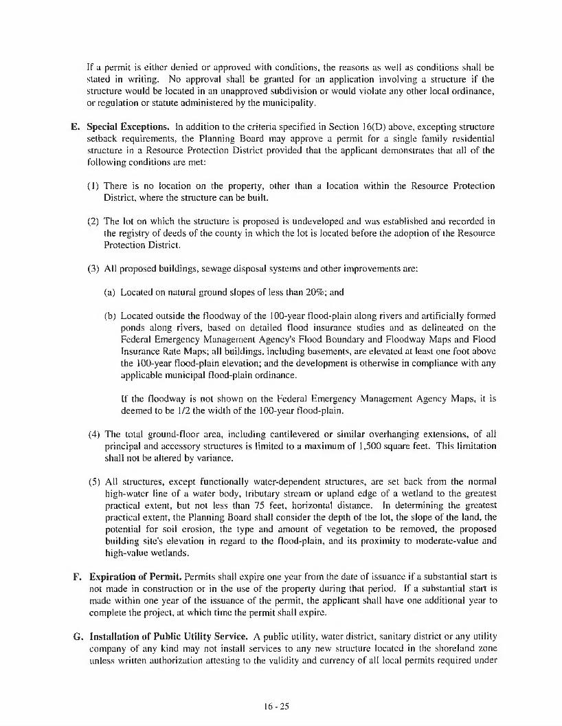
If a permit is either denied or approved with conditions, the reasons as well as conditions shall be stated in writing. No approval shall be granted for an application involving a structure if the structure would be located in an unapproved subdivision or would violate any other local ordinance, or regulation or statute administered by the municipality.
E. Special Exceptions. In addition to the criteria specified in Section 16(D) above, excepting structure setback requirements, the Planning Board may approve a permit for a single family residential structure in a Resource Protection District provided that the applicant demonstrates that all of the following conditions are met:
(1) There is no location on the property, other than a location within the Resource Protection District, where the structure can be built.
(2) The lot on which the structure is proposed is undeveloped and was established and recorded in the registry of deeds of the county in which the lot is located before the adoption of the Resource Protection District.
(3) All proposed buildings, sewage disposal systems and other improvements are:
(a) Located on natural ground slopes of less than 20%; and
(b) Located outside the flood way of the 100-year flood-plain along rivers and artificially formed ponds along rivers, based on detailed flood insurance studies and as delineated on the Federal Emergency Management Agency’s Flood Boundary and Floodway Maps and Flood Insurance Rate Maps; all buildings, including basements, are elevated at least one foot above the 100-year Hood-plain elevation; and the development is otherwise in compliance with any applicable municipal flood-plain ordinance.
If the floodway is not shown on the Federal Emergency Management Agency Maps, it is deemed to be 1/2 the width of the 100-year flood-plain.
(4) The total ground-floor area, including cantilevered or similar overhanging extensions, of all principal and accessory structures is limited to a maximum of 1,500 square feet. This limitation shall not be altered by variance.
(5) All structures, except functionally water-dependent structures, are set back from the normal high-water line of a water body, tributary stream or upland edge of a wetland to the greatest practical extent, but not less than 75 feet, horizontal distance. In determining the greatest practical extent, the Planning Board shall consider the depth of the lot, the slope of the land, the potential for soil erosion, the type and amount of vegetation to be removed, the proposed building site's elevation in regard to the flood-plain, and its proximity to moderate-value and high-value wetlands.
F. Expiration of Permit. Permits shall expire one year from the date of issuance if a substantial start is not made in construction or in the use of the property during that period. If a substantial start is made within one year of the issuance of the permit, the applicant shall have one additional year to complete the project, at which time the permit shall expire.
G. Installation of Public Utility Service. A public utility, water district, sanitary district or any utility company of any kind may not install services to any new structure located in the shoreland zone unless written authorization attesting to the validity and currency of all local permits required under
1 6 - 2 5
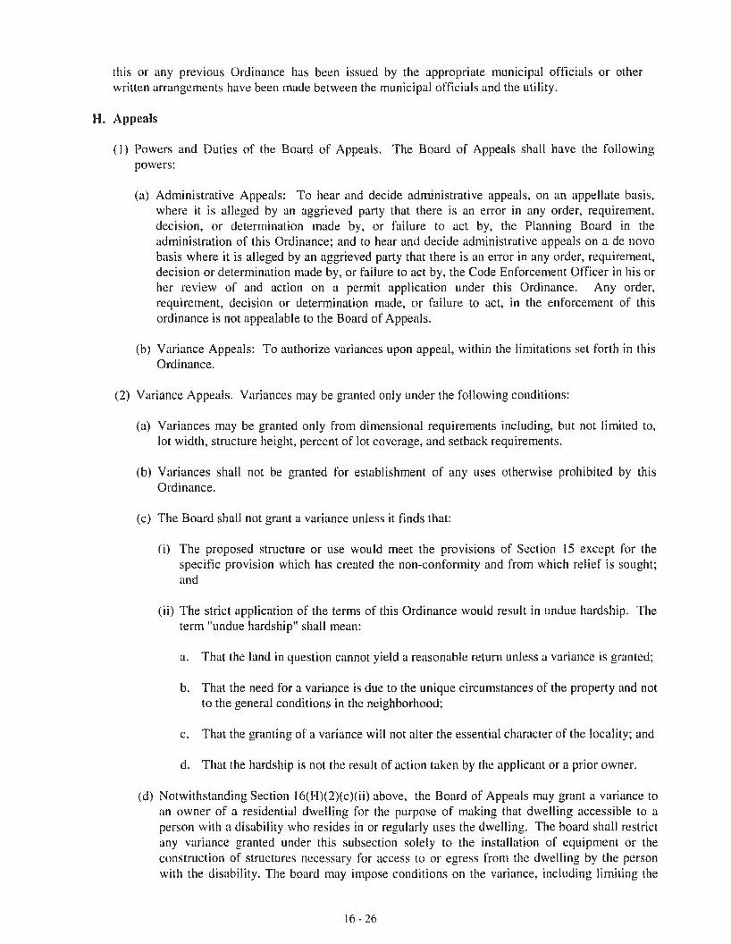
this or any previous Ordinance has been issued by the appropriate municipal officials or other written arrangements have been made between the municipal officials and the utility.
H. Appeals
(1) Powers and Duties of the Board of Appeals. The Board of Appeals shall have the followingpowers:
(a) Administrative Appeals: To hear and decide administrative appeals, on an appellate basis, where it is alleged by an aggrieved party that there is an error in any order, requirement, decision, or determination made by, or failure to act by, the Planning Board in the administration of this Ordinance; and to hear and decide administrative appeals on a de novo basis where it is alleged by an aggrieved party that there is an error in any order, requirement, decision or determination made by, or failure to act by, the Code Enforcement Officer in his or her review of and action on a permit application under this Ordinance. Any order, requirement, decision or determination made, or failure to act, in the enforcement of this ordinance is not appealable to the Board of Appeals.
(b) Variance Appeals: To authorize variances upon appeal, within the limitations set forth in this Ordinance.
(2) Variance Appeals. Variances may be granted only under the following conditions:
(a) Variances may be granted only from dimensional requirements including, but not limited to, lot width, structure height, percent of lot coverage, and setback requirements.
(b) Variances shall not be granted for establishment of any uses otherwise prohibited by this Ordinance.
(c) The Board shall not grant a variance unless it finds that:
(i) The proposed structure or use would meet the provisions of Section 15 except for the specific provision which has created the non-conformity and from which relief is sought; and
(ii) The strict application of the terms of this Ordinance would result in undue hardship. The term "undue hardship" shall mean:
a. That the land in question cannot yield a reasonable return unless a variance is granted;
b. That the need for a variance is due to the unique circumstances of the property and not to the general conditions in the neighborhood;
c. That the granting of a variance will not alter the essential character of the locality; and
d. That the hardship is not the result of action taken by the applicant or a prior owner.
(d) Notwithstanding Section 16(H)(2)(c)(ii) above, the Board of Appeals may grant a variance to an owner of a residential dwelling for the purpose of making that dwelling accessible to a person with a disability who resides in or regularly uses the dwelling. The board shall restrict any variance granted under this subsection solely to the installation of equipment or the construction of structures necessary for access to or egress from the dwelling by the person with the disability. The board may impose conditions on the variance, including limiting the
1 6 - 2 6

variance to the duration of the disability or to the time that the person with the disability lives in the dwelling. The term “structures necessary for access to or egress from the dwelling" shall include railing, wall or roof systems necessary for the safety or effectiveness of the structure,
(e) The Board of Appeals shall limit any variances granted as strictly as possible in order to ensure conformance with the purposes and provisions of this Ordinance to the greatest extent possible, and in doing so may impose such conditions to a variance as it deems necessary. The party receiving the variance shall comply with any conditions imposed.
(0 A copy of each variance request, including the application and all supporting information supplied by the applicant, shall be forwarded by the municipal officials to the Commissioner of the Department of Environmental Protection at least twenty (20) days prior to action by the Board of Appeals. Any comments received from the Commissioner prior to the action by the Board of Appeals shall be made part of the record and shall be taken into consideration by the Board of Appeals.
(3) Administrative Appeals
When the Board of Appeals reviews a decision of the Code Enforcement Officer the Board of Appeals shall hold a “de novo” hearing. At this time the Board may receive and consider new evidence and testimony, be it oral or written. When acting in a “de novo” capacity the Board of Appeals shall hear and decide the matter afresh, undertaking its own independent analysis of evidence and the law, and reaching its own decision.
When the Board of Appeals hears a decision of the Planning Board, it shall hold an appellate hearing, and may reverse the decision of the Planning Board only upon finding that the decision was contrary to specific provisions of the Ordinance or contrary to the facts presented to the Planning Board. The Board of Appeals may only review the record of the proceedings before the Planning Board. The Board Appeals shall not receive or consider any evidence which was not presented to the Planning Board, but the Board of Appeals may receive and consider written or oral arguments. If the Board of Appeals determines that the record of the Planning Board proceedings are inadequate, the Board of Appeals may remand the matter to the Planning Board for additional fact finding.
(4) Appeal Procedure
(a) Making an Appeal
(i) An administrative or variance appeal may be taken to the Board of Appeals by an aggrieved party from any decision of the Code Enforcement Officer or the Planning Board, except for enforcement-related matters as described in Section 16(H)(1)(a) above. Such an appeal shall be taken within thirty (30) days of the date of the official, written decision appealed from, and not otherwise, except that the Board, upon a showing of good cause, may waive the thirty (30) day requirement.
(ii) Applications for appeals shall be made by filing with the Board of Appeals a written notice of appeal which includes:
a. A concise written statement indicating what relief is requested and why the appeal or variance should be granted.
16-27
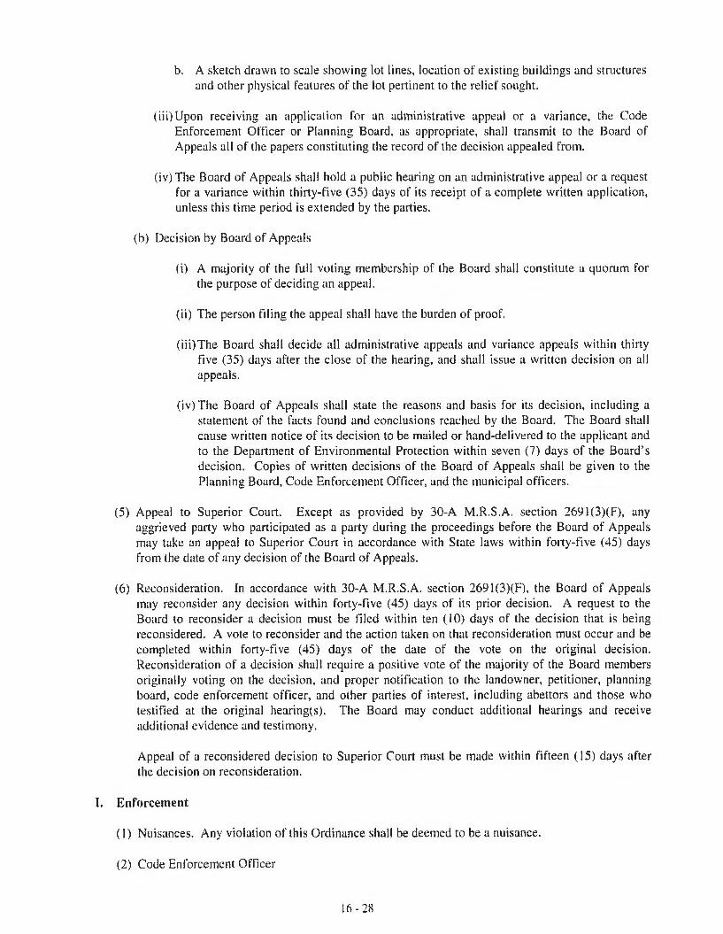
b. A sketch drawn to scale showing lot lines, location of existing buildings and structures and other physical features of the lot pertinent to the relief sought.
(iii) Upon receiving an application for an administrative appeal or a variance, the Code Enforcement Officer or Planning Board, as appropriate, shall transmit to the Board of Appeals all of the papers constituting the record of the decision appealed from.
(iv) The Board of Appeals shall hold a public hearing on an administrative appeal or a request for a variance within thirty-five (35) days of its receipt of a complete written application, unless this time period is extended by the parties.
(b) Decision by Board of Appeals
(i) A majority of the full voting membership of the Board shall constitute a quorum for the purpose of deciding an appeal.
(ii) The person filing the appeal shall have the burden of proof.
(iii) The Board shall decide all administrative appeals and variance appeals within thirty five (35) days after the close of the hearing, and shall issue a written decision on all appeals.
(iv) The Board of Appeals shall state the reasons and basis for its decision, including a statement of the facts found and conclusions reached by the Board. The Board shall cause written notice of its decision to be mailed or hand-delivered to the applicant and to the Department of Environmental Protection within seven (7) days of the Board’s decision. Copies of written decisions of the Board of Appeals shall be given to the Planning Board, Code Enforcement Officer, and the municipal officers.
(5) Appeal to Superior Court. Except as provided by 30-A M.R.S.A. section 2691(3)(F), any aggrieved party who participated as a party during the proceedings before the Board of Appeals may take an appeal to Superior Court in accordance with State laws within forty-five (45) days from the date of any decision of the Board of Appeals.
(6) Reconsideration, in accordance with 30-A M.R.S.A. section 2691 (3)(F), the Board of Appeals may reconsider any decision within forty-five (45) days of its prior decision. A request to the Board to reconsider a decision must be filed within ten (10) days of the decision that is being reconsidered. A vote to reconsider and the action taken on that reconsideration must occur and be completed within forty-five (45) days of the date of the vote on the original decision. Reconsideration of a decision shall require a positive vote of the majority of the Board members originally voting on the decision, and proper notification to the landowner, petitioner, planning board, code enforcement officer, and other parties of interest, including abettors and those who testified at the original hearing(s). The Board may conduct additional hearings and receive additional evidence and testimony.
Appeal of a reconsidered decision to Superior Court must be made within fifteen (15) days after the decision on reconsideration.
I. Enforcement
(1) Nuisances. Any violation of this Ordinance shall be deemed to be a nuisance.
(2) Code Enforcement Officer
16-28

(a) It shall be the duty of the Code Enforcement Officer to enforce the provisions of this Ordinance- If the Code Enforcement Officer shall find that any provision of this Ordinance is being violated, he or she shall notify in writing the person responsible for such violation, indicating the nature of the violation and ordering the action necessary to correct it, including discontinuance of illegal use of land, buildings or structures, or work being done, removal of illegal buildings or structures, and abatement of nuisance conditions. A copy of such notices shall be submitted to the municipal officers and be maintained as a permanent record.
(b) The Code Enforcement Officer shall conduct on-site inspections to insure compliance with all applicable laws and conditions attached to permit approvals. The Code Enforcement Officer shall also investigate all complaints of alleged violations of this Ordinance.
(c) The Code Enforcement Officer shall keep a complete record of all essential transactions of the office, including applications submitted, permits granted or denied, variances granted or denied, revocation actions, revocation of permits, appeals, court actions, violations investigated, violations found, and fees collected. On a biennial basis, a summary of this record shall be submitted to the Director of the Bureau of Land and Water Quality within the Department of Environmental Protection.
(3) Legal Actions. When the above action does not result in the correction or abatement of the violation or nuisance condition, the Municipal Officers, upon notice from the Code Enforcement Officer, are hereby directed to institute any and all actions and proceedings, either legal or equitable, including seeking injunctions of violations and the imposition of fines, that may be appropriate or necessary to enforce the provisions of this Ordinance in the name of the municipality. The municipal officers, or their authorized agent, are hereby authorized to enter into administrative consent agreements for the purpose of eliminating violations of this Ordinance and recovering fines without Court action. Such agreements shall not allow an illegal structure or use to continue unless there is clear and convincing evidence that the illegal structure or use was constructed or conducted as a direct result of erroneous advice given by an authorized municipal official and there is no evidence that the owner acted in bad faith, or unless the removal of the structure or use will result in a threat or hazard to public health and safety or will result in substantial environmental damage.
(4) Fines. Any person, including but not limited to a landowner, a landowner's agent or a contractor, who violates any provision or requirement of this Ordinance shall be penalized in accordance with 30-A, M.R.S.A. section 4452.
NOTE: Current penalties include fines of not less than $100 nor more than $2500 per violation for each day that the violation continues. However, in a resource protection district the maximum
______ penalty is increased to $5000 (38 M.R.S.A. section 4452). ______
17. Definitions.
Except where specifically defined herein, all words used in this Code shall carry their customary meanings. Words used in the present tense include the future, and the plural includes the singular; the word "lot" includes the word "plot"; the word "building" includes the word "structure"; the word “may” shall be permissive; the word "shall" is always mandatory; "occupied" or "used" shall be considered as though followed by the words "or intended, arranged, or designed to be used or occupied."
Definitions apply to all Land Use Ordinances unless otherwise specified.
Abutting Property: Any lot which is physically contiguous with the subject lot even if only at a
16-29

point and any lot which is located directly across a street or right-of-way from the subject lot such that the extension of the side lot lines of the subject lot would touch or enclose the abutting property.
Accessory Building: A detached, subordinate building, the use of which is clearly incidental and related to that of the principal building or use of the land, and which is located on the same lot as that of the principal building or use.
Accessory structure or use - a use or structure which is incidental and subordinate to the principal use or structure. Accessory uses, when aggregated, shall not subordinate the principal use of the lot. A deck or similar extension of the principal structure or a garage attached to the principal structure by a roof or a common wall is considered part of the principal structure.
Accessory use: A use customarily incidental and subordinate to the principal building or use and located on the 'same lot with such principal building or use. Such use shall include one accessory apartment that is clearly a subordinate unit related to the main residence. Such unit shall not be counted as a second whole unit for the purposes of zoning, however adequate off street parking shall be required and all requirements of the State of Maine Plumbing Code shall be met.
Addition: Any proposed change which increases the size of a building.
Adjacent Grade: Means the natural elevation of the ground surface prior to construction next to the proposed walls of a structure.
Affordable Housing: Housing units which will meet the sales price and/or rental targets established by the U.S, Department of Housing and Urban Development for housing affordability.
Aggrieved party - an owner of land whose property is directly or indirectly affected by the granting or denial of a permit or variance under this Ordinance; a person whose land abuts land for which a permit or variance has been granted; or any other person or group of persons who have suffered particularized injury as a result of the granting or denial of such permit or variance.
Agriculture - the production, keeping or maintenance for sale or lease, of plants and/or animals, including but not limited to: forages and sod crops; grains and seed crops; dairy animals and dairy products; poultry and poultry products; livestock; fruits and vegetables; and ornamental and green-house products. Agriculture does not include forest management and timber harvesting activities.
Alteration: A change, addition, or modification, requiring construction, including any change in the location of structural members of buildings such as bearing walls, columns, beams, or girders which would alter or affect any exterior architectural features.
Antenna: A system of electrical conductors that emit or receive radio waves, including microwave dishes.
Applicant: The person applying for subdivision approval under these regulations.
Aquaculture - the growing or propagation of harvestable freshwater, estuarine, or marine plant or animalspecies.
Area of Special Flood Hazard: The land in the floodplain having a one percent or greater chance of flooding in any given year as specifically identified in the Flood Insurance Study cited in Article 1 of the Flood Plain Management Ordinance.
16-30

Arterial: A controlled access road or a street or road with traffic signals at important intersections and/or stop signs on side streets or which is functionally classified by the Maine Department of Transportation as an arterial.
Attic: The unfinished portion or portions of a building which are located immediately below and wholly or partly within the roof framing.
Automobile Graveyard: A yard, field, or other area used as a place of storage for three or more unserviceable, discarded, worn-out or junked automobiles.
Average Daily Traffic (ADT): The average number of vehicles per day that enter and exit the premises or travel over a specific section of road.
Backlot: A lot that has no frontage on a road, street or private way. Backlots shall not be permitted in the Town of Pittsfield.
Banner: Any sign of lightweight fabric or similar material that is mounted to a pole or a building by a frame at one or more edges. National, state or municipal flags, or the official flag of any institution or business shall not be considered a banner.
Basal Area - the area of cross-section of a tree stem at 4 1/2 feet above ground level and inclusive of bark.
Base Flood: The flood having a one percent chance of being equaled or exceeded in any given year, commonly called the 100-year flood.
Basement - any portion of a structure with a floor-to-ceiling height of 6 feet or more and having more than 50% of its volume below the existing ground level.
Billboard: A structure, either free standing or attached to a building, the surface of which is available for hire for advertising purposes.
Boarding house: A building other than a hotel or restaurant where meals or lodging are regularly furnished by pre-arrangement for compensation.
Boat Launching Facility - a facility designed primarily for the launching and landing of watercraft, and which may include an access ramp, docking area, and parking spaces for vehicles and trailers.
Buffer Area: A part of a property or an entire property, which is not built upon and is specifically intended to separate and thus minimize the effects of a land use activity (e.g., noise, dust, visibility, glare, etc.) on adjacent properties or on sensitive natural resources.
Building: Any permanent structure, having one or more floors and a roof, which is used for the housing or enclosure of persons, animals or property. When any portion thereof is separated by a division wall without opening, then each such portion shall be deemed a separate building.
Building Height: The vertical distance measured from the mean elevation of the finished lot grade along the street yard face of the structure to the highest point of fiat roofs; to the mean height level between the eaves and the ridges of gable, gambrel, hip, and pitch roofs; or to the deck line of mansard roofs.
Building Width: The minimum horizontal dimension of the principal part of the building. The width shall not include outside porches not used as normal living space.
16-31

Business and Professional Offices: Offices for the conduct of business which involve no sales of products available on the premises, except those pertaining to the profession, or storage of materials or equipment which are used off the premises. The following uses are not considered business and professional offices:
1) Distribution facilities2) Sales offices involving on-premises display and sales of materials3) Offices of building contractors involving the storage of materials or equipment
Campground - any area or tract of land to accommodate two (2) or more parties in temporary living quarters, including, but not limited to tents, recreational vehicles or other shelters.
Canopy - the more or less continuous cover formed by tree crowns in a wooded area.
Capital Improvements Program (CIP): The municipality's proposed schedule of future projects listed in order of construction priority together with cost estimates and the anticipated means of financing each project.
Capital Investment Plan: The portion of the comprehensive plan that identifies the projects for consideration for inclusion within the capital improvements program, together with an estimate of the order of magnitude for the cost of each project.
Certificate of Compliance: A document signed by the Code Enforcement Officer stating that a structure is in compliance with all of the provisions of this Ordinance.
Change from One Category of Nonresident Use to Another Category of Nonresidential Use: A change in the type of occupancy of a nonresidential building or structure, or a portion thereof, such that the basic type of use is changed, such as from retail to office or storage to a restaurant, but not including a change in the occupants.
Charitable/Benevolent Association: A non-profit organization that is not organized or operated for the purpose of carrying on a trade or business. No part of its net earnings may benefit any member of the association. The purpose shall be to provide religious, social, physical, recreational and/or benevolent benefits to its members/associates.
Code Enforcement Officer: A person appointed by the municipal officers to perform the inspection, licensing, and enforcement duties required by a particular statute or ordinance.
^Commercial use - the use of lands, buildings, or structures, other than a "home occupation," defined below, the intent and result of which activity is the production of income from the buying and selling of goods and/or services, exclusive of rental of residential buildings and/or dwelling units. The term “commercial use” shall not include medical marijuana dispensaries or methadone clinics, which uses shall not be allowed in any shoreland zoning district.
Common Open Space: Land within or related to a subdivision, not individually owned or within an individual lot, which is designed and intended for the common use or enjoyment of the residents of the development or the general public, it may include complementary structures and improvements, typically used for maintenance and operation of the open space, such as for outdoor recreation.
Comprehensive Plan: A document or interrelated documents adopted by the Legislative Body, containing an inventory and analysis of existing conditions, a compilation of goals for the development of the community, an expression of policies for achieving these goals, and a strategy for implementation of the policies.
16-32
Corner Lot: A lot abutting two or more streets at their intersection provided that the comer of such intersection shall have an angle of 135 degrees or less, measured on the lot side. Such comer lots shall be deemed to have two front yard setbacks.
Coverage: That percentage of the plot or lot area covered by the building area.
Curb Cut: The opening along the curb line or street right-of-way line at which point vehicles may enter or leave the street.
Day Care Center: A home or other facility used generally to provide day care services or baby-sitting services for thirteen (13) or more children. This use shall be a principal use and shall require a conditional use approval and site plan approval by the Planning Board.
Day Care Home: A single family home used generally to provide day care services or baby-sitting services for six (6) or fewer children. This shall be considered a home occupation.
Day Care Home, Class A: A home used generally to provide day care services or baby-sitting services for more than six (6) but twelve (12) or fewer children. This use shall be an accessory to the residential use but shall require a conditional use approval from the Planning Board.
DBH - the diameter of a standing tree measured 4.5 feet from ground level.
Density: The number of dwelling units per acre of land.
Developed Area: Any area on which a site improvement or change is made, including buildings, landscaping, parking areas, and streets.
Development: Means any change caused by individuals or entities to improved or unimproved real estate, including but not limited to the construction of buildings or other structures; the construction of additions or substantial improvements to buildings or other structures; mining, dredging, Filling, grading, paving, excavation, drilling operations or storage of equipment or materials; and the storage, deposition, or extraction of materials, public or private sewage disposal systems or water supply facilities or alteration of the land, water or vegetation, or the addition or alteration of structures or other construction not naturally occurring.
Dimensional requirements - numerical standards relating to spatial relationships including but not limited to setback, lot area, shore frontage and height.
Direct Watershed of a Great Pond: That portion of the watershed that drains directly to the great pond without first passing through an upstream great pond. For the purposes of these regulations, the watershed boundaries shall be as delineated in the comprehensive plan. Due to the scale of the map in the comprehensive plan there may be small inaccuracies in the delineation of the watershed boundary. Where there is a dispute as to exact location of a watershed boundary, the Board or its designee and the applicant shall conduct an on-site investigation to determine where the drainage divide lies. If the Board and the applicant can not agree on the location of the drainage divide based on the on-site investigation, the burden of proof shall lie with the applicant to provide the Board with information from a registered land surveyor showing where the drainage divide lies.
Disability - any disability, infirmity, malformation, disfigurement, congenital defect or mental condition caused by bodily injury, accident, disease, birth defect, environmental conditions or illness; and also includes the physical or mental condition of a person which constitutes a substantial handicap as determined by a physician or in the case of mental handicap, by a psychiatrist or psychologist, as well as
1 6 - 3 3
any other health or sensory impairment which requires special education, vocational rehabilitation or related services.
Driveway - a vehicular access-way less than five hundred (500) feet in length serving two single-family dwellings or one two-family dwelling, or less.
Drive-through Service: A retail or service activity in which the customer does not leave his/her motor vehicle to complete the transaction, and which complies with the following requirements:
1) A separate, defined stacking lane is provided which will accommodate a minimum of five vehicles.
2) The transaction occurs at a defined service window or terminal.3) The service window or terminal is located a minimum of sixty (60) feet, with the maximum
to be established at Site Plan Review, from the point of egress onto the nearest street right- of-way.
4) The architectural design of the service window or terminal shall be compatible with the principal use.
Dwelling: A building designed or used as the living quarters for one or more families. The term shall not be deemed to include a hotel, motel, rooming house, mobile home, or trailer, but shall include a modular housing unit consisting of two or more units of which neither unit is a complete dwelling unit and which is constructed in accordance with the BOCA Building Code.
Dwelling: Multi-Family: A single building designed for or occupied by three (3) or more families with separate housekeeping and cooking facilities for each.
Dwelling: Single-Family: A detached residence for, or occupied by, (1) family only.
Dwelling: Two Family: A residence designed for or occupied by two (2) families only, with separate housekeeping and cooking facilities for each.
Dwelling Unit: A room or suite of rooms used as a habitation which is separate from other such rooms or suites of rooms, and which contains independent living, cooking, and sleeping facilities; includes single family houses, and the units in a duplex, apartment house, multifamily dwellings, and residential condominiums.(For shoreland zone, see Residential Dwelling Unit).
Elevated Building: A non-basement building
a. built, in the case of a building in Zones AE or A, to have the top of the elevated floor elevated above the ground level by means of pilings, columns, post, piers, or "stilts;" and
b. adequately anchored so as not to impair the structural integrity of the building during a flood of up to one foot above the magnitude of the base flood.
In the case of Zones AE or A, Elevated Building also includes a building elevated by means of fill or solid foundation perimeter walls with hydraulic openings sufficient to facilitate the unimpeded movement of flood waters.
Elevation Certificate: An official form (FEMA Form 81-31, 03/97, as amended) that:a. is used to verify compliance with the floodplain management regulations of the National Flood Insurance Program; and,
16-34

b. is required for purchasing flood insurance.
Emergency operations - operations conducted for the public health, safety or general welfare, such as protection of resources from immediate destruction or loss, law enforcement, and operations to rescue human beings, property and livestock from the threat of destruction or injury.
Engineered Subsurface Waste Water Disposal System: A subsurface waste water disposal system designed, installed, and operated as a single unit to treat 2,000 gallons per day or more; or any system designed to treat waste water with characteristics significantly different from domestic waste water.
Enlargement or Expansion of a Structure: An increase of the building footprint and/or increase in the height of the structure beyond its present highest point. Alterations of existing buildings which are required in order to meet the requirements of the Americans with Disabilities Act (ADA) and/or the State Fire Code are not considered to be enlargements or expansions of a structure and are not required to meet otherwise applicable setback requirements, provided the alterations are the minimum necessary to satisfy the ADA and/or the latest NFPA 101 Life Safety Code.
Essential services - gas, electrical or communication facilities; steam, fuel, electric power or water transmission or distribution lines, towers and related equipment; telephone cables or lines, poles and related equipment; gas, oil, water, slurry or other similar pipelines; municipal sewage lines, collection or supply systems; and associated storage tanks. Such systems may include towers, poles, wires, mains, drains, pipes, conduits, cables, fire alarms and police call boxes, traffic signals, hydrants and similar accessories, but shall not include service drops or buildings which are necessary for the furnishing of such services.
Expansion of a structure - an increase in the floor area or volume of a structure, including all extensions such as, but not limited to: attached decks, garages, porches and greenhouses. Increases which are required in order to meet the requirements of the Americans with Disabilities Act and/or the State Fire Code are not considered to be enlargements or expansions of use, except in the shoreland zone where a variance is required to exceed the expansion limitations.
Expansion of use - the addition of one or more months to a use’s operating season; or the use of more floor area or ground area devoted to a particular use.
Exterior Architectural Features: Elements of a building’s outside appearance including but not limited to, architectural character, general composition and general appearance of exterior siding, exterior trim, change in size of door and window openings, roofs, porches, signs, fire escapes, and accessory buildings and solar facilities.
Family - one or more persons occupying a premises and living as a single housekeeping unit.
Final Plan: The final drawings on which the applicant's plan of subdivision is presented to the Board for approval and which, if approved, may be recorded at the Registry of Deeds.
Fisheries, Significant Fisheries: Areas identified by a governmental agency such as the Maine Department of Inland Fisheries and Wildlife, Atlantic Salmon Authority, or Maine Department of Marine Resources as having significant value as fisheries and any areas so identified in the municipality's comprehensive plan.
Flag: Any fabric or bunting containing distinctive colors, patterns, or symbols, used as a symbol of a government, political subdivision, or other entity.
16-35

Flood or Flooding:
a. A general and temporary condition of partial or complete inundation of normally dry land areas from:
L The overflow of inland or tidal waters.
2. The unusual and rapid accumulation or runoff of surface waters from any source.
b. The collapse or subsidence of land along the shore of a lake or other body of water as a result of erosion or undermining caused by waves or currents of water exceeding anticipated cyclical levels or suddenly caused by an unusually high water level in a natural body of water, accompanied by a severe storm, or by an unanticipated force of nature, such as flash flood or an abnormal tidal surge, or by some similarly unusual and unforeseeable event which results in flooding as defined in paragraph a.l. of this definition.
Flood Elevation Study: An examination, evaluation and determination of flood hazards and, if appropriate, corresponding water surface elevations.
Flood Insurance Rate Map: The official map on which the Federal Emergency Management Agency has delineated both the areas of special flood hazards and the risk premium zones applicable to the Town of Pittsfield, Maine.
Flood Insurance Rate Map (FIRM): An official map of a community, on which the Federal Insurance Administrator has delineated both the special hazard areas and the risk premium zones applicable to the community.
Flood Insurance Study: See Flood Elevation Study.
Floodplain Management: The operation of an overall program of corrective and preventive measures for reducing flood damage, including but not limited to emergency preparedness plans, flood control works, and floodplain management regulations.
Floodplain Management Regulations: Zoning ordinances, subdivision regulations, building codes, health regulations, special purpose ordinances (such as a floodplain ordinance, grading ordinance, and erosion control ordinance) and other applications of police power. The term describes such state or local regulations, in any combination thereof, which provide standards for the purpose of flood damage prevention and reduction.
Floodplain or Flood-prone Area: Any land area susceptible to being inundated by water from any source (see flooding).
Floodproofing: Any combination of structural and non-structural additions, changes, or adjustments to structures which reduce or eliminate flood damage to real estate or improved real property, water and sanitary facilities, structures and contents.
Floodway - the channel of a river or other watercourse and adjacent land areas that must be reserved in order to discharge the 100-year flood without cumulatively increasing the water surface elevation by more than one foot in height.
Floodway Encroachment Lines: The lines marking the limits of floodways on federal, state, and local floodplain maps.
16-36
Floor area - the sum of the horizontal areas of the floor(s) of a structure enclosed by exterior walls, plus the horizontal area of any unenclosed portions of a structure such as porches and decks.
Floor Area Ratio: A measure of the intensity of the use of a piece of property determined by dividing the sum of the gross floor area of all floors of all principal buildings or structures by the total area of the parcel.
Footprint: Area of the ground covered by a structure, including the foundation and all areas enclosed by exterior walls and footings.
Forest management activities - timber cruising and other forest resource evaluation activities, pesticide or fertilizer application, management planning activities, timber stand improvement, pruning, regeneration of forest stands, and other similar or associated activities, exclusive of timber harvesting and the construction, creation or maintenance of roads.
Forested wetland - a freshwater wetland dominated by woody vegetation that is six (6) meters tall (approximately twenty (20) feet) or taller.
Foundation - the supporting substructure of a building or other structure, excluding wooden sills and post supports, but including basements, slabs, frost walls, or other base consisting of concrete, block, brick or similar material.
Freeboard: Means a factor of safety usually expressed in feet above a flood level for purposes of floodplain management. Freeboard tends to compensate for the many unknown factors, such as wave action, bridge openings, and the hydrological effect of urbanization of the watershed, that could contribute to flood heights greater than the height calculated for a selected size flood and floodway conditions.
Freshwater wetland - freshwater swamps, marshes, bogs and similar areas, other than forested wetlands, which are:
1. Of ten or more contiguous acres; or of less than 10 contiguous acres and adjacent to a surface water body, excluding any river, stream or brook, such that in a natural state, the combined surface area is in excess of 10 acres; and
2. Inundated or saturated by surface or ground water at a frequency and for a duration sufficient to support, and which under normal circumstances do support, a prevalence of wetland vegetation typically adapted for life in saturated soils.
Freshwater wetlands may contain small stream channels or inclusions of land that do not conform to the criteria of this definition.
Frontage: The horizontal, straight-line distance between the intersections of the side lot lines with the road right-of-way.
Functionally Dependent Use: A use which cannot perform its intended purpose unless it is located or carried out in close proximity to water. The term includes only docking facilities, port facilities that are necessary for the loading and unloading of cargo or passengers, and ship building and ship repair facilities, but does not include long-term storage or related manufacturing facilities.
Functionally water-dependent uses - those uses that require, for their primary purpose, location on submerged lands or that require direct access to, or location in, coastal or inland waters and that can not be located away from these waters. The uses include, but are not limited to commercial and recreational
1 6 - 3 7
fishing and boating facilities, excluding recreational boat storage buildings, finfish and shellfish processing, fish storage and retail and wholesale fish marketing facilities, waterfront dock and port facilities, shipyards and boat building facilities, marinas, navigation aids, basins and channels, retaining walls, industrial uses dependent upon water-borne transportation or requiring large volumes of cooling or processing water that can not reasonably be located or operated at an inland site, and uses that primarily provide general public access to coastal or inland waters.
Great pond - any inland body of water which in a natural state has a surface area in excess of ten acres, and any inland body of water artificially formed or increased which has a surface area in excess of thirty (30) acres except for the purposes of this Ordinance, where the artificially formed or increased inland body of water is completely surrounded by land held by a single owner.
Ground cover - small plants, fallen leaves, needles and twigs, and the partially decayed organic matter of the forest floor.
Height of a structure - the vertical distance between the mean original (prior to construction) grade at the downhill side of the structure and the highest point of the structure, excluding chimneys, steeples, antennas, and similar appurtenances that have no floor area.
High Intensity Soil Survey: A map prepared by a Certified Soil Scientist, identifying the soil types down to one eighth of an acre or less at a scale equivalent to the subdivision plan submitted. The soils shall be identified in accordance with the National Cooperative Soil Survey. The map shall show the location of all test pits used to identify the soils, and shall be accompanied by a log of each sample point identifying the textural classification and the depth to seasonal high water table or bedrock at that location. Single soil test pits and their evaluation for suitability for subsurface waste water disposal systems shall not be considered to constitute high intensity soil surveys.
Historic or Archaeological Resources: Areas identified by a governmental agency such as the Maine Historic Preservation Commission as having significant value as an historic or archaeological resource and any areas identified in the municipality’s comprehensive plan.
Historic Structure: Any structure that is:
a. Listed individually in the National Register of Historic Places (a listing maintained by the Department of Interior) or preliminarily determined by the Secretary of the Interior as meeting the requirements for individual listing on the National Register;
b. Certified or preliminarily determined by the Secretary of the Interior as contributing to the historical significance of a registered historic district or a district preliminarily determined by the Secretary of the Interior to qualify as a registered historic district;
c. Individually listed on a state inventory of historic places in states with historic preservation programs which have been approved by the Secretary of the Interior; or
d. Individually listed on a local inventory of historic places in communities with historic preservation programs that have been certified either:
1. By an approved state program as determined by the Secretary of the Interior, or
2. Directly by the Secretary of the Interior in states without approved programs.
1 6 - 3 8
Home occupation - an occupation or profession which is customarily conducted on or in a residential structure or property and which is 1) clearly incidental to and compatible with the residential use of the property and surrounding residential uses; and 2) which employs no more than two (2) persons other than family members residing in the home.
Hotel/Motel: A building or group of buildings containing six of more guest rooms and offering lodging accommodations (which may include such accessory services as food and beverages, meeting rooms, entertainment and recreation) to transient guests. A hotel/motel may provide kitchens or kitchenettes in guestrooms and will not, as a result, be considered a dwelling unit under this Ordinance, as long as the hotel/motel is occupied exclusively by transient guests. A transient guest is a person who occupies the hotel/motel for no more than 186 days in any 365-day period.
Household Pets: Those animals normally considered as household companions, and not including horses, cows, sheep, goats, mink, swine, chickens, turkeys or any animals raised for sale or for the sale of their products.
Impervious Coverage Ratio: A measure of the intensity of the use of a piece of property determined by dividing the total area of the site covered by impervious surface including roofs, parking lots, roads, access drives, service areas, paved drainage ways, and similar impervious surfaces by the total area of the parcel.
Impervious Surface: The area covered by buildings and associated constructed facilities, areas which have been or will be covered by a low-permeability material, such as asphalt or concrete, and areas such as gravel roads and unpaved parking areas, which have been or will be compacted through design or use to reduce their permeability. Common impervious surfaces include, but are not limited to, roof tops, walkways, patios, driveways, parking lots or storage areas, concrete or asphalt paving, gravel roads, packed earthen materials, and oiled, macadam, or other surfaces which similarly impede the natural infiltration of stormwater.
Increase in nonconformity of a structure - any change in a structure or property which causes further deviation from the dimensional standard(s) creating the nonconformity such as, but not limited to, reduction in water body, tributary stream or wetland setback distance, increase in lot coverage, or increase in height of a structure. Property changes or structure expansions which either meet the dimensional standard or which cause no further increase in the linear extent of nonconformance of the existing structure shall not be considered to increase nonconformity. For example, there is no increase in nonconformity with the setback requirement for water bodies, wetlands, or tributary streams if the expansion extends no further into the required setback area than does any portion of the existing nonconforming structure. Hence, a structure may be expanded laterally provided that the expansion extends no closer to the water body, tributary stream, or wetland than the closest portion of the existing structure from that water body, tributary stream, or wetland. Included in this allowance are expansions which in-fill irregularly shaped structures.
Individual private campsite - an area of land which is not associated with a campground, but which is developed for repeated camping by only one group not to exceed ten (10) individuals and which involves site improvements which may include but not be limited to a gravel pad, parking area, fire place, or tent platform.
Industrial - The assembling, fabrication, finishing, manufacturing, packaging or processing of goods, or the extraction of minerals.
Institutional - a non-profit or quasi-public use, or institution such as a church, library, public or private school, hospital, or municipally owned or operated building, structure or land used for public purposes.
16-39

Junk Yard: A lot or part thereof, exposed to the elements, which is used for the sale or for the storage for sale of second-hand products or materials, for the storage of any three or more automobiles or trucks which cannot pass the state inspection test in their existing condition.
Kennel: An establishment in which more than four (4) dogs or four (4) cats more than one year old are housed, bred, boarded, trained or sold.
Landscaped Buffer Strip: A landscaped area adjacent to and parallel with the front property line of a lot or parcel. The border strip may be crossed by drives, access roads or pedestrian ways but otherwise shall be maintained in a landscaped state. The border strip shall not be used for parking, the storage of materials, equipment or wastes or the display of any equipment, materials or products.
Level of Service: A description of the operating conditions a driver will experience while traveling on a particular street or highway calculated in accordance with the provisions of the Highway Capacity Manual, 1991 edition, published by the National Academy of Sciences, Transportation Research Board as amended from time to time. There are six levels of service ranging from Level of Service A, with free traffic flow and no delays to Level of Service F, with forced flow and congestion resulting in complete failure of the roadway.
Loading Area: A completely off-street space or berth on the same lot for the loading or unloading of freight carriers, having adequate ingress and egress to a public street or alley.
Locally Established Datum: Means, for purposes of this ordinance, an elevation established for a specific site to which all other elevations at the site are referenced. This elevation is generally not referenced to the National Geodetic Vertical Datum (NGVD) or any other established datum and is used in areas where Mean Sea Level data is too far from a specific site to be practically used.
Lot: A parcel of land in single ownership, or one leasehold, with ascertainable boundaries established by deed or instrument of record, or a segment of land ownership defined by lot boundary lines on a land subdivision plan duly approved by the Planning Board and recorded in the County Registry of Deeds.
Lot area - The area of land enclosed within the boundary lines of a lot, minus land below the normal high-water line of a water body or upland edge of a wetland and areas beneath roads serving more than two lots. Also a parcel of land in single ownership, or one leasehold, with ascertainable boundaries established by deed or instrument of record, or a segment of land ownership defined by lot boundary lines on a land subdivision plan duly approved by the Planning Board and recorded in the County Registry of Deeds.
Lot Lines: The lines bounding a lot. Wherever a lot abuts a street, the sideline of the street on the side abutting the lot shall constitute the lot line.
Lowest Floor: The lowest floor of the lowest enclosed area (including basement). An unfinished or Hood resistant enclosure, usable solely for parking of vehicles, building access or storage in an area other than a basement area is not considered a building's lowest floor, provided that such enclosure is not built so as to render the structure in violation of the applicable non-elevation design requirements described in Article VI of this ordinance.
Manufactured Home: A structure, transportable in one or more sections, which is built on a permanent chassis and is designed for use with or without a permanent foundation when connected to the required utilities. For floodplain management purposes the term manufactured home also includes park trailers, travel trailers, and other similar vehicles placed on a site for greater than 180 consecutive days.
1 6 - 4 0

Manufactured Home Park or Subdivision: A parcel (or contiguous parcels) of land divided into two or more manufactured home lots for rent or sale.
Manufactured Housing: A structural unit or units designed for occupancy and constructed in a manufacturing facility and transported, by the use of its own chassis or an independent chassis, to a building site. For the purposes of this Ordinance the term includes:
Mobile Homest. Units constructed after June 15, 1976 and commonly called “newer mobile homes” which the manufacturer certifies are constructed in compliance with the United States Department of Housing and Urban Development Standards, meaning structures transportable in one or more sections, which in the traveling mode are 14 body feet or more in width and are 750 or more square feet in size(not including any tongue) and which are built on a permanent chassis and designed to be used as dwellings, with or without permanent foundations, when connected to the required utilities including plumbing, heating, air conditioning or electrical systems contained in the unit.
Modular Homes2. Units commonly called “modular homes” which the manufacturer certifies are constructed
in compliance with Title 10, Ordinance 957, and rules adopted under that Ordinance, meaning structures transportable in one or more sections, which are not constructed on a permanent chassis and are designed to be used as dwellings on foundations when connected to the required utilities including plumbing, heating, air conditioning or electrical systems contained in the unit.
Marina - a business establishment having frontage on navigable water and, as its principal use, providing for hire offshore moorings or docking facilities for boats, and which may also provide accessory services such as boat and related sales, boat repair and construction, indoor and outdoor storage of boats and marine equipment, bait and tackle shops and marine fuel service facilities.
Market value - the estimated price a property will bring in the open market and under prevailing market conditions in a sale between a willing seller and a willing buyer, both conversant with the property and with prevailing general price levels.
Mean Sea Level: Means, for purposes of the National Flood Insurance Program, the National Geodetic Vertical Datum (NGVD) of 1929, or other datum, to which base flood elevations shown on a community's Flood Insurance Rate map are referenced.
3Medical marijuana dispensary: A “registered dispensary” as that term is defined by 22 M.R.S.A. Section 2422(6), as may be amended from time to time, including any location at which marijuana is cultivated by a registered dispensary pursuant to 22 M.R.S.A. Section 2428, as may be amended.
^Methadone Clinic: A clinic or similar facility that provides for the operation of substance abuse treatment programs to provide treatment for persons with heroin or other opiate addictions where the treatment provided includes administration or prescription of methadone or other opioid replacements (e.g., methadone, methadone hydrochloride or LAAM (levo-alpha-acetyl-methadol) for either detoxification or maintenance purposes, which treatment programs are typically licensed by the State of Maine Department of Health and Human Services Division of Licensing and Regulatory Services under 14-118 Code of Maine Regulations (Chapter 5), as may be amended from time to time.
Mineral exploration - hand sampling, test boring, or other methods of determining the nature or extent of mineral resources which create minimal disturbance to the land and which include reasonable measures to restore the land to its original condition.
16- 41
Mineral extraction - any operation within any twelve (12) month period which removes more than one hundred (100) cubic yards of soil, topsoil, loam, sand, gravel, clay, rock, peat, or other like material from its natural location and to transport the product removed, away from the extraction site.
Minimum lot width - the closest distance between the side lot lines of a lot. When only two lot lines extend into the shoreiand zone, both lot lines shall be considered to be side lot lines.
Minor Development: Means all development that is not new construction or a substantial improvement, such as repairs, maintenance, renovations, or additions, whose value is less than 50% of the market value of the structure. It also includes, but is not limited to: accessory structures as provided for in Article VIJ., mining, dredging, filling, grading, paving, excavation, drilling operations, storage of equipment or materials, deposition or extraction of materials, public or private sewage disposal systems or water supply facilities that do not involve structures; and non-structural projects such as bridges, dams, towers, fencing, pipelines, wharves, and piers.
Mobile Home Park: A contiguous parcel of land under unified ownership approved by the municipality for the placement of 3 or more manufactured homes. Individual home sites may be rented or leased.
Mobile Vending Unit: A vehicle, trailer, van, pushcart or portable structure which is temporarily located on private property for the purpose of operating a retail business or service business and removed from the site every Minor Development: Means all development that is not new construction or a substantial improvement, such as repairs, maintenance, renovations, or additions, whose value is less than 50% of the market value of the structure. It also includes, but is not limited to: accessory structures as provided for in Article VIJ., mining, dredging, filling, grading, paving, excavation, drilling operations, storage of equipment or materials, deposition or extraction of materials, public or private sewage disposal systems or water supply facilities that do not involve structures; and non-structural projects such as bridges, dams, towers, fencing, pipelines, wharves, and piers.
Mobile Home Park: A contiguous parcel of land under unified ownership approved by the municipality for the placement of 3 or more manufactured homes. Individual home sites may be rented or leased, day or seasonally, but which does not include such structures temporarily located on any particular private property for such purposes for less than one-half hour. It shall not include such uses as construction offices during the duration of a building project or sales as part of an approved farmers market, fair or similar event.
Multifamily Development: A subdivision which contains three or more dwelling units on land in common ownership, such as apartment buildings, condominiums or mobile home parks.
Multi-unit residential - a residential structure containing three (3) or more residential dwelling units.
Municipal Engineer: Any registered professional engineer hired or retained by the municipality, either as staff or on a consulting basis.
Municipality: The Town of Pittsfield.
National Geodetic Vertical Datum (NGVD): The national vertical datum, whose standard was established in 1929, which is used by the National Flood Insurance Program (NFIP). NGVD was based upon mean sea level in 1929 and also has been called “ 1929 Mean Sea Level (MSL).”
Native - indigenous to the local forests.
Natural Areas and Natural Communities, Unique Natural Areas and Natural Communities:
1 6 - 4 2
Areas identified by a governmental agency such as the Maine Department of Conservation Natural Areas Program as having significant value as a natural area and any areas so identified in the municipality’s comprehensive plan.
Net Acreage: The net area of any parcel or site generally suitable, in its natural state, for development and theoretically related to the natural capacity of the land to support a certain intensity of use. The net acreage shall be determined by subtracting unsuitable areas from the gross acreage of the parcel. The following original land areas shall be considered unsuitable and shall be deducted in the following order:
1. Fifteen percent (15%) of the total acreage of the parcel as an estimated allowance for new access roads and parking areas, whether or not the actual area devoted to these uses is greater or less than 15 percent.
2. Areas that are, because of existing land uses, natural features, or lack of access, isolated and unavailable for building purposes or for use in common with the remainder of the parcel, as determined by the Planning Board.
3. Areas within a floodway or 100-year flood hazard area, as shown on the Federal Flood Boundary and Floodway Map or Federal Flood Insurance Rate Map.
4. Areas characterized predominately by soils classified by the U.S. Soil Conservation Service as either a) “very poorly drained” or b) “poorly drained” and having a slope of less than three percent (3%).
5. Areas of rights-of-way and easements, except for new access roads deducted above and rights-of-way or easements for landscaped buffer strips and walking/bicycle paths not part of a street right-of-way.
6. Stream channels, as measured from the top of banks, and other surface water bodies, as measured from the high water mark.
7. Areas of 33 percent sustained slope or more. Slope areas of 20 to 33 percent shall also be deducted unless the developer can demonstrate to the Planning Board's satisfaction that these slopes will be used as part of the overall plan for the development, that they are stable for structures, if so utilized, and that any slope development will minimize soil erosion and comply with Maine State Plumbing Code.
8. Areas of un-reclaimed gravel or borrow pits.
9. Land in Resource Protection Districts.
10. Other areas that the Planning Board determines could not, in their natural state, be incorporated into conventional subdivision lots of the minimum required area.
No building or structure shall be sited in areas treated as 100 percent deductions from the parcel's gross area. Sitting of structures in areas treated as 50 percent deductions shall be discouraged but permitted where the applicant/developer demonstrates that measures will be taken to minimize erosion, sedimentation, and seasonal wetness, that these areas are stable for the sitting of structures and that proposed subsurface waste disposal systems are sited away from marginal soils and otherwise meet the State of Maine Subsurface Waste Disposal Rules.
Net Residential Acreage: The total acreage available for the subdivision, as shown on the proposed subdivision plan, minus the area for streets or access and the areas that are unsuitable for development.
16-43

Net Residential Density: The net residential acreage of a parcel of land divided by the minimum lot area per dwelling unit.
New Construction: Structures for which the "start of construction" commenced on or after the effective date of floodplain management regulations or other ordinances adopted by a community and includes any subsequent improvements to such structures.
New Structure or Structures: Includes any structure for which construction begins on or after September 23, 1988. The area included in the expansion of an existing structure is deemed to be a new structure.
Non-conforming condition - non-conforming lot, structure or use which is allowed solely because it was in lawful existence at the time this Ordinance or subsequent amendment took effect.
Non-conforming lot - a single lot of record which, at the effective date of adoption or amendment of this Ordinance, does not meet the area, frontage, or width requirements of the district in which it is located.
Non-conforming structure - a structure which does not meet any one or more of the following dimensional requirements; setback, height, or lot coverage, but which is allowed solely because it was in lawful existence at the time this Ordinance or subsequent amendments took effect.
Non-conforming use - use of buildings, structures, premises, land or parts thereof which is not allowed in the district in which it is situated, but which is allowed to remain solely because it was in lawful existence at the time this Ordinance or subsequent amendments took effect.
Normal high-water line - that line which is apparent from visible markings, changes in the character of soils due to prolonged action of the water or changes in vegetation, and which distinguishes between predominantly aquatic and predominantly terrestrial land. Areas contiguous with rivers and ponds that support non-forested wetland vegetation and hydric soils and that are at the same or lower elevation as the water level of the river or great pond during the period of normal high-water are considered part of the river or pond.
Nursing Home: Any dwelling in which three (3) or more aged, chronically ill, or incurable persons are housed and furnished with meals, and nursing care for compensation.
100-Year Flood: The highest level of flood that, on the average, has a one percent ( 1 %) chance of occurring in any given year.
Parking Space: Parking space shall mean an area of not less than 180 square feet, exclusive of drives or aisles giving access thereto, accessible from streets or aisles leading to streets and usable for the storage or parking of passenger vehicles. Parking space or access thereto shall be construed as to be usable year round.
Pennant: Any lightweight plastic, fabric, or other material, whether or not containing a message of any kind, suspended from a rope, wire, or string, usually in series, designed to move in the wind.
Person - an individual, corporation, governmental agency, municipality, trust, estate, partnership, association, two or more individuals having a joint or common interest, or other legal entity.
Planned Residential Unit Development: A development of land that is under unified control and is planned and developed as a whole in a single development operation of programmed series of
16-44
development stages. It may contain more than one principal structure on a lot and may include a mix of single family detached houses with Town houses and apartment buildings with common recreation areas and off-street parking.
Planning Board: The Planning Board of the Town of Pittsfield.
Preliminary Plan: The preliminary drawings indicating the proposed layout of the subdivision to be submitted to the Planning Board for its consideration.
Prime Agricultural Soils: Prime agricultural soils are those soils which have the least limitations for growing food and will produce the best yields with the least environmental damage.
Principal structure - a building other than one which is used for purposes wholly incidental or accessory to the use of another building or use on the same premises.
Principal use - a use other than one which is wholly incidental or accessory to another use on the same premises.
Public facility - any facility, including, but not limited to, buildings, property, recreation areas, and roads, which are owned, leased, or otherwise operated, or funded by a governmental body or public entity.
Public Improvement: Works of governmental units and public utilities, including but not limited to, lighting, sidewalks, street furniture, overhead utilities, buildings, tree planting programs, street signs, and traffic lights.
Public Sewer System: A common sewer controlled by a public, governmental authority.
Public Water System: A water supply system that provides water to at least 15 service connections or services water to at least 25 individuals daily for at least 30 days a year.
Recent floodplain soils - the following soil series as described and identified by the National Cooperative Soil Survey:
Fryeburg Hadley LimerickLovewell Medomak OndawaAlluvial Cornish CharlesPodunk Rumney SacoSuncook Sunday Winooski
Recharge Area: Area composed of permeable, porous material through which precipitation and surface water infiltrate and directly replenish groundwater in aquifers.
Recording Plan: An original of the Final Plan, suitable for recording at the Registry of Deeds and which need show only information relevant to the transfer of an interest in the property, and which does not show other information presented on the plan such as sewer and water line locations and sizes, culverts, and building lines.
Recreational facility - a place designed and equipped for the conduct of sports, leisure time activities, and other customary and usual recreational activities, excluding boat launching facilities.
Recreational vehicle - a vehicle or an attachment to a vehicle designed to be towed, and designed for temporary sleeping or living quarters for one or more persons, and which may include a pick-up camper,
1 6 - 4 5

travel trailer, tent trailer, camp trailer, and motor home. In order to be considered as a vehicle and not as a structure, the unit must remain with its tires on the ground, and must be registered with the State Division of Motor Vehicles.
Regulatory Floodway:
a. The channel of a river or other water course and the adjacent land areas that must be reserved in order to discharge the base flood without cumulatively increasing the water surface elevation more than one foot, and
b. when not designated on the community’s Flood Insurance Rate Map, it is considered to be the channel of a river or other water course and the adjacent land areas to a distance of one- half the width of the floodplain, as measured from the normal high water mark to the upland limit of the floodplain.
Replacement system - a system intended to replace: I.) an existing system which is either malfunctioning or being upgraded with no significant change of design flow or use of the structure, or 2.) any existing overboard wastewater discharge.
Reserved Affordable Housing: Affordable housing which is restricted by means of deed covenants, financing restrictions, or other binding long term methods to occupancy by households making 80% or less of the area median household income.
Residential dwelling unit - a room or group of rooms designed and equipped exclusively for use as permanent, seasonal, or temporary living quarters for only one family at a time, and containing cooking, sleeping and toilet facilities. The term shall include mobile homes and rental units that contain cooking, sleeping, and toilet facilities regardless of the time-period rented. Recreational vehicles are not residential dwelling units.
Residual basal area - the average of the basal area of trees remaining on a harvested site.
Retail Business: A business establishment engaged in the sale, rental, or lease of goods or services to the ultimate consumer for direct use or consumption and not for resale.
Riprap - rocks, irregularly shaped, and at least six (6) inches in diameter, used for erosion control and soil stabilization, typically used on ground slopes of two (2) units horizontal to one (1) unit vertical orless.
River - a free-flowing body of water including its associated floodplain wetlands from that point at which it provides drainage for a watershed of twenty five (25) square miles to its mouth.
Riverine: Means relating to, formed by, or resembling a river (including tributaries), stream, brook, etc.
Road - a route or track consisting of a bed of exposed mineral soil, gravel, asphalt, or other surfacing material constructed for or created by the repeated passage of motorized vehicles, excluding a driveway as defined.
Roadside Stand: A building or structure used for the retail sales of fresh fruits, vegetables, flowers, herbs or plants. In addition, it may involve the accessory sales of other unprocessed foodstuffs, home processed food products such as jams, jellies, pickles, sauces or baked goods and home-made handicrafts. The floor area devoted to the sales of these accessory items shall not exceed 50% of the total sales area. No commercially packaged handicrafts or commercially processed or packaged foodstuffs shall be sold at a roadside stand.
1 6 - 4 6

Service drop - any utility line extension which does not cross or run beneath any portion of a water body provided that:
1. in the case of electric service
a. the placement of wires and/or the installation of utility poles is located entirely upon the premises of the customer requesting service or upon a roadway right-of-way; and
b. the total length of the extension is less than one thousand (1,000) feet.
2. in the case of telephone service
a. the extension, regardless of length, will be made by the installation of telephone wires to existing utility poles, or
b. the extension requiring the installation of new utility poles or placement underground is less than one thousand (1,000) feet in length.
Setback, Lot Line: The minimum horizontal distance from a lot line to the nearest part of a building, including porches, steps and railings.
Setback Shoreline - the nearest horizontal distance from the normal high-water line of a water body or tributary stream, or upland edge of a wetland, to the nearest part of a structure, road, parking space or other regulated object or area.
Shopping Center: Any concentration of two or more retail stores or service establishments under one ownership or management containing 15,000 square feet or more of gross floor space.
Shore frontage - the length of a lot bordering on a water body or wetland measured in a straight line between the intersections of the lot lines with the shoreline.
Shoreland zone - the land area located within two hundred and fifty (250) feet, horizontal distance, of the normal high-water line of any great pond or river; within 250 feet, horizontal distance, of the upland edge of a freshwater wetland; or within seventy-five (75) feet, horizontal distance, of the normal high- water line of a stream.
Shoreline - the normal high-water line, or upland edge of a freshwater wetland.
Sight Distance: The length of an unobstructed view from a particular access point to the farthest visible point of reference on a roadway. Used in these regulations as a reference for unobstructed road visibility.
Sign: Any structure or part thereof attached thereto or painted or represented thereon, which shall display or include any letter, word, model, banner, flag, pennant, insignia, device or representation used as, or which is in the nature of an announcement, direction or advertisement. The word "sign" does not include the flag, pennant or insignia of any nation, state, city or other political unit, or of any political, educational, charitable, philanthropic, civic, professional, religious or like campaign, drive, movement, or event.
Sign Area: The surface area on one side of the smallest simple geometric shape exemplified by a square, rectangle, triangle, circle, etcetera, encompassing all lettering, wording, design, or symbols, together with any background which is distinguishable from the building. For the purposes of
1 6 - 4 7

calculating the surface area of a sign, an inconspicuous support exemplified by a slim post is not part of the sign.
Sign, Canopy: A sign that is part of or attached to an awning, canopy, or other fabric, plastic, or structural protective cover over a door, entrance, window, or outdoor service area.
Sign, Consolidated: A single, on premise sign that serves two or more businesses or entities, all of which are located at the same lot of record, which sign is on a single device, fixture, placard, or structure.
Sign, Freestanding: A sign supported by one or more upright poles, columns, braces or structure anchored in the ground and not attached to any building or other structure.
Sign, Externally Illuminated: A sign that is lit entirely from an external source, such as flood or spot lights, and is so arranged that no direct rays of light are projected from the external source onto adjoining properties or public streets.
Sign, Illuminated: A sign lit in any manner by an artificial light.
Sign, Internally Illuminated: A sign whose lighting is integral to the sign and/or shines through a plastic or other translucent covering.
Sign, Ladder: A sign with two or more signs attached to the same support. The components of a ladder sign must comply, cumulatively, with the dimensional limitations imposed by this section.
Sign, Off Premise: A sign that is not located on the same lot of record that the business, facility, or point of interest is located.
Sign, On Building: A sign that is attached to the building wall and extends not more than six inches from the face of such wall.
Sign, On Premise: A sign that is located on the same lot of record that the business, facility, or point of interest is located.
Sign, Projecting: A sign that is attached to a building wall and extends more than six inches from the face of such wall.
Sign, Portable: A sign that is not permanently attached to the ground or other permanent structure, or a sign designed to be transported, including but not limited to, signs designed to be transported by means of wheels or trailers, balloons used as signs, and signs attached to or painted on vehicles parked and visible from the public right of-way, unless said vehicle is used in the normal day-to-day operations of the business. For the purpose of this Ordinance, menu and sandwich board signs are not considered portable signs.
Sign, Temporary: A sign of temporary nature, erected for a period of less than 90 days within any 12 month period, exemplified by the following: political signs, charitable signs, fundraising signs, construction signs, carnival signs, garage sales, lawn sales, rummage sales, and all signs advertising the sale of personal property (excluding mobile homes), and for rent signs. Any exterior sign displayed by an ongoing business on the business’ premises in which the written or printed message changes while the structure of the sign remains unchanged shall not be considered as a temporary sign. For example, chalkboards and signs with removable lettering shall not be considered temporary signs.
1 6 - 4 8

Sketch Plan: Conceptual maps, renderings, and supportive data describing the project proposed by the applicant for initial review prior to submitting an application for subdivision approval.
Skid trail - a route repeatedly used by forwarding machinery or animal to haul or drag forest products from the stump to the yard or landing, the construction of which requires minimal excavation.Slash - the residue, e.g., treetops and branches, left on the ground after a timber harvest.
Special Flood Hazard Area: See Area of Special Flood Hazard.
Start of Construction: Means the date the building permit was issued, provided the actual start of construction, repair, reconstruction, rehabilitation, addition, placement, substantial improvement or other improvement was within 180 days of the permit date. The actual start means either the First placement of permanent construction of a structure on a site, such as the pouring of slab or footings, the installation of piles, the construction of columns, or any work beyond the stage of excavation; or the placement of a manufactured home on a foundation. Permanent construction does not include land preparation, such as clearing, grading and filling; nor does it include the installation of streets and/or walkways; nor does it include excavation for basement, footings, piers, or foundations or the erection of temporary forms; nor does it include the installation on the property of accessory buildings, such as garages or sheds not occupied as dwelling units or not part of the main structure. For a substantial improvement, the actual start of construction means the first alteration of any wall, ceiling, floor, or other structural part of a building, whether or not that alteration affects the external dimensions of the building.
Stream: A free-flowing body of water from the outlet of a great pond or the confluence of two (2) perennial streams as depicted on the most recent edition of a United States Geological Survey 7.5 minute series topographic map, or if not available, a 15-minute series topographic map, to the point where the body of water becomes a river or flows to another water body or wetland within the shoreland area. This definition to also includes Johnson Brook from the 300 foot contour as depicted on the USGS Map to the Burnham Town Line.
Street: A way established or maintained under public authority, or a fifty (50) foot wide recorded private way approved by the Planning Board, or a way shown on a plan of a subdivision duly approved by the Planning Board. The right-of-way of a street cannot be used to calculate the frontage of a lot.
Street Classification:
Arterial Street: A major thoroughfare that serves as a major traffic way for travel between and through the municipality. The following roadways shall be considered arterial streets:
Interstate 95 Canaan Road Main Street Somerset Avenue
Collector Street: A street with average daily traffic of 200 vehicles per day or greater, or streets which serve as feeders to arterial streets, and collectors of traffic from minor streets. The following roadways shall be considered collector streets:
North Main Street Hartland Avenue Hunnewell Avenue Madawaska Ave.Phillips Corner Road Peltoma Avenue
1 6 - 4 9

Cul-de-sac: A street with only one outlet and having the other end for the reversal of traffic movement.
Industrial or Commercial Street: Streets servicing industrial or commercial uses.
Local Street: A street servicing only residential properties and which has an average daily traffic of less than 200 vehicles per day.
Private Right-of-Way: A minor residential street servicing no more than eight dwelling units, which is not intended to be dedicated as a public way.
Structure - anything built for the support, shelter or enclosure of persons, animals, goods or property of any kind, together with anything constructed or erected with a fixed location on or in the ground, exclusive of fences, and poles, wiring and other aerial equipment normally associated with service drops as well as guying and guy anchors. The term includes structures temporarily or permanently located, such as decks, patios, and satellite dishes.
Subdivision: The division of a tract or parcel of land into three (3) or more lots as defined by the Maine Revised Statutes Annotated, Title 30-A, Sec. 4401, as amended, within any five (5) year period.
Substantial Construction: The completion of a portion of the improvements that represents no less than thirty percent of the costs of the proposed improvements within a subdivision, if the subdivision is to consist of individual lots to be sold or leased by the subdivider, the cost of construction of buildings on those lots shall not be included. If the subdivision is a multifamily development, or if the applicant proposes to construct the buildings within the subdivision, the cost of building construction shall be included in the total costs of proposed improvements.
Substantial Damage: Damage of any origin sustained by a structure whereby the cost of restoring the structure to its before damage condition would equal or exceed 50 percent of the market value of the structure before the damage occurred.
Substantial Improvement: Means any reconstruction, rehabilitation, addition, or other improvement of a structure, the cost of which equals or exceeds 50 percent of the market value of the structure before the start of construction of the improvement. This term includes structures which have incurred substantial damage, regardless of the actual repair work performed. The term does not, however, include either:
a. Any project for improvement of a structure to correct existing violations of state or local health, sanitary, or safety code specifications which have been identified by the local code enforcement official and which are the minimum necessary to assure safe living conditions; or
b. Any alteration of a Historic Structure, provided that the alteration will not preclude the structure’s continued designation as a historic structure, and a variance is obtained from the community’s Board of Appeals.
Substantial start - completion of thirty (30) percent of a permitted structure or use measured as a percentage of estimated total cost.
Substantially Commenced; Substantially Completed: Construction shall be considered to be substantially commenced when any work beyond the state of excavation, including but not limited to, the
16-50

pouring of a slab or footings, the installation of piles, the construction of columns, or the placement of a manufactured home on a foundation has begun. Construction shall be considered to be substantially completed when it has been completed to the point where normal functioning, use, or occupancy can occur without concern for the general health, safety, and welfare of the occupant and the general public. At a minimum it shall include the completion of no less than seventy (70) percent of the costs of the proposed improvements within a development and shall include permanent stabilization and/or revegetation of areas of the site that were disturbed during construction.
Subsurface sewage disposal system - any system designed to dispose of waste or waste water on or beneath the surface of the earth; includes, but is not limited to: septic tanks; disposal Fields; grandfathered cesspools; holding tanks; pretreatment Filter, piping, or any other Fixture, mechanism, or apparatus used for those purposes; does not include any discharge system licensed under 38 M.R.S.A. section 414, any surface waste water disposal system, or any municipal or quasi-municipal sewer or waste water treatment system.
Sustained slope - a change in elevation where the referenced percent grade is substantially maintained or exceeded throughout the measured area.
Timber harvesting - the cutting and removal of timber for the primary purpose of selling or processing forest products. The cutting or removal of trees in the shoreland zone on a lot that has less than two (2) acres within the shoreland zone shall not be considered timber harvesting. Such cutting or removal of trees shall be regulated pursuant to Section 15 (O), Clearing or Removal o f Vegetation for Activities Other Than Timber Harvesting.
Tract or Parcel of Land: All contiguous land in the same ownership, provided that lands located on opposite sides of a public or private road shall be considered each a separate tract or parcel of land unless such road was established by the owner of land on both sides thereof.
Tributary stream - means a channel between defined banks created by the action of surface water, which is characterized by the lack of terrestrial vegetation or by the presence of a bed, devoid of topsoil, containing waterborne deposits or exposed soil, parent material or bedrock; and which is connected hydrologically with other water bodies. “Tributary stream” does not include rills or gullies forming because of accelerated erosion in disturbed soils where the natural vegetation cover has been removed by human activity.
This definition does not include the term "stream" as defined elsewhere in this Ordinance, and only applies to that portion of the tributary stream located within the shoreland zone of the receiving water body or wetland.
NOTE: Water setback requirements apply to tributary streams within the shoreland zone.
Turning Circle: A street segment forming a circle at the closed end of a cul-de-sac street, with a curve radius of 100 feet as measured to the outside line of the right-of-way.
Upland edge of a wetland - the boundary between upland and wetland. For purposes of a freshwater wetland, the upland edge is formed where the soils are not saturated for a duration sufficient to support wetland vegetation; or where the soils support the growth of wetland vegetation, but such vegetation is dominated by woody stems that are six (6) meters (approximately twenty (20) foot) tali or taller.
Usable Open Space: That portion of the common open space that due to its slope, drainage characteristics and soil conditions can be used for active recreation, horticulture or agriculture. In order to be considered usable open space, the land must not be poorly drained nor very poorly drained, have ledge outcroppings or areas with slopes exceeding 10%.
16- 51

Use: The declared or ostensible purpose for which land or a building is arranged, designed, or intended, or for which either land or a building is or may be occupied or maintained.
Utilities: Public and private facilities such as water wells, water and sewage pumping stations, water storage tanks, power, cable television and communication transmission lines, electrical power substations, static transformer stations, telegraph exchanges, commercial microwave radio relays, and gas regulation stations, but not including sewage disposal plants, municipal incinerators, warehouses, shops, and storage yards.
Variance: A relaxation of the terms of this Ordinance where such variances shall not be contrary to the public interest and where, owning to conditions peculiar to the property and not the result of the actions of the applicant, a literal enforcement of this Ordinance would result in unnecessary and undue hardship. A variance is authorized only for lot area, lot coverage by structure, frontage, lot width, and setbacks. Establishment or expansion of a use otherwise prohibited shall not be allowed by variance, nor shall a variance be granted because of the presence of non-conformities in the zoning district or adjoining zoning districts.
Vegetation - all live trees, shrubs, and other plants including without limitation, trees both over and under 4 inches in diameter, measured at 4 1/2 feet above ground level.
Violation: Means the failure of a structure, use, lot or development to comply with a community's floodplain management regulations or the standards of this Ordinance.
Volume of a structure - the volume of all portions of a structure enclosed by roof and fixed exterior walls as measured from the exterior faces of these walls and roof.
Water body - any pond, river or stream.
Water crossing - any project extending from one bank to the opposite bank of a river, stream, tributary stream, or wetland whether under, through, or over the water or wetland. Such projects include but may not be limited to roads, fords, bridges, culverts, water lines, sewer lines, and cables as well as maintenance work on these crossings. This definition includes crossings for timber harvesting equipment and related activities.
Wetland - a freshwater wetland.
Wildlife Habitat, Significant Wildlife Habitat: Areas identified by a governmental agency such as the Maine Department of Inland Fisheries and Wildlife as having significant value as habitat for animals and any areas so identified in the municipality's comprehensive plan.
Woody Vegetation - live trees or woody, non-herbaceous shrubs.
Yard: An unoccupied space, open to the sky, on the same lot with a building or structure.
Yard Front: An open unoccupied space on the same lot with the building or structure between the front line of the building or structure and the front line of the lot at the road or street and extending the full width of the lot.
Yard Rear: An open unoccupied space on the same lot with the building or structure between the rear line of the building or structure and the rear line of the lot and extending the full width of the lot.
1 6 - 5 2

Yard Side: An open unoccupied space on the same lot with the building or structure situated between the building and the side line of the lot and extending from the front yard to the rear yard. Any lot line not a rear line or a front line shall be deemed a sideline.
'Ordinance 11-06, 05/03/2011 Ordinance 14-06,05/06/2014 Ordinance 15-03,03/03/2015
1 6 - 5 3
TABLE OF CONTENTS
CHAPTER 13B. SITE PLAN REVIEW ORDINANCE 13B-2SECTION 1. PURPOSE...........................................................................................13B-2SECTION 2. APPLICABILITY OF SITE PLAN REVIEW 13B-2SECTION 3. DEFINITIONS...................................................................................13B-3SECTION 4. ADMINISTRATION AND ENFORCEMENT 13B-3SECTION 5. INTERPRETATION OF THE ORDINANCE 13B-4SECTION 6. REVIEW AND APPROVAL AUTHORITY 13B-4SECTION 7. REVIEW PROCEDURES 13B-4SECTION 8. SUBMISSION REQUIREMENTS 13B-8SECTION 9. APPROVAL STANDARDS AND CRITERIA 13B-12SECTION 10. POST APPROVAL ACTIVITIES...............................................13B-20SECTION 11. APPEAL OF PLANNING BOARD ACTIONS..........................13B-22SECTION 12. AMENDMENTS TO THE ORDINANCE..................................13B-22SECTION 13. SEVERABILITY...........................................................................13B-22
13B-1
CHAPTER 13B. SITE PLAN REVIEW ORDINANCE
SECTION 1. PURPOSE
The site plan review provisions set forth in this ordinance are intended to protect the public health and safety, promote the general welfare of the community, and conserve the environment by assuring that nonresidential and multifamily construction is designed and developed in a manner which assures that adequate provisions are made for traffic safety and access; emergency access; water supply; sewage disposal; management of storm water, erosion, and sedimentation; protection of the groundwater; protection of the environment, wildlife habitat, fisheries, and unique natural areas; protection of historic and archaeological resources; minimizing the adverse impacts on adjacent properties; and fitting the project harmoniously into the fabric of the community.
SECTION 2. APPLICABILITY OF SITE PLAN REVIEW
A person who has right, title, or interest in a parcel of land or any person authorized to act on behalf of a person with right, title, or interest in a parcel of land must obtain site plan approval prior to commencing any of the following activities, obtaining a building or plumbing permit for the activities, or undertaking any alteration or improvement of the site including grubbing or grading:
1. 5The construction or replacement of any new building or structure for a nonresidential use, including, but not limited to, accessory buildings, accessory structures, communication towers, and wind energy facilities.
2. The expansion of an existing nonresidential building or structure including accessory buildings that increases the total floor area.
3. The conversion of an existing building, in whole or in part, from a residential use to a nonresidential use.
4. The establishment of a new nonresidential use even if no buildings or structures are proposed, including uses such as gravel pits, cemeteries, golf courses, and other nonstructural nonresidential uses.
5. The conversion of an existing nonresidential use, in whole or in part, to another nonresidential use if the new use changes the basic nature of die existing use such that it increases the intensity of on- or off-site impacts of the use subject to the standards and criteria of site plan review described in Section 9 of this ordinance.
6. The construction of a residential building containing three (3) or more dwelling units.
7. The modification or expansion of an existing residential structure that increases the number of dwelling units in the structure by three (3) or more in any five (5) year period.
8. The conversion of an existing nonresidential building or structure, in whole or in part, into three (3) or more dwelling units within a five (5) year period.
13B-2
9. The construction or expansion of paved areas or other impervious surfaces,including walkways, access drives, and parking lots involving an area of more than two thousand five hundred (2,500) square feet within any three (3) year period.
The following activities shall not require site plan approval. Certain of these activities will, however, require the owner to obtain a building permit, plumbing permit or other state or local approvals:
a) The construction, alteration, or enlargement of a single family or two-family dwelling, including accessory buildings and structures.
b) The placement, alteration, or enlargement of a single manufactured housing or mobile home dwelling, including accessory buildings and structures on individually owned lots.
c) Agricultural activities, including agricultural buildings and structures.
d) Timber harvesting and forest management activities.
e) The establishment and modification of home occupations that do not result in changes to the site or exterior of the building.
f) Activities involving nonresidential buildings or activities that are specifically excluded from review by the provisions of this section.
SECTION 3. DEFINITIONS
Unless otherwise specified in this Ordinance, the definitions applicable to this ordinance shall be as found in Chapter 13C. Land Use Definitions Ordinance.
SECTION 4. ADMINISTRATION AND ENFORCEMENT
This ordinance shall be administered and enforced by a Code Enforcement Officer (CEO) appointed by the Municipal Officers.
2It shall be the duty of die CEO and Town Council to enforce die provisions of this ordinance. If the CEO or his/her agent shall find that any provision of this ordinance is being violated, he/she shall notify in writing the person responsible for such violation, indicating die nature of the violation and ordering the action necessary to correct it. He/she shall order discontinuance of illegal use of buildings, structures, additions, or work being done, or shall take any other action authorized by this ordinance to insure compliance with or to prevent violation of its provisions.
2When any violation of any provisions of this code shall be found to exist, the Town Council, after notice from the Code Enforcement Officer, shall assume sole responsibility for resolution the violation. Any resolution will be by die council in the name of die Town. The Council may institute any and all actions and proceedings either legal or equitable that may be appropriate or necessary for the enforcement of die provisions of
13B-3

this Ordinance, the same to be brought in the name of the Town. The Council shall adopt written procedures for its conduct in addressing a violation. Tins provision shall not prevent any person aggrieved by a violation of this Code from taking appropriate legal action against the violator.
Any person, firm, or corporation being the owner of or having control or use of any building or premises who violates any of the provisions of this ordinance, shall be fined in accordance with Title 30-A M.R.S.A. §4452 as may be amended from time to time. Each day such a violation is permitted to exist after notification shall constitute a separate offense. The municipal officers, or their authorized agent, are hereby authorized to enter into administrative consent agreements for the purpose of eliminating violations of this ordinance and recovering fines without court action.
SECTION 5. INTERPRETATION OF THE ORDINANCE
The Code Enforcement Officer shall be responsible for administering the provisions of this ordinance including interpreting the provisions hereof.
Any person, who believes that the CEO has made an error in the interpretation or application of the provisions of this ordinance, may appeal such determination to the Board of Appeals as an administrative appeal. If the Board finds that the CEO erred in his/her interpretation of the ordinance, it shall modify or reverse the action accordingly.
SECTION 6. REVIEW AND APPROVAL AUTHORITY
The Planning Board is authorized to review and act on all site plans for development requiring site plan review as defined above.
In considering site plans under this provision, the Planning Board may act to approve, disapprove, or approve the project with conditions as are authorized by these provisions.
SECTION 7. REVIEW PROCEDURES
The Planning Board shall use the following procedures in reviewing applications for site plan review.
7.1. Pre-application
Prior to submitting a formal application, the applicant or his/her representative may request a pre-application conference with the Planning Board. The pre-application conference shall be informal and informational in nature. There shall be no fee for a preapplication review, and such review shall not cause the plan to be a pending application or proceeding under Title 1 M.R.S.A. §302 as may be amended from time to time. No decision on the substance of the plan shall be made at the pre-application conference.
7.1.1. Purpose
The purposes of the pre-application conference are to:
a) Allow the Planning Board to understand the nature of the proposed use
13B-4

and the issues involved in the proposal,
b) Allow the applicant to understand the development review process and required submissions,
c) Identify issues that need to be addressed in future submissions, and
d) Make the applicant aware of any opportunities for coordinating the development with community policies, programs, or facilities.
e) In addition, the Board may schedule a site inspection in accordance with subsection 7.2(5) if deemed necessary and resolve any requests for waivers from the submission requirements.
7.1.2. Information Required
There are no formal submission requirements for a Pre-application conference. However, the applicant should be prepared to discuss the following with the Board:
a) Hie proposed site, including its location, size, and general characteristics,
b) The nature of the proposed use and potential development,
c) Any issues or questions about existing municipal regulations and their applicability to the project, and
d) Any requests for waivers from the submission requirements.
7.1.3. Waivers
Where the Board makes written findings of fact that there are special circumstances of a particular proposal, it may waive portions of die submission requirements, unless otherwise indicated in the regulations, provided the applicant has demonstrated that the performance standards and criteria of the Site Review Ordinance have been or will be met; the public health, safety, and welfare are protected; and provided the waiver(s) does not have the effect of nullifying the intent and purpose of the Comprehensive Plan or the Land Use Ordinances.
7.2. Application Submission and Review Procedures
The applicant must prepare and submit a site plan review application, including the development plan and supporting documentation that meets the submission requirements set forth below. This material must be submitted to die Code Enforcement Officer.
a) At the first meeting at which the application is considered, the Planning Board shall give a dated receipt to die applicant. Prior to this meeting the town shall notify by first-class mail all property owners within two hundred fifty (250) feet of die parcel on which die proposed development is located. Written notice of the pending application shall also be submitted to the Public Works Foreman/Superintendent, Town Manager, Fire Chief, Police Chief, Plumbing
13B-5

b) Within forty (40) days of the receipt of a formal site plan review application, the Planning Board shall review die material and determine whether or not the submission is complete. If the application is determined to be incomplete, the Board shall notify the applicant in writing of this finding, shall specify the additional materials required to make die application complete and shall advise the applicant that the application will not be further considered by the Board until the additional information is submitted to the Board. These steps, except the notification requirements, shall be repeated until die application is found to be complete.
c) As soon as die Board determines that the application is complete, die Board shall: notify the applicant in writing of this finding, meet the notification requirements of subsection (e) below, and place the item on the agenda for substantive review within forty (40) days of this finding. In addition, the Board shall determine whether to hold a public hearing on the site plan review application.
d) If the Board decides to hold a public hearing, it shall hold the hearing within forty (40) days of determining that it has received a complete application, and shall publish a notice of the date, time and place of the hearing in a newspaper of general circulation in the municipality at least two times, the date of the first publication to be at least seven days prior to the hearing. A copy of the notice shall be mailed to the applicant.
e) The Planning Board shall give written notice of the date, time, and place of the meeting at which the application will be considered for substantive review to the applicant and all persons who received die notice in (a).
f) The Planning Board may hold an on-site inspection of the site to review the existing conditions; field verifies the information submitted and investigate the development proposal. The Board may schedule this visit either before or after the first meeting at which the application is considered. The Board may decide not to hold an on-site inspection when the site is snow covered. If an application is pending during a period when there is snow cover, the deadline by which the Planning Board shall take final action on the application as specified in (g) may be extended, which extension shall not exceed forty (40) days after the Board is able to conduct an on-site inspection. Written notice of the on-site inspection shall be provided to all parties entitled to notice under subsection (e).
g) Hie Planning Board shall take final action on said application within forty (40) days of placing the item on the agenda for substantive review. The Board shall act to deny, to approve, or to approve the application with conditions. The Board may impose such conditions as are deemed advisable to assure compliance with the standards of approval. In issuing its decision, the Planning Board shall make written findings of fact establishing that the proposed development does or does not meet the standards of approval and other requirements of the Town. The Board shall notify die applicant, all officials who received notice under (e), and all parties who requested to be notified of the action of the Board, including the findings of fact, and any conditions of approval. This requirement can be met through die distribution of minutes of the meeting containing the findings of fact
Inspector, and other interested parties.
13B-6
and decision of the Board. All time limits provided for in this section may be extended by mutual agreement of the applicant and Planning Board.
7.3. Final Approval and Filing
Upon completion of the requirements of this Section and an approval vote by the Planning Board, die application shall be deemed to have final approval and the site plan shall be signed by the Board and must be filed with the CEO. Any plan not so filed within forty (40) days of the date upon which such plan is approved and signed by the Board shall become null and void. A receipt noting the date and time the plan is filed shall be issued by the CEO to the applicant.
7.4. Fees
7.4.1. Application Fee
An application for site plan review must be accompanied by an application fee. This fee is intended to cover the cost of the municipality's administrative processing of the application, including notification, advertising, mailings, and similar costs. The fee shall not be refundable. This application fee must be paid to die municipality and evidence of payment of the fee must be included with the application.
7.4.2. Technical Review Fee
In addition to the application fee, the applicant for site plan review must also pay a technical review fee to defray the municipality's legal and technical costs of die application review. This fee must be paid to the municipality and shall be deposited in the Development Review Trust Account, which shall be separate and distinct from all other municipal accounts. The application will be considered incomplete until evidence of payment of this fee is submitted to the Planning Board. The Board may reduce the amount of the technical review fee or eliminate die fee if it determines diat die scale or nature of the project will require little or no outside review.
The technical review fee may be used by the Planning Board to pay reasonable costs incurred by the Board, at its discretion, which relate directly to the review of the application pursuant to the review criteria. Such services may include, but need not be limited to, consulting, engineering or other professional fees, adomey fees, recording fees, and appraisal fees. Hie municipality shall provide the applicant, upon written request, with an accounting of his or her account and shall refund all of the remaining monies, including accrued interest, in the account after the payment by the Town of all costs and services related to the review. Such payment of remaining monies shall be made no later than sixty (60) days after the approval of the application, denial of the application or approval with condition of the application. Such refund shall be accompanied by a final accounting of expenditures from the fund. The monies in such fund shall not be used by the Board for any enforcement purposes nor shall the applicant be liable for costs incurred by or costs of services contracted for by the Board which exceed the amount deposited to die trust account.
7.4.3. Establishment of Fees
The Municipal Officers may, from time to time and after consultation with die Board,13B-7

establish the appropriate application fees and technical review fees following posting of the proposed schedule of fees and public hearing.
SECTION 8. SUBMISSION REQUIREMENTS
Applications for site plan review must be submitted on application forms provided by the municipality. The complete application form, evidence of payment of the required fees, and the required plans and related information must be submitted to the Code Enforcement Officer (CEO). The submission must contain at least the following exhibits and information unless specifically waived in writing. The Planning Board may waive any of the submission requirements based upon a written request of the applicant. Such request must be made at the time of the pre-application conference or at the initial review of the application if no pre-application conference is held. A waiver of any submission requirement may be granted only if the Board makes a written finding that the information is not required to determine compliance with the standards.
All applications for site plan review must contain the follow ing information:
a) A fully executed and signed copy of the application for site plan review.
b) Evidence of payment of the application and technical review fees.
c) Eight (8) copies of written materials plus eight (8) sets of maps or drawings containing the information listed below. The written materials must be contained in a bound report. The maps or drawings must be at a scale sufficient to allow review of the items listed under the approval standards and criteria, but in no case shall be more than one hundred (100) feet to the inch for that portion of the tract of land being proposed for development:
8.1. General Information
a) Record owner's name(s), address(es), and phone number(s) and applicant's name(s), address(es) and phone number(s) if different.
b) The location of all required building setbacks, yards, and buffers.
c) Names and addresses of all property owners within two hundred fifty (250) feet of any and all property boundaries.
d) Sketch map showing general location of the site within the municipality based upon a reduction of the tax maps.
e) Boundaries of all contiguous property under the total or partial control of the owner or applicant regardless of whether all or part is being developed at this time.
f) The tax map and lot number of the parcel or parcels on which the project is located.
g) a copy of the deed to die property, an option to purchase the property or other documentation to demonstrate right, title or interest in the property on the part of
13B-8
the applicant.
h) The name, registration number, and seal of the person who prepared the plan, if applicable.
i) Evidence of the applicant's technical and financial capability to carry out the project as proposed.
j) 3 4Show on a site map Prime Farm Lands contained on the application site.
k) 5 6An affirmation, signed and dated by the Applicant, that the information provided in the application is correct and that the proposal, if approved and built, shall be constructed and operated in accordance with the standards of this proposal as approved and all conditions of approval, if any.
l) 5Wind Energy Facility additional requirements:
1) Description of the proposed Wind Energy Facility that includes the number, location and aggregate generating capacity of all Wind Turbines, the Turbine Height and manufacturer’s specifications for each Wind Turbine (including but not limited to the make, model, maximum generating capacity, sound emission levels and types of overspeed controls) and a description of Associated Facilities.
2) Written evidence that the Environmental Coordinator of the Maine Department of Inland Fisheries and Wildlife (MDIFW) and that the Maine Natural Areas Program (MNAP) have both been notified of the pending application and the location and Turbine Height of all proposed Wind Turbines.
3) Written evidence that the provider of electrical service to the property has been notified of the intent to connect an electric generator to the electricity grid, if such connection is proposed.
4) Description of emergency and normal shutdown procedures.
5) Photographs of existing conditions at the site.
6) An application for a Wind Energy Facility shall include structural drawings of the Tower foundation and anchoring system: a) prepared by the Wind Turbine or Tower manufacturer, or b) prepared in accordance with the manufacturer’s specifications and stamped by a Maine-licensed professional engineer and a written statement, signed by the Applicant, that certifies that the proposed facility is designed to meet the applicable noise control standards under appendix A and/or B of Chapter 13, Zoning Ordinance and acknowledges the Applicant's obligation to take remedial action if the Code Enforcement Officer determines those standards are not being met.
13B-9
7) An Application for Type 1 B, Type 2 or Type 3 Wind Energy Facility shall include the following sight line, photographic and, if applicable, screening information, from any protected location within 1,000 feet of each Wind Turbine. Each Sight Line Representation shall be drawn at a scale sufficiently large to make it legible. If screening is proposed, the proposed screening device, such as trees, shrubs or fencing, shall be depicted on the drawing along with the sight line as altered by the screening.
8) Applications for Temporary Metrological (MET) Towers shall be subject to the submission and review standards for a Type 1A Wind Energy Facility, as applicable. A permit for a Temporary MET Tower shall be valid for 2 years and 3 months from the date of issuance. Hie Code Enforcement Officer may grant three one-year extensions of this permit period. Within 30 days following removal of a MET Tower, the Applicant shall restore the site to its original condition to the extent practicable. Hie provisions of this section do not apply to permanent MET Towers or MET Towers included as Associated Facilities in approved Wind Energy Facility applications.
8.2. Existing Conditions
a) Zoning classification(s), including overlay and/or sub districts, of the property and the location of zoning district boundaries if the property is located in two (2) or more zoning districts or sub districts or abuts a different district.
b) The bearings and length of all property lines of the property to be developed and the source of this information. The Planning Board may waive this requirement of a boundary survey when sufficient information is available to establish, on the ground, all property boundaries.
c) location and size of any existing sewer and water mains, culverts or drains, on-site sewage disposal systems, wells, underground tanks or installations, and power and telephone lines and poles on the property to be developed, on abutting streets, or land that may serve the development, and an assessment of their adequacy and condition to meet the needs of the proposed use. Appropriate elevations must be provided as necessary to determine the direction of sewer and storm water flow.
d) Location, names, and present widths of existing public and/or private streets and rights-of-way within or adjacent to the proposed development.
e) The location, dimensions and ground floor elevation of all existing buildings on the site.
f) the location and dimensions of existing driveways, parking and loading areas, walkways, and sidewalks on or immediately adjacent to the site.
g) Location of intersecting roads or driveways within two hundred (200) feet of the site.
h) the location of open drainage courses, wetlands, stonewalls, graveyards, fences,13B-10
stands of trees, and other important or unique natural areas and site features, including but not limited to, floodplains, deer wintering areas, significant wildlife habitats, scenic areas, habitat for rare and endangered plants and animals, unique natural communities and natural areas, sand and gravel aquifers, and historic and/or archaeological resources, together with a description of such features.
i) the direction of existing surface water drainage across the site.
j) The location, front view, dimensions, and lighting of existing signs.
k) Location and dimensions of any existing easements and copies of existing covenants or deed restrictions.
l) The location of the nearest fire hydrant, dry hydrant or other water supply for fire protection.
8.3. Proposed Development Activity
a) Estimated demand for water supply and sewage disposal together with the location and dimensions of all provisions for water supply and wastewater disposal, and evidence of their adequacy for the proposed use, including soils test pit data if on-site sewage disposal is proposed.
b) The direction of proposed surface water drainage across the site and from the site, with an assessment of impacts on downstream properties.
c) Provisions for handling all solid wastes, including hazardous and special wastes and the location and proposed screening of any on-site collection or storage facilities.
d) the location, dimensions, and materials to be used in the construction of proposed driveways, parking and loading areas, and walkways and any changes in traffic flow onto or off-site.
e) proposed landscaping and buffering.
f) The location, dimensions, and ground floor elevation of all proposed buildings or building expansion proposed on the site.
g) Location, front view, materials, and dimensions of proposed signs together with the method for securing the sign.
h) Location and type of exterior lighting.
i) The location of all utilities, including fire protection systems.
j) A general description of the proposed use or activity.
k) An estimate of the peak hour and daily traffic to be generated by the project.
l) stormwater calculations, erosion and sedimentation control measures, and water13B-11
quality and/or phosphorous export management provisions, if the project requires a stormwater permit from the Maine Department of Environmental Protection or if the Planning Board determines that such information is necessary based upon the scale of the project or the existing conditions in the vicinity of the project.
8.4. Approval Block
Space must be provided on the plan drawing for the signatures of the Planning Board and date together with the following words, "Approved: Town of Pittsfield Planning Board.”
SECTION 9. APPROVAL STANDARDS AND CRITERIA
The following criteria shall be used by the Planning Board in reviewing applications for site plan review and shall serve as minimum requirements for approval of the application. The application shall be approved unless the Planning Board determines that the applicant has failed to meet one or more of these standards. In all instances, the burden of proof shall be on the applicant who must produce evidence sufficient to warrant a finding that all applicable criteria have been met.
9.1. Utilization of the Site
The plan for the development must reflect the natural capabilities of the site to support development. Buildings, lots, and support facilities must be clustered in those portions of the site that have the most suitable conditions for development. Environmentally sensitive areas, including but not limited to, wetlands, steep slopes, floodplains, significant wildlife habitats, fisheries, scenic areas, habitat for rare and endangered plants and animals, unique natural communities and natural areas, and sand and gravel aquifers must be maintained and preserved to the maximum extent. Natural drainage areas must also be preserved to the maximum extent. The development must include appropriate measures for protecting these resources, including but not limited to, modification of the proposed design of the site, timing of construction, and limiting the extent of excavation.
9.2. Adequacy of Road System
Vehicular access to the site must be on roads which have adequate capacity to accommodate the additional traffic generated by the development. For developments which generate one hundred (100/ or more peak hour trips based on the latest edition of the Trip Generation Manual of the Institute of Traffic Engineers as may be amended from time to time, intersections on major access routes to the site within one (1) mile of any entrance road which are functioning at a Level of Service of D or better prior to the development must function at a minimum at Level of Service D after development. If any such intersection is functioning at a Level of Service E or lower prior to the development, the project must not reduce the current level of service. This requirement may be waived by the Planning Board if the project is located within a growth area designated in the Town's adopted Comprehensive Plan and the Board determines that the project will not have an unnecessary adverse impact on traffic flow or safety.
A development not meeting this requirement may be approved if the applicant demonstrates that:
13B-12
a) A public agency has committed funds to construct the improvements necessary to bring the level of access to this standard, or
b) The applicant will assume financial responsibility for the improvements necessary to bring the level of service to this standard and will assure the completion of the improvements with a financial guarantee acceptable to the municipality.
9.3. Access into the Site
Vehicular access to and from the development must be safe and convenient.
a) Any driveway or proposed street must be designed so as to provide the minimum sight distance according to the Maine Department of Transportation standards, to the maximum extent possible.
b) Points of access and egress must be located to avoid hazardous conflicts with existing turning movements and traffic flows.
c) The grade of any proposed drive or street must be not more than +/- 3% for a minimum of two (2) car lengths, or forty (40) feet, from the intersection.
d) The intersection of any access/egress drive or proposed street must function: (a) at a Level of Service of D following development if the project will generate one thousand (1,000) or more vehicle trips per twenty-four (24) hour period; or (b) at a level which will allow safe access into and out of the project if less than one thousand (1,000) trips are generated.
e) Where a lot has frontage on two (2) or more streets, the primary access to and egress from the lot must be provided from the street where there is less potential for traffic congestion and for traffic and pedestrian hazards. Access from other streets may be allowed if it is safe and does not promote short-cutting through the site.
f) WTiere it is necessary to safeguard against hazards to traffic and pedestrians and/or to avoid traffic congestion, the applicant shall be responsible for providing turning lanes, traffic directional islands, and traffic controls within public streets.
g) Access-ways must be designed and have sufficient capacity to avoid queuing of entering vehicles on any public street.
h) The following criteria must be used to limit the number of driveways serving a proposed project:
1) No use that generates less than one hundred (100) vehicle trips per day shall have more than one (1) two-way driveway onto a single roadway. Such driveway must be no greater than thirty (30) feet wide.
13B-13

2) No use which generates one hundred (100) or more vehicle trips per day shall have more than two (2) points of entry from and two (2) points of egress to a single roadway. The combined width of all access-ways must not exceed sixty (60) feet.
9.4. Access-way Location and Spacing
Access-ways must meet the following standards:
a) Private entrances/exits must be located at least fifty (50) feet from the closest un-signalized intersection and one hundred fifty (150) feet from the closest signalized intersection, as measured from the point of tangency for the comer to the point of tangency for the access-way. This requirement may be reduced if the shape of the site does not allow conformance with this standard.
b) Private access-ways in or out of a development must be separated by a minimum of seventy-five (75) feet where possible.
9.5. Internal Vehicular Circulation
The layout of the site must provide for the safe movement of passenger, service, andemergency vehicles through the site.
a) Nonresidential projects that will be served by delivery vehicles must provide a clear route for such vehicles with appropriate geometric design to allow turning and backing for a minimum of W B -40 vehicles.
b) Clear routes of access must be provided and maintained for emergency vehicles to and around buildings and must be posted with appropriate signage (fire lane - no parking).
c) The layout and design of parking areas must provide for safe and convenient circulation of vehicles throughout the lot.
d) All roadways must be designed to harmonize with the topographic and natural features of the site insofar as practical by minimizing filling, grading, excavation, or other similar activities which result in unstable soil conditions and soil erosion, by fitting the development to the natural contour of the land and avoiding substantial areas of excessive grade and tree removal, and by retaining existing vegetation during construction. The road network must provide for vehicular, pedestrian, and cyclist safety, all season emergency access, snow storage, and delivery and collection services.
9.6. Parking Layout and Design
Off-street parking must conform to the following standards:
13B-14

a) Parking areas with more than two (2) parking spaces must be arranged so that it is not necessary for vehicles to back into the street.
b) All parking spaces, access drives, and impervious surfaces must be located at least five (5) feet from any side or rear lot line, except where standards for buffer yards require a greater distance. No parking spaces or asphalt type surface shall be located within five (5) feet of the front property line. Parking lots on adjoining lots may be connected by access-ways not exceeding twenty-four (24) feet in width.
c) Parking stalls and aisle layout must conform to the following standards.
Parking Angle Stall Width Skew Width Stall Depth Aisle Width90 9'0" 18'0" 24'-0" two way
60 8'6" 10'6" 18'0" 16'-0" one way only
45 8'6" 12'9" 17'6" 12'-0" one way only
30 8'6" 17'0" 17'0" 12'-0" one way only
d) In lots utilizing diagonal parking, the direction of proper traffic flow must be indicated by signs, pavement markings or other permanent indications and maintained as necessary.
e) Parking areas for nonresidential uses must be designed to permit each motor vehicle to proceed to and from the parking space provided for it without requiring the moving of any other motor vehicles. Double stack parking may be permitted for resident parking in conjunction with residential uses if both spaces in the stack are assigned to the occupants of the same dwelling unit.
f) Provisions must be made to restrict the "overhang" of parked vehicles when it might restrict traffic flow on adjacent through roads, restrict pedestrian or bicycle movement on adjacent walkways, or damage landscape materials.
9.7. Pedestrian Circulation
The site plan must provide for a system of pedestrian ways w ithin the development appropriate to the type and scale of development. This system must connect the major building entrances/exits with parking areas and with existing sidewalks, if they exist or are planned in the vicinity of the project. The pedestrian network may be located either in the street right-of-way or outside of the right-of-way in open space or recreation areas. The system must be designed to link the project with residential, recreational, and commercial facilities, schools, bus stops, and existing sidewalks in the neighborhood or, when appropriate, to connect with amenities such as parks or open space on or adjacent to the site.
13B-15
9.8. Stormwater Management
Adequate provisions must be made for the collection and disposal of all stormwater that runs off proposed streets, parking areas, roofs, and other surfaces, through a stonnwater drainage system and maintenance plan, which must not have adverse impacts on abutting or downstream properties.
a) To the extent possible, the plan must retain stormwater on the site using the natural features of the site.
b) Unless the discharge is directly to a major river segment, stormwater runoff systems must detain or retain water such that the rate of flow from the site after development does not exceed the predevelopment rate.
c) The applicant must demonstrate that on- and off-site downstream channel or system capacity is sufficient to carry the flow without adverse effects, including but not limited to flooding and erosion of shoreland areas, or that he/she will be responsible for whatever improvements are needed to provide the required increase in capacity and/or mitigation.
d) All natural drainage ways must be preserved at their natural gradients and must not be filled or converted to a closed system unless approved as part of the site plan review.
e) The design of the stonnwater drainage system must provide for the disposal of stormwater without damage to streets, adjacent properties, downstream properties, soils, and vegetation.
f) The design of the storm drainage systems must be fully cognizant of upstream runoff that must pass over or through the site to be developed and provide for this movement.
g) The biological and chemical properties of the receiving waters must not be degraded by the stormwater runoff from the development site. The use of oil and grease traps in manholes, the use of on-site vegetated waterways, and vegetated buffer strips along waterways and drainage swales, and the reduction in use of deicing salts and fertilizers may be required, especially where the development stonnwater discharges into a gravel aquifer area or other water supply source, or a great pond.
9.9. Erosion Control
All building, site, and roadway designs and layouts must harmonize with existing topography and conserve desirable natural surroundings to the fullest extent possible such that filling, excavation and earth moving activity is kept to a minimum. Parking lots on sloped sites must be terraced to avoid undue cut and fill, and/or die need for retaining walls. Natural vegetation must be preserved and protected wherever possible.
Soil erosion and sedimentation of watercourses and water bodies will be minimized by an active program meeting the requirements of the Maine Erosion and Sediment Control Handbook for Construction: Best Management Practices, dated March 1991 as may be
13B-16
amended from time to time.
9.10. Water Supply
The development must be provided with a system of water supply that provides each use with an adequate supply of water and which does not adversely affect adjacent water supplies.
If the project is to be served by a public water supply, the applicant must secure and submit a written statement from the supplier that the proposed water supply system conforms with its design and construction standards, will not result in an undue burden on the source or distribution system, and will be installed in a manner adequate to provide needed domestic and fire protection flows.
9.11. Sewage Disposal
The development must be provided with a method of disposing of sewage that is in compliance with the State Plumbing Code.
a) All sanitary sewage from new or expanded uses must be discharged into a public sewage collection and treatment system when such facilities are currently available or can reasonably be made available at the lot line and have adequate capacity to handle the projected waste generation.
b) If the public collection system is not at the lot line, but can be extended in the public right-of-way, the collection system must be extended by the owner and the new or expanded use connected to the public system. Such extension shall be required if the public system is within one hundred (100) feet of a new use with a design sewage flow of less than five hundred (500) gallons per day or within three hundred (300) feet of a new use with a design sewage flow of five hundred (500) or more gallons per day and the system has adequate capacity to accommodate die additional flow. The Planning Board may waive this requirement if the use is already served by a properly functioning subsurface disposal system that is properly sized for the projected flows, provided that comiection to the public system will occur if and when the subsurface system needs to be replaced.
c) If the public system cannot serve or be extended to serve a new or expanded use, the sewage must be disposed of by an on-site sewage disposal system meeting the requirements of the Subsurface Wastewater Disposal Rules.
d) When two (2) or more lots or buildings in different ownership share the use of a common subsurface disposal system, the system must be owned and maintained in common by an owners' association. Covenants in the deeds for each lot must require mandatory membership in the association and provide for adequate funding of the association to assure proper maintenance of the system.
e) Industrial or commercial wastewater may be discharged to public sewers13B-17

in such quantities and/or of such quality as to be compatible with sewage treatment operations. Such wastes may require pretreatment at the industrial or commercial site in order to render them amenable to public treatment processes. Pretreatment includes, but is not limited to, screening, grinding, sedimentation, pH adjustment, surface skimming, chemical oxidation and reduction and dilution. The pretreatment standards shall be determined by die Pittsfield Sewer Department.
9.12. Utilities
The development must be provided with electrical, telephone, and telecommunication service adequate to meet the anticipated use of the project. New utility lines and facilities must be screened from view to die extent feasible. If the service in die street or on adjoining lots is underground, the new service must be placed underground.
9.13. Natural Features
The landscape must be preserved in its natural state insofar as practical by minimizing tree removal, disturbance and compaction of soil, and by retaining existing vegetation insofar as practical during constmction. Extensive grading and filling must be avoided as far as possible.
9.14. Groundwater Protection
The proposed site development and use must not adversely impact eidier the quality or quantity of groundwater available to abutting properties or to public water supply systems. Applicants whose projects involve on-site water supply or sewage disposal systems with a capacity of two diousand (2,000) gallons per day or greater must demonstrate that the groundwater at the property line will comply, following development, with the standards for safe drinking water as established by the State of Maine.
9.15. Water Quality Protection
All aspects of the project must be designed so that:
a) No person shall locate, store, discharge, or permit the discharge of any treated, untreated, or inadequately treated liquid, gaseous, or solid materials of such nature, quantity, obnoxiousness, toxicity, or temperature that may run off, seep, percolate, or wash into surface or groundwaters so as to contaminate, pollute, or harm such waters or cause nuisances, such as objectionable shore deposits, floating or submerged debris, oil or scum, color, odor, taste, or unsightliness or be harmful to human, animal, plant, or aquatic life.
b) All storage facilities for fuel, chemicals, chemical or industrial wastes, and biodegradable raw materials, must meet the standards of the Maine Department of Environmental Protection and the State Fire Marshall's Office.
c) If the project is located within the watershed of a 'body of water most at13B-18

risk from development' as identified by the Maine Department of Environmental Protection (DEP), the project must comply with the standards of the DEP with respect to the export of total suspended solids and/or phosphorous.
39.16. Hazardous, Special and Radioactive Materials
The handling, storage, and use of all materials identified by the standards of a federal or state agency as hazardous, special or radioactive must be done in accordance with the standards of these agencies.
No flammable or explosive liquids, solids or gases shall be stored in bulk above ground or below ground unless they meet die property line setback and all odier requirements of NFPA # 58, the edition currendy adopted by the State of Maine. Also, substances must be stored in a manner and location, which is in compliance widi appropriate rules and regulations of die Maine Department of Public Safety and odier appropriate federal, state, and local regulations.
It shall be the responsibility of the applicant to provide documentation from die appropriate agencies that these requirements are met.
9.17. Shoreland Relationship
The development must not adversely affect the water quality or shoreline of any adjacent water body. The development plan must provide for access to abutting navigable water bodies for the use of the occupants of the development as appropriate.
9.18. Technical and Financial Capacity
The applicant must demonstrate that he/she has the financial and technical capacity to carry out the project in accordance with this ordinance and the approved plan.
9.19. Solid Waste Disposal
The proposed development must provide for adequate disposal of solid wastes. All solid waste must be disposed of at a licensed disposal facility having adequate capacity to accept the project's wastes.
9.20. Historic and Archaeological Resources
If any portion of the site has been identified as containing historic or archaeological resources, the development must include appropriate measures for protecting these resources, including but not limited to, modification of the proposed design of the site, timing of construction, and limiting the extent of excavation.
9.21. Floodplain Management
If any portion of the site is located within a special flood hazard area as identified by the Federal Emergency Management Agency, all use and development of that portion of the site must be consistent with die Town's Floodplain management provisions.
13B-19

9.22 5Use of Public Roads
Applications for projects requiring transportation of over sized or over weight loads or large construction equipment or construction in right-of-way of public roads shall, after a decision by the Planning Board, be required to comply with the following:
1. The Applicant shall identify all state and local public roads to be used within The Town of Pittsfield to transport equipment and parts for construction, operation and/or maintenance of the project.
2. The Town Engineer, Road Commissioner or a qualified third-party engineer acceptable to both the Town of Pittsfield and the Applicant and paid for by the Applicant, shall document road conditions prior to construction. The Town Engineer, Road Commissioner or third-party engineer shall document road conditions again, thirty (30) days after construction is complete or as weather permits.
3. The Applicant shall demonstrate, to the satisfaction of the Planning Board, that it has financial resources sufficient to comply with subsection 4, below, and the Planning Board may require the Applicant to post a bond or other security in order to ensure such compliance.
4. Any road damage caused by the Applicant or its contractors shall be promptly repaired at the Applicant’s expense.
SECTION 10. POST APPROVAL ACTIVITIES
10.1. Limitation of Approval
Substantial construction of the improvements covered by any site plan approval must be commenced within twelve (12) months of the date upon which the approval was granted. If construction has not been substantially completed within the time period specified in project approval, the approval shall be null and void. The applicant may request an extension of the approval deadline prior to the expiration of the period. Such request must be in writing and must be made to the Planning Board. The Planning Board may grant up to two (2), six (6) month extensions to the periods if the approved plan conforms to the ordinances in effect at the time the extension is granted and any and all federal and state approvals and pennits are current.
10.2. Incorporation of Approved Plan
One copy of the approved site plan must be included with the application for the building permit for the project and all construction activities must conform to the approved plan, including any conditions of approval and minor changes approved by the Code Enforcement Officer (CEO) to address field conditions.
10.3. Recording of the Approved Plan
One copy of the approved site plan must be recorded in the Somerset County Registry of Deeds within thirty (30) days of approval and the book and page number provided to the
13B-20
CEO. Failure to record the plan within thirty (30) days shall void the approval. The Planning Board may extend this period for cause.
10.4. Improvement Guarantees
10.4.1. Application
a) Improvement Guarantee - The Planning Board may require the posting of an improvement guarantee in such amount and form as specified in subsection 10.4.2. Below as is reasonably necessary to ensure the proper installation of all off-site improvements required as conditions of approval. Hie nature and duration of the guarantee shall be structured to achieve this goal without adding unnecessary costs to the applicant.
b) Upon substantial completion of all required improvements, the developer must notify the Planning Board of the completion or substantial completion of improvements, and must send a copy of such notice to the CEO. The CEO shall inspect all improvements and must file a report indicating approval, partial approval, or rejection of such improvements with a statement of reasons for any rejection.
c) The Planning Board shall approve, partially approve, or reject the improvements on the basis of the report of the CEO.
d) If the improvements are approved, the guarantee shall be released. Where partial approval is granted, the developer shall be released from liability only for that portion of the improvements approved.
10.4.2. Form of Guarantee
Performance guarantees may be provided by a variety of means including, but not limited to, the following which must be recommended by the Town Manager and approved as to form and enforceability by the Town Council.
a) Security Bond - The applicant may obtain a security bond from a surety bonding company authorized to do business in the state.
b) Letter of Credit - The applicant may provide an irrevocable letter of credit from a bank or other reputable lending institution.
c) Escrow Account - The applicant may deposit cash or other instruments readily convertible into cash at face value, either with die municipality, or in escrow widi a bank. Any such account must require Town approval for withdrawal and must stipulate that die Town can withdraw the money upon forty-eight (48) hour advance notice to die applicant to complete the guaranteed improvements.
10.5. Submission of As-Built Plans
Any project involving the construction of more than twenty thousand (20,000) square feet of gross floor area or fifty thousand (50,000) square feet of impervious surface, must
13B-21

provide the CEO with a set of construction plans show ing the buildmg(s) and site improvements as actually constructed on the site. These "as-built" plans must be submitted within thirty (30) days of the issuance of a certificate of occupancy for the project or occupancy of the building.
10.6. Minor Changes to Approved Plans
Minor changes in approved plans necessary to address field conditions may be approved by the CEO provided that any such change does not affect compliance with the standards or alter the essential nature of the proposal. Any such change must be endorsed in writing on the approved plan by the CEO.
10.7. Amendments to Approved Plans
Approvals of site plans are dependent upon and limited to the proposals and plans contained in the application and supporting documents submitted and affirmed to by the applicant. Any variation from the plans, proposals, and supporting documents, except minor changes that do not affect approval standards, is subject to review and approval.
SECTION 11. APPEAL OF PLANNING BOARD ACTIONS
Appeal of any actions taken by the Planning Board with respect to this section shall be to the Superior Court in accordance with the Maine Rules of Civil Procedure, Rule 80B.
SECTION 12. AMENDMENTS TO THE ORDINANCE
An Amendment of this ordinance may be initiated by the Planning Board provided a majority of the Board has voted to do so; a request of the Town Council to the Planning Board; or, a written petition of a number of voters equal to at least ten per cent (10%) of the number of votes cast in the municipality at the last gubernatorial election.
An amendment of this Ordinance may be adopted by a majority vote of the Council if the proposed amendment is recommended by an affirmative vote of at least four members of the Planning Board; or, at least five affirmative votes of the Council if the proposed amendment is not recommended by at least four members of the Planning Board.
In cither case, the Planning Board shall hold a public hearing on the proposed amendment at least 14 days prior to the meeting of the governing body. Notice of die hearing shall be given in accordance with the requirements of 30-A M.R.S.A. Section 4452(9) as may be amended from time to time.
No proposed change in this Ordinance which has been unfavorably acted upon by the Council shall be considered on its merits by the Council within two (2) years after the date of such unfavorable action unless adoption of the proposed change is recommended by the unanimous vote of the Planning Board.
SECTION 13. SEVERABILITY
The invalidity of any section or provision of this ordinance shall not be held to invalidate any other section or provision of this ordinance.
13B-22

1 Ordinance 04-03, 03/02/042 Ordinance 05-05, 03/02/053 O rdinance 08-15, 09/02/084 Ordinance 16-10, 08/16/165 Ordinance 16-10, 08/16/16
13B-23

TABLE OF CONTENTS
CHAPTER 15. SUBDIVISION ORDINANCE 15 -4
ARTICLE 1 - PURPOSE............................................................................................................ 15-4
ARTICLE 2 - AUTHORITY AND ADMINISTRATION 15-42.1 Authority.................................................................................................. 15-42.2 Administration......................................................................................... 15-42.3 Amendments............................................................................................ 15-5
ARTICLE 3 - DEFINITIONS.................................................................................................... 15-5
ARTICLE 4 - ADMINISTRATIVE PROCEDURE 15-5
ARTICLE 5 - PRE-APP MEETING, SKETCH PLAN & SITE INSPECTION 15-55.1 Purpose..................................................................................................... 15-55.2 Procedure................................................................................................. 15-55.3 Submission............................................................................................... 15-65.4 Contour Interval and On-Site Inspection............................................. 15-65.5 Rights not Vested..................................................................................... 15-65.6 Establishment of File............................................................................... 15-6
ARTICLE 6 - MINOR SUBDIVISION 15-66.1 General..................................................................................................... 15-66.2 Procedure................................................................................................. 15-76.3 Submissions.............................................................................................. 15-8
ARTICLE 7 - PRELIMINARY PLAN FOR MAJOR SUBDIVISION 15-137.1 Procedure............................................................................................... 15-137.2 Submissions............................................................................................ 15-15
ARTICLE 8 - FINAL PLAN FOR MAJOR SUBDIVISION 15 -178.1 Procedure..............................................................................................15 - 178.2 Submissions............................................................................................ 15-198.3 Final Approval and Filing.................................................................... 15-22
ARTICLE 9 - REVISIONS TO APPROVED PLANS 15-229.1 Procedure..............................................................................................15 - 229.2 Submissions...........................................................................................15 - 239.3 Scope of Review..................................................................................... 15-23
ARTICLE 10 - INSPECTIONS AND ENFORCEMENT 15 - 2310.1 Inspection of Required Improvements................................................15 - 23

ARTICLE 11 - PERFORMANCE STANDARDS................................................................15-2511.1 Pollution................................................................................................15 - 2511.2 Sufficient Water....................................................................................15 - 2611.3 Impact on Existing Water Supplies....................................................15 - 2711.4 Soil Erosion............................................................................................ 15-2711.5 Traffic Conditions................................................................................15 - 2711.6 Sewage Disposal....................................................................................15 - 2811.7 Impact on the Municipality's Ability to Dispose of Solid Waste......15 - 2911.8 Impact on Natural Beauty, Aesthetics, Historic Sites, Wildlife Habitat,
Rare Natural Areas or Public Access to the Shoreline.....................15-2911.9 Conformance with the Land Use Ordinance...................................... 15-3111.10 Financial and Technical Capacity....................................................... 15-3111.11 Impact on Water Quality or Shoreline................................................ 15-3111.12 Impact on Ground Water Quality or Quantity.................................15 - 3211.13 Floodplain Management......................................................................15 - 3311.14 Identification of Freshwater Wetlands...............................................15 - 3311.15 Storm Water Management..................................................................15 - 3311.16 Reservation or Dedication and Maintenance of Open Space and Common
Land Facilities and Services................................................................15 - 3411.17 Phosphorus Impacts on Great Ponds.................................................15 - 35Table 11.17-1. Phosphorus Export Standards.................................................15 - 36
ARTICLE 12 - DESIGN GUIDELINES................................................................................15 - 3912.1 Sufficient Water....................................................................................15 - 3912.2 Traffic Conditions................................................................................. 15-40Table 12.2-1. Minimum Standards for Corner Clearance...........................15 - 44Table 12.2-2. Minimum Access Spacing.......................................................... 15-45Table 12.2-3. Street Design Guidelines...........................................................15-48Table 12.2-4. Minimum Pavement Materials Thicknesses...........................15 - 50Table 12.2-5. Aggregate Subbase Grading Requirements............................. 15-51Table 12.2-6. Base Course Grading Requirements.......................................15 - 5212.3 Impact on Natural Beauty, Aesthetics, Historic Sites, Wildlife Habitat,
Rare Natural Areas or Public Access to the Shoreline......................15 - 5212.4 Storm Water Management Design Guidelines..................................15 - 55Table 12.4-1. Culvert Size and Thicknesses................................................... 15 - 5612.5 Impact on Water Quality or Shoreline...............................................15 - 5612.6 Blocks.....................................................................................................15 - 5712.7 Lots........................................................................................................15 - 5712.8 Utilities.................................................................................................... 15-5712.9 Monuments............................................................................................15 - 5812.10 Phosphorus Export...............................................................................15 - 58
ARTICLE 13 - PERFORMANCE GUARANTEES 15 - 5813.1 Types of Guarantees................................................................................15-58
10.2 Violations and Enforcement.................................................................15-24
15-2
13.2 Contents of Guarantee.........................................................................15 - 5913.3 Escrow Account....................................................................................15 - 5913.4 Performance Bond................................................................................15 - 5913.5 Letter of Credit...................................................................................... 15-6013.6 Phasing of Development........................................................................ 15-6013.7 Release of Guarantee............................................................................15 - 6013.8 Default ........................................................................................15-6013.9 Improvements Guaranteed................................................................... 15-60
ARTICLE 14 - WAIVERS......................................................................................................15-6014.1 Waivers Authorized.............................................................................15-6014.2 Findings of Fact Required...................................................................15-6114.3 Conditions.............................................................................................15-6114.4 Waivers to be shown on final plan....................................................... 15-61
ARTICLE 15 - APPEALS.......................................................................................................15-6115.1 Appeals to Superior Court...................................................................15 - 61
15-3

CHAPTER 15. SUBDIVISION ORDINANCE
ARTICLE 1 - PURPOSE
The purpose of these regulations is:
1.1 To provide for an expeditious and efficient process for the review of proposed subdivisions;
1.2 To clarify the approval criteria of the state Subdivision Law, found in Title 30-A M.R.S.A., §4404;
1.3 To assure that new development in the Town of Pittsfield meets die goals and conforms to the policies of the Pittsfield Comprehensive Plan;
1.4 To assure die comfort, convenience, safety, health and welfare of the people of the Town of Pittsfield;
1.5 To protect the environment and conserve the natural and cultural resources identified in the Pittsfield Comprehensive Plan as important to die community;
1.6 To assure that an appropriate level of services and facilities are available to die residents of new subdivisions and diat lots in subdivisions are capable of supporting the proposed uses and structures;
1.7 To minimize the potential impacts from new subdivisions on neighboring properties and on the municipality; and
1.8 To promote the development of an economically sound and stable community.
ARTICLE 2 - AUTHORITY AND ADMINISTRATION
2.1 Authority
A. These standards have been prepared in accordance with the provisions of Title 30-A M.R.S.A., §4403.
B. These standards shall be known and may be cited as "Subdivision Regulations of the Town of Pirisfield, Maine/’
'C. The effective date of this Ordinance shall be thirty (30) days after its date of adoption by the Town Council on October 21, 2003.
2.2 Administration
A. Hie Planning Board of the Town of Pittsfield, hereinafter called the Board, shall administer these regulations.
15-4

B. Hie provisions of these regulations shall pertain to all land and buildings proposed for subdivision within the boundaries of the Town of Pittsfield.
2.3 Amendments
A. Iliese regulations may be amended by the Legislative Body of the Town of Pittsfield.
B. A public hearing shall be held prior to the adoption of any amendment. Notice of the hearing shall be provided at least seven days in advance of the hearing.
ARTICLE 3 - DEFINITIONS
2Unless otherwise specified in this Ordinance, the definitions applicable to this ordinance shall be as found in Chapter 13C. Land Use Definitions Ordinance.
ARTICLE 4 - ADMINISTRATIVE PROCEDURE
In order to establish an orderly, equitable and expeditious procedure for reviewing subdivisions and to avoid unnecessary delays in processing applications for subdivision review, the Board shall prepare a written agenda for each regularly scheduled meeting. The agenda shall be prepared no less than one week in advance of the meeting, distributed to the Board members and any applicants appearing on die agenda, and posted at the municipal offices. Applicants shall request to be placed on the Board’s agenda at least twenty-one days in advance of a regularly scheduled meeting by contacting the Chairperson. Applicants who attend a meeting but who are not on die Board’s agenda may be heard only after all agenda items have been completed, and then only if a majority of the Board so votes. However, the Board shall take no action on any application not appearing on die Board’s written agenda.
ARTICLE 5 - PREAPPLICATION MEETING, SKETCH PLAN AND SITE INSPECTION
5.1 Purpose
The purpose of die preapplication meeting and on-site inspection is for the applicant to present general information regarding the proposed subdivision to the Board and receive die Board’s comments prior to the expenditure of substantial sums of money on surveying, soils identification, and engineering by the applicant.
5.2 Procedure
A. The applicant shall present the Preapplication Sketch Plan and make a verbal presentation regarding the site and the proposed subdivision.
B. Following the applicant’s presentation, the Board may ask questions and make suggestions to be incorporated by the applicant into the application.
C. The date of the on-site inspection is selected.
15-5

5.3 Submission
The Preapplication Sketch Plan shall show in simple sketch form the proposed layout of streets, lots, buildings and other features in relation to existing conditions. The Sketch Plan, which does not have to be engineered and may be a free-hand penciled sketch, should be supplemented with general information to describe or outline the existing conditions of the site and the proposed development. It will be most helpful to both the applicant and the Board for site conditions such as steep slopes, wet areas and vegetative cover to be identified in a general manner. It is recommended that the sketch plan be superimposed on or accompanied by a copy of the assessor’s map(s) on which the land is located. Hie Sketch Plan shall be accompanied by:
A. A copy of a portion of the U.S.G.S. topographic map of the area showing the outline of the proposed subdivision unless the proposed subdivision is less than ten acres in size.
B. A copy of that portion of the county soil survey covering the proposed subdivision, showing the outline of the proposed subdivision.
5.4 Contour Interval and On-Site Inspection
Within thirty days of the Preapplication meeting, the Board may hold an on-site inspection of the property and inform the applicant in writing of the required contour interval on the Preliminary Plan, or Final Plan in the case of a Minor Subdivision. The applicant shall place "flagging” at the centerline of any proposed streets, and at the approximate intersections of the street centerlines and lot comers, prior to the on-site inspection. The Board shall not conduct on-site inspections when there is more than one foot of snow on the ground.
5.5 Rights not Vested
Hie preapplication meeting, the submittal or review of the sketch plan or the on-site inspection shall not be considered the initiation of the review process for the purposes of bringing the plan under the protection of Title 1 M.R.S.A., §302.
5.6 Establishment of File
Following the Preapplication meeting die Board shall establish a file for die proposed subdivision. All correspondence and submissions regarding the Preapplication meeting and application shall be maintained in the fde.
ARTICLE 6 - MINOR SUBDIVISION
6.1 General
Hie Board may require, where it deems necessary to make a determination regarding the criteria for approval from Title 30-A M.R.S.A., §4404 as amended from time to time, or the standards from Article 11 of these regulations, that a Minor Subdivision comply with some or all of the submission requirements for a Major Subdivision.
15-6
6.2 Procedure
A. Within six months after the on-site inspection by the Board, the applicant shall submit an application for approval of a final plan at least twenty-one days prior to a scheduled meeting of die Board. Applications shall be submitted by mail to the Board in care of die municipal office or delivered by hand to die municipal office. Failure to submit the application within six months shall require resubmission of the Sketch Plan to the Board. The final plan shall approximate the layout shown on the Sketch Plan, plus any recommendations made by the Board.
B. All applications for final plan approval for a Minor Subdivision shall be accompanied by a non-refundable application fee of $25 per lot or dwelling unit, payable by check to the municipality. In addition, the applicant shall pay a fee of $5 0 per lot or dwelling unit to be deposited in a special account designated for that subdivision application, to be used by die Board for hiring independent consulting services to review die application, if necessary. If the balance in this special account is drawn down by 75%, the Board shall notify the applicant, and require that an additional $25 per lot or dwelling unit be deposited by the applicant. The Board shall continue to notify the applicant and require an additional $25 per lot or dwelling unit be deposited as necessary whenever the balance of the account is drawn down by 75% of the original deposit. Any balance in the account remaining after a decision on die final plan application by the Board shall be returned to the applicant. If a public hearing is deemed necessary by the Board, an additional fee shall be required to cover the costs of advertising.
C. The applicant, or his duly authorized representative, shall attend the meeting of the Board to present the final plan. Failure to atiend the meeting to present the final plan shall result in a delay of the Board's receipt of the plan until the next meeting which the applicant atiends.
D. At or subsequent to the meeting at which an application for final plan approval of a minor subdivision is initially presented, the Board shall:
1. Issue a dated receipt to the applicant.
2. Notify in writing all owners of abutting property that an application for subdivision approval has been submitted, specifying the location of the proposed subdivision and including a general description of the project.
3. Notify the clerk and the review authority of the neighboring municipalities if any portion of the subdivision abuts or crosses the municipal boundary.
E. Within thirty days of die receipt of die final plan application, the Board shall determine whetiier the application is complete and notify the applicant in writing of its determination. If the application is not complete, the Board shall notify the applicant of the specific additional material needed to complete the application.
F. Upon a determination that a complete application has been submitted for review, the Board shall notify die applicant in writing of that determination. The Board shall determine
15-7

whether to hold a public hearing on the final plan application.
G. If the Board decides to hold a public hearing, it shall hold the hearing within thirty days of determining that it has received a complete application, and shall publish a notice of the date, time and place of the hearing in a newspaper of general circulation in the municipality at least two times, the date of the first publication to be at least seven days prior to the hearing. A copy of the notice shall be mailed to the applicant and abutters.
H. Within thirty days from the public hearing or within sixty days of determining a complete application has been received, if no hearing is held, or within another time limit as may be otherwise mutually agreed to by the Board and the applicant, the Board shall make findings of fact, and conclusions relative to the criteria contained in Title 30-A M.R.S.A., §4404 as amended from time to time and the standards of Article 11. If the Board finds that all the criteria of the Statute and the standards of Article 11 have been met, it shall approve the final plan. If the Board finds that any of the criteria of the statute or the standards of Article 11 have not been met, the Board shall either deny the application or approve the application with conditions to ensure all of the criteria and standards will be met by the subdivision. The Board shall issue a written notice of its decision to the applicant, including its findings, conclusions and any reasons for denial or conditions of approval.
6.3 Submissions
The final plan application shall consist of the following items:
A. Application Form and required fees.
B. Location Map. The location map shall be drawn at a size adequate to show die relationship of the proposed subdivision to the adjacent properties, and to allow the Board to locate the subdivision within the municipality. The location map shall show:
1. Existing subdivisions in the proximity of the proposed subdivision.
2. Locations and names of existing and proposed streets within one mile of the subdivision.
3. Boundaries and designations of zoning districts within one mile of the subdivision.
4. An outline of the proposed subdivision and any remaining portion of the owner’s property if the final plan submitted covers only a portion of the owner's entire contiguous holding.
5. 4 5Prime Farm Lands contained on the application site.
C. Final Plan. The subdivision plan for a Minor Subdivision shall consist of two reproducible, stable-based transparencies, one to be recorded at the Registry of Deeds, the other to be filed at the municipal office, and four copies of one or more maps or drawings drawn to a scale of
15-8

not more than one hundred feet to the inch. The reproducible transparencies shall be embossed with the seal of the individual responsible for preparation of the plan. Plans for subdivisions containing more than one hundred acres may be drawn at a scale of not more than two hundred feet to the inch provided all necessary detail can easily be read. Plans shall be no larger than 24 by 36 inches in size, and shall have a margin of two inches outside of the border lines on the left side for binding and a one inch margin outside the border along the remaining sides. Space shall be provided for endorsement by the Board. Three copies of all information accompanying the plan shall be submitted. In addition, one copy of the Plan(s) reduced to a size of 8 Vi by 11 inches or 11 by 17 inches, and all accompanying information shall be mailed to each Board member no less than seven days prior to the meeting.
D. Application Requirements
The application for approval of a Minor Subdivision shall include the following information. Hie Board may require additional information to be submitted, where it finds necessary in orderto determine whether the criteria of Title 30-A M.R.S.A., §4404 as amended from time to time are met.
1. Proposed name of the subdivision, or identifying title, and the name of the municipality in which it is located, plus the assessor's map and lot numbers.
2. Verification of right, title, or interest in the property.
3. A standard boundary survey of the parcel, giving complete descriptive data by bearings and distances, made and certified by a registered land surveyor. The comers and angle points of the parcel shall be located on the ground and marked by monuments. The plan shall indicate the type of monument found or to be set at each lot comer.
4. A copy of the most recently recorded deed for the parcel. A copy of all deed restrictions, easements, rights-of-way, or other encumbrances currently affecting the property.
5. A copy of any deed restrictions intended to cover all or part of the lots or dwellings in the subdivision.
6. An indication of the type of sewage disposal to be used in the subdivision.
(a) When sewage disposal is to be accomplished by connection to the public sewer, a written statement from the sewer department, stating that the department has the capacity to collect and treat die waste water, shall be provided.
(b) When sewage disposal is to be accomplished by subsurface waste water disposal systems, test pit analyses, prepared by a Licensed Site Evaluator shall be provided. A map showing die location of all test pits dug on the site shall be submitted.
15-9
7. Ail indication of the type of water supply system(s) to be used in the subdivision.
(a) When water is to be supplied by public water supply, a written statement from die Pittsfield Water Department shall be submitted indicating that diere is adequate supply and pressure for the subdivision and that the department approves die plans for extensions where necessary. Where die department’s supply line is to be extended, a written statement from the fire chief, stating approval of the location of fire hydrants, if any, and a written statement from the department approving die design of the extension shall be submitted.
(b) When water is to be supplied by private wells, evidence of adequate ground water supply and quality shall be submitted by a well driller or a hydrogeologist familiar with the area.
8. The date die plan was prepared, north point, and graphic map scale.
9. The names and addresses of the record owner, applicant, and individual or company who prepared the plan, and adjoining property owners.
10. A high intensity soil survey by a Certified Soil Scientist. Wetland areas shall be identified on the survey, regardless of size.
11. The number of acres within the proposed subdivision, location of property lines, existing buildings, vegetative cover type, and other essential existing physical feadires. On wooded sites, the plan shall indicate die area where clearing for lawns and structures shall be pennitted and/or any restrictions to be placed on clearing existing vegetation.
12. The location of all rivers, streams and brooks within or adjacent to the proposed subdivision. If any portion of die proposed subdivision is located in the direct watershed of a great pond, die application shall indicate which great pond.
13. Contour lines at the interval specified by the Board, showing elevations in relation to mean sea level.
14. The zoning district in which die proposed subdivision is located and location of any zoning boundaries affecting die subdivision.
15. Hie location and size of existing and proposed sewers, water mains, culverts,stonnwater management facilities and drainage ways on or adjacent to the property to be subdivided. 16
16. Hie location, names, and present right of way widths of existing streets and highways, and existing and proposed easements, building lines, parks and other open spaces on or adjacent to the subdivision. The plan shall contain sufficient data to allow the location, bearing and lengtii of every street line, lot line, and boundary line to be
15-10

readily determined and be reproduced upon the ground. These lines shall be tied to reference points previously established. In order to facilitate the addition of the subdivision into the municipal property records, this information shall also be submitted on a 3 V2 inch computer disc in a format compatible with the assessor’s records.
17. The location of any open space to be preserved and a description of proposed improvements and their management.
18. All parcels of land proposed to be dedicated to public use and the conditions of such dedication. Written offers to convey title to the municipality of all public open spaces shown on the plan, and copies of agreements or other documents showing die maimer in which open spaces to be retained by the applicant or lot owners are to be maintained shall be submitted. If open space or other land is to be offered to the municipality, written evidence that die municipal officers are satisfied with die legal sufficiency of the wriden offer to convey title shall be included.
19. If any portion of the subdivision is in a flood-prone area, the boundaries of any flood hazard areas and die 100-year flood elevation, as depicted on the municipality’s Flood Insurance Rate Map, shall be delineated on the plan.
20. A hydrogeologic assessment prepared by a Certified Geologist or Registered Professional Engineer, experienced in hydrogeology, when the subdivision is not served by public sewer and;
(a) Any part of the subdivision is located over a sand and gravel aquifer, as shown on a map entitled “Hydrogeologic Data for Significant Sand and Gravel Aquifers,” by the Maine Geological Survey, 1985 as amended from time to time; or
(b) The subdivision has an average density of more than one dwelling unit per 100,000 square feet.
The Board may require a hydrogeologic assessment in other cases where site considerations or development design indicate greater potential of adverse impacts on ground water quality. These cases include extensive areas of shallow to bedrock soils; or developments in which the average density is less than one dwelling unit per 100,000 square feet but the density of the developed portion is in excess of one dwelling unit per 80,000 square feet; or proposed use of shared or common subsurface waste water disposal systems.
Hie hydrogeologic assessment shall be conducted in accordance with the provisions of Section 11.12.A.1 below.
21. An estimate of the amount and type of vehicular traffic to be generated on a daily basis and at peak hours. Trip generation rates used shall be taken from Trip Generation Manual, 1991 edition as amended from time to time, published by the Institute of
15 - 11

Transportation Engineers. Trip generation rates from other sources may be used if the applicant demonstrates that these sources better reflect local conditions.
22. For subdivisions involving 40 or more parking spaces or projected to generate more than 400 vehicle trips per day, a traffic impact analysis, prepared by a Registered Professional Engineer with experience in traffic engineering, shall be submitted. The analysis shall indicate the expected average daily vehicular trips, peak-hour volumes, access conditions at the site, distribution of traffic, types of vehicles expected, effect upon the level of service of the street giving access to the site and neighboring streets which may be affected, and recommended improvements to maintain the desired level of service on the affected streets.
23. A storm water management plan, prepared by a registered professional engineer in accordance with the manual Stormwater Management for Maine: Best Management Practices, published by the Maine Department of Environmental Protection (1995) as amended from time to time. The Board may not waive submission of the stonn water management plan unless the subdivision is not in the watershed of a great pond, the proposed subdivision will not involve grading which changes drainage patterns, and the addition of impervious surfaces such as roofs and driveways is less than 5% of the area of the subdivision.
24. An erosion and sedimentation control plan prepared in accordance with the Maine Erosion and Sedimentation Control Handbook for Construction: Best Management Practices, published by the Cumberland County Soil and Water Conservation District and the Maine Department of Environmental Protection, March 1991 as amended from time to time. The Board may not waive submission of the erosion and sedimentation control plan unless the subdivision is not in the watershed of a great pond, die proposed subdivision will not involve grading which changes drainage patterns, and the addition of impervious surfaces such as roofs and driveways is less dian 5% of die area of the subdivision.
25. Areas within or adjacent to the proposed subdivision which have been identified as high or moderate value wildlife habitat by the Maine Department of Inland Fisheries and Wildlife or within the comprehensive plan. If any portion of the subdivision is located within an area designated as a critical natural area by the comprehensive plan or the Maine Natural Areas Program the plan shall indicate appropriate measures for the preservation of the values which qualify the site for such designation.
26. If the proposed subdivision is in the direct watershed of a great pond, a phosphorus control plan.
(a) For subdivisions which qualify for the simplified review procedure as described in Section 11.17.A.2, the plan shall indicate the location and dimensions of vegetative buffer strips or infiltration systems.
(b) For subdivisions that do not qual ify for the si mplified review procedure as described in Section 11.17.A.2, the following shall be submitted.
15 - 12

1. A phosphorus impact analysis and control plan conducted using the procedures set forth in Phosphorus Control in Lake Watersheds: A Technical Guide for Evaluating New Development, published by tire Maine Department of Environmental Protection, September, 1992 as revised from time to time.
2. A long-term maintenance plan for all phosphorus control measures.
3. The contour lines shown on the plan shall be at an interval of no less than five feet.
4. Areas with sustained slopes greater than 25% covering more than one acre shall be delineated.
27. The location and method of disposal for land clearing and construction debris.
ARTICLE 7 - PRELIMINARY PLAN FOR MAJOR SUBDIVISION
7.1 Procedure
A. Within six months after the on-site inspection by the Board, die applicant shall submit an application for approval of a preliminary plan at least twenty-one days prior to a scheduled meeting of the Board. Applications shall be submitted by mail to the Board in care of die municipal offices or delivered by hand to the municipal offices. Failure to submit an application within six months shall require resubmission of the Sketch Plan to the Board. The preliminary plan shall approximate the layout shown on the Sketch Plan, plus any recommendations made by the Board.
B. All applications for preliminary plan approval for a Major Subdivision shall be accompanied by an application fee of $25 per lot or dwelling unit, payable by check to the municipality. In addition, the applicant shall pay a fee of $50 per lot or dwelling unit to be deposited in a special account designated for that subdivision application, to be used by the Board for hiring independent consulting services to review the application. If the balance in this special account is drawn down by 75%, die Board shall notify the applicant, and require that an additional $25 per lot or dwelling unit be deposited by the applicant. The Board shall continue to notify the applicant and require an additional $25 per lot or dwelling unit be deposited as necessary whenever the balance of die account is drawn down by 75% of the original deposit. Any balance in die account remaining after a decision on the final plan application by the Board shall be returned to die applicant. If a public hearing is deemed necessary by die Board, an additional fee shall be required to cover the costs of advertising.
C. The applicant, or his duly audiorized representative, shall attend the meeting of the Board to present die preliminary plan application. Failure to attend the meeting to present the preliminary plan application shall result in a delay of the Board's receipt of the plan until the next meeting diat die applicant attends.
D. At or subsequent to the meeting at which an application for preliminary plan subdivision is initially presented, the Board shall:
15-13
1. Issue a dated receipt to the applicant.
2. Notify in writing all owners of abutting property that an application for subdivision approval has been submitted, specifying the location of the proposed subdivision and including a general description of the project.
3. Notify the clerk and the review authority of the neighboring municipalities if any portion of the subdivision abuts or crosses the municipal boundary.
E. Within thirty days of the receipt of the preliminary plan application, the Board shall determine whether the application is complete and notify the applicant in writing of its determination. If the application is not complete, the Board shall notify the applicant of the specific additional material needed to complete the application.
F. Upon determination that a complete application has been submitted for review, the Board shall notify the applicant in writing of its determination. The Board shall determine whether to hold a public hearing on the preliminary plan application.
G. If the Board decides to hold a public hearing, it shall hold the hearing within thirty days of determining that it has received a complete application, and shall publish a notice of the date, time and place of the hearing in a newspaper of general circulation in the municipality at least two times, the date of the first publication to be at least seven days prior to the hearing. A copy of the notice shall be mailed to the applicant.
H. Within thirty days from the public hearing or within sixty days of determining a complete application has been received, if no hearing is held, or within another time limit as may be otherwise mutually agreed to by the Board and the applicant, the Board shall make findings of fact on the application, and approve, approve with conditions, or deny the preliminary plan application. The Board shall specify in writing its findings of facts and reasons for any conditions or denial.
I. When granting approval to a preliminary plan, the Board shall state the conditions of such approval, if any, with respect to:
1. The specific changes which it will require in the final plan;
2. The character and extent of the required i mprovements for which waivers may have been requested and which the Board finds may be waived without jeopardy to the public health, safety, and general welfare; and
3. The construction items for which cost estimates and perfonnance guarantees will be required as prerequisite to the approval of the final plan.
J. Approval of a preliminary plan shall not constitute approval of the final plan or intent to approve the final plan, but rather it shall be deemed an expression of approval of the design of the preliminary plan as a guide to the preparation of the final plan. The final plan shall be
15 - 14
submitted for approval by the Board upon fulfillment of the requirements of these regulations and the conditions of preliminary approval, if any. Prior to the approval of the final plan, the Board may require that additional information be submitted and changes in the plan be made as a result of further study of the proposed subdivision or as a result of new infonnation received.
7.2 Submissions
The preliminary plan application shall consist of the following items.
A. Application Form with required fees.
B. Location Map. The location map shall be drawn at a size adequate to show die relationship of the proposed subdivision to the adjacent properties, and to allow the Board to locate the subdivision within the municipality. The location map shall show:
1. Existing subdivisions in the proximity of the proposed subdivision.
2. Locations and names of existing and proposed streets within one mile of the proposed subdivision.
3. Boundaries and designations of zoning districts within one mile of the proposed subdivision.
4. An outline of the proposed subdivision and any remaining portion of the owner’s property if the preliminary plan submitted covers only a portion of the owner’s entire contiguous holding.
5. 4Prime Farm Lands contained on the application site.
C. Preliminary Plan. The preliminary plan shall be submitted in ten copies of one or more maps or drawings which may be printed or reproduced on paper, with all dimensions shown in feet or decimals of a foot. Hie preliminary plan shall be drawn to a scale of not more than one hundred feet to the inch. Plans for subdivisions containing more than one hundred acres may be drawn at a scale of not more than two hundred feet to the inch provided all necessary detail can easily be read. In addition, one copy of the plan(s) reduced to a size of 8 Vi by 11 inches or 11 by 17 inches, and all accompanying information shall be mailed to each Board member no less than seven days prior to the meeting.
D. Application Requirements. The application for preliminary plan approval shall include the follow ing information. The Board may require additional information to be submitted, where it finds necessary in order to determine whether the criteria of Title 30-A M.R.S.A., §4404 as amended from time to time are met.
1. Proposed name of the subdi v i si on and the name of the munic ipality in which it is located, plus the Assessor's Map and Lot numbers.
15 - 15

2. Verification of right, titles or interest in the property.
3. A standard boundary survey of the parcel, giving complete descriptive data by bearings and distances, made and certified by a registered land surveyor. The comers and angle points of the parcel shall be located on the ground and marked by monuments.
4. A copy of the most recently recorded deed for the parcel. A copy of all deed restrictions, easements, rights-of-way, or other encumbrances currently affecting the property.
5. A copy of any deed restrictions intended to cover all or part of the lots or dwellings in the subdivision.
6. An indication of the type of sewage disposal to be used in the subdivision.
(a) When sewage disposal is to be accomplished by connection to the public sewer, a letter from the Pittsfield Sewer Department stating the department has the capacity to collect and treat the waste water shall be provided.
(b) When sewage disposal is to be accomplished by subsurface waste water disposal systems, test pit analyses, prepared by a Licensed Site Evaluator or Certified Soil Scientist shall be provided. A map showing the location of all test pits dug on the site shall be submitted.
7. An indication of the type of water supply system(s) to be used in the subdivision.
When water is to be supplied by public water supply, a written statement from the Pittsfield Water Department shall be submitted indicating there is adequate supply and pressure for the subdivision.
8. Hie date the plan was prepared, north point, and graphic map scale.
9. The names and addresses of the record owner, applicant, and individual or company who prepared the plan and adjoining property owners.
10. A high intensity soil survey by a Certified Soil Scientist. Wetland areas shall be identified on the survey, regardless of size.
11. The number of acres w ithin the proposed subdivision, location of property lines, existing buildings, vegetative cover type, and other essential existing physical features.
12. The location of all rivers, streams and brooks within or adjacent to the proposed subdivision. If any portion of the proposed subdivision is located in the direct watershed of a great pond, the application shall indicate which great pond. 13
13. Contour lines at the interval specified by the Board, showing elevations in relation to Mean Sea Level.
15 - 16

14. The zoning district in which the proposed subdivision is located and the location of any zoning boundaries affecting the subdivision.
15. The location and size of existing and proposed sewers, water mains, culverts, and drainage ways on or adjacent to the property to be subdivided.
16. The location, names, and present right of way widths of existing streets, highways, easements, building lines, parks and other open spaces on or adjacent to the subdivision.
17. The proposed lot lines with approximate dimensions and lot areas.
18. All parcels of land proposed to be dedicated to public use and the conditions of such dedication.
19. The location of any open space to be preserved and a description of proposed ownership, improvement and management.
20. The area on each lot where existing forest cover will be pennitted to be removed and converted to lawn, stmctures or other cover and any proposed restrictions to be placed on clearing existing vegetation.
21. If any portion of the subdivision is in a flood-prone area, the boundaries of any flood hazard areas and the 100-year flood elevation, as depicted on the municipality’s Flood Insurance Rate Map, shall be delineated on the plan.
22. A hydrogeologic assessment prepared by a Certified Geologist or Registered Professional Engineer, experienced in hydrogeology, when the subdivision is not served by public sewer and;
(a) Any part of the subdivision is located over a sand and gravel aquifer, as shown on a map entitled "Hydrogeologic Data for Significant Sand and Gravel Aquifers,” by the Maine Geological Survey, 1985 as amended from time to time, or
(b) The subdivision has an average density of more than one dwelling unit per 100,000 square feet.
The Board may require a hydrogeologic assessment in other cases where site considerations or development design indicate greater potential of adverse impacts on ground water quality. These cases include extensive areas of shallow to bedrock soils; or developments hi which the average density is less than one dwelling unit per 100,000 square feet but the density of the developed portion is in excess of one dwelling unit per 80,000 square feet; or the proposed use of shared or common subsurface waste water disposal systems.
The hydrogeologic assessment shall be conducted in accordance with the provisions of Section 11.12.A.1 below.
15-17

23. An estimate of the amount and type of vehicular traffic to be generated on a daily basis and at peak hours. Trip generation rates used shall be taken from Trip Generation Manual, 1991 edition as amended from time to time, published by the Institute of Transportation Engineers. Trip generation rates from other sources may be used if the applicant demonstrates that these sources better reflect local conditions.
24. Areas within or adjacent to the proposed subdivision which have been identified as high or moderate value wildlife habitat by the Maine Department of Inland Fisheries and Wildlife or within die comprehensive plan. If any portion of the subdivision is located within an area designated as a unique natural area by the comprehensive plan or die Maine Natural Areas Program die plan shall indicate appropriate measures for the preservation of die values which qualify die site for such designation.
25. If the proposed subdivision is in the direct watershed of a great pond, and qualifies for die simplified review procedure for phosphorus control, the plan shall indicate the location and dimensions of vegetative buffer strips or infiltration systems and the application shall include a long-term maintenance plan for all phosphorus control measures.
ARTICLE 8 - FINAL PLAN FOR MAJOR SUBDIVISION
8.1 Procedure
A. Within six months after the approval of the preliminary plan, the applicant shall submit an application for approval of the final plan at least twenty-one days prior to a scheduled meeting of the Board. Applications shall be submitted by mail to the Board in care of die municipal offices or delivered by hand to the municipal offices. If the application for the final plan is not submitted within six months after preliminary plan approval, die Board shall require resubmission ofthe preliminary plan, except as stipulated below. The final plan shall approximate the layout shown on the preliminary plan, plus any changes required by the Board.
If an applicant cannot submit the final plan within six months, due to delays caused by odier regulatory bodies, or other reasons, the applicant may request an extension. Such a request for an extension to the filing deadline shall be filed, in writing, wfth the Board prior to die expiration of the filing period. In considering the request for an extension the Board shall make findings that die applicant has made due progress in preparation ofthe final plan and in pursuing approval of die plans before other agencies, and that municipal ordinances or regulations which may impact on the proposed development have not been amended.
B. All applications for final plan approval for a major subdivision shall be accompanied by a non-reftindable application fee of $25 per lot or dwelling unit payable by check to the municipality. If a public hearing is deemed necessary by the Board, an additional fee shall be required to cover the costs of advertising and postal notification.
C. Prior to submittal of the final plan application, the following approvals shall be obtained in writing, where applicable:
15-18

1. Maine Department of Environmental Protection, under the Site Location of Development Act, Natural Resources Protection Act, or if a waste water discharge license is needed.
2. Maine Department of Human Services, if the applicant proposes to provide a public water system other than the Pittsfield Water Department.
3. Maine Department of Human Services, if an engineered subsurface waste water disposal system(s) is to be utilized.
4. U.S. Army Corps of Engineers, if a permit under Section 404 of the Clean Water Act is required.
D. The applicant, or his duly authorized representative, shall attend the meeting of the Board to discuss the final plan. Failure to attend the meeting to present the final plan application shall result in a delay of the Board’s receipt of the plan until the next meeting which the applicant attends.
E. At the meeting at which an application for final plan approval of a major subdivision is initially presented, the Board shall issue a dated receipt to the applicant.
F. Within thirty days of die receipt of die final plan application, the Board shall determine whether the application is complete and notify the applicant in writing of its determination. If the application is not complete, the Board shall notify the applicant of the specific additional material needed to complete the application.
G. Upon determination that a complete application has been submitted for review, the Board shall issue a dated receipt to die applicant. The Board shall determine whether to hold a public hearing on the final plan application.
H. If the Board decides to hold a public hearing, it shall hold the hearing within thirty days of determining it has received a complete application, and shall publish a notice of the date, tune and place of the hearing in a newspaper of local circulation at least two times, die date of the first publication to be at least seven days before the hearing. In addition, the notice of the hearing shall be posted in at least three prominent places within the municipality at least seven days prior to the hearing.
I. Hie Board shall notify the public works foreman, superintendent water/sewer department, school superintendent, police chief, and fire chief of the proposed subdivision, the number of dwelling units proposed, the length of roadways, and the size and construction characteristics of any multi-family, commercial or industrial buildings. Hie Board shall request that these officials comment upon the adequacy of their department's existing capital facilities to service the proposed subdivision.
J. Before the Board grants approval of the final plan, the applicant shall meet the performance guarantee requirements contained in Article 13.
15 - 19

K. Within thirty days from the public hearing or within sixty days of receiving a complete application, if no hearing is held, or within another time limit as may be otherwise mutually agreed to by the Board and the applicant, the Board shall make findings of fact, and conclusions relative to the criteria for approval contained in Title 30-A M.R.S.A., §4404 as amended from time to tune and die standards of these regulations. If the Board finds that all the criteria of the statute and die standards of these regulations have been met, diey shall approve the final plan. If die Board finds that any of the criteria of die statute or the standards of these regulations have not been met, the Board shall either deny the application or approve the application with conditions to ensure all of the standards will be met by the subdivision. The reasons for any conditions shall be stated in the records of the Board.
8.2 Submissions
The final plan shall consist of one or more maps or drawings drawn to a scale of not more than one hundred feet to the inch. Plans for subdivisions containing more than one hundred acres may be drawn at a scale of not more than two hundred feet to the inch provided all necessary detail can easily be read. Plans shall be no larger than 24 by 36 inches in size, and shall have a margin of two inches outside of the border line on die left side for binding and a one inch margin outside tiie border along die remaining sides. Space shall be reserved on the plan for endorsement by the Board. Two reproducible, stable-based transparencies, one to be recorded at tiie Registry of Deeds, the other to be filed at the municipal office, and four copies of the plan shall be submitted. The applicant may instead submit one reproducible stable-based transparent original of the final plan and one recording plan with three copies of the final plan. In addition, one copy of the final plan, reduced to a size of 8'A by 11 inches or 11 by 17 inches, and all accompanying information shall be mailed to each Board member no less than seven days prior to the meeting.
The final plan shall include or be accompanied by the following information.
A. Proposed name of the subdivision and the name of the municipality in which it is located, plus the assessor’s map and lot numbers.
B. Hie number of acres within the proposed subdivision, location of property lines, existing buildings, watercourses, and other essential existing physical features.
C. An indication of the type of sewage disposal to be used in the subdivision. When sewage disposal is to be accomplished by connection to the public sewer, a written statement from the Pitisfield Sewer Department indicating the department has reviewed and approved the sewerage design shall be submitted.
D. An indication of the type of water supply system(s) to be used in the subdivision.
1. When water is to be suppl ied by an existing public water supply, a written statement from the Pitisfield Water Department shall be submitted indicating the department has reviewed and approved the water system design. A written statement shall be submitted from the fire chief approving all hydrant locations or other fire protection measures deemed necessary.
15-20

2. When water is to be supplied by private wells, evidence of adequate ground or bedrock water supply and quality shall be submitted by a well driller or a hydrogeologist familiar with the area.
E. The date the plan was prepared, north point, graphic map scale.
F. The names and addresses of the record owner, applicant, and individual or company who prepared the plan.
G. The location of any zoning boundaries affecting the subdivision.
H. If different than those submitted with the preliminary plan, a copy of any proposed deed restrictions intended to cover all or part of the lots or dwellings in the subdivision.
I. The location and size of existing and proposed sewers, water mains, culverts, stormwater management facilities and drainage ways on or adjacent to the property to be subdivided.
J. The location, names, and present widths of existing and proposed streets, highways, easements, buildings, parks and other open spaces on or adjacent to the subdivision. The plan shall contain sufficient data to allow die location, bearing and length of every street line, lot line, and boundary line to be readily determined and be reproduced upon die ground. These lines shall be tied to reference points previously established. The location, bearing and length of street lines, lot lines and parcel boundary lines shall be certified by a registered land surveyor. The original reproducible plan shall be embossed with the seal of the registered land surveyor and be signed by that individual.
K. Street plans, meeting the requirements of Section 12.2.B.2.
L. A storm water management plan, prepared by a registered professional engineer in accordance with the Stormwater Management for Maine: Best Management Practices, published by the Maine Department of Environmental Protection (1995) as amended from time to time. Hie Board may not waive submission of the storm water management plan unless the subdivision is not in the watershed of a great pond, the proposed subdivision will not involve grading which changes drainage patterns, and the addition of impervious surfaces such as roofs and driveways is less than 5% of the area of the subdivision.
M. An erosion and sedimentation control plan prepared in accordance with the Maine Erosion and Sedimentation Control Handbook for Construction: Best Management Practices, published by the Cumberland County Soil and Water Conservation District and the Maine Department of Environmental Protection, March 1991 as amended from time to time. The Board may not waive submission of the erosion and sedimentation control plan unless the subdivision is not in the watershed of a great pond, the proposed subdivision will not involve grading which changes drainage patterns, and the addition of impervious surfaces such as roofs and driveways is less than 5% of the area of the subdivision.
N. All parcels of land proposed to be dedicated to public use and the conditions of such dedication. Written offers to convey title to the municipality of all public ways and open
15-21

spaces shown on the Plan, and copies of agreements or other documents showing the manner in which open spaces to be retained by the developer or lot owners are to be maintained shall be submitted. If proposed streets and/or open spaces or other land is to be offered to the municipality, written evidence that the Municipal Officers are satisfied with the legal sufficiency of the written offer to convey title shall be included.
O. The boundaries of any flood hazard areas and the 100-year flood elevation as depicted on the municipality's Flood Insurance Rate Map, shall be delineated on the plan.
P. If any portion of the proposed subdivision is in the direct watershed of a great pond, and does not qualify forthe simplified review procedure for phosphorus control, the follow ing shall be submitted or indicated on the plan.
1. A phosphorus impact analysis and control plan conducted using the procedures set forth in Phosphorus Control in Lake Watersheds: A Technical Guide for Evaluating New Development, published by the Maine Department of Environmental Protection, revised September, 1992 and as amended from time to time. The analysis and control plan shall include all worksheets, engineering calculations, and construction specifications and diagrams for control measures, as required by the Technical Guide.
2. A long-term maintenance plan for all phosphorus control measures.
3. The contour lines shown on the plan shall be at an interval of no less than five feet.
4. Areas with sustained slopes greater than 25% covering more than one acre shall be delineated.
Q. A list of construction items, with cost estimates, that will be completed by the applicant prior to the sale of lots, and evidence that the applicant has financial commitments or resources to cover these costs.
R. The location and method of disposal for land clearing and construction debris.
8.3 Final Approval and Filing
A. No plan shall be approved by the Board as long as the applicant is in violation of the provisions of a previously approved Plan within the municipality.
B. Upon findings of fact and determination that all standards in Title 30-A M.R.S.A., §4404 as amended from time to time, and these regulations have been met, and upon voting to approve the subdivision, die Board shall sign the final plan. The Board shall specify in writing its findings of facts and reasons for any conditions or denial. One copy of the signed plan shall be retained by die Board as part of its permanent records. One copy of the signed plan shall be forwarded to the tax assessor. One copy of die signed plan shall be forwarded to the code enforcement officer. Any subdivision not recorded in the Registry of Deeds within ninety days of the date upon which die plan is approved and signed by the Board shall become null and void.
15-22
C. No changes, erasures, modifications, or revisions shall be made in any final plan after approval has been given by the Board and endorsed in writing on the plan, unless the revised final plan is first submitted and the Board approves any modifications, except in accordance with Article 10. The Board shall make findings that the revised plan meets the criteria of Title 30-A M.R.S.A., §4404, and the standards of these regulations. In the event that a Plan is recorded without complying with this requirement, it shall be considered null and void, and the Board shall institute proceedings to have the plan stricken from the records of the Registry of Deeds.
D. The approval by the Board of a subdivision plan shall not be deemed to constitute or be evidence of any acceptance by the municipality of any street, easement, or other open space shown on such plan. When a park, playground, or other recreation area shall have been shown on the plan to be dedicated to the municipality, approval of the plan shall not constitute an acceptance by the municipality of such areas. The Board shall require the plan to contain appropriate notes to this effect. The Board may also require the filing of a written agreement between the applicant and the municipal officers covering future deed and title dedication, and provision for the cost of grading, development, equipment, and maintenance of any such dedicated area.
E. Except in the case of a phased development plan, failure to complete substantial construction of the subdivision within five years of the date of approval and signing of the plan shall render the plan null and void. Upon determining that a subdivision's approval has expired under this paragraph, the Board shall have a notice placed in the Registry of Deeds to that effect.
ARTICLE 9 - REVISIONS TO APPROVED PLANS
9.1 Procedure
An applicant for a revision to a previously approved plan shall, at least twenty-one days prior to a scheduled meeting of the Board, request to be placed on the Board's agenda. If the revision involves the creation of additional lots or dwelling units, the procedures for preliminary plan approval shall be followed. If the revision involves only modifications of the approved plan, without the creation of additional lots or dwelling units, the procedures for final plan approval shall be followed.
9.2 Submissions
The applicant shall submit a copy of the approved plan as well as ten copies of the proposed revisions. The application shall also include enough supporting information to allow the Board to make a determination that the proposed revisions meet the standards of these regulations and the criteria of the statute. The revised plan shall indicate that it is the revision of a previously approved and recorded plan and shall show the title of the subdivision and the book and page on which the original plan is recorded at the Registry of Deeds.
15-23

9.3 Scope of Review
The Board's scope of review shall be limited to those portions of the plan which are proposed tobe changed.
ARTICLE 10 - INSPECTIONS AND ENFORCEMENT
10.1 Inspection of Required Improvements
A. At least five days prior to commencing construction of required improvements, the subdivider or builder shall:
1. Notify the code enforcement officer in writing of the time when s/he proposes to commence construction of such improvements, so that the municipal officers can arrange for inspections to assure that all municipal specifications, requirements, and conditions of approval are met during the construction of required improvements, and to assure the satisfactory completion of improvements and utilities required by the Board.
2. Deposit with the municipal officers a check for the amount of 2% of the estimated costs of the required improvements to pay for the costs of inspection. If upon satisfactory completion of construction and cleanup there are funds remaining, the surplus shall be refunded to the subdivider or builder as appropriate. If the inspection account shall be drawn down by 90%, die subdivider or builder shall deposit an additional 1% of the estimated costs of the required improvements.
B. If the inspecting official finds upon inspection of the improvements that any of the required improvements have not been constructed in accordance with the plans and specifications filed by die subdivider, he shall so report in writing to the municipal officers, Board, and the subdivider and builder. The municipal officers shall take any steps necessary to assure compliance with the approved plans.
C. If at any time it appears necessary or desirable to modify the required improvements before or during the construction of die required improvements, the inspecting official is audiorized to approve minor modifications due to unforeseen circumstances such as encountering hidden outcrops of bedrock, natural springs, etc. The inspecting official shall issue any approval under this section in writing and shall transmit a copy of the approval to die Board. Revised plans shall be filed with die Board. For major modifications, such as relocation of rights-of-way, property boundaries, changes of grade by more than 1%, etc., die subdivider shall obtain pennission from the Board to modify die plans.
D. At die close of each construction season the Town shall, at die expense of die subdivider, have die site inspected by a qualified individual. By October 1 of each year during which construction was done on the site, die inspector shall submit a report to the Board based on that inspection, addressing whetiier stonn water and erosion control measures (both temporary and permanent) are in place, are properly installed, and appear adequate. The report shall also include a discussion and recommendations on any problems which were
15-24
encountered.
E. Prior to the sale of any lot, the subdivider shall provide the Board with a letter from a Registered Land Surveyor, stating that all monumentation shown on the plan has been installed.
F. Upon completion of street construction and prior to a vote by the municipal officers to accept a proposed public way, a written certification signed by a professional engineer shall be submitted to the municipal officers at the expense of the applicant, certifying that the proposed public way meets or exceeds the design and construction requirements of these regulations. If there are any underground utilities, the servicing utility shall certify in writing that they have been installed in a manner acceptable to the utility. “As built” plans shall be signed by a professional engineer and submitted to the municipal officers.
G. The subdivider shall be required to maintain all improvements and provide for snow removal on streets and sidewalks until acceptance of die improvements by die municipality or control is placed with a lot owners’ association.
10.2 Violations and Enforcement
A. No plan of a division of land within the municipality which would constitute a subdivision shall be recorded in the Registry of Deeds until a final plan has been approved and signed by the Board in accordance with these regulations.
B. A person shall not convey, offer or agree to convey any land in a subdivision which has not been approved by the Board and recorded in the Registry of Deeds.
C. A person shall not sell, lease or otherwise convey any land in an approved subdivision which is not shown on the plan as a separate lot.
D. No public utility, water utility, sanitary utility or any utility company of any kind shall serve any lot in a subdivision for which a final plan has not been approved by the Board.
E. Development of a subdivision without Board approval shall be a violation of law. Development includes grading or construction of roads, grading of land or lots, or construction of buildings which require a plan approved as provided in these regulations and recorded in the Registry of Deeds.
F. No lot in a subdivision may be sold, leased, or otherwise conveyed before the street upon which the lot fronts is completed in accordance with these regulations up to and including the entire frontage of the lot. No unit hr a multi-family development shall be occupied before the street upon which the unit is accessed is completed in accordance with these regulations.
G. Violations of the above provisions of this section are a nuisance and shall be punished in accordance with the provisions of Title 30-A M.R.S.A., §4452 as amended from time to time.
3H. When any violation of any provisions of this Code shall be found to exist, the Town Council,15-25
after notice from tire Code Enforcement Officer, shall assume sole responsibility for resolution the violation. Any resolution wi 11 be by the Council in the name of the Town. The Council may institute any and all actions and proceedings either legal or equitable that may be appropriate or necessary for the enforcement of the provisions of this Ordinance, the same to be brought in the name of the Town. The Council shall adopt written procedures for it’s conduct in addressing a violation. This provision shall not prevent any person aggrieved by a violation of this Code from taking appropriate legal action against die violator.
ARTICLE 11 - PERFORMANCE STANDARDS
The performance standards in this article arc intended to clarify and expand upon the criteria for approval found within the subdivision statute (Title 30-A M.R.S.A., §4404). In reviewing a proposed subdivision, the Board shall review the application for conformance with die following performance standards and make findings diat each has been met prior to the approval of a final plan. Compliance with the design guidelines of Article 12 shall be considered to be evidence of meeting the appropriate performance standards. Proposed subdivisions not in compliance with the design guidelines of Article 12 may be considered, but the applicant shall provide clear and convincing evidence that the proposed design will meet the performance standard(s) and die statutory criteria. In all instances the burden of proof shall be upon the applicant to present adequate information to indicate all perfonnance standards and statutory criteria for approval have been or will be met.
11.1 Pollution
A. The proposed subdivision shall not discharge waste water to a water body without a license from the Maine Department of Environmental Protection.
B. Discharges of storm water shall be treated to remove oil, grease, and sediment prior to discharge into surface waterbodies. When the subdivision is within the watershed of a great pond, the storm water shall be treated in order to remove excess nutrients.
11.2 Sufficient Water
A. Water Supply
1. Any subdivision within the area designated in the comprehensive plan for future public water supply service shall make provisions for connection to the Pittsfield Water Department system. When public water supply service will not be available at the time of construction of the subdivision, a "capped system” shall be installed within the subdivision to allow future connection when service becomes available without excavation within the right-of-way of any street within the subdivision.
2. When a subdivision is to be served by the public water system, the complete supply system within the subdivision including fire hydrants, shall be installed at the expense of the applicant. Hie size and location of mains, gate valves, hydrants, and service connections shall be reviewed and approved in writing by the Pittsfield Water Department and the fire chief. When a proposed subdivision is not within the area
15-26

designated for public water supply service in the comprehensive plan, water supply shall be from individual wells or a private community water system.
(a) Individual wells shall be sited and constructed to prevent infiltration of surface water, and contamination from subsurface waste water disposal systems and other sources of potential contamination.
(b) Lot design shall permit placement of wells, subsurface waste water disposal areas, and reserve sites for subsurface waste water disposal areas in compliance with the Maine Department of Human Services Maine Subsurface Wastewater Disposal Rules and the Well Drillers and Pump Installers Rules as amended from time to time.
(c) If a central water supply system is provided by the applicant, the location and protection of the source, the design, construction and operation of die system shall conform to the standards of the Maine Department of Human Sen ices Maine Rules Relating to Drinking Water (10-144A C.M.R. 231) as amended from time to time.
(d) In areas where the comprehensive plan has identified the need for additional water storage capacity for fire fighting purposes, the applicant shall provide adequate water storage facilities. Facilities maybe ponds with dry hydrants, underground storage reservoirs or other methods acceptable to die fire chief. An easement shall be granted to the municipality granting access to and maintenance of dry hydrants or reservoirs where necessary. The Board may waive the requirement for water storage only upon submidal of evidence that the soil types in the subdivision will not pennit their construction or installation and that die fire chief has indicated in writing that alternate methods of fire protection are available.
B. Water Quality
Water supplies shall meet the primary drinking water standards contained in die Maine Rules Relating to Drinking Water. If proposed water supplies contain contaminants in excess of the secondary drinking water standards in the Maine Rules Relating to Drinking Water, that fact shall be disclosed in a note on the plan to be recorded in the Registry of Deeds.
11.3 Impact on Existing Water Supplies
In meeting the standards of Section 11.2.A, a proposed subdivision shall not generate a demand on the source, treatment facilities or distribution system of the town’s water department beyond the capacity of that system's components, considering improvements that are planned to be in place prior to occupancy of the subdivision. Hie applicant shall be responsible for paying the cost of system improvements to the town’s system as necessary to alleviate existing deficiencies.
11.4 Soil Erosion
15-27

A. The proposed subdivision shall prevent soil erosion from entering waterbodies, wetlands, and adjacent properties.
B. The procedures outlined in the erosion and sedimentation control plan shall be implemented during die site preparation, construction, and clean-up stages.
C. Topsoil shall be considered part of die subdivision and shall not be removed from the site except for surplus topsoil from roads, parking areas, and building excavations.
11.5 Traffic Conditions
A. In general, provision shall be made for vehicular access to the subdivision and circulation within the subdivision in such a manner as to:
1. Safeguard against hazards to traffic and pedestrians in existing streets and within the subdivision;
2. Avoid traffic congestion on any street; and
3. Provide safe and convenient circulation on public streets and within the subdivision.
B. More specifically, access and circulation shall also conform to the following standards.
1. Hie vehicular access to the subdivision shall be arranged to avoid through traffic use of existing streets which the comprehensive plan has classified as local residential streets.
2. The street giving access to the subdivision and neighboring streets and intersections which can be expected to carry traffic generated by die subdivision shall have the capacity or be suitably improved to accommodate that traffic and avoid unreasonable congestion. No subdivision shall reduce the Level of Service (LOS) of the street giving access to the subdivision and neighboring streets and intersections to “D” or below.
3. Where necessary to safeguard against hazards to traffic and pedestrians and/or to avoid traffic congestion, provision shall be made for turning lanes, traffic directional islands, frontage roads, sidewalks, bicycleways and traffic controls widiin existing public streets.
4. Accessways to non-residential subdivisions or to multifamily developments shall be designed to avoid queuing of entering vehicles on any street. Left lane storage capacity shall be provided to meet anticipated demand. A study or analysis to determine the need for a left-turn storage lane shall be done. 5
5. Where topographic and other site conditions allow, provision shall be made for street connections to adjoining lots of similar existing or potential use within areas
15-28

of the municipality designated as growth areas in die comprehensive plan; or in non-residential subdivisions when such access shall be provided if it will:
(a) Facilitate fire protection services as approved by die fire chief; or
(b) Enable the public to travel between two existing or potential uses, generally open to die public, without need to travel upon a public street.
6. Street Names, Signs and Lighting.
Streets which join and are in alignment with streets of abutting or neighboring properties shall bear the same name. Names of new streets shall not duplicate, nor bear phonetic resemblance to the names of existing streets widiin the municipality, and shall be subject to the approval of die Board. No street name shall be the common given name of a person. The developer shall either install street name, traffic safety and control signs meeting municipal specifications or reimburse die municipality for the costs of their installation. Street lighting shall be installed by die developer as approved by the Board.
7. Clean-up.
Following street construction, the developer or contractor shall conduct a thorough clean-up of sdimps and other debris from the entire street right-of-way. If on-site disposal of the stumps and debris is proposed, the site shall be indicated on the plan, and be suitably covered with fill and topsoil, limed, fertilized, and seeded.
11.6 Sewage Disposal
A. Public System.
1. Any subdivision within the area designated in the comprehensive plan for future public sewage disposal service shall be connected to the Pittsfield town sewer system.
2. When a subdivision is proposed to be served by the public sewage system, the complete collection system within the subdivision, including manholes and pump stations, shall be installed at the expense of the applicant.
3. Hie Pittsfield Sewer Department shall certify that providing service to the proposed subdivision is within the capacity of the system's existing collection and treatment system or improvements planned to be complete prior to the construction of the subdivision.
4. The Pittsfield Sewer Department shall review and approve the construction draw ings for the sewerage system. The size and location of laterals, collectors, manholes, and pump stations shall be reviewed and approved in writing by the department.
15-29

B. Private Systems.
1. When a proposed subdivision is not within the area designated for public sewage disposal service in the comprehensive plan, connection to the public system shall not be permitted. Sewage disposal shall be private subsurface waste water disposal systems or a private treatment facility with surface discharge.
2. The applicant shall submit evidence of site suitability for subsurface sewage disposal prepared by a Maine Licensed Site Evaluator in frill compliance with the requirements of the State of Maine Subsurface Wastewater Disposal Rules.
(a) The site evaluator shall certify in writing that all test pits which meet the requirements for a new system represent an area large enough to install a disposal area on soils which meet the Disposal Rules.
(b) On lots in which the limiting factor has been identified as being within 24 inches of the surface, a second site with suitable soils shall be shown as a reserve area for future replacement of the disposal area. The reserve area shall be shown on the plan and restricted so as not to be built upon.
(c) In no instance shall a disposal area be on a site which requires a New System Variance from the Subsurface Wastewater Disposal Rules.
11.7 Impact on the Municipality's Ability to Dispose of Solid Waste
If the additional solid waste from the proposed subdivision exceeds the capacity of the municipal solid waste facility, causes the municipal facility to no longer be in compliance with its license from the Department of Environmental Protection, or causes the municipality to exceed its contract with a non-municipal facility, the applicant shall make alternate arrangements for the disposal of solid waste. The alternate arrangements shall be at a disposal facility which is in compliance with its license. The Board may not require the alternate arrangement to exceed a period of five years.
11.8 Impact on Natural Beauty, Aesthetics, Historic Sites, Wildlife Habitat, Rare Natural Areas or Public Access to the Shoreline
A. Preservation of Natural Beauty and Aesthetics.
1. Hie plan shall, by notes on the final plan and deed restrictions, limit the clearing of trees to those areas designated on the plan.
2. Except in areas of the municipality designated by the comprehensive plan as growth areas, the subdivision shall be designed to minimize the visibility of buildings from existing public roads.
3. The Board may require the application to include a landscape plan that will show15-30

the preservation of any existing trees larger than 18 inches diameter breast height, the replacement of trees and vegetation, and graded contours.
4. When a proposed subdivision street traverses open fields the plans shall include the planting of street trees.
B. Retention of Open Spaces and Natural or Historic Features.
1. If any portion of the subdivision is located within an area designated by the comprehensive plan as open space or greenbelt, that portion shall be reserved for open space preservation.
2. If any portion of the subdivision is located within an area designated as a unique natural area by the Maine Natural Areas Program the plan shall indicate appropriate measures for the preservation of the values which qualify the site for such designation.
3. If any portion of the subdivision is designated a site of historic or prehistoric importance by the comprehensive plan or the Maine Historic Preservation Commission, appropriate measures for the protection of the historic or prehistoric resources shall be included in the plan.
4. The subdivision shall reserve sufficient undeveloped land to provide for the recreational needs of the occupants. The percentage of open space to be reserved shall depend on the proposed lot sizes within the subdivision, the expected demographic makeup of the occupants of the subdivision, and the site characteristics.
5. Land reserved for open space purposes shall be of a character, configuration and location suitable for the particular use intended.
6. Reserved open space land shall be owned in common by the property owners in the subdivision.
C. Protection of Significant Wildlife Habitat.
If any portion of a proposed subdivision lies within:
1. 250 feet of the following areas identified and mapped by the Department of Inland Fisheries and Wildlife or the comprehensive plan as:
(a) Habitat for species appearing on the official state or federal lists of endangered or threatened species;
(b) High and moderate value waterfowl and wading bird habitats, including nesting and feeding areas;
15-31

(c) Shorebird nesting, feeding and staging areas;
(d) Critical spawning and nursery areas for Atlantic sea run salmon as defined by the Atlantic Sea Rim Salmon Commission;
2. 1,320 feet of an area identified and mapped by the Department of Inland Fisheries and Wildlife as a high or moderate value deer wintering area or travel corridor;
3. Other important habitat areas identified in the comprehensive plan, the applicant shall demonstrate that there shall be no adverse impacts on the habitat and species it supports. A report prepared by a wildlife biologist with demonstrated experience with the wildlife resource being impacted shall be submitted. This report shall assess the potential impact of the subdivision on the significant habitat and adjacent areas that are important to the maintenance of the affected species and shall describe appropriate mitigation measures to ensure that the subdivision will have no adverse impacts on the habitat and the species it supports.
D. Any existing public rights of access to the shoreline of a water body shall bemaintained by means of easements or rights-of-way, or should be included in the open space with provisions made for continued public access.
11.9 Conformance with the Land Use Ordinance
All lots shall meet the minimum dimensional requirements of the Land Use Ordinance for the zoning district in which they are located. The proposed subdivision shall meet all applicable performance standards or design criteria from the Land Use Ordinance.
11.10 Financial and Technical Capacity
A. Financial Capacity.
The applicant shall have adequate financial resources to construct the proposed improvements and meet the criteria of the statute and the standards of these regulations. When the applicant proposes to construct die buildings as well as the subdivision improvements, the applicant shall have adequate financial resources to construct the total development. In making the above determinations the Board shall consider the proposed time frame for construction and the effects of inflation.
B. Technical Ability.
1. The applicant shall retain qualified contractors and consultants to supervise, construct and inspect the required improvements in the proposed subdivision.
2. In determining the applicant's technical ability die Board shall consider the applicant's previous experience, die experience and training of die applicant's consultants and contractors, and die existence of violations of previous approvals granted to the applicant.
15-32

11.11 Impact on Water Quality or Shoreline
Cutting or removal of vegetation along waterbodies shall not increase water temperature, result in shoreline erosion or sedimentation of waterbodies.
11.12 Impact on Ground Water Quality or Quantity
A. Ground Water Quality
1. When a hydrogeologic assessment is submitted, the assessment shall contain at least die following information:
(a) A map showing the basic soils types.
(b) The depth to the water table at representative points throughout the subdivision.
(c) Drainage conditions throughout die subdivision.
(d) Data on die existing ground water quality, either from test wells in the subdivision or from existing wells on abutting lots.
(e) An analysis and evaluation of the effect of the subdivision on ground water resources. In die case of residential developments, the evaluation shall, at a minimum, include a projection of post development nitrate-nitrogen concentrations at any wells within the subdivision, or at the subdivision boundaries; or at a distance of 1,000 feet from potential contamination sources, whichever is the shortest distance.
(f) A map showing the location of any subsurface waste water disposal systems and drinking water wells within the subdivision and within 200 feet of the subdivision boundaries.
2. Projections of ground water quality shall be based on the assumption of drought conditions (assuming 60% of annual average precipitation).
3. No subdivision shall increase any contaminant concentration in the ground water to more than one half of the Maine Department of Human Services primary drinking water standards. No subdivision shall increase any contaminant concentration in die ground water to more than the Maine Department of Human Services secondary drinking water standards.
4. If ground water contains contaminants in excess of the Maine Department of Human Services primary drinking water standards, and the subdivision is to be served by on-site ground water supplies, the applicant shall demonstrate how water quality will be improved or treated.
15-33
5. If ground water contains contaminants in excess of the Maine Department of Human Services secondary drinking water standards, the subdivision shall not cause the concentration of the parameters hi question to exceed 150% of the ambient concentration.
6. If construction standards for drinking water wells or other measures to reduce ground water contamination and protect drinking water supplies are recommended in the assessment, those standards shall be included as a note on the final plan, and as restrictions in die deeds to the affected lots.
B. Ground Water Quantity.
1. Ground water wididrawals by a proposed subdivision shall not lower the water table beyond the boundaries of die subdivision.
2. A proposed subdivision shall not result in a lowering of the water table at the subdivision boundary by increasing runoff with a corresponding decrease in infiltration of precipitation.
11.13 Floodplain Management
When any part of a subdivision is located hi a special flood hazard area as identified by the Federal Emergency Management Agency:
A. All public utilities and facilities, such as sewer, gas, electrical and water systems shall be located and constructed to minimize or eliminate flood damages.
B. Adequate drainage shall be provided so as to reduce exposure to flood hazards.
C. The plan shall include a statement that structures in the subdivision shall be constructed with their lowest floor, including the basement, at least one foot above die 100-year flood elevation. Such a restriction shall be included in any deed, lease, purchase and sale agreement, or document transferring or expressing an intent to transfer any interest in real estate or structure, including but not limited to a time-share interest. The statement shall clearly articulate that the municipality may enforce any violation of the construction requirement and that fact shall also be included in the deed or any other document previously described. The construction requirement shall also be clearly stated on the plan.
D. The boundaries of all special flood hazard zones shall be delineated on die plan.
11.14 Identification of Freshwater Wetlands
Freshwater wetlands shall be identified in accordance with the 1987 Corps of Engineers Wetland Delineation Manual, published by the United States Army Corps of Engineers and as amended from time to time.
15-34

11.15 Storm Water Management
A. Adequate provision shall be made for the management of the quantity and quality of all stonn water generated within the subdivision, and any drained ground water through a management system of swales, culverts, underdrains, storm drains and best management practices equivalent to those described in die Stormwater Management for Maine: Best Management Practices, published by the Maine Department of Environmental Protection, 1995 as amended from time to time, in conformance with die policies of die comprehensive plan. The stonn water management system shall be designed to meet the following standards:
1. Quantity.
Peak discharge rates shall be limited to the predevelopment levels for die 2-year, 10-year, and 25-year frequency, 24-hour duration storm unless stonn water from the subdivision will drain directly into a major water body such as a great pond or die Sebasticook River.
2. Quality.
(a) Maj or Subdivisions.
(b) Stonn water run-off in major subdivisions must be treated by the use of best management practices equivalent to those described in the Stormwater Management for Maine: Best Management Practices, published by the Maine Department of Environmental Protection, 1995, as amended from time to time to achieve, by design, 40% reduction in total suspended solids.
(c) Minor Subdivisions.
(d) Stonn water run-off in minor subdivisions must be treated by the use of best management practices equivalent to those described in the Stormwater Management for Maine: Best Management Practices, published by the Maine Department of Environmental Protection, 1995 as amended from time to time, to achieve, by design, 15% reduction in total suspended solids.
B. Where necessary to achieve the above standards, tiiere shall be provided easements or drainage rights-of-way with swales, culverts, catch basins or otiier means of channeling surface water within the subdivision and over otiier properties. Wherever the storm drainage system is not witiiin the right-of-way of a public street, perpetual easements shall be provided to die municipality allowing maintenance and improvement of the system.
11.16 Reservation or Dedication and Maintenance of Open Space and Common Land, Facilities and Services
15-35
A. All open space common land, facilities and property shall be owned by:
1. The owners of the lots or dwelling units by means of a lot owners' association incorporated under laws of the State of Maine;
2. An association which has as its principal purpose the conservation or preservation of land in essentially its natural condition; or
3. The municipality.
B. Further subdivision of the common land or open space and its use for other than non-commercial recreation, agriculture, or conservation purposes, except for easements for underground utilities, shall be prohibited. Structures and buildings accessory to non-commercial recreational or conservation uses may be erected on the common land. When open space is to be owned by an entity other than the municipality, there shall be a conservation easement deeded to the municipality prohibiting future development.
C. The common land or open space shall be shown on the final plan with appropriate notations on tire plan to indicate:
1. It shall not be used for future building lots; and
2. Which portions of the open space, if any, may be dedicated for acceptance by the municipality.
D. The final plan application shall include the following:
1. Covenants for mandatory membership in the lot owners' association setting forth tire owners' rights, interests, and privileges in the association and the common property and facilities, to be included in the deed for each lot or dwelling.
2. Draft articles of incorporation of the proposed lot owners’ association as a not-for-profit corporation; and
3. Draft by-laws of the proposed lot owners’ association specifying the responsibilities and authority of the association, tire operating procedures of the association and providing for proper capitalization of tire association to cover the costs of major repairs, maintenance and replacement of common facilities.
E. In combination, the documents referenced nr paragraph D above shall provide for the following.
1. The homeowners' association shall have the responsibility of maintaining the common property or facilities.
The association shall levy annual charges against all owners of lots or dwelling15-36
2.
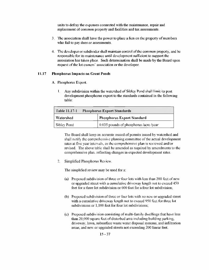
units to defray the expenses connected with die maintenance, repair and replacement of common property and facilities and tax assessments.
3. The association shall have the power to place a lien on the property of members who fail to pay dues or assessments.
4. The developer or subdivider shall maintain control of die common property, and be responsible for its maintenance until development sufficient to support the association has taken place. Such determination shall be made by the Board upon request of the lot owners’ association or the developer.
11.17 Phosphorus Impacts on Great Ponds
A. Phosphorus Export.
1. Any subdivision within die watershed of Sibley Pond shall limit its post development phosphorus export to the standards contained in the following table:
Table 11.17-1 Phosphorus Export Standards
Watershed Phosphorus Export Standard
Sibley Pond 0.035 pounds of phosphorus /acre /year
The Board shall keep an accurate record of permits issued by watershed and shall notify the comprehensive planning committee of the actual development rates at five year intervals, as the comprehensive plan is reviewed and/or revised. The above table shall be amended as required by amendments to the comprehensive plan, reflecting changes in expected development rates.
2. Simplified Phosphorus Review.
The simplified review may be used for a:
(a) Proposed subdivision of three or four lots with less than 200 feet of new or upgraded street with a cumulative driveway length not to exceed 450 feet for a three lot subdivision or 600 feet for a four lot subdivision;
(b) Proposed subdivision of three or four lots with no new or upgraded street with a cumulative driveway length not to exceed 950 feet for three lot subdivisions or 1,100 feet for four lot subdivisions;
(c) Proposed subdivision consisting of multi-family dwellings that have less than 20,000 square feet of disturbed area including building parking, driveway, lawn, subsurface waste water disposal systems, and infiltration areas, and new or upgraded streets not exceeding 200 linear feet.
15-37
(d) A proposed subdivision which creates lots which could be further divided such that five or more lots may result shall be subject to the standard review procedures unless there are deed restrictions prohibiting future divisions of the lots.
3. Standard Review.
This section shall apply to proposed subdivisions which do not qualify for the simplified review. Phosphorus export from a proposed development shall be calculated according to the procedures in Phosphorus Control in Lake Watersheds: A Technical Guide for Evaluating New Development, published by the Maine Department of Environmental Protection, revised September, 1992 as amended from time to time. When a proposed subdivision creates lots which are more than twice the required minimum lot size and there are no deed restrictions proposed to prohibit future divisions, the applicant shall cither calculate phosphorus loading based on the maximum feasible number of lots, and shall design controls adequate to limit the resulting phosphorus loading, or shall reserve a portion of the permitted phosphoms export for future divisions.
4. Maintenance and Use Restrictions for Phosphoms Control Measures.
Provisions for monitoring, inspections, and maintenance of phosphoms control measures shall be included in the application.
(a) Vegetative Buffer Strips.
Individual lot owners shall be required to maintain buffer areas on their individual lots in accordance with the following standards, to be specified in recorded deed restrictions and as notes on the plan. Where a vegetative buffer strip is to be owned in common by property owners in die subdivision, documentation establishing the lot owners’ association shall include the following standards.
1. Wooded Buffers.
Maintenance provisions for wooded buffers hall provide for eidier of die following two options.
a) No Disturbance.
Maintenance and use provisions for wooded buffer strips which are located on hydrologic soil group D soils and within 250 feet of the great pond or a tributary, or which are located on slopes over 20% shall include the following.
[1] Buffers shall be inspected annually for evidence of erosion or 15-38
concentrated flows through or around the buffer. All eroded areas must be seeded and mulched. A shallow stone trench must be installed as a level spreader to distribute flows evenly in any area showing concentrated flows.
[2] All existing undergrowth (vegetation less than four feet high), forest floor duff layer, and leaf litter must remain undisturbed and intact, except that one winding walking path, no wider than six feet, is allowed through the buffer. This path shall not be a straight line to the great pond or tributary and shall remain stabilized.
[3] Pruning of live tree branches that do not exceed twelve feet above the ground level is permitted provided that at least the top two-thirds of the tree canopy is maintained.
[4] No cutting is allowed of trees except for normal maintenance of dead, wind blown, or damaged trees.
[5] Buffers shall not be used for all-terrain vehicle or vehicular traffic.
b) Limited Disturbance.
Maintenance and use provisions for other buffer strips may includethe following:
[1] There shall be no cleared openings. An evenly distributed stand of trees and other vegetation shall be maintained.
[2] Activity within the buffer shall be conducted to minimize disturbance of existing forest floor, leaf litter and vegetation less than four feet in height. Where the existing ground cover is disturbed and results in exposed mineral soil, that area shall be immediately stabilized to avoid soil erosion.
[3] Removal of vegetation less than four feet in height is limited to that necessary to create a winding foot path no wider than six feet. This path shall not be a straight line to the great pond or a tributary. The path must remain stabilized.
[4] Pruning of live tree branches that do not exceed 12 feet in height above the ground level is permitted provided that at least the top two-thirds of the tree canopy is maintained. 5
[5] Where the removal of storm-damaged, diseased, unsafe, or dead trees results in a cleared opening, those openings shall be
15-39

replanted with native trees at least three feet in height unless existing new tree growth is present.
[6] Buffers shall not be used for all terrain vehicle or vehicular traffic.
2. Non-wooded Buffers.
a) Non-wooded buffers may be allowed to revert to or to be planted to forest, in which case the standards above shall apply.
b) A buffer must maintain a dense, complete and vigorous cover of “non-lawn” vegetation which shall be mowed no more than once a year. Vegetation may include grass, other herbaceous species, shrubs and trees.
c) Activity within the buffer shall be conducted so as to prevent damage to vegetation and exposure of mineral soil. Burning of vegetation shall be prohibited.
d) Buffers shall not be used for all-terrain vehicles or other vehicular traffic.
(b) Infiltration Systems.
Individual lot owners shall be responsible for maintenance of individual infiltration systems according to the standards specified in Phosphorus Control in Lake Watersheds: A Technical Guide for Evaluating New Development, published by the Maine Department of Environmental Protection, revised September, 1992. Requirements for maintenance shall be included in deed restrictions and as notes upon die plan. As an alternative to maintenance by individual lot owners, the applicant may designate some other entity to be contracted to take the responsibility, and shall include the above referenced maintenance provisions in any contractual agreement. Where infiltration systems serve more tiian one lot, a lot owners’ association shall be established and the above referenced maintenance provisions shall be referenced in the documentation establishing the association.
(c) Wet Ponds.
A lot owners’ association shall be established to maintain wet ponds, unless die municipality or some other public entity agrees to assume inspection and maintenance duties. Documentation establishing die association or establishing an agreement with a public entity shall include die maintenance standards specified in die manual Phosphorus Control in Lake Watersheds: A Technical Guide for Evaluating New Development,
15-40

published by die Maine Department of Environmental Protection, revised September, 1992.
ARTICLE 12 - DESIGN GUIDELINES
This article is intended to provide an example of design guidelines, which if followed will result in meeting the appropriate performance standards of Article 11. Compliance with these guidelines shall be considered evidence of meeting those standards. Proposed subdivisions not in compliance with the design guidelines of this article may be considered, but the applicant shall provide clear and convincing evidence diat the proposed design will meet the performance standard(s) and the statutory criteria, hi all instances the burden of proof shall be upon the applicant to present adequate information to indicate all performance standards and statutory criteria for approval have been or will be met.
12.1 Sufficient Water
A. Well Construction.
1. Due to die increased chance of contamination from surface water, dug wells shall be prohibited on lots of one acre or less. On such lots, the applicant shall prohibit dug wells by deed restrictions and a note on die plan.
2. If located downhill from the street, wells shall not be constructed within 100 feet of the traveled way of any street. If located uphill of die street wells shall not be constructed within 50 feet of the traveled way of any street, 'this restriction shall be included as a note on the plan and as a deed restriction to die effected lots.
B. Fire Protection.
1. Fire hydrants connected to a public water supply system shall be located no further dian 500 feet from any building.
2. A minimum storage capacity of 10,000 gallons shall be provided for a subdivision not served by a public water supply. Additional storage of 2,000 gallons per lot or principal building shall be provided. The Board may require additional storage capacity upon a recommendation from the fire chief. Where ponds are proposed for water storage, die capacity of the pond shall be calculated based on the lowest water level less an equivalent of three feet of ice.
3. Hydrants or other provisions for drafting water shall be provided to the specifications of the fire department. Minimum pipe size connecting dry hydrants to ponds or storage vaults shall be six inches.
4. Where the dry hydrant or other water source is not within the right-of-way of a proposed or existing street, an easement to die municipality shall be provided to allow access. A suitable accessway to the hydrant or other water source shall be constructed.
15-41

12.2 Traffic Conditions
A. Access Control.
1. Where a minor subdivision abuts or contains an existing or proposed arterial street, no residential lot may have vehicular access directly onto the arterial street. Where a major subdivision abuts or contains an existing street, no residential lot may have vehicular access directly onto that street. If a new arterial or collector street is proposed as part of the major subdivision, new residential lots may not take access directly off this arterial or collector street. These requirements shall be noted on the plan and in the deed of any lot with frontage on the such streets.
2. Where a lot has frontage on two or more streets, die access to die lot shall be provided to the lot across die frontage and to the street where there is lesser potential for traffic congestion and for hazards to traffic and pedestrians. This restriction shall appear as a note on the plan and as a deed restriction to the affected lots.
3. Subdivision Access Design for Subdivisions Entering onto Arterial Streets.
4. When die access to a subdivision is a street, the street design and construction standards of Section 12.2.B below shall be met. Where diere is a conflict between the standards in diis section and the standards of Section 12.2.B, die stricter or more stringent shall apply.
(a) General.
Access design shall be based on the estimated volume using die access classification defined below. Traffic volume estimates shall be as defined in the Trip Generation Manual, 1991 edition, published by the histitute of Transportation Engineers as amended from time to time.
1. Low Volume Access: An access with 50 vehicle trips per day or less.
2. Medium Volume Access: Any access with more than 50 vehicle trips per day but less than 200 peak hour vehicle trips per day.
3. High Volume Access: Peak hour volume of 200 vehicle trips or greater.
(b) Sight Distances.
Accesses shall be located and designed in profile and grading to provide the required sight distance measured in each direction. Sight distances shall be measured from the driver's seat of a vehicle standing on that portion of the exit with the front of the vehicle a minimum of 10 feet behind the curbline or edge of shoulder, with the height of the eye 3 Zi feet, to the top of an
15-42
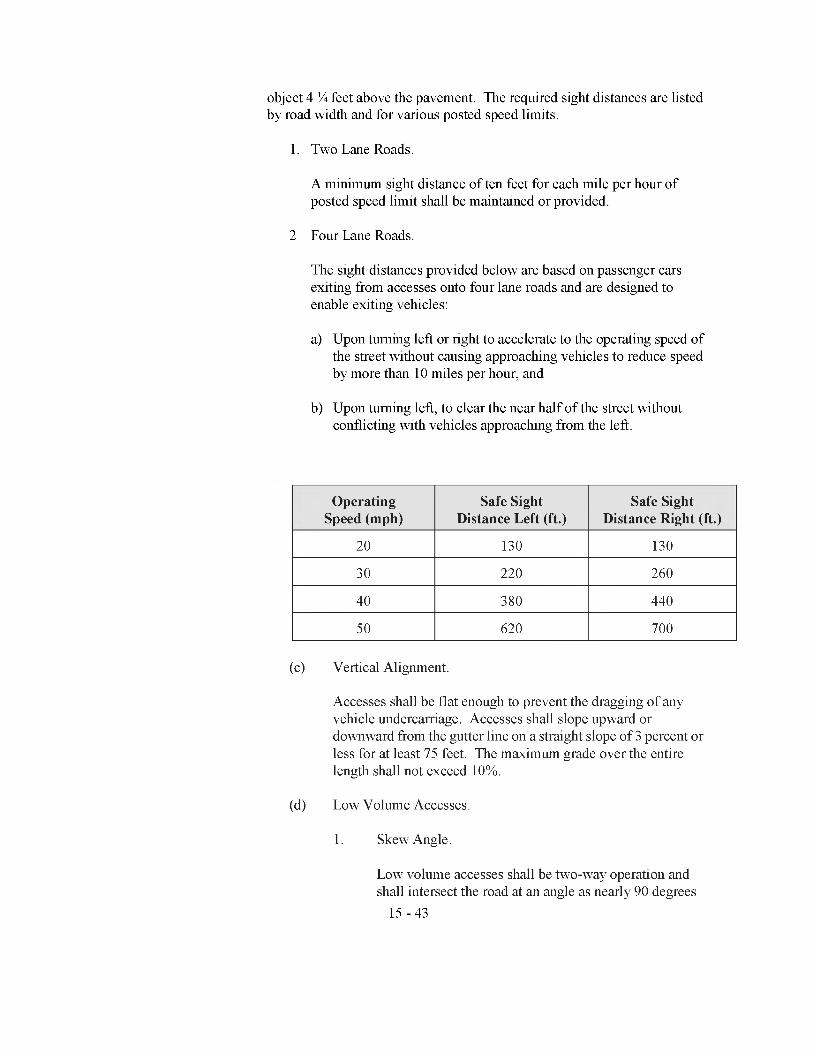
object 4 % feet above the pavement. The required sight distances are listed by road width and for various posted speed limits.
1. Two Lane Roads.
A minimum sight distance of ten feet for each mile per hour of posted speed limit shall be maintained or provided.
2 Four Lane Roads.
The sight distances provided below are based on passenger cars exiting from accesses onto four lane roads and are designed to enable exiting vehicles:
a) Upon turning left or right to accelerate to the operating speed of the street without causing approaching vehicles to reduce speed by more than 10 miles per hour, and
b) Upon turning left, to clear the near half of the street without conflicting with vehicles approaching from the left.
Operating Speed (mph)
Safe Sight Distance Left (ft.)
Safe Sight Distance Right (ft.)
20 130 130
30 220 260
40 380 440
50 620 700
(c) Vertical Alignment.
Accesses shall be flat enough to prevent the dragging of any vehicle undercarriage. Accesses shall slope upward or downward from the gutter line on a straight slope of 3 percent or less for at least 75 feet. The maximum grade over the entire length shall not exceed 10%.
(d) Low Volume Accesses.
1. Skew Angle.
Low volume accesses shall be two-way operation and shall intersect the road at an angle as nearly 90 degrees
15-43
as site conditions permit, but in no case less than 60 degrees.
2. Curb Radius.
The curb radius shall be between 10 feet and 15 feet, with a preferred radius of 15 feet.
3. Access Width.
The width of the access shall be between 20 feet and 24 feet, with a preferred width of 20 feet.
Medium Volume Accesses.
1. Skew Angle.
Medium Volume Accesses shall be either one-way or two-way operation and shall intersect the road at an angle as nearly 90 degrees as site conditions permit, but in no case less than 60 degrees.
2. Curb Radius.
Curb radii will vary depending if the access has one-way or two-way operation. On a two-way access the curb radii shall be between 25 feet and 40 feet, with a preferred radius of 30 feet. On one way accesses, the curb radii shall be 30 feet for right turns into and out of the site, with a 5 foot radius on the opposite curb.
3. Width.
On a two-way access the width shall be between 24 and 26 feet, with a preferred width of 26 feet. However, where truck traffic is anticipated, the width may be no more than 30 feet. On a one-way access the width shall be between 16 feet and 20, with a preferred width of 16 feet.
4. Curb-Cut Width.
On a two-way access the curb-cut width shall be between 74 feet and 110 feet with a preferred width of 86 feet. On a one-way access the curb-cut width shall be between 46 feet and 70 feet with a preferred width of 51
15-44

feet.
(f) High Volume Accesses.
1. Skew Angle.
High Volume Accesses shall intersect the road at an angle as nearly to 90 degrees as site conditions permit, but in no case less than 60 degrees.
2. Curb Radius.
Without channelization islands for right-turn movements into and out of the site, the curb radii shall be between 30 feet and 50 feet. With channelization islands, the curb radii shall be between 75 feet and 100 feet.
3. Curb Cut Width.
Without channelization, curb-cut width shall be between 106 feet and 162 feet with a preferred width of 154 feet. With channelization, the curb-cut width shall be between 196 feet and 262 feet with a preferred width of 254 feet.
4. Entering and exiting accesses shall be separated by a raised median which shall be between 6 feet and 10 feet in width. Medians separating traffic flows shall be no less than 25 feet in length, with a preferred length of 100 feet.
5. Width.
Access widths shall be between 20 feet and 26 feet on each side of the median, with a preferred width of 24 feet. Right turn only lanes established by a channelization island shall be between 16 feet and 20 feet, with a preferred width of 20 feet. 6
6. Appropriate traffic control signage shall be erected at the intersection of the access and the street and on medians and channelization islands.
(g) Access Location and Spacing.
1. Minimum Comer Clearance.15-45
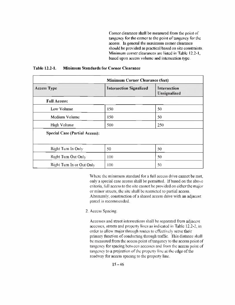
Comer clearance shall be measured from the point of tangency for the comer to the point of tangency for the access. In general the maximum comer clearance should be provided as practical based on site constraints. Minimum comer clearances are listed hi Table 12.2-1, based upon access volume and intersection type.
Table 12.2-1. Minimum Standards for Corner Clearance
Minimum Corner Clearance (feet)
Access Type Intersection Signalized IntersectionUnsignalized
Full Access:
Low Volume 150 50
Medium Volume 150 50
High Volume 500 250
Special Case (Partial Access):
Right Turn In Only 50 50
Right Turn Out Only 100 50
Right Turn In or Out Only 100 50
Where the minimum standard for a full access drive cannot be met, only a special case access shall be permitted. If based on the above criteria, full access to the site cannot be provided on cither the major or minor streets, the site shall be restricted to partial access. Alternately, constmction of a shared access drive with an adjacent parcel is recommended.
2. Access Spacing.
Accesses and street intersections shall be separated from adjacent accesses, streets and property lines as indicated in Table 12.2-2, in order to allow major through routes to effectively serve their primary function of conducting through traffic. This distance shall be measured from the access point of tangency to the access point of tangency for spacing between accesses and from the access point of tangency to a projection of the property line at the edge of the roadway for access spacing to the property line.
15-46
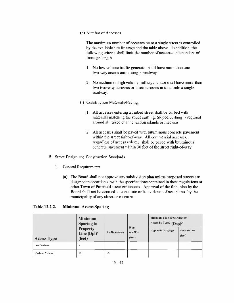
(h) Number of Accesses.
The maximum number of accesses on to a single street is controlled by the available site frontage and the table above, hi addition, the following criteria shall limit the number of accesses independent of frontage length.
1. No low volume traffic generator shall have more than one two-way access onto a single roadway.
2. No medium or high volume traffic generator shall have more than two two-way accesses or three accesses in total onto a single roadway.
(i) Construction Materials/Paving.
1. All accesses entering a curbed street shall be curbed with materials matching the street curbing. Sloped curbing is required around all raised channelization islands or medians.
2. All accesses shall be paved with bituminous concrete pavement within the street right-of-way. All commercial accesses, regardless of access volume, shall be paved with bituminous concrete pavement within 30 feet of the street right-of-way.
B. Street Design and Construction Standards.
1. General Requirements.
(a) The Board shall not approve any subdivision plan unless proposed streets are designed in accordance with the specifications contained in these regulations or other Town of Pittsfield street ordinances. Approval of the final plan by the Board shall not be deemed to constitute or be evidence of acceptance by the municipality of any street or easement.
Table 12.2-2. Minimum Access Spacing
Access Type
Minimum Spacing to Property Line (Dpi)1 (feet)
M e d iu m ( fe e t)
H ig h
w /o R T *
(fe e t)
M in im u m S p a c in g to
A c cess b y T y p e 2
d ja c e n t
p)3H ig h w /R T * * (fe e t) S p e c ia l C a se
(fe e t)
L ow V olum e 5
M edium V olum e 10 75
15-47

H igh V olum e (w /o RT)* 75 75 150
H ig h V olum e (w / RT)** 75 75 250 500
Special Case 10 75 75 75 40***
1 Dpi = Distance measured from Property Line - Measured from point o f tangency o f access to projection o f property line on roadway edge.2For two more accesses serving a single parcel, or from a proposed access from an existing access.3Dsp = Spacing between driveways - measured from point o f tangency o f access to point o f tangency o f adjacent access. *High volume access without right turn channelization.**High Volume access with right turn channelization.***Right turn-in-only-upstream o f right-tum-out-only. Right-turn-out followed by right-tum-in not allowed.
(b) Applicants shall submit to the Board, as part of the final plan, detailed construction drawings showing a plan view, profile, and typical cross-section of the proposed streets and existing streets within 300 feet of any proposed intersections. The plan view shall be at a scale of one inch equals no more than fifty feet. The vertical scale of the profile shall be one inch equals no more than five feet. The plans shall include the following information:
1. Date, scale, and north point, indicating magnetic or true.
2. Intersections of the proposed street with existing streets.
3. Roadway and right-of-way limits including edge of pavement, edge of shoulder, sidewalks, and curbs.
4. Kind, size, location, material, profile and cross-section of all existing and proposed drainage structures and their location with respect to the existing natural waterways and proposed drainage ways.
5. Complete curve data shall be indicated for all horizontal and vertical curves.
6. Turning radii at all intersections.
7. Centerline gradients.
8. Size, type and locations of all existing and proposed overhead and underground utilities, to include but not be limited to water, sewer, electricity, telephone, lighting, and cable television.
(c) Upon receipt of plans for a proposed public street the Board shall forward one copy to the municipal officers, the foreman of the Public Works Department, and the CEO for review and comment. Plans for streets which are not proposed to be accepted by the municipality shall be sent to the CEO and the foreman of the Pittsfield Public Works Department for review and comment.
15-48

(d) Where the applicant proposes improvements within existing public streets, the proposed design and construction details shall be approved in writing by the foreman of die Pittsfield Public Works Department or the Maine Department of Transportation, as appropriate.
(e) Where die subdivision streets are to remain private roads, the following words shall appear on the recorded plan.
“All roads in this subdivision shall remain private roads to be maintained by die developer or die lot owners and shall not be accepted or maintained by the Town, until they meet the municipal street design and construction standards.”
2. Street Design Standards.
(a) These design guidelines shall control the roadway, shoulders, curbs, sidewalks, drainage systems, culverts, and other appurtenances associated with die street, and shall be met by all streets within a subdivision, unless the applicant can provide clear and convincing evidence tiiat an alternate design will meet good engineering practice and will meet the performance standards of Article 11.
(b) Reserve strips controlling access to streets shall be prohibited except where their control is definitely placed with the municipality.
(c) Adjacent to areas zoned and designed for commercial use, or where a change of zoning to a zone which permits commercial uses is contemplated by the municipality, the street right-of-way and/or pavement width shall be increased on each side by half of die amount necessary to bring die road into conformance with the standards for commercial streets in these regulations.
(d) Any subdivision expected to generate average daily traffic of 200 trips per day or more shall have at least two street connections with existing public streets, streets shown on an Official Map, or streets on an approved subdivision plan for which performance guarantees have been filed and accepted. Any street with an average daily traffic of 200 trips per day or more shall have at least two street connections leading to existing public streets, or streets on an approved subdivision plan for which performance guarantees have been filed and accepted.
(e) The design standards of Table 12.2-3 shall apply according to street classification.
(f) The centerline of the roadway shall be the centerline of the right-of-way.
(g) Dead end streets.
(h) In addition to the design standards in Table 12.2-3, dead-end streets shall be constructed to provide a cul-de-sac turn-around with the following requirements for radii: Property line: 60 feet; outer edge of pavement: 50 feet; inner edge of
15-49

pavement: 30 feet. Where the cul-de-sac is in a wooded area prior to development, a stand of trees shall be maintained within the center of the cul-de-sac. In addition, the applicant shall make provisions for future road connections from the existing cul-de-sac to the next street for continuation of the road.
(i) Grades, Intersections, and Sight Distances.
1. Grades of all streets shall conform in general to the terrain, so that cut and fill are minimized while maintaining the grade standards above.
2. All changes in grade shall be connected by vertical curves in order to provide the following minimum stopping sight distances based on the street design speed.
Design Speed (mph) 20 25 30 35
Stopping Sight Distance (ft.) 125 150 200 250
Stopping sight distance shall be calculated with a height of eye at 3 Vz feet and the height of object at A foot.
Table 12.2-3. Street Design Guidelines
__________________________________ Tv,pe of Street
Design Standard Arterial Collector
MinorPrivateRights-of-Way
Industrial/Commercial
Minimum Right- of-Way Width
8 0 ' 5 0 ' 5 0 ' 5 0 ' 6 0 1
Minimum Traveled Way Width
4 4 ' 2 4 ’ 2 0 ' 1 8 ' 3 0 '
Minimum Width of Shoulders (each side)
5 ' 3 ’ 3 ' 3 ' 9'
Sidewalk Width 8 ' 5 ' 5 ' N / A 8 '
Minimum Grade . 5 % . 5 % . 5 % . 5 % . 5 %
Maximum Grade* 5 % 6% 8 % 8 % 5 %
Minimum Centerline Radiuswithout superelevation 5 0 0 ' 2 8 0 ’ 2 8 0 ' 1 7 5 ' 4 0 0 ’
w ith superelevation 3 5 0 ' 1 7 5 ’ 1 7 5 ' 1 1 0 ' 3 0 0 ’
15-50
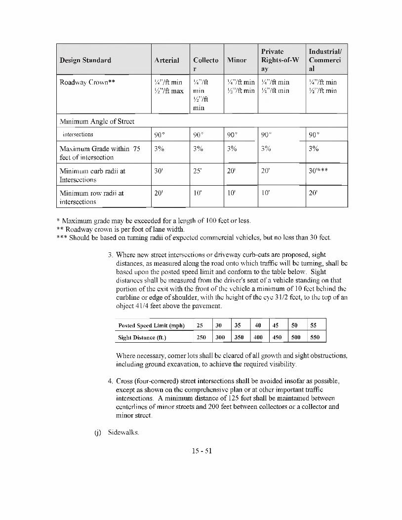
Design Standard Arterial Collector
MinorPrivateRights-of-Way
Industrial/Commercial
Roadway Crown** % ’’/ft min 547ft max
%7ftmin727ftmin
%7ft min 7 '7ft min
7i'7ft min Vi'/W min
%'7ft min 727ft min
Minimum Angle of Street
intersections kO oo
kO o0
kO oo
kO o0
SO oo
Maximum Grade within 75 feet of intersection
3% 3% 3% 3% 3%
Minimum curb radii at Intersections
30' 25' 20' 20' 301***
Minimum row radii at intersections
20' 10' 10' 10' 20'
* Maximum grade may be exceeded for a length of 100 feet or less.** Roadway crown is per foot of lane width.*** Should be based on turning radii of expected commercial vehicles, but no less than 30 feet.
3. Where new street intersections or driveway curb-cuts are proposed, sightdistances, as measured along the road onto which traffic will be turning, shall be based upon the posted speed limit and conform to the table below. Sight distances shall be measured from the driver's seat of a vehicle standing on that portion of the exit with the front of the vehicle a minimum of 10 feet behind the curbline or edge of shoulder, with the height of the eye 31/2 feet, to the top of an object 41/4 feet above the pavement.
P osted Speed L im it (m ph) 25 30 35 40 45 50 55
Sight D istance (ft.) 250 300 350 400 450 500 550
Where necessary, comer lots shall be cleared of all growth and sight obstructions, including ground excavation, to achieve the required visibility.
4. Cross (four-cornered) street intersections shall be avoided insofar as possible, except as shown on the comprehensive plan or at other important traffic intersections. A minimum distance of 125 feet shall be maintained between centerlines of minor streets and 200 feet between collectors or a collector and minor street.
(j) Sidewalks.
15-51
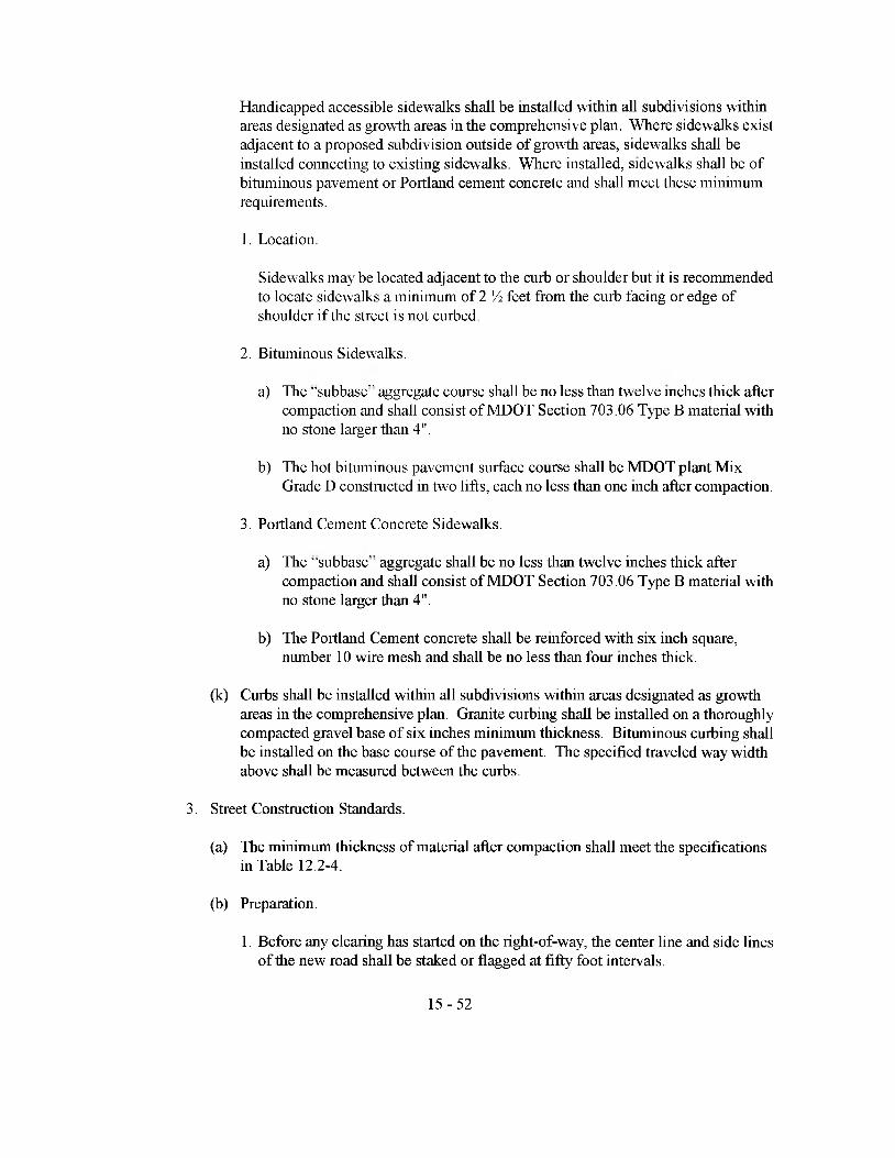
Handicapped accessible sidewalks shall be installed within all subdivisions within areas designated as growth areas in the comprehensive plan. Where sidewalks exist adjacent to a proposed subdivision outside of growth areas, sidewalks shall be installed connecting to existing sidewalks. Where installed, sidewalks shall be of bituminous pavement or Portland cement concrete and shall meet these minimum requirements.
1. Location.
Sidewalks may be located adjacent to the curb or shoulder but it is recommended to locate sidewalks a minimum of 2 V2 feet from the curb facing or edge of shoulder if the street is not curbed.
2. Bituminous Sidewalks.
a) The "subbasc" aggregate course shall be no less than twelve inches thick after compaction and shall consist of MDOT Section 703.06 Type B material with no stone larger than 4".
b) The hot bituminous pavement surface course shall be MDOT plant Mix Grade D constructed in two lifts, each no less than one inch after compaction.
3. Portland Cement Concrete Sidewalks.
a) The "subbasc" aggregate shall be no less than twelve inches thick after compaction and shall consist of MDOT Section 703 .06 Type B material with no stone larger than 4".
b) The Portland Cement concrete shall be reinforced with six inch square, number 10 wire mesh and shall be no less than four niches thick.
(k) Curbs shall be installed within all subdivisions within areas designated as growth areas in the comprehensive plan. Granite curbing shall be installed on a thoroughly compacted gravel base of six inches minimum thickness. Bituminous curbing shall be installed on die base course of die pavement. The specified traveled way width above shall be measured between die curbs.
3. Street Construction Standards.
(a) The minimum diickness of material after compaction shall meet die specifications in Table 12.2-4.
(b) Preparation.
1. Before any clearing has started on die right-of-way, the center line and side lines of die new road shall be staked or flagged at fifty foot intervals.
15-52
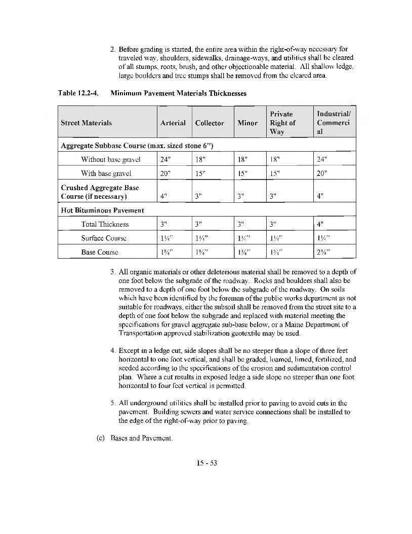
2. Before grading is started, the entire area within the right-of-way necessary for traveled way, shoulders, sidewalks, drainage-ways, and utilities shall be cleared of all stumps, roots, brush, and other objectionable material. All shallow ledge, large boulders and tree stumps shall be removed from the cleared area.
Table 12.2-4. Minimum Pavement Materials Thicknesses
Street Materials Arterial Collector MinorPrivate Right ofWay
Industrial/Commercial
Aggregate Subbase Course (max. sized stone 6")
Without base gravel 24" 18" 18" 18" 24"
With base gravel 20" 15" 15" 15" 20"
Crushed Aggregate Base Course (if necessary) 4" 3" 3" 3" 4"
Hot Bituminous Pavement
Total Thickness 3" 3" 3" 3" 4"
Surface Course IV*” IV*” I V ” IV*” I V ”
Base Course l 3/*” PA” PA” PA” 2 V*”
3. All organic materials or other deleterious material shall be removed to a depth of one foot below the subgrade of the roadway. Rocks and boulders shall also be removed to a depth of one foot below the subgrade of the roadway. On soils which have been identified by the foreman of the public works department as not suitable for roadways, either the subsoil shall be removed from the street site to a depth of one foot below the subgrade and replaced w ith material meeting the specifications for gravel aggregate sub-base below, or a Maine Department of Transportation approved stabilization geotextile may be used.
4. Except in a ledge cut, side slopes shall be no steeper than a slope of three feet horizontal to one foot vertical, and shall be graded, loamed, limed, fertilized, and seeded according to the specifications of the erosion and sedimentation control plan. Where a cut results in exposed ledge a side slope no steeper than one foot horizontal to four feet vertical is permitted.
5. All underground utilities shall be installed prior to paving to avoid cuts in the pavement. Building sewers and water service connections shall be installed to the edge of the right-of-way prior to paving.
(c) Bases and Pavement.
15-53

1. Bases/Subbase.
a) The Aggregate subbase course shall be sand or gravel of hard durable particles free from vegetative matter, lumps or balls of clay and other deleterious substances. The gradation of the part that passes a three inch square mesh sieve shall meet the grading requirements of Table 12.2-5.
Table 12.2-5. Aggregate Subbase Grading Requirements
Percentage by Weight Passing Sieve Designation Square Mesh Sieves
Va inch 25-70%
No. 40 0-30%
No. 200 0-7%
Aggregate for the subbase shall contain no particles of rock exceeding six inches in any dimension.
b) If the Aggregate Subbase Course is found to be not fine-gradable because of larger stones, then a minimum of three inches of Aggregate Base Course shall be placed on top of the subbase course. The Aggregate Base Course shall be screened or crushed gravel of hard durable particles free from vegetative matter, lumps or balls of clay and other deleterious substances and shall meet the MDOT Section 703.06 Type A standard. The gradation of the part that passes a three inch square mesh sieve shall meet the grading requirements of Table 12.2-6.
Aggregate for the base shall contain no particles of rock exceeding two inches in any dimension.
2. Pavement Joints.
Where pavement joins an existing pavement, the existing pavement shall be cut along a smooth line and form a neat, even, vertical joint.
Table 12.2-6. Base Course Grading RequirementsPercentage by Weight Passing Sieve Designation Square Mesh Sieves
Vi inch 45-70%
1/4 inch 30-55%
No. 40 0-20%
No. 200 0-5%
15-54

3. Pavements.
a) Minimum standards for the base layer of pavement shall be the Maine Department of Transportation specifications for plant mix grade B with an aggregate size no more than 1 inch maximum and a liquid asphalt content between 4.8% and 6.0% by weight depending on aggregate characteristics. The pavement may be placed between May 15 and November 15, provided the air temperature in the shade at the paving location is 35 °F and rising and die surface to be paved is not frozen or unreasonably wet.
b) Minimum standards for the surface layer of pavement shall be the Maine Department of Transportation specifications for plant mix grade C or D with an aggregate size no more dian 3/4 inch maximum and a liquid asphalt content between 5.8% and 7.0% by weight depending on aggregate characteristics. The pavement may be placed between May 15 and October 15, provided the air temperature in the shade at die paving location is 50°F and rising.
12.3 Impact on Natural Beauty, Aesthetics, Historic Sites, Wildlife Habitat, Rare NaturalAreas or Public Access to the Shoreline
A. Preservation of Natural Beauty and Aesthetics.
1. Unless located in areas designated as a growth area in the comprehensive plan, a subdivision in which the land cover type at the time of application is forested shall maintain a wooded buffer strip no less than fifty feet in width along all existing public roads. The buffer may be broken only for driveways and streets.
2. Unless located in areas designated as a growth area in the comprehensive plan, building location shall be restricted from open fields, and shall be located within forested portions of the subdivision. When the subdivision contains no forest or insufficient forested portions to include all buildings, the subdivision shall be designed to minimize the appearance of building when viewed from existing public streets.
3. When a proposed subdivision street traverses open fields, the plan shall include the planting of street trees. Street trees shall include a mix of tall shade trees and medium height flowering species. Trees shall be planted no more than fifty feet apart.
B. Retention of Open Spaces and Natural or Flistoric Features.
1. The subdivision shall reserve between 5% and 10% of the area of the subdivision as open space in order to provide for the recreational needs of the occupants of the subdivision and/or to maintain the scenic or natural beauty of the area. In determining the need for open space the Board shall consider the needs identified in the comprehensive plan or recreation plan for open space or recreation facilities in the neighborhood surrounding the subdivision and the policies of the plan for meeting those needs; the proximity of the
15-55

subdivision to neighboring dedicated open space or recreation facilities; the type of development and the demographic characteristics of potential residents in the subdivision; and the density or lot sizes of the development.
2. Subdivisions with an average density of more than three dwelling units per acre shall provide no less than fifty percent of die open space as usable open space to be improved for ball fields, playgrounds or odier similar active recreation facility. A site intended to be used for active recreation purposes, such as a playground or a play field, should be relatively level and dry, have a total frontage on one or more streets of at least 200 feet, and have no major dimensions of less than 200 feet.
3. Sites selected primarily for scenic or passive recreation purposes shall have such access as the Board may deem suitable and no less than 25 feet of road frontage. The configuration of such sites shall be deemed adequate by the Board with regard to scenic attributes and significant wildlife habitat to be preserved, together with sufficient areas for trails, lookouts, etc. where necessary and appropriate.
4. Proposed subdivisions which include or are adjacent to buildings or sites on the National Register of Historic Places or which die comprehensive plan has identified as being of historical significance shall be designed in such a manner as to minimize the impacts on the historic features. When die historic features to be protected include buildings, the placement and the architectural design of new structures in the subdivision shall be similar to the historic structures. The Board shall seek the advice of the Maine Historic Preservation Commission in reviewing such plans.
C. Protection of Significant Wildlife Habitat and Important Habitat Areas.
The follow ing guidelines are designed to protect the significant wildlife resources identified in the municipality. Hie Board recognizes that wildlife management must take into account many site specific variables. Applicants proposing to subdivide land within identified wildlife resources must consult with the Maine Department of Inland Fisheries and Wildlife or a qualified wildlife biologist and provide their written comments to the Board. The guidelines of this section shall apply to only those subdivisions which include significant wildlife habitat or resources identified in Section 11.8.C.
1. Protection of Habitat of Endangered or Threatened Species.
(a) Habitat for species appearing on the official state or federal lists of endangered or threatened species shall be placed in open space.
(b) Deed restrictions and notes on the plan shall reflect standards from the Department of Inland Fisheries and Wildlife for removal of vegetation within 250 feet of die habitat for species appearing on the list of endangered or threatened species unless the Department of Inland Fisheries and Wildlife has approved cutting of vegetation in writing.
2. Protection of Waterfowl, Shorebird, and Wading Bird Habitat, Atlantic Salmon15-56
Spawning and Nursery Areas.
(a) There shall be no cutting of vegetation within the strip of land extending 75 feet inland from the normal high-water mark of the following habitat areas:
1. Shorebird nesting, feeding and staging areas;
2. High and moderate value waterfowl and wading bird habitats, including nesting and feeding areas;
3. Critical spawning and nursery areas for Atlantic sea run salmon as defined by the Atlantic Sea Run Salmon Commission, or
4. Other important habitat areas identified in the comprehensive plan.
(b) This restriction shall appear as a note on the plan and as a deed restriction to the affected lots.
3. Protection of Deer Wintering Areas.
The report prepared by a wildlife biologist, selected or approved by the Board, shallinclude a management plan for deer wintering areas.
4. Protection of Important Shoreland Areas.
(a) Except as in areas described in Section 12.3.C.2, within all areas subject to the state mandated 250 foot shoreland zone:
1. Tree removal shall be limited to no more than 40% of the volume of trees 4 inches or more in diameter measured at 454 feet above the ground level on any lot in any ten year period.
2. Harvesting operations shall not create single clear-cut openings greater than 10,000 square feet in the forest canopy. Where such openings exceed 5,000 square feet they shall be at least 100 feet apart. Such clear-cut openings shall be included in the calculation of total volume removal. For the purposes of the guidelines, volume may be considered to be equivalent to basal area.
3. Cleared openings for development, including but not limited to, principal and accessory structures, driveways and sewage disposal areas, shall not exceed in the aggregate, 25% of the lot area or 10,000 square feet, whichever is greater, including land previously developed.
(b) These restrictions shall appear as notes on the plan and as deed restrictions to the affected lots. 5
5. If die proposed subdivision includes other important wildlife habitat as identified by the15-57
Department of Inland Fisheries and Wildlife or die comprehensive plan, the restrictions on activities in and around these areas shall be reviewed by the Department or a qualified wildlife biologist and their comments presented in writing to the Board.
12.4 Storm Water Management Design Guidelines
A. Design of best management practices shall be substantially equivalent to diose described in the Storm Water Management for Maine: Best Management Practices, published by the Maine Department of Environmental Protection, 1995.
B. Drainage easements for existing water courses or proposed drainage ways shall be provided at least 30 feet wide, conforming substantially with the lines of existing natural drainage.
C. The minimum pipe size for any storm drainage pipe shall be 15 inches for driveway entrances and eighteen inches for cross culverts. Maximum trench width at die pipe crown shall be the outside diameter of the pipe plus two feet. Pipe shall be bedded in a fine granular material, containing no stones larger dian three inches, lumps of clay, or organic matter, reaching a minimum of six inches below the bottom of the pipe extending to six inches above the top of the pipe. From that point, suitable excavated material should be used to minimize heaving.
D. Catch basins shall be installed where necessary and when located widiin a street shall be located at the curb line. Such catch basins shall be 48" diameter pre-cast concrete with a 2' sump and a 4' cone with a "bicycle friendly” cast iron grate. All catch basins shall be connected to a stormwater collection system.
E. Stonn Drainage Construction Standards.
1. Materials.
(a) Storm drainage pipes shall conform to die requirements of Maine Department of Transportation materials specifications Section 706 for non-metallic pipe and Section 707 for metallic pipe. Plastic (polyediylene) pipes shall not be installed except in closed systems such as street underdrains. Bituminous-coated steel pipes shall not be used.
(b) Where the stonn drainage pipe is to be covered by ten feet or more of fill material, pipe material with a fifty year life shall be used. These materials include concrete pipe, polymer coated galvanized corrugated steel pipe, polyvinyl-chloride (PVC) pipe, and corrugated aluminum alloy pipe.
2. Pipe Gauges.
Metallic storm drainage pipe shall meet the thickness requirements of Table 12.4-1, depending on pipe diameter:
Table 12.4-1. Culvert Size and Thicknesses15-58
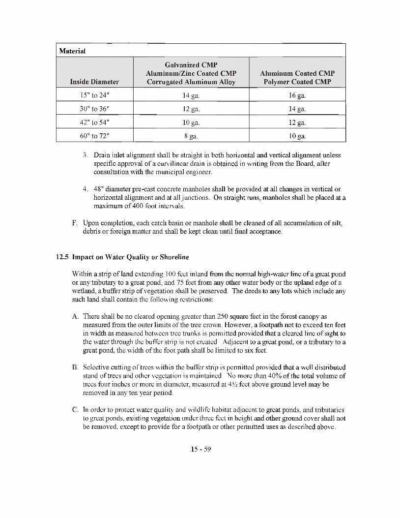
Material
Inside Diameter
Galvanized CMP Aluminum/Zinc Coated CMP Corrugated Aluminum Alloy
Aluminum Coated CMP Polymer Coated CMP
15" to 24" 14 ga. 16 ga.
30" to 36" 12 ga. 14 ga.
42" to 54" 10 ga. 12 ga.
60"to 72" 8 ga. 10 ga.
3. Drain inlet alignment shall be straight in both horizontal and vertical alignment unless specific approval of a curvilinear drain is obtained in writing from the Board, after consultation with the municipal engineer.
4. 48" diameter pre-cast concrete manholes shall be provided at all changes in vertical or horizontal alignment and at all junctions. On straight runs, manholes shall be placed at a maximum of 400 foot intervals.
F. Upon completion, each catch basin or manhole shall be cleaned of all accumulation of silt, debris or foreign matter and shall be kept clean until final acceptance.
12.5 Impact on Water Quality or Shoreline
Within a strip of land extending 100 feet inland from the normal high-water line of a great pond or any tributary to a great pond, and 75 feet from any other water body or the upland edge of a wetland, a buffer strip of vegetation shall be preserved. The deeds to any lots which include any such land shall contain the following restrictions:
A. There shall be no cleared opening greater than 250 square feet in the forest canopy as measured from the outer limits of the tree crown. However, a footpath not to exceed ten feet in width as measured between tree trunks is permitted provided that a cleared line of sight to the water through the buffer strip is not created. Adjacent to a great pond, or a tributary to a great pond, the width of the foot path shall be limited to six feet.
B. Selective cutting of trees within the buffer strip is permitted provided that a well distributed stand of trees and other vegetation is maintained. No more than 40% of the total volume of trees four inches or more in diameter, measured at 4'A feet above ground level may be removed in any ten year period.
C. In order to protect water quality and wildlife habitat adjacent to great ponds, and tributaries to great ponds, existing vegetation under three feet in height and other ground cover shall not be removed, except to provide for a footpath or other permitted uses as described above.
15-59

D. Pruning of tree branches, on the bottom third of the tree is permitted.
12.6 Blocks
Where street lengths exceed 1,000 feet between intersections with other streets, die Board may require a utility/pedestrian easement, at least 20 feet in width, to provide for underground utility- crossings and/or a pedestrian pathway of at least five feet in width constructed in accordance with design standards in Section 12.2.B.2.j. Maintenance obligations of the easement shall be included in the written description of die easement.
12.7 Lots
A. Wherever possible, side lot lines shall be perpendicular to the street.
B. The subdivision of tracts into parcels with more than twice die required minimum lot size shall be laid out in such a manner as either to provide for or preclude future division. Deed restrictions and notes on the plan shall eidier prohibit future divisions of the lots or specify that any future division shall constitute a rev ision to the plan and shall require approval from the Board, subject to die criteria of the subdivision statute, the standards of tiiese regulations and conditions placed on the original approval.
C. If a lot on one side of a stream, road or other similar barrier fails to meet the minimum requirements for lot size, it may not be combined with a lot on the other side of the stream, or road to meet the minimum lot size.
D. The ratio of lot length to width shall not be more than three to one. Flag lots and other odd shaped lots in which narrow strips are joined to other parcels in order to meet minimum lot size requirements are prohibited.
E. Developers shall work with the municipal officials to assign appropriate lot numbers such that rapid identification is facilitated in emergencies.
12.8 Utilities
Utilities serving subdivisions in areas designated by the comprehensive plan as growth areas shall be installed underground. Utilities serving lots with a street frontage of 125 feet or less shall be installed underground. The Board may approve overhead utilities when the applicant proposes reserved affordable housing and provides evidence that die increased costs of underground utilities will raise the costs of the housing beyond the targets for affordable housing in the comprehensive plan.
12.9 Monuments
A. Stone or precast concrete monuments shall be set at all street intersections and points of curvature, but no further than 750 feet apart along street lines without curves or intersections.
B. Stone or precast concrete monuments shall be set at all comers and angle points of the15-60

subdivision boundaries where die interior angle of the subdivision boundaries is 135 ° or less.
C. Stone or concrete monuments shall be a minimum of four inches square at die top and four feet in length, and set in the ground at final grade level. After they are set, a drill hole 54 inch deep shall locate the point or points described above.
D. All other subdivision boundary comers and angle points, as well as all lot boundary comers and angle points shall be marked by suitable monumentation, as required by the Maine Board of Registration of Land Surveyors.
12.10 Phosphorus Export
A. When a proposed subdivision is widiin die direct watershed of Sibley Pond and qualifies for the simplified review procedure, a 75 foot wooded buffer strip or a 125 foot non-wooded buffer strip shall be provided on die downhill side of all lots along all tributaries to Sibley Pond and along Sibley Pond. Wooded and non-wooded buffer strips shall meet the standards set forth in Section 11.17 A 4 (a), hi addition, die following standards shall be met.
1. Driveways and parking areas shall be designed and constructed such that runoff is quickly shed from driveways to buffer areas and that disruption of natural drainage patterns is minimized. Devices such as water bars, broad based drainage dips and razor blades, ditches, swales, ditch turnouts and die proper grading of gravel shall be utilized.
2. Roof runoff shall not be channelized to the pond but distributed over stable, well vegetated areas or infiltrated into the soil.
3. The use of phosphorus fertilizers shall be discouraged by notes on the plan.
4. Septic systems shall meet all current plumbing code requirements including loam liners where appropriate.
B. When the proposed subdivision is within the direct watershed of a great pond and does not qualify for simplified reviewed, the phosphorus control measures shall meet the design criteria in Phosphoms Control in Lake Watersheds: A Technical Guide for Evaluating New Development, published by the Maine Department of Environmental Protection, revised September, 1992 as amended from time to time.
ARTICLE 13 - PERFORMANCE GUARANTEES
13.1 Types of Guarantees
With submittal of the application for final plan approval, the applicant shall provide one of the following performance guarantees for an amount adequate to cover the total construction costs of all required improvements, taking into account the time-span of the construction schedule and the inflation rate for construction costs:
15-61
A. Either a certified check payable to the municipality or a savings account or certificate of deposit naming the municipality as owner, for the establishment of an escrow account;
B. A performance bond payable to the municipality issued by a surety company, approved by the municipal officers, or town manager;
C. An irrevocable letter of credit from a financial institution establishing funding for the construction of the subdivision, from which the Municipality may draw if construction is inadequate, approved by the municipal officers, or town manager;
The conditions and amount of the performance guarantee shall be determined by the Board with the advice of the CEO, foreman public works department, municipal officers, and/or municipal attorney.
13.2 Contents of Guarantee
The performance guarantee shall contain a construction schedule, cost estimates for each major phase of construction taking into account inflation, provisions for inspections of each phase of construction, provisions for the release of part or all of the perfonnance guarantee to die developer, and a date after which the applicant will be in default and the municipality shall have access to the funds to finish construction.
13.3 Escrow Account
A cash contribution to the establishment of an escrow account shall be made by either a certified check made out to the municipality, the direct deposit into a savings account, or the purchase of a certificate of deposit. For any account opened by the applicant, the municipality shall be named as owner or co-owner, and the consent of the municipality shall be required for a withdrawal. Any interest earned on the escrow account shall be returned to the applicant unless the municipality has found it necessary to draw on the account to cover the cost of items not completed by the developer under the performance guarantee. In such case the interest earned shall be proportionately divided between the amount returned to the applicant and the amount withdrawn to complete the required improvements.
13.4 Performance Bond
A performance bond shall detail the conditions of the bond, the method for release of the bond or portions of the bond to the applicant, and the procedures for collection by the municipality. The bond documents shall specifically reference the subdivision for which approval is sought. A perfonnance bond shall not be canceled by the issuer without prior written notice to the municipality.
13.5 Letter of Credit
An irrevocable letter of credit from a bank or other lending institution shall indicate that funds have been set aside for the construction of the subdivision and may not be used for any other project or loan.
15-62

13.6 Phasing of Development
The Board may approve plans to develop a major subdivision in separate and distinct phases. This may be accomplished by limiting final approval to those lots abutting that section of die proposed subdivision street which is covered by a performance guarantee. When development is phased, road construction shall commence from an existing public way. Final approval of lots in subsequent phases shall be given only upon satisfactory completion of all requirements pertaining to previous phases.
13.7 Release of Guarantee
Prior to the release of any part of die perfonnance guarantee, the Board shall determine to its satisfaction, in part upon die report of the CEO or other qualified individual retained by the municipality and any odier agencies and departments who may be involved, tiiat the proposed improvements meet or exceed die design and construction requirements for that portion or phase of die subdivision for which the release is requested.
13.8 Default
If upon inspection, the CEO or other qualified individual retained by the municipality finds that any of the required improvements have not been constructed in accordance with the plans and specifications filed as part of the application, he or she shall so report in writing to the municipal officers, the Board, and the applicant or builder. Hie municipal officers shall take any steps necessary to preserve the municipality's rights.
13.9 Improvements Guaranteed
Performance guarantees shall be tendered for all improvements required to meet the standards of these regulations and for the constmction of the streets, storm water management facilities, public sewage collection or disposal facilities, public water systems, and erosion and sedimentation control measures.
ARTICLE 14 - WAIVERS
14.1 Waivers Authorized
Where the Board makes written findings of fact that there are special circumstances of a particular parcel proposed to be subdivided, it may waive portions of the submission requirements, unless otherwise indicated in the regulations, provided the applicant has demonstrated that the performance standards of these regulations and the criteria of the subdivision statute have been or will be met, the public health, safety, and welfare are protected, and provided the waivers do not have the effect of nullifying the intent and purpose of the comprehensive plan, the land use ordinance, or these regulations.
14.2 Findings of Fact Required
15-63
Where the Board makes written findings of fact that due to special circumstances of a particular lot proposed to be subdivided, the provision of certain required improvements is not requisite to provide for the public health, safety or welfare, or are inappropriate because of inadequate or lacking connecting facilities adjacent to or in proximity of die proposed subdivision, it may waive the requirement for such improvements, subject to appropriate conditions, provided the waivers do not have the effect of nullifying die intent and purpose of the comprehensive plan, the zoning ordinance, ordiese regulations, and further provided the performance standards of these regulations and the criteria of the subdivision statute have been or will be met by the proposed subdivision.
14.3 Conditions
Waivers may only be granted in accordance with Sections 14.1 and 14.2. When granting waivers, the Board shall set conditions so that the purposes of diese regulations are met.
14.4 Waivers to be shown on final plan
When the Board grants a waiver to any of the improvements required by these regulations, the final plan, to be recorded at the Registry of Deeds, shall indicate die waivers granted and the date on which diey were granted.
ARTICLE 15 - APPEALS
15.1 Appeals to Superior Court
An aggrieved party may appeal any decision of the Board under these regulations to Somerset County Superior Court, within thirty days of the date the Board takes its final vote on the application.
1 Ordinance 03-30, 10/21/20032 Ordinance 04-03, 03/02/20043 Ordinance 05-06, 03/15/20054 Ordinance 16-12, 08/16/2016
15-64

TABLE OF CONTENTS
CHAPTER 13. ZONING ORDINANCE 13-3SECTION 1 - GENERAL.................................................................................................13-3
A. TITLE.............................................................................................13-3B. AUTHORITY................................................................................13-3C. PURPOSES....................................................................................13-3D. APPLICABILITY 13-3E. CONFLICTS WITH OTHER ORDINANCES 13-3F. VALIDITY AND SEVERABILITY 13-3G. EFFECTIVE DATE......................................................................13-4H. AMENDMENTS............................................................................ 13-4
SECTION 2 - NON-CONFORMANCE..........................................................................13-4A. PURPOSE......................................................................................13-4B. GENERAL REQUIREMENTS...................................................13-4C. NON-CONFORMING STRUCTURES 13-5D. NON-CONFORMING USES....................................................... 13-6E. NON-CONFORMING LOTS....................................................... 13-7F. MAINTENANCE AFTER CASUALTY DAMAGE 13-7G. VESTED RIGHTS 13-9
SECTION 3 - ESTABLISHMENT OF DISTRICTS..................................................... 13-9A. DISTRICTS ESTABLISHED...................................................... 13-9B. ONE FAMILY RESIDENTIAL DISTRICT (R-l) 13-10C. ONE AND TWO FAMILY AND MOBILE HOME RESIDENTIAL
DISTRICT (R-2).......................................................................... 13-10D. ONE AND TWO FAMILY RESIDENTIAL DISTRICT (R-3) 13-10E. FAMILY & COMMUNITY RESIDENTIAL DISTRICT (R-4) 13-10F. TOWN CENTER DISTRICT (C-l)........................................... 13-11G. HIGHWAY COMMERCIAL DISTRICT (C-2) 13-11H. INDUSTRIAL DISTRICT (C-3)................................................ 13-11I. CORRIDOR DEV. OVERLAY DISTRICT (CDOD)...............13-11J. MEDICAL SERVICES OVERLAY DISTRICT (MSOD) 13-12K. RURAL DISTRICT (C-4)........................................................... 13-12L. AGRICULTURAL PROTECTION DISTRICT 13-12M. RIVERFRONT DISTRICT 13-13N. SCENIC OVERLAY DISTRICT 13-14O. AIRPORT OVERLAY DISTRICT........................................... 13-14
SECTION 4 - PERFORMANCE STANDARDS 13-14GENERAL REQUIREMENTS......................................................................... 13-14SPECIFIC REQUIREMENTS.......................................................................... 13-15
ACCESSORY USES............................................................................... 13-15ACCESSORY/IN-LAW APT.................................................................. 13-16SWIMMING POOLS.............................................................................. 13-17HOME BASED ENTERPRISE 13-17HOME OCCUPATIONS 13-18
13-1

ANIMALS......................................................................................DRIVEWAYS................................................................................ACCESS.........................................................................................HEIGHT.........................................................................................SANITARY WASTES...................................................................SITE RESTRICTIONS.................................................................WELLHEAD PROTECTION ZONES.......................................PROPERTY MAINTENANCESCREENING.................................................................................JUNKYARDS AND AUTOMOBILE GRAVEYARDS............TEMPORARY UNITSMANUFACTURED HOUSING...................................................PREVENTION OF EROSION....................................................MINERAL EXPLORATION, EXCAVATION ANDGRAVEL PITS..............................................................................NOISE.............................................................................................PARKING, LOADING AND TRAFFIC.....................................BUFFERS.......................................................................................SIGNS.............................................................................................MOBILE HOME PARKSCONVERSIONS TO MULTI-FAMILY STRUCTURESBED AND BREAKFASTS............................................................MEDICAL MARIJUANA DISPENSARY.................................METHADObi"FT^IbJJC •••••••••••••••••••••••••••••••••••••••••••••••••••••••••••••••«WIND ENERGY FACILITY.......................................................COMMUNICATION TOWERS AND METEOROLOGICALTOWERS........................................................................................
SECTION 5 - ADMINISTRATION....................................................................A. PLANNING BOARDB. CODE ENFORCEMENT OFFICERC. LEGAL ACTIONS AND VIOLATIONS........................D. FINES.................................................................................E. BUILDING PERMITF. APPLICATIONG. CERTIFICATE OF OCCUPANCY................................H. F E E .....................................................................................
SECTION 6 - CONDITIONAL USES................................................................SECTION 7 - APPEALS......................................................................................
A. APPOINTMENT AND COMPOSITIONB. POWERS AND DUTIES..................................................C. APPEAL PROCEDURE...................................................
SECTION 8 - DEFINITIONSAPPENDIX A, B AND C, WIND ENERGY FACILITY...................................
13-1913-2213-2213-2213-2313-2313-2313-2313-2413-2413-2513-2613-26
13-2713-2813-2813-3213-3313-3713-3913-3913-3913-43
.13-45
,13-5013-5113-5113-5113-5213-5213-5213-5213-5313-5313-5313-5513-5513-5513-5713-59
..13-59
TABLE P - RESIDENTIAL AND RURAL DISTRICT USE 13-Table
TABLE Q - COMMERCIAL DISTRICT USE.................................................................. 13-Table
TABLE R - SPECIAL DISTRICT USE 13-Table
13-2

CHAPTER 13. ZONING ORDINANCE
SECTION 1 - GENERAL
A. TITLE
This Ordinance shall be known and cited as the Zoning Ordinance of the Town of Pittsfield, Maine, and will be referred to as “this Ordinance/’
B. AUTHORITY
This Ordinance is adopted pursuant to the enabling provisions of Article VIII, Part 2, Section 1 of the Maine constitution, the provisions of Title 30-A, MRSA Section 3001 (Home Rule), the State’s growth management law, Title 30-A, MRSA, Sections 4211 et. seq.
C. PURPOSES
'The purposes of this Ordinance are to implement the provisions of the Town’s Comprehensive Plan; to encourage growth in the identified growth areas of the community, and to limit growth in the rural areas; to promote the health and safety and general welfare of the residents of the community; to encourage the most appropriate use of land throughout the community; to promote traffic safety; to provide safety from fire and other elements; to provide an allotment of land area in new developments sufficient for adequate enjoyment of community life; to conserve natural resources; and to further the maintenance of safe and healthful conditions; to prevent and control water pollution; to protect fish spawning grounds, aquatic life, bird and other wildlife habitat; to protect buildings and lands from flooding and accelerated erosion; to protect archaeological and historic resources; to control building sites, placement of structures and land uses; to conserve natural beauty and open space.
D. APPLICABILITY
The provisions of this Ordinance shall govern all land and all structures within the boundaries of the Town of Pittsfield, except for those areas designated under the Town of Pittsfield Shoreland Zoning Ordinance.
E. CONFLICTS WITH OTHER ORDINANCES
Whenever a provision of this Ordinance conflicts with or is inconsistent with another provision of this Ordinance or of any other Ordinance, other than Shoreland Zoning Ordinance, regulation or statute, the more restrictive provision shall control.
This Ordinance supersedes and replaces the Pittsfield Zoning Ordinance, which became effective on July 3, 1986.
F. VALIDITY AND SEVERABILITYShould any section or provision of this Ordinance be declared by the courts to be invalid, such decision shall not invalidate any other section or provision of the Ordinance.
13-3
G. EFFECTIVE DATE
1. The effective date of this Ordinance shall be thirty (30) days after its date of adoption by theTown Council on June 6, 2000. The Ordinance shall apply to all proceedings, applications and petitions not pending within the meaning of Title 30A, M.R.S.A., Section 3002 as of the date of adoption of this Ordinance.
H. AMENDMENTS
1. An amendment of this Ordinance may be initiated by the Planning Board provided a majority of the Board has voted to do so; a request of the Council to the Planning Board; a written petition of a number of voters equal to at least ten per cent (10%) of the number of votes cast in the municipality at the last gubernatorial election.
2. An amendment of this Ordinance may be adopted by a majority vote of the Council if the proposed amendment is recommended by an affirmative vote of at least four members of the Planning Board; or, at least five affirmative votes of the Council if the proposed amendment is not recommended by at least four members of the Planning Board.
In either case, the Planning Board shall hold a public hearing on the proposed amendment at least 14 days prior to the meeting of the governing body. Notice of the hearing shall be given in accordance with the requirements of 30-A M.R.S.A., Section 4352 as may be amended from time to time.
3. No proposed change in this Ordinance which has been unfavorably acted upon by die Council shall be considered on its merits by the Council within two (2) years after the date of such unfavorable action unless adoption of the proposed change is recommended by the unanimous vote of the Planning Board.
SECTION 2 - NON-CONFORMANCE
A. PURPOSE
It is the intent of these provisions to promote land use conformities, except that non-conformingconditions that legally existed before the effective date of this Ordinance or any amendment theretoshall be allowed to continue, subject to the requirements set forth in this section.
B. GENERAL REQUIREMENTS
1. Transfer of Ownership: Non-conforming structures, lots, and uses may be transferred, and the new owner may continue the non-conforming use or continue to use the non-conforming structure or lot, subject to the provisions of this Ordinance.
2. Repair and Maintenance: This Ordinance allows, without a permit pursuant to this Ordinance, the normal upkeep and maintenance of non-conforming uses and structures including repairs or renovations which do not involve expansion of the non-conforming use or structure. It also
13-4

allows changes in a non-conforming use or structure required by federal, state or local building and safety codes.
C. NON-CONFORMING STRUCTURES
1. Expansions: A non-conforming structure may be added to or expanded after obtaining a permit from the Code Enforcement Officer, if such addition or expansion does not increase the nonconformity of the structure.
Foundations: Construction or enlargement of a foundation beneath the existing structure shall not be considered an expansion of the structure provided that: 1) the structure and new foundation are placed such that the setback and other dimensional requirements are met to the greatest practical extent as determined by the Code Enforcement Officer, basing his or her decision on the criteria specified in subsection 2. Relocation, below; 2) die completed foundation does not extend beyond the exterior existing dimension of the structure; and 3) the foundation does not cause the structure to be elevated more than three (3) additional feet.
Lot Lines: No structure which is less than the required setback from a property line or die normal high water line of a water body, tributary stream, or upland edge of a wetland shall be expanded toward the property line or die water body, tributary stream, or wetland.
2. Relocation: A non-conforming structure may be relocated within the boundaries of the parcel on which the stmcture is located provided that the site of relocation conforms to all setback or other dimensional requirements to the greatest practical extent as detemuned by the Code Enforcement Officer, and provided that the applicant demonstrates that the present subsurface sewage disposal system (if applicable) meets the requirements of State law and die State of Maine Subsurface Water Disposal Rules or that anew system can be installed in compliance with the law and said Rules. In no case shall a stmcture be relocated in a manner that causes the stmcture to be more non-conforming.
In determining whether the building relocation meets the setback or other dimensional requirements to the greatest practical extent, the Code Enforcement Officer shall base his or her decision on the size of the lot, the slope of the land, the potential for soil erosion, die location of the septic system and other on-site soils suitable for septic systems, and the type and amount of vegetation to be removed to accomplish the relocation.
3. Reconstmction or Replacement: Any non-conforming stmcture which is located less than the required setback from the normal high water line of a water body, tributary stream, or upland edge of a wetland, or from the property line, or which otherwise fails to meet the dimensional requirements of this Ordinance, and which is removed or damaged or destroyed by more than 50 percent of the market value of the stmcture before such damage, destmction or removal, may be reconstmcted or replaced provided that a permit is obtained within one year of the date of said damage, destmction or removal and provided that such reconstmction or replacement is in compliance with the setback or other dimensional requirements to the greatest practical extent as determined by the Code Enforcement Officer, and provided that the applicant demonstrates that the present subsurface sewage disposal system (if applicable) meets the requirements of State law and the State of Maine Subsurface Wastewater Disposal Rules, or that a new system can be installed in compliance with the law and said Rules. In no case shall a stmcture be reconstmcted or replaced so as to increase its non-conformity.
13-5

Any non-conforming structure which is damaged or destroyed by 50 percent or less of the market value of the structure, excluding normal maintenance and repair, may be reconstructed in place with a permit from the Code Enforcement Officer.
In determining whether the building reconstruction or replacement meets setbacks to the greatest practical extent, the Code Enforcement Officer shall consider in addition to the criteria in paragraph 2 above, the physical condition and type of foundation present, if any.
4. Change of Use of a Non-Conforming Structure: The use of a non-conforming structure maynot be changed to another use unless the Code Enforcement Officer, after reviewing a written application, determines that the new use will have no greater adverse impact than the existing use.
In determining whether a greater adverse impact will occur, the Code Enforcement Officer shall require written documentation from the applicant, regarding the probable effects of the change on public health and safety, erosion and sedimentation, water quality, fish and wildlife habitat, vegetative cover, visual and actual points of public access to waters, natural beauty, flood plain management, archaeological and historical resources, and the character of the neighborhood.
D. NON-CONFORMING USES
1. Continuance of Non-Conforming Uses: Any use of land, buildings or structures that was lawfi.il at the time of adoption of tins Ordinance may continue, although such use does not conform to the provisions of this Ordinance.
2. Expansions: Non-conforming uses may, after obtaining a permit from the Planning Board, be pemiitted to expand on a lot of record legally existing as of the effective date of this Ordinance.
New Structures: Where a legal non-conforming use exists a new structure may be allowed when this structure will have no greater adverse impact on adjacent properties. In making this determination the Planning Board shall utilize the Site Plan Review Ordinance to evaluate any potential changes.
In granting a permit for the expansion of a non-conforming use the Planning Board must determine that the expanded use will have no greater adverse impact on adjacent properties. In making this determination, the Planning Board shall evaluate changes in noise, traffic, parking, odors, litter or other nuisances likely to result from the expanded use.
3. Discontinuance of Non-Conforming Uses: A lot, building or structure in or on which a non- conforming use is discontinued for a period exceeding one year, or which is superseded by a conforming use, may not again be devoted to a non-conforming use.
4. Change of Use: An existing non-conforming use may be changed to another non-conforming use provided that tire Planning Board finds that the proposed use is equally or more appropriate to the distnet than the existing non-conforming use, and that the proposed use will have no greater adverse impact on adjacent properties than the former use.
13-6
The determination of appropriateness shall be based on die probable changes in traffic (volume and type), parking, noise, potential for litter, wastes or by-products, fumes, odors, or other nuisances likely to result from such change of use. The performance standards of this Ordinance shall apply to such requests.
In determining that greater adverse impact will not occur, the Planning Board shall require written documentation from the applicant, regarding the probable effects on public health and safety, erosion and sedimentation, water quality, fish and wildlife habitat, vegetative cover, visual and actual points of public access to waters, natural beauty, flood plain management, archaeological and historical resources, and the character of the neighborhood.
25. Notwithstanding Section 2.D. of this Ordinance, the Planning Board may, upon determining that a structure/lot is of such design and/or configuration that it can not reasonably be converted to a conforming use, allow the reestablishment of a non-conforming use. The Board shall use the criteria in Section 2.D.4. for its review.
E. NON-CONFORMING LOTS
1. Non-conforming Lots: A vacant, non-conforming lot of record legally existing as of the effective date of this Ordinance or amendment thereto, and in separate ownership, may be built upon without the need for a lot size variance.
2. Contiguous Built Lots: If two or more contiguous lots or parcels are in the same ownership of record at the time of effective date or amendment of this Ordinance, and if all or part of the lots do not meet the dimensional requirements of this Ordinance, and if a principal use or structure exists on each lot, the non-conforming lots may be conveyed separately or together, provided that lots of at least 10,000 square feet are created in areas with Town water and sewer and at least 20,000 square feet in all other areas of Town and meet the requirements of the State Subsurface Wastewater Disposal Rules.
If two or more principal uses or structures existed on a single lot of record on the effective date of this Ordinance, each may be sold on a separate lot provided that the above referenced law and rules are complied with. When such lots are divided, each lot thus created must be as conforming as possible to the dimensional requirements of this Ordinance.
3. Contiguous Lots - Vacant or Partially Built: If two or more contiguous lots or parcels are in the same ownership of record at the time of or since adoption or amendment of this Ordinance, if any of these lots do not individually meet the dimensional requirements of this Ordinance or subsequent amendments, and if one or more of the lots are vacant or contain no principal structure, the lots shall be combined to the extent necessary to meet the dimensional requirements.
F. “ MAINTENANCE AFTER CASUALTY DAMAGE
Within a period of 90 days after casualty (see Definitions) damage to property grounds or structures,the owner shall cause or contract for die repair or restoration of damaged areas, the demolition of any
13-7

structures not to be repaired and die removal of all debris connected tiierewidi. The Code Enforcement Officer may grant an extension under certain hardship conditions
RESPONSIBILITIES
Owners, operators, and occupants of properties shall maintain the structures and exterior property grounds in compliance with this ordinance. All vacant structures and premises thereof or vacant land shall be maintained in a clean, safe, secure and sanitary condition as so as not to cause a blighting problem or adversely affect the public health and safety and to avoid any adverse effects to the adjoining properties.
ENFORCEMENT & PENALTIES
Method of Service
The Code Enforcement Officer shall issue a notice of violation for any violation of this subsection. Such written notice of violation shall be served by one more of the following methods: 1. Delivered personally by hand delivery, 2. Sent by certified mail and first class U. S. mail addressed to the last known address. 3. A copy of the notice may also be posted in a conspicuous place in or about the structure or property affected by such notice.
Said notice shall explain the nature of the violation and require corrective action within 30 calendar days from the date of the receipt of the notice to correct die violation; 7 days for a health and/or safety violation. The violator may appeal the Code Enforcement Officer’s decision to the Board of Appeals.A written application for appeal must be filed within 7 days of the notice of violation or order being served by die Code Enforcement Officer. Appeals of notices and orders (odier than imminent danger notices) shall stay the enforcement of the notice and order until die appeal is heard by die Board of Appeals. The number of days given for compliance shall start after the Board of Appeals has heard the appeal.
If a violation is not corrected within the time allowed, the Town may pursue all remedies and relief available by law and/or in equity for land use ordinances, including without limitation the remedies and relief provided in 30A-M.R.S.A. Section 4452. The Town shall retain all penalties set forth in this ordinance. The Code Enforcement Officer may after approval of the Town Council represent the Town in District Court. However, should the services of the Town Attorney be required, the case shall first be reviewed with the Town Council.
EXTENSION REQUESTS
Violators may submit a written request to the Code Enforcement Officer for a one-time extension of time to correct any violation under this subsection.. The extension of time may be given for financial hardship. Evidence of hardship must be provided by finial documentation such as proof of expensive and other relevant information. If a violation is discovered during winter months (November 1 - April 1) and if winter weather prevents the correction of a violation/s a onetime extension of time for winter conditions may be given. These extensions for financial or seasonal hardships shall be at the discretion of die Code Enforcement Officer. The Code Enforcement Officer may offer one (1) special extension of up to 180 days to violators of this ordinance if a hardship can be shown.
13-8

G. VESTED RIGHTS
Non-conforming use rights do not arise by die mere filing of a notice of intent to build, an application for building permits, or an application for required State permits and approvals. Such rights may arise when actual substantial construction has begun, or in the case of pending applications, when the substantive review process to determine compliance with substantive performance standards on a complete application commences. Such construction must be legal at the time it is commenced and the owner must be in possession of and in compliance with all validly issued permits, both State and local.
SECTION 3 - ESTABLISHMENT OF DISTRICTS
A. DISTRICTS ESTABLISHED
The Town of Pittsfield is hereby divided into the following classes of districts as shown on the Rural and Urban Land Use Maps, dated October 1977, revised November 1999 and January 2000, attached hereto and incorporated herein. District boundaries that abut a road are divided at the road’s centerline. Where any ambiguity exists concerning the permissibility of a use, the Code Enforcement Officer shall make a determination.
RESIDENTIAL DISTRICTS
One Family Residential District - R-lOne and Two Family and Mobile Home Residential District - R-2One and Two Family Residential District - R-3One Family and Community Residential District - R-4
COMMERCIAL DISTRICTS
Town Center District - C-l Highway Commercial District - C-2
Industrial District - C-3Corridor Development Overlay District (CDOD)Medical Services Overlay District (MSOD)
RURAL DISTRICT
Rural District - C-4
SPECIAL DISTRICTS
Agricultural Protection District (APD)Riverfront District (RF)Scenic Overlay District (SOD)Airport Overlay District (AOD)
13-9
B. ONE FAMILY RESIDENTIAL DISTRICT (R-l)
Hie purpose of the R-l residential district is to provide an area for high quality, upscale single-family neighborhoods on larger lots served by the Town's water and sewer departments. Privacy between homes and isolation from commercial and industrial land uses characterize this district. High quality planned residential developments with nicely landscaped grounds may be compatible with the singlefamily homes in this district.
Permitted and conditional uses allowed in this district and space and bulk standards for these uses are set forth on the following Table P.
C. ONE AND TWO FAMILY AND MOBILE HOME RESIDENTIAL DISTRICT (R-2)
3The purpose of the R-2 residential district is to provide for affordable, medium-density housing. Planned unit developments, professional offices, and civic uses such as schools, churches, parks and community centers are appropriate for this district. In order to meet the goals of the Comprehensive Plan to keep 75% of the new housing units in the urban area, it is also appropriate for two-family dwelling units to add or expand to a third unit. Day care centers, nursery schools, boarding homes and assisted living facilities are appropriate conditional uses in this district if the integrity of the principal uses is protected.
Permitted and conditional uses allowed in this district and space and bulk standards for these uses are set forth on the following Table P.
D. ONE AND TWO FAMILY RESIDENTIAL DISTRICT (R-3)
The purpose of the R-3 residential district is to provide guidelines to protect the character of die traditional, medium density residential neighborhoods that were developed in the mid- to late-1800s. Much of the older portion of in-town Pittsfield is designated in this district and is characterized by well-kept, older, traditionally styled homes. Supporting services for residential neighborhoods, such as schools, libraries, parks, and churches are appropriate in this district. Professional offices and multi-family housing which maintain the residential appearance of large older homes is also appropriate. Day care centers and nursery schools are appropriate conditional uses in this district. Permitted and conditional uses allowed in this district and space and bulk standards for these uses are set forth on the following Table P.
E. FAMILY AND COMMUNITY RESIDENTIAL DISTRICT (R-4)
Hie purpose of the R-4 residential district is to provide a high-quality yet affordable residential growth area that allows for single-family homes but especially encourages planned residential developments. A variety of rental and ownership options, from Townhouse apartments to condominiums, mobile home parks, and retirement and assisted living communities are envisioned in this district. Quality design and construction, efficient and attractive placement of structures and amenities, privacy and landscaping are to be required to ensure that desirable residential areas are created. Supporting services for residential neighborhoods, such as schools, libraries, parks, and churches are appropriate in this district. Day care centers and nursery schools are appropriate conditional uses in this district.
13-10
F. TOWN CENTER DISTRICT (C-l)
The purpose of the Town Center District is to preserve and enhance a thriving business district in Pittsfield's downtown Retail stores, professional offices, banks, restaurants, government offices, consumer services and indoor recreation facilities are encouraged to locate here. Residential units are allowed only on floors above street level of commercial buildings.
Permitted and conditional uses allowed in this district and space and bulk standards for these uses are set forth on the following Table Q.
G. HIGHWAY COMMERCIAL DISTRICT (C-2)
The purpose of the Highway Commercial District is to provide for travel and vehicle-oriented sales and services and retail uses that are too land-intensive for the Town Center District. It is the intent of the Town to prevent strip development in these areas by managing access, regulating signs, and encouraging landscaping. Residential uses are not allowed in this district.
Permitted and conditional uses allowed in this district and space and bulk standards for these uses are set forth on the following Table Q.
H. INDUSTRIAL DISTRICT (C-3)
Ure purpose of the Industrial District is to provide areas for a wide range of intensive, non-retail commercial activities that require good transportation, utilities, and related services. In addition to manufacturing and transportation-related activities, wholesaling, office space, high-tech employers, call centers, etc., are appropriate in this district. Residential uses are not permitted in this district.
Permitted and conditional uses allowed in this district and space and bulk standards for these uses are set forth on the following Table Q.
I. CORRIDOR DEVELOPMENT OVERLAY DISTRICT (CDOD)
The purpose of the Corridor Development Overlay District is to provide areas for land-intensive commercial enterprises that do not require public water and sewer. The only retail operations allowed in this district are those that require too much land to locate in the Town Center or the Highway Commercial Districts, such as large equipment dealerships, and lumberyards. Junkyards and traffic- intensive recreational activities such as amusement parks and racetracks shall be directed to this district.
Permitted and conditional uses allowed in this district and space and bulk standards for these uses are set forth on the following Table Q.
Permitted and conditional uses allowed in this district and space and bulk standards for these uses areset forth on the following Table P.
13-11
J. MEDICAL SERVICES OVERLAY DISTRICT (MSOD)
The purpose of the Medical Services Overlay District is to encourage the siting of medical facilities in the area adjacent to Sebasticook Valley Hospital. This district is especially appropriate for intensive health care facilities and support services related to the hospital such as laboratories, rehabilitation centers, nursing homes and clinics. By virtue of being an overlay district rather than a base district, property owners will maintain residential development opportunities in this area in addition to those related to medical facilities.
Permitted and conditional uses allowed in this district and space and bulk standards for these uses are set forth on the following Table Q.
K. RURAL DISTRICT (C-4)
The purpose of the rural district is to preserve undeveloped land to the greatest extent possible and to support natural resource based industries. Agriculture and forestry will be the predominant land uses other than conservation. Low-density residential development will be permitted but discouraged. Home-based enterprises will be allowed within strict guidelines to ensure environmental protection and compatibility with neighboring uses.
Permitted and conditional uses allowed in this district and space and bulk standards for these uses are set forth on the following Table P.
L. AGRICULTURAL PROTECTION DISTRICT
1. Purpose
The purpose of the Agricultural Protection District is to both preserve productive farmland and enhance the viability of agricultural work. This district shall cover a land area (not necessarily contiguous) of between 1000 and 2000 acres.
Permitted uses allowed in this district and space and bulk standards for these uses are set forth on the following Table R.
2. Application ProcessAll applications for die inclusion of land into the Agricultural Protection District shall be made to the Planning Board.
The application shall include die following information:
a) Landowner’s name and address.
b) Proof of ownership of the parcel.
c) The address and location of the property including the tax map and lot number.
d) Number of acres to be included within the district and current use of the property.
13-12

e) A medium intensity soil survey of the property and a USGS 10' topographic map of thesite.
f) A statement from the applicant that the land in question will be preserved in or for an agricultural use.
3. Review Criteria
In determining the suitability of land submitted for inclusion into the Agricultural Protection District, the Planning Board shall utilize the following criteria.
a) Taxes on land brought for consideration shall be current.
b) Land brought for consideration shall not lie within a growth area as designated by the Pittsfield Comprehensive Plan.
c) Land under consideration must be currently farmed or it must include a large percentage of prime agricultural soils as defined below.
For the purposes of this section, prime agricultural soils shall include:
BaB Bangor silt loam, 3-8% slopes BuB Buxton silt loam, 0-8% slopes DxB Dixmont silt loam, 0-8% slopes Ha Hadley silt loamMbB Madawaska fine sandy loam, 0-8% slopesWn Winooski silt loamAaB Adams loamy sand, 0-8% slopesPgB Plaisted gravelly loam, 3-8% slopesTtB Thomdike-Bangor silt loams, 0-8% slopesTpB Thomdike-Plaisted loams, 0-8% slopesLk Li me ri ck silt loam
d) The topography of land brought for consideration shall be acceptable for agricultural purposes.
4. Withdrawal Penalty
Land removed from this district within seven years (7) of first acceptance into the program shall be assessed a penalty set by the Town Council.
M. RIVERFRONT DISTRICT
The purpose of the Riverfront District is to recognize that there is a limited amount of riverfront property in Pittsfield and that the use of such property is worthy of individual consideration based upon the opportunities offered by specific sites, creative ideas, entrepreneurial spirit, resource protection, and greater community benefit, such as the preservation of public access. All uses in this district are conditional uses and must meet a strict set of criteria which are outlined in Section 6., B. of this Ordinance to ensure appropriateness.
13-13

N. SCENIC OVERLAY DISTRICT
The purpose of this district is to preserve the quality of the view of urban Pittsfield from 1-95 northbound near the Webb Road. Structures such as cellular towers, standpipes, and drive-in movie screens that might distract from the view shall be prohibited from this district.
Permitted and conditional uses allowed in this district and space and bulk standards for these uses are set forth on the following Table R.
O. AIRPORT OVERLAY DISTRICT
The purpose of this district is to create an area that includes the airport property, adjacent clear zones, and adjoining properties with potential for providing support services to the airport. This district would designate such properties as related to the current or future functioning of the airport. Where this overlay district falls over an urban land use district, property therein would be eligible for uses related to the airport that might otherwise be prohibited in the district. Residential uses not directly related to airport activities shall not be permitted in this district.
Permitted and conditional uses allowed in this district and space and bulk standards for these uses are set forth on the following Table R.
SECTION 4 - PERFORMANCE STANDARDS
A. GENERAL REQUIREMENTS
4The following general requirements shall apply to all districts except die Shoreland districts:
1. No structure shall be erected or used, and no lot shall be used or divided, unless in conformity with the provisions of this Ordinance, except as provided below. All structures and lots, and uses of structures and lots, which fail to conform to the provisions of this Ordinance, are prohibited, except as provided herein.
a) Accessory buildings, for residential uses only, that have less than 200 square feet of footpnnt, are less than 15 feet in height, contain no plumbing and are not permanently attached shall not be required to comply with the setback requirements of Table P and shall not require a building permit subject to the following;
i. Accessory buildings shall not be allowed in the front yard area of a lot except in the C-4 District where a single building for shelter while awaiting transportation shall be allowed in the front yard area.
Uses allowed in this district and space and bulk standards for these uses are set forth on the followingTable R.
13-14

1. If the building does not meet the lot line setback established for the district inTable P then the owner of the property abutting the sideline adjacent to tire budding must give a written approval for the building.
ii. In no case shall any accessory structure be located closer than 5’ to the property lines.
For the purposes of this section permanently attached shall mean to be on a concrete foundation or slab or otherwise constructed such that it can not be removed without the need for excavation and demolition.
2. When a lot is situated in part in tire Town of Pittsfield and in part in an adjacent municipality, the provisions of this Ordinance shall be applied to that portion of such lot that lies in the Town of Pittsfield as if the entire lot were situated in Pittsfield.
3. 20When a lot is transected by a zoning district boundary, the regulations set forth in this Ordinance applying to the larger part by area of such lot may also be deemed to govern in the smaller part beyond such zoning district boundary but only to an extent not more than thirty (30) feet in depth beyond said zoning district boundary. Tire Planning Board may grant a Conditional Use to allow the lot to be used in its entirety to the conditions of cither one or the other zones in the lot. The Planning Board shall follow the Conditional Uses approval process of this Chapter 13 - Section 6 “Conditional Uses” in granting or denying a request.
4. No dwelling shall be erected except on a lot that fronts on a street, as defined. Tire minimum street frontage, measured along tire lot line at the street, shall be at least equal to the minimum lot width. 5 6 * * * * * * * * * * * *
5. The area of a lot that lies within the right-of-way lines of a public or private way shall not be counted as part of such lot for the purposes of meeting the area requirements of this Ordinance even if the fee to such land is held by the lot owner.
6. Any land taken by eminent domain, or conveyed for a public purpose, for which the land couldhave been or was taken by eminent domain, shall not be deemed to have been transferred inviolation of the lot size, lot coverage and setback provisions of this Ordinance.
B. SPECIFIC REQUIREMENTS
The following specific requirements shall apply to uses in all districts except as noted.
ACCESSORY USES
Accessory uses and structures are permitted in any district but only in conjunction w ith theconstruction of a principal structure. Accessory buildings may be constructed prior to construction ofthe principal structure, as long as the principal structure is completed within twenty-four (24) monthsof the issuance of the building permit for the accessory building. Other than Home Occupations,residential accessory uses shall not involve the conduct of any business, trade, or industry. Accessoryuses include space for incidental repairs, storage, parking, gardening, servant’s, itinerant agriculturallaborer’s and watchman's quarters not for rent, and private emergency shelters.
13-15

23An Accessory or in-Law Apartment is allowed in Residential District R-l provided the conditions are met.
An accessory apartment is a second dwelling unit located within, attached or on the same lot as a structure constructed as a detached single-family dwelling, subordinate in size to the principal dwelling unit and separated from it in a manner that maintains the appearance of the structure as a single family dwelling unit.
The Building Inspector shall issue a building permit for an accessory apartment provided that the unit meets the standards of the building code and each of the following conditions and requirements is met:
1. The owner of the dwelling or lot which or in which the accessory apartment is created, shall occupy either of the dwelling units except for temporary absences of up to six months. For the purpose of this section, the "owner" shall be one or more individuals residing in a dwelling, who hold title and for whom the dwelling is the primary residence for voting and tax purposes.
2. There shall be no more than one accessory apartment within or on the lot of the single-family dwelling.
3. There shall be no boarders or lodgers within either unit of the dwelling.
4. The gross floor area of the dwelling, including the basement, shall have be at least 1200 square feet, which amount shall be verified in the records of the Building Inspector. For purposes of this subsection, “gross floor area” is defined as the sum of the gross horizontal living areas of the floors of a building measured from the exterior face of exterior walls, or from the center line of a wall separating two buildings, but not including interior parking spaces.
5. The maximum net floor area of the accessory apartment shall not exceed 33 percent of the net floor area of the principal dwelling unit.
6. There shall be no more than two bedrooms in an accessory apartment.
7. The accessory apartment’s exterior shall be designed so that die appearance of die structure remains that of a single family dwelling.
8. All stairways to second floor shall be enclosed widiin the exterior walls of the dwelling.
9. Any new entrance shall be located on the side or in the rear of the dwelling.
10. Where there are two or more existing entrances on the front facade of a dwelling, if modifications are made to any entrance, the result shall be that one appears to be the principal entrance and die other entrances appear to be secondary.
11. There shall be provided at least two off-street parking spaces for the principal dwelling unit and at least two off-street parking spaces for accessory apartment.
12. The accessory apartment shall have its own separate entrances from the outside.
13. The accessory apartment shall have its own complete kitchen and complete badi and toilet
13-16

facilities.
14. Accessory apartment may be located within the single family dwelling, attached to it or located over an attached or detached garage provided the appears of a single family to home is maintained.
15. Both the accessory apartment and the single family dwelling are served on one water meter and one electrical meter.
SWIMMING POOLS
In-ground swimming pools are considered structures for die purposes of this Ordinance. In-ground pools shall be surrounded by a barrier type fence at least four (4) feet high equipped with self locking gates capable of preventing children from gaining access.
26HOME BASED ENTERPRISE
Definition: A Home Based Enterprise is a business conducted by the owner or lessee of his or her dwelling unit or other building on the same lot as the dwelling in Rural District C4. The Home Based Enterprise operator must be a resident of the home. A lessee must obtain landowner permission. This ordinance shall not apply to agricultural businesses such as farms and farm stands.
Intent:
The intent of this ordinance is to allow the operation of a Home Based Enterprise that will allow uses in zoning district C-4 that may have a greater impact than those allowed in a Home Occupation Business while having a minimal effect on surrounding properties. A Site Plan Review will not be required for a Home Based Enterprise approval.
A permit fee for a Home Based Enterprise shall be established by the Pittsfield Town Council. The fee shall be subject to change by the Pittsfield Town Council on an as needed basis.
A permit for a Home Based Enterpri se shall be granted by the Code Enforcement Officer if all of the following requirements are met:
Regulations:
The lot must be a minimum of two (2) acres in land area with at least 200 feet of lot frontage.
No more than five (5) persons, other than the owners or lessees, shall be engaged in such occupation at the site.
No more than 50% of the living area of the dwelling shall be used for the office or operations area of the Home Based Enterprise either in the residence or another building on the lot. Exterior areas are not part of the 50%.
There shall be no change in the outside appearance of die dwelling or other buildings except to add non-display windows or changes required to access the building. A sign as allowed by town codes is permitted.
13-17

No equipment, employee parking or material storage shall be allowed in either the 50-foot road setback or within 30 feet of the other property lines.
If the traffic generated by the Home Based Enterprise exceeds 25 trips per day, the Code Enforcement Officer shall refer approval of the application to the Planning Board who shall require the applicant to submit a traffic impact analysis by a professional traffic engineer to aid in their decision.
On State maintained roads a Maine Department of Transportation driveway entrance pennit or change of use permit is required. Town roads will require a Town of Pittsfield private driveway entrance permit if a new driveway is added.
No customer or employee parking shall be allowed within the right-of-way of any adjoining road.
The driveway area shall be large enough to prevent trucks or other vehicles from needing to back in from or back out into the road.
Objectionable conditions such as smoke, dust, electrical disturbances or odor shall not be allowed.
Noise shall be governed by the Town of Pittsfield Chapter 13 Zoning Ordinance Section 4 “Performance Standards” “Noise”.
Exterior lighting must be shielded down lighting.
Exterior storage of materials, product or equipment shall occupy a total area no more than 10,000 square feet and shall be shielded from the view of any road and of surrounding properties and be at least 100 feet from any residential dwelling other than owner's dwelling. Interior storage in existing buildings is allowed in the setback areas. However, this interior storage would count as to the 50% of the living area calculation.
All business vehicles must have a current inspection sticker and be registered if required by State law.
Any uses which were in active operation on the effective date of this ordinance shall be allowed to continue and shall be considered preexisting non-confonning uses, but only to the extent of actual active pursuit of the use (in number of employees, vehicles, types of use, etc.). Any subsequent change or diminution of such use will result in the partial or total loss of the non-conforming status. Business not in operation for more than 1 year shall lose their non-conforming or grandfathered status.
Preexisting Non-Conforming Uses meeting the definition of Home Based Enterprises shall be required to register with Code Enforcement Officer within 90 days of the effective date of this ordinance. The operator of the Home Enterprise shall provide information as to the number of employees, type and amount of equipment, the size of exterior storage area and the size of operations area.
HOME OCCUPATIONS
Home Occupations which are accessory to and compatible with a residential use are permitted in any single or two family dwelling unit. A permit for a home occupation shall be granted if the Code Enforcement Officer finds that the activity conforms with the following conditions:
13-18

1. The occupation or profession shall be carried out wholly within the dwelling unit or within a structure that is customarily accessory to a dwelling unit.
2. No more than one person other than family residing on the premises shall be employed in the home occupation.
3. There shall be no exterior display, no exterior sign (except as expressly permitted by the sign regulations of this Ordinance), no exterior storage of materials, equipment, vehicles or supplies and no other exterior indication of the home occupation or variation from the residential character of the principal building.
4. No nuisance shall be generated, including but not necessarily limited to offensive noise, electrical disturbances, activity at unreasonable hours, vibration, smoke, dust, odors, heat, glare, traffic or parking.
5. Automobile and truck traffic generated shall not be greater than 25 trips per day.
6. No exterior structural alterations to the primary structure may be made to increase die visibility of the home occupation.
7. The home occupation may not utilize more than 35% of die gross floor area of the dwelling unit.
2'ANIMALS
Farm animals such as horses, cable, pigs, etc., are permibed in the C-4 Rural District and the R-4 Residential District as provided in Table P of this Ordinance. Livestock enclosures must not be located within 50 feet of any drinking water source.
In residential districts no animals or birds shall be allowed to be kept on die premises except normal household pets such as cats, dogs or parakeets. Female chickens will be allowed in residential districts R-l, R-2, and R-3 and in districts C-l, C-2, C-3 and RF on lots with residential housing. The Shoreland Ordinance shall govern lots in Shoreland Zoning. Female chickens shall not be allowed in Mobile Flome Parks. The following conditions shall apply:
The purpose of this abide is to provide standards for the keeping of domesticated chickens in residential districts R-l, R-2, and R-3 and in districts C-l, C-2, C-3 and RF on lots with residential housing. The Town recognizes that adverse neighborhood impacts may result from the keeping of domesticated chickens as a result of noise, odor, unsanitary animal living conditions, unsanitary waste storage and removal, the abraction of predators, rodents, insects, or parasites, and non-confmed animals leaving the owner’s propeby. This abide is intended to create licensing standards and requirements that ensure that domesticated chickens do not adversely impact the neighborhood surrounding the property on which the chickens are kept.
1. Chicken Pen shall mean a wire enclosure connected to a chicken house for the purpose of allowing chickens to leave the chicken house while remaining in an enclosed environment, safe from land and air predators.
2. Chicken House shall mean a structure for die sheltering of female chickens. An existing shed or
13-19

garage can be used for this purpose if it meets the standards contained below including the required distance from property lines.
3. An annual permit is required for the keeping of any female chickens within the residential districts R-l, R-2, and R-3 and in districts C-l, C-2, C-3 and RF on lots with residential housing. The permit shall include allowances for a single chicken house less than 200 square feet in size and a secure chicken pen as defined above. A building permit will not be required.The Town Council will set a fee for this permit by order and revise as needed from time to time.
4. The maximum number of chickens allowed is six (6) per lot regardless of how many dwelling units are on the lot. In the case of residential condominium complexes without individually owned back yards, the maximum number of chickens allowed is six (6) per complex.
5. Only female chickens are allowed. There is no restriction on chicken species.
6. Chickens shall be kept as pets and for personal use only; no person shall sell eggs or engage in chicken breeding or fertilizer production for commercial purposes. The slaughtering of chickens for meat production is prohibited.
7. Chickens must be kept in an enclosure or fenced area at all times. During daylight hours, chickens may be allowed outside of their chicken house, shed or garage in a securely fenced chicken pen. Chickens shall be secured within the chicken house during non-daylight hours.
8. The chicken house must be clean, dry, and odor-free, kept in a neat and sanitary condition at all times, in a manner that will not disturb the use or enjoyment of neighboring lots due to noise, odor or other adverse impact.
9. The chicken house and chicken pen must provide adequate ventilation and adequate sun and shade and must both be impermeable to rodents, wild birds, and predators, including dogs and cats.
10. A stationary or mobile chicken house shall be provided and shall be designed to provide safe and healthy living conditions for the chickens while minimizing adverse impacts to other residents in die neighborhood. The structures shall be enclosed on all sides and shall have a roof and doors. The structure shall be less than 200 square feet in size. Access doors must be able to be shut and locked at night. Opening windows and vents must be covered with predator and bird-proof wire of less than one (1) inch openings. The materials used in making the chicken house shall be uniform for each element of the structure such that the walls are made of the same material, the roof has die same shingles or odier covering, and any windows or openings are constructed using the same materials. The chicken house shall be well maintained.
11. Stationary and mobile chicken houses shall only be located in rear yards. For a comer lot or otiier property where no rear yard exists, a side yard may be used as long as the setbacks generally applicable in the zoning district are met.
12. If a mobile or stationary chicken house is proposed to be located less dian twenty (20) feet in zoning district R-2 and R-3, thirty (30) feet in zoning district R-l, 20 feet in C-l and C-2 and twenty-five (25) feet in C-3 from any side or rear property line, the applicant shall have the abutting land owner or owners affected sign an “Acknowledgment of Reduction of Set Back by
13-20

Abutter for a Chicken House” document supplied by the Town. This form must be completed before the Code Enforcement Officer may issue a permit. No chicken house shall be located closer than 5 feet to a property line.
13. Chicken pens must be provided consisting of sturdy wire fencing or other fencing approved by Code Enforcement Officer to contain hens at any time the hens are not inside the chicken house. These pens shall be kept in good repair and include overhead protection from air and land predators.
14. Odors from chickens, chicken manure, or other chicken-related substances shall not be perceptible at the property boundaries.
15. Perceptible noise from chickens shall not be loud enough at the property boundaries to disturb persons of reasonable sensitivity.
16. The property owner shall take necessary action to reduce the attraction of predators, rodents and the potential infestation of insects and parasites. Chickens found to be infested with insects and parasites that may result in unhealthy conditions to human habitation shall be removed by the Code Enforcement Officer.
17. Chickens must be provided with access to feed and clean water at all times, Such feed and water shall be fed to the chickens inside the chicken house and shall be unavailable to rodents, wild birds and predators. Feed must be stored in a metal container impenneable to rodents, wild birds and other predators.
18. Provision must be made for the storage and removal of chicken manure. All stored manure shall be covered by a fully enclosed structure with a water repellant roof or lid over the entire structure. No more than three (3) cubic feet of manure shall be stored. All other manure not used for composting or fertilizing shall be removed, hi addition, the henhouse, chicken pen and surrounding area must be kept free from trash and accumulated droppings. Uneaten feed shall be removed in a timely manner.
19. Every applicant for a permit to keep chickens shall complete and file an application on a fonn prescribed by the Code Enforcement Officer. Any material misstatement or omission shall be grounds for denial, suspension or revocation of the permit.
20. The Code Enforcement Officer shall issue an annual permit if the applicant has demonstrated compliance with the criteria and standards in this article.
21. The Code Enforcement Officer shall deny a permit if the applicant has not demonstrated compliance with all provisions of this article.
22. A permit to keep chickens may be suspended or revoked by the Code Enforcement Officer where there is a risk to public health or safety or for any violation of or failure to comply with any of the provisions of this article or with the provisions of any other applicable ordinance or law.
23. Any denial, revocation or suspension of a permit shall be in writing and shall include notification of the right to and procedure for appeal.
13-21

24. Any violation of the provisions of this section or of the permit shall be grounds for an order from the Code Enforcement Officer to remove the chickens and the chicken-related structures within (30) days of notice of violation. In addition to any other enforcement action, which the Town may take, violation of any provision of this article shall be a civil violation and a fine not exceeding one-hundred dollars ($100.00) may be imposed per terms of State of Maine Statute 30-A M. R. S. A. Section 4452. Each day that a violation continues may be treated as a separate offense.
25. The Health Officer or Code Enforcement Officer may also order the removal of the chickens upon a determination that the chickens pose a health risk.
26. If a chicken dies, it must be disposed of promptly in a sanitary manner in accordance with applicable regulations for carcass disposal.
27. On or before (January 31) annually, the Code Enforcement Officer shall submit to the Town Council a report stating the number of permits issued in the previous permit year, the number of complaints reported in the previous permit year, the nature of any enforcement activities, and any other information relevant to the oversight of provisions in this article.
Commercial kennels, or other accommodations where household pet species such as cats, dogs, orparakeets are boarded are permitted only in the C-4 Rural District provided no animals or birds are keptwithin 50 feet of a residential lot line.
DRIVEWAYS
All driveways installed, altered, changed, replaced, or extended after the effective date of thisOrdinance shall meet the following requirements:
1. A minimum of twelve feet (12') shall be provided between all driveways. Five feet (5’) shall be provided between a driveway and all lot lines.
2. Driveway openings for vehicular ingress and egress shall not exceed twenty-four feet (24’) at the right-of-way line and thirty feet (30’) at the pavement.
3. Driveways into comer lots shall take their access from the less traveled road.
ACCESS
No direct public or private access shall be permitted to existing or proposed rights-of-way:
1. Within one hundred feet (100’) of where the right-of-way of one arterial street intersects another arterial street.
2. Within fifty feet (50’) of where the right-of-way of a minor/residential street intersects with the right-of-way of an arterial street.
HEIGHT
13-22
The district height limitations stipulated elsewhere in this Ordinance may be exceeded in all zones except the Scenic Overlay District, but such modifications shall be in accordance with the following:
1. Architectural projections such as spires, belfries, parapet walls, cupolas, domes, flues and chimneys, are exempt from the height limitations of this Ordinance.
2. Special structures such as elevator penthouses, gas tanks, grain elevators, scenery lofts, radio and television receiving antennas, manufacturing equipment and necessary mechanical appurtenances, cooking towers, fire towers, substations, and smoke stacks, are exempt from the height limitations of this Ordinance.
3. Essential services, utilities, water towers, electric power and communication transmission lines are exempt from the height limitations of this Ordinance.
4. ^Communication Towers, Meteorological Towers, Observation Towers and Wind Energy Facilities shall have height requirements determined by a lot line setback of 150% of the height of the structure.
5. Agricultural structures such as bams, silos, and windmills, shall not exceed in height twice their distance from the nearest lot line.
SANITARY WASTES
All sanitary waste disposal facilities shall conform in all respects with the provisions of the State of Maine Plumbing Code and subsequent revisions thereof. No structure or land use requiring sanitary waste disposal facilities shall be issued a permit under the provisions of this Ordinance without first having been issued a Plumbing Pennit and/or Subsurface Wastewater Disposal System permit by the Plumbing Inspector of the Town.
SITE RESTRICTIONS
1. All lots shall abut upon a public way or a private way.
2. No land shall be used which does not meet the requirements of the Pittsfield Flood Hazard Ordinance.
27WELLHEAD PROTECTION ZONES
The Town of Pittsfield shall use State of Maine Revised Statute, Title 38, Subsection 1392 through 1400 to assure and enforce protection of Wellhead Protection Zones as mapped by the State of Maine.
^PROPERTY MAINTENANCE
Exterior of Structures
All fences and barriers shall be kept in good repair.All exterior walls, roofs, chimneys, smokestacks, stairs, decks, porches, and balconies shall be structurally sound and maintained in good repair.Temporary roof coverings such tarps, plastic sheeting or roofing under layment shall be not allowed
13-23

for a period greater than 60 days.All projections from structures, such as awnings, signs, fire escapes, and ductwork shall be properly anchored and maintained in good repair.All handrails and guards shall be firmly fastened and capable of supporting normally imposed loads and shall be maintained in good condition.All exterior doors, door assemblies and hardware shall be maintained in good condition.All exterior wall and roof surfaces of any structure used for human occupancy shall be protected so as to prevent wind, rain, and snow penetration.Basement foundations shall be enclosed so as to prevent entry of vermin.All structures shall be kept free from insect and rodent infestation. All structures in which insects or rodents are found shall be exterminated by approved processes that will not be injurious to human health. After extermination, proper precautions shall be taken to prevent re-infestation.
^SCREENING
All outside storage of materials of any type shall be located and suitably screened by plantings or fencing so as not be clearly visible from the street or abutting properties.
Screening may be accomplished by natural or man-made objects, plantings or properly constructed fences, any of which must completely screen the items from ordinary view from any portion of any public way or abutting property throughout the entire calendar year. All screening must be located outside of the public way right-of-way limits.
Natural or man-made objects may include:
1. Hills, gullies, or embankments. Such man-made objects must be constructed to blend with the landscape with loaming and seeding or other treatment as may be necessary to establish a natural appearance.
2. Buildings or other installations.
3. Planting, including trees, shrubs, or other vegetation of sufficient height, density and depth of planting or growth to completely screen a property from ordinary view from any highway throughout the entire calendar year may be used for screening.
4. Fences, which shall be so located and of sufficient height to completely screen the property from ordinary view from any highway within the prescribed distances. The height of the fence shall be sufficient to accomplish complete screening from ordinary view. All fences shall be well constructed and maintained. Only sound, undamaged material, uniform in appearance, and erected in a workmanlike manner, shall be used in the construction and maintenance of a fence used for screening purposes.
JUNKYARDS AND AUTOMOBILE GRAVEYARDS
Junkyards and automobile graveyards shall comply with the requirements of 30-A., M.R.S.A. 3751- 3760, as amended, hi addition, a yearly permit must be obtained from the Planning Board and the following standards shall apply.
13-24
1. Junkyards may not be located in a flood hazard area, within 300 feet of a river, pond or freshwater wetland or over a sand and gravel aquifer. If die Planning Board has any doubt about a proposed facility’s proximity to any of diese sensitive areas, it may require the applicant to hire a qualified professional soil scientist or equivalent to determine boundaries of and take measurements from sensitive areas.
2. The discharge of any fluid from any motor vehicle or piece of junk into or onto the ground is prohibited. The owner and operator shall take frill responsibility for diorough clean-up of any spill and shall be required to maintain a suitable performance bond and/or insurance policy to ensure adequate clean-up in the event of an environmental accident or operations shutdown. Such bond/policy shall be reviewed by die Planning Board and approved prior to issuance of permit approval. The bond/policy shall be effective prior to the start of junkyard operations.
3. The operator must have an adequate written management plan for liquid wastes, batteries, and potential spills.
4. All fluid removal and repair work involving fluids shall take place on an impervious surface designed to contain any runoff. All storage facilities for liquids that may tiireaten groundwater quality must be covered and situated on impervious floors with dikes adequate to contain the largest quantity of fluid in use at any one time in the area.
5. The applicant must provide a list of and copies of agreements between haulers of waste fluids, tires, unsalvageable vehicles, etc., concerning the legal removal of these materials from the site. The Town shall be provided with copies of any changes to these agreements, and the operator shall maintain a log of actual disposal records that may be inspected by the Town during normal operation hours without notice.
6. If the junkyard is visible from a public way or neighboring property, a vegetative buffer shall be planted and maintained on the junkyard property to effectively screen die operation from view on a year-round basis from that direction. In the event tiiat new plantings are necessary to achieve this goal, vegetation shall be planted that is of sufficient species, age and spacing to achieve the full screening standard within four years of planting. Junk shall not be stored within view of the public way through driveway openings. The applicant may petition the Planning Board to substitute an attractive, high quality fence for the vegetative screening. The Planning Board may approve this substitute if the proposed fence materials and design do not detract from die neighborhood character and are acceptable to any affected abutters.
7. The Planning Board may attach any permit conditions it feels reasonable and necessary to ensure compliance with the above standards.
8. Each permitted junkyard and auto graveyard shall be inspected by the Code Enforcement Officer at least once a year to ensure compliance with these requirements. The Code Enforcement Officer shall make a report of the inspection, which shall be reviewed at the time of annual permit renewal by the Planning Board and Council. Any violations discovered shall be appropriately prosecuted and may serve as grounds for permit revocation.
TEMPORARY UNITS
13-25

Temporary units such as real estate sales field offices, construction management trailers and shelters for materials and equipment being used in the construction of a permanent structure may be permitted by the Code Enforcement Officer. Such units shall be placed on a site in such a manner that all setback requirements of the zone are met. After two years the Code Enforcement Officer may require the removal of said units.
MANUFACTURED HOUSING
A manufactured housing unit shall meet the following standards:
1. The unit shall be constructed with a pitched roof having a pitch of 2 in 12 or greater.
2. The roof shall be covered with asphalt composition shingles, fiberglass shingles, approved wood shingles or shakes, or similar residential roofing material.
3. The exterior wall surfaces shall be covered w ith materials similar to traditional site-built housing units. These materials may include clapboards, simulated clapboards such as conventional vinyl or metal siding, wood shingles or shakes or similar materials, but shall not include smooth, ribbed or corrugated metal or plastic panels.
4. Manufactured housing units built prior to June 15, 1976 must comply with the National Electric Code, the State of Maine Internal Plumbing Rules and the National Fire Protection Association's Life Safety Code. The referenced codes shall be the edition adopted by the State of Maine.
5. The minimum floor area of the unit shall be 750 square feet.
6. Mobile homes will set on a minimum eighteen inch (18") gravel base pad.
7. Skirting will be required on all mobile homes.
8. Not withstanding the above requirements 1 through 5, units currently existing within the Municipal limits may be relocated within the Municipality.
PREVENTION OF EROSION
1. No person shall perform any act or use of the land in a manner that would cause substantial or avoidable erosion, create a nuisance, or alter existing patterns of natural water flow in the Town. This shall not affect any extractive operations complying with the standards of performance specified elsewhere in this Code.
2. All development shall generally comply with the following guidelines for prevention of erosion:
a) Select a site with the right soil properties, including natural drainage and topography, for the intended use.
b) Utilize for open space uses those areas with soil unsuitable for construction.
c) Preserve trees and other vegetation wherever possible.
13-26

d) Hold lot grading to a minimum by fitting the development to the natural contour of the land; avoid substantial areas of excessive grade.
e) Spread jute matting or straw during construction in critical areas subject to erosion.
f) Construct sediment basins to trap sediment from run-off waters during development. Expose as small an area of subsoil as possible at any one time during development and for as short a period as possible.
g) Provide for the disposal of increased run-off caused by changed land formation, paving and construction, and for the avoidance of sedimentation of run-off channels, on or off the site.
h) Plant permanent vegetation and install structures as soon as possible for the purpose of soil stabilization and re-vegetation adequate to meet the minimum standards of the Cumberland County Soil and Water Conservation District Technical Guide, Maine Erosion and Sediment Control Handbook for Construction: Best Management Practices, and subsequent amendments thereto.
MINERAL EXPLORATION, EXCAVATION AND GRAVEL PITS
Top soil, rock, sand, gravel, and similar earth materials may be removed from locations where permitted under the tenns of this Ordinance only after a Conditional Use Pennit for such operations has been issued by the Planning Board in accordance with the provisions of this Ordinance, and provided that the following provisions shall be specifically illustrated in the application for the Conditional Use.
1. Specific plans are established to avoid hazards from excessive slopes or standing water. Where an embankment must be left upon the completion of operations, it shall be at a slope not steeper than one (1) foot vertical to two (2) feet horizontal.
2. The operation is shielded from surrounding property with adequate screening and creates no disturbance of a water source.
3. No excavation shall be extended below the grade of adjacent streets unless one hundred feet (100') from the street line or unless provisions have been made for reconstruction of the street at a different level.
4. Sufficient topsoil or loam shall be retained to cover all areas with a three inch (3") layer so that they may be seeded and a vegetative cover may be restored. Such seeding and restoration shall be provided by die applicant.
5. There is at least one hundred feet (100') between the edge of the digging or quarrying activities and the property lines.
6. Dust or other air pollutants are kept to a minimum by appropriate landscaping, paving, watering or fencing.
13-27

7. Appropriate fencing or landscaping is provided to screen the site of digging operations from any public right-of-way and from any dwelling within two hundred fifty feet (250') of the property lines of the excavation site.
A surety bond shall be posted with the Town Clerk by the applicant in an amount found by the Town Council upon recommendation by the Planning Board to be sufficient to guarantee conformity with the provisions of the grant of approval.
All plan review shall take into consideration the following items. The Planning Board may impose such conditions as necessary to safeguard the health, safety and welfare of the community. Such conditions may include:
a) Fencing, landscaped buffer strips, public safetyb) Advertising signs, lightingc) Parking space, loading and unloading areasd) Entrances and exitse) Time period of operationf) Hours of operationg) Methods of operationh) Weight and loading limit of trucksi) Sand and gravel spillage upon public streetsj) Reclamation proposals
NOISE
Noise is required to be muffled so as not to be objectionable due to intermittence, beat frequency or shrillness. Noise may be equal to but not exceed during any consecutive 8-hour period an average of 75 decibels at 600 cps measured at any boundary line. During the peak activity of 60 minutes in a 24- hour period a noise may not exceed 100 decibels at 600 cps when measured at the source. The cost of such testing shall be borne by the applicant.
PARKING, LOADING AND TRAFFIC
A. Off-Street Parking Standards
1. Off-street parking, in addition to being a permitted use, shall be considered as an accessory use when required or provided to serve conforming uses located in any district.
2. The following minimum off-street parking and loading requirements shall be provided and maintained in case of new construction, alterations and changes of use. Such parking may be provided in spaces of 180 square feet each, except as provided for in the Site Plan Review Ordinance. All spaces shall be accessible from lanes of adequate size and location.
Single Family Dwellings: 2 parking spaces for each dwelling.
13-28

Multi-Family Dwellings: 1.5 parking spaces per each dwelling unit.
Motels, tourist homes, rooming houses, fraternities: 1 parking space for each sleeping room.
Hotels: 1 parking space for each 2 guest rooms.
Nursery Schools: 5 parking spaces for each room used as a nursery room.
Elementary Schools: 1 parking space for each adult employee plus 15 parking spaces.
Junior Fhgh Schools: 1 parking space for each adult employee plus 15 parking spaces.
Senior Fhgh Schools: 1 parking space for each adult employee plus 15 parking spaces for each 100 students or major fraction thereof of total enrollment.
Hospitals, sanatoria, nursing homes: 1 parking space for each 500 square
feet or major fraction thereof of floor area, exclusive of basement.
Theaters, auchtona, churches, arenas: 1 parking space for each 4 seats or for each 100
square feet or major fraction thereof of assemblage space if no fixed seats.
Mortuary Chapels: 15 parking spaces for each chapel.
Retail Stores: 1 parking space for each 200 square feet of gross floor area.
Bowling Alley: 4 parking spaces for each bowling lane.
Restaurants: 1 parking space for each 100 square feet, or major fraction thereof, of floor area not used for storage or food preparation.
Drive-in restaurants, Snack bars: Minimum 25 parking spaces plus 4
square feet of parking for each square foot of floor space in excess of 2,500 square feet.
Offices, professional
13-29

and public buildings: 1 parking space for each 250 square feet of gross floor area.
Medical and Dental Offices: 1 parking space for each 250 square feet of gross floor area plus 1 space for each examination, treatment or consultation room.
Industry, Manufacturing and business: 1 parking space for each 1,000 square feet of floor
area, or major fraction thereof, for that part of every business, manufacturing and industrial building not catering to retail trade and with floor area over 3000 square feet.
4.
5.
Required off-street parking in all residential districts shall be located on the same lot as the principal building or use except that where it cannot reasonably be provided on the same lot, the Planning Board may authorize residential off-street parking to be located on another lot within 300 feet of the residential uses served as measured along lines of public access. Such parking areas shall be held under the same ownership or lease as the residential uses served and evidence of such control or lease shall be required.
Required off-street parking in all business and industrial zones shall be located on the same lot with the principal building or use, or within 100 feet measured along lines of public access, except that where off-street parking cannot be provided within these limits, the Planning Board may permit such off-street parking to be located a reasonable distance from the principal building or use, measured along lines of public access.Such parking areas shall be held under the same ownership or lease, and evidence of such control or lease shall be required. Such lots shall be located within business or industrial districts.Where off-street parking for more than six vehicles is required or provided on a lot in a Residential Zone and vehicles are to be or may be parked within the area otherwise required to be kept open and unoccupied for front, side, and rear yards in the zone in which such parking is located, the following requirements shall be met:
a) A continuous guard curb, rectangular in cross section, at least six inches in height and permanently anchored, shall be provided and maintained at least five feet from the street or lot line between such off-street parking and that part of the street or lot line involved so that bumpers of vehicles cannot project beyond its face toward the street or line involved, either above or below the impact surface.
b) Where such off-street parking shall abut a lot in residential use or an unoccupied lot which is located in a Residential Zone, a chain link, picket or sapling fence, not less than 48 inches in height, shall be provided and maintained between such off-street parking and that part of the lot line involved.
Where off-street parking for more than six vehicles is required or provided on a lot in any Business Zone, the following requirements shall be met:
13-30

a) Where vehicles are to be or may be parked within ten feet of any street line, a continuous guard curb, rectangular in cross section, at least six inches in height and pennanently anchored, shall be provided and maintained at least five feet from the street line between such off-street parking and that part of the street line so that the bumpers of vehicles cannot project beyond its face toward the street line involved, either above or below the impact surface.
b) Where such off-street parking shall abut a lot in a residential district or a lot in residential use, a chain link, picket, or sapling fence, not less than 48 inches in height, shall be provided and maintained between such off-street parking and that part of the lot line involved.
7. Where off-street parking is required or provided, the following construction requirements shall apply:
a) Appropriate driveways from streets or alleys, as well as maneuvering areas, shall be provided. Location and width of approaches over public sidewalks shall be approved by the Public Works Director or Foreman. When access to parking areas is available from more than one street, the location of points of ingress and egress shall have the approval of the Planning Board.
b) The surface of driveways, maneuvering areas, and parking areas shall be uniformly graded with a subgrade consisting of well-compacted gravel or equivalent materials at least six inches in depth. For commercial, industrial, and institutional uses and apartment buildings, the drives, maneuvering areas and parking areas shall be covered with two inches of bituminous concrete properly prepared and laid in two courses of one inch each in accordance with specifications prepared by the Public Works Department. All other installations shall have a wearing surface equivalent in qualities of compaction and durability to fine gravel.
c) A system of surface drainage shall be provided in such a way that the water runoff shall not run over or across any public sidewalk or street.
d) Where artificial lighting is provided, it shall be shaded or screened so that no light source shall be visible from outside the area and its access driveways.
8. The Planning Board may approve the joint use of a parking facility by two or more principal buildings or uses where it is clearly demonstrated that said parking facility will substantially meet the intent of the requirements by reasons of variation in the probable time of maximum use by patrons or employees among such establishments.
9. No portion of any lot that is used to satisfy the street setback requirements of this Ordinance shall be used for parking for any commercial or industrial use.
B. Off-Street Loading Standards
13-31
1. In those districts where off-street loading is required, the following minimum off-street loading bay or loading berths shall be provided and maintained in the case of new construction, alterations, and changes of use:
Office Buildings and Hotels with a gross floor area of more than 100,000 square feet: 1 Bay
Retail, wholesale and industrial operations with a gross floor area of more than 5,000 square feet:
5.001 to 40,000 sq. ft. 1 Bay40.001 to 100,000 sq. ft. 2 Bays100.001 to 160,000 sq. ft. 3 Bays160.001 to 240,000 sq. ft. 4 Bays240.001 to 320,000 sq. ft. 5 Bays320.001 to 400,000 sq. ft. 6 Bays
Each 90,000 square feet over 400,000 1 additional Bay
2. Each loading bay shall have minimum dimensions of 70 feet by 14 feet and may be located either within a building or outside and adjoining an opening in the building. Every part of such loading bay shall be located completely off the street. In case trucks, trailers, or other motor vehicles larger than the dimensions of the minimum loading bay habitually serve the building in question, additional space shall be provided so that such vehicle shall park or stand completely off the street. 3
3. The provisions of this section for off-street loading shall not be construed as prohibiting incidental curbside business deliveries, dispatches, or services provided that they are in compliance with all applicable State and local traffic regulations.
C. Corner Clearances
For purposes of traffic safety in all Districts, no building or structure may be erected and no vegetation other than shade trees may be maintained above a height of three feet above the plane through the curb grades of intersecting streets within a triangle two sides of which are the edges of the public ways for twenty feet measured from their point of intersection or in the case of rounded street comers, the point of intersection of their tangents.
BUFFERS
1. No structure shall be erected or any use permitted in nonresidential districts unless a bufferstrip at least twenty five feet (25') but not more than seventy-five feet (75') wide as determined by the Planning Board is provided and maintained between any adjoining residential district and the nonresidential structure or use. Such buffer area shall be for the purpose of eliminating or minimizing any adverse effects upon the environmental or aesthetic qualities of abutting properties or any type of nuisance affecting the health, safety, welfare and property values of the residents of Pittsfield.
13-32

2. Natural features shall be maintained wherever possible to provide a break between the proposed development and abutting properties.
3. When natural features such as topography, gullies, stands of trees, shrubbery, or rock outcrops do not exist or are insufficient to provide a buffer, the developer shall landscape or otherwise provide fencing or screening.
4. All buffer areas shall be maintained in a tidy and sanitary condition by die owner.
19SIGNS
A. Permit Required
No person, firm or corporation shall hereafter erect, hang, place or alter a sign or sign structure of any kind without a permit having been issued by the Code Enforcement Officer, upon payment of a permit fee as determined by the Town Council. Any permit obtained subsequent to the erecting, hanging, placing, or altering of a sign or structure shall be subject to a permit fee five times the scheduled fee. Every application for a sign permit shall be accompanied by plan to scale, showing the area of the sign, the position of the building, structure or lot to which or upon which the sign is to be attached or erected, the method of illumination if any, and such other information as the Code Enforcement Officer shall require to show full compliance with this and all other laws and Ordinances of the Town. If the proposed sign is in compliance with all such requirements and laws, the permit shall be issued. No sign shall block visual access to any public way.
B. Exempted Signs
The following signs are exempt from the provisions of this Ordinance.
1. Any sign that was lawfully in existence prior to the date of adoption of this Ordinance, provided however, any change in lettering size, construction,1 2 3 4 * * 7 wording, location, or lighting of said sign shall constitute a new sign and such change shall be governed by the terms of this Ordinance.
2. House addresses, family names and no trespassing signs.
3. Traffic control signs, official State DOT business directional signs and municipal directional signs, and safety signs including handicapped access signs.
4. Temporary signs as defined in this ordinance and Chapter 13C.
55. Signs appl icd to, over, or near a door or window that display operating hours and operationsdirectly related to the Business or Agency. Such signs shall be limited to a total of two (2) square feet per entrance that serves the Business or Agency. In the case of more than one Business or Agency per building, each shall be allowed one sign per entrance that serves the Business or Agency.
66. Parking and parking controls signs not exceeding 3 sq. ft.
7. “No Smoking” exterior or in building signs not exceeding 3 sq. ft.
13-33
C. Community, Municipal and Quasi-Municipal Facilities
All community, municipal or quasi-municipal signs shall meet the requirements of Section I.Specifications below.
6D. This section intentionally left blank
E. Illuminated Signs
1. Externally illuminated signs shall be lighted by sources that are shielded from streets and ad joining property, with no exposed source of illumination. The intensity of light shall remain constant in color, location and brightness.
2. Internally illuminated signs must be of solid non-translucent background with subdued lights coming through translucent letters. No sign shall constitute a hazard to vehicular traffic.
F. Flags, Banners and Pennants
Flags, banners, and pennants are permitted as temporary signs for the promotion of an event by acivic group, provided they are displayed no longer than seven consecutive days.
Exterior flags with the word “OPEN” are allowed provided the sidewalk area is not obstructedand these signs are taken down when the business represented is closed for the day.
G. General Prohibition in all Zones
1. Billboards, animated signs, flashing signs, roof signs, rotating signs, signs containing any visible moving parts, and portable signs are prohibited in all zones. Engraved cornerstones and stone engraved building or structure names are exempt from this prohibition.
72. Easel and other sidewalk signs not affixed to a structure or sign post are prohibited in all zones except:
7a. Portable, non-permanent, sandwich signs shall be allowed on the sidewalks in the C-l District and shall not exceed 2' in width and 4' in height. The signs may not be placed prior to 8 AM daily and must be removed by 6PM. The signs may not be placed on the road surface and must leave 40" of clear passage on the sidewalk. They must be approved by the Public Works Foreman.
H. Off-Premise Signs
1. Off premise signs are prohibited except for official business directional signs that have been approved by the State Department of Transportation. 2
2. The location of public parking, public transportation, and roadside municipal directional signs must be approved by the Code Enforcement Officer.
I. Specifications
All signs must conform to the following specifications.
1. In the C-3 Industrial district one on-premise sign per business on the site with a maximum area of 32 square feet per side (per business) shall be permitted.
13-34

2. In the C-4 Rural district one on-premise sign per business on the site identifying a permitted use conducted on the premise, with a maximum area of 16 square feet per side shall be permitted. Approved subdivisions may be allowed one sign, with a maximum area of 16 square feet per side, designating the name of the subdivision.
83. In the C-l Town Center district two on-premise signs per business on the site with acombined maximum area of 32 square feet shall be permitted. In addition, the following standards shall apply:
a) Projecting signs that hang on an arm or object shall not exceed 12 square feet in size and shall be perpendicular to the building.
b) The sign area of canopies and awnings shall not exceed 50% of the total area of the canopy or awning. The area of the canopy or awning shall be calculated by its measurement on the face of the structure to which it is attached.
c) Any sign, canopy or awning over a sidewalk or other public way shall have a minimum vertical clearance of 8 feet.
94. In the Medical Services Overlay District the following standards shall apply:
a) Two on-premise signs per business on the site with a maximum combined area of 45 square feet per side shall be permitted.
b) Freestanding signs shall have a maximum height of 15 feet measured from the ground to the top of the sign.
c) Multi-use buildings may have an additional sign as a ladder sign not to exceed 100 sq. ft. One additional sign, not to exceed 32 sq. ft., shall be permitted if the building fronts upon more than one thoroughfare.
95. In the C -2 Highway Commercial District and the Corridor Development Overlay District the following standards shall apply:
a) Two on-premise signs per business on the site with maximum combined area of 60 square feet per side shall be permitted.
b) Freestanding signs shall have maximum height of 20 feet measured from the ground to the top of the sign.
c) Multi-use buildings may have an additional sign as a ladder sign not to exceed 100 sq. ft. One additional sign, not toexceed 32 sq. ft., shall be permitted if the building fronts upon more than one thoroughfare.
6. No signs are permitted in any residential district except for signs identifying a permitted home occupation. Such home occupations shall be permitted one non-illuminated sign with a maximum area of 4 square feet. Properties with more than one home occupation shall not exceed the permitted 4 square feet with any combination of signs.
97. If not already allowed, businesses, other than home occupations shall be allowed to have a single sign not to exceed 32 sq. ft. except in the R-l, R-2 and R-3 districts where they shall
13-35

be allowed a 16 sq. ft. sign.
10J. Non-Conforming Signs
Non-conforming signs in existence prior to the date of adoption of this Ordinance may be replaced by new signs that comply with the terms of this section or that are not larger than existing sign area. A non-conforming sign, which is discontinued for a period of 12 consecutive months, may not be resumed.
K. Signs in Front Setback
A sign in the front setback area may not protrude outside the property line, except for canopy or projecting signs in conformance with I. Specifications of this section.
The person applying/receiving a permit shall be responsible for compliance with all federal and state requirements regulating the placement of signs.
L. Roadside Signs
Roadside signs for public parking and transportation facilities shall be no larger than 12 inches by 18 inches in size. Freestanding signs within public parking facilities shall be no larger than 16 square feet.
M. Signs on tax parcel lots that abut and are intended to be seen from Interstate 1-95 shall be governed by Maine State Law requirements as adopted by the State of Maine from time to time.
N. Temporary Signs
A temporary sign, as defined in Chapter 13C shall not exceed 32 square feet in sign area and shall not be illuminated. A sign permit shall be required for any sign erected longer than 90 days within any 12-month period, except real estate signs, which may be left in place without a permit until the sale of the property, and construction, charitable and fundraising signs, which shall be allowed without a permit for the duration of the project.
O. Planning Board Approval of extra signage or alternative location
The Planning Board may grant approval to an application for an increase in any of the following: (1) size, (2) number of signs per business or per tax lot, and (3) location. The Planning Board may not approve an increase to the maximum height above ground level. In no event shall the Planning Board approve an increase in the number of signs that exceeds one additional sign per business or an increase in the area of signage that exceeds the otherwise applicable requirement by greater than fifty percent.
In determining whether to approve a requested increase, the Planning Board shall take the following into consideration:
The additional signage, sign area or requested location is needed to provide sign visibility from tax lots that abut more than one street, road, or highway.
The approval is needed for a business to comply with franchise requirements.
The approval will not create a nuisance to abutting property owners due to appearance, fight spillover or interference with sight distances, or significantly change the character of the neighborhood.
13-36

MOBILE HOME PARKS
Mobile home parks shall meet State requirements for mobile home parks and all of the followingcritena:
1. Mobile home parks shall meet all applicable requirements for a residential subdivision, except as modified below, and shall conform to all applicable State laws and local Ordinances except as modified below.
2. The minimum area of land within the park shall be 10% greater than die combined area of the individual lots proposed (not including the area required for road rights of way and buffer strips), but only for mobile home parks that are served by public sewer.
3. All mobile homes in a mobile home park shall be connected to a common water supply and distribution system, either public or private, at no expense to the municipality, approved by the Department of Human Services, Division of Health Engineering.
4. All mobile homes in a mobile home park shall be connected to an approved sanitary sewer system, in accordance with the sanitary provisions of this Ordinance.
n 5. No mobile home shall be placed within thirty feet (301) of any other mobile home.
6. Each mobile home site shall have a lot area of at least 5000 square feet where town water and sewer service is provided and 12,000 square feet where the park is served by a private central on-site subsurface wastewater disposal system. For units diat are served by individual on-site subsurface wastewater disposal systems 20,000 square feet shall be required.
127. Each mobile home site shall have at least 50 feet of frontage on a public way or private wayopen to the general public. Private ways shall be at least 23 feet in width of which 20 feet shall be paved. Private ways shall be in accordance with acceptable engineering standards and in accordance with a Professional Engineer's seal as required by the Manufactured Housing Board. Private ways shall also conform with "reasonable safety standards applicable to intersections with public ways adjacent to the mobile home park.” Nothing in these requirements shall have the effect of requiring mobile home be placed parallel to either a public or private way. Unless a road in a mobile home park is to be accepted by the Town then private roads in the mobile home park shall be exempt from the street design standards of the Subdivision Ordinance.
8. A continuous landscaped area not less than twenty-five feet (25') in width containing evergreen shrubs, trees, fences, walls or any combination which forms an effective visual barrier of not less than six (6) feet in height shall be located along property boundaries that abut land used for residential use and when the park’s density is more than two (2) times that of the immediately adjacent parcels or, if they are undeveloped, of the maximum permitted net residential density.
13-37

9. Each mobile home shall be set on an eighteen inch (18") gravel base pad.
10. All mobile homes in a mobile home park shall be provided with at least two (2) off-street parking spaces.
11. Each mobile home site shall have garbage cans constructed of durable metal or other approved types of material with tight fitting covers in quantities adequate to permit storage of all garbage and rubbish. The cans shall be kept in sanitary condition at all times. The mobile home park owner is responsible to see that garbage and rubbish is taken to an approved solid waste disposal facility on a regular basis, not exceeding two (2) week intervals.
12. Mobile home parks are not to be used as commercial sales lots for the sale of mobile homes on a regular basis, but this does not prevent normal sales transactions of mobile home units that have occupied the park as residential units.
13. All parks shall be furnished with lighting units so spaced and equipped as to provide for the safe movement of pedestrians and vehicles at night.
14. A mobile home site approved for occupancy by the Planning Board may be rented or leased as a site within a mobile home park, but if the lot is sold it may be occupied only if it meets all dimensional requirements prescribed for the zoning district in which it is located, and must be on a street which meets Town standards as defined in the Subdivision Ordinance for an ordinary subdivision as opposed to a mobile home park.
15. Full skirting shall be required around all homes.
16. Oil drums shall be kept under cover.
17. Trees shall be retained and/or planted to offer shade and visual screening of at least 50% between homes. In the case of new plantings, species, age and spacing shall be such that the 50% effective visual screening standard shall be achieved within 4 years of planting.
18. Existing parks shall come into compliance with the performance standards of this Ordinance within three years of its adoption.
19. Nothing in these requirements shall require that electrical lines and telephone lines be located underground within a mobile home park.
1320. Mobile Home Parks in the C-4 Rural District with lot areas of 20,000 square feet or less shall maintain the following minimum setbacks:
Street setback (see note) 30'Side and rear lines 20'
Note: This shall apply to streets and roads that are part of the park but not other public and private roads. The distance is from the property line not the edge of the roadway.
13-38

^CONVERSIONS TO MULTI-FAMILY STRUCTURES
Existing Residential Structures may be converted to Multi-family residential subject to the following:
1. The structure is located in a district that allows multi-family housing.
2. The structure is serviced by Municipal sewer and water.
3. Notwithstanding the requirements of Table P, lot area and lot frontage, the minimum street frontage shall be 50'. The minimum lot area shall be 2,000 square feet per unit.
4. The minimum lot area required for the conversion of a structure shall be 6,000 square feet.
5. Conversions of existing structures creating more than 6 units shall not be allowed under these standards and must comply with the structure requirements of Table P.
6. Except for accessory buildings there shall be no expansion of the structure.
7. The Appeals Board shall grant no Variance of these provisions.
15 BED AND BREAKFASTS
The following standards shall apply to bed and breakfasts, as defined:
1. Class 3 Bed and Breakfasts shall be considered as Home Occupations.
2. Class 2 Bed and Breakfasts shall be considered conditional uses and be reviewed by thePlanning Board as such.
3. Class 1 Bed and Breakfasts shall be considered motels and be reviewed by the Planning Board under the Site Plan Review Ordinance.
4. Class 2 and 3 Bed and Breakfasts shall be allowed in all legally existing single-family dwelling units.
5. All Bed and Breakfasts shall occur in the dwelling unit that is the principal residence of the occupant who acts as the proprietor.
6. A Bed and Breakfast may serve meals to its guests only.
7. Prior to being permitted by the Planning Board or the CEO, the applicant for a Bed and Breakfast shall demonstrate approval by the State Fire Marshal’s Office and the Department of Human Services.
24MEDICAL MARIJUANA DISPENSARY
Not withstanding the provisions of 1 M.R.S.A. Section 302 or any other law to the contrary, this
13-39

Section, when enacted, shall govern any proposed medical marijuana dispensary for which an application has not been submitted and acted on by the Planning Board prior to October 21, 2014.
This Ordinance shall apply to medical marijuana dispensaries that may be proposed to be located within the Town of Pittsfield
The following standards shall apply to all medical marijuana dispensaries, in addition to the standards in Section 6 of this Ordinance:
1. Location Criteria: No medical marijuana dispensary shall be sited on a property with any boundary within 250 feet of any of the following uses:
a) a church, synagogue or other house of religious worship;b) a lot used principally for one, two or multi-family residential purposes;c) an athletic field, park, playground or recreational facility;d) a licensed child care facility;e) any juvenile or adult halfway house, correctional facility or substance abuse
rehabilitation or treatment center; orf) any existing business or professional office.
When the use listed above is located within a structure, the 250 feet shall be measured from that structure to the property line of the medical marijuana dispensary. When the use is a use that is located outside of a structure, the 250 feet shall be measured from lot line to lot line.
A dispensary shall be a single-use operation. It shall not be located in a mixed-use residential building, a multi-tenant commercial building, or within a structure shared with other uses and/or tenants.
A dispensary shall be operated from a permanent location and shall not be permitted to operate from a moveable, mobile, or transitory location.
A dispensary shall only be located in a zoning district where a dispensary is allowed as a conditional use and shall not be allowed in any other zoning district.
2. Hours of Operation: Medical marijuana dispensaries may be open for business only between the hours of 9:00 am and 7:00 pm, locally prevailing time.
3. Parking: Medical marijuana dispensaries shall provide adequate on-site parking spaces to meet anticipated peak hour parking needs for employees and visitors.
4. Signage and Advertising: All signage and advertising for a medical marijuana dispensary shall comply with all applicable provisions of the Town’s ordinances pertaining to sign regulations.
In addition, no signage or advertising shall use die word “marijuana” or “cannabis,” or any other word, phrase or symbol commonly understood to refer to marijuana unless such word, phrase or symbol is immediately preceded by the word “medical” in type and font that is at least as readily discernible as all odier
13-40
words, phrases or symbols on die sign. Such signage and advertising must clearly indicate that the products and services are offered only for medical marijuana qualifying patients and primary caregivers.
5. Security Requirements: Security measures at a medical marijuana dispensary and any associated cultivation facility shall include, at a minimum, the following:
a) Security surveillance cameras installed and operating 24 hours a day,7 days a week to monitor all entrances, along with the interior and exterior of the premises, to discourage and facilitate the reporting of criminal acts and nuisance activities occurring at the premises;
b) Door and window intrusion robbery and burglary alarm systems with Audible and Police Department notification components that are Professionally monitored and maintained in good working condition;
c) A locking safe permanently affixed to the premises that is suitable for Storage of all prepared marijuana and cash stored overnight on die Licensed premises;
d) Exterior lighting diat illuminates the exterior walls of the licensed Premises and compiles with applicable provisions of this Ordinance; and
e) Deadbolt locks on all exterior doors and locks or bars on any other access Points (i.e., windows).
The medical marijuana dispensary shall provide die Police Chief or his designee with the name and functioning telephone number of a 24-hour on-call staff person to whom the Town may provide notice of any operating problems associated with
the medical marijuana dispensary.
6. Fire Safety: All buildings associated with a medical mari juana dispensary, including any associated cultivation facility, shall be protected by the use of a fire suppression system and shall be approved by the Fire Chief. A medical marijuana dispensary shall have a Knox Box or shall provide the Fire Department w ith the necessary information to allow entry by Fire Department personnel in the event of an emergency at the location.
7. Cultivation: If there is both the cultivation and dispensation of marijuana occurring on the same site, the cultivation area shall not be greater than 25% of the total floor area of the portion of the building used for dispensation of marijuana. All cultivation of marijuana shall take place in a non-transparent secured building.
8. On-site Consumption of Medical Marijuana: The consumption, ingestion or inhalation of medical marijuana on or within the premises of a medical marijuana dispensary or cultivation facility is prohibited; provided, however, that a medical mari juana dispensary employee who is a qualifying patient, as that term is defined in 22 M.R.S.A. Section 2422(9), as may be amended, may consume medical
13-41

marijuana within the enclosed building area of the premises if such consumption occurs via oral consumption (i.e., eating only). For purposes of this subsection, the term “premises” includes die actual building, as well as any accessory structures, parking lot or parking areas, or other surrounding within 250 feet of the medical marijuana dispensary’s entrance.
9. Visibility of Activities; Control of Emissions; and Disposal Plan:
A dispensary shall not adversely affect health and safety of the nearby residents or businesses by creating dust, glare, heat, noise, noxious gasses, odor, smoke, traffic, vibration or other impacts, or be hazardous due to use or storage of materials, processes, products or wastes.
a) All activities of medical marijuana dispensaries and cultivation facilities, including, without limitation, cultivating, growing, processing, displaying, selling and storage, shall be conducted indoors in an enclosed and locked facility.
b) No marijuana or paraphernalia shall be displayed or kept in a dispensary or cultivation facility so as to be visible from outside the premises. A dispensary shall not have on-site display of marijuana plants. There shall be no window display.
c) Sufficient measures and means of preventing smoke, odors, debris, dust, fluids and other substances from exiting a dispensary or cultivation facility must be provided at all times. Sufficient measures shall be provided for the proper disposal of all such materials, items and other Substances in a safe, sanitary and secure manner and in accordance with all applicable federal, state and local laws and regulations.
d) All medical marijuana dispensaries shall have in place an operational plan for proper disposal of marijuana and related by-products.
10. Sale of Edible Products: No food products shall be sold, prepared, produced or assembled by a medical marijuana dispensary except in compliance with all operating and other requirements of state and local law and regulations, including, without limitation, food establishment licensing requirements. Any goods containing marijuana for human consumption shall be stored in a secure area.
11. Other Laws Remain Applicable: A medical marijuana dispensary shall meet all operating and other requirements of state and local law and regulations. To the extent the State of Maine has adopted or adopts in the future any stricter law or regulations governing medical marijuana dispensaries, the stricter law or regulation shall control.
12. Maximum Number: The maximum number of medical marijuana dispensaries in the Town shall be capped at one (1) and it shall operate from only one physical location.
13-42
13. Application Submission Requirements: The applicant shall provide the Code Enforcement Officer with documentation of any required state or federal Approvals for the medical marijuana dispensary operation.
25METHADONE CLINIC:
Not withstanding the provisions of 1 M.R.S.A. Section 302 or any other law to the contrary, this Section, when enacted, shall govern any proposed methadone clinic for which an application has not been submitted and acted on by the Planning Board prior to November 18, 2014.
This Ordinance shall apply to methadone clinics, as defined in Chapter 13C, that may be proposed to be located within the Town of Pittsfield.
The following standards shall apply to all methadone clinics, in addition to die standards in Section 6 of this Ordinance:
1. Location Criteria: No methadone clinic shall be sited within 250 feet of any of the following uses:
a) a church, synagogue or other house of religious worship;b) a public or private school;c) a lot used principally for one, two or multi-family residential purposes;d) an adiletic field, park, playground or recreational facility;e) a licensed child care facility;f) any juvenile or adult halfway house, correctional facility, methadone
clinic or substance abuse rehabilitation or treatment center;g) a lot on which anodier methadone clinic is sited; orh) any business or professional office.
When die use listed above is located within a structure, the 250 feet shall be measured from that structure to the property line of the methadone clinic. When the use is a use that is located outside of a structure, the 250 feet shall be measured from lot line to lot line.
A methadone clinic shall be a single-use operation. It shall not be located in a mixed-use residential building, a multi-tenant commercial building, or within a structure shared with other uses and/or tenants.
A methadone clinic shall be operated from a permanent location and shall not be pennitted to operate from a moveable, mobile, or transitory location.
Methadone clinic shall only be located in a zoning district where the clinic is allowed as a conditional use and shall not be allowed in any other zoning district.
Any entrance or exit drive for a methadone clinic shall be located only on Route 100. Notwithstanding any other requirements of this Ordinance, a methadone clinic shall be set back at least 100 feet from the edge of the road right-of-way.
2. Hours of Operation: Methadone clinics may be open for business only between the hours of 9:00 am and 5:00 pm, locally prevailing time.
13-43

3. Parking: Methadone clinics shall provide adequate on-site parkingspaces to meet anticipated peak hour parking needs for employees and visitors.
4. Signage and Advertising: All signage and advertising for a methadone clinic shall comply with all applicable provisions of the Town’s ordinances pertaining to sign regulations.
5. Security Requirements: Security measures at a methadone clinic shall include, at a minimum, the following:
a) Security surveillance cameras installed an operating 24 hours a day,7 days a week to monitor all entrances, along with the interior and exterior of the premises, to discourage and facilitate the reporting of criminal acts and nuisance activities occurring at the premises;
b) Door and window intrusion robbery and burglary alarm systems with audible and Police Department notification components that are professionally monitored and maintained in good working condition;
c) A locking safe permanently affixed to die premises that is suitable for storage of all drugs and cash stored overnight on the licensed premises;
d) Exterior lighting that illuminates the exterior walls of die licensed premises and compiles with applicable provisions of this Ordinance; and
e) Deadbolt locks on all exterior doors and locks or bars on any other access points (i.e., windows).
All security recordings shall be preserved for at least seventy-two (72) hours by the methadone clinic. The methadone clinic shall provide the Police Chief or his designee with the name and functioning telephone number of a 24-hour on-call staff person to whom the Town may provide notice of any operating problems associated with the methadone clinic.
6. Fire Safety: All buildings associated with a methadone clinic shall be protected by the use of a fire suppression system and shall be approved by the Fire Chief. A methadone clinic shall have a Knox Box or shall provide the Fire department with the necessary information to allow entry by Fire Department personnel in the event of an emergency at the location.
7. Visibility of Activities; Control of Emissions; and Disposal Plan:
A methadone clinic shall not adversely affect health and safety of the nearby residents or businesses by creating dust, glare, heat, noise, noxious gasses, odor, smoke, traffic, vibration or other impacts, or be hazardous due to use or storage of materials, processes, products or wastes.
a) All activities of the methadone clinic shall be conducted indoors in an
13-44

b) No drugs shall be displayed or kept in a methadone clinic so as to be visible from outside the premises. A clinic shall not have on-site displays of drugs and there shall be no window display.
c) Sufficient measures and means of preventing smoke, odors, debris, dust,Fluids and other substances from exiting a methadone clinic must be provided at all times. Sufficient measures shall be provided for the proper disposal of all such materials, items and other substances in a safe, sanitary and secure manner and in accordance with all applicable federal, state and local laws and regulations.
d) All methadone clinics shall have in place an operational plan for proper disposal of drugs.
8. Other Laws Remain Applicable: A methadone clinic shall meet all operating and other requirements of state and local law and regulations. To the extent the State of Maine has adopted or adopts in the future any stricter law or regulations governing methadone clinics, the stricter law or regulation shall control.
9. Maximum Number: The maximum number of methadone clinics in the Town shall be capped at one (1) and it shall operate from only one physical location.
10. Not-for-profit Corporation: A methadone clinic must operate on a not-for-profit basis.
11. Application Submission Requirements: The applicant shall provide the Code Enforcement Officer with documentation of any required state or federal approvals for the methadone clinic.
28WIND ENERGY FACILITY
1. Lot Line Setbacks
Wind Turbines shall have a lot line setback a horizontal distance equivalent to 150% of the Turbine Height from property boundaries, public and private rights-of-way and overhead utility lines that are not part of the proposed Generating Facility.
2. Natural Resource Protection
A Wind Energy Facility shall not have an unreasonable adverse effect on rare, threatened, or endangered wildlife, significant wildlife habitat, rare, threatened or endangered plants and rare and exemplary plant communities. In making its determination under this subsection, the Planning Board shall consider pertinent application materials and the written comments and/or recommendations, if any, of the Maine Department of Inland Fisheries and Wildlife (MDIFW) Environmental Coordinator and the Maine Natural Areas Program (MNAP).
enclosed and locked facility.
13-45

3. Building Permit
Building Permits are as required by Section 5, Subsection E of this Ordinance. All components of the Wind Energy Facility shall conform to relevant and applicable local, state and national building codes and shall meet the requirements of all applicable state and federal agencies.
4. Overspeed Controls and Brakes
Each Wind Turbine shall be equipped with an over speed control system that: 1) includes both an aerodynamic control such as stall regulation, variable blade pitch, or other similar system, and a mechanical brake that operates in fail safe mode; or 2) has been designed by the manufacturer or a Maine licensed engineer and found by the Planning Board, based on its review of a written description of the design and function of the system, to meet the needs of public safety.
5. Access
All ground-mounted electrical and control equipment and all access doors to a Wind Turbine shall be labeled and secured to prevent unauthorized access. A Wind Tower shall not be climbable up to a minimum of fifteen (15) feet above ground surface.
6. Blade Clearance
The minimum distance between the ground and all blades of a Wind Turbine shall be 25 feet as measured at the lowest arc of the blades.
7. Signal Interference
The Wind Energy Facility shall not cause any disruption or loss of radio, telephone, television, or similar signals and the operator shall make all efforts necessary to mitigate any disruption or loss.
8. Structure Type
With the exception of Meteorological (MET) Towers, Towers shall be monopoles with no guy wires. This requirement may be waived for type 1 facilities or if the Applicant demonstrates to the satisfaction of the Planning Board, that there is no practicable alternative. Bird flight diverters must be installed on any guy wires that are permitted.
9. Building-Mounted Wind Turbines
Building-mounted Wind Turbines are not permitted.
10. Visual Appearance
1. A Wind Turbine shall be a non-obtrusive color such as white, off-white or gray, or as may otherwise be required by another governmental agency with jurisdiction over the
13-46

Wind Energy Facility.
2. A Wind Turbine shall not be lighted artificially, except to the extent consistent with Federal Aviation Administration requirements or other applicable authority that regulates air safety or as is otherwise required by another governmental agency with jurisdiction over the Wind Energy Facility.
3. A Wind Turbine shall not be used to support signs except for warning signs and shall not display advertising.
11. Control of Noise
Noise emanating from a Wind Energy Facility shall be controlled in accordance with the provisions of Appendix A or Appendix B in accordance with Table S. If there is a conflict between a provision of Appendix A or Appendix B and other provision of this ordinance, the provision of Appendix A or B as determined by classification shall apply.
12. Warnings
Clearly visible warning signs concerning voltage must be placed at the base of all pad-mounted transformers and substations.
13. Artificial Habitat
The creation of artificial habitat for raptors or raptor prey shall be minimized. In making its determination tire Planning Board shall consider comments and recommendations, if any, provided by the Maine Department of Inland Fisheries and Wildlife.
14. Effect on Scenic Resources
1. Except as otherwise provided in this subsection, if a Type 2 or Type 3 Wind Energy Facility is proposed for location in or is visible from a Scenic Resource, the Applicant shall provide the Planning Board a visual impact assessment that addresses the evaluation criteria in subsection 2. There is a rebuttable presumption that a visual impact assessment is not required for those portions of a Type 2 or Type 3 Wind Energy Facility that are located more than 3 miles, measured horizontally, from a Scenic Resource. The Planning Board may require a visual impact assessment for portions of the Type 2 or Type 3 Wind Energy Facility located more than 3 miles and up to 8 miles from a Scenic Resource if it finds that a visual impact assessment is needed to determine if there is the potential for significant adverse effects on the Scenic Resource. Information intended to rebut the presumption must be submitted to the Planning Board by any interested Person within 30 days of acceptance of the application as complete. The Planning Board shall determine if the presumption is rebutted based on a preponderance of evidence in the record.
Wind Energy Facility applicants required to provide a visual impact assessment shall follow the charts and requirements of “Protecting Local Scenic Resource Community- Based Performance Standards by Robert F. Fauncc" dated December of 2007, a copy of
13-47
which is available in the Building Inspector and Codes Office. This shall only apply to Wind Energy Facilities.
2. The Planning Board shall determine, based on consideration of the evaluation criteria in subsection 3, whether the Type 2 or 3 Wind Energy Facility significantly compromises views from a Scenic Resource such that the proposed facility has an unreasonable adverse effect on the scenic character or existing uses related to scenic character of that Scenic Resource.
3. In making its determination pursuant to subsection 2., and in determining whether an Applicant for a Type 2 or 3 Wind Energy Facility located more than 3 miles from a Scenic Resource must provide a visual impact assessment in accordance with subsection T, the Planning Board shall consider:
a. The significance of the potentially affected Scenic Resource;
b. The existing character of the surrounding area;
c. The expectations of the typical viewer;
d. The Type 2 or Type 3 Wind Energy Facility’s purpose and die context of the proposed activity;
e. The extent, nature and duration of potentially affected public uses of the Scenic Resource and the potential effect on the public’s continued use and enjoyment of the Scenic Resource; and
f. The scope and scale of the potential effect of views of the Wind Energy Facility on the Scenic Resource, including but not limited to issues related to the number and extent of Wind Turbines visible from the Scenic Resource, the distance from the Scenic Resource and the effect of prominent features of the Wind Energy Facility on the landscape.
A finding by the Planning Board that the Type 2 or Type 3 Wind Energy Facility is a highly visible feature in the landscape is not a solely sufficient basis for determination that it has an unreasonable adverse effect on the scenic character and existing uses related to scenic character of a Scenic Resource. In making its determination under subsection 2, the Planning Board shall consider insignificant the effects of portions of a Type 2 or Type 3 Wind Energy Facility located more than 8 miles, measured horizontally, from a Scenic Resource.
15 Shadow Flicker
Wind Energy Facilities shall be designed to avoid unreasonable adverse shadow flicker effect at any Occupied Building located on a Non-Participating Landowner’s property.
16 Relationship to DEP Certification and Permitting
1. For Wind Energy Facility for which a DEP Certification has been submitted the Planning Board shall consider, to the extent applicable, pertinent findings in that
13-48

certification when making its determination. There is a rebuttable presumption that a Wind Energy Facility that has obtained DEP Certification meets the requirements of subsections 1,11, and 15. The Planning Board may, as a condition of approval of a Type 2 Wind Energy Facility that generates energy for sale or use by a person other than the generator, deem DEP's issuance of a certificate for the development sufficient to meet, in whole or in part, as applicable, the requirements of sections 1, 11, and 15.
2. If DEP has issued a Site Location of Development Act permit for a Type 3 WindEnergy Facility pursuant to 38 M.R.S. § 484(3), there is a rebuttable presumption that the development meets the requirements of subsections 1,2, 11, 15,21 and, as it pertains to Scenic Resources of state or national significance as defined by 35-A M.R.S. §3451 (9), section 14.5. The Planning Board may, as a condition of approval of a Type 3 Wind Energy Facility, deem DEP's issuance of a permit for the development sufficient to meet, in whole or in part, as applicable, the requirements of subsections 1, 2,11, 15, 21 and, as it pertains to Scenic Resources of state or national significance as it pertains to section 14.5.
17 Local Emergency Services
1. The Applicant shall provide a copy of the project summary and site plan to local emergency service providers, including paid or volunteer fire department(s).
2. Upon request, the Applicant shall cooperate with emergency service providers to develop and coordinate implementation of an emergency response plan for a Type 2 or Type 3 Wind Energy Facility.
3. A Wind Turbine shall be equipped with an appropriate fire suppression system to address fires within the Nacelle portion of die turbine or shall otiierwise address die issue of fire safety to the satisfaction of the Planning Board.
18 Liability Insurance
The Applicant or an Applicant's designee acceptable to the Planning Board shall maintain a current general liability policy for the Type 2 or Type 3 Wind Energy Facility that covers bodily injury and property damage with limits in an amount commensurate with the scope and scale of the Facility. The Applicant or its designee shall make certificates of insurance available to the Code Enforcement Officer upon request.
19 Design Safety Certification
Each Wind Turbine shall conform to applicable industry standards including those of the American National Standards Institute (ANSI) and at least one of die following: Underwriters Laboratories, Det Norske Veritas, Germanischer Llloyd Wind Energies, or other similar certifying organization.
20 Public Inquiries and Complaints
1. The Applicant/owner or its designee shall maintain a phone number and
13-49

identify a responsible Person for the public to contact with inquiries and complaints throughout the life of the Wind Energy Facility.
2. The Applicant/Owner or its designee of type 2 and 3 facilities shall make reasonable efforts to respond to the public’s inquiries and complaints and shall provide written copies of all complaints and the company's resolution or response to the Code Enforcement Officer upon request.
21 Decommissioning
The Applicant shall prepare a decommissioning plan in conformance with Appendix C. This shall not apply to type 1 and 2 facilities.
T A B L E S: C lassifica tion o f W in d E nergy F acilities, N o ise C on tro l S tandards and C orrespond ingL ocal R ev iew and A p p rova l A u th ority
FacilityType
AggregateCapacity
TurbineHeight
Max # of Turbines
Noise Control Standards
DEP Site Location Permit Required
Local Review and Approval
1A <100kW < 80' 1 Appendix A or B No Planning Board
IB <100 kW >80' N/A Appendix A or B No Planning Board
2 >100 kW N/A N/A Appendix B No1 Planning Board
3 >100 kW N/A N/A Appendix B Yes2 Planning Board
1 Per 35- A MRS J3.3456. DEP Certificate required if energy generated is for sale or use by a Person other than the generator2 Per 38 MRS §482(2)
28COMMUNICATION TOWERS AND METEOROLOGICAL TOWERS
1 Lot Line Setbacks
Free standing Communication Towers and permanent Meteorological Towers shall be set back a horizontal distance equivalent to 150% of die structure height from property boundaries, public and private rights-of-way and overhead utility lines that are not part of the proposed facility.
Communication Towers and Meteorological Towers that are mounted on or are physically attached to a building shall be set back a horizontal distance equivalent to 150% of the structure height from the highest level of attachment to the building.
2 Building Permit
Building Permits are as required by Section 5, Subsection E of this Ordinance. All components of die Communication Towers and Meteorological Towers shall conform to relevant and applicable local, state and national building codes and shall meet the requirements of all applicable state and federal agencies.
13-50
3 Access
All ground-mounted electrical equipment and all access doors shall be labeled and secured to prevent unauthorized access. A Tower shall not be climbable up to a minimum of fifteen (15) feet above ground surface.
4 Signal Interference
The Communication Towers and Meteorological Towers shall not cause any disruption or loss of radio, telephone, television, or similar signals and the operator shall make all efforts necessary to mitigate any disruption or loss.
5 Visual Appearance
A. A Communication Tower or Meteorological Tower shall not be lighted artificially, except to die extent consistent with Federal Aviation Administration requirements or other applicable autiiority that regulates air safety.
B. A Communication Tower or Meteorological Tower shall not be used to support signs except for warning signs and shall not display advertising.
C. Free standing Communication Towers and Meteorological Towers shall be located to maximize the effectiveness of existing vegetation, structures and topographic features in screening views of the structure from Scenic Resources or shall be camouflaged. Communication Structures and Meteorological Towers that are mounted on or are physically attached to a building shall be designed to appear as part of die building.
SECTION 5 - ADMINISTRATION
A PLANNING BOARD
It shall be the duty of the Planning Board to review and act on applications for Conditional Use permits, review and act on requests to expand non-conforming uses and review and act on requests to change an existing non-conforming use to another non- conforming use as authorized per this ordinance.
B CODE ENFORCEMENT OFFICER
l6It shall be the duty of the Code Enforcement Officer or other person duly authorized by the Town of Pittsfield to identify violations of the provisions of this Ordinance. If die Code Enforcement Officer shall find that any of the provisions of this Ordinance are being violated, he shall notify in writing the owner or occupant, indicating the nature of the violation and ordering the action necessary to correct it. He shall also notify the Council of the written notice of a violation. He shall order the discontinuance of illegal buddings or structures or of
13-51

additions, alterations, or structural changes thereto; discontinuance of any illegal work being done; or shall take any other action authorized by this Code to insure compliance with or to prevent violation of its provisions.
The Code Enforcement Officer shall have the right of access to buildings and structures for inspection purposes as provided under 30-A M.R.S.A. 4452(1) and other applicable provisions of state law.
C LEGAL ACTIONS AND VIOLATIONS
When any violation of any provisions of this Code shall be found to exist, the Town Council, after notice from the Code Enforcement Officer, shall assume sole responsibility for resolution the violation. Any resolution will be by the Council in the name of the Town. The Council may institute any and all actions and proceedings either legal or equitable that may be appropriate or necessary for the enforcement of the provisions of this Ordinance, the same to be brought in the name of the Town. The Council shall adopt written procedures for its conduct in addressing a violation. This provision shall not prevent any person aggrieved by a violation of this Code from taking appropriate legal action against the violator.
D FINES
Any person, firm, contractor or agent being the owner of or having control or use of any building or premises who violates any of the provisions hereof shall be in violation of this Ordinance and subject to an enforcement action under die terms of 30-A MRS. A. Section 4452.
E BUILDING PERMIT
17No building or other structure shall be erected, moved, added to, or structurally altered widiout a permit, except as otherwise provided in tiiis ordinance, issued by die Code Enforcement Officer or his designee. No building permit shall be issued except in conformity with the provisions of this Code, except after wriden order from the Board of Appeals. Development must commence within (6) months of the date of issuance of die building permit. If not, the permit is no longer valid, a new permit must be obtained and any changes in municipal Ordinances must be complied with. If the building or part is not substantially completed within 24 months of the issuing of the permit, the permit shall lapse. It may be renewed without charge upon application but any part of the development not completed must conform to any changes in the zoning or building Ordinances that may have been enacted since the date of issue.
F. APPLICATION
1) Unless excused by the Code Enforcement Officer, all applications for building permits shall be accompanied by plans drawn to scale, showing the actual dimensions and shape of the lot to be built upon; the exact sizes and locations on the lot of buildings already existing, if any; the location and dimensions of the proposed building or alteration; and the proposed sewage disposal system as designed by a Licensed Site Evaluator or Soil
13-52

Scientist. The Code Enforcement Officer may require at his discretion additional tests to be perforated under his observation and at the expense of tire applicant. The application shall include such other information as lawfully may be required by die Code Enforcement Officer to determine conformance with and provide for the enforcement of this Code, hi addition, if water service is not available from the Pittsfield Water Department, the application shall identify the proposed water supply plan. The Plumbing Inspector must approve this plan and shall require in writing that an adequate and safe supply of water will be provided.
2) In all districts, the approval of building permit applications where on-site septic disposal is proposed shall be subject to prior obtainment of all required plumbing and Subsurface Wastewater Disposal system permits.
3) No building or structure of any kind shall be erected and no alteration of the natural contour of the land by grading or filling for any purpose shall be permitted in an area subject to periodic flooding or standing water.
G CERTIFICATE OF OCCUPANCY
It shall be unlawful to use or occupy or permit the use or occupancy of any building or premises, or both, or part thereof hereafter created, erected, changed, converted, or wholly or partly altered or enlarged in its use or structure until a Certificate of Occupancy shall have been issued therefor by the Code Enforcement Officer and endorsed to the effect that the proposed use of the building or land conforms with the requirements of this Ordinance.
A temporary Certificate of Occupancy may be issued by the Code Enforcement Officer for a period of six months during construction or alterations for partial occupancy of a building pending its completion, provided that such temporary certificate may require such conditions and safeguards as will protect the safety of the occupants and the public. The Code Enforcement Officer shall maintain a public record of all Certificates of Occupancy. Failure to obtain a Certificate of Occupancy prior to use of the premises shall be a violation of this Code.
No Certificate of Occupancy shall be issued until the applicant has presented evidence to the Code Enforcement Officer that any restrictions or conditions of approval imposed by the Planning Board or Board of Appeals have been recorded in the County Registry of Deeds, either by means of notation(s) on a recorded plan or by filing of such other certificate as will provide record notice of such conditions of approval. The cost of recording any such plan or certificate shall be borne by the applicant.
H. FEE
The application for a building permit shall be accompanied by a fee. The fee shall be determined from the schedule of building permit fees adopted by order of the Town Council. No building permit shall be issued until the fee is paid.
SECTION 6 - CONDITIONAL USES
A. Conditional uses may be granted by the Planning Board after considering the characteristics and location of the proposed use and of other properties in the surrounding neighborhood,
13-53

provided that the petitioner shall submit to the Board statements in writing, which may be accompanied by diagrams or photographs which shall become part of the record of such petitions, demonstrating that the proposed use:
1) Will meet the definition and any specific requirements set forth in this Ordinance for such particular use;
2) Will be compatible with the general character of the neighborhood with regard to design, scale, and bulk of proposed structure;
3) Will not have a significant detrimental effect on the use and peacefi.il enjoyment of abutting property as a result of noise, vibrations, fumes, odor, dust, light or glare;
4) Will not have a significant adverse effect on adjacent or nearby property values;
5) Will not result in significant flood hazard or flood damage, drainage problems, ground or surface water contamination, or soil erosion;
6) Will be served adequately by, but will not overburden, existing public sen ices and facilities, including fire protection services, sanitary sewers, roads, water and storm drainage systems.
Upon showing that a proposed use is a conditional use in the district where it is to be located, a conditional use permit shall be granted unless the Board determines that the proposed use will not meet one of the standards set forth in paragraphs 1) through 6) of this subsection.
B. Conditional uses in the Riverfront District. Conditional Uses in the Riverfront District may be granted by the Planning Board providing they meet all the conditions set forth in section 6 A above and the Board finds that the following conditions are met:
1) The proposed use meets die dimensional and performance standards of die strictest use district which it abuts.
2) If a residential development, die proposed use meets the maximum density standards of the strictest neighboring residential district, unless there is a distance of at least 150 feet between a developed use of the property and the property boundary, hi such a case, a maximum residential density of 7500 square feet /unit may be allowed if the Planning Board finds that the lot and services can support that density.
3) The proposed use meets all applicable requirements of the Shoreland Zoning Ordinance and the Planning Board makes all findings necessary to approve a Shoreland Zoning Permit.
4) The proposed use and its impacts will protect the integrity of the Sebasticook River.
13-54

SECTION 7 - APPEALS
A. APPOINTMENT AND COMPOSITION
1) The Municipal Officers shall appoint members to the Board of Appeals.
2) The Board shall consist of seven (7) members and one associate member serving staggered terms of five (5) years for regular members and three (3) years for the associate member. The associate member shall act on the Board in place of a member who may be unable to act due to conflict of interest, absence, or physical incapacity. The board shall elect annually a chairman and secretary from its membership. The secretary shall provide for the keeping of the minutes of the proceedings of the Board of Appeals, which shall show the vote of each member upon each question. All minutes of the Board shall be public record. A quorum shall consist of four members. All decisions shall be by at least 4 affirmative votes of the Board.
3) Neither a Municipal Officer nor his or her spouse may serve as a member or an associate member of the Board.
4) Any question of whether a particular issue involves a conflict of interest sufficient to disqualify a member from voting thereon shall be decided by a majority vote of the members, except the member who is being challenged.
5) A member of the Board may be dismissed for cause by the Municipal Officers before the expiration of his/her term.
B. POWERS AND DUTIES
Appeals shall lie from a decision of the Code Enforcement Officer or Planning Board to the Board of Appeals, except as otherwise provided, and from the Board of Appeals to the Superior Court as provided by law (Title 30-A, §2691, MRSA).
The Board of Appeals shall have the following powers and duties:
1) Administrative Appeals. To hear and decide where it is alleged there is an error in any order, requirement, decision, or determination made by the Code Enforcement Officer or Planning Board in the administration of this Code. The action of the Code Enforcement Officer or Planning Board may be modified or reversed by the Board of Appeals, by majority vote.
NOTE: Enforcement decisions made by the Code Enforcement Officer are not appealable to die Board of Appeals. An “enforcement decision” is any decision concerning land use activities that is in violation of the municipal ordinances and includes but is not limited to “stop work orders,” notices of violation and commencement of a civil action under rule 80 K, Maine Rules of Civil Procedure.
2) Variance Appeals. To authorize variances upon appeal, within the limitations set forth in this Ordinance. Variances may be granted by the Board from the restrictions imposed
13-55

by this Ordinance on frontage, lot size, structure height, percent of lot coverage and setback requirements.
Variances shall not be granted for the establishment of any use otherwise prohibited by this Ordinance.
Except as provided in 3 and 4 of this section a variance may be granted by the Board only where strict application of the Ordinance, or a provision thereof, to the petitioner and his property would cause undue hardship. The words “undue hardship” as used in this subsection mean:
a) the land in question cannot yield a reasonable return unless a variance is granted.
b) the need for a variance is due to the unique circumstances of the property and not to the general conditions in the neighborhood;
c) the granting of a variance will not alter the essential character of die locality; and
d) the hardship is not the result of action taken by die applicant or a prior owner.
3) Disability Variance. The Board may grant a variance to aproperty owner fordie purpose of making that property accessible to a person with a disability who is living on the property. The Board shall restrict any variance granted under this subsection solely to the installation of equipment or the construction of structures necessary for access to or egress from the property by the person with the disability. The Board may impose conditions on the variance, including limiting the variance to the duration of the disability or to the time that the person with the disability lives on the property. For the purposes of this subsection, a disability has the same meaning as a physical or mental handicap under Title 5, §4553, MRSA and the term “structures necessary for access to or egress from the property” is defined to include railing wall or roof systems necessary for the safety or effectiveness of the structure.
4) Variance from dimensional standards. The Board of Appeals may grant a variance from the dimensional standards of this ordinance when the strict application of the ordinance to the petitioner and the petitioner’s property would cause a practical difficulty and when the following conditions exist:
a) The need for a variance is due to the unique circumstances of the property and not to the general condition of the neighborhood;
b) The granting of a variance will not produce an undesirable change in the character of the neighborhood and will not unreasonably detrimentally affect the use or market value of abutting properties;
c) The practical difficulty is not the result of action taken by the petitioner or a prior owner;
13-56
d) No other feasible alternative to a variance is available to the petitioner;
e) The granting of a variance will not unreasonably adversely affect the natural environment; and
f) The property is not located in whole or in part within Shoreland areas as described in Title 38, section 435.
As used in this subsection, “dimensional standards” means and is limited to ordinance provisions relating to lot area, lot coverage, frontage and setback requirements.
As used in this subsection “practical difficulty” means that the strict application of the ordinance to the property precludes the ability of the petitioner to pursue a use permitted in the zoning district in which the property is located and results in significant economic injury to the petitioner.
In granting by majority vote any variance hereunder, the Board of Appeals shall take into consideration die following and may impose such conditions as it deems necessary in furtherance of the intent and purpose of this Code:
location, character and natural features fencing and screeninglandscaping, topography, and natural drainage vehicular access, circulation and parking pedestrian circulation signs and lighting all potential nuisances
C. APPEAL PROCEDURE
1) Except as otherwise provided, a person aggrieved by a decision of the Code Enforcement Officer or Planning Board shall commence his/her appeal within thirty (30) days after issuance of a written decision. The appeal shall be filed with the Town Clerk on fonns to be approved by the Board of Appeals, and die aggrieved person shall specifically set forth on said fonn die grounds for said appeal. A non-refimdable fee in such amount(s) and for such purpose(s) as the Town Council may from time to time establish by Council order shall be paid by die appellant to the Town of Pitisfield at the time of filing his/her appeal. Each appeal shall be filed on a separate form. A separate fee shall be assessed for each appeal except that a single fee shall be assessed for multiple appeals filed by die same appellant, concerning die same property, and scheduled to be heard by the Board of Appeals at the same proceeding.
2) Before taking action on any appeal, the Board of Appeals shall hold a public hearing. The Town Clerk shall cause notice of the appeal to be published in a newspaper of general circulation in the Town at least seven days prior to the date of hearing. The notice shall be in a form which the Town Clerk deems to be an adequate summary of the appeal.
3) Following the filing of an appeal, the Town Clerk shall notify forthwith the Board of Appeals, the Code Enforcement Officer and the Planning Board, and the appeal shall be in order for
13-57

hearing at the next meeting of the Board of Appeals following by at least 7 days die mailing of notices but within sixty (60) days of the filing of the formal appeal.
4) In the case of administrative and variance appeals, the Town Clerk shall notify by mail only the owners of property abutting the property for which an appeal is taken of the nature of the appeal and of the time and place of the public hearing thereon.
5) For the purposes of diis section, the owners of property shall be considered to be the parties listed by the Assessor of Taxes for the Town of Pittsfield as those against whom taxes are assessed. Failure of any property owner to receive a notice of public hearing shall not necessitate anodier hearing or invalidate any action by the Board of Appeals.
6) Written notice of the decision of the Board of Appeals shall be sent by certified mail to the appellant within seven (7) days of the decision by the Board. Copies of the decision shall also be provided to the Town Council, the Planning Board Chairperson and the Code Enforcement Officer within 7 days of the decision.
7) At any hearing, a party may appeal by agent or attorney. Hearing shall not be continued to other times except for good cause.
8) The Code Enforcement Officer or his/her representative as designated by the Town Manager shall attend all hearings and may present to the Board of Appeals all plans, photographs, or other material he/she deems appropriate for an understanding of the appeal.
9) The appellant's case shall be heard first. To maintain orderly procedure, each side shall proceed without interruption. Questions may be asked through the Chair. All persons at the hearing shall abide by the order of the Chairman.
10) An approval under the provisions of this Ordinance secured by vote of the Board of Appeals shall expire if the work or change involved is not commenced within six months of the date on which the appeal is granted, and if the work or change is not substantially completed within one year of the date on which such appeal is granted, unless as otherwise provided for in the appeal.
11) If the Board of Appeals shall deny an appeal, a second appeal of a similar nature shall not be brought before the Board within one year from the date of the denial by the Board of the first appeal, unless in the opinion of a majority of the Board, substantial new evidence shall be brought forward, or unless the Board finds, in its sole and exclusive judgment, that an error or mistake of law or misunderstanding of facts shall have been made.
12) The applicant shall record any restrictions or conditions of approval imposed by the Board of Appeals before any Building Permit or Certificate of Occupancy shall be issued.
13) The Board shall keep a record of each appeal filed, noting the date of filing, the date when received from the Town Clerk, the date of hearing, and the person by whom such appeal was formally presented at the hearing. Hie Board shall record in writing the reasons for its actions and the final disposition of each appeal entertained, and may similarly record its rejection and reasons for re jection of any request for an appeal not entertained by the Board.
13-58

14) Any variance granted must be recorded in the Somerset County Registry of Deeds within 90 days of the date of the granting of the variance, as required by 30-A, M.R.S.A. Section 4353(5). The variance is not valid until recorded. Failure to record a variance within the required period of time shall render the variance void.
15) An appeal of a decision of the Board of Appeals in the administration of this ordinance may be initiated by an aggrieved party within 45 days of the original decision by the Board of Appeals. Such action must be to the Superior court under the Maine Rules of Civil Procedure, Rule 80B. The hearing before the Superior Court shall be without a jury.
18SECTION 8 - DEFINITIONS
Unless otherwise specified in this Ordinance, the definitions applicable to this ordinance shall be as found in Chapter 13C. Land Use Definitions Ordinance.
APPENDIX A
Noise Standards for Type 1A and Type IB Wind Energy Facilities
Noise emanating from a Type 1A or Typel B Wind Energy Facility shall be controlled in accordance with the provisions of this appendix or, upon the written request of the applicant, the provisions of appendix B. If the Applicant chooses review under appendix B, the provisions of sections 1,2 and 6 shall apply, but the provisions of section 3, 4 and 5 shall not apply.
1. The sound level limits contained in this section apply only to areas that are defined as Protected Locations and to property boundaries that describe the outer limits of the facility site in combination with any parcel(s) owned by a Participating Land-Owner that are contiguous with the facility site.
2. The sound level limits contained in this section do not apply to the facility site or any parcel(s) owned by a Participating Land-Owner that are contiguous with the facility site.
3. The sound levels resulting from routine operation of a Wind Energy Facility, as measured in accordance with the procedures described in section 5 shall not exceed the limits specified for the following locations and times:
a. At a Protected Location with no living and sleeping quarters:
55 dBA during the Protected Location’s regular hours of operation
b. At a Protected Location with living and sleeping quarters:
Area(s) within 500 feet of living and sleeping quarters:45 dBA between 7:00 p.m. and 7:00 a.m.55 dBa between 7:00 a.m. and 7:00 p.m.
13-59

Area(s) more than 500 feet from living and sleeping quarters:55dBA at all times.
c. At property boundaries that describe the outer limits of the facility site combined with any parcel(s) owned by a Participating Land-Owner that are contiguous with die facility site:
75 dBA at all times.
4. The Planning Board shall determine, for purposes of issuing its approval, that the pertinent sound-level limits under this appendix have been met, subject to the Applicant's obligation to take remedial action as necessary under section 8.1,i of the Site Plan Review Ordinance.
5. The Code Enforcement Officer or his agent may perform measurements of sound levels resulting from routine operation of an installed Type 1A or Type 1 B Wind Energy Facility at the officer's own initiative or in response to a noise-related complaint to determine compliance with the pertinent standards in this appendix. Such measurements shall be performed as follows:
a. Measurements shall be obtained during representative weather conditions when the sound of the Wind Energy Facility is most clearly noticeable. Preferable weather conditions for sound measurements at distances greater than about 500 feet from the sound source include overcast days when the measurement location is downwind of the Wind Turbine and inversion periods (which most commonly occur at night).
b. Sound levels shall be measured at least four (4) feet above theground by a meter set on the A-weighted response scale, fast response. The meter shall meet the latest version of American National
Standards Institute (ANSI SI.4.) "American Standard Specification for General Purpose Sound Level Meters'’ and shall have been calibrated at a recognized laboratory within the past year.
c. 5 dBA shall be added to sound levels of any Short Duration Repetitive Sound measured in accordance with paragraphs a and b.
6. The Applicant shall operate the proposed Wind Energy Facility in conformance with the sound level limits of this appendix. If, based on post-installation measurements taken in accordance with this appendix the Code Enforcement Officer determines that the applicable sound-level limits are not being met, the Applicant shall, at the Applicant's expense and in accordance with the the Town of Pittsfield's Chapter 13 Zoning Ordinance and in consultation with the Code Enforcement Officer, take the remedial action deemed necessary by the Code Enforcement Officer to ensure compliance with those limits. Remedial action that the Code Enforcement Officer may require, includes, but shall not be limited to, one or more of the following:
a. modification or limitation of operations during certain hours or wind conditions;
b. maintenance, repair, modification or replacement of equipment;
13-60

c. relocation of the Wind Turbine(s); and,
d. removal of the Wind Turbine(s) provided that the Code Enforcement Officer may require removal of the Wind Turbine(s) only if the Code Enforcement Officer determines that there is no practicable alternative.
e. All testing costs shall be paid by the applicant or the facility owner. (This is to include testing required by Appendix A and B).
f. The Code Enforcement Officer may require all testing be done by a Maine licensed engineer.
APPENDIX B
Control of Noise
Pursuant to Wind Energy Facility, section 11, noise emanating from a Type 2 Wind Energy Facility, a Type 3 Wind Energy Facility, or, upon written request of die Applicant, a Type 1A or Type IB Wind Energy Facility, shall be controlled in accordance with the following provisions:
A. Sound Level Limits
1. Sound from Routine Operation of Facility
a. Except as noted in subsections (b) and (c) below, the hourly sound levels resulting from routine operation of the facility and measured in accordance with the measurement procedures described in subsection F shall not exceed die following limits:
i. At any property line of the facility site or contiguous property owned by the Applicant or Participating Land Owner(s), whichever is farther from die proposed facility’s regulated sound sources:
75 dBA at any time of day
ii. At any Protected Location in an area for which the zoning is not predominantly commercial, transportation, or industrial;
60 dBA between 7:00 a.m. and 7:00 p.m. (the "daytime hourly limit"), and 50 dBA between 7:00 p.m. and 7:00 a.m. (the "nighttime hourly limit")
iii. At any Protected Location in an area for which the zoning is predominantly commercial, transportation, or industrial;
70 dBA between 7:00 a.m. and 7:00 p.m. (the "daytime hourly limit"), and 60 dBA between 7:00 p.m. and 7:00 a.m. (the 'nighttime hourly limit')
iv. When a proposed facility is to be located in an area where the daytime pre- development ambient hourly sound level at a Protected Location is equal to or less than 45 dBA and/or the nighttime pre-development ambient hourly sound level at a Protected Location is equal to or less than 35 dBA, the hourly sound levels
13-61

resulting from routine operation of the facility and measured in accordance with the measurement procedures described in subsection F shall not exceed the following limits at that Protected Location:
55 dBA between 7:00 a.m. and 7:00 p.m. (the "daytime hourly limit"), and 45 dBA between 7:00 p.m. and 7:00 a.m. (the "nighttime hourly limit")
For the purpose of determining whether a Protected Location has a daytime or nighttime pre-development ambient hourly sound level equal to or less than 45 dBA or 35 dBA, respectively, the Applicant may make sound level measurements in accordance with the procedures in subsection F or may estimate the sound-level based upon the population density and proximity to local highways. If the resident population w ithin a circle of 3,000 feet radius around a Protected Location is greater than 300 persons, or the hourly sound level from highway traffic at a Protected Location is predicted to be greater than 45 dBA in the daytime or 35 dBA at night, then the Applicant may estimate the daytime or nighttime predevelopment ambient hourly sound level to be greater than 45 dBA or 35 dBA, respectively.
NOTE: Highway traffic noise can be predicted using the nomograph method of FHWA Highway Traffic Noise Prediction Model, FF1WA-RD-77-108, December 1978.
v. Notwithstanding the above, the Applicant need not measure or estimate die predevelopment ambient hourly sound levels at a Protected Location if he demonstrates, by estimate or example, that the hourly sound levels resulting from routine operation of the facility will not exceed 50 dBA in die daytime or 40 dBA at night.
b. If the Applicant chooses to demonstrate by measurement that the daytime and/or nighttime pre-development ambient sound environment at any Protected Location near the facility site exceeds the daytime and/or nighttime limits in subsection l(a)(ii) or 1 (a)(iii) by at least 5 dBA, then the daytime and/or nighttime limits shall be 5 dBA less than the measured daytime and/or nighttime pre-development ambient hourly sound level at the location of the measurement for the corresponding time period.
c. For any Protected Location near an existing facility, the hourly sound level limit for routine operation of the existing facility and all future expansions of that facility shall be the applicable hourly sound level limit of 1(a) or 1(b) above, or, at the Applicant's election, the existing hourly sound level from routine operation of the existing facility plus 3 dBA.
d. For the purposes of determining compliance with the above sound level limits, 5 dBA shall be added to the observed levels of any tonal sounds that result from routine operation of the facility.
e. When routine operation of a facility produces short duration repetitive sound, the following limits shall apply:
13-62
i. For short duration repetitive sounds, 5 dBA shall be added to the observed levels of the short duration repetitive sounds that result from routine operation of the facility for the purposes of determining compliance with the above sound level limits.
ii. For short duration repetitive sounds which the municipal entity responsible for review and approval of a pending application under section 4.9.1 determines, due to their character and/or duration, are particularly annoying or pose a threat to the health and welfare of nearby neighbors, 5 dBA shall be added to the observed levels of the short duration repetitive sounds that result from routine operation of the facility for the purposes of determining compliance with the above sound level limits, and the maximum sound level of the short duration repetitive sounds shall not exceed the following limits:
a. At any Protected Location in an area for which the zoning is not predominantly commercial, transportation, or industrial:
65 dBA between 7:00 a.m. and 7:00 p.m., and 55 dBA between 7:00 p.m. and 7:00 a.m.
b. At any Protected Location in an area for which the zoning is predominantly commercial, transportation, or industrial:
75 dBA between 7:00 a.m. and 7:00 p.m., and 65 dBA between 7:00 p.m. and 7:00 a.m.
c. If the Applicant chooses to demonstrate by measurement that the predevelopment ambient hourly sound level at any Protected Location near the facility site exceeds 60 dBA between 7:00 a.m. and 7:00 p.m., and/or 50 dBA between 7:00 p.m. and 7:00 a.m., then the maximum sound level limit for short duration repetitive sound shall be 5 dBA greater than the measured predevelopment ambient hourly sound level at the location of the measurement for the corresponding time period.
d. For any Protected Location near an existing facility, the maximum sound level limit for short duration repetitive sound resulting from routine operation of the existing facility and all future expansions and modifications of that facility shall be the applicable maximum sound level limit of (e)(ii)(a) or(e)(ii)(b) above, or, at the Applicant's election, the existing maximum sound level of the short duration repetitive sound resulting from routine operation of the existing facility plus 3 dBA.
NOTE: The maximum sound level of the short duration repetitive sound shall be measured using the fast response [LAFmax], See the definition of maximum sound level.
2. Sound from Construction of a Facility
a. The sound from construction activities between 7:00 p.m. and 7:00 a.m. is subject to the following limits:
13-63

i. Sound from nighttime construction activities shall be subject to the nighttime routine operation sound level limits contained in subsections 1(a) and 1(b).
ii. If construction activities are conducted concurrently with routine operation of the facility, then the combined total of construction and routine operation sound shall be subject to the nighttime routine operation sound level limits contained in subsections 1(a) and 1(b).
iii. Higher levels of nighttime construction sound are permitted when a duly issued permit authorizing nighttime construction sound in excess of these limits has been granted by the Code Enforcement Officer.
b. Sound from construction activities between 7:00 a.m. and 7:00 p.m. shall not exceed the following limits at any Protected Location:
c. All equipment used in construction on the facility site shall comply with applicable federal noise regulations and shall include environmental noise control devices in proper working condition, as originally provided with the equipment by its manufacturer.
3. Sound from Maintenance Activities
a. Sound from routine, ongoing maintenance activities shall be considered part of the routine operation of the facility and the combined total of the routine maintenance and operation sound shall be subject to the routine operation sound level limits contained in subsection 1.
b. Sound from occasional, major, scheduled overhaul activities shall be subject to the construction sound level limits contained in subsection 2. If overhaul activities are conducted concurrently with routine operation and/or construction activities, the combined total of the overhaul, routine operation and construction sound shall be subject to the construction sound level limits contained in subsection 2.
B. Submissions
1. Facilities with Minor Sound Impact
An Applicant proposing a facility with minor sound impact may choose to file, as part of the permit application, a statement attesting to the minor nature of the anticipated sound
Duration of Activity Hourly Sound Level Limit
12 hours 8 hours 6 hours 4 hours 3 hours 2 hours
87 dBA 90 dBA 92 dBA 95 dBA 97 dBA 100 dBA 105 dBA1 hour or less
13-64

impact of their facility. An applicant proposing an expansion or modification of an existing facility with minor sound impact may follow the same procedure as described above. For the purpose of this ordinance, a facility or an expansion or modification of an existing facility with minor sound impact means a facility where the Applicant demonstrates, by estimate or example, that the regulated sound from routine operation of the facility will not exceed 5 dBA less than the applicable limits established under Section A. It is the intent of this subsection that an applicant need not conduct sound level measurements to demonstrate that die facility or an expansion or modification of an existing facility will have a minor sound impact.
2. Other Facilities
Technical information shall be submitted describing the Applicant’s plan and intent to make adequate provision for the control of noise. The applicant's plan shall contain information such as the following, when appropriate:
a. Maps and descriptions of the land uses, local zoning and comprehensive plans for the area potentially affected by sounds from the facility.
b. A description of major sound sources, including tonal sound sources and sources of short duration repetitive sounds, associated with the construction, operation and maintenance of the proposed facility, including their locations within the proposed facility.
c. A description of the daytime and nighttime hourly sound levels and, for short duration repetitive sounds, the maximum sound levels expected to be produced by these sound sources at Protected Locations near the proposed facility.
d. A description of the Protected Locations near the proposed facility.
e. A description of proposed major sound control measures, including their locations and expected performance.
f. A comparison of the expected sound levels from the proposed facility with the sound level limits of this regulation.
C. Conditions of Approval
The Planning Board may, as condition of approval, establish any reasonable requirement to ensure that the Applicant has made adequate provision for the control of noise from the facility and to reduce the impact of noise on Protected Locations. Such conditions may include, but are not limited to, enclosing equipment or operations, imposing limits on hours of operation, or requiring the employment of specific design technologies, site design, modes of operation, or traffic patterns.
The sound level limits prescribed in this ordinance shall not preclude the Planning Board from requiring an Applicant to demonstrate that sound levels from a facility will not unreasonably disturb wildlife or adversely affect wildlife populations in accordance w ith Chapter 13,Wind energy Facility, section 2. In addition, the sound level limits shall not
13-65

preclude the Planning Board, as condition of approval, from requiring that lower sound level limits be met to ensure that the Applicant has made adequate provision for the protection of wildlife.
D. Waiver from Sound Level Limits
The Town of Pittsfield recognizes that there are certain facilities or activities associated w ith facilities for which noise control measures are not reasonably available. Therefore, the Planning Board may grant a waiver from any of the sound level limits contained in this ordinance upon (1) a showing by the Applicant that he or she has made a comprehensive assessment ofthe available technologies for the facility and that the sound level limits cannot practicably be met with any of these available technologies, and (2) a finding by the Planning Board that the proposed facility will not have an unreasonable impact on Protected Locations. In addition, a waiver may be granted by the Planning Board if (1) a facility is deemed necessary in the interest of national defense or public safety and the Applicant has shown that the sound level limits cannot practicably be met without unduly limiting the facility's intended function, and (2) a finding is made by the Planning Board that the proposed facility will not have an unreasonable impact on Protected Locations. The Planning Board shall consider the request for a waiver as part ofthe review of a completed permit application. In granting a waiver, Planning Board may, as a condition of approval, impose terms and conditions to ensure that no unreasonable sound impacts will occur.
E. Definitions
Terms used herein are defined below for the purpose of this noise regulation.
AMBIENT SOUND: At a specified time, the all-encompassing sound associated with a given environment, being usually a composite of sounds from many sources at many directions, near and far, including the specific facility of interest.
ENERGY SUM OF A SERIES OF LEVELS: Ten times the logarithm of the arithmetic sum of the anti logarithms of one-tenth ofthe levels. [Note: See Section F(4.2).|
EQUIVALENT SOUND LEVEL: The level of the mean-square A-weighted sound pressure during a stated time period, or equivalently the level ofthe sound exposure during a stated time period divided by the duration of the period. (NOTE: For convenience, a one hour equivalent sound level should begin approximately on the hour.)
HOURLY SOUND LEVEL: The equivalent sound level for one hour measured or computed in accordance with this ordinance.
MAXIMUM SOUND LEVEL: Ten times the common logarithm of the square of the ratio of the maximum sound to the reference sound of 20 micropascals. Symbol: LAFmax.
MAXIMUM SOUND: Largest A-weighted and fast exponential-time-weighted sound during a specified time interval. Unit: pascal (Pa).
PRE-DEVELOPMENT AMBIENT SOUND: The ambient sound at a specified location in the vicinity of a facility site prior to the construction and operation of the proposed facility or
13-66

expansion.
SHORT DURATION REPETITIVE SOUNDS: A sequence of repetitive sounds which occur more than once within an hour, each clearly discernible as an event and causing an increase in the sound level of at least 6 dBA on the fast meter response above the sound level observed immediately before and after the event, each typically less than ten seconds in duration, and which are inherent to the process or operation of the facility and are foreseeable.
SOUND COMPONENT: The measurable sound from an audibly identifiable source or groupof sources.
SOUND UEVEU: Ten times the common logarithm of the square of the ratio of the frequency-weighted and time-exponentially averaged sound pressure to the reference sound of 20 micropascals. For the purpose of this ordinance, sound level measurements are obtained using the A-weighted frequency response and fast dynamic response of the measuring system, unless otherwise noted.
SOUND PRESSURE: Root-mean-square of the instantaneous sound pressures in a stated frequency band and during a specified time interval. Unit: pascal (Pa).
SOUND PRESSURE UEVEL: Ten times the common logarithm of the square of the ratio of the sound pressure to the reference sound pressure of 20 micropascals.
TONAU SOUND: for the purpose of this ordinance, a tonal sound exists if, at a Protected Location, the one-third octave band sound pressure level in the band containing the tonal sound exceeds the arithmetic average of the sound pressure levels of the two contiguous one- third octave bands by 5 dB for center frequencies at or between 500 Hz and 10,000 Hz, by 8 dB for center frequencies at or between 160 and 400 Hz, and by 15 dB for center frequencies at or between 25 Hz and 125 Hz.
Additional acoustical terms used in work associated with this ordinance shall be used in accordance with the following American National Standards Institute (ANSI) standards:
• ANSI S I2.9-1988 - American National Standard Quantities and Procedures for Description and Measurements of Environmental Sound, Part 1;
• ANSI S3.20-1973 - American National Standard Psychoacoustical Terminology;• ANSI S1.1-1960 - American National Standard Acoustical Terminology
F. Measurement Procedures
1. Scope. These procedures specify measurement criteria and methodology for use, with applications, compliance testing and enforcement. They provide methods for measuring the ambient sound and the sound from routine operation of the facility, and define the information to be reported. The same methods shall be used for measuring the sound of construction and maintenance activities.
2. Measurement Criteria
2.1 Measurement Personnel
13-67
Measurements shall be supervised by personnel who are well qualified by training andexperience in measurement and evaluation of environmental sound, or by personnel trainedto operate under a specific measurement plan approved by the municipal entityresponsible for review and approval of the pending application under 9.1.
2.2 Measurement Instrumentation
a. A sound level meter or alternative sound level measurement system used shall meet all of the Type 1 or 2 performance requirements of American National Standard Specifications for Sound Level Meters, ANSI SI .4-1983.
b. An integrating sound level meter (or measurement system) shall also meet the Type 1 or 2 perfonnance requirements for integrating/averaging in die International Electrotechnical Commission Standard on Integrating-Averaging Sound Level Meters, IEC Publication 804 (1985).
c. A filter for determining the existence of tonal sounds shall meet all the requirements of-American National Standard Specification for Octave-Band and Fractional Octave-Band Analog and Digital Filters, ANSI S I. 11-1986 for Order 3, Type 3-D perfonnance.
d. An acoustical calibrator shall be used of a type recommended by the manufacturer of die sound level meter and that meets die requirements of American National Standard Specification for Acoustical Calibrators, ANSI SI .40-1984.
e. (e) A microphone windscreen shall be used of a type recommended by die manufacturer of the sound level meter.
2.3 Calibration
a. The sound level meter shall have been calibrated by a laboratory within 12 months o f the measurement, and the microphone's response shall be traceable to the National Bureau of Standards.
b. Field calibrations shall be recorded before and after each measurement period and at shorter intervals if recommended by the manufacturer.
2.4 Measurement Location, Configuration and Environment
a. Except as noted in subsection (b) below, measurement locations shall be at nearby Protected Locations that are most likely affected by the sound from routine operation of the facility.
b. For determining compliance with the 75 dBA property line hourly sound level limit described in subsection A(l)(a)(i), measurement locations shall be selected at the property lines of the proposed facility or contiguous property owned by the Applicant, as appropriate.
13-68
c. The microphone shall be positioned at a height of approximately 4 to 5 feet abovethe ground, and oriented in accordance with the manufacturer's recommendations.
d. Measurement locations should be selected so that no vertical reflective surface exceeding the microphone height is located within 30 feet. When this is not possible, the measurement location may be closer than 30 feet to the reflective surface, but under no circumstances shall it be closer than 6 feet.
e. When possible, measurement locations should be at least 50 feet from any regulated sound source on the facility.
f. Measurement periods shall be avoided when the local wind speed exceeds 12 mph and/or precipitation would affect the measurement results.
2.5 Measurement Plans. Plans for measurement of pre-development ambient sound or post-facility sound may be discussed with the Code Enforcement Officer.
3. Measurement of Ambient Sound
3.1 Pre-development Ambient Sound
Measurements of the pre-development ambient sound are required only when the Applicant elects to establish the sound level limit in accordance with subsections A(l)(b) and A(l)(e)(ii)(d) for a facility in an area with high ambient sound levels, such as near highways, airports, or pre-existing facilities; or when the Applicant elects to establish that the daytime and nighttime ambient hourly sound levels at representative Protected Locations exceed 45 dBA and 35 dBA, respectively.
a. Measurements shall be made at representative Protected Locations for periods of time sufficient to adequately characterize the ambient sound. At a minimum, measurements shall be made on three different weekdays (Monday through Friday) during all hours that the facility will operate. If the proposed facility will operate on Saturdays and/or Sundays, measurements shall also be made during all hours that the facility will operate.
b. Measurement periods with particularly high ambient sounds, such as during holiday traffic activity, significant insect activity or high coastline waves, should generally be avoided.
c. At any measurement location the daytime and nighttime ambient hourly sound level shall be computed by arithmetically averaging the daytime and nighttime values of the measured one hour equivalent sound levels. Multiple values, if they exist, for any specific hour on any specific day shall first be averaged before the computation described above.
3.2 Post-Facility Ambient Sound
a. Measurements of the post-facility ambient one hour equivalent sound levels and, if short duration repetitive sounds are produced by the facility, the
13-69

maximum sound levels made at nearby Protected Locations and during representative routine operation of the facility that are not greater than the applicable limits of subsection C clearly indicate compliance with those limits.
b. Compliance with the limits of subsection A(l)(b) may also be demonstrated by showing that the post-facility ambient hourly sound level, measured in accordance with the procedures of subsection 3.1 above during routine operation of the facility, does not exceed the pre-development ambient hourly sound level by more than one decibel, and that the sound from routine operation of the facility is not characterized by either tonal sounds or short duration repetitive sounds.
c. Compliance with the limits of subsection A(l)(e)(ii)(d) may also be demonstrated by showing that the post facility maximum sound level of any short duration repetitive sound, measured in accordance with the procedures of subsection 3.1 above, during routine operation of the facility, does not exceed the predevelopment ambient hourly sound level by more than five decibels.
d. If any of the conditions in (a), (b) or (c) above are not met, compliance with respect to the applicable limits must be determined by measuring the sound from routine operation of the facility in accordance with the procedures described in subsection 4.
4. Measurement of the Sound from Routine Operation of Facility
4.1 General
a. Measurements of the sound from routine operation of facilities are generally necessary only for specific compliance testing purposes in the event that community complaints result from operation of the facility, for validation of an Applicant's calculated sound levels when requested by die Planning Board for determination of existing hourly sound levels for an existing facility or for enforcement by the Code Enforcement Officer.
b. Measurements shall be obtained during representative weadier conditions when the facility sound is most clearly noticeable. Preferable weather conditions for sound measurements at distances greater than about 500 feet from the sound source include overcast days when the measurement location is downwind of the facility and inversion periods (which most commonly occur at night).
c. Measurements of the facility sound shall be made so as to exclude the contribution of sound from facility equipment that is exempt from this regulation.
4.2 Measurement of the Sound Levels Resulting from Routine Operation of the Facility
a. When the ambient sound levels are greater than the sound level limits, additional measurements can be used to determine the hourly sound level that results from routine operation of the facility. These additional measurements may include diagnostic measurements such as measurements made close to the facility and extrapolated to the Protected Location, special checkmark measurement techniques
13-70

that include the separate identification of audible sound sources, or the use of sound level meters with pause capabilities that allow the operator to exclude non-facility sounds.
b. For the purposes of computing the hourly sound level resulting from routine operation of the facility, sample diagnostic measurements may be made to obtain the one hour equivalent sound levels for each sound component
c. Identification of tonal sounds produced by the routine operation of a facility for the purpose of adding the 5 dBA penalty in accordance with subsection A(l)(d) requires aural perception by the measurer, followed by use of one-third octave band spectrum analysis instrumentation. If one or more of the sounds of routine operation of the facility are found to be tonal sounds, the hourly sound level component for tonal sounds shall be computed by adding 5 dBA to the one hour equivalent sound level for those sounds.
d. Identification of short duration repetitive sounds produced by routine operation of a facility requires careful observations. For the sound to be classified as short duration repetitive sound, the source(s) must be inherent to the process or operation of die facility and not the result of an unforeseeable occurrence. If one or more of the sounds of routine operation of the facility are found to be short duration repetitive sounds, the hourly sound level component for short duration repetitive sounds shall be computed by adding 5 dBA to the one hour equivalent sound level for those sounds. If required, the maximum sound levels of short duration repetitive sounds shall be measured using the fast response [LAFmax], The duration and the frequency of occurrence of the events shall also be measured. In some cases, the sound exposure levels of the events may be measured. The one hour equivalent sound level of a short duration repetitive sound may be determined from measurements of the maximum sound level during the events, the duration and frequency of occurrence of the events, and their sound exposure levels.
e. The daytime or nighttime hourly sound level resulting from routine operation of a facility is the energy sum of the hourly sound level components from the facility, including appropriate penalties, (see (c) and (d) above). If the energy sum does not exceed the appropriate daytime or nighttime sound level limit, then the facility is in compliance with that sound level limit at that Protected Location.
5. Reporting Sound Measurement Data. The sound measurement data report shouldinclude the following:
a. The dates, days of the week and hours of the day when measurements were made.b. The wind direction and speed, temperature, humidity and sky condition.c. Identification of all measurement equipment by make, model and serial number.d. The most recent dates of laboratory calibration of sound level measuring equipment.e. The dates, times and results of all field calibrations during the measurements.f. The applicable sound level limits, together with the appropriate hourly sound
levels and the measurement data from which they were computed, including data relevant to cither tonal or short duration repetitive sounds.
g. A sketch of the site, not necessarily to scale, orienting the facility, the
13-71
measurement locations, topographic features and relevant distances, and containing sufficient information for another investigator to repeat die measurements under similar conditions.
h. A description of the sound from the facility and the existing environment by character and location.
APPENDIX C
Decommissioning Plan
Pursuant to Wind Energy Facility, section 21, die Applicant shall provide a plan fordecommissioning a Type 2 or Type 3 Wind Energy Facility. The decommissioning plan shallinclude, but shall not be limited to the following:
1. A description of the trigger for implementing the decommissioning plan. There is a rebuttable presumption that decommissioning is required if no electricity is generated for a continuous period of twelve (12) months. The Applicant may rebut the presumption by providing evidence, such as a force majeure event that interrupts the generation of electricity, that altiiough the project has not generated electricity for a continuous period of 12 months, the project has not been abandoned and should not be decommissioned.
2. A description of the work required to physically remove all Wind Turbines, associated foundations to a depth of 24 inches, buildings, cabling, electrical components, and any other Associated Facilities to the extent they are not otherwise in or proposed to be placed into productive use. All earth disturbed during decommissioning must be graded and re-seeded, unless the landowner of the affected land requests otherwise in writing.
[Note: At the time of decommissioning, the Applicant may provide evidence of plans for continued beneficial use of any or all of the components of the Wind Energy Facility. Any changes to the approved decommissioning plan shall be subject to review and approval by the Codes Enforcement Officer.]
3. An estimate of the total cost of decommissioning less salvage value of the equipment and itemization of the estimated major expenses, including the projected costs of measures taken to minimize or prevent adverse effects on the environment during implementation of the decommissioning plan. The itemization of major costs may include, but is not limited to, the cost of the following activities: turbine removal, turbine foundation removal and permanent stabilization, building removal and permanent stabilization, transmission corridor removal and permanent stabilization and road infrastructure removal and permanent stabilization.
4. Demonstration in the form of a performance bond, surety bond, letter of credit, parental guarantee or other form of financial assurance as may be acceptable to the Planning Board that upon the end of the useful life of the Wind Energy Facility the Applicant will have the necessary financial assurance in place for 100% of the total cost of decommissioning, less salvage value. The Applicant may propose securing the necessary financial assurance in phases, as long as the total required financial assurance is in place a minimum of 5 years prior to the expected end of the useful life of the Wind Energy Facility.
13-72

1 Ordinance 04-04, 3/2/042 Ordinance 03-32A, 12/02/033 Ordinance 02-25, 10/15/024 Ordinance 03-29, 10/21/035 Ordinance 02-18, 08/06/026 Ordinance 06-02,02/21/067 Ordinance 06-02,02/21/068 Ordinance 05-10, 06/08/059 Ordinance 06-02, 02/21/0610 Ordinance 06-02,02/21/06 "Ordinance 06-04,02/21/0612 Ordinance 04-09, 4/20/0413 Ordinance 06-03, 02/21/0614 Ordinance 03-32A, 12/02/0315 Ordinance 04-02, 3/02/0416 Ordinance 05-04, 03/15/0517 Ordinance 03-29, 10/21/0318 Ordinance 04-03, 03/02/419 Ordinance 08-10, 04/15/0820 Ordinance 10-09, 07/13/1021 Ordinance 11-07, 08/16/1122 Ordinance 14-03, 04/01/1423 Ordinance 14-04, 04/01/14 24Ordinance 15-03, 03/03/15 25 Ordinance 15-03, 03/03/15 20 Ordinance 16-09, 08/16/1627 Ordinance 16-09, 08/16/1628 Ordinance 16-09, 08/16/16 28 Ordinance 16-09, 08/16/16
13-73