traffic engineering study for valencia road,...
TRANSCRIPT

Final Transportation Engineering Study Traffic Engineering Study for Valencia Road, Mountain Eagle Drive to Mark Road (4RTVMW and 4RTVWE) Tucson, Arizona July 2011


Valencia Road: Mountain Eagle Drive to Mark Road July 2011
List of Exhibits
Exhibit 1 Location Map....................................................................................................................3 Exhibit 2 Site Vicinity Map ...............................................................................................................4 Exhibit 3 Summary of Driveways, Side Streets, Intersections...........................................................7 Exhibit 4 Existing Lane Configurations and Traffic Control Devices..................................................12 Exhibit 5 Existing Traffic Conditions (2011) Average Daily Traffic ....................................................13 Exhibit 6 Existing Traffic Conditions (2011) Weekday AM Peak Hour ..............................................14 Exhibit 7 Existing Traffic Conditions (2011) Weekday PM Peak Hour ..............................................15 Exhibit 8 Traffic ADT Factors...........................................................................................................16 Exhibit 9 Vehicle Classification Data................................................................................................16 Exhibit 10 Intersection Crash Data Summary (July 1, 2007 – June 30, 2010).....................................18 Exhibit 11 Segment Crash Data Summary (July 1, 2007 – June 30, 2010).........................................19 Exhibit 12 Traffic Projections .............................................................................................................24 Exhibit 13 Year 2030 Traffic Conditions with Existing Lane Configurations Weekday AM Peak Hour .26 Exhibit 14 Year 2030 Traffic Conditions with Existing Lane Configurations Weekday PM Peak Hour..27 Exhibit 15 Proposed Lane Configurations and Traffic Control Devices ...............................................28 Exhibit 16 Year 2030 Traffic Conditions with Added Capacity Weekday AM Peak Hour .....................29 Exhibit 17 Year 2030 Traffic Conditions with Added Capacity Weekday PM Peak Hour .....................30 Exhibit 18 Minimum Required Storage Lengths .................................................................................33 Exhibit 19 Proposed Median Opening Locations................................................................................35 Exhibit 20 Summary of Median Opening Locations............................................................................34 Exhibit 21 Proposed Lane Configuration and Phasing Valencia Road and Vahalla Road ..................41 Exhibit 22 Proposed Lane Configuration and Phasing Valencia Road and Iberia Avenue ..................42 Exhibit 23 Proposed Lane Configuration and Phasing Valencia Road and Wade Road .....................43 Exhibit 24 Proposed Lane Configuration and Phasing Valencia Road and Camino Verde .................44

Valencia Road: Mountain Eagle Drive to Mark Road July 2011
Table of Contents 1. Executive Summary.........................................................................................................................1 2. Introduction .....................................................................................................................................2 3. Existing Conditions ..........................................................................................................................5 4. Future Conditions ............................................................................................................................23 5. Proposed Improvements..................................................................................................................32 6. Conclusions.....................................................................................................................................45 7. References .....................................................................................................................................46

Valencia Road: Mountain Eagle Drive to Mark Road July 2011
1
1. Executive Summary The widening of Valencia Road from a half-mile west of Mountain Eagle Drive to Mark Road is a Regional Transportation Authority (RTA) funded roadway project. This traffic engineering report was prepared as part of the design process for the section of Valencia Road from Mountain Eagle Drive to Mark Road. Study area maps are provided in Exhibits 1 and 2. The study area on Valencia Road is exclusive of the Mark Road intersection. The Mark Road Intersection was evaluated and reconstructed as a part of the Valencia Road Mark Road to Camino de la Tierra project. This traffic engineering report was prepared in accordance with the guidelines set forth by Pima County Roadway Design Manual (Third Edition). The purpose of this traffic report is to evaluate existing and future (2030) traffic conditions and provide specific recommendations to be used for the design of improvements on Valencia Road. These recommendations include the need for additional signalized intersections, lane configuration at signalized intersections, turn lane storage requirements, traffic control requirements, location and configuration of median openings, pedestrian and bicycle features, and the need for roadway lighting. Conclusions of the Report Conclusions and improvement needs for opening year of the Valencia Road from Mountain Eagle to Mark Road improvement project include:
Traffic flow on Valencia Road is clearly directional with heavy eastbound traffic during the a.m. and heavy westbound traffic during the p.m. peak periods. As such, the additional signalized intersections provided in Exhibit 15 should be added; and different signal timing strategies should be implemented for different peak periods.
To accommodate the projected 2030 traffic demands, a 4-lane roadway is needed for the entire section of Valencia Road, from Mountain Eagle to Mark Road.
Based on the 2030 traffic projections, the turn lane storage lengths provided in Exhibit 18 are recommended for signalized intersections.
A review of crash data covering the last three years showed signalized intersections’ crash rates are higher than average for signalized intersections within Pima County. The addition of through lanes and proposed raised median to control access should improve the overall safety on Valencia Road

Valencia Road: Mountain Eagle Drive to Mark Road July 2011
2
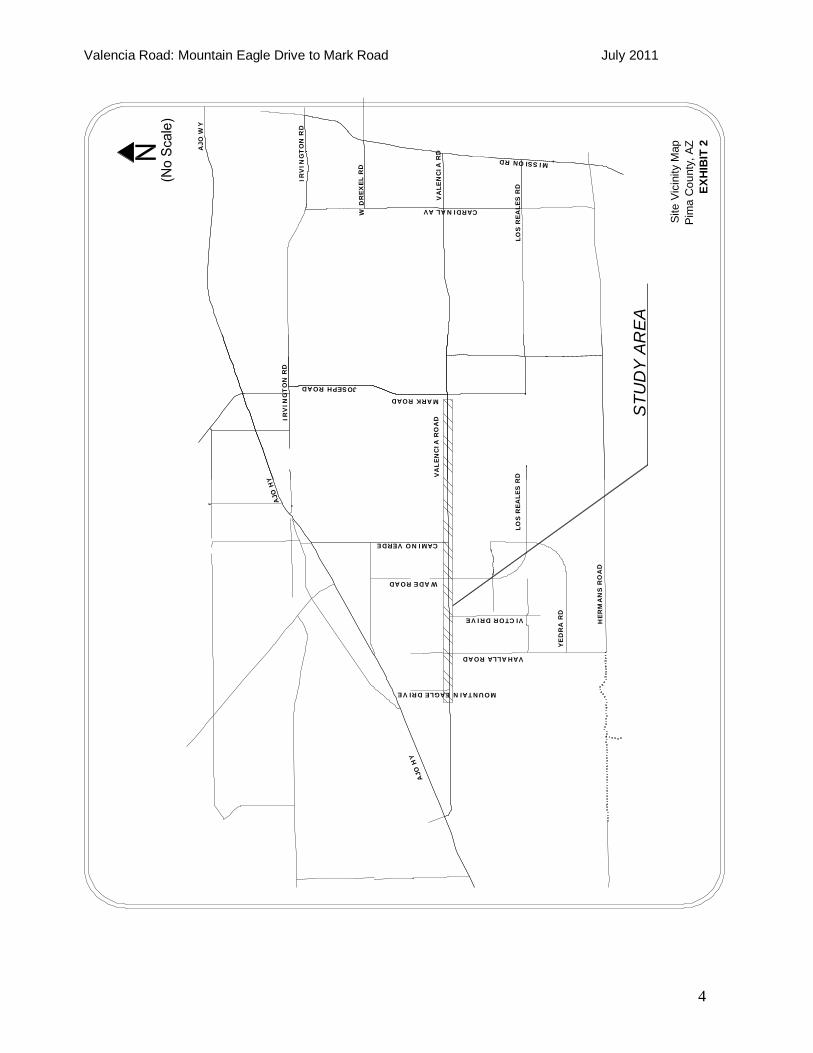
2. Introduction The corridor under study is Valencia Road from Mountain Eagle Drive to Mark Road. This project is located in southwest Tucson, Arizona as shown in Exhibit 1. A more descriptive map of the study area is illustrated in Exhibit 2. The widening of Valencia Road from Mountain Eagle Drive to Mark Road is a RTA funded project. This project will widen the western three-and-a-half miles of existing two-lane roadway to a four-lane divided arterial, and the eastern one mile to a five-lane arterial. This project is to be completed in two phases. Pima County Department of Transportation will lead the preliminary roadway design for the entire corridor. During Phase I of the project Pima County Department of Transportation will design and construct the roadway improvements from Wade Road to just west of the Mark Road intersection. During Phase II, the roadway improvements will be designed and constructed from Mountain Eagle Drive to Wade Road. The proposed widening of Valencia Road from Mountain Eagle Drive to Mark Road aims to provide capacity for future traffic demands, improve traffic safety and operations, reduce congestion, and increase mobility. The purpose of this traffic engineering report is to address capacity, safety, access, and multi-modal requirements. More specifically, the report presents results from the evaluation of the existing conditions as well as analyses of the future traffic conditions; then it presents recommendations for improvements. The following potential improvements have been considered and evaluated: additional travel lanes and turning lanes, turn lane storage requirements, intersection operational analysis, access control, pedestrian, transit, and bicycle facilities.

Valencia Road: Mountain Eagle Drive to Mark Road July 2011
3
Location MapPima County, AZ
EXHIBIT 1
OR
AC
LER
OA
D
TANGERINEROAD
LA C
HO
LLA
BLV
DMAGEEROAD
THO
RN
YD
ALE
RO
AD
I-10
I-10
AJO WAY
SITE LOCATION
I-19
TUCSON
I-10
(No Scale)N
VALENCIAROAD
Valencia Road: Mountain Eagle Drive to Mark Road July 2011
4
Site
Vic
inity
Map
Pim
a C
ount
y, A
ZEX
HIB
IT 2
AJO
HY
CAMINO VERDE
IRV
ING
TO
N R
DA
JO H
Y
LO
S R
EA
LES
RD
VA
LEN
CIA
RO
AD
VA
LE
NC
IA R
D
MISSION RD
JOSEPH ROAD
CARDINAL AV
W D
REX
EL R
D
IRV
ING
TO
N R
D
AJO
WY
VAHALLA ROAD
WADE ROAD
MARK ROAD
MOUNTAIN EAGLE DRIVE
VICTOR DRIVE
HER
MA
NS
RO
AD
LO
S R
EA
LES
RD
YE
DR
A R
D
STU
DY
AR
EA

Valencia Road: Mountain Eagle Drive to Mark Road July 2011
5
3. Existing Conditions This section provides an inventory of existing features and conditions within the roadway corridor. 3.1 Land Use Much of the property along this section of Valencia Road is currently developed and many of the vacant lots have approved development plans. Zoning of the property adjacent to the corridor includes residential and business/commercial land uses. Zoning along Valencia Road includes CB-1, CR-1, CR-3, CR-4, CR-5, CMH-1, GR-1, RH, SH, SR and TR under Pima County zoning ordinances. CB-1 is zoned as local business zone, CR-1 is zoned as single residence, CR-3 as single residence, CR-4 as mixed dwelling type zoning, and CR-5 is zoned as multiple residences. CMH-1 as County manufactured and mobile home, GR-1 is zoned rural residential, RH is zoned rural homestead, SH as suburban homestead, SR is zoned as suburban ranch and TR is zoned as transitional. 3.2 Physical Conditions 3.2.1 Roadway Valencia Road has one through travel lane in each direction between Mountain Eagle Drive and Mark Road. The roadway lies within Pima County. The existing horizontal alignment consists of tangent sections and curves. The roadway consists of a 3-lane cross section from Mountain Eagle Drive to approximately 3500 feet west of the Mark Road intersection. This roadway project does not include the Mark Road intersection. This cross section includes 12-foot wide through lanes, 12-foot wide two-way left turn lane and one-foot wide paved shoulders with exclusive left and right turn lanes at the major intersection with Camino Verde. The corridor has one signalized intersection and 13 unsignalized intersections. Refer to Exhibit 3. 3.2.2 Speed Limits The existing posted speed limits on the roadways within the study area are as follows. All other side streets have a 25 mile per hour (mph) posted speed limit.
Valencia Road from Mountain Eagle Drive to Camino Verde – 50 mph Valencia Road from Camino Verde to Mark Road - 45 mph Vahalla Road south of Valencia Road – 45 mph Wade Road south of Valencia Road – 45 mph Camino Verde - 45 mph Ignacio Baumea – 35 mph Mark Road – 45 mph
3.2.3 Intersections The roadway corridor lies within unincorporated Pima County. Currently there is one signalized intersection and 13 unsignalized intersections within the study corridor. Existing lane configurations and traffic control devices for major intersections along the corridor are shown in Exhibit 4.

Valencia Road: Mountain Eagle Drive to Mark Road July 2011
6
3.3 Traffic Data and Analysis 3.3.1 Traffic Counts The following traffic counts were collected for the project between November 17, 2010 and February 7, 2011.
Morning and evening peak period turning movement counts at the signalized intersections at Camino Verde and at Mark Road.
Morning and evening peak period turning movement counts at stop-controlled intersections at Mountain Eagle Drive, Vahalla Road, Iberia Avenue, Wade Road and Ignacio Baumea.
Vehicle Classification on eastbound and westbound Valencia Road. Directional daily traffic at the following locations: Valencia Road, Mountain Eagle Drive,
Vahalla Road, Iberia Road, Wade Road, Camino Verde, Casino del Sol, Ignacio Baumea and Mark Road.
Additional directional daily traffic at the following locations: Via Molino De Viento, Via Diego De Riveria, Bullfinch Drive, Giuliani Avenue, De Concini Drive, Eagle’s Talon Parkway, Victor Drive, Star Ridge Place, Star Diamond Place, South Arrow, Mardick Avenue, Viviana Road, and Valencia Road.
To complement the counts collected above, historical traffic counts were also obtained from Pima Associations of Governments (PAG) and Pima County Department of Transportation (PCDOT), Traffic Division. Directional daily traffic counts are summarized in Exhibit 5 and peak-hour turning movement counts are summarized in Exhibit 6 and 7. Raw counts and any additional directional daily traffic counts are included in Appendix A for reference. Based on the counts, the peak hours were found to occur between 7:15 AM – 8:15 AM in the morning and 5:00 PM – 6:00 PM in the evening.

Sum
mary of D
riveways,
Side S
treets, IntersectionsP
ima C
ounty, AZEXH
IBIT 3a
Signalized Intersection
Unsignalized Intersection
Drivew
ay
SUD MATCHLINE B
MATCHLINE AMATCHLINE BMATCHLINE C
MATCHLINE A BEGIN PROJECT(N
o Scale)
N

Sum
mary of D
riveways,
Side S
treets, IntersectionsP
ima C
ounty, AZEXH
IBIT 3b
Signalized Intersection
Unsignalized Intersection
Drivew
ay
SUD MATCHLINE E
MATCHLINE DMATCHLINE EMATCHLINE F
MATCHLINE D MATCHLINE C(N
o Scale)
N

Sum
mary of D
riveways,
Side S
treets, IntersectionsP
ima C
ounty, AZEXH
IBIT 3c
Signalized Intersection
Unsignalized Intersection
Drivew
ay
SUD MATCHLINE H
MATCHLINE GMATCHLINE HMATCHLINE I
MATCHLINE G MATCHLINE F(N
o Scale)
N

Sum
mary of D
riveways,
Side S
treets, IntersectionsP
ima C
ounty, AZEXH
IBIT 3d
Signalized Intersection
Unsignalized Intersection
Drivew
ay
SUD MATCHLINE K
MATCHLINE JMATCHLINE K
MATCHLINE J MATCHLINE I
MATCHLINE L
(No S
cale)N

Sum
mary of D
riveways,
Side S
treets, IntersectionsP
ima C
ounty, AZEXH
IBIT 3e
Signalized Intersection
Unsignalized Intersection
Drivew
ay
SUD
MATCHLINE N
MATCHLINE MMATCHLINE N
MATCHLINE M MATCHLINE L
(No S
cale)N

Valencia Road: Mountain Eagle Drive to Mark Road July 2011
12
Exi
stin
g La
ne C
onfig
urat
ion
and
Traf
fic C
ontro
l Dev
ices
Pim
a C
ount
y, A
ZEX
HIB
IT 4
AJO
HY
CAMINO VERDE
VA
LEN
CIA
RO
AD
VAHALLA ROAD
WADE ROAD
MARK ROAD
DR
EX
EL R
OA
D
MOUNTAINEAGLE DRIVE
IGNACIOBAUMEA
IBERIA ROAD
12
34
56
7
12
34
76
5

Valencia Road: Mountain Eagle Drive to Mark Road July 2011
13
Exi
stin
g Tr
affic
Con
ditio
ns (2
011)
Ave
rage
Dai
ly T
raffi
cPi
ma
Cou
nty,
AZ
EXH
IBIT
5
AJO
HY
CAMINO VERDE
VA
LEN
CIA
RO
AD
VAHALLA ROAD
WADE ROAD
MARK ROAD
DR
EX
EL R
OA
D
MOUNTAINEAGLE DRIVE
IGNACIOBAUMEA
IBERIA ROAD
4724
9015
1238
817
264
4577 2639
3622
2930
234
868
975
2159
2218
2
490
804
CASINODEL SOL
3807

Valencia Road: Mountain Eagle Drive to Mark Road July 2011
14
Exi
stin
g Tr
affic
Con
ditio
ns (2
011)
Wee
kday
AM
Pea
k ho
urP
ima
Cou
nty,
AZ
EXH
IBIT
6
AJO
HY
CAMINO VERDE
VA
LEN
CIA
RO
AD
VAHALLA ROAD
WADE ROAD
MARK ROAD
DR
EX
EL R
OA
D
MOUNTAINEAGLE DRIVE
IGNACIOBAUMEA
IBERIA ROAD
12
34
56
7
12
34
76
5
LOS
= C
Del
=22.
2sV
/C=0
.61
LOS=
BD
el=1
7.8
V/C
=0.3
4
LOS
=N/A
Del
=1.4
sV
/C=0
.09
LOS
=N/A
Del
=0.5
sV
/C=0
.21
LOS
=N/A
Del
=3.2
sV
/C=0
.18
LOS
=N/A
Del
=11.
4sV
/C=0
.78
LOS
=N/A
Del
=1.1
sV
/C=0
.24
148
324
18 5
15 129
12
2 358
3
3157
16716
1 136
65
0 538
12
000
392363
85 378
46
78 532
53559277
319385
13 100
N/A
2 271
N/A
5N/A53
31 148
N/A
268
727
N/A
51N/A120
N/A
251
54
N/A
758
19
13N/A41

Valencia Road: Mountain Eagle Drive to Mark Road July 2011
15
Exis
ting
Traf
fic C
ondi
tions
(201
1)W
eekd
ay P
M P
eak
hour
Pim
a C
ount
y, A
ZEX
HIB
IT 7
AJO
HY
CAMINO VERDE
VA
LE
NC
IA R
OA
D
VAHALLA ROAD
WADE ROAD
MARK ROAD
DR
EX
EL R
OA
D
MOUNTAINEAGLE DRIVE
IGNACIOBAUMEA
IBERIA ROAD
12
34
56
7
12
34
76
5
LOS=
CD
el=2
0.4s
V/C
=0.4
9
LOS=
BD
el=1
4.4s
V/C
=0.3
9
LOS
=N/A
Del
=0.6
sV
/C=0
.19
LOS=
N/A
Del
=0.4
sV/
C=0
.25
LOS=
N/A
Del
=1.4
sV/
C=0
.07
LOS
=N/A
Del
=5.0
sV
/C=0
.42
LOS
=N/A
Del
=2.0
sV
/C=0
.34
390
191
4 1449 38
630
3 228
1
2028
2318
1 524
473
0 284
16
000
150140
93 743
65
57 493
23
625358
353733
56 248
N/A
8 144
N/A
3N/A19
143
554
N/A
79 281
N/A
275N/A82
N/A
796
47
N/A
580
23
24N/A193

Valencia Road: Mountain Eagle Drive to Mark Road July 2011
16
3.3.2 Traffic Factors Traffic factors listed in Exhibit 8 were calculated from the 24-hour roadway counts. The K-factor (K), which represents the percentage of daily traffic that occurs during the peak hour, and the directional split (D) are based on traffic flow during the morning and evening peak hours.
Exhibit 8 Traffic Factors K D Valencia Road
AM PM AM PM Ajo Road to Vahalla Road 0.03 0.03 0.69 0.62
Vahalla Road to Wade Road 0.04 0.04 0.78 0.61 Wade Road to Camino Verde 0.01 0.05 0.53 0.73
Camino Verde to Viviana Road 0.04 0.04 0.82 0.65 Viviana Road to Mark Road 0.03 0.04 0.74 0.51
The directional split indicates unbalanced directional traffic flow during the peak traffic period. Eastbound traffic is heavier during the a.m. peak hour and westbound traffic is heavier during the p.m. peak hour. 3.3.3 Heavy Vehicle Percentage Three-hour vehicle classification counts were taken on February 1 and 3, 2011. The results of the classification study are summarized in Exhibit 9. In general, the observed heavy vehicle percentage for eastbound traffic is about 3% which is consistent with other major arterials in the metropolitan area where 3-5% is typical. Westbound traffic is about 8% which is higher than other major arterials. (It should be noted that FHWA defines heavy vehicles as those in the Categories “2 Axle 6 Tire” through “>6 Axle Multi.”)
Exhibit 9 Vehicle Classification Data
Motorcycles Cars & Trailers
2 Axle Light
Goods Bus 2 Axle
Single 3 Axle Single
4 Axle Single
<5 Axle ST
5 Axle ST
>6 Axle ST
5 Axle Multi
6 Axle Multi
>6 Axle Multi
Not Class.
Valencia Road Eastbound 1 587 139 0 18 2 0 2 0 0 0 0 0 1
0.1% 78.3% 18.5% 0.0% 2.4% 0.3% 0.0% 0.3% 0.0% 0.0% 0.0% 0.0% 0.0% 0.1% Valencia Road Westbound 9 943 70 0 16 6 9 31 4 10 1 2 7 12
0.8% 84.2% 6.3% 0.0% 1.4% 0.5% 0.8% 2.8% 0.4% 0.9% 0.1% 0.2% 0.6% 1.1% 3.3.4 Traffic Analysis Intersection level of service analyses were performed using the Synchro (version 7) software package, which utilizes the Highway Capacity Manual (HCM) analysis procedures. The analyses were performed for the peak 15 minute using the following criteria and assumptions.
A 3.00% of heavy vehicles for eastbound traffic and 8.00% of heavy vehicles for westbound traffic were used for analyses of existing conditions and were assumed to remain the same for future conditions.
Existing timing plans were obtained from PCDOT and entered into Synchro. A peak-hour factor (PHF) of 1.00 for each movement was applied to the Synchro model.

Valencia Road: Mountain Eagle Drive to Mark Road July 2011
17
Level of service (LOS) is a qualitative measure that describes the operating conditions of an intersection or roadway. For a signalized intersection, the level of service is defined by the average control delay that a driver experiences at the intersection. LOS A equated to ideal conditions with little or no delay, while LOS F represents congested conditions with average vehicle control delays exceeding 80 seconds. LOS D is defined as the threshold for acceptable operation in the PAG region. The intersection analysis results are summarized in Exhibits 6 and 7. The results are discussed below and corresponding Synchro output pages are included in Appendix B. 3.3.4.1 Intersection of Valencia Road and Camino Verde During the a.m. peak hour, the intersection LOS is C, and all movements have LOS of D or better. During the p.m. peak hour, the intersection LOS is C, and all movements have LOS D or better. 3.3.4.2 Intersection of Valencia Road and Mark Road During the a.m. peak hour, the intersection LOS is B, and all movements have LOS D or better. During the p.m. peak hour, the intersection LOS is B, and all movements have LOS D or better. 3.4 Crash Summary Crash data for the period of July 1, 2007 to June 30, 2010 was obtained from PCDOT. The intersection and crash data was reviewed and is summarized in Exhibits 10 and 11, respectively. Crash Data is included in Appendix C.

Valencia Road: Mountain Eagle Drive to Mark Road July 2011
18
Exhibit 10 Intersection Crash Data Summary (July 1, 2007 - June 30, 2010)
Intersections
Valencia Road at
Mountain Eagle Avenue
Valencia Road at
Vahalla Road
Valencia Road at Iberia
Avenue
Valencia Road at
Wade Road
Valencia Road at Camino Verde
Valencia Road at Mark Road
Crash Type Number % Number % Number % Number % Number % Number % Rear-end 0 0 0 0 0 0 4 44 14 61 25 64 Turning 0 0 0 0 1 100 0 0 1 4 4 10 Angle 1 100 1 100 0 0 2 22 7 30 4 10
Out of Control 0 0 0 0 0 0 0 0 0 0 0 0 Sideswipe 0 0 0 0 0 0 0 0 0 0 1 3
Miscellaneous 0 0 0 0 0 0 2 22 1 4 2 5 Fixed Object 0 0 0 0 0 0 1 11 0 0 0 0
Backing 0 0 0 0 0 0 0 0 0 0 2 5 Head on 0 0 0 0 0 0 0 0 0 0 1 3 Animal 0 0 0 0 0 0 0 0 0 0 0 0
Pedestrian 0 0 0 0 0 0 0 0 0 0 0 0 Total Crashes 1 N/A 1 N/A 1 N/A 9 N/A 23 N/A 39 N/A
Daily ADT 5963 N/A 7457 N/A 8829 N/A 15013 N/A 17833 N/A 24890 N/A Crash Rate 0.15 N/A 0.12 N/A 0.10 N/A 0.55 N/A 1.18 N/A 1.43 N/A
Average Crash Rate 0.39 N/A 0.39 N/A 0.39 N/A 0.39 N/A 0.96 N/A 0.96 N/A
Severity Fatal 0 0 0 0 0 0 0 0 0 0 0 0
Class 4 Injury 0 0 0 0 0 0 0 0 1 4 0 0 Bodily Injury 0 0 1 100 0 0 4 44 10 43 16 41
PDO 1 100 0 0 1 100 5 56 12 52 23 59 Severity Index 1.00 N/A 2.00 N/A 1.00 N/A 1.44 N/A 1.64 N/A 1.41 N/A
Average Severity Index 1.50 N/A 1.50 N/A 1.50 N/A 1.50 N/A 1.40 N/A 1.40 N/A
Intersection Crash Rates refer to the number of crashes per million vehicles entering the intersection. Rate=(number of 3-year crashes x 10^6)/(3 years x weekday entering volume x 365 days)
Severity Index is calculated based on crash severity parameters developmed by the National Safety Council. Index = [5.8 (Fatality&Class 4 Injury) + 2(Class2&3 Bodily Injury) + Property Damage]/(Total No. of Crashes)

Valencia Road: Mountain Eagle Drive to Mark Road July 2011
19
Exhibit 11 Segment Crash Data Summary (July 1, 2007 -- June 30, 2010)
Segments
Valencia Road from Mountain Eagle Drive to Iberia Avenue (8200-7400)
Valencia Road from Iberia Avenue to
Camino Verde (7399-6600)
Valencia Road from Camino
Verde to Camino Rancho (6599-
5800)
Valencia Road from Camino
Rancho to Mark Road (5799-5000)
Crash Type Number % Number % Number % Number % Rear-end 0 0 8 53 7 47 7 32 Turning 0 0 0 0 0 0 2 9 Angle 0 0 0 0 0 0 2 9
Sideswipe 0 0 1 7 2 13 2 9 U-Turn 0 0 3 20 1 7 0 0
Out of Control 0 0 1 7 1 7 4 18 Miscellaneous 0 0 0 0 1 7 2 9 Fixed Object 0 0 1 7 2 13 2 9
Backing 0 0 0 0 0 0 0 0 Head on 0 0 0 0 0 0 0 0
Pedestrian 0 0 0 0 0 0 0 0 Animal 0 0 1 7 1 7 1 5
Total Crashes 0 N/A 15 N/A 15 N/A 22 N/A Daily ADT 12895 N/A 12895 N/A 13244 N/A 13244 N/A Crash Rate 0.00 N/A 1.06 N/A 0.69 N/A 1.00 N/A
Average Crash Rate 1.32 N/A 1.32 N/A 1.32 N/A 1.32 N/A Severity
Fatal 0 0 0 0 0 0 0 0 Class 4 Injury 0 0 1 7 0 0 3 14 Bodily Injury 0 0 5 33 4 27 7 32
PDO 0 0 9 60 11 73 12 55 Severity Index 0.00 N/A 1.65 N/A 1.27 N/A 1.97 N/A
Average Severity Index 1.58 N/A 1.58 N/A 1.58 N/A 1.58 N/A
Segment Crash Rates refer to the number of crashes per million vehicle miles of travel. Rate=(number of 3-year crashes x 10^6)/(segment length x 3 years x weekday volume x 365 days)
Severity Index is calculated based on crash severity parameters developmed by the National Safety
Council. Index = [5.8 (Fatality&Class 4 Injury) + 2(Class2&3 Bodily Injury) + Property Damage]/(Total No. of Crashes)
3.4.1 Intersection Crash Analysis The signalized intersections of Camino Verde and Mark Road had crash rates higher than the three-year average crash rate of 0.96 crashes per million entering vehicles for all signalized intersections within Pima County (based on data from 01/2006 to 12/2008) (Reference 7). For the signalized intersection at Camino Verde, the severity index was higher than the average severity index for all signalized intersections within Pima County (based on data from 01/2006 to 12/2008). 3.4.1.1 Valencia Road and Mountain Eagle Drive This unsignalized intersection had a crash rate of 0.16 crashes per million entering vehicles and a severity index of 1.0. The single crash for this was an angle type crash.

Valencia Road: Mountain Eagle Drive to Mark Road July 2011
20
3.4.1.2 Valencia Road and Vahalla Road This unsignalized intersection had a crash rate of 0.13 crashes per million entering vehicles and a severity index of 2.0. The single crash for this intersection was an angle type crash. 3.4.1.3 Valencia Road and Iberia Avenue This unsignalized intersection had a crash rate of 0.11 crashes per million entering vehicles and a severity index of 1.0. The single crash for this intersection was a turning type crash. 3.4.1.4 Valencia Road and Wade Road This unsignalized intersection had a crash rate of 0.56 crashes per million entering vehicles and a severity index of 1.44. The predominant crash type for this intersection was rear-end, representing 44% of all crashes. No definitive probable causes have been identified at this location. 3.4.1.5 Valencia Road and Camino Verde This signalized intersection had a crash rate of 1.21 crashes per million entering vehicles and a severity index of 1.64. The predominant crash type was rear-end, representing 61% of all crashes. No definitive probably causes have been identified at this location. 3.4.1.6 Valencia Road and Mark Road This signalized intersection had a crash rate of 1.47 crashes per million entering vehicles and a severity rate of 1.41. The predominant crash type for this intersection is rear-end, representing 64% of all crashes. No definitive probable causes have been identified at this location. 3.4.2 Segment Crash Analysis The crash rate on all segments of the roadway were below the three year average crash rate of 1.32 crashes per million vehicle-miles for all roadway segments within Pima County (based on data from 01/2006 to 12/2008) (Reference 7). One segment, from Camino Rancho to Mark Road, had a severity index that was higher than the average severity index of 1.58 for all roadway segments within Pima County (based on data from 01/2006 to 12/2008). A majority of the crashes were rear-end crashes. No fatalities were reported during the study period. 3.4.2.1 Valencia Road from Mountain Eagle Drive to Iberia Avenue (8200 W. -7400 W.) This segment of the corridor had a crash rate of 0.0, indicating zero crashes during the investigation period. 3.4.2.2 Valencia Road from Iberia Avenue to Camino Verde (7399 W.-6600 W.) This segment of the corridor had a crash rate of 1.06 and a severity index of 1.65. Rear-end is the most predominant type of crash in this segment, representing 53% of all crashes for this segment. No definitive probable cause has been identified at this location. 3.4.2.3 Valencia Road from Camino Verde to Camino Rancho (6599 W. -5800 W.) This segment of the corridor had a crash rate of 0.69 and a severity index of 1.27. The predominant type of crash was rear-end, representing 47% of all crashes for this segment.

Valencia Road: Mountain Eagle Drive to Mark Road July 2011
21
3.4.2.4 Valencia Road from Camino Rancho to Mark Road (5799-5000) This segment of the corridor had a crash rate of 1.0 and a severity index of 1.97. The predominant type of crash was rear-end, representing 32% of all crashes for this segment. 3.5 Summary of Signal Warrant Studies A signal warrant study was performed at the following four unsignalized intersections with Valencia Road: Mountain Eagle Drive, Vahalla Road, Iberia Avenue, and Wade Road. The existing peak hour traffic volumes were evaluated in relation to Warrant 1, Condition A. Minumum Vehicular Volume and Warrant 1, Condition B Interruption of Continuous Traffic in the Manual on Uniform Traffic Control Devices. The analysis of the warrants for the installation of a traffic signal is included in Appendix D. 3.5.1 Valencia Road at Mountain Eagle Drive This intersection does not meet the warrant for a traffic signal under existing conditions. 3.5.2 Valencia Road at Vahalla Road This intersection does not meet the warrant for traffic signal under existing conditions. 3.5.3 Valencia Road at Iberia Avenue This intersection does not meet the warrant for a traffic signal under existing conditions. 3.5.4 Valencia Road at Wade Road This intersection currently meets the warrant for a traffic signal. Valencia Road and Wade Road intersection meets the minimum 8-hour vehicular volumes, and it is recommended that a signal be installed at this intersection. The north leg of Wade Road is currently an unmaintained, dirt road and should be realigned to meet the signalized intersection for continued vehicle access. 3.6 Alternative Transportation Modes This section describes existing transit services along and in the vicinity of the corridor study and pedestrian, bicycle, and equestrian activities and facilities within the project area. Currently SunTran Route 27 runs along Valencia Road through the project from Mark Road to Casino del Sol, a distance of approximately 1.5 miles. This route runs approximately every 15 minutes Monday through Friday from 6:00 AM until 10:30 PM, Saturday approximately every one hour from 7:30 AM until 9:45 PM, and Sunday every one hour from approximately 6:30 AM until 7:45 PM. There is a Park & Ride lot at the Casino del Sol for commuter use. There are no future plans to provide additional bus service to this area. There are no existing bicycle facilities along the project corridor from Mountain Eagle Drive to Mark Road. Bicyclists currently share the lane with motorists for this length of the roadway. There are no existing pedestrian facilities in the project area. Marked pedestrian crosswalks are limited to signalized intersections.

Valencia Road: Mountain Eagle Drive to Mark Road July 2011
22
There are no designated equestrian trails in the area. 3.7 Lighting and ITS The project corridor area is under lighting code E1c per the City of Tucson/Pima County Outdoor Lighting Code, which is defined as inclusive of the circular area thirty-five miles in radius the center of which is the summit of Kitt Peak in Section 4.9.4. The codes that are applicable restrict the permitted lighting installations as indicated in the City of Tucson/Pima County Outdoor Lighting Code. Currently there is intersection lighting at all the signalized intersections along the project corridor. Pima County does not typically provide continuous street lighting except in areas with relatively high density of access points/activity and/or pedestrian activity. Since neither of these conditions will likely exist along this corridor, lighting at signalized intersections will provide appropriate roadway illumination. Intersection lighting currently exists at all signalized intersections. All the traffic signals along the corridor are equipped with Emergency Vehicle Preemption detectors and beacons.

Valencia Road: Mountain Eagle Drive to Mark Road July 2011
23
4. Future Conditions The following subsections provide a summary of upcoming developments along the Valencia Road corridor, planned transportation improvements, and the estimation of the 2030 traffic demand. 4.1 Planned Developments Several developments are proposed along the corridor. Star Valley Block 13 is a 67.64 acre residential subdivision consisting of 302 single family residential lots south of Valencia Road and Wade Road. Star Valley Commercial Center is a 9.53 acre commercial development at the southwest corner of Wade Road and Valencia Road. Star Valley Block 4 is a 126.36 acre residential subdivision consisting of 572 single family residential homes. Star Valley Block 7 is a 56.30 acre residential subdivision consisting of 368 single family residential lots. Star Valley Block 8 is a 58.86 acre residential subdivision consisting of 239 single family residential lots. 4.2 Planned Transportation Improvements There exist a number of recently constructed or planned transportation improvements within the project area. Many of these improvements are funded by public agencies while others are required improvements as part of a development. The improvements are summarized below.
Ajo Way widening from Valencia Road to Kinney Road. Ajo Way and Kinney Road intersection reconstruction. Valencia Road from Mark Road to Camino de la Tierra widening completed in May 2008. Valencia Road and Camino Verde intersection reconstruction completed in early 2010. Ignacio Baumea from Valencia Road to Los Reales construction completed in 2010. Addition of bike lanes on Valencia Rd from Camino de la Tierra to Cardinal Avenue and
Westover to Mission Road La Luna Subdivision Sonoran Ranch Estates II Subdivision Star Valley Subdivision
4.3 Traffic Projections The 2030 traffic volumes were developed by first obtaining the 2030 projections produced by the Pima Association of Governments (PAG) regional model. The PAG volumes were then compared to historical counts and 2010-2011 counts. The PAG 2040 regional model was also taken into consideration as annual growth was reduced considerably in some areas between the 2030 and 2040 models. Some of the 2030 PAG projected volumes appear unusual when considering the latest 2040 projections and were decreased somewhat to account for this variation. The traffic projections are summarized in Exhibit 12. Once the 2030 average daily traffic (ADT) volumes were established, 2030 peak hour volumes for the major study intersections were developed. The 2030 peak hour turning volumes were derived from the 2011 turning movement counts, 2011 K and D factors and the 2030 estimated ADT volumes.

Valencia Road: Mountain Eagle Drive to Mark Road July 2011
24
Exhibit 12 Traffic ADT Projections
PAG Assumed for This Study Roadway Segment Existing
(2011) 2030 Annual
Growth 2040 Annual Growth 2030 Annual
Growth
Valencia Road
Mark Road to Camino de
Oeste 22182 52000 4.6% 66000 6.0% 46734 4.0%
Ignacio Baumea
Ignacio Baumea South 2159 15000 10.7% -- 0.0% 6532 6.0%
Camino Verde
Camino Verde North 3622 25000 10.7% 12000 6.0% 10959 6.0%
Mark Road North 4577 11000 4.7% 24000 5.9% 11992 5.2% Mark
Road Mark Road South 2636 20000 11.3% 37000 9.5% 13553 9.0%
Ajo Road to Vahalla Road 4724 13000 5.5% 33000 6.0% 11937 5.0%
Vahalla Road to Wade Road 9015 36000 7.6% 33000 4.1% 24932 5.5%
Wade Road to Camino Verde 14783 36000 4.8% 33000 2.5% 28420 3.5%
Camino Verde to Vivianna
Road 12388 33000 5.3% 33000 3.1% 23785 3.5%
Valencia Road
Vivianna Road to Mark Road 17264 42000 4.8% 33000 2.0% 33147 3.5%
4.3.1 Projections for Vahalla Road The PAG model does not include what it does not consider to be a major roadway, so Vahalla Road is not shown on the PAG 2030 regional model. Counts were taken at this currently unsignalized intersection and a conservative 3% linear annual growth rate was assumed for this study. 4.3.2 Projections for Iberia Avenue Iberia Avenue is also not considered a major roadway within the PAG 2030 regional model and it is not shown. Counts were taken at this intersection and a 3% linear growth rate was assumed for this study. 4.3.3 Projections for Wade Road Wade Road is also not considered a major roadway within the PAG 2030 regional model and it is not shown. Counts were taken at this intersection and a 3% linear growth rate was assumed for this study. 4.3.4 Projections for Camino Verde Camino Verde is a major local road. Based on current use and proposed development, a 6% annual growth rate was assumed for this study.

Valencia Road: Mountain Eagle Drive to Mark Road July 2011
25
4.3.5 Projections for Ignacio Baumea Ignacio Baumea was considered a significant new roadway per the 2030 PAG regional model but left off the 2040 model entirely. A reduced annual growth rate of 6% was assumed for this study. 4.4 Capacity and Level of Service This section presents capacity analysis results for the Valencia Road roadway from Mountain Eagle Drive to Mark Road and the study intersections. Relevant discussions are provided regarding capacity requirements to accommodate 2030 traffic demand. Capacity on a roadway segment depends greatly on intersection traffic control along the segment as well as street environment such as roadside activity, lane uses, driveway density, parking, speed limit, type of median, etc. Florida Department of Transportation (FDOT) has established that a 2-lane arterial can generally accommodate 15,600 vehicles per day (vpd) at LOS E and a 4-lane arterial can accommodate 32,900 vpd. The existing daily traffic volumes along Valencia Road range from 2,100 to 17,200 vpd, and the 2030 daily traffic volumes are estimated to be in the range of 6,000 to 36,000 vpd. Considering FDOT’s LOS criteria and number of through lanes required at the major signalized intersections along Valencia Road, a 4-lane cross section will be required to accommodate the 2030 traffic. For the major intersections, Synchro (version 7) was used to assess future capacity requirements. Exhibits 13 and 14 show the intersection levels of service (LOS) in 2030 if no capacity improvements were implemented. The results indicate that all of the signalized intersections will operate at unacceptable level of service and cause excessive delays and queuing. Required intersection lane configurations to adequately accommodate the 2030 peak hour traffic are illustrated in Exhibit 15. Specific needs/improvements for each intersection are discussed below. Exhibits 16 and 17 summarize the capacity analysis results with the improvements in place. Turn-lane storage length requirements are discussed separately in Section 5.4.

Valencia Road: Mountain Eagle Drive to Mark Road July 2011
26
Yea
r 203
0 Tr
affic
Con
ditio
nsw
ith E
xist
ing
Lane
Con
figur
atio
nsW
eekd
ay A
M P
eak
hour
Pim
a C
ount
y, A
ZEX
HIB
IT 1
3
AJO
HY
CAMINO VERDE
VA
LEN
CIA
RO
AD
VAHALLA ROAD
WADE ROAD
MARK ROAD
DR
EX
EL R
OA
D
MOUNTAINEAGLE DRIVE
IGNACIOBAUMEA
IBERIA ROAD
12
34
56
7
12
34
76
5
LOS
=ED
el=7
7.7s
V/C
=1.1
3
LOS
=FD
el=2
32.9
sV
/C=1
.39
LOS
=N/A
Del
=1.6
sV
/C=0
.25
LOS
=N/A
Del
=0.6
sV
/C=0
.52
LOS
=N/A
Del
=7.8
sV
/C=0
.84
LOS
=N/A
Del
= 66
.6s
V/C
= 21
.39
LOS
=N/A
Del
=4.1
sV
/C=0
.53
374
819
32 9
46 399
37
6 1070
9
5296
11484
0 382
182
0 2371
53
000
670620
182
808
98
152
1038
103
147246206
189568446
33 256
N/A
5 696
N/A
9N/A93
59 283
N/A
505
1370
N/A
148N/A349
N/A
525
113
N/A
1655
41
39N/A121

Valencia Road: Mountain Eagle Drive to Mark Road July 2011
27
Yea
r 203
0 Tr
affic
Con
ditio
nsw
ith E
xist
ing
Lane
Con
figur
atio
nsW
eekd
ay P
M P
eak
hour
Pim
a C
ount
y, A
ZEX
HIB
IT 1
4
AJO
HY
CAMINO VERDE
VA
LEN
CIA
RO
AD
VAHALLA ROAD
WADE ROAD
MARK ROAD
DR
EX
EL R
OA
D
MOUNTAINEAGLE DRIVE
IGNACIOBAUMEA
IBERIA ROAD
12
34
56
7
12
34
76
5
LOS
=FD
el=1
32.5
sV
/C=1
.16
LOS
=FD
el=1
10.4
sV
/C=1
.08
LOS
=N/A
Del
=0.8
sV
/C=0
.49
LOS
=N/A
Del
=0.4
sV
/C=0
.57
LOS
=N/A
Del
=7.1
sV
/C=0
.52
LOS
=N/A
Del
=433
.9s
V/C
= 2.
98
LOS
=N/A
Del
=61.
8sV
/C=1
.55
896
483
7 24
149
1175
91
9 695
3
4049
3531
0 1466
1324
0 1223
69
000
260245
203
1620
142
114
984
46167143156
214227202
141
623
N/A
21 369
N/A
5N/A34
272
1056
N/A
149
529
N/A
812N/A242
N/A
710
98
N/A
1218
48
71N/A573

Valencia Road: Mountain Eagle Drive to Mark Road July 2011
28
Futu
re L
ane
Con
figur
atio
nsan
d Tr
affic
Con
trol D
evic
esP
ima
Cou
nty,
AZ
EXH
IBIT
15
AJO
HY
CAMINO VERDE
VA
LE
NC
IA R
OA
D
VAHALLA ROAD
WADE ROAD
MARK ROAD
DR
EX
EL R
OA
D
MOUNTAINEAGLE DRIVE
IGNACIOBAUMEA
IBERIA ROAD
12
34
56
7
12
34
76
5

Valencia Road: Mountain Eagle Drive to Mark Road July 2011
29
Year
203
0 Tr
affic
Con
ditio
nsw
ith A
dded
Cap
acity
Wee
kday
AM
Pea
k ho
urP
ima
Cou
nty,
AZ
EXH
IBIT
16
AJO
HY
CAMINO VERDE
VA
LE
NC
IA R
OA
D
VAHALLA ROAD
WADE ROAD
MARK ROAD
DR
EX
EL R
OA
D
MOUNTAINEAGLE DRIVE
IGNACIOBAUMEA
IBERIA ROAD
12
34
56
7
12
34
76
5
LOS
=BD
el=1
6.9s
V/C
=0.8
1
LOS=
FD
el=2
03s
V/C
=1.3
3
LOS=
N/A
Del
=1.6
sV
/C=0
.30
LOS=
BD
el=1
2.9s
V/C
=0.3
3
LOS=
AD
el=6
.1s
V/C
=0.5
2
LOS=
CD
el=2
4.0s
V/C
=0.9
3
LOS=
N/A
Del
=48.
5sV/
C=2
.33
374
818
32 9
46 399
37
6 1070
9
5296
11484
0 382
182
0 2371
53
000
670620
182
808
98
152
1038
103
147246206
189568446
33 256
N/A
5 696
N/A
9N/A92
59 283
N/A
505
1370
N/A
148N/A349
N/A
525
113
N/A
1655
41
39N/A121

Valencia Road: Mountain Eagle Drive to Mark Road July 2011
30
Yea
r 203
0 Tr
affic
Con
ditio
nsw
ith A
dded
Cap
acity
Wee
kday
PM
Pea
k ho
urP
ima
Cou
nty,
AZ
EXH
IBIT
17
AJO
HY
CAMINO VERDE
VA
LEN
CIA
RO
AD
VAHALLA ROAD
WADE ROAD
MARK ROAD
DR
EX
EL R
OA
D
MOUNTAINEAGLE DRIVE
IGNACIOBAUMEA
IBERIA ROAD
12
34
56
7
12
34
76
5
LOS
=ED
el=6
0sV
/C=1
.08
LOS
=ED
el=7
5.4s
V/C
=1.1
3
LOS
=N/A
Del
=0.9
sV
/C=0
.24
LOS
=AD
el=6
sV
/C=0
.38
LOS=
AD
el=6
.5s
V/C
=0.6
5
LOS
=CD
el=2
5.2s
V/C
=0.9
6
LOS
=N/A
Del
=97.
9sV
/C=1
.83
896
483
7 24
149
1175
91
9 695
3
4049
3531
0 1466
1324
0 1223
69
000
260245
203
1620
142
114
984
46167143156
214227202
169
746
N/A
21 369
N/A
5N/A34
272
1056
N/A
149
529
N/A
812N/A242
N/A
710
97
N/A
1218
48
71N/A573

Valencia Road: Mountain Eagle Drive to Mark Road July 2011
31
4.4.1 Intersection of Valencia Road and Vahalla Road With the existing lane configurations and 2030 turning volume, the intersection of Valencia Road and Vahalla will operate with an intersection delay of 0.6 seconds. With the intersection widening to two through lanes, the intersection delay will be 12.9 seconds with a LOS A during the a.m. peak hour and a LOS B during the p.m. peak hour. 4.4.2 Intersection of Valencia Road and Iberia Avenue With the existing lane configurations and 2030 turning volume, the intersection of Valencia Road and Iberia Avenue will operate with an intersection delay of 7.8 seconds. With the intersection widening to two through lanes, the intersection delay will be 6.5 seconds with a LOS A during the a.m. and p.m. peak hours. 4.4.3 Intersection of Valencia Road and Wade Road With the existing lane configurations and 2030 turning volume, the intersection of Valencia Road and Wade Road will operate with an intersection delay of 433.9 seconds, or 7.2 minutes. With the intersection widening to two through lanes with dedicated left and right turn lanes in the east and west directions, the intersection delay will be 25.2 seconds with a LOS C during the a.m. and p.m. peak hours. Volumes necessitate dual westbound left-turn lanes. Pima County guidelines require an exclusive eastbound right-turn lane with the future volume. The north leg of Wade Road is currently an unmaintained, dirt road; however, with the intersection widening to two through lanes on Valencia, the north leg of Wade Road should be realigned to meet the signalized intersection for continued vehicle access. 4.4.4 Intersection of Valencia Road and Camino Verde With the existing lane configurations and 2030 volume, the intersection of Valencia Road and Camino Verde will operate with an intersection delay of 132.5 seconds with a LOS E during the a.m peak hour and a LOS F during the p.m. peak hour. With the intersection widening to two through lanes with dedicated left and right turn lanes in the east and west directions, the intersection delay will be 60 seconds with a LOS B during the a.m. peak hour and a LOS E during the p.m. peak hour. Pima County guidelines require an exclusive westbound right-turn lane with the future volume.

Valencia Road: Mountain Eagle Drive to Mark Road July 2011
32
5. Proposed Improvements Based on the results of the various capacity and safety analyses, a set of corridor improvements is developed and recommended. The recommendations include appropriate design parameters, number of through lanes for the corridor, lane configuration and traffic control at the major intersections, access control, storage length of turn bays, and multi modal requirements. The following sections describe the proposed improvements in detail. 5.1 Design Parameters Valencia Road from Mountain Eagle Drive to Mark Road will be designed according to the requirements and parameters identified in the latest Pima County Roadway Design Manual and the AASHTO “Green Book”. The following design criteria are recommended for this project. Design Speed: The design speed selected for the Valencia Road widening should be consistent with other arterials in the area to provide for driver expectation and safety. The design speed will also need to be flexible to address right-of-way, environmental, and cost constraints. Considering that the widening of Valencia Road is intended to function as a major arterial, and to provide for consistency with other arterials in the area, a 50 mph design speed is recommended. Stopping Sight Distance: The stopping sight distance should be a minimum of 425 feet for a design speed of 50 mph, based on the design criteria provided in Exhibit 7-1 of the AASHTO Green Book, 2004. Clear Zone: According to the AASHTO Roadside Design Guide (2002), the clear zone for a 45 or 50 mph design speed should be 20 feet, depending on whether the roadway section is in a cut or a fill slope section with a 6:1 or flatter side slope. The clear zone extends from the edge of the nearest through lane to the toe or the top of the slope. Based on these criteria, a minimum 20-foot clear zone is recommended for the Valencia Road widening. Median: The AASHTO Green Book Design Guidelines for urban arterials indicates that an 18-foot median (6-foot median at intersections with left-turn lanes) is the desired minimum. For the Valencia Road widening, a 20-foot median is recommended. This width is consistent with the cross-section standards listed in Table 2-2 of the Pima County Roadway Design Manual. Design Vehicle: WB-50 semi-trailer combination for major intersections. 5.2 Roadway Segments A four-lane divided roadway is proposed for Valencia Road from Mountain Eagle Drive to Mark Road. Through and turn lanes should be 11’ wide. Pima County Roadway Design Manual standard travel lane width is 11’. Minimum six-foot multiuse lanes should be provided along this entire section for use by bicycles and disabled vehicles. Dedicated right turn lanes are recommended at major intersections along the entire corridor. 5.3 Intersections The proposed lane configurations are shown in Exhibit 15. Eastbound traffic on Valencia Road will require a dedicated left-turn lane, two through lanes and a dedicated right-turn lane at

Valencia Road: Mountain Eagle Drive to Mark Road July 2011
33
signalized intersections. Westbound will also require a dedicated left-turn lane, two through lanes and a dedicated right-turn lane at signalized intersections. 5.4 Turn Bay Storage 5.4.1 Signalized Intersections Recommended storage lengths for the signalized intersections are provided in Exhibit 18. Storage lengths were based on the 95th percentile queue lengths calculated in the Synchro analysis and guidance on turn bay lengths provided by PCDOT/TDOT Pavement Marking Deign Manual. The turn storage worksheets are included in Appendix H.
Exhibit 18 Minimum Required Storage Lengths
Intersection Turn Bay 2030 Design Volume (vph)
Estimated Queue, ft
Required Minimum
Storage, ft
Recommended Storage, ft
WB LT 149 124 150 150 NB RT 31 26 150 150 SB LT 96 124 150 150
Iberia Avenue
WB RT 149 124 150 150 EB RT 75 63 150 150
Dual WB LT 1324 1064 150 400 NB RT 620 517 150 400
Wade Road
NB LT 67 95 150 150 EB LT 554 499 150 400 WB RT 272 311 150 300 SB LT 349 339 150 350
Camino Verde
SB RT 218 267 150 250 5.4.2 Unsignalized Intersections Future traffic volumes at the minor unsignalized intersections were not projected since minor streets are not in the PAG regional model. Based on the existing turning volumes, the minimum storage length required by Pima County will be sufficient at these minor unsignalized intersections. It is also recommended that PCDOT standards should be used when providing turning lane storage at the median openings. 5.5 Median Openings The Valencia Road corridor will function as a principal urban arterial, therefore the roadway design must provide for a high level of traffic safety and operations, and a raised median is recommended. While a raised median does not maintain the current level of access, the safety benefits of a raised median outweigh those associated with no median or with a two-way left-turn lane (TWLTL). In order to provide access as necessary, frequent median openings should be provided. Existing access to adjacent properties were inventoried and are summarized in Exhibit 3. Determination of appropriate median openings was based on several factors, including level of access provided by each opening and the resulting median opening spacing. The Pima County Design Guidelines recommend that median openings be spaced no closer than 660 feet to other median openings and require that they not be placed within the functional

Valencia Road: Mountain Eagle Drive to Mark Road July 2011
34
limit of a major intersection. The preferred median opening spacing is ¼ mile. The practical limits of median opening spacing are typically dictated by the required turn-bay lengths. Based on the Pima County Guidelines, the minimum turn-bay length for a posted speed of 45 mph is 250 feet. This includes a 100 foot taper and 150 feet of storage. The proposed median openings are shown in Exhibit 19. A description of each median opening, along with the access that will be provided is given in Exhibit 20.
Exhibit 20 Summary of Median Openings Locations
I.D. Location/Side Street Allowed Movement Comments
EB LT 1 Mountain Eagle Drive SB LT
Serves Residential Area
EB LT SB LT
Serves Residential Area 2 Eagle's Talon Parkway
WB LT Serves Substation 3 Vahalla Road All Serves Residential Subdivision 4 Iberia Avenue All Serves Residential Subdivision
WB LT 5 Victor Drive NB LT
Serves Residential Area
WB LT NB LT
Signalized Intersection 6 Wade Road
EB LT Serves Residential Area 7 South Arrow EB LT Serves Residential Area
EB LT 8 Camino Verde SB LT
Signalized Intersection
EB LT 9 Mardick Avenue SB LT
Serves Residential Area
EB LT 10 Viviana Road
SB LT Serves Residential Area

Proposed M
edian Openings
Valencia R
oadP
ima C
ounty, AZEXH
IBIT 19a
MATCHLINE B
MATCHLINE AMATCHLINE BMATCHLINE C
MATCHLINE A BEGIN PROJECT(N
o Scale)
N
2
1
3

Proposed M
edian Openings
Valencia R
oadP
ima C
ounty, AZEXH
IBIT 19b
MATCHLINE E
MATCHLINE DMATCHLINE EMATCHLINE F
MATCHLINE D MATCHLINE C(N
o Scale)
N
4
6
5

Proposed M
edian Openings
Valencia R
oadP
ima C
ounty, AZEXH
IBIT 19c
MATCHLINE H
MATCHLINE GMATCHLINE HMATCHLINE I
MATCHLINE G MATCHLINE F(N
o Scale)
N
78

Proposed M
edian Openings
Valencia R
oadP
ima C
ounty, AZEXH
IBIT 19d
MATCHLINE K
MATCHLINE JMATCHLINE K
MATCHLINE J MATCHLINE I
MATCHLINE L
(No S
cale)N
8

Proposed M
edian Openings
Valencia R
oadP
ima C
ounty, AZEXH
IBIT 19e
MATCHLINE N
MATCHLINE MMATCHLINE N
MATCHLINE M MATCHLINE L
(No S
cale)N

Valencia Road: Mountain Eagle Drive to Mark Road July 2011
40
5.6 Alternative Transportation Modes Implementation of 6-foot paved multiuse lanes within the roadway cross section will provide a separate lane for use by bicycles. A continuous paved sidewalk along Valencia Road should be constructed for pedestrian use. ADA compliant ramps shall be provided at all intersections or driveways. Crosswalks shall be maintained at all signalized intersections. 5.7 Lighting and ITS Intersection lighting currently exists at all signalized intersections. Intersection lighting will be provided with this project at the proposed signalized intersections of Valencia Road and Vahalla Road, Iberia Avenue and Wade Road. Per Pima County policy, ITS conduit with inner ducts will need to be installed along one side of Valencia Road

Proposed Lane Configuration and PhasingValencia Road at Vahalla Road
Pima County, AZEXHIBIT 21
(No Scale)N
Vah
alla
Roa
d
Vah
alla
Roa
d
Valencia Road
Valencia Road
(No Scale)N

Proposed Lane Configuration and PhasingValencia Road at Iberia Avenue
Pima County, AZEXHIBIT 22
(No Scale)N
Iber
ia A
venu
e
Iber
ia A
venu
e
Valencia Road
Valencia Road
(No Scale)N
Phasing
Ø 1 Ø 2 Ø 3 Ø 4

Proposed Lane Configuration and PhasingValencia Road at Wade Road
Pima County, AZEXHIBIT 23
(No Scale)N
Wad
e R
oad
Wad
e R
oad
Valencia Road
Valencia Road
(No Scale)N
Phasing
Ø 1 Ø 2 Ø 3 Ø 4

Proposed Lane Configuration and PhasingLa Cholla Blvd. and Lambert Ln.
Pima County, AZEXHIBIT 24
(No Scale)N
Cam
ino
Verd
e
Valencia Road
(No Scale)N
Phasing
Ø 1 Ø 2 Ø 3

Valencia Road: Mountain Eagle Drive to Mark Road July 2011
45
6. Conclusions An extensive amount of data was collected for this traffic engineering study. Capacity, queuing, and crash analyses were conducted to evaluate the corridor’s current and future operations. The study’s conclusions are summarized below. The following conclusions were reached for the traffic and safety analyses conducted.
Traffic flow on Valencia Road, is directional during the a.m. and p.m. peak periods. Different timing strategies should be implemented for different peak periods.
To accommodate the projected 2030 traffic demands, a 4-lane roadway is needed for the entire section of Valencia Road, from Mountain Eagle Drive to Mark Road.
Based on 2030 traffic projections, the turn lane storage lengths provided in Exhibit 18 are recommended for signalized intersections.
A review of crash data covering the last three years showed crash rates at signalized intersections are higher than average for signalized intersections within Pima County. The addition of through lanes and proposed raised median to control access should improve the overall safety on Valencia Road.
The following improvements are proposed for the Valencia Road corridor:
Widen Valencia Road from Mountain Eagle Drive to Mark Road to four through lanes. Signalize the intersections of Vahalla Road, Iberia Avenue and Wade Road. At all signalized intersections provide exclusive left-turn and right-turns with the
recommended turn bay storage lengths. Realign the north leg of Wade Road to meet the signal and maintain vehicle access. Provide median openings at recommended locations. Provide a continuous paved sidewalk along Valencia Road. Install ITS conduit with inner ducts along one side of Valencia Road. The posted speed limit should remain 45 miles per hour along Valencia Road.

Valencia Road: Mountain Eagle Drive to Mark Road July 2011
46
7. References
1. Pima County. Roadway Design Manual, Third Edition. 2010. 2. Transportation Research Board. Highway Capacity Manual. 2000.
3. AASHTO. Roadside Design Guide. 2002. 4. AASHTO. A Policy on Geometric Design of Highways and Streets. 2004. 5. Regional Transportation Authority. Approved RTA Project List. May 2006.
6. Pima County Southwest Infrastructure Plan. November 2007. 7. PCDOT Web Site. http://www.dot.co.pima.az.us/trafeng/.

Valencia Road: Mountain Eagle Drive to Mark Road July 2011
List of Appendices Appendix A Traffic Counts Appendix B Capacity Worksheets (2011) Appendix C Crash Records Appendix D Signal Warrant Worksheets Appendix E 2030 Turning Volumes Worksheet Appendix F Capacity Worksheets (Existing Capacity with 2030 Volume) Appendix G Capacity Worksheets (2030) Appendix H Storage Length Estimation