traffic impact assessment guidelines (draft) (pdf, 1mb)
TRANSCRIPT
Request for Quotation Buffalo Creek Rehabilitation & SQID March 2008
Page 1
TRAFFIC IMPACT ASSESSMENT GUIDELINES (DRAFT)
14 March 2016
DOCUMENT TEMPLATE ISSUE
Document No Prepared By Issued By Date
Issue 1 Bitzios Consulting/City of Ryde City of Ryde 14/3/2016

City of Ryde Traffic, Transport & Development
1 Constitution Road RYDE NSW 2112
TABLE OF CONTENTS
1 Purpose of the Guidelines 1
1.1 Background 1 1.2 Purpose 1 1.3 Key Principles 1 1.4 Feedback 2
2 TIA Overview 2
2.1 What is a TIA? 2 2.2 Link to Development Applications 2 2.3 What should be included in a TIA? 3
3 Traffic Impact Assessment Process 4
3.1 Overall Process 4 3.2 Step 1 – Preliminary Investigation 5
3.2.1 DA Pre-lodgement Consultation 5 3.3 Step 2 - Identify External Impacts Assessment Level 5
3.3.1 Traffic Development Levels 5 3.3.2 Precinct Types 5 3.3.3 Precinct Type 1: Macquarie Park Precinct 6 3.3.4 Precinct Type 2: Town Centres and Transit Orientated Developments (TODs) 8 3.3.5 Precinct Type 3: All Other Areas 12
3.4 Step 3 – Determine Background Conditions 13 3.4.1 Traffic 13 3.4.2 Transport 13 3.4.3 Parking 14 3.4.4 Committed Developments and Upgrade Projects 14
3.5 Step 4 – Determine Development Traffic 14 3.5.1 Traffic Generation 14 3.5.2 Drop-In and Diverted Trip Discounts 14 3.5.3 Mode Split Discounts – Justification for Areas Outside of Macquarie Park 15 3.5.4 Mode Split Discounts – Macquarie Park 15 3.5.5 Linking Parking Provision to Traffic Generation 15 3.5.6 Traffic Distribution and Traffic Assignment 16
3.6 Step 5 – Impact Assessment 16 3.6.1 Traffic 16 3.6.2 Transport 17 3.6.3 Active Transport 17 3.6.4 Parking Supply 17 3.6.5 Car Park and Access Design 18
3.7 Step 6 – Impact Mitigation 18 3.8 Step 7 – Documentation and Submission to Council 18
3.8.1 Models 19 3.8.2 Data 19
3.9 Step 8 - Provision of Additional Information 19

Appendix A: Contents and Form of the TIA 20
Appendix B: TIA Submission Checklist 21
Appendix C: Reference and Source Documents 22
Appendix D: Abbreviations and Glossary 23

TRAFFIC IMPACT ASSESSMENT GUIDELINES (DRAFT)
Page 1
1 Purpose of the Guidelines
1.1 Background
The Ryde 2025 Community Strategic Plan forecasts a population growth of 25%, as well as 21,000 new jobs, amounting to around 80,000 additional people in City of Ryde by 2031. A significant amount of new development will be required to support this growth, resulting in an increasing number of development applications before Council.
The City of Ryde Council (the Council) receives a variety of Traffic Impact Assessment (TIA) reports as part of Development Applications (DAs) for a range of development types and scales. TIA reports received by Council vary significantly in quality, completeness and robustness and a very wide range of input assumptions are used in an inconsistent way. In order to ensure consistency across assessments of the traffic impacts of development across the city, it is important to have clear guidelines on how the TIA should be prepared.
1.2 Purpose
Road authorities including the City of Ryde and Roads and Maritime Services (RMS) are responsible for the safety and efficiency of the road system through the management of roads under their control. Land use developments can generate additional traffic movements as people move to and from (and within) the development. These traffic movements add to the volume of traffic on the existing road network.
In addition, new developments may introduce new infrastructure such as new roads and intersections and the effects of these changes on other road users needs to be assessed in terms of both traffic efficiency and traffic safety.
Without a clear picture of the type of traffic movements (e.g. cars, pedestrians, cyclists, trucks, etc.) or their scale, timing and location, there is a risk that these additional traffic movements may contribute to safety problems, unforeseen congestion or other problems where the development connects to the road system or elsewhere on the road network
1.
This guideline has been developed to describe the processes that should be used to assess the traffic and transport impacts of developments across the City of Ryde Local Government Area (Ryde LGA). The principal purposes of this guideline are to:
advise when a TIA should be prepared;
identify how a TIA is to be undertaken and the issues to be addressed; and
identify what key assumptions should be used.
These guidelines have been developed to be consistent with the Austroads Guide to Traffic-Management Part 12 –Traffic Impacts of Developments.
1.3 Key Principles
This guideline is intended to improve the manner in which traffic impacts are estimated for new developments and how traffic reports are presented and assessed in order to:
assist all parties to understand the traffic impacts of a development;
provide a greater level of confidence in the estimation of the range and scale of the traffic impacts of development;
ensure more information is available to assist the development industry in preparing TIAs;
achieve greater consistency in the format and content of TIAs submitted to the Council;
achieve greater consistency and efficiencies in the assessment of TIAs by Council officers; and
provide greater consistency in the conditions attached to development approvals and greater consistency in the grounds for refusal due to impacts that cannot be practically mitigated.
1
Austroads Guide to Traffic Management Part 12 – Traffic Impacts of Developments
TRAFFIC IMPACT ASSESSMENT GUIDELINES (DRAFT)
Page 2
1.4 Feedback
Any enquiries of this guideline can be made in the following ways:
In Person Customer Service Centre Civic Centre 1 Devlin Street, Ryde, NSW 2112
Telephone Enquiries Customer Service Call Centre Phone: 9952 8222
Postal Address All correspondence should be address to the General Manager Locked Bag 2069 North Ryde NSW 1670.
Other Contact Details Email: [email protected] Fax: 9952 8070 TTY: 9952 8470
2 TIA Overview
2.1 What is a TIA?
A TIA involves a process of compiling and analysing data to assess the effects of a potential development on the operation of roads and transportation networks. It requires the impacts to be quantified and the mitigation measures proposed to demonstrate how the impacts generated by the development can be managed or mitigated to ensure agreed levels of service and levels of safety risk are not exceeded.
The TIA not only considers traffic impacts (i.e. road network efficiency and safety), but also considers impacts on all road users including public transport users, pedestrians and cyclists. The TIA considers both impacts on operations (i.e. efficiency, safety) as well as physical impacts on transport infrastructure.
2.2 Link to Development Applications
The TIA is a key part of the Statement of Environmental Effects which must be addressed in the Development Application (DA). The key purpose of a TIA is to input into Council and State Government decision makers in their determination of whether the development can be approved with conditions, or, if its impacts are too severe and can’t be mitigated, that it warrants the Council refusing the application.
More specifically, the TIA assists the Council to:
understand the alignment of the development and its proposed infrastructure works with government and council traffic and transport strategies and planning controls;
determine the additional traffic generated by a proposed development and how this traffic can be incorporated into the road system to ensure appropriate Levels of Service are maintained for all users;
ensure that traffic-related safety risks are not introduced or existing risks not exacerbated to an unsuitable level by the development; and
understand how the development and its traffic and transport demands are integrated with Council and State Government policies and projects and particularly considering the cumulative impacts of development.
TRAFFIC IMPACT ASSESSMENT GUIDELINES (DRAFT)
Page 3
In accordance with Council’s Environment and Planning policy, traffic elements of the development need to be addressed in a DA. These traffic elements include, but are not limited to, the development traffic generated, traffic safety, vehicle access and parking, servicing of the site and the availability of public transport as well as the accommodation of pedestrian and cyclists.
2.3 What should be included in a TIA?
The TIA is required to be prepared with a suitable level of detail to include at least the following aspects:
details of the development and its operational characteristics;
the location and form of any access(es) proposed;
a description of current traffic and transportation conditions near the development, including road function, operational capacity and safety;
existing public transport facilities, pedestrian and cyclist movement desire lines and infrastructure;
the predicted future traffic and transportation conditions with and without the proposed development;
the operational capacity of the existing network that is potentially affected by the development;
road safety of the existing network that is potentially affected by the development;
estimated traffic generation to and from the development at times of the day and week where the combined background and development traffic are at their peaks;
intersection and link capacity analysis to determine where infrastructure upgrades are required to mitigate impacts of development;
assessment of any amenity impacts associated with increased traffic levels due to the development;
service vehicle facility arrangements for the development (if relevant to the land uses proposed);
car parking supply to support the development and the configuration of any on-site parking areas to be in accordance with the Council’s DCP 9.3: Parking Control or Australian Standards AS 2890, as relevant;
access to public transport and any supporting public transport infrastructure needed for the development (e.g. bus stops);
consideration of pedestrian and cyclist access paths required and any associated on-site facilities;
pavement impacts during construction and operations (if reasonably high volumes of heavy vehicle traffic are associated with the development); and
a summary of the impacts and mitigation measures associated with the development and a statement identifying if the mitigation measures are sufficient to minimise the development’s impacts.
A typical table of content for a TIA is included in Appendix A. Applicants should develop their TIA reports as closely as possible to the contents structure provided in Appendix A.
Further details on specific requirements can be sourced from Austroads Guide to Traffic Management Part 12 – Traffic Impacts of Developments.

TRAFFIC IMPACT ASSESSMENT GUIDELINES (DRAFT)
Page 4
3 Traffic Impact Assessment Process
3.1 Overall Process
Figure 1 shows the traffic impact assessment process to be followed for development applications within the City of Ryde.
Figure 1: Traffic Impact Assessment Process
TRAFFIC IMPACT ASSESSMENT GUIDELINES (DRAFT)
Page 5
3.2 Step 1 – Preliminary Investigation
3.2.1 DA Pre-lodgement Consultation
The City of Ryde Council offers a formal pre-DA lodgement service to assist customers with advice regarding their development proposal prior to the lodgement of a DA. A pre-lodgement meeting provides the prospective applicant with the opportunity to discuss and receive feedback from Council on the technical aspects of a development proposal as well as the key input assumptions for the TIA.
The pre-lodgement meeting can also be used to confirm the level and geographical extent of the traffic impacts assessment and for Council (and TfNSW/RMS as relevant) to identify any specific matters that should be considered in the assessment.
3.3 Step 2 - Identify External Impacts Assessment Level
The level of TIA assessment of external impacts required is based on a combination of:
the level of traffic generation by the development; and
the potential impact of the traffic generation in the surrounding transport - land use context.
It is noted that developments related to health, community and educational facilities; such as child care centres, schools and hospitals are likely to need a “site specific” detailed traffic impact assessment. The assessment process of these developments would generally require extensive consultation with the community. Therefore, it is advised that applicants should consult with Council during the planning stage to understand the level of traffic assessment and community engagement required.
In this guideline, a matrix is used to identify the assessment level required. The matrix is a product of the location type categories and the development-level categories. The purpose of defining assessment level categories is to ensure the content of TIAs received by Council is commensurate with the level of potential impacts.
3.3.1 Traffic Development Levels
The Traffic Development Level is defined by the total peak hour generation of the development, as follows:
1. Major Development or a Planning Proposal: >50 trips per peak hour.
2. Medium Development: 21-50 trips per peak hour.
3. Minor Development: <20 trips per peak hour.
3.3.2 Precinct Types
The areas of focus for a traffic impact assessment can vary depending on the land use environment, planning intent, development controls, proximity to public transport and proximity to state control roads. To provide further guidance, the land use environment has been separated into three categories, as follows:
Precinct Type 1 - Macquarie Park Precinct;
Precinct Type 2 - Town Centres and Transit Orientated Developments; and
Precinct Type 3 - Other areas.

TRAFFIC IMPACT ASSESSMENT GUIDELINES (DRAFT)
Page 6
3.3.3 Precinct Type 1: Macquarie Park Precinct
The Draft Metropolitan Strategy for Sydney 2031 framework has identified Macquarie Park as a “Specialised Centre” which is a clustering of high technology businesses and a campus type working environment and amenities.
The Macquarie Park Precinct is bounded by Epping Road to the south-west, Delhi Road and M2 Motorway to the north-east, Culloden Road to the west and Lane Cover River to the east, as shown in Figure 2.
Given the scale of development in Macquarie Park and the traffic congestion issues already evident in this area in peak times, specific TIA requirements have been developed for the Macquarie Park Precinct.
Figure 2: Macquarie Park Precinct
The matrix for identifying the TIA assessment level in Macquarie Park Precinct is shown in Table 1.
Table 1 External Assessment Level Matrix – Macquarie Park Precinct
Traffic Development Level
1
Major Medium Minor
Location Type
2
1 1 1 2
2 1 2 3
3 2 3 3 1 As defined in Section 3.3.1
2 As defined in Figure 2

TRAFFIC IMPACT ASSESSMENT GUIDELINES (DRAFT)
Page 7
The Location Type is defined by the development’s proximity to the major road network as shown in Figure 2. The assessment required under each assessment level is summarised as follows:
Assessment Level 1 requires a wide-area network assessment including consideration of all current and future proposed road connections (as per the City of Ryde Development Control Plan, Section 4.5: Macquarie Park corridor) within at least 800 metres of the site and at least to all of the expected access points onto the RMS road system. It is expected that some form of traffic assignment model will be used along with intersection models at key affected intersections. A detailed TIA analysis/report should be prepared along with or including a modelling report.
Assessment Level 2 requires a localised network assessment including consideration of all current and future proposed road connections within 400m of the site and at least to all of the expected access points onto the RMS road system. It is expected that as a minimum manual traffic assignment to the local network will be documented and intersection analysis undertaken at key affected intersections. A moderate level of detail is required for the TIA report.
Assessment Level 3 requires a localised assessment including consideration of all current and future proposed road connections immediately surrounding the site and the expected primary access point onto the RMS road system. At a minimum, access intersection assessment is required for any congested intersections immediately surrounding the site. A low level TIA report will be adequate with a statement of impacts, corresponding with a statement of proposed mitigation measures and possible measures to optimise the network.
TRAFFIC IMPACT ASSESSMENT GUIDELINES (DRAFT)
Page 8
3.3.4 Precinct Type 2: Town Centres and Transit Orientated Developments (TODs)
The Ryde DCP 2014 stipulates different planning controls for the City’s traditional town centres of:
Eastwood;
West Ryde;
Ryde;
Gladesville; and
Meadowbank.
These town centres are generally local shopping villages comprising mixed residential and retail developments. Developments with significant traffic generation (e.g. as high as in the Macquarie Park Precinct) are not expected at these town centres. However a number of town centres, such as West Ryde, Ryde and Gladesville, have direct frontage to RMS-controlled arterial road corridors. Traffic generated by developments within these areas has the potential to significantly impact on the major roads, such as Victoria Road and Church Street/Devlin Street and a greater level of scrutiny is needed when preparing TIAs for developments near these major road corridors.
Within town centre precincts, two levels of “location” have been defined similar to what has been defined for the Macquarie Park Precinct. Each precinct and its location types are provided below.
For TODs, which are not located in the defined town centres above, the assessment level should be to the same level as for town centres stipulated in the section. In addition, the parking rates used should consider Council’s current DCP and the parking rates within it should be interpreted as the upper limit of parking provision rather than the minimum requirement. Justifiable further parking supply relaxations will be considered on a case-by-case basis, should complimentary measures be proposed to maximise public transport and active transport usage.
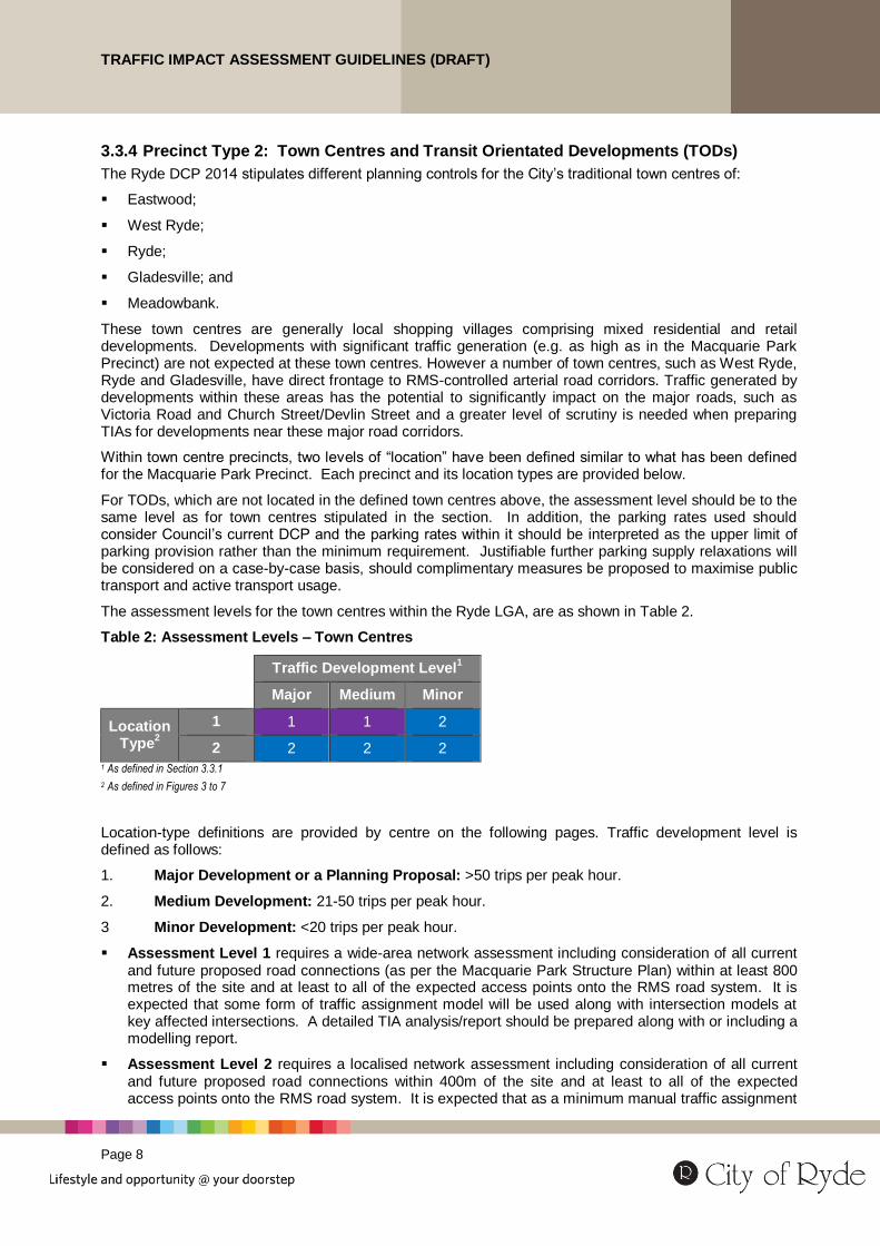
The assessment levels for the town centres within the Ryde LGA, are as shown in Table 2.
Table 2: Assessment Levels – Town Centres
Traffic Development Level
1
Major Medium Minor
Location Type
2
1 1 1 2
2 2 2 2 1 As defined in Section 3.3.1
2 As defined in Figures 3 to 7
Location-type definitions are provided by centre on the following pages. Traffic development level is defined as follows:
1. Major Development or a Planning Proposal: >50 trips per peak hour.
2. Medium Development: 21-50 trips per peak hour.
3 Minor Development: <20 trips per peak hour.
Assessment Level 1 requires a wide-area network assessment including consideration of all current and future proposed road connections (as per the Macquarie Park Structure Plan) within at least 800 metres of the site and at least to all of the expected access points onto the RMS road system. It is expected that some form of traffic assignment model will be used along with intersection models at key affected intersections. A detailed TIA analysis/report should be prepared along with or including a modelling report.
Assessment Level 2 requires a localised network assessment including consideration of all current and future proposed road connections within 400m of the site and at least to all of the expected access points onto the RMS road system. It is expected that as a minimum manual traffic assignment

TRAFFIC IMPACT ASSESSMENT GUIDELINES (DRAFT)
Page 9
to the local network will be documented and intersection analysis undertaken at key affected intersections. A moderate level of detail is required for the TIA report.
Where developments are located in congested parts of town centres, even though they might be a “medium” development or a “minor” development, network analysis might be required, including intersection analysis, particularly if queuing through intersections is already common in peak periods. Advice should be sought from Council in these circumstances.
Eastwood Town Centre
The Eastwood Centre is located around Eastwood Railway Station, and is well known as an Asian shopping village with speciality stores, supermarkets and restaurants. Eastwood Town Centre is relatively well served by the Northern Line rail service and numerous bus routes connecting Parramatta, Chatswood, Macquarie Park and the Sydney CBD.
First Avenue, Shaftsbury Road and Blaxland Road are the major sub-arterial roads connecting Eastwood Town Centre to the external road network. The extent of Eastwood Town Centre is shown in Figure 3, along with the location type definitions.
Figure 3: Eastwood Town Centre

TRAFFIC IMPACT ASSESSMENT GUIDELINES (DRAFT)
Page 10
West Ryde Town Centre
West Ryde Town Centre is bisected north-south by Victoria Road and east-west by the Northern Line Railway corridor. Since the redevelopment of West Ryde Town Centre commenced in 2010, the town centre has expanded to the north of Victoria Road and to the blocks adjacent and parallel to the main road. The West Ryde Town Centre comprises mixed use of commercial, retail and residential developments. The scope of the West Ryde Town Centre and the defined Location Types are shown in Figure 4.
Figure 4: West Ryde Town Centre
Ryde Town Centre
The Ryde Town Centre is located at the intersection of Devlin Street and Blaxland Road, and identified as the civic heart and retail hub for the City of Ryde. The Ryde Town Centre comprises heritage buildings, civic centre, high density residential building and shopping centre. The Ryde Town Centre Location Type definitions are shown in Figure 5.
Figure 5: Ryde Town Centre
TRAFFIC IMPACT ASSESSMENT GUIDELINES (DRAFT)
Page 11
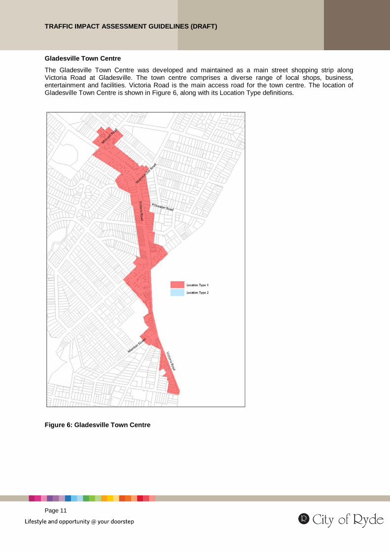
Gladesville Town Centre
The Gladesville Town Centre was developed and maintained as a main street shopping strip along Victoria Road at Gladesville. The town centre comprises a diverse range of local shops, business, entertainment and facilities. Victoria Road is the main access road for the town centre. The location of Gladesville Town Centre is shown in Figure 6, along with its Location Type definitions.
Figure 6: Gladesville Town Centre
TRAFFIC IMPACT ASSESSMENT GUIDELINES (DRAFT)
Page 12
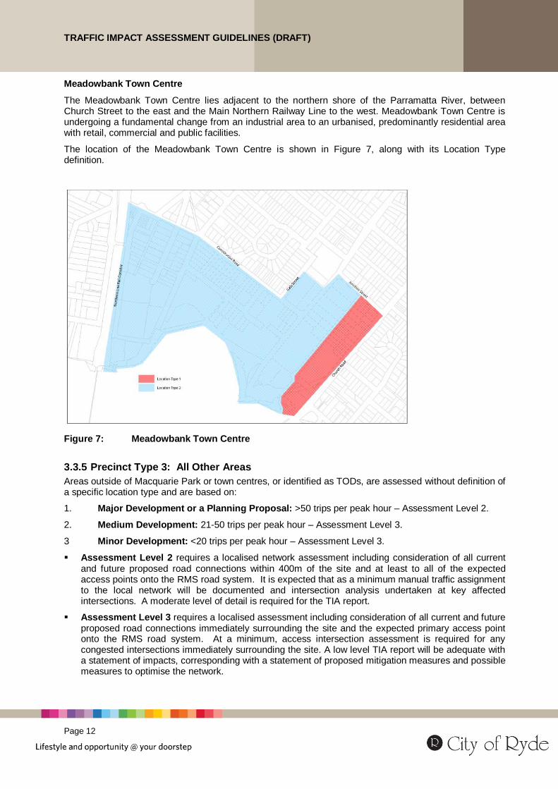
Meadowbank Town Centre
The Meadowbank Town Centre lies adjacent to the northern shore of the Parramatta River, between Church Street to the east and the Main Northern Railway Line to the west. Meadowbank Town Centre is undergoing a fundamental change from an industrial area to an urbanised, predominantly residential area with retail, commercial and public facilities.
The location of the Meadowbank Town Centre is shown in Figure 7, along with its Location Type definition.
Figure 7: Meadowbank Town Centre
3.3.5 Precinct Type 3: All Other Areas
Areas outside of Macquarie Park or town centres, or identified as TODs, are assessed without definition of a specific location type and are based on:
1. Major Development or a Planning Proposal: >50 trips per peak hour – Assessment Level 2.
2. Medium Development: 21-50 trips per peak hour – Assessment Level 3.
3 Minor Development: <20 trips per peak hour – Assessment Level 3.
Assessment Level 2 requires a localised network assessment including consideration of all current and future proposed road connections within 400m of the site and at least to all of the expected access points onto the RMS road system. It is expected that as a minimum manual traffic assignment to the local network will be documented and intersection analysis undertaken at key affected intersections. A moderate level of detail is required for the TIA report.
Assessment Level 3 requires a localised assessment including consideration of all current and future proposed road connections immediately surrounding the site and the expected primary access point onto the RMS road system. At a minimum, access intersection assessment is required for any congested intersections immediately surrounding the site. A low level TIA report will be adequate with a statement of impacts, corresponding with a statement of proposed mitigation measures and possible measures to optimise the network.
TRAFFIC IMPACT ASSESSMENT GUIDELINES (DRAFT)
Page 13
3.4 Step 3 – Determine Background Conditions
The background traffic and transport conditions should consider the traffic, transport and parking elements for the current circumstances.
3.4.1 Traffic
Existing traffic conditions in the vicinity of the proposed development are the main consideration in the TIA. They should include the reporting of the following components:
site location in its transport/land use context;
road network structure, road hierarchy and any access limitation policies;
daily and peak hour traffic volumes and vehicle classifications mix;
consideration of other peak periods other than commuting peaks, such as Saturday for retail development and special peaks for event-based or recreational development;
current intersection operational performance; and
current road safety issues and risks.
It is Council’s preference that 7 day traffic counts be undertaken to identify the existing peak hours and likely combined peak hours with the development.
3.4.2 Transport
Public transport services and active transport facilities should be reviewed and discussed, including where relevant:
locations of railway stations, bus stops and ferry wharves;
public transport routes, services and frequencies at the times when the development generates its demand;
the cycling and pedestrian network and facilities; and
identification of the deficiencies and coverage gaps relevant to the development.

TRAFFIC IMPACT ASSESSMENT GUIDELINES (DRAFT)
Page 14
3.4.3 Parking
The analysis of existing parking demand and supply should be considered, if relevant, and include:
on-street parking supply and time restrictions;
off-street parking supply;
parking occupancy and duration; and
identification of existing parking deficiencies.
The assessment of the existing conditions should also consider possible variations and causes; such as alternate periods of peak parking demand, specific events, seasonal variations, effects of impending projects etc. This information should be requested from Council where relevant.
3.4.4 Committed Developments and Upgrade Projects
Any committed or approved developments and infrastructure upgrade projects in the vicinity, which are likely to have cumulative impacts on the road network within the impact area of the proposal should be considered in the assessment. This should include:
potential traffic generation of approved development sites;
under construction or completed road network and infrastructure upgrades; and
infrastructure and service changes for public transport and pedestrian and cyclists facilities.
3.5 Step 4 – Determine Development Traffic
3.5.1 Traffic Generation
The number of vehicle trips, including passenger cars and commercial vehicles, likely to be generated by the proposed development should be estimated.
At a minimum, two periods of traffic generation should be considered:
the peak activity time of the development; and
the peak activity time of the adjacent road network.
The most reliable source of trip generation data is likely to be survey data from the development (where an existing development is being changed or enlarged) or a similar development in a similar location. If the applicant wishes to use this method, the site location and survey methodology should be discussed and agreed with Council.
The RMS Guide to Traffic Generating Developments provides traffic generation rates for most typical land uses; with due recognition that the RMS is continually updating its rates for a number of land uses as published in its “Technical Directions”. For the development types which are not included within the RMS Guideline, traffic generation should be estimated using first principles, preferably based on survey data of similar existing developments where possible.
Where the development site is occupied and active in the base case assessment year and nearby traffic counts have included this development, then the current site traffic generation can be deducted to estimate net impacts.
3.5.2 Drop-In and Diverted Trip Discounts
Some land use types may generate a proportion of their custom from drop-in trips that would have been on the fronting road anyway and some developments may divert some traffic from nearby places in the network which would change the nature of impacts in those areas.
Any drop in trip discounting should be clearly justified with traffic survey or market research data or references to relevant RMS sources. Any discounting proposed should be submitted to Council/RMS for approval.

TRAFFIC IMPACT ASSESSMENT GUIDELINES (DRAFT)
Page 15
3.5.3 Mode Split Discounts – Justification for Areas Outside of Macquarie Park
The major roads within Ryde LGA are heavily congested in peak periods and both the RMS and Council are committed to trying to reduce the impacts of future development-generated traffic. Reduced traffic generation rates may able to be used in the TIA with clear justification of how they would be achieved. A number of factors can be considered for “discounting” standard traffic generation rates. These include:
commitments to workplace travel plans and ongoing workplace programs (definitive, measureable, enforceable approaches are needed however);
reduced parking supply as required by the DCP or where the consequences of on street impacts are not excessive (see Section 3.5.5);
provision for car share schemes;
improved access to public transport facilities and/or provision of public transport infrastructure;
targeted development types aimed at local catchments (clear justification required however);
improved walking and cycling facilities within/near the site; and
end of trip facilities on site.
Mode split discounts that can be adopted if a comprehensive and accountable traffic reduction strategy is provided.
It must be noted that the mode split discount factor used in the traffic generation calculations should be discussed and agreed by Council and RMS (as relevant) prior to its use in the TIA to reduce the likelihood of these assumptions being rejected.
3.5.4 Mode Split Discounts – Macquarie Park
Council is actively promoting reduced private vehicle access to/from Macquarie Park to ensure its sustainable accessibility into the future. Table 3 provides potential standard traffic generation rate discounts with appropriate initiatives put in place as part of the development.
Table 3: Potential Mode Split Discounts – Macquarie Park
Initiative Discount guide
A complete/holistic workplace travel plan and implementation program Up to 40%
Reduced parking supply and associated, justified reduction in demand Up to 20%
Development targeted to local catchments Up to 20%
Contribution to public or active transport infrastructure Up to 10%
Note: These discounts are not cumulative and only one discount can be applied for, if justifiable.
It must be noted that the mode split discount factor used in the traffic generation calculations should be discussed and agreed by Council and RMS (as relevant) prior to its use in the TIA to reduce the likelihood of these assumptions being rejected.
3.5.5 Linking Parking Provision to Traffic Generation
Where a specific parking management strategy is being proposed as part of the development to discourage parking in order to reduce traffic generation, the parking strategy is to be presented in detail to demonstrate how it will result in modal shift rather than simply displacing parking to surrounding locations.

TRAFFIC IMPACT ASSESSMENT GUIDELINES (DRAFT)
Page 16
3.5.6 Traffic Distribution and Traffic Assignment
The routes and directions taken by traffic to and from the proposed development site should be identified and justified.
Traffic assignment should be based on the existing travel patterns (e.g. from count data, ABS data or Travel Survey data), considering surrounding land use, road hierarchy, congestion and the specific operational characteristics of the proposed development.
All assumptions and the methodology used to establish the trip distribution and traffic assignment is to be documented in the TIA report. The assessment should be based on the critical peak periods where the combination of background and local traffic is at is maximum.
3.6 Step 5 – Impact Assessment
The impact assessment detail should be based on the Assessment Level requirements, including the extent of the intersections to be assessed and the type of modelling/analysis required as per Step 2.
3.6.1 Traffic
The impact of the additional trips on traffic operations needs to be quantified. Analysis should include at least two scenarios; with and without development. Additional scenarios, such as cumulative traffic volumes generated by potential developments nearby, road infrastructure upgrades in the vicinity and operational changes, may also be needed depending on the details of the situation being assessed.
A comparison of the existing and future traffic volumes for each scenario is required. The assessment year should be the year of opening that the final stage of the development is complete. Future year scenarios are to be considered such as 5, 10 or 15 year design horizon, which should be discussed with Council, RMS and TfNSW, as required.
Background traffic should be projected to the assessment year with the growth factor being extracted from one of the following sources.
historical traffic growth trends (from count data);
calibrated Strategic Traffic Model; or
relevant growth information derived from Census or Journey to Work data.
The assessment should identify Degree of Saturation, Delays, Level of Service and vehicle queuing in the following scenarios:
for intersections operating below practical capacity under both background and ”with development” conditions: the percentage of the intersection capacity used up by development traffic (based on the intersection volume-capacity ratio);
for intersections operating below practical capacity under background conditions and above practical capacity under ”with development” conditions: the works required to return the operation of the intersection to below practical capacity operating conditions; and
for intersections operating at/above practical capacity under background conditions and at/above practical capacity under ”with development” conditions: any reasonable set of works able to be constructed to return the with development intersection operating conditions to “without development” volume-capacity ratios (i.e. a “no worsening” effect).
All assumptions, models (including input data files) and outputs are to be provided with the documentation. The production of any models would need to comply with the latest RMS “Traffic Modelling Guidelines” publication.
Further Information
The Traffic Modelling Guidelines can be accessed via the RMS website www.RMS.nsw.gov.au.

TRAFFIC IMPACT ASSESSMENT GUIDELINES (DRAFT)
Page 17
Road safety impacts may also need to be considered depending on the size of the development, access locations and the existing crash history. A preliminary safety risk assessment should be undertaken to determine if further more detailed analysis should be undertaken. More detailed analysis would consider crash data and an assessment of how the development would mitigate any increase in the crash risk due to its additional traffic and/or its access or mitigation works.
For any development with access from an arterial road, a queuing analysis should also be undertaken to assess the likelihood of queueing from within the development back into traffic on the main road including identifying ways to mitigate this risk. Similarly, a queueing analysis should be undertaken to determine the level of average delay likely for egress from the site to an arterial road.
3.6.2 Transport
If the size of the development is large enough to potentially influence existing travel patterns and modal splits or the development is located in a town centre near a key bus stop or train station, the TIA should assess the impacts on other transport modes as well, rather than just on the traffic network. This assessment would also be required in order to justify any proposed discounting of traffic generation rates.
Due to the negative impacts of existing traffic congestion along corridors such as Victoria Road, Lane Cove Road and Epping Road, the City of Ryde supports measures that achieve a reduction in car use in Ryde through increased use of more sustainable transport modes, such as public transport, walking and cycling.
Macquarie Park Precinct – Green Travel Plans
Macquarie Park, in particular, is identified as one of the specialised centres, which contains significant business activities performing a vital economic and employment role within the Sydney metropolitan area. Any developments within the Macquarie Park Precinct would have a higher possibility of adverse impacts on an already congested surrounding road network.
Green Travel Plans should be included within the TIA for major developments proposed within the Macquarie Park Precinct in order to:
relieve current road network pressures;
reduce the private car usage and encourage active and public transport trips; and
reduce pressure on long-stay parking.
3.6.3 Active Transport
Depending on the nature and scale of the proposed development, pedestrian and cyclists will access the development via the adjacent road system. The TIA report should review and assess as well as on site needs the active transport facilities for both pedestrians and cyclists accessing or passing the development.
Pedestrian facilities should also address the needs of people with disabilities.
3.6.4 Parking Supply
The parking demand of the development is to be calculated based on the parking rates in the relevant DCP. The supply of the following parking types may need to be considered in the TIA, depending on the type of development and its operations:
permanent parking;
temporary parking (with or without time restrictions);
commercial vehicle parking;
bicycle parking; and
parking for special vehicles.
Where alternative rates to those included in the relevant DCP are proposed, clear justification is required for the reasoning for alternate parking rates, based on achieving broader transport efficiency outcomes.

TRAFFIC IMPACT ASSESSMENT GUIDELINES (DRAFT)
Page 18
3.6.5 Car Park and Access Design
Developments with on-site parking require access from the frontage road to the car parking and service facilities.
The design of the car parking area and access driveway should conform to the Australian Standard AS 2890 series and the requirements in the relevant DCP. The following design factors for car parking and access are to be assessed:
parking module type and dimensions;
car park circulation;
maximum size of service vehicle to access;
dimensions of service areas;
service vehicle manoeuvring areas;
gradients of car parking spaces and ramps;
access location(s) and form to ensure that the efficient and safe entry and exit can be achieved without impact on the adjoining public road network;
sight distances;
potential vehicle-vehicle and vehicle-pedestrian conflicts; and
safety and efficiency of car park layout.
If the development access is from a high speed or high volume road, which requires an acceleration/deceleration lane, the applicant should refer to Austroads’ Guide to Road Design and an appropriate design of the acceleration/deceleration lane should be provided.
The TIA report should address servicing arrangements for vehicles such as waste collection, removalist and delivery trucks. If adequate service bay is not proposed on-site, the TIA report should address how these vehicles would be accommodated on-street.
3.7 Step 6 – Impact Mitigation
After Step 5 assessment of impacts, all mitigation measures and plans identified as necessary to serve the proposed development and mitigate the development traffic, transport and parking impacts should be documented and discussed in the TIA report. These mitigation measures must be feasible, implementable and consistent with Council’s and RMS’ transport plans. For example, the upgrade works must be able to be constructed on lands not in private, third party ownership.
3.8 Step 7 – Documentation and Submission to Council
All findings and recommendations during the course of the TIA should be reported and submitted to Council as part of the DA submission for assessment and within a self-contained Traffic Impact Assessment report.
The TIA report should contain at least the following:
current transport network situation (levels of congestion, operational considerations, public and active transport networks etc.) and references to any relevant planning in the area such as elements of the NSW Long Term Transport Master Plan and any relevant upgrade proposals/projects;
development details;
rates and assumptions used to calculate development traffic generation;
detailed justification of the initiatives to be committed to such that traffic generation discounts can be applied, including an assessment of public and active transport responsibilities for the development;
the traffic generation summary table;

TRAFFIC IMPACT ASSESSMENT GUIDELINES (DRAFT)
Page 19
the Assessment Level required and any special circumstances that need to be considered;
the traffic distribution and assignment assumptions and associated traffic volume figures;
the details of any traffic assignment models or methods used and the justification for use of these models or methods;
intersection assessment inputs including traffic volumes (e.g. light and heavy vehicles), intersection layouts/configurations, signal phasing data, any non-default parameters used, and details of any additional traffic infrastructure works implemented to mitigate development impacts;
intersection assessment outputs including the movement DOS, delay, LOS and queue comparison summaries “with” and “without” the development, both before and after any infrastructure upgrades have been included;
a traffic safety risk assessment;
a public transport impact assessment;
a pedestrian/cyclist impact assessment;
a summary list of the works proposed to be constructed or contributed to as part of the development;
an assessment of parking supply impacts including any clear reasoning for parking supply relaxations and the on-site access and parking configuration;
an infrastructure delivery timing plan, which should be aligned with the Council’s delivery plan for other projects in the area where relevant; and
any other details/assumptions relevant for reviewing the consultant’s assessment methods and outputs.
A copy of TIA submission checklist is included in Appendix B:
3.8.1 Models
If traffic models have been developed as part of the assessment process, all models and associated data are to be suitably documented and submitted on electronic media and with the TIA report.
3.8.2 Data
Survey data collated during the course of the TIA should be submitted in raw data form to Council (e.g. intersection count sheets provided electronically) for review and verification.
3.9 Step 8 - Provision of Additional Information
Council will review the information submitted and the impact assessment results and determine if sufficient information is provided or if additional information is required to enable the application to be determined and conditions to be set.
The applicant should provide additional information, if requested, for Council re-assessment during the DA assessment process.
If the requested information is not submitted within a specified timeframe (which varies depending on the development application type), Council will assess the application absent of this information and a recommendation will be made on the basis of the available information.
Further Information
For further information, you can contact Council’s Building & Development Advisory Service on 9952 8222 or via email at [email protected]

TRAFFIC IMPACT ASSESSMENT GUIDELINES (DRAFT)
Page 20
Appendix A: Contents and Form of the TIA
A typical table of content for a TIA is provided below. Applicants should develop their TIA reports as closely as possible to the contents structure provided below.
1. Introduction
1.1 Background 1.2 Scope and Assessment Area
2 Existing Conditions
2.1 Existing Land Use and Zoning 2.2 Surrounding Road Network Details 2.3 Existing Traffic Volumes 2.4 Existing Site Access 2.5 Public Transport 2.6 Active Transport 2.7 Parking Conditions 2.8 Intersection and Network Performance 2.9 Prevailing Traffic Safety Issues
3 Proposed Development Details
3.1 Development Site Plan 3.2 Operational Details 3.3 Access and Parking Proposal
4 Development Traffic
4.1 Trip Generation and Assessment Level 4.2 Trip Distribution 4.3 Traffic Assignment
5 Impact Assessment 5.1 Future Background Traffic Volumes 5.2 Future Total Traffic Volumes 5.3 Future Intersection and Network Performance 5.4 Access Impacts 5.5 Impacts on Public Transport 5.6 Impacts on Active Transport 5.7 Impacts on Road Safety 5.8 Parking Supply
6 Impact Mitigation
6.1 Proposed Traffic Impact Mitigation Works and Program 6.2 Other Proposed Works 6.3 Green Travel Plan (if relevant) 6.4 Other Initiatives
7 Car Park and Access Assessment
7.1 Car Park Layout Design Review 7.2 Access Design 7.3 Servicing Arrangements
8 Conclusions
Appendices – Traffic Modelling Report and detailed results as relevant

TRAFFIC IMPACT ASSESSMENT GUIDELINES (DRAFT)
Page 21
Appendix B: TIA Submission Checklist
Items Info Included Comment
Specify Documents provided
TIA report
Traffic models <Electronic files >
Traffic data <Electronic files >
Stakeholder Consultation undertaken
Government Agencies?
Transport Operators?
Community Organisations?
Other?
Assessment Level
Assessment Level (1, 2 or 3)
Modelling method <Network, Linear, Intersection>
Existing development context
Site locality provided?
Existing site access details provided? <existing use, location and layout>
Land use context described? <on-site and adjacent area>
Proposed uses and areas provided?
Operating hours, peaks defined?
Number of employees and visitors noted?
Access form and location shown?
Development stages provided (if applicable)?
Existing traffic conditions
Traffic volumes provided? <daily and peak hour>
Peak hours defined?
Preliminary safety assessment?
Public transport network and services?
Pedestrian and bicycle facilities?
Current on-site parking?
On-street parking?
Current intersection/network performance? <DoS, delays, LoS, Queuing>
Development traffic
Traffic generation and discount assumptions? <rates, references, discounts justifications>
Traffic distribution and route choice assumptions?
On-site parking supply justified?
Car park and Access design
Layout review in accordance with AS2890?
Access assessment?
Servicing arrangements?
Impact assessment
Background traffic growth justification? rate used
Assessment year traffic volumes estimated? intersection and network
Intersection operations provided? DoS, delays, LoS, Queuing
Comparison to base case undertaken? DoS, delays, LoS, Queuing
Impacts on traffic operations documented?
Impacts on public transport documented?
Impacts on active transport documented?
Impacts on safety documented?
Impact mitigation measures
Traffic infrastructure measures?
Public transport measures?
Active transport measures?
Safety improvements measures?
Green travel plan measures?
Other measures?
TRAFFIC IMPACT ASSESSMENT GUIDELINES (DRAFT)
Page 22
Appendix C: Reference and Source Documents
Legislation
Environmental Planning and Assessment Act 1979
Environmental Planning and Assessment Regulation 2000
Australian Standards
AS2890 Parking facilities Series
Part 1: Off-street car parking
Part 2: Off-street commercial vehicle facilities
Part 3: Bicycle parking facilities
Part 5: On-street parking
Part 6 Off-street parking for people with disabilities
Austroads
Guide to Road Design Series
Guide to Traffic Management Series
Guide to Road Safety Series
Department of Planning and Infrastructure, NSW
State Environmental Planning Policy (Infrastructure) 2007
Roads and Maritime Services
Guide to Traffic Generating Developments 2002
TDT 2013/04a, Guide to Traffic Generating Developments Updated traffic surveys
City of Ryde Council
Ryde Local Environmental Plan (LEP) 2014
Ryde Development Control Plan (DCP) 2014

TRAFFIC IMPACT ASSESSMENT GUIDELINES (DRAFT)
Page 23
Appendix D: Abbreviations and Glossary
Access Means any place, new or existing, where vehicles and/or pedestrians and/or cyclists move between a road and land abutting a road.
Applicant The proponent (person or organisation) proposing to lodge or lodging a Development Application to Council or planning authority for the development and/or use of land and/or a building.
Assessment Year The year of opening of the final stage of the development.
Austroads The national association of road transport and traffic authorities in Australia.
Council City of Ryde Council.
DA Development Application.
DoS Degree of Saturation; one of intersection performance indicators.
LOS Level of Service; one of intersection performance indicators.
RMS Roads and Maritime Services, New South Wales.
TfNSW Transport for New South Wales.
TIA Traffic Impact Assessment