traffic management technology - virginia
TRANSCRIPT

Traffic Management Technology
Dean Gustafson, PE, PTOE State Operations Engineer
Operations Division

The Everyday Story of Operations

VDOT’s Operations Program
• A core part of VDOT’s mission to plan,
deliver, operate and maintain a world-
class transportation system
• The Operations Program is focused on
the user/driver to maximize system
reliability and maintain system access
• The Statewide Program consists of
statewide policy/planning/guidance and 5
operating regions
− Transportation Operations Centers
(TOC’s) in Hampton Roads, Nova,
Richmond, Salem and Staunton
• Provides information and situational
awareness to VDOT management and
public

Matter of Economics
• Congestion cost Virginia over $4.8 B in
2010*
• $253.1 M worth of goods moves by
truck in VA*
• Rear-end crashes resulted in 48 deaths
(2011) and 23,360 injured (last 12 months,
35% of INJ)
• Virginia transportation system must be
more reliable than other states’ to be
competitive
• Operations Strategies could save $370.5 M
every year in Virginia
• Virginia home to National Capital Region
and numerous Military Installations *Source: TTI 2011 Urban Mobility Report
4

VDOT’s Statewide Operations Program
TOC Components
Five Regions and TOCs
• Northern (Fairfax)
• Eastern (VA Beach)
• Central (Richmond)
• Northwest (Staunton)
• Southwest (Salem)
Transportation Operations Center
Advanced Transportation
Management System (ATMS)
• Hardware
• Software
• Communications
Equipment
Cameras
Message Signs
Portable Message Signs
Weather Stations Shoulder/Lane Control Traffic Detectors Ramp Meters HOV Gates Overheight Detection Highway Advisory
Radio (HAR)

VDOT’s Statewide Operations Program
Operations Statistics
System Mileage
• Interstate – 1,120
• Primary – 7,996
• Secondary - 48,809
7 Tunnels
11 Moveable Bridges
3 Ferries
• Each TOC handles 28 to 151 events every day
• Over 2,700 field devices
• Over 338 miles of VDOT fiber
• 50 SSP patrol routes covering 503 miles of
Interstate
− 30 routes/250 miles are 24/7
• 3rd Generation Statewide 511 Program
− Phone, Web, Mobile App
− Sponsorship/Revenue Generation

Proposed TOC Contract
Innovations
• Interoperability between centers
• Modernize technology on road and software
− Establish statewide process to review and implement new
technologies/innovations.
− Provide AVL on all SSP Vehicles
− Enhanced SSP and Severe Incident Response Vehicles for quick
clearance
− Network Operations Center to improve device availability
− Real-time tools to monitor performance
• Improve monitoring and communications to traveling public
− Statewide Training Academy for TOC staff
− Monitor and operate traffic signals in real-time to improve arterial
operations
Transportation Video & Data (TVD) Services VDOT’s 511 Program

Transportation Video & Data (TVD) Services
VDOT’s New 511 Program
• New 511 service launched May 18, 2012
• New website offers free streaming video to the public
– www.511Virginia.org
• Service disseminates traffic info through several outlets:
– Web and mobile applications (iPhone and Droid)
– Interactive Voice Response (IVR) phone system
– Information displays at Welcome Centers
– Twitter and email alerts
– Travel Time road signs in Hampton Roads

Transportation Video & Data (TVD) Services
Key Features
511 Phone Service
(IVR)
• New voice recognition engine
• Directional recognition
• Travel times
511 Website & Mobile
App
• Redesigned site
• Live streaming video (15 frames/sec)
• Mobile app with live traffic information
• Travel times
Video / Data Sharing
• Free video access through web service
• Includes attribution to VDOT
• Operations data publicly available
511 Highway Signs
• Sponsorship acknowledgements will be
added to 511 signs

Real-time Traffic
Speeds Displayed
for Major Routes

Streaming Video
Provided for VDOT’s
800+ Cameras

“Reach the Beach” tool provides
Travel Times for alternate
Routes to VA Beach

List of Travel Times Twitter Feed Map Home Screen
511 Mobile App – New Feature for VDOT

Transportation Video & Data (TVD) Services
Revenue Generation and Sponsorship
• Sponsor acknowledgement signs placed with VDOT 511 signs
• Sponsorship revenues will offset 511 O&M costs
• Coordination with other sponsorship opportunities:
Safety Service Patrol vehicles
SAVE (rest areas)
Roadway / Facility naming rights

Active Traffic Management (ATM)

Application of ATM to I-66 Corridor
Project Scope
• District of Columbia (Exit 74) to Gainesville (US-29)
• 32 mile corridor with diverse needs and characteristics including
suburban, urban, bidirectional peaks, transit, HOV, and ride sharing
• Assortment of ATM treatments proposed for different segments
• Two stage design-build procurement process

ATM Display Concept
Between ½ mile to 1 mile spacing (1 Kilometer to 1.5 Kilometer)
Example with HOV Lane, No Shoulder Running Example with HOV Lane and Shoulder Running

19
I-66 ATM Timeline
• Awarded in January 2013
• Design and construction: Spring 2012 – Fall 2014
• ATM full Start-Up: Spring 2015
• Supplemental info available at: www.virginiadot.org

I-64 & I-77 Active Traffic
and Safety Management System
I-64 Afton Mountain I-77 Fancy Gap Mountain
Primary goal: Improve safety of travel along Afton and Fancy Gap Mountains
Secondary goal: Increase operational efficiency of travel along the corridors

Connected Vehicle Technologies

Connected Vehicle Technologies
“Connected Vehicle” is a national initiative to improve safety and mobility
by enabling communications between vehicles, infrastructure and devices
Vehicle connectivity provides a bi-directional ability to share information
– Vehicle to Vehicle (V2V)
– Vehicle to Infrastructure (V2I)
– Vehicle to Device (V2D)
Wireless communication channels are used
– Cellular for general information
– Dedicated Short Range Communications (DSRC) for low-latency, robust, secure information
Various in-vehicle and roadside applications are enabled with the communicated information
Connected Vehicles
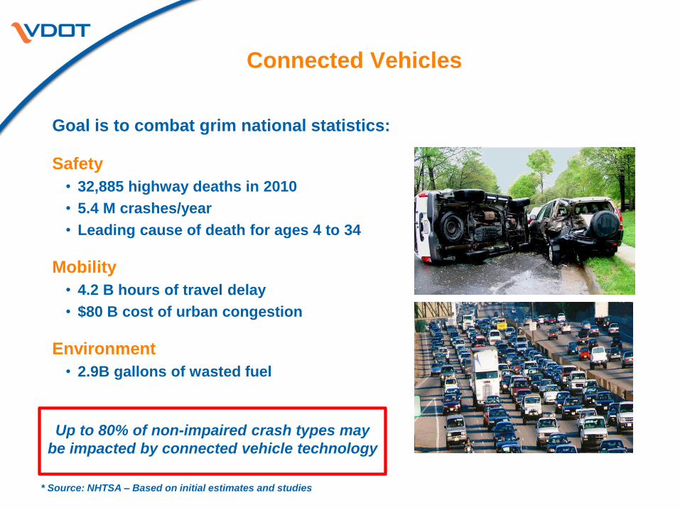
Goal is to combat grim national statistics:
Safety
• 32,885 highway deaths in 2010
• 5.4 M crashes/year
• Leading cause of death for ages 4 to 34
Mobility
• 4.2 B hours of travel delay
• $80 B cost of urban congestion
Environment
• 2.9B gallons of wasted fuel
Up to 80% of non-impaired crash types may
be impacted by connected vehicle technology
* Source: NHTSA – Based on initial estimates and studies

• In cooperation with Virginia Tech, UVA and
Morgan State University, VDOT is establishing
Connected Vehicle Test Beds at the Smart Road
and along I-66 & major primaries in NOVA
• Test Beds will include roadside equipment,
communication networks, and servers
• Connected Vehicle applications will be piloted at
Smart Road first (includes signalized intersection)
• NOVA routes selected based on congestion, high
crash rates and multimodal characteristics
(I-66, US 50, US 29, Gallows Rd)
Virginia Connected Vehicle Test Bed

Proposed Road Side Infrastructure Sites
Northern Virginia

• 47 Dedicated Short Range
Communication Transmitters
• 200 Portable Aftermarket
Safety Devices (Android-type)
• 10 instrumented cars
• 2 instrumented heavy vehicles
(Semi, Motorcoach)
Equipment and Vehicles at Test Beds