transportation - clermont county, ohio · the clermont county engineer’s jurisdiction includes:...
TRANSCRIPT

Transportation
39
The Transportation Element includes:• Clermont County’s Roadway Types and Classifications• Intermodal Transportation Options• Transportation Studies relevant to Clermont County• Current/Future Transportation Projects • Transportation Goals
Transportation addresses traffic circulation; alternative modes of travel including public transit, pedestrian and bike travel; parking facilities; aviation, rail and barge facilities, access to those facilities, and intermodal terminals; the availability of transportation facilities and services to serve existing land uses; and the compatibility between future land use and transportation elements.
Clermont County Engineer Duties (Section 315.08 Ohio Revised Code):• Prepares all plans (specifications, details, and estimates of cost);• Submits forms of contracts for the construction, maintenance, and repair of all bridges, culverts, roads, drains, ditches, roads on county fairgrounds, and other public improvements, except buildings, constructed under the authority of any board within and for the county;• Serves as the engineering advisor to the township trustees for the maintenance, widening, and repair of their roads;
• Is responsible for the bridges on both the County and Township roadway systems as well as certain bridges within municipalities. Annual bridge inspections and evaluations of the condition and load-carrying capacity of each bridge are part of this responsibility; and• Participates in County and Regional Planning Commissions and provides tax map drafting services for the county. In unincorporated areas, the engineer may also be involved in the establishment and maintenance of petitioned and assessed ditches, sidewalks, and even county airports.
The Clermont County Engineer’s jurisdiction includes:• 382.8 miles of county highways (center-line miles)• 394 bridges• 1,932 roadway culverts
The engineer shall not be required to prepare plans, specifications, details, estimates of costs, or forms of contracts for emergency repairs authorized under section 315.13 of the Ohio Revised Code, unless he deems them necessary.
This comprehensive plan includes the most current edition of the Clermont County Regional Transportation Improvement Program (RTIP) and is included in the appendix.
Introduction & Purpose
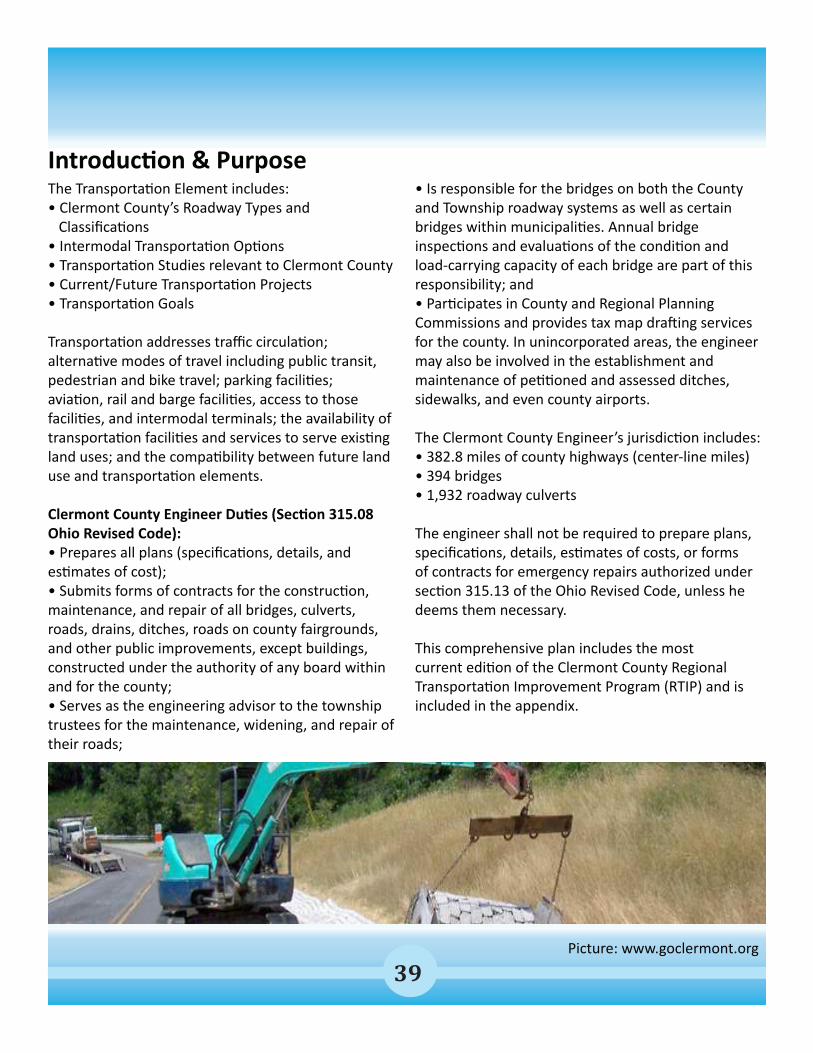
Picture: www.goclermont.org

40
Established in June 2006, the Clermont County Transportation Improvement District’s (CCTID) primary function is to take the lead in working between local jurisdictional partners and other county, state and federal agencies to identify, develop and secure funding for transportation improvement projects that support local and regional economic development strategies.
Projects advanced by the CCTID ease congestion, expand access to current and future businesses and shopping locations, and improve safety for all who travel through the area.
The CCTID actively seeks out and builds partnerships that harness private sector innovation and resources, encourages competition, and optimizes the assignment of risk. Through this approach, the CCTID brings about cost-effective and environmentally compatible solutions for project development and delivery.
Eight projects since 2007, representing an investment of more than $25 million, have supported economic growth and regional stability and many were completed on time and on budget. The success of these projects has generated more funding
and support for current and future projects. Approximately ten additional projects representing more than $50 million in investments either are underway now or will be by 2015. And more are being planned.
Ohio Department of Transportation (ODOT)Clermont County is located in District Eight for the Ohio Department of Transportation. District Eight also serves Butler, Clinton, Greene, Hamilton, Preble, and Warren counties in southwest Ohio.
All Department of Transportation activities within the seven-county region of District 8 fall under the guidance of the District Deputy Director. The Deputy Director assists in strategic planning, short and long-term goal setting, performance measurement and policy development and deployment on both the statewide and district-wide level.
The Deputy Director also represents and communicates the activities, views and policies of the department with representatives of local, state and federal agencies, elected officials of local, state and federal governments, consultants, contractors, vendors, the news media and other internal and external customers.
More information: www.goclermont.org
Clermont County Transportation Improvement District
41
Clermont County’s Four Road Types:1) State Highways, Interstate Highways, and U.S. Highways2) County Roads3) Township and Municipal Roads4) Private Roads
State Highways, Interstate Highways, and U.S. Highways These are also known as the main thoroughfares of the County. These roads can be identified by the road number. The Ohio Department of Transportation (ODOT) is responsible for these roads.
Some examples of these roads in the County include: •Interstate 275 •US 50 and US 52 •SR 32, SR 125, SR 28, etc.
County RoadsThe County Engineer is responsible for these roads. There are exceptions, but most county roads are “connector” type roads. They serve as main arteries or “collectors” for the State roads. Some examples of these roads in the County include: • Branch Hill-Guinea Pike
• Old SR 74 • Bethel-New Richmond Road • Clough Pike
Township and Municipal RoadsTownship roads are public roads maintained by each township’s highway department. These are generally subdivision and cul-de-sac roads within township limits. Municipal roads are those located within a city (i.e. Milford or Loveland) or within an incorporated village (i.e. Amelia, New Richmond, Bethel, etc.).
Some examples of these roads in the County include: • Weaver Road • Patterson Road • Maple Creek Road
Private RoadsThe property owners maintain these roads.
Clermont County Road Types
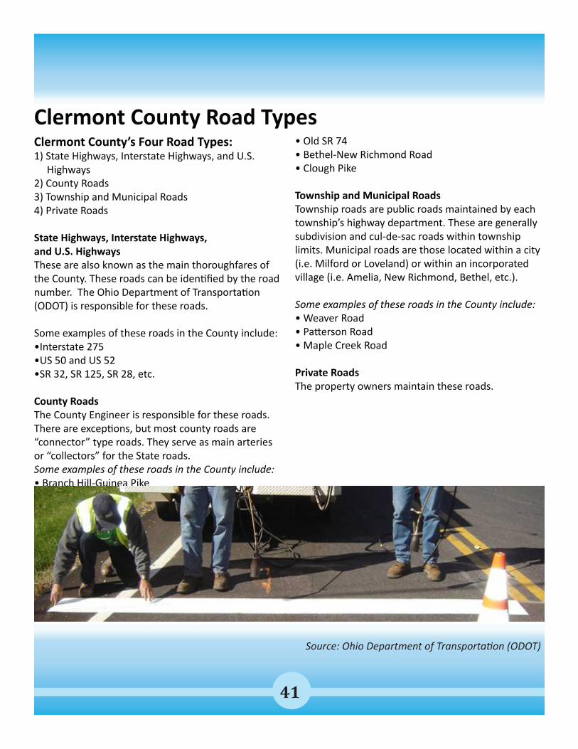
Source: Ohio Department of Transportation (ODOT)

42
Clermont County has many roads. These roads can be broken down into categories known as the “Functional Classification”. This classification is created by grouping roads, streets, and highways in a hierarchy based on the type of highway service they provide.
Streets and highways do not operate independently. They are part of an interconnected network, and each one performs a service in moving traffic throughout the system.
Ohio Department of Transportation (ODOT) Classification Definitions
At the top of the road classification system hierarchy are “Arterials”. These include classes of highways emphasizing a high level of mobility for the through movement of traffic. Travel speeds and distances are greater on these facilities compared to the other classes. The highest classes of arterials, Interstates and freeways, are limited access to allow the free flow of traffic.
“Collectors” are in the middle of the hierarchy and their name describes their function. They collect traffic from the lesser traveled roads and distribute it to the higher travelled ones. Collectors provide both mobility and land access. Generally, trip lengths,
speeds, and volumes are moderate.
At the bottom of the hierarchy are local streets and roads. Their primary function is to provide land access. Travel speeds, distances, and volumes are generally low, and through traffic is usually discouraged.
RURAL CLASSIFICATIONSThe rural functional classification system consists of all highways located outside urban and urbanized area boundaries. There are four classes of highways in the rural system: principal arterials, minor arterials, major and minor collectors, and locals.
Rural Principal Arterial Serve corridor movements having trip length and travel density characteristics indicative of substantial statewide or interstate travel; connect all or nearly all urban areas with 50,000 and over population and the majority of urban areas with 25,000 and over population; provide an integrated network of continuous routes.
Rural Collectors Serve primarily inner-county rather than statewide travel; serve more moderate travel speeds and distances than those on arterial routes.
More information: www.goclermont.org
Clermont County Roadway Classifications

43
Rural Major Collectors Provide service to any county seat, larger towns, and other county destinations such as consolidated schools, parks, or important mining and agricultural area not served by an arterial; connect these places with nearby larger towns and cities or with arterial routes; serve the most important inner-county travel corridors.
Rural Minor Collectors Are spaced at intervals to collect traffic from local roads and bring all developed areas within reasonable distance of a collector; provide service to smaller communities not served by a higher class facility; connect locally important traffic generators with rural hinterlands.
Rural Locals Provide access to adjacent land; serve travel over relatively short distances.
URBAN CLASSIFICATIONSThe urban functional classification system consists of all roads, streets, and highways located inside the urban/urbanized area boundary. Because of the greater concentration of population, more intense land use, and higher traffic volumes in the urban area compared to rural, some characteristics of urban classes differ slightly from their rural counterparts, for example in the density and spacing of the urban network and in the volume and length of trips.
Urban Principal ArterialServe major activity centers, highest volume corridors, and longest trip demands; carry high proportion of total urban travel on minimum of mileage; interconnect and provide continuity for major rural corridors to accommodate trips entering and leaving urban area and movements through the urban area; serve demand for intra-area travel as between the central business district and outlying residential areas.
Urban Minor Arterials Interconnect with and augment the principal arterials; serve trips of moderate length at a somewhat lower level of travel mobility than principal arterials; distribute traffic to smaller geographic areas than those served by principal arterials; provide more land access than principal arterials without penetrating identifiable neighborhoods; provide urban connections for rural collectors.
Urban Collectors Serve both land access and traffic circulation in residential and commercial/industrial areas; penetrate residential neighborhoods; distribute and channel trips between local streets and arterials.
Urban Locals Provide direct access to adjacent land; provide access to higher systems; carry no through traffic movement.
Clermont County Roadway Classifications
Source: Ohio Department of Transportation (ODOT)

44
Road Classifications (ODOT)
Road Classifications Map: Ohio Department of Transportation (ODOT)

45More information: www.goclermont.org
Metro Routes28 Milford/East End & 29X Milford ExpressBeginning in Milford this bus route travels throughout Terrace Park, Plainville, Madeira, Mariemont, Fairfax, East End, Columbia Tusculum to downtown Cincinnati.
82X Eastgate ExpressProvides non-stop express service from Union Township Civic Center to downtown Cincinnati.
Route 1 Felicity - Eastgate ShuttleFelicity Shuttle provides service between the town of Felicity, the Amelia area, and the Eastgate mall area.
Route 2X New Richmond ExpressProvides non-stop express service from the Rivertown Market Park & Ride (1041 Old St Rt 52) to downtown Cincinnati. The route has 4 bus stops in downtown.
Route 4X Amelia ExpressProvides non-stop express service from the Amelia area to downtown Cincinnati. The route has 4 bus stops in downtown and over 30 stops along 125.
Clermont Transportation Connection (CTC) Clermont Transportation Connection provides funding for 3 Metro routes in Clermont County. These routes provide fixed route bus service to several parts of Clermont County and downtown Cincinnati.
Dial-A-Ride Service Dial-A-Ride is a door to door public transit service which operates very similar to a taxi cab. Passengers must call the dispatching office and schedule a ride on one of CTC’s buses.
The service is open to any person in Clermont County. All vehicles are wheel chair accessible. Passengers can be picked up anywhere in Clermont County and taken to any destination in Clermont County. If a passenger wishes to go outside Clermont County CTC can drop them off at a METRO bus stop, but CTC’s Dial-A-Ride vehicles do not leave the county.
Non-Emergency Medical Transportation (NET)Non-Emergency Medical Transportation or NET is available to persons on Medicaid. The service provides transportation services to and from medical appointments. The service is free of charge for those who are eligible.
AirportsThe Clermont County Airport is a general aviation airport with a 3,568 foot runway located two miles west of Batavia. There are 120 aircraft based at the field and flight instruction and T-hangar rentals are available at the airport.
The Greater Cincinnati/Northern Kentucky International Airport (CVG) is a direct 30 minute drive via I-275. The airport provides non-stop services to nearly 40 destinations via eight different airline carriers.
Clermont County Transit Options

46
Biking and Walking Trails in Clermont County
Source: Clermont County Park District
The Little Miami Scenic Bike TrailThis bike trail is referred to as the Loveland Bike Trail and “Rail Trail”. It begins west of the bridge in Old Milford, following the original route the Little Miami Railroad ran in 1937. The trail is about 70 miles long, with the portion in Clermont County being nearly 13 miles, and is built along the right-of-way of the abandoned Little Miami Railroad, on the Little Miami River. The Clermont County portion connects the cities od Loveland and Milford.
The East Fork State Park Mountain Bike TrailThe East Fork State Park Mountain Bike Trail system has been around since 1994. In 2004, the transformation began to turn this trail system into one of the Cincinnati area’s premier mountain biking locations. The park offers some of the fastest single track mountain bike trails in the state. The trail consists of three sections of trail: the South Loop, the Middle Loop and the North Trail.

47
Pictures & Map: Clermont County Park District
Williamsburg to Batavia Hike Bike TrailThis trail is different from the Little Miami Scenic Trail in that it shares roadway with vehicles in some places and other areas it is a separate trail. It also differs by making use of old roadways that were abandoned during the construction of Harsha Lake.
The second phase of the Williamsburg to Batavia Hike/Bike trail was completed in October 2013. This section of trail connects the East Fork State Park campground with the existing trail, thereby connecting users to the Village of Williamsburg. Phase III is currently being planned.
Places to stop along the trail will include the East Fork River Valley overlook on the old Broadway trail section in Williamsburg, the Cain Run Creek bridge and waterfalls at the end of Williamsburg-Bantam Road, the wetland observation deck, and the lake overlook at the end of old Cain Run Road trail segment.
Williamsburg to Batavia Hike Bike Trail
48
Several transportation studies have been undertaken to address important transportation corridors in Clermont County.
State Route 28 Corridor StudyClermont County, through the Clermont County Transportation Improvement District (CCTID), initiated this project to examine land use, zoning, and capacity and to develop a comprehensive access management strategy for the corridor. The project considers both physical improvements to the roadway and its connections and assists the county in developing policies to manage future growth in this dynamic corridor.
Project Goals: The following project goals were developed from conversations with project stakeholders from the CCTID, Miami Township, and Goshen Township. These goals will be used as the basis for comparing alternatives and, ultimately, selecting a preferred alternative for this portion of the State Route 28 Corridor.
- To develop an access management plan for the Corridor with a focus on:- Long-term safety and congestion management- Economic development- To provide a land-use planning tool- To establish NEPA groundwork to help secure funding for infrastructure improvements- To promote cooperation amongst stakeholders for their mutual benefit
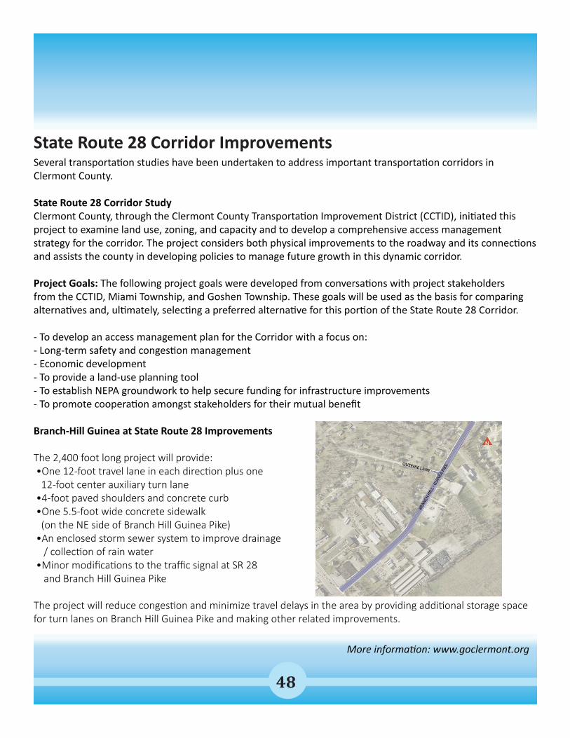
Branch-Hill Guinea at State Route 28 Improvements
The 2,400 foot long project will provide: •One 12-foot travel lane in each direction plus one 12-foot center auxiliary turn lane •4-foot paved shoulders and concrete curb •One 5.5-foot wide concrete sidewalk (on the NE side of Branch Hill Guinea Pike) •An enclosed storm sewer system to improve drainage / collection of rain water •Minor modifications to the traffic signal at SR 28 and Branch Hill Guinea Pike
The project will reduce congestion and minimize travel delays in the area by providing additional storage space for turn lanes on Branch Hill Guinea Pike and making other related improvements.
State Route 28 Corridor Improvements
More information: www.goclermont.org
State Route 28 Corridor Improvements

49
More information: www.goclermont.org
State Route 32 East Corridor StudyThe Clermont County Transportation Improvement District is planning for future transportation and infrastructure improvements along State Route 32 in central and eastern Clermont County from Bauer Road to Dela Palma Road.
Called the Strategic Plan for Access Improvements: SR 32 Corridor East, the study will evaluate the approximately seven mile corridor in order to provide recommendations to ensure the capacity, safety and efficiency of the transportation corridor and the surrounding land uses for the future.
The five draft study goals below represent the basis with which the transportation and infrastructure alternatives will be measured.
GOALS1) To develop transportation solutions that adequately address the future land use and infrastructure needs of the SR 32 Corridor East project area.2) To preserve needed right of way for future transportation and infrastructure investments.3) To develop infrastructure solutions that are compatible and allow for future economic development opportunities4) To improve the safety and efficiency of the SR 32 Corridor East transportation system by preserving capacity, decreasing travel times, and providing adequate connectivity.5) To develop innovative financing options for the phased implementation of the preferred transportation and infrastructure improvements.
State Route 32 Corridor Study
More information: www.goclermont.org
50
Spanning nearly 165 square miles, the Eastern Corridor Program area extends east from downtown Cincinnati through Hamilton County to the Olive Branch-Stonelick interchange in Batavia Township, Clermont County.
The Eastern Corridor Multi-Modal Improvements consist of rail transit (Oasis Line to be discussed in further detail later in this chapter), roadway, expanded bus, and pedestrian/bike access throughout the Eastern Corridor. The following is a brief overview of the roadway segments:
Segment I – Red Bank CorridorThe Red Bank Corridor extends between US-50 (Columbia Parkway) in Fairfax and the I-71 ramp in Madisonville. Project elements include improvement to the Red Bank Corridor to better support current and future traffic volumes; intersection improvements coordinated with roadway design to better facilitate accessibility, safety and traffic efficiencies; and to accommodate pedestrian and bicycle movements as part of the overall design. A preferred alternative is expected to be selected in 2014.
Segment II-III Relocated State Route 32As one of the primary thoroughfares within the Eastern Corridor region, SR 32 is an important element of the Eastern Corridor. Currently, this roadway experiences high volumes of commuter, heavy truck and residential traffic. This creates high levels of congestion and accident rates and poor levels of service. In addition, travel is primarily limited to vehicular traffic. The proposed SR 32 Relocation project is intended to address these issues and provide direct, multi-modal access to US 50, the Red Bank corridor and I-71.
Relocated SR 32 project elements include improvements to the local roadway network in the corridor; inceased capacity to accommodate the existing and future travel demand; access management; shift the western end of SR 32 (which currently intersects with Beechmont Avenue) north to create a new direct link with the Red Bank business corridor and I-71 to the west with portions of eastern Hamilton County and western Clermont County to the east. This connection would be established, in part, through a new multi-modal structure (supporting Relocated SR 32 and the Oasis Rail Transit) across the Little Miami River linking SR 32, US 50, and Red Bank Road. Tier 2 environmental studies are underway to identify a preferred alternative.
Segment IV – I-275/SR 32 Interchange ImprovementsThe I-275/SR 32 interchange improvements include the reconfiguration of the interchanges at I-275 and Eastgate Boulevard along SR 32 in western Clermont County. The project begins at Bell’s Lane and extends to Glen Este-Withamsville Road. Segment IV, together with key local network improvements, is more commonly referred to as the Eastgate area improvements and are presented in more detail in the following pages of this chapter.
Eastern Corridor Multi-Modal Improvements
More information: www.goclermont.org

51
The Clermont County Transportation Improvement District (CCTID) is currently working on more than a dozen roadway improvements that will increase safety, support better traffic flow through the area, and provide the infrastructure for continued economic development and investment throughout the County.
PHASE ONE: EASTGATE NORTH FRONTAGE ROAD IMPROVEMENTS Estimated Completion Date: 2014Estimated Construction Cost: $3 Million
Project Scope: this project is approximately 3200 feet in length and will include lane realignments to allow traffic to move through the intersection more efficiently. Adjustments to the signal timing have also been made to accommodate new lane movements.
Community Benefit: Improved access to and from State Route 32 and Eastgate Boulevard, particularly for traffic moving through the Eastgate retail hub.
More information : www.goclermont.org
State Route 32 - Eastgate Area Improvements

52
More information : www.goclermont.org
PHASE TWO: RECONSTRUCTION OF EASTGATE BOULEVARD OVER SR 32Estimated Completion Date: 2014Estimated Construction Cost: $10 Million
Project Scope: this project includes the reconstruction and widening of the Eastgate Boulevard structure over State Route 32, the relocation of the existing Westbound entrance and exit ramps from State Route 32 to Eastgate North Drive instead of Eastgate Boulevard, reconfiguration of the Eastgate Boulevard exit and entrance ramps at Eastgate Boulevard, and the reconstruction of the Westbound loop ramp from Eastgate Boulevard to State Route 32.
Community Benefit: Moving ramp traffic from Eastgate Boulevard to Eastgate North Drive eliminates the existing ramp intersection along Eastgate Boulevard and provides improved levels of service along the Boulevard.
More information: www.goclermont.org
State Route 32 - Eastgate Area Improvements

53
PHASE THREE: I-275/SR 32 INTERCHANGE IMPROVEMENTSEstimated Completion Date: Fall 2015Estimated Construction Cost: $46.2 Million
Project Scope: these improvements represent the most significant change to traffic patterns in the Eastgate area. Improvements to the Interstate 275/State Route 32 Interchange will address a variety of problems associated with the existing interchanges. These problems include high accident rates, increasing traffic and congestion, and inappropriately spaced roadway access points that require motorists to merge quickly and weave in between accelerating traffic.
Planned Improvements Include: • Widening portions of State Route 32 from Old State Route 74 to Eastgate Square Drive.• Constructing new ramps to provide new access to State Route 32 from Interstate 25, as well as new ramps and structures under Interstate 275 and that will allow for the Aicholtz Road Connector. • Improving safety by increasing the spacing distance between on and off ramps to eliminate weaving traffic.
Community Benefit: the Interstate 275/State Route 32 Interchange Improvements are a well-coordinated series of projects that have been designed to serve current as well as projected travel demand, which simply means that project managers have anticipated planned growth in the area and these improvements will support those potential changes. Importantly, improvements will also reduce congestion and delay, and improve roadway safety.
More information: www.goclermont.org
State Route 32 - Eastgate Area Improvements

54More information: www.goclermont.org
State Route 32 - Local Network Improvements
More information: www.goclermont.org
In addition to the improvements taking place along State Route 32, there are a number of local network improvements that will support improved traffic flow throughout the Eastgate area:• Aicholtz Road Connector• Ivy Pointe Extension• Clough Pike Widening• Eastgate South Drive Roundabout
AICHOLTZ ROAD CONNECTOREstimated Completion Date: 2016Estimated Project Cost: $6.25 Million
Project Scope: this project will reestablish a vital link in the Eastgate area’s roadway network, help reduce congestion on State Route 32 and improve access and mobility for local residents and businesses.
The Aicholtz Connector utilizes the structures completed as part of Phase 3 of the I-275/SR 32 interchange to allow for a new roadway link from Eastgate Boulevard to Mt. Carmel-Tobasco (Bell’s Lane) providing connectivity between residential and commercial development without having to access State Route 32. The connection will reduce congestion and improve safety along State Route 32 along the corridors most heavily traveled segment.

55
More information: www.goclermont.org
Eastgate Area - Local Network ImprovementsCLOUGH PIKE WIDENINGEstimated Completion Date: End 2014Estimated Construction Cost: $6.5 Million
Project Scope: the Clough Pike widening project will add a third travel lane along a 1.3 mile section of Clough Pike, between Mount Carmel-Tobasco Road and Glen Este Withamsville Road. A center turn lane will be added, as well as a sidewalk along the north side of the road. Upgrades will be made to intersection and traffic signals, and drainage improvements will also be completed along the project corridor.
Community Benefit: In addition to reduced congestion, less ‘stop-n-go’ traffic and improved safety for drivers, a new sidewalk will provide better pedestrian access to schools, churches and parks in the project area.
Clough Pike is a critical east-west road serving residential and commercial traffic in the Eastgate Area. Clough Pike is ideally located between SR 32 and SR 125 and upgrades to Clough Pike in the Eastgate area will improve travel time, safety, and congestion along this heavily travelled local road.

56
More information: www.goclermont.org
Eastgate Area - Local Network Improvements
More information: www.goclermont.org
IVY POINTE EXTENSIONEstimated Completion Date: 2015Estimated Construction Cost: $1.75 Million
Project Scope: the Ivy Pointe project will extend the existing roadway approximately a quarter of a mile beyond the intersection of Ferguson Drive and Ivy Pointe Boulevard to a new connection with Aicholtz Road.
Community Benefit: this extension will improve access in this area and provide better service to traffic that will be generated by the new Cincinnati Children’s Hospital development and the existing Ivy Pointe Commerce Park. This road improvement will also ease congestion on Eastgate Boulevard and provide better connectivity for the Eastgate area.
Clermont Chamberof Commerce

57
More information: www.goclermont.org
EASTGATE SOUTH DRIVE ROUNDABOUTEstimated Completion Date: 2015Estimated Construction Cost: $900,000
Project Scope: Located in Union Township, the intersection of Eastgate South Drive and Clepper Lane serves traffic coming from five separate entry points (three public roadways and two private property drives). This project will remove the existing signalized intersection and replace traffic signals with a roundabout. The project will extend an additional 500 feet from the center of the intersection in each direction, and additional work will be completed along Clepper Lane to create a landscaped median and center turn lane.
Community Benefit: the roundabout will improve the flow of traffic, enhance safety and reduce congestion in this busy retail area.
SR 32 IMPROVEMENTS AT BELL’S LANEEstimated Completion Date: 2015Estimated Construction Cost: $2 Million
Project Scope: Intersection improvements at the intersection of Bell’s Lane and SR 32 will be needed to handle the anticipated volumes (turning movements) resulting from the closure of the southern leg of the Old SR 74 intersection with SR 32 to the east.
Project elements include potential dual left turn lanes from SR 32 onto Bell’s Lane (and associated receiving lanes on Bell’s Lane), signal improvements, and possible drainage improvements.
Eastgate Area - Local Network Improvements
More information: www.goclermont.org

58
More information : www.goclermont.org
Segment IVa – SR 32 Corridor ImprovementsSegment IVa of the Eastern Corridor primarily focuses on the portion of SR 32 in Clermont County from just west of Glen Este-Withamsville Road to the Olive Branch-Stonelick interchange. The focus of the improvements center on access management and, more specifically, the elimination of the existing at-grade intersections (both signalized and unsignalized) along this stretch of SR 32.
Proposed improvements include expanding the roadway’s capacity and consolidating entrance and exit locations. Access would be eliminated at Elick Lane, Old SR 74, and Fayard Drive and limited at Glen Este-Withamsville Road.
A new interchange is planned either between Glen Este-Withamsville Road and Elick Lane/Bach-Buxton Road or just east of Elick Lane/Bach-Buxton Road. Overpasses would be constructed at Glen Este-Withamsville Road and Old SR 74. Current work includes the evaluation of partial access at the Glen Este-Withamsville Road area that would allow for WB and EB movements from SR 32 to access the commercial and residential development in the Eastgate area. It is anticipated that alternatives would be presented to the public in 2014 to determine the preferred alternative.

59
More information: www.goclermont.org
More information : www.goclermont.org
Similar to Segment IV, the Segment IVa improvements would also require improvements to the local road network to support the mainline SR 32 improvements.
Two local roadway improvements have been identified to support the mainline improvements:
The Clepper Lane Extension
The Clepper Lane Extension project would connect Glen Este-Withamsville Road to Elick Lane/Bach-Buxton Road on the south side of SR 32 to access the existing commercial and residential development. The project would also allow for a future connection to the proposed interchange alternative just east of existing Elick Lane/Bach-Buxton Road.
Old SR 74 Widening – Phase 1
The Old SR 74 Widening – Phase 1 project would consist of capacity, intersection and access improvements to Old SR 74 between Glen Este-Withamsville Road and Schoolhouse Road with a re-aligned intersection at Tealtown Road to accommodate a new connection south of Old SR 74 to provide access to the existing residential development in that area.
Segment IVa – SR 32 Corridor Improvements (cont’d)

60
More information: www.goclermont.org
More information: www.goclermont.org
Future ProjectsOasis Rail TransitOffering a new transportation alternative to the Greater Cincinnati region, Oasis Rail Transit is a commuter rail line that will transport residents, workers and visitors between downtown Cincinnati and the communities extending east through Hamilton County and into western Clermont County. The rail line is supportive of transit, bicycle and walking-based travel and can reduce reliance on cars as a primary mode of local transportation. It can also help stimulate community enhancement, revitalization and economic growth opportunities through on-going service and Transit-Oriented Developments (TODs) that could envelop the line’s rail stations. TODs are walkable, mixed-used community spaces that typically include office, retail, residential and social gathering facilities. The Oasis Rail Transit line is a foundation upon which Greater Cincinnati’s envisioned regional rail system could ultimately be built to better connect our region – from Hamilton, Clermont, Butler, and Warren counties in Ohio to Campbell and Kenton counties in northern Kentucky and locations in southern Indiana.
ITS ProjectThe ITS Phase II project covers more than 50 county and municipal traffic signals across Clermont County. In addition to upgrading to energy-efficient LED displays and providing battery backup to each intersection, the project will interconnect and synchronize some of these signals to create a well-timed, coordinated and monitored traffic system. The new technology will allow the interconnected traffic signals to adapt to meet real-time traffic demands. Drivers will experience reduced congestion, less stop-and-go traffic and overall improved safety.

61
Goals & Objectives1) To develop transportation solutions that adequately address the future land use and infrastructure needs of Clermont County and transportation corridors.
2) To preserve needed right-of-way for future transportation and infrastructure investments.
3) To develop infrastructure solutions that are compatible with the character of the corridors while at the same time allowing for economic development opportunities.
4) To improve the safety and efficiency of the transportation system by preserving capacity, decreasing travel times and providing adequate connectivity.
5) To develop innovative financing options for the phased implementation of the preferred transportation and infrastructure improvements.