trocaire - community based action plan · manual for the preparation of a community-based...
TRANSCRIPT
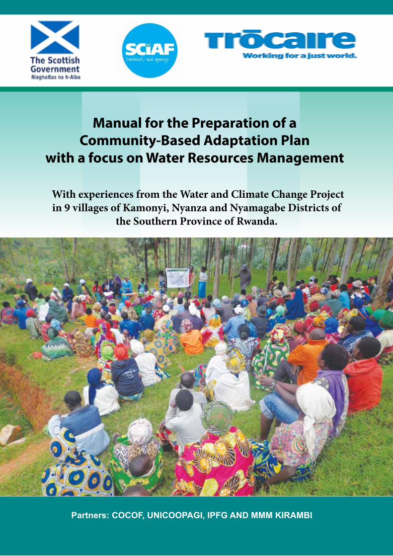
Manual for the Preparation of a Community-Based Adaptation Plan
with a focus on Water Resources Management
Partners: COCOF, UNICOOPAGI, IPFG AND MMM KIRAMBI
With experiences from the Water and Climate Change Project in 9 villages of Kamonyi, Nyanza and Nyamagabe Districts of
the Southern Province of Rwanda.
18
Head office:
Maynooth, Co. Kildare
Tel: +353 (0) 1 629 3333
Dublin:
12 Cathedral Street, Dublin 1,
Tel: +353 (0) 1 874 3875
Cork:
9 Cook Street, Cork,
Tel: +353 (0) 21 427 5622
Northern Ireland:
50 King Street, Belfast, BT1 6AD,
Tel: +44 (0) 28 9080 8030
Rwanda
No. 12, KN 31st, Kiyovu, P.O. Box 2040,
Kigali, Rwanda
Tel: (+250) 0252 502663 (+250) 0252 502664
Fax: (+250) 0252 570456
www.trocaire.org
Trócaire is the overseas development agency of the Catholic Church in Ireland Charity No. CHY5883 (ROI) / XR10431 (NI)
Photo credits: Photos on page 7: Trócaire Rwanda Photos on pages 10: Trócaire Rwanda and Jean Pierre Photos on pages 8, 9, 11&12: Jean Pierre

This Manual has been produced by Trocaire, the Irish Catholic Agency for World Development.
With the technical support from:
Rose Hogon, Karulinda Emmanuel, Bizimana Xavier, Gasasira Claudien; Ngabo Janvier, Safari Jean Baptist & Louise Umuhire.
Kigali, August 2016
Cover photo: Trócaire
Manual for Village Integrated Water Resources Planning
1
Manual for the Preparation of a Community-Based Adaptation Plan with a focus on Water Resources Management
With experiences from the Water and Climate Change Project in 9 villages of Kamonyi, Nyanza
and Nyamagabe Districts of the Southern Province of Rwanda.
Partners: COCOF, UNICOOPAGI, IPFG AND MMM KIRAMBI
Manual for Village Integrated Water Resources Planning
2
Manual for Village Integrated Water Resources Planning
3
Manual for Village Integrated Water Resources Planning
3
Table of contents
Acronyms and Abbreviations ................................................................................................................. 5
List of Tables .......................................................................................................................................... 6
List of figures .......................................................................................................................................... 6
I. Introduction ..................................................................................................................................... 7
II. Step 1 - Discuss climate change impacts with a particular focus on water resources ................. 9
II.1. Purpose ........................................................................................................................................ 9
II.2. Expected Outputs ........................................................................................................................ 9
II.3. Methodology ............................................................................................................................. 10
1. Explain the purpose of the Water and CC project. ................................................................ 10
2. Discuss Climate Change – the impacts that the villagers see already, the impacts that the scientists forecast for Rwanda. ...................................................................................................... 10
3. Explain Climate Change Adaptation, Rwandan NAPA and the priority of Integrated Water Resources Management. ............................................................................................................... 14
4. Explain the five steps that the project is suggesting to the village for making a climate change adaptation plan focussed on water resources. ................................................................... 16
5. Request the villagers to select or elect a team which will work with the project – the Village Climate Change and Water Committee......................................................................................... 16
6. Before Closing the Public meeting ....................................................................................... 17
7. After the Public Meeting ....................................................................................................... 18
III. Step 2 - Assess opportunities, capacity, vulnerability and risks ............................................... 19
III.1. Purpose ..................................................................................................................................... 19
III.2. Expected Outputs ..................................................................................................................... 19
III.3. Methodology ............................................................................................................................ 20
1. Prepare Village WCC Team ................................................................................................. 20
2. Mapping of village water resources by villagers facilitated by VWCC ............................... 24
3. Verification visit to the key sites: transect walk ................................................................... 26
4. Assess water resources management capacities (individual and organisations) ................... 29
Stakeholder Listing Methodology ................................................................................................. 29
Water stakeholder power analysis - Venn Diagramming Methodology (See example of diagram below) ........................................................................................................................................... 32
5. Assess Vulnerability and risk ................................................................................................ 34
IV. Step 3 –Analyzing water resources issues and opportunities and prioritising actions .............. 35
IV.1. Purpose .................................................................................................................................... 35
IV.2. Expected outputs ...................................................................................................................... 35
IV.3. Methodology ............................................................................................................................ 36
V. Step 4 - Making a Water and Climate Change Adaptation Plan ................................................... 38
Manual for Village Integrated Water Resources Planning
4
Manual for Village Integrated Water Resources Planning
4
V.1. Purpose ...................................................................................................................................... 38
V.2. Expected outputs ....................................................................................................................... 38
V.3. Methodology ............................................................................................................................. 39
VI. Step 5 - Implementing priority actions relating to water resources management ..................... 42
VI.1. Purpose .................................................................................................................................... 42
VI.2. Expected outputs ...................................................................................................................... 42
VI.3. Methodology ............................................................................................................................ 42
1. Provide relevant trainings ..................................................................................................... 42
2. Organise people .................................................................................................................... 42
3. Communications and information ......................................................................................... 43
4. Learn the rules for water resources management, water rights and responsibilities of every citizen. ........................................................................................................................................... 44
5. Getting resources .................................................................................................................. 45
6. Managing resources .............................................................................................................. 45
7. Maintenance of water conservation, storage, lifting and delivery systems. .......................... 45
8. Monitor the progress of the plan in a participatory manner. ................................................. 46
Appendix 1 ............................................................................................................................................ 47
Appendix 2: Example of water catchment hhydrological map ............................................................ 49
Appendix 3: Institutions responsible for water management in Rwanda.............................................. 50
Manual for Village Integrated Water Resources Planning
5
Manual for Village Integrated Water Resources Planning
5
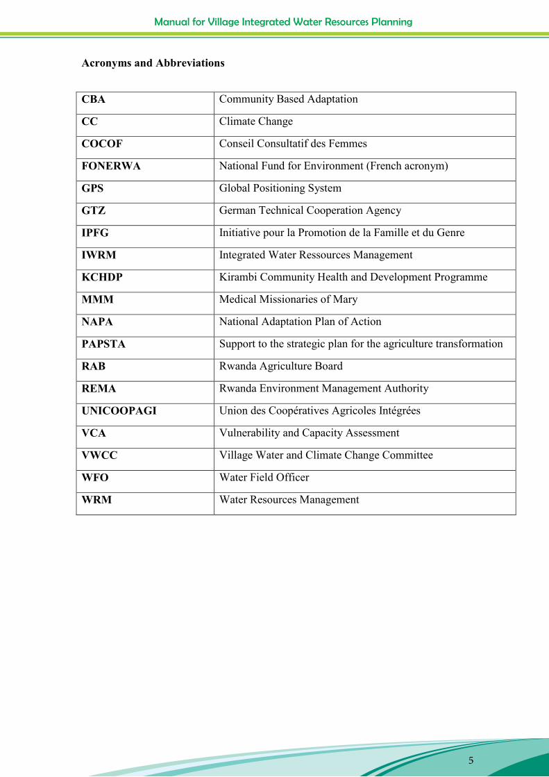
Acronyms and Abbreviations
CBA Community Based Adaptation
CC Climate Change
COCOF Conseil Consultatif des Femmes
FONERWA National Fund for Environment (French acronym)
GPS Global Positioning System
GTZ German Technical Cooperation Agency
IPFG Initiative pour la Promotion de la Famille et du Genre
IWRM Integrated Water Ressources Management
KCHDP Kirambi Community Health and Development Programme
MMM Medical Missionaries of Mary
NAPA National Adaptation Plan of Action
PAPSTA Support to the strategic plan for the agriculture transformation
RAB Rwanda Agriculture Board
REMA Rwanda Environment Management Authority
UNICOOPAGI Union des Coopératives Agricoles Intégrées
VCA Vulnerability and Capacity Assessment
VWCC Village Water and Climate Change Committee
WFO Water Field Officer
WRM Water Resources Management
Manual for Village Integrated Water Resources Planning
6
Manual for Village Integrated Water Resources Planning
6
List of Tables Table 1: Discuss Climate change with the villagers ................................................................................ 9
Table 2: Map Water Resources ............................................................................................................. 19
Table 3: Example of historical events and trend line combined ........................................................... 25
Table 4: Example of a list of water stakeholders Rubanga and Nyarusange villages, COCOF Musambira ............................................................................................................................................ 30
Table 5: Analyse issues and opportunities and prioritise actions ......................................................... 35
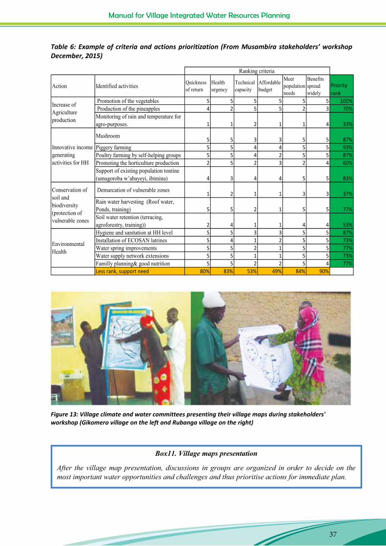
Table 6: Example of criteria and actions prioritization (From Musambira stakeholders’ workshop December, 2015) .................................................................................................................................. 37
Table 7: Make a village water resources management strategy and action plan ................................ 38
Table 8: ACTION PLANS ELABORATION IN GIKOMERO AND GATARE VILLAGES (CYANIKA SECTOR) ... 39
Table 9: Example of information and communication framework ....................................................... 44
List of figures
Figure 1: Water cycle drawn by participants in WFO training, Kirambi Feb 2015 ................................ 11
Figure 2: Runoff and infiltration demonstration by UNICOOPAGI water field officer, Nyamigina, 25/02/2015 ........................................................................................................................................... 12
Figure 3: Sector Agronomist explaining Rwanda’s CC adaptation efforts ............................................ 15
Figure 4: Cyanika Sector Agronomist discussing with Gatare villagers about climate change (on the left), Gatare village water committee (on the right) ............................................................................ 18
Figure 5: Villagers in a mapping exercise .............................................................................................. 21
Figure 6: Water field officers practicing participatory mapping, Kirambi, Feb 2015 ........................... 23
Figure 7: A shady location, for the comfort of mappers and a bare road, for easy view of markers: Kirambi school (on the left) and Gikomero village (on the right) ......................................................... 24
Figure 8: Mpaza water map .................................................................................................................. 24
Figure 9: Gatare village trend line about water demand, IPFG Nyamagabe ........................................ 26
Figure 10: Gikomero transect walk ....................................................................................................... 28
Figure 11: Example of a Venn diagram of Rubanga village, COCOF Musambira .................................. 32
Figure 12: Example of vulnerability matrix: Nyarugeti an Ngororero villages ...................................... 34
Figure 13: Village climate and water committees presenting their village maps during stakeholders' workshop (Gikomero village on the left and Rubanga village on the right) ......................................... 37
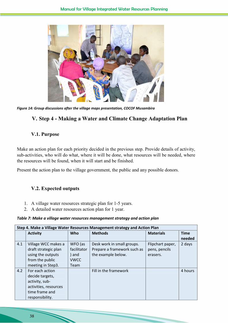
Figure 14: Group discussions after the village maps presentation, COCOF Musambira ...................... 38
Figure 15: Villagers preparing the trees nursery in Nyarugeti village of Tare Sector, Nyamagabe District. .................................................................................................................................................. 46
Figure 16: Example of water catchment in UNICOOPAGI zone, Nyamagabe District. ......................... 49
Manual for Village Integrated Water Resources Planning
7
Manual for Village Integrated Water Resources Planning
7
I. Introduction
The aim of Trócaire Rwanda‟s Sustainable Livelihoods Programme is to improve household livelihood security through increasing household food security and income from farm/off farm activities and to reduce the vulnerability of targeted households by building their capacities to cope and adapt to effects of climate variability and change. The specific objectives for the programme are:
Improved food security
Increased household income
Increased capacity for the partners and households to identify and to mitigate the risks related to the climate.
The Rwandan government‟s Water Resources Management Sub-sector Strategic Plan (2011– 2015) has supported the rehabilitation of water catchments, the development of rainwater harvesting initiatives and improved storm water management, climate change mitigation and improved energy efficiency. These innovations, however, must be scaled up, consolidated and shared as lessons learned across the country. The main challenge is to utilize water much more efficiently, in the context of declining water resources due to environmental degradation, climate change and an increasing population.
Within the programme, there is a pilot project entitled Water for agricultural production aiming at integrating technologies and practices in rain water & waste water management for boosting agricultural production and increasing resilience for small farmers in 9 villages located in three Districts of the Centre and South namely Nyanza, Nyamagabe and Kamonyi. It will pilot technologies and approaches to broaden the options available to poor, rural communities to manage water more efficiently and sustainably, in the context of limited resources and climate threats.
This project seeks to reduce vulnerability to climate change by supporting the communities to apply a range of technologies to harvest and use rainwater, together with the recycling of the water used for other domestic activities. This will be carried out in conjunction with community sensitization on climate change adaptation technologies and practices, leading to the development of local community Integrated Water Resources Management plans. The project will document and disseminate the approaches behind the technologies and practices that are supported by the project for further learning, duplication and advocacy work for the future.
The overall objective of the project The project will enhance the capacity of small-scale farmers to apply rainwater harvesting and wastewater technologies for agricultural production and thereby increase resilience to climate change in four “Cells” (communities) in Rwanda.
Manual for Village Integrated Water Resources Planning
8
Manual for Village Integrated Water Resources Planning
8
The project outputs will include:
Output 1: Community in 8 villages are educated in climate change adaptation practices & planning;
Output 2: Roof water harvested and used for vegetable production by MHHs and FHHs;
Output 3: Waste water recycled and used for vegetable production by MHHs and FHHs;
Output 4: Climate Change Adaptation technologies and practices in 4 cells are documented for community, partners‟, Trócaire‟s and external learning.
This manual for preparation of a community-based adaptation plan with focus on water
resources relates to Output 1 It is primarily a guide for Water Field Officers who are working
with Community members to achieve the following five goals:
Goal 1: Discussing climate change impacts in their villages with a particular focus on water
resources;
Goal 2: Assessing opportunities, capacity, vulnerability and risks;
Goal 3: Analysing issues and opportunities and prioritising actions;
Goal 4: Making Village Water and Climate Change Adaptation Plans;
Goal 5: Implementing Priority Actions relating to Water Resources Management.
The five headings above form the five main steps of the Village Water and Climate Change
Planning Process and are explained in detail in each chapter. The water Field Officers
received a short training course in using the manual and have so far reached the end of Step
4. Their experiences and those of the villagers are reflected in comments, tips and photos
throughout the draft of the manual. The manual will be published in Kinyarwanda and shared
widely in Rwanda.
This manual draws heavily on material from CARE International‟s CBA and VCA
Handbooks, toolkits and guides found on the following website -
www.careclimatechange.org and also from other sources referenced throughout.
Bizimana, Xavier ; Gasasira, Claudien ; Hogan, Rose; Karulinda, Emmanuel ; Ngabo, Janvier; Safari, Jean Baptis and Umuhire, Marie Louise, August 2016.
Manual for Village Integrated Water Resources Planning
9
Manual for Village Integrated Water Resources Planning
9
II. Step 1 - Discuss climate change impacts with a particular focus on water resources
II.1. Purpose
The purpose of Step1 is to meet all the villagers (women, men, young people and children) and introduce the following points to them:
Explain the purpose of water and climate change project. Discuss climate change focusing on the impacts that the villagers see already, the
impacts that the scientists forecast for Rwanda Explain Climate Change Adaptation, Rwandan National Adaptation Plan (NAPA) and
the priority of Integrated Water Resources Management. Explain the five steps that the project is suggesting to the village for making a climate
change adaptation plan focussing on water resources. Request the villagers to elect a team which will work with the project (the Village CC
and Water team). Suggest criteria for selecting the team. Make a deadline for the first meeting of the team.
II.2. Expected Outputs
1. The whole village understands the project purpose, climate change adaptation and has agreed to collaborate with the project.
2. The villagers agree that a village water and climate change team will be selected. 3. The village leaders agree to keep records of the community water and climate change
adaptation plan in a public file.
Table 1: Discuss Climate change with the villagers
Step 1. Discuss Climate Change with the villagers Activity Who Methods Materials Time 1.0 One or more Public
meetings with all (>75%) villagers to discuss climate change and request the design of a temporal Village Climate Change and Water Team
All villagers, and Village leaders Cell and Sector leaders and Extension workers. Your organisation‟s boss. A Minute-taker/secretary. Writer/recorder for flipchart notes.
1. Plenary presentations and discussions. 2. Separate groups (Men, women and young people) Discussions.
1. Project description. 2. Information on climate change in Rwanda. 3. Definition of Climate Change Adaptation. 4. Five-step process for Village Adaptation planning. Flipchart paper, marker pens, stick-its. Note books, paper. Big File folder, puncher, stapler and staples for the Village to record their CC Adaptation planning activities.
2 hours per meeting.
Manual for Village Integrated Water Resources Planning
10
Manual for Village Integrated Water Resources Planning
10
II.3. Methodology
Before starting, ask the village leader to appoint a person to take minutes of the meeting, recording what is being presented and said by all participants.
1. Explain the purpose of the Water and CC project. Introduce yourself; the water field officer and your organisation. Tell the villagers the purpose of the project and what the project is intending to do in Rwanda and in this village. Tell what the project duration is, that it is just a pilot project and that this is one of the first villages to be selected. Explain that some households have been selected for rainwater harvesting interventions, but that the project wants the whole village to benefit by improving management of the water resources to become more resilient to climate change.
2. Discuss Climate Change – the impacts that the villagers see already, the impacts that the scientists forecast for Rwanda.
Villagers ‘views Get villagers views on Climate Change through questions like:
- “What do you understand by climate change?”
- “How does climate change affect water resources in rivers, springs, field crops and homes?”
-“What impact has this on your lives?”
Consider answers from two women, two men and two young people. Ask the village recorder to write the key points on the flipchart.
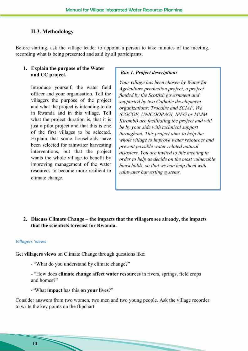
Box 1. Project description:
Your village has been chosen by Water for Agriculture production project, a project funded by the Scottish government and supported by two Catholic development organizations; Trocaire and SCIAF. We (COCOF, UNICOOPAGI, IPFG or MMM Kirambi) are facilitating the project and will be by your side with technical support throughout. This project aims to help the whole village to improve water resources and prevent possible water related natural disasters. You are invited to this meeting in order to help us decide on the most vulnerable households, so that we can help them with rainwater harvesting systems.
Manual for Village Integrated Water Resources Planning
11
Manual for Village Integrated Water Resources Planning
11
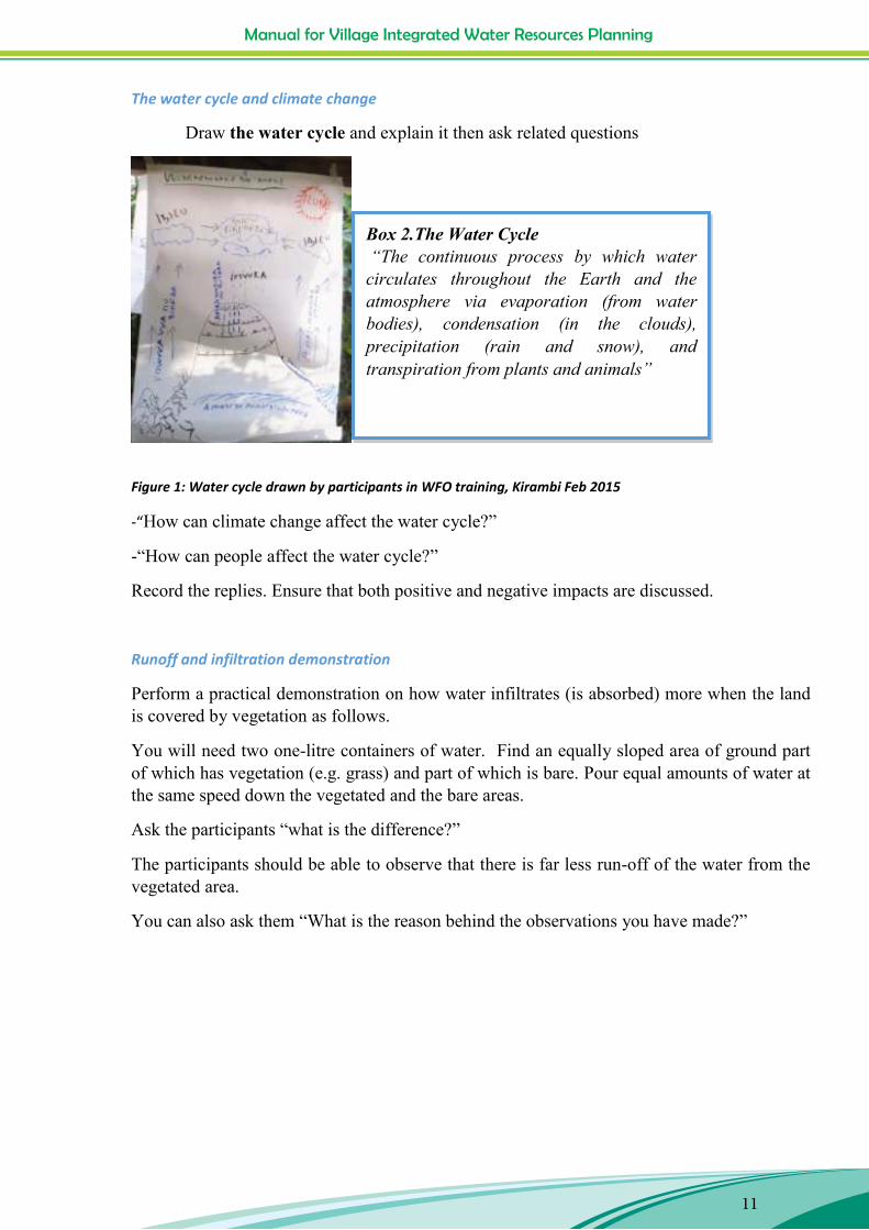
The water cycle and climate change
Draw the water cycle and explain it then ask related questions
Figure 1: Water cycle drawn by participants in WFO training, Kirambi Feb 2015
-“How can climate change affect the water cycle?”
-“How can people affect the water cycle?”
Record the replies. Ensure that both positive and negative impacts are discussed.
Runoff and infiltration demonstration
Perform a practical demonstration on how water infiltrates (is absorbed) more when the land is covered by vegetation as follows.
You will need two one-litre containers of water. Find an equally sloped area of ground part of which has vegetation (e.g. grass) and part of which is bare. Pour equal amounts of water at the same speed down the vegetated and the bare areas.
Ask the participants “what is the difference?”
The participants should be able to observe that there is far less run-off of the water from the vegetated area.
You can also ask them “What is the reason behind the observations you have made?”
Box 2.The Water Cycle “The continuous process by which water circulates throughout the Earth and the atmosphere via evaporation (from water bodies), condensation (in the clouds), precipitation (rain and snow), and transpiration from plants and animals”

Manual for Village Integrated Water Resources Planning
12
Manual for Village Integrated Water Resources Planning
12
Figure 2: Runoff and infiltration demonstration by UNICOOPAGI water field officer, Nyamigina, 25/02/2015
Own Catchment map Show the villagers the catchment map for their area (see Annex 2) and describe the main features. Encourage discussion and the contribution of more details to the map.
Manual for Village Integrated Water Resources Planning
13
Manual for Village Integrated Water Resources Planning
13
Climate Change forecast for Rwanda
Present the current information available about the expected changes in climate in Rwanda.
For example the information in the Box 3 below which has been collected from government documents will assist you in your presentation.
Box 3: Climate Change forecast for Rwanda (various sources) Temperatures are rising, rainfall is uncertain (probably can increase) and the seasons are shifting. Climate model scenarios show future increases in mean annual temperature of up to 3.25°C by the end of the century. Changes in rainfall are more uncertain, though most of the models show that rainfall will increase. These projections are based on downscaling of global climate models to a single station in Rwanda (Kigali Airport); limited regional climate modelling has been carried out that captures Rwanda‟s unique regional setting and climatology. Temperatures: Minimum and maximum Analysis of historical temperatures at Kigali indicates that minimum temperatures have been rising faster than maximum temperatures, but with a general overall rise in temperature particularly since 1992. All of the climate model scenarios show future increases in mean annual temperature in future years. The CCE data, based on downscaled data for Kigali‟s airport station, reports an increase of average maximum monthly temperatures of around 1.5 to 2.7 ºC (for a business as usual, no mitigation, scenario) over the range of models by the 2050s (2046 -2065), with greatest warming from July to September. The trends in monthly average minimum temperatures project a rise of between 1.7 to 2.8 ºC for 2046-2065, with the most warming occurring in June to August. Rainfall – amount uncertain with a shift in seasons Changes in precipitation are more uncertain. The majority of the projections indicate that average annual rainfall will actually increase, particularly in some seasons, indicating a potential strengthening of the rains which is important in relation to flood risk. However, some models show reductions in rainfall in some months. A shift in the timing of seasons is already being reported in certain regions. More extreme rain conditions –short heavy burst of rain and longer dry periods. Floods and droughts could both become more frequent.
Manual for Village Integrated Water Resources Planning
14
Manual for Village Integrated Water Resources Planning
14
3. Explain Climate Change Adaptation, Rwandan NAPA and the priority of Integrated Water Resources Management. Villagers ‘views
Get the villagers’ views on what Climate Change Adaptation means: -“What do you understand by climate change adaptation?” -“How do you think this village can adapt to climate change?” -Look at the answers and ask: “Do you think that the adaptation methods you have proposed are truly sustainable?
Might some of them be damaging your resources? Could you continue to adopt those methods in the long-term?”
Formal Definition of Climate Change Adaptation Write a formal definition of Climate Change Adaptation on a flipchart and read it out to the villagers. -Ask if they agree with these definitions.
-Write their comments on the flipchart.
A good adaptation plan Explain the characteristics of a good Climate Change Adaptation plan as follows;-
Oriented towards longer term livelihoods security A continuous process Results are sustainable Uses resources efficiently and sustainably Involves planning Combines old and new strategies and knowledge Focused on finding alternatives.
Ask the villagers “What else do you think would be important in your village‟s plan?”
Box 4. The UNFCCC definition of Climate Change Adaptation;
“Actions taken to help communities and ecosystems cope with changing climate condition.”
Box 5. The IPCC definition of Climate Change adaptation; “Adjustment in natural or human systems in response to actual or expected climatic stimuli or their effects, which moderates harm or exploits beneficial opportunities”
Manual for Village Integrated Water Resources Planning
15
Manual for Village Integrated Water Resources Planning
15
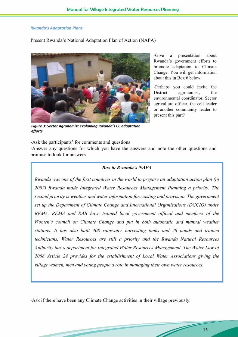
Figure 3: Sector Agronomist explaining Rwanda’s CC adaptation efforts
Rwanda’s Adaptation Plans Present Rwanda‟s National Adaptation Plan of Action (NAPA)
-Give a presentation about Rwanda‟s government efforts to promote adaptation to Climate Change. You will get information about this in Box 6 below.
-Perhaps you could invite the District agronomist, the environmental coordinator, Sector agriculture officer, the cell leader or another community leader to present this part?
-Ask the participants‟ for comments and questions -Answer any questions for which you have the answers and note the other questions and promise to look for answers.
-Ask if there have been any Climate Change activities in their village previously.
Box 6: Rwanda’s NAPA
Rwanda was one of the first countries in the world to prepare an adaptation action plan (in
2007) Rwanda made Integrated Water Resources Management Planning a priority. The
second priority is weather and water information forecasting and provision. The government
set up the Department of Climate Change and International Organisations (DCCIO) under
REMA. REMA and RAB have trained local government official and members of the
Women‟s council on Climate Change and put in both automatic and manual weather
stations. It has also built 408 rainwater harvesting tanks and 28 ponds and trained
technicians. Water Resources are still a priority and the Rwanda Natural Resources
Authority has a department for Integrated Water Resources Management. The Water Law of
2008 Article 24 provides for the establishment of Local Water Associations giving the
village women, men and young people a role in managing their own water resources.
Manual for Village Integrated Water Resources Planning
16
Manual for Village Integrated Water Resources Planning
16
-Discuss and clarify information about what has already been done regarding Climate Change. -Record villagers‟ reactions
4. Explain the five steps that the project is suggesting to the village for making a climate change adaptation plan focussed on water resources.
-Write down the five steps on a flipchart and explain them 1. Discussing climate change impacts in their villages with a particular focus on
water resources. 2. Assessing opportunities, capacity, vulnerability and risks. 3. Analysing issues and opportunities and prioritising actions 4. Making a climate change adaptation plan 5. Implementing priority actions relating to water resources management.
-Request the meeting to comment on the proposed process.
-Record and discuss their comments/changes
-Request the meeting to approve the five-step process.
5. Request the villagers to select or elect a team which will work with the project – the Village Climate Change and Water Committee
-Explain that it is the villagers who are responsible for their own climate change adaptation plan and that they will need to decide on a team (a small number of women and men) to follow the five steps.
-Explain that you would like to work with the team and that the team will be responsible to the whole village as represented by the villager leader.
-The team will report back to the village leader who will call public meetings at regular intervals.
-Ask if there is any team or committee who is already in existence which has water as responsibility.
-If yes, ask if the team is active and effective.
-Ask the villagers if the team members fit the criteria below.
-If the team is lacking any of the needed qualities, ask them if they would like to improve the current team, or prefer to disband it and make a new team.
Manual for Village Integrated Water Resources Planning
17
Manual for Village Integrated Water Resources Planning
17
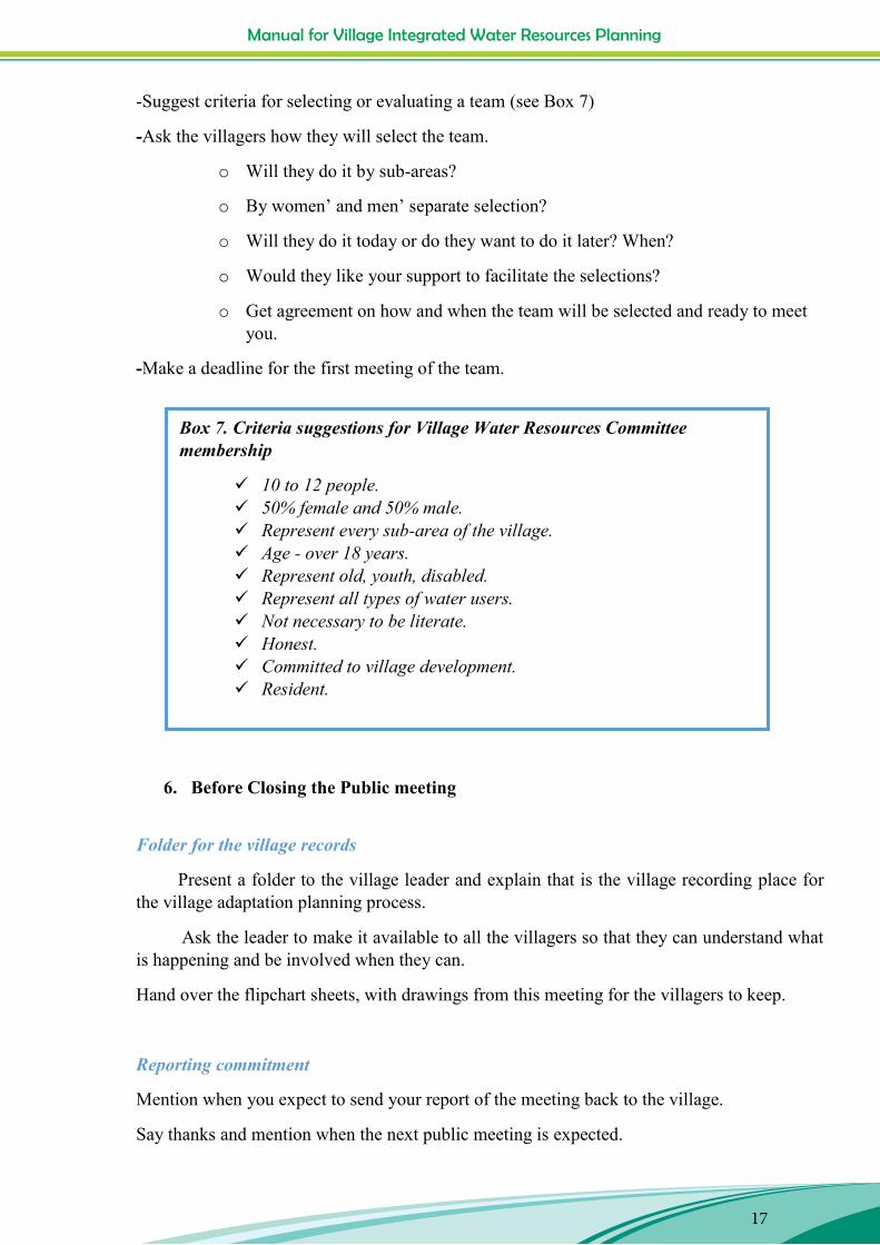
-Suggest criteria for selecting or evaluating a team (see Box 7)
-Ask the villagers how they will select the team.
o Will they do it by sub-areas?
o By women‟ and men‟ separate selection?
o Will they do it today or do they want to do it later? When?
o Would they like your support to facilitate the selections?
o Get agreement on how and when the team will be selected and ready to meet you.
-Make a deadline for the first meeting of the team.
6. Before Closing the Public meeting
Folder for the village records
Present a folder to the village leader and explain that is the village recording place for the village adaptation planning process.
Ask the leader to make it available to all the villagers so that they can understand what is happening and be involved when they can.
Hand over the flipchart sheets, with drawings from this meeting for the villagers to keep.
Reporting commitment
Mention when you expect to send your report of the meeting back to the village.
Say thanks and mention when the next public meeting is expected.
Box 7. Criteria suggestions for Village Water Resources Committee membership
10 to 12 people. 50% female and 50% male. Represent every sub-area of the village. Age - over 18 years. Represent old, youth, disabled. Represent all types of water users. Not necessary to be literate. Honest. Committed to village development. Resident.

Manual for Village Integrated Water Resources Planning
18
Manual for Village Integrated Water Resources Planning
18
7. After the Public Meeting
- Write up a report of the public meeting.
-Share the report with the village.
Figure 4: Cyanika Sector Agronomist discussing with Gatare villagers about climate change (on the left), Gatare village water committee (on the right)
Manual for Village Integrated Water Resources Planning
19
Manual for Village Integrated Water Resources Planning
19
III. Step 2 - Assess opportunities, capacity, vulnerability and risks
III.1. Purpose
The purpose of Step 2 is to facilitate the community to map their water resources and to identify opportunities, vulnerabilities and risks. Then to list experience and capacity in water resources management; list this information in preparation for discussion at a public village meeting at which the challenges and opportunities will be prioritised.
III.2. Expected Outputs
1. Village map with all the key water resource features, risks and vulnerabilities. 2. List of opportunities for improving Water Resources Management in order to be more
resilient to climate change. 3. List of capacities (human skills, human organisation etc.) which can help with better
WRM. 4. List of vulnerabilities, challenges and opportunities which are recommended as
priorities.
Table 2: Map Water Resources
Step 2. Map Water Resources –Assess WRM capacity, vulnerability and risk. Activity Who Methods Materials Time
needed 2.1 Prepare Village
WCC Team for Step 2 practice
WFO, local authorities and VWCC team
Group work, mapping practice.
Sticks, stones, leaves, ashes, seeds etc. Flipchart paper, pens pencils, erasers, notebooks, camera
4 hours
2.2 Map water resources of the village with village members
VWCC Team with 3 groups –women, men and young people.
Three separate mapping activities. Consolidation of the three maps into one.
Sticks, stones, leaves, ashes, seeds etc. Flipchart paper, pens pencils, erasers, notebooks, camera
1 day
2.3 Verification visit to risk and opportunity sites.
VWCC team and WFO
Transect walk taking photographs and geo-referencing the
Camera , G.P.S. 4 hours
Manual for Village Integrated Water Resources Planning
20
Manual for Village Integrated Water Resources Planning
20
photographs. 2.4 Assess WRM
capacity – individuals and organisations.
VWCC team and WFO with women, men and young people representatives.
List and Venn Diagram of stakeholders in WRM -Who owns controls and manages water now? -Who has special skills in water management?
Paper, scissors. Flipchart paper, pens, pencils. Camera.
3 hours
2.5 Assess vulnerability and risk.
VWCC team and WFO with women, men and young representatives
Risk and vulnerability matrix and group discussion.
2 hours
III.3. Methodology
1. Prepare Village WCC Team
Give general advice about participatory work in villages, being polite and inclusive to everybody. See advice in Appendix 1.
Prepare VWCC Team for the process
-Explain and decide the content of the village water resources map.
Water resources: rivers, streams, lakes, springs, wells, water holes, domestic water supply systems (intakes, pipes, taps, tanks), rainwater harvesting cisterns and tanks etc.
General relief features and other natural features (hills, escarpments, drainage features, natural water sources, vegetation types, quarries, clay pits, mines fields etc).
Boundaries of the village
Features in adjacent villages which influence the water resources here. E.g. forests, river sources, irrigation scheme upstream, mine, factory effluent, etc.
Cropping and grazing areas.
Settlement and buildings
Manual for Village Integrated Water Resources Planning
21
Risk areas: with specific problems gullies, land slippage, terrace breakdown, water shortage, very sandy soils, soils with little organic matter, flood, weak soil structure, bare hilltops, high run-off from new road, activities in adjacent villages…
Opportunities: untapped resources or innovations that some few are doing now e.g. quarry which could form a pond site, natural stone formation which could form run-off catchment site, road which could supply run-off water, in-field opportunities to trap water (mulching, shading, pitting, mixed cropping), buildings which could collect water for communal use, people who are experienced in water conservation…
Trends in water resources quantity and quality: what is getting better? What is getting worse? Since 1965 what can they remember about the water resources? In 1965, 1975, 1985, 1995, 2005, 2015 or any year in between did anything major happened, e.g. drought, flood, landslide, river became seasonal?
Ask “Is there anything else that the VWCC team thinks is important to include in the map?”
Women were the ones who knew most about water points and high risk erosion zones. Men could tell you about forestry and banana plantations. Water Field Officer.
The villagers were terrific, they know so much and, once you give them the idea of what to do, they are very capable of doing it themselves. I learnt a lot from them. Water Field Officer.
Figure 5: Villagers in a mapping exercise

Manual for Village Integrated Water Resources Planning
21
Manual for Village Integrated Water Resources Planning
21
Risk areas: with specific problems gullies, land slippage, terrace breakdown, water shortage, very sandy soils, soils with little organic matter, flood, weak soil structure, bare hilltops, high run-off from new road, activities in adjacent villages…
Opportunities: untapped resources or innovations that some few are doing now e.g. quarry which could form a pond site, natural stone formation which could form run-off catchment site, road which could supply run-off water, in-field opportunities to trap water (mulching, shading, pitting, mixed cropping), buildings which could collect water for communal use, people who are experienced in water conservation…
Trends in water resources quantity and quality: what is getting better? What is getting worse? Since 1965 what can they remember about the water resources? In 1965, 1975, 1985, 1995, 2005, 2015 or any year in between did anything major happened, e.g. drought, flood, landslide, river became seasonal?
Ask “Is there anything else that the VWCC team thinks is important to include in the map?”
Women were the ones who knew most about water points and high risk erosion zones. Men could tell you about forestry and banana plantations. Water Field Officer.
The villagers were terrific, they know so much and, once you give them the idea of what to do, they are very capable of doing it themselves. I learnt a lot from them. Water Field Officer.
Figure 5: Villagers in a mapping exercise

Manual for Village Integrated Water Resources Planning
22
Manual for Village Integrated Water Resources Planning
22
-Explain the process of mapping and practice it together
The map is developed by community members from all villages in separate groups for women, men and young people
The mapping is done outdoors on clear ground with shade. The VWCC team facilitates the mapping process. They (community) draw the map at an appropriate spot on the ground using locally
available materials i.e. ashes, sticks, leaves, stones, soil, flowers, seeds etc. The facilitator ensures that all members are able to participate and follow the process. The facilitator ensures that at least one note-taker is recording the names of the rivers,
wells, springs, and other significant resources are written down. The facilitator ensures that a volunteer/s have a pencil and eraser and blank paper to
sketch a draft of the map during the process. Once the community has finished, the facilitator should interview/probe the map to
bring out important issues. The maps are then presented to all three groups in plenary for verification and
adoption of one consolidated map. The VWCC Team and facilitator transfer the map together with all the details
provided by the community onto the flipchart sheet. The facilitator photographs the map and leaves it to the VWCC Team in the village.
-Practice the mapping yourselves
Spend at least 30 minutes practicing the mapping. Make sure that each person understands what to do, how to get it started, how to
include everyone, how to transfer the map onto a flipchart Make sure each VWCC Team member has the materials needed; pens, pencils eraser,
flipchart paper.
-Make a timetable of work Discuss the village area where it is appropriate to do the mapping. Should the women
be in one sub-village, the men in another and young people in another? Should the VWCC Team split up, who is going to facilitate which group and where?
When will the VWCC team do the mapping, how will they assemble the people, do they need to get the village leader to call the mapping sessions?
Agree on the timetable for mapping. -Agree on a place and time for bringing all three maps together.
Manual for Village Integrated Water Resources Planning
23
Manual for Village Integrated Water Resources Planning
23
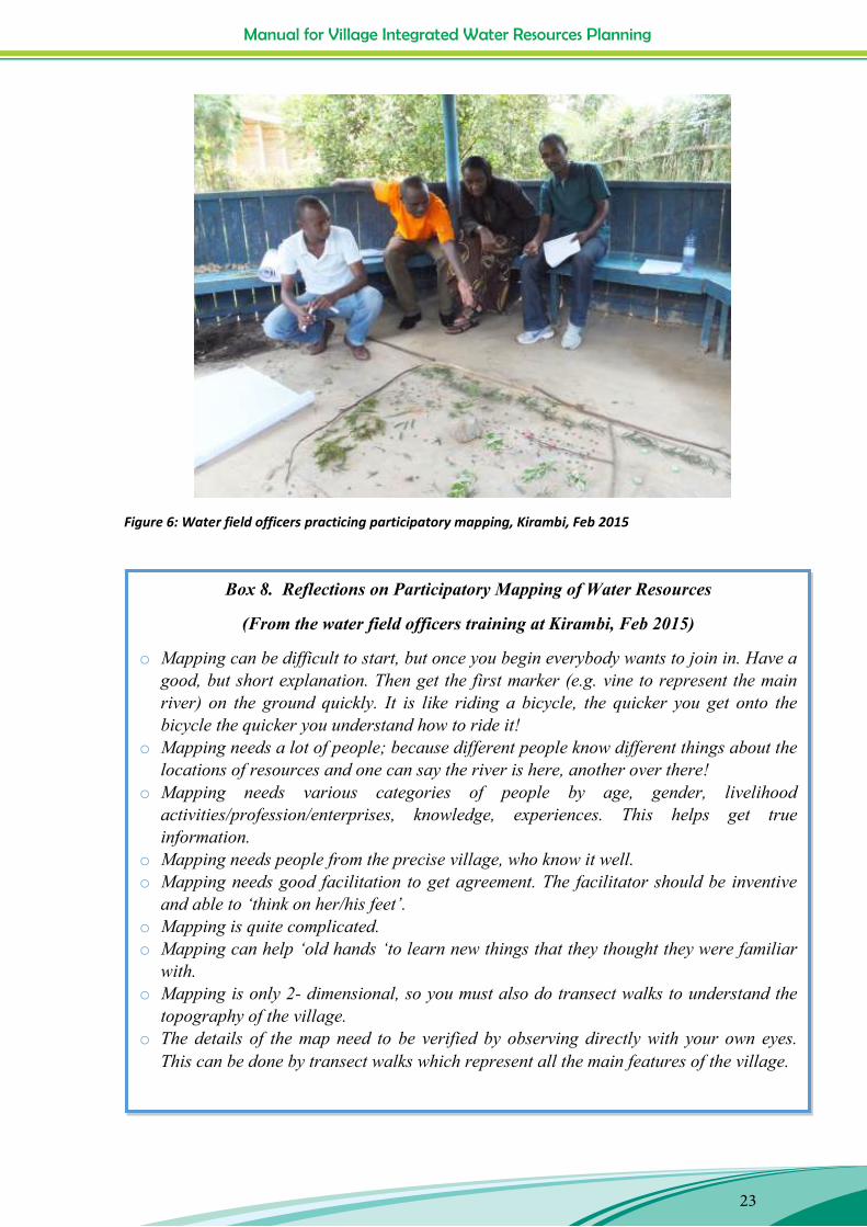
Figure 6: Water field officers practicing participatory mapping, Kirambi, Feb 2015
Box 8. Reflections on Participatory Mapping of Water Resources
(From the water field officers training at Kirambi, Feb 2015)
o Mapping can be difficult to start, but once you begin everybody wants to join in. Have a good, but short explanation. Then get the first marker (e.g. vine to represent the main river) on the ground quickly. It is like riding a bicycle, the quicker you get onto the bicycle the quicker you understand how to ride it!
o Mapping needs a lot of people; because different people know different things about the locations of resources and one can say the river is here, another over there!
o Mapping needs various categories of people by age, gender, livelihood activities/profession/enterprises, knowledge, experiences. This helps get true information.
o Mapping needs people from the precise village, who know it well. o Mapping needs good facilitation to get agreement. The facilitator should be inventive
and able to „think on her/his feet‟. o Mapping is quite complicated. o Mapping can help „old hands „to learn new things that they thought they were familiar
with. o Mapping is only 2- dimensional, so you must also do transect walks to understand the
topography of the village. o The details of the map need to be verified by observing directly with your own eyes.
This can be done by transect walks which represent all the main features of the village.
Manual for Village Integrated Water Resources Planning
24
Manual for Village Integrated Water Resources Planning
24
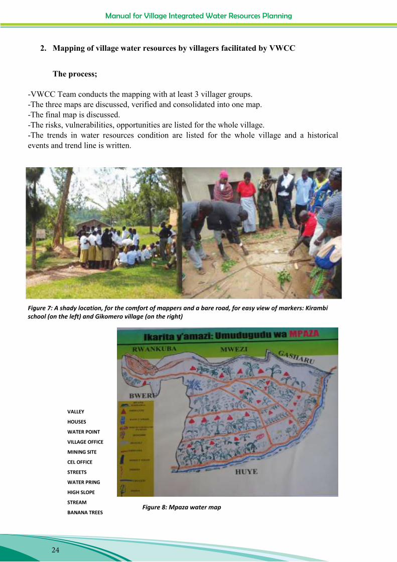
2. Mapping of village water resources by villagers facilitated by VWCC
The process;
-VWCC Team conducts the mapping with at least 3 villager groups. -The three maps are discussed, verified and consolidated into one map. -The final map is discussed. -The risks, vulnerabilities, opportunities are listed for the whole village. -The trends in water resources condition are listed for the whole village and a historical events and trend line is written.
Figure 7: A shady location, for the comfort of mappers and a bare road, for easy view of markers: Kirambi school (on the left) and Gikomero village (on the right)
VALLEY
HOUSES
WATER POINT
VILLAGE OFFICE
MINING SITE
CEL OFFICE
STREETS
WATER PRING
HIGH SLOPE
STREAM
BANANA TREES Figure 8: Mpaza water map

Manual for Village Integrated Water Resources Planning
25
Man
ual f
or V
illag
e In
tegr
ated
Wat
er R
esou
rces
Pla
nnin
g
25
Tabl
e 3:
Exa
mpl
e of
hist
orica
l eve
nts a
nd tr
end
line
com
bine
d
W
ater
reso
urce
s 194
0- 2
015
Gat
are v
illag
e /C
yani
ka-N
yam
agab
e Y
ear
1940
-19
45
1983
19
84
1987
19
75
1985
19
93
1996
20
04
2006
20
07
Even
t D
roug
ht
(Ruz
agay
ura)
Hea
vy ra
in
caus
ing
flood
Star
t of
min
ing
activ
ities
by
Ch
ines
e
AED
ER
proj
ect
help
ed
villa
gers
in
mai
nten
anc
e of w
ater
so
urce
s (s
prin
gs)
Dro
ught
(R
wak
abw
ija)
Hea
vy ra
in
whi
ch h
ighl
y da
mag
ed
crop
s
dro
ught
(R
ujuk
undi
)
Eros
ion
cont
rol,
plan
ting
trees
, and
ro
ads
prep
arat
ion
flood
in
“K
avir
i” ri
ver
eros
ion
cont
rol
activ
ities
in
itiat
ed b
y G
TZ
PAPS
TA te
ach
villa
gers
how
to
desig
n te
rrace
s
Tren
d D
ecre
ase o
f the
avai
labl
e wat
er
Tren
d W
ater
dem
and
is in
crea
sing
in th
e vill
ages
due
to p
opul
atio
n gr
owth
Tr
end
Nat
ural
veg
etat
ion
and
fore
st ha
s dec
reas
ed
Tren
d W
ater
selli
ng b
ecam
e m
ore c
omm
on an
d w
ater
pric
es ar
e inc
reas
ing.
Tr
end
Agr
icul
tura
l pro
duct
ion
high
ly af
fect
ed
Tren
d Te
rraci
ng an
d ot
her s
lope
pro
tect
ion
are b
ecom
ing
mor
e com
mon
- re
duce
s run
-off.
Manual for Village Integrated Water Resources Planning
26
Manual for Village Integrated Water Resources Planning
26
Example of trend line
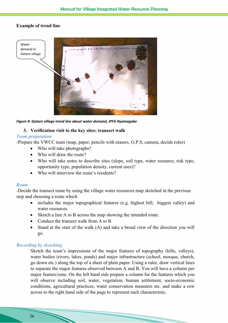
Figure 9: Gatare village trend line about water demand, IPFG Nyamagabe
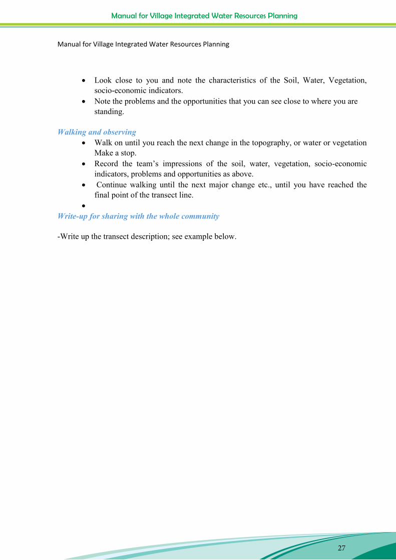
3. Verification visit to the key sites: transect walk Team preparation -Prepare the VWCC team (map, paper, pencils with erasers, G.P.S, camera, decide roles)
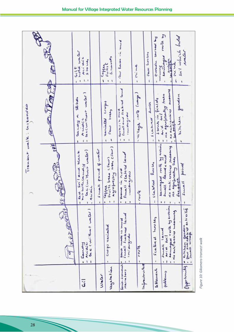
Who will take photographs? Who will draw the route? Who will take notes to describe sites (slope, soil type, water resource, risk type,
opportunity type, population density, current uses)? Who will interview the route‟s residents?
Route -Decide the transect route by using the village water resources map sketched in the previous step and choosing a route which
includes the major topographical features (e.g. highest hill, biggest valley) and water resources
Sketch a line A to B across the map showing the intended route. Conduct the transect walk from A to B Stand at the start of the walk (A) and take a broad view of the direction you will
go.
Recording by sketching Sketch the team‟s impressions of the major features of topography (hills, valleys), water bodies (rivers, lakes, ponds) and major infrastructure (school, mosque, church, go down etc.) along the top of a sheet of plain paper. Using a ruler, draw vertical lines to separate the major features observed between A and B. You will have a column per major feature/zone. On the left hand side prepare a column for the features which you will observe including soil, water, vegetation, human settlement, socio-economic conditions, agricultural practices, water conservation measures etc. and make a row across to the right hand side of the page to represent each characteristic.
Water demand in Gatare village
Manual for Village Integrated Water Resources Planning
27
Manual for Village Integrated Water Resources Planning
27
Look close to you and note the characteristics of the Soil, Water, Vegetation,
socio-economic indicators. Note the problems and the opportunities that you can see close to where you are
standing.
Walking and observing Walk on until you reach the next change in the topography, or water or vegetation
Make a stop. Record the team‟s impressions of the soil, water, vegetation, socio-economic
indicators, problems and opportunities as above. Continue walking until the next major change etc., until you have reached the
final point of the transect line.
Write-up for sharing with the whole community -Write up the transect description; see example below.
Manual for Village Integrated Water Resources Planning
28
Man
ual f
or V
illag
e In
tegr
ated
Wat
er R
esou
rces
Pla
nnin
g
28
Figu
re 1
0: G
ikom
ero
tran
sect
wal
k

Manual for Village Integrated Water Resources Planning
29
Manual for Village Integrated Water Resources Planning
29
4. Assess water resources management capacities (individual and organisations)
-Prepare the VWCC Team by
Explaining the listing methodology Explaining the Venn diagram methodology Practicing the activity Assisting the VWCC Team to plan the discussions with women, men and young
people in separate groups. Ensuring the VWCC Team has cameras, pens, paper, scissors, flipchart paper etc.
Stakeholder Listing Methodology
The following questions should be asked to the team for the listing:
“Who is involved in using and managing water in this village?” “What is their role? “ “What skills do they have?” “What are the issues with their involvement in water use and/or management?” “What impact, positive or negative, do this stakeholder /stakeholder group have on the
water resources?”
Make a list of the answers (see the example list of stakeholders below)

Manual for Village Integrated Water Resources Planning
30
Man
ual f
or V
illag
e In
tegr
ated
Wat
er R
esou
rces
Pla
nnin
g
30
Tabl
e 4:
Exa
mpl
e of
a li
st o
f wat
er st
akeh
olde
rs R
uban
ga a
nd N
yaru
sang
e vi
llage
s, C
OCO
F M
usam
bira
Stak
ehol
der
Rol
e Sk
ills
Issu
e Im
pact
on
wat
er r
esou
rces
.
Loc
al a
utho
ritie
s at c
ell
& se
ctor
leve
l Im
plem
ent t
he w
ater
re
late
d po
licy
from
the
high
er le
vels
, mon
itor a
ll th
ings
hap
peni
ng in
the
sect
or, s
uper
vise
the
wat
er
use
and
prov
ide
info
rmat
ion
for f
utur
e pl
an.
Skill
ed st
aff i
n di
ffer
ent
dom
ains
(Soc
io-e
cono
my,
la
nd m
anag
emen
t, ag
rono
my,
env
ironm
ent,
educ
atio
n an
d po
licy)
and
le
ader
ship
.
Hav
e to
impl
emen
t the
hi
gher
leve
l pla
n w
hich
do
esn‟
t con
side
r muc
h th
e de
tail
need
s fro
m th
e lo
wer
le
vel (
hous
ehol
d). L
imite
d bu
dget
for p
otab
le w
ater
di
strib
utio
n. W
RM
not
ap
plie
d at
sect
or le
vel.
Peop
le w
alk
long
dis
tanc
e to
ge
t wat
er. W
ater
reso
urce
s us
ed in
divi
dual
ly, n
o W
RM
sy
stem
. Riv
ers a
nd st
ream
s no
t con
trolle
d. E
rosi
on a
nd
varia
bilit
y of
clim
ate
dist
urb
the
farm
ers c
ropp
ing
plan
s.
NG
Os i
n ag
ricu
lture
su
ppor
t (C
OC
OF,
IM
PUY
AB
O, D
uham
ic,
RW
AR
RI)
Hel
p fa
rmer
s in
capa
city
bu
ildin
g, p
rovi
de th
e ag
ro
inpu
ts, a
pply
new
te
chno
logi
es a
nd a
dvoc
ate
for f
arm
ers r
ight
s.
Expe
rt in
agr
onom
y, w
ater
m
anag
emen
t, ad
voca
cy,
crop
man
agem
ent,
post
ha
rves
ting
tech
nolo
gy a
nd
soil
prot
ectio
n.
Fina
ncia
l dep
ende
nce,
H
igh
supp
ort n
eeds
from
th
e po
pula
tion,
low
-leve
l sk
ills o
f the
fam
ers,
limite
d re
sour
ces.
Impl
emen
tatio
n of
WR
M
and
clim
ate
chan
ge p
roje
cts
for m
ore
resi
lienc
e. Im
prov
e po
pula
tion
capa
city
and
kn
owle
dge.
Rel
igio
us in
stitu
tions
( C
atho
lic c
hurc
h, E
PR,
AD
EPR
and
Isla
m, )
Spiri
tual
lead
ersh
ip fo
r the
po
pula
tion,
ow
n th
e bi
g pa
rcel
s and
bui
ldin
g.
Prom
ote
deve
lopm
ent
proj
ects
.
Men
tors
hip.
Opp
ortu
nitie
s to
reac
h w
ide
audi
ence
s.
Wat
er fr
om th
e bu
ildin
gs
not c
ontro
lled,
low
co
nnec
tion
with
the
WR
M
team
.
Lack
impl
icat
ion
in
man
agem
ent o
f wat
er
reso
urce
s. C
ause
ero
sion
fr
om th
eir e
stat
e/bu
ildin
gs
and
com
poun
ds.
Farm
ers a
nd li
vest
ock
keep
ers (
Wom
en a
nd
men
)
Till
the
soil
ever
y se
ason
, de
stro
y th
e so
il co
ver;
acce
lera
te th
e w
ater
ev
apor
atio
n an
d so
il m
oist
ure
goin
g do
wn
Food
pro
duct
ion
thro
ugh
man
agem
ent o
f cro
ps,
man
agem
ent o
f soi
l, pr
otec
t env
ironm
ent.
Som
e us
e co
mpo
st, g
rass
Dep
ende
nce
on w
eath
er
seas
ons,
smal
l est
ates
, soi
ls
moi
stur
e de
ficits
, hig
h er
osio
n, lo
w a
gro
tech
nolo
gy, l
ow
Pres
sure
/ove
ruse
of l
and
(e
vapo
ratio
n, so
il m
oist
ure
defic
its, e
rosi
on)
Less
pro
duct
ivity
, les
s be
nefit
from
wat
er re
sour
ces.
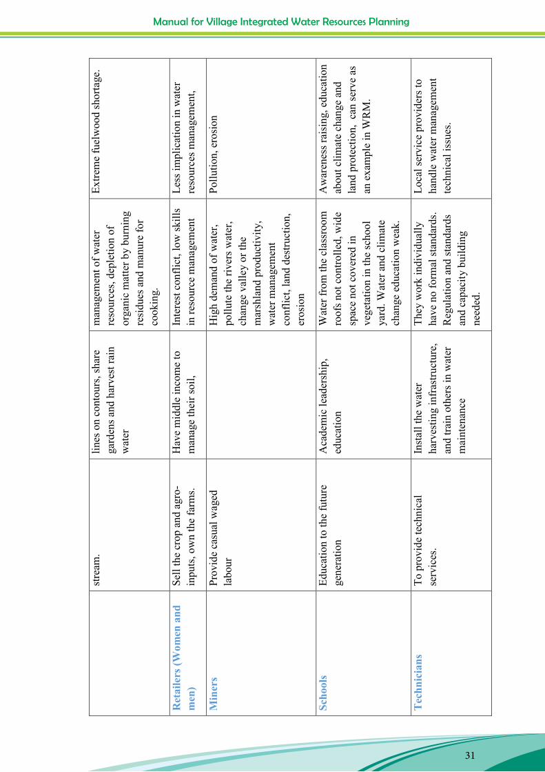
Manual for Village Integrated Water Resources Planning
31
Man
ual f
or V
illag
e In
tegr
ated
Wat
er R
esou
rces
Pla
nnin
g
31
stre
am.
lin
es o
n co
ntou
rs, s
hare
ga
rden
s and
har
vest
rain
w
ater
man
agem
ent o
f wat
er
reso
urce
s, de
plet
ion
of
orga
nic
mat
ter b
y bu
rnin
g re
sidu
es a
nd m
anur
e fo
r co
okin
g.
Extre
me
fuel
woo
d sh
orta
ge.
Ret
aile
rs (W
omen
and
m
en)
Sell
the
crop
and
agr
o-in
puts
, ow
n th
e fa
rms.
H
ave
mid
dle
inco
me
to
man
age
thei
r soi
l, In
tere
st c
onfli
ct, l
ow sk
ills
in re
sour
ce m
anag
emen
t Le
ss im
plic
atio
n in
wat
er
reso
urce
s man
agem
ent,
Min
ers
Prov
ide
casu
al w
aged
la
bour
Hig
h de
man
d of
wat
er,
pollu
te th
e riv
ers w
ater
, ch
ange
val
ley
or th
e m
arsh
land
pro
duct
ivity
, w
ater
man
agem
ent
conf
lict,
land
des
truct
ion,
er
osio
n
Pollu
tion,
ero
sion
Scho
ols
Educ
atio
n to
the
futu
re
gene
ratio
n A
cade
mic
lead
ersh
ip,
educ
atio
n W
ater
from
the
clas
sroo
m
roof
s not
con
trolle
d, w
ide
spac
e no
t cov
ered
in
vege
tatio
n in
the
scho
ol
yard
. Wat
er a
nd c
limat
e ch
ange
edu
catio
n w
eak.
Aw
aren
ess r
aisi
ng, e
duca
tion
abou
t clim
ate
chan
ge a
nd
land
pro
tect
ion,
can
serv
e as
an
exa
mpl
e in
WR
M.
Tec
hnic
ians
To
pro
vide
tech
nica
l se
rvic
es.
Inst
all t
he w
ater
ha
rves
ting
infr
astru
ctur
e,
and
train
oth
ers i
n w
ater
m
aint
enan
ce
They
wor
k in
divi
dual
ly
have
no
form
al st
anda
rds.
Reg
ulat
ion
and
stan
dard
s an
d ca
paci
ty b
uild
ing
need
ed.
Loca
l ser
vice
pro
vide
rs to
ha
ndle
wat
er m
anag
emen
t te
chni
cal i
ssue
s.
Manual for Village Integrated Water Resources Planning
32
Manual for Village Integrated Water Resources Planning
32
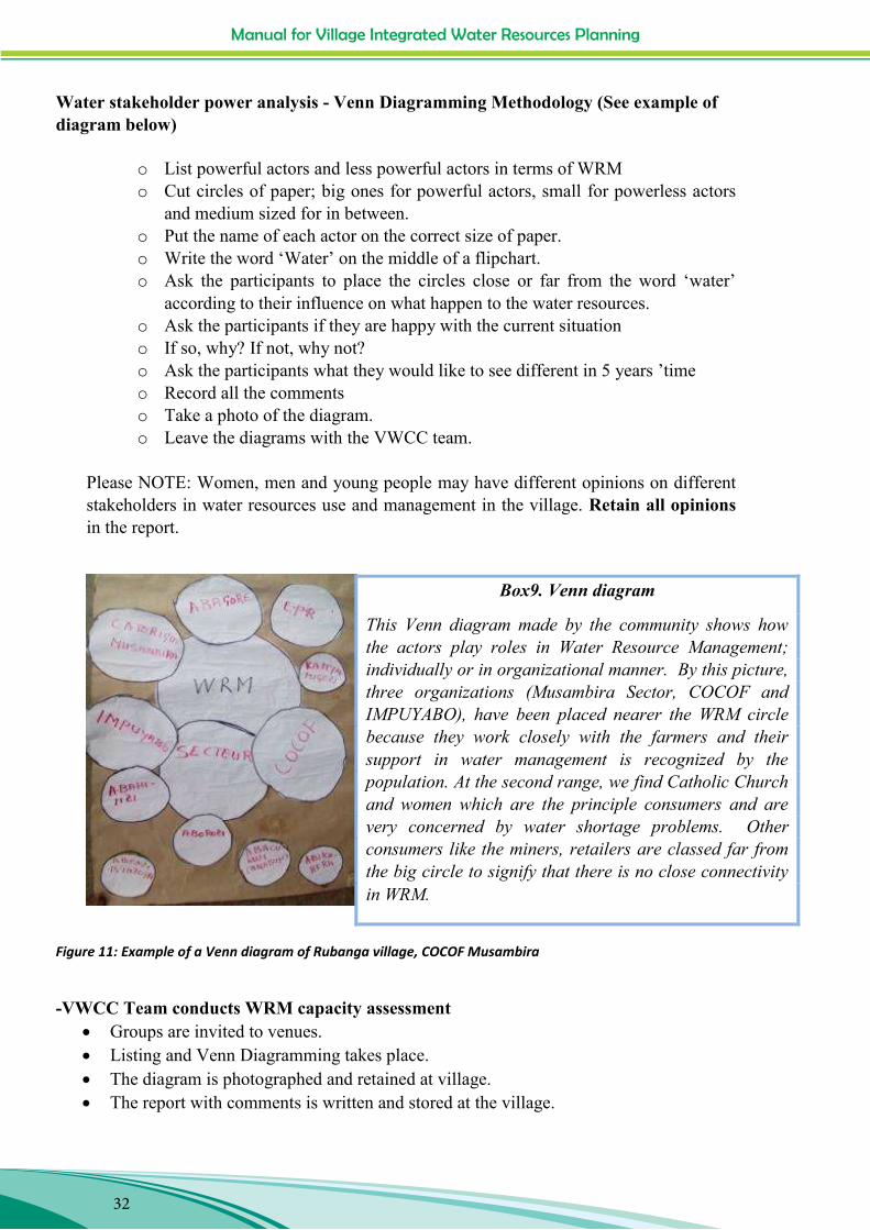
Water stakeholder power analysis - Venn Diagramming Methodology (See example of diagram below)
o List powerful actors and less powerful actors in terms of WRM o Cut circles of paper; big ones for powerful actors, small for powerless actors
and medium sized for in between. o Put the name of each actor on the correct size of paper. o Write the word „Water‟ on the middle of a flipchart. o Ask the participants to place the circles close or far from the word „water‟
according to their influence on what happen to the water resources. o Ask the participants if they are happy with the current situation o If so, why? If not, why not? o Ask the participants what they would like to see different in 5 years ‟time o Record all the comments o Take a photo of the diagram. o Leave the diagrams with the VWCC team.
Please NOTE: Women, men and young people may have different opinions on different stakeholders in water resources use and management in the village. Retain all opinions in the report.
Figure 11: Example of a Venn diagram of Rubanga village, COCOF Musambira
-VWCC Team conducts WRM capacity assessment
Groups are invited to venues. Listing and Venn Diagramming takes place. The diagram is photographed and retained at village. The report with comments is written and stored at the village.
Box9. Venn diagram
This Venn diagram made by the community shows how the actors play roles in Water Resource Management; individually or in organizational manner. By this picture, three organizations (Musambira Sector, COCOF and IMPUYABO), have been placed nearer the WRM circle because they work closely with the farmers and their support in water management is recognized by the population. At the second range, we find Catholic Church and women which are the principle consumers and are very concerned by water shortage problems. Other consumers like the miners, retailers are classed far from the big circle to signify that there is no close connectivity in WRM.
Manual for Village Integrated Water Resources Planning
33
Manual for Village Integrated Water Resources Planning
33
Box 10. Field work reflections (From WFO Training, Kirambi Feb. 2015)
General Make sure the purpose is understood by all before hand Make sure the meeting rules are discussed at the beginning of each
meeting. It is hard to keep the attention of everyone for a long exercise;
provide a break and plan to do a small amount each day. Men tend to contribute more. Encouraging women takes a
conscious effort but it does work. Give enough time for explanations by the participants.
Historical water events It is easy to get information about big events from people. People
remember big events like floods and droughts.
Trends about water resources Trends can be difficult to find, especially related to the specific
issue of water or with young people who have few years to reflect backwards on.

Manual for Village Integrated Water Resources Planning
34
Manual for Village Integrated Water Resources Planning
34
5. Assess Vulnerability and risk -Prepare the VWCC Team for the process;
Prepare vulnerability matrix and practice completing it. Prepare 3 blank matrices on double flipchart sheets for use with the three (Women,
men and young people) groups. Assist the VWCC Team to make arrangements to carry out the assessment with
groups of women, men and young people. The VWCC carries out the vulnerability assessment with women, men and young
people.
Figure 12: Example of vulnerability matrix: Nyarugeti an Ngororero villages
Quantity and quality of water
Staple crops
Fuel
Livestock
Houses
Human health
Travelling
Food scarcity
Malnutrition
Organization that provide money
Erosion Floods Drought Rain shortage
Land slide
Over-grazing
Burning

Manual for Village Integrated Water Resources Planning
35
Manual for Village Integrated Water Resources Planning
35
IV. Step 3 –Analyzing water resources issues and opportunities and prioritising actions
IV.1. Purpose
The purpose of Step 3 is to:
1. Present the reports, maps, diagrams and findings of the participatory studies, as well as any other information you1 or the water project consultant2 have assembled about the hydrology and climate of the village, to the whole village population.
2. Get the villagers views. 3. Prioritise the most important opportunities and challenges relating to water resources
management. 4. Agree who should be responsible for water resources management in the village and
what their tasks are.
IV.2. Expected outputs
1. Most important water opportunities and challenges selected 2. Actions prioritised for immediate plan 3. Responsible team/ committee for WRM decided.
Table 5: Analyse issues and opportunities and prioritise actions
Step 3. Analyse issues and opportunities and prioritise actions Activity Who Methods Materials Time
needed 3.1 Prepare Village CCW
Team for Step 3.2 Practice Step 3.2
WFO and government extension workers. VWCC Team
Organise results from Step 2. Make a summarised report of the findings. Decide who from the VWCC presents what.
Flipchart paper, pens, pencils, camera. ..Beans or stones for voting/ranking priorities
2 hours
3.2 Facilitate the whole VWCC Team Public All reports, maps, photo 3 hours
1 You, the WFO should collect any information, maps, reports which are available in the IPFG, COCOF,UNICOPAGI or KCHDP offices about the two villages. You should also request the Sector and District to supply you with copies of any maps and plans they have which include agriculture or land use or water developments in each of the villages. You should also check REMA, RNRA, DCCIO,RAB and Minagri or other relevant websites and contacts you have to find out their activities and plans in the village or the area. You should also research your village on Google earth. 2 The project engaged two consultants to help research the water resources and opportunities in eight villages: 1. Rainwater harvesting consultant. 2. Water resources and hydrology specialist.
Manual for Village Integrated Water Resources Planning
36
Manual for Village Integrated Water Resources Planning
36
village to analyse water issues and opportunities and to prioritise challenges and opportunities for action.
Meeting of all villagers (at least 75%). Vote/ranking on priority issues and opportunities in groups of women, men and young people.
and diagrams from step 2. Summarised presentations. Flipchart paper, pens, pencils, camera. Beans or stones for voting/ranking priorities.
IV.3. Methodology
Facilitate the villagers to discuss and decide the criteria for selecting the problems to act on. Examples of criteria could be;
Quickest returns, Benefits many people Easiest to do technically within the capacity of the villagers Best returns to investment of time and labour Most sustainable solution
Manual for Village Integrated Water Resources Planning
37
Manual for Village Integrated Water Resources Planning
37
Table 6: Example of criteria and actions prioritization (From Musambira stakeholders’ workshop December, 2015)
Action Identified activities Quickness of return
Health urgency
Technical capacity
Affordable budget
Meet population needs
Benefits spread widely
Priority rank
Promotion of the vegetables 5 5 5 5 5 5 100% Production of the pineapples 4 2 5 5 2 3 70%Monitoring of rain and temperature for agro-purposes. 1 1 2 1 1 4 33%
Mushroom 5 5 3 3 5 5 87%Piggery farming 5 5 4 4 5 5 93%Poultry farming by self-helping groups 5 5 4 2 5 5 87%Promoting the horticulture production 2 5 2 3 2 4 60%Support of existing population tontine (umugoroba w‟abayeyi, ibimina) 4 3 4 4 5 5 83%
Demarcation of vulnerable zones 1 2 1 1 3 3 37%Rain water harvesting (Roof water, Ponds, training) 5 5 2 1 5 5 77%Soil water retention (terracing, agroforestry, training)) 2 4 1 1 4 4 53%Hygiene and sanitation at HH level 5 5 3 3 5 5 87%Installation of ECOSAN latrines 5 4 1 2 5 5 73%Water spring improvements 5 5 2 1 5 5 77%Water supply network extensions 5 5 1 1 5 5 73%Familly planning& good nutrition 5 5 2 2 5 4 77%Less rank, support need 80% 83% 53% 49% 84% 90%
Increase of Agriculture production
Innovative income generating activities for HH
Conservation of soil and biodiversity (protection of vulnerable zones
Environmental Health
Ranking criteria
Figure 13: Village climate and water committees presenting their village maps during stakeholders' workshop (Gikomero village on the left and Rubanga village on the right)
Box11. Village maps presentation
After the village map presentation, discussions in groups are organized in order to decide on the most important water opportunities and challenges and thus prioritise actions for immediate plan.
Manual for Village Integrated Water Resources Planning
38
Manual for Village Integrated Water Resources Planning
38
Figure 14: Group discussions after the village maps presentation, COCOF Musambira
V. Step 4 - Making a Water and Climate Change Adaptation Plan
V.1. Purpose
Make an action plan for each priority decided in the previous step. Provide details of activity, sub-activities, who will do what, where it will be done, what resources will be needed, where the resources will be found, when it will start and be finished.
Present the action plan to the village government, the public and any possible donors.
V.2. Expected outputs
1. A village water resources strategic plan for 1-5 years. 2. A detailed water resources action plan for 1 year.
Table 7: Make a village water resources management strategy and action plan
Step 4. Make a Village Water Resources Management strategy and Action Plan Activity Who Methods Materials Time
needed 4.1 Village WCC makes a
draft strategic plan using the outputs from the public meeting in Step3.
WFO (as facilitator) and VWCC Team
Desk work in small groups. Prepare a framework such as the example below.
Flipchart paper, pens, pencils erasers.
2 days
4.2 For each action decide targets, activity, sub-activities, resources time frame and responsibility.
Fill in the framework 4 hours
Manual for Village Integrated Water Resources Planning
39
Manual for Village Integrated Water Resources Planning
39
4.3 Present the Action Plan to the village leaders and the public for feedback, approval and support.
3 hours
4.4 Promote the action Plan to Cell, Sector and District leaders and request inclusion in District budget. Present to prospective funders and faith leaders. E.g. private business, NGOs, donors.
Village Water CC representatives
Coach the representatives. Arrange invites to government events e.g. open days, stakeholders meetings, JAF and other opportunities.
Posters, maps, transect. Flipchart paper, A4 paper.
various
V.3. Methodology
For each action discuss and decide targets, activity, sub-activities, resources, time frame and responsibility.
Please see the example action plan below. It lists the five major actions which the communities have decided to undertake, that is;
Action 1: EROSION CONTROL
Action 2: PROTECTING VULNERABLE ZONES
Action 3: RUNOFF RAIN WATER HARVESTING
Action 4: CLEAN WATER SUPPLY IN GIKOMERO VILLAGE
Action 5: RE-ESTABLISHING KAVIRI MARSHLAND IN GATARE VILLAGE
Action 1 is given in detail below showing sub-activities, resources needed, time line, responsible persons. Similar details have been elaborated for actions 2 to 5.
Table 8: ACTION PLANS ELABORATION IN GIKOMERO AND GATARE VILLAGES (CYANIKA SECTOR)
Action 1: EROSION CONTROL
Action 2: PROTECTING VULNERABLE ZONES
Action 3: RUNOFF RAIN WATER HARVESTING
Action 4: CLEAN WATER SUPPLY IN GIKOMERO VILLAGE
Action 5: RE-ESTABLISHING KAVIRI MARSHLAND IN GATARE VILLAGE

Manual for Village Integrated Water Resources Planning
40
Manual for Village Integrated Water Resources Planning
40
ACTION 1 EROSION CONTROL (Gikomero and Gatare Villages)
TARGET All demarcated sites affected by erosion will be protected by the end of 2016
ACTIVITY SUB ACTIVITIES RESOURCES TIMELINE PERSON RESPONSIBLE
1.1 Digging anti-erosive
1.1.1 Demarcating all zones affected by erosion
*Signs (stones, trees )
*1 month *Committee
*Funders
1.1.2 Digging new ditches and repairing the existing ones
*Materials for taking measurements and those for digging
*Technician
*5 months *Committee
*Funders
*local authorities
*Community (through umuganda3)
1.1.3 Training on erosion control technics
*Erosion control expert
*Training materials (notebooks, pens, . )
*Making announcements
1 week *Committee
*Funders
1.2 PLANTING TREES AND AGROFORESTRY TREES
1.2.1 Survey to identify site and to know number of trees in need.
1 week *Committee
*Local authorities
1.2.2 Making tree nurseries and compost
*Site identification for nurseries making
*Tree seeds (calliandra, leucaena, fruits, grevelia…)
*Materials for nurseries construction
*Materials for making compost (cow dung, chopped grasses…)
*Watering canes
*Technician
1 week
*Committee
*Funders
*local authorities
*Community (through umuganda)
3 Compulsory community work as part of Rwanda’s nation-building efforts.

Manual for Village Integrated Water Resources Planning
41
Manual for Village Integrated Water Resources Planning
41
1.2.3 Tree planting
*Sensitization 2 Months *Committee
*local authorities
*Community (through umuganda)
1.3.1 Constructing bridges 4 bridges in Gikomero and Gatare villages
*Technicians
*Materials for bridge construction (trees, stones, sand, hoes, cement, iron concrete,…)
5 Months *Committee
*Funders
*local authorities
*Community (through umuganda)
1.3 REESTABLISHMENT OF BRIDGES AND REPAIRING HOLES AND GULLIES CAUSED BY EROSION 1.3.2 Repairing all
identified gullies and holes caused by erosion
*Materials (stones, sand, required type of soil)
* Technician
3 months *Committee
*Funders
*local authorities
*Community (through umuganda)
1.3.3 Planting trees and grasses to repaired site
*Tree transplants
*Grasses
2 months *Committee
*Funders
*Community (through umuganda)
1.4 PROTECTING ALL VULNERABLE ZONE
1.4.1 Establishing rules and regulation for vulnerable zone protection against erosion
*Existing environment rules
1 week
1.4.2 Making official rules and regulation made
* Announcement (Posts)
*Public meetings
*Committee
*Community (through umuganda)
1.4.3 Training committee in environment protection
*Training materials and other requirements
*Specialist in environment protection
twice a year
*Committee
*Funders
*Community (through umuganda)
Manual for Village Integrated Water Resources Planning
42
Manual for Village Integrated Water Resources Planning
42
VI. Step 5 - Implementing priority actions relating to water resources management
VI.1. Purpose Implement the agreed actions in the Village Action Plans.
Formalise the village water resources management organisation.
VI.2. Expected outputs
1. An official democratically elected village WRM committee is established and working. 2. The agreed actions are being implemented. 3. The agreed actions are being monitored by the village residents through their village
government or any other democratically selected monitoring body. 4. The learnings from the actions are being shared throughout the whole village and the
neighbouring villages.
VI.3. Methodology
1. Provide relevant trainings
-Training in project management skills, committee administration, finance, inventory, people management
-Training in technical, land and water resources management skills
-Training in communication, education and information sharing
2. Organise people
-Clarify what body is responsible for water resources management in the village
-Check the national regulations, policies and laws for water resources administration and clarify the role of the village government in water governance.
-Find out if there is a specific statutory tool for the establishment of a village water resources management committee. If there is no specific tool, find out what type of committee and what role can comply with the policies and regulations
-Check with the relevant local authorities and relevant ministries what the requirements are in order to recognise and support the village water resources management committee in its work.
-Clarify and establish the

Manual for Village Integrated Water Resources Planning
43
Manual for Village Integrated Water Resources Planning
43
a. Number of members b. Representation of different user groups c. Terms of Reference /duties/powers of the committee members, d. Transparency and open communications at regular agreed intervals. e. Duration of the membership (1, 2, or 3 years to the next election) f. Gender balance g. Attendance rules h. Freedom from vested interests and i. Other rules to which the members must comply j. Support the village government and the temporary village water resources
management and climate change team to plan and run the election/selection of the formal WRM Committee.
-Check national rules for calling a public village meeting; apply them. For example:
o The need to give notice to all villagers, o The dates for receiving nominations for a committee o The timing and location to facilitate the majority of villagers to participate. o The voting procedure etc.
Support the village government to comply with these rules and to run the election. When the formal VWRM Committee is elected, support them through training and on-the-job advice to gain the necessary knowledge and skills to carry out their functions.
3. Communications and information
Assist the village water resources management committee to consider who they need to communicate with, what they need to communicate about and how best to communicate with each type of stakeholder. The table below provides some suggestions. Remember that the communications need to be two-way and that collecting feedback is the key to improving the WRM methods being promoted.
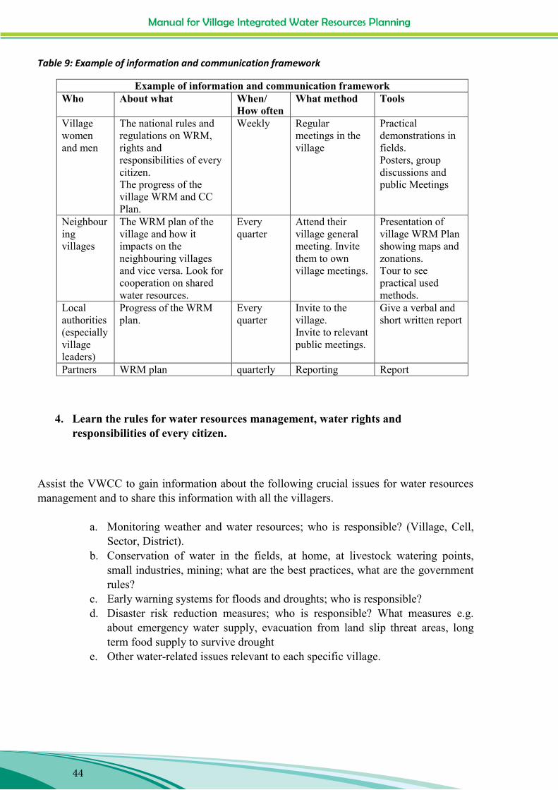
Manual for Village Integrated Water Resources Planning
44
Manual for Village Integrated Water Resources Planning
44
Table 9: Example of information and communication framework
Example of information and communication framework Who About what When/
How often What method Tools
Village women and men
The national rules and regulations on WRM, rights and responsibilities of every citizen. The progress of the village WRM and CC Plan.
Weekly Regular meetings in the village
Practical demonstrations in fields. Posters, group discussions and public Meetings
Neighbouring villages
The WRM plan of the village and how it impacts on the neighbouring villages and vice versa. Look for cooperation on shared water resources.
Every quarter
Attend their village general meeting. Invite them to own village meetings.
Presentation of village WRM Plan showing maps and zonations. Tour to see practical used methods.
Local authorities (especially village leaders)
Progress of the WRM plan.
Every quarter
Invite to the village. Invite to relevant public meetings.
Give a verbal and short written report
Partners WRM plan quarterly Reporting Report
4. Learn the rules for water resources management, water rights and responsibilities of every citizen.
Assist the VWCC to gain information about the following crucial issues for water resources management and to share this information with all the villagers.
a. Monitoring weather and water resources; who is responsible? (Village, Cell, Sector, District).
b. Conservation of water in the fields, at home, at livestock watering points, small industries, mining; what are the best practices, what are the government rules?
c. Early warning systems for floods and droughts; who is responsible? d. Disaster risk reduction measures; who is responsible? What measures e.g.
about emergency water supply, evacuation from land slip threat areas, long term food supply to survive drought
e. Other water-related issues relevant to each specific village.

Manual for Village Integrated Water Resources Planning
45
Manual for Village Integrated Water Resources Planning
45
5. Getting resources
Resources from the villagers, from the project, resources from government; support the VWCC to learn how to get collaboration from villagers for the conservation and management of communally-shared water resources in the overall catchment. Also facilitate the VWCC to be aware of government schemes (e.g. FONERWA) and how to access the funds and technical advice which is available under those schemes.
6. Managing resources
The resources will include water supply, money (bank accounts, spending, charging), and equipment. Arrange training in skills to manage and maintain these resources from the available experts. Give the VWCC practice in managing the resources supplied by the project by putting them in charge of funds.
7. Maintenance of water conservation, storage, lifting and delivery systems4.
Ensure that women and men villagers and members of the VWCC know how to manage any new structures or equipment supplied. Support the villagers and the VWRMCC to select female and male volunteers who have an aptitude for mechanical skills and arrange a training programme with a series of modules for passing on the practical skills needed. Provide training and follow-up to each trainee as well as direct checking at each household or installation to ensure that the capacity to maintain the installation/equipment has truly been acquired. When the trainees have proven their capacity arrange for their recognition as „Village Water Technicians‟ at a public meeting of all villagers.
4 See building and maintenance manuals prepared by the project.

Manual for Village Integrated Water Resources Planning
46
Manual for Village Integrated Water Resources Planning
46
Figure 15: Villagers preparing the trees nursery in Nyarugeti village of Tare Sector, Nyamagabe District.
8. Monitor the progress of the plan in a participatory manner.
Support the VWCC to decide how they will monitor the village water resources management action plan by discussing the targets and considering how they will measure whether they have been achieved.
Manual for Village Integrated Water Resources Planning
47
Manual for Village Integrated Water Resources Planning
47
Appendix 1
Advice for working with groups of people in a participatory way (Adapted from various sources including www.careclimatechange.org)
Manage expectations It is important to manage expectations during field exchanges. For example, the fact that this project is including all villagers and not just cooperative members need to be explained. Also the fact that only some houses will get support for building rainwater storage systems and others not, needs to be explained in the context that the overall focus is to increase the availability of water in all the land of the village and reduce the impacts of Climate Change on all households through measure to protect the landscape from erosion, from flood and drought damage. Create and maintain a trusting and ‘safe’ space
Allow a trusted community member or local representative to introduce the team. Be gracious and patient allowing the local community to „own‟ the meeting. Allow everyone to introduce themselves. Ask permission to take photographs or video, and refrain if participants are
uncomfortable with it. Provide refreshments if appropriate. Value all participants‟ knowledge and experience. Interrupt over-active or disruptive participators and allow space for shy participants. Acknowledge that all are teachers and learners. Admit to and correct your errors. Be impartial. Frequently allow time for participants to ask questions.
Animate and balance participation
Ensure that the venue is conducive to participation; not too hot or cold. Make People able to see each other.
Develop ground rules with the participants. Explain the process and ensure that all understand instructions and questions. Support those which are shy, and gently silence those that take the floor too much or
consider themselves “experts”. Probe for more information if the discussion is lagging, but try not to lead participants Find ways to allow people to drive the process (e.g. interviewing each other, taking
photographs, using the GPS to mark sites of importance to them, building the map themselves, marking symbols on the matrix).
Allow participants to raise issues, but keep the process on track. Ensure that you are moving quickly enough to cover the necessary ground in the time allocated.

Manual for Village Integrated Water Resources Planning
48
Manual for Village Integrated Water Resources Planning
48
Finish gracefully
Discuss and agree what the next steps are. Schedule a time to return. Thank the group for their participation, and give an opportunity to ask questions.
Records and reporting
Allow the participants to like and to keep the products of the discussions (e.g. drawings, your presentation, water resources maps, transect map and report, meeting minutes), photograph or make a copy and leave the original behind.
Commit to a date by which you will have sent back your report in a format and
language which the participants can understand.
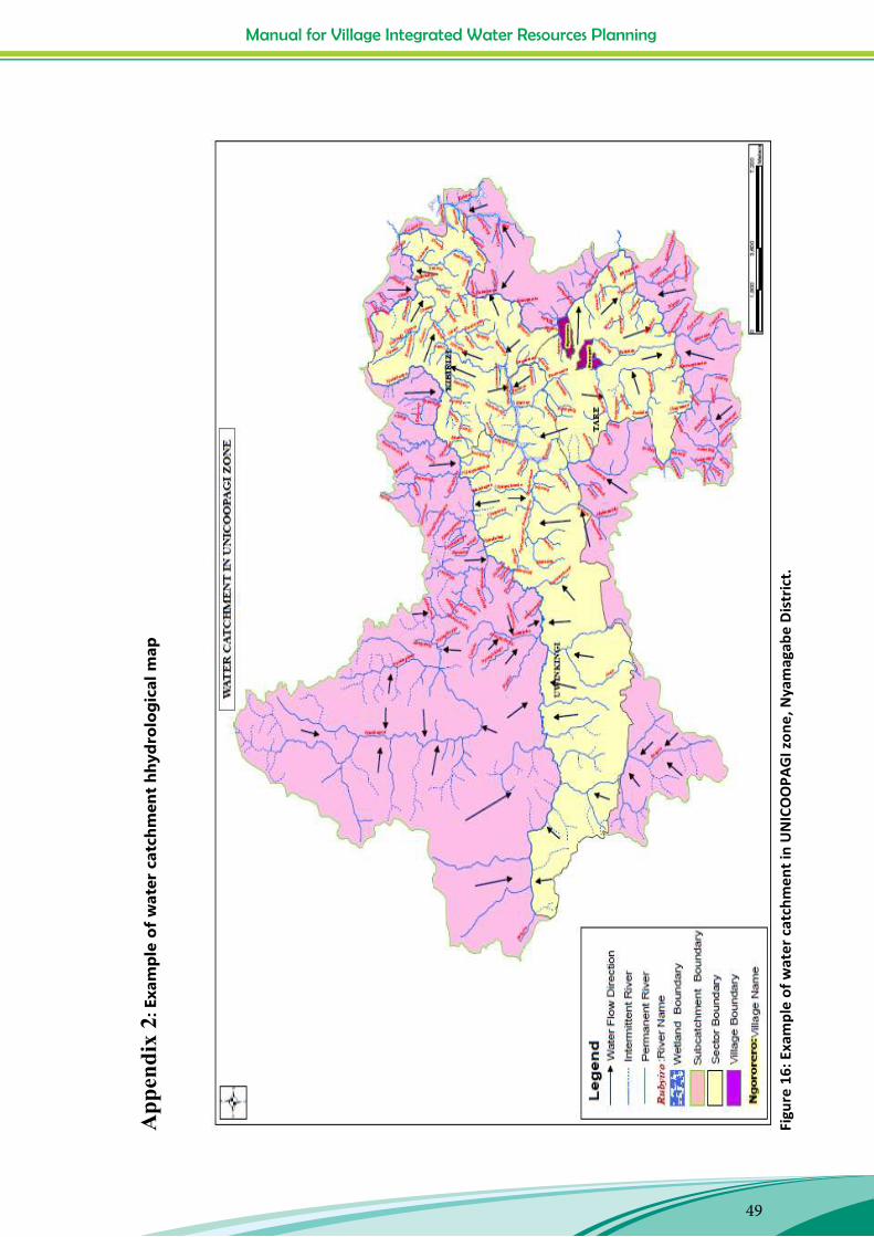
Manual for Village Integrated Water Resources Planning
49
Man
ual f
or V
illag
e In
tegr
ated
Wat
er R
esou
rces
Pla
nnin
g
49
App
endi
x 2:
Exa
mpl
e of
wat
er c
atch
men
t hh
ydro
logi
cal m
ap
Figu
re 1
6: E
xam
ple
of w
ater
cat
chm
ent i
n U
NIC
OO
PAG
I zon
e, N
yam
agab
e D
istr
ict.
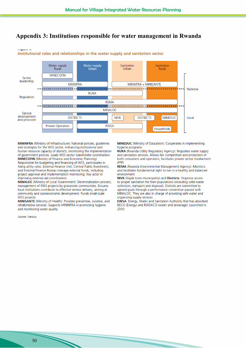
Manual for Village Integrated Water Resources Planning
50
Manual for Village Integrated Water Resources Planning
50
Appendix 3: Institutions responsible for water management in Rwanda
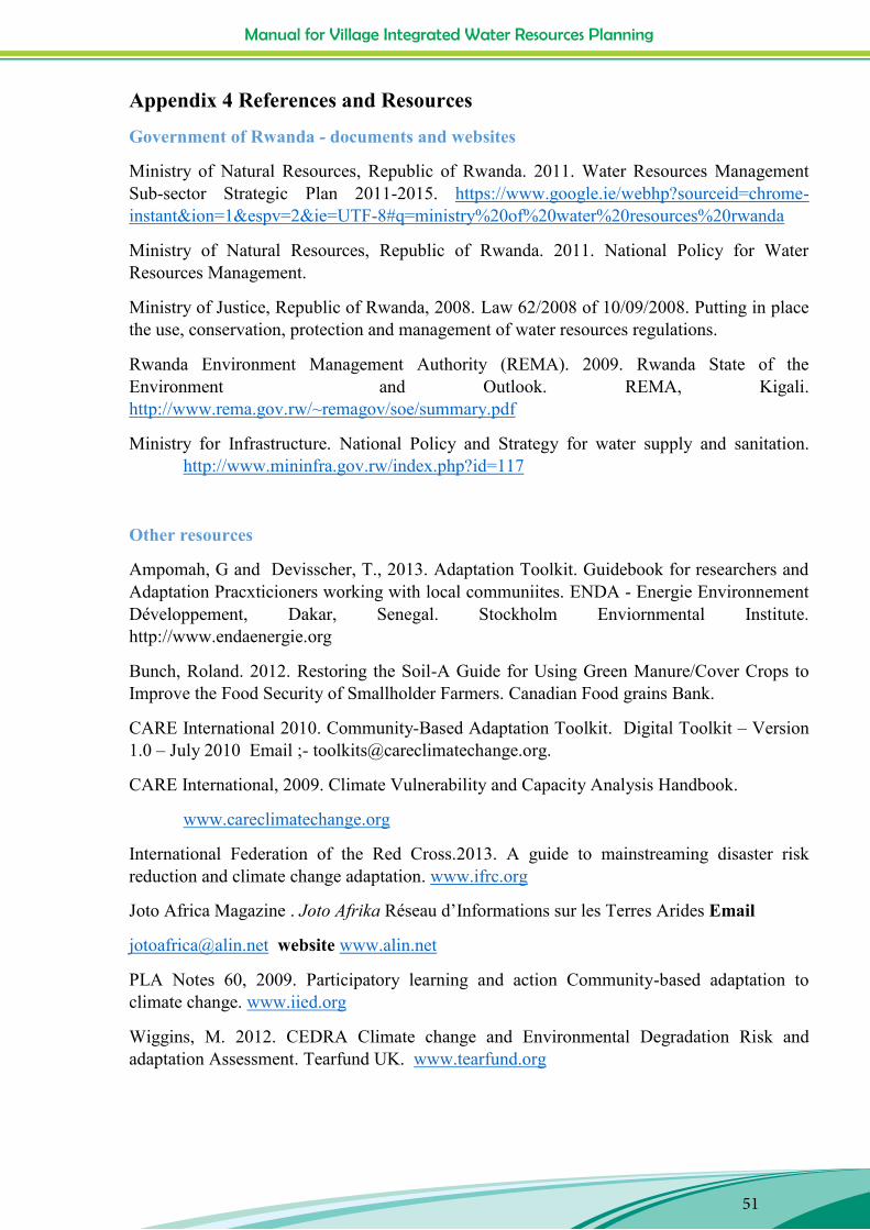
Manual for Village Integrated Water Resources Planning
51
Manual for Village Integrated Water Resources Planning
51
Appendix 4 References and Resources
Government of Rwanda - documents and websites
Ministry of Natural Resources, Republic of Rwanda. 2011. Water Resources Management Sub-sector Strategic Plan 2011-2015. https://www.google.ie/webhp?sourceid=chrome-instant&ion=1&espv=2&ie=UTF-8#q=ministry%20of%20water%20resources%20rwanda
Ministry of Natural Resources, Republic of Rwanda. 2011. National Policy for Water Resources Management.
Ministry of Justice, Republic of Rwanda, 2008. Law 62/2008 of 10/09/2008. Putting in place the use, conservation, protection and management of water resources regulations.
Rwanda Environment Management Authority (REMA). 2009. Rwanda State of the Environment and Outlook. REMA, Kigali. http://www.rema.gov.rw/~remagov/soe/summary.pdf
Ministry for Infrastructure. National Policy and Strategy for water supply and sanitation. http://www.mininfra.gov.rw/index.php?id=117
Other resources
Ampomah, G and Devisscher, T., 2013. Adaptation Toolkit. Guidebook for researchers and Adaptation Pracxticioners working with local communiites. ENDA - Energie Environnement Développement, Dakar, Senegal. Stockholm Enviornmental Institute. http://www.endaenergie.org
Bunch, Roland. 2012. Restoring the Soil-A Guide for Using Green Manure/Cover Crops to Improve the Food Security of Smallholder Farmers. Canadian Food grains Bank.
CARE International 2010. Community-Based Adaptation Toolkit. Digital Toolkit – Version 1.0 – July 2010 Email ;- [email protected].
CARE International, 2009. Climate Vulnerability and Capacity Analysis Handbook.
www.careclimatechange.org
International Federation of the Red Cross.2013. A guide to mainstreaming disaster risk reduction and climate change adaptation. www.ifrc.org
Joto Africa Magazine . Joto Afrika Réseau d‟Informations sur les Terres Arides Email
[email protected] website www.alin.net
PLA Notes 60, 2009. Participatory learning and action Community-based adaptation to climate change. www.iied.org
Wiggins, M. 2012. CEDRA Climate change and Environmental Degradation Risk and adaptation Assessment. Tearfund UK. www.tearfund.org

Manual for Village Integrated Water Resources Planning
52


Manual for the Preparation of a Community-Based Adaptation Plan
with a focus on Water Resources Management
Partners: COCOF, UNICOOPAGI, IPFG AND MMM KIRAMBI
With experiences from the Water and Climate Change Project in 9 villages of Kamonyi, Nyanza and Nyamagabe Districts of
the Southern Province of Rwanda.
18
Head office:
Maynooth, Co. Kildare
Tel: +353 (0) 1 629 3333
Dublin:
12 Cathedral Street, Dublin 1,
Tel: +353 (0) 1 874 3875
Cork:
9 Cook Street, Cork,
Tel: +353 (0) 21 427 5622
Northern Ireland:
50 King Street, Belfast, BT1 6AD,
Tel: +44 (0) 28 9080 8030
Rwanda
No. 12, KN 31st, Kiyovu, P.O. Box 2040,
Kigali, Rwanda
Tel: (+250) 0252 502663 (+250) 0252 502664
Fax: (+250) 0252 570456
www.trocaire.org
Trócaire is the overseas development agency of the Catholic Church in Ireland Charity No. CHY5883 (ROI) / XR10431 (NI)
Photo credits: Photos on page 7: Trócaire Rwanda Photos on pages 10: Trócaire Rwanda and Jean Pierre Photos on pages 8, 9, 11&12: Jean Pierre