ts04a jones land 5601 ppt - fig · rover desktop web viewer ... evolving requirements, evolving...
TRANSCRIPT
30.5.2012
1
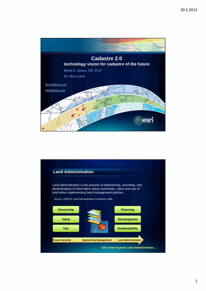
Cadastre 2.0technology vision for cadastre of the future
Brent A. Jones, PE, PLS
Dr. Nick Land
Land Administration
Land administration is the process of determining, recording, and disseminating of information about ownership, value and use of land when implementing land management policies.
Source: UN/ECE Land Administration Guidelines 1996
Tenure Security Spatial Data Management Land Administration
LIS
Ownership
Value
Use
Planning
Development
Sustainability
GIS is key to good Land Administration.....
30.5.2012
2
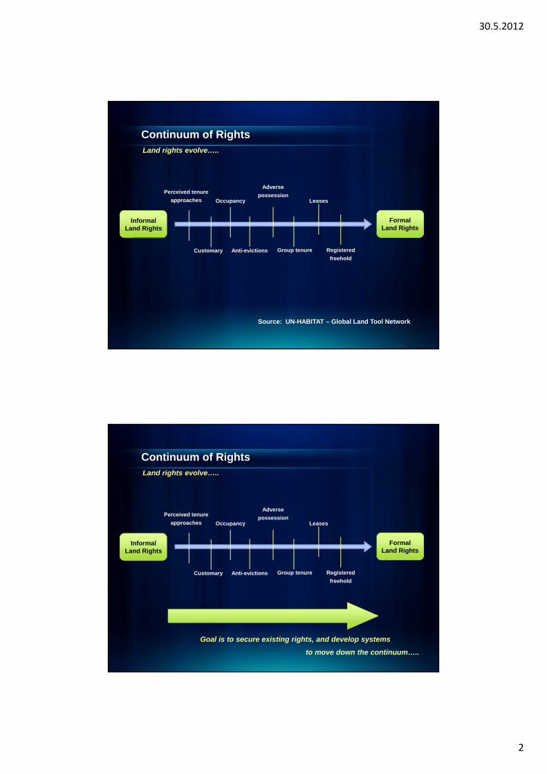
InformalLand Rights
FormalLand Rights
Perceived tenure
approaches
Customary Anti-evictions
Occupancy
Adverse
possession
Group tenure Registered
freehold
Leases
Continuum of RightsLand rights evolve…..
Source: UN-HABITAT – Global Land Tool Network
InformalLand Rights
FormalLand Rights
Perceived tenure
approaches
Customary Anti-evictions
Occupancy
Adverse
possession
Group tenure Registered
freehold
Leases
Continuum of RightsLand rights evolve…..
Goal is to secure existing rights, and develop systems
to move down the continuum…..
30.5.2012
3
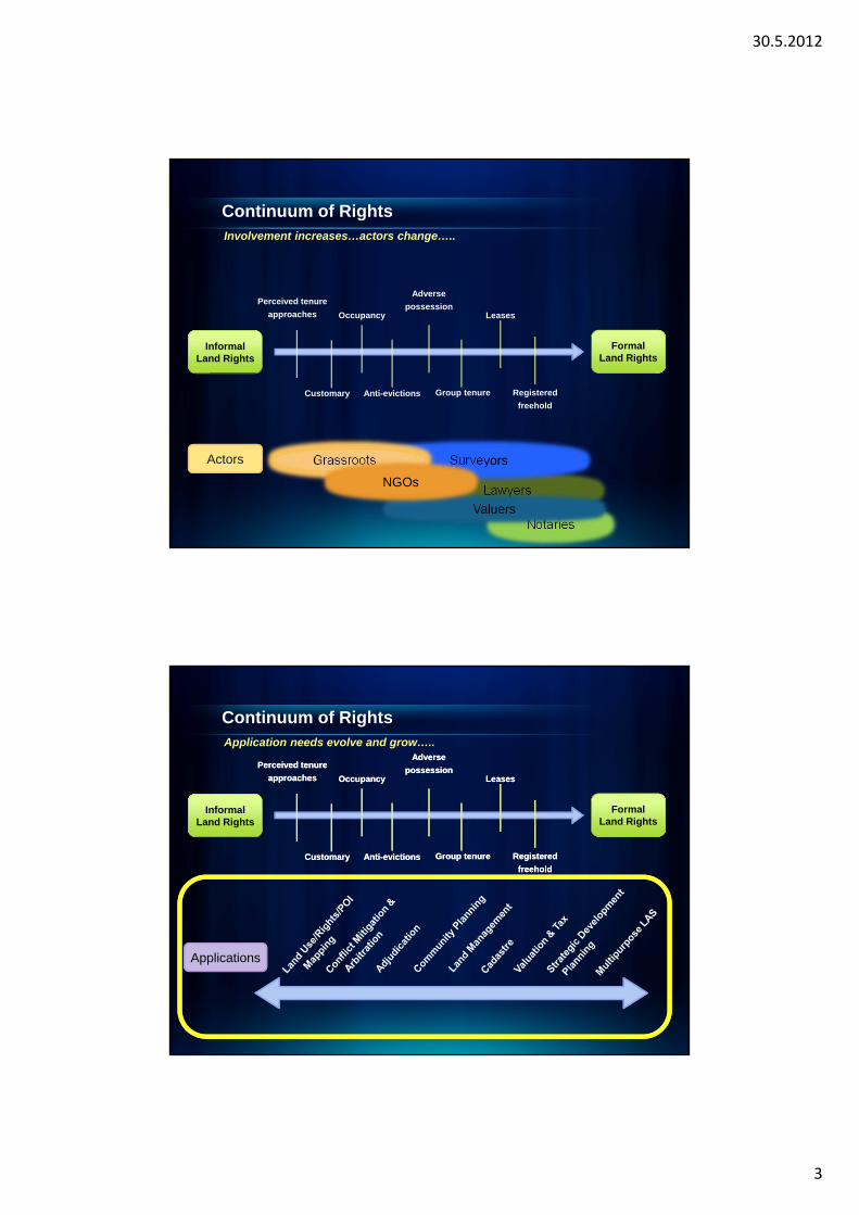
NotariesNotaries
LawyersLawyers
InformalLand Rights
FormalLand Rights
Perceived tenure
approaches
Customary Anti-evictions
Occupancy
Adverse
possession
Group tenure Registered
freehold
Leases
ValuersValuers
SurveyorsSurveyorsGrassrootsGrassroots
NGOsNGOs
Actors
Continuum of RightsInvolvement increases…actors change…..
Continuum of Rights
Applications
InformalLand Rights
FormalLand Rights
Perceived tenure
approaches
Customary Anti-evictions
Occupancy
Adverse
possession
Group tenure Registered
freehold
Leases
InformalLand Rights
FormalLand Rights
Perceived tenure
approaches
Customary Anti-evictions
Occupancy
Adverse
possession
Group tenure Registered
freehold
Leases
Application needs evolve and grow…..
30.5.2012
4
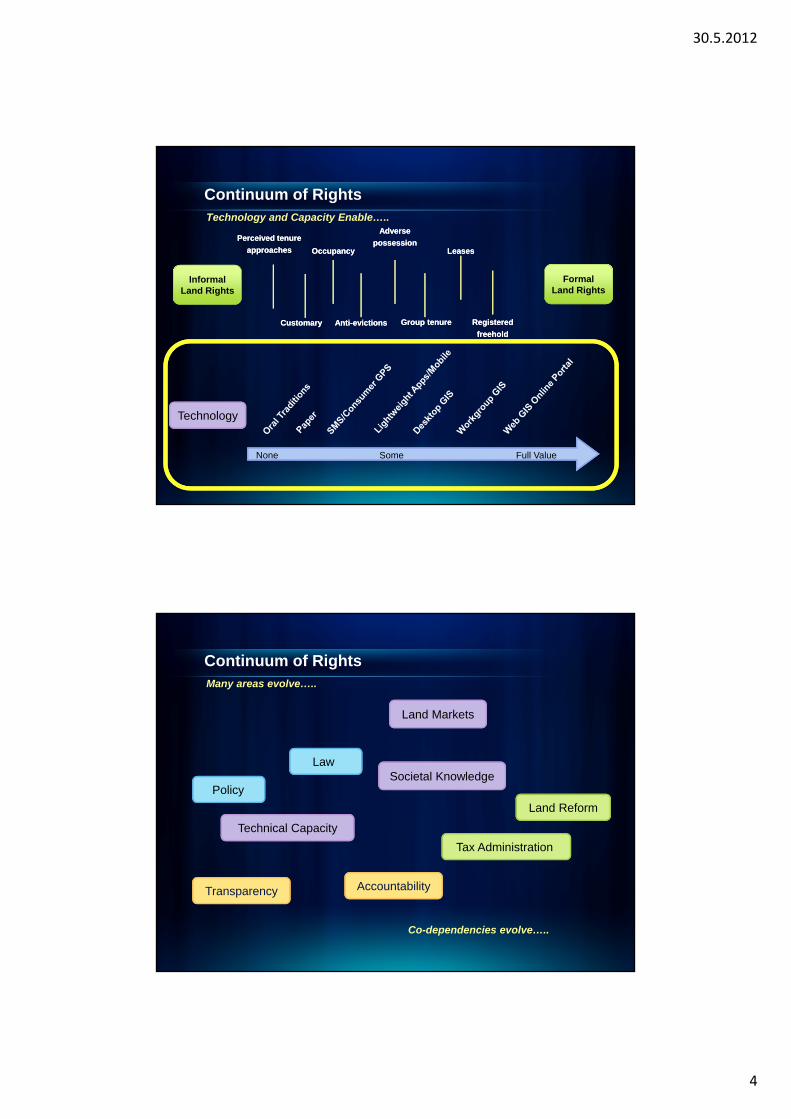
Continuum of Rights
Technology
InformalLand Rights
None Some Full Value
FormalLand Rights
Perceived tenure
approaches
Customary Anti-evictions
Occupancy
Adverse
possession
Group tenure Registered
freehold
Leases
InformalLand Rights
None Some Full Value None Some Full Value
FormalLand Rights
Perceived tenure
approaches
Customary Anti-evictions
Occupancy
Adverse
possession
Group tenure Registered
freehold
Leases
Technology and Capacity Enable…..
Continuum of Rights
Technical Capacity
Tax Administration
Transparency
Many areas evolve…..
PolicySocietal Knowledge
Accountability
Co-dependencies evolve…..
Land Markets
Law
Land Reform
30.5.2012
5
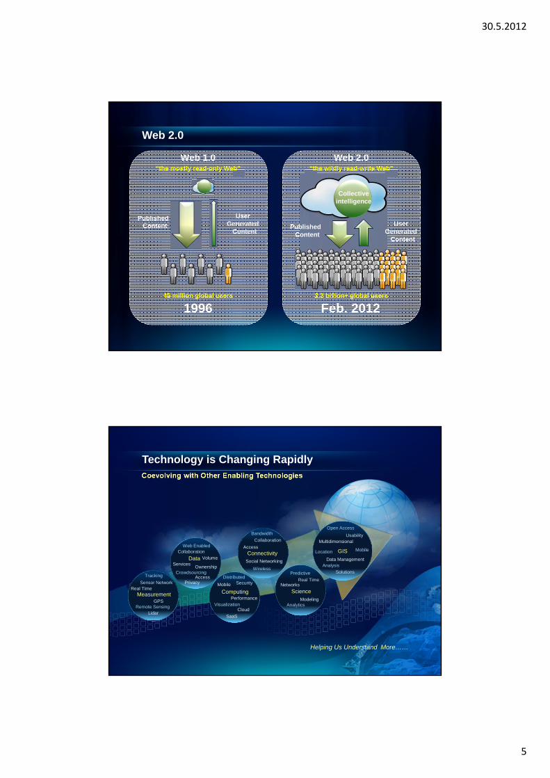
“the mostly read-only Web”
45 million global users
1996
Web 1.0
PublishedContent
UserGenerated
Content
“the wildly read-write Web”
2.3 billion+ global users
Feb. 2012
Web 2.0
Collective intelligence
PublishedContent
UserGenerated
Content
Web 2.0
Technology is Changing RapidlyCoevolving with Other Enabling Technologies
Helping Us Understand More……
Access
Bandwidth
Collaboration
Social Networking
Connectivity
Wireless
Networks
Predictive
Real Time
Science
AnalyticsModeling
Real Time
Tracking
Sensor Network
Measurement
Remote SensingLidar
GPS
Services
Web EnabledCollaboration
Privacy
Data
CrowdsourcingAccess
Ownership
Volume
Mobile
DistributedSecurity
Computing
VisualizationCloud
Performance
SaaS
Multidimensional
Open Access
Usability
Data Management
Solutions
GIS
Analysis
Location Mobile
30.5.2012
6
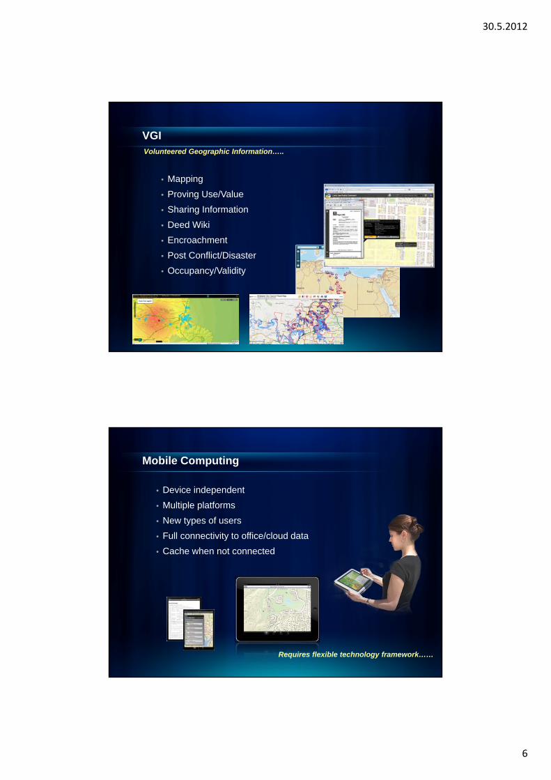
VGI
• Mapping
• Proving Use/Value
• Sharing Information
• Deed Wiki
• Encroachment
• Post Conflict/Disaster
• Occupancy/Validity
Volunteered Geographic Information…..
• Device independent
• Multiple platforms
• New types of users
• Full connectivity to office/cloud data
• Cache when not connected
Mobile Computing
Requires flexible technology framework……
30.5.2012
7
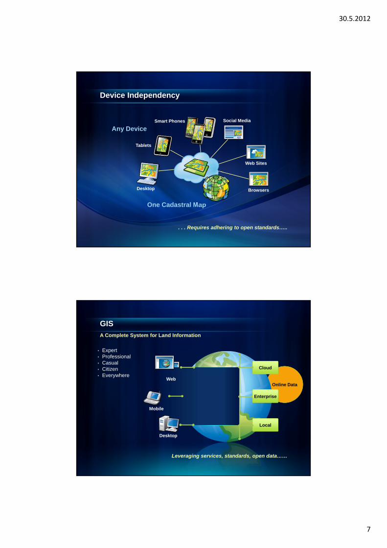
Device Independency
. . . Requires adhering to open standards…..
One Cadastral Map
Desktop
Tablets
Smart Phones
Web Sites
Any Device
Browsers
Social Media
Online Data
Cloud
Local
Mobile
Desktop
Web
Enterprise
GISA Complete System for Land Information
Leveraging services, standards, open data……
• Expert• Professional• Casual• Citizen• Everywhere
30.5.2012
8
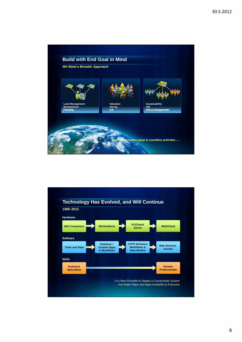
Build with End Goal in MindWe Need a Broader Approach
ValuationSurveyLIS
SustainabilitySDICitizen Engagement
Land ManagementDevelopmentPlanning
Cadastre provides value to countless activities…..
Technology Has Evolved, and Will Continue1989–2012
. . . It Is Now Possible to Deploy a Countrywide System. . . And Make Maps and Apps Available to Everyone
Software
COTS SolutionsWorkflows &Data Models
Web Services Access
Database +Custom Apps& Workflows
Tools and Data
Hardware
PC/Client/Server
Web/CloudWorkstationsMini Computers
Skills
DomainProfessionals
Technical Specialists
30.5.2012
9
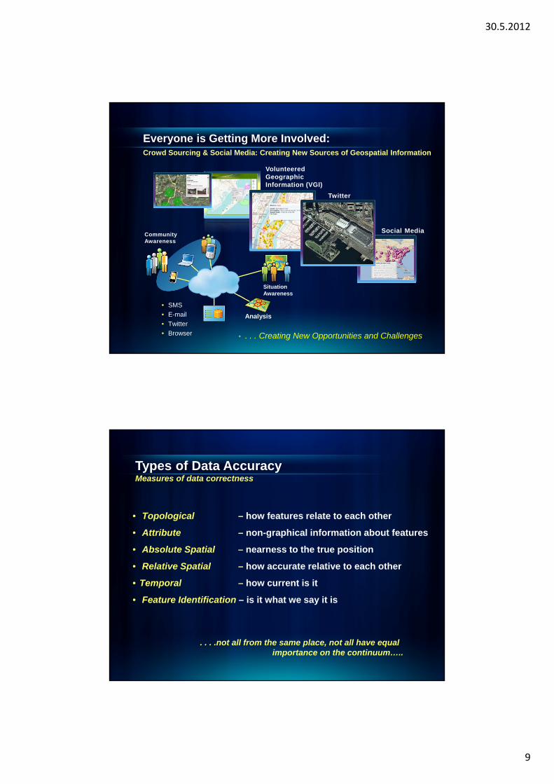
Everyone is Getting More Involved:Crowd Sourcing & Social Media: Creating New Sources of Geospatial Information
• . . . Creating New Opportunities and Challenges
Situation Awareness
Analysis
Community Awareness
• SMS
• Browser
Social Media
Volunteered Geographic Information (VGI)
Types of Data AccuracyMeasures of data correctness
• Topological – how features relate to each other
• Attribute – non-graphical information about features
• Absolute Spatial – nearness to the true position
• Relative Spatial – how accurate relative to each other
• Temporal – how current is it
• Feature Identification – is it what we say it is
. . . .not all from the same place, not all have equalimportance on the continuum…..
30.5.2012
10
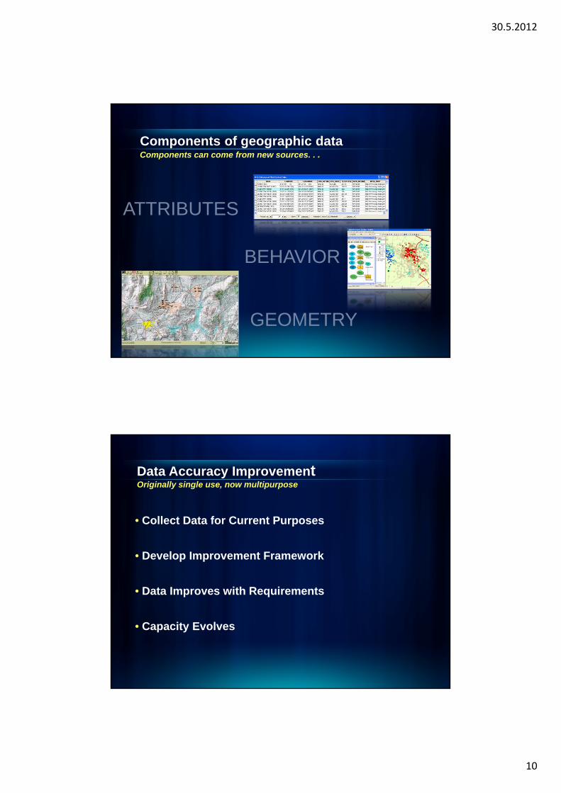
Components of geographic dataComponents can come from new sources. . .
BEHAVIOR
ATTRIBUTES
GEOMETRY
Data Accuracy ImprovementOriginally single use, now multipurpose
• Collect Data for Current Purposes
• Develop Improvement Framework
• Data Improves with Requirements
• Capacity Evolves
30.5.2012
11
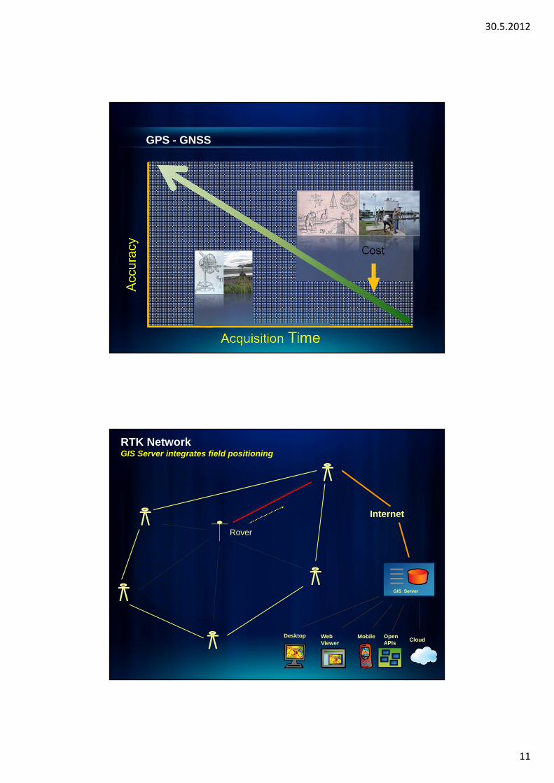
Cost
GPS - GNSS
RTK NetworkGIS Server integrates field positioning
Internet
Rover
Desktop Web Viewer
Mobile OpenAPIs
Cloud
GIS Server
30.5.2012
12
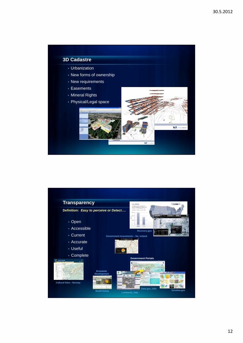
• Urbanization
• New forms of ownership
• New requirements
• Easements
• Mineral Rights
• Physical/Legal space
3D Cadastre
Transparency
• Open
• Accessible
• Current
• Accurate
• Useful
• Complete
Definition: Easy to perceive or Detect….
Recovery.gov
Cultural Sites - Norway
Government Investments – No. Ireland
Government Portals
Lombardy, Italy
Data.gov, USAGeodata.gov
Economic Development
South Korea
30.5.2012
13
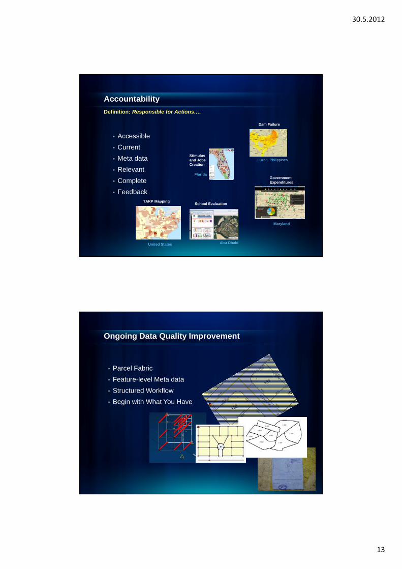
Accountability
• Accessible
• Current
• Meta data
• Relevant
• Complete
• Feedback
Definition: Responsible for Actions….
Dam Failure
Luzon, Philippines
GovernmentExpenditures
Maryland
School Evaluation
Abu Dhabi
Florida
Stimulus and Jobs Creation
United States
TARP Mapping
Ongoing Data Quality Improvement
• Parcel Fabric
• Feature-level Meta data
• Structured Workflow
• Begin with What You Have
30.5.2012
14
Cadastre 2.0
Evolving Demands, Evolving Requirements, Evolving Technology
• Multipurpose• Transparent• Accountable• Citizen Engagement - VGI• Mobile• Spatial Data Infrastructure - SDI• 3D• Cloud Computing• Online Data• Ongoing Data Quality Improvement
. . . .Leveraging technology, open standards and open data…..
Cadastre 2.0technology vision for cadastre of the future
Brent A. Jones, PE, PLS
Dr. Nick Land

30.5.2012
15