tuesday, october 15, 2013 12:45 pm - san antonio of san antonio zoning commission agenda cliff...
TRANSCRIPT

CITY OF SAN ANTONIO Zoning Commission Agenda
Cliff Morton Development and Business Services Center
1901 S. Alamo Street Board Room
Tuesday, October 15, 2013
12:45 PM
ZONING COMMISSIONERS
Mariana Ornelas – District 1 Santos Villarreal – District 7 Dan Martinez – District 2 Francine Romero – District 8 Terry Boyd – District 3 John J. Middleton, II – District 9 Ricardo Briones – District 5 Milton R. McFarland – District 10 Christopher Martinez – District 6 Vacant – District Mayor
Orlando Salazar – District 4 Chairman
1. 12:45 PM - Work Session – discussion of policies and administrative procedures and any items for
consideration on the agenda for October 15, 2013.
2. 1:00 P.M. Board Room– Call to Order.
3. Roll Call.
4. Pledge of Allegiance.
5. Election of officer for Vice-Chair.
6. Consideration of October 1, 2013 Zoning Commission Minutes.
7. ZONING CASE NUMBER Z2013198 (Council District 8) – POSTPONED: A request for a change in zoning from “C-2 GC-1 MSAO-1 MLOD-1” Commercial Hill Country Gateway Corridor Camp Bullis Military Sound Attenuation Overlay Camp Bull Military Lighting Overlay District, “C-2 UC-1 GC-1 MASO-1 MLOD-1” Commercial IH-10/FM 1604 Urban Corridor Hill Country Gateway Corridor Camp Bullis Military Sound Attenuation Overlay Camp Bull Military Lighting Overlay District, “C-3 MSAO-1 MLOD-1” General Commercial Camp Bullis Military Sound Attenuation Overlay Camp Bull Military Lighting Overlay District, “C-3 GC-1 MSAO-1 MLOD-1” General Commercial Hill Country Gateway Corridor Camp Bullis Military Sound Attenuation Overlay Camp Bull Military Lighting Overlay District, and “C-3 UC-1 GC-1 MSAO-1 MLOD-1” General Commercial IH-10/FM 1604 Urban Corridor Hill Country Gateway Corridor Camp Bullis Military Sound Attenuation Overlay Camp Bull Military Lighting Overlay District to “MF-40 MSAO-1 MLOD-1” Multi-Family Camp Bullis Military Sound Attenuation Overlay Camp Bull Military Lighting Overlay District, “MF-40 GC-1 MSAO-1 MLOD-1” Multi-Family Hill Country Gateway Corridor Camp Bullis Military Sound Attenuation Overlay Camp Bull Military Lighting Overlay District, and “MF-40 UC-1 GC-1 MSAO-1 MLOD-1” Multi-Family IH-10/FM 1604 Urban Corridor Hill Country Gateway Corridor Camp Bullis Military Sound Attenuation Overlay Camp Bull Military Lighting Overlay District on 10 acres out of NCB 18335, NCB 18338 and NCB 34034 on portions of the 21500 and 21600 Blocks of Milsa Drive.
8. ZONING CASE NUMBER Z2013215 (Council District 5) – POSTPONED: A request for a change in zoning from “IDZ AHOD” Infill Development Zone Airport Hazard Overlay District with uses permitted in “R-4” Residential Single-Family District and “NC” Neighborhood Commercial District to “RM-4 AHOD” Residential Mixed Airport Hazard Overlay District on Lots 1 and 2, Block 5, NCB 2569; 246 East Cevallos Street and 323 Clay Street.
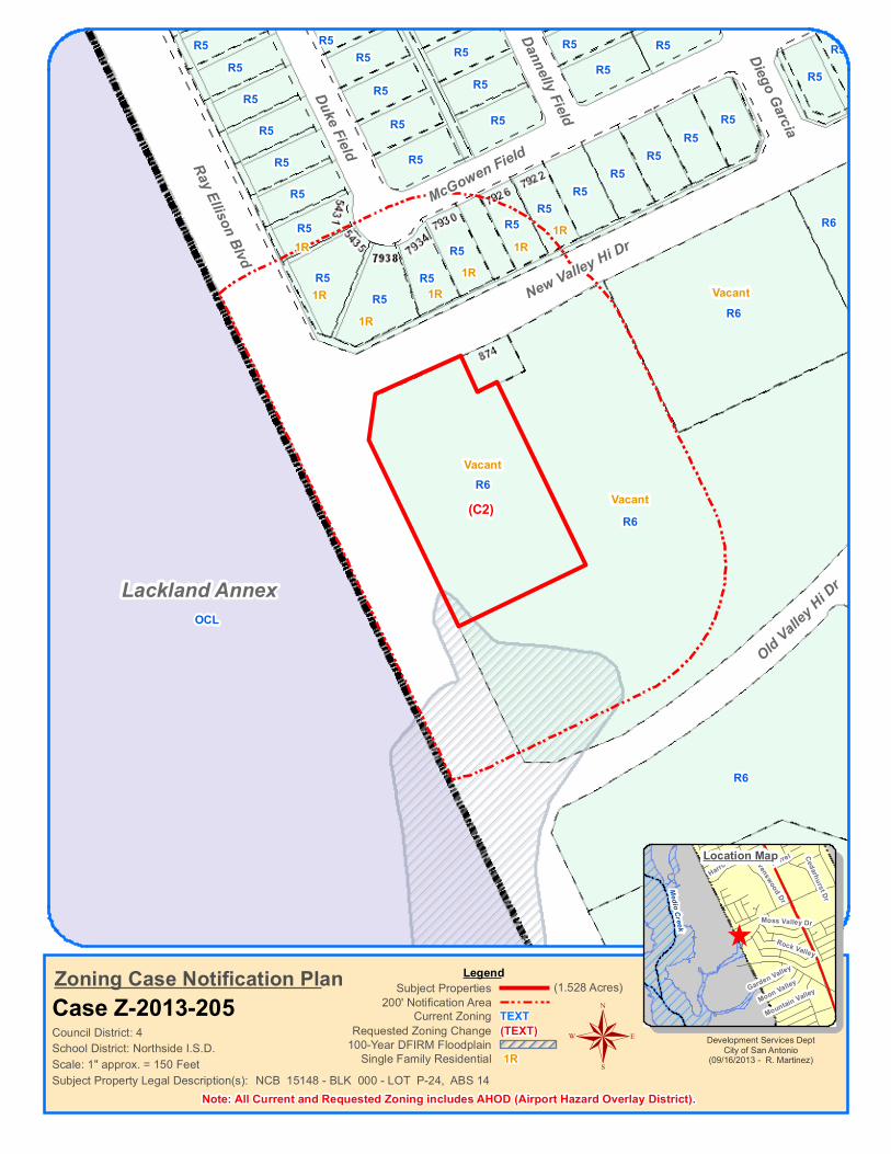
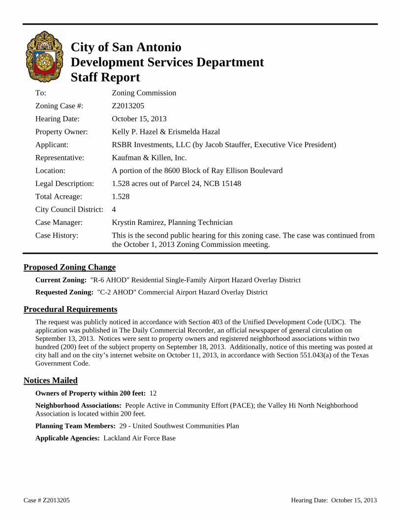
9. ZONING CASE NUMBER Z2013205 (Council District 4): A request for a change in zoning from “R-6 AHOD” Residential Single Family Airport Hazard Overlay District to “C-2 AHOD” Commercial Airport Hazard Overlay District on 1.528 acres out of Parcel 24, NCB 15148 on a portion of the 8600 Block of Ray Ellison Boulevard.
10. ZONING CASE NUMBER Z2013203 CD (Council District 5): A request for a change in zoning from “C-2NA CD AHOD” Commercial Nonalcoholic Sales Airport Hazard Overlay District with a Conditional Use for a Carwash to “C-2NA CD AHOD” Commercial Nonalcoholic Sales Airport Hazard Overlay District with a Conditional Use for Motor Vehicle Sales on Lot 21, Block 26, NCB 10553; 3684 Culebra Road.
11. ZONING CASE NUMBER Z2013204 (Council District 1): A request for a change in zoning from “R-6 NCD-5 AHOD” Residential Single Family Neighborhood Conservation Airport Hazard Overlay District to “RM-6 NCD-5 AHOD” Residential Mixed Neighborhood Conservation Airport Hazard Overlay District on Lots 38 & 39, Block 22, NCB 6421; 613 W. Hollywood Boulevard.
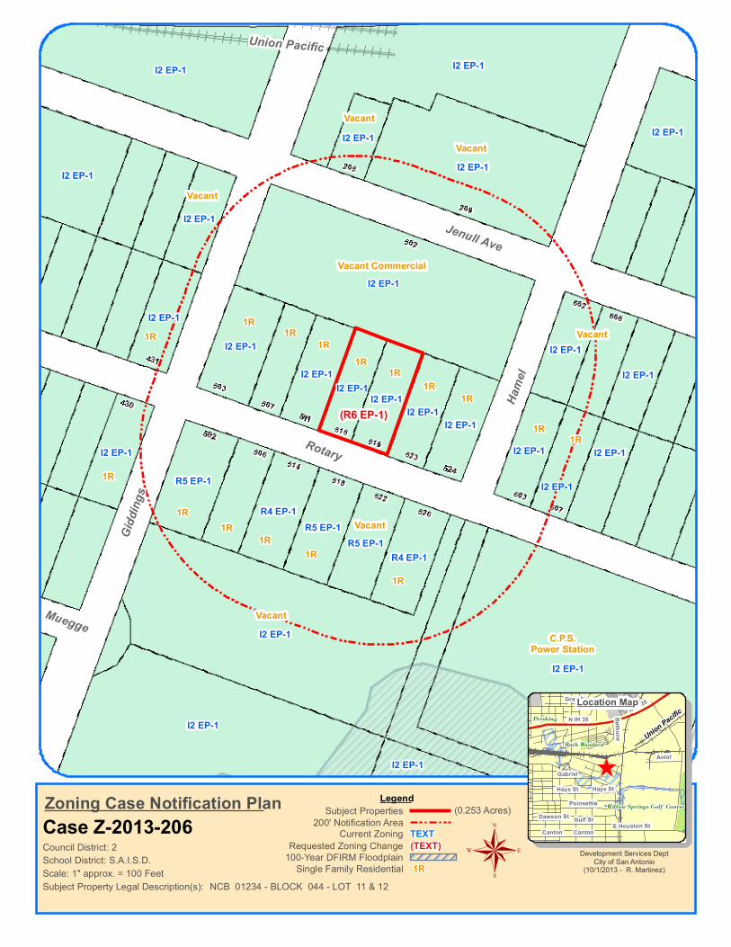
12. ZONING CASE NUMBER Z2013206 (Council District 2): A request for a change in zoning from “I-2 EP-1” Heavy Industrial Facility Parking/Traffic Control District to “R-6 EP-1” Residential Single Family Facility Parking/Traffic Control District on Lots 11 and 12, Block 44, NCB 1234; 515 and 519 Rotary.
13. ZONING CASE NUMBER Z2013207 (Council District 6): A request for a change in zoning from “R-6” Residential Single-Family District to “O-1” Office District on Lot 14, Block 3, NCB 17637; 5524 Rogers Road.
14. ZONING CASE NUMBER Z2013208 (Council District 3): A request for a change in zoning from “R-4 AHOD” Residential Single Family Airport Hazard Overlay District to “MF-33 AHOD” Multi Family Airport Hazard Overlay District on 20.79 Acres out of NCB 11156; Northeast intersection of Loop 410 and Walhalla Avenue.
15. ZONING CASE NUMBER Z2013211 (Council District 1): A request for a change in zoning from “R-5 AHOD” Residential Single-Family Airport Hazard Overlay District to “C-2 AHOD” Commercial Airport Hazard Overlay District on Lots 51, 52 and east 12 feet of Lot 9, Block 2, NCB 8417; 244 and 250 Sherwood Drive.
16. ZONING CASE NUMBER Z2013213 (Council District 3): A request for a change in zoning from “I-1 AHOD” General Industrial Airport Hazard Overlay District and “H I-1 AHOD” Mission Historic General Industrial Airport Hazard Overlay District to “C-3 AHOD” General Commercial Airport Hazard Overlay District and “H C-3 AHOD” Mission Historic General Commercial Airport Hazard Overlay District on Tract B and Tract C, NCB 11170; 1426 Braubach.
17. ZONING CASE NUMBER Z2013216 (Council District 5): A request “I-1 AHOD” General Industrial Airport Hazard Overlay District to “C-3NA AHOD” General Commercial Nonalcoholic Sales Airport Hazard Overlay District on 1.106 acres out of NCB 8114 and NCB 12771; 1334 South General McMullen Drive.

18. Director’s Report. – Joint Zoning and Planning Commission Meeting and introduction of new staff.
19. Executive Session: consultation on attorney-client matters (real estate, litigation, personnel and security matters) as well as any of the above agenda items may be discussed.
20. ADJOURNMENT.
Accessibility Statement
This meeting is wheelchair accessible. Accessible entrances are located at the front and side of the building at 1901 South Alamo Street. Accessible parking spaces are located at
the front and rear of the building. Auxiliary Aids and Services are available upon request (Interpreters for the Deaf must be requested forty-eight [48] hours prior to
the meeting). For Assistance, Call (210) 207-7245 Voice/TTY.
Ray Ellison Blvd
New Valley Hi Dr
McGowen Field
Old Valley H
i DrDuke Field
Diego Garcia
Dannelly Field
OCL
R6
R6
R6
R6
R5R5
R6
R5
R5
R5R5
R5
R5
R5
R5
R5R5
R5
R5
R5
R5
R5
R5
R5
R5R5
R5
R5 R5R5 R5 R5R5 R5 R5R5
Lackland Annex
Scale: 1" approx. = 150 Feet
Council District: 4TEXT(TEXT)
Current ZoningRequested Zoning Change
Zoning Case Notification PlanCase Z-2013-205
LegendSubject Properties
200' Notification Area
Subject Property Legal Description(s):
(1.528 Acres)
100-Year DFIRM Floodplain
NCB 15148 - BLK 000 - LOT P-24, ABS 14Single Family Residential 1R
Note: All Current and Requested Zoning includes AHOD (Airport Hazard Overlay District).
Development Services DeptCity of San Antonio
(09/16/2013 - R. Martinez)
^
Medio Creek
Moon Valley
Rock Valley
Garden Valley
Farrel
Mountain Valley
Moss Valley Dr
Harrow Dr Cedarhurst Dr
Ravenswood Dr
®
Location Map
R6
School District: Northside I.S.D.
(C2)
Vacant
Vacant
1R
1R1R
1R1R
1R1R
Vacant
Case # Z2013205 Hearing Date: October 15, 2013
City of San Antonio Development Services Department Staff Report To: Zoning Commission
Zoning Case #: Z2013205
Hearing Date: October 15, 2013
Property Owner: Kelly P. Hazel & Erismelda Hazal
Applicant: RSBR Investments, LLC (by Jacob Stauffer, Executive Vice President)
Representative: Kaufman & Killen, Inc.
Location: A portion of the 8600 Block of Ray Ellison Boulevard
Legal Description: 1.528 acres out of Parcel 24, NCB 15148
Total Acreage: 1.528
City Council District: 4
Case Manager: Krystin Ramirez, Planning Technician
Case History: This is the second public hearing for this zoning case. The case was continued from the October 1, 2013 Zoning Commission meeting.
Proposed Zoning Change Current Zoning: "R-6 AHOD" Residential Single-Family Airport Hazard Overlay District
Requested Zoning: "C-2 AHOD" Commercial Airport Hazard Overlay District
Procedural Requirements The request was publicly noticed in accordance with Section 403 of the Unified Development Code (UDC). The application was published in The Daily Commercial Recorder, an official newspaper of general circulation on September 13, 2013. Notices were sent to property owners and registered neighborhood associations within two hundred (200) feet of the subject property on September 18, 2013. Additionally, notice of this meeting was posted at city hall and on the city’s internet website on October 11, 2013, in accordance with Section 551.043(a) of the Texas Government Code.
Notices Mailed Owners of Property within 200 feet: 12
Neighborhood Associations: People Active in Community Effort (PACE); the Valley Hi North Neighborhood Association is located within 200 feet.
Planning Team Members: 29 - United Southwest Communities Plan
Applicable Agencies: Lackland Air Force Base
Case # Z2013205 Hearing Date: October 15, 2013
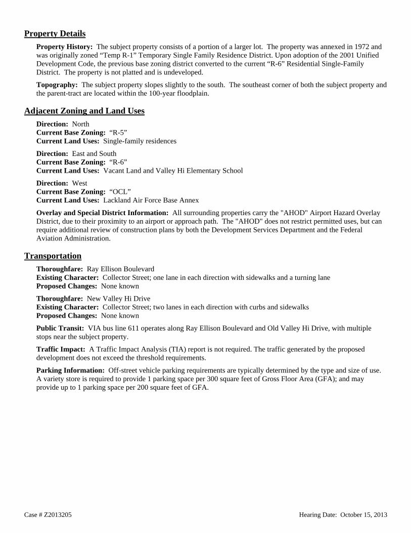
Property Details Property History: The subject property consists of a portion of a larger lot. The property was annexed in 1972 and was originally zoned “Temp R-1” Temporary Single Family Residence District. Upon adoption of the 2001 Unified Development Code, the previous base zoning district converted to the current “R-6” Residential Single-Family District. The property is not platted and is undeveloped.
Topography: The subject property slopes slightly to the south. The southeast corner of both the subject property and the parent-tract are located within the 100-year floodplain.
Adjacent Zoning and Land Uses Direction: North Current Base Zoning: “R-5” Current Land Uses: Single-family residences
Direction: East and South Current Base Zoning: “R-6” Current Land Uses: Vacant Land and Valley Hi Elementary School
Direction: West Current Base Zoning: “OCL” Current Land Uses: Lackland Air Force Base Annex
Overlay and Special District Information: All surrounding properties carry the "AHOD" Airport Hazard Overlay District, due to their proximity to an airport or approach path. The "AHOD" does not restrict permitted uses, but can require additional review of construction plans by both the Development Services Department and the Federal Aviation Administration.
Transportation Thoroughfare: Ray Ellison Boulevard Existing Character: Collector Street; one lane in each direction with sidewalks and a turning lane Proposed Changes: None known
Thoroughfare: New Valley Hi Drive Existing Character: Collector Street; two lanes in each direction with curbs and sidewalks Proposed Changes: None known
Public Transit: VIA bus line 611 operates along Ray Ellison Boulevard and Old Valley Hi Drive, with multiple stops near the subject property.
Traffic Impact: A Traffic Impact Analysis (TIA) report is not required. The traffic generated by the proposed development does not exceed the threshold requirements.
Parking Information: Off-street vehicle parking requirements are typically determined by the type and size of use. A variety store is required to provide 1 parking space per 300 square feet of Gross Floor Area (GFA); and may provide up to 1 parking space per 200 square feet of GFA.

Case # Z2013205 Hearing Date: October 15, 2013
Staff Analysis and Recommendation: Approval, pending plan amendment Criteria for Review: According to Section 35-421, zoning amendments shall be based on the approval criteria below.
1. Consistency:
The property is located within the United Southwest Communities Plan and is currently designated as Low Density Residential in the future land use component of the plan. The requested “C-2” base zoning district is not consistent with the adopted land use designation. A master plan amendment has been submitted, requesting to change the land use designation to Community Commercial. Staff and Planning Commission recommend approval of the plan amendment request.
The Community Commercial land use designation should be located at nodes on arterial thoroughfares at major intersections or where an existing commercial area has been established. The subject property is located at the intersection of two collector streets.
2. Adverse Impacts on Neighboring Lands:
Staff finds no evidence of likely adverse impacts on neighboring lands in relation to this zoning change request.
3. Suitability as Presently Zoned:
The “R-6” base zoning district is not necessarily appropriate for the subject property, the parent tract, or the surrounding undeveloped properties. Single-family residential development is not likely on the properties. The properties are better suited for institutional, multi-family residential, or small-scale office/commercial uses because of their proximity to the military base, at the periphery of two single-family residential subdivisions, bound by collector streets.
4. Health, Safety and Welfare:
Staff has found no indication of likely adverse effects on the public health, safety, or welfare.
5. Public Policy:
Should the plan amendment request be approved, the request does not appear to conflict with any public policy objective.
6. Size of Tract:
The subject property is 1.528 acres in size, which reasonably accommodates the uses permitted in “C-2” and the typical parking requirements.
7. Other Factors:
The subject property is located within the Lackland Military Influence Area. In accordance with the signed Memorandum of Understanding, zoning staff provided the Military with a copy of the rezoning request for review and comment. The comments returned to staff indicated no concern related to the rezoning request; however, there is concern regarding development of the site as the surrounding areas to the south are prone to flooding. Storm water and drainage will be reviewed as part of the site development and building permit process.

Ellor Dr
Yolan
da
Culebra Rd
Maide
n Lan
e
Roan
oke A
ve
C2
C2C2
C3 C3
C2
C2NA-CD
R5
C3NAC3
C2
R5
C3
R6
R6
C3
C2
C3
R6R6
R5
R6
R6
R6
R6R6
R6
R6R6
R6
R5
R6 R6 R6 R6 R6 R6 R6 R6
R5 R5R5
R6
R5 R5R5 R5
R6
R6
R6
R6
R6-CD
R6R6
R6-CD
Scale: 1" approx. = 100 Feet
Council District: 5TEXT(TEXT)
Current ZoningRequested Zoning Change
Zoning Case Notification PlanCase Z-2013-203
LegendSubject Properties
200' Notification Area
Subject Property Legal Description(s):
(0.660 Acres)
100-Year DFIRM Floodplain
NCB 10553 - BLOCK 026 - LOT 021Single Family Residential 1R
Note: All Current and Requested Zoning includes AHOD (Airport Hazard Overlay District).
Development Services DeptCity of San Antonio
(09/13/2013 - R. Martinez)
^
Clarissa Alderete
Apache Creek
WilleeSurre
ls Manning
Alici
a
Riverdale
Flint
Globe AveLark
Rosa
bell
Bluff St
Rita Lane
Floren
cia Holy
Cros
s
Fig
Cannon Dr
Dolor
es Av
e
Rita
Ruth Dr
W Woodlawn Belfair
Groff
NW 36
th St
Bartmer St
Carlo
ta
Groff
Alici
a
Lark
®
Location Map
(C2NA CD)
School District: Edgewood I.S.D.
Auto PartsCar Wash
Gas StationRetail Center
Cafe
Auto RepairsRetail Center1RCard
ReaderAuto
RepairsVacant
1R 1R 1R 1R 1R 1R 1R 1R 1R
1R1R1R 1R

Case # Z2013203 CD Hearing Date: October 15, 2013
City of San Antonio Development Services Department Staff Report To: Zoning Commission
Zoning Case #: Z2013203 CD
Hearing Date: October 15, 2013
Property Owner: Darrell Centeno
Applicant: Salah Diab
Representative: Salah Diab
Location: 3684 Culebra Road
Legal Description: Lot 21, Block 26, NCB 10553
Total Acreage: 0.66
City Council District: 5
Case Manager: Tony Felts, Planner
Case History: This is the first public hearing for this zoning change request.
Proposed Zoning Change Current Zoning: "C-2NA CD AHOD" Commercial Nonalcoholic Sales Airport Hazard Overlay District with a Conditional Use for a Car Wash
Requested Zoning: "C-2NA CD AHOD" Commercial Nonalcoholic Sales Airport Hazard Overlay District with a Conditional Use for Motor Vehicle Sales
Procedural Requirements The request was publicly noticed in accordance with Section 403 of the Unified Development Code (UDC). The application was published in The Daily Commercial Recorder, an official newspaper of general circulation on September 27, 2013. Notices were sent to property owners and registered neighborhood associations within two hundred (200) feet of the subject property on October 2, 2013. Additionally, notice of this meeting was posted at city hall and on the city’s internet website on October 11, 2013, in accordance with Section 551.043(a) of the Texas Government Code.
Notices Mailed Owners of Property within 200 feet: 25
Neighborhood Associations: Loma Park Neighborhood Association
Planning Team Members: 35 – West/Southwest Sector Plan
Applicable Agencies: None

Case # Z2013203 CD Hearing Date: October 15, 2013
Property Details Property History: The subject property was annexed in 1945 and was originally zoned “C” Apartment District. In 1953, the property was rezoned to “F” Local Retail District. Upon adoption of the 2001 Unified Development Code, the previous base zoning district converted to “C-2” Commercial District. In a 2007 case, the property was rezoned to “C-2NA CD” Commercial Nonalcoholic Sales District with a Conditional Use for a Car Wash. The property was platted in 2008, and was developed with a 2,200-square foot car wash facility in 2009.
Topography: The property does not include any abnormal physical features such as significant slope or inclusion in a flood plain.
Adjacent Zoning and Land Uses Direction: West, North and East Current Base Zoning: “C-2”, “C-3”, and “C-3NA” Current Land Uses: Auto Parts Retail, Auto Repair Facilities, Psychic, Single-Family Residence, Retail Centers, Restaurant, and Gas Station
Direction: South Current Base Zoning: “R-6” Current Land Uses: Single-Family Residences
Overlay and Special District Information: All surrounding properties carry the "AHOD" Airport Hazard Overlay District, due to their proximity to an airport or approach path. The "AHOD" does not restrict permitted uses, but can require additional review of construction plans by both the Development Services Department and the Federal Aviation Administration.
Transportation Thoroughfare: Culebra Road Existing Character: Secondary Arterial, Type A; two lanes in each direction with a center turn lane and sidewalks Proposed Changes: None known
Thoroughfare: Ellor Drive Existing Character: Local Street; one lane in each direction with no sidewalks Proposed Changes: None known
Thoroughfare: Yolanda and Maiden Lane Existing Character: Local Streets; one lane in each direction with sidewalks Proposed Changes: None known
Public Transit: VIA bus lines 82 and 282 operate along Culebra Road, with multiple stops adjacent to the subject property.
Traffic Impact: A Traffic Impact Analysis (TIA) is not required. The traffic generated by the proposed development does not exceed the threshold requirements.
Parking Information: Motor Vehicle Sales requires a minimum parking ratio of one space per 500 square feet of gross floor area of the sales and service building. The maximum parking ratio allowed by the UDC is one space per 375 square feet of gross floor area of the sales and service building. The requisite site plan indicates four parking spaces for customers and employees, with the remaining 32 parking areas designated for vehicle sales inventory.

Case # Z2013203 CD Hearing Date: October 15, 2013
Staff Analysis and Recommendation: Approval, with conditions Criteria for Review: According to Section 35-421, zoning amendments shall be based on the approval criteria below.
1. Consistency:
The subject property is within the West/Southwest Sector Plan and is designated as General Urban Tier in the future land use component of the plan. The “C-2” base zoning district is consistent with the General Urban Tier designation.
2. Adverse Impacts on Neighboring Lands:
Staff finds no likely adverse impacts on surrounding properties in relation to the zoning change request. This section of Culebra Road is fully developed as a commercial corridor. The subject property currently functions as a car wash and there are other auto-related uses in the immediate vicinity. Given the amount of automobile traffic that the current use entails, the transition to motor vehicle sales would likely have a negligible impact on neighboring lands.
The conditional zoning procedure is designed to provide for a land use that is not permitted by the established zoning district but, due to individual site considerations or unique development requirements, would be compatible with adjacent land uses under given conditions.
3. Suitability as Presently Zoned:
The existing zoning and conditional use are appropriate for the subject property. The rezoning request includes only a change to the conditional use, and both the current and requested conditional uses are auto related. Therefore, staff finds the request suitable for the subject property.
4. Health, Safety and Welfare:
Staff has found no indication of likely adverse effects on the public health, safety or welfare.
5. Public Policy:
The request does not appear to conflict with any public policy objective.
6. Size of Tract:
The tract measures 0.66 of an acre in size, and is sufficient to accommodate the uses permitted in “C-2”, the proposed conditional use for motor vehicle sales, and the required parking. The size of the property will serve to limit the scale and impact of the proposed conditional use.
7. Other Factors:
Staff recommends the following conditions:
1. All on-site lighting shall be directed onto the site and point away from any adjacent residential zoning or uses.
2. Outdoor speaker and paging systems shall be prohibited.


Beacon Ave
W Hollywood Ave
W Rosewood Ave
W Lynwood
N Flo
res St
W Lynwood
R6 NCD-5
R6 NCD-5
R6 NCD-5
R6 NCD-5
R6 NCD-5
R6 NCD-5
R6 NCD-5
R6 NCD-5R6 NCD-2
R6 NCD-5
R6 NCD-5
R6 NCD-5
R6 NCD-5
R6 NCD-5
R6 NCD-5
R6 NCD-2
R6 NCD-2R6 NCD-5R6 NCD-5 R6 NCD-2
Union
Pacif
ic
Scale: 1" approx. = 100 Feet
Council District: 1TEXT(TEXT)
Current ZoningRequested Zoning Change
Zoning Case Notification PlanCase Z-2013-204
LegendSubject Properties
200' Notification Area
Subject Property Legal Description(s):
(0.141 Acres)
100-Year DFIRM Floodplain
NCB 06421 - BLK 022 - LOT 38 and 39Single Family Residential 1R
Note: All Current and Requested Zoning includes AHOD (Airport Hazard Overlay District).
Development Services DeptCity of San Antonio
(09/16/2013 - R. Martinez)
^
Union
Pacif
ic
Marti
nez C
reek
Elmwood
MillardSacramento
Pasadena
Fulton Ave
W Lynwood
W Olmos Dr
W Summit
Vassar
W Summit
W Lynwood
Sacramento
®
Location Map
School District: San Antonio I.S.D.
1R 1R 1R 1R 1R 1R 1R
1R 1R 1R 1R 1R 1R 1R 1R1R
1R 1R 1R 1R 1R 1R 1R 1R 1R 1R
1R
1R 1R 1R 1R
1R 1R 1R 1R 1R
R6 NCD-5
R6 NCD-5R6 NCD-5
R6 NCD-5 R6 NCD-5R6 NCD-5
R6 NCD-5R6 NCD-5
(RM6 NCD-5)R6 NCD-5 R6 NCD-5
R6 NCD-5 R6 NCD-5 R6 NCD-5 R6 NCD-5

Case # Z2013204 Hearing Date: October 15, 2013
City of San Antonio Development Services Department Staff Report To: Zoning Commission
Zoning Case #: Z2013204
Hearing Date: October 15, 2013
Property Owner: Stephen M. Horton & John M. Hill, Jr.
Applicant: Stephen M. Horton
Representative: Kaufman & Killen, Inc. (Ashley Farrimond)
Location: 613 West Hollywood Boulevard
Legal Description: Lots 38 & 39, Block 22, NCB 6421
Total Acreage: 0.1412
City Council District: 1
Case Manager: Ernest Brown, Planner
Case History: This is the first public hearing for this zoning case.
Proposed Zoning Change Current Zoning: "R-6 NCD-5 AHOD" Residential Single-Family Beacon Hill Area Neighborhood Conservation Airport Hazard Overlay District
Requested Zoning: "RM-6 NCD-5 AHOD" Residential Mixed Beacon Hill Area Neighborhood Conservation Airport Hazard Overlay District
Procedural Requirements The request was publicly noticed in accordance with Section 403 of the Unified Development Code (UDC). The application was published in The Daily Commercial Recorder, an official newspaper of general circulation on September 27, 2013. Notices were sent to property owners and registered neighborhood associations within two hundred (200) feet of the subject property on October 2, 2013. Additionally, notice of this meeting was posted at city hall and on the city’s internet website on October 11, 2013, in accordance with Section 551.043(a) of the Texas Government Code.
Notices Mailed Owners of Property within 200 feet: 34
Registered Neighborhood Associations within 200 feet: Beacon Hill Neighborhood Association
Planning Team: 11 - Midtown Neighborhoods Plan
Applicable Agencies: None

Case # Z2013204 Hearing Date: October 15, 2013
Property Details Property History: The subject property is located within the city limits as recognized in 1938, and was originally zoned under the 1938 zoning code. In a 1997 case, the property was rezoned to “R-1” Single Family Residence District. Upon adoption of the 2001 Unified Development Code, the previous base zoning district converted to the current “R-6” Residential Single-Family District. The subject property is undeveloped, with the exception of an 80-square foot shed that was built in 2004. The property is platted in its current configuration.
Topography: The property does not include any abnormal physical features such as significant slope or inclusion in a flood plan.
Adjacent Zoning and Land Uses Direction: All Current Base Zoning: “R-6” Current Land Uses: Single-Family Residences
Overlay and Special District Information: All surrounding properties carry the "AHOD" Airport Hazard Overlay District, due to their proximity to an airport or approach path. The "AHOD" does not restrict permitted uses, but can require additional review of construction plans by both the Development Services Department and the Federal Aviation Administration.
The Beacon Hill Area Neighborhood Conservation District (NCD-5) is an overlay zoning district that contains design guidelines for rehabilitation of existing residential and commercial development. Property owners, together with Planning & Community Development staff, develop the design guidelines. These guidelines can address building materials, height, size, massing, signage, sidewalk location, etc.
Transportation Thoroughfare: West Hollywood Avenue and West Rosewood Avenue Existing Character: Local Streets; one lane in each direction with sidewalks Proposed Changes: None known
Public Transit: There are no public transit stops in the immediate vicinity of the subject property. The nearest VIA bus lines operate along Hildebrand Avenue to the north and San Pedro Avenue to the east.
Traffic Impact: A Traffic Impact Analysis (TIA) is not required because traffic generated by the proposed development does not exceed the threshold requirements.
Parking Information: Off-street vehicle parking requirements for 2-family dwellings are: Minimum - 1 space per unit; Maximum – 2 spaces per unit.

Case # Z2013204 Hearing Date: October 15, 2013
Staff Analysis and Recommendation: Approval Criteria for Review: According to Section 35-421, zoning amendments shall be based on the approval criteria below.
1. Consistency:
The subject property is located within the Midtown Neighborhoods Plan and is currently designated as Low Density Residential in the future land use component of the plan. Although multi-unit dwellings are not typically considered consistent with the Low Density Residential land use designation, the Midtown Neighborhoods Plan allows a limited number of duplexes in low-density areas.
2. Adverse Impacts on Neighboring Lands:
The larger area surrounding the subject property includes a wide range of residential densities; however, the immediate area is predominantly single-family. The adopted land use plan allows a limited number of two-family dwellings on a single lot, but the practice should be limited in order to maintain the overall character of the neighborhood. Staff finds no likely adverse impacts on the surrounding community, as long as the number of duplexes remains small.
3. Suitability as Presently Zoned:
The existing “R-6” base zoning district is consistent with the adopted land use plan and the surrounding neighborhood.
4. Health, Safety and Welfare:
Staff has found no evidence of negative impacts on the public health, safety or welfare of the surrounding community.
5. Public Policy:
The request does not appear to conflict with any public policy objective.
6. Size of Tract:
The subject property measures 0.1412 of an acre in size, which is sufficient to accommodate the uses permitted in “RM-6” and required parking.
7. Other Factors:
The “RM-6” district does not permit more than two dwellings on a single lot. The proposed duplex use can be achieved through a request for a conditional use in the existing single-family zoning district. In this case, staff does not believe that the conditional use option provides any additional protections for the surrounding community. Regardless of the base zoning district, new residential development on the property will be subject to the design standards of the Beacon Hill Area Neighborhood Conservation District.
Rotary
Gidd
ings
Jenull Ave
Hame
l
Muegge
I2 EP-1
I2 EP-1
I2 EP-1
I2 EP-1
I2 EP-1
I2 EP-1
I2 EP-1
I2 EP-1
I2 EP-1
I2 EP-1
R5 EP-1
R4 EP-1
I2 EP-1
R4 EP-1
R5 EP-1
I2 EP-1
I2 EP-1
I2 EP-1
R5 EP-1
I2 EP-1
I2 EP-1
I2 EP-1
I2 EP-1
I2 EP-1
I2 EP-1
I2 EP-1
I2 EP-1
I2 EP-1
Union Pacific
Scale: 1" approx. = 100 Feet
Council District: 2TEXT(TEXT)
Current ZoningRequested Zoning Change
Zoning Case Notification PlanCase Z-2013-206
LegendSubject Properties
200' Notification Area
Subject Property Legal Description(s):
(0.253 Acres)
100-Year DFIRM Floodplain
NCB 01234 - BLOCK 044 - LOT 11 & 12Single Family Residential 1R
Development Services DeptCity of San Antonio
(10/1/2013 - R. Martinez)
^Willow Springs Golf Course
Ruth Woodard
Pershing
Union Pacific
Aniol
Gulf StCanton
N IH 35
Poinsettia
Gray St
Gabriel
E Houston StDawson St
Bethune
Hays St
N IH 35
Hays St
Canton
®
Location Map
School District: S.A.I.S.D.
I2 EP-1
(R6 EP-1)
1R1R
1R1R
1R1R
1R
1R1R
1R
1R1R
1R1R
1R
1R
Vacant
Vacant
Vacant Commercial
Vacant
Vacant
Vacant
Vacant
C.P.S.Power Station
I2 EP-1
Case # Z2013206 Hearing Date: October 15, 2013
City of San Antonio Development Services Department Staff Report To: Zoning Commission
Zoning Case #: Z2013206
Hearing Date: October 15, 2013
Property Owner: Tammy Moore
Applicant: Tammy Moore
Representative: Tammy Moore
Location: 515 and 519 Rotary
Legal Description: Lots 11 and 12, Block 44, NCB 1234
Total Acreage: 0.2534
City Council District: 2
Case Manager: Ernest Brown, Planner
Case History: This is the first public hearing for this zoning case.
Proposed Zoning Change Current Zoning: "I-2 EP-1" Heavy Industrial Facility Parking/Traffic Control District
Requested Zoning: "R-6 EP-1" Residential Single-Family Facility Parking/Traffic Control District
Procedural Requirements The request was publicly noticed in accordance with Section 403 of the Unified Development Code (UDC). The application was published in The Daily Commercial Recorder, an official newspaper of general circulation on September 27, 2013. Notices were sent to property owners and registered neighborhood associations within two hundred (200) feet of the subject property on October 2, 2013. Additionally, notice of this meeting was posted at city hall and on the city’s internet website on October 11, 2013, in accordance with Section 551.043(a) of the Texas Government Code.
Notices Mailed Owners of Property within 200 feet: 27
Registered Neighborhood Associations within 200 feet: Harvard Place/Eastlawn Neighborhood Association
Planning Team: 22 – Arena District/Eastside Community Plan
Applicable Agencies: None

Case # Z2013206 Hearing Date: October 15, 2013
Property Details Property History: The subject property consists of two lots, which are located within the city limits as recognized in 1938, and were originally zoned “L” First Manufacturing District. Upon adoption of the 2001 Unified Development Code, the previous base zoning district converted to the current “I-2” Heavy Industrial District. The properties are both developed with single-family residences, measuring 658 square feet and 1,448 square feet, that were built in 1954.
Topography: The property does not include any abnormal physical features such as significant slope or inclusion in a flood plan.
Adjacent Zoning and Land Uses Direction: North Current Base Zoning: “I-2” Current Land Uses: Vacant Warehouse and Undeveloped Land
Direction: West and East Current Base Zoning: “I-2” Current Land Uses: Single-Family Residences and Undeveloped Lots
Direction: Southeast Current Base Zoning: “I-2” Current Land Uses: CPS Electric Substation
Direction: South Current Base Zoning: “R-4” and “R-5” Current Land Uses: Single-Family Residences
Overlay and Special District Information: The “EP-1” Facility Parking /Traffic Control Overlay District is an overlay zoning district that contains parking and traffic regulations for areas around large facilities that attract large volumes of vehicular traffic. The overlay district addresses areas not properly zoned for commercial parking. These guidelines can also address access for emergency vehicles, congestion, and visual blight.
Transportation Thoroughfare: Rotary, Giddings, Jenull Avenue and Hamel Existing Character: Local Streets; one lane in each direction with sidewalks. Proposed Changes: None Known
Public Transit: There are no public transit stops in the immediate vicinity of the subject property. The nearest VIA bus line operates along North Rio Grande Street, southwest of the subject property.
Traffic Impact: A Traffic Impact Analysis (TIA) is not required because traffic generated by the proposed development does not exceed the threshold requirements.
Parking Information: Off-street vehicle parking requirements for single-family dwellings are a minimum of 1 space with no maximum.
Case # Z2013206 Hearing Date: October 15, 2013
Staff Analysis and Recommendation: Approval Criteria for Review: According to Section 35-421, zoning amendments shall be based on the approval criteria below.
1. Consistency:
The subject property is located within the Arena District/Eastside Community Plan and is currently designated as Medium Density Residential in the future land use component of the plan. The requested “R-6” base zoning district is consistent with the adopted land use designation.
2. Adverse Impacts on Neighboring Lands:
Staff has found no evidence of likely adverse impacts on neighboring lands in relation to this zoning change request. The zoning request is consistent with the surrounding development.
3. Suitability as Presently Zoned:
The existing zoning is not consistent with the adopted land use plan and is not appropriate for the subject property or surrounding area. The “I-2” district is meant to accommodate a wide range of heavy industrial and manufacturing uses. The area is concentrated with established existing single family residential development. Even though the neighborhood is enclosed on two sides by rail road traffic, staff finds no presence of established industrial uses in the area. The existing “I-2” district is the result of the zoning district conversion that accompanied adoption of the 2001 Unified Development Code.
4. Health, Safety and Welfare:
Staff has found no evidence of negative impacts on the public health, safety or welfare of the surrounding community.
5. Public Policy:
The request does not appear to conflict with any public policy objectives.
6. Size of Tract:
Together, the subject properties measure 0.2534 of an acre in size. Each lot is approximately 5,500 square feet, which does not meet the minimum lot size for the “R-6” district. However, the applicant’s stated intention is to combine the lots into a single lot and construct a new single-family residence on the resulting 11,000-square foot lot.
7. Other Factors:
None.

Roge
rs Rd
Mt H
elen D
r
C3
R6
R6
R6
R6
R6
R6
C1
C1
R6
O1
R6
R6 R6
R6R6
R6-CD
R6R6
Scale: 1" approx. = 100 Feet
Council District: 6TEXT(TEXT)
Current ZoningRequested Zoning Change
Zoning Case Notification PlanCase Z-2013-207
LegendSubject Properties
200' Notification Area
Subject Property Legal Description(s):
(0.460 Acres)
100-Year DFIRM Floodplain
NCB 17637 - BLOCK 003 - LOT 014Single Family Residential 1R
Development Services DeptCity of San Antonio
(10/1/2013 - R. Martinez)
^
Culebra CreekCulebra Creek
Helotes Creek
Hwy 151
Mt Hood Dr
Hidd
en M
ist
Rogers Rd
Mt Baker Dr
Loop
W 16
04 N
Rogers Rd
®
Location Map
School District: Northside I.S.D.
Vacant
Vacant
Medical- Clinic
Vacant
Vacant
Vacant
Warehouse
Vacant
1R
1R
1R
1R
(O1) Vacant
Case # Z2013207 Hearing Date: October 15, 2013
City of San Antonio Development Services Department Staff Report To: Zoning Commission
Zoning Case #: Z2013207
Hearing Date: October 15, 2013
Property Owner: Chukwuma N. Ogogor and Nkechi S. Ogogor
Applicant: Chukwuma N. Ogogor and Nkechi S. Ogogor
Representative: Chukwuma N. Ogogor
Location: 5524 Rogers Road
Legal Description: Lot 14, Block 3, NCB 17637
Total Acreage: 0.46
City Council District: 6
Case Manager: Krystin Ramirez, Planning Technician
Case History: This is the first public hearing for this zoning case.
Proposed Zoning Change Current Zoning: "R-6" Residential Single-Family District
Requested Zoning: "O-1" Office District
Procedural Requirements The request was publicly noticed in accordance with Section 403 of the Unified Development Code (UDC). The application was published in The Daily Commercial Recorder, an official newspaper of general circulation on September 27, 2013. Notices were sent to property owners and registered neighborhood associations within two hundred (200) feet of the subject property on October 2, 2013. Additionally, notice of this meeting was posted at city hall and on the city’s internet website on October 11, 2013, in accordance with Section 551.043(a) of the Texas Government Code.
Notices Mailed Owners of Property within 200 feet: 13
Neighborhood Associations: Mountain View Acres Neighborhood Coalition
Planning Team Members: 35 - West/Southwest Sector Plan
Applicable Agencies: None

Case # Z2013207 Hearing Date: October 15, 2013
Property Details Property History: The subject property was annexed in 1996 and was originally zoned “Temp R-1” Temporary Single Family Residence District. Upon adoption of the 2001 Unified Development Code, the previous base zoning district converted to the current “R-6” Residential Single-Family District. The subject site was platted in its current configuration in 1957 and is currently undeveloped.
Topography: The property does not include any abnormal physical features such as slope or inclusion in a floodplain.
Adjacent Zoning and Land Uses Direction: North Current Base Zoning: “O-1” and “C-1” Current Land Uses: Medical office, undeveloped land and storage area
Direction: West Current Base Zoning: “C-3” Current Land Uses: Vacant Land
Direction: South and East Current Base Zoning: “R-6” Current Land Uses: Single-family residences, vacant land and storage areas
Transportation Thoroughfare: Rogers Road Existing Character: Secondary Arterial Type A Street; two lanes in each direction with sidewalks Proposed Changes: None known
Public Transit: VIA bus line 660 operates along Rogers Road, with multiple stops near the subject property. VIA bus line 606 operates along Culebra Road, north of subject property.
Traffic Impact: A Traffic Impact Analysis (TIA) report is not required. The traffic generated by the proposed development does not exceed the threshold requirements.
Parking Information: Off-street vehicle parking requirements are typically determined by type and size of the use. Medical Clinic - Minimum Parking Requirement: 1 space per 400 square feet of Gross Floor Area (GFA). Maximum Parking Requirement: 1 space per 100 square feet of GFA.

Case # Z2013207 Hearing Date: October 15, 2013
Staff Analysis and Recommendation: Approval Criteria for Review: According to Section 35-421, zoning amendments shall be based on the approval criteria below.
1. Consistency:
The property is located within the West/Southwest Sector Plan and is currently designated as Rural Estate Tier in the future land use component of the plan. The requested “O-1” base zoning district is consistent with the adopted land use designation. The Rural Estate Tier allows a range of very low-density residential uses, as well as small-scale service and retail uses meant to serve large, rural residential areas.
2. Adverse Impacts on Neighboring Lands:
Staff finds no evidence of likely adverse impacts on neighboring lands in relation to this zoning change request and finds the requested zoning to be appropriate because of the subject property’s location with frontage on an arterial thoroughfare.
3. Suitability as Presently Zoned:
The “R-6” base zoning district is not entirely appropriate for the subject property. This zoning district is not recommended under the Rural Estate Tier of the West/Southwest Sector Plan. The subject property currently contains warehousing and is better suited for small-scale office/commercial uses.
Additionally, single-family residential uses are not encouraged with access from arterial thoroughfares because of safety issues that arise from vehicles backing into traffic when leaving the residential property. The UDC includes provisions limiting such access for residential lots that are less than 1 acre in size. The subject property has existing ingress/egress to Rogers Road, and residential development would not be prohibited on the site; but the UDC discourages such development for new subdivisions.
4. Health, Safety and Welfare:
Staff has found no indication of likely adverse effects on the public health, safety, or welfare.
5. Public Policy:
The request does not appear to conflict with any public policy objective.
6. Size of Tract:
The subject property is 0.46 acres in size, which reasonably accommodates the uses proposed medical clinic and the required parking.
7. Other Factors:
The “O-1” district requires parking be located behind the primary structure, but does allow a limited amount of parking in the front and side yards.

R4
R4
UD
I1
C3NA
UD
O2
R4
R4R4
R4R4
RM4
UD
R4
R4
UD
R4
R4
R4
R4
R4
R4R4
R4
R4
R4
R4
R4
R4
R4
R4 R4
R4
R4
R4 R4
R4
R4
R4 R4
R4
R4
R4 R4R4
R4R4
R4
R4 R4
R4 R4
R4
R4
R4
R4R4
R4
R4R4
R4
R4
R4R4
R4
R4
R4
R4R4 R4
R4R4
R4
R4
R4
R4R4
R4 R4
R4
R4 R4
R4
R4
R4
R4
R4
R4
R4
R4
R4
R4
R4
R4
R4
R4R4
UD
R4
R4
R4R4
R4
R4
R4
R4
R4R4
R4
R4
R4R4 R4
R4 R4
R4
R4R4
R4
R4R4
R4
R4
R4
R4 R4R4 R4 R4 R4
R4
R4 R4R4R4 R4R4 R4 R4 R4R4 R4R4R4R4
TejedaAcademy
Tidewind St
Loop 410 SE
E Chavaneaux
Yett A
ve
Walha
lla A
ve
Loop 410 SE
Development Services DeptCity of San Antonio
(10/1/2013 - R Martinez)
Scale: 1" approx. = 250 Feet
Council District: 3
Zoning Case Notification Plan Case Z-2013-208
Legend
Subject Property Legal Description(s):
(20.790 Acres)
NCB 11156 - BLOCK 000 - LOT E 1330''OF TR-4A, E 1365''OF TR-5A, E IRR 760''OF TR-6A, E IRR 713''OF TR-7A, & 6P RESURVEYED PER DEED 12145/2470
Note: All Current and Requested Zoning includes AHOD (Airport Hazard Overlay District). Single Family Residential 1R
100-Year DFIRM Floodplain(TEXT)Requested Zoning ChangeTEXTCurrent Zoning
200' Notification AreaSubject Properties
®
^SE Loop 410Loop 410 SE
Moursund Blvd
Yett A
veE Mally BlvdYukon Blvd
Tidewind St
E Chavaneaux
Lanier BlvdBeam
School District: Harlandale and Southside I.S.D.
Location Map
R4(MF33)
VacantVacantVacant
Vacant
Vacant
Vacant
1R 1R1R 1R 1R 1R 1R 1R 1R 1R 1R 1R 1R 1R 1R 1R1R
1R 1R 1R 1R 1R 1R
1R 1R 1R 1R 1R

Case # Z2013208 Hearing Date: October 15, 2013
City of San Antonio Development Services Department Staff Report To: Zoning Commission
Zoning Case #: Z2013208
Hearing Date: October 15, 2013
Property Owner: 100 SA Pleasanton, Ltd. (by Marsha Normand, Sole Manager)
Applicant: Marsha Normand
Representative: Brown & Ortiz, P.C. (by James Griffin)
Location: A portion of the 12100 Block of Southeast Loop 410
Legal Description: 20.79 acres out of NCB 11156
Total Acreage: 20.79
City Council District: 3
Case Manager: Ernest Brown, Planner
Case History: This is the first public hearing for this zoning case.
Proposed Zoning Change Current Zoning: "R-4 AHOD" Residential Single-Family Airport Hazard Overlay District
Requested Zoning: "MF-33 AHOD" Multi-Family Airport Hazard Overlay District
Procedural Requirements The request was publicly noticed in accordance with Section 403 of the Unified Development Code (UDC). The application was published in The Daily Commercial Recorder, an official newspaper of general circulation on September 27, 2013. Notices were sent to property owners and registered neighborhood associations within two hundred (200) feet of the subject property on October 2, 2013. Additionally, notice of this meeting was posted at city hall and on the city’s internet website on October 11, 2013, in accordance with Section 551.043(a) of the Texas Government Code.
Notices Mailed Owners of Property within 200 feet: 54
Registered Neighborhood Associations within 200 feet: None
Planning Team: 14 – Stinson Airport Vicinity Land Use Plan
Applicable Agencies: City of San Antonio Aviation Department
Case # Z2013208 Hearing Date: October 15, 2013
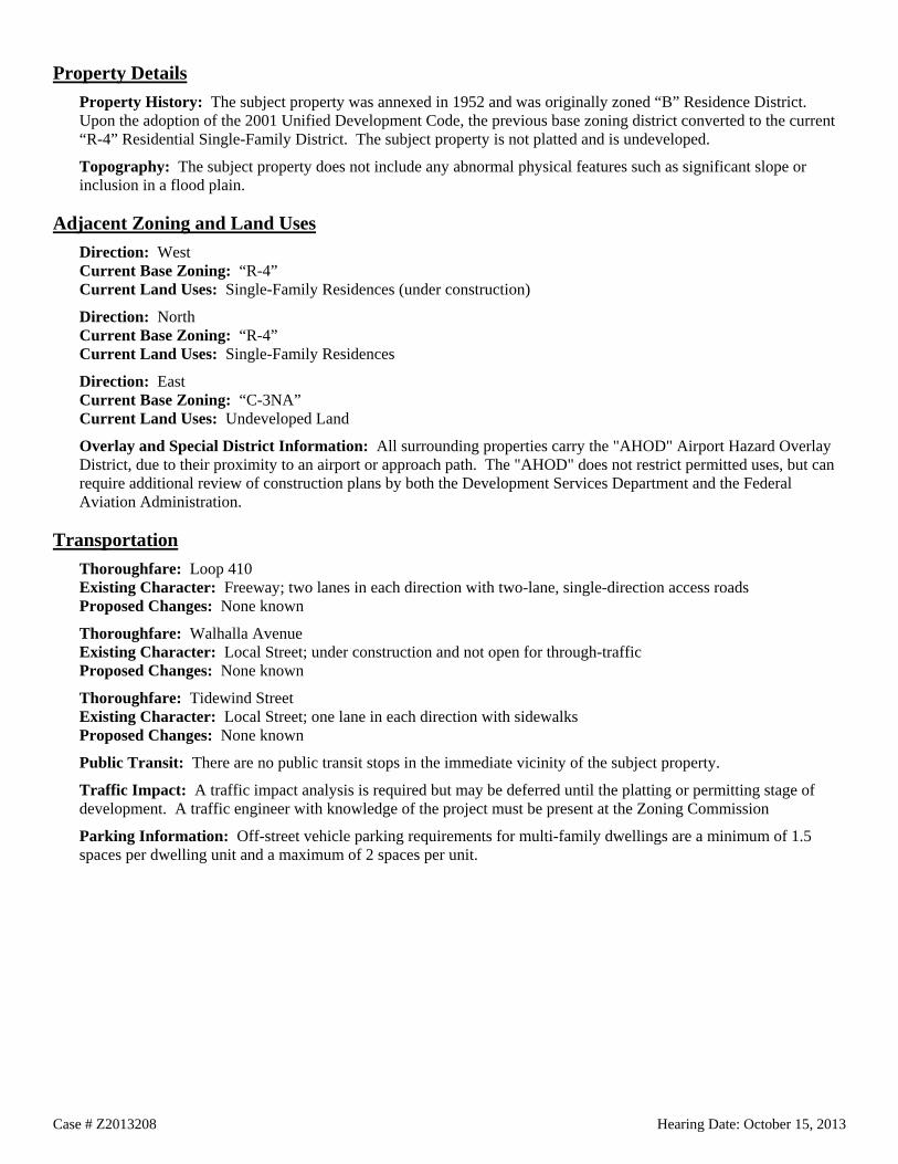
Property Details Property History: The subject property was annexed in 1952 and was originally zoned “B” Residence District. Upon the adoption of the 2001 Unified Development Code, the previous base zoning district converted to the current “R-4” Residential Single-Family District. The subject property is not platted and is undeveloped.
Topography: The subject property does not include any abnormal physical features such as significant slope or inclusion in a flood plain.
Adjacent Zoning and Land Uses Direction: West Current Base Zoning: “R-4” Current Land Uses: Single-Family Residences (under construction)
Direction: North Current Base Zoning: “R-4” Current Land Uses: Single-Family Residences
Direction: East Current Base Zoning: “C-3NA” Current Land Uses: Undeveloped Land
Overlay and Special District Information: All surrounding properties carry the "AHOD" Airport Hazard Overlay District, due to their proximity to an airport or approach path. The "AHOD" does not restrict permitted uses, but can require additional review of construction plans by both the Development Services Department and the Federal Aviation Administration.
Transportation Thoroughfare: Loop 410 Existing Character: Freeway; two lanes in each direction with two-lane, single-direction access roads Proposed Changes: None known
Thoroughfare: Walhalla Avenue Existing Character: Local Street; under construction and not open for through-traffic Proposed Changes: None known
Thoroughfare: Tidewind Street Existing Character: Local Street; one lane in each direction with sidewalks Proposed Changes: None known
Public Transit: There are no public transit stops in the immediate vicinity of the subject property.
Traffic Impact: A traffic impact analysis is required but may be deferred until the platting or permitting stage of development. A traffic engineer with knowledge of the project must be present at the Zoning Commission
Parking Information: Off-street vehicle parking requirements for multi-family dwellings are a minimum of 1.5 spaces per dwelling unit and a maximum of 2 spaces per unit.

Case # Z2013208 Hearing Date: October 15, 2013
Staff Analysis and Recommendation: Approval, pending plan amendment Criteria for Review: According to Section 35-421, zoning amendments shall be based on the approval criteria below.
1. Consistency:
The property is located within the Stinson Airport Vicinity Land Use Plan. Most of the subject property is currently designated as Community Commercial in the future land use component of the plan, while one small portion is currently designated as Low Density Residential. The requested “MF-33” district is not consistent with either of the adopted land use designations. The applicant has submitted a request to amend the land use designation to High Density Residential. Staff and Planning Commission recommend approval of the plan amendment request.
2. Adverse Impacts on Neighboring Lands:
The subject property abuts single-family residences to the north. Any development on the subject property is likely to impact the neighboring residences. However, there is a row of undeveloped lots between the subject property and the residences fronting Tidewind Street. The undeveloped lots appear to be unplatted and do not have street frontage or access. In most cases, the rear lots are under common ownership with the front lots, and tend to serve as extended backyards for the single-family residences. These rear lots provide a significant buffer between the proposed multi-family development and the existing single-family residences.
Although the area is largely residential land use, staff found no evidence of likely adverse impacts on neighboring lands in relation to this zoning change request. The location of the requested “MF-33” along a major arterial meets the guidelines of the Stinson Airport Vicinity land use plan. It provides a transitional land use between the neighboring residential single family development and the major thoroughfare.
3. Suitability as Presently Zoned:
The existing residential single-family zoning is not consistent with the Community Commercial land use designation, nor is it appropriate for property located on an expressway. Multi-family uses may provide an appropriate transition between major thoroughfares and low-density residential development.
4. Health, Safety and Welfare:
Staff has found no indication of likely adverse effects on the public health, safety or welfare.
5. Public Policy:
The request does not appear to conflict with any public policy objective.
6. Size of Tract:
The subject property measures 20.79 acres in size, which will allow a maximum of 686 units should the requested zoning change be approved.
7. Other Factors:
This property is located within the Stinson Airport Awareness Zone; therefore, the zoning request was reviewed by the City's Aviation Department. The Aviation Department does not object to the requested change in zoning.
IH 10 W
Sherwood Dr
C2
R5
R5
R5 R5
R5R5 R5 R5R5
R5
R5
O2R5
C2
C3NA
C2
O2
C1
C2
R5
C2
R5
C2
O2
C2
C2
C2 MF33
C3R
C2
R5
R5
C2C2
R5
C2C2
C3NA
RM4
C2-CD
C2
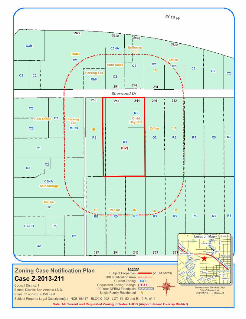
Scale: 1" approx. = 150 Feet
Council District: 1TEXT(TEXT)
Current ZoningRequested Zoning Change
Zoning Case Notification PlanCase Z-2013-211
LegendSubject Properties
200' Notification Area
Subject Property Legal Description(s):
(2.013 Acres)
100-Year DFIRM Floodplain
NCB 08417 - BLOCK 002 - LOT 51, 52 and E. 12 Ft. of 9Single Family Residential 1R
Note: All Current and Requested Zoning includes AHOD (Airport Hazard Overlay District).
Development Services DeptCity of San Antonio
(10/2/2013 - R. Martinez)
^
Granados
Los Angeles Heights
Martinez Creek
Spencer Lane
Greencrest
Art
Freiling Dr Redrock Dr
Frost
Fresno
Newson
El Monte Blvd
Rodena
Ennis
Alhambra
Edison DrLee HallEwing Gard
ina St
IH 10 W
®
Location Map
School District: San Antonio I.S.D.
(C2)
UniformsCo.
Auto Sales
HotelOffice
1R
1ROffice
ChildDayCare
1R
Post Office ParkingLot
Parking Lot
Vacant1R 1R 1R 1R
Tile Co.
Self-Storage
Case # Z2013211 Hearing Date: October 15, 2013
City of San Antonio Development Services Department Staff Report To: Zoning Commission
Zoning Case #: Z2013211
Hearing Date: October 15, 2013
Property Owner: Joy Learning Center, LLC (by LaTanya Price, Managing Member)
Applicant: Joy Learning Center, LLC (by LaTanya Price, Managing Member)
Representative: Langley & Banack, Inc. (Paul Fletcher)
Location: 244 and 250 Sherwood Drive
Legal Description: Lots 51 and 52 and the east 12 feet of Lot 9, Block 2, NCB 8417
Total Acreage: 2.0131
City Council District: 1
Case Manager: Pedro Vega, Planner
Case History: This is the first public hearing for this zoning case.
Proposed Zoning Change Current Zoning: “R-5 AHOD” Residential Single-Family Airport Hazard Overlay District
Requested Zoning: “C-2 AHOD” Commercial Airport Hazard Overlay District
Procedural Requirements The request was publicly noticed in accordance with Section 403 of the Unified Development Code (UDC). The application was published in The Daily Commercial Recorder, an official newspaper of general circulation on September 27, 2013. Notices were sent to property owners and registered neighborhood associations within two hundred (200) feet of the subject property on October 2, 2013. Additionally, notice of this meeting was posted at city hall and on the city’s internet website on October 11, 2013, in accordance with Section 551.043(a) of the Texas Government Code.
Notices Mailed Owners of Property within 200 feet: 19
Neighborhood Associations: Los Angeles Heights Neighborhood Association
Planning Team Members: 18-Near Northwest Community Plan
Applicable Agencies: None

Case # Z2013211 Hearing Date: October 15, 2013
Property Details Property History: The subject property was annexed in May of 1940, and was originally zoned “A” Single Family Residence District. Upon adoption of the 2001 Unified Development Code, the previous base zoning district converted to the current “R-5” Residential Single-Family District. The property consists of two platted lots and a portion of a third lot. The property at 250 Sherwood Drive is developed with two residential structures measuring 3,017 and 1,080 square feet in size that were built in 1932, and formerly served as a church and outreach center. The property at 244 Sherwood Drive is developed with two residential structures measuring 1,348 and 440 square feet in size that were built in 1949 and has previously been operated as a childcare facility.
Topography: The property does not include any abnormal physical features such as slope or inclusion in a flood plain.
Adjacent Zoning and Land Uses Direction: West Current Base Zoning: “R-5”, “MF-33, “C-1” and “C-2 Current Land Uses: Single-Family Dwelling, Parking Lot and Post Office
Direction: North Current Base Zoning: “RM-4”, “C-2” and “C-3NA” Current Land Uses: Hotel, Auto Sales, Uniform Service Company, Single-Family Residence and an Office
Direction: East Current Base Zoning: “O-2” and “R-5” Current Land Uses: Office and Single-Family Dwellings
Direction: South Current Base Zoning: “R-5” Current Land Uses: Single-Family Dwellings and Vacant Lot
Overlay and Special District Information: All surrounding properties carry the "AHOD" Airport Hazard Overlay District, due to their proximity to an airport or approach path. The "AHOD" does not restrict permitted uses, but can require additional review of construction plans by both the Development Services Department and the Federal Aviation Administration.
Transportation Thoroughfare: Sherwood Drive Existing Character: Local Street; one lane in each direction with partial sidewalks Proposed Changes: None known
Thoroughfare: Vance Jackson Road Existing Character: Secondary Arterial Type A; 2 lanes in each direction with sidewalks Proposed Changes: None known
Public Transit: The VIA bus line number 96 operates along Vance Jackson Road, with multiple stops near the subject property.
Traffic Impact: A Traffic Impact Analysis (TIA) is not required. The traffic generated by the proposed development does not exceed the threshold requirements.
Parking Information: Off-street vehicle parking requirements are typically determined by the type of use and building size.
Day Care Center – Child and/or Adult Care - Minimum Parking Requirement: 1 space per 375 square feet of Gross Floor Area (GFA). Maximum Parking Requirement: 1.5 spaces per 375 square feet of Gross Floor Area (GFA).
Case # Z2013211 Hearing Date: October 15, 2013
Staff Analysis and Recommendation: Denial Criteria for Review: According to Section 35-421, zoning amendments shall be based on the approval criteria below.
1. Consistency:
The subject property is located within the Near Northwest Community Plan and is designated as Urban Low Density Residential in the future land use component of the plan. The requested “C-2” base zoning district is not consistent with the adopted land use designation. A plan amendment has been initiated, requesting to change the land use designation to Community Commercial. Staff recommends denial of Community Commercial, with an alternate recommendation of approval of Neighborhood Commercial. Planning Commission recommends approval of Community Commercial.
The Community Commercial designation includes medium and high intensity land uses that draw its customer base from a larger community. Community Commercial uses are typically located on arterials at major intersections (nodes) or in established commercial areas along arterials.
The Neighborhood Commercial designation accommodates small-scale office and retail uses, limited to 5,000 square feet in size, and encourages parking to the rear of the primary structure.
2. Adverse Impacts on Neighboring Lands:
The “C-2” district allows a wide range of commercial uses, some of which may be too intense for the subject property and abutting residences. The property is in close proximity to an established commercial area, and the requested zoning change could encourage commercial encroachment into the residential neighborhood. However, staff recognizes that the properties are not likely to revert to residential uses. They have long been used as a religious facility with childcare services, the lot abutting to the east is zoned “O-2” and is developed as an office, and the area’s proximity to an established commercial node increases the likelihood of adaptive reuse of the residences as office and service uses.
3. Suitability as Presently Zoned:
The adopted Near Northwest Community Plan identifies the subject property as Urban Low Density Residential in the Future Land Use component of the plan. The existing “R-5” zoning district is consistent with the adopted land use plan.
4. Health, Safety and Welfare:
Staff has found no indication of likely adverse effects on the public health, safety or welfare.
5. Public Policy:
The Near Northwest Community Plan was adopted in February of 2002. The plan was adopted as components of the City’s Comprehensive Master Plan. The subject property does not meet the recommended location criteria for the requested classification, which is most appropriate at intersections and along arterial roadways where traffic can easily be facilitated in an efficient manner. However, Goal 2, Objective 2.2 of the Near Northwest Community Plan encourages business development and creating opportunities for new business development to ensure a diversity of attractive businesses in pedestrian friendly environments.
6. Size of Tract:
The subject property is 2.0131 acres and appears to be of sufficient size to accommodate uses permitted in the “C-2” district. Childcare facilities are permitted in the “NC” Neighborhood Commercial and “C-1” Light Commercial zoning districts. These districts carry individual and aggregate building size limits of 3,000/5,000 square feet and 5,000/15,000 square feet, respectively. The large size of the subject property can accommodate larger uses than those allowed in the “NC” and “C-1” zoning districts.
7. Other Factors:
None.

4844
I1 H
I1
I1
I1
I1 H
I1 H
I2
I2I1
I1 H
I1 H
I1
RM4 H
I1 H
I1
RM4
I1
I1 H
I1
I1
I1 H
I1
I1
I1 H RIO-6I1
I1 H RIO-6
RM4
I1 H
I1 H
RM4
I1
I1 H I1 HI1 H
I2
RM4
I1 H
RM4 RM4 RM4C2
MH RM4 RM4RM4 RM4RM4 RM4RM4 RM4RM4
I1 H
RM4
I1
RM4
I1 H
I1 H
I1 HI1 H
Ashley Rd
Braubach
Six Mile Creek
Development Services DeptCity of San Antonio
(10/2/2013 - R Martinez)
Scale: 1" approx. = 400 Feet
Council District: 3
Zoning Case Notification Plan Case Z-2013-213
Legend
Subject Property Legal Description(s):
(25.727 Acres)
NCB 11170 - BLOCK 000 - LOT: TRACT B & TRACT C
Note: All Current and Requested Zoning includes AHOD (Airport Hazard Overlay District). Single Family Residential 1R
100-Year DFIRM Floodplain(TEXT)Requested Zoning ChangeTEXTCurrent Zoning
200' Notification AreaSubject Properties
®
^Ashley Rd
Rilling Rd
Espa
da Rd
Roosevelt Ave
Mission Rd
School District: Southside I.S.D.
Location Map
(C3 H)(C3)
Vacant 1R
VacantVacant
Vacant
Vacant
1R
Vacant
Vacant1R 1R 1R 1R
Baseball Field Baseball Field

Case # Z2013213 Hearing Date: October 15, 2013
City of San Antonio Development Services Department Staff Report To: Zoning Commission
Zoning Case #: Z2013213
Hearing Date: October 15, 2013
Property Owners: Eloy Rocha and Mary Ann Diaz
Applicant: Edward R. Campos
Representative: Edward R. Campos
Location: 1426 Braubach
Legal Description: Tract B and Tract C, NCB 11170
Total Acreage: 25.727
City Council District: 3
Case Manager: Brenda V. Martinez
Case History: This is the first public hearing for this zoning case.
Proposed Zoning Change Current Zoning: "I-1 AHOD" General Industrial Airport Hazard Overlay District and "H I-1 AHOD" General Industrial Mission Historic Airport Hazard Overlay District
Requested Zoning: "C-3 AHOD" General Commercial Airport Hazard Overlay District and "H C-3 AHOD" General Commercial Mission Historic Airport Hazard Overlay District
Procedural Requirements The request was publicly noticed in accordance with Section 403 of the Unified Development Code (UDC). The application was published in The Daily Commercial Recorder, an official newspaper of general circulation on September 27, 2013. Notices were sent to property owners and registered neighborhood associations within two hundred (200) feet of the subject property on October 2, 2013. Additionally, notice of this meeting was posted at city hall and on the city’s internet website on October 11, 2013, in accordance with Section 551.043(a) of the Texas Government Code.
Notices Mailed Owners of Property within 200 feet: 22
Registered Neighborhood Associations within 200 feet: Villa Coronado Neighborhood Association
Planning Team: 14 (Stinson Airport Vicinity Land Use Plan)
Applicable Agencies: City of San Antonio Aviation Department and Office of Historic Preservation

Case # Z2013213 Hearing Date: October 15, 2013
Property Details Property History: The subject property was annexed in 1952 and was originally zoned under the 1938 zoning code. In a 1986 large-area case, the property was rezoned to “I-1” Light Industry District. Upon adoption of the 2001 Unified Development Code, the previous base zoning districts converted to the current “I-1” General Industrial District. The subject site is currently developed with two baseball fields as well as a single-family residence measuring 1,599 square feet that was built in 1988 with an addition made in 2008. The property is not platted.
Topography: The property is relatively flat with a slight slope. However, small portions of the site near the northeast and southeast corners appear to be in the 100 year flood plain.
Adjacent Zoning and Land Uses Direction: North Current Base Zoning: “RM-4” and “I-1” Current Land Uses: Vacant Land and Single-Family Residences
Direction: East, South and West Current Base Zoning: “I-1” Current Land Uses: Vacant Land, Warehouse and a Salvage Yard
Overlay and Special District Information: All surrounding properties carry the "AHOD" Airport Hazard Overlay District, due to their proximity to an airport or approach path. The "AHOD" does not restrict permitted uses, but can require additional review of construction plans by both the Development Services Department and the Federal Aviation Administration.
Some of the surrounding properties are located in the Mission Historic District, which was adopted in 1977. Historic districts do not regulate use of the property, but do enforce building exterior design standards meant to maintain the architectural character or cultural significance of the designated area. Building plans and permit applications will be subject to review by the Office of Historic Preservation and the Historic and Design Review Commission (HDRC) prior to any permits being issued.
Transportation Thoroughfare: Braubach and Ashley Road Existing Character: Local Street; 1 lane in each direction Proposed Changes: None known
Public Transit: The nearest VIA bus line is the number 42 line, which operates along Roosevelt Avenue and Ashley Road.
Traffic Impact: A Traffic Impact Analysis is not required. The traffic generated by the proposed development does not exceed the threshold requirements.
Parking Information: Off-street vehicle parking requirements are typically determined by the type and size of use.
Athletic Fields – Commercial - Minimum Parking Requirement: 1 per 6 seats or 1 per 30 square feet of Gross Floor Area (GFA) if no permanent seats; Maximum Parking Requirement: 1 per 4 seats or 1 per 50 square feet of GFA if no permanent seats.

Case # Z2013213 Hearing Date: October 15, 2013
Staff Analysis and Recommendation: Approval Criteria for Review: According to Section 35-421, zoning amendments shall be based on the approval criteria below.
1. Consistency:
The subject property is located within the Stinson Airport Vicinity Land Use Plan and is identified as Business Park in the future land use component of the plan. The “C-3” zoning district is consistent with the adopted land use designation.
2. Adverse Impacts on Neighboring Lands:
Staff has found no evidence of likely adverse impacts on surrounding properties. The majority of surrounding properties, save those to the north, are zoned for industrial uses.
3. Suitability as Presently Zoned:
The adopted Stinson Airport Vicinity Land Use Plan identifies the subject property and the majority of surrounding properties as Business Park in the Future Land Use component of the plan. The property’s current “I-1” district is consistent with zoning in the surrounding area; however, it is not consistent with the adopted land use designation. The requested “C-3” district would allow several uses that remain in character with the surrounding development while maintaining consistency with the Stinson Airport Vicinity Land Use Plan.
4. Health, Safety and Welfare:
Staff has found no indication of likely adverse effects on the public health, safety or welfare.
5. Public Policy:
The existing “I-1” zoning is not consistent with the adopted “Business Park” land use designation.
6. Size of Tract:
The subject property is 25.727 acres, which is of sufficient size to accommodate uses permitted in “C-3”.
7. Other Factors:
The property is accessible only from Ashley Road through an egress/ingress easement. There is currently no access to the subject property from Braubach, which helps protect the existing residential dwellings to the north of the subject site.
This property is located within the Stinson Airport Awareness Zone; therefore, the zoning request was reviewed by the City's Aviation Department. The Aviation Department does not object to the requested change in zoning.

Amera
da
S Gen
eral M
cMull
en
Patton Blvd
Amaya Calle
Aldama Calle
Brady Blvd
Patton Blvd
I1
O1
C2NA
C2
R6
MF33
MF33
R6
MF33
R6
R5
R6
R6
R6
MF33-CD
R6
MF33
MF33
R6
MF33
R5
R5
MF33
R4MF33
MF33
MF33
MF33
MF33
MF33
MF33
MF33
MF33
MF33
MF33
MF33
MF33
MF33
MF33
MF33
MF33
MF33
MF33
MF33
MF33
MF33
MF33
MF33
C2-S
MF33MF33MF33
C2NA
MF33
MF33 MF33MF33
MF33
MF33
MF33MF33
MF33
MF33
MF33
MF33
MF33
MF33
MF33
MF33
MF33
MF33
MF33MF33MF33
Scale: 1" approx. = 120 Feet
Council District: 5TEXT(TEXT)
Current ZoningRequested Zoning Change
Zoning Case Notification PlanCase Z-2013-216
LegendSubject Properties
200' Notification Area
Subject Property Legal Description(s):
(1.106 Acres)
100-Year DFIRM Floodplain
NCB 08114 - BLOCK 031 - LOT 54, S 200.2 IRR 24Single Family Residential 1R
Note: All Current and Requested Zoning includes AHOD (Airport Hazard Overlay District).
Development Services DeptCity of San Antonio
(10/3/2013 - R. Martinez)
^
HattonKirk Place
Allen
de
Rica
rdo
Arteago
Dahlg
reen
Ave
Piega
n
Jesu
sita
Morelia
Balbo
a St
Arisp
e
Brady Blvd
Rome
ro
Ceralvo St
W Hwy 90
Growdon Rd
Menefee Blvd
W Hwy 90Menefee Blvd
Ceralvo St
®
Location Map
School District: Edgewood I.S.D.
1R 1R
1RVacant
1R
1R
2R
1R
1R
1R
1R
1R
1R
2R2R
1R
1R
1R
1R
1R
1R
1R
ChurchOffice Bldg.Used Car Lot
Vacant
1R
Restaurant
1RVacant
Vacant
1R
Parking Lot
1R
1R
1R
1R
Vacant

Case # Z2013216 Hearing Date: October 15, 2013
City of San Antonio Development Services Department Staff Report To: Zoning Commission
Zoning Case #: Z2013216
Hearing Date: October 15, 2013
Property Owner: DAS 27 Properties, LLC (by David Steiner, Managing Member)
Applicant: David Steiner
Representative: David Steiner
Location: 1334 South General McMullen
Legal Description: 1.106 acres out of NCB 8114 and NCB 12771
Total Acreage: 1.106
City Council District: 5
Case Manager: Pedro Vega, Planner
Case History: This is the first public hearing for this zoning case.
Proposed Zoning Change Current Zoning: “I-1 AHOD” General Industrial Airport Hazard Overlay District
Requested Zoning: “C-3NA AHOD” General Commercial Nonalcoholic Sales Airport Hazard Overlay District
Procedural Requirements The request was publicly noticed in accordance with Section 403 of the Unified Development Code (UDC). The application was published in The Daily Commercial Recorder, an official newspaper of general circulation on September 27, 2013. Notices were sent to property owners and registered neighborhood associations within two hundred (200) feet of the subject property on October 2, 2013. Additionally, notice of this meeting was posted at city hall and on the city’s internet website on October 11, 2013, in accordance with Section 551.043(a) of the Texas Government Code.
Notices Mailed Owners of Property within 200 feet: 41
Neighborhood Associations: None
Planning Team Members: None
Applicable Agencies: None
Case # Z2013216 Hearing Date: October 15, 2013
Property Details Property History: The subject property was annexed in July of 1945, and was originally zoned “JJ” Commercial District. Upon adoption of the 2001 Unified Development Code, the previous base zoning district converted to the current ”I-1” General Industrial District. The property is currently developed with multiple office and warehouse structures, totaling approximately 10,556 square feet in size, along with multiple sheds and partially enclosed areas. The structures were built between 1960 and 1985. The property is not platted in its current configuration.
Topography: The property does not include any abnormal physical features such as slope or inclusion in a flood plain.
Adjacent Zoning and Land Uses Direction: East and North Current Base Zoning: “R-4”, “MF-33” and “R-6” Current Land Uses: Single-Family Dwellings, Two-Family Dwellings and Undeveloped Lots
Direction: West Current Base Zoning: “R-5”, “C-2NA”, “R-6” and “MF-33” Current Land Uses: Auto Sales, Single-Family Dwellings, Restaurant, Parking Lot, Bar and Undeveloped Lots
Direction: South Current Base Zoning: “C-2” and “MF-33” Current Land Uses: Vacant Lot and Single-Family Dwelling
Overlay and Special District Information: All surrounding properties carry the "AHOD" Airport Hazard Overlay District, due to their proximity to an airport or approach path. The "AHOD" does not restrict permitted uses, but can require additional review of construction plans by both the Development Services Department and the Federal Aviation Administration.
Transportation Thoroughfare: South General McMullen Existing Character: Primary Arterial Type A; 3 lanes in each direction with center turn lanes, and sidewalks Proposed Changes: None known
Thoroughfare: Patton Boulevard Existing Character: Local Street; one lane in each direction with sidewalks; no access to General McMullen Proposed Changes: None known
Public Transit: The VIA bus line 524 operates along South General McMullen Drive, with multiple stops near the subject property.
Traffic Impact: A Traffic Impact Analysis (TIA) is not required. The traffic generated by the proposed development does not exceed the threshold requirements.
Parking Information: Off-street vehicle parking requirements are typically determined by the type and size of use. The rezoning application generally refers to proposed general commercial uses. Therefore, staff cannot calculate the parking requirement at this time.
Case # Z2013216 Hearing Date: October 15, 2013
Staff Analysis and Recommendation: Approval Criteria for Review: According to Section 35-421, zoning amendments shall be based on the approval criteria below.
1. Consistency:
The subject property is not located within a Neighborhood, Community or Sector Plan area; therefore, a finding of consistency is not required.
2. Adverse Impacts on Neighboring Lands:
Staff has found no evidence of likely adverse impacts on neighboring lands in relation to this zoning change request. The subject property has long been used for light industrial uses, but the buildings are currently vacant with the exception of welding services. Approval of commercial zoning for the property will allow reuse of the underutilized buildings. The proposed re-use of the existing vacant buildings would be a substantial improvement to the current conditions of the site.
3. Suitability as Presently Zoned:
The existing “I-1” General Industrial District is inappropriate for the area. The “I-1” zoning district is meant to accommodate areas of heavy and concentrated fabrication, manufacturing and industrial uses which are suitable based upon adjacent land uses, access to transportation and the availability of public services and facilities.
3. Health, Safety and Welfare:
Staff has found no indication of likely adverse effects on the public health, safety, or welfare. Uses allowed in "C-3NA” would be more consistent with the existing pattern of development in the area. Although the subject property abuts single-family residential uses, it is also located at the intersection South General McMullen and US Highway 90 West. Major intersections are the most appropriate location for regional commercial uses such as those allowed in the "C-3NA" zoning district.
5. Public Policy:
The property is located within the Inner City Reinvestment Policy (ICRIP) area. The purpose of the ICRIP is to promote growth and development in the inner city, specifically in areas that are currently served by public infrastructure and transit, but underserved by residential and commercial real estate markets.
The "NA" Nonalcoholic Sales designation will prohibit the sale of alcohol on the subject property. The property had previously been an ornamental iron and fence company for many years. The request supports the City Master Plan, which encourages the preservation and revitalization of vacant buildings in older neighborhoods located inside Loop 410.
6. Size of Tract: The subject property is 1.106 acres and appears to be of sufficient size to accommodate the uses permitted in the “C-3NA” district and the typical required parking.
7. Other Factors:
Staff believes that the existing “I-1” zoning district is not compatible with the commercial character of South General McMullen Drive and that the subject property is unlikely to be utilized for industrial uses. Staff finds this request reasonable and beneficial for the community. Considering the frontage the subject property maintains, commercial uses would be better suited at this location than industrial uses.