two portolans at cefalù
TRANSCRIPT
September 2010 BIMCC Newsletter No 38
BIMCC
Newsletter No 38 September 2010
Web site: www.bimcc.org
ISSN 1379-3306
Also in this issue:
• The former Polish-Lithuanian Commonwealth • Collectable/affordable maps: War engravings • Programme of the BIMCC Conference on China • … and the usual departments
Thirteenth year
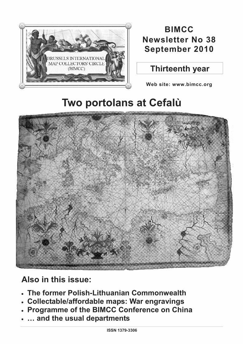
Two portolans at Cefalù

BIMCC Newsletter No 38 September 2010 2
LIBRAIRIE GROMMEN Rue du Pont 33 B-4000 Liège
Tél. +32(0)4 222 24 48 Fax +32(0)4 222 24 49
Dealer and Auctionner of rare books.
manuscripts, prints, maps & travel photography
Catalogues can be seen on www.librairiegrommen.be
Email : [email protected]
André Vanden Eynde
Rue de Stassart 59 B-1050 Brussels
Tel. +32 (0)2 514 40 47
Maps, prints, views of all parts of the world
Specialist in plans and views of Brussels
Elisabeth Hermans Old Maps and Prints
Grand Sablon 8 - 9
Grote Zavel 8 - 9 1000 Brussels
Tel. +32 11 31 17 19 Fax +32 11 31 66 96 Mobile 0475 61 38 53
Cartographica Neerlandica The Ortelius Specialist
Soestdijkseweg 101
NL - 3721 AA Bilthoven Tel. +31 30 220 23 96
E-mail: [email protected] www.orteliusmaps.com
30% korting op alle cartografische prenten
bij
De Slegte
Kijk voor de adressen en openingstijden van onze winkels op: www.DeSlegte.com
Leden van de BIMCC krijgen op vertoon van deze advertentie
30% korting op alle cartografische prenten bij boekhandel De Slegte.
De korting geldt niet voor bestellingen via onze website en kan niet met andere kortingen worden gecombineerd.
Paul Bremmers Antiquariaat Antique Maps and Prints
Brusselsestraat 91
Maastricht
Tel: +31 43 3253762 www.paulbremmers.com [email protected]
Grafiek en oude kaartenGrafiek en oude kaartenGrafiek en oude kaartenGrafiek en oude kaarten
Aankoop en verkoopAankoop en verkoopAankoop en verkoopAankoop en verkoop Rob Camp Tel. +32(0)11 596338Rob Camp Tel. +32(0)11 596338Rob Camp Tel. +32(0)11 596338Rob Camp Tel. +32(0)11 596338
Beursstraat 46Beursstraat 46Beursstraat 46Beursstraat 46 Gsm +32(0)498 772505 Gsm +32(0)498 772505 Gsm +32(0)498 772505 Gsm +32(0)498 772505
3832 Ulbeek3832 Ulbeek3832 Ulbeek3832 Ulbeek–––– Wellen Fax+32(0)11 596338 Wellen Fax+32(0)11 596338 Wellen Fax+32(0)11 596338 Wellen Fax+32(0)11 596338 www.lexwww.lexwww.lexwww.lex----antiqua.beantiqua.beantiqua.beantiqua.be [email protected]@[email protected]@lex----antiqua.beantiqua.beantiqua.beantiqua.be
Your specialist in conservation and restor-ing of maps, prints, manuscripts and books.
For more information see the internet. Inquire for free estimates.
Panovenweg 40 NL - 5708 HR Helmond Tel. + 31492553990 E-mail: [email protected] Internet: www.r-ah.nl
September 2010 BIMCC Newsletter No 38 3 3
Dear Map Friends,
The ‘international’ character of our Circle has rarely been so well illustrated as in this Newsletter: thanks to his Polish connections, Peter Galezowski first takes us to countries on the eastern edge of Europe (Belarus, Lithuania, Poland and Ukraine); Wulf then takes us around the Mediterranean, and the Aegean in particular, through his study of two portolans in Sicily; finally, after touching on the map of France and the history of Middelburg (in the Netherlands), we give you a preview of the next BIMCC Conference devoted to China.
Do register early for both coming events, the excursion to Middelburg (29 October) and the Conference on China (5 December); the number of participants is limited!
Cartographically yours.
Jean-Louis Renteux
Editor [email protected]
EDITORIAL
Contents
Pictures at an exhibition Highlights of Polish and European cartography in Warsaw La Mer à l'Encre [The sea in ink!]
4 6
Looks at books De Ptolémée à La Guillotière (XVe - XVIe siècle) –
[From Ptolemy to La Guillotière (15th - 16th century)] The Island of Lost Maps
8 10
History and Cartography The former Polish-Lithuanian Commonwealth as depicted in albums and atlases A surprise encounter: two portolans at Cefalù, attributed to Placido Caloiro e Oliva
11 16
Collectable/affordable maps War engravings
24
BIMCC news
BIMCC Programme for 2010: Autumn excursion to Middelburg A brief history and the evolution of a city through maps China by Jodocus Hondius The Verbiest – Chinese Celestial globe
BIMCC Annual Conference and exhibition on China
26
28 29 30
International news & events 32
Auction calendar 37
Cover: The Mediterranean, attributed to Placido Caloiro e Oliva, first half 17th century. (described as Chart B in the article on page 16) © Fondazione culturale Mandralisca, Cefalù

BIMCC Newsletter No 38 September 2010 4
PICTURES AT AN EXHIBITION I
Highlights of Polish and European cartography in Warsaw
The opening of the Royal Castle Library in Warsaw on 14 June 2010 (see Newsletter No 37) was accompanied by a cartographical exhibition curated by Dr Kazimierz Kozica, and designed to highlight, through some of the finest maps and views from the recently-acquired Niewodniczanski Collection, the interaction between Polish and European cartography and topography over the course of history.
Interestingly, there seemed to be two parallel strands running through the exhibition: the contribution made to the development of European
cartography by Polish cartographers, and conversely, the contribution made to the development of Polish cartography by foreigners, usually but not always in the service of some of Poland's more cartographically-minded monarchs.
The earliest map on display was the first modern Tabula Moderna to stretch across the whole of Central and Eastern Europe and encompass, according to the title, Polonie Ungarie Boemie Germanie Rvssie Lithvanie. Published in Rome by Marco Beneventano in 1507, it was drawn in cooperation with Bernard Wapowski, the father of Polish cartography, and is the first map to mention Poland in the title. Waclaw Grodecki's Poloniae Litvaniaeq. Descriptio, the later state is shown here, had enormous influence on Western cartography, mainly on account of its inclusion by Abraham Ortelius in his atlases as from 1570. In the same year another notable product of Renaissance cartography in Poland was published in Venice, Andrzej Pograbka's Partis Sarmatiae Europeae, of which only a few copies are known. Tomasz Makowski's Magni Ducatus Lithvaniae, first published by Willem Blaeu in Amsterdam in 1613 – the state on display here dates from 1631 – is a landmark representation of the lands comprised in the eastern half of the Polish-Lithuanian Commonwealth.
Antiquariaat SANDERUS F. Devroe
Old maps, atlases and prints
Nederkouter 32 9000 Gent
Tel +32(0)9 223 35 90 Fax +32(0)9 223 39 71
www.sanderusmaps.com E-mail: [email protected]
Paulus Swaen Internet Map Auctions
March-May-September-November
Maps, Globes, Views, Atlases, Prints
Catalogue on: www.swaen.com E-mail: [email protected]
Tel. +1 727 687 32 98
September 2010 BIMCC Newsletter No 38 5 5
The skills of non-Polish cartographers were also much in evidence in the exhibition. In 1593 Gerard de Jode inserted a profile portrait of King Sigismund III Vasa in his Poloniae amplissimi regnii, published in Antwerp. In 1658 Antonius Gudicanus drew his Nova Descriptio Totius Regni Polonici in the form of an eagle, the country's national symbol, an image which is perhaps Poland's answer to the Leo Belgicus. And half a century later the Amsterdam publisher Chatelain included in his own atlas a Carte de Pologne attributed to Nicolas Gueudeville, showing regional coats of arms and setting forth a chronology of the country's monarchs. The splendours of the Amsterdam, Nuremberg and Paris publishers were not overlooked: Carel Allard, Jakob Sandrart, Guillaume Sanson and Hubert Jaillot, all produced highly decorative images of the country at its greatest extent, if not at the height of its fortunes, in the 17th century.
France's notable contribution to Polish and European cartography was evidenced above all by the first scientifically-measured map of Ukraine, Delineatio Generalis Camporum Desertorum vulgo Ukraina, drawn by Guillaume Vasseur de Beauplan, an army engineer from Rouen who had entered the service of King Wladyslaw IV Vasa. First published by Wilhelm Hondius in Gdansk in 1648, this map subsequently reappeared in modified form in many of the best-known 17th century atlases and consequently exerted enormous influence on the image of this part of Europe in Western cartography. A century later, in 1753, Johann Friedrich Endersch, mathematician to the Saxon court, drew an accurate image of the mouth of the Vistula in his Mappa Geographica Trivm Insularum in Prussia.
Not long after his election in 1763, the enlightened Stanislas August Poniatowski, last King of Poland, succeeded in attracting several prominent French and Italian artists and cartographers to his court. In 1770 the Venetian Bartolomeo Folino engraved a large scale Carte Generale et Nouvelle de toutte la Pologne, noteworthy in that it shows the country's roads. This was followed two years later by Giovanni Rizzi-Zannoni's Carte de la Pologne, an atlas of Poland - assembled here into a magnificent wall map - which constitutes the first modern representation of the country. The maps of Poland's central regions and of the area around Warsaw by the royal cartographer Charles De Perthees, based on accurate surveys and published in Paris after 1792, are outstanding in terms of accuracy of detail.
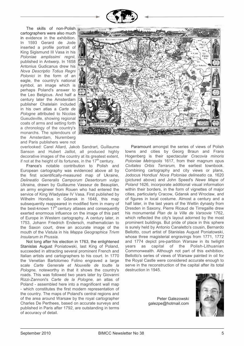
Paramount amongst the series of views of Polish towns and cities by Georg Braun and Frans Hogenberg is their spectacular Cracovia minoris Poloniae Metropolis 1617, from their magnum opus Civitates Orbis Terrarum, the earliest townbook. Combining cartography and city views or plans, Jodocus Hondius' Nova Poloniae delineatio ca. 1620 (pictured above) and John Speed's Newe Mape of Poland 1626, incorporate additional visual information within their borders, in the form of vignettes of major cities, particularly Cracow, Gdansk and Wroclaw, and of figures in local costume. Almost a century and a half later, in the last years of the Wettin dynasty from Dresden in Saxony, Pierre Ricaud de Tirregaille drew his monumental Plan de la Ville de Varsovie 1762, which reflected the city's layout adorned by the most prominent buildings. But pride of place in this sphere is surely held by Antonio Canaletto's cousin, Bernardo Bellotto, court artist of Stanislas August Poniatowski, whose three magisterial engravings from 1771, 1772 and 1774 depict pre-partition Warsaw in its twilight years as capital of the Polish-Lithuanian Commonwealth. Although not part of this exhibition, Bellotto's series of views of Warsaw painted in oil for the Royal Castle were considered accurate enough to serve in the reconstruction of the capital after its total destruction in 1945.
Peter Galezowski [email protected]
BIMCC Newsletter No 38 September 2010 6
PICTURES AT AN EXHIBITION II
La Mer à l'Encre – Trois siècles de cartes marines – XVIe – XVIIIe siècles (The sea in ink – Three centuries of sea charts – 16th-18th centuries) Corderie Royale – Rochefort-sur-mer, until 31 December 2011
The exhibition, on display until 31 December 2011 in Rochefort (Charente Maritime, France) in the showrooms of the Royal Rope Factory1, was conceived and realised in collaboration with the Department of Defence history of Vincennes and its local branch of Rochefort.
The exhibition focuses on three areas: • A p resen ta t i on o f t he
cartographic production in Normandy during the 16th and 17th centuries;
• A presentation dedicated entirely to the Neptune François (published in 1693), the general cartographic work completed on the initiative of Colbert, minister of Louis XIV;
• Finally, through filmed theatre and projected video, the visitor is invited to attend a debate between a cartographer of the 18th century engaged in calculations without end, and a captain focused on the avoidance of very real obstacles. Only the first two areas are reported here. The exhibition presents a rich iconography mostly
provided by the Bibliothèque Nationale de France and the Naval department of the Service Historique de la Défense of Vincennes together with ancient navigational instruments.
Cartographic production since the Middle Ages Before ‘Norman’ mapping, the exhibition presents:
• The so-called ‘Pisan’ map, the oldest known western chart representing full details of the Mediterranean and more roughly the Atlantic coast and the Channel, probably drawn around 1290 in Genoa;
• The Portolan Chart certainly executed in Palma de Mallorca in 1339 and signed by Angelino Dulcert, the first known Catalan map. This manuscript map on parchment includes a rich nomenclature of the hinterland together with the representation of mountain ranges, rivers and lakes, even Mansa Musa, emperor of Mali, appears;
• The Travels or Book of Marvels (1410) of Jean de Mandeville.
Other sumptuous images are also presented, such as: • An excerpt from the Catalan Atlas describing the Far East by Abraham Cresques , 1375 (reported in 1380 as being from the library of Charles V, king of France); • The ‘Planisphere’ or ‘Cantino World Map’ of Alberto Cantino (about 1502) that marks the end of the medieval era and represents the divide of the world between Spain and Portugal as a result of the Treaty of Tordesillas of 1494; • The Map of Atlantic from the Miller Atlas of Lopo Homem, 1519. The so-called Norman maps appeared later and their production is linked to economic development in Normandy. Norman mapping developed around the port of
Dieppe under the leadership of major ship-owners from Dieppe, like Jean Ango (1480-1551). The Dieppe school is particularly active between 1540 and 1634, its golden age being between 1540 and 1580. This school is in fact the city school of hydrography where the art of navigation was taught. The school was mainly led by the priest Pierre Desceliers (1487-1553) and cartographers, from Nicolas Desliens to Jacques de Vau de Claye including Jean Rotz, Nicolas Vallard, Pierre Descelliers, Guillaume Le Testu and Jean Cosson. The reputation of Norman cartography continues until the 17th century thanks to the pilots Pierre de Vaulx and Jean Guérard.
The Universal Cosmography of 1556 by Guillaume Le Testu is an example of the persistence of a phantasmagorical representation of the world in opposition to an increasingly concrete awareness of the actual world.
More modest, the Conquet School shines in Britanny through Guillaume Brouscou who in 1548 published the Manual of navigation for the use of Breton sailors.
The exhibition also addresses the complexity of the maps and their impact on the art of navigation at sea, with excerpts from the Diary of Francis Drake, as well as on the art of sailing close to the coast, with excerpts from the Great rudder of the sea by Pierre Garcie called Ferrande, Venetian coastal trade master, which was reprinted 25 times between 1518 and 1643.
From the 16th to the 17th century, the Netherlands
1 For practical details, see page 36
September 2010 BIMCC Newsletter No 38 7 7
dominated the world of cartography, Amsterdam taking over from Antwerp. The first land or sea atlases came from the Netherlands and their production occupied several publishers such as Hondius and Blaeu. The marine atlas of Johannes Janssonius (1588-1664) published in 1650 in the fifth part of his Atlas novus is displayed in the exhibition together with a copy of the famous 1587's ‘Mirror of the sea’ (Spieghel der Zeevaerdt) of Lucas Janszoon Waghenaer. After this publication, the name of ‘Waggoners’ was given for some time to sea atlases. Alongside commercial map production, the VOC (Verenigde Oost-Indische Compagnie - United Dutch East India Company) had its own cartographers since 1612. Their task was to provide navigators with the necessary manuscript charts and to use the information collected by navigators. From 1633 to 1705, the Blaeus were the chart makers of the VOC.
The French Neptune Despite the magnificent achievements of
Normandy, France remained a minor player in European cartographic production until the second half of the 17th century. The Navy plays a vital role in the protective system of Colbert who no longer wants to depend on foreign countries for the construction of vessels, crewing or chart making. This led to the creation of the Paris Observatory (founded in 1667) and the Academy of Sciences which publishes since 1679 the Knowledge of Time designed to provide sailors with tables giving the precise position of the main stars in the sky. Quite naturally, Colbert will call upon Louis-Nicolas de Clerville (1610-1677), Commissioner General of Fortifications, to map the coasts of the ocean from Dunkerque to Bayonne. The work thus produced is the first real attempt to represent the coastline to a satisfactory scale and according to surveys carried out in the field. But they
are too faulty and limited in scope with the result that the Clerville mapping is too vague.
In 1671, the Chevalier de Clerville is replaced by a military engineer, La Favolière. To avoid inaccurate maps causing shipwrecks, La Favolière gives a key role to the seamarks, the bathymetry and the systematic representation of banks and shoals: charting finally enters the age of hydrography. The work is emblematic of La Favolière’s contribution and the novelty to what became in 1693 the Neptune François. The book comprises 29 maps showing the European coasts from Norway to Gibraltar.
Counterfeited and imitated abroad (even at the time of its publication in France by Pieter Mortier, the Dutch bookseller in Amsterdam), the Neptune François is not very well received in France where sailors are confused by the most innovative features, including the Mercator projection. It will be forgotten for several decades and the copper plates will be purchased by the French Department of the Navy in 1751 and filed in the Dépot des Cartes et Plans of the Navy, founded in 1720. A second edition of the Neptune François is published in 1753 using the original copper plates supplemented and corrected on some points by Jacques-Nicolas Bellin, official hydrographer of the Navy. A third edition appeared in 1773 and a final edition published in 1806 by the Imperial Printing press. The Neptune François will be supplanted in the early 19th century by the French Pilot of Beautemps-Beaupré.
The exhibition features a copy of the ‘Neptune François’ (which, fortunately, did not suffer from the flood following the storm Xynthia on 28 February 2010) and an ‘electronic’ version which you can browse pages and admire the magnificent images of the French coastline.
As an extension to the exhibition of the Royal
Rope Factory, the National Naval Museum of Rochefort presents the exhibition ‘Tracez la route ! – Cartes et marins, hier et demain’ (Draw your route. Charts and sailors, yesterday and to-morrow). It is a journey through time from world maps, coastal and seabed charts, including among other things, an interactive area, allowing visitors to try a 3D simulation software on learning how to get a boat licence.
Claude Leclerc [email protected]
References: • La mer à l'encre, trois siècles de cartes marines du Moyen Age au siècle des Lumières (exhibition catalogue)
• Les cahiers de la Corderie / au large © Corderie Royale – Centre International de la Mer, 2010
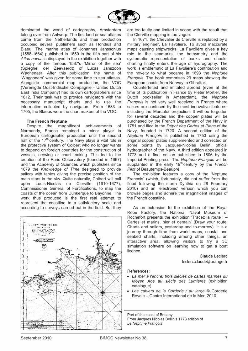
Part of the coast of Brittany From Jacques Nicolas Bellin’s 1773 edition of Le Neptune François
BIMCC Newsletter No 38 September 2010 8
LOOKS AT BOOKS I
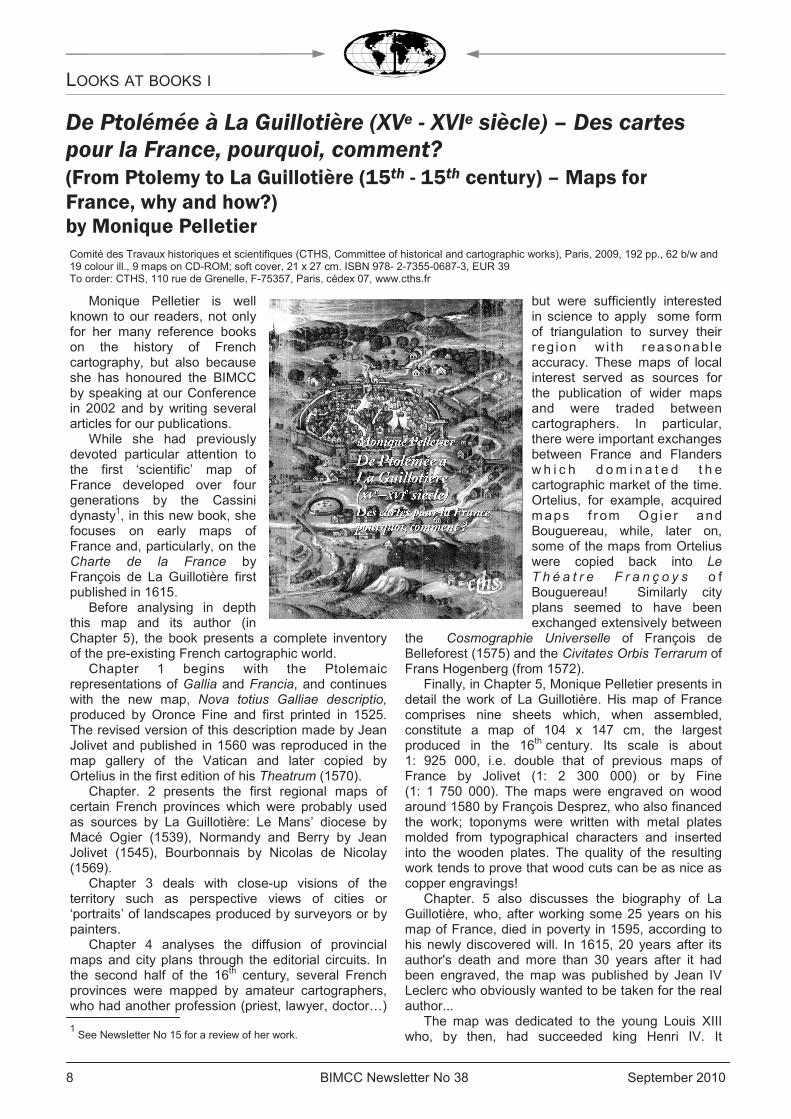
De Ptolémée à La Guillotière (XVe - XVIe siècle) – Des cartes pour la France, pourquoi, comment? (From Ptolemy to La Guillotière (15th - 15th century) – Maps for
France, why and how?) by Monique Pelletier Comité des Travaux historiques et scientifiques (CTHS, Committee of historical and cartographic works), Paris, 2009, 192 pp., 62 b/w and 19 colour ill., 9 maps on CD-ROM; soft cover, 21 x 27 cm. ISBN 978- 2-7355-0687-3, EUR 39 To order: CTHS, 110 rue de Grenelle, F-75357, Paris, cédex 07, www.cths.fr
Monique Pelletier is well known to our readers, not only for her many reference books on the history of French cartography, but also because she has honoured the BIMCC by speaking at our Conference in 2002 and by writing several articles for our publications.
While she had previously devoted particular attention to the first ‘scientific’ map of France developed over four generations by the Cassini dynasty1, in this new book, she focuses on early maps of France and, particularly, on the Charte de la France by François de La Guillotière first published in 1615.
Before analysing in depth this map and its author (in Chapter 5), the book presents a complete inventory of the pre-existing French cartographic world.
Chapter 1 begins with the Ptolemaic representations of Gallia and Francia, and continues with the new map, Nova totius Galliae descriptio, produced by Oronce Fine and first printed in 1525. The revised version of this description made by Jean Jolivet and published in 1560 was reproduced in the map gallery of the Vatican and later copied by Ortelius in the first edition of his Theatrum (1570).
Chapter. 2 presents the first regional maps of certain French provinces which were probably used as sources by La Guillotière: Le Mans’ diocese by Macé Ogier (1539), Normandy and Berry by Jean Jolivet (1545), Bourbonnais by Nicolas de Nicolay (1569).
Chapter 3 deals with close-up visions of the territory such as perspective views of cities or ‘portraits’ of landscapes produced by surveyors or by painters.
Chapter 4 analyses the diffusion of provincial maps and city plans through the editorial circuits. In the second half of the 16th century, several French provinces were mapped by amateur cartographers, who had another profession (priest, lawyer, doctor…)
but were sufficiently interested in science to apply some form of triangulation to survey their reg ion w i th reasonab le accuracy. These maps of local interest served as sources for the publication of wider maps and were traded between cartographers. In particular, there were important exchanges between France and Flanders w h i c h d om i n a t e d t h e cartographic market of the time. Ortelius, for example, acquired maps f r om Og ie r and Bouguereau, while, later on, some of the maps from Ortelius were copied back into Le T h é a t r e F r a n ç o y s o f Bouguereau! Similarly city plans seemed to have been exchanged extensively between
the Cosmographie Universelle of François de Belleforest (1575) and the Civitates Orbis Terrarum of Frans Hogenberg (from 1572).
Finally, in Chapter 5, Monique Pelletier presents in detail the work of La Guillotière. His map of France comprises nine sheets which, when assembled, constitute a map of 104 x 147 cm, the largest produced in the 16th century. Its scale is about 1: 925 000, i.e. double that of previous maps of France by Jolivet (1: 2 300 000) or by Fine (1: 1 750 000). The maps were engraved on wood around 1580 by François Desprez, who also financed the work; toponyms were written with metal plates molded from typographical characters and inserted into the wooden plates. The quality of the resulting work tends to prove that wood cuts can be as nice as copper engravings!
Chapter. 5 also discusses the biography of La Guillotière, who, after working some 25 years on his map of France, died in poverty in 1595, according to his newly discovered will. In 1615, 20 years after its author's death and more than 30 years after it had been engraved, the map was published by Jean IV Leclerc who obviously wanted to be taken for the real author...
The map was dedicated to the young Louis XIII who, by then, had succeeded king Henri IV. It
1 See Newsletter No 15 for a review of her work.

September 2010 BIMCC Newsletter No 38 9 9
depicted not only French territory enlarged through the reign of ‘Henri le Grand’, but extended far to the east well into Germany and northern Italy; this was justified by reference to the ancient notion of Gaul which was much larger than France.
In this chapter, Monique Pelletier analyses all the aspects of the Charte: accuracy, contents, presentation and décor, successive editions and sources used.
The accuracy of latitudes is compared to that of contemporary maps of France: it is better than Jolivet, but not as good as Fine. The accuracy is also assessed by comparing distances between city pairs with a modern map; the errors range from –13% to +11% within France proper. Errors tend to be larger in northern Spain, in Italy and in Germany.
These variations in accuracy are probably due to the variety of sources used and the method employed to combine them. La Guillotière did not start from a pre-existing map of France (such as Jolivet’s) but compiled the provincial maps available, including some of his own making (e.g. Normandy), as well as maps of neighbouring countries to cover the eastern part of his Charte. La Guillotière did not just copy and assemble these sources; he drew his map based on the canvas constituted by the coast lines and the hydrological network, and he positioned the various localities with respect to this network.
The book is very well documented and the numerous bibliographical references reflect the vast historical and cartographic culture of the author. An index and a rich bibliography (8 pages) complement it.
There is also a CD-ROM inserted in the book cover. It contains ten pictures (in jpeg format, with 8 to 10 Mb each): the nine sheets and the assembled map. This allows one to zoom in on the details of any map and to print a subset of one’s favourite area.
Jean-Louis Renteux [email protected]
Detail of the north-west sheet of the Charte de la France’ (Bibliothèque nationale de France, Cartes et Plans, Ge C 22 500)
Detail showing, on top of Zeeland, the arms of the kingdoms of France and Navarra

BIMCC Newsletter No 38 September 2010 10
LOOKS AT BOOKS II
The Island of Lost Maps: A True Story of Cartographic Crime by Miles Harvey
Phoenix paperback, London, 2002 (first published 2001), 405 pp., 15 b/w ill., soft cover, 13 x 20 cm. ISBN 0 75381-315-7, GBP 7.99
This book looks, and reads, like a novel. Yet it is not fiction and its subject-matter is quite serious.
It centres on the story of Gilbert Bland (also known under many other names) who became famous – or rather infamous – in 1995, as the ‘greatest American map thief in history’. He stole hundreds of maps from a number of reputed libraries across the US and British Columbia, with incredible ease; he just slashed pages out of books and atlases with a razor blade… until someone caught him in the act at the Peabody Library in Baltimore on 7 December 1995. He was arrested… and released after giving 700 $ in cash to the Library to compensate for the damage inflicted on four books, a petty crime in the eyes of the Baltimore police! However, a notebook he left behind revealed that Bland was not just an occasional map thief, but that he was systematically visiting major libraries with a shopping list of ancient maps for which he had identified potential buyers. This triggered a warning to be issued to all libraries concerned, through the Ex Libris Internet discussion group. The FBI got involved but only managed to arrest Bland on 2 January 1996, leaving him enough time to remove his stock from his Antique Maps shop near Fort Lauderdale, Florida.
This allowed Bland to negotiate a plea bargain for a reduced sentence (he spent less than 17 months in prison for his cartographic crimes), against the restitution of stolen maps. His cache contained some
150 antique maps, and 100 more were ret r ieved f rom his customers; the total was then worth about half a million US dollars. Strangely enough, the FBI had a difficult time returning these maps to their legal owners; after two years (long after Bland had been released from jail), only 180 maps out of 250 had been returned; many libraries were unaware that maps had been cut out of their books or atlases, or they would not admit that their security system could be deficient… The positive side of this deplorable story is that security has now been reinforced in libraries around the world.* Author Miles Harvey spent four years investigating this case, trying to understand Gilbert Bland’s motivations, and he
provides lots of background information on his past. The episodes of this cartographic crime spree are also interleaved with chapters exploring various aspects of the world of maps: history of cartography and exploration, libraries and librarians, map collectors, map dealers and map auctions, etc. Some philosophical and literary digressions are not really indispensable, but, overall, this book is a good read and also a lively introduction to the universe of map collecting.
Jean-Louis Renteux
* According to MapHist (http://mailman.geo.uu.nl/pipermail/maphist/2008-January/011131.html), Gilbert Bland might have been active again in the map business in 2008…
September 2010 BIMCC Newsletter No 38 11 11
The former Polish-Lithuanian Commonwealth as depicted in albums and atlases
by Dr Lucyna Szaniawska (translated and edited by Peter Galezowski)
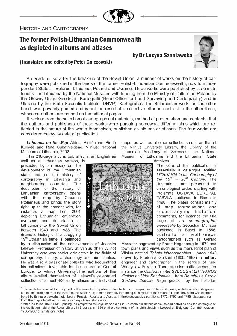
Lithuania on the Map. Aldona Bieliūniené, Biruté Kulnyté and Rūta Subatniekiené, Vilnius: National Museum of Lithuania, 2002.
This 218-page album, published in an English as well as a Lithuanian version, is preceded by an essay on the development of the Lithuanian state and on the history of cartography in Lithuania and neighbouring countries. The description of the history of Lithuanian cartography opens with the map by Claudius Ptolemeus and brings the story right up to the present with, for instance, a map from 2001 depicting Lithuanian emigration overseas and deportation of Lithuanians to the Soviet Union between 1940 and 1988. The dramatic history of the struggling 19th Lithuanian state is balanced by a discussion of the achievements of Joachim Lelewel, Professor of history at Vilnius (then Wilno) University who was particularly active in the fields of cartography, history, archaeology and numismatics. He was also a passionate collector who bequeathed his collections, invaluable for the cultures of Central Europe, to Vilnius University2.The authors of this album availed themselves of Lelewel’s celebrated collection of almost 400 early atlases and individual
maps, as well as of other collections such as that of the Vilnius University Library, the Library of the Lithuanian Academy of Sciences, the National Museum of Lithuania and the Lithuanian State
Archives. The core of the publication is essentially a catalogue entitled LITHUANIA in the Cartography of the 15
th – 20
th Century. The
illustrations are presented in chronological order, starting with Ptolemy's OCTAVA EUROPAE TABVLA published in Rome in 1490. The plates consist mainly of map reproductions and a c c ompan y i n g h i s t o r i c a l documents, for instance the title page of La cosmographie universelle by Sebastian Münster published in Basel in 1556, p o r t r a i t s o f we l l - k nown cartographers such as Gerard
Mercator engraved by Franz Hogenberg in 1574,and town plans and views such as the manuscript plan of Vilnius entitled Tabula ichonographica... Anno 1648 drawn by Frederick Getkant (1600–1668), a military engineer and cartographer in the service of King Wladyslaw IV Vasa. There are also battle scenes, for instance the Conflictus inter SVECOS et LITHVANOS dimidio ab Urbe Sandomiria... from De rebus a Carolo Gustavo Sueciae Rege gestis... by the historian
1 These states were all formerly part of the so-called Republic of Two Nations or pre-partition Poland-Lithuania, a state which at its great-est extent stretched from the Baltic to the Black Sea; it came formally into being as a result of the Union of Lublin 1569 and was dismem-bered by its more powerful neighbours, Prussia, Russia and Austria, in three successive partitions, 1772, 1793 and 1795, disappearing from the map altogether for over a century (Translator’s note). ² After the failed 1830-1831 uprising, he emigrated to Belgium and died in Brussels; for details of his life and activities see the catalogue of the exhibition held at the Royal Library in Brussels in 1986 on the bicentenary of his birth ‘Joachim Lelewel en Belgique. Commémoration 1786-1986’ (Translator’s note).
HISTORY AND CARTOGRAPHY
A decade or so after the break-up of the Soviet Union, a number of works on the history of car-tography were published in the lands of the former Polish-Lithuanian Commonwealth, now four inde-pendent States – Belarus, Lithuania, Poland and Ukraine. Three works were published by state insti-tutions – in Lithuania by the National Museum with funding from the Ministry of Culture, in Poland by the Główny Urząd Geodezji i Kartografii (Head Office for Land Surveying and Cartography) and in Ukraine by the State Scientific Institute (DNVP) ‘Kartografia’. The Belarussian work, on the other hand, was privately printed and is not the result of a collective effort in contrast to the other three, whose co-authors are named on the editorial pages.
It is clear from the selection of cartographical materials, method of presentation and contents, that the authors and publishers of these works were pursuing somewhat differing aims which are re-flected in the nature of the works themselves, published as albums or atlases. The four works are considered below by date of publication.
BIMCC Newsletter No 38 September 2010 12
Samuel Pufendorf, drawn by Erik Dahlbergh and published in Nuremberg in 1696, and some photographs depicting for instance officers of the Army's Topographical Service demarcating the Lithuanian-Soviet border in 1939. The illustrations are described and in places accompanied by a brief historical commentary.
Alternating with each other in chronological order are maps of Europe, the Polish-Lithuanian Commonwealth, Russia, the Baltic, Livonia and Prussia, which together with other historical documents make up the image of Lithuania. At the end, there is an annex with an index of persons, bibliographies and English translations of Latin texts accompanying the maps (Fig.1), for instance the description LITHVANIA DVCATVS. Samogitia, Russia & Volhinia printed on the verso of the map of Lithuania in 17th century editions of Mercator's atlas.
Fig. 1 Note on the Polesian marshes from Tomasz Ma-kowski’s Magni Ducatus Lithuaniae 1613.
3 This work has recently been supplemented by a second volume, bearing the same title, published by the same team in 2009 and cover-ing the period from the mid-17th to the second half of the 18th century (Translator’s note).
Ukraina na starodavnih kartah. Kinec’ XV – perša polovina XVII st. (Ukraine on old maps – from the end of the 15
th to the first half of the
17th
century). M. Vavričin, Â. Daškevič and U. Krištalovič. Kiev: State Scientific Institute (DNVP) ‘Kartografiâ’, 2004
This album, which contains 207 pages and is in Ukrainian and English, is authored by three historical cartographers from Lviv in Ukraine, and is preceded by an introduction by Rostyslav Sossa in which the Uk r a i n i an t r ad i t i o n o f map reproduction is described together with a brief account of the cartographical holdings of two Lviv scientific institutions (the Vasyl Stefanyk Library and the Ivan Franko Library). The purpose of the work is also set out. 3
In contrast to the Lithuanian album, the Ukrainian one merely describes and reproduces maps and is concerned entirely with the history of cartography. The chronological span is shorter, and embraces two centuries, from the end of the 15th to the middle of the 17th century. As in the Lithuanian album, each plate is a map, described in full. There is a technical section setting forth the name of the author, publisher and engraver, the title of the work from which the map is taken, printing technique, dimensions and the language of the map. An accompanying text specifies the map’s contents and extent, setting out the names of mountains, rivers and other features in areas lying within present-day Ukraine. Finally, the cartographical sources used by the map’s author and its later derivatives are given. The chronological order is strictly observed, as in printed catalogues. The maps
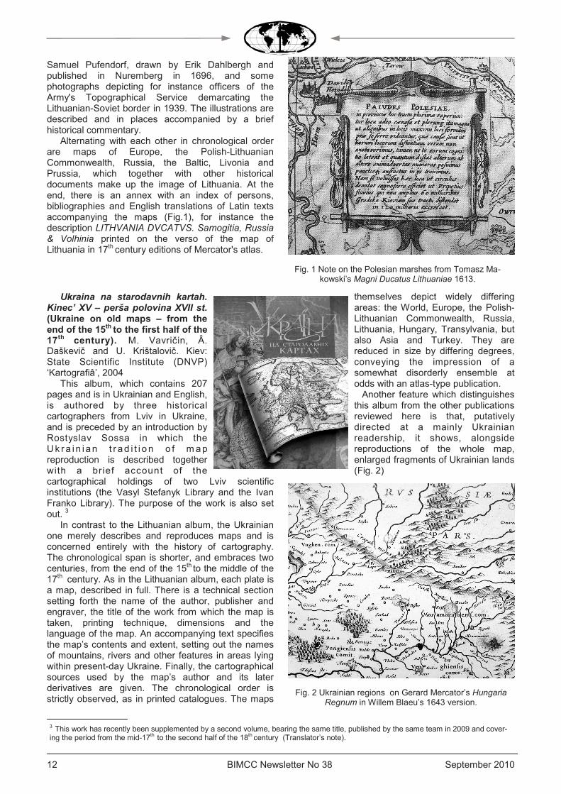
themselves depict widely differing areas: the World, Europe, the Polish-Lithuanian Commonwealth, Russia, Lithuania, Hungary, Transylvania, but also Asia and Turkey. They are reduced in size by differing degrees, conveying the impression of a somewhat disorderly ensemble at odds with an atlas-type publication. Another feature which distinguishes this album from the other publications reviewed here is that, putatively directed at a mainly Ukrainian readership, it shows, alongside reproductions of the whole map, enlarged fragments of Ukrainian lands
(Fig. 2)
Fig. 2 Ukrainian regions on Gerard Mercator’s Hungaria Regnum in Willem Blaeu’s 1643 version.

September 2010 BIMCC Newsletter No 38 13 13
Staražy tna ja ka r tagra f i j a Bie la rusi (Be la rus in o ld cartography). Lev R. Kozlov, Minsk: ‘Arty-Feks’, 2005
This 46-page at las, which comprises maps published between 1570 and 1821 and is in Belarussian, is described as an album by the author, a historian who has for many years been dealing with the history of cartography of the Belarussian lands. In his introduction, entitled Lectori salutem, which suggests that the work is intended to be as reader-friendly as possible, the author encourages readers to learn about „the lands in which their ancestors lived”. And the reproductions have been prepared in such a way as to make the maps highly readable. The author did not attempt to produce a coloured album which appeals to the eye, but selected black and white maps in which the contents and names have not been obscured by colours. The atlas can thus usefully serve as a sourcebook.
As in the Ukrainian album, only reproductions of original maps are used as illustrations, although the underlying conception is different. All the maps are published on a scale of 1:1 or almost, and shown in
chronological and geographical order. They are grouped into three periods, the 16th/17th,18th and 19th centuries. Each group opens with a general map o f t h e P o l i s h - L i t h u a n i a n Commonwealth, or a fragment thereof: the first, with Wacław Grodecki’s representation, as updated by Andrzej Pograbka in 1570; the second, with Frederick de Wit’s Polonia from ca. 1706, the year of his death and the one by Henry Abraham Chatelain (1684–1743), published in his historical atlas in 1720; and the third, with the map by William Faden (1750–1836), published by James Wyld jr. (1812–1887) in 1841. They are followed by maps of the Grand
Duchy of Lithuania, and subsequently by detailed maps of individual voivodships (Nowogródek, Połock, Wilno and Mińsk) by Nicolas Sanson d’Abbeville (1600–1667) or of individual provinces (’guberniya’) (Wilno, Witebsk, Grodno, Mohylew and Mińsk), published by the St. Petersburg Academy of Sciences in 1820 or 1821. The reproductions are preceded by short notes on the author and how the map came into being. The publication closes with a selected literature and the announcement of a further volume to come.
Polonia. Atlas map z XVI – XVIII wieku. (Polonia. An atlas of maps from the !6
th to the 18
th
century). Introduction by Professor
Stanislaw Alexandrowicz. Warsaw: Główny Urząd Geodezj i i Kartografii, 2005
This atlas opens with an introduction in Polish to the country’s cartographical heritage from the 16th to the 18th century by P r o f e s s o r S t a n i s l a w Alexandrowicz4.
The author starts from the premise that Amsterdam, Augsburg and Nuremberg publishers would have been unable to issue maps of the Polish lands unless measurements had previously been taken and maps previously been drawn to the appropriate standard in the Polish-Lithuanian Commonwealth. Polish maps compiled in the first half of the 16th century and published before 1650 frequently played a decisive role in the gradual design by the great West European cartographers, and primarily by Gerard Mercator, of the correct image of a substantial part of Europe.” He then proceeds to discuss selected maps showing Polish lands, starting with medieval mappae mundi such as Fra Mauro’s of 1459, through various Tabulae novae, Bernard Wapowski’s maps of Central Europe from 1526 and
1528, Stanisław Porębski’s map of the duchies of Oświęcim and Zator publ ished in 1570, Jerzy Freudenhammer’s map of 1645 depicting the Palatinate of Poznan, and Mikołaj Krzysztof Radziwiłł’s work on the Grand Duchy of Lithuania executed between 1569 and 1599, and engraved in Amsterdam in 1613 from a drawing by Tomasz Makowski. He also notes the contributions of foreign cartographers in the service of Poland's monarchs, such as the Frenchman Guillaume Le Vasseur
de Beauplan5 (- Ed) whose maps first appeared in Gdansk in 1648 and 1650 and were later published by Joan Blaeu in 1662, and the work of cartographers commissioned by Stanisław August Poniatowski, last king of Poland, and the learned and enlightened nobleman Aleksander Jabłonowski.
The publication comprises 54 plates, map reproductions accompanied by explanatory texts. The maps shown are from the collection of early maps of the Polish-Lithuanian Commonwealth assembled by Ewa Woźniak to project an image of the lands which lie, or once lay, within Poland’s borders, and of interest to contemporary scholars researching the history of Poland and of neighbouring countries.
4 one of Poland’s leading specialists in the history of cartography and author of the definitive work on the development of cartography in the Grand Duchy of Lithuania from the 15th to the mid-18th century (Translator’s note). 5 Beauplan was the author of the very first Description d’Ukraine, a landmark work published in Rouen in 1660 (Translator’s note).

BIMCC Newsletter No 38 September 2010 14
The arrangement is typical of the 16th and 17th
century atlases issued by the foremost Amsterdam publishers. Accordingly maps of the Commonwealth are preceded by images of the World and of Europe by way of introduction to the subject. General maps of the Commonwealth are followed by maps of its central regions and then by those of outlying parts, proceeding from north to south, namely Lithuania, Prussia, Western Pomerania, Greater Poland, Silesia and Ukraine. Two maps of the Baltic, which differ fundamentally from the others in the collection, are also included at the end. Within each group showing the same region, the maps are arranged in
chronological order according to the date of publication. The great majority of maps are reproduced on a scale of 1:1. Only larger maps, such as the map of the World by Henricus Hondius or Tomasz Makowski’s map of Lithuania had to be reduced.
The description of each map comprises its history and selected features and is compressed into a single column. The arrangement alongside each other of maps similar in content and extent was considered the best method for comparative purposes. Appropriate fragments were selected and arranged In columns adjoining the descriptive text for each map (Fig. 3).
Aside from the commentary, it is possible to
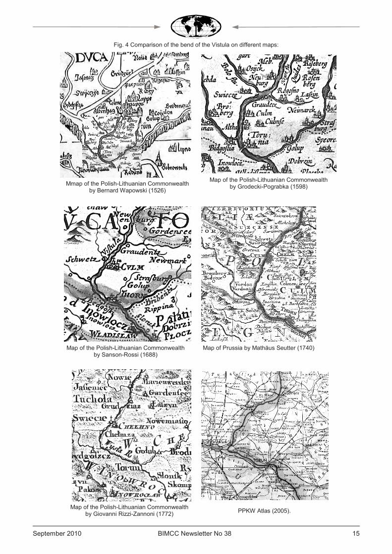
compare a large number of topographical features. Using a few images, for instance of the bend of the Vistula on its lower course, in the section between Torun and Grudziądz, it is possible to establish incontrovertibly the similarity or otherwise in the representation of that area. And on that basis, to contemplate the selection of cartographical materials and to draw conclusions as to a map's place in relation to others, and at times as to the authorship of earlier cartographical works. Between 1595 and 1740 the representation of that particular bend of the river was very similar on maps of Prussia. From Seutter’s map of Prussia (Fig. 4), for instance, it appears highly likely that this image was drawn in the absence of fresh measurements or fresh surveys on the ground. In other words, the cartographical representation of the image was left uncorrected. It is worth noting that generalisation was a very difficult task for cartographers, which is no doubt why that same area was shown differently practically every time on general maps of the Commonwealth between 1526 and 1772 (Fig. 4). It would seem, however, that it was no worse, and in the case of Giovanni Rizzi-Zannoni’s map was even better, than the image depicted on maps of Prussia from that period.
The publication ends with a bibliography of reference works citing over 80 titles and with an index of persons.
The four works discussed above, all published over a brief period, differ considerably from one another. At first sight, they all comprise maps properly printed in technical terms and can thus be classified as publications on the history of cartography, although they differ in other respects. The Lithuanian album is a history of the Lithuanian state told mainly in cartographical images. The authors of the Ukrainian album set themselves as their main task to retrieve an image of the Ukrainian lands from the most diverse cartographical materials. Similarly, the Belarussian and Polish atlases show their respective lands in an order of presentation that pro-ceeds from the general to the particular, although their chronological order differs somewhat. The Ukrainian album has more maps (119) than the others, although, as in the Lithuanian one, their geographical content cannot always be fully interpreted, which may hinder scholarly analysis or comparison. The chronological scope also varies, from very broad in the Lithuanian album to very narrow (two centuries) in the Belarussian one. Notwithstanding the divergence in the authors’ and editors’ intentions, the readers themselves will proba-bly reach out for these publications. The reason is quite simple: in all four countries, the history of cartography aroused in the past very little interest on the part of their own publishers.
Fig. 3 Sample page with fragments of maps discussed in the description.
September 2010 BIMCC Newsletter No 38 15 15
Fig. 4 Comparison of the bend of the Vistula on different maps:
Map of Prussia by Mathäus Seutter (1740)
Mmap of the Polish-Lithuanian Commonwealth by Bernard Wapowski (1526)
Map of the Polish-Lithuanian Commonwealth by Giovanni Rizzi-Zannoni (1772) PPKW Atlas (2005).
Map of the Polish-Lithuanian Commonwealth by Grodecki-Pograbka (1598)
Map of the Polish-Lithuanian Commonwealth by Sanson-Rossi (1688)

BIMCC Newsletter No 38 September 2010 16
HISTORY AND CARTOGRAPHY
A surprise encounter : two portolans at Cefalù, attributed to Placido Caloiro e Oliva
by Wulf Bodenstein [email protected]
1 Liliane Dufour, Antonio La Gumina, Imago Siciliae, Cartografia storica della Sicilia 1420-1860, Catania : Domenico Sanfilippo Editore, 2007. Cloth-bound in slip case, 32 x 33 cm. 332 pp., 228 maps illustrated in colour, and described. Visit www.dseditore.it. See also my review of the exhibition of Sicily maps from the La Gumina collection in Brussels, L’Isola a tre punte, in BIMCC Newsletter N° 12, January 2002, p. 7. 2 Le Guide du Routard, Sicile, Paris: Hachette, 2009, p. 485 3 See also Helen Wallis, Arthur Robinson (ed.), Cartographical Innovations, An International Handbook of Mapping Terms to 1900, Tring : Map Collector Publications, 1987, p. 12
In August 2009 my wife and I spent a week in Palermo, the ancient capital of Sicily. I had promi-sed that, this time, we would concentrate entirely on the historical sites and events, and turn a blind eye to anything cartographical. As it happened, I did not entirely honour my pledge. Firstly, I could not resist buying a rather lavishly illustrated book on maps of Sicily spotted in a book store1. Secondly, as we were considering visiting some places nearby, we found mention in our guide2 of a Museum in the small town of Cefalù, an hour’s train ride from Palermo, where there were supposed to be ‘antiques cartes marines’ (ancient sea charts), among the collection of historical artefacts and old books.
My wife, mustering her best Italian, phoned the Museum, only to be told that the Library was clo-sed to the public in August, and the curator was absent. We decided to give it a try anyway. The next day we found our way to the Museo Mandralisca in Cefalù. We separated from the stream of tourists visiting the rich archeological collections and repeated our request to see the charts in the Library. Finally, we were shown into the vestibule of the Library upstairs, where Dr Maria Teresa Dispenza, Administrative Director of the Mandralisca Cultural Foundation, very kindly listened to our request and, having switched to perfect English, asked us to come back in an hour’s time. What we then dis-covered was a big surprise : two portolans of the Mediterranean ! Let me try to shed some light on these. A closer examination of their cartographic content was facilitated when Dr Dispenza sent me colour photographs of the two charts and some documentation after our short visit. Prof Corradino Astengo (Genoa University), a specialist on ancient nautical charts and one of the distinguished speakers at our 5th International Conference in 2006, Charting the Seas, assisted with bibliographical support and advice.
The Museum’s Library The Museo (Fondazione culturale) Mandralisca is
at n° 13, Via Mandralisca, in 90015 Cefalù (PA). Its public library was established in 1853 with a donation by Enrico Piraino, Baron of Mandralisca. Among the 6 000 books are some rare volumes of the 16th century, for example works related to geography by Olaus Magnus, Giovanni Botero, Philippus Cluverius, and Ptolemy’s Geografia by Magini. These two portolans, acquired in the 1930’s, undoubtedly represent a highlight of this collection: one of the Aegean Sea, the other of the Mediterranean, both attributed to Placido Caloiro e Oliva of Messina, first half of the 17th century. They were last shown in public at the 2nd Exhibition of Ancient Books staged by the Mandralisca Foundation in Cefalù from 15 to 30 October 1994.
Portolan Charts A brief review of definitions, plus a summary of
some of their salient features, is perhaps appropriate here. Initially, the term ‘portolan’ (from the Italian portolano) referred to written sailing instructions or coast pilots (peripli). As of the middle of the 19th century however, the meaning of this term was extended, rightly or wrongly, to cover harbour-finding charts accompanying these sailing instructions, and ‘portolan chart’ became the denomination of a distinct cartographic genre3. This is, generally speaking, characterized by the following features: • manuscript, drawn in ink on treated animal skin
(calf or sheep) called ‘vellum’ and often skilfully embellished with flags, coats of arms, and other vignettes, at times with heightening in gold;
• although initially destined for navigation along the coasts of the Mediterranean and the Black Sea, portolan charts subsequently also covered parts of

September 2010 BIMCC Newsletter No 38 17 17
the Atlantic coasts of Europe and Africa and were ultimately produced in the form of planispheres, reflecting the results of European exploration;
• place names are written inland, perpendicular to the coast ; colouring conventions permit distinctions between places of varying importance;
• a network of rhumb lines covers the chart to permit plotting a route. These radiate from a central windrose and intersect with lines emanating from (usually) sixteen equidistant points on its periphery. The earliest of these charts dates back to the end
of the 13th century. It is the so-called Carte Pisane, thought to have been made in Genoa and now preserved in the Bibliothèque Nationale, Paris. The major centres of production of these manuscript charts were Genoa, Venice, Majorca, Naples, Messina, Marseilles. On account of their exposure to the harsh working conditions at sea and the wear and tear of time, comparatively few of the early individual portolan charts have survived, or have suffered more or less severe damage. However, when multiple charts were bound together in what could be called an atlas, such as the well-known Catalan Atlas (ca 1375),
the one by Battista Agnese (1546), or the Atlas Universal by Diogo Homem (ca 1565)4, they had a much better chance of survival.
A typical example of a portolan chart of the 16th century is that of Banet Panades, Messina, 1557 (now in the Museo Navale in Genoa5, Fig. 1) which I found in Corradino Astengo’s fundamental study and survey of 16th and 17th nautical cartography in the Mediterranean6. It clearly shows the shape of the animal’s skin, neck to the left. It depicts the shores of the Mediterranean and the Black Sea, with part of the Red Sea, tinted red. The centre of the system of windroses is to the East of Sardinia, and its straight-line radials of winds, the rhumb lines, intersect with those of the sixteen peripheral ones, every second one of these being artistically enhanced, with the exception of the one on the Aegean coast of Turkey where an extensive decoration would have obscured essential topographical details. The very dense succession of coastal toponyms inland are clearly visible, as are the town vignettes, flags with coats of arms, and the distance scales at top and bottom of the chart.
Fig. 1 Typical example of a portolan chart of the Mediterranean, by Banet Panades, Messina, 1557
4 See my reviews in respectively BIMCC Newsletter No 30 (January 2008, pp. 16-17) and BIMCC Newsletter No 14 (September 2002,
pp.10-11). 5 See BIMCC Newsletter No 32 (Sept. 2008) about this museum.
6 Astengo, 2000, Fig. 1.
BIMCC Newsletter No 38 September 2010 18
Some mysteries have surrounded portolans for a long time and continue to intrigue researchers. There is the question of their unknown origin : they turn up all of a sudden around 1290, in pointed contrast to the prevailing convention of medieval mappae mundi centered on Jerusalem. They also appear to have been drawn consistently with astounding geographical accuracy, at least as far as the shores of the Mediterranean basin and of the Black Sea were concerned. And they continued to be produced well beyond the time when their practical use for navigation at sea had come to an end, as they were replaced by more modern printed charts. However, to the extent that they progressively lost their utility, they gained in artistic style, a feature which may account, at least partly, for their longevity.
There is an abundant literature on these charts, and recent publications are frequently adorned with colour reproductions which convey the artistic dimension of great appeal, common to portolans in general. One of the best introductions to the subject at the moment is Prof Astengo’s contribution in Vol. 3 of the History of Cartography, concentrating on nautical charts of the 16th and 17th century in the Mediterranean chart making tradition7. He states that over 650 charts and atlases are held in public collections alone and estimates about one hundred more to be in private hands. Together with around 180 charts identified by Tony Campbell as originating prior to 15008 it may be assumed that nearly one thousand portolan charts and atlases have survived to this day. A recent census by Richard Pflederer9 updates this number to an astonishing 5 711 charts. Based on previous surveys by Campbell, Astengo and many other scholars, Pflederer’s analysis goes beyond these both in geographical coverage and time since he documents portolan holdings world-wide, recording individual charts and those bound into atlases, and extends the period of his research to the mid-18th century.
The two Cefalù portolans are, of course, registered in Astengo’s survey, and this entry has been copied into the Pflederer census.
General aspects and attribution of the Cefalù
portolan charts As far as could be ascertained, no complete study
of these two charts has been published so far. Let us therefore turn to Roberto Almagià, the renowned Italian historian of cartography who, in 1937, shortly after the two portolans had been added to the Library, published the following brief note on them in the Italian Geographical Journal, the Rivista Geografica Italiana10
(translation by Dominique & Wulf Bodenstein):
Two manuscript nautical charts in the Mandralisca Library of Cefalù.
Under the diligent leadership of the Director of the Mandralisca Library of Cefalù, Giovanni Cavalloro, the Library has recently acquired, from private hands, an antique cartographic treasure which merits being mentioned in this Journal. It concerns two nautical charts, certainly of Italian origin, that can be dated to the first half of the 17
th century. They are bound
together inside a parchment folder measuring about 40.5 x 28.7 cm, in which the charts, also drawn on parchment, are folded in the middle. I can give a brief description of these because, thanks to the generous support from the mentioned Librarian, I was able to examine this treasure in Rome. In its present state of conservation it shows heavy traces of wear and tear, worm holes, and some stains of humidity.
The first chart measures 54.5 x 38.7 cm, including a black border frame, and covers the entire Aegean. The outlines of coasts and islands are, as is customary, traced in various colours ; some islands (especially the smallest) are in full colour (green, pink, yellow, gold, brown, etc.). Chios is painted black, with a red cross, and Rhodos red with a black cross. The large number of toponyms are all in black, and in Italian. The windroses are made up of 32 winds. Along the left border is a banderole with the usual subdivision into 5 times 5 intervals (5 intervals = ca. 40 mm).
The second chart measures 56.4 x 39.5 cm and comprises the entire Mediterranean basin except the extreme west, with the Strait of Gibraltar. Of the Iberian peninsula, therefore, only the eastern part is visible, and of the Black Sea only its south-western edge. And it has a windrose of 32 winds, drawn and coloured as the preceding one, but the style is rather negligent. Some rivers are painted quite arbitrarily as heavy green lines ; in the approximate location of Jerusalem is the Calvary with three crosses. At top right is an ornamental design in the form of a crest, totally imaginary, and above it the conventional line of intervals (5 intervals = ca. 11 mm).
Neither of the charts appears to contain any particular aspects worthy of mention. To the extent that the margins are worn and damaged in several places due to stains and holes, it seems impossible to find a trace of the author or a date. However, the attribution to the 17
th century appears realistic on
account of the general style of ornamentation, of lettering, etc. On the whole the two charts show many analogies with those of the Oliva family of Messina, and in particular with Placido, of whom we know charts which are signed and dated between 1615 and 1643 (practically all with the signature « Placidus Caloiro et Oliva »), and all produced in Messina. But I have not been able to make detailed comparisons.
7 Astengo, 2007, pp. 174-262. This is an amended and translated version of Astengo 2000. 8 Campbell, 1986, pp. 67-94 9 Pflederer, 2009. See also the review by Gillian Hutchinson in Imago Mundi 62.2 (2010), p. 261. 10 Rivista Geografica Italiana, 44th year, Fascicolo I-II, January-April 1937, pp. 84-85

September 2010 BIMCC Newsletter No 38 19 19
I would like to expand a little on the physical appearance of these charts and the chart maker, and then offer a few comments on them individually.
Both portolans, the one of the Aegean Sea (Chart A, Fig. 2 on the centrefold) , and that of the Mediterranean (Chart B on the cover page), are folded in the middle, as we have seen. Chart A has its north-south axis along the length of the vellum and is therefore present in oblong format, north at left. Chart B, in contrast, has north at the top, as is common, with its east-west axis running along the length of the vellum. As the two pieces of vellum on which the charts are painted have been cut to a rectangular format, it is not clear which end the neck is.
The verso of the right-hand part of Chart A and the verso of the left-hand part of Chart B are each glued onto a rough central piece of cardboard and therefore joined together. The other two versos of the charts are glued directly onto the inner sides of a rather coarse parchment folder that contains the folded charts.
The chart maker Placido Caloiro e Oliva to whom the charts are attributed, belongs to a late generation of the Oliva dynasty which was active between 1538 and 1673, initially working in Majorca but later spreading to Messina, Naples, Marseilles, and other places. As they changed their name in different locations of work, it is difficult to follow their history, but Astengo’s chapter on ’Centers of Production’11 provides welcome clarification. In the Index of Cartographers at Appendix 7.1 to the quoted text, Astengo enumerates 30 charts attributable to Placido Caloiro e Oliva alone, of which 23 in Italian depositories, including the two at Cefalù.
Some observations on Chart A, the Aegean Sea
(Fig. 2, centrefold in colour) It covers an area from ca 40° 45’ N to 35° 30’ N
(roughly from the latitude of Thessaloniki in the north to just south of Crete), and from ca 22° 15’ E to 28° 00’ E (roughly from Kalamata in the Peloponnese to Rhodos), plotted on a modern map. The scale bar contained in the banderole at the top of the chart (that is on the left side of the illustration) is constructed in accordance with a ‘standard’ codified form : it contains no numerals, but instead a line of alternating blank and dotted spaces, divided by vertical bars. Between every other pair of bars there are six dots creating five spaces, each of which is 10 miles, so that the space between the vertical bars represents 50 miles12. If one assumes that the miles are Genoese miles, with a metric value of 1 338 m13 , then I estimate the scale to
be ca 1:1 600 000 (I concede though, not being an authority on this matter, that experts may want to correct this assessment, especially since different values of a mile may be applicable in the Aegean).
The central or primary windrose is just to the east of the southern tip of Euboea, the island marked as negroponti, its ancient name. This and twelve of the 16 peripheral or secondary windroses are artfully rendered, with a fleur de lys pointing north, although the two largest ones at the eastern and western extremities are cut off at the margins, showing only part of a quite elaborate ornamentation. As always, the ’silent’ ones are those that are placed in topographically important locations.
Other decorative elements, such as town vignettes, vessels or heraldic shields, are absent here. Two islands, however, are singled out with specific colouring : Xio and Rodo (today’s Chios and Rhodos), showing distinctive Christian crosses. The former was, of course, the stronghold of the Genoese, the latter of the Christian Knights, and both represented a bulwark against Ottoman expansion. Although Rhodos had been conquered by the Turks in 1522 and Chios in 1566, they are here still shown to be under Christian rule.
While many toponyms (not all, as has been stated) are in black, others are written in red, ostensibly to single out places of importance. The same applies to Chart B.
Half-way between Chios and the southern end of Euboea there is a red spot within a circle where, according to my modern, admittedly rather small-scale maps of that area, no island is shown. More intriguingly still, it is marked Caloiro (Fig. 3). One might be tempted to suspect a connection with the
11 Astengo, 2007, p. 206 and Appendix 7.2 on p. 262 12 Astengo, 2007, p. 193, without giving a metric value for the mile. 13 See Ingrid Kretschmer (et al.), Lexikon zur Geschichte der Kartographie, Wien : Deuticke, 1986, p. 620 14 Imago Mundi 29 (1977), pp.55-71, and Addendum in Imago Mundi 31 (1979), pp. 94-96.
Fig. 3 The mysterious island of Caloiro (detail of Chart A, North at right)

Fig. 2 Chart A,
The Aegean, attributed to Placido Caloiro e Oliva, first half 17© Fondazione culturale Mandralisca, Cefalù
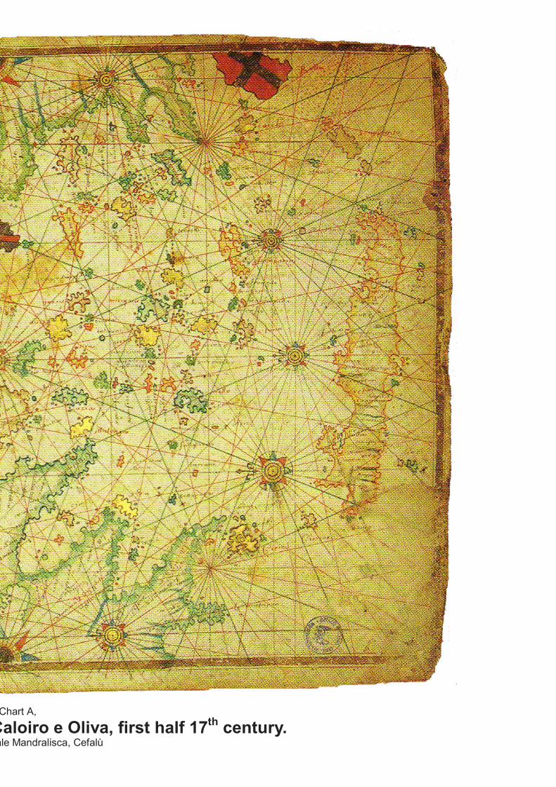
Fig. 2 Chart A,
The Aegean, attributed to Placido Caloiro e Oliva, first half 17th century.
© Fondazione culturale Mandralisca, Cefalù

BIMCC Newsletter No 38 September 2010 22
chartmaker’s name, but then there are a number of crosses in the sea nearby, indicating cliffs, which would probably not be present if a pun were intended (?), or a signature, en cache, displaced here. By a happy coincidence this enigma was elucidated when I found an article by W. Sidney Allen, Kalóyeros : an Atlantis in microcosm?
14. According to Allen, this
island (plus another one by that name, near Cos, which is not our concern here), was first mentioned by Buondelmonti in his Liber insularum Archipelagi (1420), and subsequently by other writers and cartographers, in different forms of spelling, from Bordone via Porcacchi, Dapper, Coronelli to d’Anville. It is a somewhat mysterious islet whose name originally meant ‘good old man’, or ‘monk’ and, according to 17th century travellers, is supposed to have been blown up in a volcanic eruption – hence the connection with Santorini and the notion of Atlantis. Shrouded in mystery as it may be, we learn that a rock island does exist at 38° 10’ N, 25° 18’ E, according to Admiralty charts cited by the author.
Some observations on Chart B, the
Mediterranean (on the cover) The area covered here extends from ca 47° N to
26° N (roughly from the latitude of Bolzano in the north to that of Luxor in Egypt), and from ca 02° W to 36° 30’ E (roughly from Almería in Spain to Damascus). Adopting the same convention for the scale (Fig. 4), and the same value for a Genoese mile (1 338 m) as in Chart A, I estimate the scale to be ca 1: 6 000 000.
The primary windrose is placed in the centre of Sicily, surrounded by the usual 16 peripheral windroses some of which are much more ornate than those on Chart A. Again it is clear that artistic, sometimes lavish, decoration of these had been allowed where this did not impair the presentation of important topographical detail. In one case, around Barcelona, a very decorative windrose was only drawn out in its western half, for this very reason. Baroque exuberance is also evident in the amphora-like flower vases attached to the two scale bars in the banderoles at top and bottom of the chart. The more luxuriant of the two, that is the one attached to the scale at top right (Fig. 4), admittedly bears some resemblance to a coat of arms, but it becomes something like a flower vase once the chart is turned upside down, the scale bar being the support on which the vase is placed.
Once more, the classical decorative elements so often present on charts of this type are absent here, with the exception of three crosses to mark the Calvary in the vicinity of Jerusalem. If their representation has been moved southwards from where it should have been, it may be assumed that this was simply for reasons of space on the chart. Readers at the time would certainly not have taken exception to such a practical adjustment.
The island fortress of the Christian Knights on Rhodos is joined by that of Malta where a white cross
is drawn on the island, while the red cross of the Genoese flag can be seen on Chios.
On portolan charts of this kind one rarely sees topographical data inland, with the exception of a few mountain ranges here and there, and some rivers the estuaries of which could be a significant coastal feature. Here we find a number of apparently important rivers flowing into the Mediterranean from the European continent and from northern Africa. Most are difficult to identify, and all seem to be rather too large. Almagià talks of their quite arbitrary representation. Noteworthy are the lakes upstream in North Africa, with an unusually elaborate but fictitious hydrographic system of lakes and Nile confluents in Egypt.
There is a problem with the lateral dimension, or width, of this chart. As can be seen, the actual centrefold does not run through the central windrose, as frequently seems to be the case (also in Chart A, Fig. 2), but through the two peripheral windroses closest to the east. Now looking at the left-hand side of the portolan, it is evident that the painted left-hand border, and most likely some part of the map, is missing. If the chart were to be folded through the central windrose in Sicily, then around 10 cm would appear to be missing towards the west. Had this part been present, it would have extended the geographical coverage to include Portugal. A reasonable assumption, it would seem, since most of the ‘classical’ portolan charts of the Mediterranean extend westward to at least Gibraltar, if not, indeed, to Cadiz, or even beyond. Only a comparison with other charts of the Mediterranean by the same chart maker would permit to progress from conjecture to something approaching certitude. An explanation for the loss of this part could be that the actual centrefold was made to fit Chart B with the size of Chart A folded. The western part exceeding it was then either truncated, or possibly folded in, with the result that, due to constant wear and tear, it finally got torn off.
Conclusion Visitors of map exhibitions will occasionally find the
one or other portolan chart among the exhibits, well protected behind glass, and in subdued light. To hold a portolan in one’s own hands is a singular experience. These few lines might perhaps help to arouse some interest in the two charts presented here, a treasure hidden away from the circuit of the larger libraries. Specialists may be encouraged to review the somewhat stern assessment made by Almagià some seventy years ago and re-examine the historical value and cartographic relevance of these two portolan charts. This should also afford confirmation, or otherwise, of the presumed authorship and dating. But above all, one thing is very clear : the two charts are in desperate need of restoration ! It is to be hoped that academic recognition may bring about a benevolent commitment, from whichever quarter, to their physical preservation.
14 Imago Mundi 29 (1977), pp.55-71, and Addendum in Imago Mundi 31 (1979), pp. 94-96.

September 2010 BIMCC Newsletter No 38 23 23
This Newsletter was edited by Jean-Louis Renteux with the support of the editorial committee comprising Wulf Bodenstein, Lisette Danckaert, Peter Galezowski, Pierre Parmentier and Jacqueline Renteux.
Fig. 4 Distance scale and decorative vase on the chart of the Mediterranean attributed to Placido Caloiro e Oliva,
first half 17th century. © Fondazione culturale Mandralisca, Cefalù (North at top)
Select bibliography: • Astengo, Corradino, La cartografia nautica mediterranea dei secoli XVI e XVII, Genova: Erga edizioni, 2000. • Astengo, Corradino, The Renaissance Chart Tradition in the Mediterranean, in: David Woodward (ed.), The History of Cartography, Vol. 3, Cartography in the European Renaissance, Chicago-London: Chicago Univer-sity Press, 2007, pp. 174-262. This is an amended and translated version of the preceding publication .
• Campbell, Tony, Census of Pre-Sixteenth Century Portolan Charts, Imago Mundi 38 (1986), pp. 67-94 • Kupčík, Ivan, Münchner Portolankarten – Munich Portolan Charts, München, Berlin: Deutscher Kunstverlag, 2000
• Lanman, Jonathan T., On the Origins of Portolan Charts, Chicago: Newberry Library, 1967 • Nebenzahl, Kenneth, Maps from the Age of Discoveries, London, Times Books Ltd., 1990 • Pastoureau, Mireille, Voies Océanes, Cartes marines et grandes découvertes, Paris: Bibliothèque Nationale, 1992
• Pflederer, Richard, Census of Portolan Charts & Atlases (privately printed in the U.S. by the author, 2009) • Roncière, Monique de la, Mollat du Jourdin, Michel, Les Portulans, Cartes marines du XIIe au XVIIe siècle, Fribourg: Office du Livre, 1984
• Sphyroeras, Vasilis, et al., Maps and Map-Makers of the Aegean, Athens, Olkos Ltd., 1985.

BIMCC Newsletter No 38 September 2010 24
During the 16th century information was exchanged by broadsheets (pamphlet – vlugschriften – histo-rieprenten).
They became very popular during the 80 years’ war of independence in the 17 Provinces (1568-1648). The protestant Dutch in the north fought for freedom against the Spanish King and his troops in the south. This war was characterised by many bat-tles, many cities were taken and abandoned. For years, the war situation created an unstable environ-ment.
The common man, mostly illiterate, depended on broadsheets — situation engravings with or without texts— for his information. Even then one was think-ing in terms of the present. The war situation changed constantly, inundation was a war weapon and cities were taken and lost.
The purpose was commercial, journalism avant la lettre, and news had to travel fast.
It is also important to note that this war was even commented on internationally by many writers. The most productive engraver during the 16th century was Frans Hogenberg (Mechlin 1538 - Cologne 1590), mostly known by many collectors as the engraver of the maps of Ortelius‘ Atlas Theatrum Orbis Terrarum. He and his sons, Johan and Abraham, produced more than 400 engravings. The editors tried to render a real picture of the situation. Therefore they used eyewit-nesses such as engineers, soldiers, informants... to describe the facts and check their accuracy. The to-pographic content was based on existing maps e.g. those by Jacob van Deventer for Joris Hoefnagel...
These engravings were cheap and the paper was of poor quality. As a result many of them were de-stroyed. Some were coloured and used as decoration. Many were used in the most important books on the
historical and military actions of this war of independ-ence. These books are still available but expensive. Unfortunately many have been dismembered and the engravings are being sold separately, which makes them affordable. It is important to note that the bulk of the engravings, in particular those by Hogenberg, were not issued by him in book form but as loose leaves. These are easy to find and are not expensive. The most important works are:
Aytzinger – De leone Belgico, 1583, 130 plates, several editions
Strada F. – History of the war of Flanders, 1644 Van Meteren E. – Histoire des Pays-Bas, 1618 Baudartius W. – Den Nassausche Oorlogen, 130
plates, 1616. Translated into French. These are miniaturised (14.5 x 12cm) copies from Hogenberg.
Bor C.P. –Oorsprongh, begin, ende vervolgt der Nederlandse Oorlogen… (1679-84), 85 plates.
Orlers J.J. – De Nassausschen Lauren-Krans, 1610.
The collectors interested in the engravings of this war should consult the Kroniek van de opstand in de hoge landen 1555-1609 by H. Kinds 1999. Ed. ALNU. The book contains 228 engravings, all true to nature, by F. Hogenberg. The author supplements each en-graving with some historical information.
Hogenberg’s engravings can be distinguished from Aytzinger’s by the fact that the latter do not contain a text at the base of the engraving. A peculiarity of this book is the compilation of identical engravings used by Hellwig, Baudartius, Bor, Hooft en Van Meteren.
Wim Dekimpe Eric Leenders [email protected] [email protected]
COLLECTABLE/AFFORDABLE MAPS
The purpose of this series of articles is to acquaint readers with interesting cartographic material that can be collected at affordable prices. On average the items treated are valued around 100 Euros. Sometimes more, because at times the value is higher as an item may be exceptionally significant.
War engravings
In the forthcoming BIMCC Newsletters do not miss ...
• Martino Martini’s atlas of China, by Stanislas De Peuter
• Evolution of the maps of Brabant, by Herman Deijnckens and Eric Leenders
• The very first maps of the County of Hainault, by Jean-Louis Renteux
• Jacques de Surhon, Cartographer of the 16th century - The man and his topographic work, by
Jean-Louis Renteux and Eric Leenders
September 2010 BIMCC Newsletter No 38 25 25
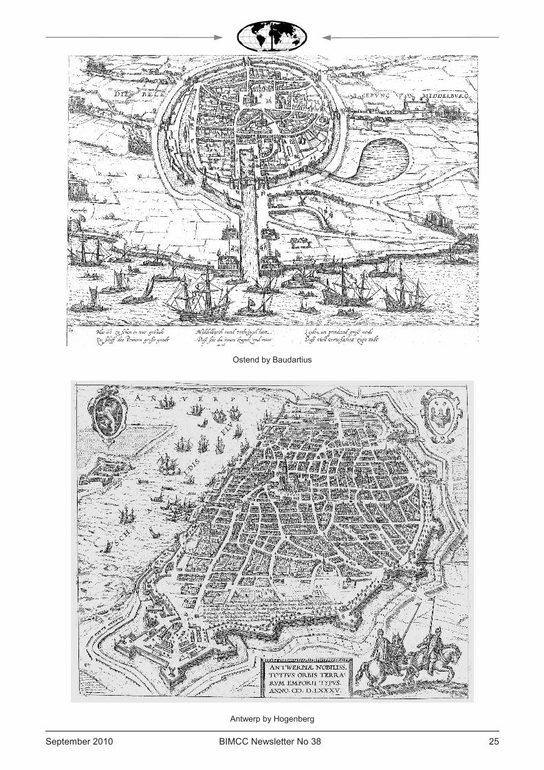
Ostend by Baudartius
Antwerp by Hogenberg
BIMCC Newsletter No 38 September 2010 26
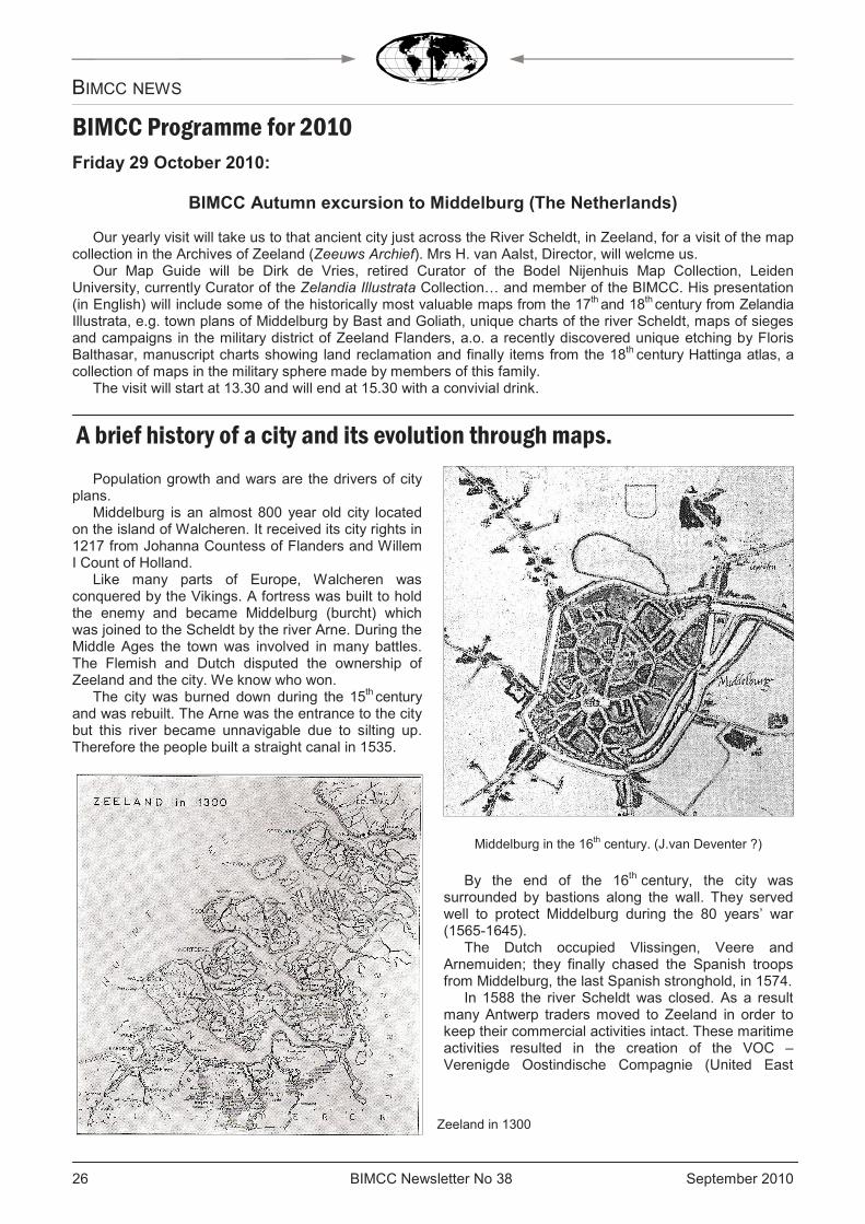
Population growth and wars are the drivers of city plans.
Middelburg is an almost 800 year old city located on the island of Walcheren. It received its city rights in 1217 from Johanna Countess of Flanders and Willem I Count of Holland.
Like many parts of Europe, Walcheren was conquered by the Vikings. A fortress was built to hold the enemy and became Middelburg (burcht) which was joined to the Scheldt by the river Arne. During the Middle Ages the town was involved in many battles. The Flemish and Dutch disputed the ownership of Zeeland and the city. We know who won.
The city was burned down during the 15th century and was rebuilt. The Arne was the entrance to the city but this river became unnavigable due to silting up. Therefore the people built a straight canal in 1535.
By the end of the 16th century, the city was surrounded by bastions along the wall. They served well to protect Middelburg during the 80 years’ war (1565-1645).
The Dutch occupied Vlissingen, Veere and Arnemuiden; they finally chased the Spanish troops from Middelburg, the last Spanish stronghold, in 1574.
In 1588 the river Scheldt was closed. As a result many Antwerp traders moved to Zeeland in order to keep their commercial activities intact. These maritime activities resulted in the creation of the VOC – Verenigde Oostindische Compagnie (United East
BIMCC NEWS
BIMCC Programme for 2010
Friday 29 October 2010:
BIMCC Autumn excursion to Middelburg (The Netherlands) Our yearly visit will take us to that ancient city just across the River Scheldt, in Zeeland, for a visit of the map
collection in the Archives of Zeeland (Zeeuws Archief). Mrs H. van Aalst, Director, will welcme us. Our Map Guide will be Dirk de Vries, retired Curator of the Bodel Nijenhuis Map Collection, Leiden
University, currently Curator of the Zelandia Illustrata Collection… and member of the BIMCC. His presentation (in English) will include some of the historically most valuable maps from the 17th and 18th century from Zelandia Illustrata, e.g. town plans of Middelburg by Bast and Goliath, unique charts of the river Scheldt, maps of sieges and campaigns in the military district of Zeeland Flanders, a.o. a recently discovered unique etching by Floris Balthasar, manuscript charts showing land reclamation and finally items from the 18th century Hattinga atlas, a collection of maps in the military sphere made by members of this family.
The visit will start at 13.30 and will end at 15.30 with a convivial drink.
A brief history of a city and its evolution through maps.
Middelburg in the 16th century. (J.van Deventer ?)
Zeeland in 1300
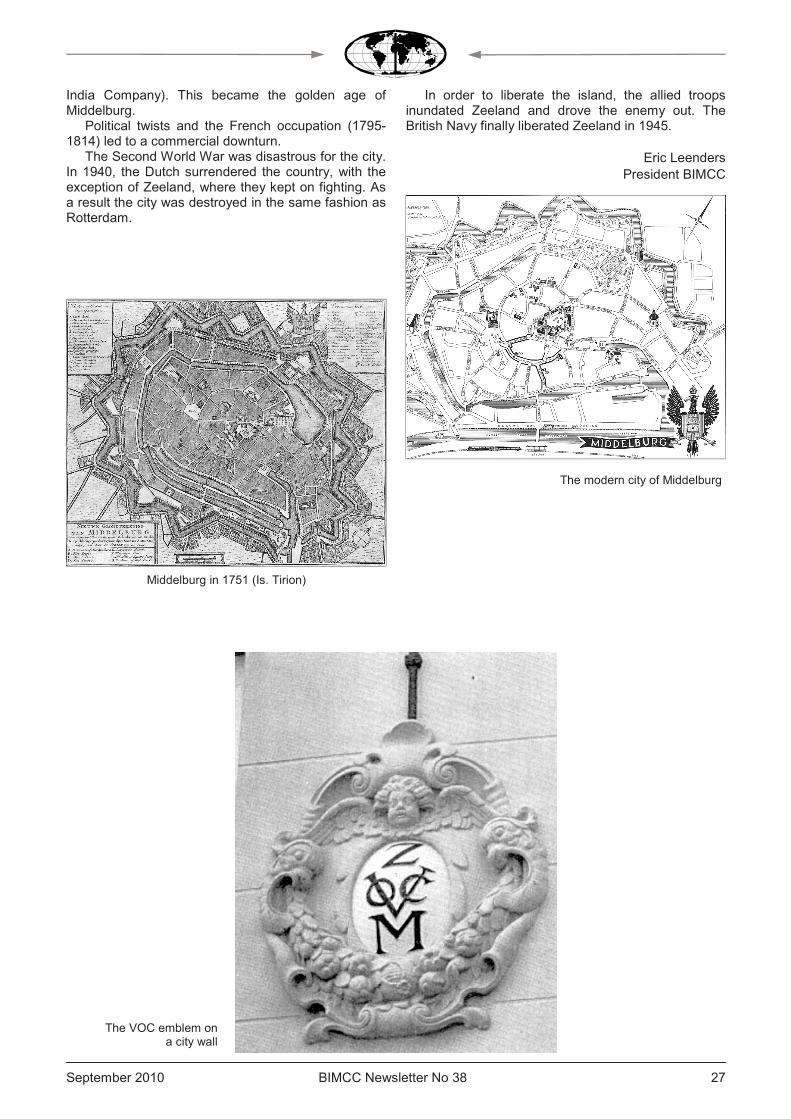
September 2010 BIMCC Newsletter No 38 27 27
India Company). This became the golden age of Middelburg.
Political twists and the French occupation (1795-1814) led to a commercial downturn.
The Second World War was disastrous for the city. In 1940, the Dutch surrendered the country, with the exception of Zeeland, where they kept on fighting. As a result the city was destroyed in the same fashion as Rotterdam.
In order to liberate the island, the allied troops inundated Zeeland and drove the enemy out. The British Navy finally liberated Zeeland in 1945.
Eric Leenders
President BIMCC
Middelburg in 1751 (Is. Tirion)
The modern city of Middelburg
The VOC emblem on a city wall
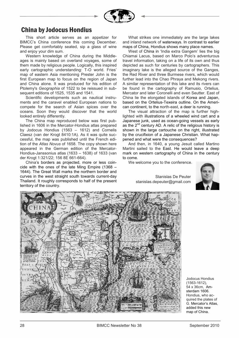
BIMCC Newsletter No 38 September 2010 28
This short article serves as an appetizer for BIMCC’s China conference this coming December. Please get comfortably seated, sip a glass of wine and enjoy your dim sum.
Western knowledge of China during the Middle-ages is mainly based on overland voyages, some of them made by religious people. Logically, this inspired early cartographic understanding: T-O world. Fries’ map of eastern Asia mentioning Prester John is the first European map to focus on the region of Japan and China alone. It was produced for his edition of Ptolemy's Geographia of 1522 to be reissued in sub-sequent editions of 1525, 1535 and 1541.
Scientific developments such as nautical instru-ments and the caravel enabled European nations to compete for the search of Asian spices over the oceans. Soon they would discover that the world looked entirely differently.
The China map reproduced below was first pub-lished in 1606 in the Mercator-Hondius atlas prepared by Jodocus Hondius (1563 – 1612) and Cornelis Claesz (van der Krogt 8410:1A). As it was quite suc-cessful, the map was published until the French edi-tion of the Atlas Novus of 1658. The copy shown here appeared in the German edition of the Mercator-Hondius-Janssonius atlas (1633 – 1638) of 1633 (van der Krogt 1:321/22; 156 8E 661-664).
China’s borders as projected, more or less coin-cide with the ones of the late Ming Empire (1368 – 1644). The Great Wall marks the northern border and curves in the west straight south towards current-day Thailand. It roughly corresponds to half of the present territory of the country.
What strikes one immediately are the large lakes and inland network of waterways. In contrast to earlier maps of China, Hondius shows many place names.
West of China in ‘India extra Gangem’ lies the big Chiamai Lacus, based on Marco Polo’s adventurous travel information, taking on a life of its own and thus depicted as such for centuries by cartographers. This imaginary lake is the alleged source of the Ganges, the Red River and three Burmese rivers, which would further lead into the Chao Phraya and Mekong rivers.
A similar representation of this lake and its rivers can be found in the cartography of Ramusio, Ortelius, Mercator and later Coronelli and even Seutter. East of China lie the elongated islands of Korea and Japan, based on the Ortelius-Texeira outline. On the Ameri-can continent, to the north-east, a deer is running.
The visual attraction of the map is further high-lighted with illustrations of a wheeled wind cart and a Japanese junk, used as ocean-going vessels as early as the 2nd century AD. A relic of the religious history is shown in the large cartouche on the right, illustrated by the crucifixion of a Japanese Christian. What hap-pened and what were the consequences?
And then, in 1640, a young Jesuit called Martino Martini sailed to the East. He would leave a deep mark on western cartography of China in the century to come.
We welcome you to the conference.
Stanislas De Peuter [email protected]
China by Jodocus Hondius
Jodocus Hondius (1563-1612), 54 x 36cm, Am-sterdam 1606. Hondius, who ac-quired the plates of G. Mercator’s Atlas, added this new map of China.
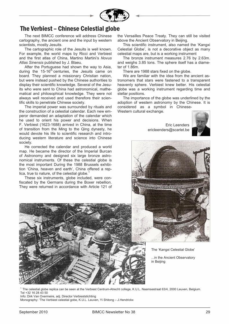
September 2010 BIMCC Newsletter No 38 29 29
The next BIMCC conference will address Chinese cartography, the ancient one and the input by western scientists, mostly Jesuits.
The cartographic role of the Jesuits is well known. For example, the world maps by Ricci and Verbiest and the first atlas of China, Martino Martini’s Novus Atlas Sinensis published by J. Blaeu.
After the Portuguese had shown the way to Asia, during the 15-16th centuries, the Jesuits came on board. They planned a missionary Christian nation, but were instead pushed by the Chinese authorities to display their scientific knowledge. Several of the Jesu-its who were sent to China had astronomical, mathe-matical and philosophical knowledge. They were not always well received and used therefore their scien-tific skills to penetrate Chinese society.
The imperial power was surrounded by rituals and the construction of a celestial calendar. Each new em-peror demanded an adaptation of the calendar which he used to orient his power and decisions. When F. Verbiest (1623-1688) arrived in China, at the time of transition from the Ming to the Qing dynasty, he would devote his life to scientific research and intro-ducing western literature and science into Chinese society.
He corrected the calendar and produced a world map. He became the director of the Imperial Burcan of Astronomy and designed six large bronze astro-nomical instruments. Of these the celestial globe is the most important During the 1988 Brussels exhibi-tion ‘China, heaven and earth’, China offered a rep-lica, true to nature, of the celestial globe.1
These six instruments, globe included, were con-fiscated by the Germans during the Boxer rebellion. They were returned in accordance with Article 121 of
the Versailles Peace Treaty. They can still be visited above the Ancient Observatory in Beijing.
This scientific instrument, also named the ‘Kangxi Celestial Globe’, is not a decorative object as many celestial maps are, but is a working instrument
The bronze instrument measures 2.76 by 2.63m. and weighs 3.85 tons. The sphere itself has a diame-ter of 1.86m.
There are 1988 stars fixed on the globe. We are familiar with the idea from the ancient as-
tronomers that stars were fastened to a transparent heavenly sphere. Verbiest knew better. His celestial globe was a working instrument regarding time and stellar positions.
The importance of the globe was underlined by the adoption of western astronomy by the Chinese. It is considered as a symbol in Chinese-Western cultural exchange.
Eric Leenders [email protected]
The Verbiest – Chinese Celestial globe
1 The celestial globe replica can be seen at the Verbiest Centrum-Atrecht college, K.U.L. Naamsestraat 63/4, 2000 Leuven, Belgium. Tel +32 16 28 43 50 Info: Dirk Van Overmeire, adj. Director Verbieststichting Monography: ‘The Verbiest celestial gobe, K.U.L. Leuven, Yi Shitong – J.Hendrickx
The ‘Kangxi Celestial Globe’ ...in the Ancient Observatory in Beijing
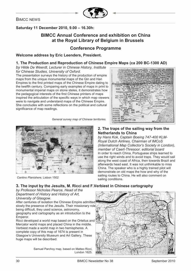
BIMCC Newsletter No 38 September 2010 30
BIMCC NEWS
Saturday 11 December 2010, 9.00 – 16.30h:
BIMCC Annual Conference and exhibition on China at the Royal Library of Belgium in Brussels
Conference Programme
Welcome address by Eric Leenders, President.
1. The Production and Reproduction of Chinese Empire Maps (ca 200 BC-1300 AD) by Hilde De Weerdt, Lecturer in Chinese History, Institute for Chinese Studies, University of Oxford. The presentation surveys the history of the production of empire maps from the unique monumental maps of the Qin and Han Empires to the first printed maps of the Chinese Empire dating to the twelfth century. Comparing early examples of maps in print to monumental imperial maps on stone steles, it demonstrates how the pedagogical interests of the first Chinese printers of maps inspired the articulation of the specific ways in which map viewers were to navigate and understand maps of the Chinese Empire. She concludes with some reflections on the political and cultural significance of map readings.
2. The traps of the sailing way from the Netherlands to China by Hans Kok, Captain Boeing 747-400 KLM-Royal Dutch Airlines, Chairman of IMCoS (International Map Collector’s Society in London), member of Caert-Thresoor. editorial board In order to reach China, Portuguese ships learned to use the right winds and to avoid traps. They would sail along the west coast of Africa, then towards Brazil and afterwards head east. It was not unthinkable to miss China. The speaker who is a highly trained pilot will demonstrate on old maps the how and why of the sailing routes to China. He will also comment on sailing conditions.
3. The input by the Jesuits, M. Ricci and F.Verbiest in Chinese cartography by Professor Nicholas Pearce, Head of the Department of History and History of Art, University of Glasgow. After centuries of isolation the Chinese Empire admitted slowly the presence of the Jesuits. Their missionary role being difficult, they used science, astronomy, geography and cartography as an introduction to the Emperor. Ricci developed a world map based on the Ortelius and Mercator world maps and placed China in the middle. Verbiest made a world map in two hemispheres. A complete copy of this map of 1674 is present in Glasgow’s University Museum and Art Gallery. These huge maps will be described.
General survey map of Chinese territories.
Cantino Planishere, Lisbon 1502
Samuel Parchoy map, based on Matteo Ricci, London 1625.
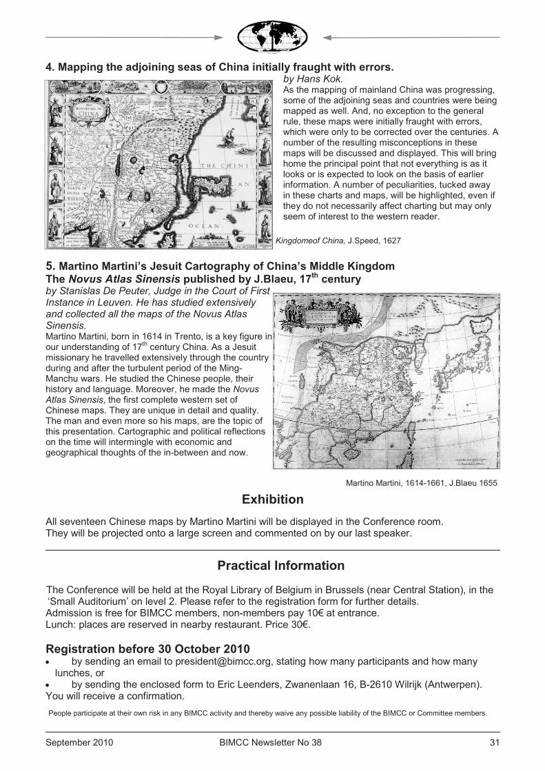
September 2010 BIMCC Newsletter No 38 31 31
4. Mapping the adjoining seas of China initially fraught with errors. by Hans Kok. As the mapping of mainland China was progressing, some of the adjoining seas and countries were being mapped as well. And, no exception to the general rule, these maps were initially fraught with errors, which were only to be corrected over the centuries. A number of the resulting misconceptions in these maps will be discussed and displayed. This will bring home the principal point that not everything is as it looks or is expected to look on the basis of earlier information. A number of peculiarities, tucked away in these charts and maps, will be highlighted, even if they do not necessarily affect charting but may only seem of interest to the western reader.
5. Martino Martini’s Jesuit Cartography of China’s Middle Kingdom The Novus Atlas Sinensis published by J.Blaeu, 17th century by Stanislas De Peuter, Judge in the Court of First Instance in Leuven. He has studied extensively and collected all the maps of the Novus Atlas Sinensis. Martino Martini, born in 1614 in Trento, is a key figure in our understanding of 17th century China. As a Jesuit missionary he travelled extensively through the country during and after the turbulent period of the Ming-Manchu wars. He studied the Chinese people, their history and language. Moreover, he made the Novus Atlas Sinensis, the first complete western set of Chinese maps. They are unique in detail and quality. The man and even more so his maps, are the topic of this presentation. Cartographic and political reflections on the time will intermingle with economic and geographical thoughts of the in-between and now.
Exhibition
All seventeen Chinese maps by Martino Martini will be displayed in the Conference room. They will be projected onto a large screen and commented on by our last speaker.
Practical Information The Conference will be held at the Royal Library of Belgium in Brussels (near Central Station), in the ‘Small Auditorium’ on level 2. Please refer to the registration form for further details. Admission is free for BIMCC members, non-members pay 10€ at entrance. Lunch: places are reserved in nearby restaurant. Price 30€.
Registration before 30 October 2010 • by sending an email to [email protected], stating how many participants and how many lunches, or
• by sending the enclosed form to Eric Leenders, Zwanenlaan 16, B-2610 Wilrijk (Antwerpen). You will receive a confirmation. People participate at their own risk in any BIMCC activity and thereby waive any possible liability of the BIMCC or Committee members.
Kingdomeof China, J.Speed, 1627
Martino Martini, 1614-1661, J.Blaeu 1655
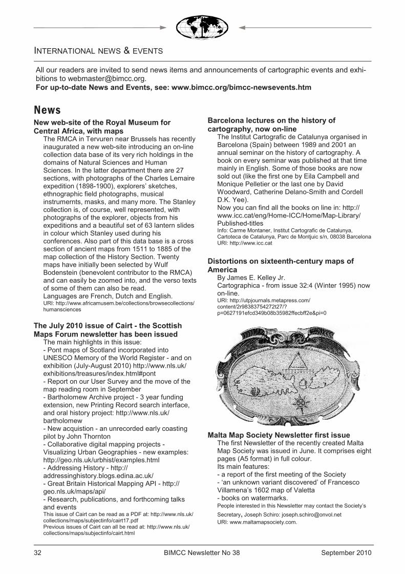
BIMCC Newsletter No 38 September 2010 32
New web-site of the Royal Museum for Central Africa, with maps
The RMCA in Tervuren near Brussels has recently inaugurated a new web-site introducing an on-line collection data base of its very rich holdings in the domains of Natural Sciences and Human Sciences. In the latter department there are 27 sections, with photographs of the Charles Lemaire expedition (1898-1900), explorers’ sketches, ethnographic field photographs, musical instrumernts, masks, and many more. The Stanley collection is, of course, well represented, with photographs of the explorer, objects from his expeditions and a beautiful set of 63 lantern slides in colour which Stanley used during his conferences. Also part of this data base is a cross section of ancient maps from 1511 to 1885 of the map collection of the History Section. Twenty maps have initially been selected by Wulf Bodenstein (benevolent contributor to the RMCA) and can easily be zoomed into, and the verso texts of some of them can also be read. Languages are French, Dutch and English. URI: http://www.africamusem.be/collections/browsecollections/humansciences
The July 2010 issue of Cairt - the Scottish Maps Forum newsletter has been issued
The main highlights in this issue: - Pont maps of Scotland incorporated into UNESCO Memory of the World Register - and on exhibition (July-August 2010) http://www.nls.uk/exhibitions/treasures/index.html#pont - Report on our User Survey and the move of the map reading room in September - Bartholomew Archive project - 3 year funding extension, new Printing Record search interface, and oral history project: http://www.nls.uk/bartholomew - New acquistion - an unrecorded early coasting pilot by John Thornton - Collaborative digital mapping projects - Visualizing Urban Geographies - new examples: http://geo.nls.uk/urbhist/examples.html - Addressing History - http://addressinghistory.blogs.edina.ac.uk/ - Great Britain Historical Mapping API - http://geo.nls.uk/maps/api/ - Research, publications, and forthcoming talks and events This issue of Cairt can be read as a PDF at: http://www.nls.uk/collections/maps/subjectinfo/cairt17.pdf Previous issues of Cairt can all be read at: http://www.nls.uk/collections/maps/subjectinfo/cairt.html
Barcelona lectures on the history of cartography, now on-line
The Institut Cartografic de Catalunya organised in Barcelona (Spain) between 1989 and 2001 an annual seminar on the history of cartography. A book on every seminar was published at that time mainly in English. Some of those books are now sold out (like the first one by Eila Campbell and Monique Pelletier or the last one by David Woodward, Catherine Delano-Smith and Cordell D.K. Yee). Now you can find all the books on line in: http://www.icc.cat/eng/Home-ICC/Home/Map-Library/Published-titles Info: Carme Montaner, Institut Cartografic de Catalunya, Cartoteca de Catalunya, Parc de Montjuic s/n, 08038 Barcelona URI: http://www.icc.cat
Distortions on sixteenth-century maps of America
By James E. Kelley Jr. Cartographica - from issue 32:4 (Winter 1995) now on-line. URI: http://utpjournals.metapress.com/content/2r98383754272t27/?p=0627191efcd349b08b35982ffecbff2e&pi=0
Malta Map Society Newsletter first issue The first Newsletter of the recently created Malta Map Society was issued in June. It comprises eight pages (A5 format) in full colour. Its main features: - a report of the first meeting of the Society - ‘an unknown variant discovered’ of Francesco Villamena’s 1602 map of Valetta - books on watermarks. People interested in this Newsletter may contact the Society’s
Secretary, Joseph Schiro: [email protected] URI: www.maltamapsociety.com.
INTERNATIONAL NEWS & EVENTS
News
All our readers are invited to send news items and announcements of cartographic events and exhi-bitions to [email protected]. For up-to-date News and Events, see: www.bimcc.org/bimcc-newsevents.htm
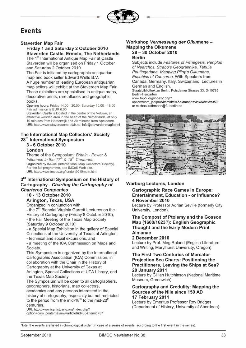
September 2010 BIMCC Newsletter No 38 33 33
Staverden Map Fair Friday 1 and Saturday 2 October 2010 Staverden Castle, Ermelo, The Netherlands The 1st International Antique Map Fair at Castle Staverden will be organised on Friday 1 October and Saturday 2 October 2010. The Fair is initiated by cartographic antiquarian map and book seller Edward Wells B.V. A huge number of leading European antiquarian map sellers will exhibit at the Staverden Map Fair. These exhibitors are specialised in antique maps, decorative prints, rare atlases and geographic books. Opening hours: Friday 14.00 - 20.00, Saturday 10.00 - 18.00 Fair admission is EUR 6.00. Staverden Castle is located in the centre of the Veluwe, an attractive wooded area in the heart of the Netherlands, at only 10 minutes from Harderwijk and 20 minutes from Apeldoorn. URI: http://www.staverdenmapfair.nl/; [email protected]
The International Map Collectors' Society 28th International Symposium
3 - 6 October 2010 London Theme of the Symposium: Britain - Power & Influence in the 17
th & 18
th Centuries
Organized by IMCoS (International Map Collectors’ Society). For the full programme, see IMCoS Web site. URI: http://www.imcos.org/london2010main.htm
3rd International Symposium on the History of Cartography - Charting the Cartography of Chartered Companies
10 - 13 October 2010 Arlington, Texas, USA Organized in conjunction with - the 7th Biennial Virginia Garrett Lectures on the History of Cartography (Friday 8 October 2010); - the Fall Meeting of the Texas Map Society (Saturday 9 October 2010); - a Special Map Exhibition in the gallery of Special Collections at the University of Texas at Arlington; - technical and social excursions, and - a meeting of the ICA Commission on Maps and Society. This Symposium is organized by the International Cartographic Association (ICA) Commission, in collaboration with the Chair in the History of Cartography at the University of Texas at Arlington, Special Collections at UTA Library, and the Texas Map Society. The Symposium will be open to all cartographers, geographers, historians, map collectors, academics and any persons interested in the history of cartography, especially but not restricted to the period from the mid-18th to the mid-20th centuries. URI: http://www.icahistcarto.org/index.php?option=com_content&view=article&id=35&Itemid=37
Workshop Vermessung der Oikumene – Mapping the Oikumene
28 – 30 October 2010 Berlin Subjects include Features of Periegesis, Periplus of Nearchos, Strabo’s Geographika, Tabula Peutingeriana, Mapping Pliny’s Oikumene, Eusebius of Caesarea. With Speakers from Canada, Germany, Italy, Switzerland. Lectures in German and English. Staatsbibliothek zu Berlin, Potsdamer Strasse 33, D-10785 Berlin-Tiergarten www.topoi.org/index2.php?option=com_jcalpro<emid=94&extmode=view&extid=350 or [email protected]
Warburg Lectures, London
Cartographic Race Games in Europe: Entertainment, Education - or Influence? 4 November 2010 Lecture by Professor Adrian Seville (formerly City University, London).
The Compost of Ptolemy and the Gosson Map (1600/1623?): English Geographic Thought and the Early Modern Print Almanac 2 December 2010 Lecture by Prof. Meg Roland (English Literature and Writing, Marylhurst University, Oregon).
The First Two Centuries of Mercator Projection Sea Charts: Positioning the Practitioners, Leaving the Ships at Sea? 20 January 2011 Lecture by Gillian Hutchinson (National Maritime Museum, Greenwich).
Cartography and Credulity: Mapping the Sources of the Nile since 150 AD 17 February 2011 Lecture by Emeritus Professor Roy Bridges (Department of History, University of Aberdeen).
Events
Note: the events are listed in chronological order (in case of a series of events, according to the first event in the series).

BIMCC Newsletter No 38 September 2010 34
London 1747 and Dublin 1756: John Rocque's Capital City Maps 3 March 2011 Lecture by Dr John Montague (Royal Irish Academy, Dublin).
A Window on the World: Maps in the European Schoolroom in the Nineteenth and Twentieth Centuries 31 March 2011 Lecture by Tom Harper (Maps, British Library).
Lectures in the history of cartography convened by Catherine Delano Smith (Institute of Historical Research), Tony Campbell (formerly Map Library, British Library), and Alessandro Scafi (Warburg Institute). Enquiries: +44 20 8346 5112, +44 20 8346 5112 (Dr Delano Smith) or [email protected]. Meetings are held at The Warburg Institute, University of London, Woburn Square, London WC1H OAB at 17.00. Admission is free. URI: http://www.maphistory.info/warburgprog.html
10th Paris Map-Fair Saturday 6 November 2010 Paris Maps - Atlases - Travel books Hotel Ambassador 16, Bd Haussmann, 75009 Paris, France Opening hours: 11.00 - 18.00 URI: http://www.map-fair.com/index.php
Les cartes anciennes du Comté de Hainaut (Ancient maps of the Hainault county)
Saturday 6 November 2010 Valenciennes, France This conference by Jean-Louis Renteux (BIMCC Editor) will focus on the needs of local historians and genealogists. Association Généalogique Flandres-Hainaut, 155 bis avenue de Reims, F-59300, Valenciennes Conference at 15.00. Admission free. http://agfh59.free.fr/; [email protected]
Mapping Africa from the ninth to the nineteenth century. Construction, transmission and circulation of cartographic knowledge about Africa (Europe, Arab world and Africa)
Cartographier l’Afrique IXe-XIXe siècle. Construction, transmissions et circulations des savoirs cartographiques sur l’Afrique (Europe, Monde Arabe et Afrique)
2 - 3 December 2010 Paris, France Colloquium organised by the Centre d’études des mondes africains (CEMAf, Centre for the Study of African Worlds) URI: http://www.cemaf.cnrs.fr/spip.php?article455
Eighteenth Annual Miami International Map Fair - The Super Bowl of mapdom - Miami Today
5 – 6 February 2011 Miami, USA Proceeds from Map Fair go toward maintaining and improving the Historical Museum’s exhibitions, educational programming and community outreach. Historical Museum of Southern Florida, 101 West Flagler Street, Miami, FL 33130 URI: http://www.hmsf.org/programs-mapFair.htm
Maps from the Eighty Years’ War (1568-1648). 24 March 2011 Bruges, Belgium The Cultuurbibliotheek is organising a conference on cartography by Philippe Despriet, architect and archaeologist. Location: Sint-Lodewijkscollege, Magdalenastraat 30, 8200 Bruges. The talk starts at 20.00. Dutch speaking. Maps will be on exhibition. Admission EUR 5, includes the traditional drink. www.cultuurbibliotheek.be
ICC 2011 - 25th International Cartography Conference and the 15th General Assembly of the International Cartographic Association
3 – 8 July 2011 Paris, France URI: http://www.icc2011.fr/fr
24th International Conference on the History of Cartography (ICHC)
10 - 15 July 2011 Moscow, Russia URI: http://www.ichc2011.ru/
25th International Conference on the History of Cartography (ICHC)
July 2013 Helsinki, Finland The Board of Directors of Imago Mundi Ltd announced that Helsinki has been chosen as the venue for the 25th ICHC.
INTERNATIONAL NEWS & EVENTS (CONT'D)
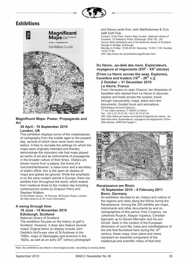
September 2010 BIMCC Newsletter No 38 35 35
Magnificent Maps: Power, Propaganda and Art
30 April - 19 September 2010 London, UK This exhibition displays some of the masterpieces of cartography from the middle ages to the present day, several of which have never been shown before. It tries to recreate the settings for which the maps were originally intended and thereby demonstrate the important role that maps played as works of art and as instruments of propaganda in the broader culture of their times. Visitors are shown rooms from a palace, the home of a merchant/landowner, a class-room and a secretary of state's office. Nor is the open-air display of maps and globes be ignored. While the emphasis is on the early modern period in Europe, there are exhibits from throughout the world, which extend from medieval times to the modern day including contemporary works by Grayson Perry and Stephen Walters. At the British Library, St Pancras, 96 Euston Road, London. isit http://www.bl.uk for more information.
A swing through time 18 June - 14 November 2010 Edinburgh, Scotland National Library of Scotland The exhibition focuses on the history of golf in Scotland. However, it does also feature several maps! Original items on display include John Geddie's bird's-eye view of St Andrews in the 1580s, maps of Gleneagles and environs in the 1820s, as well as an early 20th century photograph
and fixture cards from John Bartholomew & Co's staff Golf Club. Contact: Chris Fleet, Senior Map Curator, National Library of Scotland, 33 Salisbury Place, Edinburgh, EH9 1SL, UK Venue: Both exhibitions are in the National Library of Scotland, George IV Bridge, Edinburgh Monday to Friday: 10.00-20.00; Saturday: 10.00-17.00; Sunday: 14.00-17.00 URI: http://www.nls.uk/exhibitions/golf/index.html
Du Havre...au-delà des mers. Explorateurs, voyageurs et négociants (XVIe - XXe siècles)
[From Le Havre across the seas. Explorers, travellers and traders (16th - 20th c.)]
2 October – 31 December 2010 Le Havre, France From Verrazano to Jean Charcot, ten itineraries of travellers who started from Le Havre to discover, explore and trade across the oceans; travel through manuscripts, maps, plans and rare documents. Guided tours and animations. Bibliothèque Armand Salacrou 17 rue Jules Lecesne, F-76600 Le Havre Tel.: +33 2 32 74 07 40, +33 2 32 74 07 40 URI: http://www.arl-haute-normandie.fr/Agenda-Du-Havre...au-dela-des-mers.-Explorateurs,-voyageurs-et-negociants--XVIe---XXe-siecles--2095.htm?page=1
Renaissance am Rhein 16 September 2010 – 6 February 2011 Bonn, Germany An exhibition devoted to art, history and culture of the regions and cities along the Rhine during the Renaissance. Among the 300 exhibits are maps, instruments and other documents by and on cartographers of this period, from Cusanus, via Johannes Ruysch, Kaspar Vopelius, Christian Sgrooten up to Gerard Mercator and his son Arnold. Seen in the context of the European dimension of court life, trade and manifestations of the arts that flourished here during the 16th century, these maps, town plans and views represent an essential component of the intellectual and scientific milieu of that time.
Exhibitions
Note: the exhibitions are listed in chronological order, according to closing dates.

BIMCC Newsletter No 38 September 2010 36
Catalogue of 384 pp. with ca 400 colour illustrations, EUR 19.80 in the exhibition, EUR 38.80 in bookstores. LVR LandesMuseum Bonn, Colmantstr. 14-16, D-53115 Bonn Tel +49- (0)228-2070-0 Fax +49-(0)228-2070-299 URI: http://www.rlmb.lvr.de/ausstellungen/vorschau
La mer à l'encre. Trois siècles de cartes marines, XVIe - XVIIIe siècles
[The sea in ink. Three centuries of sea charts, 16th - 18th c.]
1 February 2010 - December 2011 Rochefort, France The arsenal built in Rochefort for Louis XIV produced the finest warships of the Marine Royale. One of its longest buildings, la Corderie Royale (rope-making plant), has been renovated and now hosts a variety of historical exhibitions. This exhibition focuses on marine charts and is complemented by a display of ancient navigation instruments, by magnificent images and by multi-media animations (See article on page 6). The exhibition has been organised with the French Service Historique de la Défense (SHD) Marine department in Rochefort, and with the support of the National Geographic Institute and of the National Marine Museum. La Corderie Royale, BP 50108, F-17303 Rochefort Cedex Telephone : +33 5 46 87 01 90, +33 5 46 87 01 90 URI: http://www.corderie-royale.com/fr/actuellement/exposition-temporaire-la-mer-l-encre-trois-siecles-de-cartes-marines-du-xvie-au-xviiie-siecle.html
INTERNATIONAL NEWS & EVENTS (CONT'D)
ANTIQUARIAAT PLANTIJN D.R. Duncker
Ginnekenmarkt 5 4835 JC Breda Nederland
Tel +31 76 560 44 00
E-mail: [email protected] www.plantijnmaps.com
Old maps, prints, atlases and illustrated books
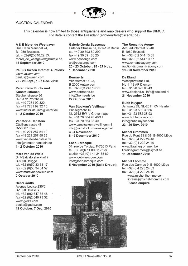
September 2010 BIMCC Newsletter No 38 37 37
AUCTION CALENDAR
A & E Morel de Westgaver Rue Henri Marichal 24, B-1050 Brussels. tel. + 32-(0)2-640.22.53, [email protected] 18 September 2010 Paulus Swaen Internet Auctions www.swaen.com [email protected] 22 - 28 Sept., 1 - 7 Dec. 2010 Peter Kiefer Buch- und Kunstauktionen Steubenstrasse 36 D-75172 Pforzheim tel. +49 7231 92 320 fax +49 7231 92 32 16 www.kiefer.de, [email protected] 1 - 2 October 2010 Venator & Hanstein Cäcilienstrasse 48, D-50667 Köln tel. +49 221 257 54 19 fax +49 221 257 55 26 www.venator-hanstein.de [email protected] 1 - 2 October 2010 Marc van de Wiele Sint-Salvatorskerkhof 7 B-8000 Brugge tel. +32 (0)50 33 63 17 fax +32 (0)50 34 64 57 www.marcvandewiele.com 2 October 2010 Henri Godts Avenue Louise 230/6 B-1050 Brussels tel. +32 (0)2 647 85 48 fax +32 (0)2 640 73 32 www.godts.com [email protected] 12 October, 7 Dec. 2010
Galerie Gerda Bassenge Erdener Strasse 5a, D-14193 Berlin tel. +49 30 893 80 290 fax +49 30 891 80 25 www.bassenge.com [email protected] 20 - 23 October, 25 - 27 Nov., 1 December 2010 Bernaerts Verlatstraat 16-22, B-2000 Antwerpen tel +32 (0)3 248 19 21 www.bernaerts.be [email protected] 27 October 2010 Van Stockum's Veilingen Prinsegracht 15 NL-2512 EW 's-Gravenhage tel. +31 70 364 98 40/41 fax +31 70 364 33 40 www.vanstockums-veilingen.nl [email protected] 3 - 4 November, 8 - 9 December 2010 Loeb-Larocque 31, rue de Tolbiac, F-75013 Paris tel. +33 (0)6 11 80 33 75 or tel./fax +33 (0)1 44 24 85 80 www.loeb-larocque.com [email protected] 5 November 2010 (Salle Drouot)
The Romantic Agony Acquaductstraat 38-40 B-1060 Brussels tel. +32 (0)2 544 10 55 fax +32 (0)2 544 10 57 www.romanticagony.com [email protected] 19 - 20 November 2010 De Eland Weesperstraat 110, NL-1112 AP Diemen tel. +31 20 623 03 43 www.deeland.nl, [email protected] 21 November 2010 Bubb Kuyper Jansweg 39, NL-2011 KM Haarlem tel. +31 23 532 39 86 fax +31 23 532 38 93 www.bubbkuyper.com [email protected] 23 - 26 Nov. 2010 Michel Grommen Rue du Pont 33 & 38, B-4000 Liège tel. +32 (0)4 222 24 48 fax +32 (0)4 222 24 49 www.librairiegrommen.be [email protected] 11 December 2010 Michel Lhomme Rue des Carmes 9, B-4000 Liège tel. +32 (0)4 223 24 63 fax +32 (0)4 222 24 19
www.michel-lhomme.com [email protected] Please enquire
This calendar is now limited to those antiquarians and map dealers who support the BIMCC. For details contact the President ([email protected])

BIMCC Newsletter No 38 September 2010 38
STANDARD WORKS ON THE HISTORY OF CARTOGRAPHY Free catalogue on request
HES & DE GRAAF Publishers BV
PO Box 540, 3990 GH Houten, Netherlands T (31) 30 6390071, F (31) 30 6380099
www.hesdegraaf.com [email protected]
For more information about our facsimile edition of the
Atlas Blaeu – Van der Hem:
www.blaeuvanderhem.com
September 2010 BIMCC Newsletter No 38 39 39
.
BIMCC
BRUSSELS INTERNATIONAL MAP COLLECTORS’ CIRCLE http://www.bimcc.org
Aims and functions of the BIMCC The BIMCC is a non-profit making association under Belgian law (asbl/vzw 0464 423 627) aiming to: 1. Provide an informal and convivial
forum for all those with a specialist interest in maps, atlases, town views and books with maps, be they collectors, academics, antiquarians, or simply interested in the subject
2. Organise lectures on various aspects of historical cartography, on regions of cartographical interest, on documentation, paper conservation and related subjects
3. Organise visits to exhibitions, and to libraries and institutions holding important map and atlas collections.
In order to achieve these aims, the Circle organises the following annual events:
• A MAP EVENING in March or
April, bringing together all those interested in maps and atlases for an informal chat about an item from their collection – an ideal opportunity to get to know the Circle.
• An EXCURSION to a Map
Collection, between September and November.
• AN INTERNATIONAL
CONFERENCE on a specific major topic every year in December.
Honorary President Wulf Bodenstein Avenue des Camélias 71 B-1150 Brussels telephone/fax: +32 (0)2 772 69 09 e-mail: [email protected] BIMCC Executive Committee President Eric Leenders Zwanenlaan 16, B-2610 Antwerpen telephone: +32 (0) 3 440 10 81 e-mail: [email protected] Vice-President Caroline De Candt Burggravenlaan 341, B-9000 Gent , telephone: +32(0)9 222 80 14 e-mail: [email protected] Treasurer &
Membership Secretary Eddy Masschalck Ridder van Ranstlei 77, B-2640 Mortsel telephone: +32(0)4 74 93 47 61 e-mail: [email protected] Secretary Delphine Strauven Lippenslaan 11, B-1650 Beersel, telephone: +32(0)479 51 51 24 e-mail: [email protected] Editor (Éditeur responsable) Jean-Louis Renteux Rue des Floralies 62 B-1200 Brussels telephone: + 32 (0)2 770 59 03 e-mail: [email protected] Webmaster Pierre Parmentier e-mail: [email protected] Scientific Adviser Lisette Danckaert
Other Officers
• Lydia Cordon
e-mail: [email protected] • Jan De Graeve • Peter Galezowski e-mail: [email protected]
• Henri Godts
e-mail: [email protected] • Rob Harren
[email protected] Becoming (and staying) a BIMCC Member Members receive three Newsletters per annum and have free admission to most of the BIMCC events — non-members pay full rates. Annual membership: EUR 30.00, Students and Juniors under 25: EUR 12.00 To become (and stay!) a member, please pay the membership dues EXCLUSIVELY by bank transfer (no cheques please) to the BIMCC bank account:
IBAN: BE52 0682 4754 2209 BIC: GKCCBEBB
and notify the Membership Secretary indicating your name and address. BIMCC Newsletter The BIMCC currently publishes three Newsletters per year. Please submit calendar items and other contributions to the editor (e-mail: [email protected]) by the following deadlines:
• 15 Dec. for the January edition.
• 15 April for the May edition.
• 15 August for the Sept. edition.
Signed articles and reviews reflect solely the opinions of the author.

Henri Godts Avenue Louise 230/6
1050 Brussels
Tel. +32(0)2 647 85 48 Fax +32(0)2 640 73 32
Dealer and Auctioneer of rare books,
manuscripts, maps and atlases
Info from: [email protected] Catalogues can be seen on
www.godts.com
Aquaductstraat 38 - 40 1060 Brussels
Tel. +32(0)2 544 10 55 Fax +32 (0)2 544 10 57
E-mail: [email protected]
www.romanticagony.com
Old and modern rare books, prints, autographs, manuscripts, maps and
atlases
Loeb-Larocque Maps, Atlases, Prints and Books
31, rue de Tolbiac 75013 Paris
By appointment only
Tel. +33(0)6 11 80 3375
Tel/Fax +33(0)1 44 24 85 80
E-mail: [email protected] www.loeb-larocque.com
Antiquariat
Peter Kiefer Buch- und Kunstauktionen
(Book and art auctions)
Steubenstraße 36 75172 Pforzheim, Germany
Tel. +49 7231 / 9232-0 Fax +49 7231 / 9232-16
E-mail: [email protected]
URI: http://www.kiefer.de/index.asp