understand how running water acts as an agent of...
TRANSCRIPT

Understand how running water
acts as an agent of erosion and
deposition. (Chapter 2)

Tributaries are branches of a river that feed water into the larger river
Rivers flow from high elevation to low elevation
Rivers empty into the sea at sea level = 0 m
Look for elevation legend, often color coded, symbols or contour lines.

What direction does the river flow? Where is the high elevation?
Where are the tributaries?
Where does the river begin?
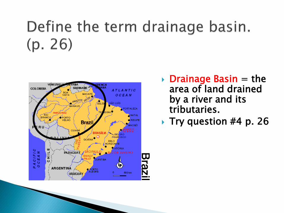
Drainage Basin = the area of land drained by a river and its tributaries.
Try question #4 p. 26


The Amazon Basin is the planet's largest body of fresh water with 1100 tributaries 17 of which are more than 1000 miles long.
Many of the tributaries begin in Colombia and Peru.
WHY????


The Nile river in Africa is the longest river in the world.
The green area on the map marks the Nile River basin.

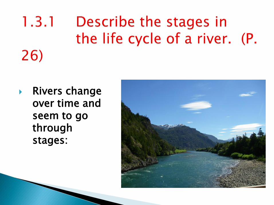
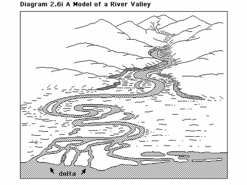
Rivers change over time and seem to go through stages:


V-shaped and narrow with steeper sides
Vertical erosion (bottom of the river)
Low water volume, but faster flows
Higher gradient (slope)
Rapids and/or waterfalls are common
Usually found in highland or mountain regions
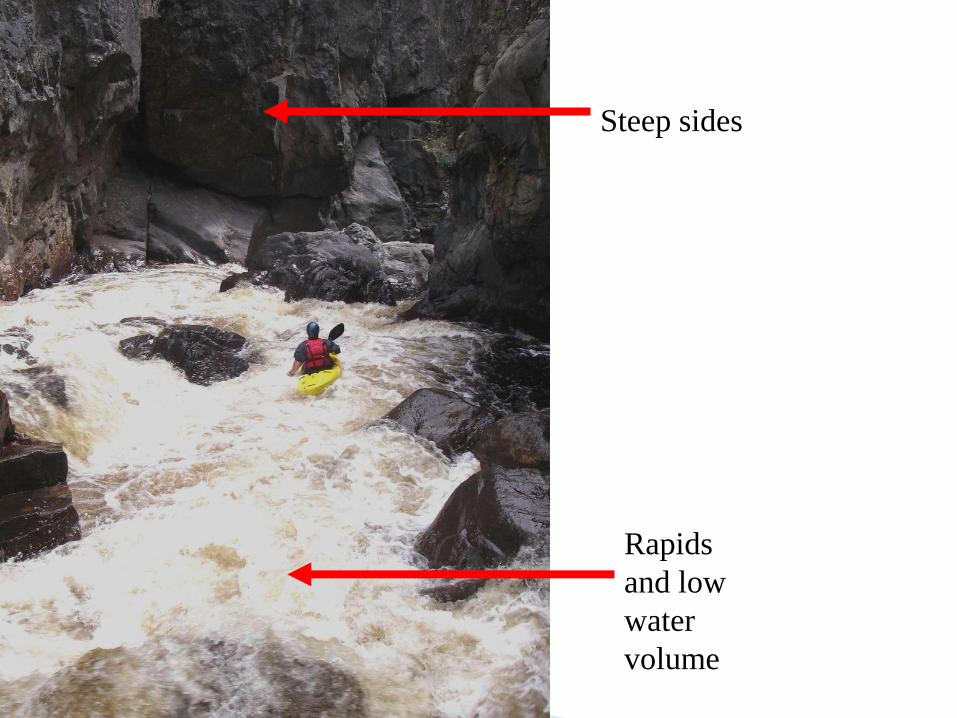
Rapids
and low
water
volume
Steep sides

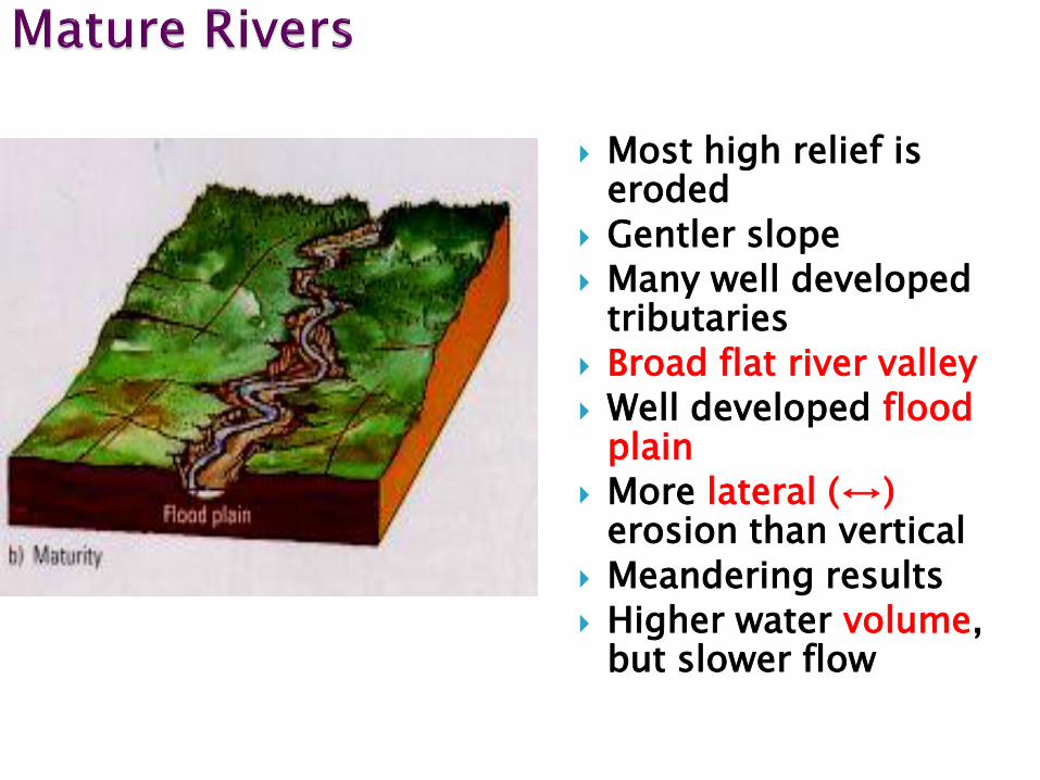
Most high relief is eroded
Gentler slope
Many well developed tributaries
Broad flat river valley
Well developed flood plain
More lateral (↔) erosion than vertical
Meandering results
Higher water volume, but slower flow

Slower flow, but higher volume Sides that are less steep

Remember the stages are not distinct.
These changes occur over long periods of time.

Meanders
form


Almost no slope Very little relief Elaborate
meandering Often swampy areas
around river Very muddy due to
slow speed and deposition
Most susceptible to flooding because of large flood plain.
Oxbow lakes develop
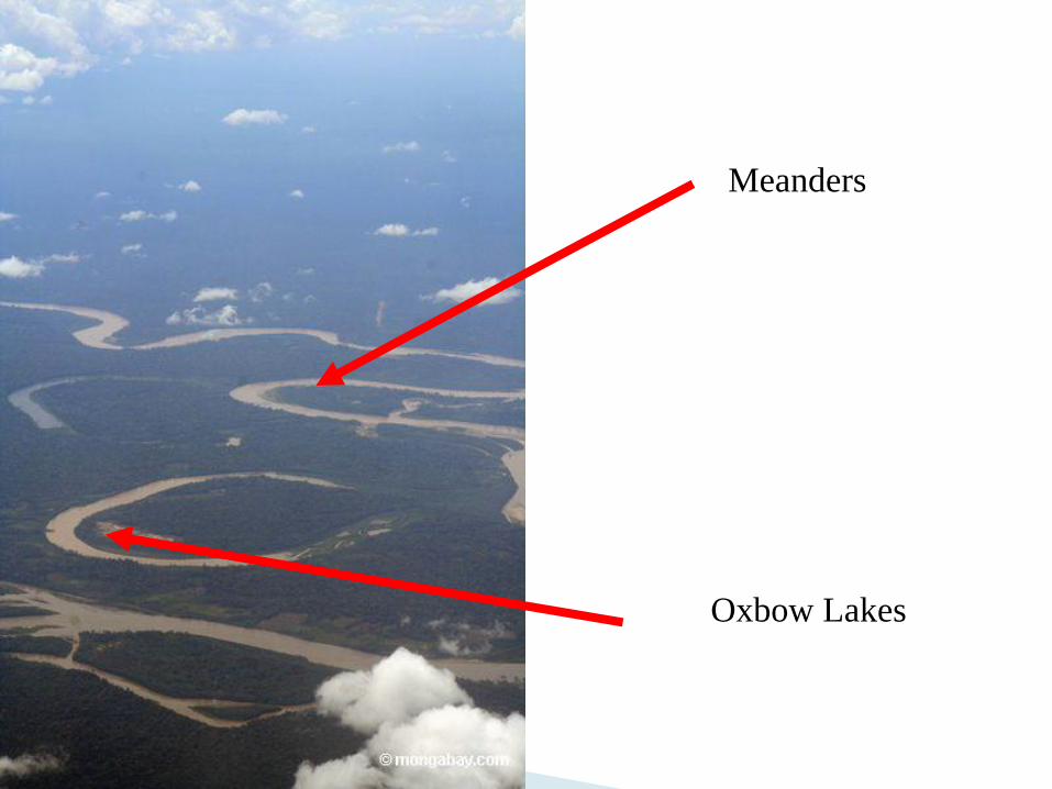
Meanders
Oxbow Lakes


http://www.kented.org.uk/ngfl/subjects/geography/rivers/River%20Articles/oxbowlake.htm
http://www.youtube.com/watch?v=ef1HI3MoXFs&feature=related


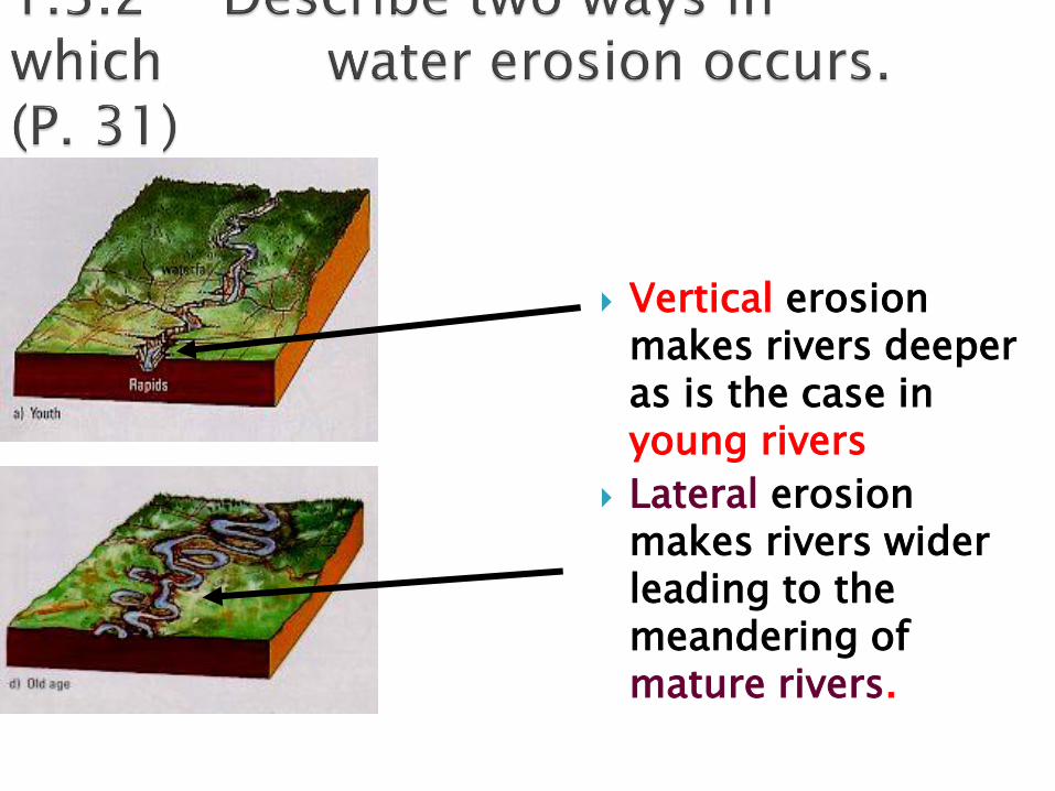
Vertical erosion makes rivers deeper as is the case in young rivers
Lateral erosion makes rivers wider leading to the meandering of mature rivers.

Youth Stage
Mature Stage
Old Age Stage

Delta = low lying area at
mouth of river formed by
deposition of silt deposition occurs
because river slows as it enters ocean or lake


Arcuate Delta=
Named from Latin word for curved in the shape of a bow.
Fan shaped
Example Nile Delta p. 32

Nile
Delta
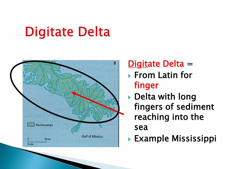
Digitate Delta =
From Latin for finger
Delta with long fingers of sediment reaching into the sea
Example Mississippi

Mississippi
Delta

Estuarine Delta =
Formed when river runs into bay or estuary
Tidal mud flats form which can be seen at low tide
Sediment deposited from river outflow and from Tidal inflow

Sacramento River – San Joaquin
San Francisco Bay Delta
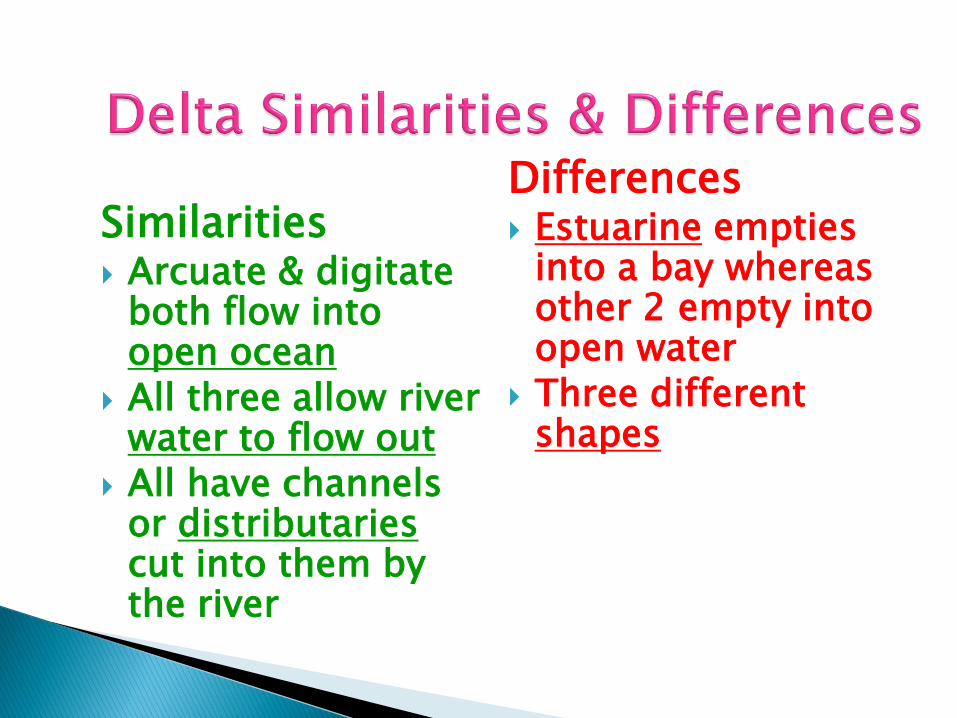
Similarities Arcuate & digitate
both flow into open ocean
All three allow river water to flow out
All have channels or distributaries cut into them by the river
Differences Estuarine empties
into a bay whereas other 2 empty into open water
Three different shapes

1. Slope of the river 2. Relief of the
banks 3. Width of the
valley 4. Meandering 5. Size of flood
plain 6. Rapids or water
falls
Evidence to look for!!

Young
Water falls & rapids
Steep slope

Late maturity
Meandering
Flood plain developing

Youth
Rapid water movement
Rapids & water falls
High relief on banks

