understanding soil surveys - more than a checklist … jan 2018 lf... · psls annual conference...
TRANSCRIPT

Understanding Soil Surveys - More Than a Checklist Item!Laurel F. Mueller
Certified Professional Soil Scientist
PSLS Annual Conference January 23, 2018
SoilServicesCompany.com
SoilServicesCompany.com
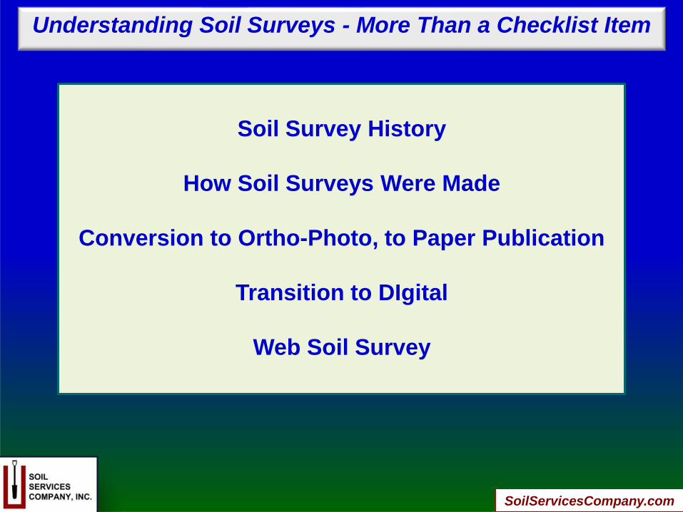
Soil Survey History
How Soil Surveys Were Made
Conversion to Ortho-Photo, to Paper Publication
Transition to DIgital
Web Soil Survey
Understanding Soil Surveys - More Than a Checklist Item
SoilServicesCompany.com
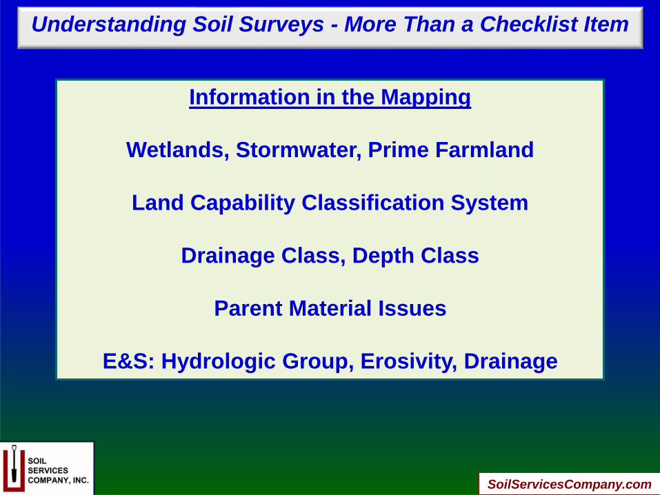
Information in the Mapping
Wetlands, Stormwater, Prime Farmland
Land Capability Classification System
Drainage Class, Depth Class
Parent Material Issues
E&S: Hydrologic Group, Erosivity, Drainage
Understanding Soil Surveys - More Than a Checklist Item

SoilServicesCompany.com
Land Development
Sewage, Stormwater, Wetlands
Exercises To Test Your Soil Map Interpretive Skills
Soil Mapping Units in Ordinances:
Alluvial, Colluvial, Prime, High Water Table, Hydric
SOIL MAPPING CAN BE WRONG AND
OWNER/DEVELOPER MAY CHALLENGE!
Understanding Soil Surveys - More Than a Checklist Item

SoilServicesCompany.com
Understanding Soil Surveys - More Than a Checklist Item
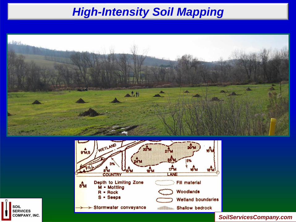
High Intensity Soil Survey
Permit Driven Soil Mapping Units
Hydraulic Conductivity (Ksat) Testing
for Large Volume Sewage Systems & Stormwater
“What are Soil Scientists?”

SoilServicesCompany.com
Laurel’s Take-Away Message:
You are Foolish to Not Research Soil Survey!
You are Doing a Dis-service to Your Client if
You Rely Only on Soil Survey for Site Planning!
High Intensity Site-Specific Soil Survey by
CPSSs Can be Cost-Effective in Making Your
Project Successful.
Understanding Soil Surveys - More Than a Checklist Item
SoilServicesCompany.com
High-Intensity Soil Mapping
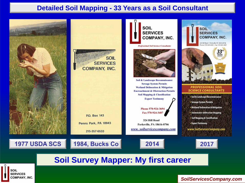
Detailed Soil Mapping - 33 Years as a Soil Consultant
2017
Soil Survey Mapper: My first career
SoilServicesCompany.com
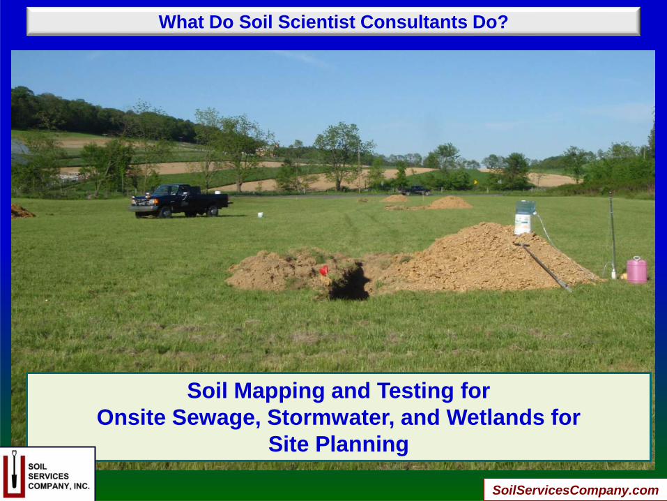
What Do Soil Scientist Consultants Do?
Soil Mapping and Testing for
Onsite Sewage, Stormwater, and Wetlands for
Site Planning
SoilServicesCompany.com

Soil Survey History
Only 2 things in life you can be sure of:
DEATH AND TAXES!
In the beginning…..
Soil mapping was for taxing land value
In early China and Russia
SoilServicesCompany.com
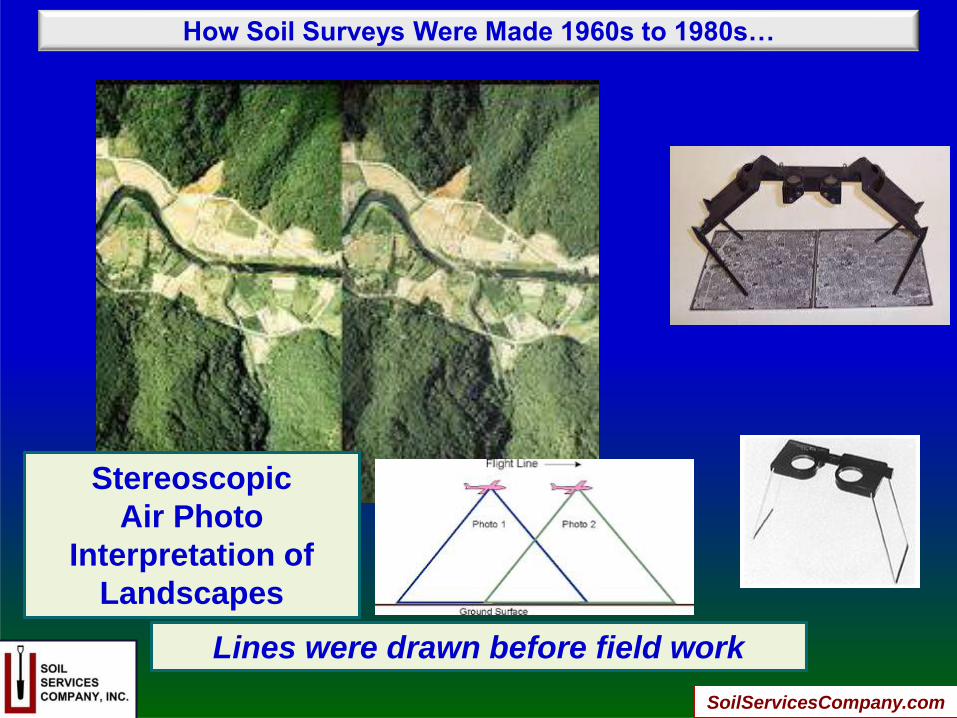
Stereoscopic
Air Photo
Interpretation of
Landscapes
Lines were drawn before field work
How Soil Surveys Were Made 1960s to 1980s…
SoilServicesCompany.com
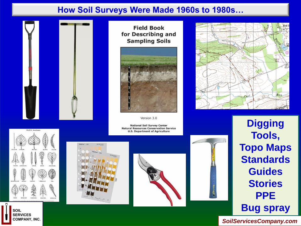
How Soil Surveys Were Made 1960s to 1980s…
Digging
Tools,
Topo Maps
Standards
Guides
Stories
PPE
Bug spray
SoilServicesCompany.com
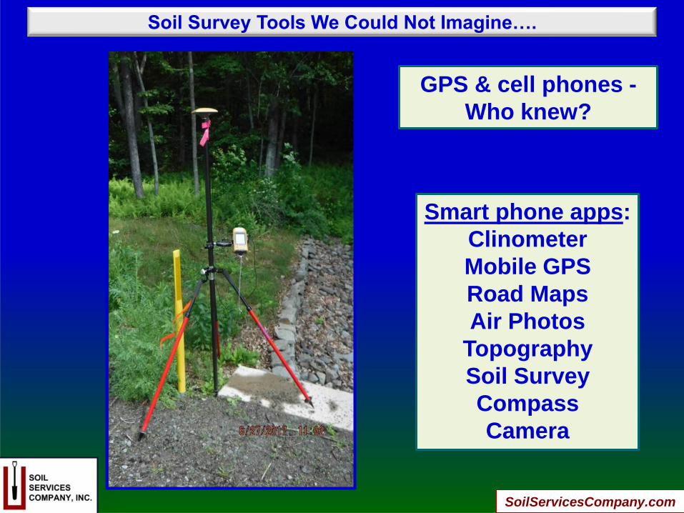
Soil Survey Tools We Could Not Imagine….
GPS & cell phones -
Who knew?
Smart phone apps:
Clinometer
Mobile GPS
Road Maps
Air Photos
Topography
Soil Survey
Compass
Camera
SoilServicesCompany.com
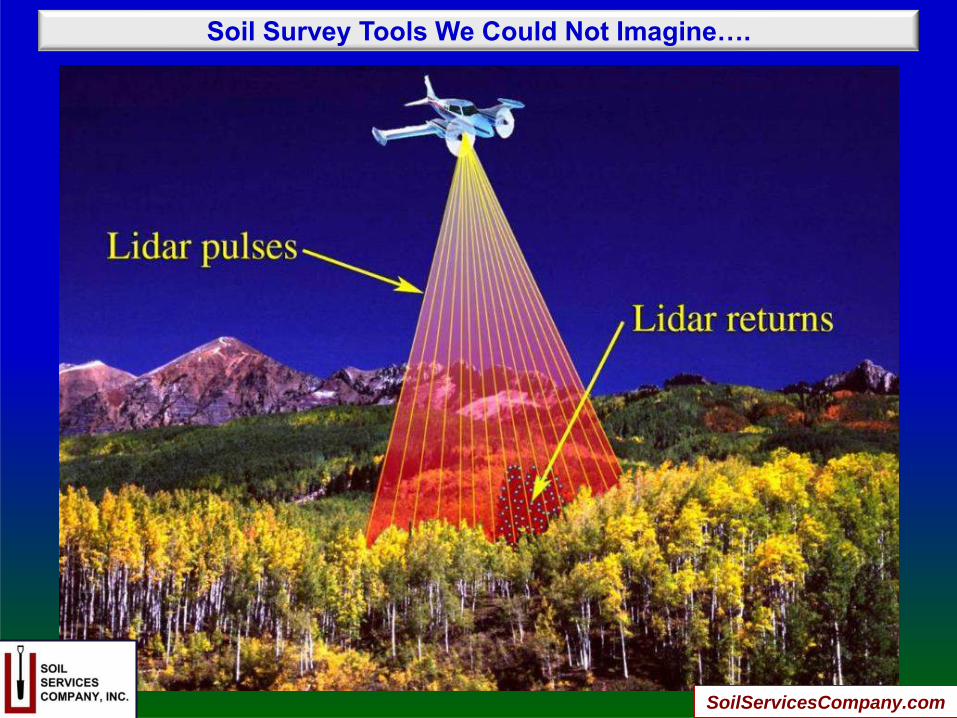
Soil Survey Tools We Could Not Imagine….
SoilServicesCompany.com

Soil Survey Tools We Could Not Imagine….
LIDAR Imagery
SoilServicesCompany.com
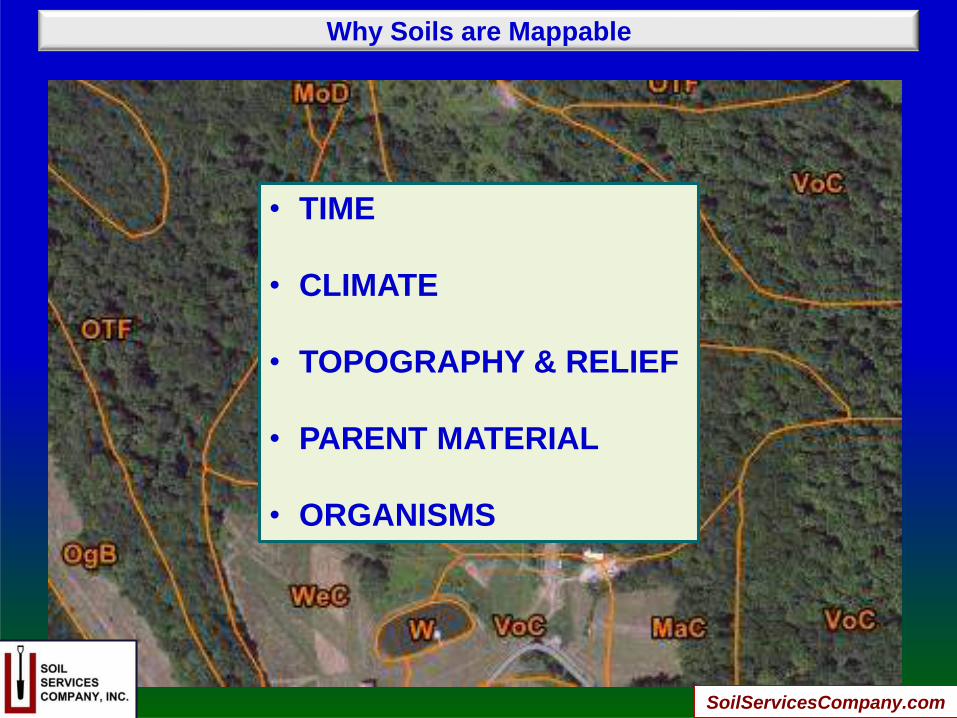
Why Soils are Mappable
• TIME
• CLIMATE
• TOPOGRAPHY & RELIEF
• PARENT MATERIAL
• ORGANISMS
SoilServicesCompany.com
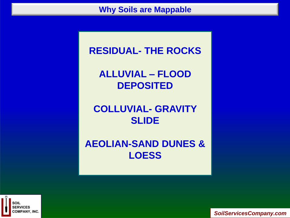
Why Soils are Mappable
RESIDUAL- THE ROCKS
ALLUVIAL – FLOOD
DEPOSITED
COLLUVIAL- GRAVITY
SLIDE
AEOLIAN-SAND DUNES &
LOESS
SoilServicesCompany.com
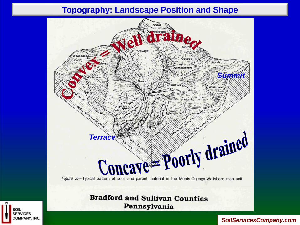
Topography: Landscape Position and Shape
Terrace
Summit
SoilServicesCompany.com

National Cooperative Soil Survey Standards (USDA/NRCS)
SoilServicesCompany.com
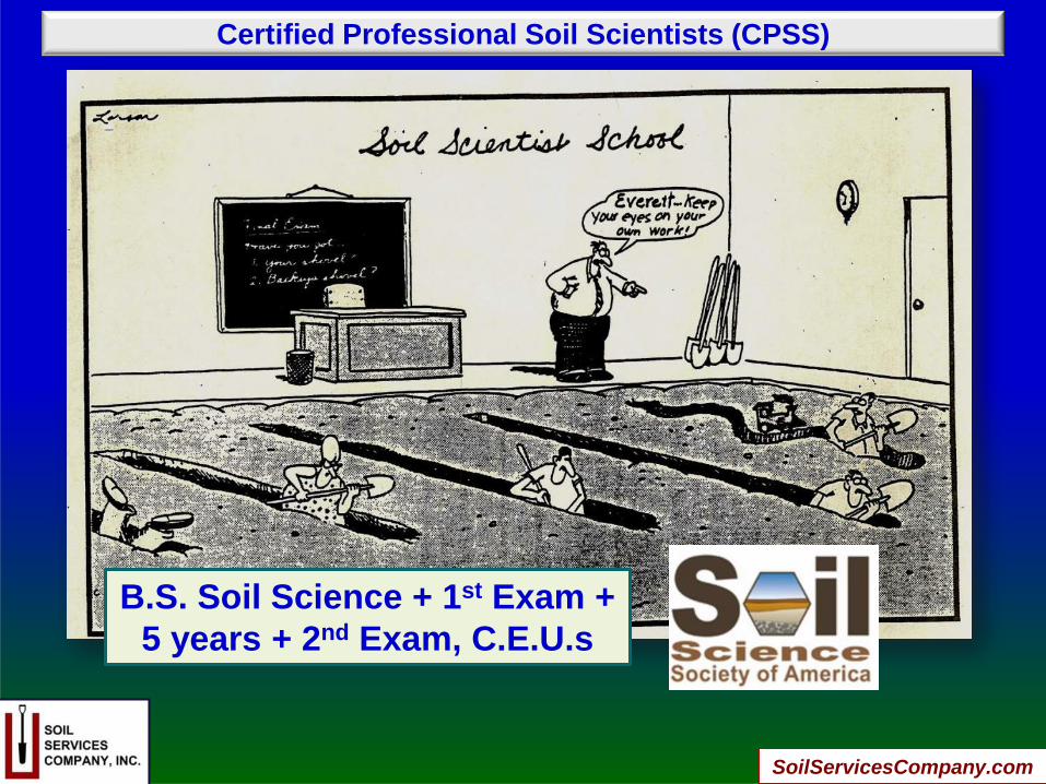
Certified Professional Soil Scientists (CPSS)
B.S. Soil Science + 1st Exam +
5 years + 2nd Exam, C.E.U.s
SoilServicesCompany.com

Soil Profile Descriptions
MASTER HORIZONS
A
E
B
C
R
Subhorizons
SoilServicesCompany.com
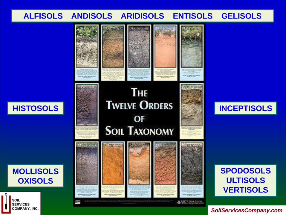
ALFISOLS ANDISOLS ARIDISOLS ENTISOLS GELISOLS
HISTOSOLS INCEPTISOLS
MOLLISOLS
OXISOLS
SPODOSOLS
ULTISOLS
VERTISOLS
SoilServicesCompany.com
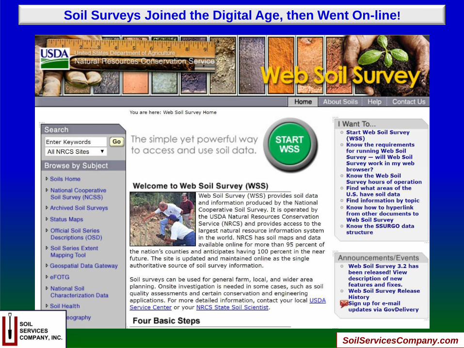
Soil Surveys Joined the Digital Age, then Went On-line!
SoilServicesCompany.com
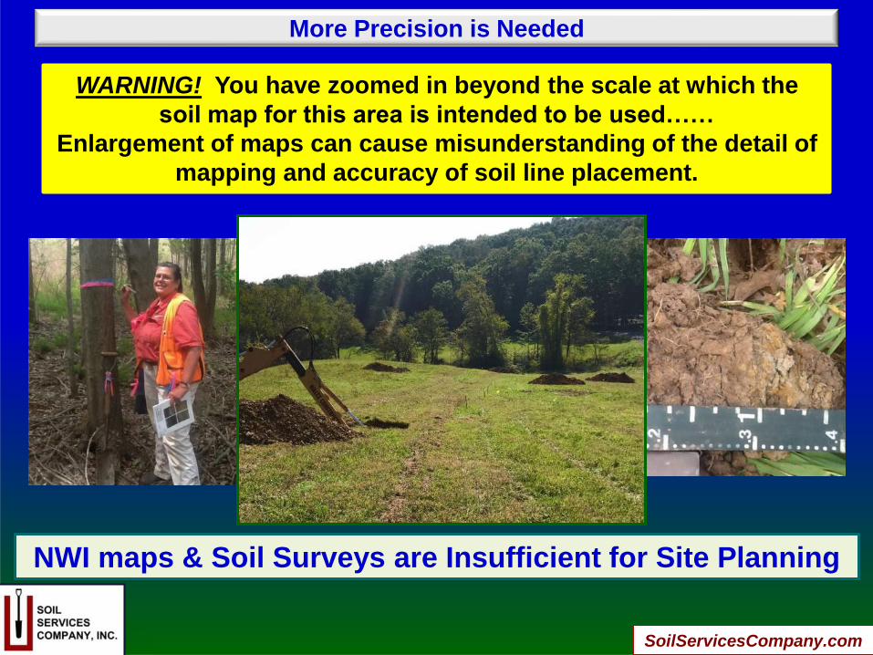
More Precision is Needed
NWI maps & Soil Surveys are Insufficient for Site Planning
WARNING! You have zoomed in beyond the scale at which the
soil map for this area is intended to be used……
Enlargement of maps can cause misunderstanding of the detail of
mapping and accuracy of soil line placement.
SoilServicesCompany.com
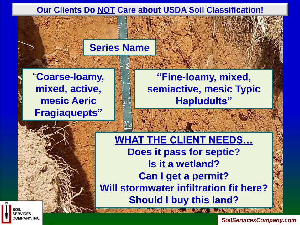
Our Clients Do NOT Care about USDA Soil Classification!
“Coarse-loamy,
mixed, active,
mesic Aeric
Fragiaquepts”
Series Name
“Fine-loamy, mixed,
semiactive, mesic Typic
Hapludults”
WHAT THE CLIENT NEEDS…
Does it pass for septic?
Is it a wetland?
Can I get a permit?
Will stormwater infiltration fit here?
Should I buy this land?
SoilServicesCompany.com
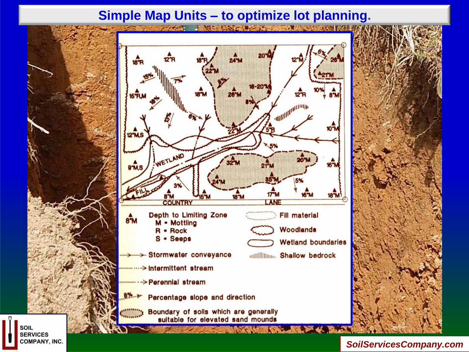
Simple Map Units – to optimize lot planning.
SoilServicesCompany.com
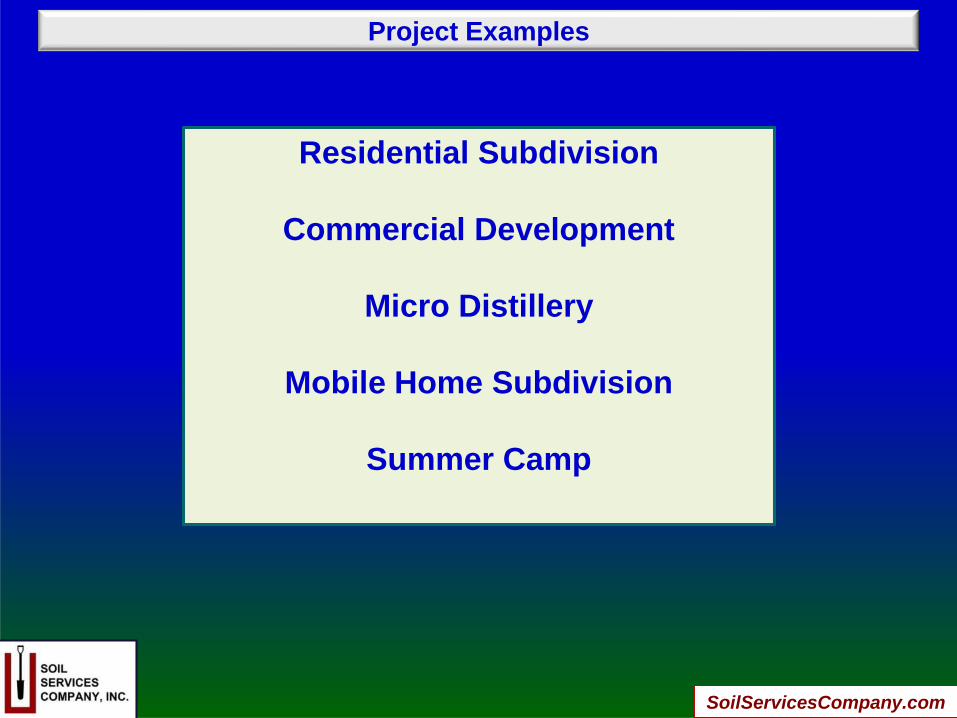
Project Examples
Residential Subdivision
Commercial Development
Micro Distillery
Mobile Home Subdivision
Summer Camp
SoilServicesCompany.com
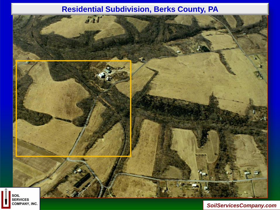
Residential Subdivision, Berks County, PA
SoilServicesCompany.com

Residential Subdivision, Berks County, PA
SoilServicesCompany.com
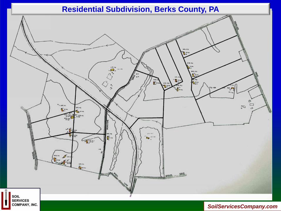
Residential Subdivision, Berks County, PA
SoilServicesCompany.com
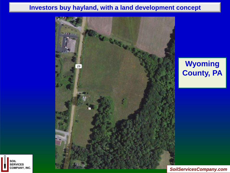
Investors buy hayland, with a land development concept
Wyoming
County, PA
SoilServicesCompany.com

Due Diligence Begins with Soil Survey Mapping
SoilServicesCompany.com
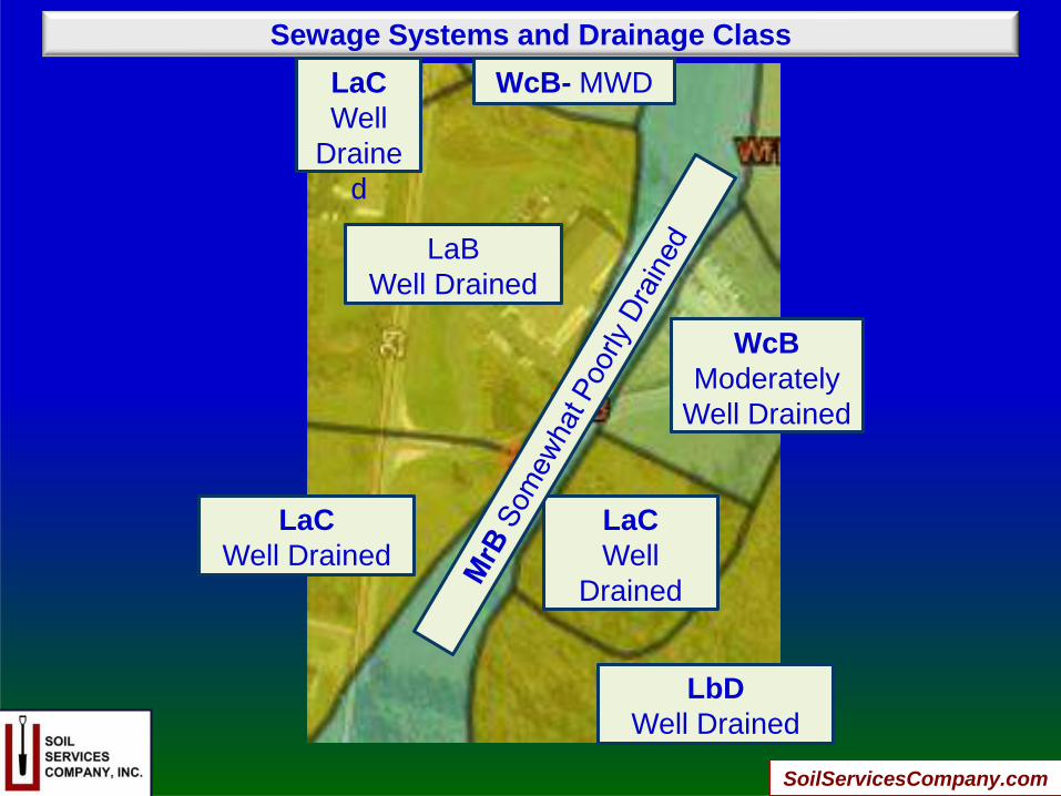
Sewage Systems and Drainage Class
LaB
Well Drained
LaC
Well Drained
LaC
Well
Drained
WcB
Moderately
Well Drained
LbD
Well Drained
LaC
Well
Draine
d
WcB- MWD
SoilServicesCompany.com
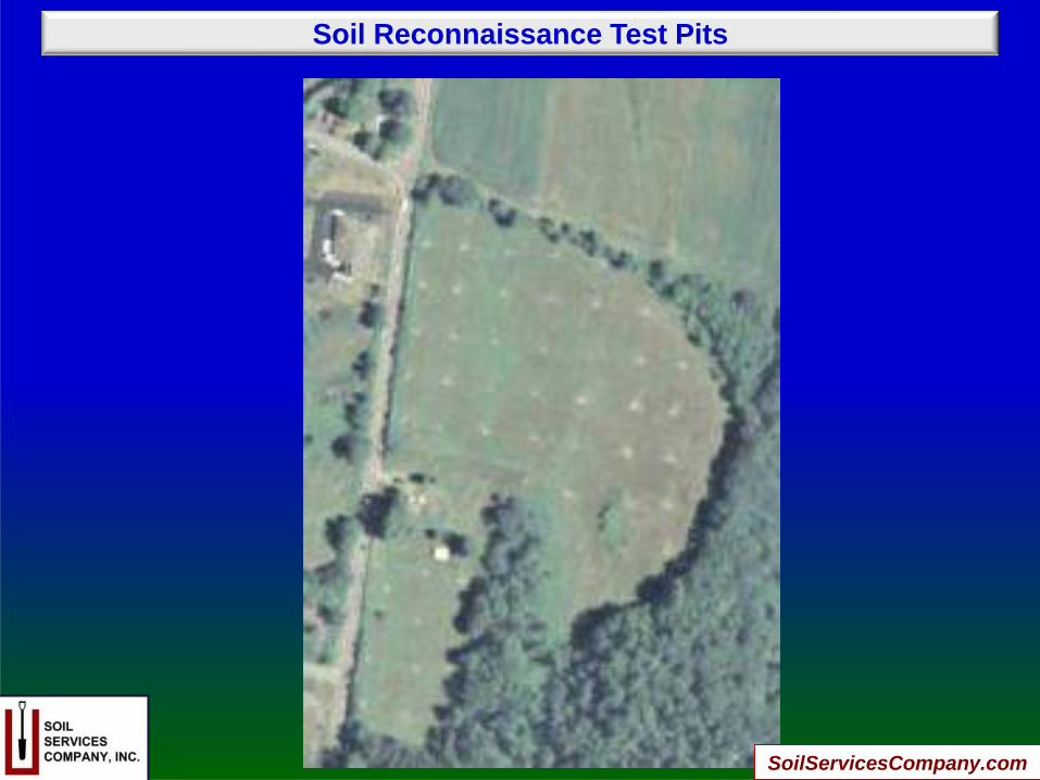
Soil Reconnaissance Test Pits
SoilServicesCompany.com
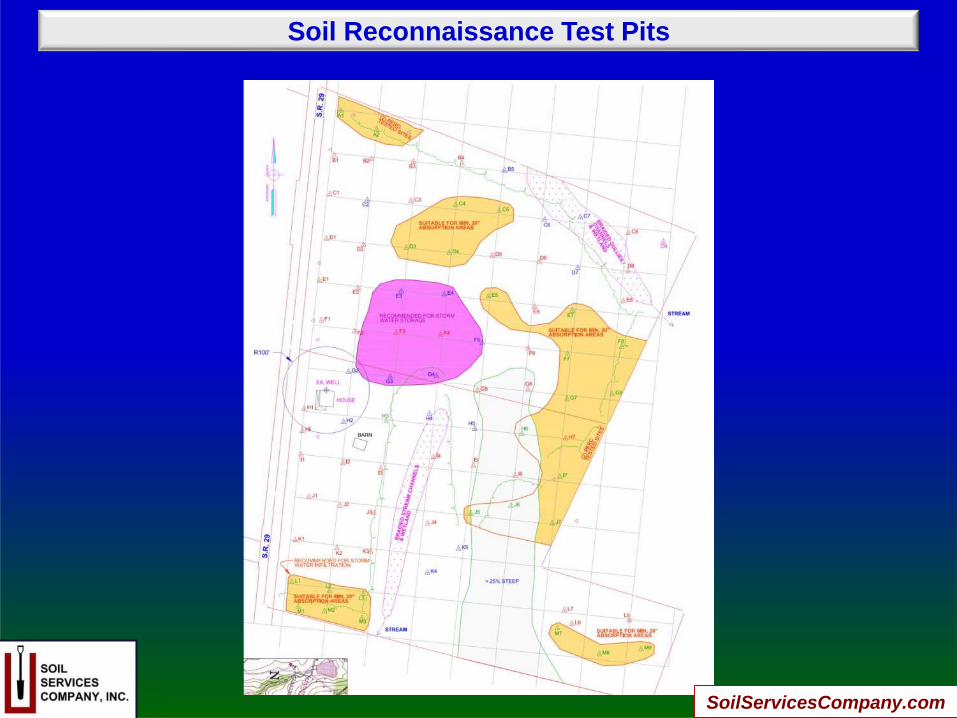
Soil Reconnaissance Test Pits
SoilServicesCompany.com
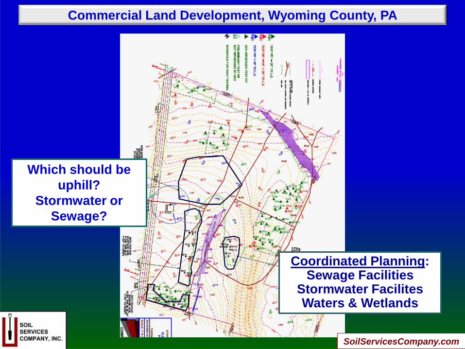
Commercial Land Development, Wyoming County, PA
Coordinated Planning:Sewage Facilities
Stormwater FacilitesWaters & Wetlands
Which should be
uphill?
Stormwater or
Sewage?
SoilServicesCompany.com

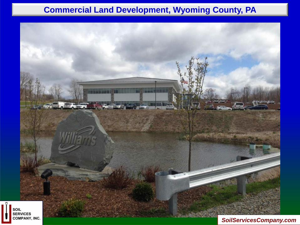
Commercial Land Development, Wyoming County, PA
Some suitable
soil is now
covered with
buildings
SoilServicesCompany.com

Commercial Land Development, Wyoming County, PA
SoilServicesCompany.com

Commercial Land Development, Wyoming County, PA
SEASONAL HIGH
WATER TABLE
PERCHED ON A
FRAGIPAN
TODAY, STORMWATER
STORAGE BASIN
THIS CONCAVE LANDSCAPE COULD NOT BE USED
FOR SEWAGE DISPOSAL …OR STORMWATER
INFILTRATION!
SoilServicesCompany.com
Commercial Land Development, Wyoming County, PA
SoilServicesCompany.com
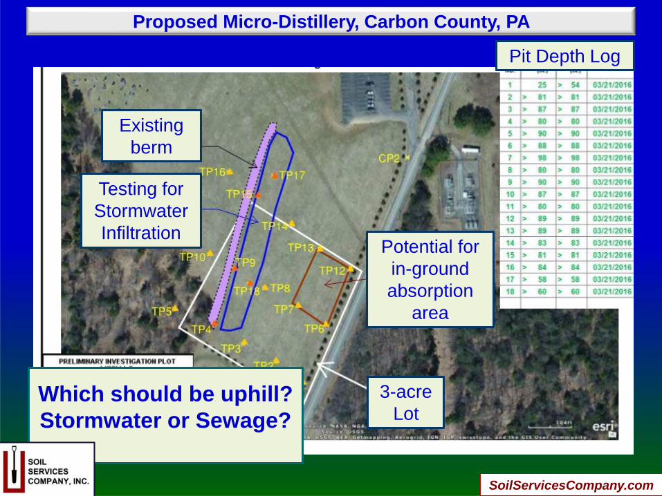
Proposed Micro-Distillery, Carbon County, PA
Existing
berm
Testing for
Stormwater
InfiltrationPotential for
in-ground
absorption
area
Which should be uphill?
Stormwater or Sewage?
3-acre
Lot
Pit Depth Log
SoilServicesCompany.com
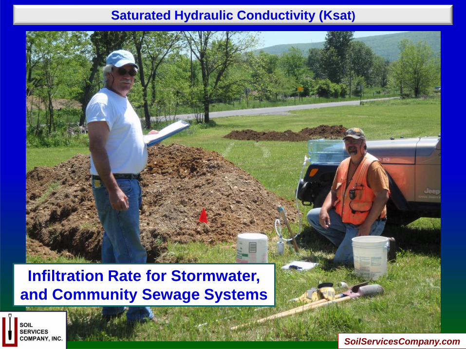
Saturated Hydraulic Conductivity (Ksat)
Infiltration Rate for Stormwater,
and Community Sewage Systems
SoilServicesCompany.com
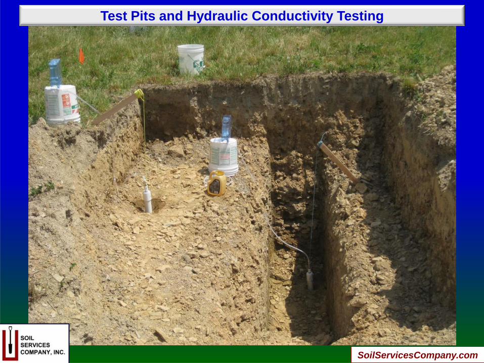
Test Pits and Hydraulic Conductivity Testing
SoilServicesCompany.com

Decentralized Community Sewage System
200 Mobile Home Lots,
Drip Field for Repair
SoilServicesCompany.com

Decentralized Community Sewage System
850 campers & staff
11,500 GPD
Spray Field for
Summer Camp
Expansion
SoilServicesCompany.com

Aeration and Soil Porosity
Essential for sewage systems
& stormwater infiltration
SoilServicesCompany.com
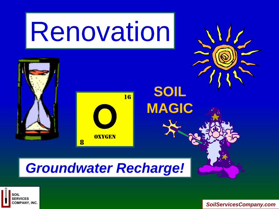
Renovation
SOIL
MAGIC
Groundwater Recharge!
SoilServicesCompany.com
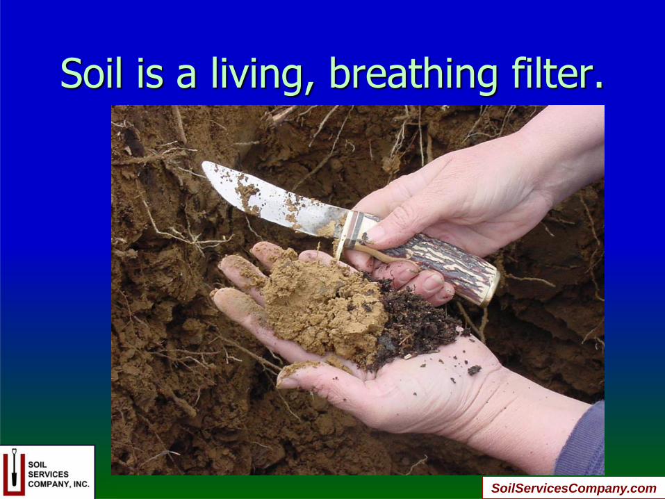
Soil is a living, breathing filter.
SoilServicesCompany.com
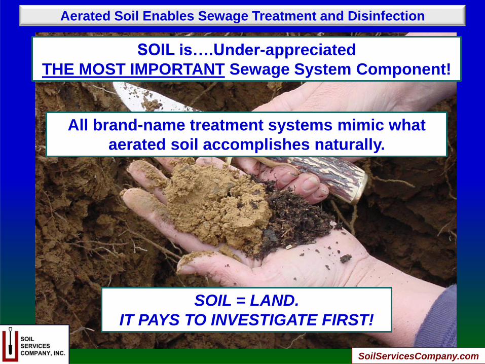
Aerated Soil Enables Sewage Treatment and Disinfection
SOIL is….Under-appreciated
THE MOST IMPORTANT Sewage System Component!
All brand-name treatment systems mimic what
aerated soil accomplishes naturally.
SOIL = LAND.
IT PAYS TO INVESTIGATE FIRST!
SoilServicesCompany.com
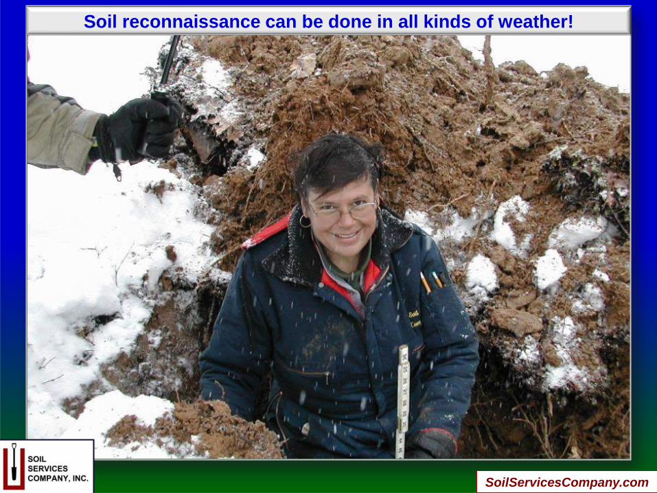
Soil reconnaissance can be done in all kinds of weather!
SoilServicesCompany.com