united states department ofthe interiorwsdot.wa.gov/nr/rdonlyres/1abe4ef4-1c45-4cf9-b126... ·...
TRANSCRIPT
United States Department of the Interior
FISH AND WILDLIFE SERVICE
Washington Fish and Wildlife Office 510 Desmond Dr. SE, Suite 102
Lacey, Washington 98503 NOV 2 6 2013 In Reply Refer To: 13410-2011-F-0063-R004
Daniel M. Mathis Division Administrator Federal Highway Administration Evergreen Plaza Building 711 Capitol Way South, Suite 501 Olympia, Washington 98501-1284
ATTN: Anthony Sarhan
Dear Mr. Mathis:
On April15, 2011, the U.S. Fish and Wildlife Service (Service) concluded formal consultation on the State Route 520, Interstate-S to Medina Bridge Replacement and HOV Project (Project) and provided a Biological Opinion (Opinion) to the Federal Highway Administration (FHW A). Final design and construction of the Project is proceeding under a series of design-build and design-bid-build contracts, administered by the FHWA and Washington State Department of Transportation (WSDOT).
On July 26, 2013, the FHWA requested re-initiation of formal consultation on the Project. This is the fourth re-initiation. This letter addresses new information regarding design and construction, use ofthe Kenmore Support Yard and Navigation Channel, and amends the Opinion to address changes to the spatial and temporal extent of effects to the bull trout (Salvelinus confluentus) and designated bull trout critical habitat. This formal re-initiation of consultation was completed in accordance with section 7(a)(2) of the Endangered Species Act of 1973, as amended (16 U.S.C. 1531 et seq.).
Consultation History
Three previous re-initiations were completed (FWS Ref. No.s 13410-2011-F-0063-R001, -R002, and -R003; January 10 and July 27, 2012, and January 3, 2013, respectively), to address new information, consider new or different effects to listed species and critical habitat, and to reconfirm or adjust the amount and extent of take specified in the Incidental Take Statement (ITS).

2 Daniel Mathis
On July 27, 2012, we responded to the second request for formal re-initiation with a letter and amendment to the Opinion and ITS. We determined that a work window extension would change the timing of work, but would not introduce new effects, or result in additional, measurable effects to the bull trout or designated bull trout critical habitat.
On January 3, 2013, we responded to the third request for formal re-initiation with a letter concluding that the identified design and construction changes would not introduce new effects, result in additional measurable effects to the bull trout or designated bull trout critical habitat, or exceed the limits of incidental take specified in the Opinion. The Service did find that activities re-scheduled for future construction seasons could potentially exceed the amount and extent of take specified in the ITS, including incidental take exempted for the west approach to Lake Washington (east of Foster Island) and Salmonid Habitat Function Zone 6. We recommended that the FHW A and WSDOT document and report working days to inform any future need for adjustment to the total amount of incidental take.
With the three previous re-initiations we found that the rationale and conclusions reached by the Opinion remained valid (Jeopardy and Adverse Modification Determinations; Opinion, pp. 113116). To date, there have been no changes to the required Reasonable and Prudent Measures (RPMs) or implementing Terms and Conditions (T&Cs).
Recent Developments
On July 30, 2013, we received a letter and memorandum from the FHWA identifying changes for the Project's West Approach Bridge North (W ABN) construction phase. Construction of the W ABN is scheduled to begin during the summer of 2014, approximately one year behind the original schedule. Additional details regarding changes for the W ABN contract and construction phase are included below (see WABN Construction Phase).
On May 30, 2013, legal counsel representing two concerned public interest groups, People for an Environmentally Responsible Kenmore (PERK) and the Lake Forest Park Stewardship Foundation (LFPSF), notified the Service of their intent to commence civil litigation against the Service, FHW A, and National Marine Fisheries Service for alleged failures to comply with administrative requirements for the reinitiation of formal consultation (50 C.F .R. section 402.16), a failure to accurately define action area, and to fully consider the potential effects of the action to listed species and designated critical habitat. These complaints relate to temporary use of an existing industrial facility located in north Lake Washington by the WSDOT and their Contractor(s), and alleged failures to comply with Clean Water Act (CWA) requirements and Washington State's water quality criteria when navigating transport barges along the federally authorized Kenmore Navigation Channel. Additional information regarding use ofthe Kenmore Support Yard, Kenmore Navigation Channel, and barge transport route between the Kenmore Navigation Channel and Lake Washington construction sites is included below (see Kenmore Support Yard and Navigation Channel).

3 Daniel Mathis
W ABN Construction Phase
Additional information regarding changes for the W ABN contract and construction phase was received in this office on July 30, 2013, and September 20, 2013. Changes for the WABN contract and phase include the following (FHWA 2013a):
• The alignment of the north bridge structure is shifted approximately 30 ft to the north. The structure's height, profile, and lane configuration remain unchanged.
• The number of permanent columns supporting the north bridge structure is reduced by at least one column per pier bent, for a total reduction of approximately 50 columns. Pier bents will consist of 9- to 13-foot diameter drilled shafts, with columns attached directly to the shafts a short distance above the mudline.
• Permanent, combined total over-water structure is reduced by more than two acres, from approximately 12.6 acres (original design) to approximately 10.3 acres.
• The W ABN contract and construction phase will require three seasons of in-water work completed below the Ordinary High Water Mark (OHWM) of Union Bay and Lake Washington (2014-2016). Some ofthe work located in Lake Washington east ofFoster Island (Salmonid Habitat Function Zone 6) will overlap, both spatially and temporally, with ongoing construction of the temporary west connection bridge between the new floating bridge alignment and existing west approach (West Connection Bridge or WCB).
• The number and size of temporary structures is reduced. Construction will require approximately 766 temporary steel piles, reduced from approximately 950 piles. Temporary over-water structure is reduced, from approximately 7.0 acres to approximately 5.3 acres.
• Installing drilled shafts at pier bents 34 to 41, furthest to the east along the west approach, will require temporary work platforms. These will not require impact pile driving (FHW A 20 13b ). Also, whereas our letter addressing the WCB contract and construction phase described the installation and subsequent removal of approximately 300 temporary steel piles for work trestles, platforms, and drilled shaft templates, construction of the WCB may now require as few as 100 temporary steel piles (FHW A 20 13b ).
• The W ABN and WCB construction phases will result in a net increase of approximately 7.1 acres of pollution-generating impervious surface (PGIS), for a total of approximately 42.3 acres through the project area. The W ABN contract and phase includes construction ofthe Montlak:e/MOHAI-vicinity enhanced stormwater treatment facility, configured for the interim condition. With completion of the W ABN contract and construction phase, stormwater runoff originating from approximately 12.0 acres ofPGIS will be conveyed to this facility. Approximately 30.3 acres of untreated PGIS will remain through these portions of the project area, about 5.0 acres less than originally projected for the interim condition.

4 Daniel Mathis
• The WSDOT will use high-efficiency street sweeping to improve stormwater quality in the interim condition, and thereby further avoid and minimize impacts to surface water quality. With completion of the WABN contract and construction phase, WSDOT will begin monthly high-efficiency street sweeping of a minimum of 5 acres of untreated PGIS (FHWA 2013b). Sweeping will continue until more ofthe existing west approach structures are demolished and replaced.
• The FHW A and WSDOT will complete compensatory mitigation for unavoidable impacts to wetlands and aquatic resources. The current schedule targets completion of mitigation activities during 2014-2015 at five sites: the East Approach Shoreline; the Washington Department ofNatural Resources South Lake Washington Site (Parcel No. 0723059105); Bear Creek; the Cedar River Elliot Bridge Reach; and, Union Bay Natural Area (Parcel No. 1625049001). Recent geotechnical findings indicate that wetland creation proposed at the WSDOT-Owned Peninsula (Parcel No. 212504UNKN) is no longer feasible. However, the five sites identified above provide all of the compensatory mitigation credit required in support of the Project through completion of the W ABN construction phase.
The changes summarized above will avoid and further minimize effects to the bull trout and designated bull trout critical habitat. Importantly, the total number and proposed physical extent of permanent structures placed in and above Union Bay and Lake Washington are reduced. The permanent structures will now result in less artificial over-water structure and a reduced in-water footprint, benefiting native fish and their habitat. The Project will achieve stormwater retrofit ahead of schedule, and the interim stormwater management strategy will further avoid and minimize impacts to surface water quality.
However, the changes will result in additional, measurable, temporary effects during construction. Three seasons of in-water work below the OHWM of Union Bay and Lake Washington will be necessary (2014-2016), including extensive impact pile driving and proofing. Some of the work in Lake Washington east of Foster Island (Salmonid Habitat Function Zone 6) will overlap, both spatially and temporally, with ongoing WCB construction activities. Applying the same methods of analysis and assumptions used previously (Opinion, pp. 43-57), we conclude that the changes will result in additional temporary effects to the bull trout and designated bull trout critical habitat.
Along the west approach to Lake Washington (east of Foster Island), and Salmonid Habitat Function Zone 6, impact pile driving and proofing will exceed the amount and extent of take previously specified in the ITS. With an increase to the total number of impact driven and proofed piles for this portion of the project area (i.e., 1,200 steel piles rather than 950), the duration and extent of underwater sound exposures will increase. This has particular significance because the vicinity of the west approach east of Foster Island is considered the primary route for salmonid migration to and from south Lake Washington and the Cedar River (WSDOT 201 0).

5 Daniel Mathis
In Union Bay and Salmonid Habitat Function Zone 4, impact pile driving and proofing will not exceed the amount or extent of previously exempted incidental take. The total number of piles and the duration and extent of potential underwater sound exposures remain essentially unchanged. However, because construction will commence approximately one year behind the original schedule, the timing of these effects is delayed.
For turbidity exposures, the total duration of work (approximately 2,000 and 1,600 working days for Union Bay and Lake Washington respectively) and physical extent of potential effects are unchanged. The FHWA and WSDOT no longer propose to demolish any of the existing west approach bridge piers outside ofthe established in-water work window.
The changes summarized above will modestly increase adverse temporary exposures and effects to bull trout and designated bull trout critical habitat. However, bull trout occur in the Lake Washington watershed infrequently and in low to very low numbers. It is therefore unlikely that the total number of exposed and affected individuals will increase substantially. The changes summarized above will avoid and further minimize potential permanent effects to bull trout and designated bull trout critical habitat.
Kenmore Support Yard and Navigation Channel
On November 15, 2011, the FHWA and WSDOT provided notice to the Service that their Contractor, Kiewit/General/Manson (KGM), intended to use properties in north Lake Washington for the purpose of floating bridge anchor construction and/or pontoon outfitting, specifically a portion of the existing Kenmore Industrial Park and property owned by the Pioneer Towing Company (Kenmore Support Yard).
On January 10, 2012, the Service responded to the FHWA's first request for re-initiation of formal consultation. Our letter to the FHWA addressed activities proposed for completion at the Kenmore Support Yard, including: upland excavation; installation of casting slabs; installation of utilities; barge and tug transport in the Kenmore Navigation Channel; and, mooring of barges adjacent to the Kenmore Support Yard. We concluded:
"With successful implementation of the proposed conservation measures, we expect that activities conducted at the Kenmore Support Yard will have no measurable, permanent or temporary effects to the bull trout, bull trout prey resources, or the Primary Constituent Elements (PCEs) of designated bull trout critical habitat. Any temporary effects to bull trout habitat, resulting from barge transport and moorage, or site stormwater discharges, will not significantly disrupt normal bull trout behaviors (i.e., feeding, moving, and sheltering), will not measurably affect habitat function in either the short or long term, and are therefore considered insignificant." (Letter to the FHWA, dated January 10, 2012; FWS RefNo. 13410-2011-F-0063-R001)
On July 10 and 13, 2012, the WSDOT, FHWA, and Service exchanged email correspondence identifying additional changes for the Floating Bridge and Landings contract, including plans to use the Kenmore Support Yard as a point of origin for the delivery of raw materials (i.e., concrete) to the east Lake Washington construction site. The WSDOT projected a modest

6 Daniel Mathis
increase to the frequency of barge trips along the Kenmore Navigation Channel and identified a number of best management practices (BMPs) that KGM would implement to avoid and minimize impacts to water quality. Although KGM has the primary responsibility for compliance monitoring and reporting, WSDOT inspectors do verify that Contractors implement required BMPs. We concluded that this" ... doesn't change the conclusions reached previously (Letter to the FHWA, dated January 10, 2012; FWS RefNo. 13410-2011-F-0063-R001)" (above).
Environmental Baseline for the Kenmore Support Yard and Navigation Channel
The Kenmore Support Yard is located in north Lake Washington on a portion of the existing Kenmore Industrial Park and property owned by the Pioneer Towing Company. The Pioneer Towing Company agreed during 2001 to a Consent Decree requiring that they conduct site cleanup actions in conjunction with planned re-development, or continue periodic compliance monitoring to demonstrate suitability for industrial use (Ecology 2013d). Since 1969, when the site was closed for landfill purposes, graded, and covered with soil, the site has been used as an industrial yard for maritime and concrete manufacturing purposes.
Ecology administers a website that documents the site's historical and continuing uses. This website provides up-to-date information regarding recent and pending activities at the site, compliance monitoring, and agency actions and determinations regarding uses under the Consent Decree (Ecology 2013d). "Ground-water compliance monitoring was conducted in 2001, 2009, 2010, and again in April2012, and these results show that no known chemicals of concern are migrating from the site ... into the adjacent waterways- Sammamish River, Lake Washington, and the Kenmore Navigation Channel. The chemicals of concern at the site are petroleum oil and diesel, arsenic, barium, and lead. All other chemicals tested including [polychlorinated biphenyls] (PCBs) showed no detection, or levels significantly below [Model Toxics Control Act] (MTCA) cleanup levels" (Ecology 2012a).
During November 2012, at the request of the City of Kenmore and to inform planning for a future dredge maintenance project, Ecology and their Consultant (Anchor QEA) conducted sediment contaminant sampling and characterization at approximately 30 locations along the Kenmore Navigation Channel and lower reach ofthe Sammamish River, at Kenmore Harbor, Kenmore Industrial Park, Log Boom Park, Lyon Creek Waterfront Park, North Lake Marina, and Harbor Village. The following represents our summary of Ecology's significant findings and conclusions (Kenmore Area Sediment and Water Characterization Environmental Evaluation Report, Executive Summary; Ecology Publication No. 13-09-174; May 2013):
• Surface water results are significantly below protection levels for human health and aquatic life.
• Most of the sediment results are below the Sediment Management Standards freshwater criteria, except for samples at two private marinas.

7 Daniel Mathis
• For sediments along the Kenmore Navigation Channel and adjacent to the Kenmore Industrial Park, results are below the Freshwater Cleanup Screening Levels, indicating that the channel would not be classified as a MTCA cleanup site.
• Compared to state cleanup criteria, the sediment results show no exceedance for metals, polycyclic-aromatic hydrocarbons, pesticides, and miscellaneous extractables (benzoic acid and benzyl alcohol), and only one occurrence of PCBs. There are multiple occurrences of phthalates and dioxins at low levels. However, excluding dioxin levels detected at two private marinas, sediment dioxin results are below soil dioxin cleanup requirements.
The waters and sediments adjacent to the Kenmore Support Yard and Kenmore Industrial Park, including the Kenmore Navigation Channel and adjoining properties, are at least mildly contaminated. Some of the identified contaminants, for example both phthalates and dioxins, are among the class of persistent, potent, and biologically active legacy pollutants that are known to be both widespread and pervasive in western Washington's tidal/marine and freshwaters.
Available information suggests to us two conclusions regarding the apparent pattern of contamination in these waters and sediments: (1) the Kenmore Industrial Park, and on-going activities at that site, are not acting as an on-going source of measurable contamination to the adjacent waters and sediments; and (2) the existing low levels of contamination found in sediments surrounding the Kenmore Industrial Park and along the Kenmore Navigation Channel likely reflect proximity to past industrial uses, and natural and anthropogenic sources in the larger watershed.
The WSDOT administers a website that describes the Project's on-going activities at the Kenmore Support Yard. Content posted at the website states that KGM has performed at least two bathymetric surveys along the Kenmore Navigation Channel (May 2012 and January 2013). The WSDOT has reported, " ... these surveys indicate that channel conditions remain adequate for use by all project vessels ... depths in the Kenmore Navigation Channel ... remain well within safe operating parameters, generally ranging from 14 [to] 17 feet deep" (WSDOT 2013).
Status of the Species and Critical Habitat (Bull Trout)
Lake Washington and its tributaries, including the Cedar and Sammamish Rivers, provide foraging, migrating, and overwintering habitat for anadromous subadult and adult bull trout. The tributaries to Lake Washington are not believed to support local populations or spawning, but do provide habitat which is important to bull trout of the Puget Sound Management Unit for maintaining diversity of life history forms and for providing access to productive foraging areas.
We expect that subadult and adult bull trout foraging and migrating in the action area are most likely from the Puyallup, Snohomish-Skykomish, and/or Skagit River core areas, based on their proximity to Lake Washington, and the fact that they support robust bull trout populations and a significant anadromous component. The Lake Washington drainage presents both potential benefits and challenges to subadult and adult bull trout. Two large lakes with high forage fish

8 Daniel Mathis
availability are dominant parts of the lower watershed and provide significant foraging habitat. However, recent decades have seen development on a large scale, with an attendant decline in the quality of aquatic environments.
Adult and subadult bull trout may occupy these waters at any time of year. However, an estimate of the number of bull trout that forage, migrate, and overwinter in the action area is not available. Given the limited number of reported observations, and because current information suggests that Lake Washington and its tributaries do not support local populations or spawning, it is reasonable to assume that low to very low numbers of bull trout are likely to forage, migrate, and overwinter in the action area (Opinion, pp. 24-27). While it is difficult to discern a regular pattern of migration and distribution for these bull trout, available data and the species' life history requirements both suggest that bull trout are more likely to occur in these waters during months coinciding with juvenile salmonid outmigration (spring and early summer), and least likely during those months when (most) anadromous bull trout return to their natal systems to spawn (late August through December).
The waters within the action area are also designated as bull trout critical habitat, including all of Lake Washington to depths less than 10 meters (75 FR 63898 [October 18, 2010]). These freshwater environments provide six of the nine bull trout critical habitat PCEs, including migration habitats (PCE #2), an abundant food base (PCE #3), and sufficient water quality and quantity such that normal reproduction, growth, and survival are not inhibited (PCE #8) (Opinion, pp. 33-35).
New Information Regarding Use of the Kenmore Support Yard and Navigation Channel
On December 28, 2012, the Washington State Department of Ecology (Ecology) issued a Notice of Violation (No. 9652) to KGM for" ... visible sediment disturbance in the Kenmore Navigation Channel" on two documented occasions, in violation ofR.C.W. 90.48.080. No copy of the notice, no copy ofKGM's reply, or any other form of correspondence or notice was provided to the Service until June of 2013.
On June 27, 2013, Ecology issued an Administrative Order to KGM (Order Docket No. 9925, Amended Order No. 1001 0) and took an enforcement action requiring that KGM comply with R.C.W. 90.48 (Water Pollution Control) and W.A.C. Chapter 173-201A (Water Quality Standards for Surface Waters ofthe State of Washington). The order requires that KGM take a number of corrective actions, and states that "KGM will operate vessels in a manner that will not cause visible sediment disturbance in the channel or in adjacent areas on either side of the channel". The order requires that, "If a KGM captain must deviate from any of the ... conditions ... and the deviation results in vessel operations outside of the channel, verbal notification of the event will be made to Ecology (within 24 hours of the event)" (Amended Administrative Order; Department of Ecology; June 27, 2013).
Ecology has cited at least two occasions, March 21 and November 28,2012, when tugboats operated by KGM caused visible sediment disturbance in the Kenmore Navigation Channel (Notice of Violation No. 9652; Department of Ecology; December 28, 2012). A third party, Waste Action Project, has alleged instead that a recurrent pattern of CWA violations has resulted

Daniel Mathis 9
from KGM's tugboat operations along the Kenmore Navigation Channel (Formal Complaint, Case 2:13-cv-01629; Smith and Lowney, PLLC; September 10, 2013). The Service has previously requested that the FHW A and WSDOT monitor and collect turbidity measurements in conjunction with these barge operations, most recently during August of this year. However, thus far no data to describe the physical extent or duration of resulting impacts have been provided.
Ecology's Amended Administrative Order establishes a compliance framework that relies on visual observations and self-reporting. The WSDOT reports, that since KGM began implementing agreed-upon BMPs for barge operations," ... KGM has not notified Ecology of deviations from any of the ... conditions" (FHWA 2013b, Appendix C). However, based on our reading of the conditions included in Ecology's Amended Administrative Order, no reported deviations could mean either oftwo things: (1) there have been no additional instances where vessels operated by KGM caused visible sediment disturbance in or adjacent to the channel; or, (2) there may or may not have been any additional instances of visible sediment disturbance, but, in any case, none that also required KGM to deviate and operate a vessel outside of the federally authorized channel. To date, no party has explained definitively to the Service whether there have been additional, known instances of visible sediment disturbance.
Exposures and Effects to Bull Trout and Designated Bull Trout Critical Habitat
Propeller wash and scour are recognized as a source of potential impacts to water quality and substrate conditions, especially when vessels operate in shallow waters with fine substrates. The Jamestown S'Klallam Tribe and their partners investigated impacts to water quality during removal of pilings from a historic log storage yard located in Sequim Bay (Weston Solutions and Pascoe Environmental Consulting, 2006). Measurements oftotal suspended solids (TSS) and turbidity were taken with the goal of evaluating the extent of sediment suspension and redistribution during the piling removal process, and a tug boat was used to position the work barge alongside the group of pilings being removed. Relevant to this discussion, the authors reported the following: " ... once the piling was removed, the tug would reposition the barge ... (and) a very large sediment plume was created ... (which) easily overwhelmed any visible plume created by the piling removal"; "TSS concentrations were approximately 10 mg/L prior to the arrival of the tug ... (but) prop wash associated with the tug movements resulted in ... TSS concentrations increasing to over 1 0-times background ... not limited to discrete areas"; and, " ... the primary source for sediment resuspension was prop wash from the tug boat as it maneuvered the barge" (Weston Solutions and Pascoe Environmental Consulting, 2006).
Because propeller wash and scour can disturb substrates and re-suspend bottom sediments, both Ecology and the U.S. Environmental Protection Agency commonly include BMPs related to barge positioning and tugboat operations when conducting cleanup actions in shallow waters. The Service has previously required the FHW A and WSDOT to implement BMPs to address these same concerns (USFWS 2009).
_I

10 Daniel Mathis
The Service's Opinion addressing this Project specifically states the following: "The project will not operate tug boats in depths shallower than 10 feet to reduce the potential for turbidity resulting from propeller wash" (p. 17); and, the FHW A and WSDOT " ... shall monitor turbidity levels in Portage Bay, Union Bay, and Lake Washington during sediment-generating activities" ifthey represent a source of potential take (p. 121).
Based on all available information, the Service concludes that measurable temporary impacts to surface water quality have on occasion resulted from KGM's tugboat operations along the Kenmore Navigation Channel. However, there is little or no reliable, empirical information to describe the frequency, physical extent, or duration of these impacts.
In the absence of this information, we cannot discount the possibility, and therefore we expect that future barge and tugboat operations in support of the Project may again impact surface water quality along the Kenmore Navigation Channel. The FHW A and WSDOT have acknowledged this possibility, considered their plans and schedule for future use of the Kenmore Support Yard and Navigation Channel in light of past experience, and have provided an estimate of 14 additional, future occasions where barge and tugboat operations may result in significant, visible sediment disturbance (FHWA 2013b, Appendix C). They suggest that these temporary impacts to surface water quality will be, " ... short in duration (one hour or less), have a limited extent (within 150 of the Navigation Channel), and [be] infrequent (less than 5 times per year) ... " (FHWA 2013b, Appendix C).
For the purposes of conservatively assessing potential effects to bull trout and designated bull trout critical habitat, we assume that barge and tugboat operations in support of the Project may cause visible sediment disturbance on more than 14 additional, future occasions. However, we also expect that not all instances of visible sediment disturbance will be of the same intensity, physical extent, and duration.
Based on all available information, the Service has reached the following conclusions regarding the likelihood of measurable adverse effects to bull trout and to designated bull trout critical habitat:
We expect that individual bull trout will be exposed to temporary sediment disturbance and increased turbidity resulting from barge and tugboat operations, propeller wash and scour. We expect that most bull trout will exhibit a mild behavioral response (e.g., avoidance). Furthermore, based on the likely physical extent of resulting sediment disturbance, and the availability of undisturbed habitats nearby (i.e., adjacent waters not exhibiting excessive turbidity), we expect that few, if any, bull trout will reside in the areas of greatest intensity a sufficient duration to result in gill clogging or abrasion.
We cannot entirely discount the possibility that some bull trout may be temporarily exposed to elevated water column contaminant concentrations. However, these exposures would be transient, would do little to change outcomes for bull trout individuals that experience other, similarly contaminated environments, and are extremely unlikely to result in measurable adverse effects to either behavior or growth.

11 Daniel Mathis
We expect that temporary exposures will prevent some bull trout from utilizing preferred habitats, impede or prevent free movement through the area, and temporarily reduce foraging efficiency and/or success. The foreseeable temporary exposures and responses represent a significant disruption of normal behaviors (i.e., the ability to successfully feed, move, and/or shelter), and create a likelihood of injury. Because of the delayed response in most individuals, we expect that sub-lethal injury, including reduced growth, survival, and reproductive potential, will be difficult or impossible to detect.
We expect that relatively few bull trout have or will be exposed to temporary sediment disturbance and increased turbidity resulting from barge and tugboat operations along the Kenmore Navigation Channel. However, these exposures will significantly disrupt the normal behaviors of some individuals (i.e., the ability to successfully feed, move, and/or shelter).
We also conclude that measurable, temporary, adverse effects to designated bull trout critical habitat are reasonably certain to occur. We expect that measurable, temporary, adverse effects to PCE #s 2 (migration habitats) and 8 (water quality and quantity) have occurred, and are likely to occur again in the future, as a result of barge and tugboat operations and resulting propeller wash, hull movement, and displacement ofbottom sediments. We agree with the FHWA and WSDOT that these measurable adverse effects to the function of designated bull trout critical habitat should be limited in physical extent and duration, and will not prevent bull trout from foraging and migrating in the action area.
We have no information to suggest that barge and tugboat operations in support of the Project will measurably affect PCE #3 (an abundant food base). We therefore expect that effects to PCE #3 will be insignificant. Also, we have no information to suggest that barge and tugboat operations conducted in support of the Project will measurably change the existing, longstanding, patterns of sediment contamination along and adjacent to the Kenmore Navigation Channel. Available information suggests to us that use of the Kenmore Support Yard in north Lake Washington by the FHWA, WSDOT, and their Contractor(s) is not responsible for the apparent existing pattern of contamination exhibited in sediments surrounding the Kenmore Industrial Park and along the Kenmore Navigation Channel. The legacy pollutants that have been detected most commonly and widely, including phthalates and dioxins, are widespread and pervasive in western Washington's waters, and likely reflect both proximity to past industrial uses and natural and anthropogenic sources in the larger watershed.
Some of these conclusions differ from those previously reached by the Service when considering the FHWA's and WSDOT's proposed use ofthe Kenmore Support Yard and Navigation Channel (Letter to the FHWA, dated January 10, 2012; FWS RefNo. 13410-2011-F-0063R001). The conclusions reached here do describe new measurable effects to the bull trout and designated bull trout critical habitat, at a location, and as a result of a specific activity, not previously described by our Opinion.
The Service has concluded that the existing compliance framework, put-in-place for the FHW A, WSDOT, and their Contractor(s), does not adequately prevent and reduce, nor adequately document and report, resulting adverse effects to bull trout. The FHWA's and WSDOT's current Contractor, KGM, has initiated no self-reporting regarding deviations from required BMPs, and
12 Daniel Mathis
yet no party can definitively confirm for the Service that there have been no additional, known instances of visible sediment disturbance. The Service concludes here that new and/or modified RPMs and implementing T&Cs are both warranted and necessary.
Jeopardy and Adverse Modification Determinations
This letter addresses design and construction changes for the W ABN contract and construction phase. These changes will modestly increase adverse temporary exposures and effects to bull trout and designated bull trout critical habitat. However, bull trout occur in the Lake Washington watershed infrequently and in low to very low numbers. It is therefore unlikely that the total number of exposed and affected individuals will increase substantially. Furthermore, the design and construction changes described here will avoid and further minimize potential permanent effects to bull trout and designated bull trout critical habitat.
This letter also addresses new information regarding the FHWA's and WSDOT's use of the Kenmore Support Yard and Navigation Channel. We expect that relatively few bull trout have or will be exposed to temporary sediment disturbance and increased turbidity resulting from barge and tugboat operations in support of the Project along the Kenmore Navigation Channel. However, these exposures will significantly disrupt the normal behaviors of some individuals (i.e., the ability to successfully feed, move, and/or shelter), and create a likelihood of injury. We also expect that measurable, temporary, adverse effects to designated bull trout critical habitat are reasonably certain to occur, including adverse effects to PCE #s 2 (migration habitats) and 8 (water quality and quantity). We agree with the FHWA and WSDOT that these measurable adverse effects to the function of designated bull trout critical habitat should be limited in physical extent and duration, and will not prevent bull trout from foraging and migrating in the action area.
However, none of the conclusions reached here fundamentally change the Service's overarching Jeopardy and Adverse Modification Determinations, or the supporting rationale previously expressed in our Opinion (pp. 113-116). We find that the rationale and conclusions reached by the Service's Opinion remain valid, and essentially unchanged:
The anticipated direct and indirect effects of the action, combined with the effects of interrelated and interdependent actions, and the cumulative effects associated with future State, tribal, local, and private actions will not appreciably reduce the likelihood of bull trout survival and recovery. The anticipated direct and indirect effects of the action, combined with the effects of interrelated and interdependent actions, and the cumulative effects associated with future State, tribal, local, and private actions will not prevent the PCEs of critical habitat from being maintained, and will not degrade the current ability to establish functioning PCEs at the scale of the action area.
This letter provides an amendment to the Opinion and ITS to address changes to the spatial and temporal extent of foreseeable effects to the bull trout and designated bull trout critical habitat, including new and modified RPMs and implementing T &Cs (Enclosure). The enclosed, reissued ITS reflects comprehensively the current and all previous revisions to quantified incidental take, including those issued on July 27, 2012 (FWS Ref. No. 13410-2011-F-0063-R002).
13 Daniel Mathis
The RPMs and implementing T&Cs are non-discretionary, and must be undertaken by the FHW A so that they become binding conditions of any grant or permit issued, as appropriate, for the exemption in section 7( o )(2) to apply. The FHWA has a continuing duty to regulate the activity covered by this ITS. If the FHWA (1) fails to assume and implement the T&Cs, or (2) fails to require the Contractor or applicant to adhere to the T &Cs, the protective coverage of section 7( o )(2) may lapse. In order to monitor incidental take, the FHWA must report to the Service the progress of the action and its effects, as specified in the ITS [50 CFR section 402.14(i)(3)].
With the reissuance of our amended ITS, this letter concludes reinitiated formal consultation on the State Route 520, Interstate-S to Medina Bridge Replacement and HOV Project. If you have any questions about this letter or our shared responsibilities under the Endangered Species Act of 1973, as amended (16 U.S.C. 1531 et seq.), please contact Ryan McReynolds at (360) 753-6047, or Emily Teachout at (360) 753-9583, of this office.
G~ p~S. Berg, Manager
Washington Fish and Wildlife Office
Enclosure: Amended Incidental Take Statement
cc: USFWS, Portland, OR (E. Nagel; K. Moynan) WSDOT, Seattle, WA (A. Hanson; M. Meade) NMFS, Seattle, W A (M. Grady; M. Lisitza) Ecology, Bellevue, W A (K. Fitzpatrick; G. Stegman) KGM, Bellevue, WA (R. Brenner) Bricklin & Newman, LLP, Seattle, WA (C. Newman)

14 Daniel Mathis
Literature and Sources
Bricklin & Newman, LLP. 2013. Letter to Mr. Ken Berg Re: Notice oflntent to Sue for Violations of the Endangered Species Act Related to the SR 520 Bridge Replacement Project Update. May 30, 2013. 6pp.
Ecology (Washington Department of Ecology). 2012a. Agency Wide Frequently Asked Questions (October 2012) Kenmore Industrial Park. Prepared by the City of Kenmore, Washington State Department of Transportation, Washington Department of Ecology, and Washington State Department of Health. Available on-line at< https //fortress.wa.gov/ecy/isp/Sitepai• aspx?csid~2134 > Accessed 10/29/2013. 16pp.
Ecology (Washington Department of Ecology). 2012b. Notice ofViolation No. 9652, Kenmore Yard- SR 520 Evergreen Point Floating Bridge Project (December 28, 2012). Northwest Regional Office, Bellevue, Washington. 4pp.
Ecology (Washington Department of Ecology). 2013a. Kenmore Area Sediment and Water Characterization Environmental Evaluation Report (Ecology Publication No. 13-09-174; May 2013). Toxics Cleanup Program, Northwest Regional Office, Bellevue, Washington. 292pp.
Ecology (Washington Department of Ecology). 2013b. Amended Administrative Order (Order Docket No. 9925, Amended Order No. 10010), Kenmore Yard- SR 520 Evergreen Point Floating Bridge Project (June 27, 2013). Northwest Regional Office, Bellevue, Washington. 6pp.
Ecology (Washington Department of Ecology). 2013c. Letter to Ms. Elizabeth Mooney, President and Members of PERK (September 24, 2013), Subject: Ecology Response to PERK Letter 7/10/13 (Dioxin in Kenmore Area Sediment and Water Characterization Environmental Report). Toxics Cleanup Program, Northwest Regional Office, Bellevue, Washington. 8pp. (with attachments).
Ecology (Washington Department of Ecology). 2013d. Kenmore Industrial Park AKA Lakepointe. Available on-line at < https://fortress.wa.gov/ecy/gsp/Sitepage.aspx?csid=2134 > Accessed 10/29/2013.
Ecology (Washington Department of Ecology). 2013e. DMMP Evaluation ofPotential Dredge Sediments in the Kenmore Navigation Channel and Surrounding Areas. Available online at < https://fortress. wa.gov/ecy/gsp/Sitepage.aspx?csid=2134> Accessed 10/29/2013. 1 page.
Federal Highway Administration. 2013a. Letter to Mr. Ken Berg (July 26, 2013) and Memorandum (ESA Reinitiation Memorandum - West Approach Bridge Project Updates). Washington Division, Olympia, Washington. 18pp. (with attachments).
Federal Highway Administration. 2013b. Letter to Mr. Ken Berg (September 18, 2013) and Memorandum (ESA Reinitiation Memorandum - West Approach Bridge Project Updates, Addendums A- C). Washington Division, Olympia, Washington. 25pp.

15 Daniel Mathis
Smith and Lowney, PLLC. 2013a. Letter to Managing Agents for Kiewit/General/Manson, a Joint Venture Re: Notice oflntent to File Suit Under the Clean Water Act. April26, 2013. 4pp.
Smith and Lowney, PLLC. 2013b. Formal Complaint, Waste Action Project v. Kiewit/General /Manson, a Joint Venture (Case 2:13-cv-01629), Filed with United States District Court, Western District of Washington at Seattle. September 10, 2013. 8pp. (with attachments).
U.S. Fish and Wildlife Service. 2009. Biological Opinion- South Park Bridge Replacement (FWS Reference No. 13410-2008-F-0383; August 17, 2009). Washington Fish and Wildlife Office, Lacey, Washington. 130pp.
U.S. Fish and Wildlife Service. 2011. Biological Opinion- State Route 520, Interstate-S to Medina Bridge Replacement and HOV Project (FWS Ref. No. 13410-2011-F-0063; April 15, 2011). Washington Fish and Wildlife Office, Lacey, Washington. 225pp.
U.S. Fish and Wildlife Service. 2012a. Letter to Daniel M. Mathis, Washington Division Administrator (FWS Ref. No. 13410-2011-F-0063-ROOl; January 10, 2012). Washington Fish and Wildlife Office, Lacey, Washington. 8pp.
U.S. Fish and Wildlife Service. 2012b. Letter to Daniel M. Mathis, Washington Division Administrator (FWS Ref. No. 13410-2011-F-0063-R002; July 27, 2012). Washington Fish and Wildlife Office, Lacey, Washington. 5pp.
U.S. Fish and Wildlife Service. 2013. Letter to Daniel M. Mathis, Washington Division Administrator (FWS Ref. No. 13410-2011-F-0063-R003; January 3, 2013). Washington Fish and Wildlife Office, Lacey, Washington. 6pp.
Washington State Department of Transportation. 2010. Biological Assessment- SR 520, I-5 to Medina: Bridge Replacement and HOV Project. Prepared for WSDOT by Confluence Environmental Company, HDR, and Parametrix, Inc. November 2010. 785pp.
Washington State Department of Transportation. 2011a. SR 520, I-5 to Medina: Bridge Replacement and HOV Project- Final Aquatic Mitigation Report. December 2011 (Revised February 2012). Available at http://www.wsdot.wa.gov/Projects/SR520Bridge!Libnuy/technical.htm#env
Washington State Department of Transportation. 2011b. SR 520, I-5 to Medina: Bridge Replacement and HOV Project- Final Wetland Mitigation Report. December 2011 (Revised February 2012). Available at http://www.wsdot.wa.gov/Projects/SR520Bridge!Librazy/technical.htm#env
Washington State Department of Transportation. 2013. SR 520 Bridge Program: Kenmore Industrial Park. Available on-line at http://www.wsdot.wa.gov/Projects/SR520Bridge/BridgeAndLandings/KenmorelndPrk.htm Accessed 11/21/2013.
16 Daniel Mathis
Weston Solutions and Pascoe Environmental Consulting. 2006. Jimmycomelately Piling Removal Monitoring Project, Final Report. Prepared for the Jamestown S'Klallam Tribe. March 2006. 109pp.

Enclosure
BIOLOGICAL OPINION USFWS Reference No. 13410-2011-F-0063
State Route 520, Interstate-S to Medina Bridge Replacement and HOV Project
Grays Harbor, King, Pierce, Snohomish, Thurston and Whatcom Counties, Washington
Agency: Federal Highway Administration
Olympia, Washington
Consultation Conducted By: U.S. Fish and Wildlife Service
Washington Fish and Wildlife Office Lacey, Washington
INCIDENTAL TAKE STATEMENT
Section 9 of the Act and Federal regulation pursuant to section 4(d) of the Act prohibit the take of endangered and threatened species, respectively, without special exemption. Take is defined as to harass, harm, pursue, hunt, shoot, wound, kill, trap, capture or collect, or to attempt to engage in any such conduct. Harm is defined by the Service as an act which actually kills or injures wildlife. Such act may include significant habitat modification or degradation where it actually kills or injures wildlife by significantly impairing essential behavior patterns, including breeding, feeding, or sheltering (50 CFR 17.3). Harass is defined by the Service as an intentional or negligent act or omission which creates the likelihood of injury to wildlife by annoying it to such an extent as to significantly disrupt normal behavioral patterns which include, but are not limited to, breeding, feeding, or sheltering (50 CFR 17.3). Incidental take is defined as take that is incidental to, and not the purpose of, the carrying out of an otherwise lawful activity. Under the terms of section 7(b )( 4) and section 7( o )(2), taking that is incidental to and not intended as part of the agency action is not considered to be prohibited taking under the Act provided that such taking is in compliance with the terms and conditions of this Incidental Take Statement.
The measures described below are non-discretionary, and must be undertaken by the FHWA so that they become binding conditions of any grant or permit issued, as appropriate, for the exemption in section 7(o)(2) to apply. The FHWA has a continuing duty to regulate the activity covered by this incidental take statement. If the FHW A ( 1) fails to assume and implement the terms and conditions or (2) fails to require the contractor or applicant to adhere to the terms and conditions of the incidental take statement through enforceable terms that are added to the permit
1
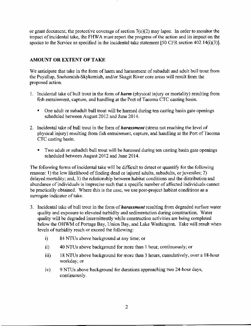
or grant document, the protective coverage of section 7( o )(2) may lapse. In order to monitor the impact of incidental take, the FHWA must report the progress of the action and its impact on the species to the Service as specified in the incidental take statement [50 CFR section 402.14(i)(3)].
AMOUNT OR EXTENT OF TAKE
We anticipate that take in the form of harm and harassment of subadult and adult bull trout from the Puyallup, Snohomish-Skykomish, and/or Skagit River core areas will result from the proposed action.
1. Incidental take of bull trout in the form of harm (physical injury or mortality) resulting from fish entrainment, capture, and handling at the Port of Tacoma CTC casting basin.
• One adult or subadult bull trout will be harmed during ten casting basin gate openings scheduled between August 2012 and June 2014.
2. Incidental take of bull trout in the form of harassment (stress not reaching the level of physical injury) resulting from fish entrainment, capture, and handling at the Port of Tacoma CTC casting basin.
• Two adult or subadult bull trout will be harassed during ten casting basin gate openings scheduled between August 2012 and June 2014.
The following forms of incidental take will be difficult to detect or quantify for the following reasons: 1) the low likelihood of finding dead or injured adults, subadults, or juveniles; 2) delayed mortality; and, 3) the relationship between habitat conditions and the distribution and abundance of individuals is imprecise such that a specific number of affected individuals cannot be practically obtained. Where this is the case, we use post-project habitat conditions as a surrogate indicator of take.
3. Incidental take of bull trout in the form of harassment resulting from degraded surface water quality and exposure to elevated turbidity and sedimentation during construction. Water quality will be degraded intermittently while construction activities are being completed below the OHWM of Portage Bay, Union Bay, and Lake Washington. Take will result when levels of turbidity reach or exceed the following:
i) 84 NTUs above background at any time; or
ii) 40 NTUs above background for more than 1 hour, continuously; or
iii) 18 NTUs above background for more than 3 hours, cumulatively, over a 18-hour workday; or
iv) 9 NTUs above background for durations approaching two 24-hour days, continuously.
2

• All adult and subadult bull trout within 300 ft of sediment-generating activities will be harassed during construction within stated in-water work windows, for a period of approximately 1,500 working days (Portage Bay; August 16- April30, 2013-2018), 2,000 working days (Union Bay; 2013-2018), 1,600 working days (Lake WashingtonWest Approach; August 1 - April30, 2013-2018), and 1,200 working days (Lake Washington- East Approach; July 1 -May 15, 2012-2015), respectively.
• All adult and subadult bull trout within 300 ft of sediment-generating activities will be harassed during demolition and removal of existing bridge and approach columns outside stated in-water work windows, for a period of approximately 50 working days (Portage Bay; 2013-2018).
4. Incidental take of bull trout in the form of harm as a direct effect of exposure to elevated underwater SPLs resulting from impact pile driving and proofing of approximately 165 steel piles along the east approach to Lake Washington, between August 2, 2012, and March 15, 2014 (approximately 200 working days in total).
• All adult or subadult bull trout within approximately 1 ,800 ft of piling installation operations in Lake Washington (150 acres during 2012-13; 134 acres during 2013-14) will be harmed.
5. Incidental take of bull trout in the form of harm as a direct effect of exposure to elevated underwater SPLs resulting from impact pile driving and proofing of approximately 1 ,200 steel piles along the west approach to Lake Washington (east of Foster Island), between October 8, 2013, and April15, 2014, between October 8, 2014, and April15, 2015, and between October 8, 2017, and April15, 2018 (approximately 570 working days in total).
• All adult or subadult bull trout within approximately 62 ft of piling installation operations in Lake Washington (4.0 acres during 2013-14; 8.0 acres during 2014-15, and 7.7 acres during 2017-18) will be harmed.
6. Incidental take of bull trout in the form ofharassment as a direct effect of exposure to elevated underwater SPLs resulting from impact pile driving and proofing of approximately 165 steel piles along the east approach to Lake Washington, between August 2, 2012, and March 15,2014 (approximately 200 working days in total).
• All adult or subadult bull trout within approximately 7,100 ft of piling installation operations in Lake Washington (1,810 acres during 2012-13; 1,760 acres during 2013-14) will be harassed.
7. Incidental take of bull trout in the form of harassment as a direct effect of exposure to elevated underwater SPLs resulting from impact pile driving and proofing of approximately 1 ,200 steel piles along the west approach to Lake Washington (east ofFoster Island), between October 8, 2013, and April 15, 2014, between October 8, 2014, and April 15, 2015, and between October 8, 2017, and April15, 2018 (approximately 570 working days in total).
3

• All adult or subadult bull trout within approximately 450 ft of piling installation operations in Lake Washington (42.8 acres during 2013-14; 40.5 acres during 2014-15, and 39.2 acres during 2017-18) will be harassed.
8. Incidental take of bull trout in the form of harassment as a direct effect of exposure to elevated underwater SPLs resulting from impact pile driving and proofing of approximately 1,100 steel piles in Union Bay, between September 1, 2014, and April30, 2015, and between September 1, 2017, and April30, 2018 (approximately 500 working days in total).
• All adult or subadult bull trout within approximately 72 ft of piling installation operations in Union Bay (10.0 acres during 2014-15; 10.0 acres during 2017-18) will be harassed.
9. Incidental take of bull trout in the form of harassment as a direct effect of exposure to elevated underwater SPLs resulting from impact pile driving and proofing of approximately 1,300 steel piles in Portage Bay, between September 1 and April 30 ofthe first, second, and third construction seasons (approximately 700 working days in total).
• All adult or subadult bull trout within approximately 72 ft of piling installation operations in Portage Bay (1 0.2 acres during the first construction season; 6.6 acres during the second season; and, 6.6 acres during the third season) will be harassed.
10. Incidental take of bull trout in the form of harassment as a direct effect of exposure to elevated stormwater pollutant concentrations. Effects to surface water quality will last in perpetuity, but exposure and effects to bull trout will be episodic. Harassment will result when dissolved Cu concentrations exceed the sub-lethal neurotoxic threshold of an increase of2 J-Lg/L over background, or when dissolved Zn concentrations exceed 5.6 J-Lg/L over background.
• All adult or subadult bull trout within 20 ft of points of storm water discharge to Lake Union, Portage Bay, Union Bay, and Fairweather Bay (approximately 10 locations in total); and within 70 ft of points of stormwater discharge to Lake Washington (approximately 44locations in total, along the floating bridge span); in perpetuity, and for the life of the proposed project.
11. Incidental take of bull trout in the form of harassment resulting from degraded surface water quality and exposure to elevated turbidity and sedimentation along and adjacent to the Kenmore Navigation Channel. Water quality will be degraded periodically and intermittently, when navigating transport barges in support of the project along the federally authorized Kenmore Navigation Channel. Take will result when visible sediment disturbance extends more than 300ft from the source (i.e., the barge and/or tugboat); and if/when visible sediment disturbance persists for more than 1 hour per event, regardless of physical extent.
4

• All adult and subadult bull trout present along the Kenmore Navigation Channel will be harassed for the duration of an estimated 14 future occasions, when barge and tugboat operations in support ofthe project cause visible sediment disturbance, for a duration of approximately 14 working days (2013-2016).
EFFECT OF THE TAKE
In the accompanying Opinion, we determined that the level of anticipated take is not likely to result in jeopardy to the bull trout.
REASONABLE AND PRUDENT MEASURES
The proposed action incorporates design elements and conservation measures which we expect will reduce permanent effects to habitat and avoid and minimize impacts during construction. We expect that the FHW A will fully implement these measures, and therefore they have not been specifically identified as Reasonable and Prudent Measures or Terms and Conditions.
The following reasonable and prudent measures (RPMs) are necessary and appropriate to minimize the impact of incidental take to bull trout:
1. Minimize and monitor incidental take caused by fish entrainment, capture, and handling at the Port of Tacoma CTC casting basin during each often casting basin gate openings.
2. Minimize and monitor incidental take caused by elevated turbidity and sedimentation during construction.
3. Minimize and monitor incidental take caused by elevated underwater SPLs from impact driving and proofing of steel piles.
4. Minimize and monitor incidental take caused by elevated stormwater pollutant concentrations.
5. Minimize and monitor incidental take caused by degraded surface water quality and exposure to elevated turbidity and sedimentation along and adjacent to the Kenmore Navigation Channel.
TERMS AND CONDITIONS
In order to be exempt from the prohibitions of section 9 of the Act, the FHWA must comply with the following terms and conditions, which implement the RPMs described above. These terms and conditions are non-discretionary.
The following terms and conditions are required for the implementation of RPM 1:
5
1. The FHW A shall ensure that casting basin pump inlets are screened according to criteria outlined by the NMFS (NMFS 1997).
2. The FHW A shall ensure that water quality conditions within the partially dewatered casting basin are adequate to support any entrained bull trout. The operations shall use aerators or air stones, as necessary, to provide for the circulation of clean, cold, well-oxygenated water.
3. The FHW A shall ensure that a qualified biologist oversees implementation of fish capture and handling procedures.
4. In the event that fish capture requires the use of electrofishing equipment, the FHW A shall use the minimum voltage, pulse width, and rate settings necessary to immobilize fish. Use of electrofishing equipment shall conform to WSDOT Fish Exclusion Protocols and Standards (WSDOT 2009), and guidelines outlined by the NMFS (NMFS 2000b ).
5. The FHW A shall document and report all bull trout encountered during fish capture and handling operations. The FHW A shall submit a monitoring report to the Washington Fish and Wildlife Office in Lacey, Washington (Attn: Transportation Planning Branch), within 30 days of the fish capture and handling operations associated with each casting basin gate opening.
The following terms and conditions are required for the implementation of RPM 2:
1. The FHWA shall monitor turbidity levels in Portage Bay, Union Bay, and Lake Washington during sediment-generating activities. Monitoring shall be conducted at a distance of 150 ft from sediment-generating activities.
2. Monitoring shall be conducted at 30-minute intervals from the start of sediment generating activities. If turbidities measured over the course ofthree consecutive 30-minute sample intervals do not exceed 9 NTUs over background, then monitoring of sediment-generating activities will be conducted for the remainder of the workday at a frequency of once every 6 hours, or if there is a visually appreciable increase in turbidity.
3. If, at any time, monitoring conducted 150ft from sediment-generating activities indicates turbidity in excess of9 NTUs over background, then monitoring shall instead be conducted at 300ft from sediment-generating activities. Monitoring shall be conducted at 30-minute intervals until turbidity falls below 9 NTUs over background.
4. If turbidity levels measured at 300ft from the sediment-generating activity exceed 84 NTUs above background at any time, 40 NTUs above background for more than 1 hour continuously, or 18 NTUs above background for more than 3 hours, cumulatively, over a 18hour workday, then the amount of take authorized by the Incidental Take Statement will have been exceeded. Sediment-generating activities shall cease, and the FHW A shall contact a
6
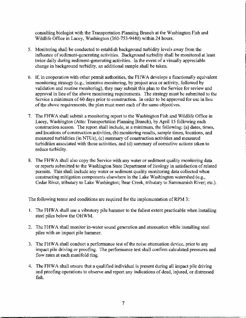
consulting biologist with the Transportation Planning Branch at the Washington Fish and Wildlife Office in Lacey, Washington (360-753-9440) within 24 hours.
5. Monitoring shall be conducted to establish background turbidity levels away from the influence of sediment-generating activities. Background turbidity shall be monitored at least twice daily during sediment-generating activities. In the event of a visually appreciable change in background turbidity, an additional sample shall be taken.
6. If, in cooperation with other permit authorities, the FHW A develops a functionally equivalent monitoring strategy (e.g., intensive monitoring, by project area or activity, followed by validation and routine monitoring), they may submit this plan to the Service for review and approval in lieu of the above monitoring requirements. The strategy must be submitted to the Service a minimum of 60 days prior to construction. In order to be approved for use in lieu of the above requirements, the plan must meet each of the same objectives.
7. The FHWA shall submit a monitoring report to the Washington Fish and Wildlife Office in Lacey, Washington (Attn: Transportation Planning Branch), by April15 following each construction season. The report shall include, at a minimum, the following: (a) dates, times, and locations of construction activities, (b) monitoring results, sample times, locations, and measured turbidities (in NTU s ), (c) summary of construction activities and measured turbidities associated with those activities, and (d) summary of corrective actions taken to reduce turbidity.
8. The FHW A shall also copy the Service with any water or sediment quality monitoring data or reports submitted to the Washington State Department of Ecology in satisfaction of related permits. This shall include any water or sediment quality monitoring data collected when constructing mitigation components elsewhere in the Lake Washington watershed (e.g., Cedar River, tributary to Lake Washington; Bear Creek, tributary to Sammamish River; etc.).
The following terms and conditions are required for the implementation of RPM 3:
1. The FHW A shall use a vibratory pile hammer to the fullest extent practicable when installing steel piles below the OHWM.
2. The FHW A shall monitor in-water sound generation and attenuation while installing steel piles with an impact pile hammer.
3. The FHW A shall conduct a performance test of the noise attenuation device, prior to any impact pile driving or proofing. The performance test shall confirm calculated pressures and flow rates at each manifold ring.
4. The FHW A shall ensure that a qualified individual is present during all impact pile driving and proofing operations to observe and report any indications of dead, injured, or distressed fish.
7

5. The FHWA shall document the effectiveness of the noise attenuation device with hydroacoustic monitoring in Portage Bay and Union Bay (west of Foster island), in Union Bay (east of Foster Island), and, along the east approach. In each of these three areas, the FHW A will perform both routine monitoring and, as necessary, contingency monitoring.
a. Routine monitoring will document effectiveness of the noise attenuation device and resulting peak sound levels for:
1. A minimum of five steel piling installed during the initial pile driving activity in each of the three areas; and,
11. A minimum of five additional steel piling installed at the mid-point of the piling installation schedule for Portage Bay and Union Bay (west of Foster island); and,
111. A minimum of five additional steel piling installed at both the mid-point and near completion of the piling installation schedule (10 piles in total) for Union Bay (east of Foster Island); and,
1v. A minimum of five additional steel piling installed at both the mid-point and near completion of the piling installation schedule (10 piles in total) for the east approach.
b. If the pile strike count for four consecutive piles exceeds by 50 percent or more the maximum single pile strike count observed when performing routine monitoring in that area, this shall be indicative of changed pile driving characteristics. The FHWA shall cease pile driving and not restart except with implementation of contingency hydroacoustic monitoring.
c. In each instance of changed pile driving characteristics, contingency hydroacoustic monitoring will document effectiveness of the noise attenuation device and resulting peak sound levels for the next five steel piling.
d. Factors to consider in identifying the piles to be monitored include, but are not limited to bathymetry of the project site, total number of piles to be impact driven and proofed, depth of water, and distance from shore. This monitoring shall document recorded SPLs, and single strike and cumulative SELs, monitored at a distance of 10 meters from the pile at mid-water depth.
6. The FHW A shall contact the Service within 24 hours if the hydroacoustic monitoring indicates that the sound levels will exceed the extent of take exempted in the Biological Opinion. The FHWA shall also contact the Service within 24 hours if they determine that unattenuated pile strikes are necessary to determine baseline sound levels or evaluate effectiveness of the noise attenuation device at locations other than the east approach. The FHW A shall consult with the Service regarding modifications to the proposed action in an
8

effort to reduce the sound levels below the limits of take and continue hydroacoustic monitoring.
7. The FHWA shall submit a monitoring report to the Washington Fish and Wildlife Office in Lacey, Washington (Attn: Transportation Planning Branch), by April15 following each construction season. The report shall include the following information:
a. Size and type of piles driven and proofed;
b. The impact hammer force used to drive and proof piles;
c. A description of the monitoring equipment;
d. The distance between hydrophone and pile;
e. The depth of the hydrophone;
f. The distance from the pile to the wetted perimeter;
g. The depth of water;
h. The depth into the substrate the pile was driven and proofed;
1. The physical characteristics of the bottom substrate into which the piles were driven and proofed; and
J. The results of the hydroacoustic monitoring, including the frequency spectrum, SPLs, and single-strike and cumulative SEL. The report must also include the ranges and means for peak, rms, and SELs.
The following terms and conditions are required for the implementation of RPM 4:
1. The FHW A shall implement the programmatic approach to storm water quality monitoring (Programmatic Monitoring Approach for Highway Storm water Runoff in Support of the Act Section 7 Consultation, dated June 2009). The WSDOT shall accurately characterize stormwater BMP effectiveness and end-of-pipe effluent discharge concentrations for treated and untreated stormwater runoff (total and dissolved Cu; total and dissolved Zn; total suspended solids). Sampling, data collection, analysis, and reporting (including quality control/quality assurance procedures) shall follow requirements from the WSDOT's Municipal Stormwater NPDES (National Pollutant Discharge Elimination System) and State Waste Discharge General Permit. Data and conclusions derived through this programmatic monitoring approach are broadly representative of conditions within the action area, including average daily traffic and temporal variations in stormwater runoff quantity and quality.
9

2. If the programmatic monitoring results suggest that the analyses included in this Opinion may have underestimated end-of-pipe effluent discharge concentrations or the size of resulting dilution zones, then the FHW A and the Service shall consider jointly any potential change(s) to exposure and effects in listed species and/or their critical habitat, and the need for reinitiation of consultation.
3. If the final, approved stormwater design(s) differ from the design described in this Opinion, then the FHW A shall evaluate potential changes in storm water pollutant loadings and concentrations. The FHWA shall provide to the Service a description of the design change(s) and a corrected version of the stormwater model analyses. If predicted pollutant loadings, concentrations, or resulting dilution zones exceed those described in this Opinion, the FHW A and the Service shall consider jointly any potential change(s) to exposure and effects, and the need for reinitiation of consultation.
4. The FHWA shall design and build the MOHAI enhanced stormwater treatment facility with a well-integrated stormwater quality monitoring capability. The MOHAI facility shall incorporate design features that facilitate accurate characterization of storm water BMP effectiveness and end-of-pipe effluent discharge concentrations for treated stormwater runoff (total and dissolved copper, total and dissolved zinc, and total suspended solids).
5. The FHW A shall provide to the Service a copy of the approved site-specific monitoring and reporting plan for the conditionally-approved AKART enhanced treatment method on the floating bridge span. The FHW A shall also provide a courtesy copy of any required monitoring reports or other documentation submitted to the Washington State Department of Ecology in support and validation of the AKART treatment method. The FHWA shall provide notice to the Service in advance of any plan to deviate from specific elements of the conditionally-approved AKART method (i.e., monthly high-efficiency sweeping and twiceannual catch basin cleaning).
6. The FHWA shall provide to the Service a courtesy copy of any permit application(s), monitoring data, or other documentation provided to the City of Seattle in support of compliance with applicable combined sewer overflow discharge requirements.
7. The FHW A shall submit all documentation in writing to the Washington Fish and Wildlife Office in Lacey, Washington (Attn: Transportation Planning Branch).
The following T &Cs are required for the implementation of RPM 5:
1. The FHW A shall visually monitor for turbidity and/or sediment disturbance whenever conducting barge and tugboat operations in support of the project along the Kenmore Navigation Channel.
2. The FHW A shall not conduct barge and tugboat operations along the Kenmore Navigation Channel at night, unless earlier monitoring has established no significant sediment
10

disturbance or visible turbidity beyond specified limits, or unless corrective actions have been taken.
3. The FHW A shall establish and use temporary anchorage in Lake Washington to reduce the number of vessels, and thereby limit the number of active propellers, in the channel at one time.
4. The FHWA shall operate vessels at speeds of 5 knots or below when in the channel, and restrict extended reverse movements.
5. The FHWA shall use navigation/GPS equipment, operate in the deepest portions ofthe channel, and record position and heading.
6. The FHW A shall minimize fuel loads, as practicable, to reduce tugboat draft.
7. If, at any time, visual monitoring detects turbidity and/or sediment disturbance extending more than 300 feet from the source (i.e., the barge and/or tugboat), or a visible plume persisting for more than 1 hour (per event) regardless of physical extent, the FHW A shall take immediate corrective action. The FHWA shall not initiate new trips along the Kenmore Navigation Channel unless and until corrective action is in-place. In the event that these same or similar conditions cannot be avoided with ensuing trips, the FHW A shall provide notice to the Service within 24 hours (Attn: Transportation Planning Branch at the Washington Fish and Wildlife Office, Lacey, Washington; Ryan McReynolds, 360-7536047; or, Emily Teachout, 360-753-9583).
8. The FHWA shall document, and compile and submit to the Service records describing barge and tugboat operations in support ofthe project along the Kenmore Navigation Channel. The FHWA shall submit an annual report to the Service each calendar year, by March 31 of the following year. The annual report shall include, at a minimum: (1) date and time of individual trips along the Kenmore Navigation Channel; (2) data sheets for individual trips, recording weather conditions, visual signs of ambient turbidity, and observer notes describing any turbidity and/or sediment disturbance resulting from barge and tugboat operations in support of the project; and, (3) a summary of any trips or events requiring corrective action, per Condition 7 (above), and the corresponding actions taken by the FHWA to reduce turbidity and/or sediment disturbance.
9. All notifications and submittals shall be made to the Transportation Planning Branch at the Washington Fish and Wildlife Office, Lacey, Washington.
We expect that the amount or extent of incidental take described above will not be exceeded as a result of the proposed action. The RPMs, with their implementing terms and conditions, are designed to minimize the impact of incidental take that might otherwise result from the proposed action. If, during the course of the action, this level of incidental take is exceeded, such incidental take represents new information requiring reinitiation of consultation and review of the reasonable and prudent measures provided. FHW A must provide an explanation of the
11

causes of the taking and review with the Service the need for possible modification of the reasonable and prudent measures.
The Service is to be notified within three working days upon locating a dead, injured or sick endangered or threatened species specimen. Initial notification must be made to the nearest U.S. Fish and Wildlife Service Law Enforcement Office. Notification must include the date, time, precise location of the injured animal or carcass, and any other pertinent information. Care should be taken in handling sick or injured specimens to preserve biological materials in the best possible state for later analysis of cause of death, if that occurs. In conjunction with the care of sick or injured endangered or threatened species or preservation of biological materials from a dead animal, the finder has the responsibility to ensure that evidence associated with the specimen is not unnecessarily disturbed. Contact the U.S. Fish and Wildlife Service Law Enforcement Office at (425) 883-8122, or the Service's Washington Fish and Wildlife Office at (360) 753-9440.
CONSERVATION RECOMMENDATIONS
Section 7(a)(l) of the Act directs Federal agencies to utilize their authorities to further the purposes of the Act by carrying out conservation programs for the benefit of endangered and threatened species. Conservation recommendations are discretionary agency activities to minimize or avoid adverse effects of a proposed action on listed species or critical habitat, to help implement recovery plans, or to develop information.
The Service recommends the following to the FHW A:
1. The FHW A should further evaluate the potential stormwater quality benefits of a program of high-efficiency sweeping performed between the west approach high-rise and Montlake Interchange. Long stretches of the Portage and Union Bay bridges and approaches have been designed to convey surface runoff to land-based storm water treatment facilities for treatment and discharge. However, under conditions exceeding the storm design event, stormwater runoff originating from the Portage and Union Bay bridges and approaches will release through scuppers and direct discharge to the adjacent waters without treatment. Highefficiency sweeping performed at strategic times of year (i.e., after prolonged periods without precipitation, and before the next significant storm event) may provide measurable stormwater quality benefits.
In order for the Service to be kept informed of actions minimizing or avoiding adverse effects or benefiting listed species or their habitats, the Service requests notification of the implementation of any conservation recommendations.
12
REINITIATION NOTICE
This concludes formal consultation on the action outlined in the request. As provided in 50 CFR section 402.16, reinitiation of formal consultation is required where discretionary Federal agency involvement or control over the action has been retained (or is authorized by law) and if: (1) the amount or extent of incidental take is exceeded; (2) new information reveals effects of the agency action that may affect listed species or critical habitat in a manner or to an extent not considered in this opinion; (3) the agency action is subsequently modified in a manner that causes an effect to the listed species or critical habitat not considered in this opinion; or ( 4) a new species is listed or critical habitat designated that may be affected by the action. In instances where the amount or extent of incidental take is exceeded, any operations causing such take must cease pending reinitiation.
13