update: information sharing environment (ise) standards
TRANSCRIPT

Update: Information Sharing Environment (ISE) Standards Coordinating Council (SCC) Presentation to National Geospatial Advisory Committee
7 April 2016
2
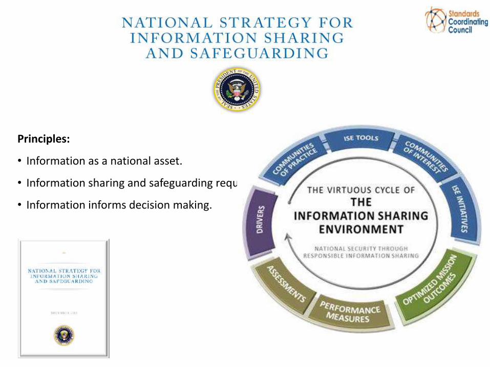
Principles:
• Information as a national asset.
• Information sharing and safeguarding requires shared risk management.
• Information informs decision making.
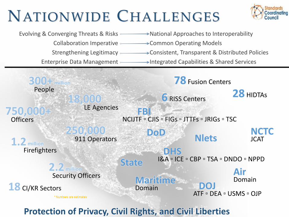
NATIONWIDE CHALLENGES
18,000 LE Agencies 750,000+
Officers
250,000 911 Operators 1.2 million
Firefighters
2.2 million
Security Officers
18 CI/KR Sectors * Numbers are estimates
300+ million
People 78 Fusion Centers
28 HIDTAs 6 RISS Centers
FBI NCIJTF ▫ CJIS ▫ FIGs ▫ JTTFs ▫ JRIGs ▫ TSC
DHS I&A ▫ ICE ▫ CBP ▫ TSA ▫ DNDO ▫ NPPD
Maritime Domain
NCTC JCAT
Air Domain
DoD
DOJ ATF ▫ DEA ▫ USMS ▫ OJP
Protection of Privacy, Civil Rights, and Civil Liberties
Nlets
State
National Approaches to Interoperability
Common Operating Models
Consistent, Transparent & Distributed Policies
Integrated Capabilities & Shared Services
Evolving & Converging Threats & Risks
Collaboration Imperative
Strengthening Legitimacy
Enterprise Data Management

INFORMATION SHARING ENVIRONMENT ( ISE) SCOPE

ISE GOVERNANCE MAP

SCC Scope
The Standards Coordinating Council (SCC) as a public / private partnership shall advise, and support the Program Manager of Information Sharing Environment (PM-ISE) by addressing needs for information sharing standards, enablers and issues related to information sharing.
• Operationalization and acceleration of the IS&S strategy;
• Advise on capabilities, standards and projects;
• Technology innovation via standards-based information interoperability architecture
See: http://www.standardscoordination.org/

SCC Objectives
• Serving as a forum for standards development organizations (SDOs), Industry and government partners to: • engage and coordinate standards development activities • to enhance communication, collaboration, and consensus
between standards partners;
• Adoption of high value standards initiatives, owned and driven by SDOs and industry organizations, designed to advance information sharing;
• Enhance awareness of industry standards activities and establish a coordinated feedback channel from government to industry to help focus industry efforts.

www.standardscoordination.org
9
STANDARDS COORDINATING COUNCIL

SCC Project Interoperability
Mission Centric – ISS Strategic • Policy Automation • Services Transformative • Cyber/Info Safeguarding • Geospatial • Sustainability (Market Attraction)
Enablement Centric – ISS Architecture
• Project Pipeline • Standards Normalization –
Project Prototyping • Info Interoperability Architecture
Framework – Common Profile • Taxonomies and Inherencies
Business Working Group
Technical Working Group
Architecture Working Group
Outreach and Communications Working Group
Performance Measurement
Working Group
Information Sharingand Access Interagency
Policy Committee (Government)
Security Working Group
Privacy Working Group
Information Sharing
Council (ISC)
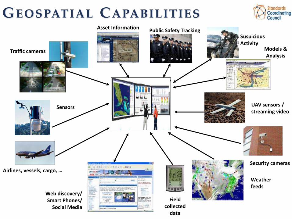
Traffic cameras
Security cameras
UAV sensors / streaming video
Models & Analysis
Sensors
Airlines, vessels, cargo, …
Weather feeds
Web discovery/ Smart Phones/
Social Media
Field collected
data
Asset Information Public Safety Tracking Suspicious Activity
GEOSPATIAL CAPABILITIES

Geospatial Interoperability Reference
Architecture
(GIRA)
OMB Collaborative Planning
Methodology (CPM)
IC Architecture Community
Federal Enterprise Architecture Guidance
Federal Enterprise Architecture (FEA)
ISE Architecture Community
State, Local, Tribal
DOJ Global Reference
Architecture (GRA)
Aligned with…
Compatible with…
Intent:
Governance
Guidance
Intent:
Governance
Guidance
Practical Application
Audience:
Executives
Program Managers
Audience:
Executives
Program Managers
Solution Architects
Department of Defense
Architecture Framework
(DoDAF)
FINAL
30 September 2010
IC Reference Models
Information Interoperability
Framework (I2F)
Geospatial Interoperability Reference
Architecture
(GIRA)
G E O S PAT I A L I N T E R O P E R A B I L I T Y R E F E R E N C E A R C H I T E C T U R E ( G I R A ) : B A C K G R O U N D & P U R P O S E
See GIRA at: http://www.standardscoordination.org/content/interoperability-tools

• Define governance oversight considerations that should be taken to ensure
consensus and responsible program management to meet mission objectives
and drive cost efficiencies.
• Serve as a base-line target reference and identifies the necessary
interoperability requirements within each of the key architecture elements (e.g.,
data, applications/services, infrastructure, security, standards and performance).
• Provide best practice implementation artifacts, interoperability standards,
authoritative reference documentation, performance measures and procedural
guidance.
• Provide sufficient technical details to serve as inputs for operational
requirements documentation, engineering designs, contract and procurement
language and related activities associated with implementing interoperable
geospatial architectures.
• Align and conform to the Federal Enterprise Architecture Framework v2, and The Common Approach to Federal Enterprise Architecture.
G I R A : G O A L S & O B J E C T I V E S
Source: DHS, NGAC presentation 2014

Industry
Federal Government
Whole of Government Whole of Society
GEOSPATIAL CONTINUUM Sa
fegu
ard
ing

Project Interoperability

Project Interoperability
• Project Interoperability is a start-up guide for information interoperability
• Project Interoperability can be used to access, improve, and use information sharing tools and resources
• It uses some of the existing, well known enterprise architecture frameworks and the principles of service-oriented architecture (such as reuse and intrinsic interoperability) to suggest standards, tools, and methodologies to link existing systems

Project Interoperability Project Pipeline - Background
• In 2014 SCC members discussed the prospect of developing a pipeline of projects that could be positioned for assessment and ‘mapping’ implementation use cases to further advance PI goals
• These use cases would • provide real world reinforcement of the ISE
Interoperability framework
• serve to inform the community on successful approaches that have been taken to implement IS&S constructs
• Provide feedback

Project Interoperability Goals
• Project Interoperability will be achieved through the mapping of active and new projects where standards-based Information Sharing and Safeguarding (IS&S) solutions are being implemented
• Establish the Information Sharing and Safeguarding Core Interoperability Framework (ICIF) for standards-based information sharing and interoperability in support of the public safety and national security missions

Project Interoperability Project Pipeline - Examples
• New Jersey – Information Sharing Environment
• Mission Context: Statewide information sharing environment for public safety
• Incident Management Information Sharing (DHS S&T)
• Mission Context: First responder information sharing environment
• Corrections Information Sharing
• Mission Context: Corrections information sharing environment
• Maritime Information Sharing Environment
• Mission Context: Maritime information sharing environment
• Cross-border Trusted Information Sharing
• Mission Context: Cross-border, bi-national information sharing environment
• Law Enforcement Event Deconfliction
• Mission Context: Creation of a nationwide event deconfliction system
• Open Geospatial Consortium (OGC) Geo4NIEM Testbed
• Mission Context: Any use case calling for NIEM IC IEPs containing geospatial data or GML feature representations leveraging NIEM components
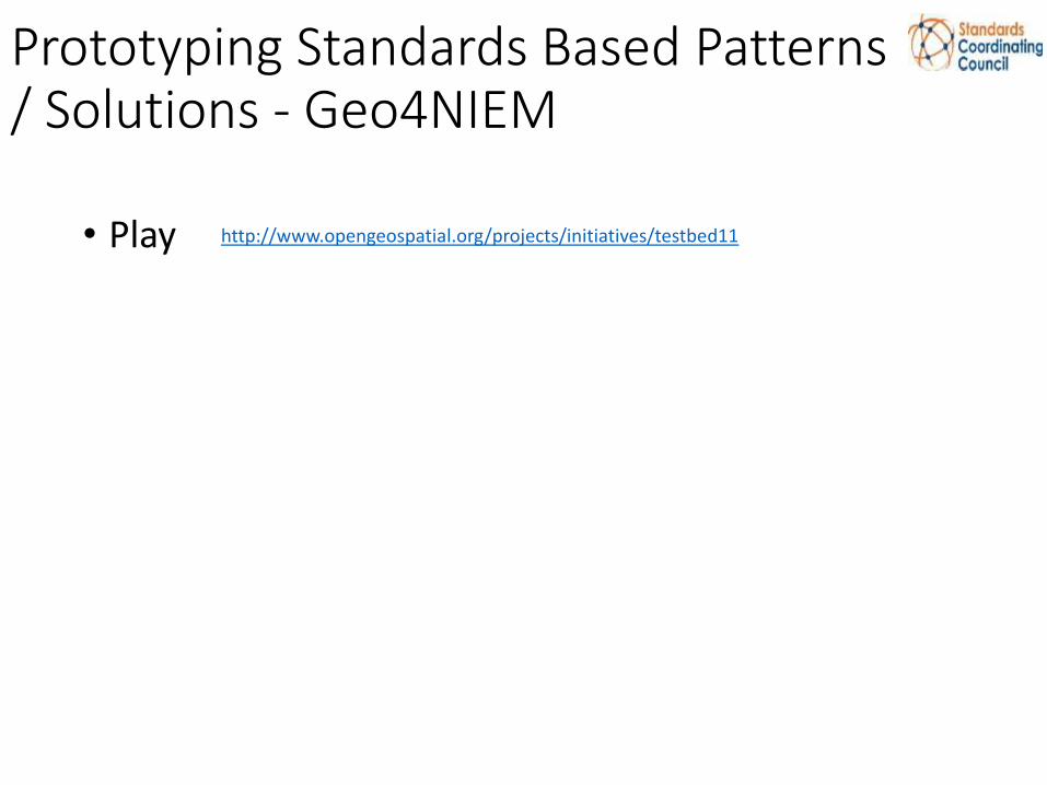
Prototyping Standards Based Patterns / Solutions - Geo4NIEM
http://www.opengeospatial.org/projects/initiatives/testbed11
• Play

For More Information:
• Standards Coordinating Council:
http://www.standardscoordination.org/
• SCC Inquiries: [email protected]
• Project Interoperability: http://www.standardscoordination.org/project_interoperability
• ISE Interoperability Framework:
http://ise.gov/sites/default/files/FINAL%20-%20ISE_I2F_v0%205.pdf
• SCC Interoperability Tools/Resources (including the Geospatial Interoperability Reference Architecture):
http://www.standardscoordination.org/content/interoperability-tools
• GIRA Blog (DeLoatch, Alexander)
https://www.ise.gov/blog/ivan-b-deloatch-and-david-alexander/introduction-geospatial-interoperability-reference