uranium division
TRANSCRIPT

INIS-mf—9688
URANIUM DIVISION
PNOC ENERGY COMPANIES BLDG.PNPC COMPLEX, MERRITT ROAD,FORT BONIFACIO, METRO MANILAPHILIPPINES
f l
1980
I
I• • vlSE»mFIC ILfBftAR) ».»*
URANIUM GEOCHEMICAL EXPLORATION
( IN NORTHWESTERN LUZON
nCT13198*I1 GABRIEL SANTOS, J R .
AND
I LOURDES FERNANDEZPHILIPPINE ATOMIC ENERGY COMMISSION
I AND
MANUEL OGENA AND GEORGE TAULIPNOC-EDC . • • .
II ABS1HACT
I A reconnaissani.. geochemical stream water and sediment survey
• which was conducted in northwestern Luzon was able to detect '•.
(10) uranium anomalous areas. These anomalous areas are located
I along a north-south trending zone of Miocene marine e l a s t i c s and
sedimentary rocks with tuffaceous sediment in te rca la t ions . In
§ general , northwest Luzon has low radioac t iv i ty except for two anoira-
- lous areas which have 3 to 6 times background rad ioac t iv i ty . Radon
anomalies occur in sparsely sca t tered locat ions .
The anomalous zones appear to be re la ted to major north-s-. . .
faults and secondary northeast-southwest trending structures.
.• - Geochemical corr jlations between uranium and other elements
such as copper, lead, zinc, manganese, silver, cobalt, .and nickeJ
I are generally very poor.
II
I
_ It is suggested that the intermediate intrusives iv the
• Cordillera Central are possibly the principal source rodcs of
W uranium in the survey area.
rr
ii
iiiiiii
i
- 2 -

II•
URANIUM GEOCHEMICAL EXPLORATIONIN NORTHWESTERN LUZON
II
BY
GABRIEL SANTOS, J R .AND
LOURDES FERNANDEZPHILIPPINE ATOMIC ENERGY (EMISSION
I AND
MANUEL OGENA AND GEORGE -TAULIPNOC-EDC
II INTRODUCTION
I The first indication of possible uranium occurrences in
• Solsona, Ilocos Norte, Northwestern Luzon was detected by an
airborne gamma spectrometer survey which was carried out by
I Huntings Geophysics, Lixl. of London in 1954. Subsequent ground
follow-up geologic and radiometric surveys in Solsona area fo<
I nearly two decades failed to pinpoint the possible location of
m the airborne radiometric anomaly. i
* In 1978, it was decided that the northwestern Luzon region
including Ilocos Norte, Abra and Ilocos Sur be explored systematical-
II ly. for uranium using geochemical methods. The exploration was
undertaken jointly by PNOC-EDC and PAEC, with the latter providing
II personnel, technical planning and analytical support. The work- which was essentially an orientation survey was covered by a non-
II
II
exlusive one year exploration permit from the Bureau of Energy
I Development (BED), Ministry of Energy and includes all lands in| Luzon bounded on the South by latitude 16°45' West and on the
East by longitude 120o52'30" North and elsewhere by the Luzon
T
II1
Sea.
i The objectives of the orientation survey were to determine
the best sampling medium which could be used effectively in a more
F intensive reconnaissance survey for pinpointing the presence of
i possible uranium mineralization; and to locate the airborne radio-
metric anomaly which was detected in 1954. The results of the
I orientation survey were submitted as a report to BED in 1979. The
results of the survey indicated that the stream water as well as
} the -80 mesh size fraction of the stream sediments were the best
. sampling media in the geochemical survey. Radon measurements in
' stTeam waters would also be useful in the evaluation of the geoche-
I mical results. Heavy mineral concentrates were considered less
effective in outlining uranium geochemical anomalies than the
| -80 mesh stream sediments fractions.
* The main purpose oe this paper is to describe the results
I of the reconnaissance geochemical exploration for uranium in
northwestern Luzon.
I- 2 -
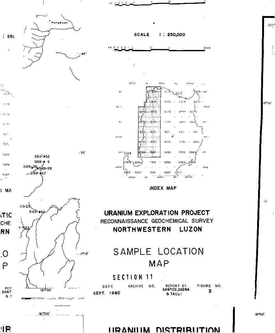
ILOCATION
IThe survey area is located in the northwestern part of
• Luzon as shown in Fig. 1. The expanded non-exclusive exploration
'"» permit area is bounded in the east by longitude 121°00' North and
in the south by latitude 16°20' West; and elsewhere by the Luzon
I Sea. The area of interest covers.the provinces of Ilocos Norte,
most of Abra, Ilocos Sur, Eenguet, La Union and some sections ofI Mountain Province. Accessibility to the project area is moderately
'-_ easy owing to the presence of well-maintained national and provincial
• roads as well as the i iierous barrio roads and trails. The main
I road, Route 3 to the area from Manila runs along the western cc. .
line passing through San Fernando (269 km.) in La Union> Vigan
I (408 km.) in Ilocos Sur and Laoag City (486 km.) in Ilocos Norte.
The eastern part of the area could be reached via Route 2 up to
Bontoc (396 km. from Manila).
TOPOGRAPHY
The project area forms a part of the western limb of the
Cordillera Central Mountain Range down to the lowlands and the
coastal area of northwestern Luzon. The mountain range and the
*. " ids are parallel »o each other in the north-south direction.
About 30% of the area is characterized by high relief elevations
ranging from 1,500 to 2,000 m. and moderate relief with 1,000 m.
- 3 -

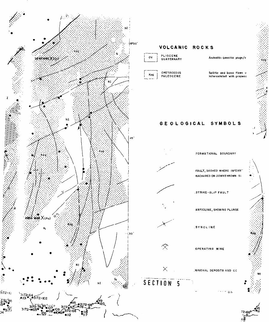
GEOLOQY OF NORTHERN LUZON
\ VIZCAYA \t
METASEOIMEMf
TERRAIN V * ^ « f
f i t . I. LOCATION OF NORTHWESTERN LUZON SURVEY AREA, SHOWINSPHYSIOCRAPHIC AND STRUCTURAL PROVINCES OF NORTHEASTERNLUZON, AFTER OURKEE AND PEDERSOS, l t d .

II
elevation on the average. Several high peaks can be found, notably,
I Mt. Cavitian (2568 m.) and Mt. Clawit (2668 m.) both in Mountain
| Province; Mt. Buguias (2841 m.) in Ifugao and Mt. Pulog (2928 m.)
in Benguet, the highest peak within the project area.
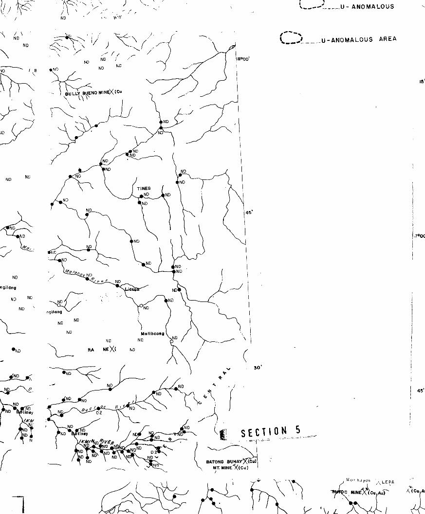
IDRAINAGE
IThe survey area is drained by five major river systems aiii
I their numerous tributaries. These drainage systems include Laoag
• and Vintar Rivers in Ilocos Norte; Abra River in Abra; and Amburaya'
River in La Union and Bued River in Benguet. They all discharge their
I loads westward into the Luzon Sea (South China Sea). Chico River
on the east side discharges its load into the larger Cagayan River
I which drains the entire Cagayan Valley. About halfway of the down-
'. stream reaches of the Laoag and Vintar Rivers, the water gradient*
' are low and the rivers are braided with wide flood plains.
These rivers have large discharge specially during the wet
1 months from June to October. The rest of the year is dry. Accord-
ing to Fernandez and Pulanco (1964), the Ilocos Coastline is an
} emerging shoreline and that most of the stream has probably main-
tained its original course.
Geologic structures generally control the trends of the
major river systems and their numerous tributaries provide excellent
•p
- 4 -
opportunities suitable for conducting regional geochemical
stream sediment surveys.
GENERAL GEOLOGY
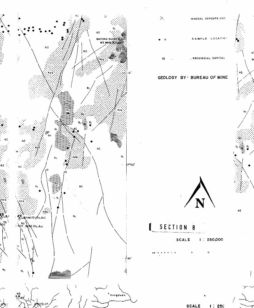
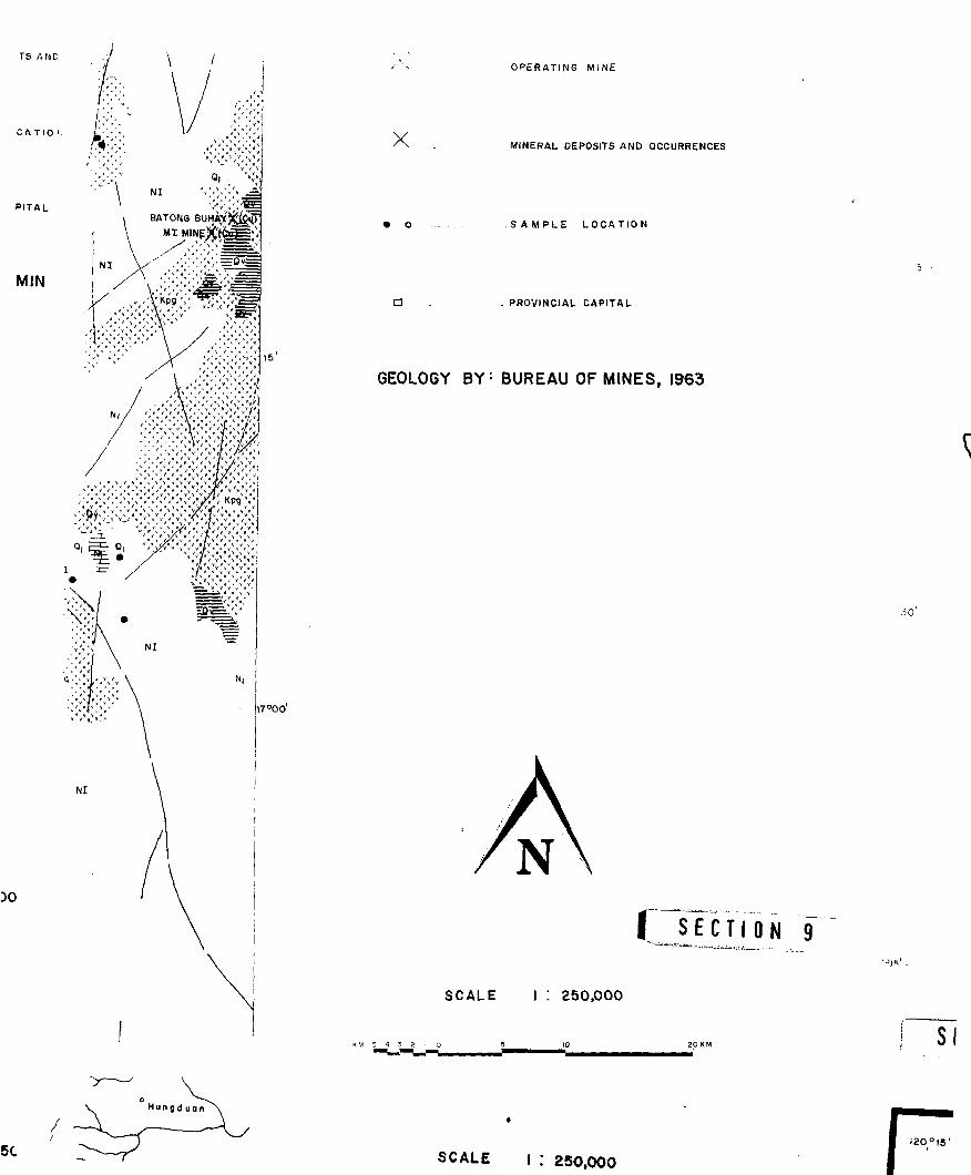
Previous works on the geology of northwestern Luzon include
those of Corby et. al. (1951)f Irving (1952), Durkee and Pederson
(1961) and others. The fieological Map of the Philippines compiled
in 1963 by the Bureau of Mines is a good source of the geology of
northern Luzon. The paper of Fernandez and Pulanco (1964) whid:
describes the regional geology of M Luzon as well as the recent
geological survey report under the Philippine-Japan Project (1979)
are excellent sources of geological information regarding the
project area.
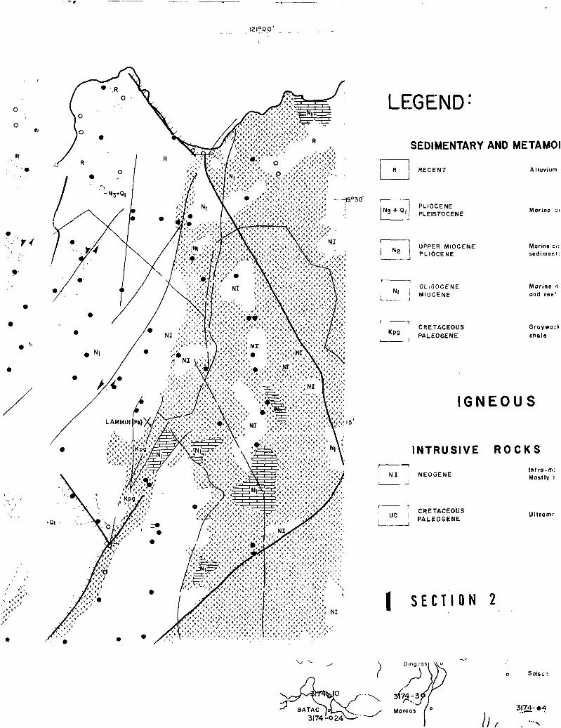
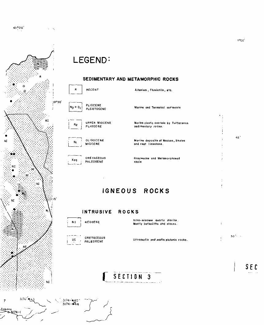
The survey area includes more than half of the Cordillera
Central and most of the Coastal Folded-Belt, Vigan-Abra High and
Laoag Embayment of Durkee and Pederson (1961). Fig. 1 shows the
physiographic and structural provinces of northern Luzon and
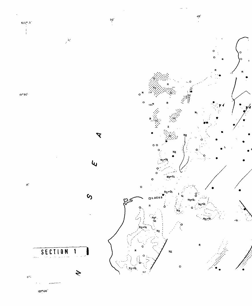
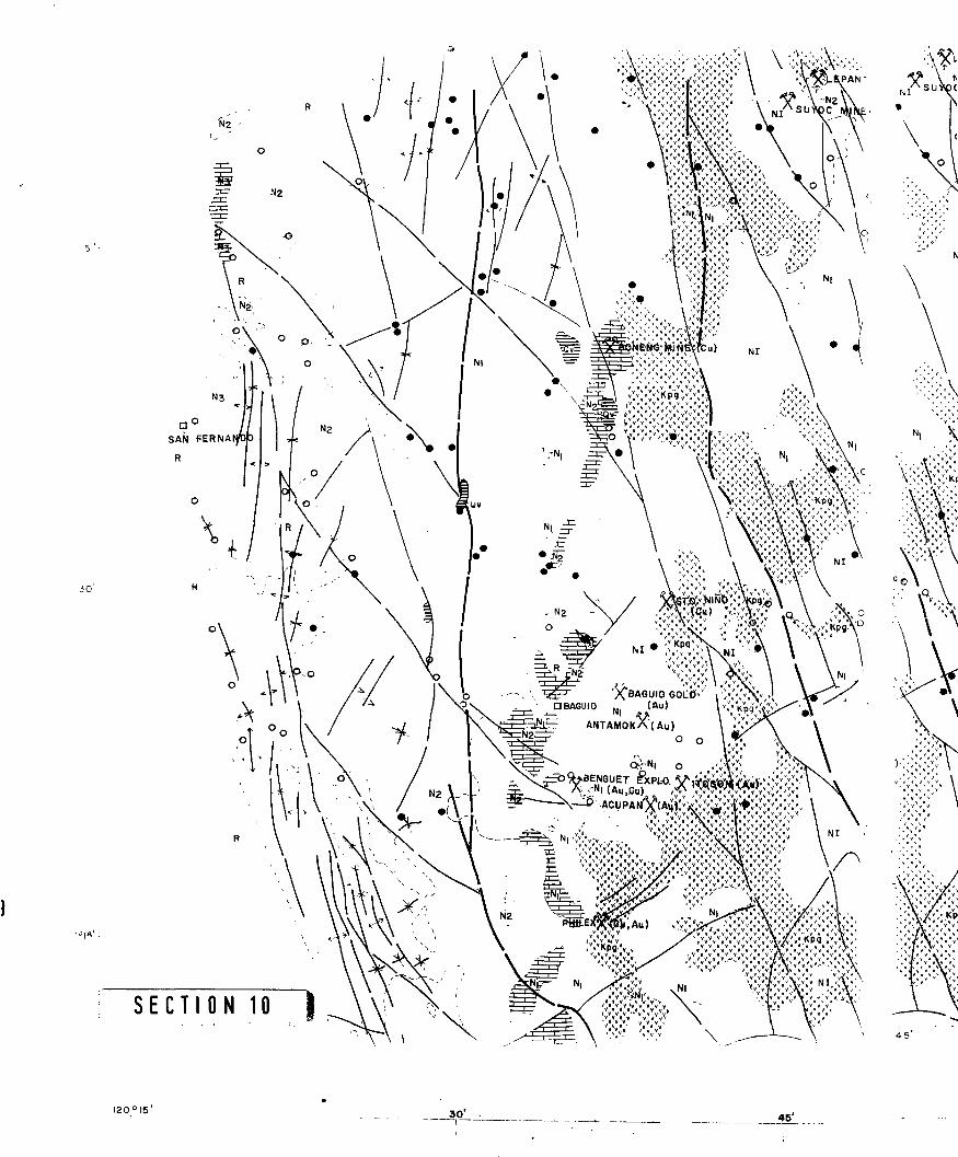
Fig. 2 shows the geological map of northwestern Luzon.
The Cordillera is composed principally of Eocene to Earl)
Miocene bedded volcanic rocks and thick post-Middle Miocene sedimen-
tary rocks. These rocks have been intruded by Early to Middle
Miocene quartzdiorite rocks which resulted in a geanticlinical
- 5 -
I
mountain range, trending in the north-south orientation. The
major structural lines ulso have a similar direction and in some
places, these fault zones are loci of gold and copper mineraliz; V::ns.
[Durkee and Pederson (1961); Fernandez and Pulanco (1964); RP-
Japan Project Report (1979).3
The Coastal Folded Belt which is located west of Cordillera
Central is a region of highly folded and faulted sedimentary
rocks trending in the north-south direction. The belt is charac-
terized by north-south trendLng anticlines and major faults as
well as northeast-southwest secondary fault systems.
The Vigan-Abra high is a topographic high which is composed
of thick meta-sedimen'*'1 and bedded volcanics with mafic intrusives.
The eastern boundary and probably the western margin are controlled
by north trending faults, Durkee and Pederson (1961).
North of the Vigan-Abra high is the Laoag embayment filled
with Miocene-Pliocene sediments. Pre-Jurassic crystalline schists
and quartzites as well as Cretaceous ultramafic rocks are found in
the northern part, in the Suyo area, Ilocos Norte. The older
rocks may possibly represent remnants of a continental landmass.
A major fault trending in the northwest-southeast direction extei. i.."i,
from the Cordillera separates the Miocene limestone of the" northern
part of the Laoag embayment.
- 6 -

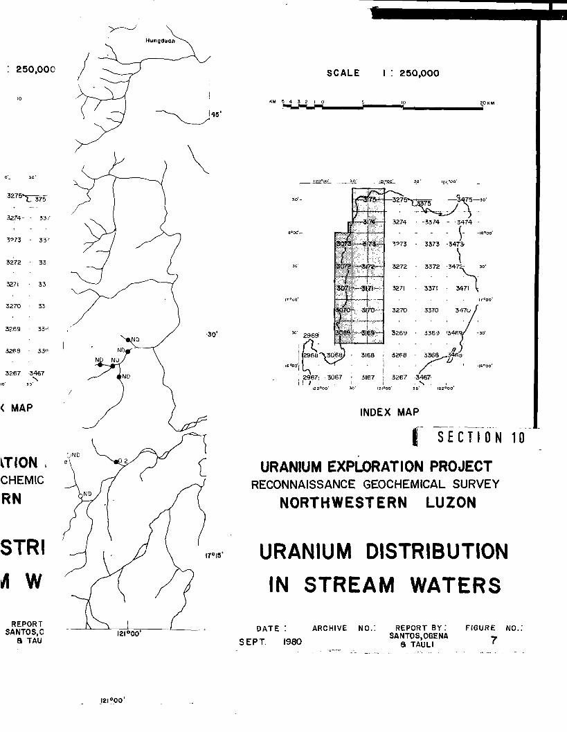
FIELD AND LABORATORY TECHNIQUES
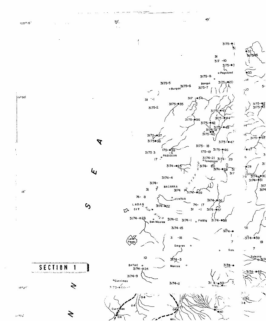
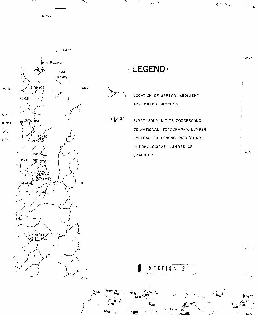
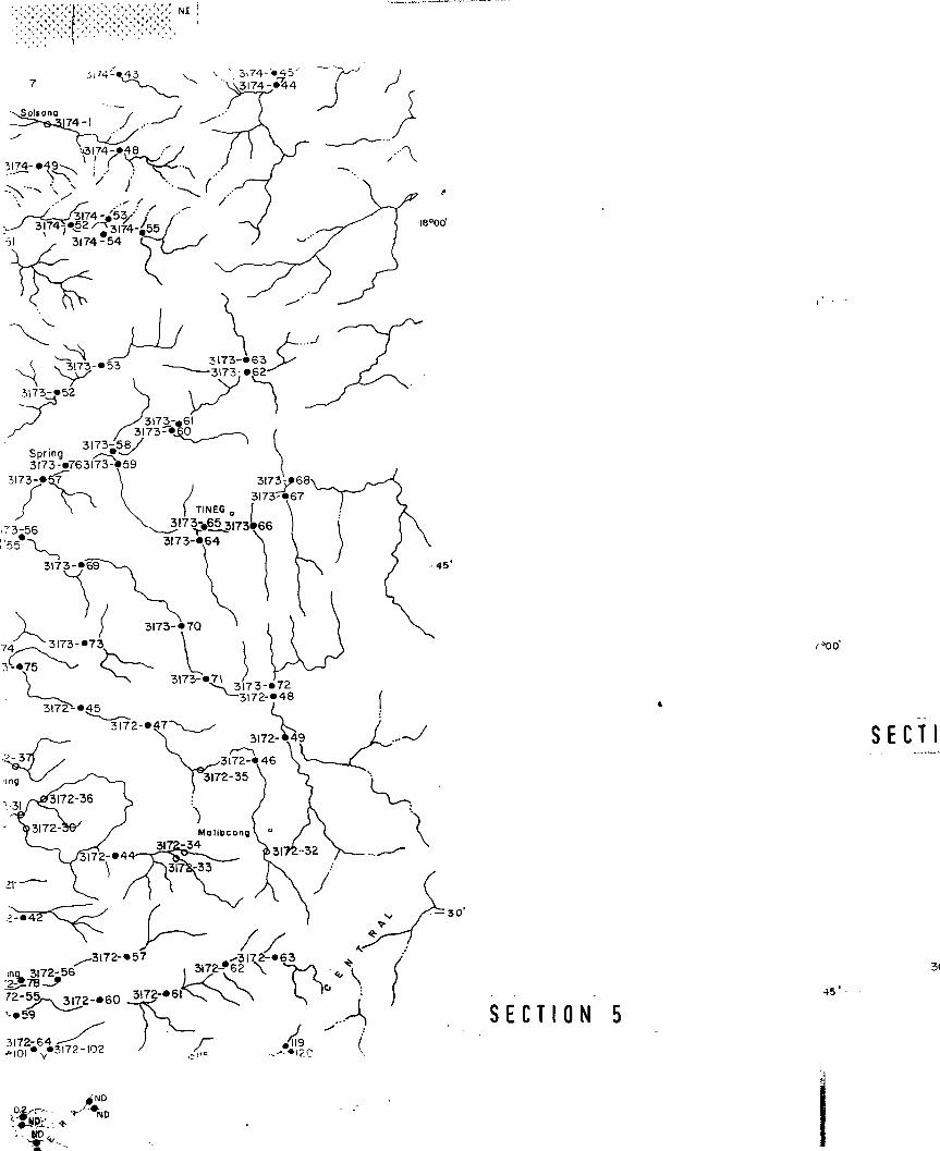
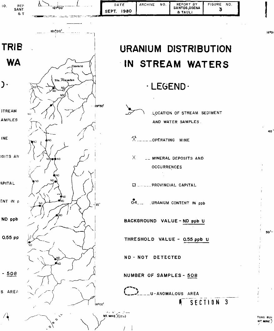
The sampling pattern was designed to collect one set of
sample of stream sediment and water from each sampling site, from
a stream draining 20-30 sq. km. area. During the orientation phase,
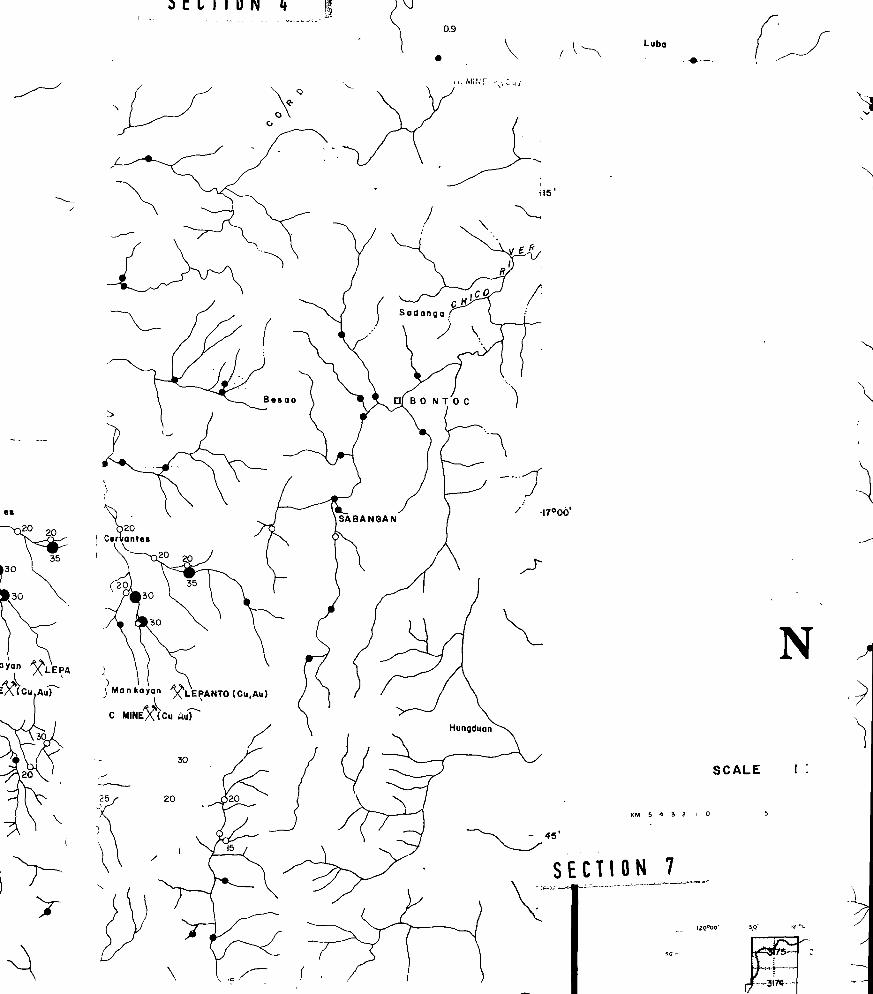
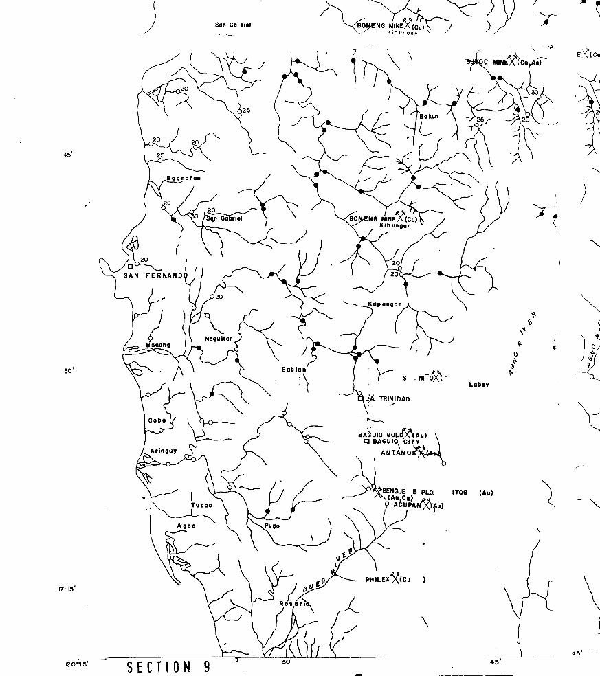
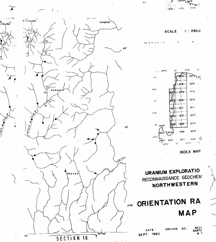
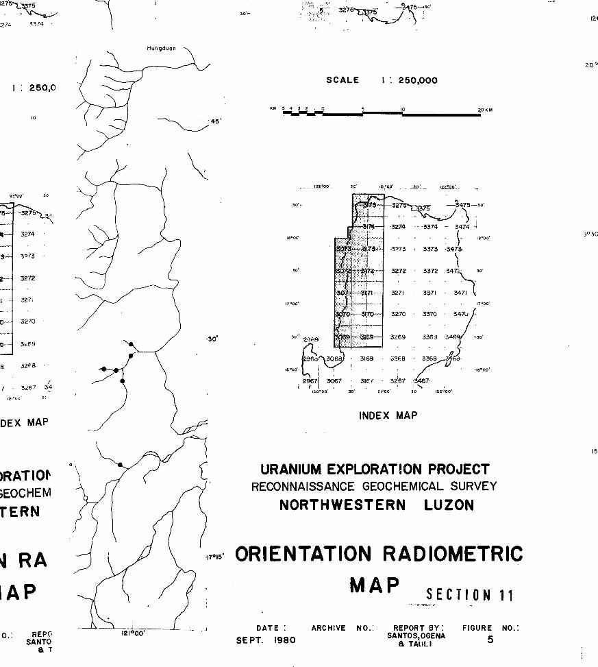
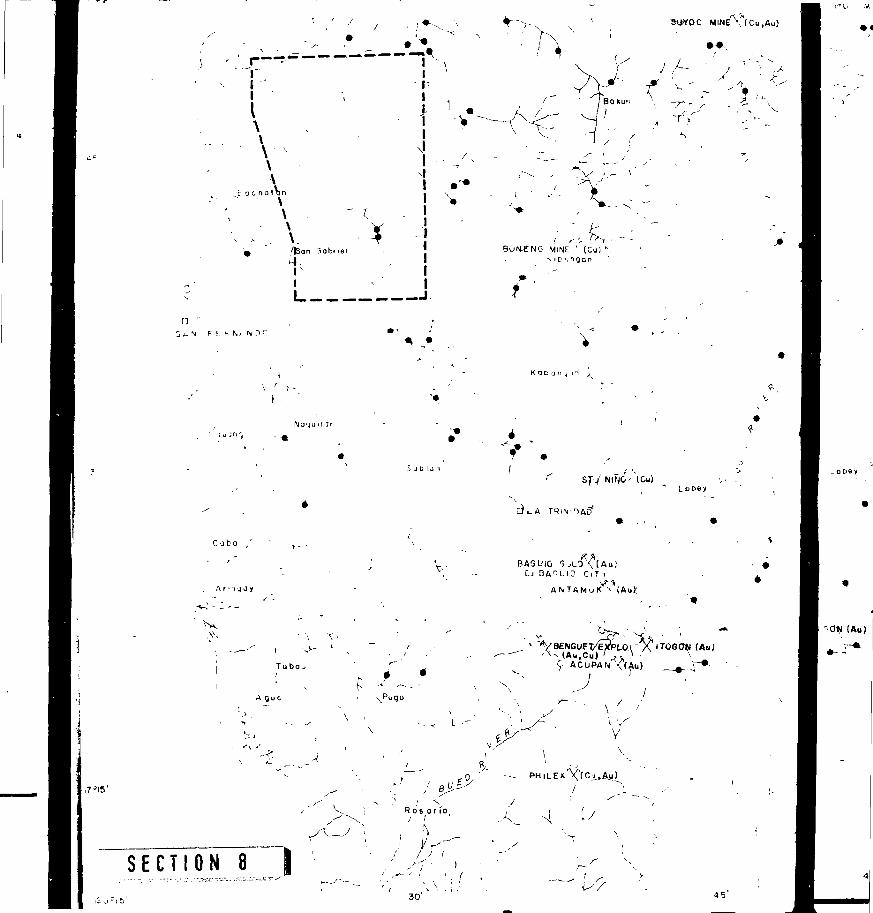
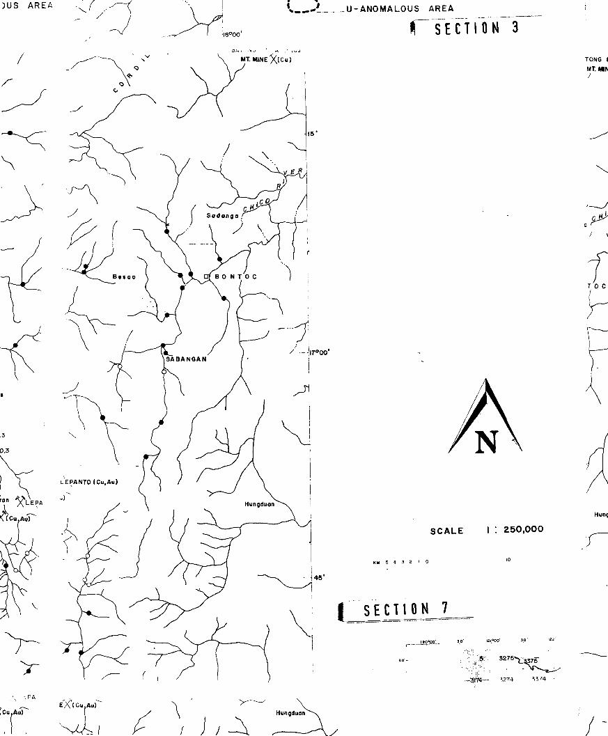
sampling was done along easily accessible tributaries. Figure 3
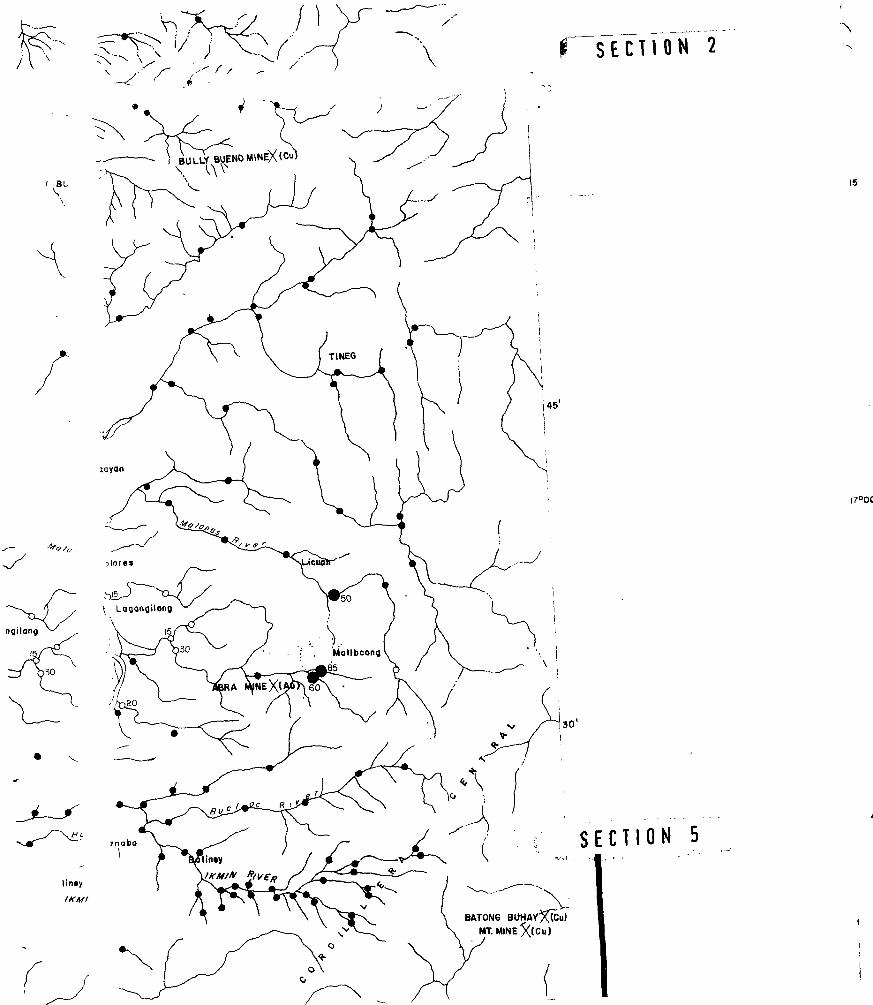
shows the location of the sampling sites.
At each sampling site, 1-2 kg. of stream sediment was
collected. (Mineral coi :ntrates were also obtained by panning
the sediments using a wooden pan during the orientation survey.)
Two stream water samples contained in 150-ml. plastic bottles were
initially collected. Radicmetric measurement was also taken around
the sampling area. The radon content of the stream water was
determined as counts per minute employing a portable radon detector
RD 200 and a degassing system model RDU 200 manufactured by EDA
Instruments Inc. (See Figs. 4 and 5)
The stream sediment samples were sun-dried and prepared in
the field and the minus 80 mesh fraction was separated and sent
to the laboratory. During the orientation survey, the following
size fractions were separated; -35 m, +80 m, -80 m, +200 m. The
mineral concentrates were treated by removing the magnetic minerals
and the non-magnetic fraction was separated from the siliceous
gangue utilizing heavy media separation.
- 7 -
Uranium analyses were done at the PAEC laboratory using
the method developed by Smith and Lynch (1969) employing a Jarrell-
Ash model 26-000 fluorometer. The sensitivity or limit of detection
of the method was about 0.2 ppm and 0.1 ppb uranium for the stream
sediment and waters, respectively.
Other trace elements such as copper, lead, zinc, manganese,
silver, cobalt and nickel were determined in the uranium leach
solution by atomic absorption spectrometry. The limit,of detection
for copper, lead, cobalt and nickel was 4 ppm; for zinc and manga-
nese, 2 ppm and for si. sr, 0.4 ppm.
- 8 -
RESULTS AND DISCUSSION
A total of 522 sampling sets consisting of
stream sediments and water were collected over the 15,000 sq. km.
survey area. Die results of the uranium and trace element analyses
of stream sediments and waters were treated statistically to
determine the background and threshold values using the method
of Lepeltier (1969).
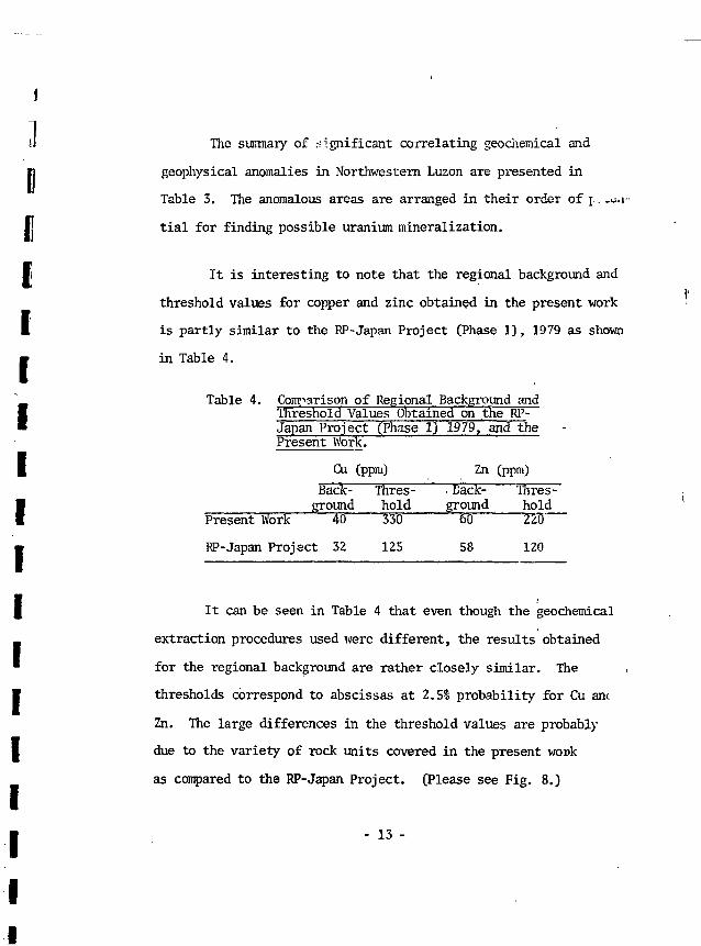
On the basis of geology, the rock units were grouped under
sedimentary and volcan. . rocks; and intrusive. Table 2 shows the
average background and threshold values of uranium, copper, lea..,
zinc, manganese, silver, cobalt and nickel.
From Table 2 it can be seen that the uranium background
values is below the detection limit of 0.2 ppm (ND) for the method.
The background and threshold values for uranium in stream waters
are ND and 0.55 ppb, respectively.
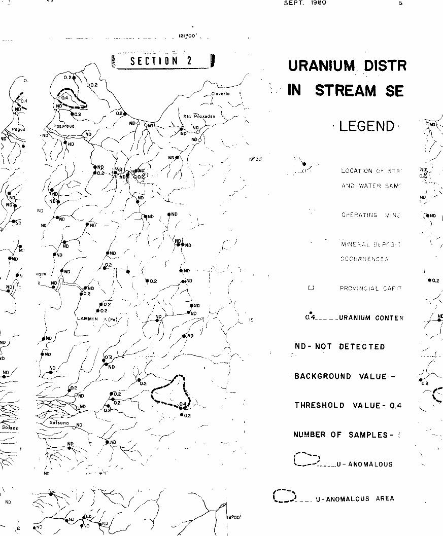
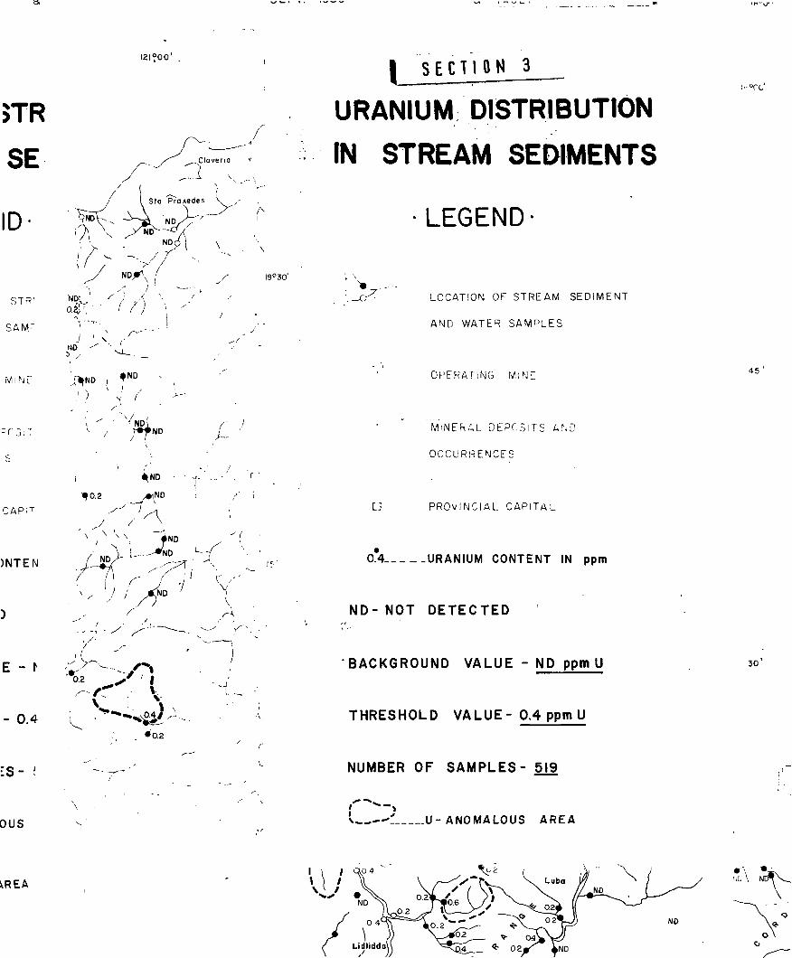
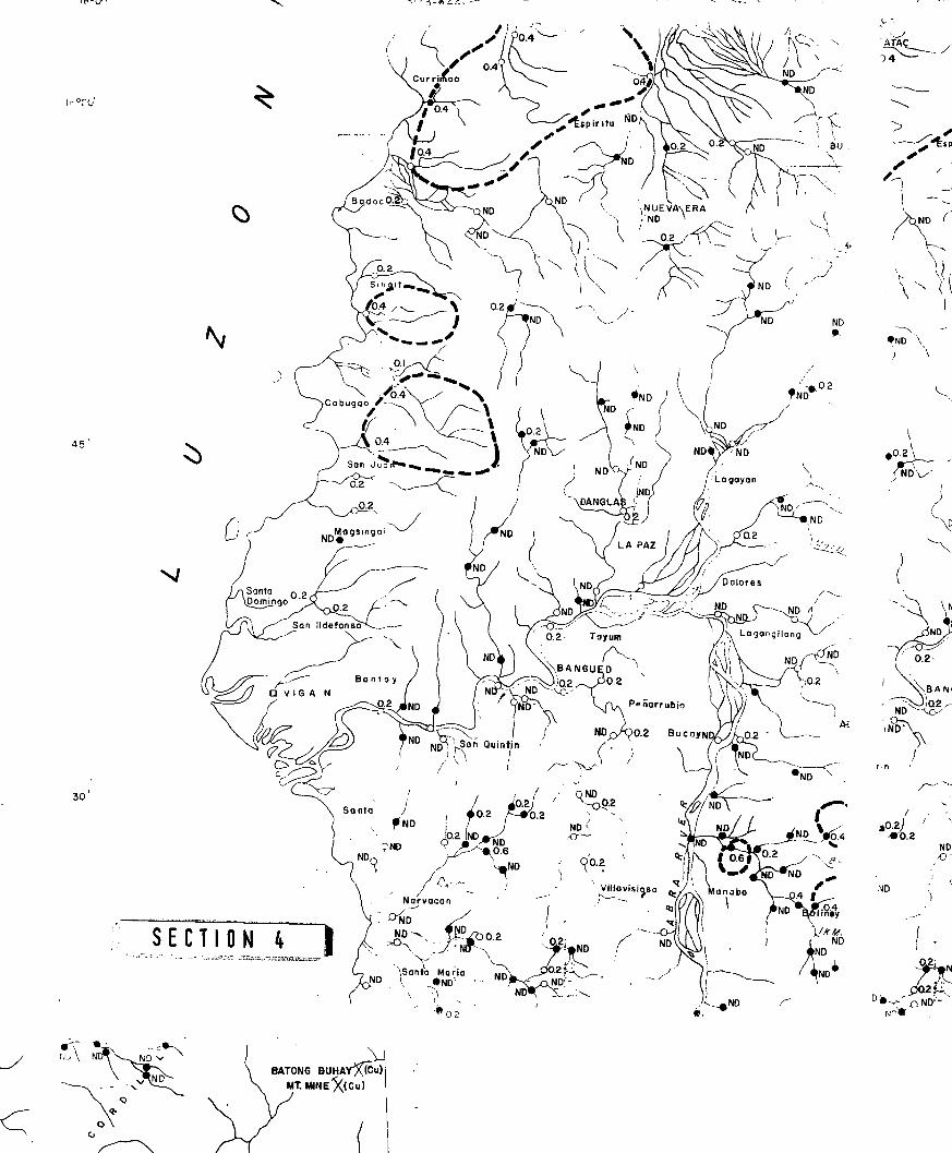
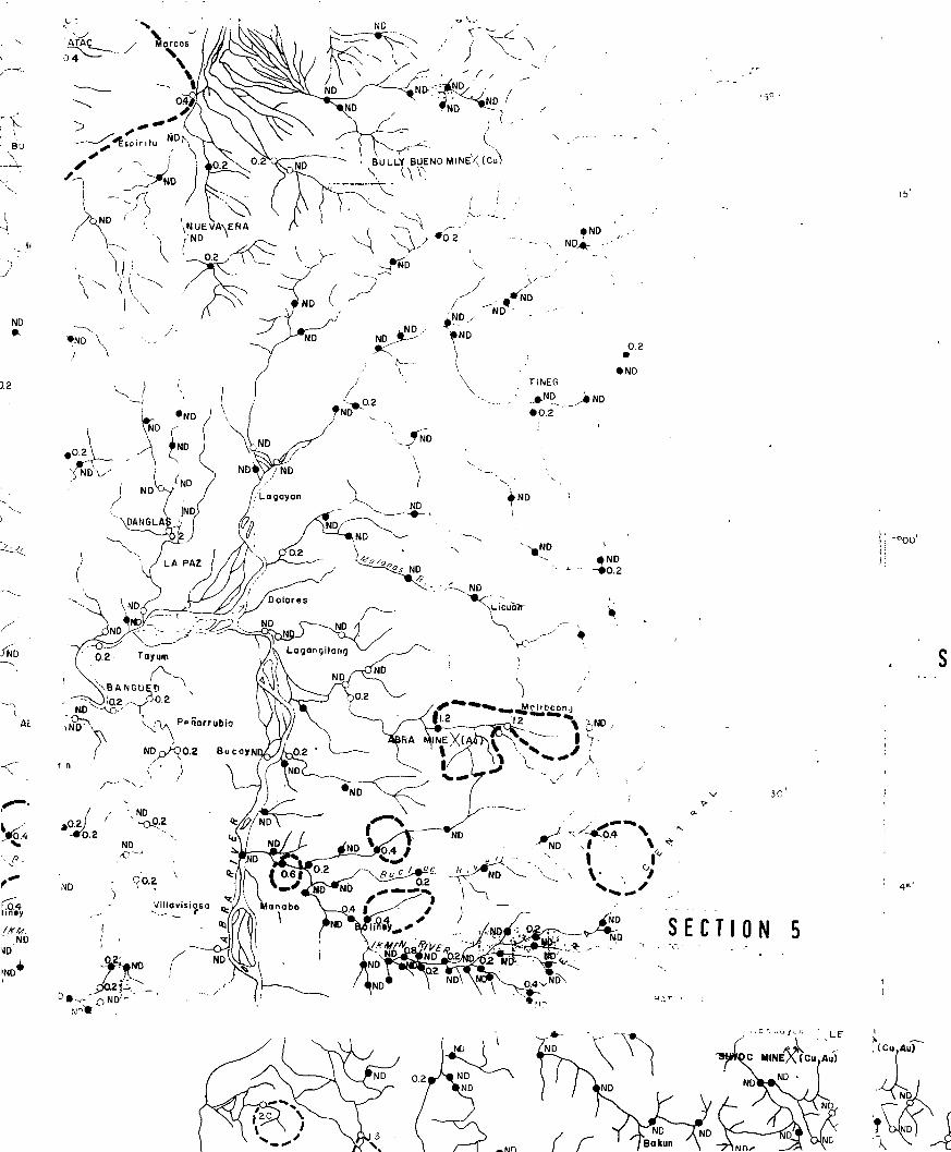
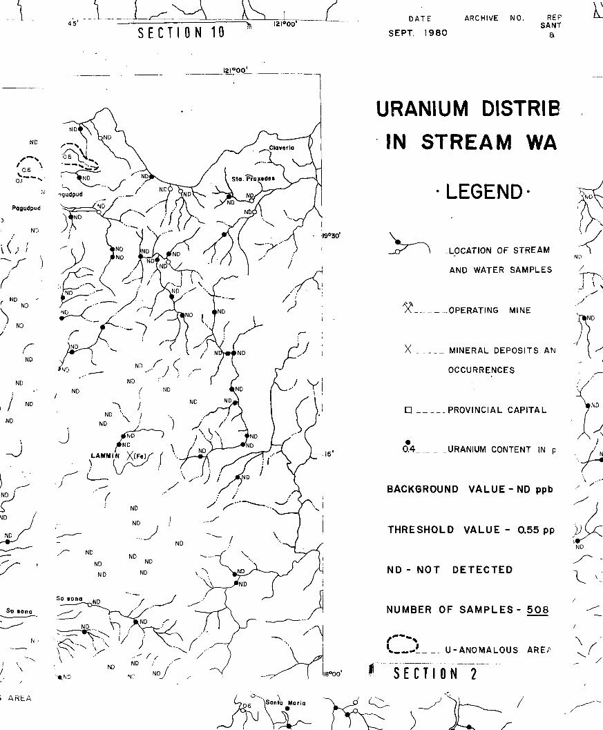
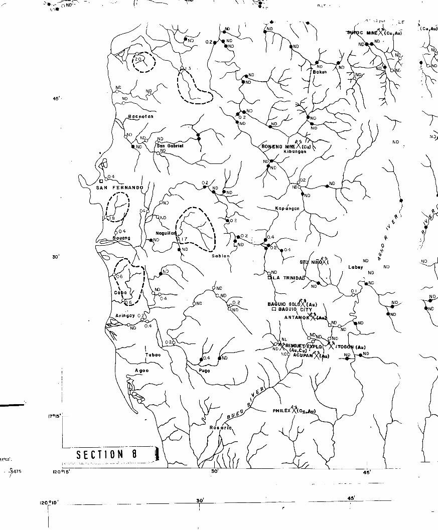
Uranium in Stream Sediments and Waters
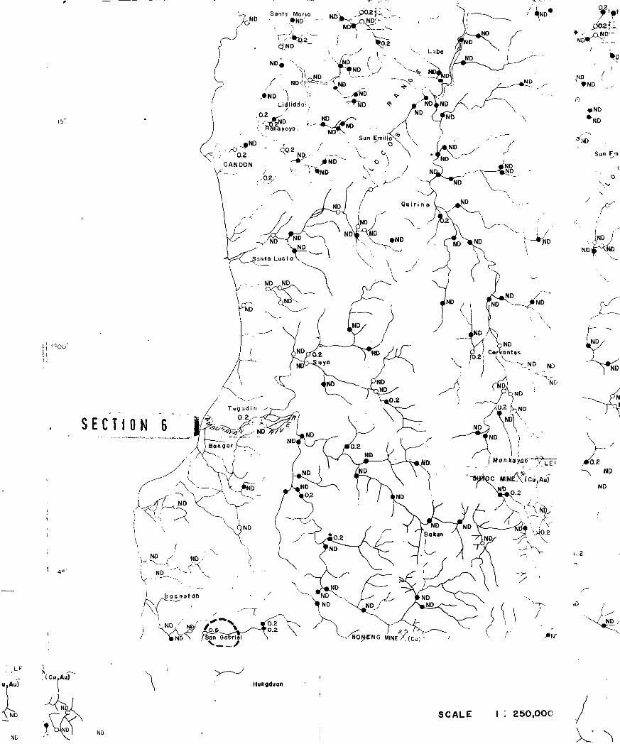
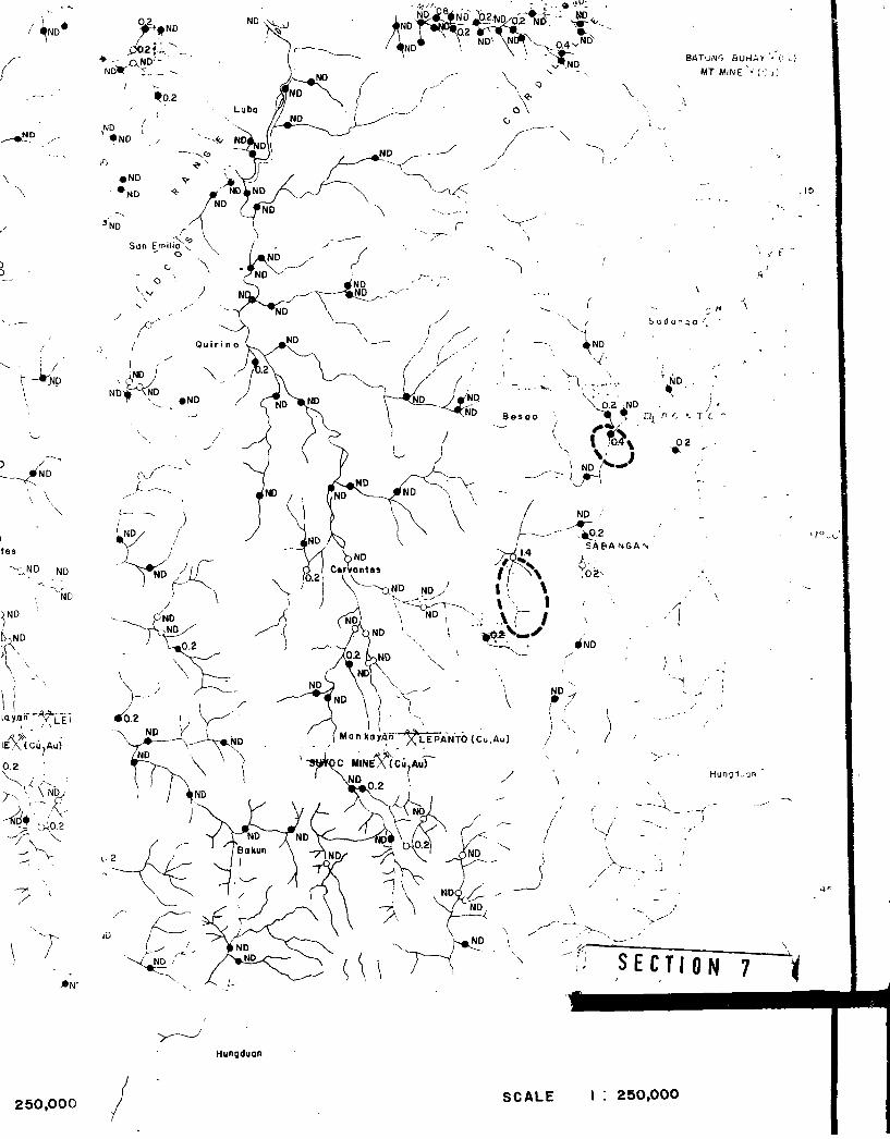
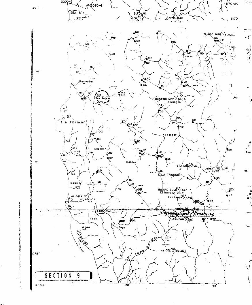
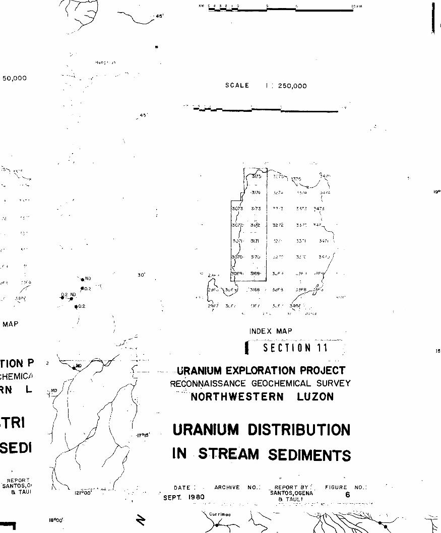
Shown in Figs. 6 and 7 are the uranium distributions in
stream sediments and wattvs, respectively. At least one large
contiguous stream sediment anomaly zone was outlined in Batac-
Badoc area, Ilocos Norte. Other lesser anomalies were indicated
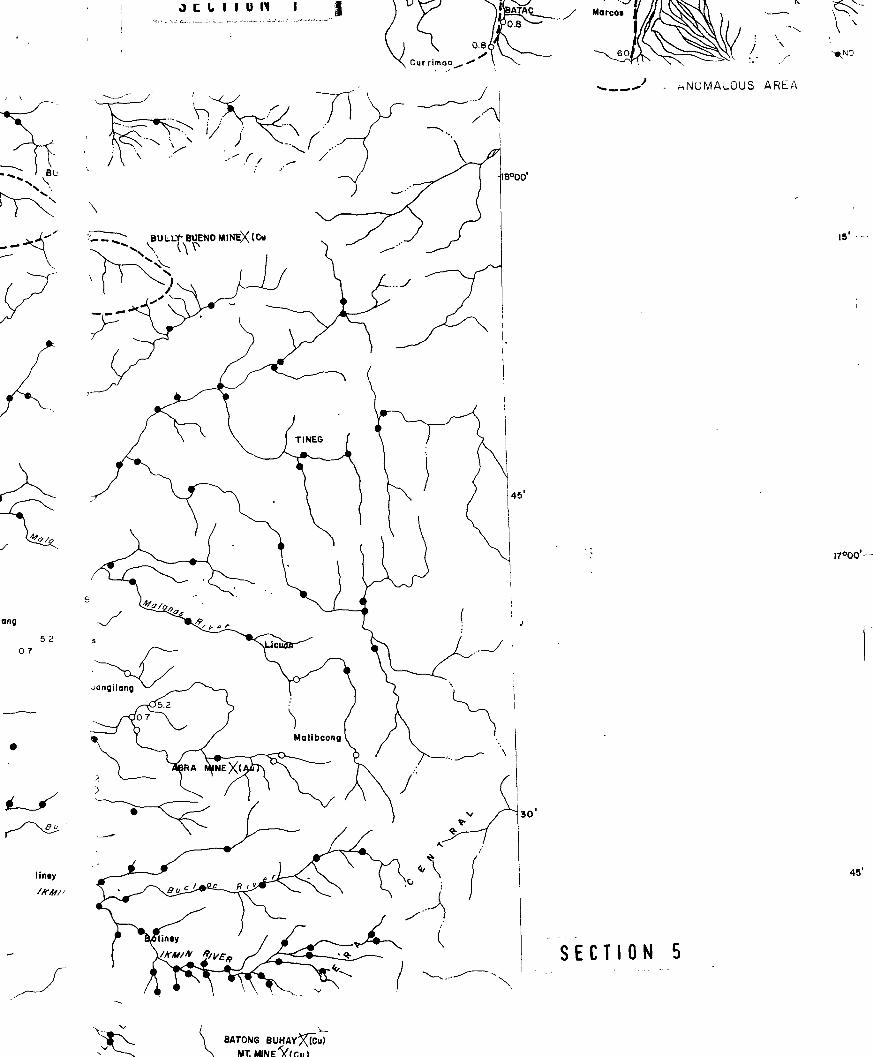
in Sinait-Cabugao, Ilocos Sur; Burgos, I.locos Norte and Malibcong-
Ikmin River area, Abra.
- 9 -

Table 2 : Average Background and Threshold Valuesof Uranium and Selected Elements inGeological Units in Northwestern Luzon.
Parts Per Million
U Cu Pb Zn >4i Ag Co Ni
Bkgd Th Bkgd Th Bkgd Th Bkgd Th Bkgd Th Bkgd Th Bkgd Th Bkgd Th
Sedimentaryand VolcanicRocks N D 0.4 32 220 17 60 60 200 630 1350 0.4
No. ofSamples
No. ofSamples
451(3) 452(2) 454 454 454
2 21 47 12 120
454 454 454
Intrusiverocks N D 0.4 45 250 15 ]10 57 580 430 2400 0.35 1.55 IS 40 9 41
68 64 68 68 68 68 68 68
CompositeUnits(Sed., Vol-canic §Intrusive)
No. ofSamples
N D 0.4 40 330 16 45 60 220 600 1350 0.36 1.65 21 47 9 105
519(2) 517(4) 521 521 521 521 521 521
Note: Bkgd - BackgroundTh - Threshold( ) - E x c l n ^ High • •iues
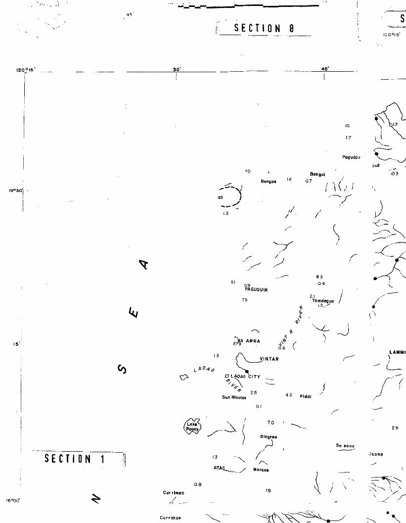
Isolated anomalies were also found in Pagudpud, Ilocos Norte and
Sabangan-Bontoc, Benguet. Uranium value as high as 1.4 ppm was
recorded in Sabangan.
One large stream water anomalous zone was delineated in
Dingras-Badoc, Ilocos Norte. Smaller anomalies were indicated in
Burgos, Ilocos Norte. Several isolated anomalies in Narvacan.-
Candon, Ilocos Sur, Bacnotan and Naguilan, La Union were also
outlined. A high 7 ppb U found in Sinait, as well as those obtained
in San Fernando and Caba maybe due to sea water contamination.
However, these anomalies would still warrant a brief closer
examination.
In general, there is a very good correlation between the
stream sediments and water uranium anomalies in Batac, Burgos and
Pagudpud areas in Iloco; Norte and Sinait, Ilocos Sur.
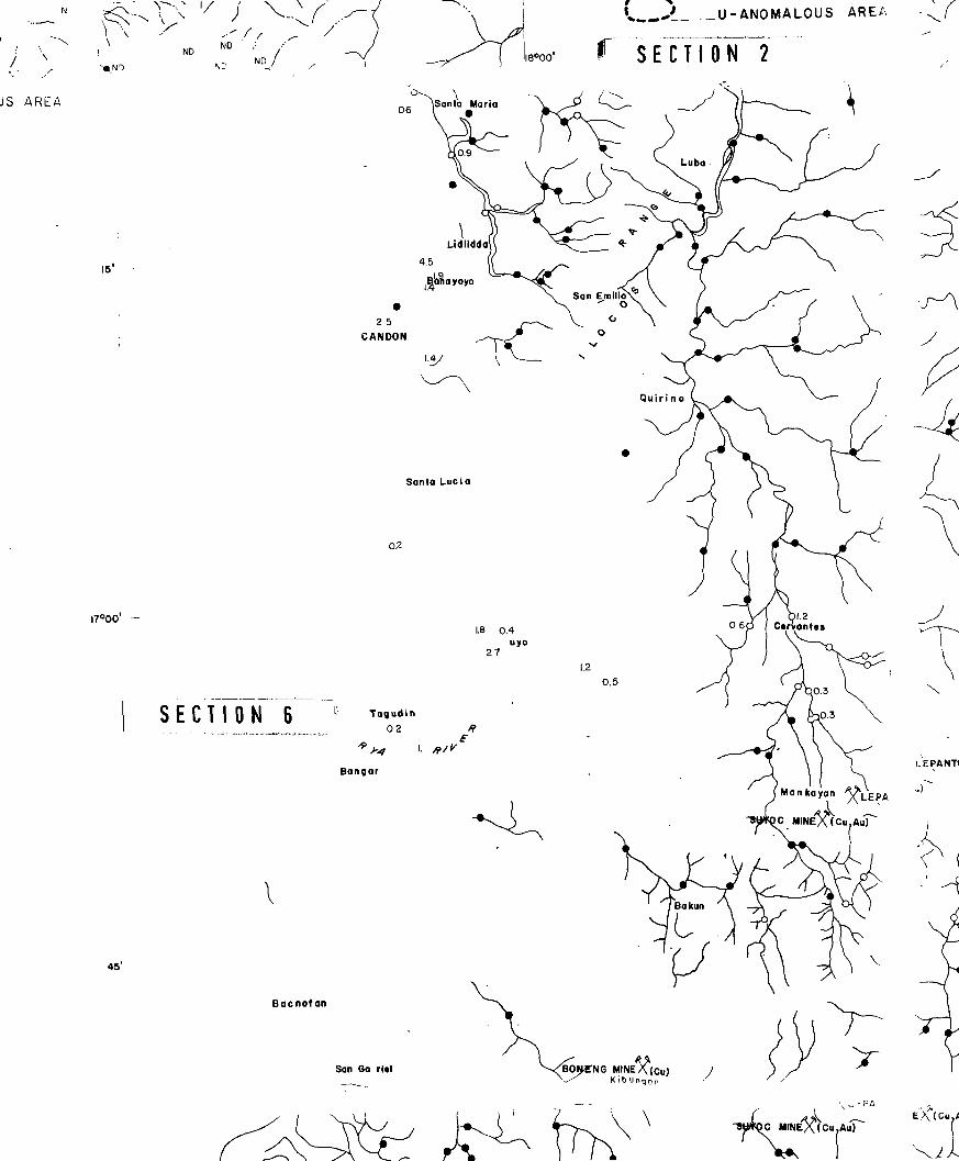
Radon Radioactivity Measurements
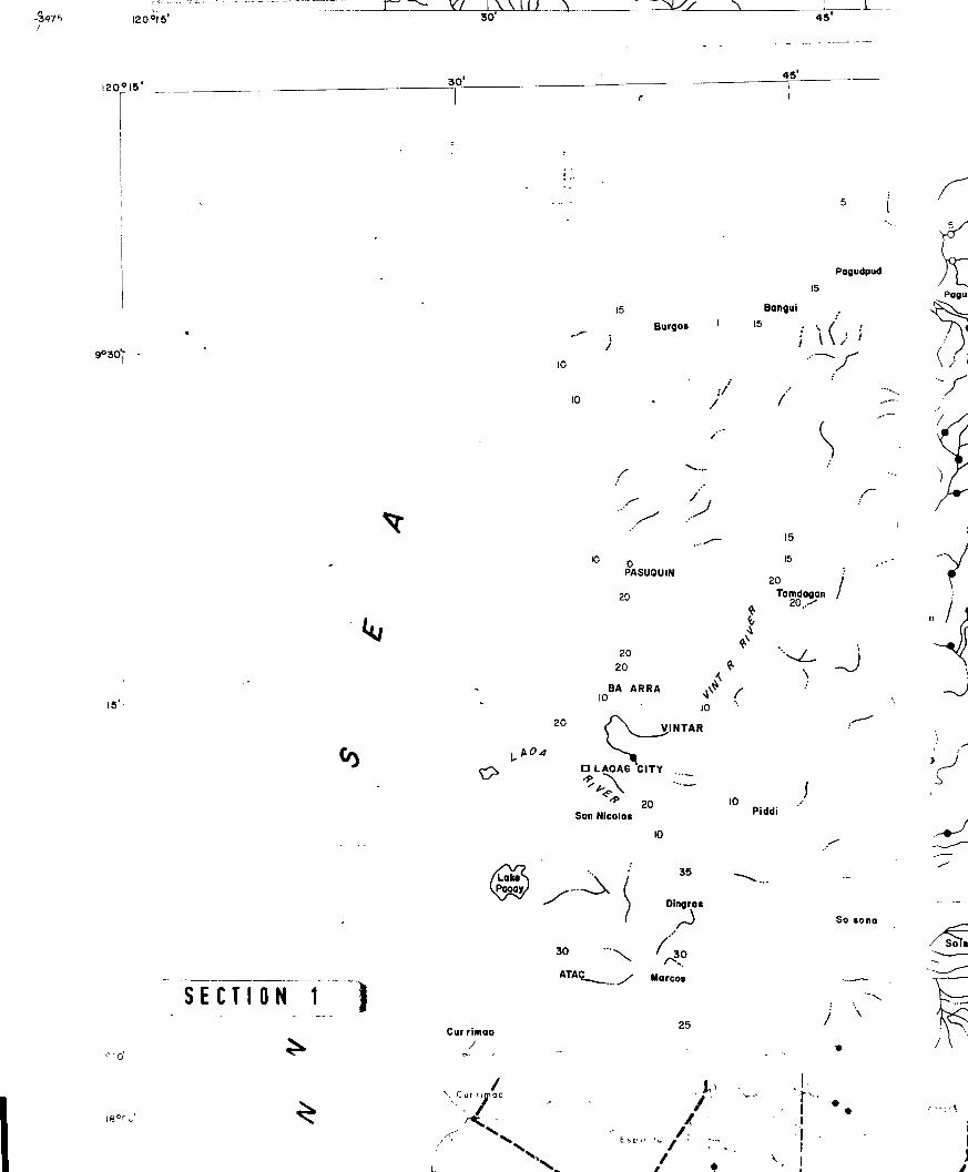
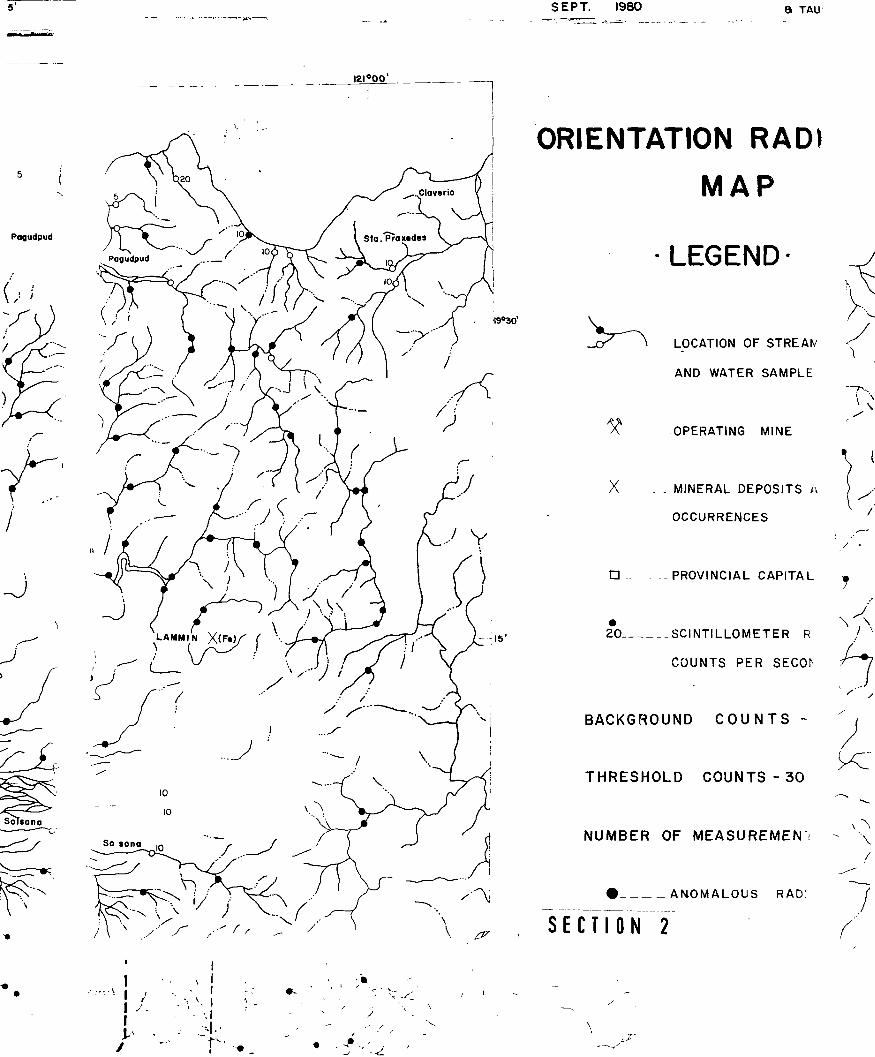
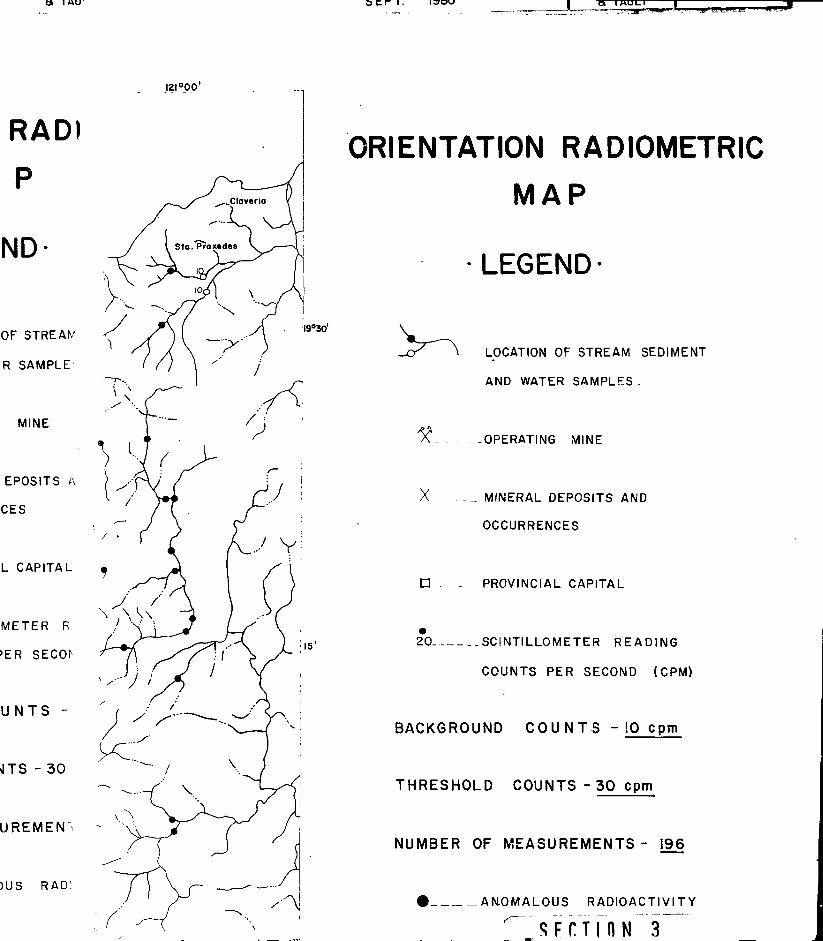
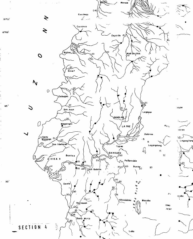
Shown in Figures 4 and 5 are the radon and radioactivity
maps obtained during the orientation phase of the survey. Four
widely separated point anomalies were delineated, three,in Ilocos
Norte (Burgos, Sta. Praxedes and Nueva Era) and one in Cabugao,
Ilocos Sur. The highest radon measurement (45.3 cpm) was recorded
in Burgos.
- 11 -
Six anomalous radioactivities corresponding to 3 times
background were measured in Dingras-ffercos-Batac, Ilocos Norte
and Malibcong, Abra. Exploration Model GRS-101A and Me Phar TV-5
portable scintillometers were used to take the radioactivity-
readings.
The uranium anomalies appear to be preferentially situated
in areas underlain by Miocene marine elastics overlain with tuff-
aceous sediments. In Batac-Badoc area, two major northeast trending
faults probably control the extent of the uranium dispersion. Inter-
secting north-south an^ northeast trending moderate faults apparently
contribute in localizing the uranium anomalies in Cabugao.
In the Malibcong-Ikmin River area, the uranium anomalies
are closely related to the Miocene quartzdiorite rocks and northea-
southwest structures. The Narvacan-Candon and Bacnotan uranium
anomaly in waters are related to strongly folded tuffaceous sand-
stone shale.
It may be noted that the uranium anomalies are predominant!
distributed in the Coastal Folded Belt and Laoag Embayment. It is
believed that the possible principal uranium source rocks are the
intrusive intermediate rocks, mainly quartdiorite found in Cordillera
Central. The Cordon syenite complex (Baquiran, 1975, Khittel, 1979),
located in the southeastern part of the Cordillera is also a
possible source rock of uranium in the project area.
- 12 -
1
Si The summary of .significant correlating geochemical and
ij geophysical anomalies in Northwestern Luzon are presented in
Table 3. The anomalous areas are arranged in their order of \.. .^i-
ij tial for finding possible uranium mineralization.
fi It is interesting to note that the regional background and
threshold values for copper and zinc obtained in the present work
1 is partly similar to the RP-Japan Project (Phase 1 ) , 1979 as shown
m in Table 4.
(Table 4. Comparison of Regional Background and
Threshold Values Obtained on the RP-Japan Project (Phase 1) 1979, and thePresent Work.
| Cu (ppm) Zn (ppm)Ba
II
Back- Thres- • Back- Thres-ground hold ground hold
Present Work 40 3 3 0 5 0
RP-Japan Project 32 125 58 120
It can be seen in Table 4 that even though the geochemical
extraction procedures used were different, the results obtained
for the regional background are rather closely similar. The
thresholds correspond to abscissas at 2.5% probability for Cu anc
Zn. The large differences in the threshold values are probably
due to the variety of rock units covered in the present womk
as compared to the RP-Japan Project. (Please see Fig. 8.)
- 13 -
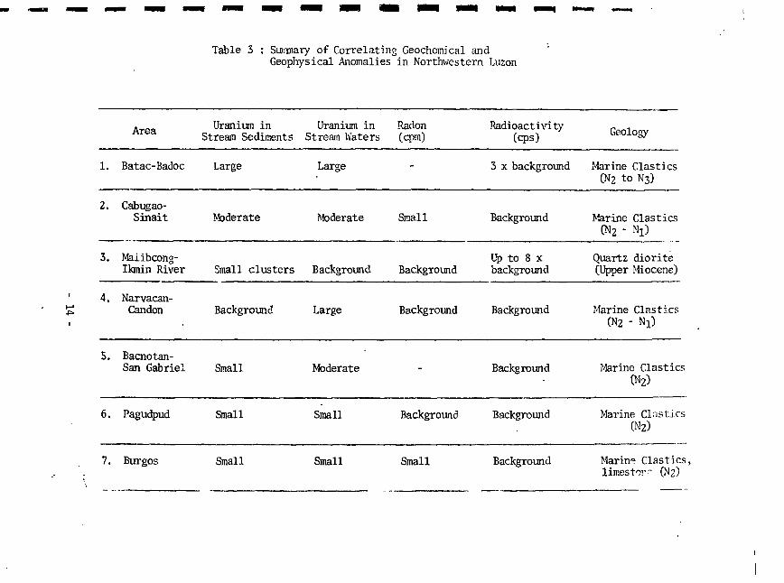
Table 3 : Summary of Correlating Geochemical andGeophysical Anomalies in Northwestern Luzon
1.
2.
3.
4.
5.
6.
Area
Batac-Badoc
Cabugao-Sinait
Maiibcong-Ikmin River
Narvacan-Candon
Bacnotan-San Gabriel
Pagudpud
Uranium inStream Sediments
Large
^derate
Small clusters
Background
Small
Small
Uranium inStream Waters
Large
Moderate
Background
Large
Moderate
Small
Radon(cpm)
-
Small
Background
Background
-
Background
Radioactivity(cps)
3 x background
Background
Up to 8 xbackground
Background
Background
Background
Geology
Marine Clastics(N2 to N3)
Marine ClasticsCM2 - %)
Quartz diorite(Upper Miocene)
Marine Clastics(N2 " % )
Marine Clastics(N2)
Marine Clastics0*2)
7. Burgos Small Small Small Background Marine Clastics,limes tor" (N2)

Uranium and thu Trace , -ments
The other trace elements such as copper, lead, zinc,
manganese, silver, cobalt and nickel were also determined in the
stream sediments to investigate whether any of these could serve
as possible indicator or pathfinder element for uranium.
In general there is poor negative (inverse) correlation
between uranium and the selected trace.elements except nickel.
Shown in Table 4 is thr correlation coefficient between uranium
and the other elements.
Table 4. Correl- ion Coefficient between Uraniumand l . trace elements.
ELEMENTS CORRELATION COEFFICIENT
U vs. Cu - 0.06
U vs. Pb - 0.05
U vs. Zn - 0.08
U vs. Mn - 0.13
U vs. Ag - 0.03
U vs. Co - 0.10
U vs. Ni • 0.05
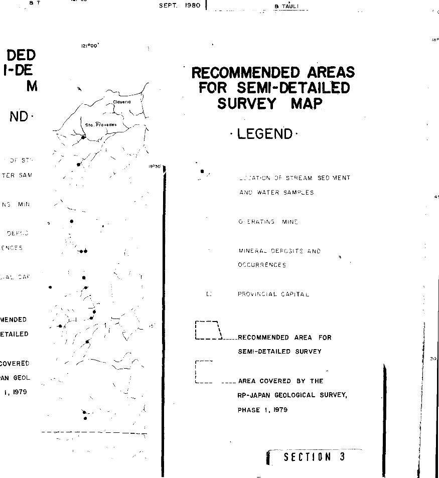
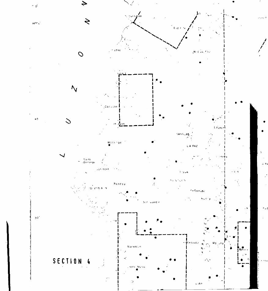
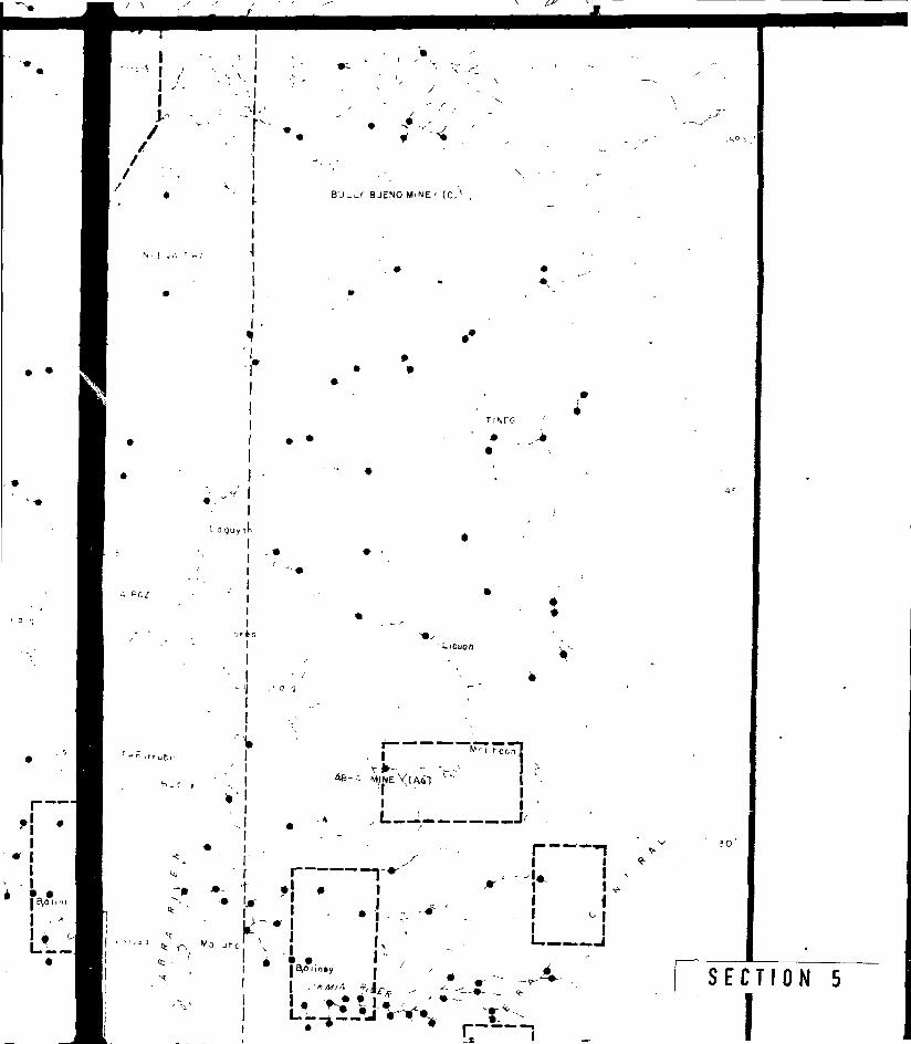
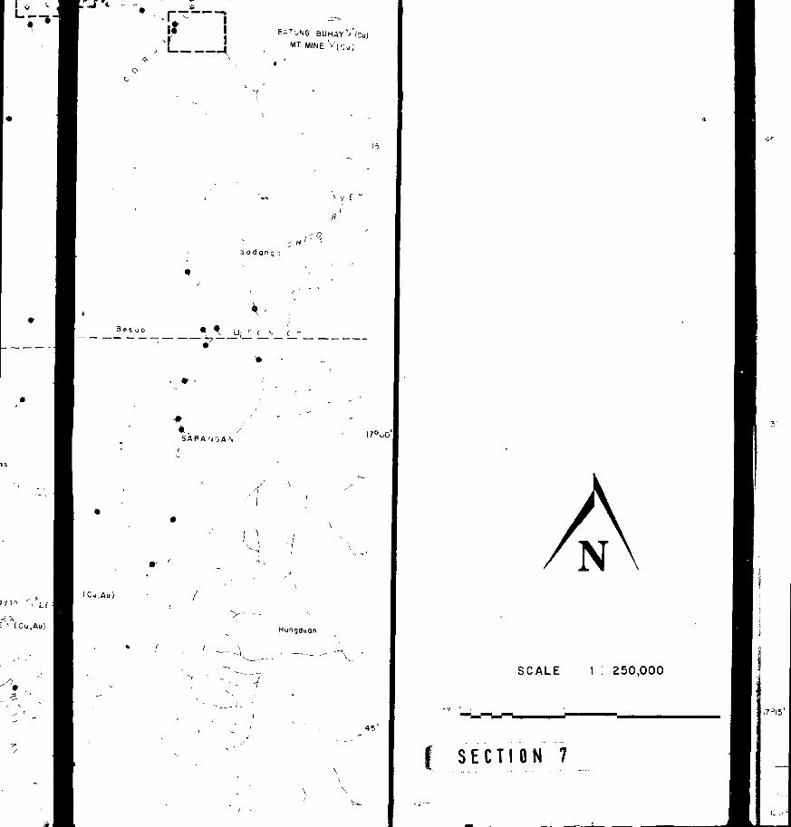
Shown in Fig. 8" is the recommended areas for follow-up semi-
detailed or intermedia/?- density sairjpling surveys. Although the
- IS -
predominant uranium anomalies are widely distributed in marine
I elastics and sedimentary rocks, it is felt that other possible
uranium occurrences, such as vein-type deposits may not be detected
I by low density sampling.
IIIIIIIIIII
- 16 -

CONCLUSION
The reconnaissance stream sediment and waters geochemical
survey which was conducted over a 15,000 sq. km. region in.north-
western Luzon has outlined ten (10) uranium geochemical anomalous
areas. These anomalous zones are mainly located in marine elastics
and sedimentary rocks vith tuffaceous sediments as well as in quartz
diorite.
The radioactivity in two anomalous areas is between 3 - 6
times background. Radon anomalies occur in sparsely scattered
points.
The anomalous zones are associated with major north-south
faults and secondary northeast-southwest structures.
Geochemical correlations between uranium and the trace
elements, copper, lead, zinc, manganese, silver, cobalt and nickel
are generally very poor.
It is suggested that the quartz diorite and silicic tuffs
in the Cordillera Central as well as the Cordon syenite complex are
possibly the principal source rocks of uranium in the survey area.
- 17 -

Ml Unit. ENERGY .
r»rrr
ACKNOWLEDGEMENTS
The authors wish to acknowledge the valuable assistance
and encouragement of Dr. M. C. Berbano, PNOC-EDC.
The chejnical analyses were performed by the staff of
the Nuclear Fuels Research Division, Department of A'uclear
Technology and Engineering of PAEC. The staff also assisted
in the statistical confutation of the geochemical Oata.
REFERENCES
Baquiran, G.B., 1975, "Notes on the Geology and Exploration ofof the Karian Copper Deposits, Cordon^ Isabela", Jour.Ceol. Soc. Phil., Vol. 29, pp. 1 - 1 2 .
Corby, G.W., et. al., 1951, "Geology and Oil Possibilities ofthe Philippines," Rep. of the Philippines Dept. Agric.and Nat. Res., Tech. Bull. 21 363 pp. >
Fernandez, J.C. and Pulanco, D., 1964, "Preliminary Report onthe Reconnaissance Geology of Northwestern Luzon,Philippines", 1 :reau of Mines.
Irving, E.M., 1952, "Geological History and Petroleum Possibili •.., .of the Philippines," Bull. Amer. Assoc. Petrol. Geol.,Vol. 36, pp. 437 - 76.
Knittel, U., 1979, "Petrography and Origin of the Syenite fromCordon, Isabela, Vol. 33, pp. 34 - 42.
Lepeltier, C., 1969, A simplified statistical treatment ofgeochemical data by graphical representation: Econ. Geol.,v. 64, pp. 538-550.
Neville, A. and Kennedy, J., "Basic Statistical Methods forEngineers and Scientists", Pennsylvania: InternationalTextbook Co., 1964.
Report on Geological Survey of Northwestern Luzon (Phase.1),Sept. 1979, Bureau of Mines - Japan InternationalCooperation Agency, 124 pp.
Smith, A.Y. and Lunch J.J., 1969, Field and Laboratory Methodsused by the Geological Survey of Canada in GeochemicaJSurveys, No. 11. Jranium in Soil, Stream Sediment andWater. Surv. Can. Paper 69-40.
P-U<.'8SiJ.it
^ 3 1
URANIUM GEOCHEMICAL EXPLORATIONIN NORTHWESTERN LUZON
URANIUM DIVISION
PNOC ENERGY COMPANIES BLDG.PNPC COMPLEX, MERRITT ROAD,FORT BONIFACIO, METRO MANILAPHILIPPINES
S E C T I O N 1 !


ND1
45'
ND BATONGMT. MINEXtCu)
Mufi ku/un \ LEPA
I2O°I5'
2 O ° I 5 '30' ' 45*

KM 5 4 3 2 ' 0
SCALE I : 250.0C
J20°00 JO l2l°00 30
3270
3269
3168 • 3268
, 2967) -3067 3167 • 3267 34.i i i ; . i --
I20°00* 30 I2I°OO- 3p
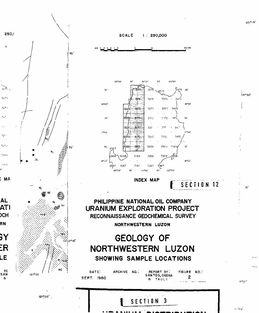
INDEX MAP
SECTION 10
URANIUM EXPLORATIONRECONNAISSANCE GEOCHEM!
NORTHWESTERN
ORIENTATION
MAP
I2I°OO" DATE :
SEPT 1980
ARCHIVE NO.. REPOSANTO
a T
I2I°OO'
-3275^
250.0C
3274
3272
3271
3270
3269
3ZF8
3267 34r
REPOSANTO'
a T
SCALE I : 250,000
KM 5 « 5 2 1 0
5,0 i2i°oo' so iaa«oo'
375 - -3475—so
3274 -3374 • 3474 ~i
• • [ -
3'73 3373 •3473'
3272 • 3372 -3472: 3
3271 3371 • 3471 \
3270 3370 347O
i«°oo'l I '
n̂- 3269 33P.J -3^6 V -Jo'
3168 ' 3268 • 336B^,346a-
2967J -3067 3167 • 3267 3467; I ; . 1 • -s
IZO°QO' 50 rZI°OO' 30 ' I22°OO'
INDEX MAP
URANIUM EXPLORATION PROJECTRECONNAISSANCE GEOCHEMICAL SURVEY
NORTHWESTERN LUZON
ORIENTATION RADON
M A P I SECTION 11
121 °00' DATE :
SEPT. 1980
ARCHIVE NO.: REPORT BY: FIGURE NO.:SANTOS, OGENA 4
a TAULI
15"
I2I°OO' IS0'"
- -3475 I2O°I5'r" ^ - xi i \ \ 11 /
30'\
45
I2O°I5' 30' 45
9o30T
15'-
Pagudpud
15 Bangui
Burgos 15 ; \ / .'
10
10 / /
10PASUOUIN
20
2020
BA ARRA
15
15
20Tomdagai
20.. " . /
-J10
1020 VINTAR
D LAOAG CITY
San Nicolas20 10
Piddi
10
35
Oingras
So sona
S E C T I O N 1 |Currimao
/
30 -
A T A Q _ Marcoi
25 / N
\ Cur nmao
/ , I
SEPT. 1980 a TAU
121 "00'
Pagudpud
•I9°3O'
ORIENTATION RADI
MAP
LEGEND
V tr
X
LOCATION OF STREAM
AND WATER SAMPLE
OPERATING MINE
MINERAL DEPOSITS A
OCCURRENCES
PROVINCIAL CAPITAL
20 SCINTILLOMETER R
COUNTS PER SECOr
BACKGROUND COUNTS -
THRESHOLD COUNTS - 30
NUMBER OF MEASUREMENT \
• ANOMALOUS RAD: (
IECTION 2 /
a i AU itn.
I2I°OO'
RAD)
P
ND-
OF STREAM
R SAMPLE
MINE
EPOSITS A
CES
L CAPITAL
METER R
>ER SECOf-
U N T S -
4TS - 30
UREMEN'i
)US RAD1.
ORIENTATION RADIOMETRIC
MAP
LEGEND
<I9°3O'
LOCATION OF STREAM SEDIMENT
AND WATER SAMPLES.
A OPERATING MINE
X .__ MINERAL DEPOSITS AND
OCCURRENCES
• PROVINCIAL CAPITAL
20 SCINTILLOMETER READING
COUNTS PER SECOND (CPM)
BACKGROUND COUNTS - 10 cpm
THRESHOLD COUNTS - 3 0 cpm
NUMBER OF MEASUREMENTS- 196
• AMOMALOUS RADIOACTIVITY^ <? F T T I fl N 3
I8°OO'
45
30
\
S E C T I O N
\ 8 L
-V,o/o ,
~~-~. I) . \ Lagangilong
ngilang
( S E C T I O N 2
IS
S E C T I O N 5