us department of the interior us geological survey miscellaneous
TRANSCRIPT

U.S. DEPARTMENT OF THE INTERIOR U.S. GEOLOGICAL SURVEY
MISCELLANEOUS INVESTIGATIONS SERIES MAP 1-2567 PAMPHLET
GEOLOGIC MAP OF PRECAMBRIAN ROCKS ALONG PART OF THE HARTVILLE UPLIFT, GUERNSEY AND CASEBIER HILL QUADRANGLES,
PLATTE AND GOSHEN COUNTIES, WYOMING
By P.K. Sims, W.C. Day, G.L. Snyder, and A.B. Wilson, with a section on
Geochronology of post-tectonic intrusive rocks by Zell E. Peterman
INTRODUCTION
The Hartville uplift is a north-northeasttrending Laramide anticline on the southeast margin of the Archean Wyoming craton. It consists of a Precambrian core (fig. 1) overlain by partly eroded gently outward-dipping Paleozoic strata and, locally, by flat-lying Tertiary and Quaternary strata. The uplift is the easternmost Laramide structure on the Wyoming craton.
The uplift exposes deformed Late Archean granite (2.58 Ga) and Late Archean or Early Proterozoic supracrustal rocks that were deformed during three, and possibly four, major compressional events in Early Proterozoic time, extending from approximately 2.1 to 1. 76 Ga. These events are recorded in the Guernsey and Casebier Hill quadrangles by (1) inversion of supracrustal succession (D1) as a result of a probable fold nappe; (2) folding of rocks at least in the southern part of uplift on east-west axes {Dz ); (3) west-vergent folding on northeasttrending axes and associated thick-skinned thrusting with concomitant prograde metamorphism; and (4) scattered horizontal folds and associated structures in the extreme southern part of the area.
The overturned succession probably constitutes the lower limb of a fold nappe (D1), which could have formed as an early phase of deformation Dz . The Dz folds apparently were caused by north-vergent collision {approximately 2.1 Ga) along the southern margin of the Wyoming craton. The main, most widespread deformation in the uplift (D3; approximately 1.82 Ga) constitutes a west-vergent fold-thrust belt on the western, convergent continental margin of the Trans-Hudson orogen (Lewry and Stauffer, 1990); the continent-arc suture is not exposed but is inferred to lie a few kilometers to the east of the uplift. The youngest recognized significant deformation (D 4),
1997
1
represented by scattered horizontal folds in the southernmost part of the uplift, is believed to have resulted from vertical compression caused by crustal thickening attributed to collision to the south along the 1. 7 6-Ga Cheyenne belt (Premo and Van Schmus, 1989).
In this report, we use informal lithologic names to describe the supracrustal rocks of the Whalen Group (Smith, 1903) in the map area. For the intrusions, granite of Haystack Range of Snyder (1980) and diorite of Twin Hills of Snyder (1980), we herein propose the formal names Haystack Range Granite and Twin Hills Diorite. The type area of the Haystack Range Granite is in T. 27 N., R. 65 W. (this report); the type area of the Twin Hills Diorite is Twin Hills, in the Moore Spring quadrangle, immediately north of the Casebier Hill quadrangle.
A geologic map of the Good Fortune mine area by Ebbett (1956) was invaluable to us inasmuch as the mine area has been rehabilitated subsequent to his work and exposures of the ore body and immediately adjacent rocks have been covered by dirt. The thesis map was made available to us by Robert S. Houston, University of Wyoming.
STRATIGRAPHY
Three principal lithologic rock units, from oldest to youngest: aluminous and ferruginous schist, metadolomite, and metavolcanic rocks, compose the Whalen Group in the map area. The succession is known to be inverted in the map area, probably as the result of a fold nappe developed before or during the early stages of deformation D2 . Evidence for an overturned succession is given mainly by stromatolitebearing carbonate rocks (XWd) in the vicinity of Hartville. On the north limb of the Graves Ranch anticline, in SE1/4 sec. 7, T. 27 N., R. 65 W., overturned beds dip moderately (40°-500) north, and on the south limb of the

anticline, steeply dipping beds face north. The anticline is a downward-facing, asymmetrical, east-plunging anticline. Other downward-facing beds in dolomite occur in the area between Hartville and Sunrise, and in the area immediately northeast of the Chicago mine.
The quartzofeldspathic (aluminous) schist unit (XWs) west of the Hartville fault consists mainly, of biotite-quartz-plagioclase schist containing sporadic garnet. This unit grades laterally into ferruginous schist (XWf) in the area east of Hartville. The ferruginous schist contains layers and lenses of banded ironformation; lenses of specularite, which have been mined at the Good Fortune, Sunrise, and Chicago mines; and discontinuous layers of quartzite. The ferruginous schist unit predominantly contains chemical sediments, in contrast to the more clastic facies of the quartzofeldspathic schist. East of the Hartville fault, the quartzofeldspathic schist (XWb) is in the amphibolite metamorphic facies and contains garnet, sillimanite, and, locally, andalusite. In the eastern area, the schist is intruded and domed by the 1.72-Ga Haystack Range Granite (Xh).
Structural analysis in the map area suggests the existence of only one carbonate unit in the Whalen Group (XWd), as shown on cross section A-A'. Previously, Snyder (1980, 1989, 1993) assigned the carbonate rocks to two informal formations, an upper "Wildcat Hills Formation" and a lower "Muskrat Canyon Formation." Metabasalt of the uppermost stratigraphic unit (XW m) was previously informally called "Mother Featherlegs basalt" (Snyder, 1980). It appears to form a good stratigraphic marker throughout the area.
The age of rocks in the Whalen Group is equivocal because internal isotopic ages are not available, and in this report Whalen Group rocks are designated as either Late Archean or Early Proterozoic. Snyder (1980, 1993) considered the Whalen Group to be Late Archean because he interpreted the rocks within it to be intruded by the Late Archean granite of Rawhide Buttes. Recent structural studies (Day and others, 1994), however, indicate that the major granite-supracrustal rock contacts are ductile shear zones, and the relationship between the granite and the supracrustal rocks is uncertain.
The Whalen Group is known to be older than the 1. 98-Ga granite of Flattop Butte (sec. 35, T. 31 N., R. 64 W.) and probably entirely older than the approximately 2-Ga metadiabase dikes (Xmd) (Snyder, 1993), for scattered dikes cut rocks of the Whalen Group. Strontium isotope compositions of metamorphosed carbon-
2
ate rocks in the Whalen Group are permissive with an Early Proterozoic rather than a Late Archean age (Zell E. Peterman, written commun., 1994). An Early Proterozoic age is also supported by the presence in the Whalen Group of Lake Superior-type banded iron-formation (XWfi) (Gross, 1965; James, 1983), which in the northern hemisphere characteristically is Early Proterozoic in age (Gross, 1980, p. 218).
STRUCTURE
Four episodes of compressional deformation, designated D1 through D4, are recorded in the supracrustal rocks and their basement in the map area, as follows: D1, overturning of the Early Proterozoic or Late Archean stratigraphic succession; Dz, folding on easttrending axes, as exemplified in the southern part (Guernsey domain) of the map area; D3, folding on northeast-trending axes, coeval with west-directed, thick-skinned thrusting; and D4, scattered, small-scale recumbent folds and associated structures in the southern part (Guernsey domain) of the map area. Compressional deformation (D1 through D4 episodes) was followed by doming of the supracrustal rocks around the 1. 72-Ga Haystack Range Granite in the area east of the Hartville fault. Compressional deformation is thought to have spanned the approximate interval 2.1-1.76 Ga. Deformations D1 and Dz were not recognized in the area previously.
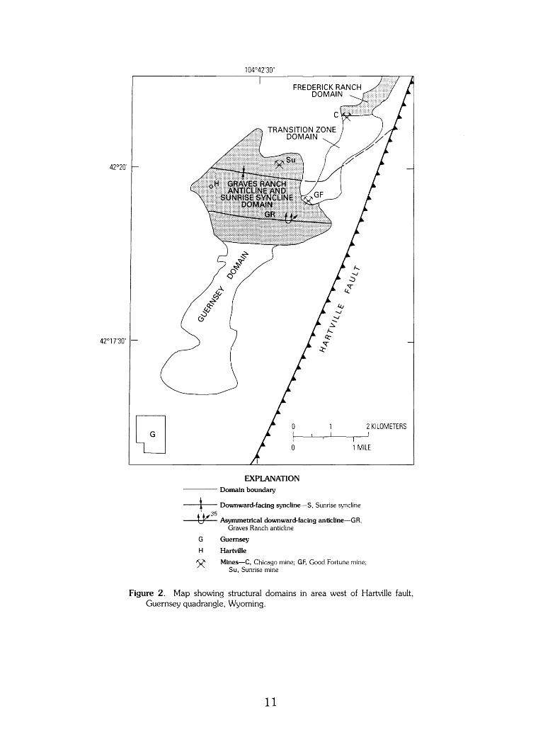
To facilitate discussion of the structure, the map area is divided into four domains (fig. 2) from south to north: (1) Guernsey domain, (2) Graves Ranch anticline and Sunrise syncline domain, (3) transition zone domain, and (4) Frederick Ranch domain. Because the doming by the 1. 72-Ga Haystack Range Granite disturbed and strongly modified the older deformational structures east of the Hartville fault, the structural domains are delineated only in the area west of the Hartville fault.
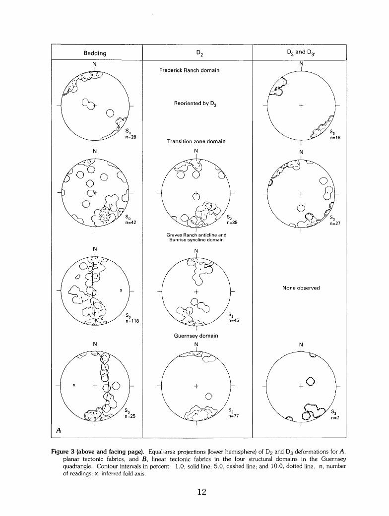
The type area of Dz deformation in the uplift is the Guernsey domain (fig. 3). Dz structures are well preserved in this area because it was virtually unaffected by younger D3 deformation, and D4 structures are not regionally significant. Northward, Dz structures are also the dominant ones in the Graves Ranch anticline and Sunrise syncline domain. In the transition zone domain, D3 structures are superposed on Dz structures, and in the Frederick Ranch domain, D3 structures have largely obliterated Dz structures through reorientation.

D1 AND D2 DEFORMATIONS
Deposition of the Whalen Group on a southeast-facing continental margin was followed by development of a fold nappe (D1). The extent of the overturned limb of the nappe is not fully known, but reconnaissance mapping in the adjoining Hell Gap quadrangle, immediately north and west of the Frederick Ranch, indicates that stromatolitic beds in the dolomite unit are upright. Accordingly, the northern limit of overturning in this southern part of the uplift coincides approximately with, but probably is not related to, the McCann Pass fault. Deformation D1 could be an early phase of deformation Dz; an associated axial planar fabric is very weak or absent, suggesting that nappe formation could have resulted from softsediment deformation. Such deformation has been proposed to account for recumbent folds lacking a pervasive axial planar cleavage in Late Archean metagraywacke in the Vermilion district, northern Minnesota (Hudleston, 1976).
Following nappe formation, compressional deformation oriented about an approximate north-south-directed tectonic axis folded the supracrustal rocks and probably the underlying granite basement. The folds (Fz) are exposed in both the Guernsey domain and the Graves Ranch anticline and Sunrise syncline domain; Sz is axial planar to Fz folds (see cross section A-A') (fig. 3); So-Sz intersections (Lz} plunge parallel to Fz. The folds plunge westward and verge southward in the Guernsey domain (fig. 3); in the domain composed of the Graves Ranch anticline (a downward-facing anticline; Shackleton, 1958) and the Sunrise syncline (a downward-facing syncline), Dz linear structures plunge both to the west and east. Dz folds in both domains are asymmetrical, similar folds of flexure-slip type. Deformation Dz is a distinct compressional event that clearly predates the Trans-Hudson orogeny. The folds (Fz} trend at approximately right angles to the younger, north-trending Trans-Hudson orogen (D3) structures.
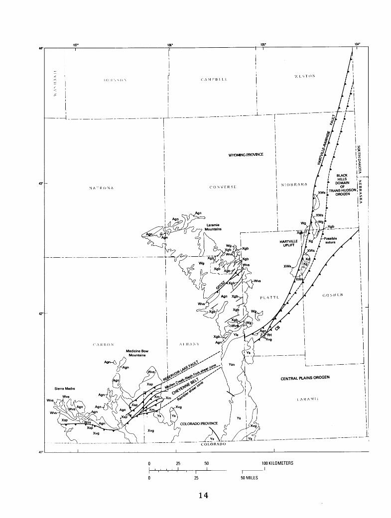
An undeformed mafic dike, interpreted as belonging to the 2. 0-Ga set, cuts Dz structures on the hill south of the Graves Ranch anticline (northern part of Guernsey domain), indicating that Dz deformation preceded 2. 0 Ga. Dz folding can be accounted for by a north-verging collision along the southern margin of the Wyoming craton. We tentatively propose that the suture for this collision is the Reservoir Lake thrust fault exposed in the Medicine Bow Mountains (fig. 4; Sims, 1995), which would project
3
to the south of the Hartville uplift. Houston and others (1992) recognized that the northvergent Reservoir Lake fault separates more intensely deformed rocks (Deep Lake Group} to the north from less-deformed Early Proterozoic rocks to the south, but they apparently considered the deformation as local in extent. They assigned this deformation of rocks north of the Reservoir Lake fault to their Fz (Karlstrom and others, 1981, fig. 1. 9); it preceded intrusion of gabbroic sills in the Deep Lake Group, whose intrusive age is 2,092±4 Ma (Houston and others, 1992, p. 39). The Reservoir Lake fault and adjacent rocks were deformed later by their deformation F 3 along the 1. 7 6-Ga Cheyenne belt. With the interpretation above, the Dz folds in the Hartville uplift could be out-ofsequence back thrusts (Morley, 1988).
Deformation Dz extended northward at least to the north edge of the Guernsey quadrangle. In the Frederick Ranch domain, Dz structures have been reoriented by D3, but the existence of relict Dz folds is shown by the variable plunge of D3 linear structures both to the northeast and southwest, depending on which limb of the Dz folds the younger structures are superposed.
D3 DEFORMATION
The main, most widespread structural event recorded in the Hartville uplift, deformation D3, produced northeast-trending folds and west-vergent thrusts that are longitudinal to the axis of the uplift and span all but the southernmost part of it. The deformation comprises a fold-and-thrust belt on the western continental margin of the Trans-Hudson orogen. The deformation is best developed in the central and northern parts of the uplift, north of the map area of this report.
F3 folds verge westward and are coeval with west-directed thrusts that involve the Archean granite basement as well as the supracrustal rocks. F3 structures fold So and Sz. In the Frederick Ranch domain F3 and L3 plunge moderately both to the northeast and the southwest (fig. 3), depending on their location relative to the relict limbs of the older Fz folds.
The principal thrust in the fold-and-thrust belt, the Hartville fault, follows the axis of the uplift and juxtaposes middle to upper amphibolite facies rocks on the east with upper greenschist facies rocks on the west. The estimated relative uplift of the eastern (hanging wall) block is about 5 km (K.R. Chamberlain, oral commun., 1993). Where exposed 7 km north of the map
area (in the Hell Gap quadrangle), the Hartville fault is a high-angle, ductile reverse fault that dips steeply east, has a component of sinistral strike-slip offset, and juxtaposes Granite of Rawhide Buttes with metadolomite (on west). S-C mylonite, L-S tectonite, and S tectonite (Berthe and others, 1979; Lister and Snoke, 1984) as much as 60 m (200 ft) wide mark the fault zone; the granite of Rawhide Buttes of Snyder (1980) on the east side of the fault is protomylonitic throughout and has local zones of orthomylonite that strike and dip subparallel to the Hartville fault. The fault is presumed either to have been steepened by later movements or to flatten with depth {probably the latter).
East of the Sunrise mine (transition zone domain, fig. 2), D3 deformation refolded the easternmost part of the D2 Sunrise syncline, warping it from its original east-west trend to a northeast direction. To the north of this warped structure, in the Frederick Ranch domain, F3 folds trend northeast and plunge both northeast and southwest (fig. 3). South of the Sunrise syncline, D2 structures were not refolded by F3. This spatial relationship suggests that in this area D3 deformation in the footwall of the Hartville fault is restricted to the vicinity of the fault.
In the transition zone domain (fig. 2) from dominant D2 structures to the south to dominant D3 structures in the Frederick Ranch domain, So, S2, and S3 can be recognized, commonly in the same outcrop. D3 structures are superposed on D2 structures. The S3 structures are axial planar to northeasttrending F3 folds. F3 folds deform So and S2. S2 is warped slightly and trends east-northeast (fig. 3). L2 and F2 are more variable than in the Hartville area, to the west. The new foliation (S3) also is variable but mainly strikes northeast. A unique structural feature in the transition zone is the highly variable but generally northwest plunge of F3' folds and L3· and F3 intersection lineation. These structures have resulted from shortening within the inner arc of the bend in the fold axis caused by warping of the F2 fold axis (Sunrise syncline) from an eastwest to a northeast direction.
The suture between continental margin rocks and arc rocks of the Trans-Hudson orogen lies east of the Hartville uplift, perhaps a few kilometers, and its northern extension lies west of the Black Hills uplift (Sims, 1995). The suture is inferred to verge westward, to be consistent with the west vergence of D3 structures in the uplift on the continental margin.
4
The suture is entirely covered by Phanerozoic strata.
The D3 deformation and metamorphism in the Hartville uplift is younger than the 1. 98-Ga granite of Flattop Butte of Snyder (1980), which is deformed by D3, and older than the 1. 74-Ga Twin Hills Diorite, which is virtually undeformed. It is inferred from isotopic studies in the nearby Laramie Mountains (Patel and others, 1991) to have taken place at about 1.82 Ga. This age is nearly identical to that of metamorphism in the Black Hills (about 1.84 Ga; Redden and others, 1990) and in northern Saskatchewan (1.82 Ga; Hoffman, 1989; Weber, 1990)-areas also known to have been deformed during the Trans-Hudson orogeny.
D4 DEFORMATION
Small-scale, late structures that are superposed on D2 structures in the southernmost part (Guernsey domain) of the map area and which have no appreciable effect on the map patterns of the rock units are present locally. The main late structures are small recumbent folds that are most abundant in biotite schist in the area immediately south of the Graves Ranch anticline. We suggest that these late flattening structures could have resulted from crustal thickening caused by superposed thrust sheets related to continent-arc collision along the 1. 7 6-Ga Cheyenne belt. This interpretation is supported by observations of Chamberlain and others (1993) in the Laramie Mountains to the west. They have shown that a 60-km-wide foreland fold-and-thrust belt, bounded on the north by the Laramie Peak (GarrettFletcher Park-Cottonwood Park of fig. 4) shear zone, exists north of the Cheyenne belt, although erosion has removed all Early Proterozoic rocks in this belt in the Laramie Mountains. The Hartville uplift is estimated to lie well within a range of 60 km from the eastward projection of the Cheyenne belt (fig. 4; Sims, 1995), and can be expected to have been similarly affected by the 1. 76-Ga deformation.
Crenulations and kink folds are present in the same area as the recumbent folds, suggesting that these disparate structures may have a common cause. In one area (NE1/4 sec. 24, T. 27 N., R. 66 W.) of phyllite (XWs) examined in detail (R.L. Bauer, written commun., 1993), crenulations of S2 have both S and Z symmetry that occur as a conjugate set. The Z crenulations generally plunge northeast and have northeast-striking axial planes; the S crenulations generally plunge northwest and have northwest-striking axial planes. These crenula-
tions are cut by kink bands that also seem to form a conjugate set. Both of these structures appear to have resulted from a west-directed shortening event, which could be caused by collision along the Cheyenne belt.
DOMING RELATED TO 1.72-GA HAYSTACK RANGE GRANITE
In the Haystack Range and adjacent areas, on the east side of the Hartville fault, emplacement of the 1. 72-Ga Haystack Range Granite (Xh) produced a dome in the adjacent biotite schist (XWb). Doming was accompanied by emplacement of granite pegmatite {Xp) into deformed schist, especially on the northeastern part of the dome. The schist contains garnet and sillimanite, which formed as a result of substantially deeper burial of rocks in this domain (relative to area west of the Hartville fault) prior to exhumation. The extent of superposed thermal metamorphism on the earlier regional metamorphism has not been determined. The doming deformed a foliation, presumably s2. The Haystack Range Granite dome is comparable in structure and age to the dome surrounding the Harney Peak Granite ( 1. 71 Ga) in the Black Hills uplift (Redden and others, 1990).
IRON ORE DEPOSITS
Approximately 45 million tons of iron ore were produced from the Hartville uplift between 1898 and 1980 mainly from three mines in the map area (Harrer, 1966; Hause!, 1989). The ore bodies are irregular-shaped lenses of specularite (XWfh) that occur at the stratigraphic top of the ferruginous schist unit (XWf), immediately above the structurally underlying metadolomite unit (inasmuch as the stratigraphic succession is inverted). None of the mines were accessible for study during our mapping, and the following discussion of the ores is taken largely from published material, especially Ball (1907) and Rupp (1939), and an unpublished M.A. thesis (Ebbett, 1956).
The ore bodies are irregular-shaped, steeply dipping lenses elongated parallel to bedding (So) and S2 in the schist unit. At the Good Fortune mine (Ebbett, 1956), two major ore bodies were mined. A western ore body was 200 ft (61 m) long and as much as 40 ft (12 m) thick; an eastern ore body was about 100 ft (30m) long and a maximum of 25ft (8.4 m) thick. Mining depths exceeded 500ft (152 m). The specularite ore is surrounded by 5-15 ft (1.5-4.5 m) of siliceous iron ore, a greasy-
5
looking, brownish-red, porous, massive, finegrained rock.
The specularite ore at the Good Fortune mine (Ebbett, 1956) is sparkly bluish black, massive, hard, fine-grained material with abundant colloform structures. Weathered ore consists of dark-red, crumbly hematite containing pockets of earthy limonite, generally along joints or fractures. Commonly, the ore contains small (as much as a few centimeters across) irregularshaped cavities lined with coarse-grained hematite plates, euhedral calcite crystals, or curved rhombs of yellow dolomite(?). Sampling by Frey (194 7) indicated that the specular hematite ore of the Good Fortune mine commonly contains 50-60 percent iron, 3-18 percent silica, and 0.1-0.3 percent phosphorus.
The Sunrise deposit is a large nearly vertical, tabular, stratabound body of hematite in the ferruginous schist unit (XWf), 50-30 ft (15-9 m) structurally above the dolomite footwall of the Sunrise syncline (Rupp, 1939). In plan view, the ore body is described as roughly an Sshaped lens whose greatest dimensions are 2, 100x500 ft (640x150 m). The ore is predominantly a red, earthy hematite but includes much hard specularite. Minor ore material is stalactitic hematite and soft ocherous limonite. Rupp reported that the ore body narrows with depth.
The genesis of the iron ores is speculative, although the source of the iron is clearly original banded iron-formation (BIF). As recognized by Ebbett (1956), specularite ore at the Good Fortune mine is enriched, through removal of much silica and concentration of hematite. Possibly, enrichment resulted from hydrothermal solutions, in a manner similar to that at the Soudan and adjacent mines in northeastern Minnesota (Sims, 1972). Gruner (1926) and several later investigators interpreted the hematite deposits in the Soudan Iron-formation as having formed by postmetamorphic replacement of the iron-formation, and perhaps some of the adjacent greenstone, by iron oxides deposited by hydrothermal solutions. Fracturing and brecciation of the original iron-formation can help localize enrichment. At the Good Fortune mine, supergene processes apparently also modified the deposits, as indicated by hematite plates in cavities in the specularite ore and by limonite along fractures. Probably supergene enrichment occurred during the long interval after deposition of the BIF and before deposition of the Paleozoic sedimentary rocks; specularite cobbles occur in the basal Paleozoic sedimentary rocks.

GEOCHRONOLOGY OF POST-TECTONIC INTRUSIVE ROCKS
By Zell E. Peterman
The Haystack Range Granite has been dated by the Rb-Sr whole-rock method, and the Twin Hills Diorite has been dated by the U-Pb zircon method.
The main body of the Haystack Range Granite (Xh) intrudes amphibolite-grade biotitequartz-plagioclase schist (XWb) on the east side of the Hartville fault. The intrusion has domed the surrounding schist, and foliation in the schist dips steeply away from the granite. A smaller, irregular-shaped body of the granite intrudes the same schist on the north side of McCann Pass. Granite pegmatite related to the Haystack Range Granite is common within and marginal to the main body of the granite.
Samples of the principal bodies of Haystack Range Granite were collected from outcrops and from a diamond drill core near McCann Pass. Rb-Sr data for seven samples define an isochron (solid line of fig. 5) with an age of 1. 72±0.04 Ga and an initial ratio (IR) of 0. 701±0.003. These seven samples scatter somewhat in excess of analytical uncertainties (MSWD=6.61), and a Model III solution is used to define the slope and intercept (Ludwig, 1991). Sample 2308WR, a fine-grained variant with strongly chloritized biotite from the southern part of the main body, is excluded from the regression as it departs substantially from the line defined by the other samples. The age of 1. 7 2±0. 04 Ga is indistinguishable from the zircon age of 1. 74±0.07 Ga for the Twin Hills Diorite and is consistent with the geologic relations between these two units, the granite being the younger of the two.
The Haystack Range Granite shows strain in protoclastic textures, but, except locally, lacks the strongly penetrative deformation characteristic of the older granites in the area. However, near the Hartville fault, recurrent movement lasting well into the Phanerozoic has imposed a strong cataclastic fabric on the granite, producing an augen gneiss with a well-developed foliation. Two samples, 3142WR and 3144WR (table 1, fig. 5), were collected from outcrops near the fault where the granite has been severely sheared. Rb-Sr data for these two samples show that the effects of this deformation have been largely physical rather than chemical as the points are colinear with data for samples collected well away from the fault. The slope and intercept of the isochron are not appreciably changed by deletion of these samples from the regression.
6
Pegmatite related to the Haystack Range Granite is extensively developed in the enclosing schist, and coarse-grained book muscovite from sample 2418Mu (table 1) gives a Rb-Sr model age of 1. 6 7 Ga. The age is slightly younger than the whole-rock isochron, although with overlapping errors, and may reflect slight open-system behavior in response to younger thermal events. Goldich and others (1966) reported ages of 1.64 Ga (Rb-Sr) and 1.31 Ga (K-Ar) for microcline and biotite, respectively, for an outcrop sample of the Haystack Range Granite.
Sample HU-23WR (table 1, fig. 5) was collected from the west end of an elongate granite ridge north of Rawhide Buttes (1.5 km north of Bald Butte and 45 km north of Guernsey). The sample, a gray biotite granite with a well-developed mortar structure, differs from the typical strongly foliated red granite of Rawhide Buttes of Snyder (1980), although it was initially thought to be part of this body. A model Rb-Sr age of about 1.8 Ga prompted a second collection (samples 3285WR and 3286WR). Data for samples HU-23WR and 3285WR are coincident, but all three points are compatible with an age of 1. 7 5±0. 07 Ga and an IR of 0. 703±0.007. These data indicate that the body exposed in this ridge is Early Proterozoic and correlative with the Haystack Range Granite in the type area. At the eastern end of the ridge, the granite is more strongly foliated and contains numerous screens and inclusions of marble and amphibolite.
Farther north at Sullivan Ridge (12 km north of Lusk), medium- to coarse-grained muscovite granite is poorly exposed. Whole rock and muscovite (sample HU-19WR, table 1) give model ages of 1.91 and 1.60 Ga, respectively. I tentatively correlate this granite with the Haystack Range Granite.
The Haystack Range Granite and the Twin Hills Diorite are roughly correlative with Early Proterozoic intrusive units in the Medicine Bow Mountains and the Sierra Madre, for which isotopic ages range from 1. 64 to 1. 7 8 Ga (Hills and Houston, 1979; Premo and Van Schmus, 1989). The Rb-Sr age for the Haystack Range Granite also agrees well with the 1. 71-Ga Rb-Sr age reported for the Harney Peak Granite in the Black Hills uplift (Riley, 1970).
The Twin Hills Diorite forms a large pluton in the central Hartville uplift comprising hornblende-biotite granite to mafic diorite. Outcrops along the southern margin of this body are present in the northern part of the Casebier Hill quadrangle. The pluton is cut by
the Haystack Range Granite. High Sr and low Rb contents (for example, HU-31 WR, table 1) preclude Rb-Sr dating of this unit. However, zircon is relatively abundant (HU-31 WR has 288 ppm Zr), and sufficient zircon for dating was obtained from about 5 kg of rock. The zircons are clear, somewhat fractured, colorless to light-yellow brown, and have sharp face intersections. Length-to-width ratios range from 3 to 5 or more, and the crystals are characterized by simple prism faces and terminations. Fine-scale growth zoning parallel to the principal faces is well developed. The crystals show no indication of containing older cores.
Two sized fractions and a nonmagnetic fraction of zircon from HU-31 WR (table 2) are 15-28 percent discordant in U-Pb ages but define a precise chord on the concordia diagram (fig. 6) with intercepts at 1. 74±0.01 and 0.079±0.40 Ga. The chord is interpreted to reflect a simple two-event history with the primary age indicated by the upper intercept with concordia. The lower intercept, roughly coincident with the Laramide orogeny, is the time of Pb loss and is consistent with many other zircon arrays for Precambrian rocks from the Wyoming age province. Discordance in the Th-Pb ages follows that of the U-Pb ages (table 2), although the two do not define a linear relation.
From the Rb-Sr data for HU-31 WR (table 2) an IR for the diorite is calculated to be 0.7029 based on the zircon age of 1.74 Ga. This ratio is close to a value of 0.7020 that might be expected from a primitive source similar to that for orogenic igneous rocks.
REFERENCES CITED
Ball, S.H., 1907, The Hartville iron-ore range, Wyoming: U.S. Geological Survey Bulletin 315-D, p. 190-205.
Berthe, D., Choukroune, P., and Jegouzo, P., 1979, Orthogneiss, mylonite, and noncoaxial deformation of granites-The example of the South Armorican shear zone: Journal of Structural Geology, v. 1, p. 31-42.
Chamberlain, K.R., Patel, S.C., Frost, B.R., and Snyder, G.L., 1993, Thick-skinned deformation of the Archean Wyoming province during Proterozoic arc-continent collision: Geology, v. 21, p. 995-998.
Day, W.C., Sims, P.K., Snyder, G.L., and Wilson, A.B., 1994, Hartville uplift, southeastern Wyoming-Revisited: Geological Society of America Abstracts with Programs, v. 26, no. 6, p. 10.
7
Ebbett, B. E., Jr., 1956, Structure and petrology of the metasedimentary rocks of the Good Fortune mining area, Platte County. Wyoming: Laramie, Wyo., University of Wyoming M.A. thesis, 151 p.
Frey, Eugene, 194 7, Good Fortune iron mine, Platte County, Wyoming: U.S. Bureau of Mines Report of Investigations 4089, 7 p.
Goldich, S.S., Lidiak, E.G., Hedge, C.E., and Walthall, F.G., 1966, Geochronology of the midcontinent region, United States; 2, Northern area: Journal of Geophysical Research, v. 71, p. 5389-5408.
Gross, G.A., 1965, Geology of iron deposits in Canada, Volume 1, General geology and evaluation of iron deposits: Geological Survey of Canada Economic Geology Report 22, 181 p.
---1980, A classification of iron formations based on depositional environments: Canadian Mineralogist, v. 18, p. 215-222.
Gruner, J.W., 1926, The Soudan formation and a new suggestion as to the origin of the Vermilion iron ores: Economic Geology, v. 21, p. 629-644.
Harrer, C.M., 1966, Wyoming iron-ore deposits: U.S. Bureau of Mines Information Circular 8315, 114 p.
Hause!, W.O., 1989, The geology of Wyoming's precious metal lode and placer deposits: Geological Survey of Wyoming Bulletin 68, 248 p.
Hills, F. A., and Houston, R.S., 1979, Early Proterozoic tectonics of the central Rocky Mountains, North America: University of Wyoming Contributions to Geology, v. 17, p. 89-109.
Hoffman, P.F., 1989, Precambrian geology and tectonic history of North America, in Bally, A.W., and Palmer, A.R., eds., The geology of North America-An overview: Boulder, Colo., Geological Society of America, The geology of North America, v. A, p. 447-512.
Houston, R.S., Karlstrom, K.E., Graff, P.J., and Flurkey, A.J., 1992, New stratigraphic subdivisions and redefinition of subdivisions of Late Archean and Early Proterozoic metasedimentary and metavolcanic rocks of the Sierra Madre and Medicine Bow Mountains, southern Wyoming: U.S. Geological Survey Professional Paper 1520, 50 p.
Hudleston, P.J., 1976, Early deformational history of Archean rocks in the Vermilion district, northeastern Minnesota: Canadian Journal of Earth Sciences, v. 13, p. 579-592.
James, H.L., 1983, Distribution of banded ironformation in space and time, in Trendall, A.F., and Morris, R.C., eds., Iron-formation-Facts and problems: Amsterdam, Elsevier Science Publishers, p. 471-490.
Karlstrom, K.E., Houston, R.S., Flurkey, A.J., Coolidge, C.M., Kratochvil, A.L., and Sever, C.K., 1981, A summary of the geology and uranium potential of Precambrian conglomerates in southeastern Wyoming: Bendix Field Engineering Corporation Report GJBX-139-81, 541 p.
Krugh, K.A., Chamberlain, K.R., and Snyder, G.L., 1993, U-Pb evidence for ca. 1.66 Ga metamorphism and deformation in the Hartville uplift, southeastern Wyoming: Geological Society of America Abstracts with Programs, v. 25, no. 5, p. 64-65.
Lewry, J.F., and Stauffer, M.R., 1990, The Early Proterozoic Trans-Hudson orogen of North America: Geological Association of Canada Special Paper 37, 505 p.
Lister, G.S., and Snoke, A.W., 1984, S-C mylonites: Journal of Structural Geology, V. 6, p. 617-638.
Ludwig, K.R., 1991, Isoplot, a plotting and regression program for radiogenic-isotope data: U.S. Geological Survey Open-File Report 91-445, 45 p.
Morley, C.K., 1988, Out of sequence thrusts: Tectonics, v. 7, p. 539-561.
Patel, S.C., Frost, B.R., and Snyder, G.L., 1991, Extensive Early Proterozoic Barrovian metamorphism in the southeastern Wyoming Province, Laramie Range, Wyoming: Geological Society of America Abstracts with Programs, v. 23, no. 5, p. A59.
Premo, W.R., and Van Schmus, W.R., 1989, Zircon geochronology of Precambrian rocks in southeastern Wyoming and northern Colorado, in Grambling, J.A., and Tewksbury, B.J., eds., Proterozoic geology of the southern Rocky Mountains: Geological Society of America Special Paper 235, p. 1-12.
Redden, J.A., Peterman, Z.E., Zartman, R.E., and DeWitt, Ed, 1990, U-Th-Pb geochronology and preliminary interpretation of Precambrian tectonic events in the Black Hills, South Dakota, in Lewry, J.F., and Stauffer, M.R., eds., The Early Proterozoic Trans-Hudson orogen of North America: Geological Association of Canada Special Paper 37, p. 229-251.
Riley, G.H., 1970, Isotopic discrepancies in zoned pegmatites, Black Hills, South Dakota: Geochimica et Cosmochimica
8
Acta, v. 34, p. 713-725. Rupp, G.H., 1939, Block-caving at the Sunrise
iron mine, Wyoming: American Institute of Mining and Metallurgical Engineers, Technical Publication No. 1069. 16 p.
Shackleton, R.M., 1958, Downward-facing structures in the Highland Border: Geological Society of London Quarterly Journal, v. 113, p. 361-392.
Sims, P.K., 1972, Mineral deposits in Lower Precambrian rocks, northern Minnesota, in Sims, P.K., and Morey, G.B., eds., Geology of Minnesota-A centennial volume: Minnesota Geological Survey, p. 172-176.
---1995, Archean and Early Proterozoic tectonic framework of north-central United States and adjacent Canada: U.S. Geological Survey Bulletin 1904-T, 12 p.
Sims, P.K., and Peterman, Z.E., 1986, Early Proterozoic Central Plains orogen-A major buried structure in the north-central United States: Geology, v. 14, p. 488-491.
Smith, W.S.T., 1903, Hartville Folio: U.S. Geological Survey Folio No. 91.
Snyder, G.L., 1980, Map of Precambrian and adjacent Phanerozoic rocks of the Hartville uplift, Goshen, Niobrara, and Platte Counties, Wyoming: U.S. Geological Survey Open-File Report 80-779, scale 1:48,000.
---1989, Hartville uplift geologic summary, in Snyder, G.L., Hausel, W.O., Klein, T.L., Houston, R.S., and Graff, P.J., Precambrian rocks and mineralization, southern Wyoming province: 28th International Geological Congress, Field Trip Guidebook T332, p. 4-12.
---1993, Hartville uplift, in Houston, R.S., and others, eds., The Wyoming province, in Reed, J.C., Jr., and others, eds., Precambrian-Conterminous U.S.: Boulder, Colo., Geological Society of America, The geology of North America, v. C2, p. 147-149.
Snyder, G.L., and Peterman, Z.E., 1982, Precambrian geology and geochronology of the Hartville uplift, Wyoming: 1982 Archean geochemistry field conference, p. 64-94.
Weber, W., 1990, The Churchill-Superior boundary zone, southeast margin of the Trans-Hudson orogen-A review, in Lewry, J.F., and Stauffer, M.R., eds., The Early Proterozoic Trans-Hudson orogen of North America: Geological Association of Canada Special Paper 37, p. 41-56.

Tectonostratigraphic evolution of southeastern margin of Wyoming Archean craton
1. Deposition of sedimentary and volcanic rocks of Whalen Group on continental margin, either in the Late Archean or Early Proterozoic. Basement in area is predominantly granite of Rawhide Buttes of Snyder (1980) but includes migmatitic biotite gneisses.
2. Nappe formation, resulting in exposure of lower limbs in Guernsey and Rawhide Buttes West quadrangles (deformation D1).
3. Deformation D2-South-vergent folding of supracrustal rocks and possible thrusting involving Archean basement. Deformation metamorphosed gabbro body on hill southeast of Graves Ranch. Deformation inferred to have occurred at approximately 2.1 Ga.
4. Rifting on approximate east-west axes and emplacement of approximately 2.0-Ga diabase dikes. Dikes are older than 1. 98-Ga granite of Flattop Butte (Snyder and Peterman, 1982) and, in Laramie Mountains, are younger than a 2.05-Ga granodiorite (Snyder, 1989).
5. Emplacement of granite of Flattop Butte of Snyder (1980); age 1. 98 Ga (Snyder and Peterman, 1982).
6. Deformation D3-West-directed foreland fold-and-thrust belt developed on west margin of TransHudson orogen; culmination of metamorphism estimated at approximately 1.82 Ga, based on age of metamorphism in Laramie Mountains (Patel and others, 1991). Deformation of granite of Flattop Butte of Snyder (1980), as well as supracrustal rocks of Whalen Group and granitic basement [granite of Rawhide Buttes of Snyder (1980)]. Caused by collision of arc rocks of Trans-Hudson orogen with continental margin.
7. Deformation D4 -Small-scale recumbent folds in schist in southern part (Guernsey domain) of uplift; fold D2 structures. Possibly related to loading by imbricate thrusts developed on continental margin during collision along the Cheyenne belt; age 1. 76 Ga (Premo and Van Schmus, 1989).
8. Emplacement of Twin Hills Diorite (age 1. 7 4 Ga) in area east of Hartville fault.
9. Emplacement of Haystack Range Granite (age 1. 72 Ga) in southern part of Hartville uplift, east of Hartville fault. The intrusion domed biotite schist country rock.
10. Intrusion of granite pegmatite into schist adjacent to Haystack Range Granite contemporaneous with emplacement of granite. Diorite and granite are interpreted to be related to crustal melting resulting from crust thickened by thrusting along the Cheyenne belt, the paleosuture between Archean continental rocks and arc-related rocks of the Central Plains orogen (Sims and Peterman, 1986).
11. Resetting of U-Pb system in monazite at 1.66 Ga (Krugh and others, 1993), possibly as a result of compressive deformation within the Central Plains orogen. Possibly the ductile deformation (protomylonite) in the Haystack Range Granite formed at this time.
12. Intrusion of metadiabase dikes with chilled margins; probably 1.4 Ga in age (Snyder, 1993).
9

EXPLANATION
CJ Haystack Range Granite, 1.72 Ga
Twin Hills Diorite, 1.74 Ga
Granite of Aattop Butte, 1. 98 Ga
Whalen Group (Early Proterozoic or Late Archean)
i))))::j Granite gneiss of Rawhide Buttes, 2.58 Ga
----Contact
Thrust fault- Sawteeth on upper plate. Opposed arrows show transcurrent movement
Outline of map
WYOMING
Map area-.
5
0
10
Haystack Range
15 KILOMETERS
10 MI LES
Figure 1 . Generalized geologic map of Precambrian rocks of Hartville uplift , Wyoming, showing location of map area. Modified from Snyder (1980) .
10
0 2 KILOMETERS
0 1 MILE
EXPLANATION ---- Domain boundary
l Downward-facing syncline-S, Sunrise syncline .. 35 J Asymmetrical downward-facing anticline-GR.
G
H
Graves Ranch anticline
Guernsey
Hartville
Mines-C, Chicago mine; GF, Good Fortune mine; Su, Sunrise mine
Figure 2. Map showing structural domains in area west of Hartville fault, Guernsey quadrangle, Wyoming.
11
Bedding
N
N
N
N
A
Frederick Ranch domain
Reoriented by D3
Transition zone domain
N
Graves Ranch anticline and Sunrise syncline domain
N
+
Guernsey domain
N
+ 0
N
N
None observed
N
Figure 3 (above and facing page). Equal-area projections (lower hemisphere) of D2 and D3 deformations for A, planar tectonic fabrics, and B, linear tectonic fabrics in the four structural domains in the Guernsey quadrangle. Contour intervals in percent: 1.0, solid line; 5.0, dashed line; and 10.0, dotted line. n, number of readings; x, inferred fold axis.
12

Reoriented by 0 3
N
N
N
B
N
8 0t-. .
Frederick Ranch domain
Transition zone domain
N
Grave's Ranch anticline and Sunrise syncline domain N
Guernsey domain
N
0 +
None observed
13
N
107° 44°~T------l1()6~0
--~---------r~ I ""' l I
1 I
42"
I I
1 I r 1 I c /\ '1 f' B E L l I I I
\\ L.:; T 0 t\ IClll'."():\
l i \
I I I --l--~---- ----------f----------------1_ __ ! _________ ~
I I il
WYOMING PROVINCE
I
I I
I I I
I I
lfJl 10
I~ 10 I~
I~ I I
BLACK L---
N /\ T I~ (J N A CONVERSE
________ .,_
I I
l I
I I
I 1
I I
I
<'AHBClN
Sierra Madre
25
14
I :"<I() B R /\ H /\
I
I I
I I
I I Wg
i----_ __J_:..,.,:J' Xgb UPLIFT I
I
I I
I I
l I
I I
OF
OROGEN I ;I>
I~ I I
\
<JOSHLN
-------~ I I I L _________ j
I I
CENTRAL PLAINS OROGEN I I I
I l_ !I R /\ !1.111
----------------------
50 MILES
EXPLANATION MIDDLE PROTEROZOIC
Syenite of Laramie Mountains (1.43 Ga)
Anorthosite of Laramie Mountains (1.43 Ga)
Sherman Granite (1.44 Ga)
EARLY PROTEROZOIC Haystack Range Granite, Hartville uplift (1. 72 Ga)
d Twin Hills Diorite, Hartville uplift (1.74 Ga)
g Metamorphosed volcanic and sedimentary rocks and mafic to felsic intrusive rocks of Colorado province (Central Plains orogen) (1.8-1.63 Ga)
Mylonite and granite in Cheyenne belt, Medicine Bow Mountains
Metamorphosed mafic dike (about 2.0 Ga)
Metasedimentary rocks of Snowy Pass Supergroup, Sierra Madre and Medicine Bow Mountains
EARLY PROTEROZOIC AND ARCHEAN ~ Ferruginous schist, including iron-formation,
metadolomite, and metabasalt (Whalen Group) of Hartville uplift
ARCHEAN
~ Granite of Laramie Mountains and granite gneiss of Hartville uplift (Late Archean)
~ Metavolcanic and metasedimentary rocks (Late Archean)
~ Paragneiss and orthogneiss
• •
CB
Contact
Fault-Movement not known
• Thrust fault-Dashed where inferred; sawteeth on upper plate
Cheyenne belt
GFCSZ Garret-Aetcher Park-Cottonwood Park shear zone
RH Richeau Hills
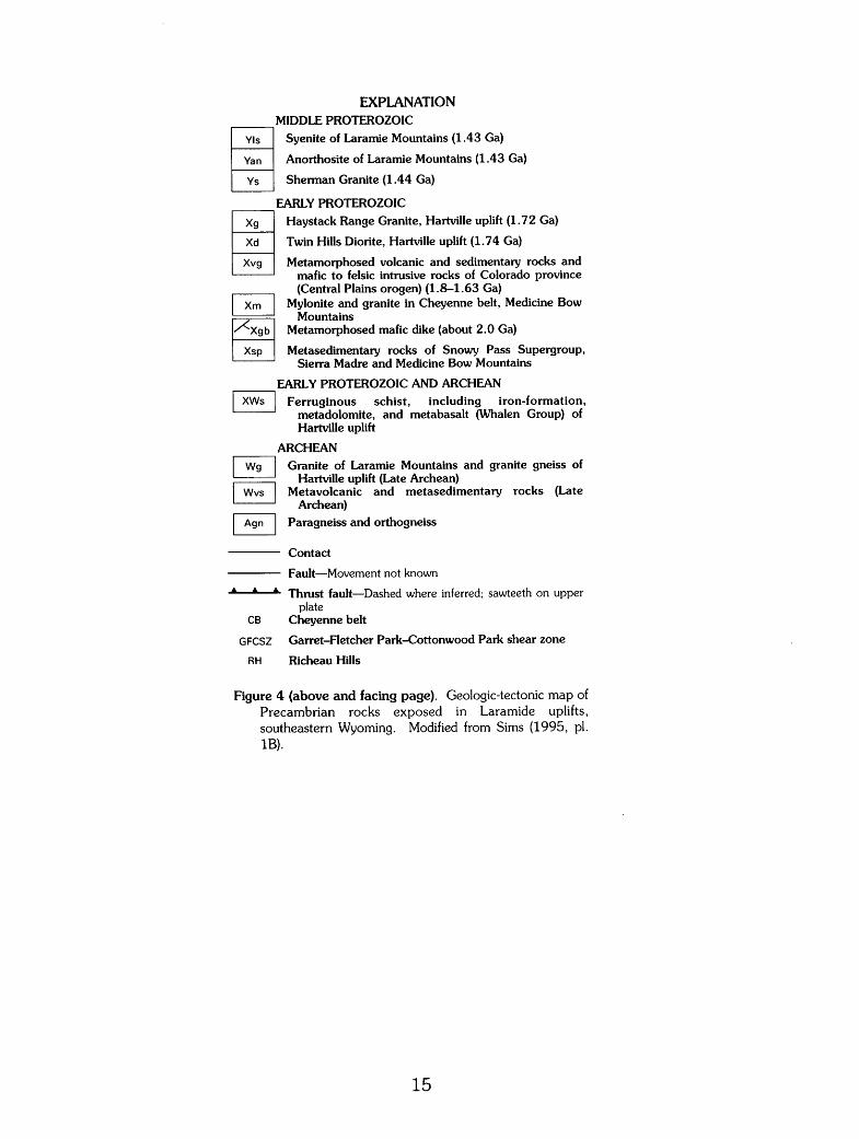
Figure 4 (above and facing page). Geologic-tectonic map of Precambrian rocks exposed in Laramide uplifts, southeastern Wyoming. Modified from Sims (1995, pl. lB).
15

Figure 5. Rubidium-strontium isochron for whole-rock samples of the Haystack Range Granite. Solid isochron, 1.72±0.4 Ga and initial ratio (IR) of 0.701±0.003, is based on samples from the southern Hartville uplift (open circles), excluding sample 2308WR. Dashed isochron, 1.75±0.07 Ga and IR of 0.703±0.007, is based on samples from a small body of granite in the northern part of the uplift (solid circles).
16

:::J co M
~ a..
!.0 0 N
0.3
0.2
0.1
2 3 4 5
Figure 6. Uranium-lead concordia diagram for zircons from the Twin Hills Diorite (sample HU-31WR). The chord through three points (two sized fractions and a nonmagnetic fraction) intersects concordia at 0. 79±0.40 Ga and 1.74±0.01 Ga.
17

Table 1. Rubidium and strontium data for whole-rock samples and muscovite from the Twin Hills Diorite, Haystack Range Granite, and miscellaneous samples
[Suffix letters refer to type of sample: WR, whole rock; Mu, muscovite. Analytical uncertainties based on replicate analyses of Precambrian granitic rocks are ±1. 75 percent for 87Rb/86Sr and ±0.025 percent for 87Sr/86Sr at the 95-percent confidence level]
Sample No. Rock type Concentration 87Rb/sssr B7sr;sssr
!carts ger million)
Rb Sr
Twin Hills Diorite
HU-31WR Diorite 91.65 483.6 0.5491 0.7167
Haystack Range Granite
HU-6WR Biotite granite 191.3 223.6 2.489 0.7621
HU-7WR Biotite granite 209.2 146.9 4.160 .8025
HU-7WR Biotite granite 208.3 146.7 4.147 .8023
MP-7AWR Biotite granite 224.3 91.93 7.184 .8816
MP-7BWR Biotite granite 311.5 40.54 23.50 1.2838
2307WR Biotite granite 150.6 332.1 1.316 .7355
2308WR Biotite granite 280.4 62.37 13.40 1.0078
2308WR Biotite granite 277.0 63.46 13.02 1.0078
2308WR Biotite granite 277.2 63.75 12.95 1.0074
2418Mu Pegmatite 587.7 5.440 1,171 28.791
3142WR Biotite granite 183.5 196.5 2.719 .7704
3144WR Biotite granite 181.2 135.5 3.904 .7950
Miscellaneous samples
HU-19WR Muscovite granite 156.5 38.12 6.730 0.9304
HU-19Mu Muscovite granite 489.4 7.956 296.7 7.5191
HU-23WR Biotite granite 128.7 231.8 1.613 .7439
3285WR Biotite granite 132.7 237.2 1.624 .7438
3286WR Biotite granite 172.3 152.1 3.303 .7862
Table 2. Uranium, thorium, and lead data for zircons from the Twin Hills Diorite
[Numbers in parentheses below sample numbers are screen sizes of the zircons; N M, nonmagnetic. Numbers in parentheses below atom ratios are ages in millions of years]
Sample No. Concentration Isotopic composition of lead Atom ratio (ppm) (atom pet)
u Th Pb 204Pb 206Pb 207Pb 208Pb 206pbj238Pb 201 PbPJsu 207pbj206Pb 208pbj232Th
HU-31WR 467.4 425.2 132.2 0.035 73.21 8.22 18.54 0.2387 3.4804 0.1058 0.0605
(100-150) (1,380) (1,523) (1,727) (1, 187)
HU-31WR 408.7 350.1 126.9 0.033 73.72 8.26 17.98 0.2642 3.0626 0.1060 0.0686
(150-200 NM) ( 1,511) (1,606) (1,732) (1,341)
HU-31WR 480.9 450.3 129.0 0.034 73.10 8.18 18.69 0.2261 3.2906 0.1055 0.0563
(-250) (1 ,314) (1,479) (1,724) (1, 107)
18

