using game engines for visualization in scientific applications
TRANSCRIPT
Using Game Engines for Visualization inScientific Applications
Karl-Ingo Friese, Marc Herrlich, and Franz-Erich Wolter
Abstract In recent years, the computer gaming industry has become a large andimportant market and impressive amounts of money are spent on the developmentof new game engines. In contrast to their development costs, the price for the finalproduct is very low compared to a professional 3D visualization/animation program.The idea to use this potential for other purposes than gaming seems obvious. Thiswork gives a review on three Serious Gaming projects, analyzes the encounteredproblems in a greater context and reflects the pros and cons of using game enginesfor scientific applications in general.
1 Introduction
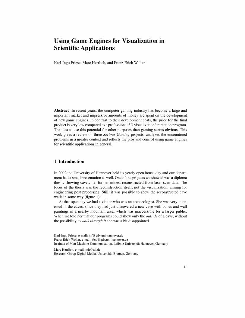
In 2002 the University of Hannover held its yearly open house day and our depart-ment had a small presentation as well. One of the projects we showed was a diplomathesis, showing caves, i.e. former mines, reconstructed from laser scan data. Thefocus of the thesis was the reconstruction itself, not the visualization, aiming forengineering post processing. Still, it was possible to show the reconstructed cavewalls in some way (figure 1).
At that open day we had a visitor who was an archaeologist. She was very inter-ested in the caves, since they had just discovered a new cave with bones and wallpaintings in a nearby mountain area, which was inaccessible for a larger public.When we told her that our programs could show only the outside of a cave, withoutthe possibility to walk through it she was a bit disappointed.
Karl-Ingo Friese, e-mail: [email protected] Wolter, e-mail: [email protected] of Man-Machine-Communication, Leibniz Universitat Hannover, Germany
Marc Herrlich, e-mail: [email protected] Group Digital Media, Universitat Bremen, Germany
11
12 Karl-Ingo Friese, Marc Herrlich, and Franz-Erich Wolter
The idea to visualize these caves also from the inside was born. The goal wasto write a small application that would allow a more natural form of showing ourcaves. What we wanted was an application, which would allow to run in a first-person-perspective through a cave-like virtual dungeon and it was obvious that suchapplications already existed in the form of computer games or to be more precise:first-person-shooters.
Compared to professional scientific visualization software, computer games haveto favor real-time rendering over physical correctness and data accuracy. We tookthe challenge to see if we could visualize our reconstructed cave with a 3D com-puter game, which, after solving some problems at the beginning, turned out to bepossible.
Fig. 1 A (reconstructed)cave with three chambers,seen from the outside. Thedifferent colors represent thedifferent laser measurements.
Since then, several projects using computer games to visualize scientific data fol-lowed. This paper gives an overview of three of them, classify them in the context ofSerious Gaming and finally reflect if and when the use of game engines in scientificapplications can be useful.
2 What has been done?
The terms Serious Games and Serious Gaming are used in the literature to describevery different application scenarios. While the concept of Serious Games is orig-inally stemming from the area of game-based learning and education [1, 17], to-day it is more generally used to describe a whole spectrum of applications [14]. Inthis sense, the area of Serious Games incorporates all aspects of applying computergame technology to non-entertainment uses, including but not limited to simula-tion, visualization and VR. For this paper we are only considering 3D-games, notpuzzles, 2D-shooters, etc. and will use the following definition of Serious Games:
Definition 1. Every application that makes significant use of game technology andis not primarily intended for pure entertainment is a Serious Game.
Historically, games were designed and implemented on a case-to-case basis, leav-ing only little room for easy modification and reuse. Therefore, the usefulness of

Using Game Engines for Visualization in Scientific Applications 13
game technology for other application areas was somewhat limited. However, thischanged with the appearance of the first modern game engines, e.g. the Quake orUnreal series, which provided better modularity. Today, developers can choose froma number of suitable commercial and non-commercial engines.
In this paper we will focus on the area of visualization using modern computergame engines. Before discussing our own research and results in the following sec-tions, we will present a current overview of the ongoing research and development,focusing on indoor and outdoor GIS and CAD data visualization and interaction.
In 2002, Rhyne [13] argued that scientists today have much to learn from thecomputer games industry regarding computer graphics, visualization, and interfaces,especially with the background of cluster computing. In this area it is an ongoingtrend to build clusters from standard PC hardware instead of specialized worksta-tions or mainframes. In Rhyne’s opinion, scientific visualization applications canbenefit from computer game technology, as most computer games are optimized forcommodity hardware. On the other hand, she states some drawbacks in using com-puter game engines, especially concerning data accuracy and reliability. She alsomentions the traditionally short release cycles in the games industry, which maylead to incomplete or unstable graphics drivers.
While this is certainly true, these short release cycles also have their advantages.Namely the availability and support for new hardware and software features. Fur-thermore, as production costs for modern games are exploding, the developmentprocesses have matured and there is a specialization taking place that is dividinggame companies into technology developers and technology users, which will leadto more robust solutions.
In the same year, Herwig and Paar [10] discussed the suitability of game enginesfor landscape visualization and planning. They presented different usage scenar-ios and analyzed the requirements of landscape architects concerning supportingtools and to what extend game engines can solve these problems. They also showedpreliminary results of tests conducted with a landscape visualization based on theUnreal Engine. Their findings fit in very well with our own research in landscapevisualization based on the CryEngine presented in section 3.3.
In the following, we will report on a number of visualization projects, whichapproximately fall into the same time span as our own projects described thereafter.
In 2001, Freudenberg et al. [6] described a low-cost VR installation powered bythe Shark3D game engine. Using commodity hardware, i.e. three standard PCs andbeamers, they employed the game engine’s built-in rendering and networking fea-tures to create a distributed rendering system capable of driving the VR projectionin real-time. Their system had enough power reserves to render pre-distorted imagesto compensate for the spherical projection plane. Opposed to expensive off-the-shelfVR solutions, the game-based solution clearly demonstrated the advantage of beingable to use standard commodity hardware.
In 2002, Shiratuddin and Thabet [15] described the implementation of a virtualoffice walkthrough system based on the Unreal Engine. They derived the geometryfrom 2D CAD data importing it into the engine. Furthermore they used cheap inputdevices like the Microsoft Sidewinder Freestyle Pro gamepad in conjunction with

14 Karl-Ingo Friese, Marc Herrlich, and Franz-Erich Wolter
the engine’s real-time capabilities to allow 6-DOF real-time interaction in a photo-realistic environment. Most of the data conversion was either executed manually orusing commercial tools. In our own research, presented in the following sections,we tried to automate the process as much as possible.
Germanchis et al. [8, 9] explored 2004 the potential of game technology for thevisualization of geographical data in the context of human path finding and spatialcognition research.
The visual quality and the level of interaction provided by modern game en-gines had certainly reached a level making them suitable for research in the areaof human cognition. The authors used a full set of professional commercial tools,e.g. ArcGIS, to prepare the data for the game engine. This again contrasts our own(semi-)automatic approaches.
Fritsch and Kada [7] discussed 2004 indoor as well as outdoor visualization ofgeographical data based on different game engines, among them the Quake3 En-gine and the Unreal Engine 2. They also discussed the benefits of game enginescompared to other software libraries and presented concepts for integrating themwith other software packages for different purposes, e.g. Computer Aided FacilityManagement-Systems. They came to the conclusion that the conversion process ofgeographical data into the data format of the game engine is one of the major obsta-cles for every game engine based application.
Arendash [2] demonstrated 2004 how the Unreal editor could be exploited asan intuitive authoring tool for web-based virtual worlds, i.e. VRML or X3D basedvirtual worlds. He presented a tool to extract geometry, texturing, and lighting datafrom the Unreal data format into a valid VRML/X3D representation.
Also in 2004, Lepouras and Vassilakis [12] presented the concept of buildingvirtual museums by using a game engine. This virtual exhibition space took advan-tage of the high visual quality of modern game engines. Lepouras and Vassilakisalso conducted a user acceptance study of their virtual museum prototype, whichshowed very promising results.
In 2005, Jacobson and Lewis [11] presented an open source project derived fromthe Unreal Engine called CaveUT for immersive Cave-like virtual reality projec-tion environments. In the same year, Stock et al. [16] demonstrated how the TorqueGame Engine can be connected to a web-based map server to create an easy-to-usecollaborative environment for landscape visualization and planning. They exploitednot only the rendering capabilities, but especially the networking features present inmost computer game engines.
In other works, game engines have also been used to provide visualization andinteraction metaphors in completely different and more abstract areas, which are notlisted here because they would go beyond the scope of this paper.

Using Game Engines for Visualization in Scientific Applications 15
3 Projects at the Welfenlab
This section will report on three projects, realized with students of the Welfenlab.The first is a (very basic) visualization of caves with Quake3. A second approachwith Unreal Tournament 2004 had the same goal. The third project focused on land-scape visualization in planing processes with FarCry.
The base for the first two projects was a digital model of man-made caves, whichwe reconstructed before in a previous work. Its original goal was to receive a re-construction as precise as possible, resulting in a highly detailed triangle surface,which could also be exported as a solid volume model for CAD applications likeAutoCAD.
3.1 Cave Visualization with Quake3
The first approach to visualize the reconstructed caves in a first person perspectiveused the (even at that time) rather old Quake3. The main reason for this was thatQuake3 was well understood and available for Windows and Linux. Quake3 wasproduced and published by IdSoftware, released in December 1999 and supportedshaders, curved surfaces, 32-bit color and of course hardware rendering. Only asingle license (of the original game) was necessary for the presentation of the results.
The goal of this first project was not only to see if it is possible to visualize thecave, but also to analyze how difficult it would be to convert our high resolutionalscientific data into the restricted surface representation of a computer game, withoutlosing too many details. This work was done by Dominik Sarnow in his junior thesis.The choice of the game engine was based on the following criteria:
• the engine must support dynamic light computations• it should have no license conflicts• it should use an open file format that is easy to understand• it should have at least some available documentation
Quake3 fulfilled all but the third criterion, because as almost all other game en-gines, the native Quake3 level format is binary, proprietary and far from being hu-man readable. Fortunately, there was an easy solution for this: the existence of thelevel editor GtkRadiant.
GtkRadiant is a level editor for Quake3 and other games. It is free for non-commercial use and is available for several platforms. Its native map format is asequence of numbered entities, the first entity always being the world which con-tains geometrical objects (brushes). An entity consists of a class name, an origin thatdefines the place of the entity in the map and texture/material properties.
Instead of writing a converter of our data into the binary format of Quake3, wedecided to export into the text format of GtkRadiant. Still we had to deal with thespecific restrictions of Quake3: a limited number of triangles (per level), a map

16 Karl-Ingo Friese, Marc Herrlich, and Franz-Erich Wolter
format that can only interpret convex objects and most obvious: all coordinates hadto be of integer value.
Since the maximal number of triangles was limited, a prestep reducing the num-bers of triangles was necessary. We used a simple shortest-edge removal procedurewhich was easy to implement and produced acceptable results.
The geometry supported by GtkRadiant consisted of planar and convex geomet-ric entities, cut out of a plane. Since our original data was a triangulated surface,the natural approach seemed to be to turn each triangle into a map entity. However,this resulted in a huge number of entities, consequently we spent the extra effortof locating planar areas in our original surface and finding suitable compositions ofconvex polygons, reducing the number of entities significantly. This interesting ge-ometrical problem was looked into more deeply in the bachelor’s thesis of DanielaLauer.
The problem of transferring vertex coordinates to integer was easy to solve: cen-ter the cave data, scale the coordinates (taking into account that the maximum sup-ported integer value for a coordinate is 64k) and delete extra decimal places. After-wards a correction step was necessary to remove degenerated triangles. Due to thenature of the internal geometry description, it was very important to create closedsurfaces, because otherwise the number of polygons in the resulting level file ex-ploded.
Fig. 2 Walking through the reconstructed cave with Quake3
In the resulting Quake3 level, colored light sources were placed at the exact posi-tions of the lasers during the measuring of the original caves, giving a very intuitiveimpression of the visibility region of each measurement, shown in figure 2.
3.2 Cave Visualization with UT 2004
During the work with Quake3, we realized that the visual restrictions would be quitestrong, resulting in a second project using the more modern game Unreal Tourna-ment 2004 (UT 2004), leading to the bachelor’s thesis of Michael Hanel.

Using Game Engines for Visualization in Scientific Applications 17
In the UT 2004 project, we followed a similar approach: writing a converter thatwould not export to the (proprietary and binary) format of the game itself, but intothe text format of its level editor, which is free for download.
The Unreal Engine 2 was designed for PC, Sony PlayStation2 and MicrosoftXBox and runs with Microsoft Windows XP and Linux. It was used in Unreal Tour-nament 2004 and Unreal 2. It supports CSG (constructive solid geometry) and BSP(binary space partitioning) geometry, 12 steps of MIP-Mapping, static and dynamiclight sources. The texture format is 32 bit with a resolution up to 2048 × 2048pixels. The engine can show up to 150.000 triangles in view.
Contrary to UT 2004, which also runs on Linux, the map editor UnrealEd 3.0is a Windows-based application. It can read and write two native data formats: Un-real Tournament Map .ut2 (binary) and Unreal Text Format .t3d (plain). Within theeditor, every object is represented by an Actor. Actor objects combine general andspecific attributes, such as the object class, position, size, color, etc. The most im-portant actor classes are Brushes, TriggerLights (Lights) and the PlayerStart.
Fig. 3 BSP Holes and their solution: segmenting the surface into several brushes
One of the biggest problems in this work was that the original data consisted ofseveral thousand triangles for the cave surface, producing high computing costs forthe engine. The first approach was to convert the whole cave as a single brush object,which turned out to be problematic, since the resulting level contained BSP holes.Therefore we had to reduce the number of triangles per brush. Experiments showedthat 500 triangles per brush seemed to be an upper limit.
In the bachelor’s thesis of Michael Hanel, this was solved by an equidistant seg-mentation of the original data into horizontal slices, illustrated in figure 3. Thesesegments were converted into brushes that needed to be closed with side walls forthe automated merging within the engine. The equidistant segmentation approachwas not optimal, since it did not guarantee an upper limit of triangles per brush, butrelatively easy to implement and chosen due to time constraints.
The restriction of 500 triangles per brush cannot be taken for granted, it justappeared to reduce the BSP holes (almost) to zero, which we found out experimen-tally. In all three projects, similar engine limitations turned out during development

18 Karl-Ingo Friese, Marc Herrlich, and Franz-Erich Wolter
Fig. 4 A screen shot showing the UT 2004 version of the cave in the level editor and the gameitself
and had to be analyzed with trial-and-error methods. This seems to be a commonproblem for Serious Gaming projects, as described in section 4.
After this was done, the last remaining problem was the lack of a texture mappingmethod, that would provide the cave walls with a sufficiently realistic appearance.Together with dynamic lighting, the result was very convincing as seen in figure4, giving people not involved in the project the immediate impression of a naturalcave, much more than in the former Quake3 visualization.
3.3 Landscape Visualization with FarCry
The third project we want to describe in this paper focuses on landscape visualiza-tion and planning (cf. [10]). Its main goal is to apply the visualization and interactioncapabilities of modern game engines, in this case the CryEngine, to build the proto-type of a visualization tool for landscape architects. Our goal was to provide a toolthat generates a quick but photo-realistic visualization of an area based on real geo-graphical data, allowing interactive movement through the landscape and real-timeinteractive modification of the terrain layout and vegetation placement.
One possible usage scenario could be a landscape architect, having a meetingwith customers and trying to present his ideas and how they will transfer into re-ality. Many people have difficulties to imagine how the look of a landscape mightchange, e.g. with different arrangements of trees and other plants, therefore it is of-ten crucial to provide images or models of the target outcome. This can be a verytime consuming and expensive process. Under these circumstances the use of gameengines might help to reduce the cost, when compared to professional solutions,while at the same time enhancing the visual quality of the final images. Game En-gines also provide the opportunity for collaborative, interactive walkthroughs withno or very low additional cost.
A crucial requirement for a landscape planning tool is the possibility of fast mod-ifications of the terrain and of the placement and arrangement of the vegetation and

Using Game Engines for Visualization in Scientific Applications 19
other objects. This poses an additional challenge in comparison to ’simple’ visu-alization tasks. In section 1 we argued that one major benefit of computer gametechnology is the optimization for commodity hardware. This was also a major con-cern in this project because in our scenario a landscape architect would have to beable to use his standard desktop or notebook computer to run our tool in front of hiscustomers.
The CryEngine [4] is a commercial game engine developed by Crytek. It wasfirst employed in the game Farcry, which we used for this project. The engine itselfis accompanied by an editor tool called CryEngine Sandbox [3].
Our overall approach can be described as follows. In the first step, very similarto the Quake 2 and UT 2004 project, the geographical data is converted into a for-mat that can be read by the CryEngine Sandbox. In the second step, the real-timeediting features of the Sandbox are then exploited to perform any necessary mod-ifications or rearrangements or to try out different landscape scenarios. Finally, amap is generated from within the Sandbox that can be used directly by the game,e.g. for collaborative exploration. It is important to note, that we try to automate theconversion process as much as possible to provide landscape architects with an easyto use tool. The key idea is, that the landscape architect only provides the basic datafiles and the visualization is then boot-strapped by the conversion tool.
Fig. 5 The CryEngine Sand-box [3] is automatically in-stalled together with the gameand free for non-commercialuse. It provides real-timeinteractive tools for terrainshaping and vegetation place-ment.
We decided to employ the CryEngine because it supports very large outdoor ter-rains, naturally an important point in our application. The CryEngine Sandbox hasalso been a key factor. In contrast to many other editing tools, the Sandbox providesreal-time interactive editing and a very comprehensive set of tools for terrain shap-ing and vegetation placement. It also supports seamless switching between in-gameand editor modes (figure 5).
Our terrain visualization and the automatic placement of vegetation is based ontwo types of data. First, we need a digital elevation model (DEM), which describesthe general shape of the landscape to a degree limited by the resolution of the avail-able DEM. Second, we need a segmentation of the terrain according to types ofvegetation present in the respective areas to be visualized. This segmentation usu-

20 Karl-Ingo Friese, Marc Herrlich, and Franz-Erich Wolter
ally decomposes the landscape into areas like forest, field, or meadow. For the pur-pose of storing the segmentation we used ESRI shape files [5], which is a standarddata format commonly used in geographic information systems.
Fig. 6 Ground Texture vs.Aerial Photography. Thegenerated ground texture andthe aerial photography of thesame area match very welleven though we used a coarsesegmentation.
We have tested out prototype with sample data from certain areas in Lower Sax-ony and have received some very convincing results concerning realism and visualquality, shown in figure 6.
The biggest difficulties we encountered during the project were connected to thedata conversion process. The resolution of the DEMs is in general very differentcompared to the internal heightmap resolution used in the game engine. Thereforethis data needs to be resampled to be used by the Sandbox. The shape file data hasto be matched and positioned correctly onto the terrain and of course it has to beclipped accordingly. Finally, the file formats used by the CryEngine are not publiclydocumented.
4 Reflection
In the last section, we presented three approaches to use existing computer gametechnology in scientific applications. The question that remains is: Was it a goodidea or would it have been more suitable to use professional visualization software?The answer is as usual: It depends.
Using commercial computer games for a non-gaming context has huge advan-tages. First of all, they usually bring state-of-the-art graphics, often supporting aclient/server concept which can be used for multi-user applications. Their most im-portant advantage is of course the price: a single license usually does not cost morethan 100 US$, while professional visualization tools easily cross 10,000 US$ percopy. Also, the professional software usually requires professional hardware, whilecomputer games are designed to run on last year’s low budget PC as well.
However, every advantage comes with a trade-off. The problems of the threeprojects from the last section seem to be exemplary for the field of Serious Gamingand can be divided into four categories:

Using Game Engines for Visualization in Scientific Applications 21
1. Lack of documentationNo matter how good a game engine and its editors are documented and how largeits community is, it seems to be impossible to find out concrete numbers, e.g. themaximum number of polygons per object or the maximum file size of a level.The process of writing tools that convert scientific data into the file format of agame engine (or for its level editor) is usually very experimental.
2. Engine-Dependent RestrictionsAs seen in all three projects, every game engine had very specific restrictions,for example the ’integer-coordinates-only’ drawback of Quake3 (section 3.1) orthe maximum number of triangles per brushes in UT 2004 (section 3.2. Theserestrictions are usually not obvious before the development starts and result intime-expensive workarounds.
3. Short Life-SpanComputer hardware evolves fast and a modern computer game usually lasts onlya few years. As long as it is new, it is usually supported well, but comparedto professional animation software, it is very unlikely that it will run on futureoperating systems or on hardware that will come out 3-4 years after its launch.
4. Not ExtendableThe application can do what the game can do. Nothing more, nothing less. Futurecustomer requests might be expensive or impossible to implement.
So why is it still reasonable to continue the work with game engines? Because oftheir potential. Computer games are highly specialized but also highly optimized,with development costs matching those of Hollywood movies. These games aresold at a very reasonable price as they are produced for a mass market. The situationcan be compared with the current run on GPU-Programming. It can be safely saidthat (ab)using the GPU for non-rendering purposes is a very unpleasant if not ques-tionable way of writing programs. Yet the impressive speedup that is gained withadditional hardware costs of zero (almost every computer already has a fast GPU)made it very popular.
If the scientific application matches the potential of a game engine close enough,as in the use of FarCry for visualizing landscape planning processes, the costs ofdeveloping software with similar capabilities would by far go beyond the costs offinding solutions for the engine restrictions or buying a professional software. Aslong as the original problem does not exceed the capabilities too much, it mightalways be worth a closer look. However, one should always keep the drawbacksmentioned above in mind.
5 Summary and Outlook
In this work we reported on three different visualization projects making use of 3Dcomputer games and tried to classify them in the context of other Serious Gamingprojects (sections 2 and 3). We have shown that the visualization of scientific data

22 Karl-Ingo Friese, Marc Herrlich, and Franz-Erich Wolter
with game engines is possible and leads to promising results. We also discussed itsdrawbacks (section 4) and tried to extract common problems of all three projects.
In the future we would like to extend the presented work. Firstly, we would liketo incorporate the latest developments in the area of game technology, i.e. enhancedrendering methods and the like. Secondly, we would like to explore the full potentialof game engines not only in graphical terms. We think there is a great potentialin using the available artificial intelligence and networking capabilties of modernengines.
References
1. Abt, C.C.: Serious Games. University Press of America (1987)2. Arendash, D.: The unreal editor as a web 3d authoring environment. In: Proceedings of the
ninth international conference on 3D Web technology, pp. 119–126. ACM, Monterey, Califor-nia (2004)
3. Crytek GmbH: CryEngine Sandbox Far Cry Edition User Manual, 1.1 edn. (2004)4. Crytek GmbH: Far Cry Engine Overview, 1.0 edn. (2005)5. Environmental Systems Research Institute: ESRI Shapefile Technical Description (1998).
White Paper6. Freudenberg, B., Masuch, M., Rober, N., Strothotte, T.: The computer-visualistik-raum: Ver-
itable and inexpensive presentation of a virtual reconstruction. VAST2001: Virtual Reality,Archaelogy, and Cultural Heritage (2001)
7. Fritsch, D., Kada, M.: Visualisation using game engines. Archiwum ISPRS 35 (2004)8. Germanchis, T., Cartwright, W.: The potential to use games engines and games software to
develop interactive, three-dimensional visualisations of geography. ICC Proceedings, Durbanpp. 352–357 (2003)
9. Germanchis, T., Pettit, C., Cartwright, W.: Building a three-dimensional geospatial virtualenvironment on computer gaming technology: Geographic visualization. Journal of spatialscience 49, 89–95 (2004)
10. Herwig, A., Paar, P.: Game engines: Tools for landscape visualization and planning? Trendsin GIS and Virtualization in Environmental Planning and Design (2002)
11. Jacobson, J., Lewis, M.: Game engine virtual reality with caveut. Computer 38, 79–82 (2005)12. Lepouras, G., Vassilakis, C.: Virtual museums for all: employing game technology for edu-
tainment. Virtual Reality 8, 96–106 (2004)13. Rhyne, T.M.: Computer games and scientific visualization. Commun. ACM 45, 40–44 (2002)14. Sawyer, B.: Serious games: Broadening games impact beyond entertainment. Computer
Graphics Forum 26, xviii (2007)15. Shiratuddin, M.F., Thabet, W.: Virtual office walkthrough using a 3d game engine. Interna-
tional Journal of Design Computing 4, 1329–7147 (2002)16. Stock, C., Bishop, I.D., O’Connor, A.: Generating virtual environments by linking spatial
data processing with a gaming engine. Trends in Real-time Landscape Visualization andParticipation, Proceedings at Anhalt University of Applied Sciences, Wichmann pp. 324–329(2005)
17. Zyda, M.: From visual simulation to virtual reality to games. Computer 38, 25–32 (2005)