utilization of the stony brook university mesoscale ensemble system at wfo's and rfc's...
Post on 20-Dec-2015
216 views
TRANSCRIPT

Utilization of the Stony Brook University Mesoscale
Ensemble System at WFO's and RFC's
Jeffrey Tongue
Robert Shedd
NOAA/NWS
Overview
• Objective
• How and what data the NWS (WFO and RFC) is getting
• What we’re doing with it
• Example from Hurricane Jeanne

Objective
• Allow operational forecasters to improve:– Understanding NWP Systems.– Understanding NWP Parameterizations.– Utilization of ensemble systems.
• Demonstrate the value of local short range ensemble systems for research and operations.

NWS WFO
• Web Pages
• Data Within AWIPS
• Data within GFE
• Discussion groups and seminars.

Web Pages
• Pro’s– Availability– Easy of Access
• Con’s– Non interactive– Static Graphics– Precipitation Displays

AWIPS
• Pro’s– Interactive– Easy of Access
• Con’s– Timeliness– Consistency
AWIPS
• Timeliness– Internet speed improved– New Linux Cluster at SBU
• (ensemble data by 2-3 AM vs 8-10 AM)
• Consistency– New scripts
• Bottom Line – If you want to use research data in operations
it MUST be consistently available and timely.
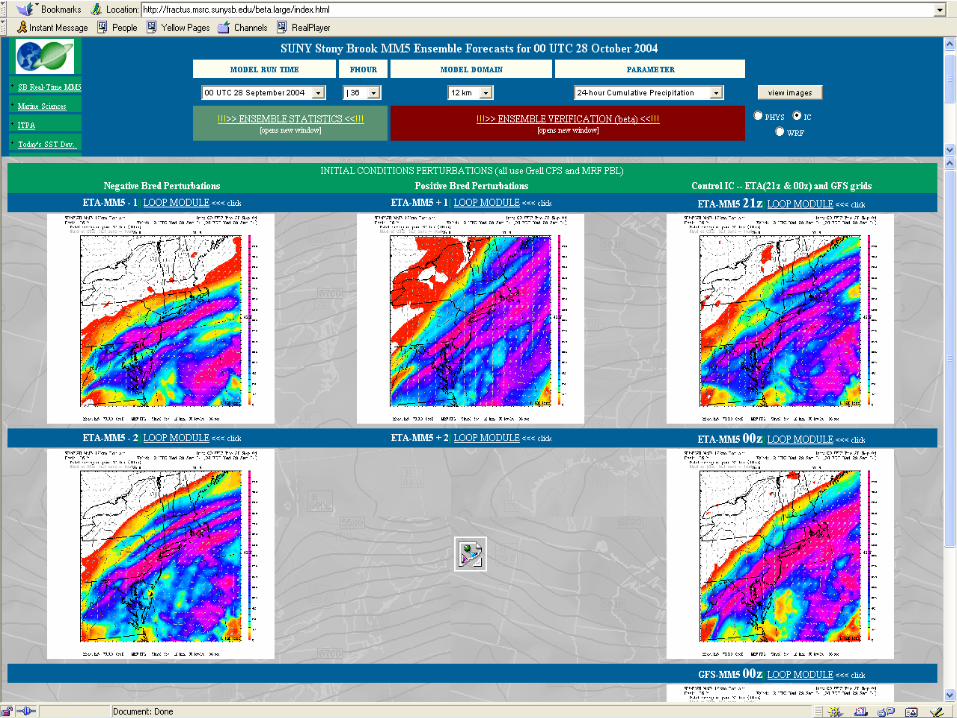
Ensemble Data
• Mainly Web Based
• Mainly looking at the QPF products
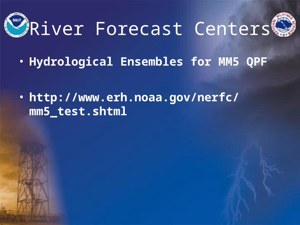
River Forecast Centers
• Hydrological Ensembles for MM5 QPF
• http://www.erh.noaa.gov/nerfc/mm5_test.shtml
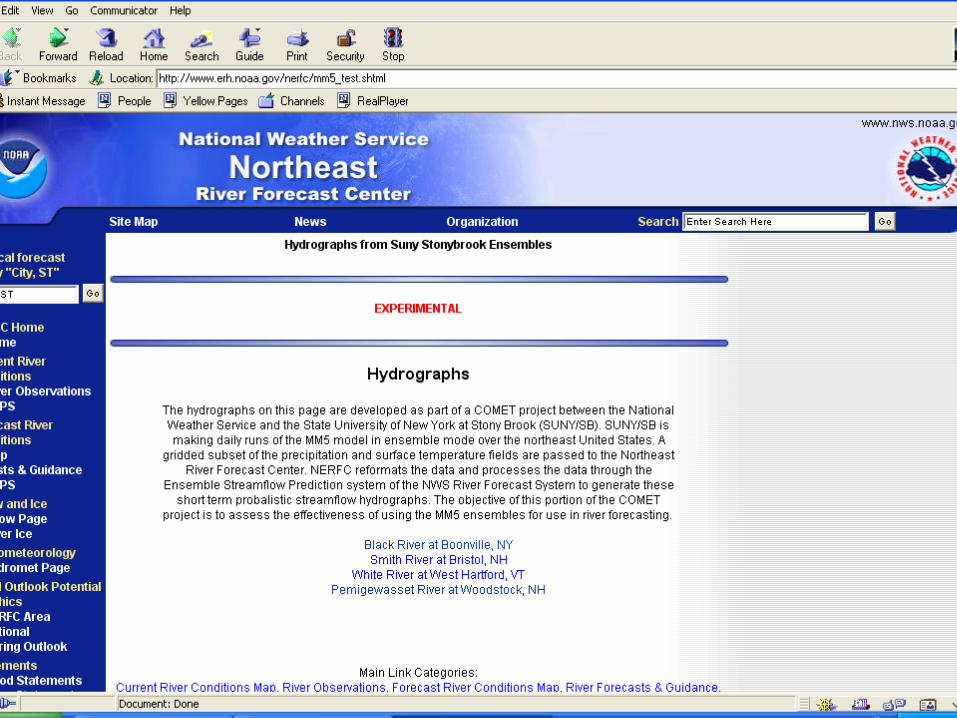
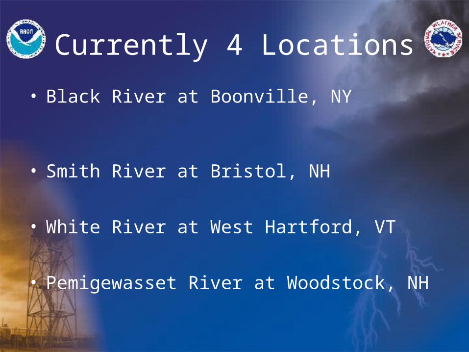
Currently 4 Locations
• Black River at Boonville, NY
• Smith River at Bristol, NH
• White River at West Hartford, VT
• Pemigewasset River at Woodstock, NH
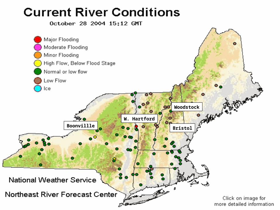
Boonvillle Bristol
W. Hartford
Woodstock

Example of MM5 Ensemble driven River Stage

Case Example
• Hurricane Jeanne
• 27-29 September 04
• 4-5 Inches of Rain NYC/LI
• 2-3 Inches Lower Hudson Valley/CT

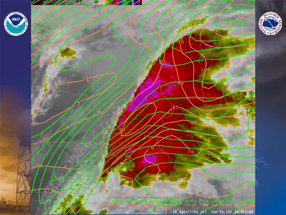
GOES IR 26/02Z – 29/20Z (6 h interval)

GFS 27/00Z Run: MSLP/1000-500 hPa Thickness Valid Sept 29th 06Z

GFS 28/00Z Run: MSLP/1000-500 hPa Thickness Valid Sept 29th 06Z

GFS 29/00Z Run: MSLP/1000-500 hPa Thickness Valid Sept 29th 06Z

Eta 27/18Z Run: QPF – 24 Hours Ending Sept 29th 12Z

GFS 28/00Z Run: QPF – 24 Hours Ending Sept 29th 12Z

HPC Day 1 QPF – 24 Hours Ending Sept 29th 12Z

Eta 28/06Z Run: QPF – 24 Hours Ending Sept 29th 12Z

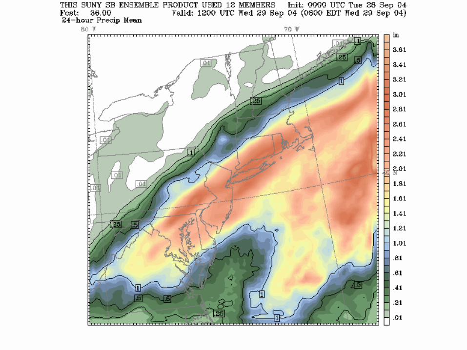


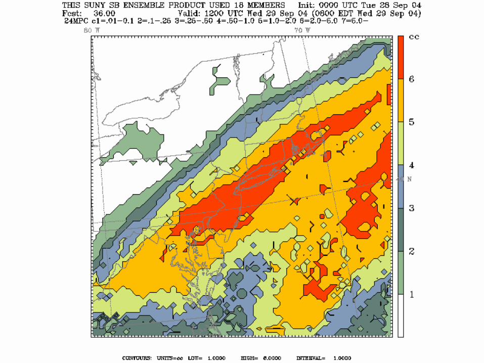
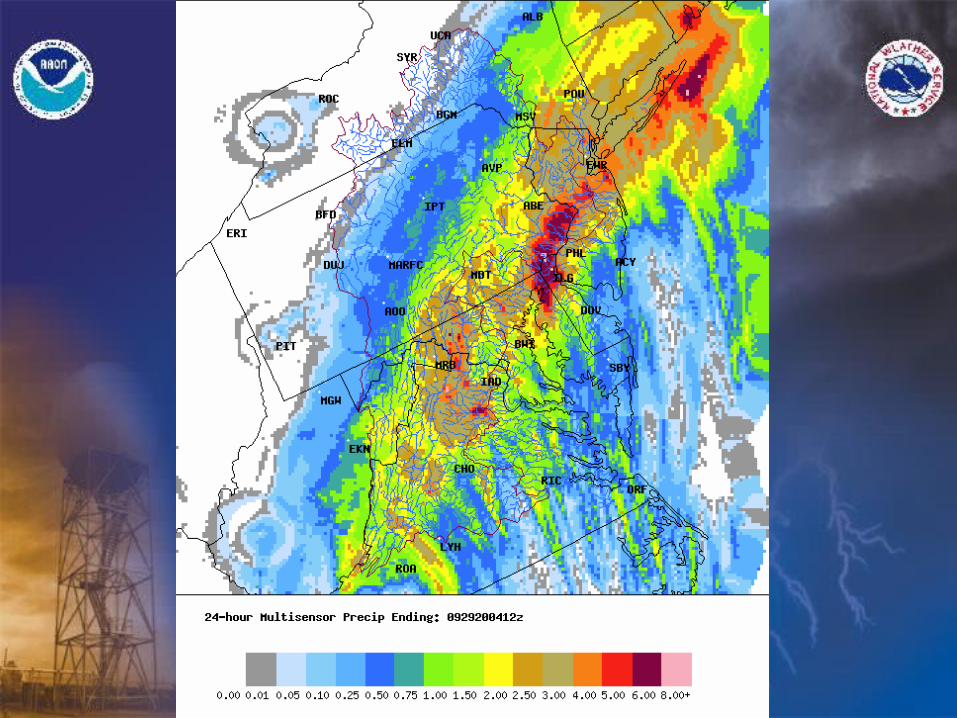

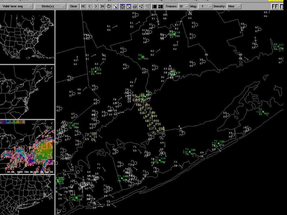
Rainfall
• New York City – 4.49 Inches
• Bridgehampton – 7.57 Inches
• Port Jervis – 1.44 Inches
Summary
• 40 FFW’s Issued (OKX CWA).• A Flash Flood Watch Was Issued Tuesday
Afternoon (28/18Z).• NCEP/HPC Models Greatly Underestimated the
Precipitation and the focus of the precip.• Short Range ensemble showed consistency and
the focus location of the QPF.• Models/Ensemble under-predict heavy precip
events.

Conclusions
• Use of Short Range Ensembles is critical.
• Forecasters do not “trust” experimental models/data.
• Forecasters need to continue to learn to integrate ensembles of models into the forecast process.
• GFE has “re-promoted” the model of the day concept.
Conclusions
• Timeliness and Reliability are key.
• Integration into GFE.
Some Future Plans
• Expand Ensemble Hydrographs
• Continue Outreach and Training
• Add members of the Ensemble to AWIPS
• Increase use of ensemble data in GFE
• Increase utilization of WS-eta
• Evaluation of local WRF element
• Increase ensemble use in GFE/NDFD
Additional