utm for wildland fire air domain awarenessutm for wildland fire air domain awareness. overview •...
TRANSCRIPT

TFRSAC Fall Meeting11/03/2016
UTM for Wildland Fire Air Domain Awareness
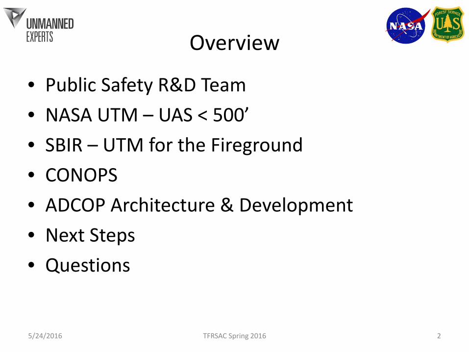
Overview
• Public Safety R&D Team• NASA UTM – UAS < 500’• SBIR – UTM for the Fireground• CONOPS• ADCOP Architecture & Development• Next Steps• Questions
5/24/2016 TFRSAC Spring 2016 2

UMEX & Vertex Geo PS S&T/SBIR Team
Ed Freeborn, CTO• 16 years PS Technical
Assistance, incl. NLECTC-NE• 30 years in Geospatial &
Imaging Technology
XPSLTE 2016 3
Drew Jurkofsky, CKO• 16 years Fort Collins Police• 14 years Accident
Reconstruction• ACTAR Accreditation #1348
Dave Prall, VP Spec Ops• 20 year LEO, rtd; SGT Elko Cty SO, NHP• PPL, Level 4 UMEX Qualified Pilot, 1000+ UAS hrs• Certified – Aeryon Scout & SkyRanger, Altavian Nova F6500
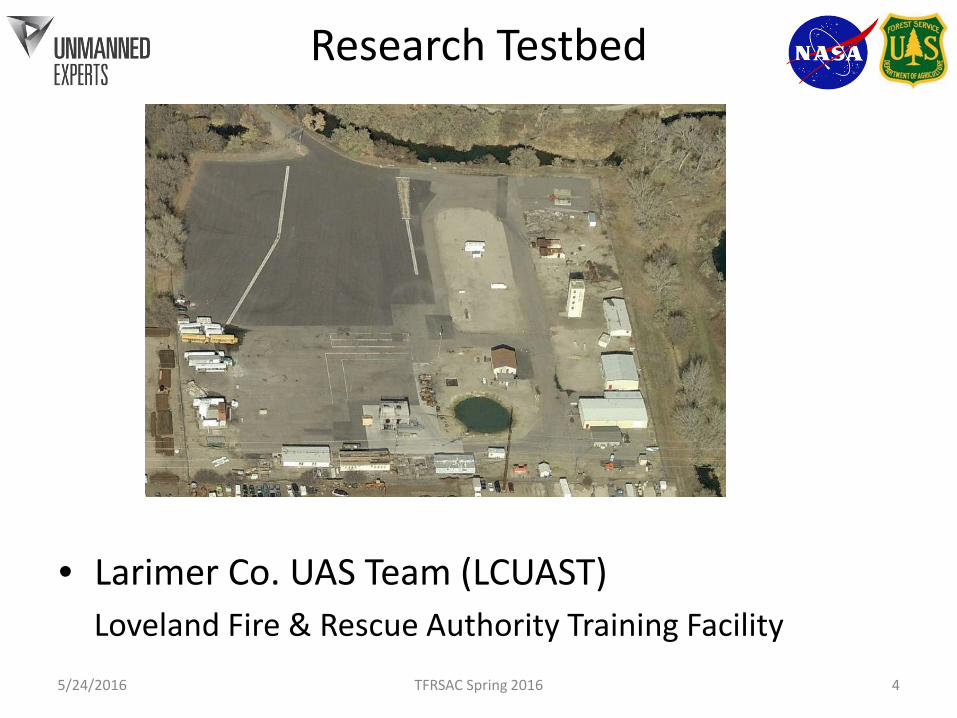
Research Testbed
• Larimer Co. UAS Team (LCUAST)Loveland Fire & Rescue Authority Training Facility
5/24/2016 TFRSAC Spring 2016 4
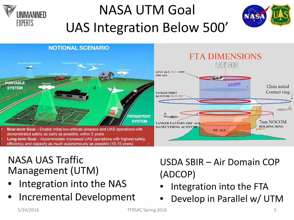
NASA UTM GoalUAS Integration Below 500’
NASA UAS Traffic Management (UTM)• Integration into the NAS• Incremental Development
5/24/2016 TFRSAC Spring 2016 5
USDA SBIR – Air Domain COP (ADCOP)• Integration into the FTA• Develop in Parallel w/ UTM
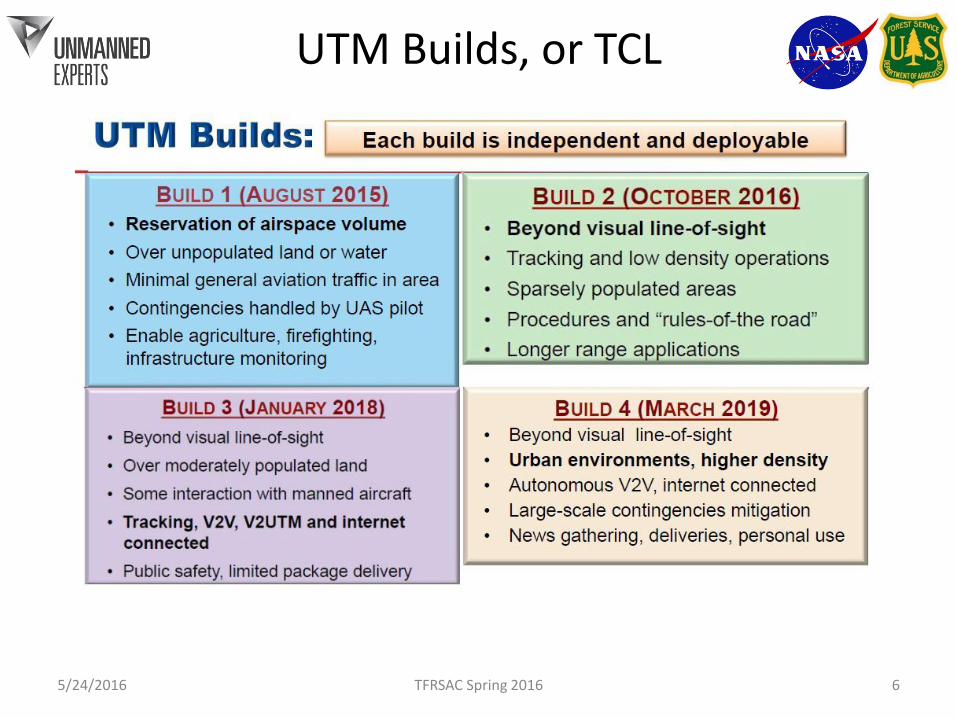
UTM Builds, or TCL
5/24/2016 TFRSAC Spring 2016 6

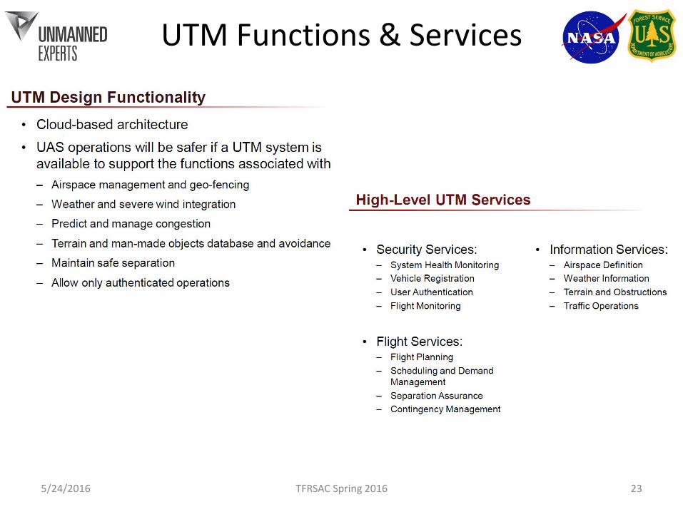
UTM Functionality Goals
• Safe, low-altitude UAS Operation with cloud-based Services– Airspace management and geofencing
• Allow only authenticated operations– Maintain safe separation
• Including with Airspace Reservations made in UTM– Weather and severe wind integration– Predict and manage congestion– Terrain and man-made objects: database and
avoidance
5/24/2016 TFRSAC Spring 2016 7
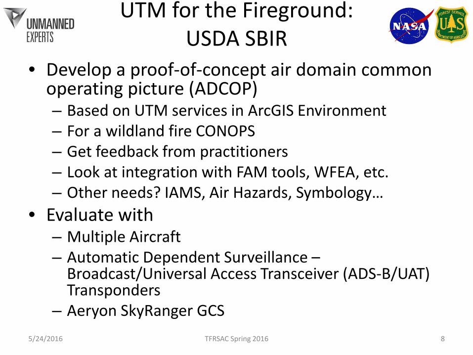
UTM for the Fireground:USDA SBIR
• Develop a proof-of-concept air domain common operating picture (ADCOP)– Based on UTM services in ArcGIS Environment– For a wildland fire CONOPS– Get feedback from practitioners– Look at integration with FAM tools, WFEA, etc.– Other needs? IAMS, Air Hazards, Symbology…
• Evaluate with– Multiple Aircraft– Automatic Dependent Surveillance –
Broadcast/Universal Access Transceiver (ADS-B/UAT) Transponders
– Aeryon SkyRanger GCS5/24/2016 TFRSAC Spring 2016 8

Concept of Operations
• Mission• Technology• Organization• Essential for tailoring new technology to user
requirements in R&D– Contrast with requirements analysis for well
understood tech
5/24/2016 TFRSAC Spring 2016 9

Wildland Fire UAS CONOPS Elements
• Wildland Fire Missions – Situational Awareness – real time, near RT sensing– Decision Support – remote sensing, modeling– Comms Op/Interop– Forensics
• UAS Technology– Small UAS (SUAS) – VTOL, Hand launched FW– Tactical UAS (TUAS) – Catapult launch– Medium Altitude, Long Endurance (MALE) Pred/Reaper
5/24/2016 TFRSAC Spring 2016 10
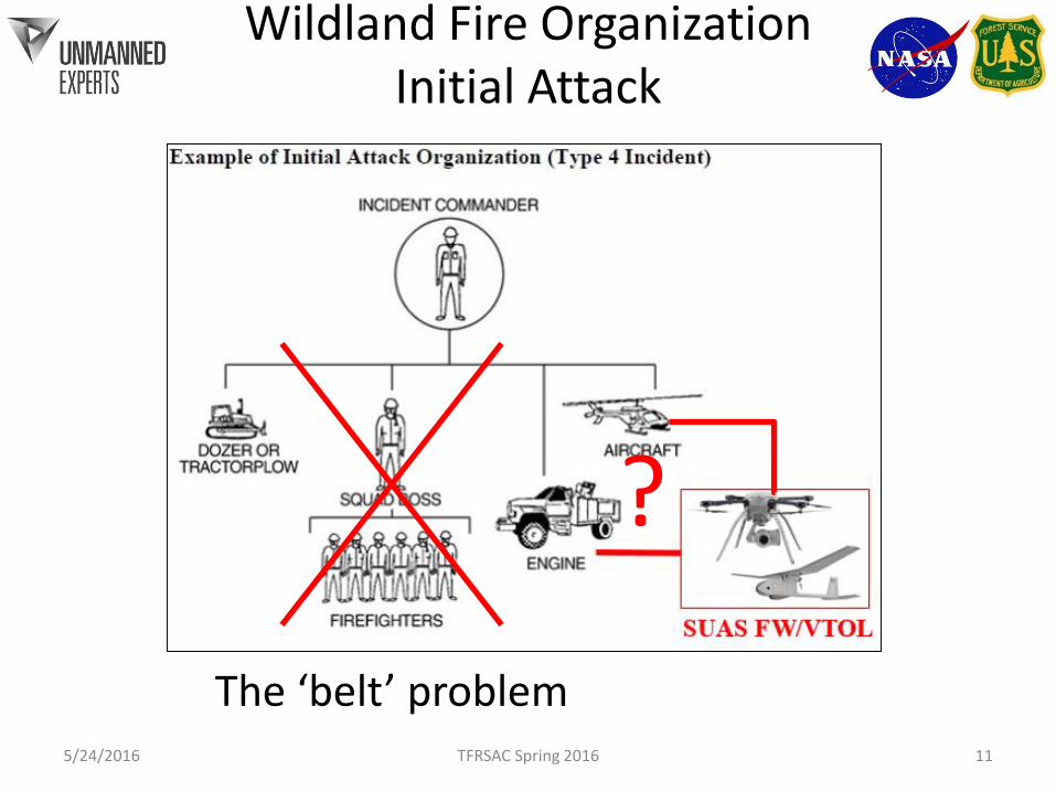
Wildland Fire Organization Initial Attack
5/24/2016 TFRSAC Spring 2016 11
The ‘belt’ problem
?
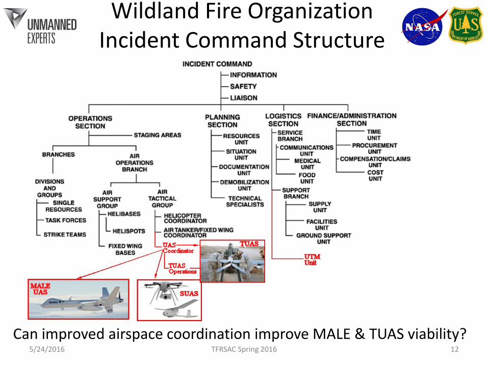
Wildland Fire OrganizationIncident Command Structure
5/24/2016 TFRSAC Spring 2016 12Can improved airspace coordination improve MALE & TUAS viability?
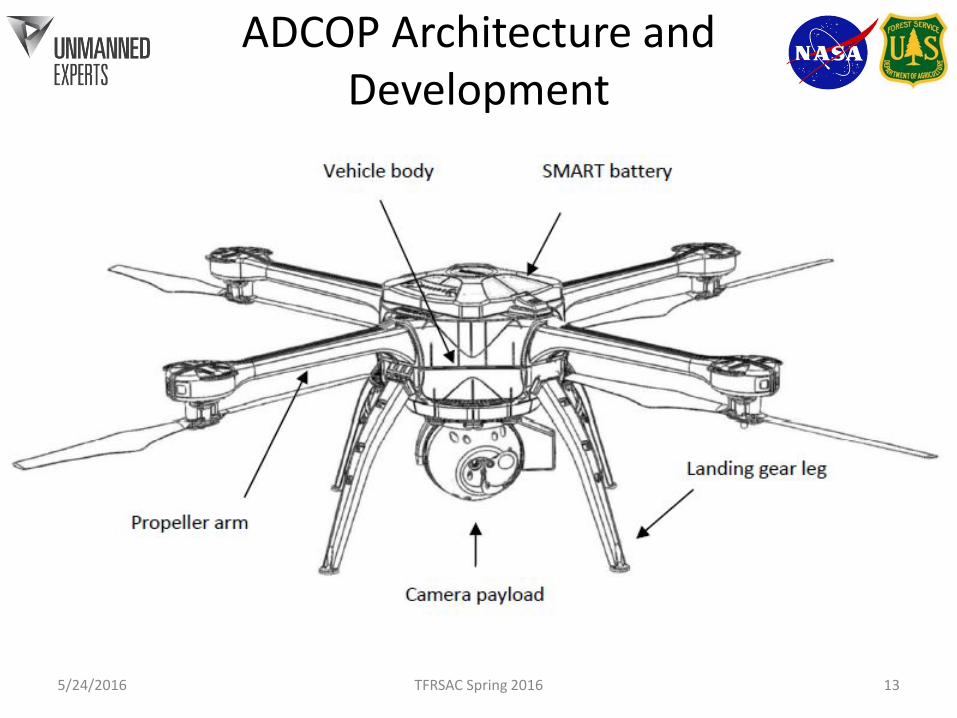
ADCOP Architecture and Development
5/24/2016 TFRSAC Spring 2016 13

Service Definitions
A Web Map Service (WMS) produces maps of spatially referenced data dynamically from geographic information. A map is not the data itself.WMS
The OGC (Open Geospatial Consortium) is an international not for profit organization committed to making quality open standards for the global geospatial community.
WFS A Web Feature Service (WFS) provides data access and manipulation operations on geographic features directly as vector entities. The Data!

Data Capture Process Description:• Flight data collected via WiFi connection to Ground Control Station.• GCS is connected to UMEX UTM Server via mobile internet• Mission Plan / Flight location coordinates are stored for archival purposes
• Point feature class in PostGIS• Listener enables real time updates
• GeoServer publishes OGC WFS containing aircraft data • Ownship attributes with location
• UMEX Location Tracker publishes required content to NASA UTM server• NASA UTM publishes other relevant airspace information


Information Use Description:
• Flight data capture using UMEX UTM client.
• Operations Dashboard application (Desktop / Web / Mobile interface) consumes asset WFS and displays as “bouncing blue ball” on basemap for real time display. • Timestamps recorded for each location to support post mission playback
• Flight location coordinates (archived copy) remains on UTM server for post mission analysis using ArcGIS Desktop.

WFS
Supporting Data- Fire Locations- Weather Services- Aircraft Locations- Air Hazards
Browser OpsDashboard
ADCOP
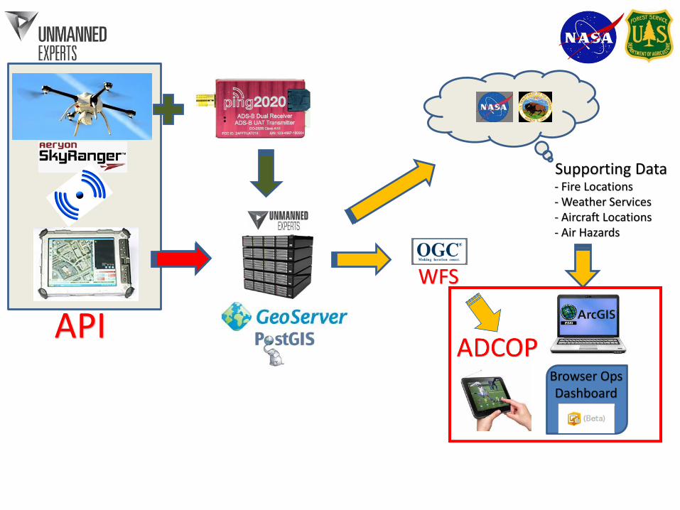
WFS
Supporting Data- Fire Locations- Weather Services- Aircraft Locations- Air Hazards
Browser OpsDashboard
API

Next Steps / Considerations
• Supplementing ADS-B Information• Mobile UTM (Private LAN)• Develop CONOPS• NASA UTM TCL3• Operational Evaluations with Wildland Fire
Community (Any takers?)• Integration with Wildland Fire Enterprise
Architecture (IRWIN)

Questions?
UMEXTelephone: 1 303 398 7056
Fax: 1 334 460 [email protected]
www.unmannedexperts.com5/24/2016 TFRSAC Spring 2016 21

Automatic Dependent Surveillance - Broadcast
UTM Functions & Services
5/24/2016 TFRSAC Spring 2016 23