vegetation mapping low lying islands in the pacific using vhr satellite images kataebati bataua...
TRANSCRIPT

Vegetation Mapping Vegetation Mapping Low Lying Islands in the Low Lying Islands in the
PacificPacificUsing VHR Satellite ImagesUsing VHR Satellite Images
Kataebati BatauaKataebati Bataua
SPC-SOPACSPC-SOPAC

Purpose of Vegetation Mapping Purpose of Vegetation Mapping (Land Cover)(Land Cover)
• Picture of available coconut palm Picture of available coconut palm resource (alternative energy, etc.)resource (alternative energy, etc.)
• Food security Food security • Base line of vegetation cover to Base line of vegetation cover to
monitor impact of climate changemonitor impact of climate change

Display GeoEye DataDisplay GeoEye Data
Texture of GeoEye data allows to separate palm and natural forest
Texture of GeoEye data allows to separate palm and natural forest

Texture and PatternTexture and Pattern

Spectral InformationSpectral Information
False Colour InfraredFalse Colour InfraredNatural ColourNatural Colour

Vegetation ClassesVegetation Classes• Coconut palm cover (3 densities !)Coconut palm cover (3 densities !)1.1. Coconut plantationCoconut plantation2.2. Dense coconutDense coconut3.3. Scattered coconutScattered coconut
• ForestForest• MangrovesMangroves• ShrubShrub• Settlement influenced areasSettlement influenced areas• Bare Land (grass, none vegetation)Bare Land (grass, none vegetation)• Water body (on the island)Water body (on the island)


Other Vegetation ClassesOther Vegetation Classes(within Settlement Area)(within Settlement Area)
Not visible on the image dataNot visible on the image data
such as:such as:– BreadfruitBreadfruit– PandanasPandanas– BananasBananas
Field sample plots
required
Field sample plots
required

The GIS Operators in KIThe GIS Operators in KI
• AgricultureAgriculture• EnvironmentEnvironment• Lands DepartmentLands Department

Backup of InformationBackup of InformationSPC-SOPAC Fiji
Agriculture Kiribati
Environment Kiribati

Delineation of Palm DensityDelineation of Palm Density

Selection of PlotsSelection of Plots
Select plots that are covered within the Select plots that are covered within the stratum (like 150 plots that contains with stratum (like 150 plots that contains with the “Y”)the “Y”)
Randomly select only 20 plots.Randomly select only 20 plots.
Counting palms/hectareCounting palms/hectare

•Plots Containing the “Y”

Counting in MapInfo Counting in MapInfo
MapInfo automatically counts the number of MapInfo automatically counts the number of
palms within the plots using SQL select palms within the plots using SQL select
SQL ResultSQL Result

The number of palms is counted through a semi automatic process connecting MapInfo GIS
software with Access Database software
Transfer
MapInfo (GIS) Access Database

Analysis in AccessAnalysis in Access
• SumSum• MinMin• MaxMax• MeanMean• No PlotsNo Plots• Area plotsArea plots• Area StratumArea Stratum• (Pot. No. Plots) (Pot. No. Plots)

Description of StratumDescription of Stratum
• Average number of palms/hectareAverage number of palms/hectare• Variability of the palm densityVariability of the palm density• Exactness of counting Exactness of counting
For 20 plots(randomly) of 50 x 50 metres the coconut palms were counted in the stratum "Scattered Coconut" on the satellite image data. This represents an area of 17,507 m2. This stratum covers 41,423 m2 and theoretically 17 plots could have been analysed instead of 20. The number of palms varies from 12 (min) to 14 (max) which represents 48 or 52 palms/ha with an average of 49 palms/ha with very small standard deviation of +2 palms/ha and a standard error of + 0.6.
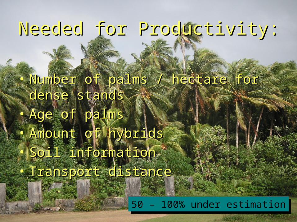
Needed for Productivity:Needed for Productivity:
• Number of palms / hectare for dense Number of palms / hectare for dense standsstands
• Age of palmsAge of palms• Amount of hybridsAmount of hybrids• Soil informationSoil information• Transport distanceTransport distance
50 – 100% under estimation50 – 100% under estimation

Results: 25 reports Results: 25 reports are readyare ready

Results in GIS EnvironmentResults in GIS Environmentat SPC-LRDat SPC-LRD
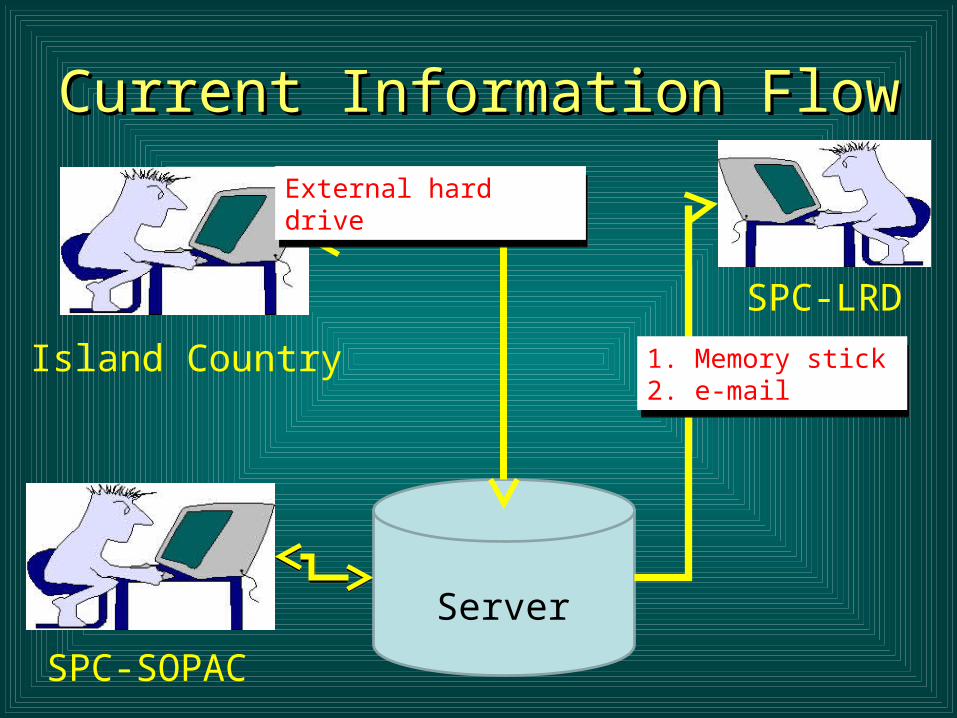
Current Information FlowCurrent Information Flow
SPC-SOPAC
SPC-LRD
Island Country 1. Memory stick2. e-mail
1. Memory stick2. e-mail
External hard driveExternal hard drive
Server

Vegetation MonitoringVegetation Monitoring
??
SPC

Thanks Thanks