village design statement l
TRANSCRIPT

Statement Village Design Te
rlin
g &
Fairst
ead P
arish
Counci
l
September 2014

2 2

3 3
Contents Introduction
Process Summary
Your Planning Considerations
Background
Character Assessments
Landscape Character Assessment
Terling
Village Centre
Owls Hill
New Road and Fairstead Road
Hull Lane, Mill Lane and Norman Hill,
Gambles Green & Flacks Green
Waltham Road and Hare Green
Fairstead
Church End
Fuller Street
Ranks Green
Parish-Wide Characteristics
Conclusions
Appendices not part of the approved document
Appendix A Issues outside the scope of the VDS
Appendix B Future Parish Consultation
Appendix C The Natural History of Terling
Appendix D Village Envelope
Appendix E Listed Buildings
Appendix F Results of Questionnaire
Appendix G Diary of Events
Acknowledgements
Useful Contacts

4 4
Poster adverting the first public meeting on 7th February 2007
5 5
Rural communities are seen to be under threat from ill-conceived and badly designed planning and development. The purpose of a Village Design Statement (VDS) is to enable local people to have a say in how they wish their village to develop so that it does not lose its
essential characteristics.
The Terling and Fairstead Village Design Statement describes the particular character of our Parish and makes recommendations (guidelines) to influence future planning and development. It has been drawn up by representatives of the Parish in full consultation with the
residents, businesses and the local planning authorities.
The VDS is no paper exercise. Braintree District Council (BDC) formally approves the guidelines in a VDS and uses them in the determination of planning applications. This means that private and public planners and developers, builders, landowners, employers, architects and homeowners need to view it so that they can make informed decisions about how their plans affect the village character
and environment.
This document is not meant to prevent progress and change. Change is both inevitable and, in many instances, desirable. The purpose is to manage change in a way which harmoniously combines our valued
heritage with the needs of the modern world.
Scope This covers the Parish Council areas of Fairstead and Terling, being
the built environments of
Church Green including The Street, Crow Pond Road, The
Yard and Dairy Hill
Owls Hill including The Terling Inn (previously known as The
Rayleigh Arms), Viner Cottages, Garnets Mead, School Green,
Fairstead Road and New Road
Waltham Road & Hare Green
Hull Lane
Gambles Green
Flacks Green
Fairstead Church End
Fuller Street
Ranks Green
Purpose The VDS guidelines are for residents, businesses, landowners, developers, planners and utility companies to ensure that any changes are in keeping with local character and residents’ aspirations for appropriate design. Its purpose is to help manage development
so that the village’s essential character can remain.
The VDS gives a detailed description of the various parts of the Parish, the individual character of their buildings and the important features of its design and historical evolution. It identifies the physical qualities and characteristics of the built environment; their surrounding areas, which are valued by the residents, and any particular features that they would like to preserve and protect. Most importantly, design guidelines are provided for how these existing
features should be reflected in any future development.
Introduction
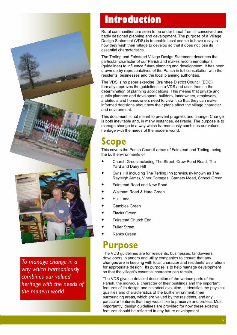
To manage change in a
way which harmoniously
combines our valued
heritage with the needs of
the modern world

6 6
About this document The Terling and Fairstead VDS reflects the views of the people of Terling and Fairstead. A number of events were held to encourage participation and get their views, including public presentations at various points in the development stages, workshops and an
in-depth questionnaire to gather opinions.
Copies of the draft document were available for one month during the consultation exercise at various addresses in the village, at the
Post Office and on the internet via the community website.
The exercise was well publicised in advance via the village notice boards, Parish News magazine and the community website. All comments by village residents have been considered and
incorporated, as appropriate, into the document.
The BDC fully supports the production of Village Design Statements by local people as one way of providing design guidance and supplementing Local Plan policy. The BDC has a policy about design, the intent of which is to ensure a high standard of design in all developments. The policy sets out a number of criteria against which development proposals are judged and refers to the production of design guides to outline the key defining local
characteristics of various parts of the Braintree District.
This VDS is fully in line with the design and development principles
of the National Planning Policy Framework.
Status In its current form this document will be used by the Terling and Fairstead Parish Council when it comments on Planning
Applications.
This document has been approved by BDC as a material
consideration in the determination of planning applications.
As the life of the Parish evolves, Terling and Fairstead Parish
Council will review and if necessary update the document.
Residents and developers can also use this document to ensure that any new builds or changes they intend to make to properties
are in keeping with local character and desires of the residents.
Planning Policy Context The planning system in which this document operates is the National Infrastructure Planning Act 2008 (as amended by the Localism Act 2011) which is currently under review by central
government.
Additionally the Braintree District Core Strategy Local Development Document was adopted on 19 September 2011 and covers the period to 2026 . It is clear that future planning processes, particularly the use of the Localism Act 2011 will require specific
local input into the style and type of future development.
This VDS therefore aims to ensure local views
are considered in future planning processes.
Guidelines shown throughout the document are grouped by subject type, but relate to all areas
of the parish.
The VDS project was commissioned by the Parish Council in September 2006. This followed a small meeting of interested
Braintree Development Plan and the
Village Design Statement.
“Planning Applications are determined in accordance with the policies contained within the Braintree District Local Plan Review (adopted 2005) and adopted Core Strategy 2011. Weight must be given to the Site Allocations and Development Management Local Plan and decisions must accord with the
National Planning Policy Guidelines.
The 2005 Braintree District Local Plan sets out detailed allocations for housing and other land uses. The Core Strategy 2011 defines the level of growth for the District to 2026 and its broad distribution. This document sets out a settlement hierarchy which defines the scale of
development intended for each settlement.
The Site Allocations and Development Management Local Plan (now at pre submission draft) was intended to replace the Braintree Local Plan Review 2005 but has not reached the final stage of adoption. A copy of the proposals
map is included as Appendix D.
These plans will in time be replaced by an up to date plan or plans based on an updated
evidence base”.
The Core Strategy describes Terling as classified as an “Other Village” (third tier) in the settlement hierarchy. This means that a village boundary has been drawn around the settlement within which small scale urban forms of development eg housing are acceptable in principle. Development within such villages is intended to be of a small scale and type to cater
for purely local needs.
Within Terling, Waltham Road, Fairstead Road, Church Road and Gambles Green Lane and Terling Hall Road have been designated as protected lanes under policy ADM45 (Site Allocations and Development Management Plan). Flacks Green, Gambles and Bramley have been protected as visually important space and protected by ADM2 and ADM14. A Conservation Area was also designated and the area adjacent to the river is shown as within
Flood Zone 2 and 3.
Fairstead does not have a settlement boundary and lies within the open countryside according the Braintree Core Strategy Spatial Strategy CS1, CS5 and the Site Allocations and Development Management Plan. It has some listed buildings, archaeologically important sites and public footpaths/bridleways. Fairstead is on the lowest tier of the settlement hierarchy described above. As such, other than for special policies, such as hamlet policy RLP16, replacement houses (RLP15) or new agricultural dwellings (RLP12), urban growth such as housing, is not considered appropriate or sustainable”. Hence, most new development is
likely to be domestic in nature or relating to the
countryside. Senior Planning Officer BDC 2014

7 7
Your Planning Considerations
Throughout this document are specific guidelines relating to Terling and Fairstead. However, if you are considering alterations to the exterior of your own property, anywhere in the Parish, there are a number of general aspects you should consider as part of your initial design process.
These may be significant changes such as replacement windows or doors or seemingly less important
items such as paintwork, signs, boundary walls, gates, hedges or removal of a tree.
However, all alterations affect the building and its surroundings as well as the overall look of the village or hamlet within the Parish so please make your own assessment by studying each visible elevation of
your property including the rear elevation, where visible, prior to alteration and ask yourself:
What are the distinctive features of the property and area?
Are any of these features out of character with the property or with the adjacent properties or with
the design guidelines in this Design Statement?
Think about the alterations you are considering. How do they affect the positive distinctive features of your property? Do they complement the character of the local area? If not, how could you change them so that they do? Alternatively, is there the opportunity to remove any
uncharacteristic features?
Contact Braintree District Council to establish if planning permission or building regulations permissions are required for your proposal; and your property is not listed or within the
conservation area.
Check also if there are any other restrictions on the development of your property. Is it a listed
building that is subject to much stricter control? In conservation areas, amongst other restrictions, this means you will need permission to cut down or significantly reduce the size of trees. Please note that most works to a listed building will require listed building consent. Permission is also
required for demolition within conservation areas.
Check if any trees on your property are listed or protected by a Tree Protection Order (TPO) or if
you are within the Conservation Area, where trees are also protected.
If you are in doubt, employ an architect or seek professional advice on your proposals. The local
planning authority is also happy to provide advice prior to the submission of an application.
The Braintree Council’s website planning policy page contains further information on Conservation
Areas. (Website: www.braintree.gov.uk)

8 8
9 9
individuals during May 2006 when the concept of a VDS was first raised and discussed. As a first step a small group made a fact finding visit to Great Bardfield, that Parish Council being the first to have their VDS adopted by a Planning Authority in Braintree. A second well attended public meeting involving 65 Parishioners was held in the Village Hall on 7th February 2007, when it was decided by a significant majority that a small working group should
prepare a Design Statement for our Parish.
From the outset it has been our aim to consult widely and in appropriate detail – whilst maximising participation with the opportunity for feedback
from as wide and diverse a group as practicable.
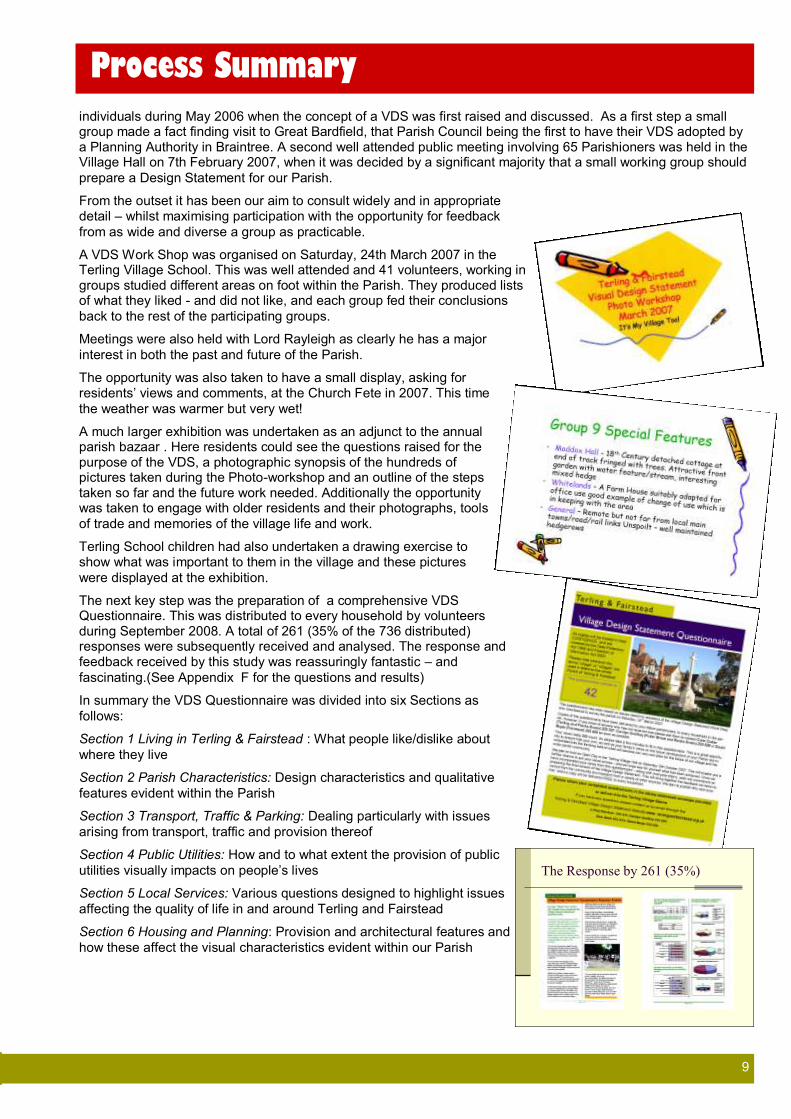
A VDS Work Shop was organised on Saturday, 24th March 2007 in the Terling Village School. This was well attended and 41 volunteers, working in groups studied different areas on foot within the Parish. They produced lists of what they liked - and did not like, and each group fed their conclusions
back to the rest of the participating groups.
Meetings were also held with Lord Rayleigh as clearly he has a major
interest in both the past and future of the Parish.
The opportunity was also taken to have a small display, asking for residents’ views and comments, at the Church Fete in 2007. This time
the weather was warmer but very wet!
A much larger exhibition was undertaken as an adjunct to the annual parish bazaar . Here residents could see the questions raised for the purpose of the VDS, a photographic synopsis of the hundreds of pictures taken during the Photo-workshop and an outline of the steps taken so far and the future work needed. Additionally the opportunity was taken to engage with older residents and their photographs, tools
of trade and memories of the village life and work.
Terling School children had also undertaken a drawing exercise to show what was important to them in the village and these pictures
were displayed at the exhibition.
The next key step was the preparation of a comprehensive VDS Questionnaire. This was distributed to every household by volunteers during September 2008. A total of 261 (35% of the 736 distributed) responses were subsequently received and analysed. The response and feedback received by this study was reassuringly fantastic – and
fascinating.(See Appendix F for the questions and results)
In summary the VDS Questionnaire was divided into six Sections as
follows:
Section 1 Living in Terling & Fairstead : What people like/dislike about
where they live
Section 2 Parish Characteristics: Design characteristics and qualitative
features evident within the Parish
Section 3 Transport, Traffic & Parking: Dealing particularly with issues
arising from transport, traffic and provision thereof
Section 4 Public Utilities: How and to what extent the provision of public
utilities visually impacts on people’s lives
Section 5 Local Services: Various questions designed to highlight issues
affecting the quality of life in and around Terling and Fairstead
Section 6 Housing and Planning: Provision and architectural features and
how these affect the visual characteristics evident within our Parish
The Response by 261 (35%)
Process Summary

10 10
Summary of the Questionnaire The VDS Questionnaire covered a broad range of issues and the full results can be found later in this document. Although these are key points, this document can only refer to the way in which design can help bring these issues about. For example the iron bollards, while clearly being appropriate design for the Estate Yard, also serve
to stop through traffic and therefore make the whole area safer and quieter.
To summarise, the four key points from the questionnaire results were:
Maintain the Quality of Life Overwhelmingly respondents want to enhance all that is peaceful (tranquil), maintaining a strong feeling of community and belonging, and quality of life. The scale and mix of architectural features and house styles dating from different periods and the range of environmentally rich and green spaces adds to the rich diversity of our
community rather than detracting from it.
It is also important to acknowledge the great significance that large numbers of our community attach to the need for and provision of facilities for informal leisure. Creating a safer and even richer environment for walkers and cyclists is vital, as is maximising the beneficial impact leisure tourism could play in the future of our village
community.
Control the Traffic There is significant and widespread concern about traffic, particularly the vehicle size, and the speed with which traffic passes through our Parish. There is also concern about the damage being caused to roadside verges by heavy goods vehicles and agricultural equipment. These are matters that impact directly upon the design, look and feel of the Parish. Lack of adequate parking and inconsiderate parking is also a key issue; also having a direct impact on the ‘look’ of the Parish. Resources and wider consultation by the Parish Council will be required if additional parking provision needs to be created. Additionally, there is a key role for the Parish Council to work with appropriate Highways authorities to provide sensitive and creative design measures to control speed and
parking as well as public awareness and understanding on the issue.
Improve Public Transport The lack of convenient public transport is an important issue both for the ageing population and for people unable to drive. We therefore recommend this is further consulted upon more widely within the community; with the
Parish Council developing specific time-lined proposals and actions. This is not deemed a matter for the VDS.
Maintain and improve the businesses Issues relating to the Terling Village Pub (currently closed and known as the Terling Inn), The Village Stores and the Village Hall, and the provision of other public facilities are not directly design related. We therefore do not
propose to take these points any further. However, they have been raised as concerns by residents.
We recommend these issues are noted by the Parish Council and raised in a timely and appropriate manner with the parties concerned. Details of residents concerns are available from the questionnaire responses (see
Appendix F).
Design Aspects Comments made included:
Safer Roads: Concerns regarding Lack of pathways, inconsiderate, speeding vehicles, HGV numbers and
speed.
Clean and Tidy: Rubbish on the roadside and fly tipping were of concern
Travel and Parking:
Encourage people to park in their driveway or any parking spaces provided
Planners to insist on at least two off-street parking spaces for every development
Any further development should have parking as a priority to stop overflow of cars parking on
roadside or grassed areas
The character of the village does not lend itself to large car parks

11 11
To help set the scene, here is a
poem about the village by Terling
resident Liz Twin.
Although it refers to Terling, it
encapsulates the feeling of the
whole Parish.
TERLING
How lucky we are
To live in such a place
With trees and fields
And masses of space
The Church and Chapel
And the wonderful school
The Dismals with its cricket
And our lovely swimming pool
The Village Shop, and Village Hall,
I think you will agree
Are places that make us all feel
Part of this Rural community
The town folk say
How do you live in such a place?
Terling, I reply, offers friendship,
Loads to do and of course all the
SPACE.
The area at the Village Hall could be tidied up but it is important not to urbanise the village
Driveways could be made visually and environmentally attractive via rain-soaking (gravel, porous
surface rather than hard surface run offs)
With better off road and off Green parking many of our roads would less resemble car parks e.g
The Street
Many of the suggestions for car parking, particularly in the centre of Terling, involved the use of, or changes to, areas currently enjoyed by the residents and visitors, but which are privately owned, such as Church Green. This document does not therefore make recommendations for change of those areas. However a number of residents suggested the provision of small “honeypot” areas (small targeted parking areas for a few cars only for specific areas such as in operation at the Dismals) for parking throughout the Parish to reduce the on street parking. A
large number of responses called for use of off street parking where it is available to residents.
As a result of the questionnaire parishioners showed they particularly valued and appreciated access to Church Green, Bromwell Leaze, The Dismals, School Green, Flacks Green, Bramley and Gambles Greens, Wades
Spring, Recreation and Cricket Fields and which were considered important open spaces

12 12
A Brief History A settlement at Terling certainly dates back to Roman times. Various artefacts have been found and Roman bricks are incorporated in the structure of Fairstead church, but the actual site of the Roman settlement is unknown. According to a Saxon document dated 627AD, about seven hundred acres of land was occupied in the Terling and Fairstead area. In 886 Terling was part of the Witham Hundred and there are references to this in records of
Terling and Fairstead until the nineteenth century.
The existing network of local roads and the layout of fields would already have been evident and well established before the Normans occupied the area around 1086. Terling is mentioned in the Doomsday Book, giving the approximate population as one hundred and twenty five. Before the Norman Conquest the three manors of
Terling were presented to the Abbot of Ely.
During the thirteenth century successive Bishops of Norwich acquired land in the Parish and the remains of the foundations of their palace exist to the west of All Saints’ Church. Henry VII later
used the palace as a hunting lodge.
Conditions of life and labour improved during the fourteenth century and more people were encouraged to take up farming. Names of the farmers who purchased holdings at this time are remembered to this
day in place names such as Loyes, Scarletts and Porridge Pot.
Despite the wars and plagues of the fifteenth century the Parish continued to prosper. Tudor House was built and the Parish church was extended. The Old Vicarage is the south wing of a fifteenth
century home.
Arable farming and sheep rearing were the basis of the village economy in the sixteenth century. Other local industries included tanning, weaving, malting and the milling of flour. Houses of the period were made of timber and clay and were thatched. The living room was also the family workshop and only the rich could afford chimneys and fireplaces. There was a growth in the number of alehouses including ‘The Angel’ in the building that now houses the
village shop and post office.
In 1720 John Strutt, who owned water mills between Chelmsford and Maldon, began the association of his family and the village with the purchase of four farms including Porridge Pot, Three Ashes and Norrells. He built Newhouse around 1726. His son purchased five more farms including Loyes and Scarletts and the Strutt family purchased the Manor of Terling with eight hundred and fifty acres in 1761. Terling Place was built between 1772 and 1780 and continues to be the family residence. John Strutt, the second Baron Rayleigh, built the village school, enlarged the church and, in 1868 after a terrible epidemic of typhoid fever, installed a village water supply system. Lord Rayleigh’s Estate is still by far the largest landowner and owns a significant number of the houses in the village. Until the latter end of the twentieth century a high proportion of the population worked for the Estate and lived in tied cottages. Today many of the
cottages are rented, often to those who commute to London.
Information extracted from ‘Terling’ by C A Barton
Historic photographs courtesy of John Thurgood
The Parish was once home to one of the most famous dairy herds in the country, (Gerald Strutt being one of the pioneers who set up the British Friesian Cattle Society in 1909) However, despite such a distinguished history farming economics has meant that over recent years the herds have declined in size and most of the farms are now
arable.
Background

13 13
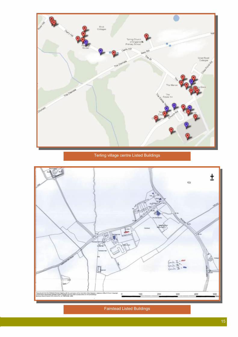
Terling and Fairstead Today Terling and Fairstead today is a quiet and peaceful community, and that peace is greatly appreciated by the residents. The population stands at about 760 people and, in both the centre of Terling and also scattered throughout the parish, there are 113 listed buildings of which Fairstead Church and Ringers Farmhouse are Grade 1 and there are twelve Grade 2 star listings. (See maps on page 15 and Appendix 1). Many properties including a number of barns, are still
thatched.
Most Parishioners who work are employed outside the Parish and typically commute to towns and cities by car or train. There are some local businesses, with Lord Rayleigh’s and Blixes farms and the
Terling School being the largest local employers.
The social fabric is strong as evidenced by the many clubs and societies in the village, which include The Terling School PTA, Brownies, Ladies Club, Bell Ringing, Church Choir, Cricket Club, Indoor Bowls, Mothers Union, Tennis Club, Swimming Club,
Gardening Club, Horticultural Society, and Clay Pigeon Shooting.
The Village Hall is in constant demand for meetings and parties, many of which are fund raising events in aid of local, national and international causes. The Village Post Office and Stores is a hub for local news as well as provisions and postal services. An Internet Café has been provided at the Store by the Parish Council to make
the internet available to those with no access from their home.
There are two pubs in the Parish, The Square and Compasses in Fuller Street which has a thriving business; the other, The Terling Inn which reopened in October 2012 after being closed for a year or so. Local opinion is greatly in favour of retaining the last pub in Terling,
although it closed once more in mid 2013.
The two Churches and the Chapel provide the spiritual centre of the Parish and are well supported. Funding for maintenance is always a task and the fund raising events are always well supported and enjoyed, as evidenced by the bi-annual Terling International Trifle
Competition.
Traffic volume and speed is recognised as a problem; mainly due to cars speeding through the narrow lanes of the villages and countryside. Typically commuter traffic travelling to and from Hatfield Peverel Station and the A12 causes most problems. Additionally the movement of large trucks through the villages gives cause for concern through the real and continued damage to the infrastructure
and some buildings.
The Geographical Context Terling and Fairstead Parish is situated in the centre of a triangle of Braintree to the North, Chelmsford to the South West and Witham to the East. Generally the Parish is defined by old farming boundaries; to the South and East by Porridge Pot and up to but not including, Whitelands Farm toward Hatfield Peverel; to the North and West by Warley and Bishops Halls towards Braintree and Youngs End and to the East by Dancing Dicks and Troys Wood towards Witham and
Faulkbourne.
20th century development is mainly ribbon style between the existing hamlets of Mill Lane, Ford Hill, Flacks and Gambles Greens and Owls Hill in Terling and some infill at Fuller Street, Ranks Green and Fairstead Church End. Future development is controlled by two
village envelopes around Terling and Gambles and Flacks Greens.
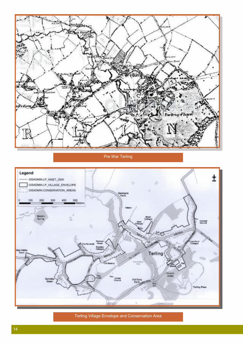
A comparison (see over) of the current and pre-war shows how little
the surrounding areas have changed.
Tudor House
Norrells
Ranks Green
Square & Compasses
Estate Yard
Fairstead Church
Village Stores Terling
14 14
Pre War Terling
Terling Village Envelope and Conservation Area
15 15
Terling village centre Listed Buildings
Fairstead Listed Buildings

16 16
The Parish is served by the River Ter (which gave its name to the Village), which for most part can be described as a stream. The
Ford in Terling has always been a popular play area for children.
Surrounding the villages and hamlets are farms and these serve to contain the size of the habitations and prevent sprawl. This is a key geographical element, the hamlets within the Parish are loosely joined, but the Parish is not joined to any of the nearby towns (Hatfield Peverel, Great Leighs). This fact has helped the Parish retain its own identity and the residents are very keen to
maintain this separation.
The farmland between Hatfield Peverel and Whitelands is known to have been identified as a strategic mineral resource of aggregate and sand which may come forward as other sites to the east of the A12 become worked out. This aspect must be considered in future where within the Terling and Fairstead Parish where the built environment is affected and forms part of the Essex County
Council Mineral Plan.
The Parish Landscape The Parish comprises the three main settlements of Terling and Fairstead (Church End and Fuller Street) and other identified
settlements of Gambles Green, Ranks Green and Flacks Green.
Approaches to the Parish from the surrounding areas are entirely through tracts of open countryside, with the roads often bordering farmland and woodland. Connecting these areas are lanes of varying widths with varying densities of housing and farm buildings at their edge. The fact that these areas have not been joined together by “string developments” helps to maintain their individual characters and, to some extent, isolation, which is prized by the residents, and adds to the spaciousness that, as many people
commented, is key to the attractiveness and tranquillity of the area.
The Natural Environment In the context of the VDS the phrase “Natural Environment” is used
to distinguish from the “Built Environment”.
The natural environment of the Parish is predominantly farm and managed woodland. Until fairly recently dairy farming was the
major occupation, but this has given way to arable farming.
The Parish is surrounded by agricultural land and “internal” areas
of significant natural interest.
There are ash, cedars, elms, horse chestnuts, a very high population of oaks, pines, sycamores, silver birch, willows, yews,
beech and spruce.
Hedgerows are important both as part of our historic, managed landscape and as a reservoir for wildlife. There are a number of individual landowner-managed hedgerows, mainly beech, hawthorn and hornbeam, which add greatly to rural feel of the
Parish.
Unfortunately there is a move towards grubbing up the hedgerows around gardens and replacing them with lower maintenance boundaries such as brick wall, close boarded fencing and “ranch style” beams. In more extreme cases garden hedgerows have been grubbed up and front gardens concreted over to provide
Character Assessment

17 17
additional parking spaces (see later comments regarding availability of parking spaces). The Parish Council has in recent years objected to both BDC and Secretary of State at appeal with some success,
with regard the use of high close boarded fencing to enclose gardens.
The natural history of our Parish is very diverse, (see Appendix C) with a number of habitats of importance for conservation. The most important, and recognised as such by European habitats directive,
are the following:
Ancient and/or species-rich hedgerows, numerous throughout
the Parish, many retaining the characteristics of original
woodland with woodland trees, shrubs and flowering plants
Aquifer fed naturally fluctuating water bodies - rivers that come
from the ground. The River Ter is recognised as important for wild brown trout, smaller Bullheads, otters though not water
voles in recent years.
Cereal field margins providing habitats for Bee Orchids, Voles
and Barn Owls.
Lower growing flower meadows are very rare but Church
Green is a fine wild flower meadow previously recognised as a Site of Importance for Nature Conservation. The Churchyard hosts a number of wildflower species including the extremely rare Birthwort a medicinal plant probably introduced in the 15th
century and the Meadow Saxifrage.
Mixed deciduous woodland is common and some probably is
ancient woodland, dating back many hundred years. Several woods show ditches clear evidence of palisades, probably at
least 200 years old, built to keep deer out of the wood.
Mammal species include Otter, Harvest Mice, Water Shrew,
Brown Hare and a number of Bat species. Three species of Deer are present, and possibly Dormice too. In all over 25 mammal species are present within the Parish, including a
number in decline in Essex in general.
Birds include Buzzards, red Kites, white Little Egrets and
Lapwings the last being a breeding species in national decline
but which still breed in the Parish.
Reptiles are rare, grass snakes and slow worms are present
but in low numbers, frogs toads and newts are more common.
Many large ancient Oaks are found and even still a few Elms
together with Wild Service and Small Leaved Lime, the last two
being indicators of ancient woodland.
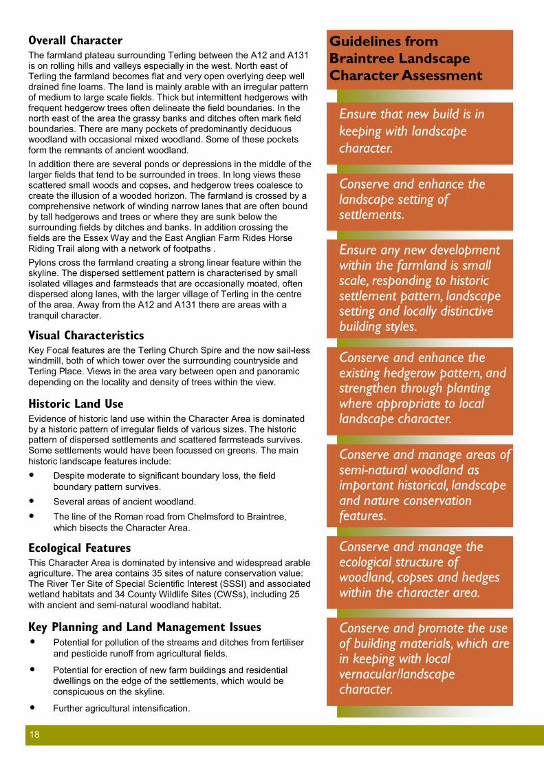
Landscape Character Assessment Extract from Braintree Council document E40 Landscape Character
Assessment Sept 2006
TERLING FARMLAND PLATEAU
Key Characteristics
Rolling arable farmland.
Irregular pattern of medium to large scale fields.
Scattered settlement pattern, with frequent small villages,
typically with greens and ponds.
Network of narrow winding lanes.
Mostly tranquil away from the A12 and A131.
18 18
Overall Character The farmland plateau surrounding Terling between the A12 and A131 is on rolling hills and valleys especially in the west. North east of Terling the farmland becomes flat and very open overlying deep well drained fine loams. The land is mainly arable with an irregular pattern of medium to large scale fields. Thick but intermittent hedgerows with frequent hedgerow trees often delineate the field boundaries. In the north east of the area the grassy banks and ditches often mark field boundaries. There are many pockets of predominantly deciduous woodland with occasional mixed woodland. Some of these pockets
form the remnants of ancient woodland.
In addition there are several ponds or depressions in the middle of the larger fields that tend to be surrounded in trees. In long views these scattered small woods and copses, and hedgerow trees coalesce to create the illusion of a wooded horizon. The farmland is crossed by a comprehensive network of winding narrow lanes that are often bound by tall hedgerows and trees or where they are sunk below the surrounding fields by ditches and banks. In addition crossing the fields are the Essex Way and the East Anglian Farm Rides Horse
Riding Trail along with a network of footpaths .
Pylons cross the farmland creating a strong linear feature within the skyline. The dispersed settlement pattern is characterised by small isolated villages and farmsteads that are occasionally moated, often dispersed along lanes, with the larger village of Terling in the centre of the area. Away from the A12 and A131 there are areas with a
tranquil character.
Visual Characteristics Key Focal features are the Terling Church Spire and the now sail-less windmill, both of which tower over the surrounding countryside and Terling Place. Views in the area vary between open and panoramic
depending on the locality and density of trees within the view.
Historic Land Use Evidence of historic land use within the Character Area is dominated by a historic pattern of irregular fields of various sizes. The historic pattern of dispersed settlements and scattered farmsteads survives. Some settlements would have been focussed on greens. The main
historic landscape features include:
Despite moderate to significant boundary loss, the field
boundary pattern survives.
Several areas of ancient woodland.
The line of the Roman road from Chelmsford to Braintree,
which bisects the Character Area.
Ecological Features This Character Area is dominated by intensive and widespread arable agriculture. The area contains 35 sites of nature conservation value: The River Ter Site of Special Scientific Interest (SSSI) and associated wetland habitats and 34 County Wildlife Sites (CWSs), including 25
with ancient and semi-natural woodland habitat.
Key Planning and Land Management Issues Potential for pollution of the streams and ditches from fertiliser
and pesticide runoff from agricultural fields.
Potential for erection of new farm buildings and residential
dwellings on the edge of the settlements, which would be
conspicuous on the skyline.
Further agricultural intensification.
Ensure that new build is in
keeping with landscape
character.
Conserve and enhance the landscape setting of settlements.
Ensure any new development within the farmland is small scale, responding to historic settlement pattern, landscape setting and locally distinctive building styles.
Conserve and enhance the existing hedgerow pattern, and strengthen through planting where appropriate to local landscape character.
Conserve and manage areas of semi-natural woodland as important historical, landscape and nature conservation features.
Conserve and manage the ecological structure of woodland, copses and hedges within the character area.
Conserve and promote the use of building materials, which are in keeping with local vernacular/landscape character.
Guidelines from
Braintree Landscape
Character Assessment

19 19
Sensitivities to Change Sensitive key characteristics and landscape elements within this character area include thick (intermittent) hedgerows, frequent hedgerow trees, grassy banks and ditches and many pockets of predominantly deciduous woodland, (which are sensitive to changes in land management). The comprehensive network of quiet rural lanes and byways, which cross the landscape are sensitive to potential increased traffic flow, associated with new development. In association with this, the overall sense of
tranquillity within the area is sensitive to change.
The open skyline of higher areas of the farmland plateau is visually sensitive to new development that may be visible within views across, to and from the area. There is a sense of historic integrity, resulting from a dispersed historic settlement (comprising dispersed settlements and scattered farmsteads). Several areas of ancient woodland within the character area are also sensitive to changes in land management. Overall, this character area has
moderate sensitivity to change.
Landscape Strategy Option Conserve, seek to protect and enhance, positive features that are essential in contributing to local distinctiveness and sense of place through effective planning and positive land management
measures.
Enhance and seek to improve the integrity of the landscape, and reinforce its character, by introducing new and/or enhanced
elements where distinctive features or characteristics are absent.
Suggested Landscape Planning Guidelines Ensure that new build is in keeping with landscape
character.
Conserve and enhance the landscape setting of settlements.
Ensure any new development within the farmland is small
scale, responding to historic settlement pattern, landscape
setting and locally distinctive building styles.
Suggested Land Management Guidelines Conserve and enhance the existing hedgerow pattern, and
strengthen through planting where appropriate to local
landscape character.
Conserve and manage areas of semi-natural woodland as
important historical, landscape and nature conservation
features.
Conserve and manage the ecological structure of woodland,
copses and hedges within the character area.
Conserve and promote the use of building materials, which
are in keeping with local vernacular/landscape character.

20 20
Terling Landscape The village of Terling is divided into two areas either side of the River Ter which is in a shallow valley, and quartered by the Dismals and the road from Hatfield Peverel to Fuller Street. The approach to the centre of the village is through open farmland with managed small
woodlands, avenues of trees with a high number of ancient oaks.
A three mile long swathe of open farm land, broken only by Whitelands and Termitts Farms and a few associated farm houses separates Terling from Hatfield Peverel. Hatfield Peverel development stops abruptly at the railway line and no significant development
extends beyond towards Terling.
This farm land and open countryside is regarded as an essential buffer between the two built areas avoiding linking the two by domestic or commercial development and as a key contributor to
quality of life in the village .
Many Terling residents who return home along this road, either from the railway station or by car from further afield, regard this as the part of the journey that lifts the worries and pressures from their working
life and prepares them for the calm of the Parish.
Essentially, a triangle of roads forms the centre of the village housing and then extends towards other habitations. Traditionally the village had outlying hamlets in the form of Flacks Green and Gambles Green though these are now joined to the rest of the village by the 20th century developments down Hull Lane and Norman Hill. For the purposes of this VDS the areas have been separated because of the differences in architectural styles. However, guidance notes relate to
all areas.
Approaching Terling From Boreham The road passes over the A12 and then under the railway line. Width and height is restricted at that point such that larger lorries are unable to use the road. Narrow lane, single track in places, winds through Berwick Place and Hatfield Wick to the Parish boundary at Terling Hall Farm. An avenue of mature trees is bordered by open farmland
and woodlands with sparse housing and farm buildings.
From the Walthams A narrow lane bordered in places by ancient oaks. The lane passes through open arable land and there are sparse farm buildings
including farm cottages.
From Hatfield Peverel A winding two lane road, generally suitable for larger traffic, passes through open fields, with a wide variety of ditches, avenue trees
including a large number of ancient oaks, with mixed hedging.
Open Spaces Responses to the questionnaire showed that the open spaces in the Parish are of great importance to the community. Besides the public spaces in the Parish, we are fortunate that Lord Rayleigh allows walking on much of his estate, provided the rules regarding areas that are off limits and the control of dogs are observed. Some of the most
popular open spaces are listed here:
Guideline:
Maintain the open spaces as key
quality of life in the village.
Watt Hobbs pond
Terling School corner
Norrells corner
From Hatfield
21 21
Church Green The Green, which is owned by Lord Rayleigh, fronts All Saints’ Parish Church and is bounded by Church Road. It is a typical Church or Village green that is central to a number of activities in the village and has been host to a number of wedding celebrations. The Green is visited by many artists and photographers every year, each wishing to capture the view of All Saints’ Church or the view of the historic houses across Church Road. An example of this view can
been seen on the front cover.
Parishioners have described Church Green as “calm, peaceful, English”, “The centre point of a typical English village”, “Views,
architecture, history”.
The practice of overnight parking on Church Green is regretted by many residents. Whilst this is probably safer than parking on the street the practice does detract from the natural beauty of Church Green and depletes the grass. The landowner has now erected signs
asking for no overnight parking.
The Green is the site of the Terling and Fairstead memorial to those from the village who gave their lives in the two World Wars. The Armistice Day Service is held on the Green by the Memorial, each November. The dignity of the Armistice Day service is sometimes compromised by vehicles parked between the congregation and the
memorial.
The Dismals The Dismals run from School Green to the Cricket field and it passes the Village Hall, the Swimming Pool, the Tennis Courts and the Children’s Playground. The Dismals are used all year round by the community and permitted access given by Lord Rayleigh is
appreciated.
The Dismals link both sides of Terling. Parishioners have described The Dismals as: “Where leisure and countryside meet”, “Essence of the Village and needs to be preserved”, “Great for families and
Children”.
Bromwell Leaze Bromwell Leaze is a large open space that links the Dismals to the North and Church Road to the South. The entry into Bromwell Leaze from the Dismals passes the Terling Cemetery, which is a very well
maintained area of peace and reflection.
Bromwell Leaze provides one of the few reasonable slopes in the Parish and becomes the toboggan run in the snow. Parishioners have described Bromwell Leaze as “A green lung of air and a
meeting place”, “A place to walk and ideal for Bonfire night”
The Ford The Ford across the River Ter is famous locally as a great play area for children, a swimming pool for dogs and a peaceful haven in the
early evenings.
The Ford is deceiving in its depth and difficulty of navigation and many cars become stranded after the drivers ignore the warning road signs. Unfortunately it has also become an attraction for “suburban explorers” who arrive in convoys of four wheel drive vehicles driving multiple times through the Ford and over the banks. This has caused significant damage to the grass banking and considerable distress to the elderly residents living nearby and
children, dog and other walkers using the area.
The Ford
Guideline:
New developments or
re-developments should
accommodate a sufficient
number of vehicle parking places
within the plot and not rely on
roadside parking.
Church Green
Church Green
The Dismals
Bromwell Leaze

22 22
Parishioners have described the Ford as “It’s something that identifies Terling”, Great for children and Pooh Sticks, tranquil”, The Ford at
Terling – it is beautiful”.
The Cricket Field The Cricket Field is very well used and the home of the Terling Cricket Club. Matches are played on most Saturdays in the season and the club actively encourages children of all ages to learn more about the game. The Cricket Field is set amid farm land and spectators can enjoy fabulous views across the village to the Spire of All Saints’ Church. The land is owned by Lord Rayleigh’s Farms and
rented to the club.
Parishioners have described the Cricket Field as “traditional English village setting”, “Cricket Pitch – one of the best in Essex”, England at
its best – even when Terling CC are losing”.
The Recreation Ground
Situated in Fairstead Road, The Recreation Ground is leased to Terling and Fairstead Parish Council by Lord Rayleigh. The Recreation Ground is the home of Terling Villa Football Club and has up-to-date changing facilities. The Ground is available for walking and organised events co-ordinated with the Parish Council and Lord
Rayleigh's Farms.
Townscape Terling to the north-east of the Ter is arranged around the historic cross roads of Crow Pond Road, The Street and Church Green, the form and grain of development still broadly following the Walker Map
of 1597.
As the Terling settlement spreads away from the centre along Crow Pond Road, the Crow Pond Cottages (a community of estate bungalows) with allotments behind sets the scale and density for the central area. Properties on New Road, originally all bungalows with large gardens stemming from the early 1920s, have largely been replaced in the interim by significantly larger detached two storey dwellings in a mixture of styles, including a timber clad Scandinavian theme, all of which appear to complement each other in the street
scene.
Sebby's Gardens and the properties on Owls Hill form the original Terling workhouse complex and as such are the original and unusual three storey dwellings in the community; they are timber framed constructions with rendered elevations under slate and clay tiled roofs with white painted joinery; there is limited off road parking available to
these properties.
The road westwards to Braintree is bordered by rendered terraced housing under clay tiled roofs to the south side and a number of brick built semi-detached houses under slate roofs to the north. The limited availability of off street parking has caused some removal of native hedging and front gardens which has detracted from the order and
coordination of the originating design for these houses.
Terling and Fairstead have a great number of listed and distinctive buildings which are listed in Appendix E. There are significant individual and clusters of such buildings throughout the two Parishes,
which significantly flavour the appearance of the areas.
The fabric and “feel” of the Parish, which is important to the residents, is created and enhanced by these structures, which must be
maintained and not obstructed or obscured by new developments.
Guideline:
The use of red or grey brick or
render will normally be the most
appropriate choice of building
material

23 23
The Village Centre
This comprises The Street, Crow Pond Road, Church Green, Dairy Hill and New
Road.
The roads extending from the triangle head towards Hatfield Peverel, Boreham, Fairstead and Fuller Street. A number of treasured open spaces and allotments spaces are
included in the village.
The architecture is a mix of housing styles dating from 1331 (approximate date of Church View and Vine Cottage) up to more modern designs of 1980-90. Much of this area is within a designated Conservation Area and there are a number of Grade 2 listed buildings. Many of the historic properties are owned by Lord Rayleigh who maintains them to a high decorative standard in co-
ordinated colour schemes.
Church Green and The Street have a high density of housing much of which was built between 1300 and 1800 and often had industrial or commercial uses over the centuries. The 14th century Village Stores building is located at the centre of this area, housed in a building which opens directly onto the roadway. Many of the properties in this area immediately abut the narrow roadway which also has tight corners. There are no pavements and little room to
provide them in most areas.
The area behind Church Green and The Street, previously Lord Rayleigh’s joinery yard, was developed in 1999/2000 into eleven houses of varying shapes and sizes, some terraced and others either link detached or detached, with rooflines and detailed architectural features which reflect the surrounding properties. Part of the development, known as Estate Yard, is paved with flagstones from the area and the road has a Victorian style iron
barrier to prevent transit of vehicles from one end to the other.
Crow Pond Road has the cottages built in the 20th century for estate workers and now available for rent by local residents. There is no pavement but there is some room for provision of one in this busy and relatively narrow road which leads to the shop. The village allotments and old timber barns (including at least one
which was previously the village abattoir) are also in this road.
Dairy Hill, at the end of Church Green has the brick built Dairy Bridge, the river water pumping station installed originally in 1767 and used to pump drinking water to the village until 1915 and which was maintained by the Parish Council and the Old Dairy farm buildings which are currently used for farm storage and which are
constructed in a combination of timber and corrugated iron sheets.
Between the last house on Church Green and Dairy Hill lies an uncultivated meadow, Bromwell Leaze, a beautiful open space of several acres, used daily by children, dog walkers and pedestrians and which also gives access to the village burial ground behind
The Street. This open space is privately owned by Lord Rayleigh.
Guideline:
Maintain hedgerows and garden
hedges as natural animal habitats
and part of the character of the
village.
Avoid where possible removal of
hedges and the erection of brick
walls, close boarded and ranch
style fences.

24 24
Buildings and Design Features Within the central conservation area there is a mix of styles mostly of two storey ranging from the timber frame with rendered infill panels under clay peg tile roofs, to brick and knapped flint buildings again under clay peg tile roofs. These buildings have enclosed gardens but car parking is often remote from the dwellings in a
series of garage blocks within the conservation area.
Materials of red brick, render (of various colours), timber windows and doors have become the preferred pallet within the conservation area, using natural hedging, wicket fences and gates as well as red brick and knapped flint perimeter enclosures to the
separate dwellings.
There are a number of listed buildings which have set the theme
for later constructions such as the Estate Yard completed in 2000.
The buildings within the village centre are largely timber frame with plaster infill, dating from approximately 1300 onwards. Chimneys are a significant feature as are the varying rooflines and aspect to the road. No individual buildings dominate their neighbours or the area, other than the Parish Church which is surrounded by large
open green areas.
The current Post Office and Village Stores is Grade 2 star listed, built in the 14th century and is timber framed, plastered, and roofed with handmade red clay tiles. It has a two-bay hall facing south
east and two two-bay cross wings and a dormer window.
There is a further group of three Grade 2 listed 16th and 17th century cottages 15 yards from the Store and next door an 18th century detached house. Close by, the Manse, is 17th century or earlier and there are a further seven Grade 2 listed houses. One
unusual house built in 1918 is faced with flint.
There are a few newer buildings of various dates from the 20th century, all set back from the road and widely separated from their neighbours. A pair of semi-detached red brick buildings originally housed the Electricity Board office and the Post Office but are now private houses. The newer houses are generally red brick and of
differing styles.
On the sharp bend in the road, the brick piers with Portland stone topped with pineapple finial ornaments, mark the entrance to Grade 2 star listed Terling Place. The tree lined, wide grassed, gravel drive provides a green vista from the centre of the village. Terling Place, a Georgian mansion built in 1772 to the designs of John Johnson, of grey brick (called Suffolk Whites) in Flemish bond, with limestone dressings, roofed with slate, is not visible from
the centre of the village.
A beautiful old 10 foot high, 16th century, Grade 2 red brick wall, recently restored, runs from the Church towards Dairy Hill and
separates the Terling Place grounds from Church Green.
Possibly the oldest houses in Terling the two cottages now known as Church View and Vine Cottage date back from approximately 1331 when they were probably one house. English Heritage remark “This house is of exceptional historic interest in that aisled halls retaining both aisles are rare, and those mainly of manorial status. Here the small size and context indicate a lower status, probably of merchant origin. The apparent association with the Parish church is misleading, for another street of houses existed in front of it until c.1843, but it may originally have faced on to a market place. A market and fair were established in Terling by 1331, which date is just compatible with the earliest part of this house. (W. Walker, Essex Markets and Fairs, Essex Record Office,
1981, 34). RCHM 8.
Guideline:
Encourage owners to maintain
the fabric and setting of the
landmarks and avoid detracting
from their visual impact and
character.
Guideline:
Endeavour to maintain the listed
buildings in a manner which
emphasises their historic and
architectural significance
Guideline:
Houses will have rooflines in
keeping with neighbouring
buildings.
Guideline:
Ensure extensions are
sympathetic to the materials
bulk and form of the existing
building.
25 25
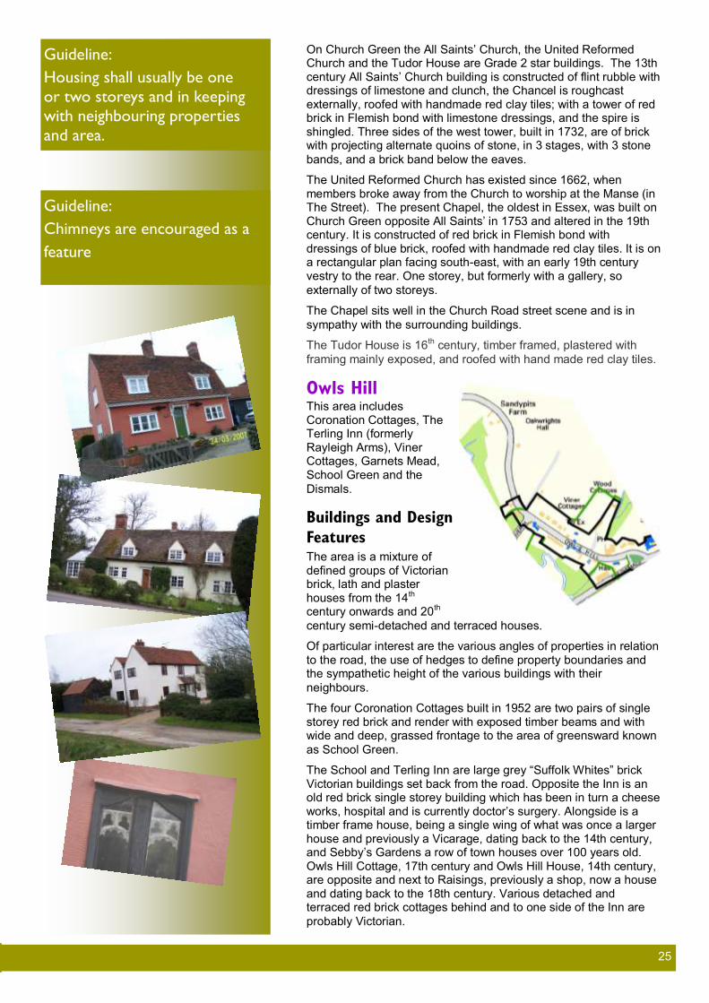
On Church Green the All Saints’ Church, the United Reformed Church and the Tudor House are Grade 2 star buildings. The 13th century All Saints’ Church building is constructed of flint rubble with dressings of limestone and clunch, the Chancel is roughcast externally, roofed with handmade red clay tiles; with a tower of red brick in Flemish bond with limestone dressings, and the spire is shingled. Three sides of the west tower, built in 1732, are of brick with projecting alternate quoins of stone, in 3 stages, with 3 stone
bands, and a brick band below the eaves.
The United Reformed Church has existed since 1662, when members broke away from the Church to worship at the Manse (in The Street). The present Chapel, the oldest in Essex, was built on Church Green opposite All Saints’ in 1753 and altered in the 19th century. It is constructed of red brick in Flemish bond with dressings of blue brick, roofed with handmade red clay tiles. It is on a rectangular plan facing south-east, with an early 19th century vestry to the rear. One storey, but formerly with a gallery, so
externally of two storeys.
The Chapel sits well in the Church Road street scene and is in
sympathy with the surrounding buildings.
The Tudor House is 16th century, timber framed, plastered with
framing mainly exposed, and roofed with hand made red clay tiles.
Owls Hill This area includes Coronation Cottages, The Terling Inn (formerly Rayleigh Arms), Viner Cottages, Garnets Mead, School Green and the
Dismals.
Buildings and Design
Features The area is a mixture of defined groups of Victorian brick, lath and plaster houses from the 14th century onwards and 20th
century semi-detached and terraced houses.
Of particular interest are the various angles of properties in relation to the road, the use of hedges to define property boundaries and the sympathetic height of the various buildings with their
neighbours.
The four Coronation Cottages built in 1952 are two pairs of single storey red brick and render with exposed timber beams and with wide and deep, grassed frontage to the area of greensward known
as School Green.
The School and Terling Inn are large grey “Suffolk Whites” brick Victorian buildings set back from the road. Opposite the Inn is an old red brick single storey building which has been in turn a cheese works, hospital and is currently doctor’s surgery. Alongside is a timber frame house, being a single wing of what was once a larger house and previously a Vicarage, dating back to the 14th century, and Sebby’s Gardens a row of town houses over 100 years old. Owls Hill Cottage, 17th century and Owls Hill House, 14th century, are opposite and next to Raisings, previously a shop, now a house and dating back to the 18th century. Various detached and terraced red brick cottages behind and to one side of the Inn are
probably Victorian.
Guideline:
Housing shall usually be one
or two storeys and in keeping
with neighbouring properties
and area.
Guideline:
Chimneys are encouraged as a
feature

26 26
Beyond these cottages lie two groups of houses built in the 1900’s and known as Viner Cottages and Garnets Mead. Viner Cottages are red brick, set back from, and higher than, the road and having a short stretch of pavement. The long front gardens are divided by a mixture of low brick walls and wire fencing and are fronted by low red brick walls. Garnets Mead houses are constructed of red brick rendered and painted and have front gardens, one or two of which are now used for car parking. The gardens were, until recently, all fronted and divided by low hedges but one or two have recently been
changed to low brick or timber fencing.
The area is ended by a mixture of adjoining houses with and without front gardens set at varying angles to the road and built in the 17th century. The back gardens to these houses and Garnets Mead run into a flood plain used for willow farming by the landowner, and by a
tenanted lease for private recreation.
A small group of older properties, River Hill Cottages, are found at the top of Ford Hill in Owls Hill, and these date from approximately
the 16th century.
The last two houses before the farmland are each different being built early in the 20th century and separated by a field from the traditional timber buildings and brick barn of Sandypits Farm buildings (there being a farm here since at least the early 18th century) and of Oakwrights Hall built in 2010. All these are set back
from the narrow road, with no pavement.
New Road and Fairstead Road New Road was developed at the beginning of the 20th century to ease traffic through The Street and provide additional housing on large plots of land with houses set back from the roadway, which has a footpath to one side. Some infill has taken place since the initial development, leading to an eclectic mixture of property styles all of
which remain on substantial plot size and are set back from the road.
Buildings and Design Features All properties are detached from their neighbours and all rooflines are of a similar height although there is a mixture of single and dual storey houses. Properties are generally fronted and divided by mixed hedgerows. The Village Envelope (an area defined by BDC as the area within which development may be permitted after planning approval, see maps in this document) includes only part of the long
back gardens of the buildings which back onto farmland.
Fairstead Road, which has the village Recreation Ground and football pitch at the corner of the road where it joins the top of New Road, has housing only on one side in the Terling village section of the road. All houses are detached and there is a mixture of one and two storey properties. Most have long front gardens and all parking is off street as there is no footpath on a road which is varying in width from barely two car to one car wide. This road is used quite frequently by very large farm and commercial vehicles travelling to Great Loyes Farm, currently used as the estate yard, and to Blixes Farm in Ranks Green, the local abattoir. The road is outside the conservation area but has the Village Envelope running closely behind the properties often cutting back gardens into areas where
construction can and cannot take place.
Hull Lane, Mill Lane and Norman Hill Hull Lane consists of houses built after the First World War and constructed of brick in semi-detached pairs. There is housing only on one side of a single car width road and a bank up to the open field opposite the housing. There is almost no on street parking except where there is a small indentation into the field bank. All houses

27 27
have front gardens, driveways to one side and very long back
gardens which extend to open fields behind.
Buildings and Design Features The area to the south of the river Ter has a number of large detached houses of various styles and ages up to 1960s set in mature grounds. There are a number of timber framed properties and two workers cottages stemming from the 17th and 18th centuries all distinguished by their large cottage gardens. The housing undertaken by Braintree Rural District Council at Bramley Cottages, Hull and Oakfield Lanes in the 1950s and 1960s sets the general theme for the area of largely two storey semi detached structures of brick and rendered elevations under slate roofs originally with Crittall metal window frames, many latterly replaced
with UPVC.
They have generally more modest gardens to the front but long gardens to the rear. These houses have often been extended and on site detached garages in a range of materials are now included within the curtilages of the properties . Without exception these
properties are fortunate to overlook open countryside front and rear
Mill Lane has a small number of generally very old houses on one side only, It is a dead end at the Mill building. The octagonal mill itself being timber framed, plastered and weather-boarded, with fabric-covered cap is Grade 2 listed, dating from c1770 and having been moved from Cressing c1875 being the last operating smock mill in Essex (last grinding flour in 1960). The sails were removed sometime after being sold around 1985 and, despite various council
requests since, have not been replaced by successive owners.
Other properties are set back from the road, which has no path, and have front gardens with parking , largely separated by mixed
hedgerows.
Norman Hill has a variety of building styles including a small terrace of red brick houses and a bay of red brick houses and bungalows set around an apple tree planted green. Also found are detached houses built in the second half of the 20th century and Kendalls, a Grade 2 star listed mid 16th century. Kendalls is timber framed, plastered, roofed with handmade red clay tiles, which English Heritage describe as “This is an exceptionally well-finished small house of 1550-75,
with minimal alteration.”
Here also is the Old Rectory, built for Rev Goodday in the early C19, of Gault brick, roofed with slate. Double pile plan facing South West,
with two internal stacks symmetrically arranged.
Guideline:
Developments should be
proportional to the plot size.
Overcrowded plots and
overbearing buildings will
detract from the essential
character of the village.
Guideline:
Encourage use of traditional
materials for construction in all
localities

28 28
There is some parking in the road, although the width of all roads
here is narrow, often only suitable for one car or small van.
Gambles Green and Flacks Green Both areas have a variety of housing ages and styles set around, and branching from, triangular greens, looking out over the Cricket Pitch and open fields towards Terling Church and Hull Lane. The
greens and fields provide a feeling of openness and calm.
Buildings and Design Features These two areas contain a mix of thatched cottages, a large manor house, timber weather-boarded houses, farm cottages, Victorian semi-detached, 1960s bungalows and newer housing dating from
1970 up to 2010.
The later additions to the area have been carefully blended with the older housing to present a harmonious picture of house development. Roof lines are in keeping with neighbouring
properties.
Houses are generally detached with front gardens or off street parking to one side. The roads are narrow although there is some street parking in front of a row of old cottages on Flacks Green. Flacks Green has a pond and a number of ancient timber barns
used for both storage and local groups such as the Scouts.
At the corner of Flacks Green and Doms Lane is found New House, built circa 1600, altered in early 18th and 20th centuries. Timber framed, plastered, roofed with handmade red clay tiles and containing some items moved from an older building in the centre of Terling, this formed part of Simon Collins Farm, alias Newhouse Farm, of 70 acres, was bought by John Strutt in 1720, and the house probably reached its present form then. An abstract of title
from 1673 is in the Essex Record Office.
Also found are a pair of cottages at the west end of Gambles Green which are Grade 2 listed and described as “Pair of attached cottages. Early 19th century. Timber framed, mainly weather boarded with some plaster, roofed with machine-made red clay tiles. On Gambles Green is The White House a grade 2 listed house, late 17th century, altered in the 19th and 20th centuries. Timber framed, plastered, roofed with handmade red clay tiles, and about which English Heritage states “This type of house is comparable with the 'saltbox' houses of New England, and is paralleled at Rank's Green Farmhouse, Fairstead.” Also found is Marchants a Grade 2 Cottage. Late 16th century, altered in early 17th, 18th and 20th centuries. Timber framed, plastered, roof partly
thatched, partly of handmade red clay tiles.
Waltham Road and Hare Green The approach from the Walthams to this area is via a narrow road towards Sparrows Farm and Rolls Farm which then becomes a single track with high hedgerows. Part of the road is deemed unsuitable for Heavy Goods Vehicles. The road runs through open
farmland and housing is sparse.
Buildings and Design Features Waltham Road has a mixture of very old buildings such as the Old Bakery, Hare House and Grade 2 Watt Hobs Farm and infill properties built largely in the 1960s and 1970s. . Watt Hobs, dating from mid 16th century, altered in 18th and 20th centuries, being timber framed, plastered, roofed with handmade red clay tiles and mentioned under the present name in a rental of 1475. Generally the housing is detached with the exception of a Victorian pair of semi-detached houses and two old semi-detached pairs of houses,

29 29
one being Hare House which at one time formed a terrace of small
cottages.
There is some on street parking but the road is narrow and most houses have parking at the front and or side of the property. Where there is on street parking it is to the side of the highway probably on private verges. There is a field to one side of the road and most
housing is on one side of the road only.
At the corner of the road which joins Waltham Road, Gambles Green and Hull Lane is also found Oakfield Lane. This has housing built by the local authority at the end of the second world war and subsequently sold or owned by Greenfields Housing, but ownership of the road has yet to be resolved and it remains un-adopted and
unmade.
Fairstead
Landscape Fairstead is a largely farming community comprised of three distinct areas, spread across the northern end of the Parish. The church is located at Fairstead, Church End, with Ranks Green approximately one mile to the north west and Fuller Street approximately one mile
to the west.
Fairstead Church End
Approaching Fairstead (Church End) Approached from the Notleys by way of fairly open roads but which narrow to partially sunken and winding narrow single track lanes which are bordered by open farmland and
gently rolling farmland.
The village of Fairstead (Church End) comprises approximately 20 houses mainly arranged around the junction of Fairstead Road and Fairstead Hall
Road.
Open Spaces The whole of this village is surrounded by farmland, with access granted by the landowners to responsible walkers. However there is
no public open space available within the village.
Townscape
Buildings and Design Features Fairstead has a high concentration of Grade 2 listed residential and farm buildings including late 18th century Fairstead Hall; early 16th century moated Beauchamps which is timber framed, plastered, roofed with handmade red clay tiles. Also moated Troys Hall Grade 2 star circa 1400, altered in the 16th century, and Pond Cottage, a grade 2 cottage, 18th century, altered in the 20th century. Pond Cottage is timber framed, weather boarded and plastered, the roof thatched with two bays facing South, and a brick chimney stack in
each gable end.

30 30
The properties still form a nucleus of the 11th century layout of the settlement as evidenced by the establishment of the church of St Mary and St Peter which is Grade 1 listed, and late 11th century, extended in early 13th century, restored in 19th century. Flint and pebble rubble, with dressings of limestone, clunch and brick, partly Roman, roofed with handmade red clay tiles. Nave and western half of Chancel late 11th century, West tower circa 1200, Eastern half of chancel circa 1230, North porch 15th century. The Chancel has Roman brick quoins approx. 3.5 metres from the West end which indicate its original termination. The quoins of the eastern extension are of limestone, chamfered with step and roll stops. In the east wall
are three 13th century lancet windows.
The original properties were timber frame and single storey with thatched roofs but have evolved within the plot boundaries to two
storey structures with rendered infill panels under clay peg tiled roofs
The Georgian and Victorian eras saw replacement of the former farm buildings with brick residential structures, a mixture of clay tile and slate roofs, white painted external joinery and rainwater goods and enclosing the properties with traditional hedging materials, red brick
perimeter walls combined with knapped flint features.
The construction in 1960s of Church Cottages, a pair of semi detached dwellings (still without garages) is the most recent addition to housing stock in the hamlet. They are rendered structures under a concrete tiled roof originally with metal “Crittall” windows, some of which have been replaced by UPVC. These properties have large front and rear gardens typical of the rural housing stock provision for
the period
The settlement of Fairstead is characterised by its low density, attached enclosed gardens to the separate dwellings and the open countryside that comes into the very heart of this community and which has been recognised by the Planning Inspectorate as an
essential feature for Ranks Green.
There is no village envelope or public open spaces.
Fuller Street Fuller Street comprises a hamlet of approximately 16 houses, a scaffolding business, garage and public house, arranged in a hollow focussed on the junction of the Ranks Green Road and the Braintree Road. Here the Square and Compasses public house, which dates from circa 1926 and in general has retained its original form and character
with some thoughtful additions, maintenance and decoration, is
located.
Approaching Fuller Street A narrow, and often twisty road, sunken in parts, and which passes through agricultural land, links Fuller Street with Great Leighs. The agricultural land creates a natural barrier to stop the two villages
spreading to form one.
Open Spaces Permitted ways are generally marked including the Essex Way which passes through the hamlet and which is supported by the owners of

31 31
the Square & Compasses who use the defunct red telephone box in Fuller Street to display paths and other useful local walking
information.
Buildings and Design Features The settlement has a number of large detached houses set in mature grounds with both native hedging and brick wall perimeter enclosures. Of special interest is The Stores, a Grade 2 house, built in circa 1590, converted to a shop and house in the 19th century, and back to a house in the 20th century. Timber framed, plastered, roofed with handmade red clay tiles, it has one 19th century half-glazed door and one plain boarded door. The shop front retains a 19th century three-directional sign reading 'Lifebuoy Soap - Sunlight Soap - No wear no tear no care' made by Roots and Heinemann of Connersville, Indiana, under a patent of 1888 and a clasped purlin roof, with original
partitions infilled with wattle and daub to apex.
Also found is Fairstead Lodge, a Grade 2 listed house, built in the early 19th century of red brick in Flemish bond and roofed with handmade red clay tiles and The Herons, a Grade 2 house from the 17th century. Timber framed, plastered, roofed with slate and handmade red clay tiles this has been two cottages previously and a six bay wagon lodge from the early 19th century which is timber
framed, weather boarded and roofed with slate.
The houses, built by Braintree Rural District Council (pre 1974 council changes), leading into the village are of two storey semi detached constructions some with red brick elevations, some with rendered elevations under concrete tile roofs; the windows were originally of the "Crittall" metal type but have largely been replaced with UPVC. These dwellings have off road parking spaces but the natural hedging
at the perimeter boundaries has been maintained
The operational scaffold commercial premises and yard storage areas are of unremarkable steel framed construction clad in a mixture of materials; the perimeter boundaries are more suited for security than visual harmony to their rural setting, especially close to listed buildings, although the hedging and brick construction have been
maintained for the commercial car repair business.
Areas of open countryside come into the centre of the hamlet, which contribute to its essential character, which is recognised by the Planning Inspectorate as a character asset in Ranks Green There is
no village envelope.
Ranks Green
Approaching
Ranks Green
Approached from Youngs End by way of a short, narrow, bendy, lane from Lynderswood Lane; from Fuller Street via a narrow lane with deep open ditches often on both sides of the road; and from Fairstead Road all through arable farmland, Ranks Green is an open hamlet of a few houses and farms mixed together
and overlooking open fields.
The Planning Inspectorate has commented that the areas of open countryside coming into the village core are an essential part of the
character.
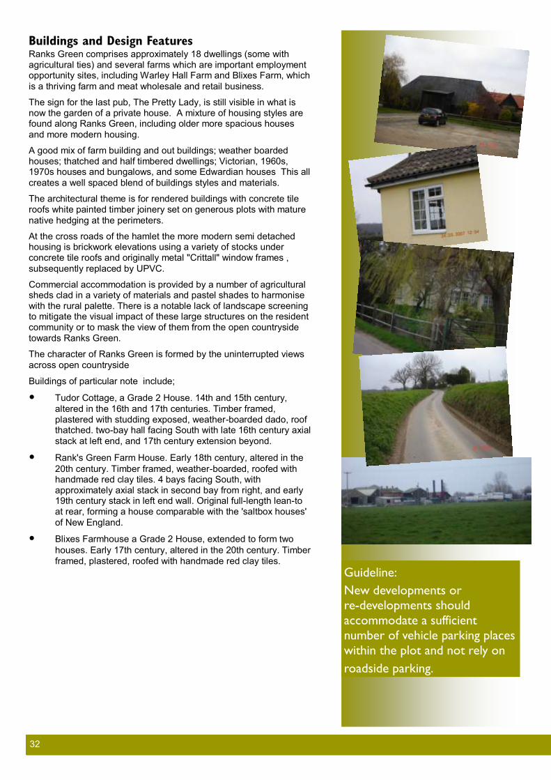
32 32
Buildings and Design Features Ranks Green comprises approximately 18 dwellings (some with agricultural ties) and several farms which are important employment opportunity sites, including Warley Hall Farm and Blixes Farm, which
is a thriving farm and meat wholesale and retail business.
The sign for the last pub, The Pretty Lady, is still visible in what is now the garden of a private house. A mixture of housing styles are found along Ranks Green, including older more spacious houses
and more modern housing.
A good mix of farm building and out buildings; weather boarded houses; thatched and half timbered dwellings; Victorian, 1960s, 1970s houses and bungalows, and some Edwardian houses This all
creates a well spaced blend of buildings styles and materials.
The architectural theme is for rendered buildings with concrete tile roofs white painted timber joinery set on generous plots with mature
native hedging at the perimeters.
At the cross roads of the hamlet the more modern semi detached housing is brickwork elevations using a variety of stocks under concrete tile roofs and originally metal "Crittall" window frames ,
subsequently replaced by UPVC.
Commercial accommodation is provided by a number of agricultural sheds clad in a variety of materials and pastel shades to harmonise with the rural palette. There is a notable lack of landscape screening to mitigate the visual impact of these large structures on the resident community or to mask the view of them from the open countryside
towards Ranks Green.
The character of Ranks Green is formed by the uninterrupted views
across open countryside
Buildings of particular note include;
Tudor Cottage, a Grade 2 House. 14th and 15th century,
altered in the 16th and 17th centuries. Timber framed, plastered with studding exposed, weather-boarded dado, roof thatched. two-bay hall facing South with late 16th century axial
stack at left end, and 17th century extension beyond.
Rank's Green Farm House. Early 18th century, altered in the
20th century. Timber framed, weather-boarded, roofed with handmade red clay tiles. 4 bays facing South, with approximately axial stack in second bay from right, and early 19th century stack in left end wall. Original full-length lean-to at rear, forming a house comparable with the 'saltbox houses'
of New England.
Blixes Farmhouse a Grade 2 House, extended to form two
houses. Early 17th century, altered in the 20th century. Timber
framed, plastered, roofed with handmade red clay tiles.
Guideline:
New developments or
re-developments should
accommodate a sufficient
number of vehicle parking places
within the plot and not rely on
roadside parking.
33 33
Spaces and Signage
Open Spaces Open spaces are detailed within each area of the Parish elsewhere within this document. Most open space within the Parish is not in fact publicly owned, though it is often open to the public. Such land is generally in private ownership, particularly that of Lord Rayleigh’s
Farms and also of Blixes Farm.
However, the contributors to the questionnaire were clear in their appreciation of access given by the local landowners. This particularly includes the access permitted to Terling Church Green, Bromwell Leaze, The Dismals, School Green, Cricket Field and Recreation Ground. Walkers access to estate roads is also greatly
appreciated and well used.
The Essex Way also strides across the Parish from Great Leighs Church across to Fuller Street, then Terling and on to Fairstead
Church End.
Public Highway Most roads through the Parish are narrow, often one vehicle width with passing places and frequently winding. Often deep ditches and hedges line the lanes, with avenues of trees and open farmland
either side.
There are almost no footpaths alongside the highways in the Parish and highway lighting only by one lamp at the junction of The Street and New Road in Terling and one other on the footpath by the Ford
at Terling.
Woodland trees, often ancient, hedges and or ditches line most of the lanes, generally maintained by local landowners. There are generally few road markings except on the slightly wider lane from
Terling to Hatfield Peverel.
There are standard highway signs along the lanes. However there are also intrusive signs by size, being overly large for example by Terling School, and speed signs on both sides of a one vehicle wide lane in places such as the exit from Fuller Street towards Great Leighs, where the signs are frequently damaged because they
intrude into the narrow lane width.
The exit lanes from Terling towards Fuller Street, Fuller Street towards Great Leighs and Fairstead Church End towards Ranks Green all have single lane, tree lined features, with the latter two being within deep cuttings. These are attractive features of the hamlets which should be retained but which do not encourage either
high levels of traffic or large vehicles.
Street Furniture There are generally no specific bus stops within the Parish, however a bus shelter has recently been installed at Waltham Road Terling. This is of timber three sided construction in keeping with the rural
area.
The only roadside street light is of reproduction Victorian style, in keeping with the age of the School Building which is the closest
visible building to the light.
Guideline:
Where approved ensure
methods of speed control are in
sympathy with rural design such
as a speed gate on Hatfield Road,
footpath/pedestrian separation
route for Crow Pond Road or
where necessary.
Guideline:
Resist any increase in the
number of electricity pylons and
pursue a policy of burying
cables.
Guideline:
Telephone and electricity poles
should be wooden.
Guideline:
All new development requests
should include adequate off-
street parking., at least in
accordance with Essex CC Car
Parking Standards. The parking
should be in tune with the village
scene and ideally not use the
whole front garden for parking .
Guideline:
Planning permission for all new
builds and substantial alterations
should require underground
power and telephone supplies
be installed.
Parish-Wide Characteristics

34 34
Salt Bins are found at several points within the Parish and are generally in need of repair or replacement, being old and salt damaged and not in keeping with the attractive areas in which they
are located, such as Church Green Terling.
The most intrusive aspect of street furniture and in use across the Parish is the use of overhead power and phone cables. These are carried on timber poles but would be better placed underground.
Frequent interruptions to power are experienced.
High voltage national grid power cables and pylons also intrude into the Parish, particularly in the Fuller Street and Ranks Green areas to the north of the Parish. These spoil rolling rural views which otherwise have probably not changed significantly in hundreds of
years.
Local landowners have not agreed to location of phone towers and while this is appreciated on aesthetic and health grounds there is a
subsequent poor standard of mobile phone signal.
Private Space Most land surrounding the highways in the Parish is private, although some, as mentioned earlier such as Church Green, Bromwell Leaze,
and The Dismals, is enjoyed by the public.
Almost all dwellings within the Parish have both front and rear gardens, although some cottages, particularly in the centre of Terling either front immediately onto the road or have very small front gardens. Here, a visitor to front door of one of these cottages will only just be off the highway, and at this point there are no pavements despite being a road junction on a double bend and by the Village
Shop.
In the most recent multi dwelling development, in The Estate Yard, houses are also mostly without front gardens, which is in keeping with the surrounding properties and where the road is not available to through traffic. Generally however, houses are set back in gardens
which abut the road and which frequently have off street parking.
Allotments are available in Terling and many gardens are sufficiently
large to have vegetable plots.
The questionnaire (Appendix F) showed that the feeling of space across the Parish is one of the most appreciated aspects of living in Terling and Fairstead. Although much of this is due to the farmland surrounding the villages and hamlets a significant part is also due to the land and vegetation surrounding individual properties, which can usually be enjoyed not only by the individual house occupants but
also by those on the highway.
Boundaries Walls and fences define the way a building or area is separated from the space around it. Beech and Privet hedges are popular and are common in the village and were the traditional boundary markers for gardens and plots. Although considered high maintenance compared to brick and wooden fences, these hedges give the Parish a changing texture as the seasons progress through the year and contribute to the countryside vista of the Parish. Additionally, traditional planted hedges provide much needed habitation and food
sources for wildlife such as birds and small animals.
Continued maintenance of such hedges and even reinstatement of lost hedges should be encouraged and required in planning application consideration where they are the norm for the neighbourhood. Hedge content and size varies throughout the
Parish and new hedges should reflect the local nature.
Guideline:
Continue to maintain and improve the
public foot paths.
Guideline:
Ensure sufficient suitably designed Dog Waste and Litter Bins are
available without detracting from the
appearance of the area.
Guideline:
Ensure mixed hedges and other boundaries are in keeping with those
of the area and where possible are not replaced by boundaries of
different types.
Guideline:
Any development or change to structures must be in sympathy with
and not detract from or harm nearby
special structures
Guideline:
Finger posts in iron and timber should be replaced when necessary as like
for like in style.

35 35
Unique Structures There are many unique structures within the Parish, both in terms of farm buildings and dwellings, including two Grade 1 and a number of Grade 2 starred. These are listed in the Appendix E and appropriate examples detailed
within the defined areas of the Parish elsewhere in this document.
The War Memorial was erected to commemorate the fallen from the Parish in World War One; subsequently, the names of those who fell in World War Two were also added. On the nearest Sunday to Armistice Day each year a service takes place around the memorial when the names or those who fell in the two Great Wars are read aloud
and two minutes silence observed.
Sympathetic Developments There is clear evidence of sympathetic development taking place in later years, this is witnessed by the use of more traditional materials and methods, such as those used in the new construction called Oakwright’s Hall Braintree Road, where exposed oak frames, traditional roofing and proportions lend themselves to the style of the
older parts of the village.
The small development of the Estate Yard, whilst providing modern accommodation retains the general look and
feel of the village and does provide higher density housing but with concessions to the local architecture.
1960 style architecture is found in places around the village and whilst these are now considered part of the village fabric, some have not enhanced the overall street vistas. The bulk and form of the buildings are not in sympathy with the traditional parts of the village and if the styles were to continue to diverge the character of the village would be lost. However the Parish does appeal to a wide variety of residents because of the eclectic mix of styles. The key therefore is for form, proportion and style of new developments to be in sympathy with
neighbouring properties.
More recent developments have included buildings which lend themselves more to the village scene in shape, proportions, texture of the walls and colour of the woodwork and walls. Good examples of such a developments are the Estate Yard, Oakwrights and the more recent houses at Gambles Green, and this style of development is
to be encouraged in planning applications.
Perceived high maintenance of traditional planted hedges has resulted in some garden hedges being grubbed-up and replaced with brick wall or close boarded fencing, of heights up to six feet. Replacements have taken place unchallenged in conservation areas, which is clearly a breach of planning rules. Further replacements should be
challenged and reinstatement of planted hedges required.
High walls and wooden fences, especially close boarded, remove the feel of openness which is an important part of the village scene. Residents have commented, and indeed complained, of the claustrophobic feel that high
walls and fences give to the narrow and winding lanes in the village.
Ranch Style open fencing is also used to replace planted hedges. Whilst these are typically lower and more
open, they are not seen as being sympathetic with the village scene and again should be avoided where possible.
Parking Parking is regarded as a general problem in the village. There is not sufficient off street parking areas in the
areas where they are needed and there is no easy solution to the problem.
Some houses, because of their age, were built without the facility for off-street parking and consequently cars are parked on the street and on open spaces (such as Church Green, where to conserve the open space the landowner has now banned overnight parking). Areas seen of particular concern are The Street and Bramley
Cottages, where street parking congestion could impede the access of emergency vehicles.
Some houses owners who do not have off street parking available, or deem the walk to the parking area too strenuous, have grubbed-up hedgerows or removed boundary fences/ walls to gain vehicular access to their front garden. Typically a hard standing is created to support the vehicle. Whilst this action relieves the issue of on street parking, it does remove a considerable amount of village charm by turning some front gardens into car parks. This situation applies to some houses adjacent to the Conservation Area. Where possible a balance should be struck between providing some garden and parking rather than losing all greenery to the garden area. Hard standing should be discouraged both for aesthetic reasons and to ensure correct water drainage. Where hard standings are necessary they should be of material suitable for sustainable drainage rather than concrete, block or other impervious surface. Guidance can be found in the central government document https://
www.gov.uk/government/uploads/system/uploads/attachment_data/file/7728/pavingfrontgardens.pdf Guideline:
Recent actions by the Parish Council to protect the School Green from erosion by vehicle parking by parents
dropping off school children, has proved a success and acclaimed by Parishioners.

36 36
Proposed development of the Terling Inn site did not include enough on-site parking for the residents of proposed houses and customers at the pub. This would have resulted in additional on street parking, adding
more danger to Owls Hill.
While no simple solution is available for the existing parking problems a study and recommendations to relieve
the current parking issues is required.

37 37
Conclusions
The views expressed by the residents and businesses throughout the consultation period, including the response received from the questionnaire have been considered within the framework of the Braintree District guidelines. All future developments in the Parish of Terling and Fairstead should be considered in the light of these guidelines
with particular consideration of the following.
To Retain The feeling of open farmland with clear separation of the various hamlets within the Parish
and also the surrounding towns and villages.
The mixed styles of property, while ensuring new developments are in harmony with immedi-
ate surroundings.
Hedgerows to fields and dwellings
Un-kerbed and un-lit highways
To Preserve and Maintain Public access to Open Spaces
Public Footpaths
Village Shop, Sports and Play facilities, Village Hall, Pubs, Post Boxes
The avenues of trees and other mixed woodland areas
The Listed Buildings
To encourage The planting of trees of mixed types including in and around new properties
Sympathetic traffic calming methods
Responsible use of private facilities such as the use of Church Green
The collection of litter and dog waste
The use of building styles and materials in harmony with neighbouring styles
To Discourage Inappropriate size and number of road signs
Unsympathetic or uncharacteristic alterations or developments
Large scale development
Reduction of undeveloped areas between hamlets
Housing outside the village envelopes
Noise or light pollution by inappropriate development (in line with BDC Supplementary Plan-ning Guidance “External Artificial Lighting” September 2009). Particular note should be taken
of the effects on wildlife and the need for lighting curfews.
On street parking
Development of oversize properties on plots

38 38
Left blank for your notes

39 39
Appendix A
Issues outside the scope of the VDS These items formed part of the consultation but are not related to the design planning process.
Litter, Fly Tipping and Dog Fouling Litter, Fly Tipping and Dog Fouling are matters of serious concern and action should be taken to reduce or
remove the problem.
Litter Litter is seen as reducing the pride that many people have for the village and gives a negative view to people
entering the Parish.
Litter is primarily generated by through traffic, especially cars and vans, with a lesser amount being generated by cyclist and runners. Generally the littler comprises fast food containers, drinks cans and bottles, water bottles and
bags of assorted waste.
There is no street cleaning in the Parish and litter removal is performed by residents either at the twice yearly
Litter Pick or by individuals as they walk. There is no shortage of litter bins in the Parish.
Specific enforcement by the Police would help, and as been proved in many other areas, stopping vehicle for
littering often provides other useful information to the Police.
Fly Tipping Not as a significant issue as Littering or Dog Fouling, but one which causes unsightly mounds of rubble and
rubbish and can cause a significant danger when refuse is dumped on the highway.
Again, Police enforcement is seen as the solution.
Dog Fouling A significant problem, especially on the paths, tracks and fields where families walk and play.
Some of the problem is cause by residents and some by those who come to the Parish to exercise their dogs.
There are sufficient Dog Waste bins in the Parish and these are emptied regularly.
A statutory £1000 fine can be imposed on owners who do not clear up after their dogs and the general feeling is
that the Dog Warden should impose fines and publish the fact in local newspapers.
Roads The road network is seen as sufficient for the transport needs of the community. Local businesses may have a
different view when dealing with large truck based deliveries.
Lack of road maintenance is seen as a problem, especially the number of potholes.
Speeding cars are seen as a significant danger. The most dangerous time is weekday morning when commuters
are rushing to catch a train from Hatfield Peverel or Witham.
Poor parking by parents who ferry children to school is also an issue.
Telephone Boxes All five redundant telephone boxes in the Parish have been adopted by the Parish Council and are being put to good use for other purposes, including housing a Defibrillator and guide information for the Essex Way. There is
an on-going project by the Parish Council to find community based uses for the others.
The Red Phone boxes are seen as part of the Village Landscape and part of the fabric. Removal without the
chance to use them for other purposes should be resisted.
It is understandable that phone boxes will be decommissioned with the growth of home telephones and mobile
phones, but retention of these historic structures should encouraged.

40 40
APPENDIX B Future Parish Consultation The following elements were not considered when the questionnaire was compiled and therefore we do not have
a view from the residents. It is recommended that Terling and Fairstead Parish Council seek the views of the
residents and add statements on these topics
Broadband
Wind Turbines and Wind farms
Cellular Telephone Masts
Traffic calming methods and designs

41 41
APPENDIX C The Natural History of Terling
The natural history of the Parish is so diverse that by covering it in such a short space will inevitably mean that something gets left out but we will do our best! In Terling, we have a number of habitats of importance for conservation. The most important, and recognised as
such by the European habitats directive, are the following:
Ancient and/or species-rich hedgerows - these are numerous throughout the Parish. As fields were cultivated and created from woodland, ancient hedges were left as field boundaries. While these hedges have been supplemented by planting, many retain the characteristics of the original woodland with woodland trees,
shrubs and flowering plants.
Aquifer fed naturally fluctuating water bodies – or, more simply, rivers that come from the ground! The River Ter is a central corridor for wildlife through the Parish and has been recognized as an important area for nature conservation for many years. Wild brown trout and the smaller bullheads are predominant species, but other species, especially chub, are increasing. Bullheads are a species of conservation interest. Eels, a species of critical conservation concern, occur in the Parish with some specimens over 20 years old in one of the farm reservoirs. Unfortunately, there seems to be have been little recent recruitment to this population. Although water voles appear to have disappeared, otters have reappeared in recent years and the much less welcome mink are present but
scarce. The water quality of the river is still good.
Cereal field margins – numerous grassy margins now exist providing habitats for a number of plant and animal species. Bee orchids have flowered in several strips and large colonies of voles have undoubtedly helped the increase in barn owls over the last few years. Spraying for broad leaved weeds does obviously adversely affect the
development of perennial wildflowers in these areas, but they are still valuable.
Lowland flower meadows are very rare but in Church Green (although a brown field site), we had a fine wild flower meadow previously recognized as a Site of Importance for Nature Conservation. This site
held a large population of Meadow saxifrage (a scarce plant in Essex) which, in the past, has provided a fine spring spectacle. Frequent mowing has reduced the importance of this area and a change in management would undoubtedly benefit it, if not, perhaps, return it to its previous state. Terling churchyard also has a number of wildflower species and one extremely rare plant in birthwort, a medicinal plant probably introduced in the
15th century.
Lowland mixed deciduous woodland is common and some is almost certainly ancient woodland, dating back many hundreds of years. This is evident from both the variety of species of trees and shrubs present and the evidence of previous management. Several woods show clear ditch and palisade boundaries, probably at least 200 years old, built to keep deer out of
the woods.
These habitats are all of European conservation importance and provide the
diverse needs of a large variety of plant and animal species.
Mammal species of importance found in the Parish include otter, harvest mouse, water shrew, brown hare and a number of bat species. Dormice may be present. Three species of deer are present, including the small and very destructive (if you’re a wild flower) muntjac. In total, more than 25 mammal species are present within the Parish, including a number in decline in Essex
in general.
Birds in the Parish have followed the broad trends shown by similar areas in the UK and, indeed, much of northern Europe. In the last fifteen years, a number of species, including tree sparrow, lesser spotted woodpecker, redpoll, corn bunting and grey partridge,
Otter track on the Ter
Spindle tree
Birthwort

42 42
have either disappeared completely or are very scarce. Even more recently, turtle doves, spotted flycatchers, yellowhammers and yellow wagtails have all shown dramatic declines. On the other hand, buzzards have
returned as both a common sight and as a breeding bird and the white little egrets can often be seen along or in the river. Peregrine falcons are regular in winter. Lapwings, a breeding species in national decline, still breed in the Parish – an increasingly rare occurrence especially away from the coast. In the winter, the abundant hedgerows provide an important food source for wintering thrushes and the river and reservoirs host passage and wintering ducks and waders. The good numbers of springs in the Parish are particularly important in very cold weather because they do not freeze over. One small spring, within 100m of the church, regularly holds wintering snipe and green sandpipers (less
than a thousand winter in UK).
Garden ponds and farm reservoirs provide breeding areas for frogs, toads and newts and good populations of the commoner species are present. At at least one farm reservoir, several thousand toads gather each spring. Reptiles, however, are scarce throughout the Parish. Grass snakes and slow worms (legless lizards) are present and possibly adders and common lizards but numbers are very low. This may be for a number of reasons –
human interference, habitat linked or predation.
The wide range of habitats and the many species of woodland tree allow a good range of butterflies, more than 20 species, to breed, some in good numbers. Elm is still a common tree in the Parish,
although now largely as hedges or small trees, and provides the food for colonies of the white letter hairstreak, a striking but rarely seen butterfly. The grass strips on field boundaries, especially in the warmer corners, have
allowed some of the grassland and meadow species to flourish.
Plant life in the Parish is as diverse as the range of habitats, with a wide range of native tree species including the odd (now very odd) large Elm, Wild Service and Small Leaved Lime – the latter two indicators of ancient woodland. The broader grass verges, hedgerows and river banks all host interesting populations of flowering
plants.
In summary, it is fair to say that the plant and animal life in our Parish is
rich and diverse and typical of such an area. The high proportion of species rich hedgerows, small woods and the river valley are all undoubtedly important in maintaining that diversity. The land in the Parish has been quite intensively managed by man almost certainly since well before the Romans came here. This management, and the climate, has created the habitats we now see and change is inevitable. By sympathetically managing those areas we can maintain and, indeed,
increase their attractiveness to plant and animal
Pyramidal orchid

43 43
APPENDIX D Village Envelope Terling has a Village Envelope which restricts the approval to build within the envelope. The envelope is seen as a good provision to prevent high density housing being created by allowing building in the larger rear gardens and
some open spaces.
The following map shows the extent of the envelope and conservation areas together with flood plain and open
spaces and which can also be seen on the village website.

44 44
APPENDIX E Listed Buildings
Fairstead Locations Grade
DINES HALL, Fairstead, Braintree, Essex II
GREAT WARLEY HALL, Fairstead, Braintree, Essex II
NEWNEYS FARMHOUSE, Fairstead, Braintree, Essex II
ELMHURST, FAIRSTEAD HALL ROAD, Fairstead, Braintree, Essex II
FAIRSTEAD HALL, FAIRSTEAD HALL ROAD, Fairstead, Braintree, Essex II
DAIRY APPROXIMATELY 5 METRES SOUTH EAST OF FAIRSTEAD HALL, FAIRSTEAD HALL ROAD, Fairstead, Braintree, Essex II
BEAUCHAMPS, FAIRSTEAD HALL ROAD, Fairstead, Braintree, Essex II
POND COTTAGE, FAIRSTEAD ROAD, Fairstead, Braintree, Essex II
THE OLD RECTORY, FAIRSTEAD ROAD, Fairstead, Braintree, Essex II
TROYS HALL, FAIRSTEAD ROAD, Fairstead, Braintree, Essex II PUMP APPROXIMATELY 1.50 METRES WEST OF FAIRSTEAD LODGE, FULLER STREET, Fairstead, Braintree, Essex II
TUDOR COTTAGE, RANKS GREEN, Fairstead, Braintree, Essex II
BLIXES FARMHOUSE, RANKS GREEN, Fairstead, Braintree, Essex II
HOMECOT, FAIRSTEAD ROAD, Fairstead, Braintree, Essex II
FAIRSTEAD LODGE, FULLER STREET, Fairstead, Braintree, Essex II
WAGGON LODGE APPROXIMATELY 90 METRES SOUTH WEST OF FARISTEAD LODGE, FULLER STREET, Fairstead, Braintree, Essex II
THE STORES, FULLER STREET, Fairstead, Braintree, Essex II
RANKS GREEN FARM, RANKS GREEN, RANKS GREEN, Fairstead, Braintree, Essex II
BARN APPROXIMATELY 30 METRES SOUTH WEST OF BLIXES FARMHOUSE, Fairstead, Braintree, Essex II
BARN APPROXIMATELY 40 METRES WEST SOUTH WEST OF GREAT WARLEY HALL, Fairstead, Braintree, Essex II
WALNUT TREE COTTAGE, FAIRSTEAD ROAD, Fairstead, Braintree, Essex II
PARISH CHURCH OF ST MARY THE VIRGIN, FAIRSTEAD HALL ROAD, Fairstead, Braintree, Essex I
THE HERONS, FULLER STREET, Fairstead, Braintree, Essex II
BARN APPROXIMATELY 40 METRES WEST SOUTH WEST OF GREAT WARLEY HALL, Fairstead, Braintree, Essex II
BARN APPROXIMATELY 10 METRES SOUTH EAST OF NEWNEYS FARMHOUSE, Fairstead, Braintree, Essex II

45 45
Terling Locations Grade POWERS HALL, TERLING ROAD, Witham, Braintree, Essex II
RIVER HILL COTTAGES, 1, OWLS HILL, Terling, Braintree, Essex II
OWLS HALL, OWLS HILL, Terling, Braintree, Essex II
SPARROWS FARMHOUSE, SPARROWS FARM ROAD, Terling, Braintree, Essex II
COMPLETE COMPLEX OF FARM BUILDINGS EAST OF SPARROW'S FARMHOUSE EXCLUDING THE BARN, LISTED SEPARATELY AS ITEM 5/152, SPARROWS FARM
ROAD, Terling, Braintree, Essex II
BARN APPROXIMATLEY 30 METRES NORTH-WEST OF ROLLS FARMHOUSE, SPAR-
ROWS FARM ROAD, Terling, Braintree, Essex II
25 AND 27, THE STREET, Terling, Braintree, Essex II
THE MANSE, THE STREET, Terling, Braintree, Essex II
TERLING HALL FARMHOUSE, THE STREET, Terling, Braintree, Essex II
GRANARY/CARTLODGE APPROXIMATLEY 90 METRES WEST-NORTH-WEST OF
TERLING HALL FARMHOUSE, TERLING HALL ROAD, Terling, Braintree, Essex II
WAT HOBBS FARMHOUSE, WAT HOBBS LANE, Terling, Braintree, Essex II
BARN APPROXIMATLEY 15 METRES SOUTH-SOUTH-EAST OF FARDINGS FARM-
HOUSE, WITHAM ROAD, Terling, Braintree, Essex II
TAYLORS FARM COTTAGES, WITHAM ROAD, Terling, Braintree, Essex II
TERMITTS FARMHOUSE, TERLING ROAD, Hatfield Peverel, Braintree, Essex II
BARN APPROXIMATELY 40 METRES WEST NORTH WEST OF TERMITTS FARM-
HOUSE, TERLING HALL ROAD, Hatfield Peverel, Braintree, Essex II
BARN OF NOAKE'S FARM, Terling, Braintree, Essex II
RINGERS FARMHOUSE, Terling, Braintree, Essex I
TERLING PLACE, Terling, Braintree, Essex II
THREE ASHES FARMHOUSE, BRAINTREE ROAD, Terling, Braintree, Essex II
BARN APPROXIMATELY 15 METRES NORTH-NORTH-EAST OF WASSES FARM-
HOUSE, BRAINTREE ROAD, Terling, Braintree, Essex II
UNITED REFORMED CHURCH, CHURCH GREEN, Terling, Braintree, Essex II
PARISH CHURCH OF ALL SAINTS, CHURCH GREEN, Terling, Braintree, Essex II
WALL EXTENDING APPROXIMATELY 65 METRES SOUTH-WEST FROM THE WEST
CORNER OF ALL SAINTS CHURCHYARD, CHURCH GREEN, Terling, Braintree, Essex II
WALL FORMING SOUTH-WEST AND SOUTH-EAST BOUNDARY OF ALL SAINTS
CHURCHYARD, CHURCH GREEN, Terling, Braintree, Essex II
WALL APPROXIMATELY 8 METRES SOUTH-WEST AND 5 METRES SOUTH-EAST OF
THE TUDOR HOUSE, CHURCH GREEN, Terling, Braintree, Essex II
MILL DAM FORMING ROAD BRIDGE OVER RIVER TER AND ASSOCIATED WHEEL CHAMBER AND WATER PUMP TO THE SOUTH, CHURCH ROAD, Terling, Braintree,
Essex II
BRAYBROOK, CROW POND ROAD, Terling, Braintree, Essex II
THE MALTINGS, FLACK'S GREEN, Terling, Braintree, Essex II

46 46
MARCHANTS, GAMBLES GREEN, Terling, Braintree, Essex II
THE WINDMILL, MILL LANE, Terling, Braintree, Essex II
UNNAMED COTTAGE OPPOSITE BRAMLEY COTTAGES 60 METRES EAST OF
KENDALLS, NORMAN HILL, Terling, Braintree, Essex II
PART OF FORMER HOUSE AND ATTACHED GARDEN WALL APPROXIMATLEY 15 METRES SOUTH OF TOPPINGHOE HALL, TERLING HALL ROAD, Hatfield Peverel,
Braintree, Essex II
BERWICK FARMHOUSE, TERLING HALL ROAD, Hatfield Peverel, Braintree, Essex II
TOPPINGHOE HALL, TERLING HALL ROAD, Hatfield Peverel, Braintree, Essex II
BARN APPROXIMATELY 10 METRES NORTH EAST OF HATFIELD WICK
FARMHOUSE, TERLING HALL ROAD, Hatfield Peverel, Braintree, Essex II
BARN APPROXIMATELY 40 METRES NORTH EAST OF WHITELANDS FARMHOUSE,
TERLING HALL ROAD, Hatfield Peverel, Braintree, Essex II
OAK LODGE, BRAINTREE ROAD, Terling, Braintree, Essex II
WASSES FARMHOUSE, BRAINTREE ROAD, Terling, Braintree, Essex II
BYRE APPROXIMATELY 25 METRES EAST OF WASSES FARMHOUSE, BRAINTREE
ROAD, Terling, Braintree, Essex II
ROSE COTTAGE, CHURCH GREEN, Terling, Braintree, Essex II
WOOD MONUMENT APPROXIMATLEY 30 METRES NORTH-EAST OF ALL SAINTS
CHURCH, CHURCH GREEN, Terling, Braintree, Essex II
TUDOR HOUSE, CHURCH GREEN, Terling, Braintree, Essex II
TERLING STORES AND POST OFFICE, CROW POND ROAD, Terling, Braintree, Essex II
GREAT LOYES FARMHOUSE, FAIRSTEAD ROAD, Terling, Braintree, Essex II
THE COFFEE HOUSE, FLACK'S GREEN, Terling, Braintree, Essex II
THE WHITE HOUSE, GAMBLES GREEN, Terling, Braintree, Essex II
UNNAMED COTTAGE 35 METRES NORTH OF RAISINGS HOUSE, OWLS HILL, Terling,
Braintree, Essex II
RIVER HILL COTTAGE, 2, OWLS HILL, Terling, Braintree, Essex II
ROSE COTTAGE, OWLS HILL, Terling, Braintree, Essex II
SCARLETTS FARMHOUSE, SPARROWS FARM ROAD, Terling, Braintree, Essex II
ROLLS FARMHOUSE, SPARROWS FARM ROAD, Terling, Braintree, Essex II
BUTLERS LODGE, THE STREET, Terling, Braintree, Essex II
PAIR OF COTTAGES 20 METRES SOUTH OF TERLING STORES AND POST OFFICE,
THE STREET, Terling, Braintree, Essex II
CARTLODGE APPROXIMATELY 80 METRES WEST-SOUTH-WEST OF TERLING HALL,
TERLING HALL ROAD, Terling, Braintree, Essex II
MADDOCKS HALL, TERLING HALL ROAD, Terling, Braintree, Essex II
FARDINGS FARMHOUSE, WITHAM ROAD, Terling, Braintree, Essex II
BARN APPROXIMATELY 40 METRES NORTH OF TAYLORS FARM COTTAGES,
WITHAM ROAD, Terling, Braintree, Essex II
Terling Locations Grade
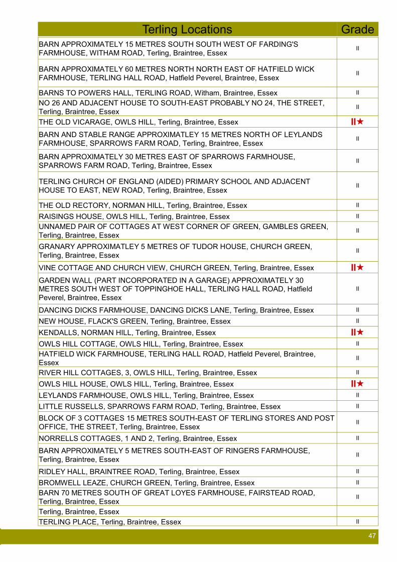
47 47
Terling Locations Grade BARN APPROXIMATELY 15 METRES SOUTH SOUTH WEST OF FARDING'S
FARMHOUSE, WITHAM ROAD, Terling, Braintree, Essex II
BARN APPROXIMATELY 60 METRES NORTH NORTH EAST OF HATFIELD WICK
FARMHOUSE, TERLING HALL ROAD, Hatfield Peverel, Braintree, Essex II
BARNS TO POWERS HALL, TERLING ROAD, Witham, Braintree, Essex II
NO 26 AND ADJACENT HOUSE TO SOUTH-EAST PROBABLY NO 24, THE STREET,
Terling, Braintree, Essex II
THE OLD VICARAGE, OWLS HILL, Terling, Braintree, Essex II
BARN AND STABLE RANGE APPROXIMATLEY 15 METRES NORTH OF LEYLANDS
FARMHOUSE, SPARROWS FARM ROAD, Terling, Braintree, Essex II
BARN APPROXIMATELY 30 METRES EAST OF SPARROWS FARMHOUSE,
SPARROWS FARM ROAD, Terling, Braintree, Essex II
TERLING CHURCH OF ENGLAND (AIDED) PRIMARY SCHOOL AND ADJACENT
HOUSE TO EAST, NEW ROAD, Terling, Braintree, Essex II
THE OLD RECTORY, NORMAN HILL, Terling, Braintree, Essex II
RAISINGS HOUSE, OWLS HILL, Terling, Braintree, Essex II
UNNAMED PAIR OF COTTAGES AT WEST CORNER OF GREEN, GAMBLES GREEN,
Terling, Braintree, Essex II
GRANARY APPROXIMATLEY 5 METRES OF TUDOR HOUSE, CHURCH GREEN,
Terling, Braintree, Essex II
VINE COTTAGE AND CHURCH VIEW, CHURCH GREEN, Terling, Braintree, Essex II
GARDEN WALL (PART INCORPORATED IN A GARAGE) APPROXIMATELY 30 METRES SOUTH WEST OF TOPPINGHOE HALL, TERLING HALL ROAD, Hatfield
Peverel, Braintree, Essex
II
DANCING DICKS FARMHOUSE, DANCING DICKS LANE, Terling, Braintree, Essex II
NEW HOUSE, FLACK'S GREEN, Terling, Braintree, Essex II
KENDALLS, NORMAN HILL, Terling, Braintree, Essex II
OWLS HILL COTTAGE, OWLS HILL, Terling, Braintree, Essex II
HATFIELD WICK FARMHOUSE, TERLING HALL ROAD, Hatfield Peverel, Braintree,
Essex II
RIVER HILL COTTAGES, 3, OWLS HILL, Terling, Braintree, Essex II
OWLS HILL HOUSE, OWLS HILL, Terling, Braintree, Essex II LEYLANDS FARMHOUSE, OWLS HILL, Terling, Braintree, Essex II
LITTLE RUSSELLS, SPARROWS FARM ROAD, Terling, Braintree, Essex II
BLOCK OF 3 COTTAGES 15 METRES SOUTH-EAST OF TERLING STORES AND POST
OFFICE, THE STREET, Terling, Braintree, Essex II
NORRELLS COTTAGES, 1 AND 2, Terling, Braintree, Essex II
BARN APPROXIMATELY 5 METRES SOUTH-EAST OF RINGERS FARMHOUSE,
Terling, Braintree, Essex II
RIDLEY HALL, BRAINTREE ROAD, Terling, Braintree, Essex II
BROMWELL LEAZE, CHURCH GREEN, Terling, Braintree, Essex II
BARN 70 METRES SOUTH OF GREAT LOYES FARMHOUSE, FAIRSTEAD ROAD,
Terling, Braintree, Essex II
Terling, Braintree, Essex
TERLING PLACE, Terling, Braintree, Essex II

48 48
Appendix F Results from Questionnaire A questionnaire was delivered to all resident in the Parish and 261 were returned.
The answers from the questionnaire were tabulated and made available to the Parish residents for comment.
Those answers were also used to define and quality the Guidelines set out in this document.
Here is an analysis of the responses
The free text format has meant that we have grouped similar answers to identify the frequently raised issues. These clearly have either a large number of respondents with common concerns or where some innovative
potential solutions have been suggested.
The overwhelming message of the responses was a Parish of peacefulness; feeling of belonging; good quality of
life with a mixture of designs, house styles and important open spaces.
Clearly the common concern was to ensure that the issues, which have been so well managed for so long by our
predecessors, and which are still important to us now, are used as the foundation for any future changes.
Three issues stood out as really being of concern to residents and, although there are design issues in how the Parish and District Council’s may affect change, the biggest opportunity for change lies in how as individuals we
correct the problem.
Speeding traffic through the village and lanes; litter and dog fouling can all easily be corrected if we have the
collective will.
Lack of public transport, inconsiderate parking, affordable housing, poor road and utility conditions were all
significant issues to many respondents.
Some issues such as the pub, village hall and store were all important with thoughtful suggestions for change or
improvement, some of which are not design related but all will be passed to the appropriate people.
The full figures are, of course, available for those of you with an analytical or inquisitive mind. No names of
respondents are available.
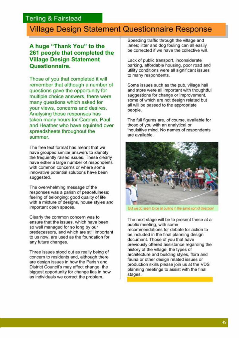
49 49

50 50

51 51

52 52
53 53

54 54

55 55

56 56

57 57

58 58
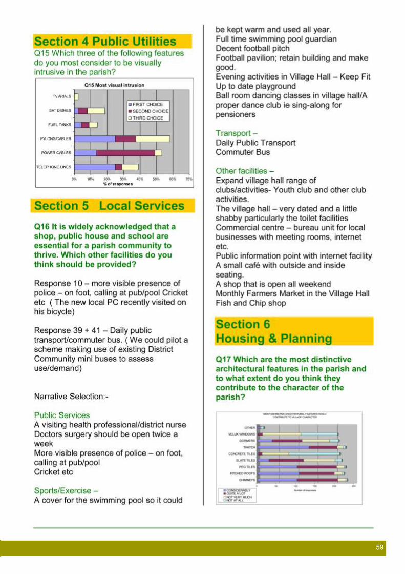
59 59

60 60

61 61

62 62
Appendix G Diary of Events Date Meeting Event or
Publication
Numbers present or
distribution
Outcome
05/07/2006 Parish Council meeting with Jan Cole, Rural Community Council of Essex
18 Parishioners, 3 councillors, Parish Clerk
Eleven of those present agreed to proceed with a VDS project
22/09/2006 Planning Sub committee VDS Committee formed and previously agreed budget provision made available.
27/09/2006 VDS Project Team Six Agreed to Contact DEFRA re grant, RCCE for example housing needs survey
11/10/2006 VDS Project Team Six Agreed to contact Essex Filed Club re Essex Biodiversity Action PLan
22/11/2006 VDS Project Team Five Meeting arranged with Gt Bardfield VDS group. HC and CC joined team
13/12/2006 VDS Project Team Eight Planning outline timetable agreed Tasks assigned
10/01/2007 Meeting with Gt Bardfield VDS team
Three Guidance from a village that has already completed a VDS with Braintree Council
17/1/2007 VDS Project Team Seven Draft outline statement for Public Meeting
31/1/2007 VDS Project Team Seven Format and arrangements for Public Meeting
07/02/2007 Public Meeting 65 A significant majority decided that a small working group should prepare a Design Statement.
21/2/2007 VDS Project Team Seven Agreed programme for Photo Workshop
Ongoing Progress report Parish News/web site
450 copies of paper Parish News circulated
Parish News and Web site pages updated regularly
24/03/2007 Photographic Workshop School Hall
41 Parish divided and walked by nine groups of people. Photographs of important design issues collected and presented by each group with each synopsis retained.
02/05/2007 VDS Project Team Seven Funding sought from RCCE
13/06/2007 VDS Project Team Seven Drafting questionnaire
27/06/2007 VDS Project Team Seven Agreement of road testing questionnaire on approximately 30 residents, with explanations of purpose Format for Fete presentation agreed
July 2007 Exhibition at Village Fete All parish residents invited
Update of reasons for and progress to date
August 2007 Draft Questionnaire circulated
Project Team plus 11 Parish Councillors
Circulated to those non committee residents who had offered further ad-hoc assistance
02/10/2007 Meeting with Lord Rayleigh Two Consultation with key land and building owner
19/09/2007 VDS Project Team Seven Ongoing creation of questionnaire
02/10/2007 Update for Lord Rayleigh Two Request for views on questionnaire
03/10/2007 VDS Project Team Seven
VDS Project Team Seven Format for Exhibition presentation agreed
10/11/2007 Exhibition at Village Hall All parish residents invited All parish clubs and organisations invited by letter including participation
Update of reasons for and progress to date, including school exhibition of work and photo workshop pictures and presentations

63 63
Date Meeting Event or Publication
Numbers present or
distribution
Outcome
January 2008 VDS Project Team Delivery briefing for Questionnaire agreed
January 2008 Amended Questionnaire to every household
736 copies distributed
Delivery by hand to every house in the Parish
February 2008 Questionnaire responses returned
261 responses (35% of the 736 distributed)
February to October 2008
Data Collection and Analysis
Three Database created collation of responses
October to December 2008
Draft document prepared of data collection
One Data collated into document circulated to Project Team plus PC representatives
20/01/2009 Outcome of Questionnaire Circulated and on parish web
Copies also placed in Village Stores and notice in Parish News magazine
March 2009 onwards VDS Project Team Four Specialist data collection for flora, fauna, architectural and historic information
21/04/2009 Progress Review presentation to Parish Council
35 recorded attendees including 11 Councillors
Only four core team members remain and further members requested. and use of additional expertise recommended and agreed.
During this time concerns expressed regarding the use of VDS by Planning Officers caused an extended suspension of work by the Project Team
October 2010 onwards Draft VDS circulated to proofing team
Project Team plus proofing team plus PC and RCCE representatives
Several iterations of the document were proofed and amended.
28/02/2012 Formal draft VDS circulated to full Parish Council Meeting
11 Councillors, Clerk, plus 5 members of the public
Further proofing and recommendations for changes made by T&FPC councillors
24/11/2012 Public Meeting Presentation of Progress
14 History of the Village Design Statement process and the reasons for the long gestation period
March 2013 Application for Funding made by Parish Council
Second bid for completion costs rejected by “Awards for All”.
10/09/2013 Situation update to Parish Councillors
11 Councillors
November 2013 Draft VDS circulated to Jan Cole RCCE
Suggestions for minor alterations
December 2013 Draft VDS circulated to Interim Planning Officer BDC
Suggestions for minor alterations
December 2013 Formal draft VDS circulated to Parish Councillors
11 Councillors Further proofing and recommendations for changes made by RCCE, BDC and T&FPC councillors
March 2014 Handover to T&FPC for Circulation to BDC councillors
July 2014 Revision suggestions made by BDC
September 2014 Re-submission made to T&F PC

64 64
Useful Contacts:
Braintree District Council
The Development/Environment Director
(Planning & Building Regulations)
Tel. 01376 552525
Fax. 01376 557787
E-mail: [email protected]
Website: www.braintree.gov.uk
or
Customer Service Centre
Terling & Fairstead Parish Council
Parish Clerk
Phoenix House
Fairstead
Essex CM3 2AT
01245 233 213
E-mail: [email protected]
www.terlingandfairstead.org.uk
Essex County Council
Listed Buildings Officer
Tel. 01245 437337
Essex County Council
Highways (Road Conditions, Traffic
Management)
Tel. 01245 240186
E-mail: [email protected]
Acknowledgements This document has been developed and produced by the Terling
and Fairstead Village Design Statement Team in consultation with
a wide variety of people including the Parish Council and Parish
residents
The team wishes to thank the following for their invaluable
contribution to this document:
Terling and Fairstead Parish Council
(with particular thanks to Robin Dixon)
Jan Cole (Rural Community Council of Essex)
Emma Goodings and Julie O’Hara
(Braintree District Council)
Lord Rayleigh and his team
All the residents who attended our workshops,
exhibitions and displays particularly those who
helped to set them up.
All those who took the time and effort to answer
the questionnaires
Maria Rumsey (then Head-Teacher) and the
children of Terling School
John Thurgood for provision of archive photographs
Proof Readers Derek and Sue Gore, John and Penny
Hall, Sue and Peter Page, David and Ann Anderson
David Gomer for his local knowledge of flora and
fauna
VDS Core Team Paul Harrison
Dick Sterk
Caroline Godfrey
Heather Cutler
Colin Cutler
David Boyle