virunga massif sustainable tourism … massif sustainable tourism development plan dr congo, rwanda...
TRANSCRIPT

Virunga Massif Sustainable Tourism Development Plan
DR Congo, Rwanda and Uganda
1
VIRUNGA MASSIF SUSTAINABLE TOURISM DEVELOPMENT PLAN
DR Congo, Rwanda and Uganda
PREPARED FOR:
With the support from
PREPARED BY:
Hitesh Mehta
Christine Katee
January 2005

Virunga Massif Sustainable Tourism Development Plan
DR Congo, Rwanda and Uganda
2
Long term conservation can only work if everybody’s needs are met and their interests realised. We need to make that link between conserving gorillas
and contributing to people’s well-being.
Annette Lanjouw Cover Photo and photo above by Hitesh Mehta

Virunga Massif Sustainable Tourism Development Plan
DR Congo, Rwanda and Uganda
3
Multi-Stakeholder Planning Charette, Ruhengeri, June 2004: Photo by Gregory Bakinzi
Acknowledgements The Consultancy Team would like to thank all the people who were involved in the development of this Sustainable Tourism Development Plan for the Virunga Massif area, especially the community members of Democratic Republic of Congo, Rwanda and Uganda who endured long discussions with complete openness and objectiveness. A special thank you to the Directors of the national conservation organisations ORTPN, ICCN and UWA, who participated actively in the discussions and facilitated meetings and visits to all existing and potential tourism sites. The Team would also like to thank the staff of non- conservation organisations, tour operators and hotel operators who supplied information and/or participated in the tourism workshop and design charettes, without whose support and fervour, this plan would not have been complete. The Team deeply appreciates the support and guidance of the guides, rangers and trackers during the many excursions in the field. It is with deep respect that we acknowledge their information which was provided under sometimes difficult situations. The International Gorilla Conservation Programme (IGCP) which has been a leader in the conservation of the mountain gorilla and its habitat was instrumental in the preparation of this Virunga Massif Sustainable Tourism Development Plan. A special thank you to the IGCP team for facilitating the activities of this assignment and for providing all the base GIS information. Last, but certainly not the least, USAID who provided most of the funding for this tourism plan.
Unless stated, all photographs are by Hitesh Mehta. We would like to thank all those people who provided photos for this plan.
Virunga Massif Sustainable Tourism Development Plan
DR Congo, Rwanda and Uganda
4
Table of Contents
ACRONYMS EXECUTIVE SUMMARY
SECTION 1 - BACKGROUND AND SITUATIONAL ANALYSIS
1 BACKGROUND .................................................................................................................................................................... 11 1.1 INTRODUCTION........................................................................................................................................................... 11 1.2 HISTORY OF VIRUNGA MASSIF REGION COMMUNITIES...................................................................................... 12 1.3 PROTECTED AREAS AND INDIGENOUS PEOPLES ................................................................................................ 13 1.4 TRANSBOUNDARY PARKS ....................................................................................................................................... 14 1.4 TOURISM AS A TOOL FOR CONSERVATION OF PROTECTED AREAS .............................................................. 17 1.5 OBJECTIVES OF THE TOURISM DEVELOPMENT PLAN ....................................................................................................... 17
2 METHODOLOGY & PROCESS ......................................................................................................................................... 18 2.1 METHODOLOGY .......................................................................................................................................................... 18 2.2 PROCESS ....................................................................................................................................................................... 18
3 EXISTING CONDITIONS ..................................................................................................................................................... 19 3.1 LOCATION .................................................................................................................................................................... 19 3.2 DEMOGRAPHICS AND LIVELIHOODS ..................................................................................................................... 20 3.3 LAND USE ..................................................................................................................................................................... 25 3.4 INFRASTRUCTURE ..................................................................................................................................................... 26
4 TOURISM CONTEXT ........................................................................................................................................................... 30 4.1 WORLD TOURISM TRENDS .......................................................................................................................................... 30 4.2 TOURISM POLICY & STRATEGY IN THE THREE COUNTRIES .............................................................................................. 32 4.3 TOURISM ATTRACTIONS .................................................................................................................................................. 34 4.4 ACCOMMODATION FACILITIES .............................................................................................................................. 36
SECTION 2 - OVERALL PHYSICAL MASTER PLANS AND TOURISM PRODUCT PLANS
5 TOURISM DEVELOPMENT PLAN .................................................................................................................................... 37 5.1 PHYSICAL ANALYSIS ....................................................................................................................................................... 37 5.2 SWOT ( STRENGHTS, WEAKNESSES, OPPORTUNITIES AND CONSTRAINTS) .................................................. 41 5.3 OVERALL TOURISM DEVELOPMENT PLAN ....................................................................................................................... 46 5.4 COMMUNITY BASED TOURISM ENTERPRISES..................................................................................................... 46
6 ZONING PLAN ...................................................................................................................................................................... 52 6.1 INSIDE THE PROTECTED AREAS ....................................................................................................................................... 52 6.2 OUTSIDE THE PROTECTED AREAS.................................................................................................................................... 54
7 TOURISM CIRCUIT PLAN .................................................................................................................................................. 40 7.1 RWANDA TOURISM CIRCUIT PLAN ................................................................................................................................... 56 7.2 UGANDA TOURISM CIRCUIT PLAN .................................................................................................................................... 60 7.3 DR CONGO TOURISM CIRCUIT PLAN ............................................................................................................................... 61 7.4 REGIONAL TOURISM CIRCUIT PLAN ................................................................................................................................. 56
8 FIRST PHASE TOURISM PROJECTS ............................................................................................................................. 63 8.1 OVERVIEW ....................................................................................................................................................................... 63
8.2 JOMBA VISITOR CENTRE ................................................................................................................................................. 69 8.3 TONGO ECOLODGE .......................................................................................................................................................... 69 8.4 POTENTIAL BENEFITS, DR CONGO ................................................................................................................................ 70 8.5 KINIGI COMMUNITY LODGE ............................................................................................................................................ 64 8.6 THE BURERA EXPERIENCE ............................................................................................................................................... 65 8.7 POTENTIAL BENEFITS, RWANDA ................................................................................................................................... 66 8.8 NYABWISHENYA LODGE, CAMPSITE AND CANOPY WALK .............................................................................................. 66 8.9 ECHUYA FOREST EXPERIENCE ......................................................................................................................................... 67 8.10 POTENTIAL BENEFITS, UGANDA .................................................................................................................................... 68
SECTION 3 - GUIDELINES AND CONCLUSIONS
9 PLANNING & MANAGEMENT GUIDELINES ................................................................................................................. 73 9.1 PLANNING GUIDELINES ........................................................................................................................................... 74 9.2 ECONOMIC GUIDELINES........................................................................................................................................... 75 9.3 SOCIAL GUIDELINES ................................................................................................................................................. 76 9.4 ENVIRONMENTAL GUIDELINES ............................................................................................................................. 77
10 CONCLUSIONS ............................................................................................................................................................... 78
11 APPENDICES ................................................................................................................................................................... 79

Virunga Massif Sustainable Tourism Development Plan
DR Congo, Rwanda and Uganda
5
Acronyms General
DFIG-I Dian Fossey Gorilla Foundation-International HIV/AIDS Human Immune Virus / Auto Immune Deficiency Syndrome IGCP International Gorilla Conservation Programme MoU Memoranda of Understanding NGO Non Governmental Organization NP National Park PA Protected Area PAC Problem Animal Control SWOT Strengths Weaknesses Opportunities Threats USAID United States Agency for International Development WWF World Wide Fund for Nature
DR Congo
DRC Democratic Republic of Congo ICCN Institut Congolais pour la Conservación de la Nature IPDP Indigenous Peoples Development Plan ITFC Institute for Tropical Forest Conservation LCSC Local Community Steering Committee TMB Trust Management Board
Rwanda
FRw Rwandan Franc MINAMIT Ministry of Crafts, Mines and Tourism MINECOFIN Ministry of Finance and Economic Planning MINITERE Ministry of Lands, Human Resettlement and Environment Protection ORTPN Office Rwandais du Tourisme et des Parcs Nationaux (Rwanda Office of
Tourism and National Parks) PNV Parc National des Volcans
Uganda
BINP Bwindi Impenetrable National Park CPAC Community-Protected Area Committee CPI Community-Protected area Institution MGNP Mgahinga Gorilla National Park MTTI Ministry of Tourism, Trade and Industry MUZ Multiple-Use Zone UWA Uganda Wildlife Authority

Virunga Massif Sustainable Tourism Development Plan
DR Congo, Rwanda and Uganda
6
Mt. Nyamulagira volcano eruption, June 2004: Photo by Juan Pablo – Flora and Fauna International
Virunga Massif - Location Plan

Virunga Massif Sustainable Tourism Development Plan
DR Congo, Rwanda and Uganda
7
‘The clearing of tropical forests appears to be the same as it was ten years ago. If present rates continue, we will severely undercut the base of natural resources on
which humanity depends. Put another way, we are ruining the natural economy on which the market economy depends. And, as an unintended consequence, we may extinguish half the species of plants and animals of the
21st century. We are more aware of the mechanics of habitat destruction, so if these considerations don’t make us change our ways, i’m afraid nothing will ‘
E.O. Wilson, National Geographic, September 2002
Hagenia abyssinica forest, Virunga Massif
Virunga Massif Sustainable Tourism Development Plan
DR Congo, Rwanda and Uganda
8
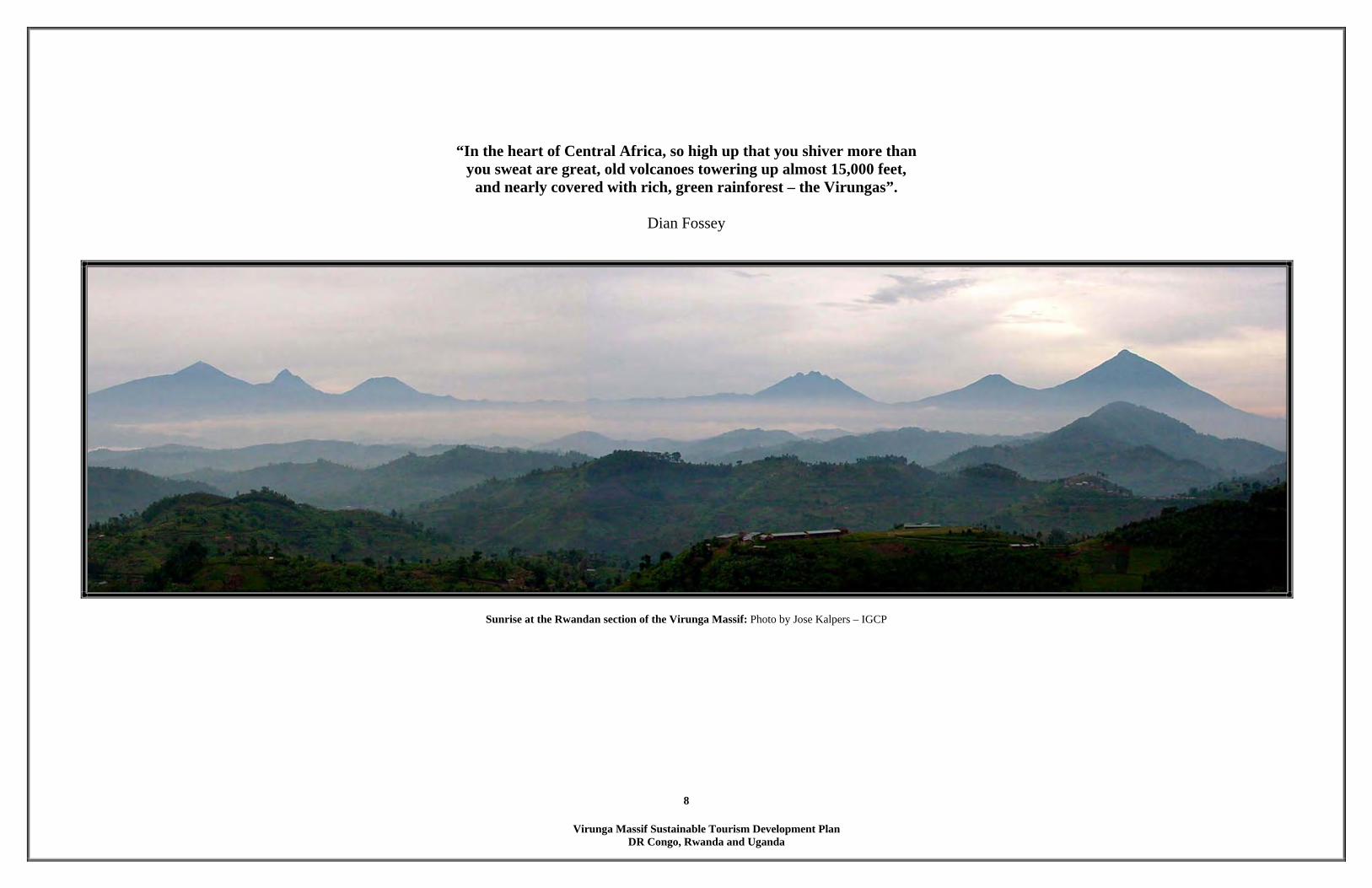
“In the heart of Central Africa, so high up that you shiver more than you sweat are great, old volcanoes towering up almost 15,000 feet,
and nearly covered with rich, green rainforest – the Virungas”.
Dian Fossey
Sunrise at the Rwandan section of the Virunga Massif: Photo by Jose Kalpers – IGCP
Virunga Massif Sustainable Tourism Development Plan
DR Congo, Rwanda and Uganda
9
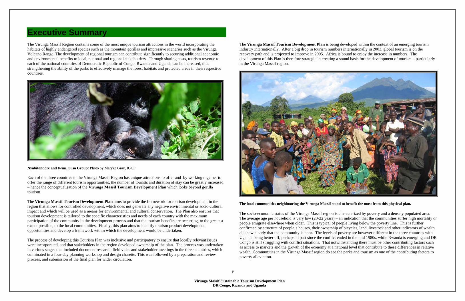
Executive Summary The Virunga Massif Region contains some of the most unique tourism attractions in the world incorporating the habitats of highly endangered species such as the mountain gorillas and impressive sceneries such as the Virunga Volcano Range. The development of regional tourism can contribute significantly to securing additional economic and environmental benefits to local, national and regional stakeholders. Through sharing costs, tourism revenue to each of the national countries of Democratic Republic of Congo, Rwanda and Uganda can be increased, thus strengthening the ability of the parks to effectively manage the forest habitats and protected areas in their respective countries.
Nyabitondore and twins, Susa Group: Photo by Maryke Gray, IGCP Each of the three countries in the Virunga Massif Region has unique attractions to offer and by working together to offer the range of different tourism opportunities, the number of tourists and duration of stay can be greatly increased – hence the conceptualisation of the Virunga Massif Tourism Development Plan which looks beyond gorilla tourism. The Virunga Massif Tourism Development Plan aims to provide the framework for tourism development in the region that allows for controlled development, which does not generate any negative environmental or socio-cultural impact and which will be used as a means for environmental and cultural conservation. The Plan also ensures that tourism development is tailored to the specific characteristics and needs of each country with the maximum participation of the community in the development process and that the tourism benefits are occurring, to the greatest extent possible, to the local communities. Finally, this plan aims to identify tourism product development opportunities and develop a framework within which the development would be undertaken. The process of developing this Tourism Plan was inclusive and participatory to ensure that locally relevant issues were incorporated, and that stakeholders in the region developed ownership of the plan. The process was undertaken in various stages that included document research, field visits and stakeholder meetings in the three countries, which culminated in a four-day planning workshop and design charette. This was followed by a preparation and review process, and submission of the final plan for wider circulation.
The Virunga Massif Tourism Development Plan is being developed within the context of an emerging tourism industry internationally. After a big drop in tourism numbers internationally in 2003, global tourism is on the recovery path and is projected to improve in 2005. Africa is bound to enjoy the increase in numbers. The development of this Plan is therefore strategic in creating a sound basis for the development of tourism – particularly in the Virunga Massif region.
The local communities neighbouring the Virunga Massif stand to benefit the most from this physical plan. The socio-economic status of the Virunga Massif region is characterized by poverty and a densely populated area. The average age per household is very low (20-22 years) – an indication that the communities suffer high mortality or people emigrate elsewhere when older. This is typical of people living below the poverty line. This is further confirmed by structure of people’s houses, their ownership of bicycles, land, livestock and other indicators of wealth all show clearly that the community is poor. The levels of poverty are however different in the three countries with Uganda being better off, perhaps in part since the conflict ended in the mid 1980s, while Rwanda is emerging and DR Congo is still struggling with conflict situations. That notwithstanding there must be other contributing factors such as access to markets and the growth of the economy at a national level that contribute to these differences in relative wealth. Communities in the Virunga Massif region do see the parks and tourism as one of the contributing factors to poverty alleviation.

Virunga Massif Sustainable Tourism Development Plan
DR Congo, Rwanda and Uganda
10
KEY ELEMENTS OF THE PLAN The Virunga Massif Sustainable Tourism Development Plan creatively merges the opportunities that the region offers with economics and planning that will lead to a successful low impact tourism destination and engage the people of the region prosperity for years to come. The Overall Tourism Development Plan addresses the quadruple bottom line of sustainable development: economic, environmental, social and spiritual sustainability.
The crater lakes have enormous tourism potential The main philosophy of the Virunga Massif Sustainable Tourism Development Plan is to diversify the tourism product (facility and activities) and be able to offer tourists a wide range of experiences and accommodation, beyond gorillas. The main concept is to develop tourism attractions outside the protected areas of PNVi, PNV and Mgahinga. The Plan will help encourage private sector and local communities to develop ‘out-of-park’ tourism enterprises such as mountain biking, canoeing on the crater lakes visits to caves and cultural sites, cultural performances, community walks and tours, local markets and handicraft demonstrations. One of the key elements of this plan is to create the ultimate ecotourism destination in the world and to lay the foundation for a Transboundary Protected Area. The Virunga Massif Tourism Development Plan provides a framework for the development of tourism in the three countries and for the key stakeholders to contribute to the development process. It is anticipated that the Plan will achieve the following aims:
(a) provide a long term vision for enhancing tourism; (b) promotion of the region as the tourism hub with linkages to regional circuits; (c) provide structured and guided development process for tourism facilities; (d) ensure inclusion of the local community in the planning, development, implementation and benefit
sharing process; (e) recognition that all tourism development has costs, and that the benefits to local communities must out
weigh the costs (f) ensure increased revenues from tourism; and
(g) ultimately ensure improved and sustainable use, conservation and management of the natural
resources.
Linkages to the riverine and savannah circuits in DR Congo is crucial to the creation of the ultimate ecotourism destination. Recognizing the importance of future tourism development and growth of the region and its inhabitants, the location of the various tourism elements takes precedence as a planning criterion in the development of the Plan. The Strategy suggests the implementation of a total of six projects– two for each country. These include an Interpretation and Culture Center, Jomba and the Tongo Lodge in Congo, Community Eco-Lodge, Kinigi and The Burera Experience in Rwanda; Canopy Walk and the Echuya Swamp Boardwalk in Uganda. Draft Plans have been developed for each site, including the existing community structures and expectations. The next step will be for each country to develop detailed implementation plans – including physical, business and marketing plans – to ensure the development of the tourism products.
Virunga Massif Sustainable Tourism Development Plan
DR Congo, Rwanda and Uganda
11
1 BACKGROUND 1.1 INTRODUCTION The Virunga Massif is an ecologically homogenous afro-montane forest, covering three contiguous national
parks in three countries: Parc National des Virunga (PNVi) in the DR Congo, Parc National des Volcans (PNV) in Rwanda and the Mgahinga Gorilla National Park (MGNP) in Uganda (see map on page 16). This massif is 447 km2 and provides one of the two remaining habitats of the highly endangered mountain gorilla as well as many other endemic and endangered species of flora and fauna. As of May 2004, there were 380 gorillas in the Virunga Massif and 320 in Bwindi Impenetrable National Park (AWF Newsletter, 2004) which is the only other habitat that harbours Mountain Gorillas.
The Bamboo forests of Virunga Massif is the home of the rare Golden Monkey: Photo by Jose Kalpers – IGCP
The Virunga Massif has great potential in developing sustainable tourism destinations that would benefit the stakeholders without compromising the environment. Sustainable tourism will heighten local awareness of the importance of conservation, provide new incentives for governments and the local communities to preserve protected areas and generate revenue for local and regional economies.
The pace and development in Rwanda and Uganda has been on the growth path, and the tourism sector has been no exception. With continued stability in DR Congo, visitation is bound to grow. This provides an opportunity for the countries to structure the tourism development process and ensure sustainability in terms of physical development, social, cultural and environmental management; and ensure the involvement of all key stakeholders especially the community who are the custodians of the habitat. This process will also facilitate diversification from gorilla tourism. To facilitate the process, in May 2004, IGCP commissioned a team of consultants (Hitesh Mehta - Ecotourism Physical Planner, Landscape Architect and Architect, and Christine Guchu-Katee - Community Ecotourism Consultant) to develop the Virunga Massif Tourism Development Plan covering DR Congo, Rwanda and Uganda. It should be noted that this plan is designed for both individual countries as well as a Transboundary protected area plan. Each government can independently implement their part of the plan and at a later stage when there is safety in the whole region, the Transboundary protected area plan can be implemented. This plan is a follow-up to IGCP’s work with the government authorities in DR Congo, Rwanda and Uganda in facilitating the process of developing national plans, and taking advantage of this opportunity to strengthen regional collaboration through harmonized tourism approaches through regional meetings.
IGCP Regional Staff, Anecto Kayitare and Helga Rainer facilitated the first regional workshop in Kisoro. Two regional meetings with representatives from the protected area authorities, private sector and local and national governments of DR Congo, Rwanda and Uganda were held in early 2004 to discuss the advantages of regional tourism and some of the possible mechanisms that would need to be in place to realize this strategy. The meetings deliberated on the advantages and disadvantages of developing regional tourism and constraints faced. An action plan taking advantage of the positive attributes and to address the constraints

Virunga Massif Sustainable Tourism Development Plan
DR Congo, Rwanda and Uganda
12
was developed. The meetings culminated in the development of a declaration (refer to appendix 1), a 15-person committee and a vision that:
The Virunga-Bwindi region is a leading high-end ecotourism destination in Africa, which contributes to conservation, peace, and sustainable development
1.2 HISTORY OF VIRUNGA MASSIF REGION COMMUNITIES
Uganda The Batwa were reportedly the only inhabitants in the area until the mid-16th century. They were mainly forest hunter-gatherers, but also may have lived within savannah forests or around lakes. The first Batutsi moved to the area after 1550, and by 1750 several Bahutu clans had arrived from Rwanda (Mapesa and Makombo, 2002).
Batwa baby and mother, Kisoro, Uganda
The Batwa culture is particularly intimately bound to Mgahinga Forest and its surrounding areas. To the Batwa the area signified a source of physical, emotional
and spiritual well-being. The caves in the park were important spiritual and cultural sites for them, and a few still visit them. The desire to continue utilising cultural sites
in the two parks still exist both among Batwa and non-Batwa. The folklore of the Bakiga and Bafumbira, the other ethnic groups neighbouring the park, also
depicts a traditional dependence on the park’s resources for household implements, agriculture and medicine. The activities of beekeepers, healers,
blacksmiths and craftspeople are still closely associated with the park.
Bwindi / Mgahinga Conservation Area Management Plan, 2000 DR Congo
Formerly Zaire and the Belgian Congo, the early history of what is now DR Congo is still largely unknown. The earliest inhabitants of the Congo Basin are believed to have been ancient Negrito peoples (pygmies) who were pushed into the mountains by Bantu and Nilotic invaders. Bantu groups moved into the area from the north and spread east and south beginning about 2,000 years ago. The northern Bantu groups settled in stateless communities in the rain forest. The Nilo-Saharan-speaking groups of the far north formed hierarchical systems with complex judicial structures. In the southern savannah zone, the Luba, Lunda, and other Bantu groups set up centralized kingdoms by 1500 (http://encarta.msn.com/encyclopedia 7615612615/ Democratic Republic_of_the_Congo.html). More recently, during the colonial era, many groups of people sharing common language, religion, tradition and culture were divided by the new boundaries, which have been largely maintained to date between Rwanda, DR Congo and Uganda. A colonial effort to import labour into certain regions of eastern DR Congo in the 1940’s led to many people from Rwanda being brought to eastern DR Congo and nationalized as Congolese citizens.
More recently, the political situation in neighbouring countries (Uganda and Rwanda) had aggravated the conflict in eastern DR Congo with the flow of refugees. The soil in eastern DR Congo is rich in mineral resources (gold, diamond, coltan) and this is probably one of reasons that war is still continuing in eastern DR Congo. The main languages in Eastern Congo are KinyaRwanda, Swahili and French. The Congolese are a vibrant culture and their music and dance are popular not only in Africa but also in Francophone Europe.
Rwanda The earliest known settlers in Rwanda were the Twa pygmies. The wild animals and plants of the predominantly forested region provided ample resources for their hunting and gathering lifestyle. In addition, their low numbers and high mobility precluded any serious problems of resource overexploitation. 200 years ago the ancestors of the modern Hutu introduced the iron-age tools and the agricultural technology necessary to transform the Rwandan landscape from forest to farmland. By the 16th Century, however, political and land use conflicts with the pastoral Tutsi in surrounding areas led to increased immigration of agriculturists into Northern Rwanda. The Hutus and Tutsis lived peacefully until the arrival of the Belgian colonialists who introduced the identity cards to divide the various ethnic tribes. These changes in the land tenure systems eventually led to what is now considered the worst genocide in the history of humankind. The genocide lasted three months over which over one million Rwandans were killed and twice as many fled into exile. During the genocide, whole Tutsi communities and villages were wiped out. Often not one person survived. It should also be noted that many moderate Hutus were also killed. Currently, the atmosphere is one of peace and calm. The country is now engaged on the path of unity and reconciliation despite the many challenges. It has come to terms with the genocide and is managing to integrate the survivors and the many Rwandans who came from abroad. There are less than 1000 Ba (Twa) who continue to live in the region and this number comprises only 0.25% of the national population.
Virunga Massif Sustainable Tourism Development Plan
DR Congo, Rwanda and Uganda
13
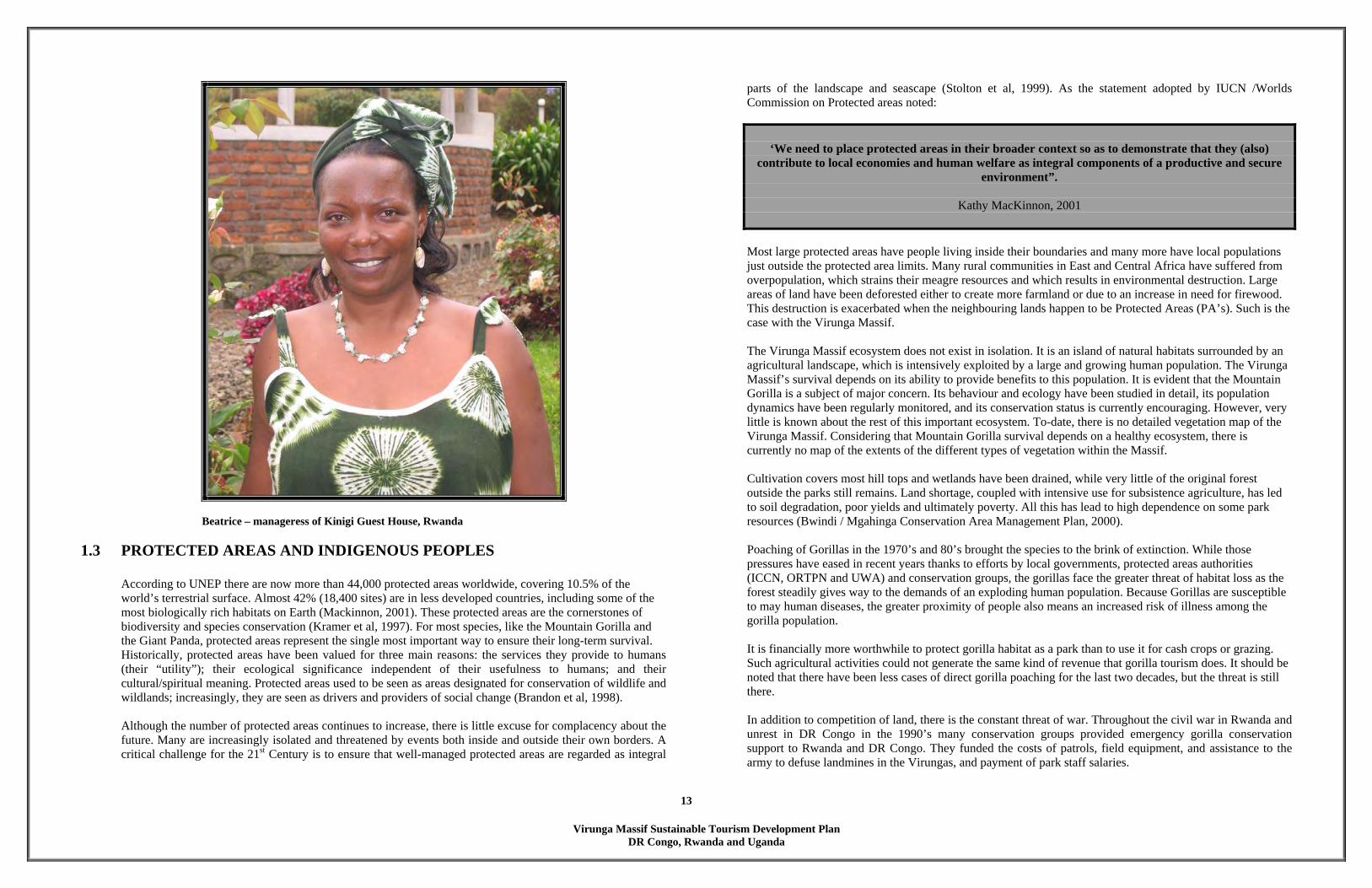
Beatrice – manageress of Kinigi Guest House, Rwanda
1.3 PROTECTED AREAS AND INDIGENOUS PEOPLES According to UNEP there are now more than 44,000 protected areas worldwide, covering 10.5% of the world’s terrestrial surface. Almost 42% (18,400 sites) are in less developed countries, including some of the most biologically rich habitats on Earth (Mackinnon, 2001). These protected areas are the cornerstones of biodiversity and species conservation (Kramer et al, 1997). For most species, like the Mountain Gorilla and the Giant Panda, protected areas represent the single most important way to ensure their long-term survival. Historically, protected areas have been valued for three main reasons: the services they provide to humans (their “utility”); their ecological significance independent of their usefulness to humans; and their cultural/spiritual meaning. Protected areas used to be seen as areas designated for conservation of wildlife and wildlands; increasingly, they are seen as drivers and providers of social change (Brandon et al, 1998). Although the number of protected areas continues to increase, there is little excuse for complacency about the future. Many are increasingly isolated and threatened by events both inside and outside their own borders. A critical challenge for the 21st Century is to ensure that well-managed protected areas are regarded as integral
parts of the landscape and seascape (Stolton et al, 1999). As the statement adopted by IUCN /Worlds Commission on Protected areas noted:
‘We need to place protected areas in their broader context so as to demonstrate that they (also) contribute to local economies and human welfare as integral components of a productive and secure
environment”.
Kathy MacKinnon, 2001 Most large protected areas have people living inside their boundaries and many more have local populations just outside the protected area limits. Many rural communities in East and Central Africa have suffered from overpopulation, which strains their meagre resources and which results in environmental destruction. Large areas of land have been deforested either to create more farmland or due to an increase in need for firewood. This destruction is exacerbated when the neighbouring lands happen to be Protected Areas (PA’s). Such is the case with the Virunga Massif. The Virunga Massif ecosystem does not exist in isolation. It is an island of natural habitats surrounded by an agricultural landscape, which is intensively exploited by a large and growing human population. The Virunga Massif’s survival depends on its ability to provide benefits to this population. It is evident that the Mountain Gorilla is a subject of major concern. Its behaviour and ecology have been studied in detail, its population dynamics have been regularly monitored, and its conservation status is currently encouraging. However, very little is known about the rest of this important ecosystem. To-date, there is no detailed vegetation map of the Virunga Massif. Considering that Mountain Gorilla survival depends on a healthy ecosystem, there is currently no map of the extents of the different types of vegetation within the Massif.
Cultivation covers most hill tops and wetlands have been drained, while very little of the original forest outside the parks still remains. Land shortage, coupled with intensive use for subsistence agriculture, has led to soil degradation, poor yields and ultimately poverty. All this has lead to high dependence on some park resources (Bwindi / Mgahinga Conservation Area Management Plan, 2000). Poaching of Gorillas in the 1970’s and 80’s brought the species to the brink of extinction. While those pressures have eased in recent years thanks to efforts by local governments, protected areas authorities (ICCN, ORTPN and UWA) and conservation groups, the gorillas face the greater threat of habitat loss as the forest steadily gives way to the demands of an exploding human population. Because Gorillas are susceptible to may human diseases, the greater proximity of people also means an increased risk of illness among the gorilla population. It is financially more worthwhile to protect gorilla habitat as a park than to use it for cash crops or grazing. Such agricultural activities could not generate the same kind of revenue that gorilla tourism does. It should be noted that there have been less cases of direct gorilla poaching for the last two decades, but the threat is still there. In addition to competition of land, there is the constant threat of war. Throughout the civil war in Rwanda and unrest in DR Congo in the 1990’s many conservation groups provided emergency gorilla conservation support to Rwanda and DR Congo. They funded the costs of patrols, field equipment, and assistance to the army to defuse landmines in the Virungas, and payment of park staff salaries.

Virunga Massif Sustainable Tourism Development Plan
DR Congo, Rwanda and Uganda
14
Painting by DR Congolese artist, Edisak describing conflicts between protected areas and local people - 1989. When more than a 1 million refugees fled Rwanda in 1994 and settled in camps near the gorillas habitat, “round-the-clock” surveillance were organized 1995, after a series of gorilla killings. From mid May to June, 2004 reports of extensive habitat destruction and land conversion by people accompanied by Rwandan military personnel and local authorities have been received by the conservation authorities in the DR Congo, and by its partners. Large numbers of people moved into the Southern Sector of PNVi (Kibumba Sub Sector), which is the habitat of the Mountain Gorilla. The people destroyed large tracts of natural habitat, including bamboo forest and mixed-forest, and converted it to pastoral and agricultural land. 15km2 has been deforested, including significant portion of the Mwaro corridor connecting Mikeno and Nyamulagira Sectors, and important area for large mammals moving between the sectors (Frankfurt Zoological Society, 2004). A key challenge for protected area managers is to find ways in which human needs can be better integrated with the needs of local and indigenous people and the needs of people living far away from the protected area in towns and cities, but who nonetheless have a stake in the future. Thousands of tourists have had the chance to visit habituated families of mountain gorillas in the three Gorilla Parks where carefully controlled programs allow a handful of tourists a day trek in to see the gorillas. The programs economic value to local communities has helped ensure community support for gorilla conservation.
Some areas of the Kibumba sub- sector were heavily deforested between May-June 2004. It is a widely argued within the wildlife conservation policy community that wildlife needs to ‘pay its way’ (Eltringham, 1994). This principle is currently taken to be true generally, but particularly in poorer regions that neighbour the Virunga Massif. The revenue stream that wildlife and tourism is now being expected to yield serves several distinct purposes. The first, and the most central to the “community” ethic that dominates much international thinking about conservation, and practice in developing countries, is that revenues from tourism should contribute to poverty alleviation in communities adjacent to protected areas to meeting the needs of rural people, and to compensating for benefits foregone due to conservation policy and the costs of living next to a protected area (Adams et al, 2002).
Conservation organizations are taking an ecosystem or landscape approach towards conservation, working with communities, within and around protected areas further conservation objectives. Indeed many in the conservation community believe that wildlife conservation and protected areas in poorer countries are doomed unless local communities become an integral part of conservation efforts and benefit economically from those efforts. As a result, a whole generation of integrated conservation and development projects (ICDP’s) has been born. The Virunga Massif Sustainable Tourism Development Plan is an integrated conservation and development projects (ICDP’s).
1.4 TRANSBOUNDARY PARKS The World Conservation Union (IUCN) had also long been promoting the establishment of Tranfrontier Conservation Areas (TFCAs) or "peace parks" because of the many benefits associated with them. TFCAs are defined as relatively large protected areas, which straddle international frontiers between two or more countries and cover large-scale natural systems encompassing one or more protected areas. Very often both

Virunga Massif Sustainable Tourism Development Plan
DR Congo, Rwanda and Uganda
15
human and animal populations traditionally migrated across or straddled the political boundaries concerned and their reality had to be addressed. The popular image of Africa is one of a vast expanse of wilderness interspersed with pockets of civilization. Land-use in present-day Africa however consists mostly of agricultural land and urban areas where development is forever encroaching on the remaining areas of wilderness. The establishment of Transboundary peace parks could be the last attempt to link these wilderness areas, thereby maintaining Africa's natural landscape and biodiversity as an integral whole. An equally important component of this concept is to ensure that the people living in or adjacent to these wilderness areas will profit from them via ecotourism, thereby making these areas sustainable. The view of conservation as a form of land-use that is integrated with other forms of land-use has brought about innovative and exciting thinking in the planning of TFCAs.
Agricultural land encroaching into the Virunga Massif (background)
I know of no political movement, no philosophy, and no ideology, which does not agree with the peace parks concept as we see it going into fruition today. It is a concept that can be embraced by
all.
Nelson Mandela
There has been a broadening of perspectives with regard to protected areas planning and management over the last twenty years. Some key indicators of what may accurately be discussed as a paradigm shift include the recognition of the importance of the connections between protected areas; as a result, protected area planning systems are moving away from a site-based approach to a bio-regional level – from protected areas as islands to protected areas as networks which are integrated with other land uses. Individual protected areas are also expanding beyond country boundaries, with Transboundary protected areas being agreed jointly by two or more neighbouring countries. The exponential growth in Transboundary conservation initiatives worldwide has resulted in more than 169 Transboundary protected area complexes, which involve 666 protected areas in 113 countries. (WPC Recommendations, 2003). Transboundary conservation initiatives have the potential to conserve biodiversity at a landscape level, to foster peaceful cooperation among communities and societies across international boundaries, and to engender regional economic growth and integration. In order for protected area managers to conduct effective Transboundary conservation programmes, there is need to harmonize approaches to planning, management, involve communities in conservation and development programmes, develop and apply best practice and share lessons learnt. The participants at the 5th World Parks Congress in Durban in September 2003 recommended that governments, NGO’s, development agencies, and specifically IUCN to “Develop, with broad consultation, an international enabling framework and internationally recognized designation/register of Transboundary protected areas.” It is the hope of the authors that when this register is completed Virunga Transboundary Park will be in the list. The basis for the successful establishment of peace parks is that ecotourism will provide an economically sustainable livelihood to the people living in and adjacent to the parks. While a number of parks still in development have no tourism facilities, others, such as the Kgalagadi Tranfrontier Park and even Kruger National Park cannot meet the ever-increasing demand for accommodation. Many Transboundary protected areas have already been promoted and managed as areas for peace and cooperation, thus adding a tangible and valuable dimension of peace building among peoples, nations and communities.
1.4.1 GREAT LIMPOPO TRANSFRONTIER PARK (GLTP) – A CASE STUDY
In the last five years in Southern Africa, an apparently surprising coalition of interests has rapidly rallied around the recently emerged concept of Transboundary Natural Resource Management (TBNRM). A variety of donors have channeled massive amounts into TBNRM in the region. Consultants have been employed, reports produced, workshops and conferences convened and even inter-governmental agreements signed (Wolmer, 2003)
In November 2000 the governments of Zimbabwe, South Africa and Mozambique signed an agreement formally establishing GLTP which will unite Zinave and Banhine National Parks and Coutade 16 Wildlife Utilization Area in Mozambique, the Kruger National Park in South Africa and the Gonarezhou National Park in Zimbabwe. Unfortunately, there was little consultation with local communities during this process and the Zimbabwean government and Dept. of National parks appeared to have a limited idea of what they had committed themselves into (Wolmer 2003).
Virunga Massif Sustainable Tourism Development Plan
DR Congo, Rwanda and Uganda
16
Although the day-to-day running of each park will remain the responsibility of each country, the GLTP will make conservation and perhaps even issues like law enforcement, much easier. The GLTP Initiative has been very much a South African driven process, and much of the momentum was provided by the Peace Parks Foundation. The Foundation was launched by a wealthy private sector individual - Anton Rupert with his own money in 1997. He has been a major player in development of the GLTP and other TFCAs bordering South Africa.
The vision of Peace Parks Foundation is to achieve inter-state collaboration in the conservation of Transboundary ecosystems and their associated biodiversity, promoting sustainable use of natural resources to improve the quality of life of the peoples of Mozambique, South Africa and Zimbabwe. The objectives of the Peace Parks Foundation are for the GLTP to strive to re-establish historical animal migration routes and other ecosystem functions disrupted by fences and incompatible legislation. This natural ecosystem will then also be jointly managed according to harmonized wildlife management policies, promoting the return of a larger and more resilient ecosystem with greater chances of long-term sustainability. Peace Parks Foundation hopes that the park will provide jobs and revenue generating opportunities for many of the thousands of local people affected by decades of civil war. They also believe that improving the lives of these rural communities will in turn further contribute towards biodiversity conservation by demonstrating the economic and social advantages that can be achieved through wildlife conservation.
Great Limpopo Tranfrontier Park – South Africa and Mozambique: Photo by Piet Theron
The Great Limpopo initiative has potentially very serious implications for the communities living around and in it (Wolmer, 2003). TBNRM is different in one very important aspect from traditional protected areas. It provides a rationale for expanding the conservation estate from enclaves to previously separate constituencies: commercial farms and communal areas. The GLTP process has unfortunately sidelined several communities in communal areas in Zimbabwe. This is somewhat surprising, given CBNRM’s (Community-Based Natural Resource Management Network) legacy to the region’s conservation discourse (consultative processes, participation, benefit sharing, etc) and the consensus on the importance of integrated conservation and development (Wolmer 2003).
The top-down process, and lack of consultation, has generated fears that the TFCA will involve displacement of people living in the corridor between Kruger and Gonarezhou National Parks. Almost everyone agrees that the degree of community consultation and participation in the implementation of the GLTP has, to date, been inadequate. As is now de rigueur, lip service is paid to the need for participation and benefit sharing, but there are still no mechanisms in place for decentralizing CBNRM.
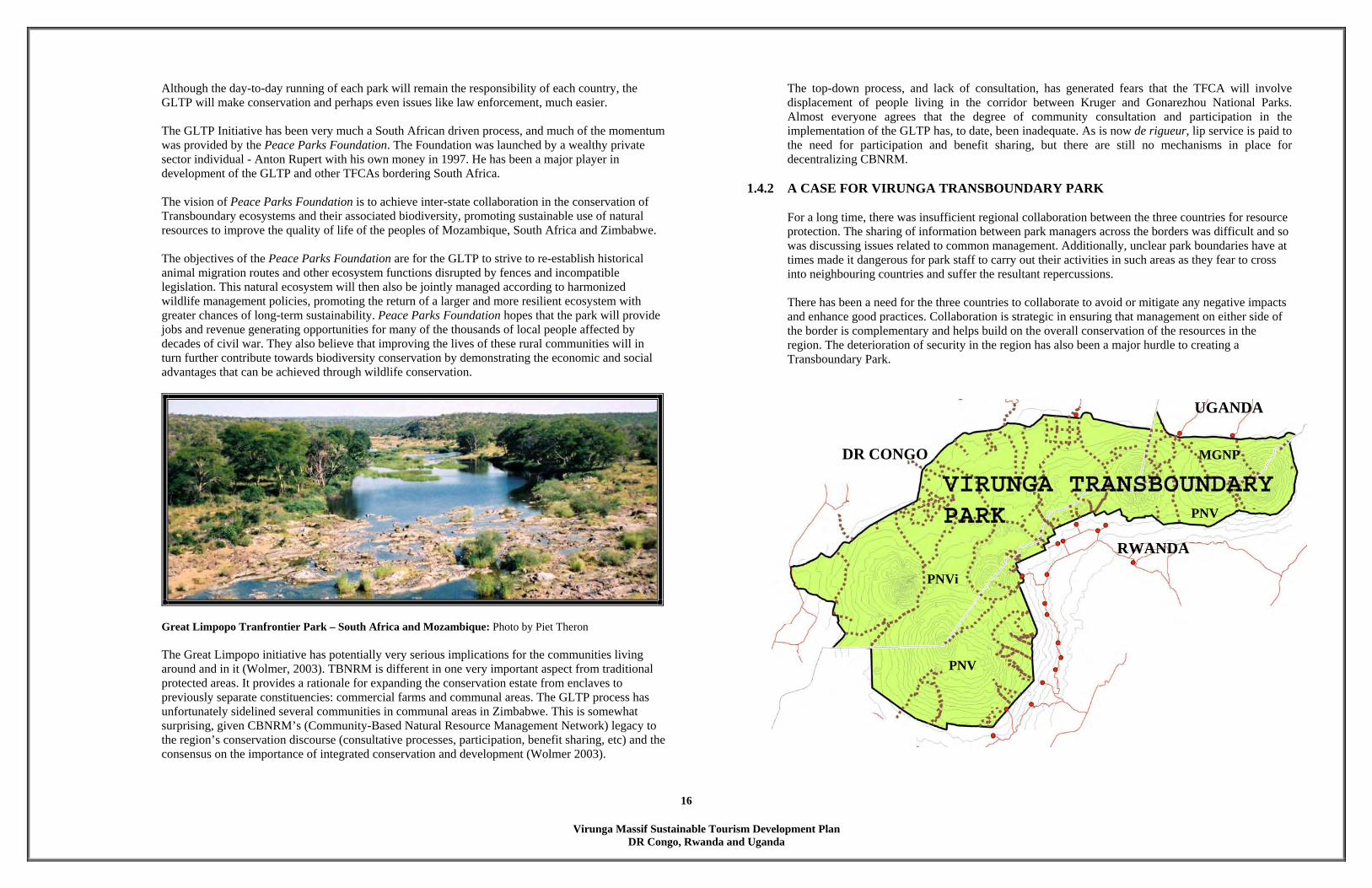
1.4.2 A CASE FOR VIRUNGA TRANSBOUNDARY PARK
For a long time, there was insufficient regional collaboration between the three countries for resource protection. The sharing of information between park managers across the borders was difficult and so was discussing issues related to common management. Additionally, unclear park boundaries have at times made it dangerous for park staff to carry out their activities in such areas as they fear to cross into neighbouring countries and suffer the resultant repercussions.
There has been a need for the three countries to collaborate to avoid or mitigate any negative impacts and enhance good practices. Collaboration is strategic in ensuring that management on either side of the border is complementary and helps build on the overall conservation of the resources in the region. The deterioration of security in the region has also been a major hurdle to creating a Transboundary Park.
UGANDA
DR CONGO MGNP PNV RWANDA PNVi PNV
Virunga Massif Sustainable Tourism Development Plan
DR Congo, Rwanda and Uganda
17
It should be noted that in the past five years, much progress has been made towards the creation of a Transboundary Park, thanks largely to the efforts of IGCP. The most positive aspect is that ICCN, ORTPN and UWA signed a MOU regarding Transboundary programmes. This is definitely a step in the right direction. The three organizations further appreciate that there have been efforts to coordinate and collaboratively manage these protected areas as one ecosystem. The parties have agreed to recognize these efforts and further pledge to continue to implement, and formalize the Transboundary collaboration in the areas of conservation, research, monitoring, community-based conservation and ecotourism to ensure sustainable biodiversity conservation. The main achievements of collaboration so far have been:
- Regular regional meetings facilitated (Kisoro and Kigali) - Regular meetings of the joint wardens’ committee - Joint patrols - Common RBM system - Common gorilla census held in 2003 - The creation of this plan (Virunga Massif Sustainable Tourism Development Plan)
All three country organizations agree that sharing of information and implementing joint programmes would benefit all the PA’s. For example, UWA, ICCN and ORTPN would benefit from synchronising management plans, zoning plans and programmes.
The Virunga Massif Sustainable Tourism Development Plan has included the local people right from the beginning and employed an equitable process which included two well-attended regional workshops and an empowerment planning and design workshop and charette. Even though the GLTP was a broader based initiative, it still did not include the local peoples
1.5 TOURISM AS A TOOL FOR CONSERVATION OF PROTECTED AREAS
While tourism offers considerable potential benefits to protected areas, the ecological, social and cultural costs of tourism in and around protected areas can be considerable. Tourism in and around protected areas needs to be sustainable and a tool for conservation; building support; generating much needed income for conservation work; and raising awareness of the need for the protection of biodiversity, ecosystem integrity and cultural heritage. Tourism must contribute to the quality of life of indigenous and local communities; protect and respect sacred sites; and acknowledge traditional knowledge. In this context, visitation, recreation and nature based tourism are important aspects of fostering support for the biological and cultural heritage amongst the wider public. Carefully planned policy together with proactive and effective management of tourism is essential. In Rwanda for example, with only tea and coffee as exports, tourism is an important means of attracting coveted dollars – and Rwanda has much to offer ecotourists. Only 39 ecotourists per day are allowed to see the five habituated groups of Gorillas. The cost per one hour visit is $375. This makes the Gorillas as the highest source of foreign income for Rwanda after coffee and tea.
1.6 OBJECTIVES OF THE TOURISM DEVELOPMENT PLAN The Tourism Development Plan for Virunga Massif provides a framework for the development of sustainable tourism in the three countries and for the key stakeholders to contribute to the development process. It is anticipated that the Plan will: (a) provide a long term vision for enhancing tourism; (b) provide structured and guided development process for tourism facilities; (c) ensure inclusion of the local community in the planning, development, implementation and benefit sharing process; (d) ensure increased revenues from tourism; (e) ultimately ensure improved conservation and management of the natural resources and (f) enhance collaboration among gorilla parks in Uganda, DR Congo and Rwanda.
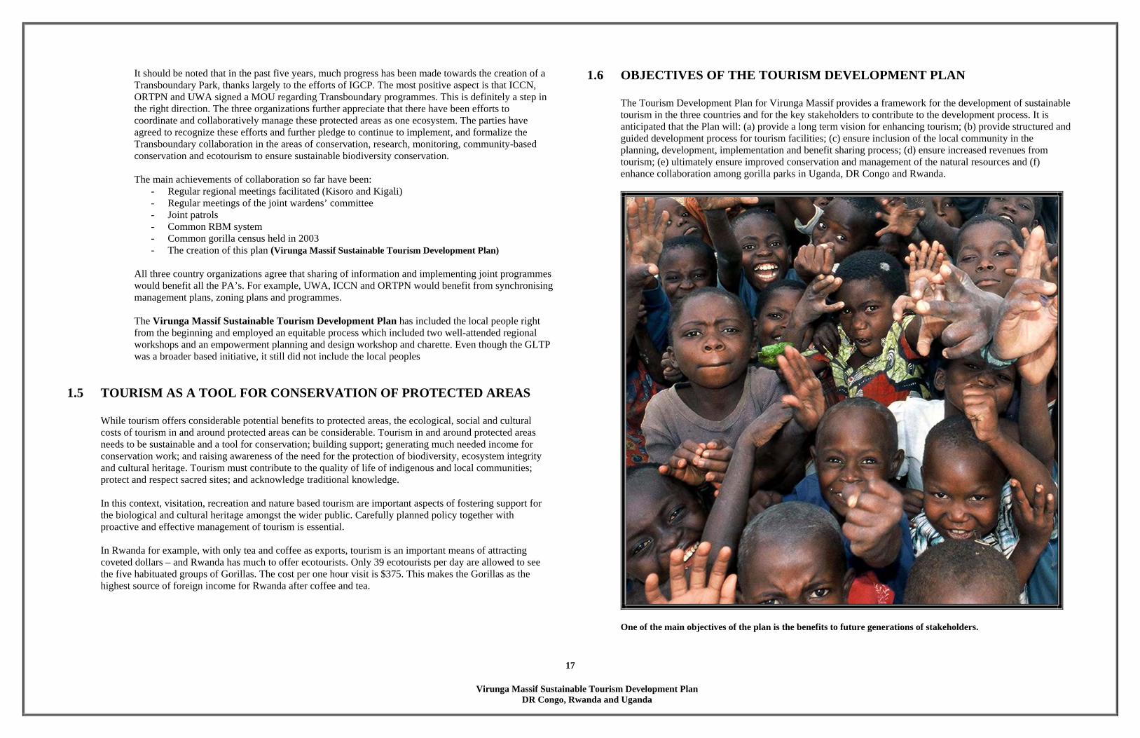
One of the main objectives of the plan is the benefits to future generations of stakeholders.

Virunga Massif Sustainable Tourism Development Plan
DR Congo, Rwanda and Uganda
18
2 METHODOLOGY & PROCESS 2.1 METHODOLOGY
Six forms of methodology were used to prepare this document: 1. Research into the history, culture, flora and fauna of the region. Documentation that was reviewed
included policies and plans produced by governments, consultants, and NGOs. A full list of references cited can be found in Appendix II.
2. Interviews with a representative section of the various stakeholders including community members, local
authorities, park management, private sector tour operators and lodge owners. A list of persons interviewed is included as Appendix IV.
3. Stakeholder meetings and open discussion with a wide cross-section of residents in the Virunga Massif.
The project began with kick-off meetings with IGCP, ORTPN, ICCN, UWA and Kisoro County Council. 4. On-site visits to numerous existing facilities (hotels, restaurants, houses, government offices, natural areas
etc). Over the course of two weeks the consultancy team visited a range of existing and potential tourism attractions in the region.
5. Participatory Workshops in Kisoro and Kigali, which were attended by representatives from all the three
countries. The deliberations from these workshops help set-up the program of development for the master plan.
6. Participatory Planning and Design Charettes1 in Ruhengeri which were attended by a wide cross-
section of 45 stakeholders, including representatives from the park management, local government, the private sector, NGOs, marginalized groups, and religious organisations. A full list of workshop participants can be found in Appendix V.
2.2 PROCESS The process of developing this Tourism Development Plan for Virunga Massif included the following stages: 1. Compilation and analysis of background documentation 2. Stakeholder meetings and workshops in Nairobi, Goma, Kisoro and Kigali.
1 Participatory Planning Workshop and Design Charettes
The Planning and Design process was initiated via the use of a planning workshop and design charettes. The workshop and charettes accelerated the planning process by creating an interactive environment with all major stakeholders working together without the normal interruptions that delay communications. It also provided an opportunity to achieve consensus on the most worthy approach to the tourism development plan. This planning process assists in reviewing program issues, environmental constraints and provides insight into the physical and market potential of the various products. The participatory workshop oriented design process is a most effective and efficient means of providing stakeholders with a specific work product quickly and comprehensively. This inclusive workshop format can provide an early feasibility review of the overall districts with minimal investment of both time and money.
3. Field visits in the three countries with the park management 4. Participatory planning and design charettes in Ruhengeri 5. Preparation of the draft plan 6. Review of Draft Plan by stakeholders 7. Revisions to Draft Plan 8. Submission of Final Plan to IGCP 9. Submission of Final Plan to the three countries by IGCP
The planning charette empowered local stakeholders
The purpose of undertaking a participatory planning approach to tourism development in the region was to ensure that locally relevant issues were incorporated, and that stakeholders in the region developed ownership of the plan.
Virunga Massif Sustainable Tourism Development Plan
DR Congo, Rwanda and Uganda
19
3 EXISTING CONDITIONS 3.1 LOCATION
Uganda The Ugandan side of the Virunga Massif is bordered to the north by Kisoro district which is located in the South Western corner of Uganda between longitude 29035’ and 29050’ East and latitude 1044’ and 1023’ South (see map on next page). Kisoro district covers an area of about 729.6 km2, of which 67.2 km2 is open water and swamps and 662 km2 is open land. It is a mountainous district that lies at an approximate altitude of 1,981m above sea level. The main tourism attraction is MGNP which harbours approximately 20 Mountain Gorillas and Golden Monkeys. Other attractions include Lakes Mutanda, Mulehe, Chahafi and Kayumba, Bwindi Impenetrable National Park, Echuya Forest Reserve and Swamp and many volcanic activity related landscapes. MGNP covers an area of 33.7 km2 and lies at latitude 1o 23’ South and longitude 29o 39’ East. MGNP is contiguous with Parc National des Virunga (240 km2) in the DRC, and Parc National des Volcans (160 km2) in Rwanda. The park includes three of the Virunga volcanoes - Mt Muhabura (4,127 m), Mt Gahinga (3,474 m) from which the park derives its name, and Mt Sabyinyo (3,634 m). It lies in Bufumbira county, Nyarusiza and Muramba sub-counties and adjacent to the three parishes of Gisozi, Rukongi and Gitenderi (see districts map).
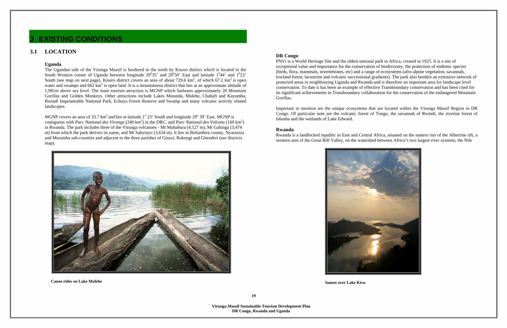
Canoe rides on Lake Mulehe
DR Congo PNVi is a World Heritage Site and the oldest national park in Africa, created in 1925. It is a site of exceptional value and importance for the conservation of biodiversity, the protection of endemic species (birds, flora, mammals, invertebrates, etc) and a range of ecosystems (afro-alpine vegetation, savannah, lowland forest, lacustrine and volcanic successional gradients). The park also borders an extensive network of protected areas in neighbouring Uganda and Rwanda and is therefore an important area for landscape level conservation. To date it has been an example of effective Transboundary conservation and has been cited for its significant achievements in Transboundary collaboration for the conservation of the endangered Mountain Gorillas. Important to mention are the unique ecosystems that are located within the Virunga Massif Region in DR Congo. Of particular note are the volcanic forest of Tongo, the savannah of Rwindi, the riverine forest of Ishasha and the wetlands of Lake Edward.
Rwanda Rwanda is a landlocked republic in East and Central Africa, situated on the eastern rim of the Albertine rift, a western arm of the Great Rift Valley, on the watershed between Africa’s two largest river systems; the Nile
Sunset over Lake Kivu

Virunga Massif Sustainable Tourism Development Plan
DR Congo, Rwanda and Uganda
20
and Congo. Much of the country’s 26,338 Km2 is dramatically mountainous, the highest being Karisimbi (4,507 m) in the volcanic Virunga Chain protected by the PNV. The largest body of water is Lake Kivu, but numerous other lakes are dotted around the country, notably Burera and Ruhondo, both of which have erratic shapes following the contours of the steep mountains that enclose the water.
3.2 DEMOGRAPHICS AND LIVELIHOODS
The information provided in this section is from the Draft Socioeconomic Surveys around Montane Forests in Uganda, Rwanda and DR Congo carried out by WCS, IGCP and CARE. This extensive survey is in print and will be available in 2005.
3.2.1 DEMOGRAPHICS
Virunga Massif Region Household size and composition The average household size within the region varies between 4.7 - 6.7 people per household. Children (aged 18 or younger) form between 45-67% of the household depending on the forest or ethnic group. The largest fluctuation is among the Batwa – in DR Congo and Bwindi they have less than 49% children, while Echuya and Mgahinga children less than 19 years are more than 63%. On average the sex ratios were close to 50:50 per household except for the Batwa communities in Echuya and Mgahinga. However certain forests had a much higher percentage of female-headed households, particularly around PNV which is a result of the war and genocide in Rwanda. Households headed by orphans also occur.
Table 1: Average household composition around the Virunga Massif
Forest group Average number per household
Percentage of occupants who
were male
Average percentage
<19 years old per household
Average percentage of
households that are headed by a
woman
Percentage of household that are orphans
Batwa Bwindi 4.82 48.10 52.60 11.67 2.77 Batwa DRC 5.33 52.08 45.83 0.00 0.00 Batwa Echuya 6.07 57.14 63.74 0.00 0.00 Batwa Mgahinga 6.73 63.37 67.33 0.00 0.00 Batwa PNV 4.71 49.49 48.48 0.00 2.02 Bwindi 6.53 49.77 58.06 6.18 2.99 Echuya 5.95 48.05 56.29 8.16 3.32 Mgahinga 6.72 49.22 51.38 4.84 2.52 PNV 5.32 47.56 57.24 17.04 3.52 Virunga 5.68 51.18 54.27 6.03 3.10
Households around Bwindi and Mgahinga had significantly more members compared to Virunga and Echuya which in turn were significantly larger than households around PNV and Batwa around PNV, Bwindi and DR Congo.
Age structure Of all the three age categories (0-20, 21-55 and 56-120) there are differences between the sex structure after the age of 20 with a relative decline in the percentage of men between the age of 21-55 for all forests except Virunga park but a higher percentage of men after the age of 55. There are several factors that could explain this: men may migrate to find work outside their homes once they are adult and certainly some of this does occur; men may be more likely to contract HIV/AIDS because they are generally more mobile and hence may die as a result; and thirdly the wars in this region may have led to the deaths of more men in this age category.
Uganda The population of Kisoro District is approximately 250,000 with an average density of 360 persons per km2. The annual growth rate of the population stands at 3.5%, which is well over the national rate of 2.5%. The majority of the people (96%) live in rural areas while about 4% are urban dwellers. The Bafumbira are the majority in the district. The Bakiga and Banyarwanda, who may have migrated from neighbouring Rwanda and other smaller tribes, exist in the district especially in Kisoro Town Council area and in the forest areas where the Batwa pygmies are found (DoE, 2001). More recently, the population growth in Kisoro District has been mostly influenced by periods of civil unrest in Uganda, Rwanda and DR Congo.
96% of the people in Kisoro live in the rural areas.

Virunga Massif Sustainable Tourism Development Plan
DR Congo, Rwanda and Uganda
21
DR Congo The estimated population living around PNVI-South (DR Congo) is approximately 675, 000 people. (A. Lanjouw et al, 2001). The density is very high and subsistence agriculture is the primary livelihood strategy of this population. The industrial and business sectors are poorly developed in this area, offering few alternatives to local populations, and those that were functional before the war have been seriously affected by insecurity and political chaos in the region (A. Lanjouw et al, 2001).
The population density is increasing every year in Eastern DR Congo. Rwanda Rwanda and has the densest population in Africa – more than eight million people. It is also one of the poorest countries in the world with over 65% of the population living below the poverty threshold. There is one doctor per 52,000 people; literacy is at 48%; and the average life expectancy is 50 years. Infant mortality is high, HIV/AIDS is rife and only half the country’s population has access to clean drinking water. Yet, Rwandans are positive and striving for better lives for themselves and their children. Rwanda is a country in an advanced stage of rehabilitation, and one looking to a brighter future. The high level of political stability and peace since 1995 has encouraged the repatriation of millions of refugees. The victims of genocide have been laid to rest in mass graves whose frank austerity affirms the government’s ability to openly confront the recent past without extracting undue political mileage from its role in ending the genocide.
Rwandans are striving for better lives for their children.
3.2.2 LIVELIHOODS
Virunga Massif Region Agriculture is the dominant land use and economic activity in the region and nearly all the households have agriculture as their main source of livelihood. It is mainly subsistence, where the surplus is sold off, with the constraint of poor marketing infrastructure. Crops grown include bananas, sorghum, sweet potatoes, millet, Irish potatoes, and on higher slopes, peas and wheat. Crops grown primarily for sale in the Virunga Massif region include coffee, tea, tobacco, pyrethrum, cabbage, leeks and tomatoes.
Table 2: The crops grown for sale around each forest - those grown for sale by more than 40% of households and those additional crops grown for sale by more than 20% of households
Crops grown by >40% of households
Additional crops grown by >20% of households
Bwindi Coffee, trees, tea, tobacco Sugar cane, tomatoes Echuya Pyrethrum, tobacco
PNV Plantains, cabbage, leeks, Pyrethrum, tomatoes Irish potatoes, peas, sorghum
Virunga Plantains, cabbage, carrots, leeks, tobacco Irish potatoes, peas, sorghum
90% of the people in the Virunga Massif Region depend on subsistence agriculture. They have just enough land to feed their families and save a few seeds for the next season. But if there is a drought or overly heavy rainfall, they lose everything. The most effective solution for them is
not moving from Agriculture to tourism, for tourism can be just as a fragile as any other industry, but in diversifying their activities – by giving them options and choices. That’s the
strategy if you want people to have more secure livelihoods
Annette Lanjouw, 2004
Virunga Massif Sustainable Tourism Development Plan
DR Congo, Rwanda and Uganda
22
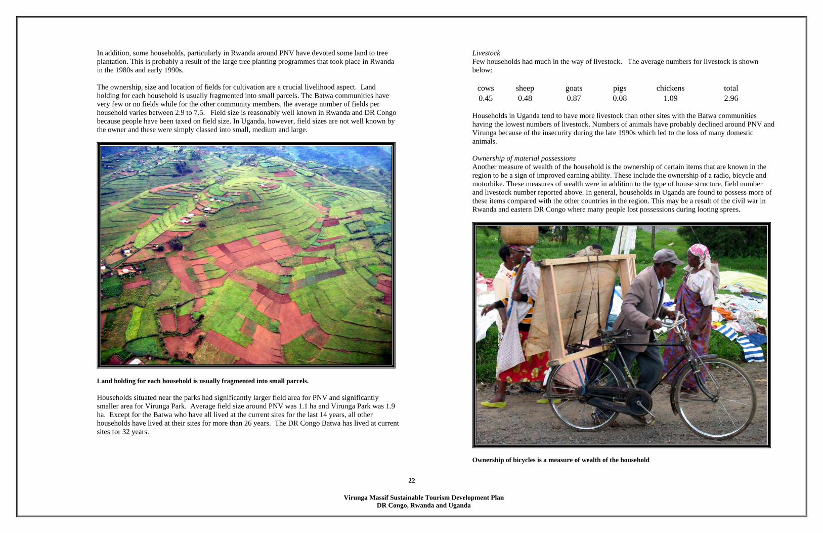
In addition, some households, particularly in Rwanda around PNV have devoted some land to tree plantation. This is probably a result of the large tree planting programmes that took place in Rwanda in the 1980s and early 1990s.
The ownership, size and location of fields for cultivation are a crucial livelihood aspect. Land holding for each household is usually fragmented into small parcels. The Batwa communities have very few or no fields while for the other community members, the average number of fields per household varies between 2.9 to 7.5. Field size is reasonably well known in Rwanda and DR Congo because people have been taxed on field size. In Uganda, however, field sizes are not well known by the owner and these were simply classed into small, medium and large.
Land holding for each household is usually fragmented into small parcels. Households situated near the parks had significantly larger field area for PNV and significantly smaller area for Virunga Park. Average field size around PNV was 1.1 ha and Virunga Park was 1.9 ha. Except for the Batwa who have all lived at the current sites for the last 14 years, all other households have lived at their sites for more than 26 years. The DR Congo Batwa has lived at current sites for 32 years.
Livestock Few households had much in the way of livestock. The average numbers for livestock is shown below:
cows sheep goats pigs chickens total 0.45 0.48 0.87 0.08 1.09 2.96
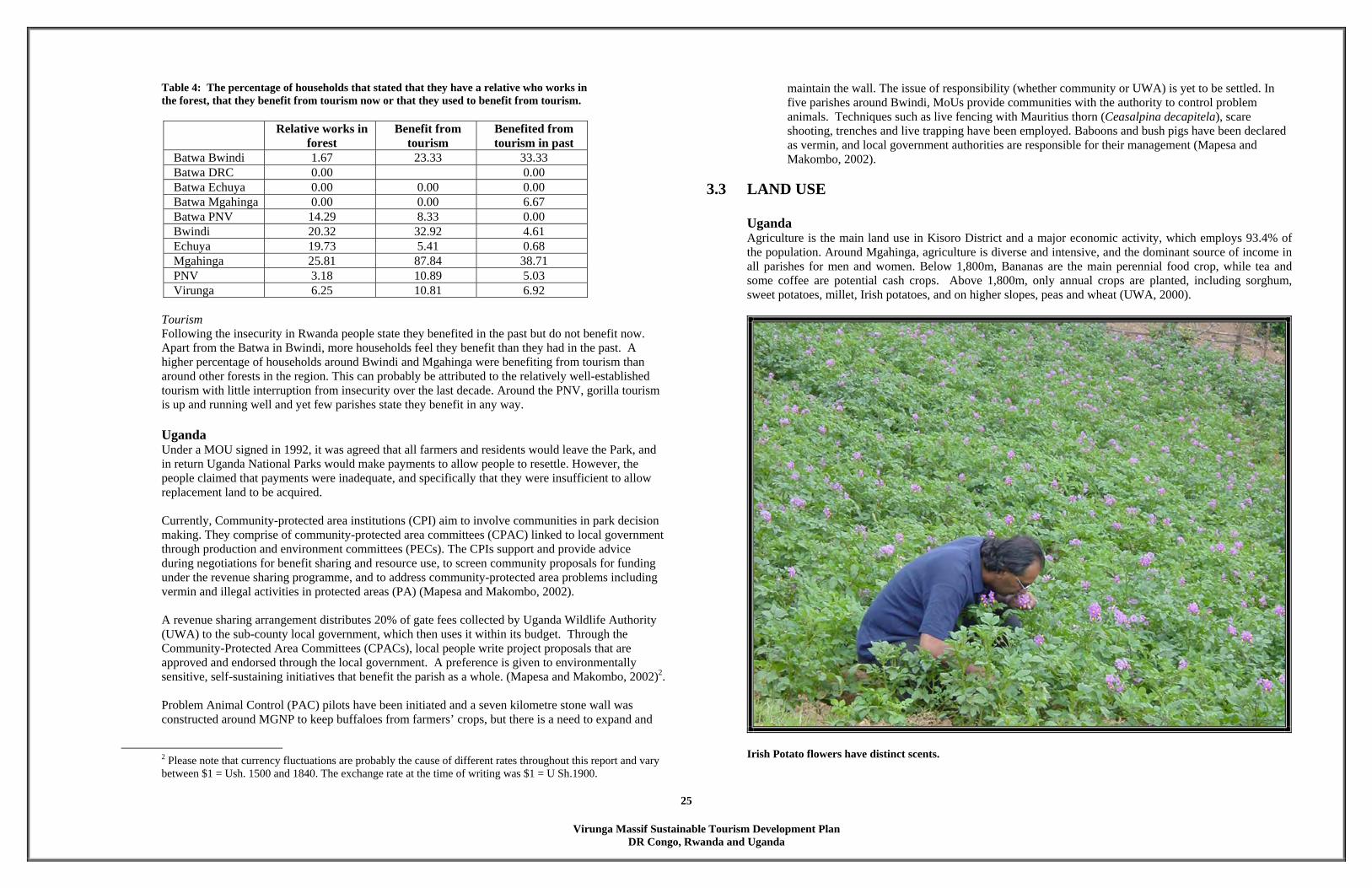
Households in Uganda tend to have more livestock than other sites with the Batwa communities having the lowest numbers of livestock. Numbers of animals have probably declined around PNV and Virunga because of the insecurity during the late 1990s which led to the loss of many domestic animals. Ownership of material possessions Another measure of wealth of the household is the ownership of certain items that are known in the region to be a sign of improved earning ability. These include the ownership of a radio, bicycle and motorbike. These measures of wealth were in addition to the type of house structure, field number and livestock number reported above. In general, households in Uganda are found to possess more of these items compared with the other countries in the region. This may be a result of the civil war in Rwanda and eastern DR Congo where many people lost possessions during looting sprees.
Ownership of bicycles is a measure of wealth of the household

Virunga Massif Sustainable Tourism Development Plan
DR Congo, Rwanda and Uganda
23
Sources of income to a household Agriculture dominated the source of income to a household (in excess of 70%). Secondary sources listed rarely exceed 20% of household’s revenue. High scoring secondary sources of revenue include employment, livestock and business, beekeeping, making crafts, brewing, growing cash crops (tea, tobacco, or coffee), driving, tourism, wood harvesting from plantations (timber and forest products – poles, bean stakes etc), traditional healing, community groups providing loans, aid projects, mining, fishing, and pension. In a recent survey, only the Batwa’s admitted to utilizing the park in order to access resources for revenue generation and indicated that ‘activities in the park’ are of high importance to them as a source of revenue. And only Batwa valued tourism because they could earn some money from dancing for tourists.
3.2.3 HEALTH Virunga Massif Region Overall, people visit healthy centres as their primary source of treatment. Around Mgahinga and Echuya, a large proportion of the people also attend a hospital for treatment. In all areas, the distance people travel for treatment varies greatly - and ranges from 5-14kms for hospitals and 3-10kms for health centres. People take between 1-2 hours to travel to a health centre (although the distance to hospital is greatest for Echuya, time taken is limited due to a good road and use public transport). Table 3: The average distance (km) and average time (hrs) to find treatment for the different types of treatment centers.
Hospital Health centre Local healer Buy medicine Km hrs km hrs km hrs km hrs Bwindi 9.99 2.99 5.22 1.88 4.14 2.08 6.84 2.57 Echuya 14.88 2.71 10.40 2.49 5.25 1.58 Mgahinga 6.22 2.91 4.06 1.47 7.13 3.06 4.80 2.20 PNV 5.34 2.12 3.68 0.86 2.73 1.07 2.93 1.22 Virunga 5.13 1.28 3.42 1.01 4.18 0.76 3.21 0.84
The socio-economic study of 2001 showed that a high number of people around Mikeno (DR Congo) went to health centers when they were sick (72.26%). This is also true for Batwa - 66.67% using health centers when they are sick, but they also use traditional healers (22.22%) compared to 8.7% for others. The fertility rate in Uganda is about 8.35 births per woman and infant mortality rate stands at 105 per 1000 live births. There is dependency ratio of 57%. These figures are some of the highest in Uganda. Crude birth rate for 1000 people stands at 57 and life expectancy is estimated at 50 and 55 years for males and females respectively. Most of the health problems in the district are a result of poor living conditions and diseases with high occurrence are almost all preventable. Tuberculosis cases increased from 142 in 1992 to 206 in the year 2000. However, leprosy cases seem to be on the decline with only 2 cases recorded in 1996 and 1 in 1998 (DoE, 2001). HIV/AIDS has been another major health problem that has affected the family structure and which is one of the main causes of death. The
Directorate of Health and Environment intends to reduce the HIV/AIDS prevalence rate from 2.5% to 2.1% within the next three years (3-Yr Kisoro District Development Plan, 2003).
People take between 1-2 hours to travel to a health center.
3.2.4 BENEFITS TO LOCAL COMMUNITIES Virunga Massif Region For the most part, people feel that they are benefiting from the parks and reserves, as do their community and country. The level of benefits is different if we compare the various sites. The Batwa living around Virunga Park, Mgahinga and Echuya feel that they do not benefit from the protected areas but Batwa around Bwindi and PNV feel they benefit. The causes of these differences are unclear because people are allowed access to Echuya and it would be expected that the Batwa living there would feel they benefited more than the Batwa around PNV, for instance, who are allowed less access. Some employment of the Batwa and some projects to help them have been set up around PNV and Bwindi which may have led to their responses. People living in the Kinigi District near the PNV felt their community did not benefit and yet this is where most of the tourism activities are centred for the gorilla tourism in Rwanda.

Virunga Massif Sustainable Tourism Development Plan
DR Congo, Rwanda and Uganda
24
For many communities the role these forests play in climate control is one of the most cited reasons for personal benefits from the forest. Around Echuya the ability to harvest forest resources is ranked highly. The presence of social services projects around Mgahinga and Bwindi also contributed to people’s impressions that they benefit from a protected area.
Bamboo harvesting takes place once a week in Echuya When people were asked why they did not benefit from a protected area, lack of access to harvest non-timber forest products (NTFP) was one of the most commonly cited reasons, particularly among the Batwa communities. Protection by parks staff was a reason cited for why they did not benefit from the forest, particularly in Bwindi and PNV where protection is probably most intensive given the numbers of guards. This indicates that effective law enforcement is deterrence to people but also leads to negative attitudes towards the protected areas. Crop raiding by wildlife was mentioned as a problem but by very few people. People feel that the country benefits from the forests through tourism and income generation, and reduction in the availability of land as a reason why the country does not benefit. Climate is not seen
as a benefit for the country yet it is probable that the watershed functions of these forests are as important to people downstream as they are to the people living next to the protected areas. Cultural values of the forest The forests have been cited as culturally important due to access to products and cultural ceremonies (e.g. cleansing ceremonies and burial grounds). The importance is however reducing since people are being stopped from using the forests. The cultural values attached to forests in DR Congo and Rwanda is much lower.
Cultural values towards the forests have been diminishing Employment The presence of the forest leads to some employment. People work as park or forest rangers/guards, tourist guides, trail cutters, and in administration. The percentage of households with relatives working in Bwindi, Echuya and Mgahinga is quite high given the number of people that live at the edge of the forest.
Virunga Massif Sustainable Tourism Development Plan
DR Congo, Rwanda and Uganda
25
Table 4: The percentage of households that stated that they have a relative who works in the forest, that they benefit from tourism now or that they used to benefit from tourism.
Relative works in
forest Benefit from
tourism Benefited from tourism in past
Batwa Bwindi 1.67 23.33 33.33 Batwa DRC 0.00 0.00 Batwa Echuya 0.00 0.00 0.00 Batwa Mgahinga 0.00 0.00 6.67 Batwa PNV 14.29 8.33 0.00 Bwindi 20.32 32.92 4.61 Echuya 19.73 5.41 0.68 Mgahinga 25.81 87.84 38.71 PNV 3.18 10.89 5.03 Virunga 6.25 10.81 6.92
Tourism Following the insecurity in Rwanda people state they benefited in the past but do not benefit now. Apart from the Batwa in Bwindi, more households feel they benefit than they had in the past. A higher percentage of households around Bwindi and Mgahinga were benefiting from tourism than around other forests in the region. This can probably be attributed to the relatively well-established tourism with little interruption from insecurity over the last decade. Around the PNV, gorilla tourism is up and running well and yet few parishes state they benefit in any way.
Uganda Under a MOU signed in 1992, it was agreed that all farmers and residents would leave the Park, and in return Uganda National Parks would make payments to allow people to resettle. However, the people claimed that payments were inadequate, and specifically that they were insufficient to allow replacement land to be acquired. Currently, Community-protected area institutions (CPI) aim to involve communities in park decision making. They comprise of community-protected area committees (CPAC) linked to local government through production and environment committees (PECs). The CPIs support and provide advice during negotiations for benefit sharing and resource use, to screen community proposals for funding under the revenue sharing programme, and to address community-protected area problems including vermin and illegal activities in protected areas (PA) (Mapesa and Makombo, 2002). A revenue sharing arrangement distributes 20% of gate fees collected by Uganda Wildlife Authority (UWA) to the sub-county local government, which then uses it within its budget. Through the Community-Protected Area Committees (CPACs), local people write project proposals that are approved and endorsed through the local government. A preference is given to environmentally sensitive, self-sustaining initiatives that benefit the parish as a whole. (Mapesa and Makombo, 2002)2. Problem Animal Control (PAC) pilots have been initiated and a seven kilometre stone wall was constructed around MGNP to keep buffaloes from farmers’ crops, but there is a need to expand and
2 Please note that currency fluctuations are probably the cause of different rates throughout this report and vary between $1 = Ush. 1500 and 1840. The exchange rate at the time of writing was $1 = U Sh.1900.
maintain the wall. The issue of responsibility (whether community or UWA) is yet to be settled. In five parishes around Bwindi, MoUs provide communities with the authority to control problem animals. Techniques such as live fencing with Mauritius thorn (Ceasalpina decapitela), scare shooting, trenches and live trapping have been employed. Baboons and bush pigs have been declared as vermin, and local government authorities are responsible for their management (Mapesa and Makombo, 2002).
3.3 LAND USE
Uganda Agriculture is the main land use in Kisoro District and a major economic activity, which employs 93.4% of the population. Around Mgahinga, agriculture is diverse and intensive, and the dominant source of income in all parishes for men and women. Below 1,800m, Bananas are the main perennial food crop, while tea and some coffee are potential cash crops. Above 1,800m, only annual crops are planted, including sorghum, sweet potatoes, millet, Irish potatoes, and on higher slopes, peas and wheat (UWA, 2000).
Irish Potato flowers have distinct scents.

Virunga Massif Sustainable Tourism Development Plan
DR Congo, Rwanda and Uganda
26
The land is highly fragmented due to traditional practices of inheritance and high population density. The average land holding per household is 0.8 ha and is usually fragmented into small parcels, often 5-6 km apart. Land ownership in the District is under customary, leasehold and freehold land tenure (DoE, 2001). Grazing areas are owned communally (KDLG, 2002). Parts of the district fall within BINP World Heritage Site, MGNP and Echuya Forest Reserve.
For example, a density of 639 people/km2 was recorded for Gisozi Parish, 330 people/km2 for Rukongi Parish, and 274 people/km2 for Gitenderi Parish, all adjacent to MGNP. And since these figures are from a census conducted in 1991, the human population density is expected to be much higher now, given the estimated annual average increase of about 2.7% in the three districts around BINP and 3.5% in Kisoro district. As population increases, essential resources become scarce and people’s dependence on the park resources increases. This leads to increased illegal access of resources like hunting, logging, etc.
DR Congo Agriculture is the main land use followed with livestock. Similar crops are grown to Uganda. Rwanda In a country whose resources are stretched to the limit to enable its population merely to survive, an impressive 8.6% of the land is set aside as national parks. Apart from PNV, there is Akagera and Nyungwe.
Pyrethrum farming is popular in Kinigi
3.4 INFRASTRUCTURE
3.4.1 ROADS
Uganda Kisoro district has a total road network of 498.25 km of which 48 km is trunk murram road under the Ministry of Works, Housing and Communications and which connects the District to the rest of the country, Rwanda and DR Congo. Feeder roads (earth/gravel) cover 353.25 km of the total road network and are maintained by the District using Donor funds. Community roads cover 97 km and are maintained by the sub-counties (Planning, 2003). The hilly terrain especially in the north and east coupled with the frequent heavy rains cause periodic landslides and render some road sections un-drivable. There are many deep valleys, rivers and swamps in low-lying areas, which make road construction very expensive. Also, there is inadequate road equipment such as lack of wheel loaders, which are used to remove landslide debris. It should be noted that the local district contributions to road maintenance is very low compared to budgets for others costs i.e. health, education (3-Yr District Development Plan, 2003). The District has a total number of 18 bridges out of which 8 are constructed with timber. DR Congo Roads in Eastern DR Congo are in reasonable condition with a few sections near Goma which are damaged by the Volcano eruption of 2002. The road from Goma to Rwindi is the best road in this part of DR Congo while the road from Rutshuru to Jomba needs a lot of repairs and regrading.
A section of the Goma-Rumangabo asphalt road was damaged by the 2002 volcano lava flow

Virunga Massif Sustainable Tourism Development Plan
DR Congo, Rwanda and Uganda
27
Rwanda An asphalt road from Kigali to Ruhengeri and from Uganda Border to DR Congo Border is the best road out of the three countries. However the road from Ruhengeri to Kinigi needs to be either graded or asphalted.
3.4.2 AIR TRANSPORT
Uganda The district has an airstrip approximately 5 km from Kisoro Town and serves as the quickest means of transport to the District. The runway is 2.1 km and can accommodate 20-seater planes.
The Kisoro Airport is beautifully located at the base of Muhabura Volcano DR Congo Eastern DR Congo has a large airport in Goma which was devastated by the Nyiragongo volcano in 2002. It has since been repaired. Flights from Kinshasha and Nairobi. Rwanda There is an International Airport at Kigali with flights from major African cities and from Europe. The airport is only 1 ½ hour from Ruhengeri which is the hub of tourism in the Virungas.
3.4.3 ELECTRICITY
Uganda The district is partially electrified, but of the available 18 Megawatts supplied by Rwanda, only 0.3 megawatts is currently consumed, mainly on lighting by Kisoro Town Council Area, Mutolere Hospital, Mutolere Secondary School, and Nyakabande and Chuho Water Works (Planning, 2003). Kisoro is not connected to the Ugandan grid as the terrain between Kabale and Kisoro would make this difficult and very expensive. So Kisoro (UEDCL) buys from Rwanda Electrogaz who have power just over the border at an average load of about 1MW of power. Katuna town, which straddles the border, is on the Ugandan grid and about 2MW is dispatched over the border, as Rwanda for similar reasons is struggling to get power to this town. An offset is calculated and the bill paid, Uganda being the net exporter. Biomass energy meets more than 90% of aggregate energy needs, and most people in Kisoro depend upon trees for their fuel wood needs, such as cooking, heating, curing tobacco and baking bricks (KDLG, 2002). Most of the fuel wood (85%) is produced from farmers’ woodlots (Kamugisha, et al., 1997) of eucalyptus and black wattle, but over-population and limited tree planting has led to a scarcity of fuel wood (UWA, 2000). Charcoal and crop residues are also widely used in households, schools, hospitals and small-scale industries. With new electricity tariffs, dependence on biomass is expected to grow exponentially (DoE, 2001).
DR Congo
Goma’s electricity comes from the Ruzizi (Bukavu) dam. The electricity supply is not regular; and there are cuts from time to time. Many hotels have generators in case of electricity shut-offs. Rutshuru and Kiwanja are supplied by a local dam managed by a local priest.
Rwanda Lakes Burera and Ruhondo are most valued for the production of hydroelectricity. It should be noted that some power plants around Ruhengeri still need rehabilitation from war damages. In recent years the demand for energy has significantly increased especially in cities such as Kigali, which are also supplied by the Ruhengeri power plants. The water levels of Rugezi swamps, L. Burera and L. Ruhondo are very low, which impacts on the energy generated from these sources.
3.4.4 WATER
Uganda Most people in the district have extreme water shortages because of the settlement patterns. The biggest settlements occur on hillsides and ridges while most water points are in the valleys. The district is not greatly endowed with water sources and walking distances to safe water points are very long. There is also a high prevalence of water- borne diseases. The district has six Gravity Flow schemes, 180 Communal Water Tanks and 352 springs. The extension of Chuho Water Supply to rural areas of Nyakabande, Nyarusiza and Chahi is underway while water works in Bunagana by Amaizi Marungi in on going and funded by the Austrian Government (Planning, 2003)
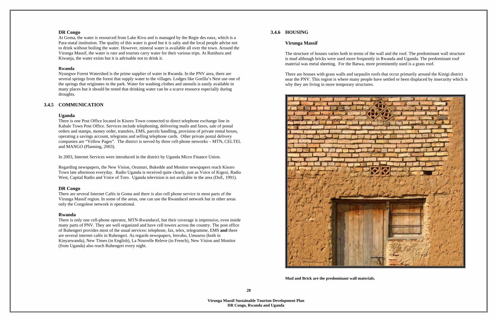
Virunga Massif Sustainable Tourism Development Plan
DR Congo, Rwanda and Uganda
28
DR Congo At Goma, the water is resourced from Lake Kivu and is managed by the Regie des eaux, which is a Para-statal institution. The quality of this water is good but it is salty and the local people advise not to drink without boiling the water. However, mineral water is available all over the town. Around the Virunga Massif, the water is rare and tourists carry water for their various trips. At Rutshuru and Kiwanja, the water exists but it is advisable not to drink it. Rwanda Nyungwe Forest Watershed is the prime supplier of water in Rwanda. In the PNV area, there are several springs from the forest that supply water to the villages. Lodges like Gorilla’s Nest use one of the springs that originates in the park. Water for washing clothes and utensils is easily available in many places but it should be noted that drinking water can be a scarce resource especially during droughts.
3.4.5 COMMUNICATION
Uganda There is one Post Office located in Kisoro Town connected to direct telephone exchange line in Kabale Town Post Office. Services include telephoning, delivering mails and faxes, sale of postal orders and stamps, money order, transfers, EMS, parcels handling, provision of private rental boxes, operating a savings account, telegrams and selling telephone cards. Other private postal delivery companies are “Yellow Pages”. The district is served by three cell-phone networks – MTN, CELTEL and MANGO (Planning, 2003). In 2003, Internet Services were introduced in the district by Uganda Micro Finance Union. Regarding newspapers, the New Vision, Orumuri, Bukedde and Monitor newspapers reach Kisoro Town late afternoon everyday. Radio Uganda is received quite clearly, just as Voice of Kigezi, Radio West, Capital Radio and Voice of Toro. Uganda television is not available in the area (DoE, 1991).
DR Congo There are several Internet Cafés in Goma and there is also cell phone service in most parts of the Virunga Massif region. In some of the areas, one can use the Rwandacel network but in other areas only the Congolese network is operational.
Rwanda There is only one cell-phone operator, MTN-Rwandacel, but their coverage is impressive, even inside many parts of PNV. They are well organized and have cell towers across the country. The post office of Ruhengeri provides most of the usual services: telephone, fax, telex, telegramme, EMS and there are several internet cafés in Ruhengeri. As regards newspapers, Imvaho, Umuseso (both in Kinyarwanda), New Times (in English), La Nouvelle Releve (in French), New Vision and Monitor (from Uganda) also reach Ruhengeri every night.
3.4.6 HOUSING Virunga Massif The structure of houses varies both in terms of the wall and the roof. The predominant wall structure is mud although bricks were used more frequently in Rwanda and Uganda. The predominant roof material was metal sheeting. For the Batwa, more prominently used is a grass roof. There are houses with grass walls and tarpaulin roofs that occur primarily around the Kinigi district near the PNV. This region is where many people have settled or been displaced by insecurity which is why they are living in more temporary structures.
Mud and Brick are the predominant wall materials.

Virunga Massif Sustainable Tourism Development Plan
DR Congo, Rwanda and Uganda
29
Table 5: The percentage of households with houses constructed of different wall and roof materials.
Wall Mud Brick Cement Planks Metal
sheet Grass Rocks Other
Batwa Bwindi 96.67 0.00 0.00 1.67 0.00 1.67 0.00 0.00 Batwa DRC 11.11 0.00 0.00 0.00 0.00 88.89 0.00 0.00 Batwa Echuya 100.00 0.00 0.00 0.00 0.00 0.00 0.00 0.00 Batwa Mgahinga 66.67 33.33 0.00 0.00 0.00 0.00 0.00 0.00 Batwa PNV 23.81 0.00 4.76 0.00 0.00 71.43 0.00 0.00 Bwindi 96.55 2.73 0.00 0.00 0.00 0.00 0.00 0.00 Echuya 97.28 2.04 0.00 0.00 0.00 0.00 0.00 0.00 Mgahinga 85.48 1.61 3.23 0.00 0.00 0.00 9.68 0.00 PNV 49.59 22.90 1.85 0.72 1.54 10.47 1.85 10.99 Virunga 82.59 2.46 0.45 5.58 0.00 7.81 0.67 0.45
Roof Grass Tiles Metal
sheet Tarp other
Batwa Bwindi 70.00 0.00 30.00 0.00 0.00 Batwa DRC 100.00 0.00 0.00 0.00 0.00 Batwa Echuya 100.00 0.00 0.00 0.00 0.00 Batwa Mgahinga 66.67 0.00 33.33 0.00 0.00 Batwa PNV 80.95 0.00 9.52 9.52 0.00 Bwindi 19.97 0.29 77.87 0.00 0.00 Echuya 10.20 0.00 88.44 0.68 0.00 Mgahinga 23.39 0.81 75.81 0.00 0.00 PNV 18.17 16.84 51.44 8.73 4.62 Virunga 41.29 0.00 54.69 3.35 0.67
Uganda There are four types of houses in Kisoro district and this has a direct relation to demographic changes especially population increase. These are (DoE, 2001): • traditional non-upgradable, constructed with mud, wattle and grass thatch (sorghum stalks,
papyrus ); • upgradable traditional houses commonly made of mud mixed with cement or sun dried bricks
with poles and iron sheets. These are common in trading centres and in the outskirts/suburbs of Kisoro Town;
• semi permanent houses made of sun-dried bricks/stones, walls with rough cast and iron sheet roof with ordinary foundation; and
• permanent houses – made of brick walls, stones, cemented floor, iron sheet or tiled roofs. This is common in trading centres, Kisoro Town Council and few well-to-do families in rural areas.
DR Congo The presence of granaries is very particular to DR Congo and one notice that the external housing décor is a lot more expressive than in Rwanda and Uganda.
Congolese houses are expressive and the granaries are distinctive. Rwanda More buildings use Volcanic Rock for walls than in either Uganda or DR Congo. The resultant forms fit in well with the lava surroundings. Bamboo is also used in the western part of PNV, in Mutura District where the roofs are made of bamboo.
Rwandan houses at the edge of PNV use a lot of lava rocks.
3.4.7 EDUCATION
Virunga Massif Sustainable Tourism Development Plan
DR Congo, Rwanda and Uganda
30
Uganda There are 6 secondary Schools, 1 Teacher Training College, 1 Vocational Institute, 1 Technical institute and 112 primary schools (DoE, 2001) in Kisoro District. DR Congo There are many secondary schools in Goma. Around Mikeno, there are primary schools, secondary schools and a technical institute. The U.S. International Partnership for Human Development in conjunction with the Ethnic Minority Pygmy Association has successfully integrated 737 Batwa pupils in 14 schools, exceeding their original goal of 500 students. Incentives are offered for school attendance such as medical attention, school supplies, uniforms, laundry soap, and school lunches during the hunting and harvest season. These programs show sensitivity to the challenges faced by Batwa. In order to be widely successful, though, more investment in these programs is needed. Education programs, such as the above mentioned, do much to alleviate ethnic discrimination. Grassroots organizations are forming to institute training and acceptance programs in local communities. Under an EU funded project Italian Cooperazione Internationale (COOPI) volunteers are working to spread respect of cultural, linguistic, and religious identity of the Aka, a group of Batwa living in Uganda. The program also issues birth certificates, the first step in allowing Batwa access to the judicial system and education.
Rwanda Of all the three countries, the Rwandan side of the Virunga Massif Region has the most information as regards to educational facilities (see map on opposite page). Apart from numerous primary and secondary schools, there is a new University under construction. This will become the first University in this region.
The new University which is located just outside Ruhengeri town.
4 TOURISM CONTEXT 4.1 WORLD TOURISM TRENDS
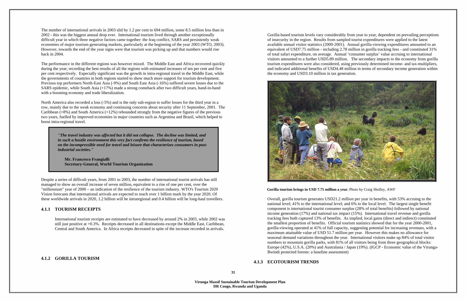
Virunga Massif Sustainable Tourism Development Plan
DR Congo, Rwanda and Uganda
31
The number of international arrivals in 2003 slid by 1.2 per cent to 694 million, some 8.5 million less than in 2002 - this was the biggest annual drop ever. International tourism lived through another exceptionally difficult year in which three negative factors came together: the Iraq conflict, SARS and persistently weak economies of major tourism-generating markets, particularly at the beginning of the year 2003 (WTO, 2003). However, towards the end of the year signs were that tourism was picking up and that numbers would rise back in 2004. The performance in the different regions was however mixed. The Middle East and Africa recovered quickly during the year; recording the best results of all the regions with estimated increases of ten per cent and five per cent respectively. Especially significant was the growth in intra-regional travel in the Middle East, while the governments of countries in both regions started to show much more support for tourism development. Previous top performers North-East Asia (-9%) and South East Asia (-16%) suffered severe losses due to the SARS epidemic, while South Asia (+17%) made a strong comeback after two difficult years, hand-in-hand with a booming economy and trade liberalization. North America also recorded a loss (-5%) and is the only sub-region to suffer losses for the third year in a row, mainly due to the weak economy and continuing concerns about security after 11 September, 2001. The Caribbean (+8%) and South America (+12%) rebounded strongly from the negative figures of the previous two years, fuelled by improved economies in major countries such as Argentina and Brazil, which helped to boost intra-regional travel. Despite a series of difficult years, from 2001 to 2003, the number of international tourist arrivals has still managed to show an overall increase of seven million, equivalent to a rise of one per cent, over the "millennium" year of 2000 – an indication of the resilience of the tourism industry. WTO's Tourism 2020 Vision forecasts that international arrivals are expected to reach over 1 billion mark by the year 2020. Of these worldwide arrivals in 2020, 1.2 billion will be intraregional and 0.4 billion will be long-haul travellers. 4.1.1 TOURISM RECEIPTS
International tourism receipts are estimated to have decreased by around 2% in 2003, while 2002 was still just positive at +0.3%. Receipts decreased in all destinations except the Middle East, Caribbean, Central and South America. In Africa receipts decreased in spite of the increase recorded in arrivals.
4.1.2 GORILLA TOURISM
Gorilla-based tourism levels vary considerably from year to year, dependent on prevailing perceptions of insecurity in the region. Results from sampled tourist expenditures were applied to the latest available annual visitor statistics (2000-2001). Annual gorilla-viewing expenditures amounted to an equivalent of USD7.75 million - including 2.78 million in gorilla tracking fees - and constituted 31% of total safari expenditure, on average. Annual ‘consumer surplus’ value accruing to international visitors amounted to a further USD5.89 million. The secondary impacts to the economy from gorilla tourism expenditures were also considered, using previously determined income- and tax-multipliers, and indicated additional benefits of USD4.48 million in terms of secondary income generation within the economy and USD3.10 million in tax generation.
Gorilla tourism brings in USD 7.75 million a year. Photo by Craig Sholley, AWF
Overall, gorilla tourism generates USD21.2 million per year in benefits, with 53% accruing to the national level; 41% to the international level; and 6% to the local level. The largest single benefit component is international tourist consumer surplus (28% of total benefits) followed by national income generation (17%) and national tax impact (15%). International travel revenue and gorilla tracking fees both captured 13% of benefits. As implied, local gains (direct and indirect) constituted the smallest proportion of benefits. Official tourism statistics showed that for the year 2000-2001, gorilla-viewing operated at 41% of full capacity, suggesting potential for increasing revenues, with a maximum attainable value of USD 51.7 million per year. However this makes no allowance for seasonal demand variations throughout the year. International visitors make up 84% of total visitor numbers to mountain gorilla parks, with 81% of all visitors being from three geographical blocks: Europe (42%), U.S.A. (20%) and Australasia / Japan (19%). (IGCP - Economic value of the Virunga-Bwindi protected forests: a baseline assessment)
4.1.3 ECOTOURISM TRENDS
"The travel industry was affected but it did not collapse. The decline was limited, and in such a hostile environment this very fact confirms the resilience of tourism, based on the incompressible need for travel and leisure that characterizes consumers in post-industrial societies."
Mr. Francesco Frangialli Secretary-General, World Tourism Organization
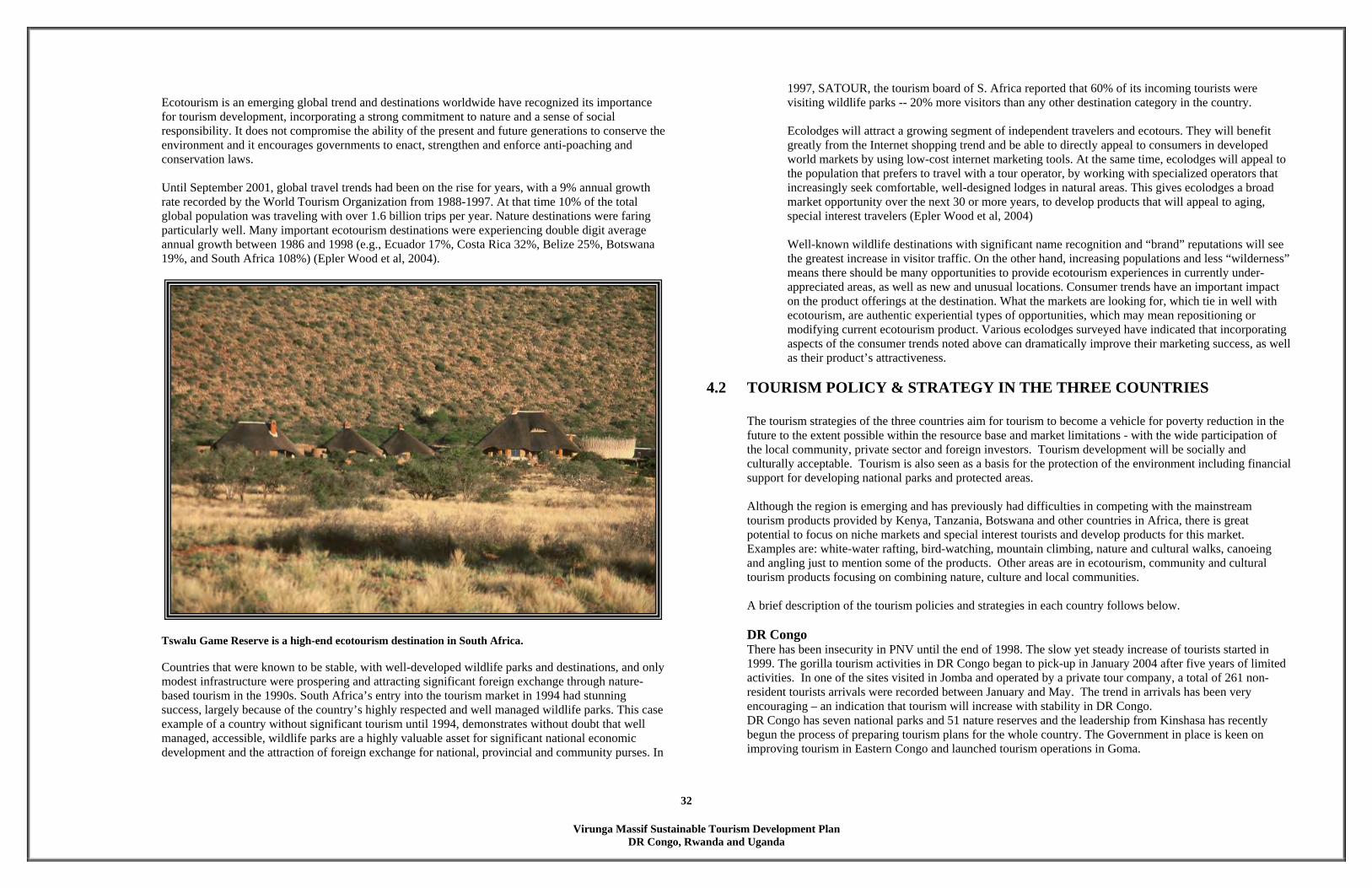
Virunga Massif Sustainable Tourism Development Plan
DR Congo, Rwanda and Uganda
32
Ecotourism is an emerging global trend and destinations worldwide have recognized its importance for tourism development, incorporating a strong commitment to nature and a sense of social responsibility. It does not compromise the ability of the present and future generations to conserve the environment and it encourages governments to enact, strengthen and enforce anti-poaching and conservation laws.
Until September 2001, global travel trends had been on the rise for years, with a 9% annual growth rate recorded by the World Tourism Organization from 1988-1997. At that time 10% of the total global population was traveling with over 1.6 billion trips per year. Nature destinations were faring particularly well. Many important ecotourism destinations were experiencing double digit average annual growth between 1986 and 1998 (e.g., Ecuador 17%, Costa Rica 32%, Belize 25%, Botswana 19%, and South Africa 108%) (Epler Wood et al, 2004).
Tswalu Game Reserve is a high-end ecotourism destination in South Africa. Countries that were known to be stable, with well-developed wildlife parks and destinations, and only modest infrastructure were prospering and attracting significant foreign exchange through nature-based tourism in the 1990s. South Africa’s entry into the tourism market in 1994 had stunning success, largely because of the country’s highly respected and well managed wildlife parks. This case example of a country without significant tourism until 1994, demonstrates without doubt that well managed, accessible, wildlife parks are a highly valuable asset for significant national economic development and the attraction of foreign exchange for national, provincial and community purses. In
1997, SATOUR, the tourism board of S. Africa reported that 60% of its incoming tourists were visiting wildlife parks -- 20% more visitors than any other destination category in the country.
Ecolodges will attract a growing segment of independent travelers and ecotours. They will benefit greatly from the Internet shopping trend and be able to directly appeal to consumers in developed world markets by using low-cost internet marketing tools. At the same time, ecolodges will appeal to the population that prefers to travel with a tour operator, by working with specialized operators that increasingly seek comfortable, well-designed lodges in natural areas. This gives ecolodges a broad market opportunity over the next 30 or more years, to develop products that will appeal to aging, special interest travelers (Epler Wood et al, 2004)
Well-known wildlife destinations with significant name recognition and “brand” reputations will see the greatest increase in visitor traffic. On the other hand, increasing populations and less “wilderness” means there should be many opportunities to provide ecotourism experiences in currently under-appreciated areas, as well as new and unusual locations. Consumer trends have an important impact on the product offerings at the destination. What the markets are looking for, which tie in well with ecotourism, are authentic experiential types of opportunities, which may mean repositioning or modifying current ecotourism product. Various ecolodges surveyed have indicated that incorporating aspects of the consumer trends noted above can dramatically improve their marketing success, as well as their product’s attractiveness.
4.2 TOURISM POLICY & STRATEGY IN THE THREE COUNTRIES The tourism strategies of the three countries aim for tourism to become a vehicle for poverty reduction in the future to the extent possible within the resource base and market limitations - with the wide participation of the local community, private sector and foreign investors. Tourism development will be socially and culturally acceptable. Tourism is also seen as a basis for the protection of the environment including financial support for developing national parks and protected areas. Although the region is emerging and has previously had difficulties in competing with the mainstream tourism products provided by Kenya, Tanzania, Botswana and other countries in Africa, there is great potential to focus on niche markets and special interest tourists and develop products for this market. Examples are: white-water rafting, bird-watching, mountain climbing, nature and cultural walks, canoeing and angling just to mention some of the products. Other areas are in ecotourism, community and cultural tourism products focusing on combining nature, culture and local communities. A brief description of the tourism policies and strategies in each country follows below.
DR Congo There has been insecurity in PNV until the end of 1998. The slow yet steady increase of tourists started in 1999. The gorilla tourism activities in DR Congo began to pick-up in January 2004 after five years of limited activities. In one of the sites visited in Jomba and operated by a private tour company, a total of 261 non- resident tourists arrivals were recorded between January and May. The trend in arrivals has been very encouraging – an indication that tourism will increase with stability in DR Congo. DR Congo has seven national parks and 51 nature reserves and the leadership from Kinshasa has recently begun the process of preparing tourism plans for the whole country. The Government in place is keen on improving tourism in Eastern Congo and launched tourism operations in Goma.
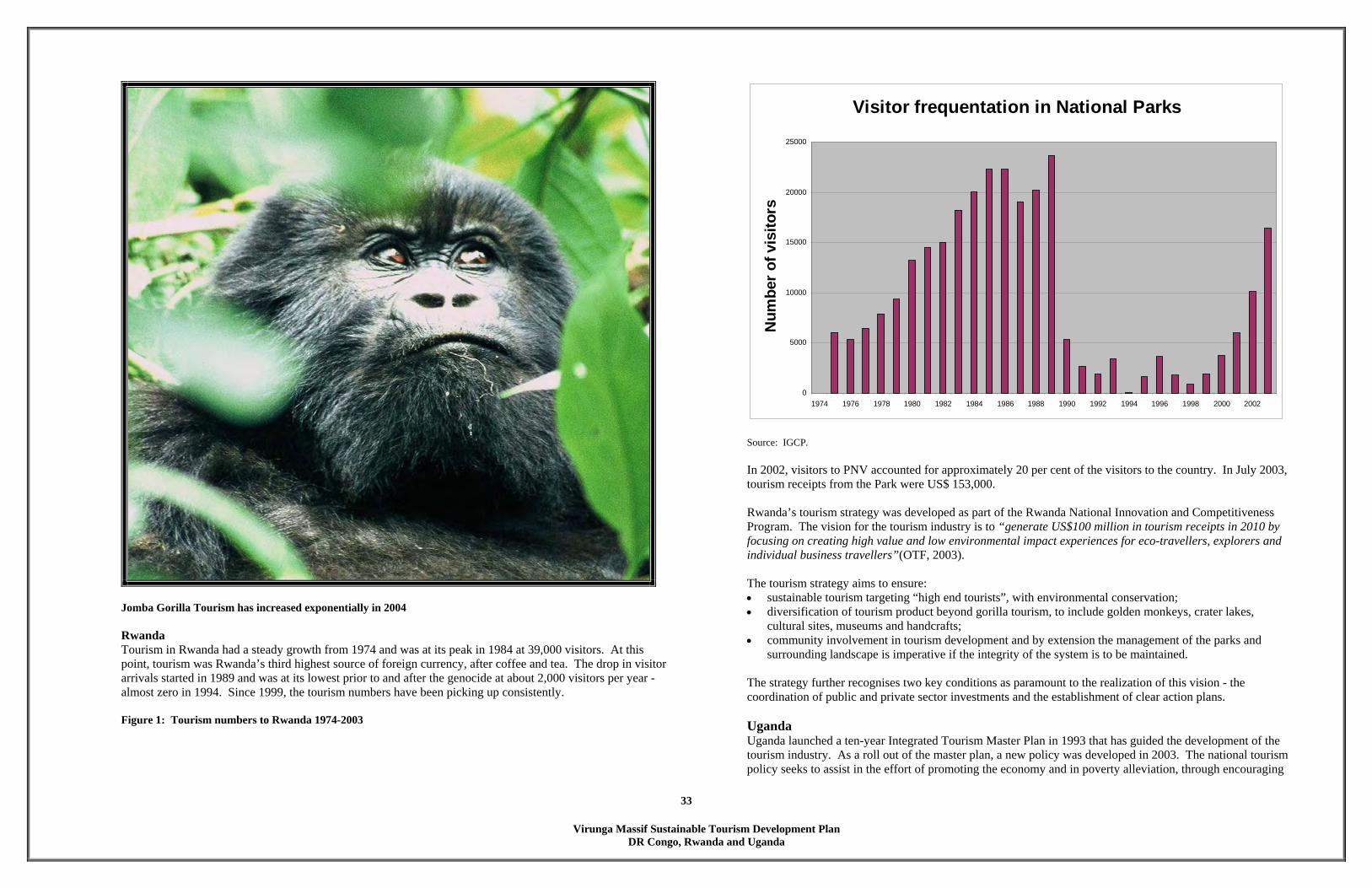
Virunga Massif Sustainable Tourism Development Plan
DR Congo, Rwanda and Uganda
33
Jomba Gorilla Tourism has increased exponentially in 2004
Rwanda Tourism in Rwanda had a steady growth from 1974 and was at its peak in 1984 at 39,000 visitors. At this point, tourism was Rwanda’s third highest source of foreign currency, after coffee and tea. The drop in visitor arrivals started in 1989 and was at its lowest prior to and after the genocide at about 2,000 visitors per year -almost zero in 1994. Since 1999, the tourism numbers have been picking up consistently.
Figure 1: Tourism numbers to Rwanda 1974-2003
Visitor frequentation in National Parks
0
5000
10000
15000
20000
25000
1974 1976 1978 1980 1982 1984 1986 1988 1990 1992 1994 1996 1998 2000 2002
Num
ber o
f vis
itors
Source: IGCP.
In 2002, visitors to PNV accounted for approximately 20 per cent of the visitors to the country. In July 2003, tourism receipts from the Park were US$ 153,000. Rwanda’s tourism strategy was developed as part of the Rwanda National Innovation and Competitiveness Program. The vision for the tourism industry is to “generate US$100 million in tourism receipts in 2010 by focusing on creating high value and low environmental impact experiences for eco-travellers, explorers and individual business travellers”(OTF, 2003). The tourism strategy aims to ensure: • sustainable tourism targeting “high end tourists”, with environmental conservation; • diversification of tourism product beyond gorilla tourism, to include golden monkeys, crater lakes,
cultural sites, museums and handcrafts; • community involvement in tourism development and by extension the management of the parks and
surrounding landscape is imperative if the integrity of the system is to be maintained. The strategy further recognises two key conditions as paramount to the realization of this vision - the coordination of public and private sector investments and the establishment of clear action plans.
Uganda Uganda launched a ten-year Integrated Tourism Master Plan in 1993 that has guided the development of the tourism industry. As a roll out of the master plan, a new policy was developed in 2003. The national tourism policy seeks to assist in the effort of promoting the economy and in poverty alleviation, through encouraging

Virunga Massif Sustainable Tourism Development Plan
DR Congo, Rwanda and Uganda
34
the development of sustainable and quality tourism. It also seeks to market Uganda as a favoured tourist destination for ecotourism, in a country renowned for its biodiversity, cultural richness and hospitable people. The philosophies conceived under the plan include: • sustainable tourism • diversification of tourism product • promotion linkages of tourism circuits with other regional countries. The objective of the national tourism policy is to define a new way forward for tourism development leading to an increase in the present level of tourist arrivals to Uganda from about 200,000 to 500,000 in ten years. The growth will in particular take place in pleasure/holiday tourism from about 25,000 tourists to approximately 100,000. Foreign revenues from tourism activities are higher than the revenues from coffee and tea which were previously the first earner. Tourism earnings in 2002 were US $ 170,000 and 1,400,000 in 2003 from tourism operations. The target is to attain US $6m in the year 2008.
As part of the country’s decentralization policy, the country has divided the country into tourism zones and decentralized the tourism function to the districts. In this regard, tourism development plans will be developed for all the districts. Two plans have already been developed - The Kisoro Tourism Development Plan covering MGNP and Bwindi Impenetrable National Forest (BINP) and the Kanungu Tourism Development Plan covering BINP and Queen Elizabeth National Park Ishasha sector have been developed and are ready for implementation. This plan includes all the recommendations made by the Kisoro Tourism Development Plan. Uganda Wildlife Authority implicates the community in the management of tourism operations. This also entails the involvement of UCOTA (Uganda Community Tourism Association)
4.3 TOURISM ATTRACTIONS The tourism attractions in the region are not only vast, but very unique to the Virunga Massif. This is one of only two places in the world where tourists can view mountain gorillas in their natural habitat and therefore gorilla tracking has been the key tourism attraction. The design charettes were keen to look beyond gorilla tourism to widen the attraction and possibly expand the number of visitor attractions and hence the extend bed nights. Several natural and heritage attractions were unearthed, with each country having a fair share of attractions – some similar in nature and others completely unique to a particular area. The teams distinguished the following available and possible attractions in the Virunga Massif:
a. community projects: cultural dancing, traditional music & instruments, handicrafts, traditional medicines, agriculture camps, traditional activities. Community attractions and activities are an untapped potential in the area. The benefits have the potential of spreading from small localized groups (e.g. in dances) to a wide cross section of the population (e.g. in handicrafts tapping into the regional and international markets)
b. natural and heritage sites – tracking of golden monkeys, forest tracking, mountain climbing on the volcanoes, scenic viewing, lava attractions, lakes, falls & rivers, hot water springs, monuments & heritage sites, caves for exploration and savannah mammals (lions, buffalos and elephants).
The cave systems in the Virunga Massif region are an untapped market. While one can argue that savannah mammals are not unique to the region, and are famous in the South and East African countries, the fact that the big five exist in close proximity to the other attractions like gorillas, would make a complete and exciting circuit for tourists thus avoiding long distance travels and consolidating incomes to the region. Some unique features included butterfly and bird watching – with the endangered Bradypterus graueri (Grauer’s Rush Warbler) only found in Echuya, Rugezi Swamp and in Bwindi. In DR Congo some of the volcanoes are still active and would make exciting attractions/aerial trips for geographers and explorers.

Virunga Massif Sustainable Tourism Development Plan
DR Congo, Rwanda and Uganda
35
Community Attractions
Attraction DR Congo Rwanda Uganda Culture dancing Mudiho, Batwa and Intore
communities in Rumangabo, Rugari, Jomba, Bukima, Gatovu, Kibumba and Kashwa.
Ikinimba, Intore, Ikinyemera, Ibyivugo, Imparamba*
Dances and drama in Musasa, Katere
Handicrafts Focused on local architecture objects: basket making, pottery, painting and blacksmith from Jomba, Rugari and Kashwa.
Homestead construction, basket weaving, pots making, wood carving, milk pots making, chalk mining, and tradition weapon making
Muramba, Bapfakurere, Batwa Villages
Traditional activities
Rugari (traditional medicines) Kibumba for nature walks (agriculture camps)
Fire making (urushingo), traditional healing and botanical gardens, witchcraft (ubupfumu), foretelling, cultural dressing, grain growing, beer brewing, milk churning and honey harvesting.
Iron blacksmith in Kabande and Nyarrubuye Story telling in Gitenderi, Mabungo Village walks, home stead visits and story telling in Ntere, Kisoro
Traditional music & instruments
Urwengo, cithare (inanga), flute (umwirongi) and drums
*Each cultural dance is special and for a special occasion. For example Imparamba is danced by agriculture people to show the importance of their profession and they sometimes wear banana leaves while dancing. Natural and Historical Sites Attraction DR Congo Rwanda Uganda Gorillas tracking Jomba, Bukima, Bikenge PNV
Virunga Discovery Center and veterinary center
MGNP
Chimpanzees & Monkeys
Tongo Golden monkeys visit Echuya
Volcanoes – mountain climbing
Nyiragongo, Nyamulagira, Mikeno
Karisimbi, Bisoke, Muhabura, Gahinga, Sabyinyo, Rock climbing
Muhabura, Gahinga, Sabyinyo
Volcanoes – scenic viewing, calderas
Sagitwe and Gasave
Lava attractions Nyiragongo, Nyamuragira and combines Goma, Monigi and Tongo.
Attraction DR Congo Rwanda Uganda Lakes, Falls & Rivers
Lake Edward & fishing sites in Vitshumbi; River Rutshuru for sport fishing in Rwindi; Rutshuru falls in Nyagahanga Rutshuru Green lake (unique crater lake) in Goma; Lake Kivu at Goma for swimming.
Lakes (Kivu) Water falls of Mutobo and Rusumo Burera-Ruhondo hanging (twin) lakes Mudeli lake (on the sides of Karisimbi mount)
Canoeing, boat riding on lakes Mutanda, Murehe, Chahafi and Kayumbu. Water Falls walks in Busanza
Hot water springs Mayi ya Moto Rwindi Site near Gisenyi Water spa springs Chuho, Chihe
Monuments & Heritage sites
Conservation heroes of VNP in Rwindi. The tomb of Akeley in Kabara between mount Mikeno and Karisimbi. Stele of 60th anniversary of VNP, a subject to visit and found in Rwindi.
Heritage site in Byangabo Buhanga heritage eco park site
Historical sites viewing in Ruganzu The tomb of Akeley in Kabara between mount Mikeno and Karisimbi. Stele of 60th anniversary of VNP, a subject to visit and found in Rwindi.
Caves for exploration
Jomba parish, Gitindagasani and Gihira, Bunagana and Rumangabo, Kabanda
Ruganzu Trails, Musanze and Muhabura, Busasamana and Mutura
Garama, Rutare, Mwambike, Sooko, Nyagihongo, Natete, Kangoma, Kabindi, Bukere.
Savannah mammals (lions, buffalos and elephants)
Rwindi
Others Village pictures in Kanyabayonga for exploration. Natural toxic gases like Mazuku in Karengera
Karisoke research center Genocide memorials in Kinigi & Bigogwe Traditional rocks Gahunga k’abarashi where a certain Rukara is said to have killed, for the first time in Rwanda, a white man (Urugezi rwa Nyirantwari Traditional mineral watering holes like Mpenge and Rubindi, Amakera of Karago, Kigufi and Karambo. Dian Fossey Discovery Center )
Bird and butterfly watching in Mgahinga, Echuya, Buhungiro, Chahafi, Mulehe, Mutanda, Soda water viewing in Nkaka, Rwabara Interpretation center in Muganza Hiking in Kigeli Caldera viewing in Sagitwe, Gisozi Salt water and tasting in Nkaka Forest, canopy and board walks in MGNP, Bunagana, Echuya

Virunga Massif Sustainable Tourism Development Plan
DR Congo, Rwanda and Uganda
36
4.4 ACCOMMODATION FACILITIES
There are approximately sixteen (16) accommodation facilities in the PNVi area, DR Congo, twenty one (21) in PNV Rwanda and twenty five (25) around the MGNP in Kisoro. The quality of the hotels varies greatly in quality, service and in prices. The newer hotels like Stella Matutina Hotel and Le Chalet in Goma, Gorillas Nest, Volcanoes Safaris Camp and Kivu Sun in Rwanda have made great strides in developing internationally competitive facilities for tourists. In DR Congo the existing facilities can be rehabilitated to match international standards, while in Rwanda, the Ministry of Commerce is in the process of grading the existing facilities. As part of the process of opening up the tourism and developing facilities, the workshop recommended that the tourism management bodies of each country develop standards for the development of physical facilities, including recommended sizes. It should be noted that there is currently no ecolodge in the Virunga Massif Region and also no five-star hotel.
DR Congo, Goma 1. Stella Matutina Hotel 2. Ihusi Hotel 3. Ishango Hotel 4. Le Chalet Hotel 5. La Frontiere Hotel 6. Karibu Hotel 7. VIP Hotel 8. Grand-Lacs Hotel 9. Nyira Hotel 10. Masque Hotel 11. Jambo Safari (under construction)
DR Congo, other areas 1. Grefamu Hotel, Kiwanja (Rutshuru) 2. Jambo Safari banda and campsite, Jomba 3. Safari Lodge, Jomba (under construction) 4. Soko Mutu Lodge, Tongo 5. Centre d’accueil protestant, Kiwanja,
(Rutshuru)
Rwanda, Ruhengeri and Environs Name Price (US $) No of Rooms 1. Gorilla Nest 65-80 45 2. EER Guest House 10-20 31 3. Muhabura 20-30 12 4. Centre Catholique Notre
Dame de Fatima, 30-50 15
5. Kinigi Guest House 10-30 12 6. Urumuri 8 5 7. Home D’accueil 7-10 11 8. Cinfop 7-10 8 9. Tourist Rest 11 9 10. Volcanoes Virunga Lodge 200 11. Kinigi Community Lodge
(planned)
12. Buhanga 13. Musangabo Tourist Site
Rwanda, Gisenyi
Name Cost (US$) No of Rooms 1. Palm Beach Hotel 40 20 2. Dos’s Guest House 15-40 12 3. Regina Hotel 20 10 4. Urumuri 15-20 15 5. Kivu Sun Hotel 65-70 - 6. Centre D’accueil 8-12 15 7. Ubumwe Plazza - - 8. Auberge De Gisenyi - - 9. Le Belvedere - -
Uganda, Kisoro
Name Cost (US$) No of rooms 1. Volcanoes Rest Camp 35 - 95 2. Travellers Rest Camp 18 - 45 3. Tourist Hotel 18 - 45 4. Sky Blue Hotel 8 - 16 5. Virunga Hotel 8 - 16 6. Mgahinga Safari Lodge 35 - 95 7. Amajambere Iwacu
Camp 8 - 18
8. Rugigana Camp Site 2 - 3 9. Bufumbira Hote 2 - 3 10. Buhungiro Camp Site 2 - 3 11. Bunagana Modern
Lodge 2 - 3
12. California Hotel 2 - 3 13. Gashumba Hotel 2 - 3 14. Grolia Hotel 2 - 3 15. Hellelua Camp Site 2 - 3 16. Kwemera Hotel 2 - 3 17. Karisimbi Camp Site 2 - 3 18. Moon Light Hotel 2 - 3 19. Mubano Hotel 8 - 16 20. Park View Hotel 2 - 3 21. Comfort Inn 2 - 3 22. Duftumukiza Camp
Site 2 - 3
23. Starlight 2 - 3 24. Gardens Hotel 2 - 3 25. Chahafi Camp Site 2 - 3

Virunga Massif Sustainable Tourism Development Plan
DR Congo, Rwanda and Uganda
37
5 TOURISM DEVELOPMENT PLAN 5.1 PHYSICAL ANALYSIS
5.1.1 TOPOGRAPHY
Virunga Massif
The Virunga Massif includes 6 volcanoes (see map overleaf), the peak of 5 of these marking the border between DR Congo, Rwanda and Uganda. From East to West the volcanoes are: • Muhabura (4127 m): Its cone includes a crater occupied by a lake approximately 36m in diameter
at its summit. • Gahinga (3474 m): Its two-tiered swamp crater is about 180m diameter at the summit. • Sabyinyo (3634 m): The oldest and most eroded of the chain, its collapsed crater is several
hardened lava crests, exposed by erosion. • Bisoke (3711 m): It’s a truncated cone whose crater is occupied by a lake. Most particularly, it
presents enormous abrupt ravines. • Karisimbi (4507 m): The highest, largest volcano and most complex of the chain. Its peak is
sometimes covered by snow. • Mikeno (4437m): It has the most pointed peak and is the most difficult volcano to climb.
The Uganda side of the massif (MGNP) extends from about 1,117m to 4,127m with a terrain that ranges from gentle slopes at lower elevations to steep, very diverse, rugged slopes exceeding 60o at high altitudes. The three volcanoes in MGNP are thought to have arisen in the early to mid-Pleistocene era, and to have formed through a deposition of layers of ash and cinders from successive lava flows (Kingston, 1967). There are numerous caves on the slopes of the mountains, caused by lava tubes. The soils are all derived from volcanic activity and reflect the relatively short time since the last eruption.
The two-tiered Swamp crater of Mt. Gahinga
5.1.2 VEGETATION The afro mountainous vegetation extends as a succession of vegetation zones principally determined by altitude. This classification covers 5 vegetation zones (Troupin, 1993): a) Neoboutonia zone: This zone is only on the Eastern side of the Rwanda volcanoes and
everywhere on the Congo side, up to 2500 m. The dominating species is the Neoboutonia microcalyx, which forms a dense forest with a median height of 20m. Lianas and epiphytes are abundant and the grass cover sometimes reaches 2m. This zone is very limited in Rwanda since the PNV has been successively amputated of its lower areas.
b) Bamboo (Arundinaria alpina) zone : It’s a giant species of the Graminee family which can be seen at the lower altitudes of all three parks. Almost everywhere the bamboo inhibits the growth of herbaceous vegetation. The dense thickets crossed by lianas make walking difficult outside of established paths. In the Eastern side of the PNV, the bamboo is located between 2500 and 3200m, while in the West the bamboo is located between 2500 and 2800m. The medium height of bamboo is about 8m.
c) Hagenia-Hypericum zone: The hagenia (Hagenia abysinica) are the tallest trees in the forest and are characterized by their imposing and tormented shape. They reach 25m height and are covered by moss and orchids. The soil in this zone is usually covered by dense vegetal associations, including grasses, lianas and shrubs. The hypericum (Hypericum revolutum), smaller than the hagenia and with yellow flowers, grows all over the massif. Groups of Vernonia adolfii-frederici, a pale mauve flower shrub, are associated to the forest zone. In this zone we also find Dombeya goetzenii. The hypericum becomes more and more abundant as we go up in altitude. At superior altitudes, the hagenia population becomes less dense, and then inexistent, and the hypericum forms a thicket with an 8m average height.
d) Sub-alpine zone: Starts when the hypericum becomes rare and disappears towards 3300m. The arborescent heathers (Erica arborea), lobelias and giant senecons dominate this tier.
e) Afro-alpine zone: Found above 4000m and consists of simpler but fragile vegetal communities. Evergreen shrubs and flowers dominate a soil covered with short grasses. Most of the rock escarpments and ravines are colonized by moss and lichen communities, of all colors. The mosses are predominant close to the Karisimbi peak.
Detail of Bamboo forest

Virunga Massif Sustainable Tourism Development Plan
DR Congo, Rwanda and Uganda
38
Rwanda Less than 5% of the region outside the Virunga Massif remains in natural condition. The biologically diverse lower montane forest zone, between 1600 and 2600m has been systematically eliminated by human settlement and clearing, leaving behind only its contribution of organic matter to enrich the soil capital of the region. A relic band remains, however, between Mts. Gahinga and Sabyinyo. There, Neobutonia, Mimulopsis, Agauria, Prunus, Bersama, Xymalos and Vernonia combine with numerous lianas, epiphytes and grasses to form a relatively rich community. Along most of the park’s lower boundary, though, homogeneous stands of bamboo (Arundinaria alpina) predominate, interspersed with grassy clearings.
Sub-alpine vegetation covers the zone between the elevations of 3000 and 4000 meters. Giant heath formations of phillipia and Erica extend down into the forest zone along exposed, rocky ridges, while giant forms of Senecio and Lobelia predominate higher up. The ground cover throughout this zone is characterized by communities of Rubus, Alchemilla, Helichrysum and Volkensia shrubs, mixed with various grasses and lichens. Where conditions permit, acidic marshes of Carex and Sphagnum also exist in this zone. At the highest elevation, above 4000m, even shrubs disappear and give way to communities of grasses, mosses and lichens. These alpine formations are not only less diverse, but also more fragile than other zones. One should note that there is considerable overlap between zones and numerous mosaic patterns exist within the lower zones. The resultant transition zones where plant communities mix are called ecotones; and they are important not only for their greater floristic diversity, but also as primary habitat for park wildlife. Wetlands have undergone extensive conversion and drainage for agricultural purposes. However, the non-cultivated core of Rugezi marsh is a major natural area dominated by Miscanthidium, papyrus and Cyperus species (Weber, 1987). Uganda The vegetation in MGNP consists of woodland, and only a small area of pure montane forest still remains at the base of Mt Muhabura following encroachment in the 1950s. Above the montane forest belt is the bamboo (Arundinaria alpina) zone that stretches from the western boundary on Sabyinyo to the lower slopes of Muhabura. The Hagenia-Hypericum zone appears above the bamboo zone on Mt. Sabyinyo and below it on Gahinga. The Afro-Alpine Belt, characterised by giant Senecio and Lobelia species, occurs above the Ericacious Belt and reaches its maximum development on Mt. Muhabura. As mentioned earlier in this report, human settlement in MGNP used to occupy a large part of the park before its gazettement and because of the various boundary changes. Agricultural activities have therefore been largely responsible for most of the exotic species found in the PA. In MGNP a study carried out on the status of exotic species (Lejju, 1999) revealed that close to 0.6% of the park’s area is covered by exotic woodlots of black wattle (Acacia mearnsii), Eucalyptus, Cupressus and Pinus. These were planted by the Forest Department when it was a forest reserve. The extent of Acacia mearnsii and Eucalyptus seems to be increasing. It was also noted that there is low establishment of indigenous tree species
Eucalyptus and Black Wattle are invasive and need to be eradicated.
GEOLOGY AND SOILS
The entire basement formation of the region consists of Precambrian rocks from which harder lithologies have obtruded and softer ones eroded. In addition, this underlying structure has been significantly altered over the millennia by faulting, vulcanism, tectonic movements and alluvial deposition (Weber, 1987). The late Tertiary and Quaternary eruptions of the Virunga volcanoes spread successive layers of lava over the Precambrian bedrock. Continual weathering of the soft parent material has produced extremely fertile soils across most of this zone, although its high porosity has also precluded the presence of significant surface water resources.
The four principal source materials for the soils of this region are lava, schists, granite and quartz. High concentrations of organic matter and high PH make the soils very fertile. Characteristics of these soils include high natural moisture and low bulk density. Soils outside the Virunga Massif have generally good agricultural potential. Serious problems of erosion control and fertility maintenance, however, are widespread and require careful attention. In Rwanda, the soil is made of brown clayey earth, covered by a layer of dark earth. The volcanic nature of the rock, together with the climate and vegetation characteristics, has created a volcanic soil which is generally basic and forest-type (inceptisols).
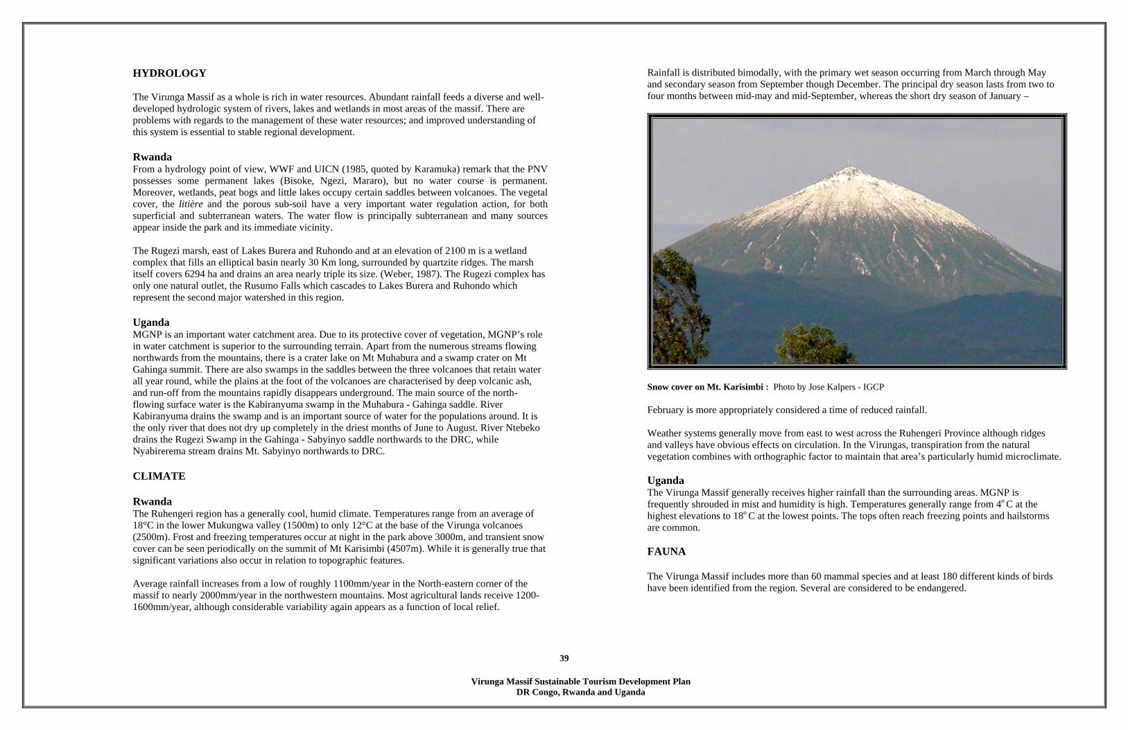
Virunga Massif Sustainable Tourism Development Plan
DR Congo, Rwanda and Uganda
39
HYDROLOGY
The Virunga Massif as a whole is rich in water resources. Abundant rainfall feeds a diverse and well-developed hydrologic system of rivers, lakes and wetlands in most areas of the massif. There are problems with regards to the management of these water resources; and improved understanding of this system is essential to stable regional development.
Rwanda From a hydrology point of view, WWF and UICN (1985, quoted by Karamuka) remark that the PNV possesses some permanent lakes (Bisoke, Ngezi, Mararo), but no water course is permanent. Moreover, wetlands, peat bogs and little lakes occupy certain saddles between volcanoes. The vegetal cover, the litière and the porous sub-soil have a very important water regulation action, for both superficial and subterranean waters. The water flow is principally subterranean and many sources appear inside the park and its immediate vicinity. The Rugezi marsh, east of Lakes Burera and Ruhondo and at an elevation of 2100 m is a wetland complex that fills an elliptical basin nearly 30 Km long, surrounded by quartzite ridges. The marsh itself covers 6294 ha and drains an area nearly triple its size. (Weber, 1987). The Rugezi complex has only one natural outlet, the Rusumo Falls which cascades to Lakes Burera and Ruhondo which represent the second major watershed in this region.
Uganda MGNP is an important water catchment area. Due to its protective cover of vegetation, MGNP’s role in water catchment is superior to the surrounding terrain. Apart from the numerous streams flowing northwards from the mountains, there is a crater lake on Mt Muhabura and a swamp crater on Mt Gahinga summit. There are also swamps in the saddles between the three volcanoes that retain water all year round, while the plains at the foot of the volcanoes are characterised by deep volcanic ash, and run-off from the mountains rapidly disappears underground. The main source of the north-flowing surface water is the Kabiranyuma swamp in the Muhabura - Gahinga saddle. River Kabiranyuma drains the swamp and is an important source of water for the populations around. It is the only river that does not dry up completely in the driest months of June to August. River Ntebeko drains the Rugezi Swamp in the Gahinga - Sabyinyo saddle northwards to the DRC, while Nyabirerema stream drains Mt. Sabyinyo northwards to DRC.
CLIMATE
Rwanda The Ruhengeri region has a generally cool, humid climate. Temperatures range from an average of 18°C in the lower Mukungwa valley (1500m) to only 12°C at the base of the Virunga volcanoes (2500m). Frost and freezing temperatures occur at night in the park above 3000m, and transient snow cover can be seen periodically on the summit of Mt Karisimbi (4507m). While it is generally true that significant variations also occur in relation to topographic features.
Average rainfall increases from a low of roughly 1100mm/year in the North-eastern corner of the massif to nearly 2000mm/year in the northwestern mountains. Most agricultural lands receive 1200-1600mm/year, although considerable variability again appears as a function of local relief.
Rainfall is distributed bimodally, with the primary wet season occurring from March through May and secondary season from September though December. The principal dry season lasts from two to four months between mid-may and mid-September, whereas the short dry season of January –
Snow cover on Mt. Karisimbi : Photo by Jose Kalpers - IGCP
February is more appropriately considered a time of reduced rainfall. Weather systems generally move from east to west across the Ruhengeri Province although ridges and valleys have obvious effects on circulation. In the Virungas, transpiration from the natural vegetation combines with orthographic factor to maintain that area’s particularly humid microclimate.
Uganda The Virunga Massif generally receives higher rainfall than the surrounding areas. MGNP is frequently shrouded in mist and humidity is high. Temperatures generally range from 4o C at the highest elevations to 18o C at the lowest points. The tops often reach freezing points and hailstorms are common.
FAUNA
The Virunga Massif includes more than 60 mammal species and at least 180 different kinds of birds have been identified from the region. Several are considered to be endangered.

Virunga Massif Sustainable Tourism Development Plan
DR Congo, Rwanda and Uganda
40
Rwanda The plant communities in PNV provide habitat for a surprising variety of animal species. In addition to more than 100 species of birds, the park contains buffalo, bushbuck and four types of primates including the rare golden monkey and the highly endangered mountain gorilla. Today, the big mammals in the park are: Elephant, Buffalo, the Guib harnaché, the Black Front Céphalophe, the Potamachère, and the Daman to only mention the herbivorous ones. Carnivores:
• Spotted hyena • Striped Chacal (IMBWEBWE) • Genette (URUTONI) • Civet (IMPIMBI) • Serval (IMONDO) • Mongoose (AKAYONGWE)
Primates:
• Golden monkey (INKIMA) • Blue or silver monkey • Mountain gorilla (Gorilla gorilla beringei)
Birds: The Virunga massif includes many bird species, of which two are endemic species:
• Shelley astrild (cryptospiza shelleyi) • Grauer warbler (bradypterus graueri)
The other most typical species are:
• Rwenzori touraco (Musophaga johnstoni) • Remeron pigeons (Columba arquatrix) are abundant. • Johnston mectarin (Nectarinia johnstoni), whose male is enterely metallic green-blue with
large red pectoral tufts and long tail.
Uganda In MGNP, 39 mammal species have been recorded, but it is believed that up to 89 do occur (Baranga 1990). The larger mammals include the mountain gorilla (Gorilla beringei beringei), buffalo (Syncerus caffer) and elephant (Loxondata africana). There is also the rare golden monkey (Cercophithecus mitis kandti) known only to occur in the Virungas and two other forests in Central Africa and the blue monkey (Cercopithecus mitis sp.). Other mammals include the golden cat (Felis (Profelis) aurata), serval cat (Felis (Leptculurus) serval), leopard (Panthera pardus), spotted hyena (Crucuta crocuta), side-striped jackal (Canisadustus), black-fronted duiker (Caphalophus nigrifrons), bushbuck (Tragelaphus scriptus) and giant forest hog (Hylocheorus meinertzhageni).
79 bird species have been recorded in MGNP, including several endemic to the East DR Congo Montane region. DR Congo Majority of the faunal species that are found in Rwanda and Uganda are also found in DR Congo.
Sunbird, one of the many species of pollinators in the Virunga Massif.
Faeces of the nocturnal porcupine

Virunga Massif Sustainable Tourism Development Plan
DR Congo, Rwanda and Uganda
41
5.2 METAPHYSICAL ANALYSIS SIX SENSES APPROACH The majority of all site analysis and planning techniques that are being practiced today are unfortunately objective, and so, somewhat one-dimensional. Considering the strong spiritual energies in the Virunga Massif Region, we employed the “six senses “ approach to analysing the spirit of the region. In order to become ‘one’ with this region we spent time at various locations in the three countries to experience the site via each one of our six senses – sound, sight, taste, smell, touch and most importantly feel. The main objective was to enter the experience the essence of the various sites. We sat on rocks, slept on the forest floors, tasted different fruits and berries, touched the various textures of the forest etc. we spent at least five minutes focusing on each one of the senses and then jotted down in our notebooks what we were sensing ands feeling. Below is a metaphysical analysis of the Virunga Massif Region.
Sitting on the crater rim of Mt. Gahinga, Uganda
Sleeping on a Bamboo forest floor, Rwanda
Sound
• The ‘hmrrr’ of the gorillas • The farting of the female gorilla
• The radio at the campsite – local news and music • The crackling sounds of the fire
• The chirping of the birds in the lower forests • The mooing of the cows at the edge of the forest
• Local people talking in their farms • The rustling of the leaves in the evening southern wind
• The breaking of bamboo stumps by the gorillas • The waterfalls of the streams
• The melodies of the lobelia flute • The distinctive sound of lava under the shoes.
• The bell ‘clongs’ of Foyer de Charite.

Virunga Massif Sustainable Tourism Development Plan
DR Congo, Rwanda and Uganda
42
Sight
• The sun rays through the hagenia leaves
• The majestic view of Karisimbi volcano from Bisoke Volcano • View of Kisoro Town and Sabyinyo Volcano from Bisoke Volcano
• Views over Kinigi and Ruhengeri • Porcupine and Buffalo Spoor along the trails
• The dense Arundinaria alpina forest • The brilliant colors of local clothes and garments
• The rising sun over Lake Burera • The bright green of a lobelia leaf
• The sheer beauty of a traditional house and garden
Touch
• Ouch!! The stinging nettles • The moist wet volcanic soil
• The coarse bark of the Hagenia trees

Virunga Massif Sustainable Tourism Development Plan
DR Congo, Rwanda and Uganda
43
Taste
• The sweet water from the mountain top
• The tasteless soil • The unforgettable taste of elephant beer
• The acrid sap of the lobelia plant
Smell
• The fresh Oxygen in the air
• The bland smell of gorilla faeces • Buffalo faeces!!
• The smoke of a rest-hut camp fire

Virunga Massif Sustainable Tourism Development Plan
DR Congo, Rwanda and Uganda
44
Becoming the site The most productive part of the metaphysical analysis is the final experience, when i (Hitesh Mehta) tried to imagine that I was the place. For this experience, I sat beside Dian Fossey’s grave and under the beautiful Hagenia forest and became the gorillas that have been laid to rest next to Dian grave at the Karisoke Research Center. By becoming the Gorillas, I had an interesting view of the project.
Following is a narrative that I wrote after becoming the Gorillas for a period of thirty minutes.

Virunga Massif Sustainable Tourism Development Plan
DR Congo, Rwanda and Uganda
45
Feel
IMAGINE
Imagine…..just imagine…. Here we lay under the Hagenia Forest and amongst the company of the one person
who loved us the most – Dian. This forest is our eternal home. It is here that our ancestors first came into being
and it is here that our children play with each other. Under this fertile volcanic soil, our souls are connected and our bones have become
part of the earth on which you are sitting on.. Some of us left this forest as part of evolution while others were killed by our closest
cousins. We don’t want your sympathy; there is no time for that. What we need is your
primal sensitivity and we need for your kind to take action!! The roots whisper to us that new twins were born a couple of days ago. We hope that
your plan will protect their mother, their habitat and their children’s home. We have always wanted to live in peace with humans and are aware that some of them were killed by their own kind while others were evacuated from our forest. We hope that your plan will also take care of them and their children as well.
Imagine all those children…..just imagine You and we are connected in more ways than you can ever imagine.
Imagine us in your plans …..just imagine.
5.3 SWOT (STRENGTHS, WEAKNESSES, OPPORTUNITIES AND CONSTRAINTS)
One of the main strategies for IGCP is the development of regional processes and collaboration that will not only contribute to conservation of the mountain gorilla and its regional habitat but also enhance economic development. The development of harmonized tourism approaches in the three countries and effective nature based tourism is one way of implementing this strategy. Each of the three countries has unique attractions to offer and by working together to provide the range of different tourism opportunities, the number of tourists and duration of stay can be greatly increased.With tourism well established in Rwanda and Uganda and recently opened in DR Congo, the participants of two regional tourism meetings held in Kisoro and Kigali, representatives from the protected area authorities, private sector, local and national governments agreed that the development of regional tourism across the Virungas held a number of advantages and supported the development of tourism across the borders despite a number of constraints. The advantages and constraints of developing regional tourism between DR Congo, Rwanda and Uganda as identified in the three workshops are: Advantages of developing regional tourism • Increase the number of tourists in the region • Longer stay by tourists – higher returns • Job creation and increase in foreign revenue • Regional collaboration can help regional marketing of products rather than individual attempts • Wider range of products • Develop cultural tourism for cultural harmony (free exchange with local communities as they speak the
same language)

Virunga Massif Sustainable Tourism Development Plan
DR Congo, Rwanda and Uganda
46
• Wider market • Benchmarking: best practices to enhance impact • Joint & improved conservation initiatives in the Virungas • Improved protection of resources • Strengthen security in the region as insecurity in one country affects the others • Creation of peace and understanding • Improve the livelihoods and well being of local people Constraints / Gaps • Security (harmony in the area, and affects the image of the region –local and national level, political
insecurity) • Immigration procedures vary (visas) • Inadequate / poor infrastructure (e.g. roads, sometimes does not exist, camps, lodges, in and outside PAs) • Human resources: Professional guide, human resource capacity inadequate (esp. in different languages),
lack of skilled personnel • Official language barriers (including at borders) • Lack of recorded historical information • Lack of awareness sensitisation across the board (e.g. tourism, and hospitality understanding, local
people’s understanding tourists) • Lack of collaboration between local officials, park officials, communities etc • Lack of joint ventures with private sector • Standardisation of services (e.g. costs of different accommodation facilities, service, and price variation
for gorilla permits) • Collaboration between tour operators not responsible • Poor communication due to mechanisms (e.g. in addition to language identified above) • Little support from different authorities • Legislation/policies are not harmonised, neither is marketing, development of products and research • Constraints of contagious diseases (Ebola) • Unbalanced development DR Congo • Few linkages • Undefined carrying capacities • Cultural erosion • Constraint of being landlocked • Lack of financial resources among the countries
An action plan focusing on overcoming the identified constraints was developed and some of the possible mechanisms that would need to be in place to realize this strategy. This is attached as an annex at the end of this document.
Intore Dancing is particular to Rwanda and developing this form of Cultural Tourism will be beneficial.
5.4 OVERALL TOURISM DEVELOPMENT PLAN The Virunga Massif Sustainable Tourism Development Plan creatively merges the opportunities that the region offers with economics and planning that will lead to a successful low impact tourism destination and hopefully engage the people of Virunga Massif region prosperity for years to come. The Overall Tourism Development Plan addresses the quadruple bottom line of sustainable development: economic, environmental, social and spiritual sustainability. The main philosophy of the Virunga Massif Sustainable Tourism Development Plan is to diversify the tourism product (facility and activities) and be able to offer tourists a wide range of experiences and accommodation. The main concept is to develop tourism attractions outside the protected areas of PNV, PNVi and MGNP. The Virunga Massif Sustainable Tourism Development Plan will help encourage private sector and local communities to develop ‘out-of-park’ tourism enterprises such as ecolodges, ecocamps, mountain biking, hiking on the hills, visits to cultural and spiritual sites, cultural performances, community walks and tours, local markets and handicraft demonstrations etc.

Virunga Massif Sustainable Tourism Development Plan
DR Congo, Rwanda and Uganda
47
The savannah plains of Rwindi in DR Congo have great tourism potential and helps diversify the experience. Based on the several community workshops that were held in Kisoro, Kigali and Ruhengeri, it is apparent that the Virunga Massif Region citizens are receptive to the prospect of appropriate tourism development. Those who participated were enthusiastic and endorsed the Virunga Massif Sustainable Tourism Development Plan concept.
The Virunga Massif Sustainable Tourism Development Plan achieves the following aims:
1. Promotion of the region as the ultimate ecotourism destination 2. Recognition that all tourism development has costs, and that the benefits to local communities must
outweigh the costs. 3. Sustainable use of the natural resources.
The Virunga Massif Sustainable Tourism Development Plan promotes the cultivation and application of innovative development solutions for the long-term economic benefit and participation of the local population. It will also attract quality tourism development while concurrently fostering protection of the culture and heritage of the residents of the region of Virunga Massif.
With the implementation of scalable development, it is expected that other economic opportunities will follow for local participation and ownership to the benefit of district residents e.g. transportation, food service, crafts, laundry, waste collection and recycling, fishing tours, recreational services, music, security, landscaping, catering etc. The Virunga Massif Sustainable Tourism Development Plan is also based on the simple premise that the Local Communities desire an increase in quality sustainable tourism with its related employment opportunities for the region. The Local Councils recognize the need to create infrastructure in the district to facilitate those opportunities.
5.4.1 GUIDING PRINCIPLES
The need for development that is compatible with environment has driven the various criteria for tourism development in the Virunga Massif region. Some of the key principles of the Virunga Massif Sustainable Tourism Development Plan:
1. The establishment of an overall sustainable tourism development style related to the high environmental and social values of the area.
2. The establishment of appropriate planning guidelines related to all aspects of tourism development. 3. To protect biodiversity and the forests. 4. To protect and further enhance sensitive ecological areas. 5. The establishment of appropriate buffer and support zones to tourism areas.
Specific Guiding Principles used in the Virunga Massif Sustainable Tourism Development Plan include:
• Balance economic, social and environmental issues to achieve ongoing benefit to residents, visitors,
and future generations; • No tourism development on ridgelines; • No tourism development on slopes over 30%; • No tourism development within critical view corridors; and • No tourism development in the conservation areas that could degrade the physical and visual
aesthetics of the area.
The whole Virunga Massif region has great potential to develop into an ultimate ecotourism destination that would benefit the stakeholders without compromising the environment. Sustainable tourism can heighten local awareness of the importance of conservation, provide new incentives for governments and the local communities to preserve protected areas and generate revenue for local and regional economies.
5.5 COMMUNITY BASED ECOTOURISM ENTERPRISES 5.5.1 OVERVIEW
Why Community Tourism? Tourism in Africa has previously contributed greatly to national economies, but has had limited benefits to the local populations, yet the locals have been and still are the custodians of the natural resources that tourism depends on. Today, most governments are working towards ensuring that
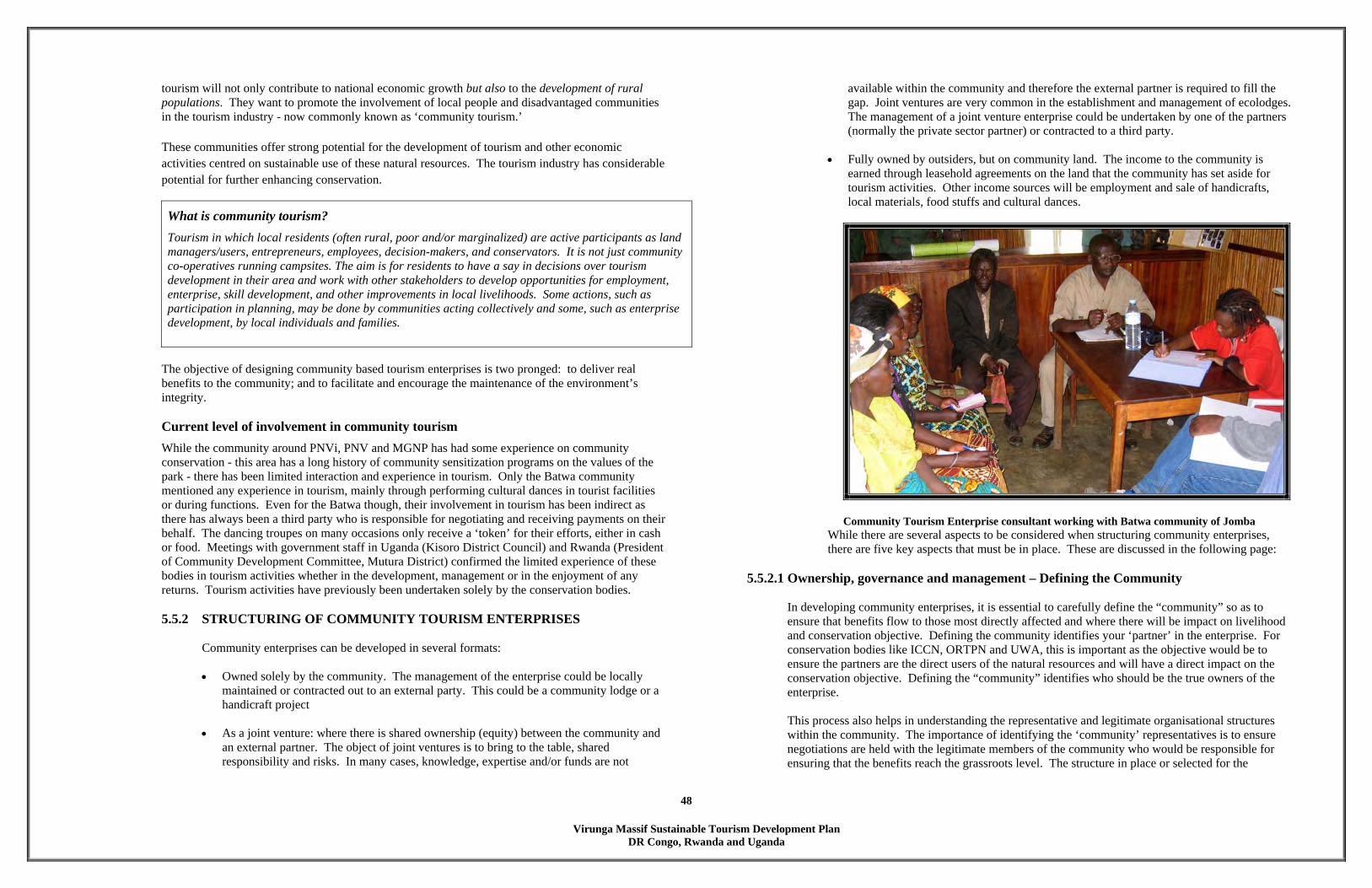
Virunga Massif Sustainable Tourism Development Plan
DR Congo, Rwanda and Uganda
48
tourism will not only contribute to national economic growth but also to the development of rural populations. They want to promote the involvement of local people and disadvantaged communities in the tourism industry - now commonly known as ‘community tourism.’ These communities offer strong potential for the development of tourism and other economic activities centred on sustainable use of these natural resources. The tourism industry has considerable potential for further enhancing conservation.
What is community tourism? Tourism in which local residents (often rural, poor and/or marginalized) are active participants as land managers/users, entrepreneurs, employees, decision-makers, and conservators. It is not just community co-operatives running campsites. The aim is for residents to have a say in decisions over tourism development in their area and work with other stakeholders to develop opportunities for employment, enterprise, skill development, and other improvements in local livelihoods. Some actions, such as participation in planning, may be done by communities acting collectively and some, such as enterprise development, by local individuals and families.
The objective of designing community based tourism enterprises is two pronged: to deliver real benefits to the community; and to facilitate and encourage the maintenance of the environment’s integrity. Current level of involvement in community tourism While the community around PNVi, PNV and MGNP has had some experience on community conservation - this area has a long history of community sensitization programs on the values of the park - there has been limited interaction and experience in tourism. Only the Batwa community mentioned any experience in tourism, mainly through performing cultural dances in tourist facilities or during functions. Even for the Batwa though, their involvement in tourism has been indirect as there has always been a third party who is responsible for negotiating and receiving payments on their behalf. The dancing troupes on many occasions only receive a ‘token’ for their efforts, either in cash or food. Meetings with government staff in Uganda (Kisoro District Council) and Rwanda (President of Community Development Committee, Mutura District) confirmed the limited experience of these bodies in tourism activities whether in the development, management or in the enjoyment of any returns. Tourism activities have previously been undertaken solely by the conservation bodies. 5.5.2 STRUCTURING OF COMMUNITY TOURISM ENTERPRISES
Community enterprises can be developed in several formats:
• Owned solely by the community. The management of the enterprise could be locally maintained or contracted out to an external party. This could be a community lodge or a handicraft project
• As a joint venture: where there is shared ownership (equity) between the community and
an external partner. The object of joint ventures is to bring to the table, shared responsibility and risks. In many cases, knowledge, expertise and/or funds are not
available within the community and therefore the external partner is required to fill the gap. Joint ventures are very common in the establishment and management of ecolodges. The management of a joint venture enterprise could be undertaken by one of the partners (normally the private sector partner) or contracted to a third party.
• Fully owned by outsiders, but on community land. The income to the community is
earned through leasehold agreements on the land that the community has set aside for tourism activities. Other income sources will be employment and sale of handicrafts, local materials, food stuffs and cultural dances.
Community Tourism Enterprise consultant working with Batwa community of Jomba
While there are several aspects to be considered when structuring community enterprises, there are five key aspects that must be in place. These are discussed in the following page:
5.5.2.1 Ownership, governance and management – Defining the Community
In developing community enterprises, it is essential to carefully define the “community” so as to ensure that benefits flow to those most directly affected and where there will be impact on livelihood and conservation objective. Defining the community identifies your ‘partner’ in the enterprise. For conservation bodies like ICCN, ORTPN and UWA, this is important as the objective would be to ensure the partners are the direct users of the natural resources and will have a direct impact on the conservation objective. Defining the “community” identifies who should be the true owners of the enterprise. This process also helps in understanding the representative and legitimate organisational structures within the community. The importance of identifying the ‘community’ representatives is to ensure negotiations are held with the legitimate members of the community who would be responsible for ensuring that the benefits reach the grassroots level. The structure in place or selected for the
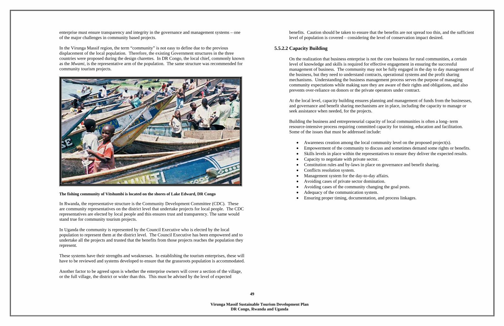
Virunga Massif Sustainable Tourism Development Plan
DR Congo, Rwanda and Uganda
49
enterprise must ensure transparency and integrity in the governance and management systems – one of the major challenges in community based projects. In the Virunga Massif region, the term “community” is not easy to define due to the previous displacement of the local population. Therefore, the existing Government structures in the three countries were proposed during the design charettes. In DR Congo, the local chief, commonly known as the Mwami, is the representative arm of the population. The same structure was recommended for community tourism projects.
The fishing community of Vitshumbi is located on the shores of Lake Edward, DR Congo
In Rwanda, the representative structure is the Community Development Committee (CDC). These are community representatives on the district level that undertake projects for local people. The CDC representatives are elected by local people and this ensures trust and transparency. The same would stand true for community tourism projects.
In Uganda the community is represented by the Council Executive who is elected by the local population to represent them at the district level. The Council Executive has been empowered and to undertake all the projects and trusted that the benefits from those projects reaches the population they represent. These systems have their strengths and weaknesses. In establishing the tourism enterprises, these will have to be reviewed and systems developed to ensure that the grassroots population is accommodated. Another factor to be agreed upon is whether the enterprise owners will cover a section of the village, or the full village, the district or wider than this. This must be advised by the level of expected
benefits. Caution should be taken to ensure that the benefits are not spread too thin, and the sufficient level of population is covered – considering the level of conservation impact desired.
5.5.2.2 Capacity Building
On the realization that business enterprise is not the core business for rural communities, a certain level of knowledge and skills is required for effective engagement in ensuring the successful management of business. The community may not be fully engaged in the day to day management of the business, but they need to understand contracts, operational systems and the profit sharing mechanisms. Understanding the business management process serves the purpose of managing community expectations while making sure they are aware of their rights and obligations, and also prevents over-reliance on donors or the private operators under contract. At the local level, capacity building ensures planning and management of funds from the businesses, and governance and benefit sharing mechanisms are in place, including the capacity to manage or seek assistance when needed, for the projects. Building the business and entrepreneurial capacity of local communities is often a long- term resource-intensive process requiring committed capacity for training, education and facilitation. Some of the issues that must be addressed include:
• Awareness creation among the local community level on the proposed project(s). • Empowerment of the community to discuss and sometimes demand some rights or benefits. • Skills levels in place within the representatives to ensure they deliver the expected results. • Capacity to negotiate with private sector. • Constitution rules and by-laws in place on governance and benefit sharing. • Conflicts resolution system. • Management system for the day-to-day affairs. • Avoiding cases of private sector domination. • Avoiding cases of the community changing the goal posts. • Adequacy of the communication system. • Ensuring proper timing, documentation, and process linkages.

Virunga Massif Sustainable Tourism Development Plan
DR Congo, Rwanda and Uganda
50
Education, especially for women and children, is a major component of capacity building
5.5.2.3 Benefits
The third component in designing community enterprises and the management structures proposed is ensuring that the enterprise and the resulting benefits reflect the actual aspirations of all stakeholders, recognising that for local communities these are likely to include jobs, participation in decision making and securing of user rights as well as cash flow. Benefits could be: financial – employment, supply of goods and services, direct income; and/or non financial – training, access to resources, improved communication or security.
In the Virunga Massif region, the stakeholder meetings reviewed the different options and categories of benefits. These included:
Employment. This is one of the key benefits expected by the community – not only because it provides jobs for their members and youth, but also because it provides a training ground and thus empowerment. Employment could be in skilled and unskilled areas depending on the capacity of the community. At the community level, decisions must be made on the categories/ type of employment and numbers i.e. all unskilled and semi skilled staff could be from the village or local stakeholders. The local population should design a selection policy as to who should be employed, in terms of quotas from each village, with an age and gender balance. Regulations should also be established for adverts and interviews using the local church, chief’s camp, and other methods agreed upon.
Supply of goods and services. The community can adequately supply some goods and services depending on standards and capacity. These should be agreed upon in advance, and like in employment, a selection process for suppliers would need to be implemented.
Other supply aspects include handicraft production and sales, cultural dances and walks, hotels, food and beverage outlets, and transportation for visitors.
Direct income: from lease fee, bed bight fee or profit sharing (depending on agreement). This includes amounts and regularity of payments. Since there is no standard agreement on what is adequate this will depend on the commercial viability of the enterprise, but it is important that it is fair and equitable. Training of tourism staff and guides should be an important benefit to the community. Agreement must be reached on training components and target group. Access to resources: agreements will need to be made on these resources based on importance to livelihood (water, firewood, bamboo) and access regulations.
The local communities should be encouraged to supply vegetables and fruits
5.5.2.4 Benefit Sharing Plans
Benefit sharing plans must be developed for each enterprise established. Most probable system of sharing benefits will be through social projects (schools, health, and water). The plan elucidate the participatory process for the selection of the type of project, selection on the location of the projects

Virunga Massif Sustainable Tourism Development Plan
DR Congo, Rwanda and Uganda
51
and who is expected to benefit in the community stratified as per age (children, youth, adults and/or aged) and gender. Other aspects that must be included in the benefits sharing plan is a monitoring system (how often, by whom) and reporting and accountability aspects including empowerment of the local population that get benefits.
The sale of handicrafts is always a good money generator for local communities. 5.5.2.5 Timing
The community tourism process takes time to develop, negotiate and deliver benefits to the community. Some processes take years. This is mainly due to the fact that they represent a new concept and model for the community and indeed the partners involved, the relative complexity of the projects, the necessary community processes involved to ensure complete understanding and buy-in for the project, the deal negotiating process and the capacity constraints and time taken to address them – including building community institutions. Deals can take one to five years to complete and it is important that time is allowed for the process to be completed. A good example is the Kisoro Tourism Development Plan which has been completed as a first step in establishing successful tourism enterprises including community enterprises. The way forward after the Plan was discussed with the Kisoro District Council and has been attached to show case some of the issues to be addressed (refer to annex at end of this report). In conclusion, there is no ideal structure- the unique circumstances of each country and enterprise will drive decisions about the type of enterprise, joint venture terms, employment, management, and
benefit sharing. Balancing realistic expectations of the partnership with real delivery of benefits is critical – raising expectations and not satisfying them may be as dangerous as doing nothing.
Mama Bomba runs a popular tourism restaurant in Kiwanja, DR Congo.
Waiters at the Stella Matutina Hotel, DR Congo.
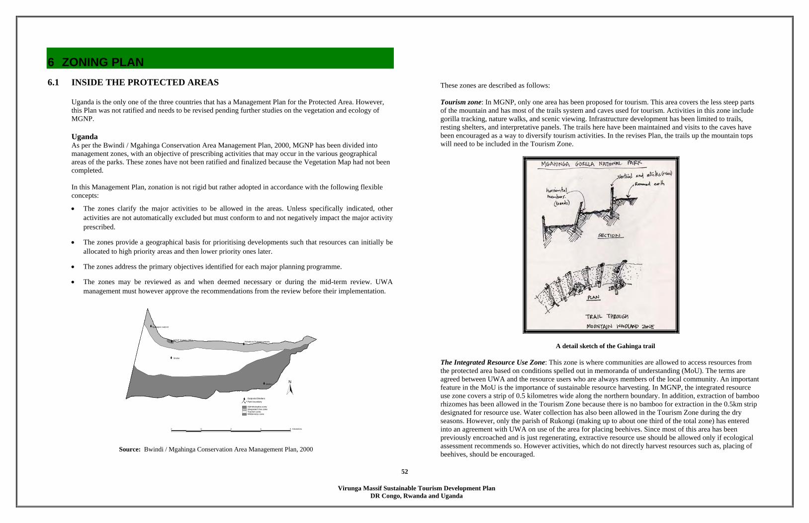
Virunga Massif Sustainable Tourism Development Plan
DR Congo, Rwanda and Uganda
52
6 ZONING PLAN 6.1 INSIDE THE PROTECTED AREAS
Uganda is the only one of the three countries that has a Management Plan for the Protected Area. However, this Plan was not ratified and needs to be revised pending further studies on the vegetation and ecology of MGNP. Uganda As per the Bwindi / Mgahinga Conservation Area Management Plan, 2000, MGNP has been divided into management zones, with an objective of prescribing activities that may occur in the various geographical areas of the parks. These zones have not been ratified and finalized because the Vegetation Map had not been completed. In this Management Plan, zonation is not rigid but rather adopted in accordance with the following flexible concepts:
• The zones clarify the major activities to be allowed in the areas. Unless specifically indicated, other activities are not automatically excluded but must conform to and not negatively impact the major activity prescribed.
• The zones provide a geographical basis for prioritising developments such that resources can initially be allocated to high priority areas and then lower priority ones later.
• The zones address the primary objectives identified for each major planning programme.
• The zones may be reviewed as and when deemed necessary or during the mid-term review. UWA management must however approve the recommendations from the review before their implementation.
<<
<
<
<
MGNP Ntebeko OfficeMuhabura Outpost/campsite
Shelter
Shelter
Nyakagezi outpost
Administrative zoneIntegrated Use zoneTourism zoneWilderness zone
Park boundary< Outposts/Shelters
2 0 2 4 6 Kilometers
N
Source: Bwindi / Mgahinga Conservation Area Management Plan, 2000
These zones are described as follows: Tourism zone: In MGNP, only one area has been proposed for tourism. This area covers the less steep parts of the mountain and has most of the trails system and caves used for tourism. Activities in this zone include gorilla tracking, nature walks, and scenic viewing. Infrastructure development has been limited to trails, resting shelters, and interpretative panels. The trails here have been maintained and visits to the caves have been encouraged as a way to diversify tourism activities. In the revises Plan, the trails up the mountain tops will need to be included in the Tourism Zone.
A detail sketch of the Gahinga trail
The Integrated Resource Use Zone: This zone is where communities are allowed to access resources from the protected area based on conditions spelled out in memoranda of understanding (MoU). The terms are agreed between UWA and the resource users who are always members of the local community. An important feature in the MoU is the importance of sustainable resource harvesting. In MGNP, the integrated resource use zone covers a strip of 0.5 kilometres wide along the northern boundary. In addition, extraction of bamboo rhizomes has been allowed in the Tourism Zone because there is no bamboo for extraction in the 0.5km strip designated for resource use. Water collection has also been allowed in the Tourism Zone during the dry seasons. However, only the parish of Rukongi (making up to about one third of the total zone) has entered into an agreement with UWA on use of the area for placing beehives. Since most of this area has been previously encroached and is just regenerating, extractive resource use should be allowed only if ecological assessment recommends so. However activities, which do not directly harvest resources such as, placing of beehives, should be encouraged.
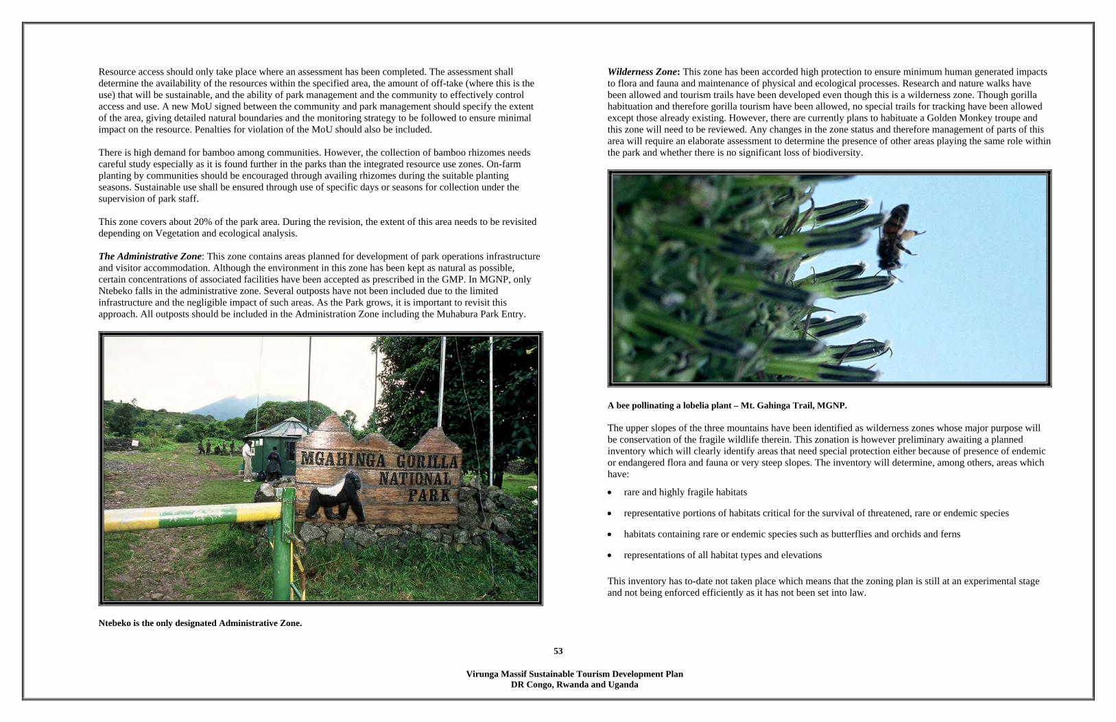
Virunga Massif Sustainable Tourism Development Plan
DR Congo, Rwanda and Uganda
53
Resource access should only take place where an assessment has been completed. The assessment shall determine the availability of the resources within the specified area, the amount of off-take (where this is the use) that will be sustainable, and the ability of park management and the community to effectively control access and use. A new MoU signed between the community and park management should specify the extent of the area, giving detailed natural boundaries and the monitoring strategy to be followed to ensure minimal impact on the resource. Penalties for violation of the MoU should also be included. There is high demand for bamboo among communities. However, the collection of bamboo rhizomes needs careful study especially as it is found further in the parks than the integrated resource use zones. On-farm planting by communities should be encouraged through availing rhizomes during the suitable planting seasons. Sustainable use shall be ensured through use of specific days or seasons for collection under the supervision of park staff. This zone covers about 20% of the park area. During the revision, the extent of this area needs to be revisited depending on Vegetation and ecological analysis. The Administrative Zone: This zone contains areas planned for development of park operations infrastructure and visitor accommodation. Although the environment in this zone has been kept as natural as possible, certain concentrations of associated facilities have been accepted as prescribed in the GMP. In MGNP, only Ntebeko falls in the administrative zone. Several outposts have not been included due to the limited infrastructure and the negligible impact of such areas. As the Park grows, it is important to revisit this approach. All outposts should be included in the Administration Zone including the Muhabura Park Entry.
Ntebeko is the only designated Administrative Zone.
Wilderness Zone: This zone has been accorded high protection to ensure minimum human generated impacts to flora and fauna and maintenance of physical and ecological processes. Research and nature walks have been allowed and tourism trails have been developed even though this is a wilderness zone. Though gorilla habituation and therefore gorilla tourism have been allowed, no special trails for tracking have been allowed except those already existing. However, there are currently plans to habituate a Golden Monkey troupe and this zone will need to be reviewed. Any changes in the zone status and therefore management of parts of this area will require an elaborate assessment to determine the presence of other areas playing the same role within the park and whether there is no significant loss of biodiversity.
A bee pollinating a lobelia plant – Mt. Gahinga Trail, MGNP. The upper slopes of the three mountains have been identified as wilderness zones whose major purpose will be conservation of the fragile wildlife therein. This zonation is however preliminary awaiting a planned inventory which will clearly identify areas that need special protection either because of presence of endemic or endangered flora and fauna or very steep slopes. The inventory will determine, among others, areas which have:
• rare and highly fragile habitats
• representative portions of habitats critical for the survival of threatened, rare or endemic species
• habitats containing rare or endemic species such as butterflies and orchids and ferns
• representations of all habitat types and elevations
This inventory has to-date not taken place which means that the zoning plan is still at an experimental stage and not being enforced efficiently as it has not been set into law.
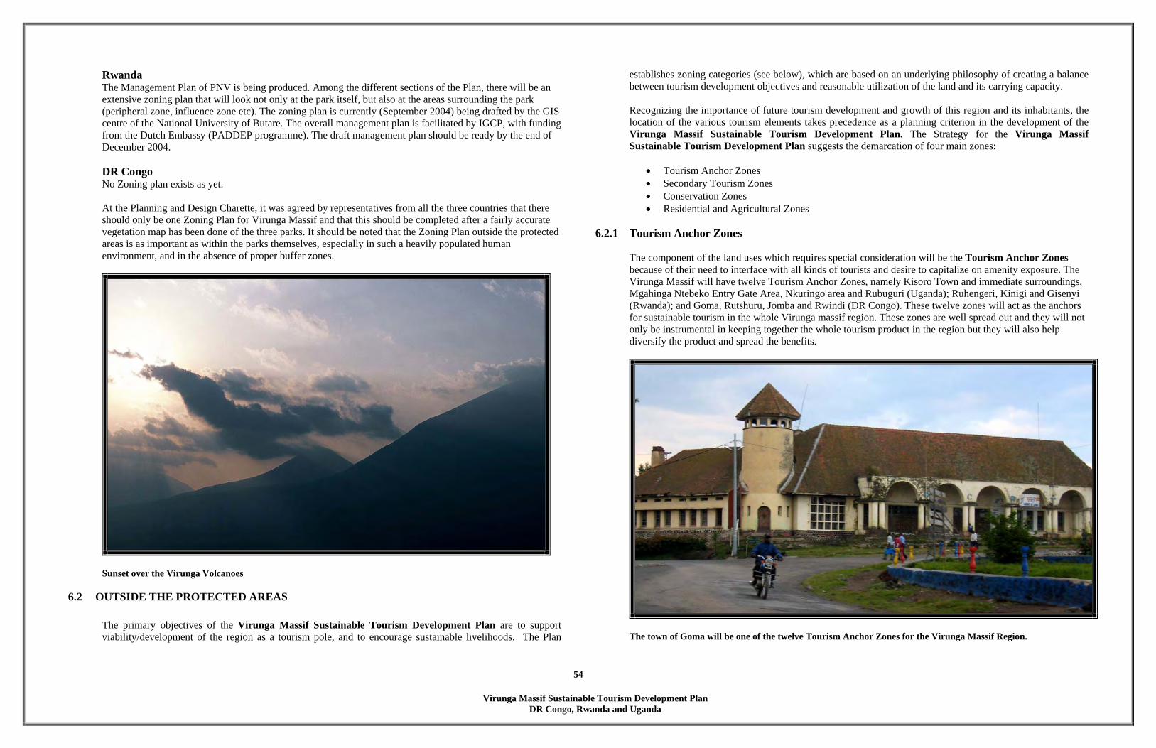
Virunga Massif Sustainable Tourism Development Plan
DR Congo, Rwanda and Uganda
54
Rwanda The Management Plan of PNV is being produced. Among the different sections of the Plan, there will be an extensive zoning plan that will look not only at the park itself, but also at the areas surrounding the park (peripheral zone, influence zone etc). The zoning plan is currently (September 2004) being drafted by the GIS centre of the National University of Butare. The overall management plan is facilitated by IGCP, with funding from the Dutch Embassy (PADDEP programme). The draft management plan should be ready by the end of December 2004. DR Congo No Zoning plan exists as yet.
At the Planning and Design Charette, it was agreed by representatives from all the three countries that there should only be one Zoning Plan for Virunga Massif and that this should be completed after a fairly accurate vegetation map has been done of the three parks. It should be noted that the Zoning Plan outside the protected areas is as important as within the parks themselves, especially in such a heavily populated human environment, and in the absence of proper buffer zones.
Sunset over the Virunga Volcanoes
6.2 OUTSIDE THE PROTECTED AREAS
The primary objectives of the Virunga Massif Sustainable Tourism Development Plan are to support viability/development of the region as a tourism pole, and to encourage sustainable livelihoods. The Plan
establishes zoning categories (see below), which are based on an underlying philosophy of creating a balance between tourism development objectives and reasonable utilization of the land and its carrying capacity. Recognizing the importance of future tourism development and growth of this region and its inhabitants, the location of the various tourism elements takes precedence as a planning criterion in the development of the Virunga Massif Sustainable Tourism Development Plan. The Strategy for the Virunga Massif Sustainable Tourism Development Plan suggests the demarcation of four main zones:
• Tourism Anchor Zones • Secondary Tourism Zones • Conservation Zones • Residential and Agricultural Zones
6.2.1 Tourism Anchor Zones The component of the land uses which requires special consideration will be the Tourism Anchor Zones because of their need to interface with all kinds of tourists and desire to capitalize on amenity exposure. The Virunga Massif will have twelve Tourism Anchor Zones, namely Kisoro Town and immediate surroundings, Mgahinga Ntebeko Entry Gate Area, Nkuringo area and Rubuguri (Uganda); Ruhengeri, Kinigi and Gisenyi (Rwanda); and Goma, Rutshuru, Jomba and Rwindi (DR Congo). These twelve zones will act as the anchors for sustainable tourism in the whole Virunga massif region. These zones are well spread out and they will not only be instrumental in keeping together the whole tourism product in the region but they will also help diversify the product and spread the benefits.
The town of Goma will be one of the twelve Tourism Anchor Zones for the Virunga Massif Region.
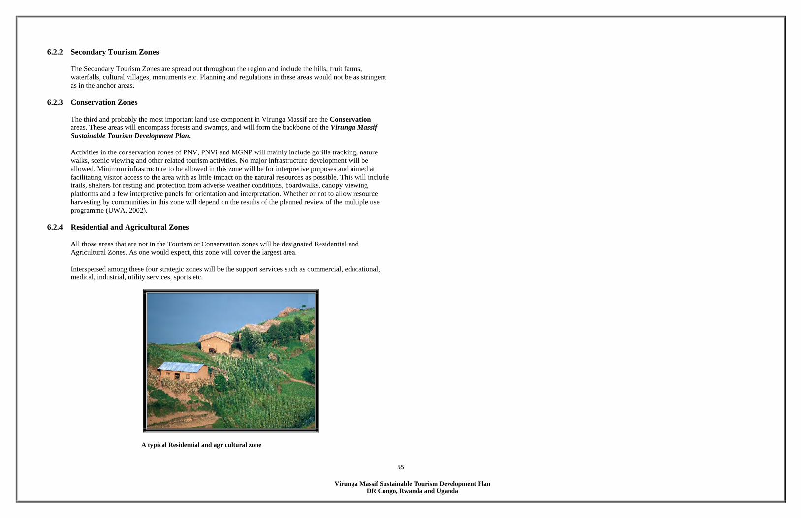
Virunga Massif Sustainable Tourism Development Plan
DR Congo, Rwanda and Uganda
55
6.2.2 Secondary Tourism Zones The Secondary Tourism Zones are spread out throughout the region and include the hills, fruit farms, waterfalls, cultural villages, monuments etc. Planning and regulations in these areas would not be as stringent as in the anchor areas.
6.2.3 Conservation Zones
The third and probably the most important land use component in Virunga Massif are the Conservation areas. These areas will encompass forests and swamps, and will form the backbone of the Virunga Massif Sustainable Tourism Development Plan. Activities in the conservation zones of PNV, PNVi and MGNP will mainly include gorilla tracking, nature walks, scenic viewing and other related tourism activities. No major infrastructure development will be allowed. Minimum infrastructure to be allowed in this zone will be for interpretive purposes and aimed at facilitating visitor access to the area with as little impact on the natural resources as possible. This will include trails, shelters for resting and protection from adverse weather conditions, boardwalks, canopy viewing platforms and a few interpretive panels for orientation and interpretation. Whether or not to allow resource harvesting by communities in this zone will depend on the results of the planned review of the multiple use programme (UWA, 2002).
6.2.4 Residential and Agricultural Zones
All those areas that are not in the Tourism or Conservation zones will be designated Residential and Agricultural Zones. As one would expect, this zone will cover the largest area. Interspersed among these four strategic zones will be the support services such as commercial, educational, medical, industrial, utility services, sports etc.
A typical Residential and agricultural zone

Virunga Massif Sustainable Tourism Development Plan
DR Congo, Rwanda and Uganda
56
7 TOURISM CIRCUIT PLAN 7.1 REGIONAL TOURISM CIRCUIT PLAN Establishment of a regional tourism circuit with information and services standardised and available to all
could tremendously improve visitor satisfaction and experience in the three countries of Uganda, Rwanda and the DR Congo.
Though opportunities exist to exploit tourism at a region level, cross border tourism has not been developed.
Information on tourism opportunities and resources across the border is scanty, if any, and it is rather expensive and cumbersome for tourists to cross the border for a visit to the neighbouring countries. Also competition exists between the countries. Establishment of a regional tourism circuit with information and services standardised and available to all, could tremendously improve visitor satisfaction and experience in the three countries, as well as increase the time spent by the tourists in the region.
REGIONAL CIRCUITS Mainly composed of medium to high altitude forest (ranging form 800m to over 4000 m) and afro-alpine vegetation, intersected by numerous rivers, lakes and swamps, the diversity of wildlife in the Virunga Massif Region is ranked amongst the highest in Africa, and one of the greatest priorities globally. As a consequence, this region has been ranked within the top sites included in WWF’s Global 200 priority sites for conservation in the world. The diversity as well as levels of endemism for birds, mammals and plants is exceptionally high in this region, due to its status as a Pleistocene refugium during the last glacial period. All these aspects make the entire Albertine Rift an attractive tourist destination with key unique attractions such as the mountain gorillas. Harmonized tourism approaches across Uganda, Rwanda and DR Congo will encourage the development of effective nature based tourism around the shared ecosystems (this includes the habitat of the mountain gorilla, savannah ecosystems and mountain ranges). This will in turn provide an additional economic option for the three countries.
A baby Hippo in DR Congo.
Through sharing costs, tourism revenue to each of the Protected Area Authorities and national countries of Uganda, Rwanda and DRC can be increased, thus strengthening conservation efforts and increasing income across the region. Each of the three countries has unique attractions to offer, by working together to offer the range of different tourism opportunities, the number of tourists and duration of stay can be greatly increased. In regional tourism planning workshops held in Kisoro in January 2004 and Kigali, April 2004, the following vision for tourism development across the Virunga-Bwindi region was developed by stakeholders who represented the three countries:
“The Virunga-Bwindi region is a leading high-end ecotourism destination in Africa, which contributes to conservation, peace, and sustainable development”
The agreed objectives of developing regional tourism across the Virunga region include: • Maximize the sustainable utilization of the available resources • Contribute to poverty alleviation in the region through the achievement of development and economic
growth • Contribute to peace and security • Improve and harmonize the quality of service • Jointly promote a competitive tourism product • Set high professional standards • Attract investment in the tourism sector • Increase tourist arrivals in the region • Promote and contribute to conservation in the region • Ensure harmonized policies with the view of creating a single market
Elephant mother and daughter in the savannah plains of DR Congo.
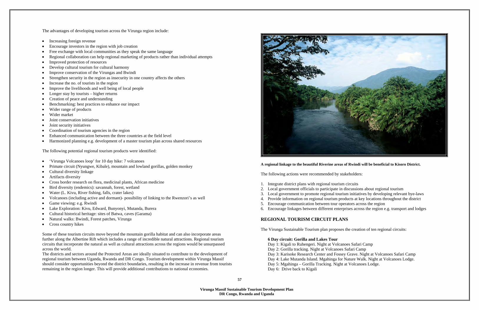
Virunga Massif Sustainable Tourism Development Plan
DR Congo, Rwanda and Uganda
57
The advantages of developing tourism across the Virunga region include: • Increasing foreign revenue • Encourage investors in the region with job creation • Free exchange with local communities as they speak the same language • Regional collaboration can help regional marketing of products rather than individual attempts • Improved protection of resources • Develop cultural tourism for cultural harmony • Improve conservation of the Virungas and Bwindi • Strengthen security in the region as insecurity in one country affects the others • Increase the no. of tourists in the region • Improve the livelihoods and well being of local people • Longer stay by tourists – higher returns • Creation of peace and understanding • Benchmarking: best practices to enhance our impact • Wider range of products • Wider market • Joint conservation initiatives • Joint security initiatives • Coordination of tourism agencies in the region • Enhanced communication between the three countries at the field level • Harmonized planning e.g. development of a master tourism plan across shared resources
The following potential regional tourism products were identified: • ‘Virunga Volcanoes loop’ for 10 day hike: 7 volcanoes • Primate circuit (Nyungwe, Kibale), mountain and lowland gorillas, golden monkey • Cultural diversity linkage • Artifacts diversity • Cross border research on flora, medicinal plants, African medicine • Bird diversity (endemics): savannah, forest, wetland • Water (L. Kivu, River fishing, falls, crater lakes) • Volcanoes (including active and dormant)- possibility of linking to the Rwenzori’s as well • Game viewing: e.g. Rwindi • Lake Exploration: Kivu, Edward, Bunyonyi, Mutanda, Burera • Cultural historical heritage: sites of Batwa, caves (Garama) • Natural walks: Bwindi, Forest patches, Virunga • Cross country hikes Some of these tourism circuits move beyond the mountain gorilla habitat and can also incorporate areas further along the Albertine Rift which includes a range of incredible natural attractions. Regional tourism circuits that incorporate the natural as well as cultural attractions across the regions would be unsurpassed across the world. The districts and sectors around the Protected Areas are ideally situated to contribute to the development of regional tourism between Uganda, Rwanda and DR Congo. Tourism development within Virunga Massif should consider opportunities beyond the district boundaries, resulting in the increase in revenue from tourists remaining in the region longer. This will provide additional contributions to national economies.
A regional linkage to the beautiful Riverine areas of Rwindi will be beneficial to Kisoro District.
The following actions were recommended by stakeholders: 1. Integrate district plans with regional tourism circuits 2. Local government officials to participate in discussions about regional tourism 3. Local government to promote regional tourism initiatives by developing relevant bye-laws 4. Provide information on regional tourism products at key locations throughout the district 5. Encourage communication between tour operators across the region 6. Encourage linkages between different enterprises across the region e.g. transport and lodges
REGIONAL TOURISM CIRCUIT PLANS
The Virunga Sustainable Tourism plan proposes the creation of ten regional circuits:
6 Day circuit: Gorilla and Lakes Tour Day 1: Kigali to Ruhengeri. Night at Volcanoes Safari Camp Day 2: Gorilla tracking. Night at Volcanoes Safari Camp Day 3: Karisoke Research Center and Fossey Grave. Night at Volcanoes Safari Camp Day 4: Lake Mutanda Island. Mgahinga for Nature Walk. Night at Volcanoes Lodge. Day 5: Mgahinga – Gorilla Tracking. Night at Volcanoes Lodge. Day 6: Drive back to Kigali

Virunga Massif Sustainable Tourism Development Plan
DR Congo, Rwanda and Uganda
58
4 Day circuit: Bird-watching tour
Day 1: Kisoro to Mgahinga – Forest walk Day 2: Kisoro to Echuya Forest and Swamp boardwalk Day 3: Kisoro to Lake Chahafi and Lake Burera Day 4: Burera camp to Rugezi Swamp. Drive back to Kisoro
2 Day circuit: Gorilla Tour 2
Day 1: Kisoro to Jomba– Batwa Village Day 2: Gorilla tracking. Drive back to Kisoro
8 Day circuit:The Ecolodge Tour
Day 1: Kigali to Ruhengeri to Kinigi to Sabyinyo Ecolodge Day 2: Golden Monkey tracking. Night at Sabyinyo Ecolodge Day 3: Drive to Kisoro to Nkuringo Ecolodge. Day 4: Gorilla Tracking. Night at Nkuringo Ecolodge Day 5: Drive to Tongo Ecolodge. Night at Tongo Ecolodge Day 6: Chimpanzee Tracking. Night at Tongo Ecolodge Day 7: Drive to Gisenyi – Night at Kivu Sun Day 8: Drive to Ruhengeri and Kigali
7 Day circuit:The Six Volcanoes Tour
Day 1: Kisoro to Muhabura Gate (MGNP). Climb to Mountain hut on Mt. Muhabura. Day 2: Climb to peak and hike down to saddle of Mt. Muhabura and Mt. Gahinga. Day 3: Climb to peak of Gahinga and down to saddle of Mt. Gahinga and Mt. Sabyinyo. Day 4: Climb to peak of Mt. Sabyinyo and down to base. Day 5: Hike through rainforest and camp at base of Mt. Bisoke Day 6: Climb to peak of Mt. Bisoke and down to saddle of Mt. Bisoke and Mt. Karisimbi Day 7: Climb to Mountain hut on Mt. Karisimbi. and hike down. Camp at Karisoke Research Center. Day 8: Walk through rainforest and climb to Mountain hut on Mt. Mikeno. Day 9: Climb to peak and hike back to Bisate. Drive to Ruhengeri
14 Day circuit:The Eight Volcanoes Tour
Day 1: Kisoro to Muhabura Gate (MGNP). Climb to Mountain hut on Mt. Muhabura. Day 2: Climb to peak and hike down to saddle of Mt. Muhabura and Mt. Gahinga. Day 3: Climb to peak of Gahinga and down to saddle of Mt. Gahinga and Mt. Sabyinyo. Day 4: Climb to peak of Mt. Sabyinyo and down to base. Day 5: Hike through rainforest and camp at base of Mt. Bisoke Day 6: Climb to peak of Mt. Bisoke and down to saddle of Mt. Bisoke and Mt. Karisimbi Day 7: Climb to Mountain hut on Mt. Karisimbi and hike down. Camp at Karisoke Research Center. Day 8: Walk through rainforest and climb to Mountain hut on Mt. Mikeno. Day 9: Climb to peak and hike to Bukima. Camp at Bukima Day 10: Drive and walk to base of Mt. Nyamulagira. Climb to Mountain hut. Day 11: Climb to Peak and hike back to base and drive to base of Mt. Nyiragongo
Day 12: Climb to the top of the crater and camp at the edge. Day 13: Hike back to base and drive to Goma. Day 14: Drive back to Ruhengeri or Kisoro
7 Day circuit: Forest and Savannah Experience
Day 1: Kisoro to Lake Mutanda. Night at Mutanda Safari Lodge. Day 2: Drive to Jomba. Night at Jambo Safari lodge. Day 3: Gorilla Tracking and Batwa performances. Night at Jambo Safari lodge. Day 4: Drive to Rwindi. Evening Game drive. Night at Hotel de la Rwindi. Day 5: Game drive to Vitshumbi and boat ride on Lake Edward. Night at Hotel de la Rwindi. Day 6: Morning game drive. Drive back to Rutshuru. Night at Grefamu Lodge Day 7: Drive back to Kisoro
9 Day circuit: Virunga Massif Circumference Tour
Day 1: Ruhengeri to Lake Burera. Night at Burera camp. Day 2: Drive to Kisoro and Ntebeko. Visitor Center and Garama Cave. Night at Volcanoes camp Day 3: Gorilla Tracking in MGNP. Drive to Jomba. Night at Jambo Safari Lodge Day 4: Drive to Kitwandja. Visit local Batwa village and Rutshuru River. Night at Grefamu Lodge Day 5: Drive to Tongo Village. Community walk. Night at Tongo ecolodge. Day 6: Chimpanzee tracking. Night at Tongo ecolodge. Day 7: Drive to Goma. Night at Stella Matutina Hotel Day 8: Drive to Kinigi. Night at Gorilla’s Nest. Day 9: Golden Monkey Tracking. Night at EER Guest House.
5 Day circuit: Virunga Massif Hiking Tour
Day 1: Hike from Kinigi to the park. Cross the border and camp in the park. Day 2: Hike to Jomba and spend the night at Jambo Safari Lodge Day 3: Hike through the park across the border. Camp at Ntebeko Day 4: Hike towards the Rwanda border and camp at base of Mt. Sabyinyo. Day 5: Hike back to Kinigi.
7 Day circuit: Great Lakes Birdwatching Tour
Day 1: Boating on Lake Kivu. Night at Stella Matutina Hotel. Day 2: Drive to Lake Burera. Night at Volcanoes camp. Day 3: Drive to Lake Chahafi. Night at Kisoro Hotel. Day 4: Drive to Lake Mutanda. Night at Mgahinga Safari Lodge Day 5: Drive to Kitwandja. Night at Grefamu Lodge Day 6: Drive to Vitshumbi. Boating on Lake Edward. Day 7: Drive to Goma. Night at Stella Matutina Hotel
7.2 RWANDA TOURISM CIRCUIT PLAN
Some of these circuits were identified during the workshop and design charette while others have been suggested by the authors of this document:

Virunga Massif Sustainable Tourism Development Plan
DR Congo, Rwanda and Uganda
59
ONE-DAY CIRCUITS
1. Nature and Culture Tour
Begins in the early morning at Ruhengeri or Kinigi, then to experience one of the Gorilla Groups Site – Lunch at a Batwa Village followed by performances and community walk (Batwa Village Kinigi, Basebya Troops Camp) – Back to Ruhengeri or Kinigi at 4 p.m. for afternoon tea.
2. Hanging Lakes Tour
Begins in the early morning at Ruhengeri or Kinigi, then to northern end of Lake Burera – Musangabo Peninsula – Rusumo Market – picnic lunch at Rusumo Falls – Rugezi Swamp Bird watching – Back to Ruhengeri or Kinigi at 6 p.m. for high tea.
3. Heritage Tour
Begins in the morning at Ruhengeri or Kinigi, then to Buhanga – visit Discovery Center – lunch at Eco-park – walk and enjoy eco-park – Back to Ruhengeri or Kinigi at 4 p.m. for afternoon tea.
4. Nature Tour
Begins in the early morning at Ruhengeri or Kinigi, then to track habituated group of Golden Monkeys – lunch at Gorillas Nest – spelunking in the caves near Kinigi – Back to Ruhengeri or Kinigi at 5 p.m.
5. Spiritual Tour
Begins in the early morning at Ruhengeri or Kinigi, then to edge of National Park – hike up Bisoke – early picnic lunch at the rim of crater lake – Karisoke Research Center Site and Dian Fossey’s Tomb – Back to Ruhengeri or Kinigi at 7 p.m. for dinner.
6. The Park Tour
Begins in the early morning at Ruhengeri or Kinigi, then to edge of National Park – hike up to Crater Lake at base of Karisimbi Volcano – early picnic lunch at the Crater Lake – Karisoke Research Center Site and Dian Fossey’s Tomb – Back to Ruhengeri or Kinigi at 7 p.m. for dinner.
7. History Tour
Begins in the early morning at Ruhengeri or Kinigi, then to Mutobo Water Falls – Byangabo Heritage site – picnic lunch at Lake Karago – Genocide Memorial – Back to Ruhengeri or Kinigi at 4 p.m. for afternoon tea. TWO-DAY CIRCUITS
1. Bisoke and Fossey Tour
Begins in the early morning at Ruhengeri or Kinigi, then to edge of National Park –hike up Bisoke – early picnic lunch at the rim of crater lake – hike down and camp under the Hagenia Abyssynicana forest at the edge of the park – next day go to Karisoke Research Center Site and Dian Fossey’s Tomb – picnic lunch under the Hagenia forest - Back to Ruhengeri or Kinigi at 4 p.m. for afternoon tea.
2. Gorilla and Lake Tour
Begins in the early morning at Ruhengeri or Kinigi, then to edge of National Park – visit one of the Gorilla Groups – lunch and performance at Batwa village (Batwa Village Kinigi, Basebya Troops Camp) – dinner and night at Bulera Camp – early morning birdwatching around the lake – picnic lunch at the edge of Rugezi Swamp – Rusumo Falls – Back to Ruhengeri or Kinigi at 5p.m.
3. Gorilla and Lake Tour 2
Begins in the early morning at Ruhengeri / Kinigi / Volcanoes Camp, then to edge of National Park – visit one of the Gorilla Groups – lunch in Ruhengeri – afternoon at Genocide Site - dinner and night at Kivu Sun, Gisenyi – early morning boat ride on the lake – picnic lunch at the hot springs – Back to Ruhengeri / Kinigi / Volcanoes Camp at 6 p.m.
4. Educational Tour
Begins in the early morning at Ruhengeri / Kinigi / Volcanoes Camp, then to edge of National Park – visit one of the Gorilla Groups – lunch and performance at Batwa village (Batwa Village Kinigi, Basebya Troops Camp) – dinner and night at Eco-park, Buhanga – early morning bird watching walk through the ancient forest – lunch at the Eco-park – afternoon at the Discovery Center – Back to Ruhengeri / Kinigi / Volcanoes Camp at 5 p.m.
5. Primate Tour
Begins in the early morning at Ruhengeri / Kinigi / Volcanoes Camp, then to edge of National Park – visit one of the Gorilla Groups – lunch and performance at Batwa village – dinner and night at Gorillas Nest – morning track to see the Golden Monkeys – lunch at the Kinigi Guest House – Back to Ruhengeri / Kinigi / Volcanoes Camp at 3 p.m.
6. Karisimbi Climbing Tour
Begins in the early morning at Ruhengeri / Kinigi, then to edge of National Park – hike up Karisimbi Volcano using existing trail – picnic lunch on the mountain – dinner and night at existing hut – early morning climb to the summit – lunch at the Gorilla’s Nest – afternoon at leisure – Back to Ruhengeri / Kinigi / Volcanoes Camp at 4 p.m.
7. Geology Tour
Begins in the early morning at Ruhengeri / Kinigi, then to edge of National Park –hike up Bisoke Volcano – picnic lunch on the edge of the crater rim – dinner and night at Gorillas’ Nest – morning walk through cave tunnels – picnic lunch in forest clearing – Back to Ruhengeri / Kinigi / Volcanoes Camp at 3 p.m. for afternoon nap.
8. Sabyinyo Tour
Begins in the early morning at Ruhengeri / Kinigi, then to edge of National Park – hike up Sabyinyo Volcano – dinner and night at mountain hut – early morning ascent of the peak – picnic lunch at Gorilla Discovery Site – Back to Ruhengeri / Kinigi / Volcanoes Camp at 4 p.m. for afternoon tea.

Virunga Massif Sustainable Tourism Development Plan
DR Congo, Rwanda and Uganda
60
THREE-DAY CIRCUITS
1. The Karisoke Climb
Begins in the early morning at Ruhengeri or Kinigi, then to edge of National Park – hike up Bisoke – early picnic lunch at the rim of crater lake – hike down and camp under the Hagenia Abyssynicana forest at the edge of the park – next day climb Karisimbi – picnic lunch on the mountain – dinner and night at existing hut – early morning climb to the summit – lunch at the Gorilla’s Nest – afternoon at leisure – Back to Ruhengeri / Kinigi / Volcanoes Camp at 4 p.m.
2. Mountain and Lake Tour
Begins in the early morning at Ruhengeri or Kinigi, then to experience one of the Gorilla Groups – Lunch at a Batwa Village followed by performances and community walk (Batwa Village Kinigi, Basebya Troops Camp) – night at Gorillas Nest – hike up Bisoke the following morning – early picnic lunch at the rim of crater lake – dinner and night at Burera Camp – in the morning to Musangabo Peninsula viewpoint – Rusumo Market – picnic lunch at Rusumo Falls – Rugezi Swamp Birdwatching – Back to Ruhengeri or Kinigi at 6 p.m. for high tea.
3. Mountain and Lake Tour 2
Begins in the early morning at Ruhengeri or Kinigi, then to experience one of the Gorilla Groups – Lunch at a Batwa Village followed by performances and community walk – night at Kivu Sun, Gisenyi – early morning boat ride on Lake Kivu – lunch at the Kivu Sun – afternoon at Hot Springs – evening, dinner and night at Kivu Sun – Morning to Genocide Site and Mutura cave– picnic lunch at Cave Site – Back to Ruhengeri or Kinigi at 4 p.m. for afternoon tea.
4. Birdwatching Tour
Begins in the early morning at Ruhengeri or Kinigi, then take a long hike into Park – picnic lunch within the park – night at Volcanoes Camp – early morning bird walk along Lake Bulera – lunch at Volcanoes – dinner and night at Burera Camp – boat trip along the lake – lunch at the camp – dinner and night at Burera Camp – half-day Rugezi Swamp Birdwatching – Back to Ruhengeri or Kinigi at 6 p.m. for high tea.
FIVE - DAY CIRCUIT
1. The Three Volcanoes Climb
Begins in the early morning at Ruhengeri or Kinigi, then to edge of National Park –hike up Muhabura – picnic lunch on the mountain – dinner and night at existing hut – early morning climb to the summit - lunch at the Mountain Hut located on the saddle between Muhabura and Gahinga – dinner and night at the Mountain Hut – morning hike up Gahinga – early picnic lunch at the rim of crater – hike down and dinner and night at Mountain Hut located on the saddle between Gahinga and Sabyinyo – next day climb Sabyinyo – picnic lunch on the mountain – Back to Ruhengeri / Kinigi / Volcanoes Camp at 6 p.m. SEVEN-DAY CIRCUIT
1. The Five Volcanoes Climb
Begins in the early morning at Ruhengeri or Kinigi, then to edge of National Park – hike up Muhabura – picnic lunch on the mountain – dinner and night at existing hut – early morning climb to the summit - lunch at the Mountain Hut located on the saddle between Muhabura and Gahinga – dinner and night at the Mountain Hut – morning hike up Gahinga – early picnic lunch at the rim of crater – hike down and dinner and night at Mountain Hut located on the saddle between Gahinga and Sabyinyo– next day climb Sabyinyo - picnic lunch on the mountain –- dinner and night at the Mountain Hut located on the saddle between Sabyinyo and Bisoke. Begin early morning and hike up Bisoke -– early picnic lunch at the rim of crater lake – hike down and camp under the Hagenia Abyssynicana forest at the edge of the park – next day climb Karisimbi - picnic lunch on the mountain – dinner and night at existing hut – early morning climb to the summit - lunch at the Gorilla’s Nest– afternoon at leisure–- Back to Ruhengeri / Kinigi / Volcanoes Camp at 4 p.m.
7.3 UGANDA TOURISM CIRCUIT PLAN In order to create varied experiences and at the same time diversify the tourism product, several circuits were identified at the design charette. Local knowledge and wisdom was helpful in creating these circuits, which have been identified in the map on the following page. The Uganda Tourism Circuit Plan for the Virunga Massif Region has been illustrated in such a way that local entrepreneurs can utilize it as is and the Local Government can use it for marketing purposes. The Circuit Plan is in no way exhaustive and additional circuits can be added depending on market demand. These circuits that were identified during the Kisoro Tourism Development Plan workshop and design charette are:
1. Mountain Biking Historical tour –1 day
Begins in the early morning at Kisoro Town, then to King Ruganzu footmarks (need to be restored) – Murora Hill Monument Site – Picnic Lunch at Lake Chahafi – Kigezi Monument – Mwambike Cave – Chuho Water Springs – Back to Kisoro at 6.30 p.m.
2. Mountain Biking Geology tour –1 day
Begins in the early morning at Kisoro Town, then to Sagitwe Caldera – then to Bunagana Rocks – Picnic Lunch at Amakera Salt Water – Natete Kangoma Caves – Back to Kisoro at 6.30 p.m.
3. 4 -WD Lakes Tour–2 days
Begins in the early morning at Kisoro Town, then to the tombs – canoeing/fishing in Lake Mulehe – lunch at Mgahinga Safari Lodge – evening boat ride on Lake Mutanda – night at Mgahinga Safari Lodge – next day, Kamugemanyi Batwa Village – lunch at Busanza Waterfalls – Natete and Kangoma Cave – Buhungiro bird watching – Back to Kisoro at 4.00 p.m.- day 2. .
4. 4 -WD Birdwatching Tour – 1 day Begins in the early morning at Kisoro Town, then to Lakes Chahafi and Kayumbu, boat ride – lunch at Chahafi campsite – drive to Echuya Forest – boardwalk – walk through forest – Back to Kisoro at 6.30p.m.

Virunga Massif Sustainable Tourism Development Plan
DR Congo, Rwanda and Uganda
61
5. 4 –WD- Hiking Batwa Culture Tour – 1 day
Begins in the early morning at Kisoro Town, then to Ntebeko Gate Visitor Center – tour with Batwa guides to Garama Cave – lunch with Batwa at Musasa Batwa Village – view cultural performance – Back to Kisoro at 6.30 p.m.
6. Birunga Mountain Climbing Tour – 3 days Begins in the early morning at Muhabura Base Camp at the edge of the park, Day 1 – Climb to Muhabura peak, camp at the edge of Kabiranyuma Swamp, Day 2 – hike through forest , Climb to Mgahinga peak, camp at the edge of Kazibakye Swamp – Day 3 - hike through forest , Climb to Sabyinyo peak – Back to Kisoro at 6.30p.m.
7. 4 -WD Birdwatching Tour – 1 day
Begins in the morning at Bukimbiri Lodge Camping Site, then to Birunga Volcanoes viewpoint, guided walk through the Echuya Swamp Boardwalk – Lunch at the edge of the swamp. Afternoon hike through Echuya Forest – Back to Bukimbiri Lodge/Volcanoes Camping Site at 5.30p.m.
8. Canopy Walk and Birdwatching Tour – 1 day Begins in the morning at Nyabwishenya Lodge/Nkuringo Ecolodge, hike down to the Canopy Walk – view the Nkuringo Falls – climb Kashotoora or Nkuringo Hill – picnic lunch at the edge of Ivy River – Bird watching – Afternoon hike back to Nyabwishenya Lodge/Nkuringo Ecolodge.
9. 4 -WD Local Heritage Tour– 1 day Begins in the early morning at Nyabwishenya Lodge/Nkuringo Ecolodge, drive to Bwakugaba Scenic Point – view the whole Birunga Volcanoes – hike to local Murujogo Batwa Village – take one-hour Batwa guided walk of the forest - lunch at Bwindi Cultural Centre in Rubuguri – Afternoon cultural performances – back to Nyabwishenya Lodge/Nkuringo Ecolodge at 4.30 p.m. It should be noted that there are numerous other opportunities for circuits and these should be explored once there is critical mass and market demand. For example, a four-day circuit could include two nights at Mgahinga Safari Lodge and two nights at Nyabwishenya Lodge. In this way, tourists get the best of the lakes and the highlands. There are of course circuits that include the Gorilla Tracking experience but these have not been identified as the focus of this plan is diversification of the existing gorilla tourism product.
10. Circuits in MGNP
1 Day: Gorilla Tracking – Cave Expedition 1 Day: Mount Muhabura Climbing 1 Day: Golden Monkeys Tracking and Caving 1 Day: Mount Gahinga Climbing 1 Day: Mount Sabyinyo Hiking 3 Days: Mount Mgahinga- Mount Gahinga – Ntebeko 3 Days: Ntebeko – Mount Gahinga – Mount Sabyinyo – Gorilla Grid (Nature) – Ntebeko. 4 Days: The Volcanoes Loop Trekking : Ntebeko – International Border – Gorge – Mount Sabyinyo – Mount
Gahinga – Mt. Muhabura – Ntebeko MGNP EXISTING TRAILS
• Muhabura trail to the top of Muhabura starting from Muhabura outpost ( 6 Km takes 4-5 hours) • Gahinga trail starts from Ntebeko ( 8 Km takes 4-5 hours) • Sabyinyo trail starts at Ntebeko ( 7 Km takes 7-8 Hours) • Gorge trail starts at Ntebeko to the foot of Sabyinyo ( takes 3-4 hours) • Cave trail – Ntebeko (4 Km takes 2-21/2 hours) • DR Congo Border Trail (return by Gorilla grid) (3-4 Hours) • Gorilla grid trail (taking 3 hours) • Viewing point, 800 m (takes 1 hour)
7.4 DR CONGO TOURISM CIRCUIT PLAN
ONE DAY CIRCUITS FROM GOMA
1. Goma Lava Tour
Begins in the morning in Goma, begin with lava fissures located just outside town and follow lava flow –lunch at local restaurant – afternoon looking at lava damage in main town – Back to Goma Hotel at 4 p.m.
2. Mt. Nyiragongo Climbing
Begins in the early morning in Goma, then to base of Mt. Nyiragongo –hike up the Volcano – picnic lunch at the Crater rim – hike down to the base camp – Back to Goma at 6 p.m.
3. Toxic Gas Tour
Begins in the morning in Goma, begin with lava fissures located just outside town and follow lava flow –lunch at local restaurant – afternoon looking at lava damage in main town – Back to Goma Hotel at 4 p.m.
4. Lake Kivu tour
Begins in the morning in Goma, begin with lava fissures located just outside town and follow lava flow –lunch at local restaurant – afternoon looking at lava damage in main town – Back to Goma Hotel at 4 p.m. ONE DAY CIRCUITS FROM JOMBA
1. Gorillas and Cave Tour
Begin in the early morning at Jambo Safari Lodge, hike into the forest to experience one of the Gorilla groups – lunch at the lodge – afternoon looking at Gitindagasani Cave – Back to Jambo Safari Lodge
2. Gorillas and Batwa
Virunga Massif Sustainable Tourism Development Plan
DR Congo, Rwanda and Uganda
62
Begin in the early morning at Jambo Safari Lodge, hike into the forest to experience one of the Gorilla groups –lunch at the lodge – afternoon visiting the local Batwa village – dance performance – Back to Jambo Safari Lodge
3. Gorillas and Visitor Center
Begin in the early morning at Jambo Safari Lodge, hike into the forest to experience one of the Gorilla groups –lunch at the lodge – afternoon visiting the new Visitor Center – Back to Jambo Safari Lodge ONE DAY CIRCUITS FROM RUTSHURU
1. Waterfalls viewing and Bird watching
Begin in the morning in Grefamu Lodge, hike into the forest to experience Rutshuru Falls – early picnic lunch at the waterfalls – afternoon walking along the Rutshuru River to watch birds – Back to Grefamu Lodge
2. Savannah and Lakes
Begin in the morning in Grefamu Lodge, drive to Rwindi – lunch at Hotel de la Rwindi – afternoon game drive along the Rwindi River – Back to Grefamu Lodge
3. Batwa Pottery and Dance Tour
Begin in the morning at Grefamu Lodge, and visit the local Batwa community – learn how to create pots - lunch in Kitwandja with Mama Bomba – afternoon community walk into Batwa Village followed by Dance performance – Back to Grefamu Lodge
4. Hot springs Tour
Begin in the morning at Grefamu Lodge, and visit the Mai ya Moto Hot Springs – picnic lunch by the Rutshuru River – visit the Conservation heroes memorial – Back to Grefamu Lodge at 4.00 p.m. for afternoon tea.
5. Tongo Forest Hike
Begin in the morning at Grefamu Lodge, and visit Tongo Forest to observe flora and fauna – lunch at Tongo village – community walk – Back to Grefamu Lodge at 4.00 p.m. for afternoon tea. TWO DAY CIRCUITS FROM GOMA
1. Mt. Nyiragongo
Begins in the early morning in Goma, then to base of Mt. Nyiragongo – hike up the Volcano – dinner and night in Camp at edge of crater – hike down to the base camp – Back to Goma for lunch.
2. Mt. Nyamulagira
Begins in the early morning in Goma, then to base of Mt. Nyamulagira – hike up the Volcano – dinner and night in Camp on the mountain – hike down to the base camp – Back to Goma for afternoon tea.
3. Gorillas and Chimpanzees
Begin in the morning in Goma, go to the edge of the park at Bukima – experience the Gorillas – dinner and night at Tongo Community Ecolodge – early morning go tracking the chimpanzees – lunch at Lodge – Back to Goma by 5.00 p.m.
4. Gorillas and Batwa Village
Begin in the early morning in Goma and drive to Jomba – lunch at Jambo Safari Lodge – hike into the forest to experience the flora and fauna – evening performance by Batwa dancers – early morning hike into the forest to experience one of the Gorilla groups – lunch at the lodge – Back to Goma by 5.00 p.m. TWO DAY CIRCUITS FROM JOMBA
1. Gorillas, caves and Visitor Center
Begin in the early morning at Jambo Safari Lodge, hike into the forest to experience one of the Gorilla groups –lunch at the lodge – afternoon looking at Gitindagasani Cave – dinner and night at to Jambo Safari Lodge – morning exploring Nyarubuye Cave – lunch at the lodge – afternoon visit to Visitor Center – Dinner and night at Jambo Safari Lodge. TWO DAY CIRCUITS FROM RUTSHURU
1. Waterfalls viewing and Chimpanzee
Begin in the morning in Grefamu Lodge, hike into the forest to experience Rutshuru Falls – early picnic lunch at the waterfalls – dinner and night at Tongo Community Ecolodge – early morning go tracking the chimpanzees – lunch at ecolodge - Back to Grefamu Lodge by 5.00 p.m.
2. Rwindi and Vitshumbi
Begin in the morning in Grefamu Lodge, drive to Rwindi –lunch at Hotel de la Rwindi – afternoon game drive in the savannah plains – dinner and night in Hotel de la Rwindi – early morning game drive to Vitshumbi Village on Lake Edward – Boat ride on the lake – Back to Grefamu Lodge by 5.00 p.m.
3. Forests and savannahs
Begin in the early morning at Jambo Safari Lodge, hike into the forest to experience one of the Gorilla groups –lunch at the lodge – drive to Rwindi – evening savannah game drive - dinner and night in Hotel de la Rwindi – early morning game drive along both Rwindi and Rutshuru Rivers - Back to Grefamu Lodge by 5.00 p.m.
THREE DAY CIRCUITS
1. Nyamulagira, Rwindi Rutshuru
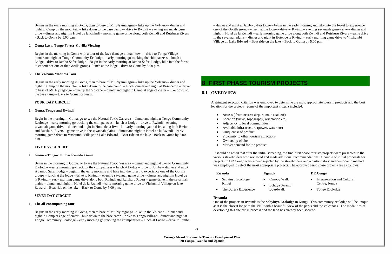
Virunga Massif Sustainable Tourism Development Plan
DR Congo, Rwanda and Uganda
63
Begins in the early morning in Goma, then to base of Mt. Nyamulagira – hike up the Volcano – dinner and night in Camp on the mountain – hike down to the base camp -– drive to Rwindi – evening savannah game drive – dinner and night in Hotel de la Rwindi – morning game drive along both Rwindi and Rutshuru Rivers - Back to Goma by 5.00 p.m.
2. Goma Lava, Tongo Forest Gorilla Viewing
Begins in the morning in Goma with a tour of the lava damage in main town – drive to Tonga Village – dinner and night at Tongo Community Ecolodge – early morning go tracking the chimpanzees – lunch at Lodge – drive to Jambo Safari lodge – Begin in the early morning at Jambo Safari Lodge, hike into the forest to experience one of the Gorilla groups –lunch at the lodge – drive to Goma by 5.00 p.m.
3. The Volcano Madness Tour
Begins in the early morning in Goma, then to base of Mt. Nyamulagira – hike up the Volcano – dinner and night in Camp on the mountain – hike down to the base camp. – lunch, dinner and night at Base camp – Drive to base of Mt. Nyiragongo –hike up the Volcano – dinner and night in Camp at edge of crater – hike down to the base camp – Back to Goma for lunch. FOUR DAY CIRCUIT
1. Goma, Tongo and Rwindi
Begin in the morning in Goma, go to see the Natural Toxic Gas area – dinner and night at Tongo Community Ecolodge – early morning go tracking the chimpanzees – lunch at Lodge – drive to Rwindi – evening savannah game drive – dinner and night in Hotel de la Rwindi – early morning game drive along both Rwindi and Rutshuru Rivers – game drive in the savannah plains – dinner and night in Hotel de la Rwindi – early morning game drive to Vitshumbi Village on Lake Edward – Boat ride on the lake - Back to Goma by 5.00 p.m. FIVE DAY CIRCUIT
1. Goma – Tongo- Jomba- Rwindi- Goma
Begin in the morning in Goma, go to see the Natural Toxic Gas area – dinner and night at Tongo Community Ecolodge – early morning go tracking the chimpanzees – lunch at Lodge – drive to Jomba – dinner and night at Jambo Safari lodge – begin in the early morning and hike into the forest to experience one of the Gorilla groups – lunch at the lodge – drive to Rwindi – evening savannah game drive – dinner and night in Hotel de la Rwindi – early morning game drive along both Rwindi and Rutshuru Rivers – game drive in the savannah plains – dinner and night in Hotel de la Rwindi – early morning game drive to Vitshumbi Village on lake Edward – Boat ride on the lake – Back to Goma by 5.00 p.m.
SEVEN DAY CIRCUIT
1. The all-encompassing tour
Begins in the early morning in Goma, then to base of Mt. Nyiragongo –hike up the Volcano – dinner and night in Camp at edge of crater – hike down to the base camp – drive to Tongo Village – dinner and night at Tongo Community Ecolodge – early morning go tracking the chimpanzees – lunch at Lodge – drive to Jomba
– dinner and night at Jambo Safari lodge – begin in the early morning and hike into the forest to experience one of the Gorilla groups –lunch at the lodge – drive to Rwindi – evening savannah game drive – dinner and night in Hotel de la Rwindi – early morning game drive along both Rwindi and Rutshuru Rivers – game drive in the savannah plains – dinner and night in Hotel de la Rwindi – early morning game drive to Vitshumbi Village on Lake Edward – Boat ride on the lake – Back to Goma by 5.00 p.m.
8 FIRST PHASE TOURISM PROJECTS 8.1 OVERVIEW
A stringent selection criterion was employed to determine the most appropriate tourism products and the best location for the projects. Some of the important criteria included:
• Access ( from nearest airport, main road etc) • Location (views, topography, orientation etc) • Adjacency to local communities • Available infrastructure (power, water etc) • Uniqueness of product • Proximity to other tourism attractions • Ownership of site • Market demand for the product
It should be noted that after the initial screening, the final first phase tourism projects were presented to the various stakeholders who reviewed and made additional recommendations. A couple of initial proposals for projects in DR Congo were indeed rejected by the stakeholders and a participatory and democratic method was employed to select the most appropriate projects. The approved First Phase projects are as follows:
Rwanda Uganda DR Congo
• Sabyinyo Ecolodge, Kinigi
• The Burera Experience
• Canopy Walk
• Echuya Swamp Boardwalk
• Interpretation and Culture Centre, Jomba
• Tongo Ecolodge
Rwanda One of the projects in Rwanda is the Sabyinyo Ecolodge in Kinigi. This community ecolodge will be unique as it is the closest lodge to the VNP with a beautiful view of the parks and the volcanoes. The modalities of developing this site are in process and the land has already been secured.
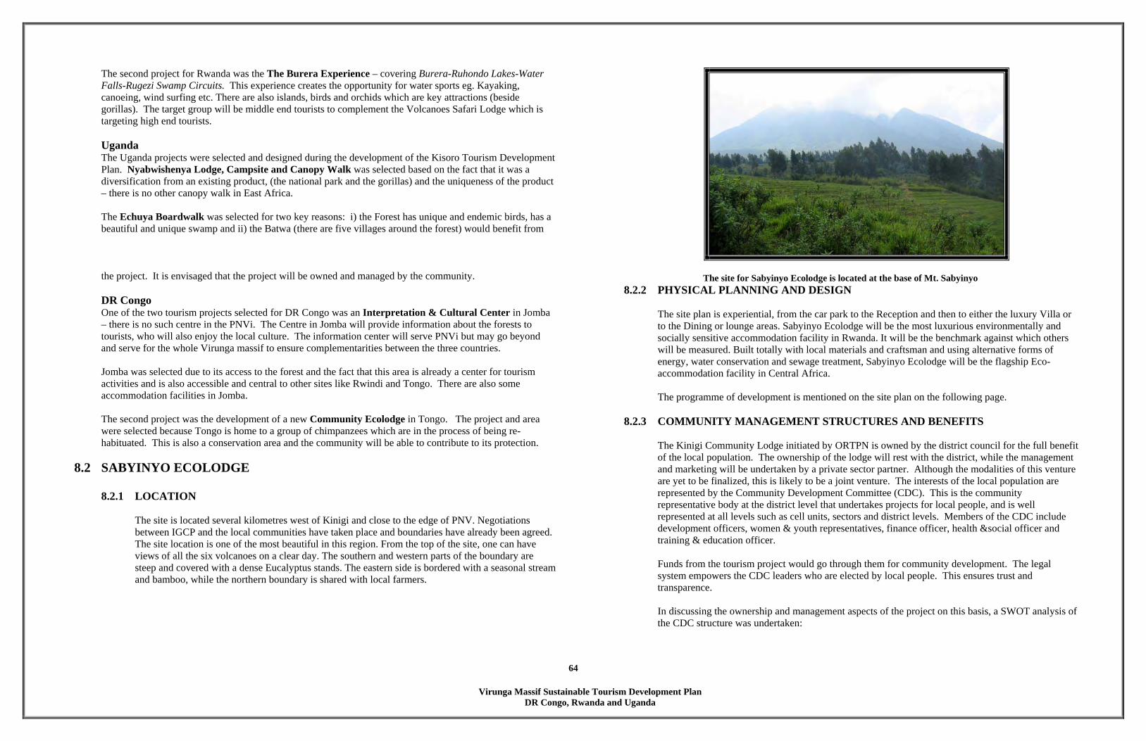
Virunga Massif Sustainable Tourism Development Plan
DR Congo, Rwanda and Uganda
64
The second project for Rwanda was the The Burera Experience – covering Burera-Ruhondo Lakes-Water Falls-Rugezi Swamp Circuits. This experience creates the opportunity for water sports eg. Kayaking, canoeing, wind surfing etc. There are also islands, birds and orchids which are key attractions (beside gorillas). The target group will be middle end tourists to complement the Volcanoes Safari Lodge which is targeting high end tourists. Uganda The Uganda projects were selected and designed during the development of the Kisoro Tourism Development Plan. Nyabwishenya Lodge, Campsite and Canopy Walk was selected based on the fact that it was a diversification from an existing product, (the national park and the gorillas) and the uniqueness of the product – there is no other canopy walk in East Africa. The Echuya Boardwalk was selected for two key reasons: i) the Forest has unique and endemic birds, has a beautiful and unique swamp and ii) the Batwa (there are five villages around the forest) would benefit from the project. It is envisaged that the project will be owned and managed by the community.
DR Congo One of the two tourism projects selected for DR Congo was an Interpretation & Cultural Center in Jomba – there is no such centre in the PNVi. The Centre in Jomba will provide information about the forests to tourists, who will also enjoy the local culture. The information center will serve PNVi but may go beyond and serve for the whole Virunga massif to ensure complementarities between the three countries. Jomba was selected due to its access to the forest and the fact that this area is already a center for tourism activities and is also accessible and central to other sites like Rwindi and Tongo. There are also some accommodation facilities in Jomba. The second project was the development of a new Community Ecolodge in Tongo. The project and area were selected because Tongo is home to a group of chimpanzees which are in the process of being re-habituated. This is also a conservation area and the community will be able to contribute to its protection.
8.2 SABYINYO ECOLODGE 8.2.1 LOCATION
The site is located several kilometres west of Kinigi and close to the edge of PNV. Negotiations between IGCP and the local communities have taken place and boundaries have already been agreed. The site location is one of the most beautiful in this region. From the top of the site, one can have views of all the six volcanoes on a clear day. The southern and western parts of the boundary are steep and covered with a dense Eucalyptus stands. The eastern side is bordered with a seasonal stream and bamboo, while the northern boundary is shared with local farmers.
The site for Sabyinyo Ecolodge is located at the base of Mt. Sabyinyo 8.2.2 PHYSICAL PLANNING AND DESIGN
The site plan is experiential, from the car park to the Reception and then to either the luxury Villa or to the Dining or lounge areas. Sabyinyo Ecolodge will be the most luxurious environmentally and socially sensitive accommodation facility in Rwanda. It will be the benchmark against which others will be measured. Built totally with local materials and craftsman and using alternative forms of energy, water conservation and sewage treatment, Sabyinyo Ecolodge will be the flagship Eco-accommodation facility in Central Africa. The programme of development is mentioned on the site plan on the following page.
8.2.3 COMMUNITY MANAGEMENT STRUCTURES AND BENEFITS
The Kinigi Community Lodge initiated by ORTPN is owned by the district council for the full benefit of the local population. The ownership of the lodge will rest with the district, while the management and marketing will be undertaken by a private sector partner. Although the modalities of this venture are yet to be finalized, this is likely to be a joint venture. The interests of the local population are represented by the Community Development Committee (CDC). This is the community representative body at the district level that undertakes projects for local people, and is well represented at all levels such as cell units, sectors and district levels. Members of the CDC include development officers, women & youth representatives, finance officer, health &social officer and training & education officer. Funds from the tourism project would go through them for community development. The legal system empowers the CDC leaders who are elected by local people. This ensures trust and transparence. In discussing the ownership and management aspects of the project on this basis, a SWOT analysis of the CDC structure was undertaken:

Virunga Massif Sustainable Tourism Development Plan
DR Congo, Rwanda and Uganda
65
• Strengths: the most positive aspect of the CDC is that it consists of elected leaders and is under an existing legal system, which not only empowers leaders, but also provides an avenue for recourse in case of problems. The CDC is represented at all levels.
• The weaknesses: the CDC system is new and still being understood and taught, as such there is
limited capacity. Being within the Local Government system, there is bound to be some level of bureaucracy, delaying processes and inadequate capacity.
• Opportunities include a political will within the CDC and indeed the Government to provide a
forum and work in a transparent manner for the benefit of the local population, a conducive and growing economic environment and a natural endowment.
• The threats are corruption, insecurity, ignorance, powerful donors priorities and low assimilation
of the system. In reviewing and developing project, it is imperative that the management structure is well articulated and takes cognizance and advantage of the existing CDC structures, plus also design a management structure that is open and transparent, but also ensures limited bureaucracy, with no room for corruption.
8.3 THE BURERA EXPERIENCE
8.3.1 LOCATION The Burera Experience is a total product that includes accommodation and eco-tours to the eastern part of Lake Burera. This ‘project’ will have a six tented ecocamps at the Gitare Fishing Village near the Musangabo Peninsula and this facility will provide ecotourism tours to both Burera and Ruhondo Lakes, Rusumo Waterfall, Rusumo Market and Rugezi Swamp Circuits.
8.3.2 PHYSICAL PLANNING The tented camps will be located on small hills overlooking the lake and with views of Mt. Muhabura. The hills currently have remnants of old farm buildings which will be removed and replaced with the tented camps. Paths will lead from the tented camps to the lake shore where visitors can go kayaking, wind surfing or canoeing with the locals.
The site for the Burera ecotents is located on the shores of Lake Burera.
8.3.3 COMMUNITY MANAGEMENT STRUCTURES AND BENEFITS
The Burera experience will be a localized community project with the potential of forming one management body – this will be discussed in detail as the project is being formed. Issues for discussion include ownership, management and benefit sharing. The project covers several land parcels which would have to be secured for the purpose of tourism development. In this regard, negotiations would be with the land owner and the district mayor to acquire a land owner certificate (Acte de Propriété. A management body or association would be formed to represent the interests of the local population and ensure that the benefits are distributed. Alternative would be to use the CDC as the case with the Kinigi eco-lodge above. In discussing the ownership and management aspects of the project on the basis of local association, a SWOT analysis of the structure was undertaken: • Strengths: Unified power within fishing community, security • Weaknesses: common and unified objective, joint knowledge, resource pool (big and enlarged
resources), better innovation, team spirit, laxity in management or mismanagement and low capacity of personnel, dictatorial tendencies, lack of organization skills, lack of by-laws & constitution, fear and domination of strong leaders, corruption and limited innovation.
• Opportunities: sympathy attraction from donors and well wishers, diversification of thoughts
and income, uplifting the standards of living, training pool.

Virunga Massif Sustainable Tourism Development Plan
DR Congo, Rwanda and Uganda
66
• Threats: competition, poor infrastructure and insecurity, interference by government officials,
bureaucracy, donor conditions, credit formalities and competition.
8.3.4 POTENTIAL BENEFITS, RWANDA During the design charettes, discussions on benefits (potential and expected) were generic – as no actual figures or details were available. The benefits mentioned were employment, market for community products, education in say foreign languages knowledge, and ultimately economic development (improvement of livelihood and development of infrastructure) and the level of service improvement. Other indirect benefits included water and social infrastructure (hospitals, dispensaries and schools), communication, connection, income generating activities (restaurants, shops, handcrafts), alternative activities to agriculture, security, alternatives to forest resources. For the Batwa, one of the benefits envisaged is land. Details of the benefit sharing mechanism will have to be developed as part of the project design system. For example, the numbers and levels of staff required at the eco-lodge will dictate how many members of the community can be employed at the eco-lodge, which in turn depends on the skills levels of the community.
8.4 NYABWISHENYA LODGE, CAMPSITE AND CANOPY WALK
8.4.1 LOCATION The project is located within the Nkuringo Tourism Anchor Zone, in the northern part of the Kisoro District (See zoning plan). The existing Sub-county administrative offices would be the renovated and become Nyabwishenya Lodge, the campsite will be located adjacent to the new lodge and the Canopy Walk is located within the Bwindi Impenetrable Forest and accessible from the existing Nteko Ranger Post on Ivy River. Nyabwishenya Lodge is located on the Nteko Ridge with majestic views of Bwindi Forest. It is also situated along the main Kisoro – Ntungamo access road. On clear days, one can see all the six volcanoes.
8.4.2 CONCEPT AND PROGRAMME
The main concept is to create an innovative product (Canopy Walk) that currently does not exist anywhere in Central and East Africa, to provide accommodation to varied markets, to renovate existing buildings and since the proposed Nkuringo Ecolodge will be catering to up-scale clients, it was felt that accommodation facilities will need to be developed in the Nkuringo Tourism Anchor Zone to cater to mid-market and low-budget tourists. Nyabwishenya Lodge will provide facilities for the mid-market clientele while the back-packers and overland tourists would either use the campsite or stay at nearby lodgings.
The programme for this development is: Canopy Walk
100 meters long canopy walk
An entry Gazebo next to the canopy walk that houses interpretive exhibits. Trails to Nkuringo and Kashotoora Hills A covered hut along Ivy River for eating and resting.
Nyabwishenya Lodge
Reception, Lounge , Dining and Kitchen (converted from existing Court House Building)
4 No. Cottages with attached bathrooms (converted from existing 4 numbers 2-room units)
Library, Interpretive and Nature Activity Centre, Admin (converted from existing Admin Building)
Existing Admin Building will be converted into an Interpretive and Nature Activity Centre.
Existing abandoned 2-room units will be converted into comfortable guest cottages.
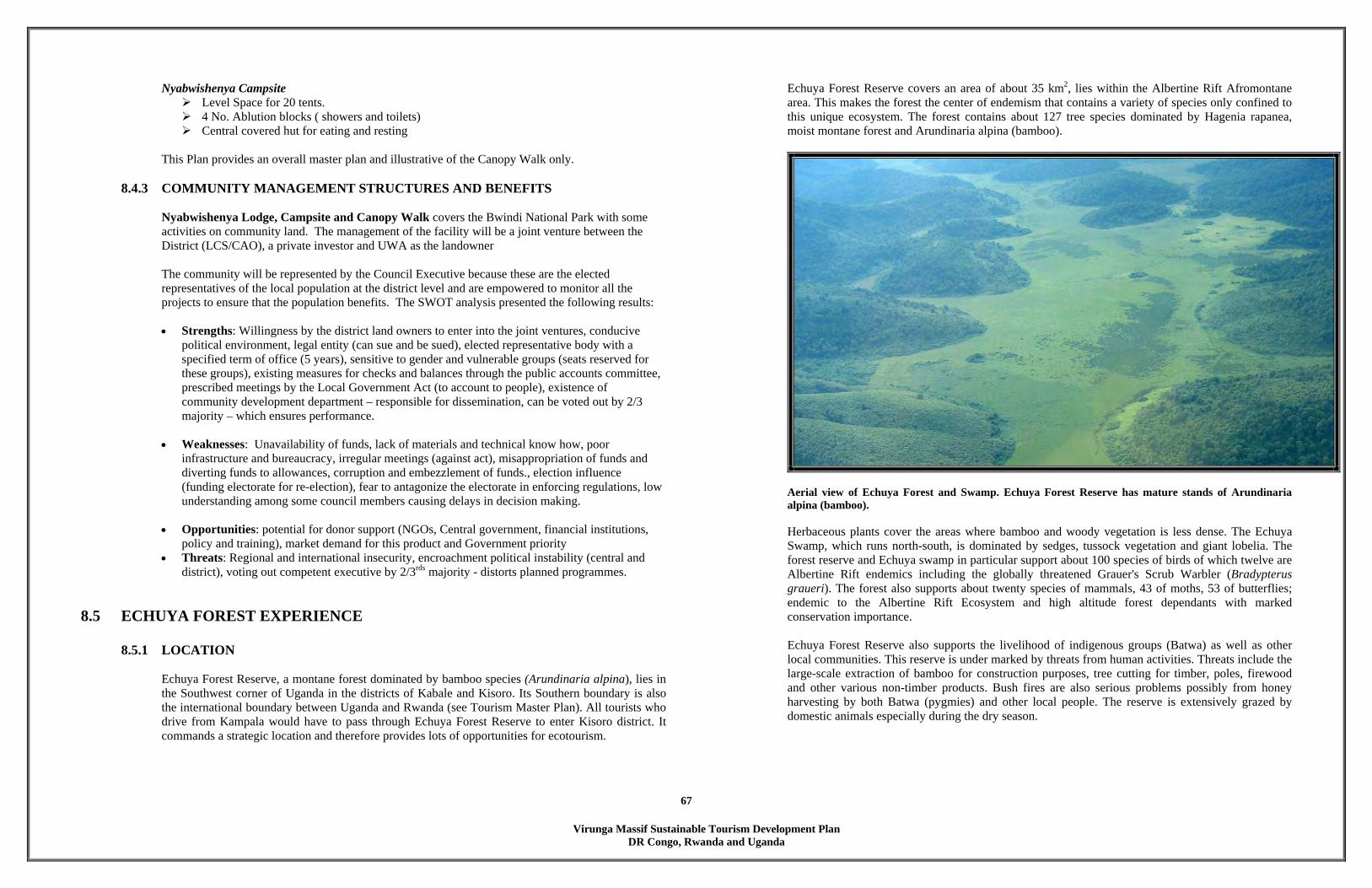
Virunga Massif Sustainable Tourism Development Plan
DR Congo, Rwanda and Uganda
67
Nyabwishenya Campsite Level Space for 20 tents. 4 No. Ablution blocks ( showers and toilets) Central covered hut for eating and resting
This Plan provides an overall master plan and illustrative of the Canopy Walk only.
8.4.3 COMMUNITY MANAGEMENT STRUCTURES AND BENEFITS Nyabwishenya Lodge, Campsite and Canopy Walk covers the Bwindi National Park with some activities on community land. The management of the facility will be a joint venture between the District (LCS/CAO), a private investor and UWA as the landowner The community will be represented by the Council Executive because these are the elected representatives of the local population at the district level and are empowered to monitor all the projects to ensure that the population benefits. The SWOT analysis presented the following results: • Strengths: Willingness by the district land owners to enter into the joint ventures, conducive
political environment, legal entity (can sue and be sued), elected representative body with a specified term of office (5 years), sensitive to gender and vulnerable groups (seats reserved for these groups), existing measures for checks and balances through the public accounts committee, prescribed meetings by the Local Government Act (to account to people), existence of community development department – responsible for dissemination, can be voted out by 2/3 majority – which ensures performance.
• Weaknesses: Unavailability of funds, lack of materials and technical know how, poor infrastructure and bureaucracy, irregular meetings (against act), misappropriation of funds and diverting funds to allowances, corruption and embezzlement of funds., election influence (funding electorate for re-election), fear to antagonize the electorate in enforcing regulations, low understanding among some council members causing delays in decision making.
• Opportunities: potential for donor support (NGOs, Central government, financial institutions, policy and training), market demand for this product and Government priority
• Threats: Regional and international insecurity, encroachment political instability (central and district), voting out competent executive by 2/3rds majority - distorts planned programmes.
8.5 ECHUYA FOREST EXPERIENCE
8.5.1 LOCATION Echuya Forest Reserve, a montane forest dominated by bamboo species (Arundinaria alpina), lies in the Southwest corner of Uganda in the districts of Kabale and Kisoro. Its Southern boundary is also the international boundary between Uganda and Rwanda (see Tourism Master Plan). All tourists who drive from Kampala would have to pass through Echuya Forest Reserve to enter Kisoro district. It commands a strategic location and therefore provides lots of opportunities for ecotourism.
Echuya Forest Reserve covers an area of about 35 km2, lies within the Albertine Rift Afromontane area. This makes the forest the center of endemism that contains a variety of species only confined to this unique ecosystem. The forest contains about 127 tree species dominated by Hagenia rapanea, moist montane forest and Arundinaria alpina (bamboo).
Aerial view of Echuya Forest and Swamp. Echuya Forest Reserve has mature stands of Arundinaria alpina (bamboo). Herbaceous plants cover the areas where bamboo and woody vegetation is less dense. The Echuya Swamp, which runs north-south, is dominated by sedges, tussock vegetation and giant lobelia. The forest reserve and Echuya swamp in particular support about 100 species of birds of which twelve are Albertine Rift endemics including the globally threatened Grauer's Scrub Warbler (Bradypterus graueri). The forest also supports about twenty species of mammals, 43 of moths, 53 of butterflies; endemic to the Albertine Rift Ecosystem and high altitude forest dependants with marked conservation importance. Echuya Forest Reserve also supports the livelihood of indigenous groups (Batwa) as well as other local communities. This reserve is under marked by threats from human activities. Threats include the large-scale extraction of bamboo for construction purposes, tree cutting for timber, poles, firewood and other various non-timber products. Bush fires are also serious problems possibly from honey harvesting by both Batwa (pygmies) and other local people. The reserve is extensively grazed by domestic animals especially during the dry season.
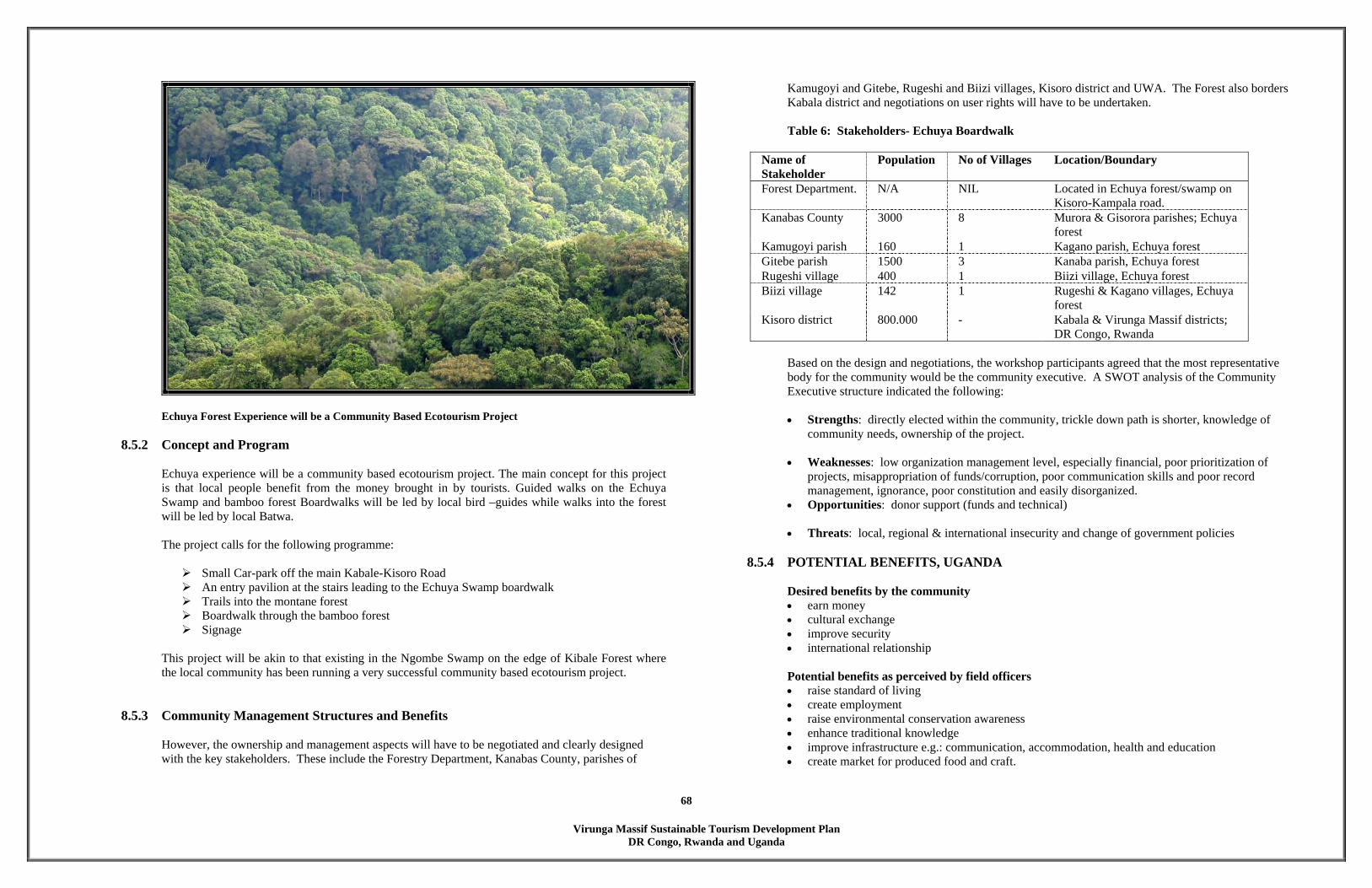
Virunga Massif Sustainable Tourism Development Plan
DR Congo, Rwanda and Uganda
68
Echuya Forest Experience will be a Community Based Ecotourism Project
8.5.2 Concept and Program
Echuya experience will be a community based ecotourism project. The main concept for this project is that local people benefit from the money brought in by tourists. Guided walks on the Echuya Swamp and bamboo forest Boardwalks will be led by local bird –guides while walks into the forest will be led by local Batwa. The project calls for the following programme:
Small Car-park off the main Kabale-Kisoro Road An entry pavilion at the stairs leading to the Echuya Swamp boardwalk Trails into the montane forest Boardwalk through the bamboo forest Signage
This project will be akin to that existing in the Ngombe Swamp on the edge of Kibale Forest where the local community has been running a very successful community based ecotourism project.
8.5.3 Community Management Structures and Benefits
However, the ownership and management aspects will have to be negotiated and clearly designed with the key stakeholders. These include the Forestry Department, Kanabas County, parishes of
Kamugoyi and Gitebe, Rugeshi and Biizi villages, Kisoro district and UWA. The Forest also borders Kabala district and negotiations on user rights will have to be undertaken. Table 6: Stakeholders- Echuya Boardwalk
Name of Stakeholder
Population No of Villages Location/Boundary
Forest Department. N/A NIL Located in Echuya forest/swamp on Kisoro-Kampala road.
Kanabas County 3000 8 Murora & Gisorora parishes; Echuya forest
Kamugoyi parish 160 1 Kagano parish, Echuya forest Gitebe parish 1500 3 Kanaba parish, Echuya forest Rugeshi village 400 1 Biizi village, Echuya forest Biizi village 142 1 Rugeshi & Kagano villages, Echuya
forest Kisoro district 800.000 - Kabala & Virunga Massif districts;
DR Congo, Rwanda Based on the design and negotiations, the workshop participants agreed that the most representative body for the community would be the community executive. A SWOT analysis of the Community Executive structure indicated the following: • Strengths: directly elected within the community, trickle down path is shorter, knowledge of
community needs, ownership of the project.
• Weaknesses: low organization management level, especially financial, poor prioritization of projects, misappropriation of funds/corruption, poor communication skills and poor record management, ignorance, poor constitution and easily disorganized.
• Opportunities: donor support (funds and technical)
• Threats: local, regional & international insecurity and change of government policies
8.5.4 POTENTIAL BENEFITS, UGANDA
Desired benefits by the community • earn money • cultural exchange • improve security • international relationship Potential benefits as perceived by field officers • raise standard of living • create employment • raise environmental conservation awareness • enhance traditional knowledge • improve infrastructure e.g.: communication, accommodation, health and education • create market for produced food and craft.
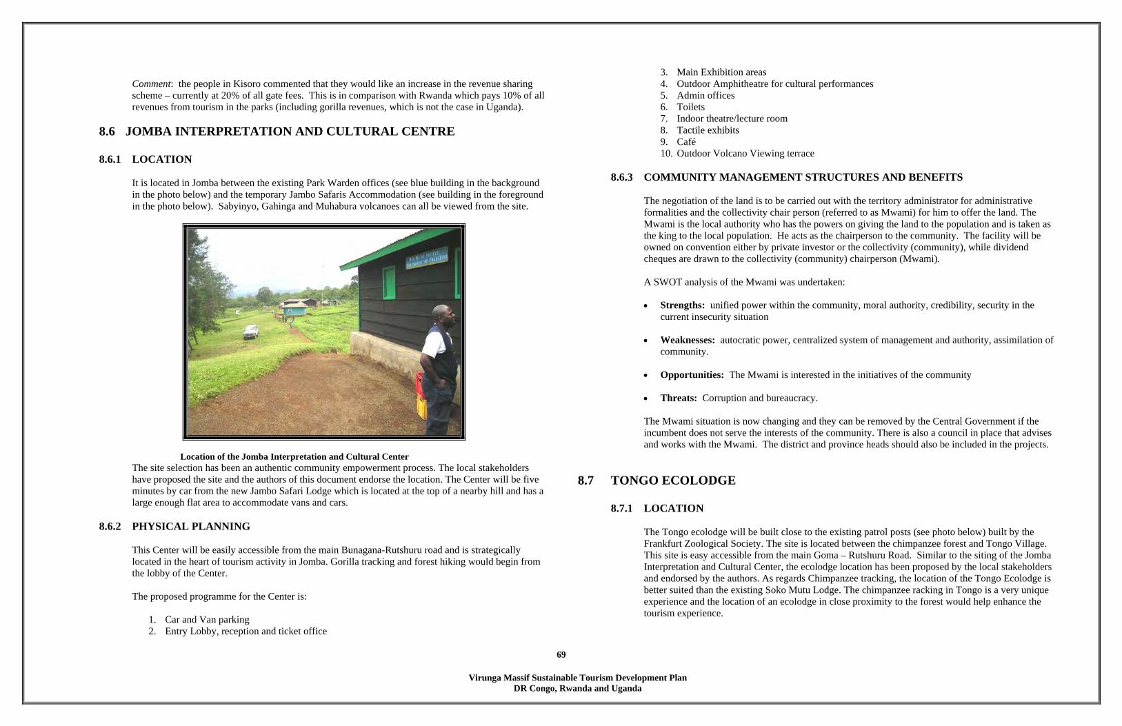
Virunga Massif Sustainable Tourism Development Plan
DR Congo, Rwanda and Uganda
69
Comment: the people in Kisoro commented that they would like an increase in the revenue sharing scheme – currently at 20% of all gate fees. This is in comparison with Rwanda which pays 10% of all revenues from tourism in the parks (including gorilla revenues, which is not the case in Uganda).
8.6 JOMBA INTERPRETATION AND CULTURAL CENTRE
8.6.1 LOCATION It is located in Jomba between the existing Park Warden offices (see blue building in the background in the photo below) and the temporary Jambo Safaris Accommodation (see building in the foreground in the photo below). Sabyinyo, Gahinga and Muhabura volcanoes can all be viewed from the site.
Location of the Jomba Interpretation and Cultural Center The site selection has been an authentic community empowerment process. The local stakeholders have proposed the site and the authors of this document endorse the location. The Center will be five minutes by car from the new Jambo Safari Lodge which is located at the top of a nearby hill and has a large enough flat area to accommodate vans and cars.
8.6.2 PHYSICAL PLANNING
This Center will be easily accessible from the main Bunagana-Rutshuru road and is strategically located in the heart of tourism activity in Jomba. Gorilla tracking and forest hiking would begin from the lobby of the Center. The proposed programme for the Center is:
1. Car and Van parking 2. Entry Lobby, reception and ticket office
3. Main Exhibition areas 4. Outdoor Amphitheatre for cultural performances 5. Admin offices 6. Toilets 7. Indoor theatre/lecture room 8. Tactile exhibits 9. Café 10. Outdoor Volcano Viewing terrace
8.6.3 COMMUNITY MANAGEMENT STRUCTURES AND BENEFITS
The negotiation of the land is to be carried out with the territory administrator for administrative formalities and the collectivity chair person (referred to as Mwami) for him to offer the land. The Mwami is the local authority who has the powers on giving the land to the population and is taken as the king to the local population. He acts as the chairperson to the community. The facility will be owned on convention either by private investor or the collectivity (community), while dividend cheques are drawn to the collectivity (community) chairperson (Mwami). A SWOT analysis of the Mwami was undertaken: • Strengths: unified power within the community, moral authority, credibility, security in the
current insecurity situation
• Weaknesses: autocratic power, centralized system of management and authority, assimilation of community.
• Opportunities: The Mwami is interested in the initiatives of the community
• Threats: Corruption and bureaucracy.
The Mwami situation is now changing and they can be removed by the Central Government if the incumbent does not serve the interests of the community. There is also a council in place that advises and works with the Mwami. The district and province heads should also be included in the projects.
8.7 TONGO ECOLODGE 8.7.1 LOCATION
The Tongo ecolodge will be built close to the existing patrol posts (see photo below) built by the Frankfurt Zoological Society. The site is located between the chimpanzee forest and Tongo Village. This site is easy accessible from the main Goma – Rutshuru Road. Similar to the siting of the Jomba Interpretation and Cultural Center, the ecolodge location has been proposed by the local stakeholders and endorsed by the authors. As regards Chimpanzee tracking, the location of the Tongo Ecolodge is better suited than the existing Soko Mutu Lodge. The chimpanzee racking in Tongo is a very unique experience and the location of an ecolodge in close proximity to the forest would help enhance the tourism experience.

Virunga Massif Sustainable Tourism Development Plan
DR Congo, Rwanda and Uganda
70
8.7.2 PHYSICAL PLANNING
The Tongo ecolodge will become the tourism hub for Tongo. The ecolodge will be designed with the local vernacular in mind and the form will have context with the surroundings. The proposed programme for the ecolodge is:
1. Car parking 2. Entry Lobby, reception 3. Dining and Lounge 4. Outdoor Amphitheatre for cultural performances 5. Kitchen and storage 6. Back –of – house facilities 7. Public Toilets 8. 6 no. Luxury Villas overlooking the forest 9. Nature Library 10. Activity Center 11. Garden Pavilions
8.7.3 COMMUNITY MANAGEMENT STRUCTURES AND BENEFITS
The community will own the facility, and negotiations will be undertaken with a management committee voted by the local population. Strengths: Organised and structured community, experience of the associative movement. Weaknesses: Lack of experience and training, inadequate resources. Opportunities: diversified attractions (chimpanzees, sceneries: one of the best in Africa: view over the whole of Virunga Range + active volcanoes + Rwenzori; regular eruptions), tourism reopening, sensitive partners and availability of materials. Threats: Insecurity and poverty.
8.7.4 POTENTIAL BENEFITS, DR CONGO
• increase in revenues • improvement in socio-economic infrastructure • cultural exchange • unemployment reduction • ecosystem conservation • improvement in product quality • improvement in security • promotion of traditions • promotion of commercial activity • increase in investments
Location of the Tongo Ecolodge
Annex Way Forward for the Kisoro Tourism Plan : Discussions with the Kisoro District Tourism Committee The objective of the meeting was to structure the way forward after the completion of the detailed tourism plan. Agenda 1. Review the sites – reminder of the sites selected for implementation and the circuits developed in
the plan, and identify sites that exist on community land and on Government land.
Virunga Massif Sustainable Tourism Development Plan
DR Congo, Rwanda and Uganda
71
2. Develop a prioritisation criterion for selection of community tourism projects. Although two sites that were perceived as ‘district wide’ had already been identified during the plan, the meeting sought to document the criteria used for their selection (with perhaps some additional input) which would be used for the selection of future projects.
3. Develop the activities that would initiate and facilitate an implementation process including: • training • protection of key tourist sites currently either dilapidated or under community land • stakeholders analysis • guidelines for tourism development – for the private sector, community deals and
environmental. • implementation structures • community benefits
4. Timeframe and way forward
1. Review of Tourism Sites
A number of the sites selected by the tourism plan were on community land and needed protection and rehabilitation. The objective of this session was to identify those that exist on Government land and those that are on community land as follows: Sites on Government land: Nkuringo Falls, Nkuringo Ecolodge, Bwakugaba Scene Point, Bukimbiri Lodge, Lake Mulehe, Kigezi Hill Scenic Point, Kigezi Monument, Chimp Forest Reserve, Busanza Falls, Garama Cave, Volcanoes, Chuho Springs, and Echuya Forest Sites on Community Land: Nombe Cave, Tombs, Kangoma Cave (written as Natete in plan), Mwambike Cave, Sagitwe Caldera, Gasave Hill, Ruganzu Rocks, Ruganzu Footmarks, Bukere Cave, Amakere Salt Water, Muremure Caldera, Murora Hill, Mwihe Springs. The bolded sites need special protection as tourist sites. Busanza Falls, under law are under Government ownership and protection. However the immediate land surrounding the falls is owned and managed by the community.
2. Selection Criteria
The following was developed as the criteria for selecting the projects for development under the tourism plan:
a) Selection of District Tourism Projects
Definition: District projects were identified as those projects that are either: • on Government land - that is the onus of the protection and management lies solely under
the control of the Government, like protected areas forests, volcanoes; and • Would require a large investment in terms of capital investment, management and
monitoring. Selection Criteria • Number of beneficiaries – the larger the number of community members who would
benefit the better.
• Level of benefits • Land ownership (clear and distinct) • Existing and supportive infrastructure • Potential impact on the environment • Commercial viability • Uniqueness of the project • Diversification of an existing product Nkuringo site was selected based on the fact that it was a diversification from an existing product, (the national park and the gorillas) and the uniqueness of the product – there is no other canopy walk in East Africa. The Echuya forest has unique and endemic birds, has a beautiful and unique swamp and would create a great attraction. The Batwa (there are five villages around the forest) would also benefit from the project.
b) Selection of Community Tourism Projects
Definition: Community projects were identified as those projects that are either: • on community land - that is the land solely under the control of the community either in
terms of ownership (with title) or use. • the level of investment in terms of capital, management and monitoring is low Selection Criteria • Number of beneficiaries – the larger the number of community members who would
benefit the better. • Level of benefits • Level of complexity of the project in terms of land ownership and access. The higher the
fragmentation around a certain tourist site or project, the larger the number of people to deal with in terms of debate and negotiations – which complicates the situation.
• Existing traditional practices • Commercial viability • Potential impact on the environment • Richness of experience (see box 1 below) Does the project address a special needs group – e.g. the Batwa, communities around
high conflict area. Box 1: Richness of Experience from the different Kisoro tourism circuits
Attraction/interest 1 2 3 4 7 9 Caves Tombs Canoeing/boat ride/fishing Scenic view (e.g. volcano) Rocks/salt water
Cultural value (from Batwa) Waterfalls Lakes (lunches) Bird watching Footmark
Virunga Massif Sustainable Tourism Development Plan
DR Congo, Rwanda and Uganda
72
Monuments Springs
5 4 6 1 1 2 NOTE: circuits 7 & 4 are covered by the Echuya Swamp and Bamboo Forest; circuit 5 &6 goes into Mgahinga (volcanoes and Garama cave) and circuits 8 goes into Bwindi – all on Government land and covered under the two district wide projects (currently) or future phase two projects.
The meeting then went ahead to select the preferred community projects/circuits, based on the selection criteria set above. The selection process picked the first two choices in each category. The two strategic circuits for the community were identified as one and three. Selection of Projects based on criteria
1 2 3 4 7 9 Remarks
No. of beneficiaries 1 2
Members felt that community members are more in circuit 1 than 3. Other circuits were too short compared to the first two and were therefore not ranked.
Level of benefits (based on no. of days of the circuit hence potential income, number of attractions and richness of experience)
2 1
Circuit 3 gets the highest ranking as it has the richest experience compared to others (refer to box 1 above) and is a 2-day circuit and therefore has a potentially higher level of income.
Complexity of project (based on level of fragmentation and number of land owners; and access to tourist site)
1 2
Circuit 1 has fewer people than two.
Existence of special interest groups (based on communities in conflict areas, the Batwa and the marginalised groups)
1 2
One has more Batwa villages around it
Impact on Environment (e.g. water and forests)
These will be developed as part of the in-depth design process – to validate the selection of the projects and confirm which one to start with. Commercial viability
Existing traditional practices (For example crafts, cultural experiences, food supply, etc.)
From the selected project sites, these will be developed as spin-off enterprises – handicrafts, cultural experiences, etc)
Pre-operational Activities The objective of this session was to review and agree on the set of preparation activities required to initiate and facilitate the implementation process of the completed tourism plan. The following were identified as the key initial activities and steps. It is important that the district follows the plan and develops a detailed implementation plan and structure. Activity 1: Immediate i) Development of a working structure and mechanism for the tourism committee and linkages
with the tourism officer. ii) Site visit by the tourism committee of all the circuits. iii) Development of a detailed implementation plan and structure.
iv) Market the plan and achieve buy-in from the Uganda Investment Authority, Uganda Tourism Board, Uganda Wildlife Authority, Ministry of Trade, Tourism and Industry and the Ministry of Finance, Planning and Economic Development. The objective of the buy in process is to ensure that the plans and businesses are marketed and that funds are planned for and availed for investment purposes.
The following activities were discussed as key in initiating the process and will form part of the detailed implementation plan and structure: i) Review of the land ownership structure within the selected sites, and particularly around the
three key areas selected for protection. ii) Assessment of the commercial viability of the selected sites – business plan, marketing plan
and structure and the operational plan and structure. iii) Identification of spin off and complimentary activities (handicrafts, food supply, cultural
dances, etc). iv) Stakeholder identification including community associations, private sector, CBOs and
NGOs. v) Development of detailed investment guidelines for the private sector involvement in the
community and the district, community involvement (including issues of ownership, governance, management (OGM), and environmental impact assessments.
vi) Development of guidelines for benefit sharing or a benefit sharing plan (looking at issues of UWA percentage to the district and its stream down to the grassroots, employment percentages, food supply quotas, sale of handicrafts, cultural troops, among others).
vii) Training plan (in conjunction with the IGCP plan – which is emanating from the training needs assessment that was done).
viii) Design of a monitoring and evaluation system. Secondary to this will be the marketing and tendering process to find private sector investors/partners. Running concurrently will be the sensitisation and mobilisation process for community and leaders, existing private sector partners in the district - tour operators, hoteliers, and campsite owners – with the objective of sensitising them on the tourism plan and the emanating policy and guidelines for tourism to ensure that they operate in harmony with the plan. Other activities must be elucidated in the implementation plan.
Some of the training needs identified: District Level (Policy) Initiation into the tourism sector, development over the years, how it works, competing destinations, tourist preferences (among others) Introduction to the Kisoro Tourism Development Plan Implementers (Guides, tour operators, transport/taxis law enforcers) Tourist management and hospitality
Community Sensitisation and mobilisation of the leaders (from LC5 level to LC1), community from

Virunga Massif Sustainable Tourism Development Plan
DR Congo, Rwanda and Uganda
73
the selected sites and the community on the three sites selected for protection.
General Discussions • Initial thoughts on the implementation system were that tourism committees could be developed around
the sites (at the sub-county level) and they would be responsible for management and monitoring the sites. The district committee would then be responsible for monitoring and standards.
• The role of the different players will need to be defined. • Compensate and/or integration of the landowners of the sites selected for the protection will have to be
elaborated. Way Forward The way forward was agreed that after the approval of the Plan by the Council, the tourism committee would immediately undertake the immediate activities listed above. • Development of a working structure and mechanism for the tourism committee and linkages with the
tourism officer. • Site visit by the tourism committee of all the circuits. • Development of a detailed implementation plan and structure – the table of contents for the structure of
the implementation plan is attached. • Market the plan and achieve buy-in from the Uganda Investment Authority, Uganda Tourism Board,
Uganda Wildlife Authority, Ministry of Trade, Tourism and Industry and the Ministry of Finance, Planning and Economic Development. The objective of the buy in process is to ensure that the plans and businesses are marketed and that funds are planned for and availed for investment purposes.
The responsible person for moving this plan forward should be identified immediately – including the timeframe. In future, this would probably be the tourism officer, but prior to the selection, an interim officer should be identified and mandated with this responsibility.
9 PLANNING & MANAGEMENT GUIDELINES Sustainable tourism development is defined as, “. . . tourism which is developed and maintained in an area (community environment) in such a manner and at such a scale that it remains viable over an indefinite period and does not degrade or alter the environment (human and physical) in which it exists to such a degree that it prohibits the successful development and well-being of other activities and processes” (Butler, 1993). However, rather than determining whether tourism is, or is not sustainable, it has been suggested that stakeholders should instead address the process of how tourism can develop and operate sustainably (Clarke, 1997). The SWOT analysis undertaken during the Virunga Massif workshop identified a range of issues pertinent to locally appropriate tourism development, given the prevailing socio-economic conditions. These issues have

Virunga Massif Sustainable Tourism Development Plan
DR Congo, Rwanda and Uganda
74
been supplemented with international best practice to derive a series of planning, economic, social and environmental guidelines that will promote responsible tourism development and poverty alleviation. The Tourism Policy for Uganda provides a basis for this approach given its support for the principles of Agenda 21 for the Travel and Tourism Industry (MTTI, 2003).
9.1 PLANNING GUIDELINES 1. Plans for tourism developments outside the Virunga Massif should be undertaken within the context of
existing and proposed complementary and competing attractions at the national level, and in relation to opportunities that may promote regional tourism circuits.
2. Local government should liase with central government structures to address regional security issues, and
enforce national legislation and local bylaws (especially in relation to crime and natural resource use).
3. Integrate district tourism plans in Uganda with broader national- and district-level planning processes, including the National Tourism Policy.
4. Planners should endeavour to use the ‘Harmonised participatory planning guidelines for parishes/wards’
(MoLG, 2003b) when undertaking tourism planning exercises in Uganda. Encourage all interested and affected parties to participate.
5. Plans should be holistic, and address economic, environmental, social and institutional factors that
promote sustainable development. 6. Develop a crisis management plan, to implement in case of a political, security, natural (e.g. bush fires),
or health crisis (e.g. Ebola, SARS). The plan should include how to minimise the risk of different scenarios occurring and strategies to address incidents and the media subsequently. Sensitise relevant stakeholders regarding the plan and provide training and facilities as required.
7. Provide opportunity for the participation and involvement of all interested and affected parties during all
stages of the planning process. Stakeholders should include the private sector, public sector (e.g. UWA), NGOs/CBOs, service providers, traditional institutions (clans/elders), parish councils, and representatives of marginalized groups, livelihood groups and the poor (MoLG, 2003a&b). To stimulate the participation
8. of poor people and vulnerable groups, incentives such as the reimbursement of travel costs, subsistence
and provision of meals during meetings may enhance their attendance (MoLG, 2003a).
9. Promote co-ordination of tourism planning functions beneath local governments to avoid disjointed planning in local governments, duplication of activities and contradicting implementation approaches (MoLG, 2003a).
10. Planning should not be a one-off exercise, but a continual process (MoLG, 2003b).
11. District councils should ensure accountability and transparency throughout the tourism planning process.
12. Spatial plans which zone areas for different types of development (including tourism) should be supported
by legislation to facilitate their effective implementation.
13. District councils should consider how they might formally respond to proposed developments that may have adverse impacts on Virunga Massif’s natural resources, culture, society and existing livelihoods.
14. District councils should consider mechanisms to convert existing development that is in conflict with the
zoning plans or Virunga Massif’s economic, environmental and social objectives.
15. Plan to provide a diverse range of new and complementary tourism attractions and activities that are appropriate to different markets (e.g. domestic tourists, foreign tourists, VFR and business travellers) and are spatially distributed across the district along existing and complementary tourist circuits with appropriate signage and visitor facilities (e.g. toilets, parking).
16. Encourage tour operators to increase the range of activities undertaken by tourists, by informing them of
the diversity and quality of complementary attractions within the district (e.g. cultural and natural attractions). Tour operators will also benefit if tourists stay longer in the area!
17. Consider issues of land ownership and equitable access to natural resources when planning tourism
developments, attractions and activities so that they provide access to opportunities for all members of the district – rather than an elite minority.
18. Plan and develop tourism infrastructure so that it not only promotes tourism, but also uplifts the standards
of living for the residents living around the Virunga Massif (e.g. road quality and safety, recreational facilities, information centres etc).
19. Local councils should encourage licensing in the tourism industry, and also coordination of the informal
sector to promote accessibility of opportunities to all.
20. Market and financial feasibility assessments should be undertaken prior to implementing tourism development proposals, before exposing external investors and local entrepreneurs to risk and unrealistic expectations.
21. Develop and maintain documentation regarding existing district level tourism assets (e.g.
accommodation) and service providers (e.g. guides, tour operators) to use as a basis for future planning, marketing and licensing. Consider posting the information on the internet to aid dissemination.
22. Promote a phased approach to the introduction and development of new tourism infrastructure and
services. In the short -term, prioritise initiatives that have a high probability of commercial success, community benefits, and low environmental impact, but which require little financial or capacity support.
23. Create policies and strategies that evoke an enabling environment to stimulate and support local
entrepreneurs and small business development.
24. Preferentially provide planning permission to investors and developers who describe how they will do to promote equity, employment and training for local people (especially the poor, women, people with disabilities and youth), and procurement from local product and service providers.

Virunga Massif Sustainable Tourism Development Plan
DR Congo, Rwanda and Uganda
75
25. Promote opportunities for community based tourism enterprises and joint ventures between the private sector and community organisations, where community members have negotiated contracts that include provisions for equitable rights, responsibilities, risks and opportunities.
9.2 ECONOMIC GUIDELINES 1. Local government should use the funding options at its disposal (including conditional, unconditional,
equalization grants, Graduated Tax, donors, private sector) to help finance community based tourism projects (MoLG, 2003a).
2. Preference should be given to tourism developments where community members are willing to contribute
towards co-financing, and where they are involved in the decision-making and identification of resources (MoLG, 2003a). Community members may have various options for contributions, including local materials and unskilled labour, or cash.
3. Where returns from user fees are attractive, provide institutional support for the private sector investment
under the Build Operate and Own (BOO) arrangement (MoLG, 2003a).
4. Use existing institutional financial structures within local government to channel funds for community based tourism development, but apply careful gap-stopping measures as a management tool to enhance functional capacities in planning, financial management, public procurement, monitoring and evaluation (MoLG, 2003a). Ensure funding is reliable to promote sustainability.
5. Where NGOs or other independent agencies transfer funds to local governments to finance CBT, ensure that there is transparency, control and accountability and appropriate levels of financial management skills (MoLG, 2003a).
6. Facilitate access by local people, especially the poor, to micro-credit and soft loans to initiate
commercially viable tourism ventures. Provide information about donors who may support community-based tourism, capacity building, and conservation initiatives.
7. Provide skills in financial management, procurement and accountability in cases where community
members are in control of funds (MoLG, 2003a).
8. Ensure that realistic plans for tourism development are developed, which are implementable with available resources and budgets. Empower stakeholders with information regarding potential or available resources for tourism development, to ensure that expectations are realistic (MoLG, 2003a).
9. Encourage improvements in the quality of all tourism attractions and services – particularly among small
medium and micro-enterprises (SMMEs) to enhance their revenue generating potential - and provide access to information and training, and quality standards.
10. Undertake market research analyses to identify options for tourism development that are viable in the
current tourism market to guide zoning.
11. Provide access to local entrepreneurs, SMMEs, and craftspeople to market research data, and encourage them in the development of diverse, quality and fairly priced products and services.
12. Promote the practice of preferential local purchasing and employment, and encourage tourism enterprises
to monitor and report on activities that stimulate the local economy, gender equity, employment of marginalized people (e.g. Batwa, people with disabilities), and set targets for improvement.
13. Facilitate and support the development and operation of locally owned and run SMMEs that are both
directly related to tourism (e.g. accommodation, guiding) and also those which support the tourism industry (e.g. transportation, internet, laundry services, microfinance).
14. Promote and encourage linkages between existing and emerging tourism enterprises and supporting
producers and suppliers in the district to enhance cooperation, communication and local networks and local business (e.g. by developing a local Tourism Association or Tourism Information Bureau).
15. Foster an ethic of corporate social responsibility (CSR) and fair trade within the tourism industry, and
consider asking enterprises to quantify their support for initiatives that uplift the community (e.g. number and value of bursaries for students; value of donations channelled to community projects and community infrastructure).
16. Provide access for local SMMEs and entrepreneurs to markets or outlets where they can sell their
products (e.g. local food and drink, crafts, honey) and services (e.g. traditional dancing, storytelling) direct to tourists with respectability. The poor and marginalized often face the greatest barriers to tourism markets, and access should be facilitated through the development of co-operative retail outlets.
17. Assist new and emerging businesses in addressing gaps in the market rather than overcapitalising on
existing strengths, to promote commercially viable development across the district.
18. Given the established market for the unique selling proposition for tourism in the district – gorilla trekking – consider how new complementary attractions and services could cater for this market.
19. Consider the potential for advances in information technology to be used in cooperatively marketing
Virunga Massif’s tourism attractions (e.g. the potential for a website describing routes, products and activities)
20. Consider the opportunity costs of tourism in people’s livelihoods. Tourism is a fragile business, and easily
affected by security, disease outbreaks and currency fluctuations. Therefore tourism should not replace existing livelihoods, but should be promoted as a complementary revenue generating activity.
21. Ensure that tourists are charged fair prices for products and services in Virunga Massif. Consider
developing guidelines for pricing and bargaining that benefit both tourists and businesses. Be aware that demand from tourism may inflate higher prices for products for local people.
22. Encourage tourism businesses to use fair recruitment (e.g. that do not unfairly benefit one cultural group
or gender), advancement, training and remuneration practices. Enterprises should sign formal contracts with employees and establish guidelines and practices to safeguard employee’s health and safety.
23. Measure and report on the contribution of tourism to poverty alleviation in the district, and consider
tourism’s impact on employment, revenue-generating activities, supporting existing livelihoods, and dependent family members.

Virunga Massif Sustainable Tourism Development Plan
DR Congo, Rwanda and Uganda
76
24. Ensure that tourists enjoy their experiences in the district: Develop, distribute and collate questionnaires that ask tourists what they did; what they enjoyed; what other activities they might like to do; additional projects they might wish to purchase; and how tourism in Virunga Massif could be improved.
25. Disseminate feedback from tourists to interested stakeholders and help them to implement
recommendations to enhance the quality of tourism in the District.
9.3 SOCIAL GUIDELINES 1. Provide training to build local capacity by developing a pool of district and local facilitators who
understand tourism development, to enhance community acceptance and ownership of the training and planning. This ensures that once the external experts withdraw, local expertise remains within the district. Training needs may include (MoLG, 2003a): project planning and management; leadership training skills; Gender and Empowerment; Business/tourism/crafts skills; Community and resource mobilisation; Financial management, procurement and accountability; Documentation/communication; and Lobbying, networking and advocacy.
2. Consider establishing local institutions such as community forums, accessible by all interested members
of the community, and especially marginalized members of society, to provide a mechanism for information about tourism to be reviewed and for local concerns to be addressed (e.g. quality, access, marketing, social impacts etc.).
3. Encourage cooperation between different institutions to promote responsible tourism and conservation,
including local government, NGOs, CBOs, private sector tourism businesses, and other interested parties. 4. Encourage mutually respectful, friendly and beneficial relationships between residents of Virunga Massif,
tourists and visitors: especially with regard to the rights of privacy.
5. Advertise areas where tourists are welcome to go, and provide information regarding areas that are prioritised for residents instead.
6. Encourage the people of Virunga Massif to be domestic tourists, especially youth: Encourage people to
visit the natural and cultural attractions in their district, and participate in recreational activities, and consider discounts for local people and marginalized groups.
7. Tourists want to ‘meet the people’ of Virunga Massif. Design opportunities for interactions between
visitors and hosts for cultural exchange and learning (e.g. homestays, storytelling, inclusion in local festivals, employ local guides, agrotourism).
8. Consider how tourism can be developed so that does not negatively affect the way of life and people’s
livelihoods (e.g. avoiding conflicts over resources, not interfering with children’s schooling). Tourism should not compromise respect for social and cultural and religious rights, or the essential human rights of people to food, a safe and clean environment, work, health, and education.
9. Provide organised and informal opportunities for tourists to learn more about the rich natural and cultural
heritage of Virunga Massif. Consider visits to Batwa communities, guided tours of local villages, meals
with traditional food and drink, demonstrations of craft making skills, cultural dances, storytelling, games, traditional music and song.
10. Use the interest from tourists in local culture to stimulate education and pride among the residents of
Virunga Massif of their heritage, and pass on stories, dances, songs and traditional skills to the youth.
11. Ensure the respect and dignity of people in the development, marketing and promotion of tourism.
12. Stimulate opportunities for marginalized members of society to actively participate in the tourism industry (e.g. women, orphans, youth, people with disabilities, the landless). Sensitise the community regarding the causes of poverty, and options to alleviate it.
13. Develop educational booklets that can be given or sold to tourists that accurately describe the history, culture, livelihoods, and traditions of the people of Virunga Massif. Describe how to communicate simple greetings in local languages. Also provide accurate information for residents about tourists to stimulate mutual understanding.
14. Develop organised tours and ‘menu’s of attractions on routes on which tourists can be guided by their
hosts, meet local people, learn about local culture and natural heritage, and buy fairly traded local produce.
15. Consider developing codes of conduct for tourists with the participation of local stakeholders regarding
local social and cultural practices, so that visitors do not unintentionally offend residents in their behaviour, their attire, or by where they go.
16. Sensitise residents regarding the potential needs and expectations of different types of tourists using radio,
workshops and schools to explain how tourism is everyone’s responsibility.
17. Promote safety and security in the province – which can benefit both tourists and hosts. Consider ‘community policing’ forums to work in collaboration with the police to address antisocial problems such as drug and alcohol abuse.
18. Use participatory processes to develop codes of conduct for stakeholders involved in the tourism industry.
Consider how stakeholders might be organised to cooperate and avoid practices that discourage tourism (e.g. begging, or pestering tourists to purchase goods or services).
19. Develop infrastructure and services that stimulates a healthy and attractive environment for both tourists
and residents (e.g. public health centres, sewerage, HIV/AIDS & malaria awareness, organised waste disposal and recycling areas).
20. Develop and implement a crisis management plan, to address crises if they take place. This should
involve providing rapid and accurate information to the media regarding actions taken to remedy situations.
21. Consider ways in which the cultural heritage and craft skills within Virunga Massif can be adapted to
provide attractive products for tourists to buy, but which do not devalue or undermine important traditions.

Virunga Massif Sustainable Tourism Development Plan
DR Congo, Rwanda and Uganda
77
22. Consider which existing resources may be sensitively exploited for tourism, with little financial investment or additional training.
23. Promote on-the-job training relating to tourism business and hospitality that is delivered in a realistic
manner (MoLG, 2003a) to interested stakeholders and marginalized members of the district. Provide a range of options for people to access education and training including demonstrations and exchange visits.
24. Introduce information about tourism attractions into school curriculums, and arrange for students to
experience Virunga Massif’s tourism activities as participants. Include information about the positive and negative economic, environmental and social impacts of tourism.
25. Promote a culture of mentoring: where the skilled and experienced within the district pass on their
knowledge to others.
26. Take personal responsibility for participating in the tourism industry, planning processes, and making Virunga Massif a better place to live and visit.
27. Promote gender equality in all sectors of tourism planning and development, and opportunities for people
with disabilities to engage.
28. Obtain information regarding options for economic participation in the tourism industry that creates the best deal for the people of Virunga Massif: consider joint ventures with the private sector, community based tourism enterprises, and privately owned businesses with equitable contracts that are independently negotiated.
29. Promote opportunities for local people to have a measure of ownership and control over tourism
enterprise development. Use the opportunities to build capacity among local people in business, financial management, environmental management and hospitality.
30. Develop appropriate indicators relevant to local society and culture that can be used to monitor and report
on both positive and negative social impacts of tourism (e.g. lower reported crime).
31. Combat any exploitation in any form of tourists or residents in Virunga Massif, especially with regard to the sexual or financial exploitation of women, youth, and marginalized groups.
9.4 ENVIRONMENTAL GUIDELINES 1. Undertake Environmental Impact Assessments (EIAs) prior to developing tourism infrastructure, in line
with national and district policy, and ensure that mitigation recommendations are undertaken.
2. Plan new developments in locations and with operational requirements that will not adversely affect local people or the environment (e.g. in ecologically sensitive areas).
3. Review environmental impacts that may occur over the life-cycle of a development: planning,
construction, operation and decommissioning.
4. Provide a support for enterprises wishing to integrate environmental management systems (EMS) within their operations. Encourage the involvement of all staff in evaluating existing environmental impacts, designing strategies to reduce harmful impacts, implementing programmes, monitoring progress towards achieving objectives, and reporting progress to employees and tourists.
5. Consider the precautionary principle when planning tourism development that may have negative
consequences for Virunga Massif’s unique ecological features.
6. Use national and international best practice in the design of infrastructure, appropriate to local conditions that reduce the operational energy requirements. Consider available options for natural lighting, cooling and heating and educate visitors and staff about what has been done.
7. Use sustainably harvested local materials during construction, operation and maintenance of tourism
infrastructure: such as bamboo. Record how much is used and the amount of money that enters the local economy as a result. Avoid using materials that are unsustainably harvested or damage the environment (e.g. wetland species).
8. Train farmers to minimise erosion by planting trees, terracing, and undertaking selective harvesting, and
avoid overgrazing, to improve the productivity of their land and also minimise the potential for landslides onto access roads.
9. Support extension programmes that promote sustainable agricultural techniques to local farmers, to
enhance self-sufficiency and productivity, build capacity, and reduce reliance on natural resources.
10. Landscape gardens and surrounding areas with indigenous plants and non-invasive species to promote conservation and education among staff and guests, and also enhance the local environment. Consider planting fast growing local tree species that will provide shade and a source of wood fuel, and reed species for maintenance.
11. Provide tourists and residents with access to clean drinking water. Measure consumption, and set realistic
targets to reduce use. Design strategies with staff to meet the targets, and consider water harvesting options.
12. Use renewable, non-polluting sources of energy whenever possible: solar, wind, and hydroelectric. Set
realistic targets to reduce energy consumption over the year, and design strategies with staff to meet them. Sensitise local people about energy saving and biomass stoves to conserve trees.
13. Use sewage treatment systems that return harmless effluent back to the environment and require little
energy or chemicals. Consider installing compost toilets for small developments, or reed bed systems for larger developments.
14. Promote the ethic of reduce, reuse and recycle among enterprise staff, local people and tourists.
Attractive craft items can often be made out of sorted waste and sold to tourists, and may be given to local craft or women’s groups. Set targets to reduce the volume of waste produced over time, and ensure that waste is disposed of in the least environmentally damaging way possible.
15. Coordinate, plan and develop waste disposal and public health systems both to the benefit of the
community and to enhance the attractiveness of Virunga Massif to visitors.
Virunga Massif Sustainable Tourism Development Plan
DR Congo, Rwanda and Uganda
78
16. Work with suppliers to reduce the volume of packaging, or to return packaging to suppliers for re-use.
17. Avoid the use of environmentally damaging chemicals, and promote the use of biodegradable and organic pest control, detergents and treatment agents.
18. Buy locally produced food, drink, furnishings and crafts that reduce transportation costs, and discourage
those products that exploit rare or endangered species, or have adverse negative social consequences. 19. Consider developing and joining local Wildlife Clubs of DR Congo, Uganda and Rwanda to promote
conservation in the district, and improve local awareness of environmental management that protects the ecosystem.
20. Encourage staff and tourists to use environmentally friendly transport (e.g. walking, cycling).
21. Consider offering indigenous tree-replanting schemes in locally de-forested areas as mechanisms for
tourists to absorb the carbon dioxide emissions produced during their flights and vehicle travel.
22. Provide visitors and staff with information that helps them to reduce their impact on the environment: consider their activities in hotels and transportation in addition to natural and protected areas, environmentally sensitive souvenirs, and perhaps design and distribute a pamphlet for their reference.
23. Train local guides who can offer tours of the outstanding natural features of Virunga Massif, and who can
educate visitors about the local environment. In addition to existing forms of tourism in protected areas (e.g. gorilla trekking), also consider agrotourism, fishing, hiking or craft making as options for visitors.
24. Considering the value of Virunga Massif’s natural heritage to residents and guests, take action to protect
and enhance it for the benefit of tourism and future generations. Consider taking action to remove litter or remediate eroded areas, and set up a community watch system for people to report incidents of poaching or crime to the authorities.
25. Work with local authorities to develop mutually beneficial conservation programmes, sustainable
utilisation initiatives, and environmental education. These may include setting aside land for natural habitats or sponsoring local conservation initiatives.
26. Contribute to problem animal control programmes, either by volunteering to work with affected people, implementing institutions, or by growing crops that are unpalatable or form barriers to wildlife.
10 CONCLUSIONS It is a well-known fact that tourism is the world’s largest industry, and growing exponentially. Although most of the industry has seen growth in the last few decades, nature-based tourism in the tropics is increasing much faster than the industry as a whole. This trend raises a serious potential threat to fragile tropical ecosystems. The reasons that many people visit these areas – lush rainforests, rare wildlife, unspoiled beaches, and unique cultures – are the very same reasons that it is globally important to ensure their continued conservation and health. There is sufficient documentation to prove that mass tourism is destroying the very same environments that the guests have come to see and experience. It should be noted though that “Sustainable Tourism” is neither well understood nor practiced. By any name, it is a risky venture. However bold, it is the right choice for the Virunga Massif Region.
Virunga Massif Sustainable Tourism Development Plan
DR Congo, Rwanda and Uganda
79
Tourism projects within the Virunga Massif Region will be built with sustainable principles and we feel that this is the right choice for this region. Protecting the biological and cultural values of the area must be a high priority for this region. Ensuring that this fragile region has an equal right to develop and prosper is vital for the cultural, monetary, aesthetic and spiritual health of the local communities. In this report, we have presented an integrated approach to sustainable tourism development, an approach that includes environmental, social and spiritual considerations throughout each stage of planning and design. A sustainable planning development model is the most appropriate and responsible option for tourism development in Virunga Massif Region that seeks to conserve the flora and fauna and help benefit local peoples. The Virunga Massif Sustainable Tourism Development Plan is designed to cater for the new breed of traveller keen on visiting remote getaways, which offer an enlightening nature travel experience that contributes to conservation of the ecosystem while respecting the integrity of host communities and helping them benefit from tourism. Developing lodges and visitor centres in remote locations present its own set of challenges. When sustainable tourism is created, it cannot be imposed – it has to integrate with the existing socio-economic profile of the region. Moreover, development has to enhance the quality of life of the local population, which should be trained for new jobs, their skills employed for making furniture, decorative and souvenir items for the tourism facilities. Virunga Massif Sustainable Tourism Development Plan diversify’s the existing tourism product (facility and activities) and will offer tourists a wide range of experiences and accommodation, beyond gorillas. By proposing tourism development outside the protected areas of PNVi, PNV and Mgahinga, the Plan seeks to encourage private sector and local communities to develop ‘out-of-park’ tourism enterprises. The key element of this plan is to create the ultimate ecotourism destination in the world and to lay the foundation for a Transboundary Protected Area. Each of the three countries in the Virunga Massif Region has unique attractions to offer and by working together to offer the range of different tourism opportunities, the number of tourists and duration of stay can be greatly increased – hence the conceptualisation of this plan.
Appendices
APPENDIX I: DECLARATION
Declaration of the participants of a regional meeting to develop tourism across the Virunga-Bwindi region
Declaration des participants a la reunion regionale pour le developpememt du tourisme dans la region de Virunga-Bwindi.
KIGALI, 21ST APRIL 2004 The Virunga-Bwindi region contains some of the most biological diverse habitats in Africa incorporating the habitats of highly endangered species such as the mountain gorillas and impressive sceneries such as the
Virunga Massif Sustainable Tourism Development Plan
DR Congo, Rwanda and Uganda
80
Virunga Volcano Range. International borders dissect some of the shared resources, which do not affect the ecological boundaries but affect the range of economic, management and land-use practices, which may be conflicting. To ensure that future generations can have sufficient access to natural resources and economic opportunities, thereby securing their livelihoods, the management of ecosystems for economic gain must become more multinational and participatory across local, national and international levels. The Virunga-Bwindi region contains some of the most attractive tourism products in the world and the development of regional tourism across this region can contribute significantly to securing additional economic and environmental benefits to local, national, regional and international stakeholders. It is therefore agreed by participants from the Democratic Republic of DR Congo (DRC), Republic of Rwanda and Republic of Uganda at a meeting held at the Hotel Intercontinental, Kigali on the 21st April 2004 that the development of tourism across the Virunga-Bwindi region is focused on the following vision:
The Virunga-Bwindi region is a leading high-end eco-tourism destination in Africa, which contributes to conservation, peace, and sustainable development
La region de Virunga-Bwindi est une importante destination en Afrique qui contribu a la conservation des resources naturelles , la paix et le developpement durable
The advantages of developing tourism across the Virunga-Bwindi region include: • Increasing foreign revenue • Encourage investors in the region with job creation • Free exchange with local communities as they speak the same language • Regional collaboration can help regional marketing of products rather than individual attempts • Improved protection of resources • Develop cultural tourism for cultural harmony • Improve conservation of the Virungas and Bwindi • Strengthen security in the region as insecurity in one country affects the others • Increase the no. of tourists in the region • Improve the livelihoods and well being of local people • Longer stay by tourists – higher returns • Creation of peace and understanding • Benchmarking: best practices to enhance our impact • Wider range of products • Wider market • Joint conservation initiatives • Joint security initiatives • Coordination of tourism agencies in the region • Enhanced communication between the three countries at the field level • Harmonized planning e.g. development of a master tourism plan across shared resources
The following potential regional tourism products were identified: • ‘Virunga loop’ for 10 day hike: 7 volcanoes • Primate circuit, mountain and lowland gorillas, golden monkey • Cultural diversity linkage • Artifacts diversity • Cross border research on flora, medcinal plants, African medicine
• Bird diversity (endemics): savannah, forest, wetland • Water (L. Kivu, River fishing, falls, crater lakes) • Volcanoes (including active and dormant)- possibility of linking to the Rwenzori’s as well • Game viewing: e.g. Bwindi • Lake Exploration: Kivu, Edward, Bunyonyi, Mutanda, Burela • Cultural historical heritage: sites of Batwa, caves • Natural walks: Bwindi, Forest patches, Virunga • Cross country hikes The agreed objectives of developing regional tourism across the Virunga-Bwindi region include: • Maximize the sustainable utilization of the available resources • Contribute to poverty alleviation in the region through the achievement of development and economic
growth • Contribute to peace and security • Improve and harmonize the quality of service • Jointly promote a competitive tourism product • Set high professional standards • Attract investment in the tourism sector • Increase tourist arrivals in the region • Promote and contribute to conservation in the region • Ensure harmonized policies with the view of creating a single market Signed on this date of April 21st, 2004 by the following meeting participants:

Virunga Massif Sustainable Tourism Development Plan
DR Congo, Rwanda and Uganda
81
APPENDIX II: REFERENCES
Adams , W.M., & Infield, M. 2002 . Who is on the Gorilla’s Payroll? Claims on Tourist Revenue from a Ugandan National Park. World Development Vol. 31. Elsevier Science Ltd. Pp 177-190.
African Wildlife Foundation 2003. The Isivuno Model – Rocktail Bay and Banzi Safari Lodges, A case study in community based tourism enterprises development in KwaZulu Natal,
AWF Newsletter, Spring 2004. Mountain Gorilla Population Increases. . African Wildlife Foundation. Washington DC Barabukaye N. 2001 Integration of the local communities in the conservation of Nyungwe Natural Forest, Research paper, Columbia University New York
Beltran, J. (ed) (2000) Indigenous and Traditional Peoples and PAs: Principles, guidelines and case studies, WCPA and IUCN, Gland, p7-8, cited in Drumm, A., and Moore, A. (2002) Ecotourism development: A manual for conservation planners and managers, Volume 1: An introduction to ecotourism planning, Nature conservancy, Arlingon, Virginia, USA
Brandon K., Redford K.H. and Sanderson S.E. (eds).1998. Parks in Peril, People, politics and protected areas. The Nature Conservancy and Island Press, Washington DC
Community Tourism in Southern Africa, produced by Africa Resources Trust (ART), for the Natural Resource Management Programme (NRMP) of the Southern Africa Development Community, funded by the United States Agency for International Development.
Campbell B. 2000. The Taming of the Gorillas. Minnerva Press. London
Department of Environment (DoE) (2001) Kisoro District Environmental Action Plan, 2002-2004, Kisoro District Local Government
EDSA and Spenceley A., 2004. Kisoro District Tourism Development Plan. Ministry of Tourism. Uganda. Eltringham, S.K. 1994. Can wildlife pay its way? Orynx, 28(3), 163-168 Epler Wood M., Wight P. and Corvetto J. 2004 – International Markets, Business, Finance, & Technical Assistance Models for Ecolodges in Developing Countries. A Report for IFC/GEF/SME Program. Washington DC (Frankfurt Zoological Society, 2004). - FZS News - Gorillas in Danger - 6. July 04 Rwanda and DRC halt illegal destruction of mountain gorilla forest in Virunga National Park, DRC http://www.zgf.de/frames_eng.html Grosspietsch M. 2003 Perceived and projected images of Rwanda – perspectives of visitors and international tour operators. Masters Dissertation (M.Sc.) Tourism, Conservation & Sustainable Development, University of Greenwich Hodd M, Roche A. 2002 Footprint Uganda Handbook. London
Kamugisha, J.R., Ogutu, Z.A., and Stahl, M. (1997) Parks and People - Conservation and Livelihoods at Crossroads: Four Case Histories, Regional Soil Conservation Unit (RSCU), Swedish International Development Co-operation Agency (SIDA) Nairobi, Kenya, cited in UWA (2000?) op. cit Kayitare A, & Lanjouw A 2003. Population Growth and the Environment: Rwanda Case Study. International Gorilla Conservation Programme. Klotchkoff Jean Claude 1990 Rwanda Today. Les editions du jaguar, Paris Kramer R.A., van Schaik C.P.and Johnson, J. (eds) 1997. Last stand. Protected Areas and the defense of Tropical Biodiversity. Oxford University Press, New York and Oxford. Lanjouw, A. 2004.Building Partnerships in the Face of Political and Armed Crisis. IGCP Lanjouw, A., Kayitare, A., Rainer, H., Rutagarama, E., Sivha, M., Asuma, S., and Kalpers, J. 2001. Beyond Boundaries : Transboundary natural resource management for mountain gorillas in the Virunga-Bwindi region. IGCP. Washington DC Mackinnon, J 1997. Protected Areas Systems review of the Indomalayan Realm. The World Bank, Asian Bureau of Conservation (ABC) and World Conservation Monitoring Centre (WCMC), Cambridge Mapesa, M. and Makombo, J. (2002) Bwindi Impenetrable National Park, Uganda, pp 77–87 in Carabias, J., de la Maza, J., and Cadenda, R. (eds) Capacity needs to manage protected areas: Africa, The Nature Conservancy, USA Mehta, H, Baez,A and O’Loughlin P. (2002) International Ecolodge Guidelines, The International Ecotourism Society, Washington DC Misago C., and Mesas. 2003. Les arts du feu au Rwanda. Poteries et fer forge. Ministerie de la Jeunesse, des sports et de la culture. Rwanda Misago C., and Mesas. 2003. Artisanat au Rwanda. La vannerie. Ministerie de la Jeunesse, des sports et de la culture. Rwanda Misago C., and Mesas. 2003. Regards sur le Rwanda. Collections du Musee National. Maisonneuve et Larose, Paris. Monfort, N. 1985. Les mammiferes du Rwanda. Rotary Club, Kigali
Plumtre A., Kayitare, A., Rainer, H., Rutagarama, E., Sivha, M., Asuma, S., and Kalpers, J. 2004. Economic value of the Virunga-Bwindi protected forests: a baseline assessment. IGCP. Rwanda. 2002. Office Rwandais du Tourisme et des Parcs Nationaux (ORTPN), The Rwandan Tourism Board,
Virunga Massif Sustainable Tourism Development Plan
DR Congo, Rwanda and Uganda
82
Spenceley, A. (2003) Tourism, Local Livelihoods and the Private Sector in South Africa: Case studies on the growing role of the private sector in natural resources management, Sustainable Livelihoods in South Africa Research Paper 8, Sustainable Livelihoods Southern Africa project, Institute of Development Studies, Brighton UK, Available at www.ids.ac.uk/env/slsa/index.html
Stolton S and Dudley N. 1999. Partnerships for protection. New strategies for planning and Management for Protected Areas. Earthscan Publications Lt. London. Uganda Wildlife Authority (UWA) (2000) Bwindi / Mgahinga Conservation Area General Management Plan, 2001-2011 Uganda Wildlife Authority (UWA) (2002) Strategic Plan, 2002-2007
Weber, B. et al. (1982). Les oiseaux du massif des Virunga. Le Parc National des Volcans. Lioness Club Inyange Kigali, ORTPN. WPC Recommendations, 2003. Vth IUCN World Parks Congress, Durban, South Africa. IUCN Weber, W. 1987. Ruhengeri and its resources: An environment profile of the Ruhengeri Prefecture, Rwanda. Ruhengeri Resource Analysis and Management (RRAM) Project. Weber, W. and Vedder A. 2002. In the Kingdom of Gorillas. Simon and Schuster, NY Wolmer W. 2003. Transboundary Conservation: The Politics of Ecological Integrity in the Great Limpopo Transfrontier Park. Sustainable Livelihoods in Southern Africa Research Paper no. 4, Institute of Development Studies, Brighton. World Tourism Organisation (WTO) (2003) Tourism and Poverty Alleviation, World Tourism Organization Zaninka, P. (2001) The impact of (forest) nature conservation on indigenous peoples: the Batwa of south-western Uganda, in Nelson, J., and Hossack, L. (eds) (2003) Indigenous peoples and protected areas in Africa: From principles to practice, Forest Peoples Programme, UK 3-Yr Kisoro District Development Plan, 2003. Kisoro County Council. Uganda.

Virunga Massif Sustainable Tourism Development Plan
DR Congo, Rwanda and Uganda
83
APPENDIX III: ITINERARY
Date Venue Activity 12th May 2004
ORTPN Meeting with ORTPN head office staff
13th May ORTPN
Muhabura Hotel
Meeting with park staff of PNV at Kinigi Visit to the Batwa village Review of the community handicrafts shop Site visit to Gorilla Nest Site visit to the volcano site hotel – including view of the lakes Meeting with tour operator, Amahoro Responsible Eco-Tourism Meeting with ORTPN Tourism Warden
14th May Various sites Mutura District Muhabura Hotel
Site visits to Musanze caves, springs and the proposed community lodge site Meeting with the President of the Community Development Committee Meeting with the Tourism Manager, ORTPN Kigali
18th May ICGP Offices, Nairobi
Meeting with Eugene, Liz and Annette
20th May ORTPN Offices, Kigali
Kick-off Meeting with Rosette, Fidele, Jose and Anecto Visit Kigali Genocide Museum and Bookshops
21st May Ruhengeri Travel to Lakes Burera and Ruhondo 22nd May ORTPN Offices,
Kinigi Meeting with ORTPN staff Travel to see caves and eco-park
23rd May Kinigi Climb Mt. Bisoke and visit Karisoke Research Center 24th May Kinigi Track the Susa Gorilla Group
Travel to see Lake Karago 25th May Kisoro District
Council, Uganda Travel to Kisoro Meeting with the Kisoro Tourism Committee
26th May Kisoro District Council, Uganda
Meeting with the Kisoro Tourism Committee (working group)
27th May Goma Travel to Goma. Meeting with ICCN 28th May Jomba Visit Gorillas. Batwa cultural dance
Meeting with community associations 29th May Ishasha/Lulimbi
Site visit to park and Lulimbi ranger post Nyakakomo Fishing Village
30th May Rutshuru Visit Batwa village, Rwindi and Vitshumbi on Lake Edward 31st May Goma Climb Mt. Nyiragongo 1st June EER Guest House Planning and preparation for workshop 2nd - 5th June
EER Guest House Design Charette Workshop
APPENDIX IV: LIST OF PERSONS MET
Date: 12th May 2004 (Wednesday) Venue: ORTPN, Kigali
Head of Departments
RUZIGANDEKWE Fidèle Executive Director, Rwanda Wildlife Authority HAKIZIMANA Emmanuel Planning, Monitoring and Research Manager, RWA NGOGA Télesphore Community Conservation Manager, RWA KALPERS José Technical Advisor, ORTPN-IGCP
Date: 13th May 2004 (Thursday)
Venue: ORTPN, Kinigi PNV Park Staff
RURANGIRWA N Justin Chief Park Warden UWINGELI Prosper Research, Planning & Monitoring Warden DUHIMBAZE Guillaume Community Warden NSABIMANA Charles Law Enforcement Warden
Date: 13th May 2004 (Thursday)
Venue: Handicrafts Shop Handicrafts Project Management & Artisans
NSENGIYAREMYE Kwitunda Celestin
President
UWAMARIYA Immaculée Treasurer UZABARANTUMA Ubugeni ZIGIRANYIRAZO Joseph Ubugeni NIZEYIMANA Innocent Sculptor NDONYAMBAYE Elijah Sculptor
Date: 13th & 14th May 2004 (Thursday & Friday)
Venue: Muhabura Hotel Tour Operator, Tourism Warden & ORTPN Tourism Manager
BAKUNZI Gregory President, Amahoro Responsible Eco-Tours SABUHORO Edwin Tourism Warden, ORTPN Kinigi NTAGOZERA Ernest Tourism Manager, ORTPN Kigali
Date: 14th May 2004 (Friday)
Venue: Mutura District Offices Deputy Mayor
MATEME Claudien Deputy Mayor of Mutura District and President of
Community Development Committee

Virunga Massif Sustainable Tourism Development Plan
DR Congo, Rwanda and Uganda
84
Date: 15th May 2004 (Saturday) Venue: IGCP Offices, Ruhengeri
Deputy Mayor
MBONYINTWALI Aphrodise CARE Ruhengeri NSENGIMANA Serge Joram Education Program Officer, DFGFI, Karisoke Research
Centre
Date: 18th May 2004 (Wednesday) Venue: IGCP Offices, Nairobi
Directors
RUTARAGAMA Eugene Director, IGCP MCFIE Liz Finance and Admin, IGCP LANJOUW Annette International Advisor, IGCP
Date: 20th May 2004 (Friday)
Venue: ORTPN Offices, Kigali Kick-off Meeting
ROSETTE RUGAMBA Director, ORTPN RUZIGANDEKWE Fidèle Executive Director, Rwanda Wildlife Authority KALPERS José Technical Advisor, ORTPN-IGCP KAYITARE Anecto Project Leader and Regional Staff, , IGCP
Date: 22nd May 2004 (Saturday)
Venue: ORTPN, Kinigi PNV Park Staff
RURANGIRWA N Justin Chief Park Warden UWINGELI Prosper Research, Planning & Monitoring Warden DUHIMBAZE Guillaume Community Warden NSABIMANA Charles Law Enforcement Warden KALPERS José Technical Advisor, ORTPN-IGCP
Date: 25th May 2004 (Tuesday)
Venue: Kisoro District Council, Uganda Kisoro Tourism Committee
MATEKE Philemon (Dr) District Chairman BEINENAAMA Francis District Planner KALIMWABO Victor (Rev) Community Tourism Chairman
Date: 26th May 2004 (Wednesday)
Venue: Kisoro District Council, Uganda Kisoro Tourism Committee (Working Meeting)
MUNDERI Juliana (Mrs) Vice Chairperson LC5 & Secretary for Production MANIRAKIZA Paul Deputy Chief Administration Officer BEINENAAMA Francis District Planner KALIMWABO Victor (Rev) Community Tourism Chairman KWIZERA Benon Private Sector Representative SEBIKARE Mabel Ag District Environmental Officer Pontiano UZABAHO District Commercial Officer
Date: 27th May 2004 (Thursday) Venue: ICCN, Goma, DR Congo
ICCN Management
KAJUGA Deo Director of ICCN, Virunga National Park MBULA Deo Technical & Scientific Chief of Section, Virunga National
Park MASHAGIRO Honore Chief Warden, South Virunga National Park, Rumangabo
Date: 28th May 2004 (Friday)
Venue: ICCN Ranger Post, Jomba Community Associations next to Park
N’BAJOMBA N’Kananira President, Batwa Group SEBUBANZA Bandaho Member, Batwa Group ABIYINGOMA Sethoor Vice President, Batwa BYIBESHO Bouovina President, Maekabgom Association KARABARANGA Marcelline Secretary, Maekabgom Association KAZUNGU Bariyanga President, Adekapgom Association NSENGINUNVA Gasigwa Vice President, Adekapgom Association BAVUKAHE Heleinie President, Amagagom SEBAHUNGU Biriko President, Johugo Association NSANZABANDI Sebwufire President, Avrmujo Association SHENATSI Azarias Community Conservation Officer, ICCN
Date: 30th May 2004 (Saturday) Venue: Batwa Village, Rutshuru
Batwa Community Members KATEMBO Vitel - Research Fellow of DFGF - Works with local fisherman in Vitshumbi
Virunga Massif Sustainable Tourism Development Plan
DR Congo, Rwanda and Uganda
85
APPENDIX V: PARTICIPANTS IN WORKSHOP & DESIGN CHARRETTE
Virunga Massif Sustainable Tourism Development Plan 2nd - 5th June 2004, Ruhengeri
Name Organisation Country Title SERUBANZA Badahu Batwa community DR Congo Batwa Representative MWAMBUTSA Vincent Jomba group DR Congo Group Representative RWANIKA Oswald Bwisha District DR Congo Delegate Chairperson SHEMATSI Azarias ICCN/PNVI sud DR Congo Warden SEBAGANALYI Emmanuel Jmabo safari tour DR Congo Coordinator BYIBESHO Baudouine Jomba Group DR Congo President BAKINAHE Stanislas ICCN DR Congo Director NZAMURA M. Therese ICCN DR Congo President NGOBOBO Paulin IGCP DR Congo Enterprise officer MBAKE Sivha IGCP DR Congo Programme Officer SHUTCHOSUNGO Robert ICCN DR Congo Researcher UWINGELI Prosper L ORTPN/VNP Rwanda Research and Planning
warden MUKANGENZI Beatrice Tourist Village Rwanda - MUKAKALISA G Beatrice EER/Shyira Rwanda Assistant Accountant BUGINGO Emmanuel DFGF Europe Rwanda Liaison Officer DUHIMBAZE Guillaume ORTPN Rwanda Community Warden NGOBOKA SERAGO Etienne
Volcanoes/BLCF Rwanda Administrator
NGOGA Télesphore ORTPN-Kigali Rwanda Community Conservation BAKINZI Gregory Amahoro Tours Rwanda Manager SABUHORO Edwin ORTPN Rwanda Tourism Warden MUGENZI Jerome Imbaraga Labour
Union Rwanda Land Exploitation Advisor
HABIMANA Joseph Kinigi district Rwanda President MUNYAMPIRWA Titus EER/ Guest
House Rwanda Receptionist
MUDASUBIRA Mathias Buhoma Rwanda Representative MWINE Mark IGCP Rwanda REO HAKIZIMANA Emmanuel ORTPN Rwanda Planning Manager NDEMEYE Anicet AIMPO Rwanda Coordinator NTILIVAMUNDA Pierre Batwa community Rwanda Representative NSABIMANA Charles ORTPN Rwanda Deputy Warden NTAGOZERA Ernest ORTPN Rwanda Tourism Manager MPARIRWA Jean de Dieu Mutobo Rwanda President NGARAMBE Vedaste Buhanga Eco Park Rwanda Project Manager NTIRENGANYA Ignace Kinigi District Rwanda Mayor BYIRINGIRO Simeon District de
Bukamba Rwanda Vice Mayor
SEBAHIRE Francois X District Mutura Rwanda Planning NZITONDA Kiyengo Architect/EER Rwanda Architecture Works
Name Organisation Country Title PRAVEEN Moman Volcanoes Safaris Rwanda Director NSABIMANA Emmanuel Student Rwanda Student BUSH Glenn Wildlife
Conservation Society
Rwanda/ Uganda
Research associate
BEINENAAMA Francis Kisoro district Uganda Planner UZABAHO Pontiano Kisoro district Uganda Commercial Officer GANGIRIBA Robinah UWA Uganda Warden Tourism NAKIDDE Agnes UWA Uganda Reservation Officer KISSA David UWA/BINP Uganda Tourism Warden ZANINKA Penninah UOBDU/Batwa Uganda Batwa Field Worker

Virunga Massif Sustainable Tourism Development Plan
DR Congo, Rwanda and Uganda
86
APPENDIX VI: WEB SITES OF OUTBOUND TRAVEL AGENTS
United Kingdom Aardvark Safaris tel: 01980 849160; email: [email protected]; web: www.aardvarksafaris.com. Alpha Travel tel: 020 8423 0220; email: [email protected]; web: http://www.arpsafaris.com/ Absolute Africa tel: 020 8742 0226; email: [email protected]; web: www.absoluteafrica.com. (Overland truck/camping safaris) Discovery Initiatives tel: 01285 643333; email: [email protected]; web: http://www.discoveryinitiatives.com/. Exodus tel: 020 8772 3807; email: [email protected]; web: www.exodus.co.uk. Footprint Adventures tel: 01522 804929; email: [email protected]; web: www.footprint-adventures.co.uk. Rainbow Tours tel: 020 7226 1004; email: [email protected]; web: www.rainbowtours.co.uk. Reef & Rainforest Tours tel: 01803 866965; email: [email protected]; web: www.reefandrainforest.co.uk. Safari Consultants Ltd tel: 01787 228494; email: [email protected]; web: http://www.safari-consultants.co.uk. Sunvil Africa tel: 020 8232 9777; email: [email protected]; web: http://www.sunvil.co.uk Vintage Africa Ltd tel: 01451 850803; email: [email protected]; web: http://www.vintageafrica.com. Volcanoes Safaris (offices in UK, US, Uganda and Rwanda). UK office: tel: 0870 870 8480; email: [email protected]; web: www.volcanoessafaris.com. Wildlife Worldwide tel: 020 8667 9158; email: [email protected]; web: http://www.wildlifeworldwide.com. USA Africa Adventure Company tel: 954 491 8877; email: [email protected]; web: http://www.africa-adventure.com Ker & Downey tel: 713 917 0048; email: [email protected]; web: http://www.kerdowney.com Volcanoes Safaris (see details under UK, above) tel: 770 730 0960; email: [email protected]; web: http://www.volcanoessafaris.com/. Belgium Continents Insolites tel: 2218 2484; email: [email protected]; web: http://www.insolites.be/. Canada Leisure Connection Tours Ltd tel: 1 800 364 5104; email [email protected]; web: http://www.lcadventuretravel.com/. France Explorator tel:153 458585; email: [email protected]; web:http://www.explo.com/. Terra Incognita Paris office tel: 155 428103; email: [email protected]; Lyon office tel: 472 532490; email:[email protected]; web: http://www.terra-incognita.fr/. Germany Globetrotter Select tel: 8171 997272; email: [email protected]; web:http://www.globetrotter-select.de/. Kenya and Uganda Magic Safaris (Uganda) tel: 41 342926; email: [email protected]; web:http://www.magic-safaris.com/. The Far Horizon (Uganda) tel: 41 343468; email: [email protected]; web: www.thefarhorizons.com. Origins Safaris (Kenya) tel: (00254) 20 331191, 222075; email: [email protected]; web: http://www.originsafaris.info/. South Africa Unusual Destinations tel: 11 706 1991; email: [email protected]; web: http://www.unusualdestinations.com/. Wild Frontiers tel: 11 702 2035; email: [email protected]; web: www.wildfrontiers.com.
Spain Kananga Travel tel: 93 268 7795; email: [email protected]; web: http://www.kananga.com/.