volume 22, number 1 the quarterly newsletter of the ... · in the air; navigating in space; and...
TRANSCRIPT

T h e I n s t i t u t e o f N a v i g a t i o n • 8 5 5 1 R i x l e w L a n e , S u i t e 3 6 0 • M a n a s s a s , V i r g i n i a 2 0 1 0 9
continued on page 4
NewsletterVolume 22, Number 1 The Quarterly Newsletter of The Institute of Navigation Spring 2012
InsIde
Ieee/IOn PLAns Conference and Awards see page 12 – 13
President’s Report ...............................2
Parole Officers Support Program ........7
From the ION Historian .......................8
DARPA Micro-PNT Program ...............10
GNSS Program Updates ......................14
ION Calendar .....................................16
Defense Matters ................................17
Navigation Novelties ..........................18
The Flying Car ...................................20
Section News and Notes .....................22
HigH-Precision gPs reference network will Monitor large U.s. eartHqUakesGPS will soon undergo a major test
of its ability to rapidly pinpoint the location and magnitude of strong earthquakes across the western United States.
Accurate and rapid identification of earthquakes registering magnitude 6.0 and stronger is critical for disaster response and mitigation efforts, especially for tsuna-mis. Calculating the strength of a tsunami requires detailed knowledge of the size of the earthquake and associated ground movements.
Acquiring this type of data for very large earthquakes is a challenge for traditional seismological instruments that measure ground shaking.
However, high-precision, second-by-second measurements of ground displace-ments using GPS have been shown to re-duce the time needed to characterize large earthquakes and to increase the accuracy of subsequent tsunami predictions. When a large earthquake is detected, GPS data are used to automatically calculate its vital characteristics including location, magni-tude and details about the fault rupture.
In the United States, the U.S. Geological Survey (USGS) and the National Oceanic and Atmospheric Administration (NOAA) are responsible for detecting and issuing warnings on earthquakes and tsunamis, respectively.
LF Wide-Area Timing Tests
Encourage eLoran
AdvocatesOn-going tests of low frequency (LF)
radio signals, including enhanced Lo-ran (eLORAN), offer a glimmer of hope for establishing an independent, multi-modal Positioning, Navigation, and Timing (PNT) system in the United States.
Virginia-based engineering firm UrsaNav Inc. has begun transmitting a variety of LF test signals, as part of a cooperative research and development agreement (CRADA) with the U.S. Coast Guard (USCG).
The test program includes a compre-hensive palette of signals that are being evaluated for their ability to provide a robust, wide-area, wireless precise timing alternative that can operate cooperatively with GNSS technology or autonomously during GNSS unavailability.
“This is a big deal!” says former ION President Jim Doherty. “It is, in fact, the first and biggest piece of good news about a true PNT backup for GPS since the ad-ministration killed Loran-C in the FY2010 budget.”
continued on page 5

IONNewsletter 2 Spring2012
froM tHe ion President
dr. todd walter
The Purpose of The ION®
Foundedin1945,TheInstituteofNavigation
istheworld’spremiernon-profitprofessional
societydedicatedtotheadvancementoftheart
andscienceofpositioning,navigationandtiming.
2012 Executive CommitteePresident:Dr.ToddWalter
Executive Vice President:Ms.PatriciaDoherty
Treasurer:Dr.FrankvanGraas
Eastern Region Vice President:Mr.DouglasTaggart
Western Region Vice President:Mr.ClydeEdgar
Satellite Division Chair:Dr.JohnRaquet
Immediate Past President:Dr.MikelMiller
How to Reach The ION®
Telephone:703-366-2723
Facsimile:703-366-2724
Web site:http://www.ion.org
E-mail:[email protected]
The ION® National Office8551 Rixlew Lane, Suite 360
Manassas, VA 20109
The ION® National Office StaffExecutive Director: LisaBeaty
Director of Information Technology:RickBuongiovanni
Director of Membership & Marketing: KennethP.Esthus
Program/Author Liaison/Executive Assistant: MiriamLewis
Meeting Planner: MeganAndrews
Publications: RachelStoker
Graphic Designer: FatimaAlly
Newsletter Editor: GlenGibbons
Spring Issue IOn neWsLeTTeR
The Institute of Navigation met jointly with the IEEE Aerospace & Electronic Systems Society (AESS) at the end of April, for the IEEE/ION Position, Location and Naviga-tion Symposium (PLANS) in Myrtle Beach, South Carolina. The quality of the techni-cal program was high, as recognized by the best paper awards presented at the confer-ence. (See pages 12-13 in this newsletter for an in-depth recap.) I would like to express my thanks to the PLANS Executive Committee, led by Chair Wayne Soehren of Honeywell, and the technical program co-chairs, Dr. Michael Veth, USAF 46th Range Group, and Dr. Gary McGraw, Rockwell Collins, for the outstanding program.
An ION Council meeting was also held in conjunction with PLANS, during which Jim Doherty provided an update on the Smithsonian National Air and Space Mu-seum’s Time and Navigation Exhibit sched-uled to open next March. The exhibit will be organized into five sections: Navigation for Everyone; Navigating at Sea; Navigating in the Air; Navigating in Space; and Invent-ing Satellite Navigation. The exhibition will feature 150 objects, including a repre-sentation of the 19th century ship from the U.S. Exploring Expedition; the first sea-going marine chronometer made in the U.S.; the submarine navigation system for the USS Alabama; a TRANSIT navigation satellite; Wiley Post’s airplane, the Winnie Mae; and Stanley, a robotic vehicle that can drive itself. The ION was the founding financial donor for this exhibit, and we are looking forward to the exhibit opening to the public.
On a sad note, we at the ION were sorry to learn of the passing of Kevin Rudolph in April. Kevin served on the ION Council as council member-at-large, as a session chair for the ION GNSS meeting, and was a very active volunteer for the ION’s Mini-
Urban Challenge program (see page 22 in this newsletter for more details). I had the privilege of working with Kevin and knew him to be a superb engineer and contribu-tor to the ION.
The first issue of NAVIGATION pub-lished with Wiley and Sons was circulated this past quarter. While you received the traditional black and white print version in the mail, full color versions of the techni-cal papers can be found on the ION’s web site. The ION will continue to work with Wiley and Sons on increasing NAVIGA-TION’s circulation, with the goal of getting the journal indexed in the web of science at the first available opportunity. Please consider submitting new work for inclusion in NAVIGATION, reacquaint yourself with NAVIGATION’s current offerings and cite NAVIGATION in other ISI indexed publica-tions where appropriate.
I am also excited to report that the ION Executive Committee recently approved the organization of a new technical program. PACIFIC PNT will be held April 22-25, 2013 in Honolulu, Hawaii, at the Waikiki Beach Marriott Resort and Spa. This new techni-cal symposium will bring together technical experts and policy leaders from Pacific Rim nations to address topics ranging from scientific applications to disaster monitor-ing and recovery operations. The meeting will be led by Dr. Mikel Miller, AFRL, and the technical program is being organized by Dr. Frank van Graas, Ohio University. This meeting will provide opportunities for cooperative global PNT development. Be sure to see the ION’s web site for additional information as it becomes available.
IONNewsletter 3 Spring2012
The European Satellite Navigation Competition (ESNC) has opened for
business — and business ideas.Now in its ninth year, the annual event
seeks the best GNSS and location-based applications from around the world with the enticement of 1 million Euro (US$1.3 million) in cash awards and business assistance for the winners.
Organized by the Anwendungszentrum Oberpfaffenhofen (AZO) with the backing of the European Commission (EC) and the European GNSS Agency (GSA), the competi-tion invites companies, start-ups, research institutions, universities, and even individuals to enter their innovative ideas in the contest.
Last year’s overall winner, Making Virtual Solid–California (MVSC), attended the ION GNSS 2011 conference to present its winning novel head-up display (HUD) for vehicle navi-gation, the True3D Volumetric HUD.
The online “ideas database” closes June 30. Through the web interface, competitors register and submit materials supporting their product or service concepts for the
overall Galileo Master prize and a series of 20 regional prizes and special topic prizes sponsored by the European Space Agency (ESA), EC/GSA, and the German Space Agency (DLR). The entry formed can be accessed beginning Monday by following the registra-tion link at <www.galileo-masters.eu>.
A separate ESNC competition for prototyp-ing prizes, introduced in 2011, focuses on satellite navigation applications for which prototypes already exist. This year, AZO is cooperating with the Industrial Technology Research Institute (ITRI) and the European Network of Living Labs (ENoLL) to recognize the best services and applications enabled by GNSS technologies.
Submissions are evaluated by expert teams of the prototyping prize partners, with the fi-nalists then being invited to demonstrate their prototypes to the respective jury. The overall winner — the Galileo Pro — will be selected from among the prototyping prize winners. However, the Galileo Pro is not eligible to become the Galileo Master.
Global SatNav Innovation Contest Seeks Good Ideas
The North American Challenge, a re-gional partnership of the ESNC, is organized by the Wireless Industry Partnership Con-nector Inc. (WIP), Canadian organization that helps developers to reduce cycle times and increase innovation in the mobile eco-system. However, application and product designers can submit their innovation to any of the ESNC’s 20 regional events.
Over the years, the ENC has served as an incubator and energizer for many start-up companies.
“Winning Galileo Masters in 2011 has been a total game-changer for us,” says Juliana Clegg, chief operating officer for MVS-California LLC. “We’re now into col-laboration with ESA and major auto makers who want 3D Head Up Display for the masses and commercial aviation. . . . it took the press and prestige of the Galileo Masters to rocket us to notoriety. I think that our Galileo win demonstrates what an amazingly international and open-minded competition this is.”
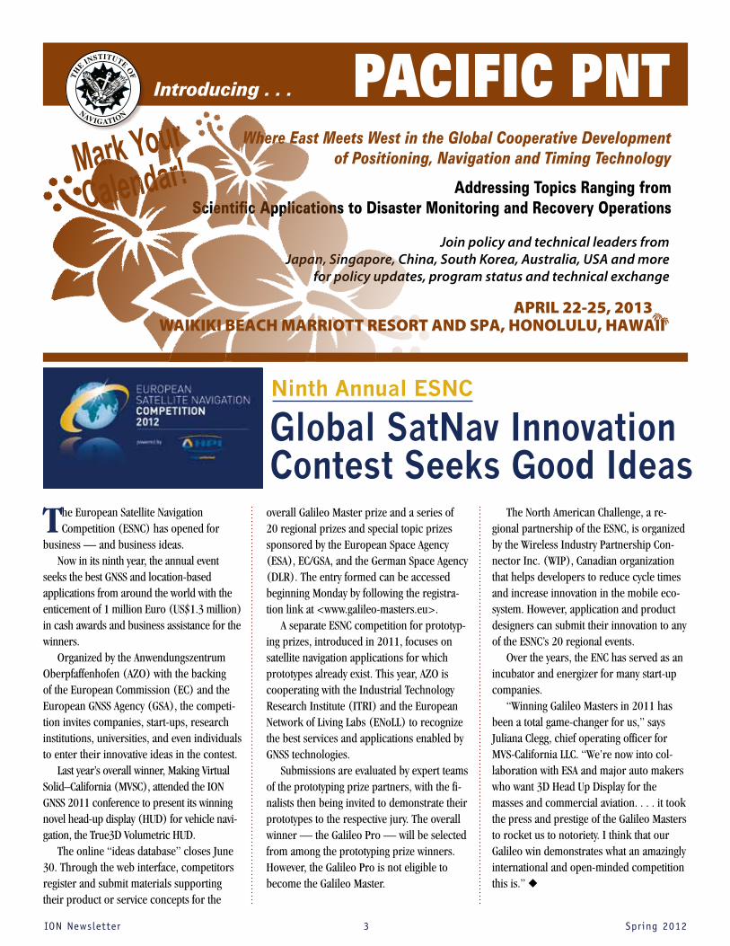
PACIFIC PNTWhere East Meets West in the Global Cooperative Development
of Positioning, Navigation and Timing Technology
Addressing Topics Ranging from Scientific Applications to Disaster Monitoring and Recovery Operations
Join policy and technical leaders from Japan, Singapore, China, South Korea, Australia, USA and more
for policy updates, program status and technical exchange
For More Information: www.ion.org
Introducing . . .
Mark Your
Calendar!
WAIKIKI BEACH MARRIOTT RESORT AND SPA, HONOLULU, HAWAIIAPRIL 22-25, 2013
Ninth Annual ESNC
IONNewsletter 4 Spring2012
Initial operations began in late Febru-ary at the former USCG Loran Support Unit in Wildwood, New Jersey. As of March 26, the company had tightened the synchronization of its transmissions to within 10 nanoseconds of Coordinated Universal Time (UTC) without the use of any propagation corrections or differential monitoring.
According to UrsaNav, the system has demonstrated UTC traceability to within ±30 nanoseconds at 160 miles from the transmitter and to within ±70 nanoseconds at 500 miles. Several trials have shown that the company’s receivers can quickly acquire the signals and steer within 50 nanoseconds of UTC, according to UrsaNav.
“Not only is this an independent timing backup,” says Doherty, “but, as we all know, the signals can also be used as pseu-doranges mixed in with GPS, or if enough transmitters are turned on, as a fully independent PNT network.”
If such a system were adopted and incorporated into the existing — although decommissioned — network
of Loran transmission stations, a backup PNT capability for safety-of-life navigation, dispatching first responders, supporting critical infrastructures, and other critical applications.
The trials are not simply transmitting eLoran signals but also evaluating some improvements to the enhanced technology that do not change the underlying signal structure. The company is also testing vari-ous LF solutions that include new waveforms and modulation techniques.
UrsaNav says its main purpose for on-air testing is to demonstrate wide-area precise timing distribution using terrestrial LF signals.
The company was founded by Charles “Chuck” Schue, its president and CEO, who was a plenary speaker at the ION Interna-tional Technical Meeting in January. Schue is a former ION DC Section Chair and cur-rently one of two marine representatives on the ION Council. He is a retired USCG officer — his last job in USCG was commanding officer of the Loran Support Unit.
For the LF tests, preliminary monitoring sites have been established at five locations: Boston, Massachusetts; Chambersburg,
Pennsylvania; Leesburg, Virginia; Chesa-peake, Virginia; and Charleston, South Carolina.
The CRADA enables UrsaNav to continue testing its advanced LF technology and use U.S. government facilities and frequency authorizations to demonstrate to what dis-tance and to what accuracy LF signals can be used for obtaining precise time.
Looking for a GPS BackupFor advocates of alternative PNT systems that could back up GPS, the LF tests pro-vide hope of reviving the eLoran program.
In 2006–2007, Doherty and Dr. Brad Parkinson, an ION Fellow and past Satellite Division Chair, led an independent review team examining PNT alternatives for the under secretaries of the U.S. Depart-ment of Transportation and Department of Homeland Security. The review team unanimously agreed that converting the ex-isting Loran-C infrastructure to eLoran and operating it as a modern, fully automated utility, would be the least expensive way to have a very robust backup.
eLoran was temporarily accepted as a multi-modal backup to GPS by the outgo-ing administration of former President George W. Bush, however, it suffered a reversal in fortunes when President Obama decided in 2010 to discontinue the venerable Loran system as an “obsolete” technology for a nominal savings in opera-tional costs of about $35 million a year.
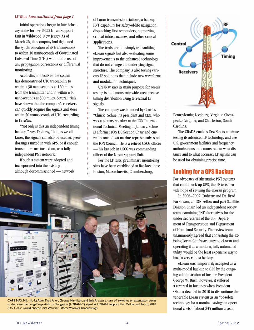
CAPE MAY, N.J. - (L-R) Adm. Thad Allen, George Hamilton, and Jack Anastasia turn off switches on attenuator boxes to decrease the Long-Range Aids to Navigation (LORAN-C) signal at LORAN Support Unit Wildwood, Feb. 8, 2010. (U.S. Coast Guard photo/Chief Warrant Officer Veronica Bandrowsky)
LF Wide-Area continued from page 1

IONNewsletter 5 Spring2012
The mothballed, Loran-C infrastructure in the continental United States (CONUS) and part of Alaska remains mostly intact. USCG has removed the two most remote transmitters and towers in Alaska (Attu, the last island in the Aleutians, and Port Clar-ence, above the Arctic Circle well north of Nome). Doherty believes, however, that the other transmitters and towers (19 in CO-NUS and 4 more Alaska) remain in place, awaiting funding for their demolition and site restoration.
UrsaNav, however, emphasizes that the USCG currently has no current plans to establish an eLoran system or to acquire, operate, or provide wireless time technol-ogy or services.
The Department of Homeland Security (DHS) is investigating precise time transfer using fiber optic networks and has asked the USCG to investigate wireless time transfer technologies as part of a national wide-area time service solution.
Additional on-air tests are planned at various sites throughout the United States, according to UrsaNav. Timing solution supplier Symmetricom and Nautel, a pro-vider of high-power RF transmitters, have partnered with UrsaNav in the tests.
The company invites researchers or organizations interested in taking part in a trial or conducting their own measure-ments to contact UrsaNav about the CRADA test program.
Evolution of real-time GNSS reference networks and data processing has evolved to the point that NASA-backed researchers believe they can soon implement large-scale demonstration tests to provide earth-quake and tsunami alerts to the general public and emergency responders.
Perhaps the most advanced of these networks to date is the Real-time Earth-quake Analysis for Disaster (READI) Miti-gation Network, which uses real-time GPS measurements from nearly 500 stations throughout California, Oregon, and Wash-
ington. Member organizations include the Scripps Institution of Oceanography’s Orbit and Permanent Array Center (SOPAC), the Pacific Northwest Geodetic Array (PANGA), EarthScope Plate Boundary Observatory, the Bay Area Regional Deformation Array, and the California Real-Time Network.
The new research network builds on technology development supported by NASA, the National Science Foundation, the Department of Defense, and the USGS.
“With the READI network we are en-abling continued development of real-time GPS technologies to advance national and international early warning disaster sys-tems,” says Craig Dobson, natural hazards program manager in the Earth Science Division at NASA Headquarters in Washing-ton. “This prototype system is a significant step towards realizing the goal of providing Pacific basin-wide natural hazards capabil-ity around the Pacific ‘Ring of Fire.’”
Most of the reference networks cur-rently use dual-frequency GPS receivers, precise point positioning (PPP) tech-niques, and a variety of high-precision orbit analysis software, according to Yehuda Bock, SOPAC’s director based in La Jolla, California.
Bock has described elements of his work in papers presented at past ION
events, including “Precise Instantaneous Network Positioning: Inverse Network RTK and Position Server,” at ION GNSS 2005, and “Wireless Instantaneous Network RTK: Positioning and Navigation,” at ION GNSS 2003.
“By using GPS to measure ground deformation from large earthquakes, we can reduce the time needed to locate and characterize the damage from large seis-mic events to several minutes,” Bock said.
Earthquakes generate two main seismic waves, a primary or P-wave that typically is detectable only with sensitive monitoring equipment, and the secondary (S-wave) that displaces the ground perpendicular to the direction of propagation — that is, the destructive shaking element.
Seismometers only measure the strength of Earth motion from earthquakes while GNSS technology can measure the actual three-dimensional displacement of the Earth’s crust that has occurred. Anoth-er advantage is that strong ground motion can actually “clip” the signal of seismic equipment, that is, go off the scale, while GNSS measurements continue to measure movement during even magnitude 8 or 9 events on the logarithmic scales used to measure the strength of earthquakes.
GPS Continuously Operating Reference Station. NOAA image.
High Precision GPS continued from page 1

IONNewsletter 6 Spring2012
The READI Mitigation Network will be able to predict when an S-wave will arrive, where the shaking will occur, and how intense it will be. That information can give public safety organizations a head start on deploying assets to the areas of greatest need, and conceivably even alert citizens at greater distances from the epicenter about the arrival of an imminent event.
“Depending on the distance from the source [of the GPS earthquake data], you might have a minute or two when you can do early warnings, Bock said.
Although GPS continuously operating reference stations (CORS) have been built out over the past 25 years, Bock says the new aspect of the effort stems from the ability to gather and process the raw data available on public servers — typically in RTCM or RINEX formats — and convert the data into geodetic displacements in real-time. The READI participants then use the displacement calculations to measure and model the earthquake events and rap-idly distribute the information for public safety purposes.
“Conventional seismic networks have consistently struggled to rapidly identify the true size of great earthquakes during the last decade,” said Timothy Melbourne, director of PANGA, which is based at
Central Washington University in Ellens-burg, Washington. “This GPS system is more likely to provide accurate and rapid estimates of the location and amount of fault slip to fire, utility, medical and other first-response teams.”
The speed with which accurate pre-dictions are made about the size of an earthquake can be the difference between life and death.
A recent Nature article discusses the March 2011 Thoku earthquake near Japan, which caused a devastating tsunami that reached the Japanese coast only 30 minutes after the first shock.
Relying on seismometer data, Japanese officials were able to issue tsunami warn-ings within eight seconds of detecting the initial shock, but they underestimated the magnitude as 7.1.
Although they increased the estimate to 8.1 within two minutes, it took the Japanese seismologists another 20 minutes to reach the final value of magnitude 9. Because the earthquake scale is logarith-mic, the initial calculations were one to two orders of magnitude smaller than the actual event.
Because they had underestimated the size of the earthquake, Japanese scientists and officals also underestimated the size of the tsunami wave, which possibly affected
the public response and associated prepa-rations by emergency responders.
Using his own calculations with real-time GPS data from the Japanese earth-quake, Melbourne says he determined the magnitude correctly within two minutes.
The significance of the delayed assess-ment is hard to calculate. “But I have a feeling that if they had known within two minutes, it would have been very differ-ent,” Melbourne said.
The Nature article also quoted Seth Stein, a geophysicist from Northwestern University, as saying “a lot of people who didn’t evacuate or didn’t evacuate far enough didn’t think it would be that big. So it’s important to get a better take, early on, about how big an earthquake is.”
Melbourne believes that the GPS-only system established by PANGA can provide sufficient data on which to model an earth-quake in real-time. In contrast, SOPAC is integrating GNSS and seismic sensors — low-cost MEMS accelerometers — into its network stations, blending the data “on the fly” using a Kalman filter.
Although the majority of the network sites — about 80 percent — use only GPS receivers, Bock said that is changing. “It’s mostly GPS now, but migrating toward GNSS capabilities,” he said.
A demonstration test of the pro-totype system will take place this year in the San Diego County area during the July/August time frame, according to Bock, and discussions are underway with other READI network participants about a much wider regional effort soon after-wards. These include the Earth-Scope Plate Boundary Observatory, the Bay Area Regional Deformation Array, and the California Real-Time Network as well as SOPAC and PANGA.
The demonstration tests will use recorded data from previous earthquakes and communication links with emergency response organizations to simulate an event and distribute information.
These satellite images show the effects of the March 2011 tsunami on Japan’s coastline. The image on the left was taken on Sept. 5, 2010; the image on the right was taken on March 12, 2011, one day after an earthquake and resulting tsunami struck the island nation. German Aerospace Center (DLR)/Rapid Eye image.
High Precision GPS continued from page 5
IONNewsletter 7 Spring2012
A U.S. Department of Justice–sponsored study has given a thumbs-up on the
use of GPS technology to help moni-tor high-risk sex offenders on parole in California.
According to the study, authored by Stephen Gies and colleagues at Devel-opment Services Group, Inc., based in Bethesda, Maryland, offenders in the GPS group demonstrated significantly better outcomes than those who were monitored in traditional ways.
Despite the increasing number of high-risk sex offenders (HRSOs) who are being placed on electronic monitoring programs, the report’s authors pointed out that little is known about how effective these programs are in increasing offender compliance and in reducing recidivism.
received traditional parole supervision than for offenders in the GPS group.
The study population was drawn from all HRSOs — 516 subjects equally divided between the treatment and control groups — who were released from prison be-tween January 2006 and March 2009 and continued to reside in the state of Califor-nia. Participants in the control group were not placed in the GPS program during the study period.
The Justice Department’s National Insti-tute of Justice (NIJ) sponsored the study, “Monitoring High-Risk Sex Offenders with GPS Technology: An Evaluation of the Cali-fornia Supervision Program,” which was published in March.
The study found that GPS monitoring costs more than traditional supervision. However, based on a set of research metrics — outcomes, cost, and process evaluations — the results for GPS-based monitoring were significantly better.
The evaluation showed that risk for a sex-related violation was nearly three times greater for offenders who received tradi-tional parole supervision, than offenders who received GPS supervision. The risk of committing an offense that resulted in an arrest was twice as high for offenders who
Study Charts Effectiveness of GPS-Based Monitoring of Parolees
Amer
ican
Con
stitu
tion
Soci
ety
phot
o
Parole Officers Support Program
continued on page 23

IONNewsletter 8 Spring2012
froM tHe ion Historian, Marvin May
Speed Through the Water: From Vitruvius’ Wheel to Thomas’ Harpoon Log
F or the ancient mariners, dead reckoning proved necessary when sightings of land
or celestial bodies could not be made, and this required knowledge of the ship’s course and speed. Today, elementary students can figure “distance equals speed multiplied by time,”but determining any of these three variables was a real challenge for early navigators.
The earliest recorded plan for measuring water speed came in about 27 B.C. from the Roman architect and engineer Vitruvius. In Book Ten of De Architectura, his magnum opus about Roman technology, he included plans for a distance log. An axle across a ship is affixed to a vertical paddle wheel
four feet (1.2 meters) in diameter. The wheel turned on the axle 400 times in one Roman mile (about 1,400 meters).
For each revolution, a pin on the axle engages a 400-tooth cogwheel, turning it one complete revolution per mile. This engages another gear with holes along the circumference, where pebbles are stored that drop one by one into a metal box that pings each time a pebble falls in.
Vitruvius wrote,“As often, therefore, as the horizontal drum in its course brings a calculus (pebble) to an opening, it will let it drop through the pipe. Thus, by sound and by number (of the pebbles in the box) the length of the voyage in miles will be shown.”
Vitruvius covered a lot of ground in his books — aqueducts and water mills, water screws and military construction, central heating and anatomical guidelines used by Leonardo Da Vinci in his famous Vitruvian man illustration. (Not to mention the an-ecdote of Archimedes and his “Eureka” mo-ment.) But it is highly unlikely that this tool was built, since the mechanical difficulty of making the device drop one pebble every revolution, and only one pebble, must have been insuperable.
Cover of the first printing of Vetruvius’ De architec-tura, 1487. The ancient text was the only architectural treatise to survive antiquity and had been copied in manuscript form over centuries. Image by Christie’s New York, for its catalog.
Ship log and reel in the Musée de la Marine, Paris. The timing sand glass is in the upper left and the log in the lower left. The small light-colored wooden pin and plug form a release mechanism for two lines of the bridle. Photo by Remi Kaup and Michael Daly, Wikimedia Commons.

IONNewsletter 9 Spring2012
Log-Ships and Outstretched ArmsPerhaps the earliest practical method of measuring speed through the water, first mentioned in the late 15th and early 16th century, was sometimes referred to as the Dutchman’s log. Two marks were set up at the ship’s side and the distance between them measured. A piece of flotsam was thrown overboard and the time it took to float the distance between the marks was re-corded with a sandglass, enabling the sailors
to calculate speed.The method was far from accurate— it
wasn’t easy to measure an arbitrary time be-fore the introduction of watches. A sandglass is useful for measuring the whole duration of time for which it was designed, however it cannot measure portions of that elapsed time as would be necessary for the Dutchman’s log method.
Other methods of measuring the elapsed time of the passage of the flotsam included repeating a set phrase over and over again, counting the pulse of heartbeats, and com-paring the time with that of a crew member running along the deck and assuming his speed as six miles per hour. These are all methods for speed x time = distance.
An English invention, the log-ship, was another fundamental water speed method
used between the 15th and 18th centuries. It was a pie-shaped board with a nine-inch radius and a weight on the curved end. It was attached to a long line by three branch-es so that it would stand at right-angles to the line.
The log-ship was dropped over the stern into the water at the same instant a minute glass was turned. As it drifted astern, the log-ship drew out the line until the sand in the glass emptied. The line was hauled in and measured in fathoms — traditionally, against a crewman’s outstretched arms. The speed, in units of leagues per hour, was calculated by multiplying the result by sixty and dividing by 2,500. The English used the historical Roman feet-to-mile conversion factor: a fathom is nominally six feet; so, a mile was calculated as 5,000 feet.
Other countries employed different conversion factors. The Spaniards and Por-tuguese used 5,714 feet in a mile. According to 1917 records, the official U.S. Navy sand glass measured 28 seconds, and knots in the line were spaced out exactly 8 fathoms (48 feet) apart. So, a knot equaled more or less 1.714 feet per second. (See conversion table below.)
The log-ship method was far from error-free. The minute sandglass varied according to temperature, humidity, and sea state. It was difficult to drop the line and haul it in the instant the sand glass was turned. Men’s arms length varied. It was hard to the keep the line taut and the water flow patterns at the stern of the ship affected the log-ship’s drift.
Knots, Globes, and Stray LinesBy the 17th century, the log-line method had been refined. Distance between knots in the
line was standardized to correspond with a speed of one mile per hour. The number of knots in the line drawn out in one minute equaled the miles per hour at which the ship was sailing and, thus, we have the term “knots” for ship speed.
But, 300 years ago, there were still no consistent standards for distance or time measurement. The length of rope between knots varied between 42 feet and 51 feet, depending on the country or the convention. Today, a knot is defined as a nautical mile per hour or 1,852 meters per hour.
Another refinement helped the men who had to haul in the log after it had been streamed. Of the three strands by which the log was attached to the line, two were made fast while the third was broken by a tapered plug and socket. When the sand in the glass had emptied, if the line were given a hard jerk, the plug would come out and the log, being then attached at two points, could ride in flat and be recovered with far less difficulty.
A further refinement included a “stray line” between the log and the zero mark. The log could then be allowed to drift well astern and out of the ship’s turbulence before the sand glass was turned and the measurement period began.
The late 18th and early 19th century brought several innovative designs including trailing globes or buckets that would gener-ate a drag force proportional to speed. This drag force was then converted by a spring and lever mechanism to display the water speed.
By the late 18th century, devices that employed a rotator came into use. It was towed astern and spun at a rate proportional
Continued on page 23
Replica of a French Admiralty marine sand glass circa 1800. University of Southern Maine Map Library.
Note: Segments of this article were extracted from A History of Marine Navigation, W. E. May, W.W. Norton & Company, 1973.
Conversions between common units of speed. The bold numbers indicate an exact conversion.
m/s km/h mph knot ft/s1 m/s = 1 3.6 2.236936 1.943844 3.2808401 km/h = 0.277778 1 0.621371 0.539957 0.9113441 mph = 0.44704 1.609344 1 0.868976 1.4666671 knot = 0.514444 1.852 1.150779 1 1.6878101 ft/s = 0.3048 1.09728 0.681818 0.592484 1

IONNewsletter 10 Spring2012
DARPA Micro-PNT Program Seeks Small-Scale Alternatives to GPS
Warfighters have depended for decades on GPS technology, and have incor-
porated it into guided munitions and other platforms to meet rigid requirements for guidance and navigation. This creates a potential challenge in instances where an intended target is equipped with high- powered jammers or if the GPS constellation is compromised.
Now the Defense Advanced Research Projects Agency (DARPA) wants to wean smart weapons and navigation systems off of GPS with a hybrid inertial navigation system-on-a-chip. The program seeks to address challenges associated with the long-term drift, dynamic range, and start-up time of chip-scale components for positioning, targeting, navigation, and guidance tasks.
In a broad agency announcement issued in April, DARPA solicited innovative research proposals in the area of co-integration of inertial sensors with dissimilar physics of operation in a single micro-scale inertial measurement unit (IMU). The agency is
specifically interested in the development of a chip-scale combinatorial atomic navigator (C-SCAN) that combines inertial sensors with dissimilar, but complementary, physics of operation into a single microsystem.
“Platforms such as missiles rely on GPS for a variety of information,” says Andrei Shkel, DARPA’s Microsystems Technology Office (MTO) program manager. “When GPS is not available gyroscopes provide orientation, accelerometers provide position, and oscillators provide timing. The new C-SCAN effort focuses on replac-ing bulky gyroscopes with a new inertial measurement unit (IMU) that is smaller, less expensive due to foundry fabrication and yields better performance.”
Shkel will serve as co-chair of the Session A7: MEMS Inertial Measurement Unit at the Joint Navigation Conference (JNC 2012) organized by the ION and the Joint Services Data Exchange (JSDE), June 12–15 in Colorado Springs.
Thinking SmallThe main objectives of the C-SCAN program are to explore the miniaturization and co-fabrication of atomic sensors with high-performance solid state inertial sensors, and to develop combinatorial algorithms and architectures that seamlessly co-integrate components with dissimilar physics into a single ensemble.
The deliverable of the program is a miniature IMU that co-integrates atomic and solid-state inertial sensors in a single microsystem with a volume of no more than 20 cubic centimeters and power consump-tion of no more than one watt.
The performance of C-SCAN is expected to be above and beyond what is currently available, combining a high resolution of motion detection (10-4 deg/hour for rota-tion and 10-6 g for linear acceleration), exceptional long-term bias and scale-factor stability (one ppm with respect to the full-scale of operation), and start-up time performance orders of magnitude better than available today (less than 10 seconds from a cold start).
The C-SCAN project is an integral part of DARPA’s micro-PNT (microtechnology for Positioning, Navigation, and Timing) portfolio of programs, which seeks to develop technologies for self-contained, chip-scale inertial navigation and precision guidance that could effectively eliminate the dependence on GPS or any other external signals subject to jamming, interference, or blockage.
Other efforts in the micro-PNT portfolio includes a recently developed micro-nuclear magnetic resonance gyro that uses the spin of atomic nuclei to measure rotation. This provides the ability to achieve navigation-grade performance with a two orders-of-magnitude reduction in size, weight, and power from state-of-the-art navigation grade gyroscopes currently used in inertial measurement units.
The Latest Effort: A Chip-Scale Combinatorial Atomic Navigator (C-SCAN)
DoD Synchronized Position Hold, Engage, Reorient, Experimental Satellites - Zero - Robotics (SPHERES-Zero-Robotics) on board the International Space Station.
IONNewsletter 11 Spring2012
DARPA Micro-PNT Program Seeks Small-Scale Alternatives to GPS
“The micro-nuclear magnetic reso-nance gyro uses gyroscopic spin of nuclear particles in a magnetic field to determine orientation,” Shkel said in describing the innovation. “This gyro has no moving parts and is not sensitive to acceleration and vibration. Others, such as silicon-based MEMS gyros, are much more susceptible to vibration, which keeps them from meet-ing performance expectations.”
CSACs in SpaceAnother advance has been investigation of chip-scale atomic clock (CSAC), first developed by DARPA and the National In-stitute of Standards and Technology (NIST) in 2004. These devices are smaller than traditional atomic clocks by a factor of
100 (down to about the size of a computer chip) and are more power-efficient by a factor of 10.
Last October, a Russian rocket trans-ported two DARPA CSACs to the Interna-tional Space Station (ISS), the first ever in space. They are undergoing tests on board the ISS in support of DARPA’s Micro-PNT program.
The chips will be inserted into bowling ball–sized satellites called Synchronized Position, Hold, Engage and Reorient Ex-perimental Satellites (SPHERES). Each of the three nine-inch-diameter SPHERES mi-crosatellites on ISS has 12 cold gas (CO2) thrusters, three rate gyros, three acceler-ometers, and a pseudo-GPS sensing system that permits state estimation relative to the frame of the U.S. Laboratory on ISS to two millimeters and two-degree accuracy.
Once the chips have been validated as operational, the SPHERES will perform a synchronized maneuver through the ISS cabin. Test sessions allow the SPHERES-CSACs to synchronize the timing between two clocks with a high-precision off-board module, then measure drift over each test
session and between test sessions. The dif-ferences in relative motion between the two clocks may provide useful data relating to movement-induced clock drift.
After the experiment, the chips contain-ing the CSACs will be removed and tested against the atomic clock on board the space station.
“DARPA hopes that testing confirms that chip-scale atomic clocks can operate in orbit with the level of accuracy for which they were designed,” Shkel said. “A suc-cessful test after transportation, launching, and space operations will mean that CSACs are one step closer to being integrated into future space platforms. Such integration should allow various space platforms more autonomy in positioning, navigation and timing.”
According to DARPA, the SPHERES-CSAC experiment may also help in the develop-ment of small-scale inertial navigation sys-tems (INS) for use on small satellites (those with a mass of 1–10 kilograms).
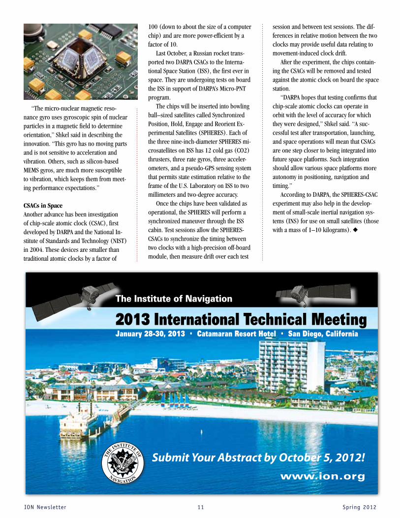
The Institute of Navigation
2013 International Technical Meeting January 28-30, 2013 • Catamaran Resort Hotel • San Diego, California
Submit Your Abstract by October 5, 2012!www.ion.org

IONNewsletter 12 Spring2012
GREENSPAN WINS IEEE/ION PLANS KERSHNER AWARD
ION
The 2012 IEEE/ION Position Location and Navigation Symposium (PLANS) was held Myrtle Beach Marriott Resort & Spa at Grande Dunes, Myrtle Beach, SC, April 23-26, 2012. The biennial symposium is co-sponsored by the IEEE Aerospace and Electronic Systems Society (AESS) and The Institute of Navigation. The meeting was attended by over 350 people and sponsored three full days of technical sessions, a day of pre-conference tutorials and a commercial exhibit.
IEEE/IONPLANS2012ExecutiveCommittee
ION would like to recognize Dr. Gary McGraw, Rockwell Collins and Dr. Michael Veth, 46th Range Group as the Technical Program Co-Chairs. The following served as Technical Track Chairs: Mr. Randall Curey, Northrop Grumman; Dr. Michael Meurer, German Aerospace Center, Germany; Dr. Jacob Campbell, AFRL Sensors Directorate; and Dr. Sherman Lo, Stanford University.
PLANSAttendeesMix&MingleintheExhibitHall
The ION would like to extend our thanks to the PLANS 2012 Executive Committee (from left to right): Dr. Gary McGraw, Technical Program Co-Chair, Rockwell Collins; Dr. Frank van Graas, Publicity Co-Chair, Ohio University; John Weyrauch, IEEE/ION Liaison, Alliant Tech Systems; Wayne Soehren, General Chair, Honeywell; Phil Dugandzic, Vice Chair, Northrop Grumman; Dr. Jacob Campbell, Publicity Co-Chair, AFRL/Sensors Directorate; Dr. Michael Veth, Technical Program Co-Chair, USAF 46th Range Group; Dan Murphy, Exhibits Co-Chair, Hysitron Inc.; and Charles Bye, Tutorials Chair, Honeywell. Not pictured: Dora Zueck, Exhibits Co-Chair, SAIC.
2012 IEEE/ION POSITION, LOCATION AND NAVIGATION SYMPOSIUM

IONNewsletter 13 Spring2012
Carlton Award Winners: Dr. John Betz (left) and Dr. Kevin Kolodziejski (right) accept award from Dr. Hugh Griffiths, IEEE AESS President (center).
THEKERSHNERAWARDIn 1986, the PLANS Executive Committee established the Dr. Richard B. Kershner Award to recognize individuals who have made substantial contributions to the technology of navigation and position equipment, systems or practices.
The 2012 Kershner Award was pre-sented to Dr. Richard Greenspan for his pioneering work in the integration of GPS receivers with inertial navigation systems and the development and perfection of carrier-phase GPS interferometry for the high precision measurement of fixed and moving baselines with applications to relative and differential ranging that cover the alphabet from Agriculture to Zoogeography (NB: the study of the distributions of animals).
IEEEWALTERFRIEDAWARDEndowed in memory of Dr. Fried’s professional engineering accom-plishments, most notably his technical leadership in the develop-ment of Doppler radar and relative navigation systems, the Walter Fried Award recognizes the best technical paper presented at the PLANS con-ference and includes a plaque and honorarium. The 2012 Fried Award was presented to Jahshan A. Bhatti, Todd E. Humphreys, The University of Texas at Austin; Brent M. Ledvina, Coherent Navigation for their paper: “Development and Demonstration of a TDOA-Based GNSS Interference Signal Localization System.” IEEECARLTONAWARDThe M. Barry Carlton Award was presented to Dr. John Betz and Dr. Kevin Kolodziejski for their paper “Generalized Theory of Code Tracking with Early-Late Discriminator, Part 1: Lower Bound and Coherent Processing & Part 2: Noncoherent Processing and Numerical Results” IEEE Transactions – AES Vol. 45, No. 4, October 2009, pp. 1538-1564. This award acknowledges what is judged the best paper in the AES Transactions in each calendar year.
BEST PAPER AWARDSBEST STUDENT PAPER AWARD: Constructing a Continuous Phase Time History from TDMA Signals for Opportunistic Navigation: Kenneth Pesyna, Z. Kassas, T. Humphreys, The University of Texas at Austin
BEST PAPER IN TRACK A: Inertial Sensors: Further Developments in Low-Cost Calibration and Testing: Zeev Berman, Berman Consulting and Training Ltd, Israel
BEST PAPER IN TRACK B: Time-Frequency Analysis of Ionosphere Scintillations Observed by A GNSS Receiver Array: Jun Wang, Y. Morton, Q. Zhou, Miami University; F. van Graas, W. Pelgrum, Ohio University
BEST PAPER IN TRACK C: Opportunistic Radio SLAM for Indoor Navigation Using Smartphone Sensors: Ramsey M. Faragher, C. Sarno, and M. Newman, Sensor Systems, Advanced Technology Centre, BAE Systems, UK
BEST PAPER IN TRACK D: Collaboration-Enhanced Receiver Integrity Monitoring with Common Residual Estimation: Jason Rife, Tufts University
John Weyrauch (left) presenting Fried Award to Jahshan A. Bhatti (right)
Dr. Richard Greenspan, 2012 Kershner Award Winner
Kenneth Pesyna (left) accepting Best Student Paper Award from Wayne Soehren (right)

IONNewsletter 14 Spring2012
Global Positioning System With the LightSquared controversy still lurking in the hallways of the Federal Com-munications Commission (FCC), GPS faces a potentially significant new issue: attempts by the UK Ministry of Defense (MOD) to collect royalties on the next-generation civil signal (L1C), which it has patented in the United Kingdom and is seeking patents elsewhere, including the United States.
The frequency structure at issue is the multiplex binary offset carrier (MBOC) signal design that laces a BOC(1,1) signal with an occasional BOC (6,1).
The common signal structure at the L1/E1 frequency, centered at 1575.42 MHz, was developed jointly by the U.S. and the European Union (EU) over a period of years. MBOC was meant to make the two systems compatible and interoperable — which benefits both sets of users.
The royalty discussions were initiated by the British firm Ploughshare Innova-
tions, a wholly owned subsidiary of the research and development division of the UK MOD, Dstl. The firm is asking for remuneration regarding a UK patent on “modulation signals for a satellite naviga-tion system.”
If the initiative is successful, receivers that employ the European version of the MBOC signal could presumably also be subject to royalties.
The signal design in question emerged in the work of the Galileo Signal Task Force of the European Commission and underlies both the Galileo Open Service and the L1C signal that will be transmitted beginning with the GPS Block III satellites scheduled for first launch in 2014.
A task force teamed European and U.S. experts to develop a new signal enabling GPS and Galileo to be both compatible and interoperable. The group was created as part of the Agreement on the promo-tion, provision and use of Galileo and GPS satellite-based navigation systems and related applications — a landmark 2004 accord formalizing cooperation on satellite navigation between the United States and more than two dozen European countries, including the United Kingdom.
A Dstl spokesman said that the UK priority patent application was filed on September 1, 2003. The spokesman added that the cornerstone concept for the patent and royalty initiative was presented in a paper, “BOC Modulation Waveforms,” at The Institute of Navigation (ION GPS/GNSS 2003 conference, co-authored by A. R. (Tony) Pratt and J. I. R. Owen.
The U.S. government is expected to mount a vigorous diplomatic and legal challenge to the patent/royalty effort.
Meanwhile, the FCC has not taken
further action following its provisional decision to vacate a January 2011 condi-tional waiver order allowing LightSquared to build a nationwide terrestrial wireless broadband network whose transmissions were found to cause widespread interfer-ence to GPS receivers during extensive tests last year.
On May 14, LightSquared filed for protection under Chapter 11 of the federal bankruptcy law. A hedge fund, Harbinger Capital Management LLC, has invested more than $3 billion in LightSquared, which is reportedly valued at just more than half a billion dollars now. LightSquared filed a 255-page document accompanied by a 176-page “technical appendix” on the final days for submitting comments on the FCC’s proposed vacation of the conditional order.
In what it characterized as “a precipi-tous turn of events” and “one of the most disastrous ‘bait-and switch’ episodes in the history of telecommunications regulation,” LightSquared accused the FCC of “an arbi-trary and capricious process.” More than a month after final responses to those com-ments could be filed, the agency had yet to act on its proposed vacation of the January 2011 order. Some observers believe that the FCC may try to delay a final decision until after the 2012 general election.
Despite the various threats facing the system, GPS — by now the elder statesman of GNSS — can hail continuing progress on its third-generation satellite develop-ment and next-generation control segment (OCX), while apparently escaping thus far the peril of defense budget cuts.
GPS Directorate commander Col. Bernie Gruber told the Munich Satellite Navigation Summit that the user equivalent range error (UERE) of the signals in space from the first First full operational capability Galileo satellite
being tested on assembly line. OHB System photo
IONNewsletter 15 Spring2012
two GPS Block IIF space vehicles (SVs) was 38 centimeters, compared to 86 centime-ters for the 31-SV constellation as a whole.
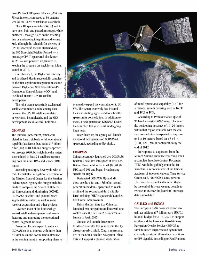
Block IIF space vehicles (SVs) 3 and 4 have been built and placed in storage, while numbers 5 through 8 are on the assembly line or undergoing integration and testing. And, although the schedule for delivery of GPS III spacecraft may be stretched out, the GPS Non-flight Satellite Testbed — a prototype GPS III spacecraft also known as SV0 — was powered up January 10, keeping the program on track for an initial launch in 2014.
On February 2, the Raytheon Company and Lockheed Martin successfully complet-ed the first significant integration milestone between Raytheon’s Next Generation GPS Operational Control System (OCX) and Lockheed Martin’s GPS III satellite development.
The joint team successfully exchanged satellite commands and telemetry data between the GPS III satellite simulator in Newtown, Pennsylvania, and the OCX development site in Aurora, Colorado.
GLONASS The Russian GNSS system, which com-pleted its long trek back to full operational capability last December, has a 347 billion ruble (US$11.81 billion) budget approved for through 2020, by which time the system is scheduled to have 24 satellites transmit-ting both the new CDMA and legacy FDMA signals.
According to Sergey Revnivykh, who di-rects the Satellite Navigation Department of the Mission Control Center for the Russian Federal Space Agency, the budget includes funds to complete the System of Differen-tial Correction and Monitoring (SCDM), GLONASS’s satellite- and ground-based augmentation system, as well as some receiver acquisition and other projects.
However, most of the funds will go toward satellite development and manu-facturing and upgrading the operational control segment, he said.
Program officials expect to enhance GLONASS so as to operate with more than 24 satellites in the constellation almanac in the coming months, supporting plans to
eventually expend the constellation to 30 SVs. The system currently has 24 satel-lites transmitting signals and four healthy spares in its constellation. In addition to these, a next-generation GLONASS-K satel-lite launched last year is still undergoing flight tests.
Later this year, the agency will launch its second next-generation GLONASS-K spacecraft, according to Revnivykh.
COMPASS China successfully launched two COMPASS/BeiDou-2 satellites into space at 4:50 a.m. Beijing Time on Monday, April 30 (20:50 UTC, April 29) and began broadcasting signals on May 6.
Designated COMPASS M3 and M4, these are the 12th and 13th of its second-generation Beidou-2 spacecraft to reach orbit and the second and third middle-Earth-orbiting (MEO) spacecraft launched by China’s GNSS program.
This is the first time that China has launched two navigation satellites with one rocket since the BeiDou-2 program’s first launch in April 2007.
Chinese will launch three more COMPASS satellites this year to join the 13 already in orbit, said Li Xing, a representa-tive of the China Satellite Navigation Office. This will support a planned declaration
of initial operational capability (IOC) for a regional system covering 84˚E to 160˚E and 55˚S to 55˚N.
According to Professor Zhao Qile of Wuhan University’s GNSS research center, the positioning accuracy of 10–20 meters within that region available with the cur-rent constellation is expected to improve to 5 to 10 meters, based on a 5+5+4 (GEO, IGSO, MEO) configuration by the end of 2012.
In response to a question from the Munich Summit audience regarding when a complete Interface Control Document (ICD) would be publicly available, Lu Xiaochun, a representative of the Chinese Academy of Sciences National Time Service Center, said, “Our ICD is a test version. [BeiDou] data is not stable now. Maybe by the end of this year we may be able to release an ICD for the [satellite] message data and orbits.”
GALILEO and EGNOS The European GNSS program expects to gain an additional 7-billion-euro (US$9.1 billion) budget for 2014–2020 to support Galileo and the European Geostationary Navigation Overlay Service (EGNOS, a satellite-based augmentation system that currently provides differential corrections to GPS signals), according to Paul Flament,
GPS
III s
atel
lite.
Loc
khee
d M
artin
gra
phic

IONNewsletter 16 Spring2012
September to accelerate development of the system as quickly as possible.
Suresh Kibe, a consultant to the India Space Research Organization, said that the second GAGAN spacecraft for India’s satellite-based augmentation system would be launched into geostationary orbit at 82˚E later this year. It will join the first spacecraft launched last May, which is now operation-al from its orbital location at 55˚E.
Galileo and EGNOS program manager for the European Commission.
The Galileo program has already con-tracted for development and manufacturing of 26 operational satellites, including the two in-orbit validation (IOV) spacecraft launched last October. The launch date for the final pair of Galileo IOV satellites will be September 28.
The first full operational capability (FOC) Galileo satellite has now been assembled at OHB System AG in Bremen, Germany, and will be made ready for testing.
Javier Benedicto, head of the European Space Agency (ESA) Galileo Project Office, has outlined an ambitious schedule to get the additional 22 FOC satellites into orbit using a combination of Russian Soyuz rock-ets carrying two satellites each and modi-fied Ariane 5 rockets with four spacecraft aboard each: three Soyuz launches in 2013 (beginning the second quarter of the year), two Soyuz and one Ariane 5 launch in 2014; and two Ariane 5 launches in 2015.
If the launch schedule goes as planned, the Galileo program expects to declare an initial operational capability in 2014. The program still needs to fund an additional four SVs to reach its planned 30-satellite constellation (27 + 3 spares).
Meanwhile, the European GNSS Agency (known by the acronym GSA), will open its new offices in Prague, Czech Republic, this September, from which the organiza-tion will continue its security and market development responsibilities for Galileo and EGNOS.
Indian and Japanese Regional Systems Representatives of regional programs in In-dia (GAGAN, the GPS-Aided Geo-Augmented Navigation system, and Indian Regional Navigation Satellite System) and Japan (Quasi-Zenith Satellite System, or QZSS) also provided updates on their activities.
Mikio Aoki, director of the Japan’s Sec-retariat of Strategic Headquarters for Space Policy, said that a budget request would be submitted in April to fund construction of a four-satellite QZSS by the end of this decade, following a cabinet decision last
CALENDAR
SEPTEMBER 2012 17-21: ION GNSS 2012, Nashville Convention Center, Nashville, Tennessee Contact: The ION Tel: +1 703-366-2723 Fax: +1 703-366-2724 Web: www.ion.org
23-28: The 2012 RTCM Annual Assembly Meeting and Conference, Loews Royal Pacific Hotel, Orlando, Florida Contact: RTCM Tel: +1 703-527-2000 Fax: +1 703-351-9932 Web: www.rtcm.org
24-27: The 18th Ka & 30th ICSSC 2012 Joint Conference Satellites in the Service of Humanity, The Westin Ottawa, Ottawa, Canada Contact: Ms. Clotilde Canepa Fertini E-mail: [email protected]: www.kaconf.org
OCTOBER 2012 1-3: 14th IAIN World Congress 2012, Concorde El Salam Hotel, Cairo, Egypt Contact: Dr. R. Rashad Tel: +2 03 550 9824 Fax: +2 03 550 9686 Web: www.iaincongress2012.org
JANUARY 201328-30: ION International Technical Meeting (ITM) 2013, Catamaran Resort Hotel, San Diego, California Contact: The ION Tel: +1 703-366-2723 Fax: +1 703-366-2724 Web: www.ion.org
APRIL 201322-25: Pacific PNT 2013, Marriott Waikki Beach Resort & Spa, Honolulu, Hawaii Contact: The ION Tel: +1 703-366-2723 Fax: +1 703-366-2724 Web: www.ion.org
SEPTEMBER 2013 16-20: ION GNSS 2013, Nashville Convention Center, Nashville, Tennessee Contact: The ION Tel: +1 703-366-2723 Fax: +1 703-366-2724 Web: www.ion.org
Be a part of the Third Annual
ION Autonomous Snowplow
CompetitionHow much snow can you move
using state of the art navigation and control technologies?
Challenge your team to design, build and operate a fully
autonomous snowplow, which will remove snow from a designated path rapidly, accurately, and safely.
January 24 – 27, 2013St. Paul, MN
Application Deadline: September 14, 2012
Open to both academic institutions and the general public.
To learn more visit:
www.autosnowplow.com

IONNewsletter 17 Spring2012
Defense Matters We Owe the Warfighter the Very Best We Can Deliver
“Space and cyberspace are
now essential to all joint
force projection, both for
the support they provide to
operations in the other
domains and as operational
domains in their own right
when directed.”
On May 1–2, 2012, I had the pleasure of attending the 11th GPS Partnership Council held at the Gordon Conference Center at the Los
Angeles Air Force Base in El Segundo, California. This is a cooperative ef-fort sponsored by the Los Angeles Chapter of the Armed Forces Commu-nications and Electronics Association (AFCEA) and the GPS Directorate.
The two-day event was advertised as a means to com-municate with GPS stakeholders on present-day activities, future plans, and mea-sures to ensure that GPS remains the world leader for providing space-based positioning, navi-
gation, and timing (PNT) services to the warfighter and civilian users. The most interesting part of this event is hearing from warfight-
ers who had recently returned from military combat operations. This occurred on the afternoon of the second day in a keynote speech and a warfighter panel consisting of six members from various U.S. military services. Represented were the Air Force (a special tactics officer, space operations officer, and a pilot), the Navy (a ship driver and a special warfare combatant–craft crewman), the U.S. Coast Guard (an aviation/search & rescue pilot) and an Army representative (the warfighter panel facilitator from the Joint Navigation Warfare Center).
Any Institute of Navigation member reading this article already knows what the underlying message from these combat theater anecdotes is: Our warfighters absolutely rely upon having access to timely and accurate PNT information. Although they are all quick to recognize that they must be prepared to conduct their respective operations using methods that do not rely upon GPS, they are equally quick to point out that not having this space-based resource immediately slows down the “ops tempo” of mission execution, reduces their ability to ensure mission success, and ultimately can lead to the loss of life.
PNT Role in Meeting Security ChallengesArmy Gen. Martin Dempsey, chairman of the Joint Chiefs of Staff, recently issued the Joint Operational Access Concept (JOAC) (see public release
version at <http://www.defense.gov/pubs/pdfs/JOAC_Jan%202012_Signed.pdf>). This document describes in broad terms the chairman’s vision of how our forces will operate in response to emerging anti-access and area-denial security challenges.
The JOAC highlights that “space and cyberspace are now essential to all joint force projection, both for the support they provide to op-erations in the other domains and as operational domains in their own right when directed.” It clearly recognizes that cross-domain informa-tion environment success depends absolutely on having PNT informa-tion in place when needed.
The integrating role that PNT plays across the Department of Defense (DoD) information technology architecture to augment military missions in support of the warfighter is essential to the force projection mission. That the DoD has recognized this connection is apparent from the importance department officials are placing on efforts to identify complementary and alternative sources of PNT. These latter technologies and systems can provide continuous assurance of PNT access under conditions where GPS signals may be temporarily unavailable due to natural or hostile interference.
The DoD is also well aware of the vital role that PNT plays as a means to achieve more efficient employment of spectrum for informa-tion interchange and command & control (C2)across the complete set of cyber-enterprise mission domains. GPS was the catalyst for the awareness of PNT as an enabler of C2 functionality more than 15 years ago, and appreciation of its importance as a critical element of the overall defense information technology architecture has been growing ever since.
As it has been since 1995, GPS remains the cornerstone source of PNT for the DoD, and it will continue to remain so as its services are modernized and improved for military and civilian users alike over the next decade and beyond.
A comment made to the Partnership audience of GPS engineers, primes, vendors, and program leaders during the warfighter discus-sion conveys this unquestioning reliance on GPS: “When I call for supporting suppression fire near my position, I never think that the satellite’s signal isn’t working correctly, and I never wonder if the mil-lions of lines of supporting code were written by the lowest bidder. . . . I trust it and I thank all of you for providing it.”
For those contributing to providing GPS for the warfighter, we must never allow them to receive anything but the best. We owe it to them to both improve its capabilities on their behalf and to ensure continuous PNT coverage for all potential missions across the future anti-access/area-denial landscape.
By doug Taggart

IONNewsletter 18 Spring2012
The team is also looking at night vision systems and intelligent speed adaptations.
Researcher Chris Emmerson said, “One thing that came out of the focus groups was that while the older generation is often keen to try new technologies, it’s their lack of experience with, and confidence in, dig-ital technologies that puts them off. Also, they felt most were designed with younger people in mind.”
Che Catastrofe! Venice Sinking FastAs befits such a beautiful city, art and science are working hand in hand to figure out what’s going on.
Concerned citizens started precise mea-surements of the sea surrounding Venice 140 years ago. Before that, art supplied the information.
Canaletto, the popular 18th century landscape painter and printmaker of Venetian scenes, was so meticulous and ac-curate in his paintings that scientists could later determine the city had sunk more than two feet since 1727. But they thought the city was stabilized after a series of flood control and restoration projects.
Turn Left at the PubBased on research that shows giving up driving is closely related to a decline in health in older people, a team of scientists at Newcastle University in the UK built a mobile driving simulator to investigate new technologies that could help keep elderly drivers safely behind the wheel as long as possible.
With test subjects in their 80s, the Intelligent Transport team at Newcastle University is investigating in-vehicle tools, including GPS, that can do the trick.
The team developed a satellite naviga-tion device that uses local landmarks as turning cues: a local pub, a library, or a post office.
In a country that drives on the left, the satnav planned routes that avoided right-hand turns in order to help less confident drivers who were wary of oncoming traffic.
NAvigAtioN NovELtiEs
Sinking Venice, Angry Birds, and More
However, Venice is still sinking up to 4/5 of an inch a year. It could be 3.2 inches lower by 2032, according to a 10-year study that used GPS and InSAR, a radar tool for measuring Earth’s deformation. “Our combined GPS and InSAR analysis clearly captured the movements over the last decade that neither method could sense alone,” said Shimon Wdowinski, an author of the study and a faculty member at the University of Miami in Florida.
GPS took absolute readings of the city and its surrounding lagoons. InSAR detected the change elevation relative to other sites.
The new study also indicated that the lagoon area was tilting eastward, a mil-limeter or two each year, leaving Venice in the west somewhat higher. Prior satellite analyses didn’t pick up on the tilt, possibly because the scientists were using InSAR alone.
The scientific study was published on March 28 in the American Geophysical Union journal G-Cubed (Geochemistry, Geo-physics, Geosystems). Canaletto’s art survives in museums, private collections and college dorm walls all over the world.
The Gravitational Force in Angry Birds ION members surely are not addicted to the mobile app phenomenon, Angry Birds. But perhaps your children, grandchildren, or employees are. In that case, be warned.
Fifty million fingers have hit the button and downloaded the new version, Angry Birds Space, in the first 35 days of availabil-ity. It’s the hottest mobile game in history.In a nod to people like ION members, the iPhone, iPad, Android, Kindle, PC, and Mac versions have added a bit of physics to
Canaletto’s The Grand Canal and the Church of the Salute, Venice 1730. Wikimedia commons.
Welsh one way sign. Wikimedia Common.
IONNewsletter 19 Spring2012
the game. Gravity on various interstellar objects helps the heroes (Angry Birds) nail their enemies (Pigs).
Meanwhile, a real physicist, Rhett Allain, who writes for Wired, has analyzed the physics of Angry Bird space in several blog posts.
He used computer programs VPython and Tracker Video Analysis for his model and estimated different aspects of the space system including the force of gravity and friction on the bird, and the energy, change in momentum, and speed of the bird.
He has an idea about how gravitational force works in the game and it looks like this in his April 4 post.
Allain blogs, “Clearly, more work needs to be done in the field of High Energy Angry Birds. Oh, and I am sure I will get the comment: Why are you wasting your time on this? For me, this analysis is the REAL Angry Birds game.”
The Perfect Ski TrailMany ski resorts spend a substantial amount of their budget on snow-making activities. Now ION corporate member Hemisphere GPS has introduced a new tool for ski resort operators: GNSS-guided receiver, touchscreen, and software system for snow grooming and manufacturing. Designed to attach to a snow cat, the EquiPiste system is named after the industry term for ski trails. It shows an operator in real time if the snow pack is thin and when and how to lay down some more. The data can be mapped within Google Earth and used for generating daily
grooming or road maintenance reports for customers. The integration of GNSS gives resort operators an edge by alerting them on when and where to redistribute snow as well as how to identically recreate (day to day and year to year) downhill race courses.
Angry Birds Space, image courtesy Rovio Entertainment Ltd.
Cred
it: v
isitm
t.com
Saeed Daneshmand and Ali Jafarnia-Jahromi, doctoral candidates in the
Position Location and Navigation (PLAN) Group at the University of Calgary’s Depart-ment of Geomatics Engineering, placed third in the 2012 National Security Innova-tion Competition organized by the National Homeland Defense Foundation (www.nhdf.org).
Open to all U.S. and Canadian under-graduate and graduate students, the competition sought to stimulate student interest in addressing national security problem solving. Through the competition, nearly 40 competing teams had the oppor-tunity to present their university-sponsored projects to a broad audience, including
industry, academic, and government organizations involved in aerospace, defense, security, and first responder activities.
Daneshmand and Jafarnia-Jahromi’s entry, “GPS Anti-Interference: A Practical Array Processing Approach,” describes a sophisticated technique to thwart interfer-ence attacks on GPS signals that can lead to incorrect navigational data and misdi-rect users. Their entry was the only one addressing the subject of GNSS.
In the competition, students needed to demonstrate why their new concept or technology has the potential to meet an identifiable national security need.
Ten finalists were invited to give oral presentations of their entries at a work-shop in Colorado Springs on April 27, with grants awarded to the top three finishers. The first-place team, with an entry on Next Generation Millimeter-Wave, Whole-Body Imaging for Concealed Threat Detection, came from North Eastern University, and the second-place finisher from the U.S. Military Academy at West Point, New York, presented a solution for On Demand Thermal Protection.
Daneshmand and Jafarnia-Jahromi are supervised by Professor Gérard Lachapelle and receive technical advice from Dr. Ali Broumandan, a post-doctoral fellow at the University of Calgary.
University of Calgary Team Wins Prize in National Security Competition

IONNewsletter 20 Spring2012
The Personal Air and Land Vehicle driving in the country, flying and landing at the Gilze-Rijen Airport near Breda, Netherlands. (Images by PalVco)
So you’ve pulled off the highway onto the airstrip, ready to release your
sports car’s rotor blade and lift off over Lake Markermeer when, darn it, you realize you forgot your pilot’s license.
Just one of the practical considerations if a Dutch company’s flying car makes it into commercial production.
On April 1, PAL-V Europe NV posted a YouTube video of the successful maiden flight of their Personal Air and Land Ve-hicle, a gyrocopter+three-wheel enclosed motorcycle the company plans to roll out commercially by 2014. The initial selling price? Just below $300,000, according to the company’s chief.
The project has solid backers and re-search partners, including Delft University, the Dutch National Aerospace Laboratory
(NLR), the Dutch patent office and busi-ness innovation agency.
So, should you cash in your 401K and buy one?
Reasons to reserve one now:The PAL-V uses existing roads, airstrips
and helipads. Think about soaring over the rush hour gridlock on a sunny afternoon.
Wait a while:You can’t take off from the freeway. You
have to drive to a grass or pavement land-ing strip with lots of clearance and spend ten minutes transforming your land vehicle to an air vehicle (and vice versa on the way down)
Now:Gyrocopter technology uses a rotor for
lift and a foldable push propeller for for-ward speed. The vehicle won’t stall
or spin. It can be steered and landed safely even if the engine fails because it descends vertically rather than nose-diving. Gyro-copter enthusiasts say it’s easier to fly than fixed-wing aircraft.
Wait: Flying one isn’t second nature — the
underlying technology has other quirks that can cause fatal accidents if a pilot is using the same automatic responses to a crisis that he or she would use in fixed wing aircraft.
Now:It’s fun to drive. Its technology automat-
ically adjusts the tilt angle of the vehicle to its speed and acceleration.
Wait:Can you imagine how many times you
will be pulled over on the road by a suspicious police officer?
THE FLYING CAR! Dutch company’s solution to the first commercial driving and flying vehicle

IONNewsletter 21 Spring2012
Corporate
Profile
NovAtel Inc. is the leading original equipment manufac-turer (OEM) supplier of precision Global Navigation Satellite Sys-tem (GNSS) components and subsystems, including receivers, antennas, enclosures and firm-ware. An ISO certified company, NovAtel’s products are devel-oped for efficient, rapid integra-tion into our customers’ precise positioning applications. These applications include precision agriculture machine guiance, surveying, Geographical Infor-mation System (GIS) mapping, port automation, mining, marine and defense. NovAtel maintains its leadership position through significant R&D investment fo-cusing on the modernized Global Positioning System (GPS), the revitalized Russian GLONASS and the emerging European Gali-leo satellite systems, as well as the integration of additional com-plementary technologies such as Inertial Measurement Units (IMUs). NovAtel Inc. is based in Calgary, Canada and is part of the Hexagon Group, Sweden. http://www.novatel.com
Now:You’ll be the only one on the road or in
the air.Wait:If this is really the beginning of the fly-
ing car, many people may crowd the skies. The company says “In the United States and soon in Europe the infrastructure is in place for ‘digital freeways’ that provide a safe corridor using GPS technology to aid regulation and avoid collisions for low flying vehicles.” This Highways In The Sky (HITS) program is being developed by NASA and enables flying vehicles to follow virtual corridors, complete with on-and-off ramps. But it’s not here yet.
Now: The PAL-V doesn’t need lots of room.
You can take off in approximately the width of a football field in the best condi-tions and twice the length of the field if you’re loaded down in the wind.
Wait: If your dream is to lift off vertically
from the Los Angeles Palos Verdes cliffs, this one isn’t for you.
Now: You can use your current driver’s
license and pilot’s license in Europe and the USA!
Wait: Oh . . . right . . . you don’t have a pilot’s
license and, in the U.S., it will take about 40 expensive hours of training to get the Sports Pilot License. Plus the theory test.
Now: It fits right in, built to CS-27 (Europe)
and FAR-27 (US) regular rotocraft stan-dards for flying and European Commission road legislation directives and National Highway Transportation Safety Administra-tion (NHTSA) standards for driving. It has good speed and gas mileage and it takes regular.
Wait: Why wait?
Watch the PAL-V fly on YouTube: http://www.youtube.com/watch?v=SgHSaNtAMjs
DUE JUNE 30Parkinson Award NominationsGraduate students in GNSS technology, applications, or policy who have completed a single-author thesis or dissertation and who are ION members are eligible for this prestigious award and $2,500 honorarium. Nominations are to be submitted by a regular or research faculty member of a college or university.
This award honors Dr. Bradford W. Parkinson for establishing the U.S. Global Positioning System and the Satellite Division of The Institute of Navigation.
For application details and entry rules go to www.ion.org. Nominations must be received by June 30.
DUE JUNE 30Kepler Award NominationsThe purpose of the Johannes Kepler Award is to honor an individual for sus-tained and significant contributions to the development of satellite navigation. The winner of this award will be deter-mined by a special nominating commit-tee. The Kepler Award is presented only when deemed appropriate. All members of The Institute of Navigation are eligible for nomination. You are encouraged to submit the names of individuals for consideration.
To submit a nomination, go to the ION website at www.ion.org. Click on Awards, scroll down, click on Kepler Award, then click on the Awards form for complete nomination instruc-tions. Nominations must be received by June 30. Nomination packages may be sent to: Satellite Division Awards Committee Chair, The Institute of Navigation, 8551 Rixlew Lane, Suite 360, Manassas, VA 20109.

IONNewsletter 22 Spring2012
ion Member news and notes
Section News and NotesThe ION Southern California Section conducted the California regional competition of the ION Mini-Urban Challenge on March 24. Sixteen high school teams participated in the event, which was hosted
by John Deere in Torrance, CA. The winning team was West High School, from Torrance, CA, who not only were repeat winners from last year’s MUC, but also won the national competition last year. We wish both West High School and Los Altos High School good luck at the national championships at the Smithsonian’s National Museum
of American History on May 26.
The section also hosted a lunchtime presentation from Dr. Andrei Shkel of DARPA entitled “Precision Navigation and Timing Enabled by Microtechnology: Are We There Yet?” on February 27. Plans are being developed for future lunchtime presentations on a variety of navigation-related topics.
On a sadder note, we were very sorry to hear of the death of Kevin Rudolph in a sailing accident during the annual Newport Beach to Ensenada yacht race. Kevin was the coordinator of the California ION Mini-Urban Challenge regional competition, and was the Western Member-At-Large of the ION Council. Kevin will be sorely missed by all.
APEGA Summit Awards® Dr. M. Elizabeth Cannon, P.Eng., President, University of Calgary, Canada and past president of The Institute of Navigation, was recognized with The Centennial Leadership Award on Thursday, April 19 at the prestigious APEGA Summit Awards® held at the Shaw Conference Center, Edmonton.
This award is presented to a member of APEGA who has attained the highest distinction relating to engineering or geoscience as an executive
or director of an outstanding project or continuing enterprise in which the member has conducted, guided or directed or was responsible for the practice of the specific profession. The recipient may have also attained the highest distinction because of invention, research or original work, or an outstanding or exemplary career in teaching the professions.
Kevin Rudolph, In MemoriamAn accident during a yacht race from Newport Beach to Ensenada, Mexico, claimed the life of Kevin Rudolph, a Raytheon Corporation employee and active member of the ION’s Southern California Section.
The U.S. Coast Guard is investigating the cause of the accident that destroyed
the 37-foot (11.3-meter) Aegean, whose four crew members died when their boat was destroyed early on the morning of April 28. Possible causes include a collision with one of the Coronado Islands or a larger ship. The crash occurred south of the Mexican border about eight miles off the Baja California coast.
The fatalities were the first in the 65-year-old Newport to Ensenada Race, the course for which crossed busy shipping lanes in the area. The Aegean was among 213 sailboats in the 125-mile race, which began at noon April 27. Rudolph had raced in the event three times previously.
Rudolph, 53, lead the ION’s Mini-Urban Challenge efforts in the Los Angeles area and was a western regional member-at-large on ION’s Council. He also played harmonica in a local band.
The Aegean’s owner and skipper, Theo Mavromatis, was an aerospace engineer for Raytheon, where Rudolph worked as senior engineering fellow and an “innovation advocate” in the Raytheon Space and Airborne Systems business in El Segundo. Along with two fellow Raytheon employees, Rudolph had recently received a patent on “aided INS/GPS/SAR navigation with other platforms.”
He obtained a bachelor of science degree in engineering from Purdue University, an M.S. engineering degree from UCLA, and a certificate in executive marketing from UCLA’s Anderson School of Management.
Rudolph is survived by his wife, Leslie, and two adult children.

IONNewsletter 23 Spring2012
ion Member news and notesThe subjects in the GPS group dem-
onstrate significantly better outcomes for both compliance and recidivism. Non-compliance (violations of parole) was nearly three times as high for subjects who received traditional parole supervision as for those who received the GPS supervi-sion.
In terms of recidivism — including rearrest, reconviction, and/or return to prison, the hazard ratio for any arrest was more than twice as high among the subjects who received traditional parole supervision.
The cost analysis indicated that the GPS program costs roughly $35.96 per day per parolee, while that of traditional supervi-sion was $27.45 per day— a difference of $8.51. However, the results favored the GPS group in terms of both noncompliance and recidivism. In other words, the GPS monitoring program was more expensive, but also more effective.
According to the California Department of Corrections and Rehabilitation (CDCR), the state has the highest population of sex offenders in the nation, as well as the larg-est number of sex offenders equipped with GPS-based monitoring systems — more than 6,600.
to the ship’s speed through the water. A major difficulty with these rotator designs was the readout mechanism for which dozens of designs were pat-ented in the period from 1772 to 1902.
In 1802 Edward Massey demon-strated a design where the rotator and case containing the indicator dials were separated, with four 17-inch lengths of cane jointed together.
In 1861, Thomas Walker, a nephew of Edward Massey, patented the harpoon log in which the rotator and dials were located in one unit. The Harpoon log had a small heart-shaped float-plane, which prevented the rotator from turning the whole casing of the log. Of course, designs such as Walker’s harpoon log required retrieving the device to read the speed.
By 1878, Walker developed a rotator with an inboard register, requiring only a walk to the stern to read the water speed. In 1890, as ships grew larger, even a walk
to the stern was considered inconvenient, and Walker developed a log that was towed from a spar alongside the ship and used a special joint to engage the registers that indicated the speed to crew members on the bridge.
These mechanical methods persisted until the early 20th century when electrical indicator transmission was invented and subsequently the electromagnetic log in the mid-20th century.Marvin B. May, <[email protected]>, is Chief Navigation Technologist at Pennsylvania State University’s Naviga-tion Research and Development Center in Warminster.
Parole Officers continued from page 7 ION Historian continued from page 9
Receive up to 25 Complimentary Technical Paper Downloads per Month
Upgrade to Premium Professional Membership!
The Institute of Navigation’s(ION) database has more than 10,000 highly-specialized technical papers, proceedings from Institute of Navigation technical conferences, and peer-reviewed articles related to the art and science and technology of positioning, navigation and timing.
www. i on .o rg
Thomas Walker’s patented Harpoon ship log, made after 1861. In the New Zealand Maritime Museum.

THE INSTITUTE OF NAVIGATION8551 Rixlew Lane, Suite 360Manassas, VA 20109-3701
Nonprofit Org.U.S. Postage
PAIDPermit No. 425 Southern, MD
The 25th International Technical Meeting of the Satellite Division of The Institute of Navigation
September 17–21, 2012 Show Dates: Sept. 19 – 21
Tutorials: Sept. 17 & 18Nashville Convention Center
Nashville , Tennessee
Register Today! www.ion.orgN A S H V I L L E
H H H H H H H H H H H H H H
NEW THIS YEAR!
• Pre-Conference GNSS Tutorials
for the Non-Engineer
• GNSS Systems Workshops
Covering Developments in
GPS, GLONASS, GALILEO,
COMPASS, IRNSS, & QZSS
• Product Demonstrations