volunteer training manual - maryland
TRANSCRIPT
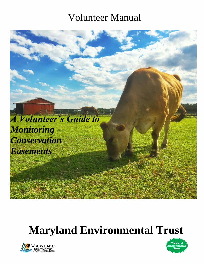
Volunteer Manual
Maryland Environmental Trust
A Volunteer’s Guide to
Monitoring
Conservation
Easements

2
If You Have Any Problems or Questions, Call Us.
Erin McNally – Easement Stewardship Specialist
Phone: 410-697-9529
Email: [email protected]
Nora Jackson – Easement Stewardship Specialist
Phone: 410-697-9523
Email: [email protected]
If the Easement Stewardship Specialist is not available ask for:
Jon Chapman – Stewardship Manager
Phone: 410-697-5919
Email: [email protected]
Main office line: 410-697-9515
Website: http://dnr.maryland.gov/met/Pages/default.aspx
All Photos in this document are property of the Maryland Environmental Trust
3
Monitoring a Conservation Easement
1. How We Select a Conservation Easement for Monitoring
We plan to visit each of our properties once every year as part of the regular monitoring
schedule. This opportunity lets us keep in touch with landowners and build our
relationship with them after their donation.
Based on the information we have on file for you—such as location preference or interests
and availability, we assign you an easement or group of easements that require a
stewardship visit.
We alert the landowner or property owner that a Volunteer Land Steward from Maryland
Environmental Trust will be calling them to arrange a mutually convenient appointment to
visit the easement property.
2. What We Send to You
We send you the assignment for the property with the following information:
● A contact sheet including the Easement ID, name of the landowner, and contact
information
● A copy of the previous monitoring report
● Photographs of the property
● Aerial photograph of the property
Previous monitoring report: Includes information you can use to fill out the Kobo form, like how many structures are
on the property, is there a stream, were they planning to make any changes, etc. If you see
things on the property that were not documented on the last monitoring report, document
them.
Photographs Pictures of the property to familiarize you with the appearance, the structures, streams,
and access points.
4
Aerial photograph Gives you the boundary of the easement property to help orient you to the size, layout
boundaries, and how to access it.
3. Arranging the Visit: Landowner
Contact the landowner to arrange your visit at a date and time acceptable to both of you.
Identify yourself as a monitor with the Maryland Environmental Trust when you call. In
some instances, you may reach a property manager or other employee and you may need
to call back at another time.
It may take a couple of attempts to reach a landowner. Try different times of the day or
week. Some landowners may be absent from remote properties for longer periods. If you
have difficulty contacting a landowner after a few attempts, please let us know.
When you reach the landowner let him or her know your interest in visiting and
performing the monitoring inspection. Ask when it would be convenient for you to come
by and visit the property. Let them know that they do not need to accompany you;
however, if they would like to be present a mutual convenient time can be arranged.
If the landowner has questions about the details of the easement refer him/her to contact
our Monitoring and Stewardship staff.
Here are some things to keep in mind when speaking to the landowner:
● If the landowner sounds confused or hesitant, assure them that your desired visit is
for a routine monitoring inspection and is a regular and necessary part of the
easement agreement.
● Access to buildings is not required.
The following are some examples of questions to ask the landowner during your initial
conversation:
● “Is there a convenient time I could come by and visit your property?”
● “Do you wish to meet with me for the monitoring visit or can I walk around the
property in your absence?”
5
● “Can you provide driving directions from a landmark, such as a highway exit or town
center?”
● “Is there more than one entrance to the property?”
● “How will I know when I am at your property?”
● “Are there access restrictions to the property, or any special parking instructions?”
● “Do I need to be wary of any dogs or livestock?”
● “Do I need to take any other precautions?”
● “Will the gate to your property be unlocked?”
Warnings about guard animals should be taken seriously; and if you open a pasture or
yard gate, close it afterward to keep animals and/or children in/out.
If the landowner will not be present, you should also ask over the phone:
● “Have there have been any changes to the property since it was last seen, e.g.,
construction of new buildings, new accesses to the property, plans for additional
structures, plans for new subdivisions, potential sale of the property?”
4. Equipment You Will Need
Here is what you will need:
Necessities—
● The assignment
● Driving directions/GPS
● Phone/Tablet with KOBO App and compass
● Door hangers
Suggestions—
● This training manual
6
● Bug repellent
● Sturdy shoes, hiking boots, or waterproof boots
● Food and water
● Rain jacket, umbrella, or both.
● Back pack
● First aid kit
● Whistle
● Sunscreen lotion, Sunglasses, hat
● Extra pair of socks and comfortable shoes to change into afterward.
5. Dressing for a Monitoring Inspection
Dress casually, but neatly and respectfully; you are representing Maryland Environmental
Trust. You will be outside in varying weather conditions for a period of time. Even on a
hot day, we recommend wearing long pants/jeans because of thorns, poison ivy, ticks, etc.
6. Meeting the Landowner
Be punctual, polite and respectful. Ask if they will show you the property. If the
landowner is not home, leave the door hanger to let them know you were there.
Remember when you set up the visit-
● Did they seem concerned about your walking the property by yourself?
● Did they even care whether you were coming to do the inspection?
● How large is the property, 30 acres, or 300?
● Did the landowner warn you of dogs or livestock?
7. Walking the Property
Some questions you may want to ask when touring the property:
● Have there been any changes to the property since the date of our last visit?
● Have they had any exceptional erosion or land management problems?
● Do they have plans to construct new buildings or means of access?
7
● Do they intend to sell or transfer the land in the near future?
● Do they have any questions regarding the easement agreement or land stewardship
issues that our staff can assist them with?
● If the landowner does have questions, put that in the report and the Easement
Stewardship Specialist will follow up.
8. KoBoCollect form
For Android users (the app):
● Click “Fill Blank Form”
● Choose “Maryland Land Trust Easement Monitoring Report”
For iPhone users (webpage):
● Open the form when you have service/wifi. Once it loads it can be filled in offline.
Filling in the form:
*fill in the first few fields from your contact sheet before you get to the property*
1. Organization: MET
2. Landtrust identifier: Easement ID
3. Reference name: Original Grantor
4. Donated?: Yes
5. Co-held?: No
Remember you can always edit the form after you’re done, so fill in all fields you can,
skip others and go straight to the photos.
Before you get to Photos the app will ask you “Add New Group?” Click “Add Group”
a. Click “Take Picture”
b. Choose “Open Camera”
c. Take the photo of the desired subject
d. Make a caption of what the subject, and the direction in which you took it
e. Click “Start GeoPoint”. It saves the geopoint automatically at 4.55m accuracy. If it
is taking too long to load, click “Save GeoPoint” at the closest accuracy you can get.
f. Do this for every picture you take. When you’re finished;
8
● “Add New Group?” Click “Do Not Add”
● Then the final question will come up asking if the Monitoring Report you have
compiled is true and correct select the box next to “OK. Please Continue”
● On iPhone, check the box next to “Save as draft”, and select the button below that
says “save draft,” then “save and close”. On Android, “Save Form and Exit”
● To return to other sections and fill in fields on Android, select the arrow icon in the
top right corner to view the whole report and select the section.
Things to include:
● Note the number of residences/ dwellings, accessory structures, whether they are
new or have changed, and any comments about them.
● If there is a waterbody present pay close attention to the size and types of vegetation
around the buffers.
● In the Overall Impressions section, we would like to see a summary of what you
saw, note any potential problems or concerns, if the property is for sale or any other
important details.
● Next is the section for recommendations for future visits, such as gear that would be
useful to bring, weather to consider, land use to be mindful of.
Submitting the form - you must be connected to Wifi.
The form you have now completed should be moved to the main page of the app in the
section labeled “Sent Finalized Form” AND “Edit Saved Form”. If there are things you
wish to expand on, clarify, or add you can still edit the form in “Edit Saved Form”. If you
have completed the form and wish to submit it click “Send Finalized Form”
Click the box on the right next to each monitoring report you have completed. Then after
you have marked all the ones that have been edited look at the bottom right corner and
click “Send Selected”. Now you’re done!
9. Taking Photographs
Photographs are important for us to have a record of land uses at the time of your visit.
9
There are two broad types of photographs that are useful to us: technical and aesthetic.
1) The “Technical” Photograph— (should be between 5 and 15)
We need photographs of:
● Entrance to the property along the road (caption this “road frontage”)
● Residences
● Other existing structures (barns, sheds, swimming pools, docks, etc)
● The landscape from the corners of the property
● Any access points (driveway, gate, adjoining roadway)
● Streams and their buffers.
2) The “Aesthetic” or “Scenic” Photograph (these are not necessary but appreciated)
● any significant wildlife or plants encountered
● any natural features you feel show our mission to protect open space and the
environment (vistas, streams, forests)
● historical structures.
10. Leaving the Property
Please let the landowner know when you are finished and ask if they have any questions.
Never give an assessment! Just thank them for allowing you access to their property and
for being a part of the conservation easement program.
If You Have Any Problems or Questions, Call Us.
You are not required to call us after performing a routine monitoring visit—you just need
to submit the results. However, if you have any questions or concerns you should call us
or email us promptly, especially if you observed land disturbance activities such as
clearing of forest, ditching of streams or wetlands, new construction, or survey activities
(new/recent boundary stakes), etc.
10
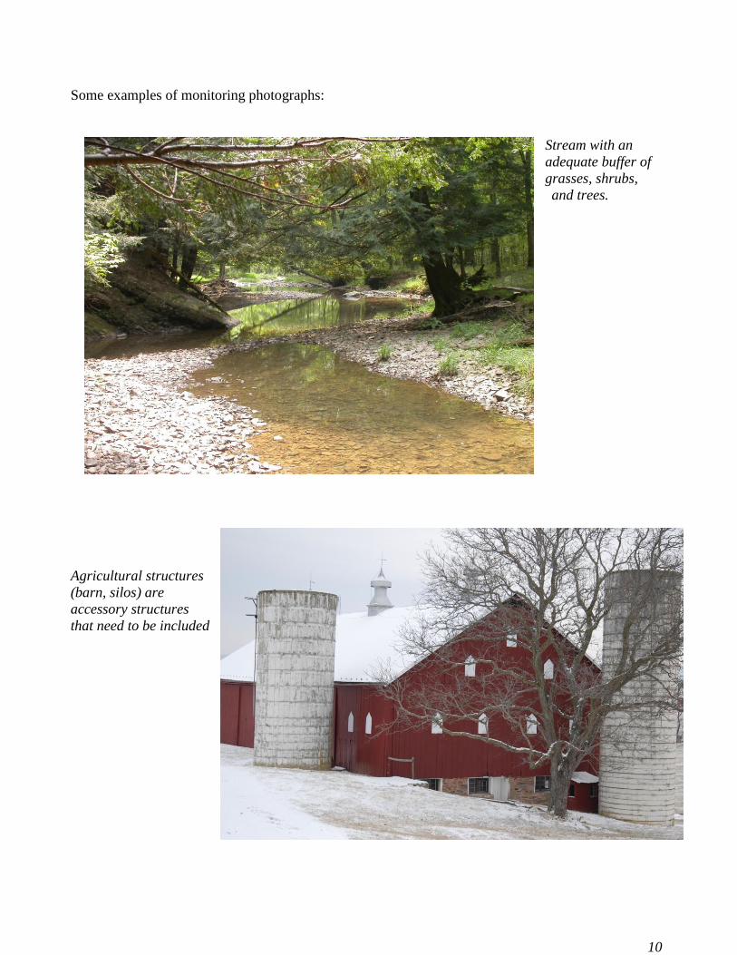
Some examples of monitoring photographs:
Stream with an
adequate buffer of
grasses, shrubs,
and trees.
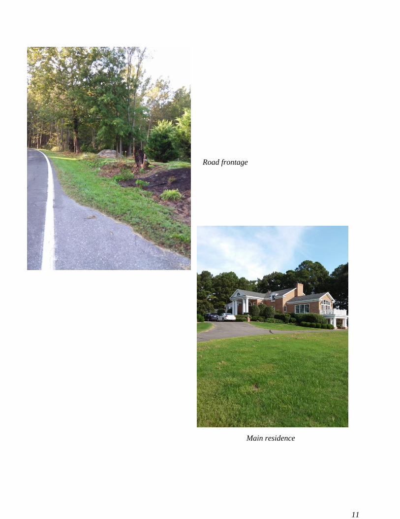
Agricultural structures
(barn, silos) are
accessory structures
that need to be included
11
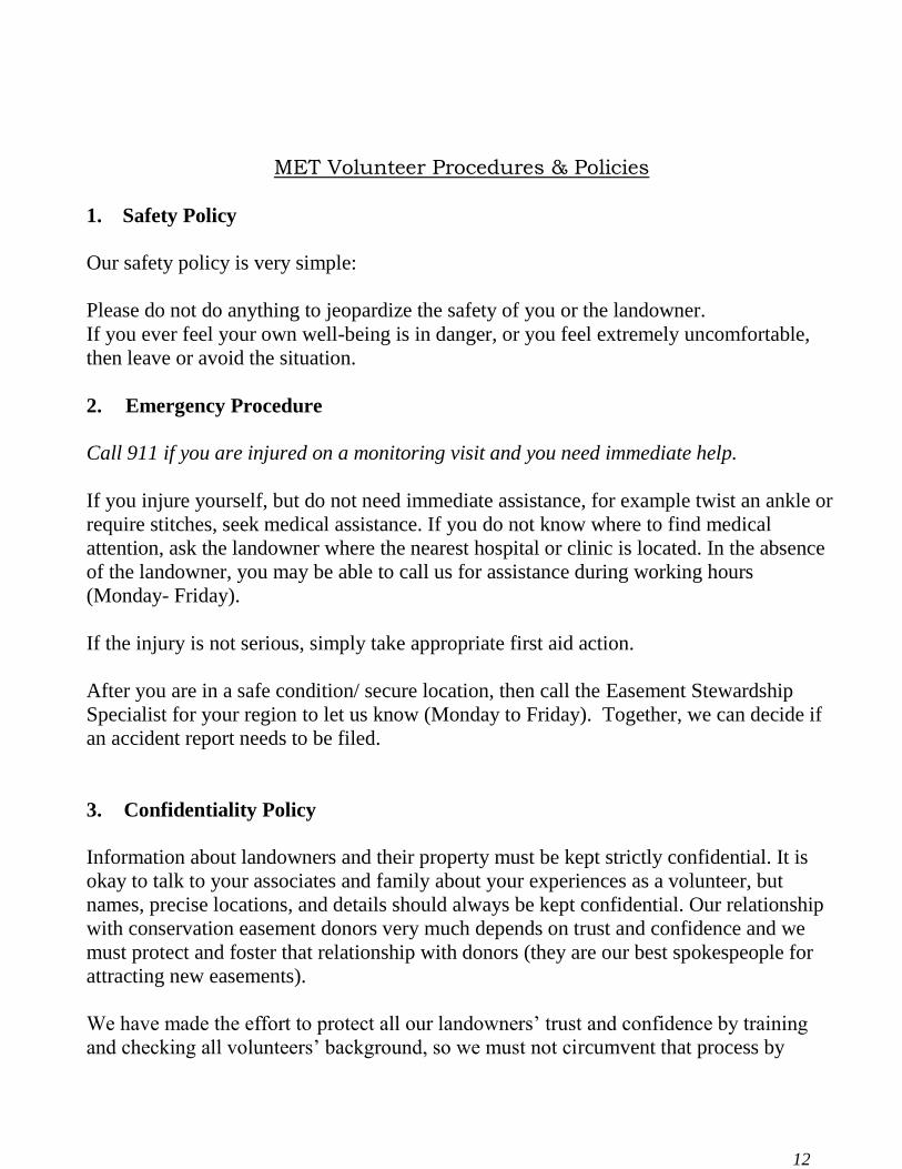
Road frontage
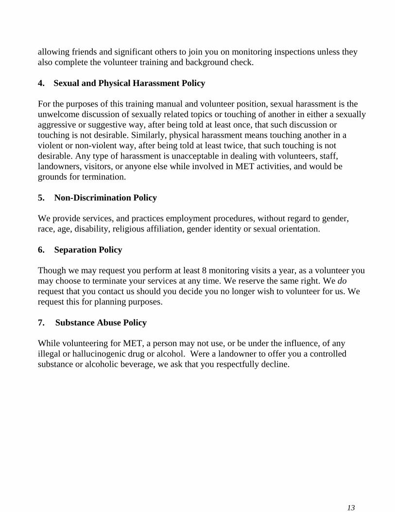
Main residence
12
MET Volunteer Procedures & Policies
1. Safety Policy
Our safety policy is very simple:
Please do not do anything to jeopardize the safety of you or the landowner.
If you ever feel your own well-being is in danger, or you feel extremely uncomfortable,
then leave or avoid the situation.
2. Emergency Procedure
Call 911 if you are injured on a monitoring visit and you need immediate help.
If you injure yourself, but do not need immediate assistance, for example twist an ankle or
require stitches, seek medical assistance. If you do not know where to find medical
attention, ask the landowner where the nearest hospital or clinic is located. In the absence
of the landowner, you may be able to call us for assistance during working hours
(Monday- Friday).
If the injury is not serious, simply take appropriate first aid action.
After you are in a safe condition/ secure location, then call the Easement Stewardship
Specialist for your region to let us know (Monday to Friday). Together, we can decide if
an accident report needs to be filed.
3. Confidentiality Policy
Information about landowners and their property must be kept strictly confidential. It is
okay to talk to your associates and family about your experiences as a volunteer, but
names, precise locations, and details should always be kept confidential. Our relationship
with conservation easement donors very much depends on trust and confidence and we
must protect and foster that relationship with donors (they are our best spokespeople for
attracting new easements).
We have made the effort to protect all our landowners’ trust and confidence by training
and checking all volunteers’ background, so we must not circumvent that process by
13
allowing friends and significant others to join you on monitoring inspections unless they
also complete the volunteer training and background check.
4. Sexual and Physical Harassment Policy
For the purposes of this training manual and volunteer position, sexual harassment is the
unwelcome discussion of sexually related topics or touching of another in either a sexually
aggressive or suggestive way, after being told at least once, that such discussion or
touching is not desirable. Similarly, physical harassment means touching another in a
violent or non-violent way, after being told at least twice, that such touching is not
desirable. Any type of harassment is unacceptable in dealing with volunteers, staff,
landowners, visitors, or anyone else while involved in MET activities, and would be
grounds for termination.
5. Non-Discrimination Policy
We provide services, and practices employment procedures, without regard to gender,
race, age, disability, religious affiliation, gender identity or sexual orientation.
6. Separation Policy
Though we may request you perform at least 8 monitoring visits a year, as a volunteer you
may choose to terminate your services at any time. We reserve the same right. We do
request that you contact us should you decide you no longer wish to volunteer for us. We
request this for planning purposes.
7. Substance Abuse Policy
While volunteering for MET, a person may not use, or be under the influence, of any
illegal or hallucinogenic drug or alcohol. Were a landowner to offer you a controlled
substance or alcoholic beverage, we ask that you respectfully decline.

14
15
Field descriptions. Each category has several fields. Any marked with an * are required. Questions
about the Kobo Tool or monitoring process can be directed to MET’s Monitoring Coordinator.
➢ Easement:
● *Organization- Land trust who holds the easement and for whom you are monitoring
● *Land trust Identifier- Combination of letters/numbers the organization uses to identify
an easement property. E.g. 0022TUL90.BACO (.01 or .02 at the end indicates the easement
has been subdivided 0022TUL90.BACO.01)
● Reference name (e.g. Property / Landowner name)- an additional name or number
used to identify the property e.g. grantor name, farm name, historic name, current landowner
name
● *Donated?- Choose Yes if the property was granted to the land trust as a donation. No if
property is a purchased easement and also indicate the Program / Easement type (Rural
Legacy, POS, CREP, etc.) or Fee Simple property.
● Co-held- the easement is co-held by another organization
○ Co-holding organization- name the co-holder
○ Co-holding organization identifier- combination of letters/numbers used to identify
the easement within their organization
➢ Visit:
● Visit type- Ground visits are arranged with the landowner and take place on the premise.
Drive-by visit are usually observation made offsite. Aerial visits take place by airplane or by
reviewing aerial imagery
● Monitor Name and Monitor Role- Include your name and whether you are staff or a
volunteer for the organization. There will be additional space below to include names of other
co-holding monitors and landowners present during the visit
● Landowner Contact- Indicate how you setup the visit: Phone, email, etc. Indicate if the
landowner was present during visit
● Also present- List the names and role of anyone else present during the visit (John
Smith- property manager, Jane Doe- co-held volunteer)
● New Landowner since last visit- refer to last monitoring report. Has ownership
changed? has changed since the last visit.
● Landowner at time of visit and new landower since last visit? - Look for this info on
the summary sheet and verify during visit.
● Portion of property viewed- Indicate which parts of the property you observed. Multiple
choices are permitted. This entry helps the stewardship staff and future monitors know what
areas are being observed regularly and which areas are not being seen.
➢ Structures:
Refer to the summary sheet for the list of existing structures. Total residences and Total accessory
structures- Make note of any differences between what you observe and the past monitoring report
under Structure Comments and be sure to photograph the changes. Total residences is most
important; you may need to approximate the number of accessories if they are numerous or scattered
throughout the property.
● Residence- a structure that appears to have all 3 residential qualifying features
(cooking, sanitation and sleeping quarters)
● Accessory structure- a structure that supports the residence, i.e. a pool house,
garage, shed, tennis court

16
● Agricultural structure- any and all structures affiliated with farming practices
(shed, barn, corn crib) ➢ Waterbody / Buffer:
Check yes if waterbody is present. Refer to general summary to determine the required buffer width.
Observe and verify if an adequate buffer is present. Additional boxes will appear as selected. Add
buffer condition and other details here.
○ Buffer (vegetation, generally 50-100 ft along each side of the stream or shoreline)
➢ Land Use & Natural Land Change- these categories are meant to document any changes in land
use, whether human caused or from natural forces. Add additional details in the space provided
and be sure to photograph any significant changes noted here.
➢ Management Plans- refer to the summary to see if certain plans are required, if so talk with the
landowner to find out if the plan is up-to-date.
● Use the Additional Comments section to provide with all other information you gathered
during your visit and any feedback to help with the perpetual stewardship of this easement
property.
➢ Photos:
Generally 6-15 photos is adequate to capture the current condition of the property:
● Structures and curtilage (area around residence)
● Waterbody and buffer
● Access and boundary (especially if encroachment is a threat)
● Any areas of special concern mentioned in notes
● Special conservation values or areas (rare plants, animals, wetland
Prepare for offline field use:
To use the Kobo web form offline, you must first open the form on your device with an internet
connection. The green check mark with the wifi bar (top left hand corner) indicates the form has
completed loading and is stored in the browser history. The form will remain
and can be used offline as long as you do not close your browser history.
The KoboCollect App can be used with or w/out internet connection initially. Connection will be
required for both the app and the webform to submit finalized reports
In the field:
Take all photographs during the monitoring visit using the Kobo Photo Capture found at the bottom of
the web app. All observations, photographs and photo information are entered directly into the Kobo
monitoring form.
1. Scroll down to the photo section, select photo box and choose take photo. * be sure your
mobile device has gps/location turned on
2. If happy with the image, select Use Image.
3. Capture the location by selecting the crosshair. Click twice to improve accuracy (<10m is
recommended)
4. Add a description for your photo.
5. Click on the plus sign to take the next photo.
17
6. (Photos can also be uploaded from the device. If you choose this option, be sure you turn
on gps/location or use gps device to geotag photos. You will have to manually enter the
coordinates into form).
7. If GPS details are not available, provide more details in your description, i.e. “Looking NW
across meadow from southern boundary”
8. Only use photo file types jpg/jpeg, png, and gif.
Saving as Draft and Submitting:
There is no login associated with the report, therefore you can only retrieve drafts on the device
where they were initially created. Rename with something convenient to you. Click the number in the
top left hand corner to retrieve drafts. Bring the draft form back up later when and where it’s
comfortable, enter more detail, finalize report, then submit. It’ll upload to the internet at the first
opportunity where there’s a connection.
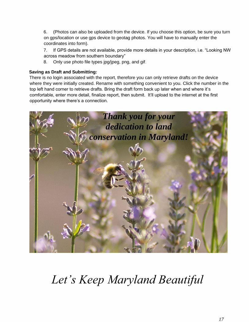
Let’s Keep Maryland Beautiful
Thank you for your
dedication to land
conservation in Maryland!