walk-through on using the eddmaps pro app · map – road, satellite, terrain, or turn offline...
TRANSCRIPT
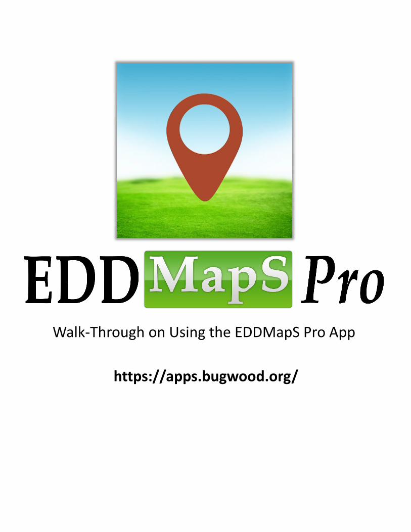
Walk-Through on Using the EDDMapS Pro App
https://apps.bugwood.org/
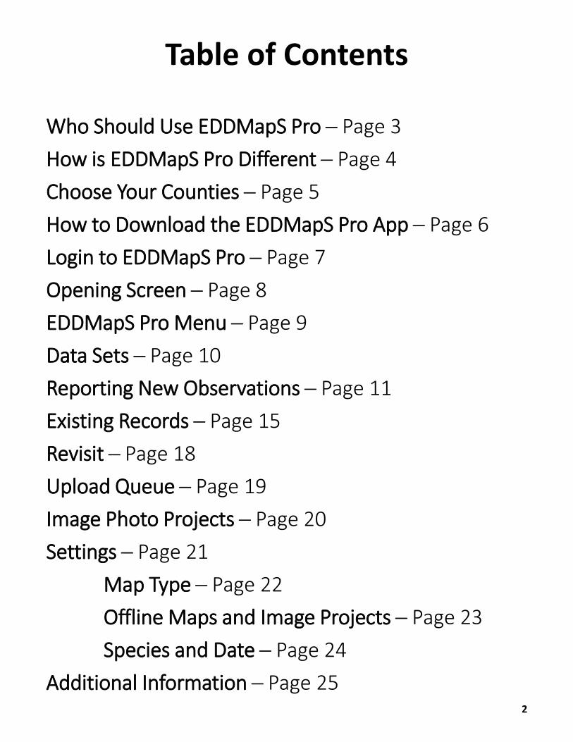
Table of Contents
Who Should Use EDDMapS Pro ─ Page 3How is EDDMapS Pro Different ─ Page 4Choose Your Counties ─ Page 5How to Download the EDDMapS Pro App ─ Page 6Login to EDDMapS Pro ─ Page 7Opening Screen ─ Page 8EDDMapS Pro Menu ─ Page 9Data Sets ─ Page 10Reporting New Observations ─ Page 11Existing Records ─ Page 15Revisit ─ Page 18Upload Queue ─ Page 19Image Photo Projects ─ Page 20Settings ─ Page 21
Map Type ─ Page 22Offline Maps and Image Projects ─ Page 23Species and Date ─ Page 24
Additional Information ─ Page 252

Professionals to use in low/no mobile signal areasLandowners and those responsible for a
specific areaThose documenting repeated visits to
infested or high-priority areas
Who Should Use EDDMapS Pro?
3
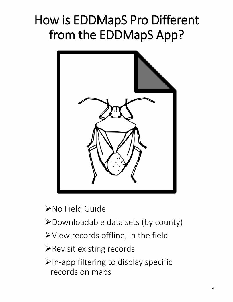
No Field GuideDownloadable data sets (by county)View records offline, in the fieldRevisit existing recordsIn-app filtering to display specific
records on maps
How is EDDMapS Pro Different from the EDDMapS App?
4
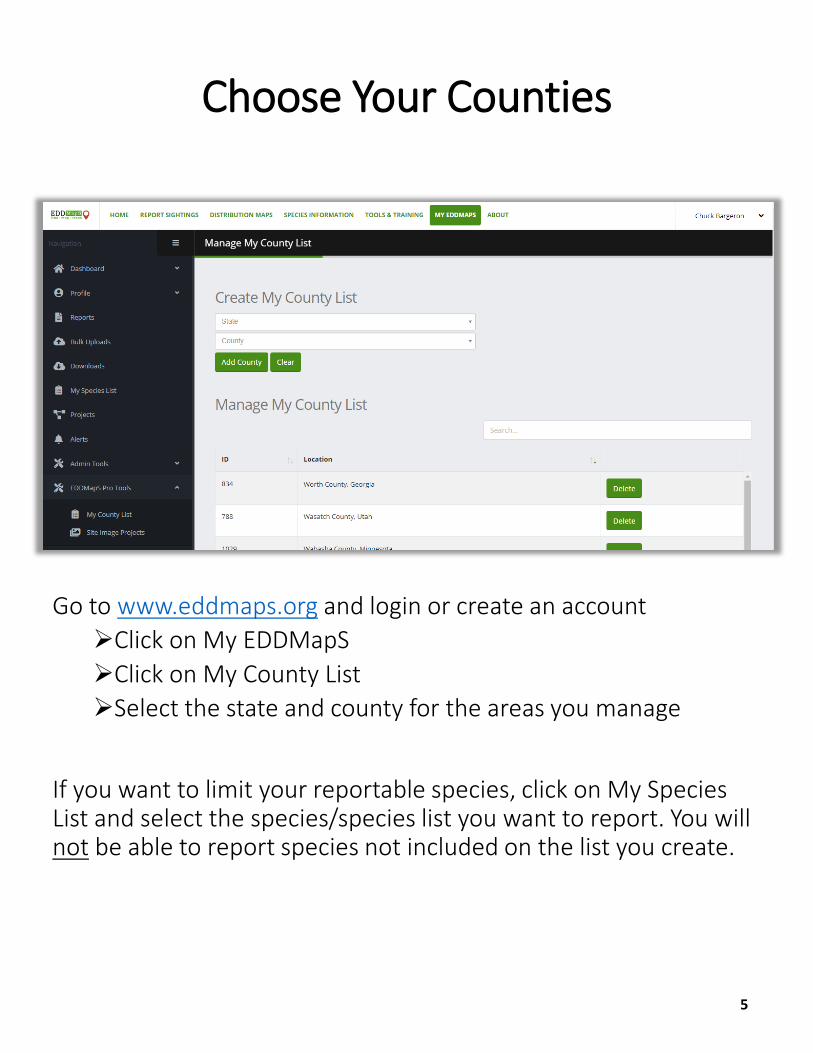
Go to www.eddmaps.org and login or create an accountClick on My EDDMapSClick on My County ListSelect the state and county for the areas you manage
If you want to limit your reportable species, click on My Species List and select the species/species list you want to report. You will not be able to report species not included on the list you create.
Choose Your Counties
5
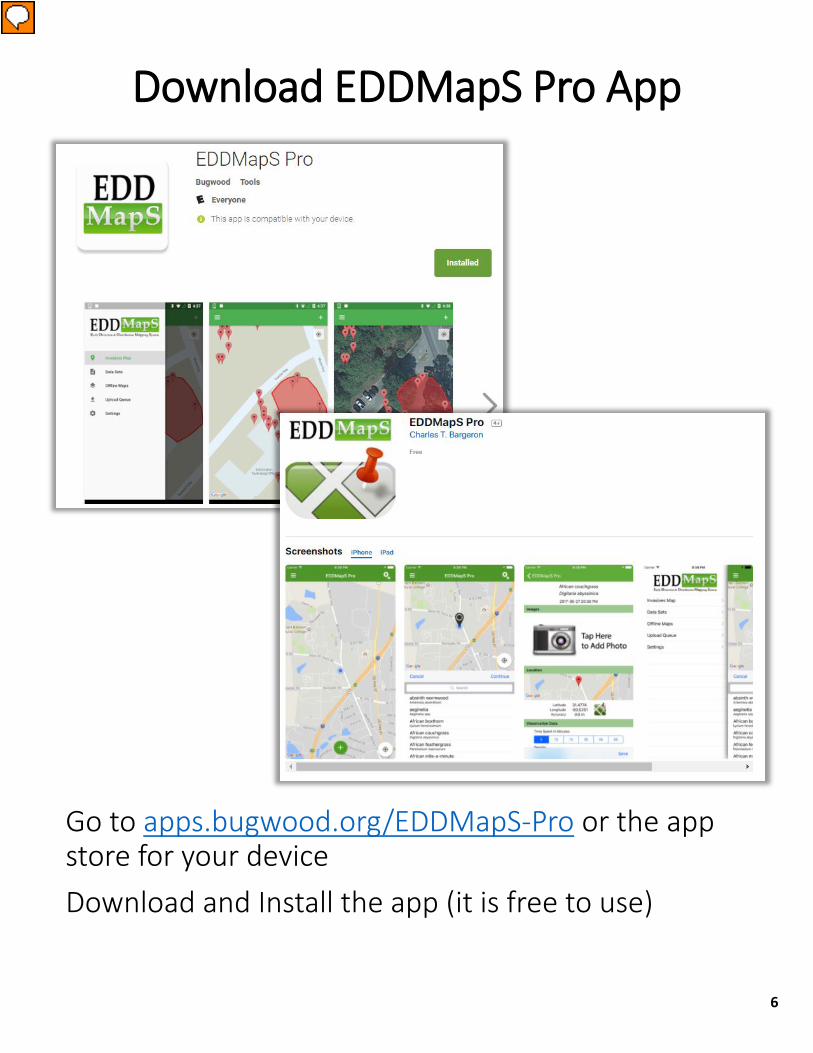
Download EDDMapS Pro App
Go to apps.bugwood.org/EDDMapS-Pro or the app store for your device Download and Install the app (it is free to use)
6
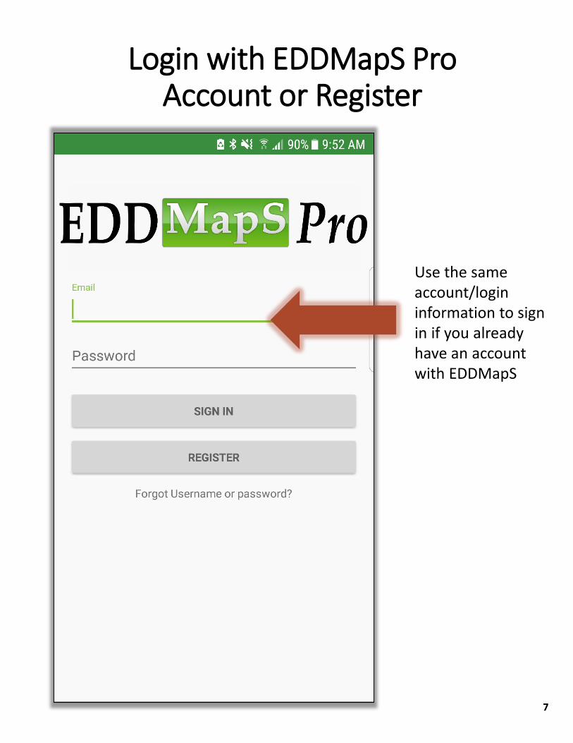
Use the same account/login information to sign in if you already have an account with EDDMapS
Login with EDDMapS Pro Account or Register
7
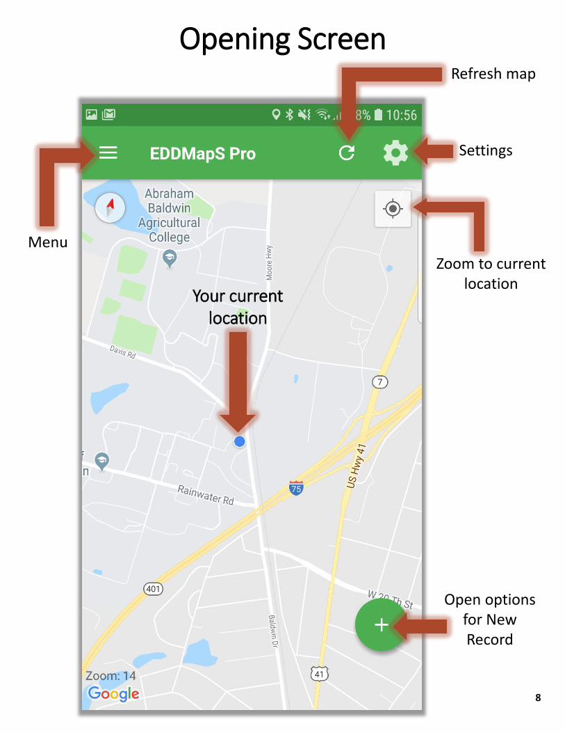
Settings
Zoom to current location
Open options for New Record
Your current location
Refresh map
Opening Screen
Menu
8
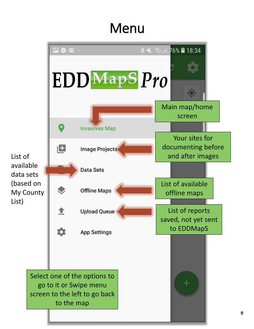
List of available data sets (based on My County List)
List of available offline maps
List of reports saved, not yet sent
to EDDMapS
Select one of the options to go to it or Swipe menu
screen to the left to go back to the map
Your sites for documenting before
and after images
Menu
Main map/home screen
9
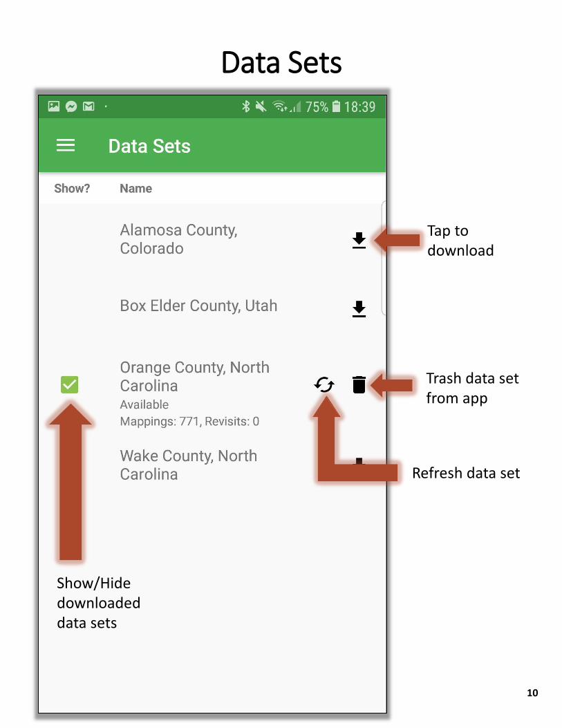
Show/Hide downloaded data sets
Trash data set from app
Tap to download
Refresh data set
Data Sets
10
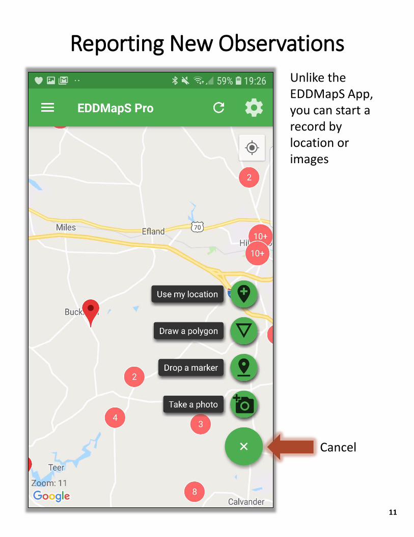
Cancel
Unlike the EDDMapS App, you can start a record by location or images
Reporting New Observations
11
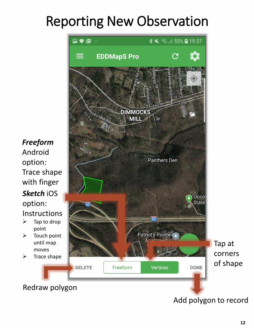
FreeformAndroid option: Trace shape with finger
Add polygon to recordRedraw polygon
Tap at corners of shape
Reporting New Observation
12
Sketch iOS option:Instructions Tap to drop
point Touch point
until map moves
Trace shape
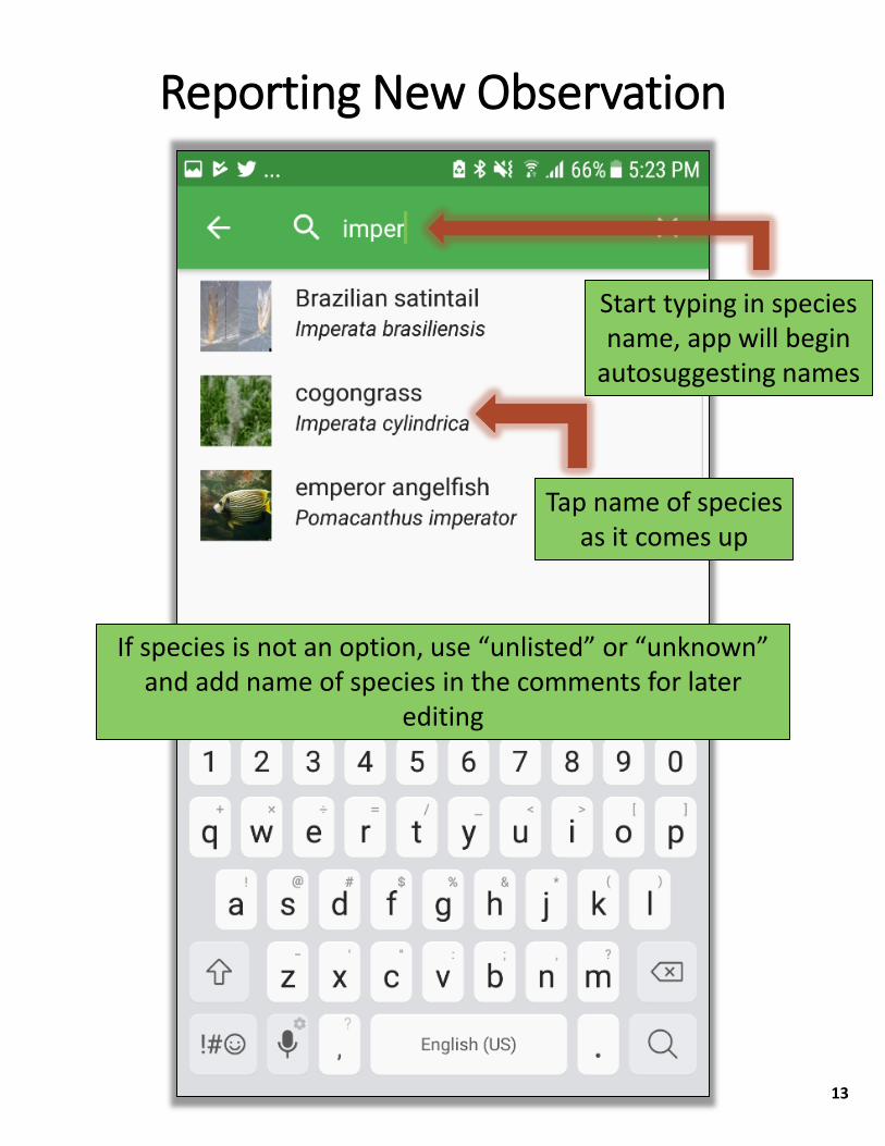
Start typing in species name, app will begin
autosuggesting names
Tap name of species as it comes up
If species is not an option, use “unlisted” or “unknown” and add name of species in the comments for later
editing
Reporting New Observation
13
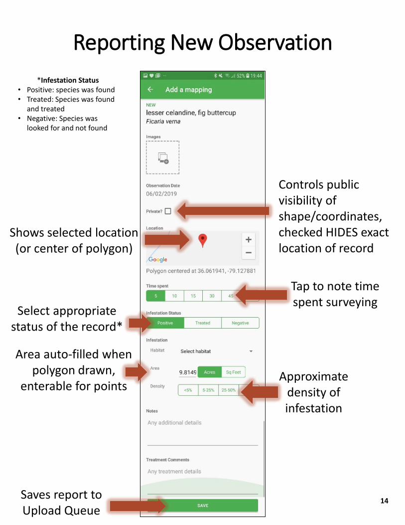
Controls public visibility of shape/coordinates, checked HIDES exact location of record
Shows selected location (or center of polygon)
Tap to note time spent surveying
Select appropriate status of the record*
Area auto-filled when polygon drawn,
enterable for pointsApproximate
density of infestation
Saves report to Upload Queue
Reporting New Observation*Infestation Status
• Positive: species was found • Treated: Species was found
and treated• Negative: Species was
looked for and not found
14
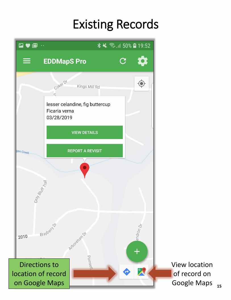
View location of record on Google Maps
Directions to location of record on Google Maps
Existing Records
15
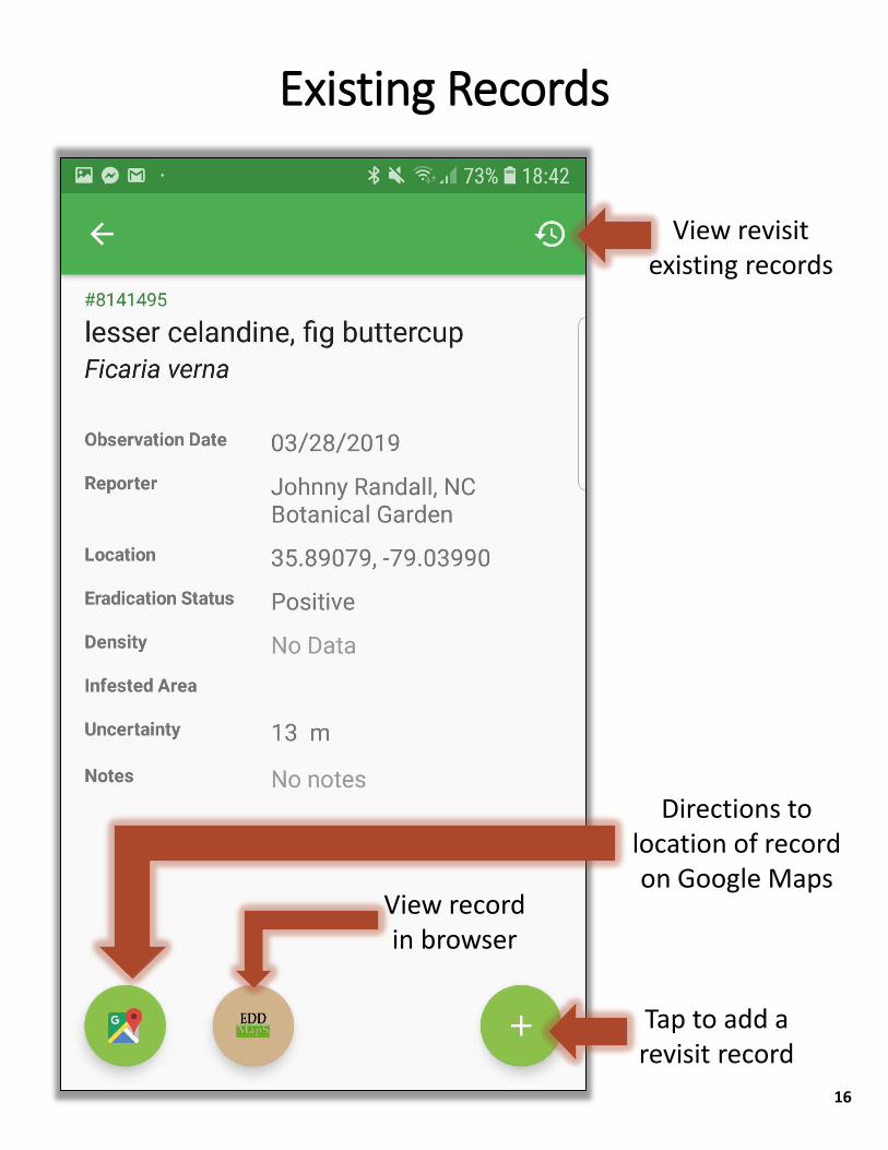
View revisit existing records
Tap to add a revisit record
View record in browser
Directions to location of record on Google Maps
Existing Records
16
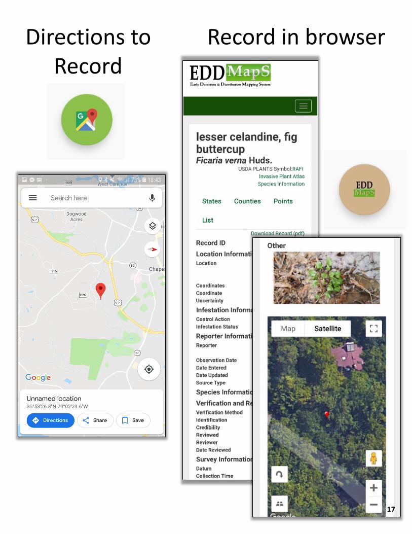
Record in browserDirections to Record
17
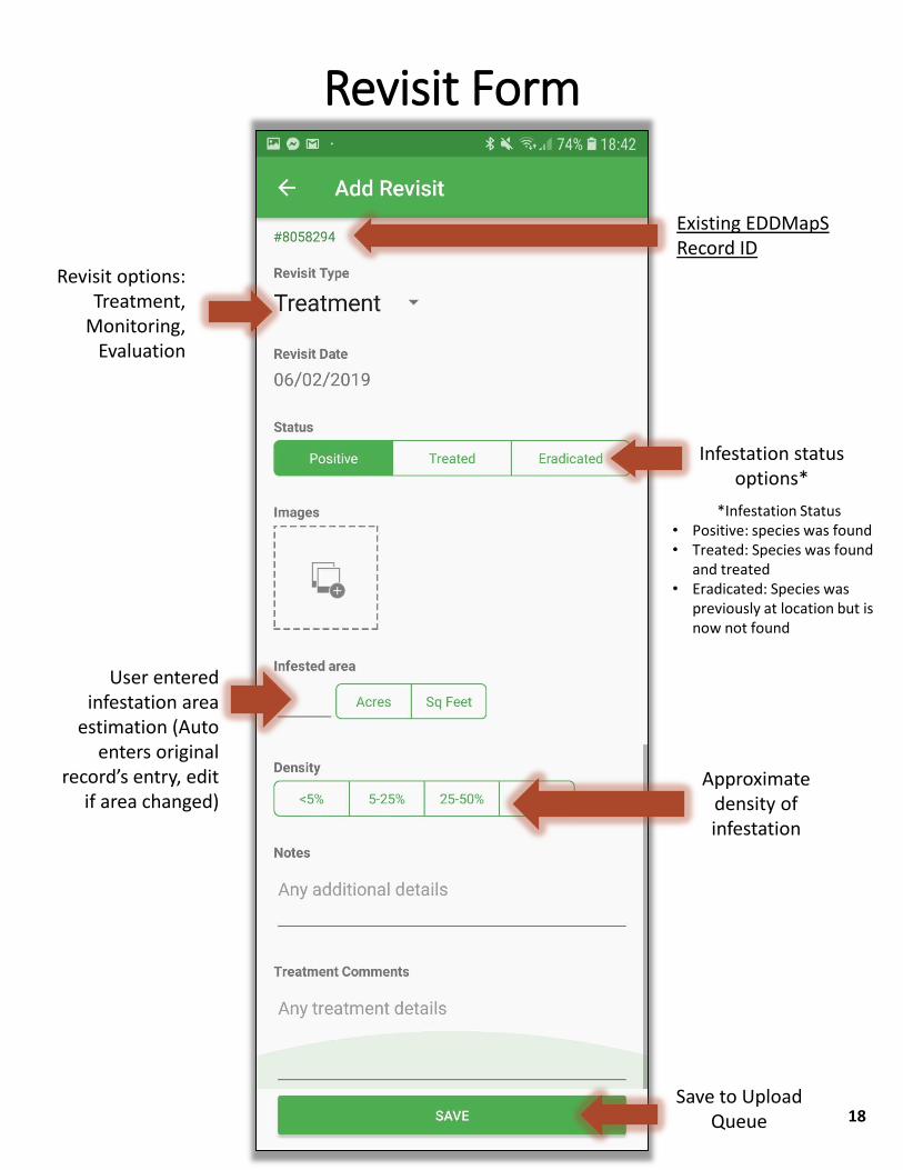
Revisit options: Treatment,
Monitoring, Evaluation
Save to Upload Queue
Existing EDDMapS Record ID
Infestation status options*
User entered infestation area
estimation (Auto enters original
record’s entry, edit if area changed)
Approximate density of infestation
Revisit Form
*Infestation Status • Positive: species was found• Treated: Species was found
and treated• Eradicated: Species was
previously at location but is now not found
18
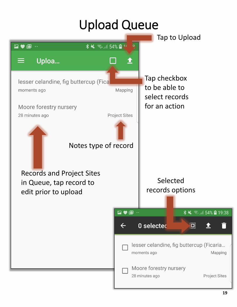
Tap checkbox to be able to select records for an action
Records and Project Sites in Queue, tap record to edit prior to upload
Notes type of record
Upload QueueTap to Upload
Selected records options
19
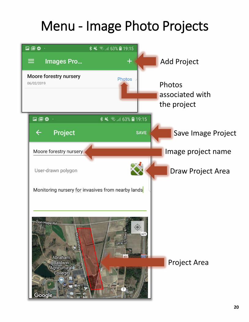
Add Project
Photos associated with the project
Menu - Image Photo Projects
Draw Project Area
Project Area
Image project name
Save Image Project
20
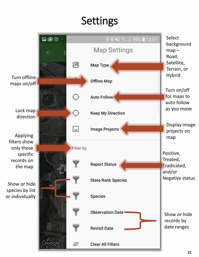
Select background map –Road, Satellite, Terrain, or HybridTurn offline
maps on/offTurn on/off for maps to auto follow as you move
Positive, Treated, Eradicated, and/or Negative status
Applying filters show only those
specific records on
the map
Display image projects on map
Settings
Show or hide species by list or individually
Show or hide records by date ranges
Lock map direction
21
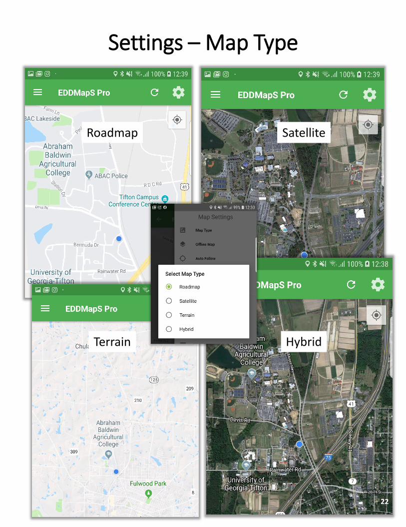
Settings – Map Type
Roadmap Satellite
Terrain Hybrid
22
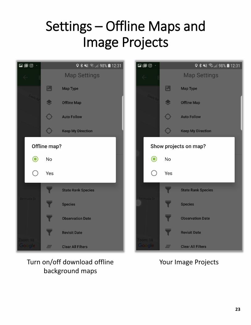
Settings – Offline Maps and Image Projects
23
Turn on/off download offline background maps
Your Image Projects

Settings – Species and Date
Observation Date and/or Revisits Date
Individual Species Selector
State Species Lists Selector
24
To access records:Visit www.eddmaps.org Login with email and passwordClick on My EDDMapS From here, you can search for records, view, revisit,
edit, and/or delete records as needed
To report a species not in AppSelect Unknown Animal or Unknown Plant if you don’t
know what the species isSelect Unlisted Animal or Unlisted Plant if you do know
the species; add species name in the commentsWhen you upload the records, you will receive an email
requesting that you update the species name if you are able
More Apps? apps.bugwood.orgMore Info? www.invasive.orgMore Bugwood websites? www.bugwood.org
Additional Questions? Contact Rebekah Wallace at [email protected]
Additional Information
25