wallace linerbvrrwomenscollege.net/wp-content/uploads/2018/05/wallace-line.pdf · indo-malay...
TRANSCRIPT

D R . A C H Y U T H A
Wallace line

Alfred Russel Wallace(1823-1913)
“A prisoner of scientific parentheses, as in, "the theory of evolution by natural selection proposed by Charles Darwin (and also by Alfred Russel Wallace).”’
QuickTime™ and a decompressor
are needed to see this picture.
QuickTime™ and a decompressor
are needed to see this picture.

The Wallace Line Alfred Wallace, one of the premier zoobiogeographers, wrote the definitive treatise “Distributions of Animals” in 1876 where he summarized the known distributions and causes of their biogeographical pattern

Discoveries
Founder of biogeography
Recognized the six great biogeographical regions on Earth.
“Wallace Line”: imaginary line separating Asia and Australia
QuickTime™ and a decompressor
are needed to see this pic ture.

• Wallace Line — the imaginary line separating the Oriental and Australian biotas — extends between Bali and Lombok and bet Borneo/Philippines and Sulawesi
Sulawesi, with its mixture of Oriental and Australian fauna, was so perplexing to Wallace, that he vacillated back and forth on where to place the island

main interest was in the vertebrate fauna of the Indo-Malay Archipelago from Asia to Australia where he clearly saw a sharp faunistic break Wallace’s trips Sclater’s & Wallace’s faunistic regions Probably his most important trip he ever made was a 6 km ferry ride from Bali to Lombok

“In the archipelago . . . there are two distinct faunas rigidly circumscribed, which differ as much as those of South America and Africa, and more than those of Europe and North America” [Letter to Henry Bates in London (1858)]

“The boundary line often passes between islands closer than others in the same group. I believe the western part to be a separated portion of continental Asia, the eastern the fragmentary prolongation of a former Pacific continent

Wallace graphically depicts what has since been termed the “Wallace Line” in his book by showing birds and mammals that are found in the Oriental (Borneo, ) and Australian (New Guinea, ) sides
Now know that the two regions are different continental plates that have been moving independently — the Asian and Australian plates
The IndoMalay - New Guinea Archipelago area includes island groups mostly confined to either of two continental shelves: Sunda shelf — Asian Sahulshelf — Australian

Collision of the Australian plate with the Asian plate occurred between 15-5 mya
Sulawesi is a hybrid island from both plates!
Tree shrews (family Tupaiidae) were indicated by Wallace as honoring this biogeographical line. An Asian group whose entire range gets as far east as Bali and Borneo but not to Lombok or Sulawesi

All but 3 of the genera of Dipterocarpaceae honor the Wallace Line
Eucalyptus (Myrtaceae) is an Australian genus and basically honors the Wallace Line from the east

Discontinuous distribution
Animals are not uniformly distributed on land and in freshwater. They are restricted to certain places by several factors such as climate, food, shelter, flora and fauna etc. Generally distribution can be classified into three categories, namely, Continuous, Discontinuous and Bipolar distribution.

When continuity of distribution of a species is broken by uninhabited areas which are sometimes very large stretches of oceans.
There are primarily four reasons why animals are distributed in widely separated areas.

1. Animals reach distant areas by sweepstake routes, as insects, snails and rats by rafting, turtles by floating and swimming and birds blown by storms.
2. The species was earlier distributed continuously but the land masses in the intermediate areas submerged, breaking the species into widely separated populations.
3. Continental drift separated the continents and carried them to long distances, isolating the animals from other areas.
4. A widely distributed species can become extinct in the intermediate areas due to change in the climate to which the species is unable to adapt.

Examples:
Peripatus (Phylum Onychophora) has 75 species distributed in Southeast Asia, East Indies, Australia,NewZealand, Africa, South and Central America.
The three surviving genera of lungfishes occur in three different continents; Protopterus in Africa,Lepidosiren in South America and Neoceratodus in Australia.
Similarly the limbless amphibians (Apoda or Gymnophiona) of the genera Ichthyophis, Gegenophis andDermophis occur in Africa, South America, Central America, South Asia and East Indies.
Ostriches are distributed in the southern hemisphere; Rhea americana in Argentina and Brazil, Struthio camelus in Africa, Emu in Australia, Cassowaries in North Queensland and New Guinea and Kiwi in forests of New Zealand.
Marsupials occur in Australia but one family Didelphidaeoccurs in South America that includes opossum (Didelphis), water opossum (Chironectes) and opossum rat (Coenolestes).
The common camel (Camelus dromidarius) occurs in the Middle East, India and Northern Africa;Camelusbactrianus is found in Mongolia and China, while two species, Llama vicuna and Llama guanaco are found in the mountainous regions of South America.
Of the two elephant species surviving today, Loxodonta africana occurs in Africa while another species,Elephas maximus is found in India, Burma, Thailand and Sri Lanka.
Alligators occur in America and China; Alligator mississipiensis in Americas, Caiman in South America and Alligator sinensis in China.
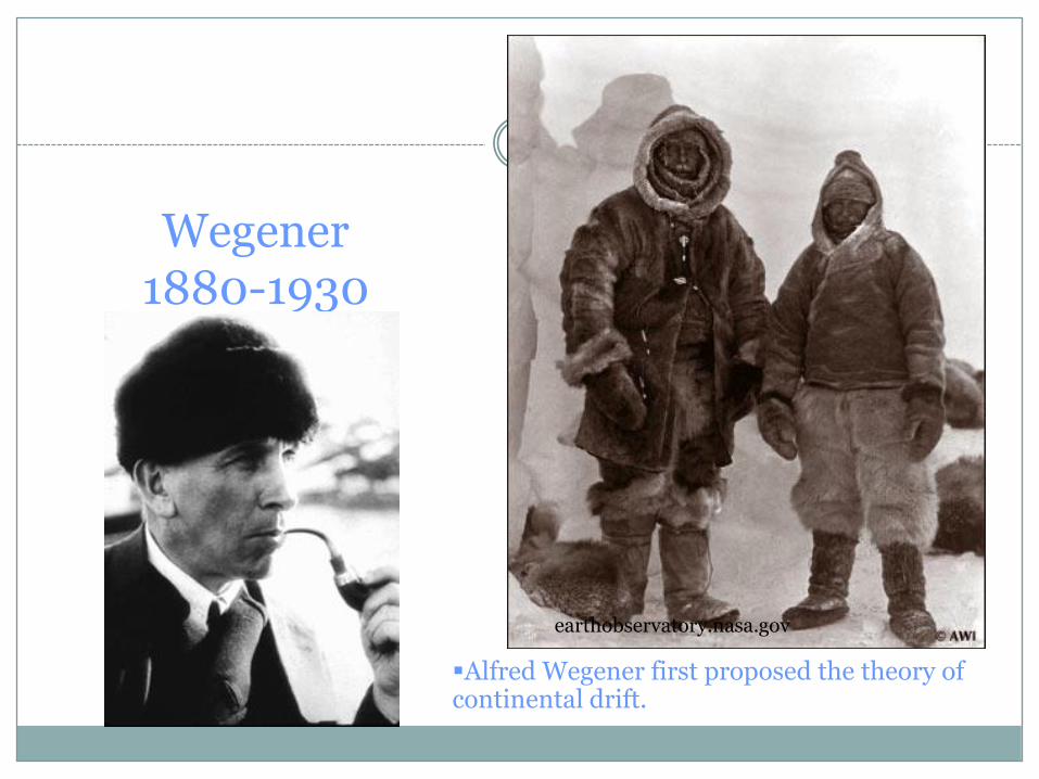
Wegener1880-1930
earthobservatory.nasa.gov
Alfred Wegener first proposed the theory of continental drift.

Continental drift was Wegener’s theory that all continents had once been joined together in a single landmass and have drifted apart since.
Wegener named this supercontinent Pangaea.
Wegener’s theory was rejected by scientists because he could not explain what force pushes or pulls continents.
Continental drift video clip
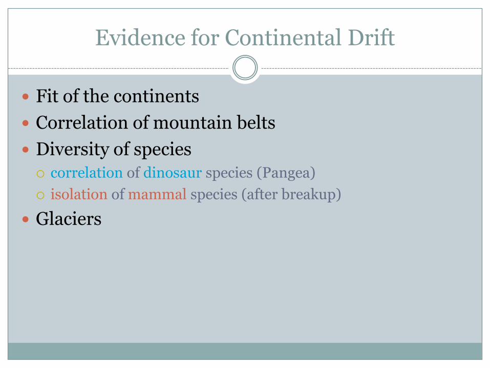
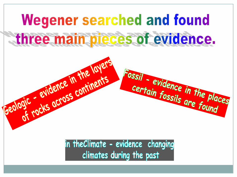
Evidence for Continental Drift
Fit of the continents
Correlation of mountain belts
Diversity of species
correlation of dinosaur species (Pangea)
isolation of mammal species (after breakup)
Glaciers
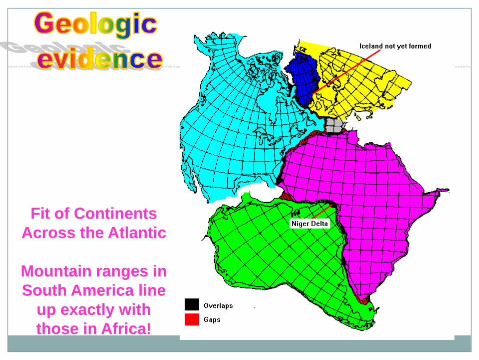
Fit of Continents
Across the Atlantic
Mountain ranges in
South America line
up exactly with
those in Africa!

Continental shelf
Submarine canyons (cut into the c. slope)
Abyssal plain
Continental rise
Continental slope
Seafloor Features: Continental Margins
Abyssal plain

Notice how fossils lined up across continents!
http://evolution.berkeley.edu/evolibrary/images/history/fossils3.gif

Amazing Facts: Did you know...
...that India was once in the Southern Hemisphere
connected to Antarctica?
...that North America was once surrounded by warm,
tropical seas?
...that Africa was once covered by glaciers, which were
kilometers in thickness?
...that the Sahara desert was once a tropical rain forest?

As North America has drifted to different latitudes, changing climates were experienced. This shows the changes in the state of New Mexico.
An example of the proof for changing climate:
At one time, the area that is New Mexico was below the equator!

He could not find theforce that was causing the continents to drift.Because of this, he could not convince anyone that continents could move.He died in Greenland on an expedition. At the time of his death, no one believed his hypothesis!
Technology developed during the 1940’s changed all that!
f

The place where two plates move apart or diverge is called a divergent boundary.

Discovery of Sea-Floor Spreading
Sea floor spreading video clip

What causes sea floor spreading? Convection currents!

This is a model of sea floor spreading at a divergent boundary called
a mid ocean ridge.

Did you know that the Earth’s longest mountain range is underwater and is called the mid-ocean ridge?
: www.ocean.udel.edu
The Mid-Ocean Ridge system, shown above snaking its way
between the continents, is more than 56,000 kilometers (35,000 mi)
long. It circles the earth like the stitching on a baseball!

A convergent boundary is where two plates come together, or converge. The result of the plates hitting together is called a collision.

A transform boundary is a place where two plates slip past each other, moving in opposite directions.

Oceanic crust to oceanic

from: http://www.geo.lsa.umich.edu/~crlb/COURSES/270
Continental crust to continental crust
collision
India-Asia (Himalayas)
Before collision
After collision

Also the way the Appalachian Mountains formed!

Because one plate gets pushed under
another, it is called subduction. This
is where volcanoes form!
Oceanic crust colliding with oceanic crust
Oceanic crust colliding with continental crust
all from: http://www.geo.lsa.umich.edu/~crlb/COURSES/270

The process by which the ocean floor sinks beneath a deep-ocean trench and back into the mantle is called

Worldwide Earthquake patterns help us know where the edges of plates are located

The Earth’s Plates