water resources division summary of fy10 accomplishments
TRANSCRIPT
Water Resources Division SUMMARY OF FY10 ACCOMPLISHMENTS
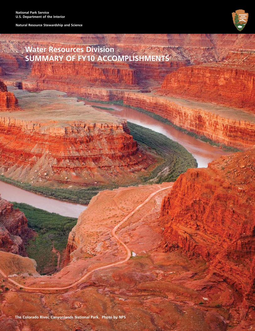
The Colorado River, Canyonlands National Park. Photo by NPS
National Park ServiceU.S. Department of the Interior
Natural Resource Stewardship and Science

Autumn Whirlpool, Great Smoky Mountains. Photo by Gavin Emmons.

Water Resources Division SUMMARY OF FY10 ACCOMPLISHMENTS
Natural Resource Stewardship and Science 1201 Oakridge Drive, Suite 250Fort Collins, CO 80525
National Park Service
U.S. Department of the InteriorWashington, DC
A moose enjoying the Brooks River in Katmai National Park and Preserve, Alaska. (NPS Photo)

A leaning pine. Yosemite National Park, California. (Photo By Dan Ng)
Appendix A - Technical Assistance ..................................................................................................................... 28
Appendix B - Summary of Water Resources Division Funding ................................................................ 53
Appendix C - Awards/Publications/Presentations/Webinars .................................................................. 67
Appendix D - Staff .................................................................................................................................................... 73
Contents
Comments from the Division Chief ...................................................................................................................... 5Examples of Water Resources Division 2010 Technical Assistance Activities ...................................................................................................... 6
Oceans and Coastal Resources Highlights ......................................................................................................... 8Coastal Marine Natural Resource Condition Assessments Off er Insights ............................................................................................................ 9The Development and Implementation of Zebra Mussels Response Plan for Isle Royale National Park ................................................. 10Monitoring Ocean Acidifi cation in the National Park Service ................................................................................................................................... 11The Water Resource Division Response to the Gulf of Mexico Oil Spill ................................................................................................................. 12Partnering with USEPA to Document Water Quality in Coastal National Parks .................................................................................................. 13
Planning and Evaluation Highlights .................................................................................................................... 14Resource Stewardship (RSS) Workshop: Lessons Learned from Pilot Parks and the Future Course of the Resource Stewardship Strategy Process ......................................................................................................................................................................................................................... 15Climate Change: Planning for an Uncertain Future ...................................................................................................................................................... 16
Water Operations Highlights ................................................................................................................................. 17Elwha River Restoration Project Update .......................................................................................................................................................................... 18Sometimes the Well is Dry .................................................................................................................................................................................................... 19Completion of a Proposed Design Grade for Prisoners Harbor Coastal Wetland Restoration Project, Channel Islands Park .......... 20
Water Rights Highlights ........................................................................................................................................... 21Automated Groundwater Monitoring System Completed at Great Sand Dunes National Park and Preserve ...................................... 22Solar Energy Company and NPS Agree to Protect Devil’s Hole (Death Valley National Park) ...................................................................... 23Land Acquisition and Water Rights .................................................................................................................................................................................... 24Long-Term Resource Monitoring along the Gunnison River in the Black Canyon of the Gunnison National Park ............................. 25
Natural Resource Challenge Aquatic Resource Field Professionals Highlights .................................. 26
Mountain Lion looking for a cool drink in Grand Teton National Park,Wyoming. (NPS Photo)

4 Water Resource Division Summary of FY09 Accomplishments
If space allows, it is recommended that the text begin on the opposite page and that this page contain photographic or illustrative material.
Refelection of the Fins, Arches National Park (NPS Photo)

Water Resources Division Summary of FY10 Accomplishments National Park Service 5
This report represents the 20th consecu-tive annual summary of the accomplish-ments of the National Park Service Water Resources Division (WRD), including a full account of our budget and the services provided to the various units of the National Park System. The report is a
collaborative eff ort of the entire WRD staff , and in preparing it we have the opportunity to stand back and take stock of the variety and breadth of the issues with which we’ve been involved, and the great number of talented and dedicated people throughout the Service with whom we’ve worked.
In 2010 the Water Resources Division (WRD) continued oversight and implementation of four Natural Resource Challenge Programs: Vital Signs Water Quality Monitoring; Natural Resource Condition Assessments; Field-based aquatic resource management specialist positions; and Water Resource protection projects. Vital signs water quality monitoring protocols have been approved and water quality monitoring is being conducted in all 32 Inventory and Monitoring Networks; WRD continues to assist the data management compo-nents of Network water quality monitoring. Updated service wide guidance was issued for conducting Natural Resource Condition Assessments and nine park condition assessment fi nal reports were completed in 2010. Fourteen fi eld-based aquatic resource profes-sional positions were funded in 2010 with vacant positions being fi lled at Jean Lafette NHP and Chattanooga, TN. The WRD Water Rights Branch supported approximately $600,000 of park water resource protection projects in 12 parks in 2010; focus of these projects centered around the protection of ground water including resources at Great Basin NP, Great Sand Dunes NP, Lake Mead NRA, Death Valley NP, and Wind Cave NP.
The year also brought implementation of the fi rst year of new fund-ing for NPS Ocean and Coastal Resource Management. The focus of the program has been on building park-based capacity to imple-ment Regional NPS Ocean Park Stewardship Action Plans and to support implementation of a new 2010 Executive Order on Ocean Stewardship. Three fi eld-based Regional Ocean Stewardship Special-ist positions were established, new park-focused senior ocean fi sher-ies, and marine water quality positions were fi lled, and a park project funding program was initiated.
A number of high visibility issues and programs of the Directorate were supported by WRD in 2010. The Division continued to be rep-resented on the Superintendents’ Colorado River Steering Commit-tee and supported a number of Colorado River water management
issues aff ecting the 8 Colorado River parks including Black Can-yon of the Gunnison Water Rights and Aspinal Unit Operations, Glen Canyon Dam Adaptive Management, Colorado River Annual Operations, and Quagga/Zebra Mussel prevention. The WRD supported an Administration priority to develop renewable en-ergy resources on public lands by reviewing fast-track solar de-velopment project proposals to insure that park water resources would be protected, and participated in the BLM-lead develop-ment of a programmatic environmental impact statement for so-lar energy development. WRD is supporting implementation of the Secretary of Interior’s new WaterSMART program – a program to help better manage water shortages in an era of expanding demand and climate change. The Division continues to assist the Director in the implementation of the new NPS Wild and Scenic Rivers Program, and beginning in 2010 is providing leadership to the implementation of the Resource Stewardship Strategy com-ponent of the NPS planning program.
Response to the Gulf of Mexico Oil Spill became a priority of the Division in 2010. Three WRD staff participated in details to incident command centers to assist in Natural Resource Damage Assessment aspects of the incident, and 2 WRD staff participated nearly full-time on working groups charged with developing and implementing damage assessment sampling protocols. In addi-tion, 5 of the WRD fi eld-supported positions assisted in resource damage assessment aspects of the spill.
The core component of WRD’s activities in 2010 continued to be the technical assistance and project support provided to parks. Over 120 parks obtained technical assistance by WRD in 2010. Examples of 2010 technical assistance highlights are provided in the sidebar to this article.
In 2010 WRD hosted the 9th bi-annual service wide water and aquatic resources meeting this past February in Fort Collins, Colorado. My (slightly biased) assessment was that this was the best and most informative gathering ever of water and aquatic resource professionals from throughout the Service. Through concurrent technical sessions and workshops, attendees shared many of the water and aquatic resource management issues and activities being addressed in parks, and we discussed ways to better share our expertise and collaborate.
Comments from the Division Chief
Bill Jackson, PhD
Water Resources Division Summary of FY10 Accomplishments National Park Service 6
Through a series of impressive keynote addresses, we also took a hard look at many of the challenges confronting the NPS water resource management mission including: the emerging crisis in water availability; emerging contaminants in waters; legal and institutional barriers to addressing climate change; and the challenges stemming from the nexus between water use and energy development.
As we look forward to 2011, WRD will continue to strive to meet the highest standards of professionalism in our work and in our service to our National Park managers. Over the years we have taken great pride in knowing that collaboratively, with our park-based peers, we have made a diff erence and the water resources and aquatic environments of the National Parks are better preserved for our eff orts. I hope you will enjoy reading about some of these many accomplishments in the short articles to follow, and we look forward to working with you in 2011.
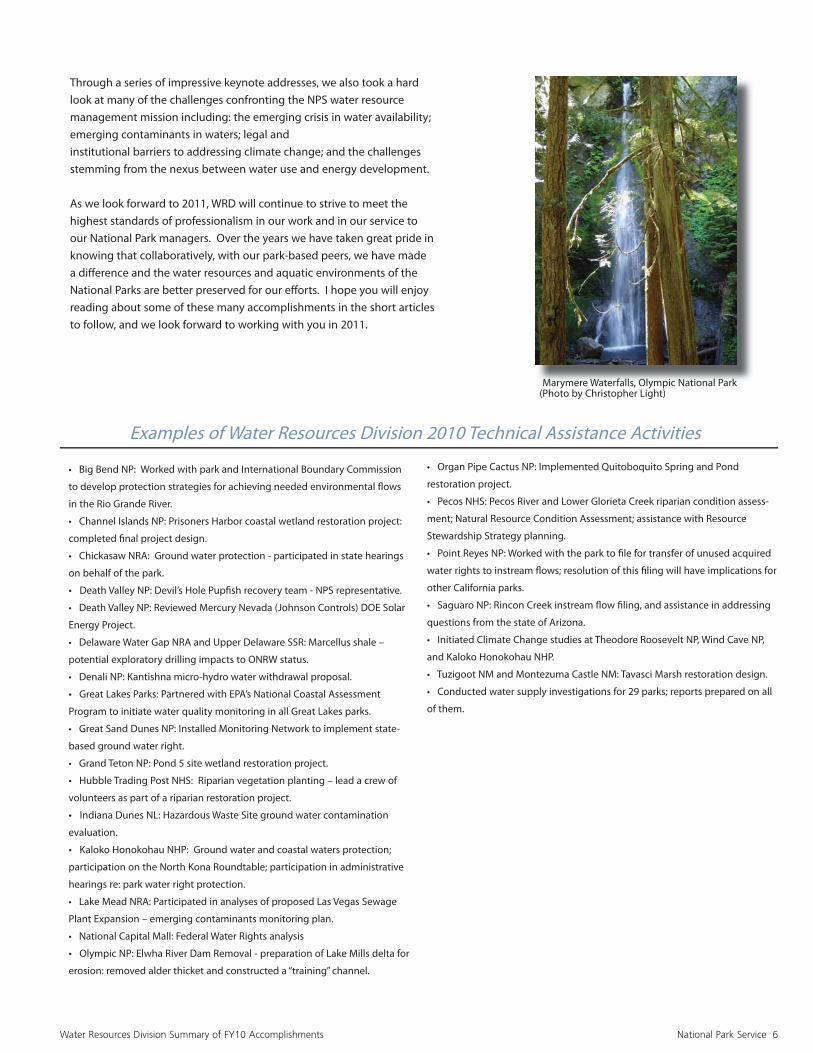
Marymere Waterfalls, Olympic National Park (Photo by Christopher Light)
Examples of Water Resources Division 2010 Technical Assistance Activities
• Big Bend NP: Worked with park and International Boundary Commission
to develop protection strategies for achieving needed environmental fl ows
in the Rio Grande River.
• Channel Islands NP: Prisoners Harbor coastal wetland restoration project:
completed fi nal project design.
• Chickasaw NRA: Ground water protection - participated in state hearings
on behalf of the park.
• Death Valley NP: Devil’s Hole Pupfi sh recovery team - NPS representative.
• Death Valley NP: Reviewed Mercury Nevada (Johnson Controls) DOE Solar
Energy Project.
• Delaware Water Gap NRA and Upper Delaware SSR: Marcellus shale –
potential exploratory drilling impacts to ONRW status.
• Denali NP: Kantishna micro-hydro water withdrawal proposal.
• Great Lakes Parks: Partnered with EPA’s National Coastal Assessment
Program to initiate water quality monitoring in all Great Lakes parks.
• Great Sand Dunes NP: Installed Monitoring Network to implement state-
based ground water right.
• Grand Teton NP: Pond 5 site wetland restoration project.
• Hubble Trading Post NHS: Riparian vegetation planting – lead a crew of
volunteers as part of a riparian restoration project.
• Indiana Dunes NL: Hazardous Waste Site ground water contamination
evaluation.
• Kaloko Honokohau NHP: Ground water and coastal waters protection;
participation on the North Kona Roundtable; participation in administrative
hearings re: park water right protection.
• Lake Mead NRA: Participated in analyses of proposed Las Vegas Sewage
Plant Expansion – emerging contaminants monitoring plan.
• National Capital Mall: Federal Water Rights analysis
• Olympic NP: Elwha River Dam Removal - preparation of Lake Mills delta for
erosion: removed alder thicket and constructed a “training” channel.
• Organ Pipe Cactus NP: Implemented Quitoboquito Spring and Pond
restoration project.
• Pecos NHS: Pecos River and Lower Glorieta Creek riparian condition assess-
ment; Natural Resource Condition Assessment; assistance with Resource
Stewardship Strategy planning.
• Point Reyes NP: Worked with the park to fi le for transfer of unused acquired
water rights to instream fl ows; resolution of this fi ling will have implications for
other California parks.
• Saguaro NP: Rincon Creek instream fl ow fi ling, and assistance in addressing
questions from the state of Arizona.
• Initiated Climate Change studies at Theodore Roosevelt NP, Wind Cave NP,
and Kaloko Honokohau NHP.
• Tuzigoot NM and Montezuma Castle NM: Tavasci Marsh restoration design.
• Conducted water supply investigations for 29 parks; reports prepared on all
of them.

7 Water Resource Division Summary of FY09 Accomplishments
If space allows, it is recommended that the text begin on the opposite page and that this page contain photographic or illustrative material. Rialto Beach, Olympic National Park, Washington. Photo by NPS

Ocean and Coastal Resources Highlights National Park Service 8
Oceans and Coastal Resources Highlights
Jeff rey Cross, Branch ChiefOcean and Coastal Resources Branch
The Ocean and Coastal Resources Branch (OCRB) is responsible for leadership and coordination of NPS ocean responsibilities, policies, and interests in the Natural Resource Stewardship and Science Directorate. The goals of the Branch are to acquire broad-based support in ocean and coastal sciences and technologies, develop servicewide ocean policies and programs, and provide technical assistance and support to parks.
The NPS 2006 Ocean Park Stewardship Action Plan calls for increasing the organizational and scientifi c emphasis to manage over 12,000 miles of coast and more than 2,500,000 acres of ocean and Great Lakes waters across 26 states and territories. The Ocean and Coastal Re-sources Branch provides the organizational structure and focus for coordination within the NRPC and with parks, regional offi ces, the Submerged Resources Center, and other entities to meet servicewide goals for ocean and coastal resource stewardship.
The branch provides leadership in developing short and long-term strategies for enhancing the NPS scientifi c, technical, and organizational capacity for ocean and coastal resource stewardship. The Branch works closely with the Geologic Resources, Biological Resources Manage-ment, and Environmental Quality divisions on critical park science and management needs. The Branch also works closely with National Oceanic and Atmospheric Administration, the U.S. Geological Survey, the U.S. Enviromental Protection Agency, other federal and state agen-cies, universities and private partners to further the goals of ocean and coastal stewardship.
During 2010, OCRB staff provided a variety of servicewide and park-specifi c technical assistance, coordinated multiple Coastal Watershed Assessment and Benthic Habitat Mapping Program projects in ocean and coastal parks, and provided policy guidance and support to parks and regions. These programs are described in separate articles. Signifi cant accomplishments under the Ocean Park Stewardship Action Plan include participation on DOI’s Senior Ocean Policy Team, which contributed to the development of the Administration’s new National Ocean Policy; the nomination and acceptance of 29 NPS units on the National System of Marine Protected Areas and participation in the Deepwa-ter Horizon Oil Spill. For more information, see http://www.nps.gov/pub_aff /oceans/conserve.htm and http://www.nature.nps.gov/water/marine.cfm.

National Park Service 9
Coastal Marine Natural Resource Condition Assessments Off er Insights
Jeff ery Cross, Branch Chief
Eff orts began in 2003 to assess coastal water resources and watershed conditions for coastal parks through the Natural Resource Challenge. Reports from these assessments characterize the relative health or status of upland, wetland, ripar-ian, marine, estuarine and Great Lakes resources within the National Park System. Working through partnerships with universities in the Cooperative Ecosystem Studies Units, collaborations with other federal agencies and contracts with pri-vate organizations, 32 of these reports have been published and 15 others are in progress. In FY10, assessment reports were published for three coastal parks – Kenai Fjords National Park (KEFJ), Isle Royale National Park (ISRO) and Kalaupapa National Historic Park (KALA).
Assessment reports provide valuable insights into factors aff ecting the health of park resources for use by natural resource managers. Some interesting information from therecently published reports includes:
• KEFJ-The northward migration of escaped farmed Atlantic salmon and other non-native migrating species poses threats to indigenous salmon and trout through disease, colonization, interbreeding, predation, habitat destruction and competition.
• ISRO-Although isolated from the mainland, ISRO is exposed to pollutants through Lake Superior waters and atmospheric deposition. Lake Superior contains measurable levels of mercury and other toxic metals, various pes-ticides and other organic compounds. Atmospheric deposition is the major source of mercury and persistent organic pollutants. Large facilities near ISRO produce compounds that are linked to smog and acid rain.
• KALA-Waikolu stream contains a rich assemblage of fi ve native amphidro-mous fi sh species, has one of the highest densities of stream gobies in the Hawaiian Islands and supports a dense population of the uncommon native stream snail Neritina granosa.
For more information on these and other coastal parks, please visit our web-site at: (http://www.nature.nps.gov/water/watershed_reports/wscondrpts.cfm).
National Park Service 10
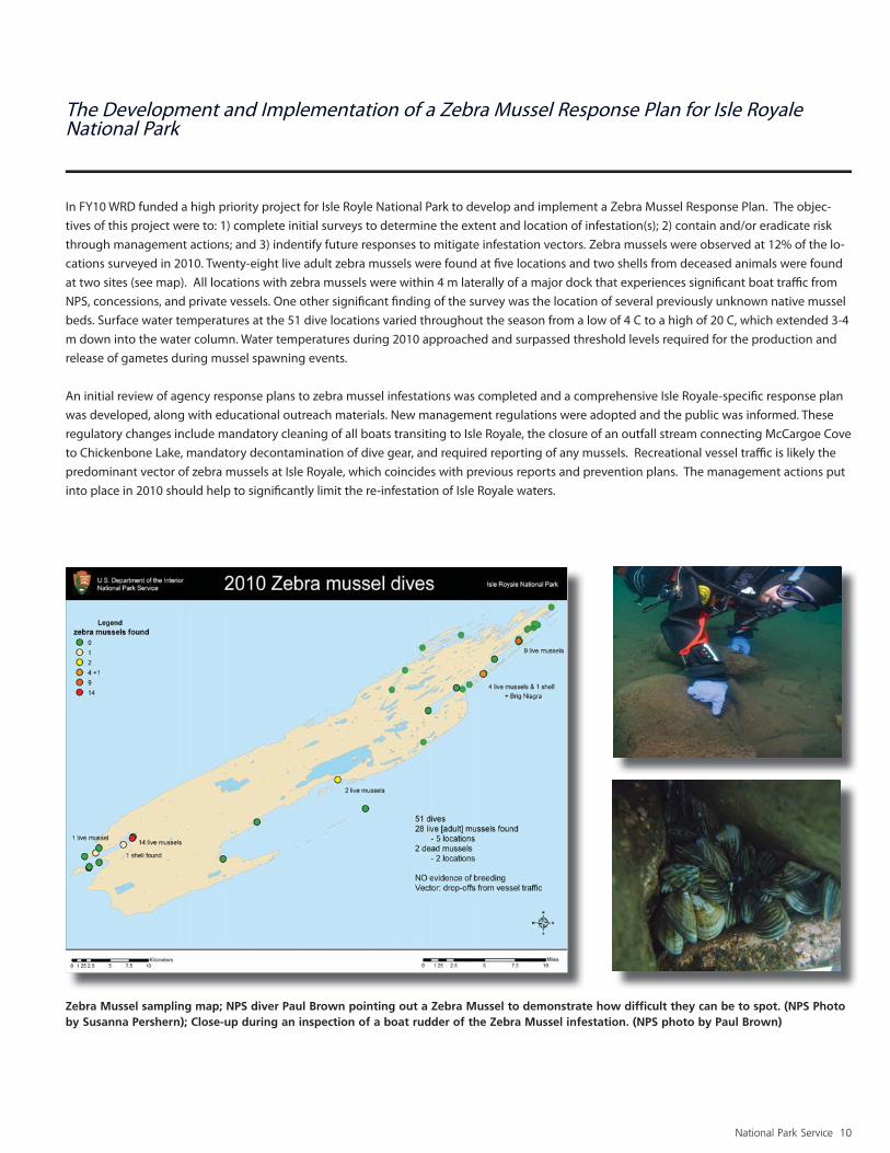
The Development and Implementation of a Zebra Mussel Response Plan for Isle Royale National Park
In FY10 WRD funded a high priority project for Isle Royle National Park to develop and implement a Zebra Mussel Response Plan. The objec-tives of this project were to: 1) complete initial surveys to determine the extent and location of infestation(s); 2) contain and/or eradicate risk through management actions; and 3) indentify future responses to mitigate infestation vectors. Zebra mussels were observed at 12% of the lo-cations surveyed in 2010. Twenty-eight live adult zebra mussels were found at fi ve locations and two shells from deceased animals were found at two sites (see map). All locations with zebra mussels were within 4 m laterally of a major dock that experiences signifi cant boat traffi c from NPS, concessions, and private vessels. One other signifi cant fi nding of the survey was the location of several previously unknown native mussel beds. Surface water temperatures at the 51 dive locations varied throughout the season from a low of 4 C to a high of 20 C, which extended 3-4 m down into the water column. Water temperatures during 2010 approached and surpassed threshold levels required for the production and release of gametes during mussel spawning events.
An initial review of agency response plans to zebra mussel infestations was completed and a comprehensive Isle Royale-specifi c response plan was developed, along with educational outreach materials. New management regulations were adopted and the public was informed. These regulatory changes include mandatory cleaning of all boats transiting to Isle Royale, the closure of an outfall stream connecting McCargoe Cove to Chickenbone Lake, mandatory decontamination of dive gear, and required reporting of any mussels. Recreational vessel traffi c is likely the predominant vector of zebra mussels at Isle Royale, which coincides with previous reports and prevention plans. The management actions put into place in 2010 should help to signifi cantly limit the re-infestation of Isle Royale waters.
Zebra Mussel sampling map; NPS diver Paul Brown pointing out a Zebra Mussel to demonstrate how diffi cult they can be to spot. (NPS Photo by Susanna Pershern); Close-up during an inspection of a boat rudder of the Zebra Mussel infestation. (NPS photo by Paul Brown)

National Park Service 11
Housing for a multiprobe datasonde to monitor ocean acidifi cation in a low elevation tidepool at Sokol Point, Olympic National Park (NPS Photo Credit: Steve Fradkin); Housing containing a multiprobe data sonde to monitor ocean acidifi cation in a low elevation tidepool at Brown’s Point, Olympic National Park. (NPS Photo Credit: Steve Fradkin)
Monitoring Ocean Acidifi cation in the National Park Service
One facet of climate change aff ecting marine ecosystems is the observed decrease in ocean pH over the past 20 years as a consequence of elevated CO2 levels. Atmospheric CO2 reacts with seawater to reduce pH and reduce the concentration of carbonate ions that are essential building blocks of shell-building marine organisms, such as corals, plankton and shellfi sh. NPS marine resources are particularly susceptible. While national ocean acidifi cation monitoring eff orts exist in off shore areas, there is a need to assess acidifi cation trends in NPS units because of regional and local variation in acidifi cation. Current methods for measuring ocean acidifi cation include chemical analyses targeting the ocean carbon dioxide system, which requires analytical laboratories and specialized instrumentation not feasible for routine implementation in NPS units.
In FY10, the Ocean and Coastal Resources Branch funded a pilot project at Olympic National Park (OLYM) to monitor nearshore ocean pH using standard multi-probe datasondes. The objectives of this project are to: 1) deploy monitoring devices that measure physical/chemical param-eters at two locations in the intertidal zone along the OLYM coast, and collect and analyze water samples from these locations; 2) use the data to model pH levels in coastal waters to develop a baseline for long-term monitoring of ocean acidifi cation; and 3) document project results into products that can be transfered to monitoring programs in other NPS units.

National Park Service 12
The Water Resources Division Response to the Gulf of Mexico Oil Spill
During FY 2010, the Water Resources Division (WRD) Fort Collins staff and WRD supported fi eld staff have contributed over 2,000 hours to oil spill eff orts. Support was provided to response eff orts by: 1) staffi ng interagency Natural Resource Damage Assessment (NRDA) eff orts co-located with the incident command centers at Houma (Jeff Cross, Gary Rosenlieb, Joe Chafey), in Mobile (Bill Jackson, Jalyn Cummings, Patty Raff erty) and in Roberts (Marie Denn) and 2) assisting the response by serving as NPS Resource Advisors with shoreline clean-up crews at Gulf Islands NS (Bill Jackson, Jalyn Cummings, Patty Raff erty, Mark Ford).
NRDA eff orts associated with this spill stem from the The Oil Pollution Act. This Act authorizes certain federal agencies, states and Indian tribes, collectively known as the ‘Trustees’ to evaluate the impacts of an oil spill on natural resources. As part of this process, scientists from each Trustee entity work together to identify potential injuries to natural resources resulting from the spill and to design studies that will be used to determine and measure spill-related injuries (or impacts) to natural resources and their human uses. Although this process started in 2010, those working on the NRDA case will remain involved until a settlement has been reached with the Responsible Party. Support provided by WRD for NRDA eff orts include: assisting in the fi eld implementation of shorebird protocols (Joe Chafey) and representing NPS on NRDA protocol work groups. Eva DiDonato serves as co-lead on the Submerged Aquatic Vegetation (SAV) Technical Workgroup (TWG), Roy Irwin serves on the Chemistry, Water Column and Toxicity Technical Work Groups and also assists in data interpretation, Mark Ford serves on the Shoreline and SAV TWGs and Jeff Duncan serves on the Fish and Shellfi sh TWGs.
Tar balls on Pensacola Beach, Gulf Islands National Seashore. (NPS Photo)
Northern Gannet collected on West Ship Island, Gulf Island National Seashore for oil recovery treatment. (NPS Photo)

National Park Service 13
Partnering with USEPA to Document Water Quality in Coastal National Parks
Water quality is currently assessed within most National Park bound-aries but the assessments are not consistent nationwide, nor do they extend outside park boundaries. With the development of the 2006 Ocean Park Stewardship Action Plan and the formation of the Ocean and Coastal Resources Branch in the Natural Resource Program Cen-ter, the National Park Service is focusing more eff ort on water quality issues beyond park shorelines. The probabilistic survey design used by the USEPA National Coastal Assessment Program provides a mecha-nism to assess the quality of park waters and to identify water quality issues that may impact park resources, but originate beyond park boundaries. NPS benefi ts in several ways from using the probabilistic survey design to assess and monitor coastal water quality. At the indi-vidual park level, managers get a snapshot of resource conditions. At the regional level, combining both NPS and EPA data, managers can compare water and sediment quality inside and outside park bound-aries increasing the big picture information for Great Lakes Parks. In FY’10 a partnership developed between the NPS Natural Resource Program Center (Fort Collins and Great Lakes staff ) and the EPA Na-tional Coastal Condition Assessment to survey water quality at Great Lakes National Parks in harmony with the planned 2010 EPA Great Lakes survey. A design for the Great Lakes Parks was developed, and 30 sites within Lake Superior and 30 sites within Lake Michigan park boundaries were sampled during the summer of 2010. Data analysis and reporting will be completed in cooperation with EPA during 2011. The EPA is considering some of the NPS sites as reference sites for the Lakes.
Funding for this project was provided to NPS through the Great Lakes Restoration Initiative for ‘Comprehensive Marine Assessments’, to acquire local data on water quality and ecosystem integrity.
Maps By NPS.
Planning and Evaluations Highlights National Park Service 14
The Planning and Evaluation Branch (PEB) provides technical assistance to parks and program leadership to NPS in three areas: water resources planning, wetlands protection and restoration, and fi sheries management.
In the planning arena, PEB staff provided substantial assistance to the NPS Climate Change Response Program (CCRP) during 2010. This included involvement in CCRP eff orts to develop climate change scenario planning processes and tools, and participation in CCRP planning and technical advisory groups. PEB staff also led or participated in 10 park-based planning studies. Examples include a water resources information overview for Bents Old Fort National Historic Site, a water resources foundation report for Big Thicket National Preserve, and a physical resourc-es issue report at Great Smoky Mountains National Park. PEB was also assigned the leadership role for implementing a fl edgling Resource Stew-ardship Strategy (RSS) Program. PEB staff is presently working to revise RSS project guidelines based on the outcomes from a Pilot RSS Project Workshop conducted during Spring, 2010.
During 2010, the wetlands program provided technical assistance to park units in all seven NPS regions. This included wetland compliance reviews for approximately 30 parks to ensure park activities or proposed actions were in compliance with NPS wetland policies and procedures. It also included a riparian functional assessment at Pecos National Historic Park, problem diagnosis and recommendation formulations for a va-riety of wetland related issues at Yosemite Natonal Park, and wetlands restoration related support for a number of park units. Examples include restoration planning at Channel Islands National Park and Tuzigoot National Monument, and oversight of earthmoving and revegetation work at John D. Rockefeller Jr. Memorial Parkway.
Fisheries program activities included a mix of policy support to national and regional offi ces and technical support to individual park units. Policy support included participation in developing quagga and zebra mussel (and other nuisance species) prevention plans, and acting as NPS representative in partnerships such as the Western Native Trout Initiative and the Desert Fishes Habitat Partnership. Park level support included peer review for the Devil’s Hole Ecosystem Monitoring Plan, onsite investigations and monitoring plan development in support of the endan-gered Topeka shiner at Tallgrass Prairie National Preserve, and assistance with native fi sh habitat restoration eff orts at a number of NPS sites including Great Smoky Mountains National Park and North Cascades National Park.
Planning and Evaluation Highlights
Jeff Albright , Acting Branch ChiefPlanning and Evaluation Branch

National Park Service 15
Resource Stewardship Strategy (RSS) Workshop: Lessons Learned from Pilot Parks and the Future Course of the Resource Stewardship Strategy Process
by Guy Adema, Natural Resources Program Manager; Denali National Park and Preserve
David Vana-Miller and Don Weeks, Hydrologists; Planning and Evaluation Branch
Resource Stewardship Strategies were initiated in 2006 to provide a framework for establishing integrated strategic plans for resource management. RSS were envisioned to provide an interdisciplinary and comprehensive approach to park management and to defi ne activi-ties for investment that would directly aff ect a park’s fundamental re-sources and values. In January 2010, the senior author began a detail to the Water Resources Planning Program to evaluate the funded RSS eff orts at pilot parks, and, based on the experience of those eff orts, develop recommendations for implementation of a RSS program. The review included interviews with park, regional, and Washington staff and culminated in a workshop convening thirty-two participants from both natural and cultural resources from April 13-15 in Ft Collins, CO.
Fourteen park staff , nine members of the Natural Resource Program Center, seven regional staff , and two Denver Service Center planners attended. Participants assessed pilot RSS from HEHO, DENA, PORE, and MONO, on four main themes: 1) What are the most and least use-ful elements of each pilot product? 2) Are there innovative ideas from a pilot worth adopting programmatically? 3) What are the reported and observed strengths and weaknesses of existing guidance? and 4) What specifi c changes in guidance would have produced a better product? This assessment also included a broader discussion on eff ec-tive interdisciplinary integration, implementation of the RSS process, and the relation of the RSS to other planning eff orts, such as how to eff ectively integrating climate change. Additional topic areas covered during the workshop included the purpose of RSS and their role in the NPS planning framework, the RSS draft Director’s Order and ideas for improvement of NPS RSS policy, and the NPS resource planning program identifi cation of core functions. Participants developed rec-ommendations for these topics, such as suggesting what eff ective support and leadership is ideal for the fi eld, what are the regional needs for successful program implementation, regional needs for a successful program, and the need for an organizational home and program manager at the WASO level.
After the workshop, the administration of the RSS pilot program and the responsibility for charting its future course was transferred to the junior authors in the Water Resources Planning Program.

National Park Service 16
Alaska Climate Change Scenario Planning Workshop, Anchorage, Alaska (Weeks, 2010)
The NPS Water Resources Division’s (WRD’s) Planning Program has progressed over the past two decades, changing services and planning products to meet the evolving needs of parks and regions.
A changing climate presents our latest planning challenge as science reveals a range of potential climate futures park managers could be addressing. Some of the climate-related infl uences are unprecedented and test traditional park planning and management as we move toward these uncertain futures.
In 2009 and 2010, WRD’s Planning Program staff worked with the NPS Climate Change Response Program (CCRP) to explore the use of scenario planning as an approach for park management within a range of plausible climate futures. Scenario planning is a proven process used over the past several decades in the private and public sector to manage for uncertain futures, and it seemed an appropriate process for the NPS to explore within the context of a changing climate. The CCRP completed fi ve case studies to test the use of Climate Change Scenario Planning in the NPS, with favorable reaction.
Building from the lessons learned during these case studies, a NPS core team, including WRD staff , implemented the next phase of Climate Change Scenario Planning. Under guidance of the Global Business Network, the world’s largest consultancy integrating scenarios and strategy, this second phase centered around training land managers from both within and outside the NPS on the Climate Change Scenario Planning process. Introducing this process as a planning tool to other land managers makes sense as we move toward cooperative management within larger landscape scales (i.e., Landscape Conservation Cooperatives).
Four training workshops were scheduled to accomplish the training, each focused on specifi c bioregional landscapes. The fi rst workshop, Alaska’s Arctic and Coastal bioregions, was completed in August 2010. The NPS Alaska Region, building from this training workshop, will be applying the Climate Change Scenario Planning process to all four Alaska networks starting in FY2011.
The knowledge and experiences gained from participating in this eff ort have been brought back to WRD’s planning program, as we continue to evolve in an ever-changing world.
Climate Change: Planning for an Uncertain Future
Don Weeks, Hydrologist;David Vana-Miller,
Planning Program Leader;Planning and Evaluation Branch

Water Operations Highlights National Park Service 17
Water Operations Highlights
Gary W. Rosenlieb, Branch Chief
The Water Operations Branch (WOB) manages servicewide pro-grams in Water Quality, Hydrology and Watershed Management and Water Resources and Information Management. Program funds managed for servicewide distribution by these programs include the Watershed Condition Assessment Program, Vital Signs Water Quality Monitoring, and the USGS-NPS Water Quality Partnership.
The branch provides technical assistance to parks, regions and monitoring networks in each of these areas and 2010 proved to be a very busy and rewarding year for us. The entire National Park Service was mobilized to help respond to the Deep Water Horizon oil spill and WOB was no exception. Roy Irwin contributed to and is still active on several Technical Working Groups working on the assessments of resource damages, including the Chemistry, Water Column and Toxicology workgroups. Branch Chief Gary Rosenlieb was mobilized to the Houma , Louisiana Incident command cen-ter where he served two weeks on the National Oceanographic and Atmospheric Administration’ s Natural Resource Damage Assessment group.
The branch provided full funding and technical assistance to 32 Vital Signs Monitoring Networks. In support of servicewide water quality data analysis and archiving, Dean Tucker Released NPSTORET v.1.82 which featured a variety of enhancements and new features suggested by users, includ-ing the ability to compare water quality data to multiple stan-dards including: user-defi ned, state, or national water quality standards. Water quality analyses could then be displayed spatially using Google Earth. In addition the Branch provided reviews and/or approvals of 11 water quality protocols sub-mitted by the networks. A notable new technical assistance eff ort acquired this year included Pete Penoyer’s support of parks in the Northeast Region by serving on an interagency team that developed expert witness testimony on potential impacts to water resources from natural gas development in the Marcellus shale.
Natural Resource Condition Assessments are now being com-pleted in increasing numbers after issuance of revised guide-lines under the stewardship of Jeff Albright. Final assessment reports were completed at the following 5 parks: John Day Fossil Beds National Monument, Minute Man National Histori-cal Park, Mount Rushmore
Rocky Mountain National Park. Drafts were submitted for review from 5 other parks including: Wrangell St. Elias National Park and Preserve, Assateague National Seashore, Delaware Water Gap National Recreation Area, Upper Delaware Scenic and Recreational River and Isle Royale National Park.
The Hydrology and Watershed Management Program continued to provide leadership for the implementation of fl oodplain man-agement and Natural Resource Condition Assessments and water supply investigations. Gary Smillie and Mike Martin provided assistance on 31 Floodplain Statement of fi ndings, including a suc-cessful re-scoping of a contract to perform engineering analysis of fl ood risk and stormwater management in the Black Rock Camp-ground. This project itself saved the NPS about $150,000. Larry Martin conducted or assisted with 29 groundwater supply investi-gations. Unfortunately, not all of them are successful as his article exhibits in the following pages on exploring for water at Capitol Reef National Park.
Restoration of ecosystems comprises an ever increasing number of technical assistance requests received by the Hydrology program. Two articles following this introduction provide some examples into our assistance eff orts. Gary Smillie provides interesting in-sights into the very initial phases of the Elwha River restoration at Olympic National Park in his article promoting effi cient erosion of the Lake Mills Delta. Restoration of a coastal wetland at Channel Islands National Park is the subject of an article contributed by Mike Martin.
We in WOB enjoy working with all of the parks on any water re-sources management issue. We are available to assist you through a phone call, email or a visit to your park.

National Park Service 18
Elwha River Restoration Project Update
Gary Smillie, Hydrology Program Team LeaderWater Operations Branch
Lake Mills delta and Elwha River, November, 2010. Notice: 1) most river fl ow is in the recently constructed center channel, 2) “bathtub” ring in the lake is due to reservoir draw down, and 3) active erosion and redistri-bution of delta sediments. (Photo by NPS)
Two dams on the Elwha River on the Olympic Peninsula in Washington State are scheduled to be removed starting fall 2011, to restore an important anadromous fi shery and other natural fl uvial and riparian conditions. The upper dam and reservoir, Glines Canyon Dam and Lake Mills, are located in Olympic National Park. In the approximately 90 year period since Glines Canyon Dam was completed, a large delta, approximately 70 feet high has developed at the head of Lake Mills. Restoration of fl uvial conditions through this region of the lake requires redistribution of these delta sediments. As such, effi cient erosion of the delta by the river during dam removal is a crucial aspect of the sediment management component of the project. In recent years, however, woody vegetation became established on the delta surface and a large debris jam formed, blocking the river from fl owing down the center of the delta. These conditions made rapid erosion of the delta by the river unlikely. WRD staff working with engineers from the Bureau of Reclamation identifi ed the problem and collaborated to correct the situation. Heavy equipment was brought to the delta during the fall of 2010 to remove vegetation and construct a pilot channel down the center of the delta. Additionally, the debris jam at the head of the delta was removed and relocated into a position to direct future fl ows into the pilot channel. As of late fall 2010, the Elwha River is fl owing primarily down the newly excavated center channel (see picture above). To encourage incision of the new channel, Lake Mills has been drawn down approximately 15 feet from full pool level, increasing the fl ow gradient over the delta. The lake will continue to be periodically drawn down prior to dam removal to give a “head start” to the erosional processes necessary for successful restoration of fl uvial conditions.

National Park Service 19
Sometimes the Well is Dry
Larry Martin, HydrogeologistWater Operations Branch
The Capitol Reef Field Station was established in 2008 as a cooperative venture of Utah Valley University and Capitol Reef National Park to provide a facility for education and research opportunities in the Parks natural history. The fi eld station currently obtains water from a shallow well completed in the alluvium of Pleasant Creek. Water from the well is classifi ed as “under the direct infl uence of surface water” due to the shallow depth and close association with water in Pleasant Creek. Since treatment of surface water at this remote location would be expensive, it was decided to drill a test well to explore for groundwater in the Sinbad Limestone Member of the Moenkopi Formation and the Kaibab Lime-stone Formation. Test drilling in August 2010 to a depth of 860 feet resulted in dismaying results: a deep hole that was totally dry. The borehole was subsequently plugged and abandoned, and the university was left with no option. They will need to upgrade the water treatment facilities to comply with Utah regulations for treatment of water from a surface-water source.
“When the well is dry, we know the worth of water.”
BENJAMIN FRANKLIN, (1706-1790), Poor Richard’s Almanac, 1746
Test Well comes up dry. Capital Reef National Park, Utah. (Photo by Larry Martin)

National Park Service 20
Areial photograph of Prisoners Harbor with surveyed boundary of the proposed restoration area. Green points are recoverable reference points.
Restoration area (90 percent design grade) with blue mean annual water table contours (CI = 0.05 m), black topographic contours (CI = 0.2 m) and vegetation communities. X and Y coordinates are derived from UTM zone 10, elevations are NAD83, all units are meters. The following colors represent the diff erent vegetation communities:
Dark Blue – open waterLight Blue – deep fringe marsh Light Green – shallow marshDark Green – wet willowTan – salt grass, dry willow
Completion of a Proposed Design Grade for Prisoners Harbor Coastal Wetland Restoration Project, Channel Islands National Park.
Michael Martin, Hydrologist; Joel Wagner, Hydrologist; Water Resources Division and Paula Power
WRD is assisting Channel Islands National Park in restoring a coastal wetland at Prison-ers Harbor, Santa Cruz Island. The former wetland was fi lled in the late 19th century to support a sheep ranching operation. During FY2010, WRD staff completed a detailed topographic survey of the site using total station and geodetic platforms. We used these data to produce detailed topographic maps of the existing land surface and the mean annual water table, which in turn were used to create a restoration design. Topographic and water table contours were developed with spatial analysis software; Surfer ™ using standard kriging grid development. The restoration design was based on information gathered at a reference transect established in a remnant, undisturbed wetland area where diff erent vegetation communities were correlated with mean an-nual water table elevations. These communities ranged from very wet environments that support California bulrush (Schoenoplectus californicus) through less saturated willow environments and into relatively dry salt grass (Distichlis spicata) elevations.
The restoration design began as a conceptual drawing with the various vegetation communities represented as polygons. To produce the proposed grading plan, we started with the mean annual water table elevations and either added or subtracted increments of elevation to reach grades that correspond to desired vegetation communities. Careful consideration was given to wetland function in designing the orientation of the communities. For example, most of the perimeter of the project area is surrounded by elevations that will support willow stands to provide screening and cover for waterfowl. Additionally, several vistas were maintained to enhance visitor experience and provide opportunities for interpretation. Lastly, the existing topographic map and the proposed design plan were “merged” to accurately estimate the amount of fi ll that will need to be excavated for the restoration. Project implementation is scheduled for fall 2011.
Water Rights Highlights National Park Service 21
Water Rights Highlights
Bill Hansen and Dan McGlothlin, Acting Branch Chiefs
The year was marked by signifi cant accomplishments and a major transition in the Water Rights Branch (WRB). After serving nearly thirteen years as chief of WRB, Chuck Pettee retired in May. Over a 22 year career in the National Park Service, Chuck provided leadership to resolve many of the Service’s most diffi cult and protracted water resource and water rights protection issues, including quantifi cation of water rights at Black Canyon of the Gunnison National Park, Great Sand Dunes National Park and Preserve, and fi ve NPS units in Montana. Chuck believed in the application of sound science to resolve complex water allocation issues and, with this approach, WRB has earned the respect of state regulators and other agencies nationally under his leadership. Chuck’s presence will be missed; however, he will continue to volunteer his wis-dom and experience on a few important water resource protection issues.
During 2010, WRB contributed to several important servicewide issues and continued to protect water resources through settlements. As part of the Secretary’s commitment to develop new energy sources, WRB represented the NPS response for the Bureau of Land Management Solar Energy Programmatic Environmental Impact Statement and worked closely with the Directorate, Geological Resources Division and regions to recommend to BLM strategies for protecting national parks. In addition, WRB continued to lead the NPS Wild and Scenic Rivers Program and provided technical and policy guidance to the park, region, Directorate and Department regarding litigation associated with the St. Croix river crossing. Five settlements were reached to protect park water resources and rights in 2010. WRB reached agreement with the State of Utah after 12 years to recognize and protect water rights at Natural Bridges, New Mexico. We also completed two settlements for Great Basin NP and Kaloko-Honokahau NHP that resolve water right issues in administrative proceedings in Nevada and Hawaii. Additionally, we reached a precedent setting water rights settlement agreement with the BLM, USFWS and a solar energy company that secures water rights to mitigate impacts of solar energy development in the Amaragosa Desert and protects Devils Hole.
WRB staff and partners continued to develop the scientifi c data to support complex water resource protection and allocation strategies. Forty-four publications and reports were produced in 2010. In addition, WRB staff made seventeen presentations at professional meetings and/or conferences. The articles that follow illustrate some of the work WRB accomplished in 2010. A common thread through these activities is the development of hydrologic data and interdisciplinary approaches to address water quantity protection issues.
Looking ahead to 2011, we will continue to see increased water development pressures around national parks. WRB will continue to develop the tools necessary to support water protection eff orts, including monitoring data, surface and ground water models, and physical and biological evidence necessary to proactively participate in water resource protection and allocation decisions. We will also continue to work closely with local conservation districts, state and other federal agencies to discuss and negotiate water use and allocation issues throughout the United States.
We want to especially thank dedicated park staff and our talented team for working so hard in 2010. Our successes are a product of their fi ne work. We encourage fi eld managers to call on the WRB whenever water resource and rights issues are a concern.

National Park Service 22
Great Sand Dunes National Park. (NPS Photo)
On August 4, 2008, Judge O. John Kuenhold signed a historic decree approving an in-place right to groundwater for Great SandDunes National Park and Preserve (GRSA). The water right entitles the National Park Service to specifi c water levels at ten monitoring wells located near the west park boundary and allows the NPS to challenge any changed or expanded use of existing water rights and new rights.
Construction of the ten groundwater monitoring wells was completed in October 2009, through an interagency agreement with the US Geological Survey, and Central Region Research Drilling Project (CRRDP). In 2010, GRSA and the Bureau of Reclamation San Luis Valley (BOR), entered into an Interagency Agreement (IA) for installation of automated instruments, operation, maintenance, and data management for the ten monitoring wells. The instrumentation will be managed to measure and record water table elevation every fi fteen minutes, providing essentially real-time data, and transmit the data via radio to the BOR offi ce in Alamosa, Colorado where it will be stored and managed. As directed by the 2008 Decree, the BOR will publish quarterly data reports and provide the reports to the Colorado State Engineer and the NPS.
Following the fi rst ten years of data collection the court will revisit the 2008 decree to determine if the water table elevations listed in the decree are reasonable or if they will be adjusted to refl ect the ten-year data record. The long-term data record should show the ef-fects of current and future groundwater pumping outside of the Park and possible related eff ects of climate change on the water table elevation beneath the Park. The water table elevation data will be used by the Colorado Division of Water Resources (CDWR) and the NPS to administer and protect the Park’s in-place groundwater right for future generations.
Automated Groundwater Monitoring System Completed at Great Sand Dunes National Park and Preserve
James Harte, HydrologistWater Rights Branch
National Park Service 23
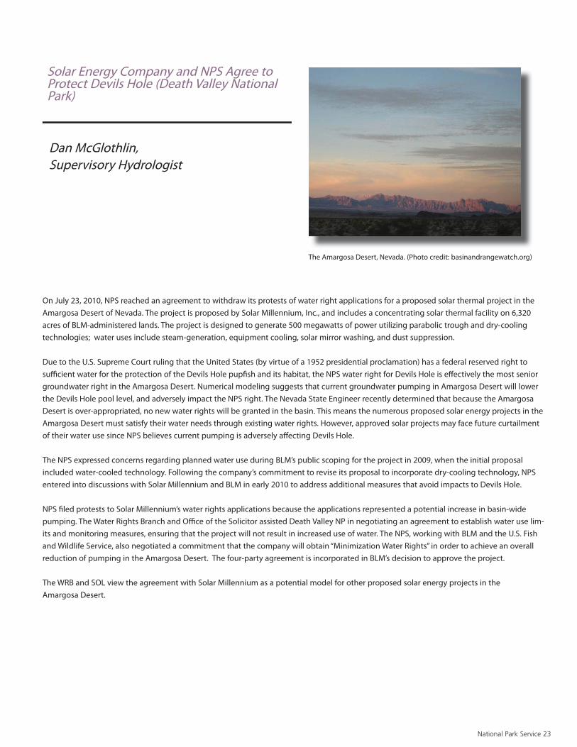
On July 23, 2010, NPS reached an agreement to withdraw its protests of water right applications for a proposed solar thermal project in the Amargosa Desert of Nevada. The project is proposed by Solar Millennium, Inc., and includes a concentrating solar thermal facility on 6,320 acres of BLM-administered lands. The project is designed to generate 500 megawatts of power utilizing parabolic trough and dry-cooling technologies; water uses include steam-generation, equipment cooling, solar mirror washing, and dust suppression.
Due to the U.S. Supreme Court ruling that the United States (by virtue of a 1952 presidential proclamation) has a federal reserved right to suffi cient water for the protection of the Devils Hole pupfi sh and its habitat, the NPS water right for Devils Hole is eff ectively the most senior groundwater right in the Amargosa Desert. Numerical modeling suggests that current groundwater pumping in Amargosa Desert will lower the Devils Hole pool level, and adversely impact the NPS right. The Nevada State Engineer recently determined that because the Amargosa Desert is over-appropriated, no new water rights will be granted in the basin. This means the numerous proposed solar energy projects in the Amargosa Desert must satisfy their water needs through existing water rights. However, approved solar projects may face future curtailment of their water use since NPS believes current pumping is adversely aff ecting Devils Hole.
The NPS expressed concerns regarding planned water use during BLM’s public scoping for the project in 2009, when the initial proposal included water-cooled technology. Following the company’s commitment to revise its proposal to incorporate dry-cooling technology, NPS entered into discussions with Solar Millennium and BLM in early 2010 to address additional measures that avoid impacts to Devils Hole.
NPS fi led protests to Solar Millennium’s water rights applications because the applications represented a potential increase in basin-wide pumping. The Water Rights Branch and Offi ce of the Solicitor assisted Death Valley NP in negotiating an agreement to establish water use lim-its and monitoring measures, ensuring that the project will not result in increased use of water. The NPS, working with BLM and the U.S. Fish and Wildlife Service, also negotiated a commitment that the company will obtain “Minimization Water Rights” in order to achieve an overall reduction of pumping in the Amargosa Desert. The four-party agreement is incorporated in BLM’s decision to approve the project.
The WRB and SOL view the agreement with Solar Millennium as a potential model for other proposed solar energy projects in the Amargosa Desert.
Solar Energy Company and NPS Agree to Protect Devils Hole (Death Valley National Park)
Dan McGlothlin, Supervisory Hydrologist
The Amargosa Desert, Nevada. (Photo credit: basinandrangewatch.org)
National Park Service 24
View of the Marin Headlands from the south tower of the Golden Gate Bridge. (Photo courtesy of Jeff Weisenburger)
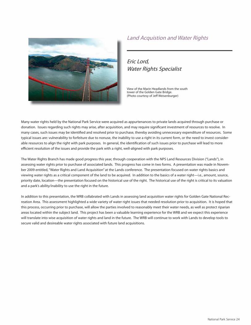
Many water rights held by the National Park Service were acquired as appurtenances to private lands acquired through purchase or donation. Issues regarding such rights may arise, after acquisition, and may require signifi cant investment of resources to resolve. In many cases, such issues may be identifi ed and resolved prior to purchase, thereby avoiding unnecessary expenditure of resources. Some typical issues are: vulnerability to forfeiture due to nonuse, the inability to use a right in its current form, or the need to invest consider-able resources to align the right with park purposes. In general, the identifi cation of such issues prior to purchase will lead to more effi cient resolution of the issues and provide the park with a right, well-aligned with park purposes.
The Water Rights Branch has made good progress this year, through cooperation with the NPS Land Resources Division (“Lands”), in assessing water rights prior to purchase of associated lands. This progress has come in two forms. A presentation was made in Novem-ber 2009 entitled, “Water Rights and Land Acquisition” at the Lands conference. The presentation focused on water rights basics and viewing water rights as a critical component of the land to be acquired. In addition to the basics of a water right—i.e., amount, source, priority date, location—the presentation focused on the historical use of the right. The historical use of the right is critical to its valuation and a park’s ability/inability to use the right in the future.
In addition to this presentation, the WRB collabrated with Lands in assessing land acquisition water rights for Golden Gate National Rec-reation Area. This assessment highlighted a wide variety of water right issues that needed resolution prior to acquisition. It is hoped that this process, occurring prior to purchase, will allow the parties involved to reasonably meet their water needs, as well as protect riparian areas located within the subject land. This project has been a valuable learning experience for the WRB and we expect this experience will translate into wise acquisition of water rights and land in the future. The WRB will continue to work with Lands to develop tools to secure valid and desireable water rights associated with future land acquisitions.
Land Acquistion and Water Rights
Eric Lord, Water Rights Specialist

National Park Service 25
Black Canyon of the Gunnison National Park (BLCA) was es-tablished in 1933 to preserve one of the most spectacular, steepest, and narrowest canyons in the country. Formed by the constant grinding of water and sediment of the Gunnison River, the 53-mile long Black Canyon is, in places, deeper than it is wide, with canyon walls towering more than 2,000 feet above the river.
Since 1966, three upstream Bureau of Reclamation reservoirs (collectively known as the Aspinall Unit) have modifi ed fl ow of the Gunnison River through BLCA, which lies immediately downstream of the lowermost reservoir. In 2008, the United States quantifi ed and was decreed a Federal Reserved water right for annual peak, shoulder, and base fl ows. These fl ows mimic the historical natural hydrograph, yet remain a subject of controversy among some local water interests and river users. In addition, the Gunnison River downstream of BLCA is designated critical habitat for two endangered Colorado River fi shes. The Bureau of Reclamation is preparing an Envi-ronmental Impact Statement to reoperate the Aspinall Unit to meet the U.S. Fish and Wildlife Service Flow Recommenda-tions for these fi sh. Thus, the NPS fi nds itself in the position of having to defend its instream fl ows and at the same time respond to and evaluate eff ects of diff erent reservoir operation alternatives on park resources.
Recently, BLCA staff , the NPS’ Northern Colorado Plateau Inventory and Monitoring Network, scientists from the United States Geological Survey, and Water Resources Division staff joined forces to develop and initiate a long-term monitoring program to document fl ow-related changes to sediment, riparian vegetation and aquatic resources within the park. While all the details have yet to be worked-out, the intent is to capture the eff ects of the decreed fl ows and diff erent reservoir releases on riparian vegetation dynamics, sediment entrainment and transport, and abundance and distribution of aquatic macroinvertabrates. Long-term monitoring of these resources will hopefully better inform reservoir man-agement decisions and illustrate the importance of more natural fl ows at maintaining the unique resources and natural processes of this national park
Long-Term Resource Monitoring along the Gunnison River in Black Canyon of the Gunnison National Park
Mark Wondzell, Hydrologist
Gunnison River, Black Canyon of the Gunnison National Park. (Photos by Mark Wondell)

Natural Resource Challenge: Aquatic Resource Field Professionals Highlights National Park Service 26
Natural Resource Challenge: Aquatic Resource Field Professionals Highlights
Funding from the Natural Resource Challenge helped support 15 fi eld-based aquatic resource professional positions in FY10. The aquatic professional positions were developed to provide the National Park Service with both an extension of the functions and capabilities provided by the Water Resources Division and the water and aquatic resource professional positions base-funded in parks and regions. Positions are designed to provide locally-based expertise to address water resource, fi shery, and/or other aquatic issues that are substantial and ongoing in a particular watershed or area. The positions are unique in that they are designed to support the needs of multiple parks.
Examples of fi eld-based Aquatic Resource Professionals’ Accomplishments FY2010:
• Worked with Indiana Dunes National Lakeshore staff to facilitate a re-do of the INDU Coastal Watershed Condition Assessment, using funding from the Great Lakes Restoration Initiative, and provided reviews of work plans and progress reports• Provided technical and logistical assistance to university cooperators conducting the Isle Royale National Park/Acadia nitrogen critical loads project. • Facilitated use of Great Lakes Restoration Initiative funds to place archival geolocator tags on breeding loons, in order to track migratory movements through northern Lake Michigan.• Conducted additional analysis of a 30-year water quality dataset covering eight sites in and near MISS, focusing on trends in nutrient and sediment loading in the corridor. • Continued drafting fi nal report on spatial, seasonal, and long-term water quality trends in and near MISS; fi nal report expected in FY11• Facilitated the use of Great Lakes Restoration Initiative funds to conduct biological surveys as part of a previously funded vernal forest pools project.• Conducted detailed analysis of data from the 2008 nitrogen study of the Lower St. Croix River; prepared presentation for the October 2010 St. Croix Research Rendezvous (“The other nutrient: nitrogen in Lake St. Croix water and biota”); contributed to presentation at the International Paleolimnology Symposium (“Nitrogen isotopes in mus-sel shells record anthropogenic nutrient loading to the Lower St. Croix River, Minnesota, Wisconsin, USA”).• Gave a guest lecture for an environmental science course at Met-ropolitan State University (“Water and mud: environmental history of the St. Croix River”).• Provided dive assistance related for a USGS SACN zebra mussel eff ects study and a climate change eff ects study.• Participated in St. Croix Basin Water Resources Planning Team activities, particularly those of the Monitoring and Assessment Sub-committee• Helped plan and conduct a suite of studies in SLBE’s Lake Michigan waters through and Great Lakes Restoration Initiative (see below).• Developed Lake Michigan-related proposals for the FY11 Great Lakes Restoration Initiative.• Provided technical assistance and input related to year two of the NRPP-NRM botulism project.
• With USGS partners, completed a historical data analysis evaluating potential causes for avian botulism outbreaks since 1960; drafted a related manuscript (“Links between type E botulism outbreaks, lake levels, and surface water temperatures in Lake Michigan, 1963-2008”) which was accepted for publication in FY11 in Journal of Great Lakes Research.• Provided hiring assistance related to the GLRI project “Comprehen-sive Marine Assessments: Benthic Habitat Mapping” and contributed to discussions related to boat and multibeam sonar purchase.• Reviewed sampling plans and provided aquatic invasive species prevention suggestions related to the GLRI project “Comprehensive Marine Assessments: Nearshore Ecological Survey”, conducted in cooperation with EPA.• Provided fi eld assistance to NPS staff and cooperators at Apostle Islands and Pictured Rocks National Lakeshores as part of the GLRI project “Implement Recommendations from Watershed Condition As-sessments: Inventory and Ecological Survey of Coastal Rock Pools”.• Reviewed work plans, contracts, and draft products related to the GLRI project “Implement Recommendations from Watershed Condition Assessments: Develop Spill Response Plans”.• Helped develop scopes of work and coordinate fi eld sampling for the GLRI projects “Research Nearshore Lake Michigan Changes: Paleolimnological Study” and “Research Nearshore Lake Michigan Changes: Intensive Food Web Study”.• Assisted with developing purchase materials for the GLRI project “Research Nearshore Lake Michigan Changes: Purchase Nearshore Monitoring Buoy”. • Served as one of two NPS points of contact for the Gulf Hypoxia Task Force Coordinating Committee, and provided NPS information for the Annual Reports and Operating Plans. • Provided oversight and reviewed progress reports for the NRPP-NRM spiny water fl ea project at ISRO, PIRO, SLBE, and VOYA.• Conducted pre-proposal reviews for Midwest Region NRPP-NRM projects.• PWR – NPS Liaison, Deepwater Horizon incident command, 4 weeks. Assembled NPS boundary maps for NOAA Geographic Information System; with interagency team, co-developed and implemented BMPs for protecting cultural resources and special status species during response activities.• PWR – Co-taught a Bureau of Land Management class entitled Measuring and Monitoring Plant Populations to increase the quality of government vegetation restoration and monitoring projects in the Pacifi c West Region.• PWR – Co-coordinated PWR conference for natural resource managers.• SFAN – designed long term monitoring plan to track integrity of wetlands and riparian habitats at PINN. Monitoring plan completed and approved by PWR regional I&M program FY2010. • CHIS – Co-led project to design Prisoners Harbor Coastal Lagoon Restoration Project to restore degraded wetland on Santa Cruz Island. Project to benefi t migratory birds and archeological resources. Completed EIS/EIR FY2010. Project to be implemented FY2011.• DEPO – NPS Natural Resource Specialist for the joint NPS/USFS General Management Plan team. Team developed management alternatives to protect natural and cultural resources while providing appropriate visitor experiences. Drafted “Aff ected Environment” chapter of EIS in FY2010.• GOGA – Co-led project to complete monitoring program to assess ecological impacts of Big Lagoon Coastal Wetland Restoration Project in Marin, CA. Project to benefi t salmonids and other protected species. Monitoring Plan completed in FY2010.• LABE – Provided technical assistance for creation of LABE Resource Stewardship Strategy. LABE RSS to be completed FY2011.

National Park Service 27
• Provided technical assistance for wetlands protection and compli-ance for Sandy Creek Bridge reconstruction project. Project to protect resources while replacing necessary infrastructure. Site Assessment conducted, EA initiated FY2010.• Lead Author for the Resource Stewardship Strategy as part of the national NPS pilot RSS program. Final draft RSS completed FY2010.• Co-led project to map wetlands at Mineral King in Sequoia NP to support upcoming site management strategy. Strategy will inform management of leased lands in park while protecting wetland resources. Completed draft report, datasheets, and maps in FY2010. • Participated on the NPS Resource Management Team and inter-agency Technical Working Group regarding the Pebble Mine, a pro-posed copper and gold mine in southwest Alaska; attended meetings, reviewed study plans, and commented on fi sheries resource issues. • Provided technical review and comments for the Southwest Alaska Salmon Habitat Partnership monitoring strategic plan.• Drafted proposal and received funding for a juvenile sockeye salm-on project in Lake Clark.• Assisted with logistics and implementation of water quality moni-toring in the Chulitna River watershed, a watershed adjacent to the proposed Pebble Mine.• Provided project oversight, completed data analysis, and wrote an-nual and fi nal reports for a monitoring project estimating the number of sockeye salmon returning to Lake Clark. • Worked cooperatively with the Alaska Department of Fish and Game (ADF&G) to radio track the seasonal movements of northern pike captured and tagged in Chulitna Bay, Hardenburg Bay, and Long Lake.• Coordinated logistics, hiring, and implementation of a new sock-eye salmon escapement project in the Kuskokwim River drainage in southwest Alaska.• Assisted a University of Washington graduate student with a fresh-water fi sh inventory in the upper Mulchatna River drainage to model distribution.• Coordinated logistics and assisted with an assessment of the feeding ecology of Arctic char in Lower Tazimina and Caribou Lakes.• Reviewed monitoring protocols and annual reports, and provided technical assistance with various fi sh and water resource projects. • Planned and facilitated collection of bathymetry data for Turquoise, Snipe, Lachbuna, and Fishtrap Lakes.• Provided input on objectives for resource condition assessment for Yukon-Charley Rivers and Gates of the Arctic• Participated as a member of the unit compliance team for Yukon-Charley Rivers and Gates of the Arctic• Initiated cooperative agreement to document impacts of 2009 spring fl ood on moose habitat, wetland communities and structures (GAAR and YUCH)• Cored Six-Mile Lake to assess the impacts of global climate change in GAAR nad YUCH. • Served as agency lead on Fish Technical Working Group for the NRDA component of the Deepwater Horizon Incident• Served on 16-day detail to the Unifi ed Incident Command as a Resource Advisor with SCAT Team 1 evaluating the extent of oil on NPS beaches and developing Shoreline Treatment Recommendations• Served on Work Group for new designations of Wild and Scenic Rivers pursuant to a NLC directive• Assist park in evaluating potential impacts associated in assessing potential impacts to aquatic resources associated with the Roberta Landfi ll (BISO). • Conducted site visit with partner agencies and park staff as part of ongoing eff ort to avoid and/or mitigate adverse eff ects of the Roberta Landfi ll project (BISO).
• Assisted park in evaluating the potential for bycatch associated with mechanized beach sifting (GUIS).• Conducted fi eld assessment to Horn Island in August to observe mechanical sifting during night operations and evaluate potential bycatch (GUIS).• Co-authored whitepaper on the implications of beach clean-up activities on natural resources (GUIS).• Conducted site visit and participated in workshop hosted by University of California Santa Barbara NCEAS on ecotoxicology of the Deepwater Horizon Oil Spill.• Acted as Regional Goal Contact for FY 07-11 and FY 08-12 NPS Strategic Plan Goal 1a1H—Land Health -Acres in Condition• Represented the NPS at the Gulf Of Mexico Alliance meetings and participated as a member on the Habitat Conservation and Restora-tion Team. Continued to develop a sediment budget for restoration in the northern Gulf of Mexico Coast• Participated in regions role in administering the annual Service-wide Combined Call (SCC) including projects that resulted inprotection and/or restoration of wetland habitat. Assisted Jean Lafi tte National and Historic Park with obtaining funding for canal reclamation project. Funding used to degrade spoil banks and fi ll previously dredged canals, restoring natural hydrology.• Participated in DWH Oil Spill response and NRDA activities• Reviewed Biscayne Bay Coastal Wetlands Phase 1 Draft Integrated Project Implementation Report and Environmental Impact • Review of Historic Structure Report (HSR) for the rehabilitation of the historic structures at Boca Chita Key• Visited endangered coral reefs to develop DHW Oil Spill response document protecting the reefs in the event oil reached these endan-gered ecosystems
Ochre Sea Stars in Redwood National Park, California (NPS Photo)

Appendix A : Technical Assistance Servicewide National Park Service 28
APPENDIX ATECHNICAL ASSISTANCE
TECHNICAL ASSISTANCE SERVICEWIDE
ServicewidePrepared and presented a class regarding water rights at the Land Resources Division Conference in Palm Desert, CA. The class focused on water rights in the context of land acquisition.
Hosted the Water Resources Aquatic Professionals meeting.
Represented WRD by co-teaching the water-related sessions of Denver University’s Earth Science in Context course for Middle and High School teachers held July 6-17, 2010.
Completed 19 station folders and 3 survey/history folders for WRB gages to support water rights eff orts in Arizona, Nevada, Oklahoma and Wyoming.
Implemented a quality control/assurance review process with the U.S. Geological Survey for WRB streamgage and water level folders.
Developed and executed a plan to place water rights dockets into NRINFO.
Co-lead a WRD team to evaluate water resource information needs and provide recommendations to the Chief of WRD.
Completed the 2007-2009 Wild and Scenic Rivers Program Accomplishment Report.
Co-taught at the Interagency Wild and Scenic River Train-the-Trainer Course.
Member of the Interagency Wild and Scenic Rivers Coordinating Council.
Led the development of a Section 7 fl owchart for the Interagency Wild and Scenic Rivers Coordinating Council.
Represented the NPS on the Navajo Nation-Hopi Indian Federal Water Rights Negotiation Team. Elevated NPS issues to the Counselor to the Secretary and Chairman of the Working Group on Indian Water Settle-ments for resolution and incorporation into the proposed Northeastern Arizona Indian Water Rights Settlement and draft legis-lation.
Member of the Colorado River Steering and Technical Committees.
Supported NPS resource protection by participating the NRDA coordination eff orts associated with the Deepwater Horizon (MC 252) Oil Spill.
Directed the Servicewide implementation and use of GPRA Goals 1a4C and 1a4D.
Represented the NPS as the primary lead on the BLM Solar Energy Programmatic Environmental Impact Statement. Coordinated NPSresponses to preliminary EIS documents with Intermountain and Pacifi c West regional offi ces and parks.
Served on the conference planning committee for the 2010 NPS Aquatic Professionals Meeting.
Organized and chaired two wetlands sessions (restoration and management) at the 2010 NPS Aquatic Professionals Meeting (February 9-11 in Fort Collins, CO).
Co-authored a 2012 OFS Statement titled “Restoring Disturbed Ecosystems in America’s Most Treasured Landscapes” (OFS Number 28096B). The requested $27.5 million would establish a dedicated funding source to address the backlog of natural resource restoration projects in parks.
Evaluated and ranked six proposals for 2010 NRPC Climate Change Program funding.
Provided support to the ADNRSS in reviewing and commenting on Development Advisory Board proposals.
Responded to the NPS Offi ce of Legislative Aff airs regarding an inquiry from Senator Wyden (after DOI testimony on climate change) regarding adaptation of climate change restoration priorities in the NPS.
Served as a proposal reviewer for the joint USGS and NPS Park Oriented Biological Support Program funding.
Alligator stare in Everglades National Park, Florida Photo by NPS

Appendix A : Technical Assistance Servicewide National Park Service 29
Served as a Development Advisory Board project reviewer, of eleven construction projects totaling over $78.6 million for cost effi ciency and technical feasibility, to advise the Natural Resource Stewardship and Science Associate Director.
Provided the Environmental Quality Division staff with an evaluation and rank ordering of 45 parks according to the amount of wetlands in the parks and the current and proposed levels of impacts to wetlands from oil and gas development activities.
Served as a member of the 2010 National Wetland Awards Selection Committee.
Served as a member of the Water Resources Division evaluation panel and helped write the 2010 request for Division funding from the Offi ce of Financial Services for four water-related areas of emphasis.
Served as a member of the Natural Resource Protection Program, Dis-turbed Lands, Proposal Ranking Panel.
Presented at the 2010 NPS Aquatic Professionals Meeting Conference. Presentation titled: Wetland Banking and No Net Loss of Wetland Ecosystem Services.
Served as the primary reviewer of, and compiled the National Park Service response comment letter for, the Department of the Army, Corps of Engineers, Notice of Proposal to Re-issue and Modify Nationwide Permits.
As part of the NRPC External Energy Issues Team, reviewed and evaluated the proposed BLM-DOE Solar Energy Programmatic Environmental Impact Statement, Chapter: Aff ected Environmental and Impact Assessment for proposed Solar Energy Zones in Colorado. Recommended language relative to the potential impacts tosurrounding parks in the region.
Served as an independent reviewer of a wetland delineation proposal project for this years’ NRPP-NRM project funding.
Served as a Contracting Offi cers Technical Representative on a Technical Evaluation Panel for the Prisoners Harbor Coastal Wetland Restoration construction project at Channel Islands National Park.
Developed and revised Natural Resource Condition Assessment program guidelines for standard report outline, standard boilerplate for chapter 1, and peer review form.
Member of the WASO Rivers/Dams workgroup.
Represent the NPS on sensor QC, Emerging Contaminants, and Sta-tistical subgroups of the National Water Quality Monitoring Council Methods and Data Comparability Board.
Participated in NPS discussions with National Parks and Conservation Association (NPCA) Center for State of the Parks staff to identify ap-propriate, useful ways that NPS and NPCA can share data and informa-tion pertaining to resource conditions in national park units.
Represented the NPS on the Chemistry, Water column and Toxicology Technical Working Group in support of the Deep Water Horizons oil spill Natural Resources Damage Assessment.
In a cooperative eff ort with Cultural Resources developed an agenda for a shared session at George Wright Society titled “Taking Stock: Assessing Cultural and Natural Resource Conditions in National Parks”
Continued development of NPSTORET - a series of Microsoft Access templates/forms for entering and documenting the results of water quality monitoring projects as per the National Water Quality Monitoring Council’s guidelines in a format compatible with upload-ing to modern STORET using the STORET Import Module or Water Quality Exchange (WQX) format. NPSTORET versions v1.80 and v.1.81 were released adding new functionality and fi xing reported bugs.
Chaired a six-member NPSTORET User Board to help oversee the development and implementation of NPSTORET.
Updated the website for Vital Signs Water Quality Data Management and Archiving at http://www.nature.nps.gov/water/infoanddata/in-dex.htm.
Setup a trial, shared/network installation of Aquatic Informatics’ Aquarius Workstation and Aquarius Database for parks, networks, and the Water Resources Division staff to evaluate their utility for process-ing and managing continuous water resource (both quantity and quality) data.
Hosted a meeting with the Inventory and Monitoring Division, Water Resources Division, two network data managers, and others in Fort Collins, CO during June to map a strategy for managing continuous water resource data streams.
Prepared a proposal to acquire a shared/network installation of Aquatic Informatics’ Aquarius Workstation that was subsequently approved.
Pelican, Dry Tortugas National Park. (Photo by Kimberly Ropp)

Appendix A : Technical Assistance Servicewide National Park Service 30
Prepared contracting materials as requested by contracting to shep-herd the acquisition of Aquatic Informatics’ Aquarius Workstation, Aquarius Database, and Aquarius Data Portal through purchasing.
Maintained the Water Resources Division’s STORET infrastructure: a data entry workstation version of STORET containing NPS’ production data and servers hosting copies of Legacy STORET, National STORET, and the STORET Data Warehouse.
Produced quarterly Capital Planning and Investment Control reports and the Offi ce of Management and Budget’s Exhibit 300-1 documenting WRD’s STORET investment.
Created a SharePoint site on the topic of Water Resources Data Management (http://nrpcsharepoint/wrd/data/default.aspx) with a subsite of Continuous Data Management (http://nrpcsharepoint/wrd/data/continuous/default.aspx).
Coordinated and wrote report on Water Resources Division’s Informa-tion Management Strategy.
Coordinated Water Resources Division’s review of a constrained set of keywords (categories) to be used to categorize ‘References’ entered into the Integration of Resource Management Applications (IRMA) for the Inventory and Monitoring Division.
Represented the Water Resources Division during NRPC Integrated Resource Management Applications (IRMA) meetings.
Represented the Water Resources Division during NRPC Information Technology Technical Advisory Group (IT-TAG) meetings.
Assisted the Environmental Protection Agency, several states, and Gold Systems Inc. in developing and debugging the Ambient Water Quality Monitoring System (AWQMS), a possible successor to the stand-alone copies of STORET.
Provided numerous corrections, additions, and suggestions to EPA regarding characteristics and other aspects of the STORET database and WQX schema, including reporting a major issue with STORET database updates going back to 2003 that, under certain circum-stances, were making erroneous changes in user data due to faulty programming logic.
Notifi ed other organizations when problems were encountered with their data in the STORET Data Warehouse.
Maintained inventory fact sheets for the water quality and water resources inventories.
Updated webpages (http://science.nature.nps.gov/im/inventory/wa-terquality/index.cfm and http://science.nature.nps.gov/im/inventory/water/index.cfm) for the Servicewide Inventory and Monitoring Program to explain the water quality and water resources inventories.
Participated in meetings with the DSC Planning Division, Alaska Regional Offi ce, and WRD staff on Wild & Scenic River planning.
Prepared the 2009 Annual Administrative Reports and Workplans for the water quality and water resources inventories.
Hosted a data management session and made a presentation at the Water Resources Division’s Aquatic Professionals Meeting in Fort Collins, CO during February.
Attended the Servicewide Inventory and Monitoring Program’s Data Manager’s Meeting in Fort Collins, CO during March.
Attended the National Water Quality Monitoring Council biennial conference in Denver, CO during April.
Attended Aquatic Informatics’ Aquarius Users Group Meeting in Denver, CO during April.
Provided assistance and slides to the Air Resources Division regarding accessing water quality data in the STORET Data Warehouse
Maintained NPSEDD v1.10, the NPS Electronic Data Deliverable specifi cation used by parks and networks for contributing water quality data for inclusion in STORET.
Maintained NPSCol2Row v2.11, a data formatting utility used to prepare data for the STORET Import Module, on the NPS’ Vital Signs Water Quality Data Management and Archiving website and EPA’s STORET Tools website (http://www.epa.gov/storet/otherapps.html) for anyone to download.
Continued to oversee the development of the Hydrographic and Im-pairment Statistics database (http://www1.nrintra.nps.gov/wrd/his/) built on a framework of the National Hydrography Dataset and state 303(d) Clean Water Act listings.
Notifi ed the U.S. Geological Survey and state National Hydrography Dataset stewards of issues encountered in processing the National Hydrography Dataset.
Maintained and enhanced the software used to quality-assure,compile, and calculate hydrographic statistics in the Hydrographic and Impairment Statistics database.
Provided support to the U.S. Geological Survey on a U.S. Agency for International Development eff ort to assist Pakistan in developing water quality database management systems.
Gray Wolf, Grand Teton National Park. (NPS Photo)Gray Wolf Grand Teton National Park (NPS Photo)

Appendix A : Technical Assistance Servicewide National Park Service 31
Coordinated the upgrade to Terrain Navigator Pro v.8.70 and trouble-shot issues for Natural Resource Program Center users.
Coordinated peer review for proposals submitted for funding from the POBS program.
Responded to public water resource inquiries generated by NPS Internet Web Site.
Committee member for biannual Water Resources Professionals meeting.
Attended Line Item Construction meeting in Galveston, Texas for NRSS.
Attended Development Advisory Board Meeting in Washington DC for NRSS.
Participated in an April 2010 Resource Stewardship Strategies (RSS) workshop to assist good linkages between Natural Resources Condition Assessments and RSSs and review lessons learned from a set of pilot RSS projects.
Participated in Dam Removal Workshop II organized by Bureau of Reclamation and US Geological Survey.
Reviewed and commented on Director’s Order 40, NPS Dam Safety Policy
Participated in Climate Change Program meetings related to fl oodplain management.
Served as coordinator for NRPC reviews of submissions to the Development Advisory Board.
WRD Point of Contact for position supported by the Natural Resources Challenge, Fluvial Geomorphologist at MORA.
Member of the Restoration Technical Advisory Group.
Represented Natural Resource Stewardship & Science on NPS Dive Control Board.
Worked with DOI Senior Ocean Policy Team and the NPS regions and parks on the implementation of the new National Ocean Policy (EO 13547).
Worked with NOAA’s Marine Protected Areas Center on an MPA Cli-mate Change working group to develop “climatologies” for marine sanctuaries, refuges and national parks.
Represented NPS at the Houma Incident Command Center during the DeepWater Horizon oil spill.
Represented NPS of the Federal Geospatial Data Committee and Coastal Spatial Data.
Subcommittee to develop the Coastal Ecological Mapping Classifi ca-tion Standard (CMECS) as a national habitat classifi cation for oceans, coasts and estuaries.
Funded Geological Resources Division contact hire of a solicitor to develop a jurisdiction handbook for ocean and coastal park superin-tendents.
Developed a marine invasive species database for all ocean and coast-al parks; hosted a Webinar to demonstrate database functionality.
Developed Servicewide Comprehensive Call ocean and coastal re-sources program funding guidance and approved and funded proj-ects at KAHO, KALA, ASIS and AKSO.
Working with the Lands Resources Division and NRPC GIS, developed shoreline maps for 84 ocean and coastal parks.
Worked with NOAA MPA Center nominate and list 19 NPS units in the National System of MPAs under EO 13158
Worked with USFWS and NOAA National Estuarine Reserves andNational Marine Sanctuary staff s to implement the interagency Seamless Network Agreement.
Worked with Russ Wilson, superintendent at CALO, on detail to WASO to develop a framework for director’s order on ocean and coastal parks.
Worked with Geological Resources Division and the Lands Resources Division to develop solicitor opinions to deal with park boundary is-sues for 12 ocean and coastal parks.
Taroko National Park Republic of China (ROC) - Provided technical consultation, conducted three workshops, and authored technical report regarding geologic/hydrologic hazards.
2010 NRPC Planning Technical Advisory Team (PTAG) member
2010 NPS Climate Change Planning Working Group member that serves the NPS Climate Change Response Steering Committee. The steering committee serves as an advisory body to the NPS Director and the National Leadership Council (NLC) on climate-related topics
2010 NPS Resource Stewardship Strategy Workshop participant (April 13-15, 2010).
2010 NPS Water Resources Planning Lead, March – June 2010
Quagga/Zebra Mussels. Photo by David Britton

Appendix A : Technical Assistance Servicewide National Park Service 32
2010 NPS Climate Change Scenario Planning Detail.
NPS participant in the Crown of the Continent Climate Change Scenario Planning Workshop.
NPS core-team participant for training federal and state agencies on Climate Change Scenario Planning (CCSP).
Reviewed/commented on the fi rst draft of a Natural Resource Condition Assessment for VAFO.
Participated in the April 2010 Pilot RSS workshop.
Participated in several meetings with DSC Planning Division and WRD staff on Wild & Scenic River planning.
Represented WRD, NRPC and PTAG at regular meetings of the DSC Planning Division.
Provided oversight and support for the fi eld-based aquatic ecologist (Natural Resource Challenge funded) position that supports Great Lakes park units.
Reviewed and provided technical comments on DOI policy regarding Fish and Shellfi sh Consumption Advisories for water bodies within DOI properties.
Participated in conference calls and other activities of the Organizing Committee for the Fourth Interagency Conference of Research in the Watershed (4th ICRW) to be held in Fairbanks, Alaska in September 2011.
Reviewed the science and public opinion regarding transport of Aquatic Nuisance Species (ANS) on felt soled wading boots in consid-eration of proposing a service-wide recommendation on the use of felt soled boots in National Parks.
Worked with other WRD and BRMD staff to ensure that NPS is represented on the Aquatic Nuisance Species Task Force.
Represented the National Park Service on the Western Regional Panel (WRP) of the Aquatic Nuisance Species Task Force.
Represented NPS on QZAP implementation committee.
Represented the National Park Service on fi sh habitat partnerships established under and recognized by the National Fish Habitat Action Plan.
Represented the National Park Service at the Annual Meeting of the Desert Fishes Council in Death Valley National Park.
Worked with staff from GRSM to fi nalize the Manual for the Use of Antimycin A for Restoration of Native Fish Populations.
Cooperated with BRMD and park staff to draft responses to letters from western states requesting information on NPS Quagga/Zebra Mussel containment activities.
Worked with western parks to estimate expenditures and needs for quagga/mussel prevention and response programs.
Worked with other WRD staff on an NRPP Servicewide proposal to develop a distribution database and risk assessment for aquatic invasive species in NPS units.
Represented the National Park Service at the annual meeting of Colorado – Wyoming Chapter of the American Fisheries Society.
Represented NPS at Wild Trout X in West Yellowstone, MT.
Moose at Oxbow Bend in Grand Teton National Park (Photo by Dan Ng )

Appendix A : Technical Assistance Regions and Parks / Alaska Region / Intermountain Region National Park Service 33
Funded development of digital shorelines for ocean and coastal parks in Alaska.
Provided oversight and management support for the fi eld-based aquatic ecologist position responsible for the Alaska Arctic and Central Alaska Networks.
Served as a selecting offi cial for the NPS Alaska Regional Hydrologist position advertised in FY10.
Provided technical assistance to Katmai National Park and Preserve to address a deteriorating fi sh ladder that was built in the 1970s without NPS approval.
Provided technical and policy review and evaluation of several draft Statements of Findings for the Brooks River Visitor Access, Katmai National Park and Preserve. Comments were used to redefi ne the project design to minimize wetland impacts.
TECHNICAL ASSISTANCE
REGIONS AND PARKS
ALASKA REGION
Regionwide
Denali National Park and Preserve
Assessed proposed use of park water for hydropower by inholder Doyon Corporation in Kintishna area. Prepared assessment in context of Director’s Order 35 A and B and considered possibility of policy waiver.
Reviewed and evaluated the Environmental Assessment for Improving Visitor Access to the Sled Dog Kennels and Demonstrations at Denali National Park and Preserve. Provided guidance on the preparation of the wetlands and compliance sections.
Provided guidance on the preparation of a Wetland Statement of Findings for Improving Visitor Access to the Sled Dog Kennels and Demonstrations at Denali National Park and Preserve. Recommended approval for the WRD Chief’s signature that certifi ed the technical adequacy of the wetland analyses and consistency of the project with Director’s Order #77-1.
Glacier Bay National Park and Preserve
Reviewed and provided technical comments on WRD Technical Report concerning the meteorology and hydrology of the Alsek River delta area within the Dry Bay Preserve, and its potential eff ects on salmon populations
Partnered with USGS to develop benthic habitat map for the West
Kenai Fjords National Park
Completed the watershed condition assessment.
Lake Clark National Preserve
Provided technical assistance support related to potential impacts to ground and surface waters from a proposed copper-gold-molybde-num mine adjacent to the park.
Presented a poster at the annual National Water Quality Monitoring Conference in Denver explaining the challenges facing the park and baseline monitoring needs the park has for the Chulitna watershed prior to the proposed Pebble Mine development.
Reviewed IMR OFS statement for Quagga/Zebra Mussel prevention at CURE and GLCA.
Katmai National Park
Provided consultation related to the replacement of a fl oating bridge in the Brooks Camp area of the park and reviewed fl oodplain Statement of Findings.
Reviewed and evaluated the report Preliminary Jurisdictional Deter-mination of Waters of the US, Including Wetlands at the Brooks River Bridge Project, Katmai National Park and Preserve. Provided advice on mitigating impacts to the wetland hydrology and the need for a Wetland Statement of Findings.
Sitka National Historical ParkProvided advice regarding water diversions by the Sitka Sound Science Center from the Indian River. Gathered and analyzed information to estimate eff ect of diversions on discharge of the Indian River.
Beautiful Sitka Sunset, Sitka National Historical Park. NPS Photo
Wrangell-St.Elias National Park and PreserveRe-uploaded water quality data to STORET from environmental geochemical investigations conducted between 1994 and 1997 to determine the extent of possible environmental hazards.
Provided consultation and biological data from two projects to park staff .
Completed draft Natural Resources Condition Assessment.
INTERMOUNTAIN REGION
Regionwide

Appendix A : Technical Assistance Regions and Parks / Intermountain Region National Park Service 34
Arches National Park Coauthored Report entitled, Groundwater Age Dating in and Near Arches National Park.
Completed draft water rights agreement with State of Utah.
Provided technical review of USGS study proposal entitled, Quantifi ca-tion of Changes in Surface-water Quantity and Quality in Arches National Park in Response to Changes in Climatic Conditions and Anthropogenic Alteration of Groundwater Resources.
Provided oversight/consultation in collection of spring discharge data.
Bent’s Old Fort National Historic Site
Determined the adequacy of water rights to meet needs of park irrigation project.
Provided on-site technical review and recommendations to improve drainage ditch issues associated with the maintenance facility and the administration buildings at Bent’s Old Fort National Historic Site. Evaluations and recommendations were documented in a trip report.
WRD staff reviewed and commented on the Bent’s Old Fort Historical Site Water Resources Information and Issues Overview Report.
Completed a draft of the Water Resources Information and Issues Overview Report. This draft was peer reviewed and I revised the document. It will be printed in October 2011.
Bandelier National Park
Bighorn Canyon National Recreation Area
Submitted annual report as required by the Montana – United States, National Park Service Water Rights Compact.
Conducted hydrogeological analysis and recommendations for con-struction of a new water supply well at Horseshoe Bend.
Participated on one conference call to discuss Quagga/Zebra Mussel prevention.
Big Hole National Battlefi eld
Submitted annual report as required by the Montana – United States, National Park Service Water Rights Compact.
Big Thicket National Preserve
Reviewed and evaluated the Wetland Delineation Report prepared for a project to plug and reclaim oil and gas wells at Big Thicket National Preserve. Comments were used to refi ne the fi nal draft. Provided advice on mitigating impacts to the wetland hydrology and the need for a Wetland Statement of Findings.
The Natural Resources Foundation Report for the park was published.
Amistad National Recreation Area
Provided consultation regarding reconstruction of dock facility.
Retrieved fl oodplain information from WRD fi les and provided inter-pretation and advice regarding Frijoles Canyon developed area.
Big Bend National Park / Rio Grande Wild & Scenic RiverProvided technical review of the detailed implementation plan for the project: Reconnaissance of Water Chemistry and Spring Flow from a Trans-border Aquifer along the Rio Grande (PMIS #109567) and recommended the release of funds to begin work.
Participated in discussions with Rio Grande Science Team to frame instream fl ow needs and fl ow requests from the Rio Conchos (Mexico) to Rio Grande.
Attended Population Viability Assessment workgroup meetings for Rio Grande silvery minnow, Albuquerque, New Mexico in support of recent reintroduction to Big Bend National Park, Texas.
Reviewed and fi led objections to water rights applications as needed to protect park water rights.
Evaluated settlement proposals and coordinated with park, SOL, and other federal agencies to resolve objections to adjudication claims.
Black Canyon of the Gunnison National Park
Evaluated water rights applications in Water Division 4 to determine eff ects of diversions on park water rights.
Provided technical input to the park on eff ects and operations of Aspinall Unit on park resources, review of Aspinall Unit Re-operations EIS, and exercise of decreed water right for Gunnison River.
Bryce Canyon National Park
Provided technical advice on how to complete the wetland delinea-tion for a proposed sewer line upgrade and construction of a road pullout area in. Provided advice on mitigating impacts to the wetland hydrology and the need for a Wetland Statement of Findings.
By the light of the moon, Bryce Canyon National Park. NPS Photo.

Appendix A : Technical Assistance Regions and Parks / Intermountain Region National Park Service 35
Continued to monitor DOE news releases and communicate with park staff concerning the Moab site groundwater remediation and construction activities.
Canyonlands and Arches National Parks
Capital Reef National Park Provided assistance in fi ling for a permit to drill a water well on Pleas-ant Creek.
Provided assistance in researching land status, legislation, and water rights for possible fencing of wetlands to exclude grazing.
Supervised drilling and conducted geologic logging and evaluation of a test well at the Utah Valley University Field Station.
Chiricahua National Monument
Reviewed and commented on fl oodplain statement of fi ndings.
Colorado National Monument
Evaluated water rights applications in Water Division 5 to determine eff ects of diversions on park water rights.
Uploaded water quality data from the 2000-2001 Level I Water Quality Inventory conducted by the U.S. Geological Survey to STORET.
Coronado National Memorial
Reviewed the Arizona Department of Water Resources subfl ow report for the San Pedro watershed. Submitted comments to the US Depart-ment of Justice.
Dinosaur National MonumentEvaluated water rights applications in Water Division 6 to determine impacts of diversions on park water rights.
Participated in and led discussions with park and region staff , DOJ, SOL, and expert scientists to begin to develop strategy for instream fl ow protection for Yampa River.
Alerted Park staff to fi ndings in a national endocrine study of importance for Park natural resources.
Reviewed and provided technical comments on report concerning the potential impacts of non-native predatory fi sh (small-mouth bass) on native fi shery on the Yampa River within Dinosaur National Park, Colorado.
Worked closely with park staff to fund several temporary employees that spent week long trips fl oating the river and clearing tamarisk from potential spawning areas.
Florissant Fossil Beds National Monument
Curecanti National Recreation Area
Evaluated water rights applications in Water Division 4 to determine impacts of diversions on park water rights.
Provided funding for a project to Colorado State University to deter-mine the dietary preferences of non-native lake trout and brown trout in Blue Mesa Reservoir.
Devil’s Tower National Monument
Reviewed and commented on fl oodplain Statement of Findings.
Conducted analyses of groundwater level monitoring data.
Submitted Application for Due Diligence to the water court for Saw-mill Trail Well.
Uploaded fi sh data to STORET from a 2002 inventory of the presence and relative abundances of fi sh species in some of the smaller park units of the Rocky Mountain Network.
Provided on-site consultation on riparian/wetland restoration oppor-tunities.
Assisted park staff with evaluation of Sawmill Trail Well.
Evaluated reported head-cutting and channel incision in several of the park’s wet meadows.
Fort Bowie National Historic Site
Provided advice during construction and testing of a new well.
Fort Laramie National Historic Site
Conducted river assessment and authored technical report.
Glacier National ParkReviewed and fi led objections to water rights applications as needed to protect park water rights.
Represented the NPS on the Blackfeet Indian Federal Water Rights Negotiation Team.
Submitted annual report as required by the Montana – United States, National Park Service Water Rights Compact.
Reviewed contract specifi cations for a fl ood hazard study conducted for the Divide Creek developed area. Reviewed the fi nal report and provided comments and suggestions for park management.
Curecanti National Recreation Area. (Photo by Rian Houston)

Appendix A : Technical Assistance Regions and Parks / Intermountain Region National Park Service 36
Conducted hydrogeological assessments for the Cut Bank Ranger Station, Avalanche Creek Campground, and Fish Creek Campground water-supply.
Reviewed the Detailed Implementation Plan for the NRPP T&E project Preservation of Threatened Bull Trout in Glacier National Park and ap-proved the release of FY10 funds
Glen Canyon National Recreation Area
Grant-Kohrs National Historic Site
Prepared a Preliminary Evaluation Report for a water supply well at Dangling Rope Marina.
Provided guidance on West Side Ditch Parshall fl ume and instrumen-tation and Clark Fork River pump.
Provided guidance and equipment in order to perform discharge measurements.
Re-uploaded data from the U.S. Geological Survey’s reformatted National Uranium Resource Evaluation to STORET.
Uploaded physical, chemical, and biological data to STORET from a July 1996 Superfund site evaluation to assess fl oodplain deposits and support risk assessment.
Uploaded water quality data to STORET from 2000-2001 from two reports written by the University of Montana characterizing the park’s geology, soil water, and ground water.
Great Sand Dunes National Park and Preserve
Completed construction of 5 groundwater monitoring wells.
Completed GPS survey of 10 monitoring wells.
Completed interagency agreement with the BOR for the operation, maintenance, and data management for 10 monitoring wells.
Provided oversight/consultation for data collection, compilation, and quarterly report preparation for 10 monitoring wells.
Completed plugging and abandonment of 8 artesian wells.
Coordinated and approved the fi nal report jurisdictional Wetland Delineation along Sand Creek, Great Sand Dunes National Park and Preserve.
Coordinated and approved the fi nal report Restoration Plan for Sand Creek, Great Sand Dunes National Park and Preserve.
Assisted Great Sand Dunes National Park and Preserve staff in devel-oping contract Scopes of Work for removing 12 artifi cial ponds and restoring the Sand Creek riparian ecosystem. Also provided assistance with wetland permitting and compliance for the project.
Provided technical review for BLM, “Solar Energy PEIS for Proposed Energy Zones in Colorado.”Uploaded fi sh data to STORET from a 2002 inventory of the presence and relative abundances of fi sh species in some of the smaller park units of the Rocky Mountain Network.
Grand Canyon National Park
Reviewed preliminary working drafts of uranium withdrawal Environ-mental Impact Statement.
Facilitated an Issues Workshop (May 6, 2010) for Grand Canyon National Park (GRCA) staff to begin eff orts to complete a WaterResources Information and Issues Overview Report.
Developed and submitted a funding proposal for a Water Resources Information and Issues Overview Report for the park.
Grand Teton National Park
Planned, facilitated and presented at a workshop to determine the values for the newly designated Snake River Headwater Wild and Scenic River.
Completed inventory and assessment of water rights associated with proposed change in point of diversion and removal of low-head dam on Spread Creek.
Reviewed applications for new water rights by Trinity Ranch, Wolf Ranch, and Leshe Reservoir, and provided recommendations to park regarding possible protest.
Prepared draft notice review protocols and sent to park for approval.
Uploaded fi sheries-related data from 1891 collected under the direc-tion of the U.S. Commissioner of Fish and Fishes, as instructed by Congress, to determine optimal locations for fi sh culture operations in Montana and Wyoming.
Reviewed fl oodplain Statement of Findings for Moose Developed Area.
Provided evaluation of well construction and testing at Triangle X Ranch.
Helped lead a week long workshop that developed the Outstandingly Remarkable Values for the recently designated wild and scenic seg-ments in the parks.
Assisted park biologists in conducting humpback chub populationmonitoring in Shinumo Creek, Grand Canyon National Park.
Guadalupe Mountains National Park
Initiated a comprehensive assessment of water rights.
Uploaded physical and chemical water quality data to STORET from a 1987-1989 study of the invertebrate distributions between the branches of McKittrick Creek.
Assisted in developing a groundwater monitoring plan

Appendix A : Technical Assistance Regions and Parks / Intermountain Region National Park Service 37
Hovenweep National MonumentSubmitted annual water use report to the State.
Hubbell Trading Post National Historic Site
Completed and published an “Assessment of Riparian-Wetland Condi-tions and Recommendations for Management: Pueblo Colorado Wash, Hubbell Trading Post National Historic Site, Arizona” in the NRPC Natural Resources Report Series (Natural Resource Report NPS/NRPC/NRR—2010/213).
Directed a coalition of volunteers, staff from several Navajo and Hopi Tribal agencies and schools, and NPS staff in planting over 12,500 native wetland plants in Pueblo Colorado Wash.
Obtained funding to expand the shallow groundwater monitoring program for the Pueblo Colorado Wash restoration project
Montezuma Castle National Monument
Developed and implemented strategy for acquisition of instream fl ow water rights for Beaver and Wet Beaver Creeks.
Provided technical assistance for construction, operation, mainte-nance, and data management for automated stage gages on Beaver and Wet Beaver Creeks.
Continued progress of investigation by USGS to determine source and fl owpaths of groundwater in Montezuma Well.
Advised park staff regarding groundwater withdrawals of the Thiemann well of the Montezuma Rimrock Water Company and possible eff ects of the withdrawals on Montezuma Well and other monument water sources. Prepared analysis and talking points for park staff .
Lyndon B. Johnson National Historical Park
Re-uploaded water quality data collected at two locations on the Pedernales River by the Lower Colorado River Authority to STORET.
Natural Bridges National Monument
Completed fi nal water rights agreement with State of Utah.
Organ Pipe Cactus National Park
Reviewed and commented on fl oodplain statement of fi ndings.
Assisted with analyses of cause and remedial action of declining water levels at Quitobaquito Spring.
Padre Island National Seashore
Provided technical review of a proposed park housing development of two sea turtle cabins along the Gulf shoreline at Padre Island National Seashore.
Worked with park staff to evaluate the potential for wetland impacts and provided guidance concerning wetland compliance.
Mesa Verde National Park
Evaluated water rights applications in Water Division 7 to determine impacts of diversions on park water rights.
Reviewed and provided comments to state regulatory agencies on semi-annual monitoring documents produced by Leaking Under-ground Storage Tank Program Responsible Party contractor.
Advised on possible impacts that construction of a new water supply pipeline and associated “frac outs” could have on existing monitor-ing wells and ongoing remediation of the Far View Terrace gasoline plume.
Palo Alto Battlefi eld National Historic Site
Established a network of continuously recording oxidation-reduction monitoring stations within unimpacted (reference) and degraded wet prairie areas of the battlefi eld.
John D. Rockefeller Jr. Memorial Parkway
Supervised the earth-moving and planting phases of the Pond 5 wetland restoration project
Lake Meredith National Recreation Area
Provided technical guidance and implementation strategies to prevent the spread and establishment of ANS (zebra mussels) in Lake Meredith .
Little Bighorn Battlefi eld National Monument
Submitted annual report as required by the Montana – United States, National Park Service Water Rights Compact.
Reviewed Basin 43O claims to determine whether NPS should object. Assisted SOL in requesting extension of deadline for fi ling objections to the water court.
Uploaded fi sh data to STORET from a 2002 inventory of the presence and relative abundances of fi sh species in some of the smaller park units of the Rocky Mountain Network.
Conducted river assessment and authored technical report.
Padre Island Turtles (Photo by Laura Pascavis)
Pecos National Historical Park
Organized and participated in meeting between US Department of Justice, Offi ce of the New Mexico State Engineer, and park staff re-garding status of water rights.

Appendix A : Technical Assistance Regions and Parks / Intermountain Region National Park Service 38
Gave presentation at and participated in public meeting regarding the work completed by NPS to secure an instream-fl ow water right for Rincon Creek.
Provided gauging station troubleshooting and training, documented gage needs in trip report.
Completed a riparian condition assessment for the Pecos River and lower Glorieta Creek at Pecos National Historical Park.
Participated in a Resource Stewardship Planning Workshop at Pecos National Historical Park.
Conducted riparian Proper Functioning Condition assessment.
Provided advice on testing and evaluation of the well at the Trading Post.
Through the ongoing PECO NRCA, worked with other NRPC Programs to improve information and data sharing between NPS science and planning programs.
Advised park staff on interpretation of data on contaminants in fi sh tissues.
Participated in the PECO Foundation Workshop in FY08. Select rep-resentatives from the NRPC team participated in two PECO RSS work-shops in FY10.
Timpanogos Cave National Monument
Reviewed and interpreted HEC – 1 output for support of fl oodplain Statement of Findings.
Rocky Mountain National Park
Evaluated water rights applications in Water Division 1 to determine impacts of diversions on park water rights.
Estimated streamfl ow depletion caused by the Glacier Basin camp-ground well. Prepared and submitted report to the US Department of Justice.
Installed water quality monitoring equipment at two sites on the Colorado River in support of the restoration of the Grand Ditch failure.
Secured funding for Colorado State University project to study thegeomorphologic eff ects of the Grand Ditch failure.
Completed and published Natural Resources Condition Assessment.
Inspected conditions associated with the Fan Lake restoration work management.
Assisted in testing and monitoring a new well at Fall River Pass.
Conducted an inventory of wells and permits for the entire park.
Worked with ROMO staff and Utah State University to refi ne an existing park “Resource Assessment Workshop” process that helps the park plan near-term workload plans and priorities.
Tuzigoot National Monument
Provided water rights technical and policy advice to support the res-toration of Tavasci Marsh.
Prepared and submitted amendment to the National Park Service claim regarding a water right for Shea Springs and Tavasci Marsh. Consulted with the Salt River Project.
Participated in scoping meeting and provided technical advice re-garding proposed wetland rehabilitation of Tavasci Marsh.
Assisted in setting up a network of eight shallow water monitoring wells in the Tavasci Marsh. Data will be used to design modifi cations in the hydrologic regime to improve habitat conditions.
Provided a Tavasci Marsh Wetland Enhancement Design Strategy to Tuzigoot National Monument. Provided strategies to manipulate hydrologic and hydraulic conditions in order to achieve pre-deter-mined fi sh and wildlife enhancement objectives.
Participated in the Tavasci Marsh Wildlife/Wetland Workshop.
Petrifi ed Forest National Park
Prepared and submitted statements of claimant for water rightstransferred from the BLM to the NPS. Prepared water right abstracts for the new water rights.
Pipe Spring National Monument
Uploaded data from 1976 through April 2010 to STORET from the park’s spring-fl ow monitoring program initiated in response to declining water levels.
Provided technical assistance for on-going studies of geology and hydrogeology and causes of springfl ow reduction.
Saguaro National Park
Sand Creek Massacre National Historic Site
Wrote wetland and riparian fundamental resource values, desired conditions, target values, comprehensive strategies, priorities, and po-tential funding sources for the “Resource Stewardship Strategy Report for Sand Creek Massacre National Historic Site.”
Evaluated the need to restore the hydraulic fl ows from a tributary to the fl oodplain of Sand Creek. Formulated a restoration strategy and recommended funding sources to complete the project.
Tallgrass Prairie National Preserve
Provided technical review and comment on a 2012 NRPP-Disturbed Lands proposal titled “Restore 500-Acre Bottomland at Tallgrass Prairie National Preserve” (PMIS 52732).
In collaboration with preserve staff and partners, developed a draft monitoring plan to accurately document the population status of the endangered Topeka shiner population within the preserve and allow resource managers to understand its response to the environment and future management actions.

Appendix A : Technical Assistance Regions and Parks / Intermountain Region / Midwest Region National Park Service 39
Presented water rights workshop at August 24 and 25, 2010, at White Sands Groundwater Workshop.
Presented discussion of “State of the Science and Threats to Monument Resources” at White Sands legal strategy workshop.
Provided technical review for BLM, Alamogordo Regional Water Supply Project Draft EIS.
Provided technical review for BLM, Solar Energy PEIS for Proposed Energy Zones in New Mexico.
Provided technical assistance in evaluating hydrogeology and water resources of the park.
Co-authored “Physical Resources Foundation Report for White Sands National Monument. “
White Sands National Monument Provided advice on the merits of a proposed change in NPS water right 81-3608 (Flanigan Ditch).
Yellowstone National Park
Reviewed and fi led objections to water rights applications as needed to protect park water rights.
Provided guidance to U.S. Forest Service, Montana Bureau of Mines and Geology and park staff to oversee a pumping test at LaDuke Springs.
Submitted annual report as required by the Montana – United States, National Park Service Water Rights Compact.
Uploaded fi sheries-related data from 1891 collected under the direction of the U.S. Commissioner of Fish and Fishes, as instructed by Congress, to determine optimal locations for fi sh culture operations in Montana and Wyoming.
Oversaw and monitored USGS real time data collection, recording and records assessment from 5 water quality monitoring sites at Sylvan Pass.
Attended the McLaren Tailings pre-bid meeting in Butte, MT
Responded to USFS requests for document review of reclamation activities and surface water and groundwater monitoring plans designed to achieve restoration goals in the New World Mining District.
Provided support for operation of park gage on Soda Butte Creek op-erated by the USGS Montana Science Center for monitoring remedia-tion of the McLaren tailings site.
Conducted fl oodplain analysis at Pebble Creek for support of Environmental Assessment.
Zion National Park
Corrected clerical error in an appendix to the water rights agreement with the State of Utah.
Planned, facilitated and presented at a workshop to determine the outstandingly remarkable values for the newly designated wild and scenic Virgin River and tributaries.
MIDWEST REGION
Zion National Park, Utah. Photo by Howard Knudsen.
Regionwide
Developed a partnership with the National Coastal Assessment Program to measure water quality in Great Lakes National Parks as part of the USEPA water quality survey of the Great Lakes.
Reviewed and provided comments on various agency testimonies for House hearings on Asian Carp.
Agate Fossil Beds National Monument
Assisted in analyses of groundwater monitoring data.
Arkansas Post National Memorial
Re-uploaded water quality data from the 1999-2000 Level I Water Quality Inventory conducted by the U.S. Geological Survey to STORET.
Badlands National Park
Reviewed and commented on fl oodplain statement of fi ndings.
Buff alo National River
Inspected several boat launch facilities associated with erosion issues.
Provided technical assistance and advice to support development of a zebra mussel prevention program. WRD provided 45K out of the high priority fund to support this eff ort.
Chickasaw National Recreation Area
Represented CHIC and NPS on the Meridian Technical Review Panel.
Evaluated the eff ects on CHIC water resources based on a new mine application fi led by Arbuckle Aggregates for an aggregate mine overlying the Arbuckle Simpson aquifer.
Continued the ongoing compilation and evaluation of hydrologic data collected at the park and adjacent areas including synoptic streamfl ow measurements collected by park staff and data submitted to NPS by Meridian.

Appendix A : Technical Assistance Regions and Parks / Midwest Region National Park Service 40
Cuyahoga Valley National Park
Uploaded results from the park’s long-term water quality monitoring program through mid-September 2009 from NPSTORET to STORET.
Reviewed and commented upon Phase I and Phase II site pre-acqui-sition assessment reports and sampling plans related to the transfer of property from the Cleveland Music Arts Association to the National Park Service.
Reviewed and evaluated the proposed impacts to wetland resources that would result from the removal of a dam on the Cuyahoga River, Cuyahoga Valley National Park.
Reviewed and provided comments on draft plan to restock Virginia-Kendal Lake after restoration of pond.
Reviewed and provided technical comments on research proposal concerning the ecological factors aff ecting extreme genetic & phenotypic diversity in Lake trout at Isle Royale National Park, Michigan.
Lincoln Boyhood National Memorial
Uploaded water quality data from the 2001-2002 Level I Water Quality Inventory conducted by the U.S. Geological Survey to STORET.
Grand Portage National MonumentImplemented and oversaw bio-stabilization of eroding river bank.
Scotts Bluff National Monument
Provided review and evaluation of the Yenson Drain Project.
Hot Springs National Park
Participated in the initial Foundation Document planning discussions with NPS Denver Service Center (DSC) and Hot Springs National Park (HOSP) staff .
Indiana Dunes National Seashore
Reviewed and provided comments on the site Screening Level Risk Assessment (SLRA) to ensure that the Pines CERCLA Remedial Investigation would provide credible data that could better be used to evaluate threats and protect park resources.
Reviewed and evaluated a Wetland Delineation Report for the Indiana Dunes National Lakeshore Municipal Water for Fire Suppression Project.
Provided technical review and comment on a 2012 NRPP-Natural Re-sources Management proposal titled “Restore Cowles Bog Wetland Complex, Phase III” (PMIS 155239).
Provided technical review and comment on a 2012 NRPP-Disturbed Lands proposal titled “Restore Cowles Bog’s Globally Imperiled Lake-plain Wet-Mesic Prairie” (PMIS 147640).
Coordinated proposal development and obtained funding for a proj-ect titled “The Impact of the Great Marsh, Indiana Dunes National Lakeshore, on Water Quality in the Derby Ditch Watershed.”
Provided technical assistance to develop a Shoreline Management Plan/EIS.
Isle Royal National Park
Reviewed and provided comments on draft Coastal Natural Resources Condition Assessment.
Completed draft Natural Resources Condition Assessment.
Completed the watershed condition assessment.
Funded invasive zebra mussel surveys and eradication.
Mount Rushmore National Monument
Completed and published Natural Resources Condition Assessment
Niobrara National Scenic River
Provided funding and technical assistance to conduct a seepage run on the Niobrara River.
Provided technical guidance to complete hydrologic, economic and fi sh and wildlife studies to support state-based instream fl ows on the Niobrara River.
Completed and published Natural Resources Condition Assessment.
Reviewed proposal to conduct a MesoHabSim habitat modeling exercise on the Niobrara River in support of establishing a fl ow recommendation to protect aquatic habitats.
Ozark National Scenic Riverways
Uploaded results from the park’s long term water quality monitoring program through mid-October 2009 from NPSTORET to STORET.
Consulted on water quality issues related to watercraft horsepower limits in various parts of the river.
Pea Ridge National Military Park
Re-uploaded water quality data from the 1999 Level I Water Quality Inventory conducted by the U.S. Geological Survey to STORET.
Sleeping Bear Dunes National Lakeshore
Provided technical review of the Croskey report entitled, “Glen Lake-Crystal River Hydrologic Assessment, Leelanau County, Michigan.”
Sampled key springs believed threatened from nitrate contamination.
St Croix National Scenic RiverwayProvided technical comments on the Environmental Assessment entitled “Restore Big Woody Cover in the Namekagon River: Cap Creek Stretch.”
Tallgrass Prairie National Preserve
Reviewed and commented on fl oodplain statement of fi ndings.

Appendix A : Technical Assistance Regions and Parks / Midwest Region / National Capital Region National Park Service 41
Completed hydrologic analysis of Medora Foundation diversions for golf course irrigation of Little Missouri River fl ows. Presented results to park staff .
Served as NRPC Project Coordinator for Climate Change Response project.
Voyageurs National ParkProvided technical review and comment on the U.S. Geological Survey’s National Park Monitoring Program proposal entitled “Land use trends and response of water quality and biology in National Parks, an example from Lake Kabetogama, Voyageurs National Park.”
Reviewed and provided technical comments on the USGS/NPS Technical Report regarding the eff ects of the water operations program for Rainy Lake and Namakan Reservoir on Lake Whitefi sh, Walleye and Northern Pike
Reviewed and provided recommendations regarding fi sh passage associated with the construction of the High Falls low head hydroelec-tric dam on the upper Namakan River and its potential eff ects on lake sturgeon and other migratory fi sh within Voyaguers National Park.
Reviewed the annual accomplishment report for the BRMD funded project “Lake Sturgeon Population Characteristics, Movements, and Habitat Use in Namakan Reservoir” and approved release of FY09 funds.
NATIONAL CAPITAL REGION
Anacostia Park
Reviewed and evaluated the internal Draft Wetlands and Resident Canada Goose Management Plan/Environmental Impact Statement. Comments concerning compliance with Directors Order #77-1were incorporated into the fi nal draft.
Reviewed and evaluated the proposed adverse impacts to wetlands resulting from the Anacostia River Tunnels of the District of Columbia Water and Sewer Authority’s Combined Sewer Overfl ow Control Project (including drop shafts, diversion structures, and tunnel over-fl ows). Comments were used to redesign outfalls and reduce wetland impacts.
Reviewed and evaluated the District of Columbia Water and Sewer Authority Long-Term Combined Sewer Overfl ow Control Program, and the Anacostia River Projects Wetland Statement of Findings at Anacos-tia Park.
Arlington National Cemetery
Consulted with park staff about the implication of removal of head-stones from a streambed.
Theodore Roosevelt National Park
Wilson’s Creek National Battlefi eld
Uploaded water quality and benthic macroinvertebrate data to STORET from a 1997 Masters Thesis in Biology at Southwest Missouri State University entitled “Biomonitoring an Impacted Stream Using Benthic Macroinvertebrates and Bioassay”.
Uploaded some miscellaneous benthic data collected by park em-ployees as part of a discontinued monitoring program from 1992-1993 to STORET.
Wilson’s Creek National Battlefi eldUploaded wet deposition data to STORET from the National Atmospheric Deposition Program collected at the park from 2002-2009.
Uploaded precipitation data to STORET from the park’s Cooperative National Weather Service gage collected from 1940-2009.
Provide NPS technical representative at Glen Lake-Crystal River Technical Committee meetings.
Provided wild and scenic river program guidance and co-authored the Section 7(a) Evaluation and Determination for the St. Croix River Crossing Project.
Attended Western South Dakota Hydrology Conference.
Reviewed and provided comments on draft macroinvertebrate report.
Reviewed and summarized discharge measurements collected at Beaver Creek Springs.
Boulder Bridge, Rock Creek Park. (NPS Photo)
Antietam National Battlefi eld
Provided historic baseline water quality data to the park.
Chesapeake and Ohio Canal National Historical ParkProvided technical review and comments on the “Final Draft EA for Proposed Eel Ladder Construction at Dams 4 and 5 on the Potomac River” at Chesapeake and Ohio Canal National Historical Park.
George Washington Memorial ParkwayReviewed and commented on a set of “Emergency Stabilization Concepts” prepared by the U.S. Army Corps of Engineers to protect against excessive erosion in the Promontory area of Dyke Marsh.
Monocracy National Battlefi eldTraveled to park and inspected conditions associated with fl ooding and bank erosion of creek fl owing through historic area.

Appendix A : Technical Assistance Regions and Parks / National Capital Region / Northeast Region National Park Service 42
National Capital Parks East
Reviewed fl oodplain Statement of Findings for Anacostia Park.
National Mall
Provided water right policy reviews (DO 35A) for a proposal to harvest rainwater.
Reviewed fl oodplain Statement of Findings for Lincoln Refl ecting Pool.
NORTHEAST REGIONRegionwide
Coordinated with Geologic Resource Division and regional staff to support parks in the region in commenting on proposed regulations of the Delaware River Basin Commission (DRBC) governing gas development from the Marcellus Shale.
Acadia National Park
Northeast Regional Hydrologist evaluated conditions associated with frequent fl ooding of Sieur de Monts developed area and aggradation of The Tarn.
Reviewed and recommended approval of an “Implementation Plan for Inventory and Protection of Salt Marshes from Risks of Sea Level Rise at Acadia National Park” (project funded by the NPS Climate Change Response Program).
Reviewed and evaluated the “Wetland Delineation and a Wetland Statement of Findings for the Capital Improvement Program of Safety and Facility Improvements at the Provincetown Municipal Airport, Cape Cod National Seashore.” Provided additional language necessary to complete the Wetland Statement of Findings.
Chesapeake & Ohio Canal National Historic ParkProvided technical and policy review and evaluation of several draft Statements of Findings for the Proposed Rehabilitation, Reconstruc-tion, and Stabilization of Big Slackwater Historic Stone Wall and Towpath in the Chesapeake & Ohio Canal National Historical Park.
Provided technical and policy review and evaluation of the “Wetland Delineation Report for the Canal Operation at Williamsport” for Mile Post 98.78 to Mile Post 99.95 restoration project.
Provided technical and policy review and evaluation of the “Wetland Delineation Report for Enhancing Visitor Experience at Hancock, MD. Chesapeake & Ohio Canal National Historical Park.” Also provided rec-ommendations to mitigate wetland impacts from a proposed project to reconstruct the historic canal.
Fire Island National Seashore
Uploaded water quality data to STORET from 1948-1953 from a report documenting the range in values of chemical constituents, radioactiv-ity, and physical characteristics of the natural water supplies in central Suff olk County, N.Y.
Uploaded 1976-1998 bathing beach sampling results to STORET from the Suff olk County Department of Health Services.
Provided technical review and comment on the draft report “Salt Marsh Mosquito Ditches at Fire Island National Seashore, New York: Implications for Restoration.”
Rock Creek Park
Reviewed and evaluated the “Klingle Valley Trail Draft Environmental Assessment for Rock Creek Park.” Recommended several additional tasks necessary to evaluate the need for compliance with Directors Order 77-1 and provided guidance on the completion of wetland compliance.
Reviewed and evaluated the “Klingle Valley Trail Design Concept Report, Stream Assessment Report, Wetland Delineation Report, Res-toration Documentation, Proposed Treatments Report, and the draft Klingle Valley Trail Wetland Statement of Findings, Rock Creek Park. “ Comments were used to refi ne the design and minimize wetland impacts which eliminated the need for a Wetland Statement of Findings.
Partnered with the state of Maryland on a benthic habitat map.
Assateague Island National Seashore
Cape Cod National Seashore
Reviewed fl oodplain Statement of Findings for the Provincetown Municipal Airport.
Provided continuing technical assistance for the Herring River restoration project.
Provided review of municipal water supply projects at Wellfl eet and Eastham.
Funded Woods Hole Oceanographic Institution to collect fi eld data and develop a predictive model for toxic red tides.
Fire Island National Seashore. (Photo courtesy of memorableimage)
Flight 93 National Memorial
Provided guidance on the preparation of the fi nal draft “Wetland Statements of Findings for Proposed Flight 93 National Memorial. “
Fort Washington Park
Traveled to and inspected areas of problematic storm water runoff causing hillslope and channel erosion.
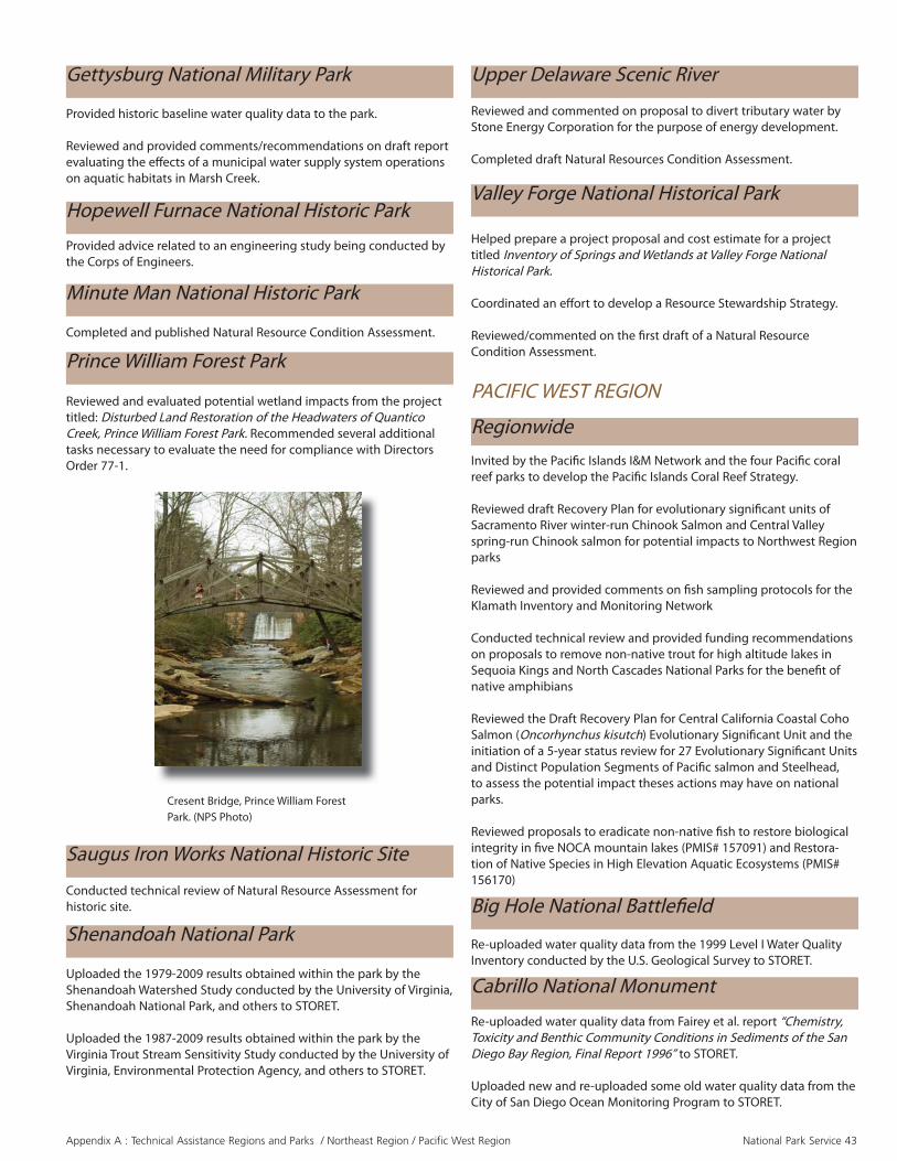
Appendix A : Technical Assistance Regions and Parks / Northeast Region / Pacifi c West Region National Park Service 43
Gettysburg National Military Park
Provided historic baseline water quality data to the park.
Reviewed and provided comments/recommendations on draft report evaluating the eff ects of a municipal water supply system operations on aquatic habitats in Marsh Creek.
Upper Delaware Scenic River
Reviewed and commented on proposal to divert tributary water by Stone Energy Corporation for the purpose of energy development.
Completed draft Natural Resources Condition Assessment.
Valley Forge National Historical Park
Helped prepare a project proposal and cost estimate for a project titled Inventory of Springs and Wetlands at Valley Forge National Historical Park.
Coordinated an eff ort to develop a Resource Stewardship Strategy.
Reviewed/commented on the fi rst draft of a Natural Resource Condition Assessment.
Hopewell Furnace National Historic Park
Provided advice related to an engineering study being conducted by the Corps of Engineers.
Minute Man National Historic Park
Completed and published Natural Resource Condition Assessment.
Prince William Forest Park
Reviewed and evaluated potential wetland impacts from the project titled: Disturbed Land Restoration of the Headwaters of Quantico Creek, Prince William Forest Park. Recommended several additional tasks necessary to evaluate the need for compliance with Directors Order 77-1.
Cresent Bridge, Prince William Forest Park. (NPS Photo)
Saugus Iron Works National Historic Site
Conducted technical review of Natural Resource Assessment for historic site.
Shenandoah National Park
Uploaded the 1979-2009 results obtained within the park by the Shenandoah Watershed Study conducted by the University of Virginia, Shenandoah National Park, and others to STORET.
Uploaded the 1987-2009 results obtained within the park by the Virginia Trout Stream Sensitivity Study conducted by the University of Virginia, Environmental Protection Agency, and others to STORET.
PACIFIC WEST REGION
RegionwideInvited by the Pacifi c Islands I&M Network and the four Pacifi c coral reef parks to develop the Pacifi c Islands Coral Reef Strategy.
Reviewed draft Recovery Plan for evolutionary signifi cant units of Sacramento River winter-run Chinook Salmon and Central Valley spring-run Chinook salmon for potential impacts to Northwest Region parks
Reviewed and provided comments on fi sh sampling protocols for the Klamath Inventory and Monitoring Network
Conducted technical review and provided funding recommendations on proposals to remove non-native trout for high altitude lakes in Sequoia Kings and North Cascades National Parks for the benefi t of native amphibians
Reviewed the Draft Recovery Plan for Central California Coastal Coho Salmon (Oncorhynchus kisutch) Evolutionary Signifi cant Unit and the initiation of a 5-year status review for 27 Evolutionary Signifi cant Units and Distinct Population Segments of Pacifi c salmon and Steelhead, to assess the potential impact theses actions may have on national parks.
Reviewed proposals to eradicate non-native fi sh to restore biological integrity in fi ve NOCA mountain lakes (PMIS# 157091) and Restora-tion of Native Species in High Elevation Aquatic Ecosystems (PMIS# 156170)
Big Hole National Battlefi eld
Re-uploaded water quality data from the 1999 Level I Water Quality Inventory conducted by the U.S. Geological Survey to STORET.
Cabrillo National Monument
Re-uploaded water quality data from Fairey et al. report “Chemistry, Toxicity and Benthic Community Conditions in Sediments of the San Diego Bay Region, Final Report 1996” to STORET.
Uploaded new and re-uploaded some old water quality data from the City of San Diego Ocean Monitoring Program to STORET.

Appendix A : Technical Assistance Regions and Parks / Pacifi c West Region National Park Service 44
California Parks
Prepared and fi led Reports of Licensee and Statements of Water Diversion and Use for triennial fi lings. Approximately 60 statements fi led for DEVA, MOJA, WHIS, REDW, PINN, LAVO, and SEKI.
Channel Islands National Park
Completed fi nal project boundary survey for restoration of Prisoners Harbor coastal wetland.
Completed a fi nal design and grading plan for a 5-acre coastal wet-land/riparian restoration project at Prisoners Harbor, Santa Cruz Island, Channel Islands National Park. Also for this project: 1) established a network of continuous water level recorders to monitor existing (baseline) and post-restoration hydrology and 2) assisted in develop-ing Scopes of Work for nursery services and earthmoving.
Created interactive water rights .pdf fi le for non-NPS water rights within the Reserve.
Re-uploaded water quality data from the 2000 Level I Water Quality Inventory conducted by the U.S. Geological Survey to STORET.
Crater Lake National Park
Re-uploaded results to STORET from a 1987 stream ecology study designed to determine whether human activities have aff ected the biological communities of Munson and Dutton Creeks and the caldera springs.
City of Rocks National Reserve
Death Valley National Park
Researched methods for estimating aquifer properties from water level and barometric data collected at well BLM-1.
Provided guidance and assistance removing instrumentation, stilling well and staff gages then reinstalling a staff gage in order to monitor water levels in Devils Hole.
Reviewed and fi led objections to water rights applications as needed to protect park water rights.
Reviewed data stored on NWIS by USGS and made recommendations to USGS to correct water level data at Devils Hole Well. Reviewed pressure data collected at the Gravity Fault wells and made recom-mendations for corrections.
Continued to compile and archive data from nine groundwater sta-tions in the Furnace Creek Wash area at DEVA not processed by WRB data processing staff .
Updated the Theis multiple regression analysis to evaluate the eff ects of historic pumping on water levels at Devils Hole. Presented a pow-erpoint presentation titled “One Fish, Two Fish, Pupfi sh, Blue Fish…Protecting Water Levels at Devils Hole” at the 2010 American Fisheries Society Meeting held in Redding, CA.
Compiled Geneerco water use histories and evaluated the potential impacts to park resources from the water rights considered under change applications fi led by Solar Millennium.
Assisted in preparation of stipulation to resolve water rights concerns and provided comments on the draft EIS associated with the Amar-gosa Farm Road Solar Energy Project (Solar Millennium).
Provided technical review for BLM, Solar Energy PEIS for Proposed Energy Zones in Nevada. Evaluated water uses for DOI’s “Fast-Track” solar energy projects pro-posed near park, and coordinated water issues with Directorate, park, region, and NRPC external energy program manager.
Compiled Amargosa Basin pumping records from the Nevada State Engineer and evaluated the priority of water rights held in Amargosa Basin.
Participated in the biannual Amargosa Coordination Meetings, monthly and bimonthly conference calls, and coordinated with other federal agencies regarding common interests and concerns within the Amargosa Desert hydrologic basin, including solar energy develop-ment, land disposal issues, and the BLM Las Vegas proposed revision to the Resource Management Plan.
Reviewed briefs fi led in the matter of Nye County, Rockview Dairies, Inc., et al., vs. Jason King, P.E., Nevada State Engineer concerning State Engineer’s Order 1197 and Ruling 5902.
Discussed issues related to movement of water rights closer to Devils Hole with Nevada State Engineer and representatives, and reviewed proposed method of evaluation contemplated by Nevada State Engi-neer per Order 1197. Provided Nevada State Engineer with concerns related to the proposed methodology.
Reviewed Settlement Agreement and proposed monitoring plan sub-mitted by Rockview Dairies per Ruling 5902 and provided comments to Nevada State Engineer.
Coordinated with Nye County representatives regarding NPS water groundwater development concerns in the Amargosa Desert.
Contributed to the planning of the 2010 Devils Hole Workshop.
Managed USGS interagency agreements, including cost-share for the Southern Amargosa. Embedded Model project.
Represented the National Park Service on the Incident Command (IC) team for the interagency eff ort to prevent the extinction of the Devils Hole pupfi sh (Cyprinodon diabolis).
Acted as peer-review manager for the long term monitoring plan for Devils Hole. The plan has been fi nalized subject to NEPA review.
Reviewed the Detailed Implementation Plan for the NRPP-BR funded project “Devils Hole Physical Model” and approved release of the fi rst year of project funding.
Golden Gate National Recreation Area
Reviewed design parameters and channel reconstruction for Redwood Creek.
Provided review of local government drainage and sediment plan.
Provided design work for the Rodeo Wetland - Surfer Parking Lot restoration project.

Appendix A : Technical Assistance Regions and Parks / Pacifi c West Region National Park Service 45
Great Basin National Park
Obtained an agreement with Baker Ranches, Inc. whereby they will withdraw their protest to four instream fl ow water right applications by the park.
Reviewed and fi led objections to water rights applications as needed to protect park water rights.
Managed ongoing project to evaluate basin-fi ll aquifers in southern Spring and Snake Valleys and their connection with surface-water resources and with the Regional Carbonate-rock Aquifer.
Prepared for future Nevada water rights hearing by conducting scien-tifi c investigations that include the collection of streamgaging, water quality, geology, and hydrogeology data.
Provided testimony in a Utah water rights hearing concerning the Central Iron County Water Conservancy District water right applica-tions. Conducted fi eld reconnaissance of springs and provided supplemental information for the hearing record.
Served as NPS technical representative on hydrology issues for Spring Valley and the Delamar, Dry Lake, and Valley Stipulated Water Rights Agreements.
Participated in the Clark, Lincoln and White Pine Counties Ground-water Development EIS process. Reviewed groundwater models and draft EIS. Participated in hydrology meetings with cooperating agen-cies. Briefed BLM and Department on NPS concerns for the EIS.
Participated in the Nevada Water Resources Association annual conference.
John Day Fossil Beds National Monument
Completed and published Natural Resources Condition Assessment.
Joshua Tree National Park
Provided technical review for BLM, Solar Energy PEIS for Proposed Energy Zones in California.
Evaluated water uses for DOI’s “Fast-Track” solar energy projects proposed near park, and coordinated water issues with Directorate, park, region, and NRPC external energy program manager.
Provided extensive review and consultation on development of a contract to perform engineering analysis of fl ood risk and stormwater management in the Black Rock Campground.
Stella Lake, Great Basin National Park. (NPS Photo)
Kalaupapa National Historical Park
Completed the watershed condition assessment.
Kaloko-Honokohau National Historical Park
Briefed new Superintendent on key groundwater quantity protection issues and prepared a briefi ng statement for the Superintendent and Natural Resource Program Center.
Participated in a water rights protection strategy session with the Su-perintendent, the Chief of Integrated Cultural and Natural Resources, the Director of the Pacifi c Area Network, and the Offi ce of the Solici-tor.
Represented the National Park Service at the sixth meeting of the Kona Water Roundtable in Kona, HI on September 23, 2010.
Summarized water level and water quality data for three monitor wells in the park and up to 16 monitor, pumping, and injection wells at the adjacent “The Shores of Kohanaiki” development and provided data in reports to the park and the Solicitor’s Offi ce.
Provided public comment to the Deputy Director of the Commission on Water Resource Management regarding the Well Construction / Pump Installation Permit for Well No. 3959-01 (Kamakana) – a new pumping well in the basal aquifer.
Provided public comment to the Deputy Director of the Commission on Water Resource Management regarding the Well Construction / Pump Installation Permit for Well No. 4157-02 (Honokohau 2) – a new municipal well in the high-level aquifer.
Provided technical assistance in negotiating a monitoring plan for the proposed Ooma Beachside Village desalination plant requiring the de-veloper to construct a deep monitor well and to monitor water level and conductivity in the well for at least two years.
Provided continued technical assistance in preparing background in-formation, written and oral testimony, and fi ndings of fact in support of Land Use Commission Docket A07-774 administrative hearing for the proposed Ooma Beachside Village, and attended the administrative hearing held on April 7, 2010
Provided technical review of the Draft Environmental Assessment for improvements to Well No. 3957-05 (Keopu-HFDC).
Developed and received funding from the Climate Change Response Program for proposal titled “Understanding Past/Future Eff ects of Climate Change on Water-Dependent Cultural Resources at KAHO.” Provided technical review of the draft Federal Environmental Assess-ment for LaiOpua Community Center and provided comments to the U.S. Department of Housing and Urban Development regarding the fi nal Federal Environmental Assessment.
Provided technical review of an educational fl yer on the park’s groundwater resources for the NPS Inventory & Monitoring Program.
Managed USGS interagency agreements and CESU agreement in support of research to better understand the impact of groundwater withdrawals on cultural and natural resources in the park.

Appendix A : Technical Assistance Regions and Parks / Pacifi c West Region National Park Service 46
Reviewed contaminants-related technical papers and results from the Kohanaiki injection well.
Reviewed and evaluated the “Kaloko-Honokohau Cultural Live-In Center Environmental Assessment for Kaloko-Honokohau National Historical Park.” Reviewed the fi nal site location for potential wetland impacts and provided language to complete the wetland compliance sections of the EA.
Provided on-site evaluation of a 30-acre estuarine cultural fi sh pond called Aimakapa. Made recommendations for restoring foraging and nesting habitat for endangered shore birds and provided objectives and construction tasks necessary to complete the restoration in a trip report.
Provided advice related to the location of park visitor services in the coastal high hazard area.
Lassen Volcanic National Park
Developed a proposal titled “Restoration Implementation Plan for Drakesbad Meadow.”
Wrote an NPS wetland compliance section for the draft “Warner Valley Comprehensive Site Plan Environmental Assessment, Lassen Volcanic National Park.”
Mojave National Preserve
Provided information on estavelles to park staff .
Assisted park with development of a management plan for springs and guzzlers.
Assisted on the Mountain Pass Mine groundwater plume.
Received draft USGS Geologic cross section report covering the area of a groundwater fl ow model
Reviewed and fi led objections to water rights applications as needed to protect park water rights.
Managed ongoing project to produce a numerical groundwater model to support water rights protection.
Managed ongoing project to investigate the hydrogeology of hot springs in the Black Canyon below Hoover Dam.
Provided guidance on work activities of Water Resources Professional stationed at the lake.
Reviewed and provided comments on technical groundwater report produced by the Moapa Band of Piutes.
Provided technical review for BLM, Solar Energy PEIS for Proposed Energy Zones in Nevada.
Participated in the Clark, Lincoln and White Pine Counties Ground-water Development EIS process. Reviewed groundwater models and draft EIS. Participated in hydrology meetings with cooperating agen-cies.
Participated in the Nevada Water Resources Association annual conference.
Provided guidance to the NPS’ Submerged Resources Center on obtaining water and sediment quality data for investigating invasive mussel issues at the park.
Represented the park in technical discussions to summarize pastinformation on limnology, ecology, contaminants, and endocrine disruption issues in Lake Mead.
Minidoka National Historic Site
Compiled historical water quality data and information for the Solicitor’s offi ce in connection with a proposed confi ned animalfeeding operation near the park.
Re-uploaded water quality data from the 1999 Level I Water Quality Inventory conducted by the U.S. Geological Survey to STORET.
Provided on-site evaluation of the hydrologic conditions of the Weippe Prairie and made recommendations identifi ed wetland resto-ration opportunities including the restoration of Jim Ford Creek and the associated palustrine wetland meadow.
WRD and a cooperator from Colorado State University will prepare a proposal for funding to: 1) evaluate existing wetland hydrology at Weippe Prairie; 2) study land use and drainage changes over time through historical aerial photo analysis; and 3) conduct a pilot restoration study.
Lake Mead National Recreation Area
Lake Roosevelt National Recreation Area
Prepared memo to park superintendent regarding state’s determination that water from proposed well would not be “park” wa-ter subject to DO 35.
Mount Rainier National Park
Conducted hydrogeologic assessment for a new well at the Carbon River entrance.
Provided technical and policy review and evaluation of the Carbon River Area Access Management Environmental Assessment, Mount Rainier National Park.
Reviewed and evaluated several drafts of the “Wetland Statement of Findings for the Carbon River Area Access Management, Environmental Assessment, Mount Rainier National Park.”
Nez Perce National Historical Park
Nez Perce National Historical Park (Photo credits unknown)

Appendix A : Technical Assistance Regions and Parks / Pacifi c West Region National Park Service 47
North Cascades National Park
Reviewed Floodplain Statement of Findings for Stehekin River Cor-ridor Plan.
Reviewed the annual accomplishment report for the NRPP project “Eradicate Non-native Fish from Seven High Priority Lakes in North Cascades National Park Service Complex (NOCA)” and approvedrelease of FY10 funds.
Provided input on Senate legislation that would allow stocking to continue in 45 historically fi shless mountain lakes.
Concluded project non-native fi sh species. The project included the monitoring of native amphibian species and macro-invertebrates.
Olympic National Park
Provided continuing assistance related to the Elwha River Restora-tion Project through the sediment management team. Results of tree removal and recommendations for further actions to prepare the Lake Mills delta for dam removal were investigated.
Evaluated potential to develop a groundwater source at Kalaloch and other areas in the park.
Funded development of ocean acidifi cation monitoring protocols.
Reviewed and evaluated the wetland impacts associated with a pro-posed rehabilitation of a wilderness campground. Recommended several additional tasks necessary to evaluate the need for compliance with Directors Order 77-1, and suggested a course of action necessary to achieve compliance with the Army Corps wetland permit process.
Conducted fl oodplain assessment/analysis of Sandy Creek and au-thored technical report.
Conducted cursory watershed assessment and provided on-site ad-vice and technical report for restoration approaches.
Pinnacles National Monument
Provided on-site evaluation and technical assistance with a drainage/erosion problem that is adversely impacting cultural features along the shoreline.
Pu’ukohola Heiau National Historic Site
Santa Monica Mountains National Recreation Area
Reviewed and commented on fl oodplain Statement of Findings.
Pinnacles National Monument. (NPS Photo)
Point Reyes National Seashore
Partnered with USGS to develop benthic habitat maps.
Continued to work with and to fund and manage the removal of non-native plant species, primarily cape ivy, along coho salmon habitat in the park.
Pu‘uhonua o Honaunau National Historical Park
Identifi ed, two issues signifi cant to the successful protection and management of wetland resources. Assisted in writing two proposals to address the primary issues titled: (1) “Anchialine Pool and Wetland Restoration at Keokea ahupua‘a, PUHO” and (2) “Delineation and Functional Assessment of Anchialine Wetland Pool and Riparian Eco-systems within PUHO” to provide information needed for the develop-ment of a wetlands management plan.
Redwood National and State Parks
Uploaded fi sh data to STORET from a 2000-2001 study by Douglas Parkinson and Associates designed to determine various aspects of outmigrating salmon and steelhead populations in the upper Red-wood Creek drainage basin.
Uploaded sediment data from 1979-1999 to STORET from a joint Na-tional Park Service and U.S. Geological Survey project to monitor Red-wood Creek channel cross sections to document changes in geometry and the movement of sediments.
Mapped wetlands at the proposed Strawberry Creek Restoration Site and submitted maps and technical documentation to park manage-ment in the form of a trip report. The wetland map and report will be used in the compliance process for the proposed restoration.
San Juan Islands National Historical Park
Coordinated with park staff and Univ. of Washington CESU coopera-tors use of a WRD continuous monitoring sonde to monitor water quality in Garrison Bay.
Partnered with USGS to develop benthic habitat maps.

Appendix A : Technical Assistance Regions and Parks / Pacifi c West Region / Southeast Region National Park Service 48
Advised staff regarding wetland compliance requirements for the Tenaya Lake Area Plan Environmental Assessment.
Approved the fi nal “El Capitan Meadow Wetland and Stream Delinea-tion Report, Yosemite National Park.” Recommended fi eld verifi cation procedures to verify the delineation results and complete the fi nal draft.
Reviewed and evaluated the “Ordinary High Water Delineation Report for the Tenaya Lake, Yosemite National Park. “ Comments were used to refi ne the delineation to include lacustrine wetlands under NPS jurisdiction.
Provided on-site evaluation and technical assistance after reviewing eight major wetland and fl oodplain issues. Comments and recom-mendations were recorded in a trip report which will be used to sub-stantiate funding proposals.
Sequoia and Kings Canyon National Park
Reviewed fl oodplain Statement of Findings for Restoration of South Fork Kings River.
Conducted fl oodplain assessment for Mineral King area and complet-ed fl oodplain analysis for Cold Springs Campground.
Assessed potential to replace surface water sources with groundwater wells for public water supplies at several sites in the park.
Assisted in developing a scope of work to assess effi cacy of wastewa-ter disposal systems at Mineral King.
Provided advice for construction of a test well in the Giant Forest area.
Conducted fi eld work for wetland delineations and mapping at Min-eral King Valley. Park staff requested this assistance to support devel-opment of a management plan for 63 privately-owned cabins (with septic systems) located along the East Fork of the Kaweah River.
Provided continued assistance in planning and designing the restora-tion of 4.5 acres of degraded wetlands in Lower Halstead Meadow.
Assisted staff in determining how to repair damage to the pilot resto-ration in Upper Halstead Meadow that occurred after a large (roughly 15-year return interval) fall rainstorm.
Whiskeytown National Recreation Area
Provided technical assistance regarding ongoing restoration of salt springs that support the only known population of Howell’s alkali-grass (Puccinellia howellii).Obtained WRD funding for supplemental hydrologic monitoring equipment.
Provided review of Pulcinella restoration in the Environmental Assess-ment.
Wrangell – St. Elias National Park and Preserve
Reviewed and evaluated the “Wetland Delineation Report for the Wrangell – St. Elias National Park and Preserve Off -Road Vehicle Trails Environmental Impact Statement.”
Yosemite National Park
Reviewed Floodplain Statement of fi ndings for Tenaya Lake Area Plan.
Provided on-site consultation and co-authored a technical report for a variety of stream wetland issues within the park.
Produced grading plan and estimated fi ll volume for wetlands restora-tion in Wawona area.
Provided technical review and comment on a draft report “Delinea-tion of Jurisdictional Waters, Including Wetlands for the Badger Pass Ski Lodge Area Rehabilitation Project” at Yosemite National Park.
Provided technical review and comment on a draft “Wetlands State-ment of Findings for the Badger Pass Ski Lodge Rehabilitation Project” at Yosemite National Park.
SOUTHEAST REGION
Regionwide
Provided training and support to the SER’s newly appointed NRCA regional lead, who will oversee NRCA projects within that region to ensure consistency with national guidance.
Co-chair of the NRDA Submerged Aquatic Vegetation Technical Work-ing Group for the DeepWater Horizon oil spill.
Facilitated meetings between EPA’s national water quality offi ce and Florida park water quality specialists to provide NPS perspectives and data for the new national water quality regulations for Florida coastal waters.
Big Cypress National Park
Reviewed Floodplain Statement of Findings for Lands Addition.
Reviewed and evaluated the wetland sections of the “Draft General Management Plan/Wilderness Study/Off -Road Vehicle Management Plan/Environmental Impact Statement for Big Cypress National Preserve.”
Reviewed and evaluated the draft “Wetland Statement of Findings for the Protection of Wetlands at Big Cypress National Preserve.”
Reviewed and evaluated several drafts of the “Owen Billie, Joe Jimmie, and Rainey Jim Camps New Home and Septic System Expansion Wet-land Statement of Findings for Big Cypress National Preserve.”
Big South Fork National River and Recreation Area
Provided wild and scenic river program guidance regarding the construction of the Roberta Landfi ll. Reviewed and evaluated the impacts to a riverine wetland system part of the proposed development of a Class I landfi ll in Scott County TN – a tributary to the Big South Fork National River and Recreation Area.
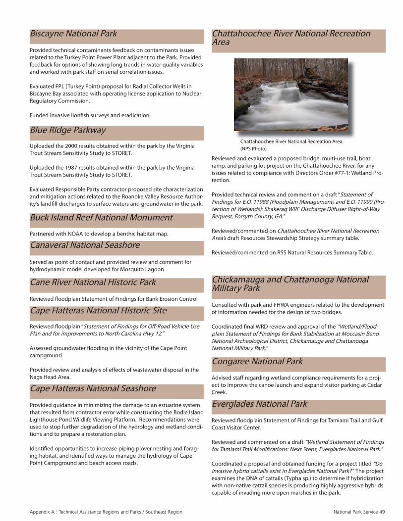
Appendix A : Technical Assistance Regions and Parks / Southeast Region National Park Service 49
Reviewed fl oodplain “Statement of Findings for Off -Road Vehicle Use Plan and for improvements to North Carolina Hwy 12.”
Assessed groundwater fl ooding in the vicinity of the Cape Point campground.
Provided review and analysis of eff ects of wastewater disposal in the Nags Head Area.
Served as point of contact and provided review and comment forhydrodynamic model developed for Mosquito Lagoon
Biscayne National Park
Provided technical contaminants feedback on contaminants issues related to the Turkey Point Power Plant adjacent to the Park. Provided feedback for options of showing long trends in water quality variables and worked with park staff on serial correlation issues.
Evaluated FPL (Turkey Point) proposal for Radial Collector Wells in Biscayne Bay associated with operating license application to Nuclear Regulatory Commission.
Funded invasive lionfi sh surveys and eradication.
Cape Hatteras National Seashore
Cape Hatteras National Historic Site
Partnered with NOAA to develop a benthic habitat map.
Cane River National Historic Park
Reviewed fl oodplain Statement of Findings for Bank Erosion Control
Uploaded the 2000 results obtained within the park by the Virginia Trout Stream Sensitivity Study to STORET.
Uploaded the 1987 results obtained within the park by the Virginia Trout Stream Sensitivity Study to STORET.
Evaluated Responsible Party contractor proposed site characterization and mitigation actions related to the Roanoke Valley Resource Author-ity’s landfi ll discharges to surface waters and groundwater in the park.
Provided guidance in minimizing the damage to an estuarine system that resulted from contractor error while constructing the Bodie Island Lighthouse Pond Wildlife Viewing Platform. Recommendations were used to stop further degradation of the hydrology and wetland condi-tions and to prepare a restoration plan.
Identifi ed opportunities to increase piping plover nesting and forag-ing habitat, and identifi ed ways to manage the hydrology of Cape Point Campground and beach access roads.
Blue Ridge Parkway
Buck Island Reef National Monument
Canaveral National Seashore
Reviewed and evaluated a proposed bridge, multi-use trail, boat ramp, and parking lot project on the Chattahoochee River, for any issues related to compliance with Directors Order #77-1: Wetland Pro-tection.
Provided technical review and comment on a draft “Statement of Findings for E.O. 11988 (Floodplain Management) and E.O. 11990 (Pro-tection of Wetlands): Shakerag WRF Discharge Diff user Right-of-Way Request, Forsyth County, GA.”
Reviewed/commented on Chattahoochee River National Recreation Area’s draft Resources Stewardship Strategy summary table.
Reviewed/commented on RSS Natural Resources Summary Table.
Chattahoochee River National Recreation Area
Chattahoochee River National Recreation Area. (NPS Photo)
Chickamauga and Chattanooga National Military Park
Consulted with park and FHWA engineers related to the development of information needed for the design of two bridges.
Coordinated fi nal WRD review and approval of the “Wetland/Flood-plain Statement of Findings for Bank Stabilization at Moccasin Bend National Archeological District, Chickamauga and Chattanooga National Military Park.”
Congaree National Park
Advised staff regarding wetland compliance requirements for a proj-ect to improve the canoe launch and expand visitor parking at Cedar Creek.
Everglades National Park
Reviewed fl oodplain Statement of Findings for Tamiami Trail and Gulf Coast Visitor Center.
Reviewed and commented on a draft “Wetland Statement of Findings for Tamiami Trail Modifi cations: Next Steps, Everglades National Park.”
Coordinated a proposal and obtained funding for a project titled “Do invasive hybrid cattails exist in Everglades National Park?” The project examines the DNA of cattails (Typha sp.) to determine if hybridization with non-native cattail species is producing highly aggressive hybrids capable of invading more open marshes in the park.

Appendix A : Technical Assistance Regions and Parks / Southeast Region National Park Service 50
Fort Pulaski National Monument
Reviewed fl oodplain Statement of Findings for Cockspur Lighthouse.
Wrote a $1.7 million project proposal titled “Restoration of Freshwater Wetlands to Estuarine Habitat at Fort Pulaski National Monument.” The proposal was a response to a request to provide a summary for climate-change funding consideration and at the same time serve as a fact sheet for Congress.
Coordinated fi nal WRD review and approval of the “Wetland State-ment of Findings for Proposed Bank Stabilization of the Cockspur Island Lighthouse.”
Uploaded results from a 1986-1988 Gulf Coast Research Laboratory project to STORET designed to collect baseline data for developing an environmental monitoring program and rationale for interpreting, assessing, and documenting resource impacts.
Re-uploaded results from a NOAA Sea Grant sponsored 1989-1990 study on the importance of seagrass communities to STORET.
Reviewed fl oodplain Statement of Findings for Fort Pickens Pier and Ferry Service.
Funded Dauphin Marine Laboratory to measure the impacts of oil on seagrass beds.
Great Smoky Mountains National Park
Uploaded water quality data collected during 2009 by park staff and the University of Tennessee from NPSTORET to STORET.
Uploaded the 2009 data from the Noland Divide long-term water quality monitoring project from NPSTORET to STORET.
WRD and GRD staff started work in 2009 on a “Physical Resources Information and Issues Overview report at Great Smoky Mountains National Park.” As part of the project eff ort, WRD staff facilitated a workshop in FY09 to focus on air, geologic, soil, and water resource issues at GRSM.
Reviewed the annual accomplishment report for the NRPP T&E funded project “Recovery Evaluation of Introduced Endangered and Threatened Fish Species at Great Smoky Mountains National Park” and approved release of FY10 funds.
Gulf Islands National Seashore
Reviewed and commented on multiple drafts of an “Environmental Assessment: Mississippi Coastal Improvement Plan, Barrier Island Restoration Plan, Ecosystem Restoration Near Fort Massachusetts on West Ship Island, Gulf Islands National Seashore.” The project involves beach nourishment in the intertidal zone using dredged sand.
Cockspur Lighthouse, Fort Pulaski National Monument.(NPS Photo)
Natchez Trace Parkway
Uploaded water quality data from the 2007-2009 Level I Water Quality Inventory conducted by the Gulf Coast Network to STORET.
Reviewed fl oodplain statement of fi ndings for Multi-use Trail Segment 3P16 and the Coley Road/Barnes Crossing Extended.
Coordinated fi nal WRD review and approval of the “Wetland State-ment of Findings for the Coley Road/Barnes Crossing Extended Road-way Project.”
Provided technical and policy review and evaluation of several draft “Wetland Statements of Findings for the Natchez Trace Parkway Multi-Use Trail, 3P18.” Recommended alternative alignments that would reduce wetland impacts and approved the wetland compensation design.
Reviewed and evaluated a “Wetland Delineation Report for the Natchez Trace Parkway Multi-Use Trail, Milepost 105.8 to 108.3.”
Obed Wild and Scenic River
Received fi nal report on underwater video habitat mapping from the University of Tennessee.
Attended the annual meeting of the Cumberland Habitat Conserva-tion Plan Science Advisory Committee.
Planned, facilitated and presented at a workshop to determine the outstanding resource values for the wild and scenic river.
Completed the hydrologic analysis portion of a Section 7 analysis for the proposed Lake Tansi Water Harvesting project.
Salt River Bay National Park and Ecological Preserve
Partnered with NOAA to develop a benthic habitat map.
Timucuan Ecological and Historic Preserve
Established contact with Saint Johns River Water Management District regarding proposed withdraw of waters

Appendix A : Technical Assistance to Networks National Park Service 51
Appalachian Highlands Network
Provided assistance in creating benthic macroinvertebrate characteristic defi nitions in NPSTORET and example spreadsheet-based imports against the characteristic defi nitions.
TECHNICAL ASSISTANCE TO NETWORKS
Greater Yellowstone Network
Provided review and comment on “Data Management Procedures for Water Resource Monitoring Version 1.0 September 30, 2009: Standard Operating Procedure #13”.
Provided a variety of guidance on standardizing water quality data management across the Network in NPSTORET.
Great Lakes Network
Uploaded the 2009 water quality data for Apostle Islands National Lakeshore from NPSTORET to STORET.
Uploaded the 2009 water quality data for Indiana Dunes National Lakeshore from NPSTORET to STORET.
Uploaded the 2009 water quality data for Isle Royale National Park from NPSTORET to STORET.
Uploaded the 2009 water quality data for Pictured Rocks National Lakeshore from NPSTORET to STORET.
Uploaded the 2009 water quality data for Saint Croix National Scenic Riverway from NPSTORET to STORET.
Uploaded the 2009 water quality data for Sleeping Bear Dunes Na-tional Lakeshore from NPSTORET to STORET.
Uploaded the 2009 water quality data for Voyageurs National Park from NPSTORET to STORET.
Cumberland Piedmont Network
Uploaded all water quality data through 2009 from NPSTORET to STORET for 14 Network parks.
Gulf Coast Network
Uploaded all water quality data through 2009 from NPSTORET to STORET for 8 Network parks.
Klamath Network
Provided review and comment on the “Klamath Network Integrated Aquatic Community and Water Quality Monitoring of Mountain Ponds and Lakes Protocol”.
Mid-Atlantic Network
Uploaded all available water quality data from NPSTORET to STORET for Network parks as of March 2010.
Early morning catch. Yellowstone National Park, Wyoming. (NPS Photo)
National Capital Region Network
Uploaded all water quality data through 2008 from NPSTORET to STORET for 10 Network parks.
North Coast and Cascades NetworkProvided review and comment on the “Protocol for Long Term Moni-toring of Mountain Lakes in the North Coast and Cascades Network of National Parks”.
Provided advice and materials for transmitting water quality data via the NPS Electronic Data Deliverable specifi cation, NPSTORET, and the Natural Resource Database Template.
Northern Colorado Plateau Network
Provided support and recommendations on importing data from disparate sources into NPSTORET, creating projects and organization, and conducting exceedance analyses.
Rocky Mountain Network
Provided support and recommendations on mapping the Network’s water quality data collection to the NPSTORET schema.
San Francisco Bay Area Network
Provided review and comment on various topics related to water quality data management and NPSTORET.
Uploaded the 2009 ambient water quality monitoring program data for several project from NPSTORET to STORET.
Coordinated peer review and approval of Streamfl owMonitoring Protocol.

Appendix A : Technical Assistance to Networks National Park Service 52
SFAN Network
Assisted in development and review of stage discharge relationships for stream gaging stations using Aquatic Informatics, Inc. Aquarius 2.6 Rating Toolbox.
Southeast Alaska Network
Provided review and comment on the “Glacier Bay National Park and Preserve Oceanographic Monitoring Protocol”.
Provided information on the NPS Electronic Data Deliverable fi le spec-ifi cations for submitting data logger fi les for inclusion in STORET.
Sierra Nevada NetworkProvided review and comment on the “Sierra Nevada Network Lake Monitoring Protocol”.
Provided background and status information on the Network’s water resource inventories.
Southern Colorado Plateau Network
Provided support and recommendations on mapping the Network’s water quality data collection to the NPSTORET schema.
Southwest Alaska Network
Provided review, consultation, and input on a draft schema for NPS continuous water resources data management using Aquarius Work-station and the Aquarius Database.

Appendix B : Summary of Water Resources Division Funding National Park Service 53
APPENDIX B
SUMMARY OF WATER RESOURCES DIVISION FUNDING FY 2010 base funding for the Water Resources Division was $12,472,000 (see Figure 1). These funds are distributed among fi ve principal categories: 1) Water Resource Projects (Water Resource Protection, Competitive Projects, and Other) 2) Water Quality Monitoring 3) Water Resource Protection (Aquatic Resource Professionals) 4) Natural Resource Condition Assessment Program (including projects) 5) Water Resource Technical Assistance (see Figure 2).
Figure 1: Water Resources Program
Funding $(000)
FY 2009 allocation 12,316,000
Classifi ed Pay Increase $173,000
2009 Travel reduction <$17,000>
Total Available in FY 2009 12,472,000
FY 2010 allocation 12,472,000
Classifi ed Pay Increase $148,000
Net FY 2010 Increase 1,250,000
Total available SUMMARY OF WATER RESOURCES DIVISION FUNDING 13,870,000
Figure 2: Water Resources Program Funding by Catagories
Funding Water Resources Projects $(000)
Water Resource Protection 657,800
Other Projects 14.20
Water Quality Vital Signs Monitoring 2,737.90 Natural Resource Condition Assessment Program 2,335,700 Natural Resource Condition Assessments Projects 1,998.5 High Priority Projects 316.7 Other Projects 20.5
Water Resource Protection--Aquatic Resource Professionals 1,327,410
Legacy High Priority Projects 182,710
Water Resource Technical Assistance 5,364,250
Ocean & Coastal Resources 1,250,000
Total 13,870,000

Appendix B : Summary of Water Resources Division Funding National Park Service 54
A summary of accomplishments derived from the FY 2009 base budget and the FY 2010 increase is provided below
Water Resource Protection Projects
The Natural Resource Challenge resulted in an increase of $823,000 per year for water resource protection projects beginning in FY 2001. As shown in Table 1, FY 2010 expenditures funded data collection and analyses to describe surface and ground water fl ow regimes and investigate the dependence of park resources upon water. These studies support the Department of the Interior Water Quantity Strategic Goal and NPS water resource protection needs associated with water allocation decisions. Results are used to develop water resource protection strategies that are implemented through settlement discussions, state or federal regulatory processes (e.g, NEPA, 404 permitting actions, reservoir operations), administrative hearings (e.g., water right protests), or state and federal court proceedings (e.g, basin-wide adjudications).
In 2010 project funds were specifi cally used to: a) collect water resource data to meet data reporting requirements, b) develop predictive capa-bilities through surface or ground water models, c) monitor impacts of reservoir releases on riparian/wetland vegetation, d) monitor impacts of ground-water development on endangered fi sh, e) and investigate the importance of fresh and brackish water on anchialine ponds.
Many issues faced by NPS are also a concern to other federal entities including the U.S. Fish and Wildlife Service, the Bureau of Land Manage-ment, the Bureau of Reclamation, the U.S. Army Corps of Engineers, and the U.S. Geological Survey. The NPS partners with these federal agen-cies to provide funding and expertise in supporting water resource investigations useful for resolving multi-agency issues in complex water allocation decisions.
To increase the eff ectiveness of its water resource protection funding, the NPS also partners with non-federal entities. Collaboration with state or private entities increases the likelihood of reaching settlements that protect NPS water resources values while allowing future water development and economic growth. For example, hydrologic data collected by the NPS for Lake Mead National Recreation Area, Death Valley National Park, and Great Basin National Park are shared with the Nevada State Engineer, southern Nevada water purveyors, and private developers. This contributes to a better understanding about the regional aquifer system and potential ground water availability in southern Nevada. In another example, groundwater monitoring data collected at Great Sand Dunes National Park and Preserve will be used by the NPS, the State of Colorado and the local water conservation district to develop a basin-wide groundwater model for implementing recently decreed water rights.
Finally, the results of these investigations must be presented in various legal forums to secure and protect water rights and water-dependent resources. Therefore, a portion of the water resource protection funds were used to support an attorney from the Offi ce of the Solicitor to provide advice and to represent the National Park Service in legal proceedings.
Aerial View of Lake Mead Recreation Area showing “bathtub” ring. (NPS photo)

Appendix B : Summary of Water Resources Division Funding National Park Service 55
Table 1: Water Resource Protection Projects -- FY 2010
Park Region Project Title FY 2010 Funding $(000)
ALL ALL Support to the Offi ce of the Solictor/Secure NPS Water Resources 197.0
BLCA IMR Hydrologic Collection and Development of a Monitoring Plan to Protect 15.0 Decreed Instream Flows
DEVA PWR Hydrologic Data Collection to Protect Devil’s Hole 4.0
LAME PWR Hydrologic Data Collection and Groundwater Modeling 15.2
KAHO PWR Development of Groundwater Model and Investigation of Water 276.0 Dependent Values
GRSA IMR Hydrogeologic Data Collection to Meet Court Decree 32.8
GRTE IMR Development of a Water Beudget for the Gros Ventre River 6.0
GRBA PWR Hydrologic Data Collection and Groundwater Modeling 55.8
ALL ALL Technical Support to All Projects and Technical Assistances 56.0
TOTAL 657.8
WATER QUALITY VITAL SIGNS MONITORING
The National Park Service is committed to a servicewide and DOI strategic goal to signifi cantly reduce the number of stream and river miles and acres of lakes and marine areas that do not meet water quality standards. As part of this goal, the NPS is also committed to protecting unimpaired water quality in parks from future degradation, including waters classifi ed as Outstanding National Resource Waters (ONRW) or State-equivalent listed waters. The NPS is committed to working with State Clean Water Act programs, as well as taking appropriate manage-ment actions within parks, to support the restoration of impaired water bodies in parks to an unimpaired condition. Presently, about 120 park units have one or more waterbodies that do not meet state water quality standards for one or more pollutant; approximately 1,800 miles of riv-ers and streams and 1,066,000 acres of lakes, reservoirs, estuaries and marine areas do not meet standards . Planning and design of the program continues to be implemented with the NPS Vital Signs Monitoring Program since water quality is key in determining overall aquatic ecosystem health. In addition, by fully integrating the design of these two programs, considerable cost effi ciencies have and will continue to be realized in staffi ng, planning and design, administration, implementation, data management, and reporting.
Full program funding was allocated to all 32 Park Vital Signs Networks in FY 2010 (Table 2). In addition, funds supported the development of an NPS Servicewide water quality data management program within the U.S. Environmental Protection Agency (EPA) STORET national water quality database. While not shown in Table 2, WRD reallocated 10 work-months involving fi ve Division staff to support program administration and the development of program technical guidance, technical protocols, detailed study plan, and quality control/quality assurance plan guidance, and database management.

Appendix B : Summary of Water Resources Division Funding National Park Service 56
Table 2: Allocation of Water Quality Park Vital Signs Monitoring Funding -- FY 2010
Network Region Number of Aff ected FY 2010 Parks Funding $(000)
Central Alaska Alaksa 5 94.2
Heartland Midwest 15 78.8
NE Coastal and Barrier Northeast 8 86.5
National Capital National Capital 11 68.2
Cumberland/Piedmont Southeast 14 56.7
Appalachian Highlands Southeast 4 67.2
North. Colorado Plateau Intermountain 16 103.7
Greater Yellowstone Intermountain 3 68.2
Sonoran Desert Intermountain 11 61.5
North Coast & Cascades Pacifi c West 7 78.8
San Francisco Bay Pacifi c West 6 67.2
Mediterranean Coast Pacifi c West 3 73.0
Southwest Alaska Alaska 5 133.6
Northeast Temperate Northeast 10 57.7
Southern Colorado Plateau Intermountain 19 119.1
Pacifi c Lakes Pacifi c West 9 145.1
Great Lakes Midwest 9 118.2
Gulf Coast Southeast 8 85.5
Rocky Mountain Intermountain 6 58.6
Sierra Nevada Pacifi c West 3 60.6
Eastern Rivers and Mountains Northeast 9 60.6
Artic Alaska 5 144.1
Klamath Pacifi c West 6 73.0
Southeast Coast Southeast 17 116.3
Upper Columbia Basin Pacifi c West 8 48.0
Southern Plains Intermountain 10 27.9
Mojave Desert Pacifi c West 6 76.9
Southeast Alaska Alaska 3 40.4
South Florida/Caribbean Southeast 6 141.3
Mid-Atlantic Northeast 11 42.3
Chihuahuan Intermountain 6 70.2
Northern Great Plains Midwest 13 77.9
TOTAL: 2010 Network Monitoring 7 NPS Regions 272 2601.3
Servicewide Data Management 136.6
GRAND TOTAL 2,737.9

Appendix B : Summary of Water Resources Division Funding National Park Service 57
Vital Signs Monitoring Networks: In FY 2010, 32 Park Vital Signs Monitoring Networks fully committed their water quality funding to compilation of background information, analysis of issues and threats, detailed program planning, supporting synoptic-level fi eld assessments, and fi ve net-works have initiated fi eld-level monitoring. Network planning approaches included personnel hiring, in-house allocation of staff , university co-operative agreements, and USGS Interagency Agreements. In addition, some equipment acquisitions were made. All 32 Networks accomplished one or more of the following activities:
• Historic data compilation and analyses • Information obtained on state-listed impaired waters and park “outstanding” waters • Documentation of signifi cant water quality stressors/threats • Synoptic inventory studies in support of detailed statistical design • Database management and GIS support programs • Development of water quality monitoring protocols • Field monitoring
Individual network accomplishments are summarized in Appendix A (detailed budgets are provided in individual NPS Network Administrative Reports).
Servicewide Data Management: The Water Resources Division continued to support network water quality monitoring programs by providing national program administration and reporting, establishing baseline inventories and analyses of available water quality data, supporting digiti-zation of legacy data from analog reports and other archival materials, maintaining a Servicewide water quality database in the EPA-STORET National Data Warehouse, and enhancing the transfer of physical, chemical, and biological data from the Networks into STORET. Two water quality research associates and a student worked to support the database development, management, and reporting activities through cooperative agreements with Colorado State University. The Servicewide STORET database has served as the starting point for most network water quality data compilation and analysis eff orts and also WRD’s Baseline Water Quality Data Inventory and Analysis Reports. In addition to data from states and other entities, this archive now hosts more than 5.7 million results for 4,638 diff erent physical, chemical, or biological characteristics from 47,569 monitoring locations in support of 1,160 diff erent projects conducted in or near 258 units of the National Park System.
Much eff ort went into enhancing NPSTORET, a series of Microsoft Access-based templates for entering, managing, reporting, and analyzing water quality data (projects, stations, metadata, and results) in a STORET compatible format. NPSTORET also includes import routines to al-low users to import their own data or stations as well as data and stations from the three major national water quality databases. Additional capabilities added to NPSTORET v.1.82 this year included (1) closer compatibility with and support for exporting to the Water Quality Exchange (WQX) format; (2) a user-confi gurable security system; (3) station image/picture manipulation; (4) additional reports and exports; (5) quick fi l-ters on the Results Template; (6) more data import options; and (7) support for Windows 7 and Access 2007/2010. Many other minor bells and whistles were added at the request of users, such as updating existing documentation, on-line help, and video demonstrations. More and more parks and networks are now using NPSTORET, data entered into NPSTORET remotely continues to be successfully migrated into WRD STORET. NPSTORET is also being used by groups outside the NPS including the country of Pakistan, Native American tribes, and watershed associations such as the Big Thompson Watershed Forum.
WRD staff continued to help facilitate stewardship of the National Hydrography Dataset (NHD) in sub-basins containing NPS lands. Staff also continued to enhance the Hydrographic and Impairment Statistics Database which contains hydrographic statistics and Clean Water Act 303(d)-listed water resource impairment data for all parks based on the NHD. The intranet website for distributing this information was enhanced.
Continuously monitored water resource data was a signifi cant new focus area. WRD acquired network licenses for software to input, process, analyze, archive, and distribute water quality and quantity data collected continuously or near-continuously (i.e. hourly or every 15 minutes). Aquarius Workstation has been installed on the NRPC network for Servicewide access. The Aquarius Database and Data Portal have also been acquired and will be made available in 2011. WRD staff assisted the Southwest Alaska Network in creating a draft database schema for ar-chiving Servicewide continuous water resources data. This schema will be fi nalized and implemented in the Aquarius Database in 2011.
Pothole-Point, Canyonlands National Park. Photo by NPS.

Appendix B : Summary of Water Resources Division Funding National Park Service 58
NATURAL RESOURCE CONDITION ASSESSMENT PROGRAMFY2010 FundingThe Natural Resource Program Center’s Water Resources Division (WRD) received $2.34 million in FY2010, as part of the Natural Resource Chal-lenge, to assess watershed resource conditions in parks. WRD’s Natural Resource Condition Assessment (NRCA) Program provides technical guidance and accountability oversight for this eff ort. The NRCA Program is working toward the goal of funding a “natural resource condition assessment” project for each of the 270-plus parks in the NPS Vital Signs Monitoring Program.
Parks receiving these assessments will be in an improved position to 1) defi ne natural resource conservation indicators and targets via park planning and 2) report to “resource condition status” accountability measures (e.g., land health goals in the Department of Interior’s Strategic Plan). Relying on existing data from multiple sources and best professional judgment, each assessment provides an interdisciplinary synthesis and report on current condition status, critical data gaps, and existing or emerging vulnerability/risk factors for important park natural resourc-es. Assessments also strive to develop overall condition ratings for park areas, at the geographic scale(s) requested by the receiving park (e.g., by park watersheds, habitat types, or management zones).
FY2010 projects benefi ted greatly from academic partnerships with universities in Cooperative Ecosystem Studies Units (CESUs), as well as from collaboration with federal agencies that provided essential expertise in varied aspects of ecological assessment and reporting.
Signifi cant program accomplishments in FY2010 are described below. Table 5 shows the budget allocation in FY2010 for the NRCA Program.
Implementation of Program Plan
One full-time staff member provided dedicated support to implement the program plan to fund a natural resource condition assessment for nearly all of the 270-plus parks served by the NPS Vital Signs Monitoring Networks during the time frame of FY2006-FY2014. This plan is being implemented in close coordination with other NPS programs and activities related to resource planning, strategic planning and performance reporting, inventory and monitoring, and disturbed lands restoration. In FY2010, the NRCA Program provided funding to support 48 new or ongoing park condition assessments. This includes 26 parks associated with project startup in FY2010 and 22 parks for which an ongoing assessment project received additional funding (Table 6).
Table 6: Natural Resource Condition Assessment Project Funding -- FY 2010
Region Agency, Cooperator/Partner, or Contractor State Parks FY 2010 Funding $(000s)
Pacifi c Northwest CESU/Saint Mary’s AK YUCH, SITK 148.0 University of MinnesotaAlaska Pacifi c Northwest CESU/Saint Mary’s AK Multiple Parks in 149.5 University of Minnesota SWAN Network
Sonoran Desert Network CO, AZ, NM Multiple Parks in 50.0 (geospatial products for use in multiple Intermountain Intermountain Region projects) Region
Rocky Mountain CESU/Colorado State CO, MT, UT, AZ Multiple Parks in 53.0 (geospatial products for use in multiple Intermountain Intermountain Region projects) Region
Intermountain Northern Colorado Plateau Network/ CO, UT ZION, CURE 106.0 Colorado Plateau CESU/University of Arizona Northern Colorado Plateau Network/ CO BLCA 43.0 US Geological Survey
Table 5: Natural Resource Condition Assessment Program -- FY2010 Budget
Program Element FY 2010 Funding $(000s)
Natural Resource Condition Assessments 1,998.5
WRD High Priority Projects 316.7
Other Projects 20.5
Total 2,335.7

Appendix B : Summary of Water Resources Division Funding National Park Service 59
Table 6 . Continued: Natural Resource Condition Assessment Project Funding -- FY 2010
Region Agency, Cooperator/Partner, or Contractor State Parks FY 2010 Funding $(000s)
Pacifi c Northwest Cooperative Ecosystem NM BIBE 33.0 Studies Unit/Saint Mary’s University of Minnesota
Southern Colorado Plateau Network NM BAND, PETR 7.0 (scoping)
Intermountain Southern Colorado Plateau Network AZ, NM, CO, UT Multiple 54.3 (project management, contracting, and science support for units on Colorado Plateau) Southern Plains Network/Utah State NM CAVO 32.0 University/Colorado State University
Pacifi c Northwest Cooperative MT BICA 35.0 Ecosystem Studies Unit/Saint Mary’s University of Minnesota
Intermountain Regional Offi ce Project Multiple Multiple 11.7 Support (miscellaneous)
Midwest Great Rivers CESU/Saint Mary’s MN, NE, SD, WY KNRI, THRO, FOUS 277.0 University of Minnesota
Chesapeake Watershed CESU/ University MD, VA MONO, MANA, 50.0 of Maryland ANTI (ongoing project) National Capital Chesapeake Watershed CESU/ University MD, VA CATO, HAFE, CHOH 24.0 of Maryland
Southern Appalachian CESU/Virginia Tech VA APCO, RICH 14.6 (ongoing project)
Chesapeake Watershed CESU/ University PA ALPO, JOFL, 135.0Northeast of Maryland FONE, FRHI Northeast Regional Offi ce Project Support Multiple Multiple 72.4 (federal term position to assist with project management)
Pacifi c Northwest CESU/Southern CA, OR LABE, LAVO, CRLA 200.0 Oregon University US Geological Survey-Biological Resources WA MORA, NOCA 115.0 Division – Forest and Rangelands Ecosystem Science Center
Californian CESU/University of California, CA SEKI 15.0 Berkeley (ongoing project)
Pacifi c West Yosemite National Park CA YOSE, DEPO 63.5 (ongoing project)
Northwest Management, Inc. ID, MT CRMO, CIRO, 10.0 HAFO, BIHO (ongoing project)
Pacifi c West Regional Offi ce Project Multiple Multiple 3.5 Support (miscellaneous)
South Florida/Caribbean Network FL BISC 107.6
Piedmont – South Atlantic Coast CESU/ AL, FL, GA, NC, SC CHAT, CONG, KEMO 138.2 North Carolina State Univ. MOCR, OCMU, HOBESoutheast CAHA, CALO, CUIS, TIMU (ongoing project)
Northeast Regional Offi ce Project Support Multiple Multiple 50.2 (federal term position to assist with project management)
TOTAL 48+ Parks 1998.5

Appendix B : Summary of Water Resources Division Funding National Park Service 60
Completed Reports
In FY 2010, condition assessment reports associated with prior year projects were published for John Day Fossil Beds National Monument,Minute Man National Historical Park, Mount Rushmore National Memorial, Niobrara National Scenic River, and Rocky Mountain National Park. These reports and additional information about the natural resource condition assessments and the coastal park assessment series can be accessed at: http://www.nature.nps.gov/water/NRCondition_Assessment_Program/Index.cfm
View from Toney Bluff , Buff alo National River, Arkansas Photo by Mark Robinson.
WRD High Priority Projects
In FY2010, WRD funded projects that addressed emerging, high-priority, park watershed condition issues, due to the applicable timeframes; these projects could not be appropriately directed through the competitive project funding program. Table 7 shows the funding allocated from the NRCA Program to support these projects.
Table 7: High Priority Project Funding-- FY 2010
Region State Park Project Title FY 2010 Funding $(000s)
Intermountain CO GRSA Plug and Abandon Nine Artesian Wells at Great Sand Dunes 39.7 National Park and Preserve
Intermountain AZ GRCA Develop a Water Resources Information and Issues Overview 30.0 Report for Grand canyon National Park
Midwest MI ISRO Develop and implement Isle Royale National Park Zebra Mussel 53.5 Response Plan
Midwest MN, WI SACN Assess Pelagic Zooplankton in Lake St. Croix in anticipation of 22.0 invasive Asian Carp Midwest AR BUFF Buff alo River: Zebra Mussel Prevention/Response Plan 50.0
Pacifi c West WA OLYM Enhance NPS Capacity to Monitor Ocean Acidifi cation 49.5 Pacifi c West CA SEKI Halstead Meadow Restoration Storm Repair 25.0
Southeast FL, GA, SC, NC Multiple Coastal Health of Southeast Parks: Multi-Scale Analysis and Synthesis 47.0
Total 7+ Parks 316.7

Appendix B : Summary of Water Resources Division Funding National Park Service 61
Examples of WRD Natural Resource Condition Assessment High Priority Projects that were funded in FY2010 are included below.
Repair of Storm Damage, Upper Halstead Meadow Pilot Restoration Project, Sequoia National Park FY2010 WCA High Priority Funding: $25,000
On October 13-14, 2009, the Halstead Meadow watershed in Sequoia National Park received an estimated 8 to 9.5 inches of rain in 24 hours. A pilot restoration project had been implemented in Upper Halstead Meadow in 2007-2008, but the plantings had not yet formed the character-istic wetland vegetation/root mat (sod) necessary to withstand fl ows from this extreme rain event. A 400-foot long erosion gully formed in the meadow during this storm, as approximately 511 cubic yards of soil material were washed away (approximately 6 percent of the 8,100 cubic yards placed in the incised channel during the pilot restoration project). A total of $56,300 of park recreational fee money was sought and obtained to conduct immediate storm repairs during Nov. 9 - 13, 2009, including fi ll placement and installation of erosion-control wattles and willow cuttings by volunteers and park staff .
As the immediate repair work proceeded, an additional $25,000 was obtained from WRD’s Watershed Condition Assessment Program “High Priority” source to help ensure protection of the site against large storms until the protective wetland “sod” could be fully established. Project components included : 1) acquire additional hydraulic engineering expertise (Herrera Environmental Consultants) to evaluate and advise on erosion control methods and materials; 2) obtain on-site technical assistance from Colorado State University to oversee further repairs and evaluate/treat erosion during the coming spring runoff ; and 3) purchase and plant native, sod-forming wetland plants for the repaired areas.
Repair/treatment of the erosion channel, funded (in part) by this money
Storm damage in the meadow (eroded channel)
Plug and Abandon Nine Artesian Wells at Great Sand Dunes National Park and PreserveFY2010 WCA High Priority Funding: $39,700.
In 2004, the Baca Ranch property was added to Great Sand Dunes National Park and Preserve (GRSA). This property included 9 unpermitted artesian wells. The state of Colorado asked GRSA to plug and abandon the wells but the park did not have the funding to accomplish this. The fl owing wells created a public relations problem for GRSA, an administrative problem with the Colorado State Engineer, and an elk manage-ment issue with the State Division of Wildlife (DOW). Using WRD funding and an Interagency Agreement with the USGS Central Region Re-search Drilling Program, the USGS plugged and abandoned 8 of the 9 artesian wells in April 2010. The last well was not plugged to comply with a request from the Colorado State SHPO to preserve a historical windmill tower located above the well.
Coastal Health of Southeast Parks: Multi-Scale Analysis and SynthesisFY2010 WCA High Priority Funding: $45,000.
Ocean and coastal resources have been identifi ed as emphasis areas within the NPS Natural Resources Stewardship and Science directorate. A signifi cant task for the WRD Ocean and Coastal Resources Branch is to assist parks in integrating results of coastal watershed condition assessments into park foundation and planning documents. Considering data and information for multiple NPS units within the southeast, the pilot project will allow us to develop scientifi cally sound and defensible methods for synthesizing water quality information for ocean and coastal parks Servicewide. The combination of water quality data from federal and state agencies combined with information from park monitoring and the coastal watershed condition assessments will give the parks local, statewide and regional perspectives on water qualityissues. On a regional level, the data synthesis will provide NPS with a snapshot of water quality inside and outside of park boundaries and a new perspective on ocean and coastal water quality. This better understanding of water quality issues will help parks identify the most eff ective areas to put their eff orts in protecting park water quality, and areas that will require partnerships with other federal, state and local agencies to address. Work on this project began in September, 2010 through a Cooperative Ecosystems Studies Unit agreement with the University of Colorado. Water quality data for southeast coastal parks is currently being collected and a database is being developed to manage that data.

Appendix B : Summary of Water Resources Division Funding National Park Service 62
Salt Pool, Death Valley National Park. NPS Photo.
Projects Funded Through FY2010 Water Resources Division Salary Lapse
Table 8: High Priority Project Funding-- Projects Funded Through WRD Salary Lapse FY 2010
Region State Park Project Title FY 2010 Funding $(000s)
Intermountain UT ZION Virgin River Bacterial Contamination Study 16.3
Intermountain NM WHSA Develop a Watershed Data Inventory for White Sands National Monument and the Tularosa Basins 30.0 Midwest SD WICA DNA Sequencing of Species in Lakes 20.0
Pacifi c West HI KAHO Kaloko Honokohau: Aimakapa Pond Wetland Restoration 38.0 Pacifi c West HI KAHO Kaloko Honokohau: Climate Change eff ects on Near-Shore Marine Resources 71.2
Pacifi c West CA DEVA NPS-USGS Interagency Agreement to Process Data and Develop a Monitoring 20.0 Record for the Gravity Fault Wells Pacifi c West NV GRBA Support for Development of the Snake Valley Ground Water Model 25.0
Southeast TN OBRI Wild and Scenic River Outstanding Resource Values Workshop 14.0 (note: 2K of additional funding was provided by WRB)
Servicewide Multiple Multiple Acquisition of Aquarius Workstation, Database, and Web Portal to 114.0 Manage Continuous Water Resources Data
Servicewide Multiple Multiple Research Associate to support development and delivery of water rights 15.0 docket information through NRInfo
Servicewide Multiple Multiple Amendment to Existing NPS-USGS Interagency Agreement for Stream 5.3 Gage Data Processing Support (ADAPS)
Total 8+ Parks 368.8

Appendix B : Summary of Water Resources Division Funding National Park Service 63
An example of a WRD Natural Resource Condition Assessment High Priority Project Funded Through WRD Salary Lapse FY 2010 is included below.
Acquisition of Aquarius Workstation, Database, and Web Portal to Manage Continuous Water Resources Data
Water monitoring is increasingly being accomplished through the use of sondes with sensors programmed to collect measurements continu-ously or near continuously (e.g. at 15 minute intervals or less). Throughout the National Park Service, parks, networks, contractors, and coop-erators are now routinely deploying data sondes to better understand the temporal variability of water quality and quantity. Although this technology nearly turns water sampling into water censusing, it also presents a number of data management (correction, fl agging, analysis, and storage) issues. The tremendous volume of data generated by data sondes rapidly overwhelms most data management systems. A single sensor recording a measurement every 15 minutes generates 35,040 results a year. Add multiple sensors to monitor several parameters and a particular monitoring station/location may yield a couple hundred thousand results a year. Multiply that by the number of data sondes deployed and a monitoring program can easily generate more than a million results annually.
To provide a servicewide solution for importing, storing, processing, distributing, and archiving continuous water resources data the Water Re-sources Division invested in a solution developed by Aquatic Informatics called Aquarius Workstation and the companion Aquarius Database and Data Portal. These products will allow parks, Vital Signs Monitoring Networks, and WRD to do the following: import time series from their sondes; do appropriate data corrections (e.g. drift, fouling, outliers, etc.); generate statistics, graphics, and reports; archive raw and corrected data as well as the entire correction history; and provide the data to the public. The system is in the process of being installed on a server in the Natural Resource Program Center. The current investment can support up to fi ve concurrent users. The Southwest Alaskan Network and WRD are in the process of designing a database schema implemented within the Aquarius Database and a separate metabase to store continuous water resources data in a common format along with the metadata about the time series.
Lava pouring into the ocean at Hawaii Volcanoes National Park. NPS Photo

Appendix B : Summary of Water Resources Division Funding National Park Service 64
OCEANS AND COASTAL RESOURCESFY 2010 Allocation: $1,250,000
Program summary
The National Park System contains substantial ocean and coastal resources with over 80 ocean and Great Lakes parks across 26 states and territories. These parks conserve over 12,000 miles of coast and 2.5 million acres of ocean and Great Lakes waters, including coral reefs, kelp forests, glaciers, estuaries, beaches, wetlands, historic forts, and shipwrecks. They attract over 80 million visitors each year and generate over $6 billion in economic benefi ts to local communities. Managers of ocean and coastal parks are confronted with multiple threats to natural and cultural resources from inside and outside of their boundaries. They need better information about the condition of submerged natural and cultural resources for making decisions, working with other agencies, and communicating to the public.
Created in 2007, the Ocean and Coastal Resources Program received appropriated funds for the fi rst time in FY 2010. The program has adopted strategies from the 2006 Ocean Park Stewardship Action Plan and regional strategic implementation plans for ocean and coastal park steward-ship. The program has focused on increasing the NPS organizational and technical capacity to address ocean and coastal issues and working through partnerships with state and federal agencies and local organizations to better understand and manage submerged resources. Technical specialists have been placed in the Southwest, Pacifi c West and Alaska regions. Positions in the Southwest and Pacifi c West regions were fi lled in FY 2010; the position in the Alaska Region will be fi lled in FY 2011. Technical specialists in marine pollution and marine fi sheries were hired in the Natural Resource Stewardship and Science Directorate. Project funds were distributed to ocean and coastal parks through the competitive Servicewide Comprehensive Call. Projects were selected that strengthen the science-based foundation for managing and conserving ocean and coastal resources and assist park managers in better understanding these ecosystems and our roles aff ecting them.
Project Summaries
Managing Marine Ecosystem Responses to Increasing Nutrients• Funding: $84,000 ($83,000 in FY 2011, $83,000 in FY 2012)• PMIS number: 146912• Park(s) aff ected: Kaloko-Honokohau National Historical Park (KAHO) and Kalaupapa National Historical Park (KALA)• Project description: Recent investigations at KAHO demonstrated that submarine groundwater discharge (SGD) supplies large volumes of nutrient-laden freshwater to coastal environments, increasing the potential for nuisance algal growth and adversely aff ecting the coral reef ecosystem. Herbivory may control some of the increased algal growth, but large herbivores have been greatly reduced by intensive fi shing. This project examines the response of algae to nutrient inputs, the eff ects of herbivores on algal growth, the infl uence of herbivore abundance and biomass on algal and coral composition, and the potential for managing herbivores to reduce algal biomass and improve coral reef health. The project will compare impacts at KAHO, an increasingly urbanized park, and KALA, a relatively remote park with a large herbivore biomass and intact trophic structure and grazing intensity.• Signifi cance: This partnership among KAHO, KALA, University of Hawaii, and Scripps Institute of Oceanography examines the impact of increasing coastal development on the health of coral reef ecosystems.
Inventory Benthic Habitats and Ocean Resources, and Protect Recreational Fishing• Funding: $154,000 (and an additional $91,000 from I&M Submerged Resource Inventories in FY 2010)• PMIS number: 162077• Park(s) aff ected: Assateague Island National Seashore (ASIS)• Project description: Eighty percent of the 2 million annual visits to ASIS involve swimming, birding, fi shing, and boating. Coastal processes, especially nearshore sand movement, aff ect visitor use; infrastructure management; an annual $1.5 million federal project to restore coastal processes; habitat availability for shorebirds, commercially, and recreationally important fi nfi sh and shellfi sh; and six federally-listed threatened and endangered species. The lack of basic information hinders the park’s ability to manage and protect its marine resources, to assess future resource threats, to prepare for sea level rise, to evaluate changing resource conditions, and to develop long-term resource monitoring protocols. This project will produce baseline information to identify critical marine habitats and support plans to protect sensitive areas from destructive activities.• Signifi cance: The partnership between ASIS and the State of Maryland’s Department of Natural Resources will produce bathymetry, sediment, and benthic habitat maps that ASIS will use to identify potential impacts of existing and proposed activities and to develop science-based management plans.
Compilation of an Accurate and Contemporary Digital Shoreline for Alaska Coastal Parks• Funding: $40,000 ($21,000 in FY 2011)• PMIS number: 156683• Park(s) aff ected: Aniakchak NM&P (ANIA), Bering Land Bridge NP (BELA), Cape Krusenstern NM (CAKR), Glacier Bay NP&P (GLBA), Katmai NP&P (KATM), Kenai Fjords NP (KEFJ), Klondike Gold Rush NHP (KLGO), Lake Clark NP&P (LACL), Sitka NHP (SITK), and Wrangell- St. Elias NP&P (WRST). • Project description: Coastal parks in Alaska lack an accurate, standardized digital marine shoreline referenced to a local tidal stage or a vertical tidal datum shoreline referenced to Mean High Water (MHW). Park boundaries in Alaska are generally based on MHW or Mean Lower Low Water (MLLW). The lack of a consistent tidal datum reference in the National Hydrographic Dataset (NHD), the

Appendix B : Summary of Water Resources Division Funding National Park Service 65
recognized source for hydrographic data, results in erroneously delineated NPS legal borders. Features for Alaska parks in the NHD were derived from 1950s USGS topographical shoreline datasets that pre-date the 1964 earth quake and isostatic rebound. The Alaska Regional Offi ce will take the best available, existing federal shoreline delineations of MHW and integrate these data into the NHD. • Signifi cance: The Alaska Regional Offi ce will produce a professionally defensible shoreline dataset for 10 Alaska coastal parks of immediate utility to resource management, collaborators, and the public through the USGS’s National Map Program.
Investigations of the linkages between toxic red tides, hydrodynamics, and groundwater nutrient fl uxes at Cape Cod National Seashore• Funding: $301,000• PMIS number: N/A• Park(s) aff ected: Cape Cod National Seashore (CACO) • Project description: Harmful algal blooms (HABs), commonly known as red tides, cause devastating impacts to local economies, public health, and ecosystems. The most serious and widespread manifestation is paralytic shellfi sh poisoning (PSP) caused by human ingestion of shellfi sh that accumulate toxins from dinofl agellates. CACO has had annual episodes of red tides near maximum ground water and associated nutrient discharges since the 1970s. The characteristics of the PSP at CACO have changed in a dramatic and negative manner over the last two decades, in some cases resulting in shellfi shing closures (and loss of jobs) for several months. This project will examine and model the dynamics of anthropogenic nutrient discharges and harmful algal blooms, and produce tools to assist park managers in developing policy and management for nutrient control and remediation.• Signifi cance: This project will advance the research and educational partnership among CACO, Woods Hole Oceanographic Institution and U.S. Geological Survey and increase public outreach by CACO on the need to protect and restore estuarine habitats that support migratory birds, spawning horseshoe crabs, seagrasses, shellfi sh, and nursery areas for juvenile fi sh and crustaceans.
Legal and Regulatory Assistance on Ocean and Coastal Issues Faced by the National Park System• Funding: $108,000• PMIS number: N/A• Park(s) aff ected: Acadia NP (ACAD), Apostle Islands NL (APIS), Assateague Island NS (ASIS), Biscayne NP (BISC), Boston Harbor Islands NRA (BOHA), Cape Cod NS (CACO), Cape Lookout NS (CALO), Channel Islands NP (CHIS), Cumberland Island NS (CUIS), Olympic NP (OLYM) and Redwoods (REDW)• Project description: An important component to increase NPS technical capacity in the Ocean and Coastal Resources Program is the description and analysis of NPS jurisdiction, authorities, boundaries, and remedies. The number of ocean and coastal legal and regulatory issues warranting research and analysis exceeds the in-house capability of the program. A contract was awarded to conduct research and develop park-specifi c legal memoranda regarding the location and modifi cation of unit boundaries. Park units included in these analyses are faced with sea and lake level changes, dynamic geologic features and coastal processes, and other factors that necessitate analysis of unit boundaries. • Signifi cance: The legal memoranda will be used by the NPS Land Resources Division to update park boundaries and by other NPS offi ces to help parks apply available authorities within the updated boundaries.
Ocean and Coastal Resources Program
Total Available in FY 2009 0Classifi ed FY Pay Increase 0Net FY 2010 Decrease 0 Total available in FY 2010 1,250,000Change from FY 2009 1,250,000
Ocean and Coastal Resources Program Funding by Categories
Servicewide Comprehensive Call and other Projects 687,000Field-based Technical Specialists 104,000*NRSS-based Technical Specialists 284,000Natural Resource Program Center overhead (10%) 125,000Program Administration 50,000Total Available in FY 2010 1,250,000
Budget Summary
* The budget cost of three fi eld-based technical specialists, including support and travel, was $450,000. The salary lapse created by the lag in the hiring process was used to fund additional, high-priority park projects.

Appendix B : Summary of Water Resources Division Funding National Park Service 66
NPS-USGS Water Quality Partnership Program
In 1998, the National Park Service (NPS) and U.S. Geological Survey (USGS) initiated the NPS/USGS Water Quality Partnership Program with support from the Clean Water Action Plan (Environmental Protection Agency 1998). Prior to 1998, NPS and the USGS National Water Quality Assessment (NAWQA) Program worked together to implement a pilot water quality monitoring program in national parks. To date, 155 partnership projects have been implemented in 108 national park units. The program supports a range of science activities focused on providing park resource managers data and information necessary to make scientifi cally defensible management and policy decisions. These activities range in scope from basic technical assistance to fi xed station monitoring to intensive/synoptic projects.
NPS-USGS WATER QUALITY PARTNERSHIP PROGRAM CONTINUING PROJECTS IN 2011
NPS Region Park Project Title FY 2010 Allocation $(1000s)
Alaska DENA Evaluate Water Quality of Streams Draining Abandoned and Reclaimed Mined Lands in the Kantishna Hills 100.00 Midwest VOYA Nutrient Cycling and Relation to Changes in Water Levels for Kabetogama Lake 85.90
Midwest SACN Monitor Progress Toward Nutrient Reduction Goals at Norway Point near Grantsburg 50.00 Midwest SACN Characterize Sediment and Nutrient Loading from Urban Stormwater 20.00
Northeast FIIS Characterizing Submarine Groundwater Discharge to Great South Bay 99.80 Pacifi c West KAHO Use Stable Isotope Tracers to Determine Anthropogenic Inputs to Water Quality 100.00
Pacifi c West MORA Developing Critical Loads for Atmospheric Deposition of Inorganic Nitrogen in Network Lakes 98.00 Pacifi c West OLYM Nearshore Eff ects of Residential Wastewater-Infl uenced Groundwater on Lake Crescent 49.00
Pacifi c West YOSE Occurrence and Distribution of Current-Use Pesticides in Atmospheric Deposition 100.00
Southeast CONG Endocrine Disrupting Contaminant Compounds 20.00
Total 722.70
Beach sunset, Fire Island National Seashore. NPS Photo.

Appendix C : Awards/Publications/Presentations/Webinars National Park Service 67
AWARDS
Paul Christensen and Bill Hansen received STAR awards from Montezuma Castle and Tuzigoot National Monuments for crafting an amendment to the NPS water-right claim for Shea Springs at Tuzigoot National Monument, allowing for the legal storage of water in and restoration of Tavasci Marsh.
Nic Medley – Star Award from Tallgrass Prairie National Preserve. Nic assisted the Preserve with Topeka shiner (an endangered fi sh) and aquatic resource planning by reviewing and writing research proposals, reviewing data, visiting the Preserve and participating in planning and compliance meetings with state and federal partners. His participation and knowledge will help the Preserve for years to come. Superior Performance award for FY10.
Kevin Noon – Star Award from Tuzigoot National Monument for assistance with planning activities for the enhancement of Tavasci Marshincluding hydrologic analysis, wetland delineation, shallow well design and placement, functional assessment, and enhancement design. Superior Performance award for FY10.
Jim Harte received a STAR award for his coordination of the drilling of ten monitoring wells in Great Sand Dunes National Park and Preserve.
Jeff Hughes received a STAR award for quantifying needs and fi ling instream fl ow applications fi led with the State of Nevada on behalf of Great Basin National Park.
Chuck Pettee received the Department of the Interior’s Superior Service Award for his distinguished career directing the National Park Service’s water rights program. The award was presented in Washington, D.C. by Associate Director Bert Frost.
Dave Vana-Miller – Superior Performance award for FY10.
Joel Wagner – Superior Performance award for FY10.
Don Weeks – Superior Performance award for FY10.
John Wullschleger – Superior Performance award for FY10.
PUBLICATIONS
Asch, T.H., and Sweetkind, D.S. 2010. Geophysical characterization of range-front faults, Snake Valley, Nevada: U.S. Geological Survey Open-File Report 2010-1016, 44 p.
Ayers, P. 2009. Obed Wild and Scenic River Habitat Mapping Project. Final Research Report. University of Tennessee, Department of Biosystems Engineering and Soil Science. Cooperative Agreement No. H5000 04 5040. 71 p.
Bennett, J. and D. Wilder. 2009. Physical Resources Foundation Report. White Sands National Monument. Natural Resource Tech. Rpt. NPS/NRPC/NRR – 2009/166 NPS Natural Resource Program Center. Ft. Collins, CO. 70 pp.
Brunner, J.F. and J.N. Cross. 2010. 2009 NPS ocean and coastal park workshop results and proceedings: establishing a community of practice, formulating guidance and charting a course for the future. Natural Resource Report NSP/NRPC/WRD/NRR —2010/194. National Park Service, Fort Collins, Colorado.
Chafey, J. 2010. Groundwater records for Water Year 2007 for Station No. 343017096561501, Chickasaw National Recreation Area – East Observation Well. National Park Service, Water Resources Division, Fort Collins, CO.
Chafey, J. 2010. Groundwater records for Water Year 2008 for Station No. 343017096561501, Chickasaw National Recreation Area – East Observation Well. National Park Service, Water Resources Division, Fort Collins, CO.
APPENDIX C
AWARDS/PUBLICATIONS/PRESENTATIONS/WEBINARS

Appendix C : Awards/Publications/Presentations/Webinars National Park Service 68
Christensen, P.K. 2010. Potential Streamfl ow Depletion Caused by the Glacier Basin Campground Well at Rocky Mountain National Park. Prepared for US Department of Justice and Rocky Mountain National Park. 10 pp.Proposal on Stream Discharge within Obed Wild and Scenic River. Fort Collins, CO: National Park Service, Water Resources Division, 10 pp + appendices.
Christensen, P.K., and Hansen, W.R. 2010. Amendment to Statement of Claim of Right to Use Public Waters of the State of Arizona, no. 36-025460, Shea Springs and Tavasci Marsh. Submitted to the Arizona Department of Water Resources. 8 pp.
Christensen, P.K., and Hansen, W.R., 2010. Talking Points for the National Park Service regarding the Tiemann Well Issue. 1 p.
Christensen, P.K., and Hansen, W.R. 2010. NPS Briefi ng to Yavapai County Board of Supervisors Meeting for Superintendent regarding the Ti-emann Well Issue. 1 p.
Cooper, D.J. 2010. Jurisdictional Wetland Delineation along Sand Creek, Great Sand Dunes National Park, Colorado. Department of Forest, Rangeland and Watershed Stewardship Colorado State University, Fort Collins, CO. 35 pp.
Cooper, D.J. and J. Shaw. 2010. Restoration Plan for Sand Creek, Great Sand Dunes National Park, Colorado. Department of Forest, Rangeland and Watershed Stewardship Colorado State University, Fort Collins, CO. 37 pp.
Corman, S.S. 2009. Salt Marsh Mosquito Ditches on Fire Island, NY: Sedimentation Rate, Nekton Community, and Implications for Restoration. Master of Science Thesis, Graduate School of Oceanography, University of Rhode Island, Narragansett, RI. 122p.
Converse, K.M. 2009. Spring pool stage records for Water Year 2007 for Station No. 343856111450701, Montezuma Well at Montezuma Castle National Monument. National Park Service, Water Resources Division, Fort Collins, CO.
Converse, K.M. 2009. Spring pool stage records for Water Year 2008 for Station No. 343856111450701, Montezuma Well at Montezuma Castle National Monument. National Park Service, Water Resources Division, Fort Collins, CO.
Converse, K.M. 2010. Spring pool stage records for Water Year 2009 for Station No. 343856111450701, Montezuma Well at Montezuma Castle National Monument. National Park Service, Water Resources Division, Fort Collins, CO.Cutillo, P.A. 2009. Review of “Evaluation of FEMFLOW3D”, October, 21, 2009. Fort Collins, CO: National Park Service, Water Resources Division, 4 pp.
Cutillo, P.A. 2009. Review of Draft Environmental Assessment for Keopu Well, Reservoir, and Water Transmission Lines Hienaloli 1-6, North Kona, Hawaii, November 4, 2009. Fort Collins, CO: National Park Service, Water Resources Division, 8 pp.
Cutillo, P.A. 2010. Review of the Federal Environmental Assessment for LaiOpua Community Center, March 18, 2010. Fort Collins, CO: National Park Service, Water Resources Division, 3 pp.
Cutillo, P.A. 2010. Supporting Information for Land Use Commission Docket A07-774, Groundwater Development Issues, April 7, 2010. Fort Collins, CO: National Park Service, Water Resources Division, 5 pp.
Cutillo, P.A. 2010. Review of proposed Modifi ed Theis Net Impact Analysis, May 18, 2010. Fort Collins, CO: National Park Service, Water Resourc-es Division, 6 pp.
DiDonato, E.M., V.D. Engle, and L.M. Smith. 2010. Water quality in southeastern coastal national parks: Is “fair” good enough? Park Science. 27: 32-37.
Dotson, K.E. 2010. Geochemical analysis of calcium carbonate cementation and its role in reducing loss rates along Snake Creek, southern Snake Valley, White Pine County, Nevada: University of Nevada, Reno, The Graduate School, Master’s Thesis, M.S. in Hydrogeology, Dr. David E. Prudic, Advisor, Aug. 2010, 72 p.
Durbin, T., and Loy, K.L. 2010. Development of a groundwater model , Snake Valley region, eastern Nevada and western Utah: West Yost Associ-ates, Consulting Engineers. Prepared for the National Park Service, Bureau of Land Management, U.S. Fish and Wildlife Service, and U.S. Bureau of Indian Aff airs; 115 pgs, plus 138 fi gures, 21 tables, and 2 oversized plates.
Fung Associates Inc. and SWCA Environmental Consultants. 2010. Assessment of natural resources and watershed conditions for Kalaupapa National Historical Park.
Natural Resource Report NPS/NRPC/WRD/NRR—2010/261. National Park Service, Fort Collins, Colorado.

Appendix C : Awards/Publications/Presentations/Webinars National Park Service 69
Gable, C. A. 2010. Groundwater records for Water Year 2006 for Station No.362532116172701, Devils Hole. National Park Service, Water Resourc-es Division, Fort Collins, CO.
Gable, C. A. 2010. Streamfl ow records for Water Year 2006 for Station No. 363031116501501, Nevares Spring near Cow Creek. National Park Ser-vice, Water Resources Division, Fort Collins, CO.
Gable, C. A. 2010. Streamfl ow records for Water Year 2006 for Station No. 362629116495601, Travertine Springs in Furnace Creek Wash. National Park Service, Water Resources Division, Fort Collins, CO.
Gable, C. A. 2010. Streamfl ow records for Water Year 2007 for Station No. 362629116495601, Travertine Springs in Furnace Creek Wash. National Park Service, Water Resources Division, Fort Collins, CO.
Gable, C. A. 2010. Streamfl ow records for Water Year 2008 for Station No. 362629116495601, Travertine Springs in Furnace Creek Wash. National Park Service, Water Resources Division, Fort Collins, CO.
Gage, E. and D.J. Cooper. 2010. Riparian Baseline Data Collection Prior to Opening the Pecos River to Fishing Access in Pecos National Historical Park. Department of Forest, Rangeland and Watershed Stewardship, Colorado State University, Fort Collins, CO. 34 pp.
Gerber, G. and Chafey, J. 2010. Streamfl ow records for Irrigation Seasons 2006 through 2008 for Station No. 433825110350101, Gros Ventre River at Upstream NPS Boundary, WY. National Park Service, Water Resources Division, Fort Collins, CO.
HRS Water Consultants, Inc. 2009. Documentation of Boundary Piezometer Installation, Great Sand Dunes National Park & Preserve, Colorado. Prepared for U.S. Department of Justice and National Park Service. Prepared by HRS Water Consultants, Inc., 8885 W. 14th Ave., Lakewood, CO 80215. 93 pp.
Hughes, J.C. 2009. Evaluation of City of Crossville - Lake Tansi Water Harvesting Proposal on stream discharge with Obed Wild and Scenic River. (Part of a Section 7 of the Wild and Scenic Rivers Action evaluation for the proposed project). November 13, 2009. 10 p.
Hughes, J.C. 2010. Summary of the Theodore Roosevely Medora Foundation Golf course diversion on the Little Missouri River stream discharge at Medora, ND. April 7, 2010. 27 p.
Hughes, J.C. 2009. Preliminary Analysis in Regard to Application for Benefi cial Water Use Permit Number 30047262-76LJ for Terence and Jane Richmond. 5 p.
Hughes, J.C. 2009. Preliminary Analysis in Regard to Application for Benefi cial Water Use Permit Numbers 30046792-41D, 30046793-41D, and 30046794-41D for Dick Hirschy Cattle, Inc. 5 p.
Hughes, J. C. 2010. Preliminary Analysis in Regard to Application for Benefi cial Water Use Permit Number 30047081-76I for Paul and Virginia DeToni. 4 p.
Hughes, J.C. 2009. Preliminary Analysis in Regard to Application for Benefi cial Water Use Permit Number 30047267-76LJ for Philip and Lynn Jones. 4 p.
Jackson, T.R. 2010. Evaluation of the hydraulic connection between streams and aquifers at Baker and Snake creeks near Great Basin National Park, Snake Valley, White Pine County, Nevada: University of Nevada, Reno, The Graduate School, Master’s Thesis, M.S. in Hydrogeology, Dr. David E. Prudic, Advisor, May 2010, 236 p.
Jackson, T.R., Hatch, C.E., and Prudic, D.E. 2009. Characterizing groundwater – surface water interactions along Snake Creek in Great Basin National Park, Nevada: University of Nevada, Reno, Hydrologic Sciences Program, Poster, 1 oversized sheet, Nov. 2009.
Jackson, T.R., Hatch, C.E., Prudic, D.E., Wallace, A.R., and Tyler, S.W. 2010, Evaluation of the hydraulic connection between streams and aquifers on Baker and Snake creek adjacent to Great Basin National Park, Snake Valley, White Pine County, Nevada: University of Nevada, Reno, Hydrologic Sciences Program, and U.S. Geological Survey, Western Mineral Resources Science Center, Reno, NV., Poster presented at Nevada Water Resourc-es Association annual conference, Las Vegas, NV, March 4, 1 oversized sheet.
Kraft, G. J., D. J. Mechenich, C. Mechenich, J. E. Cook, and S. M. Seiler. 2010. Assessment of natural resource conditions: Isle Royale National Park. Natural Resource Report NPS/NRPC/WRD/NRR—2010/237. National Park Service, Fort Collins, Colorado.
Loy, K.L. and Durbin, T. 2010. Simulation results report, eastern Nevada – western Utah regional groundwater fl ow model: West Yost Associates, Consulting Engineers. Prepared for the National Park Service, Bureau of Land Management, U.S. Fish and Wildlife Service, and U.S. Bureau of Indian Aff airs; 24 pgs, plus 38 fi gures, 4 tables, 2 oversized plates, and 5 appendices.

Appendix C : Awards/Publications/Presentations/Webinars National Park Service 70
Masbruch, M. D., D. K. Solomon, and J. Harte. 2010. Groundwater Age Dating in and Near Arches National Park, Utah. University of Utah, Department of Geology and Geophysics, Salt Lake City, Utah. 48p.
Mason, D. 2009. Cowles Bog Wetland Complex History, Inventory, and Restoration. Final Completion Report for Restoration of the Biological Resources of the Cowles Bog Wetland Complex: Phase I – Inventory. Indiana Dunes National Lakeshore, Porter, IN.
McCreedy, C., R. Beavers, J. Eshleman, and J.N. Cross. 2010. Rising tide: Ocean and coastal program highlights. Natural Resource Program Center Newsletter. National Park Service, Fort Collins, Colorado.
Medland, J., Santiago, H., Hansen, W.R., Harn, J., Shanklin, I., and Ellsworth, A.C. 2010. Evaluation and Determination, Section 7(a) of the Wild and Scenic Rivers Act, St. Croix River Crossing Project, National Park Service, U. S. Dept. of the Interior, Sept. 2010, 66 p.
Nagorski, S., E. Hood, G. Eckert, and S. Pyare. 2010. Assessment of coastal water resources and watershed conditions: Kenai Fjords National Park. Natural Resource Report NPS/NRPC/WRD/NRR—2010/192. National Park Service, Fort Collins, Colorado.
Patana-Anake, P., J. Schoer, and J. Marburger. 2010. The Impact of the Great Marsh, Indiana Dunes National Lakeshore, on Water Quality in the Derby Ditch Watershed. Poster presented at the Summer Celebration of Undergraduate Scholarship, Valparaiso University, 27 July 2010.
Sobczak, R., G. Eckert, Jim Woods, and D. Vana-Miller. 2010. Natural Resources Foundation Report for Big Thicket National Preserve. Natural Resource Report NPS/NRPC/WRD/NRR – 2010/180.
Stevenson, S. A. 2010. Streamfl ow records for Water Year 1999 for Station No. 362629116495601, Travertine Springs in Furnace Creek Wash. Na-tional Park Service, Water Resources Division, Fort Collins, CO.
Stevenson, S. A. 2010. Streamfl ow records for Water Year 2000 for Station No. 362629116495601, Travertine Springs in Furnace Creek Wash. Na-tional Park Service, Water Resources Division, Fort Collins, CO.
Stevenson, S. A. 2010. Streamfl ow records for Water Year 2001 for Station No. 362629116495601, Travertine Springs in Furnace Creek Wash. Na-tional Park Service, Water Resources Division, Fort Collins, CO.
Stevenson, S. A. 2010. Streamfl ow records for Calendar Year 2002 for Station No. 362629116495601, Travertine Springs in Furnace Creek Wash. National Park Service, Water Resources Division, Fort Collins, CO.
Sweetkind, D.S. 2010. Integrating geologic and geophysical data near Great Basin National Park: U.S. Geological Survey, Geologic Discipline, Denver, CO, Poster, Jun. 2010, 1 oversized sheet.
Vana-Miller, D. 2010. Water Resources Information and Issues Overview for Bents Old Fort National Historic Site. Natural Resource Report NPS/NRPC/WRD/NRR—2010/258.
Van Liew, W.P. 2010. Supplement to the record, Utah State Engineer’s water-rights hearing on applications in Pine and Wah Wah valleys fi led by the Central Iron County Water Conservancy District: NPS memorandum to Peter A. Fahmy and James E. Karkut, USDOI Solicitors, regarding examples of regional springs that have dried up from adjacent groundwater pumping, 5 p.
Wagner, J. and R. Inglis. 2010. Assessment of Riparian-Wetland Conditions and Recommendations for Management: Pueblo Colorado Wash, Hubbell Trading Post National Historic Site, Arizona. Natural Resource Report NPS/NRPC/NRR—2010/213. National Park Service, Fort Collins, Colorado.
Weeks, D.P. 2010. Overview presentation of the NPS Planning Framework with emphasis on the Resource Stewardship Strategy. Pecos National Historical Park. RSS Workshop, January 27, 2010. Pecos, NM.
Weeks, D.P. 2010. Overview presentation of the NPS Climate Change Response Program’s scenario planning eff ort. NRPC All-Hands Meeting, Lakewood Cultural Center. September 8, 2010. Lakewood, CO.
Weeks, D.P. 2010. Overview of the NPS Planning Framework and Climate Change Scenario Planning. Natural Resource Program Center, Academy Place. September 9, 2010. Lakewood, CO.
Weeks, D. and D. Vana-Miller. 2009. A Biosphere Reserve in Peril: Great Smoky Mountains National Park. WRD Annual Report. ZARA Environmental, LLC. 2009. Groundwater macroinvertebrate survey at Wind Cave National Park, South Dakota. Final report. 36 p.

Appendix C : Awards/Publications/Presentations/Webinars National Park Service 71
PRESENTATIONS
Back, J.T. 2010. One Fish, Two Fish, Pupfi sh, Blue Fish…Protecting Water Levels at Devils Hole, March 2010, American Fisheries Society Meeting, Redding, CA.
Christensen, P.K. 2010. Protecting Natural Resources at Saguaro National Park through Water Rights. NPS 2010 Aquatic Professionals Conference, Fort Collins, CO, poster session.
Christensen, P.K., and Hansen, W.R. 2010. Protecting Natural Resources at Saguaro National Park through Water Rights. Public Meeting, Tucson, AZ. Presentation and poster session.
Cross, J.N. 2010. Submerged Resources Inventories. I&M Regional Coordinators. Fort Collins, CO.
Cross, J.N. 2010. Implementation of the FY2010 Ocean’s Base Increase. WRD Aquatic Professionals Workshop. Fort Collins, CO.
Cross, J.N. 2010. Ocean Stewardship: A WASO Perspective. Pacifi c Islands Network Coral Reef Strategy Workshop. Honolulu, HI.
Cross, J.N. 2010. NRPC Ocean and Coastal Resources Program. Southeast Region Ocean Workshop. Miami, FL.
Cross, J.N. 2010. NRPC Ocean and Coastal Resources Program. NRSS All-Hands Meeting. Lakewood, CO.
Cutillo, P.A. 2009. An Inconvenient Park, Urban Development and Resource Protection at Kaloko-Honokohau National Historical Park, November 17, 2009, Colorado State University, Fort Collins, CO.
Cutillo, P.A., and J.D. Bredehoeft. 2010. Estimating aquifer properties from the water level response to earth tides, May 6, 2010, 2010 Annual Devils Hole Workshop, Death Valley National Park, CA.
DiDonato, E. 2009. Making the Most of Water Quality Data in National Parks. Coastal and Estuarine Research Federation Biennial Conference. Portland, OR.
DiDonato, E., B. Lafrancois, J. Glase and U. Gafvert. 2010. Freshwater Foundations: Comprehensive Marine Assessments for the Great Lakes National Parks. 2010 NPS Aquatic Professionals Meeting. Fort Collins, CO.
DiDonato, E. 2010. Partnering with USEPA to Document Water Quality in Coastal National Parks. Seventh National Monitoring Conference: Monitoring From the Summit to the Sea. Denver, CO.
DiDonato, E.M., V.D. Engle, and L.M. Smith. 2010. Water quality in southeastern coastal national parks: Is “fair” good enough? Park Science. 27: 32-37.
Halford, K.J. 2010. Directly assessing hydrologic eff ects with drawdown models – A Snake Valley example: U.S. Geological Survey, Nevada Water Science Center, Carson City, NV; Powerpoint slide-show presented at Nevada Water Resources Association annual conference, Las Vegas, NV, March 4, 16 slides, with animation.
Hansen, W.R. 2010. What is an Outstandingly Remarkable Value (ORV)? NPS Aquatics Professional Meeting, Fort Collins, CO. February 9-11, 2010.
Hansen, W.R., Harn, J., Diedrich, J., Rylands, K., and Alston, J. 2010. Interagency Wild and Scenic Rivers Train-the-Trainer Course, April 13-15, 2010, Phoenix, AZ.
Hansen, W.R. 2010. How Much Water Does a National Scenic River Need? A Flow Initiative for Nebraska’s Niobrara River, Bridging Conservation and Recreation, River Management Society and National Association of Recreation Resources Planners 2010 Symposium, May 18-20, 2010, Portland, OR.
Hatch, C.E., Prudic, D.E., Jackson, T.R., and Tyler, S.W. 2009. Geological controls on the characteristics and spatial distribution of streambed seepage in a Great Basin stream, southern Snake Range, Nevada: University of Nevada, Reno, Department of Geological Sciences and Engineering, Written abstract and verbal presentation at Geological Society of American Annual Meeting, Portland, OR., Oct. 2009.
Hatch, C.E., Prudic, D.E., Tyler, S.W., and Jackson, T.R. 2010. Role of geology and chemistry in defi ning reaches of Snake Creek likely to be susceptible to nearby groundwater pumping in southern Snake Valley, Nevada: University of Nevada, Reno, Department of Geological Sciences and Engineering, Written abstract and verbal presentation at the 44th Annual American Fisheries Society California–Nevada Conference, Redding, CA, Mar. 2010.
Appendix C : Awards/Publications/Presentations/Webinars National Park Service 72
Hatch, C.E., Prudic, D.E., Jackson, T.R., Dotson, K.E., and Tyler, S.W. 2010. What do you mean my stream is clogged? How geology, heat, and streambed chemistry defi ne surface water – groundwater interactions in a Great Basin stream: University of Nevada, Reno, Department of Geological Sciences and Engineering, Written abstract for presentation at the annual conference of the American Geophysical Union, San Francisco, CA, Sep. 2010.
Karst, Gary and S. A. Stevenson. 2010. Exploring the Use of Time Series Analysis to Aid Detection of Drawdown at a Monitoring Well Due to Nearby Groundwater Pumping. NPS Aquatics Professional Meeting, Fort Collins, CO. February 9-11, 2010.
Karst, Gary and S. A. Stevenson. 2010. Exploring the Use of Time Series Analysis to Aid Detection of Drawdown at a Monitoring Well Due to Nearby Groundwater Pumping. Nevada Water Resources Association Annual Conference, Las Vegas, NV. March 2-4, 2010.
Lord, E.H. 2009. Water Rights in the Context of Land Acquisition, NPS Land Resources Division Conference. Palm Desert, CA.
McCreedy, C., D. Hallac. 2010. Ecosystem-based management and regional restoration: Tortugas ecological reserve and Dry Tortugas National Park. Department of the Interior ocean, coastal and Great Lakes workshop. Sheperdstown, WV.
Prudhomme, C., R. Beard, and E. DiDonato 2010. Managing Aquatic Invasive Species in Ocean, Coastal and Great Lakes Parks. 17th International Conference on Aquatic Invasive Species. San Diego, CA. (Poster)
Thompson, B., J. Cross, E. DiDonato, and R. Beard 2010. Rapid Assessment Surveys and Protocols for Lionfi sh Invasions in National Parks. 17th International Conference on Aquatic Invasive Species. San Diego, CA. (Poster)
Van Liew, W.P. 2010. Estimates of Future Eff ects of the Proposed Groundwater Withdrawals in Pine and Wah Wah Valleys by the Central Iron County Water Conservancy District: Presentation to the Utah State Engineer at a water-rights hearing on applications by the Central Iron County Water Conservancy District in Pine and Wah Wah valleys, Beaver, Utah, July 14, 2010, 56 slides.
Van Liew, W.P. and Harte, J. 2010. The drilling and construction of monitoring wells adjacent to Great Sand Dunes National Park and Great Basin National Park: NPS Aquatic Professionals Meeting, Fort Collins, CO, February 9-11, 2010.
POSTERS
Prudhomme, C., R. Beard, and E. DiDonato 2010. Managing Aquatic Invasive Species in Ocean, Coastal and Great Lakes Parks. 17th International Conference on Aquatic Invasive Species. San Diego, CA. (Poster)
Thompson, B., J. Cross, E. DiDonato, and R. Beard 2010. Rapid Assessment Surveys and Protocols for Lionfi sh Invasions in National Parks. 17th International Conference on Aquatic Invasive Species. San Diego, CA. (Poster)
TRAINING
COR/COTR 40-Hour Certifi cation. NPI, Inc., April 5-9, 2010. Lakewood, CO.

Appendix D : Staff National Park Service 73
OFFICE OF THE DIVISION CHIEF STAFF
Bill Jackson: Division Chief, PhD in Hydrology. Specialty areas include sedimentation processes, fl uvial geomorphology, and river assessment, restoration, and management.
Sharon Kliwinski: Water Resources Wash¬ington Liaison, BS in Environmental and Pollution Sciences. Specialty areas include environmental legislation and regulations, natural resource policy issues, and mining laws, policies, and programs.
Debi Cox: Program Analyst, EEOCounselor, BA in Anthropology. Specialty areas include coordination of interagency and cooperative agreements and project funding.
Kris Parker: Lead Administrative Assistant, EEOCounselor. Specialty areas include conference and meeting planning and coordination, PMIS, and report coordination and editing.
Carol Liester: Purchasing Assistant. Specialty areas include procurement, property management, and GSA vehicle coordination.
Laura Pascavis: Archivist, Web Developer, MA in Archival Science, MA in Historical Archeology, BA in History with specialization in environmental and western history.
Glenn Patterson: Colorado State University Research Associate serving as advisor to the NPS Water Resources Division for USGS Water Activities. Specialty areas include hydrology, water quality, sedimentation, and program coordination.
OCEAN AND COASTAL RESOURCES BRANCH STAFF
Jeff rey Cross: Branch Chief, PhD in Marine Fisheries, MS and BS in Zoology. Speciality areas include marine and freshwater ecology, fi sheries biology, and natural resource management.
Eva DiDonato: Marine Pollution Ecologist
Thom Curdts: GIS and Remote Sensing Specialist, MS in Forest Sciences (GIS/RS program). Specialty areas include GIS analysis, natural resource mapping, image analysis and data management.
Karl Bookins: Marine Fishery Scientist. Ph.D. in Fishery Science, M.S. Oceanography, B.S. Marine Biology.Specialty areas Marine Fishery & Estua-rine Science
Jeremy Cantor: Colorado State University. GIS Technician, M.S. in Natural Resources Stewardship - Spatial Information Systems, BA in Geography.
Cliff McCreedy: Marine Management Specialist, BA in Political Science with career emphasis on regulatory and ocean policy. Specialty areas include marine resource management and planning, marine protected areas, coral reefs, coastal watershed assessment, and interagency marine partnerships.
PLANNING AND EVALUATION BRANCH STAFF
Jeff Albright: Acting Branch Chief, Watershed Condition Assessment Program Coordinator, MS in Watershed Management. Specialty areas include hydrology data collection and data management protocols, watershed assessments, integration of science and policy in resource protection/restoration programs.
APPENDIX D
STAFF

Appendix D : Staff National Park Service 74
Joel Wagner: Wetlands Program Team Leader, MS in Environmental Science (Water Resources). Specialty areas include wetlands science, hydrology, restoration and regulatory issues.
Kevin Noon: Wetland Specialist, PhD in Wetland Ecology. Specialty areas include wetland evaluation, management, restoration, and regulatory issues.
John Wullschleger: Fisheries Program Team Leader, MS in Fish and Wildlife Science. Specialty areas include freshwater invertebrates, marine intertidal biota, fl uvial ecology, and stream habitat restoration.
Jeff Wagner: Fisheries Biologist (SCEP), BS in Aquatic Biology with a minor in fi sheries biology. Specialty areas include native fi sh restoration and stream habitat restoration.
David Vana-Miller: Water Resources Planning Program Team Leader, MS in Marine Biology. Specialty areas include water resources planning, aquatic and marine resources management, water quality, and measures of biotic integrity.
Don Weeks: Hydrologist, MS in Geology (Hydrogeology). Speciality areas include water resources management planning, ground-water monitoring, and wetland management.
Lael Wagner: Administrative Assistant.
WATER OPERATIONS BRANCH STAFF
Gary Rosenlieb: Branch Chief, Water Quality Program Team Leader, MS in Water Resources. Specialty areas include water quality (chemistry and microbiology) ground-water quality, and hazardous materials management.
Gary Smillie: Hydrology Program Team Leader, Hydrologist/Hydraulic Engineer, MS in Civil Engineering. Specialty areas include fl ood frequency analysis, open channel hydraulics, fl oodplain management, and sedi¬ment transport.
Dean Tucker: Information Management Program Leader, Natural Resource Special¬ist, PhD in Forestry. Specialty areas include data management and reporting, hydrographic analysis, computer graphics, and water resources applications in GIS.
Larry Martin: Hydrogeologist, MS in Hydrology. Specialty areas include ground-water management, ground-water modeling, surface-water/ground-water interactions, water supply development, and source water protection.
Pete Penoyer: Hydrogeologist, Associate in Hazardous Materials, MS in Geology, Professional Degree in Hydrogeology. Specialty areas include ground-water analysis, ground-water contamination, site assessments under CERCLA, and water quality monitoring.
Rick Inglis: Hydrologist, BS in Watershed Science. Specialty areas include fi eld hydrologic data collection and analysis, watershed condition and riparian zone assessment and management, and stream restoration.
Michael Martin: Hydrologist, BS in Environmental Geology, MS in Watershed Science. Specialty areas include open channel fl ow, geomorphol-ogy, fl ood analysis, wetlands hydrology, geochemistry, and water quality.
Barry Long: Hydrologist, BS in Watershed Sciences, MS in Forest Hydrology. Specialty areas include physical-chemical aspects of water quality.
Roy Irwin: Senior Contaminants Specialist, PhD in Biology. Specialist in environmental contaminants, ecological/biological aspects of water quality, monitoring study design and development, measurement uncertainty, and QA/QC issues.
Mike Matz: Colorado State University Research Associate, Water Quality Database Manager, MS in Civil Engineering. Specialty areas include water quality planning and management, inventory and monitoring, and data analysis.
Nathan Elder: Colorado State University Research Associate, STORET Database Project, BS in Watershed Science.
Paula Galloway: Colorado State University Research Associate, NPSTORET Database Project, PhD in Chemical Engineering.
Caroline Goughis: Colorado State University Research Associate, STORET Database Project, MS in Marine Sciences.
Jia Ling: Impaired Waters Database Manager. B.S. in Wildlife Biology and presently a Master’s Degree Candidate in Forest Science. Specialty area is GIS.
WATER RIGHTS BRANCH STAFF
Bill Hansen: Acting Branch Chief, Supervisory Hydrologist, Adjudication Program and Information Management Program Leader, BS in Water-shed Science, MS in Hydrology. Specialty areas include water rights policy and adjudication, surface-water hydrology, and wild and scenic rivers.

Appendix D : Staff National Park Service 75
Dan McGlothlin: Acting Branch Chief, Supervisory Hydrologist, Monitoring and Enforcement Program Leader, BS in Watershed Hydrology. Specialty areas include water rights establishment and protection and water resources policy.
Jennifer Back: Hydrologist, MS in Watershed Science. Specialty areas include ground- and surface-water interactions and stable isotopes.
Paul Christensen: Hydrologist, MS in Geology. Specialty areas include hydrogeology, water resources, and water rights.
Paula Cutillo: Hydrologist, PhD in Hydrogeology. Specialty areas include subsurface hydrodynamics and hydrogeologic modeling.
Chris Gable: Hydrologist, BS in Watershed Science. Specialty areas include surface- water hydrology, fi eld methods, instrumentation, and data analysis.
Gwen Gerber: Hydrologist, BS and MS in Geology. Specialty areas include hydrogeol¬ogy and surface-water data collection.
Jim Harte: Hydrologist, BS in Forestry/Watershed Sciences. Specialty areas include surface-water hydrology, sediment transport, and watershed management.
Jeff Hughes: Hydrologist, MS in Watershed Sciences. Specialty areas include water rights and surface-water hydrology.
Eric Lord: Water Rights Specialist, BS in Mineral Land Management, JD, MS in Forestry.
Bill Van Liew: Hydrologist, BS in Civil Engineering, BS in Geology, MS in Ground-Water Engineering/Environmental Hydrogeology. Specialty areas include ground-water hydrol¬ogy and ground-water/surface-water interac¬tions.
Mark Wondzell: Hydrologist, BS in Forestry, MS in Agricultural Engineering.
Joseph Chafey: Colorado State University Research Assistant, BS in Natural Resource Management with a minor in Watershed Science. Specialty areas include ground- and surface-water data processing.
Kathryn Converse: Hydrology SCEP, BS in Earth Sciences, Masters Degree Candidate in Anthropology, International Development. Specialtyareas include ground- and surface-water data collection and processing.
Mallory Hall: Colorado State University Student Assistant. Bachelor’s Degree Candidate in Geology with a minor in Watershed Sciences.
Flora Romero: Colorado State University Administrative Assistant. Associates Degree in Business. Specialty area is water rights quantifi cation and protection projects.
Sharla Stevenson: Colorado State University Research Assistant, BS in Agriculture, Masters Degree Candidate in Watershed Science. Specialty areas include hydrologic modeling and geographic information systems.

Water Resource Division Summary of FY10 Accomplishments
Water Resources DivisionSummary of FY10 AccomplishmentsFebruary 2011
National Park Service
Director Jonathan Jarvis
Natural Resource Stewardship and Science
Associate Director Bert FrostDeputy Associate Director Beth Johnson
Natural Resource Program Center
Director George DickisonChief, Air Resources Division Christine ShaverChief, Biological Resources Management Division Jerry MitchellChief, Environmental Quality Division Tamara WhittingtonChief, Geologic Resources Division Dave SteensenChief, Water Resources Division Bill Jackson
Credits
Editing Nina Dutton and Lael Wagner Project Coordinator Kris Parker Layout and Design Laura Pascavis
Published electronically on the World Wide Web. Please see www.nature.nps.gov/water/wrdpub.cfm.
Mention of trade names or commercial products does not consitute endorsement of or recommendation for use by the National Park Service.
The Department of the Interior protects and manages the nation’s natural resources and cultural heritage; provides scientifi c and other information about those resources; and honors its special responsibilities to American Indians, Alaska Natives, and affi liated island Communities.

Water Resources Divison National Park Service 1201 Oakridge Drive, Suite 250Fort Collins, CO 80525
E X P E R I E N C E Y O U R A M E R I C A™
National Park ServiceU.S. Department of the Interior
Natural Resource Stewardship and Science