“water resources management in the region of orestiada” orestiada, may 2008 clay - project...
TRANSCRIPT

““WATER RESOURCES WATER RESOURCES MANAGEMENT IN THE REGION MANAGEMENT IN THE REGION
OF ORESTIADA”OF ORESTIADA”
Orestiada, May 2008
CLAY - PROJECTCLAY - PROJECT
Arvaniti EleniKakos SteliosPapantoniou ManolisParaskevopoulou Magda
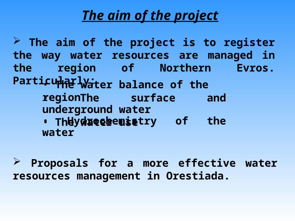
The aim of the project
• The water balance of the region• The surface and underground water• Hydrochemistry of the water • The water use
Proposals for a more effective water resources management in Orestiada.
The aim of the project is to register the way water resources are managed in the region of Northern Evros. Particularly:

Geographical position of the region

Present situation Unreasonable waste of water resources for urban and agricultural use
Precipitations are decreasing The springs of the two (2) most important rivers of the region (Evros and Ardas) are in Bulgaria that controls the flow of the water
Results The quantity is gradually decreasing Irrigation needs cannot be covered
The quality of surface water is continually going down because of pollutants which are dumped by Bulgaria
Dangers for public health
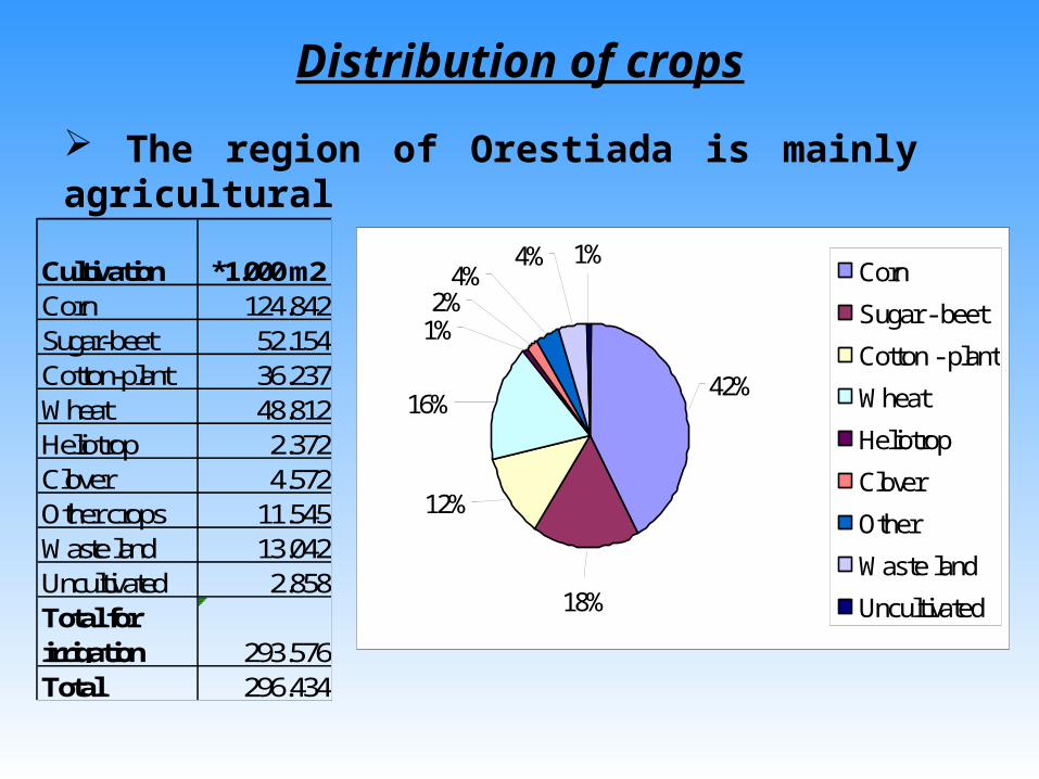
Distribution of crops
The region of Orestiada is mainly agricultural
Cultivation *1.000 m2Corn 124.842Sugar-beet 52.154Cotton-plant 36.237Wheat 48.812Heliotrop 2.372Clover 4.572Other crops 11.545Waste land 13.042Uncultivated 2.858Total for irrigation 293.576Total 296.434
42%
1%4%
18%
12%
16%
1%2%
4% Corn
Sugar - beet
Cotton - plant
Wheat
Heliotrop
Clover
Other
Waste land
Uncultivated

Works of water resources management
φρ.Άρδα
Α Καρακόπετρας Β Καρακόπετρας
Λιμνοδεξαμενή
Καστανιές
Κόμαρα Κυπρίνος
Νεοχώρι
Ορμένιο
Πύθιο
Πτελέα
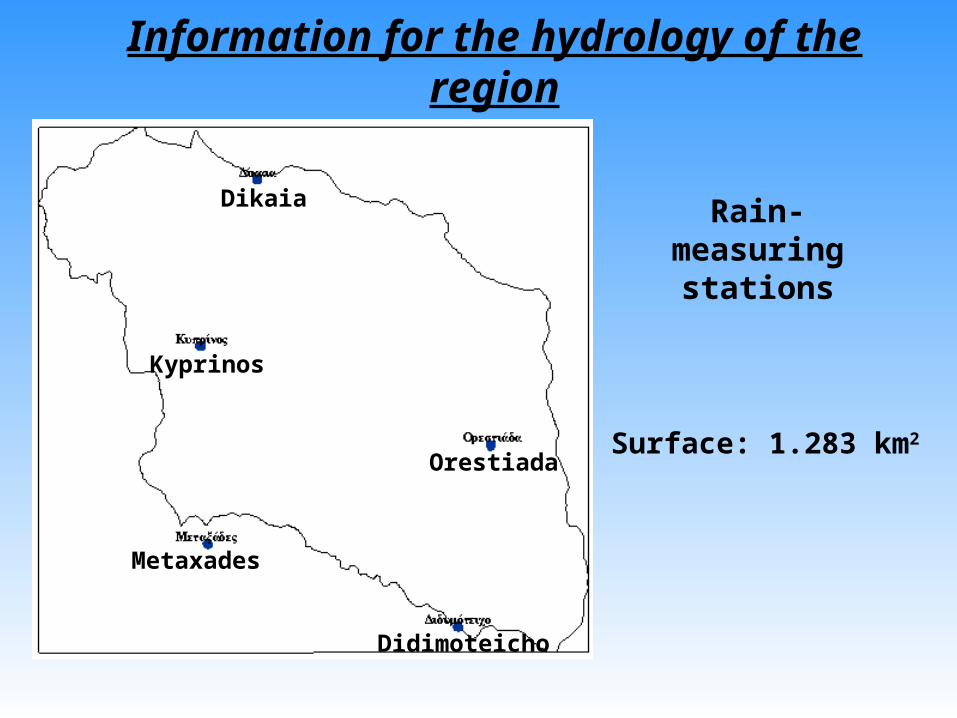
Information for the hydrology of the region
Surface: 1.283 km2
Rain-measuring stations
Dikaia
Kyprinos
Orestiada
Metaxades
Didimoteicho

Annual distribution of precipitation (1966 – 2001)Orestiada
0200400600800
1.000
1966
1968
1970
1972
1974
1976
1978
1980
1982
1984
1986
1988
1990
1992
1994
1996
1998
2000
Έτη
Ύψ
ος
(mm
)
• min: 320 mm (1986)• max: 949 mm (1998)• Average: 538 mm/year

Metaxades
0200400600800
1.0001.200
1966
1968
1970
1972
1974
1976
1978
1980
1982
1984
1986
1988
1990
1992
1994
1996
1998
2000
Έτη
Ύψ
ος
(mm
)
• min: 261 mm (2001) • max: 1.022 mm (1966)• Average: 631 mm/year
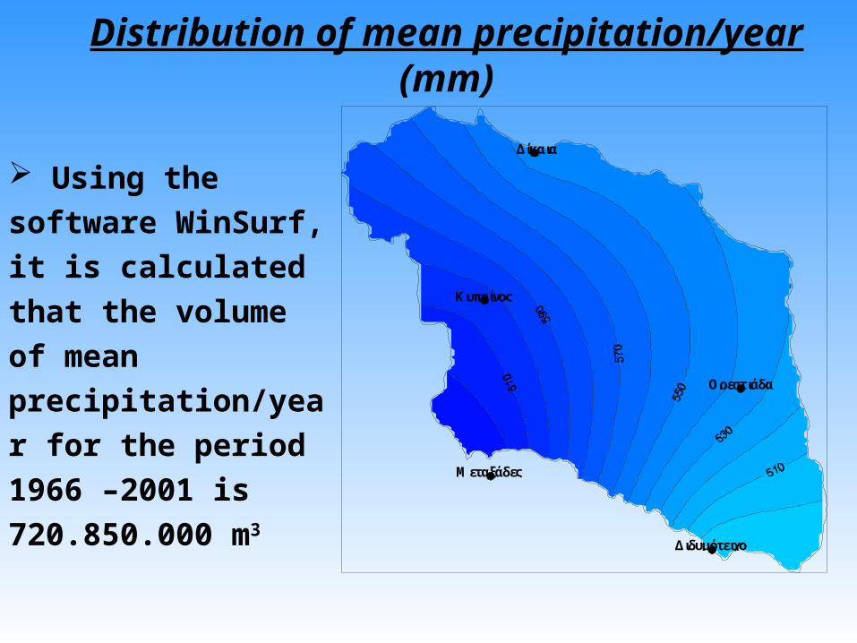
Distribution of mean precipitation/year (mm)
Using the software
WinSurf, it is calculated
that the volume of mean
precipitation/year for
the period 1966 –2001 is
720.850.000 m3
Δίκαια
Κυπρίνος
Ορεστιάδα
Διδυμότειχο
Μεταξάδες

The driest month is August with 30.166.000 m3
Δίκαια
Κυπρίνος
Ορεστιάδα
Διδυμότειχο
Μεταξάδες
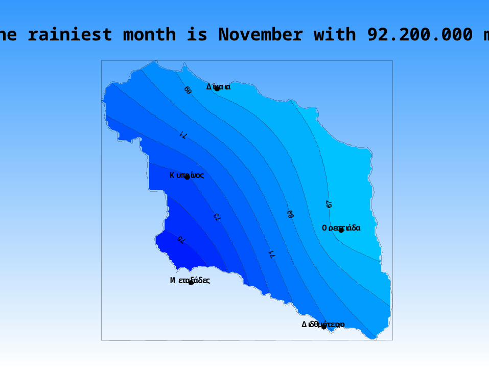
The rainiest month is November with 92.200.000 m3
Δίκαια
Κυπρίνος
Ορεστιάδα
Διδθμότειχο
Μεταξάδες

Mean precipitation – Evapotranspiration - Surplus
P (mm) ETr (mm) Surplus (mm) %P (ETr) %P (Surplus)min 327,74 291,74 3,05 51,71 0,93max 884,00 616,54 403,51 99,31 47,43M.O. 561,84 413,85 153,60 75,67 24,33
0
200
400
600
800
1.000
P (mm) ETr (mm) Πλεόν. (mm)
(mm
)

Variation of monthly precipitation and surplus
0
20
40
60
80
ΙΑΝ
.
ΦΕ
Β.
ΜΑ
Ρ.
ΑΠ
Ρ.
ΜΑ
I.
ΙΟΥ
Ν.
ΙΟΥ
Λ.
ΑΥ
Γ.
ΣΕΠ
.
ΟΚ
Τ.
ΝΟ
Ε.
ΔΕ
Κ.
months
(mm
) P (mm)
Surplus
From October to May precipitation (P) is higher than evapotranspiration (ETr) and consequently there is surplus.
From June to September there is no surplus because P < ETr.

Surface water resources in the region of Orestiada
The flow of river Evros was gauged only for the period 1970 – 1974. From then the flow was gauged once from 2/2/2002 to 5/2/2002.
Flow variation 1970 - 1974
0200400600800
1.000
Μαϊ-70
Νοε-
70
Μαϊ-71
Νοε-
71
Μαϊ-72
Νοε-
72
Μαϊ-73
Νοε-
73
Date
Q (m3 /s
ec)

The flow of river Erithropotamos (Red River) was gauged from 25/1/1974 to 21/2/1983. From then the flow hasn’t been gauged yet.
Flow variation 1974 - 1983
020406080
100120140
Ιαν-
74
Ιαν-
75
Ιαν-
76
Ιαν-
77
Ιαν-
78
Ιαν-
79
Ιαν-
80
Ιαν-
81
Ιαν-
82
Ιαν-
83
Date
Q (m
3 /sec
)
The flow of river Ardas hasn’t been gauged yet, although it is of great importance for the whole region.
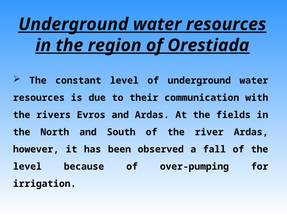
The constant level of underground water resources is due to
their communication with the rivers Evros and Ardas. At the
fields in the North and South of the river Ardas, however, it
has been observed a fall of the level because of over-pumping
for irrigation.
Underground water resources in the region of Orestiada

Water quality in the region of Orestiada
Max limits Northern Ardas Southern Ardas r.Ardas r.EvrospH - 8 8 8,52 9,44
Conductivity - 555 613 260 489Hardness - 235 228 112 140Cl (mg/lt) 200 50 74 14 33
SO4 (mg/lt) 250 62 60 57 80NO3 (mg/lt) 50 15 17 3 2,4K (mg/lt) 12 3 4 3,5 6Na (mg/lt) 150 38 57 14 40Mg (mg/lt) 50 16 20 7,7 17,7Ca (mg/lt) - 67 58 32 27

Conclusions
The examined parameters don’t surpass the permissible limits.
Surface and underground water resources in the region
are suitable for irrigation because SAR < 6 in all the
examined samples.
In general, underground water resources quality in the region is very good.

Water use in the region of Orestiada
Water resources cover the needs for irrigation and for
potable water.
The r.Ardas is the only one of the three rivers that covers
the needs for irrigation. The Bulgarian Government, however,
allows only 186*10^6 m3 to be used for these needs.
As a consequence there are many drills in the fields in
order to satisfy the needs for water during the summer. The
fields in the North and South of r.Ardas are irrigated by an
extended irrigational net.

53%47%
Distribution of irrigational water
From 29.650 ha cultivated in the region, 15.714,5 ha (53%) are irrigated with surface water resources and the rest 13.935,5 ha (47%) with drills.

Potable water in the region of Orestiada The needs for potable water are satisfied with drills and in a small percentage with springs in the north region of the r.Ardas.
There are 6 Municipalities in the region and the total water consumption for 2001 was 3.242.000 m3. Municipality of Orestiada has the highest consumption and Municipality of Didimoticho follows.
40%
21%
14%
6%
7%
12% Orestiada
Didimoteicho
Vissa
Kyprinos
Metaxades
Trigono

0
500.000
1.000.000
1.500.000
2.000.000
1990
1991
1992
1993
1994
1995
1996
1997
1998
1999
2000
2001
Years
Wat
er C
onsu
mption
Water consumption (m3) in the Municipality of Orestiada
• min: 1.176.000 m3 (2000)
• max: 1.882.000 m3 (1995)
• Average consumption: 1.504.000 m3/year

Water Consumption (m3) in the Municipality of Didimoticho
0
200.000
400.000
600.000
800.000
1995
1996
1997
1998
1999
2000
2001
2002
Years
Wat
er C
onsu
mption
• min: 367.000 m3 (1995)
• max: 686.000 m3 (2001)
• Average Consumption: 535.000 m3/year

96,30%
0,29%
0,04%
3,37%
Oικίες
Βιομηχανία
Στρατός
Σχολεία
Municipality of Orestiada:
96,30 % for households
3,37 % for army
0,29 % for industry
0,04 % for schools
Municipality of Didimoticho:
72,11 % for households
15,29 % for army
9,83 % for industry
2,19 % for schools72,11%
2,15%
9,83%
15,92%Households
Industry
Arny
Schools

Summary
Volume of Mean Annual Precipitation
720,84*10^6 m3
Evapotranspiration (75,7%)
545,68*10^6 m3
Surplus (24,3%)
175,16*10^6 m3

Mean Annual Surplus
175,16*10^6 m3
Run-off Infiltration to the underground water resources

Proposals
Continuous and systematic registration of precipitation in
all the stations and flow variation in the rivers.
Construction of small dams in order to hold the surplus
during the winter. Dams have to be constructed in the
western region where surplus is higher.
Disaster of inactive drills and very strict appliance of the
laws for every new drill.
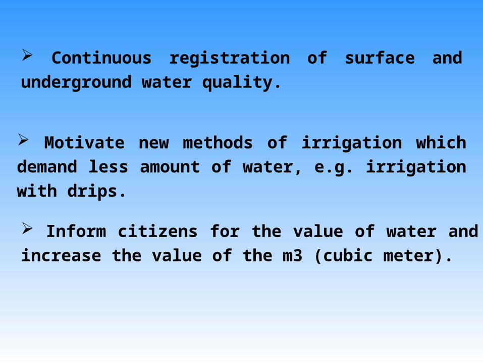
Continuous registration of surface and underground water
quality.
Motivate new methods of irrigation which demand less
amount of water, e.g. irrigation with drips.
Inform citizens for the value of water and increase the value
of the m3 (cubic meter).