wayfinding and spatial configuration: evidence
TRANSCRIPT
PAPER REF # 8098 Proceedings: Eighth International Space Syntax Symposium Edited by M. Greene, J. Reyes and A. Castro. Santiago de Chile: PUC, 2012.
8098:1
WAYFINDING AND SPATIAL CONFIGURATION: evidence from street corners
AUTHOR: Beatrix EMO Bartlett School of Graduate Studies, University College London, United Kingdom e‐mail: [email protected] Christoph HÖLSCHER Centre for Cognitive Science, University of Freiburg, Germany e‐mail: [email protected]‐freiburg.de Jan M. WIENER Psychology Research Centre, Bournemouth University, United Kingdom Ruth Conroy DALTON Built and Natural Environment, Northumbria University, United Kingdom e‐mail: r.conroy‐[email protected]
KEYWORDS: Wayfinding, Spatial Configuration, Individual, Space Syntax, Spatial Decision‐Making
THEME: Spatial Cognition
Abstract
Experimental subjects choose where to go at various street corners in the City of London. A total of 532
decisions of 20 participants at 28 street corners provide a rich set of data. Based on this evidence, a model
for the role of spatial geometry in wayfinding is proposed. An admixture of local and global space syntax
measures of spatial configuration explains where people move; global integration proving to be a particularly
dominant variable. Controls single out the impacts of lighting and affordances; other persons and traffic
serving as particularly strong attractors. The experiment sheds new light on the role of the space syntax
model for analysing individual spatial decisions.

Proceedings: Eighth International Space Syntax Symposium Santiago de Chile: PUC, 2012.
8098:2
1. INTRODUCTION
The paper provides experimental evidence for the role of spatial configuration in wayfinding behaviour.
Spatial configuration is recorded using the space syntax measures of integration and choice at local and
global scales. The study aims to shed light on the effect of street grid connectivity on individual spatial
decision‐making.
The paper begins with an overview of relevant previous work on spatial decision‐making and the impact of
structural properties of the environment. It then reports the results of a behavioural study in which
participants were asked to choose between path alternatives, either when roaming freely or when looking
for a taxi rank. The stimuli used in the experiment were photographs of urban street corners. Participants’
decisions were tested against the space syntax model. Results show that the space syntax model is effective
when assessing individual spatial decision‐making and future research should incorporate gaze bias to
provide a further layer of analysis.
1.1. Wayfinding
Wayfinding is not purely random; it follows psychological patterns based on visual perception. It can be
defined as the decision‐making process stage of navigation, where navigation is composed of locomotion
and wayfinding (Montello, 2001); wayfinding is necessarily related to choices made by the individual. Three
types of spatial knowledge have been identified that are used in wayfinding: landmark, route and survey
(Siegel & White, 1975). This paper looks at search activities, with no information pertaining to either route
or survey knowledge. The concept of a landmark is broad in wayfinding studies. This paper accepts that a
distinct feature in the urban landscape, such as a landmark marked on a tourist’s map, offers a wealth of
information unlike other elements in that landscape – several studies have correlated the presence of such
landmarks with improved wayfinding performance (eg. Appleyard, 1970; Montello & Pick, 1993). By
contrast, this paper adopts a much more general definition of landmark, supported by the visual perception
literature, that is closer to Gibson’s concept of affordances (Gibson, 1966); any evidently distinguishable
feature of the urban landscape that can provide a wealth of information unlike other elements in the scene
is a landmark.
Wayfinding is affected by familiarity; several studies have noted a change in wayfinding behaviour when
subjects are familiar with the environment (eg. Gärling, 1986; Hölscher, Brösamle & Vrachlotis, 2009).
Familiarity is not a condition tested in this study, although it is controlled for, as all subjects were not
familiar with the environment. Wayfinding behaviour is also affected by the presence of people; several
studies have shown that people act as attractors (eg. Appleyard, 1970; Peponis, 1990, and more recently
Dalton, Troffa, Zacharias & Hölscher 2011). This study will specifically control for the presence of people.
Another variable is the spatial ability of the subject, which can be tested by recording the wayfinding
performance (eg. by using the Santa Barbara Sense of Direction Scale, see Hegarty, Richardson, Montello,
Lovelace, & Subbiah, 2002); this is not a feature of this study, as there was no correct wayfinding behaviour.
Wayfinding behaviour is affected by the environment. A seminal study identified four environmental
variables that affect wayfinding behaviour: visual access, architectural differentiation, floorplan
configuration and signage (Weisman, 1981); the last of these is perhaps the least interesting for this study as
it is not inherent to the environment itself. Architectural differentiation and configuration, on the other
hand, represent fundamental qualities of the environment. It is often difficult to separate differentiation,

Proceedings: Eighth International Space Syntax Symposium Santiago de Chile: PUC, 2012.
8098:3
complexity and configuration from one another in wayfinding research, and this is reflected in the research
reported in the following subsections. Visual access is an interesting inclusion in Weisman’s list because,
while it is reflected to some extent in the structural properties of the environment, it evokes a more
perceptual type of analysis – an approach that is adopted in this paper.
The explicit or implicit purpose of wayfinding is a crucial factor in explaining wayfinding behaviour. It follows
that studies wishing to examine wayfinding behaviour must be acute in their identification of a task; a recent
taxonomy of wayfinding tasks has been proposed to help classify studies that use different tasks (Wiener et.
al., 2009). The simplest wayfinding task is to ask, ‘which way would you go?’. It forces a choice based on a
purpose that has not been made explicit, although the subject, in reaching a decision, will have
acknowledged some type of purpose. It is suggested that a basic human characteristic, when faced with an
open question of which way to go, is to assess how connected the path alternatives are. Thus a subject
looking at the same scene in two instances, with a different purpose in mind in each case, might well reach a
different conclusion as to which way to go. This paper explores the role of a task in wayfinding behaviour by
examining directed and undirected path search activity.
1.2 Spatial Configuration
The role of spatial configuration on individual spatial decision‐making is particularly interesting because it
suggests that the layout of the environment itself affects the choices that individuals make. The term spatial
configuration refers to the way every space in the built environment relates to every other. Several studies
have identified this factor as a relevant one for wayfinding studies. Weisman (1981) drew links with the
Gestalt psychologists and suggested that a blueprint with gestalt (which can loosely be translated as ‘good
form’) would promote accurate wayfinding performance. O’Neill (1991) identified the role of configuration
in his model of architectural legibility. A number of studies have drawn on the implications behind Tolman’s
pioneering study (1938) where he suggested that topological connections be critical to our cognitive
understanding of the environment; this has led to a large body of research on the form of the cognitive map
(see Kitchin & Freundschuh, 2000 for a review).
Space syntax offers an environmental model that is able to measure spatial configuration (Hillier & Hanson,
1984). It has been used in navigation studies wishing to assess the role of spatial configuration on the
behaviour of the individual. The space syntax environmental model uses the topological structure of the
urban grid to examine its social use. At an urban scale, the space syntax model uses structural elements of
the environment to predict pedestrian flow within the urban grid. The model is solely based on the
connectivity of streets, and does not include any other type of information such as land use or traffic flow.
The model has proved accurate at the aggregate level, although it seems likely that it is also relevant at the
individual level, given that it seems to reflect the way humans interact with their surroundings (Penn, 2003).
The issue of developing the space syntax model so as to make it relevant also at the level of the individual
has gained importance in the space syntax community (see Hölscher, Dalton & Turner, 2006 as well as Dara‐
Abrams, Hölscher, Dalton & Turner, 2010). Two important experiments have, using space syntax, directly
related spatial configuration with the navigational performance of subjects in open and directed search
tasks in a hospital setting (Peponis, 1990; Haq & Zimring, 2003). The need for a closer examination of
individual differences in space syntax analysis was revealed by the analysis of pause behaviour at junctions
in different virtual worlds (Conroy, 2001). Further research refining the space syntax model has included the
relevance of the individual (Hillier & Iida, 2005). Moreover the use of space syntax as a post‐hoc analytic tool

Proceedings: Eighth International Space Syntax Symposium Santiago de Chile: PUC, 2012.
8098:4
has shown that an analysis of spatial configuration can explain aspects of wayfinding behaviour (Hölscher et
al., 2009).
1.3 Spatial Complexity
Factors relating to spatial complexity play a role in determining wayfinding, although it is sometimes difficult
to distinguish between spatial complexity and configuration. Several studies acknowledge the need to study
the complexity of the configuration; for Weisman the two factors go hand in hand (1981); O’Neill discusses
the measure of topological complexity (1991) and, more recently, Hölscher et al. (2006) examine floorplan
complexity.
Spatial complexity can be measured by looking at the number of objects in a scene, which provide directly
deducible information as to which way to go. This type of complexity is specifically accounted for in this
experiment through the choice of stimuli used.
Another way to measure spatial complexity comes from isovist analysis . An isovist is a 2D polygon that
represents the vista around one point, its generating location (see Benedikt, 1971 for a pioneering study of
the use of isovists in the built environment). Different properties of an isovist represent geometric
information in the environment (see for example (Benedikt, 1971; Turner, 2001 and Franz & Wiener, 2008);
some of these have been shown to correlate with navigation behaviour (eg. Hölscher et al., 2009; Wiener et
al., 2007 and Meilinger, Franz & Bülthoff, 2009).
Whilst isovist analysis and visibility graph analysis (which examines the interrelation between individual
isovists, see Turner et al., 2001) provide an accurate measurement of the geometric properties of a
viewshed, they tend to be based on the architectural representation of the environment. For studies
undertaken in a virtual environment, the viewsheds match the perceptual information the participant is
presented with. However, in the real world, the different forms of isovist analyses do not match a subject’s
sensory information; street furniture, moving obstacles, contrasting light conditions and overhead
obstructions are all examples of how the structural properties of a real world viewshed might differ from the
viewshed drawn off an architectural representation of the environment. A recent innovation in isovist
analysis seeks to adapt existing techniques to the challenges of real world experiments. Six image properties
have been proposed that represent geometric properties of the urban environment as perceived by the
viewer: depth of view, visual connectivity, percentages of visible sky and floor areas, the ratio of sky to floor
area and the longest permeable route (Emo, 2010). In a similar approach, but using virtual stimuli, Wiener et
al. (in press) propose the depth profile in conjunction with the number of edges as a useful measure of
geometric information in the environment as perceived by the viewer.
Although the type of spatial complexity addressed by isovist‐inspired analyses is not controlled for in this
study, it will be a salient component of a subsequent study that targets the role of spatial complexity in
wayfinding by looking at gaze behaviour.
1.4 Specific Aims and Hypotheses
i. To provide experimental data that can be used to test the effectiveness of the space syntax model on
choices made by the individual.

Proceedings: Eighth International Space Syntax Symposium Santiago de Chile: PUC, 2012.
8098:5
ii. To propose tasks that promote the type of wayfinding behaviour that can be modelled using space
syntax techniques.
iii. To test the hypothesis that wayfinding behaviour in an urban environment is largely affected by the
spatial configuration of the street grid.
iv. To provide a detailed study of one type of wayfinding behaviour, namely path search with no route or
survey knowledge; this is achieved by examining both directed and undirected conditions. It is
suggested that innate human wayfinding behaviour in the built environment involves looking for a path
through it; activity in the undirected path search should largely indicate this.
v. To assess the influence of attractors such as people and traffic. The hypothesis is that these elements
act as affordances and encourage movement towards them.
2. METHODS
An experiment was designed to test the effectiveness of the space syntax model on individual spatial
decision‐making. Participants were asked to choose between path alternatives, either when roaming freely
or when looking for a taxi rank. The stimuli used in the experiment were photographs of urban street
corners.
2.1 Stimuli
The stimuli were photographs taken at urban street corners in the City of London, which is the historical
core, and an important financial and legal centre, of London. Each stimulus presents a decision point with a
distinct binary choice of one left and one right path alternative.
The photographs aim to present the viewer with a clear understanding of the spatial geometry of the
environment. Elements of a scene that reflect a temporary quality, such as people, vehicles or building
works were avoided. This leaves an image in which the spatial geometry of the scene is intact – a necessary
feature of a study on the spatial geometry of wayfinding in urban environments.
Another merit of the stimuli is that they evoke wayfinding activity, that is, they are an adequate substitute of
physical wayfinding in the real world. Responses in a post‐study interview of a pilot study showed that
participants were responding to the photographs as if they were in situ. This is important because i) it
confirms the role of wayfinding as a static condition of navigation that occurs at decision points and ii) this
study promotes the benefits of modelling real world wayfinding behaviour using photographs.

Proceedings: Eighth International Space Syntax Symposium Santiago de Chile: PUC, 2012.
8098:6
Figure 1. Example stimulus.
Several of the variables identified in the literature were controlled for. In order to control for the effect of
light in the images, the light conditions were altered in two of the images, such that the two path
alternatives were seen to have equal light settings.
Figure 2. Example of a control condition for light. The left image shows one path alternative that is considerably darker than the other;
this bias is not present in the right image.
The specific condition of people as attractors was controlled for, by having people present in one of the
stimuli.
Figure 3. Control stimulus for presence of people.

Proceedings: Eighth International Space Syntax Symposium Santiago de Chile: PUC, 2012.
8098:7
In addition, traffic as an attractor was controlled for. This control also sheds light on the extent to which
participants follow directly deducible evidence, loosely conforming to the landmark strategy (see above). To
control for this case, a vehicle and a bus stop were clearly visible in separate instances.
Figure 4. The control stimuli for traffic.
2.2 Task
The experiment examines path search behaviour, where no information is provided of route or survey
knowledge. In order to fully investigate this kind of wayfinding activity, two instances were assessed: i) an
undirected instance where participants were roaming freely, responding to the question ‘which way would
you go’ with no other information being provided and ii) a directed instance where subjects were asked to
look for a taxi rank. The benefit of examining these two types of wayfinding activity is to be able to assess
how important the introduction of a specific task is.
The aim was to have a task that encouraged participants to look for a more connected street. This derives
from the principal aim of the study to examine the role of topological connections of the urban grid on
individual spatial decision‐making. By having a task that promotes the use of spatial configuration to aid the
decision process, it is more likely that space syntax measures will be able to model those decisions. The
hypothesis is that the specific task will facilitate the decision‐making process – it is suggested that lower
response times will reflect this.
A pilot study identified what kind of task would be suitable for examining the directed path search
behaviour. The aim was to have a task that was spatially defined as well as visually neutral; this latter
requirement stems from the goal of a subsequent study which looks at the gaze behaviour.
2.3 Participants
20 participants took part in the experiment, of which 12 were female. Most were university students and
the average age was 29.05 ±5.5 years. None of the participants were familiar with the area used in the
study. One participant was unexpectedly interrupted during the course of the experiment and their data had
to be discarded.

Proceedings: Eighth International Space Syntax Symposium Santiago de Chile: PUC, 2012.
8098:8
2.4 Procedure
Participants viewed the stimuli at a resolution of 1024 x 768 pixels on a 20” CRT monitor. Subjects were
asked to make a left/right choice according to the spatial task; responses were recorded by using the arrow
keys on the keyboard. Participants filled in a brief questionnaire before reading the instructions, informing
them to look carefully at the stimuli and choose to go either left or right according to a task. They were told
to follow on‐screen instructions relating to a change of task during the experiment. Participants were asked
to make their choice as soon as they were confident with that choice. To control for any left/right bias a
version of each stimulus was generated that was mirrored on the vertical axis. Each participant was shown
the full set of stimuli in random order.
2.5 Space Syntax Measures
The space syntax model was used to provide the measure of spatial configuration for each path alternative
in the stimuli set. Space syntax techniques examine the relationship between the local and global scales by
looking at the connectivity of streets in the built environment (for an overview of space syntax see Bafna,
2003).
The space syntax model chosen for this study takes the set of longest and fewest lines of sight with potential
for movement (known as axial lines) in the system (in this case the centre of London), and breaks them up at
each junction into segments. A segment is a part of an axial line that connects two adjacent junctions; each
segment begins and ends at an intersection with another line. This network is then analysed as a graph, with
the segments as nodes and the intersections as the links connecting them. The benefit of using a network
based on segments rather than axial lines is that the connections between the nodes can take into account
angular displacement as well as topological distance; this has been shown to better reflect observed
pedestrian flow (Hillier & Iida, 2005).
The graph is measured according to different mathematical properties that are believed to reflect urban
movement (for a greater discussion of this refer to Hillier & Iida, 2005). A measure of closeness, or
integration as it is commonly known in space syntax research, will reflect how likely it is that a segment is an
origin or destination segment; a measure of betweenness, or choice, will reflect how likely it is that a
segment features as an intervening space in between an origin and destination. These measures can be
recorded at different scales, reflecting the variable length of journeys in the urban network; at a basic level it
is helpful to distinguish between local and global scales. The scale is recorded in terms of a radius, centred
on the segment in question, measured in metric distance.
The space syntax model used in this study was based on an axial map of Greater London, restricted to the
area of interest (the centre of London) plus a catchment area of three miles to avoid any edge effects. All the
analysis was segment angular analysis. Integration and choice were measured at the global scale (r=n) and at
the local scale of radius 100m; note that it is customary in space syntax research to record the natural
logarithm of choice. See the appendix for graphical representations of the measures from the space syntax
model.
The selection of the local radius of 100m was reached through a pilot study that measured the average
depth of view in a large set of photographs from which the stimuli used in the present study were ultimately
Proceedings: Eighth International Space Syntax Symposium Santiago de Chile: PUC, 2012.
8098:9
derived. In addition, it is reasonable to assume that most spatial decisions are reached based on information
within 100m from the current standpoint.
2.6 Space Syntax Analysis
The spatial configuration of both path alternatives for each stimulus was recorded using the four space
syntax measures of local and global integration and choice. Participants’ decisions were then analysed to see
whether they corresponded with the space syntax model. The tables below report the number of decisions
that could be modelled according to spatial configuration. Note that both the undirected and the directed
search task in this experiment encouraged the participant to choose the more connected of the two path
alternatives; the merit of having both tasks is to be able to assess the impact of the specific task (taxi rank)
from free roaming activity.
3. RESULTS
Results from the experiment show that the decisions made were not purely random. Expectation in a purely
random model would be that, over time, the total number of decisions for each path alternative would
reach a 50:50 path choice ratio. Instead, 75% (p<0.01) of decisions made were consistent even when the
stimulus was mirrored on the vertical axis. Thus the majority of subjects chose the same path alternative
regardless of whether it was shown as the left hand or right hand path choice. This level of consistency
supports the logically true hypothesis that wayfinding is not merely a random process.
Results show that two thirds of all decisions made went towards the more connected street. This high
percentage suggests that path search tasks are undertaken with a view to finding the more connected
street. The measure of spatial configuration for which this was highest was global integration (77%); local
integration and global choice both showed a strong connection at the 70% mark. A reduced number of
decisions (53%) followed the space syntax model for local choice. The correlations with local choice did not
achieve the 1% significance threshold (p=0.076); this is due to the fewer number of choices that could be
modelled according to this measure. Thus the local choice measure, following the results of the study, is
held to be a less relevant measure when trying to model human wayfinding behaviour.
Table 1. Decisions made independent of task
Integration r=n
Integrationr=100m
ln Choicer=n
ln Choice r=100m
No. of decisions 410 370 374 283
% 77.07 69.55 70.3 53.2
p value <0.01 <0.01 <0.01 0.076

Proceedings: Eighth International Space Syntax Symposium Santiago de Chile: PUC, 2012.
8098:10
Looking only at the free roaming task, slightly less than two thirds of decisions made (64%) went towards the
more connected street. This is a high percentage and supports the hypothesis that subjects were attending
to information relating to spatial configuration. The correlation was higher for both integration measures
than choice. Interestingly, the local integration measure reached a higher correlation than global integration
(71% compared to 68%); thus when roaming freely, local integration is of particular relevance. For choice,
63% followed the global measure and 53% local choice; once again, the correlations with local choice did not
achieve significance (p=0.179).
Table 2. Decisions made in undirected path search task
Integration r=n
Integrationr=100m
ln Choicer=n
ln Choice r=100m
No. of decisions 182 189 169 141
% 68.42 71.05 63.53 53.01
p value <0.01 <0.01 <0.01 0.179
More decisions could be modelled according to measures of spatial configuration in the directed search task
than in the undirected search task; overall 70% of the decisions could be modelled by the space syntax
model. This is in accordance with the hypothesis; the choice of task was specifically designed to encourage
participants to use information relating to spatial configuration. Global measures were stronger than local
measures; for each radius, the integration measure was stronger than the choice measure.
Table 3. Decisions made in directed path search task
Integration r=n
Integrationr=100m
ln Choicer=n
ln Choice r=100m
No. of decisions 229 182 206 142
% 86.09 68.42 77.44 53.38
p value <0.01 <0.01 <0.01 0.149
In order to test the importance of effect of light on participants’ decisions, the light conditions were altered
in two of the stimuli. Of the 76 decisions made in these conditions, 80% (p<0.01) were not affected by the
light conditions. This is a crucial finding for the study, as it shows that subjects are responding to something
other than the presence or absence of light in the scene.
Results also provide evidence on further control conditions. Of the 266 decisions made in scenes where
there was directly deducible evidence for which path alternative was more connected, 92% (p<0.01) of them
picked up on the evidence from the scene. Specifically, almost all instances where people were visible led to
the wayfinding choice following the path option with the people (97%, p<0.01); this is in line with research
that has shown that navigation is very much affected by the presence of people. Most of the decisions

Proceedings: Eighth International Space Syntax Symposium Santiago de Chile: PUC, 2012.
8098:11
where there was evidence of traffic flow, such as the presence of a vehicle or a bus stop, led to the path
choice following that clue (90%, p<0.01). Taken together, these two features strongly suggest that subjects
were following directly deducible clues where possible.
The average response time was 2.67 secs. There was a marked difference in response times for the two
tasks. Average response time for the undirected task was 2.99 secs, compared to 2.32 secs for the directed
task. This provides further evidence that the introduction of a specific task facilitated the wayfinding
decision.
4. DISCUSSION
Results from the study suggest that spatial configuration is an important factor in individual spatial decision‐
making. Of all the decisions made in the study, two thirds could be modelled by analysing spatial
configuration.
Overall, global integration proved to be the most effective measure of spatial configuration when examining
to what extent participants chose the path alternative that was most connected; 77% of all decisions could
be modelled according to global integration. This is a crucial finding because it suggests that we understand
the global structure of a space from a local viewpoint, a tenet of space syntax theory underlying the concept
of intelligibility. Thus this paper provides initial empirical evidence in support of the theory that the
intelligibility of an environment stems from the relation between the local and global scales. Further
empirical evidence is required. One avenue to investigate this would be to test the relationship between
both depth of view and visual connectivity with global integration, variables identified in a previous study
(Emo, 2010), using eye tracking equipment.
The local integration and global choice measures both offered a strong correlation with participants’
choices; approximately 70% of all choices could be modelled according to either of these two measures.
However, the two measures fared differently in the different tasks. In the undirected path search task, local
integration proved to be the most effective measure, even when compared with global integration (see
table 2). This suggests that information specific to the local structure of the urban grid is of particular
relevance during free roaming; this is an important finding and a study that examines gaze bias would be
well placed to examine it further. On the other hand, in the directed search task, global choice was a more
effective measure than local integration. This suggests i) that global information is more pertinent when
making a decision with a specific task in mind and ii) that the relation of which streets are more likely to be
encountered when accomplishing that task is more important in directed than in undirected path search
activity.
Local choice did not prove to be an effective measure, given that just over 50% of the responses could be
modelled by that measures; none of the correlations with the local choice measure achieved significance.
Previous research found that local choice responded poorly to visually‐dependent spatial variables (Emo,
2010); future research should examine this further.
The study identified the effect of a specific task on path search behaviour. The introduction of the taxi rank
task i) re‐enforced the decisions made in the undirected path search scenario (the correlation of subjects
choosing the more connected path rose from 64% in the undirected case to 70% in the directed case) and ii)
required less time for a response to be made (average response times decreased from 2.99 secs to 2.32
Proceedings: Eighth International Space Syntax Symposium Santiago de Chile: PUC, 2012.
8098:12
secs). It is suggested therefore that future studies need not introduce a specific task when looking at path
search behaviour; the research could focus on the most innate form of wayfinding would be examined,
without the subjectivity involved when interpreting a task.
Results also show that landmarks, understood as affordances, are critical to spatial decision‐making. Almost
all the decisions made when there was directly deducible evidence in the scene providing information on the
connectivity of the street followed that path alternative. Specifically, this study can confirm results of
previous research where the presence of people is understood as an affordance; 97% of decisions made
when there were people in the scene went towards them. Additionally, traffic signs and vehicles were
shown to have a similar, if slightly less powerful, effect; 90% of decisions made went towards these clues
when they were present in the scene. A final control condition, the presence of light, was shown not to have
a significant impact on the choices made; 80% of path choices made when the light condition was altered
remained the same despite that alteration. This is an important finding as it suggests that bright areas do
not affect wayfinding decisions.
This paper has described the design and reported the data of an experiment testing the effectiveness of the
space syntax model on individual spatial decision‐making. Results show that individuals respond to spatial
configuration during wayfinding and that the space syntax model is able to measure this. It is hoped that
future research will contribute to a predictive model for wayfinding behaviour based on the structural
properties of the environment.
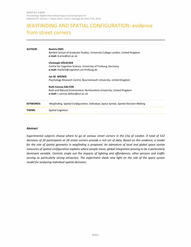
5. APPENDIX: SPACE SYNTAX GRAPHS
Figure 1. Integration r=n.
Proceedings: Eighth International Space Syntax Symposium Santiago de Chile: PUC, 2012.
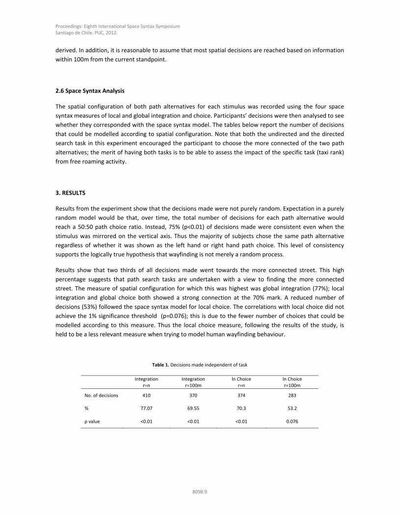
8098:13
Figure 2. Integration r=100m.
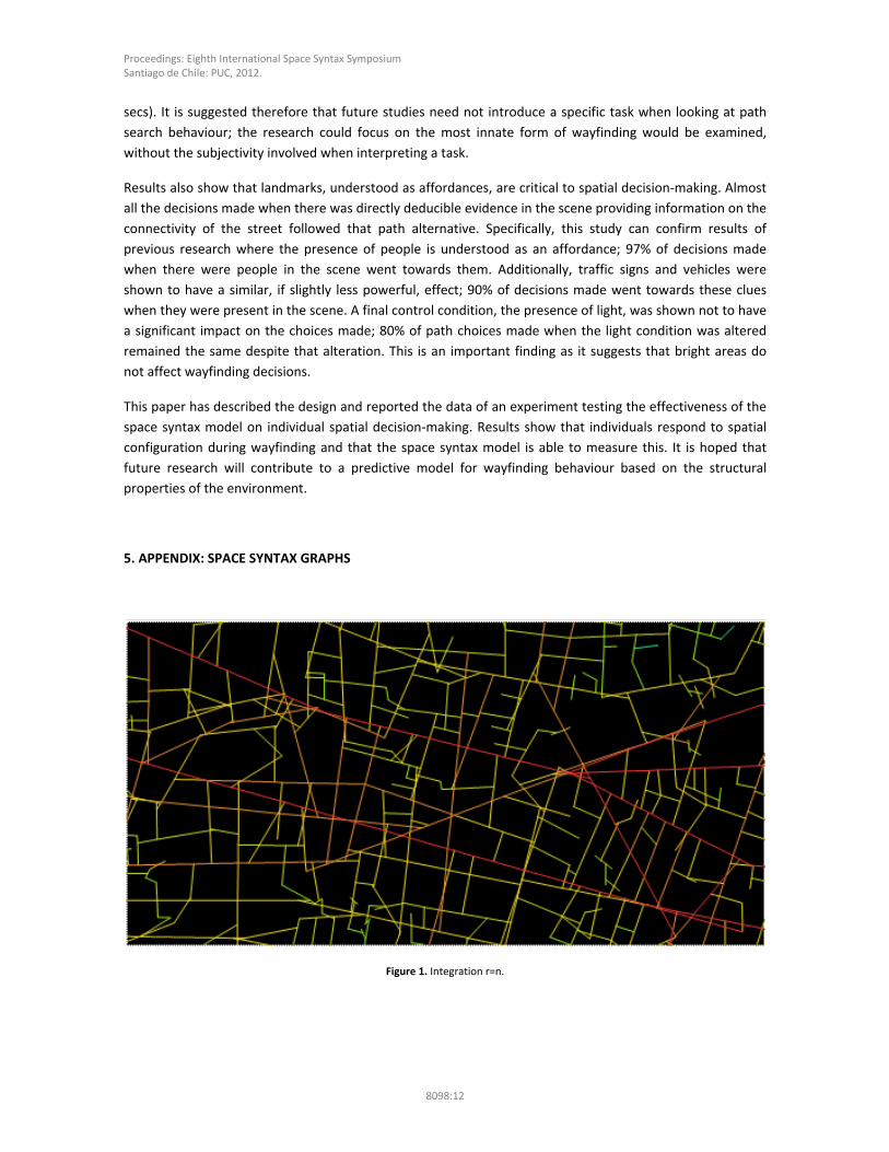
Figure 3. Choice r=n.
Proceedings: Eighth International Space Syntax Symposium Santiago de Chile: PUC, 2012.
8098:14
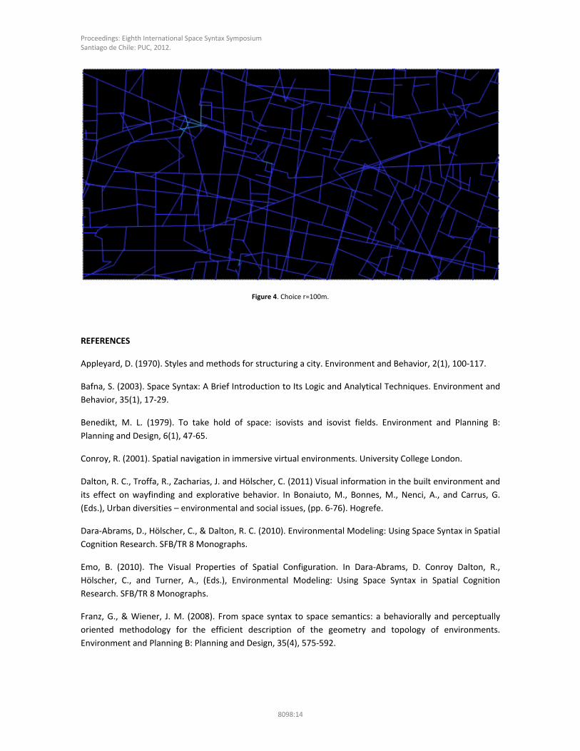
Figure 4. Choice r=100m.
REFERENCES
Appleyard, D. (1970). Styles and methods for structuring a city. Environment and Behavior, 2(1), 100‐117.
Bafna, S. (2003). Space Syntax: A Brief Introduction to Its Logic and Analytical Techniques. Environment and
Behavior, 35(1), 17‐29.
Benedikt, M. L. (1979). To take hold of space: isovists and isovist fields. Environment and Planning B:
Planning and Design, 6(1), 47‐65.
Conroy, R. (2001). Spatial navigation in immersive virtual environments. University College London.
Dalton, R. C., Troffa, R., Zacharias, J. and Hölscher, C. (2011) Visual information in the built environment and
its effect on wayfinding and explorative behavior. In Bonaiuto, M., Bonnes, M., Nenci, A., and Carrus, G.
(Eds.), Urban diversities – environmental and social issues, (pp. 6‐76). Hogrefe.
Dara‐Abrams, D., Hölscher, C., & Dalton, R. C. (2010). Environmental Modeling: Using Space Syntax in Spatial
Cognition Research. SFB/TR 8 Monographs.
Emo, B. (2010). The Visual Properties of Spatial Configuration. In Dara‐Abrams, D. Conroy Dalton, R.,
Hölscher, C., and Turner, A., (Eds.), Environmental Modeling: Using Space Syntax in Spatial Cognition
Research. SFB/TR 8 Monographs.
Franz, G., & Wiener, J. M. (2008). From space syntax to space semantics: a behaviorally and perceptually
oriented methodology for the efficient description of the geometry and topology of environments.
Environment and Planning B: Planning and Design, 35(4), 575‐592.

Proceedings: Eighth International Space Syntax Symposium Santiago de Chile: PUC, 2012.
8098:15
Gärling, T., Böok, A. (1983). Cognitive mapping of large‐scale environments: the interrelation of action plans,
acquisition and orientation, Environment and Behavior, 16, 3‐30.
Gibson, J. J. (1966). The senses considered as perceptual systems. Boston: Houghton Mifflin.
Haq, S., & Zimring, C. (2003). Just down the road a piece ‐ The development of topological knowledge of
building layouts. Environment and Behavior, 35(1), 132‐160.
Hardy, A.C. (1967). Landscape and Human Perception. In A. C. Murray (Ed.), Methods of Landscape Analysis,
Vol. October, Landscape Research Group, London.
Hegarty, M., Richardson, A. E., Montello, D. R., Lovelace, K., & Subbiah, I. (2002). Development of a self‐
report measure of environmental spatial ability. Intelligence, 30, 425–447.
Hillier, B., & Hanson, J. (1984). The Social Logic of Space. Cambridge University Press.
Hillier, B., & Iida, S. (2005). Network and psychological effects in urban movement. LNCS, 3693, 475‐490.
Hölscher, C., Brösamle, M., & Vrachliotis, G. (2009). Challenges in multilevel wayfinding: a case study with
the space syntax technique. Environment and Planning B: Planning and Design.
Hölscher, C., Meilinger, T., Vrachliotis, G., Brösamle, M., & Knauff, M. (2006) Up the down staircase:
Wayfinding strategies in multi‐level buildings. Journal of Environmental Psychology, 26(4), 284‐299.
Hölscher, C., Dalton, R. C., & Turner, A. (2006). Space syntax and spatial cognition. SFB/TR 8 Monographs.
Kitchin, R., & Freundschuh, S. (2000). Cognitive mapping: Past, present, and future. Routledge.
Meilinger, T., Franz, G., & Bülthoff, H. (2009). From isovists via mental representations to behaviour.
Environment and Planning B: Planning and Design.
Montello, D. (2001). Spatial Cognition. In N. J. Smelser and P. B. Baltes (Eds.), International Encyclopedia of
the Social & Behavioral Sciences.
Montello, D. and Pick, H. (1993). Integrating knowledge of vertically aligned large‐scale spaces, Environment
and Behavior, 25(4), 457‐484.
O'Neill, M. (1991). Evaluation of a conceptual model of architecural legibility. Environment and Behavior,
23(3), 553‐574.
Peponis, J., Zimring, C., & Choi, Y. K. (1990). Finding the Building in Wayfinding. Environment and Behavior,
22(5), 555‐590.
Penn, A. (2003). Space syntax and spatial cognition – or why the axial line. Environment and Behavior, 35,
30‐65.
Siegel, A. & White, S. (1975) The development of spatial representations of large‐scale environments. In H.
W. Reese (Ed.), Advances in child development and behavior, New York: Academic Press.
Tandy, C. (1967). The Isovist Method of Landscape Survey. In A. C. Murray (Ed.), Methods of Landscape
Analysis, Vol. October, Landscape Research Group, London.

Proceedings: Eighth International Space Syntax Symposium Santiago de Chile: PUC, 2012.
8098:16
Tolman, E. (1948). Cognitive maps in rats and men. Psychological Review.
Turner, A., Doxa, M., Sulivan, D. O., & Penn, A. (2001). From isovists to visibility graphs: a methodology for
the analysis of architectural space. Environmental and Planning B: Planning and Design, 28, 103‐121.
Weisman, J. (1981). Evaluating architectural legibility. Wayfinding in the built environment. Environment and
Behavior, 13(2), 189‐204.
Wiener, J. M., Hölscher, C., Büchener, S., & Konieczny, L. (In press). Gaze behaviour during Space Perception
and Spatial Decision Making. Psychological Research.
Wiener, J. M., Büchner, S., & Hölscher, C. (2009). Taxonomy of Human Wayfinding Tasks: A Knowledge‐
Based Approach. Spatial Cognition & Computation, 9(2), 152‐165.
Wiener, J. M., Franz, G., Rossmanith, N., Reichelt, A., Mallot, H.A., & Bülthoff, H.H. (2007). Isovist analysis
captures properties of space relevant for locomotion and experience. Perception, 36, 1066‐1083.