wetlans hydrological requeriments
DESCRIPTION
This is anTRANSCRIPT

MANUAL FOR DETERMINING THE HYDROLOGICAL REQUIREMENTS OF WETLANDS.
THE SPANISH CONTEXT
Rafael Sánchez and María José Viñals
Fund
ació
n Bi
odiv
ersi
dad
Man
ual f
or d
eter
min
ing
the
hydr
olog
ical
requ
irem
ents
of w
etla
nds.
The
Spa
nish
Con
text
This Manual is the result of a research project undertaken by Funda-ción Biodiversidad with the collaboration of the Hydrographic Con-federation of the Jucar River and the Hydrographic Confederation of the Guadalquivir River within the programme of work of the Centro Español de Humedales (Spanish Centre for Wetlands). The aim of project was to contribute knowledge related to the techniques to determine the hydrological requirements of wetlands. This is an issue directly related with the application of the Birds Directive, the Habitats Directive and the Water Framework Directive of the Euro-pean Union in wetlands of the EU member countries, as well as with the application of the Ramsar Convention in the countries which are Parties to the treaty. In this way, the tools proposed in this book are intended to facilitate the management and wise use of an important resource for the survival of wetlands and human beings: water.
With the assistance of:

MANUAL FOR DETERMINING THE HYDROLOGICAL REQUIREMENTS OF WETLANDS
THE SPANISH CONTEXT
Rafael Sánchez and María José Viñals
Madrid, 2012

3
Authors: Rafael Sánchez and María José Viñals
Coordination by Fundación Biodiversidad:Ignacio Torres and Victoria Pérez
Technical coordination:Pau Alonso-Monasterio
This book is the result of a research project carried out by the Fundación Biodiversidad in collaboration with the Hydrographical Confederation of the Júcar. To this project must be added additional works carried out by the Hydrographical Confederation of the Guadalquivir which complement this first research phase and whose progress is outlined in this document.
Scientific Committee: Carmen Antón- Pacheco, Bruno Ballesteros, Magdalena Bernués, Cesar Borja, Antonio Camacho, Vicente Caselles, Víctor J. Cifuentes, Santos Cirujano, Emilio Custodio, Mª José Checa, José Antonio Domínguez, Rosario Escudero, Rafael Fernández Gutiérrez, Javier Ferrer, Silvia González Castro, Rafael Hidalgo, Guillermo Martínez, Bárbara Mora, Antoni Munné and Manuel Oñorbe.
Photograph authors:P. Alonso-Monasterio, A. Asencio, Confederación Hidrográfica del Guadalquivir, Confederación Hidrográfica del Júcar, C. González, Fundación Global Nature, M. Oñorbe, J. Ramos, A. Rodríguez, M. Rodríguez, Biopauker, Tragsa, E. Viñals, M.J. Viñals.
Cover photo:Enric Viñals
Acknowledgements: Catalonian Water Agency, Spanish Wetlands Center, Consejo Superior de Investigaciones Científicas (CSIC), Hydrographical Confederation of the Guadalquivir, Hydrographical Confederation of the Júcar, Spanish Geologhical and Mining Institute, Ministry of Agriculture, Food and the Environment, Secretariat of the Convention on Wetlands (Ramsar), Tragsatec, INTECSAINARSA, Polytechnic University of Catalonia, Polytechnic University of Valencia, University of Sevilla, University of Valencia-Estudi General and WWF-Spain.To Eugenio Barrios, Delmar Blasco, Reyes del Rio, Arantxa Fidalgo, Rafael Hidalgo, Juan Martínez Rubio, Pablo Sanchez Gonzalez.
Declaration of responsibilityThe authors are responsible for the statements and the data presented in this publication, as well as for the opinions expressed therein, which are not necessarily those of the Fundación Biodiversidad.
Cite this book as: Sánchez, R. y Viñals, M.J. (2012). Manual for Determining the Water requirements of Wetlands. The Spanish Context. Ed. Fundación Biodiversidad, 68 pp.
This book is available in electronic format in Spanish and in English at the site: http://www.fundacion-biodiversidad.es/images/stories/recursos/proyectos/2012/necesidades_hidricas_humedales.pdf
Edited by:© Ministerio de Agricultura, Alimentación y Medio AmbienteSecretaría General TécnicaCentro de Publicaciones
© Fundación BiodiversidadCalle Fortuny, 728010 Madridwww.fundacion-biodiversidad.es
Printing and binding:Graphic Design: Soporte CreativoPrinting and Binding: Punto Gráfico Impresores
NIPO 280-12-139-2Legal deposit M-24398-2012
Catalog of Publications of the General Administration of the State:http://publicacionesoficiales.boe.es/
Technical data:Format: 20x28cm Text box: 16,3x22,9cmTypeset: MetaOT Binding: Rustic, sewn with natural yarn
Distribution: Paseo de la Infanta Isabel, 1
28014 MadridTeléfono: 91 347 55 41
Fax: 91 347 57 22
Virtual shop: [email protected]
The paper used for the printing of this book was manufactured from wood sourced from forests and plantations managed with the highest environmental standards, guaranteeing that the exploitation of resources is environmentally sustainable and socially beneficial. For this reason, Greenpeace attests that this book meets the environmental and social requirements to be considered a “friends of the trees” book. The “Friends of the trees” project promotes the conservation and the sustainable use of the forests, especially of primary forests, the last virgin forests of the planet.
Table of Contents
1. WETLANDS AND WATER
2. LEGAL CONSIDERATIONS OF THE WATER REQUIREMENTS OF WETLAND 2.1. The Ramsar Convention and water requirements2.2. Water requirements in the European Directives2.3. Spanish legislation
3. BASIC COMPONENTS OF THE WATER REQUIREMENTS STUDY3.1. The hydrology of wetlands3.2. The biological components of wetlands in the study of water requirements
4. ANALYSIS, METHODS AND TECHNIQUES FOR DETERMINING THE WATER REQUIREMENTS OF WETLANDS4.1. Calculation methods 4.2. Phases of the analysis for determining water requirements
5. CASE STUDIES5.1. The Doñana Marshes5.2. Fuente de Piedra Lagoon5.3. L’Albufera of Valencia
6. BIBLIOGRAPHICAL REFERENCES
7. ANNEX. Protocol for measuring water levels in wetlands
6
9 9
1113
171925
27
2934
37374450
57
59
TT-COC-002739
Mixed SourcesProduct group from well-managed forests and controlled sources

54
Presentation
This is a work that was needed, both in Spain as well as at the international level.
Fortunately, we have overcome that perception rooted in the collective conscience that wetlands are useless, even dangerous spaces, and that it was better to supplant the spaces they occupy with more useful uses. Little by little, this notion has been replaced by large social acceptance of the importance and value of wetland ecosystems. And, as our scientists and experts contribute more data on the functions and ecological services that they provide, almost no one dares question the need for their conservation and sustainable use. To the contrary, in many cases many are genuinely concerned with trying to restore degraded wetlands and even with recovering, to the extent possible, historical wetlands that disappeared due to human intervention.
This process of positive change has greatly helped the Convention on Wetlands of International Importance (Ramsar Convention). The treaty was signed back in 1971 and little by little it has influenced the policies of the member States (currently 160), policies that have been translated into, among others, education and awareness building campaigns on the value and importance of these ecosystems. And, within the European Union, we have taken a decisive step with the adoption of the Water Framework Directive. The transposition of this Directive, though sometimes slow and not always linear, to the national legislations is ensuring, at last, that water is no longer considered a good that is solely at the service of the human species but that it is also, an essential element for ensuring the correct functioning of the natural processes upon which life depends, not only ours, within our space of existence.
However, it is one thing to recognize the value of wetlands and the need to conserve them. The other is how to do this, especially with regards to the essential and intrinsic element of these ecosystems: water. Because although the perception regarding the limitlessness of the resource and the practical and ethical need to distribute it equitably and efficiently between all the legitimate uses (need and basic human right, productive uses, ecological uses) has changed, we have not yet developed sufficient technical capacities and legal, administrative and consensus building processes, to assign to each use the quantity of water it merits based on right and need.
Accordingly, this Manual which is dedicated specifically to determining the water requirements of wetlands represents an excellent contribution to this topic. I am sure that it will be very useful in Spain as we move forward in the application of the Water Framework Directive. It will also be helpful at the international level as an additional contribution to the work of the Scientific and Technical Review Panel of the Ramsar Convention that continues to work on this issue to provide guidance and technical assistance and for the policies of the 160 nations signatories to the treaty.
Thus, we must be thankful to the authors and collaborators who participated in the preparation of this Manual because its contribution will be of great use to those on the ground who must make the difficult decisions on the rational, equitable and efficient use of this valued and scarce resource: water.
Delmar Blasco Consultant Former Secretary General of the Ramsar Convention on Wetlands
76
Water, as is known, is a valuable resource indis-pensable for the economic development of the regions. But it must not be forgotten that this re-source is the self-same one that maintains natural systems, the one that provides goods and services fundamental for our development and wellbeing, and the one that configures landscapes, towns and cities. An inadequate use of water can provoke the deterioration of its multiple functions, or of some of them, resulting in losses of these and in conflict situations (waters devaluated by pollution, agri-cultural collapse from overexploitation of aquifers, coastal erosion due to dam construction, etc.).
For this reason, no one questions that the use of hydrological resources (and of natural resources in general) must be submitted to the principles of effi-ciency, sustainability and rationality, understan-ding that their use must be compatible with their conservation. And to talk of these principles is to talk of exploitation and demand, but also of con-trols and limits of sustainable use of the resource. The logic is incontestable: water is not a limitless resource, and therefore we must establish rules for its use.
In the field of water management, the principle of “wise use” is based on the concepts of “environ-mental flows” in the case of rivers and “water re-quirements” when we talk of wetlands, understan-ding these as water reserved for natural systems so that the systems may conserve their natural values, providing at the same time other functions and ser-vices useful to society.
Wetlands are aquatic ecosystems that host an enormous, varied and unique natural and cultural heritage. They are irreplaceable habitats for a large number of species of high interest for conservation and of use for society. Nonetheless, they withs-tand multiple threats and aggressions. The origin of these pressures is found in both direct (land use changes, water pollution, accumulation of solid waste –rubbish, rubble-, sewage, etc.) and indirect actions (intensive groundwater use, etc.). All this causes alteration of the hydrological system that supplies wet areas, modifying in these cases the regime flows to the wetland, and with this its struc-ture, values and functions.
1. WETLANDS AND WATER
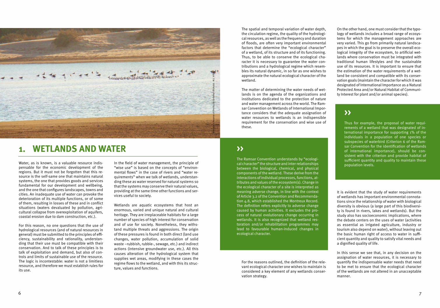
Bio
sphe
re R
eser
ve o
f the
Ria
de
Urd
aiba
i (B
izka
ia).
M.J.
Viñ
als
The spatial and temporal variation of water depth, the circulation regime, the quality of the hydrologi-cal resources, as well as the frequency and duration of floods, are often very important environmental factors that determine the “ecological character” of a wetland, of its structure and of its functioning. Thus, to be able to conserve the ecological cha-racter it is necessary to guarantee the water con-tributions and a hydrological regime which resem-bles its natural dynamic, in so far as one wishes to approximate the natural ecological character of the wetland.
The matter of determining the water needs of wet-lands is on the agenda of the organizations and institutions dedicated to the protection of nature and water management across the world. The Ram-sar Convention on Wetlands of International Impor-tance considers that the adequate assignation of water resources to wetlands is an indispensible requirement for the conservation and wise use of these.
For the reasons outlined, the definition of the rele-vant ecological character one wishes to maintain is considered a key element of any wetlands conser-vation strategy.
On the other hand, one must consider that the typo-logy of wetlands includes a broad range of ecosys-tems for which the management approaches are very varied. This go from primarily natural landsca-pes in which the goal is to preserve the overall eco-logical integrity of the ecosystem, to artificial wet-lands where conservation must be integrated with traditional human lifestyles and the sustainable use of its resources. It is important to ensure that the estimation of the water requirements of a wet-land be consistent and compatible with its conser-vation goals (maintain the character for which it was designated of International Importance as a Natural Protected Area and/or Natural Habitat of Communi-ty Interest for plant and/or animal species).
It is evident that the study of water requirements of wetlands has important environmental connota-tions since the relationship of water with biological diversity is obvious (a large part of this biodiversi-ty is found in rivers, lakes and wetlands). But the study also has socioeconomic implications, where the debate centers on the uses of water (activities as essential as irrigated agriculture, industry or tourism also depend on water), without leaving out the basic human right of access to water in suffi-cient quantity and quality to satisfy vital needs and a dignified quality of life.
In this sense we see that, in any decision on the assignation of water resources, it is necessary to quantify the indispensable water needs that need to be met to ensure that the ecological character of the wetlands are not altered in an unacceptable manner.
The Ramsar Convention understands by “ecologi-cal character” the structure and inter-relationships between the biological, chemical, and physical components of the wetland. These derive from the interactions of individual processes, functions, at-tributes and values of the ecosystem(s). Change in the ecological character of a site is interpreted as meaning adverse change, in line with the context of Article 3.2 of the Convention and Recommenda-tion 4.8, which established the Montreux Record. The definition refers explicitly to adverse change caused by human activities. It excludes the pro-cess of natural evolutionary change occurring in wetlands. It is also recognized that wetland res-toration and/or rehabilitation programmes may lead to favourable human-induced changes in ecological character.
>>
Thus for example, the proposal of water requi-rements of a wetland that was designated of in-ternational importance for supporting 1% of the individuals in a population of one species or subspecies of waterbird (Criterion 6 of the Ram-sar Convention for the identification of wetlands of international importance), should be con-sistent with the criterion and provide habitat of sufficient quantity and quality to maintain these population levels.
>>

98
In addition, we must highlight that addressing is-sues of the water requirements of wetlands also has a series of positive consequences. The ascer-tainment of water requirements can contribute to avoid the degradation of wetlands in the medium or long term, further the efforts for their restora-tion, avoid beforehand the over allocation of water among users in cases of underestimated water requirements, help regulate an excessive compe-tition between users, contribute to avoiding the loss of economic opportunities in cases of overes-timated water requirements, and the escalation of conflict in situations of prolonged drought.
In any case, we must point out that the ascertain-ment of the water requirements of a wetland is not a simple task, since it includes a varied ensemble
of technical and scientific studies that require the collaboration of specialists from diverse discipli-nes (botany, hydrology, hydraulics, zoology, etc.) working for a common objective. Putting into prac-tice the water requirements also implies multiple decisions in a setting where many interested actors converge and where different competencies coin-cide, etc. It is therefore a complex process where the lack of transparency can easily result in lack of agreement and consensus between the parties. This manual intends to convey the concept of water requirements of wetlands and the scope of the as-certainment of these requirements, providing clari-ty on the actions necessary to ensure that the stu-dies to do this are integrated with all other aspects of water management.
The Convention on Wetlands of International Im-portance or Ramsar Convention has addressed, di-rectly or indirectly, issues related to water since its beginning in 1971, but more clearly and specifically since the Conference of the Parties which took pla-ce in Australia in 1996. Initially, its recommenda-tion centred on problems of lack of water in parti-cular wetlands, but, in subsequent meetings of the Conference of the Parties (COP), problems resulting from the excessive use of water that directly impac-ted some of the wetlands included in the List of Wetlands of International Importance started to be emphasised. A number of resolutions and recom-mendations thus highlighted the importance of the adequate management of hydrological resources
for the conservation of wetlands. Notwithstanding, it was in the 6th Meeting of the COP that, for the first time, it was explicitly recognized that wetlands require a certain volume of water to maintain their ecological character (Resolution VI.23).
Subsequently, Resolution VII.18 makes a specific reference to the water requirements of wetlands in the context of river basin management, stressing the importance of evaluating the ecological water demands as an essential component of river basin management. In addition, this Resolution endorses a series of guidelines for the Contracting Parties to the Convention relating to the maintenance of na-tural water regimes to maintain wetlands.
2. LEGAL CONSIDERATIONS OF THE WATER REQUIREMENTS OF WETLANDS 2.1. THE RAMSAR CONVENTION AND WATER REQUIREMENTS
Nat
iona
l Par
k of
Aig
üest
orte
s an
d Es
tany
de
Sant
Mau
rice
(LLe
ida)
. M. O
ñorb
e

1110
From a conceptual viewpoint, it was in Valencia (Spain) during the 8th Meeting of the COP in 2002 that the entire process of allocation and mana-gement of water for maintaining the ecological functions of wetlands was addressed (Resolution VIII.1). Although the methods for determining the water requirements of wetlands were not addres-sed in detail, complementary issues such as policy and legislation and decision-making frameworks were undertaken. Two other resolutions directly re-lated to hydrological resources management were also adopted at this meeting: on the one hand, Resolution VIII.40 enabled the adoption of the first guidelines for rendering the use of groundwater compatible with the conservation of wetlands, and on the other hand Resolution VIII.34 focused on the interdependencies between agricultural activi-ties and the wise use of wetlands.
Resolution IX.1 and its Annexes C, Ci and Cii adop-ted in 2005, provided scientific and technical di-rection, additional to the Ramsar guidelines, regar-ding water, the phases of river basin management and groundwater management.
Lastly, in 2008 the “Changwon Declaration on hu-man well-being and wetlands” (Resolution X.3)
made a call for action, presenting priority action steps for delivering some of the world’s most cri-tical environmental sustainability goals. This De-claration recognizes that the increasing demand for, and over-use of, water jeopardizes human well-being and the environment and that there is often not enough water to meet our direct human needs and to maintain the wetlands we need.
In addition, the issue of determining water requi-rements for wetlands is also found in the Ramsar Strategic Plan 2009-2015. For example, the effecti-ve management of wetlands (Strategy 2.5 and 2.7), calls for an understanding the amount of water (in quantitative terms), required by wetlands as well as their sources. In this manner, it fosters an explicit recognition of wetlands in integrated water resour-ces management (Strategy 1.7). The inventory and assessment of wetlands (Strategies 1.1, 2.4 and 2.6) includes the wetlands’ hydrological regime, management objectives and limits of acceptable change. It is clear that, when wetland degradation is caused by intensive water use, restoration will depend on assigning water volumes sufficient to recovering wetland functions and ecological cha-racter (Strategy 1.8).
Lago
on T
oja
de R
ibas
(Pal
enci
a). A
. Rod
rígue
z
Wetlands are among the most threated ecosystems in the European Union, with more than 56% classi-fied as having a “unfavourable-bad” conservation status and another 30% classified as “unfavoura-ble-inadequate” (ETC/BD, 2009). For example, it is calculated that Spain currently has a surface of 114,100 ha of wetlands, which represents, accor-ding to various estimates, less than 40% of the surface which existed 50 years ago (MMA, 2000).
The Birds Directive (BD), the Habitats Directive (HD) and the Water Framework Directive (WFD) are legal instruments of great relevance and pertinence for conservation, protection and wise use of European wetlands at this time.
The application of these Directives must be coor-dinated and complementary (an obligation esta-blished in the respective texts), with the goal of achieving greater coherence both for the conserva-tion of European biodiversity and for the wise use of water.
The Birds Directive1 exhorts Member states to pay special attention to the conservation of wild birds through the preservation of their habitats, the creation of Special Conservation Areas (SCAs) and the restoration of altered habitats. Although the text of the Directive does not specifically mention the requirement of creating management plans for the SCAs, it makes reference to the creation of the necessary legal framework for the preservation, maintenance or restoration of a sufficient diversity and area of habitats essential to the conservation of all species of birds, many of which are aquatic.
The Habitats Directive2 protects a number of habi-tats and animal and plant species of conservation interest for Europe, with the goal of maintaining or re-establishing a “favourable conservation status”, with a focus on the presence and distribution of
these. Many of these habitats and these flora and fauna species are only found in wetlands. This Di-rective fosters the declaration of a sufficient num-ber of Sites of Community Importance (SCI), which are subsequently designated Special Area of Con-servation (SAC), and which together with the SCAs of the Birds Directive constitute the Natura 2000 network. This network is the primary instrument for the protection of species and habitats in Euro-pe. All this is complemented by a system of “strict protection” which the Directive assigns to the taxa included in Annex IV, even when these species are found outside the Natura 2000 Network. This Directive calls for the implementation of manage-ment plans3.
1 Directive 2009/147/EC of the European Parliament and of the Council of 30 November 2009 on the conservation of wild birds.2 Council Directive 92/43/EEC of 21 May 1992 on the conservation of natural habitats and of wild fauna and flora.3 For special areas of conservation, Member States shall establish the necessary conservation measures involving, if need be, appropriate management plans specifically designed for the sites or integrated into other development plans (Art. 6.1 of the Habitats Directive).
2.2. WATER REQUIREMENTS IN THE EUROPEAN DIRECTIVES
Lago
on d
e la
Nav
a (P
alen
cia)
. Glo
bal N
atur
e Fo
unda
tion

1312
The Water Framework Directive4 establishes a con-text of conservation and restoration of aquatic ecosystems based on the principle of sustainable use. In hydrological planning, this principle of sus-tainable use and conservation of aquatic ecosys-tems is built, to a large extent, on the concept of environmental flows (known as water requirements or needs in the case of wetlands).
The WFD requires the establishment of management plans to prevent the deterioration of ecosystems. It regulates economic activities under a framework of sustainability. For this, water bodies must achieve “good ecological status” which is defined through a series of biological (composition and abundance of certain taxa), hydromorphological, chemical and physicochemical indicators depending on the type of water body. Water bodies designated as modi-fied must achieve “good ecological potential”.
Although the Directive does not utilize the exact term “hydrological requirement”, the concept is implicit in the planning process since it establishes the need to develop river basin management plans for achieving environmental objectives. It takes into account, of course, the conservation objecti-ves of the Natura 2000 sites that depend on water, which must be explicitly defined in the basin plans. The link established between water management and achieving environmental objectives allows the concept of water requirements to be more flexible, and, depending on the established conservation objective (for a protected area or a heavily modi-fied water body), the necessary volume of water will be different.
Lastly, it is important to point out that the cohe-rent and effective application of the mandates of the three Directives must be complementary. Thus, from the point of view of watershed management, one must incorporate the specific objectives of pro-tected areas, including the Natura 2000 sites, to the general objective of “good ecological status” sought by the WFD.
The “favourable conservation status” of the Natu-ra 2000 sites is defined as that in which the spe-cies and habitats included in Annex I of the Birds Directive or Annexes I, II and IV of the Habitats Directive, have improved relative to a predetermi-ned reference value that ensures their long-term survival. It is determined by the distribution area of the habitats, the species’ population levels and the quality of the habitats that prompted the Natura 2000 site designation.
>>
According to the Water Framework Directive, the “ecological status” is an expression of the qua-lity of the structure and functioning of aquatic ecosystems associated with surface waters, clas-sified in accordance with Annex V.
>>
4 Directive 2000/60/EC of the European Parliament and of the Council of 23 October 2000 establishing a framework for Community action in the field of water policy.
2.3. SPANISH LEGISLATION
Environmental hydrological uses are expressly gua-ranteed at the highest level in the Spanish legal structure since the early 1980s of the 20th century (Water Law), as a general restriction on the other water uses (with the exception of supply for human populations). There is no doubt that this condition of environmental prevalence can result in conflicti-ve situations when it affects territories with a high demand for hydrological resources and a chronic shortage of these.
Furthermore, in compliance with our European obligations, the Spanish legal framework has gra-dually incorporated the Birds, Habitats and Water Framework Directives.
The Habitats Directive was transposed, in a first phase, through the Royal Decree 1997/1995 which established the measures that contribute to gua-rantee biodiversity through the conservation of na-tural habitats and of wild fauna and flora, through new contributions to Law 42/2001 of Natural Heri-tage and Biodiversity.
The transposition of the Water Framework Directi-ve to the internal legal framework has been more complicated (there is a multitude of regulations of different ranks). In the area that interests us, we
must highlight above all the Hydrographical Plan-ning Regulation (Royal Decree 907/2007), which best captures the Directive´s contents related to planning. This Regulation makes explicit refe-rence to the obligation of determining the water requirements for wetlands with the fundamental objective of contributing to achieving their good status or ecological potential. This is achieved by sustainably maintaining the functions and struc-ture of wetlands, providing the habitat conditions adequate for satisfying the requirements of the di-fferent biological communities belonging to these aquatic ecosystems and the associated terrestrial ecosystems, through the preservation of the eco-logical processes necessary for completing their biological cycles. In addition, in developing this Royal Decree, Order ARM/2656/2008, known as the Hydrological Planning Instruction, was appro-ved. The latter elaborates upon the concepts and details of the methods necessary to determine the hydrological requirement of different water bodies. This Order clearly established the need to link wet-land hydrology with the “environmental objecti-ves” sought (the conservation and recovery of the general ecological functions of wetlands, the con-servation of species and habitats and the conser-vation of landscapes).
Ulla
l Gra
n de
la M
arja
l de
Gan
dia
(Val
enci
a). T
rags
a
1514
Currently in Spain, the River Basin Hydrological Plans are instruments that must include the envi-ronmental objectives of protection, improvement and regeneration of surface water and groundwater bodies. The Basin Organization is the administra-tion body responsible for the application of the Hydrological Planning Regulation (in the case of basins shared by two or more regions these orga-nizations are at the state level, but in the case of intra-region basins they belong to the correspon-ding Autonomous Community).
As was mentioned earlier, when determining the water requirements of wetlands it is very important to take into account the desired or mandated envi-ronmental objectives. For this reason, in the case of Spanish wetlands, the following elements are considered:
1. For water bodies defined by the Basin Orga-nizations, the environmental objective sought is the “good ecological status”, which will be evaluated using indicators of the quality of the ecological status of the water.
Environmental objectives in the water requirements study
A. Conservation and recovery of general ecological functions- Guarantee the maintenance of the structure and functionality of lake ecosystems and their associated
elements. - Maintain a inundation regime in the wetland that maintains conditions compatible with the establis-
hed environmental objectives. - Maximize the potential contribution of the site to the migration and wintering processes of birds as
an enclave of trophic support and refuge.
B. Conservation of species and habitats- Serve as a base for the conservation of species in general, serving, amongst others, functions of
genetic reserve.- Provide adequate protection to the plant and fauna elements (communities of species) of greatest
value due to their level of threat, richness, diversity, abundance, fragility and scientific value.- Maintain, in a favourable conservation status the Natural Habitats of Community Interest. - Maintain, in a favourable conservation status at least, the Species of Community Interest of Annex II
of Royal Decree 1997/1995 and Royal Decree 1193/1998 belonging to the zone. - Maintain, in a favourable conservation status the bird species of Annex I of the Birds Directive and of
Directive 91/244/CEE belonging to the site.- Contribute to the conservation of classified species present in the area and their habitats. The latter
must have the area adequate to maintain viable populations of these species. - Contribute to the development and application of the plans for the recovery and conservation of the
threatened species present in the area, as well as ensure the compatibility of the dispositions, direc-tives and actions contained in these plans, both those already approved as well as those that could be approved in the future.
C. Conservation of landscapes- Maintain the landscapes of the wetland and its surroundings in an adequate condition, addressing
its particular uniqueness.
>>2. In wetlands declared Natural Protected Areas and Natura 2000 sites, the conservation objec-tives which must be achieved are defined in the designation of these sites. Concretely, for Spa-nish Natura 2000 sites, a “favourable conserva-tion status” should be achieved for the Habitats of Community Interest included in these sites, as well as the conservation objectives of the species included in the different annexes of the Habitats and Birds Directives present in these sites.
3. Other water bodies that do not have a speci-fic protection designation, but are included in other catalogues of interest such as the Spanish Inventory of Wetlands (Royal Decree 435/2004, 12th of March).
In the case of lakes and wetlands dependent on groundwater, the Hydrological Planning Instruction specifies that a hydrological regime based on pie-zometric levels must be maintained such that “the alternations due to human activity not impede the achievement of the environmental objectives spe-cified for the associated surface waters, or cause any significant harm to the associated terrestrial ecosystems that directly depend on the ground-water body”.
We see thus how the determination of the water requirements of wetlands portends to be a key as-pect for the conservation of these ecosystems. The issue becomes especially relevant for the large im-plications it entails for water management.
We must keep in mind however, that the confluen-ce of several environmental objectives in the same space can result in confusion. It is therefore neces-sary to, systematically and for every case, identify the conservation objectives for each habitat and species of community interest that depend on water, and to verify whether these are more rigo-rous than other objectives of the WFD applicable to each water body. Furthermore, the quantity of water reserved for environmental conservation will vary depending on whether one is dealing with pro-tected areas, natural water bodies or heavily modi-fied water bodies. These inputs should contribute to achieving the environmental objectives of the corresponding water bodies. The ultimate goal is not to simply provide a set volume, but rather to achieve the environmental objective of the wetland in question.
Nat
ural
Par
k Ba
hia
de C
adiz
.. A.
Ase
ncio

1716
The water requirements of wetlands in the legal framework
Which is the applicable legal framework?The applicable legal framework for the water requirements of wetlands is primary found in the water sector legislation (Water Framework Directive, successive texts of the Water Law, other mandates such as the Hydrological Planning Regulation and Instruction). In addition, the environmental legislation has bearing on some aspects of the water requirements, as in the case of protected areas or the recovery of endangered species.
Where and when are they established?According to Article 18 of the Royal Decree 907/2007 of the Hydrological Planning Regulation, the water requirements of aquatic ecosystems are determined in the Basin Hydrological Plan.
How is a water requirements regime defined?This is the regime that permits the sustainable maintenance of the function and structure ofaquatic ecosystems and associated terrestrial ecosystems, contributing to achieve the goodstatus or ecological potential of the corresponding water bodies.
What is the position of the other uses?Article 57 (7) of Law 46/1999 clearly defines some limits in the use of hydrological resources for environ-mental reasons, establishing for the first time that “ecosystem flows or environmental demands will not be characterized as use (…), they should be considered as a general restriction on all systems of exploi-tation”, the exception to the rule being the supremacy of use for the supply of human populations.
For which water bodies should they be calculated?The water requirements must be determined for all the water bodies in each category, such as transition waters, lakes, wetlands and groundwater bodies.
How is this put into practise?The establishment of the water requirements regime will be carried out through a process that takes pla-ce in three phases: technical studies for the determination of water requirements; a consensus building process; and a process of application of the exploitation systems.
>>
3. BASIC COMPONENTS OF THE HYDROLOGICAL REQUIREMENTS STUDY
Lago
on d
el C
añiz
ar (T
erue
l). M
.J. V
iñal
s
The key elements of the study of the hydrological requirements of a wetland are the hydrology, the biological communities and the conservation ob-jectives.
The phases of the analysis that should steer the hydrological requirements study are:
1. As we have seen, the legal analysis provides an understanding of the conservation objecti-ves and of the particular conditions imposed by the various legislations. The general conserva-tion objectives of wetlands are complemented in turn by the specific objectives of protected areas, which can be especially demanding in the case of some protection designations or when particular endangered species are pre-sent. A careful review of the legal framework makes explicit the conservation objectives for which a coherent hydrological requirements proposal must be formulated.
2. The analysis of the physical environment centres primarily on the characterisation of the hydrology and hydrogeology of the wetland. This undertaking includes the study of the na-tural inundation regime and of the effect of
human activities on this regime (water use, im-pacts, etc.), among others.
3. The analysis of the bio-ecological environment is based on an understanding of the biological communities present in the wetland. These are an important component of the conservation values of wetlands, to the point that in a num-ber of cases management activities are directly or indirectly oriented to the conservation and improvement of the biological communities. In addition, we must keep in mind that habitats and species provide information on the hydro-logical dynamic, including the distribution and abundance of different organisms. The hydrolo-gy-ecology relationship is key for understanding the dynamic of these ecosystems.

1918
KEY ELEMENTS OF HIDROLOGICAL REQUIREMENTS STUDY
HYDROLOGICAL FUNCTIONING
BIOLOGICAL COMMUNITIES
CONSERVATION OBJECTIVES
GROUND WATER
FLOWS TO THE WETLAND
GOOD ECOLOGICALSTATUS
MAINTENANCE OF INDICATORS
HIDRO-METEOROLO-GICAL BALANCE
MORPHOLOGICALCHARACTERISTICS
INUNDATIONREGIME
WFE INDICATORS
RAMSARINDICATORS BIRDS
HYGROPHILOUSVEGETATION
HIDROPHYTIC VEGETATION
INVERTEBRATES
MAMMALS
FISH
HB AND BDINDICATORS
WATERLOSES
PIEZOMETRIC FLUCTUATION
REGIME
FAVOURABLECONSERVATION
STATUS
SURFACE WATER
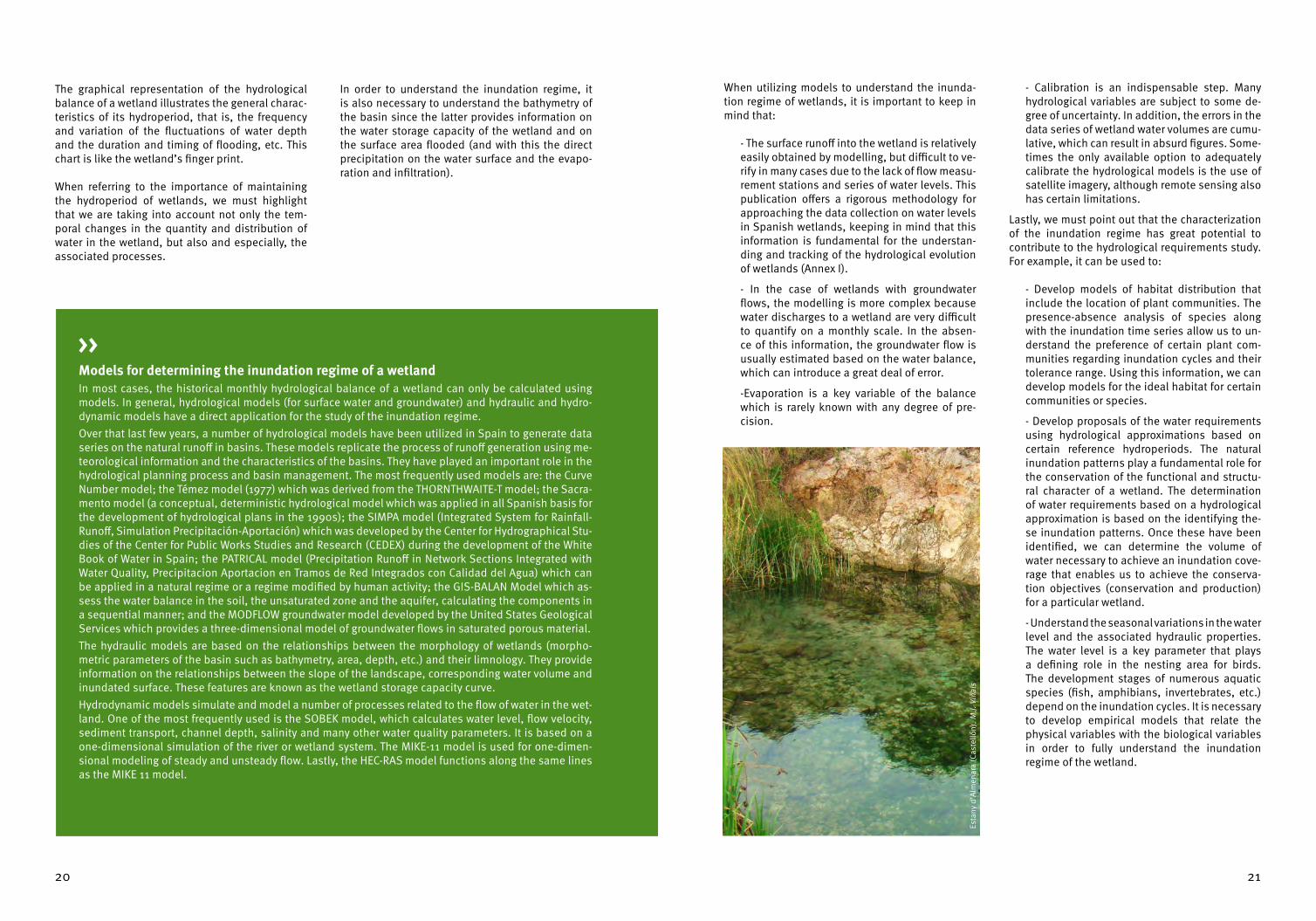
An understanding of the inundation regime of wet-lands in both natural and modified conditions is fundamental for the hydrological study necessary to determine the hydrological requirements of a wetland. The inundation regime is a factor that, to a large extent, determines the organization and dy-namic of the ecosystem (presence and distribution of biological communities).
The inundation regime is defined as the variation in water volumes or depth of water over time. The stu-dy of the inundation regime is carried out at a mon-thly scale and lengthy time series are necessary in order to understand the inter-annual variation.
Determining the inundation regime of a wetland is no easy task. To accomplish this, one must calcula-te the hydrological balance of the wetland and map the bathymetry of its basin.
The hydrological balance study consist of quanti-fying, for a certain time period, the flows of water in and out of a system, taking into account both sur-face water and groundwater (precipitation, surface and groundwater flows, infiltration, runoff, water
extraction, etc.). For this, one must compile all the climatic and hydrological data available over a sufficient time frame, usually of 20 years. The data must be analysed in monthly intervals.
As described above, a detailed study of the histori-cal data series should enable us to identify the sea-sonal and inter-annual variations of the wetland.
Quantitative data for some of the parameters of the water balance equation is typically lacking, es-pecially for monthly balances or historical series of the latter. To make up for these deficiencies, we use hydrological models and programmes for the tracking and control of wetlands which, over the last decade, have provided basic data that in some cases enable us to develop a fairly accurate hydrological balance, at least for some of the more significant elements of the system such as surface runoff.
In addition, it is useful to understand the hydrolo-gical regime of the wetland not only under natural conditions but also when its elements have been modified, since the inundation regime will ob-viously vary.
3.1. THE HYDROLOGY OF WETLANDS
SCI R
ia d
e Fo
z-M
asm
a (L
ugo)
. M.J.
Viñ
als
2120
The graphical representation of the hydrological balance of a wetland illustrates the general charac-teristics of its hydroperiod, that is, the frequency and variation of the fluctuations of water depth and the duration and timing of flooding, etc. This chart is like the wetland’s finger print.
When referring to the importance of maintaining the hydroperiod of wetlands, we must highlight that we are taking into account not only the tem-poral changes in the quantity and distribution of water in the wetland, but also and especially, the associated processes.
In order to understand the inundation regime, it is also necessary to understand the bathymetry of the basin since the latter provides information on the water storage capacity of the wetland and on the surface area flooded (and with this the direct precipitation on the water surface and the evapo-ration and infiltration).
Models for determining the inundation regime of a wetlandIn most cases, the historical monthly hydrological balance of a wetland can only be calculated using models. In general, hydrological models (for surface water and groundwater) and hydraulic and hydro-dynamic models have a direct application for the study of the inundation regime. Over that last few years, a number of hydrological models have been utilized in Spain to generate data series on the natural runoff in basins. These models replicate the process of runoff generation using me-teorological information and the characteristics of the basins. They have played an important role in the hydrological planning process and basin management. The most frequently used models are: the Curve Number model; the Témez model (1977) which was derived from the THORNTHWAITE-T model; the Sacra-mento model (a conceptual, deterministic hydrological model which was applied in all Spanish basis for the development of hydrological plans in the 1990s); the SIMPA model (Integrated System for Rainfall-Runoff, Simulation Precipitación-Aportación) which was developed by the Center for Hydrographical Stu-dies of the Center for Public Works Studies and Research (CEDEX) during the development of the White Book of Water in Spain; the PATRICAL model (Precipitation Runoff in Network Sections Integrated with Water Quality, Precipitacion Aportacion en Tramos de Red Integrados con Calidad del Agua) which can be applied in a natural regime or a regime modified by human activity; the GIS-BALAN Model which as-sess the water balance in the soil, the unsaturated zone and the aquifer, calculating the components in a sequential manner; and the MODFLOW groundwater model developed by the United States Geological Services which provides a three-dimensional model of groundwater flows in saturated porous material. The hydraulic models are based on the relationships between the morphology of wetlands (morpho-metric parameters of the basin such as bathymetry, area, depth, etc.) and their limnology. They provide information on the relationships between the slope of the landscape, corresponding water volume and inundated surface. These features are known as the wetland storage capacity curve. Hydrodynamic models simulate and model a number of processes related to the flow of water in the wet-land. One of the most frequently used is the SOBEK model, which calculates water level, flow velocity, sediment transport, channel depth, salinity and many other water quality parameters. It is based on a one-dimensional simulation of the river or wetland system. The MIKE-11 model is used for one-dimen-sional modeling of steady and unsteady flow. Lastly, the HEC-RAS model functions along the same lines as the MIKE 11 model.
>>
When utilizing models to understand the inunda-tion regime of wetlands, it is important to keep in mind that:
- The surface runoff into the wetland is relatively easily obtained by modelling, but difficult to ve-rify in many cases due to the lack of flow measu-rement stations and series of water levels. This publication offers a rigorous methodology for approaching the data collection on water levels in Spanish wetlands, keeping in mind that this information is fundamental for the understan-ding and tracking of the hydrological evolution of wetlands (Annex I).
- In the case of wetlands with groundwater flows, the modelling is more complex because water discharges to a wetland are very difficult to quantify on a monthly scale. In the absen-ce of this information, the groundwater flow is usually estimated based on the water balance, which can introduce a great deal of error.
-Evaporation is a key variable of the balance which is rarely known with any degree of pre-cision.
- Calibration is an indispensable step. Many hydrological variables are subject to some de-gree of uncertainty. In addition, the errors in the data series of wetland water volumes are cumu-lative, which can result in absurd figures. Some-times the only available option to adequately calibrate the hydrological models is the use of satellite imagery, although remote sensing also has certain limitations.
Lastly, we must point out that the characterization of the inundation regime has great potential to contribute to the hydrological requirements study. For example, it can be used to:
- Develop models of habitat distribution that include the location of plant communities. The presence-absence analysis of species along with the inundation time series allow us to un-derstand the preference of certain plant com-munities regarding inundation cycles and their tolerance range. Using this information, we can develop models for the ideal habitat for certain communities or species.
- Develop proposals of the water requirements using hydrological approximations based on certain reference hydroperiods. The natural inundation patterns play a fundamental role for the conservation of the functional and structu-ral character of a wetland. The determination of water requirements based on a hydrological approximation is based on the identifying the-se inundation patterns. Once these have been identified, we can determine the volume of water necessary to achieve an inundation cove-rage that enables us to achieve the conserva-tion objectives (conservation and production) for a particular wetland.
- Understand the seasonal variations in the water level and the associated hydraulic properties. The water level is a key parameter that plays a defining role in the nesting area for birds. The development stages of numerous aquatic species (fish, amphibians, invertebrates, etc.) depend on the inundation cycles. It is necessary to develop empirical models that relate the physical variables with the biological variables in order to fully understand the inundation regime of the wetland.
Esta
ny d
’Alm
enar
a (C
aste
llón)
. M.J.
Viñ
als

2322
Remote Sensing Techniques for the Determination of the Inundation Regime of WetlandsRemote sensing technology is excellent for monitoring dynamic natural phenomena and has applica-tions for the study and monitoring of wetlands. In particular, it provides a great deal of information on the evolution over long periods of time (since the 1970s) of the superficial hydrological characteristics of a wetland (changes in the inundation surface, periods of drying and salinization, tracking of water pollution, etc.). The remote sensing data is analysed to obtain information on the extension of the inundated area over a certain time frame (selecting historical and recent dates). This information is obtained by overlaying satellite images of Earth (Landsat satellite) with calculations of depth and water volume of the wetlands for the same dates. In this manner one can calculate retrospective time series of wetland inundations and use these to calibrate the hydrological models, determine inundation regimes, and other uses. The methodology consists of analysing the spectral signature of each image for each date and genera-ting a layer of water surface for each image. To do this, a Water Index is used, which is extracted using the green and infrared bands of the Lansdsat TM sensor. When a precise digital landscape model (DLM) is available, the depth for each date is calculated based on the water surface and bathymetry extracted from the DLM. If a precise DLM is not available, the depth is obtained by a calibration methodology that relates the area of the water surface measured with remote sensing and the depth measurements taken in the field by calculating the linear regression that correlates them.
The Demarcation of the Guadalquivir Wetlands Case Study5
Although hydrological information is key for understanding the ecological functioning of wetlands, this information usually does not exist or the time series available is too short to statistically characterize a wetland. On the other hand, remote sensing offers a lengthy data series of historical images that provide a large amount of information of the planet’s surface, including some of the hydrological characteristics of wetlands such as the inundated area. A historical analysis using remote sensing enables us to cons-truct a retrospective time series of wetlands inundations, thus contributing to a better understanding of their functioning. The study carried out in selected wetlands in the Demarcation of The Guadalquivir sought to develop a simple and practical methodology to calculate and monitor the water area over time, using remote sen-sing techniques and data obtainable at a low cost.
>>
5 Information extracted from: “Determinación mediante técnicas de teledetección de niveles y superficie inundada de humedales incluidos en la Demarcación Hidrográfica del Guadalquivir” prepared by TRAGSATEC for the Hidrographic Confederation of The Guadalquivir (2011).
The first step was the creation of a database of Landsat images for the two periods selected (1995-2007 and 2008-2010) containing those images most appropriate for the study objectives (Figure 1). To homo-genize the images, these were orthorectified (using a Spot 5 image of the National Remote Sensing Plan and the digital landscape model from the SIGPAC) and radiometrically corrected, converting the digital level values (8-bit, 256 shades of grey) to reflectivity values, that is, the per cent of incident radiation reflected by the surface. Different indices, such as the Modified Normalized Difference Water Index (MNDWI), the Normalized Di-fference Water Index (NDWI) and the CEDEX Water Index were tested for the identification of the surface water. The indices were evaluated for different image dates and for different inundation levels. The IAL25 was selected since it was most appropriate for the inundation levels observed in the images. In some particular cases, additional application of the NDVI in combination with the IRM allowed for an improved discernment of the inundated vegetation. Using the wetland bathymetry obtained from a digital landscape model (DLM) and the water surface ob-tained from the application of the IAL25 index, the study was able to determine both the water volume and depth for each of the dates of the satellite imagery.
Figure 1. Methodology utilised. Source: TRAGSATEC for CHG, 2011
METHODOLOGY
PERMANENT LAKES (Zoñar, Rincón)
SEASONAL LAKES
Satellite images available
(1984-2010)
Images selected
Measurements levels in the field (1985-2010)
Reference le
vel
RS Analysis
GISAnalysis
Model calibrated
MODEL CALIBRATED FOR CALCULATION OF DEPTHS
CALI
BRAT
ION
(1
995
- 200
7)
MDT 5M Bathymetry Layor of depths and volume by date and associated BD
Inundated area by date
Lake ID Image date Level date
Water area
Level in field RS level Dif. in
levels (m)Dif. in levels
(%)
Zoñar Year/mo./ day Year/mo ha m m m %
Dep
h (m
)
Area (ha)
00 2 4 6 8 10 12
Y - 0,000 + 0,3382 + 0,1108R - 0,9900
14 16
0,51
1,5
2
2,5
3
3,5
4

2524
By comparing measurements of real water depth obtained in the field with the results obtained with the remote sensing techniques, the study was able to observe that, on average, the differences were less than 20 cm. In most cases these differences could be justified by the uncertainty in the match between the date of the field measurements and the date of the images utilized, as well as by the error resulting from the spatial resolution of the images and the DLM. From the results obtained from this study we can conclude that remote sensing techniques can be a simple and affordable means for generating a historical series of inundations in wetlands. Data series on water levels and volumes can also be calculated if an adequate bathymetry is available. Despite these good results, the study noted some caveats that could limit the use of remote sensing te-chnique in other wetlands. For example, the minimum area of the wetlands is proportional to the spatial resolution of the images (this study considered the minimum area to be 0.1 ha, approximately 10 pixels of a Landsat image). In addition, the spectral resolution of the images also limits their application. This fact makes advisable that at least the green, red and near infrared bandwidths be available, although the mid infrared bandwidth is also desirable (as is the case for Landsat images). The type of wetland inundation regime could also limit the application of remote sensing.
The values that led to the protection of many wet-lands have been their vegetation and their fauna. For this reason, the conservation status of these is a fundamental factor that depends largely on water and on the processes that occur in the ecosystem. In many instances, the biological components (ha-bitats and species) are a result of the hydrological behaviour of the wetland and can be considered true “indicators” when determining the water re-quirements.
The selection of the species that will guide the water requirements study should take into account the susceptibility of these species to changes in the inundation regime of the wetland, and espe-cially, their sensitivity to the types of hydrological alterations taking place in the water body. The spe-cies of flora and fauna or the natural habitats can be considered individually or by biological commu-nities or groups of habitats.
It appears that plants are the best indicator due to their high diversity and the fundamental role of ve-getation for the refuge, breeding and feeding of the fauna (birds, amphibians, fish, etc.).
When we undertake a detailed analysis of the water requirements of plant communities, we observe that there is a dependency gradient that ranges from the strictly aquatic plants that carry out their entire life cycle in the water, to plants that have an affinity for water or exhibit a competitive advanta-ge in wet conditions (for example, phreatophytic vegetation).
The spatial layout of the plant species in a wetland responds fundamentally to environmental gra-dients, where the inundation regime and salinity conditions are the primary factors responsible for this layout. The resulting landscape is characteri-zed by a zonification of the vegetation in concentric bands distributed around the centre of the lagoon (Keddy, 2002; Wisheu y Keddy, 1992; Wasserberg et al., 2006).
Among the Habitats of Community Interest listed in Annex I of the Habitats Directive that depend on water, we can find: standing water habitats (Group 31), Atlantic and continental salt marshes and salt meadows (Group 13), Mediterranean and thermo-Atlantic salt marshes and salt meadows (Group 14),
3.2. THE BIOLOGICAL COMPONENTS OF WETLANDS
Mar
jals
de
La S
afor
(Val
enci
a). M
.J. V
iñal
s
Nat
ural
Res
erve
of t
he A
mar
ga L
agoo
n (C
órdo
ba).
PN
OA
2010
. Hyd
rogr
aphi
c Co
nfed
erat
ion
of th
e G
uada
lqui
vir R
iver
2726
Salt and gypsum inland steppes (Group 15), Sphag-num acid bogs (Group 71), etc. In Spain, the Minis-try for Environment, and Marine and Rural Affairs carried out an exhaustive study to characterize the habitats included in Group 31 (VV.AA., 2009) due to the interest of the Ministry to be involved in the synergistic application of the European Habitats and Water Frameworks Directives.
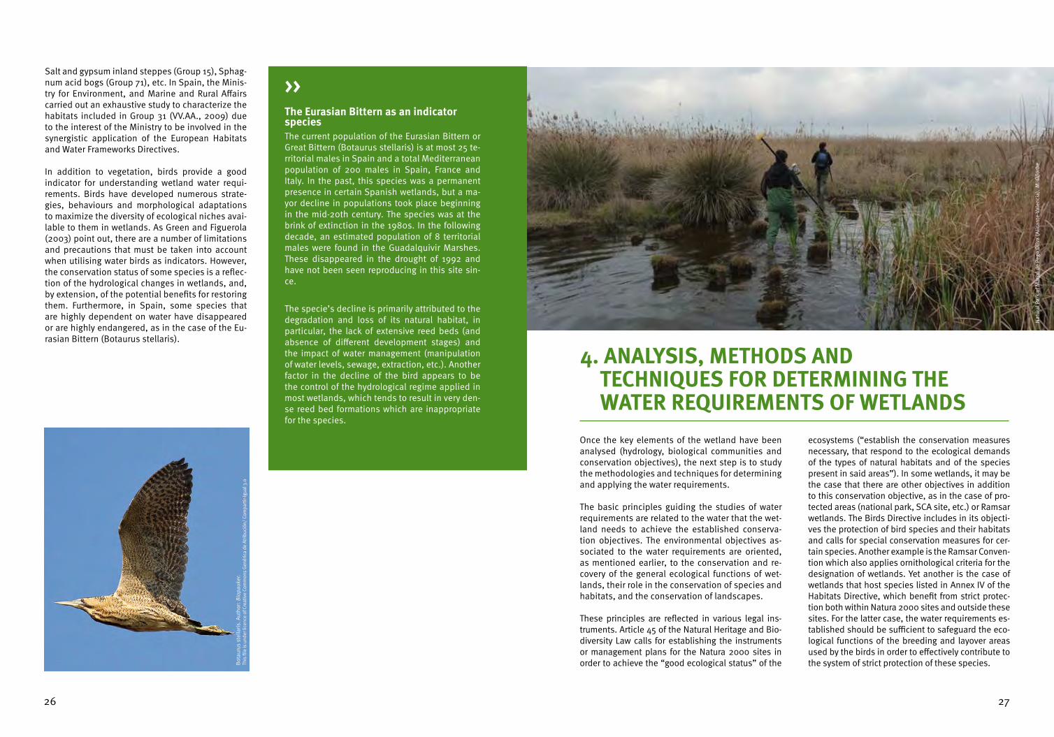
In addition to vegetation, birds provide a good indicator for understanding wetland water requi-rements. Birds have developed numerous strate-gies, behaviours and morphological adaptations to maximize the diversity of ecological niches avai-lable to them in wetlands. As Green and Figuerola (2003) point out, there are a number of limitations and precautions that must be taken into account when utilising water birds as indicators. However, the conservation status of some species is a reflec-tion of the hydrological changes in wetlands, and, by extension, of the potential benefits for restoring them. Furthermore, in Spain, some species that are highly dependent on water have disappeared or are highly endangered, as in the case of the Eu-rasian Bittern (Botaurus stellaris).
The Eurasian Bittern as an indicator speciesThe current population of the Eurasian Bittern or Great Bittern (Botaurus stellaris) is at most 25 te-rritorial males in Spain and a total Mediterranean population of 200 males in Spain, France and Italy. In the past, this species was a permanent presence in certain Spanish wetlands, but a ma-yor decline in populations took place beginning in the mid-20th century. The species was at the brink of extinction in the 1980s. In the following decade, an estimated population of 8 territorial males were found in the Guadalquivir Marshes. These disappeared in the drought of 1992 and have not been seen reproducing in this site sin-ce.
The specie’s decline is primarily attributed to the degradation and loss of its natural habitat, in particular, the lack of extensive reed beds (and absence of different development stages) and the impact of water management (manipulation of water levels, sewage, extraction, etc.). Another factor in the decline of the bird appears to be the control of the hydrological regime applied in most wetlands, which tends to result in very den-se reed bed formations which are inappropriate for the species.
>>
Bot
auru
s st
ella
ris. A
utho
r: B
iopa
uker
. Th
is fi
le is
und
er li
cenc
e of
Cre
ativ
e Co
mm
ons
Gen
éric
a de
Atri
buci
ón/
Com
part
ir-Ig
ual 3
.0
Once the key elements of the wetland have been analysed (hydrology, biological communities and conservation objectives), the next step is to study the methodologies and techniques for determining and applying the water requirements.
The basic principles guiding the studies of water requirements are related to the water that the wet-land needs to achieve the established conserva-tion objectives. The environmental objectives as-sociated to the water requirements are oriented, as mentioned earlier, to the conservation and re-covery of the general ecological functions of wet-lands, their role in the conservation of species and habitats, and the conservation of landscapes.
These principles are reflected in various legal ins-truments. Article 45 of the Natural Heritage and Bio-diversity Law calls for establishing the instruments or management plans for the Natura 2000 sites in order to achieve the “good ecological status” of the
ecosystems (“establish the conservation measures necessary, that respond to the ecological demands of the types of natural habitats and of the species present in said areas”). In some wetlands, it may be the case that there are other objectives in addition to this conservation objective, as in the case of pro-tected areas (national park, SCA site, etc.) or Ramsar wetlands. The Birds Directive includes in its objecti-ves the protection of bird species and their habitats and calls for special conservation measures for cer-tain species. Another example is the Ramsar Conven-tion which also applies ornithological criteria for the designation of wetlands. Yet another is the case of wetlands that host species listed in Annex IV of the Habitats Directive, which benefit from strict protec-tion both within Natura 2000 sites and outside these sites. For the latter case, the water requirements es-tablished should be sufficient to safeguard the eco-logical functions of the breeding and layover areas used by the birds in order to effectively contribute to the system of strict protection of these species.
4. ANALYSIS, METHODS AND TECHNIQUES FOR DETERMINING THE WATER REQUIREMENTS OF WETLANDS
Nat
ural
Par
k of
Mar
jal d
e Pe
go O
liva
(Alic
ante
-Val
enci
a). M
. Oño
rbe

2928
The WFD takes into account all these situations and establishes in Article 4.2 that, where more than one of the objectives relates to a given body of water, the most stringent shall apply. This means that for each case, it is necessary to systematically identify the conservation objectives for the habitats and species of community interest that depend on water and to verify whether these are more strin-gent that the objectives of the WFD for the water body in question.
The Hydrological Planning Instruction states that “the fundamental objective of characterizing the environmental water requirements of the bodies of water classified as lakes or lagoonal transition zo-nes is to contribute to achieving a “good ecological status or potential”. This conservation objective will be attained “by the sustainable maintenance of the functionality and structure of said ecosys-tems, providing the habitat conditions adequa-te for satisfying the requirements of the different
biological communities belonging to these aquatic ecosystems and the associated terrestrial ecosys-tems, through the preservation of the ecological processes necessary to complete their biological cycles”. In the case of lakes and wetlands depen-dent on groundwater, the Instruction specifies that a hydrological regime based on piezometric levels must be maintained such that “the alternations due to human activity not impede the achievement of the environmental objectives specified for the associated surface waters, or cause any significant harm to the associated terrestrial ecosystems that directly depend on the groundwater body”.
From all these situations we conclude that the best conservation status is achieved with water flows that approximate natural flows and that the water requirements of a wetland should be defined such that significant changes in the biological communi-ties are avoided.
The tools and techniques developed in scientific circles for determining the water quantities requi-red by ecosystems are generally called “calculation methods”.
These methods determine the type of hydrologi-cal regime necessary for the wetland to maintain its ecological characteristics. As mentioned in the beginning of this manual, one must first identify the most relevant ecological characteristics that should be conserved in the wetland.
The starting point is the notion that a wetland is compose of a physical environment and a biolo-
gical environment composed of plant, animal and microorganism communities that interact as a functional unit. As mentioned earlier, the hydrolo-gical regime plays a key role in the physical envi-ronment. The particular dynamics of the hydrologi-cal regime (resulting from groundwater discharges, surface runoff, evaporation losses, etc.), result in a certain inundation regime which varies depending on the characteristics of the basin. The hydrolo-gical dynamic is the foundation of the ecological processes and determines the habitat conditions under which the animal and plant species and the microorganisms interact, organise, change, fluc-tuate and evolve.
4.1. CALCULATION METHODS FOR THE WATER REQUIREMENTS STUDY
Mar
jal d
e Xe
resa
. M
. Oño
rbe

3130
SIMPLIFIED CONCEPTUAL MODEL SHOWING THE CHARACTERISTICS OF A WETLAND
PHYSICAL ENVIRONMENT
BIOLOGICAL ENVIRONMENT
ECOSYSTEM SERVICES
Hydrological methods
Ecosystem valuation methods
Hydro-biological methods
Hydraulicmethods
GROUND WATER
INUNDATION REGIME
PIEZOMETRIC FLUCTUATION
REGIME
SURFACE WATER
DISCHARGES TO THE WETLANDS
HYGROPHILOUS VEGETATION
PROVISIONING
SUPPORT CULTURAL AND RECREATION
REGULATION
HIDROPHYTIC VEGETATION
INVERTEBRATES MAMMALS
FISH BIRDS
WATER LOSSES
GEOMORPHOLOGY
HIDRO-METEOROLO-GICAL BALANCE
MORPHOLOGICAL CHARACTERISTICS
Food, fresh water, fiber, fuel, etc.
Biodiversity and breeding sites, nutrient cycling, soil
formation, etc.
Heritage and identity, spiritual inspiration, educational
spaces, etc.
Climate regulation, hydrological regimes, pollution etc.
Over 200 methods have been described in diffe-rent parts of the world for determining environmen-tal flows and/or water requirements. These can be categorized as: hydrological methods, hydraulic methods, hydro-biological or habitat modelling methods, ecosystem valuation methods and holis-tic approaches.
Despite the important progress of these methods in the last years, scientists and managers have not reached consensus on a method that is entirely satisfactory. Hydrological approximations are the most commonly used because of the ease of cal-culation, whereas habitat modelling is widely em-ployed in the northern hemisphere. Methods that employ an “ecosystem approach” are increasingly recommended. These methods focus particular attention on the natural processes of ecosystems and incorporate, to a greater or lesser extent, com-ponents of the natural hydrological regime. Ove-rall, holistic approaches are the best reviewed in the specialized literature (Carreño et al., 2008).
Hydrological methods are based on the natural hydrological regime (and by extension the hydro-period and inundation regime) since this is a key variable in the dynamics and functioning of wet-lands. The advantages of hydrological methods include their analysis capacity and temporal re-solution (all the components of the hydrological regime can be characterised at the required time intervals). We must also highlight that this is an analytical approximation that utilizes the other me-thods as reference variables.
Hydrological methods are adequate for establis-hing a first approximation of the water require-ments of wetlands or when rapid evaluations are necessary. These methods are also useful in wet-lands where hydrological significance was applied as a criterion for the designation of a wetland of international importance.
There are numerous variations of the hydrological method, which is based on the analysis of the na-tural hydrological regime to develop proposals of water for wetlands. The best methods are based on a characterisation of the “natural perturbation regime” and the “natural variability range” (based on analysis by percentiles). In this manner, when applied to a hydrological time series at monthly time scale, these methods can adequately reflect the hydroperiods of wetlands. Because many wet-lands are also characterized by high inter annual
variability, it is also recommended to at least sepa-rate wet cycles from dry cycles in order to encom-pass a greater range of environmental conditions.
The characterization of the natural perturbation regime is based on an analysis of events. The epi-sodes of maximum and minimum water volumes are events of great ecological significance for wet-lands.
Some of the limitations for the application of hydro-logical methods include the lack of hydrological data series that cover a sufficient period of time (at least 20 years) and that reflect natural conditions. However, these limitations are being overcome with the development of hydrological simulation models and retrospective analyses using satellite images.
Bird
ring
ing.
C. G
onzá
lez

3332
Hydro-biological, also known and habitat mode-lling methods analyse the response of certain spe-cies to hydrological conditions. These models are based on the preferences of the species for certain habitat conditions. To apply this method, one must identify the species or biological groups of sufficient relevance in terms of interest or indicator value. For this reason, this method is especially appropriate when the biological elements were the justification for the designation of wetlands of international im-portance. Additionally, one must analyse for each species the limits of their habitat preferences ba-sed on detailed studies of the species.
The habitat of a species is understood as “the des-cription of a site, at a determined scale of space and time, in which the organism lives or can live”. The geographical, climate and biological characteris-tics important for the distribution of the organisms are typically used to describe a habitat. Although it is practically impossible to define all the variables, the habitat of a species can be adequately repre-sented by selecting some of these variables. Un-doubtedly, the physical variables related to water
(depth, inundation duration and timing, etc.) are especially relevant for aquatic species. This model based on habitats provides information on the po-tential area that species or communities could oc-cupy as a function of the inundation regime.
One of the advantages of this method is its pre-dictive capacity, which offers an enormous poten-tial when formulating different scenarios of water requirements for wetlands. Furthermore, it can be used in combination with other methods to predict the biological consequences of a particular mana-gement scenario and the implications each scena-rio for other water users or for the economy. For this reason, hydro-biological methods are especially indicated for cases where there are conflicts over water use.
The limitations of the hydro-biological methods include the elevated costs in terms of time and resources of carrying out the necessary biological and physical studies. In many cases, the proposals developed with hydro-biological methods have been based on a single species without taking into
Nat
ural
Par
k Ca
bo d
e G
ata-
Níja
r. (A
lmer
ía).
M. O
ñorb
e
account the complex processes governing wetlands or the rich diversity of other species. In wetlands with high biodiversity it is difficult to identify a spe-cies that represents the entire ecosystem.
The determination of water requirements based on holistic approximations consider the wetland as a whole as their point of departure. This method see-ks to understand the response of the entire system based on the analysis of different components or processes essential to the ecosystem, including its species.
These holistic approximations are not based on a particular methodology but rather on an appro-ach or vision in which different fields of knowled-ge (including hydrology, hydraulics, hydrogeolo-gy, geomorphology, ecology, botany, ichthyology, entomology, water quality, etc.) are organized un-der a work plan to adopt, in a comprehensive and explicit manner, proposals for water requirements aimed at achieving the environmental objectives of the wetland and its long term conservation. The hydrological and hydro-biological methods descri-bed previously are not excluded from this holistic approximation. Rather, they form part of a broader conceptual framework and work plan that takes into account the entire ecosystem at different sca-les of time and space.
Undoubtedly, the most noteworthy advantage of the holistic approaches is the fact that they encom-pass the wetland as a whole, focusing on the con-servation of the entire system in the medium and long term. The participation of experts from diffe-rent fields of knowledge, including in many cases local experts, is very important since it gives these methods scientific credibility. For this reason they are also useful approaches in situations where the-re are conflicts with other water users. In situations with limited data, it can also be useful to draw on the knowledge of experts. The biggest disadvanta-ge of holistic methods is their high cost when com-pared to hydrological methods.
As we have seen, the final selection of one method over other depends on the concrete characteristics of the wetland (ecological, economic and social) and the context of the decision to be taken (overall resource planning, monitoring, reducing conflict between users, wetland restoration plan, etc.). In all cases it is important to remember that the methods presented are neither exclusionary nor would their necessarily present differing results. Rather, we should keep in mind that the types of analysis and the information utilised by each me-thod is different (some are based on few variables while other employ diverse variable and sophisti-cated models).

3534
When undertaking a systematic study of the water requirements of a wetland, one must first characte-rize the wetland, including for this: identification of the wetland type, characterisation of the climate, hydromorphological characterisation, hydrogeolo-gical characterisation, hydrological function and water balance, physical-chemical balance, ecologi-
cal characterisation, identification of the pressures on the wetland.
The information used for these studies is usually dispersed among different organisations and thus far not been compiled or integrated.
4.2. PHASES OF THE ANALYSIS FOR DETERMINING WATER REQUIREMENTS
The next step in the process for determining the water requirements is inspired by the work plan proposed by the “Guia para la determinacion del regimen de caudales ecologicos/ Lagos y Zonas Humedas” (Guide for Determining the Ecological Flows Regime/Lakes and Wetlands) written by a Working Group coordinated by the General Sub Di-rection for Planning and Sustainable Use of Water (Subdireccion General de Planificación y Uso Sos-tenible del Agua) of the Ministry for Environment, and Marine and Rural Affairs (MARM). It consists of four phases of work:
1. Identify the variables (hydrological, hydrau-lic, biological, physical-chemical and ecologi-cal) necessary for the characterisation of the wetland. This characterisation should be as complete as possible based on the data avai-
lable and the relevance for conservation (at the community, state or regional scale) and should follow the outline already presented.
2. Model the hydrological behaviour of the wet-land, using the models proposed for the deter-mination of the inundation regime (hydrologi-cal for surface water and ground water and/or hydraulic and hydrodynamic models).
3. Establish the relationships between the hydrological and ecological behaviour of the wetland, identifying the morphological and hydrological variables that most determine the conservation of the “good ecological status”.
4. Determine the required monthly water flows that meet the water requirements of the wet-land.
One must identify and quantify the water that enters the system, especially ground water contributions, and discharges or losses. A conceptual model of the functions of the wetland should be created. The model should identify all the components and their seasonal and inter-annual variations. The model will provide information on the origin of the water entering the wetland (sur-face, groundwater or mixed), the relationship of the wetland with the flows (influent or effluent), as well as the volumes of water contributions, recharge and circulation of the system.
Where possible, the chemical composition of the water and the seasonal and inter-annual variations in the chemistry should be characterised. Special at-tention should be paid to the composition and concentration of dissolved minerals, as well as to the primary sources and sinks of chemical compounds and the conditions of the physical parameters. A wetland with different sour-ces of water will have a chemical dynamic that depends on these different flows. To avoid changes to the physical-chemical conditions of the wetland and a consequent loss of its characteristics, in addition to the flows, it is im-portant to understand their sources and characteristics. This also applies to the groundwater bodies associated with the wetland functions.
The composition and structure of the biological communities found in the wetland (habitats and species) should be characterised as well as their sea-sonal and inter-annual variations. Endangered species, protected species and indicator species should be identified.
The water extractions from the wetlands and their historical evolution should be identified. The direct uses of the wetlands and artificial water discharges such as agriculture runoff should also be identified. Other pressures such as land use changes, water quality problems, etc. should also be noted.
Hydrological function and water balance
Physical-chemical balance
Ecological characterisation
Identification of the pressures
Aspects considered in the characterisation of wetlands>>Identification of the type of wetland
Characterisation of the climate
Hydrogeological characterisation
Hydromorphologi-cal characterisation
Wetlands should be identified with their corresponding codes (SIC, SPA, Ramsar, etc.). In addition, they should be classified according to the ca-tegories established by the Hydrological Planning Instruction, following the procedures established in the Instruction. Where relevant, and in cases where the information is available and the corresponding body of water typology should also be assigned.
The data for the basic variables for the water balance calculation should be obtained: precipitation, mean temperatures, maximum and minimum temperatures, real and potential evaporation and evapotranspiration. The data obtained should be of good quality and be representatives of the climatic conditions of the wetland and drainage basin.
Where possible, the information should be obtained from a historical data series that is sufficiently representative of unaltered hydrological conditions or minimally altered conditions. In wetlands with groundwater discharges, the functioning of the aquifer associated to the wetland and the piezometric levels that define the hydrogeological behaviour of the aquifer (transmissivity, storage coefficient, piezometric head and extrac-ted volumes) should be described.
The hydromorphological variables that most influence the structure and functioning of the aquatic ecosystem should be characterised. For this, one requires the bathymetry of the wetland as well as data on the floo-ded area, water depth and the seasonal and inter-annual variations.

3736
>>
>> Detailed Contents of a Study for the Determination of Water Requirements 1. GENERAL INFORMATION 1.1. Location 1.2. General description 1.3. Legal framework for its protection 1.3.1. Protection figures 1.3.2. Management instruments and norms2. CHARACTERISTICS OF THE WETLAND 2.1. Climate 2.2. Geology and geomorphology 2.3. Topography and hydraulic characteristics 2.4. Fauna 2.5. Flora and vegetation 2.5.1. Flora of interest for conservation 2.5.2. Vegetation - Characteristic plant communities - Hydraulic preferences and vegetation model - Evolution of the vegetation3. PRESSURES AND IMPACTS 3.1. Pressures 3.2. Impacts4. CONSERVATION VALUES OF THE WETLAND 4.1. Conservation values 4.1.1. Ramsar criteria 4.1.2. Habitats of Community Interest 4.1.3. Species of Community Interest (mammals, birds, amphibians and reptiles, fish, invertebrates and plants) 4.2. General conservation status5. HYDROLOGY OF THE WETLAND 5.1. Description of the hydrological functioning 5.1.1. Hydrological functioning under natural conditions 5.1.2. Hydrological functioning under modified conditions 5.2. Time series of wetland inundation and associated balance 5.3. Modelling of the water balance of the wetland 5.3.1. Elements of the balance 5.3.2. Time series of monthly balances 5.4. Alteration of the hydrological regime of the wetland6. SUMMARY OF THE ECOLOGY AND HYDROLOGY OF THE WETLAND 6.1. Conceptual model 6.2. State of conservation of the wetland 6.3. Evolution and trends of the wetland7. WATER REQUIREMENTS OF THE WETLAND 7.1. Conservation objectives associated to the water requirements regime 7.2. Water requirements proposal 7.2.1. Hydrological approximation a. Determination of the characteristic hydrological values b. Characterization of the reference hydroperiods c. Selection of hydroperiods and proposal of water requirements 7.2.2. Hydro-biological approximation a. Identification of the biological and ecological elements for the water requirements proposal (flora, fauna and vegetation) b. Determination of the potential surfaces of reference c. Selection criteria for determining the minimum requirements d. Determination of the potential surface of the hydrological proposals.
5.1.1. Characteristics of the wetland
Doñana National Park is located in in the provin-ces of Huelva, Seville and Cádiz in the Communi-ty of Andalucía, in southern Spain. The wetland is characterised by a great diversity of environments, including forest ecosystems, Mediterranean scrub, sand dune complexes (dynamic and fixed dunes), beaches, lagoon systems and, especially, marshes. The marsh is a clay plain of fluvial depositions sub-ject to marine forces that currently covers 30,000 ha. It was produced by the depositions of the his-torical estuary system at the mouth of the Guadal-quivir and Guadimar Rivers. This area represents an extraordinary site for the wintering, migration and breeding of numerous birds, especially water birds. Doñana is also noteworthy for the presence of several emblematic endangered species such as
the Iberian lynx or the imperial eagle, which find here one of the last refuges. The site is globally re-cognized for its important and unique values.
The most significant pressures that impact the wet-land are:
- Land use changes that began with the imple-mentation of agricultural development plans in the second half of the 20th Century that implied the drying-up and transformation of 76% of the original surface (150,000 ha) of the Guadalqui-vir marsh system (Casas y Urdiales, 1995; MMA, 2001; Garcia Novo y Marin, 2005) as well as part of the native forest cover which was substituted with eucalyptus plantations. - The extraction of groundwater for irrigation has resulted in the continuous decline of piezo-metric levels in some locations.
5. CASE STUDIES5.1. THE DOÑANA MARSHES6
Doñ
ana
Nat
iona
l Par
k. J.
Ram
os
6 This case study is based on the report produced by Rafael Sánchez for WWF Spain in 2009 titled “Caudales ecologicos de la marisma del Par-que Nacional de Donana y su area de influencia”. (Environmental flows in the marsh of the National Park of Doñana and its area of influence).

3938
-Indiscriminate hunting was very common in earlier decades and had a large impact on some species which are currently endangered. - The excess of livestock density has caused da-mage to the vegetation in Doñana. - The introduction of non-native species has resulted in damage and significant transforma-tion of the Doñana ecosystems, especially with the introduction of the American freshwater cra-yfish Procambarus clarkii.
The hydrological functioning of the Doñana wet-lands includes a diverse network of rivers, streams and lakes, as well as water from other sources (water transition from the estuary and discharges from aquifers).
The human interventions mentioned above caused profound changes in the hydrological regime of the marshes and a drastic reduction of their area.
One of the primary consequences of the recent in-terventions in Doñana has been the drastic reduc-tion in water inputs to the marsh. Figure 2 presents rough chronology of the most important interven-tions and a rough quantification of these.
The drastic reduction of inputs to the marsh have been partially compensated by two factors. Not-withstanding the environmental problems caused (loss of biological connectivity, elevation of the maximum flood levels, transformation into a stan-ding marsh system), the closing of the sluice gates at the Montaña del Río (of Dos Rompidos, of the Figuerola, of Brenes, etc.) has prolonged the inun-dation periods in the marsh. In addition, the area of the marsh was reduced in parallel with the re-duction of water inputs. This reduction in area can partially compensate for the inundation levels in the remaining marsh.
Figure 2. Chronology of the reduction of the river inputs to the marsh of Doñana with indication of the main human interventions.
Wat
er in
puts
to th
e m
arsh
of D
oñan
a (h
m3 )
Works by channeling the Guadalquivir River(40 hm3)
Works by channeling the Guadadiamar River(218 hm3)
Reduction in the discharges of the aquifer because of abstractions (71 hm3)
Aportaciones remanentes que llegan a Doñana en 2006 (75 hm3)
400
1800
1810
1820
1830
1840
1850
1860
1870
1880
1890
1900
1910
1920
1930
1940
1950
1960
1970
1980
1990
2000
2010
350
300
250
200
150
100
50
0
5.1.2. The Water Requirements Study
An approach based on the Ecological Limits of Hydrological Alteration (ELOHA) conceptual fra-mework was employed to develop the proposal of the water requirements for Doñana. This framework was selected for its scientific robustness and fle-xibility for assessing and managing environmental flows. In this framework, knowledge is systema-tically organized around the relations between hydrology and ecology within a broader context of decision making (Arthingthon et al, 2006, Poff et al, 2009).
Using this conceptual framework, the formulation of the proposal for the water requirements of the marshes (steps 1 to 7 in figure 3) requires three fun-damental analyses:
1. The hydrological analysis. Based on the avai-lable information, the natural and modified hydrological functioning of the marsh and of the main contributing rivers are analysed (steps 1 and 2). The hydrological characterization inclu-des an analysis of natural droughts, the seaso-nal pattern of base flows and the flood regime of each system. The surface inputs are comple-mented with the Almonte-Marismas aquifer sys-tem balances. Using a comparison of the data series of historical natural conditions with the series of observed conditions (registers of the gauging stations, inundation area, water levels, etc.), the observed hydrological changes are evaluated and the chronology of these changes since 1850 to the present is completed. 2. Hydro-ecological analysis. The natural hydro-logical regime is a key control factor that, to a large extent, dictates the changes to the ecosystems. The associated habitats and spe-cies responses to the natural hydrological dyna-mic include the distribution and abundance of the different organisms. The hydrology-ecology relationship is a key for understanding the dy-namic between ecosystems, habitats and spe-cies. The vegetation is noteworthy because of its intrinsic importance; because of the role it plays for the different animal groups; and be-cause of its capacity to indicate changes. There is also a zonification response of the vegetation as a function of the inundation regime. 3. Legal analysis. The conditions imposed by the legal framework impose a number of res-trictions to the possible environmental flow options in the Doñana context. The general con-
servation objectives are complemented by the specific objectives imposed by the protected area status (which are particularly rigorous in the case of the National Park). This study inclu-ded a review of both the legal framework regar-ding environmental flows as well as the dispo-sitions specific to Doñana. In this manner, the conservation objectives for which proposal for environmental flows must be formulated were made explicit.
Doñ
ana
Nat
iona
l Par
k. M
.Oño
rbe

4140
Figure 3. Process for formulating the proposal for water requirements of the Doñana Marshes
Figure 4. Conceptual framework for integr ating the water requirements of the marshes, the environmental flows of the upstream rivers and the
diverse biotic components of the ecosystem.
HYDROGRAPH UNDER NATURAL CONDITIONS
(1)
WATER REQUIREMENTS PROPOSAL
(7)
IMPLEMENTATION OF THE WATER REQUIREMENTS
(9)
MONITORING AND CONTROL PROGRAM
(10)
BIOLOGICAL, ECOLOGICAL, ETC., STUDIES
(3)
HYDROLOGY-ECOLOGY RELATIONSHIPS
(4)
OBJECTIVE CONDITIONS
(6)
LEGAL FRAMEWORK
(5)
SOCIAL AGENTS (8)
ALTERATION OF THE HYDROLOGICAL FUNCTIONING
(2)
HYDROLOGICAL ANALYSIS
HYDRO-ECOLOGICAL ANALYSIS
LEGAL ANALYSIS
STREAM INPUTSRivers draining into the marsh
HYDROPERIOD OF THE MARSHLevels and duration of inundations
VEGETATIONAbundance and diversity
HABITAT FOR AMPHIBIANSAbundance and diversity
HABITAT FOR FISH AND CONNECTIVITY
Abundance and diversity
BIRDS OF THE MARSHAbundance and diversity
HABITAT FOR MAMMALSAbundance and diversity
1
2
34 6
75
To simplify the multiple factors involved in the stu-dy of environmental flows in Doñana, it is neces-sary to identify specific indicators. The conceptual models offer an easy and effective alternative to communicate and synthesise extremely complex process. Figure 4 shows the relationships bet-ween the environmental flows, the hydroperiod of the marsh and different biotic components of the ecosystem.
The hydraulic regime of the marsh is fundamentally conditioned by the inputs from the two rivers that drain into it (1). The water balance of the marsh (taking into consideration the inputs and outputs of the system) and the topographic features of the terrain determine the inundation levels of the mar-shes at each time of year. This inundation regime (number of days inundated, maximum and mini-mum standing water levels, seasonal distribution, etc.) defines the hydroperiod of the marsh (2). The inundation regime is translated into certain hydraulic parameters (measured depth the stan-ding water, duration, etc.) that have a big impact
on the presence and distribution of plant species (3). The different inundation levels link different parts of the marsh, favouring connectivity for diffe-rent fish species (4).
The natural mouth of the marsh toward the estuary through the Montaña del Río is a clear example of the connectivity that permitted the migration of euryhali-ne aquatic species, which in turn were preyed upon by birds (4-6). The vegetation of the marsh has a determi-ning role on all the phases of the biological life cycle of fish (4), amphibians (5), birds (6) and mammals (7). The different species of birds are desagregated accor-ding to habitat structure and the type of resource they exploit (2-3-6). In the reproductive colonies, the avai-lability of shallow water among the vegetation (2-6) or the presence of branches and shrubs at the edge of the marsh (3-6) condition the reproductive success of a number of species. At the end of spring, the marshes begin the process of drying, drastically reducing the surface of standing water. When the water levels fall too fast and the nests are left dry (2-6), the reproducti-ve success of the species decreases.
Doñ
ana
Nat
iona
l Par
k. M
. Oño
rbe

4342
An approximation based on the hydrological regi-me is adequate for determining the water require-ments of the wetland since this constitutes the pri-mary organisation factor of the aquatic ecosystem. If we consider that the habitats and species are to a large extent conditioned by the hydrological dy-namic of a wetland, then the management propo-sals that reflect the natural regime will produce the processes and conditions adequate for their con-servation.
The recovery of a more natural hydrological dyna-mic of rivers, streams and the marsh is an indis-pensable condition for achieving the conservation objectives of Doñana. It is especially relevant to understand the trends of the changes in the vege-tation (drastic reduction in the more hydrophilic plants) and decline of some bird species that serve as indicators of the impacts of the hydrological al-ternation (Eurasian Bittern, Marbled Duck, Crested Coot, Glossy Ibis, etc.).
Taking into account the importance of the hydro-logical regime of the rivers that discharge into the marsh and the particular legal conditions for this site, a hydrological approach is adopted for deter-mining the water requirements of the marsh. The following criteria are used:
1. The environmental flows proposal is compo-sed of the assemblage of the values of the na-tural hydrological regime for each of the rivers and streams that flow into the marsh. 2.The water requirements proposal for the mar-sh is composed of the assemblage of water vo-lumes that discharged into the marsh, in con-sistency with the proposals developed for rivers and streams.
To formulate this water requirements proposal it is necessary to identify the relevant rivers and streams that flow into the marsh (Figure 5).
There are six stretches of river considered rele-vant in the assemblage of basins that flow into the marshes (four are in the Guadalquivir River basin).
Three of these stretches contribute inputs that are characteristic of the marsh, and can be added in this case to the inputs of their tributaries.
The availability of hydrological information and the representativeness of the primary elements of the hydrographical system must be considered in the identification of the relevant stretches for the de-termination of water requirements. Their importan-ce from the environmental perspective and their strategic relevance for the system of water resour-ces exploitation must also be considered.
Figure 6 show the proposal for water requirements of the marsh, taking into account the assemblage of natural inputs carried by the more relevant rivers and streams. The Figure shows the natural hydro-logical regime of the marsh, while the water requi-rements proposal for dry and median years have been defined from the 25th and 50th percentiles respectively.
Figure 5. Rivers and streams draining into Doñana.
Figure 6: Characteristic Inputs and Proposal concerning the Hydrological Requirements of the Doñana Marshes
CHARACTERISTIC INPUT TO THE MARSHES
OCT NOV DEC JAN FEB MAR APR MAY JUN JUL AUG SEP TOTAL
CHAR
ACTE
RIST
IC
INPU
TS
Very dry 1,5 1,7 3,6 4,4 5,8 6,3 5,1 4,2 3,1 2,6 2,2 1,8 42,3
Dry 2,3 4,6 6,9 9,1 10,9 14,1 11,5 6,9 4,5 3,6 3,0 2,6 80,1
Median years 5,2 7,2 15,2 33,2 32,6 34,1 25,3 12,8 8,8 6,2 5,1 4,8 190,3
Wet 8,5 24,1 44,3 61,1 71,5 64,2 45,3 26,6 14,5 11,1 9,0 7,1 387,2
Very wet 17,8 67,8 130,7 144,2 153,4 127,3 91,1 46,3 19,0 14,2 11,4 9,0 832,3
Inpu
t (hm
3 )
1000,000
OCT NOV DEC JAN FEB MAR APR MAY JUN JUL AUG SEP
100,000
10,000
1,000

4544
5.2.1. Characteristics of the wetland
The Fuente de Piedra Lagoon is located to the nor-thwest of the province of Malaga, at an altitude of 410 meters above sea level in the region known as Hoya del Navazo. It constitutes one of the most im-portant reproduction areas for the Common Flamin-go (Phoenicopteus ruber roseus) in the Iberian Pe-ninsula. Between 1983 and 2007, Fuente de Piedra was the site of, on average, 35.7% of the successfu-lly reproducing birds and 40.4% of the chicks born in the western Mediterranean. In 1998, under opti-mal water conditions, 19,500 reproducing couples were registered. The lagoon is also an exceptionally important site for the nesting and reproduction of other bird species such as the Gull-billed Tern (Ge-lochelidon nilotica). This site has Europe’s most numerous and stable population of this species, representing 25% of European reproducers.
The primary pressures on the lagoon are:- Morphological changes to the lagoon basin which took place towards the end of the 19th Century to enable salt exploitation (Calderón, 1888). The exploitation of salt continued until 1951 when ceased to be profitable. - Overexploitation of the aquifer due to water extraction for irrigation and urban supply. This resulted in a reduction of the water resources available for the lagoon and caused a drop in piezometric levels in the areas with concentra-tion of wells. The overexploitation of certain areas of the Fuente de Piedra basin is currently observed. - Pollution from untreated effluent from nearby urban centres that impacts the natural hydrolo-gical functioning. - Intensive use by local inhabitants for recrea-tion and leisure, particularly in years with high water levels. This was especially the case prior
5.2. FUENTE DE PIEDRA LAGOON 7
7 This case study is based on the work carried out by the company INTECSA-INARSA for the Water Agency of Andalucía in the context of develo-ping the Hydrological Plan for the Mediterranean Basins of Andalucía.
Nat
ural
Res
erve
of t
he F
uent
e de
Pie
dra
Lago
on. M
. Rod
rígue
z
to the protection of the lagoon. Access to the interior of the lagoon is currently restricted to management and research.- Loss of habitat for bird communities due to water extraction of agricultural uses and the channelling of many streams. This has caused a reduction in the reproductive success of some species, as well as an increase in intra and inter species competition for nesting sites.
The hydrological functioning of the Fuente de Pie-dra Lagoon is complex. It includes groundwater contributions, direct precipitation into the basin and the runoff of a number of streams that flow into the Lagoon. The circulation of water in the Lagoon basin occurs through three interconnected storage and regulation systems (the soil, the aquifer and the lagoon itself).
There are numerous exploitations of groundwater in the area surrounding the lagoon. In the mid-1980s, in response to a major drought, there was a proliferation of increasingly deep wells for the extraction of water from the aquifer. The levels re-gistered by the limnograph of the Lagoon provide an estimation of actual water depth of the Lagoon, and the hydrological alternations resulting from the extraction of groundwater.
The extractions result in a reduction of the volume of water stored in the aquifers. This decreases the groundwater contributions to the Lagoon, which in turn means the lagoon does not reach the surface water levels it would hold under a natural regime. Between 1974 and 1983, the decrease in aquifer le-vels due to groundwater pumping was measured at over six meters in the areas surrounding Fuente de Piedra.
5.2.2. The Water Requirements Study
The studies carried out to justify the Water Pro-tection Plan of the Fuente de Piedra Lagoon inclu-ded the zoning of the Lagoon as a function of its interest for conservation. The areas identified as having a high degree of environmental quality are: the Lagoon itself, the emerged land area and the areas on the banks of the Lagoon, the areas prone to flooding and the area where fresh water enters the Lagoon.
One of the aspects of upmost interest for the con-servation of Fuente de Piedra is its role in hosting flamingos. The large inter-annual variations in the reproductive success of these birds is tied to rain-
fall, which determines, for each hydrological cycle, the water level in the seasonal wetlands. This ul-timately governs the establishment or absence of the reproductive colony in the wetland.
The flamingo can therefore be identified as a bio-logical indictor for determining the water require-ments of the lagoon.
The study of the biological cycle of the flamingo in Fuente the Piedra uncovered a number of factors that negatively impact the reproductive success of the colony. The most relevant factors include the drying of the Lagoon, the lack of food in the Lagoon towards the end of the breeding cycle, predation by mammals, intra-species competition between large reproductive groups of flamingos and disturbances from photographers and low -flying aircraft. Thus, the water requirements proposals have a direct im-pact on the reproductive success of the species.
In a general conceptual manner, the factors men-tioned above that influence the reproductive suc-cess of the flamingos are related to each other as show in Figure 7:
- The hydraulic regime of the lagoon is funda-mentally conditioned by the river flow and in-puts from the aquifer system (1)- The inputs and outputs of the system (water balance), together with the topographic cha-racteristics of the terrain, determine the inun-dation levels of the lagoon basin at every point of the year. The inundation regime (number of days of inundation, maximum and minimum levels of standing water, seasonal distribution, etc.) define the hydroperiod of the lagoon and its levels throughout the cycle (2).- The emergence of isolated topographical land features (islands) is related to the water levels (4). The isolation of these islands is a function of the duration of the inundation (6). The flamin-go colonies generally occupy the ruins of dykes from the former salt works, but in the wettest years these dykes are flooded and the colonies are established on natural islands. - The best sites for the establishment of flamin-go breeding colonies are isolated islands. A greater surface of isolated islands reduces intra-species competition by avoiding overcrowding in the area of dykes. Overcrowding causes dis-turbances in the reproductive colony (5). When the spaces suitable for nesting are insufficient, the newcomers walk through the colony and

4746
establish themselves among the nesting birds, disturbing the flamingos that are incubating or that are caring for recently hatched chicks. The newcomers may even displace the reproducing pairs and take over their nests or may lay their eggs randomly on the dyke and abandon them within a few days. This is the cause of the high laying rate of the Fuente de Piedra colony that has been reported by a number of authors, and of the reproductive success rate of this colony. -High water levels in spring time maintain the islets isolated. This reduces the predation (7) by foxes (Vulpes vulpes), badgers (Meles meles) and dogs (Canis familiaris).
-The biomass production of the lagoon system increases with an increase in the inundated sur-face area (8). In the long term, this results in a greater availability of trophic resources for the flamingo (9), which in turn reduces the time the breeding pairs are away from the nest.
In the Fuente de Piedra Lagoon, the estimation of the reproductive parameters has been developed as part of the Flamingo Banding Programme of the Environmental Council of the Junta de Andalucía (Figure 8). This monitoring programme provides key information for empirically correlating the re-productive success of the flamingos with water le-vels in the Lagoon.
Figure 7. Factors that influence the reproductive success of flamingos in the Fuente de Piedra Lagoon.
Input from river and aquifer discharges
Water levels in the Lagoon and inundation regime
Greater surface area of isolated islands
Availability of food
Reproductive success
Predation by terrestrial animals
Intra-species competition
Isolation from land
Creation of islands Lagoon biomass
1
2
3
4 6
8
9
10
5 7
Different hydrological indicators have been utili-zed to correlate the reproductive success of diffe-rent species with water levels. The indicator that showed the best relationship with reproductive success was the mean water levels in the Lagoon for the months of March, April and May (Figure 9).
Based on the graph in Figure 9, we can make the following statements regarding the reproductive success of the flamingo:
- When the mean water depth during the three spring months (March, April and May) is below 20cm, the reproductive success is “null”.
Figure 8. Reproductive success of flamingos in the Fuente de Piedra Lagoon. Data: Junta de Andalucía. Source: INTECSA-INARSA.
Figure 9. Correlation of the reproductive success of flamingos with water levels in the Fuente de Piedra Lagoon for March, April and May. Source: INTECSA-INARSA.
Num
ber
Reproducing pairs Chicks Reproductive success
Repr
oduc
tive
suc
cess
(%
)
20.000
18.000
16.000
14.000
12.000
10.000
8.000
6.000
4.000
2.000
0
1985
1987
1989
1991
1993
1995
1997
1999
2001
2003
2005
2007
100
90
80
70
60
50
40
30
20
10
0
Reproductive success (%)
REPRODUCTIVE SUCCESS VS. MEAN WATER LEVELS IN MAR, APR, MAY
Mea
n w
ater
leve
ls in
Mar
, Apr
, May
(cm
)
180
160
140
120
100
80
0 10 20 30 40 50 60 70 80 90
60
40
20
0
y = 10,188e0,0256x
R2 = 0,4537
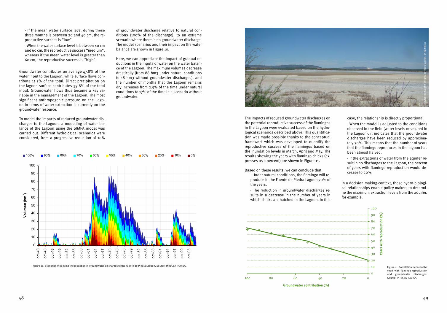
4948
- If the mean water surface level during these three months is between 20 and 40 cm, the re-productive success is “low”. - When the water surface level is between 40 cm and 60 cm, the reproductive success “medium”, whereas if the mean water level is greater than 60 cm, the reproductive success is “high”.
Groundwater contributes on average 47.8% of the water input to the Lagoon, while surface flows con-tribute 11.5% of the total. Direct precipitation on the lagoon surface contributes 39.8% of the total input. Groundwater flows thus become a key va-riable in the management of the Lagoon. The most significant anthropogenic pressure on the Lago-on in terms of water extraction is currently on the groundwater resource.
To model the impacts of reduced groundwater dis-charges to the Lagoon, a modelling of water ba-lance of the Lagoon using the SIMPA model was carried out. Different hydrological scenarios were considered, from a progressive reduction of 10%
of groundwater discharge relative to natural con-ditions (100% of the discharge), to an extreme scenario where there is no groundwater discharge. The model scenarios and their impact on the water balance are shown in Figure 10.
Here, we can appreciate the impact of gradual re-ductions in the inputs of water on the water balan-ce of the Lagoon. The maximum volumes decrease drastically (from 88 hm3 under natural conditions to 18 hm3 without groundwater discharges), and the number of months that the Lagoon remains dry increases from 2.5% of the time under natural conditions to 17% of the time in a scenario without groundwater.
Figure 10. Scenarios modelling the reduction in groundwater discharges to the Fuente de Piedra Lagoon. Source: INTECSA-INARSA.
0
10
20
30
40
50
60
70
80
90
100
oct-40
oct-43
oct-46
oct-49
oct-52
oct-55
oct-58
oct-61
oct-64
oct-67
oct-70
oct-73
oct-76
oct-79
oct-82
oct-85
oct-88
oct-91
oct-94
oct-97
oct-00
oct-03
Volu
men
(hm
3 )
100% 90% 80% 70% 60% 50% 40% 30% 20% 10% 0%
The impacts of reduced groundwater discharges on the potential reproductive success of the flamingos in the Lagoon were evaluated based on the hydro-logical scenarios described above. This quantifica-tion was made possible thanks to the conceptual framework which was developed to quantify the reproductive success of the flamingos based on the inundation levels in March, April and May. The results showing the years with flamingo chicks (ex-presses as a percent) are shown in Figure 11.
Based on these results, we can conclude that: - Under natural conditions, the flamingo will re-produce in the Fuente de Piedra Lagoon 70% of the years.- The reduction in groundwater discharges re-sults in a decrease in the number of years in which chicks are hatched in the Lagoon. In this
case, the relationship is directly proportional. - When the model is adjusted to the conditions observed in the field (water levels measured in the Lagoon), it indicates that the groundwater discharges have been reduced by approxima-tely 70%. This means that the number of years that the flamingo reproduces in the lagoon has been almost halved. - If the extractions of water from the aquifer re-sult in no discharges to the Lagoon, the percent of years with flamingo reproduction would de-crease to 20%.
In a decision-making context, these hydro-biologi-cal relationships enable policy makers to determi-ne the maximum extraction levels from the aquifer, for example.
Figure 11. Correlation between the years with flamingo reproduction and groundwater discharges. Source: INTECSA-INARSA.
Nat
ural
Res
erve
of t
he F
uent
e de
Pie
dra
Lago
on. M
. Rod
rígue
z
Groundwater contribution (%)
Year
s w
ith
repr
oduc
tion
(%)
100 020406080
100
0
10
20
30
40
50
60
70
80
90
Fuente de Piedra. M. Rodríguez

5150
5.3.1. Characteristics of the wetland
L’Albufera de Valencia Natural Park is located the Community of Valencia, in the central region of the plain of Valencia. With a current surface area of 21,000 ha, this significant wetland runs along the coast between the new course of the Turia River to the north and the Serra de Les Rabosses in Culle-ra, to the south. The three primary environments found in the wetland are:
- The coastal shoal is a sandbar 30 km long and approximately 1 km wide formed in the Holoce-ne by sedimentary depositions of the Turia and Xúquer Rivers. Dune ecosystems covered with Mediterranean maquis have evolved here. - L’Albufera Lagoon which covers approximately 3,000 ha (of which 2,800 ha is open water) is located at the centre. It has large areas of mar-sh vegetation known locally as “matas” or “ma-tes”. These occupy much of the banks and form some islands (about 290 ha). The Lagoon is communicated with the sea via three drainage canals at which sluice gates have been insta-lled to regulate the water flow. - The rice fields are the environment that co-ver the largest area (14,000 ha). These, which
are crossed by numerous canals and ditches, extend over what was once an extensive bog. Small springs or wellheads locally known as “ullals” are dispersed in the rice fields, prima-rily in the western region.
According to the Ramsar Information Sheet, the pri-mary factors that contribute to the degradation of L’Albufera are:
- Water pollution in the runoff from domestic, industrial and agricultural (pesticides and fer-tilisers used in the rice fields and nearby gar-dens). - Siltation processes due to the sediments de-posited in banks and ditches.- Alternations and physical occupation of the land by urban developments and buildings from nearby cities.- Illegal hunting which directly impacts ani-mals.- Reduction in the contributions of clean water. A reduction of water inputs to the wetland has been observed in the last years. This situation represents a potential problem since it could re-sult in a general decline in the quality of water, in delays in the winter inundation of the rice
5.3. L’ALBUFERA OF VALENCIA
Nat
ural
Par
k of
the
Alfu
bera
de
Vale
ncia
. Hyd
rogr
aphi
c Co
nfed
erat
ion
of th
e Jú
car R
iver
fields (which is vital for the presence of water birds at this time of year) or have direct conse-quences for agriculture and fishing.
According to the document “Historical Study of L’Albufera” (MMA, 2004a), the drainage of surface water into the Lagoon was historically very small. Before the expansion of irrigation, the Júcar and Tu-ria Rivers, which were the main forces that shaped the system, only flowed into the lagoon under flood conditions. The only surface runoff feeding into the lagoon came from a handful of nearby springs, and from a few ditches and ravines such as the Barran-co Fondo, the Beniparrell (which carried scarce and intermittent flows) but particularly from the Poyo ditch and the ditch de la Catarroja.
The development of irrigation greatly increased the discharges of surface water. The expansion of the irrigation schemes of L’Horta and of the Acequias Mayores de Sueca and Cullera diverted to the La-goon large quantities of water that had formerly flowed into the sea. This trend has increased in the last centuries.
Currently, surface runoff is carried through the Poyo ditch and a number of ditches that flow into the La-goon. Groundwater flow occurs through the springs (“ullals”) located both in the floor of L’Albufera La-goon itself and in the channels that flow into the Lagoon. In the last years, these springs have be-come less visible or have disappeared due to the decrease of groundwater flows and to the silting of the springs due to natural and anthropogenic causes. In addition to these sources, we must add water discharges from agriculture returns and from sewage, almost all of which is now treated.
At the other end of the system, the Lagoon drains through the canals (golas) de Pujol, Perellonet and Perelló. The Gola del Perelló, and possibly that of del Perellonet are natural waterways whereas the de Pujol was excavated in 1953. Today, the three canals have sluice gates that artificially control the water level in the Lagoon and impede the entry of marine water. There are also two other canals in L’Albufera National Park: Gola del Marney or Rei and Gola de Sant Llorenç, that drain the southern portion of the Park.
Rice
fiel
ds in
the
Nat
ural
Par
k of
the
Alfu
bera
de
Vale
ncia
. P. A
lons
o-M
onas
terio

5352
5.3.2. The Water Requirements Study
In the context of hydrological planning, L’Albufera de Valencia has been classified as a highly modified water body given that the water levels and area inundated depend on the an-thropogenic actions in the canals connecting the Lagoon with the sea and on agricultural ac-tivities. One possible scenario for management objectives is presented in the activities listed in the “Study for the Sustainable Development of L’Albufera de Valencia” prepared by the com-pany Técnica y Proyectos, S.A. (TPSA) for the General Direction of Hydraulic Works and Water Quality (DGOHCA) of the Environment Ministry under the direction of the Hydrographical Con-federation of the Júncar.
The debate among experts regarding the en-vironmental objectives for the wetland which took place in 2003 concluded that the waters of the Lagoon should have the following biological and physical-chemical characteristics: - Clear water and oxygenated surface sediment.- Presence of phytoplankton, diatom and other algae typical of coastal lagoons but absence of explosive growth of cyanobacteria. Chlorophyll concentrations corresponding to meso-eutro-phic aquatic ecosystems (values always below 50 μg/l of Chlorophyll-a).- Filtering zooplankton composed of large spe-cies, seasonally dominated by Cladocera.- Regeneration of swam and submerged vegeta-tion and associated invertebrates:
•Recoveryofthepopulationsofseveralin-vertebrates, for example shrimp populations (Atyaephyra desmaresti, Dugastella valenti-na and Palaemonetes zariqueiyi).
Lago
on in
the
the
Nat
ural
Par
k of
the
Alfu
bera
de
Vale
ncia
. J. R
amos
•Benthoscharacteristicof coastal lagoonswith good development of submerged vege-tation. Presence of species found in similar lagoons, such as those of the Myriophyllum, Ceratophyllum, Potamogetum genera and Characean algae.
Other hydromorphological and biological characte-ristics desirable in L’Albufera are:
- Water through flow and recycling adequate for achieving the health of the ecosystem. This implies a guarantee of water flows of sufficient volume and quality, to control not only eutro-phication, but also salinization. Entry of impor-tant volumes of surface flows in the north and west to balance the dominance of flows from the south. - Sustainable sedimentation rates in the Lagoon by controlling and reducing pollution, erosion, transport and sedimentation processes. - Richness of fish, amphibians, reptiles, birds and mammals. - Recovery of the species characteristic of L’Albufera, since some of these are endemic and are included in the list of protected species (some species of crustaceans, molluscs and fish of the cyprinodontidae family).- Improvement of the fishery resources of L’Albufera with populations of seabass (Dicen-trarchus labrax) and eels (Anguilla anguilla) in reasonable and balanced proportions, together with populations of mullet fish (Mugil cepha-lus).- Good status of the riparian formations in the waterways of the drainage basin. Growth of natural riparian vegetation in the surrounding waterways and on the submergible banks of the ravines. Minimal artificial channelling of the waterways. - Maintenance of rice cultivation using sustai-nable practices, and of the multiple functions of the irrigation infrastructure (inundation-dra-inage) as a means to counteract the impact of invasive aquatic species that could be better controlled at times when the swamp is dry.
The modelling of the hydrodynamic functioning of the wetland and the nutrient cycling and eutrophi-cation process that impact water quality corrobora-ted two circumstances (MAMA, 2004b):
- The modelling of a scenario based on the ideal upper limit of pollution, and on water volume
discharges below the average of the last few years shows a good response of the system with regards to its trophic state. If these variables were applied, some of the fundamental condi-tions defined in the sustainable development scenario for L’Albufera could be achieved. - Unless the deficiencies of the wastewater treatment systems in surrounding L’Albufera are addressed and corrected, the addition of flows of clean water would be an ineffective measu-re. Under this scenario, the previously defined conditions for reaching the environmental ob-jectives would not be reached.
Figure 12 shows a simplified ecological model of L’Albufera de Valencia and its different biotic com-ponents. These are based on the work of Villena (2007). This model is used to identify the most re-levant ecological indicators that help to determine the volumes of water necessary for L’Albufera.
The overwhelming dominance and permanence of cyanobacteria in L’Albufera is primarily related to: eutrophication; the existing oligotrophic condi-tions; the stabilization and feedback process of the bacteria populations through their re-suspension the water column due to the polymixis of the Lago-on and recruitment from the sediment; and to the lack of predation by the micro-zooplankton spe-cies that dominate in the Lagoon. The dominance of filamentous cyanobacteria in the phytoplankton community impedes the advent of phases of clear water due to the reduced capacity of zooplankton to filter these algae. Furthermore, the turbidity is stabilized by a high biomass of benthivorous and zooplanktivorous fish.
The reduction in the entry of nutrients triggered the decline of the populations of Planktothrix agardhii and the emergence of clear phases with duration of up to five weeks (during the months of February and March 1999 and 2000). During these clear pha-ses the phytoplankton community was dominated by centric diatom algae and Chlorophyceae.
The submerged macrophytes play an important structural and stabilizing role in the ecology of shallow lakes. The role of charophyte water plants in water clarity is especially recognized and their disappearance from shallow lakes results in eu-trophication and a dramatic increase in turbidity. Creating the adequate habitat conditions and the availability of resources for these plants increases

5554
the richness of fish, amphibians, reptiles and birds. This will contribute to the recovery of the species characteristic of L’Albufera.
Keeping in mind the importance of nutrients in the ecological dynamic of L’Albufera, an approach ba-sed on the physical-chemical characteristics of the
water (especially the concentrations of phospha-tes) is indicated for determining the volumes of water and the corresponding water quality requi-red by the wetland.
Figure 12. Ecological model of L’Albufera de Valencia which highlights the importance of nutrients in the dynamics of the ecosystem.
NUTRIENTSNitrates and phosphates
PHYTOPLANKTONDominance of Cyanophyta
ZOOPLANKTONCladóceros
TURBIDITYClarity of the water
SUBMERGED MACROPHYTES
Myriophyllum, Ceratophyllum, Potamogetum and characea
AMPHIBIANS AND REPTILESAbundance and diversity
FISHDicentrarchus labrax, Anguilla anguilla and Mugil cephalus
INVERTEBRATESAtyaephyra desmaresti,
Dugastella valentina andPalaemonetes zariqueiyi
BIRDSAbundance and diversity

5756
Arthington, A.H., Bunn, S.E., Poff, N.L. y Naiman, R.J. 2006. The challenge of providing environmental environmen-tal flow rules to sustain river ecosystems. Ecological Applications, 16: 1311-1318.
Calderón, S. 1888. La Salina de Fuente de Piedra. Actas de la Sociedad Española de Historia Natural, de Sevilla, Tomo XVII.
Carreño, M.F., Martínez, J., Vidal-Abarca, M.R. y Suárez, M.L. 2008. Indicadores bibliográficos para la valoración de las metodologías de determinación de los caudales ambientales. Actas del VI Congreso Ibérico sobre Gestión y Planificación del Agua. Fundación Nueva Cultura del Agua. Vitoria.
Casas, J. y Urdiales, C. 1995. Introducción a la Gestión Hidráulica de las Marismas del Parque Nacional de Doñana. En Montes (ed.): Bases ecológicas para la restauración de humedales en la cuenca Mediterránea. Consejería de Medio Ambiente, Junta de Andalucía. Sevilla.
Confederación Hidrográfica del Júcar. 2005. Zonas húmedas en el ámbito de la Confederación Hidrográfica del Júcar. Ministerio de Medio Ambiente de España.
ETC/BD. 2009. Habitats Directive Article 17 Reporting (2001–2006). Some specific analysis on conservation status. European Topic Centre on Biological Diversity, Paris.
García Novo, F. y Marín, C. 2005. Doñana: Agua y Biosfera. Ministerio de Medio Ambiente. Confederación Hidro-gráfica del Guadalquivir. Madrid.
Green, A. y Figuerola, J. 2003. Aves acuáticas como bioindicadores en los humedales. En: Paracuellos (ed.): Eco-logía, manejo y conservación de los humedales. Instituto de Estudios Almerienses, Colección Actas, 49: 47-60. Almería.
Keddy, P. 2002. Wetland Ecology. Principles and conservation. Cambridge University Press, Cambridge, UK.
Ministerio de Medio Ambiente. 1999. 1ª Reunión Internacional de Expertos sobre la Regeneración Hídrica de Doñana. Ponencias y conclusiones. Huelva.
Ministerio de Medio Ambiente. 2000. Plan Estratégico Español para la Conservación y el Uso Racional de los Hu-medales. Dirección General de Conservación de la Naturaleza.
Ministerio de Medio Ambiente. 2001. Documento Marco para el Desarrollo del Proyecto Doñana 2005. Regene-ración hídrica de las cuencas y cauces vertientes a las marismas del Parque Nacional de Doñana. Informe técnico. Madrid.
Ministerio de Medio Ambiente. 2004a. Estudio histórico de l’Albufera. En: Estudio para el desarrollo sostenible de L’Albufera. Valencia: Clave 7241-IN-OA-RI1/04/1-001. Documento redactado con la asistencia técnica de Typsa.
Ministerio de Medio Ambiente. 2004b. Bases para la rehabilitación de L’Albufera. En: Estudio para el desarrollo sostenible de L’Albufera. Valencia: Clave 7241-IN- OA-PC5/01/2-002-ed01. Documento redactado con la asisten-cia técnica de Typsa.
Poff, N.L., Richter, B., Arthington, A.H., Bunn, S.E., Naiman, R.J., Kendy, E., Acreman, M., Apse, C., Bledsoe, B.P., Fre-eman, M., Henriksen, J., Jacobson, R.B., Kennen, J., Merritt, D.M., O’Keeffe, J., Olden, J.D., Rogers, K., Tharme, R.E. y Warner, A. 2010. The Ecological Limits of Hydrologic Alteration (ELOHA): a new framework for developing regio-
6. BIBLIOGRAPHICAL REFERENCES

5958
nal environmental flow standards”. Freshwater Biology, 55 (1):147–170.
Villena, M. J. 2007. Ecología de los lagos someros en la zona mediterránea. Importancia de los productores prima-rios. Tesis doctoral inédita.
VV.AA. 2009. Bases ecológicas preliminares para la conservación de los tipos de hábitat de interés comunitario en España. Madrid: Ministerio de Medio Ambiente, y Medio Rural y Marino.
Wasserberg, G., Kotler, B.P., Morris, D.W. y Abramskyd, Z. 2006. A Spectre of Coexistence: Is Centrifugal Community Organization Haunted by the Ghost of Competition? Israel Journal of Ecology and Evolution, 52:123–140.
Wisheu, I.C. y Keddy, P.A. 1992. Competition and centrifugal organization of plant-communities: theory and tests. Journal of Vegetation Science, 3: 147–156. The purpose of this protocol is to obtain the water
surface level in water bodies classified as “lakes” (lakes, lagoons and wetlands).
This protocol is meant for application by the Hydro-graphical Confederations in the implementation and exploitation of the official networks for the evaluation and monitoring of the ecological sta-tus/potential established in Directive 2000/60/EC (Water Framework Directive).
The protocol will also be applied in for the inven-tory of the natural water resources of the river ba-sins in cases where water levels are used to de-termine the water requirements of lakes, lagoons and wetlands. It will also be used to analyse the coherence of other hydrological variables in these water bodies (precipitation, potential evapotrans-piration, real evapotranspiration, aquifer recharge, surface runoff, groundwater flow and total runoff or discharge).
Overall, the water surface level values obtained can be used for:
- Application for establishing the indicators of hydromorphological status “water level fluctua-tion” and “variation of water depth”.- Identification of reference water bodies using
the evaluation of hydromorphological pressure and their possible deviation with regards to the range of natural variation of the two indicators mentioned above. - Monitoring of water bodies classified as lakes to the extent that these hydromrophological indicators impact the ecological status of the water bodies. They will be used in particular for determining the degree to which the water requirements of the water bodies classified as lakes are met. - Designation of highly modified water bodies when the artificial fluctuations in water levels impede the achievement of a good ecological status. - Designing the program of measures to identi-fy the possible causes of the failure to comply with the environmental objectives due to hydro-morphological pressures. - Determining the water requirements of lakes, lagoons and wetlands when the data series of water levels meet the necessary requirements established in Order ARM/2656/2008 by which the Hydrological Planning Instruction was approved. - Use in the inventory of natural water resources as a data series that synthesises and can be con-trasted with the other hydrological variables.
Directive 2000/60/EC establishes that the member States should control and asses the volume and le-vel or rate of flow to the extent relevant for ecologi-cal and chemical status and ecological potential.
The Water Framework Directive states that the me-thods used for the monitoring of type parameters shall conform to the international or national stan-
dards which will ensure the provision of data of an equivalent scientific quality and comparability.
Therefore, the objective of this protocol is to esta-blish the conditions for the measurement of water surface levels in water bodies classified as lakes or lagoons, in compliance with the requirements mentioned above.
7. ANNEX
PROTOCOL FOR MEASURING WATER LEVELS IN WETLANDS
1. APPLICATION
2. OBJECTIVE

6160
The following is the legal framework used for this protocol:
• Directive 2000/60/EC of the European Par-liament and of the Council which establishes framework for Community action in the field of water policy.• LegislativeRoyalDecree 1/2001which esta-blishes the text of the Water Law• Legislative Royal Decree 907/2007 whichapproves the Hydrological Planning Regulation • Order ARM/2656/2008 which approves theHydrological Planning Instruction.
The current Instruction was drafted taking into ac-count the following standards:
•UNE-ENISO4373:2009–Hydrometry-Waterlevel measuring devices. (ISO 4373:2008).• UNE-EN 13757-1:2003 - Communication sys-tem for meters and remote reading of meters - Part 1: Data exchange.
• UNE-EN 13757-2:2005 - Communication sys-tems for and remote reading of meters - Part 2: Physical and link layer• UNE-EN 13757-3:2005 - Communication sys-tems for and remote reading of meters - Part 3: Dedicated application layer.• UNE-EN 13757-4:2006 - Communication sys-tems for meters and remote reading of meters - Part 4: Wireless meter readout (radio meter rea-ding for operation in the 868 Mhz To 870 Mhz Srd Band).• UNE-EN 13757-5:2010 - Communication sys-tems for meters and remote reading of meters - Part 5: Wireless relaying.•UNE-EN 13757-6:2009 - Communication sys-tems for meters and remote reading of meters - Part 6: Local Bus.•ISO772–Hydrometricdeterminations--Voca-bulary and symbols.•IEC60529–Degreesofprotectionprovidedbyenclosures (IP Code).
The data on water surface levels in the lakes and lagoons will be obtained using measuring devices, and, where relevant, the recording of data in the field. 4.1. Water level measuring devices
4.1.1. Specifications of the instruments
The devices for measuring water levels in wetlands should be classified, at least, for a “class 3 action” as defined in the UNE-EN ISO 4373:2009 standard. That is, the nominal error in the range of measu-rements should be less than 1%. The uncertainty of the chronometer devices should be within ±150 seconds at the end of a 30 day period in the case of digital chronometers, or within ±15 minutes at the end of 30 days in the case of analogue chronome-ters.
4.1.2. Types of devices for measuring water levels
One or more devices for measuring water levels shall be set up in the water body, taking into ac-count the characteristics of the latter (size, number and type of basins, morphology, etc.) and the exis-ting measurement devices.
The following devices for measuring water levels can be used:
a) Vertical or inclined staff gauges. A staff gau-ge is a graduated scale, directly or firmly fixed on an appropriate vertical surface (Fig. a1). When the range of water levels exceeds the capacity of a single staff gauge, other comple-mentary gauges can be installed in a section, on an axis perpendicular to the rising/falling di-rection of the water. The overlap should be no less than 15 cm.
3. REFERENCE LEGAL FRAMEWORK
4. DEVICES AND EQUIPMENT
The inclined staff gauge shall be adjusted to the incline of the bank. It can follow a single slo-pe for its entire length or it can be composed of various slopes. It both cases the axis of each section should be perpendicular to the rising/falling direction so the water (Fig. a2).
A vertical or inclined staff gauge is an afforda-ble, simple, robust and absolute method for determining the level of the water surface. The shortcoming being that it is difficult to obtain readings in the field with a true resolution grea-ter than ±5 mm.
b) Wire weight gauge. This consists of a weight that is manually lowered until it touches the surface of the water. The wire weight can be wound around drum which is connected to a reeling device or it can be bobbin connected to a bar. The equipment can be difficult to use in low light conditions or where direct visibility is difficult.
c)Mechanical float gauge. A float gauge con-sists of a float (which usually functions within a measuring well), a graduated tape or wire, a counterweight or resort, a pulley and a gauge. The tape or wire runs through a pulley which is designed to avoid slippage. The tape or wire is maintained tense by the action of the coun-terweight or resort. In this manner the float, that positions the tape in relation to the gauge, detects the variations in water level. Usually, a float is used with a continuous strip-chart or a drum-type recorder to maintain a continuous record of the water level data.
When used alone, a float gauge delivers a direct measurement of water levels, providing a good resolution at low levels. The drawback is that it is a mechanical device (subject to errors resul-ting from variations in temperature, lag and fric-tion) and it generally requires a measuring well that can be costly to build and maintain.
d) Electronic pressure transducer. An electronic pressure transducer converts the pressure of a fluid into electronic signals. A typical sensor is composed of a mechanical force collector that responds to variations in pressure by displace-ment, an electronic component that produces a signal proportional to this displacement and a vented tube to eliminate atmospheric pressu-re variations or two absolute pressure devices, one of which measures atmospheric pressure. An electronic transducer does not require a measuring well to dampen the fluctuations in water level. It is ideal for adapting to electronic systems for registering and transmitting data. The levels of uncertainty are generally on the or-der of ± 0.1 to 0.5% of the scale. The transducer is impacted by variations in the environment such as the density of the water column.
4.1.3. Level of reference in the measurement of water levels
The level of the water surface recorded in a wet-land is not an absolute measure. It must always be taken in relation to a reference point. In the same manner, the measuring devices require points of reference from which to record the level of the water surface.
In the context of water surface levels in lakes and wetlands, the points of reference shall be used to:
Figure a2. Two inclined gauges on the banks of a channel.
Figure a1. Detail of the graduated scale of a staff gauge. Detail of the removable panel for the red graduation numbers (A) and 10 mm divi-sions (B).
6
9
87
65
4
3
2
1
5
B
A150

6362
a) Establish the point of reference in the field.b) Provide a value that serves as a reference for the levels recorded by the measuring devices.c) Periodically verify the levels of the measuring devices relative to the point of reference.
Each measuring device will have, at the least, one reference point which is permanently installed in a stable and safe site. The capacity of the reference point to maintain its position relative to the terrain is essential for referencing the levels of the measu-ring device (Fig. 3).
The level of reference for each measuring station should be checked periodically. If possible, these should be referenced relative to a point in the na-tional geospatial network.
4.2. Equipment for field work
The following equipment and complementary ma-terial shall be provided for the collection of water surface level measurements in the field:
- Sampling protocol - Field log books- Field note books- Waterproof covers for field records- Digital camera- Mobile telephone- Adequate maps- GPS device- Compass- Thermometer
Figure 3. Reference points of a staff gauge.
Scale reading4 m
3 m
2 m
1 m
0 m
Assumed elev.: 3,962 m
Level point of reference
Reference elevation point: 0.00 m, equivalent to 354 m.a.s.l.
Volume zero:
3,962 m
The number of devices for measuring the water sur-face level will depend on the characteristics of the water body. More than one water level measuring device will be utilized under the following circums-tances:
a) When the size of the wetland or its morpholo-gy result in centimetres of difference in the water surface levels measured at different points. b) When the water body is at risk of failing its en-vironmental objectives due to significant hydro-morphological pressures (operational control design). In these cases, sufficient control points will be available to evaluate the magnitude and impact of the hydromorphological pressures.
c) When the wetland is divided into different sections that present differentiated behaviour in water levels (for example, different hydraulic mechanisms for controlling levels).d) When there is more than one well-defined basin in the wetland complex. e) For any other relevant and justifiable reason.
When the installation of additional measuring de-vices is necessary, their location and number will be determined keeping in mind the specific cha-racteristics of the water body such that the measu-res recorded by the devices are as representative as possible of the entire wetland.
A water level measuring device will be well located, designed and build if it meets the following criteria:
a) It is possible to obtain a precise reading of the water level for all levels.b) It is possible to obtain a precise reading of the water level in all seasons and for all years.c) The location is accessible and/or visible to the operators that carry out the maintenance and collect the readings.d) The measuring device is in good structural conditions (level reference point and devices in stable and safe locations).
The measuring device will be located in the sites within the wetland where it can record the maxi-mum fluctuations, including those resulting from extraordinary events that are either natural or cau-sed by human actions.
In temporary wetlands, the periodic drying pheno-mena should be taken into account. This means that at least one device should be place in the dee-pest point of the water body.
For the devices that provide discrete measure-ments (staff gauges and wire weight gauges), at least three readings of the water surface level shall be recorded for each of the devices found in the water body.
5. DETERMINING THE NUMBER OF DEVICES FOR MEASURING WATER SURFACE LEVELS
6. LOCATION OF THE MEASURING DEVICES
7. NUMBER OF READINGS PER MEASUREMENT

6564
The periodicity of the measurements of the water surface level in wetlands should provide informa-tion that is sufficient for carrying out a confident evaluation of the water level fluctuations and varia-tions of the average water depth in a water body.
For the devices that provide discrete measurements (staff gauges and wire weight gauges), the periodi-city of the measurements should take into account the nature of the variations in water levels resulting from natural and anthropogenic conditions. The dates selected for carrying out the readings shall reflect the alterations in the water body due to the changes brought about by anthropogenic pressu-res. If necessary to meet this objective, other con-trol readings will be recorded in different seasons of the same year.
As a general guideline, the recordings of water le-vel readings in wetlands should take place at inter-vals no greater than one month, unless the techni-cal knowledge and the judgment of experts justify longer intervals.
The timing of readings for research purposes will vary in function of the specific circumstances of each water body. In cases where the water body is subject to strong pressures due to water extraction or modification of surface flows, an effort shall be made to install devices that continuously measure water levels for the duration of the research.
For the devices that provide discrete measure-ments, at least three readings shall be recorded for each for each device.
In the cases where waves complicate the readings of manual devices, readings shall be recorded for the maximum and minimum heights caused by the waves.
In the field visits, the following complementary in-formation shall be recorded:
- Estimated wind speed (at least on the Beaufort scale)
- Wind direction- Estimated wave height- Temperature- Time
The data sheet for field measurements attached to this protocol shall be completed.
The level of uncertainty in the measurements of water level will depend on the type of device uti-lized, as described in section 4.1.2 of this annex. According to UNE-EN ISO 4373:2009, for these ty-pes of devices the uncertainty will be calculated as follows:
a) Vertical or inclined staff gauges. A triangular distribution is applied to the uncertainty, or, asso-ciated with the indication of a vertical or inclined staff gauge, x such that:
Where xmax is the maximum discernable limit; xmin is the lowest discernable limit.
8. FREQUENCY AND TIMING OF MEASUREMENTS
9. PROCEDURE FOR RECORDING WATER SURFACE LEVEL DATA
10. DETERMINING THE UNCERTAINTY IN THE MEASUREMENTS
b) Wire weight gauge. A triangular distribution is applied to the uncertainty associated with the rea-dings of a wire weight gauge. The equation is the same as the one applied above.
Where xmax is the maximum discernable limit; xmin is the lowest discernable limit.
c) Mechanical float gauge. Due to the lag in the system of the mechanical float gauge, the distribu-tion of the uncertainty is bimodal such that:
Where xmax is the maximum discernable limit; xmin is the lowest discernable limit.
d) Electronic pressure transducer. A pressure trans-ducer has a rectangular distribution of uncertainty. The following equation applies:
Where xmax is the maximum discernable limit; xmin is the lowest discernable limit.

6766
DATA SHEET FOR FIELD MEASUREMENTS
Control programme
Surveillance
Operative
Research
Reference
Protected area
DATA READINGS OF WATER SURFACE LEVELS IN LAKES AND WETLANDS
Name of the water body:
Organisation/company:
Person collecting the sample:
Measurement code:
Date:
Beginning time:
End time:
___/___/______
____ : ____
____ : ____
MEASUREMENT IDENTIFICATION INFORMATION
Estimated wind speed (m/s):
Wind direction:
Notes on the climate conditions:
Wind force (according to Beaufort Scale1)
Temperature: (º C):
1 Scale available at the end of this Annex.
CLIMATE CONDITIONS
Precision of the measurement
2 mm or less
5 mm or less
1 cm or less
Greater than 1 cm
Device operated by:
Name of the station:
Coordinates: UTM X________ UTM Y_______ Huso_______
Type of device
Staff gauge
Wire weight gauge
Mechanical float gauge
Electronic pressure transducer
Station code:
Zero volume scale height:
DATA FROM THE MEASURING DEVICE
Type of data registration
Discrete
Continuous
Measurement code Readings of the levels
Notes on the measurements:
a:
a:
a:
a:
a:
b:
b:
b:
b:
b:
c:
c:
c:
c:
c:
1
2
3
4
5
Notes on the readingsReading with waves
Maximum height Minimum height
MEASUREMENT

68
Description of Access route:
Beaufort number
0
1
2
3
4
5
6
7
8
9
10
11
12
Wind speed (km/h)
0 a 1
2 a 5
6 a 11
12 a 19
20 a 28
29 a 38
39 a 49
50 a 61
62 a 74
75 a 88
89 a 102
103 a 117
118 y más
Description
Calm
Very Light
Light breeze
Gentle breeze
Moderate breeze
Fresh breeze
Strong breeze
Near gale
Gale
Strong gale
Storm
Violent storm
Hurricane
Effects on land
Calm, smoke rises vertically
Smoke drift indicates wind direction
Leaves rustle, vanes begin to move
Leaves and small twigs constantly moving, light flags extended
Dust, leaves, and loose paper lifted, small tree branches move
Small trees in leaf begin to sway, whitecaps on lakes
Larger tree branches moving, difficulty keeping umbrellas open
Large trees moving, resistance felt walking against wind
Treetops breaking, difficulty moving against wind
Trees damaged, impossible to move against wind
Trees broken or uprooted, considerable structural damage
Widespread damage to buildings, rooftops and tres
Great and widespread damage. Many trees uprooted. Total destruction.
Location map:
ACCESS AND LOCATION
BEAUFORT SCALE OF WIND FORCE