what is where? lecture 5 introduction to giss geography 176a department of geography, ucsb summer...
Post on 20-Dec-2015
216 views
TRANSCRIPT
What is Where?
Lecture 5
Introduction to GISs
Geography 176A
Department of Geography, UCSB
Summer 06, Session B

You can use a GIS to answer the question: What is where?What is where?
WHAT:WHAT: Characteristics of attributes or features
WHERE:WHERE: In geographic space

What and Where
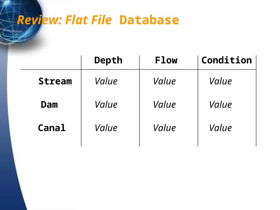
Review: Flat File Database
Depth Flow Condition
Stream
Dam
Canal
Value Value Value
Value Value Value
Value Value Value

Arc/node map data structure with files
1 1,2,3,4,5,6,7
Arcs File
POLYGON “A”
A: 1,2, Area, Attributes
File of Arcs by Polygon
1
23
4
5
6
7
8
9
10
1112
13 1 x y2 x y3 x y4 x y5 x y6 x y7 x y8 x y9 x y10 x y11 x y12 x y13 x y
Po
ints
Fil
e
1
2
2 1,8,9,10,11,12,13,7

A GIS links attribute and spatial data
Attribute DataFlat FileRelations
Map DataPoint FileLine FileArea FileTopologyTheme

What is a Data Model?
A logical construct for the storage and retrieval of information.
GIS map data structures are mapmap data models.
AttributeAttribute data models are needed for the DBMS.
The origin of DBMS data models is in computer science.

A DBMS contains:
Data definition language
Data dictionary
Data-entry module
Data update module
Report generator
Query language

GIS and DBMS
Ability of the DBMS or GIS to get back on demand data that were previously stored
Geographic search is the secret to GIS data retrieval.
Many forms of data organization are incapable of geographic search
GISystems have embedded DBMSs, or link to a commercial DBMS
Examples: Access, Dbase, ORACLE, Excel, Paradox

Historically, databases were structured hierarchically in files...
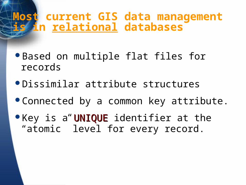
Most current GIS data management is in relational databases
Based on multiple flat files for records
Dissimilar attribute structures
Connected by a common key attribute.
Key is a UNIQUEUNIQUE identifier at the “atomic” level for every record.

Relational Data Bases

Retrieval Operations
Searches by attribute: find and browse.
Data reorganization: select, renumber, and sort.
Compute allows the creation of new attributes based on calculated values.

DBMS queries via the query language
sort
renumber
subset
search

Command line attribute query
find in states where state_name = ‘California’find in states where state_name = ‘California’<1 record in result><1 record in result>
use statesuse states
calculate in states population_density = calculate in states population_density = population / area population / area <50 records in result><50 records in result>
restrict in states where population_density > restrict in states where population_density > 1000 1000 <20 records selected in result><20 records selected in result>

The Retrieval User Interface
GIS query is usually by command line, batch, menu or macro.
Most GIS packages use the GUI of the computer’s operating system to support both a menu-type query interface and a macro or programming language.
SQL is a standard interface to relational databases and is supported by many GISs.


Spatial Retrieval Operations
Attribute queries are not very useful for geographic search.
In a map database the records are features or themes
The spatial equivalent of a find is locate, the GIS highlights the result.
Spatial equivalents of the DBMS queries result in locating sets of features or building new GIS layers.

Spatial Search
Buffering is a spatial retrieval around points, lines, or areas based on distance.
Overlay is a spatial retrieval operation that is equivalent to an attribute join.
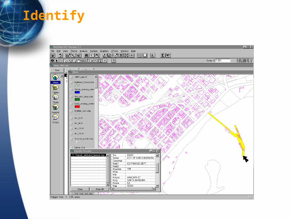
Identify

Recode
OR

Data overlay

Overlay
01

Types of overlay operations
And
Or
Max
Min
Exhaustive set

Buffer

Complex Retrieval: Map Algebra
Combinations of spatial and attribute queries can build some complex and powerful GIS operations, such as weighting.
Weighted overlay analysis really just complex retrieval.

Weighted Overlay Analysis
Weights of Evidence Analysis
Of Maya Settlement locations, Belize River, Belize
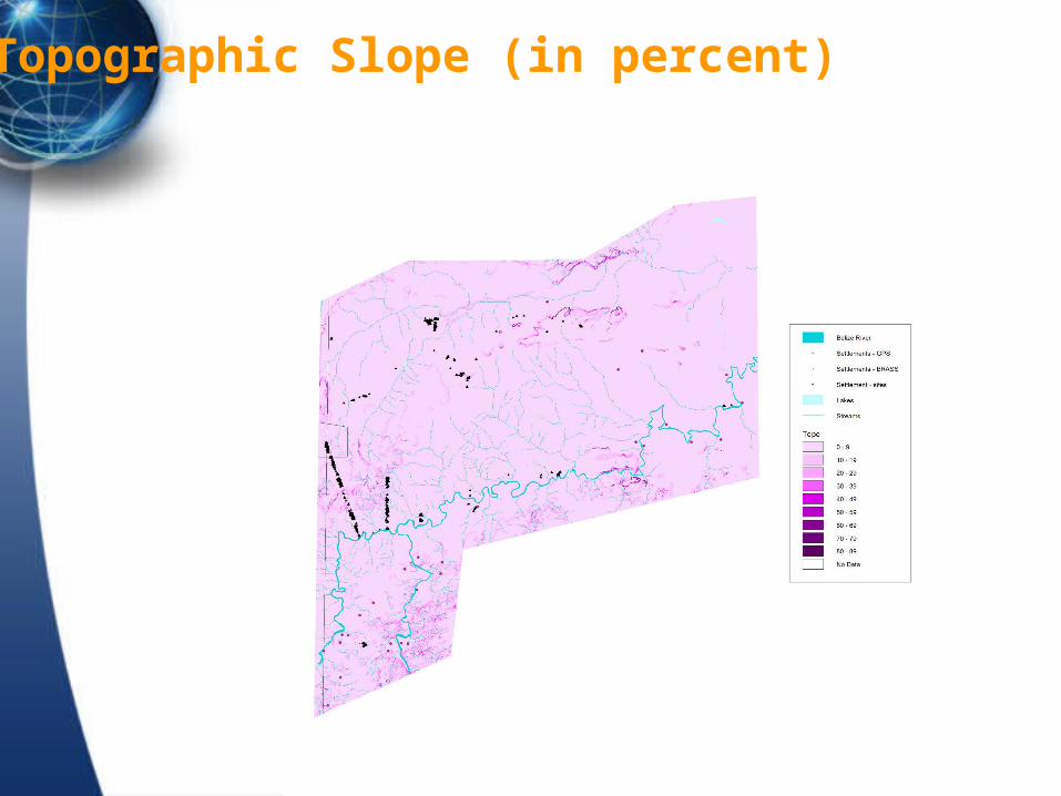
Topographic Slope (in percent)

Soil drainage property

Soil fertility

Distance to streams

WofE Model 1

WofeE Model 2

Results
Model explains 75% of settlement locations
Eliminated lakes, Strahler order, Belize river as contributory factors
Streams important up to 400m
Validation with GPS field data
Extending model to regional data

Unsurveyed sites added by GPS

Coming next….
Why is there?