wicomico river maintenance dredging & deal island …
TRANSCRIPT

WICOMICO RIVER
MAINTENANCE DREDGING
& DEAL ISLAND WETLAND
RESTORATION
U.S. Army Corps of Engineers
Baltimore District
April 14, 2021
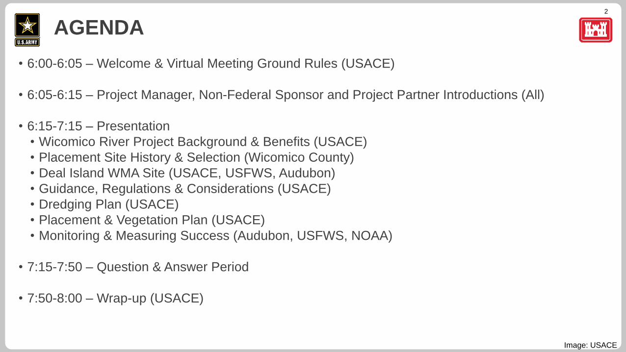
2
• 6:00-6:05 – Welcome & Virtual Meeting Ground Rules (USACE)
• 6:05-6:15 – Project Manager, Non-Federal Sponsor and Project Partner Introductions (All)
• 6:15-7:15 – Presentation
• Wicomico River Project Background & Benefits (USACE)
• Placement Site History & Selection (Wicomico County)
• Deal Island WMA Site (USACE, USFWS, Audubon)
• Guidance, Regulations & Considerations (USACE)
• Dredging Plan (USACE)
• Placement & Vegetation Plan (USACE)
• Monitoring & Measuring Success (Audubon, USFWS, NOAA)
• 7:15-7:50 – Question & Answer Period
• 7:50-8:00 – Wrap-up (USACE)
AGENDA
Image: USACE
3
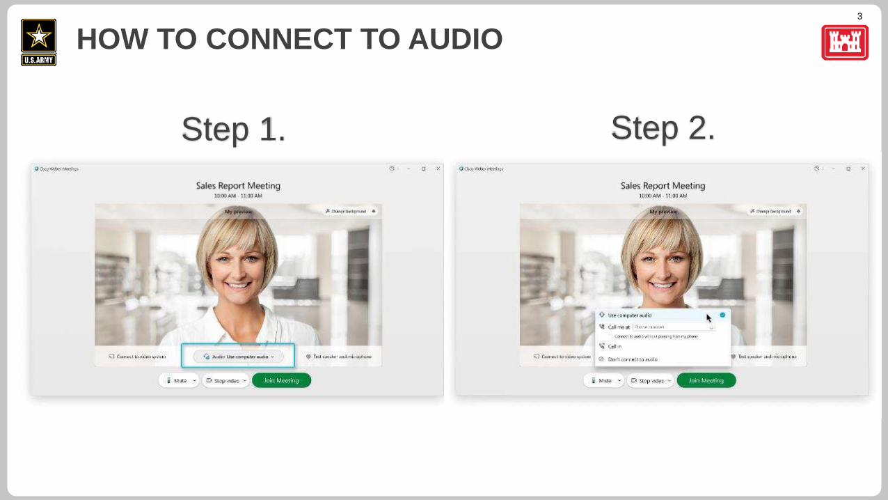
HOW TO CONNECT TO AUDIO
Step 1. Step 2.
4
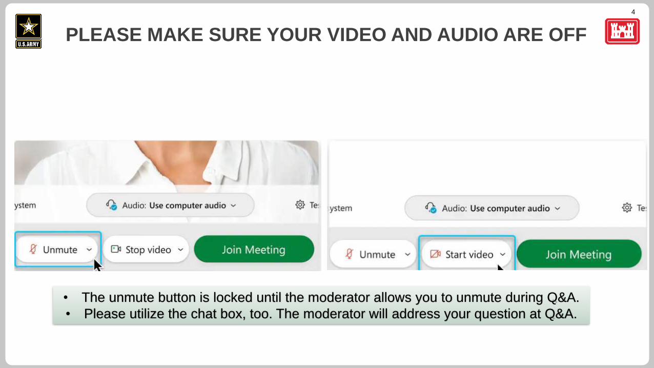
PLEASE MAKE SURE YOUR VIDEO AND AUDIO ARE OFF
• The unmute button is locked until the moderator allows you to unmute during Q&A.
• Please utilize the chat box, too. The moderator will address your question at Q&A.
5
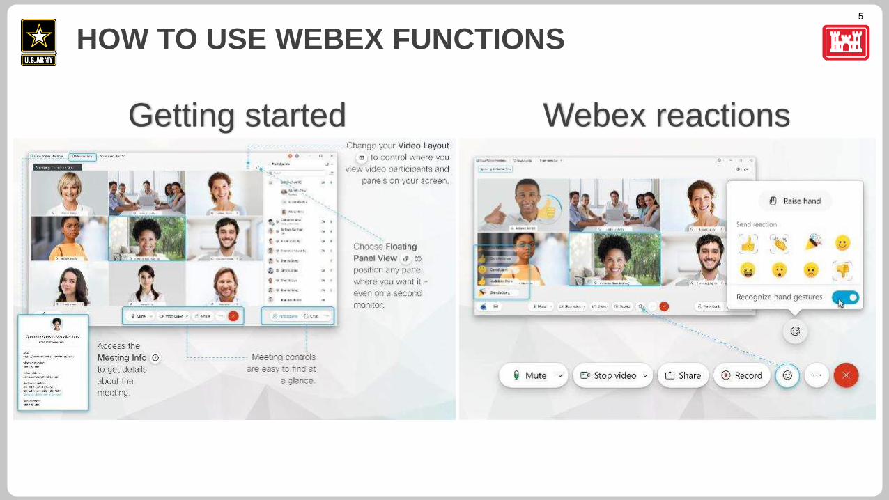
HOW TO USE WEBEX FUNCTIONS
Getting started Webex reactions
6
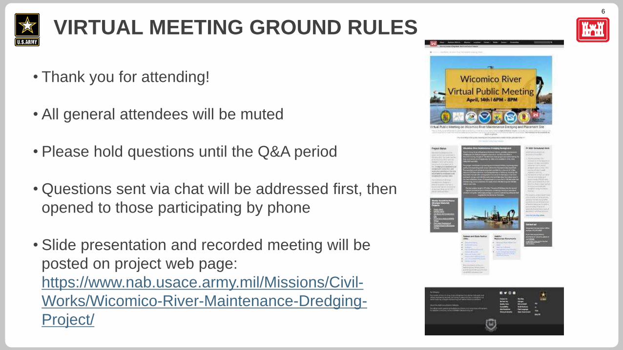
• Thank you for attending!
• All general attendees will be muted
• Please hold questions until the Q&A period
• Questions sent via chat will be addressed first, then
opened to those participating by phone
• Slide presentation and recorded meeting will be
posted on project web page:
https://www.nab.usace.army.mil/Missions/Civil-
Works/Wicomico-River-Maintenance-Dredging-
Project/
VIRTUAL MEETING GROUND RULES
7
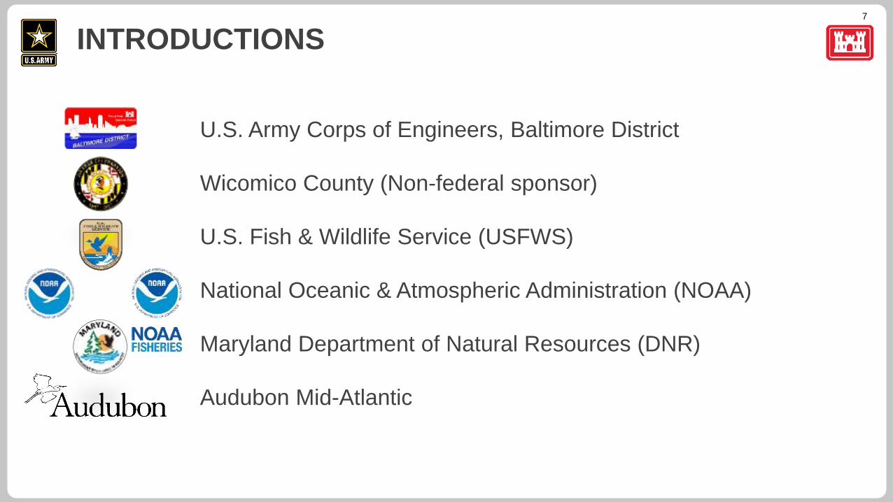
U.S. Army Corps of Engineers, Baltimore District
Wicomico County (Non-federal sponsor)
U.S. Fish & Wildlife Service (USFWS)
National Oceanic & Atmospheric Administration (NOAA)
Maryland Department of Natural Resources (DNR)
Audubon Mid-Atlantic
INTRODUCTIONS
8
SPEAKERS
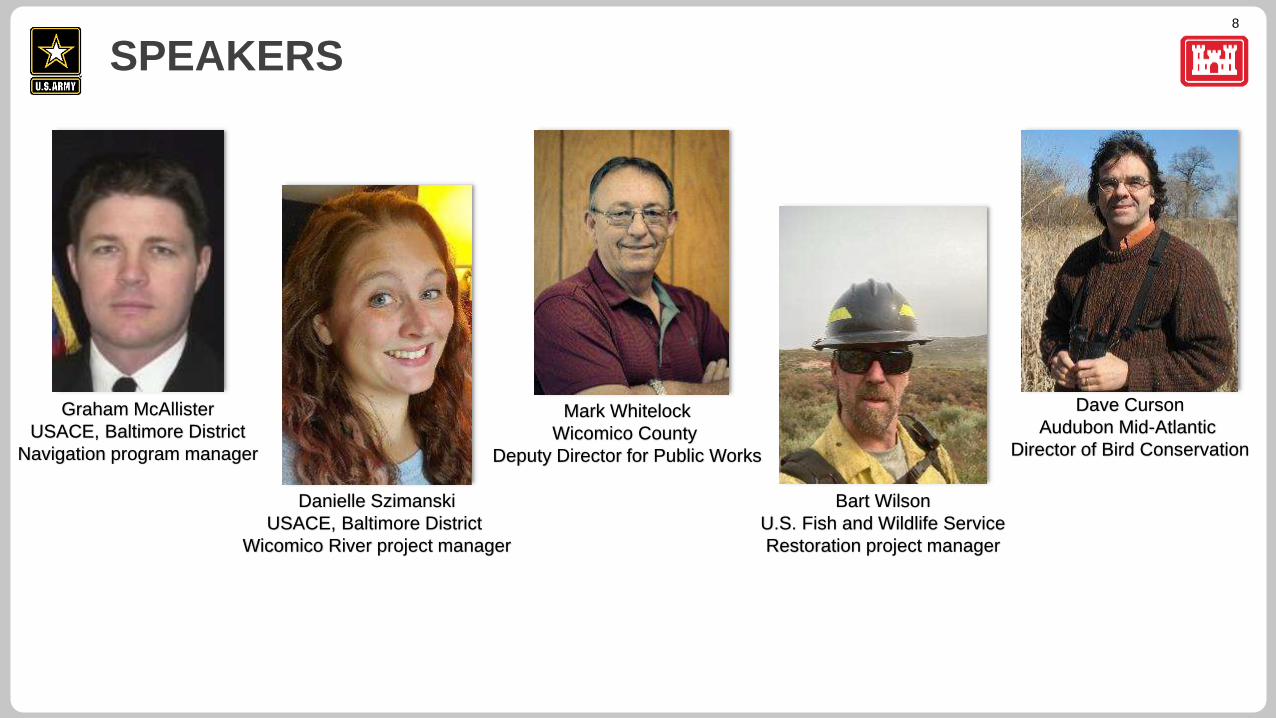
Graham McAllister
USACE, Baltimore District
Navigation program manager
Danielle Szimanski
USACE, Baltimore District
Wicomico River project manager
Mark Whitelock
Wicomico County
Deputy Director for Public Works
Bart Wilson
U.S. Fish and Wildlife Service
Restoration project manager
Dave Curson
Audubon Mid-Atlantic
Director of Bird Conservation
9
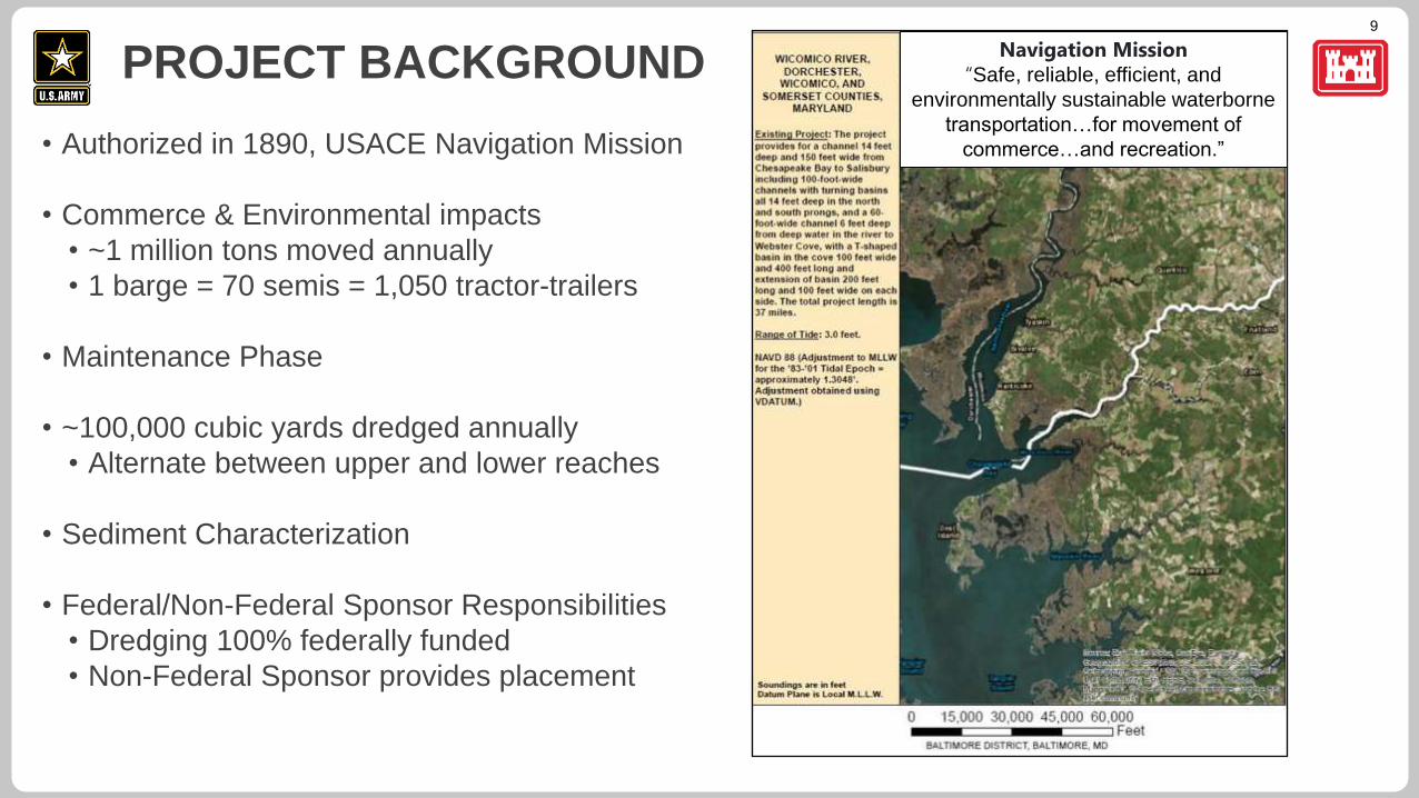
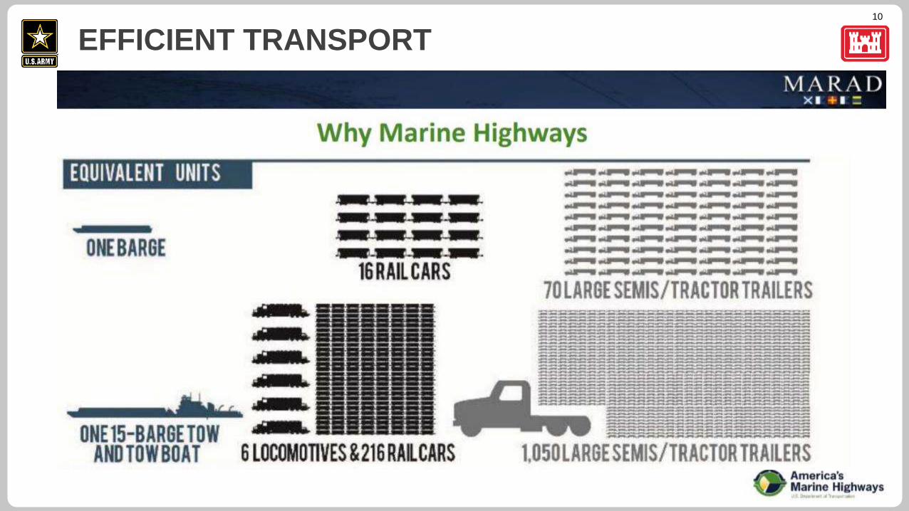
• Authorized in 1890, USACE Navigation Mission
• Commerce & Environmental impacts
• ~1 million tons moved annually
• 1 barge = 70 semis = 1,050 tractor-trailers
• Maintenance Phase
• ~100,000 cubic yards dredged annually
• Alternate between upper and lower reaches
• Sediment Characterization
• Federal/Non-Federal Sponsor Responsibilities
• Dredging 100% federally funded
• Non-Federal Sponsor provides placement
PROJECT BACKGROUND Navigation Mission
“Safe, reliable, efficient, and
environmentally sustainable waterborne
transportation…for movement of
commerce…and recreation.”
10
EFFICIENT TRANSPORT
11
ENVIRONMENTAL BENEFITS
12
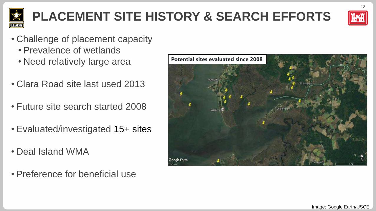
• Challenge of placement capacity
• Prevalence of wetlands
• Need relatively large area
• Clara Road site last used 2013
• Future site search started 2008
• Evaluated/investigated 15+ sites
• Deal Island WMA
• Preference for beneficial use
PLACEMENT SITE HISTORY & SEARCH EFFORTS
Image: Google Earth/USCE
Potential sites evaluated since 2008
13
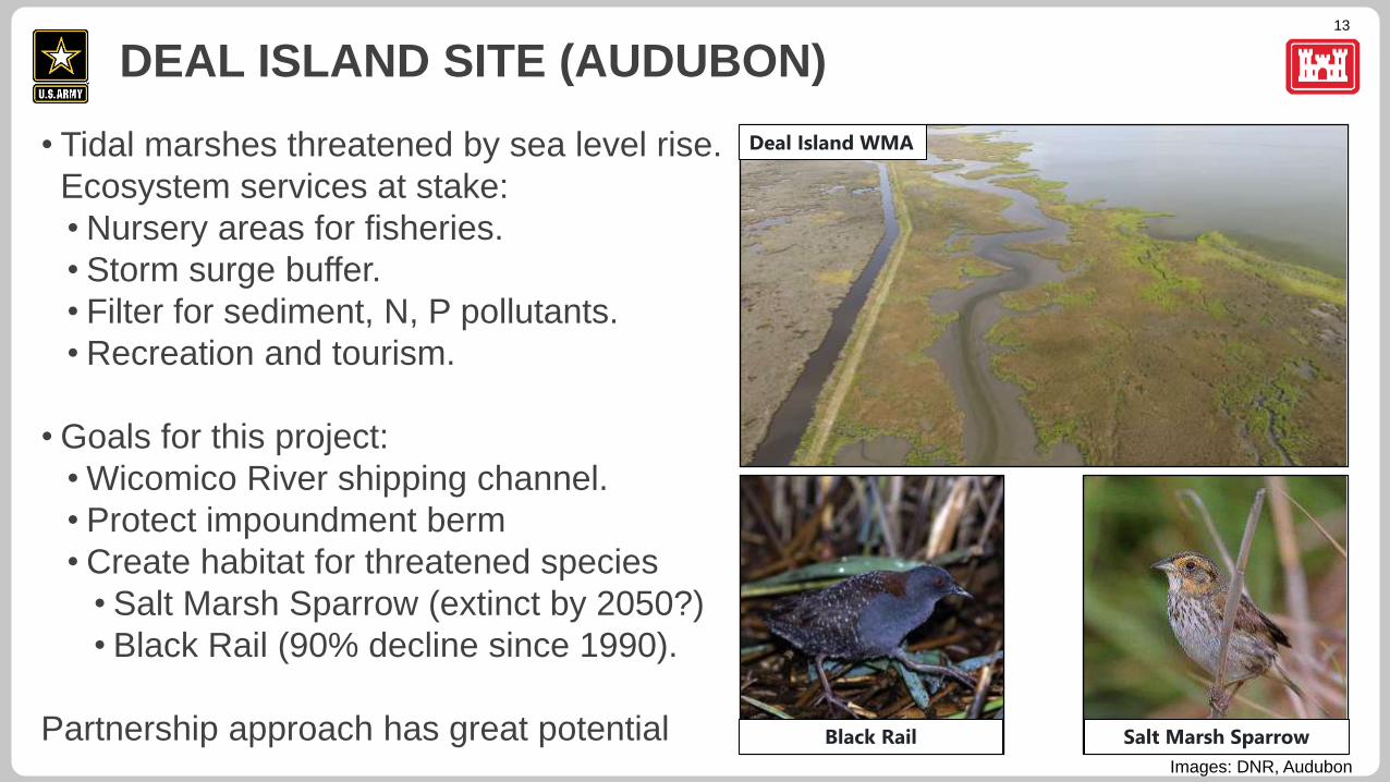
• Tidal marshes threatened by sea level rise.
Ecosystem services at stake:
• Nursery areas for fisheries.
• Storm surge buffer.
• Filter for sediment, N, P pollutants.
• Recreation and tourism.
• Goals for this project:
• Wicomico River shipping channel.
• Protect impoundment berm
• Create habitat for threatened species
• Salt Marsh Sparrow (extinct by 2050?)
• Black Rail (90% decline since 1990).
Partnership approach has great potential
DEAL ISLAND SITE (AUDUBON)
Deal Island WMA
Black Rail Salt Marsh Sparrow
Images: DNR, Audubon
14
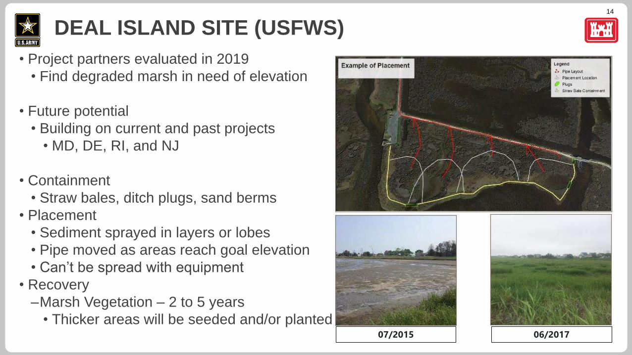
• Project partners evaluated in 2019
• Find degraded marsh in need of elevation
• Future potential
• Building on current and past projects
• MD, DE, RI, and NJ
• Containment
• Straw bales, ditch plugs, sand berms
• Placement
• Sediment sprayed in layers or lobes
• Pipe moved as areas reach goal elevation
• Can’t be spread with equipment
• Recovery
–Marsh Vegetation – 2 to 5 years
• Thicker areas will be seeded and/or planted
DEAL ISLAND SITE (USFWS)
07/2015 06/2017
15
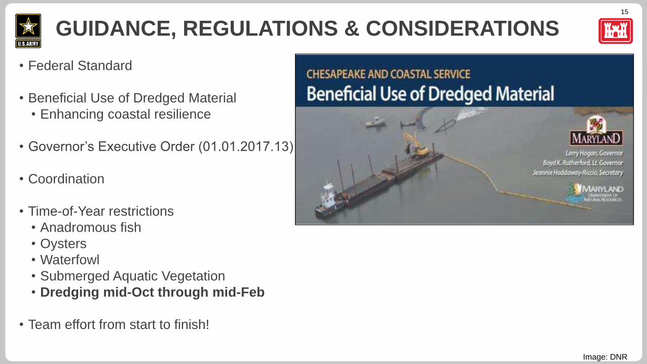
• Federal Standard
• Beneficial Use of Dredged Material
• Enhancing coastal resilience
• Governor’s Executive Order (01.01.2017.13)
• Coordination
• Time-of-Year restrictions
• Anadromous fish
• Oysters
• Waterfowl
• Submerged Aquatic Vegetation
• Dredging mid-Oct through mid-Feb
• Team effort from start to finish!
GUIDANCE, REGULATIONS & CONSIDERATIONS
Image: DNR
16
DREDGING PLAN
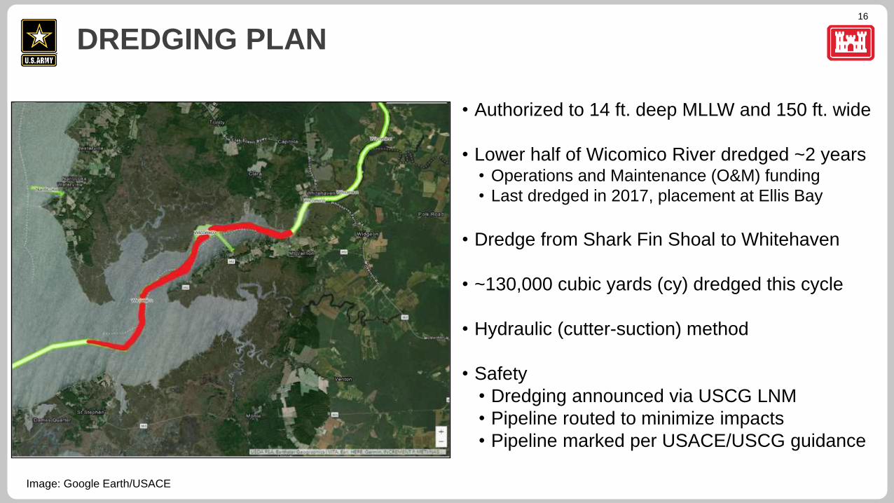
• Authorized to 14 ft. deep MLLW and 150 ft. wide
• Lower half of Wicomico River dredged ~2 years• Operations and Maintenance (O&M) funding
• Last dredged in 2017, placement at Ellis Bay
• Dredge from Shark Fin Shoal to Whitehaven
• ~130,000 cubic yards (cy) dredged this cycle
• Hydraulic (cutter-suction) method
• Safety
• Dredging announced via USCG LNM
• Pipeline routed to minimize impacts
• Pipeline marked per USACE/USCG guidance
Image: Google Earth/USACE
17
PLACEMENT & VEGETATION PLAN
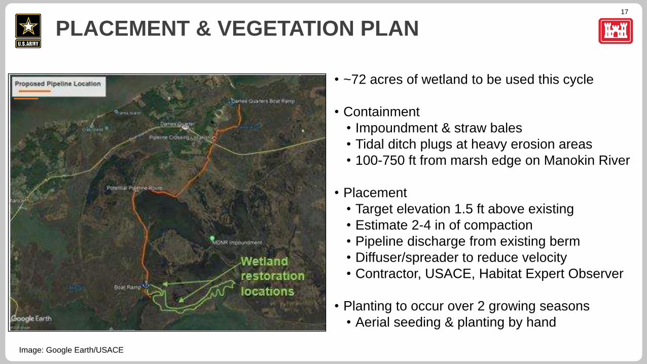
• ~72 acres of wetland to be used this cycle
• Containment
• Impoundment & straw bales
• Tidal ditch plugs at heavy erosion areas
• 100-750 ft from marsh edge on Manokin River
• Placement
• Target elevation 1.5 ft above existing
• Estimate 2-4 in of compaction
• Pipeline discharge from existing berm
• Diffuser/spreader to reduce velocity
• Contractor, USACE, Habitat Expert Observer
• Planting to occur over 2 growing seasons
• Aerial seeding & planting by hand
Image: Google Earth/USACE
18
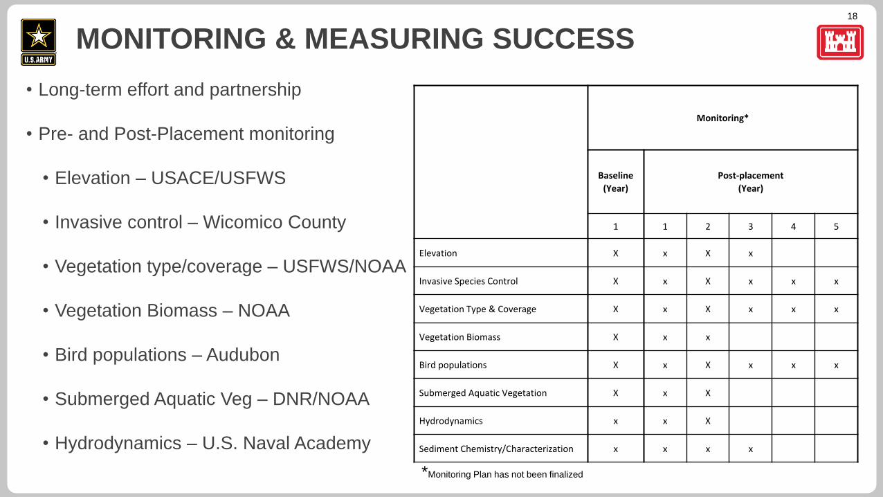
• Long-term effort and partnership
• Pre- and Post-Placement monitoring
• Elevation – USACE/USFWS
• Invasive control – Wicomico County
• Vegetation type/coverage – USFWS/NOAA
• Vegetation Biomass – NOAA
• Bird populations – Audubon
• Submerged Aquatic Veg – DNR/NOAA
• Hydrodynamics – U.S. Naval Academy
MONITORING & MEASURING SUCCESS
Monitoring*
Baseline
(Year)
Post-placement
(Year)
1 1 2 3 4 5
Elevation X x X x
Invasive Species Control X x X x x x
Vegetation Type & Coverage X x X x x x
Vegetation Biomass X x x
Bird populations X x X x x x
Submerged Aquatic Vegetation X x X
Hydrodynamics x x X
Sediment Chemistry/Characterization x x x x
*Monitoring Plan has not been finalized

19
GUIDANCE FOR
QUESTION & ANSWER PERIOD
20
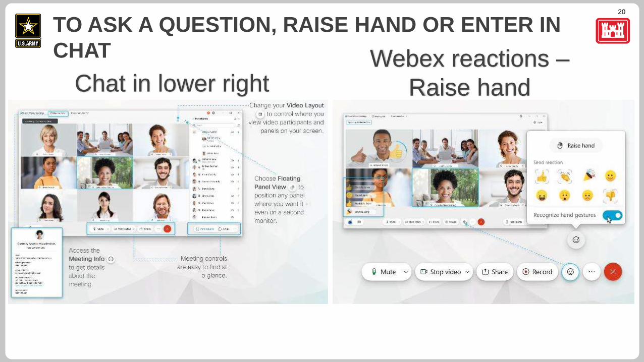
TO ASK A QUESTION, RAISE HAND OR ENTER IN
CHAT
Chat in lower rightWebex reactions –
Raise hand
21
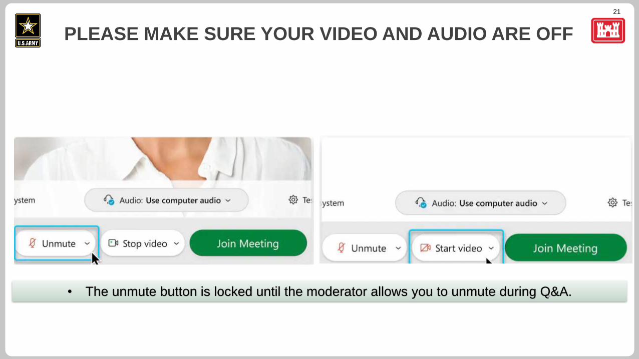
PLEASE MAKE SURE YOUR VIDEO AND AUDIO ARE OFF
• The unmute button is locked until the moderator allows you to unmute during Q&A.

22
QUESTION & ANSWER PERIOD
23
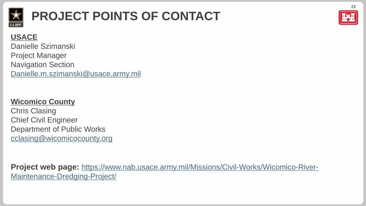
USACE
Danielle Szimanski
Project Manager
Navigation Section
Wicomico County
Chris Clasing
Chief Civil Engineer
Department of Public Works
Project web page: https://www.nab.usace.army.mil/Missions/Civil-Works/Wicomico-River-
Maintenance-Dredging-Project/
PROJECT POINTS OF CONTACT
24
THANK YOU!
Image: Audubon Mid-Atlantic