wild and scenic river reconnaissance survey of the york river · 2 wild and scenic river...
TRANSCRIPT

Wild and Scenic River Reconnaissance Survey of the York RiverPrepared by: National Park Service Northeast Region 2013
National Park ServiceU.S. Department of the Interior
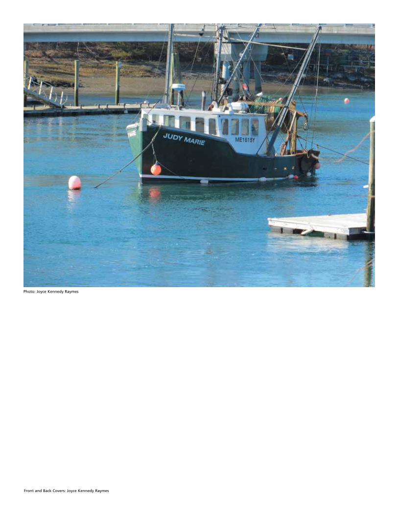
Front and Back Covers: Joyce Kennedy Raymes
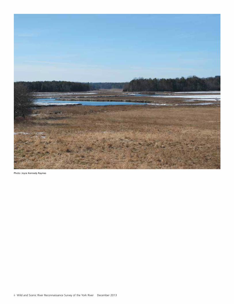
Photo: Joyce Kennedy Raymes

National Park Service i
Wild and Scenic River Reconnaissance Survey of the York RiverPrepared by: National Park Service Northeast Region 2013
Department of the InteriorNational Park ServiceNortheast Region15 State StreetBoston, MA 02109-3572Tel: 617-223-5191
National Park ServiceNortheast Region200 Chestnut Street, 3FLPhiladelphia, PA 19106Tel: 215-597-6482
Goldsmith Communications, Harwinton, CT, Graphic Design
ii Wild and Scenic River Reconnaissance Survey of the York River December 2013
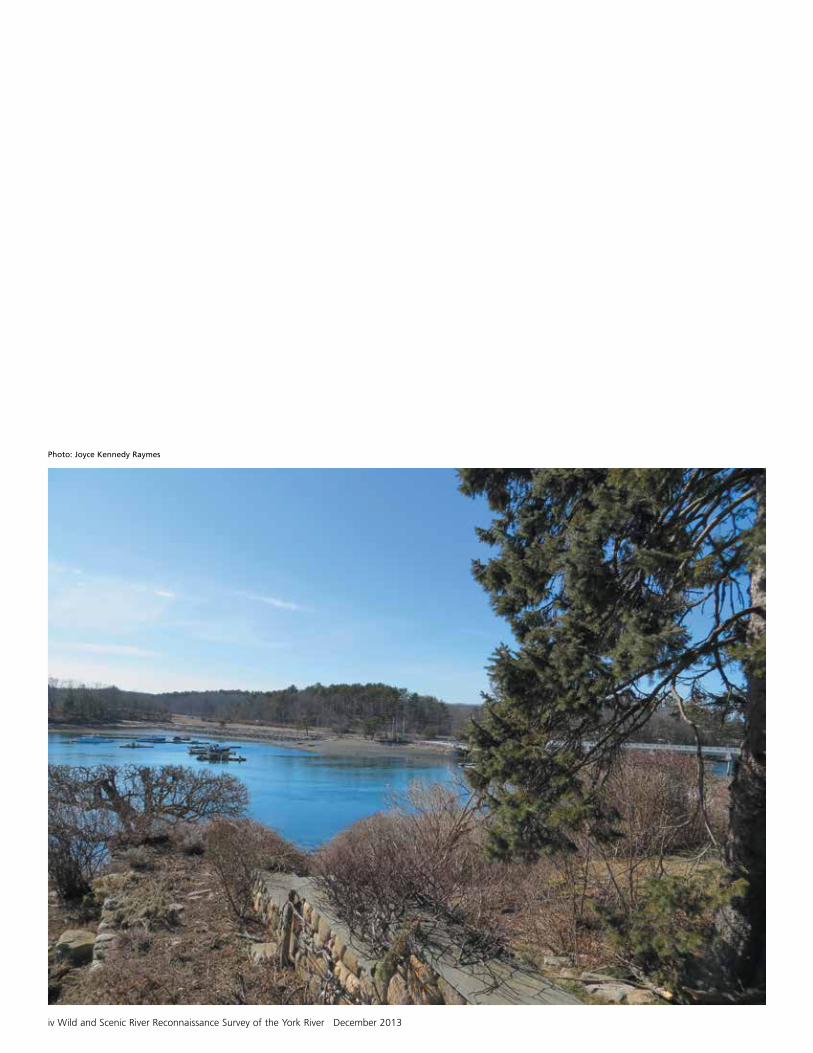
Photo: Joyce Kennedy Raymes

National Park Service iii
Contents
Wild and Scenic River Reconnaissance Survey Report Outline
I. Summary . . . . . . . . . . . . . . . . . . . . . . . . . . . . . . . . . . . . . . . . . . . . . . . . . . . . . . . . . . . . 1 A. Brief History . . . . . . . . . . . . . . . . . . . . . . . . . . . . . . . . . . . . . . . . . . . . . . . . . . . . . . . . . . . . . . . 1 B. Summary of Preliminary Findings . . . . . . . . . . . . . . . . . . . . . . . . . . . . . . . . . . . . . . . . . . . . . . . 1
II. Overview: National Wild and Scenic Rivers . . . . . . . . . . . . . . . . . . . . . . . . . . . . . . . 3 A. Congressionally Authorized Wild and Scenic River Studies . . . . . . . . . . . . . . . . . . . . . . . . . . . . 3 B. Eligibility & Suitability Criteria . . . . . . . . . . . . . . . . . . . . . . . . . . . . . . . . . . . . . . . . . . . . . . . . . . 3 C. Partnership Wild and Scenic Rivers Model . . . . . . . . . . . . . . . . . . . . . . . . . . . . . . . . . . . . . . . . 4
III. Description of Survey Area . . . . . . . . . . . . . . . . . . . . . . . . . . . . . . . . . . . . . . . . . . . . 6
IV. Preliminary Evaluation of Eligibility . . . . . . . . . . . . . . . . . . . . . . . . . . . . . . . . . . . . . 7 A. Potential ORVs . . . . . . . . . . . . . . . . . . . . . . . . . . . . . . . . . . . . . . . . . . . . . . . . . . . . . . . . . . . . . 7 1. Overview of Natural Resources . . . . . . . . . . . . . . . . . . . . . . . . . . . . . . . . . . . . . . . . . . . . . . . 7 2. Overview of Cultural and Historical Resources . . . . . . . . . . . . . . . . . . . . . . . . . . . . . . . . . . . . 8 3. Overview of Recreational and Scenic Resources . . . . . . . . . . . . . . . . . . . . . . . . . . . . . . . . . 11 B. Preliminary Free-Flow Analysis . . . . . . . . . . . . . . . . . . . . . . . . . . . . . . . . . . . . . . . . . . . . . . . . 12 C. Existing Water Quality . . . . . . . . . . . . . . . . . . . . . . . . . . . . . . . . . . . . . . . . . . . . . . . . . . . . . . . 13 D. Information Gaps / Potential Research Studies . . . . . . . . . . . . . . . . . . . . . . . . . . . . . . . . . . . . 14
V. Preliminary Evaluation of Suitability . . . . . . . . . . . . . . . . . . . . . . . . . . . . . . . . . . . . 17 A. Existing River Protection . . . . . . . . . . . . . . . . . . . . . . . . . . . . . . . . . . . . . . . . . . . . . . . . . . . . . 17 B. Existing Support for Wild and Scenic Study . . . . . . . . . . . . . . . . . . . . . . . . . . . . . . . . . . . . . . . 21 C. Partnership Wild and Scenic River Considerations . . . . . . . . . . . . . . . . . . . . . . . . . . . . . . . . . 22
VI. NPS Findings . . . . . . . . . . . . . . . . . . . . . . . . . . . . . . . . . . . . . . . . . . . . . . . . . . . . . . . 23
iv Wild and Scenic River Reconnaissance Survey of the York River December 2013
Photo: Joyce Kennedy Raymes
National Park Service 1 National Park Service 1
I. Summary
A. Brief HistoryA reconnaissance survey of the York River was conducted by the Northeast Region of the National Park Service (NPS) at the request of Representative Chellie Pingree (ME-1). Representative Pingree requested that 11-miles of the York River, as it runs through the towns of Eliot, South Berwick, Kittery and York in southern Maine, be evaluated as a candidate for a potential Wild and Scenic River designation and as a step toward a full Wild and Scenic River Study.
The reconnaissance survey provides a preliminary assessment of the eligibility and suitability of the York River as a candidate for a Wild and Scenic designation according to criteria established under the Wild and Scenic Rivers Act (WSRA). Included in the preliminary eligibility assessment is the identification of potentially significant natural, cultural and recreational resources that may be determined to be Outstandingly Remarkable Values (ORVs) as defined by the WSRA. The overall objective is to determine whether Congressional authorization for a Wild and Scenic River Study is warranted, and to make an initial determination on whether Wild and Scenic designation is an appropriate technique for river protection.
There are no public documents prepared for this reconnaissance survey nor does it trigger NEPA (National Environmental Policy Act), since NPS is not taking a major federal action significantly affecting the human environment. The survey determines only whether a full Wild and Scenic Study is warranted. Although the reconnaissance survey does not involve the public, consultation with key stakeholders was vital to this process. The NEPA process and full public involvement would be part of a Wild and Scenic Rivers Study should it be authorized by Congress. The survey began in January, 2013 and was completed in September, 2013 by staff of the Northeast Regional Office.
Since 2009, the locally-based Friends of the York River group including residents, town leaders, and others interested in river conservation has been leading an exploratory effort to determine whether the Wild and Scenic River designation might be an appropriate way to recognize and protect the York River and its associated resources. The group held a variety of public meetings and gathered letters in support of a Study from individuals, organizations and the three towns. Specifically, local interest has been expressed in pursuing a “Partnership Wild and Scenic River Study”, based on river management models such as the Lamprey River in New Hampshire and Farmington River in Connecticut. As such, this reconnaissance survey addresses some of the particular features and requirements of the Partnership Wild and Scenic River (PWSR) Model as a part of the preliminary evaluation process. It is important to note that the Allagash River in Maine is not a PWSR.
The York River Wild and Scenic River Bill (Study Bill) introduced and passed in the House of Representatives during the 112th Congress, failed to make its way through the complete legislative process. In May, 2013, Representative Chellie Pingree re-introduced the legislation in the House and in September, 2013, Senator Angus King in the Senate. The Study Bill would amend the Wild and Scenic Rivers Act to designate segments of the York River and associated tributaries for study for potential inclusion in the National Wild and Scenic Rivers System.
B. Preliminary FindingsThe NPS reconnaissance survey team has determined, based on readily available information, that segments of the York River exhibit free-flowing character and noteworthy natural, cultural and recreational resource values likely to meet eligibility criteria for inclusion in the National Wild and Scenic Rivers System (System). In addition, the presence of very strong community and interest group support for a Wild and Scenic River Study, together with a demonstrated

2 Wild and Scenic River Reconnaissance Survey of the York River December 2013
track record of natural and cultural resource protection, supports key elements of suitability for inclusion in the System, and provides a strong indication that a Wild and Scenic Rivers Study would be appropriate and productive.
The Wild and Scenic Rivers Act provides for three possible classifications of eligible river segments: “wild”, ”scenic” and ”recreational.” The criteria distinguishing these classifications are based on the degree of human modification of the river and its adjacent shorelines. Based upon the applicable criteria, the York River will not meet the “wild” river area criteria. However, a more in-depth analysis would be required to determine whether a “scenic” or “recreational” classification is appropriate for river segments likely to meet the eligibility criteria.
Photo: Karen Young
National Park Service 3 National Park Service 3
II. Overview: National Wild and Scenic Rivers
BackgroundThe National Wild and Scenic Rivers System was established by Congress in 1968 through the Wild and Scenic Rivers Act (WSRA) to protect outstanding rivers from harmful effects of new federally assisted projects such as dams and hydroelectric facilities. To be considered eligible for inclusion in the System, a river or river segment must be free-flowing and possess at least one Outstandingly Remarkable Value (ORV). The ORV must be natural, cultural or recreational in character, river-dependent, and have unique, rare or exemplary qualities on a regional or national scale. The most common way for an eligible river to be added to the System is through federal legislation. Each river that is designated into the national system receives permanent protection from development of federal water resource projects that would have an adverse effect on its free-flowing condition, water quality, and ORVs. In addition, the Federal Energy Regulatory Commission (FERC) may not license the construction of any dam or associated project works on a designated segment of river.
A. Congressionally Authorized Wild and Scenic River StudiesTo determine whether a river is both eligible and suitable to be included in the National Wild and Scenic Rivers System, a Wild and Scenic River Study (Study) is conducted. Congress authorizes studies based on Section 5(a) of the WSRA. Eligibility is based on the presence of a free-flowing river condition and the presence of at least one ORV.
A Study assesses the potential ORVs through objective analysis of known data by resource experts using professional judgment. The Study process provides ample time for extensive education and broad participation in the process. This extensive public process is critical to ultimate determination of suitability for inclusion in the System. Congress generally directs that Wild and Scenic River Studies be concluded within three years from the initial funding of the Study.
According to Section 5(c) of the WSRA, the Study should be pursued in close cooperation with the appropriate agencies of the state or its political subdivisions and shall include a determination of the degree to which the state might participate in the preservation and administration of the river should it be proposed for inclusion in the National Wild and Scenic Rivers System.
B. Eligibility and Suitability CriteriaEligibility
To be eligible for designation, a river must be free-flowing and possess at least one river-dependent Outstandingly Remarkable Value (ORV). Free-flowing is defined by the Wild and Scenic Rivers Act (WSRA) as, “existing or flowing in a natural condition without impoundment, diversion, straightening, rip-rapping, or other modification of the waterway. The existence, however, of low dams, diversion works and other minor structures at the time any river is proposed for inclusion in the national wild and scenic rivers system shall not automatically bar its consideration for such inclusion: Provided, That this shall not be construed to authorize, intend, or encourage future construction of such structures in components of the national wild and scenic rivers system.”
The WSRA defines an ORV as a scenic, recreational, geologic, fish and wildlife, historic, cultural, or other similar value. An ORV must be a river-related unique, rare or exemplary feature on a regional or national scale of comparison.
Suitability
Suitability is an assessment of factors to provide the basis for determining whether to recommend a river for addition to the National Wild and Scenic Rivers System. The Interagency
_____________________________________________________________1 Section 6(c) states that federal condemnation of lands cannot be used in towns that have zoning
ordinances in force that are consistent with the purposes of the WSRA.
2 Section 3(d)(1) requires that a comprehensive management plan address resource protection, development of lands and facilities, user capacities, and other management practices necessary or desirable to achieve the purposes of the WSRA.
4 Wild and Scenic River Reconnaissance Survey of the York River December 2013
Wild and Scenic Rivers Coordinating Council (IWSRCC) developed the following questions that can assist with the determination:
1) Should the river’s free-flowing character, water quality and ORVs be protected, or are one or more other uses important enough to warrant doing otherwise?
2) Will the river’s free-flowing character, water quality, and ORVs be protected through designation? Is it the best method for protecting the river corridor? In answering these questions, the benefits and impacts of Wild and Scenic River designation must be evaluated, and alternative protection methods considered.
3) Is there a demonstrated commitment to protect the river by non-federal entities that may be partially responsible for implementing the management plan?
Determining a river’s suitability for a Wild and Scenic designation is uniquely based on the specific characteristics and conditions of an individual river. The Study Team is responsible for making this determination based on a wide range of considerations including evaluating any potential threats to the free-flowing condition or resources in a region with high development pressure.
C. Partnership Wild and Scenic Rivers ModelThe Partnership Wild and Scenic River model was developed in response to the need for a Wild and Scenic River designation model tailored to rivers that meet the Wild and Scenic River criteria and that are characterized by community-based settings, extensive private land ownership along the river, non-federal lands, and well-established traditions of local governance. This model has a proven track record of effectively creating river protection strategies that bring communities together in protecting, enhancing and managing local river resources, while focusing federal involvement on technical assistance rather than direct land or resource management. With the exception of the Allagash River in Maine and the Westfield River in Massachusetts, all of the other New England rivers are designated through the Partnership Wild and Scenic River model.
For more than 20 years, the NPS has taken advantage of this direction when conducting Studies bordered by predominantly private and non-federal lands by encouraging formation of informal Study Committees based around state and local representation. Such Study Committees have become an integral part of the Study approach, and ensure active local participation in the process. Local and state knowledge is often critical to effective and efficient research regarding potential ORVs of the Study area, and is absolutely essential to the development of local and state-based management strategies for protection of such values. Since it is a central tenet of such studies that land-based resource protection must be primarily accomplished through local, state, and non-governmental action, it is therefore a central task of the Study committee to develop a locally-based management plan (Plan) to protect the important river values being researched and documented throughout a Study. Adoption of the Plan by state and local governments prior to designation provides evidence of local commitment to protecting Wild and Scenic River values without the need for direct federal management, a major factor in determining whether the Partnership model is suitable for the river under study. This Plan can serve the river, local communities, state agencies and other stakeholders regardless of whether Wild and Scenic River status is achieved as a result of the Study.
During a Partnership Wild and Scenic Rivers Study the suitability determination is based on factors such as:
1) Public support and evidence of commitment by non-federal entities that will be partially responsible for implementing a plan for protection;
2) Evidence of existing resource protection to meet the requirements of Section 6(c)1 of the WSRA; and
3) Lasting protection measures set forth in a non-regulatory, locally-developed comprehensive management plan as required under Section 3(d)(1)2 of the WSRA.
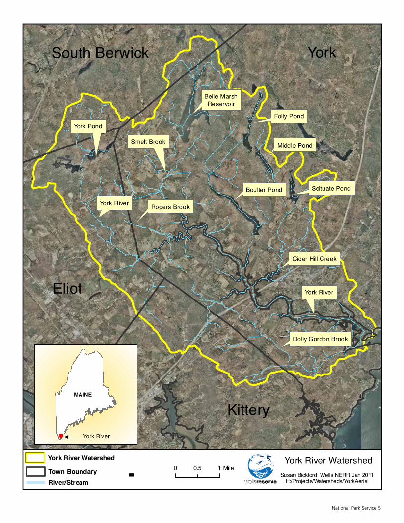
National Park Service 5
River/StreamTown Boundary 0 10.5 Mile-
York River WatershedSusan Bickford Wells NERR Jan 2011
H:/Projects/Watersheds/YorkAerial
YorkSouth Berwick
Eliot
Kittery
Cider Hill Creek
York River
Boulter Pond Scituate Pond
Middle Pond
Folly Pond
Belle MarshReservoir
York Pond
Dolly Gordon Brook
York River
Smelt Brook
Rogers Brook
York River Watershed
MAINE
York River

_____________________________________________________________3 http://swim.wellsreserve.org/watershed.php?ws_id=2&byname=&byzip=&imagefield.x=67&imagefield.y=20
4 http://yorkrivers.org/york_river.html
5 http://yorkrivers.org/york_river.html
6 Wild and Scenic River Reconnaissance Survey of the York River December 2013
III. Description of Survey Area
The York River watershed is located in southern Maine within the towns of Kittery, Eliot, South Berwick and York. The majority (72%) of the watershed area is located within the Town of York. The watershed covers 32 square miles and includes the York River mainstem and numerous wetlands, ponds, and tributaries, as well as drinking water reservoirs and the extensive salt marsh estuary. There are a total of 109 miles of streams and rivers. The major York River tributaries are the Cider Hill Creek, Cutts Ridge Brook, Rogers Brook and Smelt Brook. This area is primarily comprised of large unfragmented forested areas and agricultural lands along with rural and some suburban residential development. The many important habitat areas support rare and endangered plant and animal species. 3 4 According to the http://swim.wellsreserve.org/town.php?town_id=35 website, “York is a rapidly growing ocean-front New England community with substantial historical features and a wealth of natural resources.”
The York River begins at the northwest corner of York Pond and quickly flows into the Upper Bartlett Mill Pond in Eliot. It then travels south to southeast through woodlands before entering the Town of York. Here it is met by Cutts Ridge Brook from the south just before passing under Birch Hill Road and coming under tidal influence. The River continues its travels, twisting and turning, in an easterly direction where it converges with Rogers Brook and Smelt Brook. As the River begins to widen, it turns in a more southerly direction where it is crossed by Scotland Bridge Road. At this point, Bass Cove Creek (which leads in from Boulter Pond) and Cider Hill Creek, both from the north, connect to the River. Across from the outlet of Cider Hill Creek, Dolly Gordon Brook and Libby Brook converge and empty into the River from the South. The York River then passes under the Turnpike and Route 1. It curves around Ramshead Point, continuing in a southeasterly direction, where it is crossed by Sewall’s Bridge and Route 103. The River passes Bragdon and Harris Islands, turns sharply around Stage Neck and empties into the Gulf of Maine.5
Photo: York Land Trust
_____________________________________________________________6 Jackie Diedrich, Cassie Thomas, U.S. Forest Service and National Park Service, The Wild & Scenic River
Study Process, (Portland, Oregon, and Anchorage, Alaska, 1999), 12.
7 http://www.maine.gov/doc/nrimc/mnap/focusarea/york_river_headwaters_focus_area.pdf
8 http://www.maine.gov/doc/nrimc/mnap/focusarea/york_river_headwaters_focus_area.pdf
9 http://www.maine.gov/doc/nrimc/mnap/focusarea/york_river_headwaters_focus_area.pdf
10 http://www.maine.gov/doc/nrimc/mnap/focusarea/york_river_headwaters_focus_area.pdf
National Park Service 7
IV. Preliminary Evaluation of Eligibility
A reconnaissance survey does not catalog all of the potential Outstandingly Remarkable Values (ORVs) within the Study area. The goal is to identify representative resources that reflect the natural, cultural and recreational values that may meet the eligibility threshold of being unique, rare or exemplary on a regional or national scale of reference and be river-related or dependent. The interdisciplinary Study Team would be tasked with making the final determinations on river-dependent resources that meet the eligibility criteria of “… being a unique, rare or exemplary feature that is significant at a comparative regional or national scale.”6
A. Potential Outstandingly Remarkable Values (ORVs)1. Overview of Natural Resources
This region hosts the largest intact coastal forest in the area between Acadia and the New Jersey Pine Barrens, as well as the largest intact coastal wetland area in southern Maine. The northern and southern forests overlap in the region and this biome transition is another reason that this area has such rich biological diversity. The presence of both salt and freshwater ecosystems and the convergence of those systems in an estuary also contribute to the wide range of special habitats present – including fringing marshes, salt marshes, tidal flats and the nutrient-rich tidal marsh estuary.
Rare species and exemplary natural communities are detailed in the State of Maine’s Focus Area of Statewide Ecological Significance document. The report states that the “Tidal Marsh Estuary Ecosystem that includes the intertidal bays and one of the largest unprotected Spartina saltmarshes is a rare community in the state. The extensive York River Estuary is one of the Gulf of Maine’s least disturbed marsh-estuarine ecosystems and may be the most ecologically diverse coastal drainage for its size in the Gulf of Maine.”7
This area of Maine has the greatest diversity of threatened and endangered species of any Maine region. The estuary provides valuable roosting and feeding area within the mapped tidal wading bird and waterfowl habitat. It is excellent spawning habitat, with 28 species of estuarine and freshwater fish present.8 The marshes also provide habitat for the rare saltmarsh sharp-tailed sparrow.9 Overall, the river area provides extensive habitat and a migration corridor within the Atlantic flyway for birds.
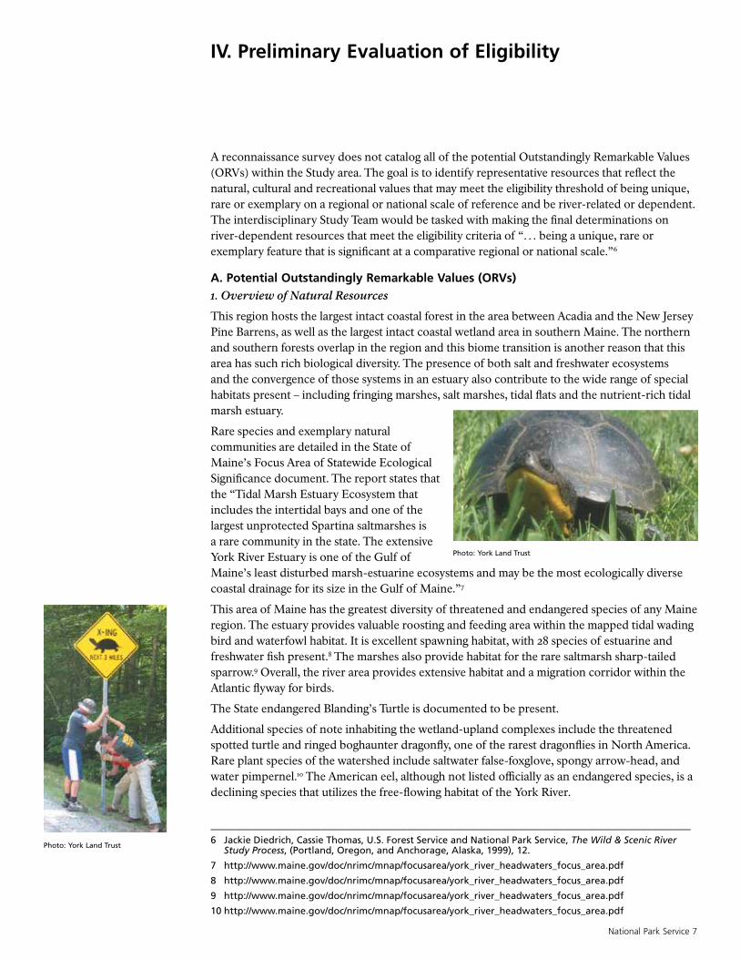
The State endangered Blanding’s Turtle is documented to be present.
Additional species of note inhabiting the wetland-upland complexes include the threatened spotted turtle and ringed boghaunter dragonfly, one of the rarest dragonflies in North America. Rare plant species of the watershed include saltwater false-foxglove, spongy arrow-head, and water pimpernel.10 The American eel, although not listed officially as an endangered species, is a declining species that utilizes the free-flowing habitat of the York River.
Photo: York Land Trust
Photo: York Land Trust
_____________________________________________________________11 http://www.waymarking.com/waymarks/wme56f_the_york_river_york_me
12 http://www.oldyork.org/buildings/hancock.html
8 Wild and Scenic River Reconnaissance Survey of the York River December 2013
2. Overview of Cultural and Historical Resources
The Interagency Wild and Scenic Rivers Coordinating Council (IWSRCC), provides guidance on eligibility criteria for prehistory and history values. Native American sites must have unique or rare characteristics or exceptional human interest value. Sites may have other attributes such as national or regional significance for interpreting prehistory. Historical values related to a river could be associated with a significant event, an important person or a rare cultural event. Such prehistory or historic sites or features could be also listed on the National Register of Historic Places. Cultural or historical resources that have local significance may not meet the criteria on a regional or national level. The reconnaissance survey has identified resources that may or may not fully meet the ORV criteria, and it would be expected that a Study Team would determine which features merit this status.
The lasting human settlement of this area relates to its abundant natural resources and the presence of the York River with its associated harbor and estuary. There is also a long-term appreciation of the natural resources of this region by its inhabitants and a long-held tradition of sustainable harvest of resources, such as fish and timber for everyday existence and income. In addition, there is a history of ship-making, brick-making and coastal shipping that developed as a result of the settlement on the banks of the York River. The configuration of the York Harbor provides a navigable and safe entry inland.
The cultural and historical resources of the York River span the historical record – from archaeological evidence of Native Americans – to village development surrounding the fishing trade in the 1600 to 1700s – to modern era engineering accomplishments. There is a vibrant local community of historians (Old York Historical Society d/b/a Museums of Old York (MOY), Eliot
Historical Society, Old Berwick Historical Society, Kittery Historical and Naval Society) that could be a source for documentation of these resources during a possible Wild and Scenic Study.
The river up until the end of the nineteenth century was York’s principal means of receiving goods from abroad or shipping local produce and product to markets overseas and up and down the coast. It provided power for gristmills and sawmills and was a primary source of employment. People initially settled close to the river, eventually spreading out into the forest and across the mountains lured by the availability for land and timber. The river with its safe harbor prospered early in York’s history. The “lower town” offered wharves and warehouses, shipyards and markets. York’s river commerce was largely that of schooners, fifty to eighty feet in length. Many were built and owned locally.11
Based on this brief survey of historic and cultural resources, it appears that the York River has a rich history as one of the first settlements of New England. There seem to be many existing resources that document the background of this area. A more detailed review of the resources that are river-related is recommended to be undertaken during a possible Study to determine whether they are river-dependent and unique, rare or exemplary regionally or nationally. The Study Team will determine which of the following resources meet all of the eligibility requirements.
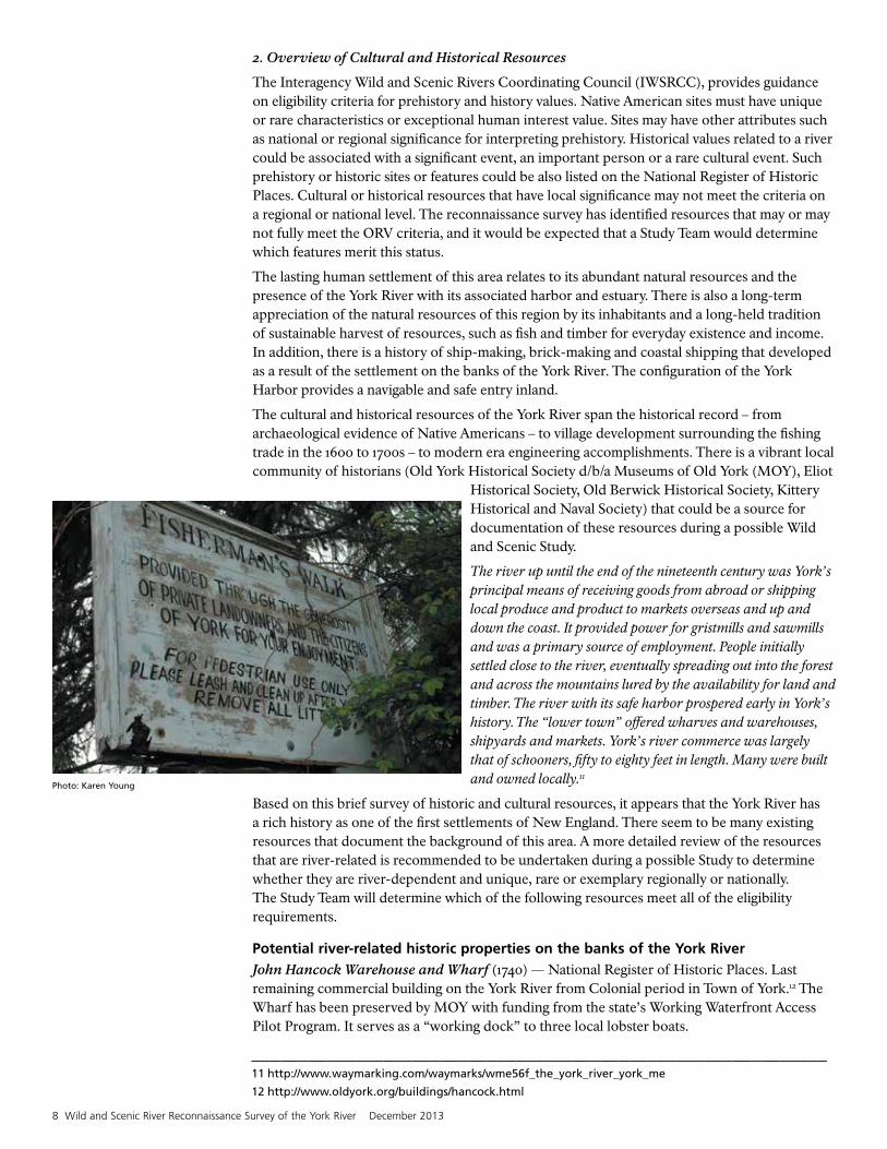
Potential river-related historic properties on the banks of the York River John Hancock Warehouse and Wharf (1740) — National Register of Historic Places. Last remaining commercial building on the York River from Colonial period in Town of York.12 The Wharf has been preserved by MOY with funding from the state’s Working Waterfront Access Pilot Program. It serves as a “working dock” to three local lobster boats.
Photo: Karen Young
National Park Service 9
George Marshall Store (1870) (MOY) — General merchandise was sold at this location and it is currently used as an art gallery featuring local artists open to the public.
Sayward Wheeler House (1718) (Historic New England) — Home of shipping merchant, judge and important resident, Jonathan Sayward.
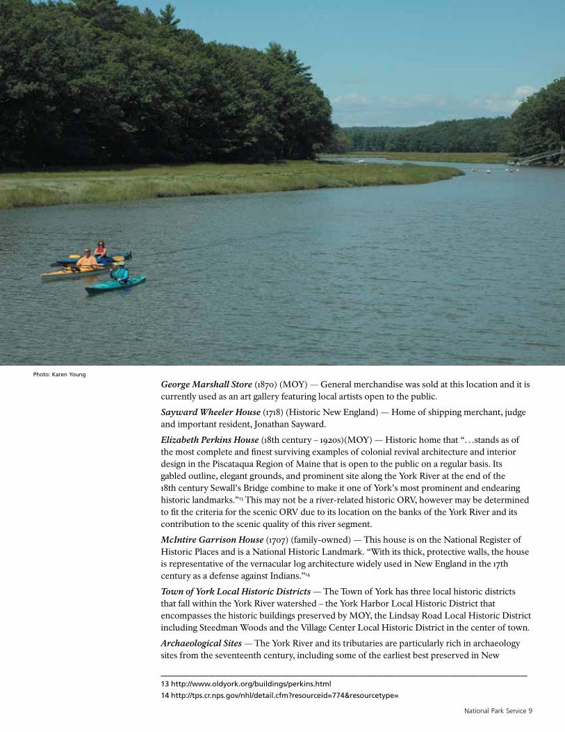
Elizabeth Perkins House (18th century – 1920s)(MOY) — Historic home that “…stands as of the most complete and finest surviving examples of colonial revival architecture and interior design in the Piscataqua Region of Maine that is open to the public on a regular basis. Its gabled outline, elegant grounds, and prominent site along the York River at the end of the 18th century Sewall’s Bridge combine to make it one of York’s most prominent and endearing historic landmarks.”13 This may not be a river-related historic ORV, however may be determined to fit the criteria for the scenic ORV due to its location on the banks of the York River and its contribution to the scenic quality of this river segment.
McIntire Garrison House (1707) (family-owned) — This house is on the National Register of Historic Places and is a National Historic Landmark. “With its thick, protective walls, the house is representative of the vernacular log architecture widely used in New England in the 17th century as a defense against Indians.”14
Town of York Local Historic Districts — The Town of York has three local historic districts that fall within the York River watershed – the York Harbor Local Historic District that encompasses the historic buildings preserved by MOY, the Lindsay Road Local Historic District including Steedman Woods and the Village Center Local Historic District in the center of town.
Archaeological Sites — The York River and its tributaries are particularly rich in archaeology sites from the seventeenth century, including some of the earliest best preserved in New
_____________________________________________________________13 http://www.oldyork.org/buildings/perkins.html
14 http://tps.cr.nps.gov/nhl/detail.cfm?resourceid=774&resourcetype=
Photo: Karen Young

_____________________________________________________________15 http://www.seacoastonline.com/apps/pbcs.dll/article?aid=/20071118/news/711180349/-1/news
16 http://www.asce.org/people-and-projects/projects/landmarks/sewall-s-bridge/
17 http://www.yorkrivers.org/historic.html
10 Wild and Scenic River Reconnaissance Survey of the York River December 2013
England, such as the remains of Point Christian Manor — the 1634 governor’s mansion. Some important sites lie partially within the tidal zone, for the first tidal powered saw mill in Maine (and probably the first in what is now the United States) was built in York in 1634. Many other tidal mills were constructed in the following years, and some were in use throughout the nineteenth century. The remains of the 1634 mill dam and a handful of other early mill dams survive — nationally significant evidence of the beginnings of the American lumber industry.
Punkintown — Site of an historic town found on York Pond in the York River headwaters. Little is known about the remains of this small town that at its peak had a population of only about 30 to 40. Residents were known to be self-sufficient with their own grist mill, saw mill and granite quarry.15
Noteworthy Inhabitants The following residents and visitors of this area include:
• Captain John Smith, the explorer and Jamestown Colony leader.
• Samuel Clemens, the author who spent the summer of 1902 living in a home along the York River.
• May Sarton, the poet who spent final years living in a house by the York River.
• Rufus McIntire, the resident who held multiple local and national government posts.
• Thomas Morton, the arch-rival of the Pilgrims of Plymouth who was exiled from Massachusetts and lived his last years in a house near the river.
It is anticipated that Wild and Scenic interdisciplinary Study Team experts would make a determination as to whether these well-known persons have a nationally or regionally significant historic or cultural relationship with the river.
Bridges, Transportation and EnergySewall’s Bridge is a historic civil engineering landmark. The wooden trestle bridge was designed and constructed by Major Samuel Sewall in 1761 and remained in use as a York River crossing until 1934, when it was replaced by a similarly designed wooden pile bridge. Original wood was used in the reconstruction. It was the earliest bridge of its kind with authentic existing construction record and drawings.16 In 2013, the bridge is undergoing reconstruction for safety reasons and that construction is near completion.
Wiggly Bridge, built in the 1930s, is one of the smallest suspension bridges in the U.S. and is an attraction for locals and tourists alike.
Thermoplastic Bridge is the first of its kind in the U.S., built from recycled plastic bottles.
Remnants of a series of historical dams and tidal mill ponds in the York River and tributaries were documented by Silas Weeks of the Eliot Historical Society. He described a sequence of grist and saw mills and three impoundments that powered a dairy barn, along with some dams that held back water to control flows for powering downstream dams as needed. The existence of the historical mills alone does not necessarily constitute an ORV and therefore it is recommended that a detailed review of the significance of individual mills or the series of mills could be investigated. For instance, the fact that the Dolly Gordon Brook powered the first tidal mill in the colonies17 could be a significant value. Other historic tidal mills exist in the watershed
Photo: Karen Young
National Park Service 11
as well such as in Barrell’s Mill Pond in York. Bud Warren may be a source of additional information as he is a local authority on tidal mills.
3. Overview of Recreational and Scenic ResourcesA potential recreational resource is based on the popularity of the activity and the extent to which visitors are willing to travel to use the resources. In addition, interpretive opportunities may be significant and may potentially attract visitors from throughout the region and a river-related activity could be a setting for a national or regional event.18 The guidance on scenery is that the elements of the landscape result in “notable or exemplary visual features and/or attractions.”
The recreational opportunities and scenic resources of this region are closely linked. The scenery is the backdrop that creates an enjoyable environment for recreating on and beside the York River. The coastal Town of York has been a popular tourism destination with its scenic views of the York Harbor and Atlantic coastline since the 1800s. It has long been a destination for those from more populated areas seeking a place of quiet refuge. The scenic qualities relate to both the natural environment and the feel of a quintessential New England town on the banks of the historic waterfront with active fishing and lobstering boats in the harbor. Small-scale commercial fishing lends a rugged charm to the harbor. Scenic views of beaches and the ocean are also a draw for tourists.
Some of the most popular recreational activities of the York River include fishing, boating and walking.
Fishing is both a commercial and recreational pursuit on the York River. There are a broad range of opportunities for anglers due to the large diversity of marine and freshwater fish species, the configuration of the safe, functioning harbor and access to the ocean.
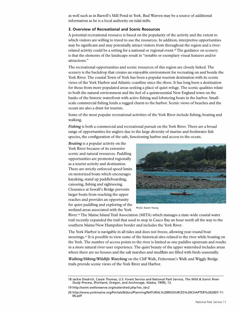
Boating is a popular activity on the York River because of its extensive scenic and natural resources. Paddling opportunities are promoted regionally as a tourist activity and destination. There are strictly enforced speed limits on motorized boats which encourages kayaking, stand up paddleboarding, canoeing, fishing and sightseeing. Clearance at Sewall’s Bridge prevents larger boats from reaching the upper reaches and provides an opportunity for quiet paddling and exploring of the wetland areas associated with the York River.19 The Maine Island Trail Association (MITA) which manages a state-wide coastal water trail recently expanded the trail that used to stop in Casco Bay an hour north all the way to the southern Maine/New Hampshire border and includes the York River.
The York Harbor is navigable in all tides and does not freeze, allowing year-round boat moorings.20 It is possible to view some of the historical sites related to the river while boating on the York. The number of access points to the river is limited as one paddles upstream and results in a more natural river-user experience. The quiet beauty of the upper watershed includes areas where there are no houses and the salt marshes and mudflats are filled with birds seasonally.
Walking/Hiking/Wildlife Watching on the Cliff Walk, Fisherman’s Walk and Wiggly Bridge trails provide scenic views of the York River and Harbor.
_____________________________________________________________18 Jackie Diedrich, Cassie Thomas, U.S. Forest Service and National Park Service, The Wild & Scenic River
Study Process, (Portland, Oregon, and Anchorage, Alaska, 1999), 13.
19 http://swim.wellsreserve.org/watershed.php?ws_id=2
20 http://www.yorkmaine.org/Portals/0/docs/Planning/NATURAL%20RESOURCES%20CHAPTER%202007-11-06.pdf
Photo: Karen Young

12 Wild and Scenic River Reconnaissance Survey of the York River December 2013
Steedman Woods is owned by MOY, and is located along the York River just upstream of Route 103. This property contains walking paths on the west end of Wiggly Bridge and, as such, forms the southerly end of the Fisherman’s Walk…The Fisherman’s Walk [and adjoining],…Cliff Path, is a public walkway[sic] that begins in Steedman Woods that follows the York River downstream to Harbor Beach and the Hartley Mason Reserve, and then follows the rocky coastline around Eastern Point to Cow Beach. Walkers on this path have spectacular views of the River and Ocean.21
There is also a network of trails dotted with scenic views and opportunities to enjoy different habitats and wildlife species in the Mt. Agamenticus region including trails on the Highland Farm Preserve, on the conserved lands around York Pond, in the Mount Agamenticus Wildlife Management Area and on both York and Kittery Water District lands in the watershed. There are scenic views from Mt. Agamenticus, Route 91, at York Pond, from the bridges and other points into the watershed area.
B. Preliminary Free-Flow AnalysisA Wild and Scenic designation preserves rivers in their free-flowing condition and protects them from the harmful effects of new federally assisted projects such as dams and hydroelectric facilities. Rivers or river segments must be determined to be free-flowing to be eligible for designation. Section 16(b) of the WSRA defines “free-flowing” as “…existing or flowing in natural condition without impoundment, diversion, straightening, rip-rapping, or other modification of the waterway. “Free-flowing” refers to the flow within the designated river segment and is not the same as naturally flowing. For instance, Section 16(b) of the WSRA also states that the existence of “low dams, diversion works, and other minor structures” does not automatically bar its consideration for designation. The 1982 Interagency Guidelines define
water flow sufficiency for a determination of eligibility stating that “Flows are sufficient if they sustain or complement the outstandingly remarkable values for which the river would be designated.”22
The State of Maine Emergency Management Agency provided an inventory of seven dams that are situated within the York River watershed. Based on this information, five of the dams are associated with the Kittery Water District and two of the dams are privately owned. The Kittery and York Water Districts have a series of six drinking water reservoirs that supply water to parts of Kittery, Eliot and York including the Portsmouth Naval Shipyard in Kittery which is a
large water consumer. The Kittery Water District dams contain the drinking water reservoirs within the York River watershed. Kittery Water District reservoirs include Folly Pond, Middle Pond, Bell Marsh Reservoir and Boulter Pond. Local partners are currently advocating for a “watershed-wide” approach to the possible Study and, therefore, all of the dams should be field-examined during a Wild and Scenic Study to determine whether they meet the “free-flowing” criteria. For example, the dams associated with the impounded drinking water reservoirs would be outside a possible Wild and Scenic designated area. It appears that the York Pond Dam located at the outlet of York Pond located in the Town of Eliot is the only dam on the York River mainstem. The remainder of the York River was historically dammed by a series of impoundments and mill ponds to power grist, saw and dairy operations. They are no longer in existence; however, there may be some evidence of these dams that could be explored during a
Photo: Karen Young
_____________________________________________________________21 http://www.yorkmaine.org/Portals/0/docs/Planning/NATURAL%20RESOURCES%20CHAPTER%202007-11-
06.pdf
22 “Department of the Interior and Agriculture Interagency Guidelines for Eligibility, Classification and Management of River Areas,” published in the Federal Register (Vol. 47, No. 173; September 7, 1982, pp. 39454-39461).
National Park Service 13
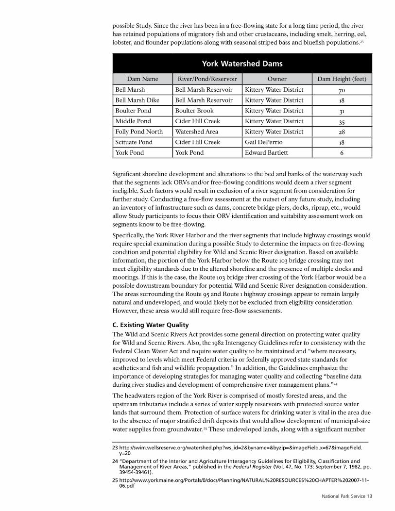
possible Study. Since the river has been in a free-flowing state for a long time period, the river has retained populations of migratory fish and other crustaceans, including smelt, herring, eel, lobster, and flounder populations along with seasonal striped bass and bluefish populations.23
York Watershed Dams
Dam Name River/Pond/Reservoir Owner Dam Height (feet)
Bell Marsh Bell Marsh Reservoir Kittery Water District 70
Bell Marsh Dike Bell Marsh Reservoir Kittery Water District 18
Boulter Pond Boulter Brook Kittery Water District 31
Middle Pond Cider Hill Creek Kittery Water District 35
Folly Pond North Watershed Area Kittery Water District 28
Scituate Pond Cider Hill Creek Gail DePerrio 18
York Pond York Pond Edward Bartlett 6
Significant shoreline development and alterations to the bed and banks of the waterway such that the segments lack ORVs and/or free-flowing conditions would deem a river segment ineligible. Such factors would result in exclusion of a river segment from consideration for further study. Conducting a free-flow assessment at the outset of any future study, including an inventory of infrastructure such as dams, concrete bridge piers, docks, riprap, etc., would allow Study participants to focus their ORV identification and suitability assessment work on segments know to be free-flowing.
Specifically, the York River Harbor and the river segments that include highway crossings would require special examination during a possible Study to determine the impacts on free-flowing condition and potential eligibility for Wild and Scenic River designation. Based on available information, the portion of the York Harbor below the Route 103 bridge crossing may not meet eligibility standards due to the altered shoreline and the presence of multiple docks and moorings. If this is the case, the Route 103 bridge river crossing of the York Harbor would be a possible downstream boundary for potential Wild and Scenic River designation consideration. The areas surrounding the Route 95 and Route 1 highway crossings appear to remain largely natural and undeveloped, and would likely not be excluded from eligibility consideration. However, these areas would still require free-flow assessments.
C. Existing Water QualityThe Wild and Scenic Rivers Act provides some general direction on protecting water quality for Wild and Scenic Rivers. Also, the 1982 Interagency Guidelines refer to consistency with the Federal Clean Water Act and require water quality to be maintained and “where necessary, improved to levels which meet Federal criteria or federally approved state standards for aesthetics and fish and wildlife propagation.” In addition, the Guidelines emphasize the importance of developing strategies for managing water quality and collecting “baseline data during river studies and development of comprehensive river management plans.”24
The headwaters region of the York River is comprised of mostly forested areas, and the upstream tributaries include a series of water supply reservoirs with protected source water lands that surround them. Protection of surface waters for drinking water is vital in the area due to the absence of major stratified drift deposits that would allow development of municipal-size water supplies from groundwater.25 These undeveloped lands, along with a significant number
_____________________________________________________________23 http://swim.wellsreserve.org/watershed.php?ws_id=2&byname=&byzip=&imageField.x=67&imageField.
y=20
24 “Department of the Interior and Agriculture Interagency Guidelines for Eligibility, Classification and Management of River Areas,” published in the Federal Register (Vol. 47, No. 173; September 7, 1982, pp. 39454-39461).
25 http://www.yorkmaine.org/Portals/0/docs/Planning/NATURAL%20RESOURCES%20CHAPTER%202007-11-06.pdf

14 Wild and Scenic River Reconnaissance Survey of the York River December 2013
of conservation and state protected lands in the region such as the Mt. Agamenticus to the Sea Conservation Initiative (MtA2C) lands including Highland Farm and the York Pond area conservation land help protect the water quality in the river. These efforts provide exceptional water quality protection. In fact, 26% of the lands in the York River watershed have been protected from development. When a watershed is developed with as little as 10% impervious surface (roadways, driveways, rooftops, etc.), water quality has been shown to become degraded in the associated water body (http://www.nemo.udel.edu/manual/Chap2Web.pdf) The land uses in the York River watershed are generally associated with a very low percent impervious surface per acre.
Some example indicators of high water quality include the large diversity of habitat supporting aquatic life and according, to the Maine Department of Marine Resources (DMR), the conditional opening of shellfish beds in the lower portion of the York River that results in recreational clamming.
The York River is categorized by the state of Maine as Class B waters that are deemed suitable for fishing, clamming and swimming. There are no municipal wastewater facilities discharging to the river. The Maine Department of Environmental Protection (DEP) reported that the York River is planned to be removed from the Impaired Coastal Watershed/Priority Coastal Watershed in the upcoming 305b/303d list since the water quality issues do not seem to be related to non-point source pollution problems associated with erosion, but are more likely due to a small number of marina/boat sources. Regardless, the largest threat to the water quality of the York River watershed is from nonpoint source pollution. The York River Watershed Nonpoint Pollution Survey and Watershed Management Plan26 prepared by the Wells National Estuarine Research Reserve for Maine DEP in 2005 includes information gathered during a nonpoint source pollution survey of the York River conducted in 2001-2003, along with other identified water quality issues.
Based on this initial survey of available water quality data, there appears to be adequate baseline information to understand the condition of the water quality in the river. A more detailed review of the data is recommended to take place during a possible Study. In a technical report developed by the IWSRCC regarding “Water Quality and Quantity as Related to the Management of Wild and Scenic Rivers,” it is advised that the water quality section of a Wild and Scenic Management Plan document baseline conditions, define water-related values to be protected and identify potential threats and protection opportunities. Documenting baseline water quality is important because this establishes the threshold for meeting the WSRA mandate to protect and enhance this Wild and Scenic Rivers Value should the river be designated.
D. Information Gaps / Potential Research StudiesThere is typically a budget associated with an authorized Study. This allows for research and technical analysis of the resources, river flows, recreational use surveys etc. These “studies within the study” help establish benchmarks for the protection of ORVs, and this information will generally result in enhanced river protection even if Wild and Scenic River designation is not achieved.27
Under the Wild and Scenic Rivers Act, a comprehensive river management plan (CRMP) must be prepared that addresses, “resource protection, development of lands and facilities, user capacities...” The NPS recommends that the CRMP be prepared during Studies where there are extensive non-federal lands within the area, and strong local interest in self-regulation combined with opposition to federal land acquisition. Developing a CRMP can support the suitability determination and establish the importance of multiple partners working for river protection. Beyond this responsibility, the Study Team would make a determination as to what additional
_____________________________________________________________26 http://swim.wellsreserve.org/csc/uploads/York%20River%20WMP.pdf
27 Jackie Diedrich, Cassie Thomas, U.S. Forest Service and National Park Service, The Wild & Scenic River Study Process, (Portland, Oregon, and Anchorage, Alaska, 1999), 11.
National Park Service 15
studies may be necessary to determine eligibility and suitability for designation. In collaboration with the Study Team, the NPS would screen prospective research studies to determine if they meet the following criteria:
• How essential is the study to the overall eligibility and suitability determinations?
• How much time would the study take (studies should take less than three years, from scoping through contracting to completion)?
• Would the potential study budget be adequate to cover costs, or if not, is there an alternate source of funding?
The Friends of the York River group, that has been leading the exploratory effort to initiate a Wild and Scenic Study, has provided the NPS with a comprehensive list of prospective studies that could be conducted with potential NPS funding through an authorized Study. The NPS has utilized that suggested list to recommend studies that could potentially be relevant in supporting the eligibility and suitability determination during a Wild and Scenic Study. The local stakeholder group may also consider additional studies while developing a possible CRMP, that would be outside the scope of a Study, but relevant for river protection.
If there is funding available through the NPS, the following potential research Study list is representative of the projected needs of the Friends of the York River group to conduct a Study, and characterizes the types of research that could be necessary to document eligibility and suitability. It is important to note that this list of possible studies has not been finalized nor determined to be essential for determining eligibility and suitability. If a Study is authorized, the NPS would work with the local Study Team to prioritize the scope of research based on the criteria referenced above.
Prepare GIS Mapping of Existing Conditions of the Watershed:
• Determine York River and contributing tributary watershed boundary.
• Prepare a topographic survey of the existing watershed to be used in planning and watershed modeling.
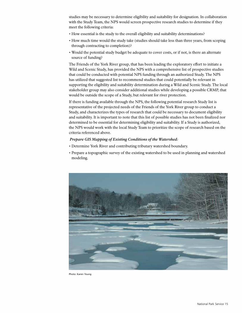
Photo: Karen Young

16 Wild and Scenic River Reconnaissance Survey of the York River December 2013
• Document and inventory protected lands within the watershed.
• Conduct an evaluation of type and extent of existing development.
• Determine trends in development expansion and resulting impact to the watershed.
• Document and map the existing land uses within the watershed including locations of lands currently in agriculture and tree growth tax protection.
• Determine the potential for expansion of forest and agriculture land uses.
Water quality:
• Inventory and prepare a database of existing water quality data to describe existing water quality and to determine trends. Identify location and types of impacts to surface water quality.
Ecology and Biodiversity:
• Perform studies to evaluate and determine regional diversity of existing ecological plant and animal habitat systems within the Wild and Scenic Study area.
• Conduct a habitat evaluation study to determine types/species, quantity, rarity, and location of existing plant and animal habitats within the Study area. The study should be used to determine methods of protection and preservation of critical and endangered species habitat.
Fisheries Habitats:
• Conduct a study to evaluate existing fisheries and habitats.
History and Archaeology:
• Conduct historical documentation and archaeological investigations of significant river-related existing and former mill sites, cemeteries, abandoned settlements to supplement local town and state historical documentation.
• Document and locate significant river-related historical structures and landforms.
• Document and locate river-related structures and features currently registered or that have the potential to be listed on the National Historical Register.
Recreation:
• Evaluate current recreational uses and recreational resources related to the river.
Dams, Docks and Piers:
• Evaluate existing dams and remnant dams to determine whether they meet the free-flowing requirement of the WSRA.
• Document and evaluate existing waterfront piers, docks, bulkheads, seawalls and structures and determine their impact on free-flow, natural features, fisheries, and habitat.
Regulations, Plans, Programs and Policies:
• Conduct an evaluation of existing and proposed local, state, and federal regulations and policies pertaining to land use, fisheries, and the natural, recreational, cultural and historical resources within the watershed.
• Determine adequacy and consistency of existing regulations, policies and permitting in achieving the purposes of the WSRA.
• Review local, regional, and state objectives for the preservation of protected lands and determine adequacy and consistency.

National Park Service 17
V. Preliminary Evaluation of Suitability
For the purpose of this survey, a preliminary suitability analysis considers readily available information related to:
• Existing river protection measures;
• Existing support for a Wild and Scenic Study;
• Initial level of demonstrated commitment to protect river;
• Preliminary assessment of whether Wild and Scenic designation might be an appropriate scheme for river protection;
• Local interest in participating in the Partnership Wild and Scenic Rivers model; and
• Potential for water resources development.
A. Existing River Protection The IWSRCC offers guidance on evaluating the adequacy of river protection and the consistency with which designation matches other agency plans, programs or policies and in meeting regional objectives. Such analysis is conducted as a part of the larger report requirements outlined in Section 4.(a)(ii) of the WSRA. An in-depth analysis is undertaken during a Wild and Scenic Study and includes an evaluation of:
• The adequacy of local zoning and other land use controls in protecting the Wild and Scenic River values28 by preventing incompatible development. This evaluation may result in a finding
Photo: York Land Trust
_____________________________________________________________28 Wild and Scenic River values include free-flowing condition, water quality and Outstandingly
Remarkable Values.
18 Wild and Scenic River Reconnaissance Survey of the York River December 2013
that the local zoning, when combined with other forms of existing resource protection, fulfills Section 6(c) of the Wild and Scenic Rivers Act, which in turn preempts the federal government’s ability to acquire land through eminent domain if the river is designated.
• The state/local government’s ability to manage and protect the Wild and Scenic River values on non-federal lands.
In conducting this evaluation a Study Team will determine if the communities and state have existing zoning and land use controls adequate to protect the waterways and associated ORVs, or whether additional controls are necessary to protect resources. Essential programs or regulations, together with resource objectives and recommendations for future action, are documented in the Conprehensive River Management Plan (CRMP) developed as a part of the Study. Partnership Wild and Scenic Rivers (PWSR) designation under the WSRA is only suitable when there is strong, broad-based support for these critical elements as included in the Plan.
Water Quality and Riverine Habitat ProtectionBased on a preliminary review of some of the existing river-related protections currently in place, it appears that the towns and local organizations have responded to the challenges of ongoing growth of the area by establishing a series of regulations, policies and programs to protect the watercourses and associated resources. For example, the Town of York has developed the Shoreland Overlay District, as described in the York Zoning Ordinance. It creates a 250 foot resource protection zone to limit development in sensitive resource areas. The Overlay District likely provides the single most important local regulatory protection, since the main stem of the York River and many of the tributaries are within the Town of York. There are also municipal protections in Kittery, Eliot and South Berwick and existing water quality programs related to the protection of York and Kittery Water District reservoirs and lands.
At the state level, the Maine DEP administers programs under the Clean Water Act such as the Maine National Pollutant Discharge Elimination System (NPDES). Under NPDES, the DEP has established an MS4 General Permit that requires a permittee to develop, implement, and enforce a Stormwater Program Management Plan implementing six minimum control measures including public education and outreach, public involvement and participation, and illicit discharge detection and elimination to protect water quality. Part of the York River watershed was recently included under this permit requirement and the initiatives that the town is undertaking to meet its requirements will provide additional water quality protections for the river. The new stormwater regulations will also direct resources to bolster existing public education and outreach programs such as York’s “Lawns to Lobsters” program that encourages local citizens to use low-impact lawn care methods to protect water quality.
Historical and Waterfront Preservation There exists a long-term history of conservation and historical preservation in this region. An active local historical community works to interpret, document and protect the rich cultural and historical resources. An example of a unique protection scheme is the restoration of the historic, working John Hancock Wharf. This dock provides access for three local lobster boats. Across the river, the York Land Trust protected Sewall’s dock in order to provide long-term access to the historical waterfront for local fisherman, and for its scenic value. It is the first project of its kind in the U.S. Multiple partners came together to realize this project. The small-scale commercial waterfront, located upstream of the Route 103 bridge, protects a historically significant feature and waterfront open space. Fishing success is supported by a high quality water resource.
Future community plans for the historical waterfront would require special attention during a management planning process and in suitability determinations to determine if the existing and future uses are compatible with WSRA protection. As noted in the eligibility section of this report it may be appropriate to delineate the downstream Study boundary at the Route 103 bridge crossing of the York Harbor. Based on available information, the land uses associated with the lower harbor may be incompatible with WSRA protection, and this area does not appear to support equivalent historical values of the waterfront upstream of Route 103.

National Park Service 19
_____________________________________________________________29 http://oldyork.org/About%20Us/index.html
30 http://www.eliothistoricalsociety.org/about.htm
31 http://www.oldberwick.org/index.php?option=com_content&view=article&id=53:about-obhs&catid=57:our-mission&itemid=82
32 http://kitterymuseum.com/
33 http://yorkrivers.org/york_river_watershed_wnerr.pdf
34 http://swim.wellsreserve.org/town.php?town_id=35
35 http://www.mta2c.org/
36 http://www.wellsreserve.org/preservation/
Local historical organizations include:Museums of York (the organization as it exists today combines two or three pre-existing organizations that merged over the years) was founded over one hundred years ago to preserve the history and artifacts of York, Maine... York is one of New England’s earliest colonial settlements. It is also the nation’s first chartered city (1641) and first incorporated city (1642). Offering thirty-seven period room settings and several galleries housed throughout nine historic museum buildings.29
Eliot Historical Society was founded in 1897 and works to preserve the town’s history through collection of artifacts and documents.30
Old Berwick Historical Society promotes public awareness of local and regional history. The Counting House Museum is a regional treasure containing one of northern New England’s last textile mill ballrooms.31
Kittery Historical and Naval Society stores artifacts and documents related to pre-revolution days through to the modern navy. Kittery is Maine’s oldest incorporated town (1647).32
Land Conservation and Natural Resource ProtectionDevelopment pressure is significant in Southern Maine. For instance, York’s population increased from 9,818 in 1990 to 12,854 in 2000. This 30.9% increase was the largest in York County.33 With the existing combination of an excellent highway access system to the region and the desirability of the coastal location there has been an influx of year-round residents and the associated traffic congestion and loss of open space.34
Despite this development pressure, there is an extensive network of local and regional organizations working to protect and preserve watershed resources that include groups such as land trusts, and other conservation and historical related organizations. Some examples follow:
Mt. Agamenticus to the Sea Conservation Initiative (MtA2C) is an effort led by a coalition of ten national, regional and local partners representing federal and governmental agencies, statewide land protection organizations, and three local land trusts. MtA2C’s goal is to protect a network of connected conservation lands and natural resources within a 48,000-acre focus area in Southern Maine for the benefit of people and wildlife. To date, over 13,000 acres have been protected in the MtA2C region. By 2032, MtA2C aims to protect at least 6,000 more acres to bring the total protected land in the Mount Agamenticus to the Sea focus area to approximately 19,000 acres.35 The Highland Farm (151-acre property that links to over 7,000 acres of protected forest) and the Davis Family property (240-acres of pristine habitat) are two examples of significant preserved properties on the banks of the York River related to this initiative.
Wells National Estuarine Research Reserve at Laudholm protects and manages 2,250 acres of coastal habitat in concert with its partners. The Wells Reserve is involved throughout southern Maine in efforts to study coastal ecosystems, provide environmental education programs, develop conservation strategies and implement the best options to protect natural resources.36
U.S. Fish and Wildlife Service Rachel Carson National Wildlife Refuge protects valuable salt marshes and estuaries for migratory birds. Located along 50 miles of coastline in York and Cumberland counties, the refuge consists of eleven divisions between Kittery and Cape Elizabeth.

Sou
rces
: Esr
i, D
eLor
me,
US
GS
, NP
S
Sout
h B
erw
ick
York
Kitt
ery
Elio
tS
tream
s
Kitt
ery
and
York
Wat
er D
istri
ct L
ands
Oth
er C
onse
rvat
ion
Land
s
Tow
n B
ound
arie
s
Tota
l Are
a:
21,1
60 a
cres
York
Riv
er W
ater
shed
Pro
tect
ed L
ands
: 5,
513
acre
s
26%
Pro
tect
ed
York
Riv
er W
ater
shed
York
Riv
er
±0
21
Mile
s
Sus
an B
ickf
ord,
Wel
ls N
ER
R J
uly
2013
H:/P
roje
cts/
YR
WS
/YR
WS
Con
land
s.m
xdA
ll bo
unda
ries
appr
oxim
ate
20 Wild and Scenic River Reconnaissance Survey of the York River December 2013
National Park Service 21
_____________________________________________________________37 http://www.fws.gov/refuge/rachel_carson/about.html
38 http://www.yorkwaterdistrict.org/
39 http://kitterywater.org/
40 http://www.maine.gov/ifw/
It will contain approximately 14,600 acres when land acquisition is complete. The proximity of the refuge to the coast and its location between the eastern deciduous forest and the boreal forest creates a composition of plants and animals not found elsewhere in Maine.37 The Refuge has selected the York River headwaters as part of its critical expansion area because of its resource values.
York Water District is dedicated to conserving and protecting the District’s natural resources and assets to ensure high quality drinking water.38 They conduct a watershed monitoring program.
Kittery Water District recognizes that water and watersheds must be preserved, conserved and protected; that an adequate supply of clean water is a basic human right; that water is a public trust, to be guarded by all levels of government acting as an equal partner with the public; and that the best advocates for water are local communities and citizens.39
Maine Department of Inland Fisheries & Wildlife – holds and manages significant conservation land around York Pond in the upper York River watershed.40
Route I-95 and Route 1 Bridge CrossingsThe river segment that includes the I-95 and Route 1 bridge crossing would require special attention and coordination with state and federal highway administrations during a suitability analysis. It would be important to consider future reconstruction plans in the context of a potential WSRA Section 7 review.
Local stakeholders conducted a meeting with the Maine Turnpike Authority on August 12, 2013 to make them aware of the proposed Study. There was no indication that they would oppose the proposed Study.
B. Existing Support for Wild and Scenic StudyThe locally-based Friends of the York River group led the exploratory effort to determine the level of support for a Wild and Scenic Study. The group held a variety of public meetings and gathered letters of support for a Wild and Scenic Study from individuals, organizations and the three towns.
The towns and organizations that provided letters of support for a Study include:Town of York Board of Selectman/Town ManagerThe Greater York Region Chamber of CommerceYork Water DistrictYork Land TrustYork Conservation Commission York Country ClubYork School DepartmentMuseums of Old YorkYork Harbor BoardYork Park and Recreation DepartmentFriends of York RiverYork Shellfish Conservation CommitteeTown of Eliot Board of SelectmanEliot Conservation CommissionEliot Historical SocietyGreat Works Regional Land Trust Eliot Open Space CommitteeTown of Kittery Town CouncilKittery Land TrustMaine Coast Heritage TrustGundalow Company

22 Wild and Scenic River Reconnaissance Survey of the York River December 2013
The individuals that provided letters of support for a Study include:State Representative Chellie Pingree
Marion Thompson Fuller Brown – shorefront property owner, past State Representative
State Senator Dawn Hill
State Representative Windol Weaver
Neil Rold, York resident, past State Representative
Stuart Dawson, landscape architect/planner
Dave Gittens, York shorefront property owner – fishing guide
Susan D. Meffert, York resident
Barrie Munro, past York Planning and Conservation Committees member
Patten D. White, York shorefront property owner – lobsterman
The State Department of Conservation (DOC) is engaged in the process and a DOC staff member is included on all communications and meeting invitations.
C. Partnership Wild and Scenic River ConsiderationsBased on available information there seems to be a willingness among local, state, federal and other partners to participate cooperatively in a Wild and Scenic River Study, including development of a river management plan to manage, protect and enhance the Wild and Scenic River values that include free-flowing condition, water quality and Outstandingly Remarkable Values (ORVs). Key local leaders have been working for over four years to educate the public and build support for federal Wild and Scenic Study authorization.
There was one potential water resources development project that was identified during this reconnaissance survey related to the potential future need to dredge the York Harbor to remove silt. It is recommended that the Study Team explore the likelihood that this type of project would be undertaken to evaluate the scope and potential impacts to Wild and Scenic River values.
National Park Service 23
VI. NPS Findings
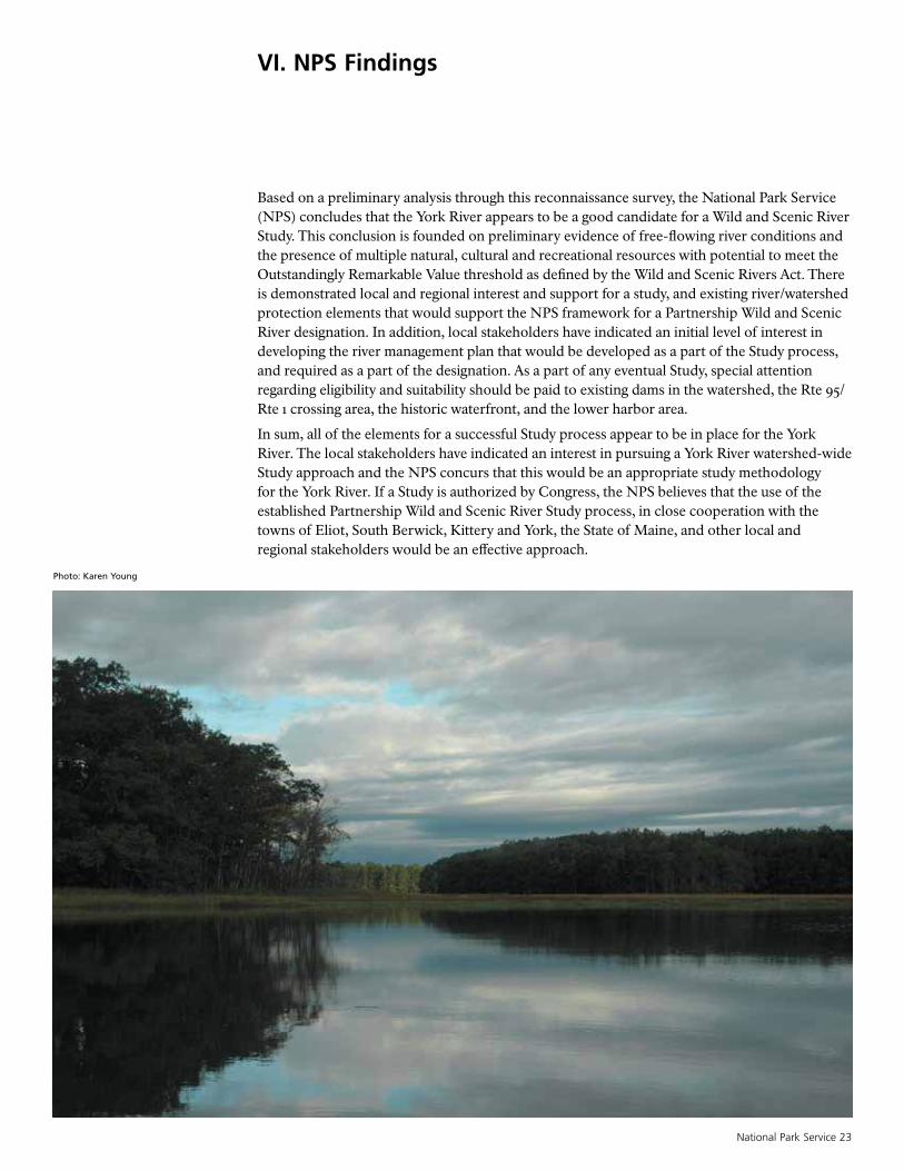
Based on a preliminary analysis through this reconnaissance survey, the National Park Service (NPS) concludes that the York River appears to be a good candidate for a Wild and Scenic River Study. This conclusion is founded on preliminary evidence of free-flowing river conditions and the presence of multiple natural, cultural and recreational resources with potential to meet the Outstandingly Remarkable Value threshold as defined by the Wild and Scenic Rivers Act. There is demonstrated local and regional interest and support for a study, and existing river/watershed protection elements that would support the NPS framework for a Partnership Wild and Scenic River designation. In addition, local stakeholders have indicated an initial level of interest in developing the river management plan that would be developed as a part of the Study process, and required as a part of the designation. As a part of any eventual Study, special attention regarding eligibility and suitability should be paid to existing dams in the watershed, the Rte 95/Rte 1 crossing area, the historic waterfront, and the lower harbor area.
In sum, all of the elements for a successful Study process appear to be in place for the York River. The local stakeholders have indicated an interest in pursuing a York River watershed-wide Study approach and the NPS concurs that this would be an appropriate study methodology for the York River. If a Study is authorized by Congress, the NPS believes that the use of the established Partnership Wild and Scenic River Study process, in close cooperation with the towns of Eliot, South Berwick, Kittery and York, the State of Maine, and other local and regional stakeholders would be an effective approach.
Photo: Karen Young
24 Wild and Scenic River Reconnaissance Survey of the York River December 2013
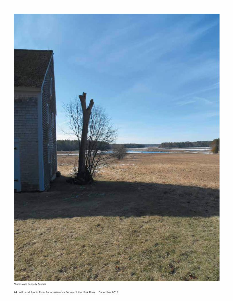
Photo: Joyce Kennedy Raymes


National Park ServiceU.S. Department of the Interior
Wild and Scenic River Reconnaissance Survey of the York River