williston, north dakota pud zoning & preliminary plat...
TRANSCRIPT
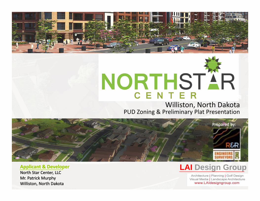
Williston, North DakotaPUD Zoning & Preliminary Plat PresentationPUD Zoning & Preliminary Plat Presentation
Prepared by:Prepared by:
Applicant & DeveloperApplicant & DeveloperNorth Star Center, LLCNorth Star Center, LLCMr. Patrick MurphyMr. Patrick MurphyWilliston, North DakotaWilliston, North Dakota
LAI Design Group

Project IntroductionPurpose • Modify configuration of land areas to simplify and
control land use transitions• Adjust building maximum heights• Integrate design controls• Integrate design controls
Rational for PUD• Improve design controls (began as traditional
rezoning)• Modify plan to create improved Mixed Use
Community (housing, commercial, park, streets &Community (housing, commercial, park, streets & traffic calming)
• Provide a variety of housing options with quality controls & consideration for affordability
ADHOC Feedback• Connectivity
l k k• Bus stop & mail kiosks• Simplify housing transitions• Zero lot line for duplex's• Utility easement coordination• Street Right of Way improvements• Buffer park from heavy commercial
Objective• Create a walk‐able and amenity based master planned
community that meets or exceeds City Standards and provide diverse housing and a sustainable commercial district
LAI Design Group 211/4/2013
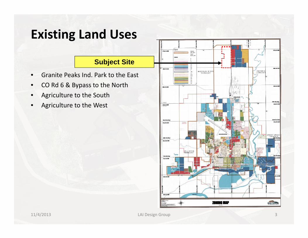
Existing Land Uses
• Granite Peaks Ind Park to the East
Subject Site
• Granite Peaks Ind. Park to the East
• CO Rd 6 & Bypass to the North
• Agriculture to the South
• A ri lt re to the West• Agriculture to the West
LAI Design Group 311/4/2013
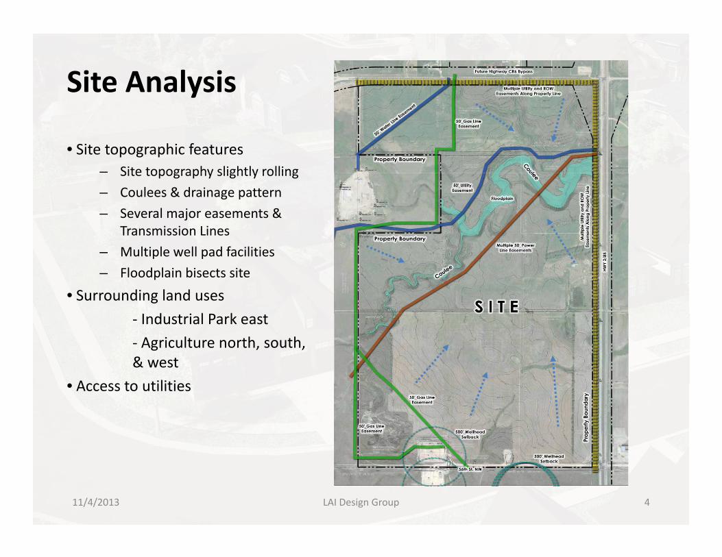
Site Analysis
• Site topographic features– Site topography slightly rollingSite topography slightly rolling
– Coulees & drainage pattern
– Several major easements & Transmission Lines
– Multiple well pad facilities
– Floodplain bisects site
• Surrounding land usesI d i l P k‐ Industrial Park east
‐ Agriculture north, south, & west
• Access to utilities• Access to utilities
11/4/2013 LAI Design Group 4

PUD Zoning Land UsesPlan Highlights• Gateway to Williston• Gateway to Williston • Connectivity • Mixed uses that support a diverse economy• Market demands exceed proposed uses
Land Use Mix on 535 Acres• C‐2: 71.73 ac. (42% of site)C 2: 71.73 ac. (42% of site)• C‐2 Heavy Commercial : 61.58 ac. (12% of site)• R‐2: 94.98 ac. (18% of site)• R‐4: 74.94 ac. (14% of site)• P&OS‐74.95 ac. (14% of site)• Public ROW – 2.9 ac. (1% of site)
• P&OS – P‐74.95 ac provided, 53.5 ac required
Development Summary• Commercial 1,966,122 SF• Heavy Commercial 804,400 SF• MF/SFA/Condo/Townhouse 1549 units• MF/SFA/Condo/Townhouse 1549 units• Twin Homes/Single Family lots 475 units
• Total unit count 2024
• Total Commercial 2,770,852SF
k• Park & Open space 74.95 ac
• Average Gross Density = 3.78 Du/Acre
• Average Net Density = 11.9 Du/Acre
LAI Design Group 511/4/2013
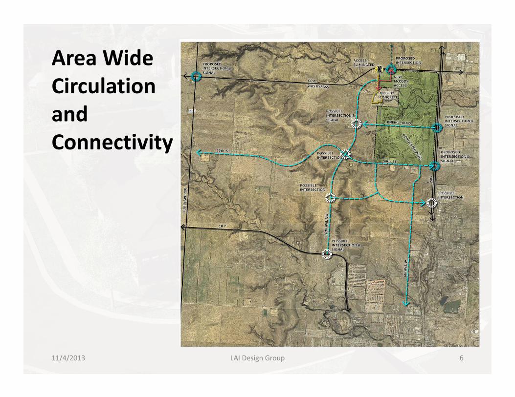
Area WideCirculation and Connectivity
LAI Design Group 611/4/2013
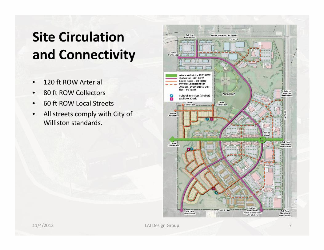
Site Circulation and Connectivity
• 120 ft ROW Arterial
• 80 ft ROW Collectors
• 60 ft ROW Local Streets
• All streets comply with City of Williston standards.
LAI Design Group 711/4/2013
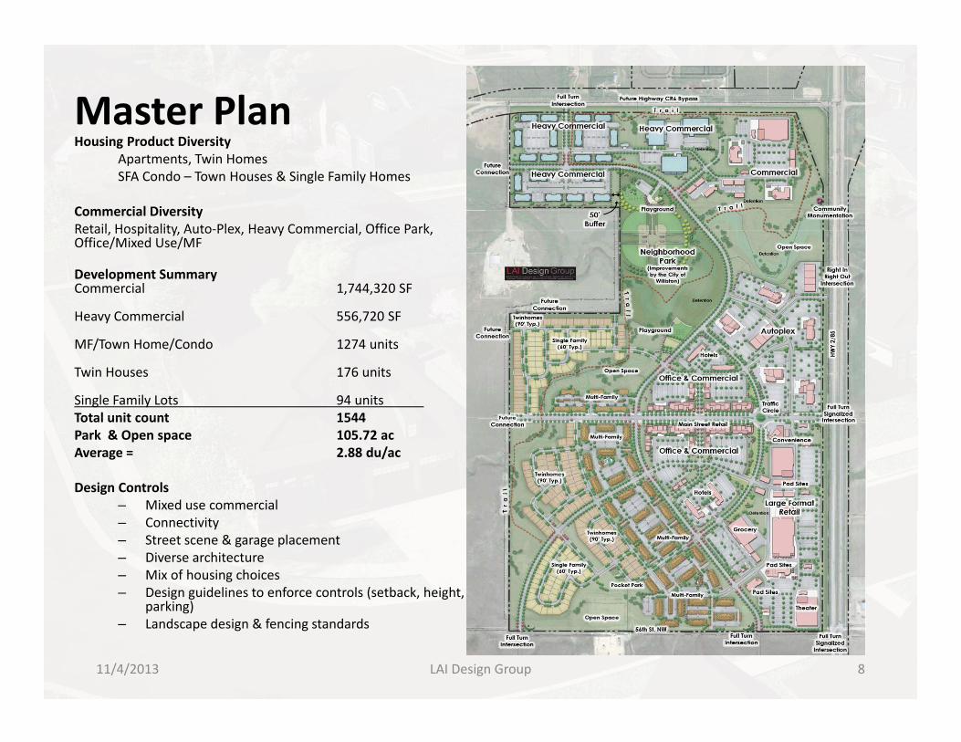
Master PlanH i P d Di iHousing Product Diversity
Apartments, Twin HomesSFA Condo – Town Houses & Single Family Homes
Commercial DiversityRetail Hospitality Auto‐Plex Heavy Commercial Office ParkRetail, Hospitality, Auto Plex, Heavy Commercial, Office Park, Office/Mixed Use/MF
Development SummaryCommercial 1,744,320 SF
Heavy Commercial 556,720 SF
MF/Town Home/Condo 1274 units
Twin Houses 176 units
Single Family Lots 94 unitsTotal unit count 1544Total unit count 1544Park & Open space 105.72 acAverage = 2.88 du/ac
Design Controls– Mixed use commercial – Connectivity– Street scene & garage placement– Diverse architecture– Mix of housing choices– Design guidelines to enforce controls (setback, height,
parking)parking)– Landscape design & fencing standards
LAI Design Group 811/4/2013

Multifamily Housing Design Standards
LAI Design Group 911/4/2013

Building Height Controls
LAI Design Group 1011/4/2013

Building Height ControlsStepped Changes in Height
• 35ft for Single Family & Twin Home
• 35 ft – 45ft for SF‐MF
• 45ft‐75ft for MF
• 75ft‐100ft for MF‐Commercial
LAI Design Group 1111/4/2013

Master Utility Plan
• Water
• Sewer
• Drainage
• Existing Easements
LAI Design Group 1211/4/2013

Phasing PlanPhase 1 South
Phase 2 MiddlePhase 2 Middle
Phase 3 North
Sewer & Water Utilities are connected under Hwy 2/85 and capacities available for each phase
LAI Design Group 1311/4/2013

Parks & Trail Master PlanSummary
51 38 A i OS• 51.38 ac Active OS
• 54.34 ac Passive OS
Total 105.72 provided vs. 53.50ac req’d
Potential amenity program (by WPRD)Potential amenity program (by WPRD)• Picnic areas, walking paths, sports fields,
community center, signage, landscaping, benches, gardens, barbecue & fire pits.
Benefits• Lifestyle, community, walk‐ability,
contiguous maintenance areas, usable facilities, creation of place‐making , p gelements.
LAI Design Group 1411/4/2013

Community Central Park
LAI Design Group 15
Potential park improvements by WPRD11/4/2013
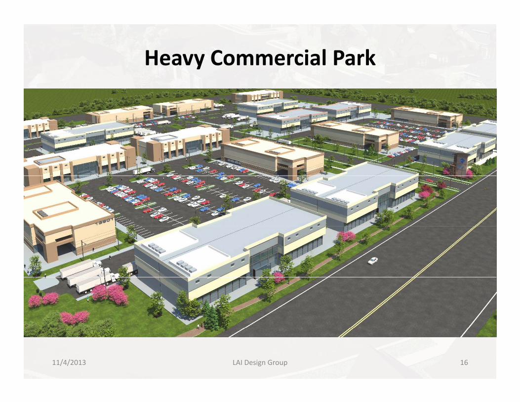
Heavy Commercial Park
LAI Design Group 1611/4/2013

Office Park/Commercial
LAI Design Group 1711/4/2013

Auto‐Plex/Commercial
LAI Design Group 1811/4/2013

Commercial/Office Mixed Use
LAI Design Group 1911/4/2013

Commercial Shopping
LAI Design Group 2011/4/2013

Mixed Residential Neighborhood
LAI Design Group 2111/4/2013

Single Family Neighborhood
LAI Design Group 2211/4/2013
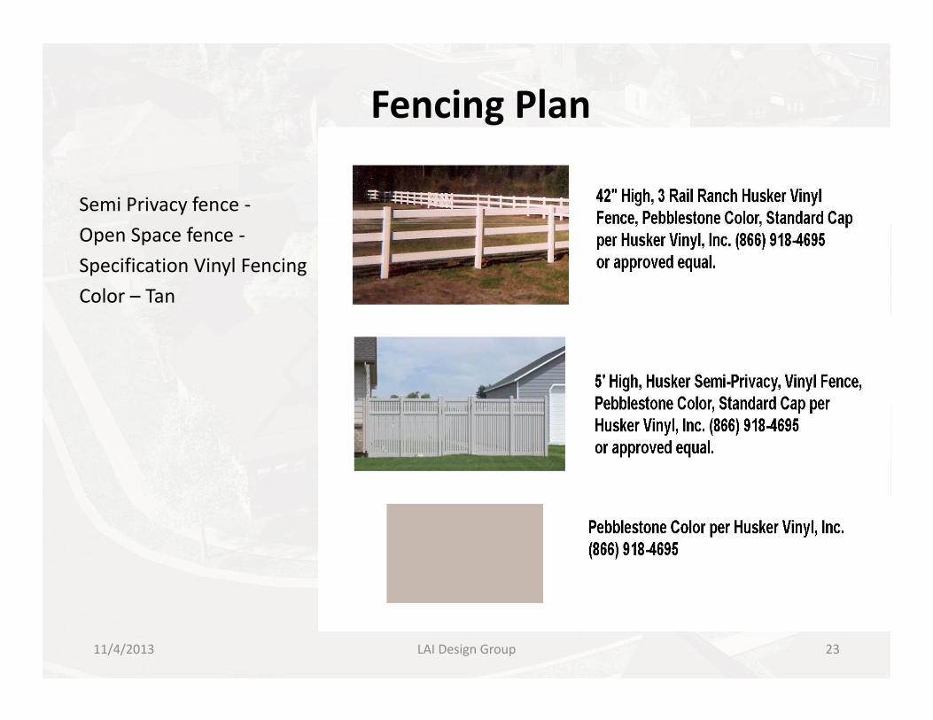
Fencing Plan
Semi Privacy fence ‐
Open Space fence ‐
Specification Vinyl Fencing
Color – Tan
LAI Design Group 2311/4/2013
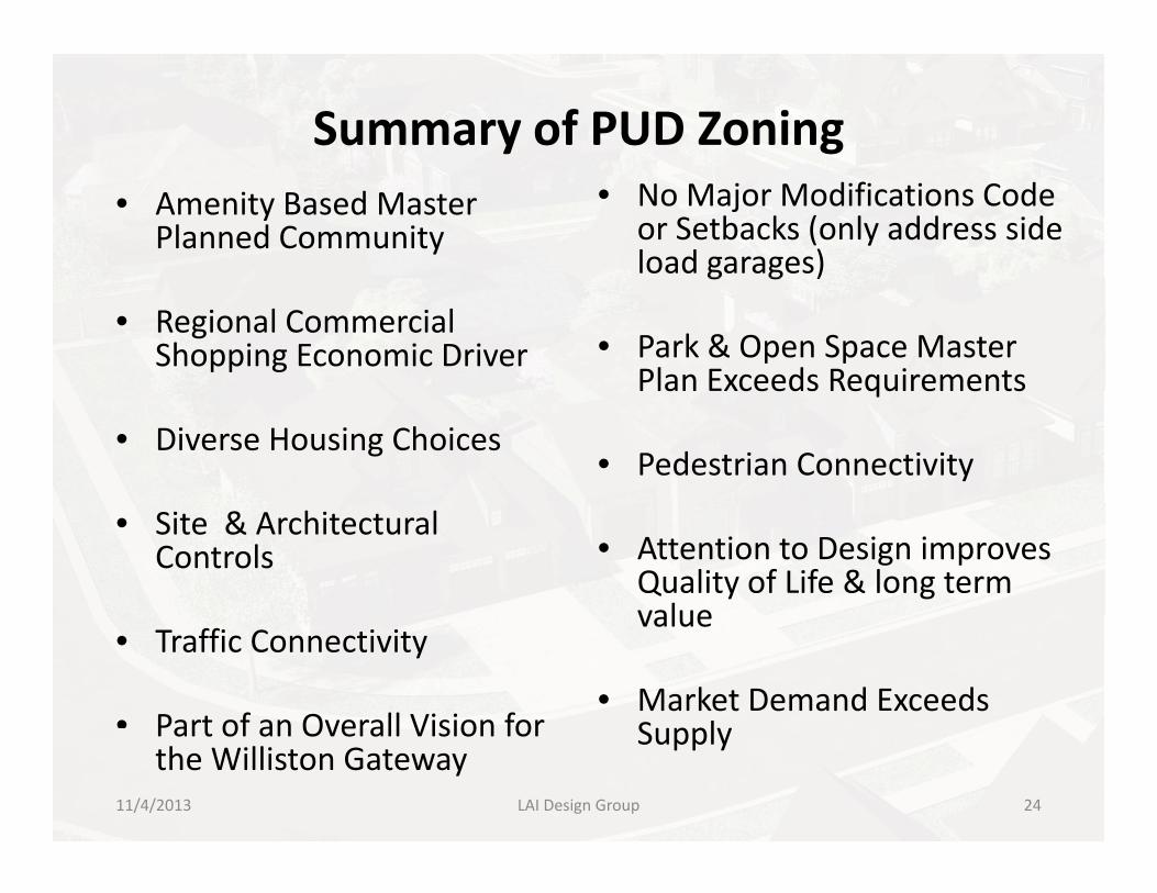
Summary of PUD Zoning• Amenity Based Master
Planned Community• No Major Modifications Code
or Setbacks (only address side load garages)
• Regional Commercial Shopping Economic Driver
g g )
• Park & Open Space Master Plan Exceeds Requirements
• Diverse Housing Choices
Plan Exceeds Requirements
• Pedestrian Connectivity
• Site & Architectural Controls • Attention to Design improves
Quality of Life & long term value
• Traffic Connectivity
• Part of an Overall Vision for
value
• Market Demand Exceeds SupplyPart of an Overall Vision for
the Williston GatewaySupply
LAI Design Group 2411/4/2013

h k f dThank you for your consideration of our Proposalof our Proposal
LAI Design Group 2511/4/2013