working with imagery in arcgis10 - nebraska gis/lis with imagery in arcgis10 jennifer kuntz....
TRANSCRIPT

Working with Imagery in ArcGIS 10
Jennifer Kuntz
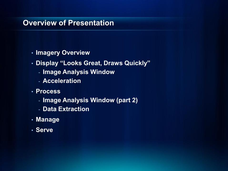
Overview of Presentation
• Imagery Overview• Display “Looks Great, Draws Quickly”
- Image Analysis Window- Acceleration
• Process- Image Analysis Window (part 2)- Data Extraction
• Manage• Serve
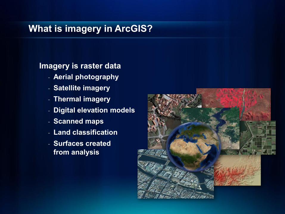
What is imagery in ArcGIS?
Imagery is raster data- Aerial photography- Satellite imagery- Thermal imagery- Digital elevation models- Scanned maps- Land classification- Surfaces created
from analysis
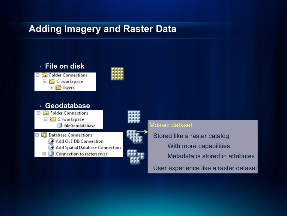
Adding Imagery and Raster Data
• File on disk
• Geodatabase
Mosaic dataset
• Stored like a raster catalog• With more capabilities• Metadata is stored in attributes
• User experience like a raster dataset
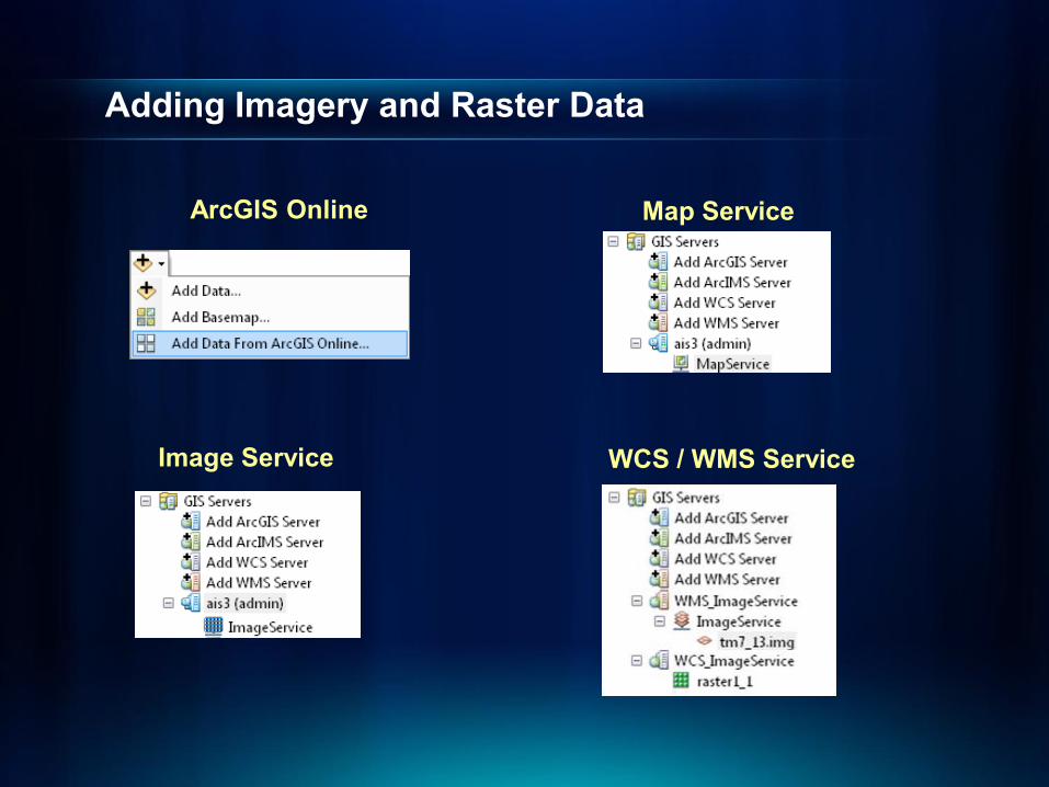
Adding Imagery and Raster Data
ArcGIS Online Map Service
Image Service WCS / WMS Service

Raster Properties
• Data source- Type of file and location
• Raster information- Information about the pixels
• Extent- Top, bottom, left and right extents
• Spatial reference- Coordinate system information
• Statistics- Min, max, mean, and standard deviation (per band)

Raster Datasets - Properties
Unstretched:Min: 24
Max: 241
Stretched:Min: 0Max: 255
• Pyramids- Reduced resolution copies of the source- Improve display performance- Support three resample methods- Can be compressed (new)
• set in GeoProcessing environment
• Statistics- Enhance visual display
• Build Pyramids and Statistics tool (new)
Nearest neighbor
Bilinear interpolation
Cubic convolution
Factor of 2

Display
Displaying Raster Data
• Renderers- Display your data with a renderer that makes your data
look good
• Image Analysis window- Common capabilities in one easy to access location

Stretched renderer
• Often used for elevation, satellite and aerial imagery• Default: when raster has more than 25 unique values
- Stretches values along a color ramp

Stretched rendererNEW at ArcGIS 10
• Percent clip stretch
• Advanced labeling

RGB renderer
• Often used for satellite imagery and aerial photos• Default: Raster has 3 or more bands
- Displays each band through a different color (Red, Green, and Blue)
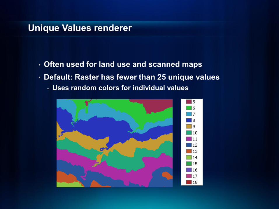
Unique Values renderer
• Often used for land use and scanned maps• Default: Raster has fewer than 25 unique values
- Uses random colors for individual values

Unique Values rendererNEW at ArcGIS 10
• Create a custom CLR file

Colormap renderer
• Often used for land use and soil maps for consistency
• Default: Colormap is present- Uses pre-chosen colors for individual values
6 =
1 = = 255 , 255 , 50 = 0 , 0 , 175
3 = = 255 , 175 , 20 4 = = 135 , 90 , 0 5 = = 120 , 215 , 0
= 0 , 100 , 15 7 = = 100, 220 , 255
2 =
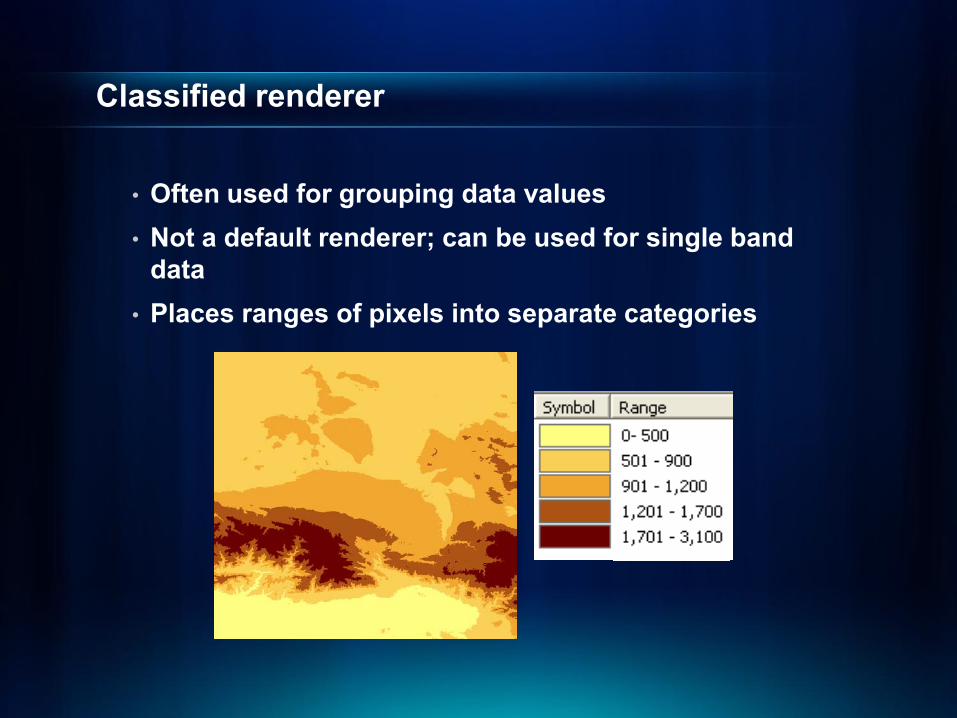
Classified renderer
• Often used for grouping data values• Not a default renderer; can be used for single band
data• Places ranges of pixels into separate categories
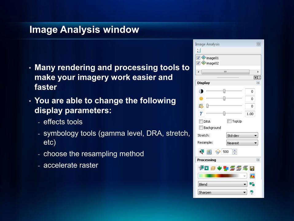
Image Analysis window
• Many rendering and processing tools to make your imagery work easier and faster
• You are able to change the following display parameters:
- effects tools- symbology tools (gamma level, DRA, stretch,
etc)- choose the resampling method- accelerate raster

Raster Display

Processing and Analyzing

Processing raster data in ArcGIS
• Combining bands• Clipping• Mosaicking• Pansharpening• Orthorectifying• …
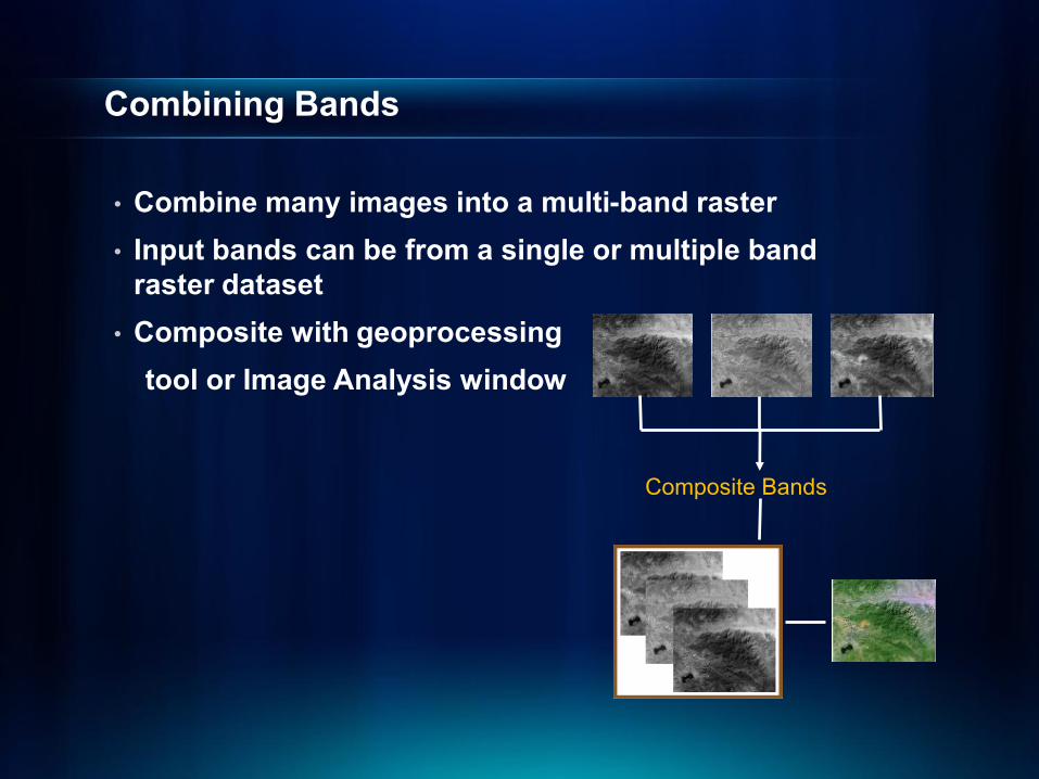
Combining Bands
• Combine many images into a multi-band raster• Input bands can be from a single or multiple band
raster dataset• Composite with geoprocessing
tool or Image Analysis window
Composite Bands

Clipping
• Clip a portion of raster to fit your study area• Clip with geoprocessing tools or with Export Data
dialog window• Clip on-the-fly with Image Analysis window
- Also able to mask (instead of clip)
Clip

Mosaicking
• Combine two more adjacent and overlapping rasterstogether
• Many mosaic geoprocessing tools:- Workspace to raster dataset- Raster catalog to raster dataset
• Mosaicking on-the-fly- Mosaic button on the Image Analysis window- Mosaic dataset (virtual mosaic)

Pansharpening
• Fuse a low resolution RGB image with a high resolution panchromatic image
- Output is a high resolution color image
• Geoprocessing tool, raster symbology tab, or Image Analysis window
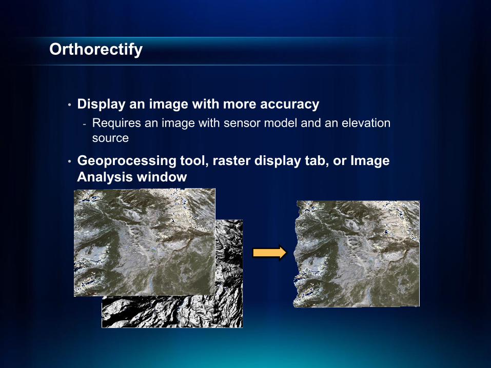
Orthorectify
• Display an image with more accuracy- Requires an image with sensor model and an elevation
source
• Geoprocessing tool, raster display tab, or Image Analysis window

Image Analysis window
Clip Export data
Composite bands
NDVI
Colormap to RGB
Difference
Pan-sharpening
Orthorectify
MaskShaded relief
Mosaic
Filter
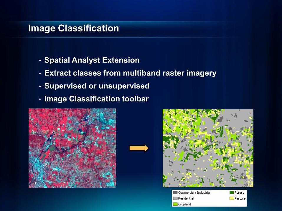
Image Classification
• Spatial Analyst Extension• Extract classes from multiband raster imagery• Supervised or unsupervised• Image Classification toolbar
Raster Analysis

Manage

Imagery Management Challenges
• Many sources
• High resolution and large volume
• Requirements: - Store efficiently- Easy to search- Fast to process- Accessible

ArcGIS 10 Image Management Recommendations
• Manage individual images using raster datasets
• Manage image collections using new mosaic datasets

Licensing
• Mosaic Dataset- View: ArcView license- Create / edit: ArcInfo/ArcEditor license- Serve: ArcGIS server + Image extension license
• Raster Dataset- View: ArcView license- Create / edit: ArcInfo/ArcEditor license- Serve: ArcGIS server

Raster Datasets – Recommendations
• Use it “as is”- Especially for compressed formats
• Better performance- Convert to tiled TIFF using the CopyRaster tool- JPEG compressed TIFF if lossy compression is allowed
- File Geodatabase raster dataset is also a comparable format
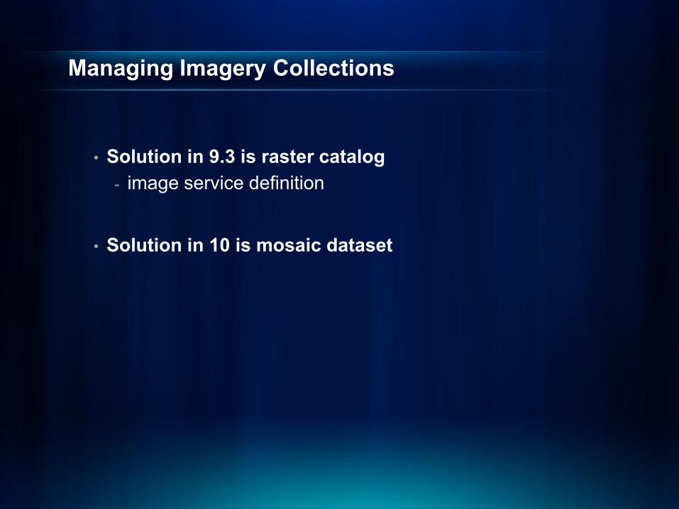
Managing Imagery Collections
• Solution in 9.3 is raster catalog- image service definition
• Solution in 10 is mosaic dataset

Raster Catalogs
• A data model for managing a collection of images in 9.3
- Stores footprints and rasters in a table- Managed/unmanaged
• Uses- Catalog images and maintain overlaps- Search based on attributes and location- Access selected members- Display footprint/pixel view
• Limitations- Do not support sensor data and metadata- No overview- Can’t be served by ArcGIS server

Mosaic Datasets - New Geodatabase Data Model
• Manage and serve collection of images- Supported in SDE/FGDB/PGDB- Does not load source pixels into geodatabase,
instead references imagery
• Manage data with an internal raster catalog
• Displays like a raster dataset
• On-the-fly image processing
Mosaic Dataset

Mosaic Dataset rendering
• Footprint view - View the minimum bounding rectangle for each raster

Mosaic Dataset rendering
• Rendering pixels – similar to a raster dataset- Level of detail – like scale dependency- Overviews – like pyramids
1 : 100 000
1 : 25 000
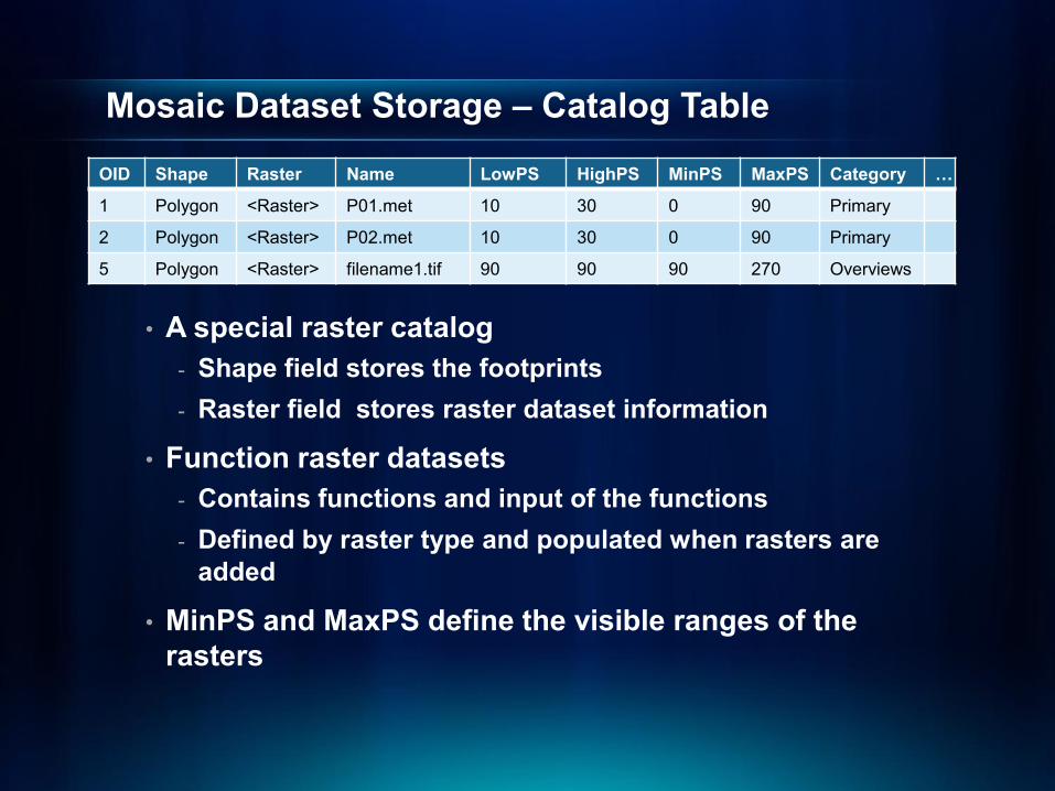
Mosaic Dataset Storage – Catalog Table
• A special raster catalog - Shape field stores the footprints- Raster field stores raster dataset information
• Function raster datasets- Contains functions and input of the functions- Defined by raster type and populated when rasters are
added
• MinPS and MaxPS define the visible ranges of the rasters
OID Shape Raster Name LowPS HighPS MinPS MaxPS Category …
1 Polygon <Raster> P01.met 10 30 0 90 Primary
2 Polygon <Raster> P02.met 10 30 0 90 Primary
5 Polygon <Raster> filename1.tif 90 90 90 270 Overviews

Mosaic Dataset – Mosaic Rules
• Control which raster/pixels to display
• Mosaic method to sort the rasters- Closest to center (default)- By attribute- Closest to nadir- North west- Seamline
• Mosaic operator to resolve the overlaps- First/Min/Max/Mean/Blend
Closest to the center
By attribute: cloud cover
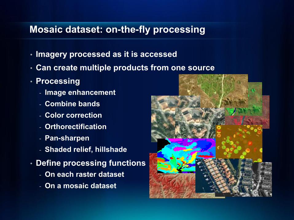
Mosaic dataset: on-the-fly processing
• Imagery processed as it is accessed• Can create multiple products from one source• Processing
- Image enhancement- Combine bands- Color correction- Orthorectification- Pan-sharpen- Shaded relief, hillshade
• Define processing functions- On each raster dataset- On a mosaic dataset
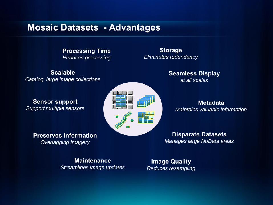
Mosaic Datasets - Advantages
StorageEliminates redundancy
Preserves informationOverlapping Imagery
MaintenanceStreamlines image updates
Image QualityReduces resampling
ScalableCatalog large image collections
Sensor support Support multiple sensors
Seamless Displayat all scales
Processing TimeReduces processing
MetadataMaintains valuable information
Disparate DatasetsManages large NoData areas
Data Management Recommendations
• Use your existing data model if they continue to meet your existing application requirements
• Use the mosaic dataset for new applications
• Migrate to the mosaic dataset to take advantages of its new features
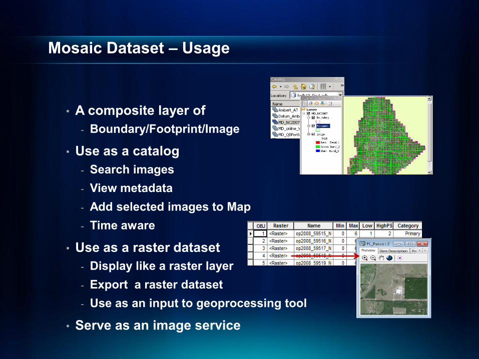
Mosaic Dataset – Usage
• A composite layer of- Boundary/Footprint/Image
• Use as a catalog- Search images- View metadata- Add selected images to Map- Time aware
• Use as a raster dataset- Display like a raster layer- Export a raster dataset- Use as an input to geoprocessing tool
• Serve as an image service
Using Mosaic Datasets
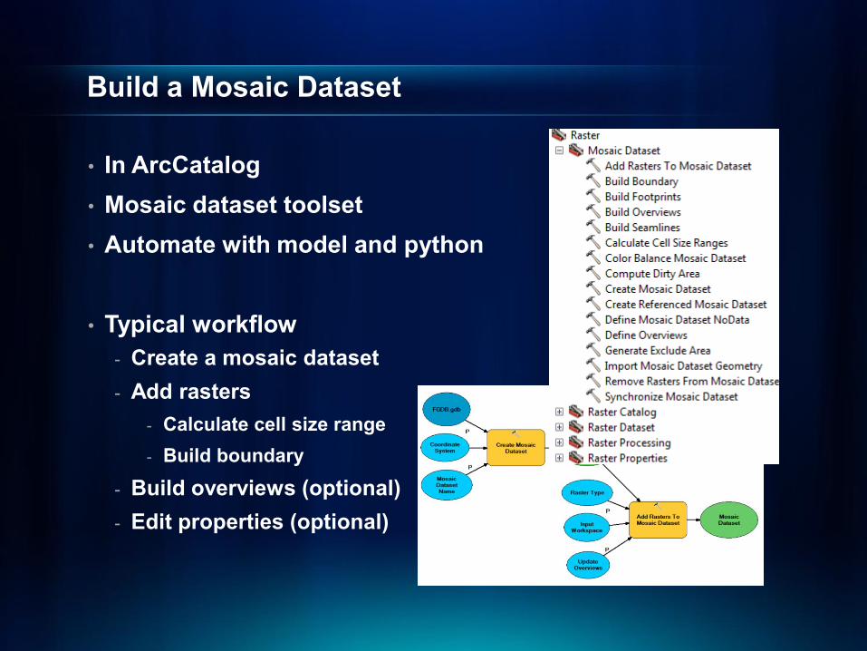
Build a Mosaic Dataset
• In ArcCatalog• Mosaic dataset toolset• Automate with model and python
• Typical workflow- Create a mosaic dataset- Add rasters
- Calculate cell size range- Build boundary
- Build overviews (optional)- Edit properties (optional)

Build a Mosaic Dataset - Create
• Create table schema and define pixel properties
• Spatial reference (required)- Used in footprints and overviews- Define a proper one- Datum consideration
• Number of bands- Taken from the first added raster
• Pixel type- Taken from the first added raster

Build a Mosaic Dataset – Add Rasters
• Use Add Rasters to Mosaic Dataset tool
• Choose a raster type- Define the format to crawl- Metadata to read and fields to create- Processes to apply
• Support many raster types- Raster Dataset/NITF/CADRG/etc.- QB/IKONOS/GeoEYE/WorldView/etc- Web Services- Table/Image Service Definition
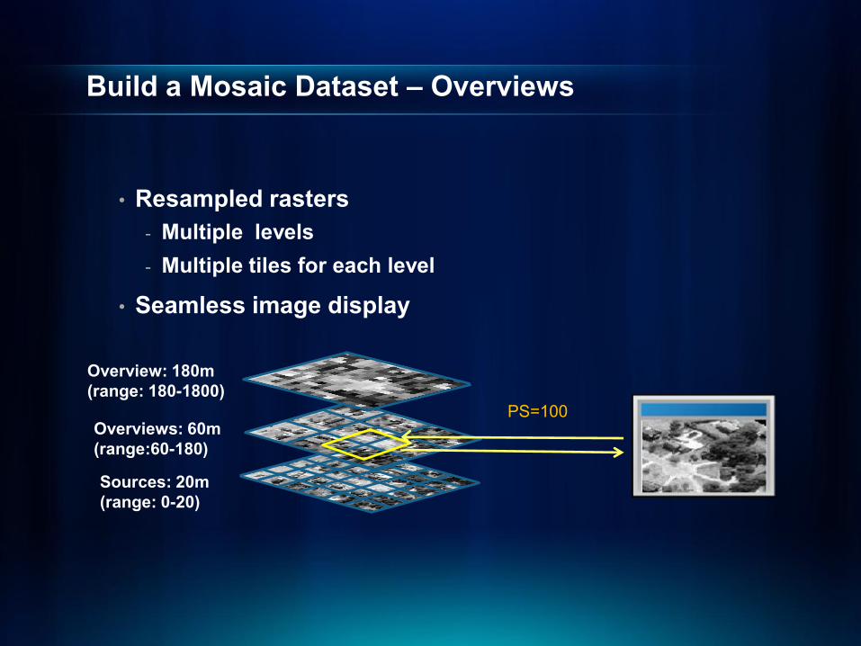
Build a Mosaic Dataset – Overviews
• Resampled rasters- Multiple levels- Multiple tiles for each level
• Seamless image display
Overview: 180m(range: 180-1800)
Sources: 20m(range: 0-20)
Overviews: 60m(range:60-180)
PS=100

Build a Mosaic Dataset – Overviews (Cont…)
• Build Overviews tool- Generate overview images
• Define Overviews tool - Redefine the default parameters
• Optionally add an external raster as overview
OID Shape Raster Name LowPS HighPS MinPS MaxPS Category …
1 Polygon <Raster> P01.met 10 30 0 90 Primary
2 Polygon <Raster> P02.met 10 30 0 90 Primary
3 Polygon <Raster> filename1.tif 90 90 90 900 Overviews
4 Polygon <Raster> filename2.tif 90 90 90 900 Overviews
Default overview parameters:TIFF format with JPEGSize is 5120x5120 Factor of 3Overview location
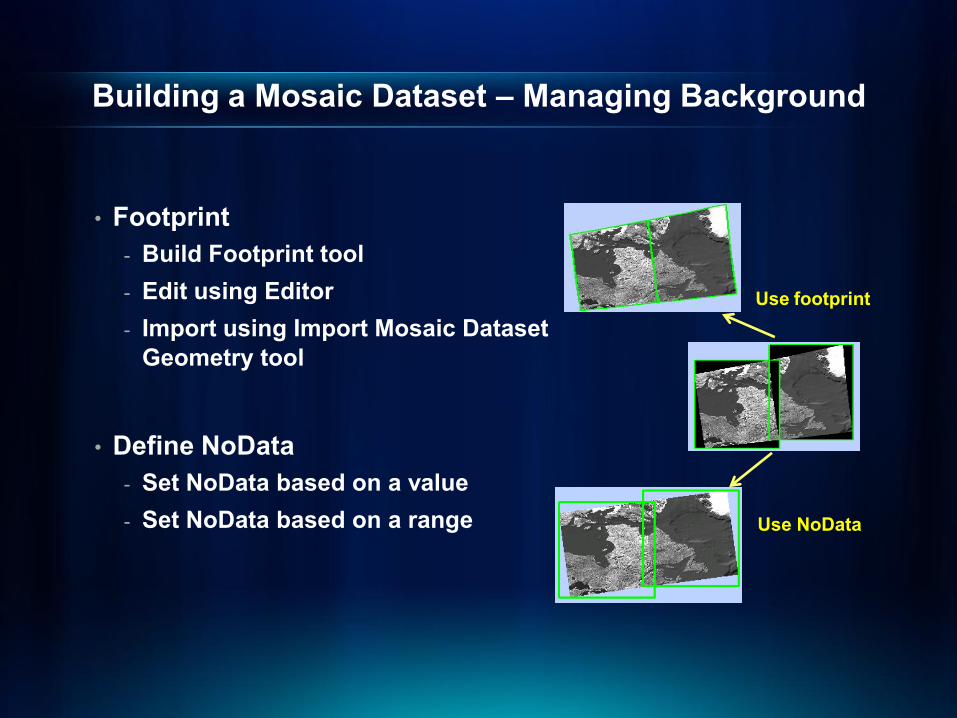
Building a Mosaic Dataset – Managing Background
• Footprint- Build Footprint tool- Edit using Editor- Import using Import Mosaic Dataset
Geometry tool
• Define NoData- Set NoData based on a value- Set NoData based on a range
Use footprint
Use NoData
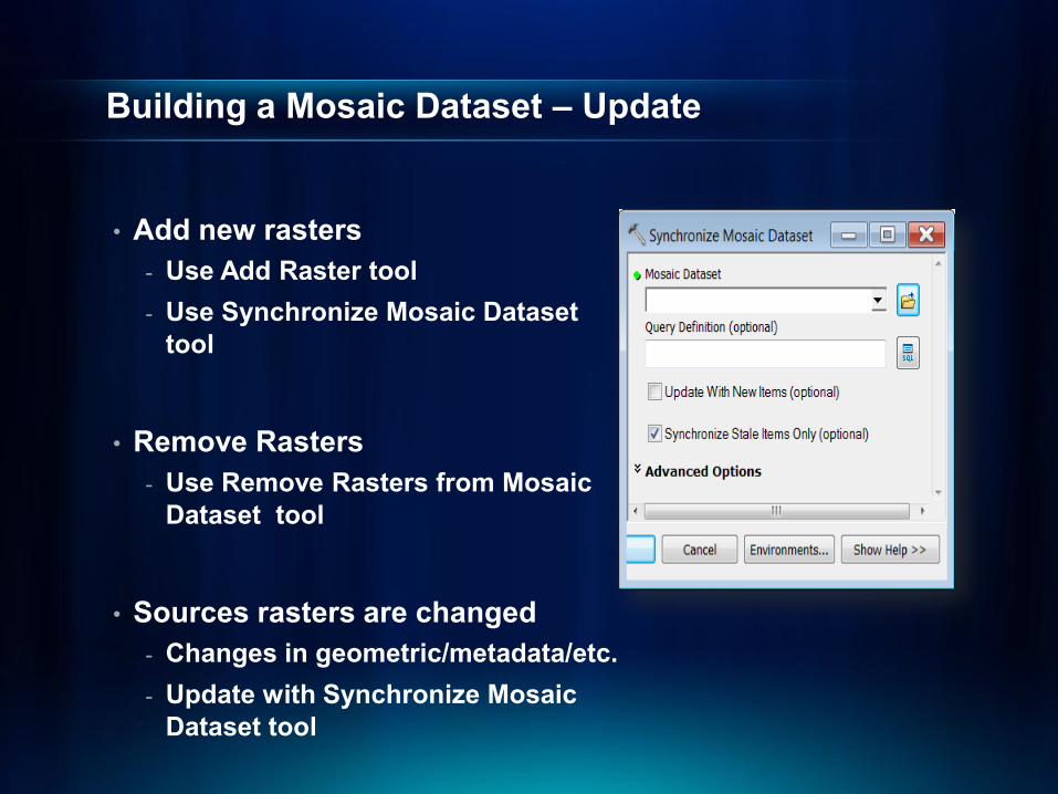
Building a Mosaic Dataset – Update
• Add new rasters- Use Add Raster tool - Use Synchronize Mosaic Dataset
tool
• Remove Rasters- Use Remove Rasters from Mosaic
Dataset tool
• Sources rasters are changed- Changes in geometric/metadata/etc. - Update with Synchronize Mosaic
Dataset tool

Mosaic Dataset – Advanced Mosaicking
• Color correction- Balance to a color surface- Balance to an existing target- Support excluded area- Color Correction window
• Seamline- Build Seamline tool- Modify seamline using Editor- Import seamline feature class
Before
After
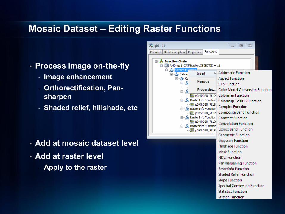
Mosaic Dataset – Editing Raster Functions
• Process image on-the-fly- Image enhancement- Orthorectification, Pan-
sharpen- Shaded relief, hillshade, etc
• Add at mosaic dataset level• Add at raster level
- Apply to the raster
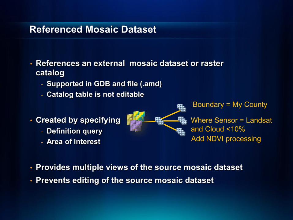
Referenced Mosaic Dataset
• References an external mosaic dataset or raster catalog
- Supported in GDB and file (.amd)- Catalog table is not editable
• Created by specifying- Definition query- Area of interest
• Provides multiple views of the source mosaic dataset• Prevents editing of the source mosaic dataset
Where Sensor = Landsatand Cloud <10%
Boundary = My County
Add NDVI processing
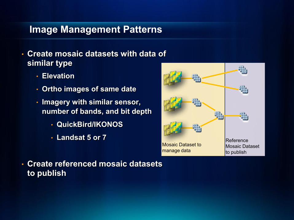
Image Management Patterns
• Create mosaic datasets with data ofsimilar type
• Elevation
• Ortho images of same date
• Imagery with similar sensor, number of bands, and bit depth
• QuickBird/IKONOS
• Landsat 5 or 7
• Create referenced mosaic datasets to publish
Mosaic Dataset to manage data
Reference Mosaic Dataset to publish

Build Mosaic Datasets

Serve

Main ways to serve imagery
• Image service- Image or raster data made available by a server to a
client application
• Map service- Published map document containing an image layer
• Other- Globe service, mobile service, geodata service…

Image Service versus Map Service
Image service Map service
Serves raster data directly Serves a map document containing raster or vector data
Image service layer properties can be altered by client
• Compression• Rendering• Band combinations
Client views map service as it was designed
Client cannot change layer properties
Can be saved as a layer and used as a data source
Can build cache

What can you do with an image service?
• Use it as an image (visual analysis)• Use it as raster data (pixel analysis)• Access it as a catalog (mosaic dataset)

Image service source data
• Data sources- Raster datasets- Mosaic datasets new
- Requires ArcGIS Server Image Extension
- Raster or mosaic layers - To control rendering- Preset some layer properties- Predefined query

Publishing an image service
• Same process as publishing any service with ArcGIS Server
- via ArcCatalog- via Server Manager
• Properties unique to image services- Capabilities- Parameters
• Some capabilities are specific to the data
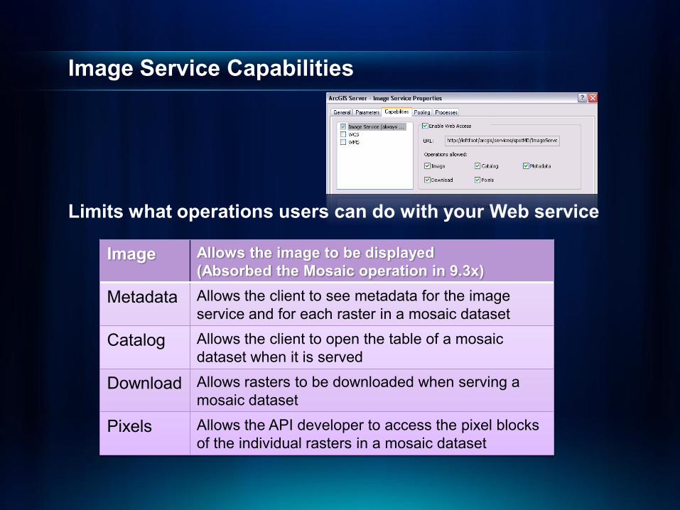
Image Service Capabilities
Limits what operations users can do with your Web service
Image Allows the image to be displayed (Absorbed the Mosaic operation in 9.3x)
Metadata Allows the client to see metadata for the image service and for each raster in a mosaic dataset
Catalog Allows the client to open the table of a mosaic dataset when it is served
Download Allows rasters to be downloaded when serving a mosaic dataset
Pixels Allows the API developer to access the pixel blocks of the individual rasters in a mosaic dataset

Image Service Parameters
• Control the image data• Imagenew, Catalognew, Downloadnew, and Output• Parameters depend on the input for the image
service• Some can be altered by the server administrator• Server administrator cannot exceed limitations for
some of the parameters- Such as: allowed mosaic methods, the maximum
number of rasters per mosaic
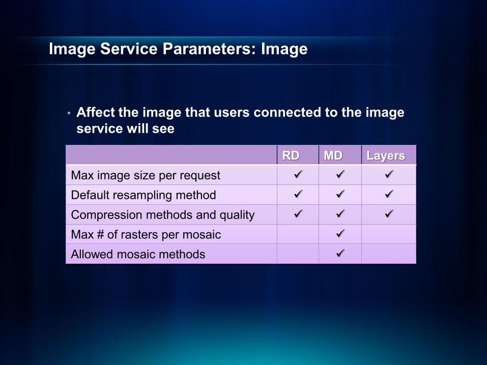
Image Service Parameters: Image
• Affect the image that users connected to the image service will see
RD MD LayersMax image size per request
Default resampling method
Compression methods and quality
Max # of rasters per mosaic
Allowed mosaic methods

How can you access an image service?
• ArcGIS Desktop• ArcGIS Explorer• Web APIs (Silverlight, Flex, JavaScript)• ArcGIS.com• REST, SOAP• WMS, WCS, KML• 3rd Party Applications

Serving and Accessing Image Services

Resources
Want to Learn More?
• Video.esri.com- Using Imagery and Raster Data in ArcGIS- What's New in Imagery and Raster at ArcGIS 10
• Training.esri.com - Recorded Training Seminars
- Visualizing and Analyzing Imagery with ArcGIS 10- Managing Imagery with ArcGIS 10
- Instructor-Led Training- Managing Imagery Using ArcGIS
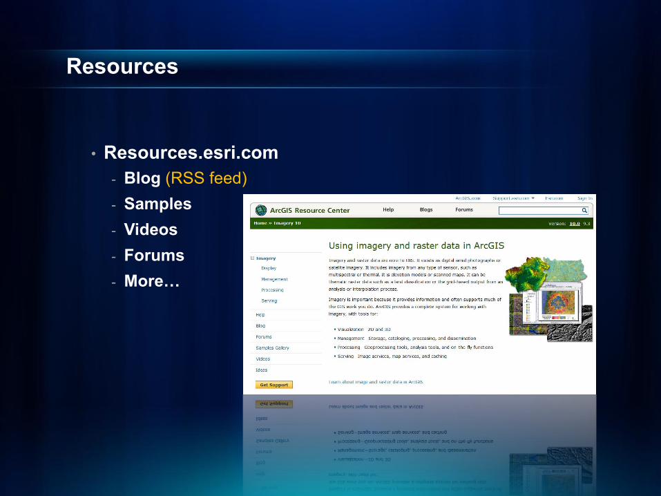
Resources
• Resources.esri.com- Blog (RSS feed)- Samples- Videos- Forums- More…
