wreck inspection report caprice -...
TRANSCRIPT

Wreck Inspection Report The Caprice
Dates Inspected: 06/02/2006 and 07/02/2006
Zach Woodford Dianna Zwart Debra Shefi
Amanda Hale
Maritime Archaeology Field School Flinders University Archaeology Department

2
Wreck Inspection Report – The Caprice 1 Site Name ........................................................................................................... 3 2 Date of Inspection.............................................................................................. 3 3 Personnel............................................................................................................ 3 4 Approximate Location...................................................................................... 3 5 Access to Site...................................................................................................... 3 6 GPS..................................................................................................................... 4 7 Compass Bearings ............................................................................................. 4 8 Visual Transits................................................................................................... 4 9 Transit Photographs ......................................................................................... 4 10 History of Caprice.......................................................................................... 5 11 Water Depth .................................................................................................. 5 12 Water Visibility ............................................................................................. 5 13 Water Temperature ...................................................................................... 5 14 Local Flora..................................................................................................... 6 15 Local Fauna ................................................................................................... 6 16 Seabed Composition...................................................................................... 6 17 Equipment used in Survey ........................................................................... 6 18 Methodology Used in Survey ....................................................................... 6 19 Limitations..................................................................................................... 8 20 Plan of Site ..................................................................................................... 8 21 Site Photographs ........................................................................................... 8 22 Description of Site ......................................................................................... 9 23 Direction of Lie.............................................................................................. 9 24 Is the wreck wood, iron or composite.......................................................... 9 25 Wooden Remains........................................................................................... 9 26 Anchors .......................................................................................................... 9 27 Mast or Rigging Remains ........................................................................... 10 28 Other Contents, Describe ........................................................................... 10 29 Site Condition .............................................................................................. 10 30 The Wreck Site Is Affected By................................................................... 11 31 Recommendations ....................................................................................... 11 32 References .................................................................................................... 12 33 Figures.......................................................................................................... 13

3
1 Site Name
Caprice
2 Date of Inspection
6 Feb., 7 Feb. 2006
3 Personnel
Team One: Zach Woodford, Dianna Zwart, Amanda Hale, Debra Shefi.
Supervisors: James Hunter, Peta Knott, Toni Massey.
4 Approximate Location
155 meters from shore, 10 meters West of Dutton Bay Jetty (see Fig. 1). Mount
Dutton Bay, Eyre Peninsula, South Australia.
5 Access to Site
The team walking down the jetty fully kitted in SCUBA gear obtained access to the
site. The BCD and tank were then removed and lowered by rope from the jetty at
pylon 30 into the water. Team members entered the water via a ladder at pylon 31,
where the jetty expands and then donned their gear in the water. This required only
a few meter swim to the wreck location. An alternative approach is to enter the
water by stairs at the beginning of the jetty and making a 155 meter surface swim to
the wreck site.

4
6 GPS
GPS points are to Pylon 30 on the Jetty 10 meters East of the wreck site. Datum
WGS 84: Lat: S34º 31’ 59.3” Long: E135º 24’ 54.8”
Easting: 539632, Northing: 6178643
7 Compass Bearings
From Jetty Pylon Number 30, 10m East of wreck: 1st transit - 20º down Jetty to
furthest West window of the Woolshed owner’s home. 2nd transit - 296º to large
white house on waterfront. 3rd transit - 154º to radio tower on hill top.
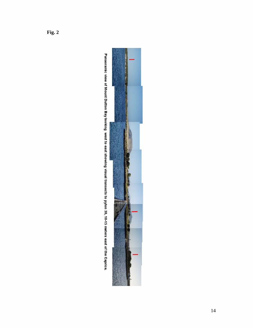
8 Visual Transits
From Pylon 30 on Jetty, 10m East of Jetty. 1st - To Large white house on waterfront
one finger to left of small tan shed to the north. 2nd – Electric pole one finger to
right of tan rainwater tank of the Woolshed owner’s home. 3rd – Eastern peak of
public restroom roof and aligning electric pole.
9 Transit Photographs
See Fig. 2

5
10 History of Caprice
There is very little historical information on the Caprice; the majority of information
comes as an oral history. Flinders University Technical officer, Rick Bullers, was
able to provide the following information: The Caprice was a cutter type fishing
vessel owned by Paddy Lynch. The ship’s recorded measurements were: length:
8.8m, breadth: 2.9m, depth: 1.7m. She operated out of Mount Dutton Bay as part of
the fisheries industry. The cause of loss is attributed to the boat dragging its anchor
and smashing against the Mount Dutton Bay Jetty. The boat was subsequently
burned and abandoned.
11 Water Depth
1.2-1.5 meters
12 Water Visibility
Visibility was quite variable on the site. The disturbance of the seabed resulted in
an immediate reduction of visibility. In the mornings, the visibility tended to be the
best at 5-7meters. This could be reduced to only 1m after divers entered the water.
Strong winds also caused waves with white caps whose energy would disrupt the
seabed resulting in poor visibility. Sea grasses floating in the water made visibility
poor for photographs. The slight westerly current would transport a portion of the
silt away; however, this was at a slow pace.
13 Water Temperature
18-21ºC

6
14 Local Flora
Various varieties of sea grasses are present and cover approximately 70% of the
seabed.
15 Local Fauna
Local Fauna on the site include, but are not limited to: Octopus, Crabs, pipefish,
globefish and Jellyfish
16 Seabed Composition
The seabed is mostly a sandy/silty mixture. Approximately 20cm below the sand is
a hard limestone layer.
17 Equipment used in Survey
2x 30m tapes, 2x10m tapes, 20m carabineer ending lead lined rope, 2x starpickets,
2x tent pegs, hand sledge, Air-probe, Olympus C-5050 digital camera and housing,
underwater slates, mylar, pencils, and water dredge.
18 Methodology Used in Survey
A baseline was set up parallel to the wreck (running 250º) approximately 1 meter
North of the Caprice. The datum for this baseline was trilaterated using pylon
numbers 28 (P28) and 30 (P30) from the Jetty. The distance from P28 was 7.04m,
from P30 was 9.05m and the distance from P28 to P30 was 12.42m.

7
A Star-picket was hammered into the seabed with a hand sledge where the two tapes
crossed; this point became the initial datum. A lead line rope was stretched tight at
an angle of 250º, parallel to the Caprice, to mark the baseline and a second star-
picket was placed at the end of the rope for a second datum.
A second baseline was established by moving 5m at 160º from the primary baseline,
and using the sledgehammer placed a tent peg as a parallel datum. A tape was then
stretched at 250º for 20m and secured with a second tent peg. This gave the team a
parallel baseline 5m from the primary baseline. A photographic record of the ship
was attempted; however, visibility and sea surface conditions limited the application
of photography (see Fig. 4 to Fig. 8).
In order to determine if more structure remained of the Caprice hand fanning was
conducted in various locations on the site. An air probe survey was also conducted
to assist in determining if buried remains were present. The air probe was used at
2m intervals along both baselines with probes taking place 1m South, directly on,
and 1m North of the baseline. The main structure of the Caprice was mapped using
the baseline-offset method. Measurements were taken to all points deemed
important and necessary to producing an accurate site plan. The primary baseline
was used throughout the mapping process. Because substantial remains were
discovered by hand fanning, dredge work was authorized to commence. However,
due to mechanical failures the dredge was not employed during the team’s time on
the Caprice.

8
19 Limitations
There were several limiting factors during the course of this survey. A compressor
breakdown resulted in limited air for SCUBA diving operations. The consequence
of this was a total of 5 dives for a dive time of 5hr. 25min. The early removal of our
team to another site limited the amount of information gathered. Particularly, new
areas of structure that had been discovered by hand fanning were not mapped in.
The malfunction of the dredge system prevented its use by our team. Visibility was
often poor on the site making measuring difficult and photography nearly
impossible. The slight current at the site could also bend tapes causing inaccurate
readings. The water temperature resulted in shorter dives and a loss of focus as team
members became cold.
Human error must also be accounted for. Visibility, current, time underwater and
cold all can play factors in human error. These could be as simple as reading the
wrong number off the tape, failure to ensure a 90º angle for the offset, having the
offset at an elevation to the baseline, lack of tightness in either the baseline or the
offset line, failure to record a needed point, and poor handwriting resulting in data
difficult to interpret.
20 Plan of Site
See Fig. 3
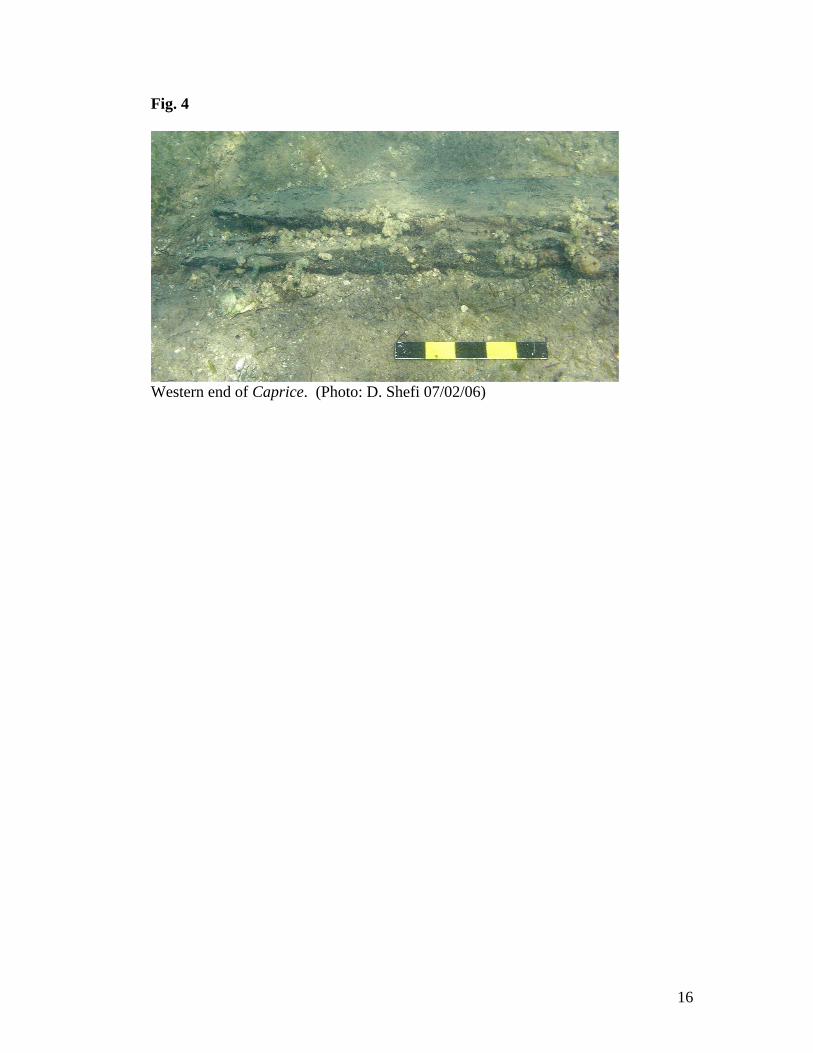
21 Site Photographs
See Fig. 4
9
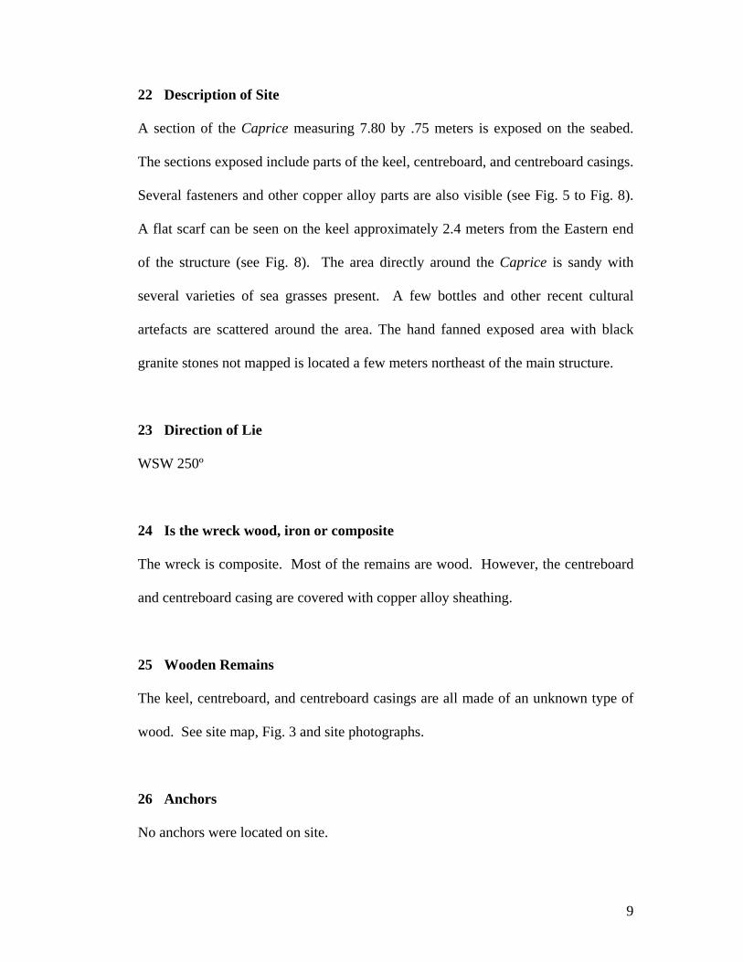
22 Description of Site
A section of the Caprice measuring 7.80 by .75 meters is exposed on the seabed.
The sections exposed include parts of the keel, centreboard, and centreboard casings.
Several fasteners and other copper alloy parts are also visible (see Fig. 5 to Fig. 8).
A flat scarf can be seen on the keel approximately 2.4 meters from the Eastern end
of the structure (see Fig. 8). The area directly around the Caprice is sandy with
several varieties of sea grasses present. A few bottles and other recent cultural
artefacts are scattered around the area. The hand fanned exposed area with black
granite stones not mapped is located a few meters northeast of the main structure.
23 Direction of Lie
WSW 250º
24 Is the wreck wood, iron or composite
The wreck is composite. Most of the remains are wood. However, the centreboard
and centreboard casing are covered with copper alloy sheathing.
25 Wooden Remains
The keel, centreboard, and centreboard casings are all made of an unknown type of
wood. See site map, Fig. 3 and site photographs.
26 Anchors
No anchors were located on site.

10
27 Mast or Rigging Remains
The mast or rigging remains were not located.
28 Other Contents, Describe
A few round black granite stones were located approximately 5 meters northeast of
the wreck. Hand fanning in this area resulted in the exposure of several wood boards
that are part of the Caprice. The limestone substrate in this area seems to dip too
greater than 20cm below the sandy surface of the seabed. Hand fanning was able to
expose approximately 2m by .5m of wood. This consisted of several different wood
boards, possible scantlings and planking. Several granite stones overlay parts of the
wood. These stones may have been ballast aboard the Caprice. Due to time
constraints and equipment malfunctions, the area was not explored further and was
unfortunately not mapped.
29 Site Condition
Mild to strong Southerly to South-easterly winds are present nearly continuously.
This, in combination with the tides, produces a westerly flowing current that is
variable, but generally mild. A limestone substrate is located approximately 20cm
from the sandy seabed over most of the site. The exception to this is where the
additional remains of the Caprice were found approximately 5m northeast of the
main site. The limestone layer at this location should only be a few more cm below
the remains. The combination of the winds, current and a shallow average water
depth of only 1.4 meters probably resulted in the break up and dispersal of most of

11
the remains of the Caprice. Although the wreck is not heavily encrusted a good
growth of sea grasses are present, as well as local fauna such as crabs, and octopus.
30 The Wreck Site Is Affected By
Currents are the most serious threat to this wreck. The seabed is fairly flat and
uniform so no natural barriers are present to protect the site. The current pushing the
remains against the limestone substrate will probably affect the wreck slowly. It is
possible that people swimming from the jetty would be able to locate and disturb the
site. Fishing lines becoming entangled among the wreckage could also adversely
affect the site. Corrosion of the copper alloy sections has and will continue to occur.
A corrosion potential measurement could provide information on the rate of
corrosion.
31 Recommendations
Very little historical information on the Caprice is available. Therefore, it is
recommended that the remains be left in-situ for further research. The area to the
northeast of the wreck that was exposed by hand fanning deems further research to
be carried out on this wreck. Although the extent of the remains is unclear, it is
believed there is enough present to warrant a more detailed examination and
excavation of the site. A yearly monitoring of the wreck should also be initiated.
The purpose would be to determine if the remains above the sea floor are remaining
in a stable condition or if deterioration is occurring at an unacceptably high rate.

12
32 References
Bullers R. Technical Officer, Flinders University. Personal Communication.
12/02/2006

13
33 Figures
Fig. 1
14
Fig. 2

15
Fig. 3
Caprice Site Plan
16
Fig. 4
Western end of Caprice. (Photo: D. Shefi 07/02/06)

17
Fig. 5
Centreboard and Centreboard Casings, located on southern side of the Caprice. (Photo: D. Shefi 07/02/06)

18
Fig. 6 (above) and Fig. 7 (below)
Detail. Copper alloy fasteners (above) and copper sheathing (below) located on the southern end of the Caprice. (Photo: D. Shefi 07/02/06)

19
Fig. 8
Detail. Flat scarf located on north side, along the keel. (Photo: D. Shefi 07/02/06)