zoning and floodplain development … non-conforming lots and uses .....57 414 permits.....58 415...
TRANSCRIPT
1
Town of Enfield Zoning Board of Adjustment
P.O. Box 373 Enfield, New Hampshire 03748
Tel. 603-632-4067 FAX 603-632-5182 * TDD 603-632-5026
E-MAIL: [email protected]
ZONING AND
FLOODPLAIN DEVELOPMENT
ORDINANCE
Adopted: March 13, 1990 Amended: May 1, 1991 March 8, 1994 March 12, 1996 April 8, 1997 March 9, 1999 March 14, 2000 March 13, 2001 March 12, 2002 March 11, 2003 March 13, 2004 March 12, 2005 March 16, 2006 March 17, 2007 March 11, 2008 March 9, 2010 March 8, 2011 March 12, 2013 March 11, 2014 March 8, 2016 March 14, 2017

Town of Enfield, NH Zoning Ordinance Amended March 14, 2017
Page 2
TABLE OF CONTENTS
ARTICLE I - INTRODUCTION ........................................................................................ 5
100 TITLE ............................................................................................................... 5 101 PURPOSE ....................................................................................................... 5 102 LOCATION AND THE PUBLIC COST OF FUTURE GROWTH ........................ 6 103 NATURAL ENVIRONMENT ............................................................................. 6
ARTICLE II - ESTABLISHMENT OF DISTRICTS ............................................................ 7
200 TYPES OF DISTRICTS .................................................................................... 7
ARTICLE III - DISTRICT BOUNDARIES ........................................................................ 8
300.1 RESIDENTIAL DISTRICT (R1) - ENFIELD VILLAGE – MASCOMA LAKE .... 8 300.2 RESIDENTIAL DISTRICT (R1) - ENFIELD CENTER - ROUTE 4A ............... 9 301 RURAL RESIDENTIAL DISTRICT (R3) ...................................................... 10 302 COMMUNITYBUSINESS DISTRICT…………………………………….……11 303.1 COMMERCIAL-INDUSTRIAL DISTRICT (C/I) - EXIT 16 AREA .................. 12 303.2 COMMERCIAL-INDUSTRIAL DISTRICT (C/I) – EXIT 15 AREA……………12 303.3 COMMERCIAL-INDUSTRIAL DISTRICT (C/I) – EXIT 14 AREA……………13 303.4 COMMERCIAL-INDUSTRIAL DISTRICT (C/I) - OLD ROUTE 10 AREA ..... 13 303.5 COMMERCIAL-INDUSTRIAL DISTRICT (C/I) - BALTIC MILL .................... 13
303.6 ROUTE 4 DISTRICT ………………………………………………………....14 304.1 ENFIELD CONSERVATION DISTRICT - RTE 4A - SOUTHEAST SIDE…14
304.2 ENFIELD CONSERVATION DISTRICT- RTE 4A - NORTHWEST SIDE…..14 304.3 ENFIELD CONSERVATION DISTRICT - I-89 SOUTHERLY SIDE………..15
304.4 ENFIELD CONSERVATION DISTRICT I-89- NORTHWEST SIDE…........15 304.5 ENFIELD CONSERVATION DISTRICT - NORTHERLY SIDE ................... .15 304.6 ENFIELD CONSERVATION DISTRICT - SOUTHERLY SIDE .................... 15 305 RURAL RESIDENTIAL-AGRICULTURAL DISTRICT (R5) ......................... 15
ARTICLE IV - REGULATION OF USES ....................................................................... 16
400 APPLICATION ............................................................................................... 16 401 DISTRICTS OTHER THAN CONSERVATION DISTRICT .............................. 16
401.1 R1 DISTRICT ......................................................................................... 16 401.2 R3 DISTRICT ......................................................................................... 18 401.3 R5 DISTRICT ......................................................................................... 20 401.4 COMMUNITY BUSINESS DISTRICT (CB) ............................................. 22 401.5 COMMERCIAL/INDUSTRIAL (C/I) DISTRICT ........................................ 24 401.6 ROUTE 4 DISTRICT………………………………………………………… .26
402 CONSERVATION DISTRICT (C) ................................................................... 34 403 SPECIAL EXCEPTIONS ................................................................................ 35
403.1. R1 DISTRICT ......................................................................................... 35 403.2. R3 DISTRICT ......................................................................................... 36 403.3. R5 DISTRICT ......................................................................................... 36 403.4. CB DISTRICT ........................................................................................ 37 403.5. C/I DISTRICT………………………………………………………………….37 403.6. ROUTE 4 DISTRICT…………………………………….……….…………..37 403.7 C DISTRICT ........................................................................................... 37
404 HOME OCCUPATION ..................................................................................... 38
Town of Enfield, NH Zoning Ordinance Amended March 14, 2017
Page 3
405 OPEN SPACE /CLUSTER DEVELOPMENT ....................................................... 39
405.1 STANDARDS AND REGULATIONS FOR CLUSTER DEVELOPMENT . 39 405.2 VILLAGE PLAN ALTERNATIVE ............................................................. 43
406 SENSITIVE RESOURCE PROTECTION AREAS .......................................... 45 406.1 WETLAND AREAS ................................................................................ 45 406.2 STEEP SLOPE AREAS ......................................................................... 46 406.3 FORESTED AREAS ............................................................................... 48 406.4 CLASS VI ROADS .................................................................................. 48
407 SPECIAL FLOOD HAZARD AREAS .............................................................. 48 408 SIGNS ........................................................................................................... 49
408.1 R1, R3, AND R5 DISTRICT SIGNS ........................................................ 50 408.2 CB, C/I and Route 4 DISTRICT SIGNS ................................................ 51 408.3 TEMPORARY SIGNS ............................................................................ 52 408.4 EXEMPTED SIGNS ............................................................................... 52 408.5 SIGN PERMIT REQUIREMENTS .......................................................... 53 408.6 FEES ..................................................................................................... 53 408.7 ENFORCEMENT ................................................................................... 53 408.8 REMOVAL OF SIGNS............................................................................ 53
409 PARKING AND LOADING AREAS ................................................................. 54 410 SIGHT DISTANCE ......................................................................................... 56 411 REMOVAL OF NATURAL MATERIAL ............................................................ 56 412 UNDISTURBED AREA .................................................................................. 57 413 NON-CONFORMING LOTS AND USES ........................................................ 57 414 PERMITS ....................................................................................................... 58 415 ADDITIONAL STUDIES AND INFORMATION REQUIREMENTS .................. 59 416 ZONING ADMINISTRATOR ........................................................................... 59 417 ENFORCEMENT ........................................................................................... 59 418 RELATIONSHIP BETWEEN STATE AND LOCAL REGULATIONS ............... 59 419 OUTDOOR LIGHTING ................................................................................... 59
419.1 GENERAL REQUIREMENTS ................................................................ 60 420 WETLAND DECISION ACCOUNTABILITY .................................................... 60 421 COMMUNITY NET METERED SOLAR ARRAYS 60
ARTICLE V - ZONING BOARD OF ADJUSTMENT ..................................................... 61
500 CREATION .................................................................................................... 61 501 MEETING OF THE BOARD, ADOPTION OF RULES ..................................... 61 502 POWERS OF THE BOARD ............................................................................ 61 503 HEARINGS BEFORE THE BOARD ............................................................... 61 504 SPECIAL EXCEPTIONS ................................................................................ 62 505 VARIANCES .................................................................................................. 62 506 APPEALS ...................................................................................................... 63 507 NOTICE TO CONSERVATION COMMISSION .............................................. 63 508 EQUITABLE WAIVER OF DIMENSIONAL REQUIREMENTS ........................ 64
ARTICLE VI - CONSERVATION MANAGEMENT ........................................................ 65
600 CONSERVATION COMMISSION .................................................................. 65 601 DUTIES OF THE COMMISSION .................................................................... 65

Town of Enfield, NH Zoning Ordinance Amended March 14, 2017
Page 4
ARTICLE VII - SEVERABILITY CLAUSE EFFECTIVE DATE AND AMENDMENT ..... 66
700 SEVERABILITY CLAUSE .............................................................................. 66 701 EFFECTIVE DATE ......................................................................................... 66 702 AMENDMENT ................................................................................................ 66
ARTICLE VIII - WIRELESS TOWERS .......................................................................... 67
801 DEFINITIONS .................................................................................................. 67 802 APPLICABILITY ............................................................................................... 67 803 GENERAL REQUIREMENTS ........................................................................... 68 804 SUBMITTAL REQUIREMENTS ........................................................................ 71 805 WAIVERS ........................................................................................................ 73 806 SECURITY AND INSURANCE ......................................................................... 73 807 REMOVAL OF ABANDONED ANTENNAS AND TOWERS .............................. 74 808 INSPECTIONS, ENFORCEMENT .................................................................... 74
ARTICLE IX - IMPACT FEES ....................................................................................... 75
901 DEFINITIONS ................................................................................................ 75 902 AUTHORITY TO ASSESS IMPACT FEES ..................................................... 75 903 ASSESSMENT METHODOLOGY .................................................................. 75 904 ADMINISTRATION OF IMPACT FEES .......................................................... 76 905 RETURN OF IMPACT FEE ............................................................................ 76 906 APPLICABILITY ............................................................................................. 76
OFFICIAL ZONING MAP……………………………..………………………….................. 77
WETLAND AREAS MAP………………………….………………….……….………....…...78
STEEP SLOPES AREAS…..………………………..………………..………………....79
APPENDIX A- LAND USE DEFINITIONS………………………………………………......80
TOWN OF ENFIELD - FLOODPLAIN DEVELOPMENT ORDINANCE………………….93
ITEM I- DEFINITION OF TERMS ............................................................................... 94 ITEM II ....................................................................................................................... 98 ITEM III ...................................................................................................................... 98 ITEM IV ..................................................................................................................... 99 ITEM V ...................................................................................................................... 99 ITEM VI ..................................................................................................................... 99 ITEM VII .................................................................................................................... 99 ITEM VIII ................................................................................................................. 100 ITEM IX- VARIANCES AND APPEALS .................................................................... 102
PLANNING BOARD SIGNATURE SHEET…… ………………………………………….103

Page 5
Town of Enfield, NH Zoning Ordinance Amended March 14, 2017
ARTICLE I - INTRODUCTION
100 TITLE
This ordinance shall be known and may be cited as the Zoning Ordinance of the Town of Enfield, New Hampshire.
101 PURPOSE
In pursuance of the authority conferred upon the Town of Enfield by Chapter 674:16 of the New Hampshire Revised Statutes Annotated (hereinafter referred to as RSA) and in order to put into effect the policy and proposals of the Town's Master Plan, the following ordinance is hereby enacted by the voters of the Town of Enfield, New Hampshire for the following purposes; as enumerated in RSA Chapter 674:17: A. To lessen congestion on the streets. B. To secure safety from fires, panic and other dangers. C. To promote health and the general welfare. D. To provide adequate light and air. E. To prevent the overcrowding of the land. F. To avoid undue concentration of population. G. To facilitate the adequate provision of transportation, solid waste facilities, water,
sewerage, schools, parks. H. To assure proper use of natural resources and other public requirements. I. To provide for harmonious development of the land and its environs.
Page 6
Town of Enfield, NH Zoning Ordinance Amended March 14, 2017
102 LOCATION AND THE PUBLIC COST OF FUTURE GROWTH
The citizens of Enfield wish to guide the location of future land development where it will provide a balanced community; that is, having the greatest benefits to present and future citizens of Enfield, without unduly increasing tax burdens to pay for additional town services.
103 NATURAL ENVIRONMENT
The citizens of Enfield wish to conserve its rural residential character, its air and water quality, its productive crop and forest lands, its wildlife habitat and its freedom from noise and traffic congestion.

Town of Enfield, NH Zoning Ordinance Amended March 14, 2017
Page 7
ARTICLE II - ESTABLISHMENT OF DISTRICTS
200 TYPES OF DISTRICTS
For the purposes of this ordinance the Town of Enfield is hereby divided into the following types of districts: A. Districts Other Than Conservation District 1. Residential District (R1) 2. Rural Residential District (R3) 3. Rural Residential-Agricultural District (R5) 4. Community Business District (CB)
5. Commercial/Industrial District (C/I)
6. Route 4 District
B. Conservation District (C)

Town of Enfield, NH Zoning Ordinance Amended March 14, 2017
Page 8
ARTICLE III - DISTRICT BOUNDARIES
Where zoning districts boundary lines are indicated as following a road or body of water, they shall be construed as following the center of the traveled way for roads, and the center of the water for bodies of water. Where zoning district boundary lines are indicated as going to, meeting, or measured from a road or body of water, they shall be construed as going to, meeting, or measured from, the center of the traveled way for roads and the center of the water for bodies of water, unless otherwise indicated. (Such as the I-89 Right of Way.)
300.1 RESIDENTIAL DISTRICT (R1) - ENFIELD VILLAGE – MASCOMA LAKE
1. Beginning, at the Enfield/Lebanon/Hanover/Canaan Town Line corner
monument;
2. thence, southeasterly along the Enfield/Canaan Town Line, to the Mascoma River;
3. thence, southerly along the Mascoma River, to Webster Brook; 4. thence, southerly along Webster Brook, to where it meets Lockehaven Road; 5. thence, westerly along Lockehaven Road, to where it meets Shaker Hill Road; 6. thence, southeasterly along Shaker Hill Road, to where it meets Fuller Road; 7. thence, westerly along Fuller Road, to where it meets Shaker Boulevard; 8. thence, westerly along Shaker Boulevard, to where it meets Route 4A; 9. thence, southwesterly along a line from Shaker Boulevard, to where it meets the
closest Conservation District 900 foot MSL contour line; 10. thence, northwesterly along the Conservation District 900 foot MSL contour line,
to where it meets the Enfield/Lebanon Town Line; 11. thence, northeasterly along the Enfield/Lebanon Town Line, to the point of
beginning.
Town of Enfield, NH Zoning Ordinance Amended March 14, 2017
Page 9
The Community Business District (CB) is excluded from the above Residential District (R1) boundary description.
300.2 RESIDENTIAL DISTRICT (R1) - ENFIELD CENTER - ROUTE 4A
1. Beginning at a point, located on Shaker Hill Road, that is 700 feet northeasterly
from Route 4A;
2. thence, southeasterly along a line located 700 feet to the east of Route 4A, to where it meets King James Road;
3. thence, southerly along King James Road, for a distance of 350 feet;
4. thence, easterly along a line located 350 feet to the north of Route 4A, to a line
that runs perpendicular through the center of the intersection of Route 4A and Grafton Pond Road;
5. thence, southerly along said line for a distance of 700 feet;
6. thence, westerly along a line located 350 feet to the south of Route 4A, to where
it meets Bog Road;
7. thence, southerly along Bog Road, to where it meets the Enfield New Hampshire Wildlife Management Area property line;
8. thence, westerly along the Enfield New Hampshire Wildlife Management Area
property line, to where it meets the Enfield Conservation District boundary line;
9. thence, westerly along the Enfield Conservation District 1,100 MSL contour line to where it meets Goodhue Hill Road;
10. thence, northeasterly along Goodhue Hill Road, to where it meets with the 900
foot MSL contour line;
11. thence, northwesterly along the 900 foot MSL contour line to a point where a line drawn from Shaker Hill Road, intersects with the Enfield Conservation District 900 foot MSL contour line;
12. thence, northeasterly along said line, to the point of beginning.

Town of Enfield, NH Zoning Ordinance Amended March 14, 2017
Page 10
301 RURAL RESIDENTIAL DISTRICT (R3)
1. Beginning, at the intersection of the Mascoma River and the Enfield/Canaan
Town Line;
2. thence, southeasterly along the Enfield/Canaan Town Line, to where it meets Mud Pond Road;
3. thence, southerly along Mud Pond Road, to where it meets Lockehaven Road;
4. thence, easterly along Lockehaven Road, to where it meets Boys Camp Road;
5. thence, southerly along Boys Camp Road, to a point located 350 feet to the north
of Route 4A;
6. thence, westerly along a line located 350 feet to the north of the Route 4A, to where it meets King James Road;
7. thence, northerly along King James Road, for a distance of 350 feet;
8. thence, northwesterly along a line located 700 feet to the north of Route 4A, to
where it meets Shaker Hill Road; 9. thence, southerly along Shaker Hill Road to where it meets Route 4A;
10. thence, southerly along a line drawn from Shaker Hill Road, to the closest Enfield
Conservation District 900 foot MSL contour line;
11. thence, northwesterly along the Enfield Conservation District 900 foot MSL contour line, to a point where it meets with a line extended from Shaker Boulevard, to the closest Enfield Conservation District 900 foot MSL contour line;
12. thence, northeasterly along said line to Shaker Boulevard;
13. thence, northeasterly along Shaker Boulevard, to where it meets Fuller Road;
14. thence, easterly along Fuller Road, to where it meets Shaker Hill Road;
15. thence, northerly along Shaker Hill Road, to where it meets Lockehaven Road;
16. thence, easterly along Lockehaven Road, to where it meets Webster Brook;

Town of Enfield, NH Zoning Ordinance Amended March 14, 2017
Page 11
17. thence, northerly along Webster Brook, to where it meets the Mascoma River;
18. thence, northerly along the Mascoma River, to the point of beginning.
302 COMMUNITY BUSINESS DISTRICT (CB) Revised March 12, 2013
1. Beginning at a point, located on Oak Grove Street, that is 350 feet southwesterly
from Route 4;
2. thence, westerly along a line parallel to Route 4 and at a distance of 350 feet from Route 4, for a distance of 2,300 feet;
3. thence, northerly along a line perpendicular to and crossing Route 4, for a
distance of 700 feet; 4. thence, easterly along a line parallel to Route 4, and at a distance of 350 feet
from Route 4, to where it meets Flanders Street;
5. thence, northerly along Flanders Street, to a point 400 feet from Route 4;
6. thence, easterly along a line parallel to Route 4, and at a distance of 400 feet from Route 4, to a point located 500 feet easterly of Anderson Hill Road;
7. thence, northeasterly along a line parallel to Anderson Hill Road, at a distance of
500 feet from Anderson Hill Road, to the Enfield/Canaan Town Line;
8. thence, southeasterly along the Enfield/Canaan Town Line, to the intersection with the western boundary of Lot 14-69.
9. thence, south along the western boundary of Lot 14-69 to the western boundary of Lot 36-1;
10. thence, south along the western boundary of lot 36-1 to the intersection with US Route 4:
11. thence across US Route 4 to the western boundary of lot 36-26;
12. thence, south and east along the western and southern boundaries of lot 36-24;
13. to the intersection with the centerline of the Northern New Hampshire Rail Trail;

Town of Enfield, NH Zoning Ordinance Amended March 14, 2017
Page 12
14. thence, westerly along the centerline of the Northern New Hampshire Rail Trail, to a point on a line extending from Oak Grove Street, and perpendicular to Main Street;
15. thence, northerly along said line, to Oak Grove Street;
16. thence, northerly along Oak Grove Street, to the point of beginning.
303.1 COMMERCIAL-INDUSTRIAL DISTRICT (C/I) - EXIT 16 AREA
1. Beginning at a point, located at the intersection of the I-89 right-of-way, and 50
feet west of Eastman Hill Road;
2. thence, northeasterly along a line located 50 feet west of Eastman Hill Road, to a point where it meets with Furlow Lane;
3. thence, westerly along Furlow Lane, to a point where it meets a straight line drawn from Furlow Lane to the Enfield/Lebanon Town Line;
4. thence, westerly along said straight line, to the Enfield/Lebanon Town Line:
5. thence, southwesterly along the Enfield/Lebanon Town Line, to the I-89 right-of-
way;
6. thence, southeasterly along the I-89 right-of-way, to the point of beginning.
303.2 COMMERCIAL-INDUSTRIAL DISTRICT (C/I) – EXIT 15 AREA
1. Beginning at a point, where Smith Pond Road meets with the I-89 right of way;
2. Thence, easterly along Smith Pond Road, to the 1,420 foot MSL contour line;
3. thence, northerly along the 1,420 foot MSL contour line, to where it meets with
the AMCA property line;
4. thence, westerly along the present (1988) AMCA property line lying outside of the Enfield Conservation District;
5. thence, southerly along the I-89 right-of-way, to the point of beginning.

Town of Enfield, NH Zoning Ordinance Amended March 14, 2017
Page 13
303.3 COMMERCIAL-INDUSTRIAL DISTRICT (C/I) - EXIT 14 AREA
1. Beginning at a point, where the I-89 right-of-way meets with the
Enfield/Grantham Town Line;
2. thence, southeasterly along the Enfield/Grantham town Line, to the Enfield
Conservation District 1,500 foot MSL contour line;
3. thence, northwesterly along the Enfield Conservation District 1,500 foot MSL contour line, to a point where a line drawn from the Enfield Conservation District 1,500 foot MSL contour line, is closest to the I-89 right-of-way;
4. thence, westerly along said line to the I-89 right-of-way;
5. thence, southerly along the I-89 right-of-way to the point of beginning.
303.4 COMMERCIAL-INDUSTRIAL DISTRICT (C/I) - OLD ROUTE 10 AREA
1. Beginning at a point, where the Enfield/Lebanon Town Line meets with the I-89 right-of-way;
2. thence, southeasterly along the I-89 right-of-way, to the Enfield/Grantham Town
Line;
3. thence, northwesterly along the Enfield/Grantham Town Line, for a distance of 1,000 feet;
4. thence, northwesterly along a line 1,000 feet westerly of the I-89 right-of-way and
paralleling the I-89 right-of-way, to the Enfield/Lebanon Town Line;
5. thence, northeasterly along the Enfield/Lebanon Town Line, to the point of beginning.
303.5 COMMERCIAL-INDUSTRIAL DISTRICT (C/I) - BALTIC MILL
The Old Baltic Mill is considered a pre-existing commercial/industrial facility which shall be allowed to continue.

Town of Enfield, NH Zoning Ordinance Amended March 14, 2017
Page 14
303.6 ROUTE 4 DISTRICT ( adopted March 12, 2013)
1. District bounded by the Enfield/Canaan Town Line on the north beginning at the intersection with the western boundary of Lot 14-69;
2. thence, east along the Enfield/Canaan Town Line to the intersection with the centerline of the Northern New Hampshire Rail Trail;
3. thence, westerly along the Northern New Hampshire Rail trail to the intersection with the southern boundary of lot 36-24;
4. thence, north and west along the boundary of Lot 36-24 to the intersection with the southern boundary of lot 36-25;
5. thence, west along the southern boundary then north along the west boundary of lot 36-25 to the intersection with US Route 4;
6. thence, across US Route 4 to the intersection with the south end of the west boundary of Lot 36-1;
7. thence, north along the west boundary of lot 36-1 to the south west intersection
with the west boundary of lot 14-69;
8. thence, north along the west boundary of lot 14-69 to the Enfield Canaan Town
304.1 ENFIELD CONSERVATION DISTRICT- ROUTE 4A - SOUTHEASTERLY SIDE
1. Beginning at a point, where the 1,100 foot MSL contour line meets with Goodhue
Hill Road;
2. thence, southeasterly along the 1,100 foot MSL contour line, to where it meets with the most southern section of the Enfield/Grantham Town Line.
304.2 ENFIELD CONSERVATION DISTRICT- ROUTE 4A - NORTHWESTERLY SIDE
1. Beginning at a point, where the 1,100 foot MSL contour line meets with Goodhue
Hill Road;
2. thence, northeasterly along Goodhue Hill Road, to where it meets with the 900 foot MSL contour line;
3. thence, northwesterly along the 900 foot MSL contour line, to where it meets with
the Enfield/Lebanon Town Line.

Town of Enfield, NH Zoning Ordinance Amended March 14, 2017
Page 15
304.3 ENFIELD CONSERVATION DISTRICT - I-89 – SOUTHERLY SIDE
1. Beginning at a point, where the 1,500 foot MSL contour line meets with Smith Pond Road;
2. thence, southerly along the 1,500 foot MSL contour line, to where it meets with
the Enfield/Grantham Town Line;
304.4 ENFIELD CONSERVATION DISTRICT - I-89 - NORTHWESTERLY SIDE
1. Beginning at a point, where the 1,500 foot MSL contour line meets with Smith
Pond Road;
2. thence, westerly along Smith Pond Road, to where it meets with the 1,420 foot MSL contour line;
3. thence, northwesterly along the 1,420 foot MSL contour line, to where it meets
with the Enfield/Lebanon Town Line.
304.5 ENFIELD CONSERVATION DISTRICT - NORTHERLY SIDE
1. Beginning at the most northwesterly point of the 1,420 foot MSL contour line, as
described in the Enfield Conservation District - I-89 - Northwesterly Side;
2. thence, northeasterly along the Enfield/Lebanon Town Line, to where it meets with the most northwesterly point of the 900 foot MSL contour line, as described in the Enfield Conservation District - Rt. 4A - Northwesterly Side.
304.6 ENFIELD CONSERVATION DISTRICT - SOUTHERLY SIDE
1. Beginning at the most southerly point of the 1,500 foot MSL contour line, as
described in the Enfield Conservation District - I-89 - Southerly Side;
2. thence southeasterly along the Enfield/Grantham Town Line, to where it meets with the most southerly point of the 1,100 foot MSL contour line, as described in the Enfield Conservation District - Rt. 4A - Southeasterly Side.
305 RURAL RESIDENTIAL-AGRICULTURAL DISTRICT (R5)
All remaining areas of the Town of Enfield not previously included in the R1, R3, CB, C/I and Conservation Districts.
Town of Enfield, NH Zoning Ordinance Amended March 14, 2017
Page 16
ARTICLE IV - REGULATION OF USES (See also Subdivision and Site Plan Review Regulations)
400 APPLICATION
1. The regulations set forth by this ordinance within each district shall apply
uniformly to each class or kind of structure, land and land use. No building, structure, or land shall hereinafter be used or occupied and no buildings or structure or part thereof shall hereinafter be erected, constructed, reconstructed, moved or structurally altered unless in conformity with all of the regulations herein specified for the district in which it is located.
2. Lots crossed by Town Lines: When part of a lot in single or joint ownership lies
outside the Town, the portion within the Town shall conform to the use regulation of the ordinance. In applying dimensional controls to that portion of the lot within the Town, the dimensions of the whole lot shall be considered without reference to the Town Line.
401 DISTRICTS OTHER THAN CONSERVATION DISTRICT
401.1 R1 DISTRICT
In the Residential District (R1) land may be used and buildings may be erected or altered for the following purposes only and subject to the following regulations and limitations: A. One-family, two-family and multi-family dwellings, and manufactured homes on
individual lots. B. Cemeteries, churches and places of formal worship. C. Home occupations subject to the provisions of Section 404. D. The growing of grain, fodder, fruits, vegetables and ornamental plants. E. Produce stands for the sale of fruits, vegetables and ornamental plants, whether
or not grown on the premises.

Town of Enfield, NH Zoning Ordinance Amended March 14, 2017
Page 17
F. Fairs run or sponsored only by local church, school, fraternal, youth or other civic organizations.
G. Private yard sales and auctions. H. Growth and harvesting of forest products are permitted. This includes the
clearing of land for a dwelling, bonafide agricultural, wildlife management, and silvicultural purposes and other uses permitted in the District and by special exception. (See Section 403.)
I. Non-Commercial outdoor recreational activities such as hunting, fishing, hiking,
cross-country skiing, snowmobiling and sailing groups. J. Accessory uses customarily incidental to A through I of this section, including
accessory dwelling units. K. Minimum lot size shall be one (1) acre except for dwellings, in which minimum lot
size shall be one (1) acre per dwelling unit with on-lot water and sewer supply, but may be one-half acre lot size for a dwelling where municipal water and sewer are used.
L. No structure shall be located nearer than twenty (20) feet from any edge of a lot
line contiguous to a street or fifteen (15) feet from any other lot boundary or shall be higher than 35 feet or two stories. This provision shall not apply to conventional television antennas, lightning rods, cupolas, steeples, or chimneys. An exception to the 20-foot setback may be granted only where a new dwelling is constructed beside or between two dwellings with modest pre-zoning front setback. Here the minimum setback may be reduced to within the five (5) feet of the average setback.
M. No structure shall be placed, located, or constructed within fifty feet from the
seasonal high water line of any river, stream, wetland, lake or public pond, and no dock may be located nearer than 25 feet from a side lot line. Dry hydrants, culverts and bridges may be permitted by Planning Board and with State permits as required.
N. At least two (2) on-lot parking spaces shall be provided for each dwelling unit of
three bedrooms or less and one (1) additional parking space for each additional bedroom. Each individual open-air parking space shall be at least ten (10) feet wide and twenty (20) feet long.
O. Multi-family dwellings consisting of three (3) or more dwelling units require Site
Plan approval by the Planning Board.

Town of Enfield, NH Zoning Ordinance Amended March 14, 2017
Page 18
P. The width of any lot shall be a minimum of 75 feet at the public right-of-way and a minimum of 100 feet at the front of the proposed building.
Q. Cluster development is permitted as per Section 405. S. A recreational vehicle, such as a motor home or camper, may be permitted on a
lot, with an existing dwelling unit, so long as it is not used for occupancy or as a dwelling in excess of three weeks in a calendar year.
T. A recreational vehicle such as a motor home or camper, may be permitted on a
lot without an existing dwelling unit, so long as sewage and gray water disposal is in accordance with State law. Occupancy shall be limited to six months in a calendar year.
U. No lot shall have more than one dwelling or principal building.
401.2 R3 DISTRICT
In the R3 District, land may be used and buildings may be erected or altered for the following purposes only and subject to the following regulations and limitations: A. One-family, two-family, multi-family dwellings, and manufactured homes on
individual lots. B. Cemeteries, churches and places of formal worship. C. Home occupations subject to the provisions of Section 404. D. The growing of grain, fodder, fruits, vegetables and ornamental plants. E. Produce stands for the sale of fruits, vegetables and ornamental plants whether
or not grown on the premises. F. Fairs run or sponsored only by local church, school, fraternal, youth or other civic
organizations. G. Private yard sales and auctions. H. Growth and harvesting of forest products are permitted. This includes the
clearing of land for a dwelling, bona fide agricultural, wildlife management, and silvicultural purposes and the other uses permitted in this District and by special exception. (See Section 403.)

Town of Enfield, NH Zoning Ordinance Amended March 14, 2017
Page 19
I. Non-commercial outdoor recreational activities such as hunting, fishing, hiking,
cross-country skiing and snowmobiling. J. Accessory uses customarily incidental to A through I of this section, including
accessory dwelling units. K. Minimum lot size shall be three (3) acres except for dwellings, in which case
minimum lot size shall be three (3) acres per dwelling unit (i.e. one (1) dwelling unit = three (3) acres, two (2) dwelling units = six (6) acres.)
L. No structure shall be located nearer than thirty (30) feet from any edge of the lot
line contiguous to the street or twenty (20) feet from any other lot boundary, or shall be higher than 35 feet or 2 and one-half stories; however, this provision shall not apply to conventional television antennas, lightning rods, cupolas, steeples or chimneys.
M. No structure shall be placed, located or constructed within fifty feet from the
seasonal high water line of any river, stream, wetland, lake or public pond, and no dock may be located nearer than 25 feet from a side lot line. Dry hydrants, culverts and bridges may be permitted by Planning Board and with State permits as required.
N. At least two (2) on-lot parking spaces shall be provided for each dwelling unit
with three (3) bedrooms or less and one (1) additional parking space for each additional bedroom. Each individual open-air parking space shall be at least ten (10) feet wide and twenty (20) feet long.
O. No lot shall have more than one dwelling or principal building. P. The width of any lot shall be a minimum of 100 feet at the public right-of-way and
a minimum of 150 feet at the front of the proposed building. A Special Exception to this requirement may be granted, where soil and slope conditions permit, for counter-balancing considerations such as preservation of wetlands, natural features, open space and habitat such as deer yards.
Q. Cluster development is permitted per Section 405. S. A recreational vehicle such as a motor home or camper may be permitted on a
lot, with an existing dwelling unit, so long as it is not used for occupancy or as a dwelling in excess of three weeks in a calendar year.
T. A recreational vehicle such as a motor home or camper may be permitted on a lot without an existing dwelling unit, so long as sewage and gray water disposal

Town of Enfield, NH Zoning Ordinance Amended March 14, 2017
Page 20
is in accordance with State law. Occupancy shall be limited to six months in a calendar year.
U. Agriculture, including farm animals and other generally accepted land uses for
farm purposes. V. Riding stables and non-commercial equestrian activities.
401.3 R5 DISTRICT
The general purpose of the Rural Residential-Agricultural District (R5) is to maintain a low density rural character primarily as a district of farms, residences and woodlands where the natural conditions of the area are maintained. In the Rural Residential-Agricultural District (R5), land may be used and buildings may be erected or altered for the following purposes only and subject to the following regulations and limitations: A. One-family dwellings including manufactured homes on individual lots. B. Cemeteries, churches and places of formal worship. C. Home occupations subject to the provisions of Section 404. D. The growing of grain, fodder, fruits, vegetables and ornamental plants. E. Produce stands for the sale of fruits, vegetables and ornamental plants, whether
or not grown on the premises. F. Fairs run or sponsored only by local church, school, fraternal, youth or other civic
organizations. G. Private yard sales and auctions. H. Growth and harvesting of forest products is permitted. This includes the clearing
of land for a structure, bona fide agricultural, wildlife management, and silvicultural purposes, and other uses permitted in the District and by special exceptions. (See Section 403.)
I. Non-commercial outdoor recreational activities such as hunting, fishing, hiking,
cross-country skiing and snowmobiling.

Town of Enfield, NH Zoning Ordinance Amended March 14, 2017
Page 21
J. Accessory uses customarily incidental to A through I of this section, including accessory dwelling units.
K. Minimum lot size shall be five (5) acres except for dwellings, in which case
minimum lot size shall be five (5) acres per dwelling unit [i.e. one (1) dwelling unit = five (5) acres, two (2) dwelling units = ten (10) acres].
L. No structure shall be located nearer than thirty (30) feet from any edge of the lot
line contiguous to the street or twenty (20) feet from any lot boundary or shall be higher than 35 feet or 2 and one-half stories; however, this provision shall not apply to conventional television antennas, lightning rods, cupolas, church steeples, chimneys, and silos.
M. No structure shall be placed, located, or constructed within fifty feet from the
seasonal high water line of any river, stream, wetland, lake or public pond, and no dock may be located nearer than 25 feet from a side lot line. Dry hydrants, culverts and bridges may be permitted by Planning Board and with State wetland permits as required.
N. At least two (2) on-lot parking spaces shall be provided for each dwelling unit
with three bedrooms or less and one (1) additional parking space for each additional bedroom. Each individual open-air parking space shall be at least ten (10) feet wide and twenty (20) feet long.
O. No lot shall have more than one dwelling or principal building. P. The width of any lot shall be a minimum of 250 feet at the public right-of-way and
minimum of 250 feet at the front of the proposed building. A Special Exception to this requirement may be granted by the Zoning Board of Adjustment (where soil and slope conditions permit) for counter-balancing considerations such as preservation of wetlands, natural features, open space and habitat such as deer yards.
Q. Cluster development is permitted as per Section 405. S. A recreational vehicle such as a motor home and camper may be permitted on a
lot with an existing dwelling unit, so long as it is not used for occupancy or as a dwelling in excess of three weeks in a calendar year.
T. A recreational vehicle such as a motor home or camper may be permitted on a
lot without an existing dwelling unit so long as sewage and gray water disposal is in accordance with state law. Occupancy shall be limited to six months per year.
Town of Enfield, NH Zoning Ordinance Amended March 14, 2017
Page 22
U. Agriculture, including farm animals and other generally accepted land uses for farm purposes.
V. Riding stables and non-commercial equestrian activities.
401.4 COMMUNITY BUSINESS DISTRICT (CB)
In the Community Business District land may be used and buildings may be erected or altered for the following purposes only and subject to the following regulations and limitations: A. One-family, two-family dwellings, accessory dwelling units and manufactured homes on individual lots. B. Cemeteries, churches and places of formal worship. C. Home occupations subject to the provisions of Section 404. D. The growing of grain, fodder, fruits, vegetables and ornamental plants. E. Produce stands for the sale of fruits, vegetables and ornamental plants whether
or not grown on the premises. F. Fairs run or sponsored only by local church, school, fraternal, youth or other civic
organizations. G. Private yard sales and auctions. H. Professional or business offices. I. Non-commercial outdoor recreational activities such as hunting, fishing, hiking,
cross-country skiing and snowmobiling. J. Retail stores, shopping centers and service establishments, including banks,
restaurants, and auto service stations. K. Public and private schools. L. Public buildings, utility stations and other essential service facilities. M. Motels, Marinas.

Town of Enfield, NH Zoning Ordinance Amended March 14, 2017
Page 23
N. Minimum lot size shall be one (1) acre for buildings with on-lot water and sewer supply but may be a minimum one-half acre lot size for a commercial building where community or municipal water and sewer are used.
O. Growth and harvesting of forest products is permitted. This includes the clearing
of land for a dwelling or bona fide agricultural, wildlife management, and silvicultural purposes and other uses permitted in the District and by special exception. (See Section 403.)
P. No structure shall be located nearer than thirty (30) feet from any lot line
contiguous to the street or twenty (20) feet from any other lot boundary, or shall be higher than 35 feet or two and one-half stories.
Q. No structure shall be placed, located, or constructed within fifty feet from the
seasonal high water line of any river, stream, wetland, lake, or public pond, and no dock may be located nearer than 25 feet from a side lot line. Dry hydrants, culverts and bridges may be permitted by Planning Board and with State permits as required.
R. In the Community Business District parking areas will as a minimum conform to
Section 409. S. Site Plan approval by the Planning Board must be obtained for any commercial
or business use, alteration or conversion to another commercial or business use. T. Educational facilities and museums U. Bus stop shelters. V. Within the downtown area, defined as those properties abutting Main Street and
Blacksmith Alley and between High and Oak Grove Streets, lot size, development and the placement of non-residential and mixed-use structures are exempted from dimensional (with the exception of building height), and parking requirements. The use of all floors of all structures directly accessible to grade, except areas used to access upper floors, shall be nonresidential, except by special exception. Parking may be leased or owned, on or off site. Planning Board site plan approval is not exempted.

Town of Enfield, NH Zoning Ordinance Amended March 14, 2017
Page 24
401.5 COMMERCIAL/INDUSTRIAL (C/I) DISTRICT
Purpose The purpose of the C/I District is to concentrate commercial and industrial growth in those areas which can best serve the overall interest of the community. 1. Permitted Uses In the C/I District, land may be used and buildings may be erected or altered for the following purposes only and subject to the following regulations and limitations: A. Professional or business offices. B. Retail stores, shopping centers and service establishments, including banks and
auto service stations. C. Commercial recreational uses, including ski facilities. D. Non-commercial outdoor recreational activities such as hunting, fishing, hiking,
cross-country skiing and snowmobiling. E. Offices, publishing houses, research and testing laboratories, contractor's yard. F. Sales, service, repair or storage businesses. G. Commercial greenhouses. H. Private yard sales and auctions. I. Restaurants and eating places. J. Essential public service facilities. K. Funeral homes. L. Cluster Development. M. Accessory uses customarily incidental to the above. N. Automotive uses (such as service stations, repair garages and car washes) O. Assembly and packaging facilities

Town of Enfield, NH Zoning Ordinance Amended March 14, 2017
Page 25
P. Bus stop shelters. 2. Use Restrictions In the C/I District, all uses must at all times comply with any and all decisions of the Zoning Board of Adjustment and the Planning Board and with the following restrictions: A. All operations are to be conducted in such a manner that all resulting dust,
cinders, fumes, odors, smoke and vapor are effectively confined to the premises or disposed of so as to prevent any air or ground pollution.
B. The activity conducted shall not pollute adjacent wetlands, streams, lakes,
aquifers or other bodies of water. C. That on-site activities shall not be detrimental to the public health, safety or
general welfare. D. That the use shall not create a hazardous traffic condition on adjacent
right-of-way or highways or impose destructive loads on said travel ways. E. That all lighting be indirect and shielded from adjoining property. No light shall
be allowed to directly illuminate the night by being focused upward onto a building or high free-standing sign.
F. Minimum lot size shall be two (2) acres. G. No structure shall be located nearer than fifty (50) feet from any lot line
contiguous to the street or twenty-five (25) feet from any lot boundary or shall be higher than thirty-five (35) feet. No structure shall be placed, located, or constructed within fifty feet from the seasonal high water line of any river, stream, wetland, lake, or public pond. Dry hydrants, culverts and bridges may be permitted at Planning Board discretion and with State wetland permit as required.
H. The coverage of each lot used for Commercial/Industrial purposes, including
buildings and parking areas, drives and any impervious surfaces shall not exceed 50 percent of the net developable land, and twenty-five (25) feet green space or landscaped area shall be reserved along lot boundaries.
I. Site Plan approval by the Planning Board must be obtained for any commercial
or business use, alteration or conversion to another commercial or business use.

Town of Enfield, NH Zoning Ordinance Amended March 14, 2017
Page 26
401.6 ROUTE 4 DISTRICT
401.6 Route 4 District Purpose: The Route 4 District is intended to promote compact, mixed-use, walkable development supported by the availability of public water and sewer infrastructure, and characterized by: high-quality, multi-story buildings designed to be compatible with traditional New England architecture; a multi-modal, interconnected transportation network, including safe routes for pedestrians, bicyclists and other trail users, and front yards dominated by landscaped green space rather than parking. The following standards shall apply to all future development within the Route 4 District.
A. Lots and Uses
Lots in the Route 4 District shall comply with the following requirements:
Lot Requirements
Road Frontage 100 ft. (minimum)
Lot Size 15,000 SF (minimum)
Impervious Surface Coverage 70% (maximum)
Residential Density 12 dwelling units per acre (maximum)
Allowed uses in the Route 4 District shall be limited to:
By-Right Uses
Retail Trade Upper-floor Residential
Retail Service Ground-floor Residential(2)
Office Food Service
Light Industry(1) Lodging
Research and Development(1) Entertainment and Recreation
Roof and ground mounted community net metered solar arrays located 100 or more feet from Route 4
Special Exceptions
Buildings or lots developed solely for residential use less than 600 feet from Route 4.
Any by-right use occurring primarily outside an enclosed building.
Roof and ground mounted community net metered solar arrays(3)
Notes (1) Shall be located 400 or more feet from Route 4. (2) Shall be located 600 or more feet from Route 4. (3) Shall be located 100 or more feet from Route 4 by right.

Town of Enfield, NH Zoning Ordinance Amended March 14, 2017
Page 27
A recreational vehicle, such as a motor home or camper, may be permitted on a lot, with an existing dwelling unit, so long as it is not used for occupancy or as a dwelling in excess of three weeks in a calendar year.
A recreational vehicle such as a motor home or camper, may be permitted on a lot without an existing dwelling unit, so long as sewage and gray water disposal is in accordance with State law. Occupancy shall be limited to six months in a calendar year.
B. Building Placement Along Route 4
Buildings on lots with frontage on Route 4 shall be placed in compliance with the following requirements:
Principal Building Setback from Lot Lines
Front Setback (<2 story building)
25 ft. (min)- 55 ft. (max)
A
Front Setback (2+ story building)
25 ft. (min)- 80 ft. (max)
B
Side Setback 0 ft. or 15 ft. (min) (1)
C
Rear Setback 20 ft. (min) D
Accessory Building Setback from Lot Lines
Front Setback 85 ft. (min)
Side and Rear Setback
15 ft. (min)
Distance Between Buildings
Between Principal Buildings
0 ft. or 25 ft. (min) (1)
Between All Other Buildings
15 ft. (min)
Notes (1) Attached buildings may be approved with no side setback or space between buildings.

Town of Enfield, NH Zoning Ordinance Amended March 14, 2017
Page 28
C. Building Placement Along Streets Other than Route 4
Buildings on lots fronting streets other than Route 4 shall be placed in compliance with the following requirements:
Principal Building Setback from Lot Lines
Front Setback 30 feet (min)
Side Setback 0 feet or 20 feet (min) (1)
Rear Setback 20 feet (min)
Accessory Building Setback from Lot Lines
Front Setback 35 feet (min)
Side and Rear Setback 20 feet (min)
Distance Between Buildings
Between Principal Buildings 0 feet or 30 feet (min) (1)
Between All Other Buildings 20 feet (min)
Notes (1) Attached buildings may be approved with no side setback or space between buildings.

Town of Enfield, NH Zoning Ordinance Amended March 14, 2017
Page 29
D. Building Form
Buildings in the Route 4 District shall comply with the following requirements:
Principal Building(1)
Building Height 16 ft. (min)-32 ft. (max)
A
Ground Floor-to-Ceiling Height(2)
12 ft. (min)-24 ft. (max)
B
Upper Floor-to-Ceiling Height
8 ft. (min)-16 ft. (max)
C
Building Footprint 40,000 SF (max)
Notes (1) Buildings with a footprint of less than 10,000 SF shall be designed with pitched roofs. Buildings with a footprint of 10,000 SF or greater may be designed with flat roofs, but shall provide a parapet at least 3 feet in height. The design of parapets shall be reviewed by the Enfield Fire Department. Flat-roofed buildings shall incorporate pitched-roof architectural elements such as enclosed entrances, porches, arcades or awnings along street-facing facades. (2) The minimum ground-floor-to-ceiling height may be 8 feet for solely residential buildings.
Accessory Buildings
Building Height 24 feet (maximum) A
Building Footprint 10,000 SF (maximum)
Architectural Encroachment Beyond Setback
Eaves, balconies, chimneys 3 feet (maximum) D
Porches, awnings, arcades(1) 10 feet (maximum) E
Notes
(1) Applies only to front setback.

Town of Enfield, NH Zoning Ordinance Amended March 14, 2017
Page 30
E. Principal Building Facades
The street facing-facades of principal buildings shall comply with the following requirements:
F. Pedestrian Access
Pedestrian access shall comply with the following requirements: 1. Sidewalks shall be provided along all road frontage. For lots fronting Route 4, the
sidewalk may be located on the interior side of the front planting area. 2. Sidewalks shall be provided from the road sidewalk to the public entrances of
principal buildings and between principal buildings on a lot. 3. Pedestrian access shall be provided from parking areas to the public entrances of
principal buildings. The Planning Board may require provision of pedestrian ways within parking areas to enhance pedestrian safety.
4. Crosswalks shall be provided where pedestrians are directed to cross vehicular travel lanes, and shall incorporate accessibility features.
5. Lots abutting the Northern Rail Trail shall provide pedestrian access from the trail to the public entrances of principal buildings unless the Planning Board finds that natural constraints make access infeasible.
6. Pedestrian access shall be provided between adjoining lots unless the Planning Board finds that natural constraints make access infeasible.
7. Pedestrian access may be located within setbacks, but shall not be located within the front planning area.
Principal Building Facades
Bay Width 24 ft. (min)-64 ft. (max)
A
Depth Change Between Bays
4 ft. (min) B
Ground Floor Blank Wall Width
16 ft. (max) C
Upper Floor Blank Wall Width
32 ft. (max) D
Ground Floor Fenestration
40% (min)-80% (max)
Upper Floor Fenestration
20% (min)-60% (max)

Town of Enfield, NH Zoning Ordinance Amended March 14, 2017
Page 31
G. Location of Parking
In addition to the requirements of Section 409, parking shall be primarily located to the side and rear of principal buildings and shall comply with the following requirements:
H. Landscaping Landscaping shall comply with the following requirements:
Location of Parking(2)(3)
Between Principal Building and Route 4
2 rows (max)
A
Setback from Property Line(1)
0 or 10 ft. (min)
B
Notes (1) Shared parking or access located on or across side or rear lot lines may be approved. (2) No parking shall occur within the front planting area. (C) (3) Vehicular access shall be provided between adjoining lots unless the Planning Board finds that natural constraints make the connection infeasible. This vehicular access shall be considered internal site circulation, not a street subject to dimensional and setback requirements. (D)
Landscaping Along Frontages(1)(2)
A planting area at least 10 feet deep shall be established along all front lot lines, excluding areas used for access. The planting area shall be landscaped as specified below:
Shade Trees
1 per 50 feet of frontage (min)
Small Trees
1 per 30 feet of frontage (min)
Shrubs 1 per 20 feet of frontage (min)
Notes (1) Plants may be clustered and do not have to be evenly distributed within the planting area. (2) Existing vegetation to be retained may be counted towards landscaping requirements.

Town of Enfield, NH Zoning Ordinance Amended March 14, 2017
Page 32
Landscaping in Parking Areas(1)(2)(3)
Parking lot landscaping shall consist of:
Shade Trees 1 per 8 spaces (minimum)
Small Trees 1 per 6 spaces (minimum)
Shrubs 1 per 4 spaces (minimum)
Notes (1) Landscaping shall be located at each end of and within parking rows so that no row of parking exceeds 15 contiguous spaces. (2) Landscaped areas (strips and islands) shall be at least 180 SF in area and shall not measure less than 5 feet in any dimension. (3) Use of Low-impact development (LID) approaches to stormwater management within surface parking lots is encouraged and landscaped areas may be used to collect and infiltrate runoff.
Landscaping Buffers from Residential Development
Where a non-residential use will abut a residential lot or zone, a vegetated buffer at least 25 feet deep shall be established or retained to maintain residents’ visual privacy and quality of life.
Planting and Maintenance(1)
Required landscaping shall meet the following size requirements when planted:
Shade Trees 2 inch caliper or 8 feet high (minimum)
Small Trees 1 inch caliper or 5 feet high (minimum)
Shrubs 1 gallon size (minimum)
Notes (1) Required landscaping shall be maintained. Dead, dying, damaged, or removed plants shall be replaced in a timely manner (no later than the next growing season).
“Shade Trees” are defined as a tree with a mature height of at least 30 feet. “Small Trees” are defined as a tree with a mature height of at least 15 feet.
Town of Enfield, NH Zoning Ordinance Amended March 14, 2017
Page 33
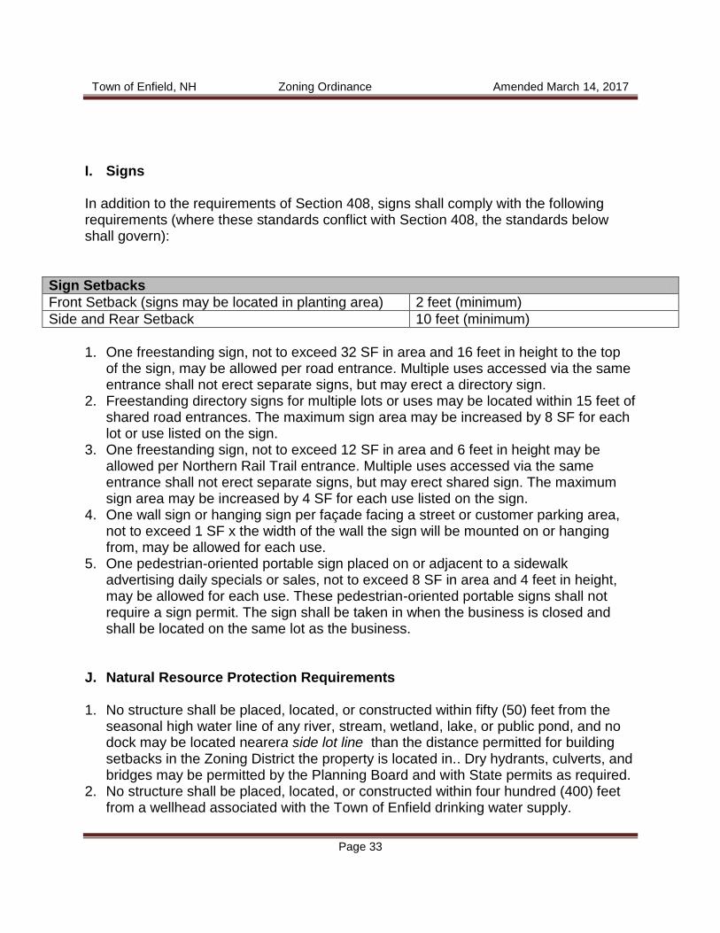
I. Signs In addition to the requirements of Section 408, signs shall comply with the following requirements (where these standards conflict with Section 408, the standards below shall govern):
Sign Setbacks
Front Setback (signs may be located in planting area) 2 feet (minimum)
Side and Rear Setback 10 feet (minimum)
1. One freestanding sign, not to exceed 32 SF in area and 16 feet in height to the top
of the sign, may be allowed per road entrance. Multiple uses accessed via the same entrance shall not erect separate signs, but may erect a directory sign.
2. Freestanding directory signs for multiple lots or uses may be located within 15 feet of shared road entrances. The maximum sign area may be increased by 8 SF for each lot or use listed on the sign.
3. One freestanding sign, not to exceed 12 SF in area and 6 feet in height may be allowed per Northern Rail Trail entrance. Multiple uses accessed via the same entrance shall not erect separate signs, but may erect shared sign. The maximum sign area may be increased by 4 SF for each use listed on the sign.
4. One wall sign or hanging sign per façade facing a street or customer parking area, not to exceed 1 SF x the width of the wall the sign will be mounted on or hanging from, may be allowed for each use.
5. One pedestrian-oriented portable sign placed on or adjacent to a sidewalk advertising daily specials or sales, not to exceed 8 SF in area and 4 feet in height, may be allowed for each use. These pedestrian-oriented portable signs shall not require a sign permit. The sign shall be taken in when the business is closed and shall be located on the same lot as the business.
J. Natural Resource Protection Requirements 1. No structure shall be placed, located, or constructed within fifty (50) feet from the
seasonal high water line of any river, stream, wetland, lake, or public pond, and no dock may be located nearera side lot line than the distance permitted for building setbacks in the Zoning District the property is located in.. Dry hydrants, culverts, and bridges may be permitted by the Planning Board and with State permits as required.
2. No structure shall be placed, located, or constructed within four hundred (400) feet from a wellhead associated with the Town of Enfield drinking water supply.

Town of Enfield, NH Zoning Ordinance Amended March 14, 2017
Page 34
402 CONSERVATION DISTRICT (C)
In the Conservation District land may be used and buildings may be erected or altered for the following purposes only and subject to the following regulations and limitations. Within the Conservation District the topographic information and data required for subdivision approval by the State of New Hampshire Water Supply and Pollution Control Commission (WS&PCC) shall be recorded in actual elevation above mean sea level (MSL), and said data shall be submitted to the Zoning Board of Adjustment in duplicate for purposes of record. A. Forestry: Growth and harvesting of forest products (not to include the clear
cutting of timber); B. Agriculture, including farm animals and other generally accepted land uses for
farm purposes; C. Single family dwellings and accessory dwelling units. D. Cluster development is permitted as per Section 405. E. Water supply. F. Non-commercial recreation activities such as hunting, fishing, hiking,
cross-country skiing and snowmobiling. G. Private yard sales and auctions. H. Accessory uses customarily incidental to the above uses and not detrimental to
the neighborhood to include the construction of access roads and buildings other than dwellings.
I. A recreational vehicle such as a motor home or camper may be permitted on a
lot, with an existing dwelling unit, so long as it is not used for occupancy or as a dwelling in excess of three weeks in a calendar year.
J. A recreational vehicle such as a motor home or camper may be permitted on a
lot without an existing dwelling unit, so long as sewage and gray water disposal is in accordance with State law. Occupancy shall be limited to six months in a calendar year.

Town of Enfield, NH Zoning Ordinance Amended March 14, 2017
Page 35
K. Dwellings shall be limited to a density of one dwelling unit to ten acres of land and no structure shall be constructed within 300 feet of an existing river, stream, wetland, lake or public pond.
L. Electric, telephone and cable television distribution systems shall be
underground including services to residents and to street lights. M. No structure shall be located nearer than seventy-five (75) feet from any lot line
contiguous to the street or fifty (50) feet from any other lot boundary or shall be higher than twenty-five (25) feet or two (2) stories.
N. In the Eastman Subdivision as shown by Tax Map 51, existing lots 1-127, no
structure shall be located nearer than twenty (20) feet from any edge of a lot line contiguous to a street or fifteen (15) feet from any other lot boundary or higher than 35 feet or two and one-half stories.
403 SPECIAL EXCEPTIONS
The Zoning Board of Adjustment, upon application and after public hearing, shall have the power to permit the following special exceptions in accordance with the restrictions contained in Sections 401 and 402 of Article IV.
1. R1 DISTRICT
A. Public and private schools B. Public buildings, utility stations and other essential services C. Antique Shops D. Bed and breakfasts E. Restaurants F. Home occupation in an existing accessory building G. Agricultural, including farm animals and other generally accepted land
uses for farm purposes H. Day care centers I. Professional offices J. Recreational facilities K. Educational facilities and museums L. Bus stop shelters M. Clustered manufactured housing.
N. Wireless Towers O. Artisan Workshop

Town of Enfield, NH Zoning Ordinance Amended March 14, 2017
Page 36
2. R3 DISTRICT
A. Public and private schools B. Public buildings, utility stations and other essential services C. Antiques shops D. Bed and breakfasts E. Home occupation in an existing accessory building F. Sand and gravel pits G. Day care centers H. Professional offices I. Recreational facilities J. Educational facilities and museums K. Bus stop shelters L. Clustered manufactured housing
M. Commercial equestrian facilities N. Wireless Towers O. Estates
P. Roof and ground mounted community net metered solar arrays
3. R5 DISTRICT
A. Public and private school B. Public buildings, utility stations and other essential services C. Seasonal recreation camps and camp grounds D. Saw mills E. Antique Shops F. Bed and breakfasts G. Home occupation in an existing accessory building H. Boarding and/or breeding kennels I. Two-family dwelling
J. Sand and gravel pits K. Day care centers
L. Professional offices M. Recreational facilities N. Educational facilities and museums O. Bus stop shelters P. Commercial equestrian activities
Q. Clustered manufactured housing R. Wireless Towers S. Estates

Town of Enfield, NH Zoning Ordinance Amended March 14, 2017
Page 37
T. Aircraft Landing Strips U. Accessory Apartment V. Roof and ground mounted community net metered solar arrays
4. CB DISTRICT
A. Wholesale business B. Day care centers C. Recreational facilities D. Commercial recreational facilities. E. Parking as described in Section 409.13. F. Wireless Towers
G. Multi-family dwellings H. Aircraft Landing Strips
I. Roof and ground mounted community net metered solar arrays
5. C/I DISTRICT
A. One-family dwelling, including manufactured homes. B. Warehouse and distribution centers C. Restaurants with entertainment or night club facilities D. Manufacturing and processing facilities E. Sand and gravel pits F. Motels G. Boarding and/or breeding kennels.
H. Wireless Towers I. Aircraft Landing Strips
J. Roof and ground mounted community net metered solar arrays
6. ROUTE 4 DISTRICT
A. Buildings or Lots developed solely for residential use less than 600 feet from Route 4
B. Any by right use occurring primarily outside an enclosed building C. Roof and ground mounted community net metered solar arrays
7. C DISTRICT
A. Construction of buildings for non-dwelling purposes B. Construction of roads not reasonably related to forestry, agricultural or
residential use C. Bus Stop Shelters
Town of Enfield, NH Zoning Ordinance Amended March 14, 2017
Page 38
D. Golf Courses with a minimum of 100 acres and no commercial structures above the 1600-foot elevation mark.
E. Estates The above Special Exceptions may be permitted, however, only if the Zoning Board of Adjustment makes all of the following findings of fact: A. The proposed site is found to be an appropriate location for such use. B. The proposed use will not adversely affect property values or improvements in
the adjacent area. C. Appropriate and adequate facilities will be provided for the proper operation of
the proposed use. D. The proposed use will comply with the applicable regulations of the District in
which it is to be located.
404 HOME OCCUPATION
An accessory use conducted entirely within a dwelling, or as may be permitted by special exception in an existing accessory building that is incidental and secondary to the use of the dwelling for residential purposes, and does not change the residential character thereof, or of a neighborhood, which does not result in levels of noise, odor, or traffic which would disturb the reasonable enjoyment of properties in the area, which does not involve the storage or display of goods and equipment visible from Town or State roads, or from other properties, and which will not create a safety hazard to the public. A home occupation may be permitted in a residential district only if it is customary and incidental to the use of the premises as a dwelling, and is subordinate to the residential use of the property. Activities such as baby-sitting, dressmaking, hairdressing, tutoring, professional offices and artistic endeavors, such as painting or pottery studio are valid home occupations. There shall be no more than one employee not living in the dwelling. A home occupation shall provide additional off-street parking area reasonably adequate to accommodate the needs created by the home occupation. Such occupation shall involve no advertising visible from the right-of-way except one identification sign not to exceed five (5) square feet in area.

Town of Enfield, NH Zoning Ordinance Amended March 14, 2017
Page 39
405 OPEN SPACE /CLUSTER DEVELOPMENT
In order to preserve open spaces, particularly forestland, natural habitats, wetlands and scenic views, for the enjoyment of the general public, a residential subdivision of a parcel of land may cluster the dwelling units on lots of reduced dimensions for the purposes of preserving fifty percent [50%] of the gross buildable land as Common Open Space. This Common Open Space is not be developed, subdivided, or any structure placed thereon, and must be permanently reserved as common land to be held by a mandatory Home Owner’s Association and so registered at the Grafton county Registry of Deeds, before Planning Board approval is given and construction is permitted.
405.1 STANDARDS AND REGULATIONS FOR CLUSTER DEVELOPMENT
Tract Area: A cluster development tract shall be at least ten [10] acres.
A. Permitted Uses and Mix: Cluster development shall be restricted to one-
family, dwellings.
B. General Provisions:
1. Any proposed development of ten [10] or more dwelling units (as opposed to building lots) shall conform to the standards and regulations for a Cluster Development. An exception to this requirement may be granted by the Zoning Board of Adjustment, to allow for conventional lot sizes permitted for in the district in which the proposed subdivision would occur, if the developer can demonstrate that the intent of Section 405, which is to maintain fifty percent [50%] or more of the gross buildable land as permanent open space and preserves special places, is not violated.
2. Lot dimensions and set back requirements for a Cluster Development
may be reduced by up to fifty five percent [55%] of that required for a conventional lot in the appropriate district allowing cluster development.
3. Common land areas and improvements thereon, shall be held,
managed, and maintained by the developer until owned and controlled by the "Mandatory Homeowners' Association.”
4. Two plans may be required by the Planning Board when a request for a
Cluster Development of less than ten [10] dwelling units is presented. One plan shall show how the land could be best developed following the

Town of Enfield, NH Zoning Ordinance Amended March 14, 2017
Page 40
zoning guidelines for the district in which the cluster subdivision is proposed. The second plan shall show how the proposed Cluster Development would be sited on the same tract of land. The first plan may be rejected by the Planning Board for its comparison if the plan appears so contrived so as to make the proposed cluster development the best choice.
5. Individual lots, buildings, streets and parking areas shall be designated
on the plans and so situated as to: minimize alteration of the site features to be preserved; to lessen the area devoted to motor vehicle access; to avoid adverse effects of noise, shadows and traffic; and to retain aesthetic qualities.
6. All utilities serving the development shall be placed underground. This
requirement may be waived for lengthy entrance roads that are visually separated from the cluster housing units.
7. A timetable for completion of the Cluster Development shall be
established and provisions made to indemnify the occupants of the development and/or Town of Enfield if the Cluster Development is not completed. Such provision shall be in the form of a bond or escrow agreement. Refer to; Subdivision Regulations 4.22 Performance and Maintenance Bonds; 5.03 Major Subdivision: Phase III: Final Review: S. Cost Estimates, and T. Security for Completion of Improvements.
8. If the developer expects the Town of Enfield to assume ownership of any infrastructure, such as, but not limited to, roads, water, sewer, recreational facilities, etc., the developer shall be required to pay for a site inspector of the town’s choosing to ensure that the completed infrastructure is consistent with the approved construction documents.
9. The developer shall provide to the Town of Enfield a set of “as built
plans,” for any infrastructure that will be owned by the Town of Enfield.
10. All pertinent provisions of the Town of Enfield Zoning Ordinance, unless specifically superseded in this Cluster Development Section, must be complied with by the developer and the Mandatory Home Owners' Association.
D. Permitted Density: The permitted density is the number of dwelling units in the development that shall not exceed the number allowed using the Net Buildable Land available and the cluster lot requirements for the zoning district in which the cluster development is proposed. If the proposed Cluster

Town of Enfield, NH Zoning Ordinance Amended March 14, 2017
Page 41
Development is located in more than one zoning district, then the total number of dwelling units allowed within the tract shall be the sum of those allowed for the portion of the net developable land lying within each zoning district.
E. Common Open space: Common open space within the Cluster Development
tract will be established and maintained in accordance with the following requirements:
1. The applicant or developer shall provide for and establish a Mandatory Home Owners' Association (a private, non-profit corporation, association, or other non-profit legal entity established by the applicant or developer for the purposes of managing and maintaining all common land.) Membership in said association shall be mandatory for all property owners and made a required covenant in any deed issued or passed as a legal entity under the laws of the State of New Hampshire for the ownership, care, and maintenance of all such land and improvements. Its articles shall be approved in writing by the Planning Board after review by the Town Attorney, prior to subdivision approval. The cost of such legal review shall be borne by the applicant or the developer. Any changes in such articles of association or incorporation shall require the prior written approval of the Planning Board.
2. Such association shall be created by a covenant. Such association shall
be composed of all persons having ownership within the development and shall be responsible for the perpetuation, maintenance, and uses and functions of all common land and facilities.
3. All common lands and improvements shall be described and identified
as to location, size, use, and control in the covenant. Such covenant shall set forth the method of assessment for the maintenance of such land. The covenant shall be written so as to run with the land and become part of the deed to each lot or dwelling unit within the development.
4. Such covenant and association shall continue in effect so as: to control the availability of facilities and land thereby provided; to maintain the land and facilities for their intended function; and to protect the development from additional and unplanned densities. Such association shall not be dissolved, nor shall such association dispose of any common area by sale or otherwise except to an organization conceived and organized to own and maintain such areas, without the prior written consent of the Board of Selectmen.
Town of Enfield, NH Zoning Ordinance Amended March 14, 2017
Page 42
5. The individual property owners shall be assessed for their share of the Common land, and the developer shall be assessed for all undeveloped lots and the undeveloped lots share of the Common Open Space.
6. The Open Space land shall be available for recreational use by the
residents of the development.
7. The required open space shall be equal to or greater than fifty percent [50%] of the gross buildable land. It shall not include wetlands, steep slopes, drainage facilities, floodways or road reserves.
8. The minimum required Open Space Land shall be placed in undivided
preserves that are equal to, or greater than three [3] acres. All Open Space Parcels between three [3] and ten [10] acres shall have a length to width ratio equal to, or less than four to one [4:1].
9. The Open Space Land shall be directly accessible to the largest
practicable number of lots within the development. The plan shall provide safe and convenient pedestrian access to the Open Space Land. For lots not adjoining the open space land, an access/entrance area, with a minimum width of fifty [50] feet between lot lines, shall be provided to the Open Space Land. This access area may be counted as part of the Open Space Land.
10. The Planning Board, at its discretion, is empowered to designate: specific areas for Common Open Space including but not limited to, natural habitats, scenic areas/vistas, and prime agricultural land; the placement, design and construction of internal streets, and the location of the home cluster(s).
11. A fifty [50] linear foot upland buffer, of natural vegetation shall be
maintained adjacent to wetlands, and surface waters, including but not limited to, brooks, streams, rivers, lakes or ponds.
F. Perimeter Buffer Zone:
1. A perimeter buffer zone having a minimum depth of one hundred [100] feet shall be provided between any building lot boundary line and the perimeter of the tract. Said buffer zone shall be comprised of vegetation, either natural or planted, and no structure shall be permitted within the buffer zone.
2. The perimeter buffer zone shall not be counted towards the open space
requirement.

Town of Enfield, NH Zoning Ordinance Amended March 14, 2017
Page 43
405.2 VILLAGE PLAN ALTERNATIVE
A. In this section, "village plan alternative'' means an optional land use control
and subdivision regulation to provide a means of promoting a more efficient and cost effective method of land development. The village plan alternative's purpose is to encourage the preservation of open space wherever possible. The village plan alternative subdivision is meant to encourage beneficial consolidation of land development to permit the efficient layout of less costly to maintain roads, utilities, and other public and private infrastructures; to improve the ability of political subdivisions to provide more rapid and efficient delivery of public safety and school transportation services as community growth occurs; and finally, to provide owners of private property with a method for realizing the inherent development value of their real property in a manner conducive to the creation of substantial benefit to the environment and to the political subdivision's property tax base.
B. An owner of record wishing to utilize the village plan alternative in the
subdivision and development of a parcel of land, by locating the entire density permitted by the existing land use regulations of the political subdivision within which the property is located, on 20 percent or less of the entire parcel available for development, shall grant to the municipality within which the property is located, as a condition of approval, a recorded easement reserving the remaining land area of the entire, original lot, solely for agriculture, forestry, and conservation, or for public recreation. The recorded easement shall limit any new construction on the remainder lot to structures associated with farming operations, forest management operations, and conservation uses, and shall specify that the restrictions contained in the easement are enforceable by the municipality. Public recreational uses shall be subject to the written approval of those abutters whose property lies within the village plan alternative subdivision portion of the project at the time when such a public use is proposed.
C. The submission and approval procedure for a village plan alternative
subdivision shall be the same as that for a conventional subdivision. Existing zoning and subdivision regulations relating to emergency access, fire prevention, and public health and safety concerns including any setback requirement for wells, septic systems, or wetland requirement imposed by the department of environmental services shall apply to the developed portion of a village plan alternative subdivision, but lot size regulations and dimensional requirements having to do with frontage and setbacks measured from all new property lot lines, and lot size regulations, as well as density regulations, shall not apply.

Town of Enfield, NH Zoning Ordinance Amended March 14, 2017
Page 44
(1) The total density of development within a village plan alternate
subdivision shall not exceed the total potential development density permitted a conventional subdivision of the entire original lot unless provisions contained within the political subdivision's land use regulations provide a basis for increasing the permitted density of development within a village plan alternative subdivision.
(2) In no case shall a political subdivision impose lesser density requirements upon a village plan alternative subdivision than the density requirements imposed on a conventional subdivision.
D. If the total area of a proposed village plan alternative subdivision including all
roadways and improvements does not exceed 20 percent of the total land area of the undeveloped lot, and if the proposed subdivision incorporates the total sum of all proposed development as permitted by local regulation on the undeveloped lot, all existing and future dimensional requirements imposed by local regulation, including lot size, shall not apply to the proposed village plan alternative subdivision.
E. The approving authority may increase, at existing property lines, the setback
to new construction within a village plan alternative subdivision by up to 2 times the distance required by current zoning or subdivision regulations, subject to the provisions of subparagraph (c).
F. Within a village plan alternative subdivision, the exterior wall construction of
buildings shall meet or exceed the requirements for fire-rated construction described by the fire prevention and building codes being enforced by the state of New Hampshire at the date and time the property owner of record files a formal application for subdivision approval with the political subdivision having jurisdiction of the project. Exterior walls and openings of new buildings shall also conform to fire protective provisions of all other building codes in force in the political subdivision. Wherever building code or fire prevention code requirements for exterior wall construction appear to be in conflict, the more stringent building or fire prevention code requirements shall apply.

Town of Enfield, NH Zoning Ordinance Amended March 14, 2017
Page 45
406 SENSITIVE RESOURCE PROTECTION AREAS
The following Sensitive Resource Protection Areas are hereby established: 1. Wetland Areas 2. Steep Slope Areas 3. Forested Areas 4. Class VI Roads
406.1 WETLAND AREAS
A. Description of Wetland Areas A wetland is an area that is inundated or saturated by surface or ground water at a frequency and duration sufficient to support and that under normal conditions does support, a prevalence of vegetation typically adapted for life in saturated soil conditions. Wetlands include, but are not limited to, swamps, marshes, bogs and similar areas. B. Delineation of Wetland Areas Mapping: The descriptions of Wetland Areas as given above are solely determinative of the boundaries of the Wetland Area. As a guide, the most recent SCS soils maps of the Town of Enfield should be viewed along with the wetland areas map (Figure B), both of which are on file in the Planning/Zoning office and the Town Clerk's office. Where the precise location of a wetland's boundary is difficult to establish, or where it is alleged that an area has been incorrectly delineated as a wetland or that an area not so designated is subsequently found to meet the criteria for wetlands designation, the Planning Board shall make its judgment under this section only upon the determination of a qualified soil scientist(s) and/or wetland scientist(s) on the basis of additional on-site investigation or other suitable research that the information on the Town Wetlands Map is incorrect. This evidence shall be acceptable only when presented in written form by said scientist(s) to the Planning Board. Any necessary soil testing procedures shall be conducted at the expense of the landowner or developer.
Town of Enfield, NH Zoning Ordinance Amended March 14, 2017
Page 46
C. Permitted Uses In a Wetland Area, permitted uses are only those uses which will not alter the natural surface configuration by the addition of fill or by excavation or dredging. The permitted uses are: 1. Forestry and tree farming, using best management practices in order to protect
streams from damage and to prevent sedimentation. 2. Cultivation and harvesting of crops according to recognized soil conservation
practices, including the protection of wetlands from pollution caused by fertilizers, pesticides and herbicides used in such cultivation.
3. Wildlife refuges, conservation areas and nature trails. 4. Open space and outdoor recreation. 5. Water supply wells. D. Special Exception In a Wetland Area the following uses may be allowed by Special Exception. All applications for special exception uses in Wetland Areas shall be referred by the Zoning Board of Adjustment to the Conservation Commission, Health Officer and Planning Board for review and comment at least twenty (20) days prior to the hearing. 1. Roads, driveways and utility easement, including power lines and pipe lines, if
essential to the productive use of land located outside the Wetland Area and if constructed to minimize any detrimental impact upon the wetlands.
2. Water impoundments. 3. Accessory building or structures customarily incidental to permitted uses allowed
by C above, provided any such buildings are not used for occupancy purposes and provided no on-site waste disposal facilities are required.
406.2 STEEP SLOPE AREAS
The purpose of a Steep Slope Area is to prevent development on slopes in excess of twenty-five percent. Development of such slopes causes: 1. Soil erosion and stream sedimentation; 2. Unnecessary loss of vegetative ground cover and destruction of trees;
Town of Enfield, NH Zoning Ordinance Amended March 14, 2017
Page 47
3. On-site waste disposal problems; 4. Difficult street construction; and 5. Expensive maintenance. A. Description of Steep Slope Areas A Steep Slope Area includes all areas of the Town of Enfield with slopes in excess of twenty-five percent. The slope of the natural terrain, as determined by the SCS soil survey, shall be determinative of whether or not land is in a Steep Slope Area. B. Mapping The descriptions of Steep Slope Areas as given above are solely determinative of the boundaries of the Steep Slope Area. As a guide, the Steep Slope Area map of the Town of Enfield (Figure C), on file in the Town Clerk's and Planning/Zoning Board's office, should be viewed. Where the precise location of a steep slope is difficult to establish, a steep slope map prepared by a professional engineer may be required to establish the location of the area. C. Permitted Uses 1. Forestry and farming using best management practices in order to protect
streams from damage and to prevent sedimentation. 2. Wildlife refuges, conservation areas and nature trails. 3. Open space and outdoor recreation. 4. Downhill and cross-country ski trails. D. Special Exceptions Structures customarily incidental to ski lift operations such as lift towers and related powering facilities, snow-making equipment and related pumping facilities and first aid shelter but not lodges, parking lots or equipment structures. The Zoning Board of Adjustment may consider an exception for roads where findings show that water runoff resulting from the proposed use will not result in soil erosion, down slope pollution or stream turbidity or where the visual impact of such development would not adversely impact the scenic or natural rural features of the area. A registered state hydrologist, soil scientist or engineer shall be utilized to help assess the impact of the proposed development on water runoff, potential soil erosion and down slope
Town of Enfield, NH Zoning Ordinance Amended March 14, 2017
Page 48
movement of sewerage and pollutants. The Board shall request the recommendations of the Conservation Commission and shall give due consideration the Commission's recommendations and findings. Where development may be granted on slopes over 25 percent, mandatory controls required to prevent down slope soil slumping, erosion or excess tree cutting must be inspected by the Zoning Administrator and any infraction shall require a stop to the development.
406.3 FORESTED AREAS
Definition of a Clearcut A clearcut shall be defined as any tree harvest that leaves less than 40 square feet of residual basal area per acre on a minimum area of three acres. Permitted Uses In a Forested Area, permitted clearcuts shall be only those that are planned and conducted with the assistance of a forester licensed in the State of New Hampshire. Clearcutting for land conversion purposes is permitted if all permits have been obtained. Said permits include, but are not limited to, building, subdivision, excavation and site plan approval where necessary.
406.4 CLASS VI ROADS
No Class VI Road shall be upgraded without prior review and written recommendation to the Board of Selectmen from the Planning Board, the Conservation Commission, Town Planner/Zoning Administrator, Director Public Works, and the Town Manager.
407 SPECIAL FLOOD HAZARD AREAS
As approved at Enfield Town Meeting 1988, all lands designated as special flood hazard areas by the Federal Emergency Management Agency (FEMA) in its Flood Insurance Rate Maps (FIRM) and Flood Boundary and Floodway maps of the Town of Enfield, NH dated November 17, 1987 are declared to be a part of this Ordinance. Applications for variances or exceptions shall be made to and be considered by the Zoning Board of Adjustment; after examining the applicant's hardships, the Zoning Board shall approve or disapprove a request based on the criteria set forth in Section 60.6 of the National Flood Insurance Program (NFIP) with Amendments and Related Regulations dated June 30, 1987 and other criteria consistent within the total Ordinance.

Town of Enfield, NH Zoning Ordinance Amended March 14, 2017
Page 49
408 SIGNS
In all districts signs or advertising devices shall conform to the following regulations: A. No sign other than official street signs or traffic directions shall be erected or
maintained within the street right-of way. B. No sign shall be placed in such a position as to endanger motor vehicle or
pedestrian traffic or obscure or otherwise cause confusion with official street or highway signs or signals.
C. Signs shall refer only to a use, activity or business carried on the lot upon which
they are situated, except that the Zoning Board of Adjustment may grant permission as a Special Exception for erection, off the premises, of a limited number of non-illuminated signs, providing the following conditions are met:
1. Each sign not exceeding three square feet. 2. Intended solely to give directional information. D. Signs may be illuminated only by continuous exterior indirect white light, with the
light sources so placed and shielded that they will not constitute a hazard to road or highway driving by glare, nor shall glare be allowed to infringe upon a neighbor's visual serenity.
E. No flashing or animated signs with visible moving parts or intermittent lighting to
create the visual effect of movement are permitted. F. No sign shall project more than six inches above the roof or parapet line of
building, nor more than four inches out from and parallel to the wall to which it is attached.
G. Signs shall be constructed of durable materials and shall be maintained in good
condition and repair. H. No portable signs are permitted. I. Regulations A through H shall not apply to non-illuminated signs that are
displayed from within a building. J. Posting of land is permitted. K. Signs on awnings are limited to the name of the enterprise and a maximum of
six-inch high letters.

Town of Enfield, NH Zoning Ordinance Amended March 14, 2017
Page 50
L. No outdoor sign shall be permitted which does not pertain to the use, activity or
business of the premises on which it is located unless otherwise permitted in this section.
M. No mural or message shall be painted onto a building's surface. Exceptions are
granted to historic landmark signs which may be preserved and maintained. N. No sign shall be affixed to any public utility pole, lamp post, street or highway
sign, traffic control device or sign post.
408.1 R1, R3, AND R5 DISTRICT SIGNS
A. Home occupations or other approved uses are permitted one (1) free-standing or
building-mounted sign per lot that conforms to the following specification: 1. Sign may not exceed five (5) square feet. 2. Solely announces the name, address and/or the profession of the
premises on which the sign is located. B. Churches and institutional buildings are also permitted one (1) bulletin,
announcement, or identification sign per lot that conforms to the following specification:
1. Sign may not exceed twelve (12) square feet. 2. Sign may not be located nearer than twelve (12) feet to a right-of-way or
lot line. C. Non-profit organizations may be granted additional sign area up to 24 square feet
by Special Exception if the Board determines that: 1. The circumstances, unique to the structure, use, or access and the area in
which the structure use or access is located are unique. 2. The additional sign area is necessary or desirable for public information
and/or safety. 3. The additional sign area is compatible with the area in which the sign will
be located.

Town of Enfield, NH Zoning Ordinance Amended March 14, 2017
Page 51
408.2 CB AND C/I and Route 4 DISTRICT SIGNS
Any sign permitted in the above paragraphs is permitted. Also permitted: A. One sign attached to a building, not exceeding a total area of one (1) square foot
for each foot of building frontage upon a right-of-way or highway. The area of the sign shall not exceed forty (40) square feet.
B. A non-illuminated directory sign, bearing the name and /or the type of business of
the principal tenants, provided it is located at the principal entrance or access to such rented areas and the area of such sign devoted to each tenant shall not exceed five (5) square feet, and the total combined area of such a sign directory does not exceed sixteen (16)square feet not including supports. The restrictions of this subsection shall not apply to ordinary directory panels and information signs maintained within a building and not intended for view from the public street.
C. Each business lot, site, tract, shopping mall, or business center may display one
free-standing sign, not to exceed twelve (12) feet in height from ground level and not to exceed forty (40) square feet including supports nor to be located nearer than twelve (12) feet from the street lot line.
D. The lighting may be direct white lighting. E. A temporary "For Sale" or "For Rent" sign not exceeding twelve (12) square feet
in area is permitted per lot or building. F. In the C/I District, any sign permitted in the above paragraphs is permitted. In
addition each business lot, site tract, shopping mall or business center may display one free-standing sign. The free-standing sign may not exceed twenty-five (25) feet in height from the ground level, not to exceed one hundred (100) square feet, and not to be located nearer than twelve (12) feet from the street lot line.
G. Route 4 District sign requirements as noted in Section 401.6 Section I
In the C/I District, one (1) internally lit sign per building lot may be erected by special exception.
Town of Enfield, NH Zoning Ordinance Amended March 14, 2017
Page 52
408.3 TEMPORARY SIGNS
Temporary signs are permitted in all districts to indicate the following: A. A construction-in-progress sign which shall not exceed six (6) square feet in area
in the R1, R3, R5, C, CB, C/I and Route 4 Districts. Such signs shall be removed within ten days following completion of the project.
B. A promotional sign erected for a special event sponsored by a non-profit
organization and not for advertising a business or service. Such a sign shall not exceed thirty-two (32) square feet in area, not extend into or over a right-of-way, be erected more than two weeks prior to the special event and be removed no later than one week after the event. Such sign is permitted in all districts.
C. Election promotion signs (as defined in RSA 652:1) shall conform to the
provisions of RSA 664:17. These signs are permitted in all districts, shall not be placed in a right-of-way and shall be removed one week after the election.
D. An auction, garage sale, rummage sale, produce sale or current event sign may
be displayed on the premises of the event for a period not to exceed one week. Such a sign shall not exceed twelve (12) square feet in area and shall be removed the day of the event. This use is permitted in all districts.
E. One time grand opening banners, pennants, flags and inflatable displays are
permitted in the CB and C/I Districts. Such events displays shall not exceed two weeks duration and shall not create a safety hazard. No special light displays (i.e., strobe lights, spot lights, search lights) are allowed.
F. A temporary "For Sale" or "For Rent" sign is permitted per building or lot in the
R1, R3 and R5 Districts in which the sign may not exceed five (5) square feet and in the CB and C/I Districts in which the sign may not exceed twelve (12) square feet.
408.4 EXEMPTED SIGNS
The following signs are exempt from these regulations and no permit shall be required for their erection. A. One sign per lot, not exceeding one (1) square foot in area, and bearing only
property numbers, post box numbers, names of occupants of premises or other identification of premises.
B. Flags and insignia of the local, state, or federal government.
Town of Enfield, NH Zoning Ordinance Amended March 14, 2017
Page 53
C. Legal notices, identification, information, or directional signs erected as required
by governmental authorities. D. Instructional signs directing or guiding traffic and parking on private property.
These signs shall be limited to five (5) square feet in size. E. Time and temperature displays without advertising matter, providing all
clearances and glare restrictions prescribed for in the Ordinance are met. F. Signs for the posting of land.
408.5 SIGN PERMIT REQUIREMENTS
A permit shall be obtained from the Zoning Administrator to erect any sign permitted, allowed by Special Exception or by Variance, except for those signs specifically exempted from obtaining a permit in Subsection 408.4.
408.6 FEES
A schedule of fees for a sign permit may be established and amended from time to time by the Planning Board.
408.7 ENFORCEMENT
The Zoning Administrator is authorized to order the repair or removal of any sign and its supports if said sign and/or supports are judged to be dangerous, or in disrepair, or if erected or maintained contrary to this provision.
408.8 REMOVAL OF SIGNS
Any sign which has been ordered removed by the Zoning Administrator, or is abandoned or discontinued, shall be removed by the person, firm, or corporation responsible for the sign within thirty days of written notice to remove.

Town of Enfield, NH Zoning Ordinance Amended March 14, 2017
Page 54
409 PARKING AND LOADING AREAS
Adequate off-street loading and parking areas shall be provided when any new use is established or any existing use is enlarged in accord with the following specifications: 1. Dimensions
Parking Space Size- 10 ft. x 18 ft. (Minimum) Parking Aisle Width- 20 ft. (Minimum) for two-way aisles 12 ft. (Minimum) for one-way aisles
2. Number of Spaces
Retail- 1 Space per 500 Sq. ft. of GLA (Minimum) Business- 1 Space per 800 Sq. ft. of GLA (Minimum) Industrial- 1 Space per 500 Sq. ft. of GLA (Minimum) Multi-family Residential/Lodging- 1 space per dwelling unit/lodging unit (Minimum)
3. On-Street Parking
Off-street parking requirements may be reduced by 1 space for every 20 feet of frontage on a road where on-street parking is allowed.
4. Parking Serving Multiple Uses
Parking designed to serve multiple uses shall be calculated by adding up the number of spaces required for the individual uses and dividing the total by the applicable shared parking factor from the table below.
Business Lodging Residential
Retail 1.2 1.4 1.3
Business 1.7 1.5
Lodging 1.1

Town of Enfield, NH Zoning Ordinance Amended March 14, 2017
Page 55
5. Handicapped-accessible Parking
Handicapped-accessible Parking shall be provided as necessary to meet the requirements of the Americans With Disabilities Act, according to the table below.
Total Parking Spaces in Lot Required Minimum Number of Accessible Spaces
1 to 25 1
26 to 50 2
51 to 75 3
76 to 100 4
101 to 150 5
151 to 200 6
201 to 300 7
301 to 400 8
Over 400 2 Percent of Total Parking Spaces
6. Lighting of Parking Areas
Only indirect lighting of parking and loading areas shall be permitted. All lighting shall be so directed and shaded to prevent any direct glare from illuminating adjacent properties. No lighting shall be directed upward that may illuminate the night sky. All lighting of parking and loading areas shall conform to the provisions of Section 419 of this Ordinance.
7. Parking in the Community Business District In the Community Business District, a Special Exception may be granted from these requirements for parking for new uses in structures that pre-date the adoption of this Ordinance and non-conforming lots.
8. Other Considerations
The Planning Board shall require applicants to submit a parking study before approving a project that includes more than twice the minimum amount of parking and may require phased construction of the additional parking upon demonstration of the need. For applicants proposing uses that do not reasonably fall into the categories of “Retail”, “Business”, “Industrial”, or “Residential/Lodging”, the Planning Board shall require a parking study to quantify parking demand.
Only surface parking spaces shall be used to determine whether a project includes more than twice the minimum.

Town of Enfield, NH Zoning Ordinance Amended March 14, 2017
Page 56
Any business requesting to place signage at an entrance to the Northern Rail Trail shall be required to have a bicycle rack. “Retail” uses shall include retail trade, retail service, food service, and restaurants. “Business” uses shall include offices, light industry, and research and development. “Industrial” uses shall include assembly and packaging facilities. “Lodging” uses shall include hotel, motel, and other overnight tourist accommodations. “GLA” is Gross Leasable Area.
410 SIGHT DISTANCE
Safe sight distance is defined as a straight line view, which encounters no obstruction, measured between two points at a height of four feet above the road surface. One point shall be located at the nearest side of the proposed driveway/entrance and at the shoulder of the existing public right-of-way, to another point located at the centerline of the public right-of-way. Minimum safe sight distances along right-of-ways providing access to driveways and/or entrances to commercial or business facilities shall be as follows: 1. For highways with speed limits of 30 mph or lower: 200 feet. 2. For highways where the speed limit is between 31 and 40 mph: 275 feet. 3. For highways where the speed limit is between 41 and 50 mph: 350 feet. 4. For all State highways or roads with speed limits in excess of 50 mph: 400 feet.
411 REMOVAL OF NATURAL MATERIAL
The removal of sand, gravel, rock or construction aggregate shall be permitted as a Special Exception in the R3 and R5 Districts upon the approval of the Zoning Board of Adjustment, and must be in compliance with the provisions stated in the Town of Enfield Local Excavation Regulations.

Town of Enfield, NH Zoning Ordinance Amended March 14, 2017
Page 57
412 UNDISTURBED AREA
Table 1 expresses the dominant environmental rationale of protecting the natural functions of hillsides, under the basic principle that steep-slope areas are more sensitive to runoff, erosion, pollution migration and hazards than areas of lesser slope. Therefore, the requirements listed below shall apply to the following slope categories: TABLE 412.1
SLOPE/NATURAL STATE REQUIREMENTS
Average Slope (%) Undisturbed Vegetation (% Per Acre)
0-10 5
10-15 10
15-20 20
20-25 30
25-30 40
30-35 50
35-40 60
*Ski trails in a bonafide ski area are exempt from this requirement.
413 NON-CONFORMING LOTS AND USES
1. Any lot of record existing on the effective date of this Ordinance shall be consid-
ered a lawful lot and may be continued. Even though the lot does not comply with the minimum lot size or frontage requirements, the lot may be built upon provided all other standards of the district in which it is located are met.
2. Any non-conforming uses existing on the effective date of this Ordinance shall be
considered a lawful lot and may be continued. Even though the lot does not comply with the minimum lot size or frontage requirements, the lot may be built upon provided all other standards of the district in which it is located are met.
3. Any non-conforming uses existing on the effective date of this Ordinance shall be
considered a lawful non-conforming use and may be continued. Any expansion of a non-conforming use may be permitted only if approved by the Zoning Board of Adjustment as a Variance. If a lawful non-conforming use is abandoned, discontinued or destroyed for any reason for a continuous period of one year or more, any subsequent use shall be in conformity with the provisions of this Ordinance.

Town of Enfield, NH Zoning Ordinance Amended March 14, 2017
Page 58
4. Any and all non-conforming uses of land, buildings or structures which are aban-
doned, discontinued or vacated or which are partially or wholly destroyed by reason of any cause whatsoever, including obsolescence, fire, explosion, storm, or other acts of God, may be resumed or restored and operated in their former non-conformity if same is started within one year following the disruption and completed within twelve (12) months thereafter. The replacement uses (or buildings and structures, if applicable) must be in the same location, and of the same dimensions as before the damage.
5. Any life safety equipment mandated by a qualified agency and recommended by
the Enfield Fire Department shall be permitted on existing non-conforming buildings or structures.
414 PERMITS
No building permit shall be issued for the erection, placement, extension or alteration of any structure unless the Building Inspector has determined that the proposed construction and use are in compliance with the Ordinance and has so certified on the building permit. All applications for a building permit, except for alterations which will not change the exterior dimensions, shall be accompanied by a site plan drawn to a scale of not smaller than one (1) inch equals twenty (20) feet showing the boundaries, dimensions and location on the lot of the building/s to be erected, placed or extended and such other information as may be necessary to determine conformity with and provide for the enforcement of this Ordinance. All permits will be posted such that they shall be seen from the road for the period of construction. The permit shall be valid for one (1) year. Where, by the nature of development, a building permit is not required, no land develop-ment for non-residential purposes may commence and no land or structure may be devoted to a new or changed use for non-residential purpose within the Town without a Site Plan Review and approval by the Planning Board, in accordance with the Enfield Site Plan Review Regulations.

Town of Enfield, NH Zoning Ordinance Amended March 14, 2017
Page 59
415 ADDITIONAL STUDIES AND INFORMATION REQUIREMENTS
The Zoning Board of Adjustment may require special studies and/or additional information that is deems necessary to carry out the purposes of these regulations. Such studies shall be undertaken at the expense of the applicant.
416 ZONING ADMINISTRATOR
The administrative and enforcement officer for this Ordinance shall be known as the Zoning Administrator and shall be hired or appointed by the Selectmen. The Zoning Administrator shall administer the Zoning Ordinance literally and shall not have the power to permit any use of land or buildings which is not in conformance with this Ordinance.
417 ENFORCEMENT
It shall be the duty of the Zoning Administrator, and he or she is hereby given the power and authority, to enforce the provisions of this Ordinance. Notification of violation shall be issued by the Zoning Administrator.
418 RELATIONSHIP BETWEEN STATE AND LOCAL REGULATIONS
Where both state and local regulations are applicable, or where overlapping local regulations exist, (for example, the Special Flood Hazard Regulations, as approved at the 1988 Enfield Town Meeting, and the Enfield Subdivision Regulations), the most stringent regulation or the one with the higher standard shall govern. If the state regulation addresses an issue not included in the local regulation or vice versa, the regulation addressing the issue shall automatically apply.
419 OUTDOOR LIGHTING
Purpose To prevent inappropriate and poorly designed or installed outdoor lighting, that causes unsafe and unpleasant conditions, limiting residents ability to enjoy the nighttime sky, and results in unnecessary use of electric power.
Town of Enfield, NH Zoning Ordinance Amended March 14, 2017
Page 60
419.1 GENERAL REQUIREMENTS
1. All lighting shall be located on the owner’s property. 2. All new or replacement street lighting will be a full cut off type fixture. 3. All building lighting for security or aesthetics shall be designed, located, installed,
and directed in such a manner as to prevent objectionable light trespass and glare across property lines, or cause disability glare at any location off the property.
420 WETLAND DECISION ACCOUNTABILITY
When an owner of private, taxed property in Enfield is denied his/her requested use of said property based on wetlands, the denying body (local or state) will, upon request, provide the property owner objective evidence as to the significant measurable benefit of said property to the Town of Enfield or State of New Hampshire.
421 COMMUNITY NET METERED SOLAR ARRAYS
In order to mitigate the impact of community net metered solar arrays on neighbors and to protect public safety and welfare:
A. Roof and ground mounted community net metered solar arrays shall be permitted by special exception in accordance with Section 504, Special Exceptions of the Zoning Ordinance, in the following districts: Community Business CB, Rte 4 (by right 100 ft setback), Rural Residential R3, Rural Residential Agricultural R5, and Commercial/Industrial C/I.
B. Community net metered solar arrays shall not be a permitted use in the following districts: R1, Conservation C and the parcels shown in the Enfield Village National Historic Register District.

Page 61
Town of Enfield, NH Zoning Ordinance Amended March 14, 2017
Town of Enfield, NH Zoning Ordinance Amended 3-12-2013 ARTICLE V - ZONING BOARD OF ADJUSTMENT
500 CREATION
The Zoning Board of Adjustment shall have five members in accordance with the provisions of RSA 673:3. A Chair, Vice-Chair, and Clerk shall be elected annually by a majority vote of the Board at the first available meeting after Town Meeting. All officers shall serve for one year and shall be eligible for re-election. Three alternate Members shall be appointed by a majority vote of the Board as provided for by RSA 673:6, IIa. Each member of the Zoning Board of Adjustment shall be a resident of the Town of Enfield in order to be elected.
501 MEETING OF THE BOARD, ADOPTION OF RULES
All meetings of the Board shall be open to the public, and the Board shall keep minutes of its proceedings, showing the vote of each member upon each question, which records shall be immediately filed in the Office of the Board and shall be a public record. The Board shall adopt rules to govern its proceedings in accordance with the provisions of this Ordinance and the provisions of RSA 91-A and 676:1.
502 POWERS OF THE BOARD
The Zoning Board of Adjustment shall have the power to hear and decide in accordance with the standards and procedures set forth in this Ordinance, any application for Special Exceptions, Variances, and Administrative Appeals, and shall further have those powers granted to the Zoning Board of Adjustment by RSA 674:33 and as it may from time to time be amended.
503 HEARINGS BEFORE THE BOARD
Any person seeking a Special Exception, Variance, or Appeal for the provisions hereof shall be entitled, upon application, to a hearing before the Board. The Board shall fix a reasonable time for the hearing following the procedures outlined in RSA 676:7, give public notice thereof, as well as notice to the parties in interest, and decide the same

Page 62
Town of Enfield, NH Zoning Ordinance Amended March 14, 2017
Town of Enfield, NH Zoning Ordinance Amended 3-12-2013
within a reasonable time. At the time of the hearing any party may appear in person or by agent or attorney.
504 SPECIAL EXCEPTIONS
In appropriate cases and subject to appropriate conditions and safeguards listed in Section 403, the Zoning Board of Adjustment has the power to hear and decide applications of exception as provided for in this Ordinance. In acting upon an application for exception, the Zoning Board shall take into consideration the appropriateness of the specific location for the proposed use and its probable effect upon the district as a whole, its wildlife, soil, streams and ponds, forests, and other recreational and environmental qualities. It shall permit the exception only when it finds that, in view of these considerations, it is consistent with the spirit of the Ordinance to do so.
505 VARIANCES
The Zoning Board may authorize a Variance from the terms of this Ordinance only when it finds that all conditions listed in RSA 673:33 apply:
1) The variance will not be contrary to the public interest.
2) The spirit of the ordinance is observed.
3) Substantial justice is done.
4) The values of surrounding properties are not diminished.
5) Literal enforcement of the provisions of the ordinance would result in an unnecessary hardship.
(A) For purposes of this subparagraph, "unnecessary hardship'' means
that, owing to special conditions of the property that distinguish it from other
properties in the area:
(i) No fair and substantial relationship exists between the general purposes of
the ordinance provision and the specific application of that provision to the
property; and
(ii) The proposed use is a reasonable one.
Page 63
Town of Enfield, NH Zoning Ordinance Amended March 14, 2017
Town of Enfield, NH Zoning Ordinance Amended 3-12-2013
(B) If the criteria in subparagraph (A) are not established, an
unnecessaryhardship will be deemed to exist if, and only if, owing to special
conditions of the property that distinguish it from other properties in the area,
the property cannot be reasonably used in strict conformance with the
ordinance, and a variance is therefore necessary to enable a reasonable use
of it.
The definition of "unnecessary hardship'' set forth in subparagraph (5)
shall apply whether the provision of the ordinance from which a variance is
sought is a restriction on use, a dimensional or other limitation on a permitted
use, or any other requirement of the ordinance.
506 APPEALS
If it is alleged that an error has been made, any aggrieved person, officer, department, board or bureau of the town affected by any decision of the administrative officer may appeal to the Board. Such appeals must occur within thirty (30) days of the decision, by filing with the Zoning Board a notice of appeal specifying the ground for appeal. An appeal stays all proceedings under the action appealed from unless the officer from whom the appeal is taken certifies to the ZBA, after notice of appeal shall have been filed him or her, that by reason of facts stated in the certificate, a stay would, in his or her opinion, cause imminent peril to life or property. In such case, proceedings shall be stayed by a restraining order which may be granted by the Board of the Superior Court. Any and all decisions rendered by the ZBA prior to enactment of this Ordinance shall remain in force and be nonrevokable.
507 NOTICE TO CONSERVATION COMMISSION
The ZBA shall notify the Conservation Commission, in advance, of all hearings concerning the granting of a Special Exception or Variance, and the Commission shall have the opportunity to attend and participate in such hearings.

Page 64
Town of Enfield, NH Zoning Ordinance Amended March 14, 2017
Town of Enfield, NH Zoning Ordinance Amended 3-12-2013
508 EQUITABLE WAIVER OF DIMENSIONAL REQUIREMENTS
When a lot or other division of land, or structure thereupon, is discovered to be in violation of a physical layout or dimensional requirement the zoning board of adjustment shall, upon application by and with the burden of proof on the property owner, grant an equitable waiver from the requirement, if and only if the board makes all of the following findings:
A. The violation was not noticed or discovered by any owner, former owner, owner's agent or representative, or municipal official, until after a structure in violation had been substantially completed, or until after a lot or other division of land in violation had been subdivided by conveyance to a bona fide purchaser for value.
B. The violation was not an outcome of ignorance of the law or ordinance, failure to inquire, obfuscation, misrepresentation, or bad faith on the part of any owner, owner's agent or representative, but was instead caused by either a good faith error in measurement or calculation made by an owner or owner's agent, or by an error in ordinance interpretation or applicability made by a municipal official in the process of issuing a permit over which that official had authority;
C. The physical or dimensional violation does not constitute a public or private nuisance, nor diminish the value of other property in the area, nor interfere with or adversely affect any present or permissible future uses of any such property.
D. Due to the degree of past construction or investment made in ignorance of the facts constituting the violation, the cost of correction so far outweighs any public benefit to be gained, that it would be inequitable to require the violation to be corrected.
Waivers shall be granted under this section only from physical layout, mathematical or dimensional requirements, and not from use restrictions. An equitable waiver granted under this section shall not be construed as a nonconforming use, and shall not exempt future use, construction, reconstruction, or additions on the property from full compliance with the ordinance. This section shall not be construed to alter the principle that owners of land are bound by constructive knowledge of all applicable requirements. This section shall not be construed to impose upon municipal officials any duty to guarantee the correctness of plans reviewed by them or property inspected by them.

Page 65
Town of Enfield, NH Zoning Ordinance Amended March 14, 2017
ARTICLE VI - CONSERVATION MANAGEMENT
600 CONSERVATION COMMISSION
The Conservation Commission for the Town of Enfield shall have the responsibility for the promotion and development of the natural resources and for the protection of watershed resources within a conservation district.
601 DUTIES OF THE COMMISSION
A. The Commission shall conduct surveys, investigations and research relating to the conservation and development of the conservation districts and may advertise, prepare, print and distribute books, maps, charts, plans and pamphlets which in its judgment it deems necessary for its work.
B. The Commission shall develop and maintain an index of all owners of land within
a conservation district and the uses to which the land is being put by the owner. C. The Commission shall develop comprehensive plans for the conservation and
development of the soil, water and related natural resources of the conservation district and may recommend to the Selectmen, the Planning Board, or the ZBA a program for the better promotion, development or utilization of such districts.
D. The Commission shall cooperate with the owners and occupiers of land within a
conservation district in order to promote the conservation of such areas and the development of such areas for public use. The Commission may acquire leases, easements and other rights to property located within a conservation district for the purpose of public access and recreation.
Town of Enfield, NH Zoning Ordinance Amended March 14, 2017
Page 66 Town of Enfield, NH Zoning and Flood plain Ordinance Amended 3-13- 2013
ARTICLE VII - SEVERABILITY CLAUSE EFFECTIVE DATE AND AMENDMENT
700 SEVERABILITY CLAUSE
The invalidity of any section or provision of this Ordinance shall not invalidate any other section or provision thereof.
701 EFFECTIVE DATE
This Ordinance shall take effect immediately upon its adoption.
702 AMENDMENT
Amendment in accordance with the requirements and procedures established in Chapters 674:1, 675:3, 5, and 7, and amendment thereto.

Town of Enfield, NH Zoning Ordinance Amended March 14, 2017
Page 67
ARTICLE VIII - WIRELESS TOWERS
801 DEFINITIONS
"Alternative tower structure" - innovative siting techniques that shall mean man-made trees, clock towers, light poles, and similar alternative-design mounting structures that camouflage or conceal the presence of antennas or towers. "Antenna" shall mean any exterior apparatus designed for telephonic, radio, television, personal communications service (PCS), pager network, or any other
communications through the sending and/or receiving of electromagnetic waves of any bandwidth. "Buildings and Related Structures" shall mean any structure, improvement, land development, or infrastructure, including rights-of-way, necessary for the operation of telecommunication facilities defined in this section. "Co-location" means locating wireless communication facilities from more than one provider on a single tower. "FAA" - an acronym that shall mean the Federal Aviation Administration "FCC" - an acronym that shall mean the Federal Communications Commission. “Height” shall mean, when referring to a tower or other structure, the distance measured from the average existing ground level within ten feet of the tower location at the time of application to the highest point on the tower or other structure, including antennas or other appurtenances.
“Telecommunications facility" shall mean any structure, antenna, tower or other device which provides, but is not limited to the following services: commercial mobile wireless services, unlicensed wireless services, cellular phone services, specialized mobile radio communications (SMR), enhanced SMR, personal communications service (PCS), paging and similar services that are marketed to the general public.
802 APPLICABILITY
1. Amateur Radio; Receive-Only Antennas. This Ordinance shall not govern
any tower or antenna that is less than 35 feet in height and is owned and operated by a federally licensed amateur radio station operator or is used exclusively for receive-only antennas.
Town of Enfield, NH Zoning Ordinance Amended March 14, 2017
Page 68
2. Essential Services and Public Utilities. Telecommunications facilities shall
not be considered infrastructure, essential services, or public utilities; siting for telecommunications facilities is considered a use of land subject to Planning Board review.
803 GENERAL REQUIREMENTS
1. Telecommunications facilities are permitted by Special Exception provided
that all standards set forth in this Article are met as well as all other applicable ordinances and regulations (including Site Plan Review). Existing towers or structures that are not presently used as telecommunications facilities must meet all requirements of this Ordinance once they are proposed for use as a telecommunication facility. Applicants proposing an increase in height of an existing telecommunications facility must also meet all requirements of this Ordinance.
2. Principal or Secondary Use. Subject to this Ordinance, an applicant who
successfully obtains permission to site under this Ordinance as a second and permitted use may construct a telecommunications facility in addition to the existing permitted use. A different existing use or an existing structure on the same lot shall not preclude the installation of an antenna or tower on such lot. For purposes of determining whether the installation of a tower or antenna complies with development regulations, including but not limited to setback requirements, lot-coverage requirements, and other such requirements, the dimensions of the entire lot shall control, even though the tower or antenna may be located on a leased parcel within such lot. Telecommunications facilities that are installed in accordance with the provisions of this Ordinance are not considered an expansion of a non-conforming use or structure.
3. MAXIMUM HEIGHT: Height: In no case shall a wireless
telecommunications facility exceed ten (10) feet over the average tree canopy height. The Planning Board will consider a 15' extension provided that the applicant can demonstrate the technical necessity of such extension and provided that the performance and design standards of Sections 5 and 6 are met. The applicant will pay for the Town to hire an independent qualified radio frequency engineer to substantiate the applicant's claim of technical necessity. Technical considerations include, but are not limited to, the availability of alternative sites, collocation and improved reception and cover within the Town. The Planning Board shall not grant the extension for any siting within scenic vistas designated by the Planning Board.

Town of Enfield, NH Zoning Ordinance Amended March 14, 2017
Page 69
a. Height, Existing Structures and Utility Poles: Carriers that locate new
wireless telecommunications facilities on water towers, electric transmission and distribution towers, utility poles and similar existing utility structures, guyed towers, lattice towers, masts and monopoles may be permitted with no increase in height.
b. Height, Other Existing Structures: The height of a wireless
telecommunications facility shall not increase the height of a structure unless the facility is completely camouflaged; for example, a facility completely within a flagpole, steeple, or chimney. The increase in height of the structure shall be in scale and proportion to the structure as originally configured. A carrier may locate a wireless telecommunications facility on a building that is legally non-conforming with respect to height, provided that the provisions of this Ordinance are met.
4. Guyed Wires are prohibited.
5. Aesthetics and Lighting.
a. Towers shall maintain a non-glossy, galvanized steel finish or be
painted a neutral color (subject to FAA requirements) to reduce visual obtrusiveness. The use of alternative tower structures is strongly encouraged by the Town.
b. At a telecommunications facility site, the design of buildings and
related structures, including utility service to the facility, shall use materials, colors, textures, screening and landscaping that will allow it to blend with the natural setting and built environment. These buildings and related structures shall also be subject to all other Site Plan Review requirements.
c. If an antenna is installed on a structure other than a tower, the antenna
and supporting electrical and mechanical equipment must be of neutral color that is identical to or compatible with the existing structure, and shall be made as visually unobtrusive as possible. In no case shall the height of any antenna be more than 20 feet greater than the height of the existing structure with which it is associated, and shall not exceed the maximum height limitation specified herein.

Town of Enfield, NH Zoning Ordinance Amended March 14, 2017
Page 70
d. Towers and related structures shall not be lighted unless required by the FAA or other applicable authority.
e. Telecommunications facilities shall not contain any permanent or
temporary signs, writing, or graphical representation of any kind, other than warning or safety signs placed within 10 feet of the ground surface.
6. Building Codes, Safety Standards. To ensure the structural integrity of
towers, antennas, and accessory structures, the owner of a tower shall ensure that it is maintained in compliance with standards published by the Electronic Industry Association and local building codes. Telecommunications facilities shall be surrounded by security fencing not less than 6 feet in height and shall be equipped with an appropriate anti-climbing device. If, upon inspection, the Town concludes that a tower fails to comply with such codes and standards and constitutes a danger to persons or property, then upon notice to the owner of the tower, the owner shall have 30 days to bring the facility into compliance with such standards. If the owner falls to bring such tower into compliance within 30 days, such action shall constitute an abandonment and grounds for the removal, in accordance with Section G. of this Ordinance, of the tower and antenna(s) at the owners expense through execution of the posted security.
7. Setbacks and Separation Requirements. The following requirements shall
supersede any other applicable standards of the Zoning Ordinance that are less strict:
a. Towers must be set back a minimum distance equal to the tower
height from all lot lines. b. Towers and accessory structures must satisfy all other setback
requirements of the Enfield Zoning Ordinance. c. A telecommunications tower or antenna over 70 feet in height shall not
be located within two miles of an existing tower or antenna over 70 feet in height, whether or not such existing tower is located within the Town of Enfield.
8. Landscaping/Natural Growth Buffer. Telecommunications facilities shall
be landscaped with a buffer of plant materials that effectively screens the view of the tower from occupied portions of adjacent property. Existing

Town of Enfield, NH Zoning Ordinance Amended March 14, 2017
Page 71
mature tree growth and natural landforms on the site shall be preserved to the maximum extent possible, and constitute the preferred method of screening.
9. Towers Excluded.
a. Construction of telecommunications facility towers is specifically
excluded from areas within a horizontal distance of 300 feet of topographic summits greater than 700 feet elevation National Geodetic Vertical Datum, or 300 feet from a ridgeline leading to such topographic summit.
b. No telecommunications facility shall be constructed within 1000 feet of
a historically or culturally significant location designated as such by the Town of Enfield, State of New Hampshire or federal government agencies.
10. Co-Location. A permittee shall cooperate with other telecommunications
providers in co locating additional antennas on towers or existing structures, provided that such proposed co locators have received approval by Special Exception from the Town. A permittee shall exercise good faith in co-locating with other providers and sharing the permitted site, provided that such shared use does not give rise to a substantial technical level impairment of the ability to provide the permitted use (i.e., a significant interference in broadcast or reception capabilities as opposed to a competitive conflict or financial burden). Such good faith shall include sharing technical information to evaluate the feasibility of co-location. In the event a dispute arises as to whether a permittee has exercised good faith in accommodating other users, the Town may require a third party technical study at the expense of either or both the applicant and permittee.
804 SUBMITTAL REQUIREMENTS
All applicants under this Ordinance shall apply to the Planning Board for Site
Plan Review, in accordance with the Town of Enfield Site Plan Review regulations. At least two weeks prior to approval, a weather balloon with a color that will contrast with the background shall be erected to denote the impact and location of the proposed tower. Said balloon will be the same height as the proposed tower.

Town of Enfield, NH Zoning Ordinance Amended March 14, 2017
Page 72
Applicants shall also be required to submit the following information:
1. A map showing the service area and an explanation of need. 2. A map showing the locations and service areas of other existing or
proposed sites operated by the applicant which are close enough to impact service within the Town's borders.
3. A diagram and/or map showing the view shed of the proposed
telecommunications facility, including all buildings and accessory structures.
4. Photo simulations from at least four directions, which simulations
adequately represent the appearance of the completed structure when viewed from inhabited areas and/or traveled roads within the Town.
5. A site and landscaping plan, which also meets the requirements of Site
Plan regulations. 6. If the applicant is proposing a new tower, written evidence
demonstrating that no existing structure within two miles of Town borders can accommodate the applicant's proposed antenna. This evidence can consist of:
a. Substantial Evidence that no existing towers or structures are
located within the geographic area.
b. Substantial Evidence that existing towers are not of sufficient height to meet the applicant's engineering requirements or do not have sufficient structural strength to support applicant's proposed equipment.
c. Substantial Evidence that the applicant's proposed antenna
would cause electromagnetic interference with the existing antenna(e) on the towers or structures, or vice-versa.
7. An agreement with the Town that allows for the maximum allowance
for co-location upon the new telecommunications structure. Such statement shall become a Condition to any approval, and shall, at a minimum, require that the applicant supply available co-location for

Town of Enfield, NH Zoning Ordinance Amended March 14, 2017
Page 73
reasonable fees and costs to other telecommunications providers. 8. Engineering information detailing the size and coverage required for
the telecommunications facility location. Structural plans shall bear the seal of a qualified Professional Engineer licensed in the State of New Hampshire. The Planning Board may have any submitted information reviewed by a consultant for verification of any claims made by the applicant regarding technical limitations and feasibility of alternative locations, or any other matter required by the application. Cost for this review shall be borne by the applicant in accordance with RSA 676: 4,
1(g).
805 WAIVERS
Where the Planning Board feels that extraordinary hardships, technical difficulties, or unreasonable expense would result from strict compliance with the foregoing regulations, or to encourage innovative approaches to providing telecommunications services, it may approve waivers to these regulations. The purpose of granting waivers under provisions of these regulations shall be to insure that an applicant is not unduly burdened, as opposed to merely inconvenienced, by said regulations. The Board shall only approve any waivers(s) when a majority of those present and voting, where proper quorum requirements are met, shall find that any waiver would not be detrimental to the public safety, health or welfare, or be injurious to other property; would promote the public interest; and will substantially secure the objectives and requirements of these regulations. A petition for any such waiver shall be submitted in writing by the applicant along with the application for Board review.
806 SECURITY AND INSURANCE
1. Recognizing the extremely hazardous situation presented by
abandoned or unmonitored towers, the Planning Board shall set the form and amount of security that represents the cost for removal and
disposal of abandoned towers in the event that the tower is abandoned and the tower owner is incapable or unwilling to remove the tower in accordance with Section I.
2. Furthermore, the Planning Board shall require the annual submission
of proof of adequate insurance covering accident or damage. Such

Town of Enfield, NH Zoning Ordinance Amended March 14, 2017
Page 74
insurance shall provide for a minimum 30 days notice of cancellation to the Town.
807 REMOVAL OF ABANDONED ANTENNAS AND TOWERS
Any antenna or tower that is not operated for a continuous period of 12 months shall be considered abandoned and hazardous to the public health and safety, unless the owner of said tower provides proof of quarterly inspections and operation. The owner shall remove the abandoned structure within 90 days of
receipt of a declaration of abandonment from the Planning Board notifying the owner of such abandonment. A declaration of abandonment shall only be issued following a public hearing, noticed per Town regulations, with notice to abutters and the last known owner/operator of the tower. If the abandoned tower is not removed within 90 days the Town may execute the security and have the tower removed. If there are two or more users of a single tower, this provision shall not become effective until all users cease using the tower.
808 INSPECTIONS, ENFORCEMENT
The owner of the telecommunications facility shall provide for quarterly structural and safety inspections to be conducted by a licensed professional Engineer experienced in the evaluation of telecommunications structures. The results of these inspections shall document compliance with applicable FCC requirements, and shall be submitted on an annual basis to the Town's Code Enforcement Officer. If deficiencies are noted during an inspection, the owner must notify the Code Enforcement Officer within 5 days of completion of the inspection. Enforcement of the provisions of this Ordinance shall be in accordance with New Hampshire RSA 676.

Town of Enfield, NH Zoning Ordinance Amended March 14, 2017
Page 75
ARTICLE IX - IMPACT FEES Purpose: This ordinance is enacted pursuant to RSA 674:21, and in order to:
- Promote the public health, safety and welfare and prosperity; - Ensure that adequate and appropriate facilities are available to individuals who
may come to be located in the Town of Enfield; - Prevent scattered or premature development of land as would involve danger or
injury to health, safety, or prosperity by reason of the lack of water supply, drainage, transportation, schools, fire protection , or other public services, or necessitate the excessive expenditure of public funds for the supply of such services;
- Provide for the harmonious development of the municipality and its environs; - Ensure the proper arrangement and coordination of streets; and, - Ensure streets of sufficient width to accommodate existing and prospective traffic.
901 DEFINITIONS
Impact Fee means a fee or assessment imposed upon development, including subdivision, building construction or other land-use change, in order to help meet the needs occasioned by the development for the construction or improvement of capital facilities owned or operated by the municipality, including and limited to water treatment and distribution facilities; wastewater treatment and disposal facilities; sanitary sewers; storm water, drainage and flood control facilities; public road systems and rights-of-way; municipal office facilities; public school facilities; the municipality’s proportional share of capital facilities of a cooperative or regional school district of which the municipality is a member; public safety facilities; solid waste collection, transfer, recycling, processing and disposal facilities; public libraries; and public recreation facilities, not including public open space.
902 AUTHORITY TO ASSESS IMPACT FEES
The Planning Board is hereby authorized to assess impact fees, as herein defined, and in accordance with the standards herein set forth. The Planning Board shall have the authority to adopt regulations to implement the provisions of this ordinance.
903 ASSESSMENT METHODOLOGY
The amount of any impact fee shall be a proportional share of municipal capital improvement costs which is reasonably related to the capital needs created by the development, and to the benefits accruing to the development from the capital improvements financed by the fee.
Town of Enfield, NH Zoning Ordinance Amended March 14, 2017
Page 76
Upgrading of existing facilities and infrastructures, the need for which is not created by new development, shall not be paid for by impact fees.
904 ADMINISTRATION OF IMPACT FEES
Each in fact impact fee shall be accounted for separately, shall be segregated from the Town’s general fund, may be spent upon order of the governing body, and shall be used solely for the capital improvements for which it was collected, or to recoup the cost of capital improvements made in anticipation of the needs for which fees are collected to meet. All impact fees shall be assessed prior to, or as a condition for, the issuance of a building permit or other appropriate permission to proceed with development. Between the date of assessment and collection, the Planning Board may require developers to post security, in the form of a cash bond, letter of credit or performance bond so as to guaranty future payment of assessed impact fees. Impact fees shall be collected as a condition for the issuance of a Certificate of Occupancy; provided however, in projects where off-site improvements are to be constructed simultaneously with a project’s development, and where the Town has appropriated the necessary funds to cover such portions of the work for which it will be responsible, the Town may advance the time of collection of the impact fee to the issuance of a building permit. The Planning Board and the assessed party may establish an alternate, mutually acceptable schedule of payment of impact fees.
905 RETURN OF IMPACT FEE
If the full impact fee assessed under this ordinance is not encumbered or otherwise legally bound to be spent for the purpose for which it was collected within six years, the fee shall be refunded to the assessed party, with any accrued interest. Whenever the calculation of the impact fee has been predicated upon some portion of capital improvement costs being borne by the Town, a refund shall be made upon the failure of the Town Meeting to appropriate the Town’s share of the capital improvement costs within six (6) years from the date of payment thereof.
906 APPLICABILITY
This ordinance shall not be deemed to affect the existing authority of the Planning Board over subdivisions and site plans, including, but not limited to the authority to declare a development to be premature or scattered in accordance with the regulations of the Board and in accordance with RSA 674:36, II (a).

Town of Enfield, NH Zoning Ordinance Amended March 14, 2017
Page 77

Town of Enfield, NH Zoning Ordinance Amended March 14, 2017
Page 78

Town of Enfield, NH Zoning Ordinance Amended March 14, 2017
Page 79

Town of Enfield, NH Zoning Ordinance Amended March 14, 2017
Page 80
APPENDIX A- LAND USE DEFINITIONS
(Definitions for Zoning, Subdivision and Site Plan Review)
Abutter: Shall mean the owner, or owners, of record of a parcel of land which is contiguous at any point to the parcel being subdivided, or which lies directly across a public right-of-way or stream from the parcel being subdivided. In the case of all subdivisions and site plan reviews, voluntary mergers, boundary line adjustments and noticed Zoning Board of Adjustment hearings the term shall also include the owner or owners of record of a parcel of land which is two hundred (200) feet from any point on the boundaries of the parcel being subdivided. Accessory Dwelling Unit: A single apartment of no more than 800 square feet, containing no more than one bedroom and one bathroom, must be connected to the main dwelling by enclosed weather-tight space with continuous roof and continuous foundation. The apartment and main dwelling are exempt from district acreage density requirements and must remain under one ownership. Accessory Building: Any structure, incidental and subordinate to the principal structure, whether portable, movable or fixed, having a roof and exterior walls, built and primarily intended to form a structure for the shelter of people animals or property. Any such structure, even if attached to a principal building by an enclosed passageway, shall be considered an accessory building. Accessory Use: A use incidental and subordinate to the principal use of the premises. Adjoining Lots: Adjacent or abutting lots which have a common boundary line. Agriculture: Any area of land, including structures thereon, that is used for agricultural purposes including forestry. This includes the raising of cows, horses, pigs, poultry and other livestock; horticulture and or chards; logging of a forest, woodland or plantation; selling of products grown or raised directly on such land; and the building, altering or maintaining of wood roads, agricultural roads, skidways, landings, fences, drainage systems and farm ponds. Annexation: Shall mean the combining of two adjacent lots both of which have the same owner. It shall be subject to the provisions of these Regulations and to the application requirements of Boundary Line Adjustments. Applicant: Person or persons submitting an application for development. Application: the form and all accompanying documents and exhibits required of an applicant by an approving authority for development review process.

Town of Enfield, NH Zoning Ordinance Amended March 14, 2017
Page 81
Approval: Recognition of the approving authority, in most cases the Planning Board, certified by written endorsement on the plan/plat and/or Notice of Decision, that the final submission meets the requirements of appropriate regulations and satisfies, in the judgment of the approving authority, all criteria of good planning and design. Approval, Conditional: Means recognition by the Planning Board, certified by written endorsement on the plat, that the plat is not finally approved nor ready for filing with the Registry of Deeds until such time as certain conditions, set forth by the Board, are met. This is not to be confused with a plat that has been approved subject to certain conditions that would be met as part of the implementation of the plan. Aquifer: A permeable formation that stores and transmits groundwater in sufficient quantity to supply wells. Auction: The sale, by a licensed auctioneer, of excess items of a family estate or beneficiaries, to customers coming to the residence to view and purchase the items. Auto Service Stations: Any area of land, including structures thereon, that is used for the supply of gasoline or oil or other fuel for motor vehicles and which may include facilities for cleaning, repairing or servicing such motor vehicles. Basal Area: Sum of the cross-sectional areas [at 4.5 feet high] of all trees on an acre. Bed and Breakfast: A single-family, owner-occupied dwelling, with meal service, limited to breakfast, for 12 or fewer in-house transient guests in a maximum of 6 bedrooms with rental period a maximum of two weeks. Board: Shall mean the Planning Board of the Town of Enfield, New Hampshire. Boundary Line Adjustment: Shall mean the altering, whether by adding, moving, or removing, of lines between two (2) adjacent lots, tracts, or parcels of land without increasing the number of parcels or lots. It shall be subject to the application requirements of Minor Subdivisions. Building: Shall mean any structure, whether portable, movable or fixed, having a roof and enclosed in whole or in part by exterior walls, either above or below the ground, and built to form the shelter of persons, animals or property of any kind. Where the context allows, the word "building" shall be construed as followed by the words "or part thereof." Building Development: Shall mean the process of changing the character of the land from its existing condition to a more usable condition by the construction or placement of a building thereon. Building Site: Shall mean that portion of a lot, tract or parcel of land upon which a single building is placed or which is intended for such placement.

Town of Enfield, NH Zoning Ordinance Amended March 14, 2017
Page 82
Buffer: An area of land located contiguous to a designated sensitive area providing a transition area compatible with the sensitive area being protected, which also serves to protect the sensitive area from changes in use of adjacent contiguous land. Church: A place of public worship. Clear Cutting: Any tree harvest that leaves less than 40 square feet of residual basal area per acre on a minimum area of three acres. Cluster Development: A residential subdivision of a parcel of land tract where, instead of subdividing the entire tract into house lots of conventional size, a similar number of family dwelling units may be clustered on lots of reduced dimensions. The remaining land in the tract which has not been built upon is reserved in perpetuity for open space. Commercial: Shall mean, but not be limited to the following types of businesses: Retail and wholesale trades, offices, laboratories, banks and financial facilities, institutions (see definition), service-related business, motels hotels and inns, automotive and machine shop sales, service and repair, restaurants, entertainment and recreation facilities, clinics and other similar uses. Commercial Recreational Facilities: Structures such as auditorium, theater, bowling alley, indoor tennis court, swimming pools, handball courts or uses such as skiing, boating, golf courses, etc. Common Area: Any and all portions other than the individually owned lots. Common Open Space: Common land area within the Cluster Development which shall not be built upon and shall remain in its natural state. Common Open Space area must comprise a minimum of 50 percent of the net developable land and must be accessible to all residential lot owners in the subdivision. The Planning Board may require a percentage of the common open area to be set up for active recreation use, for example, softball fields, basketball and tennis courts, children play area, etc. Common Open Space may not include commercial recreational facilities. Community Wastewater System: A non-municipal wastewater supply system that serves an average of at least twenty-five (25) individuals daily year round or that has at least fifteen (l5) service connections. Community Water Supply: A water supply that serves an average of at least twenty-five (25) individuals daily year round or that has at least fifteen (15) service connections. Condominium: Shall mean multi-family, group or clustered housing, wherein housing units are individually owned, but wherein open space and group facilities are held in common ownership. Condominiums shall be considered a subdivision of land as outlined in RSA 356-B and as defined in RSA 672:14, and reviewed accordingly.
Town of Enfield, NH Zoning Ordinance Amended March 14, 2017
Page 83
Contiguous Lots: Shall mean adjacent or abutting lots which have a common boundary line. Contractor's Yard: Carpenter shop, plumbing, electrical, roofing, contracting or other similar service establishments. Development: Shall be defined as the process of realizing one or more of the possibilities inherent in something such as, but not necessarily limited to, a tract of land, site, building or buildings, installation or any combination of these. The process of achieving said realization need not necessarily involve physical change to the land, site, buildings, installation or any combination of these. Disability Glare: The eye’s Line-of-Sight contact with a direct light source, which causes a partial blindness. Diversion: Shall mean a channel, with or without a supporting ride on the lower side, constructed across or at the bottom of a slope. Drainage way: Shall mean surficial gullies, ditches, or incised watercourses (natural or manmade) necessary to convey surface water (after runoff) along its down slope path. Driveway: Any improved or unimproved area serving as an area of access, entrance, exit, or approach from any street to any parcel of land, regardless of public or private ownership. . Driveways serving three or more parcels shall be constructed to Enfield Street Design Standards Duplex: A structure having dual utilization; for example, a two-family (two-dwelling) building. Dwelling: A privately or publicly owned building containing a dwelling unit or dwelling units. Dwelling Unit: One or more rooms arranged for the regular or periodic use of one or more individuals living as a single housekeeping unit, with cooking, living, sanitary, and sleeping facilities. Dwelling, One-Family: A detached or free-standing dwelling designed for residential use by one family only. Dwelling, Two-Family: A dwelling designed for residential use by not more than two families living separately from each other in individual attached dwelling units. Dwelling, Multi-Family: A dwelling designed for residential use by three or more families living separately from each other in individual attached dwelling units.

Town of Enfield, NH Zoning Ordinance Amended March 14, 2017
Page 84
Easement: The right of a person or party to use the land of another for a specified purpose and also the land area subject to such right. Engineer: A professional engineer licensed by the State of New Hampshire. Erosion: The wearing away of the land surface by the action of wind, water or gravity. Essential Services: The erection, construction or major alteration by public utility companies of underground or overhead gas, electrical, sewer, steam, or water transmission or distribution systems, including poles, wires, mains, drains, sewers, pipes, conduit cables, and similar equipment and accessories in connection therewith, and including buildings reasonably necessary for the furnishing of such services by public utility companies. Estates: An estate consists of at least fifty (50) acres and a maximum of three (3) accessory dwellings such as guesthouses and servants’ quarters. Fair: A gathering of buyers and sellers at a particular place and time for trade. Farm: Any land, buildings, or structures on or in which agriculture and farming activities are carried out or conducted and shall include the residence or residences of owners, occupants, or employees located on such land. Structures shall include all farm outbuildings used in the care of livestock, and in the production and storage of fruit, vegetables, or nursery stock; in the production of maple syrup; greenhouses for the production of annual or perennial plants; and any other structures used in operations named in paragraph II of section 21:34-a of the NH RSA. Family: Any number of persons related by blood or marriage, or not more than three persons not related by blood or marriage, living together as a single housekeeping unit. Final Plat: Shall mean the final drawing or drawings on which the applicant’s plan is indicated, prepared as required under the provisions of these regulations. Flood Limit: Shall mean the land-water boundary of a watercourse flowing at its 100-year frequency as defined by a responsible public agency such as the US Army Corps of Engineers, or the US Department of Agriculture Natural Resource Conservation Service (NRCS). Flood Prone Area: Shall mean the area of land lower in elevation than the land-water boundary along a watercourse flowing at its 100-year frequency or those soils classified by the National Cooperative Soil Survey as “soils subject to flooding.” Foot-candle: A unit of measure for luminance. A unit of luminance on a surface that is everywhere one foot from a uniform point source of light of one candle and equal to one lumen per square foot.

Town of Enfield, NH Zoning Ordinance Amended March 14, 2017
Page 85
Frontage: The width of a lot measured along its common boundary with the street line. Full cut off type fixture: A luminaire or light fixture that; by design of the housing, does not allow any light dispersion or direct glare to shine above 90 degree, horizontal plane from the base of the fixture. Gross Buildable land: Gross Buildable Land equals tract size, minus the buffer area(s) and Unbuildable Land. Height: Height shall be measured from the natural surface of the ground on the side of a structure facing the street, road, or right-of-way. Home Occupation: Non-residential use of a portion of a dwelling unit with no structural changes to the building and land. Horizontal Luminance: The measurement of brightness from a light source, usually measured in foot-candles or lumens, which is taken through a light meter’s sensor at a horizontal position. Industrial: Shall mean places of manufacturing, assembly, packaging, testing, development, fabricating, or the warehousing of goods. Institution: Includes hospitals, churches, retirement and elderly facilities, schools, etc. Junkyard: A place used for storing and keeping, or storing and selling, trading, or otherwise transferring old or scrap metals, rope, rags, batteries, paper, trash, rubber products, glass, plastic, construction waste, or other materials, in quantities beyond that which an average family would retain; or multiple non-registered motor vehicles, including but not limited to the types of junkyards found in RSA 236:112. Kennel: The boarding, breeding, raising, grooming, or training of two or more dogs,
cats, or other household pets of any age not owned by the owner or occupant of the
premises for commercial gain.
Light Trespass: Light from an artificial light source that is intruding into an area where it is not wanted or does not belong. Lot: A parcel of land designated on a plot to be filed with the Register of Deeds by its owner or owners as a separate plot of land. For purposes of the Ordinance, a lot shall have boundaries identical with those recorded with the Register of Deeds. Lot Line: Shall mean the property line dividing a lot from a street right-of-way, a body of water or adjacent property. Lot Line Adjustment: Means adjustments to the boundary between adjoining properties, where no new lots are created.

Town of Enfield, NH Zoning Ordinance Amended March 14, 2017
Page 86
Lot of Record: A lot which is recorded in the Grafton County Registry of Deeds or a lot or parcel described by metes and bounds, the description of which has been so recorded. Lot size: Shall mean the total horizontal land area within the boundaries, of a lot, exclusive of any land designated for street purposes. Manufactured Housing: As defined in RSA 674:31, this housing shall mean any structure, transportable in one or more sections, which, in the traveling mode, is 8 body feet or more in width and 40 body feet or more in length, or when erected on site, is 320 square feet or more, and/or which is built on a permanent chassis and designed to be used as a dwelling with or without a permanent foundation when connected to required utilities, which include plumbing, heating and electric heating systems contained therein. For mobile homes built prior to June 15, 1976, a label certifying compliance to the Standard for Mobile Homes, NFPA 501, ANSI 119.1, in effect at the time of manufacture is required. For the purpose of these provisions, a mobile home shall be considered a manufactured home. Marshes: Shall mean treeless wetlands dominated by soft-stemmed herbaceous plants. The surface of a marsh is frequently covered by water year around. Marshes can vary from a wet meadow type to those areas with several feet of water. Master Plan: Shall mean the comprehensive plan or plan of development for the municipality as defined in RSA 674:1 and 2. Mixed-Use: Any combination of permitted uses in the affected district. Motel: A building or group of buildings which contain four or more apartments or living accommodations, for ten or more persons, with or without kitchens, and which constitutes primarily a temporary abode for persons who have their residence elsewhere. This shall include hotel. Municipal Wastewater System: A wastewater collection, treatment, and disposal system that serves an average of at least twenty-five (25) individuals daily year round or that has at least fifteen (15) service connections and that is owned and operated by a municipal or regional government. Municipal Water Supply: A water supply that serves an average of at least twenty-five (25) individuals daily year round or that has at least fifteen (15) service connections and that is owned and operated by a municipal or regional government. Net Buildable Land: Net Buildable Land equals Gross Buildable Land minus Required Open Space.
Town of Enfield, NH Zoning Ordinance Amended March 14, 2017
Page 87
Net Developable Land: The area of a subdivision remaining after exclusion of those features or areas which the Zoning Ordinance and local, state or federal regulations exclude from land development calculation requirements road right-of way area. Non-Conforming Lot: Any lot which does not conform to the area, frontage, or depth requirements of the districts in which it is located. Non-Conforming Structure: Any structure which does not, in whole or in part, conform to the regulations of the district in which it is located. Non-Conforming Use: The use of any building, structure, or land contrary to the use provisions of this Ordinance for the district in which the building, structure or land is located. Non-residential: Shall mean any use not directly associated with the use of a dwelling unit. Offices, Professional: A place where licensed professionals (i.e., doctors, lawyers, engineers) practice their professions. Official Map: Shall mean the adopted street or base map of the municipality as defined in RSA 674:9-11. Open Space: Land preserved in an undeveloped and largely natural state. Owner: Shall mean the owner of record as listed in the Town of Enfield Property Files or proved with more current written documentation. Parapet: That portion of a building wall that rises above the roof level. Parking Space: A conveniently accessible off-street space for exclusive use as a parking area for one motor vehicle, with a minimum size of ten (10) by twenty (20) feet. Perimeter Buffer Zone: Perimeter Buffer Zone equals the sum of the areas in the one hundred [100] foot zone between the individual building lots and tract boundary. Section G. refers. Performance Bond: Shall mean cash, surety bond, escrow deposit or irrevocable letter of credit as approved by the Planning Board to secure regulated improvements of subdivided property. Plat: Shall mean a drawing or drawings on which the applicant’s plan is indicated. Preliminary Layout or Design Review: Shall mean the preliminary drawing or drawings prepared as required and submitted to the Board prior to preparing the final plat.

Town of Enfield, NH Zoning Ordinance Amended March 14, 2017
Page 88
Poorly Drained: Shall mean an area where water is removed so slowly that the soil remains wet for a large part of the time. A poorly drained soil has a water table near the ground surface that keeps the soil wet for six or more months of the year. Produce Stand: Sale of flowers, garden supplies, or agricultural produce designed to serve highway customers. Public Hearing: Means a meeting, notice of which must be given per RSA 675:7 and 676:4,I (d), at which the public is allowed to offer testimony. Public Meeting: Means the regular business meeting of the Planning Board as required per RSA 673:10. Notice must be posted at least 24 hours in advance and the meeting must be open to the public, although participation by the public is at the discretion of the Board. Public Waters: [Per NH Env-Wt-101.] Qualified Soil Scientist: A person qualified in soil classification who is recommended or approved by the State, under the provisions of RSA 310-A. Recreational Facilities: Recreational activities which shall include such facilities as tennis courts, swimming pool, golf courses, playfields, ski trails and similar uses. Regulations: Except where otherwise indicated, shall refer to and be interpreted to mean the Town of Enfield Site Plan or Subdivision Regulations. Re-subdivision: Shall mean the altering, whether by adding, moving, or removing, of lines between three (3) or more adjacent lots, tracts, or parcels of land without increasing the number of parcels or lots. It shall be subject to the application requirements of Major Subdivision. Required Open Space: Required Open Space equals fifty percent [50%] of Gross Buildable Land. Residential: Shall mean a building or buildings of one or more dwelling units. Riding Stable: A building in which horses are sheltered and fed. Right-of-Way: A street, road, highway dedicated or intended to be dedicated for public travel or an approved private way offering the principal means of access to abutting properties. All plot plans must show the existing road and the right-of-way boundaries. Riparian Zone: Flood plains, banks, and associated areas that border free-flowing or standing water.

Town of Enfield, NH Zoning Ordinance Amended March 14, 2017
Page 89
Seasonal High-Water Line (Table): The highest part of the soil or highest level at which the water stands for a significant period of time during the wet season. Sediment: Solid material, both mineral and organic, that is in suspension, is being transported, or has been moved from its site of origin, by air, water, or gravity as a product of erosion. Seeps: A spot where groundwater oozes slowly to the surface forming a small pool. Soil at these sites remains saturated for some portion or all of the growing season, and often stays wet through-out the winter. Setback: The distance between a building or structure and the nearest property line, wetland, or sewage disposal system. Sign: A name, identification, image, description, display or illustration which is affixed to, painted or represented directly or indirectly upon a building, structure or parcel of land, and which directs attention to an object, product, place, activity, facility, service, event, attraction, person, institution, organization, or business and which is visible from any street, right-of-way, sidewalk, alley, park or other public property. Customary displays of merchandise or objects and material placed behind a store window are not signs or parts of signs. Sign Area: The sign area means the entire area within a circle, triangle or parallelogram enclosing the extreme limits of writing, representation, emblem or any other figure of similar character, together with any frame or other material or color forming an integral part of the display or used to differentiate the sign from the background against which it is placed; excluding the necessary supports or uprights on which such sign is placed. Where a sign has two or more faces, the area of all faces shall be included in determining area of the sign, except where two such faces are placed back to back and are at no point more than two (2) feet from one another, the area of the sign shall be taken either as the area of one face - if the two faces are of equal area, or the area of the larger face - if the two faces are of unequal area. Sign, Directory: A sign listing the names of the occupants or businesses of a building, shopping center or mall. Sign, Free Standing: A sign placed on the grounds of the property and not attached to a building. Sign, Portable: A portable sign shall mean any sign that is designed to be transported, including but not limited to the following:
1. Signs with wheels removed. 2. Signs with chassis skid or support constructed without wheels. 3. Signs designed to be transported by trailer or wheels. 4. Signs converted to A- or T-frame signs.

Town of Enfield, NH Zoning Ordinance Amended March 14, 2017
Page 90
5. Signs attached temporarily to the ground, a structure or other sign. 6. Signs mounted on a vehicle for advertising purposes, parked and visible from the
public right-of-way, except signs identifying the related business when the vehicle is being used in the normal day-to-day operation of that business.
7. Menu and sandwich boards. Sign, Projecting: A sign attached perpendicularly or at an angle to a building wall. Site: Shall mean the place where anything is, or is to be, fixed, placed or located. Site Plan: Shall be all documentation, including the plat, drawings, descriptive materials and any other pertinent information showing how the proposed development will achieve conformity with the requirements in these regulations. Sky glow: Light from a luminaire that is emitted above the horizontal plane that passes through the lowest part of the luminaire. Slope: The steepness of the land surface under consideration expressed in terms of percent. This is the number of feet fall or rise per 100 feet of horizontal distance. Soil Type: As defined and classified by U.S.D.A. Soil Conservation Service.
Solar array, net metered – a ground or roof mounted array whose generated electricity is used to offset a rate payer’s on-site electrical usage.
Solar array, community net metered - a ground or roof mounted array whose generated electricity is used to offset that of a community of meters as defined in the NH Public Utilities Commission group net metering rule RSA 362-A:9 XIV. Special Exception: An exception is a use which would not be appropriate generally or without restriction throughout a particular zone. A use may be permitted in a particular zone as an exception only if specific provision for such exception is made in this Zoning Ordinance. (See Article V, Section 504.) Special Flood Hazard Area: [Per FEMA.] Steep Slope Area: Includes all areas of the Town of Enfield with slopes in excess of twenty-five percent. The slope of the natural terrain, as determined by the SCS soil survey, shall be determinative of whether or not land is in a Steep Slope Area. Street: A state highway, town road, avenue, lane and/or any other way used or in existence for vehicular travel including driveways which serves three or more adjacent lots or sites. The word street shall include the entire right-of-way. Street, Arterial: Shall mean a street or highway used primarily for heavy and/or through traffic.

Town of Enfield, NH Zoning Ordinance Amended March 14, 2017
Page 91
Street, Collector: Shall mean a street, which serves primarily to carry traffic from local streets to arterial streets and to public and other centers of traffic. Street, Frontage: Shall mean the measured distance along a town-maintained, state maintained or private street between the points of intersection of the side lot lines with the road. Street, Local: A Street used primarily to give access to abutting properties. Street, Private: Shall mean a street which meets all specifications of these regulations but is not owned by the Town, State or Federal Government. Structure: Any temporary or permanently constructed, erected or placed material or combination of materials in or upon the ground, including, but not limited to buildings, manufactured homes, radio towers, sheds and storage bins, storage tanks, portable carports, swimming pools, tennis courts, parking lots, signs. Fences, culverts, driveways, roads, mailboxes, bobhouses not exceeding sixty-four (64) square feet, stonewalls, walks, landscaping, subsurface waste disposal facilities and essential services are structures, but are exempt from dimensional and buffer zone requirements. Subdivider: Shall mean the owner of record of the land to be subdivided, including any subsequent owner(s) of record making any subdivision of such land or any part thereof, or the agent of any such owner, and including, but not limited to, a developer. Subdivision: As defined in RSA 672:14. Subdivision, Major: Subdivision, Major: Shall mean the division of a lot, tract, or parcel of land into three (3) or more lots, sites, tracts, or other divisions of land. Subdivision, Minor: Subdivision, Minor: Shall mean the division of a lot, tract, or parcel of land into two (2) lots, sites, or other dwelling units, and which requires no new roads, public utilities, or other municipal improvements. A parcel of land which has been subjected to minor subdivision shall not be eligible for further minor subdivision for a period of five (5) years from the date of the most recent minor subdivision approval. Subdivision, Technical or Annexation: [Per subdivision regs] Surface Waters: Water bodies including but not limited to lakes, perennial and intermittent streams, rivers, reservoirs, etc. Surveyor: Shall mean a surveyor licensed by the State of New Hampshire to provide surveying services. Stream: [Per NH Env-Wt-101.] Town: Shall mean the Town of Enfield, New Hampshire.

Town of Enfield, NH Zoning Ordinance Amended March 14, 2017
Page 92
Unbuildable Land: Unbuildable Land is the sum of wetlands, steep slopes, drainage facilities, and floodways. Uniformity Ratio: (U. Ratio) Describes the average level of illumination in relation to the lowest level of illumination for a given area. Example: U. Ratio =4:1 for the given area, the lowest level of illumination (1) should be no less than 25% or “4 time less” than the average (4) level of illumination. Uplighting: Any light source that distributes illumination above a 90-degree horizontal plane. Variance: A variation from the terms of this Ordinance. (See Article V, Section 505. Vernal pools: An ephemeral body of water that fills in the spring, holds water for at least 10 days, and dries up by fall in some or all years. They have no defined inlet or outlet, or contain fish. Waste, Disposal System: Shall mean an assembly of components which will contain, transport, and/or alter products of discard or products incidental to a process. It protects the environmental ecological system from fumes, odors, litter, health hazards and possible damages. Water Frontage: Shall mean the average of the total straight-line distance between the points of intersection of the waterfront property with the shoreline and the measured distances along the shoreline. Waterfront Property: Shall mean a lot or parcel of land, which abuts a body of water. Wetland: A wetland is an area that is inundated or saturated by surface or ground water at a frequency and duration sufficient to support and that under normal conditions does support, a prevalence of vegetation typically adapted for life in saturated soil conditions. Wetlands include swamps, marshes, bogs and similar areas. The definition of a wetland will remain consistent with “New Hampshire Code of Administrative Rules Chapter Env-Wt 100-800” (Part Env-Wt 301 Delineation and Classification of Wetlands). Yard Sale: The sale of excess items by a family or families from its residence to customers coming to the residence to view and purchase the items. It shall include garage, lawn, attic, tag and porch sale, and similar expression intending to convey such type of sales
Town of Enfield, NH Zoning Ordinance Amended March 14, 2017
Page 93
END OF DOCMUMENT
Amended by Town Meeting: March 18, 2017 Chair: Dan Kiley ___________________________ Vice Chair: Tim Taylor ___________________________ Board Members: John Kluge ___________________________ Nancy Scovner ___________________________ Kurt Gotthardt ___________________________ David Fracht ___________________________ Rite Seto ___________________________ Alt Paula Rowe ___________________________ Alt Jim Bonner ___________________________

Town of Enfield, NH Zoning Ordinance Amended March 14, 2017
Page 94
TOWN OF ENFIELD - FLOODPLAIN DEVELOPMENT ORDINANCE
This Ordinance, adopted, pursuant to the authority of RSA 674:16, shall be known as the Town of Enfield Floodplain Development Ordinance. The regulations in this ordinance shall overlay and supplement the regulations in the Town of Enfield Zoning Ordinance, and shall be considered part of the Zoning Ordinance for purposes of administration and appeals under state law. If any provision of this ordinance or regulation, the provision imposing the greater restriction or more stringent standard shall be controlling.
If any provision of this ordinance differs or appears to conflict with any provision of the Zoning Ordinance or other ordinance or regulation, the provision imposing the greater restriction or more stringent standard shall prevail.
ITEM I - DEFINITION OF TERMS
The following definitions shall apply only to this Floodplain Development Ordinance, and shall not be affected by the provisions of any other ordinance of the Town of Enfield.
AREA OF SPECIAL FLOOD HAZARD is the land in the flood plain within the Town of Enfield subject to a 1 percent or greater chance of flooding in any given year. The area is designated as Zone(s) A or AE on the Flood Insurance Rate Map.
BASE FLOOD means the flood having a one-percent possibility of being equaled or exceeding in any given year.
BASEMENT means any area of a building having its floor subgrade on all sides.
BUILDING see structure. DEVELOPMENT means any man-made change to improved or unimproved real estate, including but not limited to buildings or other structures, mining, dredging, filling, grading, paving, excavation or drilling operations or storage of equipment or materials. FEMA means the Federal Emergency Management Agency.
Town of Enfield, NH Zoning Ordinance Amended March 14, 2017
Page 95
FLOOD OR FLOODING means a general and temporary condition of partial or complete inundation of normally dry land areas from:
(1) the overflow of inland or tidal waters; (2) the unusual and rapid accumulation or runoff of surface waters from
any source.
FLOOD INSURANCE RATE MAP (FIRM) means a official map incorporated with this ordinance, on which FEMA has delineated both the special flood hazard areas and the risk premium zones applicable to the Town of Enfield.
FLOOD INSURANCE STUDY means an examination, evaluation and determination of flood hazards and, if appropriate, corresponding water surface elevations, or an examination, evaluation and determination of mudslide (i.e. mudflow) and/or flood-related erosion hazards. FLOODPLAIN OR FLOOD-PRONE AREA means any land area susceptible to being inundated by water from any source (see definition of flooding). FLOOD PROOFING means any combination of structural and nonstructural additions, changes, or adjustments to structures which reduce or eliminate flood damage to real estate or improved real property, water and sanitation facilities, structures and their contents. FLOOD WAY see regulatory floodway. FUNCTIONALLY DEPENDENT, USE means a use which cannot perform its intended purpose unless it is located or carried out in close proximity to water. The term includes only docking and port facilities that are necessary for the loading/unloading of cargo or passengers, and ship building /repairs facilities but does not include long-term storage or related manufacturing facilities. HIGHEST ADJACENT GRADE means the highest natural elevation of the ground surface prior to construction next to the proposed walls of structure. HISTORIC STRUCTURE means any structure that is:
(a) Listed individually in the National Register of Historic Places (a listing
maintained by the Department of the Interior) or preliminarily determined by the Secretary of the Interior as meeting the requirements for individual listing on the National Register;
(b) Certified or preliminarily determined by the Secretary of the Interior as
contributing to the historical significance of a registered historic district or a district preliminarily determined by the Secretary to qualify as registered historic district;

Town of Enfield, NH Zoning Ordinance Amended March 14, 2017
Page 96
(c) Individually listed on a local inventory of historic places in communities
with historic preservation programs that have been certified either:
1) By an approved state program as determined by the Secretary of the Interior, or
2) Directly by the Secretary of the Interior in states without approved programs.
(d) Individually listed on a state inventory of historic places in states with
historic preservation programs which have been approved by the Secretary of the interior
LOWEST FLOOR means the lowest floor of the lowest enclosed area (including basement). An unfinished or flood resistant enclosure, usable solely for parking of vehicles, building access or storage in an area other than a basement area is not considered a building’s lowest floor; provided, that such an enclosure is not built so as to render the structure in violation of the applicable non-elevation design requirements of this Ordinance.
MANUFACTURED HOME means a structure, transportable in one or more sections, which is built on a permanent chassis and is designed for use with or without a permanent foundation when attached to the required utilities. For floodplain management purposes the term ‘‘manufactured home’’ includes park trailers, travel trailers, and other similar vehicles placed on site for greater than 180 consecutive days. This includes manufactured homes located in a manufactured home park or subdivision. MANUFACTURED HOME PARK OR SUBDIVISION means a parcel (or contiguous parcels) of land divided into two or more manufactured home lots for rent or sale. MEAN SEA LEVEL means the National Geodetic Vertical Datum (NGVD) of 1929 or other datum, to which base flood elevations shown on a community’s Flood Insurance Rate Map are referenced. NEW CONSTRUCTION means, for the purposes of determining insurance rates, structures for which the start of construction” commenced on or after the effective date of an initial FIRM or after December 31, 1974, whichever is later, and includes any subsequent improvements to such structures. For floodplain management purposes, new construction means structures for which the start of construction commenced on or after the effective date of a floodplain management regulation adopted by a community and includes any subsequent improvements to such structures. 100 YEAR FLOOD see base flood.

Town of Enfield, NH Zoning Ordinance Amended March 14, 2017
Page 97
RECREATIONAL VEHICLE means a vehicle which is (a) built on a single chassis; (b) 400 square feet or less when measured at the largest horizontal projection; (c) designed to be self-propelled or permanently towable by a light duty truck; and (d) designed primarily not for use as a permanent dwelling but as temporary living quarters for recreational, camping, travel or seasonal use. REGULATORY FLOODWAY means the channel of a river or other watercourse and the adjacent land areas that must be reserved in order to discharge the base flood without cumulatively increasing the water surface elevation more than a designated height. SPECIAL FLOOD HAZARD AREA see “Area of Special Flood Hazard.” STRUCTURE means for floodplain management purposes, a walled and roofed building, including a gas or liquid storage tank, that is principally above ground, as well as a manufactured home. START OF CONSTRUCTION includes substantial improvements, and means the date the building permit was issued, provided the actual start of construction, repair, reconstruction, placement, or other improvement was within 180 days of the permit date. The actual start means either the first placement of permanent construction of a structure on site, such as the pouring of slab or footing, the installation of piles, the construction of columns, or any work beyond the stage of excavation; or the placement of manufactured home on a foundation. Permanent construction does not include land preparation, such as clearing, grading and filling; nor does it include the installation of streets and/or walkways; nor does it include excavation for a basement, footings, piers, or foundations or the erection of temporary forms; nor does it include the installation on the property of accessory buildings, such as garages or sheds not occupied as dwelling units or part of the main structure. SUBSTANTIAL DAMAGE meaning damage of any origin sustained by a structure whereby the cost of restoring the structure to its before-damaged condition would equal or exceed 50 percent of the market value of the structure before the damage occurred. SUBSTANTIAL IMPROVEMENT means any combination of repairs, reconstruction, alteration, or improvements to a structure in which the cumulative cost equals or exceeds fifty percent of the market value of the structure. The market value of the structure should equal:
(1) The appraised value prior to the start of the initial repair or
improvements,
OR

Town of Enfield, NH Zoning Ordinance Amended March 14, 2017
Page 98
(2) In the case of damage, the value of the structure prior to the damage occurring.
For the purposes of this definition, substantial improvement is considered to occur when the first alteration of any wall, ceiling, floor or other structural part of the building commences, whether or not that alteration affects the external dimensions of the structure. This term includes structures which have incurred substantial damage, regardless of actual repair work performed. The term does not however, include any project for improvement of a structure required to comply with existing health, sanitary, or safety code specifications which are solely necessary to assure safe living conditions or any alteration of a historic structure, provided that the alteration will not preclude the structure’s continued designation as a historic structure.
VIOLATION means the failure of a structure or other development to be fully compliant with the community’s flood plain management regulations. A structure or other development without the elevation certificate, other certifications, or other evidence of compliance required in 44CFR § 60.3(b)(5), (c)(4), (c)(10), (d)(3), (e)(2), (e)(4), or (e)(5) is presumed to be in violation until such time as that documentation is provided. WATER SURFACE ELEVATION means the height, in relation to the National Geodetic Vertical Datum (NGVD) of 1929, (or other datum, where specified) of floods of various magnitudes and frequencies in the floodplains.
ITEM II
All proposed development in any special flood hazard areas shall require a permit.
ITEM III
The Building Inspector shall review all building permit applications for new construction or substantial improvements to determine whether proposed building sites will be reasonably safe from flooding. If a proposed building site is located in a special flood hazard area, all new construction or substantial improvements shall
(i) Be designed (or modified) and adequately anchored to prevent flotation,
collapse, or lateral movement of the structure resulting from hydrodynamic and hydrostatic loads, including the effects of buoyancy;
(ii) Be constructed with materials resistant to flood damage; (iii) Be constructed by methods and practices that minimize flood damages; (iv) Be constructed with electrical, heating, ventilation, plumbing, and air
conditioning equipment, and other service facilities that are designed
Town of Enfield, NH Zoning Ordinance Amended March 14, 2017
Page 99
and/or located so as to prevent water from entering or accumulating within the components during conditions of flooding.
ITEM IV
Where new or replacement water and sewer systems (including on-site systems) are proposed in a special flood hazard area the applicant shall provide the Building Inspector with assurance that these systems will be designed to minimize or eliminate infiltration of flood waters into the systems and discharges from the systems into flood waters, and on-site waste disposal systems will be located to avoid impairment to them or contamination from them during periods of flooding.
ITEM V
For all new or substantially improved structures located in Zones A or AE the applicant shall furnish the following information to the Building Inspector:
(a) The as-built elevation (in relation to NGVD) of the lowest floor (including
basement) and include whether or not such structures contain a basement;
(b) If the structure has been floodproofed, the as-built elevation (in relation to
NGVD) to which the structure was floodproofed; (c) Any certification of floodproofing.
The Building Inspector shall maintain for public inspection, and shall furnish such information upon request.
ITEM VI
The Building Inspector shall not grant a building permit until the applicant certifies that all necessary permits have been received from those governmental agencies for which approval is required by federal or state law, including Section 404 of the Federal Water Pollution Control Act Amendments of 1972, 33 U.S.C. 1334.
ITEM VII
1. In riverine situations, prior to the alteration or relocation of a watercourse the
applicant for such authorization shall notify the Wetlands Bureau of the New Hampshire Department of Environmental Services and submit copies of such notification to the Building Inspector, in addition to the copies required by RSA

Town of Enfield, NH Zoning Ordinance Amended March 14, 2017
Page 100
482-A: 3. Further, the applicant shall be required to submit copies of said notification to those adjacent communities as determined by the Building Inspector, including notice of all scheduled hearings before the Wetlands Bureau.
2. The applicant shall submit to the Building Inspector, certification provided by a
registered professional engineer, assuring that the flood carrying capacity of an altered or relocated watercourse can and will be maintained.
3. Along watercourses with a designated Regulatory Floodway no
encroachments, including fill new construction, substantial improvements, and other development are allowed within the floodway unless it has been demonstrated through hydrologic and hydraulic analyses performed in accordance with standard engineering practices that the proposed encroachment would not result in any increase in flood levels within the community during the base flood discharge.
4. Until a Regulatory Floodway is designated along watercourses, no new
construction, substantial improvements, or other development (including fill) shall be permitted within Zone AE on the FIRM, unless it is demonstrated by the applicant that the cumulative effect of the proposed development, when combined with all existing and anticipated development, will not increase the water surface elevation of the base flood more than one foot at any point within the community.
5. The Building Inspector shall obtain, review, and reasonably utilize any
floodway data available from Federal, State, or other sources as criteria for requiring that all development located in Zone A meet the following floodway requirement:
"No encroachments, including fill, new construction, substantial improvements, and other development are allowed within the floodway that would result in any increase in flood levels within the community during the base flood discharge."
ITEM VIII
1. In special flood hazard areas the Building Inspector shall determine the 100-
year flood elevation in the following order of precedence according to the data available:
a. In zones A and AE, refer to the elevation data provided in the
community's Flood Insurance Study and accompanying FIRM.

Town of Enfield, NH Zoning Ordinance Amended March 14, 2017
Page 101
b. In Zones A the Building Inspector shall obtain, review, and reasonably utilize any 100 year flood elevation data available from any federal, state or other source including data submitted for development proposals submitted to the community (i.e. subdivisions, site approvals).
2. The Building Inspector’s 100-year flood elevation determination will be used
as criteria for requiring zone A and AE:
a. All new construction or substantial improvement of residential structures have the lowest floor (including basement) elevated to or above the 100 year flood elevation;
b. That all new construction or substantial improvements of non-
residential structures have the lowest floor (including basement) elevated to or above the 100 year flood level; or together with attendant utility and sanitary facilities, shall:
(i) Be floodproofed so that below the 100 year flood elevation the
structure is watertight with walls substantially impermeable to the passage of water;
(ii) Have structural components capable of resisting hydrostatic and hydrodynamic loads and the effects of buoyancy;
(iii) Be certified by a registered professional engineer or architect that the design and methods of construction are in accordance with accepted standards of practice for meeting the provisions for this section;
c. All manufactured homes to be placed or substantially improved within
special flood hazard areas shall be elevated on a permanent foundation such that the lowest floor of the manufactured home is at or above the base flood level; and be securely anchored to resist flotation, collapse, or lateral movement. Methods of anchoring may include, but are not limited to, use of over the top or frame ties to ground anchors. This requirement is in addition to applicable state and local anchoring requirements for resisting wind forces:
d. Recreational Vehicles placed on sites within Zone A and AE shall
either:
(i) Be on the site for fewer than 180 consecutive days, (ii) Be fully licensed and ready for highway use, or (iii) Meet all the standards of Section 60.3 (b) (1) of the elevation
and anchoring requirements for “manufactured homes” in Paragraph (c) (6) of Section 60.3.

Town of Enfield, NH Zoning Ordinance Amended March 14, 2017
Page 102
e. For all new construction and substantial improvements, fully enclosed areas below the lowest floor that are subject to flooding are permitted provided they meet the following requirements:
(i) The enclosed area is unfinished or flood resistant, usable
solely for the parking of vehicles, building access or storage; (ii) The area is not a basement; (iii) Shall be designed to automatically equalize hydrostatic flood
forces on exterior walls by allowing for the entry and exit of floodwater. Designs for meeting this requirement must either be certified by a registered professional engineer or architect or must meet or exceed the following minimum criteria: A minimum of two openings having a total net area of not less than one square inch for every square foot of enclosed area subject to flooding shall be provided. The bottom of all openings shall be no higher than one foot above grade. Openings may be equipped with screens, louvers, or other coverings or devices provided that they permit the automatic entry and exit of floodwater.
f. Proposed structures to be located on slopes in special flood hazard
areas zones AH and AO shall include adequate drainage paths to guide floodwaters around and away from the proposed structures.
ITEM IX- VARIANCES AND APPEALS
1. Any order, requirement, decision or determination of the building inspector
made under this ordinance may be appealed to the Zoning Board of Adjustment as set forth in RSA 676:5.
2. If the applicant, upon appeal, requests a variance as authorized by RSA
674:33, I(b), the applicant shall have the burden of showing in addition to the usual variance standards under state law:
(i) That the variance will not result in increased flood heights, additional threats to public safety, or extraordinary public expense;
(ii) That if the requested variance is for activity within a designated regulatory floodway, no increase in flood levels during the base flood discharge will result;
(iii) That the variance is the minimum necessary considering the flood hazard, to afford relief.
Town of Enfield, NH Zoning Ordinance Amended March 14, 2017
Page 103
3. The Zoning Board of Adjustment shall notify the applicant in writing that:
(i) The issuance of a variance to construct below the base flood level will result in increased premium rates for flood insurance up to amounts as high as $25 for $100 of insurance coverage and,
(ii) Such construction below the base flood level increases risks to life and property. Such notification shall be maintained with a record of all variance actions.
4. The community shall:
(i) Maintain a record of all variance actions, including the justification for their issuance, and
(ii) Report such variances issued in its annual or biennial report submitted to FEMA’s Federal Insurance Administrator.
ENFIELD FLOOD PLAIN DEVELOPMENT ORDINANCE Adopted: March 9, 1993 Amended: March 8, 1994 March 17, 2007