06 chapter 6 120607 · area still will be subject to inundation similar to that shown in the ......
TRANSCRIPT

National Park Service and Marin County Chapter 6. Responses to Comments
Wetland and Creek Restoration at Big Lagoon, Muir Beach Final Environmental Impact Statement/Environmental Impact Report
6-115
December 2007
J&S 05052.05

National Park Service and Marin County Chapter 6. Responses to Comments
Wetland and Creek Restoration at Big Lagoon, Muir Beach Final Environmental Impact Statement/Environmental Impact Report
6-116
December 2007
J&S 05052.05

National Park Service and Marin County Chapter 6. Responses to Comments
Wetland and Creek Restoration at Big Lagoon, Muir Beach Final Environmental Impact Statement/Environmental Impact Report
6-117
December 2007
J&S 05052.05

National Park Service and Marin County Chapter 6. Responses to Comments
Wetland and Creek Restoration at Big Lagoon, Muir Beach Final Environmental Impact Statement/Environmental Impact Report
6-118
December 2007
J&S 05052.05
Letter R: Margaret Kettunen Zegart (February 26, 2007)
Many of the comments in Letter R are similar or identical to those presented in Letter Q. Only new or different comments have been responded to in this letter.
Response to Comment R-1
This suggestion is appreciated. However, the project intends to restore and enhance natural hydrological processes at the site, and there is no evidence that such a pond may have existed in this area. Please note that when the parking lot is removed, the area will function as a winter floodplain, which still will provide valuable habitat for salmonids.
Response to Comment R-2
Please note that the project does propose a separate, multimodal bike/pedestrian facility on the bridge, as referenced in this comment. As such, it is consistent with the Marin Countywide Plan.
Response to Comment R-3
An expanded lagoon has been considered as part of Restoration Alternatives 3 and 4.
Response to Comment R-4
The tidal lagoon shifts seasonally from freshwater to brackish water. In the winter months when the beach berm is open and tidal inflows occur, the water in the lagoon can be stratified with saline water at the bottom and fresh water at the top. When the beach berm closes and there are still low freshwater inflows from Redwood Creek, the fresh water and saline water can be well-mixed and brackish. Late in the fall, when freshwater inflows are very low and the berm is still closed, the water can become stratified, with the saline water at the bottom. Although the quantity of fresh and saline water varies throughout the year, saline water is always present in the lagoon. Salinity at different strata of the tidal lagoon was measured monthly during the 1992–1993 analyses for the project (PWA 1994).
National Park Service and Marin County Chapter 6. Responses to Comments
Wetland and Creek Restoration at Big Lagoon, Muir Beach Final Environmental Impact Statement/Environmental Impact Report
6-119
December 2007
J&S 05052.05

National Park Service and Marin County Chapter 6. Responses to Comments
Wetland and Creek Restoration at Big Lagoon, Muir Beach Final Environmental Impact Statement/Environmental Impact Report
6-120
December 2007
J&S 05052.05
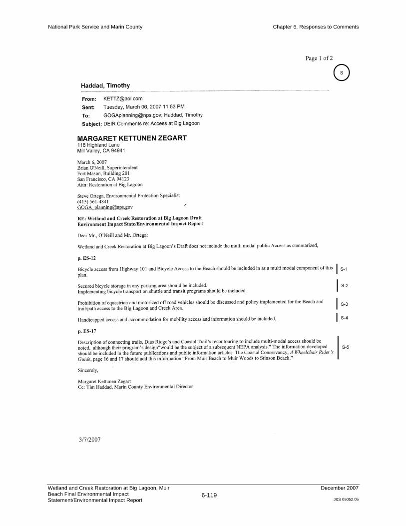
Letter S: Margaret Kettunen Zegart (March 6, 2007)
Response to Comment S-1
The proposed path would be bicycle-accessible, with bicyclists having the option of using Pacific Way to reach the parking lot.
Response to Comment S-2
Secure bicycle storage features such as bike racks will be incorporated into designs for visitors’ convenience and security. However, please note that actions related to a shuttle are not a component of this project and would need to be addressed by operators of a shuttle system.
Response to Comment S-3
The trails in the project area will be multiuse to facilitate full visitor access to and full recreational opportunities on the site. Equestrians will be permitted to use the trails in the project area. Motorized vehicles generally would not be permitted, and the only off-road vehicles that would be permitted would be bicycles or those used for ADA accessibility.
Response to Comment S-4
All trails proposed as part of the project will be ADA-compliant. This pertains to the new path from Hwy 1 to the parking lot, including the portion that will be attached to the new bridge.
Response to Comment S-5
This suggestion is appreciated. It is outside the scope of this project to plan details of the Dias Ridge or Coastal Trail recontouring projects. Please note, however, that the trails referred to cannot meet requirements for outdoor ADA accessibility because of their terrain and steep slopes.

National Park Service and Marin County Chapter 6. Responses to Comments
Wetland and Creek Restoration at Big Lagoon, Muir Beach Final Environmental Impact Statement/Environmental Impact Report
6-121
December 2007
J&S 05052.05

National Park Service and Marin County Chapter 6. Responses to Comments
Wetland and Creek Restoration at Big Lagoon, Muir Beach Final Environmental Impact Statement/Environmental Impact Report
6-122
December 2007
J&S 05052.05

National Park Service and Marin County Chapter 6. Responses to Comments
Wetland and Creek Restoration at Big Lagoon, Muir Beach Final Environmental Impact Statement/Environmental Impact Report
6-123
December 2007
J&S 05052.05
Letter T: David M. MacKenzie (March 6, 2007)
Response to Comment T-1
It would be possible to modify the lagoon alternatives to include more emergent wetland. In fact, the long-term development of emergent wetland in the lagoon alternatives was one of their attributes. However, the lagoon alternatives were not selected because of a combination of factors; added emergent wetlands in those alternatives would not alter that evaluation. The enormous quantities of soil that would have to be excavated and hauled for the lagoon alternatives—and the likely refilling of the lagoons with sediment—was a large factor in screening them out from the preferred alternative.
Response to Comment T-2
Under the preferred alternative, areas of open water would continue to exist along the creek channel, in backwater channels, and within the backbeach tidal lagoon. In addition, during the wet season, it is anticipated that the site will continue to exhibit periods of extensive inundation and seasonal ponding, particularly within the emergent wetland areas (please refer to MR-2). Although more extensive open water areas were considered in Restoration Alternatives 3 and 4, the additional volume of excavation was determined to be prohibitive.
Response to Comment T-3
The Draft EIS/EIR cover photo shows an existing winter condition at the site, with the intermittent tidal lagoon in the foreground and ponding behind the levee road in the center of the photo (the Green Gulch pasture). Although the preferred alternative does not propose to excavate a large lagoon in the pasture area, the area still will be subject to inundation similar to that shown in the photo. The primary difference between the photo and the preferred alternative is that there will be more tree cover in the pasture area. The cover of the Final EIS/EIR has been revised to show the view north from the beach, standing near the tidal lagoon. Post-project, this view would remain unchanged with the exception of enhanced vegetation.
Response to Comment T-4
The Nature Conservancy’s 25 global biodiversity “hot spots” were identified in:
Stein, B. A., L. S. Kutner, and J. S. Adams, eds. 2000. Precious Heritage: The Status of Biodiversity in the United States. Oxford: Oxford University Press.

National Park Service and Marin County Chapter 6. Responses to Comments
Wetland and Creek Restoration at Big Lagoon, Muir Beach Final Environmental Impact Statement/Environmental Impact Report
6-124
December 2007
J&S 05052.05
Response to Comment T-5
All the federally and state-listed special-status aquatic species at the site have experienced substantial impacts on their habitats over recent decades. NPS Management Policy 4.4.2.3 states, “NPS will survey for, protect and strive to recover all species native to national park system units that are listed under the Endangered Species Act.” As such, actions to provide habitat for special-status species drive specific elements of project design, and that is why this is listed as a project goal.
As for native species, NPS Management Policy 4.4.2 states, “Whenever possible, natural processes will be relied upon to maintain native plant and animal species and influence natural fluctuations in populations of these species.” The project would enhance habitat for many native species that are not listed under ESA or CESA, as discussed in Impacts WLD-R5, WLD-R6, and WLD-R18. Additionally, floodplain, wetland, and riparian functioning would be improved to ensure a higher quality of breeding and foraging habitat for native species over the long term.
Response to Comment T-6
The new drainage on Pacific Way does not permanently solve the flooding issue at this access point. The new drainage helps drain water off the road, but it does not reduce flooding on the road during larger storm events. The uncontrolled flows during such events represent a substantial flooding problem that impairs vehicle access. As such, the conditions are not sustainable and need to be addressed.
Response to Comment T-7
Common wildlife species, such as lizards, garter snakes, sparrows, blackbirds, black-tailed deer, coyote, squirrels, perch, and sculpin, are discussed in Chapter 3, Affected Environment, section 3.2.2 Wildlife and Wildlife Habitat. Impacts on common species of wildlife are discussed under Impact WLD-R18.
Habitat requirements for listed species, according to ESA and CESA, are presumed to be protective of more than those listed species. Thus, when water quality and instream habitat are improved for coho salmon, for example, other species (vegetation, insects, other salmonids, and birds) benefit from the improved habitat as well. Although the goal of the proposed project is focused on listed species, the project is anticipated to benefit all of the native species that use the habitat types that will be available following restoration.

National Park Service and Marin County Chapter 6. Responses to Comments
Wetland and Creek Restoration at Big Lagoon, Muir Beach Final Environmental Impact Statement/Environmental Impact Report
6-125
December 2007
J&S 05052.05
Response to Comment T-8
Comment noted.
Response to Comment T-9
Comment noted. NPS will consider the incorporation of bird blinds and boardwalks into the marsh as project design continues.
Response to Comment T-10
The project design and environmental analysis has used valid scientific approaches and the best available information to predict future conditions at the site. Although uncertainty regarding future conditions is unavoidable, the project has been designed to create self-sustaining habitat to the extent that the natural area will be mostly unconfined, and changes in the channel or in the habitat type will be allowed to occur with minimal interference by land managers. In terms of sustainability, this represents a substantial improvement over existing (confined) conditions.
Response to Comment T-11
The conceptual designs shown in this EIS/EIR have more extensive areas of emergent wetland than the conceptual designs in the Feasibility Analysis Report (PWA et al. 2004). New areas would be excavated, and the existing emergent wetland (the cattail area) in the southern portion of the pasture would not be removed as part of the project. It is possible that the cattail area may persist, although this is uncertain.
Designing the project to contain even more extensive areas of emergent wetland would be difficult. Relocation of the channel would result in a decrease in groundwater levels, which would have the tendency to dry out the site. Extensive excavation, therefore, would be necessary to bring the ground surface close enough to groundwater to allow emergent wetland to persist throughout the site. Such excavation would disturb the site extensively. Fill disposal and related haul trips also were a determining factor in selecting Restoration Alternative 2 as the preferred alternative over Restoration Alternatives 3 and 4, and they are generally regarded as undesirable.
Please also refer to MR-3, which discusses the potential shifts in habitat mosaics over time in response to sea level rise.

National Park Service and Marin County Chapter 6. Responses to Comments
Wetland and Creek Restoration at Big Lagoon, Muir Beach Final Environmental Impact Statement/Environmental Impact Report
6-126
December 2007
J&S 05052.05
Response to Comment T-12
Please refer to Response to Comment T-2. In addition, although an off-channel orientation could reduce sedimentation, a pond would still be subject to siltation during routine storm events that result in standing water throughout much of the site. These larger events carry heavy sediment loads, and off-channel open water features would still fill in over time. Achieving conditions similar to those in the 1853 maps is not possible over the long term because of elevated sediment loads from the upper watershed, which have been semipermanently increased because of the legacy of land use in the watershed. Therefore, extensive excavation has been determined to be undesirable because of its relatively short-term benefits weighed against the impacts of fill hauling and extensive site disturbance.
Response to Comment T-13
Please refer to the discussion of Impact WP-R2. Evaporation losses would be increased as a result of the increased extent of open water habitat. In addition, excavation of the lagoon bottoms would lower groundwater levels in the immediate vicinity of the lagoons by several feet. This lowering of groundwater may decrease in association with anticipated sea level rise. Although water is expected always to be present in the lagoons during the dry season, the reduction in groundwater levels could result in reduced instream flows in Redwood Creek. This reduction would be caused by the thalweg elevation of the creek being higher than the groundwater level in the zone of influence of the lagoons. This also would be reflected in decreased flows downstream. Although such impacts are not certain, particularly with the range of estimates in sea level rise, they have been included because they are reasonably foreseeable.
Response to Comment T-14
Please refer to the discussion on pages 2-51 through 2-52. Section 101(b) of NEPA presents a variety of criteria for determination of the environmentally preferred alternative. In general, the criteria stress a balance between project benefits and the degree of adverse impacts. All alternatives would provide ecosystem benefits and would provide unique recreational opportunities. Restoration Alternatives 3 and 4 would have some benefits that would not be experienced under Restoration Alternative 2, such as increased diversity and more even representation of habitats at the site. However, it was determined that adverse effects related to the construction of these alternatives outweighed these benefits. Impacts of construction that would be more severe under Restoration Alternatives 3 and 4 include increases in air emissions; the extent of disturbance to habitat and biological resources (including populations of special-status species); the potential for disturbances to cultural resources; effects of noise and diminished aesthetics on visitors and residents during construction activities such as fill hauling,; and the duration of construction. The benefits of the alternatives also would have a tendency to be reduced over time, as ongoing sediment loads would cause the alternatives to trend gradually toward conditions that are similar
National Park Service and Marin County Chapter 6. Responses to Comments
Wetland and Creek Restoration at Big Lagoon, Muir Beach Final Environmental Impact Statement/Environmental Impact Report
6-127
December 2007
J&S 05052.05
to those of Restoration Alternative 2. As such, it was the judgment of the EIS/EIR authors that Restoration Alternative 2 represented the environmentally superior alternative.
Response to Comment T-15
The latest IPCC (2007) predictions for future global sea level rise over the next 50 years are lower than those estimated in IPCC (2001). However, MR-3 discusses the potential effects of more extreme sea level rise. The upper end of IPCC (2007) values for 2100 is 1.85 feet, using 2010 as a baseline. Additional modeling with an ocean level increase of 6.5 feet (from 3 to 9.5 feet NGVD) was performed to accommodate both sea level rise and severe storm conditions. The conclusions of this analysis indicate that water levels upstream of the footbridge would be increased by less than 1 foot and that water level increases do not extend up to Pacific Way. Also note that for the scenario that was modeled, flood levels under the proposed project are predicted to be 1 to 2 feet lower than existing conditions. Please refer to MR-3 for a more complete discussion of the effects of sea level rise.
Response to Comment T-16
The goals of presenting Restoration Alternatives 3 and 4 were to evaluate the implications of trying to achieve conditions that were more similar to the historical (pre-1853) conditions at the site. Constructing additional ponds that are separate from the active channel does not fit within the overall approach of these alternatives, as such ponds were not present historically. If CRLF impacts had been the only issue that prevented these alternatives from being selected as the preferred alternative, NPS could have considered design modifications for CRLF. However, as stated earlier, there were many reasons that these alternatives were not selected as preferred, including increased costs and extent, intensity, and the duration of impacts.

National Park Service and Marin County Chapter 6. Responses to Comments
Wetland and Creek Restoration at Big Lagoon, Muir Beach Final Environmental Impact Statement/Environmental Impact Report
6-128
December 2007
J&S 05052.05

National Park Service and Marin County Chapter 6. Responses to Comments
Wetland and Creek Restoration at Big Lagoon, Muir Beach Final Environmental Impact Statement/Environmental Impact Report
6-129
December 2007
J&S 05052.05
Letter U: John and Cela O. O’Connor (March 7, 2007)
Response to Comment U-1
The alternatives analyzed in the Draft EIS/EIR represent tradeoffs between different habitat values; the commenter is correct in that Restoration Alternative 2 is more heavily weighted toward riparian wetland habitat compared to Restoration Alternatives 3 and 4, which are weighted toward open water habitat. Selection of the preferred alternative considered many factors, including cost and benefits to wildlife and the public; Restoration Alternative 2 was determined to be the most beneficial overall. Please refer to Page 2-45 for a complete discussion of the decision-making process and factors considered in selecting the preferred alternative.
With respect to benefits to salmonids, the Draft EIS/EIR found that the various action alternatives were very similar. All alternatives would greatly reduce the potential for entrapment as a result of out-of-bank flows or channel avulsion. A similar extent of juvenile rearing habitat would be present under all alternatives. For Restoration Alternative 2, this would be primarily in the form of backwater channels, in-channel pools, cover provided by LWD, and floodplain habitat during high winter flows. Restoration Alternatives 3 and 4, in contrast, would provide this habitat in the form of the lagoons rather than through backwater channels and in-channel features.
Response to Comment U-2
Historically, the channel downstream of the pedestrian bridge was located in the easily erodable beach sand. During high flows, the channel could readily respond to migrating sand and other sediment by scouring vertically and laterally. It is suspected that over time, old channel armoring from near the parking lot was displaced downstream and prevented the lower channel from downcutting. This led to the condition in 2002 when the channel could not cut through the cohesive sediment and dense vegetation that established downstream of the footbridge. The proposed project seeks to prevent this condition from reoccurring by:
relocating the channel beachward into the open sand,
removing any buried riprap that could inhibit channel mobility, and
rotating the parking lot.
These modifications are intended to increase the sustainability of the channel located in the back beach. However, since the 2005/2006 winter storms, the creek channel has eroded through the erosion-resistant material into underlying beach sand. This may make it unnecessary to relocate the channel.
In the restoration design, multiple changes will work in combination to allow the channel the mobility needed to address the existing condition (the parking lot

National Park Service and Marin County Chapter 6. Responses to Comments
Wetland and Creek Restoration at Big Lagoon, Muir Beach Final Environmental Impact Statement/Environmental Impact Report
6-130
December 2007
J&S 05052.05
modification, the levee road removal, the riprap removal, and allowing the channel to cut through the sandy area downstream of the pedestrian bridge.
Response to Comment U-3
Since publication of the Draft EIS/EIR, NPS has chosen to select Public Access Alternative B4 as the preferred alternative to improve floodplain connectivity and sediment transport functions. Regarding the effects of the parking lot on flooding, hydraulic modeling was employed to determine the effects of removal of parking lot fill on improving conveyance and sediment transport capacity (PWA et al. 2004). A sensitivity analysis was performed on the existing conditions model by testing the impacts of removing a portion of existing fill. The eastern end of the parking lot and picnic area was moved westward 30, 60, 90, 120, and 300 feet. Each of these 5 parking lot configurations was tested in the hydraulic model under the Q5 and Q50 conditions. Immediately upstream of the parking lot under Q5 conditions, the hydraulic model showed that water levels dropped by 0.5 ft, 0.7 ft, and 0.9 ft at setback distances of 30, 90, and 300 feet, respectively. A similar hydraulic pattern was apparent under Q50 conditions. The 350-foot parking lot setback under Public Access Alternative B4 was selected as an appropriate minimum parking lot setback distance, given the improvement in water levels with increasing setback distance.
The commenter also brings up other issues related to the size and location of the parking lot, such as safety concerns, aesthetics, and visitor experience. The Final EIS/EIR determined that relocation of the parking lot to the Alder Grove under Public Access Alternative C would have substantial safety issues for bicyclists, pedestrians, and equestrians that could not be fully mitigated through signage. Regarding aesthetics, the reconfigured parking lot under Public Access Alternative B4 is anticipated to be an improvement over existing conditions, as it would have less of a protrusion into the landscape. Views also would be improved through installation of planting bays between parking rows. Finally, regarding visitor experience, the Final EIS/EIR concluded that reduced parking lot capacity would adversely affect visitor experience for those visitors having difficulty finding parking; thus, the proposed alternative would maintain the current number of parking spaces.
Overall, Public Access Alternative B4 was determined to be the best option to balance multiple project objectives while avoiding or minimizing environmental impacts.
Response to Comment U-4
NPS agrees that reducing the parking lot capacity will not encourage the use of alternative transportation. However, if alternative transportation does not exist and the parking lot is reduced, adverse traffic impacts on Pacific Way and Hwy 1 will occur. This project seeks to coordinate with regional transportation planning, but planning means for alternative transportation is outside the scope of this

National Park Service and Marin County Chapter 6. Responses to Comments
Wetland and Creek Restoration at Big Lagoon, Muir Beach Final Environmental Impact Statement/Environmental Impact Report
6-131
December 2007
J&S 05052.05
project. Nonetheless, NPS will not preclude the possibility of reducing the parking lot in the future, if conditions change.
Response to Comment U-5
The preference for Bridge Alternative BR3 and Restoration Alternative 3 is noted. Thank you for your participation in the environmental review process.

National Park Service and Marin County Chapter 6. Responses to Comments
Wetland and Creek Restoration at Big Lagoon, Muir Beach Final Environmental Impact Statement/Environmental Impact Report
6-132
December 2007
J&S 05052.05

National Park Service and Marin County Chapter 6. Responses to Comments
Wetland and Creek Restoration at Big Lagoon, Muir Beach Final Environmental Impact Statement/Environmental Impact Report
6-133
December 2007
J&S 05052.05
National Park Service and Marin County Chapter 6. Responses to Comments
Wetland and Creek Restoration at Big Lagoon, Muir Beach Final Environmental Impact Statement/Environmental Impact Report
6-134
December 2007
J&S 05052.05
National Park Service and Marin County Chapter 6. Responses to Comments
Wetland and Creek Restoration at Big Lagoon, Muir Beach Final Environmental Impact Statement/Environmental Impact Report
6-135
December 2007
J&S 05052.05
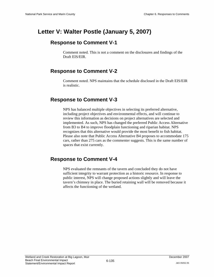
Letter V: Walter Postle (January 5, 2007)
Response to Comment V-1
Comment noted. This is not a comment on the disclosures and findings of the Draft EIS/EIR.
Response to Comment V-2
Comment noted. NPS maintains that the schedule disclosed in the Draft EIS/EIR is realistic.
Response to Comment V-3
NPS has balanced multiple objectives in selecting its preferred alternative, including project objectives and environmental effects, and will continue to review this information as decisions on project alternatives are selected and implemented. As such, NPS has changed the preferred Public Access Alternative from B3 to B4 to improve floodplain functioning and riparian habitat. NPS recognizes that this alternative would provide the most benefit to fish habitat. Please also note that Public Access Alternative B4 proposes to accommodate 175 cars, rather than 275 cars as the commenter suggests. This is the same number of spaces that exist currently.
Response to Comment V-4
NPS evaluated the remnants of the tavern and concluded they do not have sufficient integrity to warrant protection as a historic resource. In response to public interest, NPS will change proposed actions slightly and will leave the tavern’s chimney in place. The buried retaining wall will be removed because it affects the functioning of the wetland.
National Park Service and Marin County Chapter 6. Responses to Comments
Wetland and Creek Restoration at Big Lagoon, Muir Beach Final Environmental Impact Statement/Environmental Impact Report
6-136
December 2007
J&S 05052.05

National Park Service and Marin County Chapter 6. Responses to Comments
Wetland and Creek Restoration at Big Lagoon, Muir Beach Final Environmental Impact Statement/Environmental Impact Report
6-137
December 2007
J&S 05052.05
National Park Service and Marin County Chapter 6. Responses to Comments
Wetland and Creek Restoration at Big Lagoon, Muir Beach Final Environmental Impact Statement/Environmental Impact Report
6-138
December 2007
J&S 05052.05
Letter W: Christian Riehl (March 6, 2007)
Response to Comment W-1
The existing parking lot is approximately 450 feet long, and the lower picnic area is an additional 60 feet long. The parking lot elevations slope from approximately 10.5 feet NGVD on the northwestern end to 13 feet at the southeastern end (adjacent to former picnic area). The high point in the parking lot is the earth berm that separates the two parking stall lanes; this ridge slopes from approximately 12.5 feet NGVD to 14 feet NGVD (northwest to southwest). Adjacent wetlands beachward of the parking lot are approximately 7 to 9 feet NGVD.
We agree that the height (i.e., elevation) of the parking lot affects the flooding levels. As part of the Feasibility Study (PWA et al. 2003), hydraulic modeling was used to help examine the effects of the parking lot on flood levels. In a hydraulic model, the parking lot elevation was lowered approximately 3 feet on the southeastern end to elevation 10 feet NGVD.
We used the hydraulic model to test the sensitivity of parking-lot height on flood levels. We performed model runs for the 5- and 50-year flow events and varied the setback distance of the lowered parking lot by 30, 60, 90, and 300 feet (westward from the creek). Under the 5-year event, water levels dropped 0.5, 0.7, and 0.9 feet at setback distances of 30, 90, and 300 feet, respectively. Under these conditions, lowering approximately 90 feet of the raised area at the southeastern end of the existing parking lot could reduce the backwater effect by 0.7 feet; only a modest incremental decrease in flood elevations (0.2 feet) would be achieved from setting the parking lot back 200 feet farther.
The preferred alternative (Public Access Alternative B4) includes a reconfigured parking lot setback approximately 350 feet from the creek bank. Based on results of the hydraulic model, as well as informed opinions of geomorphologists who are cognizant of the effects of rare, but large events, NPS believes the rotated parking lot will fully achieve the protection the commenter seeks. NPS did consider lowering the new parking lot, even though we are confident that pulling it away from the creek alone would achieve the needed area for high flows to pass. The new parking lot would remain inundated under large flood events (such as Q50 and larger). If the parking lot elevation were lowered, it would be inundated more frequently due to creek flooding and/or storm surge, thereby increasing maintenance needs. NPS is choosing to keep the parking lot at about its existing elevation to minimize parking lot maintenance needs. (The exact elevation of the parking lot will be selected during the detailed design phase based on more refined hydraulic analysis.)
Response to Comment W-2
NPS appreciates the commenter’s input and concern for the area’s natural values. Residents of Green Gulch Farm and the Muir Beach community also have

National Park Service and Marin County Chapter 6. Responses to Comments
Wetland and Creek Restoration at Big Lagoon, Muir Beach Final Environmental Impact Statement/Environmental Impact Report
6-139
December 2007
J&S 05052.05
expressed a preference that the beach remain relatively free of signage so that users can experience the area’s natural qualities with a minimum of distraction. On the other hand, public surveys conducted by the Golden Gate National Parks Association have shown that visitors want more information about park resources, recreational opportunities, and trail routes.
NPS intends to balance these two interests by creating a cohesive signage/interpretation plan that provides pertinent information but does not alter the rural, semi-wild character of the area. This approach follows NPS policy 9.3.1.1 that signs
will be held to the minimum number, size and wording required to serve their intended functions and to minimally intrude upon the natural and historic settings. They will be placed where they do not interfere with park visitors' enjoyment and appreciation of park resources.
The signage plan will be developed during the design phase of the project, following the completion of the Final EIS/EIR.

National Park Service and Marin County Chapter 6. Responses to Comments
Wetland and Creek Restoration at Big Lagoon, Muir Beach Final Environmental Impact Statement/Environmental Impact Report
6-140
December 2007
J&S 05052.05
National Park Service and Marin County Chapter 6. Responses to Comments
Wetland and Creek Restoration at Big Lagoon, Muir Beach Final Environmental Impact Statement/Environmental Impact Report
6-141
December 2007
J&S 05052.05
Letter X: Edward T. Sanford (January 8, 2007)
Response to Comment X-1
As discussed in the Final EIS/EIR, Public Access Alternative B4 is now the preferred alternative. Public Access Alternative B4 was determined to be the best option to balance multiple project objectives while avoiding or minimizing environmental impacts. Public Access Alternative B4 would provide the same number of spaces as the existing parking lot and includes 310 linear feet of stacking room for cars between the entrance and the first parking stall. This alternative will allow improved floodplain functioning and habitat enhancement.

National Park Service and Marin County Chapter 6. Responses to Comments
Wetland and Creek Restoration at Big Lagoon, Muir Beach Final Environmental Impact Statement/Environmental Impact Report
6-142
December 2007
J&S 05052.05
National Park Service and Marin County Chapter 6. Responses to Comments
Wetland and Creek Restoration at Big Lagoon, Muir Beach Final Environmental Impact Statement/Environmental Impact Report
6-143
December 2007
J&S 05052.05

National Park Service and Marin County Chapter 6. Responses to Comments
Wetland and Creek Restoration at Big Lagoon, Muir Beach Final Environmental Impact Statement/Environmental Impact Report
6-144
December 2007
J&S 05052.05
Letter Y: David Schonbrunn (March 6, 2007)
Response to Comment Y-1
As part of the CTMP, projected (2023) parking demand at Muir Beach was estimated as follows (existing demand has been included for reference).
Table 6-4. Projected 2023 Parking Demand at Muir Beach
Peak Season Shoulder Season Off Season
Weekday Weekend Weekday Weekend Weekday Weekend
Existing parking demand 159 201 115 160 30 120
Projected parking demand (2023) 210 260 145 200 50 175
Bold = demand exceeds number of available spaces.
Source: CTMP, unpublished data.
Future increases in parking demand would result in exceeding parking capacity more frequently than under existing conditions. Other ancillary effects would increase over time also, such as the frequency and extent of vehicle queuing; LOS and intersection delay; and risks to pedestrians, equestrians, and bicyclists. As is the case in the near term, these effects would be more severe for smaller parking lots.
NPS was aware of the CTMP’s projection of increased demand in the future but chose not to increase the size of the parking lot to meet that demand in order to avoid increased traffic impacts and increased impacts on resources. The commenter makes an argument that the EIS/EIR should demonstrate a method for coping with future increases in visitors. Various parking-lot sizes were considered, one of which would meet current peak-season weekend demand and none of which would meet projected peak-season weekend demand. The maximum size of any parking lot alternative was determined through the use of a hydraulic model to outline an area where parking lot fill would not increase upstream flood elevations. While it would have been possible to increase the capacity of the parking lot slightly (Public Access Alternative B5), the EIS/EIR analyses showed this would increase traffic impacts under the existing condition, regardless of what the future projections are. It is important to note that future increases in parking demand are not a result of the project, but rather an environment in which the project would exist. The preferred alternative does not change parking capacity, so future conditions would be the same whether or not the project were implemented. The project will remedy the impact of parking on natural creek function without increasing traffic impacts.
Finally, projections of parking and visitor demand could change in the future as a result of increases in public transportation, alternative modes of transportation, changed demographics leading to alterations in parking demand, use of Intelligent Transportation Systems (ITS), and other factors that remain speculative. For instance, when the County and Caltrans develop a bus stop on

National Park Service and Marin County Chapter 6. Responses to Comments
Wetland and Creek Restoration at Big Lagoon, Muir Beach Final Environmental Impact Statement/Environmental Impact Report
6-145
December 2007
J&S 05052.05
Hwy 1, some added visitors may reach the site via the Muir Woods shuttle. The project does anticipate this by planning a trail along Pacific Way that will improve the experience and reduce conflicts with vehicles on the road. An improved multi-use trail connection that would result from the proposed Dias Ridge Trail recontouring and rerouting would improve access by methods other than auto. NPS may address other issues related to increased visitor demand over time outside the context of this proposed project. The Draft EIS/EIR provides an adequate analysis of existing and future traffic impacts for the purposes of disclosure, decision-making, and selection of a preferred alternative in the context of the proposed project.
Response to Comment Y-2
The degree to which visitor numbers may change (either increase or decrease) as a result of the proposed project is speculative. There is no basis for determining such a change with any degree of certainty, and the comment does not provide any information that would provide such a basis. Visitor amenities at the site would remain much as they are today, with only modest improvements in condition as a result of the project and no change in parking capacity For this reason, the assumption that visitation would remain unchanged by the project has been used and remains valid for the purposes of the EIS/EIR analysis.
Response to Comment Y-3
The preferred parking-lot size was selected with consideration of a variety of factors, including both existing and future projected parking demand and the sensitivity of the project setting. Public Access Alternative B4 was determined to be the best option to balance multiple project objectives while avoiding or minimizing environmental impacts. Public Access Alternative B4 would provide the same number of spaces as the existing parking lot and includes 310 linear feet of stacking room for cars between the entrance and the first parking stall.
Response to Comment Y-4
Text in the Draft EIS/EIR, page 4-251, describing the methods used to analyze the proposed action’s impacts on traffic flow and intersection delay in the project vicinity explains, “Because no data were available on the extent of illegal parking at the site during periods when parking capacity is exceeded, modeling assumed that vehicles accessing the parking lot when the lot was full would either wait for a parking space or leave the site.” Illegal parking adjacent to the beach reduces the effect of overflow vehicles on nearby roadways. Because no data are available on what percentage of overflow vehicles park illegally rather than queuing for legal spaces or returning to area roads, it was not possible to make a reasonable assumption about how much reduction in traffic overflow would result from illegal parking. To ensure that the effect of reduced parking-lot size on traffic flow was not underestimated, EIS/EIR analysis assumed that all
National Park Service and Marin County Chapter 6. Responses to Comments
Wetland and Creek Restoration at Big Lagoon, Muir Beach Final Environmental Impact Statement/Environmental Impact Report
6-146
December 2007
J&S 05052.05
overflow vehicles either would queue or return to area roadways rather than park illegally—this gives a conservative, “worst case” analysis of the effects of reduced beach parking on traffic flow near Muir Beach.
The conservative assumptions made in the traffic flow analysis were not intended to avoid discussion of illegal parking effects; NPS and Marin County are aware that some level of illegal parking does occur and that a reduction in parking availability at the beach would likely increase the extent of illegal parking, with corollary effects on local circulation and access. This contributed to the selection of a Public Access Alternative that maintains the existing parking lot size. The potential that a reduction in parking availability at the beach could increase illegal parking on adjacent roads was discussed under Impact TC-P1: Changes in Parking Availability During Construction (EIS/EIR page 4-258) and Impact TC-P6: Long-Term Changes in Parking Availability (EIS/EIR page 4-261).
Response to Comment Y-5
The text introducing each table has been modified in the Final EIS/EIR to clarify the date of the traffic baseline data used to construct the tables.
Response to Comment Y-6
The commenter refers to adverse impacts associated with parking lot alternatives with reduced capacity relative to existing conditions (i.e, B1, B2, and C1). Parking restrictions on roadways accessing Muir Beach are not under NPS jurisdiction; they are enforced by the Marin County Sheriff’s Office. However, NPS shares the commenter’s concern regarding the adverse effects of illegal parking and is committed to working with the County and local residents to address this problem; as discussed above, the potential that reduced parking availability would increase illegal parking was a key reason for the selection of a preferred Public Access Alternative that would maintain the existing size of the parking lot.
While expansion of the Muir Woods Shuttle system to Muir Beach could alleviate impacts associated with the smaller parking lot alternatives, such expansion of service is beyond the scope of this project and therefore has not been proposed as mitigation.
Response to Comment Y-7
The parking plan for this project does meet NPS Management Policy 9.2.4 for parking, which states, “Permanent parking area will not normally be sized for the peak use day, but rather for the use anticipated on the average weekend day during the peak season of use.” As stated previously, the goals of this project do not include regional transportation planning, although nothing in this EIS/EIR precludes NPS addressing these issues through future planning. It is noted that
National Park Service and Marin County Chapter 6. Responses to Comments
Wetland and Creek Restoration at Big Lagoon, Muir Beach Final Environmental Impact Statement/Environmental Impact Report
6-147
December 2007
J&S 05052.05
the commenter believes that NPS Management Policy 9.2.4 is outmoded. It was not used as the sole criterion for the determination of impacts. The preferred Public Access Alternative was identified to minimize impacts on natural resources while still accommodating visitors. Please refer to the analysis thresholds provided in Section 4.3.4.2 of the EIS/EIR.
Response to Comment Y-8
The project itself would not result in the reduction of vehicle trips to the site compared with existing conditions. The public demand for use of the site would not change as a result of the project. The project therefore would not create any transportation-related energy impacts requiring mitigation, and Impact PS-R2 was determined to be negligible, including consideration of the transportation component. For this reason, reductions in vehicular travel to the park were not considered for mitigation in relationship to this project.
Please note, however, that the project does not preclude future improvements to public transportation in the area and the integration of the site with those services. In the event that public transportation is provided to the site, energy demand associated with visitation to Muir Beach potentially would decline. However, this impact would not be realized without public transportation service, which is not part of the proposed project.

National Park Service and Marin County Chapter 6. Responses to Comments
Wetland and Creek Restoration at Big Lagoon, Muir Beach Final Environmental Impact Statement/Environmental Impact Report
6-148
December 2007
J&S 05052.05
Letter Z: Responses to Marin County Planning Commission Hearing Comments
The following paragraphs represent summaries of all oral comments received at the Marin County Planning Commission Hearing in San Rafael, California, held on February 26, 2007; at 11 a.m. Responses to comments are provided immediately after each comment (bullets). In general, oral comments duplicated those received in writing; for this reason, most of the responses refer the reader to the responses prepared to relevant written comments.
Comment and Response Z-1
Comments were received regarding the preference for selection of Bridge Alternative BR-4, the longest bridge alternative, as the preferred alternative.
Please refer to MR-1 Preferred Bridge Alternative.
Comment and Response Z-2
Concern was expressed regarding the width and aesthetic appearance of the proposed bridge. Commenters are concerned that the bridge would be too wide and not blend in with the rustic character of the area. A request was made for more details on how the bridge width was estimated.
Please refer to MR-1 and Response to Comment F-7.
Comment and Response Z-3
More information was requested on the Value Analysis and cost estimates conducted for determination of the Preferred Alternative.
Please refer to MR-1 Preferred Bridge Alternative.
Comment and Response Z-4
Numerous comments were received regarding accommodation of alternative means of transport to the project site, such as local bus service, to reduce congestion on Pacific Way. Commenters expressed the desire for the parking lot size to be reduced to allow for a bus stop and transit service to be included in the proposed project.
Please refer to Responses to Comments C-4, C-6, F-20, and J-1.

National Park Service and Marin County Chapter 6. Responses to Comments
Wetland and Creek Restoration at Big Lagoon, Muir Beach Final Environmental Impact Statement/Environmental Impact Report
6-149
December 2007
J&S 05052.05
Comment and Response Z-5
Comments were received regarding the parking lot design and concerns over the orientation of the parking lot relative to the creek. Preference for Public Access Alternative C was expressed.
Please refer to Responses to Comments C-7, J-2, and W-1.
Comment and Response Z-6
Comments were received regarding provisions for separate pedestrian access to the beach and parking lot. A separate pedestrian bridge was also proposed.
Please refer to Response to Comment N-17.
Comment and Response Z-7
A comment was received about the impact of sea level rise on the frequency and depth of flooding over the bridge.
Please refer to MR-3 Sea Level Rise.
Comment and Response Z-8
A comment was received regarding riparian restoration and the level of protection that would be provided for salmon refugia and rearing habitat.
Please refer to MR-2 Salmonid Rearing Habitat.
Comment and Response Z-9
Preference was expressed for selection of the alternatives that would restore the most geomorphic functions of the creek and result in the least amount of fill in the floodplain.
The commenter’s preference is noted. The preferred alternative is anticipated to result in substantial improvement to the geomorphic functioning of Redwood Creek while minimizing the amount of net fill to the floodplain.

National Park Service and Marin County Chapter 6. Responses to Comments
Wetland and Creek Restoration at Big Lagoon, Muir Beach Final Environmental Impact Statement/Environmental Impact Report
6-150
December 2007
J&S 05052.05
Comment and Response Z-10
Commenters requested that signage for the proposed project include regional history about the area and encourage alternative transport to the project site.
Please refer to Responses to Comments L-7 and W-2.
Comment and Response Z-11
Consideration of population growth estimates and the potential impact on visitor use and traffic at the proposed project site was requested.
Increases in population, Muir Beach visitation, and associated vehicle traffic were considered in preparation of the EIS/EIR. However, because these are not consequences of the project or its alternatives, their potential impacts were not evaluated. Although the goals of the project do not include addressing increased visitation to Muir Beach, the project would create conditions that are as good or better than existing conditions with respect to accommodation of visitors (such as construction of a new Pacific Way bridge that accommodates two-way traffic and construction of a separate pedestrian trail). Further, the proposed project would not preclude future actions to address increases in visitation over time.