1 new orleans district morganza to the gulf 23 may 2008 carl anderson, senior project manager, usace
TRANSCRIPT

1
New Orleans DistrictNew Orleans District
Morganza to the GulfMorganza to the Gulf
23 May 200823 May 2008
Carl Anderson, Senior Project Manager, USACE

2
Morganza to the GulfMorganza to the GulfPurposePurpose
Morganza to the GulfMorganza to the GulfPurposePurpose
• Reduce flood damages Reduce flood damages (10,000 homes flooded (10,000 homes flooded during Hurricane Rita, during Hurricane Rita, 3,000 severely 3,000 severely damaged)damaged)
• Reduce coastal Reduce coastal wetlands losswetlands loss
• Minimize adverse Minimize adverse impacts on navigation impacts on navigation and industryand industry
Hurricane Flood DamageHurricane Flood Damage

3
Morganza to the GulfMorganza to the Gulf
Authorized by Congress in WRDA 2007Authorized by Congress in WRDA 2007
Total Project Cost = $912M Total Project Cost = $912M (Oct. 2007 price levels)(Oct. 2007 price levels)
• Cost-sharing 65%-35%Cost-sharing 65%-35%– LADOTD will be construction sponsorLADOTD will be construction sponsor
– TLCD will sponsor OMRRR TLCD will sponsor OMRRR
4
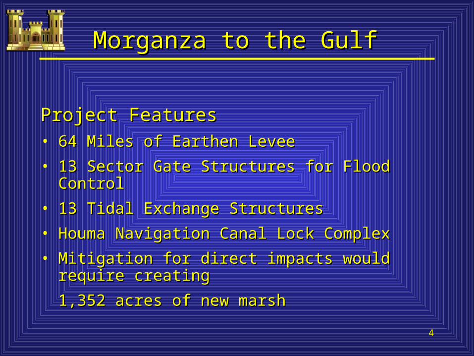
Morganza to the GulfMorganza to the Gulf
Project FeaturesProject Features• 64 Miles of Earthen Levee64 Miles of Earthen Levee
• 13 Sector Gate Structures for Flood Control13 Sector Gate Structures for Flood Control
• 13 Tidal Exchange Structures13 Tidal Exchange Structures
• Houma Navigation Canal Lock ComplexHouma Navigation Canal Lock Complex
• Mitigation for direct impacts would require creating Mitigation for direct impacts would require creating
1,352 acres of new marsh1,352 acres of new marsh

5
Existing Hydrologic BarriersExisting Hydrologic Barriers
6
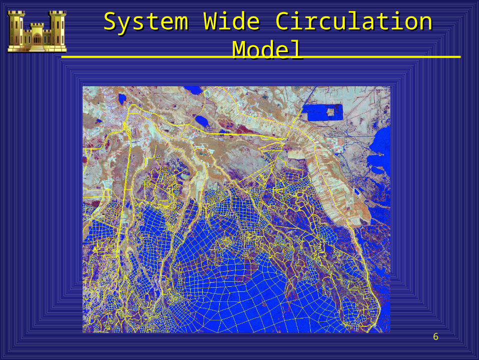
System Wide Circulation ModelSystem Wide Circulation Model
7
LaroseLaroseGIWWGIWW
CocodrieCocodrieB. G
rand
Cai
llou
B. G
rand
Cai
llou
B. L
afou
rche
B. L
afou
rche
GIWWGIWWPresquilePresquile
BoudreauxBoudreaux
B. P
etit
Cai
llou
B. P
etit
Cai
llou
Lafourche Parish
Lafourche Parish
Terrebonne Parish
Terrebonne Parish
NNBourgBourg
AshlandAshland 56
ChauvinChauvin
57
315
DulacDulac
Morganza to the Gulf of Mexico
Project
Morganza to the Gulf of Mexico
Project
REACH AREACH AREACH AREACH A
REACH BREACH BREACH BREACH B
Sector GatesSector GatesSector GatesSector Gates
Houma Navigation Canal Lock Houma Navigation Canal Lock and Sector Gateand Sector GateHouma Navigation Canal Lock Houma Navigation Canal Lock and Sector Gateand Sector Gate
Work in Kind (WIK) LeveesWork in Kind (WIK) LeveesWork in Kind (WIK) LeveesWork in Kind (WIK) Levees
Recommended AlignmentRecommended AlignmentRecommended AlignmentRecommended Alignment
MontegutMontegut
REACH EREACH EREACH EREACH E
REACH FREACH FREACH FREACH F
REACH HREACH HREACH HREACH H
REACH GREACH GREACH GREACH G
REACH IREACH IREACH IREACH I
REACH KREACH KREACH KREACH K
REACH LREACH LREACH LREACH L
HoumaHouma
REACHJ-1
B. T
erre
bo
nn
e
B. T
erre
bo
nn
e REACHREACHJ-2J-2
REACHREACHJ-2J-2
REACHREACHJ-3J-3
REACHREACHJ-3J-3
55
8
9
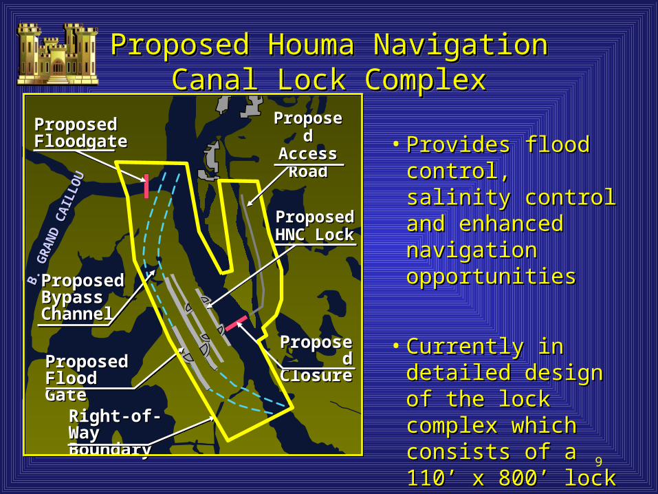
Proposed Houma NavigationProposed Houma NavigationCanal Lock ComplexCanal Lock Complex
Proposed Houma NavigationProposed Houma NavigationCanal Lock ComplexCanal Lock Complex
Proposed Proposed FloodgateFloodgate
Right-of-Way Right-of-Way BoundaryBoundary
B. G
RA
ND
CA
ILLO
U
B. G
RA
ND
CA
ILLO
U
Proposed Proposed Bypass Bypass ChannelChannel
Proposed Proposed ClosureClosureProposed Proposed
Flood GateFlood Gate
• Provides flood control, Provides flood control, salinity control and salinity control and enhanced navigation enhanced navigation opportunitiesopportunities
• Currently in detailed Currently in detailed design of the lock design of the lock complex which consists complex which consists of a 110’ x 800’ lock of a 110’ x 800’ lock and 250’ floodgateand 250’ floodgate
Proposed Proposed HNC LockHNC Lock
Proposed Proposed Access Access RoadRoad

10
Louisiana Coastal AreaLouisiana Coastal Area
• The Multi-purpose operation of Houma The Multi-purpose operation of Houma Navigation Canal (HNC) Lock is listed as a Navigation Canal (HNC) Lock is listed as a near term critical restoration feature in the near term critical restoration feature in the final programmatic EIS for Louisiana final programmatic EIS for Louisiana Coastal Area Ecosystem Restoration Study Coastal Area Ecosystem Restoration Study for Subprovince 3.for Subprovince 3.
• A Record of Decision for this FPEIS was A Record of Decision for this FPEIS was signed in January 2005 and was signed in January 2005 and was authorized in authorized in Water Resources Water Resources Development Act of 2007.Development Act of 2007.
11
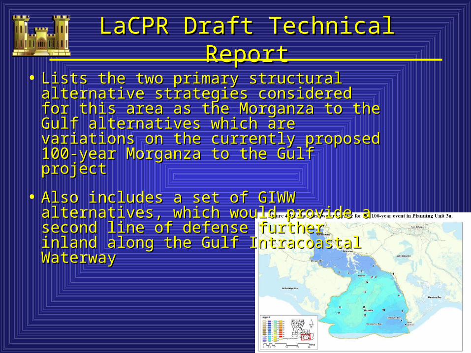
LaCPR Draft Technical ReportLaCPR Draft Technical Report
• Lists the two primary structural alternative Lists the two primary structural alternative strategies considered for this area as the strategies considered for this area as the Morganza to the Gulf alternatives which are Morganza to the Gulf alternatives which are variations on the currently proposed 100-year variations on the currently proposed 100-year Morganza to the Gulf project Morganza to the Gulf project
• Also includes a set of GIWW alternatives, which Also includes a set of GIWW alternatives, which would provide a second line of defense further would provide a second line of defense further inland along the Gulf Intracoastal Waterwayinland along the Gulf Intracoastal Waterway

12
Summary of Benefits
• Flood ProtectionFlood Protection– 100-yr level of protection to be provided100-yr level of protection to be provided– Safeguard approximately 150,000 residentsSafeguard approximately 150,000 residents
• Safe HarborSafe Harbor– System would reduce damages, transportation System would reduce damages, transportation
and storage costs and increase navigation and storage costs and increase navigation opportunitiesopportunities

13
Summary of BenefitsSummary of Benefits
• Ecosystem ProtectionEcosystem Protection– Reduce saltwater intrusion and the frequency of Reduce saltwater intrusion and the frequency of
wetland flooding for 83,000 acres of existing wetland flooding for 83,000 acres of existing wetlandswetlands
– Potential for managing freshwater flow and Potential for managing freshwater flow and improving rapidly deteriorating wetlandsimproving rapidly deteriorating wetlands
• Water Supply Water Supply – Reduce annual water treatment costs, equipment Reduce annual water treatment costs, equipment
replacement and maintenance costsreplacement and maintenance costs
– Reduce the need for capital projectsReduce the need for capital projects• Dredging/expansion of current reservoir or purchasing Dredging/expansion of current reservoir or purchasing
purification systemspurification systems
14
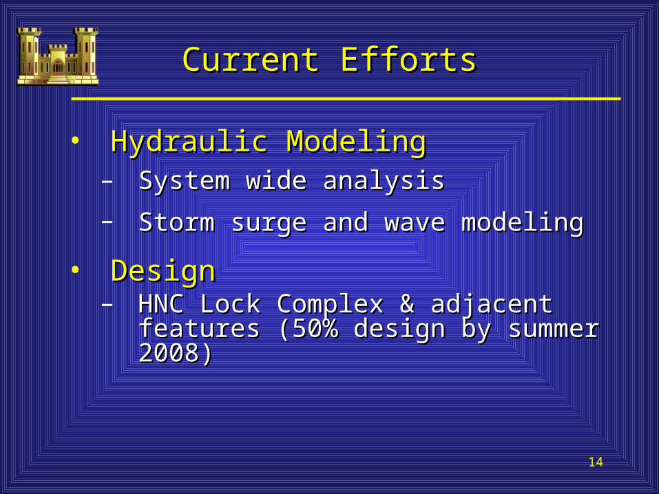
Current EffortsCurrent Efforts
• Hydraulic ModelingHydraulic Modeling– System wide analysisSystem wide analysis
– Storm surge and wave modelingStorm surge and wave modeling
• DesignDesign– HNC Lock Complex & adjacent features HNC Lock Complex & adjacent features
(50% design by summer 2008)(50% design by summer 2008)

15
Current EffortsCurrent Efforts
• Revised Programmatic Environmental Revised Programmatic Environmental Impact Statement (RPEIS)Impact Statement (RPEIS)– Includes lock as constructible featureIncludes lock as constructible feature– Completion expected in summer 2009Completion expected in summer 2009
• Post Authorization Change Report Post Authorization Change Report (PAC)(PAC)– Completion expected in summer 2009Completion expected in summer 2009
16
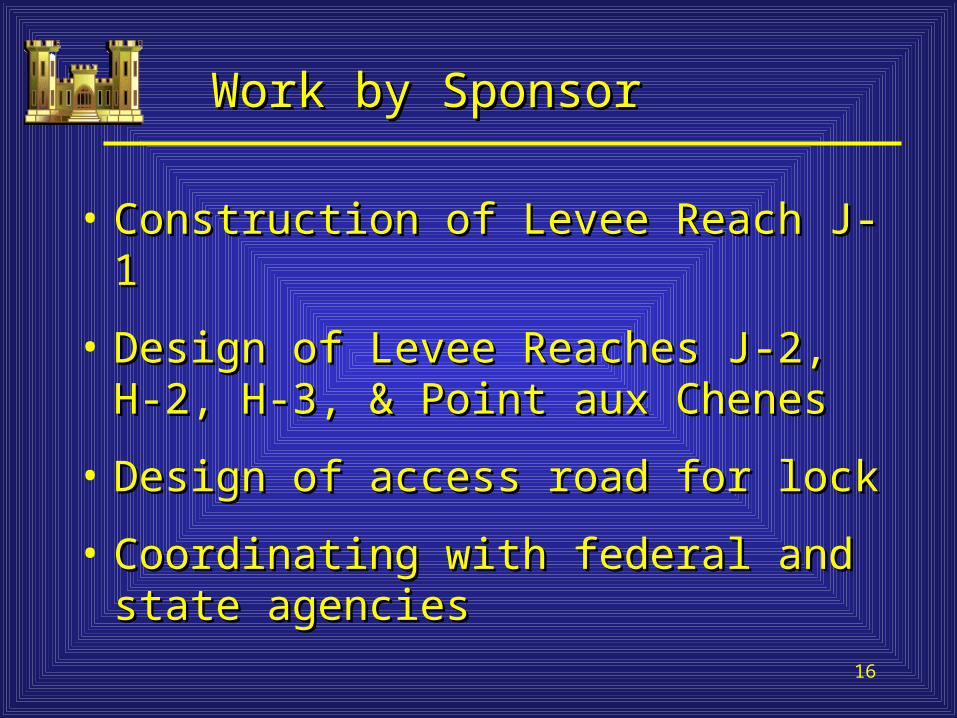
Work by SponsorWork by Sponsor
• Construction of Levee Reach J-1Construction of Levee Reach J-1
• Design of Levee Reaches J-2, H-2, H-3, Design of Levee Reaches J-2, H-2, H-3, & Point aux Chenes& Point aux Chenes
• Design of access road for lockDesign of access road for lock
• Coordinating with federal and state Coordinating with federal and state agenciesagencies

17
Project Web PageProject Web Page
http://www.mvn.usace.army.milhttp://www.mvn.usace.army.mil/prj/mtog//prj/mtog/