11.0 archaeological, architectural and cultural …
TRANSCRIPT

ARCHAEOLOGICAL, ARCHITECTURAL AND CULTURAL HERITAGE AWN Consulting Limited _____________________________________________________________________________________________________
_____________________________________________________________________________________________________
ABP Clones WWTP Alterations EIS Page 1
11.0 ARCHAEOLOGICAL, ARCHITECTURAL AND CULTURAL HERITAGE 11.1 INTRODUCTION
Moore Group was commissioned by AWN Consulting on behalf Anglo Beef Processors Ireland (t/a ABP Clones) to carry out a cultural heritage assessment of the potential impact on the cultural heritage resource of an existing slaughterhouse/meat processing facility at Clones, Co Monaghan. The proposed development will involve amendments to the operation of the existing onsite WWTP (reducing chloride discharges) and relocation of the point of discharge from the local tributary to the River Finn to allow for greater dilution. The development will involve the installation of c.3km of 100mm HDPE pipe with a minimum cover of 1m extending south west from the existing WWTP across 450m of greenfield and south along the margin of the R212 to a point south of Cumber Bridge to the River Finn. The pipeline route will potentially impact on the former site of the Clones Union Workhouse and Cumber Corn Mill. Along the route, it will pass in the near vicinity of a number of Protected Structures/NIAH sites including a gate lodge to Cloncurrin House, a Memorial in the Presbyterian Cemetery and Cumber Bridge. This study aims to assess the baseline archaeological, architectural and cultural heritage environment, to evaluate the likely impacts that the proposed development will have on this environment and to recommend mitigation measures, in accordance with the policies of the Department of Arts, Heritage, Regional, Rural and Gaeltacht Affairs and Monaghan County Council, the National Monuments Acts 1930-2004 and best practise guidelines, to ameliorate these impacts. Following on from this, the residual impact that the proposed scheme will have on the baseline environment is evaluated and identified. For the purposes of this report the definition of “cultural heritage” is taken broadly from the UNESCO Convention Concerning the Protection of the World Cultural and Natural Heritage, 1972, which considers the following to be “cultural heritage”:
Tangible cultural heritage:
movable cultural heritage (artefacts)
immovable cultural heritage (monuments, archaeological sites, and so on)
underwater cultural heritage (shipwrecks, underwater ruins and cities)
Intangible cultural heritage: oral traditions, folklore etc.
This Impact Assessment addresses Cultural Heritage under two headings: archaeology and architectural/built heritage. Where appropriate, mitigation measures are proposed and an indication of the likely potential residual impacts upon the cultural heritage are quantified.
For
insp
ectio
n pur
pose
s only
.
Conse
nt of
copy
right
owne
r req
uired
for a
ny ot
her u
se.
EPA Export 03-05-2017:03:09:26

ARCHAEOLOGICAL, ARCHITECTURAL AND CULTURAL HERITAGE AWN Consulting Limited _____________________________________________________________________________________________________
_____________________________________________________________________________________________________
ABP Clones WWTP Alterations EIS Page 2
Figure 11.1 Site location Map showing ABP Clones and proposed pipeline route.
11.2 METHODOLOGY
The evaluation of impacts upon the archaeological, architectural and cultural heritage resource is based on a desktop study of published and unpublished documentary and cartographic sources, followed by a field survey. In light of the legislative protection afforded to the cultural heritage resource this report evaluates the archaeological, architectural, cultural and historical importance of the subject area and examines the impacts of the proposed development on both the local archaeological monuments and cultural heritage sites.
11.2.1 Desk Based Study
World Heritage Sites and Candidate World Heritage Sites were reviewed to see if any are located within the vicinity of the proposed development. All known cultural heritage sites were mapped in GIS along with aerial photography and Ordnance Survey Ireland (OSI) First Edition Mapping (Circa 1830). Sites mapped included the following:
UNESCO World Heritage Sites including the tentative list of candidate sites;
National Monuments, be they in the ownership or guardianship of the State, in the ownership of a local authority or monuments under preservation orders;
Record of Monuments & Places (RMP) and Sites and Monuments Record (SMR) from www.archaeology.ie;
Records of Protected Structures from Monaghan County Council;
National Inventory of Architectural Heritage (NIAH) for County Monaghan
For
insp
ectio
n pur
pose
s only
.
Conse
nt of
copy
right
owne
r req
uired
for a
ny ot
her u
se.
EPA Export 03-05-2017:03:09:26

ARCHAEOLOGICAL, ARCHITECTURAL AND CULTURAL HERITAGE AWN Consulting Limited _____________________________________________________________________________________________________
_____________________________________________________________________________________________________
ABP Clones WWTP Alterations EIS Page 3
Demesnes Landscapes and Historic Gardens indicated on the OSI First Edition Mapping.
All townlands located within 0.5km of the site were listed and cross-referenced with:
National Monuments List for County Monaghan from www.archaeology.ie; and
Preservation Orders, a list available from the National Monuments Service.
All churches and graveyards which have the potential to be in the ownership of the Local Authorities were highlighted as potential National Monuments.
All townlands located along the proposed route were reviewed and crossed referenced with:
o National Monuments, a list for County Monaghan available from www.archaeology.ie;
o Preservation Orders, a list available from the National Monuments Service; and
o Lists contained in to the Report of the Commissioners or Church Temporalities of Ireland (1879) which contain lists of Churches, School Houses and Graveyards that were vested in the Representative Church Body and the Burial Boards under The Irish Church Act, 1869.
The Monaghan Development Plan 2013-2019 (Chapter 4 Environment and Heritage, Architectural and Built Heritage Chapter 4.11 and Archaeological Heritage 4.12) and other documentary and literary sources were reviewed to obtain a comprehensive understanding of the cultural heritage of the region. In order to assess the potential impact of the proposal the following sources were also consulted or reviewed:
Excavations Bulletin;
Topographical files of the National Museum of Ireland;
Cartographic Sources;
Toponyms;
Aerial photographs;
Published archaeological inventories; and
Documentary Sources: a number of literary references were consulted 11.3 RECEIVING ENVIRONMENT
The project area is located within LCA.4, The Clones River Valley and Farmed Uplands, as identified in the Monaghan Landscape Character Assessment. This is a low-lying undulating farmed landscape comprising a series of low rolling hills. The River Finn is the principal watercourse extending from the north east to the south west. Occasional small loughs are also dispersed throughout this landscape. Remnants of an industrial past include the disused Ulster Canal which extends from the north east towards Clones. The proposed scheme area consists of the existing ABP facility, on the former site of the Clones Union Workhouse and Hospital at Teehill and south along the R121 regional road towards the Finn River at Cumber Bridge. From north to south, the road passes rolling countryside through the townlands of Teehill, Cloncurrin, Clonkeen, Clonmore townlands in a predominantly rural setting defined by improved pastureland with frequent ‘one off’ dwelling houses along the
For
insp
ectio
n pur
pose
s only
.
Conse
nt of
copy
right
owne
r req
uired
for a
ny ot
her u
se.
EPA Export 03-05-2017:03:09:26

ARCHAEOLOGICAL, ARCHITECTURAL AND CULTURAL HERITAGE AWN Consulting Limited _____________________________________________________________________________________________________
_____________________________________________________________________________________________________
ABP Clones WWTP Alterations EIS Page 4
roadside. Significant development along the road include the Union Workhouse, Cloncurrin House, Clonmore Presbyterian Burial Ground and Cumber Bridge.
Location Details
County Monaghan
Local Authority Monaghan County Council
Barony Dartree
Civil Parish Clones
Townlands Teehill, Cloncurrin, Clonkeen, Clonmore
OS Sheet Number
MO016
National Monuments within 1km
Crossmoyle Round tower RMP MO011-010002 (Nat mon no. 111) 548m from WWTP
Crossmoyle High Cross RMP MO011-010002 (Nat mon no. 112) 730m from WWTP
Crossmoyle Church RMP MO011-010002 (Nat mon no. 111) 546m from WWTP
RMP’s / SMR’s(within 200m)
There are no recorded monuments within 200m of the scheme extending from the facility and along the length of the R212 road. The nearest recorded monuments
are in Clones town and relate to the Church, round tower and graveyard at Crossmoyle.
Protected Structures/NIAH sites within 200m.
NIAH Reg. no. 41401601, Gate Lodge Teehill, on roadside
NIAH Reg. no. 41401602, Cloncurrin House, 100m from road NIAH Reg. no. 41401604, Williamson Memorial in Clonmore graveyard, 20m from road NIAH Reg. no. 41401608, Cumber Bridge, on road
Other Cultural Heritage Sites /Zones of archaeological potential within 2km
Clones Own Area of Archaeological Importance
Former site of Corn mill near Cumber Bridge
ITM Centred on ITM 649905/824223
Table 11.1 Location details
11.3.1 Archaeological, Architectural and Historical Background 11.3.1.1 Mesolithic Period (8000–4000 BC)
The Mesolithic (middle stone age) people were the first inhabitants of Ireland, arriving about 9000 years ago. They were a mobile society relying on wild resources for food, which was hunted and gathered using stone tools as well as boats, nets and traps. Due to the transitory nature of Mesolithic encampments evidence for settlement activity can be scarce and in many cases, can only be determined by flint scatters or rubbish middens. Regionally a Mesolithic flint identified as a Bann Flake was found in Corduff (NMI Find No. - 1965:138).
11.3.1.2 Neolithic Period (4000BC-2500BC)
The practice of farming spread from the Middle East, through eastern and southern Europe to reach Ireland via Britain around 4000BC.This transition fundamentally changed the local economy from one based on hunting and foraging to one of cereal cultivation and livestock rearing. Stray finds like the discovery of a stone axehead (NMI Find No. - 1933:236) from Annalogh, indicates that there was activity during this period. Other finds that could fall into this broad date range include a flint thumb-scraper (NMI Find No. - 1956:274) from Cargaghoge, a flint scraper (NMI Find No. - 1965:130) from Cargaghoge and a flint blade (NMI Find No. - 1965:133) from Corduff,
11.3.1.3 The Bronze Age (2500BC-500BC)
As stone tools were replaced by the use of copper, which was later combined with tin to make bronze, the structure of society also changed. Bronze Age funerary practices developed from inhumation in the earlier period towards cremation in the later period
For
insp
ectio
n pur
pose
s only
.
Conse
nt of
copy
right
owne
r req
uired
for a
ny ot
her u
se.
EPA Export 03-05-2017:03:09:26

ARCHAEOLOGICAL, ARCHITECTURAL AND CULTURAL HERITAGE AWN Consulting Limited _____________________________________________________________________________________________________
_____________________________________________________________________________________________________
ABP Clones WWTP Alterations EIS Page 5
with remains interred in simple pits or within Ring ditches or barrows. Settlement patterns in this period can be inferred by the distribution of fulachta fia (sometimes referred to as burnt mounds). These consist of mounds of fire cracked stones in charcoal enriched clay and are thought to have fulfilled numerous functions including cooking, bathing, brewing and textile processing.
11.3.1.4 The Iron Age (c. 500BC to 500AD)
Life in the Iron Age seems to have been defined by continually warring petty kingdoms run on an extended clan system, had their economy rooted in mixed farming and cattle. Settlement was typically centred on a focal hillfort with satellite ringforts. The population appears to have lived in hillforts, crannógs and major defensive sites. There is a small Crannog MO016-013 to the west of the scheme area near Lisabuck Lough.
11.3.1.5 Early Medieval Period (c. 500AD-1100AD)
Settlement in the Early Medieval Period is defined by the ringfort, thought to be small farmsteads, enclosing houses, farm buildings and animal pens, enclosed as protection against raiders or wild animals. Their distribution in the region is dispersed and widespread and are the most numerous and visible monuments in the county. Local examples include raths in Lisabuck MO016-005 and MO017-020 Fremagh. The town of Clones owes its origins to the foundation of a monastic settlement by St. Tigernach in what was then the Kingdom of Dartraige Con-innsi (the Calf People).. According to what are probably fourteenth century and later Lives, he was educated at Whithorn in England and visited Rome where he collected relics of Ss Peter and Paul before establishing a monastery at Clones where he died in AD 549-50 (Ó Riain 2011, 572-3).The monastery was plundered by Vikings in 836 and destroyed by fire in 1095 (McKenna 1920, vol. 2, 1-12), but probably from the 1140s it had been transformed into the Augustinian abbey of St Peter and Paul.
11.3.1.6 Medieval Period to Late Medieval (c. 1100AD-1650AD)
The late medieval period coincides with the arrival of the Anglo Normans in 1169. Their impact on the archaeological, cultural and political landscape transformed the country and over time the tuath system was replaced by a feudal system ruled by lords and barons. Towns began to develop and monument types associated with this period include motte and baileys, moated sites and later stone castles, in particular tower houses. In Clones this conquest is represented by a Motte and Baily (in Crossmoyle townland near the monastic site). By AD 1300 the old Gaelic chiefdoms were reasserting their control. A sharp cultural division emerged in the east border area between the old order and the Feudal system of the settlers evident in the counties of Louth and Down which were under English control. Following successive Irish defeats and with various Plantations by the 17th century, practically all the traditionally held Gaelic lands were confiscated and transferred to English settlers.
11.3.1.7 Modern Period
By the end of the eighteenth century the fortunes of the protestant ascendency were flourishing. This wealth was expressed in the conversion of old manors into demesnes centred on a mansion house in a designed landscape bounded by a high walls accessed via grand entrances guarded by gate lodges. The nearest big demesne’s in the wider subject area include Carra House in Fermanagh and Hilton House.
For
insp
ectio
n pur
pose
s only
.
Conse
nt of
copy
right
owne
r req
uired
for a
ny ot
her u
se.
EPA Export 03-05-2017:03:09:26

ARCHAEOLOGICAL, ARCHITECTURAL AND CULTURAL HERITAGE AWN Consulting Limited _____________________________________________________________________________________________________
_____________________________________________________________________________________________________
ABP Clones WWTP Alterations EIS Page 6
11.3.1.8 Clones Workhouse The existing ABP Clones plant occupies the former site of the Clones Union Workhouse that opened in November 1842. The building was designed by George Wilkenson to a standard plan and could accommodate 600 inmates. During the famine era additional houses were hired to aid an additional 220 inmates. Census records of the time indicate a local drop in the population by 35%. Given these number coupled with an outbreak of cholera many inmates were buried in pits to the rear of the mortuary along the eastern boundary wall of the workhouse. In 2012 excavations in advance of development located 25 in situ burials within 5 of the 7 foundation pads. Clones Workhouse operated until its closure in 1921. Except for the infirmary, the workhouse was largely demolished (ca. 1920-30). It was subsequently re-used as a technical school and later a veterinary unit. The last remaining workhouse buildings were demolished in 2012 (see cartographic section for more details).
11.3.2 Archaeological Heritage 11.3.2.1 World Heritage Sites
There are no World Heritage sites or sites on the tentative list of World Heritage Sites located within 10km of the proposed development.
11.3.2.2 National Monuments
Under the National Monuments Act (1930) and its various amendments archaeological sites in the ownership or guardianship of the state or a local authority and sites under preservation orders are designated as National Monuments and offered the highest level of protection under Irish Legislation. In order to ensure that all potential National Monuments were recorded the following methodology was employed in assessing potential impacts. All National Monuments in the ownership or guardianship of the state or a local authority or sites under Preservation Orders within 5km of the proposed development were reviewed in GIS to ascertain whether there was any potential for direct impacts (physical or on their setting) or indirect impacts.
11.3.2.2.1 National Monuments in the Ownership or Guardianship of the State
There are three National Monuments in the Ownership or Guardianship of the State within 1km of the proposed realignment. These sites are as follows:
Name Description Townland Leg Status RMP No Nat Mon
No Distance
Clones Round tower
Crossmoyle Ownership MO011-010002-
111 548m
Clones High Cross
Crossmoyle Ownership MO011-010005-
112 730m
Clones Church
Crossmoyle Ownership MO011-010001-
111 546m
Table 11.2 National Monuments in wider vicinity of scheme area
SMR No. MO011-010002 Classification: Round Tower Description: Situated towards the bottom of a S-facing slope, and incorporated into the perimeter of the graveyard (MO011-010003-) at W. The doorway and lights are completely plain with simple lintels, suggesting an early date. The lintelled and battered doorway, which entered at the first floor, is c. 1.5m the level of the graveyard and faces E. At this level the floor of the tower (int. diam. 2.7m; ext. diam. c. 4.9m) was supported on rebates but above this three floors were supported only partly on offsets and partly on beams set into the walls. The tower survives to the level of the cap (H c. 23m), which is missing. The interior was cleared of rubble in the 1840s
For
insp
ectio
n pur
pose
s only
.
Conse
nt of
copy
right
owne
r req
uired
for a
ny ot
her u
se.
EPA Export 03-05-2017:03:09:26

ARCHAEOLOGICAL, ARCHITECTURAL AND CULTURAL HERITAGE AWN Consulting Limited _____________________________________________________________________________________________________
_____________________________________________________________________________________________________
ABP Clones WWTP Alterations EIS Page 7
when two archaeological floors, the lower with mortar, were noted. Beneath the mortar was a jumble of inhumed remains, undoubtedly disturbed in building the tower from a pre-existing cemetery. (Wakeman 1875, 329-32; Barrow 1979, 171-2) Compiled by: Michael Moore
Plate 11.1 Looking west to Round Tower in Crossmoyle.
SMR No. MO011-010001 Classification: Church Description: Situated towards the bottom of a S-facing slope and now within Clones town. St Tigearnach was descended through his father from the Uí Bhairrce, an obscure Leinster sept who have given their name to the Barony of Bargy in Wexford, but his mother was descended from kings of Oirghialla, at that time a prominent Ulster kingdom occupying the area between the Erne and the Upper Bann. According to what are probably fourteenth century and later Lives, he was educated at Whithorn in England and visited Rome where he collected relics of Ss Peter and Paul before establishing a monastery at Clones where he died in AD 549-50 (Ó Riain 2011, 572-3). Three bishops of Clogher after the first, St Macartin or Mac Caorthainn, were based at Clones rather than Clogher (Gwynn and Hadcock 1970, 164) and there are many references to Clones in the annals from 714. The monastery was plundered by Vikings in 836 and destroyed by fire in 1095 (McKenna 1920, vol. 2, 1-12), but probably from the 1140s it had been transformed into the Augustinian abbey of Ss Peter and Paul, under which name it is listed, separate from the church or parish church of Clones (MO011-010016-) in the ecclesiastical taxation (1302-06) of Pope Nicholas IV (Cal. doc. Ire, 5, 212). A copy of the Gospels that had reputedly been given to St Mac Caorthainn by St Patrick was enshrined at Clones in the mid fourteenth century, according to inscriptions on its sides that refer to John O Karbri, abbot of Clones who died in 1353 and John Barrdan, the craftsman who made it. The Domhnach was normally held at Clogher,
For
insp
ectio
n pur
pose
s only
.
Conse
nt of
copy
right
owne
r req
uired
for a
ny ot
her u
se.
EPA Export 03-05-2017:03:09:26

ARCHAEOLOGICAL, ARCHITECTURAL AND CULTURAL HERITAGE AWN Consulting Limited _____________________________________________________________________________________________________
_____________________________________________________________________________________________________
ABP Clones WWTP Alterations EIS Page 8
Co. Tyrone, and it is now part of the Royal Irish Academy collection in the National Museum of Ireland (Shirley 1879, 169-72; McKenna 1920, 2, 36-49; Bourke 2006). By 1414 the abbey was so impoverished that indulgences were granted to fund necessary works to the church and cloister (Gwynn and Hadcock 1970, 164). It escaped the general Suppression of the monasteries in 1539-40, but c. 1586-7 it was identified by Sir Henry Duke of Castlejordan, Co. Meath (ME052-005----) who leased the premises and land from the Crown as the Manor of Clones. His widow, Mary, married again to Sir Francis Rushe, and the property descended through their daughter Elenor to the Barrett-Leonard family, with whom it remained into the nineteenth century. In a lease of 1629 the remains of the abbey are described as ‘containing half an acre, wherein standeth one church half covered with straw, the kitchen and divers other ruinous edifices, with one garden and orchard’ (Shirley 1879, 173-4; McKenna 1920, 2, 1-27). Of the church founded by St Tigearnach there is no trace. The church known as the Abbey is the chancel of a twelfth century Romanesque style of church, although very plain. It survives as the conserved walls of a structure (ext. dims 12.7m E-W; 6.15m N-S) but most of the N and E walls (H c. 1m) are rebuilt. There is a single round-headed window placed high in the S wall, and the arch (Wth 1.77m) in the W wall led to a nave that has disappeared. On the outer face of the N wall is a carving of a high cross (H 0.25m), much as the Clones high cross (MO011-010005-) appears today, and a shallow hollow (diam. 0.3m) in a nearby stone in the wall is where pilgrims are said to have rested their heads while touching the carving. This church is in a small graveyard (dims c. 25m E-W; c. 20m N-S) that was part of the main graveyard (MO011-010003-) c. 40m to the WSW before the N-S Whitehall St. severed the connection. The round tower (MO010-011002-) is incorporated into the wall of the larger graveyard at W and the stone shrine (MO011-010004-) is inside its S wall (Wakeman 1875). The earliest map of Clones from c. 1590 (illustrated in Shirley 1879) shows a large church with a crossing tower and transepts close to the round tower. This would be the Augustinian abbey that required work to its cloister in 1414, and it was probably located in the large graveyard E of the round tower (MO011-010002-), as so many churches stand in that relation to their round towers, but of the Clones cloister or the Augustinian transept church there is no trace. Compiled by: Michael Moore Date of revised upload: 29 November 2016 References: 1. Bourke, C. 2006 The Domhnach Airgid in 2006. Clogher Record, vol. 20, No. 1, 31-42. 2. Cal. doc. Ire. - Calendar of documents relating to Ireland 1171-1307, ed. H.S. Sweetman (5 vols., London, 1875-86). 3. Gwynn, A. and Hadcock, R.N. 1970 (Reprint 1988) Medieval religious houses of Ireland. Dublin. Irish Academic Press. 4. McKenna, Rev. J. E. 1920 Parochial History of the Diocese of Clogher. 2 vols, Enniskillen, Author 5. Ó Riain, P. 2011 A dictionary of Irish Saints. Dublin. Four Courts Press. 6. Shirley, E.P. 1879 The history of the county of Monaghan. London. Pickering. 7. Wakeman, W. F. 1875 On the Ecclesiastical Antiquities of Cluain-Eois, now Clones, County of Monaghan. Journal of the Royal Society of Antiquaries of Ireland, vol. 13, 327-340 (RT 329-32; ‘Abbey’ 333-35; Shrine 335-8
For
insp
ectio
n pur
pose
s only
.
Conse
nt of
copy
right
owne
r req
uired
for a
ny ot
her u
se.
EPA Export 03-05-2017:03:09:26

ARCHAEOLOGICAL, ARCHITECTURAL AND CULTURAL HERITAGE AWN Consulting Limited _____________________________________________________________________________________________________
_____________________________________________________________________________________________________
ABP Clones WWTP Alterations EIS Page 9
Plate 11.2 Looking east to St Tigearnach’s Church Crossmoyle.
SMR No. MO011-010005 Classification: High Cross Description: Situated in the Diamond, original location is believed to have been close to the round tower (MO011-010002-). Composed of two separate parts which didn't originally belong together. Depictions of Adam and Eve and the Sacrifice of Isaac and Daniel in the Den of Lions on W face while E face displays illustrations of the Adoration of the Magi, the Marriage Feast of Cana, the Multiplication of the Loaves and Fishes and the Crucifixion. The two sides are decorated with geometric designs and bosses (Harbison 1992, 274; Harbison 45-7; No. 48/49). Date of upload: 14 April 2011 References: 1. Harbison, P. 1992 The high crosses of Ireland: an iconographical and photographic survey, 3 vols. Dublin. Royal Irish Academy. Bonn. Dr. Rudolf Habelt GMBH
11.3.2.3 Archaeological Monuments
The legislation that affords protection to the archaeology of Ireland has seen several amendments since the first National Monuments Act of 1930 and there is a legacy of a number of different registers and associated terminology. The following sections contain information relative to the Register of Historic Monuments (RHM), the Record of Monuments and Places (RMP) and the Archaeological Survey Database (ASD).
11.3.2.3.1 Record of Monuments and Places
Sites that are not in state care are listed in the Record of Monuments and Places. This inventory consists of nationwide set of 6” maps with an accompanying index which shows all the sites, monuments and zones of archaeological potential, recorded to date. The inventory concentrates on pre 1700 AD sites.
For
insp
ectio
n pur
pose
s only
.
Conse
nt of
copy
right
owne
r req
uired
for a
ny ot
her u
se.
EPA Export 03-05-2017:03:09:26

ARCHAEOLOGICAL, ARCHITECTURAL AND CULTURAL HERITAGE AWN Consulting Limited _____________________________________________________________________________________________________
_____________________________________________________________________________________________________
ABP Clones WWTP Alterations EIS Page 10
Figure 11.2 Extract from RMP OS 6” sheet no. MO11 showing archaeological sites in Clones and
the site of the Technical School, present day ABP Clones plant.
For
insp
ectio
n pur
pose
s only
.
Conse
nt of
copy
right
owne
r req
uired
for a
ny ot
her u
se.
EPA Export 03-05-2017:03:09:26

ARCHAEOLOGICAL, ARCHITECTURAL AND CULTURAL HERITAGE AWN Consulting Limited _____________________________________________________________________________________________________
_____________________________________________________________________________________________________
ABP Clones WWTP Alterations EIS Page 11
Figure 11.3 Extract from RMP OS 6” sheet no. MO16 showing local archaeological resource.
11.3.2.3.2 Archaeological Survey Database The most up-to-date record of archaeological monuments, the Archaeological Survey of Ireland (ASI), is available for viewing and download on the www.archaeology.ie website. This record is continually revised and indicates a number of additional sites that do not feature on the printed maps. A data search indicates that there are no recorded monuments within 500m of the ABP site or on either side of the R212 road. The nearest recorded monuments are found in Crossmoyle Church and graveyard MO011-010001-10 (520m) in Clones Town, an enclosure MO016-003- at Cloncurrin (562m) and a Crannog MO016-013 at Coolnalong (580m)
For
insp
ectio
n pur
pose
s only
.
Conse
nt of
copy
right
owne
r req
uired
for a
ny ot
her u
se.
EPA Export 03-05-2017:03:09:26

ARCHAEOLOGICAL, ARCHITECTURAL AND CULTURAL HERITAGE AWN Consulting Limited _____________________________________________________________________________________________________
_____________________________________________________________________________________________________
ABP Clones WWTP Alterations EIS Page 12
11.3.2.4 Previously Unrecorded Cultural Heritage Sites/Areas of Archaeological Potential
A field survey of the subject area and environs identified two areas of archaeological potential (AAP’s). They include the former Clones Union Workhouse on the present ABP site (AAP1) and the now demolished site of a Corn Mill south of Cumber Bridge. These sites are not included on the existing SMR inventory. Nonetheless they should be considered to be sites of historic significance. The work house operated for over 60 years and had a significant role in the history of the area during the famine period. In 2012 coffined burials were discovered in one of the new foundation trenches at the rear (eastern) end of the site during the construction of a new building. The burials were located outside the Workhouse along the rear (Workhouse Wall) between the Mortuary and Fever Hospital. The mill site is part of the county’s industrial heritage and its foundations may survive below ground.
AAP Name of site ITM E/N Historic Mapping Current status Distance
to scheme
AAP1 Clones Union workhouse
650281/825205 Not on first ed. Featured on 2
nd
edition
Site demolished over a number of phases 1930’s, 1970’’s and finally 2012. Human remains excavated in 2012
20m to former work house wall
AAP2 Cumber Corn Mill
649844/823215 Featured on 1st
edition, mill building removed by 2
nd edition
Site totally cleared and now a greenfield
Approx. 15m from former Mill building
Table 11.3 Areas of Archaeological Potential (AAP’s)
For
insp
ectio
n pur
pose
s only
.
Conse
nt of
copy
right
owne
r req
uired
for a
ny ot
her u
se.
EPA Export 03-05-2017:03:09:26

ARCHAEOLOGICAL, ARCHITECTURAL AND CULTURAL HERITAGE AWN Consulting Limited _____________________________________________________________________________________________________
_____________________________________________________________________________________________________
ABP Clones WWTP Alterations EIS Page 13
Figure 11.4 Aerial overlay showing Union Workhouse and hospital AAP1 (extract from OS 25”
map).
For
insp
ectio
n pur
pose
s only
.
Conse
nt of
copy
right
owne
r req
uired
for a
ny ot
her u
se.
EPA Export 03-05-2017:03:09:26

ARCHAEOLOGICAL, ARCHITECTURAL AND CULTURAL HERITAGE AWN Consulting Limited _____________________________________________________________________________________________________
_____________________________________________________________________________________________________
ABP Clones WWTP Alterations EIS Page 14
Figure 11.5 Aerial overlay showing Corn mill and Cumber Bridge AAP2, Clonmore (extract from
OS 25” map).
11.3.2.5 Topographical Files of the National Museum of Ireland The topographical files of the NMI identify all recorded finds held in the NMI archive that have been donated to the state in accordance with national monuments legislation. A review of the files did not list any finds recovered from within the immediate subject area. The nearest find in the wider subject area relates to an Ornamented Wooded Cauldron (NMI 1933:759 found in Altarate Glebe 1.5km to the north west.
11.3.2.6 Toponym Analysis
Townland names are a rich source of information for the land use, history, archaeology and folklore of an area. The placename can have a variety of language origins such as, Irish, Viking, Anglo-Norman and English. The names can provide information on families, topographical features, and historical incidents. In compiling the following data a number of resources were consulted including the Placenames Database of Ireland www.logainm.ie and Irish Names of Places by P.W. Joyce (Joyce, 1913).
Name Description Townland
Teehill Cnoc an Tí The house on the hill
Cloncurrin Chluain Coirrín Curran’s Meadow
Clonkeen Cluain Caoin The fair or pleasant meadow
Clonmore Cluain Mor The big meadow
Clones Chluain Eois Eos’s Meadow
Table 11.4 Toponym list
11.3.2.7 Previous Archaeological Fieldwork
The Excavation Bulletin is both a published annual directory and an online database that provides summary accounts of all the excavations carried out in Ireland and
For
insp
ectio
n pur
pose
s only
.
Conse
nt of
copy
right
owne
r req
uired
for a
ny ot
her u
se.
EPA Export 03-05-2017:03:09:26
ARCHAEOLOGICAL, ARCHITECTURAL AND CULTURAL HERITAGE AWN Consulting Limited _____________________________________________________________________________________________________
_____________________________________________________________________________________________________
ABP Clones WWTP Alterations EIS Page 15
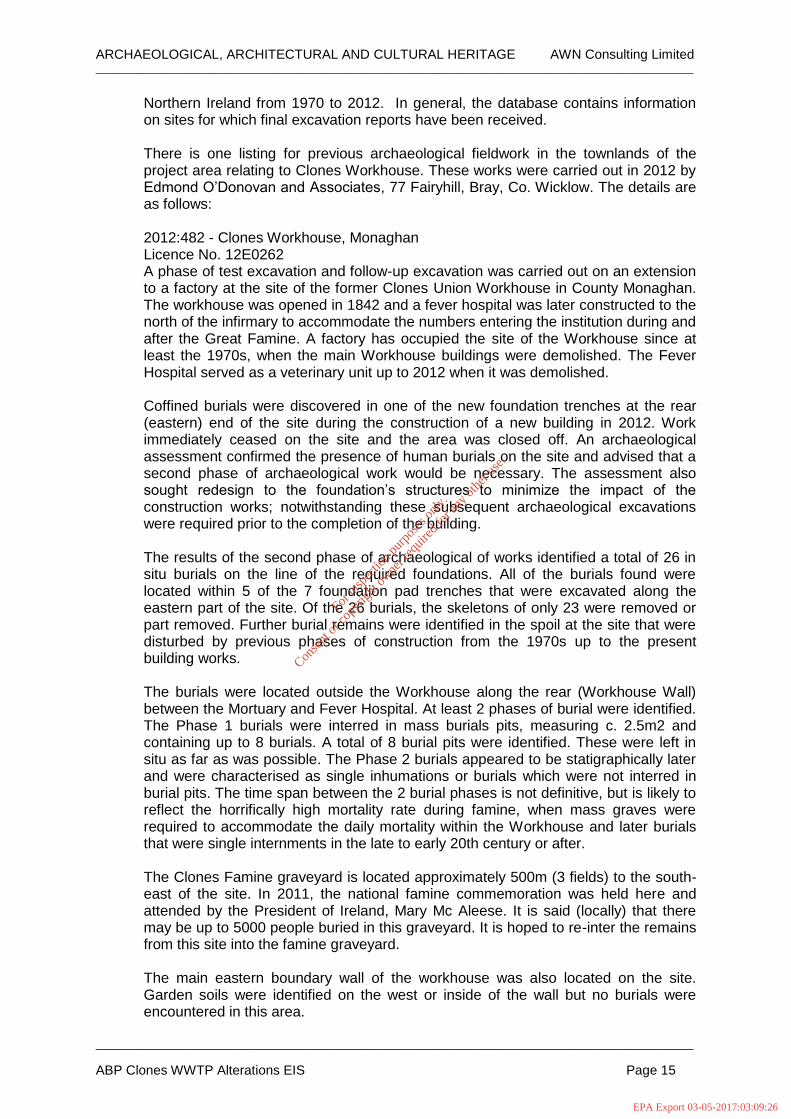
Northern Ireland from 1970 to 2012. In general, the database contains information on sites for which final excavation reports have been received. There is one listing for previous archaeological fieldwork in the townlands of the project area relating to Clones Workhouse. These works were carried out in 2012 by Edmond O’Donovan and Associates, 77 Fairyhill, Bray, Co. Wicklow. The details are as follows: 2012:482 - Clones Workhouse, Monaghan Licence No. 12E0262 A phase of test excavation and follow-up excavation was carried out on an extension to a factory at the site of the former Clones Union Workhouse in County Monaghan. The workhouse was opened in 1842 and a fever hospital was later constructed to the north of the infirmary to accommodate the numbers entering the institution during and after the Great Famine. A factory has occupied the site of the Workhouse since at least the 1970s, when the main Workhouse buildings were demolished. The Fever Hospital served as a veterinary unit up to 2012 when it was demolished. Coffined burials were discovered in one of the new foundation trenches at the rear (eastern) end of the site during the construction of a new building in 2012. Work immediately ceased on the site and the area was closed off. An archaeological assessment confirmed the presence of human burials on the site and advised that a second phase of archaeological work would be necessary. The assessment also sought redesign to the foundation’s structures to minimize the impact of the construction works; notwithstanding these subsequent archaeological excavations were required prior to the completion of the building. The results of the second phase of archaeological of works identified a total of 26 in situ burials on the line of the required foundations. All of the burials found were located within 5 of the 7 foundation pad trenches that were excavated along the eastern part of the site. Of the 26 burials, the skeletons of only 23 were removed or part removed. Further burial remains were identified in the spoil at the site that were disturbed by previous phases of construction from the 1970s up to the present building works. The burials were located outside the Workhouse along the rear (Workhouse Wall) between the Mortuary and Fever Hospital. At least 2 phases of burial were identified. The Phase 1 burials were interred in mass burials pits, measuring c. 2.5m2 and containing up to 8 burials. A total of 8 burial pits were identified. These were left in situ as far as was possible. The Phase 2 burials appeared to be statigraphically later and were characterised as single inhumations or burials which were not interred in burial pits. The time span between the 2 burial phases is not definitive, but is likely to reflect the horrifically high mortality rate during famine, when mass graves were required to accommodate the daily mortality within the Workhouse and later burials that were single internments in the late to early 20th century or after. The Clones Famine graveyard is located approximately 500m (3 fields) to the south-east of the site. In 2011, the national famine commemoration was held here and attended by the President of Ireland, Mary Mc Aleese. It is said (locally) that there may be up to 5000 people buried in this graveyard. It is hoped to re-inter the remains from this site into the famine graveyard. The main eastern boundary wall of the workhouse was also located on the site. Garden soils were identified on the west or inside of the wall but no burials were encountered in this area.
For
insp
ectio
n pur
pose
s only
.
Conse
nt of
copy
right
owne
r req
uired
for a
ny ot
her u
se.
EPA Export 03-05-2017:03:09:26

ARCHAEOLOGICAL, ARCHITECTURAL AND CULTURAL HERITAGE AWN Consulting Limited _____________________________________________________________________________________________________
_____________________________________________________________________________________________________
ABP Clones WWTP Alterations EIS Page 16
The osteological analysis of the site is being carried out by Dr. Jonny Geber, who has identified a minimum of 35 individuals from the excavated human remains. These comprised 17 non-adults and 18 adults, the latter of which included seven males and four females. Identified pathologies includes indicators of considerable metabolic disorders (scurvy, cribra orbitalia, Harris lines), as well as degenerative joint disease and dental disease. Overall, the palaeopathological findings and distribution of lesions are very similar to those observed in the skeletons found in famine mass burial at the workhouse in Kilkenny City, excavated by Brenda O’Meara for Margaret Gowen and Co. Ltd in 2006 (Excavations 2006, No. 1556, 05E0435), and appears to conform to a palaeopathological trait in victims of the Great Famine in Ireland.
Figure 11.6 Overlay of 25” map and aerial image showing Mr. E. O’Donovan’s excavation site
2012.
11.3.2.8 Cartographic Research
Analysis of historic mapping shows how the landscape has changed over time. The comparison of editions of historic maps can show how some landscape features have been created, altered or removed over a period of time. Sometimes features that appear on these early maps are found to be of potential archaeological significance during fieldwork. For this study the following historic maps were consulted:
First edition Ordnance Survey 6” Maps surveyed 1834; and
Second edition Ordnance Survey 25” Maps circa 1888-1913.
Cassini 6” map 1930’s.
A review of the available cartographic sources, begins with the first edition OS map which accurately depicts the subject area in pre-famine times. The current site of the ABP Plant occupied an open featureless field in Teehill south of the ‘intended line of the Canal’. Along the roadway, to the south, the proposed pipeline route passes a roadside dwelling and school house near the junction at Clonkeen and terminates at
For
insp
ectio
n pur
pose
s only
.
Conse
nt of
copy
right
owne
r req
uired
for a
ny ot
her u
se.
EPA Export 03-05-2017:03:09:26
ARCHAEOLOGICAL, ARCHITECTURAL AND CULTURAL HERITAGE AWN Consulting Limited _____________________________________________________________________________________________________
_____________________________________________________________________________________________________
ABP Clones WWTP Alterations EIS Page 17
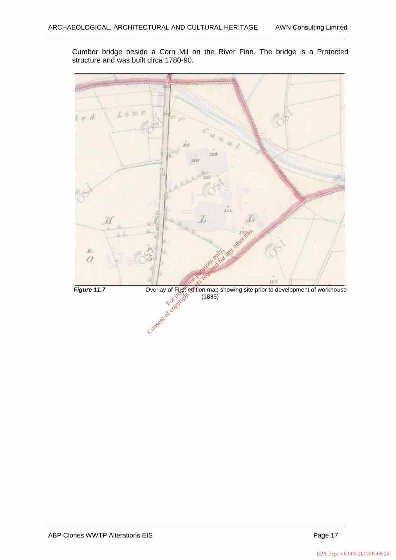
Cumber bridge beside a Corn Mil on the River Finn. The bridge is a Protected structure and was built circa 1780-90.
Figure 11.7 Overlay of First edition map showing site prior to development of workhouse
(1835)
For
insp
ectio
n pur
pose
s only
.
Conse
nt of
copy
right
owne
r req
uired
for a
ny ot
her u
se.
EPA Export 03-05-2017:03:09:26

ARCHAEOLOGICAL, ARCHITECTURAL AND CULTURAL HERITAGE AWN Consulting Limited _____________________________________________________________________________________________________
_____________________________________________________________________________________________________
ABP Clones WWTP Alterations EIS Page 18
Figure 11.8 Corn mill and Cumber bridge on River Finn.
Figure 11.9 Extract from OS 25” sheet showing Union Workhouse and hospital.
For
insp
ectio
n pur
pose
s only
.
Conse
nt of
copy
right
owne
r req
uired
for a
ny ot
her u
se.
EPA Export 03-05-2017:03:09:26

ARCHAEOLOGICAL, ARCHITECTURAL AND CULTURAL HERITAGE AWN Consulting Limited _____________________________________________________________________________________________________
_____________________________________________________________________________________________________
ABP Clones WWTP Alterations EIS Page 19
Figure 11.10 Extract from OS 25” sheet showing Cloncurrin House and gate lodge.
Figure 11.11 Extract from OS 25” sheet showing Presbytarian Cemetery.
For
insp
ectio
n pur
pose
s only
.
Conse
nt of
copy
right
owne
r req
uired
for a
ny ot
her u
se.
EPA Export 03-05-2017:03:09:26

ARCHAEOLOGICAL, ARCHITECTURAL AND CULTURAL HERITAGE AWN Consulting Limited _____________________________________________________________________________________________________
_____________________________________________________________________________________________________
ABP Clones WWTP Alterations EIS Page 20
Figure 11.12 Extract from OS 25” sheet showing Cumar Bridge.
Figure 11.13 Extract from OS 6” Cassini showing plant site as a technical school.
For
insp
ectio
n pur
pose
s only
.
Conse
nt of
copy
right
owne
r req
uired
for a
ny ot
her u
se.
EPA Export 03-05-2017:03:09:27

ARCHAEOLOGICAL, ARCHITECTURAL AND CULTURAL HERITAGE AWN Consulting Limited _____________________________________________________________________________________________________
_____________________________________________________________________________________________________
ABP Clones WWTP Alterations EIS Page 21
The second edition 25” map (1888-1913) shows the scheme area in more detail annotating new structures and features. The significant developments along the route include the Ulster Canal (1841), the Union Workhouse and Hospital, the Presbyterian Burial Ground and Cloncurrin House. The Canal was finished in 1841 and connected Lough Neagh to Lough Erne. As a commercial venture the canal failed to generate significant trade hampered by narrow locks preventing through trade and an inadequate water supply. The Monaghan section of the canal is currently being managed by Waterways Ireland. The Union workhouse, the present site of the ABP Clones was built on a 6-acre site at Teehill by the Poor Law Commissioners in 1843. The building, designed by George Wilkinson to a standardised plan was fit to accommodate 600 inmates, a fever hospital was added north of the main infirmary. Figure 11.9 shows an accurate site lay-out of the workhouse, based on this evidence and the 2012 excavation report (E. O’Donovan Licence no. 12E0262) the site was originally a drumlin, the summit of which was reduced and levelled, and the fill used to build up an artificial escarpment on the south west corner, evident by the hachures on the map. Within the rectangular footprint bounded by a high wall was a complex of buildings. At the roadside was a centrally placed reception/administration building that led to an enclosed yard that faced the main workhouse containing male and female dormitories and a school. To the rear of this were the dining rooms, kitchens, laundry and toilet block. The infirmary to the north was a later addition. The workhouse was closed in 1921 and the complex was later largely demolished leaving only the former hospital. The 6” Cassini map dated to the 1930’s shows a much-reduced site, the hospital building was at this stage used as a technical school (1924-1964). This building, later a veterinary unit, was demolished in 2012. Also of note on the cassini map is the development of a new cemetery north of Cloncurrin House.
11.3.2.9 Aerial Photography
The usefulness of aerial photography is that it allows for a different perspective, ‘the distant view’. Archaeological sites may show up on the ground surface, depending on their state of preservation, by light and shadow contrasts (shadow marks), tonal differences in the soil (soil marks) or differences in height and colour of the cultivated cereal (crop marks). It is also a useful aid in pinpointing existing features and can assist in ascertaining their extent and degree of preservation. A review of available aerial photographs from 1995 to more recent satellite imagery did not identify any anomalies or features of archaeological potential.
For
insp
ectio
n pur
pose
s only
.
Conse
nt of
copy
right
owne
r req
uired
for a
ny ot
her u
se.
EPA Export 03-05-2017:03:09:27

ARCHAEOLOGICAL, ARCHITECTURAL AND CULTURAL HERITAGE AWN Consulting Limited _____________________________________________________________________________________________________
_____________________________________________________________________________________________________
ABP Clones WWTP Alterations EIS Page 22
Figure 11.14 Aerial image showing significant cultural heritage sites along proposed route.
11.3.3 Architectural Heritage 11.3.3.1 Architectural Conservation Areas
An Architectural Conservation Area (ACA) is a place, area, group of structures or townscape that is of special architectural, historical, archaeological, technical, social, cultural, or scientific, interest, or that contributes to the appreciation of a Protected Structure. There are three ACA’s defined in Clones including:
The Diamond ACA (extending west to east from C of I. the Diamond and north Macurtain Street.
Macurtain Street ACA, and
Ball Alley ACA including Round tower and Cemetery.
For
insp
ectio
n pur
pose
s only
.
Conse
nt of
copy
right
owne
r req
uired
for a
ny ot
her u
se.
EPA Export 03-05-2017:03:09:27

ARCHAEOLOGICAL, ARCHITECTURAL AND CULTURAL HERITAGE AWN Consulting Limited _____________________________________________________________________________________________________
_____________________________________________________________________________________________________
ABP Clones WWTP Alterations EIS Page 23
11.3.3.2 Record of Protected Structures (RPS) / National Inventory of Architectural Heritage (NIAH)
The importance of our built heritage is enshrined in the Planning and Development Act, 2000 (Part II, Section 10) which places a statutory obligation on local authorities to include in their Development Plans objectives for the protection of structures, or parts of structures, which are of special interest. The principal mechanism for the protection of these structures is through their inclusion on the Record of Protected Structures (RPS).. In considering additions to the Record of Protected Structures local authorities have recourse to the National Inventory of Architectural Heritage (NIAH) which provides a source of guidance on the significance of buildings in their respective areas. The Monaghan Development Plan lists four NIAH sites within the scheme area. Of these, only one, Cumber Bridge, is listed on the Record of Protected Structures.
Architectural Heritage
RPS/ NIAH reg no Structure Name Description Distance from
scheme
NIAH Reg. no. 41401601 Not on RPS Inventory
Gate Lodge Detached single-bay two-storey gate lodge, built c.1850, Regional Rating
5m on western side of
carrigeway
NIAH Reg. no. 41401602 Not on RPS Inventory
Cloncurrin House Detached L-plan three-bay two-storey house, built c.1850, Regional Rating
110m to west of road.
NIAH Reg. no. 41401604 Not on RPS Inventory
Williamson Memorial
Freestanding columnar pedestal memorial, erected c.1890, Regional
Rating
16m to west of road in
Presbyterian cemetery.
NIAH Reg. no. 41401608 On RPS list
Cumber Bridge Triple-arch limestone bridge, built
c.1800, carrying road over River Finn, Regional Rating
On road.
Table 11.5 Table detailing local architectural heritage sites.
Gate Lodge to Cloncurrin House in Teehill NIAH Reg. no. 41401601 RPS: Not featured Rating; Regional Date: 1840-1860 Description: Detached single-bay two-storey gate lodge, built c.1850, having gable-fronted projecting porch to front (south) elevation, and recent two-bay single-storey extension to rear. Now in use as house. Hipped slate roof, with rendered chimneystacks, clay ridge tiles, and replacement uPVC rainwater goods. Timber bargeboard and finial to porch. Recently smooth rendered walls, having block-and-start render quoins, render plinth course and render platband over ground floor. Square-headed window openings, with decorative render surrounds, sills and replacement uPVC windows. Square-headed door opening, to east elevation of porch, having simple raised render reveal, timber panelled door, and limestone step. Dressed sandstone sill, with benchmark, removed from house to wall to west of building. Gateway to south, comprising double-leaf cast-iron gate having spoked finials and octagonal-plan render piers, with pointed render capping. Matching single-leaf pedestrian gate to each side, flanked by painted octagonal-plan dressed stone piers, having pointed render capping. Matching curved railings on render plinth boundary wall, terminating in octagonal tooled stone piers. The lodge and gateway form an attractive group in the landscape. Cloncurrin House in Teehill NIAH Reg. no. 41401602
For
insp
ectio
n pur
pose
s only
.
Conse
nt of
copy
right
owne
r req
uired
for a
ny ot
her u
se.
EPA Export 03-05-2017:03:09:27

ARCHAEOLOGICAL, ARCHITECTURAL AND CULTURAL HERITAGE AWN Consulting Limited _____________________________________________________________________________________________________
_____________________________________________________________________________________________________
ABP Clones WWTP Alterations EIS Page 24
RPS: Not featured Rating; Regional Date: 1840-1860 Description Detached L-plan three-bay two-storey house, built c.1850, having projecting porch to front (east) elevation, canted bay window to south elevation, and extensions to rear. Hipped slate roof, with rendered chimneystack, projecting eaves with decorative dentillated eaves course having scalloped base and moulded paired eaves brackets. Ruled-and-lined rendered walls, having rusticated render block-and-start quoins and render plinth course. Square-headed window openings to front and side elevations, with painted masonry sills, and moulded render label-mouldings with decorative keystones. Square-headed window openings to rear. Round-headed window openings to north and south elevations of porch, set within recessed panels, having fixed timber frames with spoked fanlights. Replacement uPVC windows to main elevations. Segmental-headed door opening to front of porch, having painted stone doorcase comprising fluted Doric-style columns on moulded plinth bases, supporting moulded lintel cornice over single-leaf timber panelled door, plain fanlight, and nosed stone steps with cast-iron bootscrapers. Square-headed door opening to south elevation, having recent double-leaf, glazed timber door. Decorative rosettes and cornices to ceilings to interior. Original timber architraves and joinery, including tripartite screen inside porch having timber panelled architraves and glazed timber panelled doors, with three-centred arch above having spoked timber fanlight. Timber panelled shutters and architrave surrounds to windows, with splayed fan-spandrels to window frames. Dressed stone steps and stone flagged floor to basement. Williamson Memorial, Presbyterian Cemetery, Clonmore. NIAH Reg. no. 41401604 RPS: Not featured Rating; Regional Date: 1890 Description Freestanding columnar pedestal memorial, erected c.1890. Polished red granite column having moulded bands and decorative triangle and wave motifs to capping. Round-plan plinth base set on square-plan stone plinth base with chamfered corners. Ivy leaf motifs to base of column. Inscription to column and family name in relief on recessed peck-dressed panel to base of column. Decorative cast-iron railings, set into ground, surrounding grave, having fleur-de-lys finials. Although this structure is subtle in design and size, it stands out among the more restrained memorials in the remainder of the graveyard, providing an interesting focal point and perhaps reflecting the social status of the family. Cumber Bridge, Coolnalong. NIAH Reg. no. 41401608 RPS: Featured on inventory Rating; Regional Date: 1790 - 1810 Description Triple-arch limestone bridge, built c.1800, carrying road over River Finn, having additional dry arch to west. Segmental arches, with dressed stone voussoirs, and gunnelled soffits. V-shaped cut-waters to north elevation having dressed stone quoins and capping. Roughly coursed squared stone to cut-waters, soffits and parapets, squared sandstone copings to parapet walls. Some damage to parapet to north. Piers reinforced with concrete. This bridge reflects the skill and craftsmanship employed in infrastructural engineering endeavours, as well as the overall development of the road network at the beginning of the nineteenth century.
For
insp
ectio
n pur
pose
s only
.
Conse
nt of
copy
right
owne
r req
uired
for a
ny ot
her u
se.
EPA Export 03-05-2017:03:09:27

ARCHAEOLOGICAL, ARCHITECTURAL AND CULTURAL HERITAGE AWN Consulting Limited _____________________________________________________________________________________________________
_____________________________________________________________________________________________________
ABP Clones WWTP Alterations EIS Page 25
11.3.3.3 Designed Landscapes-Demesnes, Historic Gardens & Country Estates The Architectural Section of the DAHG is in the process of a multi-phase study looking at Designed Landscapes and Historic Gardens that appear as shaded areas on the First Edition Ordnance Survey Maps, circa. 1830. The NIAH inventory classifies historic gardens and designed landscapes into five possible options referred to as a ‘Statement of Condition’. This statement provides a general overview of a sites status but as noted in their Project Methodology the findings are ‘not an indication of a site's heritage importance and should not be used to justify statements about the site's importance or merit’. There is one demesne listed in the NIAH Garden Survey within the scheme area, Cloncurrin House. This house is not on the first edition map and dates to the mid nineteenth century (1840-1860).
NIAH Garden Survey
NIAH Garden survey ref no
Structure Name Description Distance from
scheme
MO-28A-H-499247
Cloncurrin House
Main features substantially present - peripheral features unrecognisable Feature Richness index 3 (out of a
maximum of 6)
Property runs along the western side of the R212.
Table 11.6 Designed landscapes form NIAH Garden Survey
11.3.4 Site Survey
A site survey of the proposed pipeline route extending from the ABP Clones plan along the R212 towards the River Finn was carried out on the 14th of February 2017 in showery and overcast conditions. North to south, the route extends from the existing WWTP to the rear of the meat processing plant into green fields. Within the plant complex the present ground levels have been raised and the site developed. Based on a map overlay the existing WWTP lies outside the curtilage of the old Clones Union workhouse. Notwithstanding this, previous archaeological investigations in 2012 along the eastern boundary wall exposed human remains. These coffined burials were interred during the time of the Great Famine. The WWTP lies approximately 45m to the south west of this area in a lower terrace that has seen considerable disturbance. South from the plant across an asphalted area the pipeline route proceeds south west through improved pasture following the line of a drainage ditch that marks the townland boundary between Teehill and Clontibret. The ground here is at the base of a slope and is soft and heavily poached by stock. The route connects with the R212 near the junction of a local access road that leads to the Clones Famine and Workhouse Memorial. On the opposite side of the road, 35m from the junction, is the gate lodge to Cloncurrin house. Both the Lodge and Cloncurrin House are dated to the mid-19th century and are listed on the NIAH register (no. 41401601 & 41401602). This property is also featured on the NIAH Garden Survey (Ref. no. MO-28A-H-499247) and is described as having its ‘Main features substantially present - peripheral features unrecognisable’. The roadside boundary in this area is a low hedgerow. There is a modern graveyard (1915) approximately 80m to the north of this gate lodge. From this point to the south, through Clonmore townland, the route passes a line of houses on the western side of the road and a late 19th century Presbyterian Cemetery containing a distinctive red granite memorial erected in 1890 that is listed on the NIAH inventory (Reg. No. 41401604). To the east is a local access road that leads west to Fernyhill House (NIAH Reg. No. 41401605 & 41401606).
For
insp
ectio
n pur
pose
s only
.
Conse
nt of
copy
right
owne
r req
uired
for a
ny ot
her u
se.
EPA Export 03-05-2017:03:09:27

ARCHAEOLOGICAL, ARCHITECTURAL AND CULTURAL HERITAGE AWN Consulting Limited _____________________________________________________________________________________________________
_____________________________________________________________________________________________________
ABP Clones WWTP Alterations EIS Page 26
Continuing south of a road junction leading eastwards (L6250) the pipeline follows a long bend in the road before diverting into pastureland near the Beechford Holsteins Farm. These fields of improved pasture lead to the River Finn. The riverside field was formerly the site of a Corn Mill that appears as a complex of three buildings and mill race on the first edition map. Based on the original survey the river channel was wider than present with the river flowing through all four arches and that diverting down a weir with a small island mid channel. On the second edition and later 6” cassini map the riverside building has been demolished and the the course of the old weir has been partially infilled. North of this field is Cumber Bridge a protected structure dating from c.1780-1790 (NIAHReg. No. 41401608). This limestone bridge with roughly coursed parapets has a span over a race to the west and a triple arch over the River Finn with cutwaters to the east. The proposed route of the pipeline will avoid any impacts on the bridge.
Plate 11.3 Looking north east towards rear of ABP plant, note change in natural levels. Proposed
pipeline will extend from plan and parallel to drainage ditch to right of middleground.
For
insp
ectio
n pur
pose
s only
.
Conse
nt of
copy
right
owne
r req
uired
for a
ny ot
her u
se.
EPA Export 03-05-2017:03:09:27

ARCHAEOLOGICAL, ARCHITECTURAL AND CULTURAL HERITAGE AWN Consulting Limited _____________________________________________________________________________________________________
_____________________________________________________________________________________________________
ABP Clones WWTP Alterations EIS Page 27
Plate 11.4 Looking north east along route of pipeline through greenfield section.
Plate 11.5 Looking west to Clones Parish Cemetery (1915).
For
insp
ectio
n pur
pose
s only
.
Conse
nt of
copy
right
owne
r req
uired
for a
ny ot
her u
se.
EPA Export 03-05-2017:03:09:27

ARCHAEOLOGICAL, ARCHITECTURAL AND CULTURAL HERITAGE AWN Consulting Limited _____________________________________________________________________________________________________
_____________________________________________________________________________________________________
ABP Clones WWTP Alterations EIS Page 28
Plate 11.6 Looking west to Gate lodge at entrance to Cloncurrin House (NIAH reg. no.
41401601)
Plate 11.7 Looking west to Williamson Memorial at Presbytarian Cemetery (NIAH reg. no.
41401604)
For
insp
ectio
n pur
pose
s only
.
Conse
nt of
copy
right
owne
r req
uired
for a
ny ot
her u
se.
EPA Export 03-05-2017:03:09:27

ARCHAEOLOGICAL, ARCHITECTURAL AND CULTURAL HERITAGE AWN Consulting Limited _____________________________________________________________________________________________________
_____________________________________________________________________________________________________
ABP Clones WWTP Alterations EIS Page 29
Plate 11.8 Looking north to Cloncurrin House from roadside (NIAH reg. no. 41401602).
Plate 11.9 Looking east across Cumber Bridge (NIAH reg. no. 41401608).
For
insp
ectio
n pur
pose
s only
.
Conse
nt of
copy
right
owne
r req
uired
for a
ny ot
her u
se.
EPA Export 03-05-2017:03:09:27

ARCHAEOLOGICAL, ARCHITECTURAL AND CULTURAL HERITAGE AWN Consulting Limited _____________________________________________________________________________________________________
_____________________________________________________________________________________________________
ABP Clones WWTP Alterations EIS Page 30
Plate 11.10 Looking south along mill race Cumber Corn Mill.
Plate 11.11 Looking north to arch north of former site of Cumber Mill.
For
insp
ectio
n pur
pose
s only
.
Conse
nt of
copy
right
owne
r req
uired
for a
ny ot
her u
se.
EPA Export 03-05-2017:03:09:27

ARCHAEOLOGICAL, ARCHITECTURAL AND CULTURAL HERITAGE AWN Consulting Limited _____________________________________________________________________________________________________
_____________________________________________________________________________________________________
ABP Clones WWTP Alterations EIS Page 31
Plate 11.12 Former site of Cumber Mill.
11.4 POTENTIAL IMPACTS OF THE DEVELOPMENT 11.4.1 Potential Direct impacts
Potential construction impacts may be direct, physical impacts on known and previously unrecorded archaeological, architectural or cultural heritage sites, structures, monuments or features. In relation to the proposed development, direct, physical impacts on the archaeological, architectural and cultural heritage can manifest themselves in the following ways:
Where an archaeological, architectural or cultural heritage site, structure, monument or feature is located within an area where works takes place and the works either intentionally or unintentionally entail the alteration or removal of all or part of the site, structure, monument or feature a direct, physical impact will occur;
Direct, physical impacts can also occur in gaining access to the site. Where archaeological, architectural or cultural heritage sites, structures, monuments or features are intentionally or unintentionally removed or altered when transporting and/or facilitating access for machinery, equipment and/or materials to or from site a direct physical impact will occur; and
There is the potential for direct, physical impacts on previously unrecorded archaeological and architectural sites, structures, monuments or features.
If these impacts cannot be remediated, for example if archaeological deposits are destroyed during excavations, then the impacts will be permanent.
11.4.1.1 Potential direct Impacts on Recorded Archaeological Monuments
The proposed route of the pipeline will not directly impact on any recorded monuments featured on the Archaeological Survey database.
For
insp
ectio
n pur
pose
s only
.
Conse
nt of
copy
right
owne
r req
uired
for a
ny ot
her u
se.
EPA Export 03-05-2017:03:09:27

ARCHAEOLOGICAL, ARCHITECTURAL AND CULTURAL HERITAGE AWN Consulting Limited _____________________________________________________________________________________________________
_____________________________________________________________________________________________________
ABP Clones WWTP Alterations EIS Page 32
11.4.1.2 Potential direct Impacts on unrecorded Archaeological Monuments The proposed works to the rear of the existing plant extending south from the WWTP has a low potential to impact on deposits, remains or features associated with the Clones Union workhouse (AAP 1). Previous work carried out by Ed Donovan in 2012 exposed human remains to the rear of the mortuary house (most easterly building on OS Second Edition map, see figure 11.8) This site along the former eastern boundary wall is approximately 45m to the west of the proposed pipeline route. The development area is on a lower ground level on a that has seen significant development in more modern times. The significance of the impact on AAP 1 was assessed as Low. There is the potential to impact on previously unrecorded features in the green field areas in Teehill. This area is of improved pasture drains a ditch along its eastern boundary. A review of historic maps, aerial imagery and a field survey did not note any anomalies or above ground features. The significance of the impact in this area was assessed as low. Along the R212 road margin there are two features including a gate house and a Presbyterian Cemetery (eastern side of carriageway). Impacts on these sites can be avoided by demarcating the areas and working on the opposite side of road. The significance of the impact in this area was assessed as negligible. To the south of the scheme near Cumber Bridge, the proposed route of the pipeline may impact on sub-surface foundations associated with the former site of a Corn Mill. This Mill appears on the First Edition Map. The field is presently an improved pasture with no above ground structural remains.
11.4.1.3 Potential direct Impacts Architectural Sites
The nearest NIAH site to the proposed works is the Gate lodge at the entrance to Cloncurrin House and Cumber Bridge. Both these sites can be avoided and will not experience any direct physical impacts.
11.4.1.4 Potential Impacts on Setting
The proposed pipeline will be undergrounded along an existing road resulting in no impact on recorded sites in the wider landscape.
11.4.1.5 Indirect Impacts
Indirect impacts occur as a secondary consequence of construction or operation of the development, and can result in physical loss or changes to the setting of a cultural heritage site beyond the development footprint. There will be no anticipated indirect impacts on the local Cultural Heritage resource.
11.4.1.6 Operational Phase
If the proposed mitigation measures are implemented and resolved during the construction phase, there should be no impacts to the local archaeological resource during the operational phase.
11.4.1.7 ‘Do Nothing scenario’
In this instance, there would be no impact on any potential unrecorded sub surface deposits.
11.4.1.8 ‘Worst case scenario’
If the proposed development where to proceed without the implementation of proposed archaeological mitigation measures construction works could directly impact on archaeological features resulting in significant negative impacts.
For
insp
ectio
n pur
pose
s only
.
Conse
nt of
copy
right
owne
r req
uired
for a
ny ot
her u
se.
EPA Export 03-05-2017:03:09:27

ARCHAEOLOGICAL, ARCHITECTURAL AND CULTURAL HERITAGE AWN Consulting Limited _____________________________________________________________________________________________________
_____________________________________________________________________________________________________
ABP Clones WWTP Alterations EIS Page 33
11.5 MITIGATION MEASURES The proposed works will involve the upgrade of the Wastewater Treatment Plant (WWTP) at the ABP facility at Clones and the installation of c.3km of 100mm HDPE pipe with a minimum cover of 1m extending south west from the existing WWTP across 450m of greenfield and south along the margin of the R212 to a point south of Cumber Bridge on the River Finn. Based on the existing archaeological record and cartographic sources there is potential to expose features, materials, remains associated with the now demolished Clones Union Workhouse (AAP1) and the Corn Mill (APP2) near Cumber Bridge. It is recommended that archaeological testing take place in these areas in advance of construction. This should be carried out by excavating trenches along the proposed pipeline using a machine fitted with a toothless/ditching bucket. This work should be carried out by a suitably qualified archaeologist under license and in accordance with the provisions of the National Monuments Acts 1930-2004. Where archaeological features are shown to be present, preservation in situ or excavation may be required. Any such mitigation should be carried out in consultation with the National Monuments Section of the DAHRRGA. In addition, it is also recommended that intermittent archaeological monitoring take place of all groundworks throughout the course of the pipe installation. In respect of architectural sites, it is recommended that the Contractors be appraised of sensitive sites (gate lodge, Presbyterian cemetery) to avoid any inadvertent impacts with machinery. The above recommendations are subject to the approval of the National Monuments Section at the Department of Arts, Heritage, Regional, Rural and Gaeltacht Affairs.
11.6 RESIDUAL IMPACTS
If the above recommendations are fully implemented the residual impacts of the proposed development on the local archaeological resource would be negligible.
11.7 REFERENCES
Joyce, P.W., 1913. Irish Names of Places. Vol. III. Laois. Killanin, Lord. & Duignan, M.V., 1989. The Shell Guide to Ireland. Edbury Press, London. Lewis, S., 1937. A Topographical Dictionary of Ireland. 2 Vols. Lewis & Co., London. Waddell, J., 1998. The Prehistoric Archaeology of Ireland. Galway University Press, Galway. Dept. of Arts, Heritage, Gaeltacht & the Islands, 1999. Frameworks and Principles for the Protection of the Archaeological Heritage, Government publications, Laois. Dept. of Arts, Heritage, Gaeltacht & the Islands, 1999. Policy and Guidelines on Archaeological Excavation. Govn. Publications, Laois. Department of the Environment & Local Government. 2000. Landscape and landscape assessment. Guidelines for planning authorities. EPA. 2002. Guidelines on the information to be contained in Environmental Impact Statements. EPA. 2003. Advice Notes on Current Practice (in the preparation of Environmental Impact Statements EPA. 2015. Revised Guidelines on the Information to be contained in Environmental Impact Statements - Draft EPA. 2015. Advice Notes for Preparing Environmental Impact Statements – Draft.
For
insp
ectio
n pur
pose
s only
.
Conse
nt of
copy
right
owne
r req
uired
for a
ny ot
her u
se.
EPA Export 03-05-2017:03:09:27

ARCHAEOLOGICAL, ARCHITECTURAL AND CULTURAL HERITAGE AWN Consulting Limited _____________________________________________________________________________________________________
_____________________________________________________________________________________________________
ABP Clones WWTP Alterations EIS Page 34
Landscape Institute and Institute of Environmental Management & Assessment, 2013; Guidelines for Landscape and Visual Impact Assessment (third edition), Routledge, 170pp. The Heritage Council, 2000. Archaeology & Development: Guidelines for Good Practice for Developers. The Heritage Council of Ireland Series, Kilkenny. The Planning and Heritage Section of the Department of the Environment, Heritage and Local Government. Sites and Monuments Record, County Laois. EPA, 1995. Advice notes on current practice in the preparation of Environmental Impact Statements. Dublin. National Monuments Acts 1930-1994
11.8 Electronic Sources
www.excavations.ie http://www.logainm.ie/ http://map.geohive.ie/ http://webgis.archaeology.ie/ http://www.Tipperarycoco.ie/ http://libguides.ucd.ie https://www.heritagemaps.ie/ http://www.workhouses.org.uk/Clones/
For
insp
ectio
n pur
pose
s only
.
Conse
nt of
copy
right
owne
r req
uired
for a
ny ot
her u
se.
EPA Export 03-05-2017:03:09:27
ARCHAEOLOGICAL, ARCHITECTURAL AND CULTURAL HERITAGE AWN Consulting Limited _____________________________________________________________________________________________________
_____________________________________________________________________________________________________
ABP Clones WWTP Alterations EIS Page 35
APPENDIX 11.1
LEGISTLATION, POLICIES AND GUIDEANCE
Conventions, Directives and Legislation Ireland has ratified several European and international conventions in relation to the protection of its cultural heritage. This section summarises Ireland’s obligations as a signatory to a number of International and European conventions relating to the protection and conservation of cultural heritage sites. Also included is a synopsis of existing national legislation governing the care and protection of our cultural heritage resource. COMOS Xi’an Declaration, 2005 Ireland is a signatory to an international declaration sponsored by International Council on Monuments and Sites (ICOMOS), the Xi’an Declaration on the Conservation of the Setting of Heritage Structures, Sites and Areas, 2005, that endeavours to ensure the safeguard and conservation of the World’s cultural heritage as part of its sustainable and human development. EIA Directive 85/337/EEC as amended In order to assist planning and other consent authorities in deciding if significant effects on the environment are likely to arise in the case of development below the national mandatory EIS thresholds, the Minister for the Environment, Heritage and Local Government published a Guidance document in August 2003. The European Landscape Convention 2000 In 2002 Ireland ratified the European Landscape Convention - also known as the Florence Convention, which promotes the protection, management and planning of European landscapes and organises European co-operation on landscape issues. It is the first international treaty to be exclusively concerned with all dimensions of European landscape. Valletta Convention, 1997 In 1997 the Republic of Ireland ratified the Council of Europe, European Convention on the Protection of the Archaeological Heritage (the ‘Valletta Convention’). Obligations under the Convention include: provision for statutory protection measures, including the maintenance of an inventory of the archaeological heritage and the designation of protected monuments and areas. Granada Convention, 1997 Under the European Convention on the Protection of the Architectural Heritage (Granada Convention), 1997, the Republic of Ireland is obliged to maintain inventories of architectural heritage, to protect the architectural heritage and adopt conservation policies as integrated planning objectives. UNESCO World Heritage Convention, 1972 This Convention provides for the identification, conservation and preservation of cultural and natural sites of outstanding universal value for inclusion in a world heritage list. The World Heritage status is a non-statutory designation and no additional statutory controls result from this designation. However the impact of proposed development upon a World Heritage Site will be a key material consideration in determining planning applications.
Legislation The Planning and Development Act 2006-2009; The Planning and Development (Strategic Infrastructure) Act 2006 ensures the protection of the archaeological heritage resource by requiring that all applications under this Act are
For
insp
ectio
n pur
pose
s only
.
Conse
nt of
copy
right
owne
r req
uired
for a
ny ot
her u
se.
EPA Export 03-05-2017:03:09:27

ARCHAEOLOGICAL, ARCHITECTURAL AND CULTURAL HERITAGE AWN Consulting Limited _____________________________________________________________________________________________________
_____________________________________________________________________________________________________
ABP Clones WWTP Alterations EIS Page 36
accompanied by an EIS including information on material assets, including the architectural and archaeological heritage, and the cultural heritage. The National Monuments Act 1930 to 2004 Irish legislation for the protection of archaeological heritage is based on the National Monuments Acts 1930 and amendments of 1954, 1987, 1994 and 2004. These acts are the principal statutes governing the care of monuments in the Irish Republic. They provide for the protection of national monuments through the use of preservation orders. The overall state archaeological service is provided by the Department of Arts, Heritage, Rural, Regional and Gaeltacht Affairs (DAHRRGA) and delivered through the Planning and Heritage Section of the DAHRRGA and the National Museum of Ireland (Irish Antiquities Division) on behalf of the Minister. Monuments are protected under the National Monuments Acts in a number of ways:
National Monuments in the ownership or guardianship of the Minister or a local authority.
National Monuments, which are subject to a preservation order.
Historic monuments or archaeological areas recorded in the Register of Historic Monuments.
Monuments recorded in the Record of Monuments and Places (RMP).
The Planning and Development Act 2000 Under arrangements which came into operation on 1 January 2000 (The Planning and Development Act 2000), the system of listing buildings was replaced with strengthened procedures for the preservation of protected structures and structures in architectural conservation areas (ACA). The Architectural Heritage and Historic Properties Act, 1999 This Act provides for the establishment of a national inventory of architectural heritage which forms the basis for recommendation from the Minister to local authorities of sites for inclusion in the local authorities Record of Protected Structures.
Other Policy Contexts and Guidelines The Archaeological Survey Database (ASD) The ASD is maintained by the National Monuments Service of the DAHRRGA and contains the most up to date information on archaeological monuments within the State. The site is regularly updated with new sites as they come to light and has increasing volumes of information about individual sites. The National Inventory of Architectural Heritage (NIAH) NIAH data is available to be viewed and / or download from the www.buildingsofireland.ie website. The website contains detailed notes and photographs of all structures included in the recommendations made by the Minister to the relevant local authorities. The Framework and Principles for the Protection of the Archaeological Heritage guidelines, 1999 This document sets out the basic principles of national policy on the protection of the archaeological heritage. A key principle set out in these guidelines is that there should always be a presumption in favour of avoidance of developmental impacts on the archaeological heritage and preservation in-situ of archaeological sites and monuments must be presumed to be the preferred option. Monaghan Development Plan 2013-2019 The Built Heritage and Archaeological policies relevant to the proposed development as outlined in the CDP area as follows:
For
insp
ectio
n pur
pose
s only
.
Conse
nt of
copy
right
owne
r req
uired
for a
ny ot
her u
se.
EPA Export 03-05-2017:03:09:27

ARCHAEOLOGICAL, ARCHITECTURAL AND CULTURAL HERITAGE AWN Consulting Limited _____________________________________________________________________________________________________
_____________________________________________________________________________________________________
ABP Clones WWTP Alterations EIS Page 37
Methodology in Evaluation of Impacts In line with EPAs Guidelines on the Information to be Contained in Environmental Impact Statements (March 2002 & Revision 2015) and DoECLGs Guidelines for Planning Authorities and An Bord Pleanála on carrying out Environmental Impact Assessment; the impact upon designated and undesignated archaeological, architectural and cultural heritage sites, structures, monuments or features have been evaluated using the following criteria: Quality of Effects
Positive Impact: A change that improves or enhances an archaeological, architectural or cultural heritage site, structure, monument or feature or its setting.
Neutral Impact: A change that does not affect an archaeological, architectural or cultural heritage site, structure, monument or feature or its setting.
Negative Impact: A change that will remove or negatively alter, whether in its entirety or not, an archaeological, architectural or cultural heritage site, structure, monument or feature, or detract from an observer’s enjoyment or appreciation of its setting.
Duration of Effects
Temporary Effects; Effects lasting less than a year
Short term Effects, Effects lasting one to seven years
Medium-term Effects, Effects lasting seven to fifteen years
Long-term Effects, Effects lasting fifteen to sixty years.
Permanent Effects, Effects lasting over sixty years
Types of Effects
Cumulative Effects: The addition of many small impacts to create one larger, more significant, impact;
‘Do-Nothing Effects’, The environment as it would be in the future should no development of any kind be carried out;
Indeterminable Effects,: When the full consequences of a change in the environment cannot be described;
Irreversible Effects, When the character, distinctiveness, diversity or reproductive capacity of an environment is permanently lost;
Residual Effects Impact: The degree of environmental change that will occur after the proposed mitigation measures have taken effect; and
‘Worst Case’ Effects, The impacts arising from a development in the case where mitigation measures substantially fail.
For
insp
ectio
n pur
pose
s only
.
Conse
nt of
copy
right
owne
r req
uired
for a
ny ot
her u
se.
EPA Export 03-05-2017:03:09:27