(1896) the history of explorations in the mississippi valley (lost civilizations)
TRANSCRIPT

8/9/2019 (1896) The History of Explorations in the Mississippi Valley (Lost Civilizations)
http://slidepdf.com/reader/full/1896-the-history-of-explorations-in-the-mississippi-valley-lost-civilizations 1/44
/*?r^
F
THE HISTOKY OF EXPLORATIONS
IN THE
MISSISSIPPI VALLEY,
STEPHEN J). PEET.
I

8/9/2019 (1896) The History of Explorations in the Mississippi Valley (Lost Civilizations)
http://slidepdf.com/reader/full/1896-the-history-of-explorations-in-the-mississippi-valley-lost-civilizations 2/44
Qass.
Book

8/9/2019 (1896) The History of Explorations in the Mississippi Valley (Lost Civilizations)
http://slidepdf.com/reader/full/1896-the-history-of-explorations-in-the-mississippi-valley-lost-civilizations 3/44

8/9/2019 (1896) The History of Explorations in the Mississippi Valley (Lost Civilizations)
http://slidepdf.com/reader/full/1896-the-history-of-explorations-in-the-mississippi-valley-lost-civilizations 4/44

8/9/2019 (1896) The History of Explorations in the Mississippi Valley (Lost Civilizations)
http://slidepdf.com/reader/full/1896-the-history-of-explorations-in-the-mississippi-valley-lost-civilizations 5/44
THE HISTORY OF EXPLORATIONS
MISSISSIPPI VALLEY.
BY
STEPHEN D.'PEET.
FROM I'KOCEEDINGS OF THE AMERICAN ANTIQUARIAN
SOCIETY, APRIL, 1896.
WORCESTER, MASS., U. S. A.
PRESS OF CHARLES HAMILTON,
3 11 Main S t ii k k t,
189G.

8/9/2019 (1896) The History of Explorations in the Mississippi Valley (Lost Civilizations)
http://slidepdf.com/reader/full/1896-the-history-of-explorations-in-the-mississippi-valley-lost-civilizations 6/44
THE HISTORY OF EXPLORATIONS IN THE
MISSISSIPPI VALLEY.
There have been three kinds of explorations in the
Mississippi Valley since the discovery, each of which has
contributed to a diflerent department of science ; the first
to geography, the second to ethnology, and the third to
archfeology. It will take some time for us to give even
the briefest review of these explorations, and yet they so
join together and dovetail into one another that it seems to
be important that they should all be considered together.
We shall therefore follow the topical, rather than the chro-
nological order, and shall consider the results which came
from the early explorations to the different departments,
giving a separate division to each.
I. We begin with the explorations which were con-
ducted in the interests of discovery. It will be noticed
that these were conducted by different nationalities and
covered different periods, the nationalities generally fol-
lowing the belts of latitude in which the mother country
was situated.
Such was the case with the Spanish, French and English,^
1 The early maps show the startling eflect of the discovery by Columbus
upon all the nations of Europe, for voyages across the ocean were conducted
by tiie different nationalities within the space of ten years; by the PZnglish
under Sebastian Cabot in 1497; by the Portuguese under Ojeda in iriO'J; by the
Spanish under Columbus and others in 1492; and by the French under Verra-
zano as early as 150.!; but it still remains a question which one of the nationali-
ties first reached the mainland and really discovered the continent. The fol-
lowing maps will show the dates of the voyages of the different nationalities
along the coast of America, the letters and figures in brackets indicating the
pages in Winsor's " Cartier to Frontenac," on which they are found.
" The King's Maj)." From a Portuguese Mappemonde, ir)0'2 [p. 7]. Ruysch,
1J08, entitled Terra Saucte Crucis Sive Muudus Novus [|). Sj. Sylvanus, loll

8/9/2019 (1896) The History of Explorations in the Mississippi Valley (Lost Civilizations)
http://slidepdf.com/reader/full/1896-the-history-of-explorations-in-the-mississippi-valley-lost-civilizations 7/44
though there were circumstances in the later explorations
which ultimately brought the nations into conflict with
one another. The English,^ who had made Jamestown
Harbor the starting-point in the south and Port Royal on
the north, extended their possessions westward and claimed
the belt between these two points by right of discovery and
purchase. TheFrench,
commencing onthe St.
Lawrence,traversed the chain of the Great Lakes, but moved in a
southwest direction, crossing the track of the English at
the junction of the Ohio with the Alleghany, and that of
the Spanish at the junction of the Arkansas with the
Mississippi ; finally reaching the Gulf of Mexico at the
mouth of the Sabine River.
The Spanish who began exploration in Florida and the
Gulf States extended their conquests to the Northwest, and
claimed at one time all the territory west of the Mississippi
River.
[p. 11]. Portuguese Chart, 1520 [p. 15]. Verrazano, 1524 [p. 17]. Maiollo,
1527 [p. 19]. Micbael Lok, 1532 [p. 20] . Mercator, 1538 [p. 4!)]. The Cabot
Mappemonde, 1544 [p. 44]. Ortelius, 1570 [p. G5J . Judaeis, 1593 [p. 67].
Quadus, ICOO [p. 68] . Hakluyt Martyr, 1587 [p. 72] . The Ottawa Route, 1642
[p. 87]. Hudson's Bay and the St. Lawrence, 1613 [p. 110]. Visscher, 1652
[p. 178.] Sanson, 1656 [p. 179]. Heylyn's Cosmography, 1656-62 [p. 180].
Blaeu, 1665 [p. 182]. Creuxius, 1660 [p. 184]. Ogilby, 1670 [p. 210]. Duvals,
1682 [p. 216]
.
This atlas served to keep up the notion that the Ottawa and not the Niagara
conducted Ihe waters of Lake Erie to the sea.
iThe English under the Cabots were seeking to rival the Spaniards in their
discovery. They made their land-fall in 1497 in the neighborhood of NewFoundland. They also discovered at the North a gulf supposed to correspond
with the Mexican gulf at the South, and here found an expanse of water which
bad already coursed another great continental valley, and by which it was
practicable to go a long distance towards the interior.
2 It is supposed that Ojeda, the Portuguese, visited Venezuela and Brazil in
1492; and the navigator Cortereal reached the coast of New England in 1501,
for there is a globe which represents the name Terra Corterealis above the St.
Lawrence, and near it the date " Anno Christi, 1501."
The Cantino map described by M. Ilarrisse shows that the Portuguese sailed
the whole length of the Eastern coast of North America as early as 1502, for on
it the coast of Greenland, New Foundland, Florida, and the West coast of Gulf
of Mexico are well depicted.
" On the King map," " Terra Laboratoris " and " Terra Cortereal" are close
together,showing that the Portuguese reached this point as early as
1502.

8/9/2019 (1896) The History of Explorations in the Mississippi Valley (Lost Civilizations)
http://slidepdf.com/reader/full/1896-the-history-of-explorations-in-the-mississippi-valley-lost-civilizations 8/44
It is remarkable that nearly all the information which we
have about the interior and the Indian tribes there, during
the lirst two hundred years, is from the historians of
different nationalities, and is contained in books printed in
different languages. To illustrate, our history of the
southern tribes, those between the Gulf coast and the
Appalachian Mountains, is written in Spanish ; that of the
tribes of the Middle States,—Powhatans, Cherokees, and
Algonquins,—is contained in English books ; that of the
northern tribes,—Hurons, Athapascans, Algonquins and
Sioux, including the Dakotas,—in French books. The
later history of the Iroquois and the tribes of the interior
was written both by English and French, the Jesuit rela-
tions containing the largest portion of the record.Still, there are cross-lights ; for while the volume by
Cabega de Vaca and that by Garci lasso de la Vega, and the
Portuguese Narrative are still relied upon as giving the
best picture of the southern tribes, the writings of De Bry
and the paintings of the artist Wyeth bring before us a
picture of the tribes who are situated on the sea-coast of
Florida and South Carolina. The maps of Verrazano, the
Spaniard, bring before us a picture of the tribes on the
coast of Maine. The writings of Champlain furnish a
picture of the Iroquois. Taking the reports by different
nationalities we have an excellent account of the early
condition of the various tribes, and are interested very
much in the descriptions of them. The picture moves
before us like a panorama. As the different expeditions
are taken into the interior one portion after another of our
noble continent is l)rought to view, making us feel as
enthusiastic and exhilarated by the vision as were the
discoverers themselves, producing upon us the same
impression that the reading of the letters did upon the
minds of the Europeans at the time. Each part of the
picture i)rings before us new scenes, new costumes and
new surroundings, and new adventures. Wo listen and

8/9/2019 (1896) The History of Explorations in the Mississippi Valley (Lost Civilizations)
http://slidepdf.com/reader/full/1896-the-history-of-explorations-in-the-mississippi-valley-lost-civilizations 9/44
we catch even the sounds of new languages, and find that
there are new grammatical constructions.
We are indebted to the explorers and travellers who
wrote descriptions which were so vivid and gave vocabula-
ries which are so correct. We can bear with the exaof2:er-
ations and deceptions of some of them, who wrote of
voyages into regions which they never reached. If the
" long river" of Lahontan has never been identified, and the
voyage of Hennepin to the mouth of the Mississippi has
proved to be a deception, the descriptions of Charlevoix,
Marquette, Joliet and La Salle, and the various mission-
aries are still resorted to for information about the Indians
of the interior.
There was to be sure a great difl^erence between the
tribes, in moral character, grade of civilization, and modes
of life; for those of the South were mild, peaceful, given
to agricultural employments, sedentary in their habits, and
somewhat advanced in their grade of civilization ; those
of the Northern States were mainly hunters, who made
their long voyages in canoes from the distant regions of the
west, and sought to barter their furs for the conmiodities
brought to them from Europe. Those of the far Westwere nomads, who followed the buffalo across the prairies,
and the elk and moose to the mountains, changing the loca-
tion of the villages according to the seasons. Those of the
East, especially the Iroquois, which were then situated in
the State of New York, were the most warlike of all the
tribes. These were the worst foes which the Indians of
the interior had at the time, and they filled all the tribesof the North with great terror. Their history is a tale of
horrors from beginning to end. Our souls are stirred
with indignation that human beings should be given to
such unearthly and demoniac passions. But we are, at
the same time, full of admiration at the fortitude and
sublime faith of the missionaries who endured so much at
their hands.

8/9/2019 (1896) The History of Explorations in the Mississippi Valley (Lost Civilizations)
http://slidepdf.com/reader/full/1896-the-history-of-explorations-in-the-mississippi-valley-lost-civilizations 10/44
6
The story of the first century reads like a romance, for
we follow the explorers through the Southern States and
across the flowing rivers. But in the second the forests
of the north are full of tragedy. It is like turning from
Homer to ^Eschylus, from Chaucer to Shakespeare, from
the days of Warren Hastings to the terrible tragedies
under General Havelock, from the days of Admiral
Coligny to the deeds of Robespierre. The cruelty of the
savage Iroquois was greater, and the sufferings of their
victims more intense, than had ever been recorded. These
turn the history which began with peaceful conquests,
interesting adventures and important discoveries, into a
record of cruel slaughter, base treachery, and appalling
torments. Treachery, however, was not confined to the
hearts of the savages, for the ill-fated La Salle, after endur-
ing all the discouragement and defeat which the deceit and
treachery of his enemies could bring upon him, finally
perished at the hands of his own followers, and his body
was left to rot in a nameless grave amid the wild scenes
on the Sabine River. His fleet was destroyed, his army
scattered, and only the faithful friend, Tonty, with the
iron hand, was left to tell the story of his tragic end.
The result of these early explorations and voj'ages was, as
we have said, to increase the knowledge of the geographical
features of the continent, both in its contour and interior.
A general acquaintance with the Indian tribes was also
gained, and especially those situated along the sea-coast
and near the rivers, for it was by voyaging, either in sail
vessels or in canoes, that explorers, traders, and mission-
aries made their distant expeditions. It would be inter-
esting to follow up the routes taken by the different parties
and quote the descriptions of the scenes through which they
passed, for by these means we should realize what their first
impressions were. It may be said, however, that the
explorers who waded through the immense swamps,
threaded the dense forests, and crossed many waste places,
8/9/2019 (1896) The History of Explorations in the Mississippi Valley (Lost Civilizations)
http://slidepdf.com/reader/full/1896-the-history-of-explorations-in-the-mississippi-valley-lost-civilizations 11/44
were not so much interested in the natural scenery as they
were in escaping the danger which hirked everywhere. The
forests were high and the rivers were large, and everything
was new and strange, yet the adventurers had been through
scenes that were grander and forests that were wilder than
these. While there were large fields of maize from which
provisions for the men and horses could be foraged, yet the
villages were palisaded and were to be taken after much
conflict and bloodshed. They were told that there was gold
among the mountains, and they turned aside from their
route to reach them. It was there that the queen of the
forest came forth in her canopied canoe. After that there
were many rivers to be crossed, and new means of crossing
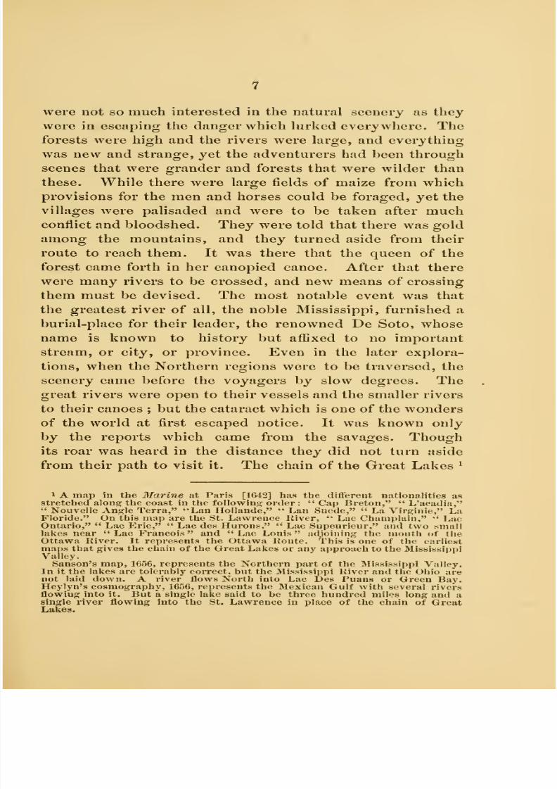
them must be devised. The most notable event was that
the greatest river of all, the noble Mississippi, furnished a
burial-place for their leader, the renowned De Soto, whose
name is known to history but affixed to no important
stream, or city, or province. Even in the later explora-
tions, when the Northern regions were to be traversed, the
scenery came before the voyagers by slow degrees. The
great rivers were open to their vessels and the smaller rivers
to their canoes ; but the cataract which is one of the wonders
of the world at first escaped notice. It was known only
by the reports which came from the savages. Though
its roar was heard in the distance they did not turn aside
from their path to visit it. The chain of the Great Lakes ^
1 A map iu the Marine at Paris [1642] has the different nationalities as
stretched aloni? the coast in the following order : "Cap Breton," " L'acadia,"" Nouvelle Anj^le Terra," "Lan Ilollande," " Lan Suede," " La Virginie," LaFloride." On this map are the St. Lawrence River, '* Lac Champlain," *' LacOntario," " Lac P]rie," " Lac des Hurons," " Lac Supeurieur," and two small
lakes near " Lac Francois " and " Lac Louis " adjoining the mouth of the
Ottawa River. It represents the Ottawa Route. This is one of the earliest
maps that gives the chain of the Great Lakes or any approach to the Mississippi
Valley.
Sanson's map, 1656, represents the Northern part of the Mississippi Valley.
In it the lakes are tolerably correct, but the Mississippi River and the Ohio are
not laid down. A river flows North into Lac Des Puans or Green Bay.
Heylyn's cosmography, 1656, represents the Mexican Gulf with several rivers
flowing into it. But a single lake said to be three hundred miles long and asingle river flowing into the St. Lawrence in place of the chain of GreatLakes.

8/9/2019 (1896) The History of Explorations in the Mississippi Valley (Lost Civilizations)
http://slidepdf.com/reader/full/1896-the-history-of-explorations-in-the-mississippi-valley-lost-civilizations 12/44
8
stretched from the deep interior to the sea, connecting
the head-waters of the Mississippi with the mouth of the
St. Lawrence with a single chasm to brealc the chain, but
it was link by link that it became known, and even then
portions were supposed to be disconnected, the impression
having been formedthat the outlet
wasby the
OttawaRiver rather than by the Niagara, and that Lake Erie
flowed north and west and not toward the Falls. Not until
the time when the ill-fated La Salle launched his famous
vessel, the Griffon, on the river above the Falls and began
his long voyage to the land of firs and forests, did the full
sense of the length and breadth of the inland seas come
before his mind. Not until after suffering the great loss
caused by the wreck of the famous vessel and the blasting
of his hopes, did he begin to realize that its boundless shores
could be a hiding-place for his enemies, and that their
treachery could follow him to the remotest villages of the
Indians. These waters which are so restless and majestic
in their sweeping currents were not grander than the spirit
of the great explorer who first traversed them. It requires
a comprehensive view such as can be gained by the rapid
passage in modern times to get a full sense of the majesty
of these great Lakes and the wonders of the regions
through which they flow. The work of tracing the routes
which were followed and identifying the places where
they stopped, remains for those who admire their exploits
and cherish their memories. There were anticipations
which nerved the first cxi)lorers. Rumors came to them
that there were rivers which led to the South Seas, and it
was a constant hope with the travellers that by some means
they might cross the barriers of land and mountain and
reach the fiirther India, which was the object of search
with Columbus, the first discoverer. It took a long time
for the mistaken notion that America was only a part of
Asia to pass away.^ The fact that it was a continent by
1 A globe made by Fninciscus Monachiis, 1526, unmistakably represents N.

8/9/2019 (1896) The History of Explorations in the Mississippi Valley (Lost Civilizations)
http://slidepdf.com/reader/full/1896-the-history-of-explorations-in-the-mississippi-valley-lost-civilizations 13/44
9
itself gradually dawned upon the mind, and then the valley
became the most prominent part of the continent.^ There
were, to be sure, rivers which were remote from the chosen
routes, and large forests which were not visited by the
explorers, and numerous villages of which nothing was
known until nearly three hundred years after the dis-
covery. We refer now to the forests along the Ohio River
and the Cumberland Valley, which afterward proved to be
so rich in al)original remains, showing that it was once
tilled with a teeming population, and abounded with villages
which were advanced in their type of architecture and art.
The Ohio River flowed through this region, and yet, for
nearly two hundred and fifty years very little was written
concerningit or its resources ; in fact, the veil of obscurity
is scarcely drawn until the time of the settlement under
Boone, Harrod, and other hardy adventurers. We read
about the conquests of Mexico and Peru under the Span-
iards with great interest. We follow the route taken by
Coronado in 1536 to the north of Mexico into New Mexico
and Colorado, and learn about the fiimous cities of Cibola.
America as part of Asia [See " Cartier to Frontenac " p. 22]. Mr. Winsor
remarks that it is thought Ruysch used Columbus's drafts. These two maps
show the ignorance as to the American coast, and perpetuate the error into
which Columbus fell at the beginning, and which he never corrected in his
life—that America was an extension of Asia. There is on Kuysch's map the
island of Java, which is one of the East Indies ; but it is in the same ocean with
the island of Hayti, which is one of the West Indies.
The map of Maiollo, 1527, represents "Francesca" along the New England
coast, " Tera Florida " on the Gulf of Mexico. "Terra Nova descoverta per
Christofaro Colurabo" in the neighborhood of Venezuela, and "SpagnoUa"
on the island of Hayti.
The " Sea of Verrazauo " appears on all of the early maps from 1524 to
1582, including one by Verrazano, 1524, Maiollo, 1527, Michael Lok, 15S2, some-
times called " Mare Indicum," and sometimes called " Mare de Verazana." It
occupies the same place as the Mississippi Valley.
1 Ortelius's map, 1570, is one of the earliest to give the continent of America
correctly. On this map the title, " America Sive India Nova," stretches across
the northern part of the continent, and " Nova Francia" appears above the St.
Lawrence, "B'lorida" in its proper place, "Hispania" across Mexico,
'•Quivira" on the Northwest coast, "Chilaga" in the neighborhood of Lake
Superior, but Peru and Hrazil in their proper place, "Caribana" on the
northern coast of S. America.

8/9/2019 (1896) The History of Explorations in the Mississippi Valley (Lost Civilizations)
http://slidepdf.com/reader/full/1896-the-history-of-explorations-in-the-mississippi-valley-lost-civilizations 14/44
10
We even pass over the mountains and enter the prairies of
the far West, and get a glimpse of that mysterious region
called Quivira. We pass up the Ottawa River with the
Jesuit missionaries and reach the head-w-aters of Lake
Superior, cross to the St. Croix River and visit St.
Anthony's Falls. We go down the Mississippi River to its
mouth and learn about the people situated on cither bank.
But that region which had been drained by the beautiful
Ohio and its branches, remained terra incognita. Even
up to the time when Washington visited the head-waters
of the river, and passed up to Presque Isle on the
shores of Lake Erie, this was ever debatable ground,
claimed by different tribes of Indians and yet coveted by
the white men.^ We know next to nothing of the changes
which took place or even of the trade which was conducted
with the native population, and archaiologists are accord-
ino-ly at a loss to explain certain things which have come to
light in modern times, and which some think were pro-
duced by the natives after they had had contact with the
whites. The supposition is that there were Spanish miners
in the mountains of North Carolina, as there were French
miners on the south shore of Lake Superior. But it is
difficult to distinguish between the metal relics which may
have been manufactured by white men and traded to the
Indians, from those which were of purely aboriginal origin.
Copper relics have been exhumed from mounds in the very
heart of the State of Ohio which seemed to bear the
impress of the ^white man's touch ; but the diflSculty is to
trace the history of these regions of the interior so as to
know how early trading-stations were established, and how
soon the Indians began to use the articles manufactured by
the white man. The southern shore of Lake Eric was also
lOnc reason for tlie i',Mionincc' of the Ohio Kivcr W!i8 that the orif,'inal inhab-
itimtH liad been driven out by tlie Iroquois in the period wiiich ehipsed
between the diseovery by Columbus and the exidoration by La Salle. The
IrofjUoiM were friendly to tlie En^'lish and hostile to the Freneli, and so kept
the Freueb e.\i>lorers from this region.
8/9/2019 (1896) The History of Explorations in the Mississippi Valley (Lost Civilizations)
http://slidepdf.com/reader/full/1896-the-history-of-explorations-in-the-mississippi-valley-lost-civilizations 15/44
11
to remain little known for a long time. The terror of the
Iroquois had made it an unattractive wilderness, and no
one dared follow the footsteps of La Salle athwart the
region. The French had constructed a stockade at Oui-
tanon on the north bank of the Wabash, but had not dared
to establish a single post east of the Maumee, for the Con-
federates Avere still holdinsj the reo;ion between Lake Erie
and the Ohio River, this region having been derelict since
the time of the destruction of the Eries in 1G50.
II. There are also Ethnological problems which are to
be solved by the history of exploration in the Mississippi
Valley. We have not time to mention all of the problems,
but will only state that it was through these explorations
that the location of the different tribes came to be
known and their affinities were discovered. It appears that
there were several great stocks scattered over the Missis-
sippi Valley, dividing it into districts, which can now be
easily traced by certain definite lines, thus making a lin-
guistic map out of the very geographical territory which
had been traversed. This map has been a varying one,
for the tribes have changed their location with every
successive period of American history. Still the tribes
continued to cluster into the same groups, for the different
stocks as they change their territory were massed together
and were settled down in the great provinces, which became
afterward States, the boundaries of these States having been
formed long before the date of history.
We go to the maps for our knowledge of all the changes
which took place whether among the Indian tribes or among
the European claimants. The maps are, to be sure, covered
with names and v;ith inscriptions which reveal the struggles
for possession among the different European nationalities,
but they are also covered with Indian names which reveal
to us the location of Indian tribes and villages. They do
not seem like maps of America, but rather like the maps of
some foreign country ; for they are printed in diflerent

8/9/2019 (1896) The History of Explorations in the Mississippi Valley (Lost Civilizations)
http://slidepdf.com/reader/full/1896-the-history-of-explorations-in-the-mississippi-valley-lost-civilizations 16/44
12
'I Iciiiicpiirs map, 1(W;!. represents the lukcs with toliTiibk" correctness liut willi
dilViiciit nitnies, viz. : Lake Frontenac, Lac Do Conty ou Eric, Lac IVOrleans
oil Huron, Lac Danpiiin on Illinois, Lac de Condeon Sui)erienr ; the Mis>is>iiipi
Kiver appears nnder the name of 1^ Colbert, and the Illinois under the name of
Seigueiuu, but the Ohio River docs uotappcur and the lower Mississippi is a mere

8/9/2019 (1896) The History of Explorations in the Mississippi Valley (Lost Civilizations)
http://slidepdf.com/reader/full/1896-the-history-of-explorations-in-the-mississippi-valley-lost-civilizations 17/44
13
languages,—English, Dutch, French and Spanish,—with the
Indian names and the names of the rivers all spelt differ-
ently. What is more, the territory of the Indian tribes
varies according to the European nationality which made
the map. The English, who claimed the Iroquois for their
allies, extended the Iroquois territory from the mouth of the
Mohawk on the Hudson River to the mouth of the Ohio, andeven down the Mississippi as far as the Gulf of Mexico ;^
dotted line. This is one of the earliest maps to represent the Mississippi Valley,
and evidently came from the explorations by La Salle. Still Joliet's larger map,
1674, contains the lakes, the upper part of the Mississippi River, the rive de
Misconsing, riv de la Divine [Illinois] ; also a river supposed to be the Ohio, on
which is the inscription : Biviere par ou descendit le Sieur de la Salle au
sortir du lac Erie i^our aller dans le Mexique, Such are the maps which
show the gradual acquaintance with the Mississippi Valley which resulted
from the various explorations.
1 There is some reason to suppose from Sajason^s map that the Maumee had
been explored as early as 1650.. In 1714, Crozat's agents found mines in south-
eastern Missouri, and got their supplies from the Illinois country. De la Tour
sent explorers four hundred miles up the Alabama above the Coosa and Talla-
poosa, who established a fort called Fort Toulouse. Crozat's agents built a
storehouse near Nashville, on a mound, where they traded with the Shawnees,
A party left Kaskaskia in 1703 to explore the Missouri ; and in 1705 some miners
built a fort on the Missouri above the Osage.
Mitchell, the geographer, claimed that the Six Nations extended tbeir terri-
tory to the river Illinois ever since 1672, and had incorporated the ancient
Shawnees and the Chaouanons, besides which they exercised a right of conquest
over the Illinois and the Mississippi as far as they extended. (Ibid., p. 237.)
In Coxe's Carolina we have a description of the territory on either side of the
Mississippi River from the mouth to St. Paul, with the resources of the country
pretty clearly described, the object of the book being to encourage English
trade with the tribes situated in the region. AVe tind a description of the region
on the Cumberland River.
But the Foxes, who had been overthrown at Detroit, were soon waylaying
the French traders at the Green Bay portage. The Fox and Wisconsin Rivers
had been well-nigh deserted, but the older portages by the Maumee and Wabash
had come into use, and Vincennes was a recognized station. (Ibid., p. 118.)
The portages south of the Chicago River, by way of the Kankakee and the
Dcs Plaines, and by the St. Joseph River, were kept open. Charlevoix went by
St. Joseph and Ivankakee to the south. The Miami confederacy, situated upon
the Wabash, had put 3,000 warriors into the field as a check upon the Iroquois.
{Ibid., p. 26.)
The Jesuits were among the Illinois tribes as early as 1680, and the Carmel-
ites and Capuchins among the tribes from Alabama to the Red River as far
north asNatchez.
Tlie Mississippibecame
the great highway of the church.
Iberville had established a settlement at Natchez called Rosalie; but Bienville,
his brother, led an expedition against two villages of the Natchez in 1723, and

8/9/2019 (1896) The History of Explorations in the Mississippi Valley (Lost Civilizations)
http://slidepdf.com/reader/full/1896-the-history-of-explorations-in-the-mississippi-valley-lost-civilizations 18/44
14
and made maps with a legend written over the prairies of Illi-
nois, " this was the place where the English hunted cows."
The French, on the other hand, based their claims on the
voyages of the French missionaries and the explorations of
the French traders. And so they gave the French names
to the same regions.
^/,et^G^.acva>^^
JoLiiyr's Mai> of tiik Mississum-i Kivhu. Fkom AVinsou's" Caktikk to Fkontexac." p. 245.
One of the earliest maps wliich gives the Mississippi River entire is this by
Joliet, 1(173. On this the laiies are all represented witli tolerable eorreetness as
well as tiie rivers and the gulf eoast, but they bear Indian and French names
mingled; the provinces having the Spanish, French, English, and Swedish
names according to the nationality that settled them. The Ohio River docs not
appear on this map, but does on the larger map by Joliet, i)ublished soon after.
prepared the way for the fearful outbreak and the war of extermination whidi
followed soon after. The French established a fort at tlie mouth of Fox
River. {Ibid., \). Vil.)
Jlitchell's map of the British colonies, 17")o, shows the route of Col. Welch
to the Mississippi in 1G9S, since followed by our traders. The Chicasaws in
alliance and subjection to the English. Chicasaw towns and English factories,
the extent of the Knglish settlements, arc placed SoO miles west of Charleston,
South Carolina. The trail crosses the head-waters of all the streams and strikes
the following villages: Ockfuskee, Coussa, also Tapouchas.

8/9/2019 (1896) The History of Explorations in the Mississippi Valley (Lost Civilizations)
http://slidepdf.com/reader/full/1896-the-history-of-explorations-in-the-mississippi-valley-lost-civilizations 19/44
15
The Indian names are applied to rivers, lakes, waterfalls,
and natural scenery, some of which have been retained
and are very euphonious and suggestive. Ontario, Huron,
Michigan being the names of lakes; Illinois, Wisconsin,
Minnesota, Mississippi, Missouri, Kansas, Arkansas, being
the names of rivers ; Omaha, Milwaukee, Kishwaukee,
being Indian names applied to villages or cities.
We notice here the difference in the names given by Euro-
pean explorers, for the missionaries applied the names of
their saints, while the traders gave only the names of their
own heroes and leaders. In this way we have St. Paul,
St. Louis, St. Marie, and St. Croix in different localities ;
but in others we read the names of Duluth, La Salle,
Marquette, and Nicolet. The English generally gave the
names of their kings and queens to the colonies on the sea-
coast, but allowed Indian names to be retained by the
mountains and rivers of the interior. The names of States,
later on, were taken from the tribes who were supposed to
have occupied and possessed them from time immemorial.
We are gaining in various ways a knowledge of the
aboriginal trade^ during this period, and more especially by
1 There had been an intermittent trade carried on with them for three-quar-
ters of a century. New Yorii was already pressing her claims over the remote
regions beyond the forks of the Alleghanies. She held that the parliamentary
acts of 1024 had made this region crown lands. The Delawares had begun to
follow the game over the mountains, and the Pennsylvania pack-men were not
far behind; though they encountered the Frenchmen on the Alleghanies.
Charlevoix spent a month in Kaskaskiu, October and November, 1721. In
passing down the river, he saw the vast meadows covered with herds of buffalo.
He passed Fort Chartres (which was founded in 1720), and remarked how the
increasing settlements between the Fort and Kaskaskia were beginning to look
like a continuous village.
The French built a fort at the mouth of the Arkansas to protect the line of
communication between New Orleans and Kaskaskia. A crowd of palisaded
cabins soon sprang up on the spot where Joutel, escaping from the assassins of
La Salle, had come so happily upon some of Tonty's men.
The Jesuits were among the tribes of the Illinois. The Iroquois were a bar-
rier of defence between the English, in Maryland and Virginia, and the French,
and had prevented them from making a descent that way. In 1701, the Lieut.-
Qovernor of New York entered into a treaty with the Confederates at Albany,
by which the region north of the Ohio and stretching to the Illinois River was

8/9/2019 (1896) The History of Explorations in the Mississippi Valley (Lost Civilizations)
http://slidepdf.com/reader/full/1896-the-history-of-explorations-in-the-mississippi-valley-lost-civilizations 20/44
16
the study of the relics which are being exhumed from time
to time. It is by this means, and by the study of journeys
and trading-expeditions which are not prominent, that cer-
tain tril)es who dwelt in the interior have become known.
To illustrate : Relics have been discovered during the last
year at Willoughby, Ohio, and have been placed in the
Western Reserve Historical Society, at Cleveland, which
help to solve the problem as to the Eries, who were blotted
out by the Iroquois. These relics are composed of pipes,
pottery, and bone needles, and resemble those which are
found on the Iroquois territory. The portraits on the pipes
resemble Iroquois faces. This proves that the Eries ^
belonged to the same stock as the Iroquois, and corres-
ponds with the tradition that they were destroyed by that
ceded to the English king. {See Winsor^s M. B., p. 67.) From this time on
trading-posts were established in Ohio mainly by the English. Still it was in
dispute until after the French and Indian war. There is a map contained in
Winsor's " The Mississippi Basin," page 242, which gives the location of the
trading-stations and Indian trails as well as forts. In this the names are ex-
pressive. Names are as follows : Logstown near Fort Du (^uesnc. Three-legs
on the Muskingum River, White-woman's on the Licking, French Margarets on
the Hocking, Hurricane Toms on the Scioto, Junundat on the Sandusky, built
in 1754.
The Mascoutens and Kickapoos, in 172(5, i)ut a stop to the Green Bay portage.
De Lignery succeeded in bringing the Foxes to a peace, and they agreed to
spare as allies of the French, the Illinois. Father Guignas and Boucher de la
Perriere built a stockade on Lake Pepin, and called it Fort I?eauharnois. It
was the first settlement on the Mississipjii north of the Illinois.
The Carolina traders had i)Ut up two booths on the Wabash, and rumors
reached Kaskaskia that other stations had been established further up the Ohio.
The English were haunting the upper waters of the Wabash and trading
among tlie Miamis. M. Vincennes, who was among the Miamis, was prepared
to repel the English if they approached. The country of Illinois was added to
Louisiana in 1717. The waning power of the Iroquois, and the coming of the
Delawares and the Shawnees into the Ohio Valley, had permitted the French to
conduct more extensive explorations. {Ibid., p. 14S.)
1 As to the location of the lories the two maps given witli this paper are sug-
gestive; namely, the map of Dr. Smith, 1720, and the map of Vander Aa, 1750.
On both of these maps the Oniasontke or Nation du Chat are placed on the
Ohio liiver, a little below Lake Erie, which was formerly called Lac de Y(-\\s or
du Chat.

8/9/2019 (1896) The History of Explorations in the Mississippi Valley (Lost Civilizations)
http://slidepdf.com/reader/full/1896-the-history-of-explorations-in-the-mississippi-valley-lost-civilizations 21/44

8/9/2019 (1896) The History of Explorations in the Mississippi Valley (Lost Civilizations)
http://slidepdf.com/reader/full/1896-the-history-of-explorations-in-the-mississippi-valley-lost-civilizations 22/44
FitoM Wixsou's " MississTPPi Basix.'
Mai' i»y Dk. Jamks Smith, London, 1720.

8/9/2019 (1896) The History of Explorations in the Mississippi Valley (Lost Civilizations)
http://slidepdf.com/reader/full/1896-the-history-of-explorations-in-the-mississippi-valley-lost-civilizations 23/44
From AYinsor's " Mississippi Basin.'
Showing Location of Indian Tribes.

8/9/2019 (1896) The History of Explorations in the Mississippi Valley (Lost Civilizations)
http://slidepdf.com/reader/full/1896-the-history-of-explorations-in-the-mississippi-valley-lost-civilizations 24/44
20
cruel and aggressive people.^ We must go far back of
the period when the Jesuit missionaries were among the
Hurons, to find the time when the Hurons, Eries, and Iro-
quois were at peace with one another and filled the entire
region from the St. Lawrence to the St. Clair Rivers, and
occupied both sides of the two great lakes,—Lake Ontario
and Lake Erie. At that time the Algonquins were divided
into four parts. Those in New England on the east, the
Delawares and Powhatans on the south, the Miamis and
Illinois on the west, the Ojibways and Athapascans on the
" Dr. James Smith's map 1720, gives the natural features correctly ; the lakes,
the rivers, the gulf coast, and the sea coast. It also gives the Indian tribes
as they were locatedat tliis
time." The Oniasontkc or Nation du Chat ontiie
Ohio River; the " Tionontatecaga who inhabit in caves to defend themselves
from the great heat," on the Tennessee, villages of the Chicachas, villages of the
Shawnees [Chaouenons] and also of the Taogarias, villages of the Caskinampos
[the CaskigheJ on the Cumberland; villages of the Chaouenons on the Santee
River. The Cherokees [Chaiaque] and the Apalachians [Apalaehe] on the
Apalache River villages of the Choctaws [Chactas] or Flat Head Indians;
also village of Chicachas on the head waters of the Mobile; vilUiges of the
Natchez, also of the Colapissas and the Taeusa, on the Lower Mississippi;
village of Tamoroa and of the Illinois and Kahokia near the mouth of the
Missouri River; the Kicapou on the Illinois River, the Mascoutcns on the RockRiver, the Miamis on Miami River, the Usages on Osage River and an inscrip-
tion on the Illinois as follows: "The Matigamea formerly lived here."
Another inscription on the Tennessee River, is as follows :" The road the
French take to go to Carolina." This map and the following one indicate the
state of the country the location of the Indian villages at the time of the first
permanent settlement of the Mississippi Valley.
1 The map based on d'Anville, published by Vander Aa, IToS, contains the
long river of l^a Hontan, near It a river supposed to flow to the "West Sea. It
also gives the five Great Lakes under their present names; the Ohio Riverunder the name Oubache; the Mississippi and Missouri and Illinois under their
present names. It represents the location of the Indian tribes as they were at
this time. The Oltawas [or Outaouacs] on both sides of Lake Superior. The
Sioux at the head waters of the Mississippi. The Foxes, or Nation des Ren-
ards, on the Wisconsin River; The Nation du Feu, or Kickapoos, west of Lake
Michigan; The Miamis, south of the lake; The Illinois on the Illinois River;
villages of the Michigamias [Matisgamea] below the Illinois. Village Des
Sauteurs near Saut St. Marie, the Mississague above Lake Huron, the Nation
Du Chat, south of Lake Krie, the Andastogues on the Alleghany River, and a
tribe called Les Oniasontkc on the upper Ohio River, and the Iroquois Justbelow the Lake Ontario. There are two forts on the map; fort de Sasqua-
hanong on the Susquehanna Uiver and fort St. Louis called fort Crevc Occur
on the Illinois River.

8/9/2019 (1896) The History of Explorations in the Mississippi Valley (Lost Civilizations)
http://slidepdf.com/reader/full/1896-the-history-of-explorations-in-the-mississippi-valley-lost-civilizations 25/44
21
north. The great Dakota tribe, called the Sioux, were
situated to the west of the Mississippi River and occupied
the States which have since borne their name ; the lowas
being but a tribe of the Dakotas, and the Missouris, Kaws,
or Kansas, constituting a branch of the same stock.
The exploration of this entire region revealed the loca-
tion of the various tribes or families of Indians whichwere the first possessors of the soil, but this is a chapter
of our history of which we know but little. The names of
the Indian tribes have fortunately been given to the States
which have been hewn out of the Northwest Territory;
Algonquin names having been affixed to the States east of
the Mississippi, the Dakota names to those west of the
Mississippi, and the names of other tribes to those that
were farther west and south.
There were great changes among them before the time
of the discovery and the settlement by the whites. There
was, however, one tribe which was constantly on the
move,—the tickle wanderers called Shawnees. The evi-
dence is that they were Algonquins, and at an early date
they passed down from the north through Illinois into
Kentucky and Tennessee, and across the Cumberland Moun-
tains to the coast of Florida and South Carolina, where
they came in contact with tribes of the Dakotas and of the
Iroquois who had branched off from the parent stock during
the time of the prehistoric migrations, and finally reached
their stopping-place in the southeast corner of the moun-
tain region. The Shawnees turned this corner, and began
wandering north until they reached the Delawares on the
Delaware River. Joining with them they turned back
toward their old seats, and are found again in the opening
of history on the Ohio River. The Shawnees have left
their names on certain rivers and trading-posts in Ohio,
Kentucky, Illinois, South Carolina, and even in Wisconsin.
But they have made great havoc with the records of other
tribes, and have brought terrible confusion into the archai-

8/9/2019 (1896) The History of Explorations in the Mississippi Valley (Lost Civilizations)
http://slidepdf.com/reader/full/1896-the-history-of-explorations-in-the-mississippi-valley-lost-civilizations 26/44
22
ology of the entire region. Their wanderings cover a
period of two hundred 3'ears, the most of them after the
date of discovery. And yet, so little is known of them,
that it is almost impossible to say to a certainty what relics
were left and what mounds, if any, were built by them.
The stone graves near Nashville and the stone graves
found in the Etowah mound, also stone graves in Ohio and
Illinois, have been ascribed to them ; but the relics found
in these different States are as different as those which
belong to difierent nationalities, and so the archaeological
record is very confused. The same uncertainty exists in
reference to the ('hcrokees.^ They are supposed to be the
Allighewis of tradition. The story is, that the Iroquois
and the Delawares migrated late in the prehistoric period
from the north or from the west. They crossed a great
river, and finally united in the effort to expel the Allighewis,
who dwelt in fortified cities or towns and were permanently
established. After long contests they drove them from
their seats, and took possession of their territory. This is
the record which has gone into history. It is not tradition
merely, but it is history. The explorers have not been
able to identify exactly the river that was crossed, nor tell
where the contest occurred, or even decide where the
walled towns were situated, though the supposition is that
southern Ohio is the place where they dwelt. It is on this
supposition that Dr. Thomas has based his theory that they
1 There were chau<?es in the location of the Chcrokeos between tlie times
of the discovery iuul the explorations of tlie Ohio Valley, but the first
record of the tribe locates them amonij the mountains of North and South
Carolina. There were also changes, according to tradition, among the Dako-
tas, but tlie date is supposed to have been before tlie discovery. The Ohio
lliver seemed to have been the migration route for the Indian tribes, though it
is uncertain as to the starling-jioiiit of some of the tribes, for the first that is
known of the Dakotas or Sioux is that they were situated east of the Alle-
glianies on the Ohio River and were moving westward. The first that is known
of the Iroquois they were on the St. Lawrence and were moving southward,
while the Delawares and other Algonquin tribes were situated north and west
of the " Great River," which may have been the Mississippi, and were moving
eastward.

8/9/2019 (1896) The History of Explorations in the Mississippi Valley (Lost Civilizations)
http://slidepdf.com/reader/full/1896-the-history-of-explorations-in-the-mississippi-valley-lost-civilizations 27/44
23
were the original Mound Builders ; leaving out of the
account the fact that other tribes, such as the Dakotas and
Delawares, have traditions that they also occupied the
same region. The question now before the archtBologists is
one of dates, for there are diflerent horizons showing that
different tribes traversed the same region. ^ But the task is
iThe discoveries in the interior are also illustrated by the various maps.
These followed in the order of time the discoveries on the coast; and yet they
overlap them, so that the same maps may be used twice. There are many col-
lections of maps which illustrate the progress of these discoveries. One in the
Library of Harvard College; another in the State Library at Albany; another
in the Library of Congress at Washington; another owned by the Ameiican
Geographical Society. There is also a fine collection at Cleveland, which was
gathered at a great expense by Judge Charles C. Baldwin, now deceased.
The maps which illustrate the location of the Indian tribes as well as the
claims set up by the different nationalities to the Mississippi Valley are quite
numerous; several of them are reproduced by Winsor in his "Mississippi
Valley^" as follows : 1. A map of the French settlement in North America, by
Thomas Kitchin, in London Magazine for December, 1747. This is one of the
best maps of the interior, for it represents the location of the Indian tribes,
Apalaches, Taensas, Tonicas, Natchez, Yasous, Tchactas [Choctaws] , Arkan-
sas, Tchicachas [ChicasawsJ, Cheraquis [Cherokees] , Chouanons [Shawnees],
Eries, Illinois, Tamarois, Cascaquias [Kaskaskias], Mascoutius [Mascoutens]
les Renero [Foxes], Miamis, Hurons, Iroquois, Outaouais [Ottawas], Abena-
kis, Etchemins.
2. Coxe's map of Carolana, published in 1722. The history of this map is as
follows : Dr. Daniel Coxe bought the patent of Carolana, and in 1698 sent a Col.
Welch to explore the country, fitted out two armed ships with a company
of French Huguenots with the object of settling somewhere on the Mississippi.
His son published a book in 1722 describing the country in the interior, and
asserting priority of English explorations to the French. These two maps are
the result.
3. Bowen & Gibson's " North America," London, 17(33. This shows the
country which was conquered by the Iroquois and so brought under the control
of the English. This map gives the country of the Choctaws, Chicasaws,
Creeks and Alibamons. The upper section shows the country of the Illinois,
Mascoutius, Miamis, Twightwees. The title, " Conquered country by the Iro-
quois," extends from the north shore of Lake Huron to New Orleans; " which
by deed of sale they surrendered to Ye Crown of Great Britain in 1701 and
renewed in 1720 and 1744."
On this map we notice the following: " The Natchez are allies of the Eng-
lish." "The Tennessee is called the Cherakee or Hogohegee river." "Tan-
nassec an English factory and Telliko factory" on the head-waters of the river,
" Walker settlement " (1750) situated on the Cumberland River. The " Shaw-
noes" are on the Ohio River, and " Shawnoah an English factory " is located on
the Sciota River, and an English fort and settlement, 1740, 150 miles from the
Ohio River among the Pickawallanees near Piqua. The Pouteuatamis are situ-

8/9/2019 (1896) The History of Explorations in the Mississippi Valley (Lost Civilizations)
http://slidepdf.com/reader/full/1896-the-history-of-explorations-in-the-mississippi-valley-lost-civilizations 28/44
24
to identify the tribes in the relics and decide upon the
succession.
III. This leads us to the last point which we shall con-
sider ; namely, the archaeological results which have fol-
lowed the exploration of the Mississippi Valley. It is
plain that the results have been valuable for they have
had the effect to correct some of the false theories, solve
some of the difficult problems and secure a positive advance
of the science of archaeology. We do not need to go over the
problems or mention all of the theories which have prevailed,
but will only say that there were many false theories as to
the peopling of this continent ; the theory that the lost
tribes were to be found here being the most prominent and
the most misleading. Another theory was that America
was the seat of a very high grade of civilization, and that
specimens of writing and art were likely to be found which
would prove a connection between the ancient people of
the Mississippi Valley and the ancient races of the East.
This theory has been exploded ; and yet no one has so far
been able to define exactly the stage of culture which the
different tribes had reached ; for some will class them all
with the rudest savages, making no distinction between the
relics and works of the Mound Builders and those of the
wild Indians, while others claim for them a grade of
progress which was higher and better than that which pre-
vailed among the Indians known to history. This fact
comes out more and more as we study the testimony of
the explorers.
We may say here, second, that the period which inter-
vened between the early explorations and the early settle-
iiUnl at tlic soiitli ciul of Lake Micliifjaii or Illiiioi.s. Fort Detroit is located on
the St. Clair River. " Eries were extirpated by the I rocjuois above a century
pa.st from wliicb time they Iiave l)een in possession of Lalvc Erie."
4. Witeliell's niiii», 177"), of Tlic British Colonies. This shows "Walker's,"
and "the extent of the English settlements," 1750; "Tclliquoan English fac-
tory"; " (^uanessee, English factory"; "Deserted Cherokee settlements" on
the Tennessee River and amonj; the mountains below the river. The traders'
routcH in eastern Kentucky and Tennessee are also laid down.

8/9/2019 (1896) The History of Explorations in the Mississippi Valley (Lost Civilizations)
http://slidepdf.com/reader/full/1896-the-history-of-explorations-in-the-mississippi-valley-lost-civilizations 29/44
25
ments was filled with events which have few records, except
those found in the traditions of the aborigines, or in the rel-
ics hidden within the mounds, or the testimony of travellers
and traders. From these three sources, we hope, ultimately,
to make out the history of the Mississippi Valley, but we
must embrace all under the department of archeology and
look to the progress of this science to clear up things whichare now obscure. We search the military records to learn
about the history of the forts. The treaties with the Indi-
ans and the fragmentary history of the trading-stations
and factories need to be examined, for we have a long
period of Indian occupation sandwiched in between the
early days of the explorers and the days of the first
settlers. We call this the "Indian Period," as we call the
period before the discovery, the " Mound Builders' Age,"
or, the prehistoric period ; but we include both of these
under the one department of archseology.
It is unfortunate that the Protestant missionaries and the
English traders have not left a better record, for it is much
easier now to find the traces of military occupation than it
is to find the sites of the Indian villages.^ The visit of
Jonathan Carver to the village of the Fox Indians in
Wisconsin, the journey of Gen. Pike to the head-waters
of the Minnesota Eiver, and again to the peak which bears
his name, the route taken by Gen. Long and his party, and
by Lewis and Clark in their distant journey across the
1 The maps which may aid the arch;cologists in identifying the trading-posts
which were established by the diflerent nationalities, several of which are
found in Mississippi Basin by Wiusor, are as follows: Homanu, 1720 [p. 92].
Law's Louisiana, 172 [p. 100]. Sayer and Jeft'ery's, [p. 117]. The Illinois
country, 177G [p. 119]. Dr. James Smitli's map, London, 1720 [p. 142].
Vangondy's, 1750 [p. 205]. Charlevoix, 1746 [p. 215]. Thomas Kitchin's, 1747
[p. 226]. Lewis Evans, 1758 [p. 244-5] , showing the trails and trading-points
and portages in Ohio. Andrew's map, London, Indian Paths in Ohio, 178^
[p. 247]. Adair's map of the Indian Nations, 1775 [p. 262]. Dumont's map of
the Chicasaw and Choctaw country[p.
265].
Covenset Mortier,
1758 [p. 275].Mitchell's map, 1775 [p. 28U] . I'ownall, 1776 [p. 30o]. I5owcn <fc Gibson's
map, 1763 [p. 328].

8/9/2019 (1896) The History of Explorations in the Mississippi Valley (Lost Civilizations)
http://slidepdf.com/reader/full/1896-the-history-of-explorations-in-the-mississippi-valley-lost-civilizations 30/44
26
Rocky Mountains, have all been written about, and the
localities identified. These help us to trace the history of
the Indians back over the period which preceded, and
identify the mounds which they noticed and made a record
of. And yet, it remained for a different kind of explora-
tion to fill up the details and make the record complete,
that kind of exploration which resulted in a description of
the Indians and their villages, and especially of the mounds
and earthworks.
If we go to the descriptions of Bartram, the botanist, and
of Adair, the Indian agent, we shall find many customs of
the Indians described; and we may suppose that they are
the same which existed at the time of the Spaniards, two
hundred years before. And yet, the testimony comes from
these writers that the Indians known to history were not the
original occupants. Such, also, is the testimony of mission-
aries. Rev. Elias Cornelius, who was afterwards secretary
of the A. B. C. F. M., says :" When I visited the famous
Etowah mound the Cherokee chiefs who attended me all
declared that these were not built by their ancestors, and
they know nothing about the people who built them." Col.
Charles C. Jones, who has written a very interesting book
on the "Antiquities of the Southern Indians, particularly
of the Georgia Tribes," and who was familiar with a great
many of the old writers, seems to think that the Indians
built the earthworks ; and yet he quotes the language of
Bartram, who says: "I am convinced that the chunky
yards now, or lately in use among the Creeks are of very
ancient date,—not the formation of the present Indians.''
Thomas Jcfierson was an explorer among the mounds.
lie examined with considerable care a barrow on the low
o-rounds of the Ravinna, and found that it contained not
less than a thousand skeletons. He was presented with
two "Indianbusts," or idols, which were unearthed on
the bank of the Cumberland River near Palmyra. He
says: "The lineaments arc strongly marked and such as

8/9/2019 (1896) The History of Explorations in the Mississippi Valley (Lost Civilizations)
http://slidepdf.com/reader/full/1896-the-history-of-explorations-in-the-mississippi-valley-lost-civilizations 31/44
27
are peculiar to the copper-colored aboriginal inhabitants
of America."
Du Pratz, in 1763, wrote the history of Louisiana, and
Mr. Haywood the history of Tennessee in 1823. Both
speak of the customs of the Indians, and Mr. Haywood
describes some of the mounds. Du Pratz also speaks of
the customs of the Natchez and describes the burial of the
stung serpent, a description which will apply very well
to the pyramid mounds situated near Natchez. Captain
Romans describes a spot especially prepared and adapted
for the dance.
Dr. Brickell, in 1737, speaks of the Indians of North
Carolina as wearing " great bobs in their ears and necklaces
of money made from shells, and a sort of gorget that
hangs on their collar whereon is engraved a cross or some
sort of figure which comes to their fancy." Mr. Henry R.
Schoolcraft also began explorations in 1820, and continued
exploring and writing for nearly thirty years. His vol-
umes are now relied upon mainly for information as to the
manners and customs of Indians, their style of dress,
and articles of industry. He made a record of their
picture-writings, mide songs, secret societies. His works
throw light on the previous conditions of the Indians.
These writers help us to understand the customs of the
Indians and to locate the diflerent tribes at the time of the
first settlements of the Mississippi Valley. They do not,
however, furnish nuich information concerning the Mound
Builders, who were the original occupants of the Valley,
and whose arts and customs were different from those of tiie
tribes which followed ; as the explorers and traders soon
modified these and introduced what might be called the
protohistoric period.
The archa'ological exploration may be said to have com-
menced with Caleb Atwater of Ohio. At least, he was the
first to explore among the mounds and to write a book
upon the subject. Various discussions, to be sure, had

8/9/2019 (1896) The History of Explorations in the Mississippi Valley (Lost Civilizations)
http://slidepdf.com/reader/full/1896-the-history-of-explorations-in-the-mississippi-valley-lost-civilizations 32/44
been carried on before his time, and certain articles had
been published by the American Philosophical Society,
prepared by Mr. Sargent.
We may say that the protohistoric relics are more diffi-
cult to account for than either the prehistoric or the
historic, and the Mound Builder problem is obscured by
this uncertainty and the want of information concerning
the Indians during this intervening period. Still there are
early maps which reveal the geographical features of the
interior and give the location of the Indian tribes and their
central villages. The Iron Age was introduced by the
white man after the times of the Discovery, but it brought
confusion into the Archtvological record. These maps indi-
cate not only a general acquaintance with the interior, but
show that there were trading-posts located in that very
region where the most important relics have been found.
They furnish a hint as to the traffic which was carried on
between the Indians and the ditierent nationalities, but
furnished no history of it. It is only when we take this as
the special point of study and examine the documents and
maps, and follow up the routes of the traders, that we shall
be able to understand the archaeology of this middle period,
the period in which this Iron Age was introduced.
There were certain impressions formed in this early
period which were manifestly erroneous. It was a poi)ular
sentiment of the time that great antiquity and a high grade
of civilization were to be ascribed to the Mound Builders,
and that even an alphabet belonged to them. As a result
various frauds were practised. Among these we shall
place the tablet taken from the Grave Creek mound in
1838, the Holy Stone of Newark, the Pompcy Stone of
New York, and worst of all, the copper plates dug up by
Joe Smith and made the foundation of the Mormon Bible.
The Cincinnati tablet was discovered about this time, but
has since been pronounced a genuine })roduct of the
so-called Mound Builder's age. The silver relics which

8/9/2019 (1896) The History of Explorations in the Mississippi Valley (Lost Civilizations)
http://slidepdf.com/reader/full/1896-the-history-of-explorations-in-the-mississippi-valley-lost-civilizations 33/44
29
were discovered by Dr. Hildreth, and supposed to be the
scabbard of a sword, have been exphiined in an article
published by this Society, written by Prof. Frederic W.
Putnam ; also in the Bulletin of the Peabody Museum.
It was during the year 187G, and in connection with
the centennial at Philadelphia, that a new impetus was
given to exploration among the mounds. The American
Antiquarian was established in 1878, and began to
publish the accounts of such explorations. The Bureau
of Ethnology was also established, and they began their
various explorations. The theory adopted by the Bureau
at once was that the Mound Builders were Indians, and
that there was no perceptible difference between the
relics and customs of the one and of the other. The
theory advocated by the editor of the Atnerican Antiqua-
rian was that there was a Mound Building age which
should be distinguished from the period of Indian occupa-
tion, and that the term "Mound Builders" should be
retained. The position amounts to this : That the proto-
historic period is different from the prehistoric, as it is
marked by a different class of tokens, and by difierent
customs ; and it is better to use the old terms which are
understood, rather than new terms which need to be
defined.
The explorations under the Bureau of Ethnology have,
however, not been confined to the mounds and earthworks;
but different persons have been sent into the interior to
study the languages and myths of the various tribes.
Others have been sent to make a note of the pictographs
and petroglyphs which are so numerous throughout the
Mississippi Valley. Certain individuals have also been com-
missioned to make a thorough search for pahvolithic relics,
and an examination of the gravel beds in which they were
said to be found. This work of the Bureau of Ethnology
has, however, been supplemented by the voluntary explo-
rations of many private individuals, some of whom have

8/9/2019 (1896) The History of Explorations in the Mississippi Valley (Lost Civilizations)
http://slidepdf.com/reader/full/1896-the-history-of-explorations-in-the-mississippi-valley-lost-civilizations 34/44
30
sent their reports to the Smithsonian to be published by
them. Others have sent them to the various papers and
periodicals. The Peabody Museum has also had exploring
parties in the field during every year, and the Bulletins are
full of brief, but comprehensive reports of the results that
have followed. The various Historical Societies, Academies
of Science, and Natural History Societies have had parties
in the field, both as volunteers and as authorized repre-
sentatives, and have published much valual)le material.^
The Society of Natural History of Cincinnati began ex-
plorations near Madisonville, and gathered many relics into
the cabinet. Dr. Charles Metz continued the work under
the Peabody Museum. The Western Reserve Historical
Society, under the direction of Col. Charles Whittlesey,
continued exploring the region along the south shore
of Lake Erie. Contents of shelter caves at Elyria were
gathered by Mr. C. E. Baldwin. Plats of the old forts
were drawn. The Davenport Academy of Science sent
out exploring parties and secured a large collection of
pottery from Arkansas and Missouri which had been gath-
ered by Mr. W. H. Pratt, and a large collection of pipes
which had been gathered by their own members. The
Academy of Science and the Washington University at
St. Louis instituted exploring parties among the ancient
villages near New Madrid, and gathered a large collection.
Large collections have been gathered by various historical
societies and academies ; among them may be mentioned
the State Historical Society of Wisconsin, Academy of
Science of Milwaukee ; also a few colleges, among which
may be mentioned Beloit College, and the University of
Ohio, though the colleges are generally remiss in preserv-
ing relics and monuments in their own vicinity, and much
information has been lost.-
Afew individuals have, at their own expense, persevered
1 Archa;oloj,'ia Ainericana, Vol. 1.
a Ibid., Vol. 2.

8/9/2019 (1896) The History of Explorations in the Mississippi Valley (Lost Civilizations)
http://slidepdf.com/reader/full/1896-the-history-of-explorations-in-the-mississippi-valley-lost-civilizations 35/44
31
in exploring mounds and publishing reports. The writer
began in 1878 exploring the effigy mounds of Wisconsin,
with which he was familiar from childhood, and continued
at intervals until nearly all the groups were visited and
platted. An effort was made to secure appropriations frorji
the legislature of Wisconsin, but failed. The results of
these surveys were published in the magazine, and after-
ward gathered in book form and published in 1890,
making the second volume of the series called Prehistoric
America.
Among other explorers may be mentioned Mr. W. K.
Moorehead, who did a great deal of exploring at his own
expense, and exhibited a valual)le collection at the Cincin-
nati Exposition in 1890. He also published a book on FortAncient " compiled from a careful survey." Mr. William
McAdams explored the region between the mouth of the
Illinois River and the mouth of the Missouri, and gath-
ered a valuable collection which was sold to the State and
is now in the cabinet at Springfield. He also surveyed
the works at Kahoka and platted a map of them. He
published a small book called " Records of Ancient Races."
Rev. J. T. MacLean explored many of the mounds of
Southern Ohio under the auspices of the Smithsonian Insti-
tution. Col. R. S. Robertson explored the mounds of
Indiana, and published an account in the Smithsonian
Reports. Prof. J. T. Short also published a book on the
"North Americans of Antiquity; Their Origin, Migrations
and types of Civilization Considered." The Canadian Insti-
tute at Toronto began to collect relics from Canada includ-
ing those from the ancient village sites of the Hurons and
Iroquois. Mr. Geo. E. Laidlaw explored the regions farther
north, and sent relics to the Institute. Mr. A. F. Berlin
explored the regions near Allentown. Gen. G. P. Thurston
carried on some very extensive explorations near Nashville,
and published a very valuable book on the Antiquities of
Tennessee. Mr. T. H. Lewis explored many localities.

8/9/2019 (1896) The History of Explorations in the Mississippi Valley (Lost Civilizations)
http://slidepdf.com/reader/full/1896-the-history-of-explorations-in-the-mississippi-valley-lost-civilizations 36/44
in Wisconsin, Missouri, Illinois, and Ohio, and gathered a
very valuable collection, which is now in the keeping of
McAllister College at Minneapolis.
Mr. A. E. Douglass explored the mounds in Florida,
and placed his collection in the Natural History Museum,
Central Park, New York. Hon. Bela Hubbard explored
the garden beds in Michigan and published a report of
them in the American Antiquarian. Prof. John Todd
explored mounds in Dakota, and published an account of
the effigies of the serpent in the JSTaturaUst, under the
title of "Bowlder Mosaics."
The Columbian Exposition, at Chicago, gave new impulse
to the work of exploring the Mississippi Valley, as well as
that of visiting the native tribes throughout the entire west.
Parties were formed and sent into Ohio. As a result, some
remarkable discoveries were made. The Hopewell Mounds,
which were situated in Clarke's Works and had been pre-
viously examined, yielded the most valuable series of relics.
A large amount of copper was exhumed here, and some
relics which batfled the archieologists, since they resembled
the European relics so strongly. Large collections were
exhibited in the Illinois Building under the charge of Mr.
William McAdams. Others, from Missouri and Illinois,
were exhibited under the charge of William Seler. Also
pottery from Arkansas under the charge of Mr. Riggs;
and the collections from Ohio and other localities under
the charge of W. K. Moorehead. Mr. Harlan I. Smith,
who explored mounds in Michigan, was employed in the
Anthropological Building. These were subject to the
examination of the gentlemen who attended the Congress
of Anthr()i)()logy which was held on the ground.
We close this review of the history of exploration, with
congratulations to the American Antiquarian Society which
began so early to encourage the scholars and scientific men
in their work, and are free to say that the work which this
Society has taken upon itself is destined to have a great

8/9/2019 (1896) The History of Explorations in the Mississippi Valley (Lost Civilizations)
http://slidepdf.com/reader/full/1896-the-history-of-explorations-in-the-mississippi-valley-lost-civilizations 37/44
33
effect upon the three departments of science to which we
have called attention. The gathering of archaeological relics
has been relegated to the museums and archa3ological socie-
ties, but the gathering of books and maps which throw light
upon the history of exploration is still going on. The
comparison of the descriptions contained in the books and
the maps with therelics
which are gathered into themuseums will enable us to draw the picture of this Missis-
sippi Valley as it was at the time of the discovery, and also
enable us to mark the changes which occurred up to the
time of the settlement by the whites. The history of this
valley may be divided into three periods,—that which
belonged purely to the the Aborigines ; that which shows
the mingling of the Aborigines Avith the whites;
and that
which treats of its complete occupation by the whites.
All three periods having been embraced by the Society from
the outset as its special provinces into which it was to enter.
It is fortunate that the American Antiquarian Society
and the Smithsonian Institution were established at that
period when settlement was rapidly increasing, and when
the tribes east of the Mississi[)pi were so rapidly disappear-ing ; for the treatises on the languages of the Indians and
the works of the Mound Builders have by this means been
preserved. We must not forget that the American Phil-
osophical Society was established, and that certain treatises
were published by that Society. The geologists also were
thoughtful and took pains to survey the mounds. The best
work on the subject is the one which was published by the
Smithsonian, as its first contribution, under the title of
"The Ancient Monuments in the Mississippi Valley."
This volume included the results which have been furnished
by other explorers,—the eccentric Kafinesque ; Mr. Mc-
Bride in Ohio and in Mississippi ; Mr. James Hough in
Louisiana; S. Taylor, li. C. Taylor, and 11. C. Locke
among the effigy mounds of Wisconsin. ^
1 The Sptiuish intrusioD into the region occupied by the southern Mound

8/9/2019 (1896) The History of Explorations in the Mississippi Valley (Lost Civilizations)
http://slidepdf.com/reader/full/1896-the-history-of-explorations-in-the-mississippi-valley-lost-civilizations 38/44
34
It is due to the American Antiquarian Society that Mr.
Atwater's investigations were made, and his "Description
of the Antiquities discovered in the State of Ohio and
other Western States," published ; and it is also owing to
the cooperation of this Society with the Smithsonian that
the interesting work on "The Antiquities of Wisconsin,
as Surveyed and Described," by Dr. Increase A. Lapham,
was undertaken and published. The same society published
also the valuable work of Albert Gallatin on "A Synopsis
of the Indian Tribes of the North America,"—a work
which has proved to be the foundation of most of the
linguistic studies which have followed. Mr. Gallatin's
system has not been supplanted by any new theory or
classification.
It is very gratifying that the Society has accumulated
such a valuable collection of books, maps and original doc-
uments, all which will be so useful to students in following
lines of investigation as to the three periods referred to
above ; especially so that the publications have not been
Builders began with Ponce de Leon in 1512, and De Allouez in 1520, and by
De Soto in 15:59, and continued to modify tlie art products for many years.
The French intrusion, commenced in 1534 under Jacques Cartier, continued
under Champlain, Dulutli, La Salle, Nieolet, Joliet, and others in K^SO; first
among tlie Iroquois in New York and afterward among the Algonquins in Illi-
nois. The English trade began with the Algonquins or Powhattans under
Capt. John Smith, 1G07 extended to Pennsylvania, IGO!) to New York and Ohio,
and finally formed a cordon of factories along the Indian trails and near the
portages throughout the entire valley of the Ohio. English settlements and
also l'>nglish factories were established at an early date among the Southern
tribes, such as the Chicasaws, Choctaws and Creeks, as may be seen by the
study of the maps above.
The history of the Dutch trade with the Indians is not so well known. " The
Algon<|uin stock, commencing with John Cabot, were taught in tlu' industrial
arts by French, Dutch, Swedes, and English Puritans, (Quakers and loyalists,
who contributed to their outfits iron arrow-heads, knives, saws, files, drills,
fish-hooks, and guns, and having cajoled them out of the knack of their native
arts put them into close intimacy with the blacksmith, gunsmith and the wood-
worker."— [I''rom The Amf'.rlcan Anl/iropdlotjist.
TheScandinavian trade
began underthe Norst^man in 900 with the tribes in
New England, and no doubt modified the arts of tlie AboriL'ines; thus intro-
ducing the Iron Age into America nearly 1,000 years ag<j.

8/9/2019 (1896) The History of Explorations in the Mississippi Valley (Lost Civilizations)
http://slidepdf.com/reader/full/1896-the-history-of-explorations-in-the-mississippi-valley-lost-civilizations 39/44
35
confined to any one province or locality, but have embraced
the entire continent ; the history of the exploration of the
Mississippi valley having been from the outset very prom-
inent, and those who were dwelling in the great valley
having frequently contributed to those publications. May
we not predict for the Society on this account a future of
greater usefulness and an influence which will extend to all
parts of the continent, thus perpetuating the names of the
early explorers and the later historians for many genera-
tions to come.
Note by Committee of Publication.—The maps used in connection
\vitli the foregoing article are talven from Mr. Winsor's valuable works
ou "The Mississippi Basin," and "From Cartier to Frontcnac," by
arrangement -with him and his publishers, Messrs. Houghton, Mifflin
&Co.

8/9/2019 (1896) The History of Explorations in the Mississippi Valley (Lost Civilizations)
http://slidepdf.com/reader/full/1896-the-history-of-explorations-in-the-mississippi-valley-lost-civilizations 40/44

8/9/2019 (1896) The History of Explorations in the Mississippi Valley (Lost Civilizations)
http://slidepdf.com/reader/full/1896-the-history-of-explorations-in-the-mississippi-valley-lost-civilizations 41/44

8/9/2019 (1896) The History of Explorations in the Mississippi Valley (Lost Civilizations)
http://slidepdf.com/reader/full/1896-the-history-of-explorations-in-the-mississippi-valley-lost-civilizations 42/44

8/9/2019 (1896) The History of Explorations in the Mississippi Valley (Lost Civilizations)
http://slidepdf.com/reader/full/1896-the-history-of-explorations-in-the-mississippi-valley-lost-civilizations 43/44

8/9/2019 (1896) The History of Explorations in the Mississippi Valley (Lost Civilizations)
http://slidepdf.com/reader/full/1896-the-history-of-explorations-in-the-mississippi-valley-lost-civilizations 44/44
LIBRARY OF CONGRESS
014 497 359 8
•/••V'^'
'^V^\'
£jiV
-H?<^