©2009 cadcorp compass 09 25th june 2009 o’callaghan alexander hotel, dublin 2
TRANSCRIPT

©2009 Cadcorp
Compass 09
25th June 2009O’Callaghan Alexander Hotel,
Dublin 2

©2009 Cadcorp
- WebGIS and Interoperability
Philip McLaughlin – GIS Technical Specialist

©2009 Cadcorp
Agenda1. Data Management
Capturing, storing data
(Spatial Data Warehouse)
2. Data Distribution
(Web Based GIS)
3. Technical Demonstration
©2009 Cadcorp
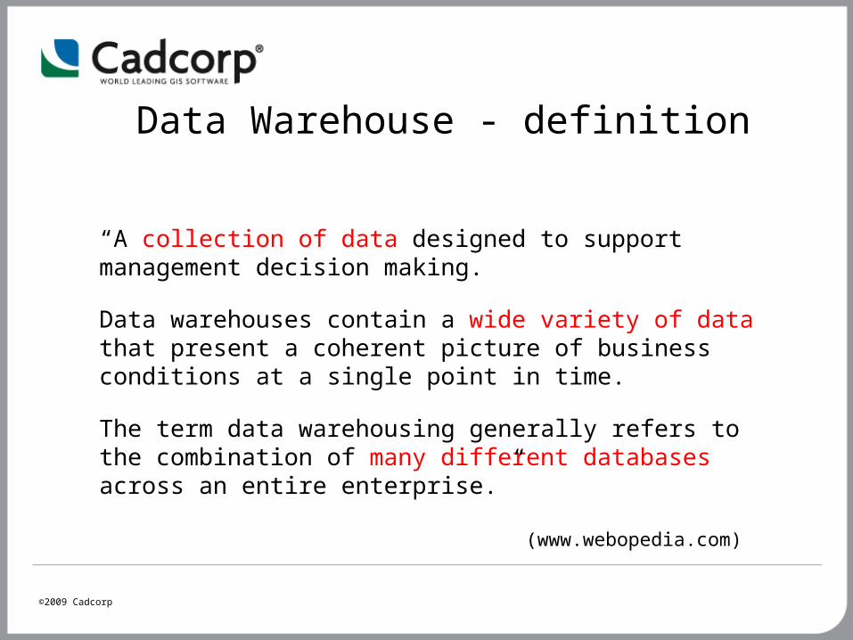
Data Warehouse - definition
“A collection of data designed to support management decision making.
Data warehouses contain a wide variety of data that present a coherent picture of business conditions at a single point in time.
The term data warehousing generally refers to the combination of many different databases across an entire enterprise.”
(www.webopedia.com)

©2009 Cadcorp
What’s required ?
“Collection of data” Oracle, PostGIS, SQLServer
“Wide variety of data” OGC Simple features specification Oracle – SDO_Geometry
“Systems to extract data ….. flexible access to the data” Intranet/Internet browser based access

©2009 Cadcorp
Spatially-enabled databases are becoming increasingly widespread and are no longer the preserve of large, enterprise, geo-spatial data stores
Demand for information sharing across organisations and partnerships
Adoption of Standards for Open Geospatial Consortium, Inc.® (OGC) data standards and interfaces
Advances in database usability and network capability
GIS becoming more mainstream IT
Drivers for spatial data warehousing?

©2009 Cadcorp
What db options are available ? D
ata
volu
mes/
perf
orm
ance
Cost
MS Access
SQL Server2008
Oracle Spatial
Enterprise
Personal ‘Flat files’
PostGIS
©2009 Cadcorp
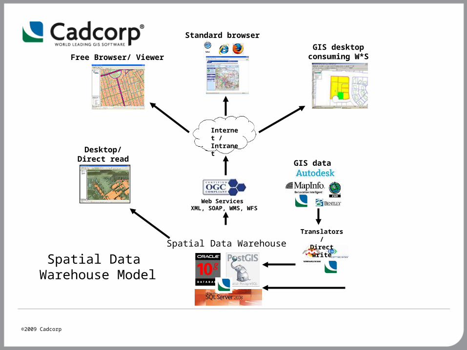
Spatial Data Warehouse Model
GIS data
Translators/Direct write
Desktop/Direct read
Internet /Intranet
Web Services XML, SOAP, WMS, WFS
Free Browser/ ViewerGIS desktop
consuming W*S
Standard browser
Spatial Data Warehouse
©2009 Cadcorp
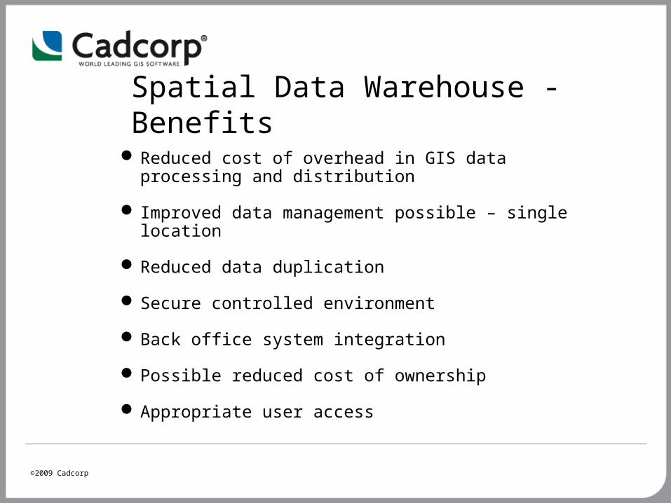
Spatial Data Warehouse - Benefits
Reduced cost of overhead in GIS data processing and distribution
Improved data management possible – single location
Reduced data duplication
Secure controlled environment
Back office system integration
Possible reduced cost of ownership
Appropriate user access
©2009 Cadcorp
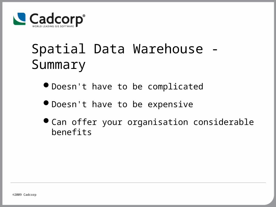
Spatial Data Warehouse - Summary
Doesn't have to be complicated
Doesn't have to be expensive
Can offer your organisation considerable benefits
©2009 Cadcorp
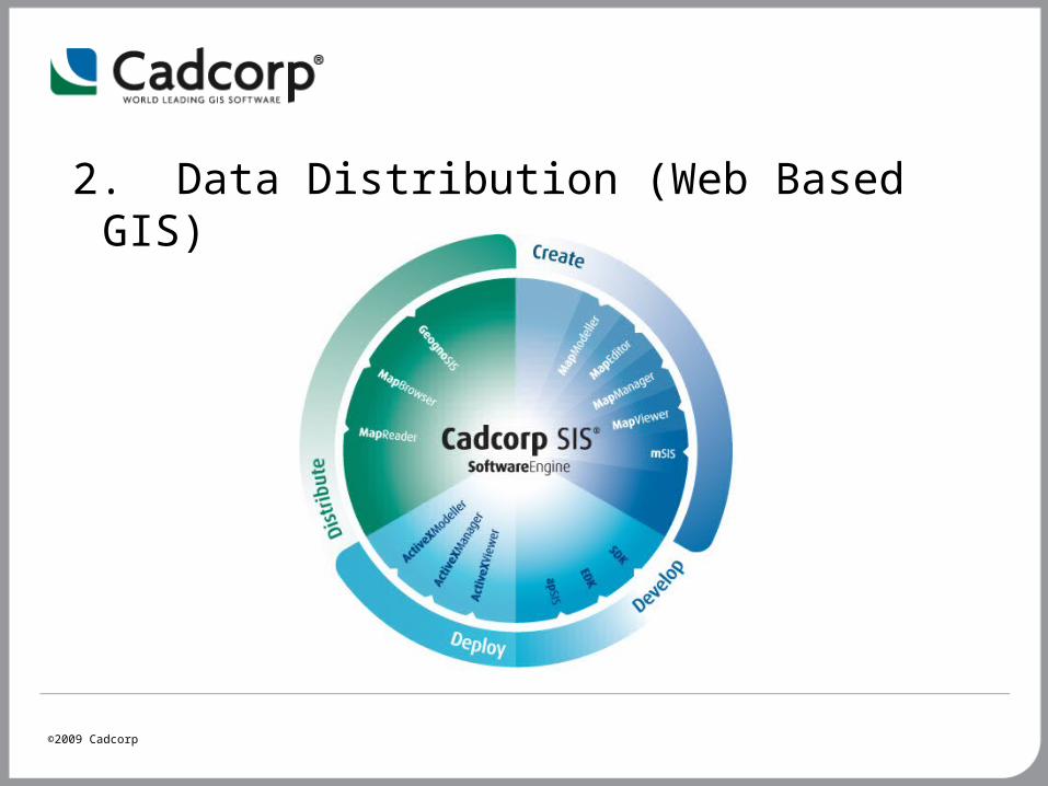
2. Data Distribution (Web Based GIS)
©2009 Cadcorp
GeognoSIS
• Is a Windows service: ‘a Windows service is a long-running executable that performs specific functions and which is designed not to require user intervention’ (Wikipedia)
• Responds to requests from application code
• Does not necessarily need to render a map
• Can distribute mapping data using Web Services

©2009 Cadcorp
GeognoSIS Triangle
©2009 Cadcorp
3. Technical Demonstration
Philip McLaughlin – GIS Technical Specialist