2012 north american river management … north... · 2012 north american river management...
TRANSCRIPT

2012 North American River Management Symposium2012 North American River Management Symposium
Presented by the River Management Society
and RiverLink
from intimate creeks
to the infinite sea
April 24-26, 2012Asheville, North Carolina

Welcome!
On behalf of RiverLink and the 2012 RMS Symposium Committee, we are honored to be your hosts during your visit to Asheville and the beautiful mountains of North Carolina for the 11th Biennial North American River Management Symposium. A wonderful group of individuals hasbeen working diligently to bring you an extremely worthwhile program.
We will explore issues from the French Broad River Basin and the Southern Appalachian Mountains to specific challenges facing rivers across the continent, extending to our vast, but vulnerable oceans. The diversity of topics, workshops, and presenters should stimulate, educate and hopefully provoke you to re-think and re-evaluate ways to address concerns within your own region, watershed and areas of expertise. To complement the science, we have included a wide range of field trips, entertainment, and opportunities for you to network with other professionals dedicated to the well-being of river systems and water resources.
This symposium is another step in improving our understanding and practice of river management techniques. Asheville’s delicate springtime setting is the perfect backdrop to highlight our keynote speakers: Paul Greenberg (author of Four Fish); Dave Cooper and Larry Gibson (representatives of the Mountain Top Removal movement); and Rebecca Wodder (lead for the US Department of Interior’s America’s Great Outdoors Rivers Initiative). They each reflect our theme of river concerns and issues–
from intimate creeks to the infinite sea.
We hope you will enjoy these speakers and the other presenters while networking with your peers. Thank you for joining us.
Your 2012 Symposium Co-chairs,
Karen Cragnolin Steve Hendricks Mary CrockettExecutive Director, Vice President, President,RiverLink RMS Southeast Chapter RMS Southeast Chapter

Registration Desk Laurel Registration
Monday 12:00 pm - 5:00 pm
Tuesday 7:00 am - 12:00 am
Thursday 7:00 am - 9:00 am
Exhibitors
Set-up Monday 3:00 pm - 9:00 pm
Displays Open Tuesday 5:30 pm - 10:00 pm
Thursday 7:30 am - 3:30 pm
Tear Down Thursday 3:30 pm - 5:00 pm
Message Center Laurel RegistrationCheck the Message Center for updated information on field sessions, ad hoc gatherings, and for lost and found items. Contact information for Symposium staff will be posted when the Registration Desk is closed. You can also call the Front Desk anytime for assistance, and for cell numbers of 2012 Symposium organizers: 828-254-3211.
Shuttles - Available from the Crowne Plaza to the Asheville airport. If you’d like to catch a ride to the airport or have a car and would be willing to take a fellow attendee along, post your request or offer with your contact information at the Message Center.
RMS Merchandise Store Mt. Roan/Mt. PisgahNeed a gift for someone at home, or an ‘atta boy/girl item for yourself? These handsome, functional RMS logo products fit the bill, and will be on sale this week during posted hours. Stop in during a break, and feel free to suggest new items that would be of interest to river managers and other outdoor professionals. You can always visit the RMS Store at www.river-management.org.
Name Badges - Please wear your name badge during the Symposium. It provides an introduction to new colleagues and a reminder for those you’ve met before. It also serves as your ticket to the one day or full array of presentations, discussions and social events for which you’ve registered.
Proceedings - Proceedings will be available at the RMS website. An estimate of their availability will be announced at the Symposium.
Symposium Evaluation - Soon after you’ve returned home, the Symposium organizations will invite you to fill out an online survey regarding your experience this week. Please take a few minutes to respond: your feedback helps us plan future conferences that meet your needs and expectations as management professionals and stewards of our waterways.
CEU Credits - Licensed Landscape Architects attending the Symposium are eligible for 10 CEU’s (a full year’s requirement).
3
LogiStiCS 2012 North American River Management Symposium2012 North American River Management Symposium

Thank You!
The River Management Society and RiverLink thank the major sponsors of
from intimate creeks to the infinite sea for their belief in our missions, their financial support,
and their logistical assistance.
4
Silent Auction Mt. Roan/Mt.Pisgah
Stop by and bid often... on items you’ve got to bring home as a
gift or personal treasure! We appreciate the generous support of businesses,
colleagues and sponsors for their donation of products and services. Bidding will close Thursday at 3:30 pm. Please return to the Mt. Roan/Mt.Pisgah Room at 5:00 pm to
claim and pick up your item(s). If you are not present for pick up, please
be prepared to pay for shipping. photo: Jack’s Plastic Welding

A. Engaging Youth–Ensuring Future Generations of River Rats: Addressing all aspects of youth engagement, whether it’s pre-kindergarten kids running rivers or college kids making decisions about their flow, we want to attract and retain future river advocates, citizens well-informed about their watersheds, river managers, and maybe even aquatic scientists.
B. Loving the River Without Loving It to Death: Changing demographics, interests, and technology are increasing the number of people on our waterways and the activities they pursue. How can managers protect the river experience and ecosystem integrity while responding to a changing America? From precedent-setting user capacity decisions, to managing emerging uses like pack-rafting and power-boating, to innovative new river management plans that link communities with rivers, new challenges and opportunities are emerging relating to managing river visitors.
C. Got Water? Is it Clean? What About the Fish (and other critters)?: River managers everywhere are facing competing demands for water withdrawals, often accompanied by declining water quality and threats to native aquatic species. Innovative solutions are needed to combat water extraction and diversion, sources of chemical or thermal pollution, and ecological degradation due to habitat fragmentation, biological invasions, and other anthropogenic disturbances.
D. Water Trails as Tools for Advocacy, Stewardship, Education, and Management: For nearly two decades, water trails have been sprouting up on waterways across the nation, providing access to recreational enthusiasts and instilling a connection to rivers and river communities. During this time it has become apparent that water trails can help river managers achieve goals beyond access protection and improvement, such as energizing river advocacy and stewardship, providing a vehicle for education about a culture or ecosystem, or assisting the responsible management of rivers and their adjacent lands.
E. Accessing the River–From Landownership to Cyberspace: Providing access to would-be river users is a key challenge in modern river management. Access can range from fee simple ownership of riparian lands to information portals that convey much needed information about river characteristics, current condition, public facilities, and long-term trends. Providing safe, appropriate, timely access to and about rivers is a crucial component of river management.
F. A River Runs Through It: Bridges, dams, turbines, reservoirs, docks, and waterfront developments are all examples of construction located at a river, and they all involve trade-offs. River-based infrastructure has often been viewed negatively by conservationists. Today, however, there are tools and processes to control, minimize, mitigate, or eliminate impacts of the built environment altogether. In some cases, river-based infrastructure can even enhance river values creating a win-win scenario.
5
tRACKS 2012 North American River Management Symposium2012 North American River Management Symposium
Many river management topics are not only important to us as professionals: they are aligned with national policy and social trends that affect the lives of our families and neighbors. Plenary and breakout sessions speak to the following tracks, labeled to assist you as you plan your time. As you review the Program, you will see these six tracks referenced in both plenary and breakout sessions.
Monday, April 23rd
8:00 AM - 4:20 pm Wild and Scenic Rivers Act Workshop: Section 7 training Mt. Mitchell Sponsored by the Interagency Wild and Scenic Rivers Coordinating Council Joan Harn, Co-Lead, Wild and Scenic Rivers Program, National Park Service
8:30 am - 2:00 pm golf Fundraiser Course, on site
12:00 - 5:00 pm Registration Laurel Registration
2:00 pm - 5:00 pm tennis tournament Courts, on site
2:00 - 10:00 pm Setup for Silent Auction, Exhibitors Mt. Roan/Mt. Pisgah
5:30 - 8:00 pm Professional Networking Mulligans
Tuesday, April 24 Meals are provided for registered attendees unless otherwise designated. To view abstracts for each presentation, refer to the Abstract Section starting on page 16.
6:00 - 7:00 am Morning Wake-up: Yoga and group Run See Message Center
7:00 - 8:15 am Registration Swannanoa
7:30 - 8:30 am Continental Breakfast Expo
8:30 - 9:45 am opening Remarks: Welcome to the Southeast Expo
National Park Service
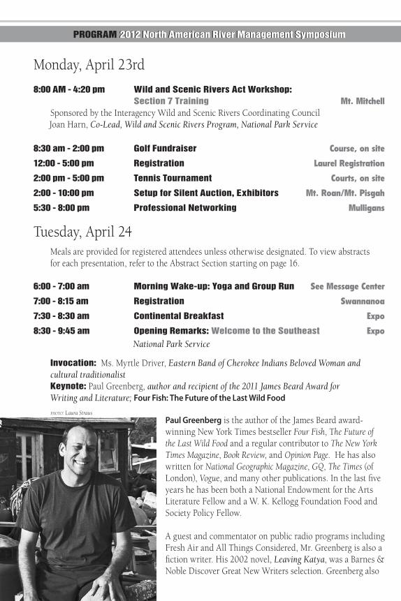
invocation: Ms. Myrtle Driver, Eastern Band of Cherokee Indians Beloved Woman and cultural traditionalist Keynote: Paul Greenberg, author and recipient of the 2011 James Beard Award for Writing and Literature; Four Fish: The Future of the Last Wild Food
Paul Greenberg is the author of the James Beard award-winning New York Times bestseller Four Fish, The Future of the Last Wild Food and a regular contributor to The New York Times Magazine, Book Review, and Opinion Page. He has also written for National Geographic Magazine, GQ, The Times (of London), Vogue, and many other publications. In the last five years he has been both a National Endowment for the Arts Literature Fellow and a W. K. Kellogg Foundation Food and Society Policy Fellow.
A guest and commentator on public radio programs including Fresh Air and All Things Considered, Mr. Greenberg is also a fiction writer. His 2002 novel, Leaving Katya, was a Barnes & Noble Discover Great New Writers selection. Greenberg also
PRogRAM 2012 North American River Management Symposium2012 North American River Management Symposium
photo: Laura Straus

lectures widely on issues of ocean sustainability at venues that range from Google to the United States Supreme Court to The Culinary Institute of America. He has lectured and reported extensively overseas with assignments in Russia, Ukraine, France, the Caucasus, Bosnia-Herzegovina, Serbia, the West Bank/Gaza, and many other locations around the world.
9:45 - 10:15 am Break Expo
10:15 - 11:00 am Plenary Session Expo Heritage on the Brink: Restoration of Native Southern Appalachian Brook Trout Steve Moore and Matt Kulp, Great Smoky Mountains National Park
11:00 am - 12:00 pm Plenary Session Expo Just Add Water - Restoring North Carolina’s Mountain Streams Regulated by Hydropower Dams Steve Smutko, Tuckasegee Facilitator; Mark Cantrell, USFWS; Mark Singleton, AW; Steve Johnson, Duke Power
12:00 - 1:30 pm Lunch River Management Awards Expo Presentation: Dennis Willis, RMS President Keynote: Rebecca Wodder, Senior Advisor to Interior Secretary Ken Salazar Protecting, Restoring and Reconnecting with Rivers through America’s Great Outdoors Initiative
Rebecca Wodder serves as Senior Advisor to Interior Secretary Ken Salazar, advancing conservation objectives, including President Obama’s initiative on America’s Great Outdoors (AGO). She leads a new AGO Rivers Initiative, to achieve the Administration’s river restoration and river recreation goals.
From 1981 to 1994, Ms. Wodder served in several different capacities at The Wilderness Society: Vice President for Organizational Development, Vice President for Membership, Marketing and Development, and Director of Alaska Programs. Prior to joining The Wilderness Society, Ms. Wodder was Legislative Assistant to U.S. Senator Gaylord Nelson (WI) on environmental and energy issues, from 1978-1980. Wodder served as President and CEO of American Rivers, the nation’s leading river conservation organization from 1995-2011. In 2010, she was recognized as a Top 25 Outstanding Conservationists by Outdoor Life Magazine, and was named Woman of the Year by the American Sportfishing Association in 1998.
Ms. Wodder holds a B.A. in Biology and a B.A. in Environmental Studies from the University of Kansas, graduating with Highest Distinction. She also holds an M.S. in Landscape Architecture and an M.S. in Water Resources Management from the University of Wisconsin-Madison.
7
1:30 - 3:00 pm Concurrent Sessions 1
A. Engaging Youth I Mt. Mitchell Building a Junior River Ranger Program for Wild and Scenic Rivers Lee Steppacher and Liz Lacy, National Park Service
C. Got Water? I Foxfire I Innovative Solutions for River Flow Protection and Restoration Gerrit Jobsis, Jenny Hoffner and John Seebach, American Rivers
D. Water Trails as Tools I Foxfire II Linking the Landscape: Conservation Strategies along Water Trail Corridors Staci Williams, American Rivers; Kari Hanna, Palmetto Conservation Foundation; Maria Whitehead, The Nature Conservancy
F. A River Runs Through It I Dogwood Flows and Recreation on Virginia’s New River Jot Splenda, The Louis Berger Group, Inc. Salmon, Water Management and Climate Change Lisa C. Thompson, University of California, Davis Railroads and Access on Alaska’s Rivers David W. Schade, MPA, Alaska Department of Natural Resources
3:00 - 3:30 pm Break Mt. Roan/Mt. Pisgah
3:30 - 5:00 pm Concurrent Sessions 2 A. Engaging Youth II Mt. Mitchell Paddle Safe–Paddle Smart (PS2) Kelsey Bracewell, American Canoe Association
B. Loving the River I Mt. Pilot Rivers as an Economic Asset: The River Towns Program Jeff Malik and Jenna Gatto, River Towns Program; Peggy Pings, National Park Service
D. Water Trails as Tools II Foxfire I Blueways for Greener Waters Cate Huxtable, American Canoe Association; Staci Williams, American Rivers
E. Accessing the River I Dogwood Interagency National River Database: A Vision for a Web-enabled Interactive Map and Database of Rivers Risa Shimoda, River Management Society; Joan Harn, National Park Service GIS-based Landscape-scale River Mapping for Virtual Video Access Paul Ayers, University of Tennessee Alaska’s Web based “Navigable Waters” Information Systems David W. Schade, MPA, Alaska Department of Natural Resources
8

F. A River Runs Through It II Foxfire II Infrastructure Projects of Wild and Scenic Rivers: Getting the Best Designs James MacCartney and Liz Lacy, National Park Service Protected Rivers and Infrastructure Development: A Case Study of the Stillwater Bridge Issue Jill Medland and Christopher E. Stein, National Park Service A Bridge Crosses Over It: Using a Charette Process to Design a New Bridge on the Wekiva Wild and Scenic River Jeffrey R. Duncan, National Park Service
5:30 - 10:00 pm Poster Session Mt. Roan/Mt. Pisgah Missouri River Water Trail Gia Wagner, National Park Service GIS-based Landscape-scale River Mapping for Virtual Video Access Paul Ayers, University of Tennessee
The ‘Outstandingly Remarkable’ Value of Recreation across 13 interconnected Snake River Headwaters rivers Sidney Woods, Bridger-Teton National Forest
Growing Stewards Using Rivers as Classrooms Ed Councill, CEO, Paddlesports Industry Foundation and kidsGROWkentucky
Creating a Water Trail on America’s Great River–The Mississippi Jon Summers, US Army Corps of Engineers Supporting Trail Maintainers in the Northern Forests Walter Opuzynski, Northern Forest Canoe Trail
Water Consumption Numbers: Can We Make Them Matter? Ken Ransford, Colorado River Basin Roundtable
Hydrokinetic Energy Projects & Recreation: A Guide to Assessing Impacts Joan Harn, National Park Service GIS-based Mapping of Outstandingly Remarkable Values on the Wekiva Wild and Scenic River Stephanie Kerrigan and Paul Ayers, University of Tennessee
Water Wise: The History of Whitewater Paddling in Western North Carolina Will Leverette, author
Ecologically Sustainable Water Management for the Saluda River: Balancing Human and Ecological Needs Jeffrey R. Duncan and Theresa Thom, National Park Service
5:30 - 9:00 pm Networking, Vendor Exhibition, Silent Auction
9
Snake River, Bridger-Teton National Forest

Wednesday, April 25
7:00 - 8:00 am Continental Breakfast Mt. Roan/Mt. Pisgah
7:15 am - 6:00 pm Symposium Field Sessions
Box lunch pick up for select field sessions during breakfast–meet for sessions in Lobby. Please arrive in the lobby area 15 minutes before your scheduled departure. At the noted time for your departure, everyone will load vehicles (signs will be posted on each bus or van) outside the hotel lobby. Return times are approximate. Important Note: If you change your mind at the last minute and decide not to go on your field trip, please notify someone at the Registration Desk so that field trip leaders are not looking for you and holding up an on-time departure for others. If weather is severe, or river flows are too high, the water-based field trips may be cancelled. Be prepared for variable weather.
7:15 am - 6:15 pm Chattooga River, Section III - Wild and Scenic River Management (rafting) Compatible conference track(s): Loving the River without Loving it to Death; Got Water? Is it Clean? What About the Fish (and Other Critters)? Lunch provided by outfitter.
9:00 am - 5:00 pm Great Smoky Mountains National Park - Fisheries Management (fishing) Waders provided, bring your own fishing gear if possible. NC or TN fishing license and trout stamp required. Box lunches available for pickup at the hotel.
9:00 am - 5:00 pm Nolichucky River - Awaiting Wild and Scenic Designation (rafting) Compatible conference track(s): Ensuring Future Generations of River Rats. Lunch provided by outfitter.
9:00 am - 5:30 pm Nantahala River and Tuckasegee River - Restoring Dammed Rivers (rafting) Compatible conference track(s): A River Runs Through It; Loving the River Without Loving it to Death; Got Water? Is it Clean? What about the Fsh (and Other Critters)? Lunch (not included in price) at the Nantahala Outdoor Center.
9:00 am - 6 pm Wilson Creek - Wild and Scenic River Plan Implementation (hiking) Box lunches available for pickup at the hotel.
9:00 - 11:00 am RiverLink Bus Tour of Asheville Compatible conference track(s): A River Runs Through It; Loving the River Without Loving it to Death. Lunch is not included.
10
Chattooga River, Second Ledge

1:00 - 5:00 pm French Broad River Float (on-water) Try out multiple water craft! Lunch is not included.
10:30 am - 4:30 pm Biltmore Estate Tour (walking) Lunch (not included in price) at the Biltmore Estate.
6:00 - 7:00 pm RMS Members: Pizza for Your thoughts! Mt. Roan/Mt. Pisgah Greet new RMS friends, high five longtime colleagues, and offer input to RMS leaders to help them know what you feel is important to members.
7:00 - 7:30 pm Mentorship Program Pre-Kickoff Mt. Roan/Mt. Pisgah Learn how river management mentors and mentees are connecting through this new program, for which members can sign up. Share your experiences to help us grow the value of this program for mentors and mentees.
7:30 - 9:00 pm Special River Presentations Mt. Roan/Mt. Pisgah Protected Area Management in Tajikistan Randy Welsh, Wild and Scenic Rivers Program Leader, USDA Forest Service
The Mountaintop Removal Road Show Coalfield organizer Dave Cooper and coalfield “mountain keeper” Larry Gibson of Kayford Mountain, West Virginia will present a dramatic 20-minute slide show about the impacts of mountaintop removal on coalfield residents, communities and the environment.
Dave Cooper (left) is a resident of Lexington, Kentucky. After 20 years working as a mechanical engineer in various industries, he worked for a year as a coalfield organizer for the Ohio Valley Environmental Coalition (OVEC). He is currently on a national speaking tour to educate communities across America about Mountaintop Removal.
Larry Gibson (right), of Kayford Mountain, West Virginia has fought for over 15 years to save Kayford Mountain and his family cemetery on top of the mountain from mountaintop removal. His efforts to save the mountain have been chronicled by ABC’s Nightline, 20/20, the BBC, US News
& World Report, the New York Times, Washington Post, and the Chicago Tribune. He has spoken at countless college campuses about mountaintop removal mining in West Virginia. He is President of the Stanley Heirs Foundation and works as a volunteer for the Ohio Valley Environmental Coalition in Huntington, West Virginia.
11
Asheville, photo: Derek Olson
Thursday, April 26
6:00 - 7:00 am Morning Wake-up: Yoga and group Run See Message Center
7:00 - 8:00 am Registration Laurel Registration
8:00 - 10:00 am Plenary Session Mt. Roan/Mt. Pisgah Water Wise: The History of Whitewater Paddling in Western North Carolina Will Leverette, author French Broad Camping Water Trail Nancy Hodges, Steve Hendricks, and Karen Cragnolin, RiverLink Thinking & Linking Outside the Box Jane Polansky, Tennessee State Parks
10:00 - 10:30 am Break Mt. Roan/Mt. Pisgah
10:30 am - 12:00 pm Concurrent Sessions 3
A. Engaging Youth III Mt. MitchellCreating the Next Generation that Cares Liz Sparks, Florida Fish and Wildlife Conservation Commission
B. Loving the River II Mt. PilotProtectors, Promoters and Proprietors: Don’t We Owe Each Other? Risa Shimoda, River Management Society; Mark Singleton, American Whitewater; Gerrit Jobsis, American Rivers; Rob White, Arkansas Headwaters Recreation Area; Stuart Schneider, Niobrara National Scenic River; Kevin Lewis, Idaho Rivers United; Bill Medlin, Legacy Paddlesports; Ed Councill, kidsGROWkentucky
C. Got Water? II Foxfire I Angler Action Program: A Technology-Based Approach to Aid Fisheries Management Rick Roberts, Linda Roberts, Snook and Gamefish Foundation; Jeff Duncan, National Park Service Fracking on the Susquehanna Laura Stroup, St. Michael’s College
F. A River Runs Through It III Dogwood A Creek Runs Through It Cassie Thomas, National Park Service
12
photo: Wrangell Institute for Science and Environment

Water Flow Regulation on the Colorado River in Central Texas: Challenges in Ecosystem Stewardship Christine Bonthius, University of Texas at Austin Water Consumption Numbers: Can We Make Them Matter? Ken Ransford, Colorado Basin Roundtable
12:00 - 1:30 pm Lunch - RMS Chapters Meet Overlook
1:30 - 3:00 pm Concurrent Sessions 4
B. Loving the River III Foxfire I Recreation Visitors Inventories to Provide Data for Management Decisions and Communications Dr. Kenneth Chilman, Southern Illinois University, Carbondale Ecosystem Services of River: Exploring the Potential for Quantifying and Mapping Social Values Zachary D. Cole, University of Florida Whose River is it, Anyways? Linda Jalbert, National Park Service
D. Water Trails as Tools III Mt. Mitchell Supporting Trail Maintainers in the Northern Forests in the 21st Century Walter Opuszynski, Northern Forest Canoe Trail Ground Broken and Campsites Mapped: Bringing a Water Trail Closer to Its Paddlers Hartwell Carson, Western North Carolina Alliance Using Water Trails to Promote Stewardship and Public Access Angie Tornes, National Park Service
F. A River Runs Through It IV Mt. Pilot The Whitewater Parks Today: The Biggest Little, and Granddaddy Thus Far Risa Shimoda, River Management Society Restoring Regulated Rivers by Harmonizing Ecosystem Needs and Recreational Benefits Thomas OKeefe, American Whitewater An Arduous Process for Recreational Flow: An Overview of Providing Recreational Flow on the Pigeon River (NC and TN) C. Blake Condo, Louis Berger Group, Inc.
3:00 - 3:30 pm Break Mt. Roan/Mt. Pisgah Silent Auction Ends
13
Columbus AL Channel, photo: McLaughlin Whitewater Design Group

3:30 - 5:00 pm Concurrent Sessions 5
B. Loving the River IV Mt. Mitchell Planning for Visitor Use on Wild and Scenic Rivers Tracy Atkins, Ericka Pilcher, and Cassie Thomas, National Park Service
C. Got Water? III Dogwood Water Is Life: Water Management Strategies in the Southeast Mitchell Reid, Alabama Rivers Alliance Ecological Recovery of Restored Streams: The Myth and the Facts David Penrose, Watershed Science The Wekiva Wild and Scenic River System: Managing a Partnership River Deborah Shelley, Wekiva River Aquatic Preserve - FDEP; Nancy Prine, Wekiva Wild and Scenic AMC
D. Water Trails as Tools IV Foxfire IChainsaw Safety In/On Water: A Training Program Overview Erik Wrede, Minnesota Department of Natural ResourcesCreating a Water Trail on America’s Great River, The Mississippi Jon Summers, US Army Corps of EngineersOur Mississippi Educator Guide and Other River Education Initiatives Jon Summers, US Army Corps of Engineers
F. A River Runs Through It V Mt. Pilot21st Century Hydropower: The Good, the Bad, and the Ugly
Matt Rice, American Rivers; Ryan Brosher, SRA International; Brad Florentin, Blue Earth and Flywater
5:00 pm Symposium Classroom Sessions End
5:15 & 5:30 Buses depart for Closing Banquet
6:00 Reception Camp Rockmont (formerly Black Mountain College)
Our closing crescendo will take place just south of the Black Mountains (highest mountains east of the Mississippi) at the former campus of famed Black Mountain College. From 1933 to 1957, Black Mountain College was an experiment in progressive education whose influence has grown steadily grown along with the reputation and accomplishments of its alumni and faculty. The college’s legion of associated visual artists, poets, musicians, architects, and a number of the 20th Century’s most innovative leaders include such luminaries as Albert Einstein, Buckminster Fuller, Robert Rauschenberg, Mary Carol Richards, Ruth Asawa, and John Cage.
14
photo: Eric Wrede

15
7:00 - 8:00 pm Barbeque Banquet
7:10 - 7:30 pm Live Auction
7:30 - 10:00 pm Mountain Music by the Lazybirds
Lazybirds is a classic American roots band from the mountains of North Carolina, specializing in good time music that is just about impossible not to move to. According to the legendary Doc Watson, “Lazybirds play a good variety of blues, jazz, and that good old ragtime sound, and you will hear the flavor of that in anything they play.” The ‘Birds’ cover a lot of musical ground, from early American stringband music to Dylan classics, as well as classic sounding originals, but deep roots are what hold all of these sounds together.
Friday, April 27
9:00 am - 12:00 pm Service Project: giving Back to the French Broad RiverLink Sculpture Plaza and Cotton Mill Labyrinth
Do a good turn for the river that provided the backdrop for the 2012 Symposium! Pick up trash, remove invasive plants, and build benches and picnic tables, then enjoy a ‘thank you’ lunch provided by RiverLink.
Join us... for a rousing live auction
at 7:10 pm Thursday evening for items that include a
trip for two on Cataract Canyon from OARS, a set of custom-
made Cataract Oars from Advanced Composites, and a personally guided week in
Hawaii, courtesy of Pacific Chapter
President Elaine Grace!
photo: Lazybirds
Tuesday, April 24
10:15 - 11:00 am PlenaryHeritage on the Brink: Restoration of Native Southern Appalachian Brook Trout Steve Moore and Matt Kulp, Great Smoky Mountains National Park
Great Smoky Mountains National Park (GRSM) was established in 1926 in order to protect and preserve the forest resources of the southern Appalachian Mountains. The park’s extensive richness of flora and fauna has resulted in its designation as an International Biosphere Reserve as well as a World Heritage Site, boasting more than 2,000 miles ofprotected streams.
Today, GRSM receives some of the highest amounts of air pollution of any National Park in the U.S. High levels of acid deposition, primarily associated with the mass-scale burning fossil fuels to produce electric power, are acidifying high elevation streams and saturating soils with too much nitrogen, which harms wildlife and trees.
The South Appalachian brook trout (Salvelinus fontinalis)–the only native salmonid in the southeastern U.S., is a harbinger of human-induced stressors and suffered losses due to acidic deposition. Presenters will review this history, as well as recent re-introduction and public outreach efforts conducted to convey that SABT are a part of the local and regional heritage, and worth preserving for future generations.
11:00 - 12:00 am PlenaryJust Add Water - Restoring North Carolina’s Mountain Streams Regulated By Hydropower DamsSteve Smutko, Tuckasegee Facilitator; Mark Cantrell, USFWS; Mark Singleton, American Whitewater; Steve Johnson, Duke Power.
Over the past decade a suite of agencies and interest groups has negotiated new licenses for dams on the Cheoah, Little Tennessee, Nantahala, and Tuckasegee rivers. The outcome has been a sweeping initiative that has restored water, rare species, outdoor recreation, and economic vitality across a broad swath of Western North Carolina. In this panel discussion presenters will share the interests they brought to these collaborative efforts, tell the story of reaching landmark agreements, and share some of the creative and exciting outcomes. In an era where the concept of collaboration is often talked about, these projects are tangible examples complete with unforeseen pitfalls and recipes for success.
1:30 - 3:00 pm Concurrent Sessions 1
A. Engaging Youth I Building a Junior River Ranger Program for Wild and Scenic RiversLee Steppacher and Liz Lacy, National Park Service
In 2011, the Sudbury, Assabet and Concord Rivers (SuAsCo) (MA) and Farmington (CT) Wild and Scenic Rivers began a joint effort to develop a Wild and Scenic Rivers version of
16
ABStRACtS 2012 North American River Management Symposium2012 North American River Management Symposium

the popular NPS “Junior Ranger” Program. The intent is two-fold: 1) get more kids out on our WSRs and 2) adapt the materials and methods refined by the Junior Ranger parks program to be applicable to a Wild and Scenic River, its corridor, and the outstanding and remarkable features that earned each Wild and Scenic River its designation. Unlike a National Park or Historic Site, Wild and Scenic Rivers generally do not exist as a Park unit; many are comprised of public and private lands joined by the flowing and changing waters of the river running through the landscape.
The Junior River Ranger Program uses a tailored approach to teach young people about these rivers’ unique “Outstandingly Remarkable Values”–and fosters an appreciation of and a sense of stewardship for our Wild and Scenic rivers as well. Equally important, because most Wild and Scenic Rivers do not have a physical built presence (a visitor center) or Park Rangers, the Junior River Ranger Program seeks an alternative approach to publicizing and distributing workbooks and conferring badges for participants. These two rivers have many experiences to share in developing workbooks, publicity, distribution, award of badges and follow through of the Junior River Ranger program. While still in its infancy, initial efforts were well received. River managers are continuing to work to refine and expand the program. A template/catalogue of activities, graphics etc. are being developed for use by wild and scenic rivers throughout the country. There are many ways in which RMS and other
rivers could support and partner with NPS on this effort to reach young people and create the next generation of river stewards. We welcome an opportunity to share our experiences and explore new possibilities.
C. Got Water? I Innovative Solutions for River Flow Protection and RestorationGerrit Jobsis, Jenny Hoffner and John Seebach, American Rivers
Rising demand for water withdrawals, recent droughts, climate change and the highly engineered nature of many of our rivers threaten aquatic life, clean water and recreational uses that are dependent on flowing water. We will review innovative solutions to address water management challenges while protecting natural flows and associated values. Our session will explore opportunities for river flow protection and restoration through effective water efficiency policies and practices, federal hydropower licensing and authorities under the Clean Water Act (CWA). A panel session with the speakers and other water management experts will allow frank discussion of challenges and solutions with workshop participants. We will review new EPA guidelines for water efficiency as an alternative to building water supply reservoirs, other key policies and practices, as well as success stories that will illustrate the feasibility and effectiveness of these water efficiency policies as water supply strategies.
17
Kisaralik River, photo: Lisa Holzapfel

Federal licenses set the rules for how individual hydropower dams are built and operated. Once a license is in place, it can determine how a river’s flows will be managed for up to fifty years, balancing electricity generation with flows needed for healthy river ecosystems, fish, wildlife, and recreation. An increasing number of licensing negotiations are turning to innovative solutions that allow for a wider range of natural flow events. We will focus on how these ideas have been applied to several recent hydropower licensings and new policy initiatives that may encourage outcomes like these in the future.
D. Water Trails as Tools ILinking the Landscape: Conservation Strategies Along Water Trail CorridorsStaci Williams, American Rivers; Kari Hanna, Palmetto Conservation Foundation; Maria Whitehead, The Nature Conservancy
Lands immediately bordering trails play an integral role in protecting ecological services while providing valued recreational experiences. These adjacent landscapes are increasingly vulnerable to incompatible development and land use. To conserve the natural and cultural heritage that make water trail experiences unique, American Rivers and Palmetto Conservation Foundation are using water trails as a catalyst to engage communities, foster economic development and protect riverside land.
American Rivers’ Blue Trail program has evolved since its conception a few years ago. Our presentation will detail how what began as a way to improve recreation and reconnect communities to local rivers has evolved into much more; an innovative protection tool. We will highlight examples from our work with communities in South Carolina that serve as a model for this unique approach to riverside land conservation and the ways we are working with federal partners and NGOs to garner support for the Land and Water Conservation Fund (LWCF) and a national system of blueways.
Palmetto Conservation Foundation, through its Glendale Outdoor Leadership School, has formed partnerships with public agencies, private landowners, and other non-profits in the Spartanburg area to develop a 50-mile paddle trail along the Pacolet River and Lawson’s Fork Creek. PCF is also spearheading the creation of a clearinghouse called Paddle SC, in which people can access vital information about South Carolina’s paddle trails. A number of organizations from around the state have partnered in this effort to promote the responsible use and enjoyment of South Carolina’s rivers.
F. A River Runs Through It IFlows and Recreation on Virginia’s New RiverJot Splenda, The Louis Berger Group, Inc.
Appalachian Power’s Claytor Hydroelectric Project on Virginia’s New River operates under a peaking regime in winter and run-of-river regime in summer. Flows can have important impacts on 56 miles of downstream river recreation including fishing, hunting, scenic floating, whitewater kayaking, and tubing. Relicensing studies analyzed the river’s hydrology, and conducted fieldwork, interviews, and focus groups to identify acceptable flow ranges and fluctuation tolerances for recreation opportunities and management options that might improve them. Findings showed opportunities occupy different “niches” in the
18

hydrograph that don’t necessarily overlap, highlighting trade-offs between different flow regimes. Higher flows provide better boatability and access for powerboats and scenic floaters but may limit wading-based fishing, reduce water clarity, or diminish perceived fishing success. The best flows for whitewater kayak playboating are marginally unsafe for family-oriented tubing at a popular falls for both activities. Winter peaking regimes offer better kayaking when tubing is not popular, but irregular timing can make those flows difficult to use. Management improvements include: 1) improved flow release information, 2) higher minimum base flows, 3) reduced “double peak” days, 4) upper fluctuation limits, 5) special event flows, 6) scheduled occasional summer whitewater flows, and 7) summer pulse flows to reduce algae concentrations.
Salmon, Water Management and Climate ChangeLisa C. Thompson, University of California, Davis
Conflict over water allocation for multiple uses is common, yet the costs of compromise are often unclear. Climate change may alter the quantity and timing of water availability, potentially heightening conflicts. We developed an analytical framework to examine trade-offs between water use for fish habitat and hydropower generation in the face of climate change. Spring-run Chinook salmon are vulnerable to climate change because adults over-summer in freshwater streams before spawning in autumn. We determined whether future streamflows and water temperatures could lead to reductions in these salmon in a California stream, and evaluated water management adaptations to ameliorate these impacts. We used projected climate data for 2010-099, as input to the WEAP watershed hydrology model, which passed streamflow and water temperature to SALMOD, a salmon population dynamics model. WEAP forecast lower summer flows and higher temperatures, while SALMOD forecast decreased adult summer survival and population declines. Of management adaptations tested, only ceasing water diversion for hydropower production from the summer fish habitat resulted in cooler water, more adults surviving to spawn, and extended population survival time, albeit with a loss of hydropower production. This framework could be transferred to other watersheds, and extended to include other water uses.
Railroads and Access on Alaska’s RiversDavid W. Schade, MPA, Alaska Department of Natural Resources
The Alaska Railroad system runs across many rivers from tidewater to the interior of Alaska. The Alaska railroad is currently doing two rail extensions, one through a major urban area, and the other through a rural part of the state. During the development of the railroad plans, many access and use issues related to the railroad have been debated, and design issues addressed. The presenter will outline these conflicts, and some of the design changes which have been proposed. Other positive railroad programs for river drop-offs, etc. will be shown as well.
19

3:30 - 5:00 pm Concurrent Sessions 2
A. Engaging Youth IIPaddle Safe–Paddle Smart (PS2)Kelsey Bracewell, American Canoe Association
Paddle Safe Paddle Smart (PS2) is a national research-based educational curriculum designed to introduce middle and high school age youth to the joys of paddling a canoe and/or kayak. The curriculum emphasizes safety and skills and is designed specifically for teachers and youth leaders who want to include paddle sport instruction in their programs. The focus of the program is on risk assessment and risk management. PS2 will help students recognize potential risk and take steps to avoid, reduce, or eliminate them. A factor that must be emphasized is that this curriculum prepares students only for protected flat water venues. Our goal is to encourage youth to participate in paddle sports as a lifelong physical-recreational activity, and to do so in a safe manner. PS2 is a joint venture of the American Canoe Association, the American Association for Physical Activity and Recreation, and the American Alliance for Health, Physical Education, Recreation, and Dance.
B. Loving the River IRivers as an Economic Asset: The River Towns ProgramJeff Malik and Jenna Gatto, River Towns Program; Peggy Pings, National Park Service
The River Towns Program is a community and economic development program, launched by the Pennsylvania Environmental Council (PEC). The program is based on the belief that our environment, economy, and quality of life are inextricably linked. This “triple bottom line” approach brings together a wide variety of partner groups who can all work towards environmental protection and restoration. The program strives to use rivers, and other natural features, as economic assets that attract the growing outdoor recreation market. In communities where rivers were once seen only as a dumping ground for industry, local economies can be rebuilt and revitalized based around tourism and small businesses. When individuals and communities recognize the economic value of a healthy river, they are motivated to sustain and conserve the river, and to integrate conservation into local planning and policies.
Through a partnership with PEC, McCollom Development Strategies, and the Student Conservation Association, the River Towns Program launched in five communities along the Monongahela River in southwestern Pennsylvania. The program’s first step was to engage community members and local groups. Town assessments were then conducted in each community, with local residents taught to look at their community with “visitor’s eyes” to see both the strengths and needs of the area. Existing plans have been reviewed, and community members have provided input on what kinds of projects they still support. Moving forward, the River Towns Program works to implement these projects, both by bringing in outside resources and engaging community members. The Pennsylvania Environmental Council aims to develop an asset-based community development model
20

that transforms the way communities perceive their natural resources. While there can be no “one size fits all” tool for sustainable communities, we believe this model can be applied to communities across the state and country. The River Towns Program was based in part on a similar program in communities along a long distance bicycle trail, and the Pennsylvania Environmental Council is working to implement this style of community development along other rivers in the state.
D. Water Trails as Tools II Blueways for “Greener” WatersCate Huxtable, American Canoe Association; Staci Williams, American Rivers
The popularity of blueways across our nation’s waters has been increasing for decades to accommodate the ever-growing paddlesports community. Connecting communities to water, increasing recreational activity, and boost to local economies, there are numerous benefits to having water trails.
At the ACA, we believe that recreation is just the beginning. Providing the tools and education to be smart and safe on the water, we strive to create future generations of paddlers and stewards for our waters. Water trails, a network of scenic and accessible water ways, have the ability to catalyze advocacy and stewardship initiatives, to protect and preserve paddling environments.
See Water Trail work in action with the ACA’s Water Trail Explorer: a comprehensive Water Trail database designed to increase access for paddlers of any skill level. American Rivers and the National Park Service are also teaming up to create a social engagement platform that tells the story of blueways across the country. The online map will include photos, videos, graphs and other media and will help connect people to their rivers through recreation.
E. Accessing the River IInteragency National River Database: A Vision for a Web-enabled Interactive Map and Database Of RiversRisa Shimoda, River Management Society; Joan Harn, National Park Service
Various individual Web sites, databases, and maps contain information about rivers in the US; data is housed at different scales (local, state, and national), by various entities (NPS, USFS, BLM, private, nonprofit), by several themes (Wild and Scenic designation, whitewater sections, floatable/boatable), and in different formats (lists, excel files, internal databases, Web-enabled databases). Wouldn’t it be nice to access river data across scales and topics from one place?
RMS seeks to provide a single platform for information dissemination among and between river managers and visitors. This database will streamline efforts to disseminate river data and create opportunities for river management agencies and entities to manage river more
21
photo: Metropolitan Affairs Coalition

effectively and efficiently. RMS envisions a river database available through the RMS website that includes all rivers, regardless of management, designation, or use type.
This Interagency National Rivers Database seeks to enhance collaboration and educate river managers and other partners and visitors about rivers and their management. We envision this database to be a jointly funded, long term legacy project coordinated by RMS in collaboration with agencies and other partners. This presentation will discuss the project vision and possibilities for a web-and spatially-enabled interagency river database.
GIS-based Landscape-scale River Mapping for Virtual Video AccessPaul Ayers, University of Tennessee
The need to develop GIS-based large-scale maps of river systems led to the design of a GPS-based river videomapping system. The river mapping system is canoe and kayak-mounted with georeferenced under and above water cameras, depth sounder and underwater lasers. GIS maps of streambank characteristics, substrate (modified Wentworth scale), embeddedness (EPA classification), depth and river characteristic (pool, riffle, run) were developed. River rugosity and sinuosity can be determined.
The system was used to map 45 river miles of the NPS Obed Wild and Scenic River (OBRI) river system, 81 miles of the NPS Big South Fork River and Recreation Area (BISO) river system, 16 miles of the NPS Great Smoky Mountains (GRSM) Abrams creek and 12 miles of the USFS Cherokee National Forest Citico creek. A snorkel-based underwater mapping system was developed for more detailed mapping. The system provides a georeferenced data-base for river and stream inventory. GIS-based video tours of the above and below water river features, providing virtual tours within ArcGIS and Google Earth will be demonstrated.
Alaska’s Web based “Navigable Waters” Information SystemsDavid W. Schade, MPA, Alaska Dept of Natural Resources, DMLW
The State of Alaska, Department on Natural Resources, Division of Mining, Land and Water has jurisdiction over the use of thousands of miles of rivers and millions of acres of lakes. In order to facilitate the public’s right to use these waters, Alaska has several web based intiatives designed to provide and solicite information. This presentation will provide an overview of these web based informational systems, and in addition will include a discussion of a joint federal-state historical reporting program which is also increasing the level of information about river use, etc which is available on the web.
F. A River Runs Through It IIInfrastructure Projects of Wild and Scenic Rivers: Getting the Best DesignsJames MacCartney and Liz Lacy, National Park Service
This session will explore how dialogue during the design stage can result in a “Win-Win” for project proponents and river administering agencies under Section 7 of the Wild and Scenic Rivers Act. Often, Section 7 determinations are made after project designs are finalized. This can result in unfavorable outcomes for project proponents who either must scrap their plans or undertake costly redesign so as to satisfy standards under Section 7. A case study from the
22

Westfield Wild and Scenic River in Massachusetts shows how involvement by the National Park Service during the preliminary project design phase resulted in successful replacement of critical municipal infrastructure–namely the McNerney Road/ Shaker Mill Brook stream crossing–and successful protection of outstanding river values, including upstream fish passage for native Eastern brook trout and other resident species. The existing 16-ft. metal squash pipe was replaced with a 24-ft. bottomless, 3-sided concrete culvert that contained streambed materials matching the natural substrate up- and downstream. Four drop structures consisting of boulder step pools were constructed at the culvert outlet allow for upstream fish passage.
Protected Rivers and Infrastructure Development: A Case Study of the Stillwater Bridge IssueJill Medland and Chris Stein, National Park Service
On October 2, 1968 Congress enacted the Wild and Scenic Rivers Act to protect, for present and future generations, certain rivers that have outstanding resource values. The Upper St. Croix River was one of the eight original rivers designated under the Act in 1968. At the same time, the Lower St. Croix River was added as a “study river.” In 1972, Congress acted to amend the Wild and Scenic Rivers Act to add the Lower St. Croix River to the national system.
A battle in the 1960’s over a proposal to build a coal-fired power plant along its banks brought national attention to the need to protect the St. Croix River. In the mid-1980’s another proposal emerged; build a new highway bridge across the Lower St. Croix National Scenic Riverway just upstream of the coal-fired power plant. The St. Croix River Crossing Project (a.k.a. the Stillwater Bridge) involves traffic congestion in downtown Stillwater, Minnesota; a historic Lift Bridge, federally-listed mussels, and the Lower St. Croix National Scenic Riverway. The project has been through two facilitated consensus-building processes, two lawsuits, four Section 7(a) evaluations, and, most recently, two bills introduced in Congress. This session provides a case study of the project.
A Bridge Crosses Over It: Using a Charette Process to Design a New Bridge on the Wekiva Wild and Scenic RiverJeffrey R. Duncan, National Park Service
In the wake of a federal court of appeals ruling last year on the St. Croix River, federal river managers are under more scrutiny than ever to be systematic and objective when it comes to evaluating whether a federally-assisted water resources project is likely to adversely affect a given Wild and Scenic River. This is also the case with the Wekiva Partnership Wild and Scenic River in Central Florida. In 2004, state legislation authorized the construction of an outer turnpike loop around the northern end of metropolitan Orlando. The Wekiva Parkway, as it’s called, is proposed to cross the Wekiva River, and entails the replacement and expansion of an existing bridge creating a larger superstructure with higher traffic volumes traveling at higher speeds. This presentation will describe an outside-the-box means of working with a diversity of stakeholders in a proactive process to design a bridge that will not adversely affect the river’s free flow, water quality, or outstandingly remarkable values, while simultaneously disarming for controversy and potential litigation. Chief among the values at risk is the river’s scenery. The NPS is working with its partners and bridge designers to objectively evaluate potential bridge designs using an adapted visual assessment technique.
23
5:30 - 10-:00 pm Poster Sessions
Missouri River Water Trail Gia Wagner, National Park Service
The Missouri River Water Trail is a multi-partner, multi-state project that is attracting people to the under-utilized Missouri River. It offers a web presence and signs that not only describe the unique resources along each segment but also serve to de-mystify paddling on the Mighty Mo. The poster will highlight the building of partnerships, funding, education, and outcomes.
GIS-based Landscape-scale River Mapping for Virtual Video AccessPaul Ayers, University of Tennessee See Concurrent Sessions 2, Accessing the River I
The ‘Outstandingly Remarkable’ Value of Recreation across 13 interconnected Snake River Headwaters riversSidney Woods, USDA Forest Service, Bridger-Teton National Forest
In 2009, the Craig Thomas Snake River Headwaters Legacy Act designated 400 miles of rivers within one watershed as part of the National Wild and Scenic Rivers System. The rivers cross agency jurisdictions, including Yellowstone and Grand Teton National Parks, the John D. Rockefeller Memorial Parkway, the National Elk Refuge and the Bridger-Teton National Forest. When considering all the ‘outstandingly remarkable’ values of this area as directed by the Wild and Scenic Rivers Act, three categories may be considered most outstanding and most rare because of their interconnectedness across the watershed. While that concept comes naturally to ecological disciplines like wildlife and fisheries, considering recreation in this manner is somewhat unusual. This presentation will show the spectrum of recreational settings across this united landscape as integral to the outstanding nature of the recreational value itself. The highly social recreational experience is represented on the mainstem Snake, both in the ‘Canyon’ stretch on the National Forest and in the iconic flatwater section through Grand Teton National Park. Rustic experiences abound along gravel roads, while primitive opportunities follow trails beside the tributaries in designated Wilderness areas. Some portions also support no direct recreational development, allowing for only low numbers of intrepid adventurers.
Growing Stewards Using Rivers as ClassroomsEd Councill, kidsGROWkentucky
kidsGROWkentucky is a non-profit organization that is connecting kids to the outdoors with initial, return and repeat experiences in the out of doors, including on the water. The organization is leveraging decades of experience serving the public with canoe and kayak trips, to connecting underserved boys and girls, their families and teachers with outdoor skill building.
Creating a Water Trail on America’s Great River–The MississippiJon Summers, US Army Corps of Engineers See Concurrent Sessions 5, Water Trails as Tools IV/Engaging Youth
24

Supporting Trail Maintainers in the Northern Forests in the 21st CenturyWalter Opuszynski, Northern Forest Canoe Trail See Concurrent Sessions 4, Water Trails as Tools III
Water Consumption Numbers: Can We Make Them Matter?Ken Ransford, Colorado River Basin Roundtable See Concurrent Sessions 3, A River Runs Through it III
Hydrokinetic Energy Projects & Recreation: A Guide to Assessing ImpactsJoan Harn, National Park Service
GIS-based Mapping of Outstandingly Remarkable Values on the Wekiva Wild and Scenic RiverStephanie Kerrigan and Paul Ayers, University of Tennessee
Water Wise: The History of Whitewater Paddling in Western North CarolinaWill Leverette, author
Ecologically Sustainable Water Management for the Saluda River:Balancing Human and Ecological NeedsJeffrey R, Duncan and Theresa Thom, National Park Service
Wednesday, April 25th
7:30 - 9:00 pm Special River Presentations
Protected Area Management in TajikistanRandy Welsh, Wild and Scenic Rivers Program Leader, USDA Forest Service
Protected Areas come in many flavors. This presentation will describe protected area management in Tajikistan with an emphasis on river management issues. Some of the issues to discuss include protecting rivers while providing for economic development of third world economies, role and involvement of indigenous peoples, and high elevation water resource projects.
The Mountaintop Removal Road ShowCoalfield organizer, Dave Cooper and
coalfield “mountain keeper” Larry Gibson, Kayford Mountain, West Virginia
This team will present a dramatic 20-minute slide show about the impacts of mountaintop removal on coalfield residents, communities and the environment.
25
photo: Randy Welsh
photo: Appalachian Voices

Thursday, April 26
8:00 - 10:00 am Plenary Water Wise: The History of Whitewater Paddling in Western North CarolinaWill Leverette, author
Will grew up in and around canoes, as his grandfather, Frank Chief Bell, was the founder of Camp Mondamin, the country’s premier summer camp for paddling. The camp’s alumni include many US Slalom Team and World Championship Team members. Ride along with Leverette as he
recounts a few of the exhilarating adventures of paddling’s pioneers who started the craze amidst the breathtaking rapids and scenery of Western North Carolina.
PlenaryFrench Broad Camping Water Trail Nancy Hodges, Steve Hendricks, and Karen Cragnolin, RiverLink
Water trails can provide people with quality recreation, increase a sense of community, and offer in-situ educational opportunities–all of which build stewardship and foster advocacy. RiverLink will examine the development of the French Broad River Paddle Trail through planning, construction and management stages to ensure that the final trail plan incorporates
opportunities for recreation, community building, and education at their highest potential. We will explain the process of trail planning and management will be reviewed using a knowledgeable advisory committee of outfitters, citizens, river professionals and others. With guidance from Charlotte Gillis of the National Parks Service, case studies, river surveys, and the Advisory Council, a conceptual plan (the FBR Paddle Trail Design and Use Guidelines) for the trail has already been developed. We will review this guiding document for trail practices, campsite design, and long-term management for the trail. We will review existing campsites which have been or scheduled for construction. Finally, we will look at how the trail builds stewardship and conservation of riparian areas and our water resources. Paddle trails build and maintain a land ethic or stewardship among river users and riparian landowners to set value for land and water management protecting rivers and water quality.
Plenary Thinking & Linking Outside the BoxJane Polansky, Tennessee State Parks
There are more than 60,000 miles of rivers and streams meandering through Tennessee’s three distinctly different geographical regions. Could that be one of the reasons why a growing interest in water related activities is circulating a buzz in communities across Tennessee? Water Trails are becoming a hot topic among recreators, property owners,
26
French Broad River, photo: RiverLink
government officials, and local businesses. While some folks welcome the economic benefits, others raise concerns about land use, water quality, and other water related issues. Throughout Tennessee, marketing strategies continue to promote economic development, tourism, and enhanced recreational opportunities. Fortunately these strategies are counter-balanced by a growing trend to support environmental, cultural and recreational interests. Many communities are adopting initiatives to maximize clean water and preserve the inherent aesthetic, environmental, and cultural qualities of their waterways. Educational outreach initiatives promoting stewardship practices are working. Watersheds are redefining boundaries and waterways are linking communities. Cities along the Mississippi River and Cumberland River are anticipating economic returns from River Front Development Projects. Several new web-based programs including a National Geographic MapGuide Project are available to inform individuals about water trails and other attractions along river corridors.
On a smaller scale, blueways are becoming synonymous with greenways, as more communities include blueways in their master plans. At least six new water trails are being developed throughout the state. This presentation will identify the presence, perception and concerns regarding Tennessee’s water trails. Additionally, it will demonstrate how water trail activities are resulting in stronger partnerships and streamlining operations. Furthermore, it will provide examples of how anything is possible when individuals are able to overcome inherent economic, geographical and cultural challenges.
10:30 - 12:00 Concurrent Sessions 3
A. Engaging Youth IIICreating the Next Generation that CaresLiz Sparks, Florida Fish and Wildlife Conservation Commission
An innovative new program is underway in Florida to address the growing disconnection between modern children and the outdoors. Today’s children devote nearly eight hours a day to entertainment media and “media multi-tasking,” while the number who spend time in the outdoors continues to decline dramatically. This is a problem because we know that kids who do not directly engage in the outdoors are less likely to develop a strong stewardship ethic for conserving the future of America’s wild places.
The Florida Fish & Wildlife Conservation Commission (FWC) and the Wildlife Foundation of Florida are developing the Florida Youth Conservation Centers Network (FYCCN), leading the effort to “create the next generation that cares”. A statewide network of conservation centers is being designed to encourage and empower youth to participate in diverse outdoor recreation experiences. Curriculum will target two developmental age groups: Grades 3–5 and 6–8 and will encourage fishing, shooting sports, boating and paddling, and wildlife viewing activities. Building these essential outdoor skills will help support the critical goal of developing a strong conservation ethic in future generations. The integrated curriculum will also include a scope and sequence that shows alignment with the Florida Department of Education’s Next Generation Sunshine State Standards (NGSSS). To maximize resources, the FWC and the Wildlife Foundation of Florida are forming partnerships with public and private agencies and recruiting experienced volunteers to share their expertise in outdoor skills.
27

B. Loving the River IIProtectors, Promoters and Proprietors: Don’t We Owe Each Other? Risa Shimoda, River Management Society; Mark Singleton, American Whitewater; Gerrit Jobsis, American Rivers; Rob White, Arkansas Headwaters Recreation Area; Stuart Schneider, Niobrara National Scenic River; Kevin Lewis, Idaho Rivers United; Bill Medlin, Legacy Paddlesports; Ed Councill, kidsGROWkentucky
When rivers are designated Wild and Scenic, do the river advocates ask for agency funding to pay for the training, planning and oversight staffing that will be needed as a result of the designation? When new water rights, improved access, and planned recreational releases are negotiated and put into effect, have project proponents sought management and maintenance for resources required to support new or incremental use? These are just a few river-based issues that involve the input and outcome of individuals and organizations focused on or responsible for: 1) improving the public’s access to rivers through protection and restoration, 2) promoting outdoor activity, and 3) managing rivers daily in accordance with local, watershed, state and federal management plans.
This panel will take a look at how these groups interface on a project basis or as a matter of course, and what they recommend to improve the balancing act of enjoying, leveraging and managing rivers.
C. Got Water? IIAngler Action Program: A Technology-Based Approach to aid Fisheries ManagementRick Roberts, Linda Roberts, Snook and Gamefish Foundation; Jeff Duncan, National Park Service
Angler-based data is urgently needed to supplement modern fisheries’ traditional and ongoing data acquisition strategies: however,
fisheries management typically relies on creel surveys and similar techniques that at best provide only a limited snapshot of the fishery. Data from your fishing trip is the missing element in fisheries stock assessment. You are the only one who knows what fish you release by size and location.
Recreational fishing is increasing in many areas of the country in both effort and economic value to local communities. Similarly, catch and release fishing is becoming more prevalent due to a combination of cultural/social changes and regulations. With these changes, many fish species are being released more often than are being harvested, and the need to acquire angler reports of released as well as harvested fish and their sizes to fully understand population dynamics is essential.
28
Kenai River, AK

The Angler Action Program is designed for use by the recreational fishing community to make recording and sharing fishing trip data simple, consistent, accurate and rewarding. Using modern technology to log fishing trips in real time and transmit the information in secure form accessible to managers as well as anglers is an essential tool toward improving recreational fisheries in both saltwater and inland freshwater ecosystems alike. Angler Action is a service project of the Snook & Gamefish Foundation undertaken in partnership with Bonefish Tarpon Trust and Florida Wildlife Research Institute. The National Park Service has recently begun using the AAP at Canaveral National Seashore, and the approach could be useful in managing fisheries on a river near you.
Fracking on the Susquehanna Laura Stroup, St. Michael’s College
The development of the Marcellus Shale gas play has differentially affected the Delaware and the Susquehanna River basins. High Volume Slick-water Hydraulic Fracturing (aka Fracking) is a controversial technique used to extract natural gas reserves from previously uneconomic gas-bearing shale units. The Marcellus Shale, stretching approximately 54,000 sq. miles across the states of New York, Pennsylvania, Ohio, Virginia, West Virginia, and Maryland, is the target of recent speculation and development from investors and oil and gas interests. The fracking process uses and degrades an enormous amount of water, an estimated 1 to 8.5 million gallons per frack, is injected under high pressure. A changing and often unknown concoction of chemical additives is also added to the water. The resulting quantities of waste-water also require safe disposal to ensure the protection of human and environmental health. Currently, the Susquehanna River Basin Commission and the Department of Environmental Protection of the State of Pennsylvania have permitted thousands of natural gas wells within the Susquehanna River watershed while diverse stakeholder opposition to shale gas development in the Delaware River watershed has prevented similar gas development. The divergent policy outcomes in the two basins will be explored to better understand management outcomes.
F. A River Runs Through It IIIA Creek Runs Through ItCassie Thomas, National Park Service
Long before hydro projects were required to balance power and non-power uses of public waterways, the Cooper Lake Hydro Project was built in the heart of Alaska’s Kenai peninsula on a tributary to the world-famous Kenai River. Since the late 1950s, all flow from the lake to Cooper Creek has been diverted into the hydro storage reservoir. When the project came up for relicensing a few years ago, the challenge was to find a way to restore spawning habitat in the creek for trout and salmon. Flow volume was not the real problem; water temperature was, because the combination of reservoir releases and accretion flows would be too cold to support egg incubation. The resource agencies, NGOs, and utility engineers involved in settlement negotiations decided build a new structure to divert snow-melt flow from a Cooper Creek tributary into the reservoir. The new diversion will simultaneously increase the project’s capacity while also increasing ambient temperatures downstream. Come hear how this unusual “win-win” approach to river restoration was developed and what its chances are for success.
29

Water Flow Regulation on the Colorado River in Central Texas: Challenges in Ecosystem StewardshipChristine Bonthius, University of Texas at Austin
The Colorado River in central Texas is obstructed by dams that create reservoirs for urban development, regulate and divert water flow for agriculture, and trap sediment. A 2006 needs assessment performed by the Lower Colorado River Association concluded that current flow rates were not substantial to maintain the ecological integrity of the river system and its outlet in the Matagorda Bay. Under current drought conditions, the situation has not improved, indicating that discussion regarding innovative solutions in ecosystem stewardship and water resource management is needed.
Water Consumption Numbers: Can We Make Them Matter?Ken Ransford, Colorado Basin Roundtable
The arid west is infamous for the politicization of water’s allocation and polarization of its stewardship, and Colorado may be Ground Zero for the battle to supply population magnets with water from once agricultural, now tourism-based communities. Non-traditional alliances are being forged to stir residents, users and advocates to manage desert rivers. This session will take a look at a tool that has been developed to look at consumption to get in front of the projected gaps between supply and demand from Colorado’s population, estimated to double by 2050. Its capabilities include projecting the effect of climate change by estimating Colorado River flow if climate change causes precipitation to decline or evapotranspiration to increase. The tool also estimates the additional water that Colorado can divert from the Colorado River based on historic river flows. What can we do about it? There just may be a way to change our trajectory.
1:30 - 3:00 pm Concurrent Sessions 4
B. Loving the River IIIRecreation Visitors Inventories to Provide Data for Management Decisions and Communications Dr. Kenneth Chilman, Southern Illinois University, Carbondale
River managers are experiencing more communication with local communities and governments as well as within the management organizations. As visitors increase or other changes occur, the specific numbers and types of visitors at various locations and their perceptions of conditions are useful for decision-making and communications. Systems to measure these numbers and visitors perceptions of conditions for large land and water areas are based on inventory principles used in other resource disciplines such as timber or wildlife management. Developing river user inventories began at Ozark National Scenic Riverways (ONSR) in 1972. Steps in the Recreation Visitors Inventory and Monitoring System (RVIMS) included identifying management subunits and visitors travel patterns within the subunits, developing, seasonal sampling schedule, and doing exit counts and surveys. One-page surveys are used to gather visitor experience and perceptions data. The data were used for the ONSR General Management Plan, defending the plan in Federal Court, and for communications with local residents. Opportunities to test and replicate the RVIMS
30

occurred on the St. Croix and Niobrara National Scenic Rivers and the Snake River in Grand Teton National Park. At the Niobrara, a shorter, less expensive Rapid Assessment Visitors Inventory (RAVI) was developed.
Ecosystem Services of River: Exploring the Potential for Quantifying and Mapping Social ValuesZachary D. Cole, University of Florida
Rivers provide important and essential ecosystem services to populations throughout the world. Most assessments regarding their management are based on ecological and economic values, often at the cost of social value evaluation. Comprehensive spatial planning and management of waterways, such as rivers, is essential for resolving conflicts and adapting to changes in environmental conditions. Research and planning applications developed for terrestrial systems have been useful and adaptable to coastal and marine environments as a means of evaluating critical social values derived from ecosystem services. A next step is to seek further modeling capabilities which reach across relevant geographic zones; rivers provide a natural link in ecosystem connectivity that can serve this purpose. A number of US river policies which center on resource protection (i.e. development of water trails, Wild and Scenic Rivers Act, etc.) have been shown to increase social values, such as recreation and aesthetics. The question remains of how to accurately map and quantify these increasedhuman social values for use in conjunction with data layers showing ecological and economic assessments. This presentation explores the potential utility of SolVES, a digital mapping and quantification tool, for measuring social values on river environments.
Whose River is it, Anyways?Linda Jalbert, National Park Service
The Colorado River through Grand Canyon National Park provides one of the world’s most unique experiences, yet management of this World Heritage Site is complicated by competing interests. This presentation will explore the complexities of trying to meet the needs of National Park Service mandates, the Grand CanyonProtection Act (GCPA) requirements, Tribal steward-ship needs and the societal values associated with water storage and power generation from Glen Canyon Dam. Grand Canyon’s Colorado River Management Plan (CRMP) established a framework for management based upon the physical and social carrying capacity of the river corridor. As the physical resources, such as camping beaches, diminishes due to minimal sediment loads, the need for active management increases. The Adaptive Management Program established through the GCPA has 25 stakeholders with the NPS, the land manager, being only one of the 25. This complicates the reality of taking active management action to protect the river resources and visitor experience.
31
Colorado River

D. Water Trails as Tools IIISupporting Trail Maintainers in the Northern Forests in the 21st CenturyWalter Opuszynski, Northern Forest Canoe Trail
The Northern Forest Canoe Trail is a small organization helping to steward 740 miles of river and portage corridor. We have been building the foundation of our stewardship efforts; an Adopt-a-segment program. For a trail that covers so much territory a challenge to overcome is effective communication and implementation of universal standards. I would like to share several tools that the NFCT is building to clear these hurdles and create a community of maintainers.
InteractIve Map tool and ForuM: The NFCT has developed an interactive on-line map that shows how the trail is broken up into 10-15 mile adoptable segments. A map user can click on a segment line and the picture of the maintainer will pop up with their name, trail segment number, and a link to the forum that the maintainer updates. The link will bring them to the latest update. This is the same tool that the NFCT Trail Director uses to be notified of larger work projects that need to be done or any safety issues or notable on the ground changes in the Trail.
traIl MaIntaIner Manual: We are also developing a Trail Maintainer manual to express safe maintenance techniques and assure that the trail standards a paddler experiences in New York are similar to what a paddler experiences in Maine.
The hopes are that others managing trails can see techniques used to coordinate and support trail maintainers. It is hoped that part of this presentation can be used for corridor managers to share techniques that they use for managing maintenance with the group.
Ground Broken and Campsites Mapped: Bringing a Water Trail Closer to Its PaddlersHartwell Carson, Western North Carolina Alliance
The French Broad River Paddle Trail was born out of the public’s desire to explore the entire French Broad River by boat. The French Broad Riverkeeper’s three successful paddle trips down the French Broad River covered over 450 miles and involved hundreds of members of the public. These trips helped peak the public’s interest in the concept in the idea of spending a weekend camping and paddling the French Broad River.
The first phase of the Western North Carolina Alliance’s French Broad River Paddle Trail will: - conduct grass roots fundraising that has raised over $35,000 to build the trail to date; - establish a world class paddle trail on over 120 miles of the French Broad River; - stretch from the headwaters in Rosman, North Carolina into Tennessee; - add eight additional campsites, one every 12-15 miles, on land leased from private landowners and the state of North Carolina; and - be managed by a reservation system at the Western North Carolina Alliance.
Two of the eight sites have been completed with the goal of having all eight sites completed and open for the public by the summer of 2012. This will be the first phase of the paddle trail that will eventually link all the major tributaries of the entire French Broad River Watershed.
32

Using Water Trails to Promote Stewardship and Public AccessAngie Tornes, National Park Service
With the rolling out of President Obama’s American Great Outdoor (AGO) Initiative, the public is becoming more aware of our natural resources and the importance of protecting them. Although water trails have been around for centuries and modern water trails for decades, more individuals, agencies, and non-governmental organizations are recognizing the link between their desire to create water trails and the goals of the AGO. The shared goals of conservation, stewardship, outdoor recreation and increased public access are demonstrated in several case studies of urban and wilderness water trails in the Great Lakes states. Each example will describe who initiated the water trail, whether they were paddlers or conservationists, and how their goals dovetailed with others who joined in the effort.
F. A River Runs Through It IVThe Whitewater Parks Today: The Biggest Little, and Granddaddy Thus FarRisa Shimoda, River Management Society
The role of artificially enhanced rivers matures each year as their numbers grow and roles in their respective communities become more familiar. “I can’t imagine what it was like without them” is common to those who have moved to live nearby, learned to paddle there and moved their businesses to greet the visitors and locals alike. Their legacy of run of river parks is almost exclusively positive, and self-contained pumped courses are paving their way to sustainability.
This chapter in the evolving story of whitewater courses and parks will focus on two projects that will likely have a major impact on river recreation in the Southeast. One is located on the Nantahala River in North Carolina whose 700 cfs will host the Freestyle World Champion-ships in 2013. In contrast, restoration on the Lower Chattahoochee River, flanked by Columbus, Georgia and Phenix City, Alabama will partially dismantle two dams and expose 2.5 miles with Class III-IV whitewater that fluctuates from 500 to 13-15,000 cfs daily to the waiting embrace of both communities. These projects and the individuals who have moved them forward may inspire communities elsewhere to follow one’s dream with patience and tenacity.
Restoring Regulated Rivers By Harmonizing Ecosystem Needs and Recreational BenefitsThomas O’Keefe, American Whitewater
Over the past five years a number of dams have been removed throughout the Pacific Northwest, reconnecting riparian ecosystems that include the Clark Fork (MT); Bear (ID); Rogue, Sandy, and Hood Rivers (OR); and Trout Creek (WA). With removal of Condit Dam on the White Salmon and the Elwha and Glines Canyon Dams on the Elwha River now underway, additional river miles are being restored. While the fishery and ecosystem benefits of restoring these rivers have been well documented, these projects also afford significant
33
Columbus AL Channel, photo: McLaughlin Whitewater Design Group

recreational benefits. Highlighting these recreational benefits is important to making a comprehensive case for restoration. Additionally, while dams throughout the Pacific Northwest and the country are coming down, the majority are here to stay. Full restoration through dam removal may not be an option in these cases, however an opportunity for restoration exists through improvements in flow regimes. In recent years we have developed new approaches to restoration that employ a comprehensive approach to restoring recreational flows, fishery flows, and geomorphic process flows. By integrating these flow needs we can move beyond past conflicts of “boating flows” vs. “fish flows” and develop a flow regime that benefits river health while providing opportunities for recreational enjoyment.
An Arduous Process for Recreational Flow: An Overview of Providing Recreational Flow on the Pigeon River (NC and TN)C. Blake Condo, Louis Berger Group, Inc.
A look back at the process for providing recreational flow below the Walters Hydroelectric Power plant during the Federal Energy Regulatory Commission’s relicensing, the discussion will be focused on the numerous issues impacting the decisions making process on providing recreational flow, the decisions made, and additional discussion describing actual usage and expenditures from the recreational users.
3:30 - 5:00 pm Concurrent Sessions 5
B. Loving the River IVPlanning for Visitor Use on Wild and Scenic RiversTracy Atkins, Ericka Pilcher and Cassie Thomas, National Park Service
How can we plan for a variety of recreational experiences on Wild and Scenic Rivers while protecting the river values for which they were designated? Denver Service Center has worked on a variety of river projects to address this question and more. Project work has included Comprehensive River Management Plans (CRMPs) for the Merced and Tuolumne Rivers, CA; Snake River Headwaters, WY; Virgin River, UT; Wekiva River, FL; and outstandingly remarkable values (ORV) workshops for the Obed River, TN; Rio Grande, TX; and the Missouri National Recreational River in NE and SD.
This work session will describe the Wild and Scenic River planning framework used for the development of Comprehensive River Management Plans, will address best practices for planning and managing use, and will share tools and techniques for establishing user capacity on Wild and Scenic Rivers. In particular, Denver Service Center has developed a process that includes defining ORVs, establishing goals and objectives for protecting river values, conducting boundary delineation, addressing development of lands and facilities, developing a user capacity strategy, evaluating water resource projects and instream flows, and establishing a monitoring strategy.
This session will elaborate on the user capacity process which identifies critical elements of visitor experiences and resource conditions that could serve as protective indicators for the ORVs. The process also outlines the minimum acceptable conditions (standards) for the indicators, and clarifies management actions that could be used to protect and enhance ORVs.
34

The final step in the user capacity framework includes a clear articulation of the kinds and amounts of use that can be sustained on a river.
C. Got Water? IIIWater Is Life: Water Management Strategies in the SoutheastMitchell Reid, Alabama Rivers Alliance
Alabama Rivers Alliance discusses the ongoing grassroots efforts to craft a sustainable water management plan to protect the South’s most essential natural resource and lay the foundation for the Region’s future prosperity. The presentation will discuss some of the various solutions that southern states have developed to manage water resources including Alabama’s Office of Water Resources, Tennessee’s statutory protections for instream flow, Georgia’s “Water Plan”, and Florida’s Water Management Districts. The presentation will conclude with proposed solutions that ARA is presenting in Alabama as an example of a way forward for sustainable water stewardship which balance environmental protection with equitable management of the State’s water resources.
Ecological Recovery of Restored Streams: The Myth and the FactsDavid Penrose, Watershed Science
The use of stream restoration as a tool for mitigation is a common practice. Since the inception of this practice more than a decade ago, restoration managers have learned a great deal about its effectiveness as a tool. Benthic macroinvertebrate samples have been collected and analyzed from many projects and the information used to define project goals and potential success criteria. Biological data from projects will be summarized; however critical to the future of stream restoration are the lessons learned. What are the goals and how can we improve the practice of stream restoration?
The Wekiva Wild and Scenic River System: Managing a Partnership RiverDeborah Shelley, Wekiva River Aquatic Preserve – FDEP; Nancy Prine, Wekiva Wild and Scenic AMC
Over the past 40 years, because of its proximity to the rapidly developed greater Orlando region, the Wekiva River System has faced many challenges including water quality degradation, habitat fragmentation, invasion by exotic species (both flora and fauna), and decline in spring flow. Surprisingly, even in the face of numerous ecological assaults, the Wekiva River System is relatively intact. Past conservation efforts including extensive acquisition of public lands, wastewater treatment facility upgrades, exotic species control, land use regulations, and other resource management programs conducted by various entities have helped maintain the integrity of this ecosystem. Since its designation in 2000, the Wekiva Wild and Scenic River System’s Advisory Management Committee (AMC), has helped coordinate projects conducted by multiple stakeholders. The AMC includes representatives from 5 non-governmental organizations, 3 counties, 3 cities, 5 state agencies and the National Park Service. The Wild and Scenic Rivers Program has also provided funding for several special projects, including research, educational programs, and a River Ambassador. Partner organizations have supported legislation and the implementation of planning strategies that have contributed to the preservation and restoration of the Wekiva River System.
35

D. Water Trails as Tools IVChainsaw Safety In/On Water: A Training Program OverviewErik Wrede, Minnesota Department of Natural Resources
River managers frequently need to make decisions with a balance of public safe passage and habitat protection in mind. Woody obstructions are critical to the health of aquatic ecosystems, and they can also present a public safety hazard. If the decision is made to remove woody obstructions, chainsaw work in/on water presents some very complex safety considerations. Compression, tension, buoyancy, gravity, current, and lack of visibility beneath the water are some of the factors that can affect a crew’s decisions about if and how to remove woody obstructions.
This session will introduce you to newly developed safety training for how to use chainsaws while wading in a river, and while cutting from a Jon boat. By understanding the anatomy of woody obstructions, crews can improve their risk analysis and planning skills.
The Minnesota State Water Trails system started in 1963 and includes 32 rivers and the North Shore of Lake Superior. The Minnesota DNR manages over 4,400 miles of routes for canoeing, kayaking, boating and camping.
Creating a Water Trail on America’s Great River, The MississippiJon Summers, US Army Corps of Engineers
The US Army Corps of Engineers Rivers Project Office is home to the new Mississippi River Water Trail. The Rivers Project provides recreation, environmental stewardship and interpretive services and outreach for communities along 300 miles of the Mississippi River and 80 miles of the Lower Illinois River. The project consists of 50,000 acres of public land and 67,000 acres of water which lie in 2 states, 13 counties and 7 congressional districts.
The development of the Mississippi River Water Trail is an innovative approach to provide high quality, low cost
outdoor recreation while encouraging low-impact use of public lands and promoting steward-ship of natural resources along the river. The water trail promotes the Mississippi River in a safe and environmentally friendly way by educating the public on ‘leave no trace’ concepts and promoting safety on the river. Local communities have engaged the Corps and become valuable partners in this effort to showcase the River and provide safe, low cost access.
This session will cover safety, education, outreach and health benefits that were incorporated during the creation of a water trail on America’s Great River–The Mississippi.
Our Mississippi Educator Guide and Other River Education InitiativesJon Summers, US Army Corps of Engineers
The development of the Our Mississippi curriculum guide for the Upper Mississippi River was done in partnership between the Upper three Corps of Engineers districts: St. Louis,
36
Confluence of Mississippi and Illinois Rivers

Rock Island and St. Paul. The guide was developed using input from stakeholders including formal and non-formal educators. Other innovative interpretive and educational programming and partnerships allow for education for all ages and encourage people to reconnect to the river and their environment. Programming and activities promote the Mississippi River and engage participants to learn more about their cultural heritage, wildlife, natural communities, history, water resources, water sheds, and water quality. Learn how programs and events help participants identify ways to get outdoors and safely enjoy their environment and encourage active lifestyles while creating new advocates for the protection of public lands and resources.
F. A River Runs Through It V21st Century Hydropower: The Good, the Bad, and the UglyMatt Rice, American Rivers; Ryan Brosher, SRA International
A renewed interest in hydropower as a source of domestic and low emission energy to either reduce carbon emissions in the face of climate change or to reduce dependency on foreign energy sources has led to a series of inflated resource assessments suggesting that that the US has tens of thousands of megawatts of undeveloped hydropower capacity. This has led to an increasing number of proposals to develop new hydropower projects most of which are categorized as small or micro hydropower. Within the premise of job creation and reducing the regulatory burden on would-be small hydropower developers there have been several efforts to “streamline” the permitting process for these types of projects though state and federal legislation. While some of these efforts appear to be in part, an ideological assault on our bedrock environmental laws such as NEPA, there are innovative projects getting permitted in a matter of months and innovative programs that are expediting the permitting process for projects that do not harm rivers without gutting long standing environmental laws.
While it is true that hydropower produces emission-free electric power, if done poorly, this benefit comes at immense cost to the environment. Dams, regardless of their size can modify natural flows, fragment river ecosystems, degrade habitat, and limit recreational opportunities. But not all new hydropower is damaging to rivers. This session will examine the differences between responsible hydropower and harmful conventional hydropower providing examples of recently permitted hydropower projects that do not harm rivers. It will also review a successful and innovative program between the State of Colorado and the Federal Energy Regulatory Commission that allows the state to prescreen projects that do harm rivers, significantly reducing the time and resources it takes to get these projects online.
This session will help participants understand the difference between responsible and harmful “small hydropower” in order to dispel the popular myth that all small/micro hydro power is unequivocally green with the goal of helping participants encourage good development rather than bad development in their states, regions, and communities. Participants will learn about existing policy, process and programs that allow small hydro-power developers to permit environmentally friendly hydropower in a significantly reduced timeframe without waiving important environmental laws. This information can be used to counter assumptions that current regulations are too burdensome to develop these types of projects in state and national efforts to roll back important laws that protect rivers. Finally, participants will learn about other current hydropower trends in the country.
37

ChairsSymposiumKaren Cragnolin, RiverLink, Inc.Steve Hendricks, US Forest Service (Retired)Mary Crockett, SC Department of Natural Resources
ProgramJeff Duncan, National Park Service
Field TripsKevin Colburn, American Whitewater
FinanceBunny Clark, RiverLink, Inc.Lee Larson, Bureau of Land Management (Retired)
HospitalityZelime Lentz, RiverLink Volunteer
TransportationDenise Snodgrass, RiverLink Volunteer
Sponsorships Gary Marsh, Bureau of Land Management (Retired)
Marketing, Design and PublicationsEric Eckl, Water Words that WorkSera Janson Zegre, Downstream StrategiesLaura Barry, Riverlink, Inc.
IT SupportCliff Northrop, US Forest Service
Silent AuctionAlta Mae Marvin, Clemson Extension Service
Additional Planning AssistanceSandra Abromitis, Riverlink VolunteerBarry Beasley, Katawba Valley Land TrustBill Marshall, SC Department of Natural ResourcesDr. Robyn Ceurvorst, Utah State UniversityJudy Culver, Bureau of Land ManagementNancy Fraley, National Park Service Elaine Grace Bill Hansen, National Park ServiceDenny Huffman, US Park Service (Retired)Karen Kustafik, City of Columbia, SCSteve Markle, OARSJamie Mireau, American RiversSteve Reed, North Carolina Department of Environment and Natural ResourcesLiz Sparks, Florida Fish and Wildlife CommissionBunny Sterin, Bureau of Land Management
Justyn Thompson, Watershed Dry BagsCorita Waters, National Park Service Randy Welsh, US Forest ServiceGeorge Wendt, OARS
Thanks go to the professional and creative staff at the Crowne Plaza Asheville: Sarah Bender Hope, Heather Riesenberg, Kelly Roberts, Ronnie Wallin, Chris Chavers, and the staff at the Asheville Racquet Club. Finally, the Symposium Committee thanks Terry Bemis of Conference Direct, who provided critical planning assistance. And a very grateful ‘thank you’ to the River Management Society Executive Director, Risa Shimoda.
RiverLink, inc.Board of DirectorschaIr - Denise Snodgrass - Asheville, NCvIce chaIr - Daniel Hitchcock, Asheville, NCtreasurer - Kirk Robinson, Canton, NCsecretary - Eleanor Ashton, Asheville, NC
Board MembersRod Baird James A. Green Robert Griffin Esther CartwrightJerry JohnsonSuzanne Judy
River Management SocietyNational Board of Directors presIdent - Dennis Willis, Price, UT vIce presIdent - Linda Jalbert, Grand Canyon, AZ secretary - Jorjena Daly, Anchorage, AK treasurer - Lee Larson, Sanford, NC
Ex-officio Advisorspast presIdent - Steven Johnson, Stillwater, MNGary G. Marsh, Mountain City, TN Randy Welsh, Washington, DCDavid Ryan, Missoula, MT Ken Ransford, Basalt, CO
Chapter Presidentsalaska - Melissa Blair, Anchorage, AK pacIFIc- Elaine Grace, Naalehu, HI northwest - Lynette Ripley, Bend, OR southwest - Dr. Robyn Cuervorst, Moab, UTMIdwest - Peter Hark, St Paul, MN southeast - Mary Crockett , Columbia SC 29202 canadIan rIver ManageMent socIety - Michael Greco - Orleans, ONT
38
Jane Sleeva Dick HallMartha Thompson Shirley SchultzMargie Eblen
CoNtRiBUtoRS 2012 North American River Management Symposium2012 North American River Management Symposium
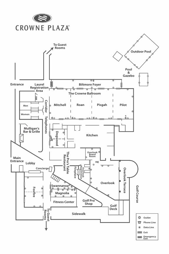
Outdoor Pool
Pool&
Gazebo
To GuestRooms
Biltmore Foyer
The Crowne Ballroom
LaurelRegistration
Area
Entrance
Corrid
or Telephones
Mitchell Roan Pisgah Pilot
Kitchen
Dog
wood
The Pro’s Table
Restaurant
Overlook
Overlook Terrace
Golf C
ourse
Golf Deck
Golf ProShop
Swannanoa
Magnolia
Fitness Center
Sidewalk
Foxfire
To Guest
Rooms
Lobby
Main Entrance
Concierge
Fireplace
Overlo
ok
Reg
istration
OverlookBoardRoom
Men
Women
Mulligan’sBar & Grille
Outlet
Phone Line
Data Line
Exit
EmergencyExit
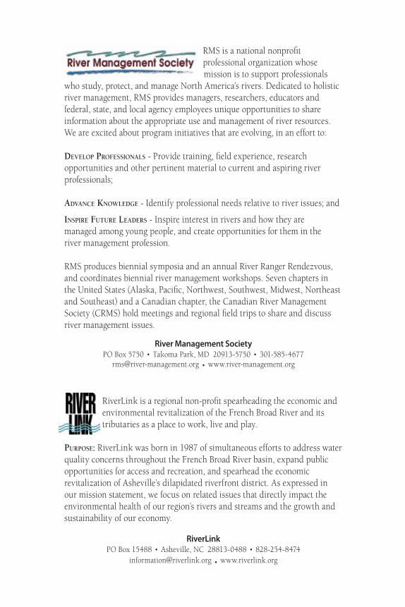
RMS is a national nonprofit professional organization whose mission is to support professionals
who study, protect, and manage North America’s rivers. Dedicated to holistic river management, RMS provides managers, researchers, educators and federal, state, and local agency employees unique opportunities to share information about the appropriate use and management of river resources. We are excited about program initiatives that are evolving, in an effort to:
Develop professionals - Provide training, field experience, research opportunities and other pertinent material to current and aspiring river professionals;
aDvance KnowleDge - Identify professional needs relative to river issues; and
inspire future leaDers - Inspire interest in rivers and how they are managed among young people, and create opportunities for them in the river management profession.
RMS produces biennial symposia and an annual River Ranger Rendezvous, and coordinates biennial river management workshops. Seven chapters in the United States (Alaska, Pacific, Northwest, Southwest, Midwest, Northeast and Southeast) and a Canadian chapter, the Canadian River Management Society (CRMS) hold meetings and regional field trips to share and discuss river management issues.
River Management SocietyPO Box 5750 . Takoma Park, MD 20913-5750 . 301-585-4677
[email protected] . www.river-management.org
RiverLink is a regional non-profit spearheading the economic and environmental revitalization of the French Broad River and its tributaries as a place to work, live and play.
purpose: RiverLink was born in 1987 of simultaneous efforts to address water quality concerns throughout the French Broad River basin, expand public opportunities for access and recreation, and spearhead the economic revitalization of Asheville’s dilapidated riverfront district. As expressed in our mission statement, we focus on related issues that directly impact the environmental health of our region’s rivers and streams and the growth and sustainability of our economy.
RiverLinkPO Box 15488 . Asheville, NC 28813-0488 . 828-254-8474
[email protected] . www.riverlink.org