2013_grassland ecosystem guidelines r.pdf -...
TRANSCRIPT

Grassland Ecosystem GuidelinesLandscape interpretation for planners and managers

Citation: SANBI. 2013. Grasslands Ecosystem Guidelines: landscapeinterpretation for planners and managers. Compiled by Cadman, M.,de Villiers, C., Lechmere-Oertel, R. and D. McCulloch. South African NationalBiodiversity Institute, Pretoria. 139 pages.
ISBN: 978-1-919976-88-4
Production management by: Aimee Ginsburg
Design by: Ideaology: Design. Advertising. Digital Pty LTD
Printed by: Typo Colour Specialists cc
Paper: Printed on environmentally friendly Triple Green Print Silkrecycled paper
Copyright: © South African National Biodiversity Institute GrasslandsProgramme. 2013. Reproduction of this publication for educational or othernon-commercial purposes is authorised without prior written permission fromthe copyright holder provided the source is fully acknowledged. Reproductionof this publication for resale or other commercial purposes is prohibitedwithout prior written permission of the copyright holder.
Photo credits: Grateful thanks go to the many people and organisationswhose photographs bring life to the pages of this report.Cover: Steve GermishuizenInside: Jocelyn Adamson, Bill Bainbridge, De Beers, Cobus Botha, Mark Botha,Angus Burns, John Burrows, Mike Cadman, Peter Chadwick, Elna de Beer,John Dini, Freyni du Toit, Peter Farrington, Albert Froneman, Claire Fulton,Steve Germishuizen, Aimee Ginsburg, Graham Grieve, Lisle Gwynn, PetaHardy, Kyle Harris, Dominic Henry, Dave Hoare, iSimangaliso Wetland ParkAuthority, Isabel Johnson, Steve Kent, Richard Lechmere-Oertel, MervynLötter, Mary-Joye Louw, Budu Manaka, Daan Prinsloo, Belinda Reyers, RinishSingh, Birdlife South Africa, Anthea Stephens, Warwick Tarboton, Chris vanRooyen, Bruce Ward-Smith, Craig Whittington-Jones, Mark Wing.

Compiled by
Grassland Ecosystem GuidelinesLandscape interpretation for planners and managers
Mandy Cadman, Charl de Villiers, Richard Lechmere-Oertel and Douglas McCulloch

This publication isdedicated to thememory ofDr Rob Scott-Shaw,whose knowledge ofgrassland ecologywas an inspirationto all.

iiiGrassland Ecosystem Guidelines
AcknowledgementsThese Grassland Ecosystem Guidelines are the culmination of collaborativeeffort to compile and synthesize knowledge on grassland ecosystems forplanners and managers, so that they can more easily and effectively incorporatebiodiversity into their land-use planning and decision-making. This work wasimplemented by the South African National Biodiversity Institute’s (SANBI)Grasslands Programme, supported by the United Nations DevelopmentProgramme (UNDP) and funded by the Global Environment Facility (GEF).
Many people have contributed to the development of these EcosystemGuidelines and the authors would like to thank everyone who contributed insome way, either through the provision of content, expert advice and insights,or encouragement along the way.
Warm thanks go particularly to the reference group who provided reviewcomments, guidance, and key inputs throughout the project. This groupincluded Brent Corcoran (WWF-SA), Aimee Ginsburg (Benefits SE), TsamaeloMalebu and Jeffrey Manuel (SANBI), and Tsumbedzo Mudalahothe andAnthea Stephens (SANBI Grasslands Programme).
Special thanks also go to those who gave voluntarily of their time and effortto contribute written content and/or review chapters in the final stages: LeonBarkhuizen, Frik Bronkhorst, Johann du Preez, Stephen Holness, KevinKirkman, Hermien le Roux , Mervyn Lötter, Greg Martindale, Roger Uys, andDamian Walters. We’d also like to thank the many people who supported usby making additional knowledge contributions, specifically Alastair Patterson,Brian Morris, Ivan Riggs, Jannie Coetzee, Mark Botha, Paul Avenant, PetaHardie, Steve Germishuizen, Wyno Prinsloo, and all the participants of theHowick and Ermelo workshops, for their enthusiasm and inputs.
Finally, we would like to give special thanks to the production team led byAimee Ginsburg, and supported by Craig Smith and Emily Botts – withoutthem, this publication would not have seen the light of day.

ivGrassland Ecosystem Guidelines
By Charl de Villiers
Much of the current conservation effort in South Africa’s grasslands is focusedon promoting land-use practices that reconcile development opportunitiesand spatial planning at a landscape scale with the over-arching goal ofmaintaining and increasing the resilience of ecosystems, especially in the faceof climate change. This landscape approach involves working within andbeyond the boundaries of protected areas to manage and mainstreambiodiversity within a mosaic of land-uses.
A great deal of this effort needs to take place on privately or communally-owned land. This land may represent our main opportunity to ensureecologically viable ‘living landscapes’ that can provide crucial services suchas water provision, while being sufficiently robust to withstand the anticipatedpressures and shocks of climate change. Therefore, even though such landdoes not form part of formally proclaimed national parks or nature reserves,it can – literally – be of irreplaceable importance for biodiversity and shouldbe managed accordingly.
In practice, this means that people who do not necessarily have a backgroundin biodiversity conservation are increasingly being called upon to manageland, plan for development, and make decisions with biodiversity in mind.Crucially, individuals and institutions who find themselves in this re-cast roleas co-custodians of grassland biodiversity have to be equipped with reliableinformation. This information must be relevant to the decisions that they needto take in order to ensure that biodiversity is sufficiently considered – andsafeguarded – in their plans and activities. These ecosystem guidelines wereconceived precisely with this end in mind, namely, to provide a consistentbenchmark and framework for addressing the biodiversity-related aspects ofland-use planning, management and regulation in South Africa’s grasslands.Until now, there has been no single document that brings the current state ofknowledge about grasslands together, with the specific aim of providing non-scientists with easy-to-use, practical guidelines on how to take better accountof biodiversity in land-use planning and decision-making. Envisaged usersinclude land managers in the livestock, wool and game sectors, environmentalassessment practitioners and biodiversity specialists, agricultural extensionofficers, and officials responsible for land-use planning and regulation in thegrasslands.
Experience has shown that ecosystem guidelines can be useful aids to informdevelopment planning and land-use management when used in conjunctionwith systematic biodiversity plans and when formally built into the terms ofreference for environmental assessments or municipal spatial planning projects.This is aided by training in the use of ecosystem guidelines in conjunctionwith related products and for application in different contexts (e.g. applicationsfor mining rights or environmental authorisations, drafting a biodiversity-compatible grazing management plan, or developing an environmentalmanagement framework). The South African National Biodiversity Institute,the Departments of Environmental Affairs and Water Affairs, provincialenvironmental and agricultural departments, professional associations andinstitutions of higher learning represent some of the key roleplayers who cancontribute to such training and capacity building.
Preface

vGrassland Ecosystem Guidelines
In summary, ecosystem guidelines such as these for the grasslands are a keyoperational component in any ‘mainstreaming’ strategy which rests on thethree pillars of:
• Enabling policies and institutions across sectors to address biodiversity in an integrated way.
• Providing accessible information about and interpretations of biodiversitypriorities (e.g. Ecosystem Guidelines that interpret and guide use of knowledge in support of sustainable development).
• Assisting institutions and individuals throughout the value-chains of land-use and environmental planning and regulation, to integrate biodiversity meaningfully into their work.
The value of these ecosystem guidelines as a resource for promoting wiseutilisation and conservation of grassland ecosystems will gradually becomeevident with time, and as the reputation of the guidelines grows, stimulatingever-wider use of the product and demands for training.
All those who are dedicated to the goals of sustainable development in thegrasslands are encouraged to record their experiences of using these guidelinesand to share this experience with SANBI and its partners. So doing, thegrasslands implementation community should contribute to an ever-improving,increasingly effective integration of ‘mainstreaming’ theory and practice insupport of securing ecosystem resilience and the inter-generational persistenceof an exceedingly valuable component of South Africa’s natural estate.
Box 1. The Grasslands Programme: conserving a working landscapeThese Ecosystem Guidelines are part of a larger focus of work in grassland ecosystems, coordinated under theSANBI Grasslands Programme. The SANBI Grasslands Programme is a 20-year initiative to mainstream biodiversityinto production practices in grasslands, thereby balancing biodiversity conservation and economic developmentimperatives in a landscape. Mainstreaming biodiversity means “incorporating biodiversity priorities into the policies,decisions and actions of a diverse range of people and organisations in various sectors” to increase awareness,minimise impact and mitigate risks to biodiversity and the ecosystem services that it supports. A large part of theProgramme was made possible through an investment from the United Nations Development (UNDP) and the GlobalEnvironment Facility (GEF), with SANBI as the implementing agent. However, the Programme relies on multi-sectorpartnerships between government, business and civil society to mainstream biodiversity objectives into the majorproduction sectors that operate in the Grasslands Biome, including agriculture, forestry, coal mining, and urbaneconomies, as well as into the enabling environment.
The Grasslands Programme seeks to find solutions in which economic development is sustained by the ecologicalservices provided by a healthy and well managed Grassland Biome. These Ecosystem Guidelines are part of abroader programme of action which has been put in place by the Grasslands Programme to respond to this challenge.

viGrassland Ecosystem Guidelines
Contents
1.1. Grassland- a biodiversity asset underpinning 2South Africa’s economy
1.2. Grasslands under pressure 3
1.3. Finding practical solutions- ecosystem guidelines for 4working in grassland landscapes
1
2.1. Ecosystems, ecological infrastructure and ecosystem 10services
2.2. Taking an ecosystem approach to planning and 11decision-making
2.3. Grassland Ecosystems in South Africa 13
2
3.1. The landscape approach to conserving biodiversity in 18working landscapes
3.2. Impacts on grasslands 18
3.3. Approaches to planning in grasslands 19
3.4. Taking a proactive approach in environmental assessment 24
3
Introduction 1
Grassland ecosystems and ecology 9
Planning a mosaic of land-uses in 17 grassland ecosystems
4.1 Notes on fire 26
4.2 Notes on grazing 27
4.3 Notes on soil erosion 30
4.4 Notes on invasive alien species 32
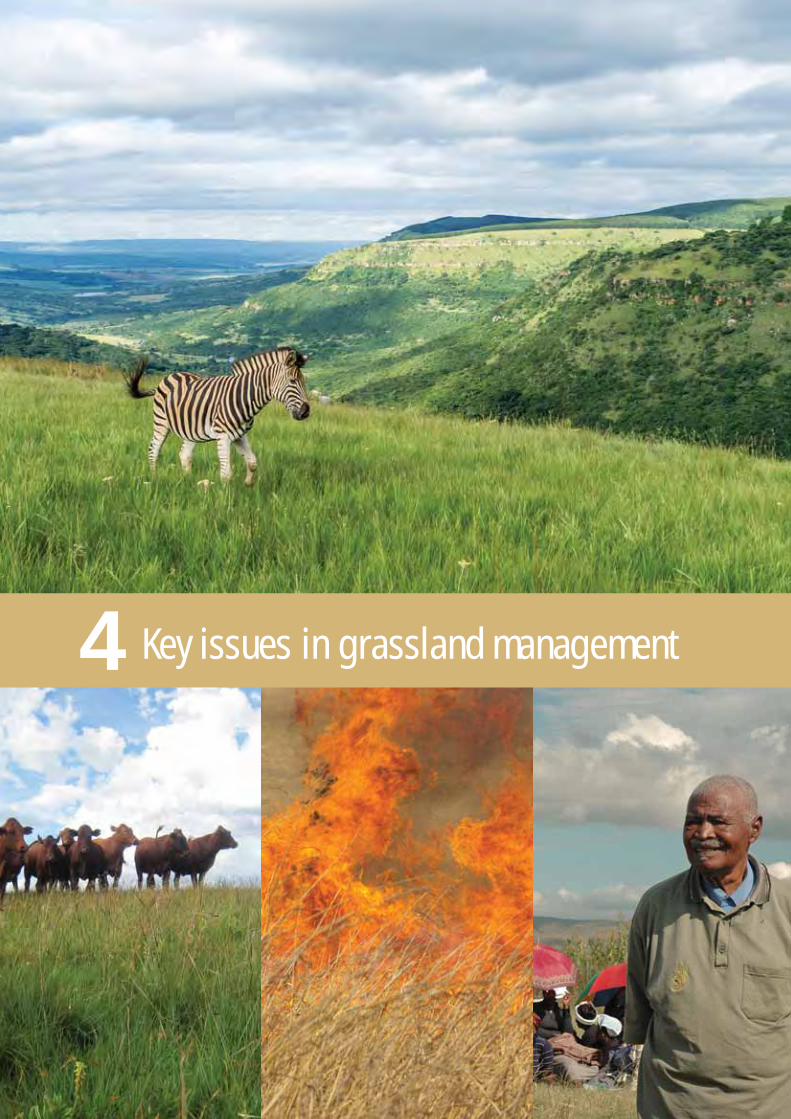
4 Key issues in grassland management 25

7 Ecosystem Guidelines for River 95Ecosystems
5 Ecosystem Guidelines for Grasslands 33
viiGrassland Ecosystem Guidelines
5.1 Guidelines that apply to all grasslands 34
5.2 Dry Highveld Grassland 52
5.3 Mesic Highveld Grassland 58
5.4 High-Altitude Grassland 64
5.5 Sub-Escarpment Grassland 72
5.6 Coastal Grassland 78
Dry
Hig
hveld
(Pg 52
)
Mes
ic H
ighve
ld
(Pg58
)
High-A
ltitu
de
(Pg 64
)
Sub-E
scar
pmen
t
(Pg 72
)
Coasta
l
(Pg 78
)
Wetlands(Pg 83)
Forests(Pg 95)
Rivers(Pg 103)
Ocean
6 Ecosystem Guidelines for Wetlands 83
8 Ecosystem Guidelines for Forests 103
Groups of Grassland Ecosystems

9.1. Glossary of Terms 110
9.2. Grassland vegetation types and ecosystem threat status 117
9.3. Proactive incorporation of biodiversity into pre-application screening 122
9.4. Basic Terms of References for Biodiversity Assessment 135
9.5. References and useful websites 137
9 Useful Resources 109
viiiGrassland Ecosystem Guidelines
Boxes, figures and tablesBoxesBox 1. The Grasslands Programme: Conserving a working landscape vBox 2. Grasslands at a glance 3Box 3. Grasslands and water 5Box 4. Broad categories of impacts on biodiversity 19Box 5. Principles of systematic biodiversity planning 21Box 6. Important systematic biodiversity planning products 23Box 7. What is ecosystem health and how can it be assessed? 39Box 8. Factors to be included in a fire management plan 40Box 9. Principles of the best practice for clearing invasive alien plants 44Box 10. WET-Health 89Box 11. Defining spatial biodiversity priority areas 116Box 12. The principle of ‘no net loss’ and biodiversity offsets 124Box 13. Economising biodiversity’s slice of the landscape 125Box 14. Critical Biodiversity Area Maps, Bioregional Plans and Biodiversity Sector Plans 126Box 15. The Implimentation Manual for Freshwater Ecosystem Priority Areas 128Box 16. Frequently asked questions about CBA maps 132
FiguresFigure 1. Map showing the nine biomes of South Africa 2Figure 2. Summary of biodiversity mainstreaming tools available to assist planners and decision-makers working 7
in grasslandsFigure 3. Components of functioning ecosystems 10Figure 4. Landscape example of some ecosystem services provided by grasslands 11Figure 5. Ecosystem resilience and thresholds of change 12Figure 6. Map of South Africa showing location of five groups of grassland ecosystems 13Figure 7. Location of grassland ecosystems in a profile of the South African landscape 15Figure 8. The mitigation hierarchy for dealing with negative impacts on biodiversity 20Figure 9. Thresholds used to assess ecosystem threat status 22Figure 10. Illustration of some indicators that can be used to assess how effectively grassland biodiversity and associated 49
ecosystem processes are being managed and conserved.Figure 11. Schematic drawing showing how the seven hydro-geomorphic classes of wetland relate to landscape setting 85
Figure 12. Schematic drawing showing slope categories for rivers, one of three factors used to define river ecosystem types 96
TablesTable 1. Vegetation Types and Threatened Ecosystems arranged according to the grassland ecosystem in which they occur 118

ixGrassland Ecosystem Guidelines
AcronymsAPO Annual Plan of OperationBGIS Biodiversity-GIS website of SANBI (http://bgis.sanbi.org)BotSoc The Botanical Society of South AfricaCARA Conservation of Agricultural Resources Act (Act 43 of 1983)CBA Critical Biodiversity AreaCBD Convention on Biological DiversityCR Critically EndangeredCREW Custodians of Rare and Endangered WildflowersCSIR Council for Scientific and Industrial ResearchDAFF Department of Agriculture, Forestry and FisheriesDWA Department of Water AffairsDEA Department of Environmental AffairsEIA Environmental Impact AssessmentEMP Environmental Management PlanEN EndangeredESA Ecological Support AreaFEPA Freshwater Ecosystem Priority AreaFPA Fire Protection AssociationIDP Integrated Development PlanIPCC Intergovernmental Panel on Climate ChangeIUCN International Union for the Conservation of NatureKZN KwaZulu-Natal (province of South Africa)masl metres above sea levelMAP Mean annual precipitationNBA National Biodiversity AssessmentNBF National Biodiversity FrameworkNEMA National Environmental Management Act (Act 107 of 1998)NEM:BA National Environmental Management: Biodiversity Act (Act 10 of 2004)NFA National Forests Act (Act 84 of 1998)NEM:PAA National Environmental Management: Protected Areas Act (Act 57 of 2003)NFEPA National Freshwater Ecosystem Priority Areas ProjectNGO Non-Governmental OrganisationNPAES National Protected Area Expansion StrategyNWA National Water Act (Act 36 of 1998)RHP River Health ProgrammeRQO Resource Quality ObjectiveSAIAB South African Institute for Aquatic BiologySANBI South African National Biodiversity InstituteSANParks South African National ParksSASS South African Scoring SystemSDF Spatial Development FrameworkSEA Strategic Environmental AssessmentVU VulnerableWESSA Wildlife and Environment Society of South AfricaWfW Working for WaterWMA Water Management AreaWoF Working on FireWRC Water Research CommissionWWF-SA World Wide Fund for Nature, South Africa

Introduction1

2Grassland Ecosystem Guidelines
1. Introduction
Grasslands cover almost one third of South Africa’s land surface, stretchingfrom the Eastern Cape and KwaZulu-Natal, over the high escarpment and ontothe central plateau of the country. They extend across the boundaries of sevenprovinces, spanning a complex array of socio-economic situations and land-use contexts. Although the bulk of grassland landscapes fall into the ‘GrasslandBiome’ (see Figure 1), there are also patches of grassland vegetation thatoccur elsewhere in the country, forming a mosaic with other vegetation typesin other biomes, such as the Indian Ocean Coastal Belt (along the coast ofthe Eastern Cape and KwaZulu-Natal). These Ecosystem Guidelines apply toall of these grassland landscapes.
Figure 1. Map showing the nine biomesof South Africa
1.1. Grassland - a biodiversity asset underpinningSouth Africa’s economySouth Africa’s grasslands are a remarkable and irreplaceable biodiversityasset of global significance. In South Africa, grassland plant diversity issecond only to that of the Fynbos Biome and grassland ecosystems are hometo a large number of the country’s rare, endangered and endemic animalspecies (see Box 2). Grasslands are critically important water productionlandscapes (see Box 3) and also provide the natural resources and ecologicalinfrastructure that supports most of South Africa’s important economicactivities, and millions of rural livelihoods.

3Grassland Ecosystem Guidelines
The conditions that prevail in grasslands make them highly suitable for humanhabitation, and many of the land-uses upon which food-production and othervital economic activities depend. For these reasons, some 40% of SouthAfricans live and work in grasslands. These landscapes are also the locationof large coal and gold deposits, agricultural lands and commercial forestryplantations, and include the heavily urbanised and industrialised province ofGauteng, which is considered to be the economic heartland of the country.These important activities form the backbone of the South African economy,but they also have impacts on the ecological infrastructure that underpinsmost of these economic activities.
1.2. Grasslands under pressureFor South Africa to meet its economic, job creation and social upliftmentneeds, it must increase agricultural production, and expand or intensifyeconomic activities such as plantation forestry and mining to feed the importantmanufacturing and energy sectors. Grasslands provide a rich set of resourcesfor addressing these challenges, but many of the current land-use practicesin grasslands are already unsustainable and grassland ecosystems andresources are coming under increasing pressure from a variety of competingland-uses.
Box 2. Grasslands at a glanceThe majority of South Africa’s grassy vegetation types occur in the Grassland Biome, although ‘grassland’ is alsofound in small patches forming a mosaic with other vegetation types in other biomes. The Grassland Biome is:
• The second largest of South Africa’s nine biomes, covering nearly 30% of the country’s land surface area.
• A rich store of biodiversity assets, including 52 of South Africa's 122 important bird areas, almost one this of the country's 107 threatened butterflies, 15 of its endemic mammals and nearly 3,500 plant species.
• A region of global significance that is also home to three natural and cultural World Heritage Sites – the Cradle of Humankind, the Vredefort Dome and the uKhahlamba Drakensberg Park – and five Ramsar wetlands of international importance.
• An important water production landscape, containing 42 river ecosystems and most of the country’s threatened wetland ecosystem types; five of South Africa’s major river systems that have their headwaters in grasslands, including the Gariep, Vaal, Thukela, Mzimvubu and Kei Rivers; in addition, at least two of the flagship free-flowing rivers identified in the National Freshwater Ecosystems Priority Areas project arise in and flow through grasslands. Grassland areas receive the majority of South Africa’s rainfall and constitute nearly half of the country’sStrategic Water Source Areas.
• Home to South Africa’s economic heartland: Grasslands support the cultivation of 60% of South Africa’s commercialcrops and 50% of subsistence croplands; 44% of the country’s cattle and 32% of its sheep find their nourishmentin grasslands; more than 40 % of all mining activities and 92 % of commercial plantation forestry takes place in grasslands, and 40% of the country’s human population live in grassland landscapes.
• One of the most at-risk of South Africa’s biomes: more than 40% of it has already been irreversibly modified, 60%of remaining grassland is considered to be threatened and less than 3% of it is under formal protection. Grasslandis also considered to face the greatest risk of significant change due to climate change.
Grasslands are a valuable national asset, and their protection, enhancement and sustainable use should be a nationalpriority. In addition to their own intrinsic value, grasslands are a valuable yet vulnerable source of natural solutionsto the challenges posed by poverty, unemployment, and climate change. Their rich store of biodiversity, diverseecosystems and abundant ecological infrastructure provides the foundation for economic growth, social developmentand human well-being.
For this potential to be realised, the country needs good scientific information that is effectively interpreted and madeavailable to end-users; well-capacitated institutions that are responsible for effective management and governanceof ecological infrastructure; and well-informed policies, legislation and leaders. These Ecosystem Guidelines forgrasslands are one of a suite of tools that address these needs.

4Grassland Ecosystem Guidelines
At least 40% of the Grassland Biome has been irreversibly modified and nearly60% of remaining grassland areas are classified as threatened – this meansthat these ecosystems are losing vital aspects of their composition, structureand functioning. This, in turn, influences their ability to deliver essentialservices such as fresh water, soil formation, climate regulation and reductionof disaster risk. With less than 3% of grasslands under formal protection,remaining grassland landscapes and the biodiversity and ecosystems theysupport, are critically at risk. In these circumstances, it is clear that strategicand focussed action and a well-informed and cautious approach to developmentplanning is of utmost importance.
Increasingly, people who do not necessarily have a background in biodiversityor conservation are being called upon to exercise decision-making powers insuch a way that economic goals can be achieved whilst the health of ecosystemsis maintained and the loss of threatened species or habitats is avoided. Ideally,all land-users and people who make decisions about the use of grasslandresources should be aware of spatial biodiversity priorities within grasslandlandscapes and should understand their management requirements. This isso that they can proactively identify the ecological opportunities and constraintswithin a landscape, and use them to locate and manage infrastructuraldevelopments and other land-uses most appropriately.
1.3. Finding practical solutions - ecosystem guidelinesfor working in grassland landscapesIndividuals and institutions who work in grassland landscapes need to beequipped with reliable information that can help them take decisions to ensurethat biodiversity is sufficiently considered – and safeguarded – in their decisions,plans and activities.
Although grasslands have been extensively studied and much scientificknowledge has been published about grassland ecology and management,this information is distributed across an array of publications spanning manyyears, and much of it is of a technical nature. Until now, there has been nosingle document that brings the current state of knowledge about grasslandstogether, with the specific aim of providing non-scientists with easy-to-use,practical guidelines on how to take better account of biodiversity in land-useplanning and decision-making.
These guidelines have been developed to fill this gap.
What the Grassland Ecosystem Guidelines are
These guidelines are a practical guide that provides a consistent benchmarkand framework for addressing the biodiversity-related aspects of land-useplanning, landscape management and environmental regulation in SouthAfrica’s grasslands. The guidelines address key questions about grasslandbiodiversity that should be asked when planning or embarking on an activityin grassland. They bring together a consensus of scientifically reliableknowledge from a wide variety of sources and experts, and present it in a non-technical format that is accessible and relevant to non-specialists.
The Guidelines are intended to enable users to contextualize and interpretspatial biodiversity priority areas, such as those shown in systematic biodiversityplans. They should make it possible for the user to ‘walk off the map’, standin a grassland landscape and, with the aid of suitably- informed maps:
• Correctly identify the broad ecosystem type they find themselves in.
• Understand broadly what drives this ecosystem in terms of ecological functioning.

5Grassland Ecosystem Guidelines
Box 3. Grasslands and waterGrasslands are critically important water production landscapes, playing a vital role in maintaining the quality andquantity of water entering rivers, streams and aquifers. The nature of the herbaceous vegetation in grasslands, bothabove and below ground, forms an effective substrate for capturing water, maximising infiltration, limiting erosiverun-off and reducing soil loss. In this way, these ecosystems play a role in augmenting and regulating stream flowby holding water in the soil profile, or within wetlands, and slowly releasing it into rivers and streams, maintainingvital base flows into the dry seasons.
Grasslands account for more than half of the Strategic Water Source Areas of the country – areas that cover lessthan 5% of South Africa’s land surface, but that receive the majority of its rainfall, and yield more than 80% of all waterrun-off. At least five major river systems have their headwaters in grasslands, and 34% of the country’s remainingwetlands occur in grassland landscapes.
Wetlands and other freshwater ecosystems are essential for sustaining the ecology and economy of grasslands. Theecosystem services provided by wetlands include their ability to:
• Improve water quality (especially important in heavily industrialised parts of the biome).
• Regulate water flow (important in regulating flood levels and maintaining dry-season flows).
• Provide water, food and other natural products for human consumption or use.
Many wetlands are home to important biodiversity, and sites of cultural, recreational, educational or scientific value.The vital role played by many wetlands in agro-pastoral production systems and local livelihoods underpins thehealth and well-being of many rural communities. Wetlands represent high-value ecological infrastructure for gathering,managing and delivering water for human use – they are, however, the most threatened of South Africa’s ecosystems.
The degradation of freshwater ecosystems (rivers and wetlands) is of great concern as South Africa is already awater-limited country. Water demand is expected to rise by some 50% over the next 20 years and unwise land-usepractices, further loss of natural grassland habitat and the anticipated effects of climate change are expected toundermine water supplies even further.
In the face of these challenges, rehabilitation and maintenance of healthy grasslands and associated freshwaterecological infrastructure provides an effective natural solution for strengthening South Africa’s water security. TheseGrassland Ecosystem Guidelines can be used to reduce further degradation and loss of grasslands and theirassociated wetlands, and to manage these ecosystems effectively for sustained water production.
• Understand what the limits of acceptable change are within that landscape,from a land-use and environmental perspective.
• Interpret how impacts need to be managed in that landscape, and how tomonitor whether management is effective in securing biodiversity and ecosystem processes.
What the Grassland Ecosystem Guidelines are not
This document is not an exhaustive scientific reference work on grasslandecology or management, systematic biodiversity planning, environmentalimpact assessment, land-use planning or environmental legislation. Usersrequiring more information on these topics can refer to other resource materials,as recommended in the chapters and particularly in chapter 9.3.
These Guidelines are also not a substitute for more detailed scientific literatureand ‘best practice’ guidelines, and they definitely do not replace the need forspecialist studies of a site. They should be used in conjunction with othertools that are available, particularly systematic biodiversity plans that exist forthe area of interest (see Chapter 3). Wherever possible, cross-reference ismade to these tools throughout the text, and in the relevant appendices at theend of the book.

6Grassland Ecosystem Guidelines
How the Grassland Ecosystem Guidelines are structured
These Guidelines provide relevant information and guidance, based on sixquestions that should be addressed when contemplating the implications forbiodiversity of land-use planning and decision-making in grasslands andassociated ecosystems:
1. What are the main ecological characteristics of grassland?2. What are the main issues, vulnerabilities and pressures in grassland?3. What are the signs of healthy grassland?4. What are the management best-practices and minimum ecological
requirements in grassland?5. What are the broad spatial guidelines for locating land-uses in grassland?6. What indicators can be used to assess and monitor the impact of
management on biodiversity in grassland?
The Guidelines include:
• An introduction to grasslands and key ecological concepts underpinningthe ecosystem guidelines (Chapters 1 and 2).
• Practical guidelines on planning for a mosaic of land-uses in grasslands,including a brief explanation of systematic biodiversity planning and noteson the pro-active consideration of biodiversity in land-use planning and decision-making (Chapter 3).
• Notes on some key issues relating to conservation and management of grassland ecosystems in general (Chapter 4).
• Ecosystem guidelines for each of the grassland ecosystem groups (Chapter5) and for wetland, river and forest ecosystems (Chapters 6, 7 and 8 respectively).
• Appendices of supplementary material that may be of additional interest to users, such as a glossary of terms (Chaper 9.1); a list of grassland vegetation types included in each ecosystem group and a list of threatenedgrassland ecosystems (Chaper 9.2); a special supplement for environmentalassessment practitioners on how to incorporate biodiversity proactively into informed development planning, impact assessment and land management in grasslands (Chaper 9.3); and a terms of reference that should be used when commissioning a biodiversity assessment (Chaper9.4); and additional references and useful websites (Chaper 9.5)
Who should use these guidelines
These Grassland Ecosystem Guidelines have been designed for use by a widerange of individuals and institutions whose activities take place in, or impactupon, grasslands. The most likely user groups include:
• decision-makers in national, provincial or local government and other regulators of land-use.
• spatial planners.
• environmental assessment practitioners.
• property developers.
• all industry or sector role-players whose work or activities take place in grasslands, or that rely on ecosystem services provided by grasslands (e.g. agriculture, mining, commercial forestry and so on)
• agriculture and conservation extension officers, and other specialist advisors.

7Grassland Ecosystem Guidelines
When and how these guidelines should be used
The earlier these guidelines are used in the planning process the better. Ideally,their use should inform a plan or project up-front so that it is possible to workwithin the opportunities and constraints of these ecosystems, thus avoidingany potentially significant impacts on or delays in the development planningprocess later on. There are other sector-specific guidelines that provide moredetailed information relating to particular types of land-use activities, orparticular types of grassland ecosystems. Where these exist, they should beused in conjunction with these Grassland Ecosystem Guidelines, as describedin Chapter 9.3. Figure 2 provides a summary of some of the key documentsand tools that are available for practitioners working in grasslands.
Figure 2. Summary of biodiversity mainstreaming tools available to assist planners and decision-makers working ingrasslands. This is not a comprehensive list, as it focuses on the guidelines and tools developed through the NationalGrasslands Biodiversity Programme; more information is available on the SANBI Grasslands Programme website(www.grasslands.org.za).
• Grasslands Research Database• Biodiversity Stewardship Business Case• Annual Plan of Operation for a Protected Environment
• Biodiversity-Friendly Red Meat Standard• Rangeland Management Toolbox for Biodiversity-
Friendly Red Meat• National Biodiversity Grazing Guideline
• FSA Environmental Guidelines for commercial forestry(including grassland management guidelines)
• Conservation planning tool• Biodiversity Screening Tool
• Bioregional plans• Gauteng Protected Areas Expansion Strategy (PAES)• Gauteng Biodiversity Stewardship Strategy• Biodiversity Offsets Guideline and Strategy• Securing sites/proclamation process (guideline)• Green Servitudes Regulatory Tool• Lifestyle Estates Guideline• Criteria for Sustainable Development Guideline
• Mining and Biodiversity Guidelines• Mining Landscape Primer• Mpumalanga mining decision support tool• Wetland Offset Guidelines• Revised Wetland Rehabilitation Guidelines
ENABLING
AGRICULTURE
FORESTRY
URBAN
MINING


Grassland ecosystems and ecology2

10Grassland Ecosystem Guidelines
2. Grassland ecosystems and ecology
2.1. Ecosystems, ecological infrastructure andecosystem servicesEcosystems are assemblages of living organisms, the interactions betweenthem and between them and their physical environment. Each ecosystem ischaracterised by its composition (the living and non-living parts of which itis made), its structure (how the parts are arranged in time and space) and theecological processes (functions such as nutrient cycling, water flows anddispersal) that maintain the composition and structure and keep it functioningas a unit (see Figure 3).
Ecological infrastructure is the stock of functioning ecosystems that providesa flow of essential system services to human communities – services such asthe provision of fresh water, climate regulation and soil formation. Ecologicalinfrastructure includes features such as healthy mountain catchments, rivers,wetlands, and nodes and corridors of natural grassland habitat which togetherform a network of interconnected structural elements within the landscape.If this ecological infrastructure is degraded or lost, the flow of ecosystemservices will diminish and ecosystems will become vulnerable to shocks anddisturbances, such as the impacts of climate change, unsustainable land usechange and natural disasters like floods and droughts. It is important to notethat when ecological infrastructure is degraded or fails, the direct monetarycost to society and government is often very high. Ecological infrastructureis, therefore, the nature-based equivalent of hard infrastructure, and is just asimportant for providing the vital services that underpin social developmentand economic activity.
Ecosystem services provided by grasslandsGrassland ecosystems provide many essential ecosystem services,underpinned by rich biodiversity and diverse ecosystem processes. It is difficultto put a price on the benefits that South African society derives from theseecosystem services, but their contribution to economic activities has beenestimated at some R9.7 million per annum. Some of the most importantecosystem services provided by grasslands include:• Water production, water purification and flood attenuation (see Box 3).• Good quality forage for animal production.• Nutrient-cycling and carbon sequestration and storage.• Pollination services.• Support for livelihoods such as thatching and weaving.• Medicinal and food plants.• Cultural, heritage & recreational amenities, often with significant tourism value.• Deep, nutrient-rich soils.Figure 3. Components of functioning
ecosystems
Living and non-living parts
How the parts are arranged
Interactions
By-products that areof use to humans
Ecosystem services
Ecosystem structure
Ecosystemcomposition
Ecological processes

11Grassland Ecosystem Guidelines
Figure 4. Landscape example of someecosystem services provided bygrasslands
2.2. Taking an ecosystem approach to planning anddecision-makingEcosystems can be defined in different ways and at different scales. A usefulway of defining them is to use vegetation types as surrogates for ecosystems,and this is the approach adopted in much of the biodiversity planning that ispracticed in South Africa today. This has been possible largely because of theexistence of a recently updated national vegetation map, and maps of riverecosystems and wetland types that provide consistent coverage of the wholecountry at an appropriate scale (1:250,000). These Grassland EcosystemGuidelines have taken a broad ecosystem approach, treating clusters of grasslandvegetation types as groups of ecosystems (similar to what has been defined asbioregions in Mucina and Rutherford, 2006) that have similar ecologicalcharacteristics, and share similar management requirements. This approachreduces the complexity of working across large and diverse landscapes involvingmany different vegetation types and land-use sectors, to a set of basic but reliablepointers that can guide responsible and appropriately informed land-use planningand decision-making about ecosystems and the biodiversity they support.
Taking a broad ecosystem approach to planning, management and conservationmeans that:• Action can be focused on ecological processes that operate across a
range of geographic scales and areas that are important for ecosystem-based adaptation to climate change, and not only on individual species asoften was the case in the past.
• Best environmental assessment practice can be achieved by addressing issues at the appropriate ecological scale, as opposed to site-based decision-making, which often fails to consider the ecological value of a site within its broader landscape and regional context.
Heritage, recreationand tourism
Supportinglivelihoods Water purification and
flood attenuation
Food, fibre andmedicine
Climateresilience
Deep, nutrient-rich soils for
plantationforestry
Good quality forage foranimal production
Water production Deep, nutrient-rich soils forplantation or food crops
Grasslands provide habitat forinsect and bird pollinators
Soil protection and erosion control

12Grassland Ecosystem Guidelines
Change in ecosystems
Ecosystems are dynamic and undergo both natural and artificially inducedchanges all the time. All ecosystems can handle a certain amount of changeyet still remain functional – this is the concept of resilience, and someecosystems are more resilient than others. But there are points at which theecosystem is pushed beyond a threshold after which it undergoes fundamentaland irreversible change. Having passed this “tipping point” or threshold, theecosystem becomes something different in terms of its composition, structureand functioning, and this could affect the ecosystem services it can provide(See Figure 5). If people are relying on the ecosystem services (e.g. watersecurity or grazing production) for their livelihoods, then the resilience of theecosystem is an important factor for them, whether they know it or not.Managing ecosystems to maintain resilience to undesirable change is animportant natural solution to coping with the impacts of climate change andunsustainable land use change.
ORIGINAL STATE
Pressures
Pressures
Diverse with no special lossEcological process functioningEcosystem services maintainedHuman well-being supported
Management activities that decrease resilience andpush the ecosystem over the threshold or tipping point
Less diverseImpaired ecosystem functioningFewer ecosystem servicesDegradation of human well-being
ALTERED STATE
Managementactivities that
increase resilience
Existingbiodiversity
Changedbiodiversity
THRESHOLD ORTIPPING POINT
Figure 5. Ecosystem resilience andthresholds of change

13Grassland Ecosystem Guidelines
Figure 6. Map of South Africa showinglocation of five groups of grasslandecosystems
2.3. Grassland Ecosystems in South AfricaThere are two broad, climatically determined types of grassland:
• Temperate inland grasslands, that make up the ‘Grassland Biome’, occurringover much of the eastern escarpment and sub-escarpment areas, and are the central, high plateau of the country.
• Subtropical grasslands that occur along the coastal belt of KwaZulu-Nataland the Eastern Cape and the interior immediately adjacent to this coastalbelt. These form part of the Indian Ocean Coastal Belt Biome, but have been included in these Guidelines as the ‘Coastal Grassland’ group of ecosystems.
The Grassland Biome includes 72 nationally recognised grassland vegetationtypes, differentiated from each other by shifts in species composition that resultfrom the interplay of environmental variables such as climate (temperature, frostand precipitation), topography and geology (Mucina & Rutherford, 2006). Theseenvironmental patterns influence other processes that shape these ecosystems,such as grazing and fire. The particular combination of abiotic factors determinesthe species richness and life history traits of the vegetation, and defines theecological characteristics of the landscape.
Biomes are defined at a very broad scale. Although the Grassland Biomeincludes the majority of grassland vegetation types, there are also a smallnumber of grassy vegetation types that fall into other biomes. These oftenoccupy relatively small areas and are highly mixed amongst other types ofvegetation, but still need to be managed as grassland. This document isintended to guide planning and decision-making in all landscapes that needto be treated as grassland from a management perspective, hence the inclusionof grasslands that fall outside the formal boundaries of the Grassland Biome.

14Grassland Ecosystem Guidelines
Visually and structurally, grasslands are dominated by species of indigenousgrass. However, in terms of species composition, grasslands are more diversethan they appear. Only one in every six species is a grass. Other plant species,especially bulbs and forbs (the collective name for soft-leaved herbaceousplants) make up 5/6 of the plant species composition in the grasslands. Scatteredtrees or tree clumps may be present in some grasslands or in particularlocations (e.g. on rocky ridges), but their canopy cover within a particularlandscape rarely exceeds two per cent. Grassland landscapes span an altitudinalrange from sea level to more than 3,000 m above sea level, and include highlyvaried topography – from sandy coastal plains and rolling hills, to the steepslopes, valleys and ridges of the sub-escarpment, up onto the peaks andplateaus of the high escarpment and the rolling plains of the Highveld.
Grassland ecosystem groupsIn these guidelines, grassland vegetation types have been arranged into fivebroad groups of ecosystems based on their species composition, communitystructure, abiotic (i.e. ‘non-living’) environmental factors, ecologicalcharacteristics and management requirements. These ecosystem groupsinclude:
• Dry Highveld Grassland.
• Mesic Highveld Grassland (excluding the north-eastern escarpment areasof Mpumalanga).
• High-Altitude Grassland (including the ‘Drakensberg Grasslands’ as defined in Mucina & Rutherford, 2006, the escarpment along the KwaZulu-Natal/Free State border and the north-eastern escarpment areasof Mpumalanga).
• Sub-Escarpment Grassland.
• Coastal Grassland (grassy vegetation types embedded within the Indian Ocean Coastal Belt Biome).
These five groups of ecosystems are similar to those recognised in Mucina& Rutherford (2006), with a few minor differences (described above) based onexpert knowledge of the ecological characteristics and managementrequirements of these ecosystems.
A ‘snapshot’ of each of these groups of ecosystems is provided under therelevant section in Chapter 6. The geographic distribution of these grasslandecosystems is illustrated in Figure 6, and their spatial location within landscapesis shown in Figure 7. Chapter 9.2 indicates to which of the five ecosystemgroups each grassland vegetation type belongs, along with its currentecosystem threat status.
Within each of the five broad grassland ecosystem groups, the plantcommunities share similar structure and species composition, and aremaintained by similar ecological processes. This means that they can beexpected to respond similarly to the land-uses that take place within themand so have similar planning and management requirements (described inChapter 5).

15Grassland Ecosystem Guidelines
Figure 7. Location of grasslandecosystems in a profile of the SouthAfrican landscape
In addition to the five grassland ecosystem groups, the guidelines includethree allied ecosystems that are present as a mosaic within the grasslandlandscape. These are:
• Wetlands.
• River ecosystems.
• Indigenous forest.
These ecosystems form an integral part of the grassland landscapes in whichthey occur, playing an important role in certain cross-cutting ecologicalprocesses that are responsible for maintaining grasslands. The generalguidelines provided in Chapters 6 – 8 for wetlands, rivers and forest patchesshould assist practitioners in giving these ecosystems appropriateconsideration as an integral part of the grassland landscape. If more detailedinformation for wetlands, rivers or forests is required, then references specificto these ecosystems should be consulted – for example, the WET-ManagementSeries (Water Research Commission Reports, see www.wrc.org.za) can beconsulted for advice on wetlands, or the Implementation Manual for FreshwaterEcosystem Priority Areas (Driver et al. 2011) can be used to guide land-useplanning and practice in all freshwater ecosystems.
Dry
Hig
hveld
Mes
ic H
ighve
ldHig
h-Alti
tude
Sub-Esc
arpm
ent
Coasta
l
WetlandsForests
Rivers
OceanGroups of Grassland Ecosystems


Planning a mosaic of land-uses ingrassland ecosystems3

18Grassland Ecosystem Guidelines
3. Planning a mosaic of land-uses in grasslandecosystems
Grasslands are in urgent need of conservation for their intrinsic value as aglobal and national biodiversity asset, and because the ecosystem servicesthey provide are vital for economic growth and social development. In particular,land-based management of grasslands has important impacts on waterproduction. The challenge lies in incorporating biodiversity priorities proactivelyinto land-use planning and decision-making, so that the interconnected issuesfaced by grassland biodiversity and South African society can be addressedin an integrated and sustainable way.
3.1. The landscape approach to conserving biodiversityin working landscapesIn these guidelines a ‘landscape approach’ to conserving grasslands ispromoted. This recognises the need for an inclusive approach that balancesbiodiversity conservation with resource utilisation and sustainable developmentacross the entire landscape – this is achieved by using a range of managementtools that can be implemented beyond the boundaries of formal protectedareas. In this approach, protected areas (declared in terms of the NationalEnvironmental Management: Protected Areas Act 57 of 2003) are viewed asone part of a mosaic of land-uses in which biodiversity management objectivesare built into the strategies, production practices and decisions of all land andresource users. Although some grassland areas may be identified as prioritiesfor the establishment of formal protected areas, it is neither feasible nordesirable to meet all grassland biodiversity conservation targets through thecreation of formal protected areas alone, especially in areas where the landscapeis also suitable for some form of production.
Conservation action should focus on maintaining functional ecosystemsacross large areas of economically productive land, securing both thebiodiversity patterns (species assemblages) and ecological processes thatare supported by these ecosystems. This means that areas important forbiodiversity conservation can be maintained and managed in a natural or near-natural state throughout the landscape. It also means that connectivity can becreated between natural and near-natural areas across the landscape, allowingfor the maintenance of ecological processes that operate at a large scale.
The landscape approach recognises that:
• Almost all ecosystems are already influenced or modified to some extentby human activity.
• People and their livelihood activities are an integral part of landscapes.
• Not all land-uses are compatible with biodiversity conservation, althoughsome are.
• There are thresholds or levels of change, beyond which the ability of the landscape to sustain life and productivity is seriously diminished.
• Management actions must be carried out at the environmental scale suitedto the issue being addressed.
3.2. Impacts on grasslandsGrasslands are old, stable and resilient ecosystems, in which most of theplants are long-lived, and can withstand repeated defoliation or disturbanceby fire, frost and low to moderate levels of grazing. However, many land-useactivities and other agents of change place pressure on South Africangrasslands. These activities can be broadly divided into those that causedegradation (changes in composition, structure or functioning) and thosethat result in a complete and irreversible modification (sometimes referred toas ‘transformation’) of the habitat, mostly through complete removal of thevegetation, or loss, turning or hardening of the soil.

19Grassland Ecosystem Guidelines
Degradation can be caused by a variety of factors, but those of greatestimportance in grasslands are:
• the incorrect application of fire and/or inappropriate grazing regimes.
• unsustainable utilisation of grassland resources.
• disturbance of the soil though activities such as ploughing for cultivation,or compaction of the soil for development.
• severe soil erosion.
• infestation by invasive alien or indigenous species.
• increased habitat fragmentation caused by various land-uses.
In most of these examples listed, the larger and more acute the degradationthe higher the likelihood that this will result in modification. Irreversiblemodification is caused by outright loss of the original vegetation, typically dueto a major land-use change due to one or more of the following:
• cultivation – commercial and subsistence planting of fields.
• mining.
• plantation forestry.
• infrastructure development, which can include building of roads, dams, houses and other hard infrastructure.
Impacting activities can have direct, indirect or cumulative effects (See Box 4).
Some grasslands can be distinguished from each other based on the extentof modification they have undergone. Primary grasslands are those that havenot been significantly modified from their original state; even though they mayno longer have their full complement of naturally-occurring species, they havenot undergone significant or irreversible modification and still retain theiressential ecological characteristics. Secondary grasslands are those that haveundergone extensive modification and a fundamental shift from their originalstate (e.g. to cultivated areas), but have then been allowed to return to a‘grassland’ state (e.g. when old cultivated lands are re-colonised by a fewgrass species). Although secondary grasslands may superficially look likeprimary grasslands, they differ markedly with respect to species composition,vegetation structure, ecological functioning and the ecosystem servicesthey deliver.
3.3. Approaches to planning in grasslandsBecause so many impacting activities take place in grasslands, adequateplanning must be carried out to manage and locate land-uses appropriately,and to mitigate against inappropriate development so that the many benefitsof grasslands are not lost.
Box 4. Broad categories of impacts on biodiversityDirect impacts: directly linked to the land-use activity at the site (e.g. ploughing of grassland, extraction of water).
Indirect impacts: resulting from the land-use activity, but occurring beyond the boundaries of the land-use site (e.g.reduced water flows downstream of the site, or migration of pollutants).
Induced impacts: not related directly to the land-use activity, but anticipated to occur because of it (e.g. thedevelopment of associated industries or settlements).
Cumulative impacts: current impacts of the land-use activity combined with impacts from past, existing and futureactivities that will affect the same landscape, ecosystem or other natural resources (e.g. several mines or large-scaleirrigated fields in the same catchment area).
Impacts may be short term (e.g. during the construction phase of a road) or may last for longer periods or even bepermanent and irreversible.

20Grassland Ecosystem Guidelines
A precautionary approach to working in grasslands is recommended, followingthese general principles:
• Apply the law.
• Use the best biodiversity and other environmental information available.
• Engage all relevant stakeholders.
• Use best practice in EIA, particularly in terms of finding the best practicablealternative to avoid unsustainable loss of grasslands and ecological functioning (see Chapter 9.4 for more detail).
• Apply the mitigation hierarchy (i.e. deliberately aim to avoid unsustainableloss of grasslands and, where this cannot be reasonably avoided, mitigateimpacts and rehabilitate disturbed areas to an ecologically acceptable condition, as required by law).
• Ensure effective implementation of biodiversity sector plans, bioregionalplans, Environmental Management Plans and other similar planning tools.
Mitigation of impacts
The early identification and assessment of impacts on biodiversity providesan opportunity to implement appropriate plans and actions that reduce direct,indirect, induced and/or cumulative risks to biodiversity, people and business.The mitigation of negative impacts on biodiversity and ecosystem services isa legal requirement that takes on different forms depending on the significanceof the impact and the area affected. Mitigation requires proactive planningthat is enabled by the mitigation hierarchy, illustrated in Figure 8. Its applicationstrives to avoid, minimise or offset disturbance of ecosystems and loss ofbiodiversity. Where biodiversity impacts are expected to be severe, the guidingprinciple should always be ‘anticipate and prevent’ rather than ‘assess andrepair’.
This approach integrates relevant biodiversity information into planning anddecision-making at every stage of the project life cycle. In essence, betterchoices can be made with the early inclusion of biodiversity information intodecision-making, and the bottom line is that ‘prevention is better than cure.’
Refers to compensating for remaining and unavoidable negative effects on biodiversity and ecosystem services.When every effort has been made to avoid or prevent impacts, minimise and then rehabilitate remaining impacts
to a degree of no net loss of biodiversity against biodiversity targets, biodiversity offsets can - in cases whereresidual impacts would not cause irreplaceable loss - provide a mechanism to compensate for significant residual
(unavoidable) negative impacts on biodiversity.
Refers to rehabilitation of areas where impacts are unavoidable and measures are taken to returnimpacted areas to a condition ecologically similar to their natural state prior to the activity. Although
rehabilitation is important and necessary, it has limitations. Even with significant resources and effort,it almost always falls short of replicating the diversity and complexity of a natural system; residual negative
impacts on biodiversity and ecosystem services will invariably still need to be offset.
Refers to considering alternatives in the project location ,siting, scale, layout, technologyand phasing that would minimise impacts on biodiversity and ecosystem services. Even
in areas where residential impacts on biodiversity and ecosystem services are not highlysignificant, effort is advised to minimise impacts and avoid costly rehabilitation or offsets.
Refers to considering options in project location, siting, nature, scale, layout,technology and phasing to avoid potentially significant impacts on
biodiversity, associated ecosystem services, and people. Where impacts wouldbe highly significant, the proposed activity should not take place; alternatives
should rather be sought. In these cases, it is inappropriate and unlikely to rely onthe later steps in the mitigation hierarchy to provide effective remedy for impacts.
MIT
IGA
TIO
N H
IER
AR
CH
Y
Avoid or prevent
Minimise
Rehabilitate
Offset
Figure 8. The mitigation hierarchy fordealing with negative impacts onbiodiversity, with biodiversity offsets tocompensate for the residual negativeimpacts on biodiversity as the ‘lastresort’.

21Grassland Ecosystem Guidelines
Identifying areas of biodiversity importance in grasslands
Valuable biodiversity is found throughout South Africa’s grasslands, but itis not evenly distributed across the landscape. Because of this, and due tolimited resources and other practical constraints, it makes sense to prioritiseareas in terms of biodiversity importance, so that conservation action can befocussed strategically on areas of greatest biodiversity importance; similarly,other forms of land-use (such as mining, human settlement and agriculture)can be located where their impact on biodiversity can be minimised.
In South Africa, spatial biodiversity priorities are identified using systematicbiodiversity planning, a method that aims to find the most efficient way to conserveenough biodiversity to ensure that it persists (See Box 5 for principles of systematicbiodiversity planning). The results include maps, showing where the highestpriority areas are within a broader landscape (enabling decision-makers to focustheir attention on these) and land-use guidelines that indicate what land-usesare compatible with maintaining biodiversity in these priority areas.
How are systematic biodiversity plans developed?
Systematic biodiversity planning involves the following steps:
Step 1. Map a wide range of information about biodiversity features and patterns of land and resource use, to show what is located where.
Step 2. Set biodiversity targets that show how much of each ecosystem isneeded to conserve it (see discussion below).
Step 3. Develop a biodiversity assessment using systematic biodiversity planning software – this indicates what needs to be prioritised andwhere, highlighting the most efficient options for meeting all biodiversity targets, as well as other possible (less efficient) alternatives.
Step 4. Interpret the biodiversity assessment and use it to generate a biodiversity priority areas map and land-use guidelines.
An important step is setting the biodiversity targets for each vegetation type(i.e. each ecosystem). To do this, each ecosystem is assigned to an ecosystemthreat status category – this is a measure of how much of the ecosystemremains intact relative to a set of thresholds, and how at risk it is of undergoingfurther degradation or loss (see Figure 9). The thresholds, which are workedout using the best available science, indicate the points at which it is estimatedthat the ecosystem will pass from being under least threat, to being vulnerable,endangered and then critically endangered.
Box 5. Principles of systematic biodiversity planningSystematic biodiversity planning is a strategic and scientific approach to identifying those areas that are essentialfor biodiversity management and conservation. Three key principles underpin systematic biodiversity planning:
• The need to conserve a representative sample of biodiversity pattern, such as species and habitats (the principleof representation).
•∑ The need to conserve the ecological and evolutionary processes that allow biodiversity to persist over time (the principle of persistence).
• The need to set quantitative biodiversity targets or thresholds that tell us how much of each biodiversity feature should be conserved in order to maintain functioning landscapes. Biodiversity targets are based on best availablescience and may be refined as new information becomes available. Biodiversity targets provide a basis for monitoringthe effectiveness of the planning and management efforts.
There are two further principles that guide the process of systematic biodiversity planning:
• Efficiency, or striving to meet biodiversity targets in the smallest area possible. Efficiency goes together with complementarity, which is the extent to which an area contributes biodiversity features not represented elsewhere.
• Transparency, or documenting a clear rationale for decisions, enabling them to be repeated and/or critically reviewed.

22Grassland Ecosystem Guidelines
The point at which an ecosystem becomes critically endangered is thebiodiversity target, and represents the minimum proportion of the ecosystemthat must be kept in a natural or near-natural state to conserve it. This doesnot mean necessarily that it needs to be located within a protected area – itmust, however, be kept in a natural state and managed for biodiversitypersistence. Biodiversity targets can also be set for other biodiversity features(such as species or ecological processes), and these are based on scientificresearch relating to those features.
Threatened ecosystems that are gazetted in terms of Section 52 of the NationalEnvironmental Management: Biodiversity Act 10 of 2004 can be a trigger forenvironmental authorisation in terms of the national environmental impactassessment regulations. A list of threatened grassland vegetation types isprovided in Appendix 2 of these Ecosystem Guidelines.
The products of systematic biodiversity planning:
The main products of systematic biodiversity planning are maps showingwhere the critical biodiversity areas (CBAs) and ecological support areas(ESAs) are located, and a set of guidelines explaining how these should bemanaged. Critical biodiversity areas are all the areas required to meetbiodiversity targets - if these areas were to be modified in some way, then thebiodiversity targets for them could not be met. CBAs need to be maintainedin a natural or near-natural state and ideally include ecological corridors thatmaintain connections between them. Ecological support areas (ESAs) areneeded to maintain the ecological functionality of the landscape by supportingthe functioning of the critical biodiversity areas, and by delivering ecosystemservices. These areas need to be kept in a near-natural state and need toremain functional, but some loss of biodiversity pattern can be tolerated.
A summary of some recently published systematic biodiversity planningproducts is provided in Box 6.
Pro
po
rtio
n o
f eco
syst
em in
go
od
eco
log
ical
co
nd
itio
n Ecosystem 100% intact
Ecological function threshold (usually 60%)
Biodiversity target + 15%
Biodiversity target (usually around 20%)*
Figure 9. Thresholds used to assessecosystem threat status. These relateto the proportion of any ecosystem typethat remains in good ecological condition.* Biodiversity target is the threshold forrepresentation of biodiversity pattern(see glossary).
Criticallyendangered
Ecosystems have very little of their original extent left in good ecologicalcondition. They are likely to have lost much of their natural structure,functioning, and species associated with the ecosystem.
EndangeredEcosystems have lost significant habitat or experienced significantdeterioration in condition, with loss of structure and function. Any furtherloss or deterioration should be avoided.
Vulnerable Ecosystems have the majority of their original extent in good ecologicalcondition, but have lost some structure or functioning.
Leastthreatened
Ecosystems have not experienced a significant loss of natural habitat ordeterioration in condition
Areas where natural habitathas been severely or irreversibly modified(e.g. by cultivation, urban expansion, open
cast mining, plantations)
None left - ecosystem lost or collapsed

23Grassland Ecosystem Guidelines
Box 6: Important systematic biodiversity planning productsThe National Biodiversity Assessment (NBA): The National Biodiversity Assessment(2011) provides a summary of spatial biodiversity priority areas that have been identifiedthrough systematic biodiversity planning at national, provincial and local level. It includesheadline indicators and national maps for terrestrial, freshwater, estuarine and marineenvironments. It provides standard national spatial data layers that can be used in othernational, regional or local planning projects and an agreed set of national biodiversity targetsfor ecosystems. The NBA products can be used to: streamline environmental decision making,strengthen land-use planning, identify priority areas for management and restoration, providean initial identification of threatened ecosystems and to highlight those areas where moredetailed planning is required.
The NBA products can be accessed via the BGIS (Biodiversity-GIS) website which ismaintained by the South African National Biodiversity Institute.
Visit http://bgis.sanbi.org/nba/project.asp
The Freshwater Ecosystem Priority Areas (FEPAs) and the FEPAImplementation Manual: The National Freshwater Ecosystem PriorityAreas (NFEPA) project was a 3-year collaboration between the CSIR,SANBI, the Department of Water Affairs, the Water ResearchCommission, SANParks, SAIAB, the WWF and DEAT (now theDepartment of Environment Affairs). Its purpose was to identify a nationalnetwork of freshwater priority areas that would be necessary to conservea representative sample of the diversity of species and inland waterecosystems in which they occur, as well as the processes that generateand maintain diversity.
NFEPA map products provide strategic spatial priorities for conservingSouth Africa’s freshwater ecosystems and supporting sustainable use
of water resources. These strategic spatial priorities are known as Freshwater Ecosystem Priority Areas, or FEPAs.FEPAs were determined through a process of systematic biodiversity planning based on a range of criteria that aredescribed in detail in the NFEPA Technical Report. The FEPA maps are published in the Atlas of FreshwaterEcosystem Priority Areas, which is accompanied by an Implementation Manual that provides detailed, practicalguidelines for managing land-uses and their impacts in the freshwater priority areas. The NFEPA products can allbe downloaded from the BGIS website.
Biodiversity Sector PlansA biodiversity sector plan provides a map of areas that are important for conserving biodiversityand ecological processes (i.e. Critical Biodiversity Areas and Ecological Support Areas), togetherwith contextual information on biodiversity and land-use guidelines. It is based on a fine-scalesystematic biodiversity plan (1:50 000 or finer), and has boundaries aligned with administrativeboundaries, such as a district or local municipality. Biodiversity Sector Plans usually take theform of a booklet or handbook, accompanied by wall maps as well as electronic versions of these.
The primary purpose of a biodiversity sector plan is to provide the biodiversity sector’s inputinto a range of multi-sectoral planning and assessment processes to inform land-use planningand decision-making (e.g. provincial and municipal integrated development plans and spatialdevelopment frameworks, environmental management frameworks and environmental management
programmes). A biodiversity sector plan can be the precursor to a Bioregional Plan which can be gazetted in termsof Chapter 3 of the NEM: Biodiversity Act.
Biodiversity Sector plans exist for several of the district municipalities in the Grasslands Biome and can be accessedvia the BGIS website or from the local conservation agency/environmental department.
Bioregional PlansA bioregional plan is a map showing Critical Biodiversity Areas for a municipality or group of municipalities, withaccompanying land- and resource-use guidelines, which has been published in terms of the Biodiversity Act. Abioregional plan must meet the requirements that are laid down in the Guideline for Bioregional Plans (DEAT 2009).It must be based on a systematic biodiversity plan and serves the same purpose as a biodiversity sector plan.Municipalities must be consulted in the process of publishing a bioregional plan and after its publication thebioregional plan must be taken into account in all future planning by a municipality.

24Grassland Ecosystem Guidelines
3.4. Taking a proactive approach in environmentalassessment: Including biodiversity considerations inpre-application project planningOne of the key tasks of both environmental assessment and spatial planningis to determine the context within which a new project is being contemplated,and against which its impacts need to be assessed. This makes possible amore informed analysis of the need for (or desirability of) a project, both interms of its ‘fit’ with environmental opportunities and constraints, and itsecological sustainability.
Activity-specific environmental impact assessment is inclined to focus onsite-specific impacts, often at the cost of a broader ecosystem perspective.Systematic biodiversity plans, used in conjunction with these ecosystemguidelines, provide an excellent starting point for evaluating the suitabilityand potential impacts of a development proposal in relation to its broaderbiodiversity context. For this reason, these tools play an important role inproviding a more ecologically-attuned perspective to environmentalassessment.
Up-front reference to systematic biodiversity plans also indicates whetherhabitat modification in a particular place will contribute to cumulative impactsby reducing the chances of meeting biodiversity targets for specific ecosystems(vegetation types), or by contributing to habitat fragmentation and degradationof ecological processes. Critical Biodiversity Areas, Freshwater EcosystemPriority Areas and Threatened Ecosystems provide a proactive and scientificbasis for gauging the potential impacts of developments on grasslandecosystems; they can, therefore, help identify the most suitable options forsiting land-uses.
There are six basic steps that should be followed to determine the biodiversitycontext of a proposed development and to identify potential ‘red flags’ thatmay need closer investigation, or that should inform the revision of projectplans and alternatives. In summary, the steps cover:
Step 1: Preparation for the site visit with reference to relevant biodiversitymaps.
Step 2: The site visit and how biodiversity considerations should inform project planning.
Step 3: What to do if a project will not have a significant effect on biodiversity.
Step 4: The importance of identifying opportunities to conserve biodiversity.
Step 5: What to do if significant impacts on biodiversity cannot be avoided
Step 6: How biodiversity considerations can be written into recommendations.
Chapter 9.4 provides a more detailed explanation of these steps. It also explainshow use of these Grassland Ecosystem Guidelines can be integrated with useof SANBI’s Biodiversity GIS website (http://bgis.sanbi.org) in pre-applicationbiodiversity screening. Chapter 9.5 provides a basic terms of reference forbiodiversity assessment for use by environmental assessment practitionersand others involved in development planning and decision-making.
Key issues in grassland management4

26Grassland Ecosystem Guidelines
This chapter provides a brief introduction to key cross-cutting issues ingrassland management, including fire, grazing, invasive alien species and soilerosion. Fire and grazing are two of the most important ecological drivers ingrassland. Any land-use change that results in reduced ability to managefire or grazing in remaining natural areas will have significant implicationsfor grassland biodiversity. Invasive alien species and soil erosion are twoof the most pervasive management issues affecting all grassland ecosystemsand are key indicators that the limits of acceptable change have beenexceeded.
The objective of this chapter is not to provide detailed guidelines for themanagement of fire, grazing, invasive alien species or soil erosion, as thisinformation can be found in other documents. Provided here is enoughinformation to understand the dynamics of these issues in grassland and tointerpret this information from a land-use planning perspective. Ecosystem-specific information relating to these issues is provided under the relevantsections in Chapter 5.
4.1. Notes on firePlanners should understand enough about fire ecology to predict what theeffects on the fire regime will be of any land-use change. Grasslands are bothfire-prone and fire-dependent, requiring fire to maintain their biodiversitypatterns and ecological processes. Fire is, therefore, critical for maintainingthe health of grassland ecosystems and is also one of the most practicalmeans of manipulating large areas of grassland for different managementobjectives.
Some of the ecological benefits of fire in grasslands include:
• Enhancement of primary productivity by stimulating new growth.
• Removal of dead and moribund plant material that will shade out the nextseason’s growth.
• Release of nutrients and organic material back into the soil.
• Providing an opportunity for the species-rich forb component of the grasslands to flourish.
• Control of woody invasive alien species and indigenous weeds.
• Increased habitat diversity, by forming a mosaic of structurally-differing habitats within the grassland landscape – for example, a mix of tall and recently-burnt short grass provides habitat for different animals.
• Limiting the establishment of woody species and the possibility of a shifttowards a more dominant woody component (such as in savanna or woodland).
Fire managementManagement of fire is governed by law in South Africa and there are legalimplications to negligence in the management of fire. All landholders arerequired by law to draw up and implement an appropriate fire managementplan that should be approved by the local Fire Protection Association.
Natural fire cycles in South African landscapes have become severely disruptedmostly because of misconceptions about the valuable role fire plays, increasedhabitat fragmentation and because of the risks associated with managing firein a production landscape. Unplanned or poorly-timed fires can be detrimental,affecting natural habitats, damaging ecosystem functioning, endangering lifeand destroying property. Pro-active fire management through planned andcontrolled burning, however, is an essential part of wise landscape managementin grasslands.
4. Key issues in grassland management

27Grassland Ecosystem Guidelines
Grassland species and ecosystems respond differently to varying fire regimes,especially when the effects of fire are considered in conjunction with thegrazing regime to which the grassland might be subjected. The incorrectapplication of fire can result in a shift in species composition, encroachmentby invasive alien or indigenous woody species, a decline in basal cover andan associated increase in soil erosion. Excluding fire for extended periods canresult in permanent damage to the grassland.
The decision on how to burn a portion of grassland must always be foundedon a clearly articulated set of management objectives for the land, andknowledge of the nature of the ecosystem (e.g. its productivity and life-historycharacteristics) and its ecological requirements. Fire can be used proactivelyas a management tool by manipulating the frequency, intensity and season ofburn, in accordance with the requirements and tolerance of the particulargrassland ecosystem, and the use to which it is being put. It is important tonote that the use of fire as a management tool becomes increasingly importantin regions with higher rainfall.
4.2. Notes on grazingAlong with fire, grazing is the single biggest factor that can influence theecology of grasslands. From a planning perspective, any change in land-usethat results in a change in the grazing regime will probably have a significantimpact on grassland vegetation. These notes unpack the likely impacts ofgrazing on biodiversity so that planners can understand the implications ofgrazing-related land-use change. It is important to keep in mind, however,that it is neither possible nor meaningful to separate out the effects of grazingand fire, as these two factors work closely together with many subtleinteractions.

28Grassland Ecosystem Guidelines
Grazing is the removal of above-ground plant matter by animals, eitherindigenous or domestic. It acts as an important agent of disturbance,introducing habitat diversity into the system both spatially and over time. Manygrassland species show life-history traits that are compatible with somegrazing pressure, and it is generally understood that grazing can play a positiverole in maintaining the ecological character of some, though not all, grasslandecosystems.
The positive effects of appropriate grazing include that it:
• Stimulates biomass production and removes dead or dying (moribund) plant biomass that might limit new growth.
• Introduces habitat variation through localised disturbance, which resultsin higher species richness and a greater abundance of small grassland animals.
• Breaks up the soil surface due to hoof action, allowing better infiltration of rainfall (this is particularly important in areas where hardening of the soil surface has occurred).
• Redistributes nutrients through animal dung.
Inappropriate grazing practices (such as over-grazing) can have negativeeffects including significant changes in species composition, especially whencombined with inappropriate use of fire. This results in dominance by a few,unpalatable species (e.g. wire grasses such as Aristida junciformis) or leadsto increased invasion by weedy species and soil erosion. This comes at thecost of both grassland biodiversity and productivity and is highly undesirable.
Factors determining appropriate grazing regimes
As with the fire, the appropriateness of any particular grazing regime will bedetermined by many factors, including the management objectives for theland, the productivity and life-history characteristics of the ecosystem and itsecological requirements, and the impact that the grazers have on the vegetationand landscape. Grazing pressure from indigenous fauna under naturalconditions is generally much lower than that resulting from domestic livestockthat are being farmed commercially, and indigenous fauna have differentimpacts from domestic livestock. However, the impact of grazing is multi-faceted, irrespective of whether it is indigenous game or domestic livestockdoing the grazing. This means that if game animals such as blesbok arestocked at ‘commercial’ densities, then they will have similar impacts todomestic livestock.
The most important factors influencing the impact of grazing are: type ofgrazer, stocking density in relation to carrying capacity of the grasslandecosystem, and the type of grazing system employed.
Type of grazer:Different animals graze in different ways, and this will result in differentoutcomes in the grassland. The basic differentiation is between concentrate(or selective) and bulk grazers:
• Concentrate or selective grazers are very picky about what they eat andgenerally nibble their way through the grassland, focusing on particular species that they find most palatable. Good examples include small buck,horses, goats and sheep. Concentrate grazers will have a significant impacton species composition if stocking rate is high.
• Bulk grazers are less fussy and generally ‘mow’ their way through grasslandeating whatever is available. Good examples include eland, rhinos, buffalosand cattle. Bulk grazers such as cattle generally have a lower impact on grassland than the equivalent number of selective grazers, as they do notcrop the plants close to the ground and are less selective in what they eat.

29Grassland Ecosystem Guidelines
Palatability has to do with the nutritional value of the grass, which is basicallyrelated to genetic variations but is also affected by variations in altitude, soilsand rainfall and rangeland management practices.
Grasslands are categorised into three types in terms of palatability for grazing,namely:
• Sourveld exists in high rainfall (mesic) regions with frosty winters and highly leached soils. In these grasslands, animal production off the veld is only possible for six months of the year, before lower temperatures anddry winters result in a significant decline in forage quality. Sourveld plantswithdraw their nutrients from their leaves, starting in early autumn, resultingin the leaves being unpalatable during winter.
• Sweetveld is found in the semi-arid, warm regions of the country where,due to lower rainfall and decreased leaching, soils are nutrient-rich and forage quality is maintained throughout the year. Sweetveld grasses tendto have lower fibre content and are palatable to livestock throughout the year, leading to year-round animal production off the veld. The quantity offorage available is limited by rainfall.
• Mixed veld includes grasses that retain their palatability for a longer periodthan sourveld grasses. This extends the grazing season in this type of grassland to approximately nine months.
Management for beef production generally favours the growth of palatablegrass species at the expense of the forbs, although, in some cases, cattle areknown to favour eating certain forb species too. It is in the forb communitythat the species richness of these ecosystems lies, and although grasslandforbs are well-adapted to fire, they are often less able to cope with sustainedgrazing pressure. This means that the impact of grazing on the forb componentof grasslands is important to monitor and that, in general, light to moderategrazing by livestock is advisable if grasslands are being managed to retainbiodiversity.

30Grassland Ecosystem Guidelines
Stocking rate:The number of animals grazing on a given area of land for a given time is thestocking rate. This is one of the most important factors determining rangelandcondition and the impact of grazing on biodiversity. The appropriate stockingrate is determined by the carrying capacity of the particular grassland ecosystem– this is the number of animal units per year that the ecosystem can supportwithout undergoing detrimental changes. Increasing the stocking rate beyonda certain threshold reduces total primary productivity and lowers the vigourof palatable species. Different grassland ecosystems can support differenttypes of grazers to a certain capacity. A few grassland ecosystems are adaptedto withstanding sustained grazing pressures at the level of commercial livestockproduction, but the majority are not.
Grazing systems:Effective management of the stocking rate is also determined by how the stockare moved across the landscape in what is called a ‘grazing system’ – this isthe way in which the distribution of grazers is managed spatially and overtime. There are many possible permutations of grazing systems, althoughthey all tend to be variations of three basic types, namely continuous, rotational(conventional) and high intensity grazing. There is much debate about thelikely impact of each grazing system on grassland productivity and diversity,and few generalisations can be drawn. Recent research suggests that highintensity grazing systems have a greater impact on biodiversity than continuousor conventional grazing systems, especially in the mesic grasslands, primarilybecause of the intense trampling effect of the confined herd. High intensitysystems are, therefore, not encouraged in intact grasslands unless there isa specific management objective in mind, such as forcing a change in grasslandspecies composition.
There are many options when it comes to rotating the impact of grazing fromone part of the grassland to another, and a similar number of opinions as towhich is best for both animal production and the vegetation. Differentecosystems will respond in different ways, but almost all grasslands respondwell to a long period (e.g. a full growing season) of rest between bouts ofgrazing, and this should be built into all grazing plans. Many grasslandlandscapes have been subjected to high levels of grazing pressure over manydecades, resulting in significant biodiversity loss. In many instances, grasslandshave already lost much of their original biodiversity, although they continueto provide adequate or even good grazing. This emphasises the need tomanage remaining representative grasslands with great care, adopting theprecautionary principle whenever there is doubt about the possible impactsof a management decision.
4.3. Notes on soil erosionA cross-cutting problem in grasslands is soil erosion, which is caused byloss of basal cover and poorly managed run-off. The main implications of soilerosion are:
• Loss of the topsoil, which has most of the organic matter and nutrients needed to promote plant growth.
• Increased sediment loads in downstream water bodies, leading to increasedeutrophication and decreased storage capacity as dams silt up.
• Permanent loss of grazing lands, and with this, the long-term food provisionpotential that these resources represent.
There are two main forms of erosion in grasslands: gully and sheet erosion.These often occur as a result of the same management neglect, but requiredifferent approaches to prevent or solve.

31Grassland Ecosystem Guidelines
Gully or donga erosionSubstantial volumes of soil can be lost through gully erosion. In some instances,gullies (or ‘dongas’) have been present for decades and it may even appearas if they are a natural part of the landscape. More often than not, though,gullies appear because of some kind of land management problem and, whenthis is the case, active intervention is required. In addition to measures whichcan be taken to stabilise the donga (See Chapter 5, question 4), the root causeof the problem must also be treated – i.e. it is important to know why the gullyis forming and adjust the land management accordingly. The stabilisationwork must always start at the upper end or ‘head cut’ of a donga or gully, asthis is a site of active erosion.
Sheet erosionSheet erosion generally occurs when the vegetation becomes sparser, withincreasingly larger spaces between individual plants. This allows water tomove over a bare soil surface and for erosion to accelerate. The reduction intopsoil reduces the likelihood of new plants establishing from seed. Over time,and especially if the same number of livestock remain on the land, consumingever-fewer plants, large areas of soil are exposed and erode down to the lowersoil horizons, which are hard and compacted. This makes rehabilitationextremely difficult. Some soils are particularly vulnerable to sheet erosion.Measures for preventing and rehabilitating sheet erosion are provided inChapter 5.

32Grassland Ecosystem Guidelines
4.4. Notes on invasive alien speciesInfestation by invasive alien species compromises the ecological integrityof grassland ecosystems, affecting their species composition, vegetationstructure and ecological processes. Poor grassland management, particularlyover-grazing and the incorrect application or exclusion of fire, leads toinfestation by woody invasive alien species (such as black wattle), as well asshrubs (such as bramble). As the ecosystem becomes depressed throughpoor management, so its natural resilience to infestation by invasive alienspecies is reduced and this can ultimately lead to a complete modificationof the grassland into a stand of woody invasive alien plants. Certain indigenouswoody species that have weedy tendencies (for example the sweet-thorn,Acacia karoo) can also invade grasslands that have been subject to poormanagement, with similar results.
It should be noted that land owners/users are required by law to control theinvasive alien vegetation on their properties. Further guidelines for managinginvasive alien species in different ecosystems are provided in Chapters 5 – 8.

Ecosystem Guidelines for Grasslands5

34Grassland Ecosystem Guidelines
5. Ecosystem Guidelines for Grasslands
This chapter provides answers to six key questions that are designed to getto the heart of understanding grassland ecosystems and the issues that impacton them, what it takes to locate land-use within them and manage them sothat biodiversity loss is avoided or minimised and ecological processes arekept intact.
The questions are:
1. What are the main ecological characteristics of grassland?
2. What are the main issues, vulnerabilities or pressures in grassland?
3. What are the signs of healthy grassland?
4. What are the management best-practices and minimum ecological requirements in grassland?
5. What are the broad spatial guidelines for locating land-uses in grassland?
6. What indicators can be used to assess and monitor the impact of management on biodiversity in grassland?
The answers to these questions are provided below, in six sections as follows:
• Section 5.1 provides generic answers that apply to any grassland ecosystem
• Sections 5.2 to 5.6 are separate sections for each of the five grassland ecosystem groups, in which ecosystem-specific responses are provided.
Within each of the five grassland ecosystems, the plant communities sharesimilar structure and species composition, and are maintained by similarecological processes. This means that they can be expected to have similarplanning and management requirements. Adopting a broad ecosystemapproach means that the ecological function of a site can be considered withinits broader landscape and regional context. In some cases, it has not beenpossible to provide ecosystem-specific answers to all of the questions simplybecause of a lack of suitable information, and in these cases the generalguidelines should be applied.
5.1. Guidelines that apply to all grassland ecosystemsWhat are the main ecological characteristics of grassland?Climate and fire are the primary factors giving grasslands their character,
influencing the typical community structure, life history characteristics andprimary productivity of each grassland ecosystem. Grazing, soil types andnutrient status are also important ecological drivers. The influence of thesefactors on the grassland is subtle and subject to many interactions, makingit difficult to draw generalisations.
• Climate: The interplay of rainfall (both the annual average and variability),frost (severity and duration), temperature and altitude affects the length of the growing season and the build-up of biomass in the grassland; thisaffects the ability of the grassland to respond to both natural and artificialdisturbances.
• Life-history characteristics: The life-histories of grassland plants influence how they respond to disturbances such as fire and grazing, as well as impacts resulting from different land-uses. Life-history strategiesof grasses fall into one of two main categories: those in which re-sproutingand vegetative reproduction are the only or main forms of persistence andreplacement, or those in which a significant amount of reproduction (i.e. replacement of individual plants) also takes place through seed. In almostall cases, individual grass plants (in perennial species) are long-lived, regardless of how much reproduction also takes place through seeds.
1

35Grassland Ecosystem Guidelines
• Fire: Grasslands are fire-prone and fire-dependent, requiring fire to maintaintheir biodiversity patterns and ecological processes – this means that fireis an essential component of good grassland management. Grassland species and ecosystems respond differently to fire, especially if the effectsof fire are considered in conjunction with the prevailing grazing regime.
• Grazing: Most grassland species can withstand some grazing pressure, and it is generally understood that grazing plays an important role in maintaining the ecological character of grassland ecosystems. It is neitherpossible nor meaningful to separate out the effects of grazing and fire asthese two factors work closely together, with many subtle interactions.
What are the main issues, vulnerabilities or pressures in grassland?
There are several pressures that are generic to all grassland ecosystems,although the finer details may differ in specific ecosystems. The main issues,vulnerabilities and pressures are:
• Increased habitat fragmentation: The ecological processes that maintainthe ‘health’ of grassland ecosystems often operate at a large spatial scale.This means that large, contiguous and linked blocks of intact grassland habitat (i.e. corridors) are needed to allow ecological processes such as fire, grazing, dispersal and pollination to operate effectively. Some land-uses may isolate and fragment the habitat into small, isolated (or disconnected) patches, leading to a breakdown in ecological processes.Some of the main causes of habitat fragmentation are:
o Expansion of farming operations (including commercial timber plantations, sugar cane fields and grain crops for human consumption,animal feeds or biofuels): As farmers attempt to improve production and profitability, there is a general trend for farming operations to usemore land, either for grazing or arable fields or both. This sometimesresults in primary grasslands being converted to cultivated fields to meet this demand and this places significant pressure on the remaininggrasslands.
o Injudicious or unplanned urban development: the expansion of urban infrastructure contributes significantly to habitat fragmentationand biodiversity loss if it is not carefully planned with biodiversity priorities and ecosystem processes in mind. In rural areas, sprawlingsettlements are the main issues of concern, especially where they havebeen allowed to grow along main access routes, leading to ribbon rather than nodal development – this has many indirect, induced and cumulative impacts. The loss of natural green belts and high priority grasslands in urban nodes, and the establishment of urban infrastructureoutside of the urban edge also results in fragmentation and loss of grassland habitat.
• Habitat modification and loss: Complete removal of natural habitat, andturning or hardening of soil, typically result from major land-use change as a result of mining, agriculture, plantation forestry, urban and peri-urbandevelopment and the construction of dams or other large infrastructure projects. These activities can have direct, indirect, induced and cumulativeimpacts on grassland ecosystems. As much of South Africa’s mineral wealth is located beneath grasslands, expansion of mining activities in biodiversity priority areas poses a significant risk to remaining grasslands,particularly in Mpumalanga and KwaZulu-Natal.
2

36Grassland Ecosystem Guidelines
• Misapplication of fire: Incorrect application of fire can result in a shift in species composition, infestation by invasive alien species and bush encroachment, an increase in densely-tufted or annual grass species, a decline in basal cover and an associated increase in soil erosion. Incorrectapplication of fire includes using the incorrect frequency, seasonality, ortype of fire, or the complete exclusion of fire. This is particularly problematical when changes in land-use (e.g. introduction of a timber plantation or housing estate in part of a grassland landscape) result in remaining grassland being burnt too infrequently, or not at all, in an attemptto manage fire risk. The impacts of incorrect use of fire are made worse when the land is also subjected to poorly-managed grazing.
• Inappropriate grazing practices: Unsustainable stocking rates and continuous over-grazing lead to a reduction in total vegetation cover (i.e.basal and aerial cover); accelerated soil erosion; changes in species composition with replacement of nutritious perennial grasses by non- palatable annual grasses and weeds; and a loss of productivity. When combined with the incorrect application of fire, these impacts are often worsened.
• Invasive alien species: Invasive alien species threaten grassland biodiversity by taking up space that would otherwise be occupied by indigenous grassland species – invasive alien plants alter ecosystem processes by changing the structural composition (e.g. impacting the aerial or basal cover) or disturbance response (e.g. increasing the flammability of the system).
• Bush encroachment: Bush encroachment occurs when the cover of grasses and forbs is replaced in time by increasingly dense stands of indigenous woody plants, either trees or shrubs. The causes of bush encroachment are complex, but seem to be worsened by over-utilisation of the grassland (which depresses the fuel load and thus reduces the intensity of fires that would normally have killed the woody plant seedlings).Global climate change, with increased temperatures and carbon dioxide levels, may also make the problem more severe.
• Over-harvesting of natural resources: There are many plant species ingrasslands that have medicinal or cosmetic properties and are harvestedto some degree, sometimes commercially. Some species that have a highmarket value are being harvested to the point of local extinction (e.g. ‘Stork’sBill’ or Pelargonium luridum, which is prized for its essential oils). In manyinstances, the extent and value of the trade is unknown and there are realrisks that key species could go locally extinct through non-permitted commercial harvesting
• Hunting and wildlife trade: Uncontrolled hunting with dogs and the informal wildlife trade are placing some important grassland mammal species, such as Oribi, at risk. These activities also depress populations of non-threatened species, particularly in the peri-urban areas close to human settlements.
What are the signs of healthy grassland?As a quick rule of thumb, the indicators of healthy grassland ecosystems are:
• High basal cover, which binds the soil and so prevents erosion.
• A high diversity of growth forms (e.g. soft-leaved herbaceous plants – orforbs, bulbs, etc in addition to grasses).
• A high diversity of grass species, rather than dominance by any single species.
• Topsoil that is intact, rich in organic matter and uncompacted, with lots of evidence of soil-turning through the action of various animals.
• An even grass sward, rather than tussocked veld – tussocked veld is an indicator that all the palatable species have been eaten, leaving big tufts of unpalatable species.
3

37Grassland Ecosystem Guidelines
• An absence of invasive alien plants or areas with heavy bush encroachment;note, however that in some grasslands indigenous woody species may occur naturally (e.g. stands of protea trees on southern slopes in sub- escarpment grasslands), but these should be present in naturally-occurring low densities or isolated patches (or small forest patches or bush-clumps where fire is naturally excluded).
A few notes on how to assess each of these indicators are provided below:
• Basal Cover: This is one of the most obvious features of grassland, andin a healthy system the basal cover should be high. Basal cover is a measureof how much of the soil is covered by the bases of the plants. At first glance, it may appear that there is a solid cover of vegetation, but a closerinspection at ground level shows that there is space between the bases ofindividual plants. The less space there is, the higher the basal cover. Lossof basal cover increases the vulnerability of grassland to soil erosion. Thisis a particular problem where there are steep slopes and multiple drainagelines, and where a large proportion of soil lost originates from the erodingfaces of dongas.
• Growth form diversity: Walking along a 50 m or 100 m-long line throughthe centre of the grassland, and describing the growth forms of every plantencountered, will give a good measure of growth (or life) form diversity. In healthy grasslands, there should be a high diversity of different growthor life forms, other than grasses – this includes bulbs, forbs, woody shrubs,sedges, small trees, ferns, succulents and so on. If these other growth forms are absent, or their diversity is low, then this is generally a sign thatthe grassland is not healthy. Grasses are generally better able to withstanddisturbance by fire and grazing than other growth forms, such as forbs.So, if grasslands are dominated by grass plants with very few forbs or geophytes, it may be due to misapplication of fire or over-grazing. If the grassland has lost those growth forms that have underground storage organs, such as bulbs and tubers (often identified by colourful floweringforms), then it is a sign that the area has probably been ploughed or subjectto some other soil disturbance in the past, even if it still looks like an intact
grassland.
• Grass species diversity: Healthy grasslands typically show high levels of grass species diversity. The dominance or absence of certain grass species can reveal a lot about the condition of the grassland, as differentspecies respond to usage and management in different ways. In areas where grazing has occurred for a long time, it is not uncommon to encountergrasslands that look healthy because they have high basal cover, but an assessment of diversity might show that they are dominated by only one or a few grass species or by unpalatable species such as Wire Grass (Aristida junciformis) and Taaipol (Eragrostis plana) – these would not behealthy grasslands. It is relatively easy for a trained person to measure species diversity by walking down a line of known distance (i.e. a transect)and measuring how many of each species are seen. Even if it is not possibleto identify the species by name, in many instances it is not difficult to separate one grass species from another visually, especially if they are flowering, and they could be called simply Species A, B, C, and so on – it is important to ensure that one grass is not confused with another.
• Soil surface features: In a healthy grassland, the soil surface should:
o Be ‘rough’ with generally darker top soil and more organic matter thanthe subsoil. If the soil surface is exposed for any length of time, it is prone to accelerated erosion and to surface hardening, neither of whichis desirable. If the topsoil and organic matter have been eroded away,it leaves a ‘smoother’ and lighter-coloured subsoil layer.

38Grassland Ecosystem Guidelines
o Show lots of evidence of soil being turned over by the activity of animalssuch as earthworms, porcupines, meerkats, moles and so on (look forevidence of mounds, burrows, holes and worm-casts). Soil-turning plays an important role in aeration and nutrient re-distribution in the soil. If the animals that perform this function are absent from the grassland, it probably indicates that it is highly disturbed and unhealthy.
• Invasive alien plants (IAPs): If invasive alien plants are emerging in a grassland landscape, it is normally a sign that its condition has deteriorated,particularly if the invasive plants are emerging throughout the grassland as opposed to being isolated in a few scattered clumps (the latter can occur if there has been localised disturbance, for example a small land slip). Ideally, there should be no invasive alien species (or only very few) in a healthy grassland.
• Indigenous weedy plants: Some indigenous plants may also behave asweeds; species that would normally be absent from grassland or presentonly in very low numbers, may become dominant if the resource use or management is inappropriate. For example, slangbos (Seriphium plumosum) may become dominant in grasslands that are chronically overgrazed, or woody tree species, such as Sweet Thorn (Acacia karoo), may encroach into grasslands and outcompete the grasses if fire is excludedfrom the landscape.
Box 7 explains what ecosystem health is and how it can be assessed. Canhealth be restored to damaged grassland ecosystems? The answer to thisquestion depends on the nature and extent of the degradation or modificationthe grassland has suffered under previous management. The following generalpoints apply:
• It is possible to ‘re-vegetate’ damaged grasslands, but this is only possibleat a small spatial scale and if the grassland still retains at least some obvious elements of health (e.g. some topsoil is still intact and all the natural vegetation has not been removed). Such re-building requires intensive and expensive interventions that focus on restoring topsoil andactive planting of a range of species, and ensuring that they survive. It alsousually requires careful and deliberate manipulation of fire and grazing (inparticular, periods of rest from grazing).
• Removal of the primary vegetation cover, such as by ploughing, is often irreversible, especially in the mesic grasslands due to the slow rate of recruitment. Although it is possible to re-vegetate damaged grasslands (see above), it is very difficult if not impossible to restore them fully to theirformer state. If managed correctly, basal cover and some grassland ecosystem processes may be restored within five to ten years. This requiresa process of intentionally establishing a sward of hardy indigenous grassesto act as “pioneers” in the succession process, using a mix of annual andsub-climax species. It should be noted, though, that the original species composition will not recover naturally – even over a long period (20-100 years) – because the long-lived, slow-growing species are very slow to colonise a denuded area. Primary grassland species, particularly in mesicgrassland, show poor ability to re-colonise and they are quickly out-competed by fast-growing annual weeds that appear when primary vegetation has been removed. This is made even worse if the topsoil hasbeen lost, as it will have to be replaced by natural regeneration, which is a decades-long process.
• Changes in species composition and structure resulting from poor rangelandmanagement are generally reversible in the short to mid-term (5-20 years), especially if the primary grassland species (forbs and grasses) are still scattered across the grassland, even in low numbers. Different ecosystemswill respond within different time frames. For example, Dry Highveld ecosystems will generally recover more quickly than mesic ones as they aredominated by plants that recruit more often from seeds stored in the seed bank, depending on rainfall. Mesic Highveld often show low levels of seedling recruitment and rely on plants being long-lived for their persistence.

39Grassland Ecosystem Guidelines
• How quickly a grassland might show natural recovery is determined by thefollowing:
o Is there enough protective cover to allow seedlings to establish?
o Is the topsoil still in place or has it, and the seed bank, been eroded away?
o Have invasive alien plants and indigenous woody species become dominant to the point that they will exclude new seedlings?
• Management actions that maintain basal cover and reduce soil erosion areimportant tools for restoring and maintaining healthy grasslands.
What are the management best practices and minimum ecological requirements in grasslands?
Best-practices and minimum ecological requirements for managinggrassland for biodiversity are presented below under four broad headings:
• managing fire
• managing grazing
• managing habitats and species
• managing soil erosion and physical disturbance.
Managing fireAn introduction to fire in grasslands has been provided in Chapter 4 andreaders are referred there for general information. Please note: The guidelinesprovided here are general recommendations that are aimed at promotingbiodiversity in grassland ecosystems, or at least achieving a compromisebetween biodiversity and other land-use objectives.
Box 7. What is ecosystem health and how can it be assessed?Different land-users may have different concepts of what constitutes ‘healthy’ grassland. Therefore, the first questionto ask is what is the purpose (or anticipated use) of the grassland? For example, a cattle farmer may be delightedwith fields dominated exclusively by Rooigras (Themeda triandra) or by some other grass species kept in a highlyproductive state (e.g. thatching grass or Hyparrhenia species), but this may concern a nature conservationist. Or, awater catchment protection agency might be satisfied with fields of unpalatable wire grass that hold the soil togetherand provide reasonable water infiltration, but this would be very unproductive for grazing.
In these guidelines, the health of the ecosystem is judged in terms of optimising biodiversity patterns and ecologicalprocesses in support of productive and resilient ecosystems.
From an ecological perspective, ‘healthy’ grassland ecosystems are characterised by various indicators, some ofwhich would be obvious to a non-specialist, and others of which may require a more trained assessment. Theindicators listed here are those that would be obvious to a non-specialist who needs to make sound judgementsabout the state of the grassland in question. The technical detail of how to measure or assess grassland health willnot be covered here, though a few pointers are provided for how to make quick assessments of certain indicators:
• It is useful to compare the grassland being assessed to one nearby that is from the same ecosystem group, and that is known to be reasonably healthy. This area can be used as a reference point for the aspects of ecosystem health given below, and then can be compared with the project site. The comparison can either be done by ‘eye’ (accepting that that this may be prone to some inaccuracy) or with some comparative measurements (if there is the capacity to carry these out).
• It is not useful to compare one grassland ecosystem type to another, as what is considered ‘healthy’ in one ecosystem may be different in another. For example, healthy basal cover in Sub-Escarpment Grassland is significantlyhigher than that for healthy Dry Highveld Grassland, and a direct comparison of this indicator between these systems would leave the assessor with an erroneous conclusion.
• The timing of assessment is very important as grasslands enter a state of dormancy over winter and are likely to lose their floristic components, which assist in distinguishing grass species from one another. For the most part,the non-grass species will also not be in evidence during winter. Therefore, it is very difficult to assess grasslandhealth (other than basal cover) in winter (especially after a fire) or after a period of heavy grazing, as there will notbe much to look at! Assessments of ecosystem health should, therefore, be made in summer.
4

40Grassland Ecosystem Guidelines
These general rules of thumb include:
• Promote habitat heterogeneity: This can be achieved by maintaining amosaic of areas with different fire regimes i.e. frequency, season, extent, intensity, type and time since last burn. Variability in time and space is the key – avoid doing the same thing year after year in the same place, as different components of the grassland will respond differently.
• Do not withhold fire: One of the biggest risks of permanently damaginggrassland comes from the prolonged (> 5 years) absence of fire. The annualaccumulation of unburnt, dead plant material forms a dense canopy that shades out the new growth, killing plants in a few years. Over time the soilis exposed leading to a loss of topsoil and the seed bank. It is very difficultto restore grassland that has been damaged in this way.
• Burn according to a plan: An appropriate burning regime is an essentialmanagement tool in grasslands, and it must be articulated in the form of a coherent, intentional fire management plan. Box 8 lists the main factorsthat should be included in a Fire Management Plan.
• Do not use herbicides or hoeing in the creation of firebreaks: The useof herbicides or hoeing for putting in the tracer lines for firebreaks kills theplants and leaves a bare soil strip that is highly susceptible to erosion – ultimately this will lead to the formation of large gullies across the grassland.Instead, use mowing, brush-cutting or spraying with a frosting agent to create tracer lines.
• Do not force fire into natural fire refugia: Fire refugia (i.e. bush clumpsand rocky areas that don’t burn easily) provide habitats that allow fire-sensitive species to escape from and survive through fires.
In addition to these general guidelines, some more specific recommendationsare made under Question 4 in the section on each ecosystem group. For detailedguidance on the management of fire in grasslands, consult an expert or burningguidelines that have been developed specifically for the area in question.
Box 8. Factors to be included in a fire management plan• Safety: Meet legal and practical requirements to ensure that burning only takes place when it is safe to do so (the
District Fire Officer or local Fire Protection Association or Officer should be consulted for guidance).
• Management objectives for the land: In practice, where the land is being used for commercial livestock production,some level of compromise will need to be struck between burning the veld to promote biodiversity, and managingit to support economically viable animal production. As an example, fodder requirements for livestock and gamemust be considered so that there is always enough unburnt vegetation for animals in the area to survive until the burnt grass has re-grown.
• The nature of the particular ecosystem: This includes its life-history characteristics and productivity, as thesedetermine how the grassland will respond to fire.
• Ecological and biodiversity considerations: The most obvious of these is to introduce as much habitat variability(in space and time) as is practically possible, by manipulating the fire regime.
• Annual adaptation of the fire plan: The fire management plan must be adapted to local conditions every year.In other words, deciding what, when and how to burn will be influenced by the past season’s fires (including unplanned fires), rainfall and vegetation growth, grazing intensity (previous and proposed), infestation by invasivealien plants or bush encroachment, or any other variables that change every year. This means the fire managementplan is adapted every year so that it is a flexible system that is sensitive to the current condition of the grassland.Once the ecosystem requirements and management outcomes and prevailing conditions are clearly understood,then the fire regime can be manipulated by adjusting the frequency, seasonality and type of fire.
• Frequency of burning: There is no set rule that can be prescribed regarding the frequency of burning; the decisionshould rather be based on the land-use objective, the need for burning according to the structure and condition of the grassland, and the amount of fuel that is present.
o Timing of burning (season): When choosing the season of burning, consider factors such as the state of dormancy of the grass, the need for fire protection, the time interval between burns, time until the start of the new growing season (i.e. how long will the soil surface remain exposed before sufficient re-growth occurs?),and prevailing weather conditions.
o Type of burn: The two most common factors to influence in a fire are the temperature of the fire and the speedat which it moves.

41Grassland Ecosystem Guidelines
Managing grazingBest practice or minimum ecological requirements for managing grazing ingrassland ecosystems include:
• Grazing must be implemented according to an intentional, coherentgrazing plan: The most important thing to remember about grazing (especially in combination with fire) is that there is no single or simple ‘one-size-fits-all’ solution. A grazing plan should pay attention to the choice of animal (bulk or selective grazers), stocking rates, rotation and resting, numbers of animals, proposed fire management, history of grazingand fire, and the sustainability of the grazing regime. Detailed informationcan be obtained from a variety of sources (such as the National Grazing Guidelines, Lechmere-Oertel 2013), or extension officers, experienced farmers or other experts who can help with the development of a well-informed grazing plan. Recognition should also be given to the skill of howto ‘read the veld’ and to having a management system flexible enough to respond to changes in the veld condition:
o If economic return is not the primary objective, grassland should be grazed continuously at light stocking rates. The selective grazing associated with this will create a mosaic of vegetation structures andniches for a variety of plant and animal species to exploit. Appropriateuse of fire should overcome any long-term changes in species composition brought about by selective grazing.
o For livestock production systems, grazing should conform strictly to national stocking rate norms, stocking rates should be monitored andincentives provided for farmers who follow best practice. The stockingrate should be flexible and variable, corresponding with factors such as annual rainfall and above mentioned factors for the grazing management plan, and should be conservative.
o Prevent overgrazing by educating land-owners and managers, promotingbiodiversity stewardship on land of high conservation value and investigating certification options to incentivise good rangeland management.
• Take care with the provision of water and licks: The concentration ofanimals around water points and licks can lead to substantial localised damage to the vegetation, ultimately giving rise to an erosion problem. The exact solution will depend on the specific conditions and there are several agricultural manuals that can provide detailed options.
• Take the pressure off natural rangelands where possible: This could be done by providing pastures in areas that have already been irreversibly modified.
• Maintain populations of naturally-occurring smaller herbivores: It isimportant to ensure that grazing is taking place at a variety of spatial scales,as this will help maintain biodiversity. Small herbivores such as rodents,tortoises and smaller antelope are, therefore, important to maintain the health of grassland ecosystems.
In addition to the general best practice guidelines described above, there aremore detailed guidelines that are given under under Question 4 for each groupof ecosystems.
Managing habitats and speciesBest practices and minimum ecological requirements for managing habitatsand species in grassland ecosystems include:
• Grasslands should be kept free of invasive alien species: Clearing ofinvasive alien species needs to be approached systematically according to an invasive alien species management plan – a haphazard approach will almost certainly make matters worse. Basic principles of best practicefor clearing invasive alien species are included in Box 9. It is advisable, however, to obtain specialist advice when drafting an invasive alien management plan, from programmes such as Working for Water (visit their website at http://www.wfw.gov.za ) or from specialists in this field.

42Grassland Ecosystem Guidelines
• Bush encroachment must be controlled: Appropriate management offire and grazing can be used to avoid or limit bush encroachment. Wheregrasslands have already become encroached by woody species, specialistadvice should be obtained on how to clear the area of encroaching species.
• Basal cover must be maintained and soil erosion reduced: Loss of basal cover increases the vulnerability of the grassland to infestation by invasive alien species and to soil erosion. This is a particular problem in escarpment and sub-Escarpment areas with their steep slopes and multiple drainage lines.
• Promote the persistence of habitats with high species diversity andendemism: Within broader grassland landscapes managed for animal production, there are islands or patches of very high diversity and endemism,and other habitats where species of special concern occur. These requirespecific management approaches that focus exclusively on the biodiversityfeatures, compelling the need to:
o Obtain ecological advice as to the most appropriate fire regime that will allow the key species to persist.
o Protect rocky ridges from grazers, even though they are more or less naturally protected by their location.
• Monitor populations of species of special interest: Request the regionalconservation authorities, relevant conservation NGOs or civil society interest groups (such as CREW – Custodians of Rare and Endangered Wildflowers) to initiate a programme to monitor the populations of importantspecies.
• Protect localities that are home to threatened species: There are several threatened species, such as cranes, cycads and oribi that shouldbe protected. Where such species occur, it is important that the appropriateconservation body (either the provincial authorities or affected conservationNGOs) be contacted and invited to offer advice and practical assistance to ensure the persistence of these individuals. The Red Data List can alsoprovide information and guidance on how to deal with these species (seehttp://redlist.sanbi.org/).
• Manage the grassland to optimise seasonal water flows: Maintain grassland diversity, structure and condition by keeping escarpment and Sub-Escarpment areas in a natural state as possible, as this will optimiseseasonal flows and improve the security of supply. In these areas, maintaining seasonal water-flows should be promoted as the primary land-use. Treating wetlands and their catchments as part of the grassland matrixis important (see Chapter 6 on Wetlands for more detailed treatment of this topic). Particular attention should be given to the following:
o Invasive alien plants should be strictly controlled.
o Point-source discharges (such as road drains) should be dispersed toavoid the formation of gullies.
o Excessive grazing and hoof damage to wetland banks should be avoided.
o Wetlands should be periodically burned, based on expert advice.
• Limit economic activity in intact primary grassland to biodiversity-compatible land-uses: Land-uses such as grazing (under sustainable stocking rates), catchment management for water production and sustainable eco-tourism would pose minimal risk to the long-term healthof primary grasslands.
• Regulate harvesting, hunting and trade in grassland species: Althoughhunting and the trade in indigenous wildlife and protection of indigenousspecies is controlled by provisions of the Biodiversity Act, this is not always easy to enforce, especially in rural areas. Harvesting and hunting (including the use of dogs), should be regulated and take place within a legal framework based on sustainable off-take rates. Active managementand close monitoring is essential to ensure that protected species are notplaced at risk by unsustainable or unregulated off-take.

43Grassland Ecosystem Guidelines
• Wild-harvesting of grassland plants: This must be regulated and, in areas where populations have been depressed, prevented. The assistanceof the relevant conservation bodies should be sought to monitor and recordwhat is being collected, where from and in what quantities. Attention should also be given to investigating the viability of replacing the wild supply with commercial, small-scale production of medicinal plant species.
Managing soil erosion and physical disturbanceBest practices for managing soil erosion and physical disturbance include:
• Manage soil erosion by identifying and treating the root cause: In general, the best way of combating erosion is to prevent it from happening.Alternatively, early detection and rehabilitation are the best options. Whentreating soil erosion, it is important to know what is causing it, and the land-use or land management must be adjusted accordingly – it is not enough simply to treat the erosion itself, without dealing with the root cause.
• Implement measures for combating erosion, including:
o A donga rehabilitation programme: a large proportion of soil lost in escarpment and sub-escarpment systems originates from the erodingfaces of dongas, and dongas must be treated as soon as they are noticed. It is critically important to understand what is causing the formation of the dongas, so that timely and appropriate intervention can be made. Stabilisation of dongas and gullies can be achieved using‘hard options’ (such as building gabions – wire cages filled with rocks)or ‘soft’ alternatives such as sloping, silt-traps and re-vegetation.
o Maintenance of roads, footpaths, stock tracks and tracer lines (old ones as well as those still in use): this is an important part of an erosion-control programme, as roads, footpaths and stock tracks pose a potentially serious erosion risk. Ensure adequate drainage through regular placement of soil humps or transverse furrows (‘afkeerwalletjies’), which direct water away from roads and paths, as well as preventing water from gathering enough momentum to cause significant erosion.
o Preventing sheet erosion: monitor the environment in which livestockare grazing and adjust the management strategy if necessary. Where sheet erosion has already happened, rehabilitate the eroded area by:
– Slowing down the movement of water over exposed soil by creatingbarriers such as brush-lines and rock packs, and mulching; mulchingholds multiple benefits as it also adds organic matter to the soil, shields the soil from temperature extremes and provides a habitatfor soil microfauna.
– Establishing a new grass sward through active planting of indigenouspioneer species that are suited to the area; this can be done throughhydro-seeding, scattering of seed, or planting of plugs or tufts.
– Removing livestock from the rehabilitation area, so that the vegetationcan recover; in other cases it may be beneficial to bring cattle intothe area briefly, if hoof action is needed to break up compacted soil;dung could provide a useful source of nutrients and organic matter.
• Obtain expert advice: Obtain the advice of experts who understand theparticular grassland ecosystem in question and ensure there is sufficientbudget and materials to do the rehabilitation work properly, as this will save time and money in the long run.

44Grassland Ecosystem Guidelines
Box 9. Principles of best practice for clearing invasive alien plantsThe objective of any programme to control invasive alien plants should be to eliminate all undesirable species froma property within a specific time-frame (with 5 years considered to be sufficient), with provisions made for follow-up to maintain an alien-free state.
• Invasive alien plants should be tackled on a species by species basis, as a single approach is unlikely to be effectivefor all species.
• The management programme for each species must include pre-treatment, initial treatment, and follow-up treatment/s and there must be an adequate budget for all treatment phases, especially in the follow-up or maintenancephase. This will require a 5-10 year budget cycle – neglecting this will make the problem worse.
• Priority species (the ones most likely to expand into other areas) should be addressed first.
• Outlier and expanding populations should be dealt with first as they contribute the most to the rate of invasion.
• Exotic and indigenous invasive species should be removed by mechanical means, but the cleared material shouldnot be left stacked in the grassland, as this poses a fire risk.
• A sound and effective rehabilitation plan should be implemented immediately following clearing in those areas where clearing is likely to result in large patches of bare soil, especially on steep slopes or adjacent to streams. Cleared areas should be re-vegetated with locally-occurring indigenous pioneer species to ‘kick start’ rehabilitation.Stumps can be treated with herbicide and left in place on steep slopes where erosion may be a problem, and beforeindigenous vegetation has had a chance to re-establish itself.
• Use of herbicides is appropriate, but chemical use must conform to the highest environmental standards as specified by the many public and private sector invasive plant control programmes currently underway.
• Burning stacks of cut material is not recommended because high temperatures can result in long-term damage to the soil. If it is necessary to remove the cut material (e.g. where it poses a fire risk or access problem) then it is best to select one or a few ‘sacrificial’ areas where the material can be burnt. Areas that are not likely to erode and that are already damaged should be selected for this purpose.
• Larger branches and trunks should be cut into logs and removed from the site – revenue could be generated fromtheir sale as firewood. Burning them on site may pose a fire risk from smouldering logs which can also damage the soil.
• Management actions that maintain basal cover and reduce soil erosion are important tools for maintaining grasslands and keeping them free of invasive species.
What are the broad spatial guidelines for locating land-usesin grassland ecosystems?
• Use systematic biodiversity plans to identify areas best suited for conservation and other land-uses: Systematic biodiversity plans shouldbe used to prioritise all areas that are to be secured for formal protectionor other forms of conservation management (e.g. sensitive habitats suchas forest patches, wetlands, remaining portions of primary grassland, allcritical biodiversity areas) and to design a system of corridors that link protected areas and other natural areas throughout the landscape. Systematic biodiversity plans can also be used to identify other areas of biodiversity importance (e.g. ecological support areas) in which biodiversity-compatible land-uses can take place, and areas where less compatible development should be located. This makes it possible for planners to beproactive in locating land-uses in areas that are best suited to them, and avoiding inappropriate development in sensitive areas. The local conservation authority or SANBI’s BGIS website can be consulted to findout if any systematic biodiversity plans are available for a particular area (visit: http://bgis.sanbi.org). Also see SANBI’s Biodiversity Advisor for on-line biodiversity information at http://biodiversityadvisor.sanbi.org/
5

45Grassland Ecosystem Guidelines
• Avoid any damaging land-use in remaining patches of primary grassland: Wherever possible, primary grasslands should be kept in a natural or near- natural state and should be managed to avoid degradation.Many grassland ecosystems have been highly modified and fragmented, and this means that the remaining intact grassland in these ecosystems becomes important to conserve. To prevent habitat loss passing thresholdsof concern, the following should be considered when planning land-use inintact primary grasslands:
o Find alternative sites wherever possible; position impacting land-usesin areas that have been previously modified, e.g. old fields.
o Avoid placing developments within the last remaining large expansesof grassland: where there are several options for siting a development,choose the habitat that is already more fragmented or locate developmentat the edge of large, intact areas.
• Avoid those parts of the landscape that are either species-rich, or particularly vulnerable to disturbance: In these areas, avoid land-usesthat may cause irreversible habitat loss or degradation of grassland ecosystems. Particular attention should be paid to:
o Steep slopes and land-slide zones: these are vulnerable to disturbanceand erosion. The risk of erosion increases with the gradient of a slopeand erosion of part of a slope can affect all areas down-slope of the eroded area. In these situations (for example, the construction of telecommunications infrastructure and access roads), planning and project design must pay particular attention to preventing erosion andslope failure (both of which, in turn, can facilitate infestation by invasivealien plants).
o Ridges, soil interfaces and rocky or naturally moist areas: these areasoften retain higher levels of habitat and species diversity and should not undergo land-use change if they are still in a natural state. Adviceshould be obtained from a biodiversity specialist or the provincial conservation agency if a project is being planned in such areas.
o High water-production areas and catchments in priority river systems(as determined by provincial biodiversity plans, NFEPA and other related products): these should be protected from any land-uses thatwill harm catchment functioning.
o Wetlands and riverine areas: these should be protected by low-impactbuffer zones and kept in a natural or near-natural state, as they are keycorridors for animal movement and play a critical role in regulation ofwater flows and groundwater recharge; they also serve as valuable breeding sites for certain species.
• Minimise bird strikes when siting power line corridors and wind farms:Power lines and wind turbines may impact on large birds, and organisationssuch as the Endangered Wildlife Trust and BirdLife Africa should be consulted when designing power line corridors to ensure that new powerlines don’t coincide with known bird flight paths. This also applies to theselection of sites for wind farms.
• Consolidate land-use activities within a property or landscape: Nodaldevelopment is preferred to situations in which developments or land-usesare scattered across the landscape. Land-use activities or infrastructuraldevelopment should be consolidated and clustered towards the peripheryof a site (where possible); contiguous blocks of grassland in a natural stateshould be maintained within the development footprint. Management burnsare also less risky and controversial when developments are clustered instead of being spread out through a landscape.
• Link natural and near-natural areas by means of corridors: No impacting land-uses should be planned within corridors. These corridorsshould be as wide as possible, to provide cover for larger animals. Ridges,mountains and rivers with intact riverine vegetation can provide effectivenatural corridors. Any current, regional systematic biodiversity plan shouldbe consulted when planning the network of corridors in the landscape.

46Grassland Ecosystem Guidelines
• Avoid ribbon development along roadways: The routing of roads needsto be carefully planned to minimise fragmentation or loss of intact grasslandhabitats through ribbon development.
• Pay special attention to wetlands, riverine areas and forests, usingthe guidelines for these ecosystems provided in Chapter 6, 7 and 8.
What indicators can be used to assess and monitor the impactof management on grassland biodiversity?
Monitoring can be carried out for different purposes and at different scalesby different people and institutions. At the landscape scale, it would usuallybe the regulatory authorities (e.g. provincial government departments or theiragencies) who would be responsible for monitoring, whereas at site level itwould be the specific land manager or user who would most likely be involved.Monitoring can be carried out to:
• Evaluate capacity to plan for and manage grasslands, i.e. find out if the resources and capacity are available to do what is required for best practice.
• Assess planning and management activity, i.e. establish if the managementobjectives are being achieved.
• Understand trends in land-use change using landscape-level indicators.
• Monitor the biodiversity health of the grassland itself, i.e. establish how the landscape is responding to management.
Intentional management of grassland implies that there is some desired stateor goal that the land manager is aiming towards. It is vital to have a monitoringprogramme in place that provides feedback so that the management plan canbe adapted as time goes on. In the planning environment, the biodiversitytargets are set during the systematic biodiversity planning process.
Monitoring capacityIt is important to monitor the willingness and capacity to plan properly for thesustainable future of grasslands. Indicators that can be used to assess capacityand willingness include:
• Capacity, commitment and budget to produce reasonable land-use plans.
• Willingness of managers to make decisions in favour of protecting grasslands from poor land-use decisions if it is justifiable.
• Capacity to design and implement a comprehensive management plan andimplement any changes that are indicated by monitoring.
• Management effectiveness.
Monitoring the planning activity per management authorityMany management authorities are not equipped with even the most basic ofplanning systems and often do not have qualified staff to advise the planningprocesses. An assessment every five or so years should identify whether thereare gaps in the human resources and systems in the planning authority.
Monitoring the landscape integrity of grasslandsMonitoring should be carried out at the scale of provinces, district and localmunicipalities so that it is easy to identify where the greatest rates of changeare occurring and whether there are problems in the decision-making processin that sphere of administration.
Simple landscape-level indicators include:
• Changes in land cover.
• How much natural grassland remains unmodified.
• Which areas have the greatest rates of change?
Measures of the decision-making process include:
• The number of applications for land-use change received and approved.
• The area of land undergoing land-use change.
• The number and area of illegal or unplanned land-use changes.
6

47Grassland Ecosystem Guidelines
Monitoring the biodiversity integrity of grasslandsAs with any biological ecosystem, it is possible to monitor ecological aspectsof grasslands that tell a story of what is happening ‘under the hood’. The aimof biodiversity monitoring is to understand whether the grassland is beingcompromised by some management or land-use activity, such as grazing andburning. Some general guidelines for monitoring biodiversity in grasslandsinclude:
• Monitor over time: It can be difficult to measure change without having a series of measurements over time that shows the direction of change starting from a baseline assessment. The baseline may not be the ideal, but it is the starting point, and later measurements will show whether thesystem is deteriorating or improving under the current land-use practice and management. Grassland systems change relatively slowly (in a 5-25 year time frame), so there has to be commitment to ongoing monitoring for long periods of time.
• Monitor at the right time: Biodiversity surveys should be carried out during the summer months when most annuals and bulbs are flowering, andfollow-up surveys should be carried out at more or less the same time of year.
• Use comparisons with grassland known to be in good condition: In an ideal situation, it is very helpful to have a near-perfect, ‘intact’ portion of grassland nearby (that is of the same type) that can be used as a referencepoint against which to measure change in the ‘managed’ or impacted grassland. However, in most grassland there has been a long history of grazing, and there are very few places where there are substantial portionsof intact grassland remaining. In such areas, start with a baseline assessment of the current condition of the grassland and measure futurechange against this.
• Select indicators carefully: It is important to have indicators that are:
o Simple and inexpensive to measure, i.e. do not require specialists.
o Measureable and sensitive to change so that a small change in the management drivers will be reflected in the indicator.
o Reliable, so that they always respond in the same way to the same drivers.
o Targeted, meaning that they are specific to land-use change drivers sothat the indicator will only respond to the driver and not to the many other influences, such as climate change.
Biodiversity indicators that can be used in all grassland ecosystems:In general, monitoring the impact of management actions on grasslandecosystems has focused on plant and soil indicators, and not animals due tothe difficulty in drawing conclusions from animal presence or absence –animals are generally very mobile, and in many cases require specialists toidentify them. There has, however, been some promising work on the use ofkey bird species and dragonflies as indicators of ecosystem health, but thiswill not be covered here.
Easily-measured indicators that respond readily to changes in management, andthat can be used in all grassland ecosystems, can be divided into two groups:
• Plant species and growth forms that appear or disappear under poor management.
• Vegetation structure, soil and water indicators that reflect changes in thewhole ecosystem.

48Grassland Ecosystem Guidelines
‘Decreasers’ and ‘increasers’: Many of the plants in grasslands are sensitiveto the pressures of inappropriate grazing and burning and are quickly lostfrom the ecosystem (over 5-15 years or so) if the conditions are not right – thishas been the subject of much scientific research. All grass species have beenclassified either as ‘decreasers’ or ‘increasers’, depending on whether theycome or go under different land-use practices or management regimes –decreasers are the palatable species that decrease or disappear in responseto high grazing pressure, and increasers are the unpalatable species thatbecome more dominant as grazing pressure increases (lists of these speciescan be accessed in any textbook or manual on grassland science). Loss ofpalatable species from the ecosystem is a sign of degradation.
Forbs and bulbs: The group of non-woody and non-grass plants called forbs,are generally susceptible to inappropriate grazing and burning and, with fewexceptions, will start to decrease under poor management. Any grasslandthat shows any of the following characteristics is showing signs of stress andthe management should be adjusted to relieve grazing or burning pressure:
• Very few species of forbs or bulbous plants (geophytes).
• A decrease in the proportion of forbs and bulbs relative to the grasses.
• Dominance by only one or a few forb species.
Invasive alien species and weedy indigenous species: Intact, healthygrasslands are usually resistant to infestation by invasive plants or non-grassland species, but not under conditions of inappropriate grazing andburning. The types of changes that take place include:
• Infestation by invasive alien species such as wattle, pine, triffid weed andbramble.
• Increasing dominance of indigenous tree species such as various types of Acacia (e.g. Sweet Thorn) or Ouhout (Leucosidea sericea) - this is typically called bush encroachment.
• Increasing dominance of woody karroid shrubs or other weedy indigenousspecies such as slangbos (Seriphium plumosum) and bracken fern (Pteridium aquilinum).
When such changes become apparent in grassland, it is already past time toact and an immediate response is required. It is important to note that theencroaching woody plants are not the cause of the problem, but the result ofinappropriate management. Although scientists do not all agree on the roleof increased atmospheric carbon dioxide and climate change in increasingwoody plants in grasslands, there is little debate that inappropriate managementcan worsen the situation.

49Grassland Ecosystem Guidelines
Vegetation structure, soil and water indicators: Changes in species andgrowth forms are associated with more long-term changes in the structure ofthe ecosystem. These changes are usually more difficult to notice and are harderto reverse. When they are noticed, it is a clear signal for immediate action, mainlyby reducing stocking rates, and adapting other components of the existinggrazing and fire management regimes. The most important signals are:
• The extent of modification of individual vegetation types, protected area buffers and areas designated as biodiversity priority areas in systematic biodiversity plans.
• Loss of large, unfragmented areas of intact grassland and ecological corridors.
• Changes in vegetation structure (as indicated by fixed point photography),such as a shift from an even sward (healthy) to tussock veld (degraded).
• Visible signs of accelerated soil erosion and increased sedimentation in rivers and streams.
• Decrease in aerial and basal cover.
• Declining water quality in rivers and the water emerging from wetlands.
• Changes in flow patterns, including the amount of water, or changes to base flows.
Figure 10. Illustration of some indicatorsthat can be used to assess howeffectively grassland biodiversity andassociated ecosystem processes arebeing managed and conserved.
Is a representative sample of grasslandbiodiversity and ecological processes
adequately protected in the landscape?
Have biodiversity priorities been effectivelymainstreamed into the plans and activities
of production sectors on land outside ofprotected areas?
Are biodiversity- sensitive land managementpractices contributing to sustaining biodiversity
patterns and ecological processes?
Extent of the protected area network,including biodiversity stewardship
agreements
Extent to which protected areas meetbiodiversity targets.
Extent to which protected areasare effectively buffered ?
Extent to which protected areas areeffectively connected across the
landscape?
Have the agricultural and conservation extentionservices been capacitated to understand spatial
biodiversity priorities and issues?
Extent to which sectors (such as forestry & sugar) & otheragricultural bodies promote and profile biodiversity issuesto their members and build biodiversity into best practice
Extent to which munciple plans (IDPs, SDFs, LUMs) takecognisance of biodiversity priorities
Extent of nature habitat keptintact under biodiversity-friendly practice
Extent of infestation by invasivealien species
Evidence of degradation as measuredthrough indicators like basal cover, soil
erosion and water quality
Effectiveness of rangeland management(focusing on fire and grazing as measured
against an annual plan of operation
Key questions
Indicators
Extent to which priority land is coming under formalmanagement that takes consideration of biodiversity
priorities
Extent to which training facilities (agriculturalcolleges) are including biodiversity as part of their
syllabi


Dry Highveld Grassland5.2.

Snapshot of Dry Highveld Grassland
General characteristics of this group of ecosystems are that they:
• Occupy the central plateau of the country, extending over much of the Free State, and into the North West Province,with smaller areas in the Eastern and Northern Cape as well as Gauteng.
• Comprise 14 national vegetation types, but are dominated spatially by Central Free State Grassland and Vaal-VetSandy Grassland (see Chapter 9.2 for full list), and include some shrublands on rocky koppies and slopes.
• Are dominated by semi-arid sweetveld that is drought-adapted and shows a significant amount of reproduction from seed; plants persist vegetatively from year to year but new plants establish after droughts from dormant seeds.
• Occur at mid-altitudes of 1 300 -1 600 masl, where the topography is mostly flat to undulating, broken occasionallyby rocky ridges, small outcropping mountains and river valleys.
• Are adapted to a climate that is temperate, with a moderate to high frequency of frost (20 – 50 frost days per year)in winter.
• Occur where rainfall is strongly seasonal, falling mainly in summer, with low mean annual precipitation(400 – 550 mm); drier parts of the region (towards the west) show greater variability in rainfall.
• Underlying geology is dominated by sandstones and mudstones, giving rise to deep, red soils; dolerite sheets areassociated with shallower, stony soils, whilst in the west, shallow red sands over layers of calcrete occur.
Conservation:
• Includes 5 threatened vegetation types (see Chapter 9.2).
• Little is under formal protection, and much has already been irreversibly modified.
Socio-economic importance:
• Important for agriculture (particularly maize), rangeland (sheep and cattle) and mining (gold).
52Grassland Ecosystem Guidelines
5.2. Dry Highveld Grassland
1 What are the main ecological characteristics of Dry Highveldgrassland?
• Climate: Dry Highveld grasslands are fundamentally different from all ofthe other grassland ecosystems, largely due to their significantly differentclimate. Even though the winters are cold and frosty, the defining climaticdifference is the low and highly variable summer rainfall. In this semi-aridecosystem, water and not the duration and temperature of the growing season is the limiting factor to growth.
• Grazing: The unpredictable semi-arid climate, combined with nutrient-rich (unleached) soils, results in nutritious sweetveld; although this grassland is slow-growing (due to low rainfall), it can support animal production year-round. Grazing is an important ‘driver’ in these systems,
Dry
Hig
hveld
Mes
ic H
ighve
ldHig
h-Alti
tude
Sub-Esc
arpm
ent
Coasta
l
WetlandsForests
Rivers
Groups of Grassland Ecosystems Ocean

53Grassland Ecosystem Guidelines
• Plant life-histories: The life-histories of plant species in this ecosystemare driven primarily by adaptation to drought. Most of the species are perennial and long-lived, persisting vegetatively over long periods. However,a significant amount of reproduction also takes place through seed production. This means that plants are able to persist in the form of dormantseeds in the seed bank through periods of drought, and this has importantimplications for veld management. It also allows for interesting cyclical shifts in species composition, such as when Karoo-like (karroid) shrubs spread into the more arid (western) parts of these grasslands during driercycles, but are replaced by grasses again when periods of higher rainfallreturn. Because seeds can lie dormant for some time, these grasslands are quite resilient to impacts over a short-term (five-year) period, and maybe expected to recover from inappropriate management within the courseof several growing seasons, if topsoil has not been lost.
• Fire: This plays an important role in maintaining these sweetveld grasslands,but it is not as important as grazing. Because sweetveld grasslands haveslow growth rates they recover slowly after fire events, although the fuel load rarely has the chance to build up enough to result in regular,intense fires.
• Encroachment by invasive woody species: Bush encroachment is largely limited by fire, coupled with the effects of low rainfall and the occurrence of frost – tree seedlings are either killed by fire or stunted by successive, severe frosts and/or lack of water. If the grass biomass is reduced by sustained grazing or decreased fire intensity, bush encroachment by trees such as Acacia karoo, or woody karroid shrubs (such as Pentzia and Felicia species) can occur.
• Underlying geology: This is an important determinant of biodiversity patterns and ecological processes. In particular, the presence of doleritesheets gives rise to ecologically sensitive plant communities that show high levels of species richness and endemism.
What are the main issues, vulnerabilities or pressures in DryHighveld Grassland?
Of particular concern in these systems is overgrazing, expansion of commercialcultivation and mining; quarrying and urban sprawl have more localised impactsin certain areas:
• Overgrazing: These nutritious sweetveld grasslands are highly susceptibleto overgrazing and have undergone some of the worst denudation of anygrassland ecosystem in South Africa. This vulnerability stems from the fact that that sweetveld maintains high nutrient content year-round and istherefore often used for grazing without any rest; also, the slow growth rate of the vegetation means that Dry Highveld Grassland recovers slowlyfrom the impacts of grazing.
• Commercial cultivation of grain crops: Because large expanses of DryHighveld Grassland have been modified through cultivation of crops, onlysmall, disconnected fragments of natural grassland remain.
• Loss of habitat due to gold mining: In the West Rand and Welkom areas,mining and its associated industries have resulted in irreversible modification of large areas of Dry Highveld Grassland, although fragmentsof Vaal-Vet Sandy Grassland do remain intact between the various mines.
• Acid mine drainage: This impacts on the streams and rivers that drain catchments of the West Rand area.
• Quarrying: Along most of the municipal, provincial and national routes,borrow-pits and quarries occur. Most of these quarries are smaller than about 2 ha and are usually close to roads, which means that their impactsare quite localised; however, their cumulative and induced impacts need to be monitored.
2

54Grassland Ecosystem Guidelines
• Urban sprawl: Certain vegetation types in and around Mangaung are significantly impacted by urban expansion, although this poses less risk elsewhere.
What are the signs of healthy Dry Highveld Grassland?In addition to the general signs of healthy grassland given in Section 5.1,
healthy Dry Highveld Grassland is characterised by:
• Undulating plains characterised by stands of Red Grass (Themeda triandra).In the higher rainfall areas Finger Grass (Digitaria eriantha) should also be prevalent and, in areas of lower rainfall and sandy soils, Borseltjie Grass(Anthephora pubsescens) should be abundant.
• Few or no karroid shrubs, although the shrubby component of these grasslands can vary naturally with topography (with shrubby species common on south-facing ridges) and in response to seasonal variation inrainfall. If the number or extent of karroid shrubs keeps increasing, then this is an indicator that the grassland is becoming degraded.
What are the management best-practices and minimumecological requirements in Dry Highveld Grassland?
In addition to the general management best practices and minimum ecologicalrequirements described in Section 5.1, the following ecosystem-specificrecommendations apply in Dry Highveld Grassland:
• Burning: Because rainfall and productivity are unpredictable, it is difficultto set out burning frequency rules for Dry Highveld Grassland; in general,and in the absence of more specific information, the following rules of thumb can be applied:
o These semi-arid systems should only be burnt when the build-up of the grass sward reaches a predetermined point, as measured with a pasture disk meter, and when there is a clear reason for burning.
o A burning interval of approximately 10 years should be applied.
o Burning should take place in late winter, and only in seasons thathave been wet enough to ensure enough biomass to support anintense fire.
• Grazing: Small animals are as important as the bulk grazers in maintainingthe vegetation structure, habitat diversity and nutrient cycles that give these systems their character. These grasslands should be managed to maintain the habitat diversity that allows a range of natural herbivores to persist. (The natural grazing regime of these systems would have includedgrazing impacts at a wide range of spatial scales, ranging from individualgrass plants grazed by small animals like insects or small rodents, throughpatches grazed by tortoises or solitary antelope, to large tracts of land grazed episodically by herds of springbok or buffalo).
Other general recommendations for managing grazing include that:
• These grasslands can be grazed commercially, but require a ‘responsive’management system that can be adapted to the high level of climatic variability found in these systems.
• Rotational grazing systems are recommended for commercial animal production; grazing intensity should be manipulated by adjusting camp numbers, the stocking rate and periods of stay/rest.
4
3

55Grassland Ecosystem Guidelines
What are the broad spatial guidelines for locating land-usesin Dry Highveld Grassland?
In addition to the general spatial guidelines described for all grasslandecosystems in Section 5.1., the following recommendations are made for DryHighveld Grassland:
• Vegetation types on dolerite and sandstone should be maintained in a natural state: Dolerite sheets supporting Bloemfontein Karroid Grassland and sandstone outcrops should be kept in a natural state – theyshould be treated as ‘no go’ areas for land-uses that result in habitat lossor degradation.
• Avoid habitat loss in threatened grassland vegetation types: Threatened vegetation types such as Bloemfontein Dry Grassland and Vaal-Vet Sandy Grassland are highly fragmented and there should be nofurther habitat loss, or ploughing, in these vegetation types without properimpact assessments.
What indicators can be used to assess and monitor the impactof management on biodiversity in Dry Highveld Grassland?
Beyond the broad guidelines provided in the answer to this question in Section5.1, there are a few specific guidelines for monitoring in Dry Highveld Grassland,as follows:
• Changes in species composition and dynamics: These changes can indicate habitat degradation. Plant surveys should be carried out to assessspecies composition, and the data should be compared with a reference site to determine the extent of degradation taking place. Degraded grasslands are characterised by an absence of Red Grass, Finger Grass and Borseltjie Grass, and dominance by unpalatable species such as wiregrass (Aristida) nd some species of Eragrostis (E. lehmaniana).
• Endangered animal species: A decline in populations of endangered animals such as Sungazer Lizards (Cordylus giganteus), and grassland birds such as bustards, korhaans, larks and pipits, is a sign that the ecosystem is becoming degraded.
5
6


Mesic Highveld Grassland5.3.

Snapshot of Mesic Highveld Grassland
General characteristics of this group of ecosystems are that they:
• Are located in the eastern, higher rainfall parts of the Highveld, covering much of Gauteng, the Eastern Free State,much of Mpumalanga and extending slightly into neighbouring parts of the Eastern Cape, and Lesotho.
• Comprise 17 national vegetation types (see Chapter 9.2).
• Are made up of highly productive sourveld grasslands characterised by long-lived grasses that favour re-sprouting, and other plants that show a tendency to store carbohydrates in specialised underground storage organs; plants
withstand above-ground disturbance by being long-lived with only occasional replacement from seed.
• Are adapted to a climate characterised by high summer rainfall (700 – 1 200 mm mean annual precipitation), combined with warm summer temperatures and cool to cold winters with a moderate to high incidence of frost.
• Occur at mid-altitudes (1 300 – 1 800 m) in varied landscapes that include extensive flat or undulating plains broken by low hills and ‘tafelbergs, rocky outcrops, steep boulder-strewn slopes and deep river valleys.
• Occur on soils that are generally deep, fertile and free-draining but can have impervious layers of hardpan or ‘ouklip’ (impervious soil layers, often infused with minerals such as calcium carbonate or iron oxide). The diversityof soil types is influenced by the underlying geology which includes base layers of sedimentary rock (shales, mudstones and sandstones), cut through by dykes and ridges of dolerite, quartzite and gabbro.
Conservation:
• A high proportion of vegetation types in Mesic Highveld Grassland are considered to be threatened and this ecosystem group is generally poorly protected (see Chapter 9.2).
Socio-economic importance:
• Many key economic activities take place in this grassland ecosystem – mining, grazing, cultivation, plantation forestry and urban settlement; Mesic Highveld grasslands are key water production landscapes – many wetlandsand pans and five major river systems have their origin in these grasslands.
58Grassland Ecosystem Guidelines
5.3. Mesic Highveld Grassland
What are the main ecological characteristics of Mesic HighveldGrassland?
• The climate is characterised by warm, wet summers and cool, dry winters; this, combined with the effects of altitude, results in:
o A long growing season (centred over summer) lasting about six to seven months, alternating with unproductive winter and early spring seasons.
o High primary productivity leading to rapid build-up of biomass, resultingin a high fuel load and potentially intense fires.
• High natural incidence of fire: Summer weather is characterised by frequent storms, and lightning strikes, which cause natural fires. The natural occurrence of fire, combined with the effects of frost and hail storms, maintains the open, largely treeless character of these grasslands(except on rocky ridges, which support natural shrublands because the surface topography favours the growth of woody species over grasses).
1
Dry
Hig
hveld
Mes
ic H
ighve
ldHig
h-Alti
tude
Sub-Esc
arpm
ent
Coasta
lWetlands
ForestsRivers
Groups of Grassland Ecosystems Ocean

59Grassland Ecosystem Guidelines
• Grazing: Mesic Highveld Grassland is reasonably well adapted to grazingpressure under low to moderate stocking rates with adequate rest periods.
• Life-history strategies: The combined summer grazing/winter burningdisturbance regime has resulted in vegetation dominated by plants that are perennial and long-lived, and that reproduce mostly by vegetative growth with only occasional replacement from seed. There are few annualspecies found in mesic grassland. This means that these ecosystems donot recover well when areas are cleared, as the newly-disturbed ground israpidly colonised by other annual weeds that out-compete slower-growing,perennial grasses.
• Hydrological characteristics: Mesic Highveld grasslands are located inhigh rainfall regions and are vitally important for water production. The characteristically dense vegetation cover traps surface water, slowing run-off and allowing more time for water to drain vertically through the poroussoil profile; this water is then stored as sub-surface water by the impermeable rock layers that lie beneath the subsoil. This sub-surface water drains slowly as clean water into the many wetland systems that occur throughout this ecosystem (as a result of its flattish topography), replenishing streams and rivers almost year-round. The supply of good quality water from these ecosystems is important for domestic, agricultural,industrial and commercial water users both in South Africa and neighbouring countries.
• Underlying geology: The diverse geology underlying Mesic Highveld Grassland correlates closely with high levels of plant species richness andendemism. The soils derived from the diverse types of parent rock vary intexture from sandy to clayey and the sandier soils tend to support lower basal cover but higher plant species diversity than less sandy ones.
What are the main issues, vulnerabilities or pressures in MesicHighveld Grassland?
Any activity that disrupts the hydrology in Mesic Highveld Grassland, suchas reducing vegetation cover, disrupting the soil profile, and modifying waterrunoff or filtration through the soil, is likely to have far-reaching impacts forthese ecosystems, the services they deliver and the people and economicactivities that depend on them.
The main concerns in these grasslands arise from the expansion of activitiessuch as coal-mining, commercial agriculture and unplanned urban development.
• Mining and associated activities: Coal mining, especially strip-mining(which is expanding rapidly in Mpumalanga), removes the primary vegetationand modifies the soil profile. In addition to local impacts, these activitiesare likely to affect hydrology and water production at a landscape level. Deep, underground coal mining penetrates the water table and can lead to widespread subsidence, although the implications and knock-on effectsof this are not well-understood. Other mining-related impacts include:
o Pollution of water bodies: deep acid saturation from coal mines is having negative impacts on the health of wetlands and river ecosystems,and affects the ability of these systems to produce clean water. This is made worse by increasing pollution from other point and non-pointsources, examples being an influx of nutrients, dissolved salts and other undesirable substances from under-performing urban seweragetreatment plants or intensive agriculture. This holds serious implicationsfor the health of people who rely on this water, both in South Africa and Mozambique where rivers are fed from catchments in Mesic Highveld Grassland.
o Acid rain associated with industry and coal-fired power stations increases soil pH and nitrogenous inputs into primary grasslands, which has a negative effect on grass species important for grazing, such as Rooigras (Themeda triandra).
2

60Grassland Ecosystem Guidelines
• Commercial crop production: The footprint of cultivated lands in mesicgrasslands is currently stable, but it is possible that increasing demand for biofuels may lead to expansion of the land under large-scale, commercialcultivation. Also, as more and more agricultural lands are mined, the demand for additional land for cultivation increases, and relatively under-developed communal areas may be targeted for expansion of commercialcrop production. If so, planners and decision-makers should work togetherto ensure an integrated approach to land-use planning and development,to ensure that critical grassland ecosystems are not lost in favour of agriculture on marginal lands, where the viability of such activities wouldbe questionable.
• Urban sprawl: Mesic Highveld grasslands happen to be home to some ofthe major urban and economic centres of the country, such as Johannesburg in Gauteng. The trend of rapid urbanisation, and its associated growth in demand for infrastructure, can cause increasing habitat loss and fragmentation of landscapes if it is not carefully planned.In many instances, the growth is associated with extensive informal peri-urban sprawl and undesirable ribbon development along main roads.
What are the signs of healthy Mesic Highveld Grassland?In addition to general signs of healthy grassland ecosystems provided in
Section 5.1, indicators of health in Mesic Highveld grasslands include:
• The presence of numerous geophytes.
• A high diversity of flowering plants other than grasses.
• Low frequency or occurrence of Hyparrhenia and related grasses.
• Intact, healthy wetlands and river ecosystems.
• Healthy populations of grassland animals, especially birds and butterflies.
What are the management best-practices and minimumecological requirements in Mesic Highveld Grassland?
In addition to the general management best practices and minimum ecologicalrequirements described in Section 5.1 above, the following ecosystem-specificrecommendations apply to Mesic Highveld Grassland:
• There should be no further loss of habitat in this ecosystem group:In particular, all large remnants of Mesic Highveld Grassland need to be maintained in a natural state and should be carefully managed for the persistence of biodiversity; large areas of natural habitat are needed for the many species of birds, plants and numerous wetlands that Mesic Highveld Grassland supports.
• Burning: In general, the burning requirements and responses of all mesicgrassland types (Mesic Highveld, Sub-Escarpment and High-Altitude ecosystems) are similar, but differ markedly from those of Dry Highveld and Coastal ecosystems. In addition to the general burning guidelines provided in Section 5.1, the following should be noted:
o The diversity of fire-tolerant wild flowers in mesic grasslands will be promoted by including a range of fire frequencies that are more diversethan the agriculturally-advocated biennial spring burns.
o Patch mosaics of predominantly two to three year fire intervals (althoughlonger burn intervals should also be included) appear to be the best-practice for promoting plant diversity in mesic grasslands
o Fuel load is the main determinant of when to burn. Burning should takeplace between May and August (depending on biomass, rainfall, windpatterns and other safety factors).
3
4

61Grassland Ecosystem Guidelines
• Grazing management should be flexible in response to the conditionof the veld and prevailing conditions. It should be noted that:
o Mesic Highveld Grassland can sustain commercial grazing, but stockingrates must remain within agricultural norms.
o Both the grass and forb communities in these ecosystems are well-adapted to relatively frequent above-ground disturbance, for examplethrough grazing and fire, but they are vulnerable to any disturbance that kills the plant, such as ploughing or intense grazing that damagesthe roots, as re-establishment from seed is rare.
• Mesic Highveld Grassland should be managed as water-productionlandscapes: All wetlands and their catchments are important. Both land-based management and direct management of wetlands should focus onavoiding activities that may interfere with water flow, infiltration or groundwater recharge. All land-use applications should include an accurate,ground-truthed map of wetlands in the landscape as part of any EIA scopingprocedure – the scoping assessment should include wetlands that fall within the site of the proposed land-use as well as any off-site wetlands that may be affected by the proposed activities.
What are the broad spatial guidelines for locating land-usesin Mesic Highveld Grassland?
In addition to the general guidelines for all grassland ecosystem groupsprovided in Section 5.1, the following recommendations are made for MesicHighveld Grassland:
• Avoid any further fragmentation of primary grasslands: Wherever possible, infrastructure development, or other impacting activities, shouldbe directed towards existing disturbed lands (unless these have been earmarked for rehabilitation) and should be directed away from grasslandcontaining habitats or species of special concern.
• Maintain connectivity between natural areas across the landscape:Establish corridors of natural grassland that can be connected throughoutthe landscape to maintain populations of birds and mammals, and to allowecological processes that operate at large scale to function.
• Establish and respect buffers around protected areas, wetlands andrivers: In areas such as the Chrissiesmeer Panveld, these buffers need tobe at least 200 m wide and mining should not be allowed – the area is unique because of its number of freshwater pans (many other pans are brackish); furthermore, the underlying geology shows high potential for acid mine drainage, which would result in acidification of the pans (as theyhave no free-flowing outlets).
• Direct impacting activities away from grasslands on dolomiticsubstrates: Land-uses other than biodiversity conservation should be directed away from grasslands on dolomites, especially around Gauteng –these contain large karst cave systems and lowering of the water table by extractive land-uses may lead to increased subsidence of soils and the formation of sinkholes.
• Mitigate the impact of urban sprawl: Best practices for mitigating the impact of urban sprawl include the establishment and maintenance of strong urban edges, well-planned open space systems that incorporate biodiversity priority areas, and a strong enabling environment for planning,managing and monitoring these areas.
5

62Grassland Ecosystem Guidelines
What indicators can be used to assess and monitor the impact of management on biodiversity in Mesic HighveldGrassland?
The general indicators described under Question 6 in Section 5.1 for allgrassland ecosystems, can be applied reliably to monitor the impact ofmanagement on biodiversity in Mesic Highveld Grassland. However, ofparticular importance in this group of ecosystems are:
• Any indicators that signal deterioration in the health of rivers and wetlands:These indicators include changes in the structure or function of wetlands,loss of wetland or riverine habitat, any deterioration in the quantity or quality of water entering or leaving wetlands and rivers and any increase in the presence of invasive alien species.
• Any signs of increased soil erosion or disruption of the soil profile (see Section 5.1 for details).
• A decline in populations of rare, endemic and threatened species, such as Rudd’s Lark, the African Grass Owl, Giant Sungazer lizards, and antbears.
6

High-Alititude Grassland5.4.

Snapshot of High-Altitude Grassland
General characteristics of these ecosystems are that they:• Are one of seven centres of endemism that have been identified in South Africa, (i.e. a large proportion of the
species in this group of ecosystems is found nowhere else).
• Comprise 22 national vegetation types, with Lesotho Highland Basalt Grassland covering the largest area(see Chapter 9.2).
• Are made up of high altitude, sourveld grasslands (mostly) dominated by slow-growing grasses that favour re-sprouting rather than reproducing by seed, and show a low tolerance for disturbance. Some parts of the Mpumalangaescarpment (e.g. Northern Escarpment Quartzite Sourveld) show faster growth rates, due to higher rainfall, slightlylower altitudes and less frost than is experienced in other high-altitude areas.
• Two broad sub-units are identified based on altitude:
o Escarpment grasslands (1 400 – 1 800 masl), incorporating the highlands of the Eastern Cape, the escarpmentof KwaZulu-Natal and Lesotho, the KwaZulu-Natal/Free State border and up into the highlands of Mpumalanga.
o Alpine grasslands (>1 800 masl), concentrated in the Eastern Cape highlands, the high escarpment of KwaZulu-Natal and Lesotho, and with northern outliers on the summits of mountains in Mpumalanga (such as Long Tom Pass, Steenkampsberg and Mariepskop).
• Occur in areas with topography that includes high-altitude plateaus, mountain peaks and slopes, hills incised bygorges and deep river valleys and undulating plains.
• Are adapted to high precipitation due to snow, frost and mist and rainfall that occurs mostly in summer; in someparts of the escarpment, mean annual precipitation varies from 1 200 – 1 500 mm, with peaks in excess of 2 500 mmoccurring at about three year intervals.
• Occur in areas of cool to very cold climate, with a high proportion of frost nights per year, although some parts of the Mpumalanga escarpment experience slightly milder climate with few frost night per year.
• Occur on alkaline soils derived from volcanic basalt rock, leached of nutrients due to high rainfall. The underlying geology includes basalt interspersed with dolerite, dolomite, quartzite and shale, each of which supportspecialised plant communities.
• Exhibit high levels of endemism in both plant and animals species, and a very rich forb component to the vegetation.
Conservation:
• This grassland ecosystem exhibits high levels of endemism in both plant and animal species (i.e. many species occur only in this grassland). Beyond the boundaries of the Maloti-Drakensberg World Heritage Site few of the vegetation types enjoy any kind of formal protection.
Socio-economic importance:• High-Altitude grasslands include some of our most important Strategic Water Source Areas and so are of importance
for South Africa’s water security. The Maloti-Drakensberg catchments represent the single most important sourceof water for South Africa’s industrial and mining heartland of Gauteng. Other key catchments along the escarpmentplay a similar water provisioning role, and an energy-generation role through pump storage schemes.
• Many rural communities are dependent on these grasslands for grazing for their livestock.
64Grassland Ecosystem Guidelines
5.4. High-Altitude Grassland
Dry
Hig
hveld
Mes
ic H
ighve
ldHig
h-Alti
tude
Sub-Esc
arpm
ent
Coasta
l
WetlandsForests
Rivers
Groups of Grassland Ecosystems Ocean
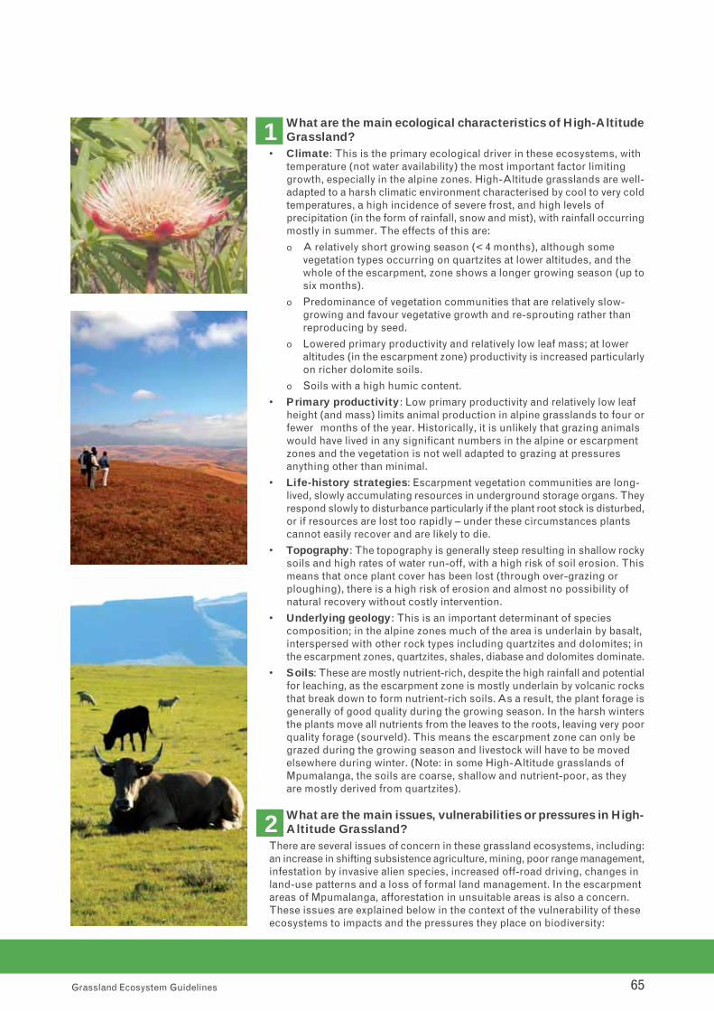
65Grassland Ecosystem Guidelines
What are the main ecological characteristics of High-AltitudeGrassland?
• Climate: This is the primary ecological driver in these ecosystems, with temperature (not water availability) the most important factor limiting growth, especially in the alpine zones. High-Altitude grasslands are well-adapted to a harsh climatic environment characterised by cool to very coldtemperatures, a high incidence of severe frost, and high levels of precipitation (in the form of rainfall, snow and mist), with rainfall occurringmostly in summer. The effects of this are:
o A relatively short growing season (< 4 months), although some vegetation types occurring on quartzites at lower altitudes, and the whole of the escarpment, zone shows a longer growing season (up tosix months).
o Predominance of vegetation communities that are relatively slow-growing and favour vegetative growth and re-sprouting rather than reproducing by seed.
o Lowered primary productivity and relatively low leaf mass; at lower altitudes (in the escarpment zone) productivity is increased particularlyon richer dolomite soils.
o Soils with a high humic content.
• Primary productivity: Low primary productivity and relatively low leaf height (and mass) limits animal production in alpine grasslands to four orfewer months of the year. Historically, it is unlikely that grazing animals would have lived in any significant numbers in the alpine or escarpment zones and the vegetation is not well adapted to grazing at pressures anything other than minimal.
• Life-history strategies: Escarpment vegetation communities are long-lived, slowly accumulating resources in underground storage organs. Theyrespond slowly to disturbance particularly if the plant root stock is disturbed,or if resources are lost too rapidly – under these circumstances plants cannot easily recover and are likely to die.
• Topography: The topography is generally steep resulting in shallow rockysoils and high rates of water run-off, with a high risk of soil erosion. Thismeans that once plant cover has been lost (through over-grazing or ploughing), there is a high risk of erosion and almost no possibility of natural recovery without costly intervention.
• Underlying geology: This is an important determinant of species composition; in the alpine zones much of the area is underlain by basalt,interspersed with other rock types including quartzites and dolomites; inthe escarpment zones, quartzites, shales, diabase and dolomites dominate.
• Soils: These are mostly nutrient-rich, despite the high rainfall and potentialfor leaching, as the escarpment zone is mostly underlain by volcanic rocksthat break down to form nutrient-rich soils. As a result, the plant forage isgenerally of good quality during the growing season. In the harsh wintersthe plants move all nutrients from the leaves to the roots, leaving very poorquality forage (sourveld). This means the escarpment zone can only be grazed during the growing season and livestock will have to be moved elsewhere during winter. (Note: in some High-Altitude grasslands of Mpumalanga, the soils are coarse, shallow and nutrient-poor, as they are mostly derived from quartzites).
What are the main issues, vulnerabilities or pressures in High-Altitude Grassland?
There are several issues of concern in these grassland ecosystems, including:an increase in shifting subsistence agriculture, mining, poor range management,infestation by invasive alien species, increased off-road driving, changes inland-use patterns and a loss of formal land management. In the escarpmentareas of Mpumalanga, afforestation in unsuitable areas is also a concern.These issues are explained below in the context of the vulnerability of theseecosystems to impacts and the pressures they place on biodiversity:
1
2

66Grassland Ecosystem Guidelines
• Shifting subsistence cultivation: In the past, most cultivation was confined to below the escarpment due to topographic and climatic factorsthat limited where crops could be grown. More recently, there has been anemergence of shifting agriculture in the escarpment and sub-escarpmentzones as lower fields have become exhausted and insufficient, and as short-season crop cultivars have been developed. In some areas, the maincrop is the illegal plant Cannabis, which is planted in areas that are unlikelyto be easily detected. The small fields are generally ploughed by oxen andare often on relatively steep slopes, making them vulnerable to erosion once the crop is harvested. Cannabis crops are grown for a few seasons, until the soil is exhausted, and then a new area is ploughed. The old fieldsdo not recover their natural species diversity due to poor recruitment.
• Poor rangeland management: These grasslands are sensitive to overgrazing by goats, sheep and cattle, primarily because their recovery rate is very slow, especially after heavy utilization. The combination of too-frequent fire followed immediately by grazing results in ever-diminishinggrass production and increasing pressure on the remaining plants and, eventually, encroachment by non-palatable karroid woody species – this can be a problem in both communal and commercial rangelands. Issues of particular concern are:
o Communal grazing: In areas subject to communal grazing, where thereis usually no single management authority, herders attempt to stimulategreen-flushes in the grassland by burning two to three times per year,whenever a fire will carry through the grass. This leads to reduced plantvigour and tuft-size, and increased soil erosion. This highly detrimentalpractice quickly reduces productive grassland to unproductive karroidshrubland. Although the shrubs can be an important source of fuel forlocal communities, when they are removed the soil is exposed leadingto extensive erosion – entire valleys can be devastated in this way.The Lesotho mountains and Drakensberg of the north-Eastern Cape are particularly affected by this issue due to the nature of the communal‘management’ of the rangeland; there is no easy solution to this complexproblem which is deeply rooted in local leadership and governance issues.
o Commercial grazing: High-Altitude grasslands are not adapted to extensive or extended grazing by large herds of grazers (especially selective grazers like sheep). They are sensitive to over-stocking, andhave to be carefully managed if they are to sustain economically viablelivestock numbers. Agricultural advice has generally focused on sustaining the productive grasses, such as Rooigras (Themeda triandra),and has under-emphasised the species-rich forb component. Althoughthe forbs are well-adapted to fire, they are less able to cope with sustained grazing pressure.
• Localised encroachment by invasive alien plant species: Several species of invasive alien plants are becoming a problem, largely as a resultof poor management of fire and grazing (the climate at higher altitudes would normal keep woody invasive species in check). The most importantinvasive species in these areas are American Bramble (Rubus cueneifolius),Black Wattle (Acacia mearnsii) and Gum (Eucalyptus species), with Bugweed(Solanum mauritianum), Acacia melanoxylon and Acacia dealbata also becoming a problem.
• Off-road driving by tourists: With the increased interest in adventure tourism, foot and animal paths in the highlands of the Eastern Cape, Lesotho and Mpumalanga are increasingly being used as vehicle tracks. This is leading to severe, localised soil erosion due to the steep slopes and shallow, fragile soils. Northern Escarpment Quartzite Sourveld is especially unable to withstand the impacts of vehicles, or any other disturbance, due to the high humic content of the soils. Vehicle tracks leave long-lasting scars in these landscapes.

67Grassland Ecosystem Guidelines
• A loss of formal land management: Complex socio-political and socio-economic issues such as stock-theft, declining security on farms and challenging economic conditions, have led some commercial farmers to abandon their land. This has been the case in the remote border areas ofKwaZulu-Natal and the Eastern Cape. The management vacuum that resultsin the latter case can lead to the problems described under ‘communal grazing’ above.
• Afforestation: Commercial timber plantations occur in many parts of thelandscape and represent an important economic activity. In some cases, afforestation has taken place in unsuitable areas, such as Northern Escarpment Dolomite Grassland in which the loss of ground water as a result of afforestation has resulted in a decreased flow of water to karst cave systems.
What are the signs of healthy High-Altitude Grassland?In addition to the general signs of healthy grassland ecosystems described
in Section 5.1, signs of healthy High-Altitude Grassland include:
• The presence of abundant geophytes and life forms other than grasses.
• Low occurrence of Hyparrhenia and other unpalatable grasses.
• High plant species diversity, as indicated by a variety of coloured forms inthe grassland.
• Low occurrence or absence of invasive alien species.
• No obvious signs of soil erosion (such as dongas, sheet erosion or leaf litter and loose soil accumulating in lower-lying areas).
• The abundant presence of naturally-occurring animals of various types.
What are the management best-practices and minimumecological requirements in High-Altitude Grassland?
In addition to the general management best-practices and minimum ecologicalrequirements described in Section 5.1, the following ecosystem-specificrecommendations apply in High-Altitude Grassland:
• Burning must be carried out according to an integrated fire management plan that takes account of the following:
o High-Altitude grasslands generally have slow growth rates (due to theclimate) and they should be burnt less frequently as the altitude increases.
o The tension between burning and grazing needs to be carefully balanced, so that enough time is given for the sward to recover after burning events – if fire is applied too frequently, or at the wrong time (e.g. spring, just as new growth is starting), it leads to reduced vigourand tuft-size, and increased soil erosion either by sheet erosion or landslides. It is recommended that patch burning be applied, using a variety of intervals between burns.
o The periodicity of burns should be 5-7 years in alpine areas, and 2-4 years in escarpment areas – the higher the altitude, the lower the frequency of burning (although this does not apply to the escarpmentgrasslands of Mpumalanga).
o Burning should take place in late winter; burning in August should beavoided due to the prevalence of hot berg winds that can increase therisk of dangerous runaway fires.
o Areas to be burnt should be divided into burning blocks using naturalfeatures such as rivers and ridges.
o High altitude, sourveld grasslands should not be grazed for 6 – 8 weeksafter being burnt.
o Sweetveld grasslands on the Stormberg plateau (north of Molteno andDordrecht in the Eastern Cape) should only be burned in seasons whengrass growth has exceeded grazing demand.
4
3

68Grassland Ecosystem Guidelines
• Grazing should be carefully managed, as follows:
o Only light to moderate grazing by livestock (preferably by bulk rather than selective grazers) should be permitted if these grasslands are being managed for the persistence of biodiversity.
o Careful animal management is required to prevent over-utilisation andits associated soil erosion; stocking rates and rest periods need to beclosely managed.
o In sourveld areas (much of the High-Altitude region) stick to low stocking rates, with continuous grazing over very large areas, with longperiods of rest (at least a full season).
o In sweetveld areas (e.g. the Stormberg plateau in the Eastern Cape) rotational grazing at low stocking rates is acceptable, but camps shouldbe rested for long enough (up to 10 weeks) to allow seed-fall.
• Pay particular attention to species of special concern: Detailed ecological studies following the minimum standards for EIAs in sensitiveareas are essential before any land-use application can be approved – these grasslands are extremely diverse and contain the highest number of threatened and endemic species of all of the grassland ecosystemgroups; many of the endemics have highly restricted distributions and could easily be irretrievably lost by inappropriate land-use at a single site.
• Invasive alien species should be controlled as matter of priority.
What are the broad spatial guidelines for locating land-uses in High Altitude Grassland?
In addition to the general guidelines provided in Section 5.1, the followingrecommendations for High-Altitude Grassland are made:
• Sites with threatened and endemic animal and plant species should be maintained in a natural state, with no further habitat loss as a result of changes in land-use; detailed spatial guidelines for dealing with these species of special concern can be found in the Red Data List (http://redlist.sanbi.org/).
• Blue swallow nesting sites should be buffered and excluded from any kindof impacting land-use.
• Avoid any further fragmentation of natural grassland areas.
• No further afforestation should be permitted on dolomitic grasslands; these have already been extensively modified and the remaining areas harbour endemic plant species and several threatened species of bats.
• Establish buffers around rivers and wetlands, following the recommendations given in Chapters 6 and 7.
• Incorporate mountain summits, ridges and peat bogs into ecological corridors that are kept in a natural state and managed for biodiversity. These corridors should be identified using current systematic biodiversityplans, and should be aligned to include migration routes and sensitive habitats, amongst other things.
• In alpine zones, where endemism is very high, the siting of any infrastructure,such as radio masts, needs to be informed by careful surveys carried outduring the flowering season (which is very short due to the cold climate).
What indicators can be used to assess and monitor the impactof management on biodiversity in High-Altitude Grassland?
The general indicators described under Question 6 in Section 5.1 for allgrassland ecosystems, can be applied reliably to monitor the impact ofmanagement on biodiversity in High-Altitude Grassland. However, of particularimportance in this group of ecosystems are:
• The status of populations of endemic and rare species: High-Altitudegrasslands show very high levels of endemism; a loss of endemic speciesfrom the ecosystem indicates the need to adjust management of fireand grazing.
5
6

69Grassland Ecosystem Guidelines
• Changes in species abundance: Single species dominating the landscapeis a sure sign of degradation as is the loss of palatable species from the ecosystem.
• Infestation by invasive alien species: One of the biggest risks posed by these species is that they occupy habitat that would otherwise be available for naturally-occurring species, thus causing degradation.
• Groundwater levels and base flows: With these grasslands being suchimportant water production landscapes, it is important to monitor catchment-level impacts of land-use change on groundwater levels and base flows.
• Obvious signs of soil erosion: Features such as hard-capping, the pedestal effect (grass clumps growing on raised pedestals of soil separatedby scoured out areas), and the accumulation of loose soil in lower lying areas are all signs of degradation as a result of inappropriate management.


Sub-Escarpment Grassland5.5.

Snapshot of Sub-Escarpment Grassland
General characteristics of this group of ecosystems are that they:
• Are mesic grasslands occurring at mid-altitudes (760 – 1 800 masl) at the base of the escarpment of KwaZulu-Nataland the Eastern Cape.
• Comprise 20 nationalvegetation types (see Chapter 9.2 for a full list).
• Are made up of long-lived grasses and forbs that are adapted to frequent above-ground disturbance mostly due to fire, after which they re-sprout using carbohydrates stored in underground storage organs.
• Reproduce only infrequently through seedlings and seeds are generally viable only for short periods; plants persistfor many years and replacement takes place vegetatively as new tillers emerge.
• Occur in areas with topography dominated by flat plains, rolling hills with gentle to steep slopes rising to the baseof the escarpment, and traversed by deep river valleys; the heterogeneity of the topography influences the prevailingfire regime.
• Are adapted to a climate that is characterised by warm, wet summers with high rainfall (mean annual precipitation>600 mm), and dry, temperate winters that are cool to cold with a moderate to heavy frost regime; the rising topography results in orographic precipitation and frequent formation of mist.
• Soils are depleted of nutrients as a result of leaching and generally support sourveld; they form a mosaic made up of shallow and poorly-drained soils from sedimentary rocks (shales, sandstones and mudstones) ,interspersedwith deep, well-drained soils from igneous rocks (such as basalt and dolerite).
Conservation status:
• All of the vegetation types are inadequately protected, with two thirds of them classified as threatened.
• Mistbelt grasslands have undergone extensive modification due to commercial forestry operations, row-croppingand urban sprawl. Only eight vegetation types have undergone relatively little modification.
Socio-economic importance:
• These grasslands are important as rangelands and are favoured for afforestation and other cropping activities. They are also important water-production landscapes, and are the catchment for important rivers such as the Mngeni, Mzimvubu and the Umtamvuna.
72Grassland Ecosystem Guidelines
5.5. Sub-Escarpment Grassland
What are the main ecological characteristics of Sub-Escarpment Grassland?
• Climate: In Sub-Escarpment Grassland the climate is more moderate thanin escarpment and alpine areas, with warm, wet summers and cold winters.This results in a longer growing season and higher grassland productivity,producing taller and heavier plants; as these grasslands still experience a cold winter with frost, they are sourveld, with poor winter grazing. Frostplays an important role in reducing grazing and ‘curing’ the grass, increasingits suitability for burning.
1
Dry
Hig
hveld
Mes
ic H
ighve
ldHig
h-Alti
tude
Sub-Esc
arpm
ent
Coasta
l
WetlandsForests
Rivers
Groups of Grassland Ecosystems Ocean

73Grassland Ecosystem Guidelines
• Fire: Sub-Escarpment grasslands are well-adapted to fire, and this is themost important ecosystem process that can be managed to maintain biodiversity and productivity in these ecosystems. The rapid biomass build-up influences fire behaviour and results in increased fire frequencyand intensity.
• Soils: These are generally deeper than in escarpment areas, and well-drained, but can become leached due to the high rainfall.
• Grazing: These grasslands are not well suited to high intensity grazing on an ongoing basis. Historically, they were subjected to light levels of selective grazing by herbivores that range in size from oribi to eland. It isunlikely that herds of bulk grazers would have come into this zone excepton occasions when grazing was limited elsewhere.
• Life-history strategies: The plants in these grasslands persist mainly through being long-lived, sporadically replacing themselves through seedsor vegetative reproduction. Many species have adapted to the frequent disturbance by fire and frost by storing carbohydrates in a variety of underground storage organs, from which they re-sprout after the disturbance.
What are the main issues, vulnerabilities or pressures in Sub-Escarpment Grassland?
The issues in Sub-Escarpment Grassland are similar to those described forHigh-Altitude Grassland, although they present themselves in slightly differentways and produce different levels of pressure in these ecosystems. Of particularconcern is expansion of various types of cultivation, heavy grazing, changesin other commercial land-use patterns (relating to mining, urban and peri-urban sprawl and sub-division of land) and encroachment by invasive alienspecies, as described below:
• Habitat loss due to expanding cultivation:
o Commercial plantation forestry: Due to the emergence of new tree cultivars and changing economics, commercial forestry is becoming viable in areas previously considered to be unsuitable for afforestation,particularly in the Eastern Cape, and in the mistbelt areas of KwaZulu-Natal. Decisions are sometimes made to plant up areas that are unsuitable for plantations, often in a poorly-informed attempt to addressthe needs of impoverished rural communities. In some areas, landownershave also shifted to timber cultivation as an alternative form of income,because rampant stock theft has made farming with livestock un-economical.
o Expansion of dairy pastures, potato and sugar-cane fields: Dairy farmersneed to expand their production systems to maintain profitability, whichresults in more primary grasslands being used for grazing or placed under pasture. Potato farmers keep expanding their operations into primary grassland because it is free of eelworm, which otherwise affectsthe marketability of the potato crop. And the development of new cultivars of sugarcane has made it possible to cultivate this crop in areas that were previously considered marginal (e.g. Richmond in southern KwaZulu-Natal).
o Shifting subsistence cultivation and a lack of formal land management:as for High-Altitude Grassland.
• Invasive alien species: The problem with invasive alien species is similarto that in High-Altitude Grassland, although the more moderate climate in Sub-Escarpment regions makes them more vulnerable to infestation bywoody invasive species. One of the greatest risks posed by invasive alienspecies is that they occupy available habitat for indigenous species, therebydegrading and modifying grassland habitats.
2
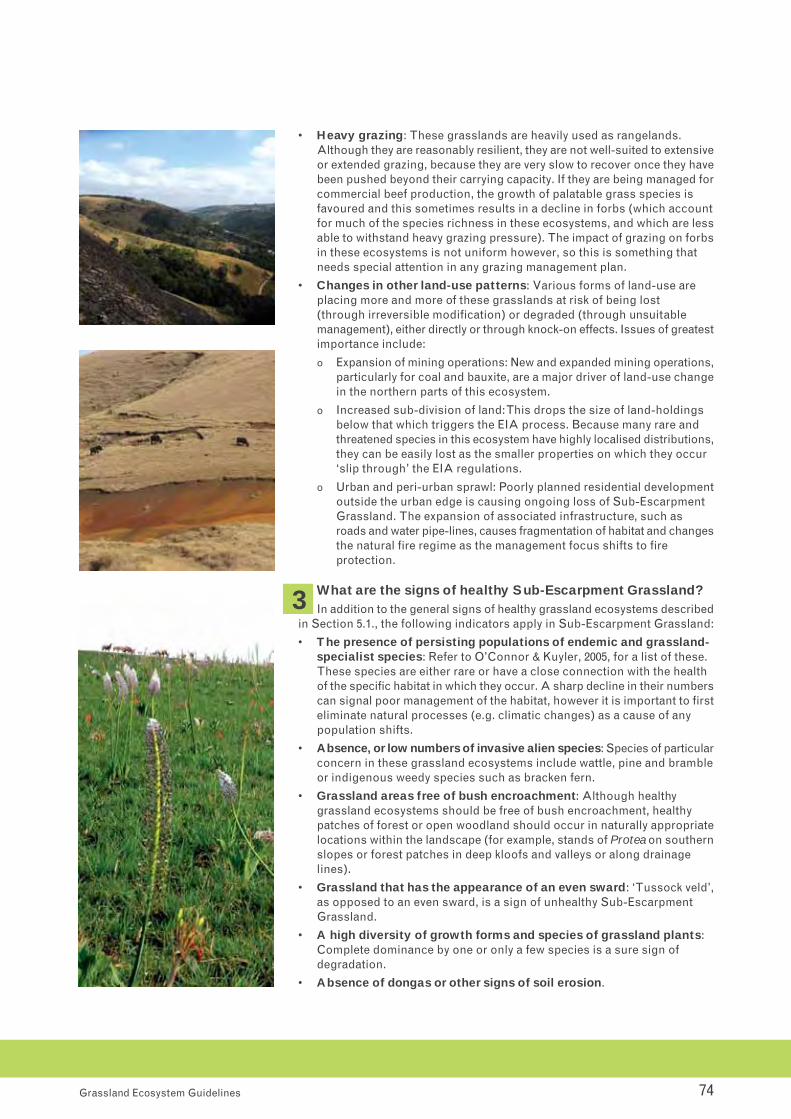
74Grassland Ecosystem Guidelines
• Heavy grazing: These grasslands are heavily used as rangelands. Although they are reasonably resilient, they are not well-suited to extensiveor extended grazing, because they are very slow to recover once they havebeen pushed beyond their carrying capacity. If they are being managed forcommercial beef production, the growth of palatable grass species is favoured and this sometimes results in a decline in forbs (which accountfor much of the species richness in these ecosystems, and which are lessable to withstand heavy grazing pressure). The impact of grazing on forbsin these ecosystems is not uniform however, so this is something that needs special attention in any grazing management plan.
• Changes in other land-use patterns: Various forms of land-use are placing more and more of these grasslands at risk of being lost (through irreversible modification) or degraded (through unsuitable management), either directly or through knock-on effects. Issues of greatestimportance include:
o Expansion of mining operations: New and expanded mining operations,particularly for coal and bauxite, are a major driver of land-use changein the northern parts of this ecosystem.
o Increased sub-division of land: This drops the size of land-holdings below that which triggers the EIA process. Because many rare and threatened species in this ecosystem have highly localised distributions,they can be easily lost as the smaller properties on which they occur ‘slip through’ the EIA regulations.
o Urban and peri-urban sprawl: Poorly planned residential developmentoutside the urban edge is causing ongoing loss of Sub-Escarpment Grassland. The expansion of associated infrastructure, such asroads and water pipe-lines, causes fragmentation of habitat and changesthe natural fire regime as the management focus shifts to fireprotection.
What are the signs of healthy Sub-Escarpment Grassland?In addition to the general signs of healthy grassland ecosystems described
in Section 5.1., the following indicators apply in Sub-Escarpment Grassland:
• The presence of persisting populations of endemic and grassland-specialist species: Refer to O’Connor & Kuyler, 2005, for a list of these. These species are either rare or have a close connection with the health of the specific habitat in which they occur. A sharp decline in their numberscan signal poor management of the habitat, however it is important to firsteliminate natural processes (e.g. climatic changes) as a cause of any population shifts.
• Absence, or low numbers of invasive alien species: Species of particularconcern in these grassland ecosystems include wattle, pine and brambleor indigenous weedy species such as bracken fern.
• Grassland areas free of bush encroachment: Although healthygrassland ecosystems should be free of bush encroachment, healthy patches of forest or open woodland should occur in naturally appropriatelocations within the landscape (for example, stands of Protea on southernslopes or forest patches in deep kloofs and valleys or along drainagelines).
• Grassland that has the appearance of an even sward: ‘Tussock veld’,as opposed to an even sward, is a sign of unhealthy Sub-Escarpment Grassland.
• A high diversity of growth forms and species of grassland plants: Complete dominance by one or only a few species is a sure sign of degradation.
• Absence of dongas or other signs of soil erosion.
3

75Grassland Ecosystem Guidelines
What are the management best-practices and minimum ecological requirements in Sub-Escarpment Grassland?
In addition to the general management best-practices and minimum ecologicalrequirements described in Section 5.1, the following ecosystem-specificrecommendations apply:
• Burn according to a fire management plan: An appropriate burning regime is an essential management tool in these grasslands. As in the other mesic grassland ecosystems, Sub-Escarpment Grassland shows high levels of plant species diversity and this is best maintained when fireis applied using a range of fire frequencies that is more diverse than the often-advocated biennial spring burns. General recommendations regardingfrequency and season of burn are:
o Burn every 2 – 4 years, depending on rainfall and fuel load.
o Burn in winter, but not too early.
o No less than 30% and no more than 60% of an area should be burnt within any given year.
• Manage grazing carefully and prevent overgrazing: Grazing should be managed to maintain cover and the natural composition of palatable species. Wherever possible, natural herbivore assemblages (i.e. composition and numbers) should be promoted as these best replicate the disturbance regimes under which the biodiversity of these ecosystemsdeveloped. In particular, note the following:
o Basal cover needs to be maintained at all costs in order to prevent soilerosion.
o Sub-Escarpment Grasslands can be grazed commercially, but under strict management that recognises the poor ability of these ecosystemsto recover once the limits of acceptable change have been passed. Forcattle, rotational grazing involving adequate periods of rest is recommended.
o If economic return is not the primary objective, grassland should be grazed continuously at light stocking rates. The selective grazing associated with this will create a mosaic of vegetation structures andniches for a variety of species to exploit. Regular burning (every two tofour years) should overcome any long-term changes in species composition brought about by selective grazing.
• Establish strategically located protected areas: Areas of highest importance should be included in protected areas (including sites securedthrough biodiversity stewardship agreements) linked by a well-defined network of corridors.
• Avoid any further loss of primary grassland: Habitat loss should be avoided and economic activity in intact primary grassland should be directedtowards land-uses that will not affect the long-term ecological integrity ofthese ecosystems (e.g. catchment management, carefully managed beef production or ecotourism).
• Manage wild-harvesting of plants: Wild-harvesting (for traditional medicines, bioprospecting or any other purpose) should be managed according to a conservative harvesting plan that is negotiated with the interested and affected parties; some compromise between conservationgoals and resource use will likely need to be met.
• Avoid impacts on wetlands: Sub-Escarpment Grasslands occur in important catchment areas; healthy wetlands are essential to continued delivery of good quality water, so impacts on wetlands in these grasslandsshould be avoided at all costs (See Chapter 6 for more information on wetlands).
• Manage wetland systems, rivers, ridges and valleys for biodiversityobjectives: Outside of protected areas these habitats should be managedin support of biodiversity objectives, particularly if they have been mappedas Critical Biodiversity Areas or Ecological Support Areas.
4

76Grassland Ecosystem Guidelines
What are the broad spatial guidelines for locating land-uses in Sub-Escarpment Grassland?
In addition to the general guidelines provided in Section 5.1, the followingrecommendations for Sub-Escarpment Grasslands are made:
• Natural and near-natural areas should be linked by means of corridors:Within a commercial agricultural, forestry or mining landscape these corridors should be at least 200 m wide. Any current systematic biodiversityplan (such as provincial biodiversity plans or biodiversity sector plans) should be consulted when planning the network of corridors in the landscape, and, wherever possible, these should be aligned to include special habitats or species of special concern.
• Establish buffers: Buffers should be established around sensitive habitats(such as wetlands and forest patches) and species of special concern. Recommendations regarding buffer widths for species of special concerncan be found in the Red Data List.
What indicators can be used to assess and monitor the impactof management on biodiversity in Sub-Escarpment Grassland?
The general indicators described under Question 6 in Section 5.1 for allgrassland ecosystems, can be applied reliably to monitor the impact ofmanagement on biodiversity in Sub-Escarpment Grassland. However, ofparticular importance in this group of ecosystems are:
• The distribution and integrity of forest patches: Forests are a naturalfeature within the matrix of these grasslands, making a significant contribution to their diversity. Their distribution and extent is largely governed by burning practices and changes in their extent, if not intended,are a reliable indicator of poor fire management.
• Species of special concern: Any change or decline in the populations of rare, threatened or endemic, grassland specialist species that cannot be attributed to natural population cycles, is an indicator that the management needs to be adjusted.
• Loss of palatable species: A decline in the diversity and abundance of palatable grass species (decreasers) indicates the need for a change in grazing management.
• Plant species composition and abundance and both aerial andbasal cover.
• Levels of encroachment by woody invasive species (either exotics or weedy indigenous species).
5
6

Coastal Grassland5.6.

78Grassland Ecosystem Guidelines
5.6. Coastal Grassland
Snapshot of Coastal Grassland
General characteristics of this group of grassland ecosystems are that they:
• Are classified as part of the Indian Ocean Coastal Belt Biome.
• Occur as patches forming a mosaic with pockets of other vegetation types (including coastal thicket and scrub, sand and swamp forests, evergreen forest , riparian habitats,wetlands and estuaries) occuring in a narrow strip extending from Maputaland in the north, southwards along the KwaZulu-Natal and Eastern Cape coastlines as far south as about East London.
• Are heterogeneous, and can be divided into two main types – the northern, more subtropical grasslands (occurringon old sandy dunes and coastal flats and reliant on a shallow water table); and the southern grasslands that occurat the transition from subtropical to more temperate systems. These occur on the rocky plateaus of coastal hills in landscapes that include coastal dunes, incised valleys, steep cliffs, rocky outcrops, and deep forested ravines.
• Occur at low altitudes (20 – 600 masl), and are adapted to a climate that is characterised by warm to hot, humid summers with high rainfall (1 000 mm), and mild winters with no frost.
• Are mesic grasslands, well-adapted to frequent above-ground disturbance largely due to fire, with well-developedcapacity for re-sprouting.
• Comprise 5 national vegetation types, and contain two of the seven Centres of Endemism recognised in South Africa; one of these, the Pondoland-Ugu Centre of endemism, has the highest density of endemic species of all of the Centres.
• Are underlain by diverse geology and soils, resulting in high levels of species diversity and endemism, especiallyon sandstone outcrops.
Conservation:
• All of the vegetation types in this ecosystem are under-protected (except in Maputaland) and most are threatened,persisting mainly as fragments.
• Coastal Grassland is overall the most threatened of all the grassland ecosystem groups.
• Extensive habitat loss has been caused by various forms of cultivation (principally sugarcane and bananas), andsprawling urban settlement and in some areas overgrazing has led to degradation.
Socio-economic importance:
• These grassland areas are dominated by sugar-cane and banana farming. They provide a rich source of thatchinggrass and plants important in traditional medicine and they are important as grazing lands for livestock.
What are the main ecological characteristics of Coastal Grasslands?• Climate: These grasslands are quite distinct from the other ecosystems,
largely due to the significantly different climate in coastal regions. The hotsummer temperatures and warm winters, combined with high summer rainfall and lack of any extended dry period, results in:
o A growing season that potentially spans the year, but is limited in winterby the slightly drier conditions.
o A rapid build-up of plant material that provides fuel for the many small-scale fires during winter; growth in this highly productive system can sometimes be limited by the poor nutrient conditions in the leached soils.
1
Dry
Hig
hveld
Mes
ic H
ighve
ldHig
h-Alti
tude
Sub-Esc
arpm
ent
Coasta
l
WetlandsForests
Rivers
Groups of Grassland Ecosystems Ocean

79Grassland Ecosystem Guidelines
• Complex geology and topography: Coastal Grassland is underlain by diverse geology including basement sandstones, granites, gneisses and schists with basalt and dolomite intrusions and sedimentary marine strata.This results in a fine-scale patterning of hydrological and soil conditionsthat gives rise to a high degree of species turnover and diversity over shortCoastal Grassland is particularly important from a species conservation perspective. Coastal Grassland on sandstones are especially diverse.
• Fire: This is one of the most important ecological processes maintainingthe character of Coastal Grasslands. Due to the high fuel loads that buildup over the long, wet growing season, these grasslands have historicallybeen subjected to frequent fires, which affects both the vegetation structureand species composition in these ecosystems. They are characterised bya dynamic relationship with coastal forest and estuarine elements, and fireis critical in maintaining the open grassland areas within the grassland-forest mosaic.
• Grazing: Historically, these grasslands would have been subjected to grazing at a variety of spatial scales with herds of bulk grazers, such as buffalo or zebra, moving periodically through an area and removing a substantial amount of material, with smaller herbivores such as oribior other antelope, removing particular plant parts on a small spatialscale.
What are the main issues, vulnerabilities or pressures in Coastal Grassland?
Dune and sand mining, infestation by invasive alien species, urban and peri-urban sprawl, the expansion of commercial cultivation and subsistence farming,and unsystematic or unplanned use of fire are the main issues in CoastalGrassland, as described below:
• Dune Mining: There is growing pressure to strip-mine titanium from sanddunes in Maputaland and Pondoland, in areas immediately adjacent to remaining Coastal Grassland. In addition to various direct and indirect impacts of this mining activity, the infrastructure and roads associated with mining will further fragment these grasslands. Sand-mining of dunesand river-beds creates similar problems.
• Extensive urban sprawl: The narrow coastal strip in which these grasslands occur is home to a large and growing city (Durban) and manyother densely populated towns and coastal resorts; in the southern part of the range, dense rural settlement is also growing. Urban and peri-urbansprawl and residential development beyond the urban edge, is causing increased habitat fragmentation and loss. The proliferation of luxury residential golfing estates and similar holiday resorts is also placing pressure on remaining grasslands, as they lead to habitat loss and the useof large volumes of water, pesticides and herbicides that affect water qualityand the underlying hydrology of remaining grassland patches.
• Construction of new major roads: Apart from habitat loss and theother direct impacts of this activity, the construction of new major roads(such as the N2 toll road between KwaZulu-Natal and the Eastern Cape) carries with it the risk of increased pressure from urban settlement – oncea new major road is established, there tends to be a natural inclinationfor people to settle along this route, leading to ribbon rather than nodal development.
2

80Grassland Ecosystem Guidelines
• Infestation by invasive alien plants: The coastal zone is particularly vulnerable to infestation by aggressive invasive alien species, such as triffid weed (Chromalaena odorata) and tick-berry (Lantana camara) due to the tropical climate and high-levels of localised disturbance. Bush andforest encroachment caused by the exclusion of fire is also a problem in some areas.
• The expansion of commercial sugar-cane farming and plantation forestry: The expansion of commercial sugar-cane farming (dryland) andplantation forestry (involving new cultivars), means that there is pressurefor more Coastal Grassland to be allocated for these activities.
• Inappropriate land-management: Over-grazing and the unsystematic or injudicious use of fire, particularly in areas that are not formally managed,causes habitat degradation in these coastal ecosystems.
What are the signs of healthy Coastal Grassland?In addition to the general signs of healthy grassland ecosystems described
in Section 5.1., the following indicators apply in Coastal Grassland:
• The distribution and integrity of forest patches: Although healthy Coastal Grassland should be free from bush encroachment, forests patchesare a natural feature within the matrix of these grasslands, making a significant contribution to their diversity. In particular, the forest ecotoneshould be intact, characterised by the presence of distinctive plant communities at the grassland-forest interface.
• The presence of persisting populations of rare sandstone endemicsand other rare, threatened or endemic species.
• An abundance and diversity of forbs and geophytes and a high diversityof grass species.
• Soils with a high proportion of soil organic matter.
• The absence of invasive alien species.
What are the management best-practices and minimum ecological requirements in Coastal Grassland?
In addition to the general management best-practices and ecological non-negotiables described in Section 5.1 above, the following ecosystem-specificrecommendations apply in Coastal Grassland:
• Burning: Fire is one of the most important ecological processes responsiblefor maintaining the open grassland areas in the grassland-forest mosaic that characterises these coastal regions. Due to the high rainfall and productivity in these ecosystems, they can support frequent fires.The diversity of fire-tolerant wild flowers in these mesic grasslands benefitsfrom being exposed to a range of fire frequencies that is more diverse thanthe often-advocated biennial, spring burns. Fire management plans for Coastal Grassland should incorporate:
o Patch mosaics of predominantly two to three year fire intervals (althoughlonger burn intervals should be included to maximise plant diversity).
o Burning that takes place in winter or spring, (depending on biomass accumulation) with no more than 30% of an area being burnt in anyone year.
• Grazing: Coastal Grasslands naturally occur as small patches rather thanextensive areas of connected grassland, and they have become even moreextensively fragmented due to habitat loss caused by various land-uses. This influences the level of grazing pressure they can withstand. Althoughthey can sustain commercial grazing, stocking rates must remain within agricultural norms and low rates are recommended.
3
4

81Grassland Ecosystem Guidelines
What are the broad spatial guidelines for locating land-uses in Coastal Grassland?
In addition to the general spatial guidelines provided in Section 5.1, thefollowing recommendations for Coastal Grassland are made:
• Avoid any further fragmentation: Coastal Grasslands are by nature patchy in their distribution, occurring as they do as part of a mosaic withforests and other vegetation types. Various land- uses have resulted in a high degree of fragmentation of these grassland-forest mosaics and thereshould be no further fragmentation in these ecosystems.
• Maintain all remaining primary Coastal Grassland in a natural or near-natural state: This is the most threatened of all the grassland ecosystem groups and all remaining areas of intact, primary grassland should be kept in a natural or near-natural state.
What indicators can be used to assess and monitor the impactof management on biodiversity in Coastal Grassland?
The general indicators described under Question 6 in Section 5.1 for allgrassland ecosystems can be applied reliably to monitor the impact ofmanagement on biodiversity in Coastal Grassland. However, of particularimportance in this group of ecosystems are:
• The encroachment of woody species into previously open grassland patches is a sign that fire is being used too infrequently, allowing woody species to out-compete grassland species.
• Absence of distinctive forest-grassland ecotonal communities indicates that fire is being used too often, or the fires are too hot, resultingin damage to the forest-grassland ecotone and the forest margin.
• Increasing occurrence of invasive alien species, either in the grasslanditself, or at forest margins.
5
6

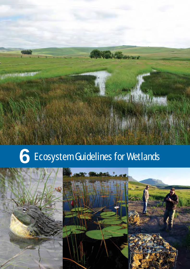
Ecosystem Guidelines for Wetlands6

84Grassland Ecosystem Guidelines
A large proportion of South Africa’s wetland ecosystems occur in grasslandlandscapes. Wetlands are those parts of the landscape where wateraccumulates long enough and often enough to influence the characteristicsof the soil and the composition of the plant and animal communities livingthere. These areas can be temporarily, seasonally or permanently wet. TheConvention on Wetlands of International Importance (i.e. the RamsarConvention) takes a broad view of wetlands that includes all aquatic freshwatersystems, but South Africa’s National Water Act (Act 36 of 1998) uses anarrower definition that applies to wetland types referred to commonly asbogs, pans, marshes and vleis. Wetlands are specialised ecosystems thatdeliver essential ecosystem services that are vital for human welfare andenvironmental sustainability. They are of strategic importance for ensuringwater quality, regulating water flows, attenuating floods and for supportingagro-pastoral systems and the livelihoods of many rural people.
Wetlands do not all share the same ecological characteristics and functionality,and so cannot all be treated in the same way from a land-use planning,management or decision-making perspective. There are several different typesof wetland ecosystems that can be identified based largely on where theyoccur within a landscape (e.g. on a slope, a plain or a valley floor), the wetlandvegetation that characterises them and how they function (see Figure 11).What all wetlands have in common is that they occur on soils that havedeveloped under prolonged periods of water-logging (i.e. the soils arehydromorphic).
The National Classification System for Wetlands (Ollis et al. 2013) recognisesthe following main categories of wetland, based on how they function:
• Seeps: (sometimes called ‘sponges’): these are generally seasonal, smalland widely scattered wetlands formed at valley heads or on hill-slopes, largely by the discharge of sub-surface water.
• Valley-bottom Wetlands: these occur in valley bottoms and are usuallywetter for longer periods than seeps. They may be channelled (with at leastone or more clearly defined stream channels, but lacking floodplain features), or un-channelled (with no clearly defined stream channel).
• Floodplain Wetlands: gently sloped, with floodplain features and a distinctstream channel.
• Depressions and ‘Flats’: areas that accumulate surface water (e.g. ‘pans’),either in depressions, or extensive areas characterised by level, gently undulating or uniformly sloping land.
Important points about all wetlands:
• They are part of a highly interconnected system; this means that impacts on one wetland at a particular point in the landscape have implications for the state of other wetlands in that wetland system. Wetlandsalso provide critical areas of cover (corridors) providing refuge for animalsto moving across a grassland landscape.
• Wetlands are vulnerable to damage and once damaged or degraded are difficult, though not impossible, to restore. Many wetlands have alreadybeen irreversibly lost, especially in urban and intensively cultivated areas,and those that remain are the most threatened of all of South Africa’s ecosystems - 65% of them are classed as threatened, and 48% of these arecritically endangered.
• The pattern of water movement in the wetland (i.e. the hydrological regime), and its relationship to the variety of soil types, gives rise to a variable mosaic of specialist habitats, contributing significantly to local biodiversity.
• The moisture within wetlands generally gives rise to a more robustvegetation structure than that of the surrounding grassland. This provides refugia for animals during times of disturbance, enhancing the potential for re-colonisation of nearby areas following disturbances suchas fire.
6. Ecosystem Guidelines for Wetlands

85Grassland Ecosystem Guidelines
• The health of wetlands is inextricably linked to the land-uses withintheir catchments. A large proportion of South Africa’s wetlands occur in grasslands, which means that sound land-use planning and managementof land-based impacts in grassland landscapes is essential to maintain the health of wetlands, and the ecosystem services they provide.
The guidelines given below are very generalised and are intended to serve asgeneral pointers or ‘red flags’ for practitioners who are working in grasslandlandscapes that include wetlands. More detailed information and guidancecan be obtained from several sources that focus on wetlands and other aquaticecosystems, such as:
• The WET-Management Series, an integrated set of tools that assists usersin achieving well-informed and effective wetland management and rehabilitation. These tools can be downloaded from the website of the Water Research Commission (www.wrc.org.za).
• The National Freshwater Ecosystem Priority Area Implementation Manual(Driver et al. 2011) which can be downloaded from SANBI’s BGIS website(www.bgis.sanbi.org.za).
• The SANBI ‘Biodiversity Advisor’ at: http://biodiversityadvisor.sanbi.org/?home_items=planning-and-assessment.
• The National Wetland Classification System (Ollis et al. 2013).
Figure 11. Schematic drawing showinghow the seven hydro-geomorphicclasses of wetland relate to landscapesetting (taken from Driver et al. 2012).

86Grassland Ecosystem Guidelines
What are the main ecological characteristics of wetlands?The structure, composition and functioning of wetland ecosystems is
determined by many interacting biophysical factors, including:
• Geology and geomorphology: Underlying rock type defines the shape of a landscape and the physical and chemical resource base of the wetlandecosystem. These differences influence the shape and gradient of the landsurface, and, therefore, the distribution of water, sediment and nutrients within the wetland.
• Hydrological regime: The timing, duration and temporal sequencing offloods and the general movement of water within the wetland exert a stronginfluence over the plants and animals living in it, and over the physical andchemical characteristics of the ecosystem.
• Water quality: Along with water quantity, water quality is a major driver of biological responses within freshwater ecosystems. Some wetlands (e.g. those with catchments underlain by sandstone) are naturally low in nutrients, and support plants, and animals, particularly adapted to lower nutrient conditions, while others have an inherently higher nutrient status.Nutrient overload (i.e. eutrophication) of wetland ecosystems can lead toecologically significant changes in vegetation structure and composition.
• Water quantity and source: The ecological character of a wetland will also be influenced by the amount and source of the water flowing throughit – water can enter the wetland from a river upstream, via surface runoff from the catchment or as subsurface seepage through the adjacent soilsin the catchment.
• Climate: This acts together with geology to influence other drivers (suchas hydrology or sedimentation) that shape wetlands. Mean annual precipitation drives the hydrology of a wetland ecosystem, and permanentlysaturated wetland areas occur more extensively and more often under higher rainfall conditions. Temperature is the most important climatic driver influencing the biota in a wetland ecosystem.
• Vegetation and other biota: The presence or absence of wetland plantsand animals can be a response to other ecological drivers (such as sedimentation), or can determine the characteristics of the wetland. Vegetation strongly influences wetland geomorphic process by slowing down water flows and capturing sediment; it is also the source of peat in peat-land systems.
• Sedimentation: The distribution of sediment within the wetland, as wellas the type of mineral sediments (fine clay or coarse sand and gravel, chemical and organic sediments), are important determinants of its ecological character. In general, the amount of sediment entering a wetlandis equal to or greater than the amount leaving it, so that there is a net accumulation of sediment in the system.
In addition to the biophysical drivers, there are several disturbance factorsthat naturally alter the structure and functioning of wetlands, including:
• Fire: Under natural or carefully managed conditions, fire is a normal, healthy part of wetland ecology. However, some wetlands (e.g. peat bogsand swamp forests) are susceptible to damage by fire and should be protected from it (i.e. where land-use changes around these wetlands havestripped the natural fire buffers away, active management is necessary toprotect them).
1

87Grassland Ecosystem Guidelines
• Grazing: Grazing influences the diversity of habitats in the wetland, and their ecological condition. Many wetlands have evolved under grazing pressure from indigenous animals such as buffalo, and, when in a healthystate, are able to support high seasonal concentrations of herbivores. Domestic livestock may have a similar (and positive) effect in maintaininghabitat diversity, if grazing pressure is carefully managed.
Primary production in wetlands is a function of the interaction of all of theother drivers listed above. Primary production is highest where water is freelyavailable throughout the year (i.e. the permanently wet zone in a wetland) andwhere nutrients and temperature are not severely limiting. Primary productionis itself a key ecological driver in wetland ecosystems, because where it is veryhigh (usually involving tall-growing, single species such as ‘fluitjiesriet’,Phragmites australis), fierce competition acts to exclude other species. Thisis important, as in these cases, disturbance ‘creates space’ for shorter-growing,less competitive species to co-occur with the more competitive ones.
What are the main issues, vulnerabilities or pressures in wetland ecosystems?
Several land-use practices and other pressures contribute to the loss anddegradation of wetlands. Impacts can be direct , occurring at the wetland site,or indirect, in which case they are related to grassland management withinthe wider catchment of the wetland.
The main causes of direct impacts on wetlands are:
• Cultivation (e.g. of sugarcane, maize or other crops): The primary impactsof agriculture on wetlands include removal of natural vegetation and ploughing (especially on floodplains). This leads to erosion and changesin water flows, water availability on the surrounding land, and water quality,especially where fertilisers and other chemicals are in use. The type of crop planted, the need for drainage and the spatial extent of the cultivationare all important in determining the extent of impact on a wetland, but, ingeneral, the impacts of cultivation in wetlands is overwhelmingly negative.For this reason, ploughing of wetlands is regulated by the Conservation of Agricultural Resources Act (CARA, Act 43 of 1983), the National WaterAct (NWA, Act 36 of 1998) and NEMA.
• Road crossings and road infrastructure: When roads are built adjacentto, in or upstream of wetlands, it results in water flow being confined through culverts, resulting in head-cut erosion or channel-scouring and incision. Drainage from roads also confines flow, resulting in point-sourcedischarges into the wetland and lateral erosion.
• Impoundments (dams, weirs, drains): The construction of any kind of impoundment influences the natural flow of water into and out of wetlandsas well as the movement of sediment.
• Poor grazing management: Wetlands are generally well-adapted to grazing, and can benefit from it. It is possible, though, to over-utilise them,especially in winter when they may contain the only green forage in the area and animals concentrate on the wetland causing erosion of channels.This dries out indigenous vegetation, compromises the ability of the wetland to hold back floods, and can release large volumes of sediment into rivers that would otherwise be trapped by wetland plants.
• Mining of peat: Peat is used in the horticulture industry and in various industrial purification procedures; when it is mined (dug out of peat bogs),the structure of the wetland is fundamentally and significantly damaged. Peat mining in South Africa is currently unsustainable.
2
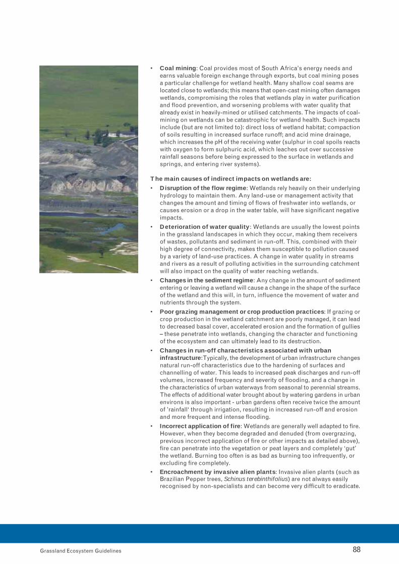
88Grassland Ecosystem Guidelines
• Coal mining: Coal provides most of South Africa’s energy needs and earns valuable foreign exchange through exports, but coal mining posesa particular challenge for wetland health. Many shallow coal seams are located close to wetlands; this means that open-cast mining often damageswetlands, compromising the roles that wetlands play in water purificationand flood prevention, and worsening problems with water quality that already exist in heavily-mined or utilised catchments. The impacts of coal-mining on wetlands can be catastrophic for wetland health. Such impactsinclude (but are not limited to): direct loss of wetland habitat; compactionof soils resulting in increased surface runoff; and acid mine drainage, which increases the pH of the receiving water (sulphur in coal spoils reactswith oxygen to form sulphuric acid, which leaches out over successive rainfall seasons before being expressed to the surface in wetlands and springs, and entering river systems).
The main causes of indirect impacts on wetlands are:
• Disruption of the flow regime: Wetlands rely heavily on their underlyinghydrology to maintain them. Any land-use or management activity that changes the amount and timing of flows of freshwater into wetlands, or causes erosion or a drop in the water table, will have significant negativeimpacts.
• Deterioration of water quality: Wetlands are usually the lowest pointsin the grassland landscapes in which they occur, making them receivers of wastes, pollutants and sediment in run-off. This, combined with their high degree of connectivity, makes them susceptible to pollution caused by a variety of land-use practices. A change in water quality in streams and rivers as a result of polluting activities in the surrounding catchmentwill also impact on the quality of water reaching wetlands.
• Changes in the sediment regime: Any change in the amount of sedimententering or leaving a wetland will cause a change in the shape of the surfaceof the wetland and this will, in turn, influence the movement of water andnutrients through the system.
• Poor grazing management or crop production practices: If grazing orcrop production in the wetland catchment are poorly managed, it can leadto decreased basal cover, accelerated erosion and the formation of gullies– these penetrate into wetlands, changing the character and functioning of the ecosystem and can ultimately lead to its destruction.
• Changes in run-off characteristics associated with urban infrastructure: Typically, the development of urban infrastructure changesnatural run-off characteristics due to the hardening of surfaces and channelling of water. This leads to increased peak discharges and run-offvolumes, increased frequency and severity of flooding, and a change in the characteristics of urban waterways from seasonal to perennial streams.The effects of additional water brought about by watering gardens in urbanenvirons is also important - urban gardens often receive twice the amountof ’rainfall‘ through irrigation, resulting in increased run-off and erosion and more frequent and intense flooding.
• Incorrect application of fire: Wetlands are generally well adapted to fire.However, when they become degraded and denuded (from overgrazing, previous incorrect application of fire or other impacts as detailed above),fire can penetrate into the vegetation or peat layers and completely ‘gut’ the wetland. Burning too often is as bad as burning too infrequently, or excluding fire completely.
• Encroachment by invasive alien plants: Invasive alien plants (such asBrazilian Pepper trees, Schinus terebinthifolius) are not always easily recognised by non-specialists and can become very difficult to eradicate.
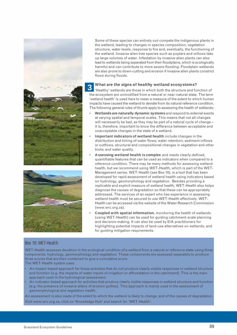
89Grassland Ecosystem Guidelines
Some of these species can entirely out-compete the indigenous plants inthe wetland, leading to changes in species composition, vegetation structure, water levels, response to fire and, eventually, the functioning ofthe wetland. Invasive alien tree species such as poplars and willows takeup large volumes of water. Infestation by invasive alien plants can also lead to wetlands being separated from their floodplains, which is ecologicallyharmful and can contribute to more severe flooding. Floodplain wetlandsare also prone to down-cutting and erosion if invasive alien plants constrictflows during floods.
What are the signs of healthy wetland ecosystems?‘Healthy’ wetlands are those in which both the structure and function of
the ecosystem are unmodified from a natural or near-natural state. The term‘wetland health’ is used here to mean a measure of the extent to which humanimpacts have caused the wetland to deviate from its natural reference condition.The following general rules of thumb apply to assessing the health of wetlands:
• Wetlands are naturally dynamic systems and respond to external eventsat varying spatial and temporal scales. This means that not all changes will necessarily be bad, as they may be part of a natural cycle of change –it is, therefore, important to know the difference between acceptable and unacceptable changes in the state of a wetland.
• Important indicators of wetland health include changes in the distribution and timing of water flows; water retention; sediment inflows or outflows, structural and compositional changes in vegetation and otherbiota; and water quality.
• Assessing wetland health is complex and needs clearly-defined, quantifiable features that can be used as indicators when compared to a reference condition. There may be many methods for assessing wetland health, but we recommend using WET-Health, which is part of the WET-Management series. WET-Health (see Box 10), is a tool that has been developed for rapid assessment of wetland health using indicators basedon hydrology, geomorphology and vegetation. Besides providing a replicable and explicit measure of wetland health, WET-Health also helpsdiagnose the causes of degradation so that these can be appropriately addressed. The services of an expert who has experience in assessing wetland health must be secured to use WET-Health effectively. WET-Health can be accessed via the website of the Water Research Commission(www.wrc.org.za).
• Coupled with spatial information, monitoring the health of wetlands (using WET-Health) can be used for guiding catchment-scale planning and decision-making. It can also be used by EIA practitioners for highlighting potential impacts of land-use alternatives on wetlands, and for guiding mitigation requirements.
Box 10: WET-HealthWET-Health assesses deviation in the ecological condition of a wetland from a natural or reference state using threecomponents: hydrology, geomorphology and vegetation. These components are assessed separately to producethree scores that are then combined to give a cumulative score.The WET-Health system uses:
• An impact-based approach for those activities that do not produce clearly visible responses in wetland structureand function (e.g. the impacts of water inputs of irrigation or afforestation in the catchment). This is the main approach used in the hydrological assessment.
• An indicator-based approach for activities that produce clearly visible responses in wetland structure and function(e.g. the presence of invasive aliens of erosion gullies). This approach is mainly used in the assessment of geomorphological and vegetation health.
An assessment is also made of the extent to which the wetland is likely to change, and of the causes of degradation.
Visit www.wrc.org.za, click on ‘Knowledge Hub’ and search for ‘WET-Health’.
3

90Grassland Ecosystem Guidelines
Can damaged wetlands be rehabilitated? As a guiding principle, wetlandsthat are currently in a healthy state should remain so; those that are not ingood condition should be rehabilitated to their best attainable ecologicalcondition, wherever possible. The following general principles are relevant towetland rehabilitation:
• Though wetlands are vulnerable to damage, they are generally more resilientthan many other ecosystems and can be rehabilitated to at least a basic level of ecological and hydrological functioning, thus restoring ecosystemservices such as water purification. Biotic diversity in the wetland, however,may be very difficult to restore, especially in drier wetlands in which it maynever recover.
• How easily the system can be rehabilitated will depend on the type of wetland (how ecologically complex it is), and the causes and extent of thedegradation. More complex habitats are more difficult to rehabilitate – impacts on these wetlands as a result of changes in water quality or the level of the water table may not be restorable. If the fundamental hydrologicalcharacteristics have been irreversibly altered, then the wetland will changeaccordingly and the shift is considered to be permanent.
• Rehabilitation can include interventions that restore ecosystem health toa degraded system by re-instating its natural ecological drivers such as seasonal flows or basic vegetation structure, or by preventing the furtherdecline of a wetland that is in the process of degrading.
• Typically, interventions to restore degraded systems consist of re-instatingthe natural hydrological regime; this is achieved by using ‘plugs’ to physicallyrepair drains in the wetland; interventions to maintain the health of a wetland, or to prevent its further decline, typically consist of managementinterventions such as removing invasive alien species, or managing grazingpressure or fire frequency.
• In designing a wetland rehabilitation plan it is important to remember that:(i) the objectives of the rehabilitation project must be clearly defined (i.e.not all wetlands can be restored to the same level); (ii) the causes of the degradation and not only the symptoms must be addressed; (iii)measurable indicators must be set to monitor the effectiveness of the rehabilitation interventions.
Note: Wetland rehabilitation is a complex process and has complex links withhuman usage. Assistance can be obtained from programmes that focus onthe rehabilitation of wetlands, such as Working for Wetlands (seewww.wetlands.sanbi.org.za). Much practical guidance in planning,implementing and evaluating wetland rehabilitation is also available throughthe WET-Management Series, published by the Water Research Commission.Visit the Water Research Commission website, www.wrc.org.za, click on“Knowledge Hub” and Search for ‘WET-Management Series; there are severaltools available for guiding wetland rehabilitation.
What are the management best-practices and minimumecological requirements for wetlands?
Land-use practices or activities that will lead to deterioration in the currentcondition of a wetland, or changes to the water flow or inundation regime ofpriority wetlands should be avoided. Land-use practices or activities that willmake rehabilitation of a priority wetland difficult or impossible are also notdesirable. General best practices for managing wetlands include:
• Never interfere with base levels in wetland systems: If the base levelof a wetland is lowered, it will usually result in erosion. Raising the base level (e.g. through building a dam or impoundment of some sort) will encourage deposition and accumulation of sediments.
4

91Grassland Ecosystem Guidelines
• Maintain grassland biodiversity, structure and condition to maximisewater flow: Maintaining grasslands in as natural a state as possible will enhance the water resources obtained from them. In grassland areas, waterproduction should be promoted as a primary land-use, especially in high-yield catchments.
• Monitor water flows, water quality and habitat condition: If any changes in these indicators are detected, make management decisions that respond to them as they arise.
• Maintain hydrological connections between wetlands: Wetlands cannot be treated as isolated systems, and hydrological connections mustbe maintained across the landscape.
• Wise fire management is an essential part of wetland management:Periodic burning of herbaceous wetlands (but NOT swamp forests and peatlands) is a beneficial practice – it removes top-growth and introducesheterogeneity to the vegetation structure. Generally wetlands are well- adapted to fire and can withstand most fire regimes within reason. Due tothe availability of water, plant biomass accumulates rapidly and wetlandswill carry fast and hot fires. Care needs to be taken with fire in hydrologicallyaltered peatlands – in afforested landscapes these can be dried out and burn out completely. General guidelines for burning wetlands to maximisebiodiversity are:
o Adjust the periodicity of burning according to rainfall: In high rainfallregions the periods between burns can be shorter (2 to 3 years), and in lower rainfall areas the interval between burns should be longer (e.g.4 to 5 years).
o Always consider the specific circumstances at the site: The frequencyof burning may be influenced by land-use practices at the site – for example, if the wetland is actively grazed by livestock then it may requireless frequent burning.
o The timing of the burn is important: Optimal timing of burns will be influenced by conditions in the wetland and the prevailing land-use practices, and there may be trade-offs between what is best for maximising biodiversity and meeting other land-use objectives.
o Consider the spatial extent of the burn: It is not advisable to burn all of the wetlands in a given area at the same time, or, in the case of an individual wetland, to burn all of it at once – species that depend on thecover provided by wetland vegetation need to be catered for by leaving some wetlands (or parts of a wetland) unburnt at any particular time.
o Consult a wetland specialist for assistance with devising an appropriatefire plan for the grassland landscape in which the wetlands occur.
• A grazing plan is essential: Grazing management needs to be adaptiveand in line with the conditions in the wetland and the management objectivesfor the area in which the wetland occurs. Factors such as grazing intensity,timing, location in relation to sensitive areas and issues such as tramplingand erosion all need to be built into an adaptive grazing management plan.Tools such as WET-Sustainable Use: a System for Assessing Sustainabilityof Wetland Use (downloadable from www.wrc.org.za) should be used toguide resource-use in wetlands.
• Disperse point-source discharges: Point-source discharges, such as road drains, cause gullies and should be dispersed by using attenuation ponds, or ensuring that there is a buffer of 20 m or more of vegetation between the outlet and the edge of the wetland.
• Control invasive alien plants: Programmes such as Working for Wateror Working for Wetlands can be approached for advice.
• Manage water quality.

92Grassland Ecosystem Guidelines
• Management of the post-development landscape should focus on:.o Restoring or maintaining the pre-development hydrological regime,
with emphasis on subsurface flow and low rates of through flow.
o Responsible use and conservation of water resources as a primary objective.
o Identification of the specific ecosystem services provided by the wetlands, and maintaining them under post-development conditions.
What are the broad spatial guidelines for locating land-uses in relation to wetlands?
Wetlands should be given priority in spatial planning because they are sucha vital part of the overall grassland landscape, with many downstream influences.This means that planners should:
• Delineate wetlands accurately in spatial plans: This should be doneat site level prior to planning new or changed land-uses in any given grassland landscape, and delineation should take place in the wet season.
• Adopt a ‘no net loss’ approach towards wetland function on a propertyor catchment scale: All wetlands have conservation significance and, wherever possible, should be excluded from development footprints. Wheredevelopment is unavoidable, and the mitigation hierarchy has been demonstrably exhausted, consider identifying an appropriate biodiversityoff-set – but this is always a last resort. The best practice guideline for wetland offsets published by SANBI (MacFarlane, 2012) provides useful guidance in this regard.
• Design and implement a clearly defined and substantiated buffer strategy: Buffers of intact natural vegetation provide a stable strip of protective, natural or near-natural terrestrial habitat around the wetland, to absorb some of the impacts of land-based activities. The width of the buffer will depend on many factors, and a national protocol for buffer determination around wetlands (and other aquatic ecosystems) has beendeveloped to provide guidance on buffer widths (MacFarlane et al. 2010). The Water Research Commission can also provide guidance in this regard;the FEPA Implementation Manual (Driver et al. 2011) provides some generalrules of thumb for buffer width for priority wetlands. In all cases, determiningthe width of a buffer to a reasonable level of confidence requires a site visitand collection of specific information. The wetland must be accurately delineated at site level, and a minimum mapping scale of 1:10 000 is recommended (1:50 000 is too coarse).
• Maintain wetlands as important ecological corridors.
• Allow space for fires within the wetland: This is important, even withinan urban landscape where fire management can be complex.
• Manage the impacts of road infrastructure on water flows carefully:
o Bridges and road crossings should make allowances for diffuse flow,with gaps beneath the crossing at least 20 m wide, depending on flows.
o Pipe culverts must also provide for base flows, which means placing at least one pipe low enough in the channel bed so the flow of water is not impeded during drier periods.
Note: A suitably qualified wetland specialist should be consulted in all planningand decision-making regarding wetlands, including during the design phaseof civil engineering and infrastructure projects. This is to ensure that theimplications of various land-use options are correctly understood by plannersand technical experts. A wetland specialist will also be needed to determinethe delineation of the wetland boundary and buffer widths.
5

93Grassland Ecosystem Guidelines
What indicators can be used to assess and monitor the impactof management on wetlands?
There are several publications that describe indicators that can be used tomonitor the management of wetlands, so this information is not repeated here.Some of the main kinds of indicators that can be used include:
• Water quality, water quantity, and habitat condition: These can be monitored using reliable, measurable indicators, such as those outlined in WET-Health (see www.wrc.org.za).
• Basic vegetation assessments over time: These can give an indicationof whether the vegetation in the wetland is changing.
• Signs of soil erosion: It is important to monitor all signs of soil erosion,and especially the presence of actively eroding head-cuts, as these wouldnormally indicate a serious degradation problem.
• Water quality: Diatoms, nutrient status and conductivity levels are reliableindicators as are signs of sediment deposition within the hydro-geomorphicunit – the choice of indicator will depend on the management needs and monitoring questions being asked. SASS (Dickens & Graham, 2002)can be used to monitor water quality, if the water leaving the wetlandis assessed.
Note: These guidelines for monitoring wetlands are generalised and additionalindicators must be used, depending on the specific wetland type. Consultthe FEPA Implementation Manual for more detailed guidelines on how totreat wetlands that are designated freshwater priority areas (FEPAs). Monitoringshould be carried out by a specialist who has experience in assessingwetlands.
6


Ecosystem Guidelines for Rivers7

96Grassland Ecosystem Guidelines
River ecosystems are vital for supplying water, which is South Africa’s scarcestnatural resource. Healthy river ecosystems support rural and urban economies,serve as critical ecological infrastructure and provide a range of importantservices to all South Africans. Grasslands, especially the Mesic Highveld,High-Altitude and Sub-Escarpment ecosystem groups, are critically importantwater-production landscapes, and sound land-based planning and managementis vital for maintaining the health of the river ecosystems that run throughthem. Despite their critical importance, main-stem river ecosystems aregenerally in a very poor ecological state. Tributaries tend to be in betterecological condition than main rivers, so the proportion of threatened riverecosystems types is higher if only main rivers are assessed, with 65% of themclassed as threatened, and 46% of them as critically endangered.
Rivers are affected by longitudinal, lateral and vertical processes and are sensitiveto upstream and downstream activities. Because of the way in which riverecosystems integrate with their catchments through the hydrological cycle,there is a strong link between catchment health and river health. Rivers are bothsubject to and indicators of land-based catchment management practices.
Rivers and the land adjacent to them (i.e. the riparian zone), are importantzones because they are at the ecological interface between terrestrial andfreshwater elements of biodiversity. They perform an important role as naturalecological corridors, allowing movement of fauna and flora within the landscape,as well as providing many other ecosystem services. Riparian zones contributeto sustaining groundwater-driven base flows in perennial rivers, particularlyduring the dry season. This is important for sustaining biodiversity, meetingthe ecological reserve (minimum daily flow volumes), the human reserve(drinking water), and water allocations (e.g. irrigation).
Riparian zones provide habitat and contribute to other biodiversity processes,including:
• Shading (buffering water temperature, especially in upper zones).
• Providing nesting areas for birds, and migration corridors.
• Serving as refugia and re-colonisation sources for more heavily-utilized main-stem rivers.
• Contribution of woody debris, providing food for microorganisms and aquatic insects, and cover for fish.
The main river types – determined by their steepness, location in the landscapeand functioning – include:
• Mountain streams.
• Upper foothill rivers.
• Lower foothill rivers.
• Lowland rivers.
Each of these river types (see Figure 12) has specific management objectivesrelating to the availability and quality of water, sediment transport, and thequality and connectivity of riparian habitat.
7. Ecosystem Guidelines for Rivers
Figure 12. Schematic drawing showingslope categories for rivers, one ofthree factors used to define riverecosystem types.
Mountain Stream
Upper Foothill
Lower FoothillLowland River

97Grassland Ecosystem Guidelines
What are the main ecological characteristics of river ecosystems?
The ecology of riverine and riparian habitat is quite complex as it lies at theinterface between terrestrial and aquatic ecosystems, and is influenced bydrivers from both of these systems. The most important ecological drivers are:
• Water quantity and hydrological flow regime: The volume, distributionand seasonality of water-flows (including surface and groundwater sources)has a strong influence over the biological communities inhabiting the riverecosystem.
• Upstream and catchment processes: Rivers are linear ecosystems andare affected by ecological processes (such as disturbance by fire) and theeffects of land-use practices throughout their catchments. Major impactson the upper reaches of a river ecosystem have a cascading effect on therest of the river ecosystem further downstream.
• Natural erosion and sedimentation: The natural erosive power of water,and the deposition of sediment in areas of slower-moving water, control the movement of the river banks and river bed material that provides habitatfor aquatic animals. Rivers are prone to flooding and the riparian vegetationis regularly exposed to major natural disturbances that can completely re-shape the river banks and strip them of vegetation.
• Connectivity of the river system: Maintaining natural connectivity of the river ecosystem throughout the landscape is important as it allows for the re-establishment of natural riverine flora and fauna after flooding,movement of migratory species and other processes that depend on the natural connectivity of the system.
What are the main issues, vulnerabilities or pressures in riverecosystems?
River ecosystems are under severe pressure across the Grassland Biome,primarily due to cumulative human impacts and the expansion of intensiveland-uses that either demand water or influence the hydrological cycle. Impactscan be both direct and indirect, and the consequences are far-reaching asrivers flow through the landscape, and impacts at one point may have knock-on effects elsewhere. A single poorly-informed decision in the upper catchmentcan affect the downstream ecology and all the downstream water users. Someof the main pressures on rivers include:
• Infestation by invasive alien plants: This includes infestation by treessuch as wattles (Acacia mearnsii) in the riparian zone, and the introductionof aquatic invasive alien species (both plants and animals).
• Direct channel modification: Re-alignment of river channels and canalization leads to direct loss of aquatic habitat and changes in naturaldrainage patterns.
• Sand-mining: This activity causes structural damage to river banks and river beds and causes large volumes of sediment to be released into rivers.
• Clearing of riparian vegetation: Removal of riparian vegetation causesfragmentation and loss of natural connectivity along river corridors, and increases the volumes and rates of water runoff into rivers.
• Impoundments: Artificial barriers, such as small river dams and weirs, change the hydrology of the river, influence water temperature, turbidity and nutrient status, and form barriers to species migration. Regulated and unseasonal flow-releases, including the cumulative impacts of upstreamcatchment activities (eg. small farm dams) and over-abstraction from ground and surface water resources, interfere with natural cues and processes.
• Pollution: Primary causes of pollution include excessive faecal and nutrientloads (primarily phosphates), as well as chemical pollution entering riversfrom industries such as mining, detergents from informal washing zonesand solid waste and litter in the riverine zone. Pollution has significant impacts on water quality both at source and cumulatively downstream.
1
2

98Grassland Ecosystem Guidelines
• Injudicious ‘hard’ development within the catchment: Activities suchas building of roads and the establishment of hardened surfaces alters the hydrological regime of riverine areas causing channel modification, loss of natural vegetation at catchment level and changes in natural patternsof water flow.
• Cumulative reduction in water flows: Over-abstraction, inter-basin transfers within the catchment and loss of natural vegetation all contributeto stream-flow reduction. This impacts on the hydrology and flow regime of rivers as well as their ability to sustain winter base flows.
• Increased sedimentation: Increased sediment loads result from poor land-use management practices and increased erosion. This alters river habitats and affects water quality.
• Degradation of wetland habitat: Damage to wetlands contributes to increased sedimentation, larger flood peaks and destabilisation of downstream river reaches. This also affects the ability of the wetland to deliver important services such as flood attenuation and improvedwater quality.
What are the signs of healthy river ecosystems?Healthy rivers are those that retain ecological characteristics and functioning
similar to a natural, pre-disturbance state, and in which there is a sustainablebalance between the ecological integrity of the river ecosystem and humanuse. In healthy river ecosystems:• Flow regimes, water quality, channel characteristics and biota will be
such that:
o In the river and along its banks most of the plant and animal species will be indigenous; indigenous riparian vegetation is still dominant along the majority of the river’s length; and invasive alien species poseno significant threat.
o Natural ecosystem processes are maintained.
o Major natural habitat features are represented and are maintainedover time.
o Linkages between the river, the floodplain, associated wetlands and drainage lines are intact.
o Natural migration routes of indigenous fish and other animals are intact.
o Natural linkages with the sea or coastal lagoons are maintained and associated estuaries are productive ecosystems.
• The sensitivity to water quality and habitat preferences of macro-invertebrates (invertebrates large enough to be seen with the naked eye)can be used as an indicator of riverine habitat integrity. These indicatorsform the basis of the South African Scoring System (SASS, currently inVersion 5) which is widely used for assessing water quality. For more information on SASS, refer to: Dickens and Graham, 2002 (detailsin reference list).
• Dragonflies (Odonata) should be present – they are an easily seen and easily understandable indicator of river health.
The River Health Programme (RHP), which is managed by the South AfricanDepartment of Water Affairs, has a well-established set of indicators forassessing the health of rivers. Visit their website at www.dwaf.gov.za for moreinformation.
Can damaged river ecosystems be rehabilitated? Although riverinehabitats are prone to natural disturbance, they may be difficult to rehabilitateafter damage, depending on the severity of the damage, and the startingcondition of the river. The following factors should be considered whendesigning a river rehabilitation plan:
3

99Grassland Ecosystem Guidelines
• Stream rehabilitation may be either passive (the disturbance is reducedand the system heals itself) or active (direct interventions in which specificrepair procedures are applied). Many aspects of riverine recovery will takeplace passively, such as re-colonisation by invertebrates, which happensrapidly if substrate and nutrient requirements are met.
• Invasion by alien plant species in the riparian zone is reversible, buthow easily it can be reversed depends on the severity of impact. Rehabilitation is not a once-off activity, but involves follow-up operationsto clear new growth and to eliminate seedbanks over the long term. It is also costly due to the physical nature of the work. It is strongly recommendedthat landowners do not allow IAPs to get out of control in the first place,due to the significant costs of clearing and rehabilitating. For further adviceon the removal of invasive alien species, contact Working for Water (www.dwaf.gov.za/wfw/) a government-led programme that focuses on the removal of invasive alien tree species from river catchments.
• Invasion by alien fish species is very difficult to reverse without costly and drastic measures such as poisoning entire stretches of rivers with a pesticide such as rotenone. Again, the best strategy is not to allowthe introduction of any further alien fish species.
What are the management best-practices and minimum ecological requirements for river ecosystems?
Best practices for maintaining the health of river ecosystems include:
• Ensure that management actions are consistent with the ResourceQuality Objectives for the river: Associated with the management classof water resource are a set of Resource Quality Objectives (RQOs) whichset out the quantity, quality and pattern of water; assurance of instream flow; and character and condition of instream and riparian habitat and biota. RQOs are progressively being set as part of the classification of water resources by DWA under Chapter 3 of the National Water Act. Furtherinformation is available here: http://www.dwaf.gov.za/rdm/.
• Keep grazers out of riparian habitats: Riparian habitat should not be grazed, even if it is part of the grassland system. Livestock generally causedamage to the banks of rivers (from trampling) and the resulting erosion can be very difficult to fix. Where river water is the only option for the cattleto drink, a few access areas should be opened up and formally stabilisedwith rock packs, or other stabilisation measures, to prevent erosion.If there are indications that such an erosion problem is developing, an alternative may be to pipe water to a point away from the stream/river.
• Aim for persistence of riverine biodiversity through the protection of ecological processes, including maintenance of:
o Natural flow regimes, including base flow, which is vital to managing water provision at a landscape scale.
o Natural erosion and sedimentation regimes.
o River connectivity (re-establishment of natural riverine fauna andriverine buffers).
o Bank stability.
o Habitat availability and accessibility.
o Control of invasive alien plants and animals.
• Implement a buffer system around all rivers: Buffers are areas of naturalvegetation that protect the ecological integrity of the receiving watercourse,protect the ecosystem from damaging impacts and allow for future rehabilitation. The width of river buffers should be determined using the guidelines in the FEPA Implementation Manual (see also Question 5, below).
4

100Grassland Ecosystem Guidelines
• Assess the impacts of any kind of land-use in the catchment on thevolumes of surface flow entering riverine systems. The emphasis should be on:
o Maintaining the natural velocity and volumes of in-flow, or keeping thesewithin a 10% variance after the introduction of a particular land-use.
o Maintaining flood control functions, by keeping riparian vegetation intact.
o Stability, with no increase in erosion or sediment deposition as a result ofthe land-use, either within the riverine zone or elsewhere in the catchment.
o Replacing the natural capacity of the soil to hold water – once surfaceshave been hardened (e.g. due to laying of concrete), artificial measuresneed to be introduced for storing water and feeding it gradually into the stream network.
• Maintain migration pathways: Indigenous migratory species must be able to move freely up- and down-stream. Any structure that obstructs ormodifies the flow in the river should include a ‘fishway’ (or fish pass) thatallows indigenous fish to move both upstream and downstream. This should only be done in rivers that are free of alien fish species (or alien fish species should be unable to use the fishpass). Hydraulic conditionswithin the fishway should suit the swimming capabilities of the migratingindigenous fish or other organisms.
• Adopt a precautionary approach: To protect the river system from therisks of water quality impairment, use the generic water quality boundaryvalues that have been determined by the Department of Water Affairs formaintaining rivers in a healthy state. These values are used to determine acceptable deviations in physical or chemical variables away from a naturalor reference condition.
What are the broad spatial guidelines for locating land-uses in relation to river ecosystems?
The National Freshwater Ecosystem Priority Areas Atlas (which can be accessedon SANBI’s BGIS website: www.bgis.sanbi.org) maps broad-scale strategicspatial priorities for conserving freshwater ecosystems and supportingsustainable use of water resources. The National Freshwater Ecosystem PriorityAreas Atlas can be used to determine if a river ecosystem falls into a freshwaterpriority area or not. If it does, the guidelines in the FEPA ImplementationManual (Driver et al. 2011) should be used to guide planning and land-use inand around this river ecosystem. At the landscape scale, broad spatial guidelinesfor locating land-uses in relation to river ecosystems include:
• Establish buffer zones on either side of the river ecosystem: Buffersshould be established to protect the riparian ecotone and the river itself from any impacting activities. Whilst the buffer might not protect the riversystem from changes to the local hydrology, or point-source discharge, it will provide the following benefits:
o Maintenance of ecological connectivity across the landscape.
o Protection of riparian vegetation. or promotion of its regeneration.
o Stabilisation of the river banks.
The appropriate buffer width will depend on many factors and the nationalprotocol for buffer determination should be used when available (MacFarlaneet al. 2010). In the absence of specific data, buffer zones should never be lessthan 10 m wide on either side of the river, and ideally should be in excess of30 m. In the case of rivers that are designated Freshwater Ecosystem PriorityAreas, a generic buffer width of 100 m should be applied (although this mayneed to be modified to take into account the specific circumstances at particularsites or habitat requirements of certain species). The buffer should be designedto incorporate at least the primary and secondary floodplain zones, and, inupstream management areas they should be wide enough to ensure that waterquality will not be affected downstream by any proposed land-uses.
• Preserve the connectivity of the river ecosystem and do not permit land-uses that lead to fragmentation of riparian zones.
5

101Grassland Ecosystem Guidelines
What indicators can be used to assess and monitor the impactsof management on the biodiversity of river ecosystems?
To assess the impacts of management on river ecosystems, two key aspectsshould be monitored: (i) the ecological integrity of riverine habitats; and, (ii)water quality.
• Habitat assessments: These can be used to determine the state of the riparian vegetation and the physical condition of the river-bank. These assessments are easy to conduct and would sound obvious alarm bells if there are problems in the ecosystem. A vegetation specialist should be able to assist with habitat assessments. In such assessments, the following would indicate a decline in the health of the ecosystem:
o Changes in species composition and vegetation structure.
o Absence of dragonflies.
o The presence of invasive alien plants.
o Signs of accelerated erosion on the banks.
o A decline in vegetation cover relative to areas that are known to be in good condition.
• Assessments of water quality: These are more complex and need to becarried out by a water quality specialist. The following aspects of water quality in streams that flow out of the riverine habitat should be assessed:
o Basic laboratory analysis of the water can be used to measure turbidity,conductivity, pH, and levels of nutrients such as ammonia, phosphate,chloride, potassium, nitrate, nitrite and sulphate.This can measured using a range of techniques that either focus on the water itself or theaquatic macro-invertebrate fauna of the stream (e.g. SASS 5).
o The community structure of aquatic invertebrates, their sensitivity to water quality and habitat changes. This can provide a time-integrated measure of the prevailing river conditions, which is something water chemistry analyses cannot do. Given the lack of expertise on macro-invertebrate taxonomy at the species level, and the number of undescribed species, it would be pragmatic to focus on particular families of invertebrates, for example mayflies, caddisflies or blackflies.
o Diatoms (unicellular algae) respond rapidly to specific physical or chemical conditions in aquatic ecosystems and are often the first indication of change. The presence or absence of indicator organismscan be used to detect specific changes in environmental conditions such as eutrophication, organic enrichment, salinisation and changesin pH. Diatom indices are generated from a list of the taxa present in a sample, along with a measure of their abundances.
6
