20151906-arcs user guide v5 3-40500 - admiralty · ecdis for which they were ordered. they will be...
TRANSCRIPT

User Guide
Version 5.3

Version 5.3
1. Introduction 1
2. ADMIRALTY Raster Chart Service Overview 22.1 New Editions and New Charts 2
2.2 Licence Period 2
2.3 Data Verifi cation 2
2.4 ARCS Start-Up Pack 3
3. Getting Started 43.1 Loading Charts 4
3.2 Chart Permits 4
3.3 Loading ARCS for the First Time 4
Chart Permits 4
Loading Base Charts 4
Loading Latest ARCS Update CDs 4
3.4 Maintaining the Chart Outfi t 4
Update CDs 4
Re-Issued ARCS Base CD-ROMs 5
New Chart Permits 5
Schedule A 5
Licence Expiry 5
Adding Chart Coverage 5
Licence Renewal 5
Contacting UKHO Customer Services or
ADMIRALTY Chart Agent 5
4. Service Details 64.1 Features of ARCS 6
Chart Coverage 6
T&P Notices to Mariners (NMs) 6
4.2 ADMIRALTY ARCS Online Updating Service 6
Installing your Software 7
Using the ADMIRALTY ARCS Online
Updating Service 7
5. Chart Carriage Regulations 85.1 Flag State Acceptance of ECDIS 8
5.2 Regulations and ARCS: 9
5.3 Port State Control 9
6. Using Electronic Charts in ECDIS 106.1 Training 10
6.2 Chart Accuracy 10
6.3 Source Data Quality 10
6.4 Chart Display Scale 10
6.5 Use of other Chart Formats 11
6.6 Procedures 11
7. Use of ECDIS with Global Positioning Systems (GPS) 127.1 Accuracy and Availability 12
Contents
Version 5.3
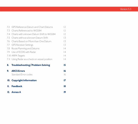
7.2 GPS Reference Datum and Chart Datums 12
7.3 Charts Referenced to WGS84 12
7.4 Charts with a known Datum Shift to WGS84 12
7.5 Charts without a known Datum Shift 13
7.6 Charts Based on More than One Datum 13
7.7 GPS Receiver Settings 13
7.8 Route Planning and Datums 14
7.9 Use of ECDIS with Radar 14
7.10 ARPA Targets 14
7.11 Using Radar as a check on vessel position 14
8. Troubleshooting / Problem Solving 15
9. ARCS Errors 16 Standard Error codes 16
10. Copyright Information 17
11. Feedback 18
12. Annex A 19
Version 5.3
Version 5.3 | 1
1. Introduction
Welcome to the ADMIRALTY Raster Chart Service (ARCS). ARCS charts are high quality, digital facsimile copies of ADMIRALTY Standard Nautical Charts (SNCs), and share a common numbering system. Chart availability is published in the ‘ADMIRALTY Nautical Products & Services Catalogue’ (NP131), in the ADMIRALTY Digital Catalogue available for downloadon the UKHO website and via the ADMIRALTY Online Catalogue on the UKHO website.
Additional charts are announced in the weekly ADMIRALTY Notices to Mariners Bulletin. ARCS charts provide a world-wide electronic chart coverage that can be used within Electronic Chart Systems (ECS)including Electronic Chart Display and Information Systems (ECDIS).
This guide is designed to help you gain maximum benefit from using the service, and should be used in conjunction with your ECS or ECDIS User Manual.

2 | Version 5.3
2. ADMIRALTY Raster Chart Service Overview
Over 3200 ARCS charts are now available on 11 Raster Chart CD-ROMs, covering the world’s major trading routes and ports. Each CD-ROM contains an average of 270 charts, but as many as 350 can be stored. Regionally based Chart CD-ROMs Base 1 to Base 10 contain ADMIRALTY Standard Nautical Charts, while Base 11 contains ocean charts at scales of 1:3,500,000 and smaller. However, please note that some ocean charts are provided on regionalChart CD-ROMs to provide continuous coverage, instead of Base 11.
2.1 New Editions and New Charts
New Editions and New Charts for ARCS and ADMIRALTY Standard Nautical Charts, are issued simultaneously. They are supplied on each weekly Update CD-ROM until incorporated into their respective ‘Home’ CD-ROMs at the next issue. Please note that New Editions and New Charts replacing charts already licensed, are supplied free of charge until the licence expiry, but will require loading from the Update CD-ROM (in instances where one chart is replaced by more than one new chart, access to all replacement charts is provided).
Occasionally, it is necessary to issue new charts in advance of their intended date of validity, for example a change in regulations commencing on a future date. In such cases the current chart will co-exist with the new chart until the date of implementation, the earlier chart being indicated with a suffi x ‘X’. The system will allow access to both charts for the period of overlap by the issue of new chart permits. At the date of implementation, the old (‘X’) edition should be deleted from the system.
2.2 Licence Period
ARCS is licensed for a period of 12 months. At the start of the licence period users will receive an ARCS Start-Up Pack containing all 11 Raster Chart CD-ROMs, the latest Update CD, a Chart Permit fi le and a Schedule A from their ADMIRALTY Chart Agent. The Chart Permit fi le unlocks the charts added to the licence and the Schedule A lists the licensed charts for your records.
During the licence period, ARCS Update CDs will be supplied weekly to enable the licensed charts to be maintained for Notices to Mariners. You will also be provided with all New Editions and replacement charts within your licence. These updates will also be available by email and over the internet by using the ADMIRALTY ARCS Online Updating Service.
When your ARCS licence expires you will no longer be able to load ARCS Update CDs. Unless the licence is renewed the charts will not be updated for Notices to Mariners and will therefore not meet SOLAS chart carriage requirements. Licence renewal can be arranged by your chosen ADMIRALTY Chart Agent.
2.3 Data Verification
ARCS charts are supplied with the same guarantee of accuracy and reliability as ADMIRALTY Standard Nautical Charts, and are subject to stringent checks to ensure that the raster image is identical to the paper one. Data quality is likely to be more reliable on newer surveys at larger scales, and the source data diagram can be used to assess

Version 5.3 | 3
the quality of source data. This is typically ten times smaller than the chart to which it refers, and should be interpreted with care at the limits of specifi c survey areas. Occasionally, plotting on the source data diagram will not be possible because it cannot be referenced to the main chart with suffi cient accuracy.
ARCS CDs are protected by encryption to ensure data integrity and to allow licensing of charts. Access to ARCS charts is provided by the Chart Permit fi les supplied; these will have been generated for, and will only work on, the ECDIS for which they were ordered. They will be provided on physical media or emailed to you.
2.4 ARCS Start-Up Pack
This pack should include:
> ARCS User Guide (this document)
> End-user Licence Agreement for digital data services (EULA)
> Packaging (to hold your CDs, Chart Permit fi les, etc)
> 11 ARCS Base CD-ROMs (these contain all availableARCS Charts)
> Chart Permit fi les (supplied by your ADMIRALTY Chart Agent on physical media or via email)
> A ‘Schedule A’ (which lists all ARCS charts incorporated in the licence)
If any of these items are missing from your Start-Up pack, please contact your ADMIRALTY Chart Agent.
Please ensure that you have read the End-user Licence Agreement before commencing use of the ADMIRALTY Raster Chart Service - available for download on the UKHO website.

4 | Version 5.3
3.1 Loading Charts
The procedure for loading ARCS charts varies from ECDIS to ECDIS however the same general principles apply and these are outlined below. You should consult your ECDIS system manual for detailed instructions.
3.2 Chart Permits
Access to the charts on the ARCS CD-ROMs is provided by Chart Permit fi les. These are supplied by your ADMIRALTY Chart Agent and consist of 2 fi les; Gb.lcn and Gb.ncp. The Chart Permit fi le contains permits for all the licensed charts.
3.3 Loading ARCS for the First Time
Chart PermitsInsert the Permits supplied into the ECDIS by following the procedures supplied by the manufacturer.
Loading Base ChartsInsert the ARCS Base CD-ROM(s) for the relevant chart permits held (refer to the Schedule A supplied or to the ARCS regional CD-ROM coverage diagram in Section 4). Most ECDIS will allow you to choose whether to load all licensed charts or just those of your choice; some may prompt you to load specifi c Base or ‘Area’ CDs. Once the charts have been installed you should update your charts by loading the latest ARCS weekly Update CD.
Loading Latest ARCS Update CDsThe ADMIRALTY Raster Chart Service Update CDs contain cumulative information. If you receive more than one ARCS weekly Update CD at the same time, you only need to load
the most recent one. Having installed the ARCS Base CD-ROM(s) and loaded the latest ARCS weekly Update CD, the ECDIS system will then display the latest ARCS information available.
3.4 Maintaining the Chart Outfit
Update CDs
ARCS Update CDs are issued weekly containing all the latest ‘Notice to Mariner’ corrections, New Editions and any New Charts issued. Updates for ARCS charts are provided in line with ADMIRALTY Notices to Mariners; New Editions and New Charts are issued in the same week as for paper charts.
On receipt of the Update CD you should load the new data using the update procedure specifi ed in your ECDIS manual. The process should be automatic, but as required by the ECDIS specifi cations you will be asked by the ECDIS to accept the updates. Again, if you receive more than one weekly Update CD at the same time, you only need to use the most recent because they are cumulative.
It is possible that your ECDIS will occasionally report warnings or errors during the update process. Whilst it is not possible to be defi nitive in this matter, users are advised that a warning can be accepted as being very unlikely to corrupt data already loaded, but an error should be treated more seriously and the chart should only be used with caution since it may not refl ect the latest Notices to Mariners information. Users should notify UKHO Customer Services (see contact details on back cover) if their ECDIS system reports errors on loading of charts or updates.
3. Getting Started

Version 5.3 | 5
Note: If replacement ARCS Base CD-ROMs have been issued containing New Editions of certain charts, subsequent updates for those charts cannot be applied until the New Edition has been installed.
NB: Stored Routes and Updates
Updates applied to the ECDIS may affect previously stored routes. It is important to check the effect of any updates on a stored route prior to its use.
Re-Issued ARCS Base CD-ROMsThe UKHO periodically re-issue new ARCS Base CD-ROMs in order to integrate newly available Base data that is temporarily held on the Update CDs. ARCS Base CD-ROMs will be accompanied by an ARCS weekly Update CD as normal.
On receipt of re-issued ARCS Base CD-ROMs it is necessary to load the re-issued CD-ROM in the same way as an ARCS Update CD.
New Chart PermitsYou will automatically be issued with all necessary Chart Permits to provide access to newly available or replaced charts within your licence. Please ensure that you load new Chart Permits with the ARCS Base and Update CDs from the same week of issue to ensure your ECDIS has the capability to use the latest charts from the latest CDs.
Schedule AThe Schedule A lists the content of all the charts that have been licensed. Amendments to this will be provided with new Chart Permits where this is necessary. The amendment will list details of cancelled and replaced charts.
Licence ExpiryOnce the licence period for the service has ended, the ECDIS system will prevent the loading of further updates until the licence is renewed. Access to ARCS charts will cease after a 30 day grace period. The expiry date is shown on the Schedule A and on the Chart Permit fi le.
Note: ARCS must be kept up to date for Notices to Mariners to meet IMO SOLAS requirements. An ECDIS using charts beyond the expiry date of the licence will not meet chart carriage requirements.
Adding Chart CoverageAdditional charts may be obtained during the licence period through your chosen ADMIRALTY Chart Agent who will supply new Chart Permits to ‘unlock’ the newly added charts.
Licence RenewalApproximately four weeks before licence expiry you should receive a renewal reminder from your ADMIRALTY Chart Agent. The ECDIS will display an intermittent warning one month before expiry and a permanent warning following expiry. To ensure continuity of service, please confi rm requests for renewal at least two weeks in advance of the expiry date.
Contacting UKHO Customer Services or ADMIRALTY Chart AgentContact details for UKHO Customer Services are located on the back cover of this document. Always quote your ARCS Licence number when contacting UKHO Customer Services or your ADMIRALTY Chart Agent This can be found on your Schedule A.

6 | Version 5.3
4.1 Features of ARCS
Produced by the UKHO for the commercial shipping industry, ARCS charts meet the International Hydrographic Organization’s (IHO’s) S-61 Raster Navigational Chart (RNC) standard. They may, with Flag state approval, be used in ECDIS (in conjunction with an appropriate folio of up to date paper charts) to meet chart carriage requirements for areas where ENCs are not yet available. See IMO ECDIS Performance Standard (1.9 as amended).
Each ARCS Chart shares the same numbering as the ADMIRALTY Standard Nautical Chart from which it is produced.
Please note that certain charts included on a Base CD-ROM may not currently be available for use, pending approval from the national hydrographic offi ces concerned.
Chart Coverage
ARCS charts available in the ADMIRALTY Raster Chart Service are available on 11‘Base CD-ROMs’ for the geographic areas covered by each CD - see diagram.
Please note that ARCS Base 11 covers the whole area shown in the diagram as it contains ocean charts at scales of 1:3,500,000 and smaller.
T&P Notices to Mariners (NMs)
A complete listing of ADMIRALTY T&P NMs are included on the ARCS Update CD. This is in text fi le format and can be printed out. Some ECDIS systems have a capability to display the appropriate T&P NMs to the user.
Figure 1 ARCS regional CD coverage
4.2 ADMIRALTY ARCS Online Updating Service
Updates for ARCS are also available via the ADMIRALTY Updating Service. This complimentary service has been created to provide the latest available Notices to Mariners to licensees of ARCS, via email or the Internet.
For detailed information about the operation of the ADMIRALTY ARCS Online Updating Service, please refer to the User Guide available for download on the UKHO website.
Notice: A weekly Update CD will continue to be sent to you via your ADMIRALTY Chart Agent in accordance with ADMIRALTY Notices to Mariners (NMs), for the period of your licence. It is recommended that the Online Service is used in conjunction with your most recent, weekly Update CD and that after downloading remote updates that you immediately update your ECDIS display system.
4. Service Details

Version 5.3 | 7
Important: We strongly recommend that you keep separate permanent written records of all information that you choose to download for reference purposes, in line with SOLAS Regulation Chapter V 2002.
Installing your Software
The ADMIRALTY ARCS Online Updating Service is available for download on the UKHO website.
To install your ADMIRALTY ARCS Online Updating Service please follow the steps below:
1. Close all programs/applications.
2. Extract the ZIP fi le to a temporary folder on your computer.
3. Open the folder and run (double click on) the fi le named setup.exe using Windows Explorer.
4. Select the Updating Service that you wish to install.
5. Follow the on-screen instructions.
Using the ADMIRALTY ARCS Online Updating Service
To launch the ADMIRALTY ARCS Online Updating Service, double click on the desktop icon or select Start – Programs – ADMIRALTY ARCS Online Updating Service – ADMIRALTY Updating Service.
Before you start you will need:
> your latest ARCS weekly Update CD (this should be the same one that was used to update your ECDIS and not a previously compiled Online Update Service CD (or Virtual CD) which contains downloaded information),
> your ARCS chart permit fi les (for fi rst time use) or if this is not available, your ARCS Licence and User Permit number,
> write-able CD
Follow the on-screen instructions inserting Licence details and loading the latest ARCS weekly Update CD. Select the latest week number to update to and then create a Chart List by inserting chart numbers into the Chart Selection window. To reduce the overall fi le size it is recommended to keep this list to a minimum including just those charts that are relevant to the current voyage.
It is recommended to check which updates are available before downloading to check on fi le size and to confi rm what updates are available.
Download the updates, then create an ARCS Update CD and use this to update your ECDIS.
Important: When you receive your UKHO published ARCS weekly Update CD, it should be used to synchronise your ARCS Online Update software - select “Synchronise with the Latest Update CD”. The published CD will contain all chart updates (your Online Update CD will only contain voyage specifi c ones).
8 | Version 5.3
5.1 Flag State Acceptance of ECDIS
SOLAS regulations were amended in 2000 to specifi cally allow the use of ECDIS to meet carriage requirement in place of paper charts.
“All ships irrespective of size shall have nautical charts and
nautical publications to plan and display the ship’s route for the
intended voyage and to plot and monitor positions throughout
the voyage; an electronic chart display and information system
(ECDIS) may be accepted as meeting the chart carriage
requirements of this sub paragraph.”
IMO SOLAS Chapter V, Regulation 19, 2.1.4
As yet, not all nations have adopted the amended regulations into their own national legislation nor have they made clear their acceptance of ECDIS. For this reason shipowners and mariners should consult their Flag State authority for guidance on meeting SOLAS obligations with ECDIS.
To meet chart carriage requirements the ECDIS must be ‘type approved’, have a suitable back up that can take over in event of failure of the primary system and be using ENCs. However in recognition of the lack of comprehensive ENC coverage IMO, in 1998, amended the ECDIS Performance Standard A817(19) to introduce a new mode of operation for ECDIS equipment. The Raster Chart Display System (RCDS) mode of ECDIS uses Raster Navigational Charts (RNCs) such as ARCS. With Flag state approval RNCs can be used to meet carriage requirements where ENCs are not available; however, when operating in this way, the ECDIS must be used together with an appropriate folio of up-to-date paper charts.
5. Chart Carriage Regulations

Version 5.3 | 9
5.2 Regulations and ARCS:
The following refers to vessels governed by the Safety Of Life At Sea (SOLAS) regulations. The International Maritime Organization (IMO) allows:
> ARCS charts to be used as an aid to navigation when displayed via an Electronic Chart System (ECS). In this instance, in order to satisfy chart carriage requirements, up-to-date paper charts must still be carried and used as the primary means of navigation.
> ARCS charts to be used as the primary means of navigation, when displayed via a type-approved Electronic Chart Display & Information System (ECDIS) in conjunction with offi cial Electronic Navigational Charts (ENCs). In this instance, in order to satisfy chart carriage requirements, ENCs (where available) must be used in preference to ARCS. Where ARCS charts are used within this ‘Dual-Fuel’ combination, an appropriate* folio of up-to-date paper charts must be carried as backup.
* What is considered ‘an appropriate folio of up to date paper charts’ will vary between fl ag states, and may or may not represent a reduction in the number of paper charts required to be carried. Users must consult their own fl ag state regulatory authority to fi nd out exactly which regulations govern their electronic chart carriage requirements.
5.3 Port State Control
It is normal for any Port State inspection to accept the vessel’s Flag State implementation of SOLAS regulations; the vessel should carry documentation to show compliance to their Flag State requirements.

10 | Version 5.3
The ECDIS user manual will outline many useful system features and functions that can be used to assist you in navigating your vessel. However, using electronic charts, especially for the fi rst time, presents the mariner with many new and important issues that need to be taken into consideration if the highest levels of vessel safety are to be maintained. In the following section of this guide we have outlined some of these issues and we urge you to take these into consideration when using electronic charts provided in the ADMIRALTY Raster Chart Service.
6.1 Training
It is recommended that users undertake both generic training in the use of electronic chart systems and charts as well as type specifi c ECDIS training for the system to be used. Training in the use of the advanced voyage planning and monitoring facilities that these systems provide will ensure you can take maximum advantage of the benefi ts of electronic charts.
6.2 Chart Accuracy
The ECDIS is a powerful navigational tool, however its usefulness is limited by the quality of the chart data that it is using. ARCS charts are derived from paper charts; therefore, the ECDIS chart display will be no better than that of the equivalent paper chart.
It should be remembered that the positional accuracy of features on charts based on old surveys may not be as good as the positions that can be obtained from GPS; this fact
should be taken into account when determining suitable clearance distances from charted features.
6.3 Source Data Quality
The quality of data underlying ARCS charts can be determined from examination of the title notes and cautions and especially the Source Data Diagram that gives a graphical indication of the survey information making up the chart.
6.4 Chart Display Scale
ARCS charts, just like paper charts, are compiled at scales suited to their intended use, taking account of all available source material. For this reason they should only be used for navigation at, or near, their compilation scale.
The majority of ECDIS systems incorporate a zoom function that allows the user to enlarge or reduce the scale of the displayed image. This function can be useful, for instance, for enlarging complex areas for the purposes of clarity, however, navigating using a scale signifi cantly different from the compilation scale is potentially dangerous as it can give a false impression of distances.
For this reason, ECDIS systems give a visual text warning when charts are ’over-zoomed’.
When an ARCS chart is enlarged or reduced in scale, the symbols enlarge / reduce in proportion to the changein scale.
6. Using Electronic Charts in ECDIS
Version 5.3 | 11
When the ARCS image is enlarged or reduced this affects the quality of the image; scale reduction results in loss of information from the display. For this reason navigation with ARCS should be conducted with the ECDIS using the high resolution image set to 1:1 (i.e. approximately chart compilation scale).
Where a greater or lesser level of chart detail is required, a larger or smaller scale ARCS chart should be selectedfor use.
6.5 Use of other Chart Formats
As well as being able to use ARCS charts many ECDIS systems provide the facility to use other types of electronic chart. Where other chart data is used in the ECDIS in combination with ARCS charts, users should exercise caution as this other data may not be produced to the same standard or updated to the same date.
6.6 Procedures
ECDIS linked to GPS, radar and other navigation devices is a powerful aid to navigation, providing assistance for quick and sound decision making; however it should not be used in isolation to make navigational decisions.
Visual observation of the world beyond the bridge windows remains vital for safe navigation. By providing continuous display of own vessel position and radar targets ECDIS can provide additional opportunity for the watch keeper tokeep lookout.
It remains essential to monitor the correct operation of all electronic equipment. Traditional relative navigation techniques (e.g. visual fi xing or radar range and bearing) should be employed to confi rm that correct vessel position is shown on the ECDIS.
It is important to ensure that all of the latest ARCS weekly Updates are loaded onto the system, and whenever possible, it is preferable to load available updates before you commence your voyage. Please note that loading and updating ARCS can take some time.
12 | Version 5.3
7.1 Accuracy and Availability
GPS is capable of horizontal positioning accurate to approximately ±33m for 95% of the time. DGPS(a refi nement of GPS) allows a typical accuracy of ±5–10m. It should be remembered that many of the surveys on which both paper and modern electronic charts are based were carried out long before GPS was available. Thus the accuracy of charted detail will in many cases not be to the same order of accuracy as is provided by GPS. This fact should be considered in determining which scale chart to use, and what are suitable tolerances when making navigational decisions.
The mariner is encouraged to employ alternative means to monitor GPS positional accuracy and to have an independent means of position fi xing on the ECDIS so as to ensure continued safe navigation if GPS is subject to accuracy or availability problems.
7.2 GPS Reference Datum and Chart Datums
GPS is based on the World Geodetic System 1984 (WGS84) datum. However, positions on many original surveys have been established by taking astronomical observations. Historically, the survey of each geographical area might have been based on different established datum, and accordingly charts worldwide have been drawn on a variety of datums. The relationship between the positions of features surveyed on different datums is still not necessarily known. This means that any point on the Earth’s surface may have a different latitude and longitude depending on the local datum to which the position is referred.
For this reason GPS positions for charted objects can be very different from their local datum positions; this difference is known as the datum shift.
7.3 Charts Referenced to WGS84
ARCS charts are referenced to the same datum as their corresponding ADMIRALTY Standard Nautical Charts; a small proportion are referenced to WGS84 datum and are used by the ECDIS in the same way as ENC.
7.4 Charts with a known Datum Shift to WGS84
Many ARCS charts are referenced to a local horizontal datum where the shift to WGS84 is known. In this case Datum Shift information is given on the face of the chart by means of a note usually entitled ̀ Satellite Derived Positions’. It is also included within the ARCS chart meta-data and can be applied automatically by the ECDIS to ensure that GPS positions are plotted correctly on the ARCS chart.
The ECDIS may display the original datum name and give an indication that positions have been adjusted to WGS84. Some ECDIS display a WGS84 grid overlay on the chart; the difference between this grid and the latitude and longitude graticule of the ARCS chart shows the magnitude of the datum shift applied.
7. Use of ECDIS with Global Positioning Systems (GPS)

Version 5.3 | 13
7.5 Charts without a known Datum Shift
The relationship between the local datum and WGS84 has not yet been accurately calculated for a considerable number of ARCS charts.
The undetermined datum shift cannot be assumed to be negligible; differences of several hundred metres are not uncommon so it is important that in these cases GPS positions are treated with extreme caution and where possible cross checked by traditional relative navigation techniques.
The ECDIS system will provide a warning when using charts that cannot be accurately referenced to WGS84. If the ECDIS allows, visual or RADAR position fi xes can be used to adjust the GPS position to fi t locally on the chart. This should be checked regularly, as the shift is unlikely to remain constant across the chart, particularly where the original source data is of some antiquity.
When taking positions from such a chart, it is advisable to specify these in terms of bearing and distance from a charted feature or the charted position on the local datum rather than use the GPS determined position.
ADMIRALTY Standard Nautical Charts are being re-drawn on WGS84 datum where information becomes available to make this possible.
7.6 Charts Based on More than One Datum
Occasionally, charts are based on more than one datum, and in these cases the system will automatically calculate
the datum shift, or warn that it is undefi ned. It should not be assumed that because the datum shift is known for one panel or plan of a chart, it is known throughout the chart and datum shifts may be different between adjacent charts, plans or panels. Where the datum shift is undefi ned, it is necessary to employ traditional methods of position fi xing off charted objects, where possible, on the same datum.
Further information on GPS and other satellite navigation systems can be found in the ADMIRALTY List of Radio Signals Volume 2 (NP282).
7.7 GPS Receiver Settings
Older GPS receivers are not able to provide Datum information via the NMEA interface to ECDIS and some earlier ECDIS systems may not recognize this information if it is provided. It is therefore strongly recommended that, when used with ECDIS, GPS receivers are set to output positions in WGS84 Datum.
If an ARCS chart has no WGS84 datum shift available, it is indicative that insuffi cient data exists to establish this with suffi cient accuracy for safe use in ECDIS. The general datum shifts provided in some GPS receivers should be used with extreme caution. If the GPS is set to provide positions in other than WGS84 datum then it is possible that the ECDIS may misinterpret the data received and positions may be incorrectly displayed on the ARCS chart.

14 | Version 5.3
7.8 Route Planning and Datums
Positions stored for routes and / or overlay information may be recorded as local datum positions. If the route is later plotted on a chart having a different datum, the route may not plot correctly. Care should be taken when displaying such data on a chart other than the one on which it was created or where routes are transferred between systems.
7.9 Use of ECDIS with Radar
Many ECDIS systems have the capability to overlay both raw radar video and / or ARPA (Automated Radar Plotting Aid) targets onto the ARCS display. Where the full radar image is used it is possible that charted information may be obscured. Superimposition of the full radar image may cause unacceptable cluttering of detail on some charts.
7.10 ARPA Targets
The superimposition of ARPA targets on the ECDIS display allows the rapid assessment of the possible actions of targets with respect to shoal water, traffi c separation schemes etc. The Radar should remain the primary tool for collision avoidance; ECDIS should only act as an aid to possible target intentions.
7.11 Using Radar as a check on vessel position
A convenient means to monitor correct referencing of vessel position to chart is to choose a charted radar conspicuous feature and to select this as an ARPA target which is displayed on the chart. If the target remains located
over the charted position of the feature this is a good indication that systems are functioning as expected.
Where the ECDIS allows the display of raw video over the chart a comparison of charted coastline with the radar image can be used in the same way; however care should be exercised as the apparent RADAR coastline can vary according to the nature of coastline and height of tide.
A similar technique can also be useful in determining a positional shift to be applied by the ECDIS when using an ARCS chart without a known datum shift. Some ECDIS systems allow the radar image or targets to be shifted in relationship to the ARCS chart to obtain best fi t. The magnitude and direction of the shift represents the datum shift for the locality and the ECDIS may be able to apply this to other overlay information. When applying a temporary shift derived in this way caution must be used as the shift cannot be assumed to remain constant across a chart or be applicable to another chart.
7. Use of ECDIS with Global Positioning Systems (GPS) continued

Version 5.3 | 15
Should you experience problems when loading ARCS charts into your ECDIS, you may fi nd it diffi cult to determine exactly which element of your system is at fault. Where one of the standard error messages shown overleaf is encountered then you should report this to your ADMIRALTY Chart Agent or contact UKHO Customer Services. If the fault appears to be hardware related (e.g. failure of physical media or CD drive) then we advise you to contact your ECDIS system supplier.
When reporting a chart related problem it is useful if you can provide the following details:
> ARCS licence number
> ECDIS system being used (especially if you have more than one system on board)
> The date (or week number) of the latest CDs held on the vessel
> The issue date of the latest permit fi les held. If the problem appears to be related to the permits it is best to send a copy of the latest permit fi les held by email if this is possible.
> Any error messages displayed on the ECDIS
Whilst the wording of displayed error messages may vary from ECDIS to ECDIS the error codes are constant.
8. Troubleshooting / Problem Solving

16 | Version 5.3
Standard Error codes
Error Code
When Occurs Description Result Remedy
1Loading Licence
Licence fi le altered Full access allowed Re-load licence fi le
2Loading Charts
Chart permit corrupted Stops task Re-load permit fi le
3Loading Updates
Updates apply to newer versionof charts than those loaded
Update actiondenied
Load charts from latest Base CD
4Loading Updates
Chart data already incorporatedUpdate action
deniedLoad latest Update CD
5Loading Updates
Licence expiredUpdate action
deniedContact ARCS ADMIRALTY
Chart Agent to renew licence
8 Chart DisplayLicence expires within
one monthFull access &
updatingContact ARCS ADMIRALTY
Chart Agent to renew licence
9 Chart DisplayLicence expired up to one
month after expiryChart access,no updating
Contact ARCS ADMIRALTYChart Agent to renew licence
10 Chart DisplayLicence expired over
one month agoChart access blocked
Contact ARCS ADMIRALTYChart Agent to renew licence
11 Chart DisplayChart encryption older than
permit encryptionChart access blocked Load charts from latest Base CD
12 Chart DisplayChart encryption newer than
permit encryptionChart access blocked
Contact ARCS ADMIRALTYChart Agent to renew licence
9. ARCS Errors
Version 5.3 | 17
ARCS is protected by Crown Copyright. It is derived from Crown Copyright information and from copyright information published by the hydrographic services of other nations. No part of ARCS may be reproduced or transmitted in any form or by any means without the prior written permission of the United Kingdom Hydrographic Offi ce and any other copyright holders.
10. Copyright Information

18 | Version 5.3
The UKHO welcomes customer comments, if you would like to provide any feedback, please forward any comments via your ADMIRALTY Chart Agent or directly to UKHO Customer Services.
11. Feedback

Version 5.3 | 19
12. Annex A
Table of FiguresFigure 1 ARCS regional CD coverage 6
GLOSSARY
ARCS ADMIRALTY Raster Chart Service
ARPA Automated Radar Plotting Aid
BA British ADMIRALTY
ECDIS Electronic Chart Display and Information System
ECS Electronic Chart System
ENC Electronic Navigational Chart
GPS / DGPS Global Positioning System / Differential Global Positioning System
IHO International Hydrographic Organization
IMO International Maritime Organization
NM Notice to Mariners
RC Raster Chart
RNC Raster Navigational Chart
Schedule A A listing of all chart holdings (weekly updates will only show changes to those holdings)
SOLAS IMO Safety of Life at Sea Convention
UKHO United Kingdom Hydrographic Offi ce
WGS84 World Geodetic System, 1984 datum

Planning for the future?
Plan with ADMIRALTY Nautical Products & Services, brought to you by the United Kingdom Hydrographic Offi ce.
For more world-class, world-leading products and services visit our website www.admiralty.co.uk
Serving our users 24/7, worldwide, 365 days a year
For more information and advice, contact our global
network of chart agents.
Alternatively our in-house customer service team is
available day in, day out – whatever the query and
wherever your journey takes you.
The United Kingdom Hydrographic Offi ce,
Admiralty Way, Taunton, Somerset,
TA1 2DN, United Kingdom
Telephone +44 (0)1823 723366
www.admiralty.co.uk
013
MANAGEMENTSYSTEMS
are trademarks of the Secretary of State for Defenceand
40500 © Crown Copyright 2015. All rights reserved. Correct at the time of publishing.