2018 5th annual - hydrogeoworkshop.org · of oklahoma and a padi divemaster. he has provided input...
TRANSCRIPT
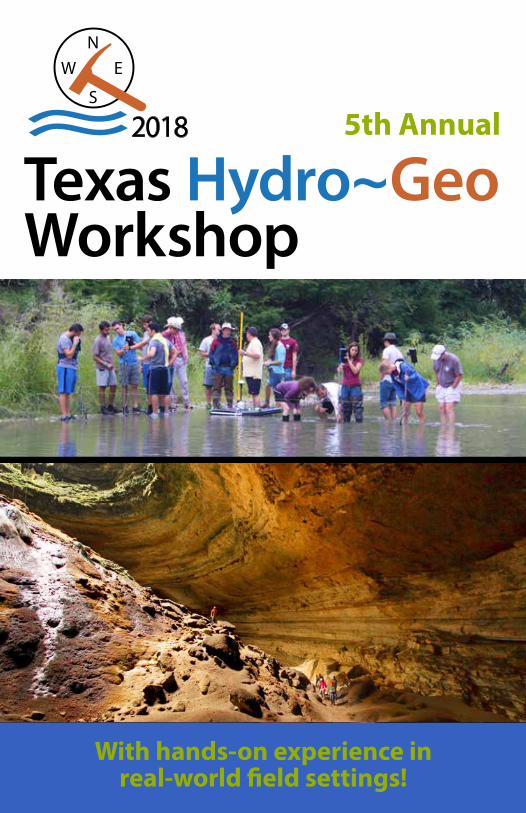
With hands-on experience in real-world field settings!
WORKSHOP
2018 5th Annual

NSS membership offers worldwide caver camaraderie, the NSS Journal of Cave and Karst Studies, and more. visit us at caves.org

CaveWITHOUT A NAME
Welcome to the 2018 Texas Hydro~Geo Workshop
The Texas Hydro~Geo Workshop was created to bring students, educators, and practitioners together in a field setting as a hands-on learning experience. Participants will have the opportunity to explore many different techniques for the collection and analysis of data from soil, rock, and water media. The workshop is structured to provide participants with the opportunity to work with leading researchers and practitioners from across the state and nation. Please make sure that you take full advantage of this unique, valuable opportunity.
This event has been made possible by the great generosity of our host, Tom Summers, owner of Cave Without a Name and his wonderful staff, including Patty Perlaky, Mike Burrell, and Mike Cunningham. They are stewards of an outstanding natural treasure – Cave Without a Name. Please treat the cave and property with great respect. We practice a “Leave No Trace” ethic for the event.
The Workshop is not possible without the many countless hours contributed by volunteers from the geoscience and environmental science community.
In addition, we must also thank our many sponsors that have stepped up with both financial support and contributions of in-kind services and equipment. Their involvement has provided a much richer and expanded experience while helping to keep costs low.
We have been amazed at the continued interest and response for the workshop; participants travel from across Texas and surrounding states, as well as internationally. We hope you find the event educational and fun. Make sure that you have an enjoyable and safe experience, and thank you for coming.
Geary M. Schindel, P.G. Co-Chair The Hydro~Geo Workshop Section President, National Speleological Society
Mike Harris Co-Chai The Hydro~Geo Workshop Section Chair, Bexar Grotto National Speleological Society
Page i
2018 Texas Hydro~Geo Workshop
EventsRegistration opens .............................................................................................Friday 6 pm
Module Sign-up ..................................................................................................Friday 7 pm
Socializing, Lightening Talks (in the Pavilion) ............................................Friday, 8pm
Modules ...............................................................................................Saturday, 9 am-5 pm
Sunday, 9 am-noon
Field Lunch Competition (in the Pavilion) .....................................Saturday, 12-1 pm
Rock Identification Contest (in the Pavilion) ............. Saturday 11-12, 2-3, 4-5 pm
Group Photo (at the Cave Entrance) ................................................ Saturday, 6:47 pm
Yodeling & Hog Calling Competition (in the Cave) .......................... Saturday, 7 pm
Keynote, Dr. Todd Halihan (in the Cave) ............................................... Saturday, 7 pm
Lightening Talks (in the Pavilion) ......................................................Saturday, 9-11 pm
Workshop Ends ...............................................................................................Sunday, noon
ContentsKeynote Speaker ......................................................................................................................1Contests ......................................................................................................................................1Modules In Alphabetical Order ..........................................................................................2Vendors/Exhibitors .................................................................................................................3Steering Committee ...............................................................................................................3Important Information ..........................................................................................................4Module Descriptions ...............................................................................................6
Field Techniques and Career Development ..............................................................6Well Drilling and Environmental Monitoring ............................................................7Surface and Borehole Geophysics ................................................................................8Water Resources ..................................................................................................................9Karst and Geologic Evaluations .................................................................................. 10Field Biology (New) ......................................................................................................... 15Caves and the Caving Environment .......................................................................... 15
Module Presenters ............................................................................................................... 17Volunteers ............................................................................................................................... 17Workshop Module Locations ........................................................................................... 18Sponsors .................................................................................................................................. 20
Page 1
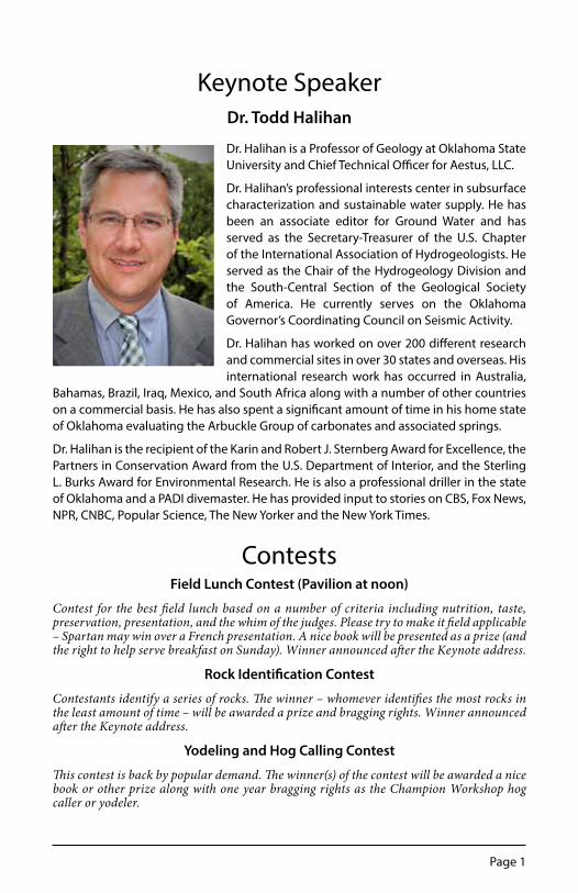
Keynote SpeakerDr. Todd Halihan
Dr. Halihan is a Professor of Geology at Oklahoma State University and Chief Technical Officer for Aestus, LLC.
Dr. Halihan’s professional interests center in subsurface characterization and sustainable water supply. He has been an associate editor for Ground Water and has served as the Secretary-Treasurer of the U.S. Chapter of the International Association of Hydrogeologists. He served as the Chair of the Hydrogeology Division and the South-Central Section of the Geological Society of America. He currently serves on the Oklahoma Governor’s Coordinating Council on Seismic Activity.
Dr. Halihan has worked on over 200 different research and commercial sites in over 30 states and overseas. His international research work has occurred in Australia,
Bahamas, Brazil, Iraq, Mexico, and South Africa along with a number of other countries on a commercial basis. He has also spent a significant amount of time in his home state of Oklahoma evaluating the Arbuckle Group of carbonates and associated springs.
Dr. Halihan is the recipient of the Karin and Robert J. Sternberg Award for Excellence, the Partners in Conservation Award from the U.S. Department of Interior, and the Sterling L. Burks Award for Environmental Research. He is also a professional driller in the state of Oklahoma and a PADI divemaster. He has provided input to stories on CBS, Fox News, NPR, CNBC, Popular Science, The New Yorker and the New York Times.
ContestsField Lunch Contest (Pavilion at noon)
Contest for the best field lunch based on a number of criteria including nutrition, taste, preservation, presentation, and the whim of the judges. Please try to make it field applicable – Spartan may win over a French presentation. A nice book will be presented as a prize (and the right to help serve breakfast on Sunday). Winner announced after the Keynote address.
Rock Identification Contest
Contestants identify a series of rocks. The winner – whomever identifies the most rocks in the least amount of time – will be awarded a prize and bragging rights. Winner announced after the Keynote address.
Yodeling and Hog Calling Contest
This contest is back by popular demand. The winner(s) of the contest will be awarded a nice book or other prize along with one year bragging rights as the Champion Workshop hog caller or yodeler.

Page 2
2018 Texas Hydro~Geo Workshop
Basics of Geologic Modeling ................................................................................................................14Carbonate Geochemistry in Karst Systems .....................................................................................11Career Development .................................................................................................................................7Career Opportunities in the Oil & Gas Industry - the Big Picture ..............................................8Cave Biological Inventory ......................................................................................................................15Cave Geology .............................................................................................................................................10Cave Management and Karst Resources..........................................................................................14Cave Mapping............................................................................................................................................15Data Presentation for Best Management Decisions ......................................................................7Developing Scientific and Field Notebooks .....................................................................................6Edwards Plateau Freshwater Fish and Mussel Biology ...............................................................15Emerging Chemicals of Concern in Water .......................................................................................10Environmental Drilling, Logging, and Sampling .............................................................................7ESRI Collector for ArcGIS Mobile App .................................................................................................7Field Instruments (map, compass, rock hammer) ..........................................................................6Field Safety ...................................................................................................................................................6Field Trip to Herff Falls at Cibolo Preserve (Sunday) ....................................................................14Field Trip to Wild Cave.............................................................................................................................16FLIR Infrared Camera and Radon Analysis .........................................................................................6Ground Penetrating Radar ......................................................................................................................8Groundwater Investigation Methods ..................................................................................................8High Resolution 3D Resistivity Imaging to Locate Caves and Voids ........................................8How to Collect Field Locational Data Using GPS ............................................................................6Hydrogeology/Well Monitoring ............................................................................................................9Karst Feature Evaluation Using the TCEQ Forms ...........................................................................11Macroinvertibrates as Water Quality Indicators ............................................................................15Nuts and Bolts of Eureka Manta2 Water Quality Sondes ...........................................................10Potentiometric Surface Mapping .......................................................................................................10Rainwater Harvesting and Design ......................................................................................................10Rock Identification ...................................................................................................................................14RTK, Robotic Total Station and LiDAR Topographic Survey Techniques ...............................14Safety in the Vertical Environment .....................................................................................................15Stalagmites as Paleoclimate Archives ...............................................................................................11Stream Gauging ..........................................................................................................................................9Structure and Stratigraphy ...................................................................................................................11Surface Geophysics (Natural Potential) ..............................................................................................8Surface Water Sampling ...........................................................................................................................9Tracer Testing in Karst ...............................................................................................................................9
Modules In Alphabetical Order

Page 3
Vendors/ExhibitorsBe sure to visit various vendors and displays
Barton Springs Edwards Aquifer Conservation DistrictBat Conservation International
Edwards Aquifer AuthorityTexas Cave Management Association
Texas Speleological SurveyEureka Water Probes
Check out Cave Without A Name’s Mineral and Gift Shop. Store hours: 10 am - 5 pm
Steering Committee Geary Schindel Edwards Aquifer Authority Mike Harris Bexar Grotto of the NSS Mike Burrell Cave Without A Name Alan Dutton UT San Antonio, retired Alf Hawkins Environmental Geophysics Associates Allan Clark US Geological Survey Amy Clark Independent Geologist Benjamin Schwartz Texas State University Brian Hunt Barton Springs Edwards Aquifer GCD Brian Smith Barton Springs Edwards Aquifer GCD Calvin Alexander University of Minnesota Eric Holman Office of Homeland Security Eric Wolff DNA Geosciences, Inc. Jack Sackrider Westwind Environmental Services James Ward Mesa Geological Jim Major Terracon Environmental Joe Yelderman Baylor University Kevin Bryant Terracon Environmental Kevin Urbanczyk Sul Ross University Marcus Gary Edwards Aquifer Authority, UT Austin Mark Dobson DNA Geosciences, Inc. Mike Cheng UT Rio Grande Valley Mustafa Saribudak Environmental Geophysics Assoc. Robert Brinkmann Hofstra University Ron Green Southwest Research Associates Sriram Madabhushi Booz Allen Hamilton Yongli Gao UT San Antonio Center for Water Research

Page 4
2018 Texas Hydro~Geo Workshop
Important InformationSafety Your safety is our highest concern and we have a Module specifically on Field Safety; however, you are responsible for your own safety and wellbeing while at the workshop. For those not familiar with the site, Cave Without A Name is located in the Texas Hill Country, and most of the property is undeveloped and maintained as a wildscape. Be aware of your surroundings and avoid hazardous plants or animals. Do not walk around at night without a flashlight. Note the location of the First Aid Station (H) on the map (page 18). The station is continually manned by Eric Holman.
Fire Ants The pest that you are most likely to come across is fire ants. These imported beauties are very common and well named. Their sting burns like touching a hot poker and can ruin your day. Please watch where you are standing, and observe your feet often. Anything that looks like an ant mound is a fire ant mound – give them plenty of room and don’t disturb them. To prevent potential bites, don’t store food in your tent and keep your tent flaps closed and secure. If bit, brush ants off with your hands and remove trousers if necessary.
Snakes This region of Texas is one of the few areas of the country that is home to all four major types of venomous snakes – rattlesnakes, copperheads, water moccasins, and coral snakes. They are not aggressive but should be treated with respect. Please point out any snakes to people near you and to a volunteer or Module instructor as soon as possible. There is no upside to handling these animals, so don’t try to pick them up or play with them – even dead ones can bite. Please leave all snakes alone.
Mammals Other hazards in the area may include skunks, raccoons, porcupines, deer, wild hogs, and the rare mountain lion. While it is rare that you will see any of these animals, please give them plenty of room if you do.
Heat and Hydration Heat and sun exposure are also a common problem. Drink plenty of water and stay hydrated. If you’re not urinating on a regular basis, your urine is a dark color, or if you develop a headache or dizziness, you are probably not drinking enough water. Seek shade and let a volunteer know. We will try and get you hydrated before it turns into heat exhaustion or heat stroke. Heat related problems can be minimized by wearing a hat, thin loose-fitting clothes, and seeking out shade where available and drink plenty of water.
Recommended Items Bring a folding chair so that you can sit at certain Modules and for a place to sit when eating and camping. In addition to normal camping equipment, bring a flashlight, field book for note taking, pencils and pens, a small ruler or scale, and calculator. Be prepared for hot, cold, wet or dry weather.
Water The water from spigots in the campground is non-potable (NOT drinkable). Bring drinking water. Please try and minimize waste of water. Reusable cups and water bottles are mandatory. Strenuous field work may require as much as one gallon per day.
Page 5
Food There will be a Food truck on site for Friday dinner and Saturday lunch. CASH ONLY; please note there is no ATM on-site. Breakfast on Saturday and Sunday is provided, as is dinner on Saturday night. If your bring a field lunch for Saturday, there will be a lunch contest for the best prepared, presented, and unique lunch. Also, bring reusable plates, cups, and utensils for meals. Washing stations provided with soap are set up at the Pavilion.
Sanitation Please use the portable toilets. They are cleaned and stocked on a regular basis. Be careful with your phones and car keys when using the toilets. The liquid will stain most items brown, yellow, or blue. Anything you drop in the toilet is your responsibility to fish out – if you want to. Please don’t throw cans or bottles into the toilets. Hand sanitizers are strategically placed around the site for your use.
Camping Cave Without A Name has made their property available at no cost to the Workshop. We’re trying to crowd a lot of happy campers into this finite spot. If your group spreads out too far, you will have people camping amongst you. Don’t Balkanize the campground. Please extend a hand and be aware that we’re all part of a close-knit family working in the geosciences. Share your campsite with others and trade experiences about your school and program. The Campground Marshall will be the final arbitrator to address any issues.
Behavior We have a strict No Drama policy and expect participants to behave in a professional manner during the entire event. If you have a High Maintenance personality, consider not attending (if in doubt, ask your friends or professors). Everyone is encouraged to have fun but obey Texas state laws. There are private residences on Cave Without A Name property; please be respectful of their privacy and don’t approach them unless invited. If you have any concerns, see the Campground Marshall. Please be kind and understanding as we work though any issues that may arise. Treat all volunteers with respect, they are cooking your food and cleaning the John’s and herding cats. If you are verbally or physically abusive to the volunteers or other participants, or are a danger to yourself or others, we reserve the right to ask you to leave or have you removed from the property. No guns or fireworks allowed. Remember, this is a rural county and we’re friends with the sheriff. He is a nice guy and provides free accommodations upon demand, complements of Kendall County tax payers.
Alcohol Policy The Hydro~Geo Workshop recognizes that the use of alcoholic beverages by those of legal age is a matter of personal choice. However, students in attendance may ultimately be governed by the policies of their higher education institution. We require that those who choose to drink on the Cave Without A Name grounds while attending the Texas Hydro~Geo Workshop abide by state law, and expect that such individuals will conduct themselves responsibly, mindful of the rights of others. Campground Marshals reserve the right to request that law enforcement remove anyone in violation of the above requirements. No alcoholic beverages will be served or sold in conjunction with the Hydro~Geo Workshop.
Waste If you brought it with you, take it home. This includes all of your trash.

Page 6
2018 Texas Hydro~Geo Workshop
Module Descriptions
Field Techniques and Career DevelopmentHow to Collect Field Locational Data Using GPS1 hour / Limit 10 participants / Location 10The Global Positioning System is a space-based navigation system that provides time and location information and has revolutionized how we collect locational data in the field. Data can now be collected on hand held units or even your cell phone. Collecting GPS data involves both hardware and software that must be understood to obtain the best results (or repeatable results). This Module is designed to help you understand and get the most out of your GPS system or cell phone in the field and discusses GPS selection, use of datums and coordinate systems, how to mark waypoints and tracks, how to navigate to a fixed point, and how to transfer data from the GPS unit to your computer. Presented by TBD.
NOTE: If you have a GPS unit, please bring it along with your user’s manual. Some GPS units will be available for use in the Module.
Field Safety1 hour / Limit 20 participants / Location HConsidering field work may be in remote locations and in weather extremes, this Module discusses issues ranging from safety, personal hygiene, common first aid issues in the field, wild animals, weather, dehydration, being stranded overnight, personal locator beacons, and wild or stupid people. Presented by Eric Holman, Department of Homeland Security.
FLIR Infrared Camera and Radon Analysis2 hours / Limit 15 participants / Location LThe use of a FLIR infrared Camera will be demonstrated. The camera can be used to find cave entrances, springs discharging below stream surfaces, and contrast between different soil types, depth to bedrock, etc. Presented by Joe Yelderman and Stephanie Wong, Baylor University.
Field Instruments (map, compass, rock hammer)2 hours / Limit 25 participants / Location 6Participants will utilize maps and Brunton Compass to collect basic data including location, strike and dip, basic field surveying, sample collection, and descriptions. Presented by Joe Yelderman and Stephanie Wong, Baylor University; Mariah Bonham and Taylor Bruecher, Edwards Aquifer Authority.
Developing Scientific and Field Notebooks1 hour / Limit 20 participants / Location LInstructions and guidance on the preparation of scientific and field notebooks. Using well-documented and comprehensive notebooks to support analysis, laboratory experiments, and field surveys will greatly facilitate successful completion of modest-sized to the most complex projects. Well-prepared and documented notebooks will also provide defensible records for future recall and to support quality record management. This Module will provide hands-on guidance and suggestions to the preparation of defensible and useful documentation. Presented by Rick Klar, Raba Kistner Environmental.

Page 7
Data Presentation for Best Management Decisions2 hours / Limit 15 participants / Location Pav-2Good decision making requires well presented data-geologic, hydrologic, geophysical, boring logs, groundwater, chemical, biological, aquifer, modeling, etc. But we do not always present data in a way that allows public stakeholders, regulators, and other agency representatives to make the best decisions possible. The vital link between the excellent field skills we learn in data gathering, the analytical techniques we use to process and reduce the data, and the presentation of the data that facilitates decision making is often missing. As data gathering capabilities increase exponentially in the future, we will continue to be challenged to reduce, process, analyze, interpret, and extract useful information that helps stakeholders make appropriate and timely decisions. This hands-on session addresses some solutions that connect the data we gather with optimizing management decisions. Presented by Sriram Madabhushi, P.G., Booz Allen Hamilton.
ESRI Collector for ArcGIS Mobile App2 hours / Unlimited participants / Location Pav-3Participants will be introduced to Collector for ArcGIS, a mobile app offered through ESRI software. Participants must bring an Android or Apple mobile device (including smart phones and iPads) to participate. This program is becoming the standard for field data collection, including locational data, observational data, and photo documentation. Presented by Taylor Bruecher, Edwards Aquifer Authority.
NOTE: The free app can be downloaded beforehand from http://www.esri.com/products/collector-for- arcgis.
Career Development1 hour / Unlimited participants / Location VR-2Come discuss important aspects of career development from the beginning of your academic program to your professional career. This will include the importance of networking, mentors, continuing education, and staying active in your professional association. Presented by various professionals representing the fields of geology, hydrology, environmental science, and the petroleum industry. Presented by Tom Fett, Bud Holzman, and Ross Webb.
Well Drilling and Environmental MonitoringEnvironmental Drilling, Logging, and Sampling3 hours / Limit 25 participants / Location 5-Off SiteIntroduction to environmental sampling of soil using manual methods and drilling rigs. Topics will include an overview of drill rig capabilities, soil sampling methods and equipment, sample collection, soil boring logging and monitoring well installation. Samples will be collected for students to observe and classify. A drilling rig will be on site to demonstrate drilling techniques. The module will be presented by Kevin K. Bryant, Jim R. Major,and Justin Turknett of Terracon Consultants, Inc., and Robert Joiner, Eric Castillo, Gary May, Justin May, Juan Martinez, and Donny May, Vortex Drilling.
Career Opportunities in the Oil & Gas Industry - the Big Picture2 hours / Limit 15 participants / Location VR-3Discusses various career opportunities in the oil and gas field include Geology, Geophysics, Petrophysics and Engineering, both now and in the past. Ample time for “Questions and Answers” will be provided. Presented by Tom Fett, Independent Geologist

Page 8
2018 Texas Hydro~Geo Workshop
Surface and Borehole GeophysicsGround Penetrating Radar2 hours / Limit 20 participants / Location VR-8Demonstration of ground penetrating radar (GPR), a commonly used near-surface geophysical method. Information regarding applications, instrument operation and interpreting GPR data will be presented. GPR data will be acquired and interpreted by the participants from both known and unknown features. GPR can be used to detect sinkholes, pipes, archaeological features, graveyards, shallow caves, UST. Presented by Kevin Bryant and Jim Major, Terracon Consultants.
Surface Geophysics (Natural Potential)3 hours / Limit 20 participants / Location 17Introduction of the Natural Potential (NP) surface geophysical method for the location of subsurface voids. NP will be conducted over known portions of Cave Without a Name or other karst features to demonstrate how this surface geophysical method is useful in delineating the subsurface in a karst terrain. Mustafa Saribudak and Alf Hawkins, Environmental Geophysical Associates.
High Resolution 3D Resistivity Imaging to Locate Caves and Voids4 hours / Limit 20 participants / Location 9Provides hands-on training by deploying the SuperSting resistivity imaging system in high resolution 3D resistivity imaging surveys that are ideal for locating caves, voids, depth to bedrock and other geotechnical targets. Data will be comprised of tightly spaced lines and then inverse modeled with the EarthImager 3D Inversion Software for a quick and accurate representation of the subsurface. 3D models will be rapidly collected with single lines of resistivity data that complete in 7 minutes and data will be displayed in real time on the Android App. Presented by Jason Greenwood and Markus Lagmanson of Advanced Geosciences, Inc. Austin, Texas, and Mauricio Flores, Southwest Research Institute.
Groundwater Investigation Methods3 / 4 hours / Limit 20 participants / Location CIntroduction to the technologies typically used for groundwater resource investigations. Students will be introduced to: 1) drilling methods, 2) the role of the geologist in the field during drilling, 3) downhole video and electric logging tools (downhole camera, Optical Borehole Imager (OBI), resistivity, gamma, caliper, fluid sampler, and flow tools), and 4) e-log interpretation. There will be a live demonstration of video and geophysical logging in an onsite water well during the Module. Example e-logs will be reviewed and interpreted. At the end of the Module, students will have an opportunity to correlate borehole cuttings and an e-log from a 1150’ deep well in West Texas. Presented by Mark Dobson and Eric Wolff, DNA Geosciences, Inc., Ed Miller and Mike Miller, GeoCam, Inc.

Page 9
Water ResourcesStream Gauging3 hours / Limit 40 participants / Location 15 Off SiteMeets 15 minutes before at the Pavilion to coordinate carpool to Kreutzberg Canyon Natural Area.* This Module will introduce students to the fundamentals of stream gauging on the nearby Guadalupe River. Participants will set up a stream transect, measure a stream profile and perform discharge measurements of the river. Participants will use a variety of acoustic velocity meters, incorporating wading and current profiling techniques. Calculated stream flows will be compared to upstream and downstream USGS stream gauges. Participants should bring clothing and sturdy shoes for wading in the river. Presented by Marcus Gary, Edwards Aquifer Authority; Kevin Urbanczyk, Sul Ross State University, and Justin, Camp, Barton Springs Edwards Aquifer GCD.
Tracer Testing in Karst4 hours / Limit 20 participants / Location EIntroduces participants to the fundamentals of groundwater tracer test design and execution. This includes field preparation, dye selection, dye injection, water and charcoal packet collection and laboratory and field analysis. Samples will be collected using an automatic water sampler and analyzed in the field using a filter fluorometer. Students will also process charcoal packets and analyze eluant for dye. Presented by Ralph Ewers, Ewers Water Consultants; Alyss Kirkendall, UT San Antonio; and Geary Schindel, Edwards Aquifer Authority.
Surface Water Sampling2 hours / Limit 15 participants / Location 18 Off SiteMeets 15 minutes before at the Pavilion to coordinate carpool to Kreutzberg Canyon Natural Area, map page 18. This Module will cover water quality sampling. Topics covered will include parameter selection, sampling equipment selection, sample collection, of field parameters (pH, temperature, conductivity, dissolved oxygen (DO), turbidity, and alkalinity), Chain of Custody (COC), packing and shipping samples, and personal protective equipment. Historical laboratory data will be presented and compared to current Maximum Contaminant Levels (MCL). Participants will get wet and should bring appropriate footwear and a change of clothes. Presented by Phil Pearce and Jennifer Gonzalez, SWCA, Inc.
Hydrogeology/Well Monitoring3 hours / Limit 15 participants / Location 11 Off SiteThis module will provide an overview of the history and role of groundwater conservation districts (GCDs) in the state of Texas, as well as an overview of the planning and implementation of pump tests on new and established wells. The purpose of this module is to present attendees with an account of the history of Texas GCDs and the role GCDs play in regulating and conserving groundwater resources. In addition, participants will learn the procedures behind planning and implementing a pump test utilizing groundwater monitoring equipment, as well as water quality instrumentation. Data collected from pump tests conducted throughout Texas will be presented in order to illustrate the valuable data that can be gleaned from conducting constant-rate pump tests and step-drawdown tests. Presented by Brandon Wilcox, Westward Environmental, Inc.; Micah Voulgaris, and Heath Hoffman, Cow Creek Groundwater Conservation District.

Page 10
2018 Texas Hydro~Geo Workshop
Potentiometric Surface Mapping2 hours / Limit 20 participants / Location Pav-4Participants will use synthetic data and create a potentiometric surface map. This is an important first step in conducting a groundwater investigation. The data will be used to calculate the direction of groundwater movement and contaminant transport. Additional data will be presented that will be used to calculate the apparent groundwater velocity in a sand and gravel aquifer. Presented by Mike Cheng, UT Rio Grande Valley, Yongli Gao, UT San Antonio.
Nuts and Bolts of Eureka Manta2 Water Quality Sondes1 hour / 10 participants / Location VR-1A hands-on introduction to sensor technologies available for multi- parameter water quality sondes; navigating the multi-probe control software; operating control devices; including a hand-held field PC with Windows Mobile; calibration of pH, conductivity and optical DO, depth and turbidity sensors; spot checking or profiling (site to site) and unattended logging; care and maintenance of water quality sondes; and managing data from real-time telemetry stations. Presented by Joanna Howerton, of Eureka Water Probes.
Rainwater Harvesting and Design2 hours / Limit 20 participants / Location ARainwater Harvesting is an ancient technique used by many past civilizations who didn’t have ready access to potable water. Integrating these simple ideas have come back into favor in the 21st century due to changing weather patterns and conservation values. This module will be geared toward both beginners and experts about the many designs and uses of rainwater and will include system design techniques, case studies, and product reviews. The materials were donated by the Cow Creek Groundwater Conservation District as an educational installation. The system will be adjacent to the presentation area providing a ‘real world’ example. Presented by Wade Kolb, Westward Environmental, Inc.
Emerging Chemicals of Concern in Water1 hour / Limit 15 participants / Location Pav-2Water resources are constantly being exposed to new and emerging chemicals. Many of these synthetic or man-made chemicals, have long-term consequences as they enter the environment. As we understand more about these toxic chemicals, their potential harmful effects on the human health and the environment are being brought into light. In this Module, we discuss physical and chemical properties of some of these chemicals, their use and prevalence in the industry, health effects and emerging regulations. We will also discuss release of these chemicals into the environment, detection and investigation techniques, their nature and behavior in the environment. Some challenges of delineation and remediation of these contaminants will also be offered. Presented by Sriram Madabhushi, P.G., Booz Allen Hamilton.
Karst and Geologic EvaluationsCave Geology3 hours / Limit 20 participants / Location 2-CVAn introduction to the process of cave and karst geology using Cave Without A Name as an example. Discussions will include cave initiation and destruction, cave formations, caves as part of the geologic record, cave data and climate change, cave hydrology, and methods for cave and karst research. Presented by Ralph Ewers, Ewers Water Consultants; Chelsea Ballard, Western Kentucky University, Susan Carter-Wilkinson, Louisville Grotto

Page 11
Karst Feature Evaluation Using the TCEQ Forms3 hours / Limit 20 participants / Location 12Participants will utilize Texas Commission on Environmental Quality (TCEQ) field evaluation forms to document and evaluate karst features. This process is performed on properties being developed on the recharge zone of the Edwards Aquifer. Karst features on Cave Without A Name property will be located and evaluated. Advanced evaluation techniques that complement TCEQ requirements will also be presented. Presented by Phil Pierce, of SWCA Environmental Consultants.
NOTE: Participants should arrive with their notebooks, pens, and whatever field equipment they deem useful for evaluating karst features. They should also visit the TCEQ website to download and bring one copy of the TCEQ assessment table (https://www.tceq.texas.gov/assets/ public/compliance/field_ops/eapp/F-0585_geologic_assessment_table.pdf), and instructions for geologists (https://www.tceq.texas.gov/assets/public/compliance/field_ ops/eapp/F-0585_geologic_assessment_instructions.pdf). Some forms will be available at the Module.
Stalagmites as Paleoclimate Archives2 hours / Limit 20 participants / Location GStalagmites are arguably the best archives of terrestrial climate change over time and as such, have been increasingly utilized for scientific study over the past few decades. This Module will introduce students to the concept of speleothems as recorders of paleoclimate information, with topics covering conservative sample collection, age dating, methods of geochemical analysis, and age model construction. Discussions will include the use of in- situ sampling techniques as well as ways in which to strike a balance between maximizing the information gained from the geochemical analysis of stalagmites and the conservation of irreplaceable cave formations. Stalagmite samples used for paleoclimate reconstructions will be available for the students to examine. Presented by Chris Ray, and Lijun Tian, UT San Antonio.
Structure and Stratigraphy3 hours / Limit 25 participants / Location 16 Off SiteA discussion of the depositional setting of the rocks forming the Edwards and Trinity aquifers. The discussion will touch on the faulting of the Balcones Fault Zone and then layout the current stratigraphy and hydro-stratigraphy of both the Edwards and Trinity aquifers. Presented by Allan Clark, US Geological Survey, Amy Clark, Independent Geologist, Tom Ewing, Independent Geologist.
Carbonate Geochemistry in Karst Systems2 hours / Limit 15 participants / Location KAn introduction to carbonate minerals, depositional environments, as well as processes and reactions in karst systems. Participants will receive an introduction to the principal classification schemes for carbonate rocks, depositional forms on both the surface and subsurface, as well as how to distinguish common carbonate minerals using a variety of field and laboratory techniques. Presented by Kevin Blackwood, East Central University.

Meeting Locations: Pav = Pavilion VR = Vendors Row CV = Cave OF = Off-site
MODULE SCHEDULE HRS LOC SATURDAY SUNDAY
7-9 9-10 10-11 11-12 12-1 1-2 2-3 3-4 4-5 5-7 7-9 9-11 7-9 9-10 10-11 11-12
Introduction (8:30-9:00) 0.5 Pav
DIN
NE
R
BR
EA
KF
AS
T
Lunch Contest 1 Pav
BR
EA
KF
AS
T
Rock Identification Contest 1 JYodeling Contest 0.5 CV
LU
NC
H
Lightening Talks 0.15 PavKeynote Address 1 CVBasics of Geologic Modeling 3 Pav-1Carbonate Geochemistry in Karst Systems 2 KCareer Development 1 VR-2Career Opportunities in the Oil & Gas Industry 2 VR-3Cave Biological Inventory 3 1 (OF)Cave Geology 3 2 -CVCave Management and Karst Resources 3 ECave Mapping 3 3-CVData Presentation for Best Management Decisions 2 Pav-2Developing Scientific and Field Notebooks 1 LEdwards Plateau Freshwater Fish and Mussel Biology 3 4 (OF)Emerging Chemicals of Concern in Water 1 Pav-2Environmental Drilling, Logging, and Sampling 3 5 (OF)ESRI Collector for ArcGIS Mobile App 2 Pav-3Field Instruments (map, compass, rock hammer) 2 6Field Safety 1 HField Trip to Herff Falls at Cibolo Preserve (Sunday) 3 1Field Trip to Wild Cave 3 7FLIR Infrared Camera and Radon Analysis 2 LGround Penetrating Radar 2 8Groundwater Investigation Methods 3 / 4 CHigh Resolution 3D Resistivity Imaging 4 9How to Collect Field Locational Data Using GPS 1 10Hydrogeology/Well Monitoring 3 11 (OF)Karst Feature Evaluation Using the TCEQ Forms 3 12Macroinvertibrates as Water Quality Indicators 2 13 (OF)Nuts and Bolts of Eureka Manta2 Water Quality Sondes 1 VR-1Potentiometric Surface Mapping 2 Pav-4Rainwater Harvesting and Design 2 ARock Identification 1 JRTK, Robotic Total Station and LiDAR Topographic Survey 2 14Safety in the Vertical Environment 2 FStalagmites as Paleoclimate Archives 2 GStream Gauging 3 15 (OF)Structure and Stratigraphy 3 16 (OF)Surface Geophysics (Natural Potential) 3 17Surface Water Sampling 2 18 (OF)Tracer Testing in Karst 4 E

Page 14
2018 Texas Hydro~Geo Workshop
RTK, Robotic Total Station and LiDAR Topographic Survey Techniques2 hours / Limit 10 participants / Location 14LiDAR is an active scanning technology that generates high density 3D point clouds. The Riegl terrestrial laser scanner (model VZ-400i) will be setup in multiple locations in order to get as much coverage as possible. The point clouds from the multiple scan locations will be registered together to create a 3D model. Presented by Kevin Urbanczyk, Sul Ross State University.
Rock Identification1 hour / Limit 15 participants / Location JThis Module will present methods to identify rocks that are common to Texas and the western United States. Here is a good opportunity to refresh your skills and learn some of the tricks of the trade for field identification. Presented by Richard Silver, Trinity University, Jesse Chadwick, Bexar Grotto of the NSS.
Cave Management and Karst Resources4 hours / Limit 20 participants / Location ECaves have attracted humans for thousands of years as places for shelter, recreation and other activities, not all good. This module will discuss management of surface and subsurface cave and karst resources including: conservation, restoration, recreation, science and environmental education. It will also touch upon geodiversity, biodiversity and wilderness concepts. Presented by Chelsea Ballard, Western Kentucky University.
Basics of Geologic Modeling3 hours / Limit 18 participants / Pav-1This module will discuss the general process involved in collecting, analyzing and applying subsurface geologic data. Module participants will be introduced to the basics of 3D model planning, design, interpolation methods, and application of the results. Following the presentation, participants will collaborate to build block models out of Legos using simplified geologic logs and a topographic data. Presented by Jack Sackrider, Westward Environmental, Inc.
Field Trip to Herff Falls at Cibolo Preserve (Sunday)3 hours / Limit 14 participants / Location 1 Off SiteMeets 15 minutes prior to start at the Pavilion. This Module will visit the Herff Falls, a narrow canyon through a large exposure of caprinid rudist reef, located at Cibolo Preserve. Cibolo Preserve is a 644-acre natural habitat laboratory located just east of Boerne. A uniquely preserved cross-section of history and nature in central Texas, the land is notable for its beauty, variety of flora and fauna, geological features and areas of archaeological interest. One and a half miles of Cibolo Creek bisects the Cibolo Preserve, before entering the Herff Falls, where shortly thereafter the water sinks in a series of swallets downstream. Participants should wear proper footwear for walking on the karst surface and bluffs. Presented by Donna Taylor, Cibolo Nature Center and Farm.

Page 15
Field Biology (New)Macroinvertibrates as Water Quality Indicators2 hours / Limit 15 participants / Location 13 Off SiteThis module will introduce students to the fundamentals of stream and pond biomonitoring techniques and includes a survey activity using aquatic macroinvertebrates as water quality indicators. Students will capture and identify macroinvertebrates within provided substrates and use datasheets to calculate and determine water quality. Supplementary discussion topics include: biosurvey methodologies, general aquatic ecology, and applications of survey results. Presented by Arlyne Martinez, Lexie Brooks, and Whitney Schwope of Westward Environmental, Inc.
Cave Biological Inventory3 hours / Limit 15 participants / Location 1 Off SiteThe majority of this module will occur within an undeveloped cave. Participants will receive an introduction to commonly encountered cave life, with an emphasis on Texas’ cave fauna. Participants will learn basic/ standard methods of cave biological inventory and conduct an inventory within the cave. Presented by Benjamin Hutchins, Texas Parks and Wildlife.
NOTE: Transport to and from cave. Participants need basic personal caving gear including durable, close-toed shoes, clothes that will get dirty, helmet, 2 sources of light, gloves, water bottle, and FULL change of clothes (including shoes). Particpants will need to abide by USFWS WNS decontamination procedures. Heavy duty plastic garbage bags will be provided.
Edwards Plateau Freshwater Fish and Mussel Biology3 hours / Limit 5 participants / Location 4 Off SiteBiologists will present an overview of commonly employed freshwater fish and mussel collection and survey techniques in Texas streams and rivers. Techniques will include seining and electrofishing for fish and tactile surveys including snorkel and hooka for mussels. General descriptions of habitats sampled and biology of organisms collected will be discussed followed by an open question / answer period. Presented by Ed Oborny, Brad Littrell, and Jube Guajard, Bio-West Environmental Consultants.
NOTE: This will be a hands on exercise so please be prepared to get wet.
Caves and the Caving EnvironmentSafety in the Vertical Environment2 hours / Limit 15 participants / Location FDiscusses safety for working above, below and on cliff faces and around vertical caves, and includes demonstrations on safety, equipment, minimum skills, and training and resources. Presented by Justin Shaw, 4CAVES Institute P.B.C.

Page 16
2018 Texas Hydro~Geo Workshop
Cave Mapping3 hours / Limit 10 participants / Location 3-CVDiscussion on cave surveying and resource documentation and participants will survey a cave or portion of cave passage on the property using a field book, compass, and clinometer. On display will be an existing cave sketch, survey notes, and cave survey programs used to reduce the field data. Presented by Marvin Miller, Bexar Grotto of the NSS, and Susan Carter-Wilkinson, Louisville Grotto of the NSS.
Field Trip to Wild Cave3 hours / Limit 15 participants / Location 7 Off SiteMeets 15 minutes before at the pavilion. Visit to a wild cave within walking distance of CWAN property. The cave is mostly a walking stream cave and you will get wet up to your waist and muddy so it may not be fore everyone. Presented by Jon Cradit, Edwards Aquifer Authority and Mike Harris, MJ Gibbons, Jason Rodriguez, Steve Gutierrez, Mio Kitano, Jill Orr, Leia Hill, Bexar Grotto of the NSS.
NOTE: Bring gloves and wear sturdy, closed toe shoes. Sandals or flip flops are not acceptable and will not be allowed in the cave. Helmet with mounted light will be provided or you may bring your own. You will also need a change of clothes and shoes for after the trip and a plastic bag for your wet items.
NOTES
Page 17
Module PresentersAlf HawkinsAllan ClarkAlyss KirkendallAmy ClarkAndrea KiddArlyne MartinezBenjamin HutchinsBrad LittrellBrandon WilcoxChelsea BallardChris RayCorbin CarsrudCurt CampbellDonna TaylorDonny MayEd MillerEd ObornyEric CastilloEric Holman
Eric WolffGary MayGeary SchindelHeath HoffmanHector HinojosaJack SackriderJason GreenwoodJason RodriguezJennifer GonzalezJesse ChadwickJill OrrJim MajorJoanna HowertonJoe YeldermanJon CraditJuan MartinezJube GuajardJustin CampJustin May
Justin Turknett Kevin BlackwoodKevin BryantKevin K BryantKevin UrbanczykLeia HillLexie BrooksLijun TianMarcus GaryMauricio FloresMariah BonhamMark DobsonMarvin MillerMicah VoulgarisMike ChengMike HarrisMike MillerMio KitanoMJ Gibbons
Mustafa SaribudakPhil PearceRalph EwersRichard SilverRick KlarRobert JoinerRoger AndradeRoss WebbSriram MadabhushiStephanie WongSteve GutierrezSusan Carter-WilkinsonTaylor BruecherTom EwingTom FettWade KolbWhitney SchwopeYongli Gao
VolunteersCo-Chair .................................Geary SchindelCo-Chair .........................................Mike HarrisTreasurer .................................... Sue SchindelSecretary .........................................Tom FlorerLogistics ....................................... MJ GibbonsSanitation ......................................Mike HarrisCampground Marshall ..............Mike Harris
Safety ............................................Eric HolmanVolunteer Coordinator ..... Jesse ChadwickFood and Promos Coord ...... Sue SchindelWeb Developer......................... Randy BakerWeb Registration ..Jesse Chadwick, Jill OrrProgram & Graphic Design............... Jill OrrT-shirt Design ............................. Don Arburn
Alyssa KirkendallAngela StringfieldAngeliqie BargoDessie PierceGarry WhiteGrace KrausHunter Balzen
Kitty MenkingKurt MenkingJake ClantonJason RodriguezJim FunkMaricio FloresMelissa Cordell
Michael PolendoMio KitanoRenee BlankenshipRenee DominguezRoss A. WebbRusty BranchRyan Monjaras
Shelia WardSkye IbarraSteven StringfieldTimothy Moore

Page 18
2018 Texas Hydro~Geo Workshop
Off-site modules meet at the Pavilion. Kreutzberg Canyon Natural Area 143 Mark Twain Road, Boerne, TX 78006
Head west onto Cave Without A Name Rd. 0.4 miles Slight left onto Kreutzberg Rd 0.7 miles Turn right onto Mark Twain Dr. Turn right into Kreutzberg Canyon Natural Area. Follow this road north 1 mile to the river-side parking area.
Workshop Module Locations
SPEEDLIMIT
3.14
SPEEDLIMIT
3.14
G
J
H
L
K
ED
B
F
C
A
PrivateProperty
Attendee Campsite #3
Attendee Campsite #2
Grotto Campsite
Entrance
First Aid
Parking
Parking
CWANStore
Septic Tank
Pavilion
CAVE RD
Attendee Campsite #4Attendee
Campsite #1
Vendor Row Meals
Cave


Advanced Geosciences Inc.
Barton Springs Edwards Aquifer Groundwater Conservation District
Cave Without A Name
Cow Creek Groundwater Conservation District
DNA Geosciences Inc
Edwards Aquifer Authority
Eureka Water Probes
Geo Cam
H.E.B.
Karst Works, Inc.
National Ground Water Association
National Speleological Society
Raba Kistner Environmental
San Antonio Geophysical Society
South Texas Geological Society
SWCA Environmental Consultants
Terracon Consulting Engineers and Scientists
UT San Antonio Center for Water Research
U.S. Geological Survey
Vortex Drilling Company
Winged Victory Graphics