5 direct growth - mississauga.ca
TRANSCRIPT
Mississauga Official Plan – Part 2 August 11, 2015 Direct Growth 5-1
5 Direct Growth
5.1 Introduction
Mississauga’s population and employment growth prospects are expected to remain strong over the next 25 years. Mississauga has sufficient land to accommodate projected growth to 2031 and beyond. As Mississauga is now at the end of its greenfield growth phase, new growth will be accommodated through redevelopment and intensification within developed areas. This chapter describes the Urban System that will be used as the framework for determining where population and employment growth will be encouraged and, conversely, those areas of the city that are expected to remain relatively stable. As such, this chapter also indicates where major infrastructure investments will be directed.
The ability to manage change wisely and direct growth to key strategic locations is critical for Mississauga’s continued success and prosperity. Mississauga’s population and employment growth will be encouraged in areas with existing and proposed service and infrastructure capacity, particularly transit and community infrastructure. Housing and job growth will be balanced and phased to ensure that required services and amenities keep pace with development.
Existing stable neighbourhoods, valuable cultural heritage resources and the Natural Heritage System will be protected.
Over time, the city will evolve to include a vibrant Downtown, a number of mixed use Major Nodes and Community Nodes, several prestigious Corporate Centres, stable residential Neighbourhoods and diverse Employment Areas. The Airport and the University of Toronto Mississauga are unique destinations. All these areas will coexist with a healthy system of green spaces and be connected by a network of Corridors that support high levels of transit use and mobility options.
Encouraging compact, mixed use development in appropriate locations will provide greater opportunities to live and work in Mississauga and reduce the need for extensive travel to fulfill the needs of day-to-day living. Directing growth to locations with existing or planned higher order or express transit service and enhancing opportunities for walking and cycling will allow for competitive alternatives to vehicular travel, which will minimize impacts on our environment and promote public health.
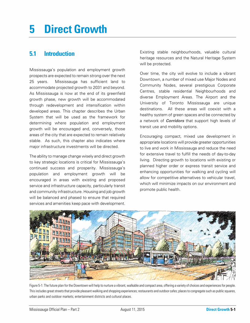
Figure 5-1: The future plan for the Downtown will help to nurture a vibrant, walkable and compact area, offering a variety of choices and experiences for people.
This includes great streets that provide pleasant walking and shopping experiences; restaurants and outdoor cafes; places to congregate such as public squares,urban parks and outdoor markets; entertainment districts and cultural places.
5-2 Direct Growth March 11, 2016 Mississauga Official Plan – Part 2
Mississauga will promote future development patterns that are sustainable – those that “meet the needs of the present without compromising the ability of future generations to meet their own needs. (Brundtland Report, 1987) To achieve this, Mississauga will integrate environmental, land use, urban design and transportation planning objectives.
Where the review of a Character Area, Corridor or Major Transit Station Area has not been completed within five years of a development application being submitted, or where such a review is underway, a development proponent may be required to prepare a development master plan in support of a development application. A development master plan will be prepared at the discretion of the City and to the City’s satisfaction. A terms of reference that delineates the area of study and identifies matters to be addressed, will be provided by the City. The development master plan will be used to guide all development proposals until such time as the policies for the Character Area, Corridor or Major Transit Station Area have been reviewed and updated by a local area review.
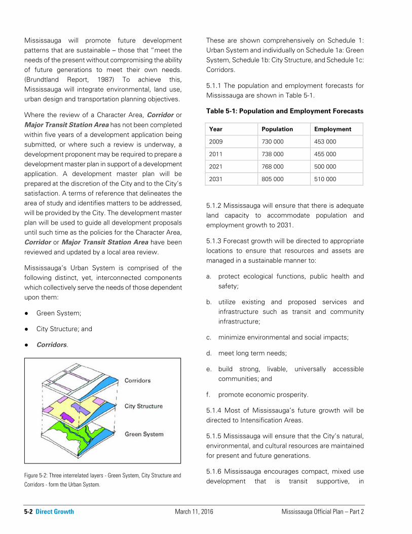
Mississauga’s Urban System is comprised of the following distinct, yet, interconnected components which collectively serve the needs of those dependent upon them:
● Green System;
● City Structure; and
● Corridors.
These are shown comprehensively on Schedule 1: Urban System and individually on Schedule 1a: Green System, Schedule 1b: City Structure, and Schedule 1c: Corridors.
5.1.1 The population and employment forecasts for Mississauga are shown in Table 5-1.
Table 5-1: Population and Employment Forecasts
Year Population Employment
2009 730 000 453 000
2011 738 000 455 000
2021 768 000 500 000
2031 805 000 510 000
5.1.2 Mississauga will ensure that there is adequate land capacity to accommodate population and employment growth to 2031.
5.1.3 Forecast growth will be directed to appropriate locations to ensure that resources and assets are managed in a sustainable manner to:
a. protect ecological functions, public health and safety;
b. utilize existing and proposed services and infrastructure such as transit and community infrastructure;
c. minimize environmental and social impacts;
d. meet long term needs;
e. build strong, livable, universally accessible communities; and
f. promote economic prosperity.
5.1.4 Most of Mississauga’s future growth will be directed to Intensification Areas.
5.1.5 Mississauga will ensure that the City’s natural, environmental, and cultural resources are maintained for present and future generations.
5.1.6 Mississauga encourages compact, mixed use development that is transit supportive, in
Figure 5-2: Three interrelated layers - Green System, City Structure and
Corridors - form the Urban System.
Mississauga Official Plan – Part 2 March 11, 2016 Direct Growth 5-3
appropriate locations, to provide a range of local live/work opportunities.
5.1.7 Mississauga will protect and conserve the character of stable residential Neighbourhoods.
5.1.8 Mississauga will protect employment lands to allow for a diversity of employment uses.
5.1.9 New development will not exceed the capacity of existing and planned engineering services, transit services and community infrastructure. Development proposals may be refused if existing or planned servicing and/or infrastructure are inadequate to support the additional population and employment growth that would be generated or be phased to coordinate with the provision of services and infrastructure.
5.1.10 The population and employment forecasts are premised on the adequacy of services and infrastructure to support growth in the appropriate locations. This includes the Mississauga Bus Rapid Transit corridor and higher order transit along Hurontario Street and Dundas Street. If satisfactory arrangements for the implementation of higher order
transit currently being planned are not made, the population and employment forecasts may be reduced in accordance with the capacity of the transportation system.
5.2 Green System
The natural environment sustains all life and is vital to the ecological, economic, social and spiritual well-being of the city. In an urban setting such as Mississauga, the built environment must be integrated with the natural environment in a manner that protects and enhances natural systems and provides the city’s inhabitants a multitude of opportunities to connect with nature.
The Green System as shown on Schedule 1a, is composed of:
● the Natural System, which includes lands within the Natural Heritage System;
● lands subject to Natural Hazards; and
● Parks and Open Spaces. These include lands designated Public and Private Open Space, Greenlands, Parkway Belt West and open space associated with educational facilities (e.g., school yards) and utilities as shown on Schedule 4: Parks and Open Spaces.
The Green System provides many important functions and services and provides the fundamental necessities of life – clean air, land and water. It provides habitat for trees, flora, fauna and aquatic life; recharges ground water; cleans the air and water and limits the damage that may result from flooding and erosion. The Green System provides opportunities for passive and active recreation, entertainment and social interaction, as well as for respite and appreciation of nature. It plays a role in preserving and enhancing the city’s cultural, archaeological and natural heritage for residents, employees and tourists. The waterfront, the Credit River and the former Lake Iroquois Shoreline are among the many natural
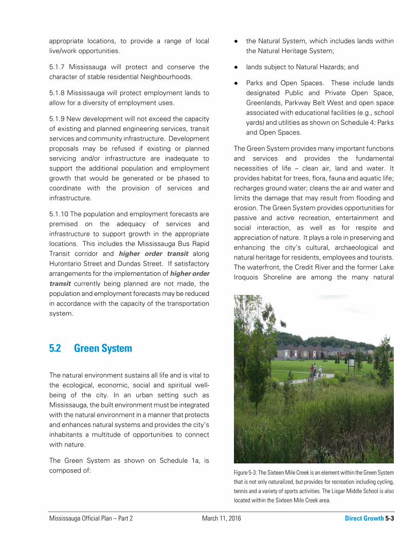
Figure 5-3: The Sixteen Mile Creek is an element within the Green Systemthat is not only naturalized, but provides for recreation including cycling,
tennis and a variety of sports activities. The Lisgar Middle School is alsolocated within the Sixteen Mile Creek area.
5-4 Direct Growth March 11, 2016 Mississauga Official Plan – Part 2
features associated with the city’s past and contribute to its unique identity. The Green System is essential in creating a beautiful and comfortable city that supports the physical and social well-being of its inhabitants.
The Green System is the first layer of the Urban System. It is essential to building a strong community and a competitive economy and must be considered in all land use and planning decisions. A robust Green System ensures the health of the natural ecosystem and is an essential contributor to quality of life.
5.2.1 Mississauga will establish strategies that protect, enhance and expand the Green System and will include a target for the lands within the city that will be included in the Green System. The City’s strategy for protecting, enhancing and restoring the Green System consists of initiatives in the following areas:
a. establishing an appropriate planning framework in strategic planning documents;
b. information management and monitoring;
c. regulation and compliance;
d. land securement;
e. stewardship;
f. promotion and education;
g. naturalization/restoration; and
h. management of natural areas.
5.2.2 Mississauga will promote and encourage the restoration of natural forms, functions and linkages.
5.2.3 Mississauga will seek to enhance opportunities for the appreciation and enjoyment of the Green System.
5.3 City Structure
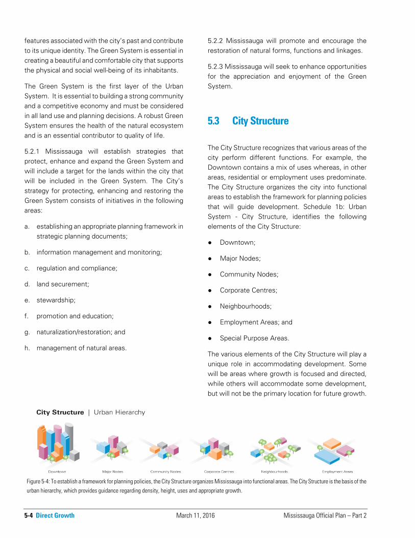
The City Structure recognizes that various areas of the city perform different functions. For example, the Downtown contains a mix of uses whereas, in other areas, residential or employment uses predominate. The City Structure organizes the city into functional areas to establish the framework for planning policies that will guide development. Schedule 1b: Urban System - City Structure, identifies the following elements of the City Structure:
● Downtown;
● Major Nodes;
● Community Nodes;
● Corporate Centres;
● Neighbourhoods;
● Employment Areas; and
● Special Purpose Areas.
The various elements of the City Structure will play a unique role in accommodating development. Some will be areas where growth is focused and directed, while others will accommodate some development, but will not be the primary location for future growth.
Figure 5-4: To establish a framework for planning policies, the City Structure organizes Mississauga into functional areas. The City Structure is the basis of the
urban hierarchy, which provides guidance regarding density, height, uses and appropriate growth.
Mississauga Official Plan – Part 2 March 11, 2016 Direct Growth 5-5
For example, in the Downtown, major new development is expected in conjunction with transit investment while Neighbourhoods will experience little change.
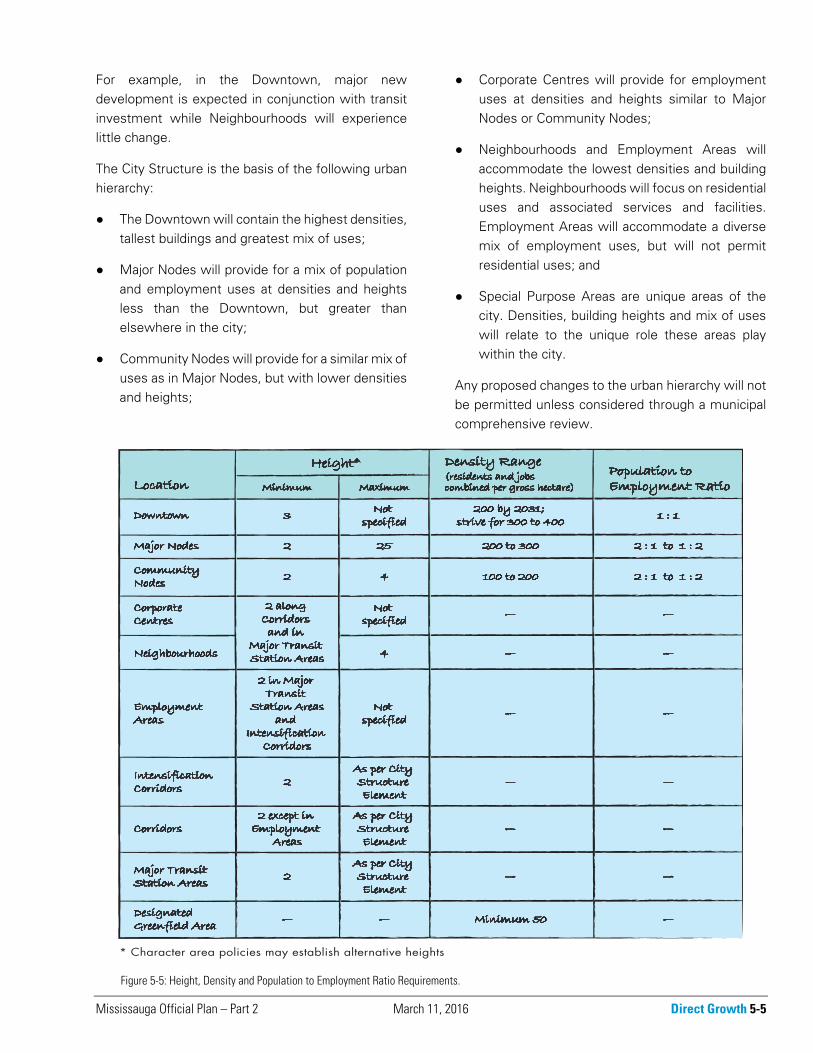
The City Structure is the basis of the following urban hierarchy:
● The Downtown will contain the highest densities, tallest buildings and greatest mix of uses;
● Major Nodes will provide for a mix of population and employment uses at densities and heights less than the Downtown, but greater than elsewhere in the city;
● Community Nodes will provide for a similar mix of uses as in Major Nodes, but with lower densities and heights;
● Corporate Centres will provide for employment uses at densities and heights similar to Major Nodes or Community Nodes;
● Neighbourhoods and Employment Areas will accommodate the lowest densities and building heights. Neighbourhoods will focus on residential uses and associated services and facilities. Employment Areas will accommodate a diverse mix of employment uses, but will not permit residential uses; and
● Special Purpose Areas are unique areas of the city. Densities, building heights and mix of uses will relate to the unique role these areas play within the city.
Any proposed changes to the urban hierarchy will not be permitted unless considered through a municipal comprehensive review.
Figure 5-5: Height, Density and Population to Employment Ratio Requirements.
5-6 Direct Growth August 11, 2015 Mississauga Official Plan – Part 2
5.3.1 Downtown
The Downtown represents a unique area within the City Structure. Much of the city’s new population and employment growth will locate in the Downtown. It is the civic and cultural centre of the city and a destination within the Greater Toronto and Hamilton Area. The Downtown will be connected to key regional and city destinations by an efficient local network of transportation and transit corridors and regional higher order transit services.
The Downtown will be a vibrant city and regional centre where residents are able to live, work and play. It is also where employees, shoppers, tourists, theatergoers and students gather in a mixed use environment, where development is pedestrian friendly, the public realm is inviting and the street network is supportive of walking and cycling as viable and convenient forms of transportation. Opportunities to enjoy nature in a variety of urban open spaces that include trees and other natural elements will be provided. Major infrastructure investments including higher order transit and community and cultural facilities will be encouraged in the Downtown.
The Downtown is Mississauga’s Urban Growth Centre as identified in the Provincial Growth Plan.
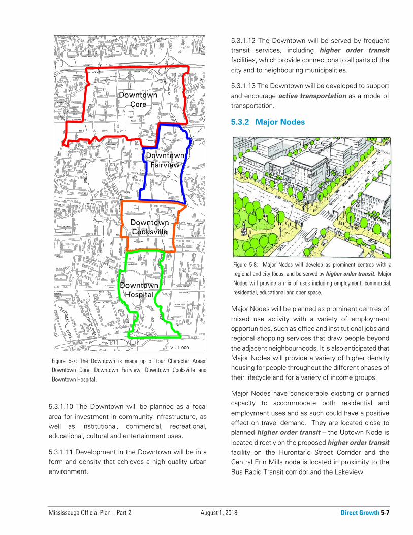
5.3.1.1 The Downtown is comprised of the lands along Hurontario Street between Highway 403 and the Queen Elizabeth Way, as identified on Schedule 1b: Urban System – City Structure and Schedule 9: Character Areas.
5.3.1.2 The Downtown will be divided into four Character Areas:
a. Downtown Core;
b. Downtown Fairview;
c. Downtown Cooksville; and
d. Downtown Hospital.
5.3.1.3 The Downtown is an Intensification Area.
5.3.1.4 The Downtown will achieve a minimum gross density of 200 residents and jobs combined per hectare by 2031. The City will strive to achieve a gross density of between 300 to 400 residents and jobs combined per hectare in the Downtown.
5.3.1.5 Development applications within the Downtown proposing a change to the designated land use, which results in a significant reduction in the number of residents or jobs that could be accommodated on the site, will not be permitted unless considered through a municipal comprehensive review.
5.3.1.6 The Downtown will achieve an average population to employment ratio of 1:1, measured as an average across the entire Downtown.
5.3.1.7 Character Area policies will establish how the density and population to employment targets will be achieved within the Downtown.
5.3.1.8 The Downtown will support opportunities for residents to work in Mississauga.
5.3.1.9 The Downtown will develop as a major regional centre and the primary location for mixed use development. The Downtown will contain the greatest concentration of activities and variety of uses.
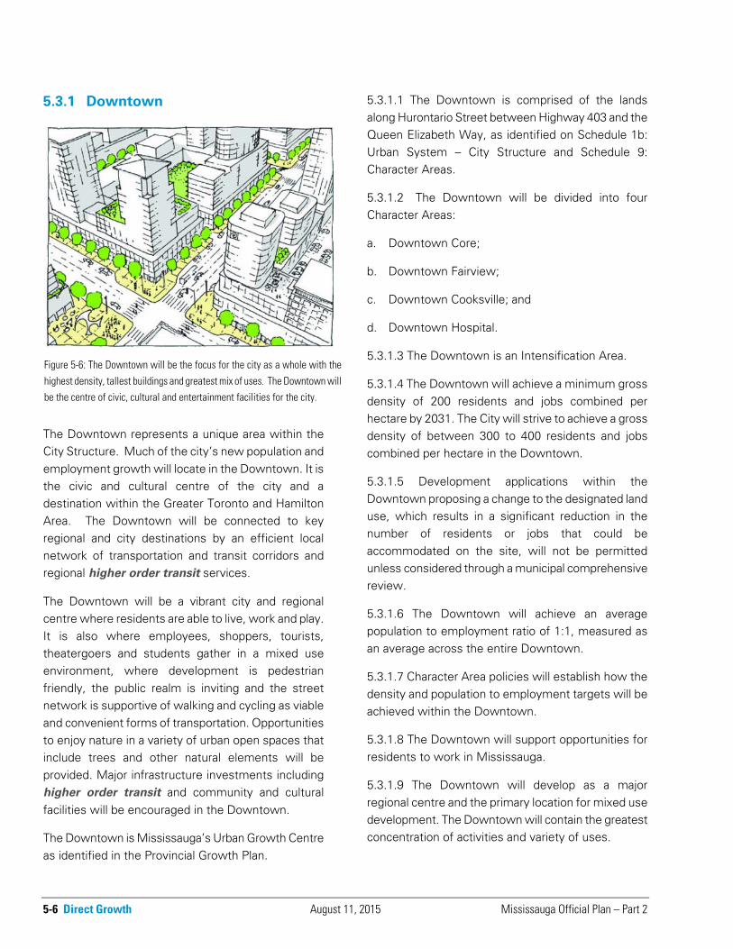
Figure 5-6: The Downtown will be the focus for the city as a whole with the
highest density, tallest buildings and greatest mix of uses. The Downtown willbe the centre of civic, cultural and entertainment facilities for the city.
Mississauga Official Plan – Part 2 August 1, 2018 Direct Growth 5-7
5.3.1.10 The Downtown will be planned as a focal area for investment in community infrastructure, as well as institutional, commercial, recreational, educational, cultural and entertainment uses.
5.3.1.11 Development in the Downtown will be in a form and density that achieves a high quality urban environment.
5.3.1.12 The Downtown will be served by frequent transit services, including higher order transit facilities, which provide connections to all parts of the city and to neighbouring municipalities.
5.3.1.13 The Downtown will be developed to support and encourage active transportation as a mode of transportation.
5.3.2 Major Nodes
Major Nodes will be planned as prominent centres of mixed use activity with a variety of employment opportunities, such as office and institutional jobs and regional shopping services that draw people beyond the adjacent neighbourhoods. It is also anticipated that Major Nodes will provide a variety of higher density housing for people throughout the different phases of their lifecycle and for a variety of income groups.
Major Nodes have considerable existing or planned capacity to accommodate both residential and employment uses and as such could have a positive effect on travel demand. They are located close to planned higher order transit – the Uptown Node is located directly on the proposed higher order transit facility on the Hurontario Street Corridor and the Central Erin Mills node is located in proximity to the Bus Rapid Transit corridor and the Lakeview
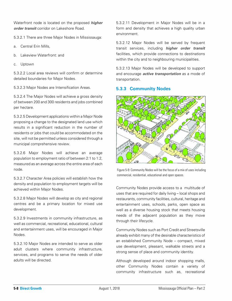
Figure 5-8: Major Nodes will develop as prominent centres with a
regional and city focus, and be served by higher order transit. Major
Nodes will provide a mix of uses including employment, commercial,residential, educational and open space.
Figure 5-7: The Downtown is made up of four Character Areas:Downtown Core, Downtown Fairview, Downtown Cooksville and
Downtown Hospital.
5-8 Direct Growth August 1, 2018 Mississauga Official Plan – Part 2
Waterfront node is located on the proposed higher
order transit corridor on Lakeshore Road.
5.3.2.1 There are three Major Nodes in Mississauga:
a. Central Erin Mills,
b. Lakeview Waterfront: and
c. Uptown
5.3.2.2 Local area reviews will confirm or determine detailed boundaries for Major Nodes.
5.3.2.3 Major Nodes are Intensification Areas.
5.3.2.4 The Major Nodes will achieve a gross density of between 200 and 300 residents and jobs combined per hectare.
5.3.2.5 Development applications within a Major Node proposing a change to the designated land use which results in a significant reduction in the number of residents or jobs that could be accommodated on the site, will not be permitted unless considered through a municipal comprehensive review.
5.3.2.6 Major Nodes will achieve an average population to employment ratio of between 2:1 to 1:2, measured as an average across the entire area of each node.
5.3.2.7 Character Area policies will establish how the density and population to employment targets will be achieved within Major Nodes.
5.3.2.8 Major Nodes will develop as city and regional centres and be a primary location for mixed use development.
5.3.2.9 Investments in community infrastructure, as well as commercial, recreational, educational, cultural and entertainment uses, will be encouraged in Major Nodes.
5.3.2.10 Major Nodes are intended to serve as older adult clusters where community infrastructure, services, and programs to serve the needs of older adults will be directed.
5.3.2.11 Development in Major Nodes will be in a form and density that achieves a high quality urban environment.
5.3.2.12 Major Nodes will be served by frequent transit services, including higher order transit facilities, which provide connections to destinations within the city and to neighbouring municipalities.
5.3.2.13 Major Nodes will be developed to support and encourage active transportation as a mode of transportation.
5.3.3 Community Nodes
Community Nodes provide access to a multitude of uses that are required for daily living – local shops and restaurants, community facilities, cultural, heritage and entertainment uses, schools, parks, open space as well as a diverse housing stock that meets housing needs of the adjacent population as they move through their lifecycle.
Community Nodes such as Port Credit and Streetsville already exhibit many of the desirable characteristics of an established Community Node – compact, mixed use development, pleasant, walkable streets and a strong sense of place and community identity.
Although developed around indoor shopping malls, other Community Nodes contain a variety of community infrastructure such as, recreational
Figure 5-9: Community Nodes will be the focus of a mix of uses includingcommercial, residential, educational and open spaces.

Mississauga Official Plan – Part 2 April 8, 2021 Direct Growth 5-9
facilities, libraries, police stations and places of religious assembly. These Nodes provide valued community benefits, but often in a form that is characterized by large blocks, surface parking, and single storey buildings with an internal focus. As these Community Nodes redevelop they will be expected to take on a more urban, pedestrian friendly form.
The Dixie-Dundas Node is an emerging Node that has a commercial base but requires new community infrastructure and a more pedestrian friendly approach to development.
5.3.3.1 There are nine Community Nodes in Mississauga:
a. Clarkson Village;
b. Dixie-Dundas;
c. Malton;
d. Meadowvale;
e. Port Credit;
f. Rathwood/Applewood;
g. Sheridan;
h. South Common; and
i. Streetsville.
5.3.3.2 Local area reviews will confirm or determine detailed boundaries for Community Nodes.
5.3.3.3 Community Nodes are Intensification Areas.
5.3.3.4 Community Nodes will achieve a gross density of between 100 and 200 residents and jobs combined per hectare.
5.3.3.5 Development applications within a Community Node proposing a change to the designated land which results in a significant reduction in the number of residents or jobs that could be accommodated on the site, will not be permitted unless considered through a municipal comprehensive review.
5.3.3.6 Community Nodes will achieve an average population to employment ratio between 2:1 to 1:2,
measured as an average across the entire area of each node.
5.3.3.7 Character Area policies will establish how the density and population to employment targets will be achieved within Community Nodes.
5.3.3.8 Redevelopment of Mixed Use sites in Community Nodes that result in a loss of commercial floor space will not be permitted unless it can be demonstrated that the planned function of the commercial component will be maintained after redevelopment.
5.3.3.9 Investments in community infrastructure, as well as commercial, recreational, educational, cultural and entertainment uses, will be encouraged in Community Nodes.
5.3.3.10 Community Nodes are intended to serve as older adult clusters where community infrastructure, services, and programs to serve the needs of older adults will be directed.
5.3.3.11 Development in Community Nodes will be in a form and density that complements the existing character of historical Nodes or that achieves a high quality urban environment within more recently developed Nodes.
5.3.3.12 Community Nodes will be served by frequent transit services that provide city wide connections. Some Community Nodes will also be served by higher order transit facilities, which provide connections to neighbouring municipalities.
5.3.3.13 Community Nodes will be developed to support and encourage active transportation as a mode of transportation.
5-10 Direct Growth August 11, 2015 Mississauga Official Plan – Part 2
5.3.4 Corporate Centres
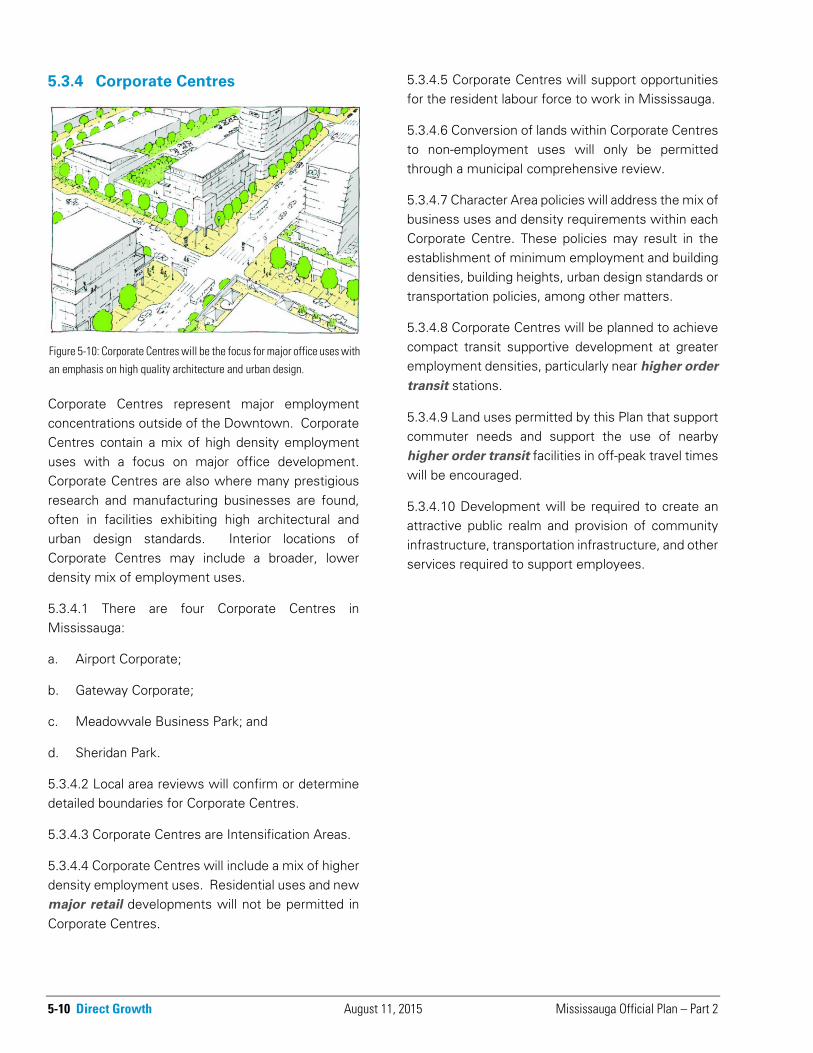
Corporate Centres represent major employment concentrations outside of the Downtown. Corporate Centres contain a mix of high density employment uses with a focus on major office development. Corporate Centres are also where many prestigious research and manufacturing businesses are found, often in facilities exhibiting high architectural and urban design standards. Interior locations of Corporate Centres may include a broader, lower density mix of employment uses.
5.3.4.1 There are four Corporate Centres in Mississauga:
a. Airport Corporate;
b. Gateway Corporate;
c. Meadowvale Business Park; and
d. Sheridan Park.
5.3.4.2 Local area reviews will confirm or determine detailed boundaries for Corporate Centres.
5.3.4.3 Corporate Centres are Intensification Areas.
5.3.4.4 Corporate Centres will include a mix of higher density employment uses. Residential uses and new major retail developments will not be permitted in Corporate Centres.
5.3.4.5 Corporate Centres will support opportunities for the resident labour force to work in Mississauga.
5.3.4.6 Conversion of lands within Corporate Centres to non-employment uses will only be permitted through a municipal comprehensive review.
5.3.4.7 Character Area policies will address the mix of business uses and density requirements within each Corporate Centre. These policies may result in the establishment of minimum employment and building densities, building heights, urban design standards or transportation policies, among other matters.
5.3.4.8 Corporate Centres will be planned to achieve compact transit supportive development at greater employment densities, particularly near higher order
transit stations.
5.3.4.9 Land uses permitted by this Plan that support commuter needs and support the use of nearby higher order transit facilities in off-peak travel times will be encouraged.
5.3.4.10 Development will be required to create an attractive public realm and provision of community infrastructure, transportation infrastructure, and other services required to support employees.
Figure 5-10: Corporate Centres will be the focus for major office uses withan emphasis on high quality architecture and urban design.
Mississauga Official Plan – Part 2 November 22, 2019 Direct Growth 5-11
5.3.5 Neighbourhoods
Mississauga has a variety of Neighbourhoods reflecting the various stages of its development. Some of these Neighbourhoods surround historic centres that date back to the 1800s, however, most of Mississauga’s Neighbourhoods were built in the latter decades of the 20th century. As such, most of Mississauga’s housing stock is quite new and in a good state of repair.
Neighbourhoods are characterized as physically stable areas with a character that is to be protected. Therefore, Mississauga’s Neighbourhoods are not appropriate areas for significant intensification. This does not mean that they will remain static or that new development must imitate previous development patterns, but rather that when development does occur it should be sensitive to the Neighbourhood’s existing and planned character.
Some community infrastructure will be provided within Neighbourhoods, however, most services for day-to-day living will be provided in Major Nodes or Community Nodes in close proximity to Neighbourhoods.
5.3.5.1 Neighbourhoods will not be the focus for intensification and should be regarded as stable residential areas where the existing character is to be preserved.
5.3.5.2 Residential intensification within Neighbourhoods will generally occur through infilling and the development of existing commercial sites as mixed use areas.
5.3.5.3 Where higher density uses are proposed, they should be located on sites identified by a local area review, along Corridors or in conjunction with existing apartment sites or commercial centres.
5.3.5.4 Redevelopment of Mixed Use sites that result in a loss of commercial floor space will not be permitted unless it can be demonstrated that the planned function of the existing non-residential component will be maintained after redevelopment.
5.3.5.5 Intensification within Neighbourhoods may be considered where the proposed development is compatible in built form and scale to surrounding development, enhances the existing or planned development and is consistent with the policies of this Plan.
5.3.5.6 Development will be sensitive to the existing and planned context and will include appropriate transitions in use, built form, density and scale.
5.3.5.7 Transportation planning within Neighbourhoods will give priority to active
transportation modes.
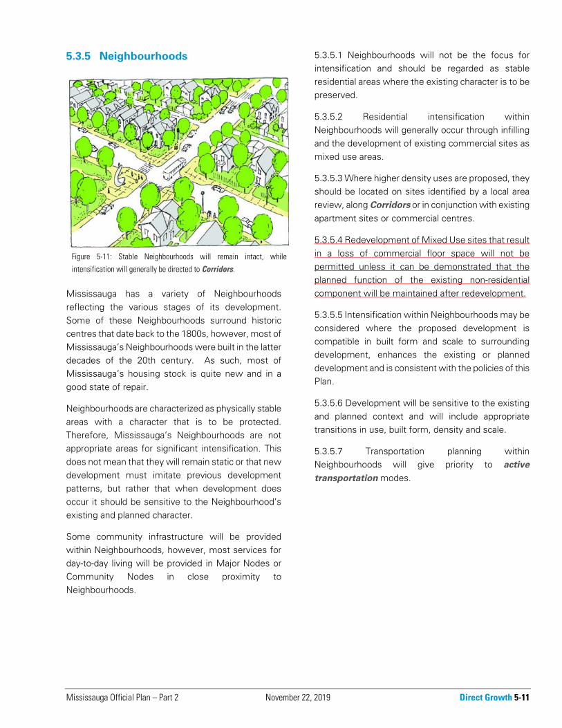
Figure 5-11: Stable Neighbourhoods will remain intact, while
intensification will generally be directed to Corridors.
5-12 Direct Growth March 11, 2016 Mississauga Official Plan – Part 2
5.3.6 Employment Areas
Employment Areas are stable areas containing diverse industrial and business employment operations. Some uses require extensive land resources and have low employment densities. Examples include logistics, warehousing and storage yards. Employment Areas also include small and mid-size office developments either in stand-alone buildings or in conjunction with other uses. In key locations, such as those with excellent transportation services, large office developments will be found. Retail, service or infrastructure uses that support the employment base are also located in Employment Areas.
In order to protect lands for employment uses, uses intended to serve the city’s residential population will be discouraged from locating in Employment Areas. Exceptions may be made for residential serving uses that would create land use conflicts with residential uses or are uses identified as beneficial to the City that cannot be accommodated in residential areas. Some examples are large scale sporting venues, places of religious assembly, or colleges and universities.
Many businesses within Employment Areas rely on the delivery of goods and services by truck. As such, goods movement infrastructure within Employment
Areas is necessary in order for businesses to remain competitive within the regional economy.
5.3.6.1 Mississauga will maintain an adequate supply of lands for a variety of employment uses to accommodate existing and future employment needs.
5.3.6.2 Mississauga will maintain a sustainable, diversified employment base by providing opportunities for a range of economic activities.
5.3.6.3 Employment uses that support opportunities for residents to work in Mississauga will be encouraged.
5.3.6.4 Mississauga will provide the necessary infrastructure to support existing and planned employment uses.
5.3.6.5 Conversion of lands within Employment Areas will only be permitted through a municipal comprehensive review.
5.3.6.6 Infrastructure in Employment Areas will be planned to support land uses with a goods movement focus.
5.3.6.7 Where feasible and appropriate, development will be encouraged to be transit supportive and minimize surface parking.
5.3.6.8 Land uses serving the residential population of the city will be discouraged and only permitted where a use is beneficial to the city and cannot locate in a residential area due to land use conflicts or the unavailability of a suitable site. Acceptable locations for these uses will be identified through a municipal comprehensive review and local area plans.
5.3.6.9 Higher density employment uses, such as office, will be required within Major Transit Station
Areas.
5.3.6.10 Additional development within Employment Areas will be permitted where the proposed development is compatible in built form and scale to surrounding development, enhances the existing or planned development and is consistent with the policies of this Plan.
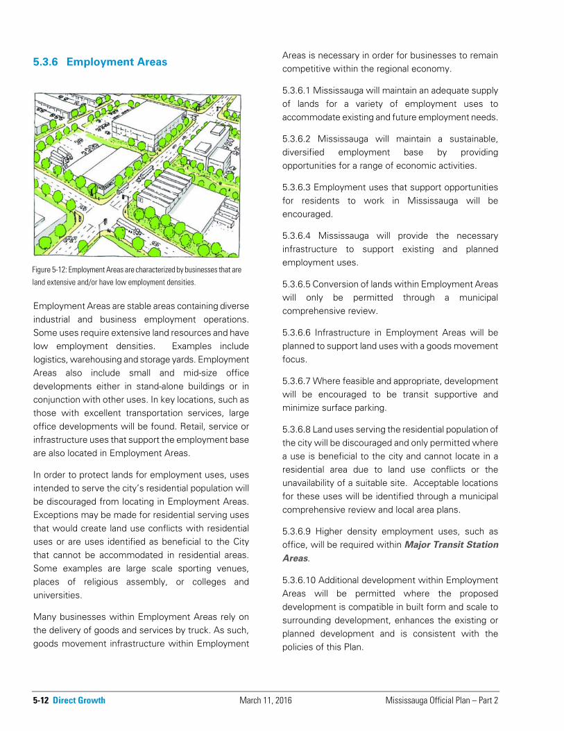
Figure 5-12: Employment Areas are characterized by businesses that are
land extensive and/or have low employment densities.
Mississauga Official Plan – Part 2 August 11, 2015 Direct Growth 5-13
5.3.7 Special Purpose Areas
Special purpose areas are unique destinations of city and regional significance. They have some or all of the following characteristics:
● specialized land uses and planning needs;
● serve a large number of users;
● substantial transportation demands;
● play a significant role in the economy;
● impact surrounding land uses and land use patterns;
● generate significant employment;
● specialized infrastructure needs; and
● are land extensive.
To date, two special purpose areas have been identified. The City may identify additional special purpose areas as they emerge.
5.3.7.1 Special Purpose Areas are:
a. the University of Toronto Mississauga (UTM); and
b. the Airport.
5.3.7.2 The City may, through amendment of this Plan, add Special Purpose Areas.
5.3.7.3 Planning studies will be prepared for Special Purpose Areas as needed.
5.3.7.4 Infrastructure to meet the needs of Special Purpose Areas will be a priority.
5.3.7.5 The City will collaborate with UTM, the Airport and proponents of new Special Purpose Areas, as appropriate.
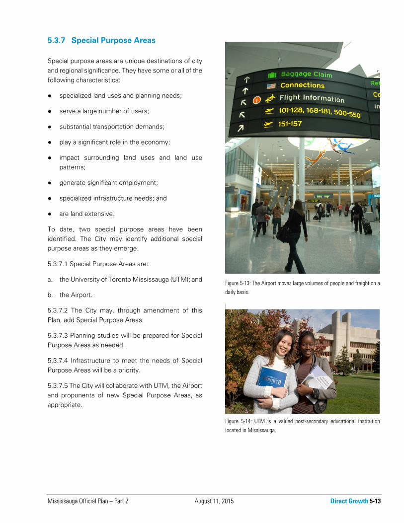
Figure 5-14: UTM is a valued post-secondary educational institution
located in Mississauga.
Figure 5-13: The Airport moves large volumes of people and freight on adaily basis.
5-14 Direct Growth August 1, 2018 Mississauga Official Plan – Part 2
5.4 Corridors
Mississauga was planned with a grid of arterials, which have historically served as the chief conduits for moving cars and freight. This grid now forms the basis of a system of Corridors.
Corridors connect various elements of the city to each other. Over time, many of these Corridors will evolve and accommodate multi-modal transportation and become attractive public places in their own right with complementary land uses. Corridors are important elements of the public realm, as they link communities and are locations where people experience the city on a day-to-day basis.
Some Corridors have been identified as appropriate locations for intensification. Additional policies have been developed for Intensification Corridors to recognize their development potential.
5.4.1 A Corridor is generally comprised of the road right-of-way as well as the lands on either side of the road. The Corridors are shown conceptually on Schedule 1c: Urban System - Corridors.
5.4.2 Where Corridors run through or when one side abuts the Downtown, Major Nodes, Community Nodes and Corporate Centres, development in those segments will also be subject to the policies of the City Structure element in which they are located. Where there is a conflict, the policies of the Downtown, Major Nodes, Community Nodes and
Corporate Centres will take precedence.
5.4.3 Corridors that run through or abut the Downtown, Major Nodes, Community Nodes and Corporate Centres are encouraged to develop with mixed uses oriented towards the Corridor.
5.4.4 Development on Corridors should be compact, mixed use and transit friendly and appropriate to the context of the surrounding Neighbourhood and Employment Area.
5.4.5 Where higher density uses within Neighbourhoods are directed to Corridors, development will be required to have regard for the character of the Neighbourhoods and provide appropriate transitions in height, built form and density to the surrounding lands.
5.4.6 Land use and design policies and the delineation of Corridor boundaries will be determined through local area reviews.
5.4.7 Land uses and building entrances will be oriented to the Corridor where possible and surrounding land use development patterns permit.
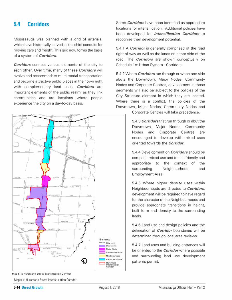
Map 5-1: Hurontario Street Intensification Corridor
Mississauga Official Plan – Part 2 August 1, 2018 Direct Growth 5-15
5.4.8 Corridors will be subject to a minimum building height of two storeys and the maximum building height specified in the City Structure element in which it is located, unless Character Area policies specify alternative building height requirements or until such time as alternative building heights are determined through planning studies. Except along Intensification
Corridors and within Major Transit Station Areas, the minimum building height requirement will not apply to Employment Areas.
5.4.9 Transit services infrastructure will utilize Corridors to connect Intensification Areas.
5.4.10 Local area reviews will consider the appropriateness of transit supportive uses at the intersection of two Corridors. Local area policies may permit additional heights and densities at these locations provided that the development reduces the dependency on cars and supports the policies of this Plan.
5.4.11 Hurontario Street and Dundas Street have been identified as Intensification Corridors. These are Intensification Areas. Additional Intensification
Corridors may be identified in the future.
5.4.12 Not all segments of Intensification Corridors are appropriate for intensification. Planning studies for Intensification Corridors will identify appropriate locations for intensification and the appropriate densities, land uses and building heights.
5.4.13 Low density residential development will be discouraged from locating within Intensification
Corridors.
5.4.14 The Hurontario Street Intensification Corridor is comprised of lands along Hurontario Street from Lake Ontario in Port Credit to the city’s limit to the north as shown on Map 5-1: Hurontario Street Intensification Corridor.
5.4.15 A number of Light Rail Transit Stations, which will be located along the Hurontario Street Intensification Corridor to serve the proposed light rail transit system are a form of Major Transit Station Areas. The Major Transit Station Areas are identified on Schedule 2: Intensification Areas and the Light Rail Transit Stations are identified on Schedule 6: Long Term Transit Network.
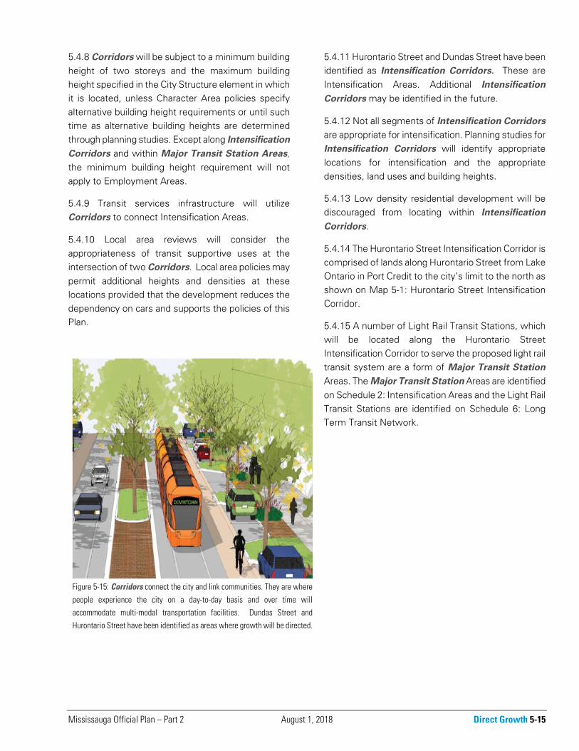
Figure 5-15: Corridors connect the city and link communities. They are where
people experience the city on a day-to-day basis and over time will
accommodate multi-modal transportation facilities. Dundas Street and
Hurontario Street have been identified as areas where growth will be directed.
5-16 Direct Growth August 11, 2015 Mississauga Official Plan – Part 2
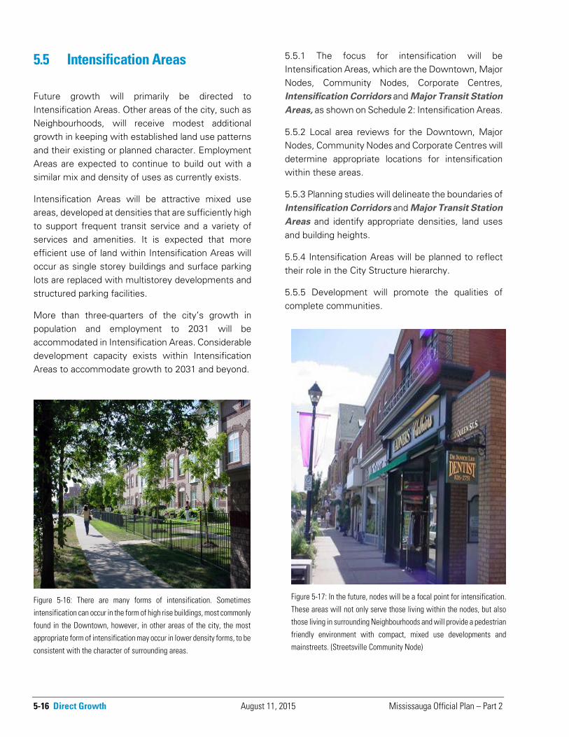
Figure 5-16: There are many forms of intensification. Sometimes
intensification can occur in the form of high rise buildings, most commonly
found in the Downtown, however, in other areas of the city, the mostappropriate form of intensification may occur in lower density forms, to be
consistent with the character of surrounding areas.
5.5 Intensification Areas
Future growth will primarily be directed to Intensification Areas. Other areas of the city, such as Neighbourhoods, will receive modest additional growth in keeping with established land use patterns and their existing or planned character. Employment Areas are expected to continue to build out with a similar mix and density of uses as currently exists.
Intensification Areas will be attractive mixed use areas, developed at densities that are sufficiently high to support frequent transit service and a variety of services and amenities. It is expected that more efficient use of land within Intensification Areas will occur as single storey buildings and surface parking lots are replaced with multistorey developments and structured parking facilities.
More than three-quarters of the city’s growth in population and employment to 2031 will be accommodated in Intensification Areas. Considerable development capacity exists within Intensification Areas to accommodate growth to 2031 and beyond.
5.5.1 The focus for intensification will be Intensification Areas, which are the Downtown, Major Nodes, Community Nodes, Corporate Centres, Intensification Corridors and Major Transit Station
Areas, as shown on Schedule 2: Intensification Areas.
5.5.2 Local area reviews for the Downtown, Major Nodes, Community Nodes and Corporate Centres will determine appropriate locations for intensification within these areas.
5.5.3 Planning studies will delineate the boundaries of Intensification Corridors and Major Transit Station
Areas and identify appropriate densities, land uses and building heights.
5.5.4 Intensification Areas will be planned to reflect their role in the City Structure hierarchy.
5.5.5 Development will promote the qualities of complete communities.
Figure 5-17: In the future, nodes will be a focal point for intensification.
These areas will not only serve those living within the nodes, but alsothose living in surrounding Neighbourhoods and will provide a pedestrian
friendly environment with compact, mixed use developments andmainstreets. (Streetsville Community Node)
Mississauga Official Plan – Part 2 March 11, 2016 Direct Growth 5-17
5.5.6 Development applications within Intensification Areas proposing a change to the designated land use, which results in a significant reduction in the number of residents or jobs that could be accommodated on the site, will not be permitted unless considered through a municipal comprehensive review.
5.5.7 A mix of medium and high density housing, community infrastructure, employment, and commercial uses, including mixed use residential/commercial buildings and offices will be encouraged. However, not all of these uses will be permitted in all areas.
5.5.8 Residential and employment density should be sufficiently high to support transit usage. Low density development will be discouraged.
5.5.9 Intensification Areas will be planned to maximize the use of existing and planned infrastructure.
5.5.10 Major office development will be encouraged to locate within the Downtown, Major Nodes, Corporate Centres, Intensification Corridors and Major Transit Station Areas. Secondary office development will be encouraged within Community Nodes.
5.5.11 Where there is a conflict between the Intensification Area policies and policies regarding the Natural Heritage System and heritage resources, the policies of the Natural Heritage System and heritage resources will take precedence.
5.5.12 Development will be phased in accordance with the provision of community infrastructure and other infrastructure.
5.5.13 Major Transit Station Areas will be subject to a minimum building height of two storeys and a maximum building height specified in the City Structure element in which it is located, unless Character Area policies specify alternative building height requirements or until such time as alternative building heights are determined through planning studies.
5.5.14 Pedestrian movement and access from major transit routes will be a priority in Intensification Areas.
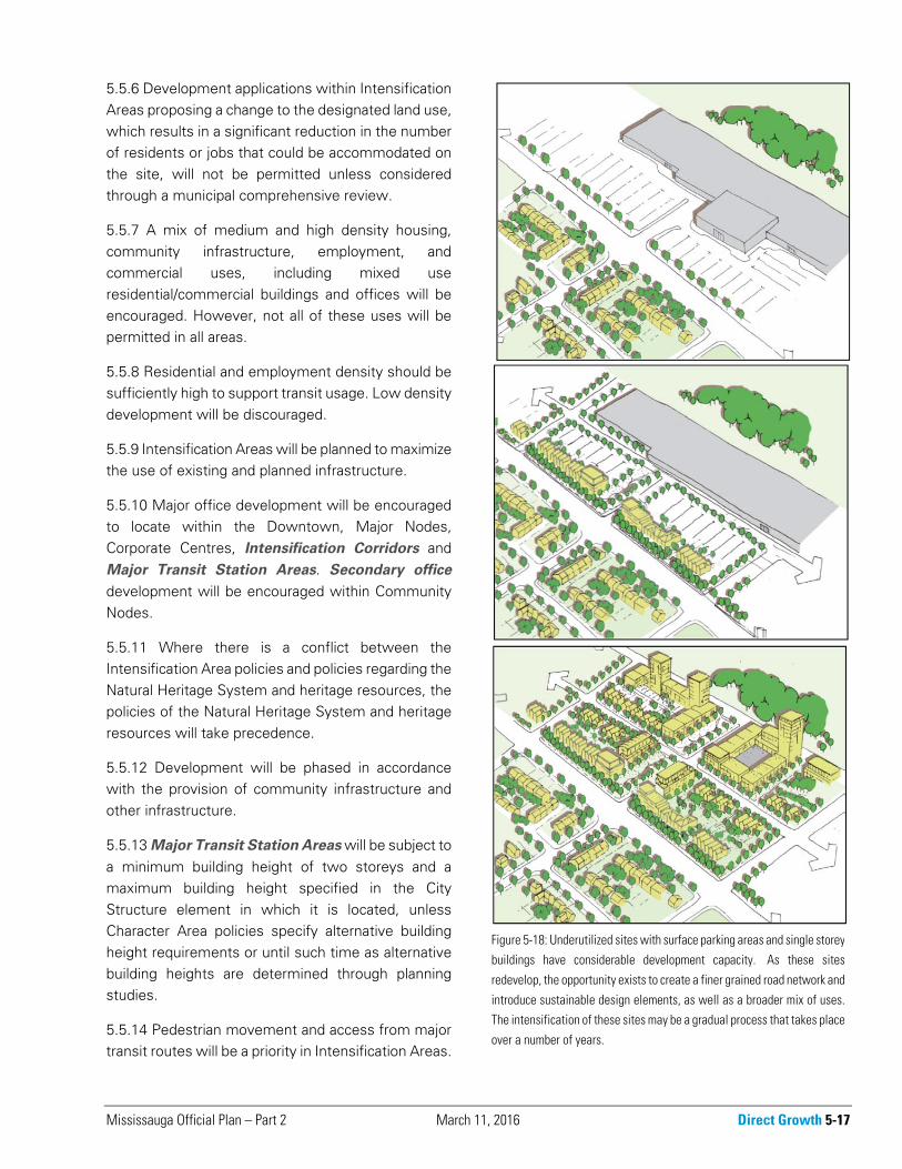
Figure 5-18: Underutilized sites with surface parking areas and single storeybuildings have considerable development capacity. As these sites
redevelop, the opportunity exists to create a finer grained road network and
introduce sustainable design elements, as well as a broader mix of uses.The intensification of these sites may be a gradual process that takes place
over a number of years.
5-18 Direct Growth August 1, 2018 Mississauga Official Plan – Part 2
5.5.15 Intensification Areas will be served by transportation Corridors containing transit and active transportation and may contain higher order transit facilities.
5.5.16 Major Transit Station Areas will be planned and designed to provide access from various transportation modes to the transit facility, including consideration of pedestrians, bicycle parking and commuter pick-up/drop-off areas.
5.5.17 For existing buildings that do not meet the policies of this Plan, applications for condominium ownership will be discouraged within Intensification Areas and along Corridors.
5.6 Designated Greenfield Area
There are lands in the Churchill Meadows Neighbourhood Character Area and in the Ninth Line Neighbourhood Character Area that are identified as a designated greenfield area pursuant to the Growth Plan for the Greater Golden Horseshoe.
5.6.1 Character Area policies may specify alternative density requirements, provided the total designated greenfield area in the Region will achieve a minimum density target of 50 residents and jobs combined per hectare, excluding environmental take-outs.