a modern vision of enterprise gis - esri
TRANSCRIPT
A Modern Vision of Enterprise GISAdam Carnow and Keith Cooke


If all you ever do with GIS is make paper maps,
then that is the only thing your customers will
ask you for…

Successful GIS Implementation Requires More Than Technology…
• Vision and Leadership
• Understanding How GIS Contributes
• Planning and Governance
• Evolutionary Approaches
• Apps that are Engaging
• Good People


Implementing a
Location Platform
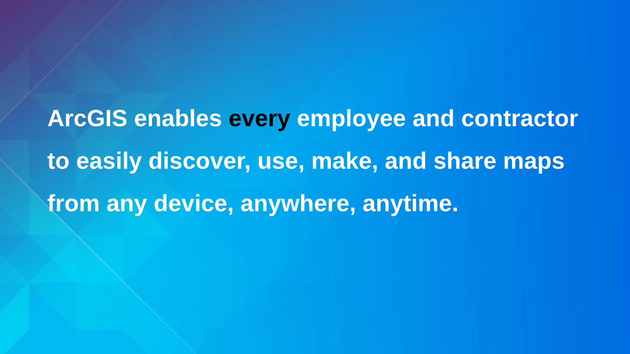
ArcGIS enables every employee and contractor
to easily discover, use, make, and share maps
from any device, anywhere, anytime.
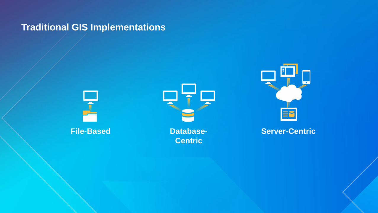
Traditional GIS Implementations
File-Based Database-
Centric
Server-Centric
ArcGIS is now a Location Platform
ArcGIS

Making GIS easier & available to anyone
ArcGIS
Knowledge
Workers
Professional
GIS
Work
Anywhere
Public
Engagement
Executive
Access
Enterprise
Integration
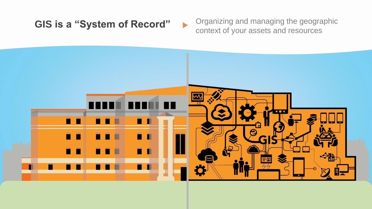
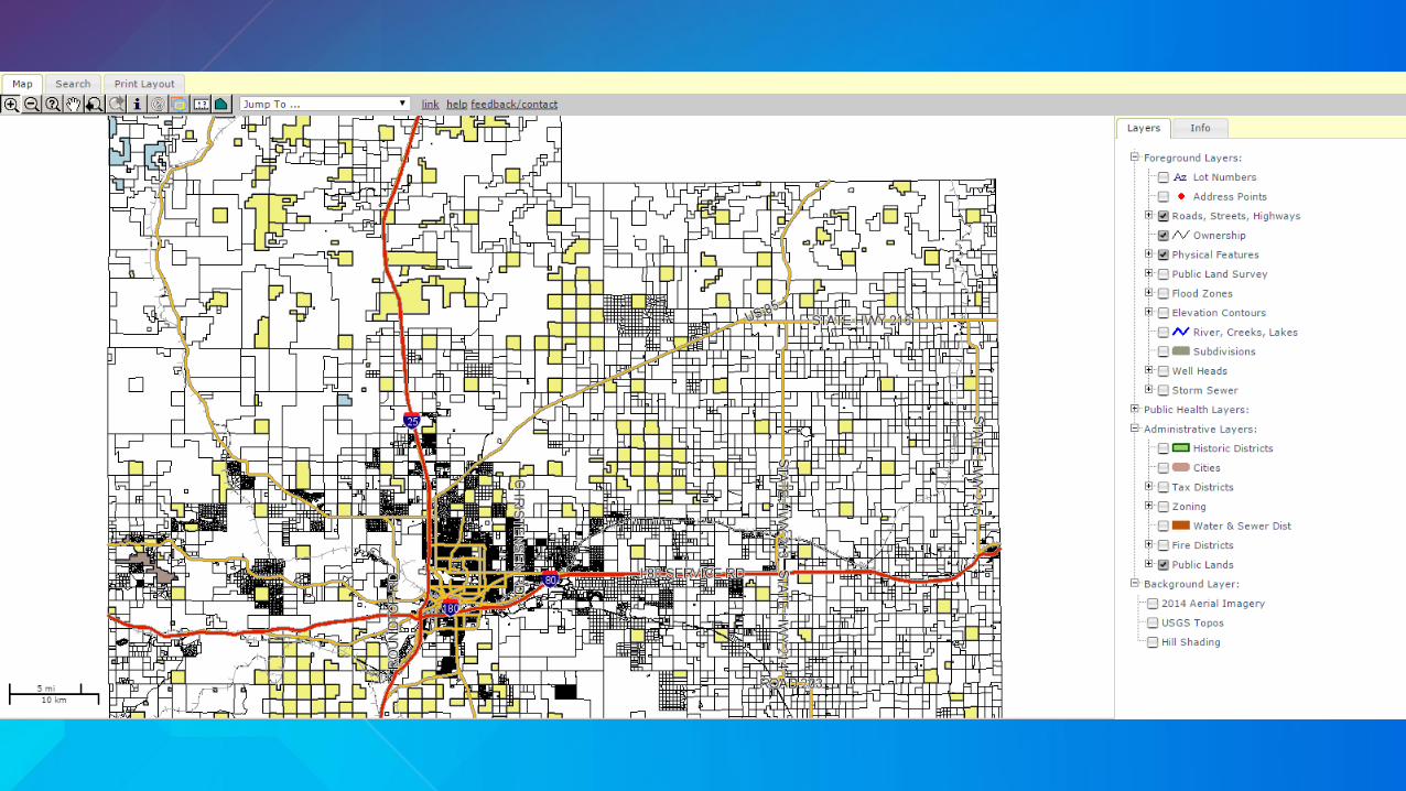
GIS is a “System of Record” Organizing and managing the geographic
context of your assets and resources
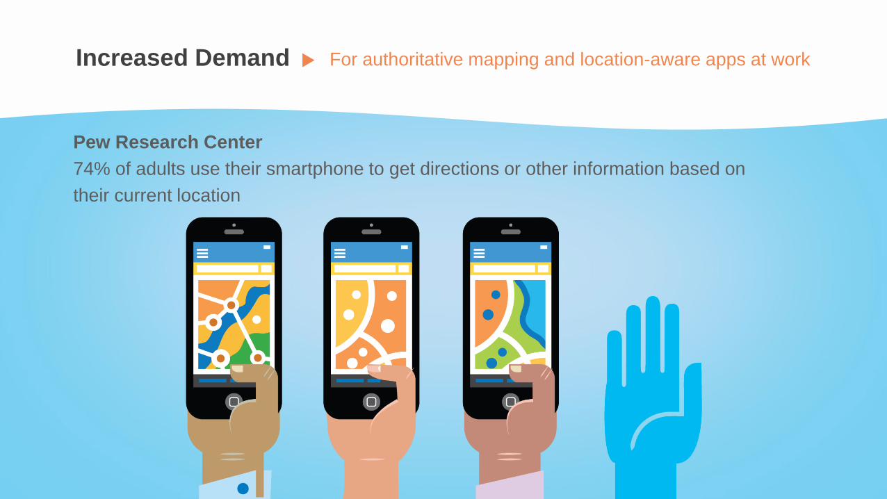
Increased Demand For authoritative mapping and location-aware apps at work
Pew Research Center
74% of adults use their smartphone to get directions or other information based on
their current location

People Use Maps at Work• But confusion results when maps are not
generated from your authoritative information
and/or are out of date…
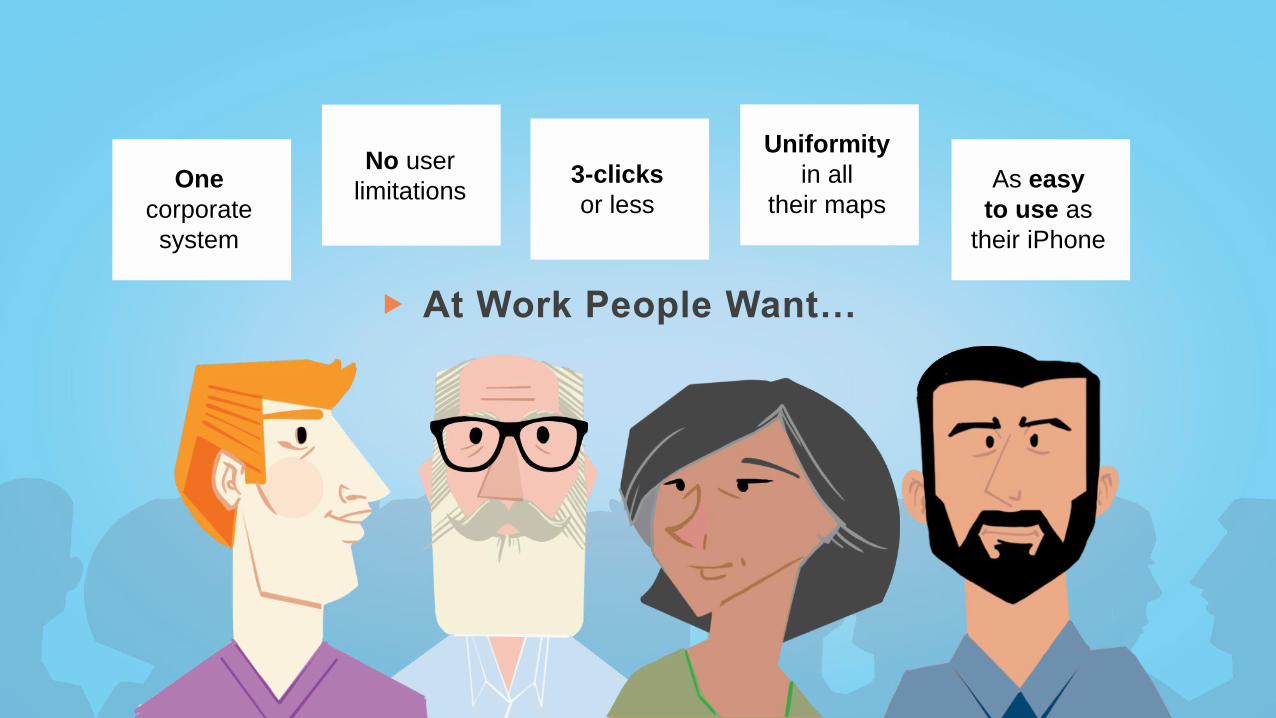
At Work People Want…
One
corporate
system
No user
limitations3-clicks
or less
Uniformity
in all
their mapsAs easy
to use as
their iPhone

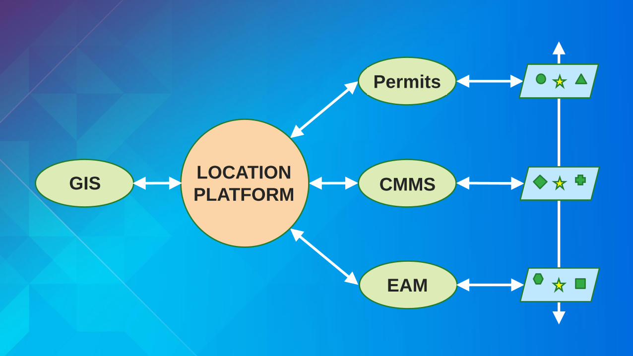
What Does a Location
Platform Look Like?
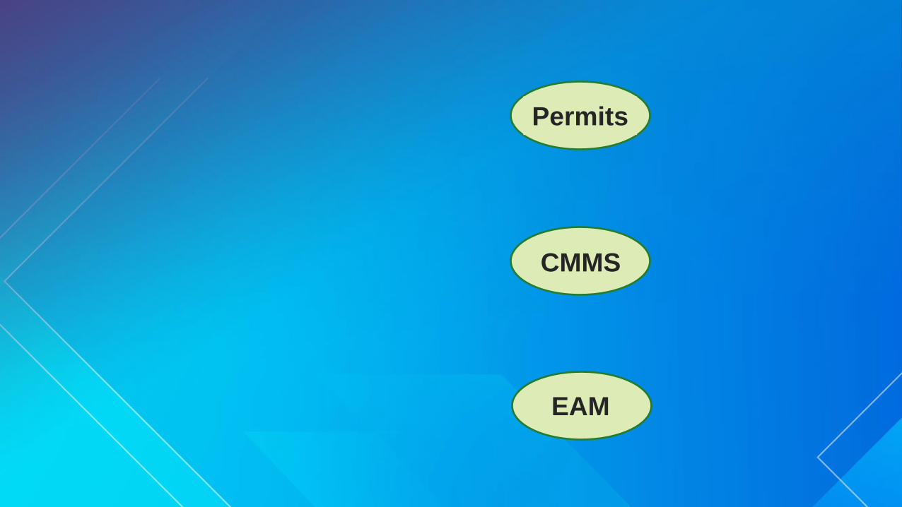
Permits
CMMS
EAM
Permits
CMMS
EAM
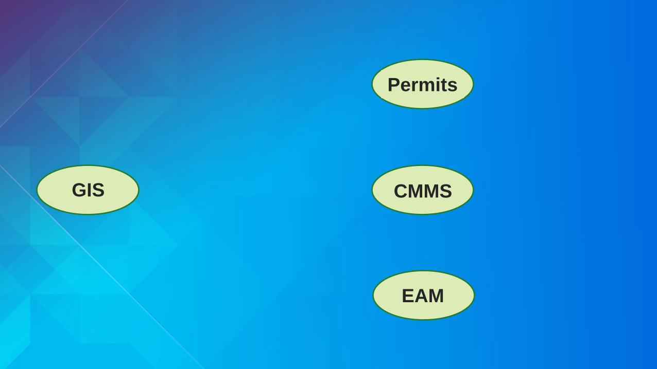
GIS

Permits
CMMS
EAM
GISLOCATION
PLATFORM

Permits
CMMS
EAM
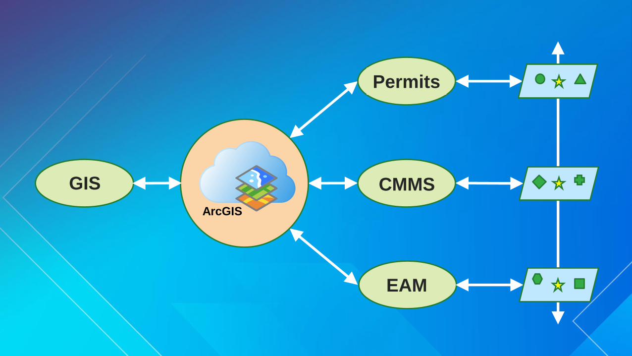
GISLOCATION
PLATFORM

Permits
CMMS
EAM
GISLOCATION
PLATFORM
Permits
CMMS
EAM
GISLOCATION
PLATFORM
Permits
CMMS
EAM
GIS
ArcGIS
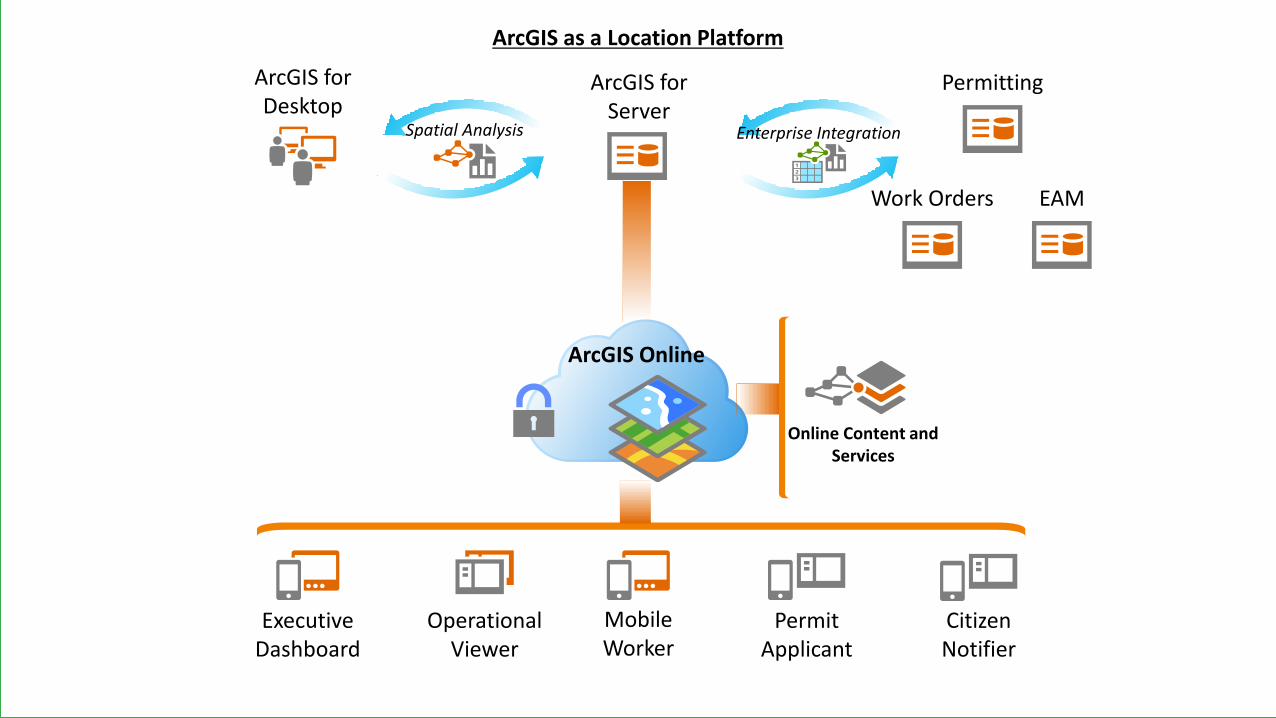
ArcGIS Online
Online Content and Services
ArcGIS for Desktop
Permitting
ArcGIS as a Location Platform
Operational Viewer
Executive Dashboard
Permit Applicant
CitizenNotifier
Mobile Worker
Work Orders EAM
Spatial Analysis Enterprise Integration
ArcGIS for Server
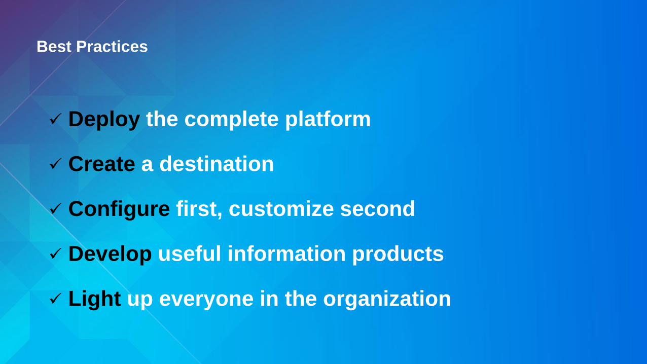
Best Practices
Deploy the complete platform
Create a destination
Configure first, customize second
Develop useful information products
Light up everyone in the organization
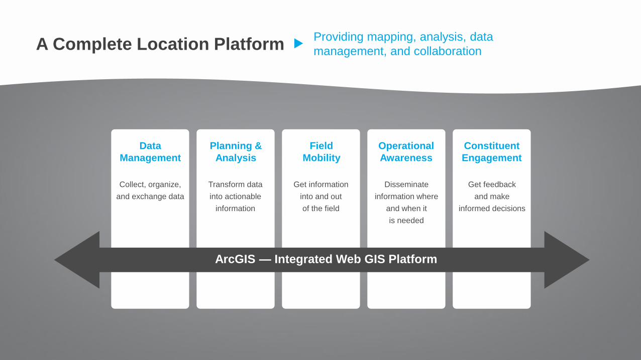
Providing mapping, analysis, data
management, and collaboration
Data
Management
ArcGIS — Integrated Web GIS Platform
Planning &
Analysis
Field
Mobility
Operational
Awareness
Constituent
Engagement
Transform data
into actionable
information
Collect, organize,
and exchange data
Get information
into and out
of the field
Disseminate
information where
and when it
is needed
Get feedback
and make
informed decisions
A Complete Location Platform
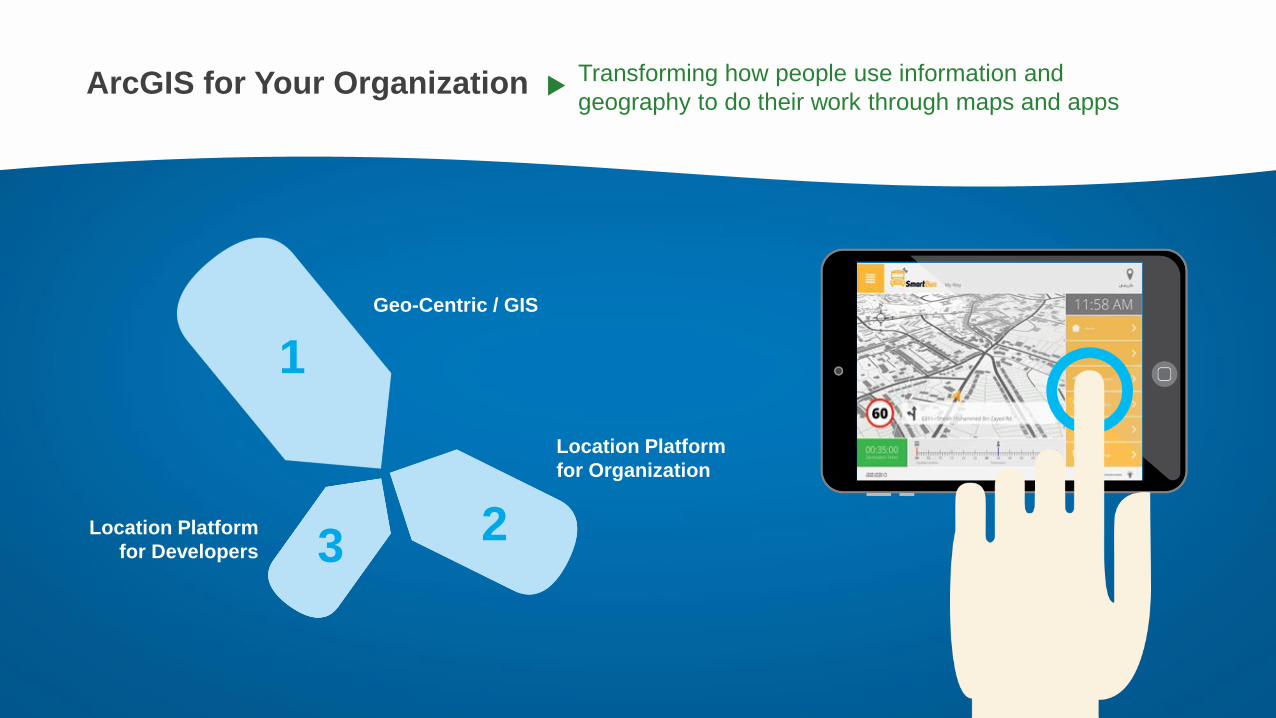
ArcGIS for Your Organization Transforming how people use information and
geography to do their work through maps and apps
1
23
Geo-Centric / GIS
Location Platform
for Developers
Location Platform
for Organization

Change Management
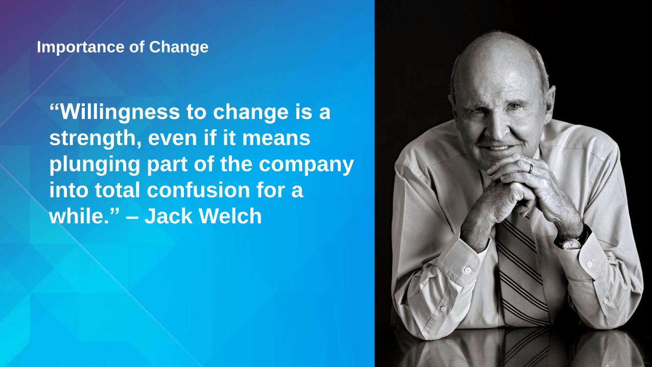
Importance of Change
“Willingness to change is a
strength, even if it means
plunging part of the company
into total confusion for a
while.” – Jack Welch

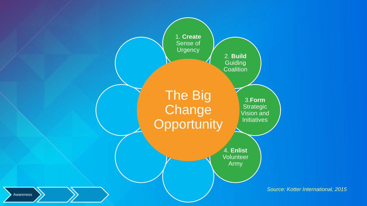
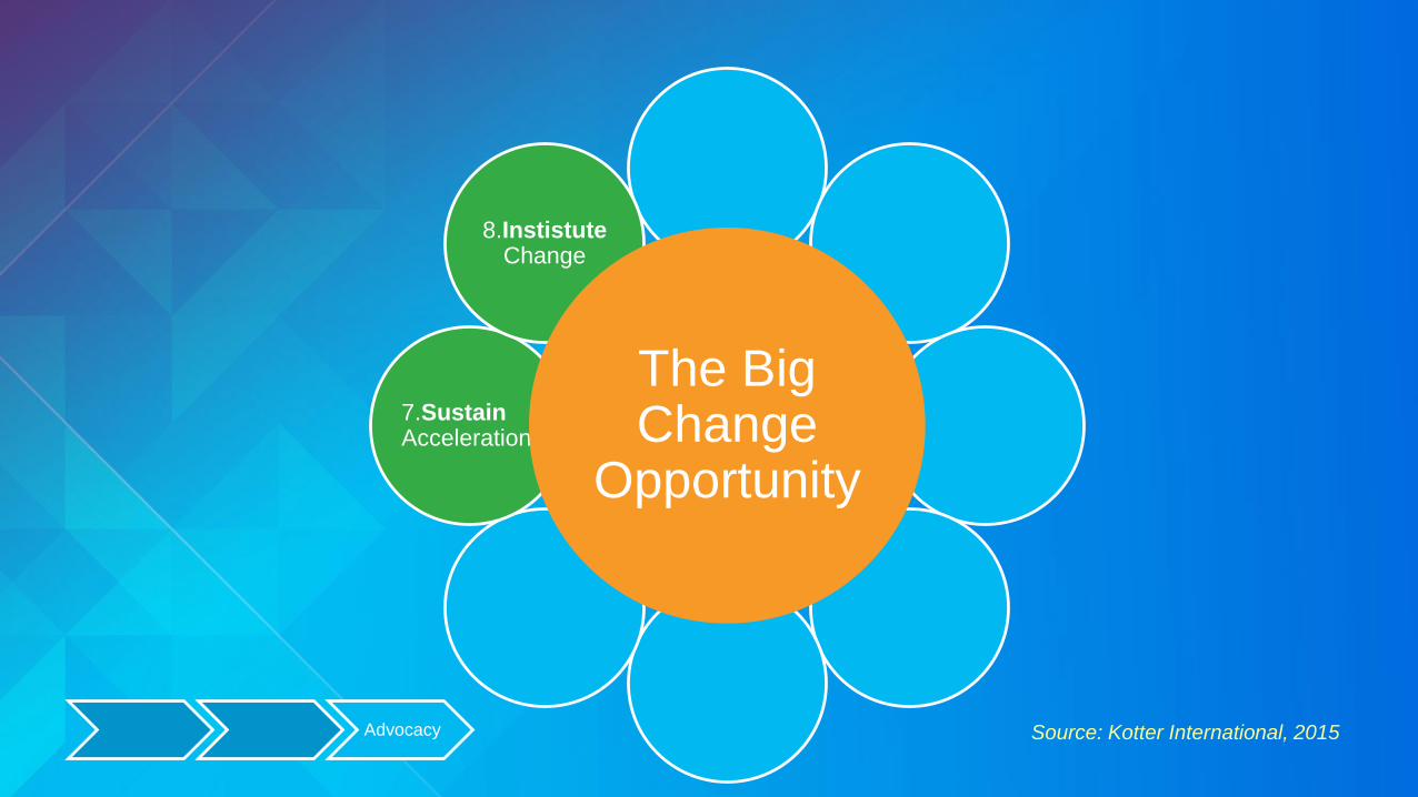
Source: Kotter International, 2015
1. CreateSense of Urgency
2. BuildGuiding Coalition
3.Form Strategic
Vision and Initiatives
4. EnlistVolunteer
Army5. EnableAction by Removing Barriers
6. GenerateShort Term
Wins
7. Sustain Acceleration
8.InstistuteChange
The Big Change
Opportunity
Awareness
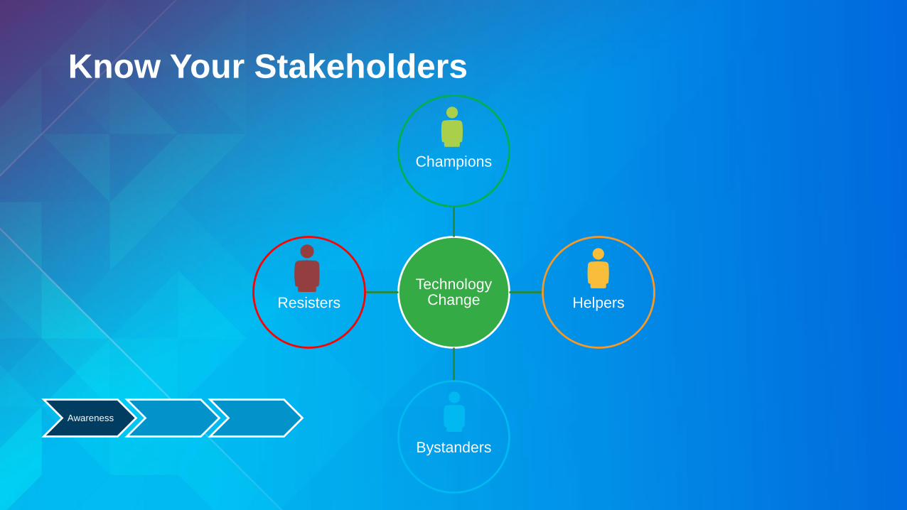
Technology Change
Champions
Helpers
Bystanders
Resisters
Know Your Stakeholders
Awareness

Source: Kotter International, 2015
1. CreateSense of Urgency
2. BuildGuiding Coalition
3.Form Strategic
Vision and Initiatives
4. EnlistVolunteer
Army5. EnableAction by Removing Barriers
6. GenerateShort Term
Wins
7. Sustain Acceleration
8.InstistuteChange
The Big Change
Opportunity

Communication Tools
• Strategic Plans
• GIS Working Groups
• Outreach initiatives
Step 5: Enable Action by Removing Barriers

Strategic Plan
• What are you building
• Focus on the business workflows
• Pick the top 5 critical workflows
Step 5: Enable Action by Removing Barriers

Adoption
• Recognize short-term wins
• Re-affirm commitments, project understanding
• Continue to build relationships
• Reinforce objectives, success criteria
Step 6: Generate Short Term Wins
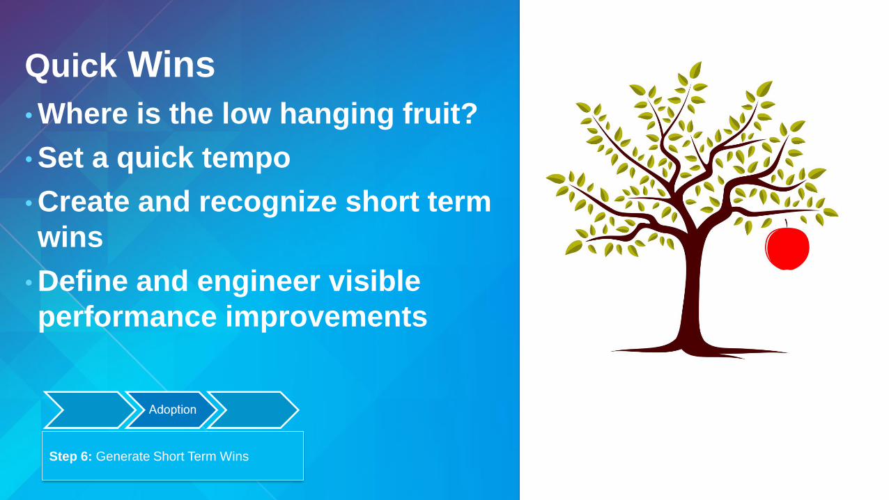
Quick Wins
• Where is the low hanging fruit?
• Set a quick tempo
• Create and recognize short term
wins
• Define and engineer visible
performance improvements
Step 6: Generate Short Term Wins
Source: Kotter International, 2015
1. CreateSense of Urgency
2. BuildGuiding Coalition
3.Form Strategic
Vision and Initiatives
4. EnlistVolunteer
Army5. EnableAction by Removing Barriers
6. GenerateShort Term
Wins
7.Sustain Acceleration
8.InstistuteChange
The Big Change
Opportunity
Advocacy
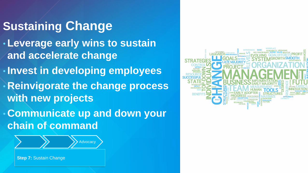
Sustaining Change
• Leverage early wins to sustain
and accelerate change
• Invest in developing employees
• Reinvigorate the change process
with new projects
• Communicate up and down your
chain of command
Step 7: Sustain Change
Advocacy
Advocacy
• Success breeds success – how do you publicize your
success?
• Adding a new community of change champions
• Broadens the reach of the change initiative
• Team and individual success creates new advocates
Step 7: Sustain Change
Advocacy
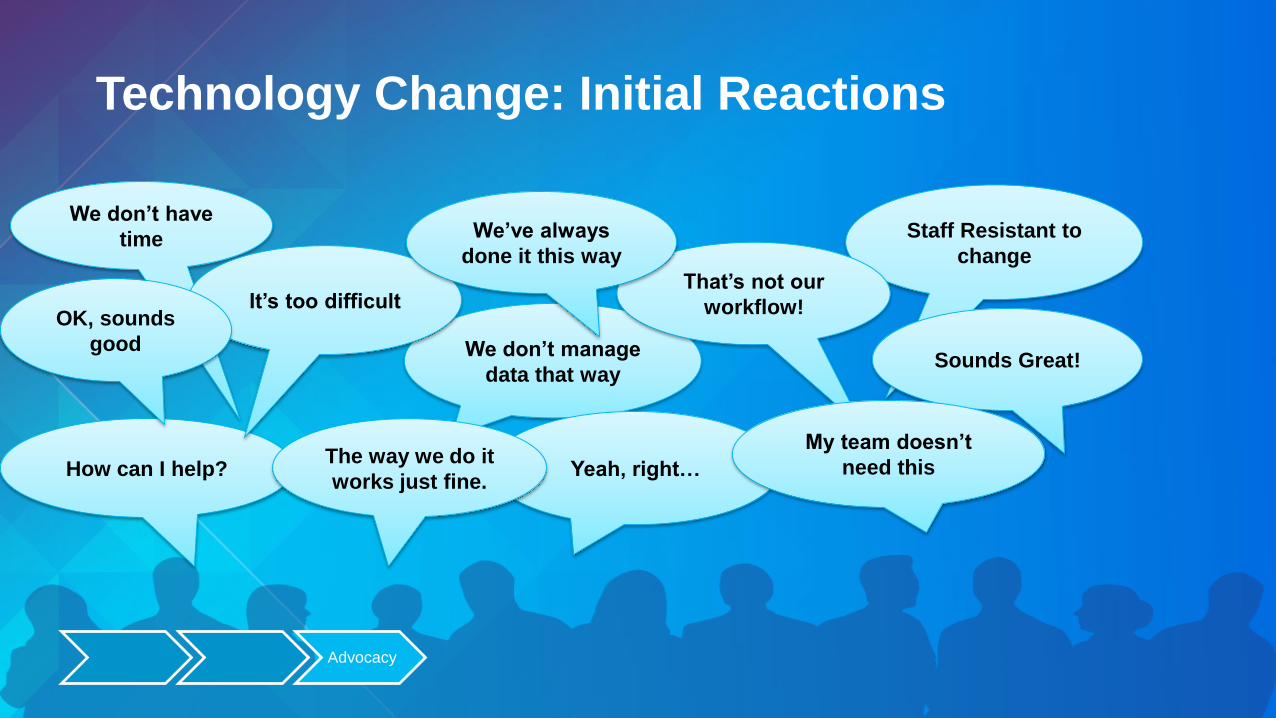
We don’t have
time
We don’t manage
data that way
Staff Resistant to
change
How can I help? Yeah, right…
That’s not our
workflow!
Sounds Great!
The way we do it
works just fine.
It’s too difficult
My team doesn’t
need this
OK, sounds
good
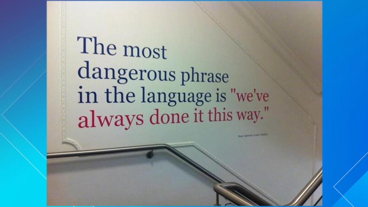
We’ve always
done it this way
Technology Change: Initial Reactions
Advocacy

This saved me
time!
I didn’t know that
about our business.
What’s next?
How can I help?Can I try it this
way?
That’s not our
workflow!
Sounds Great!
The way we do it
works just fine.
That was
surprisingly
simple.
I see how this helps
my team.
That was great!
I like this new way
of doing things.
Technology Change: The new reaction
Advocacy

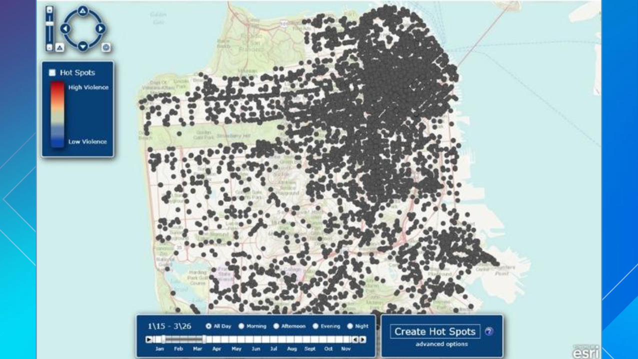
The Power of Spatial
Analysis


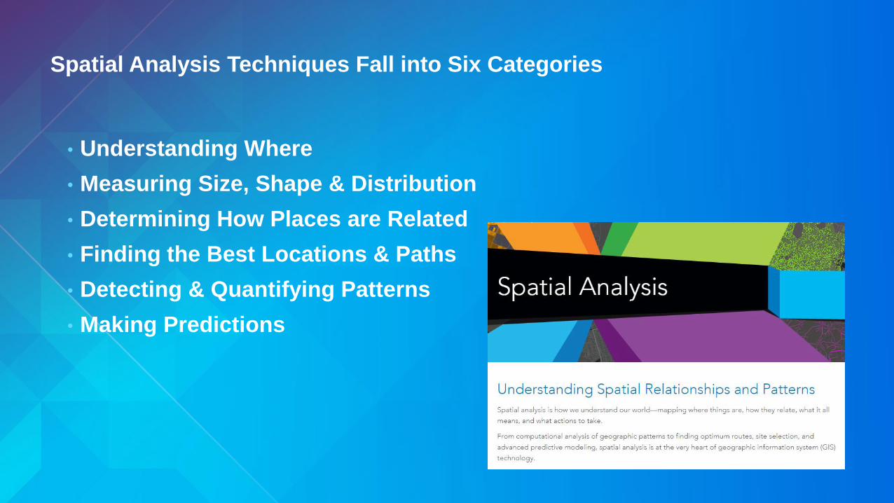
Spatial Analysis Techniques Fall into Six Categories
• Understanding Where
• Measuring Size, Shape & Distribution
• Determining How Places are Related
• Finding the Best Locations & Paths
• Detecting & Quantifying Patterns
• Making Predictions


Engaging with
Executives


GIS is a “System of Record” Organizing and managing the geographic
context of your assets and resources


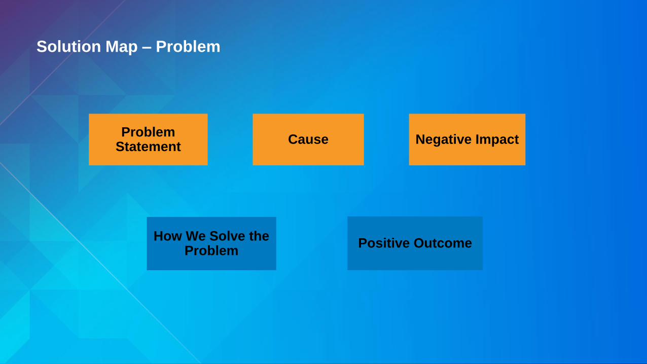
Solution Map – Problem
Problem Statement
Cause Negative Impact
How We Solve the Problem
Positive Outcome

Making GIS Sustainable
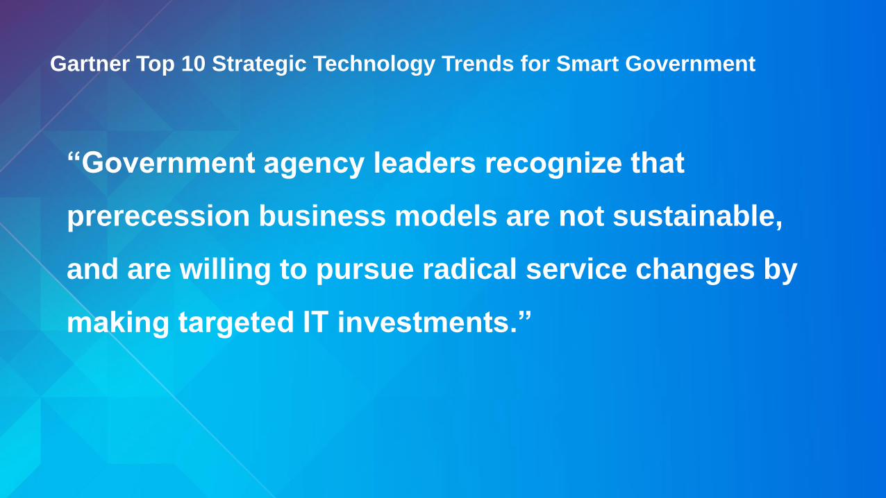
Gartner Top 10 Strategic Technology Trends for Smart Government
“Government agency leaders recognize that
prerecession business models are not sustainable,
and are willing to pursue radical service changes by
making targeted IT investments.”

Driving Forces
• The pace of technology change is increasing.
• Customers expect single-topic, focused, easy-to-use
apps that run on any device.
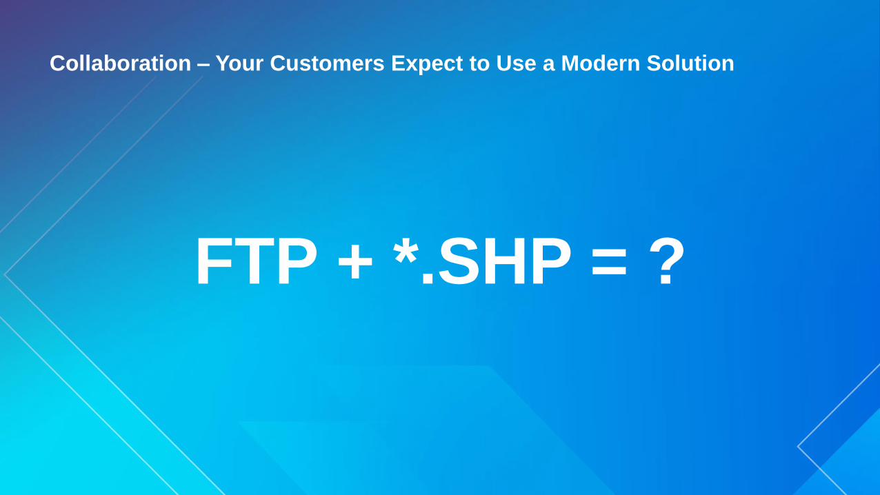
Collaboration – Your Customers Expect to Use a Modern Solution
FTP + *.SHP = ?
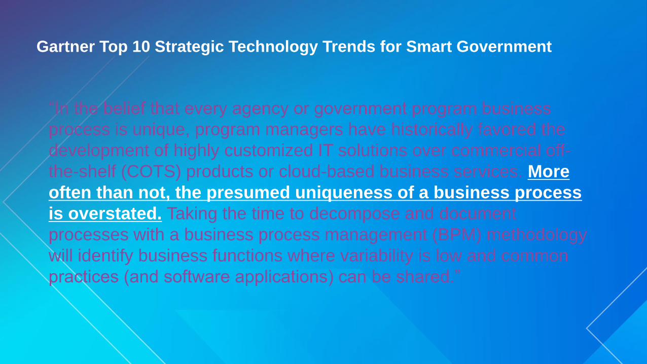
Gartner Top 10 Strategic Technology Trends for Smart Government
“In the belief that every agency or government program business
process is unique, program managers have historically favored the
development of highly customized IT solutions over commercial off-
the-shelf (COTS) products or cloud-based business services. More
often than not, the presumed uniqueness of a business process
is overstated. Taking the time to decompose and document
processes with a business process management (BPM) methodology
will identify business functions where variability is low and common
practices (and software applications) can be shared.”
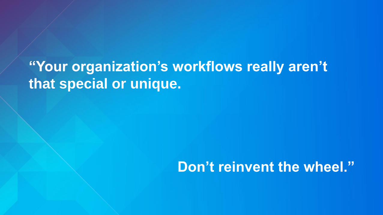
“Your organization’s workflows really aren’t
that special or unique.
Don’t reinvent the wheel.”


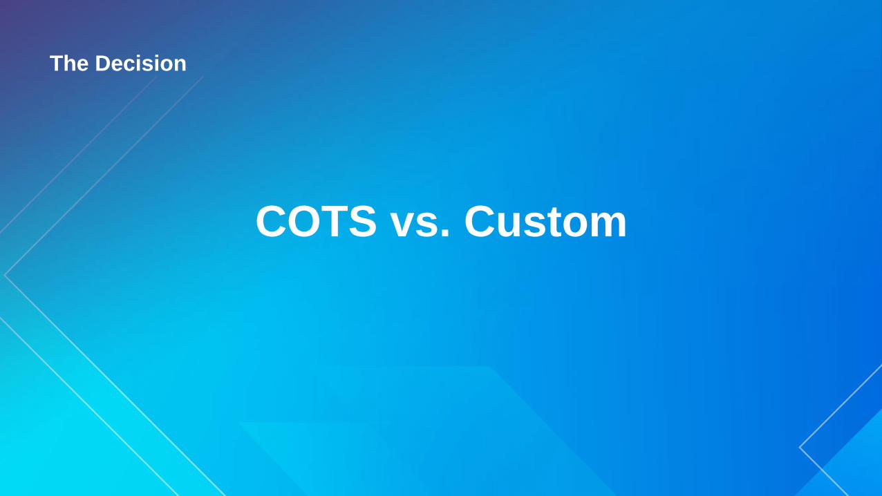
The Decision
COTS vs. Custom
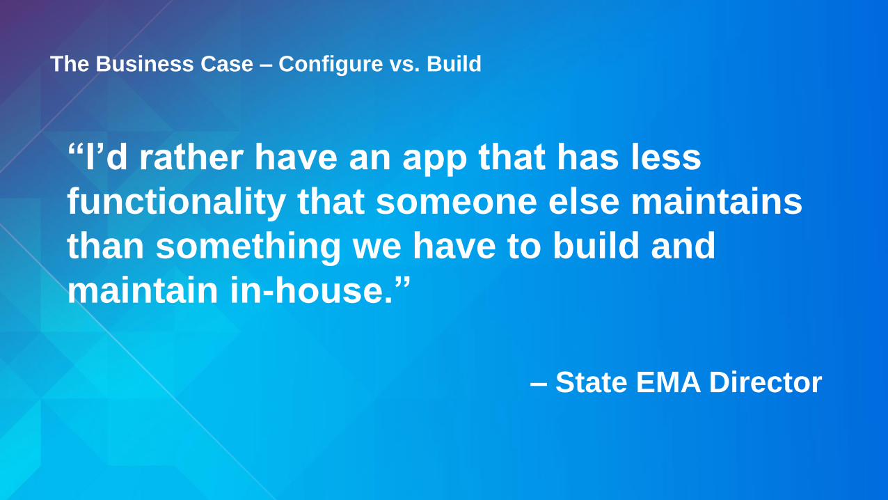
The Business Case – Configure vs. Build
“I’d rather have an app that has less
functionality that someone else maintains
than something we have to build and
maintain in-house.”
– State EMA Director

Esri COTS White Paper – 2011
• Philosophy:
“Go With The Grain”
• Technology:
ArcGIS as an integrated platform
• Methodology:
• Follow Best Practices
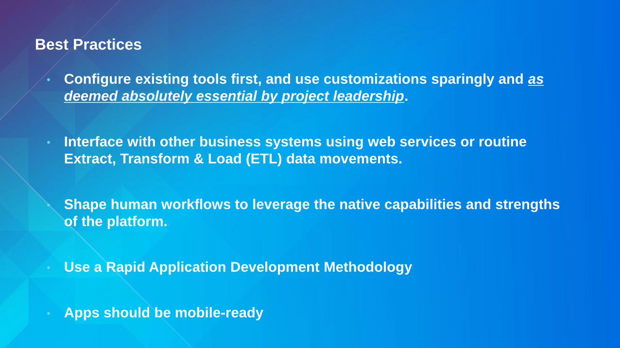
Best Practices
• Configure existing tools first, and use customizations sparingly and as
deemed absolutely essential by project leadership.
• Interface with other business systems using web services or routine
Extract, Transform & Load (ETL) data movements.
• Shape human workflows to leverage the native capabilities and strengths
of the platform.
• Use a Rapid Application Development Methodology
• Apps should be mobile-ready
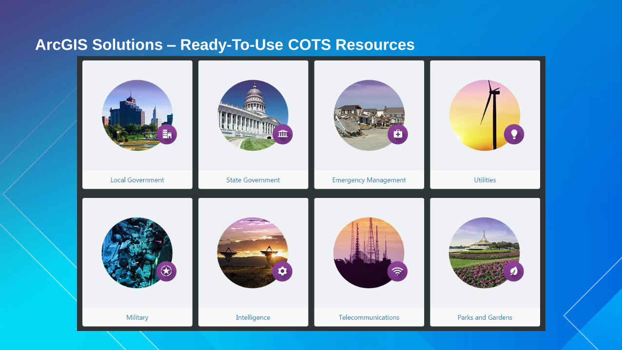
ArcGIS Solutions – Ready-To-Use COTS Resources

Operations Dashboard & Collector
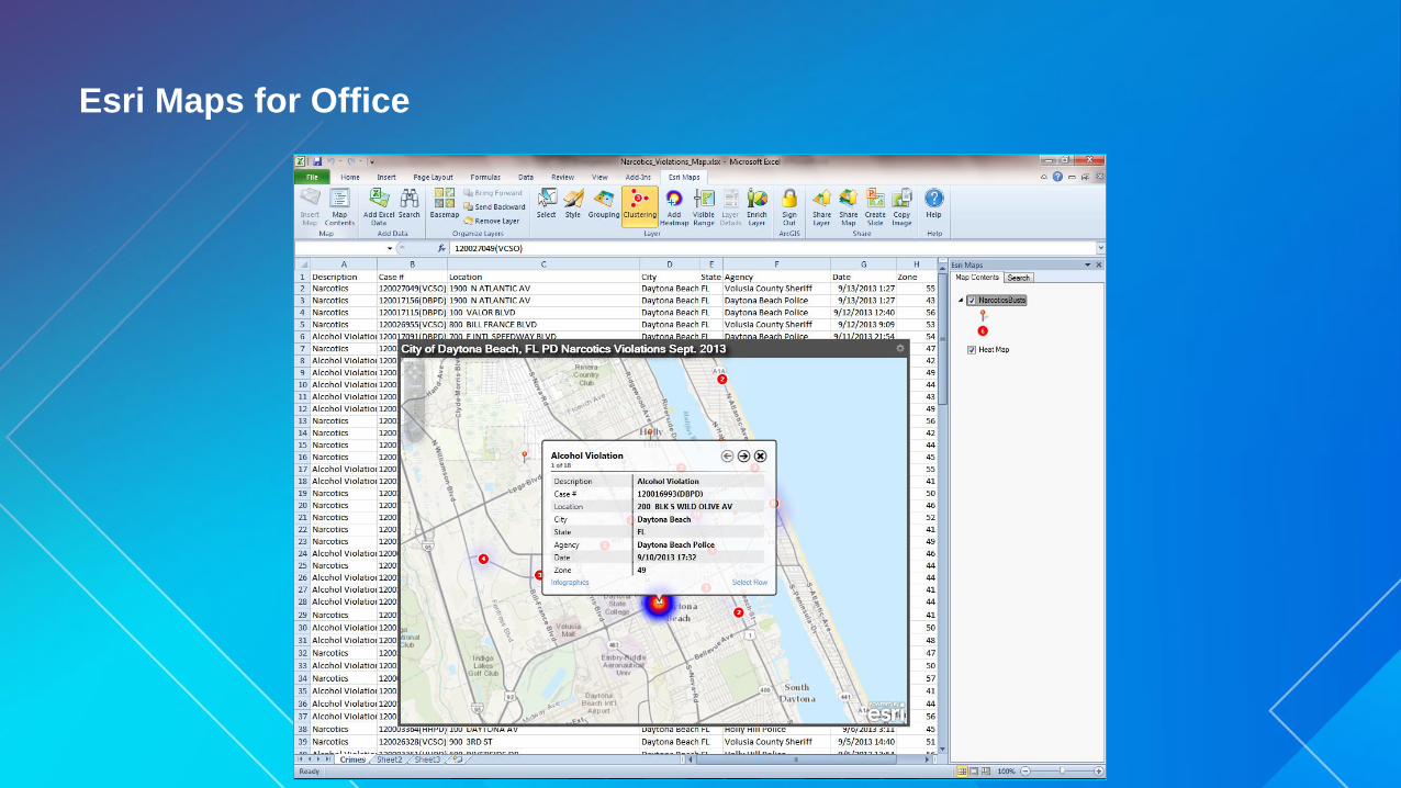
Esri Maps for Office
Strategic Planning
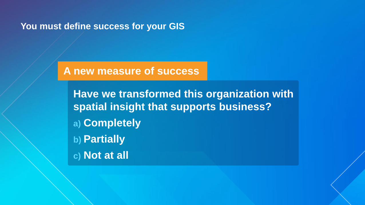
You must define success for your GIS
A new measure of success
Have we transformed this organization with
spatial insight that supports business?
a) Completely
b) Partially
c) Not at all

Executives Citizens
GIS StaffProgram Staff
ArcGIS
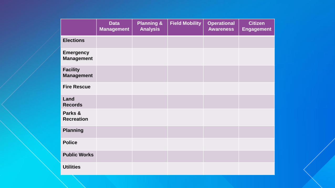
Data
Management
Planning &
Analysis
Field Mobility Operational
Awareness
Citizen
Engagement
Elections
Emergency
Management
Facility
Management
Fire Rescue
Land
Records
Parks &
Recreation
Planning
Police
Public Works
Utilities

Data
Management
Planning &
Analysis
Field Mobility Operational
Awareness
Citizen
Engagement
Elections
Emergency
Management
Facility
Management
Fire Rescue
Land
Records
Parks &
Recreation
Planning
Police
Public Works
Utilities

Data
Management
Planning &
Analysis
Field Mobility Operational
Awareness
Citizen
Engagement
Elections
COTS COTS COTS
Emergency
Management
COTS COTS COTS
Facility
Management
COTS COTS COTS
Fire Rescue
COTS COTS COTS
Land
Records
COTS COTS COTS
Parks &
Recreation
COTS COTS COTS
Planning
COTS COTS COTS
Police
COTS COTS COTS
Public Works
COTS COTS COTS
Utilities
COTS COTS COTS
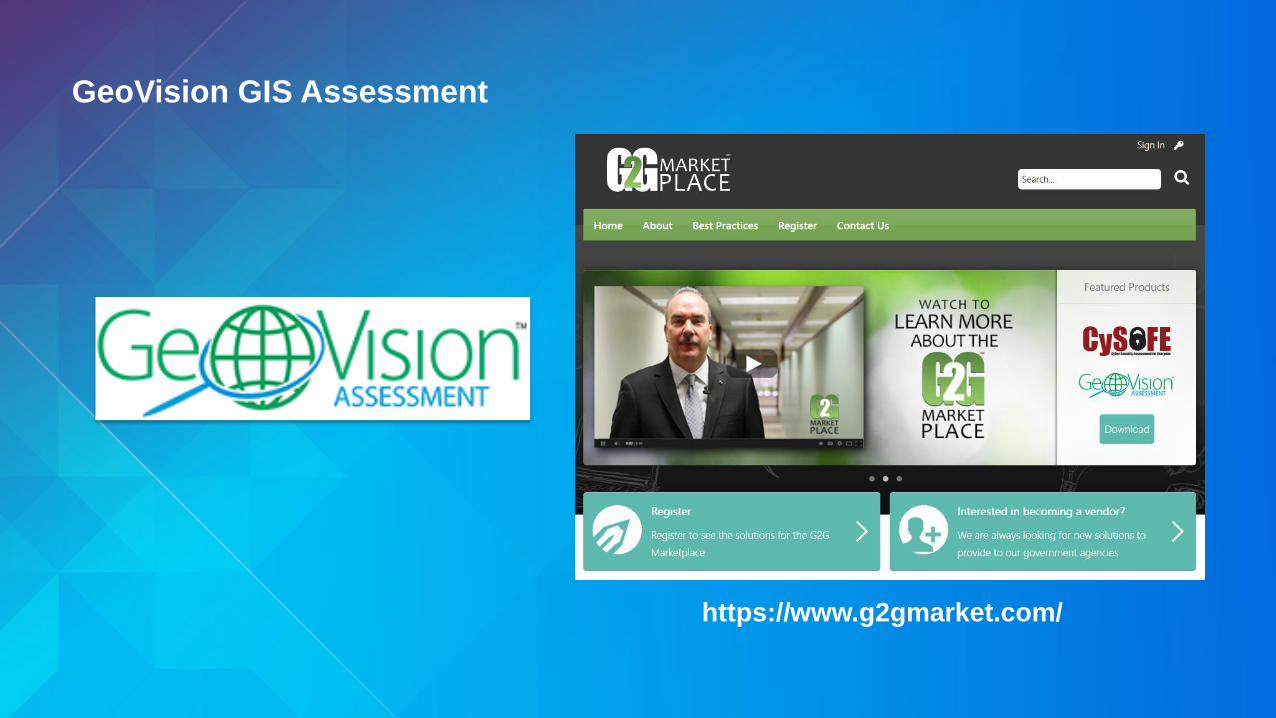
GeoVision GIS Assessment
https://www.g2gmarket.com/


Summary
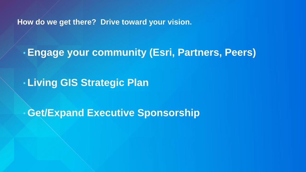
How do we get there? Drive toward your vision.
• Engage your community (Esri, Partners, Peers)
• Living GIS Strategic Plan
• Get/Expand Executive Sponsorship

Road map to Success
• Embrace change (technology, expectations)
• Implement GIS as a location platform to support business
across all six business patterns
• Sell the value of your GIS
• Engage executives & make them GIS users
• Deploy COTS, mobile-capable focused apps ASAP
• Market Spatial Analysis capabilities to your customers

GIS Manager or GIS Leader?

“Good business leaders
create a vision, articulate
the vision, passionately
own the vision, &
relentlessly drive it to
completion.”

ArcGIS enables every employee and contractor
to easily discover, use, make, and share maps
from any device, anywhere, anytime.
Adam Carnow
@AdamCarnowEsri
704-541-9810 x8679
Keith Cooke
@KeithCookeEsri
704-541-9810 x4419
THANK YOU!