acrp 4-18 –runway protection zones (rpz) risk assessment...
TRANSCRIPT
i
ACRP 4-18 –RUNWAY PROTECTION ZONES (RPZ) RISK ASSESSMENT TOOL
FINAL PROJECT REPORT
PREPARED FOR THE AIRPORT COOPERATIVE RESEARCH
PROGRAM (ACRP)
Hamid Shirazi, Jim Hall, Beattie Williams, Stephen Moser, Dorothy Boswell, Marshall Hardy, Rich Speir and Endri Mustafa
Applied Research Associates (ARA), Inc.
Mark Johnson, Colleen Quinn, Patrick Hickman and David Ramacorti Ricondo & Associates (R&A)
Stephanie Ward and Morgan Turner Mead and Hunt,
Joanne Landry of Landry Consultants
Prof. Ali Mosleh of University of California at Los Angeles
Applied Research Associates, Inc.
Elkridge, MD
July 2016
TRANSPORTATION RESEARCH BOARD OF THE NATIONAL ACADEMIES
PRIVILEGED DOCUMENT This report, not released for publication, is furnished only for review to members of or participants in the work of the CRP. This report is to be
regarded as fully privileged, and dissemination of the information included herein must be approved by the CRP.

ii
ACKNOWLEDGMENT OF SPONSORSHIP
This work was sponsored by one or more of the following as noted: American Association of State Highway and Transportation Officials, in cooperation with the Federal Highway Administration, and was conducted in the National Cooperative Highway Research Program, Federal Transit Administration and was conducted in the Transit Cooperative Research Program, American Association of State Highway and Transportation Officials, in cooperation with the Federal Motor Carriers Safety Administration, and was conducted in the Commercial Truck and Bus Safety Synthesis Program, Federal Aviation Administration and was conducted in the Airports Cooperative Research Program, which is administered by the Transportation Research Board of the National Academies.
DISCLAIMER
This is an uncorrected draft as submitted by the research agency. The opinions and conclusions expressed or implied in the report are those of the research agency. They are not necessarily those of the Transportation Research Board, the National Academies, or the program sponsors.

iii
TABLE OF CONTENTS
AUTHOR ACKNOWLEDGEMENTS .................................................................................................... vi
ABSTRACT ............................................................................................................................................... vii
CHAPTER 1 – Introduction ...................................................................................................................... 1
CHAPTER 2 – Literature Review ............................................................................................................. 4
CHAPTER 3 – Data Collection and Analysis ........................................................................................... 7 3.1. Accident and Incident Data Collection .............................................................................................. 7 3.2. Normal Operation Data (NOD) Collection ...................................................................................... 11
CHAPTER 4 – Risk Modeling ................................................................................................................. 13
4.1. Accident Likelihood Models ............................................................................................................ 14 4.2. Location Models .............................................................................................................................. 19
4.2.1. Historic accident location data ............................................................................................. 19 4.2.2. Longitudinal and lateral location modeling ......................................................................... 24
4.3. RPZ Crash Likelihood ..................................................................................................................... 30 4.4. Consequence Models ....................................................................................................................... 31
4.2.1. Historic events consequences............................................................................................... 31 4.2.2. Consequence modeling approach......................................................................................... 32
4.5. Risk Assessment .............................................................................................................................. 35
CHAPTER 5 – Conclusions .................................................................................................................... 36 5.1. Major Achievements ........................................................................................................................ 37
5.1.1. Data collection and risk modeling ....................................................................................... 37 5.1.2. RPZ risk assessment software tool....................................................................................... 37 5.1.3. Users’ guide ......................................................................................................................... 37
5.2. Limitations ....................................................................................................................................... 38
REFERENCES .......................................................................................................................................... 39 ABBREVIATIONS AND ACRONYMS ................................................................................................. 41 APPENDIX A – Inventory of Collected Accidents and Incidents ....................................................... A1 APPENDIX B – Sampled Airports ..........................................................................................................B1 APPENDIX C – Standard Error of Regression Coefficient of Accident Location Models ............... C1 APPENDIX D – Coordinates of Events Used for Development of Location Models ………………..D1

iv
LIST OF FIGURES
Figure 3.1– Snapshot of accident and incident database .............................................................................. 8 Figure 3.2- Event (accident/incident) types. ................................................................................................. 9 Figure 3.3- Distribution of event (accidents/incident) types in database. ..................................................... 9 Figure 3.4- Number of collected events over time. ..................................................................................... 10 Figure 4.1- RPZ risk assessment modeling framework. ............................................................................. 13 Figure 4.2- Location models coordinates. ................................................................................................... 19 Figure 4.3- LDOR location scatter plot. ..................................................................................................... 20 Figure 4.4- LDUS location scatter plot. ...................................................................................................... 20 Figure 4.5- TOOR location scatter plot. ..................................................................................................... 21 Figure 4.6- TOOS location scatter plot. ...................................................................................................... 21 Figure 4.7- Lateral and longitudinal distance distribution for LDOR events. ............................................ 22 Figure 4.8- Lateral and longitudinal distance distribution for LDUS events. ............................................. 22 Figure 4.9- Lateral and longitudinal distance distribution for TOOR events. ............................................ 23 Figure 4.10- Lateral and longitudinal distance distribution for TOOS events. ........................................... 23 Figure 4.11- LDOR longitudinal component of location model_ 𝒈𝒈(𝒙𝒙). ..................................................... 25 Figure 4.12- LDUS longitudinal component of location model_ 𝒈𝒈(𝒙𝒙). ..................................................... 25 Figure 4.13- TOOR longitudinal component of location model_ 𝒈𝒈(𝒙𝒙). ..................................................... 26 Figure 4.14- TOOS longitudinal component of location model_ 𝒈𝒈(𝒙𝒙). ..................................................... 26 Figure 4.15- LDOR conditional lateral model estimates, 𝒉𝒉(𝒚𝒚|𝒙𝒙), versus historic events. ......................... 28 Figure 4.16- LDUS conditional lateral model estimates, 𝒉𝒉(𝒚𝒚|𝒙𝒙), versus historic events. .......................... 28 Figure 4.17- TOOR conditional lateral model estimates, 𝒉𝒉(𝒚𝒚|𝒙𝒙), versus historic events. ......................... 29 Figure 4.18- Schema used for developing accident location models for a specific location. ..................... 29 Figure 4.19- RPZ Crash Likelihood Schematic. ......................................................................................... 31

v
LIST OF TABLES
Table 3.1- Accident and Incident Filtering Criteria ...................................................................................... 7 Table 3.2- Distribution of accidents and incidents by aircraft class. .......................................................... 10 Table 3.3- Distribution of accidents and incidents by operation type......................................................... 11 Table 3.4- NOD movements by operation types......................................................................................... 12 Table 3.5- NOD movements by engine types. ............................................................................................ 12 Table 3.6- NOD movements by aircraft classes. ........................................................................................ 12 Table 4.1- Adjustment factors for identification of runway distance required. .......................................... 14 Table 4.2- Dichotomized independent variables generated for developing likelihood models. ................. 16 Table 4.3- Comparison of backward and forward stepwise regression likelihood models. ........................ 16 Table 4.4- Regression models coefficients for accident types. ................................................................... 18 Table 4.5- Number of events with known location coordinates. ................................................................ 19 Table 4.6- Summary statistics for longitudinal components of location models. ....................................... 24 Table 4.7- Summary statistics for lateral components of location models_ 𝒉𝒉(𝒚𝒚|𝒙𝒙). .................................. 27 Table 4.8- Summary statistics for lateral component of TOOS location model _ 𝒉𝒉(𝒚𝒚). ............................ 27 Table 4.9- Events consequences to people and property on the ground. .................................................... 31 Table 4.10- Land use and environ of collected events in accident database. .............................................. 32 Table 4.11- Percent of events with fire eruption. ........................................................................................ 33
vi
A U T H O R A C K N O W L E D G E M E N T S
The research reported herein was performed under ACRP Project 4-18 by Applied Research Associates Inc. (ARA), Ricondo & Associates (R&A), Mead & Hunt, Dr. Ali Mosleh and Landry Consultants. ARA was the prime contractor for this study. Dr. Jim Hall, Principal Engineer at ARA, was the Principal Investigator and Mr. Hamid Shirazi, P.E., Principal Engineer at ARA, was the Project Manager. The programing team included Ms. Beattie Williams, Mr. Stephen Moser and Dorothy Boswell of ARA. Mr. Hardy Marshall, Mr. Rich Speir and Mr. Endri Mustafa from ARA, Mr. Mark Johnson, Ms. Colleen Quinn, Mr. Patrick Hickman and Mr. David Ramacorti of R&A, Ms. Stephanie Ward and Ms. Morgan Turner of Mead and Hunt, Ms. Joanne Landry and Dr. Ali Mosleh collaborated in the development of this research, the project report and the users’ guide.
The research team wishes to express their appreciation to Ms. Marci Greenberger of the Transportation
Research Board for her guidance and project coordination during the development of this study. The authors are very grateful for the guidance and help provided by the ACRP Panel for ACRP 4-18, chaired by Mr. David Bannard and including Mr.Paul Esposito, Ms. Jennifer Fuller, Ms. Dawn Mehler, Mr. Jorge Panteli, Mr. Roger Studenski, Mr. Richard Marchi, Stephen Maher, Mr. Rick Etter and Mr. Joseph Snell. The research team is specifically grateful for the support that was provided by the FAA liaison, Mr. Steven Debban, who provided part of data required for the study.

vii
A B S T R A C T This report documents the effort in developing quantitative models to estimate the risk of airport
operation to the people on the ground within the boundaries of runway protection zones (RPZ). Data from historical accidents and incidents that have occurred around the airports are collected and stored in a relational database. To facilitate modeling, historic events are classified as landing overrun, landing undershoot, takeoff overrun and takeoff overshoot, and separate models are developed for each accident types.
The modeling structure includes three parts. First, accident models estimate the likelihood of an aircraft
going off the runway. Next, location models estimate the accident aircraft reach certain locations beyond the runway. Finally, consequence models estimate the likelihood of fatality of the people on the ground based on population density of the land uses within an RPZ.
A software tool was developed to implement the models. The software requires one year of movement
and weather data at the airport as well as population density of the land uses within the RPZs. A users’ guide, submitted as a separate document, supports users to assemble the required inputs and to run the tool.
1
C H A P T E R 1
Introduction
Mechanical malfunction, low visibility, fuel starvation and loss of situational awareness are just a few of the reasons cited as causes of aircraft accidents. Often these accidents take place in sight of the runway environment while a pilot is either landing or departing from an airport. In 1952, a report by the President’s Airport Commission, The Airport and Its Neighbors, noted that clear areas beyond the end of runway ends were important and were worthy of federal management. These areas, formerly known as clear zones and now called RPZs, were originally established to delineate areas of land below aircraft approach paths in order to prevent the creation of airport hazards or development of incompatible land uses within these critical locations.
The U.S. Department of Commerce concurred with the recommendations of the President’s Airport
Commission on the basis that these areas were “primarily for the purpose of safety for people on the ground.” With the study findings and the Department of Commerce support, the Federal Aviation Administration (FAA) adopted clear zones with dimensional standards to implement the Commission’s recommendation. These clear zones were intended to preclude the construction of obstructions potentially hazardous to aircraft operations and to control building construction for the protection of people on the ground.
Unfortunately, for many years these clear zones were largely overlooked by both airports and
surrounding communities who have the police power to control the land development around airports, especially when the property is not airport-owned. As such, there are airports across the U.S. that have development within their RPZs. In many instances, these uses have been located in the RPZs for years with no adverse impacts to the airport or the development. In other instances, land uses have been allowed to develop in RPZs (usually on property that is not airport-owned) that have been detrimental to the airport and the development. Traditionally, there has been little research conducted or guidance provided that assists an airport, developer, or local municipality in the process of assessing what the impacts of development may be, relative to its location within the RPZ. The results of this ACRP project will provide a much needed resource for the industry in assessing the risk associated with developments in RPZs.
Located at the end of each runway, and ideally controlled by the airport, RPZs are designed with the
intent to protect people and property on the ground. Acquisition of sufficient property interest to maintain an area that is clear of all incompatible land uses, objects, and activities is most desirable, however since RPZs can often extend beyond airport property, this can become challenging for airports to achieve. The FAA recommends that, whenever possible, the entire RPZ be owned by the airport and be clear of all obstructions if practicable. Where ownership is impracticable, avigation easements are recommended to obtain the right to regulate the height of structures and vegetation within the RPZ footprint. Obtaining easements that are restrictive enough to limit building opportunities, as well as limit the height of objects that may affect approach and departure paths, are often just as costly to procure as purchasing the

2
property outright. Consequently, airports may be hesitant to undertake acquisition of any kind for property in their RPZs.
It is desirable to clear all objects from the RPZ, per the criteria noted in FAA AC 150/5300-13A, Airport Design, however the following land uses are permissible in the RPZ without further evaluation:
• Farming that meets the minimum buffers as discussed in the AC • Irrigation channels as long as they do not attract birds • Airport service roads, as long as they are not public roads and are directly controlled by the
airport operator • Underground facilities, as long as they meet other design criteria, such as RSA requirements, as
applicable • Unstaffed NAVAIDs and facilities, such as equipment for airport facilities that are considered
fixed-by-function in regard to the RPZ.
New or modified land uses within RPZs that require coordination with the National Airport Planning and Environmental Division (APP-400) include the following, according to the FAA’s Interim Guidance on Land Uses within a Runway Protection Zone:
• Buildings and structures, examples include but are not limited to: residences, schools,
churches, hospitals or other medical care facilities, commercial/industrial buildings, etc.) • Recreational land use, examples include but are not limited to: golf courses, sports fields,
amusement parks, other places of public assembly, etc.) • Transportation facilities. Examples include, but are not limited to: • Rail facilities -light or heavy, passenger or freight • Public roads/highways • Vehicular parking facilities • Fuel storage facilities (above and below ground) • Hazardous material storage (above and below ground) • Wastewater treatment facilities • Above-ground utility infrastructure (i.e. electrical substations), including any type of solar
panel installations. A provision has historically been provided wherein, if it is determined to be impracticable for an airport
sponsor to acquire and plan the land uses within the entire RPZ, provisions can be made to maintain existing residential structures so long as they do not pose a hazard to safe air navigation. The land use standards can provide a recommendation status for that portion of the RPZ that is not controlled by the airport sponsor. If this option is impractical, the airport sponsor should consider the acquisition of an avigation easement to provide control over the RPZ area. Challenges to this option are often the method and criteria that are used to determine what is considered to be impractical.
This report serves as the technical background of the software tool that was developed for the risk
assessment of runway protection zones (RPZ_RAT). It describes the accidents and incidents data collection effort and presents the modeling framework that was developed for the risk assessment. The modeling intent is to develop crash likelihood contours within the boundaries of the airport RPZs. Then, the crash likelihood contours is combined with land use characteristics to assess risk to the people on the ground within each RPZ. The RPZ risk is further refined to every land use within a RPZ.
The data collection effort built upon the database that was developed for the ACRP Report 3- Analysis
of Aircraft Overruns and Undershoots for Runway Safety Areas- and ACRP Report 50- Improved Models

3
for Risk Assessment of Runway Safety Areas- projects. In development of the accident database, more than 300,000 aviation accident and incident reports were screened from 35 countries to identify the cases relevant to current study. More than half of the screened events were from the U.S. Accident and incident data were collected from the following sources:
• FAA Accident/Incident Data System (AIDS). • FAA/National Aeronautics & Space Administration (NASA) Aviation Safety Reporting
System (ASRS). • National Transportation Safety Board (NTSB) Accident Database & Synopses. • MITRE Corporation Runway Excursion Events Database. • Transportation Safety Board of Canada (TSB). • International Civil Aviation Organization (ICAO) Accident/Incident Data Reporting (ADREP)
system. • Australian Transport Safety Bureau (ATSB). • Bureau d'Enquêtes et d'Analyses pour la Sécurité de l'Aviation Civile (France BEA). • UK Air Accidents Investigation Branch (AAIB). • New Zealand Transport Accident Investigation Commission (TAIC). • Air Accident Investigation Bureau of Singapore. • Ireland Air Accident Investigation Unit (AAIU). • Spain Comisión de Investigación de Accidentes e Incidentes de Aviación Civil (CIAIAC). • Indonesia National Transportation Safety Committee (NTSC). • Netherlands Aviation Safety Board (NASB). • Aviation Safety Network (ASN) • Civil Aviation Daily Occurrence Reporting System of Canada (CADORS)
4
C H A P T E R 2
Literature Review
For airports, an important element of safety is the crash risk to populations living in its close proximity. Since most accidents occur during the landing and takeoff phases of a flight, an airport serves to concentrate that risk on its surrounding population. There are various reasons in developing and implementing a tool that can quantify this risk; one of which is the need for airport expansions. Many major airports in the U.S. and around the world are built close to metropolitan areas. A runway extension project or a new runway construction as examples may expose the general public to additional safety risks. Changes to the airport operation such as the introduction of a larger aircraft may also affect the risk of surrounding areas. Other reasons that affect the risk are the changes in the land use around the airport such as the construction of a mass transit system or a major highway that borders the airport.
Several agencies have attempted to quantify the risk over the past two decades. Australian Centre of
Advanced Risk and Reliability Engineering Ltd (ACARRE) Inc. developed a consequence model for using at Sydney airport (Federal Airports Corporation, 1990). The consequence model considered the damage from the impact and the fire that may erupt. Impact areas and affected areas were defined, and it was assumed everybody in the impact area and 30% of people in the affected area would be fatally injured. These assumptions combined with the average population density of the people on the ground provided an estimate of fatality on the ground.
Motivated by the 1992 crash of an El Al freight airliner into an apartment building near Amsterdam
killing more than 40 people, RAND organization was tasked by Netherland officials to develop a framework for the assessment of safety risk to the public on the ground in 1993. The RAND organization (1995) developed the Safety Assessment of the Ground Environment of Airports (SAGE-A) model as a general tool for the evaluation of airport risk to its surrounding areas. The RAND location model only included 53 accidents that resulted in the aircraft hull loss farther than 500 meter from the runway. The study did not differentiate between landing and takeoff accidents and used a Cartesian system for modeling. The RAND consequence model consisted of fatality rates and crash influence areas for large, medium and small aircraft types. Fatality rate is defined as the proportion of the people killed to the people present in a given structure within the area affected by a crash. A matrix of crash influence areas for steep and shallow crash angles, and in ‘open fields’ was prepared. The RAND report did not provide specifics about how these rates and areas were obtained.
In an effort to develop crash location distributions, AEA Technology (Byrne and Jackson, 1992)
derived distributions for commercial/military aircraft and also for light aircraft with MTOW of less than 2.3 ton. These distributions were based only on accidents that occurred in the US and in Canada. A future study by the company focused on accidents within 5 miles of airports involving aircraft types with maximum takeoff weight (MTOW) of greater than 2.3 ton. Separate models were developed for landing and takeoff using 121 accidents. The study adopted a Cartesian (x,y) coordinate and tried to account for the fact that as accidents occur farther away from the runway, they tend to deviate farther from the

5
extended centerline. However, limited number of accidents compelled the study not to account for the dependency of the location coordinates.
DNV Technica Inc. (Purdy, 1994) developed deterministic location models for landings and takeoffs
that involved several assumptions. The model was used in risk assessments at Amsterdam and Manchester airports. DNV also used a Cartesian system with lateral and longitudinal components. Crashes were divided into two types; steep dive and shallow dive crashes. It was assumed that pilots had little to no control in steep crashes and some degree of control in shallow crashes. The deviation of the steep crashes from extended centerline was assumed to be much larger than the shallow ones. It was assumed that 90% of crashes at Amsterdam airport and 50% of crashes at Manchester airport would be shallow where the pilot might have some degree of control to navigate away from the populated areas. To evaluate the consequences of the crash, crash area was assessed according to the size of the impacting aircraft, the impact angle, and the fuel load. The model assumed everybody in the impact area would be killed.
Eddowes (1994) developed a consequence model for implementation at Manchester airport. The model
was based on historical events and provided estimates of the number of houses destroyed, number of fatalities on the ground and the size of the area affected. The model was based on 30 accidents with ground fatalities and established a linear relationship between MTOW and fatality.
In 1997, Center for Transport Studies of Imperial College of London performed a study sponsored by
the UK National Air Traffic Services (NATS) to review the Public Safety Zone (PSZ) policy and to identify a suitable risk modeling approach and to implement the approach for the risk assessment at five UK airports. The goal of the study was to derive a general policy for land use in the vicinity of the airports based on the levels of risk calculated for the surrounding area. PSZs in U.K. have the same function as RPZs in the U.S. The modeling approach was implemented for risk assessment at five U.K. airports. The study adopted a three part modeling approach consisting of crash frequency, location, and consequence models. Crash frequency models were in essence simple crash rates driven from the number of relevant accidents in defined aircraft groups and total number of movements. Relevant accidents were identified from the database of aircraft accidents maintained by Airclaims Ltd. Movement data were obtained from Official Airline Guide (OAG) database. In developing the frequency models, eight groups of aircraft types were devised according to the year of production, engine type and size. Jet aircraft types produced in the eastern countries were separated as a group.
NATS location models were based on 354 past accidents including aircraft with more than 4 ton
MTOW. This geared the study mainly towards commercial flights. The study developed four sets of distributions for landing and takeoff overruns and landing and takeoff crashes from flights. Models were developed relative to the runway end and extended centerline. NATS consequence model separated crash influence areas to impact and debris areas. Impact areas were assumed to be destroyed. The study identified impact and debris areas from 126 and 56 crashes, respectively. Linear and logarithmic relationships were examined between the sizes of the areas and the MTOW. Logarithmic relationship was found a better fit for the data. Even though the number of fatalities were normally noted in historic events, fatality rates were not available since the number of people present at the crash site was rarely noted. Since all historic fatal accidents in the NATS database occurred at impact areas, the study adopted a 100% fatality rate in the impact area, and in return excluded the debris area from the model. NATS also studied the effect of the terrain on the impact and debris areas and found no significant correlation existed.
6
The National Aerospace Dutch Laboratory (NLR) developed a risk assessment model (Piers et al., 1993) which was later updated in 1999. The earlier study used 181 commercial aircraft accidents and coordinate system based on the nominal route of the aircraft when available for developing location models. Engineering judgement was used for many of the accidents where the nominal route was not available. Accidents within 12 kilometer (km) of the runway end for landing accidents and within 6 km for takeoff accidents were considered. All these accidents were for aircraft types with MTOW of more than 5.7 ton. NLR developed a proprietary software tool for conducting the analysis. Many elements of the NLR studies are not publicly available. NLR consequence model related the consequence area to the MTOW of the accident aircraft in historical events. A linear relationship between MTOW and the consequence area was assumed, and models for built-up, open, and wooded and water terrains were developed. A constant fatality rate of 30% was assumed over the entire consequence area. The rate was the average from historical accidents. NLR consequence model was based on a small number of accidents whose consequences were known in great level of details resulting in statistical uncertainty. The study considered the models to be cautious.
The updated NLR study risk model improved and extended the previous effort by adapting new
parameters and by implementing some conceptual changes to the previous risk models. The improvements in the later study was due to the availability of more comprehensive historical data on aircraft operations and accidents (Pikar et al, 2000). The model was intended for implementation at Schiphol Airport; thus, only historic accidents at airports comparable with Schiphol were used. The study period gathered accidents from 1980 to 1997 and identified 75 accidents with 95 million corresponding movements in 40 reference airports. The major goal of the NLR study was to develop a methodology that could be used to assess the risk of Amsterdam airport to the people on the ground. Therefore, in selecting the reference airports, the mix of movements as well as accidents, several filtering criteria was put in place. For example only airports with at least 150,000 annual commercial movements equipped with terminal approach radar were considered.
In 2003, Environmental Resources Management (ERM) Ltd was contracted by the Ireland Department
of Transportation to investigate PSZs of Ireland’s main three airports; Cork, Dublin, and Shannon. ERM implemented the methodology developed for UK NATS and provided recommendations regarding the PSZs policy.

7
C H A P T E R 3
Data Collection and Analysis
3.1. Accident and Incident Data Collection As noted earlier, various national and international sources were used in collecting accident and
incident data. Criteria for filtering accidents and incidents were required to make the events comparable. The criteria used are shown in Table 3.1. Only events that occurred within 2 miles of the runways were collected. This represents the area where the overwhelming majority of accidents in proximity of the airports have occurred.
Table 3.1- Accident and Incident Filtering Criteria
Filter # Description Justification 1 Remove non-fixed wing aircraft
entries Study is concerned with fixed wing civil aircraft accidents and incidents only
2
3
Remove occurrences for unwanted phases of flight
Remove occurrences on unpaved runway surfaces
Study focus is on the runway protection zones. Cases where the accident occurred during landing and takeoff within 2 mile of the runway were collected.
Flight characteristics on unpaved runway surfaces are different from flights on paved runways.
Accidents of light aircraft types weighing less than 6,000 lbs. had to be sampled due to their high frequency of occurrence. A group of 78 airports in the U.S. sampled by Wong (2007) were used for the collection of these accidents and incidents. The sampled airports include general aviation airports as well as various sizes of hub and non-hub airports in various FAA regions.
Using these criteria, 1,069 accidents and incidents were identified that provide complete or partial set
of information needed to develop the models. Accident and incident investigation reports usually do not include all the details needed for populating the database that was developed for storing the collected data. Other sources were explored to obtain the missing data. Information regarding aircraft performance, airport characteristics such as runway length, elevation and surrounding terrain as well as meteorological conditions were often obtained through other sources. More information regarding the accident and incident data collection effort is presented in the ensuing sections of this report. Appendix A presents the list of accidents and incidents that are used for the development of the risk models.

8
The information from the accident and incident reports were organized in a Microsoft Access database. Various relational tables were developed in the database to ease the data collection effort. The database was designed to hold more than 60 data fields for each event such as the reporting source, the airport that the accident took place, the runway orientation and surface conditions, the aircraft characteristics, onboard and on the ground injuries and damages. Figure 3.1 is a screenshot of the database.
Figure 3.1– Snapshot of accident and incident database
To facilitate modeling, accident and incident events were classified into the following types:
• Landing overrun (LDOR) • Landing undershoot (LDUS) • Takeoff overrun (TOOR) • Takeoff overshoot (TOOS)
Figure 3.2 schematically illustrates these events. LDOR are events where the landing aircraft fails to
stop and leaves the far end of the runway. LDUS events are occurrences of aircraft touching down or crashing in a landing attempt prior to the beginning of the runway. If the aircraft leaves the runway end on the ground in a takeoff roll, the event is classified as a TOOR. If the aircraft takes off and crashes after becoming airborne, the event is classified as a TOOS.

9
Source: NLR – Modified Figure 3.2 – Event (accident/incident) types.
Figure 3.3 shows the distribution of the accident types from the database. As shown, more than half of the collected events are landing overruns. Landing events combined account for more than three quarters of all events.
Figure 3.3- Distribution of event (accident/incident) types in database.
Figure 3.4 presents the number of events per year of occurrence. The dashed line presents all the events of the database. The solid line with the triangle marker presents events in the U.S. and the grey line at the bottom presents the number of light aircraft events from the sampled airports. The light aircraft events were collected from the last 2 decades only.
As shown, the number of events in the U.S. is relatively steady for the decade from 1994 to 2004 and
then decreases during the following 10 years. The number of events over the last few years is considerably lower than the prior years. The number of light aircraft events in the sampled airports shows an overall downward trend over the past 2 decades.
LDOR, 54%LDUS,
24%
TOOR, 13%
TOOS, 9%

10
Figure 3.4- Number of collected events over time.
Aircraft types were grouped according to their MTOW and size into 5 classes using the following classification scheme:
• A: Small aircraft of MTOW 12.5k lbs. or less (Beech-90, Cessna Caravan) • B: Medium aircraft of MTOW 12.5k-41k lbs. (business jets, Embraer 120, Learjet 35) • C: Large commuter with MTOW of 41k-255k lbs. (Regional Jets, ERJ-190, ATR42) • D: Large jets with MTOW of 41k-255k lbs. (B737, A320) • E: Heavy jets with MTOW of 255k lbs. and more (B777, A340)
Tables 3.2 and 3.3 provide the breakdown of collected events based on equipment class and operation
type. As shown, the medium and small aircraft types account for the majority of the collected events. Also, general aviation and commercial operations make up the majority of the collected events.
Table 3.2- Distribution of accidents and incidents by aircraft class.
Aircraft class Percent A 32%
B 31%
C 10%
D 17%
E 10%
0
10
20
30
40
50
60
1975 1980 1985 1990 1995 2000 2005 2010 2015
Num
ber
of E
vent
s Occ
urre
d
Year of Event Occurent
All Database Events US Events Light Acft Events at Mvmnt Arpts

11
Table 3.3- Distribution of accidents and incidents by operation type.
Operation type Percent Air taxi/commuter (TC) 11%
Cargo (F) 9%
Commercial (C) 37%
General aviation (GA) 43%
3.2. Normal Operation Data (NOD) Collection A key approach in this study is the use of NOD for accident likelihood modeling. The use of NOD
makes it possible to account for exposure of the aircraft movements to various elements that contribute to accidents. For example, although the existence of a factor such as an icy runway could be identified as a contributing factor to an accident, in the absence of information on non-accident movements exposed to the same factor, it is not possible to know how critical the factor is. With NOD, the number of operations that experience the factor singularly, and in combination with other factors can be calculated; risk ratios can be generated; and the importance of risk factors can be quantified. The use of NOD allows the models to navigate away from simply relying on crash rates based on just aircraft, engine, or operation type, and to account for factors that have been typically ignored in some risk assessment studies.
It is neither possible nor necessary to use the movement data from the entire country. Therefore the
movement data had to be sampled. The sampling strategy devised by Wong (D. Wong, Ph.D. dissertation, 2007) resulted in 78 airports being selected from various airport sizes, FAA regions, and the presence of terrain features around the airport. The NOD database used in a prior study published as ACRP Report 50- Improved Models for Risk Assessment of Runway Safety Areas- was complemented with information for aircraft types with MTOW lower than 6,000 lbs. as well as with movements with piston engines.
The ultimate NOD database contains 263,375 movement records with more than 500 aircraft types. The
performance characteristics of the aircraft types in the NOD database, including MTOW, standard landing and takeoff distance required, wingspan and length were investigated and assigned for each aircraft. Weather elements were also identified and assigned to the movements in the NOD database. As shown in Table 3.4, commercial operations account for the majority of movements in the database. Table 3.5 presents the breakdown of the NOD database according to aircraft engine type. Aircraft class C makes up the majority of the movements in the NOD database as shown in Table 3.6.

12
Table 3.4- NOD movements by operation types.
Operation Type Percent Air taxi/commuter (TC) 23%
Cargo (F) 4%
Commercial (C) 62%
General aviation (GA) 11%
Table 3.5- NOD movements by engine types.
Engine type Percent Jet 80%
Piston 6%
Turboprop 14%
Table 3.6- NOD movements by aircraft classes.
Aircraft Class Percent A 8%
B 18%
C 20%
D 42%
E 12%

13
C H A P T E R 4
Risk Modeling
The modeling framework adopted for this study is a 3 part model as shown in Figure 4.1. The modeling framework include accident likelihood models, location likelihood models, and the consequence models. The accident likelihood models estimate the likelihood that an accident occurs. The accident location models estimate the likelihood that the accident aircraft extends a certain distance beyond the runway. The combination of the accident likelihood models and the location models provides the RPZ crash likelihood. RPZ crash likelihood estimates the annual likelihood of a crash occur within the boundaries of an RPZ. The RPZ crash likelihood is combined with the consequence models encompassing the population densities of the land uses identified within an RPZ to provide the RPZ risk. This section provides details of the models developed in this study.
Figure 4.1- RPZ risk assessment modeling framework.

14
4.1. Accident Likelihood Models The accident likelihood models estimate the likelihood that an event occurs given certain operational
conditions. The models implement independent variables identified as either causal or contributing factors for the occurrence of the event. The data collection effort was focused on obtaining the following information from the historic accident and incident investigation reports:
• Airport specific data: Elevation, hub/non-hub classification, runways declared distances • Flight specific data: Aircraft make and model, runway distance required for landing and
takeoff, type of operation, and domestic/international flight • Weather elements: Ceiling and visibility, wind direction and magnitude, temperature, light
level, type of precipitation, fog, gust and windshear
Runway criticality factors were also assigned to the accidents. Runway criticality factor is defined as the logarithm of the ratio between the distance required for the operation and the distance available. To correctly identify the distance required for the operation, the standard distance for the aircraft type had to be identified and adjusted for the condition of the operation. The required distances are adjusted for elevation, temperature, wind and various contaminated surface conditions. The adjustment factors applied to the standard distance required, based on a study conducted by Flight Safety Foundation (1996), are presented in Table 4.1.
Table 4.1- Adjustment factors for identification of runway distance required.
Local Factor Unit Reference Adjustment Elevation (E) (i) 1000 ft E = 0 ft (sea level) Fe = 0.07 E + 1
Temperature (T) (i) deg C T = 15 deg C Ft = 0.01 (T – (15 – 1.981 E)) + 1
Tailwind (TWLDJ) for Jets (iii) knot TWLDJ = 0 knot FTWJ = (RD + 22. TWLDJ)/RD (ii)
Tailwind (TWLDT) for non-jets (iii) knot TWLDT = 0 knot FTWJ = (RD + 30. TWLDT)/RD
Headwind (HWTOJ) for Jets (iii) knot HWTOJ = 0 knot FTWJ = (RD + 6. HWTOJ)/RD
Headwind (HWTOT) for non-jets (iii) knot HWTOJ = 0 knot FTWJ = (RD + 6. HWTOT)/RD
Runway Surface Condition – Wet (iv) Yes/No Dry FW = 1.4
Runway Surface Condition – Snow (iv) Yes/No Dry FS = 1.6
Runway Surface Condition – Slush (iv) Yes/No Dry FSl = 2.0
Runway Surface Condition – Ice (iv) Yes/No Dry FI = 3.5
i – Temperature and elevation corrections used for runway design ii – RD is the runway distance required in feet iii – Correction for wind are average values for aircraft type (jet or turboprop\piston) iv – Runway contamination factors are those suggested by Flight Safety Foundation

15
The same information discussed above was obtained for the movements in the NOD. A large database that combined both the historic events and the NOD as well as their associated information at the time of the operation was developed.
Every piece of information in the combined database that was represented by a continuous variable was
dichotomized except for the criticality factor. Dichotomization is the process of transferring a continuous variable into discrete counterparts of either one or zero values through the use of dummy variables. Dummy variables are dichotomous; one if the visibility of the operation is within the range that is being presented by the variable and zero if otherwise. For example, visibility is a continuous variable and was presented with the following four dummy variables:
• VisLT2: Visibility less than 2 statute mile • VisGT2LT4: Visibility between 2 and 4 statute mile • VisGT4LT8: Visibility between 4 and 8 statute mile • VisGT8: Visibility greater than 8 statute mile
As a result, every record in the combined database of NOD and accidents was presented by 43
variables as shown in Table 4.2. Another variable was introduced as the target variable. The target variable was recorded as one for accidents and incidents, and zero for NOD movements.
It was intended to develop one accident likelihood model for each accident type. Therefore, in
developing the landing overrun and undershoot likelihood models, arrival movements from the NOD were used in combination with LDOR and LDUS accidents and incidents. In developing takeoff overrun and overshoot likelihood models, departure movements from NOD were used in combination with TOOR and TOOS accidents and incidents.
Binomial logistic regression modelling structure was used for developing the likelihood models with a
general form as shown in Equation 4.1. Binomial logistic regression represents the situations in which the target outcome is a dichotomous variable. This fits well with the problem at hand where there are only two possible outcomes for every set of variables; normal operation or accident.
(4.1)
where excursionf is the likelihood of an accident type occurring given the independent variables; Xi are independent variables shown in Table 4.2; and bi are the estimated regression coefficients.
Forward stepwise regression and backward stepwise regression models were developed for every accident type. The forward model starts with no variables in the model, tests the addition of each variable using a chosen comparison criterion, adds the variable that improves the model the most, and repeats this process until no variable improves the model. The backward model starts with using all the variables, deletes variables that improve the model using a chosen comparison criterion and repeats the process until no further improvement is possible. The following three criteria were implemented to choose between forward and backward models:
• Number of input variables. Better model implements fewer input variables. In other words, simpler model is better.
• R2 values. Better model has higher R2 value. • Area under the receiver operating characteristic (ROC) curve. The higher the area under the
ROC curve, the better the model. A perfect model has a ROC curve value of one. A random estimator has a value of 0.5.
...)( 332211011
++++−+= XbXbXbbexcursion e
f

16
Table 4.3 presents the performance of the forward and backward models for each accident type. As shown in the table, the backward models had either equal or a very slightly better performance with respect to R2 and the area under the ROC curve, however the forward models achieved the R2 and the area under the ROC curve with fewer input variables. For all accident types, forward stepwise models were preferred.
Table 4.2- Dichotomized independent variables generated for developing likelihood models.
Category Input variables Category Input variables
Ope
ratio
n C
hara
cter
istic
s Foreign Origin/Destination
Wea
ther
Cha
ract
eris
tics
Visibility greater than 8 sm Commercial operation (C) Temperature less than 5 deg C
General aviation operation (GA) Temperature between 5 and 15 deg C Cargo operation (F) Temperature between 15 and 25 deg C
Taxi/commuter operation (T/C) Temperature greater than 25 deg C
Airc
raft
and
airp
ort
Cha
ract
eris
tics
Aircraft class A Fog Aircraft class B Icing Aircraft class C Electric Storm Aircraft class D Frozen Precipitation Aircraft class E Snow
Piston engine type Night Prop engine type Rain Jet engine type Crosswind less than 2 knots Criticality factor Crosswind between 2 and 5 knots
Hub airport Crosswind between 5 and 12 knots
Wea
ther
C
hara
cter
istic
s
Ceiling less than 200 ft Crosswind greater than 12 knots Ceiling between 200 and 1000 ft Tailwind less than 2 knots Ceiling between 1000 and 2500 ft Tailwind between 2 and 5 knots
Ceiling greater than 2500 ft Tailwind between 5 and 12 knots Visibility less than 2 sm Tailwind greater than 12 knots
Visibility between 2 and 4 sm Presence of gusty winds Visibility between 4 and 8 sm
Table 4.3- Comparison of backward and forward stepwise regression likelihood models.
Event type
Backward stepwise regression Forward stepwise regression
No. of inputs R2 ROC curve No. of inputs R2 ROC
curve
LDOR 30 48.3% 95.1% 19 48.0% 95.1%
LDUS 21 35.9% 94.5% 18 35.7% 94.4%
TOOR 16 28.3% 92.0% 15 28.3% 92.0%

17
TOOS 20 42.0% 97.3% 14 40.3% 97.2%
Table 4.4 presents the variables that were selected by the forward regression routines and their associated coefficients. The following were assigned as the reference category against which the odds ratios should be interpreted: Aircraft class D, commercial operation, ceiling height greater than 2,500 feet, visibility greater than 8 statute mile, crosswind and tailwind less than 2 knots, air temperature of 15 to 25 degree Celsius, domestic origin and destination flights, hub airport and absence of the weather elements. As shown in the table, some variables such as crosswind between 2 and 5 knots are found to be relevant in all four accident types while others may be relevant in one accident type and not in others. The standard errors associated with each coefficient estimate is included in Appendix C.
The software tool developed for this project implements the accident likelihood models and assigns
estimates of accidents to every movement at a study airport. To conduct the analysis at an airport, movements over one typical year is used by the software to cover the seasonal variation as well as airport movement mix variation. For arrivals, likelihoods of LDOR and LDUS are calculated. For departures, likelihoods of TOOR and TOOS are calculated. Then, the tool stores the number of arrivals and departures on each runway and their corresponding average likelihoods for the accident types. These statistics are used later in the development of the risk models.

18
Table 4.4- Regression models coefficients for accident types.
Variables LDOR LDUS TOOR TOOS
Hub -3.32 -0.99 -1.46 -1.84
Foreign O/D 1.71 1.67 1.50
Aircraft class A -1.18
Aircraft class B 0.66 1.49 Aircraft class C -1.53
Aircraft class B or C -2.38
Piston 2.55 3.50 3.78 2.90
Prop -1.22 -1.02 1.77
Operation type F 1.95
Operation type GA 1.47 0.74 2.82
Operation type TC 0.66 1.23 1.96
Fog 1.60 2.17 1.65 2.22
Icing 1.50
Night 1.61 2.06 2.13 2.45
Rain 0.76
Snow 1.57 1.13 2.54
Electric Storm -1.23
Ceiling less than 200 feet 2.44
Ceiling between 1000 and 2500 feet -0.79
Temperature less than 5 C 0.68 0.90
Temperature greater than 25 C -0.86 -0.46
Tailwind between 5 and 12 knots 0.94 0.65
Tailwind greater than 12 knots 3.22 3.45
Tailwind greater than 2 less than 5 -0.68
Visibility less than 2 statute mile 1.60 1.29
Visibility between 2 and 4 statute mile 0.98 1.35
Visibility between 4 and 8 statute mile 0.70
Crosswind between 2 and 5 knots -1.11 -0.46 -0.86 -0.87
Crosswind between 5 and 12 knots -0.47 -0.72 Criticality factor 5.82 3.00 4.68 2.77
Constant -11.96 -16.37 -16.41 -18.22

19
4.2. Location Models Location models quantify the likelihood of an accident at a given location beyond a runway and within
an RPZ. In review of the historic events, the location of the accidents were recorded using a Cartesian coordinate system with the origin at the centerline of the runway threshold. As shown in Figure 4.2, X measures the longitudinal distance of the accident location from the runway threshold and Y measures its lateral distance from the runway extended centerline. Accidents along the runway (i.e. veer-offs and accidents on runways) are not within the scope of this project. Also, the significance of the runway length is accounted for in developing the accident likelihood models by incorporating runway criticality factor as a variable. Therefore, the location models merely estimate the distribution of the accident locations beyond the runway. It was assumed the aircraft is equally likely to veer to the left and to the right after the end of the runway. Therefore, the models provide the same likelihood estimate for both sides of the runway.
Figure 4.2– Location models coordinates.
4.2.1. Historic accidents location data
Table 4.5 shows the number of historic events with known location coordinates. Investigation reports more frequently describe the longitudinal distance of the accident location than the lateral distance from the extended runway centerline. As a result, for all types of accidents, the longitudinal component is more frequently known than the lateral component.
Figures 4.3 to 4.6 illustrate the scatter plot of the accidents collected from the historic events when both
coordinates were known. Majority of the events occurred close to the runway threshold and along the centerline of the runway. Takeoff overshoot events are most scattered around the runway as shown in Figure 4.6. Appendix D presents the accidents that were used for developing the location models.
Table 4.5- Number of events with known location coordinates. Event Type Longitudinal (X) Lateral (Y)
LDOR 428 342
LDUS 198 164
TOOR 105 89
TOOS 61 56
x
y

20
Figure 4.3- LDOR location scatter plot.
Figure 4.4- LDUS location scatter plot.
0
500
1000
1500
2000
2500
3000
3500
0 500 1000 1500 2000 2500 3000 3500 4000Dis
tanc
e fr
om e
xten
ded
runw
ay c
ente
rline
(Y in
ft)
Distance from runway end (X in ft)
LDOR events location
0
500
1000
1500
2000
2500
3000
3500
4000
4500
5000
0 1000 2000 3000 4000 5000 6000
Dis
tanc
e fr
om e
xten
ded
runw
ay c
ente
rline
(Y in
ft)
Distance from runway threshold (X in ft)
LDUS events location

21
Figure 4.5- TOOR location scatter plot.
Figure 4.6- TOOS location scatter plot.
0
200
400
600
800
1000
1200
1400
0 500 1000 1500 2000 2500 3000Dis
tanc
e fr
om e
xten
ded
runw
ay c
ente
rline
(Y in
ft)
Distance from runway end ( X in ft)
TOOR events location
0
500
1000
1500
2000
2500
3000
3500
4000
4500
5000
0 1000 2000 3000 4000 5000 6000
Dis
tanc
e fr
om e
xten
ded
runw
ay c
ente
rline
(Y in
ft)
Distance from runway end (X in ft)
TOOS events location

22
Figures 4.7 to 4.10 show the histograms of the events location. As shown in the Figure 4.7, 201 LDORs are contained within 200 feet from the runway which equates to 47% of the events. Less than 7% of LDORs extend more than 1,000 feet beyond the runway. More than 90% of LDORs are contained within 150 feet from the runway centerline, respectively.
Thirty eight percent of LDUSs occurred within 200 feet from the landing threshold and 19% occurred
more than 2,500 feet from the runway threshold as shown in Figure 4.8. The remaining 43% of LDUSs occurred between 200 and 2,500 feet from the runway threshold. About 76% of LDUSs are reported to have touched down within 50 feet of the extended centerline.
Figure 4.9 depicts that TOORs are relatively uniformly distributed between the first 3 groups extending
from 0 to 1,000 feet beyond the runway with 15% of the events extending farther than that. Laterally, the TOORs remained within 50 feet of the centerline in 75% of the events. Comparing Figures 4.7 and 4.9 illustrates that TOORs tend to extend farther away from the runway than the LDORs; however, the lateral distance in TOORs is less dispersed around the extended centerline than the LDORs.
As shown in Figure 4.10, more than 31% of TOOSs with identified location extended farther than
2,500 feet away from the runway and more than 18% extended more than 1,000 feet from the centerline. TOOSs are the most dispersed event type both in longitudinal and lateral directions.
Figure 4.7- Lateral and longitudinal distance distribution for LDOR events.
Figure 4.8- Lateral and longitudinal distance distribution for LDUS events.
201
132
69
203 5
0%
20%
40%
60%
80%
100%
0
50
100
150
200
250
0-200 200-500 500-1000 1000-1700 1700-2500 >2500
Num
ber
of E
vent
s
Longitudinal Distance From Threshold (ft)
LDOR
Frequency
Cumulative %
79
35
21 19 16
39
0%
20%
40%
60%
80%
100%
0
10
20
30
40
50
60
70
80
90
0-200 200-500 500-1000 1000-1700 1700-2500 >2500
Num
ber
of E
vent
s
Longitudinal Distance From Threshold (ft)
LDUS
Frequency
Cumulative %
129
143 6 1 5
12
0%
20%
40%
60%
80%
100%
0
20
40
60
80
100
120
140
0-50 50-150 150-250 250-500 500-700 700-1000 >1000
Num
ber
of E
vent
s
Lateral Distance From Extended Centerline (ft)
LDUS
Frequency
Cumulative %

23
Figure 4.9- Lateral and longitudinal distance distribution for TOOR events.
Figure 4.10- Lateral and longitudinal distance distribution for TOOS events.
3133
31
14
03
0%
20%
40%
60%
80%
100%
0
5
10
15
20
25
30
35
0-200 200-500 500-1000 1000-1700 1700-2500 >2500
Num
ber
of E
vent
s
Longitudinal Distance From Threshold (ft)
TOOR
Frequency
Cumulative %
70
124 4 2 1 1
0%
20%
40%
60%
80%
100%
0
10
20
30
40
50
60
70
80
0-50 50-150 150-250 250-500 500-700 700-1000 >1000
Num
ber
of E
vent
s
Lateral Distance From Extended Centerline (ft)
TOOR
Frequency
Cumulative %
1820
14
19
5
35
0%
20%
40%
60%
80%
100%
0
5
10
15
20
25
30
35
40
0-200 200-500 500-1000 1000-1700 1700-2500 >2500
Num
ber
of E
vent
s
Longitudinal Distance From Threshold (ft)
TOOSFrequency
Cumulative %
37
11
6
15
5 4
18
0%
20%
40%
60%
80%
100%
0
5
10
15
20
25
30
35
40
0-50 50-150 150-250 250-500 500-700 700-1000 >1000
Num
ber
of E
vent
s
Lateral Distance From Extended Centerline (ft)
TOOS
Frequency
Cumulative %
24
4.2.2. Longitudinal and lateral location modeling
A general modeling structure as shown in equation 4.2 was implemented to model accident locations. The model is built to account for the possible interdependency between longitudinal and lateral coordinates:
𝐿𝐿(𝑥𝑥 ≥ 𝑥𝑥1,𝑦𝑦 ≥ 𝑦𝑦1) = 𝑔𝑔(𝑥𝑥 ≥ 𝑥𝑥1) × ℎ(𝑦𝑦 ≥ 𝑦𝑦1|𝑥𝑥 ≥ 𝑥𝑥1) (4.2)
where 𝐿𝐿(𝑥𝑥 ≥ 𝑥𝑥1,𝑦𝑦 ≥ 𝑦𝑦1) is the likelihood of an accident occurring 𝑥𝑥1 feet or more from the runway threshold and 𝑦𝑦1 feet or more from the extended runway centerline. 𝑔𝑔(𝑥𝑥 ≥ 𝑥𝑥1) presents the longitudinal component of the location model estimating the likelihood of an accident at least 𝑥𝑥1 feet from the runway. The conditional lateral component of the location model, ℎ(𝑦𝑦 ≥ 𝑦𝑦1|𝑥𝑥 ≥ 𝑥𝑥1), is the likelihood of an accident at least 𝑦𝑦1 feet away from the extended centerline given that the location is at least 𝑥𝑥1 feet from the runway. For every type of accident, longitudinal and lateral components of the location model were developed separately.
Based on the location of historic events, four complementary cumulative probability distribution
(CCPD) models were developed for the longitudinal component of location model. With CCPDs, the fraction of accidents involving locations exceeding a given distance from the runway end or threshold can be estimated. Various modeling structures were examined to fit the CCPDs. Nonlinear exponential functions in general forms as shown in equation (4.3) provided excellent fit with R2 values of above 99% for all accident types. Models parameters are shown in Table 4.6 with their corresponding R2 values.
𝑔𝑔(𝑥𝑥 ≥ 𝑥𝑥1) = 𝑒𝑒𝑎𝑎 . 𝑥𝑥1𝑏𝑏 (4.3)
Table 4.6- Summary statistics for longitudinal components of location models.
Accident type a b R2
LDOR -0.0034 0.979 99.7
LDUS -0.0230 0.548 99.2
TOOR -0.0007 1.131 99.8
TOOS -0.0003 1.017 99.3
Figures 4.11 through 4.14 present the CCPD from historic events as well as the models’ fit to the data.
As shown in all figures, very good fits were achieved for the longitudinal component of location model for all accident types.

25
Figure 4.11- LDOR longitudinal component of location model_ 𝒈𝒈(𝒙𝒙).
Figure 4.12- LDUS longitudinal component of location model_ 𝒈𝒈(𝒙𝒙).
0
0.2
0.4
0.6
0.8
1
0 500 1000 1500 2000 2500 3000 3500 4000
CCPD
Distance from runway (ft)
LDOR
Historic Model Estimate
0
0.2
0.4
0.6
0.8
1
0 2000 4000 6000 8000 10000
CCPD
Distance from runway (ft)
LDUS
Historic Model Estimate
26
Figure 4.13- TOOR longitudinal component of location model_ 𝒈𝒈(𝒙𝒙).
Figure 4.14- TOOS longitudinal component of location model_ 𝒈𝒈(𝒙𝒙).
0
0.2
0.4
0.6
0.8
1
0 500 1000 1500 2000 2500 3000 3500
CCPD
Distance from runway (ft)
TOOR
Historic Model Estimate
0
0.2
0.4
0.6
0.8
1
0 2000 4000 6000 8000 10000
CCPD
Distance from runway (ft)
TOOS
Historic Model Estimate

27
Historical events with known X and Y coordinates of crash location were used to calculate the conditional lateral components of the location models. Regression modeling was used to fit the data. Equation 4.4 presents the general form of the regression model that was used. Table 4.7 provides summary statistics of the models.
h(𝑦𝑦 ≥ 𝑦𝑦1|𝑥𝑥 ≥ 𝑥𝑥1) = 1
1+𝑒𝑒(𝑎𝑎1 . 𝑥𝑥1𝑏𝑏1+𝑎𝑎2 . 𝑦𝑦1𝑏𝑏2+𝑐𝑐) (4.4)
Table 4.7- Summary statistics for lateral components of location models_ 𝒉𝒉(𝒚𝒚|𝒙𝒙).
𝒂𝒂𝟏𝟏 𝒃𝒃𝟏𝟏 𝒂𝒂𝟐𝟐 𝒃𝒃𝟐𝟐 𝐂𝐂 𝐑𝐑𝟐𝟐
LDOR -0.024 0.625 2.999 0.143 -4.040 98.6
LDUS -1.536 0.169 0.560 0.261 3.440 87.9
TOOR -0.001 0.980 3.676 0.102 -4.329 98.0
TOOS -4.32E-07 1.778 0.889 0.219 -3.100 97.4
As shown in the table, all models have achieved good fit. However, the 𝑎𝑎1 coefficient for TOOS model is very small (-4.32 × 10⁻⁷). The statistical significance test on 𝑎𝑎1 of TOOS model indicated that the 95% confidence interval for 𝑎𝑎1 included zero. Therefore, it was concluded that for TOOS, the Y coordinate of the location is independent of the X coordinate. Therefore, lateral component of TOOS model was modeled using a nonlinear exponential model similar to the longitudinal component. Table 4.8 presents the summary statistics.
Table 4.8- Summary statistics for lateral component of TOOS location model _ 𝒉𝒉(𝒚𝒚).
a b R2
TOOS -0.0475 0.4634 99.2
Figures 4.15 through 4.17 present the model estimates of the lateral component of the location versus
the likelihood from the historic events for LDOR, LDUS and TOOR. With a perfect model, the points fall on the bisector line.

28
Figure 4.15- LDOR conditional lateral model estimates, 𝒉𝒉(𝒚𝒚|𝒙𝒙), versus historic events.
Figure 4.16- LDUS conditional lateral model estimates, 𝒉𝒉(𝒚𝒚|𝒙𝒙), versus historic events.
0
0.2
0.4
0.6
0.8
1
0.0 0.2 0.4 0.6 0.8 1.0
Mod
el E
stim
ate
Historic events
LDOR
0
0.2
0.4
0.6
0.8
1
0.0 0.2 0.4 0.6 0.8 1.0
Mod
el E
stim
ate
Historic events
LDUS

29
Figure 4.17- TOOR conditional lateral model estimates, 𝒉𝒉(𝒚𝒚|𝒙𝒙), versus historic events.
As was explained so far, multiplying the longitudinal and lateral components provides the location model, L(.), which is the likelihood that an accident occurs more than a certain distance from the runway and more than a certain distance from the extended centerline. Four models were developed for each accident type and were denoted as 𝐿𝐿𝐿𝐿𝐿𝐿𝐿𝐿𝐿𝐿, 𝐿𝐿𝐿𝐿𝐿𝐿𝐿𝐿𝐿𝐿, 𝐿𝐿𝑇𝑇𝐿𝐿𝐿𝐿𝐿𝐿, and 𝐿𝐿𝑇𝑇𝐿𝐿𝐿𝐿𝐿𝐿. To obtain the likelihood of an accident in a location confined on all sides, shown as A in Figure 4.18, further refinements is necessary. It is important to highlight the following:
• It is nearly impossible to model the actual wreckage path of the accident aircraft because of
unavailability of the data from historic events as well as its complexity and dependence on a variety of factors. In developing the models, it is assumed that the accident occurs parallel to the runway.
• In developing the location models, it was assumed the same proportion of accidents occur on either side of the runway. Therefore the findings from models, when used to estimate the likelihood of an accident in an area on one side of the runway, should be divided by 2.
Figure 4.18- Schema used for developing accident location models for a specific location.
0
0.2
0.4
0.6
0.8
1
0.0 0.2 0.4 0.6 0.8 1.0
Mod
el E
stim
ate
Historic events
TOOR

30
Conservatively, it is assumed that location A in Figure 4.18 is impacted in a LDOR or a TOOR accident if the aircraft travels at least 𝑥𝑥1 feet off the runway and remain within 𝑦𝑦1 and 𝑦𝑦2 feet from the extended centerline. Therefore, the likelihood that location A is impacted in a LDOR or a TOOR event can be obtained from the followings:
𝐿𝐿𝐴𝐴𝐿𝐿𝐿𝐿𝐿𝐿𝐿𝐿 = 12
× [𝐿𝐿𝐿𝐿𝐿𝐿𝐿𝐿𝐿𝐿(𝑥𝑥1,𝑦𝑦1) − 𝐿𝐿𝐿𝐿𝐿𝐿𝐿𝐿𝐿𝐿(𝑥𝑥1,𝑦𝑦2)] (4.5a)
𝐿𝐿𝐴𝐴𝑇𝑇𝐿𝐿𝐿𝐿𝐿𝐿 = 12
× [𝐿𝐿𝑇𝑇𝐿𝐿𝐿𝐿𝐿𝐿(𝑥𝑥1,𝑦𝑦1) − 𝐿𝐿𝑇𝑇𝐿𝐿𝐿𝐿𝐿𝐿(𝑥𝑥1,𝑦𝑦2)] (4.5b)
where 𝑥𝑥1 and 𝑦𝑦1 are the distance of the closest edge of A with respect to the runway and the extended centerline, respectively, and 𝑦𝑦2 is the distance of the farthest edge of A with respect to the extended centerline.
In LDUS historic events, total wreckage length was measured and recorded, when available. This is the length parallel to the runway that the aircraft traveled from the first point of impact until it stopped. The data was available from 66 events. It was identified that the median distance traveled from the first point of impact was 550 feet. Therefore, a LDUS impacts location A if the first point of impact is between the closer side of A to the runway and 550 feet of the farther side of A. This is shown mathematically in equation 4.6:
𝐿𝐿𝐴𝐴𝐿𝐿𝐿𝐿𝐿𝐿𝐿𝐿 = 12
× {[𝐿𝐿𝐿𝐿𝐿𝐿𝐿𝐿𝐿𝐿(𝑥𝑥1,𝑦𝑦1) − 𝐿𝐿𝐿𝐿𝐿𝐿𝐿𝐿𝐿𝐿(𝑥𝑥1,𝑦𝑦2)] − [𝐿𝐿𝐿𝐿𝐿𝐿𝐿𝐿𝐿𝐿(𝑥𝑥2 + 550,𝑦𝑦1) − 𝐿𝐿𝐿𝐿𝐿𝐿𝐿𝐿𝐿𝐿(𝑥𝑥2 + 550,𝑦𝑦2)]} (4.6)
In the case of a TOOS event, Location A is impacted if the accident location is within the confines of location A. Therefore, the likelihood of a TOOS crash may be obtained from equation 4.7:
𝐿𝐿𝐴𝐴𝑇𝑇𝐿𝐿𝐿𝐿𝐿𝐿 = 12
× {[𝐿𝐿𝑇𝑇𝐿𝐿𝐿𝐿𝐿𝐿(𝑥𝑥1,𝑦𝑦1) − 𝐿𝐿𝑇𝑇𝐿𝐿𝐿𝐿𝐿𝐿(𝑥𝑥1,𝑦𝑦2)] − [𝐿𝐿𝑇𝑇𝐿𝐿𝐿𝐿𝐿𝐿(𝑥𝑥2,𝑦𝑦1) − 𝐿𝐿𝑇𝑇𝐿𝐿𝐿𝐿𝐿𝐿(𝑥𝑥2,𝑦𝑦2)]} (4.7)
4.3. RPZ Crash Likelihood The RPZ crash likelihood is defined as the likelihood of a crash within an airport RPZ in a year. RPZ
crash likelihood combines the findings from the first part of the modeling framework (accident likelihood models) with the second part (location models), and takes into account the annual number of landings and takeoffs that may crash in an RPZ. The RPZ crash likelihood is shown as contours inside the RPZs.
The RPZ crash likelihood incorporates the likelihoods for all types of accidents inside an RPZ. The
likelihoods of LDOR and LDUS for every arrival and the likelihoods of TOOR and TOOS for every departure is obtained using the accident likelihood models. Then averages for each accident type is calculated for each runway. An RPZ is subjected to LDUS accidents for arrivals on the runway. The RPZ is also subjected to LDOR accidents for arrivals from the opposite runway, as well as TOOR and TOOS accidents for departures from the opposite runway. Following the schematic shown in Figure 4.19, when 𝐿𝐿𝐿𝐿2 is the number of landings on the runway in direction 2, and 𝑇𝑇𝑇𝑇1 and 𝐿𝐿𝐿𝐿1 are the number of takeoffs and landings on the opposite runway in direction 1, crash likelihood at point A within the RPZ is obtained from the following:
𝐶𝐶𝐶𝐶𝑎𝑎𝐶𝐶ℎ 𝐿𝐿𝐿𝐿𝐿𝐿𝑒𝑒𝐿𝐿𝐿𝐿ℎ𝑜𝑜𝑜𝑜𝑜𝑜𝐴𝐴 = (𝐿𝐿𝐿𝐿1 × 𝑓𝑓1𝐿𝐿𝐿𝐿𝐿𝐿𝐿𝐿 × 𝐿𝐿𝐴𝐴𝐿𝐿𝐿𝐿𝐿𝐿𝐿𝐿) + �𝐿𝐿𝐿𝐿2 × 𝑓𝑓2𝐿𝐿𝐿𝐿𝐿𝐿𝐿𝐿 × 𝐿𝐿𝐴𝐴𝐿𝐿𝐿𝐿𝐿𝐿𝐿𝐿� + (𝑇𝑇𝑇𝑇1 × 𝑓𝑓1𝑇𝑇𝐿𝐿𝐿𝐿𝐿𝐿 ×𝐿𝐿𝐴𝐴𝑇𝑇𝐿𝐿𝐿𝐿𝐿𝐿) + (𝑇𝑇𝑇𝑇1 × 𝑓𝑓1𝑇𝑇𝐿𝐿𝐿𝐿𝐿𝐿 × 𝐿𝐿𝐴𝐴𝑇𝑇𝐿𝐿𝐿𝐿𝐿𝐿) (4.8)

31
Figure 4.19- RPZ Crash Likelihood Schematic.
where 𝑓𝑓 is the average likelihood from the accident likelihood models with superscript identifying the accident type and subscript identifying the runway direction. For example, 𝑓𝑓1𝐿𝐿𝐿𝐿𝐿𝐿𝐿𝐿denotes the average likelihood of a LDOR event for landings in runway direction 1. 𝐿𝐿𝐴𝐴 is the location likelihood at location A with superscript identifying the accident type. When crash likelihood at all locations within an RPZ is summed up, the RPZ crash likelihood is obtained as shown below.
𝑅𝑅𝑅𝑅𝑅𝑅 𝐶𝐶𝐶𝐶𝑎𝑎𝐶𝐶ℎ 𝐿𝐿𝐿𝐿𝐿𝐿𝑒𝑒𝐿𝐿𝐿𝐿ℎ𝑜𝑜𝑜𝑜𝑜𝑜 = ∑ 𝐶𝐶𝐶𝐶𝑎𝑎𝐶𝐶ℎ 𝐿𝐿𝐿𝐿𝐿𝐿𝑒𝑒𝐿𝐿𝐿𝐿ℎ𝑜𝑜𝑜𝑜𝑜𝑜𝐴𝐴𝐴𝐴𝐴𝐴𝐴𝐴 𝐴𝐴 (4.9)
4.4. Consequence Models
4.4.1. Historic events consequences
The historic events were investigated to obtain consequences to the people and property on the ground. As shown in Table 4.9, only about 3% of the events resulted in injuries to the people on the ground. Fatal injury to the people on the ground was reported in only 1% of the events gathered. In about 24% of the events, there was some damage to the property on the ground, and in about 2% the impacted property was reported destroyed. The land use and the environment of the events were also examined and recorded. As shown in Table 4.10, the majority of events were contained within the airport property in an open area.
Table 4.9- Events consequences to people and property on the ground.
On-the-Ground Injury
Injury Percent
On-the-Ground Damage
Damage Percent Fatality 1% Destroyed 2%
Major 1% Major 9%
Minor 1% Minor 13%
None 97% None 76%

32
Table 4.10- Land use and environ of collected events in accident database.
Land Use Percent Environ Percent On-Airport property 71% Open Area 59%
Infrastructure 19% Permissible Use 12%
Agricultural 4% Trees /Vegetation 6%
Residential 2% Public roads 5%
Other 4% Buildings/Structures 4%
Utilities 3%
Open water 2%
Other 10%
4.4.2. Consequence modeling approach
The consequences of an accident to the people and property on the ground depends on the characteristics of the accident and the designated land use and population density of the accident location. As was shown from the historical data, consequences range from no injury to fatality to the people and no damage to destruction to the property on the ground. Thus, the worst credible outcome in the case of these accidents is in fact human fatality which is set as the goal of consequence modeling.
Modelling consequences was performed in two steps:
• First, the size of the crash influence area and the fatality rate within this area were estimated. • Then, the population density of the area was amalgamated to estimate the consequences.
Mathematically:
𝐶𝐶𝐴𝐴 = 𝐼𝐼𝐼𝐼 × 𝑅𝑅𝐿𝐿𝐴𝐴 × 𝐹𝐹𝑅𝑅 (4.10)
where 𝐶𝐶𝐴𝐴 is the consequence at location A, 𝐼𝐼𝐼𝐼 is the size of the influence area, 𝑅𝑅𝐿𝐿𝐴𝐴 is the population density at location A and 𝐹𝐹𝑅𝑅 is the fatality rate. The multiplication of the first two terms (influence area and the population density) estimates the number of people present in the area. Then multiplying the number of people present by the fatality rate estimates the expected fatality as the result of a crash.
Among accidents with notable consequences on the ground, accident reports rarely provided
description of the dimension and the extent of the crash influence area. Also, although the number of people fatally injured are usually noted, the number of people present in the area uninjured are rarely investigated making it very difficult to establish fatality rates. Lack of sufficient relevant data made it challenging to develop empirical consequence models from the accident data collected so simplifying assumptions had to be made.
One of the variables recorded in the review of the historic events was whether or not fire erupted as the
consequence of the crash. It was assumed that fire eruption would affect the size of the influence area and

33
the fatality rate. Table 4.11 presents the percentage of the events with fire for the accident types. In identifying the percentages, events that extended at least 200 feet from the runway were considered to coincide with the RPZ threshold. Fire occurred more frequently in TOOS and LDUS events as shown in the table.
Table 4.11- Percent of events with fire eruption.
Accident type % of events with fire
LDOR 6%
LDUS 27%
TOOR 13%
TOOS 36%
Influence area without fire
When no fire is erupted, it is argued that people on the ground are impacted only if the aircraft directly collides with them or the structure or the vehicle that contains them. In this case, the influence area is estimated by aircraft dimensions: wingspan (WS) and length. Twelve historic events were identified where a collision with people and property on the ground took place and no fire erupted. Five of these events resulted in ground fatality and the other seven caused minor or major injuries. Therefore, a fatality rate of 42% is driven.
Influence area with fire
Accidents that result in fire can potentially influence a larger area. In some of these events, the aircraft breaks in pieces and spreads over a larger area than would be covered by its wingspan. The area that includes the main body of aircraft is defined as impact area and other areas affected are defined as debris area. The historic accident database includes 11 accidents that resulted in fire with injuries to the people on the ground. Only 4 resulted in fatality. Given the small number of events in the database that could describe the impact and debris area, the research team reviewed other studies to support the analysis. Many of these studies included accidents that crashed much farther away from the runway than covered in the scope of this study.
UK NATS study identified 182 crashes. In 56 crashes the impact area was identified, and in 126
crashes the size of the debris area was established. NATS examined both linear and logarithmic relationship between the impact and debris areas and the MTOW of the accident aircraft. It was noted that given the scatter of the events, the following logarithmic relationship provided a better fit for the impact area:
ln(𝐼𝐼𝑀𝑀𝑇𝑇𝐿𝐿𝑀𝑀) = ln(1000) − 6.16 + 0.474ln (𝑀𝑀𝑇𝑇𝑇𝑇𝑀𝑀) (4.11)
Thirty-two events in NATS database resulted in fatality of the people on the ground and they were all within the impact area. Obviously, NATS database is a sample of the events and fatalities can occur in debris area surrounding the impact area. Therefore, the study suggested limiting the influence area to only the impact area, and adopt a 100% fatality rate. It was argued that the conservative assumption

34
regarding the fatality rate makes up for abandoning the debris area. Therefore, the NATS model was adopted to quantify the influence area that involves fire break out.
Population density of land uses within RPZs
Population density is the last piece of information that the consequence model requires. It is defined as the number of people present per unit area within the boundaries of a land use. Various land uses that encroach the RPZs should be identified and their population densities established. The users’ guide provide resources that are useful for estimating the population densities according to the land use.
When the 3 pieces of the consequence model are put together, equation 4.12 is derived. When an
accident occurs, fire may or may not erupt. The likelihood of fire erupting was drawn from the historic percentage of the accidents that caught fire as shown in Table 4.11. The size of the influence area and the mortality rate were also obtained for both potential outcomes. NATS relationship was used for estimating the influence area for outcomes involving fire with a 100% fatality rate. Aircraft dimensions were used for estimating the influence area for outcomes not involving fire with a 42% fatality rate. One consequence model is developed for every accident type by expanding the consequence model presented in equation 4.10 to the following:
𝐶𝐶𝐴𝐴𝑎𝑎𝑎𝑎𝑎𝑎 = [𝑅𝑅𝑓𝑓𝑓𝑓𝑓𝑓𝑒𝑒𝑎𝑎𝑎𝑎𝑎𝑎 × 𝐼𝐼𝑀𝑀𝑇𝑇𝐿𝐿𝑀𝑀 × 100% + �1 − 𝑅𝑅𝑓𝑓𝑓𝑓𝑓𝑓𝑒𝑒𝑎𝑎𝑎𝑎𝑎𝑎 � × 𝐼𝐼𝑤𝑤𝑤𝑤.𝐴𝐴 × 42%] × 𝑅𝑅𝐿𝐿𝐴𝐴 (4.12)
where 𝐶𝐶𝐴𝐴𝑎𝑎𝑎𝑎𝑎𝑎 is the consequence of a specific accident type at location A, 𝑅𝑅𝑓𝑓𝑓𝑓𝑓𝑓𝑒𝑒𝑎𝑎𝑎𝑎𝑎𝑎 is the percentage of those accident types that result in fire, 𝐼𝐼𝑀𝑀𝑇𝑇𝐿𝐿𝑀𝑀 is the influence area obtained from MTOW of aircraft, and 𝐼𝐼𝑤𝑤𝑤𝑤.𝐴𝐴 is the influence area obtained from aircraft dimensions. 𝑅𝑅𝐿𝐿𝐴𝐴 is population density at location A.
Although the equation could be implemented for every movement at the airport and then accumulated
for all movements, it would increase the computational time enormously. Instead, the following steps were undertaken using the schematic presented in Figure 4.19:
• Landings in direction 1 and landings and takeoffs in direction 2 are identified in NOD file.
These are movements that could potentially crash at location A. • The influence areas based on MTOW and aircraft dimensions are calculated for these
movements. • Averages of the influence areas are calculated separately for landings in direction 1 and the
landings and takeoffs in direction 2. These averages are used accordingly in equation 4.12 for every accident type. This results in four consequence models that could impact location A; 𝐶𝐶𝐴𝐴𝐿𝐿𝐿𝐿𝐿𝐿𝐿𝐿, 𝐶𝐶𝐴𝐴𝐿𝐿𝐿𝐿𝐿𝐿𝐿𝐿, 𝐶𝐶𝐴𝐴𝑇𝑇𝐿𝐿𝐿𝐿𝐿𝐿, 𝐶𝐶𝐴𝐴𝑇𝑇𝐿𝐿𝐿𝐿𝐿𝐿

35
4.5. Risk Assessment Risk is the combination of the likelihood and the severity of the consequences. An aviation accident
can potentially cause a myriad of consequences. To assess the risk, FAA in various publications and guidelines recommends to identify the worst credible outcome, and then quantify the likelihood of the outcome. The worst credible outcome with respect to the people on the ground is fatal injury as is supported by historic events. Therefore, the analysis aims at evaluating the annual likelihood of fatality of the people on the ground. For location A as shown in the Figure 4.19, this is achieved by combining the three parts of the modeling structure as presented below:
𝑅𝑅𝐿𝐿𝐶𝐶𝐿𝐿𝐴𝐴 = 𝐿𝐿𝐿𝐿1 × 𝑓𝑓1𝐿𝐿𝐿𝐿𝐿𝐿𝐿𝐿 × 𝐿𝐿𝐴𝐴𝐿𝐿𝐿𝐿𝐿𝐿𝐿𝐿 × 𝐶𝐶𝐴𝐴𝐿𝐿𝐿𝐿𝐿𝐿𝐿𝐿 + 𝐿𝐿𝐿𝐿2 × 𝑓𝑓2𝐿𝐿𝐿𝐿𝐿𝐿𝐿𝐿 × 𝐿𝐿𝐴𝐴𝐿𝐿𝐿𝐿𝐿𝐿𝐿𝐿 × 𝐶𝐶𝐴𝐴𝐿𝐿𝐿𝐿𝐿𝐿𝐿𝐿 +
𝑇𝑇𝑇𝑇1 × 𝑓𝑓1𝑇𝑇𝐿𝐿𝐿𝐿𝐿𝐿 × 𝐿𝐿𝐴𝐴𝑇𝑇𝐿𝐿𝐿𝐿𝐿𝐿 × 𝐶𝐶𝐴𝐴𝑇𝑇𝐿𝐿𝐿𝐿𝐿𝐿 + 𝑇𝑇𝑇𝑇1 × 𝑓𝑓1𝑇𝑇𝐿𝐿𝐿𝐿𝐿𝐿 × 𝐿𝐿𝐴𝐴𝑇𝑇𝐿𝐿𝐿𝐿𝐿𝐿 × 𝐶𝐶𝐴𝐴𝑇𝑇𝐿𝐿𝐿𝐿𝐿𝐿 (4.13)
As shown, the model aggregates the risk from all accident types. The multiplication of the first three terms (number of movements, average likelihood of accident for the movements, and likelihood that the accident impacts location A) provides the likelihood that location A is impacted in a year of airport operation. Multiplying this with the consequence term (expected fatality as a result of crash) provides risk at location A.
To implement the risk model, the airport RPZs are converted to a grid system where the user chooses
its density. Then, the user identifies land uses within the RPZs and assigns their population densities. The software tool identifies the cells in the grid system that underlie the land use, and obtains the risk for the cells. The software tool outputs the land use risk which is the summation of the risks from all underlying cells. The software tool also outputs the RPZ risk which is the summation of the risks for the land uses within the RPZ.

36
C H A P T E R 5
Conclusions
Because most aircraft accidents occur during the landing and takeoff phases of the flight, accident risk tends to be concentrated near airports. The FAA has recognized the risk of accidents in the immediate airport vicinity through the establishment of safety zones intended to remain free of unnecessary objects and obstacles, including, for example, object-free areas and runway safety areas. Most of the FAA-defined safety zones apply to the immediate runway environment on airport property and are intended to ensure the safety of airport personnel and aircraft crews and passengers. Runway protection zones (RPZs) however are defined “to enhance the protection of people and property on the ground (FAA Advisory Circular 150/5300.13A)”. RPZs extend up to 2,500 feet from the primary surface at the end of runways, depending on the design aircraft and the nature of the runway approach.
Improved methods of understanding and quantifying risk in RPZs can promote enhancements to airport safety. More specifically, this improved understanding can support the immediate needs of the FAA and airport operators. The FAA provides guidance to airports on acceptable land uses in RPZs. A more robust understanding of the nature of risk in RPZs would be helpful to the FAA in refining and improving their guidance. Airport operators are responsible for implementing FAA land use guidance in RPZs. An improved understanding of the accident risk in RPZs can assist airports in determining how to prioritize RPZ improvements and mitigation actions relative to the many other facilities and operational needs with which they are faced. The risk assessment tool developed in this project is valuable to airport operators in evaluating the merits of alternative risk mitigation actions in RPZs. In addition, the risk analysis tool can help both the FAA and airport operators better understand the potential consequences of proposed changes in the RPZs.
Many airports are subject to encroachment from urban development. A better understanding of the risks within RPZs enables airport operators to argue more convincingly for critical land use control measures in RPZs or for airport acquisition of those lands before they are developed.
The objectives of this study was threefold:
• Develop a risk assessment framework based on historic events • Develop a software tool to assess the risk of accidents to the people on the ground within RPZs • Develop a users’ guide
Each of these goals was accomplished, and the major achievements are presented below.

37
5.1. Major Achievements
5.1.1. Data collection and risk modeling
The database developed under the study presented in ACRP Report 50- Improved Models for Risk Assessment of Runway Safety Areas- included about 700 aircraft overrun and undershoot accidents and incidents from 1980 to 2009. The database was re-examined and additional data fields relevant to the scope of this study were collected. The study period was also expanded to include accidents and incidents that occurred between 2009 and 2014. Prior study only included events up to 2,000 feet from the runway end. This area was expanded to distances of up to 2 miles from the runway end. Another major accomplishment with respect to the database was inclusion of the light and piston aircraft types. From a sample of airports, 150 relevant events involving light and piston engine aircraft types were gathered and included in the database. All considered, the number of events in the database grew to a total of 1,066 events.
Another accomplishment with respect to data collection was with respect to the database of normal
operation. The normal operation database was complemented with addition of about 25,000 movements of light and piston engine aircraft types at sampled airports. This laid the ground for improved data-driven models to be developed and implemented for the risk assessment.
5.1.2. RPZ risk assessment software tool
The models were implemented in a software tool. The RPZ risk assessment tool, named RPZ_RAT, is user-friendly and practical, and allows users to account for various factors that may impact the RPZ risk. The software tool is coded using C# programming language which is the language most commonly used to build modern Windows applications. For data management, the software uses SQL Server Express which offers all SQL server programmability features yet runs in user mode and has a fast, zero-configuration installation. The tool database is installed and can be accessed locally rather than requiring a server to host the database. A sidebar navigation tree is implemented in the software for data input and modification, rather than simplistic pop-up boxes. The navigation tree environment provides greater ease of use and flexibility for the users.
A geographical information system (GIS)-based graphical user input format is implemented for
defining runways, RPZ boundaries, as well as the boundaries of the land uses within the RPZs. To facilitate such data entries, ESRI map viewer is imbedded with the software tool.
In presenting the results from the software, GIS-based color-coded graphical contours is superimposed
on the airport map. This provides the users with a powerful tool for visualizing and understanding the geographical extent of the areas that are more likely to be impacted by an accident.
5.1.3. Users’ guide
A users’ guide was developed as part of this study. The document was designed to assist with conducting a risk assessment for airport RPZs using the software tool. The guide provides background information on risk assessment, supports the users in running the tool and in understanding the results. It also supports with the selection of risk mitigation strategies to manage safety risk to the people on the ground. The document provides guidance in using the findings from the risk assessment in a broader safety management system (SMS) context especially when other safety risk management (SRM) programs are in place.

38
5.2. Limitations Although the goal of the study was to develop a very comprehensive modeling framework and a user-
friendly tool to implement the models, there are some limitations that should be noted. Some of those limitations are rooted in data availability, and some are rooted in reducing the computational time needed to perform the analysis.
As an important limitation, the tool is only intended for airport planning. The models and the software
are not intended to be used for estimating the risk during real-time operations. Only models and tools from aircraft manufacturers can use actual aircraft data during real-time operations to model aircraft performance.
The models framework is based on actual data from accident and incident reports. Models are in
essence derived from evidence gathered from these reports. Therefore, the validity of the models depend on the accuracy of the information contained in these reports. Some simplifying assumptions were needed. For example, a basic landing distance required for the type of aircraft was obtained and corrected for temperature, runway elevation, wind, and surface conditions. Wind corrections implemented are considered to be average adjustments, and surface conditions are estimated based on weather conditions, rather than relying on actual runway friction. Another example is that touchdown location or the approach speed during landing were not implemented in modeling the likelihood of accidents. These are important factors that may lead to an accident, but there are no means to account for them.
Additional simplifications were necessary to address the interaction of incidents with existing land
uses. In many cases, the pilot is able to have some directional control of the aircraft and avoid land uses that may contain population with higher densities. The approach simply assumes that the aircraft location is a random process and the deviation from the runway centerline follows a normal probability distribution and that, during overruns and undershoots, the aircraft follows a path that is parallel to the runway centerline. Another modeling limitation is the difficulty in accounting for human factors that normally contribute to aviation accidents.

39
R E F E R E N C E S
• Byrne JP and Jowett J., Aircraft Crash Studies in AEA Technology: Safety and Reliability in the ‘90s: Will past experience or prediction meet our needs, Altrincham, September 1990: eds. Walter M H and Cox R F: Elsevier Applied Science: 1990: 217-237.
• Byrne J P, Jackson M A: Aircraft Reliabilities and Airfield Dependencies, AEA RS 5407: December 1992.
• Eddowes M J., Risk of Ground Fatalities from Aircraft Crash Accidents at Manchester Airport: Proof of Evidence and Summary Proof: Manchester Airport Joint Action Group: May 11 1994.
• Enders, J., Dodd, R., Tarrel, R., Khatwa, R., Roelen, A., Karwal, A., “Airport Safety: A Study of Accidents and Available Approach-and-Landing Aids.” Flight Safety Digest, Flight Safety Foundation, VA, March 1996.
• Environmental Resources Management (ERM) Ltd, Public Safety Zones: Criteria and Policy, Risk Assessment and Expert Opinions, 2003.
• Federal Airports Corporation: Draft Environmental Impact Statement Sydney (Kingsford Smith) Airport, Hazard analysis and risk assessment working paper, Australian Centre of Advanced Risk and Reliability Engineering (ACARRE) Ltd: August 1990.
• FAA Advisory Circular 150/5300.13, Airport Design, Section 212. • FAA Advisory Circular 150/5300.13, Airport Design, Section 212.a.2; FAA Memorandum,
Interim Guidance on Land Uses Within a Runway Protection Zone, from Benito de Leon, Director, Office of Planning and Programming (APP-1) to Regional Airports Division Managers, 610 Branch Managers, 620 Branch Managers, ADO Managers, September 27, 2012.
• Hillestad R, Solomon K et al, Airport Growth and Safety: A Study of the External Risk of Schiphol Airport and Possible Safety Enhancement Measures, RAND Corporation, Santa Monica CA: ISBN 0-8330-1418-8: 1993.
• National Air Traffic Services Limited (NATS), Third Party Risk Near Airports and Public Safety Zone Policy, AW Evans, PB Foot, SM Mason, IG Parker, K Slater, Center for Transport Studies, University College and Imperial College London, R&D Report 9636, London, June 1997.
• Piers M A, Loog M P et al., The Development of a Method for the Analysis of Societal and Individual Risk due to Aircraft Accidents in the Vicinity of Airports: National Aerospace Laboratory: Netherlands: NLR CR 93372 L, November 1993.
• Pikaar, AJ, MA Piers and B Ale, External Risk around Airports, a Model Update, National Aerospace Laboratory NLR, NLR-TP-2000-400, 2000.
• Purdy G: Rebuttal Proof of Evidence Third Party Risks: Manchester Airport Plc, Proposed second runway, DNV Technica Limited, August 1994
• RAND Corporation, Modeling the External Risks of Airports for Policy Analysis, Stephan D. Bradly and Richard J. Hillestad, Santa Monica, CA, 1995.
• Smith E J., Extension to Risk Analysis of Aircraft Impacts at Schiphol Airport, Technica Consulting Scientists and Engineers: Draft Final Report C2475, December 1990.
• The President’s Airport Commission, The Airport and Its Neighbors: The Report of the President’s Commission, May 16, 1952.

40
• Wong, D. K. Y., The Modeling of Accident Frequency Using Risk Exposure Data for the Assessment of Airport Safety Areas, Ph.D. dissertation, University of Loughborough, Leicestershire, United Kingdom, 2007.

41
A B B R E V I A T I O N S A N D A C R O N Y M S
ESRI: Environmental Systems Research Institute
SQL: Structured Query Language
FAA: Federal Aviation Administration
GA: General aviation
GIS: geographical information system
LDOR: Landing overrun
LDUS: Landing undershoot
MTOW: Maximum takeoff weight
NATS: National Air Traffic Services of UK
NLR: National Aerospace Dutch Laboratory
NOD: Normal Operation Data
PD: Population Density
PSZ: Public Safety Zone
RPZ: Runway protection zones
RPZ_RAT: Runway protection zone Risk assessment tool
SMS: Safety management system
SRM: Safety risk management
TOOR: Takeoff overrun
TOOS: Takeoff overshoot
WS: Wingspan

A.1
A P P E N D I X A
Inventory of Collected Accidents and Incidents

A.2
Date Country City/State Event type
Aircraft Code
Airport Code
18-Jul-71 Australia Sydney, New South Wales LDOR B742 YSSY
17-Jan-78 USA TYLER, TX LDOR AC68 TYR
27-Jan-78 USA NASHVILLE, TN TOOR B722 BNA
03-Apr-78 USA DETROIT, MI LDUS DC10 DTW
02-May-78 USA LAKE CHARLES, LA LDOR CV24
31-May-78 USA LEWISTOWN, MT LDUS MU2 LWT
29-Jun-78 USA EBENSBURG, PA LDUS MU2 9G8
16-Aug-78 USA SODA SPRINGS, ID LDOR NA U78
10-Jan-79 USA LUBBOCK, TX LDUS LJ24 LBB
27-Jan-79 USA AGANA, GU LDUS B722 GUM
15-Feb-79 USA WAUKEGAN, IL LDOR GLF UGN
01-Aug-79 USA MATTOON, IL LDOR SBR1 MTO
10-Aug-79 USA HAYWARD, CA LDOR NA HWD
17-Aug-79 USA BETHANY, OK LDUS FA20 PWA
28-Aug-79 USA SAIPAN, MP LDUS B722 GSN
11-Sep-79 USA FAYETTEVILLE, AR LDOR SW3 FYV
08-Oct-79 Greece Athens LDOR DC86 LGAT
21-Nov-79 USA CARLSBAD, CA LDOR LJ24 CRQ
21-Dec-79 USA BURLINGTON, VT LDUS BA11 BTV
22-Dec-79 USA DENVER, CO LDUS B722 DEN
13-Feb-80 USA CHICAGO, IL TOOR C500
07-Apr-80 Canada Athabasca, Alta LDOR MU2 CYWM
25-Jul-80 USA TAMPA, FL LDUS B722 TPA
29-Jul-80 USA HOUMA, LA LDOR WW24 HUM
07-Aug-80 UK Leeds Bradford LDOR VC10 LBA
06-Sep-80 Canada Seal River, Manitoba LDOR DHC6
19-Oct-80 USA Phoenix, AZ LDUS B722 PHX

A.3
Date Country City/State Event type
Aircraft Code
Airport Code
22-Oct-80 USA PHOENIX, AZ LDUS DC93 PHX
20-Dec-80 USA TETERBORO, NJ LDOR FA20 TEB
01-Feb-81 USA PONTIAC, MI LDOR C550 PTK
19-Feb-81 USA Pittsburg, PA TOOR DC93 PTS
04-Mar-81 USA HAGERSTOWN, MD TOOR C500 HGR
12-Mar-81 USA CINCINNATI, OH LDUS SBR1 LUK
29-Mar-81 England Borough of Luton, Bedfordshire LDOR L29B EGGW
18-Apr-81 USA SAND POINT, AK LDUS YS11 SDP
01-May-81 USA LITTLE ROCK, AR LDOR AC68 LIT
06-May-81 USA NEW CASTLE, DE LDOR MU2 ILG
02-Jul-81 USA RICHMOND HEIGHTS, OH LDOR CL60 CGF
17-Jul-81 USA LINCOLN, NE LDOR LJ25 LNK
01-Aug-81 Canada Sugluk Airport, Quebec LDOR DHC6 YZG
13-Sep-81 USA BOSTON, MA LDOR DC10 BOS
26-Nov-81 USA AUGUSTA, GA LDUS B722 AGS
09-Dec-81 USA ALBUQUERQUE, NM LDOR AC68 ABQ
11-Dec-81 USA SAN JUAN, PR LDOR DC10 JSJ
01-Jan-82 UK Cambridge LDOR C550 CBG
12-Jan-82 USA ADDISON, TX LDOR HS25 ADS
12-Jan-82 USA DALLAS, TX LDOR HS25 ADS
13-Jan-82 USA Washinton, D.C., TOOS B737 DCA
23-Jan-82 USA Boston, Massachusetts LDOR DC10 BOS
03-Feb-82 USA PHILADELPHIA, PA TOOR DC10 PHL
15-Feb-82 USA LOS ANGELES, CA LDOR B737 LAX
19-Feb-82 USA HARLINGEN, TX LDOR B722 HRL
19-Feb-82 USA PONTIAC, MI LDOR FA20 OAK
26-Feb-82 USA ATLANTA, GA LDOR BE90 PDK
16-Apr-82 USA MARANA, AZ TOOR DC85 TUS

A.4
Date Country City/State Event type
Aircraft Code
Airport Code
16-May-82 USA HOOPER BAY, AK LDUS DHC6 HPB
04-Jun-82 USA WICHITA, KS TOOR BE60 AAO
05-Jul-82 USA Boise, ID TOOR DC9 BOI
09-Jul-82 USA NEW ORLEANS, LA TOOS B722 MSY
13-Sep-82 USA DENVER, CO TOOR SW3 DEN
01-Oct-82 UK Scatsa LDOR HS25 SCS
03-Oct-82 USA Jefferson Parish, LA TOOR B722 MSY
11-Nov-82 USA SAN JUAN, PR LDOR L101 SJU
20-Nov-82 USA ATLANTA, GA LDOR AC80 ATL
18-Dec-82 USA PELLSTON, MI LDOR DC93 PLN
27-Dec-82 USA DUBUQUE, IA LDOR E110 DBQ
11-Jan-83 USA DETROIT, MI TOOS DC85 DTW
23-Jan-83 USA JAMAICA, NY LDUS DC86 JFK
20-Mar-83 USA CHICAGO, IL LDUS SBR1 ORD
19-Apr-83 Canada Gaspe Airport, Quebec LDOR HS25 YGP
24-Jun-83 USA KAILUA/KONA, HI LDOR YS11 KOA
02-Jul-83 USA KING SALMON, AK TOOR DC85 AKN
07-Jul-83 USA ROCHELLE, IL LDUS BE20 RPJ
15-Jul-83 USA BLOUNTVILLE, TN LDOR GLF TRI
20-Jul-83 USA CHICAGO, IL LDOR DC87 ORD
10-Sep-83 USA BURLINGTON, CO LDOR BE90 ITR
20-Sep-83 USA MASSENA, NY LDOR LJ35 MSS
21-Oct-83 USA BLOOMINGTON/NORMAL, IL LDOR SW3 BMI
25-Oct-83 USA NORFOLK, VA LDOR DC86 NGU
23-Nov-83 USA PERRIS, CA TOOR DHC6
29-Nov-83 UK Sumburgh LDOR A748 LSI
03-Dec-83 USA OLNEY, TX TOOR FA10 SPS
12-Dec-83 USA COATESVILLE, PA LDUS SBR1 40N

A.5
Date Country City/State Event type
Aircraft Code
Airport Code
21-Dec-83 USA DETROIT, MI LDUS BE20 DET
22-Dec-83 USA EAGLE, CO LDOR LJ25 EGE
23-Dec-83 USA ANCHORAGE, AK TOOR DC10 ANC
05-Jan-84 USA SEATTLE, WA LDUS B722 SEA
30-Jan-84 USA AVALON, CA LDOR LJ24 AVX
12-Feb-84 USA OSHKOSH, WI LDOR DC93 OSH
28-Feb-84 USA JAMAICA, NY LDOR DC10 JFK
30-Mar-84 USA KAILUA/KONA, HI LDOR DC93 KOA
02-Apr-84 USA LITTLE ROCK, AR LDOR CL60 LIT
08-Apr-84 USA AUSTIN, TX LDUS LJ25 AUS
31-May-84 USA DENVER, CO TOOR B722 DEN
23-Jun-84 USA CHICAGO, IL LDOR B703 ORD
06-Jul-84 Canada Blanc-Sablon, Quebec LDOR A748 YBX
12-Jul-84 USA MCALESTER, OK LDUS BE40 MLC
28-Jul-84 USA WATERVILLE, ME TOOR LJ25 WVL
02-Aug-84 Puerto Rico Vieques TOOS BN2T TJVQ
01-Nov-84 UK Bristol LDOR A300 BRS
15-Dec-84 Canada Sioux Lookout, Ontario LDOR C500 YXL
05-Jan-85 USA OKLAHOMA CITY, OK LDOR LJ25 OK15
17-Jan-85 USA FLUSHING, NY TOOR B722 LGA
21-Jan-85 USA JOHNSTOWN, PA TOOR LJ25 JST
31-Jan-85 USA LONDON, KY LDOR SW3 LOZ
03-Apr-85 USA GRAND RAPIDS, MI TOOR DHC6 GRR
08-May-85 USA CHICAGO, IL LDOR LJ24
12-May-85 USA LAKE GENEVA, WI LDUS FA50 C02
27-May-85 UK Leeds Bradford LDOR L101 LBA
11-Jun-85 USA VAN NUYS, CA LDOR WW24 VNY
27-Jun-85 England Leeds LDOR L101 EGNM

A.6
Date Country City/State Event type
Aircraft Code
Airport Code
27-Jun-85 Puerto Rico Luis Munoz Marin International Airport, San Juan ,
TOOR DC10 SJU
27-Jun-85 USA SAN JUAN, PR TOOR DC10 SJU
28-Jun-85 USA CHARLOTTE, NC LDUS PA42 CLT
12-Jul-85 USA FORT WORTH, TX LDOR LJ35 FTW
02-Aug-85 USA DALLAS/FT WORTH, TX LDUS L101 DFW
13-Aug-85 USA MADISON, WI TOOR LJ24 MSN
25-Aug-85 USA Auburn, Maine LDUS BE99 LEW
28-Aug-85 USA GREEN BAY, WI LDOR BA11 GRB
06-Sep-85 USA Milwaukee, Wisconsin TOOS DC91 MKE
23-Sep-85 USA WEST CHICAGO, IL LDOR FA10 DPA
25-Sep-85 USA UNALASKA, AK LDUS B737 DUT
19-Oct-85 USA BLOOMINGTON, IN LDOR VC10 BMG
07-Nov-85 USA SPARTA, TN LDOR HS25 SRB
02-Jan-86 USA DETROIT, MI LDOR DC10 DTW
31-Jan-86 USA LANCASTER, CA LDOR C550 WJF
07-Feb-86 USA MEKORYUK, AK LDUS DHC6 MYU
08-Feb-86 USA HARLINGEN, TX LDUS B722 HRL
08-Feb-86 USA CARLSBAD, CA LDOR MU30 CRQ
21-Feb-86 USA ERIE, PA LDOR DC93 ERI
27-Feb-86 USA COATSVILLE, PA LDOR FA10 40N
13-Mar-86 USA CHARLESTON, SC LDOR DC93 CHS
07-May-86 USA HOLLYWOOD, FL LDOR LJ24 HWO
20-May-86 USA HUTCHINSON, KS LDUS SW3 HUT
01-Jul-86 USA LINCOLN, NE LDUS SW3 LNK
20-Jul-86 Canada Wabush, Newfoundland TOOR B737 YWK
02-Aug-86 USA BEDFORD, IN LDOR HS25 BFR
06-Aug-86 USA RUTLAND, VT TOOR LJ55 RUT

A.7
Date Country City/State Event type
Aircraft Code
Airport Code
29-Sep-86 USA LIBERAL, KS LDOR SBR2 LBL
14-Oct-86 USA BEVERLY, MA LDOR BE90 BVY
25-Oct-86 USA CHARLOTTE, NC LDOR B737 CLT
04-Jan-87 USA HUDSON, NY LDUS LJ55 1B1
05-Jan-87 USA LEBANON, NH LDOR LJ35 LEB
29-Jan-87 USA CHICAGO, IL LDOR DC9 MDW
11-Feb-87 USA ONEONTA, NY LDUS BE90 N66
04-Mar-87 USA Romulus, Michigan LDUS C212 DTW
12-Mar-87 USA DES MOINES, IA LDOR DC87 DSM
08-May-87 Puerto Rico Mayaguez LDUS C212 MAZ
12-May-87 USA WEST MIFFLIN, PA TOOS LJ25 AGC
26-May-87 USA KENNER, LA TOOR JS31 MSY
22-Jun-87 USA ATLANTA, GA LDUS DHC8 ATL
16-Jul-87 USA JACKSON, MS TOOR WW24 JAN
03-Aug-87 USA DENVER, CO TOOR A300 DEN
16-Aug-87 USA Romulus, Michigan TOOS MD82 DTW
09-Sep-87 USA TULSA, OK LDOR LJ36 TUL
21-Sep-87 USA TYNDALL AFB, FL TOOR LJ35 PAM
24-Sep-87 USA TWIN FALLS, ID TOOR SW3 TWF
28-Sep-87 USA SAINT LOUIS, MO LDUS MD80 STL
05-Oct-87 USA OAKLAND, CA TOOR LJ25 OAK
06-Oct-87 USA KENNEWICK, WA LDOR JS31 S98
21-Oct-87 USA SAN LUIS OBISPO, CA LDOR SW3 SBP
28-Oct-87 USA BARTLESVILLE, OK LDOR CV64 BVO
04-Nov-87 USA WILLIAMSPORT, PA LDOR BE90 IPT
15-Nov-87 USA DENVER, CO TOOS DC91 Stapleton
23-Nov-87 USA HOMER, AK LDUS B190 HOM

A.8
Date Country City/State Event type
Aircraft Code
Airport Code
23-Nov-87 USA NASHVILLE, TN LDOR B722 BNA
05-Dec-87 USA LEXINGTON, KY LDUS HS25 LEX
19-Dec-87 USA Bethel, AK TOOR C208 BET
03-Feb-88 USA DENVER, CO LDOR DC8 DEN
16-Feb-88 USA GROTON, CT LDUS SF34 GON
21-May-88 USA DFW AIRPORT, TX TOOR DC10 DFW
01-Jun-88 USA JAMAICA, NY LDUS B742 JFK
17-Jun-88 USA W. PALM BEACH, FL LDOR LJ24 PBI
27-Jun-88 UK Newcastle TOOR BA11 NCL
15-Jul-88 USA SAN DIEGO, CA LDOR MU2 MYF
26-Jul-88 USA MORRISTOWN, NJ LDUS LJ35 MMU
01-Aug-88 USA PENSACOLA, FL LDOR MD88 PNS
16-Aug-88 USA CLEVELAND, OH TOOR SW3 CLE
19-Aug-88 USA Pensacola, FL LDOR DC9 PNS
19-Aug-88 USA Cleveland, OH TOOR PA46 CLE
31-Aug-88 USA DALLAS/FT WORTH, TX TOOS B722 DFW
11-Sep-88 USA NEW ORLEANS, LA TOOR L29B MSY
19-Sep-88 USA San Diego, CA LDUS DC9 SAN
19-Sep-88 USA Paducah, KY LDOR PA46 PAH
22-Sep-88 USA FREMONT, MI LDOR C550 3FM
23-Sep-88 USA PADUCAH, KY LDOR SW3 PAH
14-Oct-88 USA SEATTLE, WA LDOR B722 SEA
19-Oct-88 USA Columbus, GA LDOR B722 LSF
21-Oct-88 Canada Happy Lake, Northwest Territories LDOR DHC6 Happy Lake
10-Nov-88 USA BURBANK, CA LDOR C17 BUR
13-Nov-88 USA NASHVILLE, TN LDOR SW3 BNA
15-Nov-88 USA MINNEAPOLIS, MN TOOR DC93 MSP

A.9
Date Country City/State Event type
Aircraft Code
Airport Code
17-Nov-88 USA BEND, OR LDOR LJ25 BDN
19-Dec-88 USA Charleston, SC LDOR DC9 CHS
19-Dec-88 USA Sandusky, OH LDUS C212 SKY
30-Dec-88 USA SAN JOSE, CA LDOR LJ35 SJC
09-Jan-89 USA BATON ROUGE, LA LDOR DC93 BTR
12-Jan-89 USA CROSSVILLE, TN LDOR C500 CSV
19-Jan-89 USA Baton Rouge, LA LDOR DC9 BTR
15-Feb-89 USA BINGHAMTON, NY LDOR FA20 BGM
19-Feb-89 USA Covington, OH LDOR B722 CVG
20-Feb-89 USA BLOOMINGTON/NORMAL, IL LDOR SH36 BMI
27-Feb-89 USA POUGHKEEPSIE, NY TOOS C550 POU
15-Mar-89 USA WEST LAFAYETTE, IN LDUS YS11 LAF
19-Mar-89 USA Chicago, IL LDOR B722 ORD
19-Mar-89 USA Daytona Beach, FL LDOR DC9 DAB
19-Mar-89 USA Washington, DC LDOR DC9 DCA
23-Mar-89 USA ROANOKE, VA LDOR LJ25 ROA
29-Mar-89 USA OWENSBORO, KY LDOR MU30 OWB
01-Apr-89 UK Leeds Bradford LDOR SH36 LBA
12-Apr-89 USA SAN DIEGO, CA LDOR B752 SAN
13-Apr-89 USA SCOTTSDALE, AZ LDUS H25B SCF
19-Apr-89 USA San Diego, CA LDOR B722 SAN
04-May-89 USA EL MONTE, CA LDOR C500 EMT
06-May-89 USA MT. PLEASANT, TN LDUS E110 MRC
18-May-89 USA JACKSON, MS LDOR MU30 JAN
05-Jun-89 USA GREENSBORO, NC LDOR BE20 GSO
18-Jul-89 USA CHICAGO, IL LDOR DC10 ORD
19-Jul-89 USA SIOUX CITY, IA LDUS DC10 SUX
27-Jul-89 USA JACKSON, WY LDOR B737 JAC

A.10
Date Country City/State Event type
Aircraft Code
Airport Code
19-Aug-89 USA New Orleans, LA TOOR B722 MSY
21-Aug-89 USA GOLD BEACH, OR LDUS BE90 4S1
25-Aug-89 USA New Orleans, LA TOOR B722 MSY
13-Sep-89 USA WARSAW, IN TOOR WW24 ASW
20-Sep-89 USA FLUSHING, NY TOOR B737 LGA
18-Oct-89 USA MONTE VISTA, CO LDOR DC93 MVI
19-Oct-89 USA Dover, DE LDOR GALX DOV
23-Oct-89 USA ANCHORAGE, AK LDOR B742 ANC
13-Dec-89 USA CHICAGO, IL LDOR DC93 MDW
26-Dec-89 USA PASCO, WA LDUS JS31 PSC
30-Dec-89 USA TUCSON, AZ LDOR B737 TUS
06-Jan-90 USA MIAMI, FL TOOR L29B MIA
17-Jan-90 USA WEST POINT, MS LDUS BE40 M83
19-Jan-90 USA Denver, CO LDOR B722 DEN
19-Jan-90 USA LITTLE ROCK, AR LDUS GLF LIT
30-Jan-90 USA ROCHESTER, NY TOOR DC9 ROC
13-Mar-90 USA TETERBORO, NJ TOOR LJ35 TEB
05-Apr-90 USA PENSACOLA, FL LDOR DC3 PNS
22-Apr-90 Australia Lord Howe Island, Lord Howe Island LDOR C501 LDH
28-Apr-90 New Zealand Queenstown LDOR B461 ZQN
04-May-90 USA WILMINGTON, NC LDUS N24A ILM
18-Jul-90 USA MILWAUKEE, WI LDOR MU30 MWC
19-Jul-90 USA Jackson, WY LDOR DC9 JAC
29-Jul-90 USA JACKSON, WY LDOR B737 JAC
19-Aug-90 USA Santa Ana, CA LDOR B722 SNA
04-Oct-90 USA DALLAS, TX LDOR GNAT ADS
29-Nov-90 USA SEBRING, FL LDUS C550 SEF
16-Dec-90 USA MARSHFIELD, WI LDUS C500 MFI

A.11
Date Country City/State Event type
Aircraft Code
Airport Code
20-Dec-90 USA MCMINNVILLE, OR LDUS F900 MMV
14-Feb-91 USA CLEVELAND, OH LDOR GLF BKL
12-Mar-91 USA JAMAICA, NY TOOR DC86 JFK
12-Mar-91 USA ALEXANDRIA, MN LDOR MU30 AXN
19-Mar-91 USA Raleigh, NC LDOR B722 RDU
29-Mar-91 USA SIOUX CITY, IA LDOR WW24 SUX
15-May-91 USA NASHVILLE, TN LDUS B722 BNA
19-Jun-91 USA Kansas City, MO LDOR B722 MCI
26-Jun-91 USA KANSAS CITY, MO LDOR B722 MCI
02-Jul-91 USA COLUMBIA, TN LDOR LJ24 MRC
10-Jul-91 USA Birmingham, Alabama LDUS BE99 BHM
22-Jul-91 USA DETROIT, MI TOOS LJ24 DET
31-Jul-91 USA DENVER, CO TOOR B722 DEN
10-Aug-91 USA CHARLOTTE, NC LDOR B763 CLT
19-Aug-91 USA Seattle, WA LDOR PA46 SEA
19-Aug-91 USA Charlotte, NC LDOR B722 CLT
01-Sep-91 USA BRAWLEY, CA, CA LDOR C340 BWC
06-Oct-91 USA AUGUSTA, ME LDOR SW3 AUG
11-Oct-91 USA Dallas, TX TOOR JS31 DFW
19-Oct-91 USA ALLAKAKET, AK LDUS BE99 AET
15-Nov-91 USA BRIGHAM CITY, UT LDUS HS25 BMC
19-Nov-91 USA Los Angeles, CA LDOR DC9 LAX
26-Nov-91 USA LOS ANGELES, CA LDOR B737 LAX
23-Dec-91 USA CARLSBAD, CA LDOR LJ25 CRQ
31-Jan-92 USA BELLINGHAM, WA TOOR B461 BLI
31-Mar-92 UK Aberdeen LDOR B461 ABZ
04-Apr-92 USA TITUSVILLE, FL LDOR NA TIX
15-Apr-92 USA CHARLOTTE, NC TOOR F27 CLT

A.12
Date Country City/State Event type
Aircraft Code
Airport Code
19-Apr-92 USA Charlotte, NC TOOR DC9 CLT
19-Apr-92 USA FORT LAUDERDALE, FL LDOR ASTR FLL
23-Apr-92 USA YPSILANTI, MI LDOR DC86 YIP
16-May-92 USA CALDWELL, NJ, NJ LDOR C172 CDW
19-May-92 USA Bozeman, MT LDOR DC9 BZN
07-Jun-92 Puerto Rico Mayaguez, LDUS C212 TJMZ
10-Jun-92 USA HASTINGS, MI LDUS C172 9D9
16-Jun-92 USA NEW CASTLE, DE LDUS BE20 ILG
17-Jun-92 USA CEDAR RAPIDS, IA LDOR SBR1 CID
01-Jul-92 USA CHICAGO, IL LDOR B752 ORD
11-Jul-92 USA CHEYENNE, WY LDOR B190 CYS
19-Jul-92 Northern Mariana Islands
Rota, FO LDOR B722 ROP
19-Jul-92 USA Chicago, IL LDOR B722 ORD
29-Jul-92 USA JACKSON, WY LDOR B752 JAC
30-Jul-92 USA JAMAICA, NY TOOS L101 JFK
07-Aug-92 USA MILWAUKEE, WI LDOR B722 MKE
08-Aug-92 USA NUIQSUT, AK LDUS BE90 AQT
19-Aug-92 USA Washington DC TOOR SW3 DCA
19-Aug-92 USA Milwaukee, WI LDOR B722 MKE
23-Aug-92 USA LOUISVILLE, KY LDOR MD88 SDF
08-Sep-92 USA WILMINGTON, NC LDOR MU30 ILM
05-Nov-92 USA SAN ANTONIO, TX LDUS SW3 SAT
07-Nov-92 USA PHOENIX, AZ LDOR SBR1 PHX
22-Nov-92 USA CLEVELAND, OH LDOR LJ25 CLE
27-Nov-92 UK Southampton LDOR L188 SOU
18-Dec-92 USA MCCALL, ID TOOR FA10 MYL
03-Jan-93 CANADA ST. ANDREWS AIRPORT 20NM N, LDOR AC68 CYAV

A.13
Date Country City/State Event type
Aircraft Code
Airport Code
MANITOBA
22-Jan-93 USA WILLOUGHBY, OH LDUS BE36 CGF
05-Feb-93 USA FAIRBANKS, AK TOOR PA18 FAI
13-Feb-93 USA PORTLAND, ME LDOR B737 PWM
19-Feb-93 USA Portland, ME LDOR DC9 PWM
15-Apr-93 USA FLAGSTAFF, AZ LDUS C172 FLG
19-Apr-93 USA MERCED, CA TOOS JS31 MCE
27-Apr-93 USA DENVER, CO LDOR DC98 DEN
29-Apr-93 USA PINE BLUFF, AR LDOR E120 PBF
24-May-93 USA KILLEEN, TX LDOR FA10 ILE
26-May-93 UK Southampton, England LDOR C550 SOU
04-Jun-93 USA SPRINGFIELD, MO LDOR FA10 SGF
07-Jun-93 USA MANASSAS, VA TOOS BE24 HEF
19-Jul-93 USA Nantucket, MI LDUS DC9 ACK
21-Jul-93 CANADA TOFINO, B.C., BRITISH COLUMBIA LDOR CV44 CYAZ
21-Jul-93 Canada Tofino LDOR CV58 YAZ
30-Jul-93 USA NANTUCKET, MA LDUS B737 ACK
24-Aug-93 USA LANDOVER, MD LDUS M20 ADW
26-Aug-93 USA HAILEY, ID LDOR FA10 SUN
26-Aug-93 USA SPRINGDALE, AR LDUS C210 ASG
12-Sep-93 France Tahiti LDOR B742 PPT
12-Sep-93 USA FAIRBANKS, AK TOOS C152 FAI
14-Sep-93 Poland Warsaw LDOR A320 EPWA
19-Sep-93 USA Washington, DC LDOR DC9 DCA
19-Sep-93 France Troyes, Aube TOOR SW3 QYR
26-Sep-93 USA SALT LAKE CITY, UT TOOS PA23 SLC
29-Sep-93 France Besançon, Franche-Comté TOOR FA10 QBQ
29-Sep-93 UK Norwich LDOR BA11 NWI

A.14
Date Country City/State Event type
Aircraft Code
Airport Code
02-Nov-93 USA HOUSTON, TX TOOR CL60 HOU
08-Nov-93 USA MANASSAS, VA LDUS PA28 HEF
09-Nov-93 USA SALT LAKE CITY, UT LDUS C182 SLC
04-Dec-93 USA CORVALLIS, OR LDOR L29B CVO
07-Dec-93 USA SANTA MONICA, CA LDOR C177 SMO
08-Dec-93 USA DFW AIRPORT, TX LDUS B737 DFW
15-Dec-93 USA SANTA ANA, CA LDUS WW24 SNA
22-Dec-93 USA CHESTERFIELD, MO LDUS M20E SUS
07-Jan-94 USA COLUMBUS, OH LDUS JS41 CMH
07-Jan-94 USA Gahanna, Ohio LDUS JS41 CMH
19-Jan-94 USA Wilmington, OH LDOR NA ILN
19-Jan-94 USA WINDSOR LOCKS, CT LDOR DC9 BDL
20-Jan-94 USA TETERBORO, NJ LDOR MU30 TEB
21-Jan-94 Canada Terrace, British Columbia LDOR B461 YXT
24-Jan-94 USA KEY LARGO, FL LDUS LJ25 07FA
27-Jan-94 USA CHICAGO, IL LDOR DC8 ORD
27-Jan-94 USA PONTIAC, MI LDOR LJ35 PTK
31-Jan-94 USA CHESTERFIELD, MO LDUS C210 SUS
01-Feb-94 USA NEW ROADS, LA LDOR SF34 HZR
06-Feb-94 USA CHESTERFIELD, MO LDUS BE95 SUS
08-Feb-94 USA WASHINGTON, DC LDOR MD80 DCA
19-Feb-94 USA Rifle, CO LDOR B461 RIL
19-Feb-94 USA Washington, DC LDOR DC9 DCA
21-Feb-94 USA KINSTON, NC TOOS PA24 ISO
02-Mar-94 USA FLUSHING, NY TOOR MD82 LGA
11-Mar-94 USA LOS ANGELES, CA LDUS PA28 SMO
19-Mar-94 USA Columbus, OH LDOR NA CMH
19-Mar-94 USA State College, PA LDOR JS32 UNV

A.15
Date Country City/State Event type
Aircraft Code
Airport Code
25-Mar-94 USA NASHUA, NH TOOS G115 ASH
26-Mar-94 USA BOCA RATON, FL TOOS C172 BCT
30-Mar-94 USA AUSTIN, TX LDUS C182 AUS
06-Apr-94 USA JACKSON, WY TOOR C421 JAC
11-Apr-94 USA CHESTERFIELD, MO LDUS C182 SUS
18-Apr-94 USA BEDFORD, PA, PA LDUS PA32 4G9
26-Apr-94 USA ANDERSON, IN LDOR CV44 AID
30-Apr-94 USA HOLLIS, NH LDUS C150 ASH
19-May-94 USA Texarkana, TX TOOR SF34 TXK
13-Jun-94 USA LEWISBURG, WV LDOR LJ35 LWB
02-Jul-94 USA Charlotte, North Carolina LDUS DC93 CLT
12-Jul-94 USA WHITE PLAINS, NY, NY TOOR PA60 HPN
13-Jul-94 USA ATLANTIC CITY, NJ TOOR LJ35 ACY
13-Jul-94 USA TUCSON, AZ LDUS M20J TUS
22-Jul-94 USA JACKSON, WY LDOR B737 JAC
30-Jul-94 USA LIVERMORE, CA LDUS C182 LVK
10-Aug-94 South Korea Jeju LDOR A300 CJU
19-Aug-94 USA SAVANNAH, GA LDOR NA SAV
26-Aug-94 USA NEW ORLEANS, LA TOOR FA20 NEW
27-Aug-94 USA CHESTERFIELD, MO TOOR BD10 SUS
19-Sep-94 USA WINSTON-SALEM, NC, NC LDUS BE35 INT
20-Sep-94 USA STERLING, MA, MA LDOR C172 3B3
08-Oct-94 USA COALINGA, CA, CA LDUS C172 308
08-Oct-94 USA PITTSBURGH, PA LDOR B190 PIT
10-Oct-94 USA SAN ANTONIO, TX LDOR LJ35 SAT
04-Nov-94 USA LITTLE ROCK, AR LDOR DC9 LIT
17-Nov-94 USA BOZEMAN, MT LDOR DC93 BZN
27-Nov-94 USA GREER, SC LDUS C182 GSP

A.16
Date Country City/State Event type
Aircraft Code
Airport Code
07-Dec-94 USA BATAVIA, NY LDOR C550 GVQ
08-Dec-94 USA KANSAS CITY, MO LDUS BE36 MCI
11-Jan-95 USA FLAGSTAFF, AZ TOOS C208 FLG
19-Jan-95 USA ATLANTA, GA LDOR B737 ATL
24-Jan-95 USA MILWAUKEE, WI LDOR NA MKE
01-Feb-95 USA Atlanta, GA LDOR DC86 ATL
13-Feb-95 USA TUSAYAN, AZ LDUS PA31 GCN
17-Feb-95 USA ATLANTA, GA LDOR DC8 ATL
19-Feb-95 USA Chicago, IL LDOR MD80 ORD
19-Feb-95 USA Chicago, IL LDOR DC10 ORD
19-Feb-95 USA Portland, OR LDUS B722 PDX
22-Feb-95 USA CHICAGO, IL LDOR DC10 ORD
01-Mar-95 Canada Jasper Hinton Airport, Alberta LDOR MU30 CEC4
03-Mar-95 USA GILLETTE, WY LDUS WW24 GCC
19-Mar-95 USA Honolulu, HI LDOR DC10 HNL
20-Mar-95 USA BETHEL, AK LDUS C207 BET
21-Apr-95 USA TACOMA, WA TOOS PA28 TIW
23-Apr-95 USA CLEVELAND, OH LDUS M20J BKL
29-Apr-95 USA CHICAGO, IL LDOR DC8 ORD
11-May-95 Canada St Johns, Newfoundland LDOR B722 YWK
14-May-95 USA OAKLAND, CA, CA TOOR C177 OAK
16-May-95 USA FLAGSTAFF, AZ TOOR RYST FLG
19-May-95 USA ATLANTIC CITY, NJ LDOR BE23 AIY
23-May-95 USA ROGERS, AR TOOR LJ35 ROG
29-May-95 USA DOWNERS GROVE, IL TOOS BE35 C24
07-Jun-95 USA HYANNIS, MA LDOR C500 HYA
19-Jun-95 Panama PANAMA CITY LDUS B742 PTY
25-Jun-95 USA Atlanta, GA TOOR LJ35 ATL

A.17
Date Country City/State Event type
Aircraft Code
Airport Code
07-Jul-95 USA BOCA RATON, FL LDOR C152 BCT
11-Jul-95 USA COLUMBUS, OH TOOR C310 CMH
11-Jul-95 USA COLUMBUS, OH TOOR C310 CMH
26-Jul-95 USA MINNEAPOLIS, MN LDOR C550 FCM
21-Aug-95 USA MESA, AZ LDOR LJ24 FFZ
18-Sep-95 USA AMES, IA TOOR C402 AMW
18-Sep-95 USA CHINO, CA LDUS SW3 CNO
19-Sep-95 USA Fayetteville, AR LDOR MD80 FYV
19-Sep-95 USA Charleston, SC LDOR MD88 CHS
21-Sep-95 USA HOUSTON, TX TOOR LJ25 HOU
12-Oct-95 USA CLEVELAND, OH LDUS GLF CLE
19-Oct-95 Canada Vancouver TOOR DC10 YVR
02-Nov-95 USA GRAND CANYON, AZ TOOS F26T GCN
03-Nov-95 USA REDWOOD CITY, CA LDUS C402 SQL
12-Nov-95 USA Windsor Locks, Connecticut LDUS MD83 BDL
18-Nov-95 USA OXNARD, CA TOOS BE35 OXR
19-Nov-95 USA CLEVELAND, OH TOOS BE58 BKL
19-Nov-95 USA ANCHORAGE, AK LDUS C441 ANC
22-Nov-95 USA GRAND CANYON, AZ TOOS C210 GCN
08-Dec-95 USA CHICAGO, IL LDOR B722 ORD
09-Dec-95 USA JACKSON, WY LDOR MU30 JAC
14-Dec-95 USA DETROIT, MI LDOR LJ55 DET
19-Dec-95 USA Los Angeles, CA LDOR B737 LAX
01-Jan-96 UK Derbyshire, England LDOR F70 EMA
02-Jan-96 Australia Bankstown, New South Wales LDOR C150 BWU
05-Jan-96 UK East Midlands Airport LDOR DC87 EMA
07-Jan-96 USA NASHVILLE, TN LDUS DC93 BNA
14-Jan-96 USA NASHUA, NH LDUS C172 ASH

A.18
Date Country City/State Event type
Aircraft Code
Airport Code
19-Jan-96 USA JACKSON, WY LDOR E120 JAC
26-Jan-96 USA SPARTA, TN LDOR FA20 SRB
31-Jan-96 USA FLAGSTAFF, AZ LDUS BE90 FLG
07-Feb-96 USA BRADFORD, PA LDOR B190 BFD
07-Feb-96 USA MAMMOTH LAKES, CA LDOR SW3 MMH
19-Feb-96 USA HOUSTON, TX LDOR DC93 IAH
19-Feb-96 USA Savannah, GA LDOR DC9 SAV
20-Feb-96 USA RIFLE, CO LDOR A748 RIL
20-Feb-96 USA WASHINGTON, DC LDOR B737 DCA
20-Feb-96 USA WASHINGTON, DC LDOR B737 DCA
28-Feb-96 USA SAVANNAH, GA LDOR DC93 SAV
11-Mar-96 USA BRIDGEPORT, WV TOOS PA23 CKB
25-Mar-96 USA HAILEY, ID LDOR C500 SUN
03-Apr-96 Canada Moncton, New Brunswick LDOR B722 YQM
03-Apr-96 USA TRAVERSE CITY, MI LDOR AT43 TVC
01-May-96 USA ALBUQUERQUE, NM TOOR SBR2 ABQ
11-May-96 USA KINSTON, NC TOOS M18 ISO
27-Jun-96 USA SAN CARLOS, CA TOOS C150 SQL
29-Jun-96 USA GRAND CANYON, AZ LDUS C402 GCN
03-Jul-96 USA KINSTON, NC LDUS BE58 ISO
08-Jul-96 USA NASHVILLE, TN TOOR B737 BNA
24-Jul-96 USA BREWER, ME LDUS C182 BGR
27-Jul-96 USA PORTLAND, OR LDUS C182 PDX
01-Aug-96 UK Cambridge TOOR C550
13-Aug-96 UK Northolt, Greater London LDOR LJ25 NHT
14-Aug-96 USA POTTSTOWN, PA TOOR PA31 N47
15-Aug-96 USA CUSTER, SD, SD TOOS BE35 SD02
16-Aug-96 UK Liverpool Airport TOOR HS25 LPL

A.19
Date Country City/State Event type
Aircraft Code
Airport Code
31-Aug-96 USA YOUNGSTOWN, OH, OH TOOS C177 04G
31-Aug-96 USA LUBBOCK, TX LDUS B722 LBB
28-Sep-96 USA CHILLICOTHE, OH LDOR MU2 RZT
06-Oct-96 USA SALINAS, CA LDOR SBR2 SNS
14-Oct-96 USA LAS VEGAS, NV LDOR AC6L VGT
19-Oct-96 USA FLUSHING LDUS MD88 LGA
29-Oct-96 USA CHICAGO/WAUKEGAN, IL LDOR CL60 UGN
01-Nov-96 USA Cleveland, OH LDOR MD88 CLE
07-Nov-96 USA PAWTUCKET, RI, RI LDOR C340 SFZ
11-Nov-96 USA CLEVELAND, OH LDOR MD80 CLE
11-Nov-96 USA CLEVELAND, OH LDOR MD88 CLE
15-Nov-96 USA SIOUX FALLS, SD LDOR DC9 FSD
19-Nov-96 USA Honolulu, HI LDOR DC10 HNL
26-Nov-96 USA BETHEL, AK TOOS C208 BET
30-Nov-96 USA IRVINE, CA LDUS MS76 SNA
06-Dec-96 USA BEDFORD, MA LDOR GLF BED
09-Dec-96 USA BOISE, ID TOOS DC3 BOI
22-Dec-96 USA HAILEY, ID LDOR CL60 SUN
23-Dec-96 CANADA TRENTON AERODROME (DND), ONTARIO
LDOR A124 CYTR
01-Jan-97 USA KANSAS CITY, MO LDOR LJ35 MKC
03-Jan-97 USA JACKSON, WY LDOR WW24 JAC
09-Jan-97 USA MONROE, MI LDUS E120 DTW
10-Jan-97 USA BANGOR, ME TOOR B190 BGR
19-Jan-97 Italy Rome TOOR DC10 FCO
21-Jan-97 USA BLOOMINGTON, IN LDOR BE30 BMG
25-Jan-97 USA PROVINCETOWN, MA LDOR C402 PVC
07-Feb-97 USA LOS ANGELES, CA LDUS C310 SMO

A.20
Date Country City/State Event type
Aircraft Code
Airport Code
16-Feb-97 CANADA WINNIPEG, MANITOBA LDUS BE60 CYWG
19-Feb-97 USA Chicago, IL LDOR B737 ORD
27-Feb-97 USA GREENVILLE, SC LDOR LJ25 GMU
02-Mar-97 USA SALT LAKE CITY, UT LDUS B200 SLC
12-Mar-97 USA HOUSTON, TX LDOR MU30 SGR
07-Apr-97 USA STEBBINS, AK LDUS PA31 WBB
10-Apr-97 USA BLOOMINGTON/NORMAL, IL LDOR JS41 BMI
25-Apr-97 USA SAN JOSE, CA TOOS C172 SJC
05-May-97 USA WESTMINISTER, MD, MD LDOR C172 2W2
07-May-97 USA EL MONTE, CA TOOR C172 EMT
21-May-97 USA SAN DIEGO, CA LDOR E120 NKX
13-Jun-97 USA SAN ANTONIO, TX TOOR C421 SAT
25-Jun-97 England London, LDOR B461 EGLC
03-Jul-97 USA PENSACOLA, FL LDOR B190 PNS
05-Jul-97 USA ARDMORE, OK LDOR SBR2 ADM
15-Jul-97 USA AVON PARK, FL LDOR LJ35 AVO
16-Jul-97 USA KNOXVILLE, TN TOOS C177 TYS
30-Jul-97 Italy Florence, Tuscany LDOR AT43 FLR
03-Aug-97 USA EAST HAMPTON, NY LDOR C560 HTO
07-Aug-97 USA MIAMI, FL TOOR DC86 MIA
09-Aug-97 USA EAGLE, CO TOOS C210 EGE
11-Aug-97 USA SANTA ANA, CA LDUS C195 SNA
13-Aug-97 USA LEXINGTON, KY LDUS FA20 LEX
14-Aug-97 USA DALTON, GA LDUS BE20 DNN
19-Aug-97 USA DES MOINES, IA LDOR SW3 DSM
19-Oct-97 Hong Kong Hong Kong, FO LDUS B742 HKG
13-Nov-97 USA WHEELING, WV LDUS BE60 HLG
18-Nov-97 USA SAN CARLOS, CA LDUS AC11 SQL
A.21
Date Country City/State Event type
Aircraft Code
Airport Code
29-Nov-97 Wales Fairwood Common, LDOR DH8A EGFH
29-Nov-97 Canada Island Lake, Manitoba TOOR B190 YIV
07-Dec-97 England Channel Islands LDOR F27 EGJB
18-Dec-97 USA OXFORD, CT TOOS BT13 OXC
19-Dec-97 USA Savannah, GA LDOR B722 SAV
19-Dec-97 USA Memphis, TN LDOR DC10 MEM
28-Dec-97 USA ELKINS, WV, WV TOOR C421 EKN
31-Dec-97 USA CHESTERFIELD, MO LDUS BE35 SUS
06-Jan-98 USA WEST MIFFLIN, PA LDOR C500 AGC
07-Jan-98 UK London City LDOR B461 LCY
16-Jan-98 USA VAN NUYS, CA LDOR GLF4 VNY
19-Jan-98 USA Portland, ME LDOR B722 PWM
19-Jan-98 USA Mekoryuk, AK LDOR B350 MYU
22-Jan-98 USA DENVER, CO LDOR DC8 DEN
22-Jan-98 USA DENVER, CO LDOR DC86 DEN
03-Feb-98 USA OMAHA, NE LDOR C414 OMA
09-Feb-98 USA CHICAGO, IL LDUS B722 ORD
18-Feb-98 Canada Peterborough Airport, Ontario LDOR FA20 YPQ
19-Feb-98 Hong Kong Hong Kong, FO LDUS B742 HKG
20-Feb-98 UK Norwich TOOR JP
23-Feb-98 USA VAN NUYS, CA LDOR LJ35 VNY
26-Feb-98 USA PITTSBURGH, PA LDOR WW24 AGC
04-Mar-98 USA MANISTEE, MI LDOR C650 MBL
11-Mar-98 USA ASPEN, CO LDOR B461 ASE
14-Mar-98 USA PORTLAND, ME LDOR MD80 PWM
14-Mar-98 USA PORTLAND, ME LDOR MD80 PWM
19-Mar-98 USA PORTLAND, OR TOOR S601 PDX
25-Mar-98 USA COLUMBUS, OH LDOR CL60 OSU

A.22
Date Country City/State Event type
Aircraft Code
Airport Code
30-Mar-98 UK Stansted TOOR HS25 STN
31-Mar-98 USA DES MOINES, IA LDOR B722 DSM
01-Apr-98 USA CHINLE, AZ LDOR C421 E91
19-Apr-98 USA LINCOLN, NE LDOR C650 LNK
23-Apr-98 USA COLUMBUS, OH LDUS BE58 CMH
11-May-98 USA NASHUA, NH LDUS C310 ASH
12-May-98 USA MONROE, MI TOOR FA20 TTF
19-May-98 USA Atlanta, GA LDOR DC93 ATL
23-May-98 USA ORLANDO, FL LDOR LJ24 ORL
07-Jun-98 USA EXCELSIOR SPR, MO, MO TOOR BE23 3EX
19-Jun-98 USA FISHERS ISLAND, NY LDOR C500 0B8
21-Jun-98 Spain Ibiza, LDOR A320 LEIB
23-Jun-98 USA WASHINGTON, DC TOOR LJ60 IAD
23-Jun-98 USA SANTA ANA, CA LDUS C152 SNA
23-Jun-98 USA WASHINGTON, DC TOOR LJ60 IAD
27-Jun-98 USA FLAGSTAFF, AZ TOOS C172 FLG
12-Jul-98 USA HAILEY, ID TOOS C170 SUN
14-Jul-98 USA PITTSBURGH, PA LDOR B737 PIT
14-Jul-98 USA PITTSBURGH, PA LDOR B737 PIT
19-Jul-98 USA Raleigh, NC TOOR B722 RDU
22-Jul-98 UK Belfast LDOR B461 BHD
01-Aug-98 USA CHICAGO, IL, IL TOOS C340 CGX
06-Aug-98 Canada Kasabonika, Ontario LDOR HS25 XKS
28-Aug-98 USA El Paso, TX TOOR FA20 ELP
28-Aug-98 USA MINNEAPOLIS, MN LDOR BE30 FCM
26-Sep-98 UK Fairoaks, England LDOR C560 FRK
24-Oct-98 UK Southampton LDOR F100 SOU
19-Nov-98 USA Atlanta, GA LDOR DC86 ATL

A.23
Date Country City/State Event type
Aircraft Code
Airport Code
03-Dec-98 Canada Iqaluit, Nunavut TOOR HS25 YFB
15-Dec-98 USA MARKSVILLE, LA LDUS C150 LA26
18-Dec-98 USA ROCHESTER, NY LDOR B722 ROC
18-Dec-98 USA ROCHESTER, NY LDOR B722 ROC
24-Dec-98 USA PROVIDENCE, RI LDOR MD80 PVD
26-Dec-98 USA JACKSON, WY LDOR B737 JAC
29-Dec-98 USA JACKSON, WY LDOR BE30 JAC
04-Jan-99 CANADA ST-AUGUSTIN, QUEBEC LDUS B190 CYIF
19-Jan-99 USA Wilmington, OH LDOR DC86 ILN
20-Jan-99 USA CHINO, CA LDOR GLF2 CNO
08-Feb-99 Netherland Amsterdam, LDOR B742 EHAM
11-Feb-99 USA GRAND ISLAND, NE LDUS AC50 GRI
16-Feb-99 USA VAN NUYS, CA LDOR GLF VNY
18-Feb-99 USA COLUMBUS, NE LDOR MU30 OLU
19-Feb-99 USA Miami, FL LDUS A300 MIA
09-Mar-99 USA INDIANAPOLIS, IN LDOR DC8 IND
30-Mar-99 England Newquay, LDUS C550 EGHQ
30-Mar-99 USA ROGERS, AR LDUS LJ35 ROG
17-Apr-99 USA BECKLEY, WV LDOR BE40 BKW
27-Apr-99 USA JUNEAU, AK LDUS C185 JNU
28-Apr-99 USA CROSSVILLE, TN LDOR FA10 CSV
04-May-99 USA SPARTA, TN LDOR FA20 SRB
08-May-99 USA JAMAICA, NY LDOR SF34 JFK
19-May-99 USA New York, NY LDUS B763 JFK
25-May-99 USA ALTUS, OK, OK TOOS M18 OK83
01-Jun-99 USA LITTLE ROCK, AR LDOR MD82 LIT
19-Jun-99 Philippines Manilla, FO LDOR B722 XCN
01-Jul-99 USA HYANNIS, MA LDOR LJ60 HYA

A.24
Date Country City/State Event type
Aircraft Code
Airport Code
01-Jul-99 USA SALT LAKE CITY, UT LDUS C182 SLC
19-Jul-99 USA Minneapolis, MN LDOR B722 MSP
23-Jul-99 USA DOVER, DE, DE LDOR C172 0N4
30-Jul-99 USA MINNEAPOLIS, MN LDOR B722 MSP
30-Jul-99 USA MINNEAPOLIS, MN LDOR B722 MSP
01-Aug-99 Canada ST. JOHN’S, Newfoundland LDOR F27 YYT
03-Aug-99 USA TUSAYAN, AZ TOOS C177 GCN
05-Aug-99 USA MINERAL POINT, WI LDOR BE9L MRJ
09-Aug-99 USA MINNEAPOLIS, MN LDOR DC10 MSP
14-Aug-99 USA SARANAC LAKE, NY LDOR B722 SLK
18-Aug-99 USA SAN CARLOS, CA LDUS DA20 SQL
19-Aug-99 USA Minneapolis, MN LDOR DC10 MSP
06-Sep-99 Scottland Shetland, LDOR C208 EGPB
19-Sep-99 Ireland Shannon, FO LDOR DC11 SNN
19-Sep-99 USA Minneapolis, MN LDOR DC93 MSP
23-Sep-99 Thailand Bangkok, Nonthaburi LDOR B742 BKK
24-Sep-99 Canada ST. JOHN’S, Newfoundland LDUS A320 YYT
26-Sep-99 USA GAINESVILLE, GA LDOR LJ24 GVL
19-Oct-99 France Paris, Ile de France LDOR DC11 CDG
11-Nov-99 USA CHICAGO, IL TOOR BE20 CGX
22-Nov-99 Canada Dryden, Ontario LDOR SW3 YHD
06-Dec-99 USA BETHEL, AK TOOR C208 BET
09-Dec-99 USA HASBROUCK HTS., NJ LDUS BE58 TEB
13-Dec-99 USA ATLANTA, GA LDOR C550 PDK
24-Dec-99 USA BETHEL, AK TOOS C207 BET
29-Dec-99 USA TRAVERSE CITY, MI LDOR DC9 TVC
01-Jan-00 USA Charlotte, NC LDOR DC98 CLT
19-Jan-00 USA GARY, IN LDOR B722 GYY

A.25
Date Country City/State Event type
Aircraft Code
Airport Code
20-Jan-00 USA Sparta, TN LDOR FA20 SRB
27-Jan-00 USA DALLAS, TX LDOR MU30 DAL
12-Feb-00 USA OLATHE, KS LDUS BE36 OJC
16-Feb-00 Japan Sapporo, Hokkaidō (Yesso) LDOR YS11 OKD
29-Feb-00 USA HOUSTON, TX LDOR B737 IAH
05-Mar-00 USA BURBANK, CA LDOR B737 BUR
12-Mar-00 USA JACKSON, WY LDOR LJ60 JAC
13-Mar-00 USA SAN FRANCISCO, CA LDUS B722 SFO
17-Mar-00 USA HYANNIS, MA LDOR F900 HYA
21-Mar-00 USA KILLEEN, TX LDOR SF34 ILE
27-Mar-00 USA FAIRBANKS, AK LDUS PA32 PAFA
01-Apr-00 USA EAGLE, CO LDOR HS25 EGE
11-Apr-00 USA SEATTLE, WA LDUS C172 BFI
11-May-00 Canada Edmonton, Alberta TOOR DC93 YEG
16-May-00 CANADA DRYDEN REGIONAL, ONTARIO LDOR C152 CYHD
18-May-00 USA MILWAUKEE, WI LDOR GLF5 MWC
31-May-00 USA PALM SPRINGS, CA LDUS C152 PSP
29-Jun-00 USA JOLIET, IL LDOR BE20 JOT
01-Jul-00 UK Coventry, England LDOR F27 CVT
23-Jul-00 Canada Dorval, Quebec LDOR B742 YUL
09-Aug-00 USA PORTLAND, OR LDOR C402 PDX
14-Aug-00 USA COLUMBUS, OH TOOS C337 TZR
17-Aug-00 USA OTTAWA, IL TOOR SC7 8N2
24-Aug-00 USA FALLON, NV LDUS C182 FLX
26-Aug-00 USA BOISE, ID LDUS C411 BOI
01-Sep-00 Canada Ottawa, ON LDOR B722 YOW
08-Sep-00 USA HAILEY, ID LDUS M20L SUN
15-Sep-00 Canada Ottawa, Ontario LDOR B722 YOW

A.26
Date Country City/State Event type
Aircraft Code
Airport Code
04-Oct-00 USA SANTA ROSA, CA TOOS C182 STS
15-Oct-00 USA ANCHORAGE, AK TOOR B742 ANC
19-Oct-00 USA Concord, CA TOOR BE30 CCR
20-Oct-00 USA St Louis, MO LDOR MD82 STL
28-Nov-00 Canada Fredericton, New Brunswick LDOR F27 YFC
18-Dec-00 Canada Windsor, Ontario LDOR A124 YQG
21-Dec-00 USA SAN CARLOS, CA LDUS C177 SQL
24-Dec-00 France Faaa, Tahiti LDOR DC10 PPT
29-Dec-00 USA Charlottesville, VA LDOR JS41 CHO
30-Dec-00 USA SALT LAKE CITY, UT LDUS MD88 SLC
01-Jan-01 USA Glasgow, KY LDOR BE90 GLW
04-Jan-01 USA Schenectady, NY TOOR LJ25 SCH
14-Jan-01 USA Corona, CA TOOS C172 AJO
01-Feb-01 USA SAN LUIS OBISPO, CA TOOR WW24 SBP
04-Feb-01 USA FT. PIERCE, FL LDOR LJ25 FPR
08-Feb-01 USA Santa Maria, CA LDUS C182 SMX
08-Feb-01 USA San Diego, CA LDUS PA28 MYF
13-Feb-01 USA Olympia, WA LDOR BE20 OLM
04-Mar-01 USA PHOENIX, AZ LDOR B737 PHX
09-Mar-01 USA Bridgeport, CT LDOR HS25 BDR
12-Mar-01 USA TELLURIDE, CO LDOR LJ35 TEX
17-Mar-01 FRANCE LYON, RHONE-ALPES LDOR B737 LYS
17-Mar-01 USA Detroit, MI TOOR A320 DTW
19-Mar-01 USA Manassas, VA LDUS PA28 HEF
20-Mar-01 USA El Paso, TX LDOR DC9 ELP
20-Mar-01 USA Shreveport, LA LDOR E110 SHV
22-Mar-01 France Orleans, Centre TOOR PA31 LFOZ
29-Mar-01 USA Aspen, CO LDUS GLF3 ASE

A.27
Date Country City/State Event type
Aircraft Code
Airport Code
04-Apr-01 Canada St. John's, Newfoundland LDOR B737 YYT
13-Apr-01 USA Gig Harbor, WA LDOR C172 TIW
22-Apr-01 USA OXNARD, CA TOOS PA22 OXR
05-May-01 USA RIVERSIDE, CA LDOR AC11 RAL
05-May-01 USA Hesperia, CA LDUS PA28 L26
05-May-01 USA Big Bear City, CA TOOS PA28 L35
12-May-01 CANADA MONTRÉAL INTL (DORVAL), QUEBEC LDOR F100 CYUL
25-May-01 France Cayenne, Guyane LDUS A340 CAY
28-May-01 USA CHICAGO, IL LDOR B737 ORD
07-Jun-01 USA Nashua, NH TOOR C172 ASH
09-Jun-01 USA Springdale, AR TOOS BE35 ASG
12-Jun-01 USA Salina, KS LDUS LJ25 SLN
14-Jun-01 USA Stockton, CA LDUS PA46 SCK
14-Jun-01 USA VAN NUYS, CA LDOR C550 VNY
14-Jun-01 USA Stockton, CA LDUS PA46 SCK
25-Jun-01 USA Napa, CA LDOR C172 APC
18-Jul-01 USA Chandler, AZ LDUS PA34 CHD
20-Jul-01 USA Portland, ME LDOR SF34 PWM
21-Jul-01 USA Springdale, AR TOOS C152 ASG
05-Aug-01 USA Weaverville, CA TOOS BE36 O54
16-Aug-01 USA TRAVERSE CITY, MI TOOR LJ25 TVC
16-Aug-01 USA SAINT PAUL, MN LDOR C404 STP
24-Aug-01 USA Ithaca, NY TOOS LJ25 ITH
28-Aug-01 USA Detroit, MI LDOR FA20 DET
30-Aug-01 USA OLATHE, KS LDOR GLF5 OJC
19-Sep-01 USA Indianapolis, IN LDUS BE20 IND
20-Oct-01 USA Houston, TX LDUS B737 IAH
13-Nov-01 USA Santa Monica, CA TOOR C340 SMO

A.28
Date Country City/State Event type
Aircraft Code
Airport Code
18-Nov-01 USA DELAVAN, WI TOOR DHC6 C59
19-Nov-01 USA NA LDOR MU30
19-Nov-01 CANADA SARNIA (CHRIS HADFIELD), ONTARIO LDOR MU30 CYZR
22-Nov-01 CANADA WINNIPEG/ST. ANDREWS, MANITOBA
LDUS C177 CYAV
01-Dec-01 USA Philadelphia, PA LDOR C550 PHL
13-Dec-01 USA TELLURIDE, CO LDOR SW3 TEX
14-Dec-01 USA PHILADELPHIA, PA LDOR C560 PHL
17-Dec-01 CANADA GANDER INTL, NEWFOUNDLAND AND LABRADOR
LDOR B744 CYQX
01-Jan-02 USA MIAMI, FL LDOR MD83 MIA
15-Jan-02 USA KINGS FORD, MI LDUS SW3 IMT
19-Jan-02 USA ATLANTA, GA LDOR MU30 PDK
22-Jan-02 USA ELBERTA, AL LDOR BE40 4AL7
07-Feb-02 USA NOVATO, CA LDOR C525 DVO
10-Feb-02 USA Cleveland, OH LDOR MU30 CGF
01-Mar-02 USA Austin, TX TOOS BE36 AUS
09-Mar-02 USA Teterboro, NJ TOOS C210 TEB
25-Mar-02 USA Anderson, IN LDOR MU30 AID
26-Mar-02 USA ERIE, PA LDOR DC93 ERI
01-Apr-02 USA Cambridge, MD TOOR BE40 CGE
10-Apr-02 USA Juneau, AK TOOS BE18 JNU
12-Apr-02 USA OXFORD, CT LDUS PA34 OXC
01-May-02 USA Baltimore, MD LDOR BE40 BWI
02-May-02 USA LEAKEY, TX LDOR C560 49R
06-May-02 USA Flagstaff, AZ LDUS C210 FLG
16-May-02 USA Boise, ID TOOS GA7 BOI
20-May-02 USA Bethany, OK TOOR C550 PWA
23-May-02 USA OLATHE, KS LDOR C500 OJC

A.29
Date Country City/State Event type
Aircraft Code
Airport Code
01-Jun-02 Australia Darwin, LDOR B737 YPDN
17-Jun-02 USA Oxford, CT LDOR LJ35 OXC
20-Jun-02 Dominican Republic
Santo Domingo LDOR B722 SDQ
12-Jul-02 Ireland Dublin, LDOR SH36 EIDW
21-Jul-02 CANADA TORONTO/BUTTONVILLE MUNICIPAL, ONTARIO
LDOR C172 CYKZ
26-Jul-02 USA Tallahassee, FL LDUS B722 TLH
02-Aug-02 USA Mokelumne Hill, CA LDUS C182 PVT
12-Aug-02 USA Bellingham, WA LDUS C182 BLI
13-Aug-02 USA Big Bear City, CA LDOR C550 L35
23-Aug-02 USA Mesa, AZ TOOR C172 FFZ
30-Aug-02 USA Lexington, KY LDOR LJ25 LEX
10-Sep-02 Canada Gander, Newfoundland and Labrador LDOR DC86 YQX
15-Sep-02 USA LA PORTE, TX LDOR C550 PPO
03-Oct-02 USA EVERETT, WA TOOR C500 PAE
15-Oct-02 Canada Ontario, ONT LDUS B742 ONT
20-Oct-02 USA Ontario, CA LDUS B742 ONT
21-Oct-02 USA Riverside, CA LDUS C210 ONT
02-Nov-02 Ireland Strandhill, Connacht LDOR F27 SXL
07-Nov-02 USA Santa Ana, CA LDUS BE35 SNA
10-Nov-02 USA Chino, CA TOOS BE36 CNO
13-Nov-02 USA San Andreas, CA TOOS BE36 CPU
15-Nov-02 USA Rosamond, CA LDOR C172 L00
20-Nov-02 CANADA WINNIPEG/ST. ANDREWS, MANITOBA
LDOR PA31 CYAV
22-Nov-02 USA SOLDOTNA, AK LDOR ASTR SXQ
01-Dec-02 USA SPOKANE, WA LDOR DHC8 GEG
10-Dec-02 USA Eagle, CO TOOR M20K EGE

A.30
Date Country City/State Event type
Aircraft Code
Airport Code
13-Dec-02 Singapore Singapore, Changi LDOR DC86 SIN
20-Dec-02 USA White Plains, NY LDOR HS25 HPN
20-Dec-02 USA Spokane, WA LDOR DHC8 GEG
05-Jan-03 USA OKLAHOMA CITY, OK LDUS SBR1 PWA
06-Jan-03 USA Cleveland, OH LDOR E145 CLE
06-Jan-03 USA RIFLE, CO LDOR GLF4 RIL
17-Jan-03 Spain Melilla, Spanish Enclave LDOR F50 MLN
30-Jan-03 UK Norwich, England LDOR E135 NWI
08-Feb-03 USA BETHEL, AK LDOR LJ25 BET
12-Feb-03 CANADA BOUNDARY BAY, BRITISH COLUMBIA LDUS BE35 CZBB
15-Feb-03 Italy See Notes, Sicily LDOR B742 FLR
15-Feb-03 USA RIFLE, CO LDOR CL60 RIL
17-Feb-03 USA EAGLE, CO LDOR LJ60 EGE
20-Feb-03 CANADA MUSKOKA, ONTARIO LDUS C150 CYQA
20-Feb-03 Italy Sigonella LDOR B742 NSY
27-Feb-03 USA LEWISBURG, TN LDOR FA20 LUG
04-Mar-03 USA STOCKTON, CA LDOR GLF5 SCK
20-Mar-03 USA Fayetteville, AR LDUS C182 FYV
23-Mar-03 USA Van Nuys, CA TOOS C172 VNY
27-Mar-03 USA CHICAGO/WAUKEGAN, IL LDOR MU2 UGN
02-Apr-03 USA Gig Harbor, WA LDUS C210 TIW
08-Apr-03 USA Delaware City, DE, DE LDUS BE35 ILG
09-Apr-03 USA Du Bois, PA LDUS SH33 DUJ
06-May-03 CANADA WILLIAMS LAKE, BRITISH COLUMBIA LDUS C172 CYWL
13-May-03 USA Somerville, TN, TN LDUS C172 FYE
18-May-03 USA Houston, TX LDOR BE30 IWS
20-May-03 USA Minneapolis, MN LDOR B737 MSP
28-May-03 USA Grand Canyon, AZ TOOS AC50 GCN

A.31
Date Country City/State Event type
Aircraft Code
Airport Code
28-May-03 UK Leeds, England LDOR C560 LBA
29-May-03 CANADA WINNIPEG/ST. ANDREWS, MANITOBA
LDOR PA23 CYAV
30-May-03 USA JAMAICA, NY LDOR DC11 JFK
12-Jun-03 USA FORT LAUDERDALE, FL TOOR LJ24 FXE
28-Jun-03 USA GOODNEWS, AK LDUS SW3 GNU
01-Jul-03 USA NA LDOR FA50
10-Jul-03 USA Tulelake, CA TOOR S2R O81
13-Jul-03 USA EVANSVILLE, IN LDOR LJ60 EVV
17-Jul-03 Netherland Eelde, Drenthe TOOR MD88 EHGG
22-Jul-03 USA Pittston, PA TOOR T MK AVP
07-Aug-03 USA DULUTH, MN TOOR WW24 DLH
17-Aug-03 USA GROTON, CT TOOR LJ25 GON
26-Aug-03 USA Yarmouth, Massachusetts TOOS B190 HYA
19-Sep-03 USA Del Rio, TX LDOR LJ25 DRT
29-Sep-03 USA Cle Elum, WA, WA LDUS PA22 S93
01-Oct-03 Belgium Liège, Liège LDOR B742 LGG
09-Oct-03 USA MONTAGUE, CA LDUS BE9L 1O5
26-Oct-03 USA San Diego, CA TOOS M20K MYF
05-Nov-03 USA NAPLES, FL LDOR C650 APF
11-Nov-03 USA Wheeling, IL TOOR C560 PWK
17-Nov-03 USA TULSA, OK LDOR LJ24 RVS
18-Nov-03 USA Mineral Wells, TX LDUS C550 DFW
23-Nov-03 CANADA NORMAN WELLS, NORTHWEST TERRITORIES
LDUS BE90 CYVQ
03-Dec-03 CANADA PITT MEADOWS, BRITISH COLUMBIA LDOR C172 CYPK
14-Dec-03 USA Claremont, CA LDUS C421 CCB
15-Dec-03 USA Watsonville, CA TOOS C182 WVI
16-Dec-03 USA TETERBORO, NJ TOOR CL60 TEB

A.32
Date Country City/State Event type
Aircraft Code
Airport Code
02-Jan-04 USA PENSACOLA, FL LDOR MD80 PNS
03-Jan-04 USA MINOCQUA, WI LDOR C500 ARV
25-Jan-04 USA GREENSBORO, NC LDOR JS41 GSO
26-Jan-04 USA PRESCOTT, AZ LDUS C560 PRC
16-Feb-04 CANADA FREDERICTON, NEW BRUNSWICK LDUS C172 CYFC
20-Feb-04 USA FT. LAUDERDALE, FL LDOR LJ25 FXE
29-Feb-04 USA SAN DIEGO, CA LDOR AC68 MYF
01-Mar-04 USA MOBILE, AL LDOR C500 BFM
16-Mar-04 USA Los Angeles, CA LDUS M20K SMO
19-Mar-04 USA PUEBLO, CO LDOR E120 PUB
20-Mar-04 USA NA LDOR B190
20-Mar-04 CANADA OTTAWA/MACDONALD-CARTIER INTL, ONTARIO
LDOR B461 CYOW
26-Mar-04 USA WATERTOWN, NY LDOR B190 ART
08-Apr-04 CANADA BRAMPTON, ONTARIO LDOR C172 CYBM
19-Apr-04 Canada Chibougamau, Quebec LDOR BE10 YMT
20-Apr-04 USA New Orleans, LA LDOR B737 MSY
22-Apr-04 CANADA ABBOTSFORD, BRITISH COLUMBIA LDUS M20F CYXX
11-May-04 USA Cortland, AL LDUS PA28 9A4
12-May-04 USA MESA, AZ LDOR FA10 FFZ
20-May-04 USA Honolulu, HI LDOR B763 HNL
23-May-04 USA Oxford, CT LDUS M20J OXC
31-May-04 CANADA WINNIPEG INTL, MANITOBA LDOR C182 CYWG
03-Jun-04 USA LEXINGTON, KY LDOR LJ55 LEX
06-Jun-04 USA SAN JOSE, CA LDUS HS25 SJC
23-Jun-04 USA Houston, TX LDOR E145 IAH
14-Jul-04 Canada Ottawa, Ontario LDOR E145 YOW
19-Jul-04 USA FORT LAUDERDALE, FL LDOR LJ55 FXE

A.33
Date Country City/State Event type
Aircraft Code
Airport Code
20-Jul-04 USA Tallahassee, FL LDOR DC91 TLH
05-Aug-04 USA WATERTOWN, NY LDOR CL60 ART
05-Aug-04 USA OXFORD, NC LDOR LJ25 HNZ
12-Aug-04 CANADA HIGH LEVEL, ALBERTA TOOR A26 CYOJ
13-Aug-04 USA San Francisco, California LDUS CV58 CVG
16-Aug-04 USA Dubois, WY, WY LDUS M6 PVT
20-Aug-04 USA NA LDOR B737
25-Aug-04 USA VENICE, FL LDUS C550 VNC
12-Sep-04 USA Chesterfield, MO TOOS C182 SUS
22-Sep-04 USA Flagstaff, AZ TOOR C210 FLG
25-Sep-04 USA Fullerton, CA TOOS BU20 FUL
01-Oct-04 USA Panama City, FL LDOR BE20 PFN
14-Oct-04 Canada Halifax, Nova Scotia TOOS B742 YHZ
19-Oct-04 USA Kirksville, Missouri LDUS JS32 IRK
27-Oct-04 USA Asheville, NC TOOS BE60 AVL
09-Nov-04 USA Boise, ID LDUS SW3 BOI
10-Nov-04 USA PANAMA CITY, FL LDOR BE20 PFN
01-Dec-04 USA Teterboro, NJ LDOR GLF4
02-Dec-04 USA Milton, FL, FL TOOS PA28 2R4
04-Dec-04 USA Santa Monica, CA LDOR PA28 SMO
05-Dec-04 USA PINE BLUFF, AR LDOR FA20 PBF
16-Dec-04 Canada Oshawa, Ontario LDOR SH36 YOO
20-Dec-04 USA El Paso, TX TOOR LJ25 ELP
01-Jan-05 USA MADISON, WI LDOR CL60 MSN
03-Jan-05 USA SAN DIEGO, CA LDOR PA31 MYF
12-Jan-05 USA JACKSONVILLE, FL LDOR BE35 CRG
24-Jan-05 Germany Düsseldorf, North Rhine-Westphalia LDOR B742 DUS
02-Feb-05 USA Teterboro, NJ TOOR CL60 TEB

A.34
Date Country City/State Event type
Aircraft Code
Airport Code
05-Feb-05 USA Murrieta, CA LDUS AEST F70
05-Feb-05 USA Murrieta, CA LDUS AEST F70
28-Feb-05 USA LINCOLNTON, NC LDOR LJ36 IPJ
08-Mar-05 USA TETERBORO, NJ LDOR H25B TEB
09-Mar-05 USA TUPELO, MS TOOR CL60 TUP
13-Mar-05 USA Big Bear City, CA TOOS PA28 L35
15-Mar-05 CANADA ST. ANTHONY, NEWFOUNDLAND AND LABRADOR
LDOR SW3 CYAY
04-Apr-05 CANADA DAUPHIN (LT. COL W.G. (BILLY) BARK, MANITOBA
TOOR PA28 CYDN
18-Apr-05 USA Tupelo, MS LDUS BE35 TUP
07-May-05 USA Grand Canyon, AZ TOOS C172 GCN
09-May-05 USA BROWNWOOD, TX TOOR SBR2 BWD
20-May-05 USA WALLACE, NC LDOR C500 ACZ
27-May-05 CANADA CHAPLEAU, ONTARIO LDOR G159 CYLD
14-Jun-05 USA NORWOOD, MA LDOR FA10 OWD
26-Jun-05 USA Hailey, ID LDUS M20J SUN
21-Jul-05 USA Las Vegas, NV TOOS AC6L VGT
25-Jul-05 Australia Nhill, VIC TOOR PA31 YNHL
02-Aug-05 Canada Toronto, Ontario LDOR A340 YYZ
13-Aug-05 USA PORTSMOUTH, VA LDOR L188 PVG
02-Sep-05 USA S. Hackensack, NJ LDUS C177 TEB
09-Sep-05 USA Boscobel, WI, WI LDUS C310 OVS
23-Sep-05 USA SAN DIEGO, CA LDOR BE40 MYF
05-Oct-05 USA Jacksonville, FL LDOR BE58 JAX
11-Oct-05 USA Riverside, CA LDOR BL17 RIR
25-Oct-05 CANADA MONCTON/GREATER MONCTON INTL, NEW BRUNSWICK
LDOR PA31 CYQM
29-Oct-05 USA NASHVILLE, TN LDOR BE20 JWN

A.35
Date Country City/State Event type
Aircraft Code
Airport Code
07-Nov-05 CANADA BOUNDARY BAY, BRITISH COLUMBIA TOOR C172 CZBB
15-Nov-05 Canada Hamilton, Ontario LDOR GLF CYHM
08-Dec-05 USA Chicago, IL LDOR B737 MDW
08-Dec-05 USA Chicago, Illinois LDOR B737 MDW
23-Dec-05 USA Livermore, CA LDUS BE36 LVK
24-Dec-05 USA Portland, OR TOOS C208 PDX
29-Dec-05 USA INDIANAPOLIS, IN LDOR LJ25 EYE
08-Jan-06 USA Mammoth Lakes, CA TOOS PA28 MMH
18-Jan-06 CANADA SAULT STE. MARIE, ONTARIO LDOR C208 CYAM
21-Jan-06 CANADA HAMILTON, ONTARIO LDOR B701 CYHM
24-Jan-06 USA Carlsbad, CA LDOR C560 CRQ
01-Feb-06 USA Burlington, NC LDUS PA31 KBUY
05-Feb-06 England London, LDOR CL60 EGGW
07-Feb-06 CANADA PITT MEADOWS, BRITISH COLUMBIA LDUS PA34 CYPK
11-Feb-06 Kuwait Kuwait City, LDOR MD11 OKBK
20-Feb-06 FO NA LDOR DC11
28-Feb-06 USA ALBUQUERQUE, NM LDOR LJ25 AEG
03-Mar-06 USA TETERBORO, NJ LDOR F900 TEB
08-Mar-06 Canada POWELL RIVER, BRITISH COLUMBIA LDOR PA31 CYPW
11-Mar-06 CANADA LONDON, ONTARIO TOOR PA38 CYXU
21-May-06 CANADA TORONTO/LESTER B. PEARSON INTL, ONTARIO
LDOR C550 CYYZ
30-May-06 USA MOSINEE, WI LDOR CL60 CWI
03-Jun-06 USA Manassas, VA TOOR D328 HEF
12-Jun-06 USA Parkville, MO LDUS PA32 MCI
22-Jun-06 UK Aberdeen, Scotland LDOR D328 ABZ
24-Jun-06 USA Upland, CA LDOR C560 CCB
01-Aug-06 USA ANGOLA, IN TOOR C560 ANQ

A.36
Date Country City/State Event type
Aircraft Code
Airport Code
27-Aug-06 USA Lexington, KY TOOR CRJ1 LEX
27-Aug-06 USA Fyette County, Kentucky TOOR CRJ1 LEX
06-Oct-06 USA LAS VEGAS, NV LDOR B190 VGT
10-Oct-06 Norway Sørstokken LDOR B461 SRP
10-Oct-06 England Hampshire, LDOR SW3 EGHL
13-Oct-06 USA BURBANK, CA LDOR GLF4 BUR
22-Oct-06 USA St. Augustine, FL LDUS BE36 KSGJ
23-Oct-06 USA Chino, CA TOOS AC11 CNO
04-Nov-06 CANADA THUNDER BAY, ONTARIO LDOR CV34 CYQT
17-Nov-06 USA Flagstaff, AZ LDUS BE35 FLG
26-Nov-06 USA Buena Park, CA LDUS BE36 FUL
26-Nov-06 CANADA MONTRÉAL/PIERRE ELLIOTT TRUDEAU IN, QUEBEC
LDOR LJ35 CYUL
02-Dec-06 USA SEATTLE, WA LDOR DHC8 SEA
10-Dec-06 USA Chandler, AZ TOOS NA CHD
12-Dec-06 USA GREAT BEND, KS LDOR PA31 GBD
18-Dec-06 USA Fayetteville, AR LDUS BE36 FYV
09-Jan-07 CANADA PRINCE GEORGE, BRITISH COLUMBIA
LDOR LJ35 CYXS
09-Jan-07 Canada FORT ST. JOHN, BRITISH COLUMBIA LDUS JS31 CYXJ
25-Jan-07 France Pau, Pyrénées Atlantiques department
TOOR F100 PUF
26-Jan-07 USA PONTIAC, MI LDOR CL60 PTK
18-Feb-07 USA CLEVELAND, OH LDOR E170 CLE
20-Feb-07 England London, LDOR B461 EGLC
21-Feb-07 USA Granbury, TX, TX LDUS CTSW 0TX1
23-Feb-07 USA Bellingham, WA LDUS C182 BLI
07-Mar-07 INDONESIA Yogyakarta, LDOR B737 WARJ
24-Mar-07 USA Monks Corner, SC LDUS BE24 50J

A.37
Date Country City/State Event type
Aircraft Code
Airport Code
29-Mar-07 USA OKLAHOMA CITY, OK LDOR G200 PWA
31-Mar-07 CANADA Gander, Newfoundland and Labrador, NEWFOUNDLAND AND LABRADOR
LDOR A124 CYQX
12-Apr-07 USA Traverse City, MI LDOR CL60 TVC
01-May-07 USA PHILADELPHIA, PA LDOR C560 PHL
23-May-07 USA Chesterfield, MO LDUS C421 SUS
15-Jun-07 CANADA RED LAKE, ONTARIO LDOR C680 CYRL
20-Jun-07 USA Laramie, WY LDOR B190 LAR
18-Jul-07 USA MINNEAPOLIS, MN LDOR B737 MSP
28-Jul-07 USA Tonasket, WA, WA LDOR M20E W01
28-Jul-07 CANADA TOFINO, BRITISH COLUMBIA LDOR PA31 CYAZ
28-Aug-07 USA Blythe, CA TOOS AT50 56CL
30-Aug-07 USA Cameron Park, CA TOOS BE36 KO61
18-Sep-07 USA Flagstaff, AZ TOOS PA28 FLG
21-Sep-07 USA Ft. Lauderdale, FL TOOS BE18 KFXE
22-Oct-07 CANADA WATSON LAKE, YUKON LDOR AL39 CYQH
28-Oct-07 USA Palm Springs, CA TOOS C172 KUDD
29-Oct-07 USA Santa Ana, CA TOOR HS25 SNA
01-Nov-07 USA Fort Lauderdale, FL LDOR GLF3 FXE
01-Dec-07 USA MADISON, WI LDOR CL60 MSN
06-Dec-07 USA Fallbrook, CA LDUS PA28 L18
10-Dec-07 USA IDAHO FALLS, ID LDOR MD80 IDA
17-Dec-07 USA VERNAL, UT LDUS BE9L VEL
07-Jan-08 CANADA FORT SMITH, NORTHWEST TERRITORIES
LDOR JS32 CYSM
16-Jan-08 USA Cleveland, OH TOOS BE58 BKL
27-Jan-08 USA SPOKANE, WA LDOR B737 GEG
30-Jan-08 USA DECATUR, IL LDOR B752 DEC

A.38
Date Country City/State Event type
Aircraft Code
Airport Code
14-Feb-08 CANADA MASCOUCHE, QUEBEC LDOR C182 CSK3
17-Feb-08 CANADA Ottawa, ONTARIO LDOR B737 CYOW
22-Feb-08 CANADA LANGLEY, BRITISH COLUMBIA TOOR C172 CYNJ
25-Feb-08 USA Jackson, WY LDOR A320 JAC
07-Mar-08 USA COLUMBUS, OH LDOR B737 CMH
15-Mar-08 USA SAN ANTONIO, TX LDOR LJ35 SAT
30-Mar-08 USA Redding, CA LDUS C182 O85
05-Apr-08 CANADA EDMONTON INTL, ALBERTA LDOR CL60 CYEG
15-Apr-08 USA San Dimas, CA TOOS PA23 POC
17-Apr-08 CANADA ROCKCLIFFE, ONTARIO LDOR PA28 CYRO
04-May-08 USA LOVELAND, CO LDOR MD80 FNL
24-Jun-08 USA NANTUCKET, MA LDOR SW3 ACK
13-Jul-08 USA Saratoga Springs, NY LDUS LJ45 5B2
22-Jul-08 CANADA HAMILTON, ONTARIO LDOR B722 CYHM
12-Aug-08 CANADA PRINCE GEORGE, BRITISH COLUMBIA
LDOR B737 CYXS
15-Sep-08 USA NANTUCKET, MA LDUS C414 ACK
19-Sep-08 USA West Columbia, South Carolina TOOR LJ60 CAE
14-Dec-08 CANADA NORTH BAY, ONTARIO LDOR DHC8 CYYB
28-Dec-08 USA Houston, TX LDOR LJ35 BPT
04-Jan-09 USA SYRACUSE, NY LDOR E145 SYR
27-Jan-09 USA Lubbock, TX LDUS AT43 LBB
28-Jan-09 USA Santa Monica, CA TOOS F26T SMO
09-Feb-09 France Paris LDOR A321 CDG
25-Feb-09 Netherlands Haarlemmermeer, LDUS B737 EHAM
28-Feb-09 USA SAVANNAH, GA LDOR CL60 SAV
21-Apr-09 CANADA LANGLEY, BRITISH COLUMBIA LDOR YK18 CYNJ
28-Apr-09 USA Mayfield Village, OH TOOS SR22 CGF
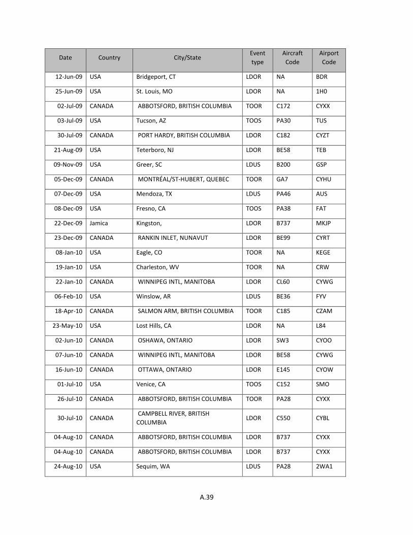
A.39
Date Country City/State Event type
Aircraft Code
Airport Code
12-Jun-09 USA Bridgeport, CT LDOR NA BDR
25-Jun-09 USA St. Louis, MO LDOR NA 1H0
02-Jul-09 CANADA ABBOTSFORD, BRITISH COLUMBIA TOOR C172 CYXX
03-Jul-09 USA Tucson, AZ TOOS PA30 TUS
30-Jul-09 CANADA PORT HARDY, BRITISH COLUMBIA LDOR C182 CYZT
21-Aug-09 USA Teterboro, NJ LDOR BE58 TEB
09-Nov-09 USA Greer, SC LDUS B200 GSP
05-Dec-09 CANADA MONTRÉAL/ST-HUBERT, QUEBEC TOOR GA7 CYHU
07-Dec-09 USA Mendoza, TX LDUS PA46 AUS
08-Dec-09 USA Fresno, CA TOOS PA38 FAT
22-Dec-09 Jamica Kingston, LDOR B737 MKJP
23-Dec-09 CANADA RANKIN INLET, NUNAVUT LDOR BE99 CYRT
08-Jan-10 USA Eagle, CO TOOR NA KEGE
19-Jan-10 USA Charleston, WV TOOR NA CRW
22-Jan-10 CANADA WINNIPEG INTL, MANITOBA LDOR CL60 CYWG
06-Feb-10 USA Winslow, AR LDUS BE36 FYV
18-Apr-10 CANADA SALMON ARM, BRITISH COLUMBIA TOOR C185 CZAM
23-May-10 USA Lost Hills, CA LDOR NA L84
02-Jun-10 CANADA OSHAWA, ONTARIO LDOR SW3 CYOO
07-Jun-10 CANADA WINNIPEG INTL, MANITOBA LDOR BE58 CYWG
16-Jun-10 CANADA OTTAWA, ONTARIO LDOR E145 CYOW
01-Jul-10 USA Venice, CA TOOS C152 SMO
26-Jul-10 CANADA ABBOTSFORD, BRITISH COLUMBIA TOOR PA28 CYXX
30-Jul-10 CANADA CAMPBELL RIVER, BRITISH COLUMBIA
LDOR C550 CYBL
04-Aug-10 CANADA ABBOTSFORD, BRITISH COLUMBIA LDOR B737 CYXX
04-Aug-10 CANADA ABBOTSFORD, BRITISH COLUMBIA LDOR B737 CYXX
24-Aug-10 USA Sequim, WA LDUS PA28 2WA1

A.40
Date Country City/State Event type
Aircraft Code
Airport Code
28-Aug-10 USA Pompano Beach, FL TOOS NA PMP
22-Sep-10 CANADA MONTMAGNY, QUEBEC TOOR B100 CSE5
25-Sep-10 USA Point Lookout, MO LDOR NA PLK
01-Oct-10 USA Teterboro, NJ LDOR NA KTEB
01-Oct-10 USA Manteo, NC LDOR NA MQI
30-Oct-10 CANADA GANDER INTL, NEWFOUNDLAND AND LABRADOR
LDOR GLF4 CYQX
17-Nov-10 USA Portland, OR LDOR NA HIO
21-Nov-10 USA Newport Beach, CA LDUS BE19 SNA
22-Nov-10 USA Jackson, WY LDOR NA JAC
14-Feb-11 USA Appleton, WI LDOR NA ATW
04-Mar-11 USA Houston, TX LDOR NA KHOU
14-Apr-11 CANADA QUEBEC LDOR PA31 CYZV
12-May-11 CANADA Montréal, QUEBEC LDUS DHC8 CYUL
25-May-11 USA Sedona, AZ LDOR NA SEZ
02-Jun-11 USA Chandler, AZ LDUS BDOG CHD
15-Jun-11 USA Nashville, TN LDOR NA JWN
16-Jun-11 USA Big Lake, AK LDUS C182 PVT
09-Jul-11 USA West Milford, NJ LDOR NA 4N1
16-Jul-11 CANADA St John's, NEWFOUNDLAND AND LABRADOR
LDOR B722 CYYT
16-Aug-11 USA Valdez, AK LDUS PA18 VDZ
17-Aug-11 CANADA Pitt Meadows, BRITISH COLUMBIA LDUS M20F CYPK
20-Aug-11 Canada Resolute Bay, Nunavut LDUS B737 YRB
29-Aug-11 USA Santa Monica, CA TOOS C172 SMO
17-Sep-11 USA Hillsboro, TX LDUS NA KINJ
31-Oct-11 USA Key West, FL LDOR NA EYW
03-Nov-11 USA Key West, FL LDOR NA EYW
15-Dec-11 USA Farmville, VA LDUS SR22 FVX

A.41
Date Country City/State Event type
Aircraft Code
Airport Code
27-Jan-12 USA Chehalis, WA LDUS PA28 KCLS
30-Jan-12 USA Baltimore, MD LDOR NA BWI
01-Feb-12 USA Anchorage, AK LDUS NA PAMR
01-Mar-12 USA Boca Raton, FL LDUS KR2 BCT
18-Jun-12 USA Atlanta, GA LDOR NA PDK
12-Jul-12 USA Minneapolis, MN LDOR NA FCM
17-Aug-12 USA Bakersfield, CA TOOS C210 BFL
15-Sep-12 USA Cedar Bluff, AL LDUS RC3 n/a
18-Sep-12 USA Macon, GA LDOR NA MAC
16-Oct-12 France Ploemeur LDOR CRJ7 LFRH
22-Oct-12 USA Sturtevant, WI LDOR NA C89
20-Feb-13 USA Thomson, GA TOOS NA HQU
24-Apr-13 USA Milledgeville, GA LDUS SR22 MLJ
10-May-13 USA Newcastle, WY LDUS C172 KECS
20-Jun-13 USA Jamestown, NY LDOR NA JHW
28-Jun-13 USA Eagle, CO LDUS PA24 EGE
03-Jul-13 USA Tillar, AR TOOR NA 5AR1
06-Jul-13 USA San Francisco, California LDUS B772 SFO
06-Jul-13 USA San Francisco, CA LDUS B772 SFO
20-Jul-13 USA Tupelo, MS LDUS BE36 TUP
03-Aug-13 USA Chesterfield, MO TOOS SR22 SUS
14-Aug-13 USA Birmingham, Alabama LDUS A300 BHM
17-Oct-13 USA Fairbanks, AK TOOS C172 FAI
23-Oct-13 USA Tucson, AZ TOOS PA23 TUS
01-Nov-13 USA Reno, NV LDOR NA RTS
14-Jun-14 USA Milton, FL LDUS CTSW 2R4

B.1
A P P E N D I X B
Sampled Airports

B.2
Sampled Airports Code
ADS CMH LAW SCK
ADW CWF LAX SEA
ASE DTW LGA SFF
ASG EGE LVK SFO
ASH EMT LWB SJC
ATL ENA MCI SLC
AUS EUG MCO SMO
AVL EWR MDT SNA
BCT FAI MSP SQL
BET FAT MYR SUN
BFI FLG NQA SUS
BFL FYV OJC TEB
BGR GCN ONT TIW
BKL GLH OXC TTD
BLI GSP OXR TUP
BOI GYR PDX TUS
CGF HEF PHX TYS
CHD IND PSP TZR
CKB ISO RNT -
CLE JNU SAW -

C.1
A P P E N D I X C
Standard Error of Regression Coefficient of Accident Likelihood Models
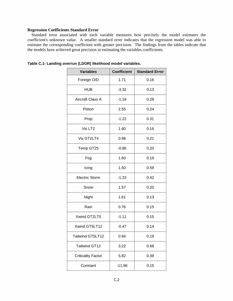
C.2
Regression Coefficients Standard Error Standard error associated with each variable measures how precisely the model estimates the
coefficient's unknown value. A smaller standard error indicates that the regression model was able to estimate the corresponding coefficient with greater precision. The findings from the tables indicate that the models have achieved great precision in estimating the variables coefficients.
Table C.1- Landing overrun (LDOR) likelihood model variables.
Variables Coefficient Standard Error
Foreign O/D 1.71 0.16
HUB -3.32 0.13
Aircraft Class A -1.18 0.28
Piston 2.55 0.24
Prop -1.22 0.31
Vis LT2 1.60 0.16
Vis GT2LT4 0.98 0.21
Temp GT25 -0.86 0.20
Fog 1.60 0.19
Icing 1.50 0.59
Electric Storm -1.23 0.42
Snow 1.57 0.20
Night 1.61 0.13
Rain 0.76 0.15
Xwind GT2LT5 -1.11 0.15
Xwind GT5LT12 -0.47 0.14
Tailwind GT5LT12 0.94 0.19
Tailwind GT12 3.22 0.68
Criticality Factor 5.82 0.39
Constant -11.96 0.15

C.3
Table C.2- Landing undershoot (LDUS) likelihood model variables.
Variables Coefficient Standard Error
Foreign O/D 1.67 0.24
Hub -0.99 0.20
Operation type GA 1.47 0.21
Operation type TC 0.66 0.32
Aircraft Class C -1.53 0.47
Aircraft Class B 0.66 0.24
Piston 3.50 0.26
Vis LT2 1.29 0.24
Vis GT2LT4 1.35 0.26
Temp LT5 0.68 0.21
Temp GT25 -0.46 0.22
Fog 2.17 0.24
Snow 1.13 0.34
Night 2.06 0.17
Xwind GT2LT5 -0.46 0.17
Tailwind GT2LT5 -0.68 0.32
Tailwind GT12 3.45 0.83
Criticality Factor 3.00 0.41
Constant -16.37 0.31

C.4
Table C.3- Takeoff overrun (TOOR) likelihood model variables.
Variables Coefficient Standard Error
Foreign O/D 1.50 0.29
HUB -1.46 0.25
Operation type GA 0.74 0.25
Operation type TC 1.23 0.32
Aircraft Class B 1.49 0.23
Piston 3.78 0.29
Prop -1.02 0.50
Ceiling GT1000LT2500 -0.79 0.38
VisGT4LT8 0.70 0.24
TempLT5 0.90 0.24
Fog 1.65 0.35
Night 2.13 0.25
Xwind GT2LT5 -0.86 0.24
Xwind GT5LT12 -0.72 0.25
Criticality Factor 4.68 0.51
Constant -16.41 0.37

C.5
Table C.4- Takeoff overshoot (TOOS) likelihood model variables.
Variables Coefficient Standard Error
Hub -1.84 0.35
Operation type GA 2.82 0.54
Operation type F 1.95 0.59
Operation type TC 1.96 0.87
Piston 2.90 0.55
Prop 1.77 0.57
Ceiling LT200 2.44 0.58
Temp GT5LT15 0.65 0.27
Fog 2.22 0.47
Snow 2.54 0.54
Night 2.45 0.31
Xwind GT2LT5 -0.87 0.31
Criticality Factor 2.77 0.63
Aircraft class B/C -2.38 0.62
Constant -18.22 0.62

D.1
A P P E N D I X D
Coordinates of Accidents and Incidents Used for Development of Location Models
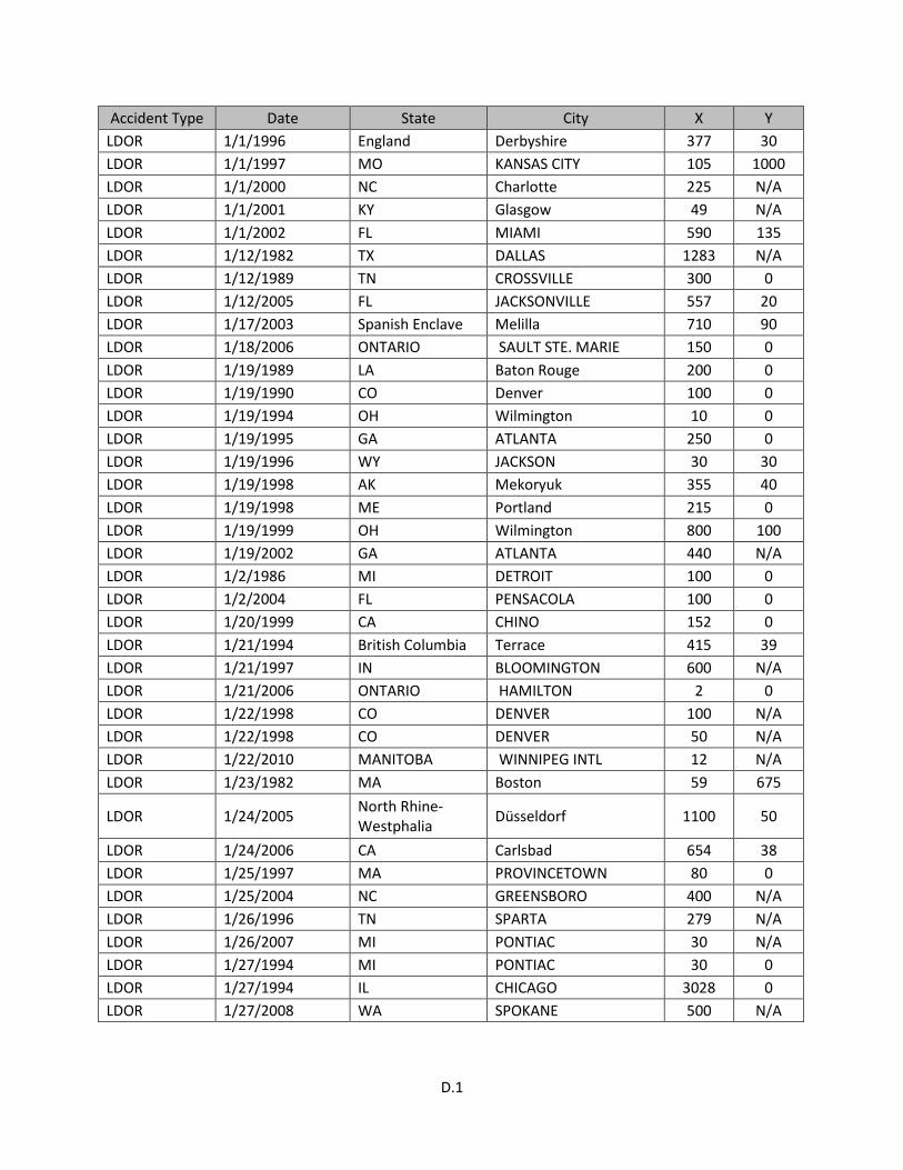
D.1
Accident Type Date State City X Y LDOR 1/1/1996 England Derbyshire 377 30 LDOR 1/1/1997 MO KANSAS CITY 105 1000 LDOR 1/1/2000 NC Charlotte 225 N/A LDOR 1/1/2001 KY Glasgow 49 N/A LDOR 1/1/2002 FL MIAMI 590 135 LDOR 1/12/1982 TX DALLAS 1283 N/A LDOR 1/12/1989 TN CROSSVILLE 300 0 LDOR 1/12/2005 FL JACKSONVILLE 557 20 LDOR 1/17/2003 Spanish Enclave Melilla 710 90 LDOR 1/18/2006 ONTARIO SAULT STE. MARIE 150 0 LDOR 1/19/1989 LA Baton Rouge 200 0 LDOR 1/19/1990 CO Denver 100 0 LDOR 1/19/1994 OH Wilmington 10 0 LDOR 1/19/1995 GA ATLANTA 250 0 LDOR 1/19/1996 WY JACKSON 30 30 LDOR 1/19/1998 AK Mekoryuk 355 40 LDOR 1/19/1998 ME Portland 215 0 LDOR 1/19/1999 OH Wilmington 800 100 LDOR 1/19/2002 GA ATLANTA 440 N/A LDOR 1/2/1986 MI DETROIT 100 0 LDOR 1/2/2004 FL PENSACOLA 100 0 LDOR 1/20/1999 CA CHINO 152 0 LDOR 1/21/1994 British Columbia Terrace 415 39 LDOR 1/21/1997 IN BLOOMINGTON 600 N/A LDOR 1/21/2006 ONTARIO HAMILTON 2 0 LDOR 1/22/1998 CO DENVER 100 N/A LDOR 1/22/1998 CO DENVER 50 N/A LDOR 1/22/2010 MANITOBA WINNIPEG INTL 12 N/A LDOR 1/23/1982 MA Boston 59 675
LDOR 1/24/2005 North Rhine-Westphalia Düsseldorf 1100 50
LDOR 1/24/2006 CA Carlsbad 654 38 LDOR 1/25/1997 MA PROVINCETOWN 80 0 LDOR 1/25/2004 NC GREENSBORO 400 N/A LDOR 1/26/1996 TN SPARTA 279 N/A LDOR 1/26/2007 MI PONTIAC 30 N/A LDOR 1/27/1994 MI PONTIAC 30 0 LDOR 1/27/1994 IL CHICAGO 3028 0 LDOR 1/27/2008 WA SPOKANE 500 N/A
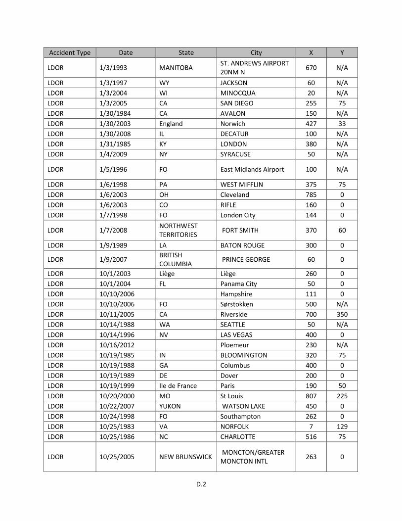
D.2
Accident Type Date State City X Y
LDOR 1/3/1993 MANITOBA ST. ANDREWS AIRPORT 20NM N 670 N/A
LDOR 1/3/1997 WY JACKSON 60 N/A LDOR 1/3/2004 WI MINOCQUA 20 N/A LDOR 1/3/2005 CA SAN DIEGO 255 75 LDOR 1/30/1984 CA AVALON 150 N/A LDOR 1/30/2003 England Norwich 427 33 LDOR 1/30/2008 IL DECATUR 100 N/A LDOR 1/31/1985 KY LONDON 380 N/A LDOR 1/4/2009 NY SYRACUSE 50 N/A
LDOR 1/5/1996 FO East Midlands Airport 100 N/A
LDOR 1/6/1998 PA WEST MIFFLIN 375 75 LDOR 1/6/2003 OH Cleveland 785 0 LDOR 1/6/2003 CO RIFLE 160 0 LDOR 1/7/1998 FO London City 144 0
LDOR 1/7/2008 NORTHWEST TERRITORIES FORT SMITH 370 60
LDOR 1/9/1989 LA BATON ROUGE 300 0
LDOR 1/9/2007 BRITISH COLUMBIA PRINCE GEORGE 60 0
LDOR 10/1/2003 Liège Liège 260 0 LDOR 10/1/2004 FL Panama City 50 0 LDOR 10/10/2006 Hampshire 111 0 LDOR 10/10/2006 FO Sørstokken 500 N/A LDOR 10/11/2005 CA Riverside 700 350 LDOR 10/14/1988 WA SEATTLE 50 N/A LDOR 10/14/1996 NV LAS VEGAS 400 0 LDOR 10/16/2012 Ploemeur 230 N/A LDOR 10/19/1985 IN BLOOMINGTON 320 75 LDOR 10/19/1988 GA Columbus 400 0 LDOR 10/19/1989 DE Dover 200 0 LDOR 10/19/1999 Ile de France Paris 190 50 LDOR 10/20/2000 MO St Louis 807 225 LDOR 10/22/2007 YUKON WATSON LAKE 450 0 LDOR 10/24/1998 FO Southampton 262 0 LDOR 10/25/1983 VA NORFOLK 7 129 LDOR 10/25/1986 NC CHARLOTTE 516 75
LDOR 10/25/2005 NEW BRUNSWICK MONCTON/GREATER MONCTON INTL 263 0
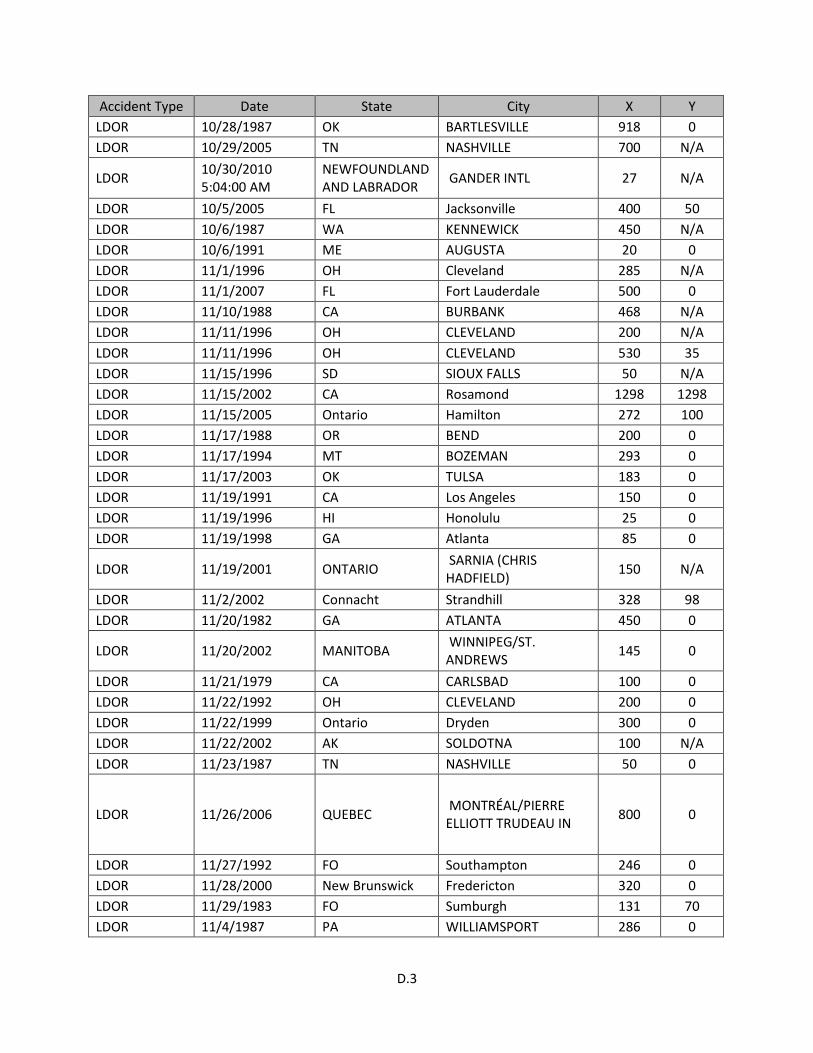
D.3
Accident Type Date State City X Y LDOR 10/28/1987 OK BARTLESVILLE 918 0 LDOR 10/29/2005 TN NASHVILLE 700 N/A
LDOR 10/30/2010 5:04:00 AM
NEWFOUNDLAND AND LABRADOR GANDER INTL 27 N/A
LDOR 10/5/2005 FL Jacksonville 400 50 LDOR 10/6/1987 WA KENNEWICK 450 N/A LDOR 10/6/1991 ME AUGUSTA 20 0 LDOR 11/1/1996 OH Cleveland 285 N/A LDOR 11/1/2007 FL Fort Lauderdale 500 0 LDOR 11/10/1988 CA BURBANK 468 N/A LDOR 11/11/1996 OH CLEVELAND 200 N/A LDOR 11/11/1996 OH CLEVELAND 530 35 LDOR 11/15/1996 SD SIOUX FALLS 50 N/A LDOR 11/15/2002 CA Rosamond 1298 1298 LDOR 11/15/2005 Ontario Hamilton 272 100 LDOR 11/17/1988 OR BEND 200 0 LDOR 11/17/1994 MT BOZEMAN 293 0 LDOR 11/17/2003 OK TULSA 183 0 LDOR 11/19/1991 CA Los Angeles 150 0 LDOR 11/19/1996 HI Honolulu 25 0 LDOR 11/19/1998 GA Atlanta 85 0
LDOR 11/19/2001 ONTARIO SARNIA (CHRIS HADFIELD) 150 N/A
LDOR 11/2/2002 Connacht Strandhill 328 98 LDOR 11/20/1982 GA ATLANTA 450 0
LDOR 11/20/2002 MANITOBA WINNIPEG/ST. ANDREWS 145 0
LDOR 11/21/1979 CA CARLSBAD 100 0 LDOR 11/22/1992 OH CLEVELAND 200 0 LDOR 11/22/1999 Ontario Dryden 300 0 LDOR 11/22/2002 AK SOLDOTNA 100 N/A LDOR 11/23/1987 TN NASHVILLE 50 0
LDOR 11/26/2006 QUEBEC MONTRÉAL/PIERRE ELLIOTT TRUDEAU IN 800 0
LDOR 11/27/1992 FO Southampton 246 0 LDOR 11/28/2000 New Brunswick Fredericton 320 0 LDOR 11/29/1983 FO Sumburgh 131 70 LDOR 11/4/1987 PA WILLIAMSPORT 286 0
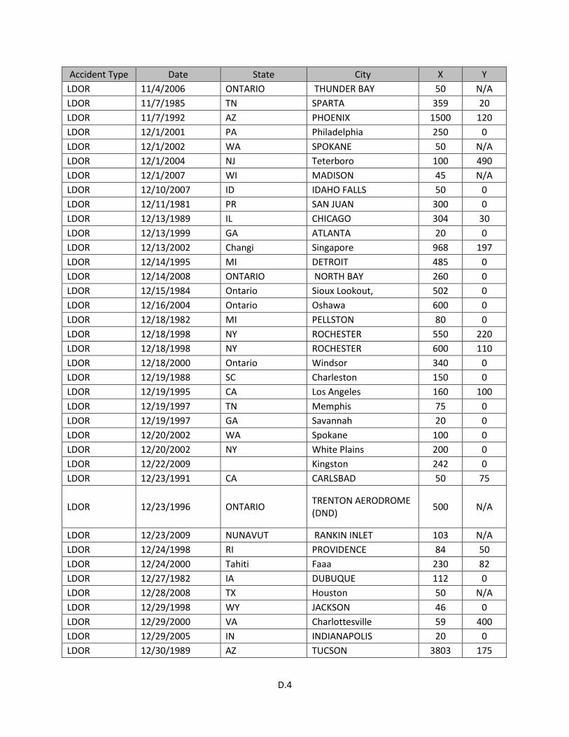
D.4
Accident Type Date State City X Y LDOR 11/4/2006 ONTARIO THUNDER BAY 50 N/A LDOR 11/7/1985 TN SPARTA 359 20 LDOR 11/7/1992 AZ PHOENIX 1500 120 LDOR 12/1/2001 PA Philadelphia 250 0 LDOR 12/1/2002 WA SPOKANE 50 N/A LDOR 12/1/2004 NJ Teterboro 100 490 LDOR 12/1/2007 WI MADISON 45 N/A LDOR 12/10/2007 ID IDAHO FALLS 50 0 LDOR 12/11/1981 PR SAN JUAN 300 0 LDOR 12/13/1989 IL CHICAGO 304 30 LDOR 12/13/1999 GA ATLANTA 20 0 LDOR 12/13/2002 Changi Singapore 968 197 LDOR 12/14/1995 MI DETROIT 485 0 LDOR 12/14/2008 ONTARIO NORTH BAY 260 0 LDOR 12/15/1984 Ontario Sioux Lookout, 502 0 LDOR 12/16/2004 Ontario Oshawa 600 0 LDOR 12/18/1982 MI PELLSTON 80 0 LDOR 12/18/1998 NY ROCHESTER 550 220 LDOR 12/18/1998 NY ROCHESTER 600 110 LDOR 12/18/2000 Ontario Windsor 340 0 LDOR 12/19/1988 SC Charleston 150 0 LDOR 12/19/1995 CA Los Angeles 160 100 LDOR 12/19/1997 TN Memphis 75 0 LDOR 12/19/1997 GA Savannah 20 0 LDOR 12/20/2002 WA Spokane 100 0 LDOR 12/20/2002 NY White Plains 200 0 LDOR 12/22/2009 Kingston 242 0 LDOR 12/23/1991 CA CARLSBAD 50 75
LDOR 12/23/1996 ONTARIO TRENTON AERODROME (DND) 500 N/A
LDOR 12/23/2009 NUNAVUT RANKIN INLET 103 N/A LDOR 12/24/1998 RI PROVIDENCE 84 50 LDOR 12/24/2000 Tahiti Faaa 230 82 LDOR 12/27/1982 IA DUBUQUE 112 0 LDOR 12/28/2008 TX Houston 50 N/A LDOR 12/29/1998 WY JACKSON 46 0 LDOR 12/29/2000 VA Charlottesville 59 400 LDOR 12/29/2005 IN INDIANAPOLIS 20 0 LDOR 12/30/1989 AZ TUCSON 3803 175

D.5
Accident Type Date State City X Y LDOR 12/5/2004 AR PINE BLUFF 240 0 LDOR 12/7/1993 CA SANTA MONICA 250 0 LDOR 12/7/1997 Channel Islands 2519 98 LDOR 12/8/1995 IL CHICAGO 40 0 LDOR 12/8/2005 IL Chicago 478 0 LDOR 12/8/2005 IL Chicago 500 5 LDOR 12/9/1995 WY JACKSON 50 N/A LDOR 2/1/1994 LA NEW ROADS 420 20 LDOR 2/1/1995 GA Atlanta 470 90 LDOR 2/10/2002 OH Cleveland 106 N/A LDOR 2/11/2006 Kuwait City 80 0 LDOR 2/13/1993 ME PORTLAND 330 50 LDOR 2/13/2001 WA Olympia 442 0 LDOR 2/14/1991 OH CLEVELAND 11 150 LDOR 2/15/1989 NY BINGHAMTON 200 80 LDOR 2/15/2003 CO RIFLE 27 0 LDOR 2/15/2003 Sicily See Notes 770 0 LDOR 2/16/1999 CA VAN NUYS 1072 451 LDOR 2/16/2000 Hokkaidō (Yesso) Sapporo 400 50 LDOR 2/17/2008 ONTARIO Ottawa 215 0
LDOR 2/18/1998 FO Peterborough Airport, Ontario 236 0
LDOR 2/18/1999 NE COLUMBUS 150 0 LDOR 2/18/2007 OH CLEVELAND 310 160 LDOR 2/19/1982 TX HARLINGEN 299 0 LDOR 2/19/1982 MI PONTIAC 50 N/A LDOR 2/19/1989 OH Covington 60 140 LDOR 2/19/1993 ME Portland 260 0 LDOR 2/19/1994 CO Rifle 630 70 LDOR 2/19/1994 DC Washington 250 50 LDOR 2/19/1995 IL Chicago 200 70 LDOR 2/19/1995 IL Chicago 10 0 LDOR 2/19/1996 TX HOUSTON 51 140 LDOR 2/19/1996 GA Savannah 300 50 LDOR 2/19/1997 IL Chicago 10 0 LDOR 2/20/1996 DC WASHINGTON 250 0 LDOR 2/20/1996 DC WASHINGTON 150 75 LDOR 2/20/1996 CO RIFLE 1000 80 LDOR 2/20/2003 FO Sigonella 800 0 LDOR 2/20/2004 FL FT. LAUDERDALE 1689 220
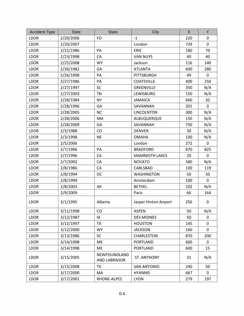
D.6
Accident Type Date State City X Y LDOR 2/20/2006 FO -1 220 0 LDOR 2/20/2007 London 729 0 LDOR 2/21/1986 PA ERIE 180 70 LDOR 2/23/1998 CA VAN NUYS 40 40 LDOR 2/25/2008 WY Jackson 116 140 LDOR 2/26/1982 GA ATLANTA 600 280 LDOR 2/26/1998 PA PITTSBURGH 49 0 LDOR 2/27/1986 PA COATSVILLE 400 250 LDOR 2/27/1997 SC GREENVILLE 350 N/A LDOR 2/27/2003 TN LEWISBURG 150 N/A LDOR 2/28/1984 NY JAMAICA 660 35 LDOR 2/28/1996 GA SAVANNAH 201 0 LDOR 2/28/2005 NC LINCOLNTON 300 N/A LDOR 2/28/2006 NM ALBUQUERQUE 150 N/A LDOR 2/28/2009 GA SAVANNAH 750 N/A LDOR 2/3/1988 CO DENVER 30 N/A LDOR 2/3/1998 NE OMAHA 100 N/A LDOR 2/5/2006 London 272 0 LDOR 2/7/1996 PA BRADFORD 870 825 LDOR 2/7/1996 CA MAMMOTH LAKES 20 0 LDOR 2/7/2002 CA NOVATO 580 N/A LDOR 2/8/1986 CA CARLSBAD 100 119 LDOR 2/8/1994 DC WASHINGTON 50 50 LDOR 2/8/1999 Amsterdam 100 0 LDOR 2/8/2003 AK BETHEL 102 N/A LDOR 2/9/2009 Paris 66 164
LDOR 3/1/1995 Alberta Jasper Hinton Airport 256 0
LDOR 3/11/1998 CO ASPEN 50 N/A LDOR 3/12/1987 IA DES MOINES 50 0 LDOR 3/12/1997 TX HOUSTON 145 0 LDOR 3/12/2000 WY JACKSON 160 0 LDOR 3/13/1986 SC CHARLESTON 870 200 LDOR 3/14/1998 ME PORTLAND 600 0 LDOR 3/14/1998 ME PORTLAND 600 15
LDOR 3/15/2005 NEWFOUNDLAND AND LABRADOR ST. ANTHONY 31 N/A
LDOR 3/15/2008 TX SAN ANTONIO 240 50 LDOR 3/17/2000 MA HYANNIS 667 0 LDOR 3/17/2001 RHONE-ALPES LYON 279 197

D.7
Accident Type Date State City X Y LDOR 3/19/1989 DC Washington 150 0 LDOR 3/19/1989 IL Chicago 500 30 LDOR 3/19/1989 FL Daytona Beach 50 0 LDOR 3/19/1991 NC Raleigh 150 0 LDOR 3/19/1994 OH Columbus 260 0 LDOR 3/19/1994 PA State College 20 0 LDOR 3/19/1995 HI Honolulu 100 70 LDOR 3/20/2001 LA Shreveport 110 0 LDOR 3/20/2001 TX El Paso 150 0
LDOR 3/20/2004 ONTARIO OTTAWA/MACDONALD-CARTIER INTL
102 N/A
LDOR 3/21/2000 TX KILLEEN 175 3 LDOR 3/23/1989 VA ROANOKE 200 10 LDOR 3/25/1996 ID HAILEY 40 0 LDOR 3/25/2002 IN Anderson 30 50 LDOR 3/26/2002 PA ERIE 40 0
LDOR 3/27/2003 IL CHICAGO/WAUKEGAN 100 N/A
LDOR 3/29/1981 Bedfordshire Borough of Luton 498 0 LDOR 3/29/1989 KY OWENSBORO 56 N/A LDOR 3/29/2007 OK OKLAHOMA CITY 500 0 LDOR 3/31/1992 FO Aberdeen 479 43 LDOR 3/31/1998 IA DES MOINES 50 50
LDOR 3/31/2007 NEWFOUNDLAND AND LABRADOR
Gander, Newfoundland and Labrador 339 439
LDOR 3/4/1998 MI MANISTEE 150 0 LDOR 3/4/2001 AZ PHOENIX 75 0 LDOR 3/5/2000 CA BURBANK 200 200 LDOR 3/7/2007 Yogyakarta 827 98 LDOR 3/7/2008 OH COLUMBUS 267 N/A LDOR 3/8/2005 NJ TETERBORO 230 N/A
LDOR 3/8/2006 BRITISH COLUMBIA POWELL RIVER 370 0
LDOR 3/9/1999 IN INDIANAPOLIS 30 0 LDOR 3/9/2001 CT Bridgeport 22 0 LDOR 4/1/2000 CO EAGLE 9 0 LDOR 4/12/2007 MI Traverse City 499 0

D.8
Accident Type Date State City X Y
LDOR 4/14/2011 2:23:00 PM QUEBEC 149 0
LDOR 4/17/1999 WV BECKLEY 216 0 LDOR 4/17/2008 ONTARIO ROCKCLIFFE 380 0 LDOR 4/19/1989 CA San Diego 280 50 LDOR 4/19/1998 NE LINCOLN 50 N/A LDOR 4/19/2004 Quebec Chibougamau 500 0 LDOR 4/2/1984 AR LITTLE ROCK 50 60 LDOR 4/20/2004 LA New Orleans 200 0
LDOR 4/21/2009 BRITISH COLUMBIA LANGLEY 100 N/A
LDOR 4/22/1990 Lord Howe Island Lord Howe Island 250 0 LDOR 4/27/1993 CO DENVER 1 30 LDOR 4/28/1990 FO Queenstown 318 82 LDOR 4/29/1993 AR PINE BLUFF 687 50 LDOR 4/3/1996 New Brunswick Moncton 154 0 LDOR 4/4/1992 FL TITUSVILLE, FL 466 N/A LDOR 4/4/2001 Newfoundland St. John's 75 53 LDOR 4/5/2008 ALBERTA EDMONTON INTL 53 0 LDOR 4/8/2004 ONTARIO BRAMPTON 100 0 LDOR 5/1/2002 MD Baltimore 680 0 LDOR 5/1/2007 PA PHILADELPHIA 100 0
LDOR 5/11/1995 FO St Johns, Newfoundland 299 21
LDOR 5/12/2001 QUEBEC MONTRÉAL INTL (DORVAL) 715 0
LDOR 5/12/2004 AZ MESA 50 0 LDOR 5/16/1992 NJ CALDWELL, NJ 370 N/A LDOR 5/16/2000 ONTARIO DRYDEN REGIONAL 400 N/A LDOR 5/18/2000 WI MILWAUKEE 228 0 LDOR 5/18/2003 TX Houston 20 0 LDOR 5/19/1992 MT Bozeman 150 0 LDOR 5/19/1995 NJ ATLANTIC CITY, NJ 200 N/A LDOR 5/19/1998 GA Atlanta 200 0 LDOR 5/2/2002 TX LEAKEY 560 50 LDOR 5/20/2003 MN Minneapolis 200 0 LDOR 5/20/2004 HI Honolulu 75 0 LDOR 5/20/2005 NC WALLACE 220 N/A LDOR 5/21/1997 CA SAN DIEGO 1300 0
LDOR 5/21/2006 ONTARIO TORONTO/LESTER B. PEARSON INTL 100 N/A

D.9
Accident Type Date State City X Y LDOR 5/23/1998 FL ORLANDO 500 0 LDOR 5/23/2002 KS OLATHE 100 N/A LDOR 5/26/1993 England Southampton 630 0 LDOR 5/27/1985 FO Leeds Bradford 538 33 LDOR 5/27/2005 ONTARIO CHAPLEAU 10 0 LDOR 5/28/2001 IL CHICAGO 205 0 LDOR 5/28/2003 England Leeds 525 86 LDOR 5/30/2003 NY JAMAICA 238 0 LDOR 5/30/2006 WI MOSINEE 400 0 LDOR 5/31/2004 MANITOBA WINNIPEG INTL 402 0 LDOR 5/4/2008 CO LOVELAND 10 N/A
LDOR 5/5/1997 MD WESTMINISTER, MD 220 30
LDOR 5/5/2001 CA RIVERSIDE 983 195 LDOR 5/7/1986 FL HOLLYWOOD 500 450 LDOR 5/8/1999 NY JAMAICA 350 N/A LDOR 6/1/1999 AR LITTLE ROCK 800 20 LDOR 6/1/2002 Darwin 144 0 LDOR 6/11/1985 CA VAN NUYS 1300 N/A LDOR 6/13/1994 WV LEWISBURG 130 0 LDOR 6/14/2005 MA NORWOOD 400 N/A LDOR 6/15/2007 ONTARIO RED LAKE 30 0 LDOR 6/16/2010 ONTARIO OTTAWA 552 320 LDOR 6/17/1988 FL W. PALM BEACH 30 0 LDOR 6/17/1992 IA CEDAR RAPIDS 212 0 LDOR 6/17/2002 CT Oxford 1500 N/A LDOR 6/19/1991 MO Kansas City 500 0 LDOR 6/19/1998 NY FISHERS ISLAND 115 0 LDOR 6/2/2010 ONTARIO OSHAWA 234 0 LDOR 6/20/2002 FO Santo Domingo 200 0 LDOR 6/20/2007 WY Laramie 160 481 LDOR 6/21/1998 Ibiza 722 492 LDOR 6/22/2006 Scotland Aberdeen 1148 40 LDOR 6/23/1984 IL CHICAGO 600 0 LDOR 6/23/2004 TX Houston 50 30 LDOR 6/25/1997 London 787 33 LDOR 6/27/1985 Leeds 515 0 LDOR 6/29/2000 IL JOLIET 170 0 LDOR 6/3/2004 KY LEXINGTON 100 0 LDOR 6/7/1995 MA HYANNIS 300 0

D.10
Accident Type Date State City X Y LDOR 7/1/1992 IL CHICAGO 25 0 LDOR 7/1/1999 MA HYANNIS 745 0 LDOR 7/1/2000 England Coventry 853 98 LDOR 7/12/1985 TX FORT WORTH 459 100 LDOR 7/12/2002 Dublin 47 0 LDOR 7/13/2003 IN EVANSVILLE 171 0 LDOR 7/14/2004 Ontario Ottawa 300 0 LDOR 7/15/1997 FL AVON PARK 1800 550
LDOR 7/16/2011 NEWFOUNDLAND AND LABRADOR St John's 350 60
LDOR 7/18/1971 New South Wales Sydney 727 60 LDOR 7/18/2007 MN MINNEAPOLIS 120 N/A LDOR 7/19/1990 WY Jackson 310 0 LDOR 7/19/1992 FO Rota 10 0 LDOR 7/19/1992 IL Chicago 30 0 LDOR 7/19/1999 MN Minneapolis 125 0 LDOR 7/19/2004 FL FORT LAUDERDALE 950 280 LDOR 7/2/1991 TN COLUMBIA 543 38 LDOR 7/20/1983 IL CHICAGO 100 0 LDOR 7/20/2001 ME Portland 50 0 LDOR 7/20/2004 FL Tallahassee 400 0 LDOR 7/21/1993 FO Tofino 150 20
LDOR 7/21/1993 BRITISH COLUMBIA TOFINO, B.C. 150 N/A
LDOR 7/21/2002 ONTARIO ORONTO/BUTTONVILLE MUNICIPAL 33 0
LDOR 7/22/1994 WY JACKSON 61 0 LDOR 7/22/1998 FO Belfast 23 0 LDOR 7/23/2000 Quebec Dorval 700 0 LDOR 7/26/1995 MN MINNEAPOLIS 800 0 LDOR 7/28/2007 WA Tonasket, WA 1320 0
LDOR 7/28/2007 BRITISH COLUMBIA TOFINO 25 N/A
LDOR 7/29/1980 LA HOUMA 50 0 LDOR 7/29/1992 WY JACKSON 100 N/A LDOR 7/30/1997 Tuscany Florence 394 0 LDOR 7/30/1999 MN MINNEAPOLIS 100 N/A LDOR 7/30/1999 MN MINNEAPOLIS 100 0 LDOR 7/5/1997 OK ARDMORE 60 0 LDOR 7/6/1984 FO Blanc-Sablon, Quebec 30 0 LDOR 8/1/1988 FL PENSACOLA 320 90

D.11
Accident Type Date State City X Y LDOR 8/1/1999 Newfoundland ST. JOHN’S 420 90 LDOR 8/10/1991 NC CHARLOTTE 50 0 LDOR 8/10/1994 Jeju Jeju 1427 3278 LDOR 8/13/1996 Greater London Northolt 748 115 LDOR 8/13/2002 CA Big Bear City 406 30 LDOR 8/13/2005 VA PORTSMOUTH 290 N/A LDOR 8/14/1999 NY SARANAC LAKE 30 0 LDOR 8/16/2001 MN SAINT PAUL 370 N/A LDOR 8/19/1988 FL Pensacola 78 0 LDOR 8/19/1990 CA Santa Ana 75 0 LDOR 8/19/1991 WA Seattle 25 30 LDOR 8/19/1991 NC Charlotte 80 0 LDOR 8/19/1992 WI Milwaukee 250 0 LDOR 8/19/1994 GA SAVANNAH 2 30 LDOR 8/19/1997 IA DES MOINES 867 0 LDOR 8/19/1999 MN Minneapolis 200 30 LDOR 8/2/1986 IN BEDFORD 677 0 LDOR 8/2/2005 Ontario Toronto 1000 30 LDOR 8/21/1995 AZ MESA 250 N/A LDOR 8/21/2009 NJ Teterboro 2089 150 LDOR 8/26/1993 ID HAILEY 850 260 LDOR 8/28/1985 WI GREEN BAY 100 0 LDOR 8/28/2001 MI Detroit 679 120 LDOR 8/3/1997 NY EAST HAMPTON 330 30 LDOR 8/30/2001 KS OLATHE 200 0 LDOR 8/30/2002 KY Lexington 410 10
LDOR 8/4/2010 BRITISH COLUMBIA ABBOTSFORD 500 0
LDOR 8/5/2004 NY WATERTOWN 23 55 LDOR 8/5/2004 NC OXFORD 100 N/A LDOR 8/6/1998 Ontario Kasabonika 449 0 LDOR 8/9/1999 MN MINNEAPOLIS 200 0 LDOR 8/9/2000 OR PORTLAND 250 N/A LDOR 9/1/1991 CA BRAWLEY, CA 627 40 LDOR 9/1/2000 ON Ottawa 100 0 LDOR 9/10/1983 CO BURLINGTON 225 N/A
LDOR 9/10/2002 Newfoundland and Labrador Gander 900 0
LDOR 9/12/1993 Tahiti Faa 230 197 LDOR 9/13/1981 MA BOSTON 50 0

D.12
Accident Type Date State City X Y LDOR 9/14/1993 Warsaw 361 295 LDOR 9/15/2000 Ontario Ottawa 234 0 LDOR 9/15/2002 TX LA PORTE 100 0 LDOR 9/19/1988 KY Paducah 200 0 LDOR 9/19/1993 DC Washington 50 0 LDOR 9/19/1995 SC Charleston 50 160 LDOR 9/19/1995 AR Fayetteville 52 0 LDOR 9/19/1999 FO Shannon 50 N/A LDOR 9/19/1999 MN Minneapolis 25 0 LDOR 9/19/2003 TX Del Rio 1600 100 LDOR 9/20/1983 NY MASSENA 587 30 LDOR 9/20/1994 MA STERLING, MA 60 N/A LDOR 9/22/1988 MI FREMONT 644 150 LDOR 9/23/1985 IL WEST CHICAGO 1200 1100 LDOR 9/23/1988 KY PADUCAH 201 0 LDOR 9/23/1999 Nonthaburi Bangkok 1050 59 LDOR 9/23/2005 CA SAN DIEGO 200 N/A LDOR 9/26/1998 England Fairoaks 765 140 LDOR 9/26/1999 GA GAINESVILLE 274 100 LDOR 9/28/1996 OH CHILLICOTHE 15 147 LDOR 9/29/1986 KS LIBERAL 1320 N/A LDOR 9/29/1993 FO Norwich 89 0 LDOR 9/6/1999 Shetland 650 0 LDUS 1/10/1979 TX LUBBOCK -120 0 LDUS 1/15/2002 MI KINGS FORD -100 0 LDUS 1/17/1990 MS WEST POINT -6 0 LDUS 1/19/1990 AR LITTLE ROCK -1600 0 LDUS 1/23/1983 NY JAMAICA -200 0 LDUS 1/24/1994 FL KEY LARGO -35 0 LDUS 1/26/2004 AZ PRESCOTT -50 0 LDUS 1/27/1979 GU AGANA -278 0 LDUS 1/27/2009 TX Lubbock -630 1 LDUS 1/27/2012 WA Chehalis, WA -300 0 LDUS 1/31/1994 MO CHESTERFIELD -700 0 LDUS 1/4/1987 NY HUDSON -100 0 LDUS 1/4/1999 QUEBEC ST-AUGUSTIN -1400 0 LDUS 1/5/1984 WA SEATTLE -360 0 LDUS 1/5/2003 OK OKLAHOMA CITY -200 -30 LDUS 1/7/1994 OH COLUMBUS -7286 0 LDUS 1/7/1994 Ohio Gahanna -6336 0
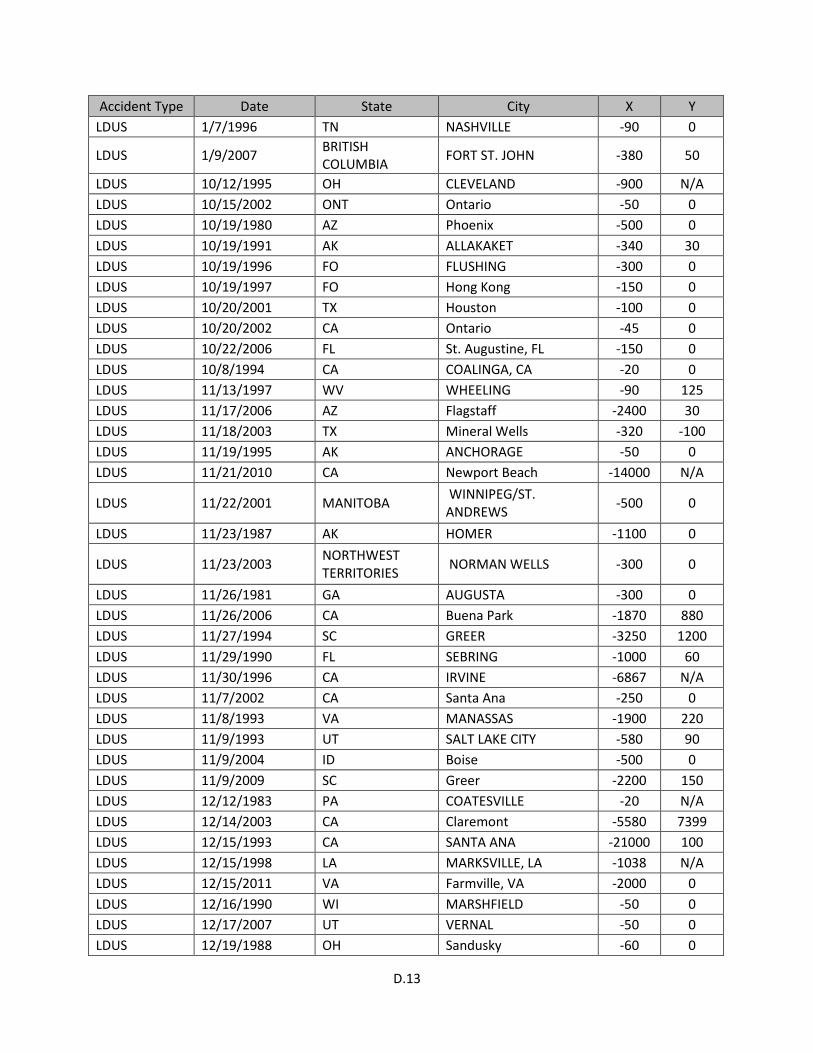
D.13
Accident Type Date State City X Y LDUS 1/7/1996 TN NASHVILLE -90 0
LDUS 1/9/2007 BRITISH COLUMBIA FORT ST. JOHN -380 50
LDUS 10/12/1995 OH CLEVELAND -900 N/A LDUS 10/15/2002 ONT Ontario -50 0 LDUS 10/19/1980 AZ Phoenix -500 0 LDUS 10/19/1991 AK ALLAKAKET -340 30 LDUS 10/19/1996 FO FLUSHING -300 0 LDUS 10/19/1997 FO Hong Kong -150 0 LDUS 10/20/2001 TX Houston -100 0 LDUS 10/20/2002 CA Ontario -45 0 LDUS 10/22/2006 FL St. Augustine, FL -150 0 LDUS 10/8/1994 CA COALINGA, CA -20 0 LDUS 11/13/1997 WV WHEELING -90 125 LDUS 11/17/2006 AZ Flagstaff -2400 30 LDUS 11/18/2003 TX Mineral Wells -320 -100 LDUS 11/19/1995 AK ANCHORAGE -50 0 LDUS 11/21/2010 CA Newport Beach -14000 N/A
LDUS 11/22/2001 MANITOBA WINNIPEG/ST. ANDREWS -500 0
LDUS 11/23/1987 AK HOMER -1100 0
LDUS 11/23/2003 NORTHWEST TERRITORIES NORMAN WELLS -300 0
LDUS 11/26/1981 GA AUGUSTA -300 0 LDUS 11/26/2006 CA Buena Park -1870 880 LDUS 11/27/1994 SC GREER -3250 1200 LDUS 11/29/1990 FL SEBRING -1000 60 LDUS 11/30/1996 CA IRVINE -6867 N/A LDUS 11/7/2002 CA Santa Ana -250 0 LDUS 11/8/1993 VA MANASSAS -1900 220 LDUS 11/9/1993 UT SALT LAKE CITY -580 90 LDUS 11/9/2004 ID Boise -500 0 LDUS 11/9/2009 SC Greer -2200 150 LDUS 12/12/1983 PA COATESVILLE -20 N/A LDUS 12/14/2003 CA Claremont -5580 7399 LDUS 12/15/1993 CA SANTA ANA -21000 100 LDUS 12/15/1998 LA MARKSVILLE, LA -1038 N/A LDUS 12/15/2011 VA Farmville, VA -2000 0 LDUS 12/16/1990 WI MARSHFIELD -50 0 LDUS 12/17/2007 UT VERNAL -50 0 LDUS 12/19/1988 OH Sandusky -60 0

D.14
Accident Type Date State City X Y LDUS 12/20/1990 OR MCMINNVILLE -50 0 LDUS 12/21/1979 VT BURLINGTON -100 0 LDUS 12/21/1983 MI DETROIT -125 N/A LDUS 12/22/1979 CO DENVER -50 0 LDUS 12/22/1993 MO CHESTERFIELD -5280 N/A LDUS 12/26/1989 WA PASCO -400 20 LDUS 12/30/2000 UT SALT LAKE CITY -400 0 LDUS 12/31/1997 MO CHESTERFIELD -4900 1400 LDUS 12/5/1987 KY LEXINGTON -1230 160 LDUS 12/6/2007 CA Fallbrook -1848 50 LDUS 12/8/1993 TX DFW AIRPORT -1095 0 LDUS 12/8/1994 MO KANSAS CITY -300 400 LDUS 12/9/1999 NJ HASBROUCK HTS. -2550 6025 LDUS 2/1/2006 NC Burlington, NC -20 0 LDUS 2/11/1987 NY ONEONTA -10 N/A LDUS 2/12/2000 KS OLATHE -900 0
LDUS 2/12/2003 BRITISH COLUMBIA BOUNDARY BAY -20 0
LDUS 2/13/1995 AZ TUSAYAN -13200 N/A LDUS 2/16/1988 CT GROTON -150 0 LDUS 2/16/1997 MANITOBA WINNIPEG -250 20 LDUS 2/16/2004 NEW BRUNSWICK FREDERICTON -200 0 LDUS 2/19/1995 OR Portland -350 0 LDUS 2/19/1998 FO Hong Kong -900 0 LDUS 2/19/1999 FL Miami -75 0 LDUS 2/25/2009 Haarlemmermeer -4910 N/A LDUS 2/5/2005 CA Murrieta -550 0 LDUS 2/5/2005 CA Murrieta, CA -20 0 LDUS 2/6/1994 MO CHESTERFIELD -7467 7467 LDUS 2/7/1986 AK MEKORYUK -50 50 LDUS 2/7/1997 CA LOS ANGELES -12700 1900
LDUS 2/7/2006 BRITISH COLUMBIA PITT MEADOWS -750 0
LDUS 2/8/1986 TX HARLINGEN -250 0 LDUS 2/8/2001 CA San Diego -2100 -40 LDUS 2/8/2001 CA Santa Maria -1540 40 LDUS 2/9/1998 IL CHICAGO -314 0 LDUS 3/1/2012 FL Boca Raton -90 0 LDUS 3/11/1994 CA LOS ANGELES -2200 350 LDUS 3/12/1981 OH CINCINNATI -50 0 LDUS 3/13/2000 CA SAN FRANCISCO -7021 921

D.15
Accident Type Date State City X Y LDUS 3/15/1989 IN WEST LAFAYETTE -500 13 LDUS 3/16/2004 CA Los Angeles -150 3200 LDUS 3/19/2001 VA Manassas -2500 0 LDUS 3/2/1997 UT SALT LAKE CITY -8230 800 LDUS 3/24/2007 SC Monks Corner, SC -100 0 LDUS 3/27/2000 AK FAIRBANKS, AK -75 N/A LDUS 3/29/2001 CO Aspen -2400 300 LDUS 3/3/1995 WY GILLETTE -50 0 LDUS 3/30/1994 TX AUSTIN -1320 0 LDUS 3/30/1999 AR ROGERS -12 N/A LDUS 3/30/1999 Newquay -741 0 LDUS 3/30/2008 CA Redding -692 40 LDUS 4/11/1994 MO CHESTERFIELD -13200 N/A LDUS 4/11/2000 WA SEATTLE -5000 300 LDUS 4/12/2002 CT OXFORD -1550 1550 LDUS 4/13/1989 AZ SCOTTSDALE -20 N/A LDUS 4/15/1993 AZ FLAGSTAFF -1700 375 LDUS 4/18/1981 AK SAND POINT -300 0 LDUS 4/18/1994 PA BEDFORD, PA -5 0 LDUS 4/18/2005 MS Tupelo -1600 1900 LDUS 4/23/1998 OH COLUMBUS -700 0 LDUS 4/27/1999 AK JUNEAU -450 0 LDUS 4/3/1978 MI DETROIT -50 0 LDUS 4/7/1997 AK STEBBINS -20 N/A LDUS 4/8/1984 TX AUSTIN -50 0 LDUS 4/8/2003 DE Delaware City, DE -36960 550 LDUS 4/9/2003 PA Du Bois -500 N/A LDUS 5/11/1998 NH NASHUA -7920 140 LDUS 5/11/2004 AL Cortland, AL -600 N/A LDUS 5/12/1985 WI LAKE GENEVA -13 5
LDUS 5/12/2011 9:30:00 AM QUEBEC Montréal -20 0
LDUS 5/13/2003 TN Somerville, TN -60 0 LDUS 5/15/1991 TN NASHVILLE -408 0 LDUS 5/16/1982 AK HOOPER BAY -1320 50 LDUS 5/19/1999 NY New York -100 0 LDUS 5/20/1986 KS HUTCHINSON -3 0 LDUS 5/23/2004 CT Oxford -2640 1000 LDUS 5/23/2007 MO Chesterfield -1750 N/A LDUS 5/25/2001 Guyane Cayenne -98 0

D.16
Accident Type Date State City X Y LDUS 5/31/1978 MT LEWISTOWN -600 0 LDUS 5/4/1990 NC WILMINGTON -370 0 LDUS 5/5/2001 CA Hesperia -2100 2062 LDUS 5/6/1989 TN MT. PLEASANT -1700 20 LDUS 5/6/2002 AZ Flagstaff -3000 0
LDUS 5/6/2003 BRITISH COLUMBIA WILLIAMS LAKE -2297 0
LDUS 5/8/1987 Mayaguez -600 0 LDUS 6/1/1988 NY JAMAICA -100 60 LDUS 6/12/2001 KS Salina -1354 85 LDUS 6/16/1992 DE NEW CASTLE -1250 N/A LDUS 6/19/1995 FO PANAMA CITY -350 0 LDUS 6/26/2005 ID Hailey -1300 N/A LDUS 6/28/1985 NC CHARLOTTE -764 N/A LDUS 6/28/2003 AK GOODNEWS -100 0 LDUS 6/28/2013 CO Eagle -2640 N/A LDUS 6/29/1978 PA EBENSBURG -600 0 LDUS 6/29/1996 AZ GRAND CANYON -32 0 LDUS 6/6/2004 CA SAN JOSE -50 0 LDUS 6/7/1992 Mayaguez -3960 N/A LDUS 7/1/1986 NE LINCOLN -243 N/A LDUS 7/10/1991 AL Birmingham -36114 0 LDUS 7/12/1984 OK MCALESTER -300 N/A LDUS 7/13/1994 AZ TUCSON -6300 N/A LDUS 7/19/1989 IA SIOUX CITY -2200 761 LDUS 7/19/1993 MI Nantucket -150 0 LDUS 7/20/2013 MS Tupelo -2200 N/A LDUS 7/25/1980 FL TAMPA -50 0 LDUS 7/26/1988 NJ MORRISTOWN -242 75 LDUS 7/26/2002 FL Tallahassee -3650 N/A LDUS 7/27/1996 OR PORTLAND -700 N/A LDUS 7/3/1996 NC KINSTON -9116 0 LDUS 7/30/1993 MA NANTUCKET -50 0 LDUS 7/30/1994 CA LIVERMORE -500 0 LDUS 7/6/2013 CA San Francisco -350 0 LDUS 7/6/2013 CA San Francisco -2400 110 LDUS 7/7/1983 IL ROCHELLE -1 0 LDUS 8/11/1997 CA SANTA ANA -2100 N/A LDUS 8/13/1997 KY LEXINGTON -13 215 LDUS 8/13/2004 CA San Francisco -6336 N/A LDUS 8/14/1997 GA DALTON -1100 135

D.17
Accident Type Date State City X Y LDUS 8/14/2013 AL Birmingham -3168 0 LDUS 8/16/2004 WY Dubois, WY -45 0 LDUS 8/16/2011 AK Valdez, AK -150 0 LDUS 8/17/1979 OK BETHANY -200 0
LDUS 8/17/2011 BRITISH COLUMBIA Pitt Meadows -400 0
LDUS 8/18/1999 CA SAN CARLOS -3960 N/A LDUS 8/2/1985 TX DALLAS/FT WORTH -6300 N/A LDUS 8/2/2002 CA Mokelumne Hill, CA -2 0 LDUS 8/20/2011 Nunavut Resolute Bay -4200 4552 LDUS 8/21/1989 OR GOLD BEACH -50 150 LDUS 8/25/1985 ME Auburn -4007 400 LDUS 8/25/2004 FL VENICE -30 0 LDUS 8/26/1993 AR SPRINGDALE -4560 0 LDUS 8/26/2000 ID BOISE -5280 1750 LDUS 8/31/1996 TX LUBBOCK -10 0 LDUS 8/8/1992 AK NUIQSUT -1 0 LDUS 9/15/2008 MA NANTUCKET -50 0 LDUS 9/18/1995 CA CHINO -1000 75 LDUS 9/19/1988 CA San Diego -50 0 LDUS 9/19/2001 IN Indianapolis -900 0 LDUS 9/24/1999 Newfoundland ST. JOHN’S -250 0 LDUS 9/25/1985 AK UNALASKA -72 N/A LDUS 9/29/2003 WA Cle Elum, WA -15 0 LDUS 9/8/2000 ID HAILEY -90 0 LDUS 9/9/2005 WI Boscobel, WI -30 0 TOOR 1/17/1985 NY FLUSHING 563 0
TOOR 1/25/2007 Pyrénées Atlantiques department
Pau 1598 100
TOOR 1/30/1990 NY ROCHESTER 249 N/A TOOR 1/4/2001 NY Schenectady 470 0 TOOR 1/6/1990 FL MIAMI 1180 100 TOOR 10/15/2000 AK ANCHORAGE 690 0 TOOR 10/19/1995 FO Vancouver 400 141 TOOR 10/19/2000 CA Concord 496 0 TOOR 10/29/2007 CA Santa Ana 50 0 TOOR 10/3/1982 LA Jefferson Parish 443 N/A TOOR 11/11/1999 IL CHICAGO 300 100 TOOR 11/11/2003 IL Wheeling 500 0

D.18
Accident Type Date State City X Y TOOR 11/15/1988 MN MINNEAPOLIS 330 0 TOOR 11/2/1993 TX HOUSTON 200 0
TOOR 11/29/1997 FO Island Lake, Manitoba 451 0
TOOR 12/16/2003 NJ TETERBORO 188 0 TOOR 12/18/1992 ID MCCALL 500 50 TOOR 12/20/2004 TX El Paso 200 0 TOOR 12/23/1983 AK ANCHORAGE 1434 40 TOOR 12/28/1997 WV ELKINS, WV 303 0 TOOR 12/3/1998 Nunavut Iqaluit 800 100
TOOR 12/5/2009 QUEBEC MONTRÉAL/ST-HUBERT 30 N/A
TOOR 12/6/1999 AK BETHEL 600 N/A TOOR 2/1/2001 CA SAN LUIS OBISPO 35 0 TOOR 2/19/1981 PA Pittsburg 199 0 TOOR 2/2/2005 NJ Teterboro 517 0
TOOR 2/22/2008 BRITISH COLUMBIA LANGLEY 258 N/A
TOOR 2/3/1982 PA PHILADELPHIA 600 0 TOOR 2/5/1993 AK FAIRBANKS 100 0 TOOR 3/12/1991 NY JAMAICA 835 550 TOOR 3/13/1990 NJ TETERBORO 250 N/A TOOR 3/17/2001 MI Detroit 530 73 TOOR 3/19/1998 OR PORTLAND 1000 530 TOOR 3/2/1994 NY FLUSHING 500 0 TOOR 3/22/2001 Centre Orleans 590 66 TOOR 3/30/1998 FO Stansted 386 0 TOOR 3/4/1981 MD HAGERSTOWN 15 0 TOOR 3/9/2005 MS TUPELO 120 30 TOOR 4/1/2002 MD Cambridge 75 N/A TOOR 4/15/1992 NC CHARLOTTE 100 0
TOOR 4/18/2010 BRITISH COLUMBIA SALMON ARM 560 90
TOOR 4/19/1992 NC Charlotte 200 130 TOOR 5/1/1996 NM ALBUQUERQUE 212 212 TOOR 5/11/2000 Alberta Edmonton 500 0 TOOR 5/14/1995 CA OAKLAND, CA 691 0 TOOR 5/16/1995 AZ FLAGSTAFF 1301 N/A TOOR 5/19/1994 TX Texarkana 79 0 TOOR 5/20/2002 OK Bethany 700 0 TOOR 5/21/1988 TX DFW AIRPORT 1112 0

D.19
Accident Type Date State City X Y TOOR 5/23/1995 AR ROGERS 1200 0 TOOR 5/26/1987 LA KENNER 1180 20 TOOR 5/31/1984 CO DENVER 1074 0 TOOR 5/9/2005 TX BROWNWOOD 1300 0 TOOR 6/12/2003 FL FORT LAUDERDALE 1000 50 TOOR 6/23/1998 DC WASHINGTON 250 N/A TOOR 6/27/1985 PR SAN JUAN 140 0
TOOR 6/27/1985 FO Luis Munoz Marin International Airport, San Juan ,
63 161
TOOR 6/27/1988 FO Newcastle 161 0 TOOR 6/3/2006 VA Manassas 1700 260 TOOR 6/4/1982 KS WICHITA 300 50
TOOR 6/7/1998 MO EXCELSIOR SPR, MO 300 0
TOOR 7/10/2003 CA Tulelake 2787 772 TOOR 7/11/1995 OH COLUMBUS, OH 320 N/A TOOR 7/11/1995 OH COLUMBUS 328 0 TOOR 7/12/1994 NY WHITE PLAINS, NY 221 0 TOOR 7/13/1994 NJ ATLANTIC CITY 446 0 TOOR 7/16/1987 MS JACKSON 1300 N/A TOOR 7/17/2003 Drenthe Eelde 328 0 TOOR 7/19/1998 NC Raleigh 200 0
TOOR 7/20/1986 FO Wabush, Newfoundland 376 0
TOOR 7/22/2003 PA Pittston 740 0 TOOR 7/28/1984 ME WATERVILLE 100 10 TOOR 7/31/1991 CO DENVER 150 0 TOOR 7/5/1982 ID Boise 50 0 TOOR 7/8/1996 TN NASHVILLE 750 100 TOOR 8/1/2006 IN ANGOLA 75 0 TOOR 8/12/2004 ALBERTA HIGH LEVEL 1200 0 TOOR 8/13/1985 WI MADISON 900 N/A TOOR 8/14/1996 PA POTTSTOWN 1429 457 TOOR 8/16/1988 OH CLEVELAND 837 387 TOOR 8/16/1996 FO Liverpool Airport 718 200 TOOR 8/16/2001 MI TRAVERSE CITY 628 0 TOOR 8/17/2003 CT GROTON 125 0 TOOR 8/19/1988 OH Cleveland 500 300 TOOR 8/19/1989 LA New Orleans 800 0

D.20
Accident Type Date State City X Y TOOR 8/19/1992 DC Washington DC 170 0 TOOR 8/25/1989 LA New Orleans 600 N/A TOOR 8/26/1994 LA NEW ORLEANS 500 0 TOOR 8/27/1994 MO CHESTERFIELD 100 0 TOOR 8/27/2006 KY Lexington 975 55 TOOR 8/27/2006 KY Fyette County 1000 0 TOOR 8/28/1998 TX El Paso 2999 0 TOOR 8/7/1997 FL MIAMI 575 0 TOOR 8/7/2003 MN DULUTH 6 N/A TOOR 9/11/1988 LA NEW ORLEANS 400 0 TOOR 9/13/1982 CO DENVER 10 0 TOOR 9/13/1989 IN WARSAW 1000 0 TOOR 9/19/1993 Aube Troyes 885 98 TOOR 9/19/2008 South Carolina West Columbia 1549 0 TOOR 9/20/1989 NY FLUSHING 194 N/A TOOR 9/21/1987 FL TYNDALL AFB 230 50 TOOR 9/21/1995 TX HOUSTON 225 0 TOOR 9/22/2004 AZ Flagstaff 800 0 TOOR 9/22/2010 QUEBEC MONTMAGNY 886 N/A TOOR 9/29/1993 Franche-Comté Besançon 99 49 TOOS 1/11/1983 MI DETROIT 299 1200 TOOS 1/11/1995 AZ FLAGSTAFF 6500 N/A TOOS 1/13/1982 Washinton, D.C. 4561 0 TOOS 1/8/2006 CA Mammoth Lakes 6997 3294 TOOS 10/14/2004 Nova Scotia Halifax 1750 40 TOOS 10/17/2013 AK Fairbanks 1585 0 TOOS 10/26/2003 CA San Diego 1313 200 TOOS 10/27/2004 NC Asheville 4224 0 TOOS 10/4/2000 CA SANTA ROSA 1476 12048 TOOS 11/10/2002 CA Chino 5542 4500 TOOS 11/13/2002 CA San Andreas 1312 643 TOOS 11/15/1987 CO DENVER 1300 325 TOOS 11/18/1995 CA OXNARD 7920 N/A TOOS 11/2/1995 AZ GRAND CANYON 12144 N/A TOOS 11/22/1995 AZ GRAND CANYON 2650 420 TOOS 12/15/2003 CA Watsonville 3196 350 TOOS 12/18/1997 CT OXFORD 100 350 TOOS 12/2/2004 FL Milton, FL 10 80 TOOS 12/24/2005 OR Portland 1300 0 TOOS 12/8/2009 CA Fresno 1500 0

D.21
Accident Type Date State City X Y TOOS 12/9/1996 ID BOISE 2900 1350 TOOS 2/27/1989 NY POUGHKEEPSIE 700 100 TOOS 3/1/2002 TX Austin 0 2410 TOOS 3/11/1996 WV BRIDGEPORT 1250 20200 TOOS 3/13/2005 CA Big Bear City 4450 0 TOOS 3/9/2002 NJ Teterboro 180 800 TOOS 4/10/2002 AK Juneau 0 2600 TOOS 5/11/1996 NC KINSTON 6077 N/A TOOS 5/16/2002 ID Boise 3800 3000 TOOS 5/25/1999 OK ALTUS, OK 2920 0 TOOS 5/28/2003 AZ Grand Canyon 2400 500
TOOS 5/29/1995 IL DOWNERS GROVE, IL 378 N/A
TOOS 5/7/2005 AZ Grand Canyon 1300 450 TOOS 6/27/1998 AZ FLAGSTAFF 6500 1600 TOOS 6/7/1993 VA MANASSAS 3700 3800 TOOS 6/9/2001 AR Springdale 5280 N/A TOOS 7/1/2010 CA Venice 1600 400 TOOS 7/12/1998 ID HAILEY 1900 900 TOOS 7/16/1997 TN KNOXVILLE 7400 7400 TOOS 7/21/2005 NV Las Vegas, NV 300 100 TOOS 7/22/1991 MI DETROIT 828 0 TOOS 7/3/2009 AZ Tucson 3480 332 TOOS 7/9/1982 LA NEW ORLEANS 4610 564 TOOS 8/1/1998 IL CHICAGO, IL 337 50 TOOS 8/15/1996 SD CUSTER, SD 1570 50 TOOS 8/16/1987 MI Romulus 5590 50 TOOS 8/2/1984 Vieques 400 N/A TOOS 8/24/2001 NY Ithaca 1003 10 TOOS 8/26/2003 MA Yarmouth 3748 0 TOOS 8/28/2007 CA Blythe 2416 0 TOOS 8/3/1999 AZ TUSAYAN 9300 2300 TOOS 8/3/2013 MO Chesterfield 4050 500 TOOS 8/30/2007 CA Cameron Park, CA 719 0 TOOS 8/31/1988 TX DALLAS/FT WORTH 2833 0 TOOS 8/31/1996 OH YOUNGSTOWN, OH 370 N/A TOOS 8/5/2001 CA Weaverville 906 268 TOOS 8/9/1997 CO EAGLE 2640 N/A TOOS 9/12/2004 MO Chesterfield 6620 700 TOOS 9/21/2007 FL Ft. Lauderdale, FL 4500 308 TOOS 9/25/2004 CA Fullerton 2371 340

D.22
Accident Type Date State City X Y TOOS 9/6/1985 WI Milwaukee 1320 9690