agreement no. ce 35/2012 (ce) planning and engineering
TRANSCRIPT

Planning Department and Civil Engineering and Development
Department
Agreement No. CE 35/2012 (CE) Planning and Engineering Study for Housing
Sites in Yuen Long South - Investigation Contamination Assessment Plan
228228 | Final |
S:\FW\CM\FROM\TONY\YLS EIA WEBSITE\HTML\EIA REPORT\APPENDICES\12. LAND CONTAMINATION_APPENDICES\APPENDIX 12.1 - CAP\228228_CAP_20170720.DOCX
Planning Department and Civil Engineering and Development Department
Agreement No. CE 35/2012 (CE) Planning and Engineering Study for Housing Sites in Yuen Long South - Investigation
Contamination Assessment Plan
228228
Final |
This report takes into account the particular
instructions and requirements of our client.
It is not intended for and should not be relied
upon by any third party and no responsibility
is undertaken to any third party.
Job number 228228
Ove Arup & Partners Hong Kong Ltd
Level 5 Festival Walk
80 Tat Chee Avenue
Kowloon Tong
Kowloon
Hong Kong
www.arup.com

Planning Department and Civil Engineering and Development
Department
Agreement No. CE 35/2012 (CE) Planning and Engineering Study for Housing
Sites in Yuen Long South - Investigation Contamination Assessment Plan
228228 | Final |
S:\FW\CM\FROM\TONY\YLS EIA WEBSITE\HTML\EIA REPORT\APPENDICES\12. LAND CONTAMINATION_APPENDICES\APPENDIX 12.1 - CAP\228228_CAP_20170720.DOCX
Contents
Page
1 Introduction 1
1.1 Background 1
1.2 The Study 2
1.3 Purpose of this Report 2
1.4 The Contamination Assessment Area 3
1.5 Statutory Legislation and Evaluation Criteria 5
2 Desktop Review 7
2.1 Review of Historical Land Use 7
2.2 Site Geology 13
2.3 Other Relevant Information 13
2.4 Site Survey 21
2.5 Future Land Use and Activities 23
3 Potentially Contaminated Sites 26
3.1 Identification of Potentially Contaminated Land Uses 26
3.2 Potentially Contaminated Sites 27
4 Potential Health Risk and Environmental Impacts 28
4.1 Potential Impact on Receptors 28
4.2 Health Risk to Workers 28
4.3 Remediation of Contaminated Soil 28
4.4 Remediation of Contaminated Groundwater 29
4.5 Potential Health Risks to Future Users of the Site 29
5 Site Investigation and Re-appraisal of Potentially Contaminated Sites 30
5.2 Sampling and Testing Strategy 32
5.3 Decontamination Procedures 32
5.4 Soil Sampling 33
5.5 Strata Logging 33
5.6 Groundwater Sampling 33
5.7 Sample Size and Handling Criteria 34
5.8 Analytical Parameters 35
5.9 Storage of Surplus Soil Samples 38
5.10 Quality Control and Quality Assurance (QA/QC) 39
5.11 Sample Handling, Packaging and Transport 39
6 Remedial Measures 41

Planning Department and Civil Engineering and Development
Department
Agreement No. CE 35/2012 (CE) Planning and Engineering Study for Housing
Sites in Yuen Long South - Investigation Contamination Assessment Plan
228228 | Final |
S:\FW\CM\FROM\TONY\YLS EIA WEBSITE\HTML\EIA REPORT\APPENDICES\12. LAND CONTAMINATION_APPENDICES\APPENDIX 12.1 - CAP\228228_CAP_20170720.DOCX
6.2 Possible Remediation Methods 41
6.3 Remediation Methods for Contaminated Soil 41
6.4 Remediation Methods for Contaminated Groundwater 42
6.5 Surmountability of Potentially Contaminated Land Uses 43
7 Programme Schedule 47
Figures
Figure 1.1 Land Contamination Assessment Area (Overall)
Figure 1.2 Land Contamination Assessment Area (Within PDAs)
(Sheet 1 of 4)
Figure 1.2a Land Contamination Assessment Area (Within PDAs)
(Sheet 2 of 4)
Figure 1.2b Land Contamination Assessment Area (Within PDAs)
(Sheet 3 of 4)
Figure 1.2c Land Contamination Assessment Area (Within PDAs)
(Sheet 4 of 4)
Figure 1.3 Land Contamination Assessment Area (Supporting Infrastructure)
(Sheet 1 of 6)
Figure 1.3a Land Contamination Assessment Area (Supporting Infrastructure)
(Sheet 2 of 6)
Figure 1.3b Land Contamination Assessment Area (Supporting Infrastructure)
(Sheet 3 of 6)
Figure 1.3c Land Contamination Assessment Area (Supporting Infrastructure)
(Sheet 4 of 6)
Figure 1.3d Land Contamination Assessment Area (Supporting Infrastructure)
(Sheet 5 of 6)
Figure 1.3e Land Contamination Assessment Area (Supporting Infrastructure)
(Sheet 6 of 6)
Figure 2.1 Private Lot in Yuen Long South
Figure 2.2 Existing Land Use (Overall)
Figure 2.3 Existing Land Use (Within PDAs) (Sheet 1 of 4)
Figure 2.3a Existing Land Use (Within PDAs) (Sheet 2 of 4)
Figure 2.3b Existing Land Use (Within PDAs) (Sheet 3 of 4)
Figure 2.3c Existing Land Use (Within PDAs) (Sheet 4 of 4)
Figure 2.4 Existing Land Use (Supporting Infrastructure) (Sheet 1 of 6)
Figure 2.4a Existing Land Use (Supporting Infrastructure) (Sheet 2 of 6)
Figure 2.4b Existing Land Use (Supporting Infrastructure) (Sheet 3 of 6)
Figure 2.4c Existing Land Use (Supporting Infrastructure) (Sheet 4 of 6)
Figure 2.4d Existing Land Use (Supporting Infrastructure) (Sheet 5 of 6)
Figure 2.4e Existing Land Use (Supporting Infrastructure) (Sheet 6 of 6)
Figure 3.1 Locations of Potentially Contaminated Sites and Private Lots
(Overall)
Figure 3.2 Locations of Potentially Contaminated Sites and Private Lots
(Within PDAs) (Sheet 1 of 4)
Figure 3.2a Locations of Potentially Contaminated Sites and Private Lots
(Within PDAs) (Sheet 2 of 4)

Planning Department and Civil Engineering and Development
Department
Agreement No. CE 35/2012 (CE) Planning and Engineering Study for Housing
Sites in Yuen Long South - Investigation Contamination Assessment Plan
228228 | Final |
S:\FW\CM\FROM\TONY\YLS EIA WEBSITE\HTML\EIA REPORT\APPENDICES\12. LAND CONTAMINATION_APPENDICES\APPENDIX 12.1 - CAP\228228_CAP_20170720.DOCX
Figure 3.2b Locations of Potentially Contaminated Sites and Private Lots
(Within PDAs) (Sheet 3 of 4)
Figure 3.2c Locations of Potentially Contaminated Sites and Private Lots
(Within PDAs) (Sheet 4 of 4)
Figure 3.3 Locations of Potentially Contaminated Sites and Private Lots
(Supporting Infrastructure) (Sheet 1 of 2)
Figure 3.3a Locations of Potentially Contaminated Sites and Private Lots
(Supporting Infrastructure) (Sheet 2 of 2)
Figure 7.1 Programme for Land Contamination Assessment and Remediation
Work after Land Resumption
Appendices
Appendix A
Correspondences between EPD and Project Proponent
Appendix B-1
Historical Aerial Photographs (Within PDAs)
Appendix B-2
Historical Aerial Photographs (Supporting Infrastructure)
Appendix C
Copy of Letters to Fire Services Department and the Formal Replies of FSD
Appendix D
Copy of Letters to Environmental Protection Department and the Formal Replies of EPD
Appendix E-1a
Summary of Site Survey and Records of Chemical Waste Producers Registration (Area 1)
Appendix E-1b
Summary of Site Survey and Records of Chemical Waste Producers Registration (Area 2)
Appendix E-1c
Summary of Site Survey and Records of Chemical Waste Producers Registration (Area 3)
Appendix E-2
Summary of Site Survey and Records of Chemical Waste Producers Registration (Supporting Infrastructure)
Appendix F
Recommended Outline Development Plan
Appendix G
Planning Department and Civil Engineering and Development
Department
Agreement No. CE 35/2012 (CE) Planning and Engineering Study for Housing
Sites in Yuen Long South - Investigation Contamination Assessment Plan
228228 | Final |
S:\FW\CM\FROM\TONY\YLS EIA WEBSITE\HTML\EIA REPORT\APPENDICES\12. LAND CONTAMINATION_APPENDICES\APPENDIX 12.1 - CAP\228228_CAP_20170720.DOCX
RBRGs for Soil and Groundwater
Appendix H
Summary of Potentially Contaminated Sites Appendix I
Groundwater Monitoring Well
Appendix J
Soil and Groundwater Testing Schedule for Potentially Contaminated Sites

Planning Department and Civil Engineering and Development Department
Agreement No. CE 35/2012 (CE) Planning and Engineering Study for Housing Sites in Yuen Long South - Investigation
Contamination Assessment Plan
228228 | Final |
S:\FW\CM\FROM\TONY\YLS EIA WEBSITE\HTML\EIA REPORT\APPENDICES\12. LAND CONTAMINATION_APPENDICES\APPENDIX 12.1 - CAP\228228_CAP_20170720.DOCX
Page 1
1 Introduction
1.1 Background
1.1.1.1 With the growing concern on the delivery of housing, the 2011-12
Policy Address announced the review of agricultural land in North
District and Yuen Long, currently used mainly for industrial purposes,
temporary storage or deserted, for housing development is one of the
measures for long-term land supply. The 2013 Policy Address states
that the review of such land in the North District and Yuen Long is one
of the measures for increasing long-term land supply for housing
development.
1.1.1.2 Being located in proximity to Yuen Long, Tuen Mun and Tin Shui Wai
new towns, and the proposed new development area (NDA) in Hung
Shui Kiu (HSK), the Yuen Long South (YLS) area is connected with
the urban areas by strategic road links, including Route 3 and Yuen
Long Highway.
1.1.1.3 The area south of Yuen Long New Town to be reviewed is bounded by
Yuen Long Highway, Kung Um Road and Tai Lam Country Park. The
tentative Potential Development Areas (PDAs) of YLS include the
Tong Yan San Tsuen (TYST) area and a piece of land zoned
“Undetermined” (“U”) located to the west of Kung Um Road/Kiu Hing
Road as well as two pieces of land zoned “Other Specified Uses”
annotated “Rural Use” (“OU(RU)”) in Tai Tong area located to the east
of Kung Um Road/Kiu Hing Road (i.e. the YLS area).
1.1.1.4 The extent of the PDAs has subsequently been subject to a
comprehensive review. To support the development proposals, the
Study has proposed infrastructure works to be carried out outside the
PDAs, including improvements to TYST Interchange and Tin Shui Wai
(TSW) West Interchange, slip roads along Yuen Long Highway,
extension of the existing water service reservoir or provision of an
additional treat sewage effluent reservoir, as well partial decking of the
Yuen Long Nullah.
1.1.1.5 The YLS area is generally rural in character with a mixture of land uses
including open storage yards, warehouses, workshops, industrial
operations, villages and residential settlements, agricultural land and
unused land. Proliferation of open storage yards, warehouses and
industrial workshops has resulted in degradation of the rural
environment. There is a need to better utilise the degraded brownfield
land occupied by open storage yards, warehouses, workshops,
industrial operations for beneficial uses and optimise the development
potential to meet the territory’s needs, and to improve the local living
environment with infrastructure.

Planning Department and Civil Engineering and Development Department
Agreement No. CE 35/2012 (CE) Planning and Engineering Study for Housing Sites in Yuen Long South - Investigation
Contamination Assessment Plan
228228 | Final |
S:\FW\CM\FROM\TONY\YLS EIA WEBSITE\HTML\EIA REPORT\APPENDICES\12. LAND CONTAMINATION_APPENDICES\APPENDIX 12.1 - CAP\228228_CAP_20170720.DOCX
Page 2
1.2 The Study
1.2.1.1 Planning Department (PlanD) and Civil Engineering and Development
Department (CEDD) of the HKSAR commissioned Ove Arup &
Partners Hong Kong Ltd. (Arup) in November 2012 to undertake the
Planning and Engineering Study for Housing Sites in YLS –
Investigation (the Study). The 30-month Study will examine the future
land use, optimise the development potential, and ascertain the
feasibility for public and private housing developments in the YLS area.
Specifically, the Study will:
examine and identify sites within the YLS PDAs for public and private housing developments, supporting Government, Institution or Community (G/IC) facilities, open space and/or amenities and other uses, and review the boundaries of the PDAs;
recommend appropriate development parameters for the development sites;
ascertain the feasibility and acceptability of the Study proposals in terms of traffic and other infrastructure capacities, urban design, environment, air ventilation, etc.;
identify and propose the engineering infrastructure works that are needed to support the Study proposals; and
undertake a three-stage Community Engagement (CE) Programme to solicit public views on the Study proposals within the PDAs as input to this Study.
1.2.1.2 The findings and recommendations of the Study will serve as a
reference for the revision of the TYST Outline Zoning Plan (OZP) and
Tai Tong OZP and the prevailing OZPs that will be affected by the
development proposals to guide the Developments and engineering
infrastructure upgrading works identified.
1.3 Purpose of this Report
1.3.1.1 According to the EIA Study Brief (EIA SB No.: ESB-246/2012)
Section 3.4.9.2, a detailed Land Contamination Study for the project
shall be conducted. A Contamination Assessment Plan (CAP) shall be
prepared and submitted to the Environmental Protection Department
(EPD) for endorsement prior to conducting contamination assessments
of the Site for the proposed developments.
1.3.1.2 The purpose of this CAP is to provide information and guidance to
characterise land contamination and identify where any contamination
is or may be present during the construction and operation of the
Assessment Area. The objectives of this CAP are:
To provide an account of the land use and relevant past land use history in relation to possible land contamination;

Planning Department and Civil Engineering and Development Department
Agreement No. CE 35/2012 (CE) Planning and Engineering Study for Housing Sites in Yuen Long South - Investigation
Contamination Assessment Plan
228228 | Final |
S:\FW\CM\FROM\TONY\YLS EIA WEBSITE\HTML\EIA REPORT\APPENDICES\12. LAND CONTAMINATION_APPENDICES\APPENDIX 12.1 - CAP\228228_CAP_20170720.DOCX
Page 3
To identify areas of potential contamination and the associated impacts, risks or hazards; and
To identify the contaminant of concern and scoping of requirements for sampling and laboratory testing of soil and groundwater sampling.
1.4 The Contamination Assessment Area
1.4.1.1 Land Contamination Assessment Area (hereafter called Assessment
Area) consists of three main parts within the PDAs and seven parts for
the proposed supporting infrastructure (refer to Section 1.1.1.4) as
described below and indicated in Figure 1.1.
1.4.1.2 The Assessment Area (Within PDAs) consists of three parts which are
referred to as “Area 1”, “Area 2” and “Area 3” in this report, as
described below:
Area 1: the area to the western side that includes Tong Yan San Tsuen;
Area 2: the area either side of the northern section of Kung Um Road; and
Area 3: the area either side of the southern section of Kung Um Road.
1.4.1.3 The extent of the Assessment Area (Within the PDAs) is shown in
Figures 1.2, 1.2a, 1.2b and 1.2c.
1.4.1.4 The Assessment Area (Supporting Infrastructure) consists of seven
parts referred to as “Supporting Infrastructure 1”, “Supporting
Infrastructure 2”, “Supporting Infrastructure 3”, “Supporting
Infrastructure 4”, “Supporting Infrastructure 5”, “Supporting
Infrastructure 6” and “Supporting Infrastructure 7” as described below:
Supporting Infrastructure 1: the area along Yuen Long Highway
from Pok Oi Interchange to the section of Kung Um Road near
the north east boundary of Area 2;
Supporting Infrastructure 2: the area includes Tong Yan San Tsuen Interchange;
Supporting Infrastructure 3: the area includes Tin Shui Wai West Interchange;
Supporting Infrastructure 4: the area includes Tan Kwai Tsuen area and in the vicinity of the Fresh Water Service Reservoirs;
Supporting Infrastructure 5: the area along the nullah of the southern part Kui Hing Road, west of Tai Tong;
Supporting Infrastructure 6: the 2 areas immediately adjacent to the west of Area 2 and the area immediately adjacent to the east of Area 3; and

Planning Department and Civil Engineering and Development Department
Agreement No. CE 35/2012 (CE) Planning and Engineering Study for Housing Sites in Yuen Long South - Investigation
Contamination Assessment Plan
228228 | Final |
S:\FW\CM\FROM\TONY\YLS EIA WEBSITE\HTML\EIA REPORT\APPENDICES\12. LAND CONTAMINATION_APPENDICES\APPENDIX 12.1 - CAP\228228_CAP_20170720.DOCX
Page 4
Supporting Infrastructure 7: Section of new sewer along Hung Tin Road, Ping Ha Road, Tin Ha Road and Ha Tsuen Road to the north of Castle Peak Road.
1.4.1.5 As part of the Study, a new sewer from YLS STW to the existing inlet
chamber of the NWNT effluent tunnel at San Wai for discharging to
Urmston Road submarine outfall will be installed, which will run along
the planned roads within the YLS PDA and existing roads outside the
PDA including Hung Tin Road, Ping Ha Road, Tin Ha Road and Ha
Tsuen Road.
1.4.1.6 The section of sewer along Hung Tin Road, Ping Ha Road, Tin Ha Road and Ha Tsuen Road to the north of Castle Peak Road (Supporting Infrastructure 7) has been covered in the assessment area of the approved EIA of Hung Shui Kiu New Development Area (AEIAR-203/2016) (see Figure 1.1 for details). According to Section 1.2 and Figure 1.3 of the CAP in Appendix 8.1 of the HSK EIA, the land contamination assessment area comprises the respective Project Area in Hung Shui Kiu and Ha Tsuen, which included the proposed sewer section to the north of Castle Peak Road under the current YLS EIA. According to the land contamination assessment results of HSK CAP, no land contamination potential was identified along this section of new sewer. Land contamination impact is thus not anticipated and hence it is not further discussed in this CAP. While for the potential of land contamination along the remaining section of sewer within the assessment area of YLS PDA and supporting infrastructure (i.e. Supporting Infrastructure 3 bounded by Castle Peak Road), it will be assessed in the latter sections of this CAP.
1.4.1.7 In addition, the assessment area of supporting infrastructure (i.e. Supporting Infrastructure 6) comprises of the 2 areas immediately adjacent to the west of Area 2 and the area immediately adjacent to the east of Area 3. Although these discrete areas are located outside the PDA boundary, they are connected to Area 2 and Area 3, and wherever the potentially contaminated sites, if identified, lying on the PDA boundary will be described in the context of the respective PDAs. As such desktop review as well as the identification of potentially contaminated land uses conducted for Supporting Infrastructure 6 in the subsequent sections should be referred to that for Area 2 and Area 3 accordingly.
1.4.1.8 The extent of the Assessment Area (Supporting Infrastructure) is shown
in Figures 1.3, 1.3a, 1.3b, 1.3c, 1.3d and 1.3e.
1.4.1.9 In terms of size of the PDAs, Area 1 covers about 98 hectares while
Area 2 and Area 3 cover about 60 hectares and 58 hectares, respectively.
The total area covered by the Assessment Area (Supporting
Infrastructure) are about 76 hectares.
1.4.1.10 A memo was issued by CEDD on 28 March 2017 (Ref: CEDD
NTW/2/8/56(E)) confirming that the areas out with the Land
Contamination Assessment Area, but within the Study Area, would not

Planning Department and Civil Engineering and Development Department
Agreement No. CE 35/2012 (CE) Planning and Engineering Study for Housing Sites in Yuen Long South - Investigation
Contamination Assessment Plan
228228 | Final |
S:\FW\CM\FROM\TONY\YLS EIA WEBSITE\HTML\EIA REPORT\APPENDICES\12. LAND CONTAMINATION_APPENDICES\APPENDIX 12.1 - CAP\228228_CAP_20170720.DOCX
Page 5
be subject to any development / redevelopment and thus not included
in the contamination assessment. The reply for EPD is as follows:
1.4.1.11 “Based on the information provided in your memo, we agree that the
scope of the land contamination assessment of the subject EIA Study
should cover the PDAs and the areas of the associated supporting
infrastructures. Other areas outside the PDAs and the associated
supporting infrastructures will not be included in the land
contamination Assessment”
1.4.1.12 The agreement between EPD and CEDD was given in Appendix A. As
such, this contamination assessment has been undertaken with the Land
Contamination Assessment Area outlined above, which falls within the
Project Area of Study Brief (EIA Study Brief (EIA SB No.: ESB-
246/2012).
1.5 Statutory Legislation and Evaluation Criteria
1.5.1.1 This CAP is prepared in accordance with the following Technical
Memorandum and Guidance Notes:
Annex 19 of the Technical Memorandum on Environmental Impact Assessment Process (TM-EIAO), Guidelines for Assessment of Impact On Sites of Cultural Heritage and Other Impacts (Section 3: Potential Contaminated Land Issues), EPD, 1997;
Guidance Manual for Use of Risk-Based Remediation Goals (RBRGs) for Contaminated Land Management, EPD, 2007;
Guidance Note for Contaminated Land Assessment and Remediation, EPD, 2007; and
Practice Guide for Investigation and Remediation of Contaminated Land, EPD, 2011.
1.5.1.2 In accordance with EPD’s Guidance Note for Contamination Land
Assessment and Remediation, a contamination assessment evaluation
should:
provide a clear and detailed account of the present use of the land and the relevant past land history, in relation to possible land contamination;
identify areas of potential contamination and associated impacts, risks or hazards; and
submit a plan to evaluate the actual contamination conditions for soil and/or groundwater, if required.
1.5.1.3 The EPD’s Guidance Note includes a summary of the general steps of
a detail contamination assessment study.
1.5.1.4 Under the Annex 19 of the TM-EIAO, consideration shall be given to
a number of potentially contaminating historical land uses, including

Planning Department and Civil Engineering and Development Department
Agreement No. CE 35/2012 (CE) Planning and Engineering Study for Housing Sites in Yuen Long South - Investigation
Contamination Assessment Plan
228228 | Final |
S:\FW\CM\FROM\TONY\YLS EIA WEBSITE\HTML\EIA REPORT\APPENDICES\12. LAND CONTAMINATION_APPENDICES\APPENDIX 12.1 - CAP\228228_CAP_20170720.DOCX
Page 6
oil installations, gas works, metal workshops, car repair and
dismantling workshops, as having the potential to cause or have caused
land contamination.
1.5.1.5 This CAP has been prepared to set out the requirements for a baseline
contamination evaluation of Assessment Area at Yuen Long South.
After land resumption a supplementary CAP to summarise the relevant
findings of the further site appraisal should be prepared. After approval
of the supplementary CAP and upon completion of the SI works, if any.
A Contamination Assessment Report (CAR) will be prepared
following site investigation activities. If contamination is identified in
the CAR, a Remediation Action Plan (RAP) should be developed to
formulate appropriate remedial measures. The RAP should follow the
requirements specified in EPD’s Practice Guide for Investigation and
Remediation of Contaminated Land. A Remediation Report (RR)
should be prepared to demonstrate adequate clean-up and submitted to
EPD for agreement prior to the commencement of any development
works at the contaminated areas.

Planning Department and Civil Engineering and Development Department
Agreement No. CE 35/2012 (CE) Planning and Engineering Study for Housing Sites in Yuen Long South - Investigation
Contamination Assessment Plan
228228 | Final |
S:\FW\CM\FROM\TONY\YLS EIA WEBSITE\HTML\EIA REPORT\APPENDICES\12. LAND CONTAMINATION_APPENDICES\APPENDIX 12.1 - CAP\228228_CAP_20170720.DOCX
Page 7
2 Desktop Review
2.1 Review of Historical Land Use
2.1.1.1 In order to identify any past land uses which may have the potential for causing land contamination, the development history of the Assessment Area has been reviewed with the aid of selected historical aerial photos between 1963 and 2012. The aerial photographs for the Assessment Area (within PDAs) and the Assessment Area (Supporting Infrastructure) are shown in Appendices B-1 and B-2 respectively and the findings are summarised in Tables 2.1 and 2.2.

Planning Department and Civil Engineering and Development Department Agreement No. CE 35/2012 (CE) Planning and Engineering Study for Housing Sites in Yuen Long South - Investigation
Contamination Assessment Plan
228228 | Final |
S:\FW\CM\FROM\TONY\YLS EIA WEBSITE\HTML\EIA REPORT\APPENDICES\12. LAND CONTAMINATION_APPENDICES\APPENDIX 12.1 - CAP\228228_CAP_20170720.DOCX
Page 8
Table 2.1 Summary of historical aerial photos review for the Assessment Area (Within PDAs) Year of
Aerial
Photos
Assessment Area (Within PDAs)
Area 1 Area 2 [1] Area 3 [2]
1963 The Assessment Area comprised of mainly rural
residential area and agricultural land (Refer to
Appendix B-1, Year 1963a).
The Assessment Area comprised of mainly
natural terrain and agricultural land (Refer to
Appendix B-1, Year 1963b).
The Assessment Area comprised of mainly
natural terrain and agricultural land (Refer to
Appendix B-1, Year 1963b).
1973
No significant change in land use was observed as
compared with Year 1963 (Refer to Appendix B-
1, Year 1973a).
No significant change in land use was
observed as compared with Year 1963 (Refer
to Appendix B-1, Year 1973b).
No significant change in land use was
observed as compared with Year 1963 (Refer
to Appendix B-1, Year 1973b).
1982
No significant change in land use was observed as
compared with Year 1973 (Refer to Appendix B-
1, Year 1982a).
No significant change in land use was
observed as compared with Year 1973 (Refer
to Appendix B-1, Year 1982b).
Part of natural terrain area in the upper,
middle and lower portion was replaced by
suspected industrial activities.
Residential premises including “Pak Sha
Tsuen” and “Wong Nai Tun Tsuen” outside
the Assessment Area were under construction
(Refer to Appendix B-1, Year 1982b).
1993
The rural residential area in the upper portion was
partially replaced by suspected industrial activities.
Residential premises “The Eldorado” were
constructed.
The agricultural land in the lower portion was
partially replaced by suspected industrial activities.
The Tin Shui Wai Interchange outside the
Assessment Area was under construction (Refer to
Appendix B-1, Year 1993a).
Part of the agricultural land was replaced by
scattered industrial activities.
The Yuen Long Highway outside the
Assessment Area was under construction
(Refer to Appendix B-1, Year 1993b).
Various industrial activities were scattered
across the Assessment Area.
“Pak Sha Tsuen” and “Wong Nai Tun Tsuen”
were constructed (Refer to Appendix B-1,
Year 1993b).
Planning Department and Civil Engineering and Development Department Agreement No. CE 35/2012 (CE) Planning and Engineering Study for Housing Sites in Yuen Long South - Investigation
Contamination Assessment Plan
228228 | Final |
S:\FW\CM\FROM\TONY\YLS EIA WEBSITE\HTML\EIA REPORT\APPENDICES\12. LAND CONTAMINATION_APPENDICES\APPENDIX 12.1 - CAP\228228_CAP_20170720.DOCX
Page 9
Year of
Aerial
Photos
Assessment Area (Within PDAs)
Area 1 Area 2 [1] Area 3 [2]
2001
Residential premises located in the upper portion
including “Windsor Garden” and "Recours La
Serre” were constructed while the “Kisland Villa”
and “Marbella Garden” were under construction.
The “Taoist Temple” in the lower portion was
constructed.
Various industrial activities were scattered across
the Assessment Area.
The Tin Shui Wai Interchange was in operation
(Refer to Appendix B-1, Year 2001a).
The agricultural land was gradually replaced
by industrial activities.
The Yuen Long Highway outside the
Assessment Area was in operation (Refer to
Appendix B-1, Year 2001b).
Most of the Assessment Area was replaced by
scattered industrial activities (Refer to
Appendix B-1, Year 2001b).
2007
Residential premises located in the upper portion
including “Kisland Villa” and “Marbella Garden”
were constructed (Refer to Appendix B-1, Year
2007a).
Most of the Assessment Area was replaced by
industrial activities.
Lam Tai East Road and Lam Tai West Road
were under construction (Refer to Appendix
B-1, Year 2007b).
The whole Assessment Area was replaced by
industrial activities.
The New residential premises “One Hyde”
outside the Assessment Area were under
construction (Refer to Appendix B-1, Year
2007b).
2012
No significant change in land use in the lower
portion was observed as compared with Year 2007
except a new residential premise “Park Villa” was
under construction.
Various industrial activities were scattered across
the Assessment Area (Refer to Appendix B-1,
Year 2012a).
Lam Tai East Road and Lam Tai West Road
were constructed.
No significant change in land use was
observed as compared with Year 2007 (Refer
to Appendix B-1, Year 2012b).
The New residential premises “Regent’s
Park” and “One Hyde” outside the
Assessment Area were under construction.
No significant change in land use was
observed as compared with Year 2007 (Refer
to Appendix B-1, Year 2012b).
Note:
[1] The 2 areas of Supporting Infrastructure 6 located immediately to the west of Area 2 are included and assessed collectively with Area 2 in this CAP due to the proximity of their locations.
[2] The area of Supporting Infrastructure 6 located immediately to the east of Area 3 is included and assessed collectively with Area 3 in this CAP due to the proximity of its location.

Planning Department and Civil Engineering and Development Department Agreement No. CE 35/2012 (CE) Planning and Engineering Study for Housing Sites in Yuen Long South - Investigation
Contamination Assessment Plan
228228 | Final |
S:\FW\CM\FROM\TONY\YLS EIA WEBSITE\HTML\EIA REPORT\APPENDICES\12. LAND CONTAMINATION_APPENDICES\APPENDIX 12.1 - CAP\228228_CAP_20170720.DOCX
Page 10
Table 2.2 Summary of historical aerial photos for the Assessment Area (Supporting Infrastructure)
Year of
Aerial
Photos
Assessment Area (Supporting Infrastructure)
Supporting Infrastructure
1
Supporting Infrastructure
2
Supporting Infrastructure
3
Supporting Infrastructure
4
Supporting Infrastructure
5
1963
The Assessment Area
comprised of mainly rural
residential area and
agricultural land.
Yuen Long Town in
addition to several
residential areas such as
Sheung Yau Tin Tsuen
were observed to the north
of the Assessment Area.
(Refer to Appendix B-2,
Year 1963c and 1963d).
The Assessment Area
comprised of mainly rural
residential and
agricultural land (Refer to
Appendix B-2, Year
1963e).
The Assessment Area
comprised of mainly rural
residential and
agricultural land (Refer to
Appendix B-2, Year
1963f).
The Assessment Area
comprised entirely of
natural terrain. (Refer to
Appendix B-2, Year
1963f).
The Assessment Area
comprised of mainly rural
residential area and
agricultural land.
1973
Tai Tong Road and Tai
Shu Ha Road were
constructed. No other
significant change in land
use was observed as
compared with Year 1963
(Appendix B-2, Year
1973c and 1973d).
Kung Um Road was
constructed. No other
significant change in land
use was observed as
compared with Year 1963
(Refer to Appendix B-2,
Year 1973e).
No significant change in
land use was observed as
compared with Year 1963
(Refer to Appendix B-2,
Year 1973f).
No significant change in
land use was observed as
compared with Year 1963
(Refer to Appendix B-2,
Year 1973f).
Kung Hing Road was
constructed. No other
significant change in land
use was observed as
compared with Year 1963.
1982
No significant change in
land use was observed as
compared with Year 1973
No significant change in
land use was observed as
compared with Year 1973
No significant change in
land use was observed as
compared with Year 1973
The Assessment Area was
partially occupied by
natural terrain whilst a
service road was under
No significant change in
land use was observed as
compared with Year 1973.

Planning Department and Civil Engineering and Development Department Agreement No. CE 35/2012 (CE) Planning and Engineering Study for Housing Sites in Yuen Long South - Investigation
Contamination Assessment Plan
228228 | Final |
S:\FW\CM\FROM\TONY\YLS EIA WEBSITE\HTML\EIA REPORT\APPENDICES\12. LAND CONTAMINATION_APPENDICES\APPENDIX 12.1 - CAP\228228_CAP_20170720.DOCX
Page 11
Year of
Aerial
Photos
Assessment Area (Supporting Infrastructure)
Supporting Infrastructure
1
Supporting Infrastructure
2
Supporting Infrastructure
3
Supporting Infrastructure
4
Supporting Infrastructure
5
(Appendix B-2, Year
1982c and 1982d).
(Refer to Appendix B-2,
Year 1982e).
(Refer to Appendix B-2,
Year 1982f).
construction. (Refer to
Appendix B-2, Year
1982f).
1993
Yuen Long Highway, Pok
Oi Interchange, and Shap
Pat Heung Interchange
were under construction
within the majority of the
Assessment Area.
(Appendix B-2, Year
1993c and 1993d).
Yuen Long Highway was
under construction at the
north of the Assessment
Area. No other significant
change in land use was
observed as compared
with Year 1982 (Refer to
Appendix B-2, Year
1993e).
Tin Shui Wai West
Interchange and Yuen
Long Highway were
under construction. (Refer
to Appendix B-2, Year
1993f).
The service road was
constructed. The
remainder of the
Assessment Area
consisted of natural
terrain. (Refer to
Appendix B-2, Year
1993f).
Kung Um Road was
constructed. No other
significant change in land
use was observed as
compared with Year 1983.
2001
Yuen Long South
Highway, Pok Oi
Interchange, and Shap Pat
Heung Interchange were
constructed. (Appendix
B-2, Year 2001c and
2001d).
Yuen Long Highway was
constructed. No other
significant change in land
use was observed as
compared with Year 1993.
(Refer to Appendix B-2,
Year 2001e).
Tin Shui Wai West
Interchange and Yuen
Long Highway was
constructed. (Refer to
Appendix B-2, Year
2001f).
No significant change in
land use was observed as
compared with Year 1993.
(Refer to Appendix B-2,
Year 2001f).
No significant change in
land use was observed as
compared with Year 1993.
2007
An open storage area was
observed within the
Assessment Area.
(Appendix B-2, Year
2007c and 2007d).
No significant change in
land use was observed as
compared with Year 2001
(Refer to Appendix B-2,
Year 2007e).
No significant change in
land use was observed as
compared with Year 2001
(Refer to Appendix B-2,
Year 2007f).
No significant change in
land use was observed as
compared with Year 2001
(Refer to Appendix B-2,
Year 2007f).
No significant change in
land use was observed as
compared with Year 2001.

Planning Department and Civil Engineering and Development Department Agreement No. CE 35/2012 (CE) Planning and Engineering Study for Housing Sites in Yuen Long South - Investigation
Contamination Assessment Plan
228228 | Final |
S:\FW\CM\FROM\TONY\YLS EIA WEBSITE\HTML\EIA REPORT\APPENDICES\12. LAND CONTAMINATION_APPENDICES\APPENDIX 12.1 - CAP\228228_CAP_20170720.DOCX
Page 12
Year of
Aerial
Photos
Assessment Area (Supporting Infrastructure)
Supporting Infrastructure
1
Supporting Infrastructure
2
Supporting Infrastructure
3
Supporting Infrastructure
4
Supporting Infrastructure
5
2012
No significant change in
land use was observed as
compared with Year 2007.
No significant change in
land use was observed as
compared with Year 2007
(Refer to Appendix B-2,
Year 2012e).
No significant change in
land use was observed as
compared with Year 2007
(Refer to Appendix B-2,
Year 2012f).
No significant change in
land use was observed as
compared with Year 2007
(Refer to Appendix B-2,
Year 2012f).
No significant change in
land use was observed as
compared with Year 2007.

Planning Department and Civil Engineering and Development Department
Agreement No. CE 35/2012 (CE) Planning and Engineering Study for Housing Sites in Yuen Long South - Investigation
Contamination Assessment Plan
228228 | Final |
S:\FW\CM\FROM\TONY\YLS EIA WEBSITE\HTML\EIA REPORT\APPENDICES\12. LAND CONTAMINATION_APPENDICES\APPENDIX 12.1 - CAP\228228_CAP_20170720.DOCX
Page 13
2.2 Site Geology
2.2.1.1 The Assessment Area (Within PDAs) and Assessment Area
(Supporting Infrastructure) are located within an area of relatively
complex geology. The district of Yuen Long is situated in a structurally
complex Palaeozoic sedimentary basin surrounded by Mesozoic
granitic and volcanic rocks, with an extensive amount of faulting and
folding. The rocks originally deposited within the sedimentary basin
have been heavily metamorphosed, leading to the formation of marble.
The younger volcanic rocks of the Tsuen Wan Volcanic group overlay
the marble bearing Palaeozoic rocks. Both the sedimentary and volcanic
rocks have subsequently been intruded by granite.
2.2.1.2 The Assessment Area is located almost exclusively on the low-lying
Yuen Long Plain, an ancient alluvial flood plain. The Assessment Area
is bound to the south and southeast by mountainous terrain. The
superficial deposits anticipated within the Assessment Area are largely
expected to comprise alluvium and colluvium. The colluvium deposits
occur upslope of the alluvial plains, filling the floors of incised valleys,
but are also found beneath alluvial deposits, mainly filling irregularities
in the karst marble surface. The alluvium was deposited under various
conditions, ranging from periods of active erosion leading to the
deposition of coarser grained materials, to quieter periods allowing far-
travelled silts and clays to be deposited. Contours in the local area
suggest the paleogeography of meandering channels, with some pools
of standing water leading to the deposition of lacustrine type deposits.
2.3 Other Relevant Information
2.3.1.1 Acquisition of other relevant information from Fire Services
Department (FSD) and the Environmental Protection Department
(EPD) was summarized below:
2.3.2 Information Request from Fire Services Department
2.3.2.1 The FSD has been contacted between March and July of 2013, between
December 2014 and January 2015 and March 2017 to obtain the
following information:
(i) The records of Dangerous Goods License(s);
(ii) Information related to the use and/or storage of dangerous goods; and
(iii) The reported accidents of spillage/leakage within the surveyed premises.

Planning Department and Civil Engineering and Development Department
Agreement No. CE 35/2012 (CE) Planning and Engineering Study for Housing Sites in Yuen Long South - Investigation
Contamination Assessment Plan
228228 | Final |
S:\FW\CM\FROM\TONY\YLS EIA WEBSITE\HTML\EIA REPORT\APPENDICES\12. LAND CONTAMINATION_APPENDICES\APPENDIX 12.1 - CAP\228228_CAP_20170720.DOCX
Page 14
2.3.2.2 Copies of enquiry by letter, follow up documents on the information
request to FSD, and the formal reply from the FSD on 8 July 2013, 17
December 2014 and 9 June 2017 are given in Appendix C.
2.3.2.3 There are 40 locations used for the storage of dangerous goods that were
on FSD records within or in the vicinity of the Assessment Area (Within
PDAs and Supporting Infrastructure). From the information provided
by FSD, 4 sites have been identified as being used for the storage of
dangerous goods within the Assessment Area. All the locations are
located along or in the vicinity of Tong Yan San Tsuen Road, in Area
1 within the Assessment Area (Within PDAs).
2.3.2.4 According to the information provided by FSD, no dangerous goods are
present in Areas 2 and 3 within the Assessment Area (Within PDAs)
and the Assessment Area (Supporting Infrastructure).
2.3.2.5 A summary of the records of dangerous goods for the Assessment Area,
as identified in Appendix C, are shown in Table 2.3 below.
Table 2.3: Summary of dangerous goods within the Assessment Area
No. Type of Dangerous Goods
Quantity Address Method of Storage Location within Assessment Area
1. Petrol 20,000L 4 Tong Yan San Tsuen Road, Ping Shan, Yuen Long
Underground Tank No
2. Petrol 20,000L 4 Tong Yan San
Tsuen Road, Ping
Shan, Yuen Long
Underground Tank No
3. Diesel 20,000L 4 Tong Yan San
Tsuen Road, Ping
Shan, Yuen Long
Underground Tank No
4. Diesel 20,000L 4 Tong Yan San
Tsuen Road, Ping
Shan, Yuen Long
Underground Tank No
5. Diesel 20,000L 4 Tong Yan San
Tsuen Road, Ping
Shan, Yuen Long
Underground Tank No
6. Diesel 22,730L G/F., Lot 2024 in DD121, Tong Yan San Tsuen, Yuen Long, N.T. (Hop Hing Building, No.9 Ping Tong Street East)
Above ground Tank No
7. Diesel 22,730L 20 Tong Yan San
Tsuen Road, Yuen
Long
Underground Tank No

Planning Department and Civil Engineering and Development Department
Agreement No. CE 35/2012 (CE) Planning and Engineering Study for Housing Sites in Yuen Long South - Investigation
Contamination Assessment Plan
228228 | Final |
S:\FW\CM\FROM\TONY\YLS EIA WEBSITE\HTML\EIA REPORT\APPENDICES\12. LAND CONTAMINATION_APPENDICES\APPENDIX 12.1 - CAP\228228_CAP_20170720.DOCX
Page 15
No. Type of Dangerous Goods
Quantity Address Method of Storage Location within Assessment Area
8. Diesel 22,730L 20 Tong Yan San
Tsuen Road, Yuen
Long
Underground Tank No
9. Petrol 22,730L 20 Tong Yan San
Tsuen Road, Yuen
Long
Underground Tank No
10. Petrol 22,730L 20 Tong Yan San
Tsuen Road, Yuen
Long
Underground Tank No
11. Petrol 22,730L 20 Tong Yan San
Tsuen Road, Yuen
Long
Underground Tank No
12. Diesel 22,500L Lot 1317 CRP, 1318
RP, 1319, 1321, 1322
RP & 1323 RP in
DD121, Ping Shan,
Yuen Long
Underground Tank No
13. Diesel 22,500L Lot 1317 CRP, 1318
RP, 1319, 1321, 1322
RP & 1323 RP in
DD121, Ping Shan,
Yuen Long
Underground Tank No
14. Petrol 22,500L Lot 1317 CRP, 1318
RP, 1319, 1321, 1322
RP & 1323 RP in
DD121, Ping Shan,
Yuen Long
Underground Tank No
15. Petrol 22,500L Lot 1317 CRP, 1318
RP, 1319, 1321, 1322
RP & 1323 RP in
DD121, Ping Shan,
Yuen Long
Underground Tank No
16. Sodium Hydroxide
3,000kg G/F, Hop Hing Building, 9 Ping Tong Street East, Tong Yan San Tsuen, Yuen Long
Dangerous Goods Store
No
17. Petrol 400L DD121, Lot 1997, Tong Yan San Tsuen, Ping Shan , Yuen Long
Dangerous Goods Store
No
18. Diesel 22,730L 6 Ping Fuk Lane, Tong Yan San Tsuen, Yuen Long
Above ground Tank No
19. Diesel 9,000L 23 Tong Yan San
Tsuen / Castle Peak
Road, Yuen Long, NT
Underground Tank No
20. Diesel 22,692L CRC Petrol Filling
Station, 9 Tong Yan
San Tsuen Road,
Yuen Long
Underground Tank No

Planning Department and Civil Engineering and Development Department
Agreement No. CE 35/2012 (CE) Planning and Engineering Study for Housing Sites in Yuen Long South - Investigation
Contamination Assessment Plan
228228 | Final |
S:\FW\CM\FROM\TONY\YLS EIA WEBSITE\HTML\EIA REPORT\APPENDICES\12. LAND CONTAMINATION_APPENDICES\APPENDIX 12.1 - CAP\228228_CAP_20170720.DOCX
Page 16
No. Type of Dangerous Goods
Quantity Address Method of Storage Location within Assessment Area
21. Petrol 22,692L CRC Petrol Filling
Station, 9 Tong Yan
San Tsuen Road,
Yuen Long
Underground Tank No
22. Petrol 22,692L CRC Petrol Filling
Station, 9 Tong Yan
San Tsuen Road,
Yuen Long
Underground Tank No
23. Kerosene 13,500L Lot 1274 R.P. & 1795
R.P. in DD 121, Tong
Yan San Tsuen, Yuen
Long
Underground Tank W24
24. Kerosene 50L Lot 1274 R.P. & 1795 R.P. in DD 121, Tong Yan San Tsuen, Yuen Long
Above ground Tank W24
25. Turpentine 1,200L Lot 1274 R.P. & 1795
R.P. in DD 121, Tong
Yan San Tsuen, Yuen
Long
Dangerous Goods
Store W24
26. Toluene 21,000L Lot 1274 R.P. & 1795
R.P. in DD 121, Tong
Yan San Tsuen, Yuen
Long
Underground Tank W24
27. Halon 1301 1,000L 56 Tong Yan San
Tsuen Road, Yuen
Long
Dangerous Goods
Store W40
28. FM200 500L 56 Tong Yan San
Tsuen Road, Yuen
Long
Dangerous Goods
Store W40
29. Ammonia
solution,
Sodium
Cyanide,
Carbon
Tetrachloride
and Potassium
cyanide
45,000Kg
Section D & F, Lot
2008, DD121, Tong
Yan San Tsuen, Yuen
Long
Dangerous Goods
Store W50a
30. Potassium
Nitrate and
Sodium
Nitrate
30,000Kg Section D & F, Lot
2008, DD121, Tong
Yan San Tsuen, Yuen
Long
Dangerous Goods
Store W50a
31. Chromic Acid 20,000Kg Section D & F, Lot
2008, DD121, Tong
Yan San Tsuen,
Yuen Long
Dangerous Goods
Store W50a

Planning Department and Civil Engineering and Development Department
Agreement No. CE 35/2012 (CE) Planning and Engineering Study for Housing Sites in Yuen Long South - Investigation
Contamination Assessment Plan
228228 | Final |
S:\FW\CM\FROM\TONY\YLS EIA WEBSITE\HTML\EIA REPORT\APPENDICES\12. LAND CONTAMINATION_APPENDICES\APPENDIX 12.1 - CAP\228228_CAP_20170720.DOCX
Page 17
No. Type of Dangerous Goods
Quantity Address Method of Storage Location within Assessment Area
32. Isopropyl
Alcohol and
Acetone
12,000Kg Section D & F, Lot
2008, DD121, Tong
Yan San Tsuen, Yuen
Long
Dangerous Goods
Store W50a
33. Thinner 12,000Kg Section D & F, Lot
2008, DD121, Tong
Yan San Tsuen, Yuen
Long
Dangerous Goods
Store W50a
34. Nitric Acid 30,000Kg Section D & F, Lot
2008, DD121, Tong
Yan San Tsuen, Yuen
Long
Dangerous Goods
Store W50a
35. Hydrochloric
Acid
20,000Kg Section D & F, Lot
2008, DD121, Tong
Yan San Tsuen, Yuen
Long
Dangerous Goods
Store W50a
36. Sulphuric Acid
and Caustic
Soda
30,000Kg Section D & F, Lot
2008, DD121, Tong
Yan San Tsuen, Yuen
Long
Dangerous Goods
Store W50a
37. Hydrogen
Peroxide
50tonnes Section D & F, Lot
2008, DD121, Tong
Yan San Tsuen, Yuen
Long
Dangerous Goods
Store W50a
38. Halon 1301 4,800L 69 Tong Yan San
Tsuen Road, Yuen
Long
Dangerous Goods
Store W72
39. Halon 1211 800L 69 Tong Yan San
Tsuen Road, Yuen
Long
Dangerous Goods
Store W72
40. Nitrogen 336L 69 Tong Yan San
Tsuen Road, Yuen
Long
Dangerous Goods
Store W72
2.3.3 Information Request from Environmental Protection
Department
2.3.3.1 The EPD was contacted in March 2013 and December 2014 to obtain
the following information:
(i) The records for Chemical Waste Producers Registration, and
(ii) The reported accidents of spillage/leakage within the Assessment Area.
2.3.3.2 Based on the information provided by EPD via email on 18 April 2013,
there is one chemical spillage / leakage record at Tong Yan San Tsuen
within the Assessment Area. With regards to Chemical Waste Producer
Records, EPD advised that there were 75 chemical waste producers

Planning Department and Civil Engineering and Development Department
Agreement No. CE 35/2012 (CE) Planning and Engineering Study for Housing Sites in Yuen Long South - Investigation
Contamination Assessment Plan
228228 | Final |
S:\FW\CM\FROM\TONY\YLS EIA WEBSITE\HTML\EIA REPORT\APPENDICES\12. LAND CONTAMINATION_APPENDICES\APPENDIX 12.1 - CAP\228228_CAP_20170720.DOCX
Page 18
registration within the Assessment Area. Among the 75 registration, 48
of them are still valid while 27 of them had been de-registered. A copy
of letter to EPD and the formal reply from EPD are given in Appendix
D. The records have been matched with the locations of surveyed sites
as mentioned in Section 2.4 below and are summarised in Appendix E.
2.3.3.3 Based on information provided by EPD via email on 7 Jan 2015, there
were no chemical spillage / leakage records with the Assessment Area
(Supporting Infrastructure). With regards to Chemical Waste Producer
Records, a review of EPD records revealed that there are no chemical
waste producers within the Assessment Area (Supporting
Infrastructure). A copy of letter to EPD and the formal reply from EPD
are given in Appendix D.
2.3.3.4 A summary of the chemical waste producer records for the Assessment
Area, as identified in Appendix D, are shown in Table 2.4 below.
Table 2.4: Summary of chemical waste producers within the Assessment Area
No. Business type Address Location Within Assessment Area
De-registered
1. Automobile
Maintenance
25, Western District, Tong Yan San Tsuen Unknown due to
limited information
from the address
provided by EPD.
2. Automobile
Maintenance
99 Tong Yan San Tsuen Road W52
3. Automobile
Maintenance
G/F, No. 3 Tong Tai Road, Tong Yan San Tsuen
W23
4. Automobile
Maintenance
Lot 982, DD121, Tong Yan San Tsuen W155
5. Automobile
Maintenance
Lot 984, DD121, Tong Yan San Tsuen W151, W152, W153
and W154
Y
6. Automobile
Maintenance
Lot 1008 B, C, F, DD121 Tong Yan San Tsuen
W144m
7. Automobile
Maintenance
Lot 1085, DD121, Tong Yan San Tsuen W83 Y
8. Automobile
Maintenance
Lot 1085, DD121, Tong Yan San Tsuen W83
9. Automobile
Maintenance
Lot 1142B, 1142C, 1146a, 1148-49, DD121, Tong Yan San Tsuen Road, Tong Yan San Tsuen
W67 Y
10. Construction
site
Lot 2131, DD121, Tong Yan San Tsuen, Yuen Long, N.T.
No.
11. Construction
site
Proposed Residential Development at Lot 2139 in DD 121, Tong Yan San Tsuen Road
W86a
12. Others 69 Tong Yan San Tsuen Road W74
13. Others Lot 596 in DD121, Tong Yan San Tsuen W105
14. Others Lot 1109, DD121, Tong Yan San Tsuen, Ping Shan
W75

Planning Department and Civil Engineering and Development Department
Agreement No. CE 35/2012 (CE) Planning and Engineering Study for Housing Sites in Yuen Long South - Investigation
Contamination Assessment Plan
228228 | Final |
S:\FW\CM\FROM\TONY\YLS EIA WEBSITE\HTML\EIA REPORT\APPENDICES\12. LAND CONTAMINATION_APPENDICES\APPENDIX 12.1 - CAP\228228_CAP_20170720.DOCX
Page 19
No. Business type Address Location Within Assessment Area
De-registered
15. Others Lot 1161Sh, 1833Sb & 1161Sd/f, DD 121, Tong Yan San Tsuen
No. Y
16. Others Lot 1207RP, 1208A, 1263RP (part), 1265RP, 1842RP & adjoining G.L., D.D. 121, Tong Yan San Tsuen
W9
17. Others Lot 1874 & 1875 S.A., DD121, Tong Yan San Tsuen
W56, W57 and W60
18. Recycling Lot 661 & 699A, DD121, Tong Yan San Tsuen
W124 and W125 Y
19. Recycling Lot 984RP, 993, 994 & 995RP, DD121, Tong Yan San Tsuen
W144m and W149
20. Trading No. 71 Shan Ha Road No. Y
21. Trading Lot 984RP, DD121, Tong Yan San Tsuen W149
22. Trading Lot 1001 & 1002, DD121, Tong Yan San Tsuen
W143
23. Transportation Lot 988, DD121, Shan Ha Tsuen, Long Hon Road
W144m
24. Transportation Lot 1021 & 1024, DD121, Tong Yan San Tsuen
W150
25. Warehouse No. 71 Shan Ha Road No.
26. Warehouse 72 Tong Yan San Tsuen Road, Tong Yan San Tsuen
W73
27. Warehouse Lot 603, DD121 W105 and W106 Y
28. Warehouse Lot 1191 DD121, Tong Yan San Tsuen No. Y
29. Workshop (air
conditioning)
G/F., 79 Shan Ha Road No.
30. Workshop
(metal)
37, Shing Yuen, Tong Yan San Tsuen, Ping Shan
No.
31. Workshop
(metal)
Lot 550 in DD121, Tong Yan San Tsuen W89a, W89b, W89c,
W90, W91, W93,
and W94
32. Workshop Lot 982 (portion), DD121, Long Hon Road, Tong Yan San Tsuen
W155 Y
33. Workshop Lot 1451 & 1452, DD121, Sha Tseng Road, Ping Shan
W41-1 Y
34. Workshop Lot 1556, DD121, Shan Ha Tsuen W178m
35. Automobile
Maintenance
1A Pak Sha Tsuen E128
36. Automobile
Maintenance
1-B Lot 1486, DD119, Tin Liu Tsuen E100 Y
37. Automobile
Maintenance
DD119, Ma Tin Village, Kung Um Road No.
38. Automobile
Maintenance
Lot 312, DD119, Shan Ha Tsuen E81m
39. Automobile
Maintenance
Lot 342, DD119, Sha Ha Tsuen, Sha Ha Road E97 and E98a

Planning Department and Civil Engineering and Development Department
Agreement No. CE 35/2012 (CE) Planning and Engineering Study for Housing Sites in Yuen Long South - Investigation
Contamination Assessment Plan
228228 | Final |
S:\FW\CM\FROM\TONY\YLS EIA WEBSITE\HTML\EIA REPORT\APPENDICES\12. LAND CONTAMINATION_APPENDICES\APPENDIX 12.1 - CAP\228228_CAP_20170720.DOCX
Page 20
No. Business type Address Location Within Assessment Area
De-registered
40. Automobile
Maintenance
Lot 1013 AB, DD119, Pak Sha Tsuen, Kung Um Road
E293 Y
41. Automobile
Maintenance
Lot 1466, DD119 E71 and E71a
42. Automobile
Maintenance
Lot 1475, 1477-1481, DD119, Kung Um Road
E74 Y
43. Automobile
Maintenance
Lot 1484, DD119, Kung Um Road, Ma Tin E99
44. Automobile
Maintenance
Lot 1567-1663, DD119, Pak Sha Tsuen, Kung Um Road
E112, E115m, E118,
E120-E124, E128
Y
45. Automobile
Maintenance
Lot 1567-1663, DD119, Pak Sha Tsuen, Kung Um Road
E112, E115m, E118,
E120-E124, E128
Y
46. Automobile
Maintenance
Lot 1567-1663, DD119, Pak Sha Tsuen, Kung Um Road
E112, E115m, E118,
E120-E124, E128
Y
47. Automobile
Maintenance
Lot 1572 & 1573, DD119, No. 1A Pak Sha Tsuen
E128 Y
48. Automobile
Maintenance
Lot 1577-1578, DD119, Kung Um Road E128
49. Automobile
Maintenance
Lot 1583, DD 119, Tin Liu Tsuen, Kung Um Road
E123
50. Automobile
Maintenance
Lot 1583, DD 119, Tin Liu Tsuen, Kung Um Road
E123 Y
51. Automobile
Maintenance
Lot 2366, DD120, Tin Lung Tsuen E4 and E5
52. Automobile
Maintenance
Lot 2386, DD120, Kung Um Road E23
53. Automobile
Maintenance
Lot 2818 & 2848, DD120, Kung Um Road E19
54. Recycling Lot 333, DD119, Sha Ha Tsuen E97
55. Recycling Lot 1524, DD119, Tin Liu Tsuen E136
56. Recycling Lot 2360, DD120 E13
57. Warehouse Lot 1488, DD119, Tai Sha Po E104 Y
58. Workshop Lot 315, DD119, Shan Ha Tsuen E83 and E84
59. Workshop Lot 2818 & 2848, DD120, Kung Um Road E19 Y
60. Automobile
Maintenance
DD117, Kung Um Road Unknown due to
limited information
from the address
provided by EPD.
Y
61. Automobile
Maintenance
Lot 734-735, DD117, Kung Um Road E164 Y
62. Automobile
Maintenance
Lot 793, DD119, Pak Sha Tsuen E244-1
63. Automobile
Maintenance
Lot 800, DD117, Kung Um Road E242 Y
64. Automobile
Maintenance
Lot 800RP, DD117, Kung Um Road E242 Y

Planning Department and Civil Engineering and Development Department
Agreement No. CE 35/2012 (CE) Planning and Engineering Study for Housing Sites in Yuen Long South - Investigation
Contamination Assessment Plan
228228 | Final |
S:\FW\CM\FROM\TONY\YLS EIA WEBSITE\HTML\EIA REPORT\APPENDICES\12. LAND CONTAMINATION_APPENDICES\APPENDIX 12.1 - CAP\228228_CAP_20170720.DOCX
Page 21
No. Business type Address Location Within Assessment Area
De-registered
65. Automobile
Maintenance
Lot 980, DD119 E316,317,319,309 Y
66. Automobile
Maintenance
Lot 1153 (RP), DD119, Pak Sha Tsuen, Kung Um Road
E441 and 442
67. Automobile
Maintenance
Lot 1247, DD119, Pak Sha Tsuen, Kung Um Road
E268
68. Automobile
Maintenance
Lot 1255, DD119, Pak Sha Tsuen, Kung Um Road
E272a, E273, and
E274
69. Construction
site
Lot 1231SA SS1 & 1231SB RP, DD119 E250
70. Recycling Lot 1295, DD119 No.
71. Trading Lot 684, DD117 E177
72. Trading Lot 774-775, DD117, Kung Um Road E191 Y
73. Warehouse Lot 1318, DD119, Pak Sha Tsuen E150
74. Warehouse Lot 1205, DD119, Pak Sha Tsuen, Kung Um Road
E332 Y
75. Workshop Lot 1298, DD119 E251
2.4 Site Survey
2.4.1.1 Site surveys were conducted from March 2013 to April 2014 for the
Assessment Area (Within PDAs) and November 2014 for the
Assessment Area (Supporting Infrastructure) to ground truth the
findings of the desktop study and to identify any other land uses within
the Assessment Area which may have potential to cause soil and
groundwater contamination.
2.4.1.2 However, detailed site appraisal at each individual premise within the
Assessment Area was restricted as the majority of the sites surveyed
consisted of 1) private land of which most were still in operation; and
2) government land but was occupied and operated by private owners
(refer to Figure 2.1). Therefore, access to the aforementioned premises
was infeasible for both inspection and site investigation due to the
ongoing operations, as both site survey and site investigation would
both involve the suspension of operations on site. Peripheral inspection
(i.e. from the entrance and / or boundary of the premises) was conducted
in order to provide a general view of the Assessment Area (Within
PDAs).
2.4.1.3 Figure 2.2 illustrates the existing land uses within the Assessment Area
for both PDAs and supporting infrastructures.
2.4.1.4 Figures 2.3, 2.3a, 2.3b and 2.3c show the non-industrial and industrial
land uses identified in the Assessment Area (Within PDAs) during the
site surveys.

Planning Department and Civil Engineering and Development Department
Agreement No. CE 35/2012 (CE) Planning and Engineering Study for Housing Sites in Yuen Long South - Investigation
Contamination Assessment Plan
228228 | Final |
S:\FW\CM\FROM\TONY\YLS EIA WEBSITE\HTML\EIA REPORT\APPENDICES\12. LAND CONTAMINATION_APPENDICES\APPENDIX 12.1 - CAP\228228_CAP_20170720.DOCX
Page 22
2.4.1.5 The Assessment Area (Supporting Infrastructure) is mostly within non-
private lots as the majority of the Assessment Area covers existing
roadworks and public facilities. However, a number of sites were able
to be surveyed as a portion of the site boundary infringed upon the
Assessment Area. These surveyed sites were partially within private
lots and most were still in operation (as refer to Figure 2.1). Therefore,
only peripheral inspections (i.e. from the entrance and / or boundary of
the premises) were conducted. Figures 2.4, 2.4a, 2.4b, 2.4c, 2.4d and
2.4e show the non-industrial and industrial land uses identified within
the Assessment Area (Supporting Infrastructure).
2.4.1.6 The sites surveyed that were considered to have the potential for
contamination were given a Site ID, whilst the non-industrial sites
shown in Figure 2.3 and Figure 2.4 were considered to have no land
continuation and were not surveyed.
2.4.1.7 In addition, public facilities with the Assessment Area (Supporting
Infrastructure) such as roads, which occupy the majority of the
Assessment Area (Supporting Infrastructure) were accessible to be
surveyed.
2.4.1.8 Table 2.5 below summaries the sites that were accessible during the
site survey.
Table 2.5 Summary of site survey accessibility for surveyed sites
Extent of Site Survey Sites
Accessible for both site inspection within the site and ground
investigation.
0
Accessible for site inspection within the site; but ground
investigation is not permitted / infeasible.
0
Inaccessible for both inspection or ground investigation, and
only peripheral inspection were conducted.
698
2.4.1.9 Individual site survey results for surveyed sites within the Assessment
Area (Within PDAs) are summarised in Appendices E-1a, E-1b and
E-1c for Areas 1, 2 and 3 respectively and Assessment Area
(Supporting Infrastructure) is summarised in Appendix E-2.
2.4.1.10 It was observed from the site survey that the Assessment Area consisted
of residential, agricultural and various industrial activities such as
vehicle/repair maintenance facilities, waste recycling workshops, metal
works and open storage areas etc.
2.4.2 Contamination Rating System
2.4.2.1 In order to determine those activities which pose the potential for
contamination, a contamination rating was determined based on visual
evidence from site survey, available historical records such as historical
aerial photos, and the EPD’s Practice Guide for Investigation and

Planning Department and Civil Engineering and Development Department
Agreement No. CE 35/2012 (CE) Planning and Engineering Study for Housing Sites in Yuen Long South - Investigation
Contamination Assessment Plan
228228 | Final |
S:\FW\CM\FROM\TONY\YLS EIA WEBSITE\HTML\EIA REPORT\APPENDICES\12. LAND CONTAMINATION_APPENDICES\APPENDIX 12.1 - CAP\228228_CAP_20170720.DOCX
Page 23
Remediation of Contaminated Land. The rating categories used in the
preliminary site evaluation are as follows:
“Yes” rating indicates sites which may have a potential for land
contamination based on visual evidence (i.e. spillage / leakage of
oils and / or chemicals, heavy oil stains on the ground, burn pits,
areas of uncontrolled dumping etc.) on site and / or through the
review of historical records (i.e. historical aerial photograph and
chemical waste producer / spillage records) that reflects the
potential for soil and groundwater contamination. Due to limited
access to verify the actual site condition, further inspection /
investigation is required after land resumption.
“No” rating indicates a low potential for land contamination, with
no major concerns observed during the site survey or throughout
the desktop review, including historical land use and other relevant
information from government departments.
2.5 Future Land Use and Activities
2.5.1.1 The relevant Risk-Based Remediation Goals (RBRGs) would be
adopted for the land contamination assessment. Four different post-
restoration land uses have been developed for the RBRGs, namely
“Urban Residential”, “Rural Residential”, “Industrial” and “Public
Parks”, to reflect the settings of which people could be exposed to
contaminated soil or groundwater. Definition of post-restoration land
uses are given in EPD’s Guidance Note for Contaminated Land
Assessment and Remediation and Guidance Manual for Use of Risk-
Based Remediation Goals (RBRGs) for Contaminated Land
Management.
2.5.1.2 The Recommended Outline Development Plan (RODP) of the Study is
given in Appendix F which consists of different facilities, such as
residential buildings, education institutions, outdoor sport facilities,
commercial, mixed development, primary and district distributors,
sewage treatment works, sewage pumping stations, pedestrian walkway,
open space, car park and various public utilities etc. The relevant
RBRGs for the identified contaminated sites should be decided with
reference to the RODP. The most relevant RBRG corresponding to its
future land use should be adopted in assessing its land contamination
level. Where a site would be developed into more than one land use, the
most stringent set of RBRGs would be adopted. RBRGs land uses
corresponding to future land uses and the land uses proposed by the
PODP are listed in Table 2.6.
Table 2.6 Post-restoration land use and RBRGs land use
Land use in RODP Land use Corresponding
RBRGs Land use
RSc
Special Residential – Public
Rental Housing (with
commercial)
Residential - Urban
High Rise Urban Residential

Planning Department and Civil Engineering and Development Department
Agreement No. CE 35/2012 (CE) Planning and Engineering Study for Housing Sites in Yuen Long South - Investigation
Contamination Assessment Plan
228228 | Final |
S:\FW\CM\FROM\TONY\YLS EIA WEBSITE\HTML\EIA REPORT\APPENDICES\12. LAND CONTAMINATION_APPENDICES\APPENDIX 12.1 - CAP\228228_CAP_20170720.DOCX
Page 24
Land use in RODP Land use Corresponding
RBRGs Land use
(R1(HOS)c)
Residential – Zone 1 (Home
Ownership Scheme) (with
commercial) (R1(HOS)c)
(R1c) Residential - Zone 1 with
Commercial
(R2(HOS)c)
Residential – Area 2 (Home
Ownership Scheme) (with
commercial) (R1(HOS)c)
(R2c) Residential - Zone 1 with
Commercial
R3 Residential - Zone 3
R4 Residential - Zone 4
Residential - Urban
Low Rise Rural Residential
R5 Residential -Zone 5
(R5(EDA))
Residential – Zone 5
(Existing Development
Area)
R6 Residential - Zone 6
V Village Type Development
G Government, Institution and
Community
Social Welfare Facility,
Community Welfare
Facility, Sports Centre,
General Clinic,
Divisional Fire Station
and Ambulance Depot,
District Police Station,
Married Quarters
Urban Residential
Government Reserve
Intended for
Government Depot Industrial
IC Institution or Community Government Institution
or Community facilities
Urban Residential
C Commercial
Commercial / Business
& Office / Commercial
Urban High Rise
AGR Agriculture Agriculture Note 1
E Education Schools Rural Residential
GB Green Belt Open Space Public Park
I Industrial Public Utilities
Industrial LO(2)
Local open Space for
Industrial Operations Warehouse & Storage
OS Open Storage
OU Other Specified Uses Public Utilities
A Amenity
Open Space Public Park DO District Open Space
LO Local Open Space
CP Country Park
Road Network
within RODP Proposed Road Network
Roads including
Pedestrian Walkway
Lower of Industrial
or Public Park PTI
Public Transport
Interchange

Planning Department and Civil Engineering and Development Department
Agreement No. CE 35/2012 (CE) Planning and Engineering Study for Housing Sites in Yuen Long South - Investigation
Contamination Assessment Plan
228228 | Final |
S:\FW\CM\FROM\TONY\YLS EIA WEBSITE\HTML\EIA REPORT\APPENDICES\12. LAND CONTAMINATION_APPENDICES\APPENDIX 12.1 - CAP\228228_CAP_20170720.DOCX
Page 25
Note:
Note 1: The corresponding land use for the RBRG is subject to an ecological risk assessment and
would be confirmed in the detailed design stage.
2.5.1.3 The latest RODP has been adopted in the land contamination
assessment and their corresponding future land uses have been used as
the evaluation criteria. If the future land uses change after the approval
of this CAP or are in doubt during further assessment (i.e. interpretation
of the soil and groundwater testing results), the most stringent set of
RBRGs should be adopted as the clean-up standard. During the detailed
design stage, the design engineer should consider whether the
remediated soils are required to be excavated during the construction
stage and re-used off-site. If it is the case, the most stringent set of
RBRGs should be adopted to ensure the remediated could be re-used in
any situation. The RBRGs for soil and soil saturation limits, and
RBRGs for groundwater and groundwater solubility limits are given in
Appendix G.

Planning Department and Civil Engineering and Development Department
Agreement No. CE 35/2012 (CE) Planning and Engineering Study for Housing Sites in Yuen Long South - Investigation
Contamination Assessment Plan
228228 | Final |
S:\FW\CM\FROM\TONY\YLS EIA WEBSITE\HTML\EIA REPORT\APPENDICES\12. LAND CONTAMINATION_APPENDICES\APPENDIX 12.1 - CAP\228228_CAP_20170720.DOCX
Page 26
3 Potentially Contaminated Sites
3.1 Identification of Potentially Contaminated Land Uses
3.1.1.1 According to Section 2.3.1 of EPD’s Practice Guide for the
Investigation and Remediation of Contaminated Land, through site
survey and desktop review such as the review of aerial photographs and
information from various government departments such as FSD and
EPD, areas which may have potential to cause soil and groundwater
contamination have been identified. Sites identified to have records of
dangerous goods and chemical waste producers are considered as
potentially contaminated sites. Furthermore, specific land uses which
were identified as potentially contaminating sources include the below.
The details of the surveyed sites are given in Appendix E.
Open storage;
Warehouse;
Vehicle maintenance;
Metal works;
Waste recycling;
Construction material and equipment storage;
Open car park;
Concrete batching plant; and
Chemical store; and
Dangerous Goods Stores; and
Chemical Waste Producers.
3.1.1.2 It should be noted that the potentially contaminated land uses that have
been identified at this stage are not exhaustive as changes of land use in
future may give rise to further potentially contaminated sites. As such,
site re-appraisal should cover the entire Assessment Area to ensure that
any additional potentially contaminated sites are identified.
3.1.1.3 With reference to Figures 2.3, 2.3a, 2.3b and 2.3c, several areas of
potentially contaminated land uses have been identified in the
Assessment Area (Within PDAs). Within Area 1 (Figure 2.3a), the
areas with the highest likelihood for potential contamination are located
in the northern, southern and eastern areas. In Area 2 (Figure 2.3b),
industrial activities are concentrated in the western section along Lam
Tai West Road and western section along Kung Um Road, while Area
3 (Figure 2.3c) largely consisted of industrial activities.
3.1.1.4 With reference to Figures 2.4, 2.4a, 2.4b, 2.4c, 2.4d and 2.4e, several
areas of potentially contaminated land uses have been identified in the
Assessment Area (Supporting Infrastructure). The area with the highest

Planning Department and Civil Engineering and Development Department
Agreement No. CE 35/2012 (CE) Planning and Engineering Study for Housing Sites in Yuen Long South - Investigation
Contamination Assessment Plan
228228 | Final |
S:\FW\CM\FROM\TONY\YLS EIA WEBSITE\HTML\EIA REPORT\APPENDICES\12. LAND CONTAMINATION_APPENDICES\APPENDIX 12.1 - CAP\228228_CAP_20170720.DOCX
Page 27
likelihood for potential contamination are located alongside Castle Peak
Road - Yuen Long and Yuen Long Highway (Figure 2.4a).
3.2 Potentially Contaminated Sites
3.2.1.1 Potentially contaminated sites within the Assessment Area have been
identified based on the selected historical aerial photos, relevant
information from FSD and EPD, existing land uses plans, and the
information collected during site survey. Table 3.1 summarises the
potentially contaminated sites identified with respect to the
contamination rating system outlined in Section 2.4.2:
Table 3.1 Summary of surveyed sites and contamination potential
Assessment Area
Total Number of Surveyed Sites
Number of Surveyed Sites with “Yes” Rating
Number of Surveyed Sites with “No” Rating.
Area 1 204 203 1
Area 2 183 183 0
Area 3 301 301 0
Supporting Infrastructure
10 10 0
Note:
Note 1: All sites were surveyed based on peripheral site inspections. Please refer to Section 2.4.1.2
for details.
3.2.1.2 The details of the individual surveyed sites are summarised in
Appendices E-1a, E-1b and E-1c for Areas 1, 2 and 3 respectively and
Assessment Area (Supporting Infrastructure) is summarised in
Appendix E-2 in accordance with the best available information based
on peripheral inspections. According to the site survey findings and the
desktop research undertaken in Section 2, it is anticipated that 715
surveyed sites will be classified as potentially contaminated sites and
most of them are located within private lots. Locations of these sites are
given in Figures 3.1, 3.2, 3.2a, 3.2b, 3.2c, 3.3 and 3.3a and details of
these potentially contaminated sites including potentially polluting
activities, approximate site area, recommended number of sampling
points, corresponding future land use etc. are summarised in Appendix
H.

Planning Department and Civil Engineering and Development Department
Agreement No. CE 35/2012 (CE) Planning and Engineering Study for Housing Sites in Yuen Long South - Investigation
Contamination Assessment Plan
228228 | Final |
S:\FW\CM\FROM\TONY\YLS EIA WEBSITE\HTML\EIA REPORT\APPENDICES\12. LAND CONTAMINATION_APPENDICES\APPENDIX 12.1 - CAP\228228_CAP_20170720.DOCX
Page 28
4 Potential Health Risk and Environmental Impacts
4.1 Potential Impact on Receptors
4.1.1.1 The potential impacts to the Project from contaminated soil and
groundwater are judged by the following associated risks.
Health risks to site workers;
Disposal of contaminated soils, where encountered;
Disposal of contaminated groundwater, where encountered; and
Potential health risks to future users of the sites.
4.2 Health Risk to Workers
4.2.1.1 Site construction workers may be exposed to contaminated soils and
groundwater during earth moving operations and the laying of pipelines
or underground services. The main exposure routes for site construction
workers are accidental direct ingestion of contaminated materials
through poor hygiene and eating or smoking on site, or through direct
contact with potentially toxic or harmful contaminants in excavated soil.
4.3 Remediation of Contaminated Soil
4.3.1.1 In the event that any contaminated soils are identified during SI works
or further environmental investigations, they should be properly
remediated or disposed of prior to the commencement of construction
programme. Prior agreement with EPD should be sought so that these
materials are dealt with appropriately in accordance with EPD’s
Guidance Note for Contaminated Land Assessment and Remediation.
Any contaminated soils which are excavated would require treatment
and/or off site disposal at an appropriate site which is licensed to accept
“contaminated” soils. The possibility of carrying out in situ and ex situ
remediation and recycling and reuse of remediated materials should be
explored as priority. Off-site disposal of contaminated materials to
landfills should be adopted as a last resort. The final remediation /
disposal requirements should be presented and addressed in the RAP,

Planning Department and Civil Engineering and Development Department
Agreement No. CE 35/2012 (CE) Planning and Engineering Study for Housing Sites in Yuen Long South - Investigation
Contamination Assessment Plan
228228 | Final |
S:\FW\CM\FROM\TONY\YLS EIA WEBSITE\HTML\EIA REPORT\APPENDICES\12. LAND CONTAMINATION_APPENDICES\APPENDIX 12.1 - CAP\228228_CAP_20170720.DOCX
Page 29
which should be submitted to EPD for agreement prior to the
remediation / disposal.
4.3.1.2 Feasible measures should be implemented to minimize or avoid
disposal of contaminated soils off site. Any contaminated soils would
be handled, treated and re-used on site as far as practicable.
4.4 Remediation of Contaminated Groundwater
4.4.1.1 Where excavations take place below the groundwater table, there may
be a need to dewater the pits for safety and construction purposes.
Where dewatering takes place through layers of contaminated material
or where any contaminated soil is being excavated, the groundwater
may become contaminated, thereby requiring appropriate handling and
remediation / disposal. The proposed remediation method and/ or
disposal arrangement of the contaminated groundwater should be
presented and addressed in the RAP which should be submitted to EPD
for agreement prior to the remediation / disposal.
4.5 Potential Health Risks to Future Users of the Site
4.5.1.1 During the operational phase, there is little potential for impacts
associated with contaminated soils as the entire project site should be
properly remediated prior to the construction phase. However, whilst
unlikely, in the event that contaminated material is identified during the
construction stage, appropriate mitigation measures should be
undertaken so that such material shall be properly treated, mitigated or
removed. Any direct contact with such materials should be avoided.

Planning Department and Civil Engineering and Development Department
Agreement No. CE 35/2012 (CE) Planning and Engineering Study for Housing Sites in Yuen Long South - Investigation
Contamination Assessment Plan
228228 | Final |
S:\FW\CM\FROM\TONY\YLS EIA WEBSITE\HTML\EIA REPORT\APPENDICES\12. LAND CONTAMINATION_APPENDICES\APPENDIX 12.1 - CAP\228228_CAP_20170720.DOCX
Page 30
5 Site Investigation and Re-appraisal of Potentially Contaminated Sites
5.1.1 Proposed Site Investigation for Potentially Contaminated
Sites
5.1.1.1 As discussed in Section 3.2, 697 potentially contaminated sites have
been identified within the Assessment Area. As the majority of the sites
within the Assessment Area (Within PDAs and Supporting
Infrastructure) are still in operation, site access for appraisal is very
limited. Sampling should be carried out in these sites once access is
available. The site survey results indicate that the recommended
numbers of boreholes are 1495, 1387, 1933, and 75 in Area 1, Area 2,
Area 3 and Supporting Infrastructure respectively (see Table 5.1
below). In total, 4890 boreholes are recommended in the whole of
Assessment Area.
Table 5.1 Summary of potentially contaminated sites require SI
Zoning No. of Potentially
Contaminated Sites
No. of Recommended
Boreholes(1) (2)
1 203 1495
2 183 1387
3 301 1933
Supporting
Infrastructure 10 75
Total 697 4890
Note:
(1) The no. of recommended boreholes is tentative and is subject to change based on on-site re-appraisal of contaminated sites at after land resumption by the PP’s appointed consultant.
(2) The determination of the number of boreholes is based on Table 2.1 of the Practice Guide for the Investigation and Remediation of Contaminated Land.
5.1.2 Proposed Re-appraisal for Potentially Contaminated
Landuses
5.1.2.1 Further site appraisal will be carried out by Project Proponent (PP)’s
appointed consultants once site access is available (e.g. after land
resumption), in order to identify the presence of “hot spots” for
intrusive site investigation and confirm the evaluation of the
contaminated site in initial land contamination assessment.
5.1.2.2 The PP’s consultants should prepare a supplementary CAP to
summarise the relevant findings of the further site appraisal. After
approval of the supplementary CAP and upon completion of the SI
works, if any, the PP should prepare a CAR to present findings of the
SI works. If contamination has been identified, a RAP should be
prepared to formulate appropriate remedial measures to deal with the
contamination identified. Following completion of any necessary
remediation works, a RR should be prepared to demonstrate adequate

Planning Department and Civil Engineering and Development Department
Agreement No. CE 35/2012 (CE) Planning and Engineering Study for Housing Sites in Yuen Long South - Investigation
Contamination Assessment Plan
228228 | Final |
S:\FW\CM\FROM\TONY\YLS EIA WEBSITE\HTML\EIA REPORT\APPENDICES\12. LAND CONTAMINATION_APPENDICES\APPENDIX 12.1 - CAP\228228_CAP_20170720.DOCX
Page 31
clean-up and submit to EPD for approval prior to the commencement
of any development works at the contaminated sites.
5.1.3 Proposed Re-appraisal for Industrial Site with No
Potential for Contamination
5.1.3.1 Although one of the sites (W162-1) is not identified as potentially
contaminated sites during the course of this land contamination
assessment considering its past and present land use, this site is still
private and the proposed redevelopment of this site will only commence
in a number of years time. Change in the land use (e.g. change to use as
chemical storage area, dismantling workshop, etc.) could take place on
this site, which may cause potential land contamination. Hence, once
the individual site is handed over to the PP for development, the PP’s
appointed consultants should revisit this site to assess the latest site
situation.
5.1.3.2 The PP should prepare and submit a supplementary Contamination
Assessment Plan (supplementary CAP) to present findings of the re-
appraisal for EPD’s review and approval prior to the commencement of
the SI works.
5.1.3.3 After approval of the supplementary CAP and upon completion of the
SI works, if any, the PP should prepare a CAR to present findings of
the SI works. If contamination has been identified, a RAP should be
prepared to formulate appropriate remedial measures to deal with the
contamination identified. Following completion of any necessary
remediation works, a RR should be prepared to demonstrate adequate
clean-up and submit to EPD for approval prior to the commencement
of any development works at the contaminated sites.
5.1.4 Proposed Re-appraisal for Non-Industrial Land Uses
5.1.4.1 Re-appraisal would also be required for the ‘Non-Industrial uses’
within the Assessment Area as the redevelopment of these land uses
would only commence a number of years later, which may allow
change in the land usage in the meantime, which may give rise to
potential land contamination.
5.1.4.2 The PP should re-appraise the ‘Non-Industrial uses’ within the
Assessment Area to assess the latest site situation once the land is
handed over to the PP and prepare a supplementary CAP presenting the
findings of the re-appraisal and strategy of the recommended SI, if
required, and submit to EPD for review and approval.
5.1.4.3 After approval of the supplementary CAP and upon completion of the
SI works, if any, the PP should prepare a CAR, to present findings of
the SI works. If contamination has been identified, a RAP should be
prepared to formulate appropriate remedial measures to deal with the
contamination identified. Following completion of any necessary
remediation works, a RR should be prepared to demonstrate adequate

Planning Department and Civil Engineering and Development Department
Agreement No. CE 35/2012 (CE) Planning and Engineering Study for Housing Sites in Yuen Long South - Investigation
Contamination Assessment Plan
228228 | Final |
S:\FW\CM\FROM\TONY\YLS EIA WEBSITE\HTML\EIA REPORT\APPENDICES\12. LAND CONTAMINATION_APPENDICES\APPENDIX 12.1 - CAP\228228_CAP_20170720.DOCX
Page 32
clean-up and submit to EPD for approval prior to the commencement
of any development works at the contaminated sites identified.
5.2 Sampling and Testing Strategy
5.2.1 General
5.2.1.1 Although SI within the potentially contaminated land uses within the
Assessment Area could not be ascertained and carried out at this stage,
the sampling and testing strategy for the SI works is provided below to
facilitate the future SI works and preparation of the supplementary CAP.
5.2.1.2 The sampling work should follow appropriate protocols to minimise the
potential for cross-contamination between samples and between
different sampling locations. Soil sampling methods are based on
techniques developed by the United States Environmental Protection
Agency (USEPA). These methods include decontamination procedures,
sample collection, preparation and preservation, and chain-of-custody
documentation.
5.2.1.3 Samples for laboratory testing should be taken with clean stainless steel
hand tools and clean latex gloves and placed in right containers made
of a material that is non-reactive with the likely contaminants.
5.2.1.4 In addition to the samples collected for laboratory analysis, a strata log
will be kept for record of additional data to aid in the interpretation of
results. Information on the general structure of the subsurface strata
including grain size, colour, wetness, and the depth and thickness of
each soil/ rock layer should be noted. The presence of any foreign
material such as metals, wood or plastics should also be recorded.
5.2.1.5 All field personnel should wear adequate personal protective equipment
when working in contaminated areas.
5.3 Decontamination Procedures
5.3.1.1 Equipment in contact with the ground should be thoroughly
decontaminated between each sampling event to minimise the potential
for cross contamination. The equipment should be decontaminated by
steam cleaning, then washed with phosphate-free detergent and finally
rinsed with water. Moreover, water should not be used during drilling.
5.3.1.2 A clean area immediately adjacent to the sampling location should be
established with a clean plastic sheet where all cleaned and foil wrapped
equipment should be placed.
5.3.1.3 During the sampling and decontamination activities, disposable latex
gloves should be worn to prevent the transfer of contaminants from

Planning Department and Civil Engineering and Development Department
Agreement No. CE 35/2012 (CE) Planning and Engineering Study for Housing Sites in Yuen Long South - Investigation
Contamination Assessment Plan
228228 | Final |
S:\FW\CM\FROM\TONY\YLS EIA WEBSITE\HTML\EIA REPORT\APPENDICES\12. LAND CONTAMINATION_APPENDICES\APPENDIX 12.1 - CAP\228228_CAP_20170720.DOCX
Page 33
other sources to the samples/ the sampling equipments. Disposable
accessories, such as latex gloves, should be discarded properly after use.
5.4 Soil Sampling
5.4.1.1 Collection of soil samples is proposed at depths of 0.5, 1.5, 3.0 and 6.0m
below ground level (mbgl) using inspection pits (0.5 and 1.5mbgl) and
boreholes (3.0 to 6.0mbgl). Borehole sampling should be undertaken by
means of dry rotary drilling method (without the use of flushing
medium to prevent cross-contamination during sampling). The on-site
Land Contamination Specialist will decide on the appropriate depths of
sampling at each point according to the actual site conditions.
5.4.1.2 An undisturbed U100 sample should be collected from each sampling
depth except at the depths of 0.5 and 1.5mbgl where inspection pit
should be employed for the collection of disturbed samples. The
disturbed samples should be placed in pre-cleaned glass sample jars.
The jars should be covered with laboratory solvent washed aluminium
foils and lids. Each jar should be labelled properly and details of the
sampling locations and other pertinent data should also be recorded. All
samples should be stored in icebox between 2oC – 4oC while in the field
or in transit and a chain-of-custody form for samples delivery should be
completed after samples collection.
5.5 Strata Logging
5.5.1.1 Strata logging for boreholes should be undertaken during the course of
drilling/digging and sampling by a qualified geologist. The logs should
include the general stratigraphic description, depth of soil sampling,
sample notation and level of groundwater (if encountered).
5.6 Groundwater Sampling
5.6.1.1 Groundwater samples should be collected at each drillhole when
encountered. Since there is no available historical drillhole record at the
time of preparation of this report, the decision on groundwater samples
collection would rest with the on-site Land Contamination Specialists
in accordance with the actual geological situation.
5.6.1.2 Each sample should be truly representative of the groundwater at the
point from which it is taken, without dilution or contamination by water
from other sources or by other materials.
5.6.1.3 A groundwater monitoring well should be installed at each borehole,
and upon completion of installation of monitoring wells, distilled water
of approximately five times the volume of the well should be used to
flush and remove the silt and drilling fluid residues in the wells. The
wells should then be allowed to stand for a day to permit groundwater
conditions to equilibrate. Groundwater level and thickness of free
product layer, if present, should be measured by dip meter and interface

Planning Department and Civil Engineering and Development Department
Agreement No. CE 35/2012 (CE) Planning and Engineering Study for Housing Sites in Yuen Long South - Investigation
Contamination Assessment Plan
228228 | Final |
S:\FW\CM\FROM\TONY\YLS EIA WEBSITE\HTML\EIA REPORT\APPENDICES\12. LAND CONTAMINATION_APPENDICES\APPENDIX 12.1 - CAP\228228_CAP_20170720.DOCX
Page 34
probe respectively, before groundwater samples are taken. Moreover,
prior to groundwater sampling, the well should be purged (by distilled
water at least three times the volume of the well) to remove the fine-
grained materials and before collecting the freshly refilled groundwater
samples. After purging, one groundwater sample should then be
collected at each sampling location with a Teflon bailer. The free
products, if present, should be sampled to allow identification by the
laboratory. Typical details of a groundwater monitoring well is shown
in Appendix I.
5.6.1.4 If the permeability of the surrounding strata and storage is low, the
process of well purging may dry up the hole, in which case the on-site
Land Contamination Specialist should decide whether the requirements
to purge three times the liquid volume should be waived.
5.6.1.5 After the dewatering process (and allowing groundwater to percolate
back into the hole if it has been purged dry), enough quantity of
groundwater sample should be collected from each drillhole, and then
stored in different sample containers for analysis. Immediately after
collection, samples should be transferred to labelled sample containers
containing the necessary preservatives (supplied by the laboratory).
Details of the sampling locations and other pertinent data should be
recorded. All groundwater samples should be stored in icebox between
2oC – 4oC while in the field or in transit and a chain-of-custody form
for samples delivery should be completed after samples collection.
5.7 Sample Size and Handling Criteria
5.7.1.1 Recommended sample size, sample containers and preservative
procedures for each chemical analysis of the soil and groundwater is
summarised in Table 5.2. The containers should be marked with
sampling locations and the depths at which the samples were taken.
Samples shall be stored between 2oC – 4oC, and delivered to the
laboratory within 24 hours.
Table 5.2: Summary of sample size and handling criteria
Analytical Parameters
Sample Size Sample Containers
Preservation Notes
Soil Sample
All major analyses in soil sample
2 x 500g Glass jar with Teflon lined lid
Refrigeration at 2oC – 4oC
The sampling jar must be filled to minimise headspace when volatile parameters are to be determined.
Groundwater sample
PCRs (C6 – C8)
2 x 40ml Glass vial with Teflon lined lid
Hydrochloric aicd (HCL), refrigeration at 2oC – 4oC
The vials must be filled for zero headspace. VOCs

Planning Department and Civil Engineering and Development Department
Agreement No. CE 35/2012 (CE) Planning and Engineering Study for Housing Sites in Yuen Long South - Investigation
Contamination Assessment Plan
228228 | Final |
S:\FW\CM\FROM\TONY\YLS EIA WEBSITE\HTML\EIA REPORT\APPENDICES\12. LAND CONTAMINATION_APPENDICES\APPENDIX 12.1 - CAP\228228_CAP_20170720.DOCX
Page 35
Analytical Parameters
Sample Size Sample Containers
Preservation Notes
PCRs (C9 – C16)
1L Amber glass bottle with Teflon lined cap
Refrigeration at 2oC – 4oC
- PCRs (C17 – C35)
SVOCs
PCBs
Mercury 250ml Clear plastic bottle
Nitric acid (HNO3), refrigeration at 2oC – 4oC
For Dissolved Metals, the sample must be filtered prior to acidification.
5.8 Analytical Parameters
5.8.1.1 Historical land use and the information collected during the site survey,
with reference to RBRGs and EPD’s Practice Guide for Investigation
and Remediation of Contaminated Land have formed the basis for the
selection of key chemicals of concern (COCs).
5.8.1.2 The collected soil and groundwater samples should be analyzed for the
parameters in accordance with the historical and current land use types
of the premises where the borehole is located. The proposed soil and
groundwater testing schedule for the potentially contaminated sites as
identified in Section 5.1 is summarized in Appendix J. The soil and
groundwater samples should be analysed by a HOKLAS accredited
laboratory in accordance with the analytical methods given in Table
5.3. The proposed testing parameters include:
Volatile Organic Compounds (VOCs): Acetone, Benzene, Bromodichloromethane, 2-Butanone, Chloroform, Ethylbenzene, Methyl tert-Butyl Ether, Methylene Chloride, Styrene, Tetrachloroethene, Toluene, Trichloroethene, Xylenes (total)
Semi Volatile Organic Compounds (SVOCs): Acenaphthene, Acenaphthylene, Anthracene, Benzo(a)anthracene, Benzo(a)pyrene, Benzo(b)fluoranthene, Benzo(g.h.i)perylene, Benzo(k)fluoranthene, Bis-(2-Ethylhexyl)phthalate, Chrysene, Dibenzo(a,h)anthracene, Fluoranthene, Fluorene, Hexachlorobenzene, Indeno(1,2,3-cd)pyrene, Naphthalene, Phenanthrene, Phenol, Pyrene
Metals: Antimony, Arsenic, Barium, Cadmium, Chromium III, Chromium VI, Cobalt, Copper, Lead, Manganese, Mercury, Molybdenum, Nickel, Tin, Zinc
Petroleum Carbon Ranges (PCRs): Carbon Ranges C6-C8, C9-C16 and C17-C35

Planning Department and Civil Engineering and Development Department
Agreement No. CE 35/2012 (CE) Planning and Engineering Study for Housing Sites in Yuen Long South - Investigation
Contamination Assessment Plan
228228 | Final |
S:\FW\CM\FROM\TONY\YLS EIA WEBSITE\HTML\EIA REPORT\APPENDICES\12. LAND CONTAMINATION_APPENDICES\APPENDIX 12.1 - CAP\228228_CAP_20170720.DOCX
Page 36
Dioxins / Polychlorinated Biphenyls (PCBs): Dioxins (I-TEQ), PCBs
5.8.1.3 The testing parameters outlined above are tentative and are based on the
contaminated land use types which were identified through desktop
review and peripheral site inspections. The testing parameters should
be revisited upon re-appraisal of the identified contaminated sites after
land resumption.
5.8.1.4 A HOKLAS accredited testing laboratory should be appointed to
conduct chemical analysis for the soil and groundwater samples. All
laboratory test methods should be accredited by the HOKLAS or one
of its Mutual Recognition Arrangement Partners.
Table 5.3: Proposed analytical method for soil and groundwater samples
Parameter Referenced Analytical Method
Reporting Limit for Soil (mg/kg)
Reporting Limit for Groundwater (mg/L)
VOCs
Acetone
USEPA(1) Method 8260
50 0.5
Benzene 0.2 0.005
Bromodichloromethane 0.1 0.005
2-Butanone 5 0.05
Chloroform 0.04 0.005
Ethylbenzene 0.5 0.005
Methyl tert-Butyl Ether 0.5 0.005
Methylene Chloride 0.5 0.05
Styrene 0.5 0.005
Tetrachloroethene 0.04 0.005
Toluene 0.5 0.005
Trichloroethene 0.1 0.005
Xylenes (Total) 2 0.02
SVOCs
Acenaphthlene
USEPA Method 8270
0.5 0.002
Acenaphthene 0.5 0.002
Anthracene 0.5 0.002
Benzo(a)anthracene 0.5 -
Benzo(a)pyrene 0.5 -
Benze(b)floranthene 1.0 0.001
Benzo(g,h,i)perylene 0.5 -
Benzo(k)fluoranthene 1.0 -

Planning Department and Civil Engineering and Development Department
Agreement No. CE 35/2012 (CE) Planning and Engineering Study for Housing Sites in Yuen Long South - Investigation
Contamination Assessment Plan
228228 | Final |
S:\FW\CM\FROM\TONY\YLS EIA WEBSITE\HTML\EIA REPORT\APPENDICES\12. LAND CONTAMINATION_APPENDICES\APPENDIX 12.1 - CAP\228228_CAP_20170720.DOCX
Page 37
Parameter Referenced Analytical Method
Reporting Limit for Soil (mg/kg)
Reporting Limit for Groundwater (mg/L)
Bis-(2-Ethylhexyl)phthalate
5.0 -
Chrysene 0.5 0.001
Dibenzo(a,h)anthracene 0.5 -
Fluoranthene 0.5 0.002
Fluorene 0.5 0.002
Hexachlorobenzene 0.2 0.004
Indeno(1,2,3-cd)pyrene 0.5 -
Naphthalene 0.5 0.002
Phenanthrene 0.5 0.002
Phenol 0.5 -
Pyrene 0.5 0.002
Metals
Lead
USEPA Method 6020
1 -
Antimony 1 -
Arsenic 1 -
Barium 1 -
Cadmium 0.2 -
Cobalt 1 -
Copper 1 -
Manganese 1 -
Molybdenum 1 -
Nickel 1 -
Tin 1 -
Zinc 1 -
Mercury APHA(2) Method 3112B 0.2 0.0005
Chromium III By Calculation(3) 1 -
Chromium VI USEPA Method 3060
APHA(2) Method 3500 Cr: D
1 -
PCRs
C6-C8
USEPA 8260/8015
5 0.02
C9-C16 200 0.5
C17-C35 500 0.5
Dioxins/ PCBs
Dioxins (I-TEQ) USEPA 1613B
USEPA 8290 0.0001 -
PCBs USEPA 8270 0.1 0.001
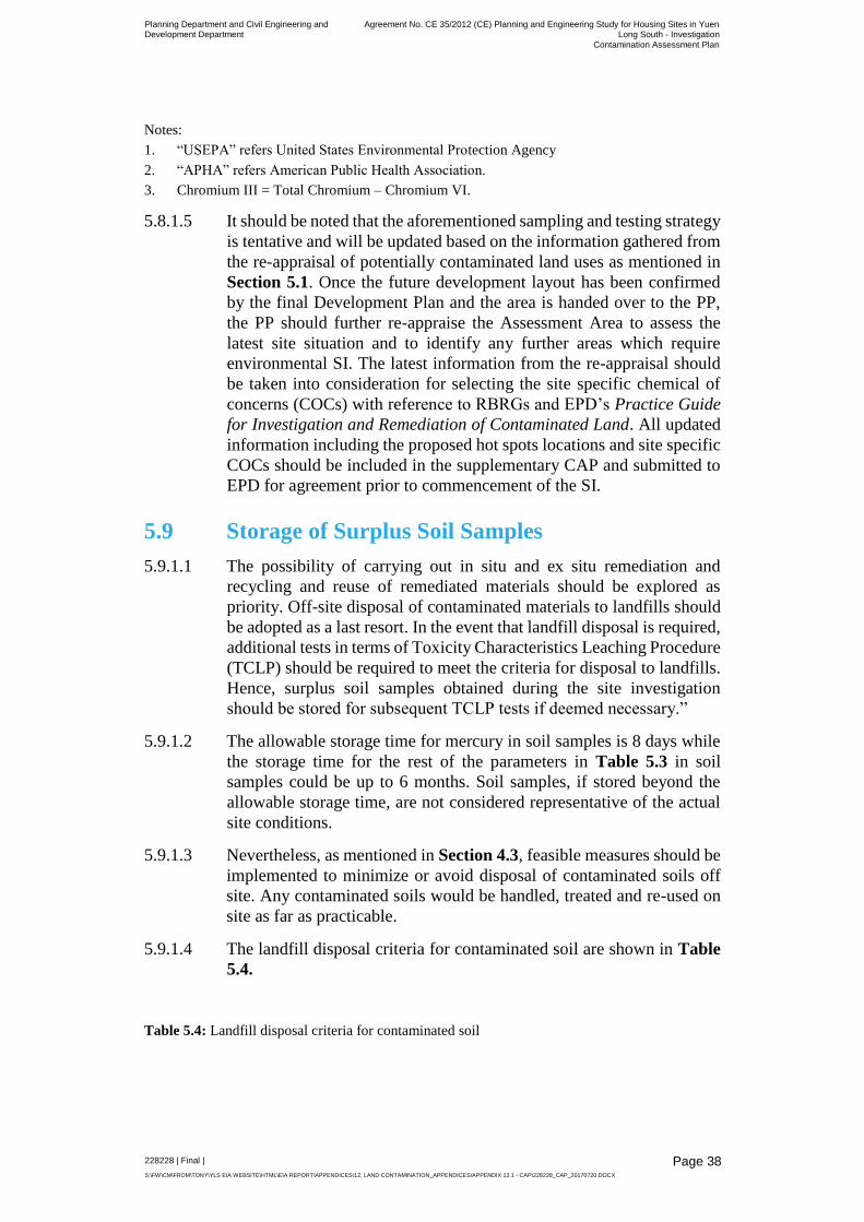
Planning Department and Civil Engineering and Development Department
Agreement No. CE 35/2012 (CE) Planning and Engineering Study for Housing Sites in Yuen Long South - Investigation
Contamination Assessment Plan
228228 | Final |
S:\FW\CM\FROM\TONY\YLS EIA WEBSITE\HTML\EIA REPORT\APPENDICES\12. LAND CONTAMINATION_APPENDICES\APPENDIX 12.1 - CAP\228228_CAP_20170720.DOCX
Page 38
Notes:
1. “USEPA” refers United States Environmental Protection Agency
2. “APHA” refers American Public Health Association.
3. Chromium III = Total Chromium – Chromium VI.
5.8.1.5 It should be noted that the aforementioned sampling and testing strategy
is tentative and will be updated based on the information gathered from
the re-appraisal of potentially contaminated land uses as mentioned in
Section 5.1. Once the future development layout has been confirmed
by the final Development Plan and the area is handed over to the PP,
the PP should further re-appraise the Assessment Area to assess the
latest site situation and to identify any further areas which require
environmental SI. The latest information from the re-appraisal should
be taken into consideration for selecting the site specific chemical of
concerns (COCs) with reference to RBRGs and EPD’s Practice Guide
for Investigation and Remediation of Contaminated Land. All updated
information including the proposed hot spots locations and site specific
COCs should be included in the supplementary CAP and submitted to
EPD for agreement prior to commencement of the SI.
5.9 Storage of Surplus Soil Samples
5.9.1.1 The possibility of carrying out in situ and ex situ remediation and
recycling and reuse of remediated materials should be explored as
priority. Off-site disposal of contaminated materials to landfills should
be adopted as a last resort. In the event that landfill disposal is required,
additional tests in terms of Toxicity Characteristics Leaching Procedure
(TCLP) should be required to meet the criteria for disposal to landfills.
Hence, surplus soil samples obtained during the site investigation
should be stored for subsequent TCLP tests if deemed necessary.”
5.9.1.2 The allowable storage time for mercury in soil samples is 8 days while
the storage time for the rest of the parameters in Table 5.3 in soil
samples could be up to 6 months. Soil samples, if stored beyond the
allowable storage time, are not considered representative of the actual
site conditions.
5.9.1.3 Nevertheless, as mentioned in Section 4.3, feasible measures should be
implemented to minimize or avoid disposal of contaminated soils off
site. Any contaminated soils would be handled, treated and re-used on
site as far as practicable.
5.9.1.4 The landfill disposal criteria for contaminated soil are shown in Table
5.4.
Table 5.4: Landfill disposal criteria for contaminated soil

Planning Department and Civil Engineering and Development Department
Agreement No. CE 35/2012 (CE) Planning and Engineering Study for Housing Sites in Yuen Long South - Investigation
Contamination Assessment Plan
228228 | Final |
S:\FW\CM\FROM\TONY\YLS EIA WEBSITE\HTML\EIA REPORT\APPENDICES\12. LAND CONTAMINATION_APPENDICES\APPENDIX 12.1 - CAP\228228_CAP_20170720.DOCX
Page 39
Parameter TCLP Limit (mg/L) Referenced Analytical Method
Reporting Limit (mg/L)
Cadmium 10
USEPA Method 1311
and 6020
0.01
Chromium 50 0.1
Copper 250 0.1
Nickel 250 0.1
Lead 50 0.1
Zinc 250 0.1
Mercury 1
USEPA Method 1311
and 6020
0.002
Tin 250 0.1
Silver 50 0.1
Antimony 150 0.1
Arsenic 50 0.1
Beryllium 10 0.1
Thallium 50 0.01
Vanadium 250 0.1
Selenium 1 0.02
Barium 1000 0.1
Ref: EPD’s Practice Guide for Investigation and Remediation of Contaminated Land
5.10 Quality Control and Quality Assurance (QA/QC)
5.10.1.1 A proper QA/QC programme should be established to ensure that the
data collected are accurate and representative of the actual soil and
groundwater conditions. The QA/QC programme should include the
following:
1 duplicate per 20 samples;
1 equipment blank per 20 samples;
1 field blank per 20 samples; and
1 trip blank per trip for the analysis of volatile parameters.
5.11 Sample Handling, Packaging and Transport
5.11.1.1 The soil and groundwater sampling should be conducted by an
experienced sampling technician (provided by the GI Contractor) and
supervised by an on-site Land Contamination Specialist. Appropriate
procedures should be adhered to. Sampling methodologies are based on
the techniques developed by the USEPA. Sampling tools should be
cleaned thoroughly before, in-between and after each sampling. Special
care should be taken to prevent any cross contamination of samples
during collection, handling and storage.
5.11.1.2 Sample containers should be laboratory cleansed, airtight, and made of
glass or other suitable materials with Teflon-lined lids so that the
container does not reach with the sample or absorb contaminants. Care
should be taken when recording and labelling the sample information
on the containers. Information such as the sampling date/ time,

Planning Department and Civil Engineering and Development Department
Agreement No. CE 35/2012 (CE) Planning and Engineering Study for Housing Sites in Yuen Long South - Investigation
Contamination Assessment Plan
228228 | Final |
S:\FW\CM\FROM\TONY\YLS EIA WEBSITE\HTML\EIA REPORT\APPENDICES\12. LAND CONTAMINATION_APPENDICES\APPENDIX 12.1 - CAP\228228_CAP_20170720.DOCX
Page 40
sampling locations, depths, and any other relevant data should be
recorded. Samples should be stored in an icebox (at about 2oC – 4oC)
immediately after collection and labelled, until they are transported to
laboratory for analysis.

Planning Department and Civil Engineering and Development Department
Agreement No. CE 35/2012 (CE) Planning and Engineering Study for Housing Sites in Yuen Long South - Investigation
Contamination Assessment Plan
228228 | Final |
S:\FW\CM\FROM\TONY\YLS EIA WEBSITE\HTML\EIA REPORT\APPENDICES\12. LAND CONTAMINATION_APPENDICES\APPENDIX 12.1 - CAP\228228_CAP_20170720.DOCX
Page 41
6 Remedial Measures
6.1.1.1 Following the submission of the supplementary CAP and completion
of the SI and laboratory testing works, a CAR should be prepared. The
CAR should present findings of the SI works and evaluate the level and
extent of potential contamination of the Assessment Area. The CAR
should evaluate the potential environmental and human health impact
based on the extent of potential contamination identified, and make
recommendation for further site investigation if necessary. If
remediation is required, a RAP will be prepared. The objectives of the
RAP are:
To evaluate and recommend appropriate remedial measures for the contaminated materials identified in the assessment;
To recommend good handling practices for the contaminated materials during all stages of the remediation works;
To recommend approximate handling and disposal measures; and
To formulate optimal and cost-effective mitigation and remedial measures for EPD’s agreement.
6.1.1.2 A RR should be prepared to demonstrate adequate clean-up prior to the
commencement of any construction works within the Assessment Area.
6.2 Possible Remediation Methods
6.2.1.1 The possible contaminants that might be found in the potentially
contaminated land uses include, as previously mentioned, VOCs /
SVOCs / Metals / PCRs / Dioxins / PCBs.
6.2.1.2 The criteria listed below should be used as the basis on which to address
soil remediation options applicable to the subject contaminants
identified:
Technical and cost effectiveness;
Technology development status;
Environmental benefits and disbenefits;
Commercial availability;
Time allowable;
Experience; and
Expertise requirement.
6.3 Remediation Methods for Contaminated Soil
6.3.1.1 Common in-situ and ex-situ treatment technologies that were screened
for the targeted soil contaminants are presented in Table 6.1 below. The
technologies are classified into biological treatment, physical /

Planning Department and Civil Engineering and Development Department
Agreement No. CE 35/2012 (CE) Planning and Engineering Study for Housing Sites in Yuen Long South - Investigation
Contamination Assessment Plan
228228 | Final |
S:\FW\CM\FROM\TONY\YLS EIA WEBSITE\HTML\EIA REPORT\APPENDICES\12. LAND CONTAMINATION_APPENDICES\APPENDIX 12.1 - CAP\228228_CAP_20170720.DOCX
Page 42
chemical treatment and removal, and grouped under in-situ and ex-situ
methods.
Table 6.1: Treatment technologies for contaminated soil
Technology In-situ Treatment Ex-situ Treatment
Biological Treatment Natural Attenuation
Soil Venting
Biopiling
Landfarming
Physical / Chemical Treatment
Electrokinetic Separation Solidification/Stabilization
Soil Washing
Removal NA Excavation and Landfill Disposal
6.3.1.2 The applicability, limitations and environmental benefits and
disbenefits of the above remediation techniques for VOCs / SVOCs /
Metals / PCRs / Dioxins / PCBs contaminated soil are described in
Table 6.2.
6.3.1.3 In assisting the formulation of appropriate remedial measures, the
Practice Guide issued by EPD suggest the following factors to be taken
into consideration when evaluating different available remediation
methods:
Degree and extent of the contamination;
Anticipated future use of the site;
Nature of the contaminants;
Soil characteristics; and
Time available for remediation.
6.3.1.4 The PP should take the aforementioned factors into consideration when
formulating the remediation strategy after land resumption and
completion of the SI works.
6.3.1.5 It should be noted that the “Excavation and Landfill Disposal” (i.e. off-
site disposal of the treated contaminated soil) should only be considered
as the last resort and contaminated soil should be remediated and reused
onsite as far as practical. If landfill disposal is deemed necessary, prior
agreement to the proposed disposal arrangement should be sought from
the Waste Facilities Management Group, and Waste Policy and Service
Group of the EPD. The final remediation / disposal requirements should
be presented and addressed in the RAP which should be submitted to
EPD for agreement prior to the remediation / disposal. Please revise the
last sentence of the section accordingly.
6.4 Remediation Methods for Contaminated Groundwater
6.4.1.1 The applicability, limitations and environmental benefits and
disbenefits of different remediation techniques for VOCs / SVOCs /

Planning Department and Civil Engineering and Development Department
Agreement No. CE 35/2012 (CE) Planning and Engineering Study for Housing Sites in Yuen Long South - Investigation
Contamination Assessment Plan
228228 | Final |
S:\FW\CM\FROM\TONY\YLS EIA WEBSITE\HTML\EIA REPORT\APPENDICES\12. LAND CONTAMINATION_APPENDICES\APPENDIX 12.1 - CAP\228228_CAP_20170720.DOCX
Page 43
Metals / PCRs / Dioxins / PCBs contaminated groundwater are
described in Table 6.3.
6.5 Surmountability of Potentially Contaminated Land Uses
6.5.1.1 The contamination problem in the land uses that are identified as
potentially contaminated would not be considered insurmountable in
the supportive view that any contaminated soil should be remediated by
the Project Proponent based on the following factors below:
Size and Scale of Individually Surveyed Sites
6.5.1.2 Based on the site survey and desktop review, the vast majority of the
sites have been identified as open storage or warehouses. As discussed
previously, due to site access issues, only peripheral site inspections
were undertaken. As such, the site inspections were unable to determine
what type of goods are stored within these sites. For example, a
warehouse containing office furniture supplies is unlikely to have any
contamination potential, whilst a warehouse containing chemicals is
likely to. Furthermore, for open storage areas and warehouses, the
majority of these sites are usually kept for the storage of goods, whilst
only a small portion of the site is reserved for chemical storage. As such,
it is considered that if there is indeed any land contamination present at
these sites, it is expected that it would be localised. Furthermore, apart
from the sites which are currently used as open area storage and
warehouse, over 90% of the remaining sites are less than 2,000m2 in
area w which is considered relatively small in scale. Therefore, the
contamination extent, if any, caused by the operations of the identified
potentially contaminated sites is anticipated to be localised.
Chemicals of Concern
6.5.1.3 Based on the COC’s identified in this site appraisal (including metals,
VOCs, SVOCs, PCRs and PCBs), it is considered that the remediation
measures outlined in Table 6.2 and 6.3 below have been demonstrated
to effectively treat such contamination, both in soil and groundwater.
Local Remediation Experience
6.5.1.4 In addition, there are a number of relevant case studies in Hong Kong
which can be referred to where these COCs have been effectively
remediated, using the techniques in Table 6.2 and 6.3 below. Such
examples range from the decontamination works at the Cheoy Lee
Shipyard to the decommissioning of the Kwai Chung Incinerator.

Planning Department and Civil Engineering and Development Department Agreement No. CE 35/2012 (CE) Planning and Engineering Study for Housing Sites in Yuen Long South - Investigation
Contamination Assessment Plan
228228 | Final |
S:\FW\CM\FROM\TONY\YLS EIA WEBSITE\HTML\EIA REPORT\APPENDICES\12. LAND CONTAMINATION_APPENDICES\APPENDIX 12.1 - CAP\228228_CAP_20170720.DOCX
Page 44
Table 6.2: List of soil remediation technologies for VOCs / SVOCs / Metals / PCRs / Dioxins / PCBs contaminated soil
Remediation Option Applicability / Environmental Benefits Limitations / Environmental Dis-benefits
Biopile Applicable for treatment of soil contaminated with PCRs , PAHs, VOCs, and SVOCs.
Effective for treatment of soil contaminated with non-halogenated VOCs and fuel hydrocarbons.
Some successful local case studies, e.g. decontamination works at the Cheoy Lee Shipyard at Penny’s Bay, reclamation works at North Tsing Yi Shipyard site.
Most cost-effective for large volumes of contaminated soil
All materials and equipment are commercially available
Can be designed to be a closed system; vapour emissions can be controlled
Labour-intensive; require considerable maintenance
Time-consuming (~1 year may be required) and not cost-effective for treating small volume of soil.
Space required for biopile construction
Halogenated VOCs, SVOCs, and pesticides can also be treated, but the process effectiveness will vary and may be applicable only to some compounds within these contaminant groups.
May not be effective for high levels of contamination.
Electrokinetic Separation Applicable to treat soil with low permeability and heavily contaminated with metals.
Effectiveness dependent on moisture content of soil and decreases with moisture content less than 10%.
Require further treatment for removal of desorbed contaminants and thus increase cost of remediation.
Variability of electrical conductivity in soil may be induced by presence of anomalies such as large gravels and insulating material. This may reduce treatment effectiveness.
Soil Vapour Extraction (SVE)
Applicable for treating soil contaminated with PCRs, VOCs and SVOCs.
Very effective at removing VOCs from unsaturated Area. With the addition of an air sparging system, contaminants can be removed from saturated Area as well.
Treatment/ disposal of residuals liquids required. Also, regeneration or disposal of the spent activated carbon will be required.
To eliminate possible harm to the public and the environment, exhaust air from in situ SVE system may require treatment.
Soil with high organic content or is extremely dry has a high sorption capacity of VOCs, which results in reduced removal rates.
Fine grained soil or soil with a high degree of saturation will require higher vacuums (increasing costs) and/or hindering the operation of the in situ SVE system.

Planning Department and Civil Engineering and Development Department Agreement No. CE 35/2012 (CE) Planning and Engineering Study for Housing Sites in Yuen Long South - Investigation
Contamination Assessment Plan
228228 | Final |
S:\FW\CM\FROM\TONY\YLS EIA WEBSITE\HTML\EIA REPORT\APPENDICES\12. LAND CONTAMINATION_APPENDICES\APPENDIX 12.1 - CAP\228228_CAP_20170720.DOCX
Page 45
Remediation Option Applicability / Environmental Benefits Limitations / Environmental Dis-benefits
Soil Washing Applicable to clean inorganic contaminants such as heavy metals from coarse-grained soils.
Effectiveness of treatment dependent on soil coarseness.
Fine soil particles may require addition of polymer for removal of contaminant by the washing fluid.
Complex waste mixtures make formulating washing fluid difficult.
Further treatment and disposal for residuals required.
Solidification /Stabilisation (S/S)
Applicable to clean-up inorganic contaminants such as heavy metals.
Solidification/stabilisation has been used on certain contaminated sites in Hong Kong and demonstrated as a successful treatment method for inorganic contaminated soil, e.g. decontamination works at the Cheoy Lee Shipyard at Penny’s Bay, reclamation works at North Tsing Yi Shipyard site and few isolated sites identified in the Deep Bay Link project.
The effectiveness reduces with the presence of organic contaminants
Large boulders may hinder the mixing process. Soil sorting is necessary before the treatment taken place.
Organics are generally not immobilised.
Long-term effectiveness has not been demonstrated for many contaminant/ process combinations.
If VOCs/ SVOCs is present underneath, it should be removed before stabilisation/ soil solidification
Thermal Desorption Applicable for treating soil contaminated with PCRs, VOCs, PAHs, Dioxins, and PCBs.
Thermal desorption have varying degrees of effectiveness against the full spectrum of organic contaminants.
Clay, silty soils and high humic content soils increase reaction time as a result of binding of contaminants. Highly abrasive feed potentially can damage the processor unit.
Excavation and Landfill Disposal
Most simple and quickest way to dispose of large volume of contaminated soil
Contamination is removed definitely
Higher certainty of success
Wide experience in Hong Kong
Applicable to all waste or mixture that meet land disposal restriction treatment standards.
Common practice for shallow, highly-contaminated soils.
Pre-treatment may be required for contaminated soil to meet landfill disposal criteria
Landfill space limited and valuable.
Indirect costs to the landfill management on monitoring and maintenance.
Potential long-term liabilities to landfill
Need large volume of clean backfill materials
No access to the working site until completion of backfilling
Least desirable management option.

Planning Department and Civil Engineering and Development Department Agreement No. CE 35/2012 (CE) Planning and Engineering Study for Housing Sites in Yuen Long South - Investigation
Contamination Assessment Plan
228228 | Final |
S:\FW\CM\FROM\TONY\YLS EIA WEBSITE\HTML\EIA REPORT\APPENDICES\12. LAND CONTAMINATION_APPENDICES\APPENDIX 12.1 - CAP\228228_CAP_20170720.DOCX
Page 46
Table 6.3: List of groundwater remediation technologies for VOCs / SVOCs / Metals / PCRs / PCBs contaminated groundwater
Remediation Option Applicability and Environmental Benefits Limitations and Environmental Disbenefits
Air Sparging Applicable for treating contaminants including PCRs, VOCs, and SVOCs. But most effective for VOCs and PCRs.
Should ensure that there is no uncontrolled movement of potentially dangerous vapours.
Less effective in fine-grain/ low permeability soil with restricted air flow and also where depth of contaminated groundwater is shallow.
If free-floating products are present underneath, it should be removed before air sparging.
Recovery Trenches or Wells Applicable for treating PCRs.
To be used for free products recovery from plume. Works well for high permeability soil.
Treatment/ disposal of recovered liquids required.
The method does not treat residual contamination in saturated soil.
The method is not applicable to contaminants with high residual saturation, contaminants with high sorption capabilities, and homogenous aquifers with hydraulic conductivity less than 10-5 cm/second.
Biofouling of the extraction wells and associated treatment stream is a common problem.

Planning Department and Civil Engineering and Development
Department
Agreement No. CE 35/2012 (CE) Planning and Engineering Study for Housing
Sites in Yuen Long South - Investigation Contamination Assessment Plan
228228 | Final |
S:\FW\CM\FROM\TONY\YLS EIA WEBSITE\HTML\EIA REPORT\APPENDICES\12. LAND CONTAMINATION_APPENDICES\APPENDIX 12.1 - CAP\228228_CAP_20170720.DOCX Page 47
Page 47
7 Programme Schedule
7.1.1 At this stage, the land resumption programme has yet to be confirmed
as the planning and engineering study is still in progress. Nevertheless,
owing to the large size of the proposed development area, it is expected
that the land will be resumed at different stages of the development.
Therefore, the environmental site investigation will be carried out at
each potentially contaminated site once the land is resumed and the
access is granted. The assessment will comprise of the following
activities:
Preparation and submission of the supplementary CAP to EPD for
agreement;
Mobilisation of the SI Contractor (pending private property access
arrangements) and contracting analytical laboratory;
Field sampling programme (number of days in field depends on
the number of sites and sampling locations);
Analytical programme/ laboratory turnaround (normal turnaround
time is expected 10 days to two weeks depending on the number
of samples);
Assessment and reporting of results in a draft CAR, including, if
required, development of RAP (estimate minimum of three
weeks); and
Preparation and submission of RR after the completion of
remediation works.
7.1.2 A tentative programme for land contamination assessment and
remediation work after land resumption is shown in Figure 7.1. The
programme is for reference only and the actual time span will subject
to the actual site condition of each concerned site.

Planning Department and Civil Engineering and Development
Department
Agreement No. CE 35/2012 (CE) Planning and Engineering Study for Housing
Sites in Yuen Long South - Investigation Contamination Assessment Plan
228228 | Final |
S:\FW\CM\FROM\TONY\YLS EIA WEBSITE\HTML\EIA REPORT\APPENDICES\12. LAND CONTAMINATION_APPENDICES\APPENDIX 12.1 - CAP\228228_CAP_20170720.DOCX
Figures
Planning Department and Civil Engineering and Development Department
Agreement No. CE 35/2012 (CE) Planning and Engineering Study for Housing Sites in Yuen Long South - Investigation
Contamination Assessment Plan
228228 | Final |
S:\FW\CM\FROM\TONY\YLS EIA WEBSITE\HTML\EIA REPORT\APPENDICES\12. LAND CONTAMINATION_APPENDICES\APPENDIX 12.1 - CAP\228228_CAP_20170720.DOCX
Appendix A
Correspondences between EPD and Project Proponent
Planning Department and Civil Engineering and Development Department
Agreement No. CE 35/2012 (CE) Planning and Engineering Study for Housing Sites in Yuen Long South - Investigation
Contamination Assessment Plan
228228 | Final |
S:\FW\CM\FROM\TONY\YLS EIA WEBSITE\HTML\EIA REPORT\APPENDICES\12. LAND CONTAMINATION_APPENDICES\APPENDIX 12.1 - CAP\228228_CAP_20170720.DOCX
Appendix B-1
Historical Aerial Photographs (Within PDAs)

Planning Department and Civil Engineering and Development Department
Agreement No. CE 35/2012 (CE) Planning and Engineering Study for Housing Sites in Yuen Long South - Investigation
Contamination Assessment Plan
228228 | Final |
S:\FW\CM\FROM\TONY\YLS EIA WEBSITE\HTML\EIA REPORT\APPENDICES\12. LAND CONTAMINATION_APPENDICES\APPENDIX 12.1 - CAP\228228_CAP_20170720.DOCX
Appendix B-2
Historical Aerial Photographs (Supporting Infrastructure)

Planning Department and Civil Engineering and Development Department
Agreement No. CE 35/2012 (CE) Planning and Engineering Study for Housing Sites in Yuen Long South - Investigation
Contamination Assessment Plan
228228 | Final |
S:\FW\CM\FROM\TONY\YLS EIA WEBSITE\HTML\EIA REPORT\APPENDICES\12. LAND CONTAMINATION_APPENDICES\APPENDIX 12.1 - CAP\228228_CAP_20170720.DOCX
Appendix C
Copy of Letters to Fire Services Department and the Formal Replies of FSD

Planning Department and Civil Engineering and Development Department
Agreement No. CE 35/2012 (CE) Planning and Engineering Study for Housing Sites in Yuen Long South - Investigation
Contamination Assessment Plan
228228 | Final |
S:\FW\CM\FROM\TONY\YLS EIA WEBSITE\HTML\EIA REPORT\APPENDICES\12. LAND CONTAMINATION_APPENDICES\APPENDIX 12.1 - CAP\228228_CAP_20170720.DOCX
Appendix D
Copy of Letters to Environmental Protection Department and the Formal Replies of EPD

Planning Department and Civil Engineering and Development Department
Agreement No. CE 35/2012 (CE) Planning and Engineering Study for Housing Sites in Yuen Long South - Investigation
Contamination Assessment Plan
228228 | Final |
S:\FW\CM\FROM\TONY\YLS EIA WEBSITE\HTML\EIA REPORT\APPENDICES\12. LAND CONTAMINATION_APPENDICES\APPENDIX 12.1 - CAP\228228_CAP_20170720.DOCX
Appendix E-1a
Summary of Site Survey and Records of Chemical Waste Producers Registration (Area 1)

Planning Department and Civil Engineering and Development Department
Agreement No. CE 35/2012 (CE) Planning and Engineering Study for Housing Sites in Yuen Long South - Investigation
Contamination Assessment Plan
228228 | Final |
S:\FW\CM\FROM\TONY\YLS EIA WEBSITE\HTML\EIA REPORT\APPENDICES\12. LAND CONTAMINATION_APPENDICES\APPENDIX 12.1 - CAP\228228_CAP_20170720.DOCX
Appendix E-1b
Summary of Site Survey and Records of Chemical Waste Producers Registration (Area 2)

Planning Department and Civil Engineering and Development Department
Agreement No. CE 35/2012 (CE) Planning and Engineering Study for Housing Sites in Yuen Long South - Investigation
Contamination Assessment Plan
228228 | Final |
S:\FW\CM\FROM\TONY\YLS EIA WEBSITE\HTML\EIA REPORT\APPENDICES\12. LAND CONTAMINATION_APPENDICES\APPENDIX 12.1 - CAP\228228_CAP_20170720.DOCX
Appendix E-1c
Summary of Site Survey and Records of Chemical Waste Producers Registration (Area 3)

Planning Department and Civil Engineering and Development Department
Agreement No. CE 35/2012 (CE) Planning and Engineering Study for Housing Sites in Yuen Long South - Investigation
Contamination Assessment Plan
228228 | Final |
S:\FW\CM\FROM\TONY\YLS EIA WEBSITE\HTML\EIA REPORT\APPENDICES\12. LAND CONTAMINATION_APPENDICES\APPENDIX 12.1 - CAP\228228_CAP_20170720.DOCX
Appendix E-2
Summary of Site Survey and Records of Chemical Waste Producers Registration (Supporting Infrastructure)

Planning Department and Civil Engineering and Development Department
Agreement No. CE 35/2012 (CE) Planning and Engineering Study for Housing Sites in Yuen Long South - Investigation
Contamination Assessment Plan
228228 | Final |
S:\FW\CM\FROM\TONY\YLS EIA WEBSITE\HTML\EIA REPORT\APPENDICES\12. LAND CONTAMINATION_APPENDICES\APPENDIX 12.1 - CAP\228228_CAP_20170720.DOCX
Appendix F
Recommended Outline Development Plan

Planning Department and Civil Engineering and Development Department
Agreement No. CE 35/2012 (CE) Planning and Engineering Study for Housing Sites in Yuen Long South - Investigation
Contamination Assessment Plan
228228 | Final |
S:\FW\CM\FROM\TONY\YLS EIA WEBSITE\HTML\EIA REPORT\APPENDICES\12. LAND CONTAMINATION_APPENDICES\APPENDIX 12.1 - CAP\228228_CAP_20170720.DOCX
Appendix G
RBRGs for Soil and Groundwater

Planning Department and Civil Engineering and Development Department
Agreement No. CE 35/2012 (CE) Planning and Engineering Study for Housing Sites in Yuen Long South - Investigation
Contamination Assessment Plan
228228 | Final |
S:\FW\CM\FROM\TONY\YLS EIA WEBSITE\HTML\EIA REPORT\APPENDICES\12. LAND CONTAMINATION_APPENDICES\APPENDIX 12.1 - CAP\228228_CAP_20170720.DOCX
Appendix H
Summary of Potentially Contaminated Sites

Planning Department and Civil Engineering and Development Department
Agreement No. CE 35/2012 (CE) Planning and Engineering Study for Housing Sites in Yuen Long South - Investigation
Contamination Assessment Plan
228228 | Final |
S:\FW\CM\FROM\TONY\YLS EIA WEBSITE\HTML\EIA REPORT\APPENDICES\12. LAND CONTAMINATION_APPENDICES\APPENDIX 12.1 - CAP\228228_CAP_20170720.DOCX
Appendix I
Groundwater Monitoring Well

Planning Department and Civil Engineering and Development Department
Agreement No. CE 35/2012 (CE) Planning and Engineering Study for Housing Sites in Yuen Long South - Investigation
Contamination Assessment Plan
228228 | Final |
S:\FW\CM\FROM\TONY\YLS EIA WEBSITE\HTML\EIA REPORT\APPENDICES\12. LAND CONTAMINATION_APPENDICES\APPENDIX 12.1 - CAP\228228_CAP_20170720.DOCX
Appendix J
Soil and Groundwater Testing Schedule for Potentially Contaminated Sites